NATIONAL WESTERN CENTER
|
|
|
- Clement Miles
- 5 years ago
- Views:
Transcription


1 NATIONAL WESTERN CENTER Infrastructure Master Plan January 2015
2 TableofContents Section 1: Executive Summary... 1 Transportation... 2 Water Distribution System... 3 Wastewater Collection System... 3 Drainage... 3 Drainage Water Quality... 4 Section 2: Proposed Development Proposed Uses... 4 Exhibit: Overall Plan Sheet 1 of Exhibit: Overall Site Plan Sheet 2 of Exhibit: Existing Utility Plan Sheet 1 of Exhibit: Existing Utility Plan Sheet 2 of Section 3: Transportation Introduction Existing Transportation System Design Criteria Proposed Transportation System Layout Conclusions Exhibit: 51 st Avenue - Plan and Profile Exhibit: Bettie Cram Drive - Plan and Profile 1 of Exhibit: Bettie Cram Drive - Plan and Profile 2 of Exhibit: National Western Drive - Plan and Profile 1 of Exhibit: National Western Drive - Plan and Profile 2 of 2... Section 4: Water Supply and Distribution System Introduction Existing Water Distribution Facilities Design Criteria Proposed Distribution System Layout Water Conservation Conclusions Exhibit: Water Improvement Plan 1 of Exhibit: Water Improvement Plan 2 of
3 Section 5: Wastewater Collection System Introduction Existing Wastewater Collection System Design Criteria Proposed Collection System Layout Graywater Reuse Conclusions Exhibit: Sanitary Sewer Improvement Plan 1 of Exhibit: Sanitary Sewer Improvement Plan 2 of Section 6: Drainage Introduction Background Design Criteria Major Drainage Basins Drainage Sub Basins Hydrology Water Quality Best Management Practices Exhibit: CCD Master Drainage Plan Basin Exhibit: Overall Drainage Basin Plan 1 of Exhibit: Overall Drainage Basin Plan 2 of Exhibit: Overall Grading Plan 1 of Exhibit: Overall Grading Plan 2 of Exhibit: Drainage Improvement Plan 1 of Exhibit: Drainage Improvement Plan 2 of Exhibit: Storm Sewer Outfall Plan and Profile Exhibit: Water Quality Plan 1 of Exhibit: Water Quality Plan 2 of Exhibit: Flood Insurance Rate Map Section 7: Dry Utility Systems Introduction Gas Distribution Facilities Existing Gas Distribution Facilities - Xcel Energy... 48
4 7.2 Electrical Distribution Facilities Fiber Optic Facilities Telephone Facilities Design Criteria Conclusion Exhibit: Existing Dry Utility Plan 1 of Exhibit: Existing Dry Utility Plan 2 of Exhibit: Proposed Dry Utility Improvement Plan 1 of Exhibit: Proposed Dry Utility Improvement Plan 2 of


5 Section1:ExecutiveSummary The new National Western Center will revitalize a large area of the city by being an active destination; by connecting neighborhoods to one another; by bringing life back to the river; and by becoming a new kind of district that celebrates the best of our natural, cultural and agricultural history and future. When we think of the site area today we think of industry, trucks and trains - but in the future we will experience a vibrant event district unified with a natural setting. The National Western Stock Show has been held on this site for over 100 years. Originally this was a location that offered river, rail, roadway, and trail access, making it a good place to meet, exchange knowledge, do business, hold, support, and transport livestock and horses, and put on a great event for the community. Those same attributes - water and access to the region - led to the development of major heavy industry on the site all based on rail travel. With the popularity of the automobile and the development of an improved water distribution system, the original asset of the site, the South Platte River, became forgotten. Now it is time for the National Western Center to revitalize itself by starting with river revitalization. This means an expanded corridor of natural habitats, expanded public access, improved water quality, and more room for the river to breathe. The Master Plan emphasizes connections, connections of people to people, people to river, and city to nature. The land along the river will be expanded into a wider corridor that will be linked into the Globeville and Elyria/Swansea neighborhoods through new street, pedestrian, bike and green connections. These new connections will support neighbors, visitors, vendors, event competitors, and employees 365 days a year with access to residences, amenities and the venues of the National Western Center itself. The Master Plan also includes a range of public plazas and connections that will support daily activity, special events, and gathering and staging during the Stock Show and other events. Each sector of the Center has its own public space or spaces, providing relief from the large scale of buildings that make up the center and also provide room for people to gather and access events as a whole during the Stock Show or to utilize and enjoy during events throughout the rest of the year. 1 Page

6 The design of these spaces will build on and express the idea that the Center is a place about both the past and the future. Western heritage will be a recurring theme in materials, details and symbols that are used in the design - but this will not be a place that is about the past. At its core the National Western Center is about the future of our western heritage and the many ways in which nature, culture, and agriculture continue to develop and change with new technologies, methods, and ever-increasing international relationships and opportunities. The design of the Center should also be of the present, using the latest in sustainable technologies and materials not of the Old West, but of the New West. This Improvement Master Plan (IMP) document addresses the general trunk infrastructure that will be required as part of the overall redevelopment. Due to the nature of this master plan, infrastructure sizing and capacity will need to be readdressed in future phases of planning and design. The IMP follows the programming and layout of the National Western Center Master Plan. Guiding principles for the design of the infrastructure that were implemented in this document include: Provide connectivity through the site for pedestrians, bicycles, and vehicles, providing access to neighborhoods, the river, and transit. Promote sustainable design for the site and do not be prescriptive with recommendations understanding the standards and technologies will change. Provide infrastructure that supports the development as programmed. Incorporate existing key infrastructure into the plan. Transportation Transportation is key to moving people to, through and around the project. Understanding and planning how vehicles, pedestrians, and bicycles interact with the river, the neighborhoods and the proposed plan provides a framework plan that establishes how these connections are made. It is also important to understand the transportation operation and requirements of an entertainment complex. An important part of the NWC plan is access to the North Metro Rail Line (NMRL) and the proposed station near Brighton Boulevard and 49 th Avenue. Access to the commuter rail line provides access to Denver Union Station to the south and 124 th Avenue to the north. Design has currently started on the project with opening slated for 20. The proposed transportation system is also about reestablishing connections to the river and the Elyria Swansea and Globeville Neighborhoods. Recommendations for roadway improvements include the following: 46 th Avenue Enhancing the existing connection between Brighton Boulevard to Washington Street. 2 Page
7 Race Court Redevelopment of the existing street to include expanded vehicular lanes for truck and trailer turn movement and facilities for bicycles and pedestrians. Bettie Cram Drive A new street connecting Brighton Boulevard to Washington Street. National Western Drive Provides north-south connectivity from 46 th Avenue to Franklin Street as well as access to the South Platte River. Brighton Boulevard north of I-70 Provides north and south connectivity from the River North Neighborhood south of I-70 to the site. Washington Street Is not included in the IMP. Preliminary cross sections have been identified in the Globeville Neighborhood Plan and further design will be investigated in additional detail in the future. All roadways will emphasize pedestrian and bicycle connections through the site and to regional trails. WaterDistributionSystem Improvements to the potable water system will need to be made internal to the site to provide necessary service to the new facilities. Connections will be made to the existing system located in Brighton Boulevard, Washington Street, 46 th Avenue and Race Court. The proposed internal system will consist of 8-inch and 12-inch lines, with 6-inch to 8-inch service / fire loops constructed around the major buildings. All proposed water lines will need to be designed and constructed to meet the requirements of Denver Water and must meet all fire code as adapted by the City and County of Denver. WastewaterCollectionSystem The site is served by two major sanitary sewer interceptors, the Metro Wastewater Reclamation District (MWRD) Delgany interceptor on the west side of the site and the 54-inch Denver Wastewater Management Division interceptor on the north side of the site. Connections to either interceptor will need to be limited and should occur at existing connection locations. A proposed system will be required to convey existing flows from the Elyria Swansea neighborhood through the site as well as collect flows from proposed buildings. It is anticipated that the size of the proposed sanitary sewer will vary from 8-inch to 12-inch. All proposed sanitary sewer will be conveyed via gravity flow to the interceptor connection points. Opportunities to look at graywater reuse for the project should be investigated as regulations within CDPHE continue to change to allow for reuse. Drainage Proximity to the South Platte River and the lower reach of the Montclair Basin creates a responsibility to properly convey and treat storm water runoff from the site prior to discharging into the river. Expectations are that the Colorado Department of Transportation I-70 East project and related drainage works will intercept the major event south of I-70, and drastically reduce the flows tributary to the site as compared to the anticipated flows in the CCD 2010 Drainage Master Plan. The City and County of Denver and Urban Drainage and Flood Control (UDFCD) are currently working on an update to the CCD Drainage Master Plan and Outfall System Plan (OSP) for the Montclair Basin. Layout of the major 3 Page
8 drainage outfall through the middle of the site and Race Court are based on the preliminary submittal of the Montclair Basin OSP. Due to the proximity of the site to the South Platte River the site will not be required to provide 100- year detention, but the Excess Urban Runoff Volume (EURV) will need to be accounted for on the project. Since 100-year detention is not required a major storm conveyance will be required for the basin. Grading of the site will generally follow existing patterns, conveying flow from the southeast to the northwest. Internal to the site, the 100-year storm should be conveyed to the river, and offsite basins from the Elyria Swansea neighborhood will be conveyed through the proposed major outfalls as well as overland via Race Court. DrainageWaterQuality The project will need to provide water quality treatment of storm water runoff in accordance with the water quality criteria in effect at the time of development. Currently, water quality is envisioned to be provided through the EURV standards as required by UDFCD. Implementation of a complete system for treatment of the runoff, including both end of pipe treatment as well as decentralized low impact development (LID) techniques should be utilized. We understand that technology and methods for implementation for water quality treatment will continue to evolve throughout the design and construction of the project so suggestions in this document are general and not prescriptive. As design continues to move forward the treatment of the storm water should be reevaluated. Denver-USACEFeasibilityStudy The City of Denver and the US Army Corps of Engineers (USACE) have partnered to develop a river plan for the north areas of the South Platte River through the River North, Globeville and Elyria neighborhoods. As part of the future habitat restoration and floodplain mitigation projects, the USACE will look for opportunities to enhance visibility and access. The study is developing alternatives for the area that will be reviewed in the spring of 2015, with the final study completed in Section2:ProposedDevelopment 2.0ProposedUses The National Western Center redevelopment transforms the existing National Western Complex into a year round entertainment complex that is true to the roots of the stock show and Denver s western heritage. The proposed development includes a number of large buildings that will be used all year for entertainment. The following buildings and uses are proposed for the site: New Arena Trade Show / Exposition Hall 1909 Stadium Arena (existing building to remain) Colorado State University Center facility Equestrian Center See Figure 1.1 for the proposed site plan and building uses. Livestock Hall, Livestock Stadium Arena and Stockyards/Event Pavilion Livestock Exchange Area Maintenance Facilities Colorado State University River Education Center 4 Page
9 NORTHSIDE PARK RACE COURT CATTLE TIES / PARKING 51ST AVENUE HARDWOODS SITE (To Remian) EQUESTRIAN PADDOCK CLINIC CLINIC OUTDOOR COVERED WARM UP WASHINGTON STREET 49TH AVE. SOUTH PLATTE RIVER STOCK YARD EVENT PAVILIONS / YARDS SHOW MTG DRI EQUESTRIAN EVENTS PADDOCK COVERED WARM UP BARN FUTURE TOD SITE REDEVELOPMENT (By Others) 49TH AVENUE LIVESTOCK CENTER FUTURE AG. BUSINESS PARK PARK / POTENTIAL FUTURE EXPANSION NATIONAL WESTERN DRIVE RIVER CENTER HERDSIRE SPACE, STOCK DOGS, HEIFER MART POTENTIAL FUTURE EXPANSION CATTLE TIES / PARKING STORAGE CONSOLIDATED DRI RAIL LINE CATTLE TIES / PARKING BETTIE CRAM DRIVE MAINT & OP YARD BAR AGRI-BUS. LIVESTOCK PARKING CSU STADIUM MARKET CENTER LIVESTOCK BNSF / RTD EXPO NEW RETAIL BRIGHTON BOULEVARD RETAIL / TOD SPECIAL EVENTS PARKING VERT. FARM 48TH AVEUNE 47TH AVENUE WILLIAMS STREET HIGH STREET RACE STREET NWC OVERALL PLAN EXHIBIT *FOR INFORMATION ONLY* STORAGE 46TH AVENUE I-70
10 PARK / POTENTIAL FUTURE EXPANSION NATIONAL WESTERN D STADIUM MARKET CENTER STORAGE 46TH AVENUE I-70 BNSF / RTD POTENTIAL PARKING STRUCTURE COLISEUM CDOT PARKING / FUTURE SITE REDEVELOPMENT PIPED DRAINAGE GLOBEVILLE LANDING PARK POTENTIAL OPEN DRAINAGE CHANNEL LOCATION PARKING / FUTURE SITE REDEVELOPMENT PIPED DRAINAGE ARKINS ARKINS BRIGHTON BOULEVARD NWC OVERALL PLAN EXHIBIT *FOR INFORMATION ONLY*
11 DRI RACE COURT 51ST AVENUE BRIGHTON BOULEVARD WASHINGTON STREET SOUTH PLATTE RIVER 49TH AVE. 49TH AVENUE NATIONAL WESTERN DRIVE BNSF / RTD 48TH AVEUNE 47TH AVENUE WILLIAMS STREET HIGH STREET RACE STREET NWC EXISTING UTILITY EXHIBIT *FOR INFORMATION ONLY* 46TH AVENUE I-70
12 46TH AVENUE I-70 I-70 BNSF / RTD 45TH WASHINGTON ARKINS BRIGHTON ARKINS NWC EXISTING UTILITY EXHIBIT *FOR INFORMATION ONLY*

13 Section3:Transportation 3.0Introduction Transportation is key to moving people to, through and around the project. Understanding and planning how vehicles, pedestrians, and bicycles interact with the river, the neighborhoods and the proposed plan provides a framework plan that establishes how these connections are made. It is also important to understand the transportation operation and requirements of an entrainment complex. An important part of the NWC plan is access to the North Metro Rail Line (NMRL) and the proposed station near Brighton Boulevard and 49 th Avenue. Access to the commuter rail line provides access to Union Station to the south and 124 th Avenue to the north. Design has currently started on the project with opening slated for 20. An internal road network was developed as part of the master plan with the goal of providing connectivity. Traffic demands and roadway capacity were not addressed in this phase of the IMP. 3.1ExistingTransportationSystem Roadways The project site is bounded by Brighton Boulevard to the east, Washington Street to the west, 46 th Avenue and the Interstate 70 viaduct to the south and Race Court on the north. Regionally the site is served by I-70 with access to the interstate provided at the Brighton Boulevard Interchange. The site is separated into two distinct sections by the BNSF rail line which travels northeast through the site. Southeast of the rail line access is provided to the site from Brighton Boulevard, 44 th Street and 46 th Avenue. Internal roads allow traffic to access and circulate through the site to access the existing buildings and parking lots. The section which lies northwest of the rail is bifurcated by National Western Drive which travels north from the intersection with 46 th Avenue to Race Court, Trolley from downtown delivers visitors to the 1913 Stock Show where it becomes Franklin Street. National Western Drive provides access to the existing buildings and cattle ties. There are three existing connections that provide access from the southeast side to the northwest, 46 th Avenue, the Marion underpass, as well as Race Court, with only the Marion underpass truly internal to the site. The existing roadway sections are as follows: Brighton Boulevard o Traffic- 2-lanes north of 47 th Avenue o Traffic -4-lanes south of 47 th Avenue o Pedestrian No facilities 9 Page
14 o Bicycle No facilities Washington Street o Traffic 2 lanes o Pedestrian limited sidewalk o Bicycle- No facilities National Western Drive o Traffic- 2 lane o Pedestrian No facilities o Bicycle No facilities 46 th Avenue o Traffic- 3 lane, 2 westbound o Pedestrian Attached walk on the north side of roadway o Bicycle No designated facilities 47 th Avenue / Marion o Traffic- 2 lane o Pedestrian walks on both sides of portion of the roadway o Bicycle No designated facilities Race Court o Traffic- 2 lane o Pedestrian attached walk on south side of roadway o Bicycle No facilities Pedestrian and Bicycle Facilities Pedestrian and bicycle access is very limited to the existing site. The surrounding area is industrial and there are limited sidewalk facilities along the major roadway connections to the site. The major north south connection, Brighton Boulevard has no sidewalks and limited curb and gutter, and is not pedestrian friendly. Race Court and 46 th Avenue have pedestrian facilities but due to the lack of continuity, connections to residential areas and limited safety features they are rarely traveled. Bicycle facilities are also very limited in the project area. There are no on street facilities that are designated for bikes. However, per the CCD Bike Map route D-13 does cross the site at 47 th Avenue and crosses to the Globeville neighborhood via 46 th Avenue. Regionally the South Platte River trail travels down the west side of the river, but there is limited or no existing access from the existing site. Transit RTD provides local transit to the site near the Brighton Boulevard and 47 th Avenue intersection. Route 48 serves the site and provides access to the 72 nd Park-n-Ride as well as access to Broadway Station. There is a strong need to provide a circulator bus/shuttle system at NWCC. This system would provide additional access to the NWCC during larger events to help reduce the need for additional onsite parking. This service would connect outlying parking lots and transit to NWCC. Space for circulator drop off and pick up is locate along 46 th Avenue, just south of the stadium mass market. 10 Page


15 3.2DesignCriteria At this phase of the IMP travel demands and roadway capacities have not been modeled or analyzed. Future phases of design should follow the requirements of the City and County of Denver. 3.3ProposedTransportationSystemLayout Roadways The layout of the roadway system was determined with the goal of connecting the site to regional infrastructure (I-70), connecting the Globeville and Elyria Swansea neighborhoods and providing access to downtown via Brighton Boulevard as well as providing circulation and access to the buildings and uses internal to the site. Within this corridor there are major transportation investments planned. At the time of this IMP the Colorado Department of Transportation is planning on moving forward with the lowering of East I-70 from Brighton Boulevard to Colorado Boulevard. The City and County of Denver is currently designing improvements to Brighton Boulevard from Broadway north adjacent to the project site. There are also plans in the future to improve Washington Street. All of these improvements will greatly increase the ability to effectively access the site. Internally to the site there are proposed improvements to the following roadways Brighton Boulevard 47 th Avenue Bettie Cram Drive Bettie Cram Drive (BNSF Underpass) Bettie Cram Drive Bridge 11 Page

")
 46 th")


16 National Western Drive (46 th Ave to 51 st Ave) National Western Drive (51 st Ave to Franklin) 46 th Avenue 46 th Avenue (BNSF Underpass) Race Court 51 st Avenue 51 st Avenue Bridge 12 Page
17 Pedestrian and Bicycle Facilities One of the critical elements of the transportation plan is to reconnect the adjacent neighborhoods and connectivity to regional trails. Improvements to the pedestrian and bicycle facilities are critical to accomplishing these goals as well as meeting the intent of Denver Moves. As shown in the previous section all of the roadway improvements include creating detached pedestrian zones as well as designated bicycle facilities. Included in the improvements are connections to the existing South Platte River trail system as well as connections to the planned Brighton Boulevard protected bike lane. An additional non-street bicycle and pedestrian connection will be provided as an elevated walkway between National Western Drive and the new RTD Commuter Rail station and Brighton Boulevard. This elevated connection will have direct access bicycle ramps at each end and vertical connections via stairs and elevators at regular intervals along its length. The walkway will vary in width between 15-feet minimum and 20-feet. This connection is not intended to be covered. Transit An important part of the NWC plan is access to the RTD North Metro Rail Line (NMRL) and the proposed station near Brighton Boulevard and 49 th Avenue. The commuter rail line provides access to Denver Union Station to the south and 124 th Avenue to the north. The RTD station will consist of (2) 16-feet wide side platforms capable of holding a 4-car train. The station will have a short section of double track at the platforms and then taper to single track both north and south of the station. The station also provides 40 spaces of surface parking. Design has currently started on the project with opening slated for Conclusions Preliminary and Final Design Preliminary and Final Design of the transportation system must be in accordance with the City and County of Denver standards and related criteria and regional travel models. The system will need to be designed in phases based on the build out of the overall NWC. Some temporary connections and facilities may be needed to accomplish the phasing. Summary With the redevelopment of the National Western Center there is a unique opportunity to remove barriers that have hindered or limited connectivity both to and through the site. Internal circulation within the site is critical to the operations of the project at full build out and is vital to the experience of its users. It is anticipated that the project will be phased and construction of the roadway system will need to follow the phasing of the project. As a result, interim connections should be made with consideration of pedestrian and bicycle connections during the design process. 13 Page
18 51ST AVENUE - PLAN AND PROFILE AT PLATTE RIVER *FOR INFORMATION ONLY*
19 SOUTH PLATTE RIVER RIVER NATIONAL WESTERN DRIVE STOCK DOGS, HEIFER MART CENTER HERDSIRE SPACE, 49TH AVENUE WASHINGTON STREET FUTURE AG. BUSINESS PARK BETTIE CRAM DR. POTENTIAL FUTURE EXPANSION CONSOLIDATED DRI RAIL LINE YARD BAR AGRI-BUS. CATTLE TIES / PARKING CATTLE TIES / PARKING MAINT & OP BETTIE CRAM DRIVE - PLAN AND PROFILE 1 *FOR INFORMATION ONLY*
20 BETTIE CRAM DRIVE - PLAN AND PROFILE 2 *FOR INFORMATION ONLY*
21 NATIONAL WESTERN DRIVE - PLAN AND PROFILE 1 *FOR INFORMATION ONLY*
22 NATIONAL WESTERN DRIVE - PLAN AND PROFILE 2 *FOR INFORMATION ONLY*
23 Section4:WaterSupplyandDistributionSystem 4.0Introduction This section describes the improvements for the water distribution system for the National Western Center to service the development based on the projected uses. Due to the preliminary nature of the planned uses within the site and meetings with Denver Water this plan does not model the demands for the site. Water lines are proposed to be located in the proposed streets to complete and connect the existing distribution systems though the project site. There will also need to be additional fire loops around the large buildings within the site. 4.1ExistingWaterDistributionFacilities The Water Improvement Plan represents the existing water distribution system within the project area. The existing water system bordering the project includes: South - 12-inch, 16-inch and 20inch (from east to west) in 46 th Avenue North 12 and 36-inch (Conduit 83) in Race Court East - 12-inch in Brighton Boulevard West 8-inch, 10-inch and 36-inch (Conduit No. 88) inch in Washington Street Internal to the site the existing water system provides water to the existing buildings. Southeast of the BNSF rail line there is an 8 and 12-inch loop through 47 th to 48 th Avenue that provides service to the existing buildings as well as providing fire protection. West of the rail there is a 12-inch line which tees into the 16-inch line in 46 th Avenue and follows National Western Drive were it becomes an 8-inch line serving the existing buildings and then connects back to the 12-inch distribution line in Race Court. 4.2DesignCriteria All design of the new water distribution system are required to be in accordance with the latest version of the Denver Water Board Engineering Standards. 4.3ProposedDistributionSystemLayout The design team met with Denver Water to determine if there were any planned water system upgrades within the project limits or adjacent to the project. At this time, Denver Water has no upgrades planned within the project area or surrounding areas, and therefore, none have been included in this plan. The entire site lies within the same hydraulic zone, and no pressure regulating valves are anticipated in the proposed system. All new distribution lines will be located to match the proposed roadway alignments and site layout in order to provide the necessary pressure and flows to the proposed buildings. All existing water lines within the project limits, which are undersized or in conflict with the proposed improvements, will be removed or abandoned per Denver Water Standards. Based on the anticipated demands at the time of this IMP, the proposed water distribution network is envisioned to include the following: Main Extensions o National Western Drive: 46 th Avenue to Race Court 12-inch 19 Page
24 o Bettie Cram Drive: 46 th Avenue to Washington Street 12-inch o 47 th Avenue: Brighton Blvd to Bettie Cram Drive 8-inch Fire Loops and Building Service line extensions o Equestrian Center 6 to 8-inch o Livestock Center 6 to 8-inch o Trade Show/Exhibition Hall 6-inch o New Arena 6-inch o 1909 Stadium Arena 6-inch Fire Protection The City and County of Denver will continue to provide fire protection service for the National Western Center. All fire protection for the site will need to meet the requirements of the International Fire Code as amended. Specific locations of fire hydrants will be located as part of the detailed engineering design for the project. Locations of fire hydrants will be approved by the Denver Fire Department and fire hydrants will be consistent with the most current Denver Water Standards. Automatic sprinkler systems will be installed in most if not all of the buildings on the site. 4.4WaterConservation Per the National Western Center Sustainability and Regeneration Framework and Goals the following goals have been established for the site: Create a net zero District for water use. Use no potable water for landscaping. A water balance study will need to be done to determine the baseline rainfall and groundwater use to frame the water use goals. Once the water balance study is complete a plan can be established for the project to meet the regeneration goals. 4.5Conclusions Final Design Final design of the water distribution system must be in accordance with Denver Water Board Engineering Standards and related criteria as well as all applicable International Fire Code that has been adopted by the City and County of Denver. All proposed mains will be required to be located in City and County of Denver right-of-way or easements dedicated to Denver Water per applicable standards. Summary With the redevelopment of the National Western Center there will need to be a complete internal distribution system constructed. It is anticipated at this time that there will not be any upgrades required to the existing system adjacent to the project. As the project moves to final design additional coordination will be required with Denver Water. It is anticipated that the project will be phased and construction of the water lines will need to follow the phasing of the project. The water system will need to be constructed to provide service to the buildings and the proposed uses. As a result of phased construction, it is anticipated that interim 20 Page
25 connections will need to be made to the existing system to provide necessary water service for certain phases of development. 21 Page
26 NORTHSIDE PARK CATTLE TIES / PARKING RACE COURT 51ST AVENUE HARDWOODS SITE (To Remian) EQUESTRIAN PADDOCK CLINIC CLINIC OUTDOOR COVERED WARM UP WASHINGTON STREET 49TH AVE. FUTURE AG. BUSINESS PARK PARK / POTENTIAL FUTURE EXPANSION NATIONAL WESTERN DRIVE SOUTH PLATTE RIVER RIVER CENTER HERDSIRE SPACE, STOCK DOGS, HEIFER MART POTENTIAL FUTURE EXPANSION CATTLE TIES / PARKING STORAGE CONSOLIDATED DRI RAIL LINE CATTLE TIES / PARKING EVENT PAVILIONS / YARDS BETTIE CRAM DRIVE MAINT & OP YARD BAR AGRI-BUS. STOCK YARD SHOW MTG LIVESTOCK PARKING CSU STADIUM MARKET DRI LIVESTOCK CENTER CENTER LIVESTOCK BNSF / RTD EQUESTRIAN EVENTS PADDOCK EXPO COVERED WARM UP NEW BARN RETAIL RETAIL / TOD BRIGHTON BOULEVARD FUTURE TOD SITE REDEVELOPMENT (By Others) 49TH AVENUE SPECIAL EVENTS PARKING VERT. FARM 48TH AVEUNE 47TH AVENUE WILLIAMS STREET HIGH STREET RACE STREET NWC WATER MAIN IMPROVEMENT EXHIBIT *FOR INFORMATION ONLY* STORAGE 46TH AVENUE I-70
27 PARK / POTENTIAL FUTURE EXPANSION MARKET STORAGE 46TH AVENUE I-70 I-70 POTENTIAL PARKING STRUCTURE COLISEUM CDOT 45TH BNSF / RTD PARKING / FUTURE SITE REDEVELOPMENT PIPED DRAINAGE WASHINGTON GLOBEVILLE LANDING PARK POTENTIAL OPEN DRAINAGE CHANNEL LOCATION PARKING / FUTURE SITE REDEVELOPMENT PIPED DRAINAGE ARKINS ARKINS BRIGHTON NWC WATER MAIN IMPROVEMENT EXHIBIT *FOR INFORMATION ONLY*

28 Section5:WastewaterCollectionSystem 5.0Introduction This section describes the improvements for the wastewater collection system for the National Western Center to service the proposed development based on the project uses. Proposed sanitary sewer lines will be located to collect flows from the proposed buildings within the site as well as convey wastewater through the site from the Elyria neighborhood. All wastewater flows will be treated by Metro Wastewater Reclamation District (MWRD). The flows will be conveyed to MWRD Delgany Interceptor on the west side of the site adjacent to the South Platte River. 5.1ExistingWastewaterCollectionSystem The Sanitary Sewer Plan represents the existing sanitary sewer collection system within the project area. There are two major trunk lines that serve the site and surrounding neighborhoods. MWRD owns and maintains the Delgany Interceptor that runs along the east side of the South Platte River. The Interceptor includes two large parallel pipes, the Delgany Common and the Delgany Interceptor. One pipe is 72-inch fiberglass reinforced polymer (FRP) and the other one is 78 reinforced concrete (RCP) pipe which collect wastewater from the majority of the metro area and convey the flows to the Metro Treatment Plant to the north of the project site. The interceptor pipes travel above ground through the site for nearly 2000 feet along the east bank of the river before entering a double 66-inch RCP siphon which transfers the wastewater beneath the South Platte River to the north bank where it connects with the 90 Denver Central Interceptor. There is also a Denver Wastewater Management Department (DWMD) interceptor ranging in size from a 54-inch to 60-inch line which collects wastewater from the existing neighborhoods to the east and flows southwesterly down Brighton Avenue for a short section before turning north and following the south side of the Riverside Cemetery to reach the east bank of South Platter River. It then flows along the east side of the river, to the south to reach the Delgany Interceptor siphon. Internal to the site there are a number of smaller systems that collect wastewater from the existing buildings as well as an 8-inch line in 48 th Avenue that collects flows from the Elyria neighborhood. These smaller internal lines connect to the Delgany and the DWMD interceptor. See the Overall Site Plan for the proposed site plan and building uses. 24 Page
29 5.2DesignCriteria Since the total use building square footage of the buildings are not planned at this stage of the plan, flow and peak flow calculations will need to be completed to determine the final size of the internal collection system when more definitive building sizes and uses are known. All design will need to comply with the latest Denver Wastewater Management Divisions standards. 5.3ProposedCollectionSystemLayout The proposed system has been laid out for the two distinct basins on the site, a basin east of the BNSF / RTD tracks and the basin to the west between the tracks and the river. East of the tracks the collection system will intercept flows from Williams and High Streets in the Elyria neighborhood at the intersection of Brighton Blvd and 48 th Avenue. The flow will be conveyed to the west to the proposed upgraded collection system east of the NMRL. In addition service lines will be constructed to collect flows from development south of Bettie Cram Drive. The sewer will collect wastewater from the following buildings: Trade Show/Exposition Hall New Arena CSU Center and 1909 Stadium Arena The flow will be conveyed to the Delgany Interceptor east of the BNSF rail lines and north of I-70. It is anticipated that any connection to the interceptor will be at existing connection points. Flows from the basin west of the BNSF / RTD tracks will be collected by a new system which will follow the proposed Bettie Cram Drive and National Western Drive. The collection system will connect to the existing 54-inch DWMD interceptor just upstream of the existing Delgany siphon. Proposed buildings that will be served by this system are: Maintenance Building Livestock Exchange Building (existing building) Livestock Stadium Arena Livestock Hall Meeting Hall (existing building) Stockyard Show and Auction Arenas Portions of the Equestrian Center Remaining portions of the Equestrian Center will be served by the existing sanitary sewer in Race Court. The existing Race Court system is a 12-inch vitrified clay pipe. If the pipe is determined to be in poor condition, it should be replaced. 5.4GraywaterReuse At the time that this report was written the Water Quality Control Division of the Colorado Department of Health and Environment (CDPHE) is investigating the reuse of graywater. Under HB : 25 Page
30 Graywater Control Regulation No. 86, CDPHE is investigating the potential use of graywater, as the regulation continues to move forward reuse should be investigated for the site. 5.5Conclusions Final Design Final design of the wastewater collection system must be in accordance with the City and County of Denver Wastewater Management Division Engineering Standards and related criteria. All proposed lines will be required to be located in City and County of Denver right-of-way or easements dedicated to the City in accordance with CCD standards. Summary With the redevelopment of the National Western Center there will need to be a complete internal sanitary sewer collection system constructed. It is anticipated at this time that there will not be any upgrades required to the existing system adjacent to the project. As the project moves to final design additional coordination will be required with the City and County of Denver. It is anticipated that the project will be phased and construction of the wastewater system will need to follow the phasing of the project. The wastewater system will need to be constructed to provide service to the buildings. As a result of phased construction, it is anticipated that interim connections to the existing system may be necessary to provide interim service prior to completion of the entire collection system. 26 Page
31 NORTHSIDE PARK CATTLE TIES / PARKING RACE COURT 51ST AVENUE HARDWOODS SITE (To Remian) EQUESTRIAN PADDOCK CLINIC CLINIC OUTDOOR COVERED WARM UP WASHINGTON STREET 49TH AVE. FUTURE AG. BUSINESS PARK PARK / POTENTIAL FUTURE EXPANSION NATIONAL WESTERN DRIVE SOUTH PLATTE RIVER RIVER CENTER HERDSIRE SPACE, STOCK DOGS, HEIFER MART POTENTIAL FUTURE EXPANSION CATTLE TIES / PARKING STORAGE CONSOLIDATED DRI RAIL LINE CATTLE TIES / PARKING EVENT PAVILIONS / YARDS BETTIE CRAM DRIVE MAINT & OP YARD BAR AGRI-BUS. STOCK YARD SHOW MTG LIVESTOCK PARKING CSU STADIUM MARKET DRI LIVESTOCK CENTER CENTER LIVESTOCK BNSF / RTD EQUESTRIAN EVENTS PADDOCK EXPO COVERED WARM UP NEW BARN RETAIL RETAIL / TOD BRIGHTON BOULEVARD FUTURE TOD SITE REDEVELOPMENT (By Others) 49TH AVENUE SPECIAL EVENTS PARKING VERT. FARM 48TH AVEUNE 47TH AVENUE WILLIAMS STREET HIGH STREET RACE STREET NWC SANITARY SEWER IMPROVEMENT EXHIBIT *FOR INFORMATION ONLY* STORAGE 46TH AVENUE I-70
32 PARK / POTENTIAL FUTURE EXPANSION MARKET STORAGE 46TH AVENUE I-70 I-70 POTENTIAL PARKING STRUCTURE COLISEUM CDOT 45TH BNSF / RTD PARKING / FUTURE SITE REDEVELOPMENT PIPED DRAINAGE WASHINGTON GLOBEVILLE LANDING PARK POTENTIAL OPEN DRAINAGE CHANNEL LOCATION ARKINS ARKINS PARKING / FUTURE SITE REDEVELOPMENT BRIGHTON PIPED DRAINAGE NWC SANITARY SEWER IMPROVEMENT EXHIBIT *FOR INFORMATION ONLY*
33 Section6:Drainage 6.0Introduction Drainage is critical at the National Western Center as the site is at the downstream end of the largest drainage basin in the City and County of Denver. Currently the potential for flooding at the site is very high. The City has plans to mitigate the flooding potential to the site through planned drainage projects upstream of the project site, south of Interstate 70. With CDOT s planned lowering of the I-70 viaduct to below grade, the flows currently entering the site from the south and east will be cut off and need to be addressed prior to relocation of I-70. Currently there are two options to convey the 100-year event south of I-70 to the South Platte River to prevent this runoff from inundating the proposed lowering of I- 70. The first are improvements that CDOT would make as part of the construction of I-70. The second is a system planned by the City and County of Denver that would intercept the flows along 40 th Avenue and convey them to the river. For this IMP, it is assumed that these improvements will be in place prior to the start of construction of the National Western Center, and the site will only need to consider offsite flows from north of I-70. If improvements to I-70 are delayed, the storm drainage at NWC will need to be reevaluated. 6.1Background Studies The City has studied the area at a Master Plan level through the City and County of Denver Storm Drainage Master Plan (September 2014). At the time of this master plan it was not known that the I-70 project would occur so the flow patterns and volumes as presented in this master plan are no longer valid considering the previously discussed planned drainage improvements south of I-70. UDFCD is currently working on revising the Montclair Basin OSP. As this documents progresses and eventually approved, updates will need to be made to the assumptions in this IMP. Site Drainage Criteria Urban redevelopment projects require a comprehensive evaluation of the onsite and offsite drainage and integration with the other site infrastructure. Key principles for the site drainage of the project are: Provide a major storm conveyance system from the Elyria Swansea neighborhood to the South Platte River as well as major storm conveyance from the site to the river. Based on the program and space limitations of the site, 100-year detention volume will be difficult to provide, but should be investigated as part of final design. With the proximity of the site to the South Platte River, Denver may grant a variance for the 100-year detention for the site. Excess Urban Runoff Volume (EURV) will be required for the project. This will provide water quality treatment and release storm events near historic levels. Develop an integrated water quality treatment methodology for the site. Include end of pipe treatment as well as decentralized site specific Low Impact Development (LID) strategies. 29 Page
34 Treatment of water quality should be in conformance with the current CCD Water Quality Master Plan. An update to this plan is currently under review. Once approved, the updated plan and findings should be incorporated into the drainage and water quality improvements to improve the health of the river. 6.2DesignCriteria Drainage improvements to the site will be required to follow the City and County of Denver and Urban Drainage and Flood Control District standards. Improvements within the river will require coordination with the US Army Corp of Engineers and Federal Emergency Management Agency (FEMA). A Conditional Letter of Map Revision (CLOMR) and final Letter of Map Revision (LOMR) will be required at location where there are crossings of the river or improvements to the river itself. 6.3MajorDrainageBasins Major Drainage and Floodways The Project is located within CCD Storm Drainage Master Plan (September 2014) I-70 & York Basin ( ). The project area ultimately flows to the west and outfalls directly to the South Platte River. The site will need to convey the runoff from a portion of the Swansea neighborhood through the site to the River. A portion of the Project is located within a FEMA regulated floodplain based on the Flood Insurance Rate Map (FIRM) Number H, last revised November 20, See the end of this section for a copy of the FIRM. This image shows one possible improvement along the South Platte River as part of the NWC Master Plan. 30 Page
35 Drainage Characteristics The existing basin is collected by multiple inlets and is conveyed to the South Platte River. The developed runoff will be treated by a variety of proposed water quality facilities and EURV detention ponds. Detailed descriptions of the proposed major basins can be found in Section DrainageSubBasins Historic Drainage Patterns The project is located in a portion of Basin in the City and County of Denver Drainage Master Plan. A portion of the basin flows to existing storm sewer in Brighton Boulevard and Race Court which discharges to the South Platte River at the Franklin Street bridge. The area located at the Denver Hardwoods building is to remain. It currently discharges directly to the South Platte River and will not be significantly modified with this Project. There are approximately 33 acres in the center of the bain which outfalls to the South Platte River, just south of the Denver Hardwoods building. Another existing outfall to the South Platte River within the basin is located adjacent to the Metro Wastewater Delgany Interceptor siphon. The majority of the drainage from the existing Stock Show buildings is conveyed by an existing 54-inch pipe to the South Platte River at the MacDonald Farm building. The area to the southwest of the Stock Show building and beneath I-70 is collected by a series of inlets and conveyed by an existing 48-inch storm sewer system along 46 th Avenue, which outfalls to the South Platte River just north of I-70. The area south of I-70 is conveyed by an existing 48-inch storm system near the Denver Coliseum and outfalls to the South Platte River just south of I-70. Onsite and Offsite Basins The Master Plan for the Project splits the developed area into three main onsite basins, and one offsite basin. Basin 1 includes the majority of the site. It is approximately 122 acres and is bordered by Race Court on the north side, Brighton Boulevard on the east, and Betty Cram Drive/47 th Avenue on the south. Basin 2 is approximately 60 acres, just south of Basin 1, and includes the remainder of the Project that is north of I-70. Basin 3 includes the entire portion of the Project area located south of I-70. The offsite basin which has been studied (Basin O-1) includes the portion of the Denver Storm Drainage Master Plan Basin 040 east of Brighton Boulevard and north of I-70. Table 1. Sub-Basin Summary Basin ID Area Imp (%) C(2) C(5) C(10) C(100) B % B % B % O % Page
 2 5 10 100 Rainfall Depth (inches) 0.95 1.34 1.55 2.57 Source: CCD Storm Criteria Table 5.")

36 6.5Hydrology Design Rainfall The hydrologic criteria to be used during the final drainage design of this project will be in compliance with UDFCD and CCD, which includes the one-hour precipitation values, as shown in Table 2. Table 2. One-Hour Precipitation Values Storm Event (years) Rainfall Depth (inches) Source: CCD Storm Criteria Table 5.1 Hydrologic Soil Group The hydrologic soil group assumed for the initial Master Plan and the analysis within this report was type C soil. A soils and geotechnical report will need to be completed with subsequent phases for the Project for a more detailed analysis of the soil types throughout the Project. Detention Discharge and Storage Calculation Method Due to the proximity of the Project to the South Platte River, the overall approach to detention is to provide the Excess Urban Runoff Volume (EURV) for the developed area. While this method does not provide 100-year detention, it provides a more accurate historic discharge rate for regularly occurring storm events. Because the runoff from larger events will reach the South Platte River ahead of the peak flows for the South Platte River basin, it is more advantageous to provide historic release rates for the smaller events, and allow the larger events to enter the river without 100-year detention. The area between the South Platte River and the proposed National Western Drive will be used for recreation and water quality 32 Page
37 Table 3 below shows the required EURV for each of the onsite basins. Each basin should provide the full EURV at the end of the outfall pipe, prior to discharging into the South Platte River. In addition to the required volume for the Project, it is planned that Basin 1 will provide additional volume to assist in treating a portion of the offsite upstream basin. This volume should be maximized in the final design to provide as much volume for treatment as possible for the residential area to the east of Brighton Boulevard before it reaches the River. Based on how much storage volume is able to be provided, the flows upstream of the ponds will need to be diverted. Only the amount of flow treated by the ponds will be allowed to enter the facilities, while the remaining flows will have to bypass to the South Platte River. Table 3. Detention Pond Summary POND Tributary Required EURV Area (ac) (ac-ft) Basin Basin Basin TOTAL Design Storm Recurrence Intervals The storm sewer system will be designed to accommodate multiple storm events. Because of the need for the runoff to be safely conveyed across the railroad tracks to the South Platte River, the main outfall systems will be sized to convey the 100-year event. It is recommended that the final design maximize the conveyance of the 100-year storm down Race Court in order to reduce the size of any new pipes crossing the BNSF and North Metro rails within the Project limits. 6.6WaterQualityBestManagementPractices Design Procedures for Water Quality Water quality for the Project will be provided for all new improvements through an integrated approach. This will be accomplished using both end of pipe treatment with ponds designed to provide EURV treatment, as well as site specific treatments throughout the different areas of the Project. See below for site specific water quality treatment facilities. Based on the preliminary findings of the City and County of Denver Water Quality Master Plan, high levels of sediment, nutrients, and bacteria are the biggest concerns in the basin. Approximately 135 acres of the 1,955 acre Elyria / Swansea basin is treated. With this in mind, final solutions to treat runoff at the project site should also maximize treatment of offsite basins. Permanent BMPs Where possible within the site, decentralized water quality treatment methods should be provided. However, due to the co-mingling of treated and untreated water within the storm sewer system, the 33 Page


38 end of pipe EURV ponds are recommended as described above. During the final design, it may be determined that the end of pipe EURV sizes may be reduced based on the different treatments provided upstream. A separate treated water outfall should also be considered where possible to prevent the comingling with untreated water and allowing for a larger portion of the off-site basin to be treated within the EURV ponds. The site specific local water quality treatment should consist of facilities such as, but not limited to: Blue Roofs and Green Roofs Possible for all new structures on site, but requires a structural design to accommodate the additional weight loading. Because of the potential cost impact to the building, blue and green roofs should mainly be considered where there is not space within the adjacent area to accommodate other types of facilities. Recommended Use: o Roof tops o Limited / unknown pollutant removal Permeable Pavers Permeable pavers are an effective way to provide filtration of runoff in areas that are to be exclusively hardscape. There are many plaza and parking areas within the master plan which should be considered for use of permeable pavers. Recommended Use: o Parking stalls in lots o On-street parking o Plaza areas o Streetscape hardscape areas REMOVAL EFFICIENCY Pollutant Efficiency Sediments / Solids Very Good Nutrients Good Total Metals Good Bacteria Unknown 34 Page


39 Bioretention Bioretention should be used in many locations throughout the site. This includes both porous landscape detention areas (PLDs), as well as sand filters. Bioretention is effective in areas such as landscape buffers, parking lot islands, streetscape amenity zones, and other open pervious areas. While both PLDs and sand filters limit the options for vegetation, they are effective ways to provide filtration of runoff in areas of all sizes. REMOVAL EFFICIENCY Pollutant Efficiency Sediments / Solids Very Good Nutrients Moderate Total Metals Good Bacteria Moderate Recommended Use: o Parking Lot Islands o Landscape Buffers o Passive Open Space Bio-swales and Grass Buffers In areas where grass swales are possible for above ground conveyance of runoff, bio-swales should be considered. Bioswales promote infiltration during smaller events and also filtration during larger runoffs. Grass buffers should be used at all locations where runoff flows from impervious areas to the drainage system. REMOVAL EFFICIENCY Pollutant Efficiency Sediments / Solids Good Nutrients Moderate Total Metals Good Bacteria Poor Recommended Use: o Landscape Buffers o Open Space o Roadway swales o Roof drain discharge points A map and table is provided in the Appendix which provides recommended areas for these different water quality facility options. The exact locations and types of treatment will be detailed in the preliminary and final design of the site plans and should make every effort to provide the appropriate treatment for the expected pollutants in each drainage sub-basin. 35 Page
40 12 N YORK ST N JOSEPHINE ST N STEELE ST N ELIZABETH ST N THOMPSON CT N BALDWIN CT N VINE ST N FILLMORE ST N FILLMORE ST N MILWAUKEE ST N STEELE ST N HIGH ST N YORK ST N RACE ST 39 N GAYLORD ST N CLAUDE CT N CLAYTON ST N MADISON ST N ADAMS ST Q 2 = 14 cfs Q 5 = 75 cfs Q 100 = 330 cfs N GARFIELD ST Key Map S Platte River NOTE: Trans-basin flows shown with a heavy black arrow are based on existing storm drain systems, not proposed drainage improvements. I I-25 Sand Creek Cherry Creek Heron Pond 116 AF N FRANKLIN ST South Platte River N FRANKLIN ST N RACE CT 72 Q 2 = 0 cfs Q 5 = 0 cfs Q 100 = 621 cfs North Metro Corridor (Com. Rail) N BRIGHTON BLVD Park Hill Triangle Pond Adams County N VASQUEZ BLVD Commerce City FILE: G:\gis_projects\DenverDrainage_2014\active\apps\Mapbook\2014_SDMP_Mapbook.mxd, 8/19/2014, chris_martin US 36 (BRT) o ,200 Feet 1 inch equals 1,200 feet Argo Park 4 AF For Detailed Hydrology See Technical Appendix and Work Map D ARKINS CT PACKING HOUSE RD N MARION ST Collection System Boundary Topographic Basin Boundary Thalweg 30 D N HUMBOLDT ST MCFARLAND DR N BRIGHTON BLVD!( D 24 E 47TH AVE 24 BRIGHTON TO WB I70 RAMP Q 2 = 0 cfs Q 5 = 0 cfs Q 100 = 4973 cfs B N BRIGHTON BLVD E 48TH AVE 21 BRIGHTON TO EB I70 RAMP WYNKOOP ST E 49TH AVE 24 D E 46TH AVE ^_ N YORK ST Q 2 = 0 cfs Q 5 = 0 cfs Q 100 = 447 cfs 30 D ^_ D 21 N JOSEPHINE ST 27 Q 2 = 0 cfs Q 5 = 0 cfs Q 100 = 608 cfs E 44TH AVE C E 45TH AVE E 43RD AVE D N CLAYTON ST Q 2 = 179 cfs Q 5 = 303 cfs Q 100 = 11 cfs 54 N MILWAUKEE ST E 48TH AVE Proposed Storm Pipe UDFCD Study Recommendations Proposed Pipe Disconnect 96 ^_ Legend 24 Existing Storm Pipe Designed Storm Improvement Existing Surface Flow Significant Flooding Location D A Proposed Detention Basin Existing Basin Potential Inundation Area Planned Transit Line D ^_ N COOK ST E 40TH AVE N VASQUEZ BLVD ^_ E 42ND AVE 30 Existing Transit Line N JACKSON ST City and County Boundary Other Municipalities Other Counties E 48TH AVE E SMITH RD E 41ST AVE N COLORADO BLVD N COLORADO BLVD E 40TH AVE 38/24 70 N ALBION ST Q 2 = 115 cfs Q 5 = 229 cfs Q 100 = 392 cfs E SMITH RD Proposed Projects East Corridor (Com. Rail) A - E 45TH AVE SYSTEM : $14,800,273 B - N BRIGHTON BLVD OUTFALL : $14,430,615 C - N RACE ST OUTFALL : $12,323,475 D - NATIONAL WESTERN IMPROVEMENTS : $8,489, AF Basin I-70 & York Denver Storm Drainage Master Plan Page 43

41 M ST M NORTHSIDE PARK ST ST M M ST M M ST HARDWOODS SITE (To Remian) RT M ST M EQUESTRIAN ST 51ST AVENUE OU ST RA C EC CATTLE TIES / PARKING M SE RV IC E ST CLINIC CLINIC OUTDOOR M ST PADDOCK SE XX M ST VIC E SE R RV IC E COVERED WARM UP XX XX M ST RIV ER BARN IC E SE RV TH ST EQUESTRIAN EVENTS COVERED WARM UP IC E RV IC E SE RV MTG ST O YA CK SH RD AR OW EN A M ST SE FUTURE TOD SITE REDEVELOPMENT (By Others) 49TH AVE. EVENT PAVILIONS / YARDS 49TH AVENUE LIVESTOCK CENTER RETAIL B1 VIC SE R SE RV IC AIL L ST DD AG RI- T F/R NS B BU S. CATTLE TIES / PARKING CE VI R SE CON EXPO E D SOL ID ST M ATE CATTLE TIES / PARKING YARD BAR RI R M E RACE STREET DR IV LIVESTOCK HIGH STREET AM INE M CR VERT. FARM 48TH AVEUNE WILLIAMS STREET ST % BRIGHTON BOULEVARD POT E FUT NTIAL U EXP RE ANS ION IE IC E TT SE RV BE VINE STREET HERDSIRE SPACE, STOCK DOGS, HEIFER MART SPECIAL EVENTS PARKING LIVESTOCK E RIVER CENTER RETAIL / TOD FUTURE AG. BUSINESS PARK 47TH AVENUE O-1 STORAGE % U ER CS NT CE STADIUM MARKET NATIO % NAL WES B2 NEW TERN DRIV E PARKING PARK / POTENTIAL FUTURE EXPANSION MAINT & OP NWC OVERALL DRAINAGE BASIN EXHIBIT *FOR INFORMATION ONLY* SO U M PADDOCK WASHINGTON STREET PL AT TE M ST I-70 46TH AVENUE POTENTIAL PARKING STRUCTURE I-70 STORAGE 37

42 FUTURE EXPANSION MARKET SERV 46TH AVENUE I-70 STORAGE I-70 ARKINS ARKINS GLOBEVILLE LANDING PARK BNSF/RTD POTENTIAL PARKING STRUCTURE PARKING / FUTURE SITE REDEVELOPMENT POTENTIAL OPEN DRAINAGE CHANNEL LOCATION B % PARKING / FUTURE SITE REDEVELOPMENT BRIGHTON TM COLISEUM PIPED DRAINAGE PIPED DRAINAGE CDOT XX XX XX NWC OVERALL DRAINAGE BASIN EXHIBIT *FOR INFORMATION ONLY*
43 51ST AVENUE NORTHSIDE PARK HARDWOODS SITE (To Remian) CATTLE TIES / PARKING RACE COURT EQUESTRIAN PADDOCK CLINIC CLINIC OUTDOOR WASHINGTON STREET 49TH AVE. FUTURE AG. BUSINESS PARK PARK / POTENTIAL FUTURE EXPANSION NATIONAL WESTERN DRIVE SOUTH PLATTE RIVER RIVER CENTER HERDSIRE SPACE, STOCK DOGS, HEIFER MART POTENTIAL FUTURE EXPANSION CATTLE TIES / PARKING STORAGE BETTIE CRAM DRIVE CONSOLIDATED DRI RAIL LINE CATTLE TIES / PARKING EVENT PAVILIONS / YARDS MAINT & OP YARD BAR AGRI-BUS. STOCK YARD SHOW MTG LIVESTOCK PARKING CSU STADIUM MARKET DRI LIVESTOCK CENTER CENTER LIVESTOCK BNSF / RTD EQUESTRIAN EVENTS PADDOCK EXPO COVERED WARM UP NEW BARN RETAIL BRIGHTON BOULEVARD COVERED WARM UP RETAIL / TOD FUTURE TOD SITE REDEVELOPMENT (By Others) 49TH AVENUE SPECIAL EVENTS PARKING VERT. FARM 48TH AVEUNE 47TH AVENUE WILLIAMS STREET HIGH STREET RACE STREET NWC OVERALL GRADING PLAN EXHIBIT *FOR INFORMATION ONLY* 46TH AVENUE STORAGE
44 PARK / POTENTIAL FUTURE EXPANSION NATIONAL WESTERN DRIV STADIUM MARKET CENTER I-70 GLOBEVILLE LANDING PARK BNSF / RTD STORAGE POTENTIAL PARKING STRUCTURE PARKING / FUTURE SITE REDEVELOPMENT POTENTIAL OPEN DRAINAGE CHANNEL LOCATION 46TH AVENUE PARKING / FUTURE SITE REDEVELOPMENT COLISEUM PIPED DRAINAGE PIPED DRAINAGE CDOT ARKINS ARKINS BRIGHTON NWC OVERALL GRADING PLAN EXHIBIT *FOR INFORMATION ONLY*
45 NORTHSIDE PARK CATTLE TIES / PARKING RACE COURT 51ST AVENUE HARDWOODS SITE (To Remian) EQUESTRIAN PADDOCK CLINIC CLINIC OUTDOOR COVERED WARM UP WASHINGTON STREET 49TH AVE. FUTURE AG. BUSINESS PARK PARK / POTENTIAL FUTURE EXPANSION NATIONAL WESTERN DRIVE SOUTH PLATTE RIVER RIVER CENTER HERDSIRE SPACE, STOCK DOGS, HEIFER MART POTENTIAL FUTURE EXPANSION CATTLE TIES / PARKING STORAGE CONSOLIDATED DRI RAIL LINE CATTLE TIES / PARKING EVENT PAVILIONS / YARDS BETTIE CRAM DRIVE MAINT & OP YARD BAR AGRI-BUS. STOCK YARD SHOW MTG LIVESTOCK PARKING CSU STADIUM MARKET DRI LIVESTOCK CENTER CENTER LIVESTOCK BNSF / RTD EQUESTRIAN EVENTS PADDOCK EXPO COVERED WARM UP NEW BARN RETAIL RETAIL / TOD BRIGHTON BOULEVARD FUTURE TOD SITE REDEVELOPMENT (By Others) 49TH AVENUE SPECIAL EVENTS PARKING VERT. FARM 48TH AVEUNE 47TH AVENUE WILLIAMS STREET HIGH STREET RACE STREET NWC DRAINAGE IMPROVEMENT EXHIBIT *FOR INFORMATION ONLY* STORAGE 46TH AVENUE I-70
46 PARK / POTENTIAL FUTURE EXPANSION MARKET STORAGE 46TH AVENUE I-70 I-70 POTENTIAL PARKING STRUCTURE COLISEUM CDOT 45TH BNSF / RTD PARKING / FUTURE SITE REDEVELOPMENT PIPED DRAINAGE WASHINGTON GLOBEVILLE LANDING PARK POTENTIAL OPEN DRAINAGE CHANNEL LOCATION PARKING / FUTURE SITE REDEVELOPMENT PIPED DRAINAGE ARKINS ARKINS BRIGHTON NWC DRAINAGE IMPROVEMENT EXHIBIT *FOR INFORMATION ONLY*
47 STORM SEWER OUTFALL - PLAN AND PROFILE *FOR INFORMATION ONLY*
48 NORTHSIDE PARK CATTLE TIES / PARKING RACE COURT 51ST AVENUE HARDWOODS SITE (To Remian) EQUESTRIAN PADDOCK CLINIC CLINIC OUTDOOR WASHINGTON STREET 49TH AVE. SOUTH PLATTE RIVER STOCK YARD SHOW MTG DRI EQUESTRIAN EVENTS PADDOCK COVERED WARM UP BARN COVERED WARM UP FUTURE TOD SITE REDEVELOPMENT (By Others) FUTURE AG. BUSINESS PARK PARK / POTENTIAL FUTURE EXPANSION NATIONAL WESTERN DRIVE RIVER CENTER HERDSIRE SPACE, STOCK DOGS, HEIFER MART POTENTIAL FUTURE EXPANSION CATTLE TIES / PARKING STORAGE CONSOLIDATED DRI RAIL LINE CATTLE TIES / PARKING EVENT PAVILIONS / YARDS BETTIE CRAM DRIVE MAINT & OP YARD BAR AGRI-BUS. LIVESTOCK PARKING CSU STADIUM MARKET LIVESTOCK CENTER CENTER LIVESTOCK BNSF / RTD EXPO NEW RETAIL BRIGHTON BOULEVARD 49TH AVENUE RETAIL / TOD SPECIAL EVENTS PARKING VERT. FARM 48TH AVEUNE 47TH AVENUE WILLIAMS STREET HIGH STREET RACE STREET NWC WATER QUALITY EXHIBIT *FOR INFORMATION ONLY* 46TH AVENUE I-70 STORAGE
49 46TH AVENUE I-70 STORAGE I-70 BNSF / RTD POTENTIAL PARKING STRUCTURE COLISEUM CDOT PARKING / FUTURE SITE REDEVELOPMENT PIPED DRAINAGE GLOBEVILLE LANDING PARK POTENTIAL OPEN DRAINAGE CHANNEL LOCATION PARKING / FUTURE SITE REDEVELOPMENT PIPED DRAINAGE ARKINS BRIGHTON ARKINS NWC WATER QUALITY EXHIBIT *FOR INFORMATION ONLY*


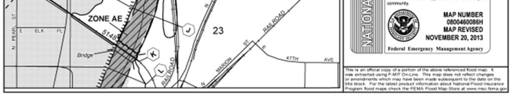
50 Exhibit:FloodInsuranceRateMap 46 Page
BROADWAY STATION Infrastructure Master Plan May 2016
 BROADWAY STATION Infrastructure Master Plan May 2016 Contents Section 1: Executive Summary... 1 Section 1.1: Amendments and Minor Deviations... 2 Exhibit 1.0A: Broadway Station Development Gross Area...
CHECKLIST FOR PHASE II DRAINAGE REPORT
 I. COVER SHEET CHECKLIST FOR PHASE II DRAINAGE REPORT A. Name of Project B. Address C. Owner D. Developer E. Engineer F. Submittal date and revision dates as applicable II. GENERAL LOCATION AND DESCRIPTION
South Bismarck Watershed Model Update and Stormwater Improvement Project
 Preliminary Engineering Report Bismarck Tribune South Bismarck Watershed Model Update and Stormwater Improvement Project City of Bismarck, ND January 2017 14.105.0046 1.0 Executive Summary The focus of
CITIZEN S ADVISORY COMMITTEE PUBLIC REALM CONCEPT PRESENTATION. October 25, 2018
 CITIZEN S ADVISORY COMMITTEE PUBLIC REALM CONCEPT PRESENTATION October 25, 2018 AGENDA Placemaking Study Overview Public Space Design Character and Concepts / Updated Visuals PLACEMAKING STUDY OVERVIEW
6.3 Elyria-Swansea. Basin Snapshot
 6.3 Elyria-Swansea The Elyria-Swansea Map Unit is comprised of the I-70 & Colorado Blvd basin (0060-01) and the I-70 & York basin (0060-02) from the Denver Storm Drainage Master Plan (SDMP) and has a total
Floodplain Technical Memorandum
 Southeast Extension Project Lincoln Station to RidgeGate Parkway Prepared for: Federal Transit Administration Prepared by: Denver Regional Transportation District May 2014 Table of Contents Page No. Chapter
Northwest Rail Corridor and US 36 BRT Development Oriented Transit Analysis 4.4 STATION AREA FINDINGS
 4.4 STATION AREA FINDINGS Each station is different, and each one requires a separate set of recommendations based on the vision for the site. This section outlines an initial TOD strategy and recommendations
When planning stormwater management facilities, the following principles shall be applied where possible.
 2.0 Principles When planning stormwater management facilities, the following principles shall be applied where possible. 2.0.1 Drainage is a regional phenomenon that does not respect the boundaries between
MASTER DEVELOPMENT DRAINAGE PLAN FOR MONUMENT HEIGHTS
 MASTER DEVELOPMENT DRAINAGE PLAN FOR MONUMENT HEIGHTS DRAINAGE REPORT STATEMENT ENGINEER'S STATEMENT: The attached drainage plan and report were prepared under my direction and supervision and are correct
East Corridor Final Environmental Impact Statement
 East Corridor Final Environmental Impact Statement Alternatives Considered Operating Plan The requirements for opening day operations versus year 2030 are based on ridership and operations. Opening day
CONTEXT: the Highway, the River + the Railroads run through us.
 CONTEXT: the Highway, the River + the Railroads run through us. I-25 36 In the past they have divided us, now we have an opportunity to unite us. I-76 I-270 I-76 CSU I-25 LEGEND Cut + Cover River North
EXCERPTS. Sep City and County of Denver (CCD) Storm Drainage Master Plan
 Storm Drainage Master Plan") EXCERPTS Acronyms in Document: CCD- City and County of Denver (the City, the Mayor and his Administration) CDOT- Colorado Department of Transportation CPGC- City Park Golf Course (Detention, part of P2PH)
EXCERPTS Acronyms in Document: CCD- City and County of Denver (the City, the Mayor and his Administration) CDOT- Colorado Department of Transportation CPGC- City Park Golf Course (Detention, part of P2PH)
Green Gables. April 24, 2013
 Green Gables Preliminary and Final Plat April 24, 2013 Development Team Green Gables Development Corporation (Owner/Developer) DTJ Design (Planner/Landscape Architect) Enertia Consulting Group (Civil Engineer)
Drexel, Barrell & Co.
 Drexel, Barrell & Co. June 18, 2018 Engineers/Surveyors Boulder Colorado Springs Greeley 3 South 7 th Street Colorado Springs, Colorado 80905-1501 719 260-0887 719 260-8352 Fax El Paso County Planning
Planning Districts INTRODUCTION
 INTRODUCTION To facilitate detailed examination of development prospects for all areas of the community, Delano has been divided into 14 planning districts. The location of these planning districts is
SOUTHWEST CORRIDOR EXTENSION. Environmental Evaluation and Basic Engineering Results PUBLIC MEETING/OPEN HOUSE November 18, 2009
 SOUTHWEST CORRIDOR EXTENSION Environmental Evaluation and Basic Engineering Results PUBLIC MEETING/OPEN HOUSE November 18, 2009 AGENDA I. Welcome/Introductions II. Project Review and Status III. Environmental
Lincoln 270. City of Lincoln. Stormwater Management Plan. April 2, 2013
 Lincoln 270 City of Lincoln Stormwater Management Plan April 2, 2013 # 2005.48 Prepared By: Civil Engineering Solutions, Inc. 590 E Street Lincoln, Ca 95648 (916) 645 5700 1.0 Background: The project site
Drexel, Barrell & Co.
 Drexel, Barrell & Co. December 21, 2018 Engineers/Surveyors Boulder Colorado Springs Greeley 3 South 7 th Street Colorado Springs, Colorado 80905-1501 719 260-0887 719 260-8352 Fax El Paso County Planning
This Review Is Divided Into Two Phases:
 Semiahmoo Town Centre Review The purpose of this review: To review the Semiahmoo Town Centre Concept Plan, originally approved in 1993, to ensure that this centre will continue to serve the needs of South
USF System Campus Master Plan Updates Goals, Objectives and Policies
 2015-2025 USF System Campus Master Plan Updates Goals, Objectives and Policies Tampa Goals, Objectives, and Policies Table of Contents Executive Summary 2015 2025 USF Campus Master Plan Update Introduction
Transportation. Strategies for Action
 Transportation A major priority for the Overlake Neighborhood is to develop a multimodal transportation system. To achieve this system, a balance has to be found among travel, circulation and access needs;
Level 1 Downstream Analysis
 Level 1 Downstream Analysis Newcastle Way Apartments Newcastle, Washington King County April 14, 2014 Revised July 10, 2014 Prepared by: Dean A. Furr, P.E. Reviewed by: Donald Scarberry, P.E. Coffman Engineering,
Mitchell Ranch South MPUD Application for Master Planned Unit Development Approval Project Narrative. Introduction
 Mitchell Ranch South MPUD Application for Master Planned Unit Development Approval Project Narrative Introduction Mitchell Ranch South is a proposed single family (detached) residential development on
October 7, City of Thornton 9500 Civic Center Drive Thornton, CO (303) RE: Maverik Thornton, CO - Drainage Report
 RE: Maverik Thornton, CO - Drainage Report") October 7, 2016 City of Thornton 9500 Civic Center Drive Thornton, CO 80229 (303) 538-7295 RE: Maverik Thornton, CO - Drainage Report As per your request, we are submitting to you the drainage report and
October 7, 2016 City of Thornton 9500 Civic Center Drive Thornton, CO 80229 (303) 538-7295 RE: Maverik Thornton, CO - Drainage Report As per your request, we are submitting to you the drainage report and
Gold Line Bus Rapid Transit Transit Oriented Development (BRTOD) Helmo Station Area Plan
 Helmo Station Area Plan") Appendix F Gold Line Bus Rapid Transit Transit Oriented Development (BRTOD) Helmo Station Area Plan Introduction and Purpose of the Plan The Gold Line Bus Rapid Transit facility is an eleven-mile dedicated
Appendix F Gold Line Bus Rapid Transit Transit Oriented Development (BRTOD) Helmo Station Area Plan Introduction and Purpose of the Plan The Gold Line Bus Rapid Transit facility is an eleven-mile dedicated
5.6 Valverde. Basin Snapshot. Valverde Land Uses
 5.6 Valverde The Valverde water quality map unit is located in west Denver and generally overlaps with Basin 0064-02 (Valverde) in the City and County of Denver Storm Drain Master Plan (SDMP). The basin
6.5 Lakewood Gulch. Basin Snapshot
 6.5 Lakewood Gulch The Lakewood Gulch Map Unit is comprised of both Lakewood Gulch and Dry Gulch (4800-01 and 4801-01) from the Denver Storm Drainage Master Plan (SDMP) and has a total drainage area of
Midtown Greenway Land Use and Development Plan Executive Summary
 Midtown Greenway Land Use and Development Plan Executive Summary Introduction The Midtown Greenway Land Use and Development Plan sets policy direction for land use and development in the Midtown Greenway
Marion Street Green Infrastructure Project. Whittier Neighborhood Community Meeting April 18, 2018
 Marion Street Green Infrastructure Project Whittier Neighborhood Community Meeting April 18, 2018 Agenda Water quality and green infrastructure Overview: Marion Street stormwater project Green infrastructure
National Western Center (NWC) Study Area Master Plan adopted March-2015 ~250 Acres Strong commitment to preserving the sites history 2.
 Study Area Master Plan adopted March-2015 ~250 Acres Strong commitment to preserving the sites history 2.") 34 National Western Center (NWC) Study Area Master Plan adopted March-2015 ~250 Acres Strong commitment to preserving the sites history 2.8 million sf of new and renovated space at full build-out Boundaries:
34 National Western Center (NWC) Study Area Master Plan adopted March-2015 ~250 Acres Strong commitment to preserving the sites history 2.8 million sf of new and renovated space at full build-out Boundaries:
PDR /21/15 Noah Beals 1/7/15 xx
 PDR150001 1/21/15 Noah Beals 1/7/15 xx 01.07.15 HTP Harmony Frontage Infrastructure Preliminary Design Review Project Narrative a) What are you proposing/use? The HTP Harmony Frontage Infrastructure project
1.0 Introduction. Purpose and Basis for Updating the TMP. Introduction 1
 1.0 Introduction The Town of Castle Rock is situated between the metropolitan areas of Denver and Colorado Springs, amidst a unique terrain of rolling hills, mesas, ravines, and waterways. Like many Front
KEIZER STATION PLAN INTRODUCTION
 KEIZER STATION PLAN INTRODUCTION Planning for this area began in 1987 when the Keizer Comprehensive Plan established the Chemawa Activity Center and McNary Activity Center. The first Chemawa Activity Center
Village of Forest Park. July 27, Sewer Separation Evaluation
 Village of Forest Park July 27, 2015 Sewer Separation Evaluation Presentation Overview Study Background Historic Nature of Forest Park Drainage Scale of Flooding Problem Forest Park Sewer System Background
Official Zoning Map Amendment Application #2018I-00077
 Community Planning and Development Planning Services 201 W. Colfax Ave., Dept. 205 Denver, CO 80202 p: 720.865.2915 f: 720.865.3052 www.denvergov.org/cpd TO: Denver Planning Board FROM: Scott Robinson,
Right-of-Way Acquisitions and Relocations Technical Memorandum
 Right-of-Way Acquisitions and Relocations Technical Memorandum Southeast Extension Project Lincoln Station to RidgeGate Parkway Prepared for: Federal Transit Administration Prepared by: Denver Regional
SEMSWA s Role in the Land Development Process
 SEMSWA s Role in the Land Development Process One of SEMSWA s responsibilities is to ensure that any new development or redevelopment within its service area is designed and constructed in compliance with
Urban runoff in my neighborhood (Capitol Hill) is heavy with trash and other debris.
 is heavy with trash and other debris.") South Platte River Meeting Comments & s #1 I am a huge fan of river areas and would love the Platte and surrounding waterways to improve to allow habitat for wildlife and recreation opportunities for citizens.
South Platte River Meeting Comments & s #1 I am a huge fan of river areas and would love the Platte and surrounding waterways to improve to allow habitat for wildlife and recreation opportunities for citizens.
City of Waco Stormwater Management Regulations
 1.0 Applicability: City of Waco Stormwater Management Regulations These regulations apply to all development within the limits of the City of Waco as well as to any subdivisions within the extra territorial
Description of Preferred Alternative
 Chapter 2 Description of Preferred Alternative 2.1 Introduction This chapter of the programmatic Sammamish Town Center Sub-area Plan Final EIS provides a more detailed description of the Preferred Alternative
PROJECT BACKGROUND. Preliminary Design Scope and Tasks
 PROJECT BACKGROUND Preliminary Design Scope and Tasks The purpose of this Study is the development of preliminary designs for intersection improvements for Trunk Highway (TH) 36 at the intersections of
PHASE III DRAINAGE REPORT
 PHASE III DRAINAGE REPORT FOR Eastlake Assisted Living & Memory Care April 20, 2016 June 3, 2016 August 5, 2016 Prepared for: 3301 E 120 th Ave, LLC. 8200 E. Maplewood Ave., Suite 150 Greenwood Village
Existing Conditions and Environmental Consequences Floodplains
 3.9 Environmental Consequences 3.8 3.8.1 WHAT ARE FLOODPLAINS? are low-lying areas adjacent to rivers, streams, and other waterbodies that are susceptible to inundation (flooding) during rain events. These
Figure 1 Cypress Street Study Area Location Map
 July 20, 2016 TO: FROM: Jim Massarelli Director of Engineering Jeff Julkowski, PE Michael Burke, PE SUBJECT: Cypress Street Study Area Stormwater Analysis (CBBEL Project No. 16-0058) At the request of
ADOPTED CAPITAL IMPROVEMENT PROGRAM BUDGET ARROYO PROJECTS
 ADOPTED CAPITAL IMPROVEMENT PROGRAM BUDGET ARROYO PROJECTS HAHAMONGNA FY 212-216 Capital Improvement Program Priority Description Total Estimated Costs Appropriated Through FY 211 Adopted FY 212 FY 213
The transportation system in a community is an
 7 TRANSPORTATION The transportation system in a community is an important factor contributing to the quality of life of the residents. Without a sound transportation system to bring both goods and patrons
1.0 PROJECT PURPOSE AND NEED
 1.0 PROJECT PURPOSE AND NEED The FasTracks Plan includes the extension of the Central Corridor from its current terminus at 30th/Downing to a connection to the East Corridor commuter rail service planned
Preliminary Plan Framework: Vision and Goals
 Preliminary Plan Framework: Vision and Goals Draft: May 2015 Introduction Since the Town of Milliken s comprehensive plan was last updated in 2010, the community was heavily impacted by the 2013 flood,
DENVER DESIGN DISTRICT GDP
 DENVER DESIGN DISTRICT GDP Urban Design Standards and Guidelines November 17, 2008 Amended February 3, 2016 City and County of Denver CF Property Management, Inc. C/O Denver Design District - Starboard
Public Meeting. October 25, 2016 Industry. Project Funded By: ADJACENT PRIVATE DEVELOPERS/OWNERS
 RIVER NORTH PROMENADE Public Meeting October 25, 2016 Industry Project Funded By: ADJACENT PRIVATE DEVELOPERS/OWNERS Agenda Update On Scope + Schedule Where We Left Off What We Heard What We ve Learned
Public input has been an important part of the plan development process.
 Lakewood s Comprehensive Plan recognizes that transportation helps shape the community, and that the way the community provides for the safe and efficient movement of people affects the character of the
Mississippi Skyway Preliminary Engineering Report
 EXECUTIVE SUMMARY Mississippi Skyway Preliminary Engineering Report CITY OF RAMSEY, MINNESOTA DECEMBER 2014 City of RAMSEY EXECUTIVE SUMMARY Project Need and Intent The Mississippi Skyway pedestrian bridge
Potential Green Infrastructure Strategies May 6, 2015 Workshop
 Potential Green Infrastructure Strategies May 6, 2015 Workshop Background The City of Cortland is developing the Tioughnioga Urban Headwaters Green Infrastructure Action Plan with funding from the National
Checklists. Project Name: Location: File Number: Date of Submittal: Reviewer: Date: Applicant: Contact Name: Phone Number:
 Applicant: Contact Name: Phone Number: Email: Project Name: Location: File Number: Date of Submittal: Reviewer: Date: Concept Plan Requirements: I. General Project Information 1. Address or parcel number
Don Mills Crossing Study and Celestica Lands Development Application Community Meeting, Open House, and Breakout Discussions
 Consultation Summary Don Mills Crossing Study and Celestica Lands Development Application Community Meeting, Open House, and Breakout Discussions This report is not intended to provide a verbatim transcript
Bourne Downtown Site Planning
 Prepared for: The Town of Bourne, MA In Cooperation with: Bourne Financial Development Corporation Prepared by:, Inc. June 24, 2009 Table of Contents Introduction and Summary... 1 Site Existing Conditions...
Table of Contents G.1.a Water Resources - Surface Water - Drainage
 Table of Contents G.1.a Water Resources - Surface Water - Drainage 1. INTRODUCTION... 1335 2. ENVIRONMENTAL SETTING... 1335 a. Regional Hydrology... 1335 b. Local Hydrology... 1337 c. On-site Hydrology...
UAA School of Engineering Parking Garage Master Plan Amendment. 1. Purpose
 UAA School of Engineering Parking Garage Master Plan Amendment 1. Purpose Since the UAA campus master plan was drafted in 2003, adopted in 2004, and amended in 2009 a number of significant changes regarding
City of Grande Prairie Development Services Department KENNEDY DEVELOPMENTS LTD. OUTLINE PLAN OP-09-01
 City of Grande Prairie Development Services Department KENNEDY DEVELOPMENTS LTD. OUTLINE PLAN OP-09-01 July 27, 2009 TABLE OF CONTENTS 1.0 Introduction... 1 1.1 Plan Area Location & Context... 1 1.2 Ownership
Developer s Program. The Station at East 54
 Developer s Program The Station at East 54 Existing Conditions The Station at East 54 is proposed for a 1.12 acre site at the northeast corner of Hamilton Road and Prestwick Road, tucked between the East
Section 11 Grading and Drainage Standards
 Section 11 Grading and Drainage Standards 11.1 INTRODUCTION The proper grading, conveyance, storage and release of storm water is critical to maintain the integrity of the Property. Drainage facilities,
Illustration of Eastlake Farmer s Cooperative Grain Elevator. Chapter 5: implementation 5-1
 Illustration of Eastlake Farmer s Cooperative Grain Elevator Chapter 5: implementation 5-1 chapter 5: implementation Introduction The Eastlake Subarea Plan includes a wide range of recommendations intended
An Ambitious Plan: Transforming the blighted South Platte River and surrounding environment into Denver s greatest natural resource.
 CONNECTING THE PEOPLE TO THEIR RIVER SOUTH PLATTE RIVER VISION IMPLEMENTATION PROGRAM: GRANT-FRONTIER PARK TO OVERLAND POND PARK REACH The South Platte River Vision Implementation Program (River Vision)
Written Statement for Keizer Station Area B Amendment. Master Plan Amendment for Keizer Station Area B GENERAL INFORMATION
 Written Statement for Keizer Station Area B Amendment Applicant: City of Keizer Request: Master Plan Amendment for Keizer Station Area B DATE: June 2017 GENERAL INFORMATION A. OWNER: The City of Keizer
City of Farmington. Downtown Plan. Amendment to the 1998 Master Plan Adopted October 11, 2004
 City of Farmington Amendment to the 1998 Master Plan Adopted October 11, 2004 Introduction Planning Background 1 Scope and Components of the Plan Amendment 2 Concept Introduction 3 Plan Concepts 3 Conceptual
Meeting Overview. Key Takeaways ~ MERRICK I. Project: Globeville Stormwater System Study. Date and Time: 05/09/2018 from 5:30 pm 7:30 pm
 COLLABORATIVE=:'.:.:' 0 Project: Globeville Stormwater System Study Date and Time: 05/09/2018 from 5:30 pm 7:30 pm Meeting Name: Community Meeting #1 Meeting Place: Stapleton Recreation Center (5090 Broadway
Northwest commuter rail station US 36 BRT. Westminster Station
 Northwest commuter rail station Westminster Station US 36 BRT Westminster Center US 36 & Church Ranch Broomfield Flatiron/96 th St. US 36 & McCaslin Table Mesa Boulder Junction 13-month effort that will
LOUISIANA STATE UNIVERSITY COMPREHENSIVE & STRATEGIC CAMPUS MASTER PLAN. APPENDIX G - Stormwater Study Findings & Stormwater Solutions
 LOUISIANA STATE UNIVERSITY COMPREHENSIVE & STRATEGIC CAMPUS MASTER PLAN APPENDIX G - Stormwater Study Findings & Stormwater Solutions LSU: MP Narrative July 2017 3.5 Open Space Existing Conditions The
Staff Report and Recommendation
 Community Planning and Development Planning Services 201 W Colfax Ave, Dept 205 Denver, CO 80202 p: 720-865-2972 f: 720-865-3056 www.denvergov.org/planning TO: LUTI FROM: Steve Nalley, Senior City Planner
Re: Thorncreek Commons Commercial Response to Pre-Application Meeting held September 24, 2014 Comments
 8/20/2015 Jay Ruchti Senior Planner City Development Department City of Thornton 9500 Civic Center Drive Thornton, CO Re: Thorncreek Commons Commercial Response to Pre-Application Meeting held September
C. WATER. 1. Surface Water Runoff. See Section C.3, Flood Hazard/Mudflow Hazard, page Ground Water
 C. WATER 1. Surface Water Runoff See Section C.3, Flood Hazard/Mudflow Hazard, page 67. 2. Ground Water Determined not significant by the October 1984 and January 1999 Initial Studies conducted by the
Olde Towne Vision Plan
 Olde Towne Vision Plan Introduction In 2016, the City of Bellevue will complete its move of City offices from Olde Towne Bellevue to its new municipal complex on Wall Street. The City intends to sell its
Public may provide comments on the GDP within the next two weeks (December 24)
") 25/70 General Development Plan (GDP) Public Meeting Wednesday, December 10, 2014 6:00 8:00 P.M. District 1 Police Station Community Room 1311 W 46th Ave, Denver, CO 80211 Council Woman Montero: This particular
25/70 General Development Plan (GDP) Public Meeting Wednesday, December 10, 2014 6:00 8:00 P.M. District 1 Police Station Community Room 1311 W 46th Ave, Denver, CO 80211 Council Woman Montero: This particular
Project Narrative For Fruita RV Resort Conditional Use Permit
 Project Narrative For Fruita RV Resort Conditional Use Permit Date: November 18, 2016 Prepared by: Robert W. Jones, II, P.E. Vortex Engineering & Architecture, Inc. 2394 Patterson Rd., Ste. 201 Grand Junction,
IMPLEMENTING SOMERSET COUNTY S INVESTMENT FRAMEWORK
 IMPLEMENTING SOMERSET COUNTY S INVESTMENT FRAMEWORK SMART CONSERVATION THROUGH SMART GROWTH NJ LAND CONSERVATION RALLY March 22, 2014 Laurette Kratina, PP, AICP, Supervising Planner Somerset County Planning
FUTURE LAND USE ELEMENT
 FUTURE LAND USE ELEMENT GOAL I: To create and sustain a great place to live, play, and prosper Objective 1: The City of Ocala shall incorporate the principles and strategies of the Ocala 2035 Vision into
CHAPTER 7: Transportation, Mobility and Circulation
 AGLE AREA COMMUNITY Plan CHAPTER 7 CHAPTER 7: Transportation, Mobility and Circulation Transportation, Mobility and Circulation The purpose of the Transportation, Mobility and Circulation Chapter is to
Silverdale Regional Center
 Silverdale Regional Center Vision for Silverdale Regional Center The Silverdale Regional Center Plan (Plan) will guide the evolution of the Silverdale Regional Center from a collection of strip malls and
P LAN PURPOSE AND PROCESS
 RIVER NORTH PLAN P LAN PURPOSE AND PROCESS BRIGHTON BOULEVARD/40 TH AND 40 TH TOD 7 PLAN PURPOSE AND PROCESS L OCATION The River North Plan study area is in North Denver just northeast of downtown. Project
Town of Portola Valley General Plan. Nathhorst Triangle Area Plan
 Town of Portola Valley General Plan Amended December 10, 1997 Table of Contents Introduction... 1 Planning Area... 1 Objectives... 2 Principles... 2 Standards... 4 Description... 4 Community Commercial...
TIRZ 17/Redevelopment Authority Capital Improvements Plan Projects
 Gessner Widening: T-1701 What: Widen the road from a six-lane divided boulevard to an eight-lane divided boulevard street section, increase turn lanes, update traffic signal system, improve drainage by
Table of Contents. Elm Avenue Improvement Plan City of Waco, Texas. Introduction 1. Existing Context 1 Figure 1 2.
 Table of Contents Introduction 1 Existing Context 1 Figure 1 2 Plan Guidelines 3 Future Urban Form 4 The West-End 4 Main Street 6 The East-End 7 Figure 2 9 Public Improvement Recommendations 7 General
CITY OF COLWICH COMPREHENSIVE PLAN LAND USE LAND USE 1
 LAND USE LAND USE 1 WHAT YOU WILL FIND IN THIS CHAPTER: Discussion of today s conditions and tomorrow s projections Discussion of challenges and opportunities Discussion of the environmental quality goals,
DESIGN CRITERIA PACKAGE
 RFQ: 17-C-00003 DESIGN-BUILD SERVICES FOR THE DESIGN CRITERIA PACKAGE PREPARED BY: JAMES E. JACKSON, JR. AIA CITY ARCHITECT CONTRACT ADMINISTRATION DEPARTMENT and INTERFLOW ENGINEERING, L.L.C DESIGN CRITERIA
C ity of Grande Prairie Development Services Department
 C ity of Grande Prairie Development Services Department FAIRWAY DEVELOPMENT OUTLINE PLAN OP 08 09 Approved April 6, 2009 Prepared by: Focus Corporation Table of Contents 1.0. Introduction 2 3 1.1. Plan
Green Infrastructure The Indianapolis Greenways Connection
 Green Infrastructure The Indianapolis Greenways Connection Fewer things in the transportation industry today make better since than combining the needs for pedestrian and bike trails with the need to locate,
PLANNED UNIT DEVELOPMENT STAFF REPORT Date: June 2, 2016
 # 9 ZON2016-01032 PLANNED UNIT DEVELOPMENT STAFF REPORT Date: June 2, 2016 DEVELOPMENT NAME JJT Properties LLC LOCATION 1147 & 1151 East I-65 Service Road South and 1180 Sledge Drive (Southeast corner
Corridor Vision. 1Pursue Minnehaha-Hiawatha Community Works Project. Mission of Hennepin County Community Works Program
 1Pursue Minnehaha-Hiawatha Community Works Project Minnehaha-Hiawatha Community Works is a project within the Hennepin Community Works (HCW) program. The mission of the HCW program is to enhance how the
Mariposa Lakes. Planned Community. Project Overview. Stockton, CA
 Planned Community Stockton, CA Project Overview March 2007 Summary of Proposed Community is a master-planned community proposed for development on approximately 3,810 acres in southeast Stockton. In 2004,
PRELIMINARY DRAINAGE REPORT LATHAM 200 MMSCFD GAS PROCESSING PLANT
 PRELIMINARY DRAINAGE REPORT LATHAM 200 MMSCFD GAS PROCESSING PLANT LOTS B, RECORDED EXEMPTION 1211-2-1, RECX13-0096 LOCATED IN THE NORTH 1/2 OF SECTION 2, TOWNSHIP 3 NORTH, RANGE 66 WEST, 6 TH PRINCIPAL
CHAPTER 8 ISSUES, CONCERNS, CONSTRAINTS AND OPPORTUNITIES
 CHAPTER 8 ISSUES, CONCERNS, CONSTRAINTS AND OPPORTUNITIES Introduction This River Conservation Plan was developed during a time of tremendous activity and effort in planning the transformation of the Delaware
OP Council Resolution June 16, Planning and Development Services
 OP-08-01 Council Resolution June 16, 2008 Planning and Development Services Kingsgate Landing Outline Plan Table of Contents 1.0 Introduction 1 1.1 Purpose of Plan 1 1.2 Plan Area Location 1 1.3 Ownership
 Item # Meeting Date: February 27, 2014 AGENDA MEMORANDUM To: From: Planning Commission Sandy Vossler, Planner II, Development Services Department Date: February 26, 2014 Title: The Lanterns Planned Development
The University District envisions, in its neighborhood
 Envisioning the University District Link Light Rail in Seattle s neighborhoods CIY OF SEALE CONCEP-LEVEL SAION AREA PLANNING RECOMMENDAION RESOLUION # 30165 EXHIBI L Vision 08.2000 he University District
STAFFORD TRACT NORTH OF US90A 1.0 INTRODUCTION 1.1 OBJECTIVE
 1.0 INTRODUCTION 1.1 OBJECTIVE This report, prepared for submittal to TxDOT, analyzes existing and proposed detention facilities draining into the TxDOT US90A storm sewer system. The results of the detailed
Red Fox Commercial Outline Plan
 Red Fox Commercial Outline Plan City of Cold Lake, Alberta Prepared by Durrance Projects Ltd and Ross W. Sharp & Associates Ltd October 2014 Rupert 1 Table of Contents 1. PURPOSE...3 1.1. Location...4
Chapter 1.0 Introduction
 Chapter 1.0 Introduction 1.1 Background The North Metro commuter rail line is part of the RTD FasTracks regional transit system expansion program to build more than 100 miles of rail transit throughout
5.0 Community Design Plan
 5.0 Community Design Plan The Community Design Plan for the Mer Bleue area is a composite of three plans: Land Use Plan Transportation Plan Municipal Servicing Plan Read together, these Plans and associated
Land Use Amendment in Southwood (Ward 11) at and Elbow Drive SW, LOC
 at and Elbow Drive SW, LOC") 2018 November 15 Page 1 of 10 EXECUTIVE SUMMARY This land use amendment application was submitted by Rick Balbi Architect on 2017 August 31 on behalf of Sable Developments Ltd, and with authorization from
2018 November 15 Page 1 of 10 EXECUTIVE SUMMARY This land use amendment application was submitted by Rick Balbi Architect on 2017 August 31 on behalf of Sable Developments Ltd, and with authorization from
Preliminary Assessment of Transportation Issues Related to Proposed Casino at Gateway South
 Preliminary Assessment of Transportation Issues Related to Proposed Casino at Gateway South DRAFT - 9/16/09 This memorandum summarizes the perspective of the City of Baltimore, Department of Transportation