SYLLABUS CE HIGHWAY ENGINEERING L T P C TOTAL L: 45
|
|
|
- Daniella Greer
- 5 years ago
- Views:
Transcription

1 TRANSPORTATION

2 HIGHWAY ENGINEERING
3 SYLLABUS CE HIGHWAY ENGINEERING L T P C TOTAL L: 45 UNIT 1. HIGHWAY PLANNING AND ALIGNMENT 8 History of road development in India Classification of highways Institutions for Highway planning, design and implementation at different levels factors influencing highway alignment Engineering surveys for alignment, objectives, conventional and modern methods. UNIT 2. GEOMETRIC DESIGN OF HIGHWAYS INCLUDING HILL ROADS 10 Typical cross sections of Urban and Rural roads Lateral and vertical clearance at underpasses Cross sectional elements Horizontal curves, super elevation, transition curves, widening of curves Sight distances Vertical curves, gradients, hairpin bends IRC standards UNIT 3. DESIGN FLEXIBLE AND RIGID PAVEMENTS 9 Design principles pavement components and their role - Design practice for flexible and rigid pavements, (IRC methods only). UNIT 4. HIGHWAY CONSTRUCTION MATERIALS, EQUIPMENTS AND PRACTICE 8 Highway construction materials, properties, testing methods Construction practice including modern methods, concrete road constructions (problem not included) - Highway drainage Special considerations for hilly roads. UNIT 5. EVALUATION AND MAINTENANCE OF PAVEMENTS 10 Pavement distress in flexible and rigid pavement Pavement evaluation, roughness, present serviceability index, skid resistance, structural evaluation, evaluation by deflection measurements Strengthening of pavements Types of maintenance IRC standards
4 TEXT BOOKS Khanna.K and Justo.C.E.G. Highway Engineering, Khanna Publishers, Roorkee, Kadiyali.L.R. Principles and practice of Highway Engineering, Khanna Technical Publications, Delhi, Indian Road Congress (IRC), Guidelines and Special Publications of Planning and Design.
5 REFERENCES Blunden W.R and J.A Black, The Land Use Transport Systems, Pergamon Press, Vazirani, V.N and S.P.Chandola, Transportation Engineering, Vol.1. Khanna Publishers, Delhi, 1999 Clarkson.H Oglesby and R.Gary Hicks, Highway Engineering, John Wileysons, 1992 Arora.N.L. Transportation Engineering, New India Publishing Home, Sharma.S.K Principles, Practices and Design of Highway Engineering, S.Chand and Company Ltd.1995 O Flaherty.C.A Highways, Butterworth Heinemann, Oxford 2006
6 UNIT 1. HIGHWAY PLANNING AND ALIGNMENT 8 History of road development in India. Classification of highways. Institutions for Highway planning, design and implementation at different levels Factors influencing highway alignment Engineering surveys for alignment, objectives, conventional and modern methods.

7 History of Road Development in the World

8 Mountain Trails

9 Roman Roads

10 Roman Road Construction Basic cross section

11 Ancient Greek Roads grooves and large stone blocks

12 Macadam Road

13 India Grand Trunk Road 2,500 kilometres (1,600 mi).

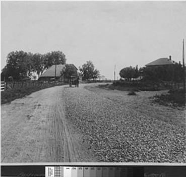
14 Plank Road Western US Early 20 th Century Plank roads were typically constructed of wood planks two inches thick and eight feet long, which were nailed to four-inch-square stringers at a 90-degree angle.
15

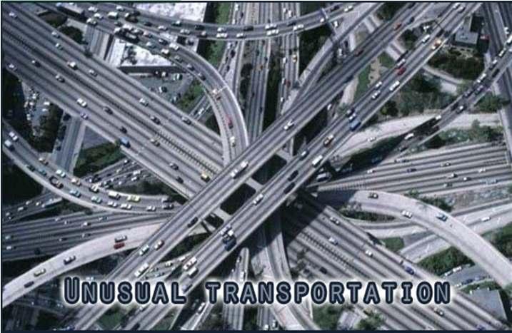
16 Future roads General Areas
17 History of Road Development in India Ancient Period (3500 BC) Mughul Period (15 th Century) British Period (17 th & 18 th Century) Free India (1950 onwards)
18 Types of Ancient Indian Roads Indus Valley Civilization (Harrapa and Mohenjedaro): Roads with brick drains on both sides. Mauryan rule in the 4th century constructed Rajpath (high roads) Banikpaths (merchant roads). Ashoka Regime: Road networks with horticulture and rest houses at km along the roads. Mughul Period Trunk roads between Northwest to Eastern part and also linking coastal and central part of India British Period Trunk roads, bridges, PWD was formed, construction of Grand Trunk Road
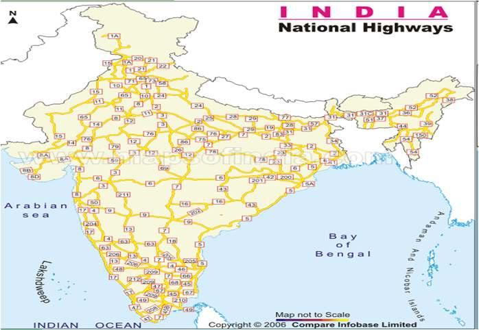
19 Indian Roads India has a large road network of over million kilometers of roadways (2.1 million miles). It is 3 rd largest road network in the world. At 0.66 km of highway per square kilometer of land the density of India s highway network is higher than that of the United States (0.65) and far higher than that of China's (0.16) or Brazil's (0.20).

20 Golden Quadrilateral It connects India's four largest metropolises: Delhi, Mumbai, Chennai and Kolkata. Four other top ten metropolises: Bangalore, Pune, Ahmedabad, and Surat, are also served by the network. The largest highway project in India, initiated by Atal Bihari Vajpayee, it is the first phase of the National Highways Development Project (NHDP), It consists of building 5,846 km (3,633 mi) of four/six lane express highways. Cost : 60,000 crore
21 Impact of Transportation Economic Development Social Development Spatial Development Cultural Development Political Development
22 Institution for Highway Planning, Design and Implementation at Different Levels Jayakar Committee (1927) Central Road Fund (1929) Indian Roads Congress (IRC), 1934 Central Road Research Institute (CRRI), 1950 National Highway Act, 1956 National Highway Authority of India (NHAI),1995 National Highway Act ( 1956 ) Second Twenty Year Road Plan ( 1961 ) Highway Research Board ( 1973 ) National Transport Policy Committee ( 1978 ) Third Twenty Year Road Plan ( 1981 )
23 Jayakar Committee,1927 Road development should be made a national interest since the provincial and local govt do not have financial and technical capacity for road development. Levy extra tax on petrol from road users to create the road development fund. To establish a semi-official,technical institution to pool technical knowledge, sharing of ideas and to act as an advisory body. To create a national level institution to carry research, development works and consultation.
24 Central Road Fund, 1929 CRF Act, 2000 Distribution of 100% cess on petrol as follows: 57.5% for NH 30% for SH MORTH 12.5% for safety works on rail-road crossing. 50% cess on diesel for Rural Road development
25 Indian Roads Congress, 1934 To provide national forum for regular pooling of experience and ideas on matters related to construction and maintenance of highways. To recommend standard specifications. To provide a platform for expression of professional opinion on matters relating to roads and road transport.
26
27 CRRI A constituent of Council of Scientific and Industrial Research (CSIR) engaged in carrying out research and development projects. design, construction and maintenance of roads and runways, traffic and transportation planning of mega and medium cities, management of roads in different terrains, Improvement of marginal materials, Utilization of industrial waste in road construction, Landslide control, Ground improvements environmental pollution, Road traffic safety, Service life assessment and rehabilitation of highway & railway bridges.
28 Ministry of Road Transport & Highways Planning, development and maintenance of National Highways in the country. Extends technical and financial support to State Governments for the development of state roads and the roads of inter-state connectivity and economic importance. Evolves standard specifications for roads and bridges in the country. Serves as a repository of technical knowledge on roads and bridges.
29 Classification of Highways Depending on weather All weather roads Fair weather roads National highway act ( 1956 ) Depending on the type of Carriage way Paved roads Unpaved roads Depending upon the pavement surface Surfaced roads Un surfaced roads
30 Classification of Highways Based on the Traffic Volume Heavy Medium Light Based on Load or Tonnage Class 1 or Class 2 etc or Class A, B etc Tonnes per day Based on location and function ( Nagpur road plan ) NH SH MDR ODR VR
31 Based on modified system of Highways classification Primary Expressways National Highways Secondary SH MDR Tertiary ODR VR
32 Classification of Roadways Expressways National Highways State Highways Major District Roads 200 Km 70,548 Km 1,31,899 Km 4,67,763 Km Rural and Other Roads 26,50,000 Km
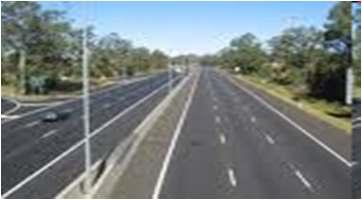
33 Expressways Heavy traffic at high speed (120km/hr) Land Width (90m) Full access control Connects major points of traffic generation No slow moving traffic allowed No loading, unloading, parking.
34 National Highways India has a huge network of national highways. The national highways have a total length of 70,548 kms. Indian highways cover 2% of the total road network of India and carry 40% of the total traffic. The entire highway network of India is managed by the National Highway Authority of India which is responsible for development and maintenance of highways. Longest highway in India is NH7 (2,369 km),which stretches from Varansi in Uttar Pradesh to Kanyakumari in the southern most point of Indian mainland. Shortest National Highway is the NH 47A (5.9 km (3.7 mi)), which connects Kundanoor Junction in Kochi city to the Kochi port at Willingdon Island.

35 NH 7 (2,369 km)
36
37 State Highways They are the arterial roads of a state, connecting up with the national highways of adjacent states, district head quarters and important cities within the state. Total length of all SH in the country is 1,37,119 Kms.
38 Major District Roads Important roads with in a district serving areas of production and markets, connecting those with each other or with the major highways. India has a total of 4,70,000 kms of MDR.
39 Other district roads Roads serving rural areas of production and providing them with outlet to market centers or other important roads like MDR or SH.
40 Village roads They are roads connecting villages or group of villages with each other or to the nearest road of a higher category like ODR or MDR. India has 26,50,000 kms of ODR+VR out of the total 33,15,231 kms of all type of roads.
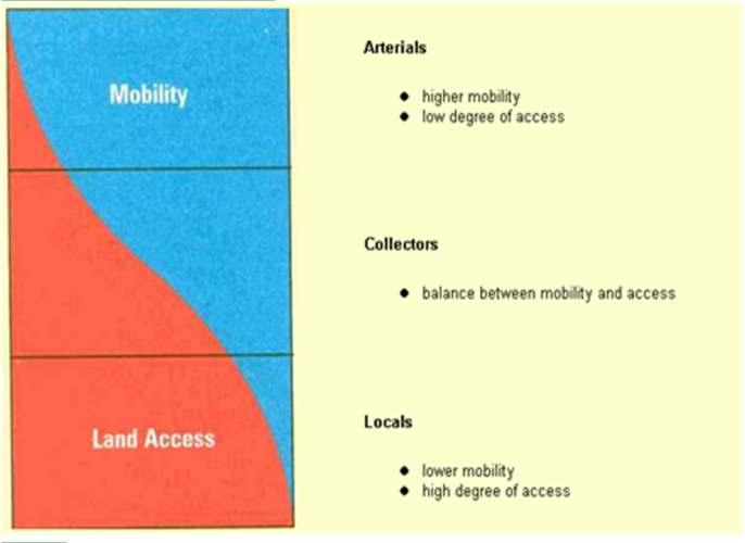
41 Urban Road Classification ARTERIAL ROADS SUB ARTERIAL COLLECTOR LOCAL STREET CUL-DE-SAC PATHWAY DRIVEWAY

42 Urban Road Classification ARTERIAL ROADS SUB ARTERIAL COLECTOR LOCAL STREET CUL-DE-SAC PATHWAY DRIVEWAY
43
44
45 ARTERIAL No frontage access, no standing vehicle, very little cross traffic. Design Speed : 80km/hr Land width : 50 60m Spacing 1.5km in CBD & 8km or more in sparsely developed areas. Divided roads with full or partial parking Pedestrian allowed to walk only at intersection
46 SUB ARTERIAL Bus stops but no standing vehicle. Less mobility than arterial. Spacing for CBD : 0.5km Sub-urban fringes : 3.5km Design speed : 60 km/hr Land width : m
47 Collector Street Collects and distributes traffic from local streets Provides access to arterial roads Located in residential, business and industrial areas. Full access allowed. Parking permitted. Design speed : 50km/hr Land Width : 20-30m
48 Local Street Design Speed : 30km/hr. Land Width : 10 20m. Primary access to residence, business or other abutting property Less volume of traffic at slow speed Origin and termination of trips. Unrestricted parking, pedestrian movements. (with frontage access, parked vehicle, bus stops and no waiting restrictions)
49 CUL DE- SAC Dead End Street with only one entry access for entry and exit. Recommended in Residential areas
50 Road Patterns Rectangular or Block patterns Radial or Star block pattern Radial or Star Circular pattern Radial or Star grid pattern Hexagonal Pattern Minimum Travel Pattern

51

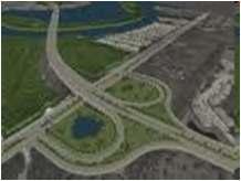
52 Highway Development Process
53

54 Factors in Planning
55 Factors Influencing Highway Alignment Requirements: Short Easy Safe Economical Factors controlling alignment : 1) Obligatory points A. Obligatory points through which alignment should pass through ( bridge site, intermediate town, Mountain pass etc B. Obligatory points through which alignment should not pass. (Religious Places,Lakes/Ponds 2) Traffic 3) Geometric design 4) Economics 5) Other considerations
56 Factors governing alignment Obligatory points The location should avoid obstructions such as places of cemeteries, archeological, historical monument, public facilities like schools and hospitals, utility services. Geometric design features Facilitate easy grade and curvature Enable ruling gradient in most sections Void sudden changes in sight distance, especially near crossings Avoid sharp horizontal curves Avoid road intersections near bend or at the top or bottom of a hill
57 Factors governing alignment Precautions at river and railway crossings Bridges should be preferably be located at right angles to the river flow, not located on a horizontal curve. Crossing railway lines should avoid intersections at gradient, frequent crossing and recrossing
58 Factors governing alignment Topographical control points The alignment, where possible should avoid passing through Marshy and low lying land with poor drainage Flood prone areas Unstable hilly features Avalanche prone areas Cross Slope Flat terrain : 0 10% Rolling terrain :10 to 25% Mountainous terrain: 25% - 40% Steep : >60% A location on high ground should be preferred rather than valley to avoid cross drainage works
59 Factors governing alignment Materials and constructional features Deep cutting should be avoided Earth work is to be balanced; quantities for filling and excavation Alignment should preferably be through better soil area to minimize pavement thickness Location may be near sources of embankment and pavement materials
60 Traffic Trend, Direction and pattern of traffic are critical elements. OD survey should be conducted. Desire lines based on survey should be drawn to indicate the desired pattern of traffic flow.
61 DESIRE LINES
62 Horizontal alignment Adjustments in horizontal alignment can help reduce the potential for generating roadway sediment. The objective is to minimize roadway cuts and fills and to avoid unstable areas. When unstable or steep slopes must be traversed, adjustments in vertical alignment can minimize impacts and produce a stable road by reducing cuts and fills
63 ECONOMIC FACTORS Capital cost Maintenance Cost Operational cost Road User Cost Embankment and deep cuttings cost.
64 Other Considerations Engineering feasibility Environmental consideration Social consideration Political Acceptability Monotony.
65 Engineering Surveys for Highway locations 1) Provisional alignment Identification ( Map study) 2) Reconnaissance survey 3) Preliminary survey 4) Final location to determine center line and detailed survey
66 Drawing and Report 1) Key map 2) Index map 3) Preliminary survey plans 4) Detailed plan and longitudinal section 5) Detailed cross section 6) Land acquisition plans 7) Drawings of cross drainage and other retaining structures 8) Drawings of road intersections 9) Land plans showing quarries etc
67 SURVEY DATA COLLECTION Natural and man made features. Proposed Geometric Design elements. Number of cross drainage structures. Soil characteristics Source of construction materials. Geological formation, type of rocks. Drainage
68 MAP STUDY Base Map preparation Topographical map (SoI) Scale -1: 2,50,000 1: 50,000 1: 25,000 Shows man made and natural features and contour lines at 15 or 30m interval. Shows possible alignments with obligatory points and minimum number of cross drainage structures.
69 RECONNAISSANCE SURVEY Map updating to confirm features indicated on map. Checking for: Number of cross drainage structures. High Flood Level (HFL) Confirming Length and value of gradient to IRC standards. Soil Characteristics. Geological features. Proximity to source of construction materials- quarries, water sources. Prepare a report on merits and demerits and profile map of scale 1:50,000.
70
71 PRELIMINARY SURVEY Base Plan Hz Vr Built up area/hilly terrain 1:1000 1:100 Plain and rolling terrain 1:2500 1:250 Establish center line Incorporation of natural and man made features Longitudinal and cross sectional profile (Levelling). Plain Terrain` Rolling Terrain Hilly Terrain Other studies : m : 50m : 30m Drainage, Hydrological, soil, Traffic and Materials. Finalisation of the best alignment Comparative analysis. Choose best alignment among alternatives. Design geometric elements.
72 DETAILED SURVEY FOR FINAL LOCATION Transferring the alignment on to ground. Detail Survey levelling work for longitudinal and transverse direction. Intervals for cross sectional levelling Plain Rolling Built up Hilly Soil Profile m 50 75m 50m 20m


73 Soil Profile A Horizon B Horizon C Horizon
74 Alignment for hill roads Minimum hair pin bends. Bends should be located on stable and flat slopes. Cross section for hair pin bends should be at intervals of 20-25m. Avoid bends in valleys. Survey for a width of ; 15 m on either side of centre line in straight alignment 30m on sharp curves.
75 MODERN SURVEY METHODS 1) Provisional alignment Identification ( Map study) 2) Reconnaissance survey 3) Hand held GPS giving 3D positions to an accuracy of 10-20m. 4) Preliminary Survey Mapping of topography and relief Use of aerial Photos Airborne Laser Terain Mapping 5) Final location and detailed survey.
76 Modern Equipments for Surveying EDM Electronic Distance Measurement Auto level. Digital level. Total station. GPS global positioning system.

 Kite")

77 Aerial Photos Balloon photography (1858) Pigeon cameras (1903) Kite photography (1890) Aircraft (WWI and WWII) Space (1947)
")


78 IKONOS (1 m Panchromatic) Landsat TM (False Color Composite) LIDAR (Light Detection and Ranging)
79 DATA FROM AERIAL SURVEY Mosaic for longitudinal and lateral overlaps. Control points Examination of photos for spot levels and contour lines Topo details Photo interpretation for geological features, soil and drainage for the study area
80 GEOMETRIC DESIGN Elements of design: Sight distance The length of road ahead visible to drivers Stopping sight distance Passing sight distance Horizontal alignment Super elevation rates (0.1 for rural areas, 0.06 for urban) Minimum radius Vertical alignment Pavement design Intersection and crossing design
81 Guidance for Route Selection Straight line alignment preferred. Avoid obstructions and frequent railway and river crossings. Avoid landslide, erosion prone and water logged and marshy area. Avoid alignment on clayey soil. Alignment should aim at maintaining uniform design speed, easy grades and curvature.
82 Comparison of Conventional and Modern Methods of Surveying Elements of comparison Maps- Base material Instruments Accuracy Conventional Topo sheets Chains, Tapes, Theodolite, Dumpy levels Chain/Tape 1 in 3000 to 1 in 30,000 Tacheometer 1 in 1000 to 1 in 10,000 Modern RS data, Aerial Photos, Satellite Imageries EDM, Total Station, GPS, Auto and Digital Level, Photogrammetry. EDM/TS 1 in to 1 in 1,00,000 Photogrammetry. 1 in to 1 in 1,00,000 Plotting CAD Systems Software Errors Human errors Closing Errors hence re measuring is required.
83 UNIT 1. HIGHWAY PLANNING AND ALIGNMENT 8 History of road development in India. Classification of highways. Institutions for Highway planning, design and implementation at different levels Factors influencing highway alignment Engineering surveys for alignment, objectives, conventional and modern methods.
84 QUESTIONS Recommendations of various Committees. Factors influencing alignment. Classification of Highways. Difference between modern and conventional surveys. Highway Development Plan.
Highway Alignment and Route Location Survey
 CHAPTER 2 Highway Route Surveys and Location Introduction To determine the geometric features of road design, the following surveys must be conducted after the necessity of the road is decided. Type of
Civil Engineering. Highway Engineering. Comprehensive Theory with Solved Examples and Practice Questions. Publications
 Civil Engineering Highway Engineering Comprehensive Theory with Solved Examples and Practice Questions Publications Publications MADE EASY Publications Corporate Office: 44-A/4, Kalu Sarai (Near Hauz Khas
GUJARAT TECHNOLOGICAL UNIVERSITY, AHMEDABAD, GUJARAT COURSE CURRICULUM COURSE TITLE: HIGHWAY ENGINEERING (COURSE CODE: ) Civil Engineering
 Civil Engineering") GUJARAT TECHNOLOGICAL UNIVERSITY, AHMEDABAD, GUJARAT COURSE CURRICULUM COURSE TITLE: HIGHWAY ENGINEERING (COURSE CODE: 3350606) Diploma Programme in which this course is offered Civil Engineering Semester
GUJARAT TECHNOLOGICAL UNIVERSITY, AHMEDABAD, GUJARAT COURSE CURRICULUM COURSE TITLE: HIGHWAY ENGINEERING (COURSE CODE: 3350606) Diploma Programme in which this course is offered Civil Engineering Semester
Tishk International University Civil Engineering Department Highway Engineering
 Tishk International University Civil Engineering Department Highway Engineering Historical Development of Highway Chapter -1- CE 426 Lecturer / Asmaa Abdulmajeed Tishk International University Lecturer/
(2A) Introduction to Design (and Nepal Rural Road Standards)
 Introduction to Design (and Nepal Rural Road Standards)") (2A) Introduction to Design (and Nepal Rural Road Standards) Presentation for LRN Training Bill Seal, Engineering Team Leader September 2014 1 Overview of Design Chapter (Day 2) 2A. Introduction to Design
(2A) Introduction to Design (and Nepal Rural Road Standards) Presentation for LRN Training Bill Seal, Engineering Team Leader September 2014 1 Overview of Design Chapter (Day 2) 2A. Introduction to Design
Study of Geometric Design, hydraulic and hydrology for Highways Using Civil 3D Software- A Case Study
 RESEARCH ARTICLE OPEN ACCESS Study of Geometric Design, hydraulic and hydrology for Highways Using Civil 3D Software- A Case Study Anil Kumar K.S School of civil engg, PhD Scholar,REVA University, and
VALLEY COUNTY MINIMUM STANDARDS FOR PRIVATE ROAD DESIGN AND CONSTRUCTION
 MINIMUM STANDARDS FOR PRIVATE ROAD DESIGN AND CONSTRUCTION Adopted November 28, 2005 TABLE OF CONTENTS DEFINITION OF TERMS...II I. DESIGN CRITERIA... 1 A. GENERAL DESIGN CRITERIA... 1 B. ROADWAY CLASSIFICATION...
Access Management: An Overview
 Figures 1-5 Below Evolution of development along a highway. In the early stages, land along the road is used for farming with little traffic generated. As time passes, the highway corridor becomes a de
1.0 INTRODUCTION 1.1 TH 14 WEST STUDY AREA Project Description Functional Classification Purpose of the Project
 1.0 INTRODUCTION 1.1 TH 14 WEST STUDY AREA 1.1.1 Project Description The Trunk Highway (TH) 14 West Corridor is a two-lane roadway approximately 22 miles in length. Located in Nicollet County, the corridor
Ten Mile Creek Planning Area
 PLANNING AREA POLICIES TEN MILE CREEK Ten Mile Creek Planning Area Location and Context The Ten Mile Creek Planning Area ( Ten Mile Creek area ) is located south of the current Boise AOCI, generally south
NORTHEAST RIVER CROSSING FUNCTIONAL PLANNING STUDY
 WELCOME Northeast River Crossing Functional Planning Study Phase 2 Public Meeting 4 to 8 PM Informal drop-in format and discussion tables Meeting Purpose Introduce the Northeast River Crossing Functional
ARTICLE IV: DEVELOPMENT STANDARDS 404 MASTER PLANNING
 IV 13 404 MASTER PLANNING Master Planning through the Site Analysis (Master Planning Site Analysis) or Planned Development (Master Planning Planned Development) is provided to encourage development which
PROTOTYPE DESIGN/INTRODUCTION
 PART III: PROTOTYPE DESIGN These concepts and guidelines described earlier were used to develop a prototype design for an emerging suburban area located west of the City of Milwaukee. This was done to
South Fraser Perimeter Road (SFPR)
") MSE WALLS & SLOPES PROJECT PROFILE South Fraser Perimeter Road (SFPR) Nilex provides multiple solutions for the new four-lane highway along Vancouver s Fraser River. LOCATION: Delta and Surrey, British
MSE WALLS & SLOPES PROJECT PROFILE South Fraser Perimeter Road (SFPR) Nilex provides multiple solutions for the new four-lane highway along Vancouver s Fraser River. LOCATION: Delta and Surrey, British
PREPARED FOR: PLATTEVIEW ROAD CORRIDOR STUDY EXECUTIVE SUMMARY
 PREPARED FOR: PLATTEVIEW ROAD CORRIDOR STUDY EXECUTIVE SUMMARY SEPTEMBER 2016 Introduction The Platteview Road Corridor Study was led by the Metropolitan Area Planning Agency (MAPA) with assistance from
4-Town Comprehensive Plan DRAFT 7/30/07
 4-Town Comprehensive Plan DRAFT 7/30/07 Acknowledgements ning Committee Town of Harrisburg Norman Roof Randy Nicol Town of Martinsburg Terry Thisse Paul Kelly Town of Montague Jan Bagdanowicz Wendy Perry
7.0 SOCIAL, ECONOMIC, AND ENVIRONMENTAL ISSUES
 7.0 SOCIAL, ECONOMIC, AND ENVIRONMENTAL ISSUES The following list of social, economic, and environmental issues have been identified based on a preliminary inventory of resources in the project area, an
TRANSPORTATION ELEMENT GOALS, OBJECTIVES, AND POLICIES
 TRANSPORTATION ELEMENT GOALS, OBJECTIVES, AND POLICIES GOAL 2 The City shall provide a safe, convenient, effective, and energy efficient multimodal transportation system which is coordinated with the Future
County of El Dorado Standard Plans
 County of El Dorado Standard Plans Table of Contents Section 1 General Standards GS-01 General Legend and Abbreviations Section 2 Roads and Streets RS-01 RS-02 RS-03 RS-04 RS-05 RS-06 RS-07 RS-08 RS-20
Title 11 Streets and Sidewalks
 Chapter 11.01 - Definitions Title 11 Streets and Sidewalks Low Impact Development (LID) - A stormwater and land use management strategy that strives to mimic predisturbance hydrologic processes of infiltration,
A/E REVIEW CHECKLIST SITE & LANDSCAPE
 A/E REVIEW CHECKLIST SITE & LANDSCAPE Reviewers should - Use Checklists when reviewing any type of VA construction project for the following disciplines: Architectural, Boiler Safety Devices Operation
Chapter 1 - General Design Guidelines CHAPTER 1 GENERAL DESIGN GUIDELINES
 CHAPTER 1 GENERAL DESIGN GUIDELINES 1.0 INTRODUCTION This Publication has been developed to provide current, uniform procedures and guidelines for the application and design of safe, convenient, efficient
Commissioners Road West Realignment Environmental Assessment
 City of London Commissioners Road West Realignment Environmental Assessment Public Information Centre No. 1 March 30, 2017 Welcome to the Public Information Centre This first Public Information Centre
A BILL FOR AN ORDINANCE TO AMEND CHAPTER 9, KAUAI COUNTY CODE 1987, RELATING TO STREET REQUIRE:MENTS FOR SUBDIVISIONS
 ORDINANCE NO. BILL NO. { vy"yj1j A BILL FOR AN ORDINANCE TO AMEND CHAPTER 9, KAUAI COUNTY CODE 1987, RELATING TO STREET REQUIRE:MENTS FOR SUBDIVISIONS BE IT ORDAINED BY THE COUNCIL OF THE COUNTY OF KAUA'I,
Daniels Park Master Plan
 Daniels Park Master Plan Prepared for: Douglas County & The City and County of Denver October, 2007 EXHIBIT A Contents Daniels Park Overview 2 Project History & Goals 2-3 Regional Context Map 4 Park Zone
Existing Transportation System 5-1
 5-1 The Jackson County transportation system is served by several modes of transportation including streets and highways, multi-modal, non-motorized, rail, and aviation. While the focus of the transportation
PARKLET PROPOSAL PACKAGE & PROCESS
 500.3 I PARKLETS The term parklet refers to a small temporary constructed seating or community gathering area over an on-street parking space or an extension of the sidewalk into the operating State highway
AWH REPORT OF THE PLANNING AND DEVELOPMENT DEPARTMENT FOR APPLICATION FOR REZONING ORDINANCE TO PLANNED UNIT DEVELOPMENT
 AWH REPORT OF THE PLANNING AND DEVELOPMENT DEPARTMENT FOR APPLICATION FOR REZONING ORDINANCE TO PLANNED UNIT DEVELOPMENT MAY 8, 2014 The Planning and Development Department hereby forwards to the Planning
III - design standards
 III - design standards The Circulation Classification and Character section of the Design Standards chapter prescribes the types of circulation routes, the location of the circulation routes, the connections
PRELIMINARY PLAT DESIGN REQUIREMENTS Updated 4/8/2016
 PRELIMINARY PLAT DESIGN REQUIREMENTS Updated 4/8/2016 The following items are required for the preliminary plat. Numbers correspond with those on the example preliminary plat. RENO COUNTY SUBDIVISION REQUIREMENTS
Municipal Class EA Study Public Information Centre No. 1 December 13, :00 pm 7:00 pm. Please sign in so we can keep you updated on this study
 Reconstruction of Regional Road 45 (Creek Road) Between Regional Road 27 (River Road) and Regional Road 63 (Canborough Road) in the Township of Wainfleet Municipal Class EA Study Public Information Centre
An Urban Transportation Perspective of Mumbai, The Maximum City
 4 February 2015 An Urban Transportation Perspective of Mumbai, The Maximum City Prof. K V Krishna Rao Civil Engineering Department Indian Institute of Technology Bombay India No. of Cities with population
Alta Vista Transportation Corridor Environmental Study Report November 2005
 Alta Vista Transportation Corridor Environmental Study Report November 2005 6.0 ALTERNATIVE DESIGNS The Preferred Solution to providing additional transportation system capacity through the AVTC study
KANPUR 5 LAND USE Final Report: Kanpur City Development Plan Under JNNURM
 5 LAND USE The process of planned development for Kanpur city was started way back in 1943 when Kanpur Development Board has prepared the first development plan. With the change in socio-economic situation
GUIDELINES FOR ENVIRONMENTAL SCREENING OF ROAD PROJECTS
 GUIDELINES FOR ENVIRONMENTAL SCREENING OF ROAD PROJECTS April, 1997 Juan Quintero The World Bank Latin America and Caribbean Region Type of Projects Much of the confusion as to the project environmental
WELCOME! 8 8:30 6: TH STREET IMPROVEMENTS. Open House. Presentation & Q&A
 WELCOME! 168 TH STREET IMPROVEMENTS 6:30 Open House 7 8 Presentation & Q&A 8 8:30 Open House WELCOME Todd Pfitzer City of Omaha Engineer Bob Stubbe City of Omaha Public Works Director Jon Meyer Project
WELCOME TO OPEN HOUSE TWO November 28, 2018
 Langstaff Road Weston Road to Highway 7 Class Environmental Assessment Study WELCOME TO OPEN HOUSE TWO November 28, 2018 Please sign in and join our mailing list Study Overview York Region is conducting
II. SINGLE FAMILY RESIDENTIAL
 II. SINGLE FAMILY RESIDENTIAL Castle Rock is made up of numerous individually built houses and subdivision tracts that have been developed during the past century. Some of the tracts are diverse in architectural
MEMORANDUM. Jim Tomberlin, Mountain Valley Properties
 MEMORANDUM TO: CC: Jim Tomberlin, Mountain Valley Properties GR Fielding, Pitkin County Engineer Brian Pettit, Pitkin County Public Works Director Dan Cokley, SGM FROM: Lee Barger, SGM DATE: June 16, 2016
ATTACHMENT A. SILVERDALE DESIGN STANDARDS Amendments to the Waaga Way Town Center Chapter
 ATTACHMENT A SILVERDALE DESIGN STANDARDS Amendments to the Waaga Way Town Center Chapter Chapter 10. Waaga Way Town Center 10.1 Physical Identity Elements & Opportunities The Waaga Way Town Center includes
Charudatta R. Prayag Deputy Director Ahmedabad Textile Industry s Research Association Ahmedabad
 Introduction to Geotextiles and the use of Polyester in Geosynthetics, and a brief outline of the Scheme for promotion of usage of Geotextiles in the NER of the Ministry of Textiles, Govt. of India Charudatta
ARTICLE 13 STREETS General
 ARTICLE 13 STREETS 13.1 General Streets shall be designed to suit their functions. Many streets have purposes other than vehicular traffic. As an alternative to current N.C. Department of Transportation
OBSERVING THE EXPANSION OF THE BUILT-UP AREAS OF REGIONAL CAPTAIL CITIES IN YANGTZE RIVER DELTA BY SATELLITE IMAGES
 OBSERVING THE EXPANSION OF THE BUILT-UP AREAS OF REGIONAL CAPTAIL CITIES IN YANGTZE RIVER DELTA BY SATELLITE IMAGES Kiyoshi TORII 1), Yoshiaki MORI 1), Zengmin JI 2), Yohei SATO 3), Kuninobu OTSUBO 4)
ARTICLE 13 STREETS General
 ARTICLE 13 STREETS 13.1 General Streets shall be designed to suit their functions. Many streets have purposes other than vehicular traffic. As an alternative to current N.C. Department of Transportation
Construction of the A30 Bodmin India Queens Improvement
 Construction of the Bodmin India Queens Improvement This case study involved the construction of the Bodmin-India Queens Improvement Scheme. The scheme upgraded this section of the to dual carriageway
PURPOSE AND NEED FOR THE VROOMAN ROAD BRIDGE and ROADWAY IMPROVEMENT PROJECT
 PURPOSE AND NEED FOR THE VROOMAN ROAD BRIDGE and ROADWAY IMPROVEMENT PROJECT PERRY AND LEROY TOWNSHIPS, LAKE COUNTY, OHIO (PID 5669/PID 85131) PREPARED BY: MICHAEL BAKER JR., INC. 1228 EUCLID AVENUE SUITE
CHAPTER 10 ROADSIDE SAFETY
 CHAPTER 10 ROADSIDE SAFETY Introduction 10-4 Clear Zone 10-4 Figure 10-1 Recovery Area and Clear Zone Examples Table 10-1 Clear Zone for 3R Projects on National Highway System Table 10-2 Clear Zone for
Madison County Data List December 16, 2008
 Madison County Data List December 16, 2008 This data list is current as of the date listed above. This does not imply that the datasets listed are current. Although a dataset may be listed it may not be
CHAPTER 26 LANDSCAPING (Chapter added in its entirety 05-08)
") CHAPTER 26 LANDSCAPING (Chapter added in its entirety 05-08) 26.01 DESCRIPTION AND PURPOSE. Landscaping is an important element of the use, development and preservation of land, and a significant factor
CHAPTER 26 LANDSCAPING (Chapter added in its entirety 05-08) 26.01 DESCRIPTION AND PURPOSE. Landscaping is an important element of the use, development and preservation of land, and a significant factor
City of Richmond. Engineering Design Specifications
 City of Richmond Design Specifications June 2008 CITY OF RICHMOND ENGINEERING DESIGN SPECIFICATIONS JUNE 2008 THIS DOCUMENT DETAILS THE MINIMUM STANDARDS TO BE USED FOR THE DESIGN OF ENGINEERING PROJECTS
Shift Rapid Transit Public Participation Meeting May 3, 2017
 Shift Rapid Transit Public Participation Meeting May 3, 2017 Shift Rapid Transit Initiative Largest infrastructure project in the city s history. Rapid Transit initiative will transform London s public
North Somerset Council Local Development Framework
 North Somerset Council Local Development Framework Sites and Policies Development Plan Document Evidence Paper Re-opening Portishead Railway Line and Options for the Location of Portishead Railway Station
Design Specifications & Requirements Manual
 11 PARKS & OPEN SPACES 11.1 DEFINITIONS... 1 11.1.1 Neighbourhood Parks... 1 11.1.2 District Parks... 1 11.1.3. Sport Parks... 1 11.1.4 Urban Parks... 1 11.1.5 Civic Spaces... 1 11.1.6 Open Space System...
HOROWHENUA DEVELOPMENT PLAN June create a safe crossing for children moving to and from the school and other areas. 7.8 Ohau
 7.8 Ohau create a safe crossing for children moving to and from the school and other areas. Ohau has a traditional village form with a collective of school, church and reserve at the main road intersection.
QUEENSTOWN LAKES DISTRICT COUNCIL SUBDIVISION DESIGN GUIDELINES
 Attachment C: Draft QLDC Subdivision Design Guidelines QUEENSTOWN LAKES DISTRICT COUNCIL DESIGN GUIDELINES A DESIGN GUIDE FOR AND DEVELOPMENT IN THE URBAN ZONES QUEENSTOWN OFFICE 10 Gorge Road Queenstown
(blank page) WestConnex New M Roads and Maritime Services Environmental impact statement
 WestConnex New M Roads and Maritime Services Environmental impact statement") (blank page) WestConnex New M5 5-42 (blank page) WestConnex New M5 5-44 5.5 Tunnels 5.5.1 Main alignment tunnels The main alignment tunnels would be about nine kilometres long, with the western tunnel
(blank page) WestConnex New M5 5-42 (blank page) WestConnex New M5 5-44 5.5 Tunnels 5.5.1 Main alignment tunnels The main alignment tunnels would be about nine kilometres long, with the western tunnel
APPENDIX C: HILLSIDE DEVELOPMENT REGULATIONS (prev. Ordinance #2008-1)
") APPENDIX C: HILLSIDE DEVELOPMENT REGULATIONS (prev. Ordinance #2008-1) 1. PURPOSE: The purpose of this section is to define the conditions under which hillside development may occur that will not result
APPENDIX C: HILLSIDE DEVELOPMENT REGULATIONS (prev. Ordinance #2008-1) 1. PURPOSE: The purpose of this section is to define the conditions under which hillside development may occur that will not result
DESIGN OF FLEXIBLE PAVEMENT USING INDUSTRIAL WASTE
 Volume: 05 Issue: 07 July-2018 www.irjet.net p-issn: 2395-0072 DESIGN OF FLEXIBLE PAVEMENT USING INDUSTRIAL WASTE VISHAL MATHAPATI 1, VISHWANATH AWATI 2 1Final year UG. Student, Dept. of Civil engineering,
GUIDELINES FOR SELECTION/SCRUTINY OF ROADS AND BRIDGES PROJECTS UNDER NABARD SCHEME
 GUIDELINES FOR SELECTION/SCRUTINY OF ROADS AND BRIDGES PROJECTS UNDER NABARD SCHEME 1. RURAL ROADS & BRIDGES Rural ruads are those roads which connect rural areas with the urban marketing, central highways,
PROPOSED BLOCK LENGTH CODE AMENDMENT
 10.426 Street Circulation Design and Connectivity. These standards are intended to assure that development will ultimately result in complete blocks bound by a network of public streets, and/or private
Low Level Road Project. Canadian Consulting Engineers Award 2016
 Low Level Road Project Canadian Consulting Engineers Award 2016 A local resident enjoys a forested section of the Spirit Trail, which connects to Moodyville Park near the east abutment of the Woodland
Integrated Multi Modal Public Transit Hub
 Leaders Programme in Urban Transport Planning and Management Integrated Multi Modal Public Transit Hub at Central Business District- Ahmedabad Neela Munshi (Senior Town Planner) Deepa Dave (AM Urban Planner)
JOB CREATION PROJECTS
 SPRINGDALE INFRASTRUCTURE DEVELOPMENT PLAN JOB CREATION PROJECTS The following pages provide a narrative description, preliminary street alignment and a preliminary construction cost estimate for each
EXHIBIT A STEAMBOAT SPRINGS FIRE PREVENTION SERVICES ADMINISTRATIVE POLICY & PROCEDURE MANUAL
 EXHIBIT A STEAMBOAT SPRINGS FIRE PREVENTION SERVICES ADMINISTRATIVE POLICY & PROCEDURE MANUAL SECTION: 4 POLICY NO.: 1258.1D DATE: September 11, 2006 PAGE: 1 SUBJECT: Fire Apparatus Access Road Standards
PROPOSED REDEVELOPMENT OF THE GLEN ABBEY GOLF CLUB. STREETSCAPE DESIGN STUDY (excerpt from the Urban Design Brief) TOWN OF OAKVILLE.
 TOWN OF OAKVILLE.") PROPOSED REDEVELOPMENT OF THE GLEN ABBEY GOLF CLUB STREETSCAPE DESIGN STUDY (excerpt from the Urban Design Brief) TOWN OF OAKVILLE OCTOBER, 2016 for 2.4.2 STREETS Streets are the single largest component
PROPOSED REDEVELOPMENT OF THE GLEN ABBEY GOLF CLUB STREETSCAPE DESIGN STUDY (excerpt from the Urban Design Brief) TOWN OF OAKVILLE OCTOBER, 2016 for 2.4.2 STREETS Streets are the single largest component
SH 199 Corridor Master Plan. Community Meeting No. 2 May 31, 2017
 Community Meeting No. 2 May 31, 2017 Transportation Projects On or Near SH 199 SH 199 from 0.3 miles south of FM 1886 to south end of Lake Worth bridge Construct freeway mainlanes and frontage roads 10-Year
ARTICLE VI: SITE PLAN REVIEW
 Section 6.01 - Site Plan Review (All Districts) ARTICLE VI: SITE PLAN REVIEW Site plans give the Planning commission an opportunity to review development proposals in a concise and consistent manner. The
Observations Regarding of Environmental Issues on DPRs for Rural Roads Under CMGSY-MPRCP
 Observations Regarding of Environmental Issues on DPRs for Rural Roads Under CMGSY-MPRCP 1. DPR for Navegaon to Pathkheda in Chhindwara Block of Chhindwara District, Consultant : IDC On perusal of DPR,
Warren County/Bowling Green Focus 2030 Comprehensive Plan VOLUME 1 INDEX
 Appendix 5: Index VOLUME 1 INDEX A Aesthetics ES-6, FLU-15, FLU-17, FLU-24, NCR-7 Agricultural Base FLU-18, FLU-20 Agricultural Centers, Rural FLU-11 Agricultural District NCR-17-NCR-18 Agricultural Economy
PROJECT SCOPE OF WORK CITY OF TOWN AND COUNTRY STORMWATER PROGRAM
 PROJECT SCOPE OF WORK CITY OF TOWN AND COUNTRY STORMWATER PROGRAM Project ID Number: 25-5 Problem: Stormwater collected from the neighborhood upstream is released at 9 Muirfield Lane and flows west toward
3.1 Survey Monument Preservation Guidelines for New and Reconstruction Projects. B. After construction and prior to recording Notice of Completion:
 3.0 SURVEY 3.1 Survey Monument Preservation Guidelines for New and Reconstruction Projects A. Prior to construction: 1. Public survey records are to be researched for the location of all possible survey
The West Vaughan Employment Area Secondary Plan Policies
 Part 2: The West Vaughan Employment Area Secondary Plan Policies 2.1 General Policies It is the policy of Council: 2.1.1. That the West Vaughan Employment Area (the WVEA), identified on Schedule 1, will
Appendix I. Checklists
 Appendix I Checklists Town of Greenwich Drainage Manual Department of Public Works - Engineering Division Town Hall - 101 Field Point Road, Greenwich, CT 06836-2540 Phone 203-622-7767 - Fax 203-622-7747
Town Center. Block 5 Existing multifamily residential units are expected to remain.
 Area Guidelines Germantown s districts should be developed as distinct communities with unique features that are supported through the guidelines. The guidelines not only help distinguish these districts
I NTRODUCTI ON. Oil Palm Immature
 I NTRODUCTI ON The objective of the planter is to establish a uniform stand of productive palms in each block in the plantation with the minimal requirement for supply planting, the shortest possible period
SYRINGA VALLEY SPECIFIC PLAN NARRATIVE
 SYRINGA VALLEY SPECIFIC PLAN NARRATIVE Introduction With this application, Pleasant Valley South LLC ( Pleasant Valley ) seeks the City of Boise s approval of a new Specific Plan Ordinance to be added
Inform you of the purpose and scope of the study for PTH 100 and a proposed future St. Norbert Bypass;
 WELCOME The intent of today s Open House is to: Inform you of the purpose and scope of the study for PTH 100 and a proposed future St. Norbert Bypass; Review highway crossing locations, future access closures
2040 Long Range Transportation Plan
 2040 Long Range Transportation Plan Adopted: April 15, 2013 APPENDIX D HIGHWAY NEEDS PLAN PROJECTS FREDERICKSBURG Existing and Committed Projects Fall Hill Avenue/Mary Washington Blvd. (Fredericksburg)
1.0 Circulation Element
 5/9/18 1.0 Circulation Element 1.1 Introduction As growth and development occur in Apache County, enhancements to its circulation system will be necessary. With time, more roads will be paved and air and
Problem soils & its management. Satira Udomsri, LDD
 Problem soils & its management Satira Udomsri, LDD Kingdom of Thailand Location: Southeast Asian mainland 5 o -20 o N 97 o -105 o E Area total: land: water: Capital: 513,120 sq km 510,890 sq km 2,230 sq
West Dennis Center: Bass River to Old Main Street. West Dennis Business District: Old Main Street to Dennis Commons
 West Dennis Center: Bass River to Old Main Street West Dennis Business District: Old Main Street to Dennis Commons Dennisport Center: Dennis Commons to Division Street Main Street Project Goals Project
1.0 Introduction. Purpose and Basis for Updating the TMP. Introduction 1
 1.0 Introduction The Town of Castle Rock is situated between the metropolitan areas of Denver and Colorado Springs, amidst a unique terrain of rolling hills, mesas, ravines, and waterways. Like many Front
Design Specifications & Requirements Manual
 11 PARKS & OPEN SPACES 11.1 DEFINITIONS... 1 11.1.1 Neighbourhood Parks... 1 11.1.2 District Parks... 1 11.1.3. Sport Parks... 1 11.1.4 Urban Parks... 1 11.1.5 Civic Spaces... 1 11.1.6 Open Space System...
Asbury Chapel Subdivision Sketch Plan
 Asbury Chapel Subdivision Sketch Plan PART 1: PROJECT SUMMARY Applicant: NVR Inc. Project Size: +/- 76.13 acres Parcel Numbers: 02101112,02116101,02116112, 02116113 Current Zoning: Transitional Residential
Town of Vershire Road Erosion Inventory Report
 Town of Vershire Road Erosion Inventory Report Taylor Valley Road. Photo taken by TRORC staff. Prepared by: 128 King Farm Road Woodstock, VT 05091 Inventory and report funded by the Vermont Agency of Transportation
A Unified Auckland The challenge of developing transport based Design Standards for the Auckland Region
 A Unified Auckland The challenge of developing transport based Design Standards for the Auckland Region Chris Beasley Principle Technical Specialist, PMO Section 1 Recap on formation of Auckland Transport
Mavis Road Class Environmental Assessment
 Mavis Road Class Environmental Assessment Public Information Centre #2 Wednesday November 9, 2016 6:00 to 8:00 p.m. Please sign in and complete a comment sheet Review the displays on your own or join in
Appendix E Preliminary Location Hydraulic Study
 Appendix E Prepared for: State of Alaska Department of Transportation and Public Facilities Prepared by: HDR Alaska, Inc. 2525 C Street, Suite 305 Anchorage, Alaska 99503 February 2014 This page intentionally
Brian Madigan, RLA, CPESC Director Land Planning & Design
 Brian Madigan, RLA, CPESC Director Land Planning & Design bmadigan@gymodpc.com Architecture, Engineering & Land Surveying, DPC 18969 US Route 11 Watertown, New York 13601 T: (315) 788-3900 F: (315) 788-0668
Chapter 3 Site Planning and Low Impact Development
 CHAPTER 3 Site Planning and Low Impact Development Chapter 3 Site Planning and Low Impact Development 3.0 Introduction The City of Charleston requires that major residential, large commercial (>1 acre),
Town of Portola Valley General Plan. Nathhorst Triangle Area Plan
 Town of Portola Valley General Plan Amended December 10, 1997 Table of Contents Introduction... 1 Planning Area... 1 Objectives... 2 Principles... 2 Standards... 4 Description... 4 Community Commercial...
TRANSPORT AND URBAN DEVELOPMENT
 The Study on Urban Transport Master Plan and Feasibility Study in HCM Metropolitan Area (HOUTRANS) TRANSPORT AND URBAN DEVELOPMENT TDSI South & JICA Study Team 1. Objectives and Methodology of Analysis
The Village of Sugar Grove, in partnership with Kane County, the Illinois Department of Transportation, and the Illinois Tollway welcomes you to the
 The Village of Sugar Grove, in partnership with Kane County, the Illinois Department of Transportation, and the Illinois Tollway welcomes you to the first Public Meeting for the proposed interchange improvement
EXHIBIT A STEAMBOAT SPRINGS FIRE PREVENTION SERVICES ADMINISTRATIVE POLICY & PROCEDURE MANUAL
 EXHIBIT A STEAMBOAT SPRINGS FIRE PREVENTION SERVICES ADMINISTRATIVE POLICY & PROCEDURE MANUAL SECTION: 4 POLICY NO.: 1257.1 DATE: April 1, 2006 PAGE: 1 SUBJECT: Fire Apparatus Access Road Standards for
PROJECT SCOPE OF WORK CITY OF TOWN AND COUNTRY STORMWATER PROGRAM
 PROJECT SCOPE OF WORK CITY OF TOWN AND COUNTRY STORMWATER PROGRAM Project Name: 362 Featherstone Dr Project ID Number: 27-3 Problem: Anecdotal evidence suggests a natural spring exists in the backyard
Low Gradient Velocity Control Short Term Steep Gradient [1] Channel Lining Medium-Long Term Outlet Control Soil Treatment Permanent
![Low Gradient Velocity Control Short Term Steep Gradient [1] Channel Lining Medium-Long Term Outlet Control Soil Treatment Permanent](/thumbs/77/74849271.jpg "Low Gradient Velocity Control Short Term Steep Gradient [1] Channel Lining Medium-Long Term Outlet Control Soil Treatment Permanent") Grass Linings DRAINAGE CONTROL TECHNIQUE Low Gradient Velocity Control Short Term Steep Gradient [1] Channel Lining Medium-Long Term Outlet Control Soil Treatment Permanent [1] May be used on short, steep
Grass Linings DRAINAGE CONTROL TECHNIQUE Low Gradient Velocity Control Short Term Steep Gradient [1] Channel Lining Medium-Long Term Outlet Control Soil Treatment Permanent [1] May be used on short, steep
Delhi May 6-7, Paper to be published in Urban Update during South Asian Cities Summit organized by AIILSG and UCLG, New
 1 FINANCING FOR SMART CITY MISSION 1 Chetan Vaidya Director SPA Delhi Background: The Government has launched number of urban missions including the one on Smart Cities. Mission will cover 100 cities over
Saranac River Trail Greenway C O N D I T I O N S R E P O R T
 Saranac River Trail Greenway C O N D I T I O N S R E P O R T City of Plattsburgh Clinton County, NY For: Clinton County Final Issued: March 22, 2017 This document was prepared for the New York State Department
APPENDIX G: TOWN ORDINANCE REVIEW
 APPENDIX G: TOWN ORDINANCE REVIEW TYLin (225740) Woodard & Curran SWMP January 2013 Stormwater LID strategies, ranked for Zoning Bylaw and Site Plan Review Standards Dimensional Requirements Permit the
Planning Justification Report
 Planning Justification Report Application for Draft Plan of Subdivision, Official Plan Amendment and Zoning Bylaw Amendment for Lift of Hold Proposed Residential Development Part of Lots 34 & 35, Concession