VIRGINIA/LAKE HIGHLAND TRANSPORTATION & LAND USE STUDY STRATEGIC PLAN
|
|
|
- Cathleen Hampton
- 5 years ago
- Views:
Transcription

1 VIRGINIA/LAKE HIGHLAND TRANSPORTATION & LAND USE STUDY STRATEGIC PLAN DRAFT REPORT - JANUARY 16, 2017
2 ACKNOWLEDGEMENTS CITY OF ORLANDO COMMISSION Mayor Buddy Dyer District 1 Commissioner Jim Gray District 2 Commissioner Tony Ortiz District 3 Commissioner Robert Stuart District 4 Commissioner Patty Sheehan District 5 Commissioner Regina Hill District 6 Commissioner Samuel Ings CITY OF ORLANDO STAFF Dean Grandin, Jr. AICP, Planning Director Elisabeth Dang, AICP, Chief Planner Michelle Beamon Robinson, AICP, Planner III John Rhoades, Project Manager Cindy Light, Neighborhood Relations Supervisor SPECIAL THANKS Lake Formosa Neighborhood Association Park Lake/Highland Neighborhood Association MetroPlan Orlando Leu Gardens All members of the community who participated in this planning process CONSULTANT TEAM Renaissance Planning Ruth Hamberg Landscape Architect and Urban Design Quality Counts Transportation Data Collection Service Accurate Traffic Counts Inc.
3 (This page intentionally left blank)
4 TABLE OF CONTENTS Acknowledgements... 2 City of Orlando Commission... 2 City of Orlando Staff... 2 Special Thanks... 2 Consultant Team... 2 Table of Contents... i Table of Figures... i 1. Introduction Project Study Area Existing Conditions (What is it Now?) Location Land Uses Transportation Community Values Vision Framework (What Can it Become?) Challenges Opportunities Vision Framework Working Vision Map Vision Elements (How to Make it Come About?) Protecting Character Character Identity Leveraging Growth and Development Market Analysis Development Scenarios Adding Capital Investments i
5 Virginia Drive Brookhaven Drive Lake Highland Drive South Lake Formosa Drive Parking Transportation Network Existing Conditions Data Collection Origin Destination Study Count Data Projected Travel Demand Background Traffic Growth Planned Development Future Development Network Alternative Analysis Alternative Roadway Networks Alden Road Alignment # Alden Road Alignment # Performance Assessment Model Summary of Findings Completing Networks Strategies (How Do We Make it a Better Place?) Specific Strategies Pedestrian Bicycle Transit Roadway Infrastructure Aesthetic Implementation (How Do We Get There?) Strategic Plan Policy Funding ii
6 6.4 Measuring Success Conclusion Appendices iii
7 TABLE OF FIGURES Figure 1 Study Area... 3 Figure 2 Location Map... 5 Figure 3 Existing Land Use... 7 Figure 4 Transportation Systems... 9 Figure 5 Community Destinations Figure 6 Vision Relationships Figure 7 Working Vision Map Figure 8 Residential Character Figure 9 Mills Avenue character Figure 10 N. Orange Avenue Character Figure 11 Virginia Drive Character Figure 12 Brookhaven Drive Character Figure 13 Redevelopment Opportunities Figure 14 Development Scenarios Summary Figure 15 Moderate Growth Scenario Figure 16 Substantial Growth Scenario Figure 17a - Virginia Drive Cross-Section from Alden Drive to Baltimore Ave Figure 17b - Virginia Drive Cross-Section from Baltimore Ave. to Ferris Ave Figure 17c - Virginia Drive Cross-Section from Ferris Ave. to Mills Ave i
8 1. INTRODUCTION 1
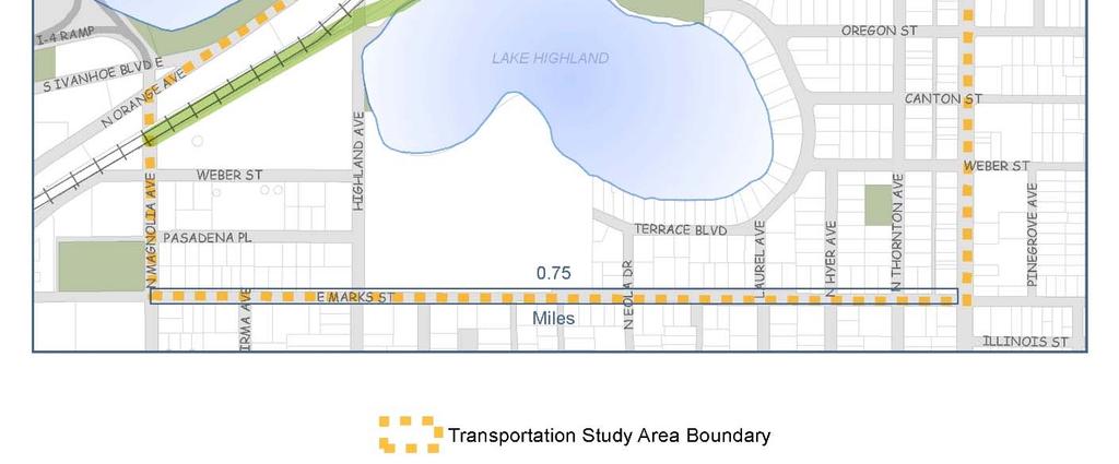
9 1. INTRODUCTION 1.1 PROJECT The Virginia Drive corridor has an abundance of charm and character with a variety of interesting businesses, and nearby parks, trails, and lakes. The adjacent residential neighborhoods boast brick streets, mature tree canopy, and a mix of historic and new homes. The corridor s central location means that it is not only a destination, but also a common route between various downtown areas. The goal of this project is to develop a multimodal transportation network design that supports the community s vision of sustainability, vitality, mobility, and safety within the corridor. This study considers a variety of factors, including character, land uses, parking demand, projected development, transportation, and travel patterns. These elements, coupled with robust public participation and input, help create a vision for the neighborhood. Based on this vision, the study identifies strategies needed to implement the community s goals. 1.2 STUDY AREA The study area is generally bounded by E. Princeton Street to the north, E. Marks Street to the south, N. Mills Avenue to the east, and N. Orange Avenue to the west. As shown below in Figure 1, this boundary (shown in blue) defines the transportation study area, while a smaller boundary (shown in red) defines the land use study area. 2

10 Figure 1 Study Area 3
11 2. EXISTING CONDITIONS 4

12 2. EXISTING CONDITIONS (WHAT IS IT NOW?) 2.1 LOCATION The Virginia/Lake Highland area is the epicenter of urban north Orlando, with College Park to the west, Audubon Park Garden District and Baldwin Park to the east, and the north quarter and downtown to the south. Virginia Drive connects the Ivanhoe Village Main Street District and the Mills 50 Main Street District and the growing extension of both the N. Orange Avenue and N. Mills Avenue commercial corridors, as well as a unique collection of neighborhoods (see Figure 2). Figure 2 Location Map 5
13 2.2 LAND USES The study area is anchored by the Lake Formosa and Park Lake/Highland neighborhoods, both substantially developed Traditional City areas containing a mix of single-family residences, multi-family units, and open spaces. Offices, retail, studio, institutional, civic and industrial uses are located on the fringes of the study area, with the most intense development occurring around the major intersections of Virginia/Orange and Virginia/Mills (see Figure 3). 6


14 Figure 3 Existing Land Use 7
15 2.3 TRANSPORTATION The study area has a well-connected framework of multimodal accessibility (see Figure 4), including: By car: I-4 access via the Princeton Street and Ivanhoe Boulevard interchanges Surrounded by major arterials: Orange Avenue, Princeton Street, Mills Avenue and Colonial Drive By transit: Currently served by LYNX routes 102 (Orange Avenue) and 125 (Mills Avenue) LYMMO Orange Line that serves the North Quarter has a stop just outside the study area at the Senior Recreation Complex on Marks Street Proposed future extension of LYMMO that links the area to downtown, SunRail stations, College Park, Florida Hospital and other LYNX connections By bike: Orlando Urban Trail traverses the study area Surrounded by existing and proposed bike lanes, trails and signed on-street routes By foot: A 10-minute walk reaches most of the commercial nodes in the study area 8

16 Figure 4 Transportation Systems 9
.")
17 2.4 COMMUNITY In addition to the established, active and desirable residential neighborhoods, the Virginia Drive corridor is highly favorable for urban development, particularly targeting younger people. Key amenities are already in place and growing, such as biking, breweries, bars/restaurants, and shops (see Figure 5). Demographics are comparable with leading urban shopping districts in the region and major development projects are underway and planned that capitalize on the location and amenities. The city s efforts to improve multimodal transportation quality of service and the public realm will only increase the area s attractiveness for development and investment. Figure 5 Community Destinations 2.5 VALUES A vision for the future of the Virginia/Lake Highland area that transcends the status quo and has staying power beyond the short term must be based on core values within the community. For the strategic plan to achieve the desired outcomes, it must be aligned 10
18 with these defined core values. Values endure, and are not likely to change over the short term. Thus, they provide a good framework for guiding the community as it moves forward to accomplish the objectives identified in the Strategic Plan. To uncover the community s shared values, the City and the consultant team hosted three workshops to explore existing conditions and future goals. The workshops were held on August 1, 2016; September 20, 2016; and October 26, Notice of the workshops was sent out via , Main Street District contact lists, NextDoor web site posting, and the City s web site. The first workshop covered existing conditions and discussion of issues and opportunities; the second workshop covered future conditions and development alternatives; and the third workshop presented the draft Plan recommendations. The methods to gather information included surveys, comments and feedback provided on maps and plans, and comments made at meetings. The information that was gathered from the community serves as the basis of the recommendations contained in this report. The values below were identified as most important by the community (see Appendix I for more detailed summaries): Character quaint homes, mixed uses, brick streets, variety of merchants Proximity close to downtown and Winter Park, centrally located Mobility easy to walk or bike Vibrant diverse, creative, edgy Beautiful parks, lakes, trees The community was also asked what they saw for the future, and what they want to be in 20 years. The responses reinforced the values they hold today: Destination a mix of uses, thriving urban neighborhood, vibrant and eclectic with a diverse group of people and activities Character unique small town feel, more grown up version of what is there today Walkable pedestrian-friendly, connected network of routes Bicycle friendly access to a variety of connected facilities and routes Green sustainable environment, cleaner lakes In the future, the Virginia Drive area should be home to a variety of unique and vibrant businesses, easily accessible to nearby residents. Redevelopment should respect the established character of the neighborhoods. Accessibility by bicycle, on foot or by transit should be safe and convenient. Vehicular access and parking should be safe, but not necessarily be as convenient as in a suburban setting. Shade and greenery should be plentiful, and outdoor public spaces such as parks and trails should be highlighted and celebrated. 11
19 3. VISION FRAMEWORK 12
20 3. VISION FRAMEWORK (WHAT CAN IT BECOME?) Members of the community who attended the workshops identified many different challenges and opportunities facing the study area. Those elements provided a context that guided the development of scenarios and alternative strategies that were considered for the strategic plan. Figure 6 below depicts the context relationships that form the framework for the Vision. Economy Mobility Community Figure 6 Vision Relationships 3.1 CHALLENGES The key challenges of the Virginia/Lake Highland area reflect its unique character and location within the downtown urban area. In many ways, these challenges are the result of the area s success over the past decades and the transitions that have occurred in terms of overall growth. The following challenges were identified by the community as context for the project: Increase pedestrian and bicycle safety along roads, on sidewalks, and at intersections Improve connectivity for both pedestrians and bicyclists Provide appropriate transitions in height and scale between neighborhoods and non-residential uses Add parking, especially near the Orlando Urban Trail Reduce neighborhood cut-through traffic Slow down traffic 13
21 Provide appropriate wayfinding to help improve movement through the corridor Provide more community spaces and parks Provide better lighting Understand retail competition in the area (Winter Park Village and Park Avenue areas) and encourage businesses that complement the study area 3.2 OPPORTUNITIES While improvements to the urban form in the study area will include a variety of specific implementation strategies, the Vision inspires the Virginia Drive area overall by: Promoting mixed-use and commercial development that complements the character of the existing neighborhoods, maintains human scale and provides appropriate transitions and buffers between different uses Encouraging buildings on primary roads to front the street and provide a pedestrian-friendly and lively public realm that is active and safe both day and night Fostering an attractive and well-maintained sidewalk zone for pedestrians that provides amenities, shade, and streetscape elements to attract activity and create social interaction Adding distinctive design features, architecturally, in the public realm, and as gateway features, that reinforce the corridor identity Improving safety for all users by slowing traffic, narrowing roadway width, restoring brick pavement surfaces, creating buffers between vehicles and pedestrians, and enhancing street crossings Strengthening and unifying multimodal character and promoting alternative forms of movement by connecting and providing seamless integration of pedestrian, bicycle, roadway and transit networks and making them accessible to users of all ages and abilities 3.3 VISION FRAMEWORK The project vision established the corridor goals and provided a guide for future planning tasks. It established a framework that identified general locations and synergies for roadway modifications, non-motorized facility treatments, access points, connections and land uses. It is intended to clarify and confirm the direction of key development, transformation, mobility and economic growth opportunities that will enhance and sustain the quality of life for all residents and stakeholders and strengthen the competitiveness of the area as a whole. The elements of the Vision may evolve over time, but its overall goals will remain constant. The Vision Statement is the framework for the strategic planning that follows: The long-range vision is to strategically guide transportation investments and development activities to preserve and strengthen the historic, cultural and social 14
22 character of the Virginia/Lake Highland area while encouraging new economic opportunities that create a diverse, vibrant and sustainable community that features a mix of small businesses, residential choices and a robust multimodal network that reduces conflicts, improves safety and improves access and mobility for all users. 3.4 WORKING VISION MAP The Working Vision Map (see Figure 7) served as a useful organizing tool for further development of concepts and strategies as part of the planning process of this project. It is a fluid document that provides guidance for achieving both short- and long-term goals and it defines the future development direction of the corridor s existing and emerging nodes, gateways and focal points. It serves as a basis for confirming or refining various design elements and policy considerations through additional analysis and it helps create identity and a well-connected community fabric. 15


23 Figure 7 Working Vision Map 16
24 4. VISION ELEMENTS 17
25 4. VISION ELEMENTS (HOW TO MAKE IT COME ABOUT?) Great neighborhoods are much sought after, but they are also fragile. Orlando is a living city it grows, evolves and moves. It is important to encourage improvements and additions that contribute to the livability of the area, but ensure that inevitable changes are in keeping with the scale and form established and desired by the community. Once character is gone, it cannot be replaced. The Vision for this project is meant to guide the City s planning and development activities. It is intended to clarify and confirm the direction of key redevelopment, revitalization, transportation connectivity, and economic growth goals that will enhance and sustain the quality of life for the residents in the study area. The Vision will continue to evolve, but its overall direction and key recommendations spring from the values defined by the community. The Vision that emerged for the Virginia/Lake Highland area is a recognition of the importance of strategically managing growth to maintain the neighborhood character while still encouraging new business opportunities, developing feasible transportation networks and enhancing connections, and preserving the beauty of the natural environment that this area values. These interconnected elements are described in more detail below: 4.1 PROTECTING CHARACTER Character What gives a community its unique character and personality? It is a combination of location, people, land uses, landmarks, appearance, age, scale, and layout. Community character is equal parts of history, context, form, natural features, social activity, community involvement and culture. A neighborhood is also defined by its geographic boundaries, by roadways, or by natural features such as lakes. The Virginia/Lake Highland area s character is shaped by its proximity to downtown Orlando, Mills Park, Loch Haven Park and Florida Hospital, among others. The Virginia/Lake Highland area is within the Ivanhoe Village Main Street District and a small portion of it is within the Mills 50 Main Street District. It is also influenced by the historic pattern of its industrial and commercial development. A distinctive community has an identity and a visual image that sets it apart. The character of the Virginia/Lake Highland area is defined by the relatively compact human scale of the buildings, the grid layout of streets and blocks, the brick streets, large old 18

26 shade trees and the natural beauty of lakes. The treasured characteristics of Orlando s Traditional City are well represented in this area, such as buildings close to the street, parking lots behind the buildings with driveways extending to side streets or connected through cross-access, and an urban form with many destinations within a 5-10 minute walkshed. A compact mixed-use urban form such as that found in the study area is a desirable trait for a multimodal district. Sustainable development guidelines (such as LEED ND and EPA s Smart Growth Principles) focus on density, urbanity and mixed uses to reduce dependence on the automobile and support other mobility choices. In fact, urban density cannot function without alternatives to the automobile. The study area already has many of the building blocks to meet these goals, including a gridded street network, buildings brought up to the street frontage and access to bike trails and transit. Identity The Virginia/Lake Highland area is decidedly urban, locally historic, authentic and walkable. The Traditional City urban form is consistent in the residential areas and commercial main streets. To get a better feel of the character and identity of the study area, it is important to understand its history and growth. There are several distinct areas within the Virginia/Lake HIghland area that have their own unique identity based on both land use and architectural patterns, including: The Park Lake/Highland and Lake Formosa neighborhoods are a part of old Orlando, mostly platted before the Great Depression in the 1930 s and developed prior to World War II. These neighborhoods are known for their modest and quaint early 20 th century bungalows on tree lined streets (see Figure 8). Other styles include Prairie, Colonial, Mission, Mediterranean and Tudor Revival. These vintage homes are generally modestly-sized and often have gabled front porches. The areas are representative of Orlando s older Traditional city neighborhoods and are already wellprotected by the City with design standards and policies. Figure 8 Residential Character 19

27 Mills Avenue carries a lot of traffic on its four lanes, with a center turn lane and onstreet parking. The on-street parking helps protect pedestrians from traffic, but it is not a very pleasant street to walk. Sidewalks are continuous on both sides of the street, but are narrow and abutting the curb, with few palms and no shade trees. The street view is cluttered with large overhead power lines. The buildings are generally one-story midcentury plain commercial sheds (see Figure 9). The Track shack building at 1104 N. Mills Avenue is a circa 1950 s Streamline Modern architectural style complete with a steam ship smoke stack. Other older buildings include 1200 N. Mills (1926), 1322 N. Mills (1930) and 1110 N. Mills (1947). The Mills 50 area has embraced a hipster/urban persona with modernist and fantastical artwork that is characterized as edgy and quirky. Figure 9 Mills Avenue character The North Orange Avenue area has a different feel than Mills Avenue slower, narrower with two lanes, a turn lane and on-street parking. It is known for its antique shops and small unique restaurants (see Figure 10). The stretch from Alden Road to Virginia Drive has the advantage of views along a lakefront park on one side with early 20 th century two-story buildings on the other along the curving street, a unique setting not found elsewhere in Orlando. The original Ivanhoe Row at Orange (built in 1945) is distinctive because of the rhythm of building articulation of the two-story facades along the street, with ground floor transparency and second floor balconies Orange is also a great historic 1925 building with plenty of transparency, balconettes fronting French doors on the second floor and recessed doorways with decorative lighting fixtures and canopies. Another interesting historic building is 1487 Orange, known as the Ivanhoe Village Business Center. This Art Deco style building was constructed circa

28 Figure 10 N. Orange Avenue Character The Virginia Drive area is a shared commercial district that joins together the Lake Formosa and Park Lake/Highland neighborhoods. Virginia Drive is part of the Ivanhoe Village Main Street District, and has a more low-key personality than Orange Avenue due to a lower density, spaces between buildings, more trees, a mix of small local businesses and a functionally practical temperament. The road is two lanes wide with a parkway and sidewalks on both sides. The parkways have a mix of live oaks and crepe myrtles, with a few palm trees. The street is comfortable to walk because vehicle speeds are fairly slow, but it is difficult to cross due to steady traffic and a lack of stop signs or crosswalks. Virginia has a main street urban form with small blocks on the north side of the road and longer blocks on the south side of the road. It only has onstreet parking in a few isolated spots. Buildings are set relatively close to the street and oriented to it (see Figure 11). Most are plain without much style or ornamentation. There are some gaps between buildings that break the continuity of the urban form. Virginia Drive evolved as a commercial district after World War II for the same reasons it functions as one today it is a connector street and adjacent to residential uses. However, there are a couple of historic residential style buildings on Virginia Drive, so the street may have been more residential at the beginning of the 20 th century. The oldest buildings are bungalow style residential, built in Most of the commercial buildings were constructed in the early 1950s. Other commercial buildings came along in the 1960s, such as the popular Hide-A-Way bar (circa 1960). A few others have been built from the 1980s on these buildings don t fit the Traditional City commercial pattern but add a quirky mix of styles and urban form to the corridor. Because of this variety, Virginia Drive has developed an eclectic village feel. 21

29 Figure 11 Virginia Drive Character The Brookhaven Drive area has a mix of industrial, commercial and warehouse style buildings. The warehouse and industrial buildings were built near the old Dinky Line railroad tracks, which opened for service in 1889 before there were cars or roads. The tracks were removed by 1969 due to the popularity of the automobile and the rail rightof-way remained vacant until the Orlando Urban Trail was built using much of the old track path. The road is two lanes wide with a sidewalk that stops and starts on both sides. It has on-street parking along the south side of the road. There are street trees some are of significant size. Development along Brookhaven predominantly meets the Traditional City commercial development pattern of building placement close to the street with parking in the rear. These are simple, utilitarian buildings without much exterior ornamentation (see Figure 12). The exception is the oldest building 543 Brookhaven with Italianate decorative motifs (1925). This building, along with 615 Brookhaven (1925), are scheduled for razing for new development. 727 Brookhaven, a residential style building, was built in 1935, with other buildings dating from the 1940s to 1960s. Most buildings in this area have a mix of architectural elements typical of the industrial style, which include square or rectilinear shape, brick or masonry and metal materials, steel beams, metal casement windows, truck loading bays and large overhead door openings. Later 20 th century buildings introduced more modern materials such as aluminum siding and corrugated metal. The Brookhaven area is now a very small remnant pocket of industrial zoned land. It no longer has manufacturing businesses except for a T-shirt printing business instead, there are several small warehouse/showroom or service type businesses. The Lake Highland Preparatory School athletic fields border the south side of this area. 22

30 Figure 12 Brookhaven Drive Character 4.2 LEVERAGING GROWTH AND DEVELOPMENT Encouraging sustainable and appropriate growth and investment is a principal concern of residents so that neighborhoods can retain their character and continue to flourish and serve as the stable foundation for the future, while ensuring that inevitable changes in adjacent areas keep the scale, form, and composition of the area and respect its past. Growth within the community vision includes several considerations: Market Analysis The Virginia Drive location is highly favorable for urban development, and there are several trends and conditions influencing the potential for development of multi-family residential, retail and office in the study area (see Appendix G for more detailed information): Future demand exists for more multi-family housing, especially before After 2030, the Virginia Drive area will likely be built out, and downtown development will be shifting focus to areas such as the Creative Village and the Sports Entertainment District. Office and retail development will mostly be limited to renovation and retenanting of viable buildings due to parcel size constraints. Limited building stock means that some unconventional spaces may be used for offices converted homes, storefronts or warehouses. Target businesses will be small, independent, creative and unique. Viable street-oriented retail must front on Virginia Drive or be visible and accessible on a larger site, such as The Yard. Proximity to Florida Hospital suggests that medical offices could have potential if building space is physically feasible. Significant redevelopment will call for assembling larger sites, primarily because of the need for more parcel depth; the best prospects are on the south side of Virginia Drive, where through-block sites could be assembled that extend to Brookhaven Drive. 23
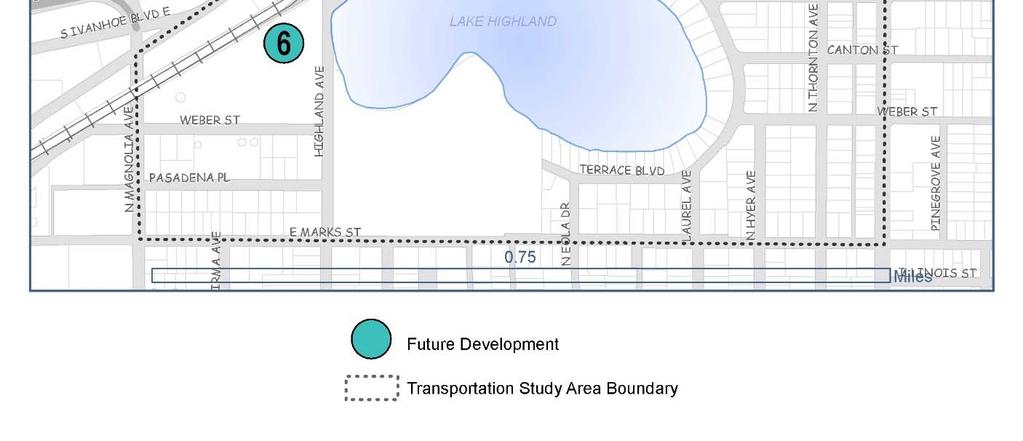
31 Several opportunities (see Figure 13) on vacant or underutilized sites have been identified where sites and/or potential parcel assemblages could facilitate future development activities: Virginia Drive - major mixed-use opportunity (area 3 on Figure 13): With current ownership patterns, a full half-block between the Yard-Crossman project and Ferris Avenue could be assembled from 6 owners. The market performance of the Yard-Crossman project will influence the likelihood of this opportunity and affect land prices. The primary question to consider is if another large building on Virginia would be considered in scale with the vision for the area. Virginia Drive - retail/restaurant/office opportunity (area 4 on Figure 13): There is slightly under 1 acre under single ownership on Ferris Avenue between Virginia and Brookhaven - the Virginia frontage is currently occupied by a used car lot and the Brookhaven frontage is currently occupied by 3 commercial businesses in low-value buildings. Brookhaven Drive - townhome opportunities (area 5 on Figure 13): There are several parcels between Ferris and Virginia that could be developed into townhomes, either as one large project with a single developer or as multiple small projects. A single project, which would require acquisition from 4 owners, would probably be more profitable, and would help create a consistent residential feel along the entire block. The proximity to shops, restaurants, and the Orlando Urban Trail would be a strong draw for urban residential. City/OUC sites - townhome opportunity (area 6 on Figure 13): Development of these sites near Brookhaven would depend on the brownfield cleanup status and the City s objectives for these sites. Alden Road south - redevelopment opportunities (area 2 on Figure 13): While most of the current businesses seem compatible with the neighborhood, improvements to Alden Road and/or success of the Yard projects may influence property owners to consider reuse or redevelopment opportunities. Property values are higher and most buildings appear more substantial than on Brookhaven Drive (townhome opportunity area). All three LLCs have the same PO Box for their mailing address, which suggests there may be common ownership. Alden Road north - multi-family or townhome opportunities (area 1 on Figure 13): The market performance of the Yard will influence development decisions and land values. Property values are high enough that significant residential density may be needed to make redevelopment projects pencil out, although it depends on the price levels that can be achieved. The Blackton Family owner has expressed interest in redevelopment, and the site is assumed for future multi-family use in the GMP projections. The next 3 sites further north along Alden have appealing water views, but would probably need to be assembled together to achieve sufficient scale for profitable redevelopment. OUC/City sites - redevelopment and reuse opportunities (area 7 on Figure 13): The Weber Street frontage may not be conducive to high value development due to the visual impact of utility buildings and electrical infrastructure. Multifamily or office could have potential, fronting on Highland Avenue. Low traffic 24
32 counts on Highland Avenue make retail unlikely. The Ivanhoe Building has good reuse potential due to character, lake views, traffic, and proximity to amenities. It is a historic landmark so it cannot be torn down for redevelopment. Depending on the adaptive reuse design feasibility, it could be used for office, multi-family or civic/cultural uses. Primary constraints are likely to be building-specific items such as interior layout, renovation needs and costs, potential remediation, and parking needs. 25
33 Figure 13 Redevelopment Opportunities 26
34 Development Scenarios The market analysis identified trends and conditions influencing the potential for development of multi-family residential, retail and office in the study area. It also identified opportunity sites and potential parcel assemblages where redevelopment could take place. Based on this work and feedback received during community meetings, two massing/scale scenarios were developed a Moderate Growth Scenario (see Figure 15) that proposes development at a scale similar to the existing buildings and a Substantial Growth Scenario (see Figure 16) that proposes more robust development. A summary of those scenarios is shown in Figure 14 below: Area Growth Scenario Moderate Substantial Orange Avenue 3 stories 5 stories Alden Road (north of The Yard) 5 stories 7 stories Alden Road (south of Virginia Drive) 3 stories 5 stories Marks Street to Pasadena Place block 3 stories 3 stories Pasadena Place to Weber Street block 3 stories 5 stories North of Weber Street 5 stories 7 stories Virginia Drive 3 stories 5 stories Brookhaven Drive (east of Ferris Avenue) 3 stories 3 stories Brookhaven Drive (west of Ferris Avenue) 3 stories 5 stories Mills Avenue (north of Mills Park) 5 stories 7 stories Mills Avenue (south of Virginia Drive) 3 stories 3 stories Montana Street/Wilfred Drive/Lang Avenue 3 stories 3 stories Figure 14 Development Scenarios Summary In addition to the height guidelines listed, there are other considerations that help frame the scenarios, including: Parcels along the Orlando Urban Trail should be encouraged to provide additional frontage or outdoor spaces opening onto the trail Parcel assemblages between Virginia Drive and Brookhaven Drive should be designed to respect the scale of the Virginia Drive frontage and step back buildings at 3 stories Commercial uses adjacent to residential should provide appropriate transitioning and buffers to protect the neighborhood character Expansion of the Florida Hospital campus will drive the development character of the north Alden Road area Mid-block paseos or pedestrian connections should be provided between Virginia and Brookhaven to shorten long block lengths and provide opportunities for additional frontage New private development should be encouraged to provide public spaces as part of the project design 27

35 Figure 15 Moderate Growth Scenario 28

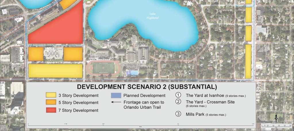
36 Figure 16 Substantial Growth Scenario 29
37 One of the considerations in the land use study is the MU-1/T zoning along Virginia Drive. This is a mixed-use designation with the following specifics: Density of du/ac Maximum FAR of 0.50 and building height of 35 feet (3 stories) by right, 75 feet (7 stories) by conditional use FAR is a base standard that may be increased by a density or intensity bonus Residential uses include attached dwellings, assisted living or nursing homes, residential care facilities and treatment/recovery facilities Commercial uses include child/adult day care, civic clubs, eating and drinking establishments, hospitals and clinics, hotels/motels, medical/dental labs, office, indoor recreation, retailing, personal services and temporary professional. These densities/intensities are compatible with the adjacent neighborhoods, as are the height limits. The adjacent Industrial zoning designation was also considered, but it is not detailed because the FLU sub-area policy renders it to be a future MU-1 district. 4.3 ADDING CAPITAL INVESTMENTS Complete Streets is an approach that encourages roadways to be planned, designed, operated, and maintained to enable safe, convenient and comfortable travel and access for users of all ages and abilities regardless of their mode of transportation, be it walking, bicycling, driving or riding public transportation. The urban character and location of the study area create many opportunities to increase connections and mobility choices. The roadway improvements outlined below will help balance travel modes, prioritize routes and accommodate expected growth: Virginia Drive Virginia Drive is envisioned as a pedestrian-priority street with an active public realm and transparent ground level. It is a County roadway and proposed improvement work will need to be coordinated with Orange County. Improvements should include: Bike lanes Green parkway On-street parking Wide sidewalks Street trees Streetscape amenities Underground utilities Buildings fronting the street with parking behind 30
38 The streetscape improvements for Virginia Drive (see Figure 17) show two sets of cross sections an interim and a final configuration. The interim cross sections indicate potential improvements to the public realm that can be accomplished in the shorter term while existing buildings are in place. They concentrate on enhancing the sidewalk and parkway (area between the curb and sidewalk) to provide a better pedestrian experience along the corridor, as well as adding the opportunity to add new on-street parking spaces. The final cross sections indicate potential improvements that are for the longer term or as redevelopment occurs. They concentrate on enhancing several multimodal components, including narrowing the width of travel lanes, adding bike lanes, fronting buildings on the street, and widening sidewalks to create an inviting pedestrian realm. As shown in Figure 18, the configuration of the final cross-sections will require the City to negotiate easements outside the existing right-of-way as redevelopment occurs to accomplish the desired public realm improvements along the corridor. 31

39 Figure 17a - Virginia Drive Cross-Section from Alden Drive to Baltimore Ave. 32


40 Figure 18b - Virginia Drive Cross-Section from Baltimore Ave. to Ferris Ave. 33

41 Figure 19c - Virginia Drive Cross-Section from Ferris Ave. to Mills Ave. 34

42 Figure 18 - Virginia Drive Existing ROW and Proposed Easement Brookhaven Drive Brookhaven Drive is envisioned as a low speed vehicular-priority street (see Figure 19) providing primary access to larger projects, transit routes, residential development and parking areas. Improvements should include: On-street parking Wider sidewalks fronting buildings on the north side of the street Street trees Streetscape amenities Buildings fronting the street with parking behind Connections to the Orlando Urban Trail 35
 and provides connections to destinations both within and outside the")

43 Lake Highland Drive Figure 19 Brookhaven Drive Cross Section Lake Highland Drive is envisioned as a low speed street that balances vehicular, pedestrian and bicycle access (see Figure 20) and provides connections to destinations both within and outside the study area. Lake Highland Preparatory School traffic and activities also influence the design of this roadway. Improvements should include: On-street parking Bulb outs in place of striped pavement to narrow roadway Street trees to frame roadway and provide shade 36
 will complete the pedestrian route around Lake Formosa and help provide east/west connections through the")

44 Sidewalk on south side of roadway Figure 20 Lake Highland Drive Cross-Section South Lake Formosa Drive South Lake Formosa Drive sidewalk (see Figure 21) will complete the pedestrian route around Lake Formosa and help provide east/west connections through the study area, especially to the Orlando Urban Trail. The preferred location for the sidewalk is on the north side of the road along the lake, except for the block between Dauphin Lane and Haven Drive that will cross over to the south side of the road to avoid existing 37

45 development and connect to an existing sidewalk. Design of the sidewalk along the lake edge should include: 6 wide sidewalk where at-grade width is available; some areas may need slope fill and stabilization Low boardwalk over exposed surface roots to protect canopy trees Raised boardwalk in areas where at-grade sidewalk is not possible Removal of selected water edge vegetation to improve views Wider sidewalk or platform to provide seating location over lake Enhanced pedestrian crossing and connection to Orlando Urban Trail If design of a sidewalk along the north side of the road is determined to be costprohibitive, a sidewalk could be considered along the south side of the road; however, there are several obstacles that would need to be overcome. Although short lengths of sidewalk already exist here, there is landscaping, trees and walls that would have to be navigated or mitigated. Additionally, many lots have a sloped front yard, so construction of a sidewalk may necessitate construction of low retaining walls. Figure 21 S. Lake Formosa Drive Sidewalk Improvements 38
46 4.4 PARKING A neighborhood parking study of non-residential uses was undertaken to evaluate existing parking conditions and determine if there is sufficient public and private parking to support current uses. The study grew out of neighborhood concerns about accommodating new development without reducing quality of life. Residents are worried that additional uses will affect congestion and worsen perceived parking shortages. For purposes of a more detailed analysis, the land use study area was broken down into several sub-areas (see Figure 22): Alden Road (north) Virginia Drive (west) Virginia Drive (east) Mills Avenue Lake Highland Drive/Mills Avenue Orange Avenue/Ivanhoe Row 39


47 Figure 22 Neighborhood Parking Sub-Areas A summary of parking counts is shown below in Figure 23. It does not include parking for Lake Highland Prep, Mills Park, The Yard or Yard-Crossman properties; however, it does include on-street parking adjacent to those sites. 40

48 Required Provided On-Street Total Sub-Area Parking Parking Over Under Parking Parking Alden Road (north) Virginia Drive (west) Virginia Drive (east) Wilfred/Mills Lake Highland/Mills N. Orange Avenue Subtotal Lake Highland Drive 98 Weber Street 33 TOTAL 1903 Figure 23 Parking Summary From an overall neighborhood perspective, there is sufficient parking to support existing uses. However, the inventory found both deficiencies and excesses in the amount of parking within each sub-area (see Appendix H for more detailed information) and highlights unique challenges related to parking. N. Orange Avenue Area: N. Orange Avenue is a thriving area of shops, restaurants and bars. However, many of the smaller sites do not have any on-site parking at all and businesses rely on on-street parking to serve patrons (see Figure 24). Due to the age of the developments, the total number of spaces that are normally required by code are not provided, so the sub-area is short on parking. Because of business growth, popularity of the area as a nighttime destination and the existing lack of parking spaces, parking demand is increasing. More parking options are needed. Shared parking with daytime and office uses, along with connecting parking through the rear of the block on the west side of Orange Avenue could help ease parking issues in the short-term. Additionally, on-street parking could be considered in front of Gaston Edwards Park, with the outside southbound lane being eliminated between NE Ivanhoe Boulevard and Highland Avenue. This would not only provide parking, but provide traffic calming. Figure 24 N. Orange Avenue, Typical Parking 41

49 Virginia Drive: The Lake Formosa and Park Lake/Highland neighborhoods have significant residential, restaurant and retail growth happening on both the east and west ends of Virginia Drive. Newer developments, such as the Yard and Yard-Crossman, will change the dynamic of the street, but they will have sufficient on-site parking to serve their residents and customers. Virginia Drive itself is a busy, small-scale street with a mix of small local businesses. Buildings are primarily one-story placed near the street with relatively small parking areas in back (see Figure 25). Most parking lots are older and do not meet current landscape or stormwater standards. Unlike Orange Avenue, Virginia Drive has very few on-street spaces and most parking occurs on-site or along side streets into the neighborhood. Most businesses have an adequate number of onsite parking spaces except for a few popular hot spots near Mills Avenue. More onstreet spaces would help with fluctuating short-term demand, add parking options, and would also help calm traffic. Other improvements that may help ease access to parking are connecting private lots together within a block and encouraging shared parking between uses at different times of the day and night. Figure 25 Virginia Drive, Typical Parking Mills Avenue: On the west side of Mills Avenue, most parcels have adequate parking and meet the minimum code requirements. A connecting alley is located behind businesses south of Lake Highland Drive, which assists with access and circulation and keeps traffic out of the adjacent neighborhood. An extension of the alley north to connect to Lang Avenue may improve business access. West of Mills Avenue, on Wilfred Drive, there is a lack of adequate parking when events are held (see Figure 26). Businesses in this area should arrange for additional parking, shared parking or valet parking during events. Providing access from the Orlando Urban Trail would help promote walking and bicycling to events. 42
. Several Brookhaven Drive businesses have limited on-site parking or share parking between adjacent sites.")

50 Figure 26 Mills Avenue, Typical Parking Brookhaven Drive: The variety of service, light manufacturing and warehouse type businesses on Brookhaven Drive depend on on-street parking for their employees as well as for deliveries (see Figure 27). Several Brookhaven Drive businesses have limited on-site parking or share parking between adjacent sites. As sites redevelop, there are some opportunities to add parking, share parking or make parking more efficient. The vacant OUC lot at the southeast corner of Ferris and Brookhaven offers an opportunity for a public parking lot to serve both nearby businesses and the Orlando Urban Trail. In the future, Brookhaven will need on-street parking on both sides of the road. As properties redevelop and change, parking issues can be addressed and access to parking will significantly improve. Figure 27 Brookhaven Drive, Typical Parking Alden Road: The warehouse district along Alden Road north of Virginia Drive was developed without much on-site parking and is 40 spaces short of code requirements. 43

51 As a result, many of the properties depend on the on-street parking (see Figure 28). This area is in a transition and should be expected to add parking as redevelopment occurs. Figure 28 Alden Road, Typical Parking Because of the above inventory and analysis, several opportunities to improve parking were noted, including: Coordinate and Connect Parking Within Blocks: Commercial main streets work best when adjacent properties work together on access and parking. The City s Traditional City design standards for commercial districts require a main street urban form with buildings to the front facing the street with parking in the rear. To make parking work best, adjacent lots should have cross access and businesses should work together to accommodate parking. Ideally, the rear parking lots would connect through the block, improving access to all businesses. Take Advantage of Shared Parking: Shared parking can be utilized where land uses have different parking demand patterns and can share the same parking spaces. Shared parking would work well with office and eating/drinking establishments where there are different peak demand times. While the City has limited control over private lots, it should pursue shared parking agreements where feasible, especially in areas where evening and weekend parking overflows into adjacent neighborhood areas. The increased activity produced by having a variety of businesses discourages undesired behaviors at night. Use Parking to Support a Multimodal Approach: Some might argue that having plenty of extra public parking will benefit businesses and customers. However, more parking attracts more vehicles, traffic and trips, and each parking space reduces the amount of building space on a site, resulting in potential lost revenue. Minimum parking requirements generally oversupply parking. The cost of parking is high, so efficient and 44
52 cost-effective use of current parking supply is better than spending money on new parking facilities that may not be needed. Alternatively, making transit, biking and walking attractive mobility options means less parking is needed. Adding secure longterm bike parking for commuters and bike racks for customers may help encourage biking. Adding pedestrian amenities such as wider sidewalks, pedestrian-scale lighting, street trees and wayfinding signage would encourage more walking. A pedestrianfriendly street encourages people to park once and shop a variety of stores on foot, thus reducing the need for parking. As growth and higher densities occur in the future, parking can be strategically located to support businesses, transit and bike use and help reduce traffic and the number of vehicle miles traveled. Green Up Parking: Parking lots contribute to water pollution unless designed to capture stormwater rather than allowing it to flow into drains. Older parking lots can be retrofitted to provide better ecosystem function, with more space for trees and green stormwater capture areas. Rainwater can be collected in bioswales planted with carefully selected vegetation and trees that absorb and clean water pollutants. Parking lots can be brought up to today s Code standards by retrofitting them to include buffer hedges adjacent to residential uses. Trees are an important asset in parking lots. Not only do they add value and provide shade, cool the pavement and buildings, and reduce energy costs, they also absorb pollutants in the air and reduce stormwater runoff. Large trees not only serve the site where they are located, but positively affect adjacent sites and sometime entire blocks. There are numerous large trees enhancing parking lots in the study area. It is recommended that healthy native trees be retained if possible when redevelopment is considered. New trees should be added to increase shade and supplement trees in declining condition. Add On-Street Parking Spaces: On-street parking provides more parking opportunities for customers to patronize local businesses. Our parking analysis found there are plenty of on-street spaces in the area, except for Virginia Drive. Adding the option for on-street spaces on Virginia Drive will not only help businesses, but will also slow traffic and improve pedestrian safety and comfort. It will also reduce demand for parking along residential streets - during peak demand times, Virginia Drive customers were observed searching for on-street parking in the Lake Formosa neighborhood. Single-family residential streets should not be the repository for overflow commercial customer parking. They should be signed to protect residents from intrusion and to preserve spaces for their own needs. Enforcement will be an issue due to the lack of adequate funding and manpower. One idea would be to provide residents with a sticker or chip device for their cars that indicates they can park there. 4.5 TRANSPORTATION NETWORK This transportation network performance assessment has been prepared to help support the City of Orlando in the development of a Transportation Infrastructure Plan for the neighborhoods surrounding the Virginia Drive corridor. This assessment looks at land use and projected development against an examination of travel patterns on the 45
53 existing network as well as two alternative alignments of Alden Road. As shown in Figure 29, the study area is bound by Princeton Street to the north, Marks Street to the south, Mills Avenue to the east, and Orange Avenue and Magnolia Avenue to the west. 46

54 Figure 29 Transportation Study Area 47
55 Existing Conditions Data Collection The assessment required a significant data collection effort to determine the existing conditions and projected future travel demands. Origin Destination Study Origin-destination (O-D) and pass through travel characteristics were collected to provide insights into the travel patterns within the study area. This data provided a framework for modeling the shifts in travel patterns for the two alternative Alden Road alignments and overall network testing. The O-D data was developed by tracking media access control (MAC) addresses from the Bluetooth equipped wireless devices found in many vehicles. These MAC addresses are not registered to individuals, and therefore the technique provides for the anonymous collection of trip data. Battery powered MAC address receivers were located at key spots in the study area and along other important links (shown in Figure 2). The post-processing of this data in a central computer system matches the timestamped addresses between the various reader locations, providing for the determination of very accurate O-D information. A summary of the O-D analysis is provided in Appendix A. Count Data Turning movement counts were collected at signalized intersections to calibrate the O-D data and develop a microsimulation Synchro model to assess traffic operations in the study area. The data collection effort included AM and PM weekday peak hour turning movement counts at 18 intersections and bicycle and pedestrian crossing counts at 2 locations: Turning Movement Counts Mills Avenue at Princeton Street Mills Avenue at Nebraska Street Mills Avenue at Virginia Drive Mills Avenue at Lake Highland Drive Mills Avenue at Marks Street Princeton Street at Alden Road Orange Avenue at Princeton Street Virginia Drive at Brookhaven Drive Virginia Drive at Ferris Avenue Virginia Drive at Alden Road Virginia Drive at Orange Avenue Orange Avenue at Alden Road 48
56 Orange Avenue at Highland Avenue Highland Avenue at Lake Highland Drive Highland Avenue at Marks Street Lake Highland Drive at Ferris Avenue Brookhaven Drive at Ferris Avenue Brookhaven Drive at Alden Road Bicycle and Pedestrian Crossings Orlando Urban Trail at Virginia Drive Railroad Crossing at Virginia Drive The count locations are shown in Figure 30. Turning movement summary tables are included as Appendix B. All intersection and roadway count data is included in Appendix C. 49


57 Figure 30 Traffic Counts and Data Collection 50
58 Projected Travel Demand The projected 2040 travel demand was developed using historical traffic counts, information from the MetroPlan Orlando Urbanized Area Transportation Study (OUATS), traffic impact studies from planned developments, and traffic impact estimates based on the Substantial Growth Scenario (Figure 16) Background Traffic Growth An annual average background traffic growth factor was developed using historic FDOT traffic count data and volume data from the OUATS model. The average annual growth rate was calculated for the previous ten years ( ) of average annual daily traffic (AADT) counts on Orange Avenue and Mills Avenue. These roadways experienced an overall decrease in AADT resulting a negative growth rate. A summary of this data is provided in Figure 31. The OUATS model 2010 and 2040 traffic volumes were also analyzed and summarized in Figure 32. Model data reflects a modest average annual growth rate of 0.53 percent within the study area. Per coordination with the City of Orlando staff, a 1 percent annual average background traffic growth factor was assumed for all roadways within the study area. The AADT count data is provided in Appendix D. Roadway From To Growth Rate Orange Avenue Princeton Street Virginia Drive -1.52% Orange Avenue Virginia Drive Alden Road -1.52% Orange Avenue Alden Road Highland Avenue -1.52% Mills Avenue Princeton Street Nebraska Street -2.29% Mills Avenue Nebraska Street Virginia Drive -2.29% Mills Avenue Virginia Drive Lake Highland -2.29% Mills Avenue Lake Highland Marks Street 0.05% Figure 31: Historic Average Annual Daily Traffic Growth Rates 51
59 Roadway From To Growth Rate Princeton Street Orange Avenue Alden Road 0.45% Princeton Street Alden Road Mills Avenue 0.45% Virginia Drive Orange Avenue Mills Avenue 0.53% Lake Highland Highland Avenue Mills Avenue 1.88% Marks Street Highland Avenue Mills Avenue 1.48% Orange Avenue Princeton Street Virginia Drive 0.44% Orange Avenue Virginia Drive Alden Road 0.43% Orange Avenue Alden Road Highland Avenue 0.43% Highland Avenue Orange Avenue Marks Street 0.63% Mills Avenue Princeton Street Nebraska Street 0.20% Mills Avenue Nebraska Street Virginia Drive 0.18% Mills Avenue Virginia Drive Lake Highland -0.15% Mills Avenue Lake Highland Marks Street -0.01% Figure 32: OUATS Model Volume Growth Rates Planned Development The projected 2040 travel demand and performance assessment model included the trip generation and assignment data from Yard at Ivanhoe and The Yard Crossman traffic impact studies, dated December 2014 and January 2016 respectively. The Yard Crossman study only included a PM peak hour analysis. Therefore, the AM trip data was generated utilizing the same methodology as the provided PM peak analysis. The analysis utilized the ITE Trip Generation Manual 9 th Edition for trip generation, NCHRP Report 684 for internal capture, assumed 2 percent transit trip reduction, and 34 percent pass-by rate for the specialty retail portion of the development. The NCHRP 684 Internal Trip Capture Estimation Tool worksheet for The Yard Crossman PM peak hour trip generation data is provided in Appendix E. A summary of the AM and PM peak hour external vehicle trip totals are provided in Figures 33 and 34. The map ID number listed in the tables correspond to the development locations illustrated in Figure 38. Map Development Total Entering Exiting 1 The Yard at Ivanhoe The Yard Crossman Figure 33: Planned Development AM Peak Hour External Vehicle Trip Totals 52
60 Map Development Total Entering Exiting 1 The Yard at Ivanhoe The Yard Crossman Figure 34: Planned Development PM Peak Hour External Vehicle Trip Totals Future Development The future development assumptions were created from the market analysis and Substantial Growth Scenario (Figure 16). Travel demand estimates were developed as part of this study. These assumptions are listed in Figure 35 with the project locations (map ID number) illustrated in Figure 38. Map Development Dwelling Units Office (KSF) Retail (KSF) 3 Virginia Drive East Mixed Use South Alden North Alden City Site South Figure 35: Future Development Assumptions The projected 2040 travel demand and performance assessment model use the same trip generation methodology as the planned development projects; ITE Trip Generation Manual 9 th Edition for trip generation, NCHRP Report 684 for internal capture, assumed 2 percent transit trip reduction, and 34 percent pass-by rate for the specialty retail portion of the development. The Internal Trip Capture Estimation Tool worksheets for PM peak hour trip generation data are provided in Appendix E. A summary of the AM and PM peak hour external vehicle trip totals are provided in Figures 36 and 37. The external vehicle trips generated by the future development were coded into the Synchro performance assessment model for trip assignment and distribution. Map Development Total Entering Exiting 3 Virginia Drive East Mixed Use South Alden North Alden City Site South Total Figure 36: Future Development AM Peak Hour External Vehicle Trip Totals 53
61 Map Development Total Entering Exiting 3 Virginia Drive East Mixed Use South Alden North Alden City Site South Total Figure 37: Future Development PM Peak Hour External Vehicle Trip Totals 54

62 Figure 38 future Development Nodes 55
63 Network Alternative Analysis ALTERNATIVE ROADWAY NETWORKS The projected 2040 traffic volumes were assigned to three alternative transportation networks including a no build existing network and two alternative alignments of Alden Road. The Alden Road alternatives are illustrated in Figures 39 and 40. Alden Road Alignment #1 The first alternative alignment for Alden Road includes the following modifications: Alden Road extended south to Highland Avenue Lake Highland Drive extended to Alden Road with a new three-way intersection Elimination of the railroad crossing at Alden Road Alden Road Alignment #2 The second alternative alignment for Alden Road includes the following modifications: Alden Road extended south to Highland Avenue Lake Highland Drive extended west to Orange Avenue using the existing Alden Road railroad crossing Eliminated the intersection of Highland Avenue and Orange Avenue Eliminated the railroad crossing at Highland Avenue 56
64 Figure 39 Alden Road Realignment Option 1 57

65 Figure 40 Alden Road Realignment Option 2 58
66 Performance Assessment Model A performance assessment model was developed to evaluate the impacts of the projected 2040 travel demand associated with the Substantial Growth Scenario (Figure 16) on the existing roadway network and the two alternative alignments of Alden Road described in the previous section. The assessment included the development of four model networks using Synchro software. The model inputs were adjusted using a spreadsheet tool that utilized the O-D information and traffic count data to reroute travel patterns. The three 2040 future scenarios include signal optimization at all signalized intersections. The Synchro summary files are provided in Appendix F. A summary of the intersection level of service and intersection capacity utilization for the existing and new signalized intersection with the study area is provided in Figures 41 and 42. The Synchro LOS information is a measure of the total intersection delay, converted to a LOS letter score. This provides insight into the level total congestion at the intersection. The intersection capacity utilization provides insight into how much extra capacity is available for traffic fluctuations and possible geometry or signal timing improvements. The intersection LOS and signal delay are presently highest at the intersection of Virginia Drive and Mills Avenue. This trend is projected to continue in the 2040 analysis as this intersection serves a crossroads where east-west and north-south traffic transitions. This intersection also serves as the point where the roadway configuration, land use and urban form transition from a signal use, auto orientation to the east, and mixed-use multimodal neighborhood center to the west. Widening Virginia Drive between Orange Avenue and Mills Avenue would serve to distribute more traffic to Orange Avenue, but at the cost of disturbing the existing neighborhood center. Virginia Drive does not continue west of Orange Avenue, likely creating the need for additional capacity improvements on Orange Avenue to provide continuity of service. Widening this roadway would also negatively impact the urban form within the corridors. The alternative Alden Road alignments enhance connectivity, simplify travel patterns and reduce conflicts. The performance assessment modeling of Alternative 1 showed an increase in trips on Orange Avenue because of the additional travel time associated with the elimination of the Alden Road and Orange Avenue intersection. Alternative 2 increases north-south travel options parallel to Orange Avenue and east-west travel options parallel to Virginia Avenue. By increasing connectivity, alternative 2 reduced the overall capacities on Virginia Drive from the No Build Scenario. 59
67 Existing Conditions 2040 No Build Network 2040 Alternative Alternative 2 Signalized Intersection Delay Delay Delay Delay LOS (sec) LOS (sec) LOS (sec) LOS (sec) Princeton St at Mills Avenue C 31 C 24 D 38 D 41 Princeton St at Orange Ave E 61 D 43 D 48 D 45 Mills Ave at Virginia Dr D 42 F 105 F 107 F 101 Virginia Dr at Orange Ave B 13 C 23 C 24 B 17 Princeton St at Alden Rd A 7 D 41 A 8 A 7 Mills Ave at Nebraska St E 74 E 62 E 71 F 92 Mills Ave at Lake Highland Dr A 4 A 9 B 11 C 30 Mills Ave at Marks St B 12 A 10 A 10 B 12 Highland Ave at Marks St B 15 B 10 B 10 B 12 Highland Ave at Orange Ave A 4 D 50 B Lake Highland Dr at Orange (option 2) C 31 Figure 41: AM Peak Hour Level of Service Summary 60
68 Existing Conditions 2040 No Build Network 2040 Alternative Alternative 2 Signalized Intersection Delay Delay Delay Delay LOS (sec) LOS (sec) LOS (sec) LOS (sec) Princeton St at Mills Avenue D 50 D 46 D 42 D 42 Princeton St at Orange Ave C 27 E 56 E 61 E 60 Mills Ave at Virginia Dr F 110 F 154 F 151 F 109 Virginia Dr at Orange Ave B 11 C 27 B 17 B 19 Princeton St at Alden Rd A 9 B 10 B 10 B 11 Mills Ave at Nebraska St D 39 E 70 E 64 D 52 Mills Ave at Lake Highland Dr A 9 C 28 D 37 D 50 Mills Ave at Marks St B 18 C 22 C 22 C 21 Highland Ave at Marks St B 18 B 14 B 15 B 14 Highland Ave at Orange Ave A 7 C 34 C Lake Highland Dr at Orange (option 2) C 32 Figure 42: PM Peak Hour Level of Service Summary 61
69 Summary of Findings The performance assessment modeling highlighted several key items for consideration. Alden Road Alignment #1 significantly impacted the projected north-south movements on Alden Road and Orange Avenue. The result was a shift in traffic from Orange Avenue to Alden Road and Highland Avenue south of Virginia Drive. However, there was not a significant shift in traffic on Virginia Drive. The travel patterns from Alden Road Alignment #2 reflect a similar north-south shift on Alden Road and provide a shift in movements from Virginia Drive to Lake Highland Drive. The east-west pattern shift provides some congestion relief at the east end of Virginia Drive at Mills Avenue. The current intersection capacity and delay during the PM peak hour at Virginia Drive and Orange Avenue and Mills Avenue is maintained without widening Virginia Drive with the additional connectivity provided by the Alden Road Alternative COMPLETING NETWORKS Multimodal planning looks at all the transportation networks in an area, along with the key land use nodes they connect. Some of the benefits of a connected multimodal system include: More transportation choices Mobility and opportunity equity Economic vitality Reduced congestion and travel time Energy conservation Increased public health and quality of life To keep people moving in and through the study area, it is important to look at how different modes of transportation work together. Multimodal planning looks at pedestrian, bicycle, roadway and transit networks; focuses on how these networks connect to each other and work together; and ensures that each network not only works well by itself, but also that each network interacts and connects with other modes to create more opportunities to move around. Pedestrian Network: An organized, walkable, pedestrian-friendly environment encourages people to get out and explore. A public realm framed by buildings with walkable blocks, quality sidewalks and public spaces, lighting and landscaping provides opportunities for shopping and dining, and gathering spaces to sit, relax and people watch. Pedestrian network improvements (see Figure 43) could include: 62
70 Wider sidewalks New sidewalks and trails to close gaps Pedestrian-scale lighting along streets and trails Park strips between the travel lane and sidewalk that are wide enough to plant street trees Intersection enhancements crosswalks, bulb outs, signals/beacons 63

71 Figure 43 Proposed Pedestrian Network 64
72 Bicycle Network: Bicycling has gained momentum as an alternative mode of transportation, for both casual users and serious bicyclists. Bicycling happens at all hours of the day and night. Enhancements that improve safety and provide facilities and amenities are important for both bicyclists and motorists. Bicycle network improvements (see Figure 44) could include: On-street bicycle routes Bike lanes Additional Bike Share (Juice) stations Bike amenities bike racks, repair stations, lockers Increased bicycle awareness signs, markings, color Improved lighting for bike paths Extensions or spurs to the Orlando Urban Trail 65


73 Figure 44 Proposed Bicycle Network 66
74 Transit Network: In increasing numbers, people are using public transportation. Everyone benefits from public transportation it saves money, enhances personal mobility, saves fuel and resources, reduces road congestion and travel time, improves the environment and public health, provides economic opportunities, and drives community growth and revitalization. Transit network improvements (see Figure 45) could include: LYMMO route expansion Enhanced amenities at transit stops benches, lighting, trash receptacle Shelters Technology digital real time route and system information, smartphone apps Information panels route and schedule, cost, customer service contacts More local bus penetration and frequency (within regular LYNX service) The LYMMO North Corridor Alternative Alignments Report defined a Locally Preferred Alternative (LPA) that contains two routes one serving Florida Hospital and College Park, and the second serving Florida Hospital, Mills Park and Virginia Drive (in an east to west direction). A potential Alden Road alignment will also be considered. The Route would also extend down the existing LYMMO path along Magnolia Avenue south of Livingston Street and around the Magnolia/South/Orange/Church loop at the south end of downtown, replacing the existing LYMMO route through downtown. The route would also divert west to the SunRail station on the east side of the existing LYNX Central Station. By extending the North Corridor route to the south end of downtown, it would intersect with east/west LYMMO routes and eventually the South corridor route when it is developed. The route would operate primarily within existing right-of-way in mixed traffic; however, over two miles of new, exclusive bus lanes have been identified along the Magnolia Avenue/North Orange Avenue one-way pairs couplet between Amelia and Weber Streets, and along North Orange Avenue southbound between Virginia and Weber Streets, and northbound between Magnolia and Highland Avenues. Signal priority could be accommodated at approximately 10 intersections. On-line stations would either be developed on the sidewalk, between the sidewalk and curb (in the parkway area), or through a curb extension, within the existing street rightof-way. The stations would include an enhanced shelter in most cases), passenger seating, lighting, and trash receptacle, as well as amenities such as real-time passenger information, wayfinding signage/information, ticket kiosks, bike racks and landscaping. 67

75 Figure 45 Proposed Transit Network 68
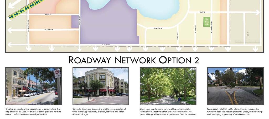
76 Roadway Network: Street traffic is composed of several primary user groups residents, employees and delivery who travel the area daily, visitors who make the study area a destination, and people who traverse the study area on route to other destinations. Design of the street contributes to the perception of an area and the way individuals interact with its built environment. While a variety of strategies have been recommended to improve transportation issues, it is recognized that with the gridded street network, traffic will continue to traverse the area and both cut-through traffic and congestion will occur at times. Roadway network improvements (see Figure 46) could include: Roadway realignment Traffic calming measures Intersection enhancement Complete Streets design Additional parking 69

77 Figure 46 Proposed Roadway Network 70
VIRGINIA / LAKE HIGHLAND TRANSPORTATION AND LAND USE STUDY
 VIRGINIA / LAKE HIGHLAND TRANSPORTATION AND LAND USE STUDY COMMUNITY MEETING #2 - PRESENTATION OVERVIEW 1 INTRODUCTION 2 CONTEXT STUDIES 3 VISION FRAMEWORK 4 DEVELOPMENT SCENARIOS 2 1 INTRODUCTION Project
VIRGINIA DRIVE SPECIAL PLAN
 August 15, 2017 Staff Report to the Municipal Planning Board CASE #GMP2017-10006 & LDC2017-00231 Item # 7 VIRGINIA DRIVE SPECIAL PLAN Location Map Subject Site SUMMARY Applicant City of Orlando, Planning
Town Center (part of the Comprehensive Plan)
") Town Center (part of the Comprehensive Plan) Mercer Island Town Center Looking North (2014) In 1994, a year-long process culminated in a set of design guidelines and code requirements for the Town Center
Town Center (part of the Comprehensive Plan) Mercer Island Town Center Looking North (2014) In 1994, a year-long process culminated in a set of design guidelines and code requirements for the Town Center
Table of Contents. Elm Avenue Improvement Plan City of Waco, Texas. Introduction 1. Existing Context 1 Figure 1 2.
 Table of Contents Introduction 1 Existing Context 1 Figure 1 2 Plan Guidelines 3 Future Urban Form 4 The West-End 4 Main Street 6 The East-End 7 Figure 2 9 Public Improvement Recommendations 7 General
CHAPTER 3 VISION, GOALS, & PLANNING PRINCIPLES. City of Greensburg Comprehensive Plan. Introduction. Vision Statement. Growth Management Goals.
 CHAPTER 3 VISION, GOALS, & PLANNING PRINCIPLES Introduction The Greensburg Comprehensive Plan is intended as a working community document. A combination of long and short-term goals, this document is intended
WEST LOOP DESIGN GUIDELINES CHECKLIST
 WEST LOOP DESIGN GUIDELINES CHECKLIST Section 1.0 General Strategies 1.1 DESIGN EXCELLENCE: ENCOURAGE HIGH QUALITY AND INNOVATIVE DESIGN OF NEW BUILDINGS WITHIN THE WEST LOOP WITHOUT BEING PRESCRIPTIVE
FUTURE LAND USE ELEMENT
 FUTURE LAND USE ELEMENT GOAL I: To create and sustain a great place to live, play, and prosper Objective 1: The City of Ocala shall incorporate the principles and strategies of the Ocala 2035 Vision into
City of Farmington. Downtown Plan. Amendment to the 1998 Master Plan Adopted October 11, 2004
 City of Farmington Amendment to the 1998 Master Plan Adopted October 11, 2004 Introduction Planning Background 1 Scope and Components of the Plan Amendment 2 Concept Introduction 3 Plan Concepts 3 Conceptual
Hockessin Community Redevelopment Plan
 Hockessin Community Redevelopment Plan 3.1 Introduction The Community Redevelopment Plan for the Village of Hockessin is the result of the people s vision for a distinct village center that serves as the
V. Vision and Guiding Principles
 V. Vision and Guiding Principles The Master Plan for the Powers Ferry Corridor seeks a foundation in the desires of the community. At times, various elements of the community offered opposing viewpoints,
Planning Board Briefing
 Planning Board Briefing Why Now? The Sector Plan Implementation Chapter States: Before Stage 1 begins, the following must occur: Approval of the Sectional Map Amendment. Approval of the Greater Lyttonsville
4.1.3 LAND USE CATEGORIES
 4.1.3 LAND USE CATEGORIES a. City Center District The City Center District incorporates the existing character and mix of uses in downtown Belmont to encourage redevelopment and new development in keeping
The Vision. Photo provided by The Minervini Group. 46 Vision, Objectives & Strategies
 Vision, Objectives & Strategies The is the public framework and guide for future development of the Grand Traverse Commons. The establishes public polices for infrastructure, the preservation of natural
FRUITVALE TRANSIT VILLAGE (Phase 2) Residential Project
 Residential Project") FRUITVALE TRANSIT VILLAGE (Phase 2) Residential Project DEVELOPER: SIGNATURE PROPERTIES ARCHITECT: HKIT ARCHITECTS April 23, 2010 TABLE OF CONTENTS 3 Vision 4 Description of Site 5 Guiding Concepts 6
FRUITVALE TRANSIT VILLAGE (Phase 2) Residential Project DEVELOPER: SIGNATURE PROPERTIES ARCHITECT: HKIT ARCHITECTS April 23, 2010 TABLE OF CONTENTS 3 Vision 4 Description of Site 5 Guiding Concepts 6
Gold Line Bus Rapid Transit Transit Oriented Development (BRTOD) Helmo Station Area Plan
 Helmo Station Area Plan") Appendix F Gold Line Bus Rapid Transit Transit Oriented Development (BRTOD) Helmo Station Area Plan Introduction and Purpose of the Plan The Gold Line Bus Rapid Transit facility is an eleven-mile dedicated
Appendix F Gold Line Bus Rapid Transit Transit Oriented Development (BRTOD) Helmo Station Area Plan Introduction and Purpose of the Plan The Gold Line Bus Rapid Transit facility is an eleven-mile dedicated
ARLINGTON COUNTY, VIRGINIA
 ARLINGTON COUNTY, VIRGINIA County Board Agenda Item Meeting October 15, 2005 DATE: September 28, 2005 SUBJECT: Request to Advertise the adoption of the 2005 Clarendon Sector Plan C. M. RECOMMENDATION:
Transportation. Strategies for Action
 Transportation A major priority for the Overlake Neighborhood is to develop a multimodal transportation system. To achieve this system, a balance has to be found among travel, circulation and access needs;
A. Background Summary of Existing Challenges and Potential Possibilities. 1. Summary of Existing Assets and Potential Opportunities
 A. Background 1 A Main Street Master Plan Study was performed and completed in October of 2007. The study was initiated to review current land uses and development patterns along Main Street, from Parrish
Urban Design Manual PLANNING AROUND RAPID TRANSIT STATIONS (PARTS) Introduction. Station Study Areas
 Introduction. Station Study Areas") 111111 PLANNING AROUND RAPID TRANSIT STATIONS (PARTS) Introduction The ION rapid transit system will link Waterloo, Kitchener and Cambridge through a central transit corridor (CTC). There are a number
111111 PLANNING AROUND RAPID TRANSIT STATIONS (PARTS) Introduction The ION rapid transit system will link Waterloo, Kitchener and Cambridge through a central transit corridor (CTC). There are a number
DRAFT. 10% Common Open Space
 % OF CHARLOTTE IS CATEGORIZED AS A. LAND USES : Placeholder map displaying location of Place Type GOALS: Accommodate XX% of future growth. Provide a concentration of primarily commercial and civic activity
Chapter 4. Linking Land Use with Transportation. Chapter 4
 Chapter 4 Linking Land Use with Transportation Chapter 4 59 Chapter 4 Linking Land Use with Transportation Community Design and Transportation Program Introduction Since the 1950s, the predominant development
Policies and Code Intent Sections Related to Town Center
 Policies and Code Intent Sections Related to Town Center The Town Center Vision is scattered throughout the Comprehensive Plan, development code and the 1994 Town Center Plan. What follows are sections
Executive Summary. NY 7 / NY 2 Corridor
 Executive Summary NY 7 / NY 2 Corridor Transportation and Land Use Study December 2005 Prepared for: Town of Colonie Capital District Transportation Committee Prepared by: Introduction: Land use decisions
Lehigh Acres Land Development Regulations Community Planning Project
 Lehigh Acres Land Development Regulations Planning Effort Summary In July, 2010 Commissioner Frank Mann invited the Lehigh Acres community to start discussing how to achieve their recently adopted community
Future Five. Design/ Development Guidelines. January 2008 Amended June 08 per City Council motion
 Future Five Design/ Development Guidelines January 2008 Amended June 08 per City Council motion 5-Points Design Guidelines Table of Contents I. Introduction 3 II. Area boundaries 4 III. Review Process
TOWN COUNCIL / PLANNING COMMISSION
 Workshop #3 TOWN COUNCIL / PLANNING COMMISSION January 20, 2011 Consultant Team In Attendance Tonight BMS Design Group Nevada City and San Francisco Michael Smiley, AICP, ASLA Partner-in-Charge Nancy L.
PLAN ELEMENTS WORKSHOP. April 5, 2016
 PLAN ELEMENTS WORKSHOP April 5, 2016 needs more housing. But there is no one-size fits-all solution. Every neighborhood has its own character. In some places, density is not only appropriate it is badly
Chapter 1: Introduction
 Chapter 1: Introduction The Penn Avenue Community Works Corridor Vision and Implementation Framework presents an integrated communitybased vision and a coordinated, long-term implementation framework for
hermitage town center
 hermitage town center A Community Vision prepared by Strada for The City of Hermitage and The Mercer County Regional Planning Commission January 2007 table of contents introduction 3 design principles
5.1 Site Plan Guidelines
 5. Community Core Guidelines Development of the Community Core will take place by plan of subdivision and site plan approval. It will occur in a phased manner that will reflect the timing of residential
The transportation system in a community is an
 7 TRANSPORTATION The transportation system in a community is an important factor contributing to the quality of life of the residents. Without a sound transportation system to bring both goods and patrons
Community Design Plan
 Gardena General Plan 2006 Authority While the is not a required element of a General Plan, it is included because improving the community appearance and image is paramount to the overall quality of life
Corridors. Re-vitalize our Corridors and Gateways
 Corridors Re-vitalize our Corridors and Gateways Artist s rendering from the 287 Strategic Plan, 2015 Corridors are the major throughways of Loveland but they also provide important commercial, community
C. Westerly Creek Village & The Montview Corridor
 C. Westerly Creek Village & The VISION Community Vision When the goals of the city are achieved Westerly Creek Village, a distinctive community defined by Montview Boulevard and Westerly Creek, is a strong
This Review Is Divided Into Two Phases:
 Semiahmoo Town Centre Review The purpose of this review: To review the Semiahmoo Town Centre Concept Plan, originally approved in 1993, to ensure that this centre will continue to serve the needs of South
ELK GROVE GENERAL PLAN VISION
 2-1 CHAPTER 2: 2-2 CREATING OUR The Community Vision for Elk Grove, expressed through a Vision Statement and a series of Supporting Principles, is a declaration of the kind of community that Elk Grove
Complete Neighbourhood Guidelines Review Tool
 Complete Neighbourhood Guidelines Review Tool Prepared By: City of Regina Planning Department October 2014 Page 1 of 14 Community Development Review Checklist for Secondary Plans and Concept Plans The
THEMES, VISION, + PRINCIPLES
 CHAPTER 2: THEMES, VISION, + PRINCIPLES This page intentionally left blank. 20 VISION DRAFT AUGUST 2018 2 2 THEMES, VISION, + GUIDING PRINCIPLES The Key Themes, Vision, and Guiding Principles presented
2. Form and Character. 2.1 Introduction. 2.2 The Downtown Addition Plan. 2.1 Introduction
 2.1 Introduction 2.1 Introduction This section of the Specific Plan describes and illustrates the desired form, character and uses of the Downtown Addition and explains the underlying design principles.
3.1 community vision. 3.3 required plan elements
 Chapter 3 Community Form 3.1 community vision 3.2 Parks & landscaping concepts 3.3 required plan elements D R A F T 20 Community Form Chapter 3 3.0 Community form 3.1 community vision The Specific Plan
URBAN DESIGN BRIEF URBAN DESIGN BRIEF 721 FRANKLIN BLVD, CAMBRIDGE August 2018
 URBAN DESIGN BRIEF URBAN DESIGN BRIEF 721 FRANKLIN BLVD, CAMBRIDGE August 2018 DESIGN BRIEF CONTENTS PART A 1.0 INTRODUCTION 2.0 DESCRIPTION & ANALYSIS OF SITE CONTEXT 3.0 DESIGN CONSTRAINTS AND OPPORTUNITIES
Small Area Plan. South Gateway
 Small Area Plan Adopted May 12, 2008 South Gateway Purpose. The South Gateway Small Area Plan defines the City s expectations for the future of the southern entrance to the City at Interstate 85 and Highway
VISION AND GUIDING DESIGN PRINCIPLES
 pleasure point commercial corridor VISION AND GUIDING DESIGN PRINCIPLES Public Draft November 26, 2018 County of Santa Cruz with assistance from MIG CONTENTS PART I: INTRODUCTION AND VISION... 3 Community
New Auburn Village Center Study Auburn, Maine
 Auburn, Maine Option Review Summary Prepared for: Androscoggin Transportation Resource Center and City of Auburn Prepared by: T.Y. Lin International MRLD October 10, 2013 1. Introduction This memo summarizes
Section 9 NEIGHBORHOOD DESIGN
 Section 9 NEIGHBORHOOD DESIGN City of Lancaster Comprehensive Plan D u n k i n, S e f k o & A s s o c i a t e s, I n c. NEIGHBORHOOD DESIGN INTRODUCTION There are many ways in which a neighborhood can
EXISTING COMPREHENSIVE PLAN
 EXISTING COMPREHENSIVE PLAN Town Center Land Use Element: V. LAND USE POLICIES Town Center Mercer Island's business district vision as described in "Your Mercer Island Citizen-Designed Downtown" was an
38 Queen s University Campus Master Plan Part 1
 38 Queen s University Campus Master Plan Part 1 46 The Campus at the City Scale Chapter 4 The Campus at the City Scale 39 Queen s is an urban University centrally located in Kingston. Decisions made by
MISSION STREETSCAPE PLAN. Neighborhood Commercial Streets handle continuous activity. Neighborhood Commercial STREET ROW: Main Design Treatments
 Neighborhood Commercial STREET ROW: 64-80 Main Design Treatments CORNER reduce crossing distance for pedestrians, create entrances to a residential area and slow cars down. help widen sidewalk allocating
6. DOWNTOWN. The Downtown Element focuses on supporting and expanding the vitality and enhancement of Downtown Chico as the City s central core.
 VISION In 2030, Downtown Chico is the heart of the community and the center of cultural activity. Engaging and active at the street level, it is a multi-story, mixed-use hub, with specialty retail, restaurants,
City of Hermosa Beach Administrative Policy #
 City of Hermosa Beach Administrative Policy # SUBJECT: Living Streets Policy Date: Approved by: City Council Authority: Public Works Department & Community Development Department Mayor, PURPOSE The City
The University District envisions, in its neighborhood
 Envisioning the University District Link Light Rail in Seattle s neighborhoods CIY OF SEALE CONCEP-LEVEL SAION AREA PLANNING RECOMMENDAION RESOLUION # 30165 EXHIBI L Vision 08.2000 he University District
Town Center. Block 5 Existing multifamily residential units are expected to remain.
 Area Guidelines Germantown s districts should be developed as distinct communities with unique features that are supported through the guidelines. The guidelines not only help distinguish these districts
Status Update (2006 vs. Now) Citizen s Advisory Committee February Plan for Prosperity
 Citizen s Advisory Committee February Plan for Prosperity") Status Update (2006 vs. Now) Citizen s Advisory Committee February 2018 Plan for Prosperity 2000 2017 2000 2017 Gardnerville Population 6,000 5,760 5746 5,500 5,000 5,067 5,550 5,165 5,394 5,412 5,250
Status Update (2006 vs. Now) Citizen s Advisory Committee February 2018 Plan for Prosperity 2000 2017 2000 2017 Gardnerville Population 6,000 5,760 5746 5,500 5,000 5,067 5,550 5,165 5,394 5,412 5,250
Introduction. Intent of the Plan. Urban Design and Land Use Approach
 Introduction Intent of the Plan This is the Second Public Open House for the. The intent of the is to update current City policy in order to encourage future development that will ensure a diverse, lively,
Sheridan Boulevard S TAT I O N A R E A P L A N S H E R I D A N B O U L E VA R D S TAT I O N A R E A P L A N
 Sheridan Boulevard S TAT I O N A R E A P L A N 1 City of Lakewood Adopted November, 2006 S H E R I D A N B O U L E VA R D S TAT I O N A R E A P L A N The Vision The City of Lakewood s overall vision is
WEST OAKLAND SPECIFIC PLAN Final Plan. 2. Vision & Goals. 2.1 Community-Based Goals and Objectives
 WEST OAKLAND SPECIFIC PLAN Final Plan 2. Vision & Goals 2.1 Community-Based Goals and Objectives June 2014 2: Vision & Goals The vision of the West Oakland Specific Plan is to see this remarkable community
ELMVALE ACRES SHOPPING CENTRE MASTER PLAN
 ELMVALE ACRES SHOPPING CENTRE MASTER PLAN Contents 1.0 INTRODUCTION... 2 2.0 LOCATION... 2 3.0 EXISTING CONTEXT... 2 4.0 VISION & GUIDING PRINCIPLES... 2 5.0 LAND USE AND BUILT FORM... 4 5.1 St. Laurent
4- PA - LD - LIVELY DOWNTOWN. LD - Background
 4- PA - LD - LIVELY DOWNTOWN LD - Background The downtown has been the service centre for the community since the city s inception and the area continues to supply people with their personal services,
SECTION TWO: Urban Design Concepts
 SECTION TWO: Urban Design Concepts The Gardnerville Plan for Prosperity shapes economic opportunities presented by regional growth. The Urban Design Concepts provide policies and concepts for land use,
Dyersville Downtown Plan. Open House October 24, 2017
 Dyersville Downtown Plan Open House October 24, 2017 What is a Comprehensive Plan? - Vision - Guidance for decisions - Basis for regulations What is a Downtown Plan? - Understand priorities - Identify
VILLAGE OF SKOKIE Design Guidelines for Mixed-Use Districts NX Neighborhood Mixed-Use TX Transit Mixed-Use CX Core Mixed-Use
 VILLAGE OF SKOKIE Design Guidelines for Mixed-Use Districts NX Neighborhood Mixed-Use TX Transit Mixed-Use CX Core Mixed-Use TABLE OF CONTENTS CHAPTER 1 SITE DESIGN Purpose 1 CHAPTER 2 SITE DESIGN Streetscape
Silverdale Regional Center
 Silverdale Regional Center Vision for Silverdale Regional Center The Silverdale Regional Center Plan (Plan) will guide the evolution of the Silverdale Regional Center from a collection of strip malls and
Highland Village Green Design Guidelines
 Highland Village Green Design Guidelines Publishing Information Title Highland Village Green Design Guidelins Author The City of Calgary Status DRAFT - Proposed document subject to changes Additional Copies
Urban Planning and Land Use
 Urban Planning and Land Use 701 North 7 th Street, Room 423 Phone: (913) 573-5750 Kansas City, Kansas 66101 Fax: (913) 573-5796 Email: planninginfo@wycokck.org www.wycokck.org/planning To: From: City Planning
1.0 Purpose of a Secondary Plan for the Masonville Transit Village
 Report to Planning and Environment Committee To: Chair and Members Planning & Environment Committee From: John M. Fleming Managing Director, Planning and City Planner Subject: Masonville Transit Village
DALY CITY VISIONING PROCESS COMMUNITY WORKSHOP 3 MAY 8, 2008
 DALY CITY VISIONING PROCESS COMMUNITY WORKSHOP 3 MAY 8, 2008 PROCESS General Plan - a statement of the community s values, vision and aspirations for now and into the future... Timeframe LONG TERM - 2030
Tonight s Agenda. Summary Presentation Open House. Group Discussion Next Steps: online community wide survey
 Community Open House February 22, 2018 Tonight s Agenda Summary Presentation Open House Station 1: Project Overview and Community Input Station 2: Draft Vision and Guiding Principles Station 3: Western,
Land Use. Hardware Street Vendor Mixed-Use
 Land Use Definition Land Use is the way a piece of real estate is utilized. Existing, proposed, and adopted land uses all play a role in the planning process. Once a land use plan is adopted, the next
VICTORIA DOWNTOWN DEVELOPMENT PLANNING
 VICTORIA DOWNTOWN DEVELOPMENT PLANNING A Vision & Guide for the Future Downtown Victoria thrives as a center for the community, offering a great mix of entertainment, culture, business, and recreational
Bayshore Boulevard Home Improvement District Design Guidelines
 Bayshore Boulevard Home Improvement District Design Guidelines guidelines for New construction projects and major alterations IN the bayshore boulevard home improvement special use DISTRICT SAN FRANCISCO
II. SINGLE FAMILY RESIDENTIAL
 II. SINGLE FAMILY RESIDENTIAL Castle Rock is made up of numerous individually built houses and subdivision tracts that have been developed during the past century. Some of the tracts are diverse in architectural
Chapter 6--Urban Design
 6.1 Introduction... 6-1 6.1.1 Background & Scope... 6-1 6.1.2 Relationship to State Law... 6-2 6.1.3 Relationship to Other General Plan Chapters... 6-2 6.2 Guiding Principles... 6-2 6.3 Urban Design Guidelines...
GREENING THE BOULEVARD Master Plan Concepts for Venice Boulevard between Lincoln and Sawtelle
 GREENING THE BOULEVARD Katherine Spitz Associates Inc. 4212½ Glencoe Avenue Marina Del Rey, CA 90292 310 574 4460 Fax 574 4462 January 2008 Table of Contents Overview Proposed Design Improvements Illustration
Midtown Greenway Land Use and Development Plan Executive Summary
 Midtown Greenway Land Use and Development Plan Executive Summary Introduction The Midtown Greenway Land Use and Development Plan sets policy direction for land use and development in the Midtown Greenway
REGIONAL ACTIVITY CENTER
 DRAFT REGIONAL ACTIVITY CENTER 70 EAST BENCH MASTER PLAN DRAFT 06 Introduction The East Bench Regional Activity center is comprised of large educational, research, medical, and employment centers. These
DRAFT. October Wheaton. Design Guidelines
 October 2011 DRAFT Wheaton Design Guidelines 2 Draft - Design Guidelines - Wheaton Sector Plan Contents 04 Section 1: Introduction 06 Section 2: Context 08 Section 3: Design Guidelines 09 Goal 1: Create
PUBLIC RIGHT-OF-WAY IN THIS CHAPTER PUBLIC REALM
 PUBLIC RIGHT-OF-WAY This section provides design guidelines for improvements in the public right-of-way. The public right-of-way refers to streets, sidewalks, non-vehicular thoroughfares, parks and greenways
LUNDY S LANE COMMUNITY IMPROVEMENT PLAN STUDY
 PUBLIC INFORMATION MEETING #2 October 12, 2016 LUNDY S LANE COMMUNITY IMPROVEMENT PLAN STUDY AGENDA 5:00 to 5:30pm: Open House 5:30 to 6:15pm: Presentation 6:15 to 7:00pm: Individual paced workshop with
BUILDING SCALE AND SETBACKS 5 ELEMENTS:... 5 FAÇADES (COMMERCIAL/RESIDENTIAL) 5
 5") VISION STATEMENT 3 UTILIZATION OF THE GUIDELINES 3 IMPLEMENTATION 3 PROCEDURES FOR DESIGN REVIEW 3 LAND USE AND ZONING 4 LAND USE 4 ELEMENTS:... 4 ZONING 4 ELEMENTS:... 4 BUILDING SCALE AND SETBACKS 5
VISION STATEMENT 3 UTILIZATION OF THE GUIDELINES 3 IMPLEMENTATION 3 PROCEDURES FOR DESIGN REVIEW 3 LAND USE AND ZONING 4 LAND USE 4 ELEMENTS:... 4 ZONING 4 ELEMENTS:... 4 BUILDING SCALE AND SETBACKS 5
Danvers High Street I-1 District Study
 Danvers High Street I-1 District Study Presentation of Final Recommendations Planning Board Presentation June 26 th, 2018 1 Introductions Metropolitan Area Planning Council Sam Cleaves AICP, Principal
MEETING PURPOSE AND OVERVIEW
 MEETING PURPOSE AND OVERVIEW On February 23, 2012, the City of Elk Grove hosted the first of two community workshops related to the Southeast Policy Area. The workshop was held from 6:00 8:30 p.m. in the
Sacramento Area Council of Governments (SACOG)
") Sacramento Area Council of Governments (SACOG) The Blueprint Vision The SACOG Board of Directors adopted the Preferred Blueprint Scenario in December 2004, a bold vision for growth that promotes compact,
Sacramento Area Council of Governments (SACOG) The Blueprint Vision The SACOG Board of Directors adopted the Preferred Blueprint Scenario in December 2004, a bold vision for growth that promotes compact,
John M. Fleming Managing Director, Planning and City Planner. Old East Village Dundas Street Corridor Secondary Plan Draft Terms of Reference
 Report to Planning and Environment Committee To: From: Subject: Chair and Members Planning & Environment Committee John M. Fleming Managing Director, Planning and City Planner Old East Village Dundas Street
9 th Street Sub Area Plan
 9 th Street Sub Area Plan In the 1990 s, when the Township prepared the last Master Plan, the 9 th Street corridor was studied as part of a larger 9 th Street Focus Area that included the West Main Street
Port Lavaca Future Land Use
 Port Lavaca Future Land Use Introduction The City of Port Lavaca is beginning to see sustained growth, after many years of relative stable population. New single family homes, apartments, and businesses
INSTITUTIONAL USE DESIGN COMPATIBILITY TECHNIQUES
 INSTITUTIONAL USE DESIGN COMPATIBILITY TECHNIQUES INTRODUCTION Community institutions are an important part of the character and vitality of neighborhoods in Forsyth County. Institutional uses include
Making Transit Oriented Development Work For Boonton, NJ
 Making Transit Oriented Development Work For Boonton, NJ Bloustein School of Planning and Public Policy Studio Dan Burton Loannie Dao Webster Slater Brandon Williams Ian Watson Maria Laham Nicola Mammes
CHAPTER 2: FUTURE LAND USE CONCEPTS
 CHAPTER 2: FUTURE LAND USE CONCEPTS INTRODUCTION The future land use concepts presented in this chapter are an expression of community support for a viable and vital US 50 Corridor. Land use recommendations
Atlanta BeltLine Subarea 3 Master Plan Update
 Atlanta BeltLine Subarea 3 Master Plan Update April 14, 2018 Workshop Meeting 1 22 miles, connecting 45 neighborhoods 22 MILES of transit 46 MILES of streetscapes and complete streets 33 MILES of urban
The Lower SaLuda Greenway
 The Lower SaLuda Greenway InITIaTIve a FLourIShInG Greenway. a hub For economic GrowTh. a ConneCTIon BeTween CoMMunITIeS. In April 2017 the Michael J. Mungo Foundation and Lexington County commissioned
WELCOME and introduction
 1 WELCOME and introduction Mobility Hub Locations within Burlington STUDY OVERVIEW STUDY OBJECTIVES The City of Burlington is developing four Area Specific Plans, one for each of Burlington s Mobility
GUIDING PRINCIPLES IN THIS CHAPTER
 GUIDING PRINCIPLES The guiding principles and design concepts in this chapter work together with the Chapel Hill 2020 Comprehensive Plan to support new public places that can be enjoyed by all while also
Chapter 1.0 Introduction
 Chapter 1.0 Introduction 1.1 Background The North Metro commuter rail line is part of the RTD FasTracks regional transit system expansion program to build more than 100 miles of rail transit throughout
East Central Area Plan
 East Central Area Plan Steering Committee Meeting March 8 th, 2018 CHUN Tears McFarlane House Vision Statement Development Opportunities Analysis Vision Elements 1. Equitable, Affordable and Inclusive
DRAFT Northeast Quadrant of Kipling Avenue and Highway 7 DRAFT AUGUST 29, Goals Land Use. The goals of this Plan are to:
 AUGUST 29, 2017 12.15 Northeast Quadrant of Kipling Avenue and Highway 7 12.15.1 Goals 12.15.2 Land Use The goals of this Plan are to: 12.15.2.1 General Provisions: a) Ensure the development of a compact
PROTECT AND PROMOTE QUALITY OF LIFE AND LIVABILITY FOR THE CITIZENS OF GAINESVILLE THROUGH QUALITY URBAN DESIGN.
 Goals, & Urban Design Element PROTECT AND PROMOTE QUALITY OF LIFE AND LIVABILITY FOR THE CITIZENS OF GAINESVILLE THROUGH QUALITY URBAN DESIGN. GOAL 1 By 2003, the City shall adopt urban design standards
Study Area. Capitol Way. Greening America s Capitals 11/13/2014. A Greening America s Capitals Project
 Olympia, WA: Greening Capitol Way Supporting Communities move towards sustainability is a priority for the federal government. A Greening America s Capitals Project Office of Sustainable Communities U.S.
Prosperity Hucks Area Plan. Transportation and Planning Committee May 11, 2015
 Prosperity Hucks Area Plan Transportation and Planning Committee May 11, 2015 Presentation Outline 1. Background and Location 2. Community Dialog Process 3. Activity Center Recommendations 4. Wedge Recommendations
Murphy Crossing Site Redevelopment Community Engagement Meeting September 19, 2016
 Murphy Crossing Site Redevelopment Community Engagement Meeting September 19, 2016 SUMMARY 1 EXECUTIVE SUMMARY STATEMENT OF PURPOSE ABI has conducted a detailed study of 1. Market potential 2. Building
Sahuarita District & Phase 1 Master Plan. Town Council December 11, 2017
 Sahuarita District & Phase 1 Master Plan Town Council December 11, 2017 Visioning Study Visioning Process Advisory Group Meetings Community Questionnaire Town Center Case Studies Community Analysis The