Site Selection Study for Plymouth Multimodal Transportation Facility Study Steering Committee Project Kick Off Meeting
|
|
|
- Stewart Leonard
- 6 years ago
- Views:
Transcription
1 Site Selection Study for Plymouth Multimodal Transportation Facility Study Steering Committee Project Kick Off Meeting DATE: Tuesday, January 25, 2011 TIME: LOCATION: ATTENDEES: 10:00 11:00 AM Mayflower Room, Plymouth Town Hall (see attached sign in sheet) Meeting Summary Frank Gay, GATRA, opened the meeting and attendees introduced themselves. Mr. Gay explained that the project is being led by GATRA in cooperation with the Town of Plymouth and the Plymouth Growth and Development Corporation. The cost of the contract is funded by: Federal Transit Agency (FTA) funding provided to GATRA 80% Town of Plymouth 10% Plymouth Growth and Development Corporation 10% David Farmer, McMahon Associates, explained that the consultant team will work with the Study Steering Committee to identify key milestones for the project and solicit feedback throughout the anticipated 12 month long project. Communication will flow through GATRA. The consultant team includes: McMahon Associates as the prime consultant and transportation planning and engineering functions DHK Architects for conceptual design Simon Engineering for parking garage expertise GLC Development Resources for public/private partnerships and real estate development Nitch Engineering for land surveying CDW Consultants for environmental work Page 1 of 3
2 Discussion by the group included the following: 2007 Plymouth Public Space Action Plan was to identify downtown locations with development potential. An outcome of the project was a brief review of potential consolidated parking facilities in downtown in order to free up existing surface lots that could be used for better purposes. The 2007 Study identified five potential sites for parking. Two other locations that have been considered are (1) Former Courthouse area; and (2) Radisson lot in the northeast area of downtown It was noted that the change in elevation from the waterfront to the Court Street/Main Street area, combined with artesian conditions of the aquifer and tides, could make construction challenging, depending upon which sites show promise Borings may have been completed for the Main/Market Street public parking area, and the nearby bridge (Whitman/Howard) Bill Shaw of Associated Engineering of Plymouth may be a good point of contact for locating data and resources that may be available to establish existing conditions in the downtown. Potential components of a multimodal center were discussed (Attachment C). This project will be unique to the needs of Plymouth. It will be important through this process to clearly define the purpose and need for the project. There was some discussion of the type and scale of multimodal facilities in other communities. The Newburyport facility was intentionally designed as a large, centralized facility. While Holyoke is a smaller facility designed to serve local transit connections, and is housed in a historic building Concern was expressed by some to maintain the scale and character of the downtown area. Discussion also included whether the Plymouth multimodal center accommodate intercity travel provided by Plymouth and Brockton and charter services, or just local GATRA service and paratransit Parking needs vary by season and with special events. Centralized parking in downtown, or remote parking near Route 3 with feeder service to downtown, must consider circulation within the downtown itself. Page 2 of 3
3 The potential for a jitney service in downtown has been discussed. A prior on demand type of trolley service was tried and discontinued due to lack of use Circulation in downtown needs to serve both the residents of Plymouth (trips related to daily business of town) and visitors who typically stay for 4 hours (day trips) or overnight (tours). Some feel more resident parking is needed. Park Plymouth has a parking permit program whereby approximately 1100 of the 1400 total permits are Plymouth resident permits. The resident permits are not currently restricted to specific lots but are restricted with respect to on street parking. Plymouth lodging currently experiences approximately 61.5% occupancy. This exceeds the rates of competing communities in the region, but falls short of the 90% occupancy goal. Plymouth is a logical place to visit from Boston, but limited transportation options make marketing difficult. Many visitors focus on the attractions in the Water Street area and never make it to the downtown core of Court/Main Street, and are unaware of other local attractions. The steepness of the hill acts as a deterrent for visitors to walk between the two areas. Plymouth and Brockton is unlikely to have intercity buses travel through downtown It was agreed that the Study Steering Committee meetings will be held monthly on the last Tuesday of the month at 10AM in the Mayflower Room of Town Hall. The next meeting is February 22. Page 3 of 3
4 Site Selection Study for Plymouth Multimodal Transportation Facility Study Steering Committee Progress Meeting DATE: Tuesday, February 22, 2011 TIME: LOCATION: 10:00 11:00 AM Mayflower Room, Plymouth Town Hall ATTENDEES: Leighton Price, PGDC Paul Cripps, PCDC/DP Mark Stankiewicz, Town Manager Chris Anzuoni, P&B Larry Rosenblum, Courthouse Bob Wollner, PRA Michael Hanlon, Fin Com John Burke, PGDC Joanne LaFerrara, GATRA David Farmer, McMahon Christi Apicella, McMahon Meeting Summary David Farmer, McMahon Associates, opened the meeting. The summary of the 1/25/11 meeting was distributed electronically prior to the meeting, and hard copies were made available. There were no modifications to the summary proposed by those in attendance. Mr. Farmer and Christi Apicella, McMahon Associates, reviewed data and information gathering tasks that have been completed to date: Parking data Available traffic counts Existing plans and reports such as the 2003 Downtown Waterfront Area Parking Analyis;2006 Master Plan; and 2007 Plymouth Public Space Action Plan Transit services and connections Meeting and consultation with Plymouth & Brockton bus service; Bill Shaw, Associated Engineering; Charter Bus companies The group discussed the history of the Middle Street parking area: A proposal in the 1970 s to expand off-street parkingapparently would have required removal of a historic house, realignment of Middle Street, and other property impacts Page 1 of 3
5 that resulted in the proposed parking expansion to be scaled back to what primarily exists today. Residents and businesses have changed hands since the initial proposal in the 1970 s, so conditions may have changed regarding potential support or opposition to additional off-street parking on Middle Street. Site assessments for potential development should include a review ofpossible archaeological impacts. The group discussed the history of the Market/School Street parking area: In recent memory, there have been two separate proposals for parking decks or structures at this location: o David Crowly, local architect, developed one set of plans on behalf of adjacent propertyowners. The Board of Selectmen did not approve the proposal. o A private developer proposedparking, but allocation of spaces between private development and public use could not be agreed upon and the proposal did not advance. Dennis Hanks, Chamber of Commerce, may have details. John Burke has renderings of both proposals, and will provide McMahon with copies. There was some discussion of adding parking meters on Court Street associated with the previous Market/School Street garage proposals. The change in on-street parking regulations was controversial. This location has the following advantages: o Proximity to Brewster Gardens and the south end of downtown o Access to/from Route 3 via Summer Street. o An easy walk to the waterfront area, due to less severe slopes than other downtown locations Due to proximity to Town Brooke, there may be underground springs that limit construction options. The group also discussed the importance of having a coordinated on-street and off-street parking program as part of the multimodal transit center and/or parking garage.park Plymouth is currently pursuing a number of parking management programs and strategies as a result of the 2003 Downtown Waterfront Area Parking Analysis. The McMahon team will develop a pro forma for the multimodal center. Plymouth & Brockton has stated that they plan to continue to provide intercity services in the Route 3 corridor, but do not plan to use the downtown multimodal center. This may require that the multimodal transit center and a potential parking garage or deck proceed separately, since a significant amount of commuter parking is not likely to be needed at the center. Page 2 of 3
6 Federal Transit Administration (FTA) could potentially fund a multimodal center, but it generally will not provide funding for parking that is not closely associated with a transit use. There are two general needs for transit in Plymouth: Intercity access Downtown services For special events, there is a need for both at the same time. Special events in downtown Plymouth include 4 th of July fireworks, parades, and the annual Thanksgiving Celebration. All three have large parking demands for the specific events and many use remote parking locations. These events may be good case studies for analyzing options for remote parking. Old Colony Planning Council (OCPC) will be evaluating transportation issues associated with special events, and could address some of the Plymouth pinch points between Route 3 and the downtown. There was some discussion regarding the latest technology for parking management, enforcement, and user interfaces. Conversations included the following: Applicability of technology such as Next Bus used for transit. Use of electronic payment capabilities (i.e., cell phones) that could become more widely applied for a user interface to search for available parking spaces in real time. Park Plymouth is moving toward new technology for parking management and enforcement in downtown Plymouth. Federal funding sources may view technology and programs that enhance livability of a community favorably. The group discussed some of the economic development potential of Cordage Park and Village Landing that could potentially serve as transportation nodes. The former railroad right of way connects the two areas and could provide an opportunity to link the downtown with the Plymouth Commuter Rail Station. A bicycle path currently runs between the two locations. McMahon Associates will check with the MBTA Real Estate Department regarding potential ownership and agreements of the MBTA-owned ROW in the vicinity of the Radisson Hotel. The McMahon Team will schedule meetings with committee members as needed to review plans for these areas. Monthly meetings will continue to be held at 10:00 a.m. the last Tuesday of the month. The next meeting will be held Tuesday, March 29. McMahon Associates will provide a project schedule with specific milestones. Page 3 of 3
7 Site Selection Study for Plymouth Multimodal Transportation Facility Study Steering Committee Progress Meeting DATE: Tuesday, February 22, 2011 TIME: LOCATION: 10:00 11:00 AM Mayflower Room, Plymouth Town Hall Agenda 1. Introductions and January 25, 2011 kickoff meeting summary (5 minutes) 2. Information gathering to date (20 minutes) a. Parking data b. Available traffic counts c. Plans and reports d. Transit service and connections e. Miscellaneous updates 3. Project Goals group discussion (10 minutes) 4. Evaluation Criteria initial discussion (15 minutes) 5. Public Communications (2 minutes) 6. Wrap up (5 minutes) a. Meeting Tuesday, March 29 at 10:00 AM
8 Timeline of Prior Parking Studies Plymouth Compact of : Parking Regulations Adopted 1958: Downtown Parking Needs Study (200 spaces) 1961: Comp. Plan Update 1966: Comp. Plan Update 1979: Waterfront Urban Design Plan (450 spaces) 1970 s to 1988: Middle Street parking expanded to 87 4 Studies: Memorial Hall (2), Middle Street, Market 1989: "Plymouth 2003: "Downtown Waterfront Area Center Waterfront Area Master Plan" Parking Analysis (618 spaces) 2004: Strategic Action Plan (garage g suggested) 2006: Master Plan : Plymouth Public Space Action Plan (5 sites)
9 GATRA/Plymouth Intermodal Transit Center Overall Project Goals for Discussion Feb 22, 2011 Goals (from RFP) Establish an intermodal facility in the downtown area. Transportation center to seamlessly coordinate and integrate various modes of transportation and services at a central location. Accommodate increased tourism in a sustainable and comprehensive strategy. Facility would not only serve visitors but residents, employees and local merchants as well. Adequate to serve the existing and future demands for transit service in Plymouth Create a stronger link between the train station and its downtown and waterfront. A critical missing link in the transportation system that would allow for a full realization of the mobility benefits derived from the local and regional transit system, is the creation of a downtown multimodal transit/parking facility Connections to the rail/bus infrastructure and local transit services to increase visitation into historic Plymouth is a major goal Provide centrally located parking with strong transit connections Take a comprehensive look at how a future multimodal parking facility would operate as the center of Plymouth's transportation network. Redevelop certain existing surface parking lots for a higher and better use, by consolidating parking in a structure From other plans: Provide a parking/intermodal center that is consistent with the historic character of downtown Incorporate liner buildings to shield open air garages from important public views Relocate a portion of existing harbor side on grade parking into the town fabric as close to Main and Court Streets as possible.
10 GATRA/Plymouth Intermodal Transit Center Site Selection Criteria for Discussion Feb 22, 2011 TRANSIT NEEDS Ability to accommodate transportation program Number of GATRA buses & paratransit Downtown shuttles/trolleys Other transit providers? Sheltered passenger waiting area Ticketing Pick up/drop off area/taxis Pedestrian access Number of parking spaces Transit Operations Transit operating efficiency Ability to encourage new riders Ability to serve needs of existing customers Flexibility to accommodate future transit needs Traffic impacts PARKING NEEDS Required parking capacity Support transit Downtown employees Downtown visitors daily business Downtown visitors tourism/day trips Special Events Traffic impacts SITE CONFIGURATION Size and configuration Pedestrian access Flexibility for massing of the structure ACCESSIBILITY Proximate to waterfront and Court/Main Street Links to key destinations in downtown area Quality of pedestrian environment Avoid steep grades Safe, visible, connections Convenient connections Streetscape design MA Access and ADA standards compliance ENVIRONMENTAL ISSUES Compatibility with surrounding historic district, sites and structures Compatibility with surrounding land uses Minimal impact on harbor Ease of environmental permitting Minimal site remediation required DEVELOPMENT ISSUES Ownership and ease of acquisition Ability to accommodate secondary uses Opportunity for public private partnership (PPP) Compatibility with downtown plans Constructability Pro Forma performance Potential funding sources
11 Site Selection Study for Plymouth Multimodal Transportation Facility Study Steering Committee Progress Meeting DATE: Tuesday, March 29, 2011 TIME: LOCATION: 10:00 11:00 AM Harbor Room, Plymouth Town Hall ATTENDEES: Leighton Price, PGDC Donna Fernandez, PGDC Patrick O Brien, Town of Plymouth Alan Zanotti, PGDC Larry Rosenblum, Courthouse Bob Wollner, PRA Michael Hanlon, Fin Com John Burke, PGDC Frank Gay, GATRA David Farmer, McMahon Christi Apicella, McMahon Meeting Summary David Farmer, McMahon Associates, opened the meeting. The summary of the 2/22/11 meeting was distributed electronically prior to the meeting, and hard copies were made available. It was noted that David Crowley s name was spelled incorrectly. Mr. Farmer reviewed the proposed project timeline (please see attached), which assumes a public meeting in mid- to late May, pending the outcome of this Steering Committee meeting. Larry Rosenblum, Courthouse Committee, provided an overview of the Courthouse planning efforts: CBT Architects signed a contract 3/28/11 to complete a Historic Structures Report. They are presenting their project approach to the Board of Selectmen tonight. The study should be complete in the early Fall 2011, and should coordinate well with the Multimodal Transit Center Site Selection Study The façade and original building (circa 1857) will remain. The 1914 and 1960 additions, and separate jail building, are likely less feasible for reuse options. Mr. Farmer reviewed updated Site Selection criteria, which has been refined to include program details such as the number of GATRA bus berths, preliminary parking demand (based on prior studies), and potential joint development options. Please see attached draft criteria. A sample Page 1 of 2
12 footprint for a 7 berth bus facility and a 160 space level of parking were provided to indicate the scale of the site that will be needed to accommodate the development program. The following points were discussed: The proposed 7 bus berths for GATRA accommodate the 4-5 current routes and allow for potential expansion of operations in the future. Plymouth & Brockton does not have an interest in using a downtown intermodal facility at this time, but the potential to accommodate larger inter-city carriers in the future should be kept in mind for design options. This type of vehicle may be accommodated on-street. If a transit center displaces parking then, at a minimum, that parking should be replaced as part of the project. There may be opportunities to further expand parking capacity as part of a public/private partnership. Mr. Farmer and Christi Apicella, McMahon Associates, presented a summary of eight potential sites for the multimodal center. The potential sites were identified through the 2007 Plymouth Public Space Action Plan, discussion with the Steering Committee, and a recent site walk. They are presented in the order that they became known to the consultant team, and not in order of preference. A list of pros and cons in terms of a particular site s ability to accommodate key elements of the program were presented (see attached). This analysis will be used to complete a matrix of site options according to specific criteria. As a result of the discussion of pros/cons, the group agreed that there could be three categories of potential sites: A multimodal center to serve GATRA services and downtown parking needs A multimodal center with a transit focus and replacement parking, but no additional parking capacity for the downtown area If only replacement parking can be fit at the multimodal center, or if additional parking is needed beyond what can be provided at the multimodal center, secondary sites to provide additional downtown parking. The consultant team will continue to refine the pros/cons for each site based on the discussion at the meeting, and input from consultant team members such as DHK Architects and Simon Design Engineering. The group agreed that a public meeting end of May/beginning of June is an accurate target date. Monthly meetings will continue to be held at 10:00 a.m. the last Tuesday of the month. The next meeting will be held Tuesday, April 26 in the Mayflower Room. Page 2 of 2
13
14 Site Selection Study for a Multimodal Transportation Facility, Plymouth, MA Draft Project Schedule Rev 3/2/2011 Task I Coord, Outreach & Mtgs Jan-11 Feb-11 Mar-11 Apr-11 May-11 Jun-11 Jul-11 Aug-11 Sep-11 Oct-11 Nov-11 Dec-11 Jan-12 Task II I.D. & Evaluate 6 to 8 Sites AReview of Past Studies BParking and Transit Needs C Identify 6 to 8 Sites D Evaluation/Screening E Select Two Finalist Sites Task III Evaluation of 2 Finalist Sites A Selected Site Measurements B Prelim. Environmental Risk C Prefiling MEPA/NEPA coord. D Traffic Analysis EReal Estate and Finance FImpacts and Environ. Justice GTransit Service Review H Refined Demand Estimates IConcept Design Task IV Site Selection A Finalize Concept BFull land survey C Conduct Phase I ESA (CH 21E) DJoint MEPA/NEPA Filing Task V Draft and Final Reports Study Steering Committee Meeting Assumptions: Public Meeting Outreach and coordination meetings with stakeholders (Task 1) will be ongoing on an as needed basis Study Steering Committee meetings will be held the last Friday of each month, unless a Public Meeting is scheduled The detailed evaluation of the 2 sites will occur during the summer months Public Meetings are anticipated prior to Memorial Day, after Labor Day, and at the end of the project Public Meetings are not scheduled during the summer months due to anticipated low attendance The final Public Meeting will be coordinated with any MEPA/NEPA requirements
15 GATRA/Plymouth Intermodal Transit Center Site Selection Needs and Criteria for Discussion March 29, 2011 SPACE PLANNING TRANSIT NEEDS Ability to accommodate transportation program Six (6) GATRA bus berths (4 current + 2 growth) One (1) additional berth (shuttles/trolleys) Passenger waiting/ticketing area (2500 SF*) Pick up/drop off/taxi area (curbside) Pedestrian access (via sidewalks) Bicycle facilities (200 SF, outdoors) Staff parking spaces (incorporated into garage) PARKING NEEDS Required parking capacity ( spaces) Downtown employees Downtown visitors daily business Downtown visitors tourism/day trips Special Events OTHER FACILITY PROGRAMMING Public private or public public partnership (PPP) Possible co location of PGDC (2500 SF*) Possible co location of Visitors (2500 SF*) Other prospective tenants (*Assumed total 7500 SF basic needs in building = 50 ft x 150 ft) FUNCTIONAL & DEVELOPMENT NEEDS SITE CONFIGURATION & ACCESSIBILITY Size and configuration of site Proximate to waterfront and Court/Main Street Access to key destinations in downtown area Quality of pedestrian environment Avoid steep grades Safe, visible, connections Convenient connections Streetscape design MA Access and ADA standards compliance Transportation Operations Transit operating efficiency Ease of vehicular parking access Ability to encourage new riders Ability to serve needs of existing customers (e.g., co location of government or social services) Flexibility to accommodate future transit needs Traffic impacts ENVIRONMENTAL ISSUES Compatibility with historic district, sites and structures Compatibility with surrounding land uses Minimal impact on environment Ease of environmental permitting Minimal site remediation required DEVELOPMENT ISSUES Ownership and ease of acquisition Ability to accommodate secondary uses Compatibility with downtown plans Pro Forma performance Potential funding sources
 Existing buildings provide some screening for parking Privately")
16 (A) 1620 Restaurant/Citizens Bank D R A F T PRO Supports waterfront uses High visibility enhances safety Primary parcel is relatively flat (grade separation with Citizens Bank) Existing buildings provide some screening for parking Privately owned site is currently for sale CON Distance from downtown core Parking is generally not the highest and best use for a waterfront parcel Cost of property is ~$4 million Grade change to Citizens Bank Primary parcel 1620 Restaurant (B) Memorial Drive PRO Currently used for public parking (116 spaces) Supports waterfront uses Proximity to existing visitor center Supports Memorial Hall events and north Court Street area Ease of access from Route 44 Gradual grade of site supports development Potential to screen parking with liner buildings and existing surrounding uses General community support for parking Town-owned CON Distance from Main Street Memorial Drive is currently oneway, limiting circulation options Gradual grade; waterfront access Memorial Drive is one-way GATRA bus hub Current pubic parking


 Main/Market Streets PRO Parking for Main Street area Southern gateway to downtown")
 General community support for parking Town-owned,")
 Proximity to Town Brook may")
17 (C) Probate Court D R A F T PRO Currently for sale Potential to combine parking area with Coldwell Banker (grade change) Serves Main Street/Court Street area CON Narrow driveway to parking behind building limits circulation options Distance to waterfront Retaining walls on north and south property lines make site expansion difficult Narrow driveway Retaining wall (south) Coldwell Banker parking (D) Main/Market Streets PRO Parking for Main Street area Southern gateway to downtown Proximity to attractions such as Mayflower Park, Grist Mill, Burial Hill Development could complete existing streetwall (split issue) General community support for parking Town-owned, currently used for parking (555 spaces) CON Distance to waterfront attractions north of Mayflower Park Development could block viewsheds (split issue) Proximity to Town Brook may limit footings/foundation Parking for Main Street area Potentially blocked viewsheds

 CON Narrow bounds of current site (Lshape)")
")


18 (E) Middle Street D R A F T PRO Proximate to waterfront attractions such such as Mayflower Park Proximate to downtown Relatively flat site Town-owned, currently used for parking (70 spaces) CON Narrow bounds of current site (Lshape) Current 1-way street pattern limits circulation Distance to waterfront restaurant area Historic house (currently parking wraps around it) Historic home (F) Former Courthouse Block PRO Proximate to Court/Main Street Courthouse owned by Plymouth Redevelopment Authority, seeking development opportunities Town ownership of former school/dpw buildings to the rear of block Good access to Route 44 Existing public parking Russell: 62 Old Police: 32 CON From rear of block: distance and steep slope to waterfront Three residences between Courthouse and former School/DPW property Parking underutilized now Potentially blocked viewsheds


")

19 (G) Radisson Lot D R A F T PRO Relatively flat property Proximate to waterfront restaurants, but does not occupy prime waterfront real estate Potential connections to commuter rail via MBTA right-of-way CON Distance from downtown Complicated ownership/easements (H) Brewster Street Lot PRO Central location for both waterfront and downtown access Existing Court Street buildings, and natural grade create screening Partial public lot (23 spaces) and Sovereign Bank Access via Brewster (2-way) and North Streets CON Somewhat distant from waterfront restaurants and Memorial Hall Private land may not be available Retaining wall
20 Site Selection Study for Plymouth Multimodal Transportation Facility Study Steering Committee Progress Meeting DATE: Tuesday, April 26, 2011 TIME: LOCATION: 10:00 11:00 AM Harbor Room, Plymouth Town Hall ATTENDEES: Leighton Price, PGDC Paul Cripps, PCDC/DP Patrick O Brien, Town of Plymouth Alan Zanotti, PGDC Larry Rosenblum, Courthouse Bob Wollner, PRA Mark Stankiewicz, Town Manager Michael Hanlon, Fin Com John Burke, PGDC Frank Gay, GATRA David Farmer, McMahon Christi Apicella, McMahon Alan Simon, Simon Design Engineering Charles Tseckares, CBT/Courthouse Meeting Summary David Farmer, McMahon Associates, opened the meeting. Alan Simon, Simon Design Engineering, was introduced as the parking specialist for the McMahon-led site selection consultant team. Charles Tskeckares, CBT Architects, also joined the group as an observer, in his role as the consultant to the Courthouse Consortium. The summary of the 3/24/11 meeting was distributed electronically prior to the meeting, and hard copies were made available. No changes to the summary were noted. Mr. Farmer reviewed the general project timeline (presented last month) noting that a public meeting is targeted for the end of May/beginning of June. Mr. Farmer suggested holding the public meeting the beginning of June, in order to allow for an additional Steering Committee meeting to be held prior to the public meeting. The group agreed. Patrick O Brien will provide to McMahon Associates suggested dates and locations for the public meeting to be held during the week of June 6. The next Steering Committee meeting will be at 10:00 am on Tuesday, May 31 (following Memorial Day). Mr. Farmer noted that the potential sites pros/cons analysis has been updated, based on feedback provided by the March Steering Committee meeting, and consultant team members (see attached). He noted that these posters will serve as the basis for the public meeting. Page 1 of 3
21 Participants at the public meeting may also be asked to vote for their top two favorite sites and provide a brief reason for the basis of their selection. Mr. Farmer noted that McMahon Associates is updating the 2003 parking supply and demand analysis for the downtown area. John Burke and Paul Cripps may be able to assist with data needed to complete the analysis. Mr. Farmer provided two versions of the site selection criteria matrix (see attached): 1. Site Selection Criteria: A detailed version of how the pro/con analysis fit into the categories for criteria related to space planning and function and development needs for the multimodal center. The group was encouraged to review this matrix on their own and provide comments to the consultant team. 2. Reduced Matrix: A simplified version of the above indicating the strength of a site to accommodate transit, parking, and/or other facility programming (public-private partnerships, prospective tenants, etc.). It was noted that Site C should be referred to as the Former Registry Building and Site F is known as the Courthouse Corridor. Mr. Farmer reviewed the Reduced Matrix, utilizing aerial photographs of each site (see attached) to present preliminary circulation patterns for transit and parking to demonstrate how each would function in plan view. It was noted that some sites (such as the former 1620 Restaurant) appear to work well in two-dimensional plan view, but changes in topography and grade separation between multiple sites may further limit layout options. Alan Simon, Simon Design Engineering, who is a parking garage specialist familiar with parking constraints in downtown Plymouth due to his involvement with prior parking garage proposals in town, then spoke about parking considerations. Mr. Simon noted that smaller sites are typically more difficult to fund due to the higher costs of parking construction concentrated in a smaller area. Ultimately, site selection is heavily influenced by how much of the cost can be subsidized by parking rates. He noted that a parking space generally must net at least $150 per month to cover operating expenses. This is substantially higher than the parking rates in Plymouth today, particularly since some are at no cost and charges for parking vary by season. A system-wide approach to parking fees is needed to make a parking garage feasible. John Burke, Plymouth Growth and Development Corporation/Park Plymouth, asked Mr. Simon for a broad estimate of the costs of constructing parking at some of the sites. Mr. Simon estimates that the cost per space at site B Memorial Drive might be on the order of $12,000 per space, whereas a site like D Main\Market might be closer to $20,000 per space, and Site H Brewster Street might be on the order of $40,000 per space. Sites such as the former Registry Building are harder to determine since land acquisition costs need to be considered. It was Page 2 of 3
22 noted that those figures should be considered reasonable for comparative purposes; better estimates would require closer examination of the requirements for any particular site. The group discussed the merits of the Courthouse Corridor for both transit and parking uses, and the potential to combine the site with Site C Former Registry Building. McMahon agreed to contact the landowners who currently hold the Site C parcels to enquire about their current plans for those parcels. Several participants mentioned the potential for the Courthouse Corridor to shape public-private partnerships throughout the downtown, and the Multimodal Transportation Facility may provide an opportunity to for this to happen in the short-term. McMahon Associates will develop sketches for potential circulation options for the Courthouse Corridor, similar to those presented for other sites. Based on the discussion, the group agreed that the primary focus should be on identifying a site that can accommodate the full development program (including both transit and parking). Therefore, the Reduced Matrix should be modified to reflect the following: Transit: Site B (Memorial Hall); Site C (Former Registry); and possibly Site F (Courthouse Corridor), depending upon possible layouts. Sites B and F present the advantage of substantial current public ownership. Parking: All sites currently contain some parking and could potentially accommodate replacement parking for the transit center, with the exception of Site E (Middle Street) and Site H (Brewster Street) where adding an additional level of parking would be difficult and disproportionally expensive due to site constraints. Site A Former 1620 Restaurant, was considered too difficult to pursue due to grade change in combination with anticipated difficulties in land acquisition and access, as portions of the restaurant property and the adjacent bank property would need to be assembled to fit the full transit center program on the site. Site G Radisson Parking Lot, was judged to be too far from the downtown core for further consideration as a transit center, and it was agreed that its incorporation as a transit center would entail too many other long-term improvements (connection to the bike path, reconstruction of the surrounding street grid), that are beyond the ability of this project to recommend. Sites D, E, and H all were deemed to be too small to incorporate the transit program associated with the project. Monthly meetings will continue to be held at 10:00 a.m. the last Tuesday of the month. The next meeting will be held Tuesday, May 31 (following Memorial Day) in the Mayflower Room. Page 3 of 3


 (B)")
 and GATRA bus hub Proximity to existing")


23 (A) 1620 Restaurant/Citizens Bank D R A F T 25 April 2011 Primary parcel 1620 Restaurant Grade change to Citizens Bank PRO Supports waterfront uses High visibility enhances safety Primary parcel is relatively flat (grade separation with Citizens Bank) Existing buildings provide some screening for parking Privately owned site is currently for sale Ease of access via Exit 6 Strong connection to Rail Trail Allows for consolidation of waterfront parking Established traffic patterns are compatible with bus turns CON Distance from downtown core Parking is generally not the highest and best use for a waterfront parcel Cost of privately-owned property acquisition is ~$4 million Depth to groundwater may limit construction NOTES Potential to consolidate parking from water street lots and town pier area to create transitoriented development (TOD) Could be appealing for regional demand (seasonal & marine) Could serve as employee parking for downtown core (would require shuttle and providing incentives) (B) Memorial Drive Gradual grade; waterfront access Current pubic parking Memorial Drive is one-way GATRA bus hub PRO Currently used for public parking (116 spaces) and GATRA bus hub Proximity to existing visitor center Supports Memorial Hall events and north Court Street area Could serve as a connector between waterfront and downtown Ease of access via Route 44 Gradual grade of site supports development Potential to screen parking with liner buildings and existing surrounding uses Multiple access points possible Town-owned Larger massing of existing buildings is compatible with a parking structure/mulitmodal center CON Distance from Main Street Memorial Drive is currently one-way, limiting circulation options NOTES Prior parking garage proposal Site is relatively large (compared to others), improving opportunity for liner buildings
 Screening with existing buildings Ease of access for pedestrians/bikes from Main Street Prior public")


 Good relationship to established traffic patterns CON Distance to waterfront attractions north of Mayflower Park Development")
 and John Carver Inn (split issue) Proximity to Town Brook may limit footings/foundation Small parcel size limits layout options and ability to combine transit and parking Small parcel")
24 (C) Probate Court D R A F T 25 April 2011 Narrow driveway Coldwell Banker parking Retaining wall (south) Currently for sale PRO Potential to combine parking area with Coldwell Banker (grade change) Serves Main Street/Court Street area Opportunities to combine with courthouse development (Site F) Screening with existing buildings Ease of access for pedestrians/bikes from Main Street Prior public use of the site (D) Main/Market Streets CON Narrow driveway to parking behind building limits circulation options Retaining walls on north and south property lines make site expansion difficult Slope of Russell Street limits options for bus berths NOTES Land assembly extends project timeline Coldwell property owners may be open to combined parking Parking capacity likely to be filled by redevelopment of building Probate Court property asking price $1.7 million Distance to waterfront Condos proposed in short-term Is the building on the Historic Register? Slope may increase options for building parking deck Reducing on-street parking would improve traffic flow Potentially blocked viewsheds Parking for Main Street area PRO Parking for Main Street area Southern gateway to downtown Proximity to attractions such as Mayflower Park, Grist Mill, Burial Hill, Brewster Gardens Development could complete existing streetwall (split issue) General community support for parking Town-owned, currently used for parking (55 spaces) Good relationship to established traffic patterns CON Distance to waterfront attractions north of Mayflower Park Development could block viewsheds from Main St. (northbound) and John Carver Inn (split issue) Proximity to Town Brook may limit footings/foundation Small parcel size limits layout options and ability to combine transit and parking Small parcel size means parking would be relatively expensive and limited impact on overall capacity NOTES Two prior parking structures proposed; wellstudied Strategic location for community development Potential for on-street bus circulation
 CON Distance to waterfront")
 Historic house (currently parking wraps around it) Parking potential, but")

 Brewster St.")

25 (E) Middle Street D R A F T 25 April 2011 Historic home PRO Proximate to waterfront attractions such such as Mayflower Park Proximate to downtown Relatively flat site Town-owned, currently used for parking (70 spaces) CON Distance to waterfront restaurant area Not a strong transit site Convoluted geometry Proximate to residential neighborhood Historic preservation concerns NOTES Narrow bounds of current site (L-shape) Historic house (currently parking wraps around it) Parking potential, but limited Public alleyway through site Adjacent Salvation Army property may expand site Limited visibility (F) Former Courthouse Block Potentially blocked viewsheds PRO Proximate to Court/Main Street Courthouse owned by Plymouth Redevelopment Authority, seeking development opportunities Town ownership of former school/dpw buildings to the rear of block Good access to Route 44 Existing public parking - Russell: 62 - Old Police: 32 Potential to combine with Probate Court Development (Site C) Brewster St. connection to waterfront CON From rear of block: distance and steep slope limit transit and pedestrian/bike access Three residences between Courthouse and former School/DPW property Parking underutilized now Better potential use for site than parking NOTES Study of reuse options underway
 Brewster Street Lot CON Distance from downtown and visitor")
 Could be appealing for regional demand (seasonal & marine) Could serve as employee parking for downtown core (would require shuttle and")
 and Sovereign Bank Access via Brewster (2-way) and North Streets CON Somewhat distant from waterfront restaurants and Memorial Hall")
26 (G) Radisson Lot D R A F T 25 April 2011 PRO Relatively flat property Proximate to waterfront restaurants, but does not occupy prime waterfront real estate Potential connections to commuter rail via MBTA right-of-way and Rail Trail Good replacement parking for waterfront Established traffic patterns are compatible with bus turns (H) Brewster Street Lot CON Distance from downtown and visitor destinations for future transit options Good pedestrian connections Complicated ownership/easements NOTES Only site outside historic district Potential to consolidate parking from water street lots and town pier area to create transitoriented development (TOD) Could be appealing for regional demand (seasonal & marine) Could serve as employee parking for downtown core (would require shuttle and providing incentives) Possibility to use as engine for future development to the north Retaining wall PRO Central location for both waterfront and downtown access Existing Court Street buildings, and natural grade create screening Partial public lot (23 spaces) and Sovereign Bank Access via Brewster (2-way) and North Streets CON Somewhat distant from waterfront restaurants and Memorial Hall Private land may not be available Bank drive-through access limits development area Size constraints limit transit layout and bus turning movements Poor geometry, access, and visibility Potential conflict with neighbors NOTES Partial public lot (23 spaces) and Sovereign Bank

27 GATRA/Plymouth Intermodal Transit Center Site Selection Criteria Discussion DRAFT for Internal Review 4/26/11 Criteria A Restaurant/Citizens Bank SPACE PLANNING B. Memorial Drive C. Probate Court D. Main/Market Streets E. Middle Street F. Former Courthouse block G. Radisson Lot H. Brewster Street Lot TRANSIT NEEDS Ability to accommodate transportation program Six (6) GATRA bus berths (4 current + 2 growth) One (1) additional berth (shuttles/trolleys) Passenger waiting/ticketing area (2500 SF*) Pick up/drop off/taxi area (curbside) Pedestrian access (via sidewalks) Bicycle facilities (200 SF, outdoors) Staff parking spaces (incorporated into garage) Depends on availability of whole site. Good if whole site available. Short distance from current hub Currently used for GATRA bus hub Transit program could be accommodated Potential site constraints for constraints for transit layout Potential for on street bus circulation Transit program limited due to small size of site Not a strong transit site Transit program limited Substantial building demolition likely required to accommodate transit program Potential connections to commuter rail via MBTA right of way and Rail Trail Established traffic patterns are compatible with bus turns Transit program could be accommodated Size constraints limit transit layout and bus turning movements PARKING NEEDS Required parking capacity ( spaces) Downtown employees Downtown visitors daily business Downtown visitors tourism/day trips Special Events Could serve as employee parking for downtown core (would require shuttle and incentives) Could be appealing for regional demand (seasonal & marine) Good replacement parking for waterfront area Currently used for public parking (116 spaces) Prior parking garage project proposed Parking capacity could be filled by redevelopment of building Serves Main Street/Court Street area Parking for Main Street area Proximity to attractions such as Mayflower Park, Grist Mill, Burial Hill, Brewster Gardens Parking potential, but limited Existing public parking Russell: 62 Old Police: 32 Parking underutilized now Good replacement parking for waterfront Could be appealing for regional demand (seasonal & marine) Could serve as employee parking for downtown core (would require shuttle and incentivization) Partial public lot (23 spaces) and Sovereign Bank OTHER FACILITY PROGRAMMING Public private or public public partnership (PPP) Possible co location of PGDC (2500 SF*) Possible co location of Visitors (2500 SF*) Other prospective tenants Reuse of restaurant building for PPP Liner buildings possible Adjacent to existing visitor s center Supports Memorial Hall events Prior public use of the site Coldwell property owners may be open to combined parking Strategic location for community development Development options limited Partnership with Plymouth Redevelopment Authority plans Potential with surrounding uses Cordage Park access Potential to work with Court Street businesses; Sovereign Bank property cooperation needed (*Assumed total 7500 SF basic needs in building = 50 ft x 150 ft)

28 Criteria A Restaurant/Citizen s Bank FUNCTIONAL & DEVELOPMENT NEEDS B. Memorial Drive C. Probate Court D. Main/Mark et Streets E. Middle Street F. Former Courthouse block Discussion DRAFT for Internal Review 4/26/11 G. Radisson H. Brewster Lot Street Lot SITE CONFIGURATION & ACCESSIBILITY Size and configuration of site Proximate to waterfront and Court/Main Street Access to key destinations in downtown area Quality of pedestrian environment Avoid steep grades Safe, visible, connections Convenient connections Streetscape design MA Access and ADA standards compliance Transportation Operations Transit operating efficiency Ease of vehicular parking access Ability to encourage new riders Ability to serve needs of existing customers (e.g., co location of government or social services) Flexibility to accommodate future transit needs Traffic impacts Established traffic patterns are compatible with bus turns Strong connection to Rail Trail Ease of access via Exit 6 High visibility enhances safety Distance to core downtown area may limit transit use Generally flat site overall Supports waterfront uses Could serve as a connector between waterfront and downtown Ease of access via Route 44 Gradual grade of site supports development Multiple access points possible Memorial Drive is currently one way, limiting circulation options Still some distance from Main Street shopping area Retaining walls on north and south property lines make site expansion difficult Slope of Russell Street limits options for bus berths, but might help stack parking Narrow driveway to parking behind building limits circulation options Ease of access for pedestrians/bikes from Main Street Reducing on street parking would improve traffic flow Southern gateway to downtown Proximity to attractions such as Mayflower Park, Grist Mill, Burial Hill, Brewster Gardens Distance to waterfront attractions north of Mayflower Park Good relationship to established traffic patterns Small parcel size limits layout options and ability to combine transit and parking Proximate to waterfront attractions such such as Mayflower Park, as well as downtown Distance to waterfront restaurant area Relatively flat site Current 1 way street pattern limits circulation Convoluted geometry Narrow bounds of current site (L shape) Public alleyway through site Proximate to Court/Main Street Good access to Route 44 Brewster St. connection to waterfront From rear of block: distance and steep slope limit transit and pedestrian/bike access Relatively flat property Proximate to waterfront restaurants, but does not occupy prime waterfront real estate Potential connections to commuter rail via MBTA right of way and Rail Trail Distance from downtown and visitor destinations for future transit options Good pedestrian connections Lathrop is only adjacent public street Central location for both waterfront and downtown access Somewhat distant from waterfront restaurants and Memorial Hall Access via Brewster (2 way) and North Streets Bank drive through access limits development area Poor geometry, access, and visibility Limited visibility ENVIRONMENTAL ISSUES Compatibility with historic district, sites and structures Compatibility with surrounding land uses Minimal impact on environment Ease of environmental permitting Minimal site remediation required Existing buildings provide some screening for parking Depth of groundwater may limit construction Potential to screen parking with liner buildings and existing surrounding uses Larger massing of existing buildings is compatible with a parking structure/mulitmodal center Is the building on the Historic Register? Screening with existing buildings Development could complete existing streetwall Development could block viewsheds from Main St. (northbound) and John Carver Inn General community support for parking In neighborhood Historic house (currently parking wraps around it); historic preservation concerns Three residences between Courthouse and former School/DPW property Only site outside historic district Former train depot may have site contamination Existing Court Street buildings, and natural grade create screening Potential conflict with neighbors DEVELOPMENT ISSUES Ownership and ease of acquisition Ability to accommodate secondary uses Compatibility with downtown plans Pro Forma performance Potential funding sources Cost of privately owned property acquisition is ~$4 million Privately owned site is currently for sale Potential to consolidate parking from water street lots and town pier area to create transitoriented development (TOD) Is multimodal facility highest and best use of site? Town owned Probate Court property price as much as $1.7 million Land assembly extends project timeline Building actively being marketed Opportunities to combine with courthouse development (Site F) Town owned, currently used for parking (55 spaces) Proximity to Town Brook may limit footings/foundation Two prior parking structures proposed; well studied Town owned, currently used for parking (70 spaces) Adjacent Salvation Army property may expand site Courthouse owned by Plymouth Redevelopment Authority, seeking development opportunities Town ownership of former school/dpw buildings to the rear of block Potential to combine with Probate Court Development (Site C) Complicated ownership/easements Potential to consolidate parking from water street lots and town pier area to create transitoriented development (TOD) Possibility to use as engine for future development to the north, Cordage Park area Private land may not be available
29 GATRA/Plymouth Intermodal Transit Center Site Selection for Transit and Parking Reduced Matrix Discussion DRAFT for Internal Review 4/26/11 Criteria A Restaurant/Citizens Bank B. Memorial Drive C. Probate Court D. Main/Market Streets E. Middle Street F. Former Courthouse block G. Radisson Lot H. Brewster Street Lot TRANSIT PROGRAM NEEDS Ability to accommodate transportation program Six (6) GATRA bus berths (4 current + 2 growth) One (1) additional berth (shuttles/trolleys) Passenger waiting/ticketing area (2500 SF*) Pick up/drop off/taxi area (curbside) Pedestrian access (via sidewalks) Bicycle facilities (200 SF, outdoors) Staff parking spaces (incorporated into garage) X X? X PARKING PROGRAM NEEDS Required parking capacity ( spaces) Downtown employees Downtown visitors daily business Downtown visitors tourism/day trips Special Events X X X X? X X? OTHER FACILITY PROGRAMMING Public private or public public partnership (PPP) Possible co location of PGDC (2500 SF*) Possible co location of Visitors (2500 SF*) Other prospective tenants X X X X X X (*Assumed total 7500 SF basic needs in building = 50 ft x 150 ft)
30 LOTHROP STREET MURRAY STREET PHOENIX COURT SAWYER PLACE COURT STREET SAMOSET STREET NORTH PARK AVENUE VERNON STREET WATER STREET SOUTH PARK AVENUE Driveway TOWN ROW STATE ACCESS BOAT MEMORIAL DRIVE R AMP TOWN WHARF CHILTON STREET WATER STREET HOWLAND STREET A B C D E F G H Behind former 1620 restaurant with portion of Citizen s Bank parking lot Memorial Drive public parking lot Behind Probate Court & adjacent Coldwell Bank parking Main/Market Streets public parking lot Middle Street public parking lot (below grade) Former Courthouse block & Russell Street lots Radisson lot Brewster Street lot Ground Level Transit Facility (sample layout for scale only) IN BUILDING OUT Upper Levels 160-Car Parking Deck (sample layout for scale only) WINSLOW STREET WATER STREET CLYFTON STREET BREWSTER STREET GORDON PLACE ALLERTON STREET SEVER PLACE NORTH STREET CARVER STREET DAVIS STREET BROOK STREET SEVER THOMAS STREET STODDARD STREET RUSSELL STREET SOUTH RUSSELL STREET SCHOOL STREET CHURCH STREET MAIN STREET TOWN SQUARE LEBARON ALLEY MIDDLE STREET LEYDEN STREET MARGERIE STREET SPRING STREET SUMMER STREET MARKET STREET MAIN STREET EXTENSION WOODWORTH STREET RUSSELL STREET SANDWICH STREET Town of Plymouth Potential ITC Sites
31 NORTH PARK AVENUE WATER STREET TOWN WHARF MEMORIAL DRIVE TOWN ROW SOUTH PARK AVENUE Site A: Former 1620 restaurant & portion Citizen's Bank lot ± Feet ER P LACE SAWY WATER STREET
32 WATER STREET HOWLAND STREET CHILTON STREET TOWN WHARF WATER STREET MEMORIAL DRIVE SOUTH PARK AVENUE Driveway Site B: Memorial Drive ± Feet NORTH PARK AVENUE COURT STREET VERNON STREET
33 BREWSTER STREET GORDON COURT NORTH STREET MAIN STREET COURT STREET HOWLAND STREET RUSSELL STREET SOUTH RUSSELL STREET SCHOOL STREET CHILTON STREET Site C: Probate Court & Coldwell Banker lots ± Feet CLYFTON STREET SEVER PLACE SEVER STREET ALLERTON STREET
34 WATER STREET SANDWICH STREET LEYDEN STREET MAIN STREET EXTENSION PLEASANT STREET SUMMER STREET MAIN STREET TOWN SQUARE MARKET STREET CHURCH STREET SCHOOL STREET SUMMER STREET Site D: Main Street/Market Street ± Feet SPRING STREET
35 WATER STREET LEYDEN STREET PRIVATE WAY LEBARON ALLEY CARVER STREET WINSLOW STREET GORDON PLACE SPOONERS ALLEY MIDDLE STREET MAIN STREET EXTENSION MAIN STREET TOWN SQUARE NORTH STREET Site E: Middle Street public lot ± Feet RUSSELL STREET COURT STREET SCHOOL STREET SOUTH RUSSELL STREET
36 NORTH STREET MAIN STREET CHURCH STREET COURT STREET SCHOOL STREET SOUTH RUSSELL STREET Site F: Former Courthouse block & Russell Street lots ± Feet SEVER PLACE SEVER STREET ALLERTON STREET THOMAS STREET RUSSELL STREET
37 STATE ACCESS BOAT RAMP TOWN ROW WATER STREET SAWYER PLACE MURRAY STREET PURITAN COURT LOTHROP STREET Site G: Radisson lot ± Feet PRIVATE WAY McKINLEY ROAD
38 WATER STREET CARVER STREET WINSLOW STREET MIDDLE STREET SPOONERS ALLEY LEBARON ALLEY GORDON PLACE GORDON COURT NORTH STREET MAIN STREET BREWSTER STREET COURT STREET Site H: Brewster Street lot ± Feet HOWLAND STREET RUSSELL STREET SCHOOL STREET SOUTH RUSSELL STREET SEVER STREET
39 Site Selection Study for Plymouth Multimodal Transportation Facility Study Steering Committee Progress Meeting DATE: Tuesday, May 31, 2011 TIME: LOCATION: 10:00 11:30 AM Harbor Room, Plymouth Town Hall ATTENDEES: Leighton Price, PGDC Paul Cripps, PCDC/DP Donna Fernandes, PGDC Alan Zanotti, PGDC Larry Rosenblum, Courthouse Michael Hanlon, Fin Com John Burke, PGDC Frank Gay, GATRA David Farmer, McMahon Christi Apicella, McMahon Meeting Summary David Farmer, McMahon Associates, opened the meeting. The summary of the 4/26/11 meeting was distributed electronically prior to the meeting, and hard copies were made available. No changes to the summary were noted. Mr. Farmer and Christi Apicella, McMahon Associates, explained that an estimate of current parking supply and demand is being prepared based on a review of existing documents. Ms. Apicella explained the study completed in 2003 by Fort Point Associates (Downtown-Waterfront Area Parking Analysis: Public Parking Development, Management and Operations) served as the starting point of the analysis. Data and methodology were updated to account for current conditions. The methodology used by McMahon is similar to that used in 2003, but expanded to review the land use categories and apply parking rates recommended by the Institute of Transportation Engineers (ITE), and parking demand rates from the Urban Land Institute (ULI). Parking supply figures were refined with data provided by Mr. John Burke, Park Plymouth. Tourism parking demand is unique to a community so information provided by Mr. Paul Cripps, Plymouth Convention and Visitors Bureau, was used to develop parking demand ratios for use in this analysis. A summary of that methodology, as well as a summary of estimated total parking demand in the downtown Plymouth area, was distributed to the group (see attached). A summary of Parking Supply Calculations was also provided (see attached). Page 1 of 3
40 Based on the initial analysis, the current parking supply is estimated to be about 2,380 parking spaces (not including the Jenney lot, Waterfront 3 lot, and the Radisson parking which did not appear to have been included in the 2003 analysis). The peak hour demand for parking during the prime tourism season during the summer months is noon with a demand for 3,224 parking spaces. The demand is fairly constant between 11 am to 1 pm. This indicates the potential unmet parking demand is about 844 spaces. If the Jenny and Waterfront 3 lots are included in the supply figure, the difference is about 600 spaces, which is consistent with the findings of prior studies. The group discussed the appropriateness of including the Waterfront 3 lot, Jenney Grist Mill lot and Radisson hotel parking in the overall downtown parking supply figures (see attached map). It was agreed that Waterfront 3 should be included due to the proximity to other waterfront parking and potential to increase use of this lot as the waterfront area develops. The Jenney Grist Mill lot will not be included due to the distance to other parking locations in the downtown area, and downtown employee reluctance to use this lot. The demand for Radisson parking is currently not included in the analysis, so the group agreed that the supply figures should not be added since the overall unmet demand will not be impacted if the Radisson supply and demand are factored into the analysis. The group discussed the seasonal nature of parking demand in downtown Plymouth, noting that there is sufficient supply during the non-summer months. Mr. Farmer and Ms. Apicella explained that the potential unmet demand was a measure to determine if additional parking may be needed in downtown it does not represent an exact number of vehicles parking illegally or circling the downtown. The unmet demand represents a typical weekday in this case, the summer months in downtown Plymouth. Parking demand is not likely to be significantly higher than this estimate for a typical day in downtown. Demand will be much higher for certain special events (i.e., the July 4 th celebration, etc.), but it is not expected that the town would attempt to provide additional downtown parking as part of this project to accommodate these special events due to the very high cost that would be involved. It was also explained that the purpose of the parking supply/demand analysis was to base the rationale for including replacement parking as part of the multimodal transportation facility. Had the analysis shown that parking is typically underutilized, it would be difficult to make the case that parking should be included as part of the project. McMahon Associates will continue to refine the analysis and update a memo outlining the findings. Mr. Farmer presented some concept sketches for a Multimodal Transit Center on the Courthouse Corridor (Site F). The concepts assumed that the front Courthouse building would remain in future development scenarios, but the balance of the corridor could generally be redeveloped. He also avoided using the existing green space between South Russell Street and Burial Hill. Four options were presented, keeping in mind that at least 100 feet is required to accommodate a turning GATRA bus: Page 2 of 3
41 1. Basement transit access: This assumed an alignment that takes advantage of the slope, allowing the transit access to be in the basement level of a new building behind the Courthouse, with additional parking and/or development above. 2. Link to Former Registry: This option assumes access via the Former Registry, crossing over Russell Street, to access a 2 nd floor level of transit. This would require a bridge/overpass over Russell Street and presents pedestrian access challenges to reach a 2 nd floor transit facility. 3. DPW Site: This is an option that transverses the Courthouse Corridor, utilizing the former DPW facility and South Russell Street parking lot adjacent to Burial Hill. 4. Russell Parking: This is similar to option 3, but uses the Russell Lot to the west of the former DPW, in an effort to use the top of the hill, avoid grades, and take advantage of access via Samoset Street. The group requested that options be considered along the entire length of South Russell Street, including the existing green space between Burial Hill and the south Russell Street lot, west of School Street. There is some evidence that this area previously consisted of residential lots and is therefore separate from Burial Hill itself. It is also likely town-owned, reducing acquisition costs. McMahon will continue to develop options, consulting information available through the Courthouse Consortium and the 2007 Public Space Action Plan. Based on the discussion, the group agreed that the primary focus should be on additional analysis of the following three sites: Site B (Memorial Hall) Site C (Former Registry) Site F (Courthouse Corridor) Public input from the June 8 Public Meeting, combined with additional layouts developed for the Courthouse Corridor, will assist the Steering Committee in determining which two sites should proceed for detailed analysis. The annotated agenda for the June 8 public meeting was distributed. The group agreed that the materials presented at the May 31 Steering Committee meeting will be useful for the public meeting. It was suggested that the need for a transit center be clearly explained. The public has generally agreed with the need for additional parking, but is less informed about the need for transit improvements for the downtown. The next Steering Committee meeting will be held at 10:00 a.m. Tuesday, July 12. Page 3 of 3
42 Updated parking supply table for Plymouth, MA: DRAFT 5/25/2011 See attached. Does not include the three potential lots under consideration. Tourist demand methodology for Plymouth, MA: 1,000,000 visitors to downtown attractions per year 1 Tourist season of 5 months (150 days) 6667 average daily visitors Assumed each visitor stayed ~3 hrs. The average visitor stays in Plymouth for 4 hrs 1, but not all of that time is in the downtown (i.e. some time is spent at Plymouth Plantation and other nondowntown attractions). Assigned 6667 visitors proportionally to the various three-hour blocks based on a midday peak between 10:30AM and 3:00PM 1 and tapering off prior and after that midday peak block. Arrivals 8am to 11am % 9am to 12pm % 10am to 1pm % 11am to 2pm % 12pm to 3pm % 1pm to 4pm % 2pm to 5pm % 3pm to 6pm % 4pm to 7pm 439 7% 6667 Since the three-hour blocks overlap, we then tallied up hourly accumulation (visitor volumes by hour) based on arrival and departures 8am 9am 10am 11am 12pm 1pm 2pm 3pm 4pm 5pm 6pm Arrivals Departures Accumulation (Hourly Visitors) Reduction of 30% of visitors arriving by bus 1 (second and third rows below)
43 Hourly vehicles calculated with a factor of 3 visitors/vehicle on average 1 (fourth row below, which represents the hourly parking demand for tourism) DRAFT 5/25/2011 Accumulation (Hourly Visitors) Bus Reduction (30% visitors on buses) Adjusted Accumulation Hourly Vehicles (3 visitors /vehicle) 8am 9am 10am 11am 12pm 1pm 2pm 3pm 4pm 5pm 6pm Information provided by Plymouth Convention and Visitors Bureau Adding this into the shared parking table, we get the updated total demand (NOTE: still does not include institutional or public land uses; however, we could assume that the tourist demand covers those): LU Code 10:00AM Hourly Demand 11:00AM Hourly Demand 12:00PM Hourly Demand 1:00PM Hourly Demand 2:00PM Hourly Demand 3:00PM Hourly Demand 4:00PM Hourly Demand 5:00PM Hourly Demand 6:00PM Hourly Demand Single Family Two Family/Condos Three/Multi Family Supermarket, Urban Convenience Market Liquor Store Sporting Goods Apparel Drive-in Bank, Urban Office Building High-Turnover Sit-Down General Light Industrial Public Institutional Tourist Total
44 DRAFT Plymouth Waterfront District Parking Supply Calculations 2011 McMahon Lot Name Spaces Waterfront Waterfront 2 72 Waterfront 3 (111) Pump House (Bus) 16 Middle St Lot 71 Main St Ext 55 Market St Ext 24 Russell St 1 62 Russell St 2 32 in front of DPW bldg 12 Jenny Pond Lot (111) Brewster St Lot 23 North St Lot 33 Memorial Lot 116 N Plymouth Village Lot 64 Off Street Total (public) 700 Village Landing 101 South of Village Landing 69 Raddison (???) Private (other) Off Street 558 Off Street Total (private) 728 Town Wharf 19 Other on Street 933 On Street Total 952 Total 2380 Proposed Changes: Water Street Improvements 80 Courthouse Bus Parking
45 Waterfront Lot 3 (111) Raddison Lot PLYMOUTH HARBOR Jenney Lot (110) Town of Plymouth Parking Lots Under Consideration for Inclusion in Parking Supply
46 Site Selection Study for Plymouth Multimodal Transportation Facility Public Workshop Wednesday, June 8, :00 9:00 pm Plymouth Arts Center, 11 North Street - Russell Library Room [Annotated] AGENDA Purpose: Review and discuss potential sites in downtown Plymouth to serve transit and downtown parking needs. 7:00 Registration & Open House Participants sign-in near entrance, pick-up agenda Project Boards set up around the room for participants to view site options pro/con list Consultants, GATRA, PGDC, Town reps available to answer questions 7:15 Welcome and Introduction Participants take their seats (possibly set up in a semi-circle, rather than rows to make it a more informal session) Frank Gay opens meetings, welcomes participants, provides an overview of the project and its goals. Recognize/introduce any elected officials and other VIPs in attendance Introduce Steering Committee Introduce Consultants Dave Farmer gives an overview of the format of the meeting (presentation with Q&A at the end) and goal for the meeting outcome (identify 2 preferred sites). Explain active participant process of non-binding vote for favorite options 7:25 Presentation What is a Multimodal Transportation Facility? Brief overview of prior studies, existing conditions Overview of development program for transit, parking, multimodal Present sites identified for evaluation Screening criteria
47 How do sites measure up? Discuss process for detailed site evaluation once two sites are selected Site details and environmental risk assessment MEPA/NEPA Traffic analysis Real Estate and Finance considerations Construction impacts Environmental justice Transit and parking demand Conceptual design 7:55 Question and Answer Facilitate Q&A on project goals, process, site information 8:15 Community Selection of Preferred Options Distribute 2 colored dots to each participant to vote for their top two preferred sites. Each participant to also note at least one reason for their vote 8:30 Reconvene & Compare Notes Consultant team to summarize key findings from voting Additional comments from participants 8:45 Closing Remarks David Farmer summarize next steps for consultant team; next public meeting in early fall to present detailed site analysis; remind people to sign-in so we can contact them for the next meeting Frank Gay thanks participants for attending; closes meeting 9:00 Adjourn
48 GATRA/Plymouth Intermodal Transit Center Site Selection Criteria Discussion DRAFT for Internal Review 5/25/11 Criteria A Restaurant/Citizens Bank SPACE PLANNING B. Memorial Drive C. Former Registry Building D. Main/Market Streets E. Middle Street F. Courthouse Corridor G. Radisson Lot H. Brewster Street Lot TRANSIT NEEDS Ability to accommodate transportation program Six (6) GATRA bus berths (4 current + 2 growth) One (1) additional berth (shuttles/trolleys) Passenger waiting/ticketing area (2500 SF*) Pick-up/drop-off/taxi area (curbside) Pedestrian access (via sidewalks) Bicycle facilities (200 SF, outdoors) Staff parking spaces (incorporated into garage) Grade change in combination with difficulties in land acquisition limit transit options Short distance from current bus hub Currently used for GATRA bus hub Transit program could be accommodated Potential site constraints for transit layout, but possible. Potential for on-street bus circulation Transit program limited due to small size of site Transit program limited due to small size of site Substantial building demolition likely required to accommodate transit program Transit program could be accommodated, but distance to downtown core limits use Potential connections to commuter rail via MBTA right-of-way and Rail Trail (long-term) Established traffic patterns are compatible with bus turns Size constraints limit transit layout and bus turning movements PARKING NEEDS Required parking capacity ( spaces) Downtown employees Downtown visitors daily business Downtown visitors tourism/day trips Special Events Could serve as employee parking for downtown core (would require shuttle and incentives) Could be appealing for regional demand (seasonal & marine) Good replacement parking for waterfront area if future development displaces other surface lots Currently used for public parking (116 spaces) Prior parking garage project proposed Parking capacity could be filled by redevelopment of building, limiting options for net new parking supply. Serves Main Street/Court Street area Parking for Main Street area Proximity to attractions such as Mayflower Park, Grist Mill, Burial Hill, Brewster Gardens Parking potential, but limited Existing public parking - Russell: 62 - Old Police: 32 Parking underutilized now Good replacement parking for waterfront Could be appealing for regional demand (seasonal & marine) Could serve as employee parking for downtown core (would require shuttle and incentives) Partial public lot (23 spaces) and Sovereign Bank. Difficult to expand parking without property acquisition OTHER FACILITY PROGRAMMING Public-private or public-public partnership (PPP) Possible co-location of PGDC (2500 SF*) Possible co-location of Visitors (2500 SF*) Other prospective tenants Reuse of restaurant building for PPP Liner buildings possible Adjacent to existing visitor s center Supports Memorial Hall events Prior public use of the site Adjacent Coldwell Banker property owners may be open to combined parking Strategic location for community development Development options limited due to small size of site Partnership with Plymouth Redevelopment Authority plans Potential with surrounding uses Potential Cordage Park access Potential to work with Court Street businesses; Sovereign Bank property cooperation needed (*Assumed total 7500 SF basic needs in building = 50 ft x 150 ft)
49 Criteria A Restaurant/Citizen s Bank FUNCTIONAL & DEVELOPMENT NEEDS B. Memorial Drive C. Former Registry Building D. Main/Market Streets E. Middle Street F. Courthouse Corridor Discussion DRAFT for Internal Review 5/25/11 G. Radisson H. Brewster Lot Street Lot SITE CONFIGURATION & ACCESSIBILITY Size and configuration of site Proximate to waterfront and Court/Main Street Access to key destinations in downtown area Quality of pedestrian environment Avoid steep grades Safe, visible, connections Convenient connections Streetscape design MA Access and ADA standards compliance Transportation Operations Transit operating efficiency Ease of vehicular parking access Ability to encourage new riders Ability to serve needs of existing customers (e.g., co-location of government or social services) Flexibility to accommodate future transit needs Traffic impacts Generally flat site of existing parking, but a significant grade change for land assembly that would be required to accommodate transit Established traffic patterns are compatible with bus turns Strong connection to Rail Trail Ease of access via Exit 6 High visibility enhances safety Distance to core downtown area may limit transit use Supports waterfront uses Could serve as a connector between waterfront and downtown Ease of access via Route 44 Gradual grade of site supports development Multiple access points possible Memorial Drive is currently one-way, limiting circulation options Still some distance from Main Street shopping area Retaining walls on north and south property lines make site expansion difficult Slope of Russell Street limits options for bus berths, but might help stack parking Narrow driveway to parking behind building limits circulation options Ease of access for pedestrians/bikes from Main Street Reducing on-street parking would improve traffic flow Southern gateway to downtown Proximity to attractions such as Mayflower Park, Grist Mill, Burial Hill, Brewster Gardens Distance to waterfront attractions north of Mayflower Park Good relationship to established traffic patterns Small parcel size limits layout options and ability to combine transit and parking Proximate to waterfront attractions such as Mayflower Park, as well as downtown Distance to waterfront restaurant area Relatively flat site Current 1-way street pattern limits circulation Convoluted geometry Narrow bounds of current site (L-shape) Public alleyway through site Proximate to Court/Main Street Good access to Route 44 Brewster St. connection to waterfront From rear of block: distance and steep slope limit transit and pedestrian/bike access Relatively flat property Proximate to waterfront restaurants, yet does not occupy prime waterfront real estate Potential connections to commuter rail via MBTA right-of-way and Rail Trail in the long-term Distance from downtown and visitor destinations for future transit options Good pedestrian connections Lathrop is only adjacent public street Central location for both waterfront and downtown access Somewhat distant from waterfront restaurants and Memorial Hall Access via Brewster (2- way) and North Streets Bank drive-through access limits development area Poor geometry, access, and visibility Limited visibility ENVIRONMENTAL ISSUES Compatibility with historic district, sites and structures Compatibility with surrounding land uses Minimal impact on environment Ease of environmental permitting Minimal site remediation required Existing buildings provide some screening for parking Depth of groundwater may limit construction Potential to screen parking with liner buildings and existing surrounding uses Larger massing of existing buildings is compatible with a parking structure/mulitmodal center Is the building on the Historic Register? Screening with existing buildings Development could complete existing streetwall Development could block viewsheds from Main St. (northbound) and John Carver Inn Some prior community support for parking Potential neighborhood conflicts Historic house (currently parking wraps around it); historic preservation concerns Three residences between Courthouse and former School/DPW property Only site outside historic district Former train depot may have site contamination Existing Court Street buildings, and natural grade create screening Potential conflict with neighbors DEVELOPMENT ISSUES Ownership and ease of acquisition Ability to accommodate secondary uses Compatibility with downtown plans Pro-Forma performance Potential funding sources Cost of privately-owned property acquisition is ~$4 million Privately owned site is currently for sale Potential to consolidate parking from water street lots and town pier area to create transitoriented development (TOD) Town-owned Probate Court property price as much as $1.7 million Land assembly extends project timeline Building actively being marketed Opportunities to combine with courthouse development (Site F) Town-owned, currently used for parking (55 spaces) Proximity to Town Brook may limit footings/foundation Two prior parking structures proposed; well-studied Town-owned, currently used for parking (70 spaces) Adjacent Salvation Army property may expand site Courthouse owned by Plymouth Redevelopment Authority, seeking development opportunities Town ownership of former school/dpw buildings to the rear of block Potential to combine with Former Registry Building (Site C) Complicated ownership/easements Potential to consolidate parking from water street lots and town pier area to create transitoriented development (TOD) Possibility to use as engine for future development to the north, Cordage Park area Private land may not be available
50 Site Selection Study for Plymouth Multimodal Transportation Facility Study Steering Committee Progress Meeting DATE: Tuesday, July 12, 2011 TIME: LOCATION: 10:00 11:30 AM Mayflower Room, Plymouth Town Hall ATTENDEES: Leighton Price, PGDC Lee Hartmann, Town Planner Dean Rizzo, PRA Alan Zanotti, PGDC Larry Rosenblum, Courthouse Marc Garrett, Ply PB John Burke, PGDC Joanne LaFerrara, GATRA David Farmer, McMahon Christi Apicella, McMahon Meeting Summary David Farmer, McMahon Associates, opened the meeting. The summary of the 5/31/11 meeting was distributed electronically prior to the meeting, and hard copies were made available. No changes to the summary were noted. The summary from Public Meeting #1 on June 8, 2011 will be distributed shortly pending receipt and review of the audio file created by PGDC. The audio file will be reviewed to confirm statements made during the question and answer period. Mr. Farmer summarized the outcome of the June 8, 2011 meeting which appeared to confirm that all potential sites in the downtown area had been identified, the pros/cons of those sites for a multimodal facility were generally accurate, and we should proceed with additional analysis of: Site B (Memorial Hall) Site C (Former Registry) Site F (Courthouse Corridor) Mr. Farmer asked the group if there had been feedback regarding the June Public Meeting. Some members indicated that the general public is more aware of the Courthouse Corridor planning, than of the Multimodal Site Selection study. Abutting residents were reported to have expressed concern with the potential noise, fumes and general bus circulation near their homes in the Courthouse area. It was also reported that there is generally more acceptance of GATRA bus services than if larger inter-city buses were the primary user of the proposed Multimodal facility.
51 Mr. Farmer presented concepts for the Multimodal facility on Site F, the Courthouse Corridor. A series of conceptual diagrams were presented (see attached), as drawn by DHK Architects, to illustrate the progression of thought for the various transit facility layouts, ranging from layouts near the top of the hill at the Russell Street parking lots; linear orientations that occupy the entire block; to the preferred options lowest on the hill, nearest the main Courthouse building and therefore accessible to Court Street and minimal slopes for pedestrian access. Discussion about the various layout options included the following: Based on a review of mapping from a local engineer and MassGIS data, there is a grade difference from the front of the Courthouse building to the former DPW facility at the top of the hill. This presents challenges for bus and pedestrian access, but also provides an opportunity to build the facility into the grade to allow for visual screening and additional development on upper levels. Several group members expressed the need to visually screen the Multimodal facility, and some suggested subsurface options for bus bays. Members of the group expressed a desire to see cross section diagrams to get a better sense of the visual impact of the proposed facility than what is presented in plan view. There was some discussion about the need to provide transit connections to remote parking in the Route 3 corridor to ease the burden downtown. There is currently an hourly connection for all four GATRA routes to facilitate transfers. It was noted that, as discussed in previous meetings, all routes could serve the Courthouse Corridor, regardless of the location of the Multimodal Center, since all current GATRA routes travel on Court Street and pass in front of the former Courthouse. There is some desire for the redeveloped Courthouse Corridor to incorporate access to Burial Hill, and therefore, options that discontinue South Russell Street may restrict future development potential of the site. The Phase 1 study of the Courthouse Corridor is a Historic Structures Report that will identify the historic significance of the structures. The feasibility of reusing those structures or not, will follow the determination of historic significance. The Phase 2 study (not currently funded) will determine the economic development potential and feasible buildout of the corridor. A strong Purpose and Need Statement must be developed for the Multimodal Site Selection project that reflects the other uses, such as visitor/tourism services, economic and community development, etc. A key question to answer Is the Multimodal facility critical to the future development of the Courthouse Corridor? John Burke mentioned
52 potential Livability grants through the Federal government that incorporate these issues. There may be geotechnical considerations that would need to be addressed before concepts are significantly advanced. The environmental features are often the determining factor of feasible development options. The group generally agreed that diagrams C, J, M warranted additional analysis.the group also agreed that efforts should be made to preserve access via South Russell Street to allow for potential frontage of future development toward Burial Hill [subsequent discussions with committee members and consultants working on the Courthouse Corridor Historic Structures Report indicate that reduced access and/or a realigned South Russell Street could be considered]. Mr. Farmer asked about the group s thoughts on continuing to evaluate Site C Former Registry Building. Based on the assessed value of the former Registry Building, value of adjacent properties, and the need to replace existing private parking, the estimated cost of acquisition could be as high as $10 million. This estimated cost is based on assessed values of the Former Registry Site and the Coldwell Banker property of $3.35 million multiplied by a factor of 2.5 for planning purposes. Considering that the remaining two sites are already in public ownership, it would be difficult to justify the additional cost of acquisition of this site for the multimodal center. The group agreed it should be dropped from further consideration. Due to some confusion by the media and general public regarding what a Multimodal facility is and what it means for the community, it was suggested that the project name should be modified to more accurately represent the goals of the project. Suggestions such as Transportation and Information Center, Welcome Center and other names with a tourism/visitor/economic development focus were made. The group is encouraged to think about options that could help brand the project and send ideas to McMahon Associates. The next Steering Committee meeting will be held at 10:00 a.m. Tuesday, August 30. The approach to the second public meeting, targeted for the end of September, will be discussed at the next Steering Committee meeting.


53 A E J B F K C G L D H M

54
55 Site Selection Study for Plymouth Multimodal Transportation Facility Study Steering Committee Progress Meeting DATE: Tuesday, September 13, 2011 TIME: LOCATION: 10:00 11:30 AM Mayflower Room, Plymouth Town Hall ATTENDEES: Leighton Price, PGDC Lee Hartmann, Town Planner Donna Fernandes, PGDC Michael Hanlon, Fin Com Alan Zanotti, PGDC Larry Rosenblum, Courthouse Mark Stankiewicz, Town Manager Marc Garrett, Ply PB John Burke, PGDC Frank Gay, GATRA Patrick O Brien, Town of Plymouth David Farmer, McMahon Christi Apicella, McMahon Laura Schaefer, PRA Meeting Summary David Farmer, McMahon Associates, opened the meeting. The summary of the 7/13/11 meeting was distributed electronically prior to the meeting, and hard copies were made available. No additions or corrections to the summary were noted. Mr. Farmer explained that working sessions have been held with the Courthouse Consortium to further evaluate options for Site F Courthouse Corridor. Discussions and conceptual drawings focused on how the three desired program elements (1) transit, (2) parking, and (3) commercial development could be accommodated on the site. In general, any two of the three program elements can be made to fit on the site, with the third program element suffering from a lack of available space. A series of conceptual diagrams were distributed to the Committee prior to the meeting (see attached). Drawings F5 and F6 were used to focus discussion on Site F. The concepts comply with the 35 foot height restriction required by zoning. There was some discussion about potential flexibility in determining overall height, but the group generally agreed with the approach that potential development should not be so tall that it overwhelms the original courthouse building. The group s discussion regarding the concepts generally included the following: Page 1 of 3
56 Concepts that allow for parking and transit to dominate the site are not consistent with the desire to adaptively reuse the site for commercial, retail, and housing. Federal Transit Administration (FTA) is unlikely to fund parking that is not needed for transit use, and is not replacement parking required for mitigation for building a transit facility that displaces parking. Maximum transit service should be provided to and from the Courthouse. It was acknowledged that good transit connectivity could be provide to the Courthouse if a bus stop with frequent service were established at Court Street in front of Court Square. Court Square itself should have a pedestrian focus. The group generally did not support bus berths or vehicular parking directly in front of the original courthouse building. However, as noted above, a bus stop on Court Street was considered very beneficial. New commercial development in the Courthouse Corridor will require parking, decreasing the total net new parking to service downtown Plymouth that could otherwise be constructed on Site F. Geotechnical and historic preservation issues may constrain development options. The group also discussed concepts for Site B Memorial Drive: The relatively flat site allows for more options for transit layout and flat plates for parking in upper levels. Access to commercial buildings between Park Drive and the Memorial Hall parking area should be maintained. Loading issues should also be considered for these uses, and Memorial Hall There are opportunities to incorporate a pedestrian corridor that links the waterfront and downtown via development of the Memorial Drive parking area for transit, parking, and commercial/tourism use. Gound-level commercial with pedestrian access should be a key component of the development. The potential for subsurface parking was mentioned, but its probable high cost was noted. A facility could potentially be constructed with footings that would allow for additional building height to be added as a future phase. Page 2 of 3
57 It was noted that prior parking structure proposals for the site were not advanced due to withdrawal of the proposals by the developer there was no specific opposition to the prior proposals. The group generally agreed that: 1. The full development program for the Multimodal Center is not possible on Site F without jeopardizing future development potential envisioned for the Courthouse Corridor. 2. Efforts should be focused on developing options for Site B, Memorial Hall. Due to some confusion by the media and general public regarding what a Multimodal facility is and what it means for the community, it was suggested that the project name should be modified to more accurately represent the goals of the project. Suggestions included: Transportation and Visitors Center Hub Concourse Memorial Hall Transportation Center Future meetings are anticipated as follows: Update the Board of Selectmen, Tuesday, October 18 th. Public Meeting #2 will follow the Selectmen meeting (date to be determined). The presentation will be similar to that given to the Board of Selectmen on 10/18/11, as well as a summary of case studies from other communities. The next Study Steering Committee meeting will be scheduled following Public Meeting #2.. An October Study Steering Committee meeting will not be held. Page 3 of 3
58
59

60
61

62
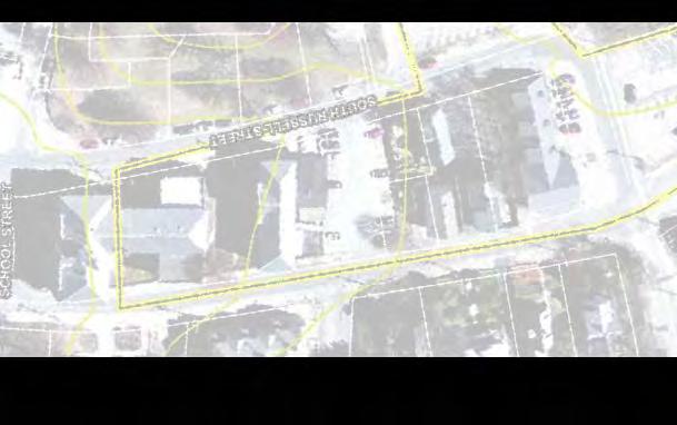
63
64

65 F5

66
67

68

69
70
71

72
73
74 B1
75 Parking Count Existing on-street 2 Existing on-site 140 Existing displaced 142 (-) New 312 (+) Net add 170 (=) B1
76 B1
77 B2
78 Parking Count Existing on-street 2 Existing on-site 140 Existing displaced 142 (-) New 300 (+) Net add 158 (=) B2
79 B2

80 B3
Final Report. Plymouth Transportation Center. August Prepared by:
 Final Report Plymouth Transportation Center August 2012 Prepared by: In association with: CDW Consultants, Inc. DHK Architects, Inc. GLC Development Resources LLC Nitsch Engineering Simon Design Engineering,
Plymouth Transportation & Visitor s Services Center May 6, 2014 Town of Plymouth Board of Selectmen Project Update - Schematic Design
 Plymouth Transportation & Visitor s Services Center May 6, 2014 Town of Plymouth Board of Selectmen Project Update - Schematic Design Overview PRIMARY PROJECT OBJECTIVES: Help address the downtown/waterfront
TOWN COUNCIL / PLANNING COMMISSION
 Workshop #3 TOWN COUNCIL / PLANNING COMMISSION January 20, 2011 Consultant Team In Attendance Tonight BMS Design Group Nevada City and San Francisco Michael Smiley, AICP, ASLA Partner-in-Charge Nancy L.
Scope of Services. River Oaks Boulevard (SH 183) Corridor Master Plan
 Corridor Master Plan") Scope of Services River Oaks Boulevard (SH 183) Corridor Master Plan PROJECT AREA The project area consists of the River Oaks Boulevard (SH 183) corridor bounded by SH 199 at the northern end and the Trinity
Scope of Services River Oaks Boulevard (SH 183) Corridor Master Plan PROJECT AREA The project area consists of the River Oaks Boulevard (SH 183) corridor bounded by SH 199 at the northern end and the Trinity
PLAN ELEMENTS WORKSHOP. April 5, 2016
 PLAN ELEMENTS WORKSHOP April 5, 2016 needs more housing. But there is no one-size fits-all solution. Every neighborhood has its own character. In some places, density is not only appropriate it is badly
Developer s Program. The Station at East 54
 Developer s Program The Station at East 54 Existing Conditions The Station at East 54 is proposed for a 1.12 acre site at the northeast corner of Hamilton Road and Prestwick Road, tucked between the East
TOWN OF NEW CASTLE - Master Plan Update
 Our Presentation Today (1) Recap the Master Planning Process To Date (2) Present the Outline of the Master Planning Work Plan (3) Present the Calendar for the Master Plan (4) Outline the scope of a Downtown
Chapter 1.0 Introduction
 Chapter 1.0 Introduction 1.1 Background The North Metro commuter rail line is part of the RTD FasTracks regional transit system expansion program to build more than 100 miles of rail transit throughout
CITY OF FARGO PARKING RAMP SITE EVALUATION
 CITY OF FARGO PARKING RAMP SITE EVALUATION EXECUTIVE SUMMARY Helenske Design Group (architect) and Carl Walker Inc (Parking Consultant) were retained by the City of Fargo to complete a downtown parking
New Westminster Downtown Parking Strategy Public Open House #1 September 13, 2012
 New Westminster Downtown Parking Strategy Public Open House #1 September 13, 2012 The City is preparing a strategy for parking in Downtown New Westminster. The study team and a group of key stakeholders
COMMUNITY OPEN HOUSE. March 28, 2012
 COMMUNITY OPEN HOUSE March 28, 2012 THE CASE FOR URBAN INVESTMENT One of the best things that cities can do to create jobs especially in the private sector is to improve the quality of life of their inhabitants.
The transportation system in a community is an
 7 TRANSPORTATION The transportation system in a community is an important factor contributing to the quality of life of the residents. Without a sound transportation system to bring both goods and patrons
Town Center (part of the Comprehensive Plan)
") Town Center (part of the Comprehensive Plan) Mercer Island Town Center Looking North (2014) In 1994, a year-long process culminated in a set of design guidelines and code requirements for the Town Center
Town Center (part of the Comprehensive Plan) Mercer Island Town Center Looking North (2014) In 1994, a year-long process culminated in a set of design guidelines and code requirements for the Town Center
Town of Cobourg Heritage Master Plan. Statutory Public Meeting
 Town of Cobourg Heritage Master Plan Statutory Public Meeting April 25 th 2016 Presentation Overview 1. Introduction 2. Project background and schedule overview 3. Review of strategic direction content
Tri-County Transportation & Land Use Study. Steering Committee Meeting May 14, 2009
 Tri-County Transportation & Land Use Study Steering Committee Meeting May 14, 2009 Agenda Recap of Study Goals and Objectives Update on CV Land Use Model: Business as Usual (BAU) Growth Scenario Pros vs
CITY OF CHARLOTTESVILLE, VIRGINIA CITY COUNCIL AGENDA
 CITY OF CHARLOTTESVILLE, VIRGINIA CITY COUNCIL AGENDA Agenda Date: December 16, 2013 Action Required: Adoption of Resolution Presenter: Staff Contacts: Title: James E. Tolbert, AICP, Director of NDS James
4/8/2015 Item #10D Page 1
 MEETING DATE: April 8, 2015 PREPARED BY: Christy Villa, Associate Civil Engineer DEPT. DIRECTOR: Glenn Pruim DEPARTMENT: Public Works CITY MANAGER: Larry Watt SUBJECT: NORTH COAST HIGHWAY 101 STREETSCAPE
3. VISION AND GOALS. Vision Statement. Goals, Objectives and Policies
 Vision Statement Queen Creek s interconnected network of parks, trails, open spaces and recreation opportunities provide safe and diverse activities and programs that sustain its unique, small town, equestrian
Executive Summary. NY 7 / NY 2 Corridor
 Executive Summary NY 7 / NY 2 Corridor Transportation and Land Use Study December 2005 Prepared for: Town of Colonie Capital District Transportation Committee Prepared by: Introduction: Land use decisions
EXHIBIT A. Tax Increment Reinvestment Zone No. 1 (Town Center) First Amended Project Plan 1
 First Amended Project Plan 1") EXHIBIT A Tax Increment Reinvestment Zone No. 1 (Town Center) First Amended Project Plan 1 1 As amended by Resolution No. 2008-02-001(TR1R) of the Tax Increment Reinvestment Zone No.1, and approved to
EXHIBIT A Tax Increment Reinvestment Zone No. 1 (Town Center) First Amended Project Plan 1 1 As amended by Resolution No. 2008-02-001(TR1R) of the Tax Increment Reinvestment Zone No.1, and approved to
Windsor Locks Transit-Oriented Development Planning Grant Request. Project Background
 Windsor Locks Transit-Oriented Development Planning Grant Request Project Background Downtown Windsor Locks runs along Main Street in the vicinity of the intersection of Routes 159 and 140. The current
The Illinois Department of Transportation and Lake County Division of Transportation. Route 173, including the Millburn Bypass
 The Illinois Department of Transportation and Lake County Division of Transportation welcome you to this Public Hearing for U.S. Route 45 from Illinois Route 132 to Illinois Route 173, including the Millburn
Allen Street Civic District Redevelopment Area Plan Redevelopment Plan & Proposal State College Planning Commission State College Redevelopment
 Allen Street Civic District Redevelopment Area Plan Redevelopment Plan & Proposal State College Planning Commission State College Redevelopment Authority September 17, 2015 Discussion Points Overview of
University of the District of Columbia Van Ness Campus Master Plan Community Open House 3. December 8, 2010
 University of the District of Columbia Van Ness Campus Master Plan Open House 3 December 8, 2010 Introductions Sequence of Work: Campus Master Plan BEGIN: INTRODUCE AND START WORK Project Initiation Team
CHAPTER 7: Transportation, Mobility and Circulation
 AGLE AREA COMMUNITY Plan CHAPTER 7 CHAPTER 7: Transportation, Mobility and Circulation Transportation, Mobility and Circulation The purpose of the Transportation, Mobility and Circulation Chapter is to
Transportation. Strategies for Action
 Transportation A major priority for the Overlake Neighborhood is to develop a multimodal transportation system. To achieve this system, a balance has to be found among travel, circulation and access needs;
Parking Garage Site Selection Committee Final Report October 15, 2012
 Parking Garage Site Selection Committee Final Report October 15, 2012 Executive Summary Recommend a Short-List of Sites for Further Review: 1. Explore the Possibility of a Private/ Public Partnership 2.
Mark-up of the effect of the proposed Bronte Village Growth Area OPA No.18 on the text of section 24, Bronte Village, of the Livable Oakville Plan
 Mark-up of the effect of the proposed Bronte Village Growth Area OPA No.18 on the text of section 24, Bronte Village, of the Livable Oakville Plan Notes: This document is provided for information purposes
City of Ann Arbor Page 1
 City of Ann Arbor Text File 301 E. Huron St. Ann Arbor, MI 48104 http://a2gov.legistar.com/cal endar.aspx Agenda # Introduced: Version: 3/3/2014 Current Status: Passed 5 Matter Type: Resolution Resolution
SUBJECT: Waterfront Hotel Planning Study Update TO: Planning and Development Committee FROM: Department of City Building. Recommendation: Purpose:
 Page 1 of Report PB-23-18 SUBJECT: Waterfront Hotel Planning Study Update TO: Planning and Development Committee FROM: Department of City Building Report Number: PB-23-18 Wards Affected: 2 File Numbers:
master plan of highways bus rapid transit amendment
 Scope of Work master plan of highways bus rapid transit amendment September 2011 Montgomery County Planning Department M-NCPPC MontgomeryPlanning.org 1 Scope of Work master plan of highways bus rapid transit
1.0 Purpose of a Secondary Plan for the Masonville Transit Village
 Report to Planning and Environment Committee To: Chair and Members Planning & Environment Committee From: John M. Fleming Managing Director, Planning and City Planner Subject: Masonville Transit Village
Rt 29 Solutions Hydraulic Planning Advisory Panel. September 14, 2017
 Hydraulic Planning Advisory Panel September 14, 2017 Agenda Item 1: Introductions Hydraulic Planning Advisory Panel members Technical Team members 2 Agenda item 2: Public Interaction and Feedback Live
Atlanta BeltLine, Inc. Pathways to Urban Sustainability
 Atlanta BeltLine, Inc. Pathways to Urban Sustainability September 30, 2010 WHAT IS THE ATLANTA BELTLINE? Transit 22-mile loop Parks 1300 + new acres Trails 33 miles Jobs & Economic Development 20 areas,
A. INTRODUCTION B. PROJECT LOCATION
 Chapter 1: Project Description A. INTRODUCTION The Lower Manhattan Development Corporation (LMDC), a subsidiary of the New York State Urban Development Corporation, doing business as the Empire State Development
8implementation. strategies
 PROGRAM STRATEGIES 8implementation strategies T he implementation actions of this chapter are designed to support and carry out the land use, economic development, transportation, urban design, and program
Downtown Area. Draft Vision and Strategies. February 24, 2015 Public Meeting
 Downtown Area Draft Vision and Strategies February 24, 2015 Public Meeting 1 SEA District North Beach Sea and Sky 3 Uptown Opportunity Neighborhoods Hillcrest Assist owner-occupants in negotiating fair
The West Vaughan Employment Area Secondary Plan Policies
 Part 2: The West Vaughan Employment Area Secondary Plan Policies 2.1 General Policies It is the policy of Council: 2.1.1. That the West Vaughan Employment Area (the WVEA), identified on Schedule 1, will
Request for Proposal
 Request for Proposal 10 th Street Corridor Master Plan Department of Planning and Zoning 500 Quartermaster Court Suite 200 Jeffersonville, IN 47130 April 18, 2017 For further information contact: Chad
DOWNTOWN GEORGETOWN PLANNING STUDY
 DOWNTOWN GEORGETOWN PLANNING STUDY Community Workshop #3 Thursday, May 4, 08 The Planning Partnership OVERVIEW OF STUDY, PROCESS & MILESTONES We are here PURPOSE OF THE STUDY To develop a clear vision
TEMPLE MEDICAL & EDUCATION DISTRICT
 City of Temple, Texas TEMPLE MEDICAL & EDUCATION DISTRICT 1 Description. The City of Temple joined in partnership with key public and private entities to jointly promote education and medical activities
Denver Moves: Transit Task Force
 Insert transit picture Denver Moves: Transit Task Force Meeting #8 October 5, 2017 1. Welcome & Introductions Opening remarks and housekeeping Task Force and audience introductions Upcoming events and
Streets, Connectivity & Built Environment Working Group August 2, 2017
 Streets, Connectivity & Built Environment Working Group August 2, 2017 DOWNTOWN OAKLAND SPECIFIC PLAN WELCOME Streets, Connectivity & Built Environment Working Group Social Equity Meeting August 2, 2017
WARM SPRINGS PARK MASTER PLAN
 TABLE OF CONTENTS page 1.0 Introduction and Overview 1 2.0 Information Gathering 2 3.0 Conceptual Alternative Development 8 4.0 Master Plan Development 14 5.0 Construction Cost Estimates 19 LIST OF FIGURES
City of Meriden Harbor Brook Flood Control Project Overview
 City of Meriden Harbor Brook Flood Control Project Overview Updated August 2013 OVERVIEW The center of Meriden, including the HUB site is the low point of the town which is ringed by basalt ridges. Running
MAIN STREET ECONOMIC DEVELOPMENT STRATEGY
 MAIN STREET ECONOMIC DEVELOPMENT STRATEGY A PATHWAY TO A BETTER POUGHKEEPSIE DRAFT Working Paper #2: Planning Strategies Submitted December 1 st, 2015 to the City of Poughkeepsie LAND USE LAW CENTER PACE
Area Plans. September 18, 2012
 Area Plans September 18, 2012 Transfer ratio for existing development up to 1:6 depending on sending parcel sensitivity and distance from community centers and/or transit routes. Within Town Center and
Southern Gateway Project and Public Green
 Southern Gateway Project and Public Green Transportation and Trinity River Project Committee May 23, 2016 Purpose of Presentation Provide the history and an overview of the Southern Gateway Project (SGP)
DRAFT PLAN PRESENTATION
 DRAFT PLAN PRESENTATION 1.23.2018 AGENDA Process Project Schedule Results from Visioning Workshop Draft Plan Highlights Concept Plans Feedback Next Steps PROJECT SCHEDULE KICK-OFF WORKSHOP August 29 th
Welcome to the. Open House
 Welcome to the 5th Street to Kinsman Road Open House November 14 5:30 7:00 p.m. Please sign in Project Overview In December 2016, City Council adopted SW 5th Street as the preferred alignment to connect
City of Farmington. Downtown Plan. Amendment to the 1998 Master Plan Adopted October 11, 2004
 City of Farmington Amendment to the 1998 Master Plan Adopted October 11, 2004 Introduction Planning Background 1 Scope and Components of the Plan Amendment 2 Concept Introduction 3 Plan Concepts 3 Conceptual
The University District envisions, in its neighborhood
 Envisioning the University District Link Light Rail in Seattle s neighborhoods CIY OF SEALE CONCEP-LEVEL SAION AREA PLANNING RECOMMENDAION RESOLUION # 30165 EXHIBI L Vision 08.2000 he University District
WALTER RAND TRANSPORTATION CENTER
 WALTER RAND TRANSPORTATION CENTER PLANNING AND DESIGN STUDY Public Meeting May 25, 2017 TONIGHT S AGENDA Introduction and Welcome Project Objectives The Study Area: WRTC and its Context Circulation Assessment
Rt 29 Solutions Hydraulic Planning Advisory Panel. September 28, 2017
 Hydraulic Planning Advisory Panel September 28, 2017 Agenda Item 1: Introductions Hydraulic Planning Advisory Panel members Technical Team members 2 Agenda item 2: Public Interaction and Feedback Live
VILLAGE OF BOLTON HERITAGE CONSERVATION DISTRICT PLAN
 Page 1 1. INTRODUCTION AND BACKGROUND 1.1 THE PROJECT VILLAGE OF BOLTON HERITAGE CONSERVATION DISTRICT PLAN TERMS OF REFERENCE The Town of Caledon (Town) is a large, predominantly rural municipality with
Downtown Dubuque...it s a great time.
 Downtown Dubuque...it s a great time. Your timing could not be better to invest in Downtown. With hundreds of millions in public and private investment occurring on the City s downtown waterfront, millions
Beaverton City Council: Work Session. SIDEDistrict. May 6, 2014
 BEAVERTON Beaverton City Council: CREEK Work Session SIDEDistrict May 6, 2014 Tonight s Agenda BEAVERTON CREEK SIDE Brief updates Creekside Vision Scenarios & discussion: Redevelopment & Parking Project
SBPO BOARD MEETING MARCH 20, 2018
 SBPO BOARD MEETING MARCH 20, 2018 TODAY'S AGENDA > Booker Middle School Outreach > Property Information > Schedule > Guiding Principles > Three Concepts Booker Middle School Outreach Property Information
Atlanta BeltLine Corridor Environmental Study. Scoping Meeting August 2008
 Atlanta BeltLine Corridor Environmental Study Scoping Meeting August 2008 What Will We Be Discussing Today? Study Overview - How Did We Get Here? - What Is the Study About? - Who Is Involved? - Where Is
Small Area Plan. South Gateway
 Small Area Plan Adopted May 12, 2008 South Gateway Purpose. The South Gateway Small Area Plan defines the City s expectations for the future of the southern entrance to the City at Interstate 85 and Highway
EXISTING COMPREHENSIVE PLAN
 EXISTING COMPREHENSIVE PLAN Town Center Land Use Element: V. LAND USE POLICIES Town Center Mercer Island's business district vision as described in "Your Mercer Island Citizen-Designed Downtown" was an
I-84 Hartford Project Open Planning Studio #12. April 25, 2017
 I-84 Hartford Project Open Planning Studio #12 April 25, 2017 Meeting Agenda 1. I-84 Hartford Project alternatives update 2. Multimodal station area planning 3. I-84 / I-91 Interchange Study coordination
D-O LRT Zoning Discussion. Chapel Hill Boards & Commissions October 16, 2017
 D-O LRT Zoning Discussion Chapel Hill Boards & Commissions October 16, 2017 Update on Overall D-O LRT Station Area Initiative Objectives Design and educate on principles of Good Transit-Oriented Development
Community Workshop. Tuesday, February 15, 2011 New Haven Free Public Library
 Community Workshop Tuesday, February 15, 2011 New Haven Free Public Library 1 Planning and Engineering Design Team PARSONS BRINCKERHOFF (PB) Lead Planning and Design NEWMAN ARCHITECTS Urban Architecture
NORTH CLAYMONT AREA MASTER PLAN COMMUNITY WORKSHOP #1 FEBRUARY 3, 2016
 NORTH CLAYMONT AREA MASTER PLAN COMMUNITY WORKSHOP #1 FEBRUARY 3, 2016 1. Introduction To the team and to the Plan Planning Partners The Claymont Community WILMAPCO New Castle County Claymont Renaissance
Gold Line Bus Rapid Transit Transit Oriented Development (BRTOD) Helmo Station Area Plan
 Helmo Station Area Plan") Appendix F Gold Line Bus Rapid Transit Transit Oriented Development (BRTOD) Helmo Station Area Plan Introduction and Purpose of the Plan The Gold Line Bus Rapid Transit facility is an eleven-mile dedicated
Appendix F Gold Line Bus Rapid Transit Transit Oriented Development (BRTOD) Helmo Station Area Plan Introduction and Purpose of the Plan The Gold Line Bus Rapid Transit facility is an eleven-mile dedicated
V. Vision and Guiding Principles
 V. Vision and Guiding Principles The Master Plan for the Powers Ferry Corridor seeks a foundation in the desires of the community. At times, various elements of the community offered opposing viewpoints,
India Basin/Hunters Point Shoreline Community Workshop May 21, 2008
 India Basin/Hunters Point Shoreline Community Workshop May 21, 2008 Workshop Agenda Welcome Process Overview Context & Existing Conditions Presentation of Draft Concepts Land Use and Open Space Priorities
Workshop 3. City of Burlington Waterfront Hotel Planning Study. September 14, The Planning Partnership
 Workshop 3 City of Burlington Waterfront Hotel Planning Study September 14, 2017 The Planning Partnership The Waterfront Hotel Planning Study 01 The Brant & Lakeshore Planning Study will establish a Strategic
ARLINGTON COUNTY, VIRGINIA
 ARLINGTON COUNTY, VIRGINIA County Board Agenda Item Meeting October 15, 2005 DATE: September 28, 2005 SUBJECT: Request to Advertise the adoption of the 2005 Clarendon Sector Plan C. M. RECOMMENDATION:
A BLUEPRINT FOR BROCKTON A CITY-WIDE COMPREHENSIVE PLAN
 A BLUEPRINT FOR BROCKTON A CITY-WIDE COMPREHENSIVE PLAN Public Meeting October 2016 1 Plan Summary and Discussion Public Meeting May 4 2017 City of Brockton Bill Carpenter, Mayor Department of Planning
International Blvd. TOD Plan Public Workshop #1
 International Blvd. TOD Plan Public Workshop #1 Add photos or project images September 21 and 22, 2010 Workshop Purpose Introduce the public to the Project Review and discuss the existing conditions analysis
Stakeholders Advisory Working Groups (SAWGs) Smart Growth and TOD Land Use (#11) SAWG Meeting
 Smart Growth and TOD Land Use (#11) SAWG Meeting") Presentation - Part II Tappan Zee Bridge/I-287 Corridor Project July 21, 2010 Slide 1. David Kooris (Regional Plan Association) welcomed members of the Land Use Stakeholders Advisory Working Groups (SAWGs)
Presentation - Part II Tappan Zee Bridge/I-287 Corridor Project July 21, 2010 Slide 1. David Kooris (Regional Plan Association) welcomed members of the Land Use Stakeholders Advisory Working Groups (SAWGs)
December 1, 2014 (revised) Preliminary Report -- Thomas Jefferson Site Evaluation
 Preliminary Report -- Thomas Jefferson Site Evaluation") December 1, 2014 (revised) TO: FROM: RE Arlington County Board Thomas Jefferson Site Evaluation Working Group by Carrie Johnson, Chair Preliminary Report -- Thomas Jefferson Site Evaluation The Thomas
December 1, 2014 (revised) TO: FROM: RE Arlington County Board Thomas Jefferson Site Evaluation Working Group by Carrie Johnson, Chair Preliminary Report -- Thomas Jefferson Site Evaluation The Thomas
A larger version of this map is located on the last page of this PDF.
 MAP Committee Input McLoughlin Area Draft Vision Map A larger version of this map is located on the last page of this PDF. 1. The map above is intended to portray a vision for the McLoughlin area. It highlights
Bourne Downtown Site Planning
 Prepared for: The Town of Bourne, MA In Cooperation with: Bourne Financial Development Corporation Prepared by:, Inc. June 24, 2009 Table of Contents Introduction and Summary... 1 Site Existing Conditions...
Michigan City Alternative Analysis Realignment Study. Progress Status Update Report Presentation to City Council February 1, 2012
 Michigan City Alternative Analysis Realignment Study Progress Status Update Report Presentation to City Council Project Web Site Project Web Site is Active www. emichigancity.com Click on NICTD logo at
RESOLUTION NO. R Refining the route, profile and stations for the Downtown Redmond Link Extension
 RESOLUTION NO. R2018-32 Refining the route, profile and stations for the Downtown Redmond Link Extension MEETING: DATE: TYPE OF ACTION: STAFF CONTACT: Capital Committee Board PROPOSED ACTION 09/13/2018
Port Credit Local Advisory Panel October 20 th Meeting
 Port Credit Local Advisory Panel October 20 th Meeting Focus Of This Evening s Meeting: 1. Hurontario Main Street Higher Order Transit Study 2. Port Credit Mobility Hub & GO Station Parking Structure Study
Freightway Site Redevelopment Study
 Freightway Site Redevelopment Study Public Meeting 1 June 12, 2017 1 Introduction Check project website for updates: www.scarsdale.com/fw Send Comments to: freightwaystudy@scarsdale.com 2 Steering Committee
Brown University: Institutional Master Plan Amendment #2. CPC Meeting: December 1, 2009
 Brown University: Institutional Master Plan Amendment #2 CPC Meeting: December 1, 2009 Jewelry District Planning Background Studies Goals Strong transportation links Streets for people Significant open
THAT the attached Terms of Reference for the Thornhill Centre Street Study be approved.
 COMMITTEE OF THE WHOLE AUGUST 18, 2003 THORNHILL CENTRE STREET STUDY PLANNING FILE: 15.92 Recommendation The Commissioner of Planning recommends: THAT the attached Terms of Reference for the Thornhill
Institutional Master Plan The Arnold Arboretum of Harvard University
 Institutional Master Plan The Arnold Arboretum of Harvard University Submitted to: Boston Redevelopment Authority One City Hall Square Boston, MA 02201 Submitted by: The Arnold Arboretum of Harvard University
Town of Oakville Streetscape Strategy
 Town of Oakville Streetscape Strategy Endorsed by PDC on February 10, 2014 (PD-011-14) Town of Oakville Streetscape Strategy [endorsed by PDC February 10, 2014] 0 Town of Oakville Streetscape Strategy
Making Transit Oriented Development Work For Boonton, NJ
 Making Transit Oriented Development Work For Boonton, NJ Bloustein School of Planning and Public Policy Studio Dan Burton Loannie Dao Webster Slater Brandon Williams Ian Watson Maria Laham Nicola Mammes
Rio/29 Small Area Plan. Design Plan & Implementation Framework Open House - January 25, 2018
 Rio/29 Small Area Plan Design Plan & Implementation Framework Open House - January 25, 2018 MEETING PURPOSE PRESENTATION 1. Orient to the updated design plans 2. Introduce implementing options 3. Explain
PREPARED FOR: PLATTEVIEW ROAD CORRIDOR STUDY EXECUTIVE SUMMARY
 PREPARED FOR: PLATTEVIEW ROAD CORRIDOR STUDY EXECUTIVE SUMMARY SEPTEMBER 2016 Introduction The Platteview Road Corridor Study was led by the Metropolitan Area Planning Agency (MAPA) with assistance from
CHAPTER FOUR: Alternatives to the Proposed Action
 CHAPTER FOUR: Alternatives to the Proposed Action CHAPTER FOUR: ALTERNATIVES TO THE PROPOSED ACTION 4.1 Alternatives to the West Campus Plan The following sections discuss alternatives to the proposed
Fifth and Detroit Street Design May 2017 Capital Improvements Committee. DOWNTOWN Street Design
 1 Fifth and Detroit Street Design May 2017 Capital Improvements Committee Agenda 2 Review Street Configuration Prior Meeting Review Outreach Synopsis Functional Street Design Refinements Curb Edge, Turning
SPECIFIC PLAN Requirements
 CITY OF LANCASTER PLANNING DEPARTMENT 44933 Fern Avenue, Lancaster, California 93534 (661) 723-6100 SPECIFIC PLAN Requirements Purpose The purpose of a specific plan is to provide for the logical development
Route 1 Corridor Study
 Route 1 Corridor Study Westbrook, Connecticut A Vision for the Connecticut Shoreline Public Informational Meeting July 28, 2015 Lower Connecticut River Valley Council of Governments Fitzgerald & Halliday,
BATHURST QUAY NEIGHBOURHOOD PLAN IMPLEMENTATION. Streetscape & Public Realm Improvement Plan - Canada Malting Silo Site and Eireann Quay
 BATHURST QUAY NEIGHBOURHOOD PLAN IMPLEMENTATION Streetscape & Public Realm Improvement Plan - Canada Malting Silo Site and Eireann Quay Bryan Bowen, Waterfront Secretariat November 25, 2017 Presentation
In partnership with: Harbor Corridor Plan Bali Hi Mobile Home Park July 24, 2013
 In partnership with: Harbor Corridor Plan Bali Hi Mobile Home Park July 24, 2013 Project Intro 2-miles of Harbor Boulevard Westminster/17 th Street to just north of Edinger Avenue Many people use the corridor
Issues Requiring Future Study
 Issues Requiring Future Study Transportation planning is an ongoing process that tends to identify new issues as it finds solutions for others. Some issues are so complex that a solution to one problem
ESTABLISH AN EFFICIENT TOWN CENTER
 ESTABLISH AN EFFICIENT TOWN CENTER 4 Overview Lisbon residents are proud of the history of Newent and at the same time recognize its current importance as a centralized location for a variety of municipal
Ann Arbor Intermodal Station Environmental Review
 Ann Arbor Intermodal Station Environmental Review Park Advisory Commission September 19, 2017 AGENDA 1. Project Update 2. Draft Environmental Assessment 3. Draft Preferred Alternative 4. Next Steps 5.
GOODY CLANCY WITH KITTELSON & ASSOCIATES RHODESIDE & HARWELL FARR ASSOCIATES W-ZHA
 1 1. Welcome 5 min. 2. Follow-up from 9/22 / Corridor of Light, ground floor uses 20 min. 3. Small on-site open spaces / Overview of types, identities 15 min. 4. Rosslyn Plaza Park / Rosslyn Plaza PDSP
City of Heath. Town Center Concept
 In the give-and-take of getting projects designed, financed, and approved, the famous refrain from the film Field of Dreams is heard often: if you build it, they will come. From the perspective of the
Laberge Group. Town of Coeymans. Draft Comprehensive Plan. Overview of Planning Process
 Draft : Presentation of Goals & Strategies Laberge Group Benjamin H. Syden, A.I.C.P., E.D.P Director in Charge Nicole Allen, A.I.C.P. Senior Planner Anjali Malhotra Planner Presentation Outline Introductions
CITY S GOALS DRIVE MODE CHOICE IN WINSTON-SALEM, NC
 CITY S GOALS DRIVE MODE CHOICE IN WINSTON-SALEM, NC Taiwo Jaiyeoba HDR, Transit Principal, Atlanta, GA Claire Brinkley HDR, Transit Planner, Charlotte, NC AGENDA 1. Project Background 2. Project Process