Broadway/Lawrence Streetscape Design Charrette March 7, 2014
|
|
|
- Diane Brianna Cooper
- 6 years ago
- Views:
Transcription


1 Design Charrette March 7, 2014


2 Agenda Introductions Goals for Charrette Project Overview Project Scoping Alternative Development Streetscape Concepts
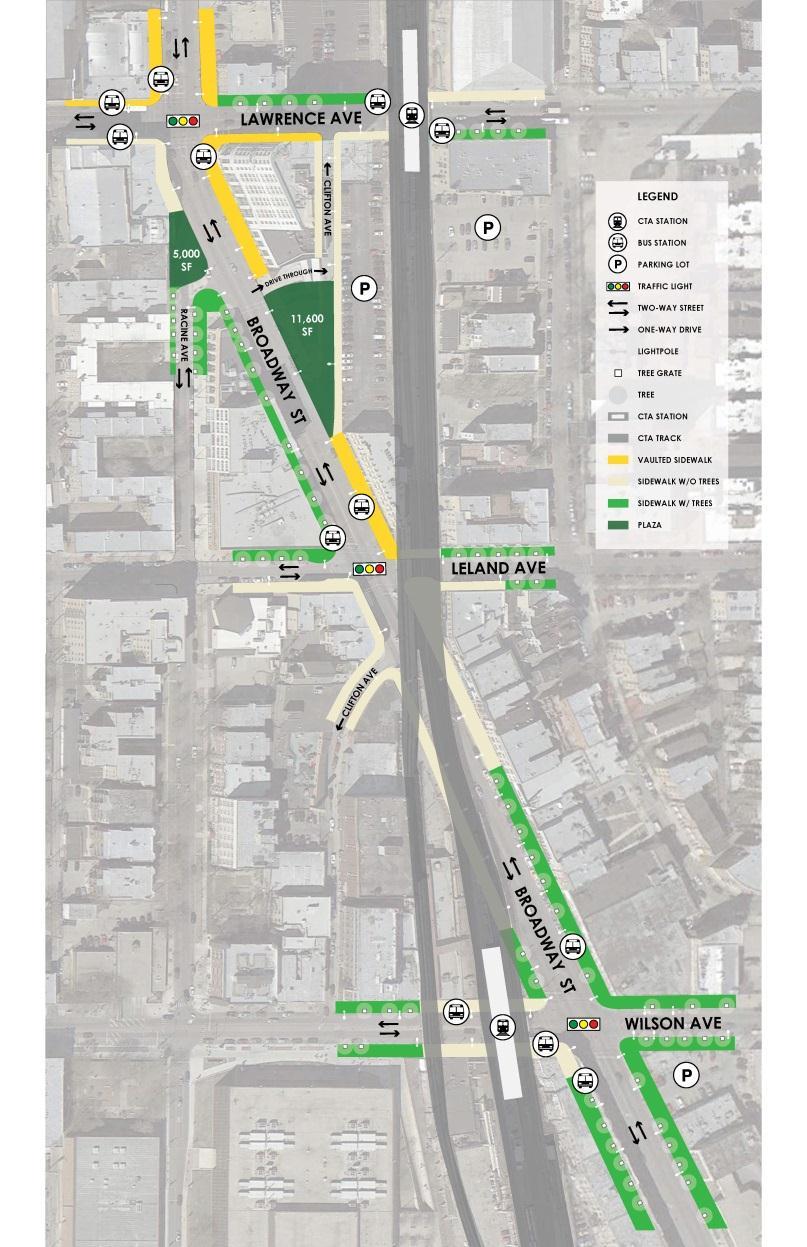
3 Overview Phase 1: North of Leland Avenue 2015 construction Phase 2: South of Leland Avenue 2016 construction*
4 Project Objectives Streetscape improvements New pedestrian plaza at Broadway/Racine intersection Pedestrian-friendly street on Clifton between Lawrence Avenue and Broadway Broadway between Gunnison St and Wilson Ave Lawrence Ave between Broadway and Winthrop Ave Desired Outcome Spur economic development, increase safety, and support mode shift in Uptown community


5 Context Existing Neighborhood Within 0.5 mile of project corridor: 28,000 residents, 6,900 jobs Within 1 mile: 70,000 residents, 22,000 jobs Regional entertainment destinations Aragon 4,500 capacity Riviera Theatre 2,500 capacity

6 Context Historic Area Uptown Square Sheridan Park Uptown Theatre Uptown Broadway Bldg Trust & Savings Bank Study area is commercial, entertainment, transportation core Schools, parks, homes adjacent to study area

7 Context Corridor Zoning Shopping Mixed-Use Commercial Surrounded by residential
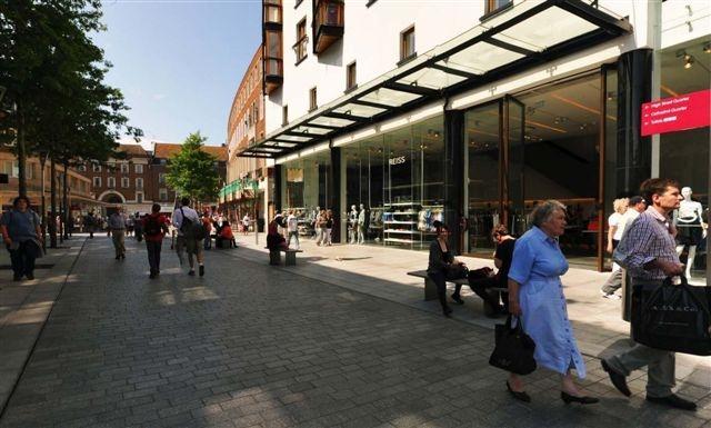
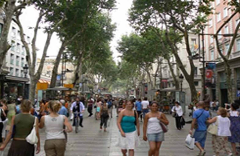
8 Pedestrians Pedestrian Street overlay Designated for Chicago s best examples of pedestrian-oriented shopping streets Opportunities to enhance pedestrian travel paths Existing sidewalk widths (each side) Broadway: ft Lawrence: 6-12 ft
9 Transit Bus Routes Rt 81 - Lawrence 24 hrs/day every day Peak: 7-9 minutes Off-peak: minutes Rt 36 - Broadway Approx 4:00 am - 1:00 am every day Peak: 9 minutes Off-peak: 20 minutes Rt 78 Montrose (Wilson/Broadway) Approx 5:00 am - 11:00 pm every day Peak: 8-10 minutes Off-peak: minutes Lawrence L Station 4,500 avg weekday entries Wilson L Station 7,000 avg weekday entries


10 Transit Wilson Station Reconstruction Looking northwest at Wilson & Broadway Before and After Source: CTA

11 Transit Wilson Station Reconstruction Fewer CTA columns in Broadway Improve sight lines, safety, and street experience for automobiles, bikes, pedestrians Source: CTA

12 Bicycle Facilities 0.5 mile to regional Lakefront Trail Streets for Cycling 2020 Plan Crosstown routes Lawrence & Broadway Neighborhood routes Winthrop & Leland Source: Streets for Cycling 2020
 Neighborhood Street (NS) or Service Way (SW) No truck routes or SRA s")
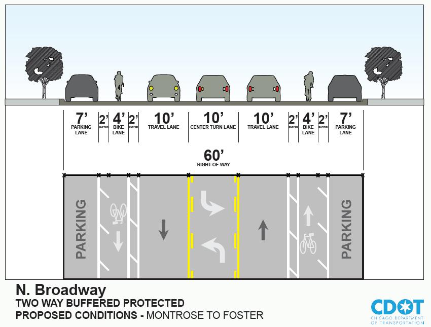
13 Automobiles Street Functional ADT Lanes Class Broadway Minor Arterial 21,600 4 (2 future) Lawrence Minor Arterial 15,700 2 Wilson Major Collector 9,200 2 Racine Local n/a 2 Clifton Local n/a 1 Street Broadway Lawrence Wilson Racine Clifton Form/Function Thoroughfare Connector Connector Neighborhood Street (NS) Neighborhood Street (NS) or Service Way (SW) No truck routes or SRA s
14 Crash Analysis Quantity Injury Type 1 Fatality 11 A - incapacitating 41 B - non-incapacitating 49 C injury reported, not evident 379 Property damage All fatal and severe injury crashes were on Broadway Broadway/Lawrence intersection 25% of study area crashes Fatality location
15 Crashes Ped/Bike 35 Pedestrian (1 fatal) 24 Cyclist Pedestrian and cyclist crashes more likely to result in injuries than automobile-only crashes 64% of A injuries 56% of B injuries Select Locations Pedestrian Cyclist Crashes Crashes Broadway/Lawrence 8 10 Broadway/Wilson 10 3 Broadway CTA 7 4 Underpass
 Mode Hierarchy P-T-B-A")
16 Complete Streets and Hierarchy Building Typology Center/Corridor (C) Roadway Form and Function Thoroughfare: Broadway Connector: Lawrence Ave, Wilson Ave Neighborhood Street: Racine Ave, Clifton Ave (or Service Way) Mode Hierarchy P-T-B-A (default)
")
17 Complete Streets Thoroughfare: Broadway City Connector: Lawrence Ave, Wilson Ave Neighborhood Street/Lane: Racine Ave, Clifton Ave (or Service Way/Alley)
18 Alternatives
19 Alternatives Racine Ave Cul-de-Sac Pros Eliminates potential turning conflicts Larger pedestrian plaza Cons Fire truck movement Narrow pedestrian path between Racine Cul-de- Sac & Broadway (7 ft)

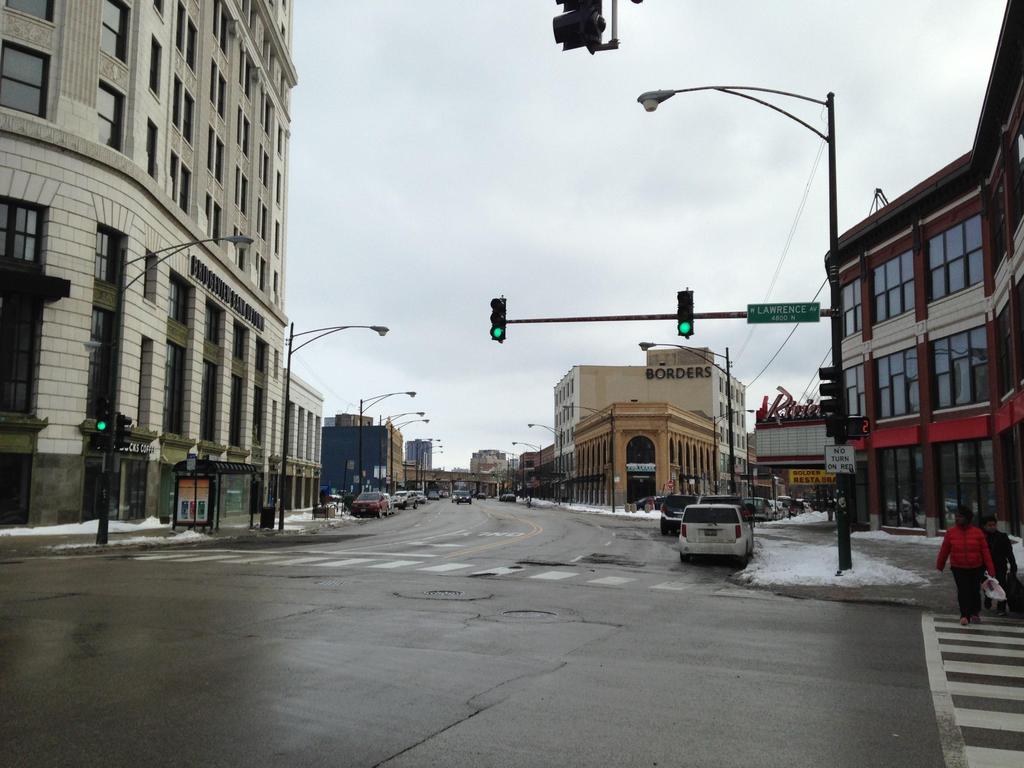
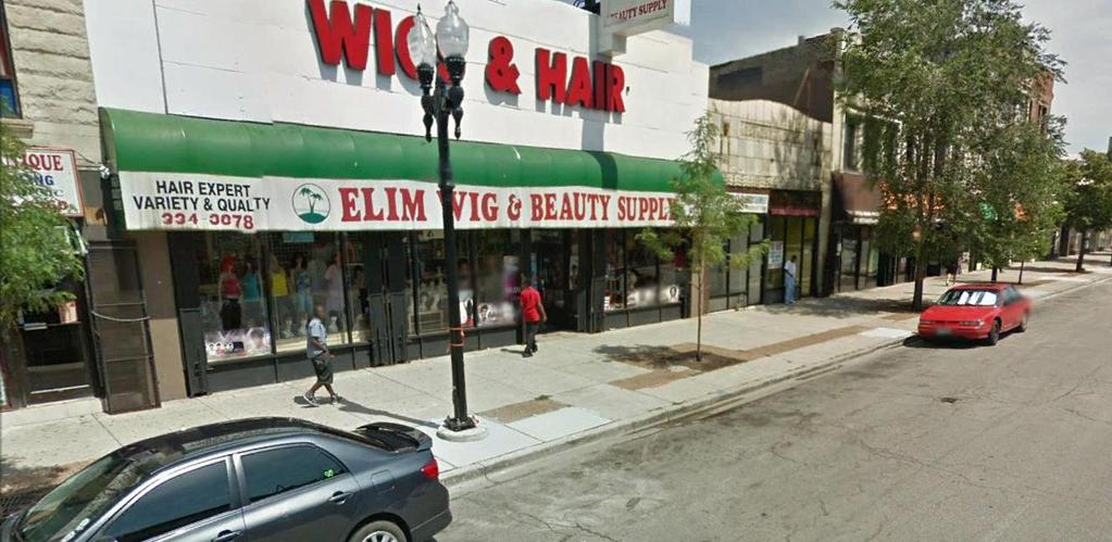
20 Alternatives Racine Ave Two- Way T-intersection Pros Pedestrian plaza Fire truck access Cons Potential turning conflicts Sight lines limit landscaping
21 Alternatives Racine Ave One-Way Northbound T- intersection Pros Eliminates some conflicts Better sight lines allow landscaping Pedestrian plaza Cons Changes two-way street to one way (however, it will match Racine Ave South)

22 Alternatives Clifton Ave One- Way Northbound Pros Maintain existing access/route New ADA sidewalks and crossings Cons Potential vehicle bypass Potential conflicts with bikes and pedestrians
23 Alternatives Clifton Ave Dead- End Pros Pedestrian plaza Reduction of conflicts Cons Elimination of a vehicle path Bank loading area access constrained
24 Sustainable Urban Infrastructure Guidelines (SUIG) Streetscape Requirements evaluated per the Sustainable Urban Infrastructure Guidelines: Water Energy Economics Materials and Waste Climate and Air Quality Beauty and Community Urban Ecology Commissioning
25 Streetscape Concepts
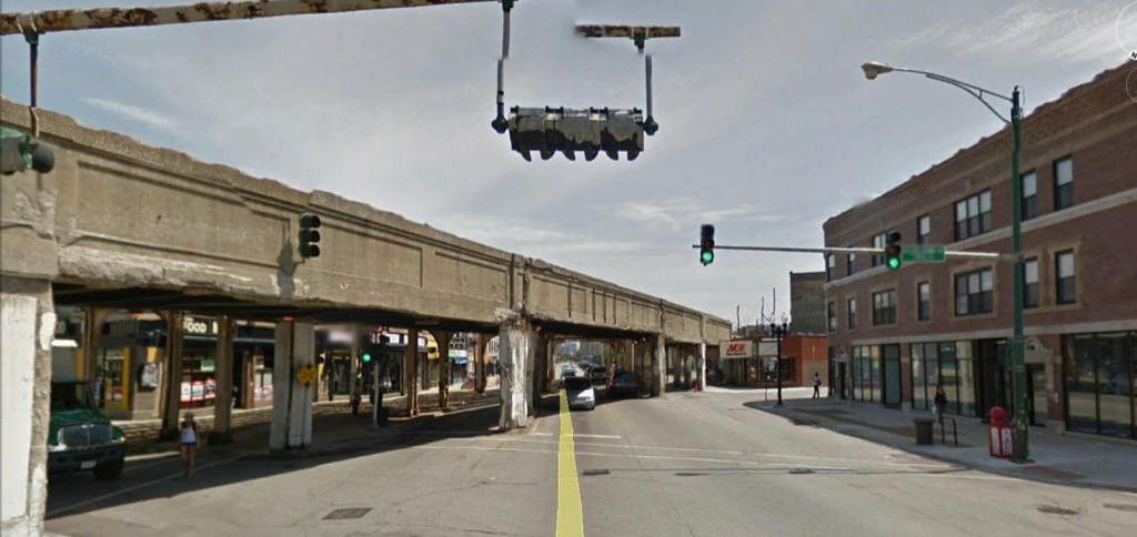
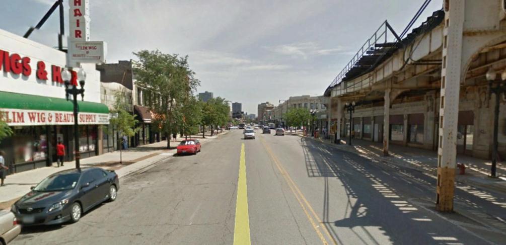
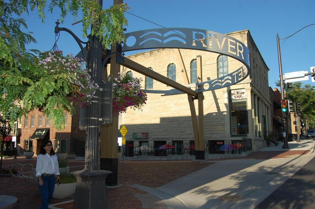
26 Existing Conditions: Bridges Divide Broadway
27 Existing Conditions South of Bridge


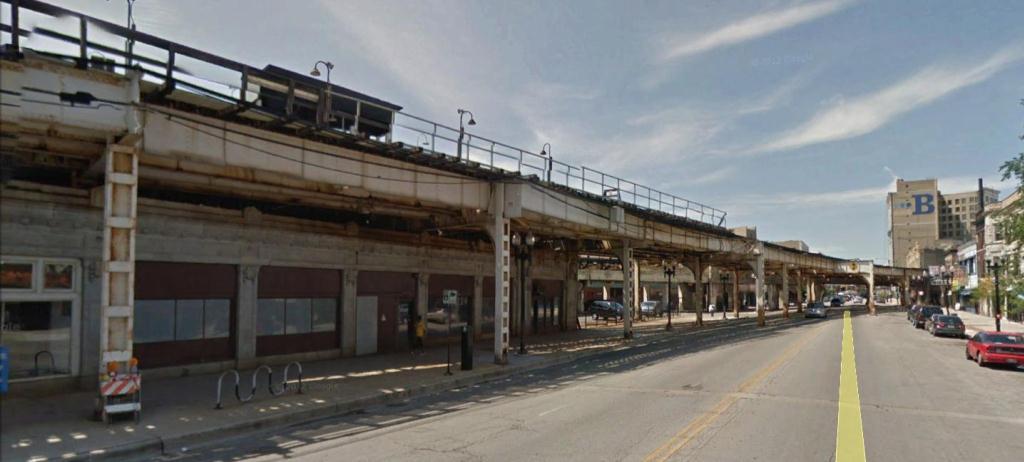
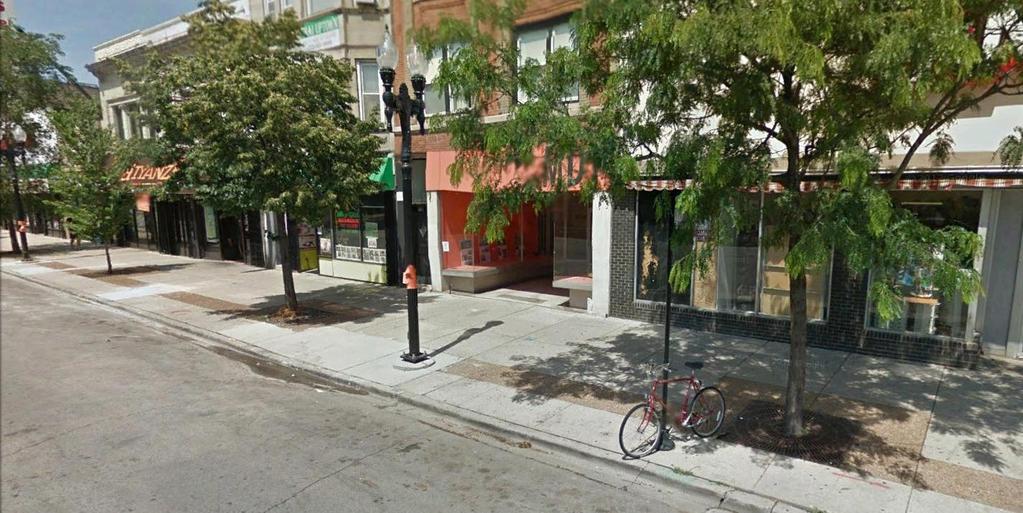
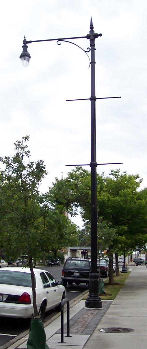
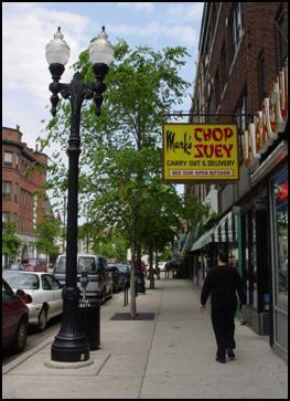
28 Existing Conditions: North of Bridge West Side: Trees in grates and cobra head lights East Side: Vaulted Sidewalks


29 Existing Conditions: Riviera and Bank West: Trees only on Racine. No Trees north of Pancake House East: Pots and Vaulted Sidewalks


30 Existing Conditions: Lawrence and Broadway No Trees, Vaulted Sidewalks, Pots and Cobra Heads Note outdoor dine on Broadway


31 Existing Conditions: Lawrence and Broadway Vaulted Sidewalks on Lawrence west of Broadway Trees in grates N. Side of Lawrence east of Broadway Vaulted Sidewalk at Bank east of Broadway
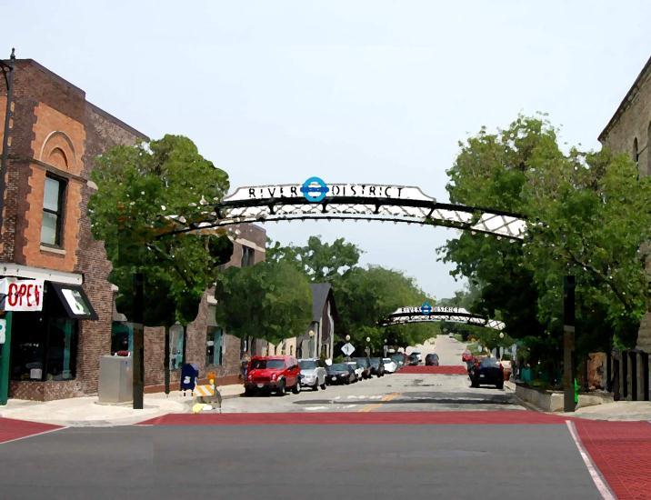
32 Future Treatments
33 Future Treatments: CDOT Family of Elements
34 Potential New Linked Public Spaces on Broadway Very different in character, scale and urban impact, one activated by adjacent uses, the other needs use generated

35 Potential New Linked Public Spaces on Broadway Both could be part of a secondary pedestrian system Both could be part of a secondary pedestrian system

36 Axis Termination on Broadway Draw Interest to the South Both could be part of a secondary pedestrian system
37 Axis Termination on Broadway Potential Plaza Directly on Axis & Connected to Riviera

38 Axis Termination on Broadway Provides a terminus, draws eye south and helps create and outdoor room
39 Potential Plaza Connected to Riviera and Restaurant Outdoor Dine, Stage and Entertainment, Festivals, Connection to Boarders Building and across Broadway to Bank Plaza? Note Windy City Rib Fest held here

40 Potential Plaza 5,000 Sq. Ft. approx. 69 feet Potential Plaza of 5,000 sq. ft.


41 Concept: Music, Dine, part of a series of festival sites Potential Plaza of 5,000 sq. ft.
42 Concept: Music, Dine, part of a series of festival sites Leading the New American Culture Hollywood on Lake Michigan Jazz Age Melting Pot/Stew Potential Plaza of 5,000 sq. ft.

43 Example: Milwaukee and Division 5,000 SQ. FT

44 Example: Rush and State 6,000 SQ. FT

45 Example: (Kempf) Giddings Plaza 6,000 sq. ft. approx. Fountain Stage Outdoor dine Giddings Plaza: Larger and rectangle approx. 125 ft. x 49 ft. or 6,000 sq. ft.


46 Example: Giddings Plaza 6,000 sq. ft.


47 Example: Giddings Plaza 6,000 sq. ft.


48 Stages OTHER DESIGNS DIFFERENT SCALES


49 Stages Planter and raised platform available from Rough and Ready

50 Idea: Integrate an Art Component Music Columns, engraved with tunes from famous local artists can be read and played outside the Riviera. Could be repeated through secondary pedestrian system

51 Idea: Integrate an Art Component
52 Idea: Plaza, temp seating, stage, music columns stage There could be many configurations
53 Potential Plaza Issues: Vaulted Side Walk

54 CDOT Planters and Family of Elements


55 Planters Use above ground planters with no seating component
56 Planters

57 Public Art
58 Public Art: Potential Wall Treatments

59 Public Art: Potential Wall Treatments

60 Clifton creates a gap in the urban wall

61 Join open spaces unite urban wall
62 Gateway

63 Gateway MORE TRADITIONAL

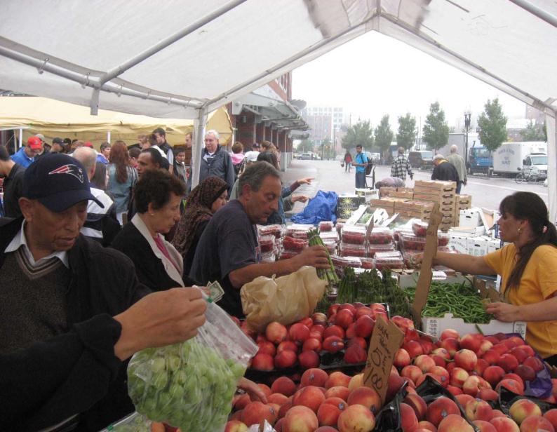
64 Clifton Potential Plaza and Flex Street 95 FT. Approx. 11,000 sq. ft. without sidewalk, more than double the size of Riviera Plaza


65 Giddings Overlaid on Plaza GIDDINGS 6,000 sq. ft. REF: ICE RINK AT MILLENIUM IS 13,000 SQ. FT.


66 Plazas Very little seating, only grass to maintain However not flexible

67 Plaza Flexible with stage


68 Idea : Temporary Dine Malaga: Role out artificial turf, drop down concession pod and open for business


69 Temporary Dine San Francisco s PROXY project brought small businesses, like Ritual Coffee, together on a series of city-owned vacant lots.

70 People Spots

71 Clifton Flex Street
72 FLEX
73 FLEX

74 Markets and Festivals

75 Markets and Festivals NEW NIGHTIME FARMERS MARKET AT ARGYLE BY BROADWAY


76 General : Elements and Features Kiosks as Focal Points Storefront Art for Vacant Buildings
77 Recap Streetscape improvements New pedestrian plaza at Broadway/Racine intersection Pedestrian-friendly street on Clifton between Lawrence Ave and Broadway Broadway between Gunnison St and Wilson Ave Lawrence between Broadway and Winthrop Ave Desired Outcome Spur economic development, increase safety, and support mode shift in Uptown community
Urban Interventions for Placemaking: Making Walkable Streets for Healthy Neighborhoods
 Urban Interventions for Placemaking: Making Walkable Streets for Healthy Neighborhoods Lunch Talks@CAF: Design for Health November 28 th, 2012 Janet L. Attarian, AIA, LEED AP BD+C Livability and Sustainable
WEST LOOP DESIGN GUIDELINES CHECKLIST
 WEST LOOP DESIGN GUIDELINES CHECKLIST Section 1.0 General Strategies 1.1 DESIGN EXCELLENCE: ENCOURAGE HIGH QUALITY AND INNOVATIVE DESIGN OF NEW BUILDINGS WITHIN THE WEST LOOP WITHOUT BEING PRESCRIPTIVE
public review draft Key objectives for this chapter are:
 5 - parks & open space Providing a rich collection of outdoor places for informal gathering and recreation, as well as planned promotional activities and community events, is a key concept for Midtown.
Meeting Display Boards for Public Hearing on the Wilson Transfer Station Project held Tuesday, February 18, 2014.
 Meeting Display Boards for Public Hearing on the Wilson Transfer Station Project held Tuesday, February 18, 2014. Board 1: Welcome Welcome to the Wilson Transfer Station Project Public Hearing. The purpose
CHICAGO S PLACEMAKING PROGRAMS
 NACTO Designing Cities Connections: Can Our Public Transportation Infrastructure Also Foster Public Life? CHICAGO S PLACEMAKING PROGRAMS Luann Hamilton Deputy Commissioner Chicago Department of Transportation
Community Engagement Committee Meeting #1 December 10, :30pm-8:30pm
 Community Engagement Committee Meeting #1 December 10, 2014 6:30pm-8:30pm Welcome and Introductions Dana Murdoch Minneapolis Park and Recreation Board Project Manager Ryan French Walker Art Center Director
FROM DUPONT CIRCLE NORTH TO CALIFORNIA STREET, NW. Welcome!
 FROM DUPONT CIRCLE NORTH TO CALIFORNIA STREET, NW Welcome! Meeting Agenda 6:00 PM Open House 6:30 PM Presentation 7:00 PM Open House / Q&A at the Boards Project Design Team Connecticut Avenue, NW Project
2017 General Obligation Bond
 2017 General Obligation Bond Presentation of Public and Council Projects to the Transportation & Mobility Stakeholder Committee April 13, 2017 Agenda Deferred Maintenance Project Development Process Projects
Lambeth Main Street Streetscape Improvements
 Lambeth Main Street Streetscape Improvements Open House October 5th, 2017 Agenda 1. Introduction 2. Project Background 3. Context 4. Project Objectives 5. Design Principles & Approach 6. Streetscape Design
CNU CHARTER AWARDS 2018 ARGYLE SHARED STREET FACT SHEET
 CNU CHARTER AWARDS 2018 ARGYLE SHARED STREET FACT SHEET Submission Category: I. The Region: Metropolis, City and Town X II. Neighborhood, District and Corridor III. Block, Street and Building Best of title:
SFMTA PHELAN LOOP AND PUBLIC PLAZA PHELAN OCEAN AVENUE
 SFMTA Municipal Transportation Agency Image: a bus in front of the Palace of the Legion of honor SFMTA PHELAN LOOP AND PUBLIC PLAZA PHELAN AVENUE @ OCEAN AVENUE Community Meeting May 23, 2012 San Francisco,
CHAPTER 7: Transportation, Mobility and Circulation
 AGLE AREA COMMUNITY Plan CHAPTER 7 CHAPTER 7: Transportation, Mobility and Circulation Transportation, Mobility and Circulation The purpose of the Transportation, Mobility and Circulation Chapter is to
2040 Long Range Transportation Plan
 2040 Long Range Transportation Plan Adopted: April 15, 2013 APPENDIX D HIGHWAY NEEDS PLAN PROJECTS FREDERICKSBURG Existing and Committed Projects Fall Hill Avenue/Mary Washington Blvd. (Fredericksburg)
Gold Line Bus Rapid Transit Transit Oriented Development (BRTOD) Helmo Station Area Plan
 Helmo Station Area Plan") Appendix F Gold Line Bus Rapid Transit Transit Oriented Development (BRTOD) Helmo Station Area Plan Introduction and Purpose of the Plan The Gold Line Bus Rapid Transit facility is an eleven-mile dedicated
Appendix F Gold Line Bus Rapid Transit Transit Oriented Development (BRTOD) Helmo Station Area Plan Introduction and Purpose of the Plan The Gold Line Bus Rapid Transit facility is an eleven-mile dedicated
This Review Is Divided Into Two Phases:
 Semiahmoo Town Centre Review The purpose of this review: To review the Semiahmoo Town Centre Concept Plan, originally approved in 1993, to ensure that this centre will continue to serve the needs of South
Today Land & People. Northeast Nampa Gateway District. Employment. Land Use Characteristics. Demographics. Current Zoning
 Today Land & People Employment Major employers include Saint Alphonsus, the College of Western Idaho, the Auto Mall, Sorrento Lactalis and Walmart. 3,004 jobs in 2010 (COMPASS-CIM 2040 TAZ data) 4,345
Complete Streets Guidelines & Implementation Strategy. Public Open House #2 June 12, :30-8:00 pm
 Complete Streets Guidelines & Implementation Strategy Public Open House #2 June 12, 2018 5:30-8:00 pm Purpose The purpose of this project is to develop Complete Streets guidelines and an implementation
Access Management: An Overview
 Figures 1-5 Below Evolution of development along a highway. In the early stages, land along the road is used for farming with little traffic generated. As time passes, the highway corridor becomes a de
The Need to Develop a Transit Ready Community
 Evaluation & Appraisal Report (EAR) Major Issue # 6 The Need to Develop a Transit Ready Community July 3, 2007 EAR Major Issue # 6 Transit Ready Existing Comp Plan policies apply only to Indiantown Road:
Trafalgar Road Corridor Planning Study Open House
 Trafalgar Road Corridor Planning Study Open House June 24, 2013 6:30-8:30 p.m. Oakville & Trafalgar Rooms Overview The Livable Oakville Plan identifies the lands along Trafalgar Road, between the QEW and
5.1 Site Plan Guidelines
 5. Community Core Guidelines Development of the Community Core will take place by plan of subdivision and site plan approval. It will occur in a phased manner that will reflect the timing of residential
Study Area. Capitol Way. Greening America s Capitals 11/13/2014. A Greening America s Capitals Project
 Olympia, WA: Greening Capitol Way Supporting Communities move towards sustainability is a priority for the federal government. A Greening America s Capitals Project Office of Sustainable Communities U.S.
APPENDICES DESIGNING PUBLIC SPACES - ENERGIZED PUBLIC SPACES DESIGN GUIDELINES WORKING DRAFT DECEMBER 2018 A1
 APPENDICES DESIGNING PUBLIC SPACES - ENERGIZED PUBLIC SPACES DESIGN GUIDELINES WORKING DRAFT DECEMBER 2018 A1 App.1 Case Studies by Park Types The upcoming (in-progress) online library will house several
LUNDY S LANE COMMUNITY IMPROVEMENT PLAN STUDY
 PUBLIC INFORMATION MEETING #2 October 12, 2016 LUNDY S LANE COMMUNITY IMPROVEMENT PLAN STUDY AGENDA 5:00 to 5:30pm: Open House 5:30 to 6:15pm: Presentation 6:15 to 7:00pm: Individual paced workshop with
The transportation system in a community is an
 7 TRANSPORTATION The transportation system in a community is an important factor contributing to the quality of life of the residents. Without a sound transportation system to bring both goods and patrons
3.1 community vision. 3.3 required plan elements
 Chapter 3 Community Form 3.1 community vision 3.2 Parks & landscaping concepts 3.3 required plan elements D R A F T 20 Community Form Chapter 3 3.0 Community form 3.1 community vision The Specific Plan
SLIDE TITLE. TRANSIT AGENCIES AND COMMUNITY PLANNING Case Study in Supporting TOD with the Chicago Transit Authority TRANSPORT CHICAGO 2017
 SLIDE TITLE TRANSIT AGENCIES AND COMMUNITY PLANNING Case Study in Supporting TOD with the Chicago Transit Authority 1 INTRODUCTION WELCOME Steve Hands, Senior Manager for the Chicago Transit Authority
Reinventing Miner Avenue as a
 Reinventing Miner Avenue as a Complete Street Reinventing Miner Avenue as a Complete Street Agenda Project Overview / Introductions Previous Meeting Recap Economic Considerations Opportunities & Constraints
THE NEIGHBORHOOD TODAY
 THE NEIGHBORHOOD TODAY CORE AREA VISION How are we Good Urbanism A Site s DNA thinking about Elements of great Unique elements urban communities embedded in a place the site and design? ELEMENTS LIKE:
TRANSIT NEIGHBORHOOD PLANS PROGRAM OVERVIEW
 TRANSIT NEIGHBORHOOD PLANS PROGRAM OVERVIEW OCTOBER 2017 Los Angeles Department of City Planning @LATNP and @Planning4LA Outline Introduction Policy Framework The Transit Neighborhood Plans Program Overview:
1.0 VISION STATEMENT. December 6, PRINCIPLES
 Vision Statement Lincoln Regional Airport 1.0 VISION STATEMENT 1.1 City LOCATION of AND OVERVIEW The Easton Lincoln Place Land Use Master Plan identifies the principles, goals, policies, and standards
THE COUTURE AT A GLANCE $122 MILLION TOTAL PROJECT COST 44 STORIES / 700,000 SQUARE FEET PUBLIC PLAZAS, PARK & PEDESTRIAN BRIDGES 302 MARKET RATE
 MILWAUKEE THE COUTURE AT A GLANCE $122 MILLION TOTAL PROJECT COST 44 STORIES / 700,000 SQUARE FEET PUBLIC PLAZAS, PARK & PEDESTRIAN BRIDGES 302 MARKET RATE APARTMENTS 54,893 SQUARE FEET OF DESTINATION
Table of Contents. Elm Avenue Improvement Plan City of Waco, Texas. Introduction 1. Existing Context 1 Figure 1 2.
 Table of Contents Introduction 1 Existing Context 1 Figure 1 2 Plan Guidelines 3 Future Urban Form 4 The West-End 4 Main Street 6 The East-End 7 Figure 2 9 Public Improvement Recommendations 7 General
Streets Vision
 streets 86 2.9 Vision : The Most Prevalent and Important Public Spaces Fixed routes of human travel have served as corridors for commerce and places for human interaction from the earliest trails and foot
4.6 LAND USE. b. Regulatory Setting. The Specific Plan area includes the following General Plan land use designations, as shown in Figure 2-3:
 4.6 LAND USE 4.6.1 Environmental Setting a. Existing Land Uses. The Specific Plan area, located in the center of the City in the downtown core area, consists of about 50 square blocks radiating from the
Equitable Growth Through TOD Planning
 Equitable Growth Through TOD Planning Community Meeting # 2 November 2017 Goals Objectives Extend investment from downtown Connect neighborhoods physically and economically Enhance places based on local
DRAFT ROOSEVELT ROAD. District Recommendations. Figure 5.23 The Roosevelt Road Corridor
 CHAPTER 5 Figure 5.23 The Road Corridor Road will develop as a mixed-use corridor, emphasizing regional retail, west of the river and mixed-use development east of the river. KEY RECOMMENDATIONS 1. High
STREETSCAPE IMPROVEMENTS - RECOMMENDATIONS
 STREETSCAPE IMPROVEMENTS - RECOMMENDATIONS Figure 4.3.1- A map of all of the recommended streetscape improvements. The key component of downtown s public realm, apart from its public spaces, is its street
Welcome to the. Open House
 Welcome to the 5th Street to Kinsman Road Open House November 14 5:30 7:00 p.m. Please sign in Project Overview In December 2016, City Council adopted SW 5th Street as the preferred alignment to connect
Por favor, levanten la mano si necesita traduccion en espanol Please raise your hand if you need Spanish translation
 FEDERAL BOULEVARD CORRIDOR WIDE STUDY PUBLIC MEETING #1 APRIL 27, 2016 Por favor, levanten la mano si necesita traduccion en espanol Please raise your hand if you need Spanish translation HDR DESIGN WORKSHOP
SH 199 Corridor Master Plan. Community Meeting No. 2 May 31, 2017
 Community Meeting No. 2 May 31, 2017 Transportation Projects On or Near SH 199 SH 199 from 0.3 miles south of FM 1886 to south end of Lake Worth bridge Construct freeway mainlanes and frontage roads 10-Year
Complete and Green Streets
 Complete and Green Streets DANNIELLE GLAROS CHIEF OF STAFF, COUNCILMAN ERIC OLSON JIM WILSON DEPARTMENT OF PUBLIC WORKS AND TRANSPORTATION, PRINCE GEORGE S COUNTY What is a complete street? Complete streets
Cleveland Park Streetscape and Drainage Improvement Project 1
 Cleveland Park Streetscape and Drainage Improvement Project 1 Urban Context Washington, D.C. Connecticut Avenue Cleveland Park Streetscape and Drainage Improvement Project 2 Neighborhood Context Contributing
MALLETTS BAY INITIATIVE
 MALLETTS BAY INITIATIVE Stormwater Management & Transportation Scoping Study January 19, 2017 Project Team Bryan Osborne Director of Public Works Sarah Hadd Director of Planning & Zoning Marshall Distel
Workshop #3 June 13, 2016
 Downtown Ocoee Master Plan Workshop #3 June 13, 2016 Our Team Our Team and Tonight s Goal Quick Recap: Why a Downtown Plan? How are we developing the plan? How can you still be involved? What s left to
P A R K L E T 2016 PILOT PROJECT
 GRAND FORKS, NORTH DAKOTA P A R K L E T 2016 PILOT PROJECT City of Grand Forks Planning & Community Development Department LIVE, LEARN, WORK, PLAY, AND STAY The purpose of the Grand Forks Parklet Application
Comprehensive Plan Advisory Panel Meeting #3
 Comprehensive Plan Advisory Panel Meeting #3 November 7, 2016 Agenda 1. September 19 th Meeting Notes 2. Summary of Focus Areas Charrette 3. Heart of the City Focus Area a. HOC2/Station Areas Concept &
CAMPUS MASTER PLAN DRAFT PLAN UPDATE JANUARY
 NEW MEXICO HIGHLANDS UNIVERSITY CAMPUS MASTER PLAN DRAFT PLAN UPDATE JANUARY 27 2010 MASTER PLANNING GOALS TO BALANCE THE STRATEGIC GOALS OF THE UNIVERSITY WITH THE PHYSICAL CAMPUS through the assessment
Midtown Corridor Alternatives Analysis. Appendix A - Initially Considered Alternatives Screening
 Midtown Corridor Alternatives Analysis Appendix A - Initially Considered Alternatives Screening Arterial BRT on Lake Street - Overall Rating: RATING Metropolitan Council recommendations stated in the Transportation
RECLAIMING PUBLIC SPACE
 RECLAIMING PUBLIC SPACE INTRODUCTION PRECEDENT STUDIES AREAS OF FOCUS VISION IMPLEMENTATION CHURCH ST WEST END AVEBROADWAY BROADWAY DIVISION ST DEMONBREUN ST Reclaiming Public Space Like most cities, Nashville
Carlsbad Village Redevelopment Concept Summary of Features
 Carlsbad Village Redevelopment Concept Summary of Features Calthorpe Associates November 5, 2003 The Redevelopment Concept illustrates a vision for the future of Carlsbad Village. The overall vision of
Dogpatch/22nd Street Greening
 TEAM MEMBERS Prepared for: GreenTrustSF Central Waterfront www.gtsfcw.org Prepared by: Fletcher Studio San Francisco, CA www.fletcherstudio.com Landscape Architecture Urban Design Environmental Planning
Draft Memorandum #1: Goals and Vision for Revitalization
 Keizer Revitalization Plan Draft Memorandum #1: Goals and Vision for Revitalization Submitted to: City of Keizer April 12, 2018 (revised) Prepared By: Angelo Planning Group and Otak, Inc. Project No. 17482.A
Tyvola & Archdale Transit Station Area Plan. June 5, 2008
 Tyvola & Archdale Transit Station Area Plan Second Public Meeting June 5, 2008 Presentation Outline 1. Purpose and Process 2. Station Area Overview 3. Plan Recommendations 4. Comments Received and Proposed
Transportation. Strategies for Action
 Transportation A major priority for the Overlake Neighborhood is to develop a multimodal transportation system. To achieve this system, a balance has to be found among travel, circulation and access needs;
Pedestrian and Bike Bridge LOGO
 6.2.2 Pedestrian and Bike Bridge The proposed pedestrian and bike crossing re-envisions the existing bridge at Pismo Creek on Cypress Street. The bridge is currently underutilized by vehicular through
Downtown North Las Vegas Demonstration Site Project. Project Update
 Downtown North Las Vegas Demonstration Site Project Project Update 7.16.14 Presentation Overview Project Purpose and Process Planning Context Opportunities and Barriers Summary Community Input Preliminary
C I T Y O F T O R O N T O L A W R E N C E A V E N U E E A S T S T U D Y. Northwest Corner of Birchmount Road and Lawrence Avenue East
 C I T Y O F T O R O N T O A P P E N D I X A Northwest Corner of Birchmount Road and Lawrence Avenue East 92 DILLON CONSULTING LTD. - J.C. WILLIAMS GROUP LTD. APPENDIX B LAWRENCE AVENUE EAST STUDY SUMMARY
Fifth and Detroit Street Design May 2017 Capital Improvements Committee. DOWNTOWN Street Design
 1 Fifth and Detroit Street Design May 2017 Capital Improvements Committee Agenda 2 Review Street Configuration Prior Meeting Review Outreach Synopsis Functional Street Design Refinements Curb Edge, Turning
Welcome. Comprehensive Plan & Transportation Plan Open House November 7, 2012
 Welcome Comprehensive Plan & Transportation Plan Open House November 7, 2012 Agenda Proposed future land use plan Comprehensive Plan strategies Traffic forecasts Future traffic operations Possible future
CHAPTER 3 VISION, GOALS, & PLANNING PRINCIPLES. City of Greensburg Comprehensive Plan. Introduction. Vision Statement. Growth Management Goals.
 CHAPTER 3 VISION, GOALS, & PLANNING PRINCIPLES Introduction The Greensburg Comprehensive Plan is intended as a working community document. A combination of long and short-term goals, this document is intended
Lower South Street/Louisa Street Charrette Final Presentation. September 22, 2009
 Lower South Street/Louisa Street Charrette Final Presentation September 22, 2009 Recap Mayor and Council called for a Charrette to engage the public on creating a vision for the Lower South Street area.
Urban Design Brief Fanshawe Park Road. Competition Toyota
 Urban Design Brief 1300 Fanshawe Park Road Competition Toyota May 2, 2014 TABLE OF CONTENTS Page No. INTRODUCTION... 1 SECTION 1 LAND USE PLANNING CONTEXT... 1 1.1 The Subject Lands... 1 1.2 The Proposal...
SLIDE TITLE TRANSIT-ORIENTED DEVELOPMENT PLAN RED-PURPLE BYPASS STUDY AREA PUBLIC MEETING #2 RED AND PURPLE MODERNIZATION. RPM TOD Plan Update
 SLIDE TITLE TRANSIT-ORIENTED DEVELOPMENT PLAN RED-PURPLE BYPASS STUDY AREA PUBLIC MEETING #2 RED AND PURPLE MODERNIZATION 1 SLIDE TITLE AGENDA Project Introduction TOD s and Development Trends Real Estate
PROPOSED REDEVELOPMENT OF THE GLEN ABBEY GOLF CLUB. STREETSCAPE DESIGN STUDY (excerpt from the Urban Design Brief) TOWN OF OAKVILLE.
 TOWN OF OAKVILLE.") PROPOSED REDEVELOPMENT OF THE GLEN ABBEY GOLF CLUB STREETSCAPE DESIGN STUDY (excerpt from the Urban Design Brief) TOWN OF OAKVILLE OCTOBER, 2016 for 2.4.2 STREETS Streets are the single largest component
PROPOSED REDEVELOPMENT OF THE GLEN ABBEY GOLF CLUB STREETSCAPE DESIGN STUDY (excerpt from the Urban Design Brief) TOWN OF OAKVILLE OCTOBER, 2016 for 2.4.2 STREETS Streets are the single largest component
SOUTH UNIVERSITY Street Design Alternatives in Progress
 1 Alternatives in Progress 2016.01.20 Meeting Agenda 2 1. Progress & Schedule 2. Utilizing the Street Design Manual 3. Site Characteristics and Input Received 4. Street Geometry What can we accomplish
COMPLETE GREEN STREET CHECKLIST
 COMPLETE GREEN STREET CHECKLIST This document was developed to dissect the structure of an urban street and explore opportunities to make our streets more complete while also integrating green street strategies.
2013 CAMPUS MASTER PLAN UPDATE
 The University of North Carolina at Greensboro 2013 CAMPUS MASTER PLAN UPDATE Board of Trustees December 6, 2013 MASTER PLAN GOALS 1. Plan for an engaging, collaborative learning environment that aligns
Route 1 Corridor Study
 Route 1 Corridor Study Westbrook, Connecticut A Vision for the Connecticut Shoreline Public Informational Meeting July 28, 2015 Lower Connecticut River Valley Council of Governments Fitzgerald & Halliday,
Broadway District Specific Plan. Community Workshop #2 February 23,2016
 Broadway District Specific Plan Community Workshop #2 February 23,2016 1 Agenda Introductions Project Progress Status Upcoming Milestones Emerging Framework Land Use Urban Design Circulation Infrastructure
Making Transit Oriented Development Work For Boonton, NJ
 Making Transit Oriented Development Work For Boonton, NJ Bloustein School of Planning and Public Policy Studio Dan Burton Loannie Dao Webster Slater Brandon Williams Ian Watson Maria Laham Nicola Mammes
Northwest Rail Corridor and US 36 BRT Development Oriented Transit Analysis 4.4 STATION AREA FINDINGS
 4.4 STATION AREA FINDINGS Each station is different, and each one requires a separate set of recommendations based on the vision for the site. This section outlines an initial TOD strategy and recommendations
City of Long Beach. creating vibrant and exciting places
 City of Long Beach creating vibrant and exciting places Land Use Element Urban Design Element Overview of the two draft General Plan elements Discuss areas of change Economic goals of the plans Case study
TOWN COUNCIL / PLANNING COMMISSION
 Workshop #3 TOWN COUNCIL / PLANNING COMMISSION January 20, 2011 Consultant Team In Attendance Tonight BMS Design Group Nevada City and San Francisco Michael Smiley, AICP, ASLA Partner-in-Charge Nancy L.
Downtown Davis Specific Plan
 Downtown Davis Specific Plan Dana Point, CA Existing Conditions Presentation Daniel Parolek Principal, Opticos Design, Inc. Mitali Ganguly Associate, Opticos Design, Inc. January 25, 2018 1 All Places
REGIONAL ACTIVITY CENTER
 DRAFT REGIONAL ACTIVITY CENTER 70 EAST BENCH MASTER PLAN DRAFT 06 Introduction The East Bench Regional Activity center is comprised of large educational, research, medical, and employment centers. These
 Community Workshop #2 December 4, 2014 Team Tonight s Agenda 6:00 pm Welcome! 6:05 pm The Future of Downtown Tustin Ideas, Strategies and Recommendations 6:35 pm Questions and Comments 6:50 pm Open
ITEM #8. Regional Smart Growth Program. Regional Smart Growth Program. Presentation Overview. Coast Highway Vision and Stategic Plan.
 Regional Smart Growth Program Economic Development Commission What is Smart Growth? Adopted as part of the Regional Comprehensive Plan (RCP) RCP provides vision for region based on Smart Growth and sustainability
EcoVerde MADISON TO DOWNTOWN TO BEACH. Legend Highway Major Connection Major Street Local Street Proposed Access. Response to Tropicana Field RFP
 EcoVerde TO BEACH 275 16th Street North 16th Street South 13th Street North 13th Street South 11th Street North 11th Street South 1st Avenue North Central Avenue 1st Avenue South TO DOWNTOWN 2nd Avenue
The Illinois Department of Transportation and Lake County Division of Transportation. Route 173, including the Millburn Bypass
 The Illinois Department of Transportation and Lake County Division of Transportation welcome you to this Public Hearing for U.S. Route 45 from Illinois Route 132 to Illinois Route 173, including the Millburn
DOWNTOWN BALTIMORE OPEN SPACE MASTER PLAN. GoDowntownBaltimore.com
 DOWNTOWN BALTIMORE OPEN SPACE MASTER PLAN 2011 GoDowntownBaltimore.com When people think about what makes a successful city, they often think about the buildings that comprise the skyline, but most don
URBAN DESIGN BRIEF. 2136&2148 Trafalgar Road. Town of Oakville
 URBAN DESIGN BRIEF 2136&2148 Trafalgar Road Town of Oakville Prepared By: METROPOLITAN CONSULTING INC For 2500674 Ontario Inc November 2016 TABLE OF CONTENTS Page No. 1.0 Introduction/Description of Subject
1. General Purpose. 3. Uses
 1. General Purpose The purpose of this DC1 Provision is to facilitate the development of a pedestrian friendly Community Commercial Centre that may accommodate a range of commercial, residential, office,
ORDINANCE AN ORDINANCE TO ADD A NEW SECTION 4.N. IN THE ZONING CODE FOR THE TOWN OF MIDDLETOWN, RELATING TO MIXED-USE DEVELOPMENT
 Introduced: November 5, 2018 Approved: ORDINANCE 18-11-01 AN ORDINANCE TO ADD A NEW SECTION 4.N. IN THE ZONING CODE FOR THE TOWN OF MIDDLETOWN, RELATING TO MIXED-USE DEVELOPMENT BE IT ENACTED BY THE MAYOR
Staff Planner Ashby Moss
 Applicant & Property Owner Public Hearing June 13, 2018 City Council Election District Beach Agenda Item 5 Request Special Exception for Alternative Compliance (Build-to requirement in Oceanfront Resort
3.0 URBAN DESIGN. December 6, OVERVIEW
 Urban Design 3.0 URBAN DESIGN December 6, 2007 3.1 OVERVIEW The highly urban character of Easton Place is defined by the overall design of the community. The following sections provide an overview of the
Metro. Activity Center Design Guidelines. Recommendations For Developing Focused, Mixed-Use Commercial/Residential Centers
 Metro Activity Center Design Guidelines Recommendations For Developing Focused, Mixed-Use Commercial/Residential Centers Metro Activity Centers What is a MAC? Legacy, the adopted guide for the future growth
West Ocala Vision & Community Plan City Council Work Session. Presented by West Ocala Community Plan Steering Committee
 West Ocala Vision & Community Plan City Council Work Session Presented by West Ocala Community Plan Steering Committee November 29,2011 Ocala 2035 Vision West Ocala Community Vision & Master Plan West
Public Meeting. US Highway 14 (6TH Street) from Main Ave to Medary Ave Urban Reconstruction Project Brookings, SD P-PH 0014(179)419 PCN 027B
 from Main Ave to Medary Ave Urban Reconstruction Project Brookings, SD P-PH 0014(179)419 PCN 027B") Public Meeting US Highway 14 (6TH Street) from Main Ave to Medary Ave Urban Reconstruction Project Brookings, SD P-PH 0014(179)419 PCN 027B Mark Leiferman Chief Road Design Engineer April 28, 2014 Why
Public Meeting US Highway 14 (6TH Street) from Main Ave to Medary Ave Urban Reconstruction Project Brookings, SD P-PH 0014(179)419 PCN 027B Mark Leiferman Chief Road Design Engineer April 28, 2014 Why
EXISTING PLANS Harriet Festing Center for Neighborhood Technology Midlothian Community Meeting March 12, 2015
 EXISTING PLANS Harriet Festing Center for Neighborhood Technology Midlothian Community Meeting March 12, 2015 BENEFITS Bring economic, community + environmental benefits Enhance property values Use
WELCOME and introduction
 1 WELCOME and introduction Mobility Hub Locations within Burlington STUDY OVERVIEW STUDY OBJECTIVES The City of Burlington is developing four Area Specific Plans, one for each of Burlington s Mobility
Mount Dennis Mobility Hub Study Public Meeting December 12 th, :30pm 9:30pm York Memorial Collegiate, Cafeteria 2690 Eglinton Avenue West
 Mount Dennis Mobility Hub Study Public Meeting December 12 th, 2012 6:30pm 9:30pm York Memorial Collegiate, Cafeteria 2690 Eglinton Avenue West MEETING SUMMARY On December 12 th, 2012, over 89 people participated
Section4 Design Vision & Implementation Plan
 Section4 Design Vision & Implementation Plan W Woodschurch Rd 4.1 Design Focus Areas The Framework Plan is simply the starting point for directing the design and implementation of a wide range of transportation
SOUTH UNIVERSITY Street Design Setting a Direction for Schematic Design
 1 SOUTH UNIVERSITY Street Design Setting a Direction for Schematic Design Meeting Agenda 2 1. Project Scope 2. Design Direction 3. Design Details 4. Schedule and Construction Logistics 3 SOUTH UNIVERSITY
Fifth and Detroit Street Design/South University Update Capital Improvement Committee Meeting
 1 Fifth and Detroit Street Design/South University Update Capital Improvement Committee Meeting Kick-off Meeting Agenda 2 1. Introductions 2. Update on South University 3. Fifth and Detroit-project scope
PLACEMAKING & MOBILITY WORKSHOP. January 27, 2016
 PLACEMAKING & MOBILITY WORKSHOP January 27, 2016 Boston needs more housing. But there is no one-size fitsall solution. Every neighborhood has its own character. In some places, density is not only appropriate
4.9 Mendocino Avenue Corridor Plan Design Guidelines
 4.9 Mendocino Avenue Corridor Plan Design Guidelines The Mendocino Avenue Corridor Plan addresses the area between College Avenue and Steele Lane. Mendocino Avenue is a busy arterial that runs parallel
Chicago Neighborhoods 2015: Assets, Plans and Trends A project of The Chicago Community Trust
 NORTHWEST SIDE Jefferson Park Milwaukee/Lawrence Corridor Study August 2008 Community Areas: Jefferson Park Department of Planning and Development, Skidmore, Owings & Merrill LLP, Applied Real Estate Analysis,
Corridors. Re-vitalize our Corridors and Gateways
 Corridors Re-vitalize our Corridors and Gateways Artist s rendering from the 287 Strategic Plan, 2015 Corridors are the major throughways of Loveland but they also provide important commercial, community
Lower Merion Commercial Districts Issues and Characteristics Handbook November 2013
 Lower Merion Commercial Districts Issues and Characteristics Handbook November 2013 DRAFT TOWNSHIP-WIDE VISION: To maintain and enhance commercial areas to complement the surrounding high-quality residential