Roading from an Aerial Perspective
|
|
|
- Eugene Hodge
- 6 years ago
- Views:
Transcription


1 Roading from an Aerial Perspective Presented by: James McCallum Roading Engineer Southland District Council

2 CONTENT 1. Introduction 2. Aerial Imagery 3. Software 4. Orthomosaics 5. Survey 6. Construction Management 7. Safety 8. Community Engagement 9. Limitations and Restrictions
 3,000km unsealed roads")

3 1. INTRODUCTION The Southland District at a glance Southland District is the second largest TLA in NZ by road km s (second only to the now amalgamated Auckland Super City) 3,000km unsealed roads 2,000km sealed roads 1,200+ road related structures Southland District covers approx. 13% of NZ land mass Geographically it varies greatly Challenging (erosion, slips, heavy traffic demand) 30,000 residents


4 1. INTRODUCTION Types of drone s available and what SDC currently use: < $1,000 $2,000 - $3,000 $5,000 + $8,000 - $10,000 + Toy Range Mid Range Consumer High End Consumer Commercial You don t need to spend a lot to see the benefits

5 2. AERIAL IMAGERY Colac Foreshore Road Erosion Monitoring Examples: Slip monitoring Bridge/structures Erosion monitoring Construction management Consent monitoring Quarry management Vegetation Management

6 2. AERIAL IMAGERY Bridge Inspection Examples: Slip monitoring Bridge/structures Erosion monitoring Construction management Consent monitoring Quarry management Vegetation Management

7 2. AERIAL IMAGERY Bridge Inspection Examples: Slip monitoring Bridge/structures Erosion monitoring Construction management Consent monitoring Quarry management Vegetation Management

8 2. AERIAL IMAGERY Lower Hollyford Slip Event Examples: Slip monitoring Bridge/structures Erosion monitoring Construction management Consent monitoring Quarry management Vegetation Management

9 2. AERIAL IMAGERY Mataura River in Flood Examples: Slip monitoring Bridge/structures Erosion monitoring Construction management Consent monitoring Quarry management Vegetation Management

10 2. AERIAL IMAGERY Noxious Plant Control Examples: Slip monitoring Bridge/structures Erosion monitoring Construction management Consent monitoring Quarry management Vegetation Management


11 3. SOFTWARE Technical Outputs from Simple Images How it works Raw Data Processing Software Outputs

12 4. ORTHOMOSAICS Cosy Nook Coastal Protection Works

13 4. ORTHOMOSAICS Cosy Nook Coastal Protection Works

14 4. ORTHOMOSAICS Cosy Nook Coastal Protection Works


15 5. SURVEY Mair s Quarry Survey and Design Point cloud Create surface and sections with endless design potential Overview of surface + point cloud C3D Surface created


16 5. SURVEY Curio Bay Heritage Area Development Development of Heritage Centre and Car Parking Some areas missed in the original topo survey Under 30 minutes, covered over 1.5km 3D Point Cloud model of site and HD images of site used in design Sensitive wildlife environment (sea lions, penguins etc)

17 5. SURVEY Brydone Glencoe Road Slip Investigation
18 5. SURVEY Brydone Glencoe Road Slip Investigation
 $1 Million + for full repair in current location Alternative options being considered One alternative required an exploratory")
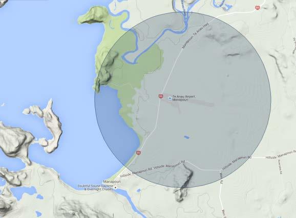
19 5. SURVEY Brydone Glencoe Road Slip Investigation Doesn t look like big a problem, but its not going away Continually topped up, keeps slumping over number of years ADT of 120 (23% Heavies = 28/day) $1 Million + for full repair in current location Alternative options being considered One alternative required an exploratory survey

20 5. SURVEY Brydone Glencoe Road Slip Investigation


21 5. SURVEY Brydone Glencoe Road Slip Investigation 1.5 hours on site, 5km length Orthomosaic and point cloud Loaded into CAD Exploratory design can be completed


22 5. SURVEY Cosy Nook Coastal Protection Works

23 5. SURVEY Cosy Nook Coastal Protection Works Comparing Point Clouds (surfaces) October 2015 and July 2016 Monitoring consent conditions Measure any detrimental effects caused by protection structure Rich virtual 3D environment for viewing and showing stakeholders


24 5. SURVEY Stockpile & Volumetric Measurement A useful tool for stockpile measurement and recording Accurate Fast Repeatable Cost effective Can done in specialist software or Autodesk Civil 3D

25 6. CONSTRUCTION MANAGEMENT Branxholme Plant Aerial Monitoring

26 6. CONSTRUCTION MANAGEMENT Branxholme Plant - Orthomosaic


27 7. SAFETY Intersection Review Intersection Review Less than 5 minutes to capture Fast analysis of pavement surface Create sections and design Up to date aerial photos to assist design Cost savings Repeatable


28 7. SAFETY Real Journeys, Manapouri Walkway Improvements Up to date imagery Improved imagery Quick results Easy to incorporate into design
29 8. COMMUNITY ENGAGEMENT


30 8. COMMUNITY ENGAGEMENT A powerful tool for getting information to customers These images offer a whole new perspective to the customer of issues happening on the roading network Also the ability to capture video footage in high definition (up to 4k) Images and footage can be circulated via: Social media (Facebook) SDC website Newspapers Council newsletters Council reports


31 9. LIMITATIONS AND RESTRICTIONS There are rules to follow!
 Wind (<20km/hr) No Fly")
 -")

32 9. LIMITATIONS AND RESTRICTIONS Limitations Weather Rain (No Rain) Wind (<20km/hr) No Fly Zones - Controlled airspace, low flying zones etc (CAA NZ permit system can help you around this) - Private land (permission needed) Restrictions CAA NZ rules always apply (penalties and fines if not obeyed)


33 End of Presentation Thank You
Aetos Overview. Mistras Internal and External Customers 03/27/2017 R1.4 D E L I V E R I N G A S S E T P R OT EC T I O N S O LU T I O N S GLO BALLY
 Aetos Overview Mistras Internal and External Customers 03/27/2017 R1.4 D E L I V E R I N G A S S E T P R OT EC T I O N S O LU T I O N S GLO BALLY OUR MISSION Cost effectively reduce or eliminate the need
Rapid Transit Implementation Working Group
 Rapid Transit Implementation Working Group October 12, 2017 1 Agenda 1. Consultation Update 2. Technical Work Update 3. LTC Rapid Transit Integration 4. Next Steps 2 Consultation Update 3 Consultation
The Moors at Arne Project, Managing Coastal Change
 General Questions What are we doing? The Environment Agency, RSPB and Natural England are working together to adapt approximately 150ha of The Moors at Arne into a diverse wetland habitat. With the sea
Mark Olive. From Disaster to Resilience: managing the reconstruction of Queensland s Regional Road Network
 From Disaster to Resilience: managing the reconstruction of Queensland s Regional Road Network Mark Olive Roads Australia Regional Conference May 2015 www.jacobs.com worldwide Disclaimer Important The
Witteveen+Bos. Strategy // Planning // Design for resilient urban places. Rachael Cox April 2017
 Healthy Witteveen+Bos: & Resilient Cities: Designing Urban Healthy Planning & and Resilient Engineering Cities 1 Witteveen+Bos Strategy // Planning // Design for resilient urban places Rachael Cox April
7. The Landscape. 7.1 Introduction. Environmental Impact Statement (EIS) Scoping Report
 Scoping Report") 7. The Landscape 7.1 Introduction The purpose of this section of the EIS Scoping Report is to describe the scope of work and methods to be applied in the identification and assessment of landscape and
7. The Landscape 7.1 Introduction The purpose of this section of the EIS Scoping Report is to describe the scope of work and methods to be applied in the identification and assessment of landscape and
Key Elements of Successful Conservation Planning. John Paskus October 17, 2013 Pierce Cedar Creek Institute Michigan Natural Features Inventory
 Key Elements of Successful Conservation Planning John Paskus October 17, 2013 Pierce Cedar Creek Institute Michigan Natural Features Inventory What is Conservation Planning? Pressey et al (2008): The process
Inform you of the purpose and scope of the study for PTH 100 and a proposed future St. Norbert Bypass;
 WELCOME The intent of today s Open House is to: Inform you of the purpose and scope of the study for PTH 100 and a proposed future St. Norbert Bypass; Review highway crossing locations, future access closures
Each course is worth 1 American Institute of Architects CEU/HSW.
 Each course is worth 1 American Institute of Architects CEU/HSW. Introduction to Mobile Mapping Attendees will learn the basics of mobile mapping including history, trends, components, and uses. This course
CASE STUDY: MCGREGOR COXALL SYDNEY, AUSTRALIA. McGregor Coxall
 CASE STUDY: MCGREGOR COXALL SYDNEY, AUSTRALIA 1 REVITALIZING THE SPACE WHERE THE WATERS MEET For the Australian landscape architecture and urban design firm, a design has to be more than just a quick solution
Ashbridges Bay Erosion and Sediment Control Project
 Ashbridges Bay Erosion and Sediment Control Project Project Brief Overview Toronto and Region Conservation Authority, in partnership with the City of Toronto, intends to carry out remedial erosion control
PARKLET PROPOSAL PACKAGE & PROCESS
 500.3 I PARKLETS The term parklet refers to a small temporary constructed seating or community gathering area over an on-street parking space or an extension of the sidewalk into the operating State highway
City of Rockingham. Local Management Practices, Costs and Strategic Coastal Planning
 City of Rockingham Local Management Practices, Costs and Strategic Coastal Planning Decision Making Process Considerations Climate Change Response Action Plan Ongoing observations/major Storm events Ongoing
Making the case for Sustainable Transport Project Potential
 Making the case for Sustainable Transport Project Potential The Structural Investment Fund (SIF) Strategy for Greater Lincolnshire identifies the barriers to growth identified by having poor transport
Adopting the Manual of Best Management Practices for Stormwater Quality. Facts for Communities
 Adopting the Manual of Best Management Practices for Stormwater Quality Facts for Communities Adopting the Manual of Best Management Practices for Stormwater Quality September 2006 prepared for the Mid-America
BACKGROUND INFORMATION DOCUMENT
 BACKGROUND INFORMATION DOCUMENT PROPOSED UPGRADING OF THE N2 NATIONAL ROAD FROM KRAAIBOSCH TO DIE VLEIE BASIC ENVIRONMENTAL IMPACT ASSESSMENT The South African National Roads Agency Society Limited (SANRAL)
East Midtown Greenway
 East Midtown Greenway 53RD TO 61ST STREET Interpretive Signage Package CB6 Meeting 61st St 60th St FDR Drive East Midtown 59th St 58th St 57th St Ed Koch Queensboro Bridge Manhattan Queens Second Avenue
A Unified Auckland The challenge of developing transport based Design Standards for the Auckland Region
 A Unified Auckland The challenge of developing transport based Design Standards for the Auckland Region Chris Beasley Principle Technical Specialist, PMO Section 1 Recap on formation of Auckland Transport
Project purpose. advise. The purpose of the Beaumaris Lake Open Space Rehabilitation project is to: + Develop a Functional Program Concept
 Project purpose owns Road Beaumaris Road The purpose of the Beaumaris Lake Open Space Rehabilitation project is to: + Develop a Functional Program Concept + Guide Rehabilitation of Landscape and Community
Saltmarsh Conference. 8 October in the Suffolk Coast & Heaths Area of Outstanding Natural Beauty
 Saltmarsh Conference 8 October 2015 in the Suffolk Coast & Heaths Area of Outstanding Natural Beauty Conference organised by Haidee Stephens, Suffolk Estuaries Officer Suffolk Coast & Heaths AONB t: 01394
Scarborough Waterfront Project
 Scarborough Waterfront Project Public Information Centre #1 Environmental Assessment Terms of Reference September 10, 2014 Agenda Open House Presentation 7:00 to 7:30 pm Presentation 7:30 to 8:15 pm History
Libby Zemaitis October 18, 2017 Climate Outreach Specialist, NYS DEC Hudson River Estuary Program
 1 Supporting Hudson Riverfront communities as Climate-Adaptive Leaders Libby Zemaitis October 18, 2017 Climate Outreach Specialist, NYS DEC Hudson River Estuary Program The Hudson River Estuary Program
LAND EAST OF SUDBURY ROAD, HALSTEAD PUBLIC CONSULTATION. Proposed Residential Development
 LAND EAST OF SUDBURY ROAD, HALSTEAD PUBLIC CONSULTATION Proposed Residential Development YOUR VIEW MATTERS TO US PROPOSED RESIDENTIAL DEVELOPMENT AREA Thank you for taking the time to read this information
Unique ID: (from PFRA database) Location: Tralee, Co. Kerry. Stage 1: Desktop Review
 Location: Tralee, Co. Kerry. Stage 1: Desktop Review") Location: Tralee, Co. Kerry Unique ID: 230361 (from PFRA database) Initial OPW Designation APSR AFRR IRR Co-ordinates Easting: 82750 Northing: 114000 River / Catchment / Sub-catchment Lee River & Big River/
Location: Tralee, Co. Kerry Unique ID: 230361 (from PFRA database) Initial OPW Designation APSR AFRR IRR Co-ordinates Easting: 82750 Northing: 114000 River / Catchment / Sub-catchment Lee River & Big River/
SURREY COASTAL FLOOD ADAPTATION STRATEGY (CFAS) Phase 1 Open House
 Phase 1 Open House") SURREY COASTAL FLOOD ADAPTATION STRATEGY (CFAS) Phase 1 Open House CFAS Open House Photo Contest Winners #SurreyCoastal Activity Gail Stephan Under crescent beach pier. Great place to take a long exposure
SURREY COASTAL FLOOD ADAPTATION STRATEGY (CFAS) Phase 1 Open House CFAS Open House Photo Contest Winners #SurreyCoastal Activity Gail Stephan Under crescent beach pier. Great place to take a long exposure
Roads To Geometry Solutions Manual Download
 We have made it easy for you to find a PDF Ebooks without any digging. And by having access to our ebooks online or by storing it on your computer, you have convenient answers with roads to geometry solutions
The Land of Oak & Iron - Sculpture Commission
 The Land of Oak & Iron - Sculpture Commission Background Set within the countryside of north east England, the Land of Oak & Iron stretches from the fringes of the North Pennines following the course of
A737/A738 Trunk Road (Dalry Bypass)
") IN ASSOCIATION WITH DRAWING STATUS A737/A738 Trunk Road (Dalry Bypass) Environmental Statement July 2013 Introduction The A737 trunk road forms a strategic link from the M8 motorway, at Paisley, to Ayrshire.
IN ASSOCIATION WITH DRAWING STATUS A737/A738 Trunk Road (Dalry Bypass) Environmental Statement July 2013 Introduction The A737 trunk road forms a strategic link from the M8 motorway, at Paisley, to Ayrshire.
PUBLIC ART CALL LIONS GATE COMMUNITY CENTRE. For Expressions of Interest Submission Deadline: March 18, 2018 Project Value: $85,000(inclusive)
") LIONS GATE COMMUNITY CENTRE PUBLIC ART CALL For Expressions of Interest Submission Deadline: March 18, 2018 Project Value: $85,000(inclusive) LGCC EOI 1 LIONS GATE COMMUNITY CENTRE (LGCC) PUBLIC ART CALL
LIONS GATE COMMUNITY CENTRE PUBLIC ART CALL For Expressions of Interest Submission Deadline: March 18, 2018 Project Value: $85,000(inclusive) LGCC EOI 1 LIONS GATE COMMUNITY CENTRE (LGCC) PUBLIC ART CALL
PROPOSED RESIDENTIAL DEVELOPMENT LAND AT GREEN LANE, YARM
 PROPOSED RESIDENTIAL DEVELOPMENT LAND AT GREEN LANE, YARM PUBLIC CONSULTATION YOUR VIEW MATTERS TO US LOCATION PLAN Thank you for taking the time to read this information leaflet regarding a proposed residential
Tale of Two Cities: Exploring How Two Communities are Using Green Infrastructure to Reduce Flood Risk
 Tale of Two Cities: Exploring How Two Communities are Using Green Infrastructure to Reduce Flood Risk NACo Steering Subcommittees Education Session Lori Cary-Kothera NOAA Coastal Services Center Issue
LANDMAP Methodology Overview
 LANDMAP Methodology Overview June 2017 Jill Bullen, Senior Landscape Specialist jill.bullen@cyfoethnaturiolcymru.gov.uk 0300 065 4706 (Please note this is an information document and not a training presentation)
Case studies. B1.1 Lloyds Crossing, Portland (USA)
") B. Case Studies 57 B1 Case studies B1.1 Lloyds Crossing, Portland (USA) Lloyds Crossing in Portland is a brownfields redevelopment site in the central city area, with the aim of: Developing a conceptual
B. Case Studies 57 B1 Case studies B1.1 Lloyds Crossing, Portland (USA) Lloyds Crossing in Portland is a brownfields redevelopment site in the central city area, with the aim of: Developing a conceptual
Coastal hazard assessments in Victoria
 Coastal hazard assessments in Victoria Viktor Brenners viktor.brenners@delwp.vic.gov.au Future Coasts program 4 year program established in 2007. Outputs included: Coastal Digital Elevation Models Victorian
SANDY UNVEILED INTERDEPENDENT
 IMAGE: MITCAU + ZUS + URBANISTEN Image by Iwan Baan OMA TEAM OMA TEAM IMAGE: SCAPE TEAM IMAGE: WXY/West8 TEAM IMAGE: PENN DESIGN / OLIN IMAGE: BIG TEAM 10/10/16 sbury Park Capacity-Building: The City of
TONIGHT S MEETING DRAFT SUMMARY REPORT CAPE WOOLAMAI COASTAL RESERVES MASTER PLAN PHILLIP ISLAND SOUTH AND NORTH COAST KEY AREA PLAN OCTOBER 2014
 TONIGHT S MEETING Phillip Island Nature Parks and Bass Coast Shire Council have partnered to achieve a comprehensive and integrated master plan for the safe use and management of Cape Woolamai Coastal
Calderdale MBC replaces creaking analogue CCTV with digital system. Surveillance Solutions from BT: a local authority case study
 Calderdale MBC replaces creaking analogue CCTV with digital system Surveillance Solutions from BT: a local authority case study Digital upgrade sees Calderdale CCTV uplift When Calderdale Metropolitan
BEACON HILL INTERNATIONAL SCHOOL
 CONTENTS Stormwater in the Schoolyard Lesson 3 BEACON HILL INTERNATIONAL SCHOOL Teacher Guide Local Stormwater Systems Lesson 5 Stormwater in Our Community Lesson 6 How to Use This Guide This guide supports
Western Belfast Bypass almost finished
 ROADS OF NATIONAL SIGNIFICANCE CHRISTCHURCH MOTORWAYS Western Belfast Bypass PROJECT UPDATE October 2017 Western Belfast Bypass almost finished The Western Belfast Bypass (WBB) project is 95 per cent complete
Urban Institute for Contemporary Arts
 Urban Institute for Contemporary Arts Mission The UICA builds creative community by fostering new forms of expression, promoting collaboration, and providing genuine experiences with contemporary art.
Long span bridges in Norway, including future crossing of the Oslo Fjord
 Long span bridges in Norway, including future crossing of the Oslo Fjord Børre Stensvold Bridge Director Norwegian Public Roads Administration Directorate of Public Roads NVF Annual Bridge onference 2014
AUCKLAND COUNCIL DISTRICT PLAN PAPAKURA SECTION
 AUCKLAND COUNCIL DISTRICT PLAN PAPAKURA SECTION OPERATIVE 16 JUNE 1999 D P Hawkins, Mayor T McLean, Chief Executive Officer Given under the Common Seal of the Papakura District Council this 16th day of
NATURE AT WORK NEWS. Brian Kuchar with Horsley Witten Group reviews maintenance
 NATURE AT WORK NEWS Brian Kuchar with Horsley Witten Group reviews maintenance requirements with participants at the October 10 training in Roger Williams Park. We often underinvest in infrastructure maintenance.
STORWATER AWARNESS TRAINING
 STORWATER AWARNESS TRAINING INTRODUCTION What is stormwater? It is rainfall and snowmelt that did not soak into the ground. It forms run-off which flows into storm drains and ends up in rivers, lakes,
ü ü ü and cloud integrated Efficient collaboration Intramural Brand independent & extramural
 Intramural Efficient collaboration & extramural Brand independent Brand independent and cloud integrated Advanced messaging communication Nurse call Centralized alarm response Wander prevention & detection
Cottage Grove Road Reconstruction. City of Madison Engineering
 Public Informational Meeting Cottage Grove Road Reconstruction October 8, 2015 Presentation Outline Introduction Project Purpose & Need Proposed Design Overview Environmental Concerns Pedestrian Needs
Green Infrastructure Projects
 Green Infrastructure Projects Phase 1 of the Sewer System Improvement Program Presentation for the CAC Wastewater Subcommittee Tuesday, April 23, 2013 Saed Toloui and Raphael Garcia SSIP Green Infrastructure
CLIMATE CHANGE AND COASTAL ADAPTATION: USING GIS AND VISUALISATION TO IDENTIFY ISSUES AFFECTING COASTAL COMMUNITIES IN ABERDEEN, SCOTLAND, UK
 nd nd B03 - Tuesday 2222 2011 TuesdayMarch March 2011 CLIMATE CHANGE AND COASTAL ADAPTATION: USING GIS AND VISUALISATION TO IDENTIFY ISSUES AFFECTING COASTAL COMMUNITIES IN ABERDEEN, SCOTLAND, UK David
EARLY FIRE DETECTION IN SWISS ROAD TUNNELS WITH MORE THAN FIREGUARD SENSORS
 - 87 - EARLY FIRE DETECTION IN SWISS ROAD TUNNELS WITH MORE THAN 1 500 FIREGUARD SENSORS W.W. Schuldt SIGRIST-PHOTOMETER AG, Switzerland ABSTRACT Major fire incidents in road tunnels with a larger number
Topoclimate Southland Soil Technical Data Sheet No Waiau
 This Technical Data Sheet describes the typical average properties of the specified soil. It is essentially a summary of information obtained from one or more profiles of this soil that were examined and
MASTERPLAN AND PARK IMPROVEMENTS
 ST.JAMES PARK MASTERPLAN AND PARK IMPROVEMENTS Stakeholder Meeting 3 April 26, 2016 Team: PMA Landscape Architects Ltd. Lead Landscape Architects MASS LBP Public Facilitation Consultant RAW Design Architectural
Park Board Chair and Commissioners General Manager Vancouver Board of Parks and Recreation Love Locks Concept Plan
 Date: June 30, 2015 TO: FROM: SUBJECT: Park Board Chair and Commissioners General Manager Vancouver Board of Parks and Recreation Love Locks Concept Plan RECOMMENDATION A. THAT the Vancouver Park Board
WATERLOO STATE SIGNIFICANT PRECINCT SUMMARY OF STUDIES
 WATERLOO STATE SIGNIFICANT PRECINCT SUMMARY OF STUDIES Technical studies will be undertaken to inform the master planning process for the Waterloo precinct to develop a Precinct Proposal to redevelop the
Ballston Station Multimodal Study. Stakeholder Meeting October 5, 2010
 Ballston Station Multimodal Study Stakeholder Meeting October 5, 2010 Agenda Welcome and Introductions Update on Short Term Improvements Update on the Multimodal Study Recap of Goals and Key Issues Working
QUESTIONS AND ANSWERS Windsor Woods, Princess Anne Plaza & The Lakes Combined Drainage Project
 QUESTIONS AND ANSWERS Windsor Woods, Princess Anne Plaza & The Lakes Combined Drainage Project Project Overview... 2 Thalia Creek (Windsor Woods) Tide Gate... 6 Club House Road Drainage Project... 9 Updated
Mississippi Drive Corridor Revitalization. A DestinationTransportation Project...
 Mississippi Drive Corridor Revitalization A DestinationTransportation Project... Mississippi Drive Corridor Revitalization Welcome! Tonight s Agenda: Further define the Scope of the Project Discuss the
The Dresden Sustainable Urban Mobility Plan (SUMP)
") The Dresden Sustainable Urban Mobility Plan (SUMP) photo: Frank Fiedler UN-Habitat III Regional Meeting Side-event Sustain and clean mobility for the New Urban Agenda Prague, 16.03.2016 Dipl.-Ing. Frank
The Dresden Sustainable Urban Mobility Plan (SUMP) photo: Frank Fiedler UN-Habitat III Regional Meeting Side-event Sustain and clean mobility for the New Urban Agenda Prague, 16.03.2016 Dipl.-Ing. Frank
WIRELESS CCTV. Utility Site Security & Surveillance.
 WIRELESS CCTV Utility Site Security & Surveillance Wireless CCTV WCCTV is the UK s leading provider of site security systems for utilities and critical national infrastructure sites, including power stations,
Lawrencetown Beach & Rainbow Haven Beach
 Lawrencetown Beach & Rainbow Haven Beach Public Engagement Session Wednesday, September 27 th, 2017 6:00pm 8:00pm Cole Harbour Place 51 Forest Hills Pkwy, Dartmouth Agenda Welcome & Introductions Overview
Ebbsfleet Development Corporation
 Title of Paper Planning and Housing Delivery Report September 2018 Presented by Sub-Committee Mark Pullin, Chief Planning Officer Planning Committee Purpose of Paper and Executive Summary This paper provides
Complete Streets Master Plan for Downtown New Britain CRCOG Transportation Committee Meeting Monday, December 9, 2013
 CRCOG Transportation Committee Meeting Monday, December 9, 2013 Introduction Why the Project was Initiated About Downtown New Britain Master Plan Goals Master Plan Overview Master Plan Study Areas and
A New Approach to Dust Monitoring
 Sponsored by Nanozen Synergist Solutions: Dust Monitoring A New Approach to Dust Monitoring By Peter Briscoe A new approach to dust monitoring is starting to spread throughout the industrial hygiene field.
Strategies/Actions Priority List
 Strengthening the Creative Sector: Build stronger relationships with, and between, cultural organizations and businesses and increase opportunities for working together to build capacity within organizations.
INSTRUCTIONS TO CANDIDATES This Resource Booklet contains resources for B561/01 and B561/02. The questions tell you which resources you need to use.
 GCSE Geography B B561 B561/01/02: Sustainable Decision Making Exercise (SDME) (Foundation and Higher Tier) Resource Booklet INSTRUCTIONS TO CANDIDATES This Resource Booklet contains resources for B561/01
Tauranga City Centre Spatial Framework
 Tauranga City Centre Spatial Framework Stakeholder Engagement Workshop 15 October 2015 Project Design Team Beca & LandLAB Our team Henry Crothers (LandLab) Landscape Architect/Urban Designer Urban and
Rio de Janeiro - Brazil. Urban Regeneration & Climate Change
 Rio de Janeiro - Brazil Urban Regeneration & Climate Change 2017 Rio de Janeiro - Brazil introduction slide 1 BRASIL 204.5 million inhabitants RIO DE JANEIRO STATE 16.5 million inhabitants RIO DE JANEIRO
Funding is available to applicants on a first come, first served basis, and applications will be considered in the order they are received.
 Program Conditions and Instructions The City of Westwood Hills is partnering with the Johnson County Program to provide $5,000.00 for a stormwater management cost-share program. The program is intended
Alternative Uses of Compost: Rain Gardens and Green Solutions for Stormwater Management
 Alternative Uses of Compost: Rain Gardens and Green Solutions for Stormwater Management Photos: David Dods, URS David Dods, Senior Environmental Engineer URS Corporation, Overland Park, Kansas Agenda 1.
Rapid Transit Implementation Working Group September 14, 2017
 Rapid Transit Implementation Working Group September 14, 2017 BACKGROUND Council approved the Rapid Transit Master Plan and Updated Business Case on July 25, 2017. Approval of the RTMP confirmed the BRT
Key Themes and Responses May 2016
 King and Victoria Transit Hub and Waterloo Street Pedestrian Access Key Themes and Responses May 2016 The following summarizes what Regional staff heard about the King Victoria Transit Hub and Waterloo
10.0 Open Space and Public Realm
 10.0 Open Space and Public Realm 10.0 Open Space and Public Realm The Public Open Space System is comprised of: outdoor spaces available for public use that are either publicly owned (e.g., parks and
COLLIER BOULEVARD (CR 951) CORRIDOR
 CORRIDOR") Project(s) Goals Improve Traffic Circulation, Capacity & Safety Focus on Safety During Design & Construction Address Public Concerns Design an Aesthetically Pleasing Project Limit Environmental Impacts
Project(s) Goals Improve Traffic Circulation, Capacity & Safety Focus on Safety During Design & Construction Address Public Concerns Design an Aesthetically Pleasing Project Limit Environmental Impacts
HS2 Environment. Protecting the environment
 HS2 Environment Protecting the environment Approach to mitigation EIA Regulations require an ES to include a description of the measures envisaged in order to avoid, reduce and, if possible, remedy significant
Building Great Neighbourhoods. Strathcona
 Building Great Neighbourhoods Strathcona March 21, 2018 Becky Redford Project Manager, Planning & Design Building Great Neighbourhoods Integrated Infrastructure Services Welcome and Purpose To provide
Environmental Impact Assessment. York Glasgow Edinburgh
 Environmental Impact Assessment York Glasgow Edinburgh Our Services Our Approach EIA (Environmental Impact Assessment) ASSESSMENTS Environmental Impact Assessment (EIA) Environmental Statements and Reports
A NEW LOOK FOR THE BISHOP CENTRE. Land Securities. Our environment. Our communities
 Welcome Welcome to this exhibition of our new plans for redeveloping the Bishop Centre. If you have any questions please ask a member of the project team - we look forward to hearing your views. Land Securities
KITCHEN REMODELING. From Inspiration to Reality An early kitchen planners guide. MURRAYLAMPERT.COM
 KITCHEN REMODELING From Inspiration to Reality An early kitchen planners guide. MURRAYLAMPERT.COM TABLE OF CONTENTS Introduction... 2 Vision... 3 Finding Inspiration... 4 Kitchen Styles & Direction...
WA PARKS FOUNDATION SWAN CANNING RIVERPARK
 WA PARKS FOUNDATION SWAN CANNING RIVERPARK Photograph: Giant Egret Large - Matt Kleczkowski SWAN CANNING RIVERPARK - RIVER JOURNEYS PROJECT Bringing Parks to our doorstep With the pace and demands of modern
Early fire and hotspot detection in tunnels. 07/09/2016 Fire and Safety in Tunnels 2016
 Early fire and hotspot detection in tunnels 07/09/2016 Fire and Safety in Tunnels 2016 FLIR Intelligent Transportation Systems FLIR ITS UK FLIR ITS France FLIR ITS Spain FLIR ITS BELGIUM FLIR ITS Germany
GO Station Mobility Hubs: Draft Precinct Plans. Committee of the Whole July 12, 2018
 GO Station Mobility Hubs: Draft Precinct Plans Committee of the Whole July 12, 2018 Purpose of this Workshop Present Draft Precinct Plans for the 3 GO Station Mobility Hubs Continue the conversations that
Physical Approaches to Flood Mitigation
 Physical Approaches to Flood Mitigation ational Academy of Sciences /19/2017 Chicago Area Before Development Widespread Flooding Waterways and Marshes Absorbent Ground Early settlers came to this location
EPUB / WATERFALL BOXES FOR PONDS ARCHIVE
 20 May, 2018 EPUB / WATERFALL BOXES FOR PONDS ARCHIVE Document Filetype: PDF 523.59 KB 0 EPUB / WATERFALL BOXES FOR PONDS ARCHIVE Shop with confidence on ebay!. Shop in Waterfall-Building-Supplies- from
Steering Committee 3. September 17, :30-7:30pm. Welcome.
 Steering Committee 3 September 17, 2015 5:30-7:30pm Welcome DOG RIVER www.makingwatershedswork.org Agenda 1. Welcome 2. Scientific Research: Water Quality 3. Current and Relevant Planning 4. Community
Integrated Land and Environmental Management - A Conceptual Approach
 Land and Environmental Management - Key Issues Integrated Land and Environmental Management - A Conceptual Approach Prof. Stig Enemark Head of School of Surveying and Planning Aalborg University, Denmark
Improving Urban Liveability through WSUD Case studies across Victoria
 Improving Urban Liveability through WSUD Case studies across Victoria Healthy Cities Conference Geelong - 8 June 2012 Anna Jennings Regional Stormwater Policy Advisor Overview Who is Clearwater? Regional
Intelligent Buildings and the Internet of Things Filling in the Missing Link. Michael Welzel Page 1
 Intelligent Buildings and the Internet of Things Filling in the Missing Link? Michael Welzel michael@directcontrol.co.nz Page 1 Who are we? Founded in 1991 Based in Auckland Operating in New Zealand &
Broadband Backup Alarms Effect on Worker Safety
 Broadband Backup Alarms Effect on Worker Safety H. Kahle, Human Factors Specialist, WorkSafeBC J. Colman, Human Factors Specialist, WorkSafeBC S. Brown, Audiologist, WorkSafeBC T. Bates, Research Coordinator,
Welcome to the Public Consultation Exhibition
 Welcome to the Public Consultation Exhibition Today is your opportunity to: Speak to the team Learn more about the project Leave feedback on the plans The Secretary of State for Transport has recognised
Vu Kim Chi Nguyen Thi Thuy Hang
 Vu Kim Chi Nguyen Thi Thuy Hang Tokyo, Dec 7, 2015 Introduction Data and methods Results and discussions Conclusion The city of Quy Nhon Urban planning in Quy Nhon Climate change and sea level rise Natural
Introduction to the project Feedback from you to guide the plan Dig in to propel us forward quickly (survey) Clear understanding of roles moving
 Clear understanding of roles moving") Introduction to the project Feedback from you to guide the plan Dig in to propel us forward quickly (survey) Clear understanding of roles moving forward .. INSPIRATION FROM THE FIELD Offers wide
Introduction to the project Feedback from you to guide the plan Dig in to propel us forward quickly (survey) Clear understanding of roles moving forward .. INSPIRATION FROM THE FIELD Offers wide
Please take time to view our latest plans, speak to the development team and ask any questions you may have. EALING BROADWAY A4020
 WELCOME Durston House School is a successful school in the heart of Ealing. With 90 per cent of our pupils living in the borough, we have a strong connection to the local area. We are proposing to consolidate
Glen Road Pedestrian Bridge Environmental Assessment
 Glen Road Pedestrian Bridge Environmental Assessment Presentation to Design Review Panel July 18, 2017 Glen Road Pedestrian Bridge Class Environmental Assessment STUDY AREA Bloor Street East Streetscape
Application of 3D Modeling Software in Landscape Planning and Design
 Application of 3D Modeling Software in Landscape Planning and Design Abstract Yongzhi Wang Food and Landscape Architecture Faculty,Sanmenxia Polytechnic, Sanmenxia 472000, China To improve the performance
Urban Growth Management in Seven New World cities: Aligning visions and quality neighbourhood outcomes
 Urban Growth Management in Seven New World cities: Aligning visions and quality neighbourhood outcomes New Zealand Centre for Sustainable Cities 14 August 2013 Errol Haarhoff & Lee Beattie School of Architecture
Town of Westport. Design Guidelines Development Committee Public Informational Presentation
 Town of Westport Design Guidelines Development Committee Public Informational Presentation 12.18.2018 Introduction / Overview The Town of Westport s Design Guidelines have been developed to guide the appearance,
ROCKLAND P.L.U.S. PLANNING LAND USE WITH STUDENTS
 ROCKLAND P.L.U.S. PLANNING LAND USE WITH STUDENTS PLUS Program Goals: High School Students from throughout Rockland County understand: The power of land use planning in shaping a community Their role as
The journey so far. The new masterplan for Dargavel Village
 The journey so far Our vision for Dargavel Village began over ten years ago when the original masterplan for transforming the former Royal Ordnance Factory site into a thriving community was established.
Decomposers down-under
 What s a Worm Worth? Steve Wratten, Harpinder Sandhu, Sue Unsworth, Jacquie Bay Earthworms, large or small, are all annelids belonging to the class Oligochaeta. New Zealand has native earthworms that belong
JACKsON STREET PIER CONCEPTUAL DESIGN PACKAGE SEPTEMBER 21, 2017
 JACKsON STREET PIER CONCEPTUAL DESIGN PACKAGE SEPTEMBER 21, 2017 JACKsON STREET PIER Process outline DESIGN PROCESS OVERVIEW: Sandusky s Jackson Street Pier Conceptual Design process included input from
Rain catcher. GREEN AMBASSADORS 4 Youth. Get informed. Time: You ll need: Who it s for: What to do: WATER. 5 to 10 year olds
 Rain catcher 40 minutes 5 to 10 year olds Plastic bottles Scissors Sand Waterproof craft paint 1. Ask each member to bring a 2 litre plastic bottle to the session with them. 2. Cut the top of the bottle