HURONTARIO MAIN LRT PROJECT Preliminary Design/TPAP ENVIRONMENTAL PROJECT REPORT JUNE ERA 0001
|
|
|
- Timothy Briggs
- 6 years ago
- Views:
Transcription


1 HURONTARIO MAIN LRT PROJECT Preliminary Design/TPAP ENVIRONMENTAL PROJECT REPORT JUNE ERA 0001
2 HURONTARIO MAIN LRT PROJECT Preliminary Design/TPAP ENVIRONMENTAL PROJECT REPORT JUNE ERA 0001

3 Table of Contents 1.0 INTRODUCTION AND STUDY PROCESS INTRODUCTION STUDY AREA ENVIRONMENTAL ASSESSMENT PROCESS Project Proponents Transit Project Assessment Process Hurontario-Main LRT Pre-Planning Activities STUDY ORGANIZATION BACKGROUND AND CONTEXT Hurontario/Main Street Corridor Master Plan Provincial Planning Policy Framework City of Mississauga Planning Policy Framework City of Brampton Planning Policy Framework Related Studies PROJECT DESCRIPTION DESIGN PHILOSOPHY AND DEVELOPMENT OF PREFERRED DESIGN LRT Corridor Design Philosophy The Complete Street Philosophy The Design Workbook Process PLANNING AND DESIGN CRITERIA Planning & Design Criteria: Transit Elements Road Elements Urban Design Approach Typical Cross-Sections Maintenance and Storage Facility SITE SPECIFIC CONSIDERATIONS Hurontario Street at Port Credit GO Station Mineola QEW Intersection Queensway Cooksville Downtown Mississauga and Highway 403 Crossing Britannia Road Highway 407 Crossing Gateway Terminal (Steeles Avenue/Shoppers World) Brampton Main Street South Heritage Area Downtown Brampton Brampton GO Station LRT Stop Maintenance and Storage Facility PREFERRED DESIGN Track Alignment Stop Locations, Spacing and Platform Length Intelligent Transportation System (ITS) Structures Special Trackwork Traction Power Substations Maintenance and Storage Facility STREETSCAPE & URBAN DESIGN STRATEGY REGIONAL AND LOCAL TRANSIT SYSTEM INTERFACE PEDESTRIAN ACCESS AND CYCLING OPPORTUNITIES LAND AND PROPERTY REQUIREMENTS PROJECT IMPLEMENTATION Procedural Approach Geographical Staging of the Project PROJECT INVESTMENT EXISTING CONDITIONS TRANSPORTATION AND UTILITIES Road Network Transit Network Automotive Network Cycling and Trail Network Surface and Subsurface Utilities SOCIO-ECONOMIC ENVIRONMENT Existing Land Use, Population and Employment NATURAL ENVIRONMENT Surface Water and Aquatic Ecosystems Terrestrial Ecosystems Hydrogeology and Contaminated Soil Noise and Vibration Air Quality CULTURAL ENVIRONMENT Built Heritage and Cultural Landscapes Archaeological Resources PROJECT ENVIRONMENTAL EFFECTS, MITIGATION AND MONITORING TRANSPORTATION AND UTILITIES Transit Operations Traffic Operations Surface and Subsurface Utilities SOCIO-ECONOMIC ENVIRONMENT Land Use Structure and Economic Impacts Community Cohesion NATURAL ENVIRONMENT Surface Water and Aquatic Ecosystems Terrestrial Ecosystems Hydrogeology and Groundwater Contaminated Property Drainage and Stormwater Management Noise and Vibration Air Quality CULTURAL ENVIRONMENT Built Heritage and Cultural Heritage Landscapes Archaeological Resources SUMMARY OF PROJECT NET EFFECTS AND MONITORING REQUIREMENTS TOC-i
4 List of Figures 5.0 PERMITS AND APPROVALS REQUIRED FOR PROJECT IMPLEMENTATION MUNICIPAL PROVINCIAL FEDERAL ENVIRONMENTAL PROJECT REPORT AMENDING PROCEDURE Need for Environmental Project Report Addendum Consistency with Environmental Project Report Significance of Proposed Changes EPR Addendum Timelines Consultation COMMUNICATIONS AND CONSULTATION PROCESS OVERVIEW OF COMMUNICATIONS CONSULTATION PROCESS Study Organization and Consultation Phases Notification Tools and Methods CONSULTATION DURING THE PRE-PLANNING PHASE Summary of Consultation with General Public and Property Owners Summary of Consultation with Technical Agencies and Municipal Staff Summary of Consultation with Aboriginal Communities CONSULTATION DURING TRANSIT PROJECT ASSESSMENT PROCESS PHASE Summary of Consultation with General Public and Property Owners Summary of Consultation with Technical Agencies and Municipal Staff Summary of Consultation with Aboriginal Communities COMMITMENTS TO FUTURE WORK AND CONSULTATION NOTICE OF COMPLETION AND EPR REVIEW PERIOD STATEMENT OF COMPLETION STUDIES AND SUPPORTING TECHNICAL DOCUMENTS Figure 1-1: Hurontario - Main LRT Proposed Corridor Figure 1-2: Transit Project Assessment Process Framework and Timelines Figure 2-1: Example LRV Figure 2-2: Hurontario-Main LRT Stop Locations Figure 2-3: Key Plan for New and Upgraded Structures Figure 2-4: Ultimate Transit Network Plan Figure 2-5: Ultimate Transit Network Plan LRT and Bus Route Details Figure 3-1: Hurontario-Main Street Corridor General Alignment Figure 3-2: Existing Corridor Bus Routes Figure 3-3: Existing Bus Routes in Downtown Mississauga Figure 3-4: Existing GO Network West of Toronto Figure 3-5: Mississauga BRT Overview Figure 3-6: Existing Cycling Route Network Figure 3-7: HMLRT Corridor Character Areas - North Section Figure 3-8: HMLRT Corridor Character Areas - South Section Figure 3-9: City of Mississauga Land Use Plan and General HMLRT Study Area Figure 3-10: City of Brampton General Land Use Designations and General HMLRT Study Area Figure 3-11: Fish and Fish Habitat within the Study Area Figure 3-12: Existing Natural Heritage Resources in the Study Area Figure 3-13: Etobicoke Creek ELC Community for Remnant Natural Areas Figure 3-14: Cooksville Creek ELC Community for Remnant Natural Areas Figure 3-15: Mary Fix Creek ELC Community for Remnant Natural Areas Figure 3-16: Point of Reception Figure 3-17: Point of Reception Figure 3-18: Point of Reception Figure 3-19: Location of Environment Canada Meteorological Station Figure 3-20: Ambient Air Quality Monitoring Station Figure 4 1: Proposed Service Pattern Figure 4-2: Ultimate Transit Network Plan Figure 4-3: Ultimate Transit Network Plan Transit Route Details Figure 4-4: HMLRT 2031 AM Peak Hour Load Profile - Brampton GO to Downtown Mississauga Figure 4-5: HMLRT 2031 AM Peak Hour Load Profile - Port Credit GO to Downtown Mississauga Figure 4-6: Future Downtown Mississauga Districts TOC-ii
5 List of Tables Table 2-1: HMLRT ITS Systems and Applications Table 2-2: Preliminary Traction Power Substation Locations Table 2-3: Outline Strategy for Local Buses in Hurontario-Main Corridor Table 3-1: Existing Corridor Bus Frequencies (March 2012) Table 3-2: Utility Service Providers Table 3-3: Population and Employment within the Study Area Table 3-4: Share of Population/Employment within the Study Area to Total Mississauga/Brampton Table 3-5: Species at Risk (SAR) Potentially Located Within the Study Area Table 3-6: Target Species Listed in Conservation Authority Fisheries Management Plans Table 3-7: Summary of Existing Fish and Fish Habitat Conditions Table 3-8: Fish Species Found in Reaches near the Study Area Table 3-9: Summary of fish use within the Study Area Table 3-10: Designated Natural Areas of Local Importance within the City of Mississauga and Study Area Vicinity Table 3-11: Wildlife Species Documented in HMLRT Corridor Table 3-12: Significant Vegetation in the Vicinity of the Study Area Table 3-13 Potential Contaminated Sites Identified by the City of Mississauga Table 3-14: Potential Contaminated Sites Identified Table 3-15: Ecolog ERIS Actual or Potential Contaminated Site Table 3-16: Points of Reception for Noise Impact Assessment Table 3-17: Estimated Current Traffic Volumes Table 3-18: Predicted Existing Sound Levels Table 3-19: Greater Toronto Area Climate Normals Table 3-20: Data on Atmospheric Hazards Table 3-21: Contaminants of Interest Table 3-22: Summary of Relevant Air Quality Thresholds Table 3-23: Summary of Ambient Monitoring Stations Table 3-24: Summary of Ambient Air Measurements (µg/m³) Table 3-25: Identified Built Heritage Resources and Cultural Heritage Landscapes in the Study Corridor Table 3-26: Archaeological Sites within 500 M of the Study Corridor Table 3-27: Details of Archaeological Sites Registered within 1 Km of the Study Area Table 4-1: Main Changes to Corridor Transit Routes Table 4-2: Minor Transit Route Diversions to Facilitate Transfers to LRT Table 4-3: Complementary Transit Network Changes Table 4-4: Through Lane Allocation Table 4-5: Development Activity Along HLMRT Corridor Table 4-6: Expected LRT Sound Levels and Impacts Table 4-7: Parallel Major Road Sound Level Increases Table 4.8: Summary of Preliminary Vibration Isolation Recommendations Table 4-9: Predicted Credible Worst-Case Concentrations (2031 Scenario with HMLRT Project in Place) Table 4-10: Relative Change in the Worst-Case Concentrations Between Scenarios Table 4-11: Net Changes of Emissions Associated with the LRT Project Table 4-12: Identified Built Heritage Resources (BHR) and Cultural Heritage Landscapes (CHL) Adjacent to the Preferred Route for the Hurontario-Main LRT Project Table 4-13: Summary of Potential Environmental Condition Changes, Mitigation, Net Effects and Monitoring Table 6-1: Public Comments During TPAP Phase and Project Team Responses Table 6-2: Agency Comments on Draft EPR and Project Team Responses APPENDIX A HURONTARIO-MAIN LRT DESIGN PLATES A.1 LRT INFRASTRUCTURE DESIGN A.2 STREETSCAPE AND URBAN DESIGN STRATEGY Appendices APPENDIX B TECHNICAL SUPPORT DOCUMENTS B.1 NATURAL ENVIRONMENT REPORT B.2 HYDROGEOLOGY REPORT B.3 PRELIMINARY MAINTENANCE AND STORAGE FACILITY (MSF) ASSESSMENT REPORTS B.4 DRAINAGE AND STORMWATER MANAGEMENT REPORT B.5 SOCIO-ECONOMIC ENVIRONMENT ASSESSMENT REPORT B.6 NOISE AND VIBRATION IMPACT ASSESSMENT REPORT B.7 AIR QUALITY ASSESSMENT REPORT B.8 CULTURAL HERITAGE ASSESSMENT REPORT B.9 ARCHAEOLOGICAL ENVIRONMENT ASSESSMENT REPORT B.10 PRELIMINARY STRUCTURAL ASSESSMENT REPORT B.11 DESIGN CRITERIA B.12 PRELIMINARY SYSTEMS OPERATIONS PLAN B.13 FUTURE YEAR VISSIM MODELS REPORT (EXCERPT) B.14 UTILITY RELOCATION STRATEGY GUIDELINES APPENDIX C CONSULTATION RECORD C.1 NOTICES C.2 OUTREACH MATRIX C.3 OUTREACH COMMUNICATIONS MAILING LIST C.4 CONSULTATION SUMMARY REPORTS C.5 SELECTED CORRESPONDENCE C.6 CHARACTER AREA WORKSHOPS C.7 ABORIGINAL COMMUNITIES C.8 PUBLIC INFORMATION CENTRE (PIC) MATERIALS (provided as a CD-ROM attached to the inside rear cover of the main volume of this Environmental Project Report and available online at the project website ( TOC-iii

6 GLOSSARY OF TERMS AND ACRONYMS Following are definitions of the common terms and acronyms referred to when discussing the Huronario-Main Street Light Rail Transit (HMLRT) Project. AAQC - Ambient Air Quality Criteria ANSI Area of Natural and Scientific Interest Anchor Hub Anchor hubs are primary major transit stations that are located within an urban growth centre. These hubs are expected to encompass major regional destinations, such as major institutions, employment centres, town centres, or regional shopping centres. They have the potential to attract and accommodate new growth and development and would act as anchors of the regional transportation system. AST Above ground storage tank BHR Built Heritage Resource BRT Bus Rapid Transit Similar to light rail transit, operating predominantly in protected rights-of way, separate from other traffic, but using advanced bus technology. Combines stations, vehicles, running ways, a flexible operating plan and technology into a high quality, customer focused service that is frequent, fast, reliable, comfortable and costefficient. The capacity of BRT is typically 2,000 to 4,000 passengers per route per hour, peak direction. Average speed: 15 to 40 km/h depending on station spacing, with higher speeds possible on grade separated rights-of-way on controlled access highways. Example: Vancouver 98B Line (Richmond section), Ottawa Transitway system. CEAA Canadian Environmental Assessment Act CHL Cultural Heritage Landscape Class EA - Municipal Engineers Association Class Environmental Assessment A planning process that must be applied to all municipal infrastructure projects. It is an evaluation of all environmental implications of a project and involves extensive public consultation to identify and mitigate any adverse impacts. COSEWIC Committee on the Status of Endangered Wildlife in Canada COSSARO - Committee on the Status of Species at Risk in Ontario CTA Canada Transportation Act/Canadian Transportation Agency CWR Continuous welded rail dba A-weighted decibels DC Direct current, in the context of power supply to the LRT system through traction power substations Environmental Assessment (EA) An Environmental Assessment (EA) is a process used in Ontario to determine the possible impacts that proposed infrastructure projects may have on the environment so that the best possible decisions can be made on if, where, when and how to construct such projects. ECA Environmental Compliance Approval ESA Environmental Site Assessment Gateway Hub Gateway hubs have two criteria: they are located at the interchange between two or more current or planned regional rapid transit lines and have a forecast combined number of boardings and alightings of 4,500 or more by 2031 for the peak morning period. Within 800 m of these hubs, the forecast density is expected to be a least 10,000 residents and jobs combined. Greenroads The Greenroads Rating System is a third-party, points-based system available to certify environmentally sustainable roadway and transportation infrastructure projects. The system, administered by the not-for-profit Greenroads Foundation based in the U.S., provides metrics to measure the effect of design and construction practices that can be implemented on a project to earn points toward one of four certification awards. In the context of this report, the reference is to the adoption of Intelligent Transportation Systems as a grading measure in the Greenroads sustainability performance evaluation. Greenroads Certification System (Source: blogspot.ca/2010/01/greenroads.html) GTHA Greater Toronto and Hamilton Area The metropolitan region encompassing the City of Toronto, the four surrounding Regional Municipalities (Durham, Halton, Peel and York) and the City of Hamilton. HADD - harmful alteration, disruption or destruction of fish habitat, as defined in the federal Fisheries Act Headway The scheduled time between successive transit vehicles on a given route. HOT (Higher Order Transit) Bus or light/heavy rail that operates in its own right-of-way or in a priority situation, and, therefore, moves more efficiently than the regular flow of traffic and can carry large numbers of people quickly and comfortably. HMLRT - Hurontario-Main Street LRT ITS Intelligent Transportation Systems Intensification Corridors Intensification areas along major roads, arterials or higher-order transit corridors that have the potential to provide a focus for higher density mixed-use development consistent with planned transit service levels. [Source: Ministry of Energy and Infrastructure, Growth Plan for the Greater Golden Horseshoe, 2006.] IO Ontario Infrastructure and Lands Corporation MBCA Migratory Birds Convention Act LED Light emitting diode source in the context of corridor lighting fixtures G-1
7 LRT Light Rail Transit A lightweight rail car (LRV) rapid transit service operating on fixed rails in the right-of-way, usually at street-level, is typically propelled by overhead electrical wires, and offers a frequent, fast, reliable, comfortable and high quality service that is environmentally sustainable. Capacity of 2,000 to 10,000 passengers per hour in the peak direction, with higher capacities where there are significant stretches of completely segregated rights-ofway. Average speed: 15 to 35 km/h depending on station spacing and extent of grade. LRT Guideway Centre Running The LRT tracks generally run immediately adjacent to and straddle the centerline of the road corridor, and a single stop platform is situated between the tracks to serve both tracks (common northbound and southbound platform). LRT Guideway Side Running Both LRT tracks run on one side of the road corridor immediately adjacent to the curbline, and the stop platforms may be in the centre of the tracks, as with the centre-running configuration, or on either side of the tracks (separate northbound and southbound platforms). LRT Guideway- Gutter Running Each of the LRT tracks runs on its own side of the road corridor immediately adjacent to the curbline, and the stop platforms are integrated with the sidewalk and other street edge features. LRV Light Rail Vehicle Major Transit Station Areas The area including and around any existing or planned higher-order transit station within a settlement area, or the area including and around a major bus depot in an urban core. Station areas generally are defined as the area within an approximate 500 metre radius of a transit station, representing about a 10-minute walk. [Source: Ministry of Energy and Infrastructure, Growth Plan for the Greater Golden Horseshoe, 2006.] Mobility Hub Major transit station areas, as defined in the Growth Plan for the Greater Golden Horseshoe, that are particularly significant given the level of transit service that is planned for them and the development potential around them. They are places of connectivity between regional rapid transit services, and also places where different modes of transportation, from walking to high-speed rail, come together seamlessly. They have, or are planned to have an attractive, intensive concentration of employment, living, shopping and enjoyment around a major transit station. To be identified as a mobility hub, a major transit station area must be located at the interchange of two or more current or planned regional rapid transit lines as identified in the Metrolinx Regional Transportation Plan, and be forecasted in the RTP to have 4,500 or more combined boardings and alightings in the morning peak period in In addition, these areas are generally forecasted to achieve or have the potential to achieve a minimum density of approximately 10,000 people and jobs within an 800 m radius. The primary major transit station areas associated with an urban growth centre are also identified as mobility hubs, as are Pearson Airport and Union Station due to their roles as the GTHA s primary international gateways. [Source: The Big Move, Metrolinx, November 2008.] MSF Maintenance and Storage Facility Mx (Metrolinx) The public authority that manages transportation planning, including public transport, within the Greater Toronto and Hamilton Area in the province of Ontario. MOE Ontario Ministry of the Environment MOI Ministry of Infrastructure MTCS Ontario Ministry of Tourism, Culture and Sport MNR Ontario Ministry of Natural Resources MTO Ministry of Transportation of Ontario OCS Overhead Contact System Particulate Matter Particulate matter is the general term used for a mixture of solid particles and liquid droplets found in the air. These particles, which come in a wide range of sizes, are emitted directly from sources or formed in the atmosphere by the transformation of gaseous emissions into secondary pollutants. Total suspended particulate matter, or TSP, refers to the fraction of PM having a diameter less than or equal to 100 microns. Inhalable particulate matter, or PM10, refers to the fraction of PM having a diameter less than or equal to 10 microns. Respirable particulate matter, or PM2.5, refers to the fraction of PM having a diameter less than or equal to 2.5 microns. The smaller the particle size, the farther the particle can penetrate into the lungs. Therefore, smaller particles pose the greatest potential for human health effects. The greatest effect on human health is from particles 10 microns or less in diameter, which can aggravate bronchitis, asthma, and other respiratory diseases. People with asthma, cardiovascular or lung disease, as well as children and elderly people, are considered to be the most sensitive to the effects of airborne PM10 or PM2.5. POR Point of Reception (in the context of noise sensitive areas and receptors). PSOP Preliminary Systems Operations Plan Rapid Transit Transit service separated partially or completely from general vehicular traffic and, therefore, able to maintain higher levels of speed, reliability and vehicle productivity than can be achieved by transit vehicles operating in mixed traffic. ROW Right-of-way Streetscaping Streetscaping refers to design of urban roadways and conditions as they affect the people that use them. Streetscapes are an important part of the public spaces where people safely interact, which help define a community s transport conditions, activities, aesthetic quality and identity. Streetscaping (programs to improve streetscape conditions) can include traffic management, sidewalk conditions, landscaping, street furniture (utility poles, benches, refuse disposal cans, etc.), building fronts and materials specifications. TDM Transportation Demand Management TDM encompasses alternatives to the single occupancy vehicle (i.e., transit, walking, biking, car pooling) and the measures or techniques that encourage the use of these alternate modes in order to maximize the people moving capability of the overall transportation system. TOD - Transit Oriented Development A form of development that represents an alternative to urban sprawl. Major characteristics include: a sufficient density to encourage public transit use; location of residences, jobs, and retail destinations close to public transit; mixed uses, with retail and employment within walking distance of residential areas; and urban design guidelines and design features to encourage a safe pedestrian orientation. G-2
8 TPAP Transit Project Assessment Process TPAP is a decision-making process used to determine the advantages and disadvantages to the environment of proceeding with a proposed project. This process was approved by the Province of Ontario in June 2008, based on the new regulation named Transit Projects and Metrolinx Undertakings, Ontario Regulation 231/08 for undertaking transit-related projects in the Greater Toronto Area. The TPAP Regulation provides a framework for an accelerated focused consultation and objection process for completing the assessment of potential environmental impacts of a transit project, so that decision-making can be completed within six months. TPSS Traction Power Substation UST Underground storage tank VISSIM A micro simulation and modelling software package for modelling complex interactions between different transport modes. Can be used at a network or intersection level. G-3
9 Table of Contents EXECUTIVE SUMMARY... E-1 ES.1 INTRODUCTION AND STUDY PROCESS... E-1 ES.2 PROJECT DESCRIPTION... E-2 ES.3 EXISTING CONDITIONS/POTENTIAL IMPACTS/MITIGATION AND NET EFFECTS... E-6 ES.4 PERMITS AND APPROVALS REQUIRED FOR PROJECT IMPLEMENTATION... E-10 ES.5 CONSULTATION AND COMMITMENTS TO FURTHER WORK... E-11 List of Figures Figure ES-1: Hurontario-Main LRT Project in the Regional Context... E-1 Figure ES-2: Hurontario-Main LRT Alignment and Stop Locations... E-3 Figure ES-3: Key Plan for New and Upgraded Structures... E-4 List of Tables Table ES-1: Outline Strategy for Local Buses in Hurontario-Main Corridor... E-6 E-i

 Project involves the operation of a high frequency LRT service in the segment of the Hurontario-Main corridor between the Port Credit GO Station to the")

10 EXECUTIVE SUMMARY ES.1 Introduction and Study Process Project Context and Study Area Metrolinx, the City of Mississauga and the City of Brampton, as project co-proponents, have completed an environmental assessment for the introduction of Light Rail Transit (LRT) in the Hurontario-Main Street corridor. The Hurontario-Main Light Rail Transit (HMLRT) Project involves the operation of a high frequency LRT service in the segment of the Hurontario-Main corridor between the Port Credit GO Station to the GO Station in Downtown Brampton, as shown in the regional context in Figure ES-1. Figure ES-1: Hurontario-Main LRT Project in the Regional Context The general study limits are the Brampton GO Station to the north, the Port Credit GO Station to the south, and the lands within and immediately adjacent to the Hurontario Street Main Street corridor right-of-way. The study also encompasses the area around Downtown Mississauga, generally within the area bounded by Hurontario Street on the east, Burnhamthorpe Road on the south, Confederation Parkway on the west and the northern limit of the Parkway Belt West on the north. Chapter 3 and Chapter 4 of this Environmental Project Report (EPR) address the existing and forecast environmental conditions in the vicinity of the project area, and the potential impacts of the proposed transit project, respectively. The area within which the potential effects of the project have been studied varies, depending on the environmental factor under consideration. The overall transportation demand modelling was based on information that covered the Greater Toronto and Hamilton Area (GTHA). For the purposes of detailed traffic modelling, the modelled area was confined to the Hurontario-Main corridor streets, including all significant intersections, with small network areas covering the downtowns of Brampton, Mississauga and Port Credit. In November 2008, Metrolinx, the agency of the Province of Ontario responsible for improving the coordination and integration of all modes of transportation in the GTHA, released The Big Move: Transforming Transportation in the Greater Toronto and Hamilton Area. This Regional Transportation Plan (RTP) identified a rapid transit network to support population and employment growth, and help reduce reliance on the private car. The Hurontario-Main corridor was included in this network and was identified as a top priority project. Environmental Study Process In support of the vision identified in the RTP for moving people and goods, and accommodating future urban growth, the City of Mississauga and the City of Brampton initiated the Hurontario/Main Street Study to develop a Corridor Master Plan. As part of the Hurontario/Main Street Corridor Master Plan process ( ), the cities developed a co-ordinated vision for the Hurontario-Main corridor that integrated land use, urban design and transportation. The Master Plan, conducted under the Municipal Class Environmental Assessment process and approved by Councils in 2010, concluded that Light Rail Transit (LRT) is the preferred form of rapid transit along the Hurontario-Main corridor. This project is being implemented in accordance with Ontario Regulation 231/08, Transit Projects and Metrolinx Undertakings (Transit Projects Regulation) of the Environmental Assessment Act. The Transit Projects Regulation exempts proponents of all public transit projects from the requirements under Part II of the Environmental Assessment Act if they adhere to the requirements of the Transit Projects Assessment Process (TPAP). Proponents must follow the prescribed steps in the TPAP within specified time frames, including provision of adequate opportunities for review and comment by a broad range of stakeholders, culminating with the Minister of the Environment s decision within six (6) months of the start of the process, which is marked by the Notice of Commencement. Once the TPAP has been completed to the satisfaction of the Minister of the Environment, transit project proponents may file a Statement of Completion and proceed to the next phase of the project. The Transit Project Assessment Process also includes an addendum process for proponents to make changes to a transit project after the Statement of Completion for the transit project is submitted. Modifications to the design and implementation of the HMLRT Project proposed in this Environmental Project Report may occur due to unforeseen circumstances, including: changes in environmental conditions in the corridor that may affect anticipated project impacts and means of mitigating adverse effects; technological advancements; and funding availability. This may result in the project being inconsistent or non-compliant with commitments made in the EPR. Modifications to the project proposals will require preparation of an addendum to the EPR. Study Organization The project has been established contractually through the City of Mississauga, with the City of Brampton acting as a primary stakeholder. The decision-making/approval functions are provided through a joint Steering Committee comprising senior technical representatives of the two cities. E-1
11 Technical inputs to the project team from the cities have been provided via the Core Working Team (CWT) with specialist input from an extended working team from all departments within the cities on an as-needed basis. Metrolinx became a project co-proponent in February 2014 and Metrolinx representatives have participated on the CWT since the study s inception. Ultimately, decisions at the technical level were made by a Steering Committee comprising senior staff from the City of Mississauga and the City of Brampton (refer also to Section ES.5 Consultation and Commitments to Further Work). A multi-disciplinary consultant team led by SNC-Lavalin Inc. has been appointed by the Cities of Mississauga and Brampton to undertake the environmental assessment and preliminary design of the HMLRT Project. Related Studies The Hurontario Main Street LRT Project is being coordinated to align with a number of related studies and initiatives, undertaken by a variety of government agencies, and organizations, which have influenced the investigations conducted for this project, or may influence implementation of the project. Metrolinx GO Transit Georgetown Corridor Planning Study/Metrolinx Georgetown North Improvements The GO Transit Georgetown Corridor Planning Study examined the introduction of All Day commuter rail service, including construction of an additional track and two new platforms at the Brampton GO Station, while the Metrolinx Georgetown North improvements initiative addresses service expansion to the Kitchener area. These proposals have influenced design of the Brampton GO Station LRT stop. City of Brampton City of Brampton Downtown Mobility Hub Area Design Plan and Downtown Design Guidelines In 2011, Metrolinx identified the Brampton GO Station and transit terminal in Downtown Brampton as an Anchor Hub in the Mobility Hub Guidelines. This study, which is still in progress, considers and consolidates the directions, recommendations and guidelines provided in various regional and city planning policy documents, in conjunction with Metrolinx s RTP and nine key objectives in Mobility Hub Guidelines, to determine a comprehensive vision for the Downtown Mobility Hub Area in Brampton. A number of plan s principal objectives and guidelines have influenced the LRT project, particularly with respect to guideway, stop and adjacent public realm design and connectivity/interface with the LRT. Queen Street Rapid Transit Project Business Case Analysis (BCA) The Brampton Queen Street Rapid Transit project would provide enhanced transit along the Queen Street and Highway 7 corridor from Downtown Brampton at Main Street to the Toronto-York Spadina Subway extension. This 23.7 km corridor would be developed as bus rapid transit, light rail transit, or a mix of both. The BCA recommends that higher-order rapid transit in the Queen Street corridor is desirable; and that a decision on technology requires further study. The decisionmaking process will influence the way in which the Hurontario-Main and Queen Street transit projects interface, including the HMLRT configuration at the Brampton GO Station. Hurontario-Main Corridor Secondary Plan The City of Brampton is undertaking an Official Plan Amendment and Zoning By-law to implement many of the planning recommendations of the Hurontario/Main Street Corridor Master Plan for lands generally fronting Hurontario/Main Street from Harold Street to Ray Lawson Boulevard. Heritage, Arts, Culture and Entertainment (HACE) Plan The purpose of this plan is to present a new five-year plan prepared by the City and local public stakeholders focused on leveraging growth of the creative economy from key cultural industries represented by Heritage Arts Culture Entertainment (HACE) activities in the Downtown district of Brampton. The plan s goals can be directly related to the types of benefits associated with implementation of rapid transit (attracting business investment; developing HACE businesses; attracting visitors; and contributing to place branding). City of Mississauga Mississauga Bus Rapid Transit Project Phase 1 of the Bus Rapid Transitway is under construction east of Downtown Mississauga. The HMLRT interfaces with the Transitway within Downtown Mississauga and will impact the movement of the BRT through the downtown area. Although the construction of the BRT is outside the scope of the HMLRT works, in order to meet the requirements of the urban form needs of Downtown Mississauga, the HMLRT Project proposals recommend that the conditions established for the BRT in the 2009 EA Addendum be reinstated and that the BRT be run in a tunnel from Rathburn Road to Centre View Drive and Station Gate Road. Mississauga Downtown21 Report and Master Plan The Downtown21 Report and Master Plan, approved by City of Mississauga Council in March 2013, converts the goals established in the City of Mississauga Strategic Plan into a functional and design driven Master Plan. The HMLRT Project supports the Downtown21 objectives of promoting the continued evolution of a liveable, compact, accessible, sustainable downtown centre for the entire city, which will enhance Mississauga s competitive advantage and reputation as a progressive community. The Master Plan forms the basis of the present City of Mississauga Downtown Local Area Plan, zoning and Built Form Standards to support a vibrant pedestrian and transit-supportive environment, and is a key input to developing the LRT corridor through Downtown Mississauga. Downtown Mississauga Movement Plan The Downtown Mississauga Movement Plan is in progress and is being prepared in parallel with, and informing, the work undertaken in the HMLRT Preliminary Design and TPAP Study. This study is examining the concepts and assumptions made in the Downtown21 Master Plan in order to carry out micro-simulation of the expected patterns of movement in Downtown Mississauga to confirm the feasibility of the concept espoused and make any recommendations for changes that would allow the vision of a truly urban Downtown Mississauga to come to fruition. Other public planning initiatives, such as Inspiration Port Credit and One Port Master Plan are related to the area south of the HMLRT Project area established for this environmental assessment. This Master Plan work is ongoing, and has not yet reached a definitive conclusion. While it is a long term project objective to extend the LRT to Port Credit s waterfront, it is recognized that the ongoing Master Plan work needs to be completed before incorporation of this segment of the alignment into the urban fabric can be finalised. The City of Mississauga is committed to completing the Master Plan work, consulting further with the public on integration of the LRT in long range plans for the area south of the Port Credit GO Station stop, and to obtaining council endorsement, prior to advancing further with this segment of the alignment. For this reason, provisions have been made to enable the stop at Port Credit GO to function as a terminus. ES.2 Project Description General Description and Design Philosophy The 23.2 km LRT alignment runs from the Port Credit GO Station in the City of Mississauga to the Brampton GO Station in Downtown Brampton, as shown in Figure ES-2. The alignment is double track throughout, is generally at-grade, and is within the existing road right-of-way, except at the north end, where it leaves the Main Street corridor and runs parallel to the CN Rail corridor into the Brampton GO Station, and along a new connection between Rathburn Road and Hurontario Street north of the Mississauga City Centre. Over most of the route the number of road traffic lanes is reduced to accommodate the LRT tracks. Preliminary design of the alignment is shown in Appendix A.1 of this EPR. E-2

12 Figure ES-2: Hurontario-Main LRT Alignment and Stop Locations The proposed LRT line is to have 26 stops, including stops within the Downtown Mississauga City Centre, as shown in Figure ES-2. The LRT alignment is segregated from other traffic, except at road intersections and along the segment through the Main Street South Heritage Area in Brampton (north crossing of Etobicoke Creek to Wellington Street). Grade-separated crossings of rail lines, roads and highways, and watercourses generally use existing structures, other than a proposed new LRT underpass beneath the rail lines at Port Credit and a new overpass of Cooksville Creek to accommodate the aforementioned new connection between Rathburn Road and Hurontario Street. There is also a new road underpass to carry Hurontario Street traffic beneath the Queen Elizabeth Way. The vertical alignment generally follows that of the roads on which the LRT runs. At the Brampton terminus, the western part of the stop is located in a cut below part of the current Brampton GO Station parking lot. The LRT corridor design philosophy builds on the Vision and Guiding Principles set out in the Hurontario/Main Street Corridor Master Plan. The approach for the development of the corridor design introduces a comprehensive urban style LRT that has the following attributes: Competitive journey times; Journey time reliability; Affordable capital and operating costs; Make a positive contribution to the beautiful street component of the Vision; and Minimize adverse impacts. This project has also adopted a complete street approach to the design of the HMLRT Corridor. Planning for a complete street means aiming to create a balance between all modes of movement, by providing space, and amenities to encourage walking, cycling, and transit, in addition to motor vehicles. The aim is to achieve a safe, attractive, and comfortable environment, particularly for pedestrians. The design of the street may differ from area to area, to align with the diverse range of places along the corridor, such as busy urban centres, and quiet residential neighbourhoods. Complete streets have been found to support: the creation of valued places; improved safety; lower transportation costs; improved physical health through walking and biking; and improved social interaction. Measures that help to achieve these attributes are: Maximizing the segregation of the LRT alignment from other traffic; Maximizing the amount of signal priority at intersections in favour of LRT; Minimizing property acquisition; and Developing complementary road traffic measures, such as: o o o o Alternative routes for traffic displaced from the LRT route; Changes to bus routes (to provide a complementary and integrated transit network); Provision for pedestrians and cyclists; and Considering the access requirements of frontages. E-3


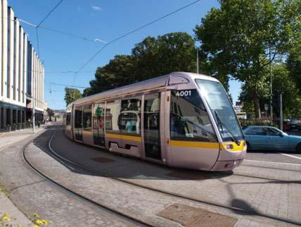
13 LRT System Elements LRT Operations The objective of the operational design criteria was to set out specifications that will help ensure reliable service, even during downgraded operating conditions. The operations will also vary to cater to the expected demand throughout the hours of operation. On a daily basis, revenue service is expected to commence at 5:00 a.m. from both terminal stops and end at 1:30 a.m. on weekdays and Saturdays, and operate between 7:00 a.m. and midnight on Sundays. The headway will be adjusted throughout operational service in order to comply with scheduling demands, with a minimum headway of 5 minutes during peak periods and decreasing in off-peak periods. The current operations plan will result in an average operating speed of 27 km/h and a one-way journey time of 47 minutes between the two end stops. This is achieved through partial segregation from other vehicular traffic and providing priority to LRT vehicles at signalized intersections (through the implementation of Intelligent Transportation System components), and the system will operate on an LRT vehicle priority green signal basis. In order to achieve this, the traffic signal system will be optimized, including the installation of an integrated system of location sensors, with specialized traffic controllers that use logical algorithms to define optimum cycle times for an LRT priority system throughout the corridor. Light Rail Vehicle The light rail vehicles will be multi-section articulated low-floor vehicles, with a maximum width of 2.65 m (excluding rear-view cameras) and a length of about 30 m (although longer units around 40 m long are also possible). Initially, the vehicles will typically be operated in two-unit consists (60 m long). The system has been designed to operate with three-unit consists up to a length of 90 m in the long term. Peak carrying capacity will be in the order of 200 passengers/vehicle, or 600 passengers per 3-vehicle consist. Maintenance and Storage Facility Power Supply and Distribution It is proopsed that the HMLRT Maintenance and Storage Facility (MSF) be situated on the provincially-owned lands within the Parkway Belt West bounded by Highway 407 to the north, Hurontario Street to the west, the Hydro One Networks Inc. transmission line and utility corridor to the south and Kennedy Road to the east. It will be connected to Hurontario Street via a dedicated spur line that diverges from the Hurontario Street corridor and runs east on Topflight Drive and north on Edwards Boulevard. The 7 ha MSF will accommodate up to 56 LRVs initially, and 74 over the long term. The HMLRT Control Centre will also be located on the MSF site. The MSF layout is shown in Appendix A.1 of this EPR. The system will be designed to provide the necessary power, as well as the voltage range, to ensure proper operation of the trains. The traction power system, consisting of traction power substations (TPSS) and the Overhead Contact System (OCS), will provide 750Vdc to power the trains. Due to concerns related to heritage attributes within the Main Street South Heritage Area and Downtown Brampton, (i.e., between the north crossing of Etobicoke Creek and the Brampton GO stop), an alternative power supply system (the option comprising battery packs or super/ultracapacitors installed on board the LRVs, with no Overhead Contact System) is being carried forward for further investigation of costs and benefits as part of the Detail Design phase. Its implementation is contingent upon final acceptability of financial and technical implications. The system will be designed to allow for a single TPSS failure without any degradation of service. A preliminary estimate indicates that 15 TPSS would be needed for the mainline and one TPSS will be provided for the Maintenance and Storage Facility to meet the Service Level to The preliminary TPSS locations are shown in Appendix A.1 of this EPR. Structures A number of existing structures are affected by the proposed HMLRT design scheme. In addition, some new structures are proposed. The engineering investigations included an assessment of the condition of all existing structures in the LRT corridor, identified the new structures required, and offered recommendations for the structural work to be completed as part of the project. The structure locations are shown in Figure ES-3. Figure ES-3: Key Plan for New and Upgraded Structures Canadian National (CN) Rail Crossing Etobicoke Creek Crossing (North) Etobicoke Creek Crossing (South) Highway 407 Crossing Highway 401 Crossing Highway 403 Crossing Cooksville Creek Crossing Rathburn Road Crossing Canadian Pacific (CP) Rail Crossing Queen Elizabeth Way (QEW) Crossing Mary Fix Creek Crossing at Eaglewood Blvd. GO Transit-Metrolinx Crossing (Port Credit GO Station) The proposed structural work, as shown on the Preliminary Design plates in Appendix A.1, include: New bridges at: o o o GO Transit-Metrolinx Crossing (Port Credit GO Station) - immediately west of the existing bridge (box structure through the existing rail embankment); Mary Fix Creek - Eaglewood Boulevard will be extended to Oriole Avenue (west of Hurontario Street) via a new bridge over the Mary Fix Creek channel; Queen Elizabeth Way (QEW) - construction of a new bridge to carry the QEW over the realigned northbound lanes carrying general purpose traffic; and E-4


; Highway 407 - load bearing reinforcements; removal of existing asphalt and concrete")
14 o Cooksville Creek west of Hurontario Street to carry the dedicated LRT guideway connection between Rathburn Road and Hurontario Street. Replacement of the bridge at Highway 403 to accommodate the LRT guideway, three northbound and four southbound lanes of general purpose traffic in each direction, and multi-use paths on both sides serving cyclists and pedestrians. Bridge modifications at: o o o o Rathburn Road - removal of existing asphalt and concrete median; installation of rails and rail expansion joints; and construction of a concrete platform; Highway 401/Whittle Road - removal of existing asphalt, concrete median and mass concrete infill; installation of rails; and construction of a concrete slab (Highway 401) and removal of the existing 300 mm pavement structure and median curbs; installation of rails; and construction of a concrete slab (Whittle Road); Highway load bearing reinforcements; removal of existing asphalt and concrete median; installation of rails and rail expansion joints; and construction of a concrete platform; and Etobicoke Creek North and South Crossings replacement of the superstructure and rehabilitation of piers and abutments. Special Trackwork Special trackwork includes crossovers, which allow Light Rail Vehicles to switch from one track to another during normal operations, or in the case of single-track operations where there is an obstruction along a track, or maintenance is being performed. Crossovers are situated at the terminal stops and elsewhere along the alignment to maintain operational headways and allow short turns. Streetscape and Urban Design Strategy The Streetscape and Urban Design Strategy (SUDS) was prepared as a discrete document and is presented in Appendix A.2 of this EPR. The SUDS is intended to support the re-design of the Corridor from a high speed, vehicle-oriented arterial roadway to a more pedestrian-supportive multi-modal streetscape; one that strengthens the quality and integration of streetscapes with a range of public spaces, transit facilities and key destinations in keeping with the Complete Street concept. Where bike lanes are to be accommodated, give preference to physically separated lanes, which provide a greater degree of separation from adjacent vehicle and/or LRT lanes, in support of increased safety. Otherwise, consider measures such as sharrows; off-street multi-use trails; two-stage turn queue boxes at intersections with connecting bicycle routes; and provision of bicycle parking in close proximity to LRT stops, intermodal stops, and major transit interchanges, in accordance with the Metrolinx Mobility Hub hierarchy of types; Adoption of four principal street typologies (typical and enhanced greenway typologies; typical and enhanced urban streetscape typologies) to respond to the unique conditions along the corridor, while targeting an appropriate level of investment, and providing a consistent approach to the creation of well designed and pedestrian supportive environments; and The inclusion of public art as part of creating valuable and meaningful public spaces in the HMLRT corridor. Provisions for Pedestrians and Cyclists As part of implementing the foregoing Complete Street strategies in accordance with the hierarchy of modes, the level of provision for pedestrians and cyclists in the corridor is to be improved, as shown in the graphic below. This objective has been pursued through consideration of the following key design strategies: Incorporation of a Pedestrian Through Zone over the full length of the HMLRT corridor and strategic introduction of Pedestrian Priority Areas to streets, crosswalks, and intersections typically within 100 m of the access to LRT stop platforms; Elimination of street medians to facilitate reallocation of the space to enlarge and enhance the pedestrian streetscape; Reduction of pedestrian crossing distances through the removal of dedicated right-turn lanes and reduced curb radii, where feasible; Provision of direct pedestrian mid-block connections to LRT platforms from the adjacent streetscape; Provision for cyclists is made over the full length of the HMLRT route in the City of Mississauga, and in Brampton south of Steeles Avenue. This is formed by a multi-use trail from the Port Credit GO Station to Queensway, then boulevard cycle lanes from Queensway to Steeles Avenue. North of Steeles Avenue, the bike lanes connect to the City of Brampton offroad trails network, in accordance with Brampton s cycling policies. Regional and Local Transit Interface The Hurontario-Main LRT project is being planned as part of the wider transit network, including local and express bus services, and regional GO Rail service (refer to Figure ES- 1), and will require changes to the existing network, both in the corridor itself and in the surrounding areas. An outline of the proposed, complementary local bus network is shown in Table ES-1. E-5
15 Table ES-1: Outline Strategy for Local Buses in Hurontario-Main Corridor Section Existing Local Services Proposed Local Services Port Credit to Downtown Mississauga MiWay route 19 group Local service between Port Credit and Downtown Mississauga only, at reduced frequency (initially proposed as 3 buses per hour) Downtown Mississauga to Bristol Road Bristol Road to Steeles Avenue Steeles Avenue to Downtown Brampton MiWay Route 19 group MiWay Route 10, plus others on certain sections MiWay Route 19 group Brampton Route 2 (part) Brampton Transit Route 52 at northern end Brampton Route 2 Existing Route 10, supplemented in part by other existing routes, retained to provide local service No local services Brampton Transit Route 52 retained No local services on Main Street Improvements to parallel back street local services In addition to the LRT on Burnhamthorpe Road, the design will include a new south bus terminal for the Downtown Mississauga area, which comprises provision for approximately 5 routes/buses to use a layby on the north and south side of Burnhamthorpe Road west of Main. Land and Property Requirements The general approach adopted in developing the LRT alignment has been to fit the route within the existing road right-ofway in order to minimize property requirements outside the existing road ROW. During the preliminary Design process, it was identified that approximately 140 properties will have impacts on their frontages or may require full acquisition. Project Implementation Experience from other Canadian LRT projects of similar scale and complexity suggest that implementation (design and construction) of the HMLRT Project should take between 3 and 5 years, depending on expectations set by the proponents on the contractors. The method of project procurement and implementation has yet to be determined. However, consistent with other LRT projects of similar scale implemented recently within Canada, there is a trend to use Public Private Partnerships (P3) or Design-Build type procurement models. In the P3 model, also referred to in Ontario as the Alternative Financing and Procurement (AFP) approach, companies bid through a competitive process to undertake the entire project, including the design, construction, project financing, maintenance and rehabilitation and, in some cases, operation of the system for a defined period of time, typically about 30 years. Design-Build procurement models are similar, but typically do not include the long term maintenance, rehabilitation and operations elements. To date, the City of Mississauga has explored funding opportunities at the federal level through P3 Canada. It is expected that the HMLRT Project will be implemented in stages. Staging will depend on, amongst other things: Confirmation of projected need/demand; Available funding; Integration with implementation of large site development/redevelopment projects, either as free-standing projects or as part of broader based initiatives (e.g., mobility hubs, redevelopment plans); Coordination with other large municipal infrastructure (capital roads/servicing) projects; and Procurement model and associated contract structuring. Staged implementation may apply, variously, to the implementation of LRT stops, traction power substations and/or designated segments of the LRT line. Project Investment The Hurontario-Main LRT is a significant investment in the future of Brampton, Mississauga and the Greater Toronto Area. The current estimate for the capital cost is $1.6 Billion. These are the total costs to bring the project into service, acquire vehicles, complete the Detail Design and build the system, allowing for: Direct costs of labour and materials, including vehicles and the MSF; Construction indirect costs to manage and direct the work; and Contingency funds to address unknown conditions. These costs also include the funds required to bring the project to the market and ensure that the project has strong public oversight; and to acquire lands for the project. ES.3 Existing Conditions/Potential Impacts/Mitigation and Net Effects The environmental effects of the proposed HMLRT Project were assessed in terms of impacts to municipal transportation and transit services and networks, utilities infrastructure, and the natural, socio-economic and cultural environments, including: Road Network; Transit Network; Cycling and Trail Networks; Surface and Subsurface Utilities; Urban Structure and Land Use Policy; Existing and Forecast Land Use and Employment; Socio-economic Environment; Noise and Vibration; Air Quality; Aquatic Ecosystems; Terrestrial Ecosystems; Hydrogeology; Contaminated Property; Built Heritage and Cultural Landscapes; and Archaeology. Details of the impact assessment are presented in Chapter 4 of the EPR and summarized in Table E-6


16 Transit Service and Transportation Network The HMLRT corridor is a major arterial in the road hierarchy for the area (refer to Figure ES-1). The number of through traffic lanes along the corridor generally ranges from 2 to 3 lanes in each direction within a right-of-way width ranging from 20 m to 65 m. Posted speeds range from 50 km/h to 80 km/h. The corridor supports a number of commercial nodes where both on-street and off-street parking spaces and loading opportunities exist. As a key transportation corridor between Mississauga and Brampton, the Hurontario-Main corridor connects to four major east-west highways: QEW; Highway 403; Highway 401; and Highway 407. The corridor also intersects with a number of major, regional roads: Queensway; Britannia Road; Derry Road West; Steeles Avenue; and Queen Street. There are four main local and express bus transit services operating in the Hurontario-Main corridor, including MiWay and Zum buses, which run between 3 and 6 buses per hour during the peak travel periods of the day and serve relatively long trips between sub-regional nodes in the corridor. There are also several other bus routes that serve shorter lengths of the LRT corridor, as well as routes that use the corridor but do not stop within it. Most inter-regional transit comprises a network of GO rail and bus services, also shown in Figure ES-1, which provide broadly east-west movements, focused on either Downtown Toronto or the North York area (Finch Station/York Mills and York University). The Mississauga Transitway (Bus Rapid Transit) project will provide a dedicated east-west transit corridor across the centre of Mississauga; it runs immediately adjacent to the HMLRT on Rathburn Road, and its proposed City Centre Station will be close to the LRT Rathburn Road stop and the existing City Centre Transit Terminal. Both municipalities have existing cycling networks that intersect, travel along or travel parallel to the Hurontario-Main corridor. The assessment of the HMLRT Project considered changes to existing transit services (in the context of the Ultimate Transit Network Plan for the sub-region) and traffic operations (traffic circulation; permitted and prohibited turning movements; property access; parking and loading provisions). Transit Service - The HMLRT Project will result in shorter in-vehicle time and more reliable service. Most MiWay and Zum local and express bus routes in the Hurontario-Main corridor will be either removed or shortened, since they will be replaced by the HMLRT service. However, the greater stop spacing of the LRT service will result in longer walking distances, which may have an impact on people with reduced mobility. Where warranted, local transit service will be maintained at a reduced transit frequency in order to support those individuals. The details of the routing of the residual service will be developed by MiWay and Brampton Transit during the implementation phase of the project. Taken together, these changes will generate significant savings in bus operating costs through reductions in mileage. In addition, some minor local diversions to routes that currently intersect the corridor without passing an LRT stop are proposed to enable direct bus-lrt transfers. No changes are proposed to the four (4) MiWay routes that run north on Hurontario Street from Downtown Mississauga for a relatively short distance before diverging. On Rathburn Road, the LRT design accommodates stops in close proximity to the LRT for east-west BRT operations, thus enhancing integration of these two high order transit services. A package of changes to bus routes outside the Hurontario-Main corridor is proposed and is designed to maximize access to the HMLRT route from the surrounding areas, to increase network connectivity and to enable as many riders as possible to use the LRT with only a single transfer. Traffic Operations - Across the majority of the HMLRT Corridor, the impact on general traffic circulation is minimal, as the LRT alignment is placed within the existing road space. The project will result in a reduction in the number of through lanes in each direction, but does not result in any road closures or changes to traffic circulation. Notwithstanding the loss of capacity for general purpose traffic, the corridor will be able to move up to three times the number of people as general purpose car traffic alone, based on current average car occupancy. At the majority of the intersections along the corridor, traffic signal timing will be altered to provide the LRT with a separate timing period, or turning movements will be separated from through moves, to eliminate vehicle-lrt conflicts. Left-turn movements across the LRT alignment have been banned at five (5) intersections, due to insufficient road space. However, suitable alternative routes are available. Where the LRT guideway results in right-in, right-out only moves from adjacent properties and side streets, U-turn provisions have been strategically introduced at existing intersections to facilitate access. The exception to this is the Main Street South Heritage Area where, for the segment between Harold Street and Wellington Street, vehicles are allowed to make left turns from the LRT guideway. The project will also result in the introduction of seven (7) new signalized intersections in the corridor to enhance traffic progression. The introduction of the LRT service in conjunction with the various components of the Complete Street concept will result in the loss of loading/unloading areas and approximately 80 on-street parking spots. Every attempt will be made to minimize or replace any parking loss for individual homes and businesses, both in the short term during the construction stages and in the longer term, once the project is constructed and operational. As part of the Detail Design phase of the project, delivery and loading arrangements and potential parking replacement solutions will be formulated and discussed with the affected property owners. To address loss of loading facilities this may include: designate new on-street loading space on the closest side-street; designate on-street loading space where feasible and where on-street parking in the corridor is to be provided; and improve public alleyways and ongoing maintenance (e.g., snow removal) to ensure abutting commercial parcels have access. A monitoring and complaint process will be in place to ensure that traffic and transit operations are not unduly compromised by construction in the LRT corridor; traffic and transit modifications are operating efficiently during the operational phase of the project; and there is not undue infiltration of through traffic on local neighbourhood streets. Surface and Subsurface Utilities The sub-surface utilities along the route include: power, telecommunications and signal control, natural gas, fuel oil, petroleum, water, and storm and sanitary sewage. The surface level infrastructure is a mix of surface run utilities, and access and control elements of the sub-surface utilities, including overhead power lines, telecommunications, street lighting, traffic signals, and their supporting infrastructure of poles and pedestals, maintenance access covers, metering, relief valves, control valves, and water hydrants. The project will result in the need for permanent relocation of both above ground and underground utilities, as well as potential localized traffic disruptions during construction. Lane closures and traffic interruptions during construction will generally be staged to retain some traffic carrying capacity through the work zone. If a total street closure is required for a short period of time, alternative access to businesses and residences will be provided. In those cases, a strategic site-specific traffic management protocol and plan will be developed and implemented. The plan will be designed to reduce disruption to traffic along the corridor. Where restricted access to existing residential, commercial and business properties is to occur as a result of utility relocations, the owners will be notified in advance of the alternative access arrangements. Socio-Economic Environment The assessment of effects on the socio-economic environment included consideration of transit project s impacts on land use planning, existing homes and businesses, the economic viability of the corridor and adjacent areas, and community cohesion. Land Use Although it is generally in an urbanized/mature state, the HMLRT Corridor encompasses portions of the urban growth centres identified for Brampton and Mississauga in the Growth Plan for the Greater Golden Horseshoe (GGH). The study area supports approximately 16% and 18% of the total combined population and employment, respectively, of E-7
 of the projected population growth within the study area.")

17 Mississauga and Brampton. Significant growth is anticipated along the corridor over the next two decades, with population and employment forecast to increase by 59,000 persons and 31,500 jobs. The Eglinton-Bristol and Mississauga Downtown core are forecast to experience close to half (48%) of the projected population growth within the study area. Employment growth is anticipated to be largely directed towards the Mississauga Employment Area and Mississauga Downtown, accounting for approximately 72% of forecast new jobs within the study area to In conjunction with the aforementioned growth plan, the Regional Transportation Plan prepared by Metrolinx has identified five mobility hubs within the corridor: Downtown Brampton (Anchor Hub); Hurontario and Steeles (Gateway Hub); Mississauga City Centre (Anchor Hub); Cooksville GO (Gateway Hub); and Port Credit GO (Gateway Hub). The increased connectivity, reduced automobile use and improved aesthetics associate with the HMLRT Project are expected to increase residential property values and attract commercial and retail development, further driving up the cost of land and increasing intensification opportunities. Furthermore, light rail transit represents a key component of municipal infrastructure, and will help meet provincial growth targets and support long-term visions developed for the City of Mississauga and the City of Brampton. Establishment of an LRT service can stimulate opportunities for the development of a wider variety of housing choices, helping to build a diverse population looking for an urban lifestyle. It is envisaged that the HMLRT Project will also create opportunities for public investment and the evolution of character areas and neighbourhood identities, building on distinct district visions outlined in local area plans. These factors both contribute to increased demand for land and support the economic viability of the highest and best uses. Since contemplation of the HMLRT Project, there has already been significant development activity along the transit corridor and developers in the corridor are working with municipal staff to facilitate integration of the LRT with their proposals. Economic Impacts - The proposed HMLRT service is anticipated to result in a positive net impact to the local economy and businesses along the route, which can generally be characterized as improved regional competiveness due to lower costs. The most significant short term economic benefit of the transit project proposal is the creation of employment during the construction phase, expected to be 4,500 person years of direct employment associated with the construction activities and a further 2,500 person years of indirect employment at businesses providing goods and services to the construction project. In addition to construction employment and local spending, these benefits will be created as a result of improved transportation for employees and customers, and increased densities that can be accommodated as a result of the improved transit network. It has been estimated that residential and commercial property values would increase in the range of 2 to 4%, on average, within 500 m of each LRT stop, translating to a significant increase in tax assessment. Further, the enhancements to the streetscape along the alignment are expected to increase the attractiveness of stores, restaurants and personal services for tenants and customers and increase the profile of the Hurontario-Main Street corridor as a regional destination. Overall, the economic uplift (which excludes the value of development relocated from elsewhere as its base value) has been estimated at $1.8 Billion by The benefits created for transportation users are related to travel time savings, automobile operating cost savings, safety benefits and qualitative transportation benefits, such as reliability and passenger comfort, and have been enumerated in the Benefits Case Analysis for the project. For most of the businesses in the commercial areas along the alignment, there will be minimal or no negative impact during the operation of the LRT. The permanent loss of parking and loading areas, and measures to address such impacts, have been discussed above. Although much of the proposed alignment will be located within existing rights-ofway, property acquisition (including full and partial takings) will be required at a number of locations - the majority of the land takings are not significant and represent less than 5% of the land area. Several business operations will be displaced to accommodate the alignment, including a bakery/restaurant and a beauty salon in Downtown Brampton. Construction and operation of the project also has the potential to disrupt or displace special events in Downtown Mississauga (Square One peak season shopping) and Downtown Brampton (Farmers Market, parades). These impacts will be addressed through strategic scheduling of the HMLRT construction and provisions for short-turning to avoid critical street segments during special events. The cities are committed to staging and scheduling construction in a manner that reduces temporary impacts during the construction period. A communication protocol with area businesses will be established, in order to ensure that concerns regarding construction activities are addressed in a timely manner, and HMLRT construction and operations will be monitored to identify and address any undue effects. Community Cohesion - Along the corridor, the existing degree of community cohesion varies significantly from place to place. For instance, some urban areas are well connected to the corridor, particularly where there is an established and walkable network of streets and blocks, with sidewalks, trails, and a continuous fabric of busy and higher density developments. Other areas reflect a much lower degree of community cohesion, particularly where the network of streets, sidewalks and/or trails do not frequently connect to the corridor. These areas reflect less than desirable walking distances to LRT stops and other key destinations. The introduction of the HMLRT will assist the cities towards achieving numerous community cohesion objectives contained within the Hurontario/Main Street Corridor Master Plan and their broader policy frameworks through the creation of Pedestrian Priority Areas along the corridor that facilitates and prioritizes the safe and comfortable movement of pedestrians and cyclists around LRT stops and in adjacent neighbourhoods and at other major destinations; the creation of well-designed areas of transition between the LRT corridor and adjacent neighbourhoods; the provision of safe, E-8
 subwatersheds.")
18 convenient, and continuous cycling routes along, and/or connecting to the LRT corridor; and the inclusion of public art to support the creation or enhancement of valuable and meaningful public spaces. Natural Environment Surface Water and Aquatic Ecosystems - The study area is located within four (4) subwatersheds. The northern segment of the corridor, north of Steeles Avenue, falls within the Upper Etobicoke Creek Subwatershed and falls under the jurisdiction of the Toronto and Region Conservation Authority (TRCA). South of Steeles Avenue to Highway 401 comprises the Fletchers Creek Subwatershed. The Lake Ontario Shoreline East Subwatershed reaches from Highway 401 to the QEW. South of the QEW to the southern limit of the corridor consists of the Norval to Port Credit Subwatershed. These latter three (3) subwatersheds are under the jurisdiction of the Credit Valley Conservation Authority (CVC). The study area is highly urbanized and many of the watercourses have been altered to manage stormwater runoff. There is a high percentage of impervious surfaces, resulting in degradation of natural aquatic features. The HMLRT corridor will cross Etobicoke Creek twice and Cooksville Creek twice. Mary Fix Creek runs parallel to the LRT corridor and will be crossed once by the proposed relocation of Inglewood Drive. Construction and operation of the Maintenance and Storage Facility will involve installing a new crossing of the Etobicoke Creek East Tributary and potential indirect impacts to a permanent on-line pond on this tributary, as well as relocation of the watercourse conveying overflow from the Highway 407 stormwater management pond situated immediately north of the MSF. Construction is not expected to involve any in-water work, with the exception of rehabilitation of the substructures on the Main Street bridges crossing Etobicoke Creek. There will be no direct impacts to aquatic species at risk. Environmental design and construction mitigation includes measures to avoid and/or minimize potential impacts to the aquatic environment and surface water through the use of best management practices for erosion and sediment control and excavation dewatering; constraints on construction timing, equipment movement, fuelling and maintenance, and materials storage; use of a debris containment system for bridge works; and appropriate construction period compliance monitoring. With respect to surface drainage, the majority of the proposed HMLRT alignment will have surface runoff collected and fed into the municipal storm sewer system. The study area is urbanized and the LRT alignment will generally remain within existing roadway allowances where the road sections are already built to urban standards. Consequently, the amount of impervious area will not increase substantially and the impacts on stormwater drainage are not expected to be significant. Where the facilities represent an increase in impervious surface and will result in increased stormwater runoff (e.g., at the MSF site), a stormwater management pond will be constructed to provide prescribed water quality treatment and quantity controls. Low Impact Development measures will also be considered for incorporation in the MSF site design. The flood control wall proposed north of the Port Credit GO Station constitutes a positive drainage control measure, in that it will contain the Mary Fix Creek flows, eliminating the spill to Hurontario Street and the associated flooding of the rail underpass (and adjacent residential lands) for the 100-year and Regional Flood events. A detailed surface water management plan will be prepared and used for monitoring throughout construction. Terrestrial Ecosystems - The majority of the lands within the project area have a high proportion of impervious surfaces and altered landscapes. The natural environment has been subjected to significant anthropomorphic pressure, which has degraded the natural attributes of the remaining vegetative assemblages. All areas examined exhibit significant degradation of historic natural systems. Cultural meadow or groomed open spaces dominate all sites, with a few small remnant woodlots or pockets of planted wooded areas present in some areas. There are also numerous areas where roadside trees and shrubs have been planted as part of landscaping/streetscaping initiatives. With the exception of the valley corridor along Etobicoke Creek, terrestrial wildlife habitat adjacent to the HMLRT corridor is minimal. The habitat that is present is provided by cultural meadows, cultural thickets, cultural woodlots and isolated forested parcels. These isolated patches are fragmented, relatively small and provide little connectivity for movement. The HMLRT Project will result in the displacement of approximately 4.6 ha of vegetation and wildlife habitat, as well as the removal a number of street trees. To minimize the effects of construction of the project on those natural and/or semi-natural vegetative assemblages and wildlife habitat found within the project area, and their function as wildlife habitat, the proponents will engage in best management practices for the protection of trees not scheduled for removal, including: preparation of a Tree Protection Plan; implementation of hard and soft landscaping in the corridor, including planting of additional street trees, where opportunities present themselves; compensation/reimbursement for displacement of publicly owned roadside trees; and timing constraints on clearing within the migratory bird nesting/breeding period. Follow-up work will include construction period compliance/effects monitoring and postconstruction (warranty period) monitoring of the health of newly planted trees. In addition, supplementary breeding bird surveys specific to species at risk may be required to verify presence/absence of barn swallow and chimney swift use of the corridor, particularly the MSF area. Hydrogeology and Groundwater - Since the extent of earth excavation on the project will be limited in most areas of the project, the shallow groundwater conditions are of most interest. Shallow groundwater exists within the upper weathered shale bedrock and/or perched groundwater in the supper sand lenses and till layers and, within the study area in the City of Mississauga, likely ranges from 3.3 m below grade (mbg) near the CP Rail Galt Subdivision line, to between 3.4 and 6.1 mbg near Courtneypark Boulevard. The general direction of shallow groundwater flow is towards Lake Ontario, and is locally influenced by the creeks that ultimately outlet to Lake Ontario. Several areas along the HMLRT corridor that exhibit groundwater vulnerability to contamination were identified (i.e., where construction may encounter highly permeable (sandy) surficial soils). Shallow groundwater levels may be temporarily affected if dewatering is required for excavation (guideway/structural/building foundations; utilities relocation/protection). If required, a Permit to Take Water application will be prepared and submitted to the Ministry of the Environment for approval in accordance with Ontario Regulation 387/04, as amended, and the monitoring program prescribed in the permit will be implemented. Contamination - Twenty-five (25) sites previously or currently supporting land uses of concern adjacent to the HMLRT Corridor (defined as automobile service/repair and/or dry cleaning) were identified. These sites were generally identified as having the potential for environmental impact; however, the likelihood of encountering contaminated material will depend on the actual final land takings for the project. Potential impacts associated with disturbance of contaminated soils include run-off of contaminated materials into watercourses; the airborne transmission of fine contaminated particulates; leaching of contaminants into groundwater; and disposal of contaminated soil removed during construction. The potential for adverse environmental impacts directly within the HMLRT Corridor is very low. The aforementioned areas of concern adjacent to the LRT alignment represent sources of contamination that have the potential for impacts to adjacent sites, including the LRT alignment lands, in the event of leaks or spills. During construction activities, excavations are anticipated; therefore, contaminated soil and groundwater may be encountered. Consequently, more detailed investigations (Phase II Environmental Site Assessments) are recommended at thirteen properties, which will provide information on soil and groundwater at these locations. At the MSF site, Areas of Potential Environmental Concern include the potential presence of fill of unknown origin and quality on the site; and the potential for designated substances to be present in the buildings on the site, including asbestoscontaining material, lead-based paint, other designated substances, mercury and silica. Similar concerns, as well as the potential for encountering contaminated groundwater, have been indentified at the Highway 403 site of the new LRT guideway. Therefore, Phase II ESAs are also recommended for the MSF and Highway 403 sites. Noise and Vibration The existing ambient noise within the HMLRT Corridor is dominated by road traffic, light industrial and commercial activities. Existing sound levels range from 55 decibels (Church Street in Brampton) to 72 decibels (Admiral Boulevard in Mississauga), which is typical for a busy urban environment. The noise and vibration impact assessment was completed using accepted protocols for urban transit projects, for 14 representative sensitive receptors E-9
, primarily because of the replacement of general purpose traffic by LRT vehicles.")
 change in the sound levels.")
19 in the HMLRT Corridor, as well as the MSF site and the Traction Power Substations, which were addressed as stationary noise sources. In most areas along the LRT route, the project will result in a modest reduction or increase in noise (1-2 db), primarily because of the replacement of general purpose traffic by LRT vehicles. Sound levels can be expected to increase by 1-2 db along the major parallel streets that Hurontario-Main traffic will divert to. There are no areas along the corridor where there will be a significant (5 db or greater) change in the sound levels. The only area with a noticeable change in sound levels will be in the Downtown Brampton area, near the Brampton GO Station (increase of 4 decibels). Since the increases in sound levels attributable to the HMLRT Project are well below the guideline level for consideration of mitigation measures (5 db), noise mitigation is not warranted for any part of the LRT route. Overall, given the distance between the MSF and the nearest sensitive receptor, and given the high ambient noise from Highway 407, an adverse noise impact from the MSF is not expected. Noise control measures are also not warranted for most of the TPSS. Segments of the corridor are expected to experience both ground borne vibration and sound from vibration created by the LRT operation, particularly at locations situated within 20 m of the LRT tracks and within 50 m of special trackwork. It is assumed that there will be a basic level of vibration isolation installed throughout the system. This will include encapsulated rail (rail embedded in a rubber casing to dampen vibration). For residential receptors located closer than 20 m, various levels of upgraded vibration isolation will be required (e.g., improved encapsulated rail systems or floating slab track). The upgraded vibration isolation will primarily serve to control the vibration-induced noise, but will also reduce the perceptible vibration levels to acceptable levels. With regard to mitigation of noise impacts during construction, contractors will be required to adhere to provincial guidelines, which place specific restrictions on source equipment sound levels. City of Mississauga and City of Brampton by-laws place restrictions on the hours of operation for all construction activities; contractors will generally be required to adhere to these restrictions. A construction phase protocol will also be developed for addressing noise and vibration complaints in keeping with the cities standard practice. For the operations phase, a noise and vibration monitoring plan will be considered, along with a complaints protocol. Air Quality - Existing air contaminant levels in the study area are within acceptable thresholds set out in MOE Ambient Air Quality Criteria (AAQCs), with the exception of particulate matter and acrolein, benzene, and benzo(a)pyrene. With respect to inhalable and respirable particulate matter and acrolein, 24-hour concentrations are within the thresholds most of the time, but do exceed them from time to time. In the case of benzene, the annual average concentration exceeds the future annual average AAQC s. The 24-hour and annual concentrations of benzo(a)pyrene exceed their respective AAQCs. Construction activities will involve heavy equipment that generates air pollutants and dust; however, these impacts are temporary in nature. Ontario Regulation 419/05 under the Environmental Protection Act requires that every measure be taken to minimize emissions and prohibit visible emissions from escaping beyond the contract limits of a construction site. The best manner to deal with the emissions from the construction phase is through diligent implementation of operating procedures, such as application of dust suppressants, reduced travel speeds for heavy vehicles, efficient staging of activities, minimizing haul distances, and covering up stockpiles. To minimize potential air quality impacts during construction, the construction tendering process will include requirements for implementation of an emissions management plan. This is expected to reduce the exposure of the general public and workers on-site to fine particles that can contribute to certain human health effects and traffic safety concerns. During the operations phase, since the LRT is an electrified rail system, it will not produce any significant local air emissions, but will displace emissions that otherwise would be generated by automobile or bus traffic. Therefore, local air quality from vehicle-related pollutants along the HMLRT corridor will improve due to the reduced vehicular traffic with the LRT in place. With respect to changes in regional air quality, which were assessed in terms of net reductions in greenhouse gases (CO2 equivalent), the HMLRT Project will result in a net annual reduction in total emissions of 8,573 tonnes, and will thus have a positive effect on regional air quality. The implementation of the HMLRT Project may cause traffic to increase on certain sections of roads off the Hurontario-Main corridor, due to the diversion of some vehicles. The assessment of impacts due to the projected traffic changes indicate that for most of the contaminants of interest, the maximum concentrations will remain within acceptable thresholds at residences and other areas along the corridor, with the highest concentrations typically occurring at residences located at the intersection of major roadways, and at very close proximity. No additional mitigation or project-specific monitoring of air quality is proposed during the operations phase. Built Heritage, Cultural Landscapes and Archaeological Resources- The results of background historic research and a review of secondary source material, including historic mapping, revealed a study area with a rural land use history dating back to the early nineteenth century. Over the course of the twentieth century, the HMLRT Corridor has steadily urbanized, primarily with a combination of residential, commercial and recreational land uses. A total of 24 built heritage resources and 12 cultural heritage landscapes were identified within the study area. There is a particular concentration of such features in the Main Street South Heritage Area of Brampton. The Stage 1 archaeological assessment background study for the TPAP investigations determined that eight (8) archaeological sites have been registered within 1 km of the study areas. The Hurontario-Main LRT Project has been designed to generally avoid displacing any built heritage resources, adversely affect cultural heritage landscapes, or encroach on areas with archaeological potential. However, the project is situated in close proximity to, or may directly affect several cultural heritage features. Where indirect/direct impacts are anticipated, and avoidance is not possible, mitigation measures will include context sensitive design of the LRT guideway, stops and platforms in areas where cultural heritage resources have been identified; and documentation of resources in advance of alteration will be considered during subsequent design phases. For example, due to concerns related to heritage attributes within the Main Street South Heritage Area and Downtown Brampton, the option, an underground or onboard power supply system instead of overhead wires is being carried forward for further investigation of costs and benefits as part of the Detail Design phase. Its implementation is contingent upon final acceptability of financial and technical implications. Built heritage resources in close proximity to the LRT alignment will be subject to pre-construction building condition surveys and monitoring during heavy construction activity. Additional archaeological investigations will be conducted on lands determined to have archaeological potential, if the final proposed design will impact these lands. ES.4 Permits and Approvals Required for Project Implementation The HMLRT project will be implemented in accordance with all applicable municipal, provincial and federal laws. Metrolinx, the City of Mississauga and the City of Brampton will obtain the necessary permits and approvals for the construction and operation of the project. It should be noted that Metrolinx is generally not subject to the legal requirements of municipal by-laws, conservation authorities permitting processes, and the Planning Act and, as such, is legally unable to obtain authorizations for these requirements. Notwithstanding, Metrolinx will work closely with all authorities having jurisdiction to achieve conformance to their respective requirements, thereby securing approvals. This will include engaging in the normal consultation/negotiation processes and submitting the prescribed design information, where appropriate, without formally entering into the permitting process. The required authorizations will include additional environmental assessment approvals required for any changes to the design of the project that is presented in this Environmental Project Report, in accordance with the Transit Projects Regulation and other applicable EA processes. This will include conducting additional environmental investigations to obtain information that supports the various applications and facilitates negotiations with regulatory agencies. E-10


20 ES.5 Consultation Consultation and Commitments to Further Work There have been two distinct phases to this study, during which consultation has occurred: Pre-Planning Phase - The objectives of consultation during the Pre-Planning phase were to provide continuity with the Hurontario/Main Street Corridor Master Plan in planning of the light rail transit system in the Hurontario-Main corridor, including examination of project alternatives; and to assist in development of conceptual and preliminary design of the project. This phase was undertaken between December 2011 and January Transit Project Assessment Process Phase - The objective of consultation during the TPAP phase was to consult on the proposed transit project, the associated potential impacts and proposed mitigation measures. This phase commenced on February 19, The general public, government agencies, various interest groups, and Aboriginal communities have been provided with numerous opportunities to review and comment on the Hurontario-Main LRT Project as it has developed. These include from the Master Plan stage, through the Pre-Planning stage to the current Transit Project Assessment Process. The consultation program is summarized in Chapter 6 of this EPR, and details are provided in the Consultation Record in Appendix C. A number of communication methods have been used to notify stakeholders of events, the latest project news and opportunities to provide input and comment. These include: Public Launch Open Houses; Public Information Centres; The project website; The project Facebook page; Twitter; Face-to-face meetings; Presentations to stakeholder groups, including Chamber of Commerce, Ratepayer Associations, and Business Improvement Areas (BIAs); Appearance and exhibits at local community events and festivals; Regular newsletters; Postcard mail drop along the corridor; Door-to-door outreach; and Contacting the LRT project team directly via telephone, the project website, or postal mail. The City of Mississauga s and City of Brampton s LRT Project Manager and the Consultant Team have also directly contacted First Nations and local Aboriginal organizations, identified through consultation with provincial and federal agencies, to solicit their views and input to development of the project, including provision of milestone notification of all opportunities to review and comment on project proposals, and to respond to requests for information/study documentation. During this study, a technical Core Working Team comprised of specialists within the Planning and Building, and Transportation and Works departments at the City of Mississauga; the Planning and Infrastructure Services Department of the City of Brampton; and representatives from Metrolinx met frequently and shaped the development of the project. This has been supplemented and strengthened by strategic reviews conducted by an Extended Working Team of specialists from across departments from both cities and a Communications Core Team led by the Consultant Team. The Extended Working Team was also engaged in design workshops oriented to refining conceptual design of the LRT. Numerous staff and information reports have gone before both the City of Mississauga and the City of Brampton Councils. Ultimately, decisions at the technical level were made by a Steering Committee comprising respective City project leads from Mississauga in the Transit Project Department, Transportation, Infrastructure and Planning Department, Redevelopment and Design Department and MiWay, and from Brampton in the Engineering and Construction Division, Policy Planning and Growth Management Divisions, Engineering and Development Department and Brampton Transit. The meetings are chaired by the Director of Transit Projects from the City of Mississauga. Formal public consultation/engagement events in the form of Public Information Centres (PIC) were held; three as part of the Pre-Planning phase and the one as part of the TPAP phase. The PICs were held for the public to view plans and have direct communication with project team members. Flyers were distributed throughout the study area and the dates/locations were advertised in local newspapers prior to each open house. The project team was in attendance at the PICs to answer questions regarding the study, and display panels and video presentations were used to present information about the project. As an extension of the PICs, focused workshops were held with community members in Mineola, the Main Street South Heritage Area and the owners and residents of Peel Condominium Corporation No. 690 in Mississauga. In addition, meetings with public and private sector owners of individual properties abutting the HMLRT Corridor occurred (e.g., provincial ministries; developers; 407ETR Concession Company Ltd.). These information sessions demonstrated widescale support for the HMLRT Project, but also identified areas of concern that were subsequently addressed during refinement of the LRT design. Commitments to Further Work and Consultation Notwithstanding the extensive consultation conducted to date, it is recognized that there are outstanding planning and design matters on which closure cannot be achieved at this stage and which need to be carried forward to future project stages. To address this need, commitments to future work for the project, and related consultation activities, are listed below. LRT Design Continue general consultation with the public, property owners, business operators, regulatory and other government agencies, Aboriginal communities, and other interested stakeholders in finalizing design of the LRT alignment, guideway, stops and ancillary facilities, such as Traction Power Substations and the Maintenance and Storage Facility. Continue consultation with TRCA and CVC with respect to restoration opportunities in directly affected reaches of Etobicoke Creek, Mary Fix Creek and Cooksville Creek. Continue consultation on integration of the LRT system and public realm enhancement (Complete Street) initiatives. Work with residents and businesses along the corridor to further develop property access, parking and loading strategies to minimize impacts. Continue to address 407ETR Concession Company Limited s concerns in the vicinity of the Hurontario Street/407ETR Interchange in the context of its Concession and Ground Lease Agreement with the Province. Implementation of the LRT alignment segment from Steeles Avenue north into the City of Brampton as part of the initial project will be subject to the findings and recommendations of ongoing studies related to the City of Brampton s long term vision for the Downtown. These related studies will help affirm that the final configuration of the HMLRT Project is both consistent and integrated with the long term visions for land use and transportation through this segment. As such, the City of Brampton is committed to undertake further consultation with the public E-11
21 and stakeholders beyond this TPAP phase, through the related studies, and to bring before Council the findings and recommendations for approval prior to implementing this segment of the project. Carry forward the option no overhead contact system technology for further investigation of costs and benefits as part of the Detail Design phase, its implementation being contingent upon final acceptability of financial and technical implications. Continue to work collaboratively on the development master planning process with stakeholders in the segment of the project between Port Credit GO Station and the waterfront (e.g., Inspiration Port Credit and Canada Lands Company Limited) with respect to the timing and design specifics of the LRT alignment and stop location(s), including: o o o o o Flexibility for system expansion across the Credit River; Location of the LRT alignment; Location of the waterfront LRT stop; Potential impacts to One Port Street frontage and the site s commercial viability; and Vehicular, pedestrian and cyclist access to the waterfront in the context of the LRT complete street concept, the City s site-specific policies for the Port Credit Local Area Plan, the Inspiration Port Credit Comprehensive Strategic Master Plan and the One Port Master Plan. Detail Design Investigations Rail and highway crossing structural design. Geotechnical investigations. Additional noise and vibration impact assessment based on known LRV specifications and additional geotechnical information. Additional (Stage 2) archaeological resources assessment based on refined property acquisition needs and permission to enter lands requiring assessment. Confirmation and refinement of built heritage conservation strategies, including preparation of Heritage Impact Assessments and Conservation Plans. Continue discussions and liaison with Metrolinx/GO Transit and city transit operators to ensure that opportunities for high quality service integration are realized and good pedestrian connectivity is achieved between LRT stops, GO Transit Bus service stops, GO Transit Rail service stations, and Bus Rapid Transit stops. City of Brampton and City of Mississauga policies regarding the introduction or replacement of noise attenuation barriers on a retrofit basis within major road corridors were reviewed for applicability to the segment of the Hurontario-Main Street corridor under consideration on this project. The City of Brampton s retrofit noise barrier policy is not applicable. Application of the City of Mississauga s policy (Policy No Noise Attenuation Barriers on Major Roadways) identified four candidate locations in Mineola and Cooksville with sensitive receptors where the sound levels from roadway traffic are, or will be, above the 60 decibel threshold criterion, warranting the introduction of barriers where none exist (2 locations), or the replacement/upgrade of existing barriers (2 locations) for details, refer to Section of the Noise and Vibration Impact Assessment Report in Appendix B.6, and the barrier locations on Sheet Numbers NC005, NC006 and NC019 in Appendix A.1 of this EPR. The City will carry consideration of the introduction of these barriers into subsequent phases of the HMLRT Project. Transit Operations The greater stop spacing of the LRT service will result in longer walking distances (balanced by reduced in-vehicle time and greater reliability), which may have an impact on people with reduced mobility. Where warranted, local transit service will be maintained at a reduced transit frequency in order to support those individuals. The details of the routing of the residual service will be developed by MiWay and Brampton Transit during the implementation phase of the project. Permits and Approvals Secure any necessary approvals, permits and authorizations from municipal, provincial and federal regulatory agencies with a mandate governing implementation of the project. This will include conducting additional environmental investigations to obtain information that supports the various applications and facilitates negotiations with regulatory agencies. Property Acquisition Refine property requirements through the design phase. Develop a property acquisition strategy based on how implementation of the project will be staged. Proceed with acquisition of the required property through negotiation, or expropriation if required. Proceed with provincial property acquisition, or transfer, in accordance with the prevailing property transfer and licensing requirements. Address Construction Issues Establish a protocol to provide quick community access to construction related information, specifically schedule and timing information for business owners and residents. Develop and implement a detailed traffic management plan, comprising a construction staging and street closure or lane reduction strategy, including an emergency response component (Fire, Police, Emergency Medical Services). Develop and implement a detailed utilities relocation/replacement plan that is fully integrated with the traffic management plan to ensure minimum disruption of services. Strictly control air, noise and vibration emissions. Develop and implement a strategic Erosion and Sediment Control Plan to protect watercourse crossings (Mary Fix Creek; Cooksville Creek; Etobicoke Creek; Etobicoke Creek Tributary), including provision of adaptive management to address construction staging requirements. Minimize impacts to street trees and natural areas not scheduled for removal through development and implementation of a Tree Management Plan. Pre-construction building condition surveys will be completed for specific cultural heritage resources (as outlined in the Cultural Heritage Assessment). Monitoring Monitor construction and operations/rehabilitation phase activities for compliance with environmental protection commitments made during the Environmental Assessment phase and requirements imposed by permits and approvals obtained during the Detail Design phase. Specific cultural heritage resources will be monitored during heavy construction activity, whenever such activity occurs in the vicinity of the above identified resources (as outlined in the Cultural Heritage Assessment). Monitor construction activities for effectiveness of new/modified environmental protection and mitigation measures adopted during the construction period (adaptive management measures). Monitoring during construction to ensure that adequate property/business access is maintained. Monitor during construction to identify undesirable traffic infiltration in adjacent neighbourhoods. Monitor during the operations phase to assess predicted benefits and net environmental effects of the project, including: o o land use redevelopment; assessed property values; E-12
22 o o o o o integration of LRT and public realm; noise and vibration; traffic operations (Hurontario-Main corridor; infiltration through adjacent neighbourhoods); parking and loading; and LRT/bus system usage. Project Funding The cities and Metrolinx will continue to explore funding opportunities for the HMLRT Project, including provincial sources and federal programs. E-13
23 Table of Contents 1.0 INTRODUCTION AND STUDY PROCESS INTRODUCTION STUDY AREA ENVIRONMENTAL ASSESSMENT PROCESS Project Proponents Transit Project Assessment Process Hurontario-Main LRT Pre-Planning Activities STUDY ORGANIZATION BACKGROUND AND CONTEXT Hurontario/Main Street Corridor Master Plan Provincial Planning Policy Framework City of Mississauga Planning Policy Framework City of Brampton Planning Policy Framework Related Studies List of Figures Figure 1-1: Hurontario - Main LRT Proposed Corridor Figure 1-2: Transit Project Assessment Process Framework and Timelines i
24 1.0 INTRODUCTION AND STUDY PROCESS 1.1 Introduction The Cities of Mississauga and Brampton initiated the Hurontario-Main Street Study in 2008 to develop a Corridor Master Plan that integrated rapid transit, land use and enhanced urban design for the 23.2 km corridor between downtown Brampton in the north and Port Credit in the south of Mississauga. The outcome of that study was the Hurontario-Main Street Corridor Master Plan 1, which set out a vision for a unified concept for mobility in the 21st Century that complements and complies with both the Province of Ontario s Places to Grow legislation and Metrolinx s The Big Move Regional Transportation Plan. Central to the Hurontario-Main Street Corridor Master Plan was the conclusion that Light Rail Transit (LRT) technology is the preferred form of transit on the corridor (refer to Figure 1-1). The LRT system, as envisaged in the Master Plan, will link two Urban Growth Centres (as designated in Places to Grow) and interface with five Mobility Hubs identified as locations for multi-modal, inter-regional transit connections and enhanced transit-oriented development. The LRT system is intended to be transformative and a catalyst for economic development, residential intensification, improved quality of life and long-term municipal sustainability. The vision for the Hurontario-Main Street Corridor, set out in the Master Plan, has three key statements that set out the vision: Easy, reliable, frequent, comfortable and convenient rapid transit service is provided throughout the corridor, with effective connections to other links in the inter-regional transit network; including development of a new Transit Terminal in Downtown Mississauga; Hurontario-Main Street is a beautiful street, with attractive places along the corridor featuring expanded mobility, vibrant economic activity, and livable, connected, mixed-use neighbourhoods, integrated with the transportation infrastructure; and The Regional Urban System and the planned urban structure of each City are recognized and reinforced, and accordingly, mixed-use, compact, Transit Oriented Development is present along the corridor, customized to suit the varying and distinct nature of each existing community and sensitive to the presence of adjacent stable neighbourhoods. Building on the vision, the Master Plan established a set of Guiding Principles to focus the development of a sustainable transportation solution along the Corridor: Maintain the focus on the big picture ; Make it sustainable and integrated; Support transit through built form and densities; Put pedestrians first; Plan for development that is compact and complete; Facilitate multimodalism; Create connectivity; Focus on place-making; Ensure that the plan is both visionary and attainable; and Protect stable neighbourhoods. The recommended transportation solution supports the vision of an easy, reliable, frequent, comfortable and convenient rapid transit service throughout the corridor. The major elements of the preferred solution include: LRT along Hurontario Street and Main Street between Brampton GO station and the Port Credit GO Station that moves more people, faster and more efficiently than other/existing means of transportation; Route(s) through downtown Mississauga that serve the range of existing and planned City Centre destinations; Development of a new transit terminal in Downtown Mississauga; Local transit services rerouted as feeders to serve the proposed LRT; Use of transit signal priority to provide reliable and attractive transit operations along the Hurontario-Main Street corridor; Conversion of the existing six-lane cross-section segments to four lanes for auto use and two reserved transit lanes. Segments of Main Street in the City of Brampton that are currently four lanes will need to have the LRT operating in shared lanes; and A maintenance and storage facility, for which the currently identified preferred location is in the southeast quadrant of the intersection of Hurontario Street and Highway 407. At this stage of the process, the Master Plan work in Port Credit through the City of Mississauga s Inspiration Port Credit initiative is ongoing, and has not yet reached a definitive conclusion. While it is a long term project objective to extend the LRT to Port Credit s waterfront, it is recognized that the ongoing Master Plan work needs to be completed before incorporation of this segment of the alignment into the urban fabric can be finalized. Therefore, for the purpose of this TPAP, the HMLRT alignment south of Port Credit GO Station has been excluded from the environmental assessment for which approval is being sought. However, the City of Mississauga is committed to completing the Master Plan work, consulting further with the public on integration of the LRT in long range plans for the area south of the Port Credit GO Station stop, and to obtaining council endorsement, prior to advancing further with this segment of the alignment. For this reason, provisions have been made to enable the stop at Port Credit GO to function as a terminus. 1.2 Study Area The Study Area for the alignment development and design concept for the HMLRT corridor is shown in Figure 1-1. The general study limits are the Brampton GO Station to the north, the Port Credit GO Station to the south, and the lands within and immediately adjacent to the Hurontario Street Main Street corridor rights-of-way. The study also encompassed the area around Downtown Mississauga, generally within the area bounded by Hurontario Street on the east, Burnhamthorpe Road on the south, Confederation Parkway on the west and the northern limit of the Parkway Belt West on the north. Chapter 3 and Chapter 4 address the existing and forecast environmental conditions in the vicinity of the project area, and the potential impacts of the proposed transit project, respectively. The area within which the potential effects of the project have been studied varies, depending on the environmental factor under consideration. The overall transportation demand modelling was based on the use of an existing EMME model that covered the Greater Toronto and Hamilton Area (GTHA). For the purposes of detailed traffic modelling, the modelled area was confined to the Hurontario-Main corridor streets, including all significant intersections, with small network areas covering the downtowns of Brampton, Mississauga and Port Credit. 1 Hurontario/Main Street Corridor Master Plan Report (October 2010), Cities of Brampton and Mississauga, Regional Municipality of Peel, Ontario 1-1
25 Figure 1-1: Hurontario - Main LRT Proposed Corridor 1.3 Environmental Assessment Process Project Proponents The proponents for this transit project are the City of Mississauga, the City of Brampton and Metrolinx. In advance of the issuance of the Notice of Commencement for the HMLRT project, Metrolinx officially became a co-proponent of the undertaking, along with the City of Mississauga and City of Brampton. The offer of co-proponency was formally confirmed in a letter, dated February 6, 2014, from Metrolinx s Chief Executive Officer to the City Manager of the City of Mississauga and to the Chief Administrative Officer of the City of Brampton (please refer to Appendix C.5 Selected Correspondence). The Ontario Environmental Assessment Act defines proponent as a person who: a) carries out or proposes to carry out an undertaking, or b) is the owner or person having charge, management or control of an undertaking. Metrolinx remains committed to being an integral partner, along with the Cities of Mississauga and Brampton, in carrying out the HMLRT project. This has included partnering with its municipal counterparts in the management of the undertaking throughout the environmental assessment (Transit Project Assessment) process, and will include assuming an active role in the control, management and funding of the project as it moves forward to the implementation phase. In the latter regard, Metrolinx will work with the cities on further defining the path forward to project delivery, including: Preparation of an update to the project business case to support community relations, communications, and seek funding from all potential sources; and Development of a Master Agreement to facilitate Mississauga, Brampton, and Metrolinx working together, including a more definitive allocation of roles and responsibilities Transit Project Assessment Process This project is being implemented in accordance with Ontario Regulation 231/08, Transit Projects and Metrolinx Undertakings (Transit Projects Regulation) of the Environmental Assessment Act. The Transit Projects Regulation exempts proponents of all public transit projects from the requirements under Part II of the Environmental Assessment Act if they adhere to the requirements of the Transit Projects Assessment Process (TPAP). Proponents must follow the prescribed steps in the TPAP within specified timeframes, culminating with the Minister of the Environment s decision within six (6) months of the start of the process, which is marked by the Notice of Commencement. A TPAP Guide was developed by the Ministry of the Environment in March 2009 (amended January 2014) and is available on the Ministry of the Environment s website: The TPAP decision-making framework and associated timeframes are illustrated in Figure 1-2. The six-month timeline includes: 120 days for consultation on positive or negative environmental impacts and the preparation of an Environmental Project Report (EPR); 30 days for the public, regulatory agencies, aboriginal communities and other interested parties to review and comment on the final EPR; and 35 days for the Minister of the Environment to respond to public requests for a review of the project. The relatively short decision-making process does not mean that the general precepts of the Environmental Assessment Act are circumvented. The proponent must still engage in good planning and make choices based on sound scientific methods. Further, assessment of potential effects of a proposed transit project, mitigation measures, traceable documentation and appropriate opportunities for stakeholder consultation/objections are still required. However, the 1-2

26 process is focused so that the assessment of potential impacts and decision-making can be completed within the prescribed timeframes. Figure 1-2: Transit Project Assessment Process Framework and Timelines The process starts with the transit project that the proponent has selected based on a comprehensive planning program. Given the universally recognized benefits of transit projects, the regulation does not require proponents to document the planning alternatives to public transit (alternatives to the undertaking), or the rationale and planning alternatives to the particular transit project. Identification of the selected project is completed within the Pre-planning Stage and may include feasibility studies; master planning; preliminary environmental reports (inventories, potential impacts); consideration of project alternatives; and pre-consultation activities with the public, regulatory agencies, aboriginal communities and other interested parties. Under the TPAP, the Minister of the Environment does not have the authority to either approve or refuse a transit project. However, the Minister may consider whether a transit project may have negative impacts on: Matters of provincial importance; and Constitutionally protected Aboriginal or treaty rights. A matter of provincial importance means: A matter of provincial importance that relates to the natural environment or has cultural heritage value or interest. Where issues related to such matters remain unresolved, the Minister may request that the proponent conduct additional investigations and consultation. Such direction will likely mean initiation of a time out or terminating and restarting the TPAP, a highly undesirable interjection in the schedule for any undertaking. Therefore, as part of the natural environmental conditions and archaeological and built heritage/cultural landscape update/consolidation, the Cities of Mississauga and Brampton have ensured that full closure is achieved on any matter deemed significant enough to be of provincial importance in the context of the Minister s 35-day review period, through the appropriate level of traceable investigation, consultation and documentation. Efforts in this regard are discussed in the Transit Project Assessment Process Guide. Consideration has also been given to the Provincial Policy Statement; however, it does not directly apply. The LRT corridor under consideration here does not affect any First Nation reserve lands. However, the corridor has been assessed with respect to use of lands and resources for traditional purposes by aboriginal persons. The assessment has been conducted by taking into account knowledge of the study area and identifying potential impacts on specific resource areas (e.g., watercourses, valley corridors, forested areas) used for traditional aboriginal purposes (fishing, hunting and harvesting/gathering of plants). Information and advice in this regard has been sought from aboriginal communities. Potential impacts on resource areas will be limited based on the proposal to implement the transit project largely in preexisting rights-of-way that have been in use since the middle of the nineteenth century Hurontario-Main LRT Pre-Planning Activities In keeping with the intent of the TPAP, a number of pre-planning activities were conducted to facilitate completion of TPAP-phase activities within the prescribed timeframe. Following is a summary of the key activities completed prior to publication of the Notice of Commencement (February 19, 2014): Review of the Master Plan report and related study documents; Review of existing conditions, including physical (geotechnical, stormwater, sub-surface utilities, etc.), socio-economic, community, natural heritage, cultural heritage, and other environmental conditions; Contacting and meeting with Ministry of the Environment staff to obtain initial input to this study, including: o o o confirming the list of bodies to contact to help identify Aboriginal communities that may be interested in the transit project; confirming the scope of various environmental impact assessment factors; reaching an agreement on the methodology for assessing the impacts for environmental factors within MOE s technical mandate; Preparing and implementing a consultation plan to obtain stakeholder input, including conducting public information sessions, focus group meetings and other outreach activities, and establishment of a project website; Initiating pre-notification and pre-consultation activities with aboriginal communities, adjacent property owners, and regulatory agencies; 1-3
27 Identifying matters of provincial importance (for example, built heritage resources, cultural heritage landscapes, archaeological resources, and designated natural areas within the study area); Identifying other provincial environmental assessment requirements (Infrastructure Ontario Public Work Class EA); Identifying potential federal environmental assessment and regulatory requirements; Conducting various studies to identify potential interactions of the project with the existing natural, social and cultural environments (constraints/challenges, opportunities and impacts) and proposed means of mitigating and monitoring potential adverse effects; Conducting other technical investigations comprising development of the project to be carried forward to the TPAP phase (refer to Section 2.1 Design Philosophy and Development of the Preferred Design). It is most important to note that this planning activity included consideration of design alternatives and their respective advantages and disadvantages prior to publication of the Notice of Commencement; Preparing a proposed schedule for conducting the TPAP phase activities, including identifying opportunities for interested persons to review and comment on the proposed design, environmental impact assessment and proposed mitigation/monitoring measures; and Commencing preparation of the EPR. 1.4 Study Organization The project has been established contractually through the City of Mississauga, with the City of Brampton acting as a primary stakeholder. The decision-making/approval functions are provided through a joint Steering Committee of the two cities. The Steering Committee is made up of directors from Planning, Engineering, Transit and Construction functions within the two cities, and chaired by the City of Mississauga s Director, Transportation Project Office and Business Services. Technical inputs to the project team from the cities have been provided via the technical Core Working Team. The Core Working Team consists of staff appointed from the areas of responsibility of each of the directors. On specialist matters, the Core Working Team is supplemented by an extended working team from all departments within the cities, who were engaged on an as-needed basis. The project is administered through City of Mississauga Transportation Project Office (TPO), with the day-to-day functions managed by a project management team made up of key staff from both Cities. A Consultant Team led by SNC-Lavalin Inc. has been appointed by the Cities of Mississauga and Brampton to undertake the preliminary design and environmental assessment of the HMLRT. The multi-disciplinary team includes a range of specialists to provide the appropriate technical input for successful completion of the TPAP and move forward to the design phase of project implementation. The Consultant Team roles are as follows: SNC-Lavalin Inc. Project management, transit system and civil engineering, environmental assessment process, natural environment component (fisheries/vegetation), property contamination, public/stakeholder consultation; Steer Davies Gleave Transit and transportation planning, and financial assessment; DIALOG Urban planning/design and public realm components; Lea Consulting Intelligent Transportation System (ITS) strategy and design (transit management/control/priority, traffic corridor management/control, parking management, security, fare collection, communications traffic signals and platform lighting design); Robson Associates Ltd. Property assessment; Watson & Associates Economists Ltd. Socio-economic component; PMA Landscape Architects Landscape architecture; Brad Golden + Co Public art; William Clarke Drainage and stormwater management; Golder Associates Ltd. Geotechnical engineering; J. E. Coulter Associates Limited Noise and vibration; RWDI AIR Inc. Air quality; Archaeological Services Inc. Built heritage resources, cultural heritage landscapes, and archaeology; LGL Limited Natural environment (wildlife; species at risk); and Verkehrs Consult Dresden-Berlin GmbH Maintenance and Storage Facility design. 1.5 Background and Context Hurontario/Main Street Corridor Master Plan This Project builds upon the work and public engagement completed during the preparation of the Hurontario/Main Street Corridor Master Plan Study, from During this period, the City of Mississauga and the City of Brampton worked with a wide range of stakeholders to develop a Corridor Master Plan that integrates rapid transit, land use, and urban design along the project corridor. The resulting Hurontario/Main Street Corridor Master Plan was approved by Councils in The Master Plan was approved under the Municipal Class Environmental Assessment process, with the completion of the first two phases addressing the problem/opportunity and alternative solutions. Through this process, it was concluded that Light Rail Transit (LRT) is the preferred form of rapid transit along the Hurontario-Main corridor. The Master Plan proposed a vision for the corridor as one of a unified concept for mobility in the 21 st Century, integrating urban design, land use planning, and transportation. The vision is fundamentally one of city-building and sustainability, centred on rapid transit as a key mode of travel on a beautiful street. Three key statements captured the vision: Easy, reliable, frequent, comfortable and convenient light rail transit service is provided throughout the Corridor, with effective connections to other links in the inter-regional transit network. Hurontario/Main Street is a beautiful street, with attractive places along the Corridor featuring expanded mobility, vibrant economic activity, and liveable, connected, mixed-use neighbourhoods, integrated with the transportation infrastructure. The Regional Urban System and the planned urban structure of each city are recognized and reinforced, and accordingly, mixed-use, compact, intensified Transit Oriented Development is present along the Corridor, customized to suit the varying and distinct nature of each existing community and sensitive to the presence of adjacent stable residential neighbourhoods Provincial Planning Policy Framework This project aligns with the planning principles and goals outlined by the Places to Grow Act, 2005, created by the Province to direct how and where growth will take place within the Greater Golden Horseshoe (GGH) region through to 2031 and beyond. The associated Growth Plan for the Greater Golden Horseshoe (2006) designates two Urban Growth Centres (UGC) along the Hurontario-Main Street corridor, including: Downtown Brampton; and Mississauga City Centre, with the aim to direct more people and jobs to support the intensification of these areas. In coordination with Places to Grow, the Province created Metrolinx, a provincial agency charged with planning for improvements to mobility and transit throughout the Greater Toronto and Hamilton Area (GTHA). In November 2008, Metrolinx published The Big Move Regional Transportation Plan. The plan sets out goals to improve the state of transportation across the Greater Toronto and Hamilton Area, including construction of a comprehensive regional rapid 1-4
28 transit network. The Metrolinx Regional Transportation Plan has identified rapid transit for the Hurontario/Main Street corridor as one of the top 15 priority projects for the GTHA City of Mississauga Planning Policy Framework This project closely aligns with, and builds upon the principles and policy directions imbedded in the City of Mississauga s planning policy framework. For instance: The Strategic Plan (SP) outlines a clear vision for the future where people can get around without an automobile, and where transit will directly influence and shape the form of the city. Transit will be a desirable choice that connects people to destinations, and will underpin an environmentally responsible, inclusive, vibrant and successful city. The Mississauga Official Plan (OP) articulates a policy focus on sustainable development by directing growth to areas of intensification, including the Hurontario Street corridor and the Downtown. The OP also shifts policy away from automobiles towards transit, by creating a transportation system that is designed to support all modes of travel, with transit as a priority, and emphasis on walking and cycling infrastructure and related facilities to support these options as viable modes of transportation. The OP also articulates a greater emphasis on urban design to ensure a high quality built form with attractive public places. These policy directions are being implemented through a range of other policy documents and initiatives, including Local Area Plans, and this project City of Brampton Planning Policy Framework This project also aligns with, and builds upon the principles imbedded in the City of Brampton s planning policy framework. For instance: The City of Brampton s Official Plan (OP) includes a Sustainable City Concept, which articulates a focus on the creation of an integrated land use and transportation plan that provides a balanced transportation system giving priority to public transit. The OP also aims to develop a rapid transit system with flexibility to be operated as an LRT corridor to serve Brampton's needs in coordination with other initiatives in the Greater Toronto Area, and particularly to achieve convenient and appropriate transit service integration with Mississauga, Toronto, York Region and other neighbouring municipalities. Through the City s Transportation and Transit Master Plan and other servicing plans, Brampton aims to develop a safe, efficient and accessible transportation system for moving people, including persons with disabilities, and goods, as well as provide improved and efficient linkages within the Greater Toronto Area. Other planning policy initiatives and directions are described in Chapter 3 of this EPR Related Studies The Hurontario Main Street LRT Project is being coordinated to align with a number of related studies and initiatives, undertaken by a variety of government agencies, and organizations. For instance, the project aligns well with the Region of Peel Strategic Plan, which identifies a goal to support and influence sustainable transportation systems, and goes further to identify support for improved and integrated active transportation, transit and land use systems to effectively move people and goods throughout Peel. As well, ongoing coordination with the Region of Peel will ensure a consistent approach to design of intersections with Regional roads and other places along the corridor having Regional jurisdiction. Following are the principal provincial and municipal planning and policy initiatives that have influenced the investigations conducted for this project, or may influence implementation of the project. Provincial GO Transit Georgetown Corridor Planning Study 2 As part of the improvements to commuter rail service in the Georgetown corridor, this GO Transit planning study examined the introduction of All Day service, including construction of an additional track and two new platforms at the Brampton GO Station. The additional (third) track would be added to the north side of the corridor by CN Rail, with one (new) platform on the south side, abutting the Railroad Street road allowance, to service the south mainline track, and one (reconfigured existing) platform between the second and third tracks to serve the north mainline track. Recent related investigations in this corridor are part of the Metrolinx Georgetown North improvements initiative, which addresses service expansion to the Kitchener area, including: building four new stations (Acton, Guelph, Breslau, Kitchener), with a possible future fifth station in Wilmot Township; building a new layover facility west of Kitchener, possibly near the village of Baden; and improving the Georgetown Station, signals and tracks. The proposed additional track and reconfigured north platform would conflict with the existing station building, which is designated under Part IV of the Ontario Heritage Act, requiring relocation of the building back (north) from the rail corridor a sufficient distance to permit the proposed infrastructure expansion. These proposals, particularly the station building relocation, have influenced design of the Brampton GO Station LRT stop, which is and will be influenced by the outcomes of the City of Brampton Downtown Mobility Hub Area Design Plan. City of Brampton City of Brampton Downtown Mobility Hub Area Design Plan and Downtown Design Guidelines 3 In 2011, Metrolinx identified the Brampton GO Train station and transit terminal in Downtown Brampton as an Anchor Hub in the Mobility Hub Guidelines. This designation will help to invigorate the Downtown, and helps to define a new role for the City in the Region. This study considers and consolidates the directions, recommendations and guidelines provided in various regional and city planning policy documents, in conjunction with Metrolinx s The Big Move (2008) and nine key objectives in Mobility Hub Guidelines to determine a comprehensive vision for the Downtown Mobility Hub Area in Brampton. The document is intended to provide City Planning Staff, property owners, developers and the public with a clear vision for new development in the Mobility Hub Area, and the tools to achieve this vision, in the form of both general and specific guidelines. The study area generally encompassed the areas subject to the Main Street North Development Permit System, the Queen Street East Study and the Heritage Conservation District. The guidelines recognize Downtown Brampton as a highly accessible regional destination due to proximity to a number of major transportation routes, including the future LRT service on Main Street. A number of principal objectives and guidelines have influenced the LRT project, particularly with respect to guideway, stop and adjacent public realm design and connectivity/interface with the LRT, including: Making walking the best transportation choice in the area, including creating an attractive public realm on Main Street (and other major streets), characterized by wide boulevards, street trees, spill-out uses, and public art. Providing new pedestrian pathways across the GO rail corridor to provide direct connections from Main Street to the Train Station Area. Develop the Main Street rail underpass into an attractive component of the transit hub, serving transit along Main Street. Concentrate the greatest densities, including new employment and housing, within and adjacent to the Train Station Area. 2 Georgetown Corridor Planning Study. GO Transit, March City of Brampton Downtown Mobility Hub Area Design Plan and Downtown Design Guidelines. City of Brampton, July
29 Preserve the existing heritage Train Station. Create a landmark entrance off of Main Street through direct, weatherprotected connections as part of a comprehensive redevelopment. Convert and consolidate all GO Transit parking below grade, or fully screened and integrated as part of wholesale redevelopment of the site. Locate new open spaces, including a park and urban plaza, within the Train Station Area. Development within The Four Corners will have increased setbacks to accommodate pedestrian-oriented streetscapes that link destinations. Create wider boulevards on Main Street through increased building setback requirements. Provide a sense of arrival within the Mobility Hub Area by promoting intensification within the Four Corners and ensuring that enhancements related to the Hurontario-Main LRT retain the unique sense of arrival to The Four Corners on Main Street South through the preservation and enhancement of Gage Park, the mature urban tree canopy, and the stock of heritage dwellings. Queen Street Rapid Transit Project Business Case Analysis (BCA) The Brampton Queen Street Rapid Transit project would provide enhanced transit along the Queen Street and Highway 7 corridor from Downtown Brampton at Main Street to the Toronto-York Spadina Subway extension. This km corridor serves a number of major destinations and land uses, including the Downtown Brampton Urban Growth Centre and Bramalea City Centre. The corridor would be developed as bus rapid transit, light rail transit, or a mix of both. Segregation of transit operations from other traffic will be a key consideration to enhance travel speeds and service reliability. Rapid transit in the corridor would support Metrolinx s Regional Transportation Plan ( The Big Move ) as well as regional and local Official Plans and Transportation Master Plans. The project would build upon the recently introduced Züm bus service, which is seen as an initial stage toward higher-order rapid transit in the Queen Street corridor. The BCA recommends that higher-order rapid transit in the Queen Street corridor is desirable; and that a decision on technology requires further study. From a purely cost-benefit perspective, bus rapid transit from Downtown Brampton to Vaughan Metropolitan Centre (Option 1A), with the highest benefit-cost ratio (BCR), demonstrates the greatest benefits per taxpayer dollar invested. Option 2B, providing LRT from Downtown Brampton to Airport Road, also provides a comparable BCR, but with lower projected ridership. The marginal difference in the BCR between these options indicates that decision-making will need to also strongly consider qualitative criteria, including meeting regional and municipal objectives, providing network connectivity, and shaping land use and urban form. Such an evaluation could be undertaken through the environmental assessment and preliminary design process that could be a next step for corridor planning. Hurontario-Main Corridor Secondary Plan The City of Brampton is undertaking an Official Plan Amendment and Zoning By-law to implement many of the planning recommendations of the Hurontario/Main Street Corridor Master Plan for lands generally fronting Hurontario/Main Street from Harold Street to Ray Lawson Boulevard. Key components of the work include: Establish planning framework to transform portions of the Hurontario-Main Corridor from auto-oriented uses to a mixed-use (commercial/residential), compact, intensified development; Prohibit outdoor storage and new auto -oriented uses such as gas bars, auto-repairs and drive-throughs; Establish minimum and maximum building heights; and Establish density ranging from 2 times to 4 times the site area. Public comments were generally supportive of City s plan for long term transit-oriented development of the Corridor. The impact of dedicating two existing lanes for LRT was a major public concern. Heritage, Arts, Culture and Entertainment (HACE) Plan The purpose is to present a new five-year plan focused on leveraging growth of the creative economy from key cultural industries represented by Heritage Arts Culture Entertainment (HACE) activities in the Downtown district of Brampton. This Plan presents the work of a stakeholder-based project team comprised of the Brampton Arts Council, the Brampton Downtown Development Corporation, the Brampton Economic Development Office, the Brampton Planning Design and Development Department, and the Brampton Art, Culture and Theatre Division of the Community Services Department. The Plan includes the project team s vision, goals, actions, priorities and strategic recommendations designed to ensure the sustainable implementation of this plan. Vision Statement By 2016 the creative economy, through heritage, arts, culture and entertainment (HACE) industries, is a leading contributor to the economic vitality and image of Downtown Brampton as the creative centre of the City. Goal 1: Collaboration To strengthen local engagement, leadership, partnership and volunteerism to achieve the heritage arts culture entertainment vision. Goal 2: Business Investment Attraction To attract, enhance and retain HACE industries in Downtown Brampton. Goal 3: Small Business Development To cultivate HACE entrepreneurship, innovation and investment in Downtown. Goal 4: Attracting Visitors Friends and Relatives To attract more visitors and residents to places, spaces, festivals and celebrations in the Downtown Brampton district. Goal 5: Place Branding To earn an image of a vibrant, interesting, happening, and recognizable creative downtown district. City of Mississauga Mississauga Bus Rapid Transit Project Environmental Assessment, Revisions and Addenda The Mississauga Bus Rapid Transit Project has been evaluated under several stages of environmental assessment, revisions and addenda. All assessments establish the need for an east-west bus rapid transit corridor across the City of Mississauga and it has been reinforced at various stages that it should extend along the Eglinton Avenue corridor in the east from the Mississauga Airport Corporate Centre, with a terminus in the vicinity of Renforth Drive and Eglinton in the City of Toronto, to Highway 403, and then along the Highway 403 corridor to the west. The evaluations have occurred as follows: Mississauga Transitway Environmental Assessment Report (January 1992); Mississauga Transitway Highway 403 Eglinton Avenue Corridor Environmental Assessment Addendum (October 2004); Mississauga Bus Rapid Transit Environmental Assessment Addendum (May 2009); and Mississauga Bus Rapid Transit Environmental Assessment Addendum (Mar 2010). Phase 1 of the Bus Rapid Transitway is under construction east of Downtown Mississauga. The HMLRT interfaces with the Transitway within Downtown Mississauga and will impact the movement of the BRT through the downtown area. Although the construction of the BRT is outside the scope of the HMLRT works, in order to meet the requirements of the urban form needs of Downtown Mississauga, the HMLRT Project proposals recommend that the conditions established for the BRT in the 2009 EA Addendum be reinstated and that the BRT be run in a tunnel from Rathburn Road to Centre View Drive and Station Gate Road. 1-6


30 Mississauga Downtown21 Report and Master Plan The Downtown21 Report and Master Plan has been prepared by the City of Mississauga to convert the goals established in the City of Mississauga Strategic Plan into a functional and design driven Master Plan. The plan covers the area bounded by: Highway 403, Hurontario Street, Burnhamthorpe Road, and Confederation Parkway; and the developments fronting this block on the opposite side of these streets. Downtown21 is designed to promote the continued evolution of a liveable, compact, accessible, sustainable downtown centre for the entire city, which will enhance Mississauga s competitive advantage and reputation as a progressive community. The plan establishes a vision for the development of: A fine grain street network and block structure; Introduction of higher order transit (LRT) into the downtown; A predictable development framework that is form based; A main street district that is pedestrian in character, which creates an important amenity to strategically attract office development; New parks and open spaces; Establishment of downtown districts; and Urban design guidelines for the downtown core. In March 2013, Council approved an Official Plan Amendment, Zoning By-law Amendment and Built Form Standards (Downtown core Local Area Plan), to provide the planning framework necessary to meet the principles and guide development in accordance with the Downtown21 Master Plan, which was received by Council in These noted amendments have been appealed to the Ontario Municipal Board and are in the process of being resolved. Downtown Mississauga Movement Plan The Downtown Mississauga Movement Plan is in progress and is being prepared in parallel with, and informing, the work undertaken in the HMLRT Preliminary Design and TPAP Study. This study was commissioned as follow-on work to the Downtown21 Master Plan in order to challenge and test the concepts established therein. This report is examining the concepts and assumptions made in Downtown21 in order to carry out micro-simulation of the expected patterns of movement in Downtown Mississauga to confirm the feasibility of the concept espoused and make any recommendations for changes that would allow the vision of a truly urban Downtown Mississauga to come to fruition. Further, this study will address additional downtown development frameworks beyond the scope of the LRT project, such as: The engineering feasibility of key road networks proposed in the Downtown21 Master Plan will be assessed/ confirmed; Larger urban form improvements beyond the LRT corridor; Future modifications to local transit and bus rapid transit development for the development of the main mobility hub at Mississauga City Centre Terminal and other proposed interchange points in the downtown; Parking development in the downtown; and The interaction of all transit modes across the study area. Inspiration Port Credit Inspiration Port Credit, launched by the City of Mississauga in the spring of 2012, relates to the master planning process for redevelopment of the 22 ha Port Credit Harbour Marina (PCHM) and 43 ha Imperial Oil Limited (IOL) former/vacant refinery lands on the Port Credit waterfront, the need for which is identified in the city s draft Port Credit Local Area Plan. In the context of this environmental assessment, the PCHM lands are of most interest, since they are within the study corridor; the IOL parcel is on the west side of the Credit River, and is of interest from a long term transportation/transit servicing perspective. The master plans, being led by the city s Strategic Community Initiatives group and involving consultation with numerous stakeholders, including city departments, the land owners, regulatory agencies and community residents and interest groups (e.g., Town of Port Credit Association, VIVA, ratepayers), will advance the achievement of the broader vision for Port Credit. To date, the planning process has included the generation and sharing of alternative conceptual land use and transportation plans, involving extensive dialogue with stakeholders, including the HMLRT project team (spring 2013). The final public community meeting with the draft recommendations was held on April 16, 2014, before seeking approval from Mississauga Council. One Port Master Plan The One Port Master Plan is an initiative of the Canada Lands Company (CLC). CLC is an arms-length, self-financing 3 reporting to Parliament through the Minister of Public Works and Government Services Canada. The principal goal of the company's current policy mandate as determined by Cabinet is:"to ensure the commercially oriented, orderly disposition of surplus properties with optimal value to the Canadian taxpayer and the holding of certain properties." It purchases properties no longer required by the Government of Canada at fair market value, then holds and manages them or improves and sells them. The CLC Port Credit Harbour Marina property at One Port Street (purchased March 2011) has been the subject of the Inspiration Port Credit master planning process, the current edition of the plan having been released in April The Master Plan is a CLC initiative, and has been a collaborative effort between CLC, community stakeholders and the City of Mississauga, with a view to contributing to the Inspiration Port Credit Comprehensive Strategic Master Plan and consideration in developing the City s site-specific policies for the Port Credit Local Area Plan. The vision for the 27.7 ha site features direct and public access to the water; a strong waterfront character; a pedestrian focus; and integration into the Port Credit community. The plan aims to leverage the existing and planned regional and local high order transit service to develop the site as a special place, and part of a non-automobile oriented community within the Port Credit Mobility Hub identified in the Metrolinx Regional Transportation Plan. It recognizes the Hurontario-Main LRT Project as having the potential to provide convenient north-south transit connections between the Brampton and Port Credit GO stations, as well as the Port Credit Lake Ontario waterfront, including the One Port site. The Master Plan strategies include the introduction of a diverse mix of land uses, allowing for flexibility of use across the site, including allowance for expanding and integrating marine operations in conjunction with residential, retail, commercial, recreational and cultural facilities. Automobile dependency would be minimized through the integration of transit, pedestrian and cycling facilities, 1-7
31 while at the same time relying on appropriate multi-point vehicular connections to and from the Lakeshore Road East and Hurontario Street corridors to maintain commercial viability 4. There has been significant dialogue between the LRT project team and CLC with respect to how to achieve mutually acceptable project designs, focusing on the interface of the LRT corridor along the One Port frontage (access/exposure to building front doors ); the location of and connectivity with the LRT terminus (Elizabeth) stop; and maintenance of vehicular and pedestrian/cyclist site access across and adjacent to the LRT guideway (via Helene Street, Elizabeth Street, Stavebank Road, St. Lawrence Drive and the proposed trail system). 4 One Port Master Plan: Keeping the Port in Port Credit. Canada Lands Company Limited, April
32 Table of Contents 2.0 PROJECT DESCRIPTION DESIGN PHILOSOPHY AND DEVELOPMENT OF PREFERRED DESIGN LRT Corridor Design Philosophy The Complete Street Philosophy The Design Workbook Process PLANNING AND DESIGN CRITERIA Planning & Design Criteria: Transit Elements Road Elements Urban Design Approach Typical Cross-Sections Maintenance and Storage Facility SITE SPECIFIC CONSIDERATIONS Hurontario Street at Port Credit GO Station Mineola QEW Intersection Queensway Cooksville Downtown Mississauga and Highway 403 Crossing Britannia Road Highway 407 Crossing Gateway Terminal (Steeles Avenue/Shoppers World) Brampton Main Street South Heritage Area Downtown Brampton Brampton GO Station LRT Stop Maintenance and Storage Facility PREFERRED DESIGN Track Alignment Stop Locations, Spacing and Platform Length Intelligent Transportation System (ITS) Structures Special Trackwork Traction Power Substations Maintenance and Storage Facility STREETSCAPE & URBAN DESIGN STRATEGY REGIONAL AND LOCAL TRANSIT SYSTEM INTERFACE PEDESTRIAN ACCESS AND CYCLING OPPORTUNITIES LAND AND PROPERTY REQUIREMENTS PROJECT IMPLEMENTATION Procedural Approach Geographical Staging of the Project PROJECT INVESTMENT List of Figures Figure 2-1: Example LRV Figure 2-2: Hurontario-Main LRT Stop Locations Figure 2-3: Key Plan for New and Upgraded Structures Figure 2-4: Ultimate Transit Network Plan Figure 2-5: Ultimate Transit Network Plan LRT and Bus Route Details List of Tables Table 2-1: HMLRT ITS Systems and Applications Table 2-2: Preliminary Traction Power Substation Locations Table 2-3: Outline Strategy for Local Buses in Hurontario-Main Corridor i
33 2.0 PROJECT DESCRIPTION 2.1 Design Philosophy and Development of Preferred Design LRT Corridor Design Philosophy The LRT corridor design philosophy builds on the Vision and Guiding Principles set out in the Hurontario/Main Street Corridor Master Plan identified in Section of this EPR. The approach for the development of the corridor design introduces a comprehensive urban style LRT. The aim is to produce a comprehensive Integrated Transit Solution that features a high quality LRT design, including the detail of interfaces with other transportation modes, and transit-oriented development. The LRT alignment should have the following attributes: Competitive journey times; Journey time reliability; Affordable capital and operating costs; Make a positive contribution to the beautiful street component of the Vision; and Minimize adverse impacts on: o o o o The environment; The public realm; Frontage property owners and occupiers; and Other traffic. Measures that help to achieve these attributes are: Maximizing the segregation of the LRT alignment from other traffic; Maximizing the amount of signal priority at intersections in favour of LRT; Minimizing property acquisition; and Developing complementary road traffic measures, such as: o o o o Alternative routes for traffic displaced from the LRT route; Changes to bus routes (to provide a complementary and integrated transit network); Provision for pedestrians and cyclists; and Considering the access requirements of frontages. Urban Style LRT The vision for the Hurontario-Main corridor is based on increasing urbanization - towards a 'beautiful street' and away from the traditional traffic artery designed to maximize the throughput of automobiles. The implication of this is that an urban style approach to LRT design is required, where the infrastructure is of an appropriate form to complement the existing and future urban fabric. This, in turn, provides the opportunity for complementary measures in the rest of the street width to accommodate the needs of other street users in a holistic fashion. Urban style LRT differs from the typical North American approach of the 1970s-80s, which saw the introduction of transit systems, often on existing or disused rail corridors. These were effective in moving people, but were not particularly attractive or people-friendly, especially on at-grade sections through established urban neighbourhoods. Competitive and reliable journey times are an essential attribute of any LRT system to maximize ridership and mode shift, and minimize operating costs. A vital part of achieving these is segregation from other traffic wherever possible, so that light rail vehicles (LRVs) are not subject to delays and variable journey times. This becomes increasingly important as travel demand and traffic levels grow. This also extends to intersections, where traffic signal priority is essential to ensure that delays to LRT are minimized, while taking account of other road users. Waiting times are a key component of any transit journey. A high frequency service, so that passengers do not have to consult a schedule before travelling, is preferable. Since average waiting times increase as services become less regular, a high standard of reliability, delivered by segregation and signal priority, is also important in minimizing waiting times. Urban style LRT also provides a high level of accessibility, with stops located to serve specific objectives, and the spacing between them varied according to the density of demand and local development patterns. Low floor vehicles and low platforms enable fast, step-free boarding and alighting, while enabling stops to be fully integrated with the streetscape. Facilities for pedestrians (both transit users and others) and cyclists are also an essential component of urban style LRT. The open design of the LRT alignment, together with low stop platforms and plentiful crosswalks, serve to maximize local accessibility and minimize severance. An integrated solution requires consideration of the design of the LRT, not only as an infrastructure project, but also as a component of the wider transit network as a whole. This, consisting of LRT, BRT, local bus, express bus and regional rail, needs to show the following characteristics if it is to be attractive to both new and existing users: Competitive and consistent journey times; Short and predictable waiting times; Punctual departures and arrivals in the case of less frequent, timetabled, services; 'Seamless' journeys from origin to destination (making any transfers as simple as possible by means of physical design, ticketing, security and information); Maximum comfort, safety and security; and Affordable fares. The basic design parameters for the HMLRT project, consistent with the Urban Style LRT approach, were set out in an Outline Design Criteria note 1. These parameters were then used to guide the development of the LRT and road alignments and the other complete street components through a Design Workbook process (refer to Section 2.1.3) The Complete Street Philosophy This project has adopted a complete street approach to the design of the HMLRT Corridor. Planning for a complete street means aiming to create a balance between all modes of movement, by providing space and amenities to encourage walking, cycling, and transit, in addition space for motor vehicles. The aim is to achieve a safe, attractive, and comfortable environment, particularly for pedestrians. The design of the street may differ from area to area, to align with the diverse range of places along the corridor, such as busy urban centres, and quiet residential neighbourhoods. Complete streets have been found to support: the creation of valued places; improved safety; lower transportation costs; improved physical health through walking and biking; and improved social interaction. The complete street approach is described in greater detail in the HMLRT Streetscape and Urban Design Strategy, which is presented in Appendix A.2 of this document The Design Workbook Process The Design Workbook (DW) process provides a record of the review and development of the LRT alignment and stops and the related changes to road layouts and other features in the corridor, including the alternatives examined and the 1 Outline Design Criteria v2.0, July

34 rationale for changes. In the environmental assessment context, they represent traceable, transparent documentation of the development and evaluation of transit project alternatives, culminating in selection of the proposed transit project. The Design Workbooks comprise a set of plans of the project layout, together with a commentary identifying changes since the previous workbook, issues still to be resolved and similar matters. The aim of the Design Workbook process is to capture all the inter-related aspects of the integrated design approach and "freeze" the design at key points in the program to allow a comprehensive review. These fixed points in the project development also provide a reference layout for the other project workstreams and formed an input into the materials used in this report. The following Design Workbooks have been issued to date: Design Workbook 0 (February 2012) Design Workbook 0 (DW0) comprised a review of the Hurontario/Main Street Corridor Master Plan layout, identifying potential project design and implementation issues and incorporating comments from the consultant team, the Cities of Mississauga and Brampton and from Metrolinx, and was issued in February Design Workbook 1 (March 2012) Design Workbook 1 (DW1) showed the first draft alignment that was developed to address a number of the issues raised in Design Workbook 0, and which aimed to show the scale of impact to deliver a "maximum segregated LRT" and its impacts on road space, curb lines and property. The layout shown was not fixed, but served to illustrate the areas where trade-offs would have to be made. The development of a comprehensive design for the Hurontario-Main LRT requires consideration of a wide range of design and operational aspects, including the urban realm and transit-oriented development and the practical needs of pedestrians, cyclists and traffic and existing residents and businesses. As a start to this design process, DW1 focused on the LRT alignment and LRT stop locations. The LRT Design Criteria were applied to produce an initial alignment that closely followed the Master Plan layout, adapted to address many of the issues raised in DW0. The DW1 LRT alignment, LRT stop locations, and changes made to curb lines and intersections formed the starting point for the development of more comprehensive plans that, through the Design Workbook process and related workshops, added the other components of the more comprehensive Integrated Transit Solution for the Hurontario-Main corridor. Design Workbook 1.1 (July 2012) Following the issue of DW1, two sets of Options Workshops were held with City of Mississauga, City of Brampton and Metrolinx staff in April and May 2012 to review the DW1 alignments, to identify matters arising from a variety of city perspectives and, in particular, to review a range of alternative options in Port Credit, Downtown Mississauga and Downtown Brampton. After these Workshops, an amended set of route alternatives was prepared and issued as DW1.1. Public Information Centre #1 Drawings The emerging DW1.1 drawings were reformatted for use at PIC #1 in June Design Workbook 1.2 and 1.3 Drawings Following PIC #1, the drawings were further reviewed by the project team, to take into account comments received at PIC #1 from stakeholders and the wider public. The incorporation of wider elements of the complete street was included in this work. DW1.2 drawings were an internal issue within the consultant team. DW1.3 drawings were prepared at 1:500 scale and show the full complete streets components. These were issued to the Cities of Mississauga and Brampton in batches for different sections of route, and reviewed with City staff. Public Information Centre #2 Drawings The emerging DW2.0 concept was used to develop the drawings used at PIC #2 in May For presentation reasons, this information was provided on large format drawings and shown on an aerial photographic base. Design Workbook 2.0 (September2013) DW2.0 includes the updated DW1.3 drawings grouped by the Character Areas along the HMLRT route. The text that accompanies the DW2.0 drawings provides a summary description of the LRT alignment, together with the associated changes to road layouts and other relevant features of the corridor. It also sets out the changes from the layout shown in DW1.1, together with the reasons for these changes, and describes the further elements of the complete street that have been added to the drawings. In Downtown Mississauga, DW2.0 includes the LRT alignment and directly associated road layout changes that were developed as part of the wider Downtown Mississauga Movement Plan (DMMP) studies. The DMMP was carried out in parallel with the HMLRT project (refer to Section 1.5.5), to addresses the wider transportation needs of the City Centre arising from the City of Mississauga s Downtown21 development and growth proposals. Design Workbook 3.0 (May 2014) DW 3.0 establishes the engineering considerations of the HMLRT system. This document is intended to encapsulate the basis of design for the final preferred alignment and establish the development of the alignment design from the submission of DW2.0 through summary text and appended supplementary notes. The DW 3.0 Document includes: Alignment drawings for road plan, profile, cross sections and typical details; Utility relocation assessment; Traction Power Supply assessment; Train control assessment; Track assessment; Lighting assessment; Intelligent transit system assessment; and Maintenance and Support Facility assessment. 2.2 Planning and Design Criteria Planning & Design Criteria: Transit Elements Light Rail Vehicles (LRVs) The light rail vehicles will be multi-section articulated vehicles, capable of operation on street, either segregated from vehicular traffic in their own dedicated right-of-way, or mixed with vehicular traffic in a shared right-of-way. The vehicles will have a maximum width of 2.65 m (excluding rear-view cameras) and a length of about 30 m (although longer units around 40 m long are also possible). Initially, the vehicles will typically be operated in two-unit consists (60 m long). In the long term, the system has been designed to operate with threeunit consists up to a length of 90 m. Peak carrying capacity will be in the order of 200 passengers/vehicle, or 600 passengers per 3-vehicle consist. The vehicles will be operated by drivers either in manual mode, driven based on traditional signaling and line-of-sight operation, or in an automatic train protection mode, whereby pre-programmed operational control features will protect for safe operation of the vehicles. The vehicles will have steel wheels, running on steel track set to standard gauge (1,435 mm). Designed to operate in tight urban settings, the vehicles will be capable of operating on curves with radii as low as 25 m. The vehicles will be 2-2

35 capable of a top operating speed of 70 km/h. The current operations plan will result in an average operating speed of 27 km/h and a one-way journey time of 47 minutes between the two end stops. Designed to offer barrier free access, the vehicles will feature low floors, with level boarding at stop platforms. The boarding height will typically be only mm above top of rail. Other accessibility features in the vehicles will include spaces reserved to accommodate wheelchair, and audio and visual notifications on board the vehicles to advise passengers of the next stop. The interiors of the vehicles will offer a minimum 70% low floor or better. power system description). The vehicles will be electrically powered at 750V DC (nominal) from an Overhead Contact System over most of the corridor length. An alternative power supply system (power distribution system comprising battery packs or super/ultracapacitors installed on board the LRVs, with no Overhead Contact System) is being carried forward as the technically preferred solution between the north crossing of Etobicoke Creek and the Brampton GO stop at the north limit of the project, but its final implementation is contingent upon final acceptability of financial and technical implications (refer also to Sections for rationale and design alternatives investigated and for traction These requirements are typical of modern LRVs available from a range of suppliers, and are consistent with the vehicles recently specified and purchased for other Ontario light rail systems (e.g., Waterloo LRT and Ottawa Confederation Line). Refer to Figure 2-1. LRT Priority LRT will be provided with the maximum practical level of priority at signalized intersections, in order to minimize LRT run times and improve LRT reliability. LRT Service Hours It is proposed that the LRT system operate between the hours of 5:00 a.m. and 1:30 a.m. on weekdays and Saturdays, and between 7:00 a.m. and midnight on Sundays. 2-3

36 Figure 2-1: Example LRV 2-4
37 2.2.2 Road Elements The introduction of LRT results in the conversion of one through traffic lane in each direction to LRT over most of the route length. Existing left-turn lanes at intersections are generally maintained, but in some cases are lengthened to accommodate the changes in traffic flow resulting from the introduction of LRT. Existing channelized right-turn lanes and associated separating islands at intersections are generally removed in accordance with the proposed complete street design approach to improve conditions for pedestrians and cyclists. Much of the route is already a divided roadway, with minor streets and private accesses operating as right-in/right-out only. The introduction of LRT extends the length of divided roadway, and hence there will be additional right-in/right-out only accesses. Additional U-turns at intersections result, and the proposed layout provides for these Urban Design Approach The urban design approach is intended to: Shape an improved pedestrian network, addressing a range of considerations, such as strengthened connections, improved safety, way finding, and more convenient circulation and road crossings; Enlarge and enhance the streetscape, addressing a range of components, such as wider sidewalks, pedestrianoriented lighting, street trees, retail and cafe spill-out zones; Focus on provisions to support a multi-modal corridor, including bike lanes, where appropriate; Physically integrate transit infrastructure with the existing and planned built environment; Provide hard and soft landscaping, to support the character of the adjacent streetscape; Identify potential public spaces and development opportunities; Minimize street clutter; Introduce public art; Support and celebrate character areas, including gateways and areas of transition between places; and Introduce sustainable design initiatives within the public realm that build off of the Low Impact Development technologies encouraged by both Councils Typical Cross-Sections The typical cross-section along the Hurontario Main LRT Corridor consists of several zones, described below. These zones are deployed in varying combinations and dimensions to suit the unique conditions and characters of each area along the Corridor. For a comprehensive list of typical cross-sections along the Corridor, please refer to the HMLRT Streetscape and Urban Design Strategy Report in Appendix A.2. The Setback Zone is located between the property line and the building face. Its function is determined by streetscape typology and adjacent building use. The Spill-Out Zone is located between the pedestrian through zone and the building face. The Pedestrian Through Zone is for pedestrian movement, and can be a sidewalk or Multi-Use Trail. The Furnishing Zone is located between the Pedestrian Through Zone and the Bicycle Lane or Curb and is intended to accommodate all street furniture and street trees, providing protection for pedestrians from faster moving forms of transport, such as bicycles and vehicles. Bicycle Facilities are provided continuously along a majority of the Hurontario Main LRT Corridor and are intended to provide a connection from Brampton to the Waterfront at Port Credit. Roadways are comprised of vehicle through and turning lanes. LRT Alignment and Stops comprise the LRT tracks, overhead power supply contact system, special structures under bridges and shelters Maintenance and Storage Facility A Maintenance and Storage Facility (MSF) provides space for the overnight storage and daily and periodic maintenance of vehicles, maintenance equipment for fixed system infrastructure (rail, substations, etc.), a control and monitoring centre for the LRT and ITS systems, and management and staff facilities for operations. The selection of a suitable site is the first step in developing an MSF. The Hurontario/Main Street Corridor Master Plan conducted an MSF site selection process; however, as site requirements and availability had changed, a re-examination of the preferred site was required during the TPAP phase. As a first step, a screening process was used to narrow the potential sites down to a short list of preferred sites for detailed evaluation. Grounds for excluding sites from detailed consideration included: If a site was too small to suit the long-term fleet storage requirements (approximately 7 ha required); If a site, although large enough, has an awkward shape and would not be able to achieve a suitable layout; If a site was initially selected because it was empty, but had since been built on; or If use of the site as an MSF would present a major conflict with land use plans/policy. A total of five sites were short-listed, with two of them having two separate layout configurations within the same site area: Site 14 Southeast of Hurontario Street and Highway 407 (2 configurations); Site 15 Southwest of Hurontario Street and Highway 407; Site 17 Northwest of Hurontario Street and Highway 401; Site 18 Northwest of Matheson Boulevard and Avebury Road; and Site 19 South of Burnhamthorpe Road and Mavis Road (2 configurations). All seven configurations were evaluated in a multiple account evaluation (MAE), based on six main criteria, each of which had one or more specific measures of effectiveness. These criteria and their measures were: Location o o Operational Resiliency Network Integration Capacity and Layout o Capacity and Layout Land Use Compatibility o o o Existing Site Conditions Envisioned Future Land Use Compatibility with Neighbouring Uses Anticipated Costs o Property Cost 2-5
38 o o Incremental Capital Costs Incremental Operating Costs Potential for Phased Implementation o Phasing Flexibility Deliverability o o Ease of Acquiring Site Environmental Requirements Based on the MAE assessment, the preferred location of the MSF was determined to be the provincially-owned lands bounded by Hurontario Street, Highway 407, the Brampton/Mississauga municipal boundary and Kennedy Road (referred to as Site 14 in the report 2 ). This location was agreed upon after an extensive review process; the full report for which may be found in Appendix B.3. Information on site-specific constraints for the MSF can be found in Section , and Section discusses the preferred design. 2.3 Site Specific Considerations During the development of the preferred HMLRT design, there were site- and segment-specific operational and design issues that had to be resolved to address the requirements of the various stakeholders participating in the study prior to incorporation of the preferred solution in the Design Workbooks. This required investigation of various conceptual design alternatives to determine the optimal solution. These design elements are described in the following sub-sections Hurontario Street at Port Credit GO Station This section of Hurontario Street is currently a four-lane undivided roadway. Consideration of impacts on traffic flow, together with provision of optimal transfer between the LRT stop and the Port Credit GO Station were discussed with Metrolinx and other stakeholders and have led to the provision of a west side LRT alignment on Hurontario Street from Park Street to north of Inglewood Drive. Various configurations for crossing the rail corridor were considered. The proposed layout includes a new bridge under the rail lines immediately west of the existing Hurontario Street bridge, to carry the two LRT tracks and a wide multi-use trail on the west side. The Port Credit GO LRT stop is located to the south of the bridge, and is provided with side platforms in order to minimize the width of the new bridge under the rail lines. The stop platforms are on a 2.5% gradient to allow the tracks to rise from beneath the rail lines to cross Park Street East at grade. In order to simplify intersection operation, Inglewood Drive is diverted to join Hurontario Street opposite Eaglewood Boulevard, resulting in a four-leg intersection instead of two offset T-intersections. A new bridge over Mary Fix Creek, incorporating sidewalks for pedestrian movements, is required to carry the diverted road over the open creek channel. The existing Inglewood Drive bridge and dedicated pedestrian bridge over the creek channel will be removed. Approximately 100 m north of the new Inglewood Drive/Eagelwood Drive Hurontario Street intersection, the LRT alignment transitions from the west side to the centre of Hurontario Street. Locating the transition here allows for a 90 m long LRV to safely stand between the Inglewood/Eaglewood intersection and the transition when full LRT priority through both the intersection and the transition cannot be given. As the Port Credit GO Station is the south terminus of the LRT service, this area also incorporates crossover tracks north of the stop. 2 Preliminary Maintenance and Storage Facility Assessment Report. SLI, November Mineola Through the Mineola section, the LRT is centre running. Conceptual design considerations included the best means of incorporating segregated LRT operation with a complete street approach, while minimizing property acquisition, street tree displacement and utility relocation. In the proposed concept, the existing 4-lane section of roadway is widened, within the ROW, to provide a central LRT median and two traffic lanes on either side. Existing minor streets and private entrances become right-in/right-out only, with provision for left turns and U-turns made at the Mineola Road and Indian Valley Trail / Pinewood Trail intersections. The latter requires some land acquisition from frontage properties QEW Intersection Traffic operations through the QEW interchange area are currently constrained during peak travel demand periods. Alternative design concepts were developed and discussed with MTO in the context of potential impacts to the operation of the highway and the structural integrity of their infrastructure. In order to construct the LRT guideway and maintain adequate traffic capacity through the interchange, it is proposed to construct a new underpass of the QEW, to the east of the existing Hurontario Street underpass, to carry 2 lanes of northbound traffic, one lane for access to westbound QEW and a U-turn to the south, and a multi-use trail. This allows the existing Hurontario Street underpass lanes to be reconfigured to provide two LRT lanes on the east side, 2 southbound through traffic lanes, one lane for access to the eastbound QEW, and a sidewalk on the west side. Some realignment of the ramps to QEW is also required Queensway There is a heavy traffic movement between the south and west legs of the Hurontario Street/Queensway intersection. In particular, there are currently two south-west left-turn lanes on Hurontario Street (south leg) to accommodate this flow. These two lanes can be maintained at the stop line, but not far enough back on the south leg to retain the existing capacity without taking property on the east side of the corridor. Alternative intersection configurations were examined to address the shortfall in general purpose vehicle capacity when the LRT is introduced. In order to optimize overall intersection capacity, an additional through/right-turn lane is provided on the west leg (west-south move) Cooksville Cooksville is designated as a Mobility Hub by Metrolinx. As part of the mobility hub development, it is proposed to extend John Street to the west of Hurontario Street. An additional parking lot for the Cooksville GO Station is to be constructed on land east of Hurontario Street and south of the rail line. This may be connected to the existing parking lot by a pedestrian bridge over Hurontario Street. The LRT stop at Cooksville is located in the centre of Hurontario Street, with pedestrian access at the south end provided from the adjacent Hillcrest Avenue/Kirwin Avenue intersection, and with a mid-block pedestrian crossing at the north end. The proposed stop location requires that the John Street intersection becomes right-in/right out only. There is a potential opportunity for an alternative pedestrian access to the north end of the stop to be provided using the proposed new pedestrian bridge Downtown Mississauga and Highway 403 Crossing In parallel with the development of the HMLRT project, the City of Mississauga commissioned the Downtown21 Master Plan (DT21) to provide a new development vision to transform its city centre from a suburban auto-dependant environment to a true urban downtown (refer to Sections and 3.2.1). The Transit chapter of the DT21 report considered a range of options for LRT in the Downtown, and concluded in favour of the LRT box around the Downtown, which was carried forward into the Hurontario/Main Street Corridor Master Plan, and has been further developed through the Design Workbook process. Downtown21 proposes significant increases in the level of development, population, employment and activity in the Downtown, with a view to creating area vibrancy, land-use synergies and economic development opportunities all of which will create additional requirements for access and movement by a range of modes walking, cycling, bus transit, 2-6
39 LRT and autos as well as a corresponding increase in servicing and delivery traffic. Downtown21 also proposes some significant changes to the Downtown road network: A finer grid of streets across the Downtown to provide to provide accessibility and a finer urban grain; and New and altered strategic roads to connect the Downtown to the wider road network. These include: o o o o A Northern Distribution Road parallel to and on the north side of Highway 403, linking Hurontario Street to Mavis Road; Extending Centre View Drive to Hurontario Street; Providing new north-south links across Highway 403 between the Downtown street network and the Northern Distribution Road; and Changes to the Highway 403 intersections at Mavis Road and Hurontario Street. In order to provide an integrated multi-modal approach to the delivery of the transportation changes in the Downtown, the City commissioned the Downtown Mississauga Movement Plan study (DMMP). The DMMP addresses the transportation needs of the City Centre arising from the Downtown 21 development and growth proposals. Whereas LRT is planned to be implemented in the relatively near future, the wider Downtown21 proposals will be delivered over a longer time period. The full program for the Downtown21 development is necessarily uncertain, and the scale, timing and final form of each component of the plan is subject to change. The proposed LRT layouts in the Downtown, together with the associated changes to road layouts have been developed in conjunction with the DMMP proposals, with feedback provided from the Downtown21 planning team. The preliminary design drawings show only the proposed LRT layout and the adjacent road layout changes required for the initial implementation of LRT. The DMMP report will show these layouts as part of the full Downtown 21 proposals for the longer term in Downtown. Downtown21 proposed the west side of the LRT box running via Burnhamthorpe Road, Living Arts Drive and Rathburn Road, with the east side running via Hurontario Street, the proposed extension of Absolute Avenue, and City Centre Drive. From the northeast corner of the box, the LRT would then run along an extended City Centre Drive, on a new bridge over Highway 403, and then turn east along the proposed Northern Distribution Road to rejoin Hurontario Street. The LRT and DMMP studies concluded that the Living Arts Drive section should run, instead, on the east side of Duke of York Boulevard. This alignment provides better passenger connection to the main Downtown attractors, and maintains traffic access to existing parking lots and proposed developments, whereas the Living Arts route passes the backs of City Hall, the Living Arts Centre and Sheridan College, and introduces conflicts with service and delivery traffic to these buildings. The DT21 proposed alignment along the Absolute Avenue extension and City Centre Drive would involve steep gradients and tight curves through the Morguard land, and the section on City Centre Drive would conflict with the main delivery access to the Square One Mall. It was concluded that these sections would not provide a high quality reliable LRT service. An alternative alignment, in which LRT remains in the centre of Hurontario Street, with a stop north of Robert Speck Parkway, has been developed. This also provides better passenger access to development on the east side of Hurontario Street. The proposed City Centre Drive extension and Northern Distribution Road are longer term components of the Downtwon21 strategy, and are unlikely to be delivered in the timescales required for LRT. Therefore, the DMMP developed two alternative layouts, which were compatible with the long-term DT21 vision, but which can be delivered independently of the DT21 road projects: In the Hurontario Street Option, the LRT continues along the centre of Hurontario Street, crossing Highway 403 at the existing bridge (widened on the west side), and the link from Rathburn Road joins it at the southern Highway 403 ramp intersection; and In the New Highway 403 Bridge Option, the east side LRT runs via Hurontario Street, Square One Drive and City Centre Drive to Rathburn Road, then passes over a new bridge over the proposed Centre View Drive extension and Highway 403, to join Hurontario Street at the northern Highway 403 intersection. Assessment of these two options determined that the Hurontario Street Option is the preferred alternative due to the impacts each option has on the track alignment south of the crossing. Specifically, given the need to provide service to all four sides of the downtown Mississauga box, the New Bridge option would require a section of track running along Hurontario Street, Square One Drive and then City Centre Drive. This creates a dog leg alignment that will have negative impacts on traffic flow in the northwest portion of downtown, as well as increases in LRT run times and maintenance requirements. In contrast, travelling straight along Hurontario Street reduced the number of turns required by the LRT, which benefits both LRT operations and vehicular traffic. Therefore, the Hurontario Street Option was selected. The DT21 proposals envisage an increased level of activity in the Downtown and a higher mode share for transit. Some of this additional transit demand is met by LRT and the Mississauga Transitway, but there will also be a substantial increase in the number of buses serving the Downtown. The existing City Centre Transit Terminal is operating close to capacity, and so an additional on-street bus facility is proposed for Burnhamthorpe Road Britannia Road There is a heavy traffic movement from Hurontario Street southbound to Britannia Road westbound. This requires the southbound dedicated right-turn lane to be maintained, in addition to two through lanes and a left-turn lane in each direction. Pedestrian crossing is allowed only on the south side of Britannia Road, next to the LRT Stop. The current plan does not allow for a pedestrian crosswalk on the north side of the intersection, due to its proximity to Highway 401 and lack of development that would warrant a crossing. This location is constrained by the presence to the southeast of the Britannia United Church and Cemetery (built in 1843 and designated under Part IV of the Ontario Heritage Act), and to the northwest by an existing commercial operation. Both properties extend beyond the general property line on this section of Hurontario Street. In order to fit the LRT guideway and traffic lanes between these constraints, it has been necessary to slightly reorient the road alignment, and to provide only a minimum width sidewalk, with no separate landscaping or furnishing zone Highway 407 Crossing The crossing of the 407 varies from much of the corridor in that the structure will be widened to accommodate the addition of the LRT guideway while maintaining three general purpose lanes in each direction over the structure. Three lanes are maintained on the approaches to the bridge from Topflight Drive to approximately 290 m north of the Highway 407 north ramp terminal. Structural assessment of the bridge determined that the addition of a concrete infill between tracks could have an impact on the bridge s overall structural capacity. Therefore, the design of the LRT track bed has been modified to use lightweight fibre reinforced polymer infill panels to reduce loading and keep the overall structural capacity of the existing bridge. Widening at this location has been provided in order to mitigate perceived impacts on the operation of the Highway 407 ramp terminals and achieve agreement. Letter exchanges on this matter are included in Appendix C.5 Selected Correspondence. Refer also to Section 6.4, which addresses commitments to further investigations and consultation Gateway Terminal (Steeles Avenue/Shoppers World) A number of alternative design concepts were developed to provide for passenger transfer between LRT and buses at the Brampton Gateway Terminal, north of Steeles Avenue. In assessing the alternatives, the primary considerations included striking a balance amongst the following objectives: providing an integrated LRT/Gateway Terminal interface to provide intermodal transfers; improving pedestrian safety and convenience (general crossing of the intersection legs, connectivity between LRT platform and terminal); maintaining Hurontario Street/Steeles Avenue intersection capacity, including turning provisions for large commercial vehicles entering the intersection; minimizing conflicts with buses exiting the terminal, particularly to the north; minimizing impacts to the Main Street/Bartley Bull intersection operation; making optimum use of ZÜM bus infrastructure space freed up by the LRT service; and optimizing use of space in the pedestrian boulevards (trail/sidewalk, landscaping) in relation to space in the median LRT islands. In the proposed design scheme, the LRT platform is located in the centre of Main Street South, with pedestrian crosswalks from both ends of the LRT platform connecting directly to the bus terminal passenger island. 2-7
40 Two southbound left-turn lanes are provided to allow sufficient capacity for buses leaving the terminal to run eastbound along Steeles Avenue. It should be noted that implementation of the alignment segment from Steeles Avenue north into Downtown Brampton as part of the initial project will be further informed by the findings and recommendations of ongoing studies related to the City of Brampton s long term vision for the Downtown. These related studies will help complement HMLRT Project to achieve the long term visions for land use and transportation through this segment. As such, the City of Brampton will undertake further consultation with the public and stakeholders beyond this TPAP phase, through these related studies, and to bring before Council the findings and recommendations for approval prior to implementing this segment of the project Brampton Main Street South Heritage Area In the Main Street South Heritage Area, the existing roadway comprises 4 narrow lanes. Alternatives were developed bearing in mind the objectives of avoiding property acquisition and displacement of mature roadside trees, and minimizing aesthetic and traffic operational impacts. In order to accommodate the central LRT alignment, the road is slightly widened within the existing right of way to provide a single traffic lane in each direction on either side of the LRT corridor. In order to maintain access to adjacent neighbourhoods, as well as vehicular capacity along Main Street, north of Nanwood Drive the LRT enters into a shared running configuration in the middle two lanes of the street until the line reaches Wellington Street. This solution has operational impacts on the alignment adding running time under normal conditions and will have material impacts on the operational reliability of the LRT in the event of LRT operating lane blockages or closures. Several options exist to minimize potential aesthetic impacts associated with the LRT. These include burying the messenger wire underground with only the one contact wire overheard, which minimizes visual impacts but may require closer pole spacing and higher costs. Alternatively, a power distribution system comprising battery packs or super/ultracapacitors installed on board the LRVs could be used, which would eliminate the need for overhead wires altogether and potentially eliminate the need for a TPSS in the area, but add the need for a redundant TPSS at Brampton GO. Due to concerns related to heritage attributes within the Main Street South Heritage Area and Downtown Brampton, the latter option (no overhead contact system) is being carried forward for further investigation of costs and benefits as part of the Detail Design phase. Its implementation is contingent upon final acceptability of financial and technical implications. Another potential advantage of the wireless solution through this segment relates to the low headroom clearance beneath the existing CN Rail bridge, just south of the Brampton GO station. If an OCS system is provided, it would be necessary to lower the road profile to achieve the clearances for road traffic to pass beneath the CN Rail bridge, whereas a wireless solution would avoid this requirement Downtown Brampton In the Hurontario-Main Street Corridor Master Plan, the LRT in downtown Brampton was designed to form a one way loop, with vehicles travelling north on Main Street until Wellington Street, turning West on Wellington Street, then north on George Street, under the GO tracks in a tunnel to a stop on the north side of the tracks. Vehicles would then turn south on Main Street and continue south towards Mississauga. This alternative was investigated further, but was discarded due to concerns regarding cost, property requirements, grade changes and construction impacts. Instead, a decision was made to pursue an alignment that went straight up and down Main Street with a switchback at the stop platform beside the Brampton GO. Two LRT design options for the new Downtown Brampton alignment were investigated in detail. In Option A, the LRT tracks move from centre running south of Wellington Street to side (gutter) running north of Wellington Street, and continue through the Downtown area, with two traffic lanes in the centre of the street. This configuration allowed only narrow sidewalks to be provided. The stop platforms for Downtown Brampton are separated, with the southbound platform located outside City Hall at Wellington Street, and the northbound platform situated to the north of Queen Street adjacent to the Rose Theatre plaza. Option A allows for some through traffic to be maintained on Main Street, but there is no space for vehicles to stop or park within this section. There is opportunity with this option to improve the Queen Street stop condition with wider sidewalks through redevelopment adjacent to the stop. However, such a redevelopment is outside the scope of this study. In Option B, the LRT tracks remain in the centre of Main Street through the Downtown area, which is closed to traffic between Queen Street and Nelson Street West/Theatre Lane. This layout provides a Transit Mall through the Downtown, with a single Downtown stop provided north of Queen Street, together with streetscape improvements wider sidewalks, more opportunity for landscape planting, café spill-out zones etc. Option B requires more traffic to divert using adjacent streets, which is anticipated to affect traffic on those streets. Option A was deemed to be the design solution that best addresses the competing interests of traffic impacts and public realm. This alternative has therefore been incorporated in the proposed HMLRT design scheme with opportunities to improve public realm throughout redevelopment Brampton GO Station LRT Stop North of the rail bridge the LRT tracks turn west into the Brampton GO Station complex, which is the LRT north terminus. A crossover is provided to enable LRVs to cross between the two tracks with an island platform stop. The stop is located between the condominium building at 11 Church Street West and the GO tracks, space being allowed for the future third GO Rail track here (refer to Section of this EPR). The length required for the crossover and platform results in the west end of the platform being located in the upper area of the GO Station parking lot. This requires the existing retaining wall between the upper and lower parking areas to be removed, with a new retaining wall around the end of the stop required. Alternatives for the LRT stop were developed to incorporate safety contingencies (introduction of a crest in the track profile and negative track gradient to the west in order to ensure no roll-back of stationary LRVs into oncoming LRT traffic or the Main Street road allowance) and minimize potential encroachment on the GO Station complex, including the existing parking area and future position of the heritage station building. The final configuration of the Brampton GO Station LRT stop will be driven by the outcomes of the City of Brampton Downtown Mobility Hub Study Design Plan, which has yet to be completed and will likely be advanced following the TPAP for this project Maintenance and Storage Facility The proposed Maintenance and Storage Facility is located within the provincially (Infrastructure Ontario) owned lands within the area of the Parkway Belt West Northern Link bounded by Hurontario Street, Highway 407, the Brampton/Mississauga municipal boundary and Kennedy Road. Although the entire site area is a single property, spaces within the property have been designated for use as transportation infrastructure (MTO), pipelines (existing and future Enbridge lines) and electric power transmission (Hydro One Networks Inc., or HONI). Thus, the MSF site layout must be compatible with these uses to the greatest extent possible. MTO has long-term plans to use part of the site to construct the Highway 407 Transitway, comprising BRT or LRT running parallel to Highway 407. The Transitway would run immediately south of Highway 407 and north of the proposed MSF. Additionally, an on-line BRT/LRT stop, as well as an adjacent bus exchange and park and ride facility, is planned on the portion of the site closest to Hurontario Street. The Transitway station at this location may need to be revised prior to implementation of the 407 Transitway to provide better interface with the HMLRT. The spur track from the LRT mainline to the MSF will also need to pass under the HONI transmission lines. HONI has indicated a preference for a perpendicular crossing of the lines, rather than tracks crossing at a diagonal/skew angle to them. This has been accommodated in the design, and has agreement in principle from HONI. A utility corridor runs north of the HONI transmission lines and south of where the MSF will be placed. The LRT spur track will also be required to pass over the pipelines in this corridor, and appropriate separation between the pipelines and the MSF must be maintained. 2-8

41 There are also several environment-related constraints present on the MSF site. Any modifications to Etobicoke Creek will require careful justification and consultation with/approval from the Toronto and Region Conservation Authority, and should be as limited as possible. Additionally, at least one species (Barn Swallow) designated as Threatened and protected under the Ontario Endangered Species Act has been observed on site, and appropriate design and construction measures will need to be applied to address requirements under the Act. Based on these constraints, a number of conceptual facility layouts alternatives were developed and evaluated. This process is detailed in Section The MSF configuration is presented in Appendix A.1 and Appendix B.3 of this EPR. 2.4 Preferred Design This section of the EPR provides a general description of the proposed Hurontario-Main LRT Project in the context of the Complete Street concept. It should be read in conjunction with Appendix A.1 (LRT Infrastructure Design) and Appendix A.2 (Streetscape and Urban Design Strategy/Landscape Plan) Track Alignment The preferred track alignment has been developed using the operational criteria as defined in Section 2.2 of this report. Please refer to Appendix A for the plan and profile drawings of the alignment. The 23.2 km LRT alignment runs from the Port Credit GO Station in the City of Mississauga to the Brampton GO Station in Downtown Brampton. The alignment is double track throughout, is generally at-grade, and is within the existing road right-of-way, except at the north end, where it leaves the Main Street corridor and runs parallel with the CN Rail corridor into the Brampton GO Station, and along a new connection between Rathburn Road and Hurontario Street north of the Mississauga City Centre. Over most of the route the number of road traffic lanes is reduced to accommodate the LRT tracks. Limited land acquisition is required at a few locations to accommodate LRT and road infrastructure, mainly at LRT stops and intersections. The LRT alignment is segregated from other traffic, except at road intersections and the Main Street segment through the Main Street South Heritage area (from the north crossing of the Etobicoke Creek to Wellington Street). Grade-separated crossings of rail lines, roads and highways, and watercourses generally use existing structures, other than a proposed new LRT underpass beneath the rail lines at Port Credit and a new overpass of Cooksville Creek to accommodate the aforementioned new connection between Rathburn Road and Hurontario Street. There is also a new road underpass to carry Hurontario Street traffic beneath the Queen Elizabeth Way. The vertical alignment generally follows that of the roads on which the LRT runs. At the Port Credit GO Station rail underpass, the LRT vertical alignment is similar to that of the adjacent roadway, but involves excavation of part of the Port Credit GO Station parking lot southwest of the bridge. At the Brampton terminus, the western part of the stop is located in a cut below part of the current Brampton GO Station parking lot. Figure 2-2: Hurontario-Main LRT Stop Locations 2-9
42 2.4.2 Stop Locations, Spacing and Platform Length Stops are located along the HMLRT route at locations selected to serve local centres, GO Transit Rail Stations and Transit Terminals and other demand generators along the route. The proposed stop locations are shown in Figure 2-2. The average inter-stop spacing is approximately 900 m. Stops will be provided with either a single central platform between the tracks or single platforms either side of the tracks, depending on the location. The platform length is nominally 90 m to accommodate 30 m LRVs operating in 3-unit consists, although a shorter platform may be constructed initially, with provision built in for later extension to 90 m when 3-unit operation is introduced. Two ramps (on each end) sloping 20:1 are available to accommodate the impaired passengers access to the Platform. Centre platforms will normally be at least 5 m wide and side platforms 3 m wide. Side platforms may be combined with the sidewalk. The higher passenger volume centre platform stops at Dundas, Cooksville and Gateway Terminal have been widened to 6 m to improve patron movement. Similarly, Rathburn, the most heavily used stop on the LRT line, has been widened to 7 m. The stops will comply with the requirements of the Accessibility for Ontarians with Disabilities Act. Platform height will be approximately level with the vehicle entry threshold to provide level boarding. Ramps will be provided at the ends of the platforms down to pedestrian crosswalks to provide passenger access. Platforms will normally be accessible from both ends, but in a few locations a single access may be appropriate. Stops are typically located close to an intersection, using the pedestrian crosswalks to access the platforms. Mid-block pedestrian crosswalks will also be provided at the opposite end of the platform in most cases. The development of this approach is set out in more detail in the note Mid-block Pedestrian Crossing Facilities at LRT Stops, which is included in Design Workbook 2.0. Stop infrastructure will be built up from a standard kit of parts to meet the expected demand. Stops elements will typically include: Dedicated stop infrastructure; Branding; Shelters; Seating; Lighting: Ticketing; Static Passenger Information; Real Time Information; CCTV; Emergency Call Stations; Passenger Announcements; and Passenger Infotainment Displays Source: Stop equipment cabinet on the platform or located nearby (e.g., integrated with traction power substation) Intelligent Transportation System (ITS) Integration of an Intelligent Transportation System (ITS) is a key element in achieving the HMLRT s vision of an easy, reliable, frequent, comfortable and convenient as well as a safe and secure light rail service system. Integrating ITS components along the HMLRT corridor would benefit the environment from transportation, socio-economic, natural and cultural perspectives by improving safety and increasing the efficiency of the system. As a reflection of the importance of ITS towards the environment, a sustainability performance evaluation tool referred to as Greenroads, developed to reward roadway projects that exceed environmental expectations by grading them based on their sustainable attributes, has integrated ITS as one of its grading measures. Greenroads recognizes the ITS systems and subsystems as addressed by the Federal Intelligent Transportation System program in the U.S. The Federal ITS program is part of the Research and Innovative Technology Administration (RITA) that co-ordinates with the U.S. Department of Transportation. Table 2-1 shows the ITS systems and their application in the HMLRT project that are accredited by Greenroads. The table also shows under which system the accredited ITS system falls in the HMLRT project. Table 2-1: HMLRT ITS Systems and Applications Greenroads ITS System Respective HMLRT ITS System ITS System s Application Surveillance Corridor Traffic Management Traffic Infrastructure Traffic Control Traffic Control, Transit Signal Priority, Adaptive Signal Control Information Dissemination LRT Signal System Corridor Traffic Management Transit Management System Traveller Information Advanced Signal Systems Dynamic Message Signs (DMS) Transit Management Transit Management System Dynamic Scheduling Wayside Information Dissemination Traveller Information Transit Management System Internet/Wireless Traveller Information 511 (IVR) Corridor Traffic Management Telephone Electronic Payment Fare Collection System Transit Fare Payment Traffic Incident Management Corridor Traffic Management Emergency Vehicle Signal Pre-emption Greenroads also rewards improvements to pedestrian, bicycle and transit access. In the program, the largest number of reward points are allocated to transit access when an exclusive right-of-way is given to transit. Looking at the HMLRT project, the project will be able to gain reward points in each of these categories in addition to the ITS points, thus supporting the project from an environmental perspective. The next section briefly describes the application of the ITS systems within the scope of the HMLRT project. The following ITS systems are included in the HMLRT system: Transit Management System; Fare Collection System; Traffic Control, Transit Signal Priority (TSP), and LRT Signal System; Corridor Traffic Management; Control Centre; and Transit Security System. 2-10
, wayside DMS, Automatic Passenger Counter (APC), security interfacing, and scheduling system, as well as fleet management.")
43 ITS Application Transit Management System The transit management system will be managing and operating all transit management subsystems, including the Computer Aided Dispatch (CAD)/Automatic Vehicle Location (AVL), wayside DMS, Automatic Passenger Counter (APC), security interfacing, and scheduling system, as well as fleet management. The system will allow for real time operation and monitoring of the LRT using data gathered from the CAD/AVL system. Equipment failures will be detected and operators will be notified using the fleet management system. Managing the subsystems via a transit management system will lead to a more informative and dynamic operation of the HMLRT for system operators and travellers. From a traveller s perspective, DMS signs and the Next Stop Announcement system are added to enhance the traveller s experience. DMS signs installed on platforms will Operator viewing vehicle locations (Source: disseminate alerts and advisories as well as the predicted arrival time of the LRV. The predicted arrival time is estimated automatically using the real time data collected from the CAD/AVL system. The Next Stop Announcement system will be installed on vehicles to notify travellers audibly and visually, of the next stop and to comply with the Accessibility for Ontarians with Disability Act (AODA). Fare Collection System Ticket Vending Machines and Presto card readers will be installed on HMLRT platforms. This step decreases LRV dwell time caused by boarding travellers presenting a proof of payment or paying for a fare. With a decrease in dwell time, the operation of the LRT will be faster and more efficient. Since the HMLRT is part of a larger GTA transit system, introducing Presto card readers, a reusable paperless technology, will give transit riders the opportunity for an easier and more convenient transfer between transit systems across the GTA. Traffic Control, Transit Signal Priority, and LRT Signal System The traffic signals at intersections along the HMLRT corridor will operate mostly based on semi-actuation, with several cases of full actuation. The centralized traffic control Presto Smart Card (Source: system will be responsible for signal coordination along the corridor to maintain traffic flow through intersections. TSP will be included in the corridor to allow LRVs to progress through signalized intersections with less delay. To better optimize transit and traffic operations, a more advanced deployment of TSP is being investigated to better administer TSP, while minimizing delay to general purpose traffic during TSP operation. The introduction of the HMLRT to the corridor may result in potential delays to general purpose traffic during daily peak travel periods, and since TSP will be integrated with the signal controller, queues and delays may be experienced by traffic on roads intersecting with or crossing the corridor. Using an advanced TSP operation will greatly lower those impacts. The HMLRT traffic signal control system will provide Transit Signal Priority (TSP) operations suitable for the LRT service, with a primary objective of optimizing LRT progression through signalized intersections by applying signal timings in favour of the LRT operation. An advanced network-based TSP system for the HMLRT will feature a series of upstream detection points for each signalized intersection (i.e., detection at two intersections upstream and/or at mid-block points, depending on the proximity of adjacent intersections), and a library of TSP strategies from which the appropriate strategy is selected by an advanced algorithm and applied to the signal timings based on the LRV s progression along the approach. Corridor Traffic Management The corridor traffic management system will monitor traffic along the HMLRT corridor and identify and manage incidents and congestion when they occur. This is achieved through closed-circuit television (CCTV) cameras that are installed along the corridor to confirm roadway conditions, specifically at intersections. Vehicle detectors will be installed at mid-block locations to determine congestion levels. Using these technologies, motorists will be informed of roadway conditions through messages displayed on Dynamic Message Signs (DMS). The DMS will be installed at decision points, giving drivers adequate time to make informed decisions about travel routes. The corridor traffic management system and operation aims at optimizing the flow of traffic and transit, thus reducing vehicle emissions. Transit Security System The security system will consist of CCTV cameras, passenger assistance intercom, silent alarms, emergency call stations, public address system and access control systems. CCTV cameras will be installed on HMLRT platforms and in vehicles to provide comprehensive visual coverage of the system. Real time video will be streamed from platforms, while CCTV systems on vehicle will store the data and send it when communication is available. In case assistance is needed on board the vehicle, passenger assistance intercom will be installed, providing communication between the passenger and the LRV driver. Silent alarms are also added to the LRV, where they are activated by a transit driver or passenger and alarms sent to the control centre. On platforms, emergency call stations will be added to provide communication between travellers and the control centre. In case of emergency, the transit staff will notify the public through speakers on platforms using the public address system. HMLRT Control Centre The HMLRT Control Centre will provide management and monitoring of ITS based subsystems for the Corridor. Based on stakeholder consultation, the recommended design is for the HMLRT control centre to house both transit management operations as well as transit security operations for the corridor. Other (existing) control centres for traffic management and conventional transit operations will reside with the municipalities, with operational data and CCTV video shared as appropriate between these control centres to support operational efficiencies and incident management and response. The current design direction is to locate the HMLRT control centre operation at the MSF Structures A number of existing structures are affected by the proposed HMLRT design scheme. In addition, some new structures are proposed. The engineering investigations included an assessment of the condition of all existing structures in the LRT corridor, identified the new structures required, and offered recommendations for the structural work to be completed as part of the project. The structure locations are shown in Figure
44 Figure 2-3: Key Plan for New and Upgraded Structures Canadian National (CN) Rail Crossing Etobicoke Creek Crossing (North) Etobicoke Creek Crossing (South) Highway 407 Crossing Highway 401 Crossing Highway 403 Crossing Cooksville Creek Crossing Rathburn Road Crossing Canadian Pacific (CP) Rail Crossing Queen Elizabeth Way (QEW) Crossing Mary Fix Creek Crossing at Eaglewood Blvd. GO Transit-Metrolinx Crossing (Port Credit GO Station) The proposed structural work is summarized as follows: GO Transit-Metrolinx Crossing (Port Credit GO Station): The HMLRT will be constructed just west of the existing Hurontario Street Subway at GO Transit-Metrolinx crossing. In order to accommodate the LRT guideway, a new bridge will be constructed immediately west of the existing bridge. Retaining walls are required north and south of the new bridge. The stairways and ramp between the LRT/Hurontario Street level and the GO Transit platform level on the bridge will be incorporated in the new structure as part of the HMLRT project. Mary Fix Creek Crossing at Eaglewood Boulevard Extension: As part of the roadway modifications for this project, Eaglewood Boulevard will be extended to Oriole Avenue (west of Hurontario Street) via a new bridge over the Mary Fix Creek channel. The existing bridge carrying Inglewood Drive over the creek will be removed, as will the existing pedestrian bridge to the south, since the new bridge will incorporate sidewalks. As part of the HMLRT construction, a retaining wall ranging from about 0.5 m to 1.0 m in height is proposed on the west side of the HMLRT right-of-way, including as part of the proposed retrofit noise barrier north of Inglewood Drive at this location. The retaining wall would contain the Mary Fix Creek flows, eliminating the spill to Hurontario Street and the associated flooding of the rail underpass (and adjacent residential lands) for the 100-year and Regional Flood events from Mary Fix Creek. Queen Elizabeth Way (QEW) Crossing: The HMLRT will be constructed under the existing QEW Overpass of Hurontario Street. The northbound lanes of Hurontario Street will be relocated to a new alignment east of the existing corridor, which will require construction of a new bridge to carry the QEW over the realigned northbound lanes. Canadian Pacific (CP) Rail Crossing: The HMLRT will be constructed in the median of Hurontario Street, with the northbound and southbound tracks on either side of the pier of the existing Hurontario Street Subway at CP Rail. No structural work is required in order to construct the HMLRT in this location, but the OCS will be attached to the existing bridge structure with appropriate isolators. Rathburn Road Crossing: The HMLRT will be constructed in the median of Hurontario Street at this location. The existing Hurontario Street Overpass of Rathburn Road will be modified to carry the LRT guideway, including removal of existing asphalt and concrete median, installation of rails and rail expansion joints, and construction of a concrete platform. Highway 403 Crossing: The proposed design scheme includes construction of the LRT guideway in the median of Hurontario Street and widening of the existing bridge. The modified Hurontario Street bridge at Highway 403 will accommodate the LRT guideway, three northbound and four southbound lanes of general purpose traffic in each direction, and multi-use paths on both sides serving cyclists and pedestrians. Cooksville Creek Crossing: The HMLRT will cross the Cooksville Creek in two locations: at an existing culvert under Hurontario Street and at a new crossing location west of Hurontario Street. No structural work is required to construct the HMLRT above the existing culvert. A new bridge will be constructed at the new crossing location. Highway 401 Crossing: The HMLRT will be constructed in the median of Hurontario Street at this location, as accommodated in the design of the recently renovated bridge. Modifications to the existing Highway 401 Underpass of Hurontario Street include removal of existing asphalt, concrete median and mass concrete infill; installation of rails; and construction of a concrete slab. The Hurontario Street bridge over Whittle Road will be modified to carry the LRT guideway, including removal of the existing 300 mm pavement structure and median curbs; installation of rails; and construction of a concrete slab. Highway 407 Crossing: The HMLRT will be constructed in the median of Hurontario Street at this location. The existing Highway 407 Underpass of Hurontario Street will be widened to carry the LRT guideway, including load bearing reinforcements; removal of existing asphalt and concrete median; installation of rails and rail expansion joints; and construction of a FRP infill median. Etobicoke Creek Crossing (South): The HMLRT will be constructed in the median of Main Street at this location. The superstructure of the existing Main Street Bridge over Etobicoke Creek will be replaced. Etobicoke Creek Crossing (North): The HMLRT will be constructed in the median of Main Street at this location. The superstructure of the existing Main Street Bridge over Etobicoke Creek will be replaced. Canadian National (CN) Rail Crossing: The HMLRT will be constructed in the median of Hurontario Street, under the existing Main Street Subway at CN Rail. No structural work is required in order to construct the HMLRT in this location. A detailed assessment of the impact on existing structures and proposals for their improvement, as well as the recommnedations for new structures required are included in Appendix B.10 Structural Assessment Report Special Trackwork Special trackwork includes crossovers, which allow Light Rail Vehicles to switch from one track to another during normal operations, or in the case of single-track operations where there is an obstruction along a track, or maintenance is being performed. Crossovers are situated at the terminal stops and elsewhere along the alignment to maintain operational headways. A preliminary operations analysis shows that crossovers are required along the alignment at the Port Credit GO Station (south terminus), Bronte College Court, Watline Avenue, Elgin Drive, Wellington Street and at the Brampton GO Station (north terminus). 2-12
45 Where tracks branch from the mainline track on Hurontario Street, there is a need for T intersections, known as half grand unions. These LRT junctions facilitate movements comparable to 3-way road intersections. Half grand unions are required at the Downtown Mississauga loop (one at Burnhamthorpe Road and another at the connection with Hurontario Street north of Rathburn Road and south of Highway 407 for the MSF spur track (at Top Flight Drive) Traction Power Substations The traction power system, consisting of traction power substations (TPSS) and the Overhead Contact System (OCS), will provide 750Vdc to power the trains. The system will be designed to provide the necessary power, as well as the voltage range, to ensure proper operation of the trains. The system will be designed to allow for a single TPSS failure without any degradation of service. The TPSS consist of high voltage AC switchgear, transformer rectifier unit, DC switchgear and supporting equipment to provide the DC traction power. The equipment will be installed in a pre-fabricated building and will be placed along the alignment. Either Hydro One Brampton or Enersource Utilities will provide the service supply connection to the TPSS. To minimize the loss of more than one TPSS due to a Utility failure, adjacent TPSS will not be fed from the same Utility substation. If this is not practical, it will be requested from the Utility that the feeds will be from different Utility busses. DC feeder cables installed in underground ducts will feed the DC power to the OCS. The OCS will be a simple catenary with a contact wire and messenger wire, with the poles typically located between the tracks. The running rails will be used for the negative power return to the substation. Due to concerns related to heritage attributes within the Main Street South Heritage Area and Downtown Brampton (i.e., between the north crossing of Etobicoke Creek and the Brampton GO stop), an alternative power supply system (the option comprising battery packs or super/ultracapacitors installed on board the LRVs, with no Overhead Contact System) is being carried forward for further investigation of costs and benefits as part of the Detail Design phase. Its implementation is contingent upon final acceptability of financial and technical implications. The on-board batteries would provide sufficient power for the trains to traverse this section. A preliminary estimate indicates that 15 TPSS would be needed for the mainline and one TPSS will be provided for the Maintenance and Storage Facility to meet the Service Level to For service beyond 2031, an additional 3 TPSS may be required for the mainline. The preliminary TPSS locations are shown in Table 2-2. Table 2-2: Preliminary Traction Power Substation Locations Nearest Street Utility Feed Intersection TPSS #2 (Alternate to Port Credit GO Station Enersource be investigated) TPSS #3 South Service Road Enersource TPSS #4 (Future) Queensway Enersource TPSS #5 Dundas Street Enersource TPSS #6 Fairview Road Enersource TPSS #7 Absolute Avenue Enersource TPSS #8 (Future) Highway 403 Enersource TPSS #9 Nahani Way Enersource TPSS #10 Matheson Boulevard Enersource TPSS #11 Britannia Road Enersource TPSS #12 (Future) Annagem Boulevard Enersource Nearest Street Utility Feed Intersection TPSS #13 Skyway Drive Enersource TPSS #14 Top Flight Drive Hydro One Brampton TPSS #15 Ray Lawson Boulevard Hydro One Brampton TPSS #16 Bartley Bull Parkway Hydro One Brampton TPSS #17 Nanwood Drive Hydro One Brampton TPSS #19 Brampton GO Station Hydro One Brampton TPSS #20 Square One Drive Enersource (MCC) TPSS #21 Highway 407 (MSF) Hydro One Brampton Maintenance and Storage Facility The preferred site for the MSF has previously been identified as the provincially-owned land bounded by Highway 407 to the north, Hurontario Street to the west, the Hydro One Networks Inc. transmission line and utility corridor to the south and Kennedy Road to the east. In addition to the MSF, parts of this site have also been envisioned for use as a transit guideway, bus exchange and park-and-ride lot associated with the Highway 407 Transitway project. The design for the MSF on this site has to accommodate several hard constraints: A maximum site width of 155 m is available; Space is required to accommodate up to 56 LRVs initially, and 74 over the long term; All other required storage, maintenance, operations and administration uses are to be provided on site; and All aspects of the Transitway project, either in their envisioned form or an alternative-but-equivalent form. Two initial designs were developed which largely placed the MSF as far west as possible while still accommodating all Transitway facilities. However, the creek itself would be covered over extensively. Consultation with TRCA determined that this represents an unacceptable impact to the creek, and that while it can be crossed; it cannot be decked over. Upon further design development, it became apparent that the MSF could not be accommodated solely on the west side of Etobicoke Creek, as there was insufficient room to provide the facility without conflicting with either the ability to provide Transitway infrastructure or the need to reduce disruption to Etobicoke Creek. Instead, a total of four alternative site layouts were considered. Two of these involved splitting the facility into two pieces (with maintenance and administration on the west side of the creek and storage on the east side) and the other two placed the entire facility on the east side of the creek. In all cases, impacts to the creek were limited to small crossings. Each option was then evaluated and scored on the basis of the following criteria: Access to and from the site for both vehicles and trains, and the level of separation between the two; Operating efficiency related to shunting trains around on site; Relative capital costs for each alternative; Operating costs associated with efficiently moving site personal around and total track infrastructure that must be maintained; and Site use and expandability, including what ancillary facilities could be provided if required. 2-13


46 Based on this scoring, the two options that placed the entire facility on the east side of the creek were found to be tied for highest performance. These options were relatively similar, but one was found to reduce train/car collision risk, although it would require slightly higher capital costs. This safer design, Option 3, was selected as the preferred choice. This alternative features the entire site on the east side of Etobicoke Creek, with vehicle access from Kennedy Road. The full assessment of MSF layout options, as well as the layout of the preferred option can be found in Appendix B Streetscape & Urban Design Strategy The Streetscape and Urban Design Strategy 3 (SUDS) was prepared as a separate document and is presented in Appendix A.2 of this EPR. The SUDS is intended to support the re-design of the Corridor from a high speed, vehicle-oriented arterial roadway to a more pedestrian-supportive multi-modal streetscape; one that strengthens the quality and integration of streetscapes with a range of public spaces, transit facilities and key destinations in keeping with the Complete Street concept. This objective is pursued through the following key design strategies: Provide a Pedestrian Through Zone, located on both sides of the street, and continuous along the entire length of the corridor. Pedestrian Priority Areas: facilitate and prioritize the safe and comfortable movement of pedestrians and cyclists surrounding LRT stops and other major destinations. Pedestrian Priority Areas (PPA s) apply to streets, crosswalks, and intersections typically within 100 m of the access to LRT stop platforms, or as otherwise designated through the Detailed Streetscape Design Recommendations. Medians: Wherever appropriate, the presence of medians is reduced to facilitate reallocation of the space to enlarge and enhance the pedestrian streetscape. Where existing medians are integral to the existing local character, or a function of the street, they should be retained. At these locations, plantings should be introduced to improve their contribution to the overall quality of the streetscape. Context Sensitive: Create well designed thresholds to celebrate and support the future vision of character areas and key destinations along the corridor. Express the transition through elements of landscape architecture, public art, lighting, signage, and/or the architecture of LRT facilities and infrastructure. Remove dedicated right-turn lanes, where feasible, to reduce pedestrian crossing distances, and support greater safety associated with reduced vehicle speeds. Special consideration should be given to intersections that include a LRT stop. Consider removal of dedicated left-turn lanes where feasible, such as at intersections with local roads. Remove left-turn lanes to reduce pedestrian crossing distances, and support greater safety associated with reduced vehicle speeds. 3 Hurontario-Main LRT Project Streetscape and Urban Design Strategy, July 2013). Reduced radii of intersection curbs: to minimize pedestrian crossing distances. On street parking to be considered only at a select number of strategic locations to support retail and small business areas, as defined in collaboration with the Cities of Brampton and Mississauga. Provide direct pedestrian mid-block connections to the LRT platform from the adjacent streetscape, particularly where significant distance separates the LRT platform from adjacent intersections, or where it is desirable to reduce illegal and/or unsafe pedestrian crossings. This objective also applies to conditions where a pedestrian mid-block crossing currently connects to a pedestrian island associated with a road intersection. At these locations, the crossing should be relocated to provide a direct connection to the sidewalk, for instance through an extension of the LRT stop platform. Where bike lanes are to be accommodated, preference ought to be given to physically separated lanes, which provide a greater degree of separation from adjacent vehicle and/or LRT lanes, in support of greater safety, and comfort for cyclists: o o o o A sharrow (shared cycle/vehicle lane) should only be accommodated at urban areas when there is not sufficient space within the ROW to provide a physically separated bike lane. Locate a multi-use trail away from busy urban areas, and/or where there is insufficient space within the ROW to accommodate an on-road bike lane. Locate a bike box at intersections where there is an LRT stop, and/or a desire to connect to an intersecting eastwest bicycle route. Bicycle parking should be provided in close proximity to LRT stops, Intermodal Stops, and major transit interchanges, in accordance with the Metrolinx Mobility Hub hierarchy of types: (B1) individual bicycle posts at standard LRT stops and throughout the alignment; (B2) multiple bike rack at intermodal stops; (B3) larger sheltered racks; or (B4) bicycle lockers at major interchanges (GO stations, City Centre Transit Terminal, etc.). At most standard LRT stops, bicycle parking should be provided in the form of bike posts or bike racks located in the planting/furnishing zone, adjacent to the access to the LRT stop. At higher volume intermodal LRT stops, particularly within intermodal stops, sheltered bike racks should be provided and located in close proximity to major pedestrian routes accessing the LRT platform. All LRT stop configurations should be designed to support best practice functional performance. For instance, this can be achieved by addressing the following: o o o o o o Design the platform to minimize the visual presence of vertical surfaces, such as splash guards, while ensuring a safe separation between the platform and adjacent vehicle lanes. Where applicable, design the platform to facilitate convenient intermodal transfers directly from the streetscape, particularly at intermodal connections (e.g., where pedestrian bridge connections access GO Rail). Where possible, the back of the platform should be blended into the adjacent sidewalk, by avoiding step changes of level, or rigid designations of platform space and sidewalk space, as well as using the same palette of surface materials. Platform elements should be integrated within the shelter design wherever possible. The modular structural supports of the platform shelter should be used to integrate both shelter lighting and any digital information display systems. Seating for side loading platform shelters can be integrated and supported by the curb and splash guard structures. For centre loading platform shelters, they can be integrated with the modular structural supports. Stop platforms should be sized and configured to provide efficient movement of people, without creating severe congestion and without prolonging the dwell time of the vehicles. 2-14


47 o Shelters should be sized and configured to suit a broad range of environmental conditions, from adverse weather, including winter storms and summer heat, to moderate conditions. Environmental Project Report The typical and enhanced urban streetscape typologies support pedestrian-oriented retail and mixed use urban areas, through the provision of a spacious pedestrian through zone, buffered from the roadway by a hardscaped planting and furnishing zone, where accommodation is provided for tree plantings, lighting, furnishings, and utilities. Public Art The inclusion of public art on major infrastructure projects, especially public transit projects, is an important component of creating valuable and meaningful public spaces. The public art program for the HMLRT project is being developed as an integral part of the total project vision, engaging a variety of potential opportunities that anticipate a range of artist procurement methods. There are two typical formats for public art that are under consideration: Integrated Public Art: Artworks that are designed as an integral element of the architectural and/or landscape program. For instance, through inclusion of public art in the design of the typical LRT stop platform; and Non-integrated Public Art: Artworks that are developed independently from the construction of the transit stops and related spaces, but are installed as a component of the LRT project. For instance, through the incorporation of public art within a park along the Corridor, or with the design of major infrastructure, such as a bridge that crosses over the LRT corridor. Four streetscape typologies are identified in the Streetscape and Urban Design Strategy (refer to Appendix A.2 for details) and are intended to respond to the unique conditions along the corridor, while targeting an appropriate level of investment, and providing a consistent approach to the creation or enhancement of well designed and pedestrian supportive environments. The aim is threefold: o o o To design streetscapes that create a safe, attractive, and comfortable environment for walking, which connect to key destinations. Differentiate the design of the street from area to area, to reflect and support the unique needs of a variety of settings, such as busy urban centres, quiet residential neighbourhoods, and other unique places along the corridor. Establish appropriate levels of investment that prioritize the design of the streetscape surrounding areas with anticipated high volumes of pedestrian use, and/or transit-oriented development, and/or other important destinations. The typical and enhanced greenway typologies support the creation of idyllic, naturalized pedestrian-oriented areas, through the provision of a spacious pedestrian through zone, buffered from the roadway by street trees, vegetation, and related soft palette of materials that support the surrounding context. 2.6 Regional and Local Transit System Interface The Hurontario-Main LRT project is being planned as part of the wider transit network including local and express bus services, and regional GO Rail service, and will require changes to the existing network, both in the corridor itself and in the surrounding areas. In keeping with putting the passenger first, the following objectives have been followed in establishing the LRT-complementary bus network: to provide a regionally-integrated network-wide solution; to grow transit ridership as a whole, not simply to maximize use of HMLRT; to provide passengers with a seamless journey, through easy transfers and, as far as possible, a journey experience that is the same irrespective of mode; to maintain accessibility and link people to jobs, homes, leisure facilities and key services; to maximize network efficiency; and to provide a network that meets current and future passenger needs. An outline of the proposed, complementary local bus network is shown in Table 2-3. The current full-length local services provided by Mississauga Transit (MiWay) Routes 19/19A/19B and Brampton Transit Route 2 would be removed, but local accessibility would be maintained on certain sections by retaining existing (or revised existing) routes, either as a free-standing service or as part of a local off-corridor service. However, where development patterns and land uses do not justify a stopping service, for example through the industrial areas between Matheson Boulevard and Highway 407, none would be provided. 2-15
48 Table 2-3: Outline Strategy for Local Buses in Hurontario-Main Corridor 4 Section Existing Local Services Proposed Local Services Port Credit to Downtown Mississauga MiWay route 19 group Local service between Port Credit and Downtown Mississauga only, at reduced frequency (initially proposed as 3 buses per hour) Downtown Mississauga to Bristol Road Bristol Road to Steeles Avenue Steeles Avenue to Downtown Brampton MiWay Route 19 group MiWay Route 10, plus others on certain sections MiWay Route 19 group Brampton Route 2 (part) Brampton Transit Route 52 at northern end Brampton Route 2 Existing Route 10, supplemented in part by other existing routes, retained to provide local service No local services Brampton Transit Route 52 retained No local services on Main Street Improvements to parallel back street local services Where HMLRT intersects other transit routes with the potential for LRT operation, the HMLRT design does not preclude through connections. Locations with such potential are (from south to north) include: Dundas Street Rapid Transit; Steeles Avenue ZÜM Service; and Queen Street ZÜM Service and future Rapid Transit. Figure 2-4 illustrates the complete Ultimate Transit Network for the Hurontario-Main LRT corridor and its key connecting transit lines, including Higher Order Transit, rail and local buses. At this scale it is not possible to show individual local bus route details clearly, so selected connections are highlighted in Figure 2-5. Figure 2-4: Ultimate Transit Network Plan 4 Hurontario-Main LRT Project Ultimate Transit Network Plan (v1.2), October


49 Figure 2-5: Ultimate Transit Network Plan LRT and Bus Route Details 2.7 Pedestrian Access and Cycling Opportunities As part of the provision of a Complete Street and in accordance with the hierarchy of modes, the level of provision for pedestrians and cyclists in the corridor is to be improved. Provision is made for wider pedestrian sidewalks (subject to the availability of right-of-way width). Additional pedestrian signals are provided at intersections that are signalized as part of the LRT project. Ramps will be provided at the ends of the platforms down to pedestrian crosswalks to provide passenger access. Platforms will normally be accessible from both ends, but in a few locations a single access may be appropriate. At most stops, additional mid-block pedestrian crossings are provided to access the end of the stop platform located away from an intersection, to provide quicker and more direct access for some passengers. Provision for cyclists is made over the full length of the HMLRT route in the City of Mississauga, and in Brampton south of Steeles Avenue. This is formed by a multi-use trail from the Port Credit GO Station to Queensway, then boulevard cycle lanes from Queensway to Steeles Avenue. These cycle lanes are located behind the curb line, to provide a degree of separation between cyclists and road traffic, and to avoid the need to reconstruct curbs, road pavements and road drainage in those areas where curb line changes are not needed for other reasons. 2-17
50 North of Steeles Avenue, the bike lanes connect to the City of Brampton off-road trails network, in accordance with Brampton s cycling policies. In areas where there is potential for a large concentration of pedestrians and cyclists within the same right-of-way, for (e.g., Port Credit GO Station), there will be adequate signage for cyclists to dismount their cycles to mitigate cyclistpedestrian conflict. Intersections and Highway Crossings At intersections, the cycle lanes ramp down to road level, and signalized cycle crossings are provided alongside the pedestrian crosswalks. Two-Stage Turn Queue Boxes 5 are provided at intersections where there are bike lanes, multi-use trails or signed cycle routes on the east-west streets, providing optimal mobility and safety for cyclists using the network. In order to provide a safe and continuous cycling and pedestrian facility along the Corridor, cycle lanes and sidewalks, or multi-use trails where space is restricted, will be extended across major highway crossings. According to provincial guidance, the facilities will cross at right-angles to the on-ramps to maximize safety. These crossings will also be suitably signed to mitigate cyclist-auto conflicts. 2.8 Land and Property Requirements The general approach adopted in developing the LRT alignment has been to fit the route within the existing road right-ofway. The approach has minimized land and property requirements outside the existing road R.O.W. During the preliminary Design process, it was identified that approximately 140 properties will have impacts on their frontages or may require full acquisition. Temporary easements may be required during construction. Permentant easements for utility relocations (for example, stabilizing guy wires for hydro poles) maybe also be required. Publicly owned (Infrastructure Ontario) land is required for the Maintenance and Storage Facility and both public and private property is required for the Traction Power Substations. Additional details of the property requirements are presented in Chapter 4, Appendix A.1 (property requirements shown as grey shades areas on design plates), and Appendix C.8 (property requirements shown as blue shaded areas on plans presented at PIC #3). 2.9 Project Implementation Following the Minister of the Environment s decision on this EPR, and preparation of the Statement of Completion by the proponent under the Transit Project Assessment Process, the project may proceed to subsequent phases of the implementation program. Following is summary of the preliminary approach to moving forward with the project, from an administrative perspective (step-wise process) and with respect to the geographical staging of the project. The preliminary work program schedule for the overall project implementation incorporates the details of the Construction Planning Strategy and the results of deliberations by the cities in relation to the outstanding activities prior to reaching the bidding stage Procedural Approach Preliminary Project Implementation Approach The method of project procurement and implementation has yet to be determined. However, consistent with other LRT projects of similar scale implemented recently within Canada, there is a trend to use Public Private Partnerships (P3) or Design-Build type procurement models. In the P3 model, also referred to in Ontario as the Alternative Financing and Procurement (AFP) approach, companies bid through a competitive process to undertake the entire project, including the 5 Two- Stage Turn Queue Boxes, National Association of City Transportation Officials (NACTO), design, construction, project financing, maintenance and rehabilitation and, in some cases, operation of the system for a defined period of time, typically about 30 years. Design-Build procurement models are similar, but typically do not include the long term maintenance, rehabilitation and operations elements. Common to both procurement methodologies, there is an initial stage which requires preparation of the technical, commercial and legal documents needed to undertake the procurement process, followed by a second stage focussed on the final implementation phase comprising the design, construction, testing and commissioning and followed by operational service. In defining the project, the project sponsors must decide what is to be included in the main project procurement and what should be external. For example, procurement of vehicles can be part of a P3/AFP approach, or can be procured separately. During the Preliminary Project Implementation phase the project s detailed implementation strategy will be further defined. Preliminary Project Implementation Process The process will have two phases: Phase A includes all the required actions to obtain outstanding information and finalization of the project procurement documents; and Phase B will focus on the design, construction and commissioning processes. The project implementation report will elaborate on the different contracts required for the completion of the project and their envisaged staging. Phase A of the project implementation includes all activities that will be finalized prior to commencement of detail design and construction under a AFP implementation scheme. Following is a list of actions based on the status of the work at the completion of the preliminary engineering phase: Value for Money Assessment to be conducted by various provincial and federal funding agencies; Project Funding Commitments from said agencies; Identification of Client s Engineer; Vehicles Procurement (if procured separately): o o o o o Vehicle definition and preparation of tender document; Bid preparation; Evaluation of bid; Contract negotiations; Contract award; Preparation and Approval of Bid Documents for Design/Build Contract (by Client s Engineer): o o Contract conditions; Technical requirements (performance requirements); Design/Build Bid Process: o o o Qualification of project proponents; Clarification period; Bid preparation; Bid submission: o o o Bid evaluation; Technical and financial evaluation of responsive bid documents; Commercial closure; 2-18
51 o o Contract concurrence from funding agencies; Notice to proceed; Property Acquisition; Additional Geotechnical Investigations; and Additional Survey Works and Establishment of Control Line for the Project Geographical Staging of the Project The HMLRT preferred alignment for this TPAP is from Port Credit GO to Brampton GO. It is expected that the HMLRT Project will be implemented in stages. Staging will depend on, amongst other things: Confirmation of projected need/demand; Available funding; Integration with implementation of large site development/redevelopment projects, either as free-standing projects or as part of broader based initiatives (e.g., mobility hubs, redevelopment plans); Coordination with other large municipal infrastructure (capital roads/servicing) projects; and Procurement model and associated contract structuring. This may apply, variously, to the implementation of LRT stops, traction power substations and/or designated segments of the LRT line. Examples include: Both municipalities are undertaking various studies along the Hurontario-Main corridor and seeking approvals, as may be required or directed by their respective councils. At this time, the City of Mississauga is proposing that the segment from Port Credit GO Station southerly to the future southern terminus at the lakeshore (Elizabeth stop on Port Street East) be deferred to permit integration into a single vision of the various proposals for redevelopment. Considerations related to the alignment north of Steeles Avenue are being considered outside the TPAP process. Traction power sub-stations are identified for the ultimate service condition. Approximately one-third of these substations will be required only when the system capacity requires expansion to 3-LRV consists; and Potential future stops identified at World Drive and Skyway/Superior that will only be required in future development conditions, once a sufficient population level in the respective catchment areas for these stops is reached. It should be noted that the MSF and associated spur will be required from the outset of the project Project Investment The Hurontario-Main LRT is a significant investment in the future of Brampton, Mississauga and the Greater Toronto Area. The current estimate for the capital cost is $1.6 Billion. These are the total costs to bring the project into service, acquire vehicles, complete the Detail Design and build the system, allowing for: Direct costs of labour and materials, including vehicles and the MSF; Construction indirect costs to manage and direct the work; and Contingency funds to address unknown conditions. These costs also include the funds required to bring the project to the market and ensure that the project has strong public oversight; and to acquire lands for the project. 2-19
52 Table of Contents 3.0 EXISTING CONDITIONS TRANSPORTATION AND UTILITIES Road Network Transit Network Automotive Network Cycling and Trail Network Surface and Subsurface Utilities SOCIO-ECONOMIC ENVIRONMENT Existing Land Use, Population and Employment NATURAL ENVIRONMENT Surface Water and Aquatic Ecosystems Terrestrial Ecosystems Hydrogeology and Contaminated Soil Noise and Vibration Air Quality CULTURAL ENVIRONMENT Built Heritage and Cultural Landscapes Archaeological Resources List of Figures Figure 3-1: Hurontario-Main Street Corridor General Alignment Figure 3-2: Existing Corridor Bus Routes Figure 3-3: Existing Bus Routes in Downtown Mississauga Figure 3-4: Existing GO Network West of Toronto Figure 3-5: Mississauga BRT Overview Figure 3-6: Existing Cycling Route Network Figure 3-7: HMLRT Corridor Character Areas - North Section Figure 3-8: HMLRT Corridor Character Areas - South Section Figure 3-9: City of Mississauga Land Use Plan and General HMLRT Study Area Figure 3-10: City of Brampton General Land Use Designations and General HMLRT Study Area Figure 3-11: Fish and Fish Habitat within the Study Area Figure 3-12: Existing Natural Heritage Resources in the Study Area Figure 3-13: Etobicoke Creek ELC Community for Remnant Natural Areas Figure 3-14: Cooksville Creek ELC Community for Remnant Natural Areas Figure 3-15: Mary Fix Creek ELC Community for Remnant Natural Areas Figure 3-16: Point of Reception Figure 3-17: Point of Reception Figure 3-18: Point of Reception Figure 3-19: Location of Environment Canada Meteorological Station Figure 3-20: Ambient Air Quality Monitoring Station List of Tables Table 3-1: Existing Corridor Bus Frequencies (March 2012) Table 3-2: Utility Service Providers Table 3-3: Population and Employment within the Study Area Table 3-4: Share of Population/Employment within the Study Area to Total Mississauga/Brampton Table 3-5: Species at Risk (SAR) Potentially Located Within the Study Area Table 3-6: Target Species Listed in Conservation Authority Fisheries Management Plans Table 3-7: Summary of Existing Fish and Fish Habitat Conditions Table 3-8: Fish Species Found in Reaches near the Study Area Table 3-9: Summary of fish use within the Study Area Table 3-10: Designated Natural Areas of Local Importance within the City of Mississauga and Study Area Vicinity Table 3-11: Wildlife Species Documented in HMLRT Corridor Table 3-12: Significant Vegetation in the Vicinity of the Study Area Table 3-13 Potential Contaminated Sites Identified by the City of Mississauga Table 3-14: Potential Contaminated Sites Identified Table 3-15: Ecolog ERIS Actual or Potential Contaminated Site Table 3-16: Points of Reception for Noise Impact Assessment Table 3-17: Estimated Current Traffic Volumes Table 3-18: Predicted Existing Sound Levels Table 3-19: Greater Toronto Area Climate Normals Table 3-20: Data on Atmospheric Hazards Table 3-21: Contaminants of Interest Table 3-22: Summary of Relevant Air Quality Thresholds Table 3-23: Summary of Ambient Monitoring Stations Table 3-24: Summary of Ambient Air Measurements (µg/m³) Table 3-25: Identified Built Heritage Resources and Cultural Heritage Landscapes in the Study Corridor Table 3-26: Archaeological Sites within 500 M of the Study Corridor Table 3-27: Details of Archaeological Sites Registered within 1 Km of the Study Area i
53 3.0 EXISTING CONDITIONS The Hurontario-Main LRT (HMLRT) project will traverse a range of urban environmental conditions. This chapter of the EPR describes the project study area in the context of the transportation infrastructure and the natural, socio-economic and cultural environments and provides the baseline, including approved infrastructure and land use plans, against which the effects of the project have been measured. Information on the following components is presented here and, for selected components, is supplemented with detailed technical reports appended to the EPR in the Appendices: Road Network; Transit Network; Cycling and Trail Networks; Surface and Subsurface Utilities; Urban Structure and Land Use Policy; Existing and Forecast Land Use and Employment; Socio-economic Environment; Noise and Vibration; Air Quality; Aquatic Ecosystems; Terrestrial Ecosystems; Hydrogeology; Contaminated Property; Built Heritage and Cultural Landscapes; and Archaeology. 3.1 Transportation and Utilities Transportation Modelling The evaluation of the Hurontario Main LRT project has made use of extensive traffic and transportation modelling throughout the project to both establish baseline conditions and evaluate the impacts of adding the LRT. Traffic performance and ridership assessments were modelled using a two stage approach. For stage one, the overall demand and changes to the corridor were modelled using a traditional four stage transportation model covering the whole of the Greater Toronto and Hamilton Area applying assumptions related to future land use, traffic network, transit network, and other considerations. From this model the core alignment transit ridership was forecast, and the forecast change in traffic flows along the corridor derived. For stage 2 the changes in traffic flow derived from the strategic model were applied to current actual road counts to establish the future traffic counts at various points in the network. These counts were combined with the proposed network changes in a detailed micro-simulation model to establish the flow of traffic at any point in the modelled network and establish the impacts of future traffic in 2031 with and without the LRT service in place. In addition to use for ridership forecasting and direct traffic impacts, these outputs have been used as the basis of analysis for air quality, noise and vibration, and the development of the road network solutions related to mitigate some road capacity issues Road Network The HMLRT corridor has been labeled a major arterial in the road hierarchy for the area. The number of through traffic lanes along the corridor can be categorized into four sections: Between Lakeshore Road and the North Service Road for Queen Elizabeth Way (QEW), there are two lanes in each direction with a median; the existing R.O.W. width varies between 24 m and 32 m; Between the North Service Road and Charolais Boulevard, the corridor widens to three lanes in each direction, often with a raised median (in some locations), though there are short distances where this varies to two or four lanes per direction; the existing R.O.W. width varies between 32 m and 55 m; and Between Charolais Boulevard and Elgin Drive, there are three lanes in the northbound direction and two lanes in the southbound direction, with a raised median, and the existing R.O.W. varies between 50 m and 65 m. Between Elgin Drive and Queen Street, Main Street is again two lanes in each direction, separated by a raised median; the existing R.O.W. width varies between 20 m and 50 m. Right-of-way widths for the Hurontario-Main Street corridor covering the HMLRT Project limits, as designated in the official plans of the City of Mississauga (Schedule 5) and City of Brampton (Exhibit 3-4) also vary, as follows: Lakeshore Road to QEW - 30 m; QEW to CP Rail corridor 35 m; CP Rail corridor to south of Burnhamthorpe Road 45 m; South of Burnhamthorpe Road to Highway m; Highway 403 to City of Mississauga boundary (south of Highway 407) 45 m; City of Mississauga boundary to Harold Street 36 m; and Harold Street to Williams Parkway m. Posted speed limits in the corridor range between 50 km/h and 80 km/h: 50 km/h Between Lakeshore Road and Kirwin Avenue and between Harold Street and Queen Street; 60 km/h Between Kirwin Avenue and World Drive and between Ray Lawson Boulevard and Harold Street; and 80 km/h Between World Drive and Ray Lawson Boulevard. As a key transportation corridor between Mississauga and Brampton, the Hurontario-Main corridor connects to four major east-west highways: QEW; Highway 403; Highway 401; and Highway 407. The corridor also intersects with a number of major, regional roads: Queensway; Britannia Road; Derry Road West; Steeles Avenue; and Queen Street. 3-1
54 Although some parallel roads exist, there is no continuous north-south parallel road network in proximity to the corridor. The major roads surrounding the HMLRT corridor are shown in Figure 3-1. Figure 3-1: Hurontario-Main Street Corridor General Alignment Transit Network The HMLRT is a north-south corridor served by local, inter-regional and specialized transit. Local Transit Bus services in the Hurontario-Main corridor consist of four main bus services, as illustrated in Figure 3-2 and Figure 3-3: MiWay local 19/19A/19B between Port Credit and Hwy 407 P&R (the 19A and 19B variants diverge to terminate in employment areas east and west of Hurontario Street, south of Hwy 401); MiWay express 103 between Port Credit and Shoppers World; Brampton local 2 between Hwy 407 Park & Ride and Brampton, continuing north to Heart Lake Centre; and Brampton Züm 502 (express - BRT) between Downtown Mississauga and Brampton, continuing north to Sandalwood Parkway. All four services run in the peaks and off-peak, at frequencies as shown in Table 3-1. Table 3-1: Existing Corridor Bus Frequencies (March 2012) Route Typical number of buses per hour (Monday-Friday peak) Typical number of buses per hour (Monday-Friday off-peak) 19/19A/19B combined 12 (4 per route) 12 (4 per route) Several other bus routes cover shorter lengths of the LRT corridor. Excluding routes that travel a very short distance along Hurontario-Main Street (and hence do not stop intermediately on the corridor), these are: MiWay 8 between Port Credit and Mineola; MiWay 62 (peaks) between Hillcrest Avenue (Cooksville GO) and Fairview Road; MiWay 10 between Rathburn Road and Ceremonial Drive (S/B) or Bristol Road (N/B); MiWay 65 between Trailwood Drive and Barondale Drive (N/B only, as part of a terminal loop); and Brampton Transit 7/7A between Courtneypark Drive and Derry Road (N/B only, as part of a terminal loop). 3-2

.")
55 Figure 3-2: Existing Corridor Bus Routes Figure 3-3: Existing Bus Routes in Downtown Mississauga Source: MiWay Weekday Map, March 2012 Inter-Regional Transit Most inter-regional transit is provided by a network of GO rail and bus services, illustrated in Figure 3-4. Three rail routes cross the Hurontario-Main corridor: Port Credit GO is served by the Lakeshore route, which has all-day service as far as Aldershot and peak services beyond there to Hamilton (though the latter do not stop at Port Credit). The Lakeshore route has recently been upgraded to a 30-minute all day service; Cooksville GO is served by the Milton route, with seven trains in each peak (to Toronto AM, from Toronto PM); and Brampton GO is served by the Georgetown/Kitchener route, with 5/6 trains in each peak (again to Toronto AM, from Toronto PM), and by VIA Rail services three times per day. On other routes, and on the rail corridors outside the hours of rail service, inter-regional transit is provided by a network of GO buses. In and around the Hurontario-Main corridor, most GO bus routes provide broadly east-west movements, focused on either Downtown Toronto or the North York area (Finch Station/York Mills and York University). Source: Cities of Mississauga and Brampton websites 3-3


56 Figure 3-4: Existing GO Network West of Toronto Figure 3-5: Mississauga BRT Overview Other Higher Order Transit projects which intersect the HMLRT corridor, set out in The Big Move include the Highway 407 BRT, the Dundas Street Rapid Transit and the Waterfront West Rapid Transit. Source: GO Transit System Map, with HMLRT corridor added Specialized Transit Accessible transit is provided by the Region of Peel under the TransHelp brand. To be eligible for this service, users must be physically unable to board public transit vehicles due to functional mobility problems. Future Transit Proposals The Mississauga BRT project, part of which is currently under construction, will provide a dedicated east-west transit corridor across the centre of Mississauga, as illustrated in Figure 3-5. It will be used by both MiWay express and local buses and by GO buses. The BRT alignment runs immediately adjacent to the LRT in Rathburn Road, and its proposed City Centre Station will be close to the LRT Rathburn Road stop and the existing City Centre Transit Terminal. Mississauga BRT forms part of a longer inter-regional transit corridor, potentially extending from Oakville in the west to Pickering in the east. Within Mississauga, the BRT is being implemented jointly with Metrolinx, with the City being responsible for the majority of the route and Metrolinx responsible for the western section between Winston Churchill Boulevard and Erin Mills Parkway. The Brampton Rapid Transit network is being planned by the City of Brampton as a grid of high frequency services on north-south and east-west corridors. Each corridor is being initially implemented as BRT under the Züm brand, operating in mixed traffic, with reliability improved through signal priority and individual intersection designs. However, the long term vision is for dedicated rights of way, with possible conversion to LRT technology as a future option in some corridors Automotive Network Over the whole of the general road network from Port Credit to Downtown Brampton, the majority of the Hurontario-Main corridor operates satisfactorily in both the weekday AM and PM peak periods, with the majority of intersections generally operating at Level of Service C or better 93% in the AM Peak Period, and 84% in the PM Peak Period. However, at a number of locations, operation is more congested in the peak hours. In the AM Peak Period, the locations are: Hurontario Street/Mineola Road Hurontario Street/QEW ramp terminals Hurontario Street/Burnhamthorpe Road Confederation Parkway/Burnhamthorpe Road Mavis Road/Burnhamthorpe Road Hurontario Street/Matheson Boulevard Hurontario Street/Britannia Road Hurontario Street/Courtneypark Drive Hurontario Street/Derry Road Main Street/Steeles Avenue 3-4
57 In particular, the busiest section of the corridor is from the Highway 403 to the QEW, with heavy movements of traffic to and from these strategic highways, and towards Downtown Mississauga. In the PM Peak Period, the busiest areas in terms of level of congestion are: Hurontario Street/Park Street Hurontario Street/QEW ramp terminals Hurontario Street/Dundas Street Hurontario Street/Burnhamthorpe Road Hurontario Street/Robert Speck Hurontario Street/Highway 403 North Confederation Parkway/Burnhamthorpe Road Confederation Parkway/Rathburn Road Mavis Road/Burnhamthorpe Road Mavis Road/Rathburn Road Mavis Road/Highway 403 ramp terminals Hurontario Street/Eglinton Avenue Hurontario Street/Matheson Boulevard Hurontario Street/Britannia Road Hurontario Street/Derry Road Main Street/Ray Lawson Boulevard Main Street/Steeles Avenue Main Street/Queen Street Chapel Street/Queen Street As set out in the list above, the weekday PM Peak Period generally exhibits a higher level of congestion within the network, with overall traffic volumes in this period around 15% higher that the AM peak equivalent, although this varies from location to location Traffic Without LRT In terms of the 2031 scenario without LRT, traffic volumes on the corridor are expected to increase by around 6% compared to the 2011 Base situation in the AM peak, and around 2% in the PM peak. This relatively small increase is related to the extra road capacity in the wider network (offering alternative routes in the future), plus the anticipated shift in modal split from autos to transit, walking and cycling. The higher increase in trips in the weekday AM Peak Period to 2031, compared to the PM Peak Period, is due to the existing AM peak scenario generally being less trafficked and less congested. Therefore, there is more spare capacity within the network as a whole for traffic levels to grow. Despite this relatively modest increase in volumes, the operation of the network does deteriorate in the 2031 BAU scenario, with a predicted 10% increase in journey time for a full trip through the network from Port Credit to Brampton. This can be associated with a combination of numerous effects within the corridor in the future, including the traffic growth, transit frequency increases and pedestrian crosswalk volume increases, which all reduce auto capacity within the network. As in the 2011 Base situation, a number of key intersections are predicted to operate at or near capacity, essentially the same key strategic locations set out in the previous section (for the Base). In particular, the following links within the network are predicted to operate poorly: Hurontario Street, between Highway 403 and QEW as 2011 Base; Burnhamthorpe Road, between Hurontario Street and Mavis Road this is principally due to the reduction of this section of Burnhamthorpe Road to two lanes in each direction (from the existing three lanes) as part of the current Downtown Mississauga Planning strategy; and Mavis Road, between Highway 403 and Burnhamthorpe Road as 2011 Base, but traffic re-assignment due to the changes on the adjacent Burnhamthorpe Road link result in capacity issues for some individual turning movements. Overall, in the 2031 BAU scenario, increased congestion is expected in both periods compared to the 2011 Base, with an increase in the number of intersections predicted to operate with Level of Service D or worse Cycling and Trail Network Both municipalities have existing cycling networks that intersect, travel along or travel parallel to the Hurontario-Main corridor, as illustrated in Figure 3-6. Mississauga The Mississauga Cycling Master Plan: shifting gears for a healthier city (City of Mississauga, 2010) sets a vision for cycling in the City of Mississauga that supports vibrant, safe and connected communities, where people choose to cycle for recreation, fitness and daily transportation needs enhancing overall health and quality of life. The plan proposes to increase the network of primary routes, secondary routes and off-road multi-use trails from the approximately 400 km at present to over 900 km over 20 years, including connecting the primary network to major transit stations and other key nodes and major destinations. There is an existing multi-use trail primary route along Hurontario Street between Port Credit GO Station and the Queen Elizabeth Way. On-road cycling lanes and shared-use routes intersect Hurontario Street (from south to north) at Gordon Drive, North Service Road, Queensway Boulevard West, Paisley Road East, Hillcrest Avenue, Elm Drive Avenue West, Elm Drive Avenue East, Rathburn Road West (to the west of the Square One Transit Terminal), Kingsbridge Garden Circle, Elia Avenue, Ceremonial Drive, Nahani Drive, Aldridge Street, and Traders Boulevard East. The only significant portion of parallel route runs either side of Hurontario Street between Queensway and Eglinton Avenue, with the parallel route to the west passing along Confederation Parkway. The existing cycling network does not provide an integrated and continuous network along, or parallel to Hurontario Street. A number of off-street multi-use trails are available in the vicinity of the Hurontario-Main Corridor. Trail segments intersect the corridor along the waterfront in Port Credit, at Britannia Road west, and Derry Road east. Portions of northsouth trail are adjacent to the corridor between Bristol Road and Fairwind Drive, from Regents Terrace to Jenkins Crescent, and the Cooksville Creek pathway from Burnhamthorpe Road East to Paisley Boulevard East. While discontinuous, these segments connect with on-street cycling facilities to form Mississauga s cycling network. Brampton The current network operates an off-road trail parallel to Main Street between Steeles Avenue East and Queen Street East (the Etobicoke Creek Trail) through Kiwanis Memorial Park, Archdekin Park, Meadowland Park, and Centennial Park. The trail crosses under Main Street near the Metro Supermarket between Etobicoke Drive/Harold Street intersection to the north and Nanwood Drive to the south. The trail crosses to the east side of Main Street further south, to the south of Peel Village Parkway. There are no crossing points across the Express Toll Route (407) within one kilometer of Hurontario Street. 3-5


58 Figure 3-6: Existing Cycling Route Network 3-6
59 3.1.5 Surface and Subsurface Utilities As can be expected for a project of the size of the HMLRT the proposed system will come into conflict with numerous existing services. Along the proposed route both surface and sub-surface utilities can be found. These utilities are controlled by various interests and have a mix of private, and public ownership (Table 3-2). Interruption of these services may have impacts from local suspension of services to shut down of utility services of national significance. The sub-surface infrastructure along the route includes: power, telecommunications and signal control, natural gas, fuel oil, petroleum, water, and storm and sanitary sewage. The surface level infrastructure is a mix of surface run utilities, and access and control elements of the sub-surface utilities. The surface run elements include: overhead power lines, telecommunications, street lighting, traffic signal, and their supporting infrastructure of poles and pedestals. The sub-surface elements at grade include items such as: maintenance access covers, metering, relief valves, control valves, water hydrants, etc. Petroleum Trans Northern Pipelines Inc. is a refined petroleum products pipeline that crosses Hurontario Street at North Service Road in Mississauga parallel to Highway 403. At this location, there are two lines: a 10 and 20 pipe in protective casings. This is a service of national significance providing refined petroleum delivery service between Nanticoke Ontario and the Port of Montreal in Quebec. Municipal Services Water supply and sanitary sewerage in the Cities of Mississauga and Brampton are the responsibility of the Region of Peel. Along the route the majority of the water mains are run along the sides of the existing roadway/right-of-way with occasional crossings of the corridor. The sanitary sewage lines are located in various areas of the ROW. The sewage lines are generally run deep below the ground surface. Storm sewage is provided along the route by the Cities of Mississauga and Brampton directly. Similar to the sanitary sewage the lines are located in various areas of the right of way. The sewage lines are generally run deep below the ground surface. Hydro, Lighting and Traffic Control Local power service along the corridor are either found in underground ducts running along the sidewalks or via aerial lines connected by hydro poles. In addition to local service the corridor is crossed by three main high voltage corridors; one operating at 500kV and two operating at 230kV. All the local power is provided locally by Enersource within the Mississauga City limits and by Hydro One Brampton for the City of Brampton. The high voltage corridors are operated by Hydro One Networks Inc. The traffic signal control system of the City of Mississauga is currently in the process of being upgraded. Telecommunications Both underground telecommunications ducts and overhead fibreoptic and copper service are present but discontinuous through the corridor. The underground ducts are owned by Bell Canada and Rogers Telecommunications, with Telus, Cogeco, and a jointly operated Public Service Network leasing space within these ducts. Overhead lines are owned by the respective system operators. Gas Based on the utility information received, there is local gas distribution throughout the corridor including three high pressure local distribution lines. All natural gas services within the bounds of the project are provided by Enbridge Inc. Endbridge Gas is planning a gas-main that will cross Hurontario Street south of 407 ETR and pass through the MSF area. Table 3-2: Utility Service Providers Service Service Provider Area Remarks Power Enersource Mississauga Hydro One Brampton Brampton Hydro One Networks Inc ALL 230 & 500kV Corridors Telecommunication Rogers ALL Bell ALL Telus ALL Underground service in leased Bell ducts Cogeco Brampton Underground service in leased Bell ducts Storm Sewage City of Mississauga Mississauga City of Brampton Brampton Sanitary Sewage Region of Peel ALL Potable Water Region of Peel ALL Natural Gas Enbridge ALL Lighting & Traffic Control City of Mississauga Mississauga City of Brampton Brampton Petroleum Trans Northern Pipelines Mississauga Along 403 utility corridor Inc. Sun-Canadian Pipe Line Mississauga Along 403 utility corridor Imperial Oil Mississauga Along 403 utility corridor 3.2 Socio-Economic Environment Existing Land Use, Population and Employment Introduction The transit corridor runs along Hurontario Street in Mississauga and Main Street in Brampton and generally from Downtown Brampton in the north to Lake Ontario in the south, looping through Mississauga Downtown Core. The study area, which includes a 500 m catchment area on each side of Hurontario Street, encompasses approximately 1,086 gross ha (2,684 gross ac). The transit corridor encompasses portions of the urban growth centres identified for Brampton and Mississauga in the Growth Plan for the Greater Golden Horseshoe (GGH) 1. These urban growth centres are planned to achieve a combined minimum density of 200 population and jobs per Ha by The Regional Transportation Plan, prepared by Metrolinx, has identified five mobility hubs within the corridor. These hubs are to be major transit station areas with high development potential. There are two types: gateway hubs and anchor hubs. Gateway hubs have two criteria: they are located at the interchange between two or more current or planned regional rapid transit lines and have a forecast combined number of boardings and alightings of 4,500 or more by Places to Grow. Growth Plan for the Greater Golden Horseshoe
60 for the peak morning period. Within 800 m of these hubs, the forecast density is expected to be a least 10,000 residents and jobs combined 2. Anchor hubs are primary major transit stations that are located within an urban growth centre. These hubs are expected to encompass major regional destinations, such as major institutions, employment centres, town centres, or regional shopping centres. They have the potential to attract and accommodate new growth and development and would act as anchors of the regional transportation system. Of the five hubs planned for the corridor, three are gateway and two are anchor as follows: Downtown Brampton (Anchor Hub); Hurontario and Steeles (Gateway Hub); Mississauga Downtown Core (Anchor Hub); Cooksville GO (Gateway Hub); and Port Credit GO (Gateway Hub). The 2010 Hurontario/Main Street Master Plan Report (Master Plan Report) was prepared for the Cities of Brampton and Mississauga to develop a Corridor Master Plan integrating rapid transit, land use and enhanced urban design for the study area. The 2010 report segmented the study area along the alignment of the proposed route into Character Areas, which are listed below from north to south: Brampton Downtown; Main Street South Heritage Area; Brampton Gateway; Gateway Corporate Centre (formerly Mississauga Employment Area); Eglinton-Bristol; Downtown Core (Mississauga City Centre); Downtown Fairview; Downtown Cooksville; Downtown Hospital; and Mineola. Figure 3-7 and Figure 3-8 summarize the geographic boundary of the study by character area. Table 3-3 and Table 3-4 summarize forecast population and employment growth within the study area by character area in accordance with the Master Plan Report. These population figures are used herein when describing existing population and employment as well as future growth trends for each of the character areas within the study area. It is noted that for some character areas, existing population and employment may be overstated because they appear to incorporate a larger area than the character areas. With a 2008 population of almost 184,000, the study area accounts for approximately 16% of the total combined population of Mississauga and Brampton. With respect to employment, there were an estimated 117,000 jobs in the study area as of 2008 which accounted for approximately 18% of the total employment of Mississauga and Brampton. Significant growth is anticipated along the corridor over the next two decades with population and employment forecast to increase by 59,000 persons and 31,500 jobs. This represents approximately 18% and 16%, respectively, of the population and employment increase for the City of Brampton and Mississauga combined. In terms of the geographic distribution of forecast population growth, the Eglinton-Bristol and Mississauga Downtown core are forecast to experience close to half (48%) of the projected population growth within the study area. Employment growth is anticipated to be largely directed towards the Mississauga Employment Area and Mississauga Downtown, accounting for approximately 72% of forecast new jobs within the study area from 2008 to The following provides a description of the existing conditions within each of the character areas, including a brief geographic description; major land use characteristics and key properties/recreational features, as applicable and anticipated changes in land uses. Particular emphasis is given to properties that front onto Hurontario Street and Main Street. 2 The Big Move: Transforming Transportation in the Greater Toronto and Hamilton Area (GTHA)


61 Figure 3-7: HMLRT Corridor Character Areas - North Section Figure 3-8: HMLRT Corridor Character Areas - South Section 3-9


62 Table 3-3: Character Area Table 3-4: Population and Employment within the Study Area Pop'n % of study area Pop'n % of study area Pop'n % Annual % of study Increase Growth area Rate Share of Population/Employment within the Study Area to Total Mississauga/Brampton Emp. % of study area Emp. % of study area Emp. % Annual % of study Increase Growth area Rate Brampton Downtown 4, % 10, % 5, % 3.4% 9.3% 5, % 9, % 3,520 62% 2.1% 11.2% Main Street South Heritage Area 9, % 11, % 1,480 15% 0.6% 2.5% % 1, % % 0.8% 0.5% Brampton Gateway 14, % 21, % 6,500 45% 1.6% 11.0% 4, % 7, % 2,760 55% 1.9% 8.8% Mississauga Employment 0 0.0% 0 0.0% 0 N/A N/A 0.0% 59, % 70, % 11,350 19% 0.8% 36.0% Eglinton-Bristol 62, % 68, % 6,020 10% 0.4% 10.2% 6, % 7, % 1,540 25% 1.0% 4.9% Downtown Core (City Centre) 24, % 47, % 22,580 91% 2.8% 38.1% 24, % 33, % 9,190 37% 1.4% 29.2% Downtown Fairview 20, % 22, % 1,700 8% 0.3% 2.9% 1, % 1, % % 0.6% 0.5% Downtown Cooksville 10, % 21, % 11, % 3.1% 18.8% 3, % 3, % % 0.8% 2.0% Downtown Hospital 14, % 16, % 1,940 14% 0.6% 3.3% 6, % 8, % 1,560 24% 0.9% 4.9% Mineola 9, % 10, % 480 5% 0.2% 0.8% 1, % 1, % 80 6% 0.2% 0.3% Port Credit 11, % 13, % 1,900 16% 0.7% 3.2% 3, % 4, % % 0.7% 1.8% Total Study Area 183, % 242, % 59,210 32% 1.2% 100.0% 117, % 148, % 31,520 27% 1.0% 100.0% Source: Hurontario/Main Street Master Plan Report Pg 252 Population Employment Change Change Population Employment Brampton Downtown This character area is generally bounded by Church and Market Streets to the north and Wellington Street to the south. As this is the northern terminus of the LRT line, the route is planned to turn west to the Brampton GO station, between the GO rail line and Church Street. An LRT stop is planned for the transit terminal, which includes Brampton bus, and GO rail and bus transit interfaces. A second LRT stop is planned for the intersection of Queen and Main Street, which will be determined through conceptual design phase discussions with stakeholders. Institutional and public uses along Main Street in this area include Brampton City Hall and an adjacent cenotaph, the Brampton Downtown transit terminal, the Brampton GO station, the Rose Theatre and several churches. Further away from Main Street are the Brampton YMCA and the Four Corners Public Library. A number of commercial establishments, including retail stores, restaurants and personal services front onto Main Street. The mix of residential uses ranges from high density to single family homes and includes apartments above ground floor commercial uses. There exists limited road right-of-way in this area due to the close set back of many of the existing buildings. This character area is within the Historic Downtown precinct area, which is the western section of the Central Area of Brampton that runs along Queen Street. The character area encompasses the historic Four Corners at Queen Street and Main Street. The Master Plan notes that the intersection of Main Street and Queen Street is the heart of the City of Brampton and a key area for intensification and redevelopment in the City of Brampton and is part of the City s Urban Growth Centre. The Downtown Core contains rich built and cultural heritage that will be preserved and enhanced to reinforce its function as a destination and primary location for business, shopping, dining, entertainment, cultural venues and program. The Downtown offers civic, institutional, cultural, and entertainment facilities, supported by residential, commercial and employment functions which support a vibrant and growing urban core. Regular events held in the Downtown Area such as the Farmers Market, Rotary Rib n Roll, the Santa Claus and Flower City Parades, Brampton s Multicultural Festival, and Films in Garden Square contribute to the place-making role of the Downtown. A number of these events, such as the Farmers Market and the parades, involve the closure of Main St. at certain times. For example, from mid-june to early October, Main St. from Nelson St. W. to Wellington St. is closed each Saturday to accommodate the Farmers Market. Change Pop'n Percentage Annual Increase Growth Rate Emp. Change Percentage Increase Annual Growth Rate Study Area Total 183, ,800 59,210 32% 1.2% 117, ,750 31,520 27% 1.0% City of Brampton Total 459, , ,026 51% 1.8% 196, , ,200 64% 2.2% City of Mississauga Total 723, ,000 89,000 12% 0.5% 450, ,000 69,000 15% 0.6% Total 1,182,919 1,507, ,026 27% 1.1% 646, , ,200 30% 1.2% Study Area as a % of Mississauga/Brampton Total 15.5% 16.1% 18.2% 18.1% 17.7% 16.1% Sources(s): Mississauga Growth Forecast Employment Version 2, September Mississauga Planning and Building Department Mississauga Growth Forecast Population Version 2, September Mississauga Planning and Building Department Brampton Growth Management Program, Development Outlook Report 2006, Hemson Consulting Within this area the transit terminal and GO transit station are recognized as a focus for integrating transit and high density development into the existing pedestrian friendly environment. Building on this vision, the Metrolinx Regional Transportation Plan has identified an Anchor Hub for Downtown Brampton. 3-10
63 This character area covers less than 1 km of the proposed route, making it one of the smallest segments in terms of length. In accordance with the Master Plan Report, approximately 4,700 people live within the Downtown area. This area also serves as a major employment hub for the City of Brampton accommodating approximately 5,700 jobs which are largely concentrated in business service, retail, health care, public administration. However, the area also accommodates numerous small businesses with roughly 80% of the existing businesses within this area employing less than 10 employees. As summarized in Table 3-3, Downtown Brampton is forecast to experience the highest annual rate of population and employment growth of the eleven character areas, with an annual population and employment growth rate from 2008 to 2031 of 3.4% and 2.1%, respectively. In terms of growth share, Brampton Downtown is forecast to accommodate approximately 9% and 11% population and employment growth forecast for the entire Hurontario corridor. A number of studies are underway in Downtown Brampton, assessing the planning design and environmental factors to be incorporated into the vision. Main Street South Heritage Area This character area is bounded by Wellington Street at the north and Charolais Boulevard to the south. It covers approximately 2.3 km of the route. LRT stops are planned for Charolais Boulevard and Nanwood Drive. LRT stop locations have been determined through conceptual design phase discussions with stakeholders. Uses along this segment of the corridor include Gage Park, a church, open space and trails, a funeral home and the Peel Art Gallery Museum and Archives. Gage Park, which is located immediately south of the City Hall is a key feature of the Downtown and attracts users from the entire City. It provides opportunities for rollerblading, picnicking, concerts and special events. In the winter, the park operates a temperature-controlled skating trail. Single family homes front onto the corridor at the north end and there are low rise apartments on the west side in the centre portion. The greatest concentration of non-residential development is found at the Brampton Mall site located at the northeast corner of Nanwood Drive and Main Street, with a range of tenants, including a major grocery store, a drug store chain and a bank. Within this character area is an extensive park system. Parkland and open space features front onto the corridor at the two locations where the Etobicoke Creek crosses Main Street. Much of the area fronting onto Main Street south of the northern Etobicoke Creek crossing is parkland, with trails that form part of the City s Etobicoke Creek trail, an extensive, major recreational facility that runs from south of Steeles Avenue to Mayfield Road (approximately 20 km). This area is largely comprised of residential uses with minimal commercial and institutional employment. According to the Master Plan Report, this area has a population and employment base of 9,800 and 840, respectively. Employment within this area is concentrated in retail followed by business services. The area is largely comprised of small businesses with less than 10 employees. The population within this character area is forecast to reach approximately 11,300 by 2031, an increase of approximately 1,500 persons from 2008 to 2031, or just under 3% of the total population growth forecast for the corridor. Between 2008 and 2031, employment growth within this character area is forecast to increase modestly by approximately 200 employees. The Master Plan indicates that the vision for this area is to maintain the existing heritage and park like character. Little redevelopment is anticipated, particularly at the north end. The northern portion of this character area (to Harold Street) is currently in the process of being designated as a Heritage Conservation District under Part V of the Ontario Heritage Act. No LRT stops are planned to be located within this conservation district. Some residential intensification is contemplated at Charolais Boulevard in the form of a senior citizens residence. The potential exists for the creation of a mini transit node near the existing Brampton Mall at Nanwood Drive. Brampton Gateway This character area is bounded by Charolais Boulevard at the north and just north of the Brampton/Mississauga boundary at the south. This area covers 3 km of the route. Four LRT stops fall within this segment of the route, including Charolais, Shoppers World (Steeles Avenue) Sir Lou Drive and Ray Lawson. The existing population base of this area is approximately 14,600, which represents approximately 8% of the population for the entire corridor. Residential uses along Main Street are largely medium and high density, with limited single family residences fronting onto the corridor. There are also a number of parks along the corridor connected by the Brampton Etobicoke Creek Trail. Other recreational uses include a driving range at the south end along the Highway 407 Corridor. The Brampton Gateway employment area accommodates approximately 5,000 employees which account for roughly 4% of the employment base along the corridor. Close to 50% of the employment within this area is institutional, while the remaining half is largely made up of retail and business service uses. Institutional uses along the corridor include Peel Regional Police Headquarters, two Provincial Court Houses, a fire station and a church. There are a number of office buildings, including offices related to the nearby court facilities, as well as several retail plazas and shopping centres, the most significant of which is Shoppers World Brampton, which is currently undergoing redevelopment and intensification. By 2031, this area is forecast to reach a population of approximately 21,000, which represents a steady annual growth rate of 1.6%. Employment within this area is also forecast to steadily increase to 7,800 by 2031, an increase of 2,800 or 1.9% annual employment growth. As indicated in the Master Plan Report, the vision for this character area is to transform Shoppers World and other singleuse retail properties into a vibrant mixed use transit-oriented development. The existing transit terminal located at the southwest corner of Shoppers World has been relocated to the southeast corner so that it fronts on the corner of Main Street and Steeles Avenue. This intersection has been identified as the centre of a Gateway Hub in the Metrolinx Regional Transportation Plan and is intended to be a major pedestrian oriented neighbourhood. A secondary transit-oriented neighbourhood area, based on a predominantly office and institutional core, is to be developed between Steeles Avenue and Highway 407. Gateway Corporate Centre This character area is bounded to the north by the Brampton/Mississauga municipal boundary just south of Highway 407 and to the south at a point just south of Matheson Boulevard. This is the largest of the character areas, covering over 5 km of the route due to the noise restrictions for sensitive land issues (e.g. residential imposed by the Greater Toronto Airports Authority). Land uses in this area are entirely non-residential. Highway 401 transects this area, with an interchange at Hurontario Street. A total of five LRT stops are planned for this area, including at the north end, just south of Highway 407 and the intersections of Derry Road, Courtneypark Drive, Britannia Road, and Matheson Boulevard. Between the Brampton/Mississauga Boundary and Highway 401, this area is largely comprised of offices and commercial uses such as hotels and restaurants. Other uses include a fitness centre; the Mississauga Entertainment Centre with restaurants, a theatre, and indoor miniature golf; and the German Canadian Club. Further back from the corridor are light industrial and warehousing/distribution uses. South of Highway 401, the area transitions to a largely office district with some retail/restaurant uses. Institutional uses include head offices of the Peel District and Dufferin-Peel Catholic District School Boards and other non-residential uses including gas stations, retail plazas, banks and offices. This character area is a major office and employment corridor with vacant developable land, particularly north of Highway 401. Its boundaries generally correspond with those of the Gateway Corporate Centre, one of four Corporate Centres identified in the Mississauga s Official Plan. Corporate Centres are planned to develop with a mix of employment uses, with a focus on office development and uses with high employment densities. Within the boundaries of the Gateway Corporate Centre as of 2011, there were 109 ha of vacant land, which accounted for 32% of the total land area 3. The Master Plan Report indicates that the vision for this area is the creation of a premier office commercial and employment corridor supported by four nodes of accessory retail, commercial, recreation and institutional uses focused around the major transit stations. Warehousing, storage and industrial uses are not permitted on lands that front onto Hurontario Street. 3 Mississauga Economic Development Office Report Market Conditions (May, 2012). 3-11
64 The existing employment base in this character area is 59,300, which accounts for over half of the total employment in the study area. By 2031, the Mississauga Employment Area is forecast to reach approximately 71,700 jobs, which represents an employment increase of over 11,000 jobs. This area is anticipated to accommodate approximately 36% of the total employment growth forecast for the entire study area from 2008 to Eglinton-Bristol This character area begins south of Matheson Boulevard at the north and ends at Highway 403 at the south. Commercial uses along the corridor include gas stations, offices, low density retail plazas, banks and restaurants. There is a church fronting onto Hurontario Street and a high school set back one lot from the corridor on Bristol Road West. Also along the corridor is a mix of high rise residential buildings with heights that range from 8 to 35 storeys, medium-density townhouse developments, 6- to 10-storey commercial buildings and single storey retail plazas. There are several parcels of vacant/undeveloped land along the corridor. LRT stops are planned for the intersections with Bristol Road and Eglinton Avenue. According to the Master Plan, the intersection of Hurontario Street and Eglinton Avenue is one of the busiest in the City. It is intended that a primary transit oriented node be created at this location. A secondary node is planned for the area of Hurontario and Bristol that would provide a transition between the employment areas to the north and the city centre to the south. Within these nodes, mixed uses are planned, including business, office, retail, cafe, restaurant and cultural uses as well as substantial residential uses. In addition, the Master Plan notes that new development should include additional public open spaces, recreational parks and public squares and plazas. The Eglinton-Bristol character area is the most populated of the character areas. With approximately 62,500 residents, it accounts for approximately 34% of the population for the entire corridor. The population for this area is forecast to increase to approximately 68,600, or 6,000 persons, which represents a modest annual growth rate of 0.4%. Employment in this area is forecast to increase from 6,200 jobs in 2008 to approximately 7,700 jobs in 2031, an increase of approximately 1,500 or 1.0% annually. The southern portion of this character area encompasses the City of Mississauga s Uptown Major Node, centred on Eglinton Avenue and Hurontario Street. Within that area, apartment units make up 86% of the housing stock, with townhouse units comprising a further 13% 4. It should be noted that this portion of the character area contains much higher average densities than the portion to the north. Within this node, the largest employment sector is Accommodation and Food Services (17% of total jobs), Professional, Scientific and Technical Services (15%) and Finance and Insurance (13%). Most of the employment in the character area is within the Uptown Major Node with the exception of the retail plaza at Bristol and several institutional uses. This node is a stable area containing a mix of high density apartments, townhouses, office and commercial uses, with the potential for additional significant high density residential development north of Eglinton Avenue on both side of Hurontario Street 5. Downtown Core (City Centre) The northern boundary of this character area is Highway 403 and the southern boundary is Elm Drive where it crosses Hurontario Street. This character area is part of the City of Mississauga s Downtown Core Character Area. Within the City s Downtown21 Master Plan, the proposed LRT route will loop to the west along Burnhamthorpe and Rathburn and north along Duke of York Boulevard. LRT stops are proposed for each of these streets as well as at Burnhamthorpe Road/Matthews Gate on Hurontario Street. This character area is also within the City s Urban Growth Centre and is the site of one of two Anchor Mobility Hubs identified by the Metrolinx Regional Transportation Plan for this corridor. The Downtown 21 Master Plan report describes this area as the heart of the transit corridor and the heart of the City of Mississauga. The City of Mississauga s Official Plan 6 also identifies this area as the heart of the City and notes that it 4 Focus on Mississauga, Atlas of the Downtown, Major Nodes and Community Nodes. Uptown Major Node. 5 Focus on Mississauga, Atlas of the Downtown, Major Nodes and Community Nodes. Uptown Major Node. 6 Mississauga Official Plan - Local Area Plan. March contains many of the City s cultural and institutional centres, including the Civic Centre, Celebration Square, the Living Arts Centre, the Central Library, the YMCA, the City Centre Transit Terminal and the recently constructed Mississauga campus of Sheridan College. Square One, a regional shopping centre, is also located within this area, as are a number of free standing restaurants, stores and private recreational uses, such as a multi-screen theatre and the Playdium. There are a number of high rise office towers and residential buildings along the corridor. This area accommodates a high concentration of the City s office space comprising approximately 3.2 million sq. ft. of major office buildings (buildings greater than 100,000 sq. ft.), including Sussex Centre Phase I & II, PHH Centre, City Centre Plaza, Mississauga City Hall, Mississauga Executive Centre I, II, III and IV ). The two largest employment sectors within this area are Finance/Insurance and Professional/Science/Technical Services, each accounting for 18% of the total employment. Retail trade is the third largest sector, with 15% of the employment. Residential development within the Official Plan character area is exclusively medium and high density, with 99% of the housing stock comprised of units in apartments. The Official Plan places a priority on mixed use and office developments with a pedestrian friendly environment. The objective is to transform this area from suburban to urban development with a walkable and human-scaled development incorporating arts and culture. Downtown21 builds upon the Official Plan and makes further refinements to the road and block structure of the Downtown to promote the continued evolution of a liveable, compact, accessible, sustainable Downtown centre. The long-term urban intensification of Downtown Mississauga is tied to the ability to serve it with high order transit. With a population of almost 25,000 persons and 25,000 jobs, this character area is expected to see significant intensification. According to the Downtown 21 Master Plan, by 2031, this area is forecast to reach a population of approximately 56,700, which would more than double its current population. The employment base is also forecast to increase to approximately 34,300 by 2031, which represents a significant share of forecast employment growth along the Hurontario corridor study area. Downtown Fairview This character area, which is part of the City of Mississauga s Urban Growth Centre, begins at Elm Drive in the north and continues south to the St. Lawrence and Hudson Railway crossing in Cooksville. An LRT stop is planned at the intersection with Central Parkway Drive. The Master Plan report notes that this character area is a major residential node. It represents a transition area between the Downtown Core to the north and Downtown Cooksville to the south. Existing land uses in this area include a mix of high density apartments, townhouses, singles and semi-detached residential units, as well as office and commercial uses. The headquarters of the City of Mississauga s Fire Department are located along the corridor with Fire Station 101 at Fairview Road. This character area is predominately residential and is home to 20,700 people. It also provides approximately 1,100 jobs, largely in the business services sector. Much of this character area falls within the boundaries of the City s Downtown Fairview character area. In accordance with Focus on Mississauga % of the residential units in the OP character area are apartments. The balance is comprised of townhouses (10%) and single/semi-detached units (2%). The largest employment sectors are retail (43%); health care and social assistance (22%); education services (13%); and accommodation and food services (11%). Modest population and employment growth is forecast for this area over the next 20 years. The City s Official Plan provides for future intensification within 500 m of either side of Hurontario Street. The vision set out in the Master Plan report is for a mix of high density uses, particularly residential with retail uses at grade. This area will connect the anchor hub at the City Centre to the mobility hub at Downtown Cooksville. Downtown Cooksville The Cooksville character area is bounded by the St. Lawrence and Hudson Railway at the north and King Street in the south. Two LRT stops are planned within this area: one at the Cooksville GO station and the other at the intersection with Dundas Street. This area is part of the Urban Growth Centre for the City of Mississauga and its boundaries are largely 3-12
65 within the Downtown Cooksville character area of the City s Official Plan. The Metrolinx Regional Transportation Plan has identified a gateway mobility hub extending from the Cooksville GO Station to Dundas Street. The Mobility hub study identified opportunities for redevelopment and intensification and considered transportation synergies with the future LRT line. As such, an increase in residential and commercial density has been endorsed to support the mixed-used pedestrian oriented hub. Key non-residential land uses along the corridor include a secondary school, the Cooksville GO station, strip retail plazas and offices. Many of the offices house medical clinics and health related services reflecting the influence of the Trillium Health Centre located in the character area immediately to the south. Employment data within the Official Plan boundaries of the character area indicate that 25% of the jobs are in the Health Care and Social Services sector 7. Residential units are primarily high density with apartments accounting for approximately 95% of the housing stock within the boundaries of the Official Plan character area. The existing population of 10,700 persons in 2008 has the potential to double by 2031, with a forecast of 21,800 persons. This increase accounts for approximately 19% of the total potential population increase within the entire Hurontario Corridor study area. The existing employment base for this area is estimated at approximately 3,200 and is largely comprised of business service uses. Employment within this area is expected to increase modestly to 3,800 jobs in 2031, or 0.8% annually. Within this area there is potential for additional office, commercial and high density apartments 8. Downtown Hospital This character area is bounded by King Street to the north and the Queen Elizabeth Way to the south. LRT stops are planned for the Queensway and the North Service Road. This area is also part of the Urban Growth Centre for the City of Mississauga. Its boundaries are somewhat consistent with the Downtown Hospital character area of the City s Official Plan, particularly the north and south boundaries. The Trillium Health Centre and Leisure World Caregiving Centre for Seniors represent the two largest employers within this character area. Other occupied lands along the Hurontario corridor include two churches, a fire station (Fire Station 110 just north of Queensway on the west side), an elementary school, a funeral home, strip retail and office uses, including a number of medical clinics. Residential uses include both high and low density apartments. By 2031, the population within this area is forecast to increase modestly by an additional 2,000 persons. Employment growth is for this area is forecast to increase by approximately 1,600 jobs, which represents a steady increase of approximately 1.0% annual growth. The vision for this area, as articulated in the Master Plan report, is to transform this area into a pedestrian and transit oriented neighbourhood. Mineola The Mineola character area is bounded by the Queen Elizabeth Way on the north to a point just north of the CN Rail Lakeshore line on the south. An LRT stop is planned for Mineola Road. The area is predominantly residential with single family homes, some of which front directly onto the corridor, others which back onto the corridor. Non-residential uses along the corridor include low density businesses and personal services, some of which are located in converted single family dwellings. The majority of these businesses are small in size with less than 10 employees. A medium density office building is located along the corridor at the north end. Institutional uses include the Port Credit GO Station and an OPP detachment on the South Service Road. Described in the Master Plan as a stable residential area, it is intended that the existing character of Mineola be maintained. The 2008 population within the study area of 9,700 persons are expected to increase modestly to 10,200 in The 2008 employment base of 1,340 is also forecast to increase modestly by less than 100 jobs. Most of the area will be maintained as low density residential and office development. A portion of the north area on the east side of Hurontario is designated for medium density development. 7 8 Focus on Mississauga Atlas of the Downtown, Major Nodes and Community Nodes. Downtown Cooksville. Focus on Mississauga Atlas of the Downtown, Major Nodes and Community Nodes. Downtown Cooksville. 3-13

66 Environmental Project Report Figure 3-9: City of Mississauga Land Use Plan and General HMLRT Study Area 3-14

67 Figure 3-10: City of Brampton General Land Use Designations and General HMLRT Study Area 3-15
68 3.3 Natural Environment Within the City of Brampton policy direction context, the project corridor is crossed by the Etobicoke Creek valley, which constitutes a valued ecological component (VEC) and in the context of the City of Brampton s initiatives to protect and preserve its natural heritage resource base. Section 4.5 of the City s Official Plan (OP) establishes the policy framework for Natural Heritage and Environmental Management, and includes the following statements: Brampton has adopted an ecosystem approach to planning, which recognizes the environment on a level with social and economic concerns and which promotes the principles of sustainable development. The ecosystem approach responds to the dynamic, interrelationship of all elements of a biophysical community, and the long-term management and related monitoring policies that address not only individual but cumulative impacts to achieve a sustainable, healthy ecosystem. Protection, enhancement and restoration of natural heritage features is important to ecosystem health particularly in an urban environment. Providing these linkages is a priority in the City of Brampton. General Natural Heritage management policies are laid out in Section of the Official Plan, and the City will strive to achieve no net loss and, if possible, a net gain to natural heritage features. Within this context, the Official Plan recognizes the Etobicoke Creek valley as a Natural Heritage feature, and designates it as one of five significant Valleyland/Watercourse Corridors in the City, the management of which is governed by Policy 4.5.7, which focuses primarily on the long term preservation and conservation of the natural features, functions and linkages. The City s Transportation policies are set out in Section 4.4 of the Official Plan. Policy states that: All components of the transportation system will be planned, designed and constructed so as to avoid/minimize/mitigate the adverse impact on natural heritage features, functions and linkages, including natural hazard management of flooding, erosion and slope stability, and cultural heritage resources in accordance with the Natural Heritage and Environmental Management, and Cultural Heritage sections of this Plan and other established practices. In the City of Mississauga, the Cooksville Creek and Mary Fix Creek systems are either crossed by or are adjacent to the Hurontario Street Corridor. Although they have been subject to significant physical alteration and exhibit degraded water quality, these systems are considered important natural features in the City. The south end of the Hurontario Corridor in the vicinity of the Lake Ontario waterfront shoreline is also considered a Natural Area and part of the City s Green System, and is a key Provincial linkage due to the unique ecological functions and habitats it provides. Mississauga OP 9 policy direction with respect to Natural Areas (Section 6.3.1) in proximity to the HMLRT Corridor is characterized by the following statement: Although some Natural Areas are of higher quality than others, a fundamental premise is that all Natural Areas and their ecological functions are part of the Natural Areas System, and the total or partial loss of any portion of the system diminishes the entire system. As such, all Natural Areas will be protected, enhanced and restored. In addition, Linkages and Special Management Areas should be restored to Natural Areas or managed to support the Natural Areas System. Residential Woodlands should be protected and enhanced. The Mary Fix corridor adjacent to the LRT Corridor is designated as a Natural Area and the north end of the Cooksville Creek corridor east of the LRT corridor is designated as a Special Management Area. Special Management Areas: are lands adjacent to existing natural areas in Mississauga with the potential for restoration, or which should be planned or managed specially, due to their proximity to the existing natural area. While the primary use of these lands may be for parks, stormwater management or other purposes, they provide opportunities for ecological benefits to the Natural Areas System. In addition, the LRT corridor is flanked by Residential Woodlands to the north west of the Hurontario-QEW interchange (Queensway to Premium Way), and in the Mineola area (Indian Valley Trail to Inglewood Drive). Residential Woodlands: are areas within City of Mississauga neighbourhoods, generally in older residential areas with large lots that have mature trees forming a relatively continuous canopy. Some areas have minimal native understorey due to maintenance of lawns and landscaping. Residential Woodlands provide a number of ecological benefits, such as habitat for tolerant canopy birds (both in migration and for breeding) and other urban wildlife, and facilitating groundwater recharge due to the high proportion of permeable ground cover. This section of the report describes the existing natural heritage resources in the study area in the context of these and broader (provincial) policy frameworks. Additional information is included in the Natural Environment Report (Appendix B.1) Surface Water and Aquatic Ecosystems Introduction This section describes the existing surface water regime, including fish habitat and fish community and its sensitivity. Sensitivity is assigned based on the DFO Risk Assessment Framework (DFO, 2011). The study area is located within four (4) subwatersheds. The northern segment of the corridor, north of Steeles Avenue, falls within the Upper Etobicoke Creek Subwatershed and falls under the jurisdiction of the Toronto and Region Conservation Authority (TRCA). South of Steeles Avenue to Highway 401 comprises the Fletchers Creek Subwatershed. The Lake Ontario Shoreline East Subwatershed reaches from Highway 401 to the QEW. South of the QEW to the southern limit of the corridor consists of the Norval to Port Credit Subwatershed. These three (3) subwatersheds are under the jurisdiction of the Credit Valley Conservation Authority (CVC). The entire study area is underlain by the Peel Plain, surficial deposits of glacial till. These soils have low infiltration rates, compared to deposits located north of the study area, however localized pockets of sand and gravel exist and there are some areas where groundwater discharge occur (CVC, 2005). In general, runoff is greater in this zone and infiltration is significantly lower than other areas of the watershed. The surface topography is relatively flat with a gentle southward slope towards Lake Ontario. The study area is highly urbanized and many of the watercourses have been altered to manage stormwater runoff. There is a high percentage of impervious surfaces, resulting in degradation of natural aquatic features. Many watercourses have either been piped underground to cross Hurontario-Main Street or have been straightened and now flow in a southerly direction in parallel with the Hurontario-Main Street corridor. The land use within the study area is primarily residential and commercial. Exceptions are Brampton City Park and a golf course adjacent to Etobicoke Creek in Brampton as well as a remnant of farm land west of Hurontario Street between Highways 401 and 407. There are a total of four (4) watercourses, one (1) on-line pond and six (6) drainage swales within the study area (locations shown in Figure 3-11). Main Street crosses Etobicoke Creek at two (2) locations (south of Peel Village Parkway and north of Nanwood Drive). The proposed Maintenance and Storage Facility (MSF) is located adjacent to a tributary and on-line pond of Etobicoke Creek. Cooksville Creek flows under Highway 403 just west of Hurontario Street and then under Hurontario Street north of Rathburn Road. Between Inglewood Drive and the CN Rail Lakeshore line, Mary Fix Creek runs immediately adjacent and parallel to Hurontario Street for approximately 400 m. At the south end of the LRT corridor, the project area is flanked by the Credit River where is drains to Lake Ontario. There are two (2) drainage swales that drain into each of the following subwatersheds: Upper Etobicoke Creek, Fletchers Creek and Lake Ontario Shoreline East Tributaries. 9 Mississauga Official Plan Part 2, Chapter 6, March 14,

69 Figure 3-11: Fish and Fish Habitat within the Study Area 3-17
70 Collection of Background Information and Field Investigations Prior to conducting the initial field investigations, a review of all background data available on the aquatic features within the study area was completed. These included: Historic studies and background project reports; Information provided by the City of Mississauga and City of Brampton, TRCA, CVC and Ontario Ministry of Natural Resources (MNR); Review of MNR records, including Areas of Natural and Scientific Interest (ANSI), Provincially Significant Wetlands (PSW) and Natural Heritage Information Center (NHIC) species occurrence records; Municipal Environmentally Significant Areas (ESAs); Species at Risk Act (SARA); and Species at Risk in Ontario (SARO). Background information on the natural environment features within the study area was gathered from the Natural Heritage Information Centre (NHIC) Biodiversity Explorer database (MNR, 2010). Since NHIC provides data based on 10 km by 10 km squares, information on environmental features and element occurrences of species of special concern was compiled from all squares that overlap the study area (squares 17PJ12, 17PJ02, 17PJ03, and 17NJ93). MNR Aurora District, TRCA and CVC were contacted in May, July and August 2012 with a request for any additional information available and an inquiry into any specific concerns regarding the proposed LRT project. Aquatic Species at Risk and Sensitive Species A review of the NHIC Biodiversity Explorer database indicates that seven (7) significant fish species are known from the vicinity (within ~10 km) of the study area and include greater redhorse (Moxostoma valenciennesi), lake sturgeon (Acipenser fulvescens), deep water sculpin (Myoxocephalus thompsoni), shortnose cisco (Coregonus reighardi), Atlantic salmon (Salmo salar), redside dace (Clinostomus elongates) and American eel (Anguilla rostrata). Two (2) species of fish have not been recorded in the vicinity of the study area for over 80 years (greater redhorse, 1927; lake sturgeon, 1931); therefore, these species are considered absent from the watersheds associated with the study area. Deep water sculpin and shortnose cisco are historically found in Lake Ontario, and are both associated with deep, cold waters. The HMLRT corridor does not encroach on the shoreline of Lake Ontario; therefore, it is unlikely that these species will be affected by the proposed project. Atlantic salmon are considered extirpated in Ontario. However, there are known captive release programs occurring in the Credit River. Atlantic salmon fry were last released in the Credit River on May 2, Redside dace were last recorded in the vicinity of the study area in 1999 and American eel were last recorded in the vicinity of the study area in Table 3-5 lists those species that have been found in the watershed and have been identified as being at risk or could potentially be at risk. In 1997 a potential redside dace/creek chub cross was captured in Etobicoke Creek and is being identified at the Royal Ontario Museum, suggesting that redside dace may still persist in the watershed (TRCA et al., 2006). The Credit Valley Fisheries Management Plan indicates that Fletchers Creek supports redside dace habitat (MNR and CVC, 2002). The watercourses in the study area contribute indirectly to this creek via ephemeral flow. Table 3-5: Species at Risk (SAR) Potentially Located Within the Study Area Species Risk Category Common Name Scientific Name SARA 1 SARO 2 Redside dace Clinostomus Special Concern, Endangered elongatus Schedule 3 Presence within the Study Area Found historically; pre-1950s in the Etobicoke Creek watershed, pre-1990s in the Fletchers Creek subwatershed American eel Anguilla rostrata No Status Endangered Found historically ( and recently in 2000) in the Etobicoke Creek watershed 1. Species at Risk Public Registry, 2012; 2. Species at Risk Ontario, 2013 Government of Canada, 2011; MNR, 2009 The fisheries management plans of the local conservation authorities have different objectives. The TRCA Fisheries Management Plan focuses on monitoring and tracking ecologically sensitive species that are at risk of being extirpated from the Etobicoke Creek watershed due to landscape changes, urbanization and climate change (TRCA et al., 2006; target species listed in Table 3-6). The CVC Fisheries Management Plan has shifted from focusing on specific species to targeting fish communities; however, individual species monitoring is still used, in particular for monitoring sportfish (target species listed in Table 3-6). Credit Valley Fisheries Management Plan efforts are focusing on protection and arresting degradation of habitat. Although no target species are located directly within the study area, there are three target species indirectly supported by watercourses within the study area, including redside dace, rainbow trout and brown trout. Table 3-6: Target Species Listed in Conservation Authority Fisheries Management Plans TRCA 1 CVC 2 Blacknose shiner (Notropis heterolepis) Brook trout (Salvelinus fontinalis) Blackchin shiner (N. heterodon) Atlantic salmon* (Salmo salar) Fantail darter (Etheostoma flabellare) Brown trout (Salmo trutta) Central mudminnow (Umbra limi) Northern pike (Esox lucius) Northern redbelly dace (Phoxinus eos) Coho salmon (Oncorhunchis kisutch) Pearl dace (Margariscus margarita) Chinook salmon (Oncorhynchus tshawytscha) Mottled sculpin* (Cottus cognatus) Rainbow trout (Oncorhynchus mykiss) Slimy sculpin* (Cottus cognatus) Largemouth bass (Micropterus salmoides) Rainbow darter* (Etheostoma caeruleum) Smallmouth bass (Micropterus dolomieui) Redside dace* (Clinostomus elongatus) Sea lamprey (Petromyzon marinus) *Likely already extirpated from the watershed; 1. TRCA et al., 2006; 2. MNR and CVC, Field Investigations and Methodology To confirm background conditions and the sensitivity of fish and fish habitat reported by others, SLI conducted field surveys on July 13, 18, 25 of 2012 and January 21, June 11 of 2013 to fully characterize and assess fish habitat features in the study area. Field data collection methods included: 3-18
71 Documented information on stream type, substrate, morphology, bank stability, in-stream cover, riparian cover, migratory obstructions and presence of any critical habitat (i.e., spawning); and Photographic documentation of existing fish habitat conditions for the watercourses within the study area. Fish community sampling and inventory was not completed as background data was deemed sufficient for the assessment of the fish community present at the watercourses in the study area. Information reported on fish species is derived primarily from historical fish collection records provided by the local conservation authorities (TRCA and CVCA). The timing of the field investigations in June/July was considered appropriate to confirm and assess existing physical (e.g., flow regime, temperature) and biotic (e.g., aquatic vegetation) habitat conditions, and specific fish use of interest. Fish habitat assessment was conducted utilizing the general methods and procedures outlined in the Ontario Stream Assessment Protocol (Stanfield, 2010). Information recorded included: Watercourse size, flow (permanent/intermittent/ephemeral) and thermal regime (coldwater/warmwater); Physical channel dimensions and habitat characteristics width, depth (including bankfull and wetted widths and depths), substrate type, in-stream/overhead cover (e.g., woody debris, undercut banks, vegetation), bank stability/erosion, channel morphology, groundwater seepage/upwelling areas and riparian vegetation; Physical barriers to fish movement; Identification of potential critical or specialized habitat areas or features (i.e., potential spawning or nursery areas); and Observations of habitat alterations/land use (i.e., channel modification, potential pollutant sources). Results of Field Investigations Stream Habitat Context The study area includes three (3) watercourses and four (4) subwatersheds (location shown in Figure 3-11). The LRT corridor will cross Etobicoke Creek twice and Cooksville Creek twice. Mary Fix Creek runs parallel to the LRT corridor and will be crossed once by a proposed road relocation. These three (3) watercourses are permanent. The proposed location of the Maintenance and Storage Facility (MSF-14) is near an intermittent tributary and permanent on-line pond of Etobicoke Creek. Six (6) drainage swales contribute ephemeral flow to Etobicoke Creek (2), Fletchers Creek (2) and Cooksville Creek (2). The portion of Etobicoke Creek within the study area is classified as intermediate riverine warmwater habitat. This habitat type was surveyed at 12 stations in 2001 and 2004 and a total of 21 species were captured (species listed in Appendix B.1 Natural Environment Report). Overall, less species were captured than expected, indicating degraded water quality. TRCA also calculated an Index of Biotic Integrity (IBI) for the sampling stations. The IBI is a measure of fish community associations that is used to measure the overall health of the watercourse. The IBI scores were either poor or fair, also indicating a generally degraded watershed. The degradation is primarily attributed to the highly altered land use. Fletchers Creek is classified as a warmwater community based on its physiography. Surveys completed by the CVCA revealed that Fletchers Creek supports a warmwater fish community dominated by cyprinids, and it has been classified within the small warmwater community management zone. Cooksville Creek originates in an industrial area around Britannia Road, west of Hurontario Street. It transitions to a naturalized reach and then becomes heavily impacted and modified around Eglinton Avenue until its junction with Lake Ontario. Mary Fix Creek originates south of Highway 403 and flows through primarily residential and commercial areas. The creek has been heavily altered to control flow during storm events. All of the watercourses within the study area are highly impacted by urbanization. In general, there are increasing levels of degradation and alteration progressing in a southerly direction along the LRT corridor. The two (2) watercourse crossings in the northern end of the corridor and the on-line pond have direct fish use. The remainder of the study area does not contain any fish and only supports fisheries through permanent and ephemeral flow, which conveys nutrients and contributes allochthanous input. Based on physiography and sampling by the local conservation authorities, the fish habitat is classified as warmwater. The substrate of the permanent watercourses is predominantly cobble with a smaller proportion of gravel, sand and silt. An exception is the watercourse in the southern end of the study area, Mary Fix Creek, which has been altered to a concrete lining. The ephemeral watercourses do not have defined channels and are lined by a silt/sand mix. The two (2) watercourse crossings which have direct fish use are warmwater fish communities located where Etobicoke Creek traverses beneath Main Street through existing bridges. The creek is a sixth order stream and classified as intermediate riverine habitat. The sensitivity of the fish community is low to moderate. The on-line pond likely supports a warmwater fish community as well; however no known sampling has been conducted. The remaining two (2) permanent, one (1) intermittent, and (6) ephemeral watercourses do not have direct fish use. However one (1) permanent watercourse and two (2) ephemeral watercourses indirectly support highly sensitive fish communities downstream of the study area. Fluvial Geomorphic Conditions The area from the northern limit of the LRT corridor southerly to Steeles Avenue falls within the Etobicoke Creek watershed, which drains 211 km 2. The headwaters of the Etobicoke Creek watershed are on the southern slope of the Oak Ridges Moraine and generally flow north to south into Lake Ontario. The watershed covers the regional municipality of Peel and the local municipalities of Mississauga, Brampton, Caledon and Toronto and it can be divided into four subwatershed basins: Upper Etobicoke, Little Etobicoke, Lower Etobicoke and Spring Creek. The study area falls within the Upper Etobicoke subwatershed. South of Steeles Avenue to the southern limit of the LRT corridor falls within the Credit Valley watershed. The headwaters are north of the Town of Orangeville and the watershed drains 871 km 2. The World Biosphere Niagara Escarpment and the Oak Ridges Moraine both bisect the watershed. The Credit River is the major watercourse in the watershed and flows for approximately 100 km through the Credit Valley. The watershed encompasses two regional municipalities (Peel and Halton Hills), two counties (Wellington and Dufferin) and nine local municipalities (Caledon, Brampton, Mississauga, Halton Hills, Erin, Amaranth, East Garafraxa, Mono and Orangeville). Approximately 20% of the watershed is comprised of major urban centres, and population growth is expected to continue increasing over the next decade. The Credit Valley watershed is divided into 22 subwatersheds. The study area falls within Fletchers Creek, Norval to Port Credit and Lake Ontario Shoreline East Tributaries subwatersheds. Background information indicates that the groundwater contribution is not sufficient to create habitat suitable for coldwater species (TRCA et al., 2006). The headwaters of the Upper Etobicoke Creek Subwatershed is composed of a sensitive cool-water community. However, south of the headwaters in the study area, the habitat transitions to warmwater conditions. There was evidence of groundwater contribution at one Etobicoke Creek site (Site ND), but it is unlikely to play a large factor in the thermal regime. During the field investigation, SLI observed mid-channel bars, bank scour, slumped banks, sediment plumes and silt overlaying the cobble substrate, all of which indicate active bank erosion. There is also evidence of erosion control methods, such as bank stabilization with boulders, rock gabions, concrete retaining walls, hardened channels lined with concrete and landscaping fabric. Many of the channels are heavily altered and have little room to change their course. Due to the high level of urbanization in the watershed and the corresponding high proportion of impermeable surfaces, many of the watercourses are likely subjected to flash flood conditions during storm events. Site-Specific Fish Habitat Assessments Fish habitat assessments at the subject watercourses were completed as part of the environmental assessment (EA) for the HMLRT Project. The following subsections provide a description of the site-specific habitat conditions at each of the subject watercourses. The fish community and habitat located within the study area and its sensitivity ranking determined according to the DFO Risk Assessment Framework (DFO, 2010) are outlined in Table 3-7. A photographic record is included as an appendix in the Natural Environment Report (Appendix B.1). Figure 3-11 shows the physical and biological limiting factors with respect to the fish and fish habitat present at the watercourses within the project limits. Based on background data sources, the map shows information on sensitivity of fish habitat, flow, thermal regime and known barriers to fish passage. 3-19
72 Table 3-7: Summary of Existing Fish and Fish Habitat Conditions Subwatershed Watercourse Site 10 Flow Ephemeral (E) / Intermittent (I) / Permanent (P) Substrate Type Vegetation Fish Observed Directly Supports a Fishery Type of Fishery Supported Sensitivity 11 (H,M,L) Rationale for Sensitivity Ranking/Comments Upper Etobicoke Creek Etobicoke Creek Tributary of Etobicoke Creek ND P Cobble (50%), gravel (20%), sand (10%), silt (10%) In-stream: attached algae, softstem bulrush, sweet flag Riparian: meadow (e.g., spotted joe pye-weed, asters, goldenrod, wild grape), grasses (e.g., reed canary grass), deciduous trees and shrubs (e.g., ash, willow, dogwood) D1 E Silt Cattails, common reed, meadow (e.g., teazle, Queen Anne s lace), grasses PV P Boulder (10%), cobble (60%), gravel (20%), sand (5%), silt (5%) Riparian: deciduous trees (e.g., willow, Norway maple, Manitoba maple), meadow and grasses D2 E Silt, sand Cattails, common reed, Russian olive, willow Yes Yes Warmwater forage and baitfish No direct fish use No Warmwater forage and baitfish Yes Yes Warmwater forage and baitfish No direct fish use No Warmwater forage and baitfish L-M Species present are resilient to change and perturbation Two species (Johnny and rainbow darter) present are targeted by the TRCA management plan L No direct fish use Ephemeral flow indirectly supports a warmwater (i.e., resilient) fishery L-M Species present are resilient to change and perturbation One species (Johnny darter) present is targeted by the TRCA management plan L No direct fish use Ephemeral flow indirectly supports a warmwater (i.e., resilient) fishery Fletchers Creek Tributary and On-line Pond of Etobicoke Creek Fletchers Creek MSF 14 I (tributary) P (on-line pond) Silt, sand In-stream: Cattails, algae, submergent aquatic vegetation Riparian: meadow (goldenron, Queen Anney s lace, mullein), grasses, deciduous trees and shrubs e.g., willow, dogwood, hawthorn) D3 E Silt, sand Cattails, common reed No direct fish use D4 E Silt, sand Cattails No direct fish use Yes Yes Warmwater forage and baitfish* No No Forage and baitfish, historic contributing redside dace habitat Forage and baitfish, historic contributing redside dace habitat M Species present are resilient to change and perturbation* Habitat supports multiple life stages (e.g, over-wintering, spawning, rearing) M No direct fish use Ephemeral flow indirectly supports historic redside dace habitat M No direct fish use Ephemeral flow indirectly supports historic redside dace habitat Mississauga Official Plan Part 2, Chapter 6, March 14, Mississauga Official Plan Part 2, Chapter 6, March 14,
73 Subwatershed Watercourse Site 10 Flow Ephemeral (E) / Intermittent (I) / Permanent (P) Substrate Type Vegetation Fish Observed Directly Supports a Fishery Type of Fishery Supported Sensitivity 11 (H,M,L) Rationale for Sensitivity Ranking/Comments Lake Ontario Shoreline East Tributaries Cooksville Creek D5 E Silt, sand Cattails No direct fish use No None L No direct fish use Ephemeral flow indirectly supports a warmwater (i.e., resilient) fishery D6 E Silt, sand Cattails, common reed No direct fish use No None L No direct fish use Ephemeral flow indirectly supports a warmwater (i.e., resilient) fishery RR P Cobble, sand, gravel In-stream: cattails, bulrush (<5% cover), duckweed, algal mats Riparian: meadow (e.g. thistle, teazle, Queen Anne s Lace), deciduous trees and shrubs (e.g., Russian olive, Norway maple, honey locust) None No Forage and sportfish M No direct fish use Permanent flow that indirectly supports a highly sensitive fishery further downstream Thermal regime is resilient (i.e., warmwater) Norval to Port Credit Subwatershed Mary Fix Creek PC P Concrete overlain with sand/gravel In-stream: algal mats Riparian: grasses, meadow (e.g., milkweed, muellin, thistle), deciduous trees and shrubs (e.g. hawthorn, ash, apple, chokecherry, Norway maple) None No Warmwater forage fish L No direct fish use High habitat resiliency (i.e., warmwater) Indirectly supports a fishery that is moderately to highly resilient to change * No fish sampling has been conducted at this time. Fish community composition is based on similar sites within the study area. 3-21

74 Species common to all of the subwatersheds are listed in Table 3-8 Upper Etobicoke Creek supports a warmwater community of forage and baitfish. Generally, most species are tolerant to degradation. North of the study area, this creek supports a coolwater community, with some species that are more sensitive to urban impacts. In Fletchers Creek, surveys in 1982 and 1989 caught redside dace downstream of the study area. Surveys since then have not captured this species at risk. No fish have been captured upstream of Highway 403 or within the study area in Cooksville Creek; however, approximately 2.5 km downstream of the study area there is a community of forage and sportfish. A survey by EcoTec in 1999 is the only set of detailed fish and fish habitat data found for Mary Fix Creek (Aquafor Beech Limited, 2011). No fish were found in the three reaches sampled, up and downstream of the QEW. Credit Valley Conservation surveyed the creek upstream of the QEW in 2010 and observed goldfish (Carassius auratus). Approximately 0.5 km downstream (west) of Hurontario Street, Kenollie Creek joins Mary Fix Creek. Kenollie Creek supports a warmwater forage fish community. Table 3-8: Sucker Family Fish Species Found in Reaches near the Study Area Common Name Scientific Name TRCA 1 CVC 2 CATOSTOMIDAE White sucker Catostomus commersoni X X Northern hog sucker Hypentelium nigricans X X Minnow Family CYPRINIDAE Goldfish Carassius auratus X X Northern redbelly dace Chrosomus eos X Finescale dace Chrosomus neogaeus X Golden shiner Notemigonus crysoleucas X Common shiner Notropis cornutus X X Fathead minnow Pimephales promelas X X Bluntnose minnow Pimephales notatus X X Blacknose dace Rhinichthys atratulus X X Longnose dace Rhinichthys cataractae X X Creek chub Semotilus atromaculatus X X Pearl dace Semotilus margarita X Central stoneroller Campostoma anomalum X Stickleback Family GASTEROSTEIDAE Brook stickleback Culaea inconstans X X Threespine stickleback Gasterosteus aculeatus X Sunfish Family CENTRARCHIDAE Rock bass Ambloplites rupestris X Green sunfish Lepomis cyanellus X Pumpkinseed Lepomis gibbosus X X Largemouth bass Micropterus salmoides X Perch Family Common Name Scientific Name TRCA 1 CVC 2 PERCIDAE Fantail darter Etheostoma flabellare X Johnny darter Etheostoma nigrum X X Trout and Salmon Family SALMONIDAE Brown trout Salmo trutta X Rainbow trout Oncorhynchus mykiss X 1. TRCA et al., 2006 ; 2. Personal communication, CVC, August 10, Permanent and Intermittent Watercourses Depending on the final route chosen, the proposed LRT Corridor will potentially cross four to six (4-6) permanent watercourse crossings and one (1) intermittent watercourse. The LRT line will also run within 10 m of a permanent watercourse near the Port Credit GO Station (location shown in Figure 3-11). The fish community and fish habitat of these sites is described in detail below. Nanwood Drive (ND) Etobicoke Creek is a permanent watercourse conveyed under a three-span bridge on Main Street north of Nanwood Drive. Upstream of the bridge, the channel exhibits flat morphology ( m deep and 8 m wide, with a bankfull height of 0.7 m). Riparian deciduous trees provide 20% cover and the cobble substrate provides 5% in-stream cover. Beneath the bridge, there is a mid-channel bar that is 3 m wide and 10 m long, which likely shifts and moves during storm event flows. Downstream of the bridge, the channel is 3 m wide and m deep, with riffle morphology for 60 m before widening to 5 m and transitioning to a run for m, and then a flat for m, followed by a pool 8-10 m wide and m deep. On the left bank (facing upstream), 40 m downstream of the bridge, there is a storm sewer outlet with sediment plumes extending into the creek. SLI observed many fish schooling in the sediment plumes. Bank erosion is evident at the storm sewer outlet. There is an additional perched culvert on the left bank 120 m downstream of the eroding bank. The substrate is 50% cobble, 20% gravel, 10% sand and 10% silt. Attached algae are growing on the cobble. Deciduous trees and shrubs provide 40% riparian cover. Cobble, softstem bulrush and sweet flag provide 5% in-stream cover. The stream at this location supports an intermediate riverine warmwater fish community. Schooling fish were observed during the field visit on July 18, TRCA surveys conducted in 2009 captured white sucker (Castostomus commersoni), bluntnose minnow (Pimephales notatus), blacknose dace (Rhinichthys atratulus), longnose dace (Rhinichthys cataractae), creek chub (Semotilus atromaculatus), central stoneroller (Campostoma anomalum), rainbow darter (Etheostoma caeruleum), and Johnny darter (Etheostoma nigrum) (Personal communication, D. Lawrie (TRCA), May ). This community has been classified as low-moderate sensitivity, since the warmwater habitat type and species present are resilient to change. Johnny darter is a target species identified in the Toronto Conservation Fisheries Management Plan and serves as an indicator for the health of the community (TRCA et al., 2006). Rainbow darter is a species of interest, as declines have been identified in the watershed. 3-22

 approximately 50 m upstream of the bridge.")
75 Peel Village Parkway (PV) Etobicoke Creek is a permanent watercourse conveyed under a Main Street bridge crossing just south of Peel Village Parkway. From m upstream of the bridge, the morphology is a flat, which transitions to a run for an additional 20 m, before becoming a riffle, which continues under the bridge. The channel is 9-10 m wide and m deep. Below the bridge, there is a mid-channel bar of cobble and rip-rap that is approximately 20 m long and 0.1 m below the water surface. There is a concrete retaining wall on the left bank (river left) approximately 50 m upstream of the bridge. There is spalling on the bridge retaining wall; debris that falls into the creek washes downstream. Also, on river left, 5 m upstream from the bridge, there is a perched culvert outfall. Deciduous trees provide 20% riparian cover, and cobble provides 10% in-stream cover. The riparian vegetation consists primarily of willow and various riparian grasses. Downstream of the bridge, the creek exhibits alternating riffle-run morphology in m intervals. The creek is m deep and 8-10 m wide. A storm sewer empties into the creek on the right bank (river right) 5 m downstream from the bridge. A pedestrian bridge crosses the creek 50 m downstream of the bridge. Downstream of the bridge, there is major bank stabilization along the left bank (river left) using armour stone that is approximately 2 m high and 100 m long. The substrate consists of 10% boulders, 60% cobble, 20% gravel, 5% sand and 5% silt. Non-filamentous algae are attached to most of the boulders and cobble. Deciduous trees provide 10% riparian cover and cobble/boulders provide 10% in-stream cover. Within 5 m of the creek, there is manicured lawn and gardens. The watercourse at this location is classified as intermediate riverine warmwater habitat. SLI observed fish in the watercourse during the field visit on July 18, In 2007, TRCA sampled white sucker, goldfish, common shiner (Luxilus cornutus), bluntnose minnow, fathead minnow (Pimephales promelas), blacknose dace, longnose dace, creek chub, central stoneroller, rock bass (Ambloplites rupestris) and Johnny darter (Personal communication, D. Lawrie (TRCA), May ). This community is classified as low-moderate sensitivity since the warmwater habitat type and species present are resilient to change. Johnny darter is a target species identified in the Toronto Conservation Fisheries Management Plan and serves as an indicator for the health of the community (TRCA et al., 2006). Maintenance and Storage Facility 14 (MSF-14) This watercourse is a headwaters tributary of Etobicoke Creek with direct fish use. The tributary originates north of Highway 407 from a stormwater pond (Upper Nine Dry Pond) which collects run-off from the County Court neighbourhood in Brampton. Just north of Highway 407, an ephemeral watercourse (Site D2 described in Section of this report) joins this tributary. An additional tributary flows east parallel to Highway 407 and before turning south parallel to Kennedy Road. Land use surrounding this site is agricultural, commercial (golf driving range), and utilities (hydro corridor). The tributary flows beneath Highway 407 through a concrete box culvert. At the time of the visit, the wetted width of the channel was approximately 6 m across and over 1 m deep. Approximately 20 m downstream of the culvert the channel narrows and the depth decreases to approximately 0.1 m The remainder of the channel is undefined and highly encroached with cattails (Typha sp.) and herbaceous vegetation, interspersed with a few shrubs. Approximately 400 m downstream of the culvert, the tributary formed a small (30 m x 60 m) online pond. The edges of the pond are densely vegetated with cattails. Water drains from the pond through a corrugated steel pipe (csp) culvert perched approximately 1 m above the downstream pool. Downstream of the csp culvert the channel is approximately 4 m wide, with a floodplain approximately 60 m wide. The channel becomes heavily encroached by cattails approximately 10 m downstream from the csp culvert. The remainder of the tributary (approximately 400 m long) is undefined and heavily encroached by cattails and herbaceous vegetation. At the southwestern edge of the agricultural field, the tributary flows underground through a large constructed conduit. Approximately 50 m upstream of the conduit, there is a small (20 m x 20 m) off-line pond, elevated above the tributary. The flow regime of the tributary is intermittent; however the on-line pond is permanent as SLI observed fish in the on-line pond during their field visit on June 11, This pond provides critical habitat (e.g., over-wintering, nursery, rearing habitat) to the fish community. No fish-community sampling has been conducted. Since this site provides critical habitat to the fish community it is classified as moderate sensitivity. Rathburn Road (RR) Cooksville Creek is a permanent watercourse flowing south under Highway 403, turning east and paralleling Rathburn Road, and then crossing under Hurontario Street. There are two tributaries of Cooksville Creek located on both the north and south sides of Highway 403, running parallel to the roadway, which join Cooksville Creek within the study area. No fish were observed during the SLI field investigations on July 18, Background information indicates that, within the study, area there is no direct fish use, but downstream there is a highly sensitive fish community. Approximately 100 m north of Highway 403 a three-cell concrete box culvert (6 m wide and 3 m high) crosses Cooksville Creek. Upstream of the culvert, the channel is 3 m wide and m deep. It divides into two separate channels that are each approximately 1-4 m wide, flowing around a large mid-channel bar that is 15 m long and 8 m wide, which blocks the middle cell of the culvert. This mid-channel bar extends 40 m downstream of the culvert. At this point, the divided channels join to form one channel that is 10 m wide and m deep. The upstream portion of the channel and downstream portion passing around the mid-channel bar exhibits riffle morphology. The riffle transitions to a glide for about 50 m before pooling in front of a concrete box culvert (6 m wide and 3 m high) supporting the Highway 403 crossing. The riffle habitat substrate is 80% cobble and 20% gravel. The glide and pool habitat has substrate of boulders (25%) and cobble (75%) overlain with silt. There are a few small mid-channel bars (0.5-1 m long and m wide) interspersed throughout the upstream section vegetated by softstem bulrush. This, combined with the substrate, provides about 30% in-stream cover. Dense floating algal mats in the glide and pool provide 90% in-stream cover. The large midchannel bar and steep riparian banks are vegetated with deciduous trees and shrubs (10%), meadow species (40%) and grasses (50%) but do not provide any stream cover. There is evidence of rock scour along the banks near the Highway 403 culvert and the upstream portion of the channel. A perched concrete box culvert is on the left bank (river left) about 10 m upstream of the Highway 403 culvert. This culvert conveys flow from a permanent tributary of Cooksville Creek, draining parallel to Highway 403. The channel is hardened (concrete-lined) and straightened, with dimensions of m wide and m deep. The channel drops 2 m before entering the culvert and drops again before emptying into Cooksville Creek. Both of these drops are considered to be a barrier to fish passage, although the concrete lined channel itself could be considered a barrier to fish passage, as there is no in-stream structure for fish to utilize as cover and rest areas while moving upstream, especially during storm event flows. There is 50% in-stream cover provided by floating algal mats, softstem bulrush and deciduous shrubs. Downstream of the Highway 403 culvert, Cooksville Creek flows south parallel to Centre View Drive before turning east and running parallel to Rathburn Road where it is conveyed under Hurontario Street through a concrete box culvert (two cells, 15 m wide and 3 m high). The channel at the Highway 403 culvert outlet is 7 m wide and m deep. It extends 3 m downstream before narrowing to 1-2 m, where the pool transitions to riffle morphology, approximately 0.2 m deep. The creek alternates between riffles and runs at 50 m intervals for approximately 150 m. At this point there is a perched concrete cylindrical culvert with straight wingwalls on the left bank (river left). At the culvert outfall, there is a pool m deep, 4 m wide and 30 m long. The pool transitions to riffle morphology before flowing over a 2 m concrete wall about 5 m upstream of the inlet to the culvert for the Hurontario Street crossing. Sedimentary bedrock is exposed along the channel banks, with large boulders scattered throughout the creekbed, comprising 90% of the substrate, with the remaining 10% being gravel. Other evidence of erosion is bank slumping where the creek curves to the east. There is evidence of erosion control around the culvert outfall (e.g., landscaping fabric on the left bank (facing upstream), rock gabions downstream of the culvert on the left bank, and broken rock gabions opposite the culvert outlet on the right side of the bank). Cattails and boulders provide 50% instream cover. Along the riparian banks, there are meadow, grasses and deciduous shrubs. However, none are close enough to the stream to provide overhead cover. 3-23

76 There is an intermittent tributary flowing parallel to Highway 403, conveyed through a corrugated steel pipe (CSP) from under City Centre Drive. There is no defined channel. The substrate is silt and the water is less than 0.1 m deep. A patch of cattails 1-2 m wide and 15 m long fills the channel. This channel runs through another CSP culvert, flowing under the left bank (river left) of Cooksville Creek before joining the main section of the creek via a perched culvert. SLI did not observe any fish during field visits on July 13 and 25, Surveys conducted at this site by Credit Valley Conservation in 1995 and 2008 site did not yield any catch. Background information shows that, upstream of this site, there is also no evidence of a fish community. However, downstream of Site RR and upstream of the CN Rail Oakville Subdivision line at Port Credit, there is a record of a highly sensitive community consisting of rainbow trout (Oncorhynchus mykiss), brown trout (Salmo trutta), longnose dace, creek chub, lake chub (Couesius plumbeus), blacknose dace and white sucker (Personal communication, CVC, August ). Since this site supports a highly sensitive fishery downstream, it is classified as moderately sensitive. Rainbow and brown trout are targeted species in the Credit Valley Fisheries Management Plan (CVC, 2002). Port Credit GO Station (PC) Mary Fix Creek is a permanent watercourse flowing south, parallel to Hurontario Street for approximately 300 m before turning west and flowing through the Port Credit GO Station parking lot parallel to the CN Rail Oakville Subdivision line, eventually joining with the Credit River. This watercourse has been heavily altered and channelized within the limits of the study area. No fish were observed during the SLI field investigations and, due to the heavily altered features of this watercourse, it is unlikely to support direct fish use. Downstream of the site, there is a warmwater community; therefore, this watercourse contributes indirectly to fish habitat through conveyance of flow, nutrients and allochthanous input. The upstream portion of the creek is 1.5 m wide and 0.05 m deep, with riffle morphology. About 75 m upstream of the bridge crossing Inglewood Drive, a perched cylindrical culvert outlet drains under Hurontario Street. The creek bed and banks are rock gabions, with manicured lawn and gardens on the banks. Deciduous trees on both banks provide % cover. At the Inglewood Drive bridge, the creek bed transitions to a hardened concrete trapezoidal channel. The banks are sloped concrete approximately 8 m wide and 2 m high. At the base of these concrete stream banks, there is a low flow channel m wide and m deep. The concrete is overlain by a thin layer of sand (50%), gravel (25%), cobble (20 %) and leaf litter (5%), likely washed into the channel during periods of high energy flow, such as storm events. Growing along the top edge of the concrete bank there are trees, shrubs, grasses and meadow species. In addition, some vegetation has pushed through the concrete, providing 10% riparian cover. The only in-stream cover is provided by floating algal mats, covering less than 5% of this reach. There are many storm sewer outfalls that convey stormwater runoff from Hurontario Street to the channel. A pedestrian bridge crosses from Hurontario Street to the GO station parking lot and in the parking lot there are two concrete box culvert crossings. SLI did not observe any fish during the field investigation on July 13, According to background information received from CVC, no fish community surveys have been conducted at this site. Upstream of this site, surveys in 1998 and 1999 did not yield any fish catch. However, in 2010, goldfish were observed (Personal communication, CVC, August ). Downstream of this site, Kenollie Creek joins Mary Fix Creek. Background information shows that this creek supports cyprinids and three-spine stickleback (Gasterosteus aculeatus). It is likely that the portion of Mary Fix Creek within the study area is unable to support a fish community as a result of urbanization and development in the area over the years, reflected in the numerous alterations to the watercourse. The fish community sensitivity is considered to be low, since there is no direct fish use and the warmwater habitat is highly resilient. This watercourse indirectly supports a habitat that is moderately to highly resilient. The objectives of the Credit Valley Fisheries Management Plan do not directly address the fish and fish habitat in this portion of the watercourse (CVC, 2002). Ephemeral Watercourses There are six (6) drainage swales located along the edge of the HMLRT corridor, which indirectly contribute to fish habitat through conveyance of water and nutrients (locations are shown in Figure 3-11). Although these watercourses do not directly support a fish community, the Credit Valley Fisheries Management Plan has identified the importance of drainage swales such as these in supporting fish habitat further downstream. As such, the fisheries management plan targets research on swales and intermittent tributaries and the formulation of guidelines for work around these features. Drainage Swale #1 (D1) This drainage swale is L-shaped, conveying ephemeral flow along Main Street into Etobicoke Creek. There is a PVC pipe near Nanwood Drive, along the western side of Main Street outletting to a vegetated swale that was dry with a substrate consisting of dry, cracked mud/silt. The swale is approximately 10 m wide and runs parallel to Main Street for 80 m before turning west, running an additional 50 m before outletting into Etobicoke Creek, approximately 300 m south of the crossing at Site ND. This drainage ditch has been allowed to naturalize, becoming vegetated with cattails, common reed and some meadow species such as teasle, Queen Anne s lace and various grasses. At the outlet into Etobicoke Creek, there is a dry, defined trapezoidal channel 0.25 m wide at the bottom, 0.5 m wide at the top and m deep with silt substrate. This ephemeral watercourse indirectly supports a low-moderately sensitive warmwater fishery downstream (described in ND section below). Drainage Swale #2 (D2) D2 conveys ephemeral flow through a concrete box culvert, eventually draining into a tributary of Etobicoke Creek. D2 is a dry defined channel, approximately 0.5 m wide, with a substrate consisting of a sand/silt mix (50:50). The channel is heavily vegetated by a dense cattail patch, approximately 3 m wide and 200 m long. The cattail patch transitions to a patch of common reed which continues east for an additional 200 m. The riparian zone within 3-5 m of the channel consists of several riparian trees (Russian olive and willow) and approximately 5 m from the top of bank the riparian vegetation transitions to manicured lawn and landscaped trees. Drainage Swale #3 (D3) This drainage swale is approximately 10 m wide and 200 m long and is located at the base of Hurontario Street and Longside Boulevard between the roadway and a fallow agricultural field. The vegetation is primarily cattails (90%) with a few patches of common reed (10%). The flow is ephemeral and eventually flows into Fletchers Creek. Downstream of this site, Fletchers Creek supports a historic population of redside dace (SAR), last captured in Since this ephemeral watercourse indirectly supports a highly sensitive fishery, it is classified as moderately sensitive. Drainage Swale #4 (D4) D4 has no defined channel, is 10 m wide, was dry at the time of the field observations and is classified as having ephemeral flow. The swale extends south of Skyway Drive approximately 500 m along Hurontario Street and eventually flows into Fletchers Creek. The vegetation is dominated by cattails. Downstream of this site, Fletchers Creek supports a historic population of redside dace (SAR) last captured in Since this ephemeral watercourse indirectly supports a highly sensitive fishery, it is classified as moderately sensitive. Drainage Swale #5 (D5) This drainage swale is 1-2 m wide and approximately 100 m long and is characterized as an ephemeral watercourse. D5 has an undefined channel that is lined with cattails and flows from a ditch on the west side of Hurontario Street around a field of manicured lawn. Near Hurontario Street there is a small pool approximately 0.3 m deep, 0.5 m wide and 0.5 m long and this feature drains into Cooksville Creek. In 2000, surveys of the creek near the study area did not yield any fish; therefore, this ephemeral watercourse indirectly contributes to fish habitat through conveyance of flow, nutrients and allochthanous input. Drainage Swale #6 (D6) This drainage swale is 1-2 m wide and approximately 500 m long with ephemeral flow. It runs along the opposite side of the same manicured lawn described for D5. The channel is undefined and vegetated by cattails and common reed. D6 eventually drains into Cooksville Creek. In 2000, surveys of the creek near the study area did not yield any fish; therefore, 3-24
77 this ephemeral watercourse indirectly contributes to fish habitat through conveyance of flow, nutrients and allochthanous input. Summary of Existing Fish and Fish Habitat In summary, findings from the fish assessments concluded that there is one permanent on-line pond, and three (3) permanent, two (2) intermittent and six (6) ephemeral watercourses located within the study area (Table 3-9). All of the watercourses are classified as warmwater habitat. Etobicoke Creek and the on-line pond have direct fish use. The proposed HMLRT Line will cross Etobicoke Creek at two (2) locations. This community is classified with low to moderate sensitivity. The MSF-14 will be constructed near the permanent on-line pond and its associated intermittent watercourse. This fish community is classified as moderate sensitivity. One (1) permanent watercourse, one (1) intermittent watercourse and two (2) ephemeral watercourses indirectly contribute to highly sensitive fisheries downstream. Overall, the watercourses within the study area have low to moderate sensitivity and there are no known aquatic species at risk. Table 3-9: ND PV MSF-14 D1 D2 D3 D4 D5 D6 RR PC Summary of fish use within the Study Area Site Watercourse Type of Fish Use Etobicoke Creek Tributaries of Etobicoke Creek Tributaries of Fletchers Creek Tributaries of Cooksville Creek Cooksville Creek Mary Fix Creek Direct Fish Use Direct Fish Use Indirect Fish Use Limitations of the watercourses for fish use) appear to be related to lack of sufficient flow or groundwater discharge to maintain adequate baseflow, natural or artificial in-stream barriers and heavy anthropogenic modification. Despite the lack of direct fish use, the watercourses have an important ecological function by indirectly supporting fish habitat downstream, with some of these watercourses containing highly sensitive communities Terrestrial Ecosystems Introduction To support the environmental baseline study for the HMLRT project, an assessment of terrestrial vegetation communities was carried out in June/July of The communities found within the study area are heavily influenced by historic and existing land uses along Hurontario-Main Street. The extensive residential and commercial development, and to a lesser extent agricultural development, has resulted in a limited number of remnant natural areas, which are principally associated with parklands and watercourse valleys, particularly the parklands associated with the Etobicoke Creek valley in the City of Brampton, and Mary Fix Creek in the City of Mississauga. These units were the focus of the vegetation community assessment. Background Data Collection Background information was reviewed in order to describe: Ecological landscape setting of the study area; General plant and faunal species/communities in potentially affected areas; Presence of rare or endangered species; and Information on other important ecological factors (e.g., critical habitats). Background data were obtained from various published and non-published sources. Sources of information included: Aurora District Ontario Ministry of Natural Resources (MNR); Toronto and Region Conservation Authority (TRCA); Credit Valley Conservation(CVC); City of Mississauga Natural Areas Survey; Hurontario-Main Street LRT team; City of Brampton Official Plan; Natural Heritage Information Center (NHIC) website 2010; Committee on the Status of Endangered Wildlife in Canada (COSEWIC); Canadian Wildlife Species at Risk (SARA); Species at Risk in Ontario (SARO) List; and Ecological Land Classification (ELC) for Southern Ontario. Field Surveys Vegetation Field surveys were conducted with the goal of confirming previous investigations, and entailed the confirmation of Ecological Land Classification (ELC), surveys for species at risk (SAR), as well as supplementing botanical surveys where they have been conducted. Field surveys were conducted by SLE on July 9, 10 and 17, 2012, using wandering transects in each significant vegetative assemblage. Assemblages for ELC assessment were determined through a review of aerial photography and background sources (Lee et al., 1998). Vegetation assemblages were identified using aerial photography and characterized using a modified ELC protocol, due primarily to the limited extent (<0.5 ha) of the majority of the vegetative units identified. All units were identified to the Vegetation Type (V-Type) level. Those units that did not fit into current V-Type designations were given codes with the appropriate Ecosite designation. Paved areas and trails were designated as disturbed, and groomed areas or parklands were designated as Manicured Grass/Trees (MGT). Plant species were documented as they were encountered during the field surveys. A complete list of the vascular plant species found is presented in the Natural Environment Report (Appendix B.1). Nomenclature is based on the Ontario plant list (Newmaster et al, 1998). Wildlife Terrestrial biologists from LGL Limited conducted field investigations on June 5, 12, and 19 and July 18, A variety of field surveys were undertaken, which are described below in more detail. Direct observations, sounds, odours and signs (tracks, trails, nests, burrows, feces, plant disturbance, and other indirect evidence) were used to determine the amount of wildlife activity occurring in the aforementioned areas designated as 3-25
78 potential areas of impact. Investigations commenced at 0600 hours each day a survey was conducted to maximize the chances of observing wildlife. Provincially and Locally Identified Natural Heritage Features There are 14 designated natural areas of provincial or local significance located within the vicinity of the study area, 12 of which are located within the City of Mississauga (listed in Table 3-10). Three natural areas fall directly within the study area: Valley and Woodlands of Etobicoke Creek; Bishopstoke Walk (CC1); and Credit River Flats (M17). Table 3-10: Designated Natural Areas of Local Importance within the City of Mississauga and Study Area Vicinity Planning District Code Name Description Meadowvale MV15 Not yet named Natural area, special management area MV2 Fletcher s Flats Natural area Hurontario H06 Hawthorne Valley Trail Natural area City Centre CC1 Bishopstoke Walk Natural area, special management area Mississauga Valley MY1 Mississauga Valley Natural area MY3 Stonebrook Natural area, special management area Cooksville CV12 Richard Jones Natural area, special management area CV10 Cooksville Natural area CV8 Camilla Natural area CV6 Stillmeadow Residential woodland Mineola M17 Credit River Flats Natural area, residential woodland Port Credit PC2 Port Credit Memorial Natural area, residential woodland intersects this area, and is a locally significant feature within the City of Mississauga. The HMLRT preferred route will cross through this area. Credit River Marshes is bounded to the north and south by wooded suburban development, to the west by The Mississauga Golf and Country Club, and to the east by a recreational harbor. Remnant sections of cattail-sedge-rush marsh and aquatic vegetation, once common along lower reaches of Credit River, begin 1 km upstream from Lake Ontario and continue for 2 km. The marshes (30 ha) grade into willow floodplain and sugar maple-beech-red oak slope; the tablelands contain residential development. The marshes are relatively undisturbed due to their inaccessibility and isolated nature. There are 50 floral species documented for this site (OMNR, 2010). The wetland is an important bird area (IBA) providing valuable breeding habitat for marsh birds, an important wintering area and a stopover point for migratory birds. It also acts as a migratory corridor for salmonids. The following sub-sections describe two of the larger natural areas in the vicinity of the project area and potential regulations that will apply. The locations of these areas relative to the study area are shown on Figure Valleys and Woodlands of Etobicoke Creek Etobicoke Creek, one of the major waterways traversing Brampton, represents (among other waterways) the backbone of the City s natural heritage system. Lands designated as Valleylands/Watercourse Corridors on Schedule D of the Official Plan (City of Brampton, 2008) are intended primarily for the preservation and conservation of the natural features and linkages. Owing to rapid urbanization in recent years, Etobicoke Creek has suffered the loss and degradation of natural habitats and ecosystem functions. The extent of Etobicoke Creek in the study area is discussed in the fisheries section (Section 3.3.1). The preferred HMLRT alignment crosses Etobicoke Creek, north of Nanwood Drive, then runs adjacent to the creek for approximately 1 km, where there is another crossing of the creek, south of Peel Village Parkway. The woodlands and valleys associated with the watercourse remain within 200 m of the HMLRT preferred route for an additional 600 m before Etobicoke Creek turns east, just north of Turtlecreek Boulevard, leaving the study area. Credit River Marshes The Credit River Marshes are classified as an Environmentally Sensitive Area (ESA) by CVC, and a Provincially Significant Wetland (PSW) and a regional life science area of natural and scientific interest (ANSI) (MNR, 2010; Piett et al, 2011). This area combines the confluent Stavebank West ANSI and the Credit River Marshes ANSI. The Credit River Flats (M17) 3-26

79 Figure 3-12: Existing Natural Heritage Resources in the Study Area 3-27


.")
80 Regulatory Protections The following regulatory protections apply to the areas identified in the preceding section. These areas are subject to various protections under both the provincial and municipal regulatory process, depending on their current status. Valleys and woodlands adjacent to watercourses in Brampton are protected under section of the Brampton Official Plan, where Lands designated as Valleylands/Watercourses Corridors on Schedule D of the Official Plan are intended primarily for the preservation and conservation of the natural features, functions and linkages. Although development is generally prohibited within valleylands and watercourse corridors, there are some existing uses and some permitted uses that must be recognized (City of Brampton, 2008). The Credit Valley Marshes are a designated Life Science Site of Local Importance (ANSI) and an Environmentally Sensitive Area (ESA). Life Science Sites are recognized as having ecological features of importance at a local level but are reasonably well represented in other parts of the province. These areas are designated by municipalities as being ecologically important and are tracked by the province. Encompassed under the general heading Natural Areas Systems, ESA sites are afforded protection by the City of Mississauga under section in the Mississauga Official Plan, Although some Natural Areas are of higher quality than others, a fundamental premise is that all natural areas and their ecological functions are part of the Natural Areas System, and the total or partial loss of any portion of the system diminishes the entire system. As such, all natural areas will be protected, enhanced and restored (City of Mississauga, 2011). This clause also applies to the natural areas listed in Table Vegetation Communities Regional Overview The study area is located within the Lake Erie Lowland Ecoregion. This is part of the Mixedwood Plain Ecozone, which encompasses the lower Great Lakes basin and St. Lawrence River valley. The combination of gentle topography, fertile soils, warm growing season and abundant rainfall, have made the Mixedwood Plain Ecozone the most intensely used and populated area in Canada. Early scientists, such as Rowe (in his treatment of the Forest Regions of Canada, 1972), called this region the Deciduous Forest Region or Carolinian zone. Agriculture is the predominant land use within of the ecoregion. This ecoregion extends from Windsor to Toronto, including the Niagara Peninsula at the southern tip of Ontario. The dominant land cover is cultivated land, with small, often isolated areas of mixed and deciduous forests. Urban development is the other significant land cover. Sugar maple, beech, white and red oak, shagbark hickory, black walnut, and butternut, among others, characterize climax vegetation. White elm, eastern cottonwood, balsam poplar, red and black ash, and silver maple characterize moist sites. Drier and warmer sites contain black maple, chestnut, and chinquapin oak. Tulip tree, sycamore, and bitternut hickory occur on moist slopes. Local Overview The majority of the lands within the project area have a high proportion of impervious surfaces and altered landscapes. SLE selected the areas of investigation based on the presence of reasonably large blocks of vegetation in the highly urbanized setting through which the proposed HMLRT will run. The natural environment has been subject to significant anthropomorphic pressure, which has degraded the natural attributes of the remaining vegetative assemblages. All areas examined exhibit significant degradation of historic natural systems. Cultural meadow or groomed open spaces dominate all sites, with a few small remnant woodlots or pockets of planted wooded areas present in some areas. This assessment has not included a survey of planted landscape trees within the study area, as these are described in more detail in the latter part of this section. Figure 3-12 provides an overview of the study area, while Figures 3-13 to 3-15 shows the ELC communities for the most prominent remnant natural areas. Cultural Areas Manicured/Meadows/Agricultural The majority of the habitat found within the study area is best described as manicured grass or trees (MGT). Much of the land abutting Hurontario-Main Street has been altered to provide park settings and landscaped property holdings for residential or commercial use, which are subject to constant maintenance. There are also a number of properties still used for active agricultural purposes. These are confined to the area south of Highway 407 and north of Highway 403. There are a number of parcels, vacant or agricultural, zoned for residential or commercial uses that are available for lease and will likely be subject to development in the future. Another common vegetation community, existing on its own as part of unmaintained parcels, or as portions of other vegetation communities, is cultural meadow (CUM 1-1). This vegetation type is dominated by grasses, along with sun tolerant broad-leaf vegetation typical of old fields and disturbed areas. Herbaceous vegetation in the cultural meadow areas consists of old field type vegetation, such as introduced forage grasses (e.g., smooth brome (Bromus inermis), timothy (Phleum pretense), reed canary grass (Phalaris arundinacea), perennial ryegrass (Lolium perrenne), creeping red fescue (Festuca rubra) and Kentucky blue grass (Poa pratensis). Broad-leaved ground cover includes common milkweed (Asclepias syriaca), common mullien (Verbascum thapsus), common burdock (Arctium minus), daisy fleabane (Erigeron annuus), wild carrot (Daucus carota), rough cinquefoil (Potentilla norvegica), garlic mustard (Alliaria petiolata), white sweet clover (Melilotus alba), bittersweet nightshade (Solanum dulcamara), crown vetch (Coronilla varia), common St. John s wort (Hypericum perforatum), common ragweed (Ambrosia artemisiifolia), yarrow (Achillea millefolium ), bull thistle (Cirsium vulgare), teasel (Dipsacus fullonum), as well as perennial asters (Aster spp.) and goldenrods (Solidago sp.). Woodlots/Thickets There are also a number of isolated and clustered trees and shrubs of various ages that are both naturalized and planted within the study area, including those in the aforementioned Residential Woodland in the Mineola area. These woodlots and thickets are mostly associated with remnant forest communities, which have been fragmented and/or subject to major disturbance from infrastructure construction or residential plantings, and contain a high proportion of invasive species. Typical tree species include Eastern white pine (Pinus strobus), Norway maple (Acer platanoides), Manitoba maple (Acer negundo), white ash (Fraxinus americana), white birch (Betula papyrifera), balsam poplar (Populus balsamifera), willows (Salix spp.), as well as Siberian elm (Ulmus pumila). Typical shrubs include staghorn sumac (Rhus typhina), tartarian honeysuckle (Lonicera tatarica), common buckthorn (Rhamnus cathartica), lilac (Syringa spp.) and grey dogwood (Cornus foemina), with red osier dogwood (Cornus stolonifera), and slender willow (Salix petiolaris) found in the wetter areas adjacent to drainage ditches. Remnant Natural Areas Etobicoke Creek Valley (City of Brampton) The Etobicoke Creek valley intersects Main Street and crosses the proposed LRT alignment twice within the study area through Joyce Archdekin Park. At the northern end the crossing is just south of Nanwood Drive, where the creek runs parallel to Main Street on the west before crossing back to the east just south of Peel Village Parkway. Etobicoke Creek then continues south until it moves east and out of the study area beyond Steeles Avenue. The ELC units for this feature are shown on Figure Within the study area, this valley can be broadly split into two sections: the maintained park section located between Main Street and Etobicoke Creek, and remnant forest or cultural woodlot communities occupying the opposite valley slope between the creek and adjacent residential developments. Soils within the Etobicoke Creek valley are well to imperfectly drained silt loam or silty clay loams. The water table was not encountered during the ELC sampling program, but mottling was often present in samples on lower slopes. 3-28


81 The maintained park area is mostly manicured open areas, with planted trees concentrated in the northern portion of Joyce Archdekin Park and a paved walking trail. The area immediately adjacent to Etobicoke Creek is not mown and vegetation within this unit is typical of cultural meadow communities described above (Section 4.1, CUM 1-1); although, in several areas SLE observed trees found in remnant forest communities on the creek s opposite bank. None of the planting groups were considered significant enough to warrant classification as a plantation. Common planting species include sweet cherry (Prunus avium), silver maple (Acer saccharinum), blue spruce (Picea pungens), and basswood (Tilia americana). On the bank opposite Main Street, the valley contains a mosaic of remnant natural forest communities, as well as cultural woodlot communities. The cultural woodlots identified on Figure 3-13 differ from the description given in previous sections for these communities only in that the canopy layer tends to have a larger portion of remnant natural species from adjacent units, such as black walnut (Juglans nigra), sugar maple and white ash. However, these species are being slowly replaced as the species described in the above section (Manitoba maple, Norway maple, pine or spruce species, common buckthorn) dominate the regeneration layers. Three patches of Fresh Moist Black Walnut Lowland Deciduous Forest (FOD 7-4) are found within the Etobicoke Creek Valley, two west of Main Street, and one to the east just south of Peel Village Parkway. In the canopy and subcanopy, these communities are dominated by black walnut, with less abundant growth of sugar maple, white ash, green ash (Fraxinus pennsylvanica) and basswood. The shrub layer is well developed, particularly in the northernmost patch, and is dominated by riverbank grape (Vitis riparia), common buckthorn, and Virginia creeper (Parthenocissus quinquefolia). Other shrubs include red raspberry (Rubus idaeus), nannyberry (Viburnum lentago), and tartarian honeysuckle. Herbaceous ground cover, where not shaded by the shrub layer, is composed principally of garlic mustard, with rough avens (Geum laciniatum), woodland strawberry (Fragaria vesca) and goldenrod found less frequently. A small patch of Dry Fresh White Ash Deciduous Forest (FOD 4-2) is located at the south end of Joyce Archdekin Park where Etobicoke Creek crosses Main Street. Both the canopy and subcanopy are dominated by white ash in this unit; other contributors include basswood, white elm (Ulmus Americana) and trembling aspen (Populus tremuloides) in the canopy, and hop hornbeam (Ostrya virginiana), basswood and Manitoba maple in the subcanopy. The shrub layer is principally common buckthorn with occasional pin cherry (Prunus pennsylvanica) and white ash saplings. The ground layer is predominantly garlic mustard with some typical cultural meadow species from the adjacent park and residential areas. There are also two patches of Dry Fresh Deciduous Forest (FOD4) located to the north and south of Bartley Bull Parkway. Within this portion of the Etobicoke Creek valley, there has been significant disturbance and portions of it are now cultural meadow open spaces. The remaining remnant forest canopy layers are a mix of Manitoba maple, white ash, and white elm. Other tree components include conifers such as white spruce (Picea glauca) and Scots pine (Pinus sylvestris), particularly in areas abutting the adjacent residential properties, as well as crack willow (Salix fragilis), which is more common near the creek. The subcanopy layer is relatively poor and consists of similar species, with the exception of the addition of Norway maple and hawthorn (Crategus spp.). The shrub layer is well developed and dominated by common buckthorn with some contributions from Manitoba maple and white ash saplings, pin cherry, and hawthorn. There is a relatively large Dry Fresh Sugar Maple-Oak community (FOD5-3) to the west of Main Street just north of Elgin Drive. The canopy layer is principally sugar maple, red oak (Quercus rubra), and black walnut, with minor contributions from white ash, particularly on the lower slope, bur oak (Quercus macrocarpa) and basswood. The sub-canopy is well developed and is dominated by sugar maple, with abundant basswood and less frequent white ash, black walnut and American beech (Fagus grandifolia). The shrub layer was not well developed within this unit, but consisted of scattered tartarian honeysuckle, common buckthorn, and Virginia creeper. Herbaceous ground cover was principally garlic mustard interspersed with small sugar maple saplings. Near the creek there were several clumps of sedges (Carex sp.). Cooksville Creek (City of Mississauga) Cooksville Creek crosses the proposed LRT route near Mississauga s City Centre via culverts in the Hurontario Street/Highway 403 Interchange. Figure 3-14 shows the ELC classifications for this remnant natural feature. Vegetation within and to the north of the Highway 403 Interchange is primarily cultural meadow. Woody species are typical of a 400 series highway ROW and include Russian olive (Elaeangus angustifolia), Manitoba maple, Austrian pine (Pinus nigra) and Norway maple. South of the interchange, the Cooksville Creek valley is surrounded by dense commercial development. Between Rathburn Road and Robert Speck Parkway the channel and valley have been heavily modified by construction activity. A cultural woodlot community (CUW-1) is found in this portion of the Cooksville Creek valley. Canopy vegetation is relatively sparse, consisting of a few mature trees, such as white elm, white ash, basswood and crack willow. There is minimal development of a subcanopy, with scattered Manitoba maple. The shrub layer is dense. Common buckthorn is most prevalent. Other shrub species include: choke cherry (Prunus virginiana), Virginia creeper, tartarian honeysuckle and riverbank grape. Groundcover consists predominantly of garlic mustard and emerging common buckthorn saplings, with some cultural meadow species, such as goldenrod, grasses and teasel along the eastern edge where the woodlot abuts a cultural meadow community. South of Robert Speck Parkway, the CUW community transitions into a Dry Fresh Sugar Maple White Ash Decidous Forest (FOD5-8). The canopy vegetation in this unit is dominated by sugar maple and white ash, with occasional red oak and patches of Manitoba maple. The shrub layer is composed of scattered red-osier dogwood and hawthorn. Ground cover is patchy, with clusters of garlic mustard, enchanter s nightshade (Circaea lutetiana), and fringed loosestrife (Lysimachia ciliata), as well as maple and ash saplings. Mary Fix Park and Mary Fix Creek Valley (City of Mississauga) Mary Fix Park is located within Mineola just southwest of the QEW in the Mary Fix Creek valley. The park is a mature woodlot surrounded by low density residential communities, lying within the City s Residential Woodlands designation. The creek flows through the park to the south, where it becomes channelized south of Mineola Road. Figure 3-15 shows the ELC designations for this remnant natural feature. The Mary Fix Creek floodplain extends south of the QEW to beyond Mineola Road and is occupied by a Fresh Moist Lowland Willow Deciduous Forest community (FOD7-3). Canopy vegetation is predominantly willow, silver maple and green ash. Other canopy contributors occur in patches, including Norway spruce (Picea abies) and black walnut. The shrub layer includes Japanese knotweed (Polygonum cuspidatum), multiflora rose (Rosa multiflora), red raspberry and tartatrian honeysuckle. Groundcover consists of spotted jewelweed (Impatiens capensis), garlic mustard, fringe loosestrife, angelica (Angelica lucida), rough avens and barn swallow wort (Hirundo rustica). To the west of Mary Fix Creek, the park woodlot is classified as Dry Fresh White Pine Oak Mixed Forest community (FOM2-1). Most of this woodlot is outside of the study area and the area under consideration does not contain a significant component of coniferous trees; however, this designation is maintained to more accurately capture the overall site condition. Canopy vegetation is dominated by a mixture of red oak, white oak (Quercus alba), white birch and white pine. The subcanopy is principally sugar maple, with significant contributions of black cherry (Prunus serotina) and American beech. The shrub layer is composed of sugar maple samplings, witch hazel (Hamamelis virginiana), tartarian honeysuckle, and red raspberry. Groundcover consists of false solomon s seal (Maianthemum racemosum), zig zag goldenrod (Solidago flexicaulis), stinging nettle (Urtica urens), wood strawberry, jack-in-the-pulpit (Arisaema triphyllum) and enchanter s nightshade. Another small remnant Dry Fresh Sugar Maple Oak Deciduous Forest (FOD9-1) is found between Pinetree Way and Hurontario Street. Canopy vegetation is predominantly sugar maple and red oak with contributions of white oak, white 3-29
82 pine, and white birch. The subcanopy is dominated by sugar maple, white ash and basswood. The shrub layer consists of witch hazel, choke cherry and tartarian honeysuckle. Herbaceous ground cover is predominantly garlic mustard with false solomon s seal, yellow avens (Geum allepicum), common mullein and common burdock. Vascular Plants A complete species list of vascular plants observed and noted within the study areas can be found in Appendix B.1 Natural Environment Report. The list is organized by scientific family name, genus and species. A total of 132 vascular plant species were observed. Of these 73 (55%) are listed as native species, and 59 (45%) are listed as invasive. Of the species observed, the majority are listed a S5 or SE5 by MNR, with a few S4 or S4? (black walnut, American beech, rough avens and Virginia creeper). The majority of the species observed are typical of disturbed environments, or have been planted as part of landscaping initiatives and, as such, provide no real indication of the true floristic quality of the sites. The disturbed and fragmented nature of the areas studied is apparent in the small size of the vegetative communities and the even distribution of native and non-native species observed within the majority of these units. It should be noted that the species list, though relatively comprehensive, is not a complete list of the plants of the area. This is particularly applicable to short-term seasonal plants, since the area was not observed throughout the full growing season. Nomenclature is primarily in accordance with the Ontario Plant List (Newmaster, 1998) and secondarily with NHIC (OMNR, 2010). A complete, detailed list of plants in the area will be compiled as the project progresses into the impact assessment phase and once the alignment has been refined. Wildlife and Wildlife Habitat Fifty-seven (57) species of wildlife were recorded in the areas investigated (refer to Table 3-11). The largest numbers of species inhabited the natural heritage areas found along water sources identified in Section 3.2.1, and within a fragmented series of cultural meadows found along Hurontario Street, mainly north of Highway 401. A minimal number of species, more commonly known as urban species that are acclimatized to human disturbances, were recorded along Hurontario Street mainly south of Highway 401 in high density commercial and residential districts where natural heritage features were minimal. Breeding bird activities, recorded for 35 of the 45 species of birds observed, indicated that most of the bird species observed were breeding in the areas investigated. The non-breeding bird species used these areas as feeding zones. Wildlife corridors for mammals were found along creeks, under bridges, along edges of cultural meadows, through cultural woodlots and even beside drains alongside Hurontario Street wherever a connection to natural heritage features could be found. Only two herpetofaunal species were recorded. This may be due to the late time of year that these species were investigated. At the northern extent of the LRT corridor, from Wellington Street to the proposed terminal point, wildlife habitat is essentially absent, except for a number of landscape trees. House Sparrow (Passer domesticus) and European Starling (Sturnus vulgaris) were the only wildlife observed. Land use from Wellington Street to where Main Street crosses Etobicoke Creek is characterized as low-density residential, with extensive, manicured lawns and gardens, as well as mature tree cover. Typically, species found in this land use type were limited to species which are provincially and regionally common birds, including American Robin (Turdus migratorius), Northern Cardinal (Cardinalis cardinalis), American Goldfinch (Carduelis tristis), House Sparrow (Passer domesticus), Blue Jay (Cyanocitta cristata), and Common Grackle (Quiscalus quiscula). Direct evidence of mammal presence was not observed; however, low-density residential areas generally support Raccoon (Procyon lotor), Gray Squirrel (Sciurus carolinensis), and Striped Skunk (Mephitis mephitis). As described under Vegetation Communities above, Etobicoke Creek is surrounded by deciduous forest, cultural thickets and cultural meadows and provides protection, breeding habitat and travel corridors for numerous species of birds and mammals. Wildlife species diversity throughout the creek valley system was much greater than areas along the main LRT corridor. At the northernmost crossing of Etobicoke Creek, north of Nanwood Drive, the creek extends upstream through Meadowland and Centennial Parks. Numerous breeding bird species, such as Mallard (Anas platyrhynchos), American Robin (Turdus migratorius), Red-eyed Vireo (Vireo olivaceus), Gray Catbird (Dumetella carolinensis), Eastern Wood Pewee (Contopus virens), Great-crested Flycatcher (Myiarchus crinitus) and Song Sparrow (Melospiza melodia) bred in this area. Breeding birds, such as Barn Swallow (Hirundo rustica) and Chimney Swift (Chaetura pelagica), were not nesting in the area; however, they foraged over the two parks next to the creek. Downstream from here, Etobicoke Creek flows south along the west side of Main Street then flows east under the Main Street bridge, just south of Peel Village Parkway. It then flows south again along the east side Main Street through Kiwanis Memorial Park to Steeles Avenue. Eastern Phoebe (Sayornis phoebe) nested under the Main Street bridge. Other bird species observed as breeders in this area consisted of Mallard, Northern Cardinal (Cardinalis cardinalis), American Crow (Corvus brachyrhynchos), Cedar Waxwing (Bombycilla cedrorum), Yellow Warbler (Dendroica petechia) and Red-winged Blackbird (Agelaius phoeniceus). The creek provides a travel corridor to feeding areas and bedding areas for numerous species of mammals that used the bridge underpasses to safely navigate across Main Street. Species such as White-tailed Deer (Odocoileus virginianus), Raccoon (Procyon lotor), Coyote (Canis latrans) and Gray Squirrel (Sciurus carolinensis) left tracks and trails along the banks of Etobicoke Creek and through the Cultural Woodlots. From Derry Road to just north of Highway 401, land use is predominantly medium density commercial. A few fragmented habitats of cultural woodlots, thickets, meadows and ponds, plus a few agricultural fields, are found along Hurontario Street between commercial properties. These few natural habitats contained several species of wildlife, including Canada Goose (Branta canadensis), Mallard, American Robin, Warbling Vireo (Vireo gilvus), Song Sparrow, Savannah Sparrow, Red-winged Blackbird, Eastern Kingbird, Killdeer, Spotted Sandpiper, Barn Swallow, Rough-winged Swallow, Tree Swallow (Tachycineta bicolor) and Horned Lark (Eremophila alpestris). These species were observed generally between 50 m and 300 m from Hurontario Street in the natural heritage areas that are remaining. Numerous north-south traveling mammal trails were found in the meadows on the west side of Hurontario Street. Between Highway 401 and Eglinton Avenue, land use can be characterized as commercial and high density residential. In addition, there are a few agricultural fields and cultural meadows remaining. These areas supported foraging Barn Swallows and breeding birds, such as Killdeer, Savannah Sparrow and Song Sparrow. On the northwest and northeast sides of Eglinton Avenue and Hurontario Street several natural areas, including: a cultural woodlot, cultural meadow, and abandoned agricultural fields and a small pond still exist. This small segment of natural area contained numerous breeding birds, such as Canada Goose, Northern Cardinal, American Robin, American Goldfinch, Song Sparrow, Savannah Sparrow and Red-winged Blackbird. From Eglinton Avenue, south to the Queen Elizabeth Way, land use is best described as high density commercial and high rise residential. The only habitat features along this section are provided by small cultural meadows inside and outside of the on- and off-ramps associated with Highway 403 and the Queen Elizabeth Way. As these areas are surrounded by major traffic movement and continuous noise pollution, minimal to no wildlife presence was observed. The Mississauga City Centre is located along this section of Hurontario Street immediately south of the Highway 403 Interchange. The majority of this area lacks natural heritage features; consequently, no wildlife of any concern was observed. It should be noted that the parcel of land bounded by Prince of Wales Boulevard, Living Arts Drive, Rathburn Road West and Duke of York Boulevard no longer exists as a cultural thicket/cultural meadow habitat area. Immediately south of the QEW, a large cultural woodlot exists on the west side of Hurontario Street that is fragmented by Pinetree Way. Further west, this woodlot connects to a north and southbound corridor that surrounds Mary Fix Creek. This area is part of the City s Residential Woodlands designation. Blue Jay (Cyanocitta cristata), Baltimore Oriole (Icterus galbula), American Robin, and American Goldfinch were observed in this woodlot along with Eastern Chipmunk (Tamias striatus). From Pinetree Way to Inglewood Avenue, just north of Port Credit, land use is low density residential. Species observed in this land use type were represented by residential/urban tolerant species, including: House Sparrow (Passer domesticus), Blue Jay, American Robin, Common Grackle, American Goldfinch, Northern Cardinal, Raccoon, Gray Squirrel and Eastern Chipmunk. This part of the LRT corridor is also situated within the City s Residential Woodlands designation. Immediately north of the Port Credit GO Station, a concrete channelized section of Mary Creek is adjacent to Hurontario Street. The associated riparian vegetation supports common urban wildlife. 3-30

83 Figure 3-13: Etobicoke Creek ELC Community for Remnant Natural Areas 3-31

84 Figure 3-14: Cooksville Creek ELC Community for Remnant Natural Areas 3-32

85 Figure 3-15: Mary Fix Creek ELC Community for Remnant Natural Areas 3-33
86 Table 3-11: Wildlife Species Documented in HMLRT Corridor Wildlife Scientific Name Common Name Herpetofauna Birds Lithobates clamitans Thamnophis sirtalis Branta Canadensis Anas platyrhynchos Green Frog Eastern Gartersnake Species Status under Legislation/Local Sensitivity Canada SARA Ontario ESA Legal Status Location of Species Identification Local Wooded 1 CUM 2 Canada Goose MBCA x x Mallard MBCA x x Ardea Herodias Great Blue Heron MBCA x Charadrius vociferous Actitis macularius Larus delawarensis Killdeer MBCA x Spotted Sandpiper MBCA BSC x Ring-billed Gull MBCA x x Columba livia Rock Pigeon x x Zenaida macroura Chaetura Pelagica Mourning Dove MBCA x x x Chimney Swift THR THR MBCA / SARA(1) x x Built Area 3 x x x Ceryle alcyon Belted Kingfisher FWCA(P) x x Picoides pubescens Contopus virens Empidonax traillii Downy Woodpecker Eastern Wood Pewee Willow Flycatcher MBCA MBCA MBCA Sayornis phoebe Eastern Phoebe MBCA BSC x Myiarchus crinitus Tyrannus tyrannus Great Crested Flycatcher MBCA Eastern Kingbird MBCA BSC x Vireo gilvus Warbling Vireo MBCA x Vireo olivaceus Red-eyed Vireo MBCA x Cyanocitta cristata Blue Jay FWCA(P) x x x x x Wildlife Scientific Name Common Name Birds (continued) Corvus brachyrhynchos Eremophila alpestris Tachycineta bicolour Stelgidopteryx serrripennis Species Status under Legislation/Local Sensitivity Canada SARA Ontario ESA Legal Status Location of Species Identification Local Wooded 1 CUM 2 American Crow x x x Horned Lark MBCA BSC x Tree Swallow MBCA x Northern Roughwinged Swallow MBCA BSC x Hirundo rustica Barn Swallow THR MBCA BSC x x Poecile atricapillus Siita carolinensis Catharus ustulatus Dumetella carolinensis Mimus polyglottos Turdus migratorius Sturnus vulgaris Bombycilla cedrorum Dendroica petechia Spizella passerine Passerculus sandwichensis Melospiza melodia Cardinalis cardinalis Agelaius phoeniceus Quiscalus quiscula Black-capped Chickadee White-breasted Nuthatch Swainson s Thrush Built Area 3 MBCA BSC x x MBCA MBCA Gray Catbird MBCA BSC x Northern Mockingbird MBCA BSC x x American Robin MBCA x x x European Starling x x x x x Cedar Waxwing MBCA x x x Yellow Warbler MBCA x x Chipping Sparrow Savannah Sparrow MBCA x x MBCA BSC x Song Sparrow MBCA x Northern Cardinal Red-winged Blackbird MBCA x x Common Grackle x x x 3-34

87 Wildlife Scientific Name Common Name Birds (continued) Mammals Molothrus ater Brown-headed Cowbird Species Status under Legislation/Local Sensitivity Canada SARA Ontario ESA Legal Status Location of Species Identification Local Wooded 1 CUM 2 Icterus spurious Orchard Oriole MBCA BSC x Icterus galbula Baltimore Oriole MBCA x x x Carpodacus mexicanus Carduelis tristis Passer domesticus Didelphis virginiana Blarina brevicauda Tamias striatus Sciurus carolinensis Microtus pennsylvanicus Mephitis mephitis House Finch MBCA x American Goldfinch x Built Area 3 MBCA BSC x x x House Sparrow x x Opossum FWCA(F) x N. Short-tailed Shrew Eastern Chipmunk FWCA(P) FWCA(P) Gray Squirrel FWCA(G) x x x Meadow Vole Striped Skunk FWCA(F) x Canis latrans Coyote FWCA(F) x x Vulpes vulpes Red Fox FWCA(F) x Procyon lotor Raccoon FWCA(F) x x x Odocoileus virginianus Legislation Referenced in the Table: SARA Canada Species at Risk Act ESA Ontario Endangered Species Act MBCA Migratory Bird Convention Act FWCA Fish and Wildlife Conservation Act Local Ranks: BSC Bird Studies Canada, Species of Conservation Priority. White-tailed Deer FWCA(G) x x Location of Species Identification: 1Species recorded within the wooded areas and or the valleylands associated with Etobicoke Creek 2Species recorded within cultural meadow/agricultural fields 3Species recorded within built-up areas, including high density commercial and residential. x x x Species at Risk (SAR) Vegetation In early 2010, NHIC updated its website and developed a new 1 km block species occurrence database, which allows for a more refined location search, compared to the previous 10 km 2 squares. All of the species listed in the results were either extirpated, or the last recorded observation occurred prior to The results of the search are listed in Table Table 3-12: Significant Vegetation in the Vicinity of the Study Area Location Scientific Name Common Name Status Last Observation Etobicoke Creek Carex torta Twisted Sedge SX, presumed 1910 Valley extirpated Crataegus dissona Northern Hawthorn S Gleditsia triacanthos Cooksville Creek Eurybia schreberi Schreber s Wood Aster Mary Fix Park/Creek Honey-locust S S2/S3 Carex conoidea Field Sedge S Eurybia schreberi Schreber s Wood Aster Oenothera clelandii Cleland s Eveningprimrose Trichophorum clintonii S2/S3 S Clinton s Clubrush S2/S None of the above species was observed during the field program. Wildlife Of the 45 bird species recorded within the study area, one species is protected under the Species at Risk Act (SARA), two species are protected under the Endangered Species Act (ESA), 36 are protected under the Migratory Birds Convention Act (MBCA) and two other species are protected under the Fish and Wildlife Conservation Act (FWCA) (Table 3-11). Twelve of the listed bird species are also considered Birds of Conservation Priority for Southern Ontario by Bird Studies Canada and are considered birds that need habitat protection because of their low tolerance to disturbance. The FWCA also protects nine of the ten mammal species recorded in the study area (Table 3-11). Due to the nature of the type of work that is to be conducted, the only areas of concern for wildlife within the study area would be the natural heritage areas investigated around Etobicoke Creek and several of the cultural meadows along Hurontario Street, primarily north of Highway 401. No observation date No observation date Source:
88 The Etobicoke Creek area in Brampton has Chimney Swifts using the parklands as foraging areas. Chimney Swifts and their habitats are protected under the Species at Risk Act (SARA) and it is ranked as a threatened bird species both federally and provincially (Table 3-11). No nests could be found within the potential impact area. The bridges over Etobicoke Creek are wildlife corridors for mammals and passage should not be blocked during construction. The bridge at Peel Village Parkway contains a Phoebe nest. This bird s nesting site is protected under the Migratory Birds Convention Act and cannot be disturbed while nesting. Phoebe s have a strong site fidelity to a nesting area and will return to the same location each year. Barn Swallows were seen foraging along both sides of Hurontario Street over the cultural meadows on the south side of Highway 407 and Highway 401. This species and its habitat are protected under the ESA, as it is ranked as a threatened species provincially (Table 3-11). Barn Swallows also have a strong site fidelity to a particular nesting area; however, no Barn Swallow nests were found on the structures associated with Highway 407 and Highway 401. In addition, no nests could be found within the vicinity of any potential areas of impact along all of Hurontario Street. The rest of the areas along Hurontario Street, especially south of Highway 401, were mainly residential and commercial buildings and the amount of natural heritage areas was minimal Hydrogeology and Contaminated Soil Introduction This section of the report provides a hydrogeological description for the HMLRT route, with a view to identifying sensitive areas and areas of concern with respect to potential impacts to the groundwater regime. In addition, areas where subsurface contamination may be encountered were identified. For these purposes, a review of Design Workbook 1 and a windshield survey along the preferred LRT route were conducted, including site visits to three main areas of interest, including: Downtown Brampton, Downtown Mississauga, and Port Credit. Additionally, available information pertaining to the local geology, hydrogeology and infrastructure were reviewed, in conjunction with the proposed construction methods. Detailed discussion of preliminary hydrogeological conditions is provided in Appendix B.2 Hurontario-Main LRT Project Preliminary Design/TPAP - Hydrogeology Report. Physical Setting The proposed LRT line is surrounded by a fully developed area consisting of high-medium density commercial and residential areas throughout Mississauga and portions of the Downtown Brampton area. Generally, few natural areas occur along the preferred route within Mississauga, with the exception of some limited area of undeveloped land along the west side of Hurontario between Ambassador Drive and Derry Road and agricultural lands between Bristol Road and Matheson Boulevard in Mississauga. Along the preferred alignment in Brampton, several green space areas exist, including the naturalized Etobicoke Creek valley, which alternates from the east to the west side of Main Street between Bartley Bull Parkway to Harold Street and is crossed by the preferred alignment just south of Peel Village Parkway and again just north of Nanwood Drive. Topography The topography of the study area is typically relatively flat in nature, and slopes gently from northeast to southeast towards Lake Ontario. The topographic elevation ranges from 220 m above sea level (masl) at the north end of the study area and slopes gently to 80 masl near Lake Ontario. Localized areas of creek valleys demonstrate slopes towards the creek bed (NRC, 2012). Outside of the Etobicoke Creek Valley, the study area does not cross any deep creek or river valleys. Physiography The proposed HMLRT corridor runs southwards across the Peel Plain throughout Brampton and Mississauga (which is cut by a strip of the South Slope) and meets the Iroquois sand plain closer to present day Lake Ontario in the Port Credit area (Chapman and Putnam, 1986). The Peel Plain consists of level to undulating clay soils that gradually slope towards Lake Ontario. Many large rivers, including the Credit, Humber, Don and Rouge cut deep valleys within the Plain, providing drainage into Lake Ontario. Streams, including Bronte, Oakville, and Etobicoke Creeks, also provide drainage of this clay Plain. The surface elevation of the regional area ranges from 150 to 230 masl. The South Slope is described as the southern slope of the Oak Ridges Moraine, which includes a strip south of the Peel Plain that consists of ground moraine deposits with irregular knolls or hills. The Iroquois Sand Plain consists of a gravelly sand deposit of the former Lake Iroquois shoreline. In the Clarkson area, the Iroquois Sand Plain is cut by grey shale bedrock at surface. Geology Quaternary Geology The preferred LRT alignment is underlain primarily by the Halton Till, consisting of fine grain silty clay to silt materials that are stone poor (Karrow, 2005). Glaciolacustrine deposits from the former Lake Iroquois exist just north of the CP Rail Galt Subdivision line at Cooksville and the shoreline of Lake Ontario. The deposits are comprised of sand and gravelly sand and gravel. Beach gravel of the former Lake Iroquois shoreline is located just north of the CN Rail Oakville Subdivision line closer to Downtown Mississauga. Palaeozoic Geology The bedrock along the preferred alignment consists of shale of Ordovician age that is interbedded with limestone in areas and is known as the Georgian Bay Formation in the south and central parts. In many places, this shallow shale has been weathered and is gray to blue-gray. Exposures of limestone deposits existed within the Port Credit area and closer to Downtown Mississauga (Karrow, 2005), although they may have been extracted and were not observed during the windshield study of the preferred alignment completed by SLI staff. Hydrogeology SLI prepared a Hydrogeological Technical Report (SLI 2014) in order to summarize available hydrogeological information for the proposed route, identify areas of concern, evaluate the impact of construction on the groundwater regime and recommend mitigation measures to address potential impacts. SLI reviewed the Preliminary Structural Assessment Report (SNC-Lavalin, October 2013) as well as five Preliminary Foundation Investigation and Design Reports (Golder, a, b, c, d, e, 2013) in order to identify potential areas where dewatering may be required for proposed construction. Available information pertaining to local geology, hydrogeology and infrastructure, in conjunction with the proposed construction methods was also reviewed. Regional Hydrogeology In the southern portion of the study area (Mississauga), the shallow lying shale bedrock and silty-clay till deposits do not allow for recharge or discharge of regional aquifers within the City of Mississauga (Peel Plain). The thin overburden materials and dense till layer provide few thick sand units and result in few to no overburden aquifers within the weathered shale layers (CVC, 1996). In the northern portion of the study area (Brampton), the Oak Ridges Aquifer complex lies north of Mayfield Road and is north of the study area; however, as interpreted from TRCA (2011), some of the hydrostratigraphic units that are considered to influence groundwater flow within the Etobicoke Creek watersheds may be present in the study area and are listed as: Layer 1: Surficial Aquifer (recent deposits and weathered Halton Till); Layer 2: Halton Aquitard; Layer 3: Oak Ridges Aquifer (or equivalent) Complex/Mackinaw Interstadial (ORAC); Layer 4: Newmarket Aquitard; Layer 5: Thorncliffe Aquifer Complex (TAC); Layer 6: Sunnybrook Aquitard; 3-36
 within the project area, shallow groundwater exists within the upper weathered")
89 Layer 7: Scarborough Aquifer Complex (SAC); and Layer 8: Weathered Bedrock. Local Hydrogeology There were no large aquifer units encountered below the preferred alignment route. As interpreted by previous geotechnical studies (Terraprobe, 1996; MNA, 1997; Trow, 2000, Golder, 2013a, b, c, d, e) within the project area, shallow groundwater exists within the upper weathered shale bedrock and/or perched groundwater in the supper sand lenses and till layers. The general direction of shallow groundwater flow is towards Lake Ontario, and is locally influenced by creeks that ultimately outlet to Lake Ontario. Shallow Groundwater Conditions As interpreted from previous studies, groundwater within the study area in the City of Mississauga likely ranges from 3.3 metres below grade (mbg) near the CP Rail Galt Subdivision line (Terraprobe, 1996), to between 3.4 to 6.1 mbg near Courtneypark Drive (Trow, 2000). Groundwater is likely present in sand lenses within the glacial till or No detailed information was available for the alignment within the City of Brampton. Groundwater is likely present in sand lenses within the glacial till or within Lake Iroquois sand deposits, however, is not expected to provide enough water for water supply based on a review of the available Ministry of the Environment water well records. As interpreted from the TRCA (2010) the Halton Till is known to exist below the area of the proposed route. This near surface till layer is considered to be an aquitard, and provides little groundwater supply and prevents deeper recharge. Deeper Groundwater Conditions As interpreted from CVC (2011), groundwater levels in wells installed greater than 25 m deep range from 90 to 160 masl along the preferred alignment from Port Credit to Highway 403. A limited number of deep wells were used for the CVC interpretation and the results should be considered approximate. The general flow direction was interpreted to be in a southerly direction towards Lake Ontario. The deeper groundwater conditions along the proposed alignment have not been investigated in detail by CVC (2011); however, based on the TRCA (2010) study, they are expected to reflect deeper stratigraphic units including the ORM Aquifer, ORM aquitard, Thorncliffe and Scarborough Formations throughout the alignment length. Based on a review of MOE water well records, approximately 21 wells were installed over 25 m deep prior to the 1970s within 100 m of the alignment for domestic, livestock and commercial purposes. This suggests that a deep aquifer may exist below the alignment. Recharge and Discharge Areas Groundwater recharge and discharge areas are associated with the potential for groundwater contamination. For instance, in a recharge area, contaminants that infiltrate to the water table will be transported with downward flowing groundwater and may impact an underlying aquifer. In contrast, in discharge areas, groundwater contamination of the water table may still occur, but downward migration is minimal, and hence impacts on an underlying aquifer, if any, will be less pronounced. As interpreted from CVC (2011), groundwater recharge is expected to occur within the gravelly sand deposits of former Lake Iroquois. However, due to the underlying shale or clay rich till materials minimal recharge to underlying aquifers is anticipated to occur. Recharge in the Brampton area is also expected to be low, as interpreted from TRCA (2010), based on the clay rich till materials of the Halton Till. The LRT alignment does not lie in an identified significant recharge area, as per the CTC studies (2012). Groundwater discharge areas are not well studied within the LRT study area; however, groundwater is expected to discharge to surface water features such as creeks and rivers, where permeable deposits exist. In some cases, it is expected that groundwater discharge provides seasonal baseflow to select watercourses. Presently, groundwater discharge has been monitored (TRCA, 2010) outside of the proposed alignment area along the Etobicoke Creek to the north and east of the alignment. Areas Vulnerable to Groundwater Contamination As interpreted from CTC (2012) studies, the proposed LRT alignment south of Highway 403 has high vulnerability due to the stratigraphy of shallow overburden soils. Areas to the north of Highway 401 have moderate to low vulnerability. Groundwater vulnerability is related to several factors: (1) the water table is shallow; (2) the overburden is either very thin or absent in much of this area; and (3) limited areas of shallow low permeability confining layers. A moderate to high groundwater vulnerability exists where construction encounters shallow sands of the Iroquois Plain in the Port Credit area and the sandy surficial soils at Highway QEW. In other parts of the alignment, the silty clay till overburden and shallow weathered shale bedrock limit downward infiltration of contaminants resulting in low groundwater vulnerability due to proposed construction activities. The results of the hydrogeological assessment suggest that there are no significant areas of concern with respect to groundwater conditions, with the following exceptions. Port Credit Historical flooding at the CN Rail bridge underpass in Port Credit and Port Credit GO Station may require additional surficial hydrologic and hydrogeological investigations to further assess and mitigate flooding, since below ground construction works at the bridge underpass are contemplated. Downtown Mississauga The proposed widening of the existing bridge to cross Highway 403, as well as the modification of the existing Hurontario Street Overpass of Rathburn Road to carry the LRT guideway and the construction of the new bridge for the new Cooksville Creek Crossing may require dewatering for foundations. A detailed hydrogeological investigation will be required to implement these proposals. Etobicoke Creek Crossings Where the proposed alignment crosses Etobicoke Creek near Nanwood Drive and Main Street, if any below surface bridge adjustments are required a detailed hydrogeological investigation will be required. Potential for Encountering Contaminated Soil and Groundwater Contaminated soil is often found on highway verges and adjacent lands, particularly those adjacent to activities such as gas stations, repair shops and scrap yards. Soil can be contaminated with petroleum hydrocarbons from spills and leaks from vehicles and fuel storage tanks. However, metals-contaminated soil is occasionally encountered on or adjacent to properties associated with industrial processes or dump sites. A list of Potentially Contaminating Activities is identified in Table 2 of Ontario Reg. 153/04 amended 511/09. In order to assess the potential to encounter contaminated material during construction activities, SLI conducted a review of land uses adjacent to the corridor by completing a windshield survey and a review of historical records. In addition, Phase I Environmental Site Assessments were completed at two properties the MSF Site, and the intersection of Highway 403 and Hurontario Street in Mississauga. The Phase I ESA work programs were generally conducted in accordance with Ontario Regulation 153/04, as amended, and involved a review of historical and regulatory records, interviews where possible with persons knowledgeable about the sites, a site reconnaissance and data analysis and reporting. LRT Alignment Information provided by the City of Mississauga Transportation Department identified one potential contaminated site (Table 3-13) along the proposed LRT alignment. This site has had required repeated cleanup activities. However, due to MOE regulatory and guideline changes, it is possible that contaminated soil and groundwater (that no longer meets the current criteria) could be encountered if construction were to be completed below ground surface. No potential contaminated sites were identified by the City of Brampton at the time of preparing this report. 3-37

90 Table 3-13 Potential Contaminated Sites Identified by the City of Mississauga Table 3-15: Ecolog ERIS Actual or Potential Contaminated Site Nearest Major Intersection Report Reference Information Actual/Potential Contamination Investigation and/or Type Dundas Street/Hurontario Street Terraprobe, 1997; and JEGEL, 2000 Diesel Database Mississaug Brampton Total a Commercial Fuel Oil Tanks Chemical Register To fill identified data gaps, SLI staff completed a field windshield survey to identify potential business activities of concern. The sites included gas stations; automotive service, repair and sales outlets; and dry cleaning/laundry shops. Key observations made during the field visit are described below and summarized in Table 3-14: Port Credit No properties located directly on the proposed alignment were identified as an environmental concern for this portion of the study area; One dry cleaner and one gas station were noted near the LRT corridor, and could possibly represent a concern for the study area. Downtown Mississauga No properties located directly on the proposed LRT alignment were identified as an environmental concern for this portion of the study area; Several gas stations, auto repairs shop and/or dry cleaners were noted on adjacent properties in the Hurontario Street corridor, and could potentially represent an environmental concern for this portion of the study area. Downtown Brampton No properties of potential concern located directly on the proposed LRT alignment were identified as an environmental concern. Table 3-14: Potential Contaminated Sites Identified Potential Contaminated Sites Mississauga Brampton Total Gas Station Repair Shop Dry Cleaner Marina Total EcoLog Environmental Risk Information Services (ERIS) Limited specializes in providing environmental and historical information compiled from government and private source records. The EcoLog ERIS database search did not identify potential environmental concerns directly within the study area. Relevant information pertaining to potential environmental concerns within a 250 m radius of the preferred alignment boundaries is summarized in Table 3-15 below. List of TSSA Expired Facilities Contaminated Sites on Federal land Fuel Storage Tank Ontario Regulation 347 Waste Generators Summary TSSA Incidents National PCB Inventory Pesticide Register TSSA Pipeline Incidents Private and Retail Fuel Storage Tanks Record of Site Condition Retail Fuel Storage Tanks Scott s Manufacturing Directory Ontario Spills Total 1, ,519 Based on the findings above, the potential for adverse environmental impacts directly within the study area is considered very low. However, there are areas of concern adjacent to the alignment where there is potential for contamination, if present, to migrate onto the proposed work area. Minor soil excavation is anticipated; therefore, soil and groundwater issues are not expected to be encountered. Maintenance and Storage Facility (MSF) A Phase I Environmental Site Assessment (ESA) was completed by SLI at the planned Maintenance and Storage Facility (MSF) site for the HMLRT Project (including the spur line connection from Hurontario Street), located at Edwards Boulevard and Kennedy Road, Brampton, Ontario. The property required is currently owned by Infrastructure Ontario and is situated on lands designated for Inter-urban transit (Transitway), Electric Power Facility, Utilities, and Public Open Space and Buffer Area within the Northern Link of the Parkway Belt West. The study area is rectangular in shape and measures approximately 218,500 m 2 (22 ha) in area. The western portion of the property is presently occupied by Brampton Golf Center and includes a one (1) storey building and a mini golf and a driving range. The building was constructed after

91 The eastern portion of the site includes an open space and a residential property located at 7324 Kennedy Road which includes a two-storey building with a basement and an attached garage. The remainder of the property consists of a large yard. The building is suspected to have been built in the 1940s, with the addition of the western portion of the house in the 1960s. Designated Substances/Hazardous Materials The use of asbestos containing materials (ACM) in construction (ceiling tiles, vinyl floor tiles, acoustic panels, roofing felts, gaskets, curtains, plasters, joint filling compound and asbestos-concrete pipe and panels) generally ceased voluntarily in the mid 1970s; however, experience has shown that ACMs manufactured previously, or held in inventory, have been used during the construction/ renovation of building until at least the 1990s. Based on historical aerial photographs of the area, the Brampton Golf Centre building appears to have been constructed after 1988 and the residential building since the 1940s. In light of this, it is possible that ACMs, lead-based paints or other designated substances are present in these buildings. This will be confirmed during the Designated Substances Surveys for the buildings during the detailed design phase, which will involve detailed inspection and intrusive sampling. Other designated substances and hazardous materials that may be present on site include lead, silica, arsenic, mercury, Polychlorinated Biphenyls (PCBs) and Ozone-Depleting Substances (ODSs). Environmental Condition The topography of the site slopes slightly to the southeast towards Etobicoke Creek, located approximately three kilometres away to the south/southeast. A tributary to the Etobicoke Creek traverses the site in the northwest southeast direction, and forms a permanent pond approximately 650 m east of Hurontario Street. The Region of Peel Watersheds map also identifies an unnamed water feature within the Etobicoke Creek Watershed that crosses the site in a northwest southeast direction in the northeast corner of the residential property located on the west side of Kennedy Road. The general direction of shallow groundwater flow is towards Lake Ontario, and is locally influenced by Etobicoke Creek, which ultimately discharges to Lake Ontario. The regional overburden geology comprises a predominantly silt to silty clay matrix, high in matrix carbonate content and clast-poor. The till is underlain by shale, limestone, dolostone or siltstone bedrock. The historical review conducted during the Phase I ESA identified the first use of the site to be at least the 1940 s (no documents earlier than a 1946 aerial photograph were available for review). The municipal directories record review indicates that the area surrounding the site has been developed in the early 2000 s. An EcoLog ERIS database search was commissioned for the study area. The EcoLog ERIS search did not identify any listings for the subject property, except for the Water Well Information System, where three registered well were identified on the property. Within 250 m of the property boundary, records were identified for two properties that are registered as generators of subject waste including oil skimmings and waste oils/sludges (petroleum based). Four properties were also identified in the Scott s Manufacturing Directory. The municipal directory search identified an auto repair shop located 200 m south of the site. Fill and vent pipes associated with an UST were noted on this property during the site visit. At the time of the site visit, the access to the building was not possible; however, waste material (scrap metal and tires) and equipment (storage trailers, tractors, boat, lawn mower and various farming equipment) were noted on the western portion of the site. No vent or fill pipes indicative of underground storage tanks (USTs) were observed on the western portion of the site. Two ASTs are present in the basement of the residential property on the west side of Kennedy Road on the eastern portion of the property. The piping connecting the fuel oil from the tanks to the furnace is installed underground within the concrete floor. The condition of this piping could not be verified. Fill was likely utilized in both portions of the property during construction of the buildings and driveways. The quality and source of this fill is unknown. Hurontario Street and Highway 403 A Phase I Environmental Site Assessment (ESA) was completed by SLI in the area of Highway 403 and Hurontario Street in Mississauga for the HMLRT Project. The property required is currently owned by Infrastructure Ontario and is situated on lands designated for Inter-urban transit, Utility, Road, and Electric Power Facility within the Southern Link of the Parkway Belt West. The site includes part of Highway 403, Hurontario Street and Rathburn Street right-of-ways and encroaches upon a private property located at 99 Rathburn Road West (Playdium Go Kart). The site includes the area located north of Rathburn Road East from Centre View Drive to Hurontario street, along Hurontario Street from south of the Highway 403 east bound ramp until just south of Highway 403 west bound ramp. Designated Substances and Hazardous Materials ACM in bridges and road construction is typically generated from the removal of asbestos-containing asphalt pavement (along with water proofing membrane and protection board) or caulking and asphalt sealant on expansion joint and electrical conduit within the embedded ducts. The use of asbestos in asphalt pavement dates back to the early 1950s and some municipalities in Canada, from the mid-1960s to the late-1970s, incorporated chrysotile asbestos fibres (1-2% by weight) in their asphalt pavement mix (surfacing material) to improve durability and increase lifespan. Sampling of bridge materials would be required prior to any disturbance in compliance with O.Reg 213/91 in order to confirm the absence of asbestos on site. Other designated substances that may be present on site include lead, silica, arsenic and mercury. Environmental Condition The topography of the site slopes to the south-southeast towards Cooksville Creek. Cooksville Creek, which is part of the Credit River Watershed, traverses the site in a north-south direction in the southern portion of the site. The general direction of shallow groundwater flow is towards Lake Ontario, and is locally influenced by Cooksville Creek that ultimately outlets to Lake Ontario. The regional overburden geology comprises predominantly silt to silty clay matrix, high in matrix carbonate content and clast poor. The till is underlain by shale, limestone, dolostone or siltstone bedrock. Based on the review of historical records available, the first developed use of the site was determined to be agricultural use, in at least the 1950 s. The municipal directories record review indicated that the area surrounding the site was developed in the late 1990 s. An EcoLog ERIS database search was commissioned for the study area. The EcoLog ERIS search identified three spills occurring on site including a spill of 100 L of gasoline onto westbound Highway 403 before Highway 10 in Within 250 m of the property boundary, records identified several properties registered as generators of subject waste including pathological waste, petroleum distillates and light fuels. Several properties were also registered in the Scott s Manufacturing Directory. One property was identified in the Automobile Wrecking and Supplies database as scrap metals facilities. Vent and fill pipes were noted in the area of the 403 westbound ramp. These pipes are associated with an Enbridge petroleum pipeline which appears to be located north of the 403 in an east-west direction. It is likely that fill was used during construction of Highway 403 and Hurontario Street. The quality and source of this fill is unknown. Further, in the late 1980 s, Cooksville Creek was rerouted further south in order to accommodate construction of the Highway 43 ramp on the west side of Hurontario Street. The material used to fill the former creek location is unknown. 3-39
92 Existing Groundwater Usage and Source Water Protection CTC Source Protection Committee (2012) studies of areas of concern in proximity to the project corridor, which include the Credit Valley Source Protection Area (CVSP), the Toronto and Region Source Protection Area (TRSP) and the Central Lake Ontario Source Protection Area (CLOSP), summarized groundwater usage, wellhead protection areas and recommended groundwater protection plans for these areas. The proposed LRT alignment passes through both the CVSP and the TRSP Areas, as identified by the Clean Water Act (2012). The following sections summarize study findings that relate directly to the proposed LRT alignment provided in the CVSP and TRSP Reports (2012). Source Water Protection The HMLRT proposed alignment lies within the jurisdiction of both the CVSP and TRSP areas as identified by the Clean Water Act (2012). Well Head Protection Areas Wellhead Protection Areas (WHPA) are based on the total area of land that contributes water to a municipal well and to the capacity of the municipal drinking-water supply system, as well as the length of time groundwater within the WHPA will take to reach the municipal drinking water supply well. Both the City of Mississauga and the City of Brampton obtain municipal drinking water from Lake Ontario. Neither city relies on groundwater for municipal water supply along the study area. No WHPAs were identified by either City or by the CTC (2012). GUDI Wells Groundwater under the direct influence of surface water (GUDI) wells draw groundwater that is directly connected to, and dependent upon, surface water. No GUDI wells were identified within the study area (CVC, 2011; CTC, 2012). Existing Groundwater Usage Both the City of Brampton and the City of Mississauga obtain the drinking water supply from Lake Ontario intake pipes. It is anticipated that local golf courses and some industries in the study area may rely on local groundwater supply wells. A review of the CVC Hydrogeology Report (2011) confirmed that no overburden wells lie within the study area south of Highway 401. The TRSP (2012) identified several water well records within the study area along Main St., however, no further investigation as to their exact locations or use was provided. MOE Water Well Records The Ontario MOE was contacted to obtain information regarding water wells on site and in the vicinity of the site to investigate potable water use in the area. A review of MOE water well records reportedly identified three hundred and seventy five (375) wells within 250 m of the alignment. Of these wells, one hundred and fifty four (154) are located within 100 m of the corridor. Use and status of these wells are generally reported as domestic, commercial, abandoned and dewatering. Drilling dates ranged from 1949 to It is expected that most of the domestic water wells identified are no longer in use due to the availability of municipal supply services; any wells identified in areas of anticipated dewatering should be further evaluated during the Detail Design phase of the project Noise and Vibration As part of the noise and vibration impact assessment, the existing conditions along the HMLRT corridor have been documented. The following sections outline the relevant noise and vibration criteria and the estimated existing sound levels. Noise and Vibration Impact Criteria The noise and vibration impact assessment criteria used to evaluate implications of the proposed LRT route are based on a set of draft protocols developed through the combined efforts of the Ministry of the Environment (MOE) and the Toronto Transit Commission (TTC). These protocols are used in the absence of any existing province-wide protocols for transit projects, specifically relating to light rail transit. The protocol that most directly relates to this project is the MOEE/TTC Draft Protocol for Noise and Vibration Assessment for the Proposed Waterfront West Light Rail Transit Line (November 11, 1993). This protocol is similar to many of the other protocols developed by the TTC and the MOE for other rapid transit projects within Ontario. Definition of Sensitive Receptors As per the MOE/TTC protocol, sensitive receptors are identified as existing or municipally-approved residential developments, nursing homes, group homes, hospitals, and other such institutional land uses where people reside. Residential receptors dominate the sensitive receptors along the corridor. Henceforth, any reference to sensitive receptors will be in reference to residential receptors unless otherwise noted. Noise Impact Criteria The first and most common component in the assessment of transit projects is the noise impact as a result of changes to the roadway sound levels at the noise-sensitive receptors. Essentially, this is a comparison of sound levels with and without implementation of the project. For this analysis, sound levels without the LRT are compared to the sound levels with the LRT. The horizon year used to project the traffic volumes on the affected streets (with and without the project) is 2031 to allow for the project and its surrounding roadways to reach a mature level of use following commencement of LRT service. The assessment is based on a daytime ( hours) and nighttime ( hours) equivalent sound level comparison, which is appropriate for non-highway projects. Where the sound levels with the project exceed the sound levels without the project by at least 5 db, noise control needs to be considered where it would be technologically, economically and administratively feasible. Existing sound levels do not play a role in the assessment. Nevertheless, they, too, have been calculated based on a daytime and nighttime equivalent sound level. The second set of noise criteria applies to ancillary facilities. These facilities are treated as stationary noise sources and are evaluated based on the MOE s NPC-205 Publication Sound Level Limits for Stationary Sources in Class 1 and 2 Areas (Urban). The hourly equivalent (1-hr Leq) sound level from stationary sources is compared to the 1-hr Leq of the ambient sound or the minimum exclusion criteria (50 db daytime, 47 db evening, 45 db nighttime), whichever is greater. The ambient sound level is comprised of the noise generated from roadway sources and excludes sources such as railways and aircraft. Typically, the quietest ambient sound level period is used as an evaluation of the worst-case situation. If the facility s sound level can remain below the quietest ambient sound level during that period, then the facility is likely to meet the guidelines during all periods of the day. Where the facility exceeds the guidelines by any measurable amount, noise control needs to be implemented, as per MOE Publication NPC-205. Vibration Impact Criteria Rail transit projects generally create both ground-borne vibration and ground vibration-induced noise. Ground-borne vibration refers to physically perceptible vibration sensed by touch. Vibration-induced noise results when vibration enters the structure of a building and the moving surfaces generate noise (the rumbling noise). As per the MOE/TTC protocol, the limit for ground-borne vibration is 0.10 mm/s RMS in sensitive receptors. There are no specific criteria in Ontario that set limits for the sound resulting from vibration (vibration-induced sound). The relatively lower limit of 0.10 mm/s instead of 0.14 mm/s (suitable for hospital vibration levels) attempts to address this issue to some extent. The possibility for a noise impact as a result of vibration still exists. It is dependent on the frequency spectrum of the vibration as well as the levels. Based on the United States Federal Transit Administration guidelines (2006), a guideline level of 35 dba is used in this report for residential rooms and other rooms (e.g., hospitals) where people generally sleep, for cases where the ground-borne, vibration-generated noise dominates the impression of the LRV passby. The points of reception for each of the sensitive receptors are generally the closest façade or point of a building. The exception would be for development types where bedrooms may be shielded from the roadway s airborne noise but not the ground vibration-induced sound (refer to Table 3-16). 3-40


93 Table 3-16: Points of Reception for Noise Impact Assessment Figure 3-17: Point of Reception 3-6 POR Type Dominant Noise Source 1 Low rise Hurontario Street 2 Low rise Hurontario Street 3 Mid rise Hurontario Street 4 Low rise Hurontario Street 5 High Rise Hurontario Street 6 High Rise Burnhamthorpe Road 7 Low rise Hurontario Street 8 Low rise Hurontario Street 9 Mid rise hotel Hurontario Street 10 Low rise Main Street 11 Low rise Main Street 12 Low rise Main Street 13 2 nd storey residential Main Street 14 High rise Main Street Figure 3-16: Point of Reception


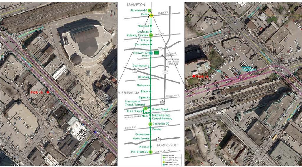
94 Figure 3-18: Point of Reception
95 Since the assessment is based on a comparison of the with project and no project sound levels, the effect of the project would be the greatest away from cross-streets carrying significant traffic volumes. The noise impacts of the addition of the LRT would be less noticeable near these cross-streets because their contribution to the traffic noise would mask the noise effects of the LRT. Similarly, receptors near major highways would also be less affected by the introduction of the LRT. The preceding receptors have been selected based on their proximity to the LRT corridor and also based on their distance from significant cross-streets and highways. As a result, the effects of the LRT service at these receptors would be the greatest along the corridor (i.e., the most conservative impact assessment locations have been selected). Predicted Existing Sound Levels The existing sound levels have been calculated at the identified PORs to establish a reference point for today s environment. The calculations use turning movement counts (TMCs) and 24-hour counts data collected by the City of Brampton and 2011 average annual daily traffic (AADT) volumes provided by the City of Mississauga. In order to calculate the daytime and nighttime equivalent sound levels, 24-hour volumes or AADT volumes are required. In order to approximate the AADT volumes, the hourly turning movement counts have been scaled up. The 24-hour counts would indicate that an appropriate scaling factor would be approximately 9 to 10 times the peak hour counts. To remain consistent, the daytime peak hour volumes ( ) from the TMCs have been scaled up by a factor of 5 to determine the AADTs. Furthermore, the volumes have been divided into daytime and nighttime components using factors of 90% and 10%, respectively. The average truck percentage along the corridor has been estimated to be comprised of 2% heavy trucks and 2% medium trucks (which includes buses). As some of the TMCs are out of date by a few years, a compounding growth rate of 1.5% per annum has been used to obtain estimated 2012 traffic volumes. Table 3-17 presents the traffic volumes in the vicinity of the PORs used in the assessment. Table 3-17: Estimated Current Traffic Volumes POR Street Cars Heavy and Medium Trucks Daytime Nighttime Daytime Nighttime 1 Hurontario Street Hurontario Street Hurontario Street Hurontario Street Hurontario Street Hurontario Street Hurontario Street Hurontario Street Main Street Main Street Main Street Main Street Based on the traffic volumes above, the estimated daytime and nighttime sound levels have been calculated. With the exception of POR 3, the topography between the POR and the roadway has been assumed to consist of hard, acoustically reflective ground. As a result, the specific receptor height is not significant in the evaluation. The predicted existing sound levels are summarized in Table 3-18, below. Table 3-18: POR Predicted Existing Sound Levels Existing Sound Levels Daytime (db, 16 hr Leq) Nighttime (db, 16 hr Leq) The above sound levels are calculated using MOE s STAMSON computer program (v. 5.04), which uses the ORNAMENT (Ontario Road Noise Analysis Method for Environment and Transportation) prediction procedure. Though the traffic volumes are approximate, differences of -20%/+25 are required to realize a 1 db change in the overall sound level. To confirm the above sound levels, several sound level measurements were taken along the corridor. The sound levels from these short, minute measurements are generally within 1-2 db of the calculated sound levels during the corresponding measurement periods. As the truck percentages used (4% overall) were relatively low, the calculated sound levels correlate well with the measured sound levels. In cases where the truck percentages are high, the model can overestimate the sound levels significantly, since modern trucks typically create 5 db less noise than the ORNAMENT model predicts. ORNAMENT truck noise relates to a typical truck on the road between 1978 and Existing sound levels were measured by this office and were generally found to be within 2-3 db of the predicted values. Generally, areas with lower truck traffic (such as in the Port Credit area) matched more closely to the predicted values. 14 Main Street

96 Vibration-sensitive Receptors Whereas the noise assessment considers 16 discrete receptors to provide an idea of the potential effects of the LRT service, the vibration assessment will take into consideration all of the sensitive receptors immediately adjacent to the corridor. As mentioned, the goal of the vibration assessment will be to identify areas where the vibration from the LRT service will exceed 0.10 mm/s RMS (ground-borne vibration) or 35 dba (vibration-induced noise). Where these criterion levels are exceeded, appropriate control measures will be recommended. There are no existing vibration sources running parallel to the route that create significant existing vibration levels. Existing vibration-sensitive receptors along the LRT corridor primarily include residential receptors. There are also theatres, places of worship, and medical facilities along the corridor that may also be sensitive to vibration from the LRT. Commercial and industrial receptors are generally less sensitive to vibration unless they house vibration-sensitive equipment (such as MRIs or electron beam microscopes) Air Quality The purpose of this section is to describe existing climate and air quality conditions in the vicinity of the proposed HMLRT project. Contaminants of interest, their relevant guidelines and the existing air quality conditions in the vicinity of study area are described. Climatic Conditions The City of Brampton and the City of Mississauga are situated at elevations of approximately 200 and 150 m above sea level, respectively. Environment Canada provides climate normals for eight (8) stations within the Toronto area. The closest and most representative station is located at the Toronto Lester B. Pearson International Airport. The location of this station is presented in Figure Figure 3-19: Location of Environment Canada Meteorological Station Table 3-19: Greater Toronto Area Climate Normals Parameter General Location Station Elevation Most frequent wind direction Mean wind speed - January Mean wind speed - July Daily min/max temperature - January Toronto Lester B. Pearson International Airport Western GTA m NW 17.8 km/h 12.3 km/h / -2.1ºC Daily min/max temperature - July 14.8 / 26.8 ºC Extreme minimum temperature Extreme maximum temperature -31.3ºC 38.3ºC Average afternoon relative humidity 62.8% Annual snowfall Annual rainfall Average snow depth - January cm 685 mm 7 cm Rainfall greater than 0.2 mm Snowfall greater than 0.2 cm days/year 46.5 days/year The GTA has a humid continental climate with warm, humid summers and cold winters. During the summer months, the daytime temperatures are usually below 30 ºC and the nighttime temperatures are typically around 15 ºC. During the winter months, the daytime temperature is usually above -10 ºC and the nighttime temperatures are typically around - 15ºC. The average afternoon humidity is 62.8% at the airport station. The area receives approximately 115 cm of snowfall on an average winter, with the average mid-winter depth of snow on the ground at approximately 7 cm. Snowfall occurs often through the winter, with appreciable amounts (greater than 0.2 cm) occurring on an average of 47 days/year, depending on location. Annual rainfall in the area is approximately 685 mm. Rain occurs fairly often during the warmer months, with appreciable rainfall (greater than 0.2mm) occurring on 112 days/year, on average. The driest month of the year is February, with an average precipitation of 22 mm; the wettest month tends to be August, with an average of 80 mm of rainfall. The months with the fewest number of days of precipitation are January, February and December, which average approximately 5 to 7 days precipitation above 0.2 mm. Table 3-20 presents data on hazardous weather conditions in the GTA, Ontario. The information presented in this table was obtained from the Canadian Climate Normal for the Toronto Lester B. Pearson International Airport station. The Toronto Lester B. International Airport station is the most representative of conditions along the proposed LRT corridor, which runs in a general northeast-southwest direction. Data from this station are summarized in Table The information presented in this table was obtained from Environment Canada s Canadian Climate Normals, for the Toronto Lester B. International Airport station. 3-44
97 Table 3-20: Data on Atmospheric Hazards Parameter Value Location Snowfall greater than 10 cm 2 days/year Lester B. Pearson International Airport Extreme snowfall 39.9 cm Lester B. Pearson International Airport Fog with visibility less than 1 km hours/year Lester B. Pearson International Airport Rainfall greater than 25 mm 4.3 days/year Lester B. Pearson International Airport Heavy snowfall events are also infrequent, with daily snowfalls greater than 10 cm generally occurring only about 2 days/year. Very heavy snowfall events occur from time to time, with the extreme being approximately 40 cm. Similarly, heavy rainfall events (greater than 25 mm) are infrequent, occurring 4 days/year on average. Fog with visibility less than 1 km occurs for approximately 102 hours/year, on average. As the study area spans a large surface area, fog is subject to variability, depending on location. Fog is likely to occur more often along the lakeshore, during the spring and fall seasons. Existing Air Quality Conditions Airborne Contaminants of Interest The selected contaminants represent the so-called criteria air contaminants (nitrogen dioxide, carbon monoxide, and particulate matter), and key volatile and semi-volatile organic compounds (benzene, 1,3-butadiene, formaldehyde, acetaldehyde, acrolein, and benzo(a)pyrene). Table 3-21 outlines the contaminants of interest. Airborne particulate matter is represented in Table 3-3 by PM10 and PM2.5, which are the inhalable and respirable fractions. These portions of the total particulate matter are considered to be of greatest concern in terms of potential effects to human health. The larger particles making up the remainder of the total particulate matter are not a concern from human health standpoint and, historically, have been a concern only with respect to nuisance effects, such as deposition on and soiling of property (e.g., sidings of residences). Therefore, the present study has focused on only the inhalable and respirable fractions of particulate matter (especially the respirable fraction, which has the strongest association with effects to human health). Table 3-21: Contaminants of Interest Contaminant Carbon Monoxide Nitrogen Dioxide Respirable Particulate Matter Inhalable Particulate Matter Benzene 1,3-Butadiene Formaldehyde Acetaldehyde Acrolein Benzo(a)pyrene Symbol or Chemical Formula CO NO2 PM2.5 PM10 C6H6 C4H6 CH2O CH3CHO C3H4O C20H12 Relevant Guidelines The Province of Ontario has established both criteria and standards for concentrations of airborne contaminants [1]. The Ambient Air Quality Criteria (AAQCs) are effects-based levels in air, based on health and/or other effects. They are used in environmental assessments, special air monitoring studies and assessments of general air quality to determine the potential for adverse effects. The standards, on the other hand, are established by Ontario Regulation 419/05, and are legal requirements which emitters in Ontario must meet. Most of the standards are based on the AAQCs but, in some cases, the standard and AAQC for a contaminant differ from each other. Since Ontario Regulation 419/05 does not apply to discharges of contaminants from motor vehicles only the AAQCs will apply to the assessment to be performed. In addition to provincial AAQCs, the Federal Government and the Canadian Council of Ministers of the Environment have established Canadian Ambient Air Quality Standards (CAAQS) [2]. These are health-based air quality objectives for pollutant concentrations in outdoor air. Of particular relevance is the CAAQS for PM2.5 (respirable particulate matter), since PM2.5 currently does not have a provincial AAQC in Ontario. These objectives are being phased in, with the final and most stringent objective becoming active in the year The air quality criteria and standards are collectively referred to as air quality thresholds in this report. The thresholds used to assess potential project impacts are summarized in Table Again, it should be noted that these thresholds represent target levels and are not specifically enforceable for motor vehicle emissions. Table 3-22: Summary of Relevant Air Quality Thresholds Pollutant Threshold (µg/m³) Averaging Period Type of Threshold Reference PM hour CAAQS [2] 8.8 Annual CAAQS [2] PM10 [1] hour AAQC [1] CO 36,200 1-hour AAQC [1] 15,700 8-hour AAQC [1] NO hour AAQC [1] hour AAQC [1] Benzene hour AAQC [1] 0.45 Annual AAQC [1] 1,3-Butadiene hour AAQC [1] 2 Annual AAQC [1] Acrolein hour AAQC [1] hour AAQC [1] Acetaldehyde minute AAQC [1] hour AAQC [1] Formaldehyde hour AAQC [1] Benzo(a)pyrene hour AAQC [1] Annual AAQC [1] Notes: [1] The threshold level for PM10 is based on an interim 24-hour AAQC of 50 µg/m
98 Historical Ambient Air Quality Monitoring Data The existing air quality conditions in the study area can be characterized generally with historical air quality monitoring data from the National Air Pollution Surveillance (NAPS) program and MOE stations. Stations located geographically close to the proposed project site that are reasonably representative of the project site were selected and utilized to determine existing air quality conditions. The proposed project site is primarily urban/suburban land use, with a mix of residential and commercial land use and located in proximity to major highways and arterial roads. The air quality monitoring stations that are closest to the study site are along the proposed LRT corridor, located at 525 Main Street North in Brampton, 310 Bristol Road East in Mississauga and Queensway/Hurontario Street in Mississauga, all in areas of urban/suburban land use. Data from these three (3) air quality monitoring station are preferable, due to the stations proximity to the proposed project site and the reasonably representative nature of the land use in the proposed project site. However, monitoring data from these stations are only available for certain time periods and for certain contaminants of interest. The other five (5) stations used are all approximately within a 20 kilometre radius of the proposed project site. All of these stations are located in areas of mixed urban/suburban land use, in proximity (1.5 to 2.5 km) to a highway (i.e., Highway 401 and Highway 403) and, therefore, are reasonably representative of the proposed project site. Figure 3-20a shows the locations of the air quality monitoring stations that were selected to compile the background air quality data. Note that ambient monitoring data for benzo(a)pyrene are not widely available. Two additional monitoring stations were included only for this contaminant. One station was located in rural Egbert, Ontario, and the other was located in downtown Toronto as shown in Figure 3-20b. All relevant ambient monitoring data were collected for all the stations and available time periods. Table 3-23 provides a description of the stations used for contaminants of interest. Due to the close proximity of the Clarkson Airshed to the project, the MOE s Clarkson Airshed Study (CAS) [3] results were included to identify the background air quality conditions. The most reasonably representative station in the CAS is Station #44086 Deer Run, West of Winston Churchill Boulevard, Oakville. The CAS data were considered for particulate matter (PM2.5, PM10), nitrogen dioxide, benzene and 1,3-butadiene. The CAS data for acrolein contain discrepancies. An addendum to the CAS titled South Mississauga (Clarkson) and Oakville Sampling Results for Acrolein, Acrylonitrile and Dichloromethane in Ambient Air was issued in April 2009 [4]. The acrolein concentrations yielded from these results were an order of magnitude higher than the concentrations reported from the Etobicoke NAPS station. Due to this discrepancy, the CAS acrolein results were not included in the ambient background concentration. All stations discussed above were selected based on the assumption that they are reasonably representative of typical contributions from background traffic on various roads, and all other miscellaneous emission sources in the surrounding area. The stations will also reflect contributions from long-range transport of certain pollutants (e.g., PM2.5) into the region from upwind regions (e.g., transport of pollutants from the Ohio Valley of the U.S. into Southern Ontario). Table 3-24 provides a summary of the data. The mean values are representative of every-day conditions and the maximum values are more representative of rare peak events, associated with unusual events occurring near the monitor that are not representative of the general background conditions. The concentrations shown in Table 3-24 were derived from an examination of the available years of monitoring data for each station and represent the average of the various levels from among the years with data available. Existing air contaminant levels in the study area for the majority of the contaminants are less than their relevant AAQC, even when considering the maximum concentrations over multiple stations and multiple years. However, PM10, PM2.5, acrolein, benzene, and benzo(a)pyrene do exceed their criteria at least some of the time. PM10 and PM2.5 have maximum concentrations that are above their 24-hour AAQC and CAAQS. These elevated maximums result from high particulate matter events that occur in the GTA from time-to-time. However, for both of these contaminants, the annual means are well below the thresholds, indicating that on an average day, the ambient concentrations of PM10 and PM2.5 are below the criterion. The 24-hour concentrations remain well below their respective thresholds at the 90th percentile level. For 24-hour acrolein, benzene and benzo(a)pyrene, the overall maximum concentrations are quite high, and represent rare, outlying events. The 90th percentile values are much lower than the overall maxima, and below their respective AAQC for acrolein and benzene, but above for benzo(a)pyrene. The annual benzene and benzo(a)pyrene concentrations also exceed their respective AAQCs. This is not unique to the GTA and is the case throughout urbanized areas of Southern Ontario. Ozone is included in Table Although ozone is not emitted directly from vehicle exhausts, it is included in the above table because it will be used to predict the formation of NO2 from vehicular NOx emissions. 3-46


99 Figure 3-20: Ambient Air Quality Monitoring Station 3-47
100 Table 3-23: Contaminant Carbon Dioxide (CO) Nitrogen Dioxide (NO2) Ozone (O3) Summary of Ambient Monitoring Stations Station Station Name Number NAPS Mississauga Station Location Years Included in Assessment Queensway W./Hurontario MOE Mississauga 3359 Mississauga Rd. N., U of T Campus NAPS NAPS Mississauga Toronto/ Etobicoke W NAPS Oakville NAPS Brampton NAPS Mississauga CAS Oakville 310 Bristol Rd. E.; Frank McKechnie Community Centre Elmcrest Road Eighth Line/Glenashton Dr., Halton Reservoir Main St. N, Peel Manor Queensway W./Hurontario Deer Run, West of Winston Churchill Boulevard MOE Mississauga 3359 Mississauga Rd. N., U of T Campus NAPS Mississauga NAPS Toronto/Etobicoke W NAPS Oakville NAPS Brampton NAPS Mississauga 310 Bristol Rd. E.; Frank McKechnie Community Centre Elmcrest Road Eighth Line/Glenashton Dr., Halton Reservoir , Main St. N, Peel Manor Queensway W./Hurontario MOE Mississauga 3359 Mississauga Rd. N., U of T Campus NAPS NAPS Mississauga Toronto/Etobicoke W NAPS Oakville NAPS Brampton 310 Bristol Rd. E.; Frank McKechnie Community Centre Elmcrest Road Eighth Line/Glenashton Dr., Halton Reservoir , Main St. N, Peel Manor Contaminant Respirable Particulate Matter (PM2.5) Inhalable Particulate Matter (PM10) Acrolein Benzene 1-3 Butadiene Formaldehyde Acetaldehyde Benzo(a)pyrene Station Station Name Number NAPS Mississauga CAS Oakville Station Location Environmental Project Report Years Included in Assessment Queensway W./Hurontario Deer Run, West of Winston Churchill Boulevard MOE Mississauga 3359 Mississauga Rd. N., U of T Campus NAPS NAPS Mississauga Toronto/Etobicoke W NAPS Oakville NAPS Brampton CAS NAPS NAPS CAS NAPS NAPS CAS NAPS NAPS NAPS NAPS NAPS NAPS Oakville Toronto/Etobicoke W 310 Bristol Rd. E.; Frank McKechnie Community Centre Elmcrest Road Eighth Line/Glenashton Dr., Halton reservoir , Main St. N, Peel Manor Deer Run, West of Winston Churchill Boulevard Elmcrest Road Toronto Ruskin/Perth St Oakville Toronto/Etobicoke W Brampton Oakville Toronto/Etobicoke W Brampton Deer Run, West of Winston Churchill Boulevard Elmcrest Road 525 Main St. N., Peel Manor Deer Run, West of Winston Churchill Boulevard Elmcrest Road 525 Main St. N., Peel Manor Toronto Ruskin/Perth St Toronto Ruskin/Perth St Egbert Egbert Toronto 223 College Street
101 Table 3-24: Pollutants Carbon Monoxide (CO) Nitrogen Dioxide (NO2) Respirable Particulate Matter (PM2.5) Inhalable Particulate Matter (PM10) Acrolein Acetaldehyde Benzene Summary of Ambient Air Measurements (µg/m³) Source Criterion (µg/m3) Averaging Period AAQC hour AAQC hour Average Concentration (Over All Years and Statistic Stations) [1] (µg/m 3 ) Maximum th Percentile 954 Maximum th Percentile N/A N/A N/A Annual Annual Mean 582 AAQC hour AAQC hour Maximum th Percentile 58 Maximum 86 90th Percentile N/A N/A Annual Annual Mean 29 CAAQS hour N/A Maximum 37 90th Percentile 16 CAAQS 8.8 Annual Annual Mean 7.4 AAQC hour Maximum 66 90th Percentile 38 N/A N/A Annual Annual Mean 20 AAQC hour AAQC hour Maximum 90th Percentile N/A N/A Maximum th Percentile 0.22 N/A N/A Annual Annual Mean 0.10 AAQC hour AAQC hour Maximum 90th Percentile N/A N/A Maximum th Percentile 2.7 N/A N/A Annual Annual Mean 1.7 AAQC hour Maximum th Percentile 1.0 AAQC 0.45 Annual Annual Mean 0.65 Notes: Pollutants 1,3-Butadiene Formaldehyde Benzo(a)pyrene Ozone N/A not available Source Criterion (µg/m3) Averaging Period AAQC hour AAQC 2 Annual Annual Mean AAQC hour Average Concentration (Over All Years and Statistic Stations) [1] (µg/m 3 ) Maximum th Percentile Maximum th Percentile 4.6 N/A N/A Annual Annual Mean 2.7 AAQC hour Maximum th Percentile AAQC Annual Annual Mean N/A N/A 1-hour 24-hour Maximum th Percentile 91 Maximum th Percentile N/A N/A Annual Annual Mean 51 [1] For each contaminant, the available years of data were reviewed and the average of 90th percentiles from the available years and for the chosen ambient monitoring stations was considered for the 1-hour, 8-hour and 24-hour averaging periods. The average annual mean was chosen for the annual averaging period. Conclusions This section has presented a summary of the climate and air quality conditions in the vicinity of the proposed HMLRT project. Existing air contaminant levels in the study area are within acceptable thresholds set out in MOE Ambient Air Quality Criteria (AAQCs), with the exception of particulate matter and acrolein, benzene, and benzo(a)pyrene. With respect to inhalable and respirable particulate matter and acrolein, 24-hour concentrations are within the thresholds most of the time, but do exceed them from time to time. In the case of benzene, the annual average concentration exceeds the future annual average AAQC s. The 24-hour and annual concentrations of benzo(a)pyrene exceed their respective AAQSs. N/A 3-49
102 3.4 Cultural Environment Built Heritage and Cultural Landscapes Introduction Archaeological Services Inc. (ASI) was contracted by SNC-Lavalin Inc. to conduct a cultural heritage assessment as part of the HMLRT Project. The purpose of the assessment is to present a built heritage and cultural landscape inventory of cultural heritage resources in the study area, an evaluation of the technically preferred alternative and potential impacts on identified cultural heritage resources, and to provide appropriate mitigation and monitoring recommendations. This section of the report presents the inventory. In order to make a preliminary identification of existing built heritage resources and cultural heritage landscapes within the study area, a number of sources were consulted. These include: Cultural Heritage Assessment Report Hurontario-Main Street Study, Municipal Class Environmental Assessment (Unterman McPhail Associates (UMA) 2010); City of Mississauga s Heritage Register; City of Mississauga s Cultural Landscape Inventory (January 2005); City of Mississauga s Cultural Resource Map (Heritage Layer); City of Brampton s Municipal Heritage Register of Cultural Heritage Resources Designated under the Ontario Heritage Act (updated June 7, 2012); City of Brampton s Municipal Heritage Register of Cultural Heritage Resources: Listed Heritage Properties (updated June 7, 2012); Brampton Maps (Heritage Layer); and Canadian Register of Historic Places. In addition to available local history books and historic mapping, information relating to the historical, design/ architectural and contextual value of each resource was gathered from the relevant municipality, where available. Information regarding the heritage resources identified in the City of Mississauga was obtained from property-specific files maintained at the Heritage Planning Services office in June Additional information regarding heritage properties/ sites in the City of Brampton was found on the city s online Heritage Newsletter, and relevant designation by-law descriptions. A field review was undertaken by ASI in June 2012 and July 2012 to document the existing conditions of the study area. While the Hurontario Street-Main Street thoroughfare through Mississauga and Brampton travels in a southeast northwest direction, for ease of description, it is hereafter described as having a north south orientation. Table 3-25 lists the built heritage resources (BHR) cultural heritage landscapes (CHL) that were identified in the study corridor during the field review. 3-50


 and detail of the date marker on the east abutment (right).")

103 Table 3-25: Identified Built Heritage Resources and Cultural Heritage Landscapes in the Study Corridor Environmental Project Report Feature Inventory Description Photograph(s) BHR 1 Location: Canadian National Railway at Hurontario Street, Mississauga Feature Type: Railway Bridge Recognition: Identified during field review & identified in the previous Cultural Heritage Resource Assessment Report (UMA 2010) Historical: - according to the date stamp located on both abutments, the bridge was built in historic mapping indicates that, prior to 1963, it was an at-grade crossing. - this railway alignment was established in the mid-nineteenth century. Design: - single-span, concrete rigid frame bridge. - features open-concept steel railings and curved soffit. Context: - frames the northern entrance into Port Credit. - associated with the Great Western Railway (now Canadian National Railway). South elevation of the bridge (left) and detail of the date marker on the east abutment (right). BHR 2 Location: 25 Pinetree Way, Mississauga (formerly 1608 Hurontario Street) Feature Type: Residence (now commercial) Recognition: Listed currently being considered for Designation under Part IV of the Ontario Heritage Act. Historical: - House was built by Mary Fix and Albert Alphonse Fix. - Mary Fix became Reeve of Toronto Township in 1955, and Peel County s first female Warden in She is noted for her role in encouraging development of the Dixie and Clarkson industrial areas in the 1950s, and for helping to establish a strong library system for the Township (now City of Mississauga) and was a founding member of the Mississauga Heritage Foundation. - She died in 1972, and bequeathed her home to the Town of Mississauga (now City of Mississauga). Design: - one-and-a-half storey vernacular residence of frame construction, following an H-plan footprint, clad in half-a-metre long wood shingles (considered an unusual construction practice), with gabled roof and internal brick chimney on the west side. - windows feature fifteen-over-fifteen pane arrangement. Context: Northeast elevation (left) and view showing setback of the structure from the road, looking south (right). - located southwest of intersection of Hurontario Street and the Queen Elizabeth Way. - context has been altered recently through the reorientation of Pinetree Way around the back of the house, effectively cutting the house off from the rest of its original parcel (which is now known as Mary Fix Park). 3-51
 Historical: - St.")


104 Table 3-25: Identified Built Heritage Resources and Cultural Heritage Landscapes in the Study Corridor Feature Inventory Description Photograph(s) BHR 3 Location: 2350 Hurontario Street, Mississauga Feature Type: Church Recognition: Identified during field review & identified in the previous Cultural Heritage Resource Assessment Report (UMA 2010) Historical: - St. Catherine of Siena Roman Catholic Church, built between 1956 and 1961, to service the growing population along Hurontario Street and surrounding residential subdivisions. - a review of aerial mapping from the mid-twentieth century indicates that this property was previously an orchard. Design: - features a three-bay front façade, which faces east, with large round window flanked by tall, narrow windows. - large front-facing gabled roof. - exterior finished in stone-facing. Context: - located on the west side of Hurontario Street. BHR 4 Location: 2364 Hurontario Street, Mississauga Feature Type: Residence (now commercial) Recognition: Identified during field review & identified in the previous Cultural Heritage Resource Assessment Report (UMA 2010) Historical: - built in the mid-twentieth century (was present on historic topographic mapping by 1954). Design: - one storey brick dwelling with low-pitched hipped roof and an attached garage. - features a central entrance flanked by two gabled bay windows. - two internally-bracketed chimneys with brick stacks. Context: - located on the west side of Hurontario Street. - located at south end of the former Cooksville settlement. Northeast elevation. BHR 5 Location: 4650 Hurontario Street, Mississauga Feature Type: Residence (now used as a restaurant) Recognition: Designated under Part IV of the Ontario Heritage Act (By-law No ) Historical: - built in about 1850 by Amos and Charles Wilcox, farmers. Design: - the Designation By-law for this structure indicates that it is a fine example of a mid-nineteenth century stone farmhouse, combining Greek and Gothic Revival detailing. - of particular note are the dentil course and cornice returns, lancet dormer window, decorative front door, and fieldstone construction made to imitate ashlar. Context: - prominently located at southwest corner of Hurontario Street and Eglinton Avenue West. - the house has been incorporated into a modern commercial development, and is currently occupied by a restaurant/pub. East elevation. Northeast elevation. 3-52
 Recognition: Designated under Part IV of the Ontario Heritage Act (By-law No.")


105 Table 3-25: Identified Built Heritage Resources and Cultural Heritage Landscapes in the Study Corridor Environmental Project Report Feature Inventory Description Photograph(s) BHR 6 Location: 6650 Hurontario Street, Mississauga Feature Type: Residence (now commercial) Recognition: Designated under Part IV of the Ontario Heritage Act (By-law No ) Historical: - land was originally granted by the Crown in a review of historic mapping shows the house was present in 1877 and at that time, it was owned/occupied by William Oliver. - during the second part of the twentieth century, it was owned by the German Canadian Club, and is known as the Hansa House. Design: - a one-and-a-half storey house with gabled roof, rubble foundation, T-shaped plan, and two internal brick chimneys at the gable ends of the main block. - decorative elements include the brackets under the eaves on all sides, the return eaves at the gable ends, the cornice which is moulded trim as well as patterned woodwork, and mouldings around the windows and main entrance. Context: Front (east) elevation (left) and view showing set-back from the road, looking south (right). - located on the west side of Hurontario Street, and is surrounded by expansive green lawns. - a large parking lot and an associated banquet hall/facility are located behind the former residence. BHR 7 Location: Corner of Elgin Drive and Main Street South, Brampton Feature Type: Gate Recognition: Listed on the municipal heritage register (Class A) Historical: - the entrance gates are associated with the 1960s residential subdivision development of Armbro Heights that was built by the Armstrong Brothers (Armbro is an abbreviation for Armstrong Brothers). Design: - each gate features matching stone materials, tall square pillars with concrete cap, and attached wall which curves or sweeps away from the road. - The interior face of each wall (facing the road) contains the name Armbro Heights in block letters with a gold background that was originally illuminated. - an example of the Modernist movement. Context: - the structures are an important landmark & gateway feature given their design, material, associated landscaping, and their positions flanking Elgin Drive at the east approach to the Etobicoke Creek bridge crossing. (Source: Listing Candidate Summary Report, City of Brampton, September 2007) South gate, looking west (left) and view of both gates flanking the road, looking west (right). 3-53
, Brampton Feature Type: Residence Recognition: Listed on the municipal heritage register (Class B) Historical: - a single structure appears on or in close proximity to this property")


106 Table 3-25: Identified Built Heritage Resources and Cultural Heritage Landscapes in the Study Corridor Feature Inventory Description Photograph(s) BHR 8 Location: 0 Main Street South (access off 34 Richmond Drive), Brampton Feature Type: Residence Recognition: Listed on the municipal heritage register (Class B) Historical: - a single structure appears on or in close proximity to this property on historic topographic mapping as early as by the 1930s, there were several structures shown in the vicinity of the original structure and at that time, access to the property was from Kennedy Road to the east, although it is located so closely to Hurontario Street. Design: - excellent example of an early twentieth century period revival house. - Elements inspired by the English Tudor Revival include: half timbering; tall and prominent chimney stacks; steeply pitched gable roof profiles; random coursed stone walls; stone labels over windows; and leaded glass casement and fixed windows. Context: - the property is located on elevated land to the east of Hurontario Street. - contributes to the character and identity of the Main Street South gateway into downtown Brampton. - a long, curving laneway linking the house to Main Street South remains extant and was likely an original access. (Source: Listing Candidate Summary Report, City of Brampton, February 2008) BHR 9 Location: 200 Main Street South, Brampton Feature Type: Residence Recognition: Listed on the municipal heritage register (Class - TBD) Historical: - built circa 1950s. - known property owners include: George Johnston (original owner, no dates); Wilbert and Lena West ( ); and Church of Jesus Christ of Latter-Day Saints (1968 present). Design: - highly representative of the modernist International Style and 50s Contempo design, as exhibited through: emphasis on horizontal lines; prominent rectangular chimney with side facing out from the front façade; open carport; large floor-to-ceiling glass plate windows; rows of small squared clerestory windows; split-level massing; and large overhanging eaves. Context: - the property is located on elevated land to the east of Hurontario Street. - contributes to the character and identity of the Main Street South gateway into downtown Brampton. - it is well concealed from the road and surrounding properties through vegetative screening. (Source: Listing Candidate Summary Report, City of Brampton, April 2009) Environmental Project Report View of the property from Main St. S., looking northeast (left) and an aerial view (right). [Bing Maps 2012 Microsoft] View of the property from Main St. S. (left) and an aerial view (right). [Bing Maps 2012 Microsoft] 3-54
 Historical: - built in circa 1915 over the Etobicoke Creek. - bridge was likely built by B. H. Bull who formally owned this property.")

 Historical: - the Park Royal apartment building was built in the 1930s. - built for Dr. Robert James Hiscox, owner and publisher of the Peel Gazette.")

107 Table 3-25: Identified Built Heritage Resources and Cultural Heritage Landscapes in the Study Corridor Feature Inventory Description Photograph(s) BHR 10 Location: Archdekin Park, west of Main Street South Feature Type: Bridge Recognition: Listed on the municipal heritage register (Class - TBD) Historical: - built in circa 1915 over the Etobicoke Creek. - bridge was likely built by B. H. Bull who formally owned this property. - the park occupies lands that were originally part of the B. H. Bull Jersey Cattle farm, noted as being the largest Jersey cattle farming operation in Canada at one time. Design: - single-span concrete bridge. - concrete balustrades and piers. - rehabilitated in 2008 by the City of Brampton. Context: - a landmark in a picturesque park setting. BHR 11 Location: 8 Wellington Street, Brampton Feature Type: Apartment Building Recognition: Designated under Part IV of the Ontario Heritage Act (By-law No ) Historical: - the Park Royal apartment building was built in the 1930s. - built for Dr. Robert James Hiscox, owner and publisher of the Peel Gazette. Design: - a one-of-a-kind example of an Art Deco/Moderne styled apartment building in Brampton. - designed by Robert W. Hall, respected architect in the region. - built by noted contractor Harry Hergaarden, regarded as one of the most important twentieth-century building contractors in Brampton. Context: - given its rare architectural style, the building serves as a landmark in the community. Views of the bridge, looking southwest (left) and east (right). BHR 12 Location: 2 Wellington Street (Ken Whillans Square), Brampton Feature Type: Cenotaph/Memorial Recognition: Listed on the municipal heritage register (Class A) Historical: - first unveiled in 1928 by Lord Willingdon, Governor General of Canada from 1926 to the memorial honours those who served and died in the First and Second World Wars and the Korean War. Design: - concrete construction. - rehabilitated in Context: - located in an open plaza in front of Brampton City Hall. - an important symbol to the community. Front façade, looking northwest. View of the Cenotaph, looking northwest. 3-55
 Historical: - the First Baptist Church was built in 1875-76. - Reverend E. J.")

 Historical: - the Boyle House was built in the nineteenth century and retains association with Robert Boyle, church minister at St. Paul s from 1855-1860 and 1867-1869.")


108 Table 3-25: Identified Built Heritage Resources and Cultural Heritage Landscapes in the Study Corridor Feature Inventory Description Photograph(s) BHR 13 Location: 48 Main Street South, Brampton Feature Type: Church Recognition: Listed on the municipal heritage register (Class A) Historical: - the First Baptist Church was built in Reverend E. J. Stobo was the first to serve as minister. Design: - red brick constructing featuring buff brick decorative treatment, corbelling at the roofline, round arched window openings, and a tall square tower. Context: - while set back from Main Street South, the church still figures prominently in the Brampton historic core given its location on a corner lot and architectural detailing. BHR 14 BHR 15 Location: 44 Main Street South, Brampton Feature Type: Residence Recognition: Designated under Part IV of the Ontario Heritage Act (By-law No ) Historical: - the Boyle House was built in the nineteenth century and retains association with Robert Boyle, church minister at St. Paul s from and the Boyle family is noted for their role in the early economic development of Brampton during the nineteenth century through their operation of a bookstore and a pharmacy. Design: - rare example of a dwelling influenced by the French Second Empire architectural style. - features a bell-cast mansard roof, front verandah with tall central staircase, eaves with paired brackets, and three dormers on the front façade with Renaissance Revival style pediments. Context: - a prominent structure given its architectural detailing, location in the historic core of Brampton, and also its location between two important churches. Location: 30 Main Street South, Brampton Feature Type: Church Recognition: Designated under Part IV of the Ontario Heritage Act (By-law No ) Historical: - St. Paul s United Church was built in the 1880s by local builder Jesse Perry, to the designs of Mallory and Sons. - associated with the Brampton congregation of the Primitive Methodist Church, which was established in 1834 by William Lawson and John Elliot. Design: - constructed of stone masonry and slate roofing. - follows a cruciform floor plan and features rusticated exterior stone walls, white stone facings, corbelling on the roofline, and slate roof shingles in a scalloped pattern. Context: - a prominent structure given its size, quality of materials and craftsmanship, architectural detailing, and location in the historic core of Brampton. Front façade, looking east (left) and setback from the road, looking south (right). View of structure, looking northeast (left) and looking southeast (right). Front façade, looking east (left) and proximity of the structure to the road, looking north (right). 3-56

.")

109 Table 3-25: Identified Built Heritage Resources and Cultural Heritage Landscapes in the Study Corridor Feature Inventory Description Photograph(s) BHR 16 Location: Main Street North, just north of Theatre Lane, Brampton Feature Type: Bridge Recognition: Identified during field review Historical: - according to the date stamp located on both abutments, the bridge was built in railway alignment was first established in the mid-nineteenth century. Design: - single-span bridge constructed using steel and concrete. Context: - frames the northern entrance into the historic commercial core of Brampton. - associated with the Grand Trunk Railway (now Canadian National Railway). BHR 17 Location: 140 Main Street North, Brampton Feature Type: Residence (now commercial) Recognition: Listed on the municipal heritage register (Class - TBD) Historical: - the Lundy House was built in circa 1852, making it one of the earliest homes to be built in Brampton. - associated with two prominent Brampton citizens: Dr. John Mullin in the late nineteenth century, and Erlin E. Copeland in the early twentieth century. Design: - three-storey brick, Georgian-inspired house with gabled roof, returned eaves, and symmetrical front façade and central entrance. - fenestration was altered recently from original design. Context: - prominently located on a corner lot. View of the bridge from the north. View from the northwest (left) and north elevation (right). 3-57


 indicated that a proposed platform and third mainline will encroach into the building.")
110 Table 3-25: Identified Built Heritage Resources and Cultural Heritage Landscapes in the Study Corridor Feature Inventory Description Photograph(s) BHR 18 Location: 19, 27, 31 Church Street West, Brampton Feature Type: Railway Station Recognition: Designated under the Heritage Railway Stations Protections Act in 1993 Historical: - the former Canadian National Railway station was built in 1907 and is now used as a VIA Rail/Go Transit Station. - the station reflects the prosperity and wealth of the Grand Trunk Railway, as well as the City of Brampton, at the turn of the century. Design: - one-and-a-half storey brick railway station resting on rock-faced granite foundations. - architectural design/detailing combines the Romanesque Revival style with the Arts and Crafts Movement, featuring: wide-arched openings; complex roof line; wide, overhanging eaves with decorative brackets; contrasting materials; variety of window openings/shapes; the large, central square entrance tower with corbelled arcading; textural masonry; and round towers with conical roofs. Context: - landmark building in Brampton s historic downtown area. BHR 19 Note: The Georgetown Corridor Planning Study (McCormick Rankin Corporation 2002:28) indicated that a proposed platform and third mainline will encroach into the building. A preliminary review of the site concluded that it would be feasible to relocate the building back from the rail corridor in order to avoid the proposed undertaking and related construction activities. Any changes to the building will be subject to review by the Historic Sites and Monuments board and will require approval of the National Transportation Agency. Location: 34 Church Street West, Brampton Feature Type: Residence (now commercial) Recognition: Designated under Part IV of the Ontario Heritage Act (By-law No ) Historical: - this structure was built in 1853 to the designs of internationally known architect William Hay. - it was built for prominent Brampton businessman and politician George Wright. - subsequent owners and prominent Brampton figures include: John Thistle; George Williams; J. W. Hewetson; and the Honourable William Grenville Davis. Design: - considered to be a rare example of High Gothic Revival architecture in Brampton. - suffered from a fire, which resulted in the removal of the rear wing. - original brick exterior has been covered with siding. Context: - helped shape and define the character of the surrounding neighbourhood. North elevation (left) and view of south elevation, looking west (right). Environmental Project Report Southeast elevation, view from Church St. (left) and view along Church St., looking west (right). 3-58
 Historical: - formerly the Farr Garage Building, likely built in the mid-twentieth century.")

111 Table 3-25: Identified Built Heritage Resources and Cultural Heritage Landscapes in the Study Corridor Feature Inventory Description Photograph(s) BHR 20 Location: Main Street North, Brampton Feature Type: Commercial Recognition: Listed on the municipal heritage register (Class - B) Historical: - formerly the Farr Garage Building, likely built in the mid-twentieth century. - front building has now been converted into stores. Design: - main structure features a rectangular footprint with a concave front façade, and a rear building extension also with a rectangular footprint. - building is a concrete structure with flat roof, simple roofline, and the front façade features rectangular storefront windows alternating with semi-circular window/door openings. Context: - forms part of the commercial streetscape of Brampton s historic commercial core, which continues on the north side of the railway tracks. BHR 21 Location: Etobicoke Creek Crossing (north) at Main Street Feature Type: Bridge Recognition: Identified during field review Historical: - associated with the Main Street alignment, a historical thoroughfare into downtown Brampton. - associated with former bridges built to span this crossing point. Design: - three-span concrete I-girder bridge that was built in the bridge underwent rehabilitation work in 2001 and Context: - forms part of a series of bridges built to span Etobicoke Creek. Aerial view of south and east elevation. [Bing Maps 2012 Microsoft] Oblique view of the east elevation of the Main Street Bridge over Etobicoke Creek (north). 3-59


112 Table 3-25: Identified Built Heritage Resources and Cultural Heritage Landscapes in the Study Corridor Feature Inventory Description Photograph(s) BHR 22 Location: Etobicoke Creek Crossing (south) at Main Street Feature Type: Bridge Recognition: Identified during field review Historical: - associated with the Main Street alignment, a historical thoroughfare into downtown Brampton. - associated with former bridges built to span this crossing point. Design: - built in 1967, rehabilitated in 1977 and Context: - forms part of a series of bridges built to span Etobicoke Creek. BHR 23 Location: Canadian Pacific Rail Crossing, Cooksville Feature Type: Bridge Recognition: Identified during field review Historical: - associated with the Hurontario Street alignment, a historical thoroughfare through Cooksville. Design: - originally built in 1925, widened in 1964, and rehabilitated in Context: - forms part of a series of bridges built to span Etobicoke Creek. Aerial view of the Main Street Bridge over Etobicoke Creek (south). (Source: Bing Maps 2013) South elevation of the bridge. 3-60

 Feature Type: Residential Neighbourhood Recognition:")
 and Hurontario Street, followed by Mineola Road and Indian Valley Trail in the 1930s 1940s, with considerable development occurring in the")

. - roads lack curbs and sidewalks, creating a soft transition from road to front yards.")
113 Table 3-25: Identified Built Heritage Resources and Cultural Heritage Landscapes in the Study Corridor Feature Inventory Description Photograph(s) BHR 24 Location: Queen Elizabeth Way (QEW) Crossing Feature Type: Bridge Recognition: Identified during field review Historical: - Canada s first cloverleaf interchange in The interchange was reconstructed in associated with the QEW and Hurontario Street. Design: - built in 1961, rehabilitated in Context: - forms part of a series of bridges built to span the Hurontario Street corridor. CHL 1 Location: Mineola Neighbourhood, Mississauga (includes the west side of Hurontario Street, from the CN Railway to just south of the QEW) Feature Type: Residential Neighbourhood Recognition: Listed on the Mississauga Cultural Heritage Landscape Inventory (L-RES-6) Historical: - a review of early twentieth-century historic mapping shows that the first residences were built along Stavebank Road (a historic road along the banks of the Credit River) and Hurontario Street, followed by Mineola Road and Indian Valley Trail in the 1930s 1940s, with considerable development occurring in the 1950s. - illustrates an important phase in Port Credit s social and physical development. Design: - the residential properties located in the Mineola residential neighbourhood are noted for their aesthetic/visual qualities and consistent scale. - the area features larger property parcels, a variety of housing styles, meandering network of roads, and most importantly, the roads and houses were built on the original topography (rather than on re-graded land). - roads lack curbs and sidewalks, creating a soft transition from road to front yards. Context: - the landscape is noted in particular for its scenic/visual qualities and blend of natural environment with manicured landscapes. - mature vegetation. - located north of the historic core of Port Credit. North elevation of the bridge. View of the west side of Hurontario St., looking north from Mineola Rd. (left) and looking south along part of the Hurontario Streetscape, from south of Indian Valley Trail (right). Photos showing range in housing styles and scale along west side of Hurontario St. 3-61


 Feature Type: Streetscape *This CHL has been altered through removal of the three dwellings")
 Historical: - early- to mid-twentieth-century residences built along")
114 Table 3-25: Identified Built Heritage Resources and Cultural Heritage Landscapes in the Study Corridor Feature Inventory Description Photograph(s) CHL 2 Location: East side of Hurontario Street, between Mineola Road and the QEW, Mississauga Feature Type: Streetscape Recognition: Identified during field review & identified in the previous Cultural Heritage Resource Assessment Report (UMA 2010) Includes one property that is Listed on the municipal heritage register: 1395 Hurontario Street, built circa Historical: - a review of early-twentieth-century mapping reveals that there were four residences along this part of Hurontario Street by 1909/1915, and the number of residences doubled by Mapping also shows that there was a mixture of brick and frame residences. - illustrates an important phase in Port Credit s social and physical development. Design: - residences of various massing, scale and architectural styles situated on large lots that front on to Hurontario Street. Context: - original topography and mature vegetation has been maintained, with properties often combining the preserved natural environment with manicured/landscaped surroundings. - most residences are well set back from the road right-of-way, and a large number have been converted into commercial or office use. - mature vegetation. - located north of the historic core of Port Credit. Southwest elevation of listed property at 1395 Hurontario St. (left) and looking north along streetscape (right). CHL 3 Location: West side of Hurontario Street, Mississauga (2134, 2130, 2124, and 2114 Hurontario Street) Feature Type: Streetscape *This CHL has been altered through removal of the three dwellings in Recognition: Identified during field review & identified in the previous Cultural Heritage Resource Assessment Report (UMA 2010) Historical: - early- to mid-twentieth-century residences built along the west side of Hurontario Street, between the historic settlement centres of Port Credit and Cooksville. Design: - generally one, to one-and-a-half storey scale, simple rectangular footprint, frame construction, siding exterior, internal chimneys, and gable roof Hurontario Street likely dates to the early part of the twentieth century given its Craftsman bungalow design. Context: - part of the streetscape is slated for redevelopment Hurontario Street is in close proximity to the current road right-of-way, while the other residences are further set back. Views showing typical examples of a small setback (left) and large setback (right) from the road. View of 2130 and 2134 Hurontario St. in July 2012 (left) and view of now vacant property in Sept 2013 (right). 3-62

.")

 and view of the Public Library, looking south along Living Arts Dr. (right).")
115 Table 3-25: Identified Built Heritage Resources and Cultural Heritage Landscapes in the Study Corridor Environmental Project Report Feature Inventory Description Photograph(s) CHL 4 Location: Mississauga City Hall complex including the Central Library and Living Arts Centre Feature Type: Institutional Recognition: Listed on the Mississauga Cultural Heritage Landscape Inventory (L-INS-1 & F-INS-1) Historical: - Mississauga City Hall represents an important phase of development in the history of Mississauga and is a testament to the success of the long-serving Mayor Hazel McCallion. - completed in Design: - City Hall is part of a larger civic campus which includes the main Public Library, and the Performing Arts Centre (L- INS-1). - the City Hall Clock Tower (F-INS-1) is a prominent feature in the city core and serves as a civic landmark, being visible from various directions and from considerable distances. - following an international design competition, the design for City Hall by UK architect Ed Jones, and Michael Kirkland and Project Planning of Toronto, was chosen as the preferred design. - City Hall is considered to be an internationally-recognized example of Post- Modern architecture. Context: South elevation of City Hall (left) and view of the Public Library, looking south along Living Arts Dr. (right). - located next to the Square One shopping centre, roughly in the geographical centre of the City of Mississauga. CHL 5 Location: 5576, 5520, 5490 Hurontario Street Feature Type: Remnant Agricultural Landscape Recognition: Listed on the Mississauga Cultural Heritage Landscape Inventory (L-AG-3) Historical: - the property features four historical buildings: the one-room Britannia Schoolhouse built in 1864, which operated until 1959; the William Chisholm House built between 1825 and 1832; a frame barn; and the Britannia Farmhouse, a Victorian style residence built c.1850, on land that was entrusted to the Peel Board of Education since Design: - the Britannia Schoolhouse is a typical example of a mid-nineteenth century educational building, built in the Gothic Revival style. - the William Chisholm House is an example of the Georgian Revival style and was moved to this site in 1990 from its original location one mile north on Hurontario Street. - the Britannia Farmhouse is a Victorian style cottage with gable roof, front gable dormer and decorative bargeboard; it was restored in Context: Views from Hurontario St. towards the Britannia Schoolhouse (left) and the William Chisholm House and frame - noted as being one of the last intact agricultural landscapes in Mississauga. barn (right). - large property, with built features and landscape features set well back from the road, with the exception of the schoolhouse. 3-63


 and view showing small setback from Hurontario St., looking north (right).")
 Historical: - According to a plaque located at the cemetery grounds, the Derry West Anglican Cemetery and former Anglican church were established at this site in about 1827 on land granted")

116 Table 3-25: Identified Built Heritage Resources and Cultural Heritage Landscapes in the Study Corridor Environmental Project Report Feature Inventory Description Photograph(s) CHL 6 Location: 5961 Hurontario Street Feature Type: Church & Cemetery Recognition: Designated under Part IV of the Ontario Heritage Act (By-law No ) Historical: - the Britannia Church and Cemetery were established in circa Design: - the church was extensively renovated in 1864, and has not been significantly altered since then. - follows the High Victorian Gothic architectural style as expressed through the use of dichromatic brickwork, nonstructural buttresses, stone trim, distinct chancel, and lancet windows. - intact interior features, according to the designation by-law, include the gallery, ceiling medallion and windows. Context: - the church, headstones, and associated iron fence/gates are in close proximity to the current road right-of-way. - an isolated landmark, the church and cemetery are all that remains of the former hamlet of Britannia (originally Gardner s ), which developed in the nineteenth century at the corner of Hurontario Street and Britannia Road West. Northwest elevation (left) and view showing small setback from Hurontario St., looking north (right). CHL 7 Location: North side of Derry Road West, west of Hurontario Street, Mississauga Feature Type: Cemetery Recognition: Designated under Part IV of the Ontario Heritage Act (By-law No ) Historical: - According to a plaque located at the cemetery grounds, the Derry West Anglican Cemetery and former Anglican church were established at this site in about 1827 on land granted to Joseph Carter in the first church (c ) was a small log church. - the second church ( ) was a mud brick church, it was destroyed by fire in 1867 and never replaced. - the cemetery closed in 1936, and for many years was left unmanaged. Design: - situated on a roughly rectangular parcel of land, the headstones are generally set back from the road and are orientated in a north-south direction. Context: - the cemetery is an isolated landmark, and all that remains of the former hamlet of Derry West which developed in the nineteenth century around the intersection of Hurontario Street and Derry Road West. CHL 8 Location: East side of Hurontario Street, south of County Court Boulevard, Brampton Feature Type: Cemetery Recognition: Listed on the municipal heritage register (Class A) (Pending Heritage Designation) Historical: - the Cheyne Pioneer Cemetery was established in the mid-nineteenth century and was associated with the former Cheyne Wesleyan Methodist Church, known as the Cheyne Chapel. - established by the Cheyne and Graham families, who were part of a group of Irish families who left the United States of America following the War of Design: - bounded by a decorative metal fence. - remaining grave markers are generally facing towards Hurontario Street. Context: - bounded by Hurontario Street to the west, and modern commercial/residential developments to the north, east and south. - the current grade of Hurontario Street is much higher than the cemetery/original topography. - features a large tree and historical plaque at the centre. Looking north from Derry Rd. W. (left) and looking across the cemetery towards the Derry Rd W/Hurontario St. intersection (right). View of the cemetery, looking northeast (left) and proximity to the road (right). 3-64


 designation under Part V of the - well established neighbourhood dating to the midnineteenth century.")


117 Table 3-25: Identified Built Heritage Resources and Cultural Heritage Landscapes in the Study Corridor Feature Inventory Description Photograph(s) CHL 9 Location: Main Street South, from Gage Park south to the Designated under Part IV of the Ontario Heritage Act: Etobicoke Creek, Brampton - 133, 77 and 67 Main Street South. Feature Type: Streetscape Listed Properties: Recognition: The Main Street South corridor is currently in the process of being designated as a Heritage Conservation District under Part V of the Ontario Heritage Act. Many adjacent properties are currently either listed on the Register - 144, 127, 119, 118, 114, 108, 93, 86, 84, 83, 79, 76, 75, 73, 63, 59, 58, 56, and 52 Main Street South. or designated under the Ontario Heritage Act. Historical: The neighbourhood is currently in the process of Heritage Conservation District (HCD) designation under Part V of the - well established neighbourhood dating to the midnineteenth century. includes all properties that currently and historically front Ontario Heritage Act. The proposed boundary of the district - many prominent members of the Brampton community, onto Main Street South, between Wellington Street and the notable for their contributions to the early development intersection of the Etobicoke Creek and Main Street. City staff and prosperity of Brampton, built the houses and/or is currently working with a consulting group to finalize the occupied the properties along this corridor. HCD Plan and Guidelines. - most properties remain in residential use, although at least one property has been converted to commercial (Funeral Home at 52 Main St. S.). Design: - features a mixture of mid- to late- nineteenthcentury residences, early twentieth-century residences, and some more recent infill from the 1960s/70s and recent decades. - the residences are situated on a flat landscape, on parcels of various sizes and shapes, and have a varied setback. Properties are generally landscaped, with a combination of formal landscaping and maintenance of natural/mature vegetation. This creates a visually interesting and aesthetically pleasing streetscape that is dominated by mature trees with large canopies that extend over the sidewalk and road in some areas. Context: - serves as a gateway to the Brampton historic core. - features sidewalks of standard size that are either immediately adjacent to the road, or separated by a small grass median/partition. - mature trees were inventoried along the property limits, adjacent to the sidewalks, on both sides of the road. - remnants of the Etobicoke Creek, which was buried in the 1960s, are visible towards the north end of the corridor on the east side (58 Main Street South) and include a small dip in the landscape and the tops of concrete walls which formerly marked the western limits of the creek. - modern additions to the streetscape, such as the retaining walls along portions of the corridor (particularly on the west side, towards the north end), and the street lighting, have been designed in a sympathetic manner. Limits of the proposed HCD boundaries. Environmental Project Report Proximity of road to sidewalk, light standards, and trees on the west side of Main St. S. at the south end (left) and north end (right). Typical example of a retaining wall along the corridor (left) and remains of the former Etobicoke Creek wall (right). Examples of houses along corridor that are either well set back from the road (left) or in closer proximity to the road (right). 3-65
 Historical: - in 1903, Gage Park became Brampton s first municipal park.")


; Ontario Heritage Trust Conservation Easement (on the former Peel County Court House) Historical/Design: - 1 3 Wellington Street East: Peel County Court House, built 1867 to the designs of")
118 Table 3-25: Identified Built Heritage Resources and Cultural Heritage Landscapes in the Study Corridor Feature Inventory Description Photograph(s) CHL 10 Location: West side of Main Street South, south of Wellington Street, Brampton Feature Type: Park Recognition: Listed on the municipal heritage register (Class A) Historical: - in 1903, Gage Park became Brampton s first municipal park. - the land was formerly part of the Alderlea Mansion front lawn/gardens owned by Kenneth Chisholm, and part of the Elliot Estate which stood to the south of the park, and which was granted by Sir William J. Gage, owner of Gage Publishing. Design: - the park features a meandering pathway, gazebo, mature trees, gardens, wading pool, children s play area, and skating trail. Context: - serves as an important transition space, given that the properties to the north of the park are largely commercial and/or denser residential, while the properties to the south are predominantly large residences on large land parcels. CHL 11 Location: South side of Wellington Street East, east of Main Street South, Brampton Feature Type: Institutional Recognition: Designated under Part IV of the Ontario Heritage Act (By-law No ); Ontario Heritage Trust Conservation Easement (on the former Peel County Court House) Historical/Design: Wellington Street East: Peel County Court House, built 1867 to the designs of Toronto Architect, William Kauffmann. The buff brick courthouse combines elements of the Classical, Italianate, Picturesque, and Gothic architectural styles. It continued to be used as office space once the new County Courthouse was built in 1967, south of Steeles Avenue. - 5 Wellington Street East: The former Peel County Registry Building. Built in , it exhibits International Style architecture. The building reflects the work of the prominent Toronto architectural firm of Rounthwaite and Fairfield. It was constructed as the fourth Peel County Registry Building, replacing the 1890 masonry Registry Office located between the County Courthouse and Jail. In 2012, the interior of the building was retrofitted as an art gallery. - 7 Wellington Street East: Peel County Land Registry Office, built in 1890 to the designs of J. Tully. The buff brick structure with limestone foundations was influenced by the Late Victorian architectural style. It replaced an earlier land registry office that had been located on Queen Street. It became the Peel County Art Gallery/Museum in Wellington Street East: Old Brampton Jail, built in 1867 to the designs of William Kauffmann in the Georgian architectural style. The jail was closed in 1977, and it became the home of the Peel Museum and Archives in Context: - these are prominent structures along the Main St. S. and Wellington St. E. streetscapes, and are important historical landmarks that are closely tied to early development and progress of Brampton. View of park from the southeast corner (left) and view of the park along west side of Main St. S., looking north (right). Environmental Project Report West elevation of the Court House (left) and north elevations of the Jail and Land Registry Office (right). 3-66
 and Main Street (from just north of the GO/VIA line to Wellington Street), Brampton Feature Type: Streetscape Recognition:")


 and looking east from Main St. (right). - the streetscape features sympathetic street lighting, trees, wide sidewalks, some street furniture.")

.")
119 Table 3-25: Identified Built Heritage Resources and Cultural Heritage Landscapes in the Study Corridor Environmental Project Report Feature Inventory Description Photograph(s) CHL 12 Location: Queen Street (Mill Street North to Chapel Street) and Main Street (from just north of the GO/VIA line to Wellington Street), Brampton Feature Type: Streetscape Recognition: Identified during field review & identified in the previous Cultural Heritage Resource Assessment Report (UMA 2010) Historical: - the Brampton commercial core developed along Main Street and Queen Street in the nineteenth century. - many businesses are associated with prominent Brampton citizens and tied directly to the early prosperity and economic development of Brampton. Design: - buildings along both sides of the street tend to be of similar setback and scale, generally two to three floors in height, with various exterior materials, roof types, window treatments, shop windows, signage, and entryways. - some buildings have been rehabilitated with modern materials. - modern commercial infill is of the same scale and setback. - some buildings do stand out along the streetscape, notably the Dominion Building at 8 Queen Street East. Context: Looking west along Queen St. E. towards Main St. (left) and looking east from Main St. (right). - the streetscape features sympathetic street lighting, trees, wide sidewalks, some street furniture. - large open pedestrian square at the northeast corner of Queen Street and Main Street. Designated under Part IV of the Ontario Heritage Act: - 15, 19 & 25 Main Street North. - 8 Queen Street East. Listed Properties: - 8, 15, 17, 19, 23, 16, 18, 20, 24 Main Street South. - 31, 33, 41, 42, 45, 46, 48, 52, 70, 72, 73, 74, 75, 82 Main Street North o includes the Heritage Theatre Block: Capitol Theatre Block (82 Main St N) and Robinson Block (70-74 Main St N) & 14, 16, 23-27, 29 39, 41 and 51 Queen Street East , 69, 75, 79, 81, 85 87, 89, 93 and 102 Queen Street West. - 4 Elizabeth Street (at Queen Street West) Main Street North (Haggert Block). Looking north along Main St. S, from Wellington St. (left) and from John St. (right). Looking north along Main St. N. (left) and north along Main St. N towards the railway overhead (right). 3-67
120 3.4.2 Archaeological Resources Introduction A Stage 1 Archaeological Assessment 12 of the Hurontario-Main Street Corridor, extending from Port Credit in the City of Mississauga to the Brampton GO Transit Station located just north of Queen Street in the City of Brampton was completed in accordance with a Municipal Class Environmental Assessment, as part of the October 2010 Master Plan study for the Hurontario-Main Street Corridor. In 2013, Archaeological Services Inc (ASI) conducted a Stage 1 archaeological assessment (background study and property inspection) as part of the HMLRT Preliminary Design and Transit Project Assessment Process. The Stage 1 assessment completed by ASI is an addendum to a previous assessment completed by Archeoworks Inc. (2010) and it only covered areas added to the project area since the original assessment. The following locations are included in the additional Stage 1 archaeological assessment: Downtown Brampton; Maintenance/Storage Facility; Bridge over Highway 401; Bridge over Highway 403; Highway QEW underpass; and CPR track underpass. Background Research The Stage 1 archaeological assessment of the study corridor was conducted in accordance with the Ontario Heritage Act (2005) and the Ontario Ministry of Culture s (MCL) draft Standards and Guidelines for Consultant Archaeologists (MCL 2006). A Stage 1 archaeological assessment involves research to describe the known and potential archaeological resources within the vicinity of a study corridor. Such an assessment incorporates a review of previous archaeological research, physiography, and land use history. Background research was completed at the Master Plan phase to identify any archaeological sites in the study corridor and to assess their archaeological potential. Consultation of the Ontario Heritage Properties Database and the Mississauga and Brampton Heritage Registries has confirmed the presence of both listed and designated heritage properties and heritage landscapes within close proximity to study corridor. Additional background research has determined that nine archaeological sites have been found within a 500 metre radius of the corridor, of which six are located within 250 m or less, indicating potential for locating additional sites within this region. Furthermore, with Etobicoke Creek bisecting the study corridor between Steeles Avenue and Queen Street; and the shores of Lake Ontario, the Credit River, and Cooksville Creek all within 300 m of the study corridor, there is high potential for the location and recovery of Aboriginal archaeological resources within the study corridor limits. The 1859 Tremaine s Map of Peel County and the 1877 Illustrated Historical Atlas of York County illustrate many historical features located within close proximity of the study corridor, including numerous homesteads, three churches, two cemeteries, two school houses, one mill, and four post offices, as well as the historic villages of Brampton, Cooksville, and Port Credit. Therefore, the background research also supports potential for locating historical remains within undisturbed portions of the study corridor limits. The background research and historic mapping demonstrates that the study area exhibits archaeological potential due to the presence of historic features within and/or in immediate or close proximity to the study areas. The Brampton study 12 Hurontario-Main Street Master Plan (October 2010) Report, Appendix 2A, Stage 1 Archaeological Assessment (AA) (February 2010) for: The Hurontario Higher Order Transit Development Class EA, Cities of Brampton and Mississauga, Regional Municipality of Peel, Ontario, Project #: 007-A Licensee/#: Kim Slocki/P029 CIF#: P area includes number town plots and the station grounds of the Grand Trunk Railway Station. The MSF study area includes the location of the historic Josh Graham farmstead and Thos Graham farmstead. The QEW study area includes/abuts the location of the historic Sir Henry Parker Toll Bar. The CPR study area includes/abuts the location of the historic Jas. W. Cotton farmhouse. Hurontario Street is indicated as a historically surveyed road and Highway QEW is aligned with the historic Middle Road. The study area also impacts on the town plot of the village of Port Credit. All these factors are indicative of archaeological potential. Further, the background research demonstrated that the study area retains potential for the recovery of pre-contact and contact period archaeological resources on account of the pre-contact and historic occupation and utilisation of the region by Aboriginal peoples. Aboriginal Land Use The north shore of Lake Ontario has been occupied by Aboriginal peoples since the glaciers began to retreat about 11,000 years B.P. Mobile hunter-gatherers have used the area for resource extraction for thousands of years. The study area is located within the Etobicoke-Mimico Creeks watershed and the Credit River watershed. The Credit River watershed has a well documented Aboriginal settlement sequences. The Etobicoke-Mimico Creeks watershed would also have been utilised by Aboriginal peoples for settlement and resource extraction however may have been a liminal territory between the Credit River Valley and Humber River Valley settlement sequences. The Credit River watershed was used intensively by Woodland period populations and this is demonstrated in the archaeological record for the area. These sites include those from more recent ancestral Huron-Wendat settlements dating from at least the beginning of the fourteenth century (ASI 2010: Antrex site) until the mid-sixteenth century (Hawkins 2004: Emerson Springs site; Crawford 2003: Wallace site). By the turn of the seventeenth century the north shore of Lake Ontario was devoid of permanent settlement and the Credit River and Etobicoke-Mimico Creeks populations are believed to have relocated to join either the Huron-Wendat Nation or perhaps more likely the Tionontaté (Petun) Nation (Birch and Williamson 2013). The Petun were closely related to the Huron-Wendat and lived in the area west of Huronia near present day Collingwood (Ramsden 1990). They were called the Petun after their practice of growing large amounts of tobacco. It is speculated that the Huron-Wendat and the Petun may have formed a single group prior to the seventeenth century given the close similarities of their cultural traditions. In 1616 Samuel de Champlain found eight villages occupied by the Petun and mentioned that two more were under construction (Garrad and Heidenreich 1978). By 1639 the Jesuits listed nine Petun villages in addition to a number of smaller settlements. While there is historic information regarding then number of Petun settlements, no information was gathered concerning the size of the Petun nation. It is now estimated that the Petun population neared 3000 by the time of European contact. Despite waging cruel wars against each other, the Petun and the Huron-Wendat were at peace at the time of Champlain s arrival. This alliance included friendship, trade, and mutual help against common enemies. Petun relations were particularly close with the Huron-Wendat Attignawantan group. In the second half of the seventeenth century some Petun and a large part of the Attignawantan combined to become the Wyandot tribe, whose territory is located west of Lake Huron. The Petun also maintained strong relationships with the Neutral and Ottawa Nations. The first Europeans to arrive in the area were transient merchants and traders from France and England, who followed Aboriginal pathways and set up trading posts at strategic locations along the well-traveled river routes. All of these occupations occurred at sites that afforded both natural landfalls for Great Lakes traffic and convenient access, by means of the various waterways and overland trails, into the hinterlands. Chief among these was Fort Rouillé, a small, wooden trading post on the shore of Lake Ontario east of the Humber River, which was built for the purpose of intercepting Aboriginal traders before they could cross the lake to trade with the English on the south shore. Jean Baptiste Rousseau established another substantial trading post at the mouth of the Humber. Early transportation routes followed existing Aboriginal trails, both along the lakeshore and adjacent to various creeks and rivers with the primary North-South route being the Carrying Place Trail, which connected Lake Ontario, via the Humber River and other waterways and trails, to Georgian Bay (ASI 2006a). 3-68
121 The ancestral Huron-Wendat are thought to have been the main group who controlled the region and the presence of European trade goods is first evident in the mid-sixteenth century where European artifacts start to make an appearance at some ancestral Huron-Wendat sites. The occurrence of European artifacts on Huron-Wendat sites increases towards the end of the sixteenth century as the interaction between the Huron-Wendat and French explorers, traders, and missionaries continued to increase in frequency and intensity. The Huron were eventually dispersed by the Five Nations Iroquois in 1649 at which point the Seneca mainly took over control of the region (Ramsden 1990). Beginning in the mid-seventeenth century, the Mississauga replaced the Seneca as the controlling Aboriginal group in the region since the Iroquois confederacy had overstretched their territory between the 1650s and 1670s (Williamson 2008). The Iroquois could not hold the region and agreed to form an alliance with the Mississauga and share hunting territories with them. In the late 1690s, the Mississauga established their settlement of Teiaiagon on the Humber River, which sat astride the most important route of the Toronto Passage. This route connected Lake Ontario with waterways and trails to Georgian Bay and the north and gave the Mississauga a strategic trading position (Williamson 2008). The Mississauga traded with both the British and the French in order to have wider access to European materials at better prices, and used their strategic position on the Humber to act as trade intermediaries between the British and tribes in the north. In 1805, Etobicoke Creek was briefly described by D Arcy Boulton: further to the westward (that is, between the Humber and the head of the lake Ontario) the Tobicoake, the Credit, and two other rivers, with a great many smaller streams, join the main waters of the lake; they all abound with fish, particularly salmon. He further noted that the tract between the Tobicoake and the head of the lake is frequented only by wandering tribes of Missassagues (Boulton 1805:48). The study area falls within the Chinguacousy Township, which is said to have been named by Sir Peregrine Maitland after the Mississauga word for the Credit River, and which signified young pine. Other scholars assert that it was named in honour of the Ottawa Chief Shinguacose, which was corrupted to the present spelling of Chinguacousy, under whose leadership Fort Michilimacinac was captured from the Americans in the War of 1812 (Mika and Mika 1977; Rayburn 1997: 68). Part of the land which encompasses Chinguacousy Township was alienated by the British from the Mississauga through a provisional treaty dated October 28, 1818 (Canada 1891: 47). The First Nations occupation in the study area overlapped with the influx of Euro-Canadian settlers. In the Credit Indian Village was established as an agricultural community and Methodist mission near present day Port Credit (Heritage Mississauga 2009; MNCFN n.d.). By 1840 the village was under significant pressure from Euro-Canadian settlement that plans begun to relocate the settlement. In 1847 the Credit Mississauga were made a land offer by the Six Nations Council to relocate at Grand River. In 1847, 266 Mississauga settled at New Credit, approximately 23 km southwest of Brantford. In 1848 a mission of the Methodist Church was established there by Rev. William Ryerson (WICEC 1985). Although the majority of the County of Peel had been surrendered from the Mississauga by 1856 (Gould 1981), this does not exclude the likelihood that the Mississauga continued to utilise the landscape at large during travel (Ambrose 1982). Physical Features The study corridor is situated within three distinct physiographical regions of Southern Ontario: the Peel Plain, which extends from the northernmost end of the corridor to Bristol Road East/West; the South Slope, which stretches from Bristol Road East/West to Central Parkway East/West; and the Iroquois Plain, which extends from Central Parkway East/West to Lakeshore Road East/West. Across the Peel Plain physiographic region of Southern Ontario, the Credit, Humber, Don, and Rouge River have cut deep valleys, as have other streams, such as the Bronte, Oakville, and Etobicoke Creeks. The underlying geological material of the plain is a till containing large amounts of shale and limestone. Although now almost completely deforested, there is evidence that this plain carried a hardwood forest of high quality and great wealth of species (Chapman & Putnam, 1984). Settled during the early part of the 19th century, the fertile clay soils were cleared rapidly. Until 1940 practically all of the land was used for agriculture. Now a good deal of this land has been bought for urban development and either lies neglected or is rented and used for cash crops (Chapman & Putnam, 1984). The South Slope physiographic region of Southern Ontario extends from the Niagara Escarpment to the Trent River; it covers approximately 940 square miles. The western portion of the South Slope of the Oak Ridges Moraine lies north of the Peel Plain, but the Trafalgar Moraine and adjacent till plain to the south of the Peel Plain is also included. The South Slope lies across the limestones of the Verulam and Lindsay Formations, the grey shales of the Georgian Bay Formation, and the reddish shales of the Queenston Formation, and contains a variety of soils, some of which have proved to be excellent through more than a century of agricultural use (Chapman & Putnam, 1984). Lying behind the lakeshore areas of first settlement in Upper Canada, the South Slope was colonized by the second wave, composed largely of British immigrants, after the close of the Napoleonic wars (Chapman & Putnam, 1984). The study corridor falls between the Hamilton and Toronto zone; there, the distance between the old and current shorelines averages approximately two miles in width. This area and its good soils became an important horticultural area, as it was protected from frost damage by its proximity to the lake and was accessible to the city by direct road and rail routes. Rapid urban, industrial and commercial development of this area has since engulfed the earlier horticultural activities (Chapman & Putnam, 1984). In terms of archaeological potential, potable water is arguably the single most important resource necessary for any extended human occupation or settlement. As water sources have remained relatively stable in Southern Ontario since post-glacial times, proximity to water can be regarded as a useful index for the evaluation of archaeological site potential. Indeed, distance from water has been one of the most commonly used variables for predictive modeling of site location. In fact, the Ministry of Tourism, Culture and Recreation (now the Ministry of Tourism, Culture and Sports) primer on archaeology, land use planning and development in Ontario stipulates that undisturbed lands within 300 m of a primary water source, and undisturbed lands within 200 m of a secondary water source, are considered to be of high archaeological potential (1997: pp )As such, with two tributaries of the Credit River Mary Fix Creek and Fletcher s Creek, and Cooksville Creek and an unnamed tributary of Etobicoke Creek flowing less than 300 m west and east of the study corridor, respectively, there is high potential for the location and recovery of prehistoric Aboriginal archaeological resources within undisturbed portions of the study corridor boundaries. Current Land Use and Field Conditions The Stage 1 archaeological assessment property inspection was conducted by Peter Carruthers (P163) of ASI, on June 5, The study areas are located along Hurontario Street in the City of Brampton and the City of Mississauga. The Brampton study area is located in the centre of Brampton from the Brampton GO station south along Main Street until Wellington Street West. It is located within a heritage district of the City of Brampton and consists primarily of mediumdensity commercial land-use as well as the GO transit train station parking lot. The MSF study area is located southeast of Highway 407 and is approximately the entire parcel of Lot 12, Concession 1 East of Centre Road, in the City of Brampton and City of Mississauga. The study area presently consists of the Topflight Drive and part of the Edwards Boulevard ROWs, a golfing driving range as well as actively cultivated agricultural fields both within and beyond the hydro-electric corridor and is sectioned by a tributary of Etobicoke Creek. The 401 study area is located at the intersection of Hurontario Street and Highway 401, in the City of Mississauga. The property is presently graded land and highway right-of-way (ROW). The 403 study area is located at the intersection of Hurontario Street and Highway 403 and the northwest corner of Square One, in the City of Mississauga. The property currently consists of graded land, highway ROW, as well as public ROW. The QEW study area is located at the intersection of Highway QEW and Hurontario Street, in the City of Mississauga. The property consists of graded land and highway ROW. The CPR study area is located at the intersection of Hurontario Street and the CPR line, between Park Street and Eaglewood Boulevard. The property currently consists of the rail over pass, graded land, a parking lot of the Port Credit GO Station and the diverted and channelized stream course of Mary Fix Creek. Along Hurontario Street from Highway 407 to Highway 401 the landscape is generally dominated by low density industrial development with some agricultural land use. From Highway 401 to Matheson Boulevard the landscape is dominated by mixed density residential, industrial, and commercial development with some agricultural land use. From Matheson Boulevard to Port Street in Port Credit, the landscape is dominated by mixed density residential with some commercial development with isolated agricultural land use in the northern portion of the area. Previous Archaeological Research In Ontario, information concerning archaeological sites is stored in the Ontario Archaeological Sites Database (OASD) maintained by the MTCS. This database contains archaeological sites registered within the Borden system. Under the Borden system, Canada has been divided into grid blocks based on latitude and longitude. A Borden block is approximately 13 km east to west, and approximately 18.5 km north to south. Each Borden block is referenced by a four- 3-69
122 letter designator, and sites within a block are numbered sequentially as they are found. The HMLRT study areas are located in Borden blocks: AjGw, AjGv, and AkGw. During the Master Plan phase, the specific study corridor under review is located within Borden Blocks AkGw, AjGw, and AjGv. According to the MTCS site registry files, a total of nine archaeological sites have been registered within 500 m of the subject lands (Table 3-26). Based on mapping received from MTCS, it was confirmed that six sites of the nine sites are located within 250 m of the study corridor. Based on the proximity of previously identified archaeological sites, as well as certain physical and historical features in close proximity to the study corridor, it was confirmed that there is high potential for the recovery of archaeological resources within undisturbed portions of its limits. Table 3-26: Archaeological Sites within 500 M of the Study Corridor Borden # Name Cultural Affiliation Type AjGv-12 Pinewood Trail Aboriginal Undetermined Campsite AjGv-2 Murphy Aboriginal Undetermined Campsite AjGv-37-19th C., Middle to Late Homestead AjGv-5 Glenburny Aceramic Campsite AjGv-8 Eley Archaic, Laurentian Campsite AjGv-9 Avonbridge Archaic, Laurentian Campsite AjGw-201 Britannia Schoolhouse Euro-Canadian Schoolhouse AjGw Aboriginal Undetermined Findspot AjGw-218 Manhattan #4 Aboriginal Undetermined Findspot According to the OASD ( communication, Robert von Bitter, MTCS Data Coordinator, May 29, 2013), four identified archaeological sites are located within 1 km of the MSF and 403 study areas. According to the OASD ( communications, Robert von Bitter, MTCS Data Coordinator, June 10, 2013), three identified archaeological sites are located within 1 km of the 401 study area (refer to Table 3-27); no identified archaeological sites are located within 1 km of the QEW and CPR study areas. According to the OASD ( communication, Robert von Bitter, MTCS Data Coordinator, July 24, 2013), one identified archaeological site is located within 1 km of the Brampton study area. According to the background research, one additional site was also located within 1 km of the MSF study area (ASI 2007). Table 3-27: Details of Archaeological Sites Registered within 1 Km of the Study Area Borden # Site Name Cultural Affiliation Site Type Researcher AjGv-26 Dark Undetermined Findspot Spittal n.d. AjGw Late Archaic Findspot Pearce 1989 AjGw Prehistoric Findspot Pearce 1989 AjGw Prehistoric Findspot Pearce 1989 AjGw-250 Tilt Euro-Canadian Homestead Henderson 1996; Janusas [Mayer HCI] 1996 AjGw-394 Fletcher s Creek Undetermined Pre-contact Campsite ASI 2007 AjGw-489 De Zen Undetermined Pre-contact Lithic scatter Cornies [AMICK] 2008 AjGw-490 James Cracker Undetermined Lithic scatter Cornies [AMICK] 2008 AkGw-456 Alderlea House Euro-Canadian Note: AMICK AMICK Consultants Ltd. Mayer HCI Mayer Heritage Consultants Inc. According to the background research, six other archaeological assessments have been conducted within 50 m of the Hurontario/Main Street LRT study areas (Ambrose 1982; AMICK 2003; Archeoworks Inc. 2007; 2011; ASI 2003a; 2008; Varley 2010). Due to access constraints only the Ambrose (1982) and ASI (2003a; 2008) reports were able to be reviewed for this Stage 1 archaeological assessment. Mary T. Ambrose (1982) conducted an archaeological survey of Highway 407 from Highway 10 to Airport Road (W.P )The report does not describe any background research or the survey methodology. The survey discovered one site (Davis AkGv-4) located in the southwest corner of Lot 13, Concession 4 east of Hurontario Street. The assemblage comprised of pottery, glass, bone, metal, and miscellaneous artifact classes and a total of 895 artifacts were recovered. The report recommended that the Davis site had very high scientific value and that a study be undertaken of glass and ceramic sherd remains from historic homestead sites in Peel County to examine chipped glass tool use by the historic Mississauga First Nation people. ASI (2003) conducted a Stage 1 archaeological assessment of the Fletcher s Creek Pumping Station and Forcemain study area, in Lots 12 and 13, East Concession 1, 2, and 3 and Part of West Concession 1, in the City of Brampton, Regional Municipality of Peel under the project direction of Martin Cooper and Dr. Bruce Welsh (MCL PIF# P ). The study area was recommended to be subject to a Stage 2 archaeological assessment. ASI (2008) conducted a Stage 2 archaeological assessment of the Sanitary Sewer Diversion Class EA study in the Regional Municipality of Peel under the project direction of Robert Pihl (MCL PIF# P ). The Stage 2 archaeological assessment was conducted on October 4 and 5 and November 8, 2005 by a combination of systematic test-pit and pedestrian survey. The Stage 2 archaeological assessment discovered one archaeological site (Fletcher s Creek AjGw- 394) and one findspot. The Fletcher s Creek site consisted of a lithic scatter of 11 chert flakes covering an area of approximately 40 m by 25 m. The findspot consisted of an isolated chert flake. The Fletcher s Creek site was recommended for Stage 3 archaeological assessment. The remainder of the study area was recommended to be considered free of future archaeological concern. ASI also conducted Cemetery Investigations on the Cheyne Cemetery (1991; 1992) and the Derry West Cemetery (2004; 2006b). ASI (1991) conducted an archaeological survey of Cheyne Cemetery in the City of Brampton, Regional Municipality of Peel. The survey employed mechanical stripping to expose a 10 m wide area eastward from Hurontario Street done to sterile subsoil. Three grave markers and 17 grave shafts were identified. The three grave markers were recommended to undergo consultation by a conservator prior to their relocation (see Maltby 1991). With regard to the 17 grave shafts it was recommended that the skeletal material be exhumed and relocated prior to the expansion of Hurontario Street. ASI (1992) conducted an archaeological mitigation of the Cheyne Cemetery located in Part Lot 14, Concession 1, E.H.S. in the City of Brampton, Regional Municipality of Peel under the project direction of Dr. Ronald Williamson. The mitigation involved the removal of human remains from burial features 13, 14, and 15 only. After a brief osteological examination the remains were reburied in a secure portion of the cemetery. The remaining 14 identified grave shafts were determined to not be impacted by the intended expansion of Hurontario Street. ASI (2004) conducted a Stage 1 archaeological resource assessment of the Derry West Cemetery located northwest of the intersection of Derry Road West and Hurontario Street, in Part Lot 11, Concession 1 West in the City of Mississauga, Regional Municipality of Peel under the project direction of Robert Pihl (MCL CIF# P ). The report determined that one existing grave and possibly additional unmarked graves were situated within the ROW of the proposed Derry Road West widening. The report recommended that the area be mechanically stripped down to the sterile subsoil under supervision of a licensed archaeologist to identify any burial shafts. ASI (2006) conducted a Stage 1 and 2 archaeological assessment of the northwest corner of the intersection of Derry Road West and Hurontario Street in Part Lot 11, Concession 1 W.H.S. in the City of Mississauga, Regional Municipality of Peel under the project direction of Dr. Bruce Welsh (MCL CIF# P ). The Stage 1 archaeological assessment determined that the study area exhibited potential for the presence of historic archaeological remains and recommended the study area be subject to a Stage 2 archaeological assessment including the mechanical stripping of the western boundary in order to expose any unmarked burial shafts which may have been present. The Stage 2 archaeological assessment was conducted by test-pit survey on July 18, No archaeological resources were documented. The 3-70
123 mechanical stripping exposed a 9 m wide, 33 m long area. A 20th century feature was observed beneath the soil. The report recommends that the study area be considered clear of any further archaeological concern. Field Review A non-intrusive field review of the proposed study corridor was conducted during the Master Plan phase to identify and describe areas of high potential, requiring additional archaeological research, and low potential areas not warranting further archaeological concern. The Stage 1 archaeological assessment was confined to the existing road (ROW) limits; the surveyed area varying in width from 6.75 to 17 m from the centreline of the roadway. A property inspection was conducted by ASI in 2013 in order to gain first-hand knowledge of the geography, topography, and current conditions of the Hurontario-Main Street LRT study areas as per the S&G (Section 1.2). The property inspection was a visual inspection only and did not include excavation or collection of archaeological resources. Google Streets View (2013) was also utilised to document current conditions. Where applicable, the requirements of the S&G (Section 1.2 Standards 1-5) were met as follows during the course of the property inspection: The Hurontario-Main Street LRT study areas were inspected systematically during optimal weather conditions which permitted good visibility of land features; Weather conditions were overcast to mix of sun and cloud with a temperature of 16 o C; Coverage was sufficient to identify previously identified features of archaeological potential and additional features not visible on mapping; and, Additional features were documented as well as any features that will affect assessment strategies. Determining Archaeological Potential Archeoworks Inc. (2010; CIF#: P ) conducted a Stage 1 archaeological assessment of the Hurontario Higher Order Transit Development Class Environmental Assessment (EA) study area in the City of Brampton and the City of Mississauga, Regional Municipality of Peel under the project direction of Kim Slocki (CIF# P ). The Stage 1 archaeological assessment determined that a several small areas in the study area retained archaeological potential. The study area was recommended to be subject to a Stage 2 archaeological assessment in areas identified to have archaeological potential. Stage 2 archaeological assessment was recommended for the following areas as described below. In the Port Credit area the grass margins of Port Street as well as the former lawn bowling green along Hurontario Street north of High Street were recommended for Stage 2 archaeological assessment. Between Port Credit and Highway QEW the grass margins on the west side of Hurontario Street north of Inglewood Drive and south of Highway QEW to Indian Valley Trail as well as on the east side of Hurontario Street south of North Service Road were recommended for Stage 2 archaeological assessment. Between Highway QEW and Dundas Street Stage 2 archaeological assessment was recommended within an urban area along Hurontario Street from approximately 400 m north of Highway QEW to approximately 775 m north of Dundas Street. Between Dundas Street and Burnhamthorpe Road West Stage 2 archaeological assessment was recommended within an urban area along Hurontario Street from approximately 775 m north of Dundas Street to Highway 403. In the Downtown Mississauga area Stage 2 archaeological assessment was recommended within a urban area along Burnhamthorpe Road West from Hurontario Street to Living Arts Drive, north along Living Arts Drive to Rathburn Road West, along Rathburn Road West to a proposed alignment running parallel to the west of Hurontario Street over Highway 403 as well as along City Centre Drive south from Rathburn Road West to a distance of approximately 530 m until a proposed diversion southeast to Hurontario Street. Between Highway 403 to Highway 401 Stage 2 archaeological assessment was recommended within an urban area along Hurontario Street from approximately 150 m south of Kingsbridge Garden Circle/Elia Avenue to approximately 90 m north of Britannia Road. Particularly the areas of impact in proximity to Britannia United Church require assessment on the basis that unmarked graves may exist within the alignment. Between Highway 401 to Highway 407 Stage 2 archaeological assessment is required for an undisturbed fallow area at the southeast corner of the intersection of Hurontario Street and Highway 407. In the Brampton Downtown area, Stage 2 archaeological assessment is recommended within an urban area on the west side of Main Street north of Sir Lou Drive, as well as on the west side of Main Street north of Charolais Boulevard. Summary of Archaeological Context A Stage 1 Archaeological Assessment of the study corridor was conducted during the Master Plan phase in order to identify disturbances and physiographic conditions resulting in areas of low archaeological potential and those undisturbed areas warranting Stage 2 assessment. The overall study corridor falls within extensively urbanized portions of the City of Mississauga and the City of Brampton, with the subject lands under investigation for the most part being confined to the existing, disturbed road ROW. Despite these disturbances and physiographic factors, the assessment has determined that select locations are potentially undisturbed. Due to the established high potential for the recovery of Aboriginal and Euro-Canadian remains within the study corridor limits, all identified undisturbed areas should be subjected to a Stage 2 archaeological field assessment, prior to the commencement of construction activities. The additional review completed by ASI in 2013, concluded that archaeological work conducted in the area demonstrated that eight archaeological sites have been registered within 1 km of the HMLRT study areas. Archaeological potential is associated with the presence of certain topographic features. All the Hurontario-Main Street study areas are located in proximity to watercourses as well as historic transportation routes. The Brampton, MSF, QEW, and CPR study areas also include/abut the locations of historically mapped features. 3-71
124 Chapter 3 References Surface Water and Aquatic Ecosystems Aquafor Beech Limited Credit Valley Conservation Lake Ontario Integrated Shoreline Strategy Background Review and Data Gap Analysis. Accessed: July 31, Credit Valley Conservation (CVC) Watershed Report Card A detailed summary on the ecosystem health of the Credit River Watershed. 25 pp. Department of Fisheries and Oceans Canada (DFO) Guide to the Risk Management Framework for DFO Habitat Management Staff Practitioners. Version pp. Government of Canada Species at Risk Public Registry. Accessed: March and April, Ministry of Natural Resources (MNR) and Credit Valley Conservation (CVC) Credit River Fisheries Management Plan A Cooperative Management Planning Initiative for the Credit River Fishery. MNR # pp + appendix. Ontario Ministry of Natural Resources (MNR) Species at Risk in Ontario (SARO) List Accessed: April, Ontario Ministry of Natural Resources (MNR) Ontario Biodiversity Explorer. Accessed: April Stanfield, L. (editor) Ontario Stream Assessment Protocol. Version 8.0. Fisheries Policy Section. Ontario Ministry of Natural Resources. Peterborough, Ontario. 376 pp. Toronto and Region Conservation Authority (TRCA), The Conservation Foundation of Greater Toronto, Etobicoke and Mimico Creeks, and Greater Toronto Airports Authority Etobicoke Creek The Aquatic Ecosystem GTAA Living City Project. 132 pp. Terrestrial Ecosystems Cadman, M.D., D.A. Sutherland, G.G. Beck, D. Lepage, and A.R. Couturier (eds.) Atlas of the Breeding Birds of Ontario, Bird Studies Canada, Environment Canada, Ontario Field Ornithologists, Ontario Ministry of Natural Resources, and Ontario Nature, Toronto, xxii pp. City of Brampton Official Plan City of Brampton, Ontario Municipal Board. 430 pp. City of Mississauga Official Plan. Committee on the Status of Endangered Wildlife in Canada Species at Risk. Ottawa. Couturier, A Conservation Priorities for the Birds of Southern Ontario. Bird Studies Canada. Dobbyn, J.S Atlas of the Mammals of Ontario. Federation of Ontario Naturalists. Toronto. Lee, H., Bakowsky, W., Riley, J., Bowles, J., Puddister, M., Uhlig., P., McMurray, S Ecological Land Classification for Southern Ontario First approximation and its application. Federation of Ontario Naturalists: Ontario. Ministry of Natural Resources Biodiversity Explorer. Available online at: Accessed July 3, Natural Heritage Information Centre Working Lists of Ontario Amphibians, Birds, Mammals, and Reptiles. Peterborough. Newmaster, S.G., A. Lehela, P.W.C. Uhlig, S. McMurray and M.J. Oldham Ontario Plant List. Forest Research Information Paper No. 123, Ontario Forest Research Institute, Ontario Ministry of Natural Resources, Sault Ste. Marie, Ontario. 550 pp. + appendices. Ontario Ministry of Natural Resources Significant Wildlife Habitat Technical Guide. Fish and Wildlife Branch, Wildlife Section, Peterborough. Ontario Ministry of Natural Resources Index List of Vulnerable, Threatened, Endangered, Extirpated or Extinct Species of Ontario. Wildlife Section, Peterborough. Ontario Ministry of Natural Resources (OMNR) Species at Risk in Ontario (SARO) List Accessed: July, Ontario Ministry of Natural Resources Natural Heritage Information Centre Biodiversity Explorer. Accessed: July, Piett, S., Sharp, M., Lefler, L., Spitale, S., Kliwer, E., Biskaris, N Natural Areas Survey 2011 Update. City of Mississauga. 123 pp. Rowe, J.S Forest Regions of Canada. Fisheries and Environment Canada, Canadian Forest Service, Headquarters, Ottawa. 172 p. Hydrogeology and Contaminated Soil Credit Valley Conservation (CVC) Lake Ontario Integrated Shoreline Strategy Background Review and Data Gap Analysis. Appendix F Hydrogeology Final Report. Prepared by Credit Valley Conservation, September 12, CTC Source Protection Committee (CTC) Approved Updated Assessment Report, Credit Valley Source Protection Area. Approved by the Ministry of the Environment January 18, CTC Source Protection Committee (CTC) Approved Updated Assessment Report: Toronto and Region Source Protection Area. Approved by the Ministry of the Environment January 18, John Emery Geotechnical Engineering Limited Consulting Engineers (JEGEL) Clean up Monitoring Report Site Decommissioning and Remediation Former Service Station Dundas Street at Hurontario Street, City of Mississauga, Ontario. Prepared for The Corporation of the City of Mississauga. File No. JEGEL , dated May 2, Karrow, P.F. and Easton, J Quaternary geology of the Brampton area; Ontario Geological Survey, Map 2223, scale 1: Government of Canada Species at Risk Public Registry. Accessed: March and April,
125 M. Nasirudding & Associates Ltd. (MNA) Geo-Environmental Investigation for Proposed Reconstruction of Hurontario Street between Matheson Boulevard to Britannia Rd. Prepared for the City of Mississauga. File No. 106CM97, dated December 12, Ontario Geologic Survey Map 2223 Quaternary Geology Brampton Area. 1:50,000. NTS Reference: 30 M/12. Queen s Printer for Ontario. Natural Resources Canada Atlas of Canada. Terraprobe Subsurface Investigation Gas Station Site Hurontario and Dundas Streets, Mississauga, ON. Prepared for the City of Mississauga. File No , dated October 24, Terraprobe Subsurface Investigation Report Hurontario Street Widening Matthews Gate to the QEW, Mississauga, ON, Part 1 Geotechnical Design Report. Prepared for the City of Mississauga. File No , dated July 12, Terraprobe Subsurface Investigation Report Hurontario Street Widening Matthews Gate to the QEW, Mississauga, ON, Part 2 CPR Crossing - Pedestrian Tunnels. Prepared for City of Mississauga. File No , dated July 13, Trow Consulting Engineers Ltd. (Trow) Geotechnical Investigation Proposed Office & Warehouse Structures 6500 Hurontario Street Mississauga, Ontario. Prepared for Higgins Developments Partners. File No. BRGE A, dated November 9, Noise and Vibration Ministry of the Environment, "Model Municipal Noise Control By-Law, Final Report", August, Ministry of the Environment, Noise Assessment Criteria in Land Use Planning, Publication LU-131, October 1997 and its Annex, October Ministry of Transportation of Ontario, Provincial and Environmental Planning Office "Environmental Guide for Noise", October Model Municipal Noise Control By-Law, Final Report, Publication NPC-101 Technical Definitions, Ministry of the Environment, August Model Municipal Noise Control By-Law, Final Report, Publication NPC-102 Instrumentation, Ministry of the Environment, August Model Municipal Noise Control By-Law, Final Report, Publication NPC-103 Procedures, Ministry of the Environment, August Model Municipal Noise Control By-Law, Final Report, Publication NPC-104 Sound Level Adjustments, August Ministry of the Environment, Sound Level Limits for Stationary Sources in Class 1 and 2 Areas (Urban), Publication NPC- 205, October Ministry of the Environment, Sound Levels Due to Road Traffic, Publication NPC-206, October Ministry of the Environment's STAMSON Computer Programme (Version 5.04). Air Quality EC, , Canadian Climate Normals or Averages , Environment Canada, National Climate Data and Information Archive. Environment Canada, Canadian Ambient Air Quality Standards. Canada. [Online] last accessed June 18, MOE, 2006, Clarkson Airshed Study Part II The Ambient Air Monitoring Program. Ontario Ministry of the Environment [Online] MOE, 2009, Clarkson Airshed Study Addendum to Part II The Ambient Air Monitoring Program: South Mississauga (Clarkson) and Oakville Sampling Results for Acrolein, Acrylonitirle and Dichloromethane in Ambient Air, Summer Ontario Ministry of the Environment. MOE, Ontario s Ambient Air Quality Criteria. Ontario Ministry of the Environment. Built Heritage and Cultural Landscapes City of Brampton. [no date]. Brampton Maps (Heritage Layer). Accessed at City of Brampton Municipal Heritage Register of Cultural Heritage Resources Designated under the Ontario Heritage Act. Updated June 7, City of Brampton Municipal Heritage Register of Cultural Heritage Resources: Listed Heritage Properties. Updated June 7, City of Mississauga Cultural Landscape Inventory. Accessed at City of Mississauga Heritage Planning Services. Heritage property files. Accessed June City of Mississauga, Culture Division Mississauga Culture on the Map (Heritage Layer). Accessed at Ministry of Tourism, Culture, and Sport, Ontario Ontario Heritage Act. Parks Canada The Canadian Register of Historic Places. Accessed at Unterman McPhail Associates (UMA) Cultural Heritage Assessment Report Hurontario-Main Street Study, Municipal Class Environmental Assessment. Archaeological Resources Hurontario-Main Street Master Plan (October 2010) Report, Appendix 2A, Stage 1 Archaeological Assessment (AA) (February 2010) for: The Hurontario Higher Order Transit Development Class EA, Cities of Brampton and Mississauga, Regional Municipality of Peel, Ontario, Project #: 007-A Licensee/#: Kim Slocki/P029 CIF#: P Model Municipal Noise Control By-Law, Final Report, Publication NPC-115, Construction Equipment, August
126 Table of Contents 4.0 PROJECT ENVIRONMENTAL EFFECTS, MITIGATION AND MONITORING TRANSPORTATION AND UTILITIES Transit Operations Traffic Operations Surface and Subsurface Utilities SOCIO-ECONOMIC ENVIRONMENT Land Use Structure and Economic Impacts Community Cohesion NATURAL ENVIRONMENT Surface Water and Aquatic Ecosystems Terrestrial Ecosystems Hydrogeology and Groundwater Contaminated Property Drainage and Stormwater Management Noise and Vibration Air Quality CULTURAL ENVIRONMENT Built Heritage and Cultural Heritage Landscapes Archaeological Resources SUMMARY OF PROJECT NET EFFECTS AND MONITORING REQUIREMENTS List of Tables Table 4-1: Main Changes to Corridor Transit Routes Table 4-2: Minor Transit Route Diversions to Facilitate Transfers to LRT Table 4-3: Complementary Transit Network Changes Table 4-4: Through Lane Allocation Table 4-5: Development Activity Along HLMRT Corridor Table 4-6: Expected LRT Sound Levels and Impacts Table 4-7: Parallel Major Road Sound Level Increases Table 4.8: Summary of Preliminary Vibration Isolation Recommendations Table 4-9: Predicted Credible Worst-Case Concentrations (2031 Scenario with HMLRT Project in Place) Table 4-10: Relative Change in the Worst-Case Concentrations Between Scenarios Table 4-11: Net Changes of Emissions Associated with the LRT Project Table 4-12: Identified Built Heritage Resources (BHR) and Cultural Heritage Landscapes (CHL) Adjacent to the Preferred Route for the Hurontario-Main LRT Project Table 4-13: Summary of Potential Environmental Condition Changes, Mitigation, Net Effects and Monitoring List of Figures Figure 4-1: Proposed Service Pattern Figure 4-2: Ultimate Transit Network Plan Figure 4-3: Ultimate Transit Network Plan Transit Route Details Figure 4-4: HMLRT 2031 AM Peak Hour Load Profile - Brampton GO to Downtown Mississauga Figure 4-5: HMLRT 2031 AM Peak Hour Load Profile - Port Credit GO to Downtown Mississauga Figure 4-6: Future Downtown Mississauga Districts i
127 4.0 PROJECT ENVIRONMENTAL EFFECTS, MITIGATION AND MONITORING Implementation of the Hurontario-Main LRT project has the potential to create environmental condition changes that may result in both positive and negative effects. These potential condition changes have been considered through the Preplanning and TPAP phases of the study. The Transit Projects Regulation requires the proponent to prepare an Environmental Project Report that contains the following information: An assessment and evaluation of the impacts that the preferred method of carrying out the transit project and other methods might have on the environment; A description of any measures proposed by the proponent for mitigating any negative impacts that the preferred method of carrying out the transit project might have on the environment; and A description of the means the proponent proposes to use to monitor or verify the effectiveness of proposed mitigation measures. The purpose of this chapter is to document these requirements for the HMLRT project. Note that alternative (other) methods of carrying out the project were considered during the Pre-planning phase and are not addressed here. The effects of the HMLRT Project have been assessed in terms of potential changes to transportation and utilities infrastructure and the natural, socio-economic and cultural environments, including use of the following evaluation factors and related criteria: Evaluation Factor TRANSPORTATION AND UTILITIES Assessment Criteria Transit Operations Changes to other (existing) local bus service in the Hurontario-Main corridor (bus service displaced by LRT service). Traffic Operations Changes in traffic circulation. Changes to existing local/feeder bus service routing and frequency to provide bus service complementary to LRT service. Changes in permitted and prohibited turning movements. Changes in property access. Changes in parking and loading provisions. Surface and Subsurface Utilities Need for relocation of existing services. SOCIO-ECONOMIC ENVIRONMENT Potential for service interruptions to residents and businesses. Land Use Structure and Economic Impacts Potential to assist in achieving overall land use objectives with respect to intensification, diversity, neighbourhood enhancement and renewal, and redevelopment to higher and better uses. Potential to support economic viability of existing land uses and regional destinations in, and adjacent to, the HMLRT corridor. Community Cohesion Potential to strengthen community cohesion through improved walkability and accessibility to active transportation corridors. Evaluation Factor NATURAL ENVIRONMENT Assessment Criteria Surface Water and Aquatic Ecosystems Impacts to watercourses providing fish habitat (number of watercourse crossings, sensitivity of fish and fish habitat, extent and function of riparian habitat, extent and type of fish habitat altered/displaced at the crossings and the importance to aquatic ecosystems). Potential impacts to designated aquatic species at risk. Impacts to the water quality, thermal regime and baseflow of the watercourse crossings. Terrestrial Ecosystems Impacts to existing vegetation communities (area, type, quality, composition, and relative extent). Potential impacts to designated Environmentally Sensitive Areas/Areas of Natural and Scientific Interest/Provincially Significant Wetlands. Potential impacts to designated vegetation species at risk; Impacts to existing wildlife (birds, mammals, and herpetofauna) and wildlife habitat (type, and quality). Potential impacts to wildlife movement, breeding, and increases in animal vehicle conflicts. Potential impacts to designated wildlife species at risk. Hydrogeology and Groundwater Potential contamination of or interference with shallow groundwater resources. Potential need for construction dewatering and related impacts to the groundwater regime. Contaminated Property The potential to encounter contaminated material during construction activities, and related effects to human health and adjacent sensitive environmental features. Drainage and Stormwater Stormwater runoff quantity: Potential for increase in peak flows, impact on storm drainage systems and erosion and flooding in receiving watercourses, as well as changes to groundwater recharge from surface drainage. Stormwater runoff quality: Potential for increase in pollutant loading and impacts on water quality in receiving watercourses. Flood Plains: Potential impacts on flood plains due to encroachment or structure widening at watercourse crossings. Noise and Vibration Potential for operational noise and vibration impacts at sensitive receptors, such as residential developments, nursing homes, group homes, hospitals, and other such institutional land uses where people reside. Potential construction noise and vibration impacts. 4-1
128 Evaluation Factor Assessment Criteria Air Quality Potential for project-related changes in traffic to impact air quality at nearby sensitive land uses. The impact of a traffic change was considered negative if it increased the potential for an air pollutant to exceed its acceptable threshold, and positive if it decreased this potential. Positive impacts have been related to potential net reductions in total regional emission of critical contaminants, including greenhouse gases. CULTURAL ENVIRONMENT Potential for construction activities to cause temporary impacts at nearby sensitive land uses. Built Heritage and Cultural Landscapes Potential direct and indirect impacts to known cultural heritage resources that may result in isolation of the resource, premature deterioration of the resource due to vibration and/or construction related impacts, and/or removal of the resource. Archaeological Resources Potential for encountering and disturbing archaeological resources adjacent to the disturbed right-of-way that remain undisturbed and contain archaeological potential. Generally, for each component, the features and sensitivities identified in Chapter 3 are summarized; the studies and criteria against which the project changes/impacts have been assessed are identified; assessment methodologies are summarized (please refer to supporting documentation in Appendix B for detailed approach and methodologies); and construction/operations impacts, proposed mitigation measures and resultant net effects, and proposed monitoring are described. The exception to this is Transportation and Utilities (Section 4.1), where, due to commonalities, some mitigation/net effects and monitoring for impacts to transit, traffic and utilities are discussed jointly at the end of Section 4.1. A list of studies completed and supporting documentation is presented in Chapter 7 of this EPR. 4.1 Transportation and Utilities Transit Operations General LRT Operation and Corridor Capacity For most of the route, the LRT system will operate in the centre of the street, with two traffic lanes converted to LRT. For limited sections (south end of Mineola; Duke of York Boulevard and Rathburn Road in Downtown Mississauga, and Main Street in Downtown Brampton), side and gutter running will be employed. With limited exceptions, two traffic lanes are maintained in each direction alongside the LRT. This approach does reduce the vehicular capacity of the corridor, but provides an overall increase in the people carrying capacity of the corridor, consistent with the vision and objectives of the project. The LRT will provide capacity for up to 7,200 passengers per hour per direction (PPHPD), based on 12 vehicles with a capacity (for a 90 m vehicle) of 600 passengers. Conversely, operating as a general purpose traffic lane, the capacity would realistically be around 1,800 people at most, assuming 900 vehicles/hour, each with an occupancy of 2 persons (which is conservatively high). Therefore, for the converted lane, the increase in people carrying capacity is fourfold; for six-lane sections of the corridor (prevalent for much of the corridor), the increase in people carrying capacity is still significant, at a doubling of capacity. Overall, the introduction of LRT to the Hurontario-Main corridor will achieve the capacity carrying increases needed to support sustained and long term growth objectives as a regional intensification corridor. Proposed Service Pattern LRVs will be driven on line-of-sight throughout, and controlled at intersections by signals, which operate in a similar manner to road traffic signals, although the specific aspects presented to LRV drivers may differ from the conventional red/amber/green. These signals will be fully integrated into the road traffic (and pedestrian and cycle) signals to ensure safe efficient operation of the intersection, maximizing LRT priority whilst maintaining sufficient capacity for road traffic. The speed limit will generally be the same as that applicable to the parallel traffic lanes. Higher speeds may be possible where public access to the track can be prevented (i.e., locations other than the shared running section in Brampton). Full delta junctions are provided at the north and south ends of the Downtown Mississauga box which allow all movements to take place in both directions in order to provide flexibility in service design, both at the planning stage and when the LRT is in operation. Crossovers between the LRT tracks are provided at each end of the route and at intervals along the route, to allow access to both platforms at termini from inbound and outbound tracks, to allow access to and from the MSF, to provide flexibility for degraded operation during maintenance, incidents and similar occurrences, and to accommodate community special events. The locations are shown in the preliminary design drawings in Appendix A.1. A range of LRT operating scenarios was assessed in the Preliminary Systems Operations Plan (PSOP) (Appendix B.12), which also sets out the recommended service pattern, service frequencies (for peak and off peak operation), run times, etc. A number of potential service patterns for Downtown Mississauga are discussed in the PSOP, which make use of the track layout in different ways, and in themselves may not require all the proposed connections. However, the layout provides the flexibility to plan services in a different way from those currently proposed, without restrictions imposed by the infrastructure. This flexibility is important for: The main scheduled service pattern, which may be different from those envisaged at the planning stage (many LRT systems adjust their services after implementation, in response to revealed patterns of ridership); Different service patterns at different times (e.g., late evenings, weekends again in response to revealed patterns of ridership); Occasional off-pattern journeys operating as part of the scheduled service at the start and end of the day and during transitional periods, which may need to use different connections (e.g., journeys between Port Credit and the MSF); and Different service patterns operated during special events, when part of the network may not be available (e.g., Farmers Market in Brampton). The recommended service pattern is preliminary, and the infrastructure will allow considerable fine-tuning of services after implementation. The Hurontario/Main Street Corridor Master Plan service pattern assumed that all services would operate between Port Credit and Brampton, travelling alternately via the east and west side of the Downtown Mississauga box. However, there is a significant difference in travel time between the two sides of the box, which would either necessitate introducing an artificial delay to east side services to maintain an even headway, or result in operation of significantly uneven headways. Although this could be operationally feasible in some time periods where the headway and journey time differential are compatible, other periods would require a different pattern to be operated, increasing the complexity of scheduling and risking passenger confusion. To avoid the disadvantages of the service pattern proposed in the Hurontario/Main Street Corridor Master Plan, an alternative has been developed. The selection of the preferred pattern has been informed by an initial analysis of forecast ridership, which indicated that: 4-2
129 A large proportion of trips are contained within the sections north and south of Downtown Mississauga, including the long section between Downtown Brampton and Eglinton Avenue, making it important to provide regular headways on these sections (which would be difficult under the Master Plan proposal); and The number of trips to and from Downtown Mississauga (either as a journey origin/destination, or to transfer to/from other transit services in the Downtown area) is significantly larger than the number travelling through the Downtown (from north to south or vice versa). The preliminary recommended alternative service pattern takes these factors into account, along with practical scheduling considerations. It provides separate services on the north and south sections of the route, both looping around Downtown Mississauga, with easy transfer opportunity provided for through passengers with centre platform configurations at Rathburn Road and Burnhamthorpe Road. Northbound LRVs from Port Credit operate counter-clockwise around the Downtown Mississauga box before returning south, and LRVs from Brampton circulate clockwise before returning north. This is shown diagrammatically in Figure 4-1. The separation of services north and south of Downtown Mississauga gives some protection against service disruption, since any delays on one section would not spread to the other. Figure 4-1: Proposed Service Pattern The peak headway is envisaged as 5 minutes, operated with sets of two LRV units coupled together. A 5-minute headway provides a turn-up-and-go service for passengers, and provides a reasonable balance between transit capacity, operating costs and traffic impact. This service plan is designed to meet forecast levels of demand, but the design incorporates the flexibility to increase capacity using either three-car sets or longer vehicles. 4-3
130 Construction/Operations Impacts The Ultimate Transit Network Plan (UTNP) 1 sets HMLRT in the context of the future wider transit network for the Cities of Mississauga and Brampton and the surrounding area, and also sets out an illustrative scope of future bus networks in the area to provide a basis for the updated demand modelling and changes to bus operations. In the context of the UTNP, the project was assessed against the following criteria with respect to transit operations: Changes to other (existing) local bus service in the Hurontario-Main corridor (bus service displaced by LRT service); and Changes to existing local/feeder bus service routing and frequency to provide bus service complementary to LRT service. Changes to Other Transit Services in HMLRT Corridor The Hurontario/Main Street Corridor Master Plan assumed that both local and express buses paralleling the HMLRT Project would be removed. However, the greater stop spacing of the LRT service will result in longer walking distances (balanced by reduced in-vehicle time and greater reliability), which may have an impact on people with reduced mobility. Where warranted, local transit service will be maintained at a reduced transit frequency in order to support those individuals. The details of the routing of the residual service will be developed by MiWay and Brampton Transit during the implementation phase of the project. Taken together, these changes will generate significant savings in bus operating costs through reductions in mileage. In addition, some minor local diversions to routes that currently intersect the corridor without passing an LRT stop are proposed to enable direct bus-lrt transfers. Such changes are expected to be broadly neutral in cost terms. The main changes to transit routes in the HMLRT corridor are shown in Table 4-1 below. Table 4-1: MiWay 19/19A/19B Hurontario Main Changes to Corridor Transit Routes Route Proposed Change Notes MiWay 103 Hurontario Express Brampton 2 Main Brampton 53 Oaklea Brampton 502 Züm Main Shorten to run Port Credit - Square One only as a single route (Route 19). Replace 19A/19B branches with new local distributor route feeding LRT at Britannia stop. Remove. Shorten to run between Brampton GO and Heart Lake Terminal. Extend from Shoppers World to Brampton GO via Bartley Bull Parkway, Peel Village Parkway, Hurontario Street, Elgin Drive, Mill Street, Harold Street, Hurontario Street, Clarence Street, Centre Street and Queen Street. Shorten to run between Brampton GO, Sandalwood Parkway and a new northern terminus (to be defined). Frequency reduced initial assumption of 3 buses per hour, to be reviewed after initial modelling. Possibly integrate with a revised 25 Traders Loop - details to be finalized. Replace with LRT. Local service south of Brampton replaced by extension of 53. Replaces local Route 2 in South Brampton with new back street service. Extension could be provided by either 53 or 54 (or both) according to detailed scheduling. As an alternative, section between Shoppers World and Brampton could be considered as a stand-alone route. Northern terminus as in the Business as Usual scenario used in traffic modelling. In summary, it is estimated that the aforementioned removal or shortening of local and express bus routes on Hurontario- Main Street would reduce the peak vehicle requirements by about 40 vehicles, all other things being equal (headways, interlining, etc.). These resources may be allocated to other bus routes by Brampton and Mississauga transit authorities. 1 Ultimate Transit Network Plan, Version 1.2 (Document No TRA ). October Proposed local changes to improve connections to LRT stops are detailed in Table 4-2 below. Table 4-2: MiWay 3 Bloor MiWay 4 Sherway Gardens MiWay 28 Confederation MiWay 38 Creditview Minor Transit Route Diversions to Facilitate Transfers to LRT Route Proposed Change Notes Divert via Central Parkway instead of Elm Drive to provide for transfers at Central Parkway LRT stop. Divert via Queensway, Hurontario Street and Paisley Boulevard West to provide for transfers at Queensway LRT stop. Divert via Paisley Boulevard West, Hurontario Street and Queensway in both directions to provide for transfers at Queensway LRT stop. Divert via Queensway, Hurontario Street and Paisley Boulevard West northbound (already runs this way southbound) to provide for transfers at Queensway LRT stop. Route 8 to remain on Elm Drive. Camilla Road (north of Queensway) and Paisley Boulevard East would not be served by Route 4 - low density residential area. If this is unacceptable, a diversion of the 28 or 38 could be considered as a replacement. Very little effect on accessibility, as bypassed stops are all close to others. As for Route 28. For clarity, no changes are proposed to the following MiWay routes, which run north on Hurontario Street from Downtown Mississauga for a relatively short distance before diverging: 7 Airport; 10 Bristol-Britannia; 34 Credit Valley; and 68 Windsor Hill Loop. These are retained to provide local service between Downtown Mississauga and Bristol Road or intermediately, this section no longer being served by local Routes 19/A/B. In addition to the LRT on Burnhamthorpe Road, the design will include a new south bus terminal for the Downtown Mississauga area, which comprises provision for approximately 5 routes/buses to use a layby on the north side of Burnhamthorpe Road west of Main. Although these stops will be the last/terminal stops on the route for some buses, they will be on the through route for others. All stops in the layby will be touch and go, as opposed to being part of a layover facility, meaning that buses will allow passengers to disembark, but will not idle for any appreciable time (less than three minutes). On Rathburn Road, the LRT design accommodates stops in close proximity to the LRT for east-west BRT operations, thus enhancing integration of these two high order transit services. Complementary Bus Network Changes A series of complementary changes to transit routes outside the HMLRT corridor has also been developed, as shown in Table 4-3, with the overall objectives of providing a single, integrated system and improving the operation of the network 4-4
131 as a whole by providing additional travel opportunities. They are designed to maximize access to the HMLRT route from the surrounding areas, to increase network connectivity and to enable as many riders as possible to use the LRT with only a single transfer. Transfers are more likely to be acceptable where both services operate at a high frequency, but a particular objective has been to enable as many people as possible to reach the HMLRT with a single journey leg, minimizing the need for double transfers. Table 4-3: MiWay 25 Traders Loop MiWay 61A Mavis MiWay 66 McLaughlin Brampton 3 McLaughlin Brampton 7/7A Kennedy Brampton 8 Centre Brampton 10 South Industrial 54 James Potter Complementary Transit Network Changes Route Proposed Change Notes Integrate with 19A/19B branches new local Britannia/Matheson distributor route. Extend from Sheridan College to Shoppers World Terminal. Extend from Sheridan College to Shoppers World Terminal. Divert part service (or run additional service) from north end to Hurontario/Britannia as 66A. Divert part of service (or run additional service) from north to Brampton GO via Queen Street as 3A. Split into northern and southern sections at Queen Street and divert both halves to Brampton GO. Shorten and divert to run between Brampton GO to Bramalea via Queen Street, Centre Street North and existing route. Extend from First Gulf Boulevard to Shoppers World and divert to run via First Gulf Boulevard and Biscayne Crescent in both directions. Extend to Brampton GO via 8 to Centre Street/Queen Street, then via Queen Street. Alternatively, retain through northsouth route but divert part of service (or run additional service) from north to Brampton GO via Queen Street. Southern section to be covered by extension of Route 54 from Shoppers World to Brampton. As an alternative, section between Shoppers World and Brampton could be considered as a stand-alone route. Figure 4-2: Ultimate Transit Network Plan These proposed changes are recommendations and assumptions for strategic planning, modelling and appraisal. The final bus networks will be for the respective municipal transit authorities to put into operation and are likely to require some adjustment after implementation, in a manner similar to the current regular review and amendment of local bus transit services, to reflect changing movement patterns and traffic conditions. Figure 4-2 illustrates the complete Ultimate Transit Network for the Hurontario-Main LRT corridor and its key connecting transit lines, including Higher Order Transit, rail and local buses. At this scale, it is not possible to show individual local transit route details clearly, so selected connections are highlighted in Figure 4-3. These include the most significant of the complementary changes described above. 4-5
132 Figure 4-3: Ultimate Transit Network Plan Transit Route Details It is expected that the reduction in corridor bus services will reduce the combined peak vehicle requirement, which could either be used to offset part of the operating costs of the LRT system, or to increase bus transit services elsewhere. Impacts on Transit Travel Times Through the project traffic and transportation modelling effort, the travel times for equivalent transit service were evaluated. The point of comparison was the average journey time between Port Credit GO and Brampton GO by bus and by LRT. The change to LRT service results in a significant reduction in travel time, from 72 minutes in the future no LRT condition to 46 minute with the LRT (noting that a single transfer is required between services in each case to make the full end-to-end journey). This running time takes into account shared running in the Main Street South Heritage Area but does not allow for delays as a result of degraded operation due to track blockage (accidents, etc.) in the shared running segment. Impacts on Road Passenger Carrying Capacity and Ridership The HMLRT will provide a significant increase in rider capacity along the Hurontario-Main Street corridor. A fully built-out HMLRT will be capable of moving approximately 3 times the number of people in the peak hour when compared to the current road capacity, based on average car occupancy of 1.3 drivers per car. In 2031, the highest loading for the LRT in the AM Peak Hour is anticipated to be south of the Gateway Terminal stop in Brampton, with approximately 2,115 passengers on the LRT. The most heavily used stop is anticipated to be the Rathburn stop, as it is a significant exchange point between the north and south segments of the system, the Mississauga Transitway, GO Bus Service and a hub for local bus service. The overall load profile from EMME2 modelling for the AM Peak Hour is shown below in Figures 4-4 and 4-5. Figure 4-4: HMLRT 2031 AM Peak Hour Load Profile - Brampton GO to Downtown Mississauga 4-6
133 Figure 4-5: HMLRT 2031 AM Peak Hour Load Profile - Port Credit GO to Downtown Mississauga Environmental Project Report As a result, the LRT alignment can generally be split into the following three sections for the purposes of assessing traffic operational impacts: Port Credit GO Station (south terminus) to north of Nanwood stop centre-running LRT (segregated); North of Nanwood stop to Wellington Street centre running LRT (shared running); and Wellington Street to Brampton GO Station (north terminus) gutter-running LRT (segregated). Within Downtown Mississauga, centre-running is proposed on the Hurontario Street and Burnhamthorpe Road sections, with side-running on Duke of York Boulevard and Rathburn Road. Construction/Operations Impacts The project was assessed against the following criteria with respect to traffic operations: Changes in traffic circulation; Changes in permitted and prohibited turning movements; Changes in property access; and Changes in parking and loading provisions. Changes in Traffic Circulation Across the majority of the LRT corridor, the impact on traffic circulation is minimal, as the LRT alignment is placed within the existing road space. This typically results in a reduction in the number of through lanes in both directions, but does not result in any road closures or changes to traffic circulation rationale. Table 4-4 sets out the reduction (or otherwise) in through lanes across the LRT corridor. The PM Peak Hour loading is anticipated to be approximately 15% higher than the AM Peak Hour loading Traffic Operations To reflect current and committed transportation projects, the traffic forecasting process included all recent and committed projects in the analysis, as well as Brampton roadway and transit networks assumed to develop consistent with the city s 2009 Transportation and Transit Master Plan (TTMP). In designing the LRT layout through the corridor, two key requirements were: Provision of a segregated LRT alignment wherever possible; and Provision of roadway that is ideally at least 2 lanes wide, but otherwise provides for one through traffic lane, together with space for frontage parking, loading, bus stops, and other traffic service features over the majority of the length. Consequently, over the majority of the corridor, this resulted in the provision of a cross-section containing one LRT lane in each direction, plus two through traffic lanes in each direction, and (where required/applicable) left-turn and right-turn bays. Over parts of the route, the existing road is not wide enough to allow for two segregated LRT lanes and two traffic lanes in each direction. On Main Street South through the Brampton Heritage Area, one general purpose traffic-only lane is provided in each direction, with traffic also permitted to share the LRT lanes. The conversion of two existing traffic lanes to segregated LRT guideway (generally) removes two traffic lanes from the existing road network, and reduces the vehicular capacity of the corridor. Consequently, traffic demand on the corridor drops in the with-lrt scenario, as traffic diverts to alternative routes, corridors and modes. Greater than two lanes is provided in two sections of the corridor. At the Hurontario St crossing of Highway 403 the lanes have been widened to three lanes northbound and four lanes southbound to address traffic performance issues. At the Hurontario St crossing of Highway 407 the corridor maintains its current three lane in each direction cross section in support of 407 ETR Concession Company requirements. 4-7
134 Table 4-4: Through Lane Allocation Section (Intersection to Intersection) Through Traffic Lanes (each direction unless specified) LRT Alignment Base LRT Hurontario Street and Main Street Park Road to Old River Road/Inglewood Drive 2 2 Side running Old River/Inglewood to QEW South 2 2 Centre running QEW South QEW North 2 2 Centre running QEW North Harborn 3 3 NB, 2 SB Centre running Harborn Square One Drive 3 2 Centre running Square One Drive Hwy403 (south) 4 NB, 3 SB 3 NB, 3 SB Centre running Hwy403 (south) Hwy403 (north) 3 NB, 3 SB 3 NB, 4 SB Centre running Hwy403 (north) Kingsbridge 3 NB, 3 SB 2 NB, 3 SB Centre running Kingsbridge Britannia 3 2 Centre running Britannia Hwy401 (south) 2 NB, 3 SB 2 NB, 2 SB Centre running Hwy401 (south) Hwy401 (north) 2 2 Centre running Hwy401 (north) World Drive 3 NB, 2 SB 2 NB, 2 SB Centre running World Drive Topflight Drive 3 2 Centre running Topflight Drive - Hwy407 (north +290m) 3 3 Centre running Hwy407 (north +290m) Elgin 3 NB, 2 SB 2 NB, 2 SB Centre running Elgin Nanwood 2 2 Centre running Nanwood Wellington 2 2 (1 shared with LRT) Centre running Wellington Theatre Lane/Nelson Street 2 (on-street parking) 1 Gutter running Theatre Lane/Nelson Nelson Street East 2 1 Gutter running Nelson Street East Church Street 2 2 Off street Downtown Mississauga Loop Burnhamthorpe Road 3 2 Centre running Duke of York Boulevard 2 1 Side running Rathburn Road 2 2 Side running Changes in Permitted and Prohibited Turning Movements At the majority of intersections along the network, the following operational changes are proposed, compared to the existing situation: Along the centre-running LRT section, all northbound and southbound left-turn movements are signalled separately from the adjacent through movements this removes all left-turn vehicle-to-lrt signal conflicts (i.e., vehicles turning across the LRT alignment), with LRT movements running in parallel with northbound and southbound through traffic movements; and In other side-running and gutter-running LRT sections, LRT generally receives a separate timing period (vehicle all-red) so as to remove all vehicle-to-lrt conflicts. A number of intersections become signalized: Hurontario/Indian Valley; Duke of York/Square One Drive (existing roundabout to be converted to a four way intersection); Main/Peel Village; Main/Pine Ridge; Main/Harold; Main/Frederick/Guest; and Main/Nelson Street East. At a number of locations, some left-turn movements across the LRT alignment have been banned, due to insufficient road space. However, in all such locations, suitable alternative routes are always available. The banned locations are as follows: Paisley Boulevard southbound left turn; Dundas Street northbound left turn; John Street southbound left turn (John Street becomes right-in/right-out only); Bristol Road southbound left turn; and Nelson Street West/Theatre Lane northbound and southbound left turns. Along the segregated centre-running section, drivers wishing to turn left (or U-turn) across the LRT tracks at non-signalized intersections will have a clear view of oncoming LRVs (on the track further to their left). However, they may not be aware of LRVs approaching from behind on their left-hand side. In order to minimize the risk of accidents, it is necessary to prohibit uncontrolled left turns and U-turns across the LRT tracks. Right turns into and out of side roads (which do not cross the LRT tracks) are not affected and will continue to operate as at present. Thus, many side streets and property accesses along the centre-running sections of the route will, in future, operate as right-in/right-out only. The design proposal also involves the removal of free-flow channelized right turns at all intersections along the route, with pedestrian crosswalks now provided from curb to curb (removal of triangular splitter islands). At LRT stops where the platform does not back onto a signalized intersection at both ends, the design allows for a twophase staggered signalized mid-block pedestrian crossing to be provided to allow movements to and from each LRT stop from both directions. The operation of these additional facilities would be co-ordinated with the operation of all other signalized intersections. If the LRT is initially implemented with shorter platforms for single or 2-unit LRV operation only, the mid-block crossings may not be provided until the system is upgraded for 3-unit operation. 4-8
135 Changes in Property Access The same arrangements as outlined above for road intersections apply to vehicular accesses to individual properties. Entrances on the centre running sections of the route and on the non-lrt side of side running sections will generally operate on a right-in/right-out only basis. Drivers wishing to make the left turn will have to either make a U turn at a suitable point or use the local road network to approach or leave in the appropriate direction. The exception to this is the Main Street South Heritage Area where, for the segment from the north crossing of Etobicoke Creek to Wellington Street, vehicles are allowed to make left turns from the LRT guideway. Changes in Parking and Loading Provisions The HMLRT service will enhance accessibility in the corridor, bringing more people to the corridor. By stimulating transit oriented development along the corridor, the LRT should attract more business activity, resulting in positive economic benefits. However, experience from other projects has suggested that an important business issue is the possible reduced vehicle access to the area and potential loss of on-street parking and loading areas. The design of the project has been developed to try to minimize these impacts and this work will continue throughout the further development and detail design of the project. The project proponents are committed to minimizing the construction period, as far as is reasonably practical, in order to minimize such construction related impacts to residents and businesses. The introduction of the LRT service in conjunction with the various components of the complete street concept will result in the following changes in (permanent loss of) designated parking and loading opportunities: On the east side of Hurontario Street, south of Dundas Street: o about 5 on-street parking spaces; On the north side of Burnhamthorpe Road, east of Duke of York Boulevard and west of Main Street: o 18 on-street parking spaces; On the south side of Burnhamthorpe Road, west of Kariya Drive: o a shoulder area; On Duke of York Boulevard, between Prince of Wales Drive and Square One Drive: o o 9 on-street parking spaces on the west side of Duke of York Boulevard; 10 on-street parking spaces on the east side of Duke of York Boulevard; On the east side of Hurontario Street, south of Britannia Road: o shoulder area with no delimited parking spaces; On Main Street, between Wellington Street and Queen Street: o about 10 on-street parking spaces; On Main Street, between Queen Street and Nelson Street: o About 30 on-street parking spaces. Changes in Traffic Performance Overall, predictions from the strategic modelling work indicate that there will generally be a 30-40% reduction in through traffic levels on the HMLRT corridor with the introduction of the LRT when compared to the business as usual condition, which is balanced with a 30-40% reduction in through capacity along the route through the removal of lanes. Over the whole route from Brampton to Port Credit, vehicular journey times can be expected to increase by between 25% and 35% in the 2031 LRT scenario compared to the 2011 Base scenario (and around 20% higher than the corresponding 2031 BAU scenario). There are certain sections of the network where capacity is restricted and poor operation (LOS E or F) is predicted. These are limited to the following locations (in at least one weekday peak period): Hurontario/Mineola; Hurontario/Queensway; Hurontario/Dundas; Hurontario/Central Parkway; Hurontario/Burnhamthorpe; Confederation/Burnhamthorpe; Mavis/Burnhamthorpe; Hurontario/Matheson; Hurontario/Britannia; Hurontario/Derry; Hurontario/Steeles; and Queen Street, downtown Brampton. The key sections of corridor that are predicted to exhibit the most congestion are similar to the 2031 BAU scenario: Hurontario Street, between Hwy403 and QEW; Burnhamthorpe Road, between Hurontario Street and Mavis Road; and Mavis Road, between Hwy403 and Burnhamthorpe Road. Although a number of additional intersections are predicted to operate at Level of Service D or worse (compared to the 2031 without LRT) in both peak periods, operation within the most critical sections of the corridor are comparable with the operation of the associated 2031 conditions without LRT. Consequently, although traffic is expected to experience an increase in journey times between 2031 without LRT and 2031 with LRT, much of this extra delay is due to the adjustment of signal timings to facilitate LRT signal priority that is, the majority of additional delay to traffic is as a result of changes to traffic signal priorities between transport modes, rather than increased congestion in the network. In terms of proof of concept, the modelling work indicates that the introduction of the LRT alignment on Hurontario Street, Main Street and sections of downtown Mississauga can be accommodated without significant deterioration in the operation of the road network. Mitigation Measures and Net Effects In terms of overall net effects, the implementation of the HMLRT Project can be accommodated by the existing road network, albeit with a general reduction in performance for other motorized road users. This is offset by the increase in people carrying capacity on the corridor. Large scale traffic schemes are not proposed to replace all the traffic capacity lost due to the implementation of the project. However, some smaller scale changes are proposed in key sections, in addition to more general improvements to the operation of the corridor as a whole: Improvements at the Hurontario Street/QEW ramp terminal intersections, to provide additional capacity between the two intersections particularly for the left-turn movements under the QEW; 4-9
136 Additional southbound capacity on Hurontario Street bridge over Highway 403; Increased cycle time operation in some sections to provide sufficient green time for critical left-turn movements at some key intersections; Maintaining two lanes in each direction on the key sections through the Main Street South Heritage Area, and the section to the south of the QEW towards Port Credit; and Improved pedestrian crosswalk facilities at some major intersections, with the removal of free-flow segregated rightturn traffic movements to improve pedestrian safety. Recommended mitigation measures to address loss of loading facilities include: designate new on-street loading space on the closest side-street to properties losing access to on-street loading on Hurontario Street and Main Street; designate on-street loading space where feasible and where on-street parking on the corridor is to be provided; and, improve public alleyways and ongoing maintenance (e.g., snow removal) to ensure abutting commercial parcels have access. In Downtown Brampton, where loading is currently carried out from the Main Street frontage, the majority of affected properties also have side or rear access available, which can be used. However, two groups of properties have been identified with no such alternative access. These are on the west side of Main Street to the south of Nelson Street West and on the east side between John Street and Queen Street East. With the introduction of LRT, these properties would need to be serviced from adjacent streets, with goods carried to the property on hand-drawn trolleys or similar. Every attempt will be made to minimize or replace any parking loss for individual homes and businesses, both in the short term during the construction stages and in the longer term, once the project is constructed and operational. As part of the Detail Design phase of the project, delivery and loading arrangements and potential parking replacement solutions will be formulated and discussed with the affected property owners. Removing a traffic lane from the HMLRT corridor will most likely cause a change in traffic flow and patterns, and increase vehicular delay along the corridor. A percentage of the traffic along the corridor will divert to parallel corridors due to the decreased capacity of the corridor, which may cause an increase in congestion levels along those alternative parallel routes. As a means of reducing delays to vehicular traffic along the HMLRT corridor and parallel corridors, and to enhance the performance and level of service at signalized intersections, traffic signal timing plan optimization may be implemented. Traffic signal timing plan optimization aims at allowing a larger volume of vehicular traffic to clear a set of intersections with minimal delay by managing the progression of vehicles. This is achieved through signal coordination, as well as through updating signal timing plans to suit traffic demands. Signal coordination occurs when signal timing plans are developed such that, by the time an automobile clears one intersection and reaches the next, the next signal would turn green, allowing the vehicle to clear it as well. This results in reduced vehicular delays at intersections, thereby optimizing the traffic flow. Signal timings along the corridor will be updated according to forecast traffic flows and field data collected. The data collected consist of traffic volumes and direction of traffic flow during different times of the day and the week. Signal timing plans along intersecting and parallel corridors may be adjusted to reflect the change in traffic conditions as a result of the introduction of the HMLRT, in order to manage congestion levels and vehicular delays. ITS solutions may also be applied along the corridor to minimize traffic congestion. Centralized traffic signal control systems are currently in operation in the City of Brampton and the City of Mississauga. These traffic signal control systems allow operators to manage the traffic signal network to better account for incidents, unexpected congestion, and inclement weather by adjusting traffic signal timing plans to suit the current situation. The deployment of a corridor traffic management system along the HMLRT corridor will further assist in reducing congestion by identifying the location of incidents as they occur. Closed circuit television and vehicle detection systems will allow traffic operators to collect traffic flow data and to locate incidents, while dynamic message signs may be used to raise the awareness of travellers when incidents occur. Overall, the traffic management systems aim at optimizing the flow of traffic along the corridor to reduce the impact of recurring and periodic congestion. The cities will also monitor post-construction traffic to identify areas where there may be undue infiltration of through traffic on local neighbourhood streets. More information about the Traffic Signal Control System and the Corridor Traffic Management System can be found in Section (Intelligent Transportation System) of this EPR. The future development of Downtown Mississauga, including LRT operation, is being addressed under the framework set out in the Downtown21 Master Plan. The City of Mississauga is currently developing the land use, transportation and planning policies to implement Downtown21, which will set out the future provision of parking and loading facilities in the Downtown Surface and Subsurface Utilities The surface and subsurface utilities along the length of the alignment are typical of the type of utilities found along major arterials and consist of a mix of overhead hydro, cable, and telephone wires on each or one side of the roadway along which the LRT will be travelling. In addition, the utilities will be crossing over or under the roadway at various intersections along the LRT route. Construction/Operations Impacts The project was assessed against the following criteria with respect to surface and subsurface utilities: Need for relocation of existing services; and Potential for service interruptions to residents and businesses. The preliminary design investigations have identified the utility protection requirements and developed a relocation strategy for the LRT alignment, generally as follows: The underground utilities that cross the LRT guideway will be protected to minimize long term impact to these (by use of sleeves, where necessary, or lowering the utility); Any underground utility line that currently runs under and parallel to the proposed LRT guideway may be relocated, where space permits, away from directly beneath the guideway, in order to eliminate the potential for any shutdown of the LRT when such utility needs maintenance or repair. The various utility companies, as well as the appropriate Region of Peel, and City of Mississauga and City of Brampton departments having jurisdiction have been consulted to the degree necessary to confirm the existence of key utilities along the proposed corridor. The preliminary design provides details on the location, size and depth of the utilities 2. Further information on specific utility types is provided below. Municipal Potential relocation or lining (less disruptive than relocation) of existing municipal services (watermains; sanitary and storm sewers) has been discussed with each responsible service group. The possibility of relocating the existing services outside the influence zone of the LRT, without requiring the introduction of utility tunnels, is highly dependent on the available right-of-way and the presence of other large diameter services in the same zone. Plans for future utilities have been taken into account and coordinated with the municipalities and the owners of the utilities. In Downtown Brampton an historic culvert serving the relocated Etobicoke creek has been identified but not located as part of this study. Prior to implementation this pipe and its condition will require location and assessment for depth and bearing capacity. Lighting The underground cables and related existing poles that will be relocated are in areas where the existing curbline needs to be relocated, and will be assessed on a case-by-case basis. The Cities of Mississauga and Brampton have plans to replace the existing lighting fixtures with LED fixtures, and the location of the poles will be determined based on a safety assessment, according applicable guidelines, for each section of the corridor. The City of Brampton will preserve the character of the existing decorative light fixtures within the Main Street South Heritage Area. 2 Utility Relocation Plan, (Document No EM ). September
137 Communications In the case of existing aerial wires, they will be relocated to an underground duct bank crossing the future LRT guideway, or elevated above the catenary of the Overhead Contact System. The impact of the LRT construction on the existing network of duct banks and hydro chambers is highly dependent on the existing depth of cover over the duct banks and opportunities to adjust the length of the collars of the chambers. Special care will be taken to minimize the effect of stray current that may cause noise in the cables. Hydro The LRT passes under major high voltage Hydro One power transmission corridors in the vicinity of Highway 403 and Highway 407. Discussions with Hydro One Network Inc. have occurred and agreement in principle obtained in relation to potential impacts to their corridor and any restrictions that might be in place concerning the passage of an LRT alignment under the high voltage east-west hydro corridors at these locations. Hydro One Networks Inc. requires that the minimum distance from the lowest point of the high voltage hydro lines and the LRT Overhead Contact System cables be respected. The design of the OCS respects that minimum distance, which varies with the voltage, diameter of the transmission wires, temperature, and proximity to Hydro One transmission line towers. The other requirement was to not locate any LRT stop beneath the hydro lines and this has also been achieved. The LRT profile has been lowered south of Highway 407 in order to achieve the required clearance under the Hydro corridor. In addition local power utility wire will require relocation or burial in several segments of the corridor. These changes will impact Enersource and Hyrdro One Brampton infrastructure. The most notable is the high mast tower line on the south side of Burnhamthorpe in the City of Mississauga. Gas There are 3 major gas mains crossing the LRT corridor: 1. The designated Parkway Belt West Utility Corridor north of Highway pipelines 2 gas lines and 2 oil lines. 2. South of Derry Road 36 diameter gas pipeline (very shallow under the pavement). 3. The designated Parkway Belt West Utility Corridor south of Highway 407. There is also a new 42 diameter gas main to be constructed parallel to the existing line in this corridor. New utilities ducts will be built as part of the LRT system, typically in the middle of the LRT guideway for power supply and communications. Temporary street/lane closures and service disruptions will be required during the construction period. However, in general, the standard construction sequence for completing utility relocations will be used during construction, so minimal impacts to existing services, or service interruptions to residents and businesses along the corridor are expected. Lane closures and traffic interruptions during construction will generally be staged to retain some traffic carrying capacity through the work zone. If a total street closure is required for a short period of time, alternative access to businesses and residences will be provided. In those cases, a strategic site-specific traffic management protocol and plan will be developed and implemented. The plan will be designed to reduce disruption to traffic along the corridor. However, it is expected that some inconvenience to car users will occur along the corridor. Mitigation Measures and Net Effects A detailed traffic management plan, comprising a construction staging and street closure or lane reduction plan, will be prepared as part of the Detail Design phase of the project. It is anticipated that only short segments of the alignment will be closed or will experience limited access at any given time during construction. To ensure that there will not be undue traffic flow and access restrictions in the corridor, the construction sequence is intended to be undertaken in manageable segments, with operationally acceptable lengths of the corridor being subjected to lane closures or restricted access at any one time during construction. Where restricted access to existing residential, commercial and business properties is to occur as a result of utility relocations, the owners will be notified in advance of the alternative access arrangements to be provided to the owner/operator to ensure continuous access during the construction period. Adequate protection will be in place to ensure site safety at all times to protect the general public and adjacent owners/operators from construction activities. Monitoring (Transportation and Utilities) As part of the traffic management plan and construction contract(s), a monitoring and complaint process will be in place to ensure that: Traffic and transit operations are not unduly compromised by construction in the LRT; Traffic and transit modifications are operating efficiently during the operational phase of the project; Safety is a priority on site for all construction employees and member of the public who have to access the corridor; There are no undue service interruptions during the construction phase; Environmental protection requirements are being met with regard to containment of effluent from utilities relocation/ replacement construction sites; and There is minimal risk of exposure of contaminated materials as a result of uncovering abandoned utilities. 4.2 Socio-Economic Environment Land Use Structure and Economic Impacts Land Use The HMLRT Project was assessed against the following criteria with respect to land use impacts: Potential to assist in achieving overall land use objectives with respect to intensification, diversity, neighbourhood enhancement and renewal, and redevelopment to higher and better uses; and Potential to support economic viability of existing land uses and regional destinations in, and adjacent to, the HMLRT corridor. In many North American cities, investment in light rail transit infrastructure has become an important way to revitalize urban areas, reduce congestion and foster healthy lifestyles. In addition to these social and environmental benefits, investment in light rail transit infrastructure can also translate into significant economic drivers of future population and employment growth. A review of comparable projects suggests that light rail systems have consistently delivered longterm positive economic impacts on property values, investment activity and employment growth. While the construction of highways and large scale roads may reduce the value of proximal residential real estate, LRT typically has the opposite impact. Increased connectivity reduces automobile use and improved aesthetics increase residential property values. This, in turn, attracts commercial and retail development, further driving up the cost of land and increasing intensification opportunities. Furthermore, light rail transit represents a key component of municipal infrastructure, helping to establish or support the respective long-term visions developed for the City of Mississauga and the City of Brampton. Establishment of an LRT service can stimulate opportunities for the development of a wider variety of housing choices, helping to build a diverse population looking for an urban lifestyle. It is envisaged that the HMLRT Project will also create opportunities for public investment and the evolution of neighbourhood identities, building on distinct district visions outlined in local area plans. These factors both contribute to increased demand for land and support the economic viability of the highest and best uses. Since contemplation of the HMLRT Project, there has been significant development activity along the transit corridor. Running from Downtown Brampton in the north through Downtown Mississauga to the Port Credit GO Station in the south, the study area encompasses approximately 2,684 gross hectares. While the transit project will certainly have positive 4-11
138 impacts beyond the immediate study area, for the purposes of this study, an assessment of development activity is limited to the 500 m buffer area established on each side of the LRT corridor. Table 4-5 outlines the number of housing units and commercial space gross floor area (m 2 ) under review in Mississauga and Brampton along the proposed corridor. Table 4-5: Development Activity Along HLMRT Corridor Residential Housing Units Non-Residential GFA (m 2 ) Single Family Dwelling Townhomes Apartments Office Retail Hotel Institutional Mississauga ,476 81,776 27,796 9,568 2,710 Brampton , Source: City of Mississauga, The Hurontario/Main Street Corridor Master Plan Report (Master Plan Report) presented a strategy for integrating rapid transit, land use and enhanced urban design for the study area. The 2010 report segmented the study area along the alignment of the proposed route into character areas, which are listed below from south to north: Mineola; Downtown Hospital; Downtown Cooksville; Downtown Fairview; Downtown Core (Mississauga City Centre); Eglinton-Bristol; Mississauga Employment Area; Brampton Gateway; Main Street South Heritage Area; and commercial uses. All buildings used for office or residential purposes are to maintain a residential appearance that is compatible with the surrounding residential area and are not to exceed 420 square metres. Hospital The Hospital character area has significant residential development activity, which will allow the area to capitalize on the North Service Road and Queensway LRT stops. The Trillium Health centre is to act as the impetus for a pedestrian and transit oriented neighbourhood, supported by low and high density residential and a mix of office and retail uses. Cooksville The two transit nodes in Cooksville the Dundas Street LRT stop and the Cooksville GO Station have provided a foundation for significant development activity in the district. Metrolinx, in partnership with the City of Mississauga, completed the Cooksville GO Mobility Hub Study in November The Mobility Hub study identified opportunities for redevelopment and intensification and considered transportation synergies with the future LRT line. As such, an increase in residential and commercial density has been endorsed to support the mixed-use pedestrian oriented hub. Fairview The Central Parkway and Matthews Gate LRT stops will be located in the Fairview area. These stops together will support primarily residential development, with an increasing neighbourhood retail component. Increasing densities and retail at grade will help to form a walkable community between Cooksville and Downtown Mississauga. Downtown Mississauga An overarching development framework for Downtown Mississauga was established by the Downtown21 Master Plan. The goal is to establish the Core s role as the primary location for major office, [with] the highest concentration of retail commercial, mixed use, civic and cultural uses 3. A foundational component of the Downtown21 Master Plan is the proposal for a new transportation framework within the Downtown. One of the core principles of the plan promotes development of a multi-modal system focused on improving walking, cycling and transit options. The Downtown21 Master Plan envisages the Downtown as an urban centre with nine districts, each bringing a distinct character and mix of uses (refer to Figure 4-4). The planned LRT routing helps to build on each vision, connecting people to jobs efficiently. The four planned LRT stops in the Plan place all of Downtown Mississauga within a five-minute walk of a transit station. Brampton Downtown. With the exception of the Port Credit area, a summary of current development activity for each character area has been included in the Appendix B.5 of this EPR (Socio-Economic Environment Assessment Report) and outlines all projects in the Official Plan Amendment, Zoning By-law Amendment or Site Plan Approvals stage. The appendix includes a list of projects, the proposed land use, project description and current stage of development. Plans for the HMLRT have been integrated into master plans and have influenced policy objectives in each of the character areas. A high level overview of the vision for each character area and the role of the LRT service are provided below. Policies in the Official Plans of both cities reflect the principles of the Growth Plan and support intensification along the Hurontario Corridor. The Hurontario Corridor LRT will play a critical role in providing a connection between the two UGC s and existing infrastructure at all GO Transit stations/facilities. Mineola There is one proposed LRT stop in the Mineola character area, located at Mineola Road West. Development activity in the Mineola area is predominantly commercial office, with some low density residential. The Mineola Neighbourhood Character Area Policies of Mississauga Official Plan includes Special Site 2 policies which deal with the frontage lands along the Hurontario Street Corridor, north and south of Mineola Road and permits detached dwellings and limited office 3 City of Mississauga. Downtown21 Plan. April Glatting Jackson Kercher Anglin. 4-12

139 Figure 4-6: Future Downtown Mississauga Districts Environmental Project Report Brampton GO Station and the interfacing proposed LRT stop. The mobility hub will support continued expansion of transportation linkages in the Brampton Gateway and Brampton Main South. Conclusion Each of the character areas are experiencing development activity along the proposed LRT corridor. The identity of each neighbourhood will continue to evolve as Local Area Plan policy and the development community interact to increase intensification and endorse a mixed-use development pattern. Some areas will remain predominantly residential, such as Mineola, but areas such as Cooksville are experiencing increased mixed-use development, enhancing objectives for a pedestrian-oriented lifestyle. Some areas, such as Cooksville, are experiencing increased mixed-use development, enhancing objectives for a pedestrian-oriented lifestyle. Eglinton-Bristol The City of Mississauga has established a vision for Eglinton-Bristol that supports a predominantly residential community, complemented by neighbourhood retail. It has been identified as a Major Node in the Mississauga Official Plan. Two stops are planned, one at Eglinton Avenue and one at Bristol Road. Mississauga Employment The vision for the Mississauga Employment area centres on the intensification of commercial space to capitalize on the planned LRT stops: Derry Road; Matheson Boulevard; Britannia Road; Courtneypark; and Highway 407. The City of Mississauga will be rezoning lands to support high density office space from Matheson north to Highway 407. Brampton Gateway The Brampton Gateway will support three LRT stops in addition to the Highway 407 stop to the south: Sir Lou Drive; Gateway Terminal; and Ray Lawson. The Brampton Gateway vision is to transform the existing auto-oriented uses into mixed use, higher density, transit oriented development. This will mean promotion of a full range of commercial, retail, office, cultural, and entertainment development, along with live-work townhouses, medium and high density residential uses and related community facilities and infrastructure, all within walkable distance to reduce automobile dependency. Brampton Main South Brampton Main South Character Area will have two LRT stops, supported by a mini-transit node with substantial green space. The goal for this area is to maintain the existing heritage and park-like character, while incorporating the LRT line. There is limited development anticipated for this area, in order to preserve the existing natural and cultural heritage environments. Brampton Downtown The vision for Downtown Brampton is to build upon the existing character and sense of place, conserving cultural heritage resources, including buildings, structures, streetscapes, and landscapes. A mobility hub in the area will include the Economic Benefits/Effects The project was assessed against the following criteria with respect to economic impacts: Impacts to the local economy; Impacts to individual business operations; Changes in employment opportunities; and Changes in property values. The anticipated impacts to the local economy of an LRT on Hurontario Street and Main Street were considered in several studies, with findings outlined in two reports, the Hurontario/Main Street Rapid Transit Benefits Case 4 and the Business Case Analysis prepared as part of the Hurontario/Main Street Corridor Master Plan Report 5. In both reports, the analyses included comparison of the relative benefits of an LRT to a BRT and to the base case. In addition, the findings for an LRT were based on assumptions regarding a preliminary configuration that may be somewhat different from what is currently proposed. Construction/Operations Impacts Economic benefits and effects will occur during both the construction and operation of the LRT. The most significant short term economic benefit of the transit project proposal is the creation of employment during the construction phase. The June 2010 Benefits Case prepared for Metrolinx, which compared the relative benefits of three transit options, estimated that the construction of an LRT from Port Credit to Downtown Brampton would generate 4,500 person years of direct employment associated with the construction activities and a further 2,500 person years of indirect employment at businesses providing goods and services to the construction project. Much of the proposed alignment will be located within existing rights-of-way; however, property acquisition (including full and partial takings from approximately 140 properties) will be required at a number of locations. Several business operations will be displaced to accommodate the alignment, including a bakery/restaurant and a beauty salon in Downtown Brampton at the southwest corner of Main Street and Church Street. In addition, the LRT alignment will require the acquisition of a portion of certain properties elsewhere in the study area that are occupied by businesses. The majority of the other land takings are not significant and represent less than 5% of the land area. In many cases, the land is publicly owned; however, there are several instances where the partial takings will reduce parking and land for storage. For example, land occupied by commercial businesses on the east and west side of Hurontario Street, just south of Steeles Avenue, will be acquired, including a portion of the site of the gas station on the southwest corner of this intersection. There are several non-residential properties for which the amount of land to be acquired represents 5% or more of the total land area of the site. These properties include a medical office, a nail salon, a day care and the Mississauga Fire Station 101/Fire Department Headquarters. 4 5 Hurontario/Main Street Rapid Transit Benefits Case, Final Report, June Steer Davies Gleave. Hurontario/Main Street Corridor Master Plan Report, Appendix 11A: Business Case Analysis, MMM Group Limited, February,
140 During construction, temporary access restrictions, temporary loss of parking and nuisance impacts, such as noise and dust, may occur. These impacts have the potential to disrupt business operations and are discussed in other sections of this report. Mitigation measures to minimize negative effects are discussed below. Generally, the proposed LRT service is anticipated to result in a positive net impact to the local economy and businesses along the route. In addition to construction employment and local spending discussed above, these benefits will be created as a result of improved transportation for employees and customers, as well as increased densities that can be accommodated as a result of the improved transit network. Further, the enhancements to the streetscape along the alignment are expected to increase the attractiveness of the commercial areas for tenants and customers. The additional transit riders and convenience of access will result in additional customers for commercial establishments, including stores, restaurants and personal services. The presence of the LRT can also be expected to increase the profile of the Hurontario-Main Street corridor as a regional destination. The Benefits Case Study referenced above identified a number of long-term economic impacts that would be created by the LRT service, including benefits to businesses, residents in the area and property owners. Business benefits will vary depending on the nature of the business, but are generally characterized as improved regional competiveness due to lower costs. These savings are expected to result from access to a larger labour market and reduced shipping/delivery times as a result of reduced road congestion and improved access for employees. This is expected to be of particular benefit to businesses located within the Mississauga Employment area (between Highway 401 and Highway 407), in part because of their distance from residential areas. The Benefits Case study, which was prepared as a comparison of the benefits of LRT versus Bus Rapid Transit (BRT) versus a combined LRT/BRT route, found that while LRT was the highest cost option (capital and operating costs), the operation of an LRT service along Hurontario-Main Street would produce the greatest benefits for all of the factors considered, including benefits for transportation users, the environment, economic development and social community. The report concluded that an investment in LRT in the Hurontario-Main corridor would generate significant benefits and support Mississauga and Brampton s broader objectives to revitalize, redevelop and reshape its most significant northsouth corridor. The benefits created for transportation users, as measured in terms of travel time savings, automobile operating cost savings, safety benefits and qualitative transportation benefits such as reliability and passenger comfort, were found to be greatest for the LRT option. In measuring economic development and social community benefits, it was concluded that the LRT option demonstrated a greater ability to attract investment and redevelopment. The Benefits Case Study also forecast increases in property values (uplift) in the vicinity of rapid transit stops, based on experience in other jurisdictions that had installed rapid transit facilities. In the case of LRT, it was estimated that residential and commercial property values would increase in the range of 2 to 4%, on average, within 500 m of each stop. A separate study, the Business Case Analysis, prepared as part of the Hurontario/Main Street Corridor Master Plan, forecasts somewhat higher increases in property values for certain land uses, based on a detailed assessment of the study area. It was anticipated that retail, office and apartment property classes would likely experience the greatest gains. Overall, the establishment of an LRT service was forecast to result in a significant increase in tax assessment. The economic uplift (which excludes the value of development relocated from elsewhere as its base value) was estimated at $1.8 Billion by The highest growth in assessment, in absolute terms, was forecast for the areas in the vicinity of Sir Lou/Ray Lawson and the Mississauga City Centre. Benefits for residents, as cited in the Benefits Case Study, include travel time savings, particularly for those accessing the LRT line, and decreased vehicle operating costs as a result of less congestion that might otherwise be experienced in the absence of LRT. For most of the businesses in the commercial areas along the alignment, there will be minimal or no negative impact during the operation of the LRT. However, there are some locations where changes in access and loss of on-street parking will occur (refer also to Section Traffic Operations for details). Access changes will typically involve the elimination of left turns into and out of certain individual properties. These access changes will affect certain commercial properties with direct frontage onto Hurontario Street within the following character areas: Mineola (all properties on the west side and properties on the east side north of Mineola Road); Downtown Hospital - all properties; Downtown Cooksville most properties south of the Cooksville GO Station, including a retail plaza north of Bristol Road and Andrika Court; Downtown Fairview several properties along the west side north of Central Parkway; Eglinton-Bristol retail plaza north of Eglinton Avenue and Andrika Court; Gateway Corporate Centre properties south of World Drive, an office development north of Courtneypark Drive (east side) and property north of Kingsway Drive to Topflight Drive; Brampton Gateway north of Sir Lou Drive on the west side; and Main Street South north of Charolais Boulevard on the west side (south of Elgin Drive) and properties along the east side from Elgin Drive north to the north crossing of Etobicoke Creek, including the retail plaza north of Nanwood Drive. Please also refer to Section Traffic Operations for details. Two business areas of special interest that are likely to be affected both positively and negatively during the construction and operation of the LRT service are discussed below. Downtown Mississauga The operation of the LRT service within the Downtown Mississauga area is expected to provide positive impacts as a result of improved transportation services for residents of this high density area, as well as improved access to commercial establishments. The availability of rapid transit for both residents living in the area and customers patronizing businesses will alleviate congestion that would otherwise worsen as additional development occurs. The potential for impacts to businesses in the Square One area during construction is a concern due to the high volume of traffic in this area and the number of access roads that will be directly affected by construction. The alignment is planned to be located on three sides of the Square One Shopping Centre and has the potential to affect businesses on this property, as well as those in the surrounding area. Once operational, a minor negative effect as a result of loss of on-street parking is expected to be offset by the increase in visitors arriving by transit. Downtown Brampton As with other local commercial areas along the corridor, the LRT service is expected to draw more visitors to this area and provide improved access for transit riders to reach this commercial centre. This will result in additional customers for area businesses. Downtown Brampton is the site of a number of cultural and recreational events, such as the outdoor skating rink, the Rose Theatre and a range of special events (parades, markets, concerts and performances) that are staged within the Downtown. The most significant event is the Farmers Market, which is held on Main Street between Wellington Street and Nelson Street every Saturday from mid-june to Thanksgiving. The Hurontario-Main LRT is designed to allow for short turn operations that can accommodate these kinds of occasional or recurring events. During construction of the LRT, events like the market and parades that occur within the Main Street right-of-way will have to be relocated. Brampton will also be looking at the broader vision for the Downtown to coordinate related activities, including new development, accommodation of events such as the Farmers Market, and enhanced rapid transit service. For a portion of the alignment through Downtown Brampton from Queen Street north to Nelson Street/Theatre Lane, current on-site parking will be eliminated. This will result in the loss of approximately 30 spaces. A further 10 spaces in the segment between Wellington Street and Queen Street will also be removed. It is expected that this loss will be offset to some extent by the increase in visitors arriving by transit, as well as the availability of parking in City parking garages constructed at 41 George Street. 4-14
141 Maintenance and Storage Facility There are no anticipated economic or planning impacts associated with the proposed maintenance and storage facility. No business operations will be displaced and there are no redevelopment plans for the proposed site. There is a tenantoccupied residential unit on Infrastructure Ontario lands that will be displaced. Mitigation Measures and Net Effects Property/business acquisition required for this project will be undertaken by the Cities of Mississauga and Brampton and Metrolinx, with the objective being to ensure that individual rights are respected and protected, and to provide fair compensation within the framework of the cities and provincial policies and associated legislative instruments governing the acquisition of property. The acquisition process emphasizes negotiation on a willing seller, willing buyer basis and the achievement of a mutually satisfactory agreement between the municipality/province and the owner. If necessary, expropriation may be required to acquire the necessary property in a timely and efficient manner. Property currently owned by provincial agencies will be transferred to, or acquired by, the project proponent at the earliest opportunity in keeping with prevailing provincial requirements and practices. Any residential leases on provincial lands will be terminated in adherence with provincial legislation and practices. Businesses displaced as a result of expropriation will be eligible for compensation to offset moving and relocation costs. In order to mitigate the effects of the displacement, it is recommended that the cities Economic Development Departments work with the affected business owners to find alternative locations in the local area that can accommodate the individual requirements of the operations displaced. In order to mitigate the negative effects associated with construction, it is recommended that, where possible, construction activities, including road closures during key shopping periods such as December and July/August, be minimized. This is a particular concern for Downtown Mississauga, which is the site of Square One, a regional shopping centre. In Downtown Brampton, the LRT is designed to allow for short turn operations that can accommodate these kinds of occasional or recurring events. During construction of the LRT, events like the market and parades that occur within the Main Street right-of-way will have to be relocated. Brampton will also be looking at the broader vision for the downtown to coordinate related activities including new development, accommodation of events such as the Farmers Market, and enhanced rapid transit service. The Cties of Mississauga and Brampton and Metrolinx, are committed to staging and scheduling construction in a manner that reduces temporary impacts during the construction period. A communication protocol with area businesses will be established, in order to ensure that concerns regarding construction activities are addressed in a timely manner so that impacts can be reduced, where possible. Other measures to reduce construction impacts include provision of alternative parking in the area at similar rates; public notifications and signage to indicate that businesses will continue to operate during construction; and marketing campaigns to encourage people to continue to come to the area during construction and to draw customers back once construction is completed. In addition, wherever possible, construction activities related to the LRT will be co-ordinated to coincide with other required infrastructure works to ensure that the construction disruption period is minimized for local business areas. It is expected that nuisance impacts will be minimized to the extent possible with good construction practices, as discussed in other sections of this report. For example, in order to mitigate some of the effects, it is planned that construction along the LRT corridor be staged, where possible, to limit the duration of negative effects, and that circumstances where roads are closed entirely to vehicle access be minimized. Monitoring With respect to long-term monitoring, planning within the Places to Grow policy environment requires comprehensive programs to monitor the various targets contained within the Growth Plan. Beyond monitoring for Growth Plan purposes, the municipal Official Plans identify monitoring and measuring performance of the Official Plan as critical to determine if: the assumptions of the Official Plan remain valid; the implementation of the policies are fulfilling the overall goals and objectives of the Official Plan; growth targets are being met; and the priorities identified in the Official Plan remain constant or require change. Official Plan monitoring is carried out through statutory 5-year official plan reviews to evaluate whether the goals and objectives of the Plan are being met and remain relevant. The more detailed policy direction is also monitored through Local Area Plan reviews. The cities also actively monitor housing starts to track new development, and monitor intensification to track whether city objectives and provincial targets are being met. Monitoring of economic activity and investment is done where city programs are in effect. Such monitoring can be established to track economic impacts in the LRT corridor over time. In the latter regard, in the short term, it is recommended that the cities monitor business impacts within the active areas of construction, to determine if significant impacts on sales are experienced, to identify any changes in employment and potential business closures during construction in Downtown Brampton as well as impacts due to changes in access along the rest of corridor. This monitoring will allow the cities to identify any additional mitigation measures that may be required Community Cohesion Along the corridor, the existing degree of community cohesion varies significantly from place to place. For instance, some urban areas are well connected to the corridor, particularly where there is an established and walkable network of streets and blocks, with sidewalks, trails, and a continuous fabric of busy and higher density developments. Other areas reflect a much lower degree of community cohesion, particularly where the network of streets, sidewalks and/or trails do not frequently connect to the corridor. These areas reflect less than desirable walking distances to LRT stops and other key destinations. A corresponding impact is that many people, including residents, employees and visitors, choose to drive to such destinations, rather than walk or take transit, since the relative level of convenience is perceived to be higher. Construction/Operations Impacts The project was assessed against the following criterion with respect to community cohesion: Potential to strengthen community cohesion through improved walkability and accessibility to active transportation corridors. With respect to community cohesion, the introduction of light rail transit assists the cities towards achieving numerous objectives contained within the Hurontario/Main Street Corridor Master Plan, and their broader policy frameworks. Through the introduction of new low-floor vehicles, frequent stops, and an urban-style approach, the Cities of Mississauga and Brampton aspire to build a modern, vibrant, and sustainable transit network that is integrated with the communities it serves. The vision aims to achieve a positive interface between transit infrastructure and the built environment to support an improved quality of life and healthy, sustainable, communities across both cities. In this respect, the introduction of LRT has the potential to enhance the quality of life for residents within the corridor influence area, and the Cities of Mississauga and Brampton as a whole by: Supporting a well-designed public realm that connects and enlivens communities; Planning for complete streets that provide a range of amenities to enhance pedestrian comfort and safety, and accommodate multi-modal movement, such as bike lanes, sidewalks, bus transit, LRT, and local traffic; Strengthening connections between public spaces and LRT facilities along the HMLRT Corridor; and Creating great places focused around transit facilities and key destinations. Community cohesion will be enhanced through: 4-15


142 The creation of Pedestrian Priority Areas (PPAs) along the corridor that facilitates and prioritizes the safe and comfortable movement of pedestrians and cyclists around LRT stops and in adjacent neighbourhoods and at other major destinations. PPAs apply to streets, crosswalks, and intersections typically within 100 m of the access to LRT stop platforms, or as otherwise designated through the Detailed Streetscape Design Recommendations in Part Four of the Streetscape and Urban Design Strategy (refer to Appendix 2.A of this EPR); Creation of well-designed thresholds to celebrate and support the future vision of character areas and key destinations along the corridor. These areas of transition between the corridor and adjacent neighbourhoods will be expressed through elements of landscape architecture, public art, lighting, signage, and/or the architecture of LRT facilities and infrastructure; The provision of safe, convenient, and continuous cycling routes along, and/or connecting to the HMLRT Corridor. A key objective is to promote transportation choice and offer a full, multi-modal urban environment; one that connects transit facilities to the communities they serve; and The inclusion of public art to support the creation or enhancement of valuable and meaningful public spaces that celebrate the existing cherished attributes or future visions of neighbourhoods and key places along the corridor. Mitigation Measures and Net Effects Based on the aforementioned benefits accruing with respect to improvements in community cohesion, no mitigation measures are deemed necessary. Monitoring No special monitoring program is proposed for assessing community cohesion. Expected benefits may be discernible as part of the monitoring of pedestrian and cycling facilities use, LRT system use, and business activity in the corridor. 4.3 Natural Environment Surface Water and Aquatic Ecosystems Fish habitat affected by the proposed HMLRT Project was identified at five (5) locations. The locations include: Site ND, Etobicoke Creek north of Nanwood Drive; Site PV, Etobicoke Creek south of Peel Village Drive; Site MSF-14, Etobicoke Creek Tributary and on-line pond at Maintenance and Storage Facility; Site RR, Cooksville Creek at Highway 403; and Site PC, Mary Fix Creek at Port Credit GO Station. Site ND (Etobicoke Creek) Etobicoke Creek supports direct fish use of a warmwater community. To accommodate the proposed HMLRT, the superstructure on the existing bridge providing a crossing for Main Street over Etobicoke Creek (Station ) will need to be replaced. In order to suit the new superstructure and extend the service life of the substructure, the piers and abutments will be rehabilitated, including removal and reconstruction of the top portions, and conversion of the abutments to a semi-integral configuration, which will eliminate the expansion joints and reduce future maintenance costs. Although the direct footprint of the existing bridges is not expected to change, in-water work will be required for the proposed improvements. Site PV (Etobicoke Creek) Etobicoke Creek supports direct fish use of a warmwater community. To accommodate the proposed HMLRT, the superstructure of the existing bridge providing a crossing for Main Street over Etobicoke Creek (Station ) will need to be replaced. In order to suit the new superstructure and extend the service life of the substructure, the piers and abutments will be rehabilitated, including removal and reconstruction of the top portions, and conversion of the abutments to a semi-integral configuration, which will eliminate the expansion joints and reduce future maintenance costs. The existing abutment wall and wingwalls will be repaired and the deck and girders will be removed. The direct footprint of the existing bridges is not expected to change. However, in-water work may be required for some of the proposed work. Site MSF-14 (West Etobicoke Creek Tributary 3) The proposed location for the Maintenance and Storage Facility is near a permanent on-line pond with direct fish use. There is a watercourse with intermittent flow associated with the pond (West Etobicoke Creek Tributary 3). The current building configuration is adjacent to the watercourse and pond, and two tracks will cross over the watercourse. The crossings will be consolidated in one crossing, with the watercourse conveyed in an open-bottom 5 m x 2 m x 30 m culvert. The separate drainage conveying overflow from the 407 ETR stormwater management pond north of the MSF site to the tributary south of the site will be realigned around the east side of the site. TRCA has identified this drainage, as well as the discrete but associated drainage from the existing 407 ETR stormwater pond north of the MSF, as watercourses contributing to fish habitat and that, if altered as proposed, will require compensatory works as part of the approvals for works constructed within areas regulated by TRCA (refer to Appendix C.5 Selected Correspondence). Site RR (Cooksville Creek) Cooksville Creek is a permanent warmwater watercourse with no direct fish use. The new HMLRT connection between Rathburn Road and Hurontario Street will require construction of a new bridge structure designed to span the watercourse and the full width of the existing channel and flood plain. Site PC (Mary Fix Creek) Mary Fix Creek is a permanent warmwater watercourse with no direct fish use. The proposed design scheme involves construction of a new bridge carrying relocated Inglewood Drive over Mary Fix Creek opposite Eaglewood Boulevard, and removal of the existing pedestrian bridge and the existing Inglewood Drive bridge. The clear span of the new bridge will be 11.2m and the existing trapezoidal concrete channel will transition to rectangular at the bridge location. The low flow channel of the existing concrete channel will be not be disturbed. A concrete retaining wall will be constructed adjacent to Mary Fix Creek immediately north of the Port Credit GO Station to facilitate construction of the LRT guideway, avoid encroachment on the existing drainage channel, and ameliorate existing flooding of the Hurontario Street corridor. Fish habitat assessment was conducted utilizing the general methods and procedures outlined in the Ontario Stream Assessment Protocol (Stanfield, 2010). Information recorded included: Watercourse size, flow (permanent/intermittent/ephemeral) and thermal regime (coldwater/warmwater); Physical channel dimensions and habitat characteristics width, depth (including bankfull and wetted widths and depths), substrate type, in-stream/overhead cover (e.g., woody debris, undercut banks, vegetation), bank stability/erosion, channel morphology, groundwater seepage/upwelling areas and riparian vegetation; Physical barriers to fish movement; Identification of potential critical or specialized habitat areas or features (i.e., potential spawning or nursery areas); and Observations of habitat alterations/land use (i.e., channel modification, potential pollutant sources). 4-16
143 Construction/Operations Impacts The project was assessed against the following criteria with respect to aquatic resource impacts: Impacts to watercourses providing fish habitat (number of watercourse crossings, sensitivity of fish and fish habitat, extent and function of riparian habitat, extent and type of fish habitat altered/displaced at the crossings and the importance to aquatic ecosystems); Potential impacts to designated aquatic species at risk; and Impacts to the water quality, thermal regime and baseflow of the watercourse crossings. The proposed culvert crossing the Etobicoke Creek tributary at the MSF has the potential to directly impact fish and fish habitat by altering/removing the physical habitat (i.e., channel bed, substrates, riparian vegetation, in-stream cover, etc.) depending on the final configuration and crossing structure chosen. In addition, the new culvert installed over Cooksville Creek to carry the new HMLRT crossing will likely cause die-back of riparian vegetation. At Mary Fix Creek, a portion of the cultural woodlot displaced for the new LRT guideway (refer to Section Terrestrial Ecosystems) comprises riparian vegetation important to bank stability and the general health of the watercourse (see below). Other potential effects to fish and fish habitat are possible due to land-based and water-based construction activities near the watercourses or tributaries/pipes that lead to the watercourses. The applicable potential effects include: Alteration/loss to riparian vegetation (food supply/sources leaf matter, terrestrial insects); Increased run-off due to construction of impervious surfaces (e.g., buildings and parking area at MSF); Discharge of sediment to watercourses from earth/spoil stockpiles, grading and excavation activities associated with construction works, resulting in the impairment of water quality and/or physical damage to habitat; Release of fuel, oil, grease contaminants from mobile equipment, resulting in unacceptable contaminant concentrations in receiving watercourse; Displacement/stranding/mortality of fish during construction from use of mobile equipment (scaffolding, pumps, backhoe, etc.) in watercourses with direct fish use (Etobicoke Creek and its tributary); and Change to sensitive life stages/process (i.e., spawning) if in-water works are not timed appropriately. Mitigation and Net Effects To address the potential impact to fish and fish habitat the following key design and construction mitigation measures will be incorporated in the construction contract through the Detail Design drawings and stipulations contained in the Special Provisions and Operational Constraints of the Contract: Design and implement erosion and sediment controls to prevent erosion of exposed soils and migration of sediment to watercourse and existing sewer system, including application of best management practices; Conduct work in a continuous fashion to minimize the duration of potential impacts; Design stormwater management to address thermal and erosion effects, including a dedicated stormwater management pond on the MSF site. Design should mimic natural drainage patterns and will include incorporation of natural channel design principles for the relocated drainage channel on the east side of the MSF site, where possible 6 ; Prohibit/limit construction access to watercourses and riparian areas, where practical; 6 It should be noted that there are currently significant constraints on implementing a natural channel design scheme, including the space available along the eastern perimeter of the MSF site adjacent to Kennedy Road, and potential conflicts between an open channel and the area allocated to Enersource facilities within the designated Parkway Belt West Utility Corridor abutting the south perimeter of the MSF site. Contain the area of disturbance to a minimum. Restore any disturbed vegetation to pre-construction conditions or better, using native species; Introduce on-site restoration plantings for loss of riparian vegetation, where possible. If appropriate compensatory plantings are not possible in the immediate watercourse reach directly affected, explore alternative planting sites with CVC and TRCA; Ensure that structures minimize encroachment on the bankfull channel and on-line pond at Etobicoke Creek Tributary, maintaining natural fluvial processes and migration opportunities; Assess potential susceptibility of channel form and morphology to loss of bank vegetation at Site RR (Cooksville Creek) during subsequent design phases to confirm whether or not specific channel stabilization measures are warranted; Transfer any fish isolated in work areas during construction using appropriate capture, handling and release techniques by a qualified Fisheries Biologist; Implement timing restrictions during construction for in-water work to protect sensitive life stages of fish, as identified by MNR (warmwater in-stream construction window is July 1 to March 31); Isolate in-water work area (work in the dry ) during construction, through temporary flow passage system (e.g., bypass pumping, cofferdam diversion channel) to maintain flow around the work zone at all times; Manage concrete effluent and dewatering to prevent release of contaminated water into receiving watercourses, including capture and transport of effluent off-site; Store, handle and dispose of all excess materials in a manner that prevents their entry to a watercourse; Equipment re-fuelling will take place no closer than 30 m from any watercourse; Operate, maintain and store all equipment and materials (e.g., fuel, lubricants) in a manner that prevents the entry of any deleterious substances to the watercourse; and Install appropriate debris collection systems over watercourses during work on bridge superstructure or other structural components that have the potential to result in discharge of deleterious materials to the watercourse. Provided the above mitigation measures are applied, there should be no negative net effects on fish and fish habitat. Monitoring An environmental monitoring plan to assess the mitigation measures for protection of aquatic and surface water resources will be prepared, if needed. It is anticipated that monitoring during construction will focus on: Routine inspections of temporary erosion and sediment control measures to ensure they are operating effectively to prevent any release of sediment- laden runoff to watercourses; Monitoring of treatment systems for any dewatering and/or concrete effluent to avoid any release of contaminated water to receiving watercourses; The effectiveness of debris containment systems over Etobicoke Creek and Cooksville Creek; and Compliance monitoring of best management practices related to refuelling and excess materials storage and handling. Monitoring during operations is typically limited to sediment accumulation and functioning of stormwater management facilities (e.g., SWM pond and any Low Impact Development measures on the MSF site), and stability of drainage systems and slopes near the watercourses in the study area. 4-17
, surveys for species at risk (SAR), as well as supplementing botanical surveys, where they have been conducted.")
144 4.3.2 Terrestrial Ecosystems Vegetation Communities Field surveys were conducted with the goal of confirming previous investigations, and entailed the confirmation of Ecological Land Classification (ELC), surveys for species at risk (SAR), as well as supplementing botanical surveys, where they have been conducted. The majority of the lands within the project area have a high proportion of impervious surfaces and altered landscapes. The natural environment has been subjected to significant anthropomorphic pressure, which has degraded the natural attributes of the remaining vegetative assemblages. All areas examined exhibit significant degradation of historic natural systems. Cultural meadow or groomed open spaces dominate all sites, with a few small remnant woodlots or pockets of planted wooded areas present in some areas. There are also numerous areas where roadside trees and shrubs have been planted as part of landscaping/streetscaping initiatives. Construction/Operations Impacts The project was assessed against the following criteria with respect to terrestrial resource impacts: Impacts to existing vegetation communities (area, type, quality, composition, and relative extent); Potential impacts to designated Environmentally Sensitive Areas/Areas of Natural and Scientific Interest/Provincially Significant Wetlands; and Potential impacts to designated vegetation species at risk. Impacts of the proposed HMLRT construction activities will be limited to the existing road bed or R.O.W. of the associated roadways over the majority of the line. For the majority of the line, the principal impact will be to streetscape trees planted within the existing medians or boulevards as the R.O.W. is modified to accommodate the LRT. The primary affected areas are (north to south): From Charolais Boulevard to just north of Highway 407 ETR, including median street trees; North of Derry Road to south of Capston Drive/World Drive; From Britannia Road to Matheson Road; From Bristol Road to Elia Avenue; North of Burnhamthorpe Road to Fairview Road, including median street trees; and From Indian Valley Trail to Mineola Road. The majority of directly affected vegetation communities include manicured or maintained areas of grass, and planted shrubs and trees associated with various land uses adjacent to the R.O.W., as well as cultural meadow (CUM 1-1) consisting of old field vegetation, which is typically found within and around the interchanges at the QEW and 400 series highways, and along undeveloped property parcels. Overall, removals of these two vegetation types are estimated to be: 1.05 ha Manicured Grass/Trees; and 4.00 ha Dry Moist Cultural Meadow. The sections below focus on impacts to the identified remnant natural areas along the R.O.W. Etobicoke Creek Valley (City of Brampton) The proposed LRT line will cross the Etobicoke Creek valley using the rehabilitated aforementioned existing bridges north of Nanwood Drive and south of Peel Village Drive in the City of Brampton. It avoids the remnant natural communities, which are largely located on the valley slopes opposite the road, but will impact some of the manicured parkland and woodlots adjacent to the road. Based on the current alignment, removals will include: 0.08 ha - Cultural Woodlot; 0.06 ha - Dry Moist Cultural Meadow; and 0.57 ha - Manicured Grass/Trees. Cooksville Creek (City of Mississauga) The proposed LRT line in Downtown Mississauga near Cooksville Creek avoids the remnant cultural woodlot and deciduous forest communities along the Cooksville Creek valley on the east side of Hurontario Street by looping onto Burnhamthorpe Road west to Duke of York Boulevard, then north to Rathburn before crossing the Highway 403/Hurontario interchange. Implementing this alignment will result in the loss of approximately: 1.30 ha Dry Moist Cultural Meadow. Mary Fix Park and Mary Fix Creek Valley (City of Mississauga) The LRT alignment avoids the deciduous and mixed forest communities associated with Mary Fix Park to the west of Pinetree Way. However, it will impact the oak-sugar maple community located between the QEW s eastbound off ramp and Pinetree Way, as well as the adjacent cultural meadow, resulting in the loss of approximately: 0.05 ha - Fresh Moist Oak Maple Deciduous Forest; and <0.01 ha - Dry Moist Cultural Meadow. Further south, the LRT alignment north of the Port Credit GO Station, combined with the new proposed bridge to convey relocated Inglewood Drive over the channelized section of Mary Fix Creek will result in the removal of: 0.18 ha - Cultural Woodlot. Maintenance and Storage Facility (MSF) The layout of the MSF will impact vegetation communities associated with the tributary of Etobicoke Creek, resulting in the removal of: 2.29 ha Dry Moist Cultural Meadow; 0.18 ha Dry Fresh Cultural Thicket; and 0.15 ha Cattail Mineral Shallow Marsh. Mitigation Measures and Net Effects The following mitigation measures will be implemented to minimize the effects of construction of the HMLRT line on those natural and/or semi-natural vegetative assemblies found within the project area: Minimize encroachment on, or avoid remnant woodlots and large healthy trees where possible. Individual specimens to be saved will be marked on the ground before construction takes place; Trees and areas to be preserved within and adjacent to the R.O.W. will be identified in a Tree Protection Plan and protected with approved fencing/hoarding defining Tree Protection Zone(s); Provide compensatory hard and soft landscaping in the corridor, including planting of additional street trees, where opportunities present themselves. A strategic plan for replacement of roadside trees has been developed and is presented in the landscape plan incorporated in the Streetscape and Urban Design Strategy (refer to Appendix A.2). At Mary Fix Creek north of the Port Credit GO Station, the absence of replanting areas in the immediate creek reach may result in the investigation of off-site opportunities in cooperation with CVC; Designate and enforce construction staging and equipment refuelling areas; Install appropriate erosion and sediment control in areas where sedimentation could potentially affect vegetation not scheduled for removal; 4-18
145 Implement stormwater management measures in accordance with stormwater management plans to minimize adverse effects to runoff water quality, and provide peak flow controls that will benefit nearby natural features; The movement of construction machinery will be limited to within the boundaries of the R.O.W and operated in a manner that minimizes damage to adjacent vegetation; Roots and branches, if damaged or requiring pruning/trimming, will be treated using approved horticultural methods; Engage in tree management, as needed, to remove any potentially hazardous trees along new wooded edges, and maintain forest health and balance; Trees felled will be dropped to fall within the R.O.W. to avoid damage to the remaining vegetation, where practicable; Retain dead standing trees in natural areas for wildlife habitat, where possible, as long as there is no safety hazard; Wherever possible, construction activities will be restricted within the dripline of all trees not required for removal; No rare or endangered species have been identified within the study area. Specimens of rare or otherwise significant species, if observed, would be transplanted in nearby compatible habitat, where practical. The survival rate of any relocated rare and endangered species will also be monitored periodically; Utilize native species for identified restoration areas; Where practicable, use only native species for landscaping efforts along the LRT R.O.W.; Provide dense edge plantings in areas of newly exposed forest edge to protect from drying winds, sun exposure (dessication and spread of invasive sun-tolerant plant species), and salt spray. These plantings may constitute an exception to the native species mandate, since non-native conifers may provide better screening/protection than native options; Return R.O.W. to pre-construction conditions, where possible. Monitoring Environmental site inspections will be required during key construction periods and at key locations to ensure that environmental protection/re-vegetation measures are implemented and functioning as intended, and that any required remedial action is undertaken. If species at risk are identified within the influence zone of construction activities, MNR will be contacted to determine how specimens of such species should be treated. Plantings of woody and herbaceous vegetation will be checked periodically for a period of two years following installation to ensure an acceptable survival rate. Wildlife The HMLRT Project is situated within the urban limits of the City of Brampton and the City of Mississauga. With the exception of the valley corridor along Etobicoke Creek, terrestrial wildlife habitat adjacent to the LRT corridor is minimal. The habitat that is present is provided by cultural meadows, cultural thickets, cultural woodlots and isolated forested parcels. These isolated patches are fragmented, relatively small and provide little connectivity for movement. Generally, the effects of the proposed HMLRT Project on wildlife species are anticipated to be minimal, as extensive vegetation clearing is not required. It is inevitable that some habitat will be lost; however, the overall limited capability of the wildlife habitat, together with the type of species supported by these isolated patches of vegetation, reduces the level of significance attributable to the loss. Terrestrial biologists from LGL Limited conducted field investigations of the study area on June 5, 12, 19 and July 18, Direct observations, sounds, odours and signs (tracks, trails, nests, burrows, feces, plant disturbance, and other indirect evidence) were used to determine the amount of wildlife activity occurring in the aforementioned areas identified as potential areas of impact. Investigations commenced at 0600 hours each day that a survey was conducted to maximize the chances of observing wildlife. Wildlife investigations in the project area included birds, herpetofauna and mammals, including species at risk and species of special conservation concern. Construction/Operations Impacts The project was assessed against the following criteria with respect to wildlife resource impacts: Impacts to existing wildlife (birds, mammals, and herpetofauna) and wildlife habitat (type, and quality); Potential impacts to wildlife movement, breeding, and increases in animal vehicle conflicts; and Potential impacts to designated wildlife species at risk. The HMLRT project has the potential to result in displacement of and disturbance to wildlife and wildlife habitat. Effects on wildlife related to the LRT project can be categorized into five main areas of concern including: Displacement of wildlife and wildlife habitat; Barrier effects on wildlife passage; Wildlife/vehicle conflicts; Disturbance to wildlife from noise, light and visual intrusion; and Displacement of wildlife species at risk and significant wildlife habitat. With the exception of the valley corridor along Etobicoke Creek, terrestrial wildlife habitat adjacent to the Hurontario corridor is minimal. The habitat that is present is provided by cultural meadows, cultural thickets, cultural woodlots and isolated forested parcels. These isolated patches are fragmented, relatively small and provide little connectivity for movement. It is inevitable that some habitat will be lost (refer to quantified vegetation community losses above); however, the overall limited capability of the wildlife habitat, together with the type of species supported by these isolated patches of vegetation, reduces the level of significance attributable to the loss. Wildlife species present in these areas are represented primarily by small mammals and small, migratory and resident passerine birds; species that are tolerant of human disturbance. Minor habitat loss will not have any significant long term effects on the existing populations, as individuals will adapt and become tolerant of the new conditions. During construction, these wildlife species will be temporarily displaced but will re-establish to the available habitat once operation of the HMLRT is established. This notwithstanding, disturbance to trees and shrubs during the breeding bird season can have a direct adverse affects to nesting birds. Crossing opportunities for terrestrial wildlife are currently limited in the existing Hurontario-Main corridor, and no new permanent barriers to wildlife passage will be created as a result of the HMLRT operation. Although increased traffic along the HMLRT could result in greater exposure of wildlife to vehicle conflicts, the potential increase in wildlife mortality above existing conditions is considered minor. Given the urban nature of the study area, the HMLRT will have no significant impact on wildlife passage as the primary existing movement corridors across the corridor (creek valleys) are essentially being retained in their current state. Wildlife movement along linear corridors crossing the LRT route could be restricted during the construction of the Cooksville Creek culvert and the rehabilitation of Etobicoke Creek bridges. Species at Risk - Chimney swifts were observed within the study area foraging in the valley lands of Etobicoke Creek and over cultural meadow habitat, but breeding activity was not evident. This species generally nests in chimneys, and is commonly found in residential areas. With the exception of the house on the west side of Kennedy Road (required for the MSF site), the project has been designed to avoid displacement of residential uses; therefore, this type of habitat for chimney swift should not be directly affected. Barn swallow breeding and foraging activity was observed at the selected MSF site. During subsequent design phases, the proponent(s) will confirm with the MNR that the mitigation measures outlined above for vegetation communities meet the criteria outlined under the ESA for the protection of Barn Swallow habitat. 4-19
146 Mitigation The impacts on wildlife, wildlife habitat resulting from this project are generally considered to be of minor significance; however, habitat loss will result along the preferred alignment. The following environmental protection measures designed to reduce or minimize removal of vegetation/wildlife habitat will be considered on a site-specific basis during the Detail Design phase: Reduce grading requirements to the minimum extent possible; Work zones will be isolated using construction fencing, barrier fencing and silt fencing to avoid further encroachment on wildlife habitat; Prepare restoration, enhancement and streetscape plans to offset vegetation/habitat losses in order to achieve a net gain in vegetation/habitat area, attributes and functions; Prepare edge management plans for areas where encroachment on vegetation communities/habitat will occur; Bird-friendly lighting and structural design will be incorporated where the LRT crosses valley and stream corridors to reduce the potential for birds to collide with new infrastructure; Maintain wildlife movement during the construction phase, particularly at the Etobicoke Creek crossings, through the inclusion of contract provisions limiting the degree to which passage through the bridge openings can be obstructed; and Engage in good housekeeping practices related to materials storage/stockpiling and equipment fuelling/ maintenance during construction to minimize adverse effects on wildlife habitat. The Migratory Birds Convention Act (MBCA) prohibits the killing, capturing, injuring, taking or disturbing of migratory birds (including eggs) or the damaging, destroying, removing or disturbing of nests. To meet the requirements of the MBCA, no vegetation removals should occur during the nesting season. The critical nesting period is April 1 to July 15. This timing restriction will also protect the birds listed under the Fish and Wildlife Conservation Act. To protect bird species that may nest in the LRT right-of-way or on the MSF site, the following measures are proposed: Implement timing constraints so that no vegetation or buildings deemed to be suitable for migratory bird/avian SAR habitat will be removed during the bird breeding season (April 1 to July 15); If construction is scheduled to occur during the aforementioned restricted period, conduct a nest search of vegetation or buildings deemed to be suitable for migratory bird habitat; and Conduct a general site visit prior to April 1 in the first year of construction, if required, to inspect the structures (buildings/bridges) scheduled for alteration or removal. If nesting is likely, the Contractor must install bird nesting preventative measures before April 1. The measures must remain in place until July 15. The Contractor will be responsible for maintaining these measures during the bird breeding season throughout the construction period. The proponents of the project will comply with the requirements of the Migratory Birds Convention Act with regard to the nesting season, and as a result, the HMLRT will have no significant adverse effects on avian wildlife species/populations. Monitoring Monitoring of the migratory bird prevention measures will occur during the critical breeding/nesting period (April 1 July 15) to ensure that the measures are effective in restricting nesting on structures scheduled for removal or alteration; thus, eliminating the potential for incidental take. If any wildlife species, particularly nesting birds, are encountered during construction, a qualified biologist will be contacted immediately to identify the species encountered and ensure that the appropriate agencies are notified and arrangements are made with respect to the appropriate action to be taken to minimize impacts to the species Hydrogeology and Groundwater Since the extent of earth excavation on the project will be limited in most areas of the project, the shallow groundwater conditions are of most interest. Shallow groundwater exists within the upper weathered shale bedrock and/or perched groundwater in the supper sand lenses and till layers and, within the study area in the City of Mississauga, likely ranges from 3.3 m below grade (mbg) near the CP Rail Galt Subdivision line, to between 3.4 and 6.1 mbg near Courtneypark Boulevard. The proposed HMLRT alignment runs through various soil types, including Iroquois Plain glaciolacustrine deposits (clay and silt, some find sand), and Halton Till (silty to clayey till). Shale Paleozoic bedrock lies below the glacial and lacustrine overburden deposits. Where there is Halton Till in evidence, this near surface till layer is considered to be an aquitard, and provides little groundwater supply and prevents deeper recharge. The general direction of shallow groundwater flow is towards Lake Ontario, and is locally influenced by the creeks that ultimately outlet to Lake Ontario. Several areas along the HMLRT corridor that exhibit groundwater vulnerability to contamination were identified (i.e., where construction may encounter highly permeable (sandy) surficial soils). Construction/Operations Impacts The project was assessed against the following criteria with respect to hydrogeology and groundwater: Potential contamination of or interference with shallow groundwater resources; and Potential need for construction dewatering and related impacts to the groundwater regime. SNC-Lavalin Inc. (SLI) prepared a Hydrogeological Technical Report (SNC-Lavalin Inc., May 2014) in order to summarize available hydrogeological information for the proposed route, identify areas of concern, evaluate the impact of construction on the groundwater regime and recommend mitigation measures to address potential impacts. SLI reviewed the Preliminary Structural Assessment Report (SNC-Lavalin Inc., March 2013) as well as five Preliminary Foundation Investigation and Design Reports (Golder, a, b, c, d, e, 2013) in order to identify potential areas where dewatering may be required for proposed construction. Available information pertaining to local geology, hydrogeology and infrastructure, in conjunction with the proposed construction methods was also reviewed. For the most part, the proposed HMLRT construction will involve widening of the existing roadway, with minor cut and fill site grading operations, possible storm sewer adjustments, relocation of select subsurface utilities, one bridge widening over Highway 403, the modification of the existing Hurontario Street Overpass of Rathburn Road to carry the LRT guideway and the construction of the new dedicated LRT guideway between Rathburn Road and Hurontario Street, including the new Cooksville Creek crossing. In addition, localized excavation up to 4 m in depth will occur to accommodate the north terminus stop at the Brampton GO Station. Therefore, no extensive groundwater impacts are anticipated. The following localized impacts may occur during construction: Shallow groundwater levels may be temporarily affected if dewatering is required for excavation of culverts, relocation of select subsurface utilities or bridge footings. If required, during the Detail Design phase, a Permit to Take Water application will be prepared and submitted to the MOE for approval in accordance with Ontario Regulation 387/04 (Ontario Water Resources Act), as amended. The application document will include appropriate evaluation of geological and hydrogeological conditions of the subject area; Some contaminated soil and groundwater may be encountered and will require proper handling in accordance with applicable environmental regulations (Ontario Regulation 347); and Soil or groundwater contamination may occur from excavation (leaching of contaminants into groundwater), construction equipment and/or associated spills. Mitigation Measures and Net Effects Mitigation plans to address the above mentioned construction impacts will be prepared based on the completion of more detailed geotechnical investigations along the route, and the development of associated construction methods during the 4-20
147 Detail Design phase. Construction equipment and temporary fuel storage areas should be maintained in good working order with appropriate safety, containment and emergency contingency measures to address accidental spills of deleterious materials (fuel, lubricants). Contingency plans will be developed to minimize potential soil or groundwater contamination and/or associated spills. Monitoring An overall monitoring plan is not required based on assumed localized construction dewatering requirements. The need for monitoring associated with any Permit to Take Water will be determined as permitting requirements are identified. Temporary or localized construction site drainage plans will be prepared, as required, based on the detail design of the alignment. Where groundwater may impact surface water (e.g., in proximity to Etobicoke Creek), or surface water runoff of concern may enter an excavation (vector to groundwater), a qualified hydrologist will be consulted for input to these plans Contaminated Property Construction/Operations Impacts The HMLRT Project was assessed against the following criteria with respect to contaminated property: The potential to encounter contaminated material during construction activities, and related effects to human health and adjacent sensitive environmental features. In order to assess the potential to encounter contaminated material during construction activities, SLI conducted a review of land uses adjacent to the corridor by completing a windshield survey and a review of historical records (Ecolog ERIS data base search and aerial photography review), as described further below. In addition, Phase I Environmental Site Assessments were completed at two properties the MSF Site, and the intersection of Highway 403 and Hurontario Street in Mississauga. The Phase I ESA work programs were generally conducted in accordance with Ontario Regulation 153/04, as amended, and involved a review of historical and regulatory records, interviews where possible with persons knowledgeable about the sites, a site reconnaissance and data analysis and reporting. Twenty-five (25) sites previously or currently supporting land uses of concern adjacent to the corridor (defined as automobile service/repair and/or dry cleaning) were identified during the review of historical records and initial windshield survey conducted by SLI in May These sites were generally identified as having the potential for environmental impact; however, the likelihood of encountering contaminated material will depend on the actual final land takings for the project. It is anticipated that land taking will be required from approximately 140 properties. Based on the review of the EcologEris report and the findings of an updated windshield survey conducted in October 2013, SLI has determined that thirteen (13) properties will require a Phase II ESA (limited to the land that is being taken) to confirm the presence of contamination during the Detail Design phase, either because of the presence of a source of contamination at the property (e.g., gas station or dry cleaner) or proximity to such a property. No Records of Site Condition (RSC) will be filed for any of the properties; therefore, Phase II ESAs will be in accordance with the Canadian Standard Association (CSA). LRT Alignment Potential impacts associated with disturbance of contaminated soils include runoff of contaminated materials into watercourses, the airborne transmission of fine contaminated particulates, leaching of contaminants into groundwater and disposal of contaminated soil removed during construction. Based on the findings of the windshield survey and historical records, the potential for adverse environmental impacts directly within the study area is very low. There are areas of concern adjacent to the alignment where there are sources of contamination that have the potential for impacts to adjacent sites, including the alignment lands, in the event of leaks or spills. During proposed construction activities, excavations are anticipated; therefore, contaminated soil and groundwater may be encountered. As outlined above, Phase II ESAs are recommended at thirteen properties, which will provide information on soil and groundwater at these properties. Ontario Regulation 153/04, as amended, will be applied with respect to the removal and/or movement of soils to minimize the potential impacts. Impacts to construction activities can be mitigated by including special provisions in the contract documents if contaminated soil is encountered. If contaminated sites are positively identified in or adjacent to the construction area, the MOE District Office will be contacted. MSF Site Based on the observations by SLI during the MSF site visit in February 2013, Areas of Potential Environmental Concern (APECs) associated with on-site construction and operations activities include: Potential fuel spills occurring on the western part of the site; Scrap metal piles located directly on the ground throughout the western part of the site; Potential presence of fill of unknown origin and quality on the site; and Potential for designated substances to be present in the buildings on the site, including asbestos-containing materials (ACM), lead-based paint, other designated substances, mercury and silica. In July 2013, the MSF site configuration was updated and the part of the site located west of Etobicoke Creek Tributary was no longer part of the MSF site. In light of the new configuration, APECs associated with on-site construction and operations activities include: Potential presence of fill of unknown origin and quality on the site; and Potential for designated substances to be present in the buildings on the site, including ACM, lead-based paint, other designated substances, mercury and silica. In the latter regard, the Infrastructure Ontario-owned property located on the west side of Kennedy Road was added to the MSF site configuration; thus, the scope of the Phase I ESA was extended. Based on the observations by SLI during the site visit in September 2013 and examination of historical records and other background data, APECs associated with on-site construction and operations activities include: Potential presence of fill on the site after the demolition of the residential building and construction of the MSF driveway; Presence of two ASTs and the associated underground piping in the basement of the residential property; Stains present in the area of the two ASTs in the basement of the residential property; Presence of one septic holding tank and the associated septic tile field, located to the east and south of the residential building, respectively; and, Potential for designated substances to be present in the building material at site, including ACMs, lead-based paint, ODSs, mercury and silica. Potentially contaminating activities, such as registered generation of waste and minor spills, were noted on off-site properties located within the Phase I ESA study area further away from the site. Soil and groundwater on site are considered unlikely to have been affected by these. No potential contaminants of concern at the site due to off-site migration are expected. Based on the findings of the Phase I ESA, a Phase II ESA is recommended at the MSF site to assess actual or potential impacts to soil and/or groundwater quality at the site. Hurontario Street and Highway 403 Based on records reviewed and observations made by SLI during the site visit, potential contaminating activities identified at the site include: Potential presence of fill on the site; A spill of 100 L of gasoline onto westbound Highway 403 east of Highway 10 (Hurontario Street) in 2001; 4-21
148 The presence of an Enbridge petroleum pipeline in the northern portion of the site, north of Highway 403; and Potential for designated substances to be present at the site, including ACMs, lead-based paint, mercury and silica. Potentially contaminating activities, such as registered generation of waste and manufacturing activities, were noted on off-site properties located within the Phase I ESA study area. Given the anticipated groundwater flow to the southeast, there is some concern that contamination from upgradient activities, if occurring, could have impacted soil and groundwater at the site. Based on the findings of the Phase I ESA, a Phase II ESA is recommended at the site to assess actual or potential impacts to soil and/or groundwater quality at the site. Mitigation Measures and Net Effects Impacts to construction activities can be mitigated by including special provisions in the contract documents if contaminated soil is encountered. Where removal of potentially contaminated soil and/or contaminated water must take place, contractors will be required to test soils and/or water for those chemicals that may have been used or deposited within the area, and will be handled in accordance with Part XV.I of the Environmental Protection Act (EPA) and Ontario Regulation 153/04 (as amended). Designated Substances Surveys (DSS) are required to confirm if ACMs, lead and other designated substances are present on-site prior to the MSF Site buildings demolition and Highway 403 bridge work. Upon completion, additional mitigation measures will be identified. Monitoring Regular and routine inspections will be conducted during construction to ensure that contract specifications are being implemented and the project s environmental commitments are being fulfilled. Contractors will be responsible for implementing all environmental protection measures specified in their contract, including any required laboratory analyses of soil and/or groundwater prior to disposal Drainage and Stormwater Management The Drainage and Stormwater Management study conducted for the HMLRT Project investigated the storm drainage requirements for the future HMLRT right-of-way and the potential impacts on the existing drainage systems. This analysis included an assessment of the existing storm drainage systems and potential impacts due to the proposed HMLRT development. A review of stormwater management methods and Low Impact Development (LID) measures was undertaken to identify measures applicable to the HMLRT development, and a conceptual Stormwater Management plan was prepared for the project. An assessment of potential flood plain impacts was also carried out where the HMLRT alignment crosses or encroaches on regulated flood plains. For the Cooksville Creek, Etobicoke Creek and Mary Fix Creek locations, flood elevations were updated and conceptual designs were prepared to verify that there would be no impact on the existing flood elevations. At Mary Fix Creek, where existing drainage conditions are deficient (resulting in flooding of adjacent areas), opportunities were explored to improve the existing conditions in conjunction with the HMLRT design. Construction/Operations Impacts The project was assessed against the following criteria with respect to drainage and stormwater management: Stormwater runoff quantity: Potential for increase in peak flows, impact on storm drainage systems and erosion and flooding in receiving watercourses, as well as changes to groundwater recharge. Runoff control and peak flow targets are specified by the drainage design criteria of the Cities of Mississauga and Brampton and the watershed management guidelines specified by the Conservation Authorities. In general, increases in peak flow and runoff volumes are to be minimized whenever possible and water balances should be maintained. Stormwater runoff quality: Potential for increase in pollutant loading and impacts on water quality in receiving watercourses. Stormwater quality control targets are specified by the Stormwater Management Design Criteria of MOE, the design criteria of the Cities of Mississauga and Brampton and the watershed management guidelines of the Conservation Authorities. In general, an enhanced level of water quality treatment is specified. However, where site constraints warrant, a best effort approach may be acceptable to maximize opportunities for water quality improvement. Flood Plains: Potential impacts on flood plains due to encroachment or structure widening at watercourse crossings. Policies and criteria for the flood plains are governed by the Conservation Authorities and the Ministry of Natural Resources. In general, the HMLRT Project must not increase flood elevations or flood hazards adjacent to the regulated watercourses, and development must be located outside of the regulated flood plain limits. HMLRT Alignment All of the proposed Hurontario-Main LRT alignment will have surface runoff collected and fed into the existing storm drainage systems of the City of Mississauga, the City of Brampton and MTO. The study area is fully urbanized and the HMLRT alignment will generally remain within existing roadway allowances where the road sections are already built to urban standards with storm sewer drainage systems. These storm drainage systems discharge to Mary Fix Creek, Cooksville Creek, Fletchers Creek West and West Etobicoke Creek. The runoff generated under the proposed design conditions will be conveyed to the same storm sewer outlets as identified under existing conditions. Surrounding land use varies from residential and commercial development to highway infrastructure. In most locations within the proposed right-of-way, the increase in the impervious surfaces compared to existing conditions will be minimal, particularly where the alignment is located within the existing road allowance. In some areas where widening of the rightof-way is required, there will be a larger increase in local impervious areas. To evaluate the potential impact on existing storm drainage systems, a screening analysis was carried out for each of the drainage catchments affected by the HMLRT alignment. The details of the analysis are presented in the Drainage and Stormwater Management Report (Appendix B.4). In this analysis, the incremental impervious area was calculated for the future condition and compared to the existing total impervious area for each storm sewer catchment. The future storm sewer flows (10-year design) were also estimated and compared to the existing storm sewer capacity. Due to a lack of sufficient storm sewer information to evaluate pipe capacity at a number of sites, further analysis will be required during Detail Design. Based on this analysis, it was concluded that the increase in runoff rates will be insignificant along the HMLRT right-of-way and the capacities of the existing storm sewers are expected to be adequate. However, more detailed analysis is required to verify this conclusion at a few locations during Detail Design. There will also be no significant impact on flooding and erosion potential in the receiving water courses. Condition assessment of the storm sewers was not done as part of this analysis. This should be completed on a case-bycase basis in consultation with the local municipalities during the Detail Design phase to identify storm sewers that are in poor condition and need to be replaced during the HMLRT construction. MSF Development A Maintenance and Storage Facility (MSF) will be developed within the Parkway Belt West lands south of Highway 407 between Hurontario Street and Kennedy Road within the Etobicoke Creek watershed. Future Transitway access and parking is located to the west adjacent to Hurontario Street. The existing land is primarily in agricultural use, with a driving range in the west end. The proposed MSF site is bounded by the future MTO Transitway on the north, the designated Utility Corridor on the south, Kennedy Road on the east and Tributary 3 of West Etobicoke Creek on the west. On the west boundary, the site will be located outside the TRCA Regulation limits of the West Etobicoke Creek tributary. The MSF site development will be about 10 ha in area, including the spur track and roads, parking, administration buildings, maintenance buildings and train storage areas. The study included the development of Regulatory Flood lines for the West Etobicoke Creek tributary to confirm the Regulatory limits for the west boundary of the property. The analysis was carried out in accordance with TRCA specifications. Access to the site for HMLRT vehicles will be from Hurontario Street and the tracks will cross the West Etobicoke Creek tributary channel over a box culvert. A conceptual design of the HMLRT profile alignment and culvert was also done to confirm that there would be no increase in flood elevations with the HMLRT development. The stormwater management criteria for quantity and quality control are defined by the City of Brampton standards and TRCA criteria for West Etobicoke Creek. Enhanced water quality treatment, peak flow control and erosion control measures are required. A detailed drainage and stormwater management analysis for the site is provided in the Drainage 4-22
149 and Stormwater Management Report (Appendix B.4). All site drainage will be conveyed by storm sewers and ditching connected to an offline stormwater management pond before discharging to the West Etobicoke Creek. The pond will be the primary stormwater management control facility, which will provide water quantity control for up to the 100-year storm, 80% Total Suspended Solids removal (Level 1 protection) for water quality treatment, extended detention storage of the 25 mm event for 48 hours for erosion control and retention of 5 mm of runoff to maintain the water balance (refer to Appendix A.1 for HMLRT Infrastructure and design drawings, including the MSF). The stormwater management pond will be supplemented by on-site low-impact development measures, where possible, to provide additional infiltration, maintain water balances and reduce runoff volumes. Potential opportunities for lowimpact development measures have been investigated on a preliminary basis but this will be investigated further during the Detail Design phase. Preliminary analyses suggest that the LID measures to be considered should include roof storage, parking lot storage, infiltration trenches in the perimeter ditching, bio-retention, and infiltration facilities in landscaped areas and in the parking lot. Regulatory Flood Plains The proposed HMLRT right-of-way and proposed MSF site either cross or lie adjacent to existing flood regulation lands as defined by the Credit Valley Conservation Authority (CVC) 7 and the Toronto and Region Conservation Authority (TRCA) 8 at a number of locations. The related regulated lands in the City of Mississauga under CVC jurisdiction are: Mary Fix Creek north of the GO Transit rail corridor; and Cooksville Creek at Highway 403. The TRCA regulated lands in the City of Brampton are: Etobicoke Creek north of Steeles Avenue; Brampton City Centre Special Policy Area (SPA); and MSF site on Tributary 3 of Etobicoke Creek south of Highway 407 and east of Hurontario Street. The natural floodplain characteristics (surface water floodway and flood storage capacity) along the corridor will not be affected by the proposed HMLRT options, as the right-of-way and stop platforms are to be located exclusively on existing streets and in urban areas. No adverse impacts to the floodplain are anticipated, as project-related site activities and improvements will be implemented in accordance with the Ontario Ministry of Natural Resources technical guidelines for River and Stream Systems: Flooding Hazard Limit (2002) and floodplain disturbance will be kept to a minimum. The profile elevations of the HMLRT guideway and stops will be maintained at or lower than existing elevations at all locations crossing or adjacent to the flood regulated lands to ensure that there will be no increase in flood elevations. At the Mary Fix Creek location, the HMLRT alignment will cross under the Metrolinx/GO tracks beside the existing Hurontario Street underpass and a station will be constructed on the west side of the street south of the tracks. The 100- year (Regulatory Flood) event spills south down Hurontario Street at this location at present. As part of the HMLRT construction, a flood control wall ranging from about 0.5 m to 1.0 m in height is proposed on the west side of the HMLRT right-of-way, including as part of the retrofit noise barrier being considered north of Inglewood Drive at this location. The flood control wall would contain the Mary Fix Creek flows, eliminating the spill to Hurontario Street and the associated flooding of the rail underpass (and adjacent residential lands) for the 100-year and Regional Flood events from Mary Fix Creek. The drainage of the underpass will be connected to the existing storm sewers and it will have a similar level of flood protection to the existing road underpass based on the downstream storm sewer capacity. The HMLRT Port Credit GO Station stop design elevation will also be above the flood elevation depth defined by the downstream storm sewer capacity At the Cooksville Creek crossing of Hurontario Street near Highway 403, the existing culvert is adequate for the HMLRT construction and does not require extension or improvement. A new HMLRT-only connection between Rathburn Road and Hurontario Street is proposed to accommodate the HMLRT links in Downtown Mississauga. This extension will cross the Cooksville Creek channel within the Hurontario Street/Highway 403 interchange. The crossing bridge will be designed with an elevation and span length to ensure no impacts on Cooksville Creek. The West Etobicoke Creek crosses the HMLRT alignment on Hurontario Street at two existing bridges, south of Peel Village Parkway and north of Nanwood Drive. At both of these locations, it was determined that the existing bridges are in good condition and structurally adequate to accommodate the future HMLRT. Widening of the structures is also not required. The proposal is to replace the bridge decks and make minor repairs to the bridge piers and abutments, while maintaining the existing profile elevation and hydraulic openings so that there will be no hydraulic impacts on the flood elevations in the creek. The HMLRT alignment traverses the flooding area within the Special Policy Area (SPA) in Downtown Brampton. Throughout this section of the right-of-way, the profile elevation of the guideway will be maintained at or below the existing road elevations to ensure that there will be no adverse impacts on the flood elevations. The existing SPA requires structures to be floodproofed to the Regional Storm flood level; however where it is not feasible to floodproof to the Regional Storm, the minimum level of protection is 1:350 year storm event. The Brampton by-pass channel was initially designed to only convey a 100-year storm event, but more recent modeling has confirmed that the channel can convey flows up to and including the 1:350 year storm. The existing 1:350 year flood protection is adequate for the HMLRT development and additional flood proofing for the Regional Storm is not required. In addition, the City of Brampton and TRCA are currently working on flood mitigation options that will eliminate or reduce the development constraints imposed by the SPA. At the MSF site, the Regulation Lands were previously defined by TRCA on the basis of the existing wetland features and flood lines were not available. As part of the preliminary design analyses, Regional Storm flood lines were calculated to confirm the Regulation Limits and the allowable development limits at the site. Construction and operation of the HMLRT Project within regulatory floodplain limits will require approval by TRCA and CVC. The need for such approvals has been identified at the following locations: Mary Fix Creek at Port Credit GO Station; Cooksville Creek at Highway 403; Etobicoke Creek (south of Peel Village Parkway); Etobicoke Creek (north of Nanwood Drive); Downtown Brampton Special Policy Area; and West Etobicoke Creek Tributary at the MSF Site. Mitigation and Net Effects There is a potential for water quality impacts on the receiving watercourses due to the new HMLRT development. The potential impact is directly related to the increase in impervious surfaces. The operation of the HMLRT vehicles is not expected to result in any significant increase in pollutant loading compared to the existing vehicular traffic and bus operations. The criterion for water quality treatment for runoff from new developments within the project area is enhanced water quality control (Level 1 protection - 80% removal of suspended solids), as identified in the Ontario Ministry of the Environment s (MOE s) Stormwater Management Planning and Design Manual (2003). There is to be no adverse impacts on flooding and erosion in the receiving watercourses. The HMLRT system will be constructed primarily within existing road right-of way, with minimal increase in impervious areas and all areas will be connected to existing storm drainage systems. It is anticipated that quantity control of runoff from the right-of-way will not be required to accommodate the new HMLRT development and stormwater management for the HMLRT development will be by the existing drainage systems. However, a more detailed analysis of the existing storm sewer capacity is required at a few locations for verification during Detail Design. The HMLRT operation is not 4-23
150 expected to have any incremental water quality impacts compared to the existing vehicular traffic. Also, as a linear facility within an existing urban right-of-way, there are limited opportunities for on-site stormwater management. However, opportunities to improve existing water quality treatment along the right-of-way in conjunction with the HMLRT construction will be investigated during Detail Design. Some storm sewers may need replacing due to poor condition, and a condition assessment should be done, including CCTV inspection where warranted, prior to initiating Detail Design. The locations to be inspected by CCTV should be determined in consultation with the municipalities. In addition, some storm sewers and catch basins will have to be relocated due to conflicts with the HMLRT guideways and stations. At these locations, there may be opportunities for additional stormwater management in conjunction with the new storm sewers. Other opportunities may arise in boulevards, at HMLRT stops, or on landscaped areas to apply Low Impact Development Practices and Best Management Practices to provide supplementary stormwater management. These opportunities will be assessed in Detail Design. Alternative mitigation measures that may be considered include methods to improve infiltration, reduce runoff volumes, maintain water balances and improve water quality, such as infiltration trenches, vegetated drainage swales, bioretention cells, permeable pavement and perforated pipe systems. These will be evaluated on a case-by-case basis along the rightof-way. Monitoring A detailed surface water management plan will be prepared and used for monitoring throughout construction. In addition, construction and post-construction monitoring may be required as condition of approvals obtained from TRCA and CVC Noise and Vibration The potential noise and vibration impacts of the proposed HMLRT Project have been evaluated using approved protocols and project-specific criteria, as agreed upon with the Ministry of the Environment s Senior Noise Engineer. The focus of the noise and vibration assessment is the effect the LRT would have at sensitive receptors during normal operations. The noise and vibration from construction activities are also considered. Following is a summary of noise and vibration impacts, mitigation and monitoring during the construction and operations phases of the project. More detailed information is presented in the Noise and Vibration Impact Assessment Report in Appendix B.6 of this EPR. Construction/Operations Impacts The project was assessed against the following criteria with respect to noise and vibration: Potential for operational noise and vibration impacts at sensitive receptors, such as residential developments, nursing homes, group homes, hospitals, and other such institutional land uses where people reside. Additional criteria were developed based on the US Federal Transit Administration guidelines to consider the effects of vibration-induced noise; and A generic guideline for construction noise and vibration based on provincial emission standards and municipal timing restrictions. Provincial and municipal guidelines provide basic restrictions and recommendations with regard to construction noise and vibration. The City of Mississauga and the City of Brampton enforce a noise by-law which prescribes appropriate hours of operation for construction activities. The applicable guidelines can be found in the following documents: MOE s Model Municipal Noise Control By-law; The Corporation of the City of Mississauga, By-law Number ; The City of Brampton, Noise By-law 93-84; NPC-115 Construction Equipment ; and NPC-205 Sound Level Limits for Stationary Sources in Class 1 & 2 (Urban) Areas 9. For the operations phase, the noise impact assessment is based in principle on the MOE/TTC Draft Noise Protocols prepared for several transit projects in Toronto in the last 20 years. The noise assessment considers the effects of the LRT on roadway noise as heard by adjacent sensitive receptors. It compares the sound levels that would be present along the corridor without the project to the sound levels that would be present along the corridor with the project in place. The difference between the two scenarios (the "No project" and "With project" sound levels) indicates the effect that the project would have along the corridor. Wherever the project results in an increase in sound levels of 5 dba or more, noise control needs to be implemented, wherever feasible. The MOE/TTC Protocols also indicate that stationary sources such as bus terminals, traction power substations, and maintenance facilities will need to meet the MOE's NPC-205 guidelines for stationary sources in urban areas. New bus terminals are not proposed as a direct result of the HMLRT. Traction power substations and the maintenance and storage facility have been reviewed at a very basic level to identify any potential issues. Each of the traction power substations and the MSF will eventually require their own Environmental Compliance Approval (ECA). A more detailed assessment of the noise effects from these facilities will be completed at that time. The vibration impact criteria attempt to address two potential impacts from vibration generated by the LRT: Ground-borne or perceptible vibration levels (vibration that can be felt by residents in a building); and Sound from vibration (vibration induced noise). The MOEE/TTC draft protocol stipulates a limit of 0.10mm/s rms (root mean square velocity) for ground-borne (perceptible) vibration at all sensitive receptors. This is the minimum guideline against which the vibration from the future HMLRT will be evaluated. If absolute vibration levels are expected to exceed this limit, mitigation methods need to be determined during the Detail Design phase to meet it, to the extent technologically, economically and administratively feasible. There are no specific criteria in Ontario that set limits for the sound resulting from vibration (vibration-induced sound or ground-borne noise). Based on the US Federal Transit Administration Guidelines (2006), a guideline level of 35 dba has been used for this environmental assessment for residential rooms and other rooms (e.g., hospitals) where people generally sleep, for cases where the ground-borne vibration generated noise dominates the impression of the LRV passby. Noise Impacts In most areas along the LRT route, the project will result in a modest reduction or increase in noise. There are no areas along the corridor where there will be a significant (5 db or greater) change in the sound levels. The only area with a noticeable change in sound levels will be in the Downtown Brampton area, near the Brampton GO Station. Table 4-6 summarizes the No Project and With Project sound levels, as well as the expected daytime and nighttime changes in sound levels. 9 MOE Publication NPC-300 Environmental Guide for Noise, Stationary and Transportation Sources Approval and Planning came into effect November 13, 2013 after this project s impact assessment had been completed. NPC-300 replaces and combines NPC- 205, NPC-232, and LU-131 into a single comprehensive document. NPC-300 will be applied in any re-assessment of this project. Note that the use of NPC-300 is not expected to significantly alter the findings of this assessment. 4-24
151 Table 4-6: POR Expected LRT Sound Levels and Impacts No Project Sound Levels (dba) Daytime (16 hr Leq) Night-time (8 hr Leq) Traffic Only Daytime (16 hr Leq) LRT Only With Project Sound Levels (dba) TOTAL Traffic Only Night-time (8 hr Leq) LRT Only TOTAL Impact (db) Daytime Notes: 1. The With Project sound levels have been divided into Traffic Only and LRT Only sound levels to show the relative significance of each. They are then added together to obtain the TOTAL sound level, which is used to determine the potential impact. Part of the reduction in road noise in the HMLRT corridor is a result of diversion of traffic onto other parallel streets. Sound levels can be expected to increase by 1-2 db along the major parallel streets. Table 4-7 summarizes the sound levels and impacts on parallel arterial roads. Table 4-7: Parallel Major Road Sound Level Increases Roadway Intersection 2031 AM Peak Hour Traffic Volumes No Project With Project Nighttime Increase (db) Chinguacousy Queen 2,107 2, Chinguacousy Charolais 2,662 2, Chinguacousy Steeles 2,723 2, Mavis Ray Lawson 2,870 2, Roadway Intersection 2031 AM Peak Hour Traffic Volumes Increase (db) No Project With Project Mavis Derry 1,445 1, Mavis Courtneypark 1,800 1, Mavis 401 North 1,993 2, Mavis Bristol 2,481 2, Mavis Winterton 2,562 2, Mavis Eglinton 3,248 3, Mavis 403 North 3,383 3, Mavis Centre View 3,995 4, Mavis Rathburn 3,453 3, Mavis Burnhamthorpe 2,924 2, Mavis Central Pkwy. 1,364 1, Mavis Hillcrest 1,575 1, Mavis Dundas 1,257 1, Mavis Paisley 1,116 1, Mavis Queensway 973 1, McLaughlin Queen 1,757 1, McLaughlin Charolais 1,428 1, McLaughlin Steeles 1,669 1, McLaughlin Ray Lawson 1,288 1, McLaughlin Derry 971 1, McLaughlin Courtneypark McLaughlin Bristol Confederation Pkwy. Eglinton 1,126 1, Confederation Pkwy. Rathburn 1,469 1, Confederation Pkwy. Burnhamthorpe 945 1, Confederation Pkwy. Central Pkwy. 1,140 1,
152 Roadway Intersection 2031 AM Peak Hour Traffic Volumes No Project With Project Increase (db) Confederation Pkwy. Hillcrest 1,623 1, Confederation Pkwy. Dundas 1,259 1, Confederation Pkwy. King Confederation Pkwy. Paisley Confederation Pkwy. Queensway Kennedy Queen 1,331 1, Kennedy Clarence 1,070 1, Kennedy Glidden Kennedy Steeles Kennedy First Gulf Blvd , Kennedy Derry Kennedy Courtneypark 978 1, Kennedy Matheson Kennedy Bristol Central Pkwy. Eglinton 1,038 1, Central Pkwy. Rathburn Central Pkwy. Burnhamthorpe Central Pkwy. Bloor 1,031 1, Central Pkwy. Cliff Central Pkwy. Mississauga Valley South As can be seen in the above table, the sound-level increases along parallel routes are quite minimal. Increases of less than 3 db in the average sound levels are considered insignificant. The exceptions are shown in bold in Table 4-7, along a portion of Confederation Parkway. Here, the absolute sound levels increase between 3 and 7 db. While this is a significant change, it should be taken in context with the absolute sound levels. With peak-hour volumes of 336 vehicles per hour at Queensway, the sound levels at receptors along Confederation Parkway would be approximately 56 db Leq during the daytime and 50 dba Leq during the night-time. In comparing this to the MOEE/TTC draft protocol s baseline limit of 55 dba during the daytime and 50 dba during the night-time, the impacts are actually 1 db and 0 db, respectively. Hence, overall, the diversion of traffic to parallel routes is minor and the acoustic effects are insignificant. Noise control measures are not warranted for any associated increases in traffic noise along the major parallel routes. The potential vehicle wheel squeal has also been reviewed wherever the LRT corridor makes sharp turns. Generally, such turns occur at major intersections where the ambient sound levels are already quite high. Provided that the light rail vehicles are equipped with a wheel damping system, the increase in sound levels at the intersections is approximately 2-3 db in the worst-case. Hence, further noise control measures to control wheel squeal are not required. Maintenance and Storage Facility A preliminary review of the MSF indicates that the noise from the facility will not be significant at the nearest sensitive receptors. The results of the modelling indicate that the sound level from the MSF will be approximately 55 dba 1-hr Leq at the nearest sensitive receptor during the most sensitive hour. As the ambient sound level has been calculated to be 58 dba at this location, an adverse impact is not expected. The greatest contributors to the overall sound from the MSF are the noise from dust collector fans and the noise from wheel squeal. Also, there is some potential for noise from the paint booth fans, depending on the size of the fan selected. Overall, given the distance between the MSF and the nearest sensitive receptor, and given the high ambient noise from Highway 407, a noise impact from the MSF is not expected. Traction Power Substations A preliminary review of the noise from the traction power substations (TPSS) has been completed. Based on measurements of similar transformers, it is assumed that each TPSS will produce a sound level of approximately 63 dba at a distance of 3 m. The modelling indicates that, in most cases, the sound levels from the TPSS are well below the ambient sound levels at the nearest sensitive receptors and are also well below the MOE s minimum exclusion level of 45 dba. Hence, noise control measures are not warranted for most of the TPSS. TPSS18, located near the Brampton GO Station, needs to be moved so that it is a minimum of 23 m from the nearest sensitive receptor to avoid the potential noise impacts. Alternatively, it should be ensured that the actual TPSS sound level output is less than or equal to 58 dba at a distance of 3 m and that the sound level is not tonal. Both the TPSS and the MSF will require ECAs from the MOE. A more detailed review of the noise affects of these facilities will be completed at that time. Vibration Based on the current design, the LRT will run as close as 5 to 10 m from the façades of some buildings. More typically, the LRT will run more than 20 m from the nearest building. Any sensitive receptors located at least: 10 m from the centreline of the nearest track wherever the LRT travels at 40 km/h 15 m from the centreline of the nearest track wherever the LRT travels at 50 km/h 20 m from the centreline of the nearest track wherever the LRT travels at 60 km/h 25 m from the centreline of the nearest track wherever the LRT travels at 80 km/h will meet the guideline limit of 0.10 mm/s without any additional vibration control measures. An additional 5 db reduction (44% reduction) will be required for areas with residential receptors located closer than the minimum setbacks described above, in order to reduce the vibration levels to 0.10mm/s rms. For concrete embedded track, however, vibration control to limit vibration-induced noise is more critical and will supersede the requirements for ground-borne vibration mitigation. The results of the assessment also suggest that some sensitive receptors (critical residential rooms) along the HMLRT corridor, including those within 50 m of special trackwork (crossovers, switches and pocket tracks) may experience levels of vibration-induced noise that require mitigation. Vibration levels immediately adjacent to special track structures can be up to 3 times (10 db) greater than vibration levels on tangent track (assuming the speed remains the same). 4-26
153 Mitigation Measures and Net Effects Noise With regard to mitigation of noise impacts during construction, provincial guidelines place specific restrictions on source equipment sound levels. The guidelines are written to restrict maximum allowable sound levels for equipment used in certain construction activities. The applicable guidelines can be found in NPC-115. NPC-205 excludes noise sources related to construction activities. City of Mississauga By-law Number and City of Brampton By-law place restrictions on the hours of operation for all construction activities; contractors will generally be required to adhere to these restrictions. In particular, construction is limited to between 7:00 a.m. and 7:00 p.m. on weekdays and Saturdays, with more stringent hours on Sundays and holidays. Construction activities beyond these periods will require exemption from the by-law (e.g., to avoid traffic operations impacts, or move/install large structures). Because of the potential impact on receptors during the nighttime periods, it is recommended that the residents in the corridor be notified several weeks in advance of pending nighttime construction activities. As indicated above, sound level increases during the operations phase may be perceptible in a couple of locations along the HMLRT corridor and on arterial roads parallel to the LRT corridor. However, since the increases in sound levels are well below the guideline level for consideration of mitigation measures (5 db), noise mitigation is not warranted for any part of the LRT route. Mitigation measures are not required for the MSF as the sound levels are well below the guidelines. Only one of the 18 TPSS is above the guideline level. Relocation of the TPSS near the Brampton GO Station 6 m further to the west will be considered, or it will be designed to produce a maximum sound level of approximately 58 dba at a distance of 3 m. Vibration It is assumed that there will be a basic level of vibration isolation installed throughout the system. This will include encapsulated rail (rail embedded in a rubber casing to dampen vibration). At distances of more than 20 m from the nearest track, the vibration levels from the LRT system will meet the applicable guidelines wherever the LRT travels at 60 km/h or less. Where the LRT travels at speeds of 80 km/h, the vibration levels from the LRT will meet the applicable guidelines whenever the nearest sensitive receptor is located 25 m or more from the nearest track. For residential receptors located closer than 20 m (25 m when the LRT travels at 80 km/h), various levels of upgraded vibration isolation will be required (e.g., improved encapsulated rail systems or floating slab track). The upgraded vibration isolation will primarily serve to control the vibration-induced noise, but will also reduce the perceptible vibration levels to below the guideline limit of 0.10 mm/s rms. The recommended levels of vibration mitigation for the LRT corridor are summarized in Table 4.8. Segments of the HMLRT corridor where upgraded vibration isolation is recommended are also shown overlain on an aerial photograph in Appendix A of the Noise and Vibration Impact Assessment report in Appendix B.6 of this EPR. It must be emphasized that these mitigation proposals, particularly the locations and the level of upgraded vibration isolation to be considered, are preliminary. A more detailed noise and vibration assessment will be conducted during the Detail Design phase of the project, when vehicle and LRT infrastructure design parameters have been refined and more site-specific information will be available (i.e., LRT vehicle and suspension type; track structure; localized soil conditions and receptor structure setback, type, condition and use). Monitoring Noise and vibration monitoring of the construction activities may be warranted. The equipment used in HMLRT construction should not be substantially different than the equipment used in roadway construction projects. Vibration sources such as pile drivers are not expected for the at-grade segment of the route. However, a construction phase protocol will also be developed for addressing noise and vibration complaints in keeping with the cities standard practice. The City of Brampton and the City of Mississauga do not currently have a post-construction transit noise monitoring policy. Though not required, noise monitoring can be conducted once the project is completed to provide an indication of the actual sound levels along the LRT route. For the operations phase, a noise and vibration monitoring plan will be considered, along with a complaints protocol. 4-27
154 Table 4.8: Summary of Preliminary Vibration Isolation Recommendations Street Name From To Distance to Closest Receptor 3 Length of Track (m) Hurontario St. 4 Port Credit GO Station Inglewood Dr Type of Track 8 Vibration Isolation Required Insertion Loss/Reduction Tangent Level 1 - Embedded 5 db Crossover Level 2 - Embedded 10 db Critical Receptor Type Low rise residential Expected Ground-Borne Vibration levels <0.10 mm/s rms Hurontario St. Inglewood Dr. Highway All Track Level 1 - Embedded 5 db Low rise residential <0.10 mm/s rms Hurontario St. Highway 403 Queensway Tangent Level 1 - Embedded 5 db Crossover Level 2 - Embedded 10 db High rise residential <0.10 mm/s rms Hurontario St. Queensway King St All Track Level 1 - Embedded 5 db High rise residential <0.10 mm/s rms Hurontario St. King St. CP Galt Rail All Track Level 1 - Embedded 5 db High rise residential <0.10 mm/s rms Hurontario St. 5 CP Galt Rail Burnhamthorpe Rd Tangent Level 1 - Embedded 5 db Crossover Level 2 - Embedded 10 db High/low rise residential <0.10 mm/s rms Burnhamthorpe Rd. Hurontario St. Duke of York Blvd All Track Level 1 - Embedded 5 db High rise residential <0.10 mm/s rms Duke of York Blvd. Burnhamthorpe Rd. Rathburn Rd All Track Level 1 - Embedded 5 db None - Rathburn Rd. Duke of York Blvd. Hurontario St All Track Level 1 - Embedded 5 db None - Hurontario St. Burnhamthorpe Rd. Highway All Track Level 1 - Embedded 5 db High rise residential <0.10 mm/s rms Hurontario St. Highway 403 Matheson Blvd All Track Level 1 - Embedded 5 db Low rise residential <0.10 mm/s rms Hurontario St. 6 Matheson Blvd. Highway Tangent Level 1 - Embedded 5 db Switches (1) Level 2 - Embedded 7 10 db Some Hotel/Motel <0.10 mm/s rms Hurontario St. Highway 407 Steeles Ave All Track Level 1 - Embedded 5 db High/low rise residential <0.10 mm/s rms Main St. Steeles Ave. Nanwood Dr All Track Level 1 - Embedded 5 db High/low rise residential <0.10 mm/s rms Main St. Nanwood Dr. John St All Track Level 2 - Embedded 10 db Low rise residential <0.10 mm/s rms Main St. John St. Nelson St All Track Level 3 - Floating 15 db 2nd storey residential <0.10 mm/s rms None Main St. Brampton GO Station Tangent Level 1 - Embedded 5 db Crossover Level 2 - Embedded 10 db High rise residential <0.10 mm/s rms Notes: 1. This table is derived from Table 17 of the Noise and Vibration Impact Assessment Report. The recommendations in Table 13 of the Noise and Vibration Impact Assessment Report are based on the findings in Section of that report and the predominant receptor type along each section. 2. There are some small areas where the vibration isolation achieved will be slightly better than required because of slightly higher setbacks for individual dwellings. These infrequent cases will need to be identified during Detail Design. 3. The distances are measured from the centreline of the nearest track to the edge of the building. The most critical receptors along the corridor are typically residential receptors. 4. The recommendations for this area do not include adjustments to the levels due to the presence of sandy soils, which tend to transmit vibration more efficiently. The effect of these sandy soils will need to be confirmed during Detail Design. 5. There is a small section in this corridor where Level 2 isolation is required due to the presence of an apartment building with no windows facing directly onto Hurontario Street. 6. Vibration isolation is not required along the entire length of this area due to the lack of sensitive receptors in this section of the corridor and the width of the right-of-way. The exception is in the vicinity of a two motels where the setback is only approximately 27m. The remaining areas do not require vibration isolation. Only the total length of track needing vibration isolation is shown (300 m) while the entire length of this area is approximately 5,500 m. 7. Level 1 transition is recommended to reduce track fatigue. 8. Tangent track refers to parallel running tracks. Crossovers represent single or double crossovers. 4-28
155 4.3.7 Air Quality Existing air contaminant levels in the study area are within acceptable thresholds set out in MOE s Ambient Air Quality Criteria (AAQCs), with the exception of particulate matter, benzene, and benzo(a)pyrene. With respect to inhalable and respirable particulate matter, 24-hour concentrations are within the future thresholds most of the time, but do exceed them from time to time. In the case of benzene, the annual average concentration exceeds the future annual average AAQC. The benzo(a)pyrene 24-hour and annual concentrations are both exceeding their respective AAQCs. Construction/Operations Impacts The project was assessed against the following criteria with respect to air quality: Potential for project-related changes in traffic to impact air quality at nearby sensitive land uses. The impact of a traffic change was considered negative if it increased the potential for an air pollutant to exceed its acceptable threshold, and positive if it decreased this potential. Positive impacts have been assessed in terms of potential net reductions in total regional emission of critical contaminants, including greenhouse gases; and Potential for construction activities to cause temporary impacts at nearby sensitive land uses. Construction activities will involve heavy equipment that generates air pollutants and dust; however, these impacts are temporary in nature. The emissions are highly variable and difficult to predict, depending on the specific activities that are taking place and the effectiveness of the mitigation measures. However, it is known that these emissions have the potential to cause undesirable air quality impacts unless effective mitigation measures are in place. Once construction is complete and the LRT system is in operation, since the LRT is an electrified rail system, it will not produce any significant local air emissions. On the contrary, it displaces emissions that otherwise would be generated by alternative methods of carrying its passengers - either automobile or bus. Local air quality from vehicle-related pollutants along the HMLRT corridor will improve due to the reduced vehicular traffic with the LRT in place and, therefore, the local air quality along this corridor was not quantitatively assessed. However, the existing traffic conditions and routes are expected to be altered to accommodate the LRT. With the proposed LRT line in place, traffic is expected to increase on certain sections of roads and decrease on others when compared to a no LRT scenario for the same year. The local air quality on other road corridors was quantitatively assessed in three worst-case areas. These areas were selected based on high traffic volumes, large increases in traffic as a result of the project, and the proximity of residences to the roadways of interest. Specifically, the three areas were: Mavis Road and McLaughlin Road between Highway 407 and Courtneypark Drive; Confederation Parkway from Burnhamthorpe Road to Hillcrest Avenue; and Kennedy Road from Matheson Boulevard to Eglinton Avenue. Vehicular traffic produces a variety of air contaminants as a result of fuel combustion inside the engine, evaporation of fuel from the tank, brake and tire wear, and re-suspension of loose particles on the road surface (silt) as the vehicle travels over the road surface. The selected contaminants of local concern represent the so-called criteria air contaminants (nitrogen dioxide, carbon monoxide, and particulate matter), and key volatile and semi-volatile organic compounds (VOC) (benzene, 1,3-butadiene, formaldehyde, acetaldehyde, acrolein, and benzo(a)pyrene). The impact on local air quality of the projected traffic increases in the three areas studied was quantitatively assessed by combining computer modelling and historical monitoring data in order to predict the concentrations of the above listed contaminants of local concern at locations close to the roadways. The computer model predicted the maximum contribution of the relevant traffic, and the historical monitoring data provided an estimate of the maximum contribution from background emission sources in the surrounding area (occasional events of elevated background concentration were excluded from the analysis). The predicted contaminant concentrations were compared against effects-based thresholds. In general, if the concentration of an airborne pollutant can be maintained below its threshold, then either no health effect is observed or the effect is small enough that it presents an acceptably low risk to the population and the environment. Table 4-9 shows the worst-case concentrations from the roadways as predicted from the computer model, the background concentrations, and the cumulative concentrations (roadway plus background) for the future (year 2031) with the LRT project in place. These concentrations are compared to the relevant thresholds for all contaminants and averaging times that were assessed. Table 4-9: Contaminant Predicted Credible Worst-Case Concentrations (2031 Scenario with HMLRT Project in Place) Averaging Period Modelled Roadway Concentration (µg/m 3 ) Background Concentration (µg/m 3 ) Cumulative Concentration (µg/m 3 ) Threshold (µg/m 3 ) % of Threshold CO 1 hr % 8 hr % NO2 1 hr % 24 hr % PM hr % Annual % PM10 24 hr % Formaldehyde 24 hr % Acetaldehyde 30 min < 1% 24 hr < 1% Benzene 24 hr % Annual % 1,3-Butadiene 24 hr % Annual % Acrolein 1 hr % 24 hr % Benzo(a)Pyrene 24 hr % Annual % Table 4-10 shows the maximum cumulative concentration (roadway plus background) at the most-impacted receptor location, for the base scenario (Year 2006), which represents existing traffic conditions, the future business as usual (BAU) scenario without the LRT in place, and the future scenario with the LRT in place. The percent change between scenarios is also shown. These predicted worst-case impacts apply to the three areas studied, where increases in local road traffic are anticipated due to the LRT. 4-29
156 Table 4-10: Contaminant Relative Change in the Worst-Case Concentrations Between Scenarios Averaging Period Predicted Cumulative Concentration (µg/m 3 ) Base Scenario Future BAU Scenario Future LRT Scenario % Change of Future LRT Scenario Relative to Base Scenario % Change of Future LRT Scenario Relative to Future BAU Scenario CO 1 hr % < 1% increase 8 hr % < 1% increase NO2 1 hr % < 1% increase 24 hr % < 1% increase PM hr % < 1% increase Annual % < 1% increase PM10 24 hr < 1% decrease < 1% increase Formaldehyde 24 hr % < 1% increase Acetaldehyde 30 min % < 1% increase 24 hr % < 1% increase Benzene 24 hr % < 1% increase Annual % < 1% increase 1,3-Butadiene 24 hr % < 1% increase Annual % < 1% increase Acrolein 1 hr % < 1% increase 24 hr % < 1% increase Benzo(a)Pyrene 24 hr % 4% Annual % 1% The assessment of impacts in areas where the traffic volumes are projected to increase with the LRT in place indicated that, for most of the contaminants assessed, the maximum cumulative concentrations remain within acceptable thresholds at residences and other sensitive receptors adjacent to the roadways. The highest concentrations typically occurred at residences located in close proximity to the intersection of major roadways. In the case of benzene and benzo(a)pyrene (two key hydrocarbons emitted in vehicle exhaust), background concentrations in the Mississauga/Brampton region currently exceed the applicable thresholds. The anticipated increases in road traffic will add slightly to the benzene and benzo(a)pyrene levels in the three areas studied (most notably along Mavis/Chinguacousy Road, Confederation Parkway/McLaughlin Road, and Kennedy Road/Central Parkway), while improving benzene and benzo(a)pyrene levels slightly in other areas where road traffic volumes are expected to decrease (along Hurontario/Main Street). The anticipated net effect for benzene and benzo(a)pyrene is very small. It should also be noted that even in areas where traffic will increase as a result of the LRT project, the worst-case contaminant concentrations are shown to decrease significantly from the existing conditions to the future year with the LRT project in place. This is due to expected ongoing improvement in average emissions per vehicle as older vehicles are gradually replaced by newer, lower emission vehicles. In addition to the local air quality assessment discussed above, the overall impact to regional air quality was also assessed by comparing the total annual emissions of criteria air contaminants and greenhouse gasses with and without the LRT in place. Notwithstanding that the LRT project may cause local increases in traffic and emissions on certain roads, as discussed above, it will reduce the overall number of automobiles and buses on the roadways in the area as passengers will instead use the LRT system. This will reduce the total vehicular emissions in the region. At the same time, however, there may be an increase in emissions from power generation stations due to the additional electricity demand as a result of the LRT system. Table 4-11 shows the estimated overall annual vehicle emission reduction, the emissions generated to run the LRT, and the overall net reduction in regional emissions attributable to the project. Because vehicle exhaust emissions are steadily declining due to the ongoing effect of federal regulations, the emission reductions have been calculated in two ways: (i) as if the LRT is already in place (2006 basis year); and (ii) with the LRT in place in a future horizon year (2031). The calculation for the 2006 basis year allows for comparison of calculated emission reductions to present-day regional emission inventories. Table 4-11: Year Net Changes of Emissions Associated with the LRT Project Emission Reduction From Reduced Vehicular Traffic (Tonnes/year) Emissions Generated From Increased Power Generation (Tonnes/year) Net Reduction (Tonnes/year) CO2e CO NOx SO2 CO2e CO NOx SO2 CO2e CO NOx SO , The increase in the air contaminants from the power generation stations is very minimal compared to the reduction in automobile emissions. The increase in emitted greenhouse gases (in terms of CO2 equivalent, CO2e) from the power generation stations is also less than half of the reduction from the automobiles. Therefore, overall the LRT project will result in a net reduction in the total emissions, and will thus have a positive effect on regional air quality. For perspective, the reduction in the air contaminants and greenhouse gases from the LRT project are, on average, approximately 0.01% of transportation-related emissions for all of Ontario. However, when added together with the effect of other transit initiatives in the province, the benefit will be somewhat larger. Mitigation Measures and Net Effects In the construction phase, the best manner to deal with the emissions is through diligent implementation of operating procedures, such as application of dust suppressants, reduced travel speeds for heavy vehicles, efficient staging of activities and minimization of haul distances, covering up stockpiles, etc. To minimize potential air quality impacts during construction, the construction tendering process will include requirements for implementation of an emissions management plan. Such a plan would set out established best management practices for dust and other emissions. This is expected to reduce the exposure of the general public and workers on-site to fine particles that can contribute to certain human health effects and traffic safety concerns. Once the LRT is operational, it has the benefit of reducing emissions and improving local air quality along the LRT corridor due to the decrease in motor vehicles. These projects however, can have the detrimental effect of displacing some motor vehicles to other roadways, thereby increasing pollutant concentrations in other areas. The air quality assessment has shown that this effect is minimal and therefore no additional mitigation as part of the project is required. Monitoring A number of monitoring approaches and mitigation measures are available for measuring and reducing dust emissions during construction to ensure compliance with the emissions management plan. Dust generation will be visually monitored to proactively achieve the goal of reducing the impacts to local air quality. As a minimum, during construction, observation of visible emissions will be treated as a case where immediate action must be taken. Since the anticipated effects on air quality are expected to be relatively small (positive in some cases and negative in others), a long term monitoring program is not proposed. 4-30
157 4.4 Cultural Environment Built Heritage and Cultural Heritage Landscapes Feature # Location Feature Type/Name Age Description/Comments The results of background historic research and a review of secondary source material, including historic mapping, revealed a study area with a rural land use history dating back to the early nineteenth century. Over the course of the twentieth century, the Hurontario-Main LRT study corridor has steadily urbanized with primarily a combination of residential, commercial and recreational land uses. A total of 24 built heritage resources and 12 cultural heritage landscapes were identified within the study area, as shown in Table Table 4-12: Identified Built Heritage Resources (BHR) and Cultural Heritage Landscapes (CHL) Adjacent to the Preferred Route for the Hurontario-Main LRT Project BHR 11 BHR 12 BHR 13 8 Wellington Street, Bram. 2 Wellington Street (Ken Whillans Square), Bram. 48 Main Street South, Brampton Apartment Building Park Royal Cenotaph/Memori al Church First Baptist Church c.1930s Designated under Part IV of the Ontario Heritage Act (By-law No ) Listed on the municipal heritage register (Class A) Listed on the municipal heritage register (Class A). Feature # Location Feature Type/Name Age Description/Comments BHR Main Street South, Bram. Residence Boyle House Mid-19th century Designated under Part IV of the Ontario Heritage Act (By-law No ). BHR 1 Metrolinx/GO rail corridor at Hurontario Street, Miss. BHR 2 25 Pinetree Way, Miss. Residence (now commercial BHR 3 BHR 4 BHR 5 BHR 6 BHR Hurontario Street, Miss Hurontario Street, Miss Hurontario Street, Miss Hurontario Street, Miss. Corner of Elgin Drive and Main Street South, Bram. Railway Bridge 1963 Identified during field review & identified in the previous Cultural Heritage Resource Assessment Report (UMA 2010). Church St. Catherine of Siena Roman Catholic Church Residence (now commercial) Residence (now commercial Wilcox House Residence (now commercial) Hansa House Gate to Armbro Heights subdivision Early 20th century c Mid-20th century Listed currently being considered for Designation under Part IV of the Ontario Heritage Act). Identified during field review & identified in the previous Cultural Heritage Resource Assessment Report (UMA 2010). Identified during field review & identified in the previous Cultural Heritage Resource Assessment Report (UMA 2010). c.1850 Designated under Part IV of the Ontario Heritage Act (By-law No ). Mid-19th century c.1960s Designated under Part IV of the Ontario Heritage Act (By-law No ). Listed on the municipal heritage register (Class A). BHR 15 BHR 16 BHR 17 BHR 18 BHR 19 BHR 20 BHR 21 BHR 22 BHR 23 BHR Main Street South, Bram. CNR and Main Street North, Bram. 140 Main Street North, Bram. 19, 27, 31 Church Street West, Bram. 34 Church Street West, Bram Main Street South, Bram. Etobicoke Creek Crossing (north) at Main Street Etobicoke Creek Crossing (south) at Main Street Canadian Pacific Rail Crossing, Cooksville Queen Elizabeth Way (QEW) Crossing Church St. Paul s United Church c.1880s Designated under Part IV of the Ontario Heritage Act (By-law No ). Bridge 1964 Identified during field review. Residence (now commercial) the Lundy House c.1852 Listed on the municipal heritage register (Class - TBD). Railway Station 1907 Designated under the Heritage Railway Stations Protections Act in Residence (now commercial) Commercial 1853 Designated under Part IV of the Ontario Heritage Act (By-law No ). Mid-20th century Listed on the municipal heritage register (Class - B). Bridge 1964 Identified during field review. Bridge 1967 Identified during field review. Bridge 1925/ Identified during field review Bridge 1961 Identified during field review. BHR 8 BHR 9 0 Main Street South (access off 34 Richmond Drive), Bram. 200 Main Street South, Bram. Residence Early-20th century Listed on the municipal heritage register (Class B). Residence c.1950s Listed on the municipal heritage register (Class - TBD). CHL 1 Mineola Neighbourhood, west side of Hurontario Street from the CN Rail corridor to the QEW, Miss. Residential Neighbourhood Landscape Early 20th century Listed on the Mississauga Cultural Heritage Landscape Inventory (L-RES-6). BHR 10 Archdekin Park, Bram. Concrete Bridge c.1915 Listed on the municipal heritage register (Class - TBD). 4-31
158 Feature # Location Feature Type/Name Age Description/Comments Construction/Operations Impacts The project was assessed against the following criterion with respect to built heritage and cultural heritage landscapes: CHL 2 East side of Hurontario Street, between Mineola Road and the QEW, Miss. CHL 3 West side of Hurontario Street, Miss. (2134, 2130, 2124, and 2114 Hurontario Street). CHL 4 Mississauga City Hall Complex CHL , 5520, 5490 Hurontario Street, Miss. CHL 6 CHL 7 CHL 8 CHL 9 CHL 10 CHL 11 CHL Hurontario Street, Miss. North side of Derry Road West, west of Hurontario Street, Miss. East side of Hurontario St., south of County Court Boulevard, Bram. Main Street South, from Gage Park south to the Etobicoke Creek, Bram. West side of Main Street South, south of Wellington Street, Bram. South side of Wellington Street East, east of Main Street South, Bram. Queen Street (Mill Street North to Chapel Street) and Main Street (from just south of the GO/VIA line to John Street), Bram. Streetscape Streetscape Institutional Remnant Agricultural Landscape Church and Cemetery Britannia Derry west Cemetery Cheyne Cemetery Streetscape Early 20th century Early 20th century c.1980s- 1990s 19th century Identified during field review & identified in the previous Cultural Heritage Resource Assessment Report (UMA 2010). * This resource was demolished in 2012 Identified during field review & identified in the previous Cultural Heritage Resource Assessment Report (UMA 2010). Listed on the Mississauga Cultural Heritage Landscape Inventory (L-INS-1 & F-INS-1). Listed on the Mississauga Cultural Heritage Landscape Inventory (L-AG-3). c.1843 Designated under Part IV of the Ontario Heritage Act (By-law No ). c.1827 Designated under Part IV of the Ontario Heritage Act (By-law No ). Mid-19th century Mid-19th century Listed on the municipal heritage register (Class A) (Pending Heritage Designation). Listed on the municipal heritage register (Class A) and is currently in the process of being designated as a Heritage Conservation District under Part V of the Ontario Heritage Act. Park Gage Park 1903 Listed on the municipal heritage register (Class A). Institutional Streetscape 19th century 19th century Designated under Part IV of the Ontario Heritage Act (By-law No ); Ontario Heritage Trust Conservation Easement (on the former Peel County Court House). Identified during field review & identified in the previous Cultural Heritage Resource Assessment Report (UMA 2010). Potential direct and indirect impacts to known cultural heritage resources that may result in isolation of the resource, premature deterioration of the resource due to vibration and/or construction related impacts, and/or removal of the resource. The proposed undertaking has the potential to affect cultural heritage resources in a variety of ways: resources may experience displacement (i.e., removal), if they are located within the project footprint; they may also be indirectly impacted through disruption by the introduction of physical, visual, audible, or atmospheric elements that are not in keeping with their character and/or setting. Based on compilation and analysis of an existing conditions inventory of cultural heritage resources; identification of overall constraints and opportunities of the undertaking; and an assessment of impacts of the proposed conceptual alignment on known cultural heritage resources (refer to Appendix B.8), the following impacts have been identified: 1. The proposed light rail transit alignment has generally been designed to stay within the existing road right-of-way, where possible. As a result, property acquisition and encroachment onto adjacent properties has been minimized. One (1) cultural heritage resource (CHL 1) will be impacted through minimal encroachment, which will result in removal of identified heritage attributes. 2. The LRT infrastructure will be located immediately adjacent to two (2) cemeteries at Britannia Road and County Court Boulevard (CHL 6 and CHL 8). 3. Four (4) cultural heritage resources (BHR 14, BHR 15, CHL 6 and CHL 12) exhibit increased potential for premature structural deterioration through adverse vibration effects and other construction-related operations. 4. Indirect impacts to two (2) cultural heritage resources (CHL 9 and CHL 12) are expected through disruption and alteration to the setting of these cultural heritage landscapes. 5. Direct impacts to two (2) resources (BHR 21 and BHR 22) are expected as both bridges are to be altered through superstructure replacement. With respect to Point 3 above, the potential for impacts to built heritage resources was considered as part of the noise and vibration assessment. With respect to ground-borne vibration, footfall-induced vibration within the buildings is often of a greater magnitude than the vibration that can be expected at various setbacks from the LRT corridor. Given that the expected vibration levels will be below 0.10 mm/s in most residential areas, the likelihood of any damage during the future operation of the LRT is minimal. Areas with heritage structures should be considered during construction phase of the LRT only. Operationally, it is not expected that vibration from passing LRVs will result in direct damage to the structural integrity of these structures. Mitigation Measures and Net Effects General recommendations to minimize the foregoing potential adverse effects include: minimization of encroachment where possible; maintenance of vehicular access to identified cultural heritage resources; and minimization of negative visual impacts through sensitive design of LRT stops and platforms in areas where cultural heritage resources have been identified. Specific recommendations include: 1. The proposed LRT alignment has been designed to stay within the existing road right-of-way where possible. However, minimal encroachment will impact CHL 1 and identified heritage attributes. 1. CHL 1: As a result of the Mineola Road LRT Stop, encroachment will take place along the frontage of the two properties just south of Mineola Road West, on the west side of Hurontario Street. The property limits will be set back between one and three metres to accommodate the projected sidewalk. A few young trees and two brick pillars with concrete caps, located to either side of the north driveway into 1312 Hurontario Street, will be directly impacted by the projected sidewalk. Given that this is part of the Mineola Neighbourhood and is listed on the Mississauga Cultural Heritage Landscape Inventory, a detailed heritage impact assessment 4-32
159 (HIA) should be conducted to determine the potential heritage value of these resources and to recommend appropriate mitigation options. The HIA should be conducted by a qualified heritage consultant at the earliest stage possible, preferably during the early stages of Detail Design, and should be conducted for the purposes of confirming the specific heritage significance of a heritage resource and associated heritage attributes, and to provide appropriate recommendations. The HIA should follow the municipal HIA Terms of Reference, and include consultation with heritage staff at the City of Mississauga. The completed HIA should be presented to the Municipal Heritage Committee and City Staff for comment and approval, and the recommendations of the HIA implemented. Potential mitigation options are documentation and relocation of the trees and brick pillars further back on to the property. 2. The Britannia Cemetery (CHL 6) in Mississauga and the Cheyne Cemetery (CHL 8) in Brampton are located on the east side of Hurontario Street. 1. A Cemetery Investigation to determine the limits of the Britannia Cemetery (CHL 6) was recommended for the Hurontario/Main Street LRT by Archeoworks (2010). Given the sensitive nature of this cultural heritage resource, the cemetery limits should be flagged based on the results of the Cemetery Investigation and steps taken to ensure that the site and surrounding fence are retained and protected during construction-related activities. 2. The Cheyne Cemetery (CHL 8) has previously been subject to a cemetery investigation (ASI 1991; 1992), which determined the western limits of the cemetery. Given the sensitive nature of this cultural heritage resource, the cemetery limits should be flagged based on the results of the Cemetery Investigation and steps taken to ensure that the site and surrounding fence are retained and protected during construction-related activities. 3. Based on a review of the DW3 drawings and the draft Noise and Vibration Impact Assessment for the Hurontario-Main Light Rail Transit (J.E. Coulter Associates Ltd., 2013), the heritage resources identified as BHR 14, BHR 15, CHL 6 and CHL 12 may be affected by vibration impacts during the construction phase of the project. To mitigate these impacts, these cultural heritage resources should be monitored during heavy construction activity, whenever such activity occurs in the vicinity of the above identified resources. In addition, pre-construction building condition surveys of structures located in BHR 14, BHR 15, CHL 6 and along Main Street North in CHL 12 should be undertaken to determine if other measures in addition to monitoring are required to conserve these resources. 4. Indirect impacts to CHL 9 and CHL 12 are expected through disruption and alteration to the setting of these landscapes. As such, these resources should be subject to photographic documentation and compilation of a cultural heritage documentation report by a qualified heritage consultant in advance of construction. This requirement for CHL 9 and CHL 12 was recommended in the report prepared by UMA in 2010; consequently, is part of the current ASI work plan. 5. Direct impacts to BHR 21, BHR 22 (Etobicoke Creek bridges) are expected, as both bridges are to be altered through superstructure replacement. As such, a detailed Heritage Impact Assessment should be conducted for these bridges to determine their potential heritage value and to recommend appropriate mitigation options. The HIA should be conducted by a qualified heritage consultant at the earliest stage possible, preferably during the early stages of Detail Design, and should be conducted for the purposes of confirming the cultural heritage value of these resources and if they are eligible for designation under Part IV of the Ontario Heritage Act, to identify associated heritage attributes, and to provide appropriate recommendations. The HIA should follow the municipal HIA Terms of Reference, and include consultation with heritage staff at the City of Brampton. The completed HIA should be presented to the Municipal Heritage Committee and City Staff for comment and approval, and the recommendations of the HIA implemented. 6. According to DW3, direct impacts to commercial buildings fronting on to Main Street North (CHL 12) are not expected to be directly impacted through removal at this time. However, should land takings be required in the future, particularly within the vicinity of the Queen Street northbound LRT stop, requiring the removal of any heritage structures within the CHL 12 limits, a resource-specific Heritage Impact Assessment (as described in Recommendation #5) must be initiated as soon as possible. It should be noted that any changes to the current preliminary engineering drawings that result in removal/demolition of a building(s) in CHL 12 is not recommended from a cultural heritage point-of-view. 7. Due to concerns related to heritage attributes within the Main Street South Heritage Area and Downtown Brampton, a power distribution system comprising battery packs or super/ultracapacitors installed on board the LRVs could be used, which would eliminate the need for overhead wires altogether and potentially eliminate the need for a TPSS within the Brampton Main Street South Heritage Area between the north crossing of Etobicoke Creek and the northern terminus of the study corridor. This option (no overhead contact system) is being carried forward for further investigation of costs and benefits as part of the Detail Design phase. Its implementation is contingent upon final acceptability of financial and technical implications. This is fully supported from a cultural heritage point-of-view, given that it will decrease visual impacts to the setting and character of the Main Street Corridor (CHL 9 and 12). 8. Should future work require an expansion of the current study corridor and/or the development of other alternatives, a qualified heritage consultant should be contacted in order to confirm impacts of the undertakings on potential cultural heritage resources. Monitoring Although the proposed undertaking has been generally developed to utilize the existing road right-of-way, and the project will incorporate the vibration mitigation measures described in Section of this EPR, further vibration studies associated with construction and operation activities should be conducted to confirm that there will not be adverse impacts to resources. Throughout portions of the study corridor, particularly in historic Downtown Brampton, building fronts dating to the nineteenth century are set in very close proximity to the existing road right-of-way. Consequently, potential vibration impacts need to be carefully considered. Based on the results of vibration studies, appropriate conservation plans should be developed, including but not limited to, building and/or façade stabilization measures or establishing appropriate setbacks Archaeological Resources The Stage 1 Archaeological Assessment completed by ASI is an addendum to a previous assessment completed by Archeoworks Inc. (2010) and it only covered areas added to the project area since the original assessment. The Stage 1 archaeological assessment background study determined that eight (8) archaeological sites have been registered within 1 km of the study areas. The following locations are included in the current Stage 1 archaeological assessment: Downtown Brampton (Brampton study area); Downtown Mississauga/bridge of Highway 403 (403 study area); Bridge over Highway 401 (401 study area); Maintenance and Storage Facility (MSF study area); Highway QEW underpass (QEW study area); and CP Rail track underpass at Cooksville (CPR study area). A review of the geography and history of the study area suggested that the study area has potential for the identification of Aboriginal and Euro-Canadian archaeological resources. Construction/Operations Impacts The project was assessed against the following criterion with respect to archaeological resources: Potential for encountering and disturbing archaeological resources adjacent to the disturbed right-of-way that remain undisturbed and contain archaeological potential. The Stage 1 archaeological assessment property inspection determined that the majority of the study areas have been previously disturbed by road construction, but that parts of the MSF study area largely retain archaeological potential. 4-33
160 Due to extensive and deep land alterations that have severely damaged, the integrity of any potential archaeological resources, the right-of-way (R.O.W.) lands within the Brampton, MSF, 401, 403, QEW, and CPR study areas do not retain archaeological potential. These R.O.W. lands do not require further archaeological assessment. The property takings in the Brampton study area, as well as the LRT alignment at the Brampton GO Station, do not require further archaeological assessment. A large area of the MSF study area beyond R.O.W. lands was also documented to have deep and extensive land alterations and also does not retain archaeological potential. Mitigation Measures and Net Effects The Stage 1 archaeological assessment (Archeoworks Inc. 2010; CIF#: P ) determined that a several small areas in the study area retained archaeological potential. The study area was recommended to be subject to a Stage 2 archaeological assessment in areas identified to have archaeological potential. Stage 2 archaeological assessment was recommended for the following areas as described below: Between Port Credit and Highway QEW the grass margins on the west side of Hurontario Street north of Inglewood Drive and south of Highway QEW to Indian Valley Trail as well as on the east side of Hurontario Street south of North Service Road were recommended for Stage 2 archaeological assessment. Between Highway QEW and Dundas Street Stage 2 archaeological assessment was recommended within an urban area along Hurontario Street from approximately 400 m north of Highway QEW to approximately 775 m north of Dundas Street. Between Dundas Street and Burnhamthorpe Road West Stage 2 archaeological assessment was recommended within an urban area along Hurontario Street from approximately 775 m north of Dundas Street to Highway 403. Between Highway 403 to Highway 401 Stage 2 archaeological assessment was recommended within an urban area along Hurontario Street from approximately 150 m south of Kingsbridge Garden Circle/Elia Avenue to approximately 90 m north of Britannia Road. Particularly the areas of impact in proximity to Britannia United Church require assessment on the basis that unmarked graves may exist within the alignment. Between Highway 401 to Highway 407 Stage 2 archaeological assessment is required for an undisturbed fallow area at the southeast corner of the intersection of Hurontario Street and Highway 407. In the Brampton Downtown area Stage 2 archaeological assessment is recommended within an urban area on the west side of Main Street north of Sir Lou Drive as well as on the west side of Main Street north of Charolais Boulevard. Areas of the present study area overlapped with the Archeoworks Inc. (2010) study area. Based on observations, ASI presents different recommendations for these areas. These differences are outline in detail in Appendix B.9. In light of the results of the background research and property inspection undertaken for the Stage 1 archaeological assessment of the Hurontario-Main Street LRT Preliminary Design and Transit Project Assessment Process Additional Areas, ASI makes the following recommendations to be treated in tandem with those of Archeoworks Inc. (2010): 1. Archaeological potential exists in the MSF study area (refer to mapping in Appendix B.9 for details). These lands require a Stage 2 archaeological assessment which should be conducted by pedestrian survey and test pit survey strategies where appropriate. 2. Due to extensive and deep land alterations that have severely damaged the integrity of any potential archaeological resources, the right-of-way (R.O.W.) lands within the Brampton, MSF, 401, Downtown Mississauga, 403, QEW, and CPR study areas do not retain archaeological potential. These R.O.W. lands do not require further archaeological assessment. The property takings in the Brampton study area, as well as the LRT alignment at the Brampton GO Station, do not require further archaeological assessment. A large area of the MSF study area beyond R.O.W. lands was also documented to have deep and extensive land alterations and also does not retain archaeological potential (refer to figures in Appendix B.9 for details); 3. Should the proposed work extend beyond the current study area, then further Stage 1 assessment must be conducted to determine the archaeological potential of the surrounding lands. Notwithstanding the results and recommendations presented in this study, Archaeological Services Inc. notes that no archaeological assessment, no matter how thorough or carefully completed, can necessarily predict, account for, or identify every form of isolated or deeply buried archaeological deposit. In the event that archaeological remains are found during subsequent construction activities, the consultant archaeologist, approval authority, and the Cultural Programs Unit of the Ministry of Tourism, Culture and Sport (MTCS) should be immediately notified. Monitoring No monitoring of the project with regards to archaeological resources is required, pending the results of the recommended Stage 2 archaeological assessment of the MSF study area. 4.5 Summary of Project Net Effects and Monitoring Requirements Table 4-13 summarizes the environmental factor-specific issues, potential impacts, proposed mitigation measures, and net effects of implementing the proposed LRT service in the Hurontario-Main Street corridor, as well as proposed monitoring and future additional/contingency investigations. 4-34
161 Table 4-13: Summary of Potential Environmental Condition Changes, Mitigation, Net Effects and Monitoring Factor Environmental Issue/Concern Concerned/Interested Party Location Potential Construction/Operations Impact/Effect Mitigation Measures Potential Net Effect/Impact Monitoring/Future Work/Contingency TRANSPORTATION AND UTILITIES Transit Operations Altered levels of transit service in and connecting to Hurontario- Main Street corridor City of Mississauga, City of Brampton, Transit Patrons LRT corridor Removal of bus services along the corridor, which are replaced by LRT service. Greater spacing of LRT stops compared with existing bus stops, resulting in some existing stops receiving less frequent services or being removed. Bus services along the corridor may be affected by temporary re-routing of bus services during the construction period. Changes to existing bus routes to retain services at stops not served by LRT, together with some additional feeder services to LRT stops. Some minor local diversions to routes that currently intersect the corridor without passing an LRT stop are proposed to enable direct bus-lrt transfers. Increased service levels in LRT Corridor, matched by efficient transit connections on adjacent routes. A monitoring and complaint process will be in place to ensure: Traffic and transit operations are not unduly compromised by construction in the LRT corridor; Traffic and transit modifications are operating efficiently during the operational phase of the project. There is not undue infiltration of through traffic on local neighbourhood streets. Traffic Operations Changes in level of traffic service Changes to property access Turning movement prohibitions Parking and loading restrictions City of Mississauga, City of Brampton, Road Users, Emergency Services Providers LRT corridor Adjacent road network Loss of two existing traffic lanes over much of the route length, converted to LRT, resulting in diversion of some traffic to other roads. Introduction of central LRT median on those sections of the route which are not currently a divided roadway will result in minor side streets and private entrances operating on a right-in/right-out only basis. LRT signaling and safety requirements result in some additional prohibited turns. Together, these impacts require drivers to take longer routes and make U-turn manoeuvres to access certain streets and properties. Loss of loading/unloading areas and approximately 80 on-street parking spots. Introduction of detours will temporarily disturb the local traffic. Presence of heavy vehicles on local streets. Some accesses will be closed temporarily during construction. The LRT service will share a lane in each direction with general purpose traffic between the north crossing of Etobicoke Creek and Wellington Street to retain road capacity for emergency and service vehicles and optimize property access through this segment of the corridor. Changes to road layouts and traffic signal operation (including additional turning lanes; traffic signal optimization; turn prohibitions). Additional U-turn facilities are provided for access to right-in /right-out entrances. Some frontage properties also have (or could have) access via side streets. Detours will be provided for traffic to alleviate the congestion during the construction phase. Special truck (haul) routes will be assigned for construction vehicles to avoid undue disturbances on local streets. Improved pedestrian crosswalk facilities at some major intersections, with the removal of free-flow segregated right-turn traffic movements to improve pedestrian safety. To address loss of loading facilities: designate new on-street loading space on the closest side-street; designate on-street loading space where feasible and where on-street parking on the corridor is to be provided; and, improve public alleyways and ongoing maintenance (e.g., snow removal) to ensure abutting commercial parcels have access. Implementation of the Hurontario-Main Street LRT can be accommodated by the existing road network, albeit with a general reduction in performance for other motorized road users. This is offset by the increase in people carrying capacity on the corridor. As above. 4-35
162 Factor Environmental Issue/Concern Concerned/Interested Party Location Potential Construction/Operations Impact/Effect Mitigation Measures Potential Net Effect/Impact Monitoring/Future Work/Contingency Surface and Subsurface Utilities Utility relocation and service interruptions during construction. Traffic interruptions. City of Mississauga, City of Brampton, Utilities Companies, Utilities Users, Businesses. Proposed LRT corridor R.OW. Temporary street/lane closures and service disruptions will be required during the construction period. However, in general, the standard construction sequence for completing utility relocations will be used during construction and minimal impacts to existing services or service interruptions are expected. Lane closures and traffic interruptions during construction will generally be staged to retain some traffic carrying capacity through the work zone. If a total street closure is required for a short period of time, alternative access to businesses and residences will be provided. Owners of existing residential, commercial and business properties will be notified in advance if utility relocation will occur. Releases from users will be obtained in advance. Adequate protection will be in place to ensure site safety at all times to protect the public and the owners from the construction sites. Limited traffic/service disruptions. Conduct additional engineering surveys and contact utility owners further to ascertain the existence and nature of their plant, and feasibility of relocation. Monitor and address service disruptions (complaint protocol). A monitoring plan will be in place to ensure: safety as a first priority for the public and employees. Monitoring of environmental protection requirements with regard to utilities, such as storm and sanitary sewers, to ensure no runoff and capture of runoff during construction. Monitoring of any potential for contaminated soils as a result of uncovering abandoned utilities. SOCIO-ECONOMIC ENVIRONMENT Land Use Structure and Economic Impacts Changes to socio-economic base Business Operators Special Event Organizers Agricultural Community Proposed LRT corridor and catchment area Property acquisition (including full and partial takings from approximately 140 properties) will be required. Displacement of some businesses in Downtown Brampton. Frontage and access impacts to a number of businesses along the LRT corridor. Potential disruption to businesses during construction. Disruption of special events during both construction and operations. Provide fair compensation within the framework of the cities and provincial policies and associated legislative instruments governing the acquisition of property, including compensation to businesses for relocation expenses and adequate notice and support to relocate within the vicinity of current operation. Prior to each stage of construction, conduct a broader public awareness campaign and develop a marketing campaign to encourage customers to patronize area businesses. Erect Open For Business signs at strategic locations during construction. Co-ordinate construction activities with other required infrastructure to minimize disruption periods. Establish a protocol for receiving and responding to concerns regarding construction impacts. A traffic management plan/protocol will be developed to provide quick access to construction related information, such as timing and schedule information for business owners and residents. Introduce single crossover to allow short turns at Wellington LRT stop in Brampton. Retain flush road surface in Downtown Brampton. Reduction in the potential for displaced and disrupted businesses. Avoids disruption of special events in Downtown Brampton during operations phase. Monitor relocation efforts of displaced businesses. Monitor impacts to businesses during construction. 4-36
163 Factor Environmental Issue/Concern Concerned/Interested Party Location Potential Construction/Operations Impact/Effect Mitigation Measures Potential Net Effect/Impact Monitoring/Future Work/Contingency Changes to economic base City and Business Interests Business Operators Proposed LRT corridor and catchment area Direct and indirect employment of approximately 7,000 person years during construction. Increases in property values averaging 2% to 4% anticipated for the area within 500 m of stops. Improved accessibility to employment areas along the alignment. None required. Significant attraction of residents, businesses and investment to the LRT corridor. None proposed. Land Use Structure and Economic Impacts (Cont d) Changes to land use structure (redevelopment potential; intensification; housing stock; and property impacts). Ministry of Municipal Affairs and Housing Cities of Mississauga Brampton Property Owners Business Operators Residents Proposed LRT corridor and catchment area The LRT will be a key driver in None required. realizing provincial and municipal population, employment and land use objectives that emphasize the important connections between land use and transportation by promoting future transit-supportive land uses along rapid transit corridors. The proposed LRT will stimulate opportunities for a wider variety of housing choice and increased residential intensification across the eleven character areas identified throughout the study area. The proposed LRT will provide a stimulus for new development and redevelopment in the office/retail sector throughout the corridor, particularly within the Downtown areas of Mississauga and Brampton. The proposed LRT will increase connectivity, reduce automobile dependency, improve aesthetics, and increase land values along the corridor. In turn, this supports increased demand for new residential and non-residential development as well as intensification. Overall increase in land use diversity and intensification. Continue long-term monitoring of land use transformation to ensure compliance with and relevance of provincial and municipal objectives, targets and policies. Continue to monitor housing starts and non-residential site plan activity to track development activity. Particular focus should be placed on the built form and density of residential and non-residential development activity along the proposed LRT corridor against provincial and local planning objectives. 4-37
164 Factor Environmental Issue/Concern Concerned/Interested Party Location Potential Construction/Operations Impact/Effect Mitigation Measures Potential Net Effect/Impact Monitoring/Future Work/Contingency Community Cohesion Community connectivity and mobility Cities of Mississauga Brampton Community Organizations Proposed LRT corridor and catchment area Increased mobility/walkability and None required. access to community destinations and amenities. The LRT will work in parallel with the existing and proposed cycling routes and multi-use trails to improve community connectivity to and from the corridor, and LRT facilities. Enhanced quality of life for residents within the corridor influence area, and the Cities of Mississauga and Brampton as a whole. None proposed. NATURAL ENVIRONMENT Surface Water and Aquatic Ecosystem Serious harm to fish during construction and operations activities TRCA MNR DFO West Etobicoke Creek Tributary 3 and on-line pond Fish may potentially be injured or killed due to spills chemical or sediment - or physical damage during in-water/near-water work. Equipment re-fuelling will take place no closer than 30 m from any watercourse. Implement fish rescue prior to any in-water work. Conduct in-water work during appropriate timing window (warm water window July 1 to March 31). Design and implement erosion and sediment controls to prevent or reduce sediment discharges to the existing sewer system and natural watercourses, including application of best management practices (e.g., Erosion & Sediment Control Guideline for Urban Construction (2006)). Conduct work in a continuous fashion to minimize the duration of potential impacts. Contain the area of disturbance to a minimum. Design drainage and stormwater management systems to mimic natural drainage patterns. Store, handle and dispose of all excess materials to prevent their entry into watercourses. Manage concrete effluent and dewatering to prevent release of contaminated water into receiving watercourses, including capture and transport of effluent off-site. Prohibit/limit construction access to watercourses / watercourse banks, where practical. Potential impacts during construction can be managed and reduced with the appropriate mitigation measures, including stormwater management design and erosion and sediment control plan. Monitoring during construction. Development and implementation of spills management plan. 4-38
165 Factor Environmental Issue/Concern Concerned/Interested Party Location Potential Construction/Operations Impact/Effect Mitigation Measures Potential Net Effect/Impact Monitoring/Future Work/Contingency Surface Water and Aquatic Ecosystem (Cont d) Barriers to fish movement Baseflow alterations Increased water temperature TRCA MNR DFO TRCA MNR DFO TRCA CVC MNR DFO West Etobicoke Creek Tributary 3 and on-line pond Etobicoke Creek crossings West Etobicoke Creek Tributary 3 and on-line pond Etobicoke Creek East Tributary drainage channel from 407 ETR SWM pond Etobicoke Creek Cooksville Creek Mary Fix Creek Barriers to fish movement will potentially be created by bridge/culvert structural work, excess material storage, sediment input. Temporary de-watering may be required for construction of bridge/culvert structural work, watercourse relocation. Drainage patterns may be altered, impacting baseflow conditions. Design crossing structures with minimum encroachment into the watercourse. Use open bottom box culverts or bridges where possible. Design drainage and stormwater management systems to mimic natural drainage patterns. Design and implement erosion and sediment controls to prevent or reduce sediment discharges to the existing sewer system and natural watercourses, including application of best management practices (e.g., Erosion & Sediment Control Guideline for Urban Construction (2006)). Prohibit/limit construction access to watercourses / watercourse banks, where practical. Existing stream flows will be maintained downstream of the de-watered work area without interruption, during all stages of work and there is to be no increase in the water levels upstream of the de-watered work area. Design drainage and stormwater management systems to mimic natural drainage patterns. Incorporate natural channel design in relocating drainage channel from 407 ETR SWM pond, where possible. Potential impacts during construction can be managed and reduced with the appropriate mitigation measures as well as the drainage and stormwater management design. Potential impacts during construction can be managed and reduced with the appropriate mitigation measures, as well as the drainage and stormwater management design. None expected. None required. None expected. None required. Development of a Stormwater Management Plan. Monitoring during construction. Preparation of construction dewatering plans, where applicable, for management of quantity flow and water quality. Development of a Stormwater Management Plan. Monitoring during construction. Investigate natural channel design opportunities in relocating drainage channel from 407 ETR SWM pond. Post-construction monitoring associated with TRCA approvals, as required. Anticipated die-back of riparian vegetation under shaded portions of structures. CVC MNR DFO Cooksville Creek Vegetation may have an important role in bank stability. Existing bank stability, channel form, morphology potentially susceptible to alteration or loss of function as a result of removal of stabilizing bank vegetation. Severe bank erosion may exacerbate erosion susceptibility. Assess potential susceptibility of channel form and morphology to loss of stabilizing bank vegetation further during subsequent design phases to confirm whether or not specific channel stabilization measures are warranted. Potential impacts during construction can be managed and reduced with the appropriate mitigation measures. Assess potential susceptibility of channel form and morphology to loss of stabilizing bank vegetation further during subsequent design phases to confirm whether or not specific channel stabilization measures are warranted. Post-construction monitoring associated with CVC approvals, as required. 4-39
166 Factor Environmental Issue/Concern Concerned/Interested Party Location Potential Construction/Operations Impact/Effect Mitigation Measures Potential Net Effect/Impact Monitoring/Future Work/Contingency Vegetation Communities Loss of vegetation from natural areas resulting from new alignment and widening of existing roads to accommodate the LRT Loss of street trees TRCA CVC MNR Cities of Mississauga Brampton LRT corridor Loss of approximately: 0.05 ha of Fresh Moist Oak Maple Deciduous Forest; 0.26 ha of Cultural Woodlot; 0.18 ha of Dry Fresh Cultural Thicket 0.15 ha of Cattail Mineral Shallow Marsh 7.65 ha of Dry Moist Cultural Meadow; 1.05 ha of Manicured Grass/trees Removal of street trees in Mineola, central Mississauga (including centre median plantings) and south Brampton (including centre median plantings). Minimize encroachment on remnant woodlots and large healthy trees. Trees and areas to be preserved within and adjacent to the R.O.W. will be identified in a Tree Protection Plan and protected with approved fencing/hoarding defining Tree Protection Zone(s). Movement of construction machinery will be limited to the boundaries of the R.O.W. and operated in a manner that minimizes damage to adjacent trees. Roots and branches, if damaged, will be treated using approved horticultural methods. Wherever possible, construction activities will be restricted within the dripline of all trees not required for removal. Inclusion of hard and soft landscaping in the corridor, including planting of additional street trees, where opportunities present themselves. Utilize native species for identified restoration areas. Potential impacts during construction can be managed and reduced with the appropriate mitigation measures, assuming compensation and reimbursement funds are directed to post-construction tree replacement. Environmental site inspections during construction to ensure that environmental protection/re-vegetation measures are implemented and working and any required remedial action is undertaken. Plantings of woody and herbaceous vegetation will be checked periodically for a period of two years after installation to ensure an acceptable survival rate. Impacts to rare or significant plant species TRCA CVC MNR Cities of Mississauga Brampton Etobicoke Creek Cooksville Creek Mary Fix Creek None expected. No rare or significant species have been identified within the study area, based on limited surveys. However, if observed, MNR will be contacted to determine how species at risk will be treated. None expected. Additional seasonal vegetation surveys may be required. Wildlife Habitat Displacement of wildlife and wildlife habitat; barrier effects on wildlife passage; wildlife/ vehicle conflicts; disturbance to wildlife resulting from noise and light. TRCA CVC MNR LRT corridor Habitat loss of approximately: 0.05 ha of Fresh Moist Oak Maple Deciduous Forest; 0.26 ha of Cultural Woodlot; 0.18 ha of Dry Fresh Cultural Thicket 0.15 ha of Cattail Mineral Shallow Marsh 7.65 ha of Dry Moist Cultural Meadow; Potential wildlife/vehicle conflicts. Disturbance to migratory birds during the breeding period. Reduce grading requirements to the minimum extent possible. Work zones will be isolated using construction fencing, barrier fencing and silt fencing to avoid further encroachment on wildlife habitat. Prepare restoration, enhancement and streetscape plans to offset vegetation/habitat losses in order to achieve a net gain in vegetation/habitat area, attributes and functions. Prepare edge management plans for areas where encroachment on vegetation communities/habitat will occur. Bird friendly lighting and structural design will be incorporated where the LRT crosses valley and stream corridors to reduce the potential for birds to collide with new infrastructure. The net effects on wildlife and wildlife habitat resulting from this project are generally considered to be of minor significance. Minor habitat loss will not have any significant long term effects on the existing populations as individuals will adapt and become tolerant of the new conditions. During construction, affected wildlife species will be temporarily displaced but will re-establish to the available habitat once operation of the HMLRT is established. Environmental site inspections during construction to ensure environmental mitigation measures are implemented and working and any required remedial action is undertaken. Implement timing constraints so that no vegetation or buildings deemed to be suitable for migratory bird habitat will be removed during the bird breeding season (April 1 to July 15). Additional breeding bird surveys may be required. 4-40
167 Factor Environmental Issue/Concern Concerned/Interested Party Location Potential Construction/Operations Impact/Effect Mitigation Measures Potential Net Effect/Impact Monitoring/Future Work/Contingency Wildlife Habitat (Cont d) Groundwater Displacement of wildlife species at risk and significant wildlife habitat. Shallow groundwater levels may be temporarily affected if dewatering is required. Soil or groundwater contamination TRCA CVC MNR TRCA CVC MOE Cities of Mississauga and Brampton TRCA CVC MOE Cities of Mississauga and Brampton LRT corridor Port Credit GO underpass; QEW crossing, 403 bridge structure, Etobicoke Creek bridge upgrades Port Credit GO underpass; QEW crossing, 403 bridge structure, Etobicoke Creek bridge upgrades Chimney Swift and Barn Swallow could potentially be impacted at the MSF Site. Shallow groundwater levels may be temporarily affected if dewatering is required for excavation. Soil or groundwater contamination may occur from excavation (leaching of contaminants into groundwater), construction equipment and/or associated spills. Engage in good housekeeping practices related to materials storage/stockpiling and equipment fuelling/maintenance during construction to minimize adverse effects on wildlife habitat. Implement timing constraints so that no vegetation or buildings deemed to be suitable for migratory bird habitat will be removed during the bird breeding season (April 1 to July 15). Prevent birds from nesting on structures scheduled for alteration or removal. Confirm presence/absence of Chimney Swift use at MSF Site during future design stages. General Barn Swallow habitat will not be destroyed. Mitigation plans to address potential construction impacts to shallow groundwater aquifers will be developed based on construction methods developed in the Detail Design phase, completion of additional geotechnical testing along the route, and an update of potential and actual sources of contaminated sites along the route. Mitigation plans to address potential construction impacts to shallow groundwater aquifers will be developed based on construction methods developed in the Detail Design phase, completion of additional geotechnical testing along the route, and an update of potential and actual sources of contaminated sites along the route. Construction equipment and temporary fuel storage areas should be maintained in good working order with appropriate safety, containment and emergency contingency measures to address accidental spills of deleterious materials (fuel, lubricants). No adverse impacts are anticipated. Due to the limited extent and depth of excavation, no extensive impact is anticipated to groundwater levels. Proposed mitigation should address project impacts relative to soil and groundwater contamination. Additional breeding bird surveys specific to SAR may be required. An overall monitoring plan is not required based on assumed localized construction dewatering requirements. Temporary or localized plans can be prepared based on the Detail Design for the alignment. Where groundwater may impact surface water, a hydrologist will be consulted for input to these plans (e.g., in proximity to Etobicoke Creek). The need for monitoring associated with any Permit to Take Water will be determined as permitting requirements are identified. Contingency plans to handle potentially impacted soil and/or contaminated water generated during potential dewatering activities will be developed. Proper handling and disposal (if required) of contaminated soil/groundwater in accordance with applicable environmental regulations. 4-41
168 Factor Environmental Issue/Concern Concerned/Interested Party Location Potential Construction/Operations Impact/Effect Mitigation Measures Potential Net Effect/Impact Monitoring/Future Work/Contingency LRT construction works encountering contaminated soils and groundwater from offsite sources Contractors MOE Cities of Mississauga and Brampton Port Credit GO underpass; QEW crossing, 403 bridge structure, Etobicoke Creek bridge upgrades If the proposed LRT corridor remains on the Hurontario Main Street alignment and if the excavation for the construction of LRT is minor, soil and groundwater issues are not expected to arise. Nevertheless, if the scope of work involves deeper excavations, then nearby sources of contamination in the vicinity of the work being performed should be considered. Where removal of potentially contaminated soil/groundwater must take place, the material being removed will be tested for those chemicals that may have been used or deposited within the area, and will be handled in accordance with Part XV.I of the Environmental Protection Act (EPA) and Ontario Regulation 153/04 (as amended). If contaminated sites are positively identified in or adjacent to the construction area, the MOE District Office will be contacted. Proposed mitigation should address project impacts relative to soil and groundwater contamination. Contingency plans to handle potentially impacted contaminated soil and/or water generated during potential dewatering activities will be developed. Additional Phase 1 Environmental Site Assessments and, potentially, Phase 2 Environmental Site Assessments will be undertaken during Detail Design, if required. Contaminated Sites LRT construction works encountering contaminated material at Maintenance and Storage site Contractors MOE Cities of Mississauga and Brampton MSF site Based on the specific observations during the Phase I ESA, Areas of Potential Environmental Concern (APECs) associated with potentially contaminating activities may be encountered during construction of the MSF. Mitigation/contingency plans to address potential encounter of contamination on the MSF site will be developed based on construction methods developed in the Detail Design phase, completion of additional geotechnical testing on the site, and an update of potential and actual sources of on-site contamination. Where removal of potentially contaminated material must take place, the material being removed will be tested for those chemicals that may have been used or deposited within the area, and will be handled in accordance with Part XV.I of the Environmental Protection Act (EPA) and Ontario Regulation 153/04 (as amended). Proposed mitigation should address project impacts relative to soil and groundwater contamination. Phase II ESA is recommended to assess the actual or potential impacts to soil and/or groundwater quality at the site. A Designated Substances Survey (DSS) is required to confirm if ACMs, lead and other designated substances are present on-site prior to the MSF Site buildings demolition. Upon completion, additional mitigation measures will be identified. LRT construction works encountering contaminated material at Hurontario Street and Highway 403 Contractors MOE Cities of Mississauga and Brampton Hurontario Street and Highway 403 Based on the specific observations during the Phase I ESA, Areas of Potential Environmental Concern (APECs) associated with potentially contaminating activities may be encountered during construction of the Hurontario Street and Highway 403 area Impacts to construction activities can be mitigated by including special provisions in the contract documents if contaminated soil is encountered. Where removal of potentially contaminated soil and/or contaminated water must take place, contractors will be required to test soils and/or water for those chemicals that may have been used or deposited within the area, and will be handled in accordance with Part XV.I of the Environmental Protection Act (EPA) and Ontario Regulation 153/04 (as amended). Proposed mitigation should address project impacts relative to soil and groundwater contamination. Phase II ESA is recommended to assess the actual or potential impacts to soil and/or groundwater quality at the site A Designated Substances Survey (DSS) is required to confirm if ACMs, lead and other designated substances are present on-site prior to Highway 403 bridge work. Upon completion, additional mitigation measures will be identified. 4-42
169 Factor Environmental Issue/Concern Concerned/Interested Party Location Potential Construction/Operations Impact/Effect Mitigation Measures Potential Net Effect/Impact Monitoring/Future Work/Contingency Drainage and Stormwater Management Increase in runoff flow volumes at MSF; maintain water balance Increase in erosion and sedimentation at MSF during construction Water quality Impacts at MSF during operations phase Increase in stormwater runoff quantity TRCA MNR TRCA MNR DFO TRCA MNR DFO MOE Cities of Mississauga and Brampton CVC TRCA West Etobicoke Creek Tributary 3 West Etobicoke Creek Tributary 3 West Etobicoke Creek Tributary 3 LRT corridor Increase in impervious area at MSF site leading to higher runoff peak flows and volumes. Construction works may require the temporary diversion or pumping of West Etobicoke Creek Tributary 3, which may temporarily reduce flow volumes. Off-line stormwater management pond supplemented by on-site Low Impact Development measures to meet pre-development flow targets identified by TRCA, including methods to improve infiltration, reduce runoff volumes, and maintain water balances, such as infiltration trenches, permeable pavement and perforated pipe systems. LID measures to retain 5 mm of runoff on-site. Potential sedimentation during Use of erosion and sediment control best construction. Works may require management practices during construction. the temporary diversion or pumping Stormwater management pond used as temporary of West Etobicoke Creek Tributary 3. sedimentation control during construction; Implement sediment and erosion control plan per TRCA criteria. Vehicle storage and maintenance operations and increase in impervious area at MSF site leading to higher runoff volumes and pollutant loadings. Potential for increase in peak flows, impact on storm drainage systems and erosion and flooding in receiving watercourses, as well as changes to groundwater recharge. Actual increases expected to be insignificant at most locations due to minor changes in impervious areas. Off-line stormwater management pond supplemented by on-site Low Impact Development measures to meet TRCA and MOE criteria, including methods to improve water quality, such as vegetated drainage swales and bioretention cells. In general, increases in peak flow and runoff volumes are to be minimized whenever possible and water balances should be maintained through stormwater management design. Adherence to runoff control and peak flow targets as specified by the drainage design criteria of the Cities of Mississauga and Brampton and the watershed management guidelines specified by the Conservation Authorities. On-site Low Impact Development measures will be used to promote infiltration. Proposed mitigation will meet water balance targets. Proposed mitigation will meet erosion and sedimentation control targets. Proposed mitigation will result in the ability to meet TRCA and MOE water quality criteria. Proposed mitigation should result in acceptable/manageable peak flows and volumes. Assess/confirm feasibility of LID measures during Detail Design phase. Monitor receiving watercourse during construction. Assess/confirm feasibility of LID measures during Detail Design phase. Investigate additional opportunities for water quantity control along constrained segments of the corridor in Detail Design phase. 4-43
170 Factor Environmental Issue/Concern Concerned/Interested Party Location Potential Construction/Operations Impact/Effect Mitigation Measures Potential Net Effect/Impact Monitoring/Future Work/Contingency Drainage and Stormwater Management (Cont d) Decrease in storm runoff quality Cities of Mississauga and Brampton CVC TRCA MOE Change in flood elevations Cities of Mississauga and Brampton CVC TRCA LRT corridor Brampton Special Policy Area Potential for increase in pollutant loading and impacts on water quality in receiving watercourses. Actual impacts on water quality expected to be insignificant at most locations due to minor changes in impervious areas and small change in loading with addition of LRT vehicles. Potential impacts on flood plains due to encroachments or structure widening at watercourse crossings. Changes to Mary Fix Creek flood event spillover characteristics at Park Road and southerly on Hurontario Street. Stormwater management design is to meet quality control targets specified by the Stormwater Management Design Criteria of MOE, the design criteria of the Cities of Mississauga and Brampton and the watershed management guidelines of the Conservation Authorities. An enhanced level of water quality treatment is specified. However, where site constraints warrant, a best effort approach may be acceptable to maximize opportunities for water quality improvement. During construction, best management practices for construction management, staging, and sediment and erosion control will be used. Policies and criteria for the flood plains are governed by the Conservation Authorities and the Ministry of Natural Resources. In general, the HMLRT Project must not increase flood elevations or flood hazards adjacent to the regulated watercourses and development must be located outside of the regulated flood plain limits. As part of the HMLRT construction, a flood control wall ranging from about 0.5 m to 1.0 m in height is proposed on the west side of the HMLRT right-ofway, including as part of the retrofit noise barrier being considered north of Inglewood Drive at this location. At the MSF site, the facility will be constructed outside of the existing flood plain. Proposed mitigation should result in the ability to meet conservation authority and MOE criteria. In general, stormwater management design will ensure that flood elevations are not increased as a result of HMLRT development. The flood control wall would contain the Mary Fix Creek flows, eliminating the spill to Hurontario Street and the associated flooding of the rail underpass (and adjacent residential lands) for the 100-year and Regional Flood events from Mary Fix Creek. Investigate additional opportunities for water quality enhancement along constrained segments of the corridor in Detail Design phase. Continue consultation with conservation authorities to secure approvals for work in regulated flood plain areas. 4-44
171 Factor Environmental Issue/Concern Concerned/Interested Party Location Potential Construction/Operations Impact/Effect Mitigation Measures Potential Net Effect/Impact Monitoring/Future Work/Contingency Noise and Vibration Noise and vibration effects during construction phase Changes in noise levels greater than 5 dba in operations phase MOE Cities of Mississauga and Brampton Residents Business Operators MOE Cities of Mississauga and Brampton Residents LRT corridor LRT corridor Increased noise and vibration levels during construction due to construction activities. Vibration from sources such as pile drivers are not expected for an atgrade route. No noise sensitive areas will be subject to noise increases greater than 5 dba during the LRT operation. Most noise sensitive locations along the LRT corridor will experience minor reductions or minor increases in daytime and night-time sound levels, ranging from a 1 dba decrease to a 1 dba increase, except at the north terminus of the route where the sound level increase will be 4 dba near the Brampton GO Station. This is primarily a result of LRT vehicles replacing buses and other motorized vehicles in the corridor and a mode shift from cars into transit vehicles. Adjacent roads receiving traffic diverted from the LRT corridor may experience noise increases of 1-2 db. Although the specifics of the construction equipment have yet to be determined, provincial and municipal guidelines provide basic restrictions and recommendations with regard to construction noise and vibration. Comply with the noise limit outlined in NPC-115 guidelines. Ensure proper and regular maintenance of construction equipment. Use/maintenance of noise abatement equipment on machinery (mufflers, etc.). City of Mississauga, By-law Number and City of Brampton, Noise By-law prescribe appropriate period for construction activities, which is between the hours of 7:00 a.m. and 7:00 p.m. Noise by-law exemptions will be obtained prior to construction in periods prohibited by the noise bylaw, if required. None required. Noise level increase during construction is temporary and can be mitigated. In most areas along the corridor, the average sound levels from the roadway will not change noticeably due to the introduction of the LRT into the corridor. The exception is near the Brampton GO Station at the north end of the corridor where there will be a noticeable but not significant increase in sound due to the LRT. A construction noise and vibration monitoring plan will be developed during detail design. A complaints protocol will be developed to monitor and investigate construction noise issues complaints. A more detailed noise and vibration assessment will be conducted during the Detail Design phase of the project, when LRT vehicle and infrastructure design parameters have been refined and more site-specific information will be available (i.e., LRT vehicle and suspension type; track structure; soil conditions and receptor structure setback, type, condition and use). Although the City of Brampton and the City of Mississauga do not currently have a post-construction transit noise monitoring policy, noise monitoring can be conducted once the project is completed to provide an indication of the actual sound levels along the LRT route. Monitor and investigate complaints on LRT operations. 4-45
172 Factor Environmental Issue/Concern Concerned/Interested Party Location Potential Construction/Operations Impact/Effect Mitigation Measures Potential Net Effect/Impact Monitoring/Future Work/Contingency Noise and Vibration I(Cont d) Ground-borne vibration and vibration-induced noise levels that exceed government guidelines/criteria related to annoyance, structural impacts and human health Noise from stationary facilities such as Traction Power Substations (TPSS) and the Maintenance and Storage Facility (MSF) MOE Cities of Mississauga and Brampton Residents Business operators MOE Cities of Mississauga and Brampton Residents Business operators Buildings within m of LRT corridor Within 25 m of the TPSS and within 300 m of the MSF At distances of more than 20 m from the nearest track, the vibration levels from the LRT system will meet the applicable guidelines. For residential receptors located closer than 20 m, particularly in Downtown Brampton and where the LRT is side running in the corridor, vibration guideline levels will be exceeded if no special isolation measures are incorporated in the trackbed design. The operation of most TPSS will result in noise levels that are well below the guideline at the nearest sensitive receptors. The MSF is far enough away from noise sensitive receptors that noise from this facility is not likely to be an issue. It is assumed that there will be a basic level of vibration isolation installed throughout the system. This will include encapsulated rail (rail embedded in a rubber casing to dampen vibration). Various levels of upgraded vibration isolation will be considered (e.g., improved encapsulated rail systems or floating slab track) during the Detail Design phase. TPSS will be located a minimum of 25 m away from all receptors, ensuring that noise will meet MOE guidelines. The TPSS at the Brampton GO Station should be moved 6 m further west to avoid noise impacts, or be designed to produce a maximum sound level of approximately 58 dba at a distance of 3 m. Noise control measures are not required for the MSF based on current plans. Vibration can be reduced to acceptable levels. Structural impacts due to vibration from normal operation are not expected. Sound levels from the MSF and most TPSS will be well below guideline levels. Conduct pre-construction building surveys for vibration-sensitive structures. Monitor vibration levels during operations phase. Monitor and investigate complaints on LRT operations. TPSS and MSF will require Environmental Compliance Approvals during the Detail Design phase of the project. A more detailed study to be completed at that time. Monitoring of completed TPSS and MSF facility sound levels is recommended. Construction of the LRT system will generate air pollutants and dust MOE Cities of Mississauga and Brampton Residents Business operators LRT corridor Nuisance effects, such as deposition on and soiling of property/business operations; and potential adverse health effects. Application of dust suppressants; reduced travel speed for heavy vehicles; efficient staging of activities; minimization of haul distances; and covering up stockpiles. May have temporary undesirable air quality impacts unless effective mitigation measures are in place. The construction tendering process should include requirements for implementation of an emissions management plan to set out established best management practices for dust and other emissions. Air Quality Altered traffic once the LRT is in place could increase contaminant concentrations in some areas Residents Along Mavis/ Chinguacousy Road, Confederation Parkway / McLaughlin Road, and Kennedy Road / Central Parkway The HMLRT Project will have minimal effects on local air quality; therefore, no adverse effects are expected. None required. The anticipated changes in road traffic will add slightly to the contaminant levels in some areas and will improve air quality in other areas, and will have an overall minimal net effect. None required. 4-46
173 Factor Environmental Issue/Concern Concerned/Interested Party Location Potential Construction/Operations Impact/Effect Mitigation Measures Potential Net Effect/Impact Monitoring/Future Work/Contingency CULTURAL ENVIRONMENT Encroachment on Built Heritage Resources (BHR) or Cultural Heritage Landscapes (CHL) MTCS Cities of Mississauga and Brampton Residents LRT corridor Potential impacts to: CHL 1, CHL 2, CHL 3, CHL 10, and CHL 11 Avoid encroachment on the existing properties. Ensure that character-defining elements are retained and protected during construction activities, including: retaining walls; mature trees; hedgerows; and fences. Potential disruption to some cultural heritage resources where avoidance and design modifications are not considered practical. Preservation of BHR/CHL through documentation. Confirm extent of impact during Detail Design. Built Heritage and Cultural Landscapes Increased potential for premature deterioration of Built Heritage Resources (BHR) or Cultural Heritage Landscapes (CHL) Displacement of Built Heritage Resources (BHR) or Cultural Heritage Landscapes (CHL) Disruption of Built Heritage Resources (BHR) or Cultural Heritage Landscapes (CHL) MTCS Cities of Mississauga and Brampton Residents MTCS Cities of Mississauga and Brampton Residents MTCS Cities of Mississauga and Brampton Residents LRT corridor Downtown Brampton LRT corridor Potential impacts to: BHR 5, BHR 6, BHR 7, BHR 21, BHR 22, CHL 7 and CHL 13 Potential impacts to: CHL 13 Potential impacts to: CHL 1, CHL 9, CHL 10, CHL 12 and CHL 13 Avoid encroachment on the existing properties. Ensure that character-defining elements are retained and protected during construction activities, including: retaining walls; mature trees; hedgerows; and fences. Direct impacts to the properties at 42, 46, 48 and 52 Main Street North may be avoided by modifying the LRT design. If retention of the CHL elements is not possible, a detailed Heritage Impact Assessment should be conducted by a qualified heritage consultant through consultation with heritage staff at the City of Brampton. Ensure that character-defining elements are retained and protected during construction activities, including: retaining walls; mature trees; hedgerows; and fences. Minimize negative visual impacts through sensitive design of LRT stops/platforms in areas where cultural heritage resources have been identified. Photographic documentation and compilation of a Cultural Heritage Resource Documentation Report prior to alteration of CHL. Potential displacement and disruption to some cultural heritage resources where avoidance and design modifications are not considered practical. Preservation of BHR/CHL through documentation. Potential displacement to some cultural heritage resources where avoidance and design modifications are not considered practical. Preservation of BHR/CHL through documentation. Potential displacement and disruption to some cultural heritage resources where avoidance and design modifications are not considered practical. Preservation of BHR/CHL through documentation. Conduct pre-construction building surveys for vibration-sensitive BHR. Conservation plans (building and façade stabilization measures; development of appropriate setbacks) should be developed based upon the results of vibration studies associated with construction activities. Heritage Impact Assessment should be undertaken to determine the appropriate mitigation measures, which may include: relocation of the structure; or heritage salvage and documentation prior to removal. Conduct pre-construction building surveys for vibration-sensitive BHR. Conservation plans (building and façade stabilization measures; development of appropriate setbacks) should be developed based upon the results of vibration studies associated with construction and operation activities. Carry forward the option no overhead contact system technology for further investigation of costs and benefits as part of the Detail Design phase, its implementation being contingent upon final acceptability of financial and technical implications. 4-47
174 Factor Environmental Issue/Concern Concerned/Interested Party Location Potential Construction/Operations Impact/Effect Mitigation Measures Potential Net Effect/Impact Monitoring/Future Work/Contingency Archaeology Areas of archaeological potential within the MSF study area MTCS City of Brampton MSF site Potential impact to archaeological resources Stage 2 Archaeological Assessment by combined pedestrian survey and test-pit survey in accordance with MTCS Standards and Guidelines to determine the presence of archaeological resources. Further archaeological assessment and ultimate mitigation may be required. Potential destruction of archaeological resources. No monitoring or contingency recommended at this time, pending the results of the recommended Stage 2 archaeological assessment. 4-48
175 Table of Contents 5.0 PERMITS AND APPROVALS REQUIRED FOR PROJECT IMPLEMENTATION MUNICIPAL PROVINCIAL FEDERAL ENVIRONMENTAL PROJECT REPORT AMENDING PROCEDURE Need for Environmental Project Report Addendum Consistency with Environmental Project Report Significance of Proposed Changes EPR Addendum Timelines Consultation i
176 5.0 PERMITS AND APPROVALS REQUIRED FOR PROJECT IMPLEMENTATION The HMLRT project will be implemented in accordance with all applicable municipal, provincial and federal laws. Metrolinx, the City of Mississauga and the City of Brampton will obtain the necessary permits and approvals for the construction and operation of the project. This section of the report identifies both project-specific permits and approvals that are known to be required at this time, and those that are typically required for this type of project. It should be noted that Metrolinx is generally not subject to the legal requirements of municipal by-laws, conservation authorities permitting processes, and the Planning Act and, as such, is legally unable to obtain authorizations for these requirements. Notwithstanding, Metrolinx will work closely with municipalities and conservation authorities to achieve conformance to their respective requirements, thereby securing approvals. This will include engaging in the normal consultation/negotiation processes and submitting the prescribed design information, where appropriate, without formally entering into the permitting process. 5.1 Municipal The following municipal approvals may be required for the construction of this project: City Council approval. Planning Act approvals (including Site Plan Approval) for building structures and facilities. The foregoing note regarding Metrolinx involvement would apply (Metrolinx is unable to enter into legally binding site plan agreements); therefore, a modified site plan approval process may be developed and applied to this project. Approvals for work in the following areas regulated by TRCA: o o o o Downtown Brampton within Etobicoke Creek regulated area (south of Woodbrook Drive to north project limit); Etobicoke Creek (from just north of Steeles Avenue to approximately Harold Street); Etobicoke Creek Tributary (north of Nanwood Drive); and Etobicoke Creek Tributary and associated drainages (MSF Site southwest quadrant Highway 407/Kennedy Road). Approvals for work in the following locations regulated by CVC: o o Mary Fix Creek at Port Credit GO Station; and Cooksville Creek at Highway 403 (new bridge crossing). In accordance with City of Mississauga By-Law (as amended by By-Law ) and City of Brampton By-Law 90-75, approval for discharges to storm sewers, including from stormwater management facilities. Work will generally be conducted in accordance with noise control by-laws (City of Mississauga By-law and City of Brampton By-law 93-84). Special by-laws may be enacted for construction and maintenance activities that must be conducted outside the prescribed hours of operation. A Heritage Permit will be required for alterations to properties designated under the Ontario Heritage Act, and for alterations to adjacent property that may impact the designated heritage property. 5.2 Provincial The following provincial permits and approvals may be required for the construction of the project: Ontario Water Resources Act Permit to Take Water (PTTW) from the Ministry of the Environment (MOE), under Ontario Regulation 387/04, if dewatering for guideway/structural/building foundations exceeds 50,000 litres per day. It is not expected that the PTTW requirement related to dewatering or diversion of flow from watercourses via mechanical means (pumping) will be required. Environmental Compliance Approvals (ECA) from MOE for new/relocated sewers and stormwater management outfalls, sewer use for discharge of dewatering effluent (in compliance with s. 53 of the Ontario Water Resources Act and relevant MOE guidelines), and noise and air quality emissions from the Maintenance and Storage Facility in compliance with applicable regulatory requirements. Ministry of Tourism, Culture and Sport (MTCS) agreement on any documentation of additional archaeological and built heritage resource investigations required to clear the corridor from further concern for this project. Accordingly, further archaeological and built heritage investigations will be conducted and the associated reports will be submitted to MTCS for review and acceptance, as required 1 prior to any ground disturbance. Excess waste generated on-site that requires off-site removal should be in accordance with Ontario Regulation 347 under the Environmental Protection Act, which includes provisions for the transportation and processing of hazardous and non-hazardous waste. Where removal of potentially contaminated soil must take place, soils will be tested for those chemicals that may have been used or dumped within the area, and will be handled in accordance with Part XV.I of the Environmental Protection Act (EPA) and Ontario Regulation 153/04, Records of Site Condition. Similarly, the quality of all fill material brought on site will meet the Ontario Regulation 153/04 requirements for the respective property use. Final approval from the Ministry of Transportation of Ontario for crossing the QEW, Highway 403 and Highway 401 corridors and 407 Transitway lands. Extensive positive and productive discussions with MTO have occurred during both the Pre-Planning and TPAP phases (refer to correspondence to date on these matters in Appendix C.5). Final agreement with 407 ETR Concession Company Limited for crossing the 407 ETR corridor and operating the LRT system on the 407ETR Hurontario Street structure. 407 ETR has identified its needs in this regard during the pre- TPAP and TPAP phases. The HMLRT project team has responded by modifying the proposed transit project design in the vicinity of the 407 ETR interchange and is committed to working cooperatively with the company to resolve design and operating issues in subsequent phases of the project (refer to correspondence in Appendix C.5). Final approval from Hydro One for crossing under its corridors at five (5) locations. Preliminary approval of the proposed crossings has been obtained from Hydro One during the pre-tpap phase (refer to Appendix C.5). Final approval from Enbridge Gas and Trans-Northern Pipelines for crossing their facilities in the corridor. Lands owned by the Ontario Infrastructure and Lands Corporation (IO) and leased or managed by other users (MTO, Hydro One, utilities companies) are to be used for project operations. This includes lands for construction of a new Maintenance and Storage Facility in the southeast quadrant of the Hurontario Street/Highway 407 Interchange; construction of a new LRT guideway between Rathburn Road and Hurontario Street at the Highway 403 Interchange; and at four other locations adjacent to the LRT corridor. Acquisition, or transfer, of these lands will be completed in accordance with prevailing requirements for the transfer and licensing of provincial property. If species at risk are identified within the influence zone of construction activities, MNR will be contacted to determine how specimens of such species should be treated. 5.3 Federal The following federal approvals may be required for the construction of the project. 1 Effective November 13, 2012, MTCS rolled out a new process for reviewing reports. Those projects considered low risk (i.e., projects documented in Stage 1 reports where Stage 2 has been recommended, or Stage 2 reports where fieldwork did not identify any archaeological material; thus, there will be no impacts to cultural resources) will now not undergo any technical review. They will simply be entered into the report register. 5-1
177 Canada Transportation Act/Railway Safety Act If an agreement (or an amendment to an existing agreement) cannot be reached with CP Rail for the bridge works at the Galt Subdivision crossing at Cooksville, and with CN Rail for work on the Main Street structure on the Weston Subdivision in downtown Brampton, approval by the Canadian Transportation Agency (CTA) under the Canada Transportation Act may be required. Generally, all works on, above or below railway property will need to be coordinated with railway operations and comply with the following requirements: Rules, policies, standards and procedures for working within the railway right-of-way; Liability insurance requirements for works performed on and/or in proximity to the railway or within railway right-ofway; and Safety and related requirements and instructions for work on railway right-of-way by non-railway personnel. All works during prearranged work blocks under railway flagging protection have to be planned and carried out in a manner to leave the work zone at the end of work block in safe condition for railway traffic. In addition, the appropriate Notification of Railway Works must be provided in compliance with the Railway Safety Act. Canadian Environmental Assessment Act, 2012 The Hurontario-Main LRT Project is not currently listed in the Regulations Designating Physical Activities (the Regulations) that are, or may be, subject to a federal environmental assessment under the Canadian Environmental Assessment Act, 2012 (i.e., it is not a designated project under CEAA). As design progresses, the project proponents will continue to monitor the HMLRT project for potential CEAA requirements (CEAA, 2012 includes provisions for the Minister of the Environment to amend the Regulations to designate a project if it has the potential to cause adverse environmental effects, contingent upon appropriate consultation). If required, the project proponents will prepare a Project Description for review by the Canadian Environmental Assessment Agency. 5.4 Environmental Project Report Amending Procedure Need for Environmental Project Report Addendum The Transit Project Assessment Process includes provisions (in Section 15 of the Regulation) for proponents to make changes to a transit project after the Statement of Completion for the transit project is submitted. The Statement of Completion is a notice prepared by the proponent and submitted to the Director of the MOE Environmental Approvals Branch (EAB) following successful completion of the 6-month TPAP (i.e., notice of a positive outcome from the Minister of the Environment s review). Modifications to the design and implementation of the HMLRT Project proposed in the Environmental Project Report may occur due to unforeseen circumstances, including: changes in environmental conditions in the corridor that may affect anticipated project impacts and means of mitigating adverse effects; technological advancements/modifications; and funding availability. This may result in the project being inconsistent or non-compliant with commitments made in the EPR. Modifications to the project proposals will require preparation of an addendum to the EPR. Changes to the project may also be required if there is a significant lapse of time (i.e., ten years) between the Statement of Completion and the start of construction, which will require a formal review of the project by the City of Mississauga, the City of Brampton and Metrolinx (in accordance with Section 16 of the Regulation). The results of the review must be posted on the Cities of Mississauga and Brampton s and Metrolinx s website. Where changes to the project are identified through the review, the cities may follow the EPR Addendum process described herein. The EPR Addendum must include the following information: A description of the proposed change; The reason for the proposed change; An assessment and evaluation of any impacts that the proposed change might have on the environment; A description of any proposed measure for mitigating any negative impacts that the proposed change might have on the environment; and A statement of whether the proponent is of the opinion that the proposed change is significant (or not), and the reasons for the opinion. The project proponents also have the option of proceeding with the transit project changes in accordance with Part II of the Environmental Assessment Act (i.e., under the provisions/requirements for an individual environmental assessment). The requirement for an addendum does not apply to a change that is required to comply with another Act, a regulation made under another Act, or an order, permit, approval or other instrument issued under another Act Consistency with Environmental Project Report In compliance with Section 15(1) of the Regulation, after the Statement of Completion is issued, the City of Mississauga, the City of Brampton and Metrolinx will prepare an addendum to the EPR if they wish to make a change to the project that is inconsistent with the EPR. A change that is inconsistent with the EPR is generally defined as one for which the impacts have not been accounted for in the EPR, either directly or through a contingency planning approach in which a worst case scenario has been contemplated and a protocol for addressing change has been included in the EPR. Essentially, this means that if the proposed change would result in a lesser impact than planned for, and meets the mitigation intents identified in the EPR, it could be deemed to be consistent with the EPR, and no addendum is required. The TPAP addendum process is different than, and should not be confused with the addendum process under the Municipal Class EA, wherein any significant modification to the project or change in the environmental setting for the project after filing of the Environmental Study Report (ESR) must be reviewed by the proponent and an addendum to the ESR must be prepared and filed in the public record. [The matter of significance in the TPAP is addressed below] Significance of Proposed Changes As indicated above, an EPR Addendum must be prepared for any proposed changes that are inconsistent with the EPR, regardless of significance. If the City of Mississauga, the City of Brampton and Metrolinx are of the opinion that the change documented in the EPR Addendum is not significant, the City of Mississauga, the City of Brampton and Metrolinx will document the reasoning behind this opinion and keep a record of the addendum to the EPR with the project file. Significance is normally associated with things such as new or additional property requirements; the alteration, addition, removal or relocation of major project elements (guideway, stops, maintenance and storage facility, service parameters); and any related environmental changes or commitments to mitigation and monitoring. MOE s interpretation of significance is related to the definitions of major and minor changes in the context of an addendum for an individual EA, where major changes result in impacts that were not contemplated in the EPR and minor changes have been captured in the EPR through flexibility in the planning and design process. In accordance with Section 15(3) of the Regulation, if the City of Mississauga, the City of Brampton and Metrolinx are of the opinion that the change is significant (which will be stated in the addendum), the City of Mississauga, the City of Brampton and Metrolinx will prepare a Notice of Environmental Project Report Addendum (NEPRA), publish the notice in a local newspaper and post the notice on the project website. The notice will also be provided to the Director of the Ministry of the Environment s EAB, the MOE Central Region Director, every property owner within 30 m of the site of the change, 5-2
178 Aboriginal communities that were given a Notice of Commencement, and any other person who the City of Mississauga, the City Brampton and Metrolinx thinks may be interested in the change to the project. Again, MOE s Environmental Approvals Branch will be consulted, through written correspondence, for advice on the addendum process prior to proceeding, so that the Branch may review the City of Mississauga, the City of Brampton and Metrolinx s interpretation of significance at the outset of the addendum process, thus avoiding disagreements on whether notification under the addendum process is required EPR Addendum Timelines The timelines for making objections, and for the Minister to act with respect to the proposed revisions in the EPR Addendum, are essentially the same in the addendum process as in the process following the original Notice of Completion (30-day public review period and the 35-day period for the Minister to act). Where the Minister provides notice to the project proponents requiring further consideration of the changes described in the EPR Addendum, the additional timeline for any such revisions would be as prescribed in the notice. The timelines for subsequent activities (further notification; and consideration by the Minister leading to a final decision on the revised EPR Addendum) would be in accordance with the provisions of Sections 15(18) to 15(21) Consultation During the pre-addendum consultation process with MOE, the ministry will provide advice on the consultation scope and mechanisms to be used. This will include repeating the mandatory contact with the Director of the MOE EAB for an opinion on which bodies to contact to assist in identifying aboriginal communities that may be interested in the change to the project; and then contacting those bodies (per Section 15(6) of the Regulation). As a minimum, the same stakeholders that were contacted at the outset of the initial TPAP process (Notice of Commencement), with the contact list updated as required, will be considered for the NEPRA process. It is expected that the consultation mechanisms employed during the EPR Addendum process will be similar to those used during the initial TPAP phase. 5-3
179 Table of Contents 6.0 COMMUNICATIONS AND CONSULTATION PROCESS OVERVIEW OF COMMUNICATIONS CONSULTATION PROCESS Study Organization and Consultation Phases Notification Tools and Methods CONSULTATION DURING THE PRE-PLANNING PHASE Summary of Consultation with General Public and Property Owners Summary of Consultation with Technical Agencies and Municipal Staff Summary of Consultation with Aboriginal Communities CONSULTATION DURING TRANSIT PROJECT ASSESSMENT PROCESS PHASE Summary of Consultation with General Public and Property Owners Summary of Consultation with Technical Agencies and Municipal Staff Summary of Consultation with Aboriginal Communities COMMITMENTS TO FUTURE WORK AND CONSULTATION NOTICE OF COMPLETION AND EPR REVIEW PERIOD STATEMENT OF COMPLETION List of Tables Table 6-1: Public Comments During TPAP Phase and Project Team Responses Table 6-2: Agency Comments on Draft EPR and Project Team Responses i
180 6.0 COMMUNICATIONS AND CONSULTATION PROCESS Within the context of the Cities of Mississauga and Brampton communications program, with Metrolinx as a co-proponent, on the Hurontario-Main LRT (HMLRT) Light Rail Transit Project, the public, regulatory agencies, Aboriginal communities and other interested parties have been provided with the opportunity to review and comment on the project. Such opportunities have extended from development of the Hurontario-Main Street Corridor Master Plan, through to the current Transit Project Assessment Process (TPAP). This chapter provides details on the consultation that was conducted during both the Pre-Planning phase, prior to issuing of the TPAP Notice of Commencement on February 19, 2014, and since issuing the Notice of Commencement (during the TPAP phase). The Consultation Record is provided in Appendix C, providing details of consultation completed during both Pre-Planning and TPAP phases. Additional opportunities for providing input to the project decision-making process, following publication of this EPR, are also identified. Appendix C.2 contains a meeting matrix of all client meetings, detailing comments made and issues identified by the aforementioned stakeholders, as well as the manner in which comments have been addressed and issues resolved. In summary, the input received during the consultations undertaken during the Pre-Planning phase and the TPAP phase indicates that there is broad public and stakeholder support for the HMLRT project. 6.1 Overview of Communications Consultation Process Study Organization and Consultation Phases During this study, a technical Core Working Team comprised of specialists within the Planning and Building, and Transportation and Works departments at the City of Mississauga; the Planning, and Infrastructure Services Department of the City of Brampton; and representatives from Metrolinx, the regional transportation agency for the Greater Toronto and Hamilton Area, met frequently and shaped the development of the project. This has been supplemented and strengthened by strategic reviews conducted by an Extended Working Team of specialists from across departments from the Cities of Mississauga and Brampton, Metrolinx and a Communications Core Team led by the Consultant Team. Numerous staff and information reports have gone before both the City of Mississauga and the City of Brampton Councils. Ultimately, decisions at the technical level were made by a Steering Committee comprising respective City project leads from Mississauga in the Transit Project Department, Transportation, Infrastructure and Planning Department, Redevelopment and Design Department and MiWay, and from Brampton in the Engineering and Construction Division, Policy Planning and Growth Management Divisions, Engineering and Development Department and Brampton Transit. The meetings are chaired by the Director of Transit Projects from the City of Mississauga. There have been two distinct phases to this study - the Pre-Planning phase and the current TPAP phase. Pre-Planning Phase - The objectives of consultation during the Pre-Planning phase were to continue planning of the light rail transit system in the Hurontario-Main corridor, including examination of project alternatives, and to develop conceptual and preliminary design of the project. This was undertaken between December 2011 and January Consultation undertaken during this period is summarized in Section 6.2 below. TPAP Phase - The objective of consultation during the TPAP phase was to consult on the developed project and the potential impacts and proposed mitigation measures. This phase commenced on February 19, 2014, concurrent with the Notice of Commencement. Consultation undertaken during this period is summarized in Section 6.3 below. The public, regulatory agencies, Aboriginal communities and other interested parties were able to choose their level of involvement from one or more of the following options: Public Launch Open Houses; Public Information Centres; The project website; The project Facebook page; Twitter; Face-to-face meetings; Presentations to stakeholder groups, including Chamber of Commerce, Ratepayer Associations, Business Improvement Areas (BIAs); Appearance and exhibits at local community events and festivals; Regular newsletters; Postcard mail drop along the corridor; Door-to-door outreach; and Contacting the LRT project team directly via telephone, the project website, or postal mail. At the public Launch Open Houses and Public Information Centres, display panels and video presentations were used to provide information about the project. Handouts and other reference materials were also provided to help the public understand the project. Project staff (City staff and consultant staff), as well as representatives from Metrolinx, were available at the Launch Open Houses and the Public Information Centres to receive comments and answer questions that were raised. Three formal rounds of public consultation/engagement and one information outreach event were undertaken; three as part of the Pre-Planning phase and the one as part of the TPAP phase Notification Tools and Methods A number of communication tools and methods have been used to notify stakeholders of events, the latest project updates and opportunities to provide input and comment. These include: Project newsletters; Project updates; s to interested parties, both members of the public and stakeholders, on the Consultant Team s mailing list (and letters to mailing members without ); Information posted on the project website; Project Facebook page; Twitter; Intranet Postings; Telephone calls outreach; Reader boards on city streets; Public outreach along the corridor; PIC postcards mail drop within 500 m of the corridor; Advertising of events and project articles in the local media; Media Advisories and news releases; Postcards for property owner/businesses along the corridor; Did You Know Handouts; FAQ Handouts; 6-1
181 Fact sheets (TPAP, LRT vs. BRT, Brampton Downtown, Mississauga Downtown, Main Street South Heritage Area, Mineola, Port Street); Kids Fun Sheets; Public Information Centre feedback forms; Consultation Summary Reports; Notice of Commencement (News release, news paper ad, direct mail to property owners within 30 metres of the corridor) ; and Notice of Completion (News release, news paper ad, direct mail to property owners within 30 metres of the corridor). The City of Mississauga s and City of Brampton s LRT Project Manager and the Consultant Team have also directly contacted First Nations and local Aboriginal organizations, identified through consultation with provincial and federal agencies, to solicit their views and input to development of the project, including provision of milestone notification of all opportunities to review and comment on project proposals, and to respond to requests for information/study documentation. 6.2 Consultation During the Pre-Planning Phase This section describes the consultation activities that have taken place between December 2011 and January 2014 during the Pre-Planning phase of the Hurontario-Main LRT project. There is a wide range of interests and stakeholders associated with the project, including, but not limited to: Metrolinx; Developers/real estate/homebuilders association; Other municipalities; Provincial agencies with an interest in the project; Business Improvement Areas and business owners/operators; Ministry of Transportation; Ministry of the Environment; 407 ETR Limited; CN Rail/CP Rail; Peel Region; GO Transit; Credit Valley Conservation; Toronto and Region Conservation Authority; Credit Valley Conservation; Regulatory agencies; Utilities; Bell; Electric power companies; Mississauga Chamber of Commerce; Brampton Chamber of Commerce; Special Interest Groups; Colleges and Universities; General public; Youth groups; Seniors groups; Neighbourhood groups; Aboriginal communities and First Nations representatives; and Property owners. A mailing list, which as of April 21, 2014 comprised of approximately 2000 contacts, was created at the beginning of the project to identify directly affected property owners, government agencies, interest groups, other key stakeholders, and residents who were interested in receiving project information. The list of stakeholders consulted is dynamic and has been expanded to incorporate new stakeholders during the course of the project. A link on the project website ( provided the opportunity for any interested individuals or organizations to be added to the contact list, and all consultation feedback material provided the opportunity to register to be kept updated. A copy of all outreach communications sent to the mailing list can be found in Appendix C Summary of Consultation with General Public and Property Owners The Hurontario-Main LRT project team has also been active in reaching out to the community through attending various community organized events. While in attendance at these events, staff was available at information booths and handed out brochures, surveys and answered questions regarding the Light Rail Transit initiative. These events included: Sheridan College and Downtown 21 Coordination Workshop, February 23, 2012; Mississauga Leadership Forum, April 24, 2012; Sheridan College, May 11, 2012; Lakeview Community Information Fair at Cawthra Seniors Centre, May 17, 2012; Lakeview Community Information Fair, May 17, 2012; Canada Lands Company (One Port Street) Coordination Meeting No. 1, May 22, 2012; Orchard Heights Community Information Fair, May 24, 2012; Ward 5 Community Information Fair, May 29, 2012; Town Hall at Iceland, May 29, 2012; Applewood Community Fair, June 7, 2012; Sheridan College, June 22, 2012; Brampton Board of Trade, August 2, 2012; Brampton Downtown Development Corporation, September 6, 2012; Canada Lands Company, September 7, 2012; Sherway Community Information Fair, September 11, 2012; Applewood Community Information Fair, September 19, 2012; 6-2
, October 24, 2012; Credit Reserve Association, November 7, 2012; Mississauga Cycling Advisory Committee of Council, November 13, 2012;")

182 Mineola Community Information Fair, September 26, 2012; Orlando Development Corporation, October 9, 2012; Canada Lands Company Public Consultation Session #2, October 18, 2012; Peel Environmental Youth Alliance Ecobuzz Conference (at Sheridan Campus), October 24, 2012; Credit Reserve Association, November 7, 2012; Mississauga Cycling Advisory Committee of Council, November 13, 2012; Inspiration Port Credit, November 29, 2012; Morguard Properties, December 6, 2011; Oxford Properties, December 11, 2012; Canada Lands Company, January 10, 2013; Morguard, March 21, 2013; University of Toronto at Mississauga s Recreation, Athletics and Wellness Centre, March 23, 2013; Inspiration Port Credit Open House, March 26, 2013; Oxford Properties, March 27, 2013; Communities on the Move, Round Table/Cooksville Community Information Fair, March 28, 2013; City of Mississauga Leadership Forum, April 22/23, 2013; Corridor Outreach to Impacted Properties, April 29 May 6, 2013; Accessibility Committee of Council, May 6, 2013; Archdiocese and St. Mary s Parish, Brampton, May 7, 2013; Lisboa and Sushi House, May 8, 2013; Oxford Properties, May 20, 2013; Morguard Properties, May 20, 2013; Canada Lands Company, May 20, 2013; Greater Toronto Area West Summit, May 21, 2013; Mineola Credit Reserve Association, June 25, 2013; Ward 5 Community Information Fair, June 27, 2013; Sheridan Phase II Core Team Meeting, July 9, 2013; Mini PIC in Brampton, July 17, 2013; Meeting with Metrolinx, July 25, 2013; Meeting with TRCA, July 29, 2013; Utility meeting No. 4 with Region of Peel, August 7, 2013; Metrolinx modeling meeting, August 8, 2013; Credit Valley Conservation (CVC) Meeting No.3, August 12, 2013; Meeting with Peel Condominium Corporation No. 690, August 23, 2013; Meeting with Enbridge, August 29, 2013; Ward 5 Meeting/Open House, September 25, 2013; and Strata Meeting in Port Credit, October 11, Project Launch and Public Information Centres (PIC) #1 and #2 Two Public Information Centres (PICs) and an initial open house were held between December 2011 and January 2014 in Brampton and Mississauga. Recognizing there had been a pause in communications since the completion of the Hurontario-Main Street Corridor Master Plan study and further development of the Master Plan, the initial open houses acted as a soft launch to reintroduce the LRT project to the public and act as a bridge between the Master Plan and development of the LRT conceptual design. These open houses were held at: The Great Hall, Mississauga Civic Centre, 300 City Centre Drive on April 25, 2012; and Brampton City Hall Atrium, 2 Wellington Street West on April 26, The soft launch was centred around introductory, drop-in style open houses and provided an overview of what has happened to date, introduced the project team, presented early information about the project, and outlined ways in which interested parties would be able to stay involved. PIC #1 was held in June The first of three PICs for the project presented conceptual alternatives for key components of the project, including the LRT route alignment, LRT guideway options (segregated or shared with general purpose traffic) and LRT stop locations. PIC #1 was held at: Rose Theatre, 1 Theatre Lane, Brampton on June 25, 2012; and The Great Hall, Mississauga Civic Centre, 300 City Centre Drive on June 26, PIC #2 was held in May The second of three PICs for the project built upon the outcomes of PIC #1, subsequent design development, and associated key stakeholder engagement. The information presented included for the first time for public comment, the preferred conceptual design of the project, including the LRT alignment, the preferred guideway configuration, the LRT stops, and integration of the LRT system in the complete street concept. PIC #2 was held at: The Great Hall, Mississauga Civic Centre, 300 City Centre Drive on May 14, 2013; and Peel Art Gallery Museum and Archives, 9 Wellington Street East, Brampton on May 15,
183 Each Open House and PIC featured a high-definition video loop on a large screen, showing photos of international LRT systems, explanations of the advantages of LRT, high-definition visualizations (PIC #2). Participants were invited to review display boards and rollout alignment drawings (PIC #2) which were arranged to provide a compelling narrative of the project s past present and future stages and next steps. Two laptop computers were available at all open houses and PICs for visitors to access the Hurontario-Main LRT website and further review information at home. Feedback forms (which were collected as part of the public consultation process) and informational handouts were available at all events, as well as kids activity pages and model cardboard pop-up LRVs for attendees who brought their children. Copies of the Master Plan were included in the reference material, and project team members were on hand to answer questions. All attendees were greeted at the entrance and were asked to sign-in. More than 450 people attended the initial open houses, nearly 425 people attended PIC #1, and approximately 470 people attended PIC #2. Appendix C.4 includes the Consultation Summary Reports for both PIC #1, and PIC #2. The feedback forms handed out to the public at both Public Information Centre #1 and #2 are also included in Appendix C.4. All public advertising done by the City of Mississauga, the City of Brampton and Metrolinx to promote the public information sessions can be found in Appendix C.1. Corridor-wide Outreach Mail drops inviting directly affected property owners and residents within a 500 m radius of the alignment were conducted, and personal invitation s were also sent to stakeholders and those on the original Master Plan mailing list for both the open houses and all three of the PICs, along with a post-pic newsletter following each PIC. In addition to meetings held prior to PIC #1 and PIC #2 with property owners directly affected along the corridor in both Brampton and Mississauga, project team staff personally connected with 193 residents and business owners and distributed approximately 200 postcards informing them about the project and potential impacts to their property. Additionally, approximately 87 businesses along Main Street in Brampton were personally called and informed about the project, invited to attend PIC #2 and told where they could review all project materials and sign up to receive project updates in the future. Character Area Workshops Three Character Area Workshops were held in June, July and August These sessions were aimed at establishing a foundation and positive working relationship with the members of these communities to get a greater understanding of the unique challenges and concerns that they expressed, and provided feedback on design revisions conducted as a result of their input. Mineola, Mississauga This session was conducted in cooperation with the local Credit Valley Reserve Association and was open to the general public. The session was in an open house format, with presentation boards addressing general project issues. Specific area issues related to revised access and movement in the corridor were addressed primarily on roll drawings covering the alignment from Port Street to the Queen Elizabeth Way. The session was held at Clarke Memorial Hall, 161 Lakeshore Road West on June 25, It was attended by 77 individuals. Main Street South Heritage Area, Brampton This session was conducted through the City of Brampton and was open to the general public. The session was in an open house format, with presentation boards addressing general project issues. Specific area issues related to revised access and movement in the corridor were addressed primarily on roll drawings covering the alignment from Nanwood Drive to the CN Rail line. Special Meeting of the Owners and Residents of Peel Condominium Corporation No. 690, Mississauga This session was conducted through the City of Mississauga and was in response to a petition signed by Owners of approximately 40% of the Regatta, a special meeting of the Corporation was called to discuss the Hurontario-Main LRT Project. The meeting was organized in a town hall format with an informal question and answer period using project materials and roll plot drawings as supportive documents. Specific area issues related to the LRT alignment terminating on Port Street. As per the recent decision of the City to terminate the alignment at Port Credit GO station and amend the EPR with clauses that could include further study to extend the alignment down to the waterfront, many of the issues of the owners were resolved. The session was held at The Regatta, 65 Port Street on August 23, It was attended by 65 individuals. Appendix C.6 includes a summary of comments received at the Character Area Workshops and the feedback forms handed out to the public Summary of Consultation with Technical Agencies and Municipal Staff Throughout the study process, the Hurontario-Main LRT Team has kept in contact with Metrolinx and other Technical Agencies and Municipal Staff. This has included regular Core Working Team meetings and workshop sessions that have helped shape the project. In addition the following meetings were held with agencies and municipal staff: Agencies Ministry of the Environment (EA and selected evaluation criteria scope) February 7, 2012 Ministry of the Environment (EPR review process) August 23, 2013 Ministry of Environment ( January 8, 2014 May 28, 2012 March 21, 2013 October 2, 2012 Ministry of Transportation May 20, 2013 April 29, 2013 September 16, 2013 September 30, 2013 July 5, 2012 Metrolinx/GO Transit July 26, 2012 March 27, 2013 Agency Meeting #1 (MTO/IO/HONI/Enbridge) April 4, 2013 Stakeholder Session (MTO, Peel, hydro companies, Infrastructure Ontario) January 28 February 7, 2013 October 31, 2012 Toronto and Region Conservation Authority June 3, 2013 July 29, 2013 October 10, 2012 Credit Valley Conservation June 20, 2013 August 12, 2013 Ministry of Municipal Affairs and Housing April 24, 2013 The session was held at Chris Gibson Recreation Centre, 125 McLaughlin Road North on July 17, It was attended by 41 individuals. 6-4
184 Municipal Staff Mississauga and Brampton Transportation Commissioners January 23, 2012 Extended Working Team February 22, 2012 Transportation and Works Lunch and Learn session February 28, 2012 Brampton and Mississauga Transit Staff Meeting March 22, 2012 Mississauga Transit Staff Meeting March 26, 2012 Brampton Transit Staff Meeting March 26, 2012 Extended Leadership Team, Mississauga March 29, 2012 Environmental Advisory Committee of Council, Mississauga April 10, 2012 Region of Peel Leadership Team April 17, 2012 Introduction meeting with Region of Peel staff April 23, 2012 City of Brampton Workshop May 16 and 17, 2012 Mississauga Transit Security Stakeholders June 7, 2012 Brampton Transit Security Stakeholders July 12, 2012 Region of Peel Regional Roads September 10-14, 2012 Mississauga Cycling Advisory Committee of Council November 13, 2012 July 5, 2012 City of Mississauga Leadership Team April 11, 2013 January 22, 2013 City of Mississauga Workshop August 24, 2012 City of Brampton Workshop August 24, 2012 December 6, 2012 Region of Peel January 16, 2013 Chief Administrative Officer, Mississauga January 24, 2013 February 1, 2013 Region of Peel Utility March 19, 2013 April 5, 2013 Region of Peel Traffic Coordination Meeting February 14, 2013 Region of Peel/City of Mississauga Leadership Team March 5, 2013 City of Mississauga Leadership Forum 2013 April 22, 2013 DW1 Workshop with City of Brampton and Metrolinx representatives April 24, 2012 DW1 Workshop with City of Mississauga and Metrolinx representatives April 26, 2012 Mississauga/Ministry of Transportation Liaison Committee April 27, 2012 Downtown Options Meeting Brampton Planning and Economic Development July 15, 2013 Leadership Meeting July 17, 2013 City Hall Parking TPSS Location Meeting July 22, 2013 Presentation to Mississauga DRP July 23, 2013 Mississauga Urban Design Advisory Committee Meeting July 23, 2013 Downtown Options Meeting Brampton Planning and Economic Development July 31, 2013 Staff Recommendation to General Committee August 13, 2013 Municipal Staff Project Review Meeting with City of Mississauga Works September 3, 2013 City of Brampton Meeting November 12, 2013 Alignment Meeting with Emergency Services, Peel, Brampton, Mississauga January 17, 2014 Elected Representatives Amrit Mangat, MPP for Mississauga-Brampton South December 11, 2011 January, 2012 Dipika Damerla MPP for Mississauga East-Cooksville January 9, 2012 Bob Dechart MP for Mississauga-Erindale January 23, 2012 Stella Ambler MP for Mississauga South January 23, 2012 Mayor Hazel McCallion, Mississauga January 24, 2012 June 13, 2012 Brad Butt MP for Mississauga-Streetsville January 27, 2012 February 1, 2012 Councillor Jim Tovey, Mississauga Ward 1 September 17, 2012 April 9, 2013 June 8, 2012 Bob Delaney MPP for Mississauga-Streetsville February 6, 2012 Brampton Mayor and Councillors February 21, 2013 Councillor Bonnie Crombie, Mississauga Ward 5 March 9, 2012 June 18, 2012 Eve Adams MP for Mississauga-Brampton South March 12, 2012 Councillor Frank Dale, Mississauga Ward 4 March 28, 2012 June 13, 2012 City of Mississauga Council Meeting March 28, 2012 Wladyslaw Lizon MP for Mississauga East-Cooksville April 13, 2012 Minister Bal Gosal, MP for Bramalea-Gore-Malton April 16, 2013 Jagmeet Singh, MPP for Bramalea-Gore-Malton June 15, 2012 Councillor Nando Iannicca, Mississauga Ward 7 June 20, 2012 Cycling Advisory Committee Meeting June 12, 2012 Mississauga Council September 12, 2012 CAO Meeting with Mayor of Brampton and Councillor Palleschi, Wards 2/6 September 9, 2013 Mississauga Council Meeting October 16, 2013 Brampton Council Meeting October 30, 2013 Brampton Committee of Council Meeting November 13, 2013 Brampton Council Meeting November 20,
185 Other Stakeholders Sheridan College May 11, 2012 June 22, 2012 Canada Lands Company Limited September 7, 2012 January 10, 2013 Council Education Session, Mississauga September 11, 2012 Orlando Development Corporation October 9, 2012 Oxford Properties December 11, 2012 March 27, 2013 Bell May 30, 2013 January 17, 2014 (telecom) Enersource August 20, 2012 May 22, 2013 Hydro One Brampton June 12, 2013 Enbridge May 14, 2013 August 29, 2013 September 17, ETR Concession Company Limited January 15, 2014 February 18, 2014 Metrolinx Co-proponency and Notice of Commencement Meeting January 31, 2014 Development on the HMLRT project has included consultation with City of Brampton and City of Mississauga staff, including Public Works (Transit, Capital Planning & Implementation, Energy, Facilities, and Operations & Maintenance), Planning and Economic Development (Development Planning, Community Planning, Downtown and Community Renewal, Strategic Services and Special Projects, Real Estate, Parking and By-law Services), Corporate Services, Community Services and Public Health Services. Consultation with municipal staff included a Lunch & Learn session and four workshops. The Lunch & Learn session was held to educate City staff on the project on February 28, On April 24 and 26, 2012 a workshop was held with city staff and Metrolinx representatives regarding the Design Workbook 1 Freeze. The SNC-Lavalin Team developed a Design Freeze Process for the Pre-Planning/TPAP Phase (refer to Section of this EPR), to record the review and development of the LRT alignment, and the related changes to road layouts and other features by means of a series of Design Freezes. The aim of the Design Freeze approach is to capture all the inter-related aspects of the integrated design approach and freeze the design at key points in the program to allow a comprehensive review. The process also captures the detail of where further design work or choices remain outstanding. These items are then carried forward into the next iteration of the project. The purpose of the workshop was to: Provide information to city staff on the status of the project s design and the next phase of the project; Understand any opportunities or challenges that staff see with the project s design and provide feedback and comment; and Identify key considerations or areas of concern for the project to date. Two additional workshops were held with municipal staff on August 24, 2012 to provide an update on the design work that has been done to date and to obtain comments on potential corridor and route alternative impacts. The foregoing consultation and related input by stakeholder groups directly influenced the development of the following elements of the conceptual design of the HMLRT Project: Location and configuration of LRT stops, including determination of the north and south terminal stops; Adoption of shared running with general purpose traffic in the Brampton Main Street South Heritage Area (between the north crossing of Etobicoke Creek and Wellington Street); To address concerns related to heritage attributes within the Main Street South Heritage Area and Downtown Brampton, (i.e., between the north crossing of Etobicoke Creek and the Brampton GO stop), an alternative power supply system (the option comprising battery packs or super/ultracapacitors installed on board the LRVs, with no Overhead Contact System) is being carried forward for further investigation of costs and benefits as part of the Detail Design phase. Its implementation is contingent upon final acceptability of financial and technical implications; Intersection design in relation to removal of channelized turning movements at major intersections requiring context sensitive solutions for pedestrian crossings; Intersection design in the context of strategic location of U-turn provisions in the LRT corridor (e.g., residents of Hampshire Crescent and Polesden Drive in Mississauga will need to change their travel pattern to make a U-turn at Pinetree Way and then make a right turn into their street); Intersection design in the context of retention and removal of intersection turning movements (e.g., revisions to the design after consultation re- introduced an intersection at Indian Valley and Pinewood Trails. This re-instatement of the intersection shortened the distance to a U-turn point from 550 m to 100 m for northbound traffic exiting Hampshire Crescent); LRT guideway and street cross-section elements and geometric design; Urban streetscape approach and priorities; Multi-use trails and sidewalks in Mineola were modified to account for mature trees not fully captured in the base design; LRT guideway alignment in the Mississauga and Brampton downtown areas; Means of integrating mitigation of existing drainage and stormwater management problems in the LRT design; Achieving mutually acceptable means of integrating the LRT and complete street design with adjacent development proposals; The crossing of Highway 407 varies from much of the corridor in that the structure will be widened to accommodate the addition of the LRT guideway while maintaining three general purpose lanes in each direction over the structure (versus two lanes in each direction in other segments of the corridor). Widening at this location has been provided in order to address 407 ETR Concession Company Limited s concerns over perceived impacts on the operation of the Highway 407 ramp terminals and achieve agreement to move forward in the design process. Optimal integration of the LRT system with regional (Metrolinx) and local municipal transit systems, including consideration of both short term needs (retention of selected local bus service in the LRT corridor) and long term and planning initiatives (accommodating/not precluding expansion of Bus Rapid Transit service and GO Rail service); and Removal of the alignment south of Port Credit GO Station to permit the City of Mississauga to finalize its vision for the Port Credit waterfront area, including how the LRT will be integrated with redevelopment initiatives Summary of Consultation with Aboriginal Communities The Transit Regulation includes requirements for consulting on and addressing potential negative impacts of the transit project on constitutionally protected Aboriginal or treaty rights. Such consultation is an important part of any duty to consult that the Crown may have in relation to such matters, and consultation may be delegated to transit project proponents. As part of the comprehensive consultation program conducted by the Cities of Mississauga and Brampton 6-6
186 and Metrolinx for this project, Aboriginal communities that are interested in or may be potentially affected by this project were identified and provided with the opportunity to participate in pre-planning activities, as well as any refinement of the project proposals during the TPAP. Notwithstanding any Crown constitutional duty to consult, Aboriginal communities were also considered to be simply interested parties for the purposes of participation in the Transit Project Assessment Process. Aboriginal communities consultation was initiated during the Pre-Planning phase by contacting the following agencies for advice to assist in identifying the appropriate Aboriginal communities; treaty rights; land claims; current litigation; and any special notification requirements that are in addition the standard milestone notifications identified: As required under the Transit Regulation, the Ontario Ministry of the Environment s Environmental Approvals Branch was contacted regarding engagement of bodies to help identify interested Aboriginal communities. MOE determined that SLI s June 14, 2012 correspondence met the requirements of the regulation (refer to Appendix C.5 Selected Correspondence); Aboriginal Affairs and Northern Development Canada (AANDC); and The Ontario Ministry of Aboriginal Affairs (OMAA). AANDC s Consultation and Accommodation Unit (CAU) was requested to provide information regarding potentially affected Aboriginal communities through a standard search of its Aboriginal and Treaty Rights Information System (ATRIS), which brings together information regarding Aboriginal groups, such as their location, related treaty information, claims (specific, comprehensive and special) and litigation. A letter was received on April 11, 2012, which provided the information requested from AANDC s Consultation and Accommodation Unit, including potentially affected Aboriginal communities within 100 km of the project site and the respective contacts (refer to Appendix C.7). In an response received on April 26, 2012 from AANDC, the Office of the Federal Interlocutor for Métis and Non- Status Indians (OFI) stated that there are no known Métis Nation of Ontario (MNO) assertions in the vicinity of the Hurontario-Main LRT Project in the cities of Mississauga and Brampton, Ontario (refer to Appendix C.7). A letter received June 1, 2012 from the Ontario Ministry of Aboriginal Affairs (OMAA) outlined Aboriginal communities that may have interest in this project and who to contact (refer to Appendix C.7). In addition, the Project Team relied on experiences and lessons learned from other projects to supplement the list of Aboriginal Communities identified by government agencies, based on knowledge of historic occupation of the part of the Province under consideration (e.g., the Huron-Wendat First Nation was added to the Aboriginal Communities Contact List even though they currently reside primarily in the Province of Quebec). As a result of these inquiries, the following Aboriginal communities and representative organizations were included on the project contact list: Alderville First Nation; Beausoleil First Nation; Caldwell First Nation; Chiefs of Ontario; Chippewas of Georgina First Nation; Chippewas of Mnjikaning First Nation; Chippewas of Sarnia First Nation (Aamjiwnaang First Nation); Chippewas of the Thames First Nation; Credit River Métis Council; Curve Lake First Nation; Haudenosaunee Confederacy, Chiefs Council; Hiawatha First Nation; Kawartha Nishnawbe First Nation; Kettle and Stony Point First Nation; Métis Nation of Ontario; Mississauga s of Scugog Island; Mississaugas of the New Credit First Nation; Moose Deer Point First Nation; Moravian of the Thames; Munsee-Delaware; Nation Huronne-Wendat; Oneida Nation of the Thames; Six Nations of the Grand River Territory; The Union of Ontario Indians (UOI); and Williams Treaties First Nations - Chippewas of Rama First Nation, Curve Lake First Nation. Identified First Nations were contacted via registered mail by the project team, either as an interested party or within the Crown s duty to consult under s. 35 of the federal Constitution Act, 1982 (where triggered by potential impacts on constitutionally protected Aboriginal or treaty rights), with respect to interest in/concern with the HMLRT project. Interested or potentially affected communities were asked to: Identify an appropriate contact to maintain consistency in the consultation approach throughout the planning process; Identify potential interests in the project proposals in a timely manner; and Participate in consultation opportunities provided by the project team, as appropriate and where possible. Written contact/notification was followed up by the Project Team with a reasonable level of effort to ascertain receipt by First Nations, via and/or telephone. All such follow-up is documented as part of the consultation process (Appendix C.7). All responses received are attached in Appendix C.7 Aboriginal Communities. In a letter response received on April 12, 2012 from Curve Lake First Nation, Chief Keith Knott indicated that Curve Lake First Nation Council is not currently aware of any issues that would cause concern with respect to their Traditional, Aboriginal and Treaty rights. It was also specified that they should be notified of any excavation unearthing bones, remains or other such evidence of a native burial site or any archaeological findings. Chippewas of Rama First Nation acknowledged receipt of the PIC notification letters that were sent to Chief Sharon Stinson Henry on March 30, April 11, and June 8, 2012 and have forwarded a copy to Karry Sandy-McKenzie, Barrister & Solicitor, and Coordinator for Williams Treaties First Nation for further review. Ms. Sandy-McKenzie was included on all the distribution lists of all First Nation correspondence as a matter of course during the project. In response to the project introductory notification and information package, Alderville First Nation requested to be kept informed of any archaeological findings, burial sites, or any environmental impacts pertaining to the HMLRT Project. To facilitate understanding of the potential project impacts, the Stage 1 Archaeological Assessment of the Hurontario-Main Street Corridor, completed as part of the October 2010 Master Plan study, was provided to Alderville First Nation on October 15,


187 In letter responses received on May 30, 2012 and May 9, 2013 from Alderville First Nation, David Simpson subsequently requested that Alderville be apprised of any archaeological findings, burial sites or any environmental impacts, should any occur throughout all phases of the project. A letter response received on May 2, 2013 from Chippewas of the Thames First Nation, indicated that Fallon Burch is the contact person for this project. 6.3 Consultation During Transit Project Assessment Process Phase The Notice of Commencement, which officially started the TPAP phase, was placed in the Mississauga News newspaper on February 19 and 26, 2014 and the Brampton Guardian newspaper on February 19 and 27, 2014, and was posted on the project website. A copy of the Notice is included in Appendix C.1. In addition, the Notice was sent to those in the Outreach Communications Mailing List in Appendix C.3, including government agencies; utilities and railway companies; elected representatives; special interest groups and other stakeholders; as well as to the Aboriginal communities listed in Appendix C.7. Recipients included the Ministry of the Environment Regional Director, Environmental Approvals Branch Director, and Project Officer; and all property owners within 30 m of the project corridor (through a dedicated mailing list) Summary of Consultation with General Public and Property Owners One round of formal consultation (Public Information Centre #3) was held after the formal Notice of Commencement was issued. Notices of Public Information Centres are included in Appendix C.1 (Notices) and were published in the Mississauga News, Weekly Voice and Hindi Abroad newspapers in Mississauga on March 12 and 19, 2014, and in the Brampton Guardian, South Asian Generation Next, and Parvasi newspapers in Brampton on March 13, 20 and 21, Notices were also mailed to all residents within 500 m of the corridor, the project mailing list, local MPs and MPPs, agency contact list and posted on the project website. Summaries of the two Public Information Centres that were held on March 26 and 27, 2014 can be found below. In addition, the panels displayed, roll plans of the preferred alignment and all public information presented during the public information centres were posted on the project website on March 26, 2014 and are included in Appendix C.8. Public Information Centre #3 The purpose of the consultation was for the public and other stakeholders to: Review work done to date; Review the updated alignment since the May 2013 Public Information Centres (Public Information Centre #2); Review potential impacts of the project and proposed mitigation treatment; Provide feedback on the project as presented; Provide comments or ask questions; and Obtain information on the future program for the project. Public Information Centre events were held on: March 26, 2014 at The Great Hall, Mississauga Civic Centre, 300 City Centre Drive between 3 p.m. and 8 p.m.; and March 27, 2014 at the Rose Theatre, 1 Theatre Lane, Brampton, between 3 p.m. and 8 p.m. Each PIC featured a high-definition video loop on a large screen, showing photos of international LRT systems, explanations of the advantages of LRT, and high-definition visualizations of the proposed HMLRT Project. Participants were invited to review display boards and rollout alignment drawings, which were arranged to provide a compelling narrative of the project s past and present stages and next steps for the TPAP process. Two laptop computers were available at both PICs for visitors to access the Hurontario-Main LRT website and further review information at home. Feedback forms (which were collected as part of the public consultation process) and informational handouts were available at all events, as well as kids activity pages and model cardboard pop-up LRVs for attendees who brought their children. Copies of the Master Plan and the draft Environmental Project Report were included in the reference material, and project team members were on hand to answer questions. Operations and maintenance issues, including snow removal/storage; Benefits verses costs and justification based on ridership or cost; Design considerations, including stop locations; Alignment; Traffic and parking issues; and Support and general Comments. All attendees were greeted at the entrance and were asked to sign in. An estimated 550 people attended PIC #3. Appendix C.4 includes the Consultation Summary Reports for PIC #3. The feedback forms handed out to the public at PIC #3 are also included in Appendix C.8. All public advertising done by the City of Mississauga, the City of Brampton and Metrolinx to promote the public information sessions can be found in Appendix C.1. A total of 104 comment forms were received at the PICs. After the PICs, the Project Team received 26 feedback forms via mail and and 17 comments/letters via or through other communications. The comments received can be summarized as falling into the following broad themes: All those who provided written comments received written responses from the Project Team (refer to Appendix C.4). Table 6-1 summarizes the comments received and the responses of the Project Team. In addition, the following Stakeholder meetings were held during the TPAP: Other Stakeholders Owners of 15 Nanwood/184 Main Street South April 29, 2014 Delegation to Brampton Board of Trade May 1, 2014 Enbridge Gas GTA May 12, 2014 Oxford Properties May 23,
PUBLIC OPEN HOUSE HURONTARIO-MAIN CORRIDOR SECONDARY PLAN
 PUBLIC OPEN HOUSE HURONTARIO-MAIN CORRIDOR SECONDARY PLAN Tuesday, February 28, 2012 6pm 9pm 1 st Floor Atrium, City Hall 2 Wellington Street West, Brampton 1 POLICY FRAMEWORK The 2006 Provincial Growth
SCARBOROUGH SUBWAY EXTENSION. Scarborough Subway Extension. Final Terms of Reference
 Scarborough Subway Extension Final Terms of Reference 1 1.0 Introduction and Background 1.1 Introduction Toronto City Council recently confirmed support for an extension of the Bloor-Danforth Subway from
Port Credit Local Advisory Panel October 20 th Meeting
 Port Credit Local Advisory Panel October 20 th Meeting Focus Of This Evening s Meeting: 1. Hurontario Main Street Higher Order Transit Study 2. Port Credit Mobility Hub & GO Station Parking Structure Study
Edward R. Sajecki Commissioner of Planning and Building
 Corporate Report Clerk s Files Originator s Files CD.04.HUR DATE: TO: FROM: Chair and Members of Planning and Development Committee Meeting Date: April 14, 2014 Edward R. Sajecki Commissioner of Planning
Hurontario/Main Street Corridor Master Plan Mississauga and Brampton Building a new and integrated vision for the corridor
 Hurontario/Main Street Corridor Master Plan Mississauga and Brampton Building a new and integrated vision for the corridor Martin Powell, Commissioner of Transportation and Works, City of Mississauga Paper
9 CITY OF VAUGHAN OFFICIAL PLAN AMENDMENT NO BOCA EAST INVESTMENTS LIMITED
 9 CITY OF VAUGHAN OFFICIAL PLAN AMENDMENT NO. 631 - BOCA EAST INVESTMENTS LIMITED The Planning and Economic Development Committee recommends the adoption of the recommendations contained in the following
Eglinton West LRT Update
 Eglinton West LRT Update Community Consultation Update May 16, 2016 Background Rapid transit along Eglinton Ave between Kennedy Station and Pearson Airport was included in the Metrolinx Regional Transportation
Rapid Transit Implementation Working Group September 14, 2017
 Rapid Transit Implementation Working Group September 14, 2017 BACKGROUND Council approved the Rapid Transit Master Plan and Updated Business Case on July 25, 2017. Approval of the RTMP confirmed the BRT
The West Vaughan Employment Area Secondary Plan Policies
 Part 2: The West Vaughan Employment Area Secondary Plan Policies 2.1 General Policies It is the policy of Council: 2.1.1. That the West Vaughan Employment Area (the WVEA), identified on Schedule 1, will
St. Clair Avenue West Area Transportation Master Plan
 1 (Between Keele Street and Old Weston Road) Public Information Centre 1 December 2, 2015 2 Welcome Welcome to the first Public Information Centre for the St. Clair Avenue West Area. The panels will present
WELCOME and introduction
 1 WELCOME and introduction Mobility Hub Locations within Burlington STUDY OVERVIEW STUDY OBJECTIVES The City of Burlington is developing four Area Specific Plans, one for each of Burlington s Mobility
Portage Parkway Environmental Assessment Public Information Centre No. 1
 City of Vaughan Portage Parkway Environmental Assessment Public Information Centre No. 1 November 25, 2015 Welcome to the Public Information Centre This first Public Information Centre (PIC) introduces
13 THORNHILL YONGE STREET STUDY IMPLEMENTATION CITY OF VAUGHAN OPA 669 AND TOWN OF MARKHAM OPA 154
 13 THORNHILL YONGE STREET STUDY IMPLEMENTATION CITY OF VAUGHAN OPA 669 AND TOWN OF MARKHAM OPA 154 The Planning and Economic Development Committee recommends the adoption of the recommendations contained
1.0 PLANNING MARKHAM S FUTURE CONTENTS
 1-1 Planning Markham s Future 1.0 PLANNING MARKHAM S FUTURE CONTENTS 1.1 THE PURPOSE OF THE OFFICIAL PLAN 1.2 THE MARKHAM CONTEXT 1.3 THE REGULATORY CONTEXT 1.3.1 Province of Ontario 1.3.2 York Region
1.3 TRANSIT VISION 2040 FROM VISION TO ACTION THEME 1: PUTTING TRANSIT AT THE CENTRE OF COMMUNITIES. Fully integrate transit with community planning
 TRANSIT VISION 2040 FROM VISION TO ACTION TRANSIT VISION 2040 defines a future in which public transit maximizes its contribution to quality of life with benefits that support a vibrant and equitable society,
SUBJECT: GO Station Mobility Hubs Preferred Concepts: Aldershot GO, Burlington GO and Appleby GO. Planning and Development Committee - Public Meeting
 Page 1 of Report PB-76-17 SUBJECT: GO Station Mobility Hubs Preferred Concepts: Aldershot GO, Burlington GO and Appleby GO TO: FROM: Planning and Development Committee - Public Meeting Planning and Building
Relief Line Project Assessment
 Relief Line Project Assessment Public Information Centre April 5, 2017 Tonight s Meeting PURPOSE To review the preferred alignment for the Local Segment. AGENDA 6:30 Open House 7:00 Presentation / Discussion
THE CITY OF VAUGHAN BY-LAW BY-LAW NUMBER A By-law to adopt Amendment Number 1 to the Official Plan of the Vaughan Planning Area.
 THE CITY OF VAUGHAN BY-LAW BY-LAW NUMBER 015-2014 A By-law to adopt Amendment Number 1 to the Official Plan of the Vaughan Planning Area. NOW THEREFORE the Council of the Corporation of the City of Vaughan
City of Toronto. Emery Village Transportation Master Plan
 City of Toronto Emery Village Transportation Master Plan May 2009 Emery Village Transportation Master Plan Toronto, ON May 2009 Consulting Inc. 100 York Blvd., Suite 300 Richmond Hill, ON L4B 1J8 Tel:
Mavis Road Class Environmental Assessment
 Mavis Road Class Environmental Assessment Public Information Centre #2 Wednesday November 9, 2016 6:00 to 8:00 p.m. Please sign in and complete a comment sheet Review the displays on your own or join in
SUBJECT: Waterfront Hotel Planning Study Update TO: Planning and Development Committee FROM: Department of City Building. Recommendation: Purpose:
 Page 1 of Report PB-23-18 SUBJECT: Waterfront Hotel Planning Study Update TO: Planning and Development Committee FROM: Department of City Building Report Number: PB-23-18 Wards Affected: 2 File Numbers:
COUNCIL ATTACHMENT 2 HIGHWAY 7 CORRIDOR AND VAUGHAN NORTH-SOUTH LINK
 COUNCIL ATTACHMENT 2 HIGHWAY 7 CORRIDOR AND VAUGHAN NORTH-SOUTH LINK Welcome! The purpose today is to: Present the Study Background; Describe Alignment Alternatives Analyzed; Present the Evaluation of
[PLANNING RATIONALE] For Site Plan Control and Lifting of Holding Zone By-Law 101 Champagne Avenue. May 23, 2014
![[PLANNING RATIONALE] For Site Plan Control and Lifting of Holding Zone By-Law 101 Champagne Avenue. May 23, 2014](/thumbs/75/71599615.jpg "[PLANNING RATIONALE] For Site Plan Control and Lifting of Holding Zone By-Law 101 Champagne Avenue. May 23, 2014") [PLANNING RATIONALE] For Site Plan Control and Lifting of Holding Zone By-Law 101 Champagne Avenue May 23, 2014 Contents 1.0 Introduction... 2 2.0 Site Context... 2 2.1 Adjacent Uses... 2 Figure 1: Site
[PLANNING RATIONALE] For Site Plan Control and Lifting of Holding Zone By-Law 101 Champagne Avenue May 23, 2014 Contents 1.0 Introduction... 2 2.0 Site Context... 2 2.1 Adjacent Uses... 2 Figure 1: Site
THE GARDEN CITY PLAN. City of St. Catharines Official Plan. City of St. Catharines
 THE GARDEN CITY PLAN City of St. Catharines Official Plan City of St. Catharines August 2010 APPROVAL INFORMATION This Official Plan of the City of St. Catharines Planning Area, known as the Garden City
MAYFIELD WEST SECONDARY PLAN PHASE 2
 MAYFIELD WEST SECONDARY PLAN PHASE 2 Council Information Workshop February 16, 2010 Draft Preferred Land Use Plan TOWN OF CALEDON PLANNING & DEVELOPMENT DEPARTMENT Workshop Agenda TOWN OF CALEDON 1. Welcome
CONSULTING SERVICES FOR THE WHITEBELT VISIONING EXERCISE ADDENDUM TO THE GTA WEST LAND USE STUDY WORK PROGRAM
 CONSULTING SERVICES FOR THE WHITEBELT VISIONING EXERCISE ADDENDUM TO THE GTA WEST LAND USE STUDY 1. Introduction WORK PROGRAM The Town of Caledon is a large, local municipality located in the Greater Toronto
178 Carruthers Properties Inc.
 178 Carruthers Properties Inc. Planning Rationale for 178 Carruthers Avenue Site Plan Control Application June 2014 Table of Contents 1.0 Introduction 2.0 Overview of Subject Property 3.0 Current Zoning
1 Introduction. Chapter. In this chapter:
 Chapter 1 Introduction In this chapter: 1.1 A Snapshot of the Region 1.2 Towards a Sustainable Region 1.3 The Provincial Context 1.4 Purpose and Organization The Regional Municipality of York Official
TOWN OF WHITBY REPORT RECOMMENDATION REPORT
 TOWN OF WHITBY REPORT RECOMMENDATION REPORT REPORT TO: Council REPORT NO: PL 95-09 DATE OF MEETING: October 13, 2009 PREPARED BY: Planning/Public Works Joint Report FILE NO(S): N/A LOCATION: N/A REPORT
AGINCOURT SECONDARY PLAN
 1 AGINCOURT SECONDARY PLAN 1. AGINCOURT SECONDARY PLAN The following policies and principles apply to the area herein referred to as Agincourt, as outlined on Map 1-1. 1. GENERAL POLICIES 1.1 This Secondary
Trafalgar Road Corridor Planning Study Open House
 Trafalgar Road Corridor Planning Study Open House June 24, 2013 6:30-8:30 p.m. Oakville & Trafalgar Rooms Overview The Livable Oakville Plan identifies the lands along Trafalgar Road, between the QEW and
WELCOME TO OPEN HOUSE TWO November 28, 2018
 Langstaff Road Weston Road to Highway 7 Class Environmental Assessment Study WELCOME TO OPEN HOUSE TWO November 28, 2018 Please sign in and join our mailing list Study Overview York Region is conducting
This page has been intentionally left blank.
 This page has been intentionally left blank. Chapter 3 3-2 3. Employment 3.A Niagara Economic Gateway 3.A.1 General The Niagara Economic Gateway comprises: a) The Gateway Economic Zone which includes all
Shift Rapid Transit Public Participation Meeting May 3, 2017
 Shift Rapid Transit Public Participation Meeting May 3, 2017 Shift Rapid Transit Initiative Largest infrastructure project in the city s history. Rapid Transit initiative will transform London s public
Urban Design Manual PLANNING AROUND RAPID TRANSIT STATIONS (PARTS) Introduction. Station Study Areas
 Introduction. Station Study Areas") 111111 PLANNING AROUND RAPID TRANSIT STATIONS (PARTS) Introduction The ION rapid transit system will link Waterloo, Kitchener and Cambridge through a central transit corridor (CTC). There are a number
111111 PLANNING AROUND RAPID TRANSIT STATIONS (PARTS) Introduction The ION rapid transit system will link Waterloo, Kitchener and Cambridge through a central transit corridor (CTC). There are a number
Burloak Drive Grade Separation
 Burloak Drive Grade Separation Transit Project Assessment Process Public Meeting #1 March 30, 2017 GO Lakeshore West Service Plan Weekday Rush Hour 15-minute, two-way service between Aldershot* and Union
MAYFIELD WEST SECONDARY PLAN PHASE 2
 MAYFIELD WEST SECONDARY PLAN PHASE 2 Public Open House #3 February 25, 2010 Draft Preferred Land Use Scenario TOWN OF CALEDON PLANNING & DEVELOPMENT DEPARTMENT Open House Agenda TOWN OF CALEDON 1. Welcome
Welcome. Walk Around. Talk to Us. Write Down Your Comments
 Welcome This is an information meeting introducing the applications for proposed redevelopment of the Yorkdale Shopping Centre site at 3401 Dufferin Street and 1 Yorkdale Road over the next 20+ years,
Town of Cobourg Heritage Master Plan. Statutory Public Meeting
 Town of Cobourg Heritage Master Plan Statutory Public Meeting April 25 th 2016 Presentation Overview 1. Introduction 2. Project background and schedule overview 3. Review of strategic direction content
3. Endorse the LRT vision in transforming Surrey into Connected-Complete-Livable communities, and more specifically, the official vision statement:
 CORPORATE REPORT NO: R038 COUNCIL DATE: February 20, 2017 REGULAR COUNCIL TO: Mayor & Council DATE: February 16, 2017 FROM: General Manager, Engineering FILE: 8740-01 SUBJECT: Surrey Light Rail Transit
Midtown Corridor Alternatives Analysis. Appendix A - Initially Considered Alternatives Screening
 Midtown Corridor Alternatives Analysis Appendix A - Initially Considered Alternatives Screening Arterial BRT on Lake Street - Overall Rating: RATING Metropolitan Council recommendations stated in the Transportation
6 Growth Management Challenges and Opportunities
 6 Growth Management Challenges and Opportunities The Town has established a goal of attaining a 50% participation rate with respect to employment opportunities versus residential population. The Town s
The Commissioner of Engineering and Public Works recommends that this report be received for information purposes.
 COMMITTEE OF THE WHOLE FEBRUARY 1, 2011 407 TRANSITWAY - ENVIRONMENTAL PROJECT REPORT MINISTRY OF TRANSPORTATION CITY WIDE Recommendation The Commissioner of Engineering and Public Works recommends that
Sustainable Growth. Sustainable Growth
 2 Sustainable Growth Sustainable Growth SUSTAINABLE GROWTH 2.1 COMMUNITY VISION... 2-5 2.2 THE CITY SYSTEM... 2-7 2.2.1 AREAS... 2-7 2.2.2 CITY-WIDE SYSTEMS... 2-8 2.2.3 PROVINCIAL PLAN BOUNDARIES AND
3 MARKHAM NORTH-SOUTH LINK CORRIDOR PUBLIC TRANSIT IMPROVEMENTS ENVIRONMENTAL ASSESSMENT UPDATE
 3 MARKHAM NORTH-SOUTH LINK CORRIDOR PUBLIC TRANSIT IMPROVEMENTS ENVIRONMENTAL ASSESSMENT UPDATE The Rapid Transit Public/Private Partnership Steering Committee recommends the adoption of the recommendations
Kanata Light Rail Transit Planning and Environmental Assessment Study
 Kanata Light Rail Transit Planning and Environmental Assessment Study Public Open House #2 Transportation Services Department December 7, 2017 Agenda Review study progress Confirm the Preferred Corridor
ELMVALE ACRES SHOPPING CENTRE MASTER PLAN
 ELMVALE ACRES SHOPPING CENTRE MASTER PLAN Contents 1.0 INTRODUCTION... 2 2.0 LOCATION... 2 3.0 EXISTING CONTEXT... 2 4.0 VISION & GUIDING PRINCIPLES... 2 5.0 LAND USE AND BUILT FORM... 4 5.1 St. Laurent
Edward R. Sajecki Commissioner of Planning and Building
 Corporate Report Clerk s Files Originator s Files CD.03.POR DATE: TO: FROM: SUBJECT: Chair and Members of Planning and Development Committee Meeting Date: February 27, 2012 Edward R. Sajecki Commissioner
Coordinated Transit Planning in Toronto SmartTrack GO RER Scarborough Relief Line Waterfront Transit
 Coordinated Transit Planning in Toronto SmartTrack GO RER Scarborough Relief Line Waterfront Transit Public Information Centres February 2016 Transportation Planning Section City Planning Division Toronto
YONGE STEELES CORRIDOR SECONDARY PLAN. Young + Wright / IBI Group Architects Dillon Consulting Ltd. GHK International (Canada) Ltd.
 Ltd.") PART A: PREAMBLE 1.0 PURPOSE The purpose of this Secondary Plan is to provide a development framework for intensification of the Yonge/ Steeles corridor including the north side of Steeles Avenue West
PART A: PREAMBLE 1.0 PURPOSE The purpose of this Secondary Plan is to provide a development framework for intensification of the Yonge/ Steeles corridor including the north side of Steeles Avenue West
12 AMENDMENT NO. 149, TOWN OF MARKHAM HIGHWAY 404 NORTH SECONDARY PLAN
 12 AMENDMENT NO. 149, TOWN OF MARKHAM HIGHWAY 404 NORTH SECONDARY PLAN The Planning and Economic Development Committee recommends the adoption of the recommendation contained in the following report August
WITNESS STATEMENT Of. Ronald Blake. On behalf of the Intervenor The Corporation of the City of Markham
 Filed: 2013-06028 EB-2012-0451 Exhibit L.EGD.COM.2 Page 1 of 7 WITNESS STATEMENT Of Ronald Blake On behalf of the Intervenor The Corporation of the City of Markham In the matter of an application by Enbridge
Official Plan Review
 Official Plan Review Summary Report - The Built Environment August 2014 Part 1: Introduction Planning for a healthy, prosperous and sustainable community is an important goal for our municipality. From
South Yonge Street Corridor
 South Yonge Street Corridor Streetscape Master Plan Study Draft Final Executive Summary Prepared by: January 2012 In Partnership with: Introduction The Future... Yonge Street is at the forefront of York
Second Line West Pedestrian/Cyclist Crossing of Highway 401 Class EA. Second Line West Pedestrian/Cyclist Crossing of Highway 401 Class EA
 1 1 Purpose of Public Information Centre #2 To provide interested and/or potentially affected stakeholders with an opportunity to participate in the planning and decision-making process for this Municipal
Building the transportation network we need for the future
 Building the transportation network we need for the future WHO IS METROLINX? Metrolinx was created in 2006 by the Province of Ontario with a mandate to create greater connection between the communities
38 Queen s University Campus Master Plan Part 1
 38 Queen s University Campus Master Plan Part 1 46 The Campus at the City Scale Chapter 4 The Campus at the City Scale 39 Queen s is an urban University centrally located in Kingston. Decisions made by
Heritage Road Improvements from Steeles Avenue to Rivermont Road
 The Corporation of the City of Brampton Heritage Road Improvements from Steeles Avenue to Rivermont Road Class Environmental Assessment Study (Schedule C) September 19, 2013 The Corporation of the City
Master Plan Class Environmental Assessment for Downtown Mississauga Road Improvements
 Master Plan Class Environmental Assessment for Downtown Mississauga Road Improvements Public Information Centre # 1 Wednesday June 25, 2014 5:30 p.m. to 8:00 p.m. Mississauga Civic Centre Great Hall Welcome
Figure 1- Site Plan Concept
 Figure 1- Site Plan Concept Parking will be provided underground on three levels at rate of 1.0 space/ unit; this rate includes all visitors parking. MMM Group has prepared a parking assessment (April,
Services Department B September 10, 2007
 Report To: Development Services Committee Item: Date of Report: DS-07-246 September 5, 2007 From: Commissioner, Development File: Date of Meeting: Services Department B7200-0001 September 10, 2007 Subject:
The transportation system in a community is an
 7 TRANSPORTATION The transportation system in a community is an important factor contributing to the quality of life of the residents. Without a sound transportation system to bring both goods and patrons
CONTENTS 2.0 A FRAMEWORK FOR SUSTAINABLE GROWTH 2.1 MANAGING SUSTAINABLE GROWTH THE VISION TO GOALS AND OBJECTIVES 2.3 MARKHAM STRUCTURE
 2 A Framework for Sustainable Growth 2.0 A FRAMEWORK FOR SUSTAINABLE GROWTH CONTENTS 2.1 MANAGING SUSTAINABLE GROWTH THE VISION TO 2031 2.2 GOALS AND OBJECTIVES 2.2.1 Protecting the Natural Environment
SUBJECT: Proposed Downtown Mobility Hub Precinct Plan and Proposed Official Plan Policies
 Page 1 of Report PB-81-17 SUBJECT: Proposed Downtown Mobility Hub Precinct Plan and Proposed Official Plan Policies TO: FROM: Committee of the Whole Planning and Building Department Report Number: PB-81-17
Employment and Commercial Review Analysis of Policy Directions
 Employment and Commercial Review Analysis of Policy Directions Appendix A The following analysis is town staff s response to the policy directions provided by the consultants who prepared the Employment
MOBILITY HUB GUIDELINES 2012 TAC Sustainable Urban Transportation Award Submission BACKGROUND MOBILITY HUB GUIDELINES
 MOBILITY HUB GUIDELINES 2012 TAC Sustainable Urban Transportation Award Submission BACKGROUND Rapid population growth, increasing congestion, and years of under investment in transit in the Greater Toronto
CITY COUNCIL AGENDA REPORT
 CITY COUNCIL AGENDA REPORT Subject: COUNCIL MOTION LRT ALIGNMENT REMOVAL FROM THE TRANSPORTATION MASTER PLAN On February 10, 2016 Councillor Hughes provided notice in accordance with Section 23 of Procedure
Public Information Centre #1
 and Highway 401 Interchange Improvements WELCOME Public Information Centre #1 Veterans Memorial Parkway Extension and Highway 401 Interchange Improvements Study May 23, 2012 4 p.m. to 7 p.m. Brief Overview
Don Mills Crossing Study and Celestica Lands Development Application Community Meeting, Open House, and Breakout Discussions
 Consultation Summary Don Mills Crossing Study and Celestica Lands Development Application Community Meeting, Open House, and Breakout Discussions This report is not intended to provide a verbatim transcript
Rapid Transit Implementation Working Group
 Rapid Transit Implementation Working Group October 12, 2017 1 Agenda 1. Consultation Update 2. Technical Work Update 3. LTC Rapid Transit Integration 4. Next Steps 2 Consultation Update 3 Consultation
2.0 A FRAMEWORK FOR SUSTAINABLE GROWTH CONTENTS
 2-2 A Framework for Sustainable Growth 2.0 A FRAMEWORK FOR SUSTAINABLE GROWTH CONTENTS 2.1 MANAGING SUSTAINABLE GROWTH THE VISION TO 2031 2.2 GOALS AND OBJECTIVES 2.2.1 Protecting the Natural Environment
1 INTRODUCTION Purpose Project Background PROJECT CONTEXT Background The Capital City Downtown Plan...
 Attachment 3 Contents CONTENTS 1 INTRODUCTION... 3 Purpose... 3 Project Background... 3 2 PROJECT CONTEXT... 9 Background... 9 The Capital City Downtown Plan... 9 The LRT Expansion Plan - LRT Downtown
Derry Green Corporate Business Park
 Town of Milton Derry Green Corporate Business Park Urban Design Guidelines BMI/Pace - June 2010 Draft 3 Prepared by: Brook McIlroy Planning + Urban Design / Pace Architects Suite 300-51 Camden Street Toronto,
and services The protection and conservation of environmentally significant and sensitive natural heritage features and functions.
 6. Land Use 6.0 Preamble A healthy and livable city is one in which people can enjoy a vibrant economy and a sustainable healthy environment in safe, caring and diverse neighbourhoods. In order to ensure
PORT WHITBY COMMUNITY
 PORT WHITBY COMMUNITY SECONDARY PLAN UPDATE COMMUNITY IMPROVEMENT PLAN URBAN DESIGN GUIDELINES September 2015 DRAFT PROPOSED AMENDMENT NUMBER # to the Whitby Official Plan PURPOSE: The intent of this Amendment
Mobility Hub Guidelines: Tools for Achieving Successful Station Areas
 Mobility Hub Guidelines: Tools for Achieving Successful Station Areas This paper introduces Metrolinx s recently released Mobility Hub Guidelines and highlights two key aspects of the document: the importance
John M. Fleming Managing Director, Planning and City Planner. Old East Village Dundas Street Corridor Secondary Plan Draft Terms of Reference
 Report to Planning and Environment Committee To: From: Subject: Chair and Members Planning & Environment Committee John M. Fleming Managing Director, Planning and City Planner Old East Village Dundas Street
Better Cycling. The City will update the cycling master plan (London ON Bikes) based on the approved BRT network.
 based on the approved BRT network.") Better Cycling Dedicated bike facilities will be constructed along BRT corridors where space is available. Nearby bike routes will also be upgraded to ensure a complete network is available for cyclists.
Better Cycling Dedicated bike facilities will be constructed along BRT corridors where space is available. Nearby bike routes will also be upgraded to ensure a complete network is available for cyclists.
Executive Summary. NY 7 / NY 2 Corridor
 Executive Summary NY 7 / NY 2 Corridor Transportation and Land Use Study December 2005 Prepared for: Town of Colonie Capital District Transportation Committee Prepared by: Introduction: Land use decisions
New-Cast Mixed-use Development Proposal King Street West, Newcastle, Ontario
 URBAN DESIGN BRIEF New-Cast Mixed-use Development Proposal King Street West, Newcastle, Ontario TABLE OF CONTENTS: 1.0 Executive Summary 2.0 Creating Vibrant and Sustainable Urban Places: Excerpts from
Transit-supportive development and city-building
 Photo: Michael Hiemstra (CC BY 2.0) Transit-supportive development and city-building Brief 3: Tools for building infrastructure and policy conditions Building the policy and infrastructure conditions Municipalities
DOWNTOWN GEORGETOWN PLANNING STUDY
 DOWNTOWN GEORGETOWN PLANNING STUDY Community Workshop #3 Thursday, May 4, 08 The Planning Partnership OVERVIEW OF STUDY, PROCESS & MILESTONES We are here PURPOSE OF THE STUDY To develop a clear vision
PUBLIC MEETING April, 20161
 PUBLIC MEETING April, 20161 The Study Area Study Area Focus Area Corridor Neighbourhoods 2 Today s Presentation This material is aimed at providing viewers with enough background to be able to think about
FORMER CANADIAN FORCES BASE (CFB) ROCKCLIFFE SECONDARY PLAN. Official Plan Amendment XX to the Official Plan for the City of Ottawa
 ROCKCLIFFE SECONDARY PLAN. Official Plan Amendment XX to the Official Plan for the City of Ottawa") FORMER CANADIAN FORCES BASE (CFB) ROCKCLIFFE SECONDARY PLAN Official Plan Amendment XX to the Official Plan for the City of Ottawa 1 INDEX THE STATEMENT OF COMPONENTS PART A THE PREAMBLE PAGE Purpose...
FORMER CANADIAN FORCES BASE (CFB) ROCKCLIFFE SECONDARY PLAN Official Plan Amendment XX to the Official Plan for the City of Ottawa 1 INDEX THE STATEMENT OF COMPONENTS PART A THE PREAMBLE PAGE Purpose...
Summary of Changes for the Comprehensive Draft Proposed Official Plan Amendment
 Summary of Changes for the Comprehensive Draft Proposed Official Plan Amendment Note: Due to the broad scope of the Official Plan Review, this list is not exhaustive of the extent of changes in the comprehensive
Table 8-4: Road Classification Local Roads, second table, of Chapter 8 Create a Multi-Modal City, be amended by adding the following:
 1 Port Street East Official Plan Amendment APPENDIX 3 Amendments to Mississauga Official Plan Table 8-4: Road Classification Local Roads, second table, of Chapter 8 Create a Multi-Modal City, be amended
Local Growth Planning in North Central Green Line Communities
 2018 April 30 Page 1 of 6 EXECUTIVE SUMMARY This report outlines a high-level scope for local growth planning for north central Green Line communities. The catalyst for this review is the significant investments
Emery Village Road 2A Municipal Class Environmental Assessment Study
 PW12.11 STAFF REPORT ACTION REQUIRED Emery Village Road 2A Municipal Class Environmental Assessment Study Date: March 30, 2016 To: From: Wards: Reference Number: Public Works and Infrastructure Committee
3 Development Process 3.1 Stage One page Stage Two page Stage Three page CENTRAL PICKERING DEVELOPMENT PLAN
 3 Development Process 3.1 Stage One page 24 3.2 Stage Two page 25 3.3 Stage Three page 28 22 CENTRAL PICKERING DEVELOPMENT PLAN The Central Pickering Development Plan establishes the key elements of new
Report to: Development Services Committee Report Date: April 24, 2017
 SUBJECT: Cornell Rouge National Urban Park Gateway - Report on Design Charrette and Next Steps PREPARED BY: Lilli Duoba, MES, MCIP, RPP, Manager, Natural Heritage (ext. 7925) REVIEWED BY: Marg Wouters,
CITY OF VAUGHAN EXTRACT FROM COUNCIL MEETING MINUTES OF NOVEMBER 15, 2016
 Item 11, Report No. 38, of the Committee of the Whole, which was adopted without amendment by the Council of the City of Vaughan on November 15, 2016. Regional Councillor Di Biase declared an interest
1.0 Purpose of a Secondary Plan for the Masonville Transit Village
 Report to Planning and Environment Committee To: Chair and Members Planning & Environment Committee From: John M. Fleming Managing Director, Planning and City Planner Subject: Masonville Transit Village
URBAN DESIGN BRIEF. 2136&2148 Trafalgar Road. Town of Oakville
 URBAN DESIGN BRIEF 2136&2148 Trafalgar Road Town of Oakville Prepared By: METROPOLITAN CONSULTING INC For 2500674 Ontario Inc November 2016 TABLE OF CONTENTS Page No. 1.0 Introduction/Description of Subject
Ashbridges Bay TTC Maintenance and Storage Facility
 Ashbridges Bay TTC Maintenance and Storage Facility September 8, 2010 Presented to Government Review Team 1 Presentation Overview Overview of the Project Status of Transit Project Assessment Process Potential
Background Summary Report
 Background Summary Report May 2014 Submitted by Macaulay Shiomi Howson Ltd. In association with AMEC MMM Group Brook McIlroy Inc. Hemson Consulting Ltd. Table of Contents 1. Introduction... 1 2. Why is
NO: R230 COUNCIL DATE: October 24, LRT Corridor Planning Studies Terms of Reference
 CORPORATE REPORT NO: R230 COUNCIL DATE: October 24, 2016 REGULAR COUNCIL TO: Mayor & Council DATE: October 20, 2016 FROM: General Manager, Planning & Development General Manager, Engineering FILE: 6520-20
The Corporation of the Town of Milton
 Report To: From: Council Barbara Koopmans, Commissioner, Planning and Development Date: May 7, 2018 Report No: Subject: Making it Possible Positioning the Town s Strategy for Growth and Economic Development
1 Metrolinx overview. Mission We connect our communities. Vision Getting you there better, faster and easier
 Mission We connect our communities Vision Getting you there better, faster and easier Values Play as a team Think forward Serve with passion 1 Metrolinx overview go transit, up express, presto Serve a
Parks Master Plan Implementation: Phase I Waterfront Use and Design REPORT #: September 7, 2016 File #
 0 'O DI Lan-171-14 1 - THE CORPORATION OF THE TOWN OF COBOURG..,. STAFF REPORT TO: FROM: Mayor and Members of Council Dean A. Hustwick, Director of Recreation and Culture DATE OF MEETING: Committee of
Urban Planning and Land Use
 Urban Planning and Land Use 701 North 7 th Street, Room 423 Phone: (913) 573-5750 Kansas City, Kansas 66101 Fax: (913) 573-5796 Email: planninginfo@wycokck.org www.wycokck.org/planning To: From: City Planning