SNEINTON CITY CENTRE LACE MARKET. 800 m : 10 min walk
|
|
|
- Alexia Carroll
- 6 years ago
- Views:
Transcription
1

2 PUBLIC REALM

3 CITY CENTRE SNEINTON LACE MARKET 00 m : min walk 0


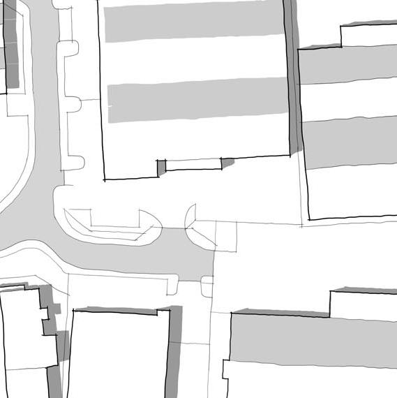
4 PUBLIC REALM 1: LANDSCAPE CONTEXT Explaining the landscape and historical context Left / Location Plan The redevelopment area which is the subject of this application is situated on the floodplain of the river Trent, to the west of Nottingham City Centre. The landscape of the Trent floodplain in this area is open and level, and historically was an important riverside meadow landscape. Meadows, bounded by hedgerows and with lines of tall poplar trees remain a characteristic feature of the landscape on the south bank of the river, at West Bridgeford and on the north bank at Colwick Park. The floodplain on the north side of the river Trent is some 00m wide. To the north rises the range of low hills on which the city of Nottingham was established (situated approximately 1 km distance) and where, immediately to the north of the Trent Lane redevelopment area, lies the district of Sneinton. This is where the closest local shops, schools and other facilities are located. The tree-covered skyline of the hills and features such as the prominent white windmill at Sneinton are local landmarks visible from the development site. The meadows east of the city centre were a popular place for leisure during the late 1th and early 0th centuries. Although the Trent Lane speedway stadium of the 10 s has long since disappeared, the Racecourse at Colwick Park, and the Yacht Club at the end of Trent Lane, and the cricket ground at Trent Bridge, and the two football grounds are a legacy from this period. During the industrial expansion of Nottingham in the mid 0th century an ambitious plan to link Nottingham with the North Sea ports at Hull and Grimsby led to the construction of Trent Depot and the river basin. Much of the land between the basin and Daleside Road was developed for light industry. The resulting low rise, low density area is an unplanned and fragmented collection of sheds, generally set back from plot boundaries, which are typically formed by mesh fencing, walls and signboards. Planting is generally the result of neglect, with self-sown regeneration of willow, elder and sycamore. Streetscape materials are typically bitmac and concrete. 1

5 DALESIDE ROAD TRENT LANE R I V E R T R E N T
6 PUBLIC REALM : MASTERPLAN Left / Masterplan with Phase 1 Area The Masterplan for the Trent Basin redevelopment site sets out to establish a robust urban framework of streets and places, in which building plots will support a wide range of potential uses, so that over time the area will become a good place to live, work and relax. The following landscape design principles underpin the Masterplan. A sense of place is to be established with a distinctive identity by reinforcing visual links to the wider landscape, with views to the river corridor from the site and views to the surrounding built environment. The development will incorporate a broader range of spaces for the benefit of residents and the general public. The River Trent and the Trent Basin will become key features of the public realm, supported by public social and communal spaces, making the site a key development within the wider landscape. The network of streets reinforces links to Sneinton and the wider landscape, including the city centre. Connections between the existing built environment and the site will be emphasized through axial routes from Daleside Road and Trent Lane. A hierarchy of streets is formed through streetscape design and the use of buildings as markers to create legible gateways The public realm framework of streets and places, are arranged so that areas are overlooked by houses to maximise passive surveillance and promote sense of security. This creates safe, friendly and usable spaces. Views will be created from the private and public domain to the landscape amenity areas of the riverfront and basin. The riverside landscape will be enhanced through complimentary trees to be planted as informal groups along the North bank of the trent. Streets will be traffic calmed and made green through appropriate planting, thereby creating attractive and usable places for people to meet, assisting the development of good neighborly relations. Communal garden and courtyard spaces will create the landscape to the rear of properties, allowing for allotments, gardens and shared
7 Capstone and balustrade Retaining and boundary structure Kerb Paved footpath Bitmac parking space Bitmac carriageway Bitmac footpath Decking ocument remains copyright of e reproduced without prior consent. ritten dimensions only. () All ted. () All dimensions shall be the work. () Landscape Projects () Engineer to specify all ction is indicative Design Project Title Trent Basin Nottingham Drawn Date Scale Drawn 01-- AC Status A Design


8 PUBLIC REALM : BASIN Trent Lane Above / Precedent images of waterside landscaping Left / Cross section and plan extract of the landscaping to the basin edge. The landscape to the edge of the basin provides part of a continuous walking route that will encompass the whole site in later phases. Parking is provided for residents and visitors at a higher level. The bold line of three storey properties will continue to define the edge of the waterfront to the East of the basin. The landscape between the buildings and the basin will provide a continuous walking route around the basin and wider site. The footpath will encompass the basin at the existing level of the wall top. Parking will be provided at the level of the properties, divided from the walking route with a precast retaining structure and timber-clad street furniture which ensures pedestrian safety. The landscape meets the edge of the basin with an existing wall structure which will remain in place. New precast concrete capstones with steel and wire balustrades will continue around the basin, providing a continuous and distinctive character to the waterfront. Within the Phase 1 area of the basin edge, the landscape will primarily function as a space for walking and parking, which will prove essential in later phases when the landscape will become more animated as the basin infrastructure develops. A formal row of Norway Maple (Acer platanoides) will be planted at intervals between parking spaces, creating a softer transition between the buildings and basin. These deciduous trees will grow to a large size with a relaxed form which will provide shelter and greenery in summer whilst allowing light through over winter. At street level the hard landscaping will consist of bitmac to provide a durable and long lasting surface, whilst the footpath will continue the character of blockwork around the basin. Paved thresholds to the properties provide a space that forms a trim around the base of the buildings and a space that residents can personalize. The level change between street level and the walking route will incorporate a precast retaining unit to avoid surcharging the existing wall. Pedestrian safety will be ensured by implementing low steel structures clad in timber which will be fixed along the kerb line and prevent the possibility of cars travelling over the edge.

 Landscape Projects epancies. () Engineer to specify all nd construction is indicative.")

9 t Tren Lane Bitmac carriageway Kerb Threshold paving Bitmac footpath Kerb Bitmac parking space Bitmac parking space Bitmac footpath Threshold paving 1 Clipped hedge n All information contained within this document remains copyright of Landscape Projects Ltd. and shall not be reproduced without prior consent. Trent Basin Nottingham Drawn Date --01 Scale A1 Trent Basin Nottingham gs - use written dimensions only. () All s unless noted. () All dimensions shall be eding with the work. () Landscape Projects epancies. () Engineer to specify all nd construction is indicative. Drawn Date 01-- Scale - Garden space Bitmac parking space Bitmac footpath Masonry wall and sliding gate Drawing Title Project Title within this document remains copyright of d shall not be reproduced without prior consent. Kerb - - Design Groundcover Bitmac parking Bitmac footpath planting space Bitmac carriageway Hedge Kerb A Phase 1 Street Section Drawn AC Status Design Checked NCS Drawing No. - Drawing Title Project Title (1) Do not scale from drawings - use written dimensions only. () All dimensions are in millimeters unless noted. () All dimensions shall be veriþed on site before proceeding with the work. () Landscape Projects shall be notiþed of any discrepancies. () Engineer to specify all sub-bases. Any below ground construction is indicative. Revision - Phase 1 Draft Plan Drawn AC Checked NCS Status For Information Drawing No. Revision


10 PUBLIC REALM : STREET Trent Lane Above / Precedent images of street landscaping Left / Cross sections and plan extracts through two areas within the streets. The street gives priority to residents and pedestrians alike and reduces the impact of traffic passing through the space. Hedges and paved thresholds integrate the property entrances within the streets. This will be the first route from Trent Lane through to the basin and functions as a shared surface space. The narrow carriage way of.m with passing spaces at intervals keeps traffic slow, combined with the low mm rise of the kerbs which allows for more freedom of movement for pedestrians. Consistent planting of Prunus and Buxus hedging will be clipped to 1m high and form a trim of greenery to the properties to be maintained by the home owners. The street will be adopted by the local authority who will maintain the social space at the centre of the street. The alcoved entrances to the properties will be a paved threshold which will provide a small space for residents to personalize as they wish, along with a small timber seat to help encourage social interaction among residents. The entrances to the street will be kept narrow with m radii kerb lines which will emphasise the priority given to pedestrians whilst allowing vehicular movement and access. The character of the buildings will extend into the site through masonry walls enclosing the gardens. Timber pergola structures will provide shelter for the bin stores and the parking spaces for residents. Visitor parking is provided in parallel bays along the street with Norway Maple (Acer platanoides) trees planted informally along the street. The trees will provide shelter and greenery at a high level with an informal and outward reaching character. The central zone of the street will be defined by a social space consisting of blockwork paving, a loose gravel surface and an informal arrangement of bollards and shrub planting. The trees in this space will be Fairview and Drumondii varieties of Acer which will provide an interesting change in foliage colour with tones of yellow-green and red. m footpaths form part of the continuous walking route through and around the site.
11 Garden space Partition fencing Bitmac parking space Pergola structure Low fence with gate Bitmac surface ains copyright of d without prior consent.


12 PUBLIC REALM : REAR COURT Trent Lane Above / Precedent images of rear courts Left / Cross section and plan extract of the rear courtyards and garden space. Garden space to the rear of the properties incorporates sheltered parking and cycle storage. The roads and footpaths into this space are gated access, restricted to residents only. In later phases this space will be developed into a social and communal recreational space for the residents of the surrounding properties. Within phase 1 the roadways and footpaths providing access to the space will be constructed to allow residents to securely park their vehicles within their garden space. A partition structure of narrow steel columns clad in timber will form the gated entrances that will appear less imposing as standard high fencing. The garden spaces will be turfed areas with bitmac parking spaces under the cover of timber pergolas. Decking provides a multifunctional space open to the residents interpretation, with a path leading to the parking space and cycle store. Individual gardens are partitioned by timber fencing at 1.m high with a trellis top, allowing some visibility through and the opportunity for climbing plants. Low 1m high fencing at the bottom of each garden will screen the parked cars whilst allowing visibility through to the courtyard which will help to encourage interaction between residents. The timber pergolas at.m high allow ample room for vehicles whilst also providing the opportunity for climbing plants to screen the vehicles should residents wish to. Planters at the end of each garden provide a transition between private garden space and the semi-private courtyard space. Ground cover planting provides a trim between the fencing and bitmac surface with Norway Maples (Acer platanoides) providing shelter and enclosure for both gardens and the courtyard space. Between the completion of phase 1 and the construction of phase, the space beyond the rear courtyards will be used for activities such as communal allotments and garden spaces.
13 Paved threshold Masonry retaining wall with railing Garden space Groundcover planting Hedge Bitmac footpath Existing carriageway Project Title sent. Trent Bas Nottingham ts Drawn Date Design Scale


14 PUBLIC REALM : TRENT LANE Trent Lane Above / Precedent images to show relationship between properties and street Left / Cross section and plan extract of interface between site and Trent Lane Retaining masonry walls and railings form private spaces between properties and Trent Lane along this frontage. The high buildings form a definitive line between the street and development with a 00mm change between street level and building entrance. The radii of the kerb line is followed by the retaining walls which create a raised planting bed at the same level as the building entrances. The boundary is softened by evergreen Buxus hedging and groundcover planting which will die back over winter. A paved threshold space is provided to the entrance of the property which provides the opportunity for residents to personalise should they wish to. The masonry walls continue the character of the architecture and lead into the site and along the street from Trent Lane. Their low height of 00mm is complimented by railings to a height of 1.m which provides gated access to the private spaces at the front of the properties. These spaces provide a visually attractive transition between the buildings and the existing street whilst providing usable space for the residents. Residents are expected to maintain the planting provided for the benefit of the wider community. Small Crab Apple (Malnus) fruit trees give an intermediate scale between buildings and landscape and hold the potential for a communal or individual fruit harvesting event each year. The paved thresholds provide functional space, giving opportunity for seating and social interaction with a slot drain to manage excess water. Where vehicular access is required to the integrated garages, the threshold spaces meet Trent Lane at street level with a small flight of steps leading to the doorway of the property. 1
97 Lea Bridge Road, Leyton, E10 7QL London Borough of Waltham Forest December 2015
 97 Lea Bridge Road, Leyton, E10 7QL London Borough of Waltham Forest December 2015 Public Realm and Landscape Proposals LEA BRIDGE ROAD, WALTHAMSTOW Public Realm & Landscape Proposals BDP(90)RPT001 December
PUBLIC RIGHT-OF-WAY IN THIS CHAPTER PUBLIC REALM
 PUBLIC RIGHT-OF-WAY This section provides design guidelines for improvements in the public right-of-way. The public right-of-way refers to streets, sidewalks, non-vehicular thoroughfares, parks and greenways
WINDSOR GLEN DESIGN GUIDELINES
 WINDSOR GLEN DESIGN GUIDELINES Adopted by Council, 2006 WINDSOR GLEN REDEVELOPMENT DESIGN GUIDELINES August 2006 1.0 Master Plan Organization For this area of the Coquitlam Town Centre, a mix of high,
4. MASTERPLAN FRAMEWORK
 6a 6b 4. MASTERPLAN FRAMEWORK 6. Car Parks 6c Car Parks 6a and 6b will provide permanent parking. Area 6a will serve the foodstore with tarmac surfacing within a defined area to the west of the adjacent
4.0 URBAN DESIGN FRAMEWORK. The vision for the future development of the plan area is to:
 4.0 The vision for the future development of the plan area is to: Create a new neighbourhood that focuses on the highly valued natural and aesthetic features of the lands and provides good quality homes,
Nelson Residential Street Frontage Guideline
 DRAFT 22-06-2012 Nelson Residential Street Frontage Guideline June 2012 1317273 Contents and purpose Residential s are important Residential s are much more than corridors which move traffic. Streets allow
VEHICULAR AND PEDESTRIAN CIRCULATION
 This perspective sketch communicates the intended character and quality of a proposed streetscape design. Locate benches near a major intersection where people tend to gather. Seating and lighting provide
Urban Design Guidelines
 Urban Design Guidelines These Urban Design Guidelines comprise the Key Design Objectives below, the Roads Design Guidelines overleaf and Neighbourhood Framework Plans. Together with Section 3: Urban Design
B L A C K D I A M O N D D E S I G N G U I D E L I N E S for Multi-family Development
 B L A C K D I A M O N D D E S I G N G U I D E L I N E S for Multi-family Development Adopted June 18, 2009 This section of the Design and focuses on site planning and design guidance for new multi-family
Background Information
 Background Information view at site entrance THE LONDON BOROUGH OF SUTTON As the strategic local authority the Council is working with a range of partners to take forward various development sites in Hackbridge.
Section 4 - Public Realm & Landscape proposals Landscape Masterplan. Section 4 52
 - Public Realm & Landscape proposals Landscape Masterplan 52 Proposed Masterplan - Green Infrastructure Strategy District Park 4.33 Ha to provide Passive and active recreation with a large play area which
Former North Works, Lickey Road, Longbridge, Birmingham
 Committee Date: 14/11/2013 Application Number: 2013/06431/PA Accepted: 27/08/2013 Application Type: Full Planning Target Date: 26/11/2013 Ward: Longbridge Former North Works, Lickey Road, Longbridge, Birmingham
BROWNFIELD REGENERATION LONDON
 P A V I N G CASE STUDY October 2015 Edition 2 Uniclass 572/1677 Public realm regeneration Iconic conservation area Shared surfaces Designing in detail BROWNFIELD REGENERATION www.paving.org.uk Introduction
East Bayshore Road Neighbourhood
 East Bayshore Road Neighbourhood Northridge Property Management Urban Design Brief 3195 East Bayshore Road City of Owen Sound January 2016 East Bayshore Road Neighbourhood Northridge Property Management
8.0 Design and Form of Development 43/
 42/ 8.0 Design and Form of Development 43/ Rothwells Farm, Golborne/ Development Statement Figure 7. Site Constraints Key 44/ Site Boundary 360 Bus Route/Stops Existing Trees Underground Water Pipe Sensitive
The Proposed Auckland Unitary Plan (notified 30 September 2013)
") 3 Business zones Introduction There are 10 business zones in the Unitary Plan: City Centre Metropolitan Centre Town Centre Local Centre Neighbourhood Centre Mixed Use General Business Business Park Light
3 Business zones Introduction There are 10 business zones in the Unitary Plan: City Centre Metropolitan Centre Town Centre Local Centre Neighbourhood Centre Mixed Use General Business Business Park Light
Page 1 of 19 URBAN DESIGN FRAMEWORK FOR BOLTON STREET WATERFORD
 Page 1 of 19 URBAN DESIGN FRAMEWORK FOR BOLTON STREET WATERFORD 1.0 Introduction: The relocation of the City Council stores and depot from Bolton Street creates an exciting opportunity for development
FLORIN ROAD CORRIDOR Site Plan and Design Review Guidelines Checklist
 FLORIN ROAD CORRIDOR Site Plan and Design Review Guidelines Checklist Applicant s Name: Project Address: Phone: Email: Applicant shall fill out the design guidelines checklist for all guidelines applicable
KEY MAP DEVELOPMENT PERMIT AREA MAP. Sunnymede North Sub-Area Plan
 Richmond Official Community Plan BROADMOOR AREA SUNNYMEDE NORTH SUB-AREA PLAN Bylaw 7100 Schedule 2.6C SUNNYMEDE NORTH SUB-AREA PLAN SUNNYMEDE NORTH SUB-AREA PLAN SUNNYMEDE NORTH SUB-AREA PLAN KEY MAP
Appendix H: Easement cross sections
 Appendix H: Easement cross sections SHARED PATH 1.5m FOOTPATH NATURE STRIP 7.3m CARRIAGEWAY 2.7m NATURE STRIP EXISTING PIPELINE 150mm DIA 5.0m (approx.) LOCAL ACCESS ROAD EXISTING PIPELINE 500mm DIA 2.7m
ILLUSTRATIVE MASTERPLAN
 ILLUSTRATIVE MASTERPLAN The Development Dairy Crest (Imperial College) The Proposed Development aims to create a new high quality residential neighbourhood, alongside a new public park for White City.
Artists impression of the Park Promenade and plot H4 with café and restaurant uses that is still subject to change
 The Park Promenade Artists impression of how a café might look Artists impression of the Park Promenade and plot H4 with café and restaurant uses that is still subject to change Precedent images for balconies
3.3. Urban Structure Defining a New Hierarchy of Routes and Spaces >Images
 Section 3.0 I The Masterplan Framework 18 >Images Examples of high quality routes and spaces 3.3. Urban Structure The success of any masterplan lies in a clear definition of the future urban structure
appendix and street interface guidelines
 appendix five: building and street interface guidelines appendix 5 building and street interface guidelines BOULEVARDS Boulevards are generally characterized by higher levels of traffic movement at higher
Surface Materials Strategy Reference Images
 2.0 RETAIL & HOTEL PLOTS, BRENT CROSS MAIN SQUARE THRESHOLD SPACES & ENERGY CENTRE Surface Materials Strategy Reference Images Riparian themes and patterns reflected in the paving Palette of warm granite
6 Site Framework Strategies
 6 Site Framework Strategies 6.1 Introduction Section 6 identifies a number of specific areas which are considered to be key sites within the Plan area and which may have potential for development / redevelopment.
Colchester Northern Gateway Master Plan Vision Review Draft. July 2016
 Colchester Northern Gateway Master Plan Vision Review Draft July 2016 Contents Introduction 4 Context 8 Purpose of the Report 8 Strategic Position 9 Overview of the Process 11 2012 Master Plan Vision 12
TRAFALGAR PLACE LONDON
 January 2017 Uniclass L534:L217 Award-winning and Stirling Prize shortlisted Urban regeneration high density housing scheme Exemplary public realm with precast concrete paving Careful detailing carried
Keystone Business Park Precinct Structure Plan North East Industrial Precinct. Part 2 Design Principles
 Keystone Business Park Precinct Structure Plan North East Industrial Precinct Part 2 Design Principles Context Issues Services Landform Issues Geotech and contamination Ecology Traffic and access Issues
RIVERSIDE DESIGN CD-1 GUIDELINES. Adopted by City Council August 9, 1983
 $1 City of Vancouver Land Use and Development Policies and Guidelines Community Services, 453 W. 12th Ave Vancouver, BC V5Y 1V4 F 604.873.7344 fax 873.7060 planning@city.vancouver.bc.ca RIVERSIDE DESIGN
Workshop 3. City of Burlington Waterfront Hotel Planning Study. September 14, The Planning Partnership
 Workshop 3 City of Burlington Waterfront Hotel Planning Study September 14, 2017 The Planning Partnership The Waterfront Hotel Planning Study 01 The Brant & Lakeshore Planning Study will establish a Strategic
PROPOSED REDEVELOPMENT OF THE GLEN ABBEY GOLF CLUB. STREETSCAPE DESIGN STUDY (excerpt from the Urban Design Brief) TOWN OF OAKVILLE.
 TOWN OF OAKVILLE.") PROPOSED REDEVELOPMENT OF THE GLEN ABBEY GOLF CLUB STREETSCAPE DESIGN STUDY (excerpt from the Urban Design Brief) TOWN OF OAKVILLE OCTOBER, 2016 for 2.4.2 STREETS Streets are the single largest component
PROPOSED REDEVELOPMENT OF THE GLEN ABBEY GOLF CLUB STREETSCAPE DESIGN STUDY (excerpt from the Urban Design Brief) TOWN OF OAKVILLE OCTOBER, 2016 for 2.4.2 STREETS Streets are the single largest component
Memorial Business Park Site. Proposed Future Development. Design guidelines. August
 Memorial Business Park Site Proposed Future Development Design guidelines August 2014 www.designenvironment.co.nz 0064 3 358 3040 Contents 1.0 Background 1.1 Introduction 3 1.2 Objectives 4 2.0 Context
Chapter 13 Residential Areas: Appendices APPENDIX 1 Residential Areas
 Chapter 13 Residential Areas: Appendices Page 1 Chapter 13 Residential Areas: Appendices APPENDIX 1 Residential Areas Design Code for Intensive Housing INTRODUCTION DESIGN ELEMENTS A NEIGHBOURHOOD DESIGN
MVRC ARCHITECTURAL DESIGN STATEMENT
 11251 MOONEE VALLEY RACING CLUB MAY 201 CONTENTS 0 Contents Introduction 1 Site Analysis a. Site Features b. Built form Interfaces c. Existing Streetscape d. Site Opportunities and Constraints 2 Masterplan
lot flankage Y street 16m 6m landscape strip for large site 3m landscape strip for small medium site
 Commercial General Commercial Objectives Create developments compatible with adjacent land uses in scale, function and character Define a consistent and attractive street edge with quality landscaping,
medium desnity housing
 This section updated September 2013 This part of the Plan sets out the assessment criteria for medium density housing. The criteria are designed to give designers and builders flexibility and to provide
Section Three, Appendix 17C Multiple Unit Housing Design Assessment Criteria
 APPENDIX 17C MULTIPLE UNIT HOUSING DESIGN ASSESSMENT CRITERIA Purpose of Appendix 17C In the Residential 9 Zone the construction and use of multiple household units located within the Multiple Household
Public Consultation. Land at Monks Farm, North Grove. Welcome
 Welcome Welcome to our public exhibition for development on Land at Monks Farm, orth Grove. Gallagher Estates and Gleeson Strategic Land are preparing an outline planning application for new homes, open
Highland Village Green Design Guidelines
 Highland Village Green Design Guidelines Publishing Information Title Highland Village Green Design Guidelins Author The City of Calgary Status DRAFT - Proposed document subject to changes Additional Copies
Regency Developments. Urban Design Brief. Holyrood DC2 Rezoning
 Regency Developments Urban Design Brief Holyrood DC2 Rezoning Stantec Consulting Ltd. 7-31-2017 1. Overview Regency Developments intends to rezone the lands located at 8510 and 8511 93 Avenue, within the
AIRPORT BUSINESS PARK
 PIER MAC PETROLEUM INSTALLATION LTD. AIRPORT BUSINESS PARK DEVELOPMENT APPLICATIONS March 2003 4.1 Airport Business Park Development Permit Area 4.1.1 Justification/Design Concept The design concept envisioned
Chapter 2: OUTLINE PLANNING APPLICATION PROPOSALS. A New Garden Neighbourhood Matford Barton 17
 Chapter 2: OUTLINE PLANNING APPLICATION PROPOSALS A New Garden Neighbourhood Matford Barton 17 2.1. SUMMARY AND STATUS OF THE PROPOSALS 2.1.1. The parameter plans and associated wording in this chapter
SCHEDULE 12 TO THE DESIGN AND DEVELOPMENT OVERLAY GLEN WAVERLEY ACTIVITY CENTRE STRUCTURE PLAN
 DD/MM/YY Proposed C120 SCHEDULE 12 TO THE DESIGN AND DEVELOPMENT OVERLAY Shown on the planning scheme map as DDO12. GLEN WAVERLEY ACTIVITY CENTRE STRUCTURE PLAN 1.0 Design objectives DD/MM/YY Proposed
EXISTING VEHICULAR & PEDESTRIAN CIRCULATION
 46 EXISTING CONDITIONS EXISTING VEHICULAR & PEDESTRIAN CIRCULATION Vehicular and pedestrian circulation patterns are illustrated on this graphic. Campus entry points and major vehicular circulation routes
GUIDELINES REPLACEMENT HOUSING GUIDELINES LOCATION INTRODUCTION URBAN DESIGN GUIDELINES
 Replacement housing in the former City of North York will be consistent with the following urban design guidelines. They provide a framework for residential re-development in the former City of North York
2.5 Roads. Loading and service areas adjacent to Highway 401 should be screened through architectural walls and/or landscape buffer planting.
 N HIGHWAY OFF RAMP 2.5 Roads A legible road network with a clear hierarchy will help create a connected community, both within and surrounding the Milton Heights. The following section outlines the proposed
(DC1) Direct Development Control Provision DC1 Area 4
 Direct Development Control Provision DC1 Area 4") . General Purpose (DC) Direct Development Control Provision DC Area 4 The purpose of this Provision is to provide for an area of commercial office employment and residential development in support of the
. General Purpose (DC) Direct Development Control Provision DC Area 4 The purpose of this Provision is to provide for an area of commercial office employment and residential development in support of the
chapter DESIGN GUIDELINES NEW RIVER MASTER PLAN REPORT
 chapter DESIGN GUIDELINES NEW RIVER MASTER PLAN REPORT .76 DESIGN GUIDELINES An Overview design guidelines NEW RIVER MASTER PLAN Design Guidelines can transform the image of a city. Specific, design-based
Clairtrell Area Context Plan
 Clairtrell Area Context Plan March 2005 Urban Development Services City Planning Contents 1. Introduction... 4 2. Development Structure... 6 2.1 Streets... 7 2.1.1 Sheppard Avenue and Bayview Avenue...
EXISTING CONDITIONS 41. Existing Conditions
 EXISTING CONDITIONS 41 Existing Conditions The Existing Analysis phase of the planning process involved a study of the existing conditions on the campus in order to identify key planning issues to be addressed
Subdivision Design Criteria. Penihana North GUIDELINES TO THE RULES
 Created September 2013 Penihana North Subdivision Design Criteria GUIDELINES TO THE RULES This part of the Plan sets out the design criteria for subdivision in Penihana North. The criteria will be considered
Next Steps / Development Process. Structure Plan. June submitted to City of Fremantle. Structure Plan. July supported for advertising
 overview What is today about? In July 0, the City of Fremantle resolved that the be advertised for public comment. Today is about: Understanding the history and context of the site Having your say on the
Ringsend & Irishtown Local Environmental Improvement Plan
 Ringsend & Irishtown Local Environmental Improvement Plan Study Area East Link Bridge St. Patrick s Boat Club Ringsend Technical Institute Stella Maris Boat Club St. Patrick s Church Ringsend Library Ringsend
Lambeth Main Street Streetscape Improvements
 Lambeth Main Street Streetscape Improvements Open House October 5th, 2017 Agenda 1. Introduction 2. Project Background 3. Context 4. Project Objectives 5. Design Principles & Approach 6. Streetscape Design
This Review Is Divided Into Two Phases:
 Semiahmoo Town Centre Review The purpose of this review: To review the Semiahmoo Town Centre Concept Plan, originally approved in 1993, to ensure that this centre will continue to serve the needs of South
YMCA Erdington (Phase 2), 300 Reservoir Road, Erdington, Birmingham, B23 6DB
, 300 Reservoir Road, Erdington, Birmingham, B23 6DB") Committee Date: 13/06/2013 Application Number: 2013/03011/PA Accepted: 30/04/2013 Application Type: Full Planning Target Date: 30/07/2013 Ward: Stockland Green YMCA Erdington (Phase 2), 300 Reservoir Road,
Committee Date: 13/06/2013 Application Number: 2013/03011/PA Accepted: 30/04/2013 Application Type: Full Planning Target Date: 30/07/2013 Ward: Stockland Green YMCA Erdington (Phase 2), 300 Reservoir Road,
LANDSCAPE DESIGN REPORT
 LANDSCAPE DESIGN REPORT Plot 12, Phase 1B (South) Reserved Matters Application Brent Cross South Limited Partnership October 2017 Contacts Brent Cross South Limited Partnership 4 Stable Street London N1C
Urban Design Brief Fanshawe Park Road. Competition Toyota
 Urban Design Brief 1300 Fanshawe Park Road Competition Toyota May 2, 2014 TABLE OF CONTENTS Page No. INTRODUCTION... 1 SECTION 1 LAND USE PLANNING CONTEXT... 1 1.1 The Subject Lands... 1 1.2 The Proposal...
FRASER LANDS CD-1 GUIDELINES (BLOCKS 68 AND 69) Adopted by City Council April 1989
 Adopted by City Council April 1989") $1 City of Vancouver Land Use and Development Policies and Guidelines Community Services, 453 W. 12th Ave Vancouver, BC V5Y 1V4 F 604.873.7344 fax 873.7060 planning@city.vancouver.bc.ca FRASER LANDS CD-1
$1 City of Vancouver Land Use and Development Policies and Guidelines Community Services, 453 W. 12th Ave Vancouver, BC V5Y 1V4 F 604.873.7344 fax 873.7060 planning@city.vancouver.bc.ca FRASER LANDS CD-1
H14. Business General Business Zone
 H14. Business General Business Zone H14.1. Zone description The Business General Business Zone provides for business activities from light industrial to limited office, large format retail and trade suppliers.
doyle + o troithigh landscape - architecture
 doyle + o troithigh landscape - architecture REPORT: PROJECT: LANDSCAPE DESIGN REPORT. STUDENT HOUSING DEVELOPMENT AT WESTWOOD HOTEL SITE. DATE: MAY 2018. www.doyle-otroithigh.com Landscape design report,
4.6: The Middle. Primary Frontages: The Middle
 4.6: The Middle Fig 4.6.3: Illustrative Section Projecting Balconies and Ro Terrace Fig 4.6.4: Illustrative Section Semi-Recessed Balconies Fig 4.6.7: Illustrative Section Recessed Balconies Fig 4.6.8:
Section Three, Appendix 16C Medium Density Housing, Design Assessment Criteria (Residential 8A zone)
") APPENDIX 16C MEDIUM DENSITY HOUSING, DESIGN ASSESSMENT CRITERIA (RESIDENTIAL 8A ZONE) PURPOSE OF APPENDIX 16C (RESIDENTIAL 8A ZONE) In the Residential 8A Zone the following are defined as restricted discretionary
APPENDIX 16C MEDIUM DENSITY HOUSING, DESIGN ASSESSMENT CRITERIA (RESIDENTIAL 8A ZONE) PURPOSE OF APPENDIX 16C (RESIDENTIAL 8A ZONE) In the Residential 8A Zone the following are defined as restricted discretionary
Mixed Use Centres Development Permit Guidelines
 1 Mixed Use Centres Development Permit Guidelines Area Commercial or Mixed Use development occurring in City Centre, Urban Centre, Neighbourhood Centre, or Institutional Complex land use designations is
DESIGN GUIDELINES. Oakdene Estate at Ocean Grove Grubb Road, Ocean Grove
 DESIGN GUIDELINES Oakdene Estate at Ocean Grove 162 240 Grubb Road, Ocean Grove TABLE OF CONTENTS INTRODUCTION... 3 1. HOUSE DESIGN APPROVAL PROCESS... 4 1.01 DESIGN PANEL FOR RESIDENTIAL DEVELOPMENT...
Boundaries and Fencing
 Boundaries and Fencing Introduction 7.1 The purpose of this chapter of the design code is to establish design principles and parameters to guide the development and erection of site boundaries within the
heuston gateway: sections heuston gateway: regeneration strategy and development framework plan
 B B1 A B1 B C A heuston gateway: sections B B1 C 117 4.3.3 Zoning The station is the central hub of the area and this function must be preserved and developed. However large areas of the Heuston Station
edge of gas line corridor setback edge of gas line corridor aligned with Schlumberger building 37.0 m AOD 33.0 m AOD max
 7. Heights and Street Frontage: In accordance with the approved heights parameters, heights to along Western Access Road must respond to the existing low density character in this location. Heights are
Commercial Development Permit Area
 City of Kamloops KAMPLAN Commercial Development Permit Area PURPOSE The purpose of this Development Permit Area (DPA) is to establish objectives and provide guidelines for the form and character of commercial
RESIDENTIAL DESIGN STANDARDS AND GUIDELINES
 DRAFT RESIDENTIAL DESIGN STANDARDS AND GUIDELINES Resident ial Standards and Guidelines For the Unincorporated Communities of West Alameda County TASK FORCE MEETING March 22, 2010 Tonight s Meeting Overview
Site 2 Development Brief
 a South Marketgait Site 2 b Union Street c Site 2 Development Brief Thomson Avenue (Northern Boulevard) Dundee Riverside Drive Discovery Plaza South Union Street Station Earl Grey Place West Site 5 Site
SECTION TWO: Overall Design Guidelines
 SECTION TWO: Overall Design Guidelines This section provides overall design principles and guidelines for the Gardnerville Mixed-use Overlay. They provide criteria for mixed-use places consisting of residential,
STATEMENT OF OBJECTION TO THE PROPOSED DEVELOPMENT OF LAND AT CHURCH CLIFF DRIVE FILEY
 STATEMENT OF OBJECTION TO THE PROPOSED DEVELOPMENT OF LAND AT CHURCH CLIFF DRIVE FILEY You will be aware that Scarborough borough council have adopted a new local plan that includes land at Church Cliff
II. SINGLE FAMILY RESIDENTIAL
 II. SINGLE FAMILY RESIDENTIAL Castle Rock is made up of numerous individually built houses and subdivision tracts that have been developed during the past century. Some of the tracts are diverse in architectural
PHASE III: Reserved Matters Submission
 Statement of Compliance with the outline approval for the proposed residential development of land at: BURGES LANE, WIVELISCOMBE PHASE III: Reserved Matters Submission Foreword Contents: This Statement
Landscape Site Plan BLOCK D BLOCK A BLOCK C BLOCK B DEC 2009 L A N E W AY ARBUTUS 2 MEWS ARBUTUS STREET YEW STREET EXTENSION LEGEND
 Landscape Site Plan Green Edges Arbutus Mews Public Square Urban Garden Courts Green Roofs City Homes Private Patios Private Roof Terraces Urban Agriculture Plots BLOCK D BLOCK C YEW STREET EXTENSION L
Figure 3-1: Public Realm Plan
 3 Public Realm Figure 3-1: Public Realm Plan 3.1 Public Realm Concept The public realm concept for the Little Mountain site integrates a clear and accessible movement network with public spaces for social
1. General Purpose. 3. Uses
 1. General Purpose The purpose of this DC1 Provision is to facilitate the development of a pedestrian friendly Community Commercial Centre that may accommodate a range of commercial, residential, office,
CENTRAL PARK LANDSCAPE DESIGN GUIDELINES
 CENTRAL PARK LANDSCAPE DESIGN GUIDELINES 1 of 9 2008 revised draft SUMMARY STATEMENT The City of Bel Aire is undertaking an ambitious transformation, developing a new city centre, with mixed use and a
Appendix A COMMUNITY IMPROVEMENT PLAN DESIGN GUIDELINES
 Appendix A COMMUNITY IMPROVEMENT PLAN DESIGN GUIDELINES INTRODUCTION The continuous and desirable improvement of Arnprior requires a clear understanding of what is envisioned for the Town. These Design
OVERVIEW PROJECT SUMMARY
 OVERVIEW These five houses on Ridge View Crescent form an important part of the wider Anslemi Ridge development. They are the backdrop to the lake that is the community heart of the nieghbourhood, and
The Village. Chapter 3. Mixed Use Development Plan SPECIFIC PLAN
 The Village SPECIFIC PLAN Chapter 3 3.1 INTRODUCTION 3.1.1 Purpose This Chapter describes the development regulations applicable to the Mixed-Use and Transit Center Planning Areas. These form-based regulations
Town of Essex Urban Design Guidelines for Downtown Harrow and Essex Centre May 2014
 Town of Essex Urban Design Guidelines for Downtown Harrow and Essex Centre May 2014 1 Table of Contents Section 1.0 Purpose and Intent.3 Section 2.0 Streetscapes 4 Section 3.0 Active and Inviting Streetscapes..5
QUEEN-RIVER SECONDARY PLAN
 34 QUEEN-RIVER SECONDARY PLAN 34. QUEEN RIVER SECONDARY PLAN 1. INTRODUCTION The Queen-River area is approximately 6.4 hectares and is located at the eastern edge of the Downtown as shown on Map 34-1.
Design Guidelines. Roosevelt. Mike Podowski DPD Design Guidelines Ordinance ATT 13 August 13, 2012 Version #1
 Roosevelt Design Guidelines The Roosevelt Neighborhood Design Guidelines apply within the Neighborhood Boundary. Map 1 2 Map 2 3 Map 3 4 CS1 Natural Systems and Site Features Citywide Guideline: Use natural
LOW DENSITY RESIDENTIAL
 LOW DENSITY RESIDENTIAL Corner lots with coach houses to increase diversity, provide unity to the streetscape and increase eyes on the street. Garages and ancillary units accessed via rear lanes. Parking
therry, elizabeth, franklin and queen: BLOCK plan
 therry, elizabeth, franklin and queen: BLOCK plan INTRODUCTION Therry, Elizabeth, Franklin and Queen Street block Purpose & background The City of Melbourne has prepared this document for developers and
URBAN DESIGN STUDY and GUIDELINES
 ALTON CENTRAL EAST COMMUNITY CITY OF BURLINGTON URBAN DESIGN STUDY and GUIDELINES Prepared by NAK DESIGN GROUP March 2004 ALTON CENTRAL EAST CITY OF BURLINGTON TABLE OF CONTENTS PART I - Alton Central
Building and Public Space Design Guidelines
 AMERICA'S CUP WYNYARD HOBSON Building and Public Space Design Guidelines INTRODUCTION 10 April 2018 The 36 th America s Cup in Auckland requires the construction of new wharf and breakwater structures.
SECTION TWO: Urban Design Concepts
 SECTION TWO: Urban Design Concepts The Gardnerville Plan for Prosperity shapes economic opportunities presented by regional growth. The Urban Design Concepts provide policies and concepts for land use,
Mark-up of the effect of the proposed Bronte Village Growth Area OPA No.18 on the text of section 24, Bronte Village, of the Livable Oakville Plan
 Mark-up of the effect of the proposed Bronte Village Growth Area OPA No.18 on the text of section 24, Bronte Village, of the Livable Oakville Plan Notes: This document is provided for information purposes
4.00 STAKEHOLDERS. urbanprojects
 4.00 STAKEHOLDERS 94 heuston gateway: regeneration strategy and development framework plan 95 The Heuston Gateway presents one of the greatest concentrations of brown field development sites located adjacent
4 Proposed masterplan 4.1 Proposed masterplan: The scheme The scheme s component parts Urban form and grain
 4 Proposed masterplan 4.1 Proposed masterplan: The scheme... 36 4.2 The scheme s component parts... 36 4.2.1 Urban form and grain...36 4.2.2 Retail Circuits...38 4.2.3 Mix of uses...39 4.2.4 Public realm...40
3.0 Area-Wide Strategies 30
 3.0 Area-Wide Strategies 30 3.6 Tourism Strategy This section of the plan aims to develop and improve the tourism potential of the area. Strategic Context The City Plan outlines the potential of Cork to
4 Residential and Urban Living Zones
 4 Residential and Urban Living Zones Refer to Chapters 11 to 20 for additional rules that may apply to these zones. 4.1 OBJECTIVES AND POLICIES Objective Res1 Policy 1 Policy 2 Policy 3 Policy 4 Policy
Multi family Residential Development Permit Area
 City of Kamloops KAMPLAN Multi family Residential Development Permit Area PURPOSE The purpose of this Development Permit Area (DPA) is to establish objectives and provide guidelines for the form and character
Subarea 4 Indian Creek. Vision The combination of park networks and transportation amenities make Subarea 4 the greenest hub in the Corridor.
 indian creek 180 extends south from 101st Street to I-435. The I-435 and Metcalf intersection is one of the primary intersections in the Kansas City Metro Area. The area includes several residential neighborhoods
GREENVALE CENTRAL PRECINCT STRUCTURE PLAN
 76 Conservation area boundary. Low Fence to exclude vehicles but allow pedestrian access Front boundary of allotment 5.0m MINIMUM SETBACK Path providing public access to dwellings fronting Conservation
BLACKHEATH SQUASH CLUB Blackheath Sports Club, Rectory Field, Charlton Road, London, SE7 7EY. Planning, Design and Access Statement
 Planning, Design and Access Statement Revised: 28 th Jan 2016 Peter Pendleton & Associates Ltd Introduction Planning permission will be sought for a refurbishment of existing courts and extension to provide