Aberdeen City Green Space Network Policy to Practice
|
|
|
- Suzan Phillips
- 5 years ago
- Views:
Transcription

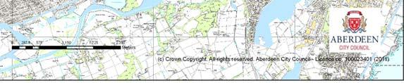
1 Aberdeen City Green Space Network Policy to Practice Aftab Majeed MIEEM, MRTPI Environmental Planner and Alistair Watson MIEEM Environmental Policy Team
2 Green Networks Why we have the green networks? How we developed the green space network in Aberdeen City?
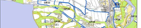
3 Aberdeen City Green Space Network- Development to Delivery Local Plan process started in Main Purpose Additional protection to open space Avoiding undue coalescence Improve access Linking wildlife corridors Strategically Linkages

4 Aberdeen Green Space Network Themes
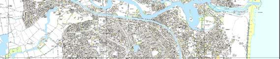
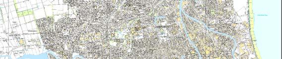
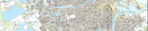
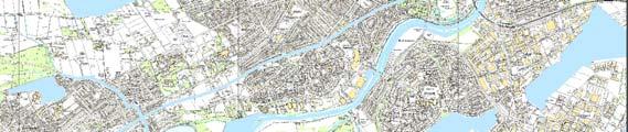
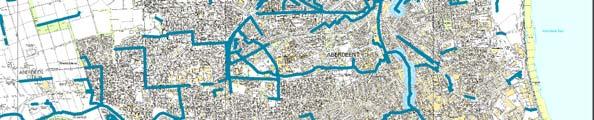
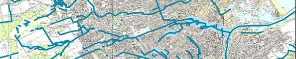
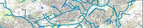
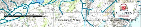
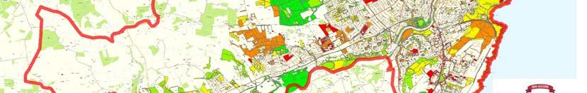
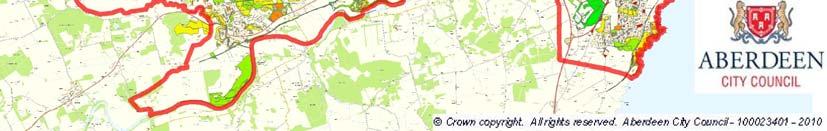
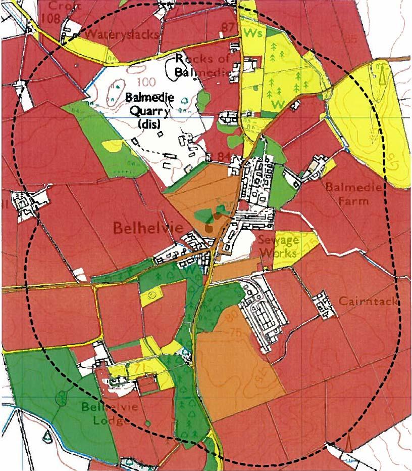
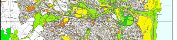
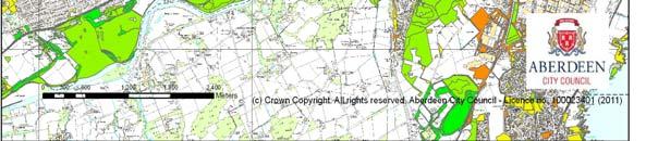
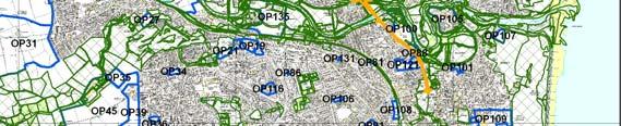
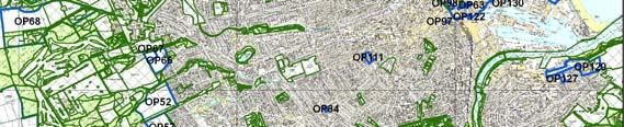
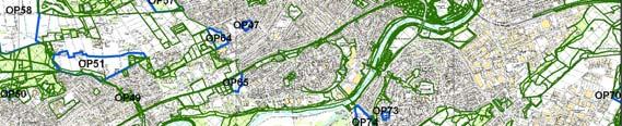
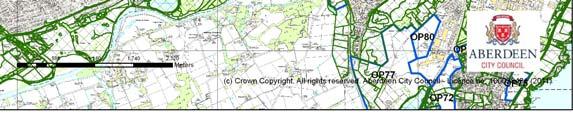
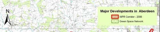
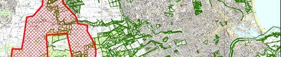
5 Aberdeen City Green Belt 2008
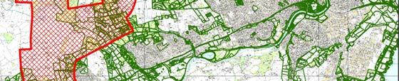
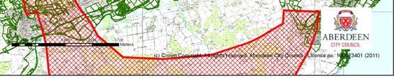
6 Developing the Green Space Network
7 Developing the Green Space Network

8 Greenspace Network Local Development Plan 2008
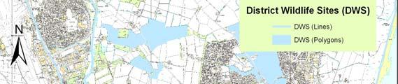
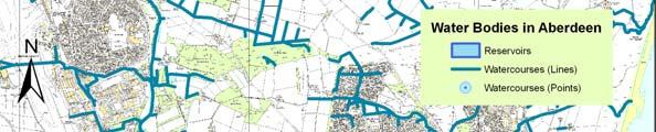
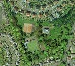
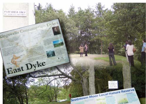
9 Green Space Network Rationale 2007 No Name GSN Category Main Land Use Description of Habitat Classifications (PAN 65) 1 Mundurno, Tarbot Hill Farm Core (Murcar) and Link to 2 (Corby Loch) and 3 (Denmore) Farmland Coastal sand dunes, improved grasslands, scrub woodland - locally important habitat and priority habitats Stream & Flooding Plains West of Muldam DWS, Nature Reserves and SSSI Recreation DWS 4 Balgownie and Blackdog Golf course, path, desired path link links to Denmore 2 Corby Loch Core (Corby Loch) and Open Water and Link to 3 (Denmore) and 4 Farmland (Scotstown Moor) 3 Denmore, Mundurno, Sheilhill Farm Link between 2 (Corby Loch), 5 (Lochside Road) and 6 (Balgownie Links Golfcourse) Woodland, Farmland and Amenity Ground Bog, lowland fern, improved grassland, wet woodland and wetlands priority habitat. Amenity grounds throughout industrial estate and some housing, as well as fen, marsh, swamp and arable farmland. East of Corby Loch West of Sheihill Farm DWS13 Newton of Sheilhill, 14 Corby Loch & SSSI No. 3 DWS 12 Scotstown Moor /Perwinnes Moss and Local Nature Reserve Corby Loch used for water sports, desired path link to Denmore and Scotstown Moor Public amenity land, paths through residential area, desire for path link across farmland to coast. Access / Existing Paths Yes Woodlands Wildlife Projects (ACP & Other) Badger territory, important corridor and foraging ground towards north of Tarbot Hill Farm. Social WPR Opportunities Comments Path link between Denmore and Coast No paths but access rights apply Badger territory Passes along northern edge of site Path linking Bridge of Don with Corby Loch and beyond Yes Shelter belts Badger territory Path linking Bridge of Don with coast
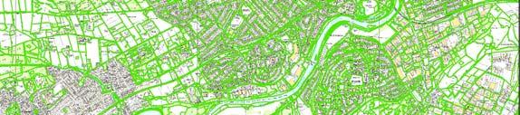
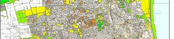
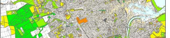
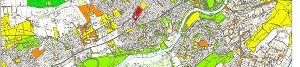
10 Green Space Network 2007


11 Green Space Mapping Using 2007 PAN 65 Typology


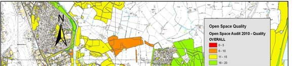
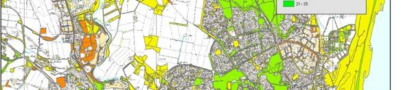
12 Open Space Quality and Quantity Audit ha 480 sites 1. Accessibility 2. Attractive 3. Health Supporting 4. Community Supporting 5. Biodiversity
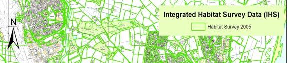
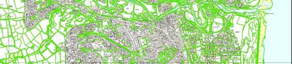
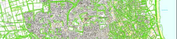
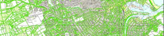
13 Innovative Approach- Adding Biodiversity using IHS data developed by North East Scotland Biological Records Centre (NESBReC)
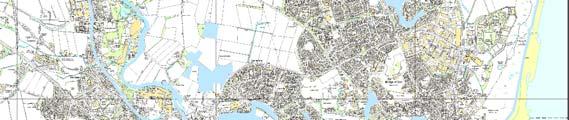
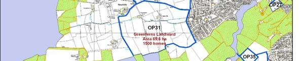
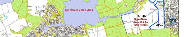
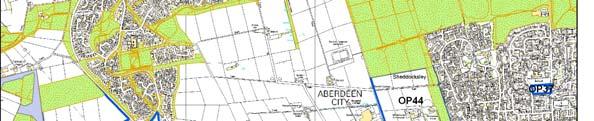
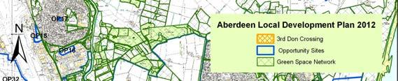
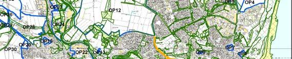
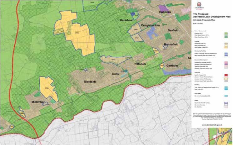
14 Aberdeen City Green Space Network 2012


15 Enhancing GSN in Aberdeen
16 GSN Planning & Management GIS Tool Kit

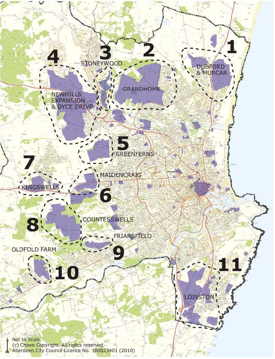
17 Challenges and Implementation Greenfield Housing Development 20,324 by 2030 Employment Land 196 hectares

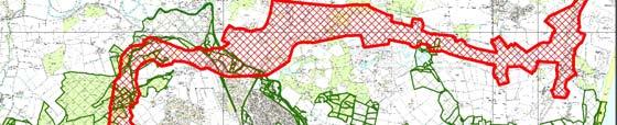
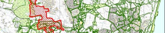
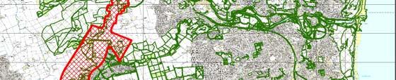
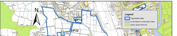
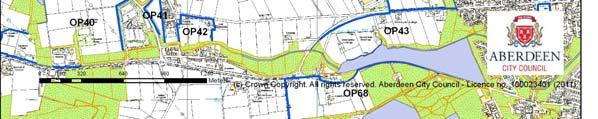
18 Challenges and Implementation Opportunity Sites and Major Infrastructure Development AWPR
19 Major Challenges Interpreting GSN Policy & dealing with Planning Applications How to implement on land out with the Council Control The Logic- Why some areas are chosen as GSN and others are not? Hard Surfaces as GSN GSN Vs Green Belt and Urban Green Space Policy Developers reservation on High Mitigation Cost


20 Delivery through Masterplanning Process but there are still?


21 Putting into Practice A Tool for Planners to use it for Planning Working with Partners Communities & Developers Delivering RBMP Implementing Environmental Strategies and Projects Open Space Management Converting Green Deserts into Green Networks Before Improving Water Quality & Habitat After


22 Efficient forward looking land management Developing Flood Risk Management Plan A tool for addressing future management issues e.g. climate change Improving Health and Economy Compliance with legislation Savings in planning for future needs

23 Value for Money It is all developed in house No consultants used No external funding No additional support Using Staff Expertise and Time Significant Savings to the Council Best Use of Local knowledge and Resources

24 Thanks for listening! Contact. . Tel
EIA Scoping Opinion Land at West Kingsford (North of the A944 Road)
") EIA Scoping Opinion Land at West Kingsford (North of the A944 Road) Page EIA Scoping Report page 10 page 13 Section 4.2.3 Cumulative Impacts 5. Proposed Scope AWPR, Prime four and other development areas
EIA Scoping Opinion Land at West Kingsford (North of the A944 Road) Page EIA Scoping Report page 10 page 13 Section 4.2.3 Cumulative Impacts 5. Proposed Scope AWPR, Prime four and other development areas
Scottish Natural Heritage Sharing Good Practice Programme
 Scottish Natural Heritage Sharing Good Practice Programme January December 2018 Sharing Good Practice is a unique programme of events for people from a wide variety of sectors, including land managers,
Making Space for Nature A Leicester Case Study. Dr Helen O Brien Leicester City Council
 Making Space for Nature A Leicester Case Study Dr Helen O Brien Leicester City Council Helen.Obrien@Leicester.gov.uk Definitions Biodiversity (biological diversity) The variety of plant and animal life
Green Infrastructure planning must be evidence led, thus the importance of this stage in collating your information and responses.
 Green Infrastructure Consultation Proforma Recipients: Andy Maginnis (Countryside Services) regarding access, recreation and tourism Ed Dursley (Transport) regarding access and movement Steve Bloomfield
BOA s and planning. Vanessa Evans Planning and Policy Officer Kent Wildlife Trust
 BOA s and planning Vanessa Evans Planning and Policy Officer Kent Wildlife Trust Planning mechanisms through which BOA s can be used include: 1. forward planning policy through new or emerging Local Plans
Wageningen Environmental Research
 Wageningen Environmental Research Monitoring the touristic values of European landscape 10-2-2017, Martin Goossen Overview - Introduction - Application - Results - Conclusion Introduction Mires and bogs
GREEN NETWORK APPLICATIONS IN ESTONIA
 GREEN NETWORK APPLICATIONS IN ESTONIA Kalev Sepp, Tuuli Veersalu, Martk Külvik Estonian University of Life Sciences 1 WHY? BACKGROUND - POLITICAL By adopting the Pan-European Biological and Landscape Diversity
Weaver Valley Green Infrastructure data
 Weaver Valley Green Infrastructure data Introduction Introduction Green infrastructure is a 150m 1 asset that we propose can be better used to provide competitive advantage and underpin sustainable growth
Sankey Valley Corridor Enhancement Project Green Infrastructure data Biodiversity and ground nesting bird habitat
 Sankey Valley Corridor Enhancement Project Green Infrastructure data Biodiversity and ground nesting bird habitat Introduction Sankey Valley is a key environmental and economic corridor; it runs through
Elderberry Walk. Developer HAB Housing
 Case studies Elderberry Walk Developer HAB Housing Development of 161 new homes on the former Dunmail Primary School site, focused around a central green street, with retained trees, new multifunctional
CREATING GREEN INFRASTRUCTURE FOR IRELAND
 CREATING GREEN INFRASTRUCTURE FOR IRELAND Dr William Hynes Downey Hynes Partnership 15 th September 2010 Overview of Presentation Definition of GI Legislation and Policy Background Examples of GI-type
Fingal Development Plan & Green Infrastructure. Nicholas O Kane Senior Executive Planner Fingal County Council
 Fingal Development Plan 2011-2017 & Green Infrastructure Nicholas O Kane Senior Executive Planner Fingal County Council 2011 Fingal Development Plan Must be in compliance with National Spatial Strategy
Priority Delivery Areas for Landscape Scale Conservation in the South West ( )
") Priority Delivery Areas for Landscape Scale Conservation in the South West (2011-15) Together, this set of Biodiversity Delivery Areas (BDAs) represents an ambitious vision to establish a network of strategic
Priority Delivery Areas for Landscape Scale Conservation in the South West (2011-15) Together, this set of Biodiversity Delivery Areas (BDAs) represents an ambitious vision to establish a network of strategic
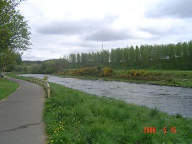
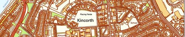
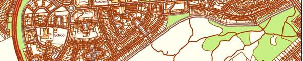
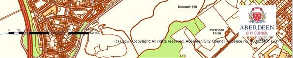
BRIDGE OF DON MASTERPLAN & PLANNING SUMMARY
 BRIDGE OF DON MASTERPLAN & PLANNING SUMMARY SITE LOCATION The site of the existing AECC lies in an area of predominately residential and business use in Bridge of Don and extends approximately 50 acres.
Green Infrastructure Enhancing Europe's Natural Capital
 Green Infrastructure Enhancing Europe's Natural Capital Marco Fritz DG ENV.B.2, Biodiversity CIS Working Group on Programmes of Measures 13/11/13 All (c) belong to the authors of the used material. Target
Countywide Green Infrastructure
 Montgomery County s Countywide Green Infrastructure F U N C T I O N A L M A S T E R P L A N The Maryland National Capital Park and Planning Commission INFRASTRUCTURE An underlying base or foundation especially
Central Lake Ontario Conservation Conservation Lands Master Plan
 Conservation Lands Master Plan Top 13 Frequently Asked Questions 1. What are conservation lands? Where are these conservation lands located in the Central Lake Ontario Conservation watershed? Conservation
GREEN INFRASTRUCTURE PLANNING GUIDE
 GREEN INFRASTRUCTURE PLANNING GUIDE Authors: C Davies, R MacFarlane, C McGloin, MRoe. Abbreviation Green Infrastructure is frequently abbreviated to as GI and Green Infrastructure Planning as GIP. Contents
Welcome. Welcome to our first Open Day event
 Welcome We are here Welcome to our first Open Day event About us This is the first of many opportunities to have your say on the development of the. Urban&Civic was founded specifically to enable and deliver
RECREATION, OPEN SPACE AND GREENWAYS ELEMENT GOALS, OBJECTIVES, AND POLICIES
 RECREATION, OPEN SPACE AND GREENWAYS ELEMENT GOALS, OBJECTIVES, AND POLICIES GOAL R-1: DEVELOP A RECREATION, OPEN SPACE AND GREENWAYS SYSTEM AS AN INTEGRAL COMPONENT OF AN OVERALL, COUNTY-WIDE ECONOMIC
Natural Environment White Paper & new partnerships to deliver green infrastructure. Henry Smith, Project and Policy Assistant, TCPA
 Natural Environment White Paper & new partnerships to deliver green infrastructure Henry Smith, Project and Policy Assistant, TCPA Presentation outline 1) Green Infrastructure introduction The TCPA s work
Enhancing Ecosystems and Biodiversity. Paul Nolan, Green Infrastructure: Planning for the Liverpool City Region
 Enhancing Ecosystems and Biodiversity Paul Nolan, Green Infrastructure: Planning for the Liverpool City Region Supposing we thought differently Amenity to Necessity Green Space to Green Infrastructure
The journey so far. The new masterplan for Dargavel Village
 The journey so far Our vision for Dargavel Village began over ten years ago when the original masterplan for transforming the former Royal Ordnance Factory site into a thriving community was established.
Land at Rampton Road. Cottenham
 Land at Rampton Road Cottenham Introduction TEP is preparing an outline planning application for 54 dwellings on 6.9 hectares of land adjacent to Rampton Road, Cottenham on behalf of the owners Cambridgeshire
Neighbourhood Planning Local Green Spaces
 Neighbourhood Planning Local Green Spaces Introduction... 2 1. Why green space is important... 4 2. Neighbourhood plans and green space... 6 3. Evidence... 8 Statutory designations... 9 Green space audit...
50-year Water & Wetland Vision for England WORKSHOP DETAILS
 50-year Water & Wetland Vision for England Workshop 3: Wetland vision maps; your feedback on draft maps, methodology and ways forward 7 th December 2006 WORKSHOP DETAILS Theme 1: Methodology and prioritisation
WELCOME. North East Haverhill. The Planning Process
 WELCOME North East The site to the North East of, known as Great Wilsey Park, is identified by St Edmundsbury Borough Council in its Core Strategy as capable of delivering a Sustainable Urban Extension.
NORTH WEST LEEDS COUNTRY PARK AND GREEN GATEWAYS PROJECT. Country Parks Officer Douglas Louis
 NORTH WEST LEEDS COUNTRY PARK AND GREEN GATEWAYS PROJECT Country Parks Officer Douglas Louis Vision To Preserve, Improve and Promote Green Spaces and their Connectivity for People & Wildlife in North West
COASTAL CONSERVANCY. Staff Recommendation March 25, 2004 LOS ANGELES GREEN VISION PLAN. File No.: Project Manager: Marc Beyeler
 COASTAL CONSERVANCY Staff Recommendation March 25, 2004 File No.: 04-014 Project Manager: Marc Beyeler RECOMMENDED ACTION: Authorization to disburse up to $50,000 to the University of Southern California
Arkansas River Corridor
 Planning for Access Welcome to the Access Project. This project is a recreational planning effort in response to an interest by regional communities along the Arkansas River corridor. The project plan
LITTLE FRANCE PARK, EDINBURGH
 LITTLE FRANCE PARK, EDINBURGH INTEGRATING ACTIVE TRAVEL ROUTES WITHIN A MASTERPLAN FROM THE OUTSET Location: Implemented: Edinburgh, Scotland 2016 - ongoing CASE STUDY The Little France Park cycling and
Neighbourhood Planning Guidance Local Green Spaces
 Neighbourhood Planning Guidance Local Green Spaces Introduction This guidance note has been produced for communities preparing neighbourhood plans in North Dorset to help them to identify, assess and designate
Neighbourhood Planning Site Assessment Pro-forma and Guide Version 2
 Neighbourhood Planning Site Assessment Pro-forma and Guide Version 2 September 2014 Site HNP 006 Land East of Stanbridge Road and North of Lower Road 1. Background information Site location and use Site
BREEDON NORTHERN LIMITED
 Non Technical Summary CONTENTS 1 INTRODUCTION... 1 2 SITE DESCRIPTION... 1 3 DESCRIPTION OF THE DEVELOPMENT... 6 4 NEED FOR THE DEVELOPMENT... 8 5 KEY ISSUES CONSIDERED IN THE ENVIRONMENTAL IMPACT ASSESSMENT...
Scottish Natural Heritage. Better places for people and nature
 Scottish Natural Heritage Better places for people and nature Contents Summary... 3 SNH approach... 5 Place-making in policy and practice... 6 Developing the contribution of the natural heritage to place-making...
Phase I Ecological Network Report Terms of Reference
 Phase I Ecological Network Report Terms of Reference INTRODUCTION In 2007, the City of Edmonton created a new Natural Area Systems Policy (C-531) and a strategic plan, Natural Connections. Together, these
DUNSFOLD NEIGHBOURHOOD PLAN Site Selection Policies
 DUNSFOLD NEIGHBOURHOOD PLAN Site Selection Policies The criteria for assessing sites for future housing and business development in Dunsfold are set out below. (Development criteria, covering what it is
THE CORPORATION OF THE CITY OF WINDSOR Office of the City Solicitor Planning Department
 THE CORPORATION OF THE CITY OF WINDSOR Office of the City Solicitor Planning Department REPORT TO THE CITY OF WINDSOR PLANNING ADVISORY COMMITTEE DATE OF REPORT: August 19, 2010 SUBJECT: Official Plan
GREENBANK DEVELOPMENT MASTERPLAN
 DEVELOPMENT MASTERPLAN POTENTIAL TRAIN STATION COMMUNITY CENTRE Greenbank will be a connected masterplanned community providing easy access to local and surrounding amenity. Affordable quality homes, green
Making the case for Sustainable Transport Project Potential
 Making the case for Sustainable Transport Project Potential The Structural Investment Fund (SIF) Strategy for Greater Lincolnshire identifies the barriers to growth identified by having poor transport
3-2 Environmental Systems
 3-2 Environmental Systems 3.0 ENVIRONMENTAL SYSTEMS CONTENTS 3.1 GREENWAY SYSTEM 3.1.1 General Policies 3.1.2 Natural Heritage Network 3.1.3 Natural Heritage Network Enhancement Lands 3.1.4 Rouge Watershed
Richard Lemon Spatial Project Manager. Biodiversity and Green Infrastructure
 Richard Lemon Spatial Project Manager Biodiversity and Green Infrastructure A key concept: Multifunctionality Combining different functions on the same piece of land multi-functional green space, new
Chapter 5: Natural Resources and Environment
 NATURAL RESOURCES AND ENVIRONMENT 5-1 5 Chapter 5: Natural Resources and Environment BACKGROUND AND INTENT Urban expansion represents the greatest risk for the future degradation of existing natural areas,
Welcome to our exhibition
 Welcome to our exhibition The Homes & Communities Agency (HCA) welcomes you to this public exhibition explaining our proposals for the redevelopment of the former Lea Castle Hospital site. About the Homes
Park Board Strategic Framework. (Mission, Vision, Directions, Goals and Objectives) June 27, 2012
 June 27, 2012") Park Board Strategic Framework (Mission, Vision, Directions, Goals and Objectives) June 27, 2012 Planning Process Overview Phase 1: Renewed Strategic Framework Phase 2: Objectives Phase 3: Prioritization
Park Board Strategic Framework (Mission, Vision, Directions, Goals and Objectives) June 27, 2012 Planning Process Overview Phase 1: Renewed Strategic Framework Phase 2: Objectives Phase 3: Prioritization
To what extent do you agree or disagree with the four options?
 Issues and options questions The easiest and most effective way to respond to the consultation is by using our online consultation portal www.spelthorne.gov.uk/localplan However you can also email us at
Longhorsley Neighbourhood Plan
 Site Assessment 1. The availability of the site 1.1 Is the land owner willing for their site to be made available for development? 1.2 If yes, do you have any written evidence to back this up? Planning
Green Infrastructure Enhancing Europe's Natural Capital Marco Fritz DG ENV.B.2, Biodiversity
 Green Infrastructure Enhancing Europe's Natural Capital Marco Fritz DG ENV.B.2, Biodiversity All (c) belong to the authors of the used material. Target 2 of the EU biodiversity Strategy By 2020, ecosystems
Rochford District Council Allocations Development Plan Document: Discussion and Consultation Document Sustainability Appraisal
 Option SWH1 Balanced Communities Option SWH1 1 To ensure the delivery of high quality sustainable communities where people want to live and work Will it ensure the phasing of infrastructure, including
Green Infrastructure Policies and Ordinances
 Green Infrastructure Policies and Ordinances October 23, 2013 By Karen Firehock, Green Infrastructure Center 2013 Georgia Urban Forest Council s 23 rd Annual Conference The mission of the nonprofit Green
nature.scot CONNECTING PEOPLE AND NATURE Corporate Plan Onward
 1 nature.scot CONNECTING PEOPLE AND NATURE Corporate Plan - 2018 Onward Foreword The priorities and activities carried out by SNH support the purpose of the Scottish Government to focus government and
What is green Infrastructure (GI)?
?") GreenNet Workshop green Infrastructure, Goričko Nature Park (Slovenia), 11.09.2013 What is green Infrastructure (GI)? Mike Cattell Leidorf DEGES Frankenwaldtourismus Hofrichter Melanie Kreutz PP02, BUND-Project
GreenNet Workshop green Infrastructure, Goričko Nature Park (Slovenia), 11.09.2013 What is green Infrastructure (GI)? Mike Cattell Leidorf DEGES Frankenwaldtourismus Hofrichter Melanie Kreutz PP02, BUND-Project
Public Consultation 23 January Peel Hall, Warrington Board 1. A message from Satnam... Site history...
 Board 1 A message from Satnam... Thank you for attending today s public consultation about proposals to develop a new residential neighbourhood at. The display boards show why the development is needed
A Joined-up Regional Landscape: A Roadmap to connect the parts
 Breaking the Barriers: Engineering Solutions to Ecological Problems A Joined-up Regional Landscape: A Roadmap to connect the parts Associate Professor Darryl Low Choy Urban Research Program Outline Nature
SPG 1. * the northern and western sections which are open fields used for pasture and grazing;
 SPG 1 1.0 INTRODUCTION This development brief is based on the allocation of the Priors Hall site for employment and countryside recreational purposes in the Corby Borough Local Plan. The brief is intended
SITE ASSESSMENT CHECKLIST
 1. Site Details a. What is the site s name/reference? SITE ASSESSMENT CHECKLIST CR3NPWHY 3007 Gasometer Site Godstone Road CR3 0EG b. Where is the site located? Wyhteleafe; Godstone Road. Urban category1
Green Infrastructure Project Guidance
 OTHER OPTIONS Green Infrastructure Project Guidance Stakeholder Informed Introduction Green infrastructure is an approach to mitigating environmental challenges using vegetation, soils and natural processes
Frequently Asked Questions
 1. Where is Aylesbury Woodlands? Frequently Asked Questions Aylesbury Woodlands lies to the east of Aylesbury. It is bounded to the south by the A41. To the north is the Aylesbury Arm of the Grand Union
Proposed S.U.E. Drayton Fields Industrial Estate. Royal Oak Industrial Estate. Daventry Town Centre. Long Marsh Industrial Estate.
 local context and amenities Existing Local Facilities Nearby Education Facilities in Daventry Local Retail Welton C of E Primary School Well Lane, Welton. This is a mixed sex rural primary school and has
UNIVERSITY TOWN NEIGHBOURHOODS 5.2 ECO-CORRIDOR MELBOURNE CAMPUS MASTER PLAN 2014
 5.2 ECO-CORRIDOR 37 ECO-CORRIDOR EXISTING CONDITIONS & VISION NEIGHBOURHOOD VISION Investment in the Eco-corridor Neighbourhood will signify the University s commitment to supporting local ecology and
Why the workshop, why the cases?
 Green Infrastructure in Central and Eastern Europe Cases from the Czech Republic, Poland and Romania Kristijan Civic, ECNC and Agnes Zolyomi, Zolyomi, CEEweb Workshop on redesigning the landscape, connecting
Blue/Green Infrastructure Study Accomack County, VA
 Blue/Green Infrastructure Study Accomack County, VA Draft Asset Maps March 8-9, 2010 Green Infrastructure Center, Inc. 2 Overview What is Green and Blue Infrastructure Project Timeline & Tasks Literature
EACCS Goal: provide guidelines for mitigation practices and overall conservation in east Alameda County
 EAST ALAMEDA COUNTY CONSERVATION STRATEGY: A BLUEPRINT FOR ACTION Community Meeting June 11, 2009 Agenda Welcome and Introductions Project Update o Introduction o Progress to Date o Next Steps Perspectives
Presentation Outcomes
 Green Infrastructure Rappahannock-Rapidan Living Lands Planning Workshop September 17, 2009 Presentation Outcomes Define green infrastructure principles and concepts (video). How are green infrastructure
Mendota-Lebanon Hills Greenway Master Plan Executive Summary. August draft for more information visit
 Mendota-Lebanon Hills Greenway Master Plan Executive Summary August 2013 draft for more information visit www.hkgi.com/projects/dakota INTRODUCTION The Mendota-Lebanon Hills Greenway Master Plan portrays
SITE ASSESSMENT FORM
 Appendix 2 SITE ASSESSMENT FORM 1. Site information Settlement: Colwall Main Village Site name: SITE 1 Part of vacated Colwall school site and adjacent area Site address: Walwyn Road Site area (hectares):
Rural Environment and Conservation
 Rural Environment and Conservation 117 Rural Environment and Conservation Introduction and Resources 118 BSc (Hons) Conservation and Environment 119 BSc (Hons) Wildlife Management 120 BSc (Hons) Rural
THE SPATIAL PLAN AND THE LANDSCAPE IN CZECH REPUBLIC
 THE SPATIAL PLAN AND THE LANDSCAPE IN CZECH REPUBLIC 13th ELC Conference, 2 3 October, Cetnjie, Montenegro Ing. Igor Kyselka CSc., Institute for spatial development, Jakubské náměstí 3, 60200 Brno, tel.:
Surrey Ecosystem Management Study
 Surrey Ecosystem Management Study Green Infrastructure Network Opportunities Public Open House & Information Session June 24 th, 2010 EMS Process Ecological Inventory Ecological Assessment Management Policy
CENTENNIAL PARKLANDS CONSERVATION MANAGEMENT PLAN: VOLUME
 EXECUTIVE SUMMARY Location Centennial Parklands is located at the heart of Sydney s Eastern Suburbs, just a couple of kilometres from the city centre. It forms a green swathe of parkland, ponds and sporting
South West Nature Map - A Planners Guide
 South West Nature Map - A Planners Guide Helping to Shape Spatial Planning for Biodiversity in Local Development Frameworks Working together for wildlife CONTENTS Foreword 1.0 Introduction 1.1 Purpose
Recreation, Open Space, Greenway Plan & Smart Agriculture Initiative
 Recreation, Open Space, Greenway Plan & Smart Agriculture Initiative This portion of the Plan represents a follow-up to Section 2, which addressed the natural environment of the two townships. This portion
Mapping produced by the Bedfordshire and Luton Biodiversity Recording and Monitoring Centre
 Mapping produced by the Bedfordshire and Luton Biodiversity Recording and Monitoring Centre Chalton Parish Green Infrastructure Plan Methodology In April 2007 Chalton Parish Council were approached with
Site Assessment Technical Document Appendix A: Glossary
 Central Bedfordshire Council www.centralbedfordshire.gov.uk Site Assessment Technical Document Appendix A: Glossary July 2017 1.1.11-1 - ii Appendix A: Glossary Term Agricultural Land Classification AONB
SALISBURY TOMORROW Our Vision
 SALISBURY TOMORROW Our Vision Salisbury is committed to supporting a high quality of life and sense of community for all residents. These commitments need to be reflected in our community programs, services
1.3 The following table presents a Statement of Compliance demonstrating how the Standish Neighbourhood Plan meets those requirements.
 1. Introduction 1.1 This Basic Condition Statement was prepared to accompany the draft Standish Neighbourhood Plan (2018). 1.2 Paragraph 8 of Schedule 4B of the Town and Country Planning Act 1990 requires
German ecological network legal base, scientific foundation and international context
 A future task in good hands German ecological network legal base, scientific foundation and international context Dr. Uwe Riecken Federal Agency for Nature Conservation (BfN) Bonn, Germany 9 th Pan-European
The Napa River Flood Protection Project
 The Napa River Flood Protection Project Creating Flood Protection and Restoring Geomorphic and Biological Processes Jeremy Sarrow, Napa County Flood Control & Water Conservation District June 2, 2014.
Review of the Environmental Impact Assessment (Agriculture) (Wales) Regulations 2007
 (Wales) Regulations 2007") Review of the Environmental Impact Assessment (Agriculture) (Wales) Regulations 2007 Consultation response form Q1. Do you agree with the proposal to add a definition of semi-natural land to the EIA regulations?
Review of the Environmental Impact Assessment (Agriculture) (Wales) Regulations 2007 Consultation response form Q1. Do you agree with the proposal to add a definition of semi-natural land to the EIA regulations?
Park Development Framework Area Proposals. Context to Area 2 Ruckholt Road to Coppermill Lane
 Park Development Framework Area Proposals Context to Area 2 Ruckholt Road to Coppermill Lane The defining feature of this area is the broad expanse of marshlands. These provide the context for a diverse
Tāhuhu whakaruruhau ā-taone The sheltering ridge pole
 B2. Tāhuhu whakaruruhau ā-taone - Urban growth and form B2.1. Issues Tāhuhu whakaruruhau ā-taone The sheltering ridge pole Auckland s growing population increases demand for housing, employment, business,
Conservation Corridor Base and Thematic Maps
 Conservation Corridor Base and Thematic Maps August 20, 2010 This project is funded in part by the Virginia Coastal Zone Management Program at the Department of Environmental Quality through Grant #NAO9NOS4190163
IFA2 UK Onshore Development Planning Statement. May 2016
 IFA2 UK Onshore Development Planning Statement May 2016 IFA2 UK Onshore Development Planning Statement Document reference IF2-ENV-STM-022 Version 1.0 Prepared by Address TEP on behalf of National Grid
MAPPING THE BENEFITS OF THE GREEN NETWORK: A NEW TOWN CASE STUDY
 MAPPING THE BENEFITS OF THE GREEN NETWORK: A NEW TOWN CASE STUDY Illustrating the use of the EcoServ- GIS toolkit to quantify the benefits of nature and the green network across Cumbernauld, North Lanarkshire.
What We Heard Public Engagement - Stage 1
 What We Heard Public Engagement - Stage 1 Background Early planning is underway for a potential new river crossing over the North Saskatchewan River, in the northeast part of the Edmonton region. The City
NEW REGIONAL OFFICIAL PLAN HIGH LEVEL PROCESS & FRAMEWORK
 NEW REGIONAL OFFICIAL PLAN HIGH LEVEL PROCESS & FRAMEWORK Why A New Official Plan Originally the role of Regionally Planning and content of Regional Official Plan (1970s) primarily focused on protecting
Delivering landscape-scale habitat restoration and creation through spatial planning. Rachel Lee, July 2010 RSPB Planning and Regional Policy Team
 Delivering landscape-scale habitat restoration and creation through spatial planning Rachel Lee, July 2010 RSPB Planning and Regional Policy Team Acknowledgements The RSPB would like to thank everyone
Wallingford Neighbourhood Plan
 Wallingford Neighbourhood Plan Introduction What is neighbourhood planning? Neighbourhood planning was introduced by the Localism Act 2011 to give local people more influence over how development comes
Florida Forever Conservation Needs Assessment Overview Maps
 Florida Forever Conservation Needs Assessment Overview Maps Prepared by Florida Natural Areas Inventory, The maps in this document are derived from the Florida Forever Conservation Needs Assessment, an
495/MetroWest Development Compact Plan Citizen Planner Training Collaborative Conference. March 17, 2012
 495/MetroWest Development Compact Plan Citizen Planner Training Collaborative Conference March 17, 2012 Project Process Local and Regional Priority Areas Growth Scenarios Transportation Investment Categories
The Inner Forth Landscape Initiative. David Anderson Inner Forth Futurescapes Officer RSPB Scotland
 The Inner Forth Landscape Initiative David Anderson Inner Forth Futurescapes Officer RSPB Scotland Talk outline Why the Inner Forth The Inner Forth Landscape Initiative Protecting the Natural Heritage
Welford-on-Avon Neighbourhood Plan Consultation Event Sunday, 6 April Your name Your address
 Welford-on-Avon Neighbourhood Plan Consultation Event Sunday, 6 April 2014 Your name Your email address Please either: - complete this feedback form and put it in the box before leaving the Memorial Hall
8.0 Design and Form of Development 43/
 42/ 8.0 Design and Form of Development 43/ Rothwells Farm, Golborne/ Development Statement Figure 7. Site Constraints Key 44/ Site Boundary 360 Bus Route/Stops Existing Trees Underground Water Pipe Sensitive
Overview of Southwestern Pennsylvania Commission s (SPC) 2040 Long Range Transportation Plan (LRTP)
 2040 Long Range Transportation Plan (LRTP)") Overview of Southwestern Pennsylvania Commission s (SPC) 2040 Long Range Transportation Plan (LRTP) Presented to Pennsylvania Agency Coordination Meeting May 27, 2015 Doug Smith & Ryan Gordon 1 Southwestern
Overview of Southwestern Pennsylvania Commission s (SPC) 2040 Long Range Transportation Plan (LRTP) Presented to Pennsylvania Agency Coordination Meeting May 27, 2015 Doug Smith & Ryan Gordon 1 Southwestern
BLACK/HARMONY/FAREWELL CREEK WATERSHED EXISTING CONDITIONS REPORT CHAPTER 5 IMPERVIOUS SURFACES
 BLACK/HARMONY/FAREWELL CREEK WATERSHED EXISTING CONDITIONS REPORT CHAPTER 5 IMPERVIOUS SURFACES Draft November 2009 TABLE OF CONTENTS 1.0 INTRODUCTION... 3 2.0 STUDY AREA AND SCOPE... 4 3.0 METHODOLOGY...
Goleta Community Plan Update
 Goleta Community Plan Update Ecology, Biology, and Habitats GVPAC Meeting Agenda [Wednesday, December 17, 2008, 6:00PM] Pledge of Allegiance and Roll Call Public Comment Period Administrative December
Virginia Beach and Sea Level Rise: Where Do We Go From Here?
 Virginia Beach and Sea Level Rise: Where Do We Go From Here? Clay Bernick City of Virginia Beach Environment & Sustainability Office Bayfront Advisory Committee Presentation July 19, 2012 Five Items to
Urban Green Space Management (Horticulture) FdSc Course outline
 FdSc Course outline") Urban Green Space Management (Horticulture) FdSc Course outline Module Outline Year 1 Module 1: Plant Development and Knowledge (20 credits) Develop applied knowledge and skills based on the principles
Urban Green Space Management (Horticulture) FdSc Course outline Module Outline Year 1 Module 1: Plant Development and Knowledge (20 credits) Develop applied knowledge and skills based on the principles
Grantham Southern Quadrant Link Road Environmental Statement
 Grantham Southern Quadrant Link Road Environmental Statement Non Technical Summary Introduction Lincolnshire County Council (LCC) is submitting a planning application for the proposed implementation of
Kibworth Harcourt. Introduction. Introduction
 Introduction Introduction Welcome to this public exhibition on the proposals for the delivery of new homes on land at The Kibworths. The purpose of today s exhibition is to give you the opportunity to