Pine Street Waterfront Overlay CITY OF ROSEBURG PINE STREET WATERFRONT OVERLAY FEBRUARY City of Roseburg
|
|
|
- Eunice Hubbard
- 5 years ago
- Views:
Transcription


1 Pine Street Waterfront Overlay CITY OF ROSEBURG PINE STREET WATERFRONT OVERLAY FEBRUARY 2018 City of Roseburg

2 Purpose of this project Create an overlay zone for Pine Street Retain the project area s historic character Allow multi-modal transportation access Promote small-scale, pedestrianoriented development

3 What this Project is Not Overlay zone will remove barriers to development but it s not a streetscape plan This effort is the first step in planning for future development and street improvements The focus of this project is on Pine Street and the overlay district, not on the river trail
4

5 A B * C


6 Pine Street Waterfront Overlay Zone PINE STREET WATERFRONT OVERLAY Community Development Department 900 SE Douglas Ave., Roseburg, Oregon Legend Potential Pine Street Waterfront Overlay C3 [General Commercial] PR [Public reserve] 1" = 150' SOUTH UMPQUA RIVER DEER CREEK NE STEPHENS ST SE SPRUCE ST SE DOUGLAS AVE 320 CORP RAILROAD SE PINE ST SE STEPHENS ST 700 SE ROSE ST Map is for informational purposes only and is not suitable for legal, engineering or surveying purposes. The City of Roseburg is not responsible for map errors, ommissions, misuse, or misinterpretation. Not for determining legal ownership or identification of property boundaries Feet

7 Key Documents CITY OF December 2006 COMPREHENSIVE PARKS MASTER PLAN ADOPTED APRIL 2008 LAND USE AND DEVELOPMENT ORDINANCE City of Roseburg Waterfront Master Development Plan ORDINANCE NO.3487 ADOPTED: JULY 24, 2017 CC Ord. No November 11, 2010 ORIGINALLY ADOPTED: JUNE 28, 1982: ORD. NO. 2363
8 Comprehensive Plan Plan Highlights Increase the potential for convention and tourist-related economic activities. Develop and expand public awareness of the Roseburg urban area s origin, development and history. Encourage preservation and restoration of sites, structures, objects and areas of cultural, historic or archaeological significance for the enjoyment and knowledge of present and future generations.
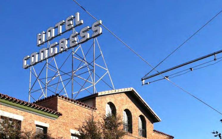
9 Transportation System Plan December 2006 Plan Highlights The TSP, as written, currently treats Pine Street not as a street but as a multi-use path. This is an opportunity for the Pine Street Overlay project to set new standards for its design. New standards that borrow more from the design of plazas and other shared urban spaces, rather than from streets.
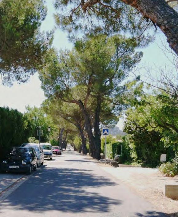
10 Bike and Pedestrian Plan Plan Highlights The key components to successful paths include: continuous separation from traffic, scenic qualities, connection to land uses, well-designed street crossings, visibility, good design, and proper maintenance.
11 Parks Master Plan CITY OF COMPREHENSIVE PARKS MASTER PLAN ADOPTED APRIL 2008 Plan Highlights...this plan recommends a conceptual overlay to all park and open space properties within the city limits that are adjacent to the river. Individual parks along the river will retain their own identities and particular uses, but these sites should also be considered as a whole... Develop consistent signage and install at all city park sites to create system identity. Provide wayfinding signage from adjacent streets for parks not located on a major street.


12 City Limits Main Map SP-6 CP-1 Quintus Park W HARVARD AVE NP-6 E S H U C R E S T E S F U L L E R TO N Brown Park SP-7 SP-5 YMCA DUCK POND Stewart Park F I R G R O V E E S FIR GROVE S o u t h U m p q u a R i v e r F R E E M O N T M S SKATE PARK SP-4 GARDEN VALLEY VETERANS' ADMINISTRATION HOSPITAL Charles S Gardiner Park Riverfront Park Templin Beach Park Micelli Park R O S E B U R G M U N I C I P A L A I R P O R T NP-1 OS-1 BOYS & GIRLS CLUB Gaddis Park R O S E B U R G H S Laurelwood Park ALAMEDA UMPQUA RIVE R BIKE PATH Riverside Park Willis Park OS-3 R O S E E S J O S E P H L A N E M S NE STEPHENS ST SP-1 SP-2 Eagles Park NP-3 Deer Creek Park Beulah Park NP-2 Commercial Street Park NP-5 Eastwood Park k DIAMOND LAKE BLVD OS-2 Inset Map E A S T W O O D E S SP-3 NP-4 P H O E N I X S C H O O L Sunshine Park Miles City of Roseburg Urban Growth Boundary City Limits Main Map Parks & Recreation Master Plan City of Roseburg, Oregon Map 2: Proposed Park System Proposed Open Space Proposed Community Park Regional Park Community Park Neighborhood Park Mini Park Greenway Special Use Areas Undeveloped Park Proposed School Park Proposed Neighborhood Park â â â â Existing Bike/ Pedestrian Path â â â â Proposed Bike/ Pedestrian Path Railroad City Limits UGB Stream River School Property o Miles Inset Map o Miles INTERSTATE FIVE D O U G L A S C O U N T Y F A I R G R O U N D S Thompson Park Parrot Creek Park Data Source: City of Roseburg GIS March 2008
13 Waterfront Master Plan City of Roseburg Waterfront Master Development Plan CC Ord. No November 11, 2010 Plan Highlights Improve north end of Pine Street with better paving and landscape and encourage redevelopment of adjoining properties....delineated with pavement markings to guide cyclists and pedestrians and perhaps delineate a lane for cars... Replace the fence, with at least a black chain link fence or a metal railing fence and add plantings.
14 City of Roseburg Waterfront Master Development Plan CC Ord. No November 11, 2010 New lighting should be installed on the corridor, consistent with light standards on other sections of riverfront and tying to downtown. Redevelopment should be required to locate close to the trail corridor, to create a sense of activation and direct observation of the corridor.
 are permitted on the ground floor but the building must be flood-proofed through engineering, design and construction.")
15 Lane Mosher Oak Washington Elk Island Douglas Pine Deer Creek Floodplain Highlights If a building is in the floodplain, residential uses are not permitted on the ground floor. Non-residential uses (commercial and retail) are permitted on the ground floor but the building must be flood-proofed through engineering, design and construction. Floodplain Map Pine Stephens A riverbank trail could provide secondary access and visibility to retail located in the ground floor of buildings in the floodplain, facing the river or facing perpendicular passageways.
16 LUDO LAND USE AND DEVELOPMENT ORDINANCE ORDINANCE NO.3487 ADOPTED: JULY 24, 2017 ORIGINALLY ADOPTED: JUNE 28, 1982: ORD. NO Plan Highlights Bed and breakfast is a permitted use, and one off-street parking space for each guest room is required. Parking should be more flexible, with local shared parking arrangements. Several uses are inconsistent with the city s goals for this area. Sidewalk cafes are conditional and should be permitted.

17 LAND USE AND DEVELOPMENT ORDINANCE ORDINANCE NO.3487 ADOPTED: JULY 24, 2017 ORIGINALLY ADOPTED: JUNE 28, 1982: ORD. NO New standards should promote the vision and current character of smallscale architecture. At the same time, LUDO amendments should optimize the redevelopment potential that is severely challenged by floodplain and historic structure limitations. It will require an intricate approach that balances competing requirements and objectives.

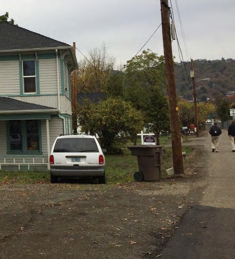
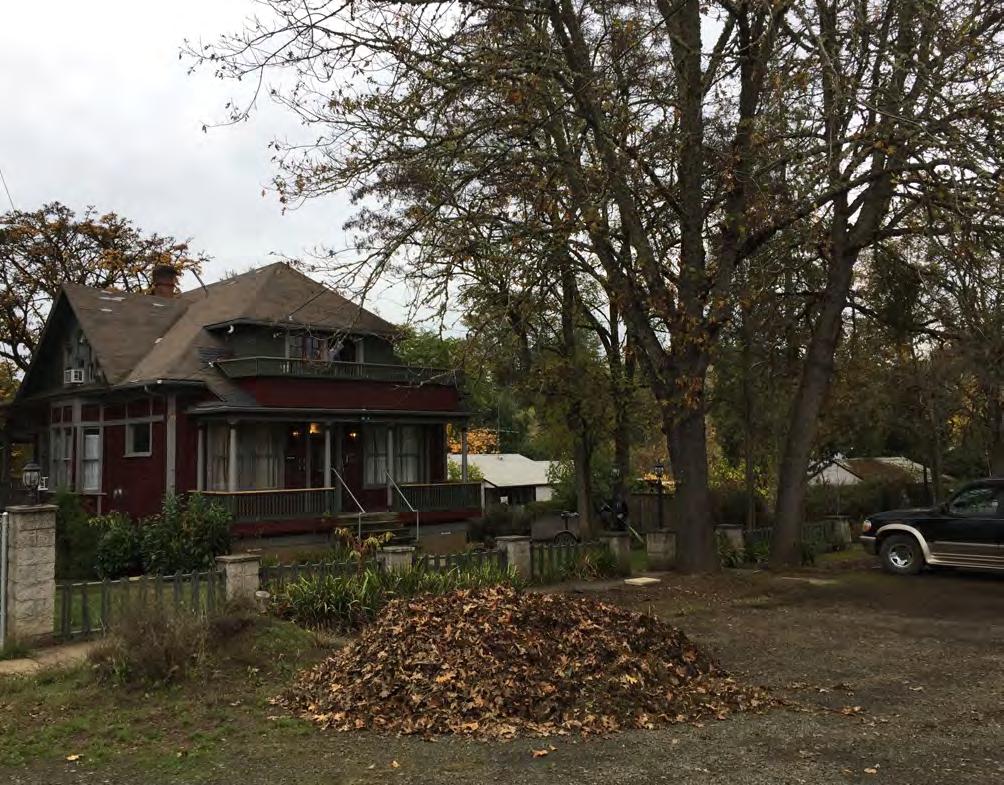
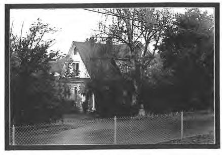
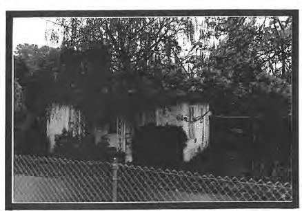
18 Historical Resources Inventory Highlights There are seven designated properties within the Pine Street area. These properties must comply with Historic District Overlay standards. Overlay standards include height and bulk restrictions. In addition, most of these are also within the floodplain and must comply with floodplain regulations.

19
20 Hierarchy of Regulations National Historic Registry Fire and Life Safety Federal and State FEMA Flood Regulations LEAST FLEXIBLE CITY OF ROSEBURG PINE STREET WATERFRONT OVERLAY FEBRUARY 2018 State Historic Preservation Office Building Code ADA Standards County and Local Planning Zoning * Documents Code Public Works Standards MOST FLEXIBLE


21 FEMA Retrofitting Methods * Elevation Relocation Demolition Wet Floodproofing Dry Floodproofing Barrier Systems


22 Lifting the building above the flood level Mandeville, Louisiana: B-3 Elevated Building Design Guidelines 5.2 Elevated Building a) Incorrect Details b) Correct Details Columns are ill proportioned and devoid of architectural detailing Beam depth is too shallow in relation to span. Pier expressed with base and capital Beam has substantial depth in relation to span Gallery Building on Piers Pier spacing is not related to principal structure No screening provided at base level aligning with face of principal building Parking is not properly screened Pier spacing related to porch columns and openings of principal structure Maintain a void at face of porch Solid screening provided at base level aligning with face of principal building Parking is properly screened 5.2

23 500 SE Douglas Avenue
24 Mandeville, Louisiana: B-3 Elevated Building Design Guidelines 5.1 Elevated Buildings a) Asymmetrical Single Story The primary design problem encountered when buildings are elevated is respecting the original architectural proportion and pattern of the principal structure. The new base zone is generally created by placing the structure on a base zone of raised columns or piers. This base zone shall be architecturally treated to mitigate the appearance of a building on stilts. Column or pier vertical proportions shall be a minimum of 1 unit wide to 12 units tall. Principal Structure b) Symmetrical Two Story Post & Lintel Expression Piers engage porch rhythm Solid panels with siding used as infill Wall with Openings Opening rhythm reflects wall openings in principal structure. Solid stucco panels recessed between piers Piers shall be treated with an architectural finish. Permissible finish materials include stucco, brick, wood, or cementitious siding. Columns or piers shall be treated with an architectural finish. Permissible finish materials include stucco, brick, wood, or cementitious siding. The spacing of piers shall respect the rhythm of the principal structure. Common elements that will dictate pier spacing include porch columns and bays, wall openings and major building elements. Principal Structure Post & Lintel Expression Columns with capital, base & shaft; Board & batten infill panels Wall with Openings Openings reflect wall openings in principal structure; base has louvered infill panels 5.1


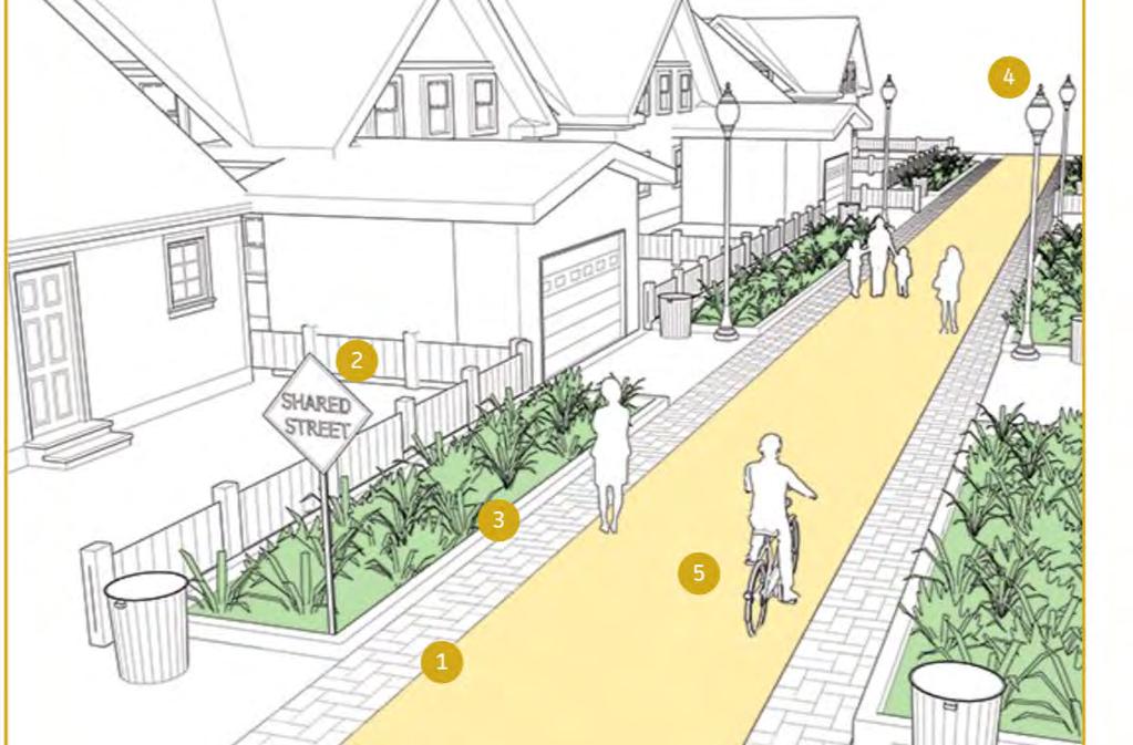
25 Inspiration West down Douglas to South Umpqua River. Riverfront trail uses the sidewalk to connect to Pine Street Figure 4I: Pine Street ROW and 20 easement north of Douglas


.")
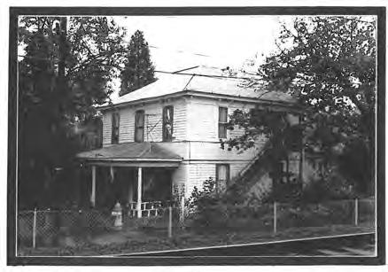
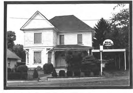
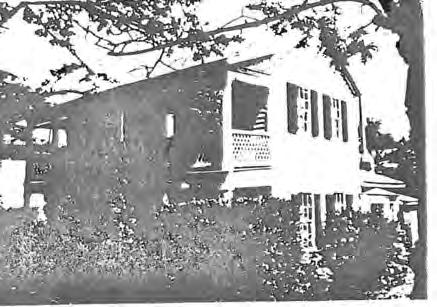
26 Roseburg Waterfront Master Development Plan Inspiration The following improvements are recommended for this corridor (see Figure 4J): Improved paving, with unit pavers preferred instead of asphalt. At very least, the corridor should be delineated with pavement markings to guide cyclists and pedestrians and perhaps delineate a lane for cars to use when accessing riverfront properties. The existing fence separating northern Pine from the railroad is stark and unattractive. Replace the fence, with at least a black chain link fence or a metal railing fence and add plantings. New lighting should be installed on the corridor, consistent with light standards on other sections of riverfront and tying to downtown. Properties along the corridor are zoned C3, which allows them to redevelop as small-scale retail. One vision imagines this corridor becoming a district with local arts and crafts shops, along with bed and breakfast-type accommodation (photos at right). Redevelopment should be required to locate close to the trail corridor, to create a sense of activation and direct observation of the corridor. A future trail connection directly on the riverbank could be realized as willing sellers make their property available and the City responds by purchasing these properties or access rights to create a public parcel. It is not anticipated that additional right-of-way acquisition is required for the improvements above. Small-scale crafts shop Bed and Breakfast in an historic house New Trees New Lighting New Fencing Special Paving Figure 4J: Conceptual cross-section for Pine Street improvements 62 Pine Street Improvements
27 BUILDINGS
28 SIGNAGE


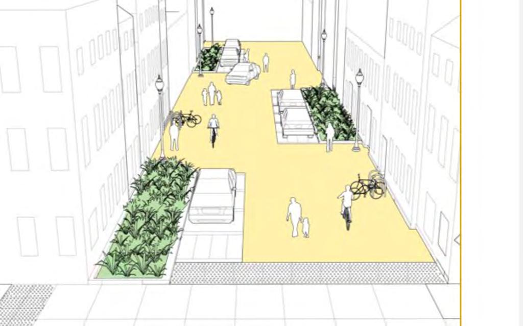
29 Inspiration Roseburg Waterfront Master Development Plan Existing Pine Street Figure 4K: Concept for Pine Street improvements
30 STREET
 Program, a joint program of the Oregon Department of Transportation and the Oregon Department of Land Conservation and Development.")
31 Pine Street Waterfront Overlay City of Roseburg Thank you CITY OF ROSEBURG PINE STREET WATERFRONT OVERLAY FEBRUARY 2018 This project is partially funded by a grant from the Transportation and Growth Management ( TGM ) Program, a joint program of the Oregon Department of Transportation and the Oregon Department of Land Conservation and Development. This TGM grant is financed, in part, by federal Fixing America s Surface Transportation Act (FAST- Act), local government, and the State of Oregon funds. The contents of this document do not necessarily reflect views or policies of the State of Oregon. urbs w o r k s
The transportation system in a community is an
 7 TRANSPORTATION The transportation system in a community is an important factor contributing to the quality of life of the residents. Without a sound transportation system to bring both goods and patrons
Planning Districts INTRODUCTION
 INTRODUCTION To facilitate detailed examination of development prospects for all areas of the community, Delano has been divided into 14 planning districts. The location of these planning districts is
Northwest Rail Corridor and US 36 BRT Development Oriented Transit Analysis 4.4 STATION AREA FINDINGS
 4.4 STATION AREA FINDINGS Each station is different, and each one requires a separate set of recommendations based on the vision for the site. This section outlines an initial TOD strategy and recommendations
The open space system should provide connective elements, relate to natural resources, and enhance the suburban character of the landscape..
 The open space system should provide connective elements, relate to natural resources, and enhance the suburban character of the landscape.. Mixed-use and infill development should maintain or enhance
Planning Board Briefing
 Planning Board Briefing Why Now? The Sector Plan Implementation Chapter States: Before Stage 1 begins, the following must occur: Approval of the Sectional Map Amendment. Approval of the Greater Lyttonsville
Potential Green Infrastructure Strategies May 6, 2015 Workshop
 Potential Green Infrastructure Strategies May 6, 2015 Workshop Background The City of Cortland is developing the Tioughnioga Urban Headwaters Green Infrastructure Action Plan with funding from the National
Yadkin River Greenway Feasibility Study Fact Sheet Village of Clemmons, Town of Lewisville, Town of Bermuda Run
 Fact Sheet Village of Clemmons, Town of Lewisville, Town of Bermuda Run Project Background The Yadkin River Greenway Feasibility Study is a joint project with the Village of Clemmons, the Town of Bermuda
A larger version of this map is located on the last page of this PDF.
 MAP Committee Input McLoughlin Area Draft Vision Map A larger version of this map is located on the last page of this PDF. 1. The map above is intended to portray a vision for the McLoughlin area. It highlights
Gold Line Bus Rapid Transit Transit Oriented Development (BRTOD) Helmo Station Area Plan
 Helmo Station Area Plan") Appendix F Gold Line Bus Rapid Transit Transit Oriented Development (BRTOD) Helmo Station Area Plan Introduction and Purpose of the Plan The Gold Line Bus Rapid Transit facility is an eleven-mile dedicated
Appendix F Gold Line Bus Rapid Transit Transit Oriented Development (BRTOD) Helmo Station Area Plan Introduction and Purpose of the Plan The Gold Line Bus Rapid Transit facility is an eleven-mile dedicated
Public input has been an important part of the plan development process.
 Lakewood s Comprehensive Plan recognizes that transportation helps shape the community, and that the way the community provides for the safe and efficient movement of people affects the character of the
Delaware River Waterfront Corporation
 Delaware River Waterfront Corporation Delaware River Waterfront Corporation Created in January 2009 to replace Penn s Landing Corporation o Open, accountable, effective leadership o New Board of Directors
COMMUNITY DESIGN. GOAL: Create livable and attractive communities. Intent
 COMMUNITY DESIGN Intent An attractive, well-designed County will attract quality development, instill civic pride, improve the visual character of the community, and create a strong, positive image for
4. INITIAL CONCEPT DEVELOPMENT AND SCREENING
 4. INITIAL CONCEPT DEVELOPMENT AND SCREENING A coordinated effort by the project team and members of the three oversight committees (Citizen Advisory, Technical Advisory, and Steering) led to 17 initial
Area Plans. September 18, 2012
 Area Plans September 18, 2012 Transfer ratio for existing development up to 1:6 depending on sending parcel sensitivity and distance from community centers and/or transit routes. Within Town Center and
VEHICULAR AND PEDESTRIAN CIRCULATION
 This perspective sketch communicates the intended character and quality of a proposed streetscape design. Locate benches near a major intersection where people tend to gather. Seating and lighting provide
DISCUSSION TOPIC: ST JOHNS RIVER & ITS TRIBUTARIES (BPII) 2030 COMPREHENSIVE PLAN POLICES AND REGULATORY FRAMEWORK
 2030 COMPREHENSIVE PLAN POLICES AND REGULATORY FRAMEWORK") DISCUSSION TOPIC: ST JOHNS RIVER & ITS TRIBUTARIES (BPII) 2030 COMPREHENSIVE PLAN POLICES AND REGULATORY FRAMEWORK St. John s River & Its Tributaries Issue Summary: The St. Johns River is an important
DISCUSSION TOPIC: ST JOHNS RIVER & ITS TRIBUTARIES (BPII) 2030 COMPREHENSIVE PLAN POLICES AND REGULATORY FRAMEWORK St. John s River & Its Tributaries Issue Summary: The St. Johns River is an important
Fall 2017 Construction Update
 Fall 2017 Construction Update Ward 4 Southeast Engineering Department Riverwalk Red Multi-Use Trail Bridge Rehabilitation The Riverwalk Red Multi Use Trail Bridge was awarded to Cramer and Associates,
City of Chickasaw Land Use Comprehensive Plan 2030 Chapter5-Draft(2)Public review_
Public review_") Land Use Land Use refers to the activity or development characteristics of a given parcel of land. The Land Use Plan presented in the following pages, represents the City of Chickasaw s official position
Land Use Land Use refers to the activity or development characteristics of a given parcel of land. The Land Use Plan presented in the following pages, represents the City of Chickasaw s official position
The University District envisions, in its neighborhood
 Envisioning the University District Link Light Rail in Seattle s neighborhoods CIY OF SEALE CONCEP-LEVEL SAION AREA PLANNING RECOMMENDAION RESOLUION # 30165 EXHIBI L Vision 08.2000 he University District
Support the implementation of Cape Coral's Comprehensive Plan. Protect and utilize the unique natural resources in the City.
 7.0 OVERVIEW - RECOMMENDATIONS Chapter 7 The preparation of the Cape Coral Parks and Recreation Master Plan spanned a period of approximately 12 months. Plan preparation included the input of a wide range
1.0 Circulation Element
 5/9/18 1.0 Circulation Element 1.1 Introduction As growth and development occur in Apache County, enhancements to its circulation system will be necessary. With time, more roads will be paved and air and
City of Plattsburgh DRI: Downtown Streetscapes & Riverfront Access. Downtown Streetscape and Riverfront Access Design
 City of Plattsburgh DRI: Downtown Streetscapes & Riverfront Access Welcome Thank you for coming this evening. Agenda PART I - Project Context The Downtown Revitalization Program Our DRI Projects Other
Little Neck Planning Area
 Little Neck Planning Area Current Reality The Little Neck Planning Area is characterized by established residential neighborhoods, Town Center and Pembroke. The Eastern and Western Branches of the Lynnhaven
Transportation. Strategies for Action
 Transportation A major priority for the Overlake Neighborhood is to develop a multimodal transportation system. To achieve this system, a balance has to be found among travel, circulation and access needs;
R STREET CORRIDOR NEIGHBORHOOD Site Plan and Design Review Supplemental Guidelines Checklist
 R STREET CORRIDOR NEIGHBORHOOD Site Plan and Design Review Supplemental Guidelines Checklist Applicant s Name: Project Address: Phone: Email: Applicant shall fill out the design guidelines checklist for
Draft Stillwater 2030 Comprehensive Plan- Goals and Policies
 Draft Stillwater 2030 Comprehensive Plan- Goals and Policies Instructions- Review each goal and policy and discuss with group any changes, deletions for additions to the list using your groups pen. Keep
SECTION TWO: Overall Design Guidelines
 SECTION TWO: Overall Design Guidelines This section provides overall design principles and guidelines for the Gardnerville Mixed-use Overlay. They provide criteria for mixed-use places consisting of residential,
Isabel Neighborhood Plan: Alternatives
 Isabel Neighborhood Plan: Alternatives Presented by: Lori Parks, Associate Planner February 2, 2015 Agenda 1. Background on BART to Livermore 2. Isabel Neighborhood Plan 3. Alternative Scenarios 4. General
CHAPTER 7: Transportation, Mobility and Circulation
 AGLE AREA COMMUNITY Plan CHAPTER 7 CHAPTER 7: Transportation, Mobility and Circulation Transportation, Mobility and Circulation The purpose of the Transportation, Mobility and Circulation Chapter is to
Somers Point Master Plan
 Somers Point Master Plan Progress Report and Public Meeting August 20, 2014 Master Plan Reexamination Municipal Land Use Law require that all municipalities reexamine their master plan every ten years.
RZC Public View Corridors and Gateways
 RZC 21.42 Public View Corridors and Gateways 21.42.010 Purpose 21.42.020 Scope and Authority 21.42.030 Administration 21.42.040 Gateways Design 21.42.050 Unidentified Public Views 21.42.060 Identification
SUNSET CORRIDOR LAND. The property is now available and ready for corporate utilization, development or investment.
 SUNSET CORRIDOR LAND The property is now available and ready for corporate utilization, development or investment. This 275-acre site is now available and ready to develop. Just off US 26, this west Sunset
PIKE PINE RENAISSANCE: ACT ONE. October 19, 2017
 PIKE PINE RENAISSANCE: ACT ONE October 19, 2017 WATERFRONT SEATTLE PROGRAM PROJECT INTRODUCTION Pike and Pine streets, between First and Melrose avenues Pedestrian and streetscape improvements Budget:
TORTI GALLAS and partners, inc. How to Retrofit Your Suburb to Make a Downtown
 How to Retrofit Your Suburb to Make a Downtown April, 2010 Where to Start What should the Town look like? How do I attract new residents, businesses and visitors?? Should we preserve our heritage? How
LAND USE PLAN 7. Housing
 21 LAND USE PLAN While the land uses that have historically dominated the Corridor itself have been industrial/commercial, the Master Plan proposes a shift to mixed-use redevelopment, complimented by a
BRADENTON RIVERWALK EXPANSION MASTER PLAN
 BRADENTON RIVERWALK EXPANSION MASTER PLAN INTRODUCTION & AGENDA Process Update Community Engagement Summary Center for Active Design (CfAD) Recommendations Context and Existing Conditions Master Plan Alternatives
Pedestrian and Bike Bridge LOGO
 6.2.2 Pedestrian and Bike Bridge The proposed pedestrian and bike crossing re-envisions the existing bridge at Pismo Creek on Cypress Street. The bridge is currently underutilized by vehicular through
Welcome. Comprehensive Plan & Transportation Plan Open House November 7, 2012
 Welcome Comprehensive Plan & Transportation Plan Open House November 7, 2012 Agenda Proposed future land use plan Comprehensive Plan strategies Traffic forecasts Future traffic operations Possible future
Whitemarsh Comprehensive Plan Update: Housing & Land Use. Public Workshop #3: September 20, 2018
 Whitemarsh Comprehensive Plan Update: Housing & Land Use Public Workshop #3: September 20, 2018 Agenda Welcome Process Recap What We ve Heard The Plan Framework Review of Recommended Actions Land Use Housing
PARKS AND RECREATION
 PARKS AND RECREATION WHAT YOU WILL FIND IN THIS CHAPTER: Background information on the development of the Park, Recreation, and System Plan (PRSP). General overview of Ellensburg s parks and recreation
Watertown City Council
 City of Watertown Watertown City Council April 14 th, 2015 Agenda Item: City Comment on Sun Share CUP Application Request for Action: Motion to Approve City Comments regarding CUP Application Department:
WELCOME WHY A TEMPORARY PATHWAY? WE WANT TO HEAR FROM YOU
 WELCOME In March, the City of Vancouver purchased the lands known as the Arbutus Corridor from Canadian Pacific Railway for the purpose of creating a transportation corridor from False Creek to the Fraser
Mendota Heights 2040 Comprehensive Plan Draft Vers
 4 Parks and Trails The City of Mendota Heights boasts a variety of recreational and open space opportunities. Few cities can claim access to regional trails, riverside and lakeside parks, scenic bluffs
4.1 AESTHETICS AND VISUAL QUALITY
 SCOPE AND METHODOLOGY 4.1 AESTHETICS AND VISUAL QUALITY This section evaluates the potential impacts to aesthetics and visual quality. Aesthetics refers to visual resources and the quality of what can
Project Consulting Team:
 THE DOWNTOWN CHERRYVILLE LAND USE + STREETSCAPE MASTER PLAN WAS FUNDED THROUGH THE GENEROUS DONATIONS OF THE FOLLOWING: The Community Foundation of Gaston County ElectriCities of North Carolina The Cherryville
3. VISION AND GOALS. Vision Statement. Goals, Objectives and Policies
 Vision Statement Queen Creek s interconnected network of parks, trails, open spaces and recreation opportunities provide safe and diverse activities and programs that sustain its unique, small town, equestrian
Honorable Mayor and Members of the City Council. Submitted by: Eric Angstadt, Director, Planning and Development
 Office of the City Manager ACTION CALENDAR January 29, 2013 To: From: Honorable Mayor and Members of the City Council Christine Daniel, City Manager Submitted by: Eric Angstadt, Director, Planning and
Chapter 6. Overall Vision RECOMMENDATIONS. More Trail and Trail. Connections. Equal Access to Park. Facilities and Programs. Water Access.
 Overall Vision More Trail and Trail Connections Equal Access to Park Facilities and Programs Water Access Environment Variety Chapter 6 RECOMMENDATIONS Chapter 6 The following recommendations for park,
Wisconsin downtown action council Downtown project case study profile
 Wisconsin downtown action council Downtown project case study profile Project Name Onalaska Waterfront Project Location City of Onalaska Project Type (check all that apply) g Residential g Commercial g
FUTURE LAND USE ELEMENT
 FUTURE LAND USE ELEMENT GOAL I: To create and sustain a great place to live, play, and prosper Objective 1: The City of Ocala shall incorporate the principles and strategies of the Ocala 2035 Vision into
TOWN COUNCIL / PLANNING COMMISSION
 Workshop #3 TOWN COUNCIL / PLANNING COMMISSION January 20, 2011 Consultant Team In Attendance Tonight BMS Design Group Nevada City and San Francisco Michael Smiley, AICP, ASLA Partner-in-Charge Nancy L.
City of Plantation Midtown District Conceptual Plan Implementation Update. City Council Presentation February 22, 2017
 City of Plantation Midtown District Conceptual Plan Implementation Update City Council Presentation February 22, 2017 Purpose of Presentation The purpose of this presentation is to: 1. Review key concepts
CONTEXT: the Highway, the River + the Railroads run through us.
 CONTEXT: the Highway, the River + the Railroads run through us. I-25 36 In the past they have divided us, now we have an opportunity to unite us. I-76 I-270 I-76 CSU I-25 LEGEND Cut + Cover River North
17.11 Establishment of Land Use Districts
 17.11 Establishment of Land Use Districts 17.11.010 Purpose. To promote the health, safety, and general welfare of City residents and those who come to South Salt Lake to work, exchange commerce and recreate.
What Does It Take To Create A Town Center?
 What Does It Take To Create A Town Center? Context, Design, and Process The Prince Frederick Master Plan Update 1 Background and Overview A Brief History of Town Centers in Calvert County 2 Background
LAND USE ELEMENT. Purpose. General Goals & Policies
 LAND USE ELEMENT Purpose This Land Use Element contains the goals and policies necessary to support the City s responsibility for managing land resources and guiding development through implementing regulations,
TEMPLE MEDICAL & EDUCATION DISTRICT
 City of Temple, Texas TEMPLE MEDICAL & EDUCATION DISTRICT 1 Description. The City of Temple joined in partnership with key public and private entities to jointly promote education and medical activities
ALLEN CREEK GREENWAY. Citizens Advisory Committee Meeting #5 July 19, Allen Creek Greenway Master Plan. July 2017
 1 ALLEN CREEK GREENWAY MASTER PLAN Citizens Advisory Committee Meeting #5 July 19, 2017 Agenda 2 Final DRAFT Preferred Plan (30 min) Master Plan Document Outline (5 min) Potential Implementation Strategy
Town of Castle Rock DRCOG 2013 Annual Growth and Development Report. Introduction. Section 1 Metro Vision 2035
 Town of Castle Rock DRCOG 2013 Annual Growth and Development Report Introduction This is the Town of Castle Rock s sixth annual report to the Denver Regional Council of Governments (DRCOG) reporting on
4 LAND USE DESIGNATIONS
 4 LAND USE DESIGNATIONS Chapter 4 describes the land use designations and densities that will implement the development vision for North Burlingame outlined in Chapter 3. Land use densities are described
STREETSCAPE IMPROVEMENTS - RECOMMENDATIONS
 STREETSCAPE IMPROVEMENTS - RECOMMENDATIONS Figure 4.3.1- A map of all of the recommended streetscape improvements. The key component of downtown s public realm, apart from its public spaces, is its street
FDOT D4 Complete Streets
 FDOT D4 Complete Streets Context Sensitive Solutions Directs that complete street solutions will complement the context of the community. Collaborative approach to decision making, project development,
City Center Specific Plan Amendments And Background Report City of Richmond. PLANNING COMMISION FINAL DRAFT January, 2001
 City Center Specific Plan Amendments And Background Report City of Richmond PLANNING COMMISION FINAL DRAFT January, 2001 TABLE OF CONTENTS Page LIST OF TABLES... LIST OF FIGURES... INDEX... OVERVIEW...
BENJAMIN BANNEKER PARK FRAMEWORK PLAN (PLAN ADOPTION)
") BENJAMIN BANNEKER PARK FRAMEWORK PLAN (PLAN ADOPTION) COUNTY BOARD MEETING DECEMBER 16, 2017 County Board Consideration: Adopt the Benjamin Banneker Park Framework Plan and Design Guidelines Framework
BENJAMIN BANNEKER PARK FRAMEWORK PLAN (PLAN ADOPTION) COUNTY BOARD MEETING DECEMBER 16, 2017 County Board Consideration: Adopt the Benjamin Banneker Park Framework Plan and Design Guidelines Framework
Vision Statement for the Town of Flower Mound Master Plan The Town of Flower Mound Master Plan furthers the established community based vision to:
 Vision Statement for the The furthers the established community based vision to: Preserve the country atmosphere and natural environment that makes Flower Mound a unique and desirable community; Mitigate
We are a determined group residents, industry, and government and by working together an incredible future lies ahead for Troy.
 PROPOSED EDITS TO COMPREHENSIVE PLAN April 5, 2018 Page Par Change Iv TOC Principle 2, page number is 3 should be 33 I Forward Par 3, delete Strike through: Troy is today experiencing 3 1.1 Par 3 change
5-AUTOMOBILE CIRCULATION & PARKING
 5-Automobile Circulation & Parking 5-AUTOMOBILE CIRCULATION & PARKING Parking and automobile circulation are always popular topics for downtowns. Citizen concerns in Georgetown have to do with high traffic
CITY OF PUYALLUP. Background. Development Services
 CITY OF PUYALLUP Development Services 333 South Meridian Puyallup WA 98371 To: City Council From: Katie Baker, AICP, Planning Division Re: South Hill Neighborhood Plan Adoption Date: (Meeting date: February
Small Area Plan. South Gateway
 Small Area Plan Adopted May 12, 2008 South Gateway Purpose. The South Gateway Small Area Plan defines the City s expectations for the future of the southern entrance to the City at Interstate 85 and Highway
Table L-1 Summary Action Strategy. Action Item Timing Status Responsible Agency
 CHAPTER 4: CIRCULATION ELEMENT ISSUE #1: MAJOR THOROUFARES AND TRANSPORTATION ROUTES A balanced transportation system for Fontana is provided that meets the mobility needs of current and future residents
What Pioneer Grove Will Look Like?
 The City of Deerfield Beach has embarked on a journey to create a new town center within the old heart of Deerfield Beach. The new town center is known as Pioneer Grove. Pioneer Grove will be Everybody
2.5 Roads. Loading and service areas adjacent to Highway 401 should be screened through architectural walls and/or landscape buffer planting.
 N HIGHWAY OFF RAMP 2.5 Roads A legible road network with a clear hierarchy will help create a connected community, both within and surrounding the Milton Heights. The following section outlines the proposed
The Vision. Photo provided by The Minervini Group. 46 Vision, Objectives & Strategies
 Vision, Objectives & Strategies The is the public framework and guide for future development of the Grand Traverse Commons. The establishes public polices for infrastructure, the preservation of natural
New Orleans East District 9, 10 & 11. St. Martin Brown & Associates
 New Orleans East District 9, 10 & 11 Work with neighborhoods to develop revitalization plans that are rational, thoughtful, can be implemented, and formed into a citywide recovery plan for submission
UNIVERSITY CITY AREA PLAN. Volume Two: Implementation Plan
 UNIVERSITY CITY AREA PLAN Volume Two: Implementation Plan Transforming the University City MSD into the vibrant, people-oriented place envisioned in the University City Plan will occur incrementally through
Provide and maintain sufficient public parks, recreation facilities, and open space to meet the recreational needs of County residents and visitors.
 (ROS) Goal Provide and maintain sufficient public parks, recreation facilities, and open space to meet the recreational needs of County residents and visitors. OBJECTIVE ROS.01 The County shall acquire,
Parks, Trails, and Open space Element
 Parks, Trails, and Open space Element Parks, Trails, and Open Space element Parks, Recreation, and Open Space are important components of the quality of life desired by the residents of Elk Grove. This
APPENDIX K WINDSOR OFFICIAL PLAN
 CEAA ENVIRONMENTAL ENVIRONMENTAL IMPACT ASSESSMENT AMBASSADOR BRIDGE ENHANCEMENT PROJECT Replacement Span and Plaza Expansion APPENDIX K WINDSOR OFFICIAL PLAN Avalon Consulting Professionals of Ontario,
OVERMOUNTAIN VICTORY TRAIL BURKE CALDELL CORRIDOR FEASIBLITY STUDY REQUEST FOR QUALIFICATIONS CALDWELL COUNTY PATHWAYS
 OVERMOUNTAIN VICTORY TRAIL BURKE CALDELL CORRIDOR FEASIBLITY STUDY REQUEST FOR QUALIFICATIONS CALDWELL COUNTY PATHWAYS Caldwell County Pathways along with our co-partners City of Lenoir, Town of Gamewell,
GOALS, OBJECTIVES, POLICIES & PROGRAMS
 Chapter 5 GOALS, OBJECTIVES, POLICIES & PROGRAMS 5.1 Goals, Objectives, Policies & Programs This is a joint plan adopted by both the Village of Waunakee and the Town of Westport. Both communities will
A Plan Enhancement Process for the Future of Howard Design Studio 2 May 28-30, The Howard Plan
 A Plan Enhancement Process for the Future of Howard Design Studio 2 May 28-30, 2011 The Howard Plan West of Pinecrest Future Land Use Plan Velp Corridor Land Use Analysis & Recommendations Duck Creek /Quarry
8implementation. strategies
 PROGRAM STRATEGIES 8implementation strategies T he implementation actions of this chapter are designed to support and carry out the land use, economic development, transportation, urban design, and program
Silverdale Regional Center
 Silverdale Regional Center Vision for Silverdale Regional Center The Silverdale Regional Center Plan (Plan) will guide the evolution of the Silverdale Regional Center from a collection of strip malls and
PLAN ELEMENTS WORKSHOP. April 5, 2016
 PLAN ELEMENTS WORKSHOP April 5, 2016 needs more housing. But there is no one-size fits-all solution. Every neighborhood has its own character. In some places, density is not only appropriate it is badly
Appendix E Preliminary Location Hydraulic Study
 Appendix E Prepared for: State of Alaska Department of Transportation and Public Facilities Prepared by: HDR Alaska, Inc. 2525 C Street, Suite 305 Anchorage, Alaska 99503 February 2014 This page intentionally
Mendota-Lebanon Hills Greenway Master Plan Executive Summary. August draft for more information visit
 Mendota-Lebanon Hills Greenway Master Plan Executive Summary August 2013 draft for more information visit www.hkgi.com/projects/dakota INTRODUCTION The Mendota-Lebanon Hills Greenway Master Plan portrays
G. RECREATION AND OPEN SPACE ELEMENT. The following summarizes the Recreation and Open Space Element:
 G. RECREATION AND OPEN SPACE ELEMENT The purpose of the Element is to provide the framework and direction for a comprehensive system of public and private sites for recreation, including, but not limited
6 PORT SYDNEY SETTLEMENT AREA
 Section 6 Port Sydney Page 61 6 PORT SYDNEY SETTLEMENT AREA 6.1 Basis and Principles Village of Port Sydney Waterfront Community Existing Services 6.1.1 Port Sydney is an historic settlement that has developed
The following principles guide the development of goals and strategies to protect and promote these amenities:
 OPEN SPACE/PARKS/TRAILS/RECREATION GOALS/STRATEGIES Cherry Hills Village is a living environment that offers low density development, open areas, public scenic vistas, public trails and public parks. This
3 Vision and Goals. Vision and Goals. Blueprint for Bloomsburg. Vision. Town of Bloomsburg Comprehensive Plan,
 Vision and Goals 3 Vision and Goals Citizens of the Town of Bloomsburg clearly value their natural and cultural heritage, the walkable, mixed use pattern of downtown, the access to education, and the community
Blue Line LRT Extension
 v e Noble Pkwy Noble Pkwy Xerxes Ave N Shingle Creek Penn Ave N Penn Ave N Fremont Ave N Lyndale Ave N S Washington Ave University Ave NE Blue Line LRT Extension LIGHT RAIL PLATFORM AND STATION DESIGN
ARGENTA TRAIL (CSAH 28/63) REALIGNMENT SOUTH PROJECT (CP 63-25)
 REALIGNMENT SOUTH PROJECT (CP 63-25)") ARGENTA TRAIL (CSAH 28/63) REALIGNMENT SOUTH PROJECT (CP 63-25) Preliminary Design Report February 2015 Prepared For: City of Inver Grove Heights Dakota County Prepared By: Kimley-Horn and Associates,
ARGENTA TRAIL (CSAH 28/63) REALIGNMENT SOUTH PROJECT (CP 63-25) Preliminary Design Report February 2015 Prepared For: City of Inver Grove Heights Dakota County Prepared By: Kimley-Horn and Associates,
Great Rivers Greenway CLEAN GREEN CONNEC TED T RAILS
 Great Rivers CLEAN GREEN CONNEC TED T RAILS Great Rivers (GRG) was established in 2000 to create a clean, green, connected St. Louis region. Today, many new and exciting projects demonstrate the social,
Town Center (part of the Comprehensive Plan)
") Town Center (part of the Comprehensive Plan) Mercer Island Town Center Looking North (2014) In 1994, a year-long process culminated in a set of design guidelines and code requirements for the Town Center
Town Center (part of the Comprehensive Plan) Mercer Island Town Center Looking North (2014) In 1994, a year-long process culminated in a set of design guidelines and code requirements for the Town Center
Institutional Overlay Zone (IOZ) Regulatory Framework
 Regulatory Framework") Institutional Overlay Zone (IOZ) Regulatory Framework Approved by Portland City Council November 20, 2017 APPLICABILITY All development proposed by Maine Medical Center (MMC) within the boundary of the
Institutional Overlay Zone (IOZ) Regulatory Framework Approved by Portland City Council November 20, 2017 APPLICABILITY All development proposed by Maine Medical Center (MMC) within the boundary of the
Landscaping And Site Details
 Landscaping And Site Details Adopted by the Barrio Latino Commission on August 20, 1996 Addition to Ybor City Design Guidelines, Street Furniture. The City of Tampa maintains and is responsible for installation
E. RURAL COMMERCIAL/INDUSTRIAL PARK MODEL
 E. RURAL COMMERCIAL/INDUSTRIAL PARK MODEL 1. PURPOSE The purpose of the Rural Commerce/Industrial Park Model is to provide parameters within which a grouping of business buildings with parking, loading
URBAN DESIGN GOALS / POLICIES / MEASURES
 URBAN DESIGN GOALS / POLICIES / MEASURES GOALS / POLICIES Authority Consideration of urban design issues in the general plan is provided under the Land Use Element requirements which direct attention to
Welcome to the. Open House
 Welcome to the 5th Street to Kinsman Road Open House November 14 5:30 7:00 p.m. Please sign in Project Overview In December 2016, City Council adopted SW 5th Street as the preferred alignment to connect
Sheridan Boulevard S TAT I O N A R E A P L A N S H E R I D A N B O U L E VA R D S TAT I O N A R E A P L A N
 Sheridan Boulevard S TAT I O N A R E A P L A N 1 City of Lakewood Adopted November, 2006 S H E R I D A N B O U L E VA R D S TAT I O N A R E A P L A N The Vision The City of Lakewood s overall vision is