REGENERATION AND NEW DEVELOPMENT AREAS
|
|
|
- Laurence Brown
- 5 years ago
- Views:
Transcription
1 REGENERATION AND NEW 3


2 3 REGENERATION AND NEW Vision To promote the renewal and regeneration of areas based on the consolidation of the built-up area and to ensure that development in new greenfield areas creates its own sense of place, is attractive and functions well. Context 1. The National Spatial Strategy People, Places and Potential, DOELG, November Architectural Heritage Protection Draft Guidelines for Planning Authorities, DOELG, December Retail Planning - Guidelines for Planning Authorities, DOELG, December Residential Density Guidelines for Planning Authorities, DOELG, September Retail Planning Strategy for the Greater Dublin Area, November A Platform for Change, Strategy Final Report, Dublin Transportation Office, November Strategic Planning Guidelines for the Greater Dublin Area, March 1999 and Annual Review and Update for 2000, 2001 and Local Coastal Plan Booterstown to Sandycove, Dun Laoghaire-Rathdown Economic Development and Planning Department, June Wicklow County Development Plan, Bray Development Plan, Enniskerry Local Area Plan, Strategy The Planning and Development Act, 2000 states that a development plan shall include objectives for the development and renewal of areas in need of regeneration. A development plan may also indicate that specified development in a particular area will be subject to the making of a local area plan. It is considered that many local planning issues cannot be given the detailed treatment that they deserve in such a broad ranging document as the County Development Plan. As such it is proposed to prepare Local Area Plans for Cherrywood-Rathmichael, Bray Environs, Kiltiernan/Glenamuck, Glencullen, Deansgrange, Stillorgan, Goatstown and Barnacullia. The major town centres of Dun Laoghaire and Dundrum contain important sites which would benefit from redevelopment or other improvement and this section includes Urban Structure Plans, the aim of which is to provide a clear and coherent vision to guide the future development of the major town centres. The strategic vision of this Plan is to create vibrant and sustainable communities and to facilitate development to meet the growing needs of those living, working or visiting the County. To this end this chapter outlines the policies and objectives for new development areas and for the renewal of areas in need of regeneration. This will be achieved in part through the urban and village renewal programme set out in this chapter. Good urban design is central to creating vibrant, attractive settlements in new areas as well as in the renewal of areas in need of regeneration. 3.1 Urban Design Urban Design is the conscious manipulation of building form and the public realm/public spaces in order to create an attractive and efficient environment, suitable for a full range of activities living, working, socialising and recreation. Good urban design enhances the environment and its benefits are manifold visual, social, economic and psychological. Run-down environments can be transformed, while new greenfield development areas can be formed which function well, appear attractive and which stand the test of time. The current pressure to provide accommodation imposes upon the Council, as custodians of that rapidly diminishing resource urban building land a duty to ensure that this valuable and finite resource is used to maximum advantage. This in turn, provides an historic opportunity to improve the built environment through a process of consolidation of the 28 DLRCOCO - Development Plan

3 REGENERATION AND NEW 3 highly fragmented urban structure which characterised much of the County s development areas. Of equal importance is the need to ensure that sound urban design principles are fully utilised in the design and planning of new development areas such as at Cherrywood, Kiltiernan and Shanganagh/Woodbrook. The objectives of urban design include: Creation of a high quality environment with a clearly defined coherent urban structure. Conservation of architectural heritage and townscape. Promotion of a high standard of design for new buildings. Encouragement of the use of natural materials. Reinforcement of local identity and sense of place. Resolution of conflict between pedestrians and traffic. Promotion of sustainable development. Stimulation of commercial investment and sustainable economic development through the creation or revitalisation of an attractive and viable urban environment. The principles of urban design include: Catering for the needs and sensibilities of those on foot, where the townscape is viewed at eye level and a rhythm is created which relates to walking pace, providing a sequence of agreeable visual experiences to be enjoyed by the pedestrian. Buildings enclosing the public space should have fineness of detail, vertical emphasis, a variety of texture/colour and relate to the human scale, particularly at street level. Creating a network of attractive public spaces varied in character, size, and scale but with consistency in surface finishes, street furniture, lighting, planting etc. Public spaces should be connected, permeable, accessible, legible and diverse in character. Public spaces should be safe as a result of natural surveillance - being overlooked by the maximum number of windows and doors and avoidance of dead gables. Promoting vibrant public spaces by having lively uses at street level which may expand onto the pavement e.g. street cafes. The facades of buildings fronting onto public spaces should be carefully designed with good quality, robust materials that will wear well. High quality landmark buildings should be promoted at strategic locations, i.e. junctions, within the public space network. Where public space is ill-defined, new buildings should be formed to reinforce sense of enclosure and sense of place. Promoting continuity of built form to ensure enclosure of public and private spaces and the physical separation between them. Visually reinforcing approaches and entrances into local centres to emphasise a sense of arrival. Encourage development of derelict and underutilised sites, particularly, in key areas. Introduce traffic management measures - traffic cells, reduction of carriageway widths, reduce speed limits, traffic calming. Awareness of sensitive uses such as pedestrian priority areas and outdoor cafes when locating bus stops Policy REG1 : Building Height and Scale In evaluating the scale and height of proposed developments, it is Council policy to balance the strategic planning need to make the most efficient use of each site with the visual impact of the proposal and its effect on existing amenities, particularly residential amenities. Given the underlying problem of falling population levels in the built-up area, it is crucial that the most efficient use be made of urban building land. This is particularly the case in locations close to good quality transport links and other services. Visual impact is primarily the effect that the proposed development will have on its immediate vicinity i.e. the streetscape/townscape adjacent to and surrounding the proposed development the object being that the proposed development is either capable of being absorbed into its physical context, or alternatively, is clearly demonstrated to DLRCOCO - Development Plan


4 3 REGENERATION AND NEW be of such a high quality of architectural merit and design that it makes a positive visual contribution to the existing environment. The above objectives and principles of urban design will be applied throughout the County in the assessment of development proposals, as well as in the preparation of Local Area Plans and Village and Urban Renewal Schemes Policy REG2: Phased Development No development shall be permitted unless it can be demonstrated that adequate provisions for specified infrastructural requirements, including: roads; sewers; water mains; community; recreational and sporting facilties (indoor and outdoor); public transport; first and second level schools and shops are available at completion to support development. 3.2 Local Area Plans Cherrywood-Rathmichael Local Area Plan A Local Area Plan will be prepared for the Cherrywood Rathmichael area as a matter of priority following the new legislative procedure for such local plans. The former draft Carrickmines Cherrywood Action Area Plan was prepared under earlier legislation. The new Local Area Plan will revise the earlier local planning process under the new legislation with its specific time limits. The Cherrywood Rathmichael Local Area Plan will cover an area of circa 307 hectares. A Local Area Plan will be prepared for this Area, which is substantial in scale, and represents the largest major potential development area for the County. It is of strategic importance located as it is within the defined Metropolitan Area, on the proposed LUAS B1 route, immediately adjoining the N11 and the South Eastern Motorway, with links to Dun Laoghaire. A coherent and integrated land use zoning and policy framework to address the long-term development of the area will be set out in the Local Area Plan. The potential of this development area has to be planned, taking cognisance of its regional importance and significance in providing for the needs of the County s residential, commercial and recreational requirements. The emphasis in this new Local Area Plan will be to design places not roads, establishing a sense of place and community. The Local Area Plan will define the principles of the layout of spaces, streets, squares, and how movement relates to them. The Plan should be flexible enough to accommodate change as the development progresses, yet robust enough to ensure that these principles are implemented without changing the original framework. The Local Area Plan will set out the overall form of development, it will create a place of distinction and will harness particular site characteristics river valleys, high viewpoints, public transport nodes. Attention will be paid to the physical form of development routes, spaces, the urban grain, density, mix of uses, height and massing, the public realm, landscape, etc. The Local Area Plan will contain specific objectives, including detailed zonings. It is proposed to develop a new urban quarter or new urban extension in the Cherrywood Rathmichael area. The development of this area is dependent on the provision of high quality light rail/bus public transport to serve the area. The boundaries of the new Cherrywood Rathmichael Area, which are shown on Maps 7, 9 and 10 of the Plan, will generally be as follows: On the north - the Carrickmines Valley, On the east the Cherrywood Road, into Mullinastill Road, Stonebridge Road (thereby excluding Falls Road) and along the N11, On the west the South East Motorway On the south the junction of the N11 and South East Motorway at Rathmichael. 30 DLRCOCO - Development Plan


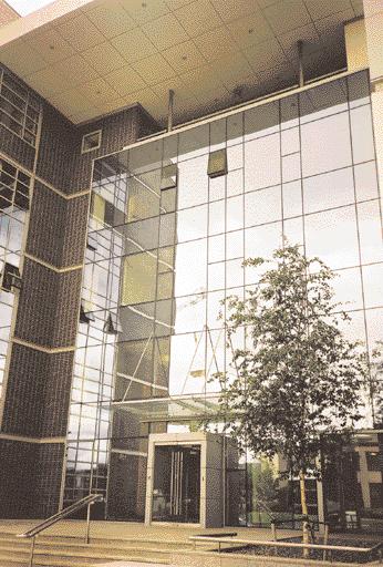
5 REGENERATION AND NEW 3 The main transportation infrastructure in the Cherrywood Rathmichael area will consist of the improved N11, the Wyattville Interchange, the South Eastern Motorway, the Wyattville Link Road, the improved Stonebridge Road, a Spine Road, internal road layout and the LUAS B1 line with its three stations at Carrickmines, Lehaunstown and Cherrywood. A potential LUAS B2 line with its station at St Columcille s Hospital can be provided across the Cherrywood Viaduct and can continue towards Shankill and Shanganagh/Woodbrook. Photo: Dun Laoghaire Harbour Company The South Eastern Motorway is nearing completion with interchanges at Carrickmines, Lehaunstown, a new bridge over the Brides Glen Road and altered road and junction arrangements in the Mullinastill/Stonebridge Road area. Design improvements will be necessary at the Lehaunstown Interchange on the SEM, with a new crossroads on the Wyattville Link. Water and drainage improvements, in addition to those already developed, will be implemented. Development at Cherrywood will require the provision of the following key infrastructural works LUAS Line B1 from Sandyford The Lehaunstown Interchange Upgrade New water supply scheme to serve Cherrywood and environs Surface water and foul drainage schemes. The core of the new Cherrywood Rathmichael Area will be north of the Wyattville Link Road, with the first phase built around the Cherrywood LUAS stop. The core will contain retail development, community and cultural facilities, cinemas, commercial development, offices, leisure facilities, underground car parking, bus interchange, mixed use developments of residential use over commercial uses, health facilities, hotel, educational facilities etc. However it is important to note that this is predicated on the provision of the Cherrywood LUAS terminus. DLRCOCO - Development Plan

6 3 REGENERATION AND NEW To the north of the core of the Cherrywood Rathmichael area there will be extensive residential areas close to the LUAS line and stations. To the north west, parallel to the SEM, there will be employment areas and business parks. To the south there will be the science and technology park. Open spaces will be created in the river valleys, on the high ground around Tully Church, on the high ground to the west of the motorway at Ticknick and along the Brides Glen Road. To the south of the Bride s Glen Road there will be residential development; to the east of Cherrywood Road (outside the local area plan boundary), there will be residential development near St Columcille s Hospital centred on a proposed LUAS B2 station. Broad ranges in respect of the quantum of development are proposed. More detail will be presented for individual development areas in the Local Area Plan. It is important to note that there are longer-term projections beyond the year The potential number of residential units will provide for a population of c.20,000 persons. High density residential development will be considered where development complies with the criteria as set out in Residential Density Guidelines. Net residential densities should be greater than 50 units per hectare within the 0.5 1km LUAS catchment area, and a higher net density of 80 units per hectare within 0 0.5km catchment area of LUAS stations along LUAS Line B1. Lands formerly proposed for the location of a golf course, abutting the SEM to the east, are now partly designated for residential development. The retail function of the Cherrywood Rathmichael Area will expand with a floor area of 35,000 sq.m. Growth of the retail element will be linked to the population and employment growth in the area, and permitted on a phased basis. The Local Area Plan will also provide for neighbourhood centres appropriate to the retail/community needs of the area. It is envisaged that the number of employees would in the long term be c10,000 workers. It is envisaged that development will be fully integrated and create a sustainable community that integrates living, working and leisure activities served by appropriate levels of retail use and community facilities. Development at the proposed Town Centre will be permitted subject to the preparation of an Urban Design Master Plan. This Master Plan will provide for a unified town centre layout, integrated with the adjoining land uses. Cherrywood Rathmichael Local Area Plan will be developed with a strong emphasis on linking areas of public open space and development of green corridors as pedestrian and cycle routes, encouraging maximum permeability and movement throughout the area. Development in the new Cherrywood Rathmichael area will be subject to the following specific objectives: To create a linear riverside park incorporating a pedestrian route and cycleway which will link Cabinteely Park to the sea at Hackett s land. To provide for an adequate open space setting for Tully Church. That public sports fields be provided west of Lehaunstown Lane. To retain the famine grave on the site adjacent to St. Columcilles Hospital. To provide for the Bride s Glen as a public amenity area. To upgrade Lehaunstown Interchange and the Wyattville Link Road. To relocate the proposed golf course to the south west side of the South Eastern Motorway. To provide for a Retail Park. To prepare an urban design Master Plan to ensure co-ordinated development of the Town Centre. To promote upgrading in capacity of water supply/new water supply/reservoir. To designate neighbourhood centres to serve the community, generally located at LUAS stations. To identify community/recreational and educational requirements. To provide for pedestrian and cycleway linkages/routes linking development either side of the Wyattville Link Road to ensure maximum permeability throughout the 32 DLRCOCO - Development Plan

7 REGENERATION AND NEW 3 plan area. To provide a pedestrian right of way from the Brides Glen Road to the Town Centre to link Cherrywood with Rathmichael. To provide a LUAS/metro stop at Rathmichael to the rear of St. Columcilles Hospital with access from both sides of the LUAS line i.e. from Falls Road and the N11.(N.B., This is outside the local area plan boundary) To carry out a study of the biodiversity of the Brides Glen, Loughlinstown River and native forest. To develop landmark buildings near the Carrickmines Interchange, the junction of the South Eastern Motorway and M11 and in the Town Centre at Cherrywood. To provide new forms of energy efficient house types and ecological house types. Detailed road layouts within the Cherrywood Rathmichael area will be examined as part of the Local Area Plan process. Road layouts shown are indicative only and may be subject to amendment during the Local Area Plan process. It is proposed that development within the Cherrywood Rathmichael area be subject to a schedule of phasing. The purpose of phasing is to ensure infrastructure, services, facilities and amenities are provided together with residential development Policy REG3: Public Transport Facilities It is Council policy that only limited development shall take place in the Cherrywood - Rathmichael area until the light rail/bus public transport facilities which will facilitate the development of the area in a sustainable manner are advanced Policy REG4: Cherrywood Town Centre It is Council policy that the District Centre zoning remain on the Cherrywood site until such time as it is confirmed that the area will be serviced by the LUAS line. The town centre shall not commence until such time as the LUAS contract is signed Rathmichael (1) The Council recognises the value of the buffer zone between the non-development mountain high amenity areas and the suburban areas. It also recognises the special environment and the distinctive character of the Rathmichael, Ballycorus areas and the sense of place that derives from that character. Accordingly a low density zoning is appropriate in the buffer areas. This will ensure a graduation in housing densities up to the high amenity areas. It permits the retention of hedgerow, woodlands, flora and fauna, equestrian activities, walking and other passive recreation and access to mountains and forest trails and sites of historical and archaeological interest. (2) It is a further objective to seek a high level of design, the careful locating of houses and the use of extensive landscaping and planting so as to protect the existing amenities of the area Bray Environs Local Area Plan There is a need to approach the future requirements of Bray in a more comprehensive way than has been previously done to ensure more sound and integrated development and to look at this area as one complete unit in planning and transportation terms. A Local Area Plan will be prepared for the Bray environs including Woodbrook and Old Conna in conjunction with residents and adjoining planning authorities. This new Local Area Plan will emphasise the need to establish a sense of place and community. It will define the principles of the layout of spaces, streets, squares, and how movement relates to them. The Local Area Plan will set out the overall form of development, it will create a place of distinction and will harness particular site characteristics trees, hedgerows and stone walls, public transport nodes and will retain and protect historic buildings. The intention is to create a village core in Old Conna and a new neighbourhood at Woodbrook centred on a high quality development around a new Woodbrook DART Station with bus and light rail interchange facilities. DLRCOCO - Development Plan


8 3 REGENERATION AND NEW Water and drainage improvements, in addition to those already developed, will be implemented. The lands in the Bray environs will have the benefit of access to the DART Line and will be served by the proposed light rail line to the city centre and Dublin Airport. A new QBC is underway at the Dublin Road linking Bray to Foxrock. The M11 Motorway leading to the M50 is easily accessible from the Wilford roundabout. Attention will be paid to the physical form of development routes, spaces, the urban grain, density, mix of uses, height and massing, the public realm, landscape, etc. The Local Area Plan will contain specific objectives including detailed zonings. Development of the Bray environs is based on the following principles: The provision of retail development, community and cultural facilities, commercial development, offices, leisure facilities, bus interchange, mixed use developments of residential use over commercial uses, health facilities, educational facilities etc. To facilitate the provision of a DART station with bus and light rail interchange facilities at Woodbrook. To reinforce the importance of Bray as a Major Town Centre by facilitating its development in the Bray environs, particularly in the area close to Castle Street. To facilitate residential development to assist in achieving the housing requirements of both Dun Laoghaire- Rathdown and Bray Town Council Kiltiernan/Glenamuck-Local Area Plan This Local Area Plan will be prepared on foot of the Council objective to prepare a Local Village Plan for Kiltiernan and will have regard to the following principles: To protect and enhance the community infrastructure of the Church of Ireland. To encourage the provision of incubator units for craft industries in Kiltiernan. To facilitate the provision of a pitch for Wayside Celtic Football Club. To provide a Neighbourhood Centre. To carry out road improvements on the Enniskerry Road/Kiltiernan junctions with Ballycorus Road and Bishop s Lane Glencullen This Local Plan will be prepared on foot of the Council objectives to prepare a Local Village Plan for Glencullen that is in keeping with the unique rural character of Glencullen and to establish an Aquifer Protection Zone at Glencullen and accordingly to prohibit any development which would conflict with this objective. In order to deliver a comprehensive Local Plan for Glencullen it will be based on an understanding of the existing settlement, its character, the way it functions and the needs of local people. The detailed nature of the community-based submissions already received indicates that much relevant information is available and the Council will encourage active community participation in the preparation of the Local Plan, thus ensuring extensive public involvement and consultation Goatstown A Local Area Plan will be prepared for the Goatstown area and development will only be permitted in this area as necessary infrastructure becomes available Stillorgan A Local Area Plan for Stillorgan shall be prepared within a year of the new Development Plan to guide the future development within the lifetime of the County Development Plan concentrating on improvements to the public domain, encompassing a variety of zonings and sites. Good quality 34 DLRCOCO - Development Plan


9 REGENERATION AND NEW 3 residential developments shall be encouraged and preferably incorporated into future schemes such as the overflow carpark, Leisureplex, Blakes and Hamiltons Yard. 3.3 Dundrum Urban Structure Plan Introduction The aim of this Urban Structure Plan is to provide a clear and coherent vision to guide the future development of Dundrum. The Plan area is defined generally as the area between the LUAS line, the Dundrum Relief Road, the Taney Road/Upper Churchtown Road junction and the Wyckham By-Pass Route. It is mainly zoned for Major Town Centre uses, but with some parts zoned residential. This area is experiencing significant ongoing development including:- Dundrum By-pass Wyckham By-pass to Sandyford Road (Phase 1) Wyckham By-pass to Taney Road (Phase 2) Landmark LUAS Bridge LUAS line with two stations under construction Shopping centre under construction Apartment development The Framework for the Future Town Centre The area is framed by a number of physical elements which have a strong influence on its shape, growth and extent. These are shown on the accompanying Urban Structure Map and are: The LUAS line with two stations on the east flank of the town centre The Wyckham By-pass on the southern side The River Slang and Dundrum By-pass on the west The existing Main Street/Sandyford Road which forms the heart of the town centre and The Ballinteer Road/Upper Kilmacud Road which forms an important cross-roads with the Main Street, the centre of gravity, as it were, of the town centre Town Centre Renewal Planning Principles (1) Adherence to the County Development Plan policies and objectives which have a specific objective to upgrade the Dundrum town centre by: The preparation and implementation of an environmental improvement scheme for Dundrum Main Street. The control of advertising and of building facades through the development control process. The provision of a Bus/LUAS/Cycle interchange Encouraging an undercroft development at Taney Bridge. N.B.The redevelopment of the environs of the LUAS Bridge and LRT Station provides a significant opportunity to create a new focal point and sense of enclosure at the northern end of the Main Street. This shall include new high quality buildings set around a civic space incorporating bus interchange with setdown facilities. (2) The provision of a pedestrian-friendly and traffic-calmed environment along the Main Street with particular care being paid to paving materials, public lighting, seating and pedestrian priority measures. (3) The selection of paving materials of appropriate scale and finish to enhance and complement the historic centre of Dundrum in the vicinity of the Protected Structures and the Architectural Conservation Area, while allowing other areas to develop with a separate style. (4) The provision of extensive off-street underground car parking facilities accessed from by-pass routes in order to reduce parked and moving vehicles on the Main Street and to serve new uses. (5) To increase penetration by buses as part of the Quality Bus Network, with particular emphasis on improved orbital routes. DLRCOCO - Development Plan
 The provision of a wide range of employment, leisure, entertainment, cultural and restaurant uses in the town centre.")
10 3 REGENERATION AND NEW (6) The provision of cycle facilities including a cycle network and cycle parking. (7) The provision of a wide range of employment, leisure, entertainment, cultural and restaurant uses in the town centre. (8) The provision of residential uses in the town centre including living over the shop, stand alone schemes, schemes for the elderly and hotel uses. In this way the existing residential use in the town centre will be strengthened. (9) The conservation, preservation and re-use of historic and interesting buildings. (10)The reinstatement and strengthening of the urban fabric along the Main Street and the Sandyford Road including infilling gap sites. This applies especially to the northern part of the town centre where a strong commercial presence is required. (11) The trees along the edge of the shopping centre carpark at the Main Street shall be retained in any new redevelopment in order to maintain high environmental standards in the regenerated town centre. (12) The provision of high quality landscaped open spaces, especially to the west of the town centre. (13) The new shopping centre currently under construction (former PYE lands), should provide and retain a wide variety of land uses including shopping, offices, residential, cinemas, bars, supermarkets, departmental store, cultural buildings including a library, crèche, hotel, clinic, leisure uses, multi-purpose meeting rooms/theatre, post office etc. These uses shall be linked along a new main pedestrian route which will connect the two LUAS stations, pedestrian bridges, footpaths and carparks. Lateral pedestrian routes will link to the main pedestrian route providing links between the Main Street/Sandyford Road axis and internal urban squares. Such squares should be sunny, sheltered and night-time friendly, with good supervision from surrounding buildings. (14) Pedestrian movement across the Ballinteer Road from the two sides of the town centre shall be safe, easy and convenient. This crossing should encourage and facilitate ease of pedestrian movement between the northern and southern parts of the town centre. (15) The Mill Pond and Mill House area will be the focus of one of the main public spaces with new buildings set around it in an attractive manner. The reuse of the Mill House as a Heritage Centre/Museum will be encouraged. (16) To produce a stronger streetscape by sensitive infilling of gaps in the urban fabric, reducing setbacks and encouraging new buildings close to the public footpath. (17) All new buildings shall respect the scale, materials and character of the town centre, be of attractive appearance and be visually interesting. 3.4 Stepaside The Stepaside Action Area Plan was prepared in response to the major rezoning of some 150 hectares of primarily residential lands in the 1998 County Development Plan. Significant on-site development activity has commenced. At the end of 2002 some 400 residential units were under construction but it is anticipated that, over the next 8-10 years, some 4,000-4,500 houses and apartments will be completed in the Action Plan area. As well as providing an obvious co-ordinating mechanism to considered and timely implementation of the new development area the primary aims and objectives of the Action Plan seek to: Facilitate an improved urban design both in site layouts and house types. The traditional low-density suburban estate layout is being actively discouraged in favour of schemes which display individuality and distinctiveness. Wherever possible the opportunity is being taken to 36 DLRCOCO - Development Plan


11 REGENERATION AND NEW 3 create focal points and a variety of spaces and places. Reflect the broad principles of sustainability through the promotion of a higher density environment which facilitates and encourages a reduction in private car usage. This is being achieved by ensuring ready access, primarily by walking and cycling, to as wide a range of local facilities that a community of this size would typically demand or require retail and community services, education provision, actively managed open space and public transport. Advance a mixed-use ethos into the new community by actively encouraging flexibility in the provision of employment, business and workspace accommodation. The enhancement of the overall level of public transport infrastructure to reduce reliance on the private car. The provision of a dedicated Greenway Spine traversing the Plan area that provides safe and dedicated cycling/walking linkages between the development parcels and amenities. To incorporate local heritage themes in the development of the Green Spineway. 3.5 Town and Village Improvement Schemes It is an objective of the Council to carry out environmental improvement schemes and streetscape plans where appropriate for the following town and village centres (both urban and rural) as resources permit. The Council may at its discretion, introduce schemes other than those listed in Table 3.1 below at any time during the life of the Development Plan. The listing does not indicate any order of priority for implementation. Table 3.1 Cornelscourt Cabinteely Dundrum Glencullen Sallynoggin Monkstown Farm Kiltiernan Foxrock Stillorgan Old Conna Loughlinstown Clonskeagh/Bird Avenue junction with Roebuck Road Little Bray Sandyford Village Kill O the Grange Williamstown Monkstown Village DLRCOCO - Development Plan


12 3 REGENERATION AND NEW DUNDRUM TOWN CENTRE URBAN STRUCTURE PLAN PL DLRCOCO - Development Plan
13
14 Introduction This section sets out a Structure Plan, the aim of which is to provide a clear and coherent vision to guide the future development of Dun Laoghaire Town Centre where currently significant areas of urban land are under-utilised and underdeveloped.
Woodbrook - Shanganagh
 Section 4: Key Sites Framework Strategy Woodbrook - Shanganagh Local Area Plan 2017-2023 4. Site Framework Strategies The Master Plans shall have regard to the thematic objectives under the LAP Development
6 Site Framework Strategies
 6 Site Framework Strategies 6.1 Introduction Section 6 identifies a number of specific areas which are considered to be key sites within the Plan area and which may have potential for development / redevelopment.
Chapter 5 Urban Design and Public Realm
 5.1 Introduction Public realm is all areas of the urban fabric to which the public have access. It is where physical interaction takes place between people. It therefore, includes buildings and their design,
Chapter 6: Development Areas
 Chapter 6: Development Areas 6 Development Areas Purpose of this section This chapter outlines the type, extent, scale and overall design ethos of the Planning Scheme. In order to do this in detail, the
MOUNT AVENUE MASTERPLAN WORKING DRAFT NOVEMBER 2006
 MOUNT AVENUE MASTERPLAN WORKING DRAFT NOVEMBER 2006 1 1. OVERALL MASTERPLAN IDENTITY: Dun Dealgan motte and bailey The Dun Dealgan motte and bailey, a national monument, is located to the north east of
4.5 Key Development Sites Site Development Frameworks
 4.4.4 Plot Ratio Plot ratio is a tool to help control the bulk and mass of buildings. It expresses the amount of floorspace in relation (proportionally) to the site area, and is determined by the gross
PART AOTEA PRECINCT
 CONTENTS... PAGE AOTEA PRECINCT...4 14.5.1 INTRODUCTION...4 14.5.2 RESOURCE MANAGEMENT ISSUES...4 14.5.3 RESOURCE MANAGEMENT OBJECTIVES AND POLICIES... 4 14.5.4 RESOURCE MANAGEMENT STRATEGY...5 14.5.5
Newcourt Masterplan. November Exeter Local Development Framework
 Newcourt Masterplan November 2010 Exeter Local Development Framework Background The Exeter Core Strategy Proposed Submission sets out the vision, objectives and strategy for the development of Exeter up
2.0 Strategic Context 4
 2.0 Strategic Context 4 2.1 The Area Action Plan is a non-statutory plan, which forms a corporate policy document, expressing particular issues and areas of concern while also providing a vision for the
Photo 4: Dart Line Traversing Plan Area. (c) Luas
 Luas") The Plan also envisages movement restrictions in and out of the development lands onto the Old Dublin Road in order to discourage traffic movement towards Shankill Village. Additional measures are proposed
The Plan also envisages movement restrictions in and out of the development lands onto the Old Dublin Road in order to discourage traffic movement towards Shankill Village. Additional measures are proposed
8.0 Design and Form of Development 43/
 42/ 8.0 Design and Form of Development 43/ Rothwells Farm, Golborne/ Development Statement Figure 7. Site Constraints Key 44/ Site Boundary 360 Bus Route/Stops Existing Trees Underground Water Pipe Sensitive
REMARKABLES PARK ZONE
 .10 Remarkables Park Zone.10.1 Resources, Activities and Values The Remarkables Park Area comprises approximately 150 hectares of perimeter urban land in the vicinity of Frankton and occupies a strategic
Page 1 of 19 URBAN DESIGN FRAMEWORK FOR BOLTON STREET WATERFORD
 Page 1 of 19 URBAN DESIGN FRAMEWORK FOR BOLTON STREET WATERFORD 1.0 Introduction: The relocation of the City Council stores and depot from Bolton Street creates an exciting opportunity for development
4 RESIDENTIAL ZONE. 4.1 Background
 4 RESIDENTIAL ZONE 4.1 Background The residential areas within the City are characterised by mainly lowrise dwellings sited on individual allotments. Past architectural styles, settlement patterns and
Rochford District Council Allocations Development Plan Document: Discussion and Consultation Document Sustainability Appraisal
 Option SWH1 Balanced Communities Option SWH1 1 To ensure the delivery of high quality sustainable communities where people want to live and work Will it ensure the phasing of infrastructure, including
CLOUGHJORDAN SETTLEMENT PLAN
 CLOUGHJORDAN SETTLEMENT PLAN 1.0 General Introduction and Development Context Location The market town of Cloughjordan lies close to the border with Offaly at the junction of the R490 and R491 Regional
DUBLIN DOCKLANDS MASTER PLAN AND RELATIONSHIP WITH OTHER PLANS
 .1 National Policy and Programmes.1.1 Sustainable Development A Strategy for Ireland, 1997.1.2 National Climate Change Strategy, 2007-2012.1. National Development Plan 2007-201.1.4 National Spatial Strategy,
17. Coolaney-Rockfield Mini-Plan
 County Development Plan 2017-2023 Consolidated Draft + Adopted Amendments - August 2017 17. Coolaney-Rockfield Mini-Plan Village profile Coolaney is located approximately 23 km to the south-west of Sligo
BORRISOKANE SETTLEMENT PLAN
 BORRISOKANE SETTLEMENT PLAN 1.0 General Introduction and Development Context Location Borrisokane is located 15km north of Nenagh on the N52. While the town is primarily residential, it acts as a market
Carton Avenue Action Area Plan Maynooth
 Carton Avenue Action Area Plan Maynooth Kildare County Council JULY 2006 (AAP) Table of Contents Section 1. Introduction...3 Statement of Strategy...3 Location of the Lands...3 Context in the Town Development
Tauranga City Centre Spatial Framework
 Tauranga City Centre Spatial Framework Stakeholder Engagement Workshop 15 October 2015 Project Design Team Beca & LandLAB Our team Henry Crothers (LandLab) Landscape Architect/Urban Designer Urban and
Colchester Northern Gateway Master Plan Vision Review Draft. July 2016
 Colchester Northern Gateway Master Plan Vision Review Draft July 2016 Contents Introduction 4 Context 8 Purpose of the Report 8 Strategic Position 9 Overview of the Process 11 2012 Master Plan Vision 12
The Proposed Auckland Unitary Plan (notified 30 September 2013)
") 3 Business zones Introduction There are 10 business zones in the Unitary Plan: City Centre Metropolitan Centre Town Centre Local Centre Neighbourhood Centre Mixed Use General Business Business Park Light
3 Business zones Introduction There are 10 business zones in the Unitary Plan: City Centre Metropolitan Centre Town Centre Local Centre Neighbourhood Centre Mixed Use General Business Business Park Light
I615. Westgate Precinct
 I615. Westgate Precinct I615.1. Precinct Description The Westgate Precinct is located approximately 18km west of the Auckland city centre. There are seven Sub-precincts in the Westgate Precinct: Sub-precinct
BLETCHLEY PARK AREA - DEVELOPMENT FRAMEWORK
 ANNEX A To Item 9 REVISED TEXT: additions shown bold and underlined, deletions in (brackets and in italics). BLETCHLEY PARK AREA - DEVELOPMENT FRAMEWORK This framework sets out the key objectives and requirements
Proposed Amendment to the
 Proposed Amendment to the Carrigaline Electoral Area Local Area Plan Amendment No 1: Carrigaline (T-02, O-02 & U-02) August 2012 Proposed Amendment to the Carriagline Electoral Area Local Area Plan 2011
Chapter 2: OUTLINE PLANNING APPLICATION PROPOSALS. A New Garden Neighbourhood Matford Barton 17
 Chapter 2: OUTLINE PLANNING APPLICATION PROPOSALS A New Garden Neighbourhood Matford Barton 17 2.1. SUMMARY AND STATUS OF THE PROPOSALS 2.1.1. The parameter plans and associated wording in this chapter
Welcome to our exhibition
 Welcome to our exhibition The Homes & Communities Agency (HCA) welcomes you to this public exhibition explaining our proposals for the redevelopment of the former Lea Castle Hospital site. About the Homes
28. Coolaney-Rockfield Mini-Plan
 28. Coolaney-Rockfield Mini-Plan 28. Coolaney-Rockfield Mini-Plan Community facilities Community facilities in Coolaney-Rockfield consist of a primary school, crèche, community centre, sports field and
Urban Design Guidelines
 Urban Design Guidelines These Urban Design Guidelines comprise the Key Design Objectives below, the Roads Design Guidelines overleaf and Neighbourhood Framework Plans. Together with Section 3: Urban Design
Northern Territory Compact Urban Growth Policy
 Northern Territory Compact Urban Growth Policy A Reference Policy Document to clause 2.7 (Reference to Policy) of the NT Planning Scheme May 2015 Table of Contents 1 Policy Setting... 3 1.1 Context for
Chapter 4: Public Realm Strategy
 Chapter 4: Public Realm Strategy 4 Public Realm Strategy This Section details the Public Realm Strategy for the Town Centre required by Sections 6.2 (e) and 6.2 (g) of the Planning Scheme to address 'the
30. Riverstown Mini-Plan
 County Development Plan 2017-2023 Consolidated Draft + Adopted Amendments August 2017 Volume 2, Chapter 30 Riverstown Mini-Plan 30. Riverstown Mini-Plan Village profile Riverstown is located approximately
WELLINGTON HOSPITAL DESIGN GUIDE TABLE OF CONTENTS
 WELLINGTON HOSPITAL DESIGN GUIDE TABLE OF CONTENTS 1.0 Introduction Page 2 The Place of Wellington Hospital 2 The Future of the Hospital 2 2.0 The Intention of the Design Guide 3 3.0 Analysis 4 General
East Grove Public Realm
 H - - MP - Elephant Park Public Realm RO EY DN NEW KENT ROAD E AC PL The public realm has been designed to create an environment which is easy to move through, accessible to all, safe and playful. The
PROPOSED REDEVELOPMENT OF THE GLEN ABBEY GOLF CLUB. STREETSCAPE DESIGN STUDY (excerpt from the Urban Design Brief) TOWN OF OAKVILLE.
 TOWN OF OAKVILLE.") PROPOSED REDEVELOPMENT OF THE GLEN ABBEY GOLF CLUB STREETSCAPE DESIGN STUDY (excerpt from the Urban Design Brief) TOWN OF OAKVILLE OCTOBER, 2016 for 2.4.2 STREETS Streets are the single largest component
PROPOSED REDEVELOPMENT OF THE GLEN ABBEY GOLF CLUB STREETSCAPE DESIGN STUDY (excerpt from the Urban Design Brief) TOWN OF OAKVILLE OCTOBER, 2016 for 2.4.2 STREETS Streets are the single largest component
elbridge Core Strategy
 C elbridge Core Strategy Celbridge is designated as a Moderate Growth Town in the RPGs. The County Development Plan reinforces this designation in its settlement strategy. Moderate Growth Towns within
DAREBIN PLANNING SCHEME AMENDMENT C137
 Who is the planning authority? Planning and Environment Act 1987 DAREBIN PLANNING SCHEME AMENDMENT C137 EXPLANATORY REPORT This amendment has been prepared by the Darebin City Council, who is the planning
OKEFORD FITZPAINE NEIGHBOURHOOD PLAN
 OKEFORD FITZPAINE NEIGHBOURHOOD PLAN Dear Parishioner, The Neighbourhood Plan Project Team have prepared this leaflet to summarise the full Neighbourhood Plan document. It provides a summary of the Vision,
Clairtrell Area Context Plan
 Clairtrell Area Context Plan March 2005 Urban Development Services City Planning Contents 1. Introduction... 4 2. Development Structure... 6 2.1 Streets... 7 2.1.1 Sheppard Avenue and Bayview Avenue...
Kibworth Harcourt. Introduction. Introduction
 Introduction Introduction Welcome to this public exhibition on the proposals for the delivery of new homes on land at The Kibworths. The purpose of today s exhibition is to give you the opportunity to
and services The protection and conservation of environmentally significant and sensitive natural heritage features and functions.
 6. Land Use 6.0 Preamble A healthy and livable city is one in which people can enjoy a vibrant economy and a sustainable healthy environment in safe, caring and diverse neighbourhoods. In order to ensure
PORT WHITBY COMMUNITY
 PORT WHITBY COMMUNITY SECONDARY PLAN UPDATE COMMUNITY IMPROVEMENT PLAN URBAN DESIGN GUIDELINES September 2015 DRAFT PROPOSED AMENDMENT NUMBER # to the Whitby Official Plan PURPOSE: The intent of this Amendment
COMMUNITY DESIGN. GOAL: Create livable and attractive communities. Intent
 COMMUNITY DESIGN Intent An attractive, well-designed County will attract quality development, instill civic pride, improve the visual character of the community, and create a strong, positive image for
PLANNING APPLICATION REPORT
 PLANNING APPLICATION REPORT CONTENTS 1.0 Introduction 1 2.0 Overview of Current Application 3 3.0 Compliance with Cherrywood Planning Scheme 2014 & UFDF 12 4.0 Compliance with Ministerial Guidelines 22
Chapter 5: Green Infrastructure
 5 Green Infrastructure 5.1 Introduction Figure 5.1: Cherrywood Way The Planning Scheme aims to create a viable green infrastructure and open space network that conserves, maintains and enhances the unique
3.3. Urban Structure Defining a New Hierarchy of Routes and Spaces >Images
 Section 3.0 I The Masterplan Framework 18 >Images Examples of high quality routes and spaces 3.3. Urban Structure The success of any masterplan lies in a clear definition of the future urban structure
APPENDIX A: Kilternan Neighbourhood Framework Plan
 APPENDIX A: Kilternan Neighbourhood Framework Plan 95 www.dlrcoco.ie Kilternan Neighbourhood Framework Plan January 2010 dlr Architects Department dlr Planning Department Contents: Kilternan Neighbourhood
Keystone Business Park Precinct Structure Plan North East Industrial Precinct. Part 2 Design Principles
 Keystone Business Park Precinct Structure Plan North East Industrial Precinct Part 2 Design Principles Context Issues Services Landform Issues Geotech and contamination Ecology Traffic and access Issues
6. Ballintogher Mini-Plan
 County Development Plan 2017-2023 Consolidated Draft + Adopted Amendments August 2017 Volume 2, Chapter 6 Ballintogher Mini-Plan 6. Ballintogher Mini-Plan Village profile Ballintogher is located approximately
97 Lea Bridge Road, Leyton, E10 7QL London Borough of Waltham Forest December 2015
 97 Lea Bridge Road, Leyton, E10 7QL London Borough of Waltham Forest December 2015 Public Realm and Landscape Proposals LEA BRIDGE ROAD, WALTHAMSTOW Public Realm & Landscape Proposals BDP(90)RPT001 December
INCREMENTAL CHANGE AREA REVIEW March 2015 Page 1
 INCREMENTAL CHANGE AREA REVIEW March 2015 Page 1 Table of Contents Introduction... 3 Background to Review... 3 Comparison of the Schedules to the General Residential Zone... 7 Methodology... 7 Policy Context...
COUNTY DEVELOPMENT PLAN Appendix 15 Sandyford Urban Framework Plan
 COUNTY DEVELOPMENT PLAN 06-0 Appendix 5 Sandyford Urban Framework Plan 06-0 dlrcoco County Development Plan 06-0 APPENDIX 5 Contents Section : Introduction 4.. Background to the Plan 4. The Legal Status
Kiltiernan Glenamuck Local Area Plan 2013
 www.dlrcoco.ie Kiltiernan Glenamuck Local Area Plan 2013 Comhairle Chontae Dhún Laoghaire - Rath an Dúin Dún Laoghaire-Rathdown County Council A SEPTEMBER 2013 Kiltiernan/Glenamuck Local Area Plan 2013
TOWN CENTRE (TC 1-4) URBAN FORM DEVELOPMENT FRAMEWORK Cherrywood Planning Scheme
 URBAN FORM DEVELOPMENT FRAMEWORK Cherrywood Planning Scheme") TOWN CENTRE (TC 1-4) URBAN FORM DEVELOPMENT FRAMEWORK Cherrywood Planning Scheme September 2017 B Cherrywood Town Centre Urban Form Development Framework September 2017 Contents 1 INTRODUCTION 3 1.1 Background
TOWN CENTRE (TC 1-4) URBAN FORM DEVELOPMENT FRAMEWORK Cherrywood Planning Scheme September 2017 B Cherrywood Town Centre Urban Form Development Framework September 2017 Contents 1 INTRODUCTION 3 1.1 Background
GREENBANK DEVELOPMENT MASTERPLAN
 DEVELOPMENT MASTERPLAN POTENTIAL TRAIN STATION COMMUNITY CENTRE Greenbank will be a connected masterplanned community providing easy access to local and surrounding amenity. Affordable quality homes, green
ILLUSTRATIVE MASTERPLAN
 ILLUSTRATIVE MASTERPLAN The Development Dairy Crest (Imperial College) The Proposed Development aims to create a new high quality residential neighbourhood, alongside a new public park for White City.
20. Ballysadare Mini-Plan
 20. Ballysadare Mini-Plan 20. Ballysadare Mini-Plan Community facilities Ballysadare has a wide range of community facilities: a primary school, St Mary s College (secondary school), a health centre, playing
Section 4 - Public Realm & Landscape proposals Landscape Masterplan. Section 4 52
 - Public Realm & Landscape proposals Landscape Masterplan 52 Proposed Masterplan - Green Infrastructure Strategy District Park 4.33 Ha to provide Passive and active recreation with a large play area which
INTRODUCTION THE VISION HALTON HEALTHY NEW TOWN WELCOME
 WELCOME INTRODUCTION Castlefields Welcome and thank you for visiting this exhibition on the emerging Masterplan. The Slopes Halton Village is one of ten demonstrator sites across the UK chosen to represent
15 Urban Design Guidelines
 15 Urban Design Guidelines Aim: To create vibrant and bustling towns and villages with a diverse mix of activities where residents can benefit from quality urban living. 15.1 Background Through the planning
To the Lord Mayor and Report No. 312/
 To the Lord Mayor and Report No. 312/2017 Members of Dublin City Council Report of the Chief Executive Dublin City Council -----------------------------------------------------------------------------------------------------------
Public Consultation. Land at Monks Farm, North Grove. Welcome
 Welcome Welcome to our public exhibition for development on Land at Monks Farm, orth Grove. Gallagher Estates and Gleeson Strategic Land are preparing an outline planning application for new homes, open
01 the vision NEW LYNN IS WAITING FOR THE GREAT LEAP FORWARD
 [A] FRAMEWORK 01 the vision 02 the framework 03 urban design principles 04 c o n t e x t 05 issues a n d o p p o r t u n i t i e s 06 creating a t.o.d. 07 key recommendations 08 seven strategic areas of
I539. Smales 2 Precinct
 I539. Smales 2 Precinct I539.1. Precinct Description The Smales 2 Precinct applies to a 4.8 hectare block of land located on the southern side of Northcote Road and fronting Lake Pupuke, Takapuna. The
Design Guidance. Introduction, Approach and Design Principles. Mauritius. November Ministry of Housing and Lands. .. a
 sig evelo r D Mauritius s. Utilities.. Individu a s. er itects.to ls chpers.po e Public. T. h rban D Sc U e me Promot e h ners. A Design Guidance o.h Planne rs n w iticians r l useholde National Development
Horwood Map of London, Westminster & Southwark First edition
 Barratt London is developing plans in tandem with Southwark Council and TfL to transform the southern end of Blackfriars Road. The residential-led, mixed-use scheme will deliver new private and affordable
WELCOME GYPSY LANE. Wider Site Location plan. Proposals for the development of LAND OFF FOXLYDIATE LANE WEBHEATH. Proposals for the development of
 WELCOME The developers are preparing an outline planning application for a residential led development and need the community s views in order to develop the proposals further WHAT IS PROPOSED? A high
Oscar Traynor Road Land Initiative Project
 Oscar Traynor Road Land Initiative Project Page 1 INTRODUCTION This report has been prepared as a follow up document to the Housing Land Initiative Feasibility Study presented to the joint Housing and
Vision for Irvine: a self-confident town where people aspire to live and work and which they are proud to call home
 Vision for Irvine: a self-confident town where people aspire to live and work and which they are proud to call home Stunning view out to the harbourside Artist s impression of how the Bridgegate area could
URBAN DESIGN BRIEF URBAN DESIGN BRIEF 721 FRANKLIN BLVD, CAMBRIDGE August 2018
 URBAN DESIGN BRIEF URBAN DESIGN BRIEF 721 FRANKLIN BLVD, CAMBRIDGE August 2018 DESIGN BRIEF CONTENTS PART A 1.0 INTRODUCTION 2.0 DESCRIPTION & ANALYSIS OF SITE CONTEXT 3.0 DESIGN CONSTRAINTS AND OPPORTUNITIES
WELCOME. Land North of STEVENAGE. We would like to thank you for attending our public exhibition today.
 WELCOME We would like to thank you for attending our public exhibition today. The purpose of this event is to share our proposals and hear your thoughts on our ideas. Members of the project team are on
UNIVERSITY TOWN NEIGHBOURHOODS 5.5 HOUSING MELBOURNE CAMPUS MASTER PLAN 2014
 5.5 169 EXISTING CONDITIONS & VISION NEIGHBOURHOOD VISION The provision of on-campus housing into the future will continue to be an important element of the La Trobe University experience. A long-term
3.1 The hybrid planning application proposes the following description of development:
 CHAPTER 3: PROPOSED DEVELOPMENT 3.1 The hybrid planning application proposes the following description of development: Hybrid (part-outline/part-full) planning application for a single composite development
Sustainable Communities Strategy
 Sustainable Communities Strategy 31 3 Vision Statement: To develop sustainable and successful communities across the County both through the continuing consolidation and redevelopment of the established
WHITELEY TOWN COUNCIL NORTH WHITELEY DEVELOPMENT SEPTEMBER 2014
 WHITELEY TOWN COUNCIL NORTH WHITELEY DEVELOPMENT SEPTEMBER 2014 Dear Resident This Special Edition of the Whiteley Voice which has been prepared in conjunction with the North Whiteley Consortium is to
GREENFORD HALL & ADJOINING LAND
 GREENFORD HALL & ADJOINING LAND CONTENTS 1. Introduction 1. Introduction 2. Urban Context 2.1 The Site and Surroundings 2.2 Urban Context Map 2.3 Access and Movement 3. Planning Context 3.1 Planning History
Rotherhithe Rotherhithe Area Vision Map
 Area Vision Map CWAAP1 Improved pedestrian and cycle links to the wider area Improved link from town centre to River Thames and docks CWAAP2 Brunel Museum NSP79 CWAAP3 Proposed Thames Crossing Station
Housing Development at Balloonagh Tralee Co Kerry
 Design Statement Housing Development at Balloonagh Tralee Co Kerry Area of site 10,400m2 24 houses-12no 3 bed, 12no 2 bed and 4 single bed apartments total residential area of 2411m2 Open space provided
MEETING OF DÚN LAOGHAIRE-RATHDOWN COUNTY COUNCIL 7 TH JULY 2014 PROPOSED HOUSING DEVELOPMENT, CLONTIBRET HOUSE, FRASCATI ROAD, BLACKROCK, CO.
 MEETING OF DÚN LAOGHAIRE-RATHDOWN COUNTY COUNCIL 7 TH JULY 2014 PROPOSED HOUSING DEVELOPMENT, CLONTIBRET HOUSE, FRASCATI ROAD, BLACKROCK, CO. DUBLIN IN ACCORDANCE WITH PART 8, ARTICLE 81 OF THE PLANNING
Hockessin Community Redevelopment Plan
 Hockessin Community Redevelopment Plan 3.1 Introduction The Community Redevelopment Plan for the Village of Hockessin is the result of the people s vision for a distinct village center that serves as the
3.0 Area-Wide Strategies 30
 3.0 Area-Wide Strategies 30 3.6 Tourism Strategy This section of the plan aims to develop and improve the tourism potential of the area. Strategic Context The City Plan outlines the potential of Cork to
Subdivision Design Criteria. Penihana North GUIDELINES TO THE RULES
 Created September 2013 Penihana North Subdivision Design Criteria GUIDELINES TO THE RULES This part of the Plan sets out the design criteria for subdivision in Penihana North. The criteria will be considered
35. Gorteen Mini-Plan
 35. Gorteen Mini-Plan 35. Gorteen Mini-Plan Community facilities Community facilities in Gorteen consist of a crèche, community centre, sports field, church, burial ground and health centre. The former
East Dulwich East Dulwich Area Vision Map
 Area Vision Map Denmark Hill Station Peckham Rye Station Nunhead Station Peckham Rye NSP38 Station NSP37 Goose Green NSP39 North Dulwich Station Key: Dulwich Village NSP40 St Barnabas Church Court Lane
SUBMISSION TO DRAFT FINGAL COUNTY DEVELOPMENT PLAN RE: LANDS AT CASTLEKNOCK VILLAGE CENTRE
 April 2016 SUBMISSION TO DRAFT FINGAL COUNTY DEVELOPMENT PLAN 2017-2023 RE: LANDS AT CASTLEKNOCK VILLAGE CENTRE On behalf of: Lidl Ireland GmbH Submitted to: Planning & Strategic Infrastructure Department
YONGE STEELES CORRIDOR SECONDARY PLAN. Young + Wright / IBI Group Architects Dillon Consulting Ltd. GHK International (Canada) Ltd.
 Ltd.") PART A: PREAMBLE 1.0 PURPOSE The purpose of this Secondary Plan is to provide a development framework for intensification of the Yonge/ Steeles corridor including the north side of Steeles Avenue West
PART A: PREAMBLE 1.0 PURPOSE The purpose of this Secondary Plan is to provide a development framework for intensification of the Yonge/ Steeles corridor including the north side of Steeles Avenue West
Planning Districts INTRODUCTION
 INTRODUCTION To facilitate detailed examination of development prospects for all areas of the community, Delano has been divided into 14 planning districts. The location of these planning districts is
EVALUATION OF MASTER PLAN ALTERNATIVES
 7 The Environmental Report is required to identify, describe and evaluate reasonable alternatives, taking into account the objectives and geographical scope of the Master Plan 2008. Three plan alternatives
PHASE III: Reserved Matters Submission
 Statement of Compliance with the outline approval for the proposed residential development of land at: BURGES LANE, WIVELISCOMBE PHASE III: Reserved Matters Submission Foreword Contents: This Statement
QUEEN-RIVER SECONDARY PLAN
 34 QUEEN-RIVER SECONDARY PLAN 34. QUEEN RIVER SECONDARY PLAN 1. INTRODUCTION The Queen-River area is approximately 6.4 hectares and is located at the eastern edge of the Downtown as shown on Map 34-1.
The journey so far. The new masterplan for Dargavel Village
 The journey so far Our vision for Dargavel Village began over ten years ago when the original masterplan for transforming the former Royal Ordnance Factory site into a thriving community was established.
Former Rockcliffe Airbase Community Design Plan Guiding Design Vision and Principles December 4, 2013
 APPENDIX 5 - Guiding Design Vision and Principles Former Rockcliffe Airbase Community Design Plan Guiding Design Vision and Principles December 4, 2013 Vision Statement The redevelopment of the former
GUIDELINES WESTON LOCATION: URBAN DESIGN GUIDELINES
 Development in the Weston area will be consistent with the following urban design guidelines. The guidelines correspond to Site and Area Specific Policies 45, 46, 47, 48, 49, 51, 52 and 232 in Chapter
EXISTING COMPREHENSIVE PLAN
 EXISTING COMPREHENSIVE PLAN Town Center Land Use Element: V. LAND USE POLICIES Town Center Mercer Island's business district vision as described in "Your Mercer Island Citizen-Designed Downtown" was an
PUTTING THE HEART INTO BATTERSEA. A vision
 PUTTING THE HEART INTO BATTERSEA A vision INTRODUCTION This document is a vision for creating a Battersea that its community can be proud of and it is about putting Battersea on the map. It is being proposed
[PLANNING RATIONALE] For Site Plan Control and Lifting of Holding Zone By-Law 101 Champagne Avenue. May 23, 2014
![[PLANNING RATIONALE] For Site Plan Control and Lifting of Holding Zone By-Law 101 Champagne Avenue. May 23, 2014](/thumbs/75/71599615.jpg "[PLANNING RATIONALE] For Site Plan Control and Lifting of Holding Zone By-Law 101 Champagne Avenue. May 23, 2014") [PLANNING RATIONALE] For Site Plan Control and Lifting of Holding Zone By-Law 101 Champagne Avenue May 23, 2014 Contents 1.0 Introduction... 2 2.0 Site Context... 2 2.1 Adjacent Uses... 2 Figure 1: Site
[PLANNING RATIONALE] For Site Plan Control and Lifting of Holding Zone By-Law 101 Champagne Avenue May 23, 2014 Contents 1.0 Introduction... 2 2.0 Site Context... 2 2.1 Adjacent Uses... 2 Figure 1: Site
SPG 1. * the northern and western sections which are open fields used for pasture and grazing;
 SPG 1 1.0 INTRODUCTION This development brief is based on the allocation of the Priors Hall site for employment and countryside recreational purposes in the Corby Borough Local Plan. The brief is intended
Appendix 1 Structure plan guidelines
 Appendix 1 Structure plan guidelines This appendix forms part of the regional policy statement [rps]. 1.1. Introduction Structure plans are an important method for establishing the pattern of land use
Figure 3-1: Public Realm Plan
 3 Public Realm Figure 3-1: Public Realm Plan 3.1 Public Realm Concept The public realm concept for the Little Mountain site integrates a clear and accessible movement network with public spaces for social