DRAFT COMPREHENSIVE PLAN UPDATE CITY OF CREVE COEUR. DRAFT RECOMMENDATIONS PRESENTATION Planning & Zoning Commission STUDIO TEAM
|
|
|
- Brent Asher Ball
- 5 years ago
- Views:
Transcription


1 CITY OF CREVE COEUR RECOMMENDATIONS PRESENTATION Planning & Zoning Commission STUDIO TEAM J u n e 2,


2 PROJECT OBJECTIVE: A COMPREHENSIVE PLAN A comprehensive plan is an official document, adopted by a city as a policy guide to decisions about the physical, social, cultural, recreational, and economic development of the community over a 15 to 20 year timeframe. This includes land use, infrastructure, transportation, public facilities, physical development, capital improvement priorities, governance, and operations. Typically, comprehensive plans are updated every 10 years


3 VISION STATEMENT Creve Coeur will continue to prosper, improve livability, and become environmentally responsive by preserving and capitalizing on new opportunities for the City s key commercial, residential, environmental, and civic assets. Through comprehensive place-making, Creve Coeur will develop a unique and recognizable physical identity; create healthy and vibrant neighborhoods; and become a regional leading green and environmentally-friendly community.
4 COMPREHENSIVE PLAN GOALS 1. Placemaking & Community Identity 2. Residential Development & Preservation 3. Economic Growth & Community Services 4. Community Amenities & Facilities 5. Parks, Open Space & Environment 6. Transportation, Connectivity & Mobility 7. Community Sustainability & Resilience

5 COMPREHENSIVE PLAN Placemaking & Community Identity [Land Use]
6 GOAL 1: Placemaking & Community Identity Creve Coeur will establish a unique regional identity and develop a 18/7 community experience to become a great place to live, shop, work, and play!
7 GOAL 1: Placemaking & Community Identity 1. Create mixed use, walkable districts. 2. Improve walkability and bikeability. 3. Improve city streetscapes and continue public realm enhancements. 4. Celebrate the community with identifiable gateways and public art. 5. Preserve high quality existing neighborhoods and community assets. 6. Support high quality, contemporary architecture and development. 7. Ensure cultural, arts, educational, and entertainment opportunities throughout the community. 8. Update the City s zoning code to facilitate and promote development that matches the community s vision for Creve Coeur. 9. Ensure that adjacent non residential and residential development is compatible with each other. 10. Improve the quality of new development by revising architectural design guidelines and establishing lot development standards, including illustrations of desired development patterns. 11. Require landscape buffer zones between non residential uses and residential districts. 12. Preserve Creve Coeur s historic properties. 13. Provide an increased number of community events and programs. 14. Develop a central gathering place that is the heart of the community.
8 EXISTING CONDITIONS ZONING 1. A Single Family Residential 2. B Single Family Residential 3. C Single Family Residential 4. D Single Family Residential 5. AR Attached Single Family Residential 6. HE Higher Education District 7. PH Planned Hospital District 8. PO Planned Office District 9. RO Research & Office District 10. MX Mixed Use District 11. PC Planned Community District 12. GC General Commercial District 13. CB Core Business District 14. LI Light Industrial District The current zoning & land use is convoluted and does not represent a vision for the City! Under the current zoning code, density is permitted to increase up to 3 times greater in certain zoning districts
9 EXISTING CONDITIONS REDEVELOPMENT OPPORTUNITY SITES Plant Sciences District Planning Area Balmoral Place Redevelopment HBE Site Redevelopment Multi Family Redevelopment Mixed Use / Multi Family Redevelopment Creve Coeur Pavilion Reinvestment East Graeser BJC West Campus Plant Sciences District Redevelopment The current zoning & land use is convoluted and does not represent a vision for the City!
10 PLAN LAND USE & CHARACTER COMMUNITY PLACE TYPE DISTRICTS Provides strategic recommendations for future land use, development character, public space, open space, and landscape. Integrates land use and physical environment to establish an intended vision for each Place Type that addresses the communities goals and desires. Objective: Utilize placemaking and community character to ensure that future land use and development achieves the vision of Creve Coeur s residents for the future of your community.
11 PLAN LAND USE & CHARACTER PLACE TYPE DISTRICTS I Countryside Estate (CE) II Estate Neighborhood 2 (ER 2) III Estate Neighborhood 1 (ER 1) IV Suburban Neighborhood 2 (SR 2) V Suburban Multi Family Neighborhood 1 (SR 1)
 IV Suburban Neighborhood 2 (SR 2) V Suburban Multi Family Neighborhood 1 (SR 1) VI Civic (CV)")
12 PLAN LAND USE & CHARACTER PLACE TYPE DISTRICTS I Countryside Estate (CE) II Estate Neighborhood 2 (ER 2) III Estate Neighborhood 1 (ER 1) IV Suburban Neighborhood 2 (SR 2) V Suburban Multi Family Neighborhood 1 (SR 1) VI Civic (CV)
13 PLAN LAND USE & CHARACTER PLACE TYPE DISTRICTS I Countryside Estate (CE) II Estate Neighborhood 2 (ER 2) III Estate Neighborhood 1 (ER 1) IV Suburban Neighborhood 2 (SR 2) V Suburban Multi Family Neighborhood 1 (SR 1) VI Civic (CV) VII Campus Suburban (C S) VIII Campus Urban (C U)
 VI Civic (CV) VII Campus Suburban (C S) VIII Campus Urban (C U) IX Neighborhood Commercial District (NC) X Mixed Use District (MU) XI Community Center District (CC) XII Mixed")
14 PLAN LAND USE & CHARACTER PLACE TYPE DISTRICTS I Countryside Estate (CE) II Estate Neighborhood 2 (ER 2) III Estate Neighborhood 1 (ER 1) IV Suburban Neighborhood 2 (SR 2) V Suburban Multi Family Neighborhood 1 (SR 1) VI Civic (CV) VII Campus Suburban (C S) VIII Campus Urban (C U) IX Neighborhood Commercial District (NC) X Mixed Use District (MU) XI Community Center District (CC) XII Mixed Use Innovation Campus (MUIC)
15 PLAN LAND USE & CHARACTER PLACE TYPE DISTRICTS I Countryside Estate (CE) II Estate Neighborhood 2 (ER 2) III Estate Neighborhood 1 (ER 1) IV Suburban Neighborhood 2 (SR 2) V Suburban Multi Family Neighborhood 1 (SR 1) VI Civic (CV) VII Campus Suburban (C S) VIII Campus Urban (C U) IX Neighborhood Commercial District (NC) X Mixed Use District (MU) XI Community Center District (CC) XII Mixed Use Innovation Campus (MUIC)
16 PLAN LAND USE & CHARACTER PLACE TYPE DISTRICTS Development fulfilling the Comprehensive Plan Vision can occur by right and incrementally Implementation of the Plan is not reliant on a few large scale development projects! Aplace based zoning code that guides development and land use to support the goals and desires of the community A fully integrated Comp Plan and zoning code, utilizing coterminous districts Removes inconsistencies and conflicts between the two documents.
17 COMPREHENSIVE PLAN Residential Development & Preservation
18 GOAL 2: Residential Development & Preservation Creve Coeur will preserve and evolve its high quality residential development and extremely stable property values while providing a greater inter connectivity of walkways, open space, and trails.
19 GOAL 2: Residential Development & Preservation 1. Increase housing options to attract changing market demographics including senior citizens aging in place and young professionals and families. 2. Guide the rebuilding of out date housing stock in selected areas to improve housing diversity and maintain a competitive residential market. 3. Continue to diversify lot sizes and types. 4. Improve neighborhood walkability and connectivity. 5. Incentivize stormwater and green infrastructure best management practices (BMPs), including bioswales, pervious pavement, and native plantings, for new developments, teardowns and infill development, and significant additions to existing homes (51% or greater of the existing home). 6. Update Creve Coeur s building code to promote green building best practices. 7. Establish a limit for the amount of pervious pavement that does not count toward site coverage allowance (currently, there is no limit for residential lots) for new developments, teardowns and infill development, and significant additions to existing homes. 8. Promote green infrastructure BMPs for homeowners, including rain gardens, native plantings, pervious pavement. 9. Mitigate the impact of non residential uses such as lighting, noise, and trash on residential uses where they are adjacent. 10. Protect residential areas from negative encroachment of non residential uses.
20 PLAN LAND USE & CHARACTER COMMUNITY PLACE TYPE DISTRICTS (RESIDENTIAL) I Countryside Estate (CE) II Estate Neighborhood 2 (ER 2) III Estate Neighborhood 1 (ER 1) IV Suburban Neighborhood 2 (SR 2) V Suburban Multi Family Neighborhood 1 (SR 1)
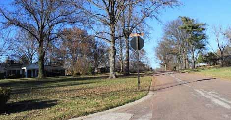
21 PLAN RESIDENTIAL PLACE TYPES Type I Countryside Estate (CE) Countryside Estate describes large lot (1 acre and larger), detached single family residential neighborhoods with a cul de sac street systems with or without pedestrian facilities built around large tracts of subdivision common ground for the use of homeowners. Includes portions of the current A Single Family Residential District.


22 Type I Countryside Estate (CE) Existing Character Images
23 PLAN RESIDENTIAL PLACE TYPES Type II Estate Neighborhood 2 (ER 2) Estate Neighborhood 2 describes large lot (1 acre and larger), detached single family residential neighborhoods with a cul de sac street systems with or without pedestrian facilities and without tracts of subdivision common ground. Includes portions of the current A Single Family Residential District.


24 Type II Estate Neighborhood 2 (ER 2) Existing Character Images
25 PLAN RESIDENTIAL PLACE TYPES Type III Estate Neighborhood 1 (ER 1) Estate Neighborhood 1 describes medium lot (10,000 sq. ft. to 1 acre), detached single family residential neighborhoods with a cul desac street systems, with or without pedestrian facilities. Includes the current B & C Single Family Residential District.


26 Type III Estate Neighborhood 1 (ER 1) Existing Character Images
27 PLAN RESIDENTIAL PLACE TYPES Type IV Suburban Neighborhood 2 (SR 2) Suburban Neighborhood 2 describes small lot (less than 10,000 sq. ft.), detached single family residential neighborhoods with an interconnected street grid and pedestrian facilities. Coterminous with the current D Single Family Residential District.


28 Type IV Suburban Neighborhood 2 (SR 2) Existing Character Images

29 PLAN RESIDENTIAL PLACE TYPES Type V Suburban Multi Family Neighborhood 1 (SR 1) Suburban Neighborhood 1 describes multi family, attached residential dwellings built around an interconnected, internal vehicular and pedestrian circulation system. Coterminous with the current AR Attached Single Family Residential District.


30 Type V Suburban Multi Family Neighborhood 1 (SR 1) Existing Character Images


31

32
33 Recommendations for Residential Place Types For new development, new subdivisions, teardowns & infills, and significant expansions (51% or greater of the existing building) Lot Development Standards Establish a front build to line in place of front setback line for all lots Provide a maximum for the amount of pervious pavement that does not count toward site coverage Eliminate floor area ratio (FAR) limitations and establish building height limits Street & Connectivity Standards Provide street and public realm facility enhancements according to street type classifications (according to the Streets Plan section) Develop bicycle facilities, pedestrian, and multi use pathways (according to the Bicycle and Pedestrian Connectivity Plan) Stormwater & Runoff Mitigation Provide regulatory incentives for increased stormwater detention/recharge (green infrastructure) on private lots Tree Coverage Standards Establish tree planting and coverage standards for private lots, common ground, and street trees. Green Space Preservation Establish a minimum percentage of vegetated green space to be preserved on site.
34 COMPREHENSIVE PLAN Economic Growth & Community Services Plan
35 GOAL 3: Economic Growth & Community Services Creve Coeur will capitalize on new job growth and commercial development opportunities to strengthen its position as a major regional business center and provide the necessary neighborhood services for the community.
36 GOAL 3: Economic Growth & Community Services 1. Ensure future economic growth is responsive to the changing economy, consumer preferences, demographics, and captures the place making dividend. 2. Provide the community services, amenities, and experience necessary to leverage and capture these changing consumer preferences. 3. Transform the Olive Boulevard corridor with a Central Business District and supporting mixed use districts. 4. Improve regional transportation services to Olive Boulevard corridor. 5. Build upon the future high tech development of the region s plant science and research district. 6. Embrace strategic public/private partnerships for redevelopment. 7. Work with the business community to develop specific recommendations related to broadband, electrical, and other infrastructure issues as they impact economic development. 8. Guide regional retail and services (serving as a destination amenity for the St. Louis area) to the Community Center District area. Other business areas should focus on local retail and services designed to serve the Creve Coeur community and immediately surrounding areas. 9. Actively work with the St. Louis Economic Development Partnership and St. Louis County on establishing the regional Plant Science Innovation District to preserve the long term economic strength of Creve Coeur. 10. Foster development of a town center, which would include the design and construction of a public gathering place or places. 11. The City should become an active and integral participant with the St. Louis Regional Chamber. 12. Advocate the construction of broadband fiber infrastructure and high speed internet access.
37 PLAN REDEVELOPMENT OPPORTUNITIES PROPOSED COMMERCIAL PLACE TYPES IX Neighborhood Commercial District (NC) X Mixed Use District (MU) XI Community Center District (CC) XII Mixed Use Innovation Campus (MUIC)
38 PLAN REDEVELOPMENT OPPORTUNITIES PROPOSED CAMPUS PLACE TYPES VII Campus Suburban (C S) VIII Campus Urban (C U)
39 PLAN REDEVELOPMENT OPPORTUNITIES PROPOSED COMMERCIAL PLACE TYPES PROPOSED FRONTAGE PLAN

40


41 COMPONENTS OF THE FRONTAGE PLAN Commercial Place Type District Street Type Frontage Type


42 Central Business District
43 PLAN FRONTAGE PLAN Central Business District Type XI Community Center District (CC) The Community Center District is intended for the development of high density, high intensity, and mixed use commercial, retail, office, and multi family residential in a walkable, urban environment.


44 Type XI Community Center District (CC) Existing Character Images

 Proposed")

45 Type XI Community Center District (CC) Proposed Character Images What we are trying to achieve!


46 Type XI Community Center District (CC) Proposed Character Images What we are trying to achieve!
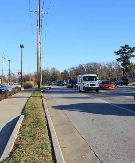
47 PLAN FRONTAGE PLAN Central Business District PRIMARY STREETS Active ground floor uses Consistent build to line Parking should primarily be located behind buildings Consistent landscaping along Olive with street trees, lighting & pedestrian amenities Building signs Encourage site amenities (outdoor dining, plazas, fountains, bicycle parking, parklets, etc.) Frontage Plan Recommendations For new development & redevelopment To the extent practicable, recommendations should also apply to significant additions to further the vision for the district.
48 FRONTAGE PLAN EXAMPLE Existing Conditions

49 FRONTAGE PLAN EXAMPLE Incremental Infill

50 FRONTAGE PLAN EXAMPLE Redevelopment


51 West Olive Corridor
52 PLAN FRONTAGE PLAN West Olive Corridor Type X Mixed Use District (MU) The Mixed Use District is intended for the development of a variety of medium density commercial, retail, office, and multi family residential on large development sites in a walkable environment with street facing storefronts and centralized parking.

")


53 Type X Mixed Use District (MU) Existing Character Images

")


54 Type X Mixed Use District (MU) Proposed Character Images What we are trying to achieve!
55 PLAN FRONTAGE PLAN West Olive Corridor PRIMARY STREETS Active and office ground floor uses Consistent build to line Parking can be located in front of buildings, but parking behind buildings is encouraged. Consistent landscaping along Olive with street trees, lighting & pedestrian amenities Building signs with limited ground signs Frontage Plan Recommendations For new development & redevelopment To the extent practicable, recommendations should also apply to significant additions to further the vision for the district.


56 East Olive / Lindbergh Corridor
57 PLAN FRONTAGE PLAN East Olive / Lindbergh Corridor Type IX Neighborhood Commercial District (NC) The Neighborhood Commercial District is intended for the development of a variety of medium to lowdensity commercial, retail, office, and neighborhood service business in a commercial corridor with shallow lot depths.


58 Type IX Neighborhood Commercial District (NC) Existing Character Images


59 Type IX Neighborhood Commercial District (NC) Proposed Character Images What we are trying to achieve!
60 PLAN FRONTAGE PLAN East Olive / Lindbergh Corridor PRIMARY STREETS Active, office & residential ground floor uses Consistent build to line Parking should primarily be located behind buildings Consistent landscaping along Olive with street trees, lighting & pedestrian amenities Building signs Encourage outdoor dining and retail site amenities Frontage Plan Recommendations For new development & redevelopment To the extent practicable, recommendations should also apply to significant additions to further the vision for the district.

61 EAST OLIVE DISTRICT EXAMPLES (Commercial Retail Only)
62 EAST OLIVE DISTRICT EXAMPLES (Mixed Use Office)
63 EAST OLIVE DISTRICT EXAMPLES (Mixed Use Residential)


64 Plant Sciences Innovation District
65 STUDIO TEAM PLAN FRONTAGE PLAN Plant Sciences Innovation District Type XII Mixed Use Innovation Campus (MUIC) The Mixed Use Innovation Campus district is intended for the development of specialized office, laboratory, institutional, and research buildings for high tech and biotech industries, supported by vibrant, ground floor mixed use development and other amenities. community


66 Type XII Mixed Use Innovation Campus Proposed Character Images What we are trying to achieve!
67 PLAN FRONTAGE PLAN Plant Sciences Innovation District PRIMARY STREETS Active, office & residential ground floor uses Consistent build to line Parking should primarily be located behind buildings Consistent landscaping along Olive with street trees, lighting & pedestrian amenities Building signs Encourage outdoor dining and retail site amenities Frontage Plan Recommendations For new development & redevelopment To the extent practicable, recommendations should also apply to significant additions to further the vision for the district.
68 PLAN FRONTAGE PLAN All Areas PRIMARY STREETS SECONDARY STREETS Active, office & residential ground floor uses Consistent build to line Side lot and rear lot parking frontages and parking structures Building signs wayfinding ground signs Encourage outdoor dining and retail site amenities Frontage Plan Recommendations For new development & redevelopment To the extent practicable, recommendations should also apply to significant additions to further the vision for the district.
69 PLAN FRONTAGE PLAN All Areas PRIMARY STREETS SECONDARY STREETS SERVICE STREETS Limited setback requirement for service access No limitation on ground floor uses No limitation on parking Frontage Plan Recommendations For new development & redevelopment To the extent practicable, recommendations should also apply to significant additions to further the vision for the district.
70 PLAN COMMUNITY CENTER DISTRICT GOLF COURSE SCENARIOS The current Comp Plan calls for partial redevelopment of the NW corner of the golf course as a public park with a plaza to serve as an anchor to the Central Business District. Scenarios have been developed, at the direction of P&Z Commission, regarding the future of the golf course. The Commission needs to provide direction on the scenarios what should be included and what should not.
71 PLAN COMMUNITY CENTER DISTRICT GOLF COURSE SCENARIOS Statement of Future Use If the golf course were not to continue to be used as a golf course, the whole property should be maintained as a public asset, providing public accessibility and use. The following scenario Exhibits are examples of potential future use. These are compplan level land use examples, and not site plans.

72 PLAN GOLF COURSE SCENARIOS SCENARIO 1: Keep the Municipal Golf Course Retain the existing golf course as is Undertake improvements to the facility over time to improve play and use

73 PLAN GOLF COURSE SCENARIOS SCENARIO 2: Central City Park Redevelop the entire golf course property as a new central city park Improve and expand the Dielmann Complex over time

74 PLAN GOLF COURSE SCENARIOS SCENARIO 3 A: Central City Park & Government Center Redevelop the entire golf course property as a new central city park Construct a new Government Center and/or Police Station in the park along Olde Cabin Road Improve and expand the Dielmann Complex over time OPTIONALLY: Add new perimeter streets on the south and west edges to improve visibility and access

75 PLAN GOLF COURSE SCENARIOS SCENARIO 3 B: Central City Park & Government Center Redevelop the entire golf course property as a new central city park Construct a new Government Center and/or Police Station facing the park along Olde Cabin Road Improve and expand the Dielmann Complex over time OPTIONALLY: Add new perimeter streets on the south and west edges to improve visibility and access
76 PLAN PROPOSED CAMPUS PLACE TYPES VII Campus Suburban (C S) VIII Campus Urban (C U)
77 STUDIO TEAM Acres PLACE TYPES PROPOSED CAMPUS PLACE TYPES Type VIII Campus Urban (C U) The Campus Urban district is intended for the development of large office structures, institutional facilities, research buildings, educational, and healthcare facilities on major arterial roads with a highintensity, walkable street frontage. Minimum size: 5

")

78 Type VIII Campus Urban (C U) Existing Character Images

79 CAMPUS URBAN (Full Block Configuration)

80 CAMPUS URBAN (Partial Block Configuration)
81 STUDIO TEAM Acres PLACE TYPES PROPOSED CAMPUS PLACE TYPES Type VII Campus Suburban (C U) The Campus Urban district is intended for the development of large office structures, institutional facilities, research buildings, educational, and healthcare facilities in predominantly residential areas or on secondary roads with low intensity, landscape frontages. Minimum size: 10

")

82 Type VII Campus Suburban (C S) Existing Character Images
83 CAMPUS SUBURBAN
84 Recommendations for Commercial Districts For new development and redevelopment. To the extent practicable, these recommendation should also apply to significant additions (51% or greater of the existing building) to further the vision of the district. GENERAL RECOMMENDATIONS Update existing design guidelines for commercial buildings for each commercial/mixed use Community Place Type match the desired district character. Establish a consistent landscape and public realm vision for Olive Boulevard across all Place Type districts. Establish tree planting and coverage standards for commercial/mixed use lots and surface parking lots Establish a minimum percentage of vegetated green space to be preserved on site. Coordinate with Ayers Saint Grosse (ASG), the planner for the Plant Sciences Innovation District, on recommendations for the Mixed Use Innovation Campus
85 COMPREHENSIVE PLAN Community Amenities & Facilities
86 GOAL 4: Community Amenities & Facilities Creve Coeur will enhance existing public facilities and provide a variety of high quality public amenities and community facilities that meet the needs and desires of all Creve Coeur residents.
87 GOAL 4: Community Amenities & Facilities 1. Improve City facilities, including the police department headquarters, City Hall, and City fire stations. 2. Continue to improve the quality and responsiveness of City services, including recycling, limb and leaf pickup, maintenance of medians and public landscaping, and maintenance of street lighting. 3. Continue to actively develop and implement the Capital Improvement Program that addresses the needs and desires of the community. 4. Continue the City s strong level of police services 5. Ensure that the Creve Coeur, West Overland, and Monarch Fire Protection Districts continue to provide quality services to residents of the City; maintain a water system that provides for acceptable fire flow rates. 6. Expand partnership and cooperative agreements with the various government entities and public and private institutions within the region. 7. Reexamine the City s relationship with the County to determine the extent and quality of the provision of services shared by the City and County. 8. Advocate for a detailed inventory of present and potential future power needs within the city, particularly along Olive Boulevard and as they relate to needs of the emerging high tech businesses. 9. Advocate for: mapping all fiber optic infrastructure within the City; deployment of fiber optic more evenly throughout the City; measuring the amount of fiber optics by mileage. 10. Maintain existing and develop new reciprocal agreements to share facilities with surrounding municipalities.
88 COMPREHENSIVE PLAN Parks, Open Space & Environment Plan
89 GOAL 5: Parks, Open Space & Environment Creve Coeur will utilize its physical geography and diverse landscapes to become a regionally recognized premier green community and to increase the amount of accessible public parks and open space for environmental preservation and recreation.
90 GOAL 5: Parks, Open Space & Environment 1. Actively pursue the integration of trails and bikeways in to the landscape and create a comprehensive community wide network of off street and on street connections for pedestrians between parks and open spaces, commercial centers, schools, and neighborhoods. 2. Require new development or redevelopment to include public amenities such as pedestrian connections, bicycle facilities, public sitting/gathering areas, and open space, as appropriate. 3. Enhance existing and develop new recreational facilities at existing City parks and recreation areas. 4. Explore the development of a central urban park or plaza as the central gathering space of the community (perhaps as part of the Community Center district), community recreation center, youth center, library, or community center. 5. Identify and designate parcels for possible future purchase by the City and redevelopment as public park space. 6. Expand the use of cooperative agreements with local schools, the Creve Coeur Racquet Club, and other recreational amenities to provide access to recreational facilities for City residents. 7. Enhance Creve Coeur s existing parks and open spaces to establish greater plant and wildlife diversity. 8. Mitigate flooding and waterway impacts from adjacent development and improve water quality.
91 PLAN RECREATION & NATURAL AMENITIES PLAN Objective: Utilize Creve Coeur s natural amenities to create an expanded, interconnected system of parks, open space, and passive and active recreation facilities.
92 PLAN RECREATION & NATURAL AMENITIES PLAN Open Space & Green Corridors
93 PLAN RECREATION & NATURAL AMENITIES PLAN Open Space & Green Corridors Primary Recreation Areas
94 PLAN RECREATION & NATURAL AMENITIES PLAN Open Space & Green Corridors Primary Recreation Areas Multi Use Pathways (Bicycle & Pedestrian)
 Pedestrian Walks (Between Neighborhoods)")
95 PLAN RECREATION & NATURAL AMENITIES PLAN Open Space & Green Corridors Primary Recreation Areas Multi Use Pathways (Bicycle & Pedestrian) Pedestrian Walks (Between Neighborhoods)
96 PLAN RECREATION & NATURAL AMENITIES PLAN Open Space & Green Corridors Primary Recreation Areas Multi Use Pathways (Bicycle & Pedestrian) Pedestrian Walks (Between Neighborhoods) Greenway Trails (Bicycle & Pedestrian) Objective: Utilize Creve Coeur s natural amenities to create an expanded, interconnected system of parks, open space, and passive and active recreation facilities.
97 COMPREHENSIVE PLAN Transportation, Connectivity & Mobility
98 GOAL 6: Transportation, Connectivity & Mobility Creve Coeur will utilize development and partnerships with other jurisdictions to better manage automobile traffic, reduce traffic congestion and improve transit, walkability and bikeability.
99 GOAL 6: Transportation, Connectivity & Mobility 1. Encourage creation of a comprehensive network of pedestrian and bicycle infrastructure and facilities to become a premier walkable and bikeable community 2. Improve access to public transit opportunities to ensure an equity of mobility for all residents and visitors regardless of age, income, or ability. 3. Use environmental design, operations, and management to reduce vehicular congestion on Olive Boulevard. 4. Manage traffic impacts in residential neighborhoods. 5. Improve north south vehicular flow in the western half of the City. 6. Promote vehicular cross access between commercial parking lots. 7. Improve coordination with East West Gateway Council of Governments (EWGCOG) to increase the City s role in regional transportation planning and transportation initiatives. 8. Develop modified engineering and design standards for streets that do not adversely affect pedestrian and bicycle performance. 9. Develop procedures for addressing requests for local traffic calming. 10. Increase local connectivity to the Great Rivers Greenway District s (GRG) regional River Ring greenway network; endorse, enhance, and facilitate implementation of GRG projects in Creve Coeur. 11. Maintain existing roadway levels of service and enhance pedestrian and bicycle facilities. 12. Enhance the safety of bicycle and pedestrian facilities, including safe pedestrian crossings of Olive Boulevard, Lindbergh Boulevard, and Ladue Road.
100 PLAN STREETS PLAN Boulevard Type Avenue Type (I & II) Commercial Street I Type Commercial Street II Type Commercial Street III Type Road I Type Road II Type Neighborhood Street Residential Street Lane Objective: Enhance Creve Coeur s street network as a key part of the City s identity and improve the function and safety for all users cars, pedestrians, transit riders, and bikes.
101 PLAN STREETS PLAN Boulevard Type Objective: Enhance Creve Coeur s street network as a key part of the City s identity and improve the function and safety for all users cars, pedestrians, transit riders, and bikes.
102 PLAN STREETS PLAN Boulevard Type Objective: Enhance Creve Coeur s street network as a key part of the City s identity and improve the function and safety for all users cars, pedestrians, transit riders, and bikes.
103 PLAN STREETS PLAN Boulevard Type Avenue Type (I & II) Objective: Enhance Creve Coeur s street network as a key part of the City s identity and improve the function and safety for all users cars, pedestrians, transit riders, and bikes.
104 PLAN STREETS PLAN Boulevard Type Avenue Type I Objective: Enhance Creve Coeur s street network as a key part of the City s identity and improve the function and safety for all users cars, pedestrians, transit riders, and bikes.
105 PLAN STREETS PLAN Boulevard Type Avenue Type II Objective: Enhance Creve Coeur s street network as a key part of the City s identity and improve the function and safety for all users cars, pedestrians, transit riders, and bikes.
106 PLAN STREETS PLAN Boulevard Type Avenue Type Commercial Street I Type Objective: Enhance Creve Coeur s street network as a key part of the City s identity and improve the function and safety for all users cars, pedestrians, transit riders, and bikes.
107 PLAN STREETS PLAN Boulevard Type Avenue Type Commercial Street I Type Objective: Enhance Creve Coeur s street network as a key part of the City s identity and improve the function and safety for all users cars, pedestrians, transit riders, and bikes.
108 PLAN STREETS PLAN Boulevard Type Avenue Type Commercial Street I Type Commercial Street II Type Objective: Enhance Creve Coeur s street network as a key part of the City s identity and improve the function and safety for all users cars, pedestrians, transit riders, and bikes.
109 PLAN STREETS PLAN Boulevard Type Avenue Type Commercial Street I Type Commercial Street II Type Objective: Enhance Creve Coeur s street network as a key part of the City s identity and improve the function and safety for all users cars, pedestrians, transit riders, and bikes.
110 PLAN STREETS PLAN Boulevard Type Avenue Type Commercial Street I Type Commercial Street II Type Commercial Street III Type Objective: Enhance Creve Coeur s street network as a key part of the City s identity and improve the function and safety for all users cars, pedestrians, transit riders, and bikes.
111 PLAN STREETS PLAN Boulevard Type Avenue Type Commercial Street I Type Commercial Street II Type Commercial Street III Type Objective: Enhance Creve Coeur s street network as a key part of the City s identity and improve the function and safety for all users cars, pedestrians, transit riders, and bikes.
112 PLAN STREETS PLAN Boulevard Type Avenue Type Commercial Street I Type Commercial Street II Type Commercial Street III Type Road I Type Objective: Enhance Creve Coeur s street network as a key part of the City s identity and improve the function and safety for all users cars, pedestrians, transit riders, and bikes.
113 PLAN STREETS PLAN Boulevard Type Avenue Type Commercial Street I Type Commercial Street II Type Commercial Street III Type Road I Type Objective: Enhance Creve Coeur s street network as a key part of the City s identity and improve the function and safety for all users cars, pedestrians, transit riders, and bikes.
114 PLAN STREETS PLAN Boulevard Type Avenue Type Commercial Street I Type Commercial Street II Type Commercial Street III Type Road I Type Road II Type Objective: Enhance Creve Coeur s street network as a key part of the City s identity and improve the function and safety for all users cars, pedestrians, transit riders, and bikes.
115 PLAN STREETS PLAN Boulevard Type Avenue Type Commercial Street I Type Commercial Street II Type Commercial Street III Type Road I Type Road II Type Objective: Enhance Creve Coeur s street network as a key part of the City s identity and improve the function and safety for all users cars, pedestrians, transit riders, and bikes.
116 PLAN STREETS PLAN Boulevard Type Avenue Type Commercial Street I Type Commercial Street II Type Commercial Street III Type Road I Type Road II Type Neighborhood Street Objective: Enhance Creve Coeur s street network as a key part of the City s identity and improve the function and safety for all users cars, pedestrians, transit riders, and bikes.
117 PLAN STREETS PLAN Boulevard Type Avenue Type Commercial Street I Type Commercial Street II Type Commercial Street III Type Road I Type Road II Type Neighborhood Street Objective: Enhance Creve Coeur s street network as a key part of the City s identity and improve the function and safety for all users cars, pedestrians, transit riders, and bikes.
118 PLAN STREETS PLAN Boulevard Type Avenue Type Commercial Street I Type Commercial Street II Type Commercial Street III Type Road I Type Road II Type Neighborhood Street Residential Street Objective: Enhance Creve Coeur s street network as a key part of the City s identity and improve the function and safety for all users cars, pedestrians, transit riders, and bikes.
119 PLAN STREETS PLAN Boulevard Type Avenue Type Commercial Street I Type Commercial Street II Type Commercial Street III Type Road I Type Road II Type Neighborhood Street Residential Street Objective: Enhance Creve Coeur s street network as a key part of the City s identity and improve the function and safety for all users cars, pedestrians, transit riders, and bikes.
120 PLAN STREETS PLAN Boulevard Type Avenue Type Commercial Street I Type Commercial Street II Type Commercial Street III Type Road I Type Road II Type Neighborhood Street Residential Street Lane Objective: Enhance Creve Coeur s street network as a key part of the City s identity and improve the function and safety for all users cars, pedestrians, transit riders, and bikes.
121 PLAN STREETS PLAN Boulevard Type Avenue Type Commercial Street I Type Commercial Street II Type Commercial Street III Type Road I Type Road II Type Neighborhood Street Residential Street Lane Objective: Enhance Creve Coeur s street network as a key part of the City s identity and improve the function and safety for all users cars, pedestrians, transit riders, and bikes.
122 PLAN PLANNED REGIONAL BIKE ROUTES (GRG Gateway Bike Plan) Centennial Greenway Bike Lane Shared Lane Markings Share the Road Paved Shoulder Wide Outside Lane Needs Further Analysis The are numerous planned regional access points and connections Creve Coeur is approx. ¾ of a mile from Centennial Greenway.
123 PLAN STREETS PLAN BICYCLE & PEDESTRIAN CONNECTIVITY PLAN Objective: Provide a network of high quality pedestrian and bicycle paths and trails that enable all residents to safely and comfortable move throughout Creve Coeur, regardless of age of ability.
124 PLAN STREETS PLAN BICYCLE & PEDESTRIAN CONNECTIVITY PLAN Dedicated Bicycle Lanes
125 PLAN STREETS PLAN BICYCLE & PEDESTRIAN CONNECTIVITY PLAN Dedicated Bicycle Lanes Multi Use Protected Pathways (Bicycle & Pedestrian)
126 PLAN STREETS PLAN BICYCLE & PEDESTRIAN CONNECTIVITY PLAN Dedicated Bicycle Lanes Multi Use Protected Pathways (Bicycle & Pedestrian) Shared Lanes (Bicycle)
127 PLAN STREETS PLAN BICYCLE & PEDESTRIAN CONNECTIVITY PLAN Dedicated Bicycle Lanes Multi Use Protected Pathways (Bicycle & Pedestrian) Shared Lanes (Bicycle) Walks (Pedestrian)
128 PLAN STREETS PLAN BICYCLE & PEDESTRIAN CONNECTIVITY PLAN Dedicated Bicycle Lanes Multi Use Protected Pathways (Bicycle & Pedestrian) Shared Lanes (Bicycle) Walks (Pedestrian) Off Street Multi Use Trails (Bicycle & Pedestrian) Objective: Provide a network of high quality pedestrian and bicycle paths and trails that enable all residents to safely and comfortable move throughout Creve Coeur, regardless of age of ability.
129 COMPREHENSIVE PLAN Community Sustainability & Resilience
130 GOAL 7: Community Sustainability & Resilience Creve Coeur will lead the region in integrating community sustainability with on going revitalization.
131 STUDIO TEAM GOAL 7: Community Sustainability & Resilience 1. Facilitate the development of community supportive retail and services to ensure long term community vibrancy and resilience. 2. Achieve a sustainable jobs/housing balance within Creve Coeur. 3. Adopt Phase II of the City s Climate Action Plan; Establish a regular schedule for future updates of the Climate Action Plan with new benchmarks, a new planning horizon with updated strategies, and updated targets. 4. Develop a Community Resilience Plan to provide for enhanced food security, emergency service access, and alternative transportation options in the event of natural disasters and social unrest. 5. Expand the use of renewable energy in City owned public facilities and promote renewable energy use for all Creve Coeur residents. 6. Establish city wide targets for the ratio both public accessible and private open space. 7. Establish a city wide Environmental Overlay District to address high priority storm water and erosion problems identified by Metropolitan St. Louis Sewer District in its Creve Coeur and Deer Creek Watershed reports; and proactively mitigate storm water runoff and improve water quality. 8. Establish a storm water level of service and prioritize the problems identified in the City s storm water study based on those criteria and accelerate the implementation of the City s Storm Water Master Plan to deal with the prioritized storm water problems. 9. Review regional sustainability initiatives and work with regional groups to enhance Creve Coeur s sustainability efforts.
132 GOAL 7: Community Sustainability & Resilience 1. Municipal Initiatives (Existing & Ongoing) Greenhouse Gas Inventory & Climate Action Plan Municipal Facilities Operations (Purchasing, Energy Audit, Green Power Comm., Etc.) 25X20 Pledge 2. Natural Resources Plan Floodplain and Flood Damage Regulations (Existing, Chapter 415) Stream Buffer Conservation Areas (Existing, Chapter 430) Open Space Preservation Tree Protection and Tree Coverage Residential Lots Non Residential Lots 3. Community Resilience Plan Food Security Emergency Services Transportation Alternatives Energy Independence
133 PLAN NATURAL RESOURCES PLAN Applies to Riparian Corridors, Common Areas & Parks Applies to Residential Lots Applies to Commercial & Mixed Use Lots Addresses issues of Sensitive Ecological Areas (steep slopes, wetlands, waterways, etc.) Natural Open Space Habitat Plant Life Diversity Water Quality Urban Heat Island Effect Visual Appeal

134 PLAN NATURAL RESOURCES PLAN Landform & Hydrology Common Ground Recreation Areas Public Parks Floodplain Corridors Objective: Preserve and enhance the natural environment of Creve Coeur; mitigate flood risk; improve water and air quality; and enhance community appearance and the overall quality of life.
135 PLAN NATURAL RESOURCES PLAN Landform & Hydrology Common Ground Recreation Areas Public Parks Floodplain Corridors Special Conservation Areas
136 PLAN NATURAL RESOURCES PLAN Landform & Hydrology Common Ground Recreation Areas Public Parks Floodplain Corridors Special Conservation Areas Residential Place Type Districts
137 PLAN NATURAL RESOURCES PLAN Landform & Hydrology Common Ground Recreation Areas Public Parks Floodplain Corridors Special Conservation Areas Residential Place Type Districts Non Residential Place Type Districts

138 PLAN NATURAL RESOURCES PLAN Landform & Hydrology Common Ground Recreation Areas Public Parks Floodplain Corridors Special Conservation Areas Residential Place Type Districts Non Residential Place Type Districts


139 PLAN NATURAL RESOURCES PLAN Special Conservation Areas
140 PLAN NATURAL RESOURCES PLAN Special Conservation Areas Recommendations For new development, new subdivisions, teardowns & infills, and significant expansions (51% or greater of the existing building) Flood Hazard and Control Regulations Chapter 415, Code of Ordinances Ensure that there is no net loss of floodwater storage capacity in Creve Coeur. Stream Buffer Protection Regulations Chapter 430, Code of Ordinances Open Space Preservation Designate City open space as for future preservation, including: o City Parks o Private recreational facilities o Subdivision common grounds rights of way o Utility
141 PLAN NATURAL RESOURCES PLAN Residential Place Type Districts
142 PLAN NATURAL RESOURCES PLAN Residential Place Types Residential Lot Recommendations for new development and redevelopment Pervious Pavement o Limit the amount of pervious pavement that does not count toward site coverage, up to a maximum Stormwater Runoff o Develop and enact a local Stormwater Ordinance to address lots of less than one (1) acre with regulations comparable to the MS4 and MSD regulations for lots one (1) acre and larger. Tree Coverage o Develop tree coverage preservation standards for residential lots Green Space Preservation o Establish a minimum percentage of vegetated green space to be preserved on site.
143 PLAN NATURAL RESOURCES PLAN Non Residential Place Type Districts
144 PLAN NATURAL RESOURCES PLAN Non Residential Place Types Non Residential Lot Recommendations for new development and redevelopment Pervious Pavement o Allow pervious pavement that does not count toward site coverage, up to a maximum, as incentives for stormwater & tree coverage best practices Stormwater Runoff o Develop and enact a local Stormwater Ordinance to address lots of less than one (1) acre with regulations comparable to the MS4 and MSD regulations for lots one (1) acre and larger. Tree Coverage o Establish minimum tree coverage requirements for surface parking lots. o Develop tree coverage preservation standards for residential lots Energy Efficient Lighting o Incentivize low voltage LED site lighting (including parking lot lighting) by allowing an increase in pervious surface coverage, up to a specified maximum Roofing Best Practices o Encourage reflective white roofing and/or green (vegetated) roofing systems o Ensure that vegetated green roofing system areas contribute to on site stormwater detention facilities. Green Space Preservation o Establish a minimum percentage of vegetated green space to be preserved on site.
145 PLAN COMMUNITY RESILIENCE PLAN Food Security Expand/enact additional ordinances allowing household suburban agriculture (including small animal husbandry) Provide regulatory incentives for household gardens Provide municipal support for community gardens Establish one of more community supported agriculture (CSA) programs with a preference for locally sourced produce Emergency Services Obtain StormReady certification from the National Weather Service (NWS) Establish a low power, wi fi based emergency service notification and response system with a 72 hour independent power source Facilitate creation of a citywide, wireless mesh communication system Transportation Alternatives Provide safe pedestrian facilities at a minimum interval of one quarter (1/4) mile Provide dedicated bicycle facilities at a minimum interval of one half (1/2) mile Implement a comprehensive Safe Routes to School (SR2S) program Develop and enact a Complete Streets ordinance Energy Independence Provide regulatory incentives for the use of ground source (geothermal) climate system in residences Provide regulatory incentives for the use of solar energy in residential and non residential properties Provide a local property tax credit for the use of ground source heating and cooling and/or solar energy.
146 COMPREHENSIVE PLAN Annexation Potential

147 POTENTIAL ANNEXATION EXISTING CITY BOUNDARY
 Expands Creve Coeur s tax base Positions Olive Boulevard in the middle of, instead of on the edge of, the community Increases housing diversity")
148 POTENTIAL ANNEXATION EXISTING CITY BOUNDARY POTENTIAL ANNEXED LAND & REVISED BOUNDARY 2,348 Acres (3.67 Sq. Mi.) 4,300 Housing Units (Est.) Expands Creve Coeur s tax base Positions Olive Boulevard in the middle of, instead of on the edge of, the community Increases housing diversity Connect to Hwy. 141

149 THANK YOU!
Silverdale Regional Center
 Silverdale Regional Center Vision for Silverdale Regional Center The Silverdale Regional Center Plan (Plan) will guide the evolution of the Silverdale Regional Center from a collection of strip malls and
Plano Tomorrow Vision and Policies
 Plano Tomorrow Vision and Policies PLANO TOMORROW PILLARS The Built Environment The Social Environment The Natural Environment The Economic Environment Land Use and Urban Design Transportation Housing
A BLUEPRINT FOR BROCKTON A CITY-WIDE COMPREHENSIVE PLAN
 A BLUEPRINT FOR BROCKTON A CITY-WIDE COMPREHENSIVE PLAN Public Meeting October 2016 1 Plan Summary and Discussion Public Meeting May 4 2017 City of Brockton Bill Carpenter, Mayor Department of Planning
CHAPTER 3 VISION, GOALS, & PLANNING PRINCIPLES. City of Greensburg Comprehensive Plan. Introduction. Vision Statement. Growth Management Goals.
 CHAPTER 3 VISION, GOALS, & PLANNING PRINCIPLES Introduction The Greensburg Comprehensive Plan is intended as a working community document. A combination of long and short-term goals, this document is intended
EXISTING COMPREHENSIVE PLAN
 EXISTING COMPREHENSIVE PLAN Town Center Land Use Element: V. LAND USE POLICIES Town Center Mercer Island's business district vision as described in "Your Mercer Island Citizen-Designed Downtown" was an
Parks, Open Space and Trails
 Introduction Parks have often been referred as the lungs of our cities, cleansing the air of pollutants and particulate matter. Parks are also gathering places for families and community. They offer spaces
V. Vision and Guiding Principles
 V. Vision and Guiding Principles The Master Plan for the Powers Ferry Corridor seeks a foundation in the desires of the community. At times, various elements of the community offered opposing viewpoints,
The Five Components of the McLoughlin Area Plan
 The Five Components of the McLoughlin Area Plan This documents contains the complete language of the five components of the McLoughlin Area Plan: The Vision Statement The Values The Guiding Principles
RECREATION AND OPEN SPACE ELEMENT GOALS, OBJECTIVES, AND POLICIES
 RECREATION AND OPEN SPACE ELEMENT GOALS, OBJECTIVES, AND POLICIES Goal 7 To provide park facilities, recreation programs, and open space resources that are safe, adequate, and accessible to all City residents,
4.1.3 LAND USE CATEGORIES
 4.1.3 LAND USE CATEGORIES a. City Center District The City Center District incorporates the existing character and mix of uses in downtown Belmont to encourage redevelopment and new development in keeping
Guiding Principles, Objectives, Strategies and Policies
 Guiding Principles, Objectives, Strategies and Policies Section 1 Introduction These Guiding Principles were adopted as part of the 1999 Athens-Clarke County Comprehensive Plan and are carried over, in
2018 Northampton Township Comprehensive Plan
 2018 BUCKS COUNTY, PENNSYLVANIA What is a? A comprehensive plan is a municipality s main policy document that details the collective vision for the future, the historic, environmental, and cultural facilities
LAND USE ELEMENT. Purpose. General Goals & Policies
 LAND USE ELEMENT Purpose This Land Use Element contains the goals and policies necessary to support the City s responsibility for managing land resources and guiding development through implementing regulations,
Preliminary Plan Framework: Vision and Goals
 Preliminary Plan Framework: Vision and Goals Draft: May 2015 Introduction Since the Town of Milliken s comprehensive plan was last updated in 2010, the community was heavily impacted by the 2013 flood,
CHAPTER 7: VISION AND ACTION STATEMENTS. Noble 2025 Vision Statement
 CHAPTER 7: VISION AND ACTION STATEMENTS This chapter presents the vision, policy and action statements that transform the comprehensive planning study, an analysis of Noble s past, future trends and community
Implementation Guide Comprehensive Plan City of Allen
 Implementation Guide 2030 Comprehensive Plan City of Allen DRAFT 2015 Implementation Guide Allen 2030 Comprehensive Plan INTRODUCTION The Comprehensive Plan serves as a guide for the growth and development
Vision Statement for the Town of Flower Mound Master Plan The Town of Flower Mound Master Plan furthers the established community based vision to:
 Vision Statement for the The furthers the established community based vision to: Preserve the country atmosphere and natural environment that makes Flower Mound a unique and desirable community; Mitigate
Concord Community Reuse Project Goals and Guiding Principles. Overarching Goals (OG)
") Concord Community Reuse Project Goals and Guiding Principles Overarching Goals (OG) No priority is implied by the order of presentation of the goals and guiding principles. Overarching goals for the Concord
Concord Community Reuse Project Goals and Guiding Principles Overarching Goals (OG) No priority is implied by the order of presentation of the goals and guiding principles. Overarching goals for the Concord
3. VISION AND GOALS. Vision Statement. Goals, Objectives and Policies
 Vision Statement Queen Creek s interconnected network of parks, trails, open spaces and recreation opportunities provide safe and diverse activities and programs that sustain its unique, small town, equestrian
Today Land & People. Northeast Nampa Gateway District. Employment. Land Use Characteristics. Demographics. Current Zoning
 Today Land & People Employment Major employers include Saint Alphonsus, the College of Western Idaho, the Auto Mall, Sorrento Lactalis and Walmart. 3,004 jobs in 2010 (COMPASS-CIM 2040 TAZ data) 4,345
The transportation system in a community is an
 7 TRANSPORTATION The transportation system in a community is an important factor contributing to the quality of life of the residents. Without a sound transportation system to bring both goods and patrons
Secrest Short Cut and Monroe Expressway Small Area Plan AUGUST 29, 2018
 Secrest Short Cut and Monroe Expressway Small Area Plan AUGUST 29, 2018 Background and Process Monroe Expressway will be open by the end of 2018 Union County and Indian Trail identified a need to revisit
Comprehensive Plan ADOPTED APRIL 2014
 Comprehensive Plan ADOPTED APRIL 2014 8 8. Outstanding Recreational & Cultural Opportunities We are proud of our community s parks and recreation system. Our community will ensure that the legacy of our
C. Westerly Creek Village & The Montview Corridor
 C. Westerly Creek Village & The VISION Community Vision When the goals of the city are achieved Westerly Creek Village, a distinctive community defined by Montview Boulevard and Westerly Creek, is a strong
17.11 Establishment of Land Use Districts
 17.11 Establishment of Land Use Districts 17.11.010 Purpose. To promote the health, safety, and general welfare of City residents and those who come to South Salt Lake to work, exchange commerce and recreate.
Plan-It Greenville (2009) Comprehensive Plan 5-Year Update
 Comprehensive Plan 5-Year Update") Plan-It Greenville (2009) Comprehensive Plan 5-Year Update What is the comprehensive plan: Collecting communitywide data Projecting future population growth Setting communitywide goals Framing policies
Plan-It Greenville (2009) Comprehensive Plan 5-Year Update What is the comprehensive plan: Collecting communitywide data Projecting future population growth Setting communitywide goals Framing policies
Visioning Statement and Guiding Principles
 Visioning Statement and Guiding Principles Planning for the Future The General Plan The General Plan represents Woodland's shared vision of the future and defines a path to lead the community toward its
Future Land Use SAMPLE RECOMMENDATIONS
 SAMPLE RECOMMENDATIONS Future Land Use The Future Land Use Chapter of the Master Plan builds upon prior chapters examining the existing conditions in their respective topic areas to present a comprehensive
Hockessin Community Redevelopment Plan
 Hockessin Community Redevelopment Plan 3.1 Introduction The Community Redevelopment Plan for the Village of Hockessin is the result of the people s vision for a distinct village center that serves as the
Broken Arrow Comprehensive Plan Update Public Workshop Meeting #3 January 23,
 Broken Arrow Comprehensive Plan Update Public Workshop Meeting #3 January 23, September 25,2018 2018 26 April 2016 AGENDA 1. Status Presentation - Charrette Recap - Proposed Vision Framework - Preliminary
Chapter 1: Introduction
 Chapter 1: Introduction The Penn Avenue Community Works Corridor Vision and Implementation Framework presents an integrated communitybased vision and a coordinated, long-term implementation framework for
Ivywild On The Creek PRELIMINARY CREEK DISTRICT MASTER PLAN
 Ivywild On The Creek PRELIMINARY CREEK DISTRICT MASTER PLAN Introduction: Rejuvenating an extraordinary Creekside neighborhood THE CREEKSIDE DISTRICT The Ivywild On The Creek Neighborhood District Master
Corridor Vision. 1Pursue Minnehaha-Hiawatha Community Works Project. Mission of Hennepin County Community Works Program
 1Pursue Minnehaha-Hiawatha Community Works Project Minnehaha-Hiawatha Community Works is a project within the Hennepin Community Works (HCW) program. The mission of the HCW program is to enhance how the
This page intentionally blank.
 This page intentionally blank. Parks, Recreation, and Open Space Chapter Relationship to Vision Vision Parks, Recreation and Open Space Chapter Concepts County Government. County government that is accountable
COMMUNITY DESIGN. GOAL: Create livable and attractive communities. Intent
 COMMUNITY DESIGN Intent An attractive, well-designed County will attract quality development, instill civic pride, improve the visual character of the community, and create a strong, positive image for
NEW CASTLE COUNTY S ZONING DISTRICTS
 NEW CASTLE COUNTY S ZONING DISTRICTS This is general information about New Castle County s zoning districts. The information included is by no means exhaustive or complete. Before designing plans to develop
Executive Summary. The Mebane CLP is not a regulatory document, but is intended to guide land development decisions. The plan includes:
 Executive Summary P URPOSE AND O RGANIZATION OF THE P LAN The City of Mebane, with input from citizens and an appointed CLP Advisory Committee, adopted Mebane by Design, a Comprehensive Land Development
Town of Peru Comprehensive Plan Executive Summary
 Town of Peru Comprehensive Plan Executive Communities that plan grow by choice, not by chance. A plan makes growth thoughtful, understandable, and predictable. A plan shows that a community is managing
implementation10 Village of Greendale Comprehensive Plan: Greendale, Wisconsin. Revisiting a Greenbelt Community
 implementation10 Village of Greendale Comprehensive Plan: 2010 - Village of Greendale Comprehensive Plan: 2010 - Implementation The recommendations of this Plan must be implemented by the Village of Greendale,
CHAPTER 7: Transportation, Mobility and Circulation
 AGLE AREA COMMUNITY Plan CHAPTER 7 CHAPTER 7: Transportation, Mobility and Circulation Transportation, Mobility and Circulation The purpose of the Transportation, Mobility and Circulation Chapter is to
TREASURE COAST REGIONAL PLANNING COUNCIL M E M O R A N D U M. To: Council Members AGENDA ITEM 5H
 TREASURE COAST REGIONAL PLANNING COUNCIL M E M O R A N D U M To: Council Members AGENDA ITEM 5H From: Date: Subject: Staff October 17, 2008 Council Meeting Local Government Comprehensive Plan Review Draft
DRAFT City of Titusville 2040 Comprehensive Plan Future Land Use, Housing, and Transportation Elements April 16, 2018
 DRAFT City of Titusville 2040 Comprehensive Plan Future Land Use, Housing, and Transportation Elements April 16, 2018 Prepared by Canin Associates for the City of Titusville About the Comprehensive Plan:
Urban Design Manual PLANNING AROUND RAPID TRANSIT STATIONS (PARTS) Introduction. Station Study Areas
 Introduction. Station Study Areas") 111111 PLANNING AROUND RAPID TRANSIT STATIONS (PARTS) Introduction The ION rapid transit system will link Waterloo, Kitchener and Cambridge through a central transit corridor (CTC). There are a number
111111 PLANNING AROUND RAPID TRANSIT STATIONS (PARTS) Introduction The ION rapid transit system will link Waterloo, Kitchener and Cambridge through a central transit corridor (CTC). There are a number
THE 355/270 CORRIDOR:
 THE 355/270 CORRIDOR: Strategic Ideas for Sustaining a Livable Work Place Project Summary ACCESS LIFE DESIGN HEALTH WORK Montgomery County Planning Department The Maryland-National Capital Park and Planning
FUTURE LAND USE ELEMENT
 FUTURE LAND USE ELEMENT GOAL I: To create and sustain a great place to live, play, and prosper Objective 1: The City of Ocala shall incorporate the principles and strategies of the Ocala 2035 Vision into
Community Design Guidelines. Port Wallace DRAFT
 Community Design Guidelines Port Wallace DRAFT Energy 1 2 3 Nature Movement Connections Built Form DRAFT Layout Energy 1 Nature Community Design Guidelines GREAT COMMUNITIES PROTECT, CELEBRATE, AND CONSERVE
Description of Preferred Alternative
 Chapter 2 Description of Preferred Alternative 2.1 Introduction This chapter of the programmatic Sammamish Town Center Sub-area Plan Final EIS provides a more detailed description of the Preferred Alternative
Toronto Complete Streets Guidelines
 Toronto Complete Streets Guidelines 108 110 7.1 Green Infrastructure Design Principles 112 7.2 Context-Sensitive Green Streets 114 7.3 Key Green Street Elements Green infrastructure refers to natural and
The West Vaughan Employment Area Secondary Plan Policies
 Part 2: The West Vaughan Employment Area Secondary Plan Policies 2.1 General Policies It is the policy of Council: 2.1.1. That the West Vaughan Employment Area (the WVEA), identified on Schedule 1, will
Complete Neighbourhood Guidelines Review Tool
 Complete Neighbourhood Guidelines Review Tool Prepared By: City of Regina Planning Department October 2014 Page 1 of 14 Community Development Review Checklist for Secondary Plans and Concept Plans The
City of Nogales General Plan
 Open Space, Parks, Recreation and Trails City of Nogales General Plan Residents of Nogales place a high priority in the development of a comprehensive system of open space, parks, recreation and trails
A larger version of this map is located on the last page of this PDF.
 MAP Committee Input McLoughlin Area Draft Vision Map A larger version of this map is located on the last page of this PDF. 1. The map above is intended to portray a vision for the McLoughlin area. It highlights
Ten Mile Creek Planning Area
 PLANNING AREA POLICIES TEN MILE CREEK Ten Mile Creek Planning Area Location and Context The Ten Mile Creek Planning Area ( Ten Mile Creek area ) is located south of the current Boise AOCI, generally south
Chapter 2: Vision, Goals and Strategies
 Chapter 2: Vision, Goals and Lake Elmo Today & Tomorrow Comprehensive Plan 2040 2 VISION, GOALS & STRATEGIES - DRAFT 4-6-2018 INTRODUCTION Comprehensive Plan Purpose Perhapse the most important objective
Mark-up of the effect of the proposed Bronte Village Growth Area OPA No.18 on the text of section 24, Bronte Village, of the Livable Oakville Plan
 Mark-up of the effect of the proposed Bronte Village Growth Area OPA No.18 on the text of section 24, Bronte Village, of the Livable Oakville Plan Notes: This document is provided for information purposes
Planned Development Review Revisions (Project No. PLNPCM )
") Planned Development Review Revisions (Project No. PLNPCM2014-00139) Standard residential development Planned Development Example: Smaller lot sizes than what is allowed to create open space amenity. What
Planned Development Review Revisions (Project No. PLNPCM2014-00139) Standard residential development Planned Development Example: Smaller lot sizes than what is allowed to create open space amenity. What
SAN RAFAEL GENERAL PLAN 2040 INTRODUCTION AND OVERVIEW
 SAN RAFAEL GENERAL PLAN 2040 INTRODUCTION AND OVERVIEW Steering Committee Presentation February 14, 2018 Purpose of General Plan Guide land use and development decisions Coordinate transportation, infrastructure,
2030 Comprehensive Plan VISION STATEMENT
 RESOURCE DOCUMENT for Steering Committee Meeting #2 July 12, 2017 2030 Comprehensive Plan VISION STATEMENT Steering Committee from 2008 Established the Lauderdale s Vision as: Creating a livable, lovable
I615. Westgate Precinct
 I615. Westgate Precinct I615.1. Precinct Description The Westgate Precinct is located approximately 18km west of the Auckland city centre. There are seven Sub-precincts in the Westgate Precinct: Sub-precinct
CITY OF LANGLEY OFFICIAL COMMUNITY PLAN BYLAW, 2005, NO APPENDIX II - REGIONAL CONTEXT MAP
 CITY OF LANGLEY OFFICIAL COMMUNITY PLAN BYLAW, 2005, NO. 2600 APPENDIX II - REGIONAL CONTEXT MAP ± Legend Agricultural Mixed Employment Industrial Conservation & Recreation Regional City Centre Urban Containment
HOT SPRINGS COMPREHENSIVE PLAN OUTLINE
 HOT SPRINGS COMPREHENSIVE PLAN OUTLINE 7/28/2015 Draft outline - Hot Springs Comprehensive Plan Draft outline of topics to be discussed at public hearings and in planning sessions. Order and topics and
BROOKHILL NEIGHBORHOOD MODEL ZONING MAP AMENDMENT PREFACE TO APPLICATION
 BROOKHILL NEIGHBORHOOD MODEL ZONING MAP AMENDMENT PREFACE TO APPLICATION June 15, 2015 Revised: August 1, 2016 I. VISION Brookhill is a proposed community based upon the principles of Albemarle County
CONTENTS 6.1 URBAN DESIGN
 6-2 Urban Design and Sustainable Development 6.0 URBAN DESIGN AND SUSTAINABLE DEVELOPMENT CONTENTS 6.1 URBAN DESIGN 6.1.1 General Policies 6.1.2 The Public Realm 6.1.3 Streets and Blocks 6.1.4 Streetscapes
2040 LUP is a part of the Comprehensive Plan and carries the same legal authority. Economic Challenges
 1.1. Guiding Anchorage s Growth Where will new residents settle over the next two decades? Where will people work, shop, and play? Will there be enough room to grow? How will Anchorage look? Will growth
1 Introduction. 4 Environmental Integrity. 7 Community Facilities
 2037: A CALL TO ACTION 2017 COMPREHENSIVE PLAN EXECUTIVE SUMMARY is the purpose of the Q: What Comprehensive Plan? The comprehensive plan serves as a guide for the community s physical, social, and economic
Transportation. Strategies for Action
 Transportation A major priority for the Overlake Neighborhood is to develop a multimodal transportation system. To achieve this system, a balance has to be found among travel, circulation and access needs;
Table L-1 Summary Action Strategy. Action Item Timing Status Responsible Agency
 CHAPTER 4: CIRCULATION ELEMENT ISSUE #1: MAJOR THOROUFARES AND TRANSPORTATION ROUTES A balanced transportation system for Fontana is provided that meets the mobility needs of current and future residents
URBAN DESIGN BRIEF. 2136&2148 Trafalgar Road. Town of Oakville
 URBAN DESIGN BRIEF 2136&2148 Trafalgar Road Town of Oakville Prepared By: METROPOLITAN CONSULTING INC For 2500674 Ontario Inc November 2016 TABLE OF CONTENTS Page No. 1.0 Introduction/Description of Subject
Policies and Code Intent Sections Related to Town Center
 Policies and Code Intent Sections Related to Town Center The Town Center Vision is scattered throughout the Comprehensive Plan, development code and the 1994 Town Center Plan. What follows are sections
City of Hermosa Beach Administrative Policy #
 City of Hermosa Beach Administrative Policy # SUBJECT: Living Streets Policy Date: Approved by: City Council Authority: Public Works Department & Community Development Department Mayor, PURPOSE The City
A. WHAT IS A GENERAL PLAN?
 I. Introduction A. WHAT IS A GENERAL PLAN? A general plan is the planning guideline for the future of a city. It contains goals and policies which regulate urban development, the protection of the natural
SECTION II SECTION II STATEMENT OF GOALS, OBJECTIVES, PRINCIPLES, ASSUMPTIONS, POLICIES AND STANDARDS
 STATEMENT OF GOALS, OBJECTIVES, PRINCIPLES, ASSUMPTIONS, POLICIES AND STANDARDS 1 2 STATEMENT OF GOALS, OBJECTIVES, PRINCIPLES, ASSUMPTIONS, POLICIES AND STANDARDS INTRODUCTION The New Jersey Municipal
Preliminary Recommendations Tk Takoma/Langley Crossroads Sector Plan
 Preliminary Recommendations Tk Takoma/Langley Crossroads Sector Plan Vision is to achieve a Transit Oriented, pedestrian friendly Community that Celebrates and builds upon the cultural Diversity of the
ELK GROVE GENERAL PLAN VISION
 2-1 CHAPTER 2: 2-2 CREATING OUR The Community Vision for Elk Grove, expressed through a Vision Statement and a series of Supporting Principles, is a declaration of the kind of community that Elk Grove
DRAFT Land Use Chapter
 Stevens Creek Urban Village DRAFT 1 18 17 Land Use Chapter INTRODUCTION This Land Use Chapter describes how the Stevens Creek Urban Village will accommodate the growth that is planned for it in the Envision
Joint Meeting City Council and the Plan Commission. September 1st, 2015
 Joint Meeting City Council and the Plan Commission September 1st, 2015 1 The City Plan Commission shall recommend a City Plan for the physical development of the City Article IX Section 2 of the City of
Future Land Use and Transportation
 Planning & Zoning Board Workshop Comprehensive Plan for Village of Estero Future Land Use and Transportation April 6, 2017 January Kick-off Meeting Public Input What do you like about Estero? Location
Planning Districts INTRODUCTION
 INTRODUCTION To facilitate detailed examination of development prospects for all areas of the community, Delano has been divided into 14 planning districts. The location of these planning districts is
Official Plan Review
 Official Plan Review Summary Report - The Built Environment August 2014 Part 1: Introduction Planning for a healthy, prosperous and sustainable community is an important goal for our municipality. From
PORT WHITBY COMMUNITY
 PORT WHITBY COMMUNITY SECONDARY PLAN UPDATE COMMUNITY IMPROVEMENT PLAN URBAN DESIGN GUIDELINES September 2015 DRAFT PROPOSED AMENDMENT NUMBER # to the Whitby Official Plan PURPOSE: The intent of this Amendment
3.9 Systems Interrelationships
 191 Sustainability Building Blocks: The Comprehensive Plan Systems Community Form Economy Social Transportation Natural Resources Housing and Neighborhoods Utilities and Infrastructure Institutions.9 Systems
Draft Memorandum #1: Goals and Vision for Revitalization
 Keizer Revitalization Plan Draft Memorandum #1: Goals and Vision for Revitalization Submitted to: City of Keizer April 12, 2018 (revised) Prepared By: Angelo Planning Group and Otak, Inc. Project No. 17482.A
S A C R A M E N T O C O U N T Y JACKSON HIGHWAY & GRANT LINE EAST VISIONING STUDY
 JACKSON HIGHWAY & GRANT LINE EAST S A C R A M E N T O C O U N T Y P L A N N I N G D E P A R T M E N T SUMMARY AND WORKBOOK November 19, 2008 History of the Visioning Study Sacramento County has two growth
Municipal Plan*Assessment
 Municipal Plan*Assessment This tool was developed to assist in reviewing municipal master plans and in determining if these plans are consistent with smart growth principles, neighboring municipal plans,
Living in Albemarle County s Urban Places
 Living in Albemarle County s Urban Places ALBEMARLE COUNTY, VIRGINIA A Closer Look at Albemarle s Approach to Managing Growth and Creating Quality Urban Environments www.albemarle.org Page 2 Living in
SUMMERSIDE / MT. CARMEL REINVESTMENT CORRIDOR COMMUNITY DEVELOPMENT STRATEGY
 SUMMERSIDE / MT. CARMEL REINVESTMENT CORRIDOR COMMUNITY DEVELOPMENT STRATEGY FEBRUARY 2013 I. Location of the Summerside/Mt. Carmel Reinvestment Corridor The Summerside/Mt. Carmel Reinvestment Corridor
Zoning and Development Considerations in the Boothbay Harbor Maritime/Water Dependent District
 Zoning and Development Considerations in the Boothbay Harbor Maritime/Water Dependent District Bob Faunce Lincoln County Planner Lincoln County Regional Planning Commission Board of Selectmen and Planning
Proposed Comprehensive Plan Strategies DRAFT for discussion June 28, 2017
 Proposed Comprehensive Plan Strategies DRAFT for discussion June 28, 2017 Land Use Rural Areas Refine the Farm and Forest area (FF) Update FF boundaries to account for existing lots less than five acres
CHAPTER 1. Ms. Guajardo s Class - Central Elementary CH 1 1
 INTRODUCTION CHAPTER 1 Ms. Guajardo s Class - Central Elementary CH 1 1 1.1 SETTING South Centre City is a linear corridor south of Downtown Escondido paralleling Centre City Parkway and South Escondido
CHAPTER 2 GOALS, OBJECTIVES AND POLICIES
 CHAPTER 2 GOALS, OBJECTIVES AND POLICIES The goals, objectives and policies of this Comprehensive Plan Update serve as guidelines for directing future growth, revitalization, development, adaptive reuse
The following principles guide the development of goals and strategies to protect and promote these amenities:
 OPEN SPACE/PARKS/TRAILS/RECREATION GOALS/STRATEGIES Cherry Hills Village is a living environment that offers low density development, open areas, public scenic vistas, public trails and public parks. This
4- PA - LD - LIVELY DOWNTOWN. LD - Background
 4- PA - LD - LIVELY DOWNTOWN LD - Background The downtown has been the service centre for the community since the city s inception and the area continues to supply people with their personal services,
DALY CITY VISIONING PROCESS COMMUNITY WORKSHOP 3 MAY 8, 2008
 DALY CITY VISIONING PROCESS COMMUNITY WORKSHOP 3 MAY 8, 2008 PROCESS General Plan - a statement of the community s values, vision and aspirations for now and into the future... Timeframe LONG TERM - 2030
38 Queen s University Campus Master Plan Part 1
 38 Queen s University Campus Master Plan Part 1 46 The Campus at the City Scale Chapter 4 The Campus at the City Scale 39 Queen s is an urban University centrally located in Kingston. Decisions made by
Improve Neighborhood Design and Reduce Non Point Source Water Pollution
 HOW TO Planning Guide Improve Neighborhood Design and Reduce Non Point Source Water Pollution This document was funded by a grant from the New Hampshire Coastal Program with funding from the National Oceanic
Warren County/Bowling Green Focus 2030 Comprehensive Plan VOLUME 1 INDEX
 Appendix 5: Index VOLUME 1 INDEX A Aesthetics ES-6, FLU-15, FLU-17, FLU-24, NCR-7 Agricultural Base FLU-18, FLU-20 Agricultural Centers, Rural FLU-11 Agricultural District NCR-17-NCR-18 Agricultural Economy
PLAN ELEMENTS WORKSHOP. April 5, 2016
 PLAN ELEMENTS WORKSHOP April 5, 2016 needs more housing. But there is no one-size fits-all solution. Every neighborhood has its own character. In some places, density is not only appropriate it is badly
Planning Board Briefing
 Planning Board Briefing Why Now? The Sector Plan Implementation Chapter States: Before Stage 1 begins, the following must occur: Approval of the Sectional Map Amendment. Approval of the Greater Lyttonsville
Somers Point Master Plan
 Somers Point Master Plan Progress Report and Public Meeting August 20, 2014 Master Plan Reexamination Municipal Land Use Law require that all municipalities reexamine their master plan every ten years.
10.0 Open Space and Public Realm
 10.0 Open Space and Public Realm 10.0 Open Space and Public Realm The Public Open Space System is comprised of: outdoor spaces available for public use that are either publicly owned (e.g., parks and