MICHENER HILL EAST. Neighbourhood Area Structure Plan. - Red Deer - InterPLAN strategies inc.
|
|
|
- Clare Stone
- 5 years ago
- Views:
Transcription
1 MICHENER HILL EAST Neighbourhood Area Structure Plan - Red Deer - InterPLAN strategies inc. Adopted by City Council, Bylaw 3217/E-2007, June 18, 2007
2 Michener Hill East Neighbourhood Area Structure Plan Planning Team: InterPLAN Strategies Inc. Al-Terra Engineering Ltd. HFKS Architects Inc. Prepared for: David Thompson Health Region Submitted by: InterPLAN Strategies Inc. Adopted by City Council Bylaw 3217/E-2007 June 18, 2007
3 Table of Contents 1.0 LOCATION. 1 Page 1.1 Location Purpose NEIGHBOURHOOD AREA STRUCTURE PLAN OBJECTIVES POLICY FRAMEWORK Intermunicipal Development Plan Municipal Development Plan East Hill Major Area Structure Plan City of Red Deer Land Use Bylaw Michener Centre Development and Subdivision Guidelines City of Red Deer Neighbourhood Planning Guidelines and Standards Red Deer Trails Master Plan SITE CHARACTERISTICS Legal Description and Ownership Site Area Current Land Use Context Land Form Ecological Profile Current Access Vegetation Environmental Site Assessment Considerations Existing Structures Geotechnical Considerations Site Servicing Historic Resources DEVELOPMENT CONCEPT Development Concept Land Use Michener Hill Village Residual Alberta Infrastructure and Transportation Lands Anticipated Population Reserve Area Open Space and Municipal Reserve Pedestrian Trails and Linkages TRANSPORTATION Transportation Network Traffic Impact Analysis Public Transit 17
4 7.0 SERVICING SCENERIO Storm Water Management Existing Storm Water Characteristics Michener Storm Water Management Strategies Sanitary Sewer Water Supply Shallow Utilities Site Grading Waste Disposal DEVELOPMENT STAGES PUBLIC CONSULTATION PLAN SUMMARY PLAN IMPLEMENTATION. 25 APPENDIX. 26 Appendix: Figures Figure 1 Figure 2 Figure 3 Figure 4 Figure 5 Figure 6 Figure 7 Figure 8 Figure 9 Figure 10 Figure 11 Figure 12 Figure 13 Figure 14 Figure 15 Location East Hill Major ASP: Site Context Existing Conditions Existing Contours Development Concept Development Concept on Aerial Michener Hill Neighbourhood Possible Scenario for Michener Hill Village Trail System Michener Avenue Cross-Section Michener Avenue Improvements Ross Street Improvements Transit Plan Servicing Scenario: Storm Water Management Servicing Scenario: Sanitary Sewer
5 Figure 16 Figure 17 Servicing Scenario: Water Supply Development Staging
6 Page 1 of LOCATION AND PURPOSE 1.1 Location Michener Hill East Neighbourhood Area Structure Plan (The Plan) (Figure 1, see Appendix) is centrally located in the city of Red Deer at the intersection of Michener Avenue and Ross Street. The Michener Hill East Neighbourhood Area Structure Plan boundary was delineated by Parkland Community Planning Services. The area so identified is bounded to the east by Michener Avenue, to the south by Ross Street, to the north by 55 th Street and to the west by residential and institutional development. 1.2 Purpose The Neighbourhood Area Structure Plan (NASP) for Michener Hill East is intended to provide a foundation for the subdivision and development of the subject site in the city of Red Deer. In preparation of this Neighbourhood Area Structure Plan, careful attention was paid to the edge conditions on all sides and the policies and objectives set forth in The City of Red Deer Municipal Development Plan adopted by City Council on August 24, 1998, the East Hill Major Area Structure Plan adopted by City Council as Bylaw 3207/A-2005 on December 19, 2005, Michener Centre Development and Subdivision Guidelines approved by City Council on October 21, 1996 and The City of Red Deer Land Use Bylaw No.3357/2006. It should be noted that the Michener Hill East NASP is not a conventional neighbourhood plan. The NASP describes how acres± (17.98 hectares±) of vacant land will be developed in an efficient and orderly manner. The NASP focuses on a parcel being proposed by the David Thompson Health Region (DTHR) for the development of seniors housing and care community called Michener Hill Village. The David Thompson Health Region (DTHR), the developer, is partnering with Extendicare to build and operate a home-like care centre in a housing development that provides a continuum of options for seniors housing and care on approximately 14.5 acres± (5.87 hectares±) of land that supports new models of care. The proposed Michener Hill Village is intended to be an aging in community opportunity catering largely to a 55+ demographic that will feature: A 220 bed Continuing Care Centre plus 60 assisted living units. Seniors Independent Housing (condominiums/apartments) Potential Seniors Individual Housing. The north and south residual parcels within the NASP boundary will remain the property of Alberta Infrastructure and Transportation. The NASP outlines the current situation and proposes scenarios for these sites. If future development does not comply with the uses outlined a NASP amendment will be required. INTERPLAN is herewith submitting, on behalf of the David Thompson Health Region, a Neighbourhood Area Structure Plan for Michener Hill East.
7 Page 2 of 26 The following sections of this report are intended to discuss the NASP objectives, policy framework, site characteristics, proposed development concept and land uses, municipal reserve and open space requirements, transportation and access, proposed site servicing and implementation strategy.
8 Page 3 of NEIGHBOURHOOD AREA STRUCTURE PLAN OBJECTIVES The following is a list of objectives for the Neighbourhood Area Structure Plan for Michener Hill East: To establish a comprehensive Neighbourhood Area Structure Plan that describes uses and strategies for appropriate development of the Plan area; To provide a policy framework consistent with the provisions of the relevant City of Red Deer policies for guiding development and subdivision of the plan area; To create the opportunity for potential development that meets the needs of the seniors housing development and is accepted by local residents; To illustrate the physical characteristics of the plan area and describe any physical impact on the natural environment by the proposed development; To identify any constraints on the plan area and how these will be addressed in the proposed development, and To address the servicing, transportation and open space requirements associated with the proposed development.
9 Page 4 of POLICY FRAMEWORK 3.1 Intermunicipal Development Plan The NASP area is situated outside the boundaries of the Intermunicipal Development Plan. 3.2 Municipal Development Plan The City of Red Deer Municipal Development Plan was adopted by City Council as Bylaw 3214/98 on August 24, Map 3 in the Municipal Development Plan shows the land use for the Michener Hill site as future residential. The expressed goal for residential development is To encourage the development of balanced residential neighbourhoods which include a full range of housing options, basic recreation services, and appropriately located school sites and other services. A stated objective for residential development is to Provide for special housing and lifestyle needs. Encourage residential infill in older neighbourhoods. Residential policies in the Municipal Development Plan address special needs housing and residential infill housing. Policies 11.6 and 11.7 respectively state that The City will partner with special needs groups to identify, and to assist in implementing housing solutions for special needs groups, such as single parent families, persons with disabilities, low income seniors and the hard to house, and Residential infill projects, which contribute positively to neighbourhood quality and image, will be encouraged in older neighbourhoods where adequate capacity in infrastructure systems and community services exists. Neighbourhood input will be solicited at the preliminary planning and design stage of any proposed infill projects. Land development policy 12.7 states that Residential development shall be required to attempt to preserve as many natural features and as much existing vegetation as possible in development proposals. Development and the Natural Environment policy 7.4 states that The City shall continue to require that all escarpments, ravines, creeks, riverbank lands, wetlands along with setbacks appropriate for preserving these features, and other undevelopable natural areas be dedicated as environmental reserve. The NASP has been prepared in accordance with the Municipal Development Plan.
10 Page 5 of East Hill Major Area Structure Plan The East Hill Major Area Structure Plan was adopted by City Council as Bylaw 3207/A-2005 on December 19, The Development Concept Plan of the Major Area Structure Plan illustrated on Figure 2 (see Appendix) indicates the majority of the Michener Hill East NASP site as residential with a proposed natural area in the north east corner at the intersection of 55 th Street and Michener Avenue. The Development Concept also shows Ross Street along the south edge of the site as an arterial street and Michener Avenue along the east boundary of the site as a collector road. The NASP has been prepared in accordance with the policies contained in the East Hill Major Area Structure Plan. 3.4 City of Red Deer Land Use Bylaw The Plan Area is designated PS Public Service (Institutional or Governmental) District by The City of Red Deer Land Use Bylaw No. 3357/2006. The general purpose of the PS Public Service (Institutional or Governmental) District is to provide land for those uses that are public or quasi-public in nature. Discretionary Uses in this District include the following that specifically relate to the proposed NASP scenario: Parking ancilliary to any permitted or discretionary use. Retail sales of goods required in connection with a use approved in this district. Retirement Home. Retirement Home is defined as a residential building or a portion of a residential building which provides permanent or long term accommodation for retired persons, which has common facilities for the preparation and consumption of food exclusively for and by the residents, in which common lounges, recreation facilities may be provided for the exclusive use of the residents, and in which each resident occupies a private unit. Assisted Living Facility. Assisted Living Facility is defined as a building, or portion of a building operated for the purpose of providing live in accommodation for six or more persons with chronic or declining conditions requiring professional care or supervision or ongoing medical care, nursing or homemaking services or for persons generally requiring specialized care but does not include a Temporary Care Facility. 3.5 Michener Centre Development and Subdivision Guidelines The Michener Centre Development and Subdivision Guidelines approved by Council on October 21, 1996, stipulate that prior to any development or subdivision, the following factors in Area 2 shall be addressed in an Outline Plan: a) Protection of the Drainage Course The developer shall be required to maintain and protect both the drainage course and the tree stand on the north side of the site. b) Protection of Gaetz Lakes The developer shall be required to design the subdivision to ensure that the Gaetz Lakes is protected from any negative impacts. c) Constructed Wetlands It is required that surface storm water from this subdivision be channelled into the existing creek channel and that the existing creek channel be
11 Page 6 of 26 enhanced so that it will function as a constructed wetland. The constructed wetland will be designed to treat the storm water to remove any substances which are harmful to the Gaetz Lakes Sanctuary. Subject to the Gaetz Lakes Sanctuary Master Plan, the naturally treated storm water will flow through to Gaetz Lakes. The possibility of an overflow connection to the storm sewer should be investigated; construction of this connection will be required if technical studies indicate that it is needed to protect the water quality entering Gaetz Lakes. d) Geotechnical Evaluation The developer shall conduct a geotechnical evaluation on the Gaetz Creek bank. e) Land Use The only land use permitted on this site are institutional uses related to the delivery of Michener Centre services or residential uses. The NASP meets the intent of the Michener Centre Development and Subdivision Guidelines. 3.6 City of Red Deer Neighbourhood Planning Guidelines and Standards The City of Red Deer Neighbourhood Planning Guidelines and Standards adopted by City Council on December 16, 2002 with subsequent amendments provide guidelines and standards for the planning and design of neighbourhoods including parks and public facilities/amenities in The City of Red Deer. The Neighbourhood Planning Guidelines and Standards define a neighbourhood as a predominately residential area, which is usually a quarter section (65 hectares or 160 acres) in size. The Michener Hill East NASP is somewhat unique in that it contains only acres (17.98 ha) and is non-conventional when compared to the standard quarter section (160 acres) as many of the criteria (standards) contained in the Neighbourhood Planning Guidelines and Standards do not apply. However, the NASP does meet the overall principles (guidelines) of the Neighbourhood Planning Guidelines and Standards. 3.7 Red Deer Trails Master Plan Map 2 of the Red Deer Trails Master approved by City Council on October 11, 2005 identifies the future trail network for the NASP and surrounding areas. Specifically, the Master Plan identifies an existing aggregate neighbourhood trail in the northerly portion of the NASP, an existing nature trail along the westerly edge of Michener Avenue and a proposed future nature trail along the southerly edge of 55 th Street. The NASP complies with the intent of the future trail network outlined in the Red Deer Trails Master Plan.
12 Page 7 of SITE CHARACTERISTICS An air photo and a topographic map of the NASP area are illustrated in Figures 3 and 4 respectively (see Appendix). 4.1 Legal Description and Ownership The legal description and land ownership for the subject site are indicated below. Legal Description: Portions of Lot 1 Block 10 Plan , and Lots 4 and 5 Block 10 Plan Land Ownership: All of the subject site is presently owned by Her Majesty the Queen in Right of Alberta as represented by Minister of Infrastructure and Transportation. The David Thompson Health Region (DTHR) has been granted permission to purchase the land from Alberta Infrastructure and Transportation, and the sale/transfer process is underway. The David Thompson Health Region (DTHR) has been authorized to act on behalf of the land owner. 4.2 Site Area The subject site contains approximately acres (17.98 ha) more or less. 4.3 Current Land Use Context The lands to the north of Michener Hill East NASP are designated as Environmental Preservation District (A2) and Public Service District (Institutional or Governmental) (PS) (Figure 3, see Appendix). The lands immediately to the east are designated as Residential (Low Density) District (R1). The lands immediately to the south west are designated as Residential (Low Density) District (R1) and Residential (Medium Density) District (R2). South of Ross Street directly south of the intersection with Michener Avenue, the lands are designated as Residential (High Density) District (R3). 4.4 Land Form The majority of the site is relatively level to gently undulating with a slight downward grade to the south and a ravine along the north east side of the site. The ravine, originating from Gaetz Lakes to the north, runs through the north easterly portion of the site and grades up to the south into a shallow drainage channel in the centre of the site. Storm drainage collects in the ravine area during periods of prolonged precipitation. The upland area around the ravine has an elevation of about 883m. The ravine is between 3 and 12 m deep with a base elevation of 872 m at the north end near 55 th Street. According to a technical investigation prepared by Parkland Geotechnical Consulting Ltd. the base of the
13 Page 8 of 26 ravine located within Lot 4, Block 10 Plan is subject to seasonal water flows which appear to cause minor erosion and down-cutting, although the base of the ravine appears to be relatively stable. 4.5 Ecological Profile The Ecological Profile of the Michener Centre Natural Area was prepared in January 1998 by The City of Red Deer. Recommendations in the Ecological Profile relating to the NW 1/4 Section 15 within which the Subject site is located include the following: R2 R3 R4 The natural vegetated drainage course and all the trees north of there, should be preserved as a crucial part of the storm water drainage system and as a natural wildlife corridor into Gaetz Lakes. In addition, the existing trail system in the area could be incorporated into The City of Red Deer trail system. The availability and locations of the Michener land natural habitats provide for the opportunity of designing a unique natural/built neighbourhood in this area. With close proximity to Gaetz Lakes, and the public desire to assure a clean and constant water supply to the lakes, a unique design will be required. The preservation and utilization of the natural wetlands in Michener Natural (Ecospace) Area should be a major component in helping to assure a clean water supply to Gaetz Lakes and to help facilitate the development of an environmental design plan. The use of constructed wetlands should be considered for the cleansing of water entering Gaetz Lakes. R5 R9 Architectural guidelines that acknowledge the unique natural habitats throughout the region should be considered for the entire study area. Residential development should take advantage of the nearby natural amenities. The clumps of poplar located on the sides of the road running into Michener Centre from Ross Street should be preserved in the present open space park setting. 4.6 Current Access The Michener Hill East NASP area currently derives access from Michener Avenue, a 7.5 m wide private road with a rural cross-section along the east boundary tying into Ross Street, a four lane undivided urban roadway, and from 55 th Street along the north boundary. 4.7 Vegetation In addition to the treed area discussed in Section 4.5 the remainder of the subject site is largely grassed with three clumps of trees located along Michener Avenue.
14 Page 9 of Environmental Site Assessment Considerations A Phase I Environmental Site Assessment (ESA) for the subject site, a copy of which is submitted under separate cover, was performed by Parkland Geotechnical Consulting Ltd. in February The primary objectives of the Phase 1 ESA were to identify environmental issues associated with the subject property and to determine whether any identified issues required a detailed site investigation or other action. The Assessment identified environmental issues related to former salt and ongoing fuel (hydrocarbon) storage at the maintenance yard (located on the north portion of Lot 1, Block 10, Plan ) were noted, including a small gasoline spill in the early 1990 s. In this regard the Assessment indicated that it is understood that the extensive clean-up prevented surficial run-off from extending to the subject property. The Assessment concluded that with the exception of the hydrocarbon impacts in the ravine, the property is considered to have a low rating in terms of environmental risk. However, while indicating that the issue is expected to have a minimal impact on the proposed development, the Assessment did recommend that a review of the ravine at the north boundary of the subject property for potential hydrocarbon impacts be carried out in the spring once the snow cover has gone. 4.9 Existing Structures With the exception of the Michener Centre maintenance operations facilities and root cellars in the northwest portion of the site, there are no existing buildings in the Plan area (Figure 3, see Appendix) Geotechnical Considerations Parkland Geotechnical Consulting Ltd. completed a Technical Investigation, submitted under separate cover, for the subject site in August The investigation concludes that the subsurface conditions of this site are considered to be suitable for the proposed residential development. The investigation does identify some geotechnical issues such as monitoring the placement of fill and includes recommendations for dealing with these issues which will be addressed during the development of the site. The investigation also included a slope stability analysis to assess potential sensitivity of the local ravine slopes to potential development in the upland area. The slope stability assessment identifies potential slope stability issues associated with the ravine, the north east portion of the subject site and provides recommendations regarding setbacks, removal of vegetation, erosion control measures and setbacks Site Servicing The subject site is readily serviced for sanitary sewer and water distribution mains by the extension of existing services within the municipal reserve lots located immediately east of the site. Storm drainage will require the creation of a storm water management facility that will utilize the existing drainage system within the ravine located at the northeast corner of the Plan area. Shallow utility infrastructure is available on site, or immediately adjacent to the site. A Development Agreement will be required for payment of off-site levies and other development charges as well as for construction of roadway and utility improvements.
15 Page 10 of Historic Resources The City of Red Deer Recreation, Parks and Culture Department staff has no specific knowledge of any unique historical, heritage, cultural, archeological or palaentological features within the NASP boundaries.
16 Page 11 of DEVELOPMENT CONCEPT 5.1 Development Concept Based upon the DTHR's Continuing Care Plan, City of Red Deer Policies, market considerations and site characteristics, a Development Concept (focusing on the Michener Hill Village seniors housing and care development) has been prepared for the entire acre± (17.98 ha±) site as illustrated in Figure 5 and on the air photo in Figure 6 (see Appendix). The Michener Hill Village development is based on DTHR plans for a portion of the site. The remainder is a shadow plan based on anticipated future use of the north and south residual parcels by Alberta Infrastructure and Transportation. 5.2 Land Use The Michener Hill Neighbourhood comprises the area shown in Figure 7. The entire neighbourhood is used in the land use allocation as it provides the closest comparison to a standard ¼ section upon which The Neighbourhood Planning Guidelines and Standards is based. The existing Land Use Allocation for the neighbourhood is summarized in Table 1 below. Table 1 Land Use Allocation for Michener Hill Neighbourhood* Area (ha) Dwelling Units % of Gross Plan Area Gross Plan Area Existing Neighbourhood Michener Hill East NASP Boundary Total Gross Plan Area Net Developable Area Gross Plan Area minus Environmental Reserve (ER/A2) 4.48 Major Roads (Ross St., 40 th Ave) 5.10 Undevelopable Slopes 3.24 Net Developable Area Density (du/net dev. Ha) Institutional Use (PS) of net Municipal Reserve (MR/P1) of net Environmental Reserve (ER/A2) of gross *Note: Gross plan area is the entire Michener Hill Neighbourhood Source for dwelling units for the existing neighbourhood from the 2006 Census Results Neighbourhood Planning Guidelines and Standards require a density in the range of and 17.3 A deferred reserve caveat (# ) is 9.38 acres/3.76 ha. This requirement has been met.
17 Page 12 of 26 The proposed land uses for the Neighbourhood Area Structure Plan boundary are summarized in Table 2 below. Table 2 Land Use Statistics for Michener Hill East Land Use Acres± Hectares± Percent Michener Hill Village (PS) Michener Hill Village (R1A) North Residual (PS) South Residual (R1A) Roads¹ Environmental Reserve (ER) Municipal Reserve (MR) Total Roads include: a. South Michener widening 2.00 acres± (0.80 ha±) b. North Michener widening 1.84 acres± (0.74 ha±) c. Ross Street widening 0.39 acres± (0.16 ha±) Michener Hill Village The centrally located Michener Hill Village, as illustrated in Figure 8 (see Appendix), is intended to be an Aging in Community opportunity catering to a senior s population. The location and configuration of the proposed Michener Hill Village was largely determined by David Thompson Health Region, who is purchasing the land from Alberta Infrastructure and Transportation. Michener Hill Village will create a modern, home-like community that supports new models of care. The NASP will include: 220-bed continuing care centre surrounded by a variety of related services and programs and an additional 60 beds for assisted living (PS) independent housing spaces for Seniors (condominiums/ apartments) (PS), and 40 potential Seniors Individual Housing (villas) (R1A). The buildings within Michener Hill Village will be a maximum of 3 to 4 stories in height. The Seniors Individual Housing component, proposed to be located adjacent to the existing residences to the west, is intended to be single storey villa style units, thereby resulting in a complementary interface. The proposed land use designations for Michener Hill Village are:
18 Page 13 of 26 The existing PS Public Service (Institutional or Governmental) District for the Continuing Care Centre and Supportive Living component, and the independent housing for seniors (condominiums/apartments); and R1A Residential (Semi-Detached Dwelling) District for the Potential Seniors Individual Housing portion Residual Alberta Infrastructure and Transportation Lands Two residual portions of the Plan area, one in the southeast corner and the other in the northwest corner are intended to remain in the ownership of Alberta Infrastructure and Transportation. At this point in time Alberta Infrastructure and Transportation has not determined a specific land use for the two areas, however, it is anticipated that the future use for the parcel in the northwest will be in accordance with the current PS Public Service District land use designation. Considering the context of the parcel in the southeast portion of the Plan area in relation to the proposed land uses immediately to the north and the existing land uses to the west and to the east, an R1A - Residential (Semi-Detached Dwelling) District is proposed for this area. A possible scenario for this area is included in Figure 5 (see Appendix) Anticipated Population The anticipated population for Michener Hill Village and the South Residual portion of the NASP is outlined in Table 3 below. The housing mix for the entire Michener Hill Neighbourhood is shown in Table 4. Table 3 Anticipated Population of Michener Hill Village Proposed Max. Number Persons per Maximum Component Land Use of Units Unit Anticipated Population Continuing Care PS Apartment/Condo PS Seniors Villas R1A Residual South R1A Total
19 Page 14 of 26 Table 4 Housing Mix in Michener Hill Neighbourhood* Housing Type Existing Nhd Mich. Hill East Total % (du) (du) (du) Housing Mix Single Family Detached (R1 and R1N) Detached with Suite (SS) Semi-Detached (R1A) Total Multi-Attached Medium Density (R2) High Density (R3) Total Total Dwelling Units Institutional(PS) Public Service (Continuing Care) Supported and Assisted Living Total PS Units 430 *Note: This is for the entire Michener Hill Neighbourhood. Source for dwelling units for the existing neighbourhood is from the 2006 Census Results. Multi-attached housing (three or more attached) shall be no less than 20% of total housing mix. Single detached and semi-detached shall be no less than 60% of the total housing stock. There is no minimum or maximum percentage for institutional type housing in the Neighbourhood Planning Standards and Guidelines Reserve Area The Plan proposes a acres± (5.62 hectares±) Reserve area in the northeast corner of the Plan area which is in accordance with The City of Red Deer policies contained in the East Hill Major Area Structure Plan, the Ecological Profile of the Michener Centre Natural Area and the Michener Centre Development and Subdivision Guidelines. In complying with these policy documents the NASP proposes to preserve the natural drainage course, the existing trees and the existing trail system in this Reserve area. This area will be designated Parks and Recreation (P1) District and Environmental Preservation (A2) District. The Reserve Area is discussed in more detail in Section 5.3 below. 5.3 Open Space and Municipal Reserve Pursuant to Section 666 of the Municipal Government Act, The City of Red Deer, as the Approving Authority, may require the owner of a parcel of land that is the subject of a proposed subdivision to provide up to ten (10) percent of the parcel as: a. land for municipal reserve, school reserve or municipal and school reserve, b. money in place of municipal reserve, school reserve or municipal and school reserve, or c. a combination of land or money.
20 Page 15 of 26 There is a Deferred Reserve Caveat (Registration Number ) registered on Title against the Michener Centre lands excluding the existing residential. The Caveat indicates that a 9.38 acre (3.796 hectare) deferred reserve caveat is registered against the Subject Site. As referenced in Section above and as illustrated in Figure 5 (see Appendix), a acres± (5.62 hectares±) Reserve parcel in the northeast area of the subject site is proposed as a combination of Environmental Reserve (ER) and Municipal Reserve (MR). The dedication of this treed area as Municipal Reserve and Environmental Reserve will ensure that the lands are preserved in their natural state and can only be modified with the approval of The City of Red Deer. The boundary of this Reserve has been determined through consultations with The City of Red Deer and input from the slope stability studies conducted by Parkland Geotechnical Consulting Ltd. Also as a result of discussions with The City of Red Deer Recreation, Parks, and Culture Department and Parkland Community Planning Services, it has been concluded that the acre± dedication will satisfy all of the Municipal Reserve requirements for the 44 acre± subject site and the Municipal Reserve requirements for the entire 93 acres± (37.6 hectares±) of land in the NW ¼ Section 15, Township 38 Range 27 W4 that is addressed in the Deferred Reserve Caveat. The reserve area is proposed as a natural park and will be designated as P1 Parks and Recreation District and A2 Environmental Preservation District. It should be noted that not all existing vegetation can be preserved but effort will be made to retain existing trees where possible and have them incorporated as a development feature. (See Figures 10 and 11). The NASP provides for a 1m Municipal Reserve strip along the north boundary of Ross Street which will restrict legal vehicular access from any future development to Ross Street. A commemorative plaque to honour the historical use of the land will be placed on the trail within the open area of the Reserve. The content and design of the plaque, as well as the precise location, will be determined in consultation with stakeholder groups. Future maintenance of the plaque will be handled by City Parks. 5.4 Pedestrian Trails and Linkages The trail system and linkages in the NASP area illustrated in Figure 9 (see Appendix) meets the intent of the Red Deer Trail Master Plan: By dedicating acres± (5.62 hectares±) of land in the northeast corner of the NASP as Reserve in the form of natural open space. By retaining and expanding upon the existing neighbourhood trail located in the proposed reserve area referenced above. By providing a trail link from the existing residential area to the Reserve area, and By incorporating a regional path along the westerly edge of Michener Avenue to provide a link between Ross Street and the trail system within the Reserve area. By providing trails that will be accessible for those with mobility disabilities.
21 Page 16 of TRANSPORTATION 6.1 Transportation Network Primary access to the Plan area will be via Michener Avenue which is required to function as a collector road. The East Hill Major Area Structure Plan indicates a 20 m undivided collector street right of way, dedicated to The City of Red Deer along the entire east boundary of the Plan area from Ross Street to 55 th Street (Figure 10, see Appendix). The Michener Hill Village development will construct the south portion of Michener Avenue to a collector street standard with a 2.5 m separate sidewalk standard roadway from Ross Street to the north boundary of the Michener Hill Village site as illustrated in Figure 11 (see Appendix). The collector street will be treed on both sides by maintaining the existing trees or introducing new trees where necessary and possible. New street lights will be installed, at the Developers cost, along the part of Michener Avenue that will be upgraded to a collector road. The 2.5 m separate sidewalk is intended to serve as a pedestrian link to the proposed reserve area to the north and ultimately to Gaetz Lakes. Though every effort will be made to do so, not all existing trees can be preserved along Michener Avenue once it is upgraded to a collector standard. The Plan also proposes the dedication of 14.33m to The City of Red Deer for the widening of Ross Street. The anticipated improvements to Ross Street are illustrated in Figure 12 (see Appendix). Secondary access to the Michener Hill Village site will be available from 55 th Street via a public access easement through the North Residual parcel as illustrated in Figure 5 (see Appendix). The roads shadowed in the possible scenario for the South Residual parcel can be either public or private. All internal roads within the NASP Area, with the exception of Michener Avenue, will be private. 6.2 Traffic Impact Analysis A Traffic Impact Analysis for the Plan area was completed by Al-Terra Engineering in May The Analysis concluded that the proposed land uses for the Plan area are expected to generate relatively low traffic and that the majority of traffic will be off peak, due to the older demographic of the anticipated population. However, the Analysis recognizes that traffic signals, although not warranted based on TAC (Transportation Association of Canada) Warrant Analysis, are expected to be required at the intersection of Michener Avenue and Ross Street, due to the high volume of traffic on Ross Street. The Analysis also notes that although the traffic generated from the subject site will be relatively low, Michener Avenue, due to its substandard width and structure, will have to be improved to a City of Red Deer collector road standard between Ross Street and the entry point to Michener Hill Village.
22 Page 17 of Public Transit The existing transit service for the NASP area is illustrated in Figure 13 (see Appendix). As shown, all entrances to Michener Hill Village are within 400m of a transit stop. An additional transit stop is proposed for along the west side of Michener Avenue as shown in Figure 13. This transit stop would be constructed in a future stage of the development. For future two way transit service, a pedestrian crossing and transit stop will be installed adjacent to the access into Michener Hill Village to allow safe crossing from the west side of Michener Avenue to the east side. Michener Avenue will be upgraded to a collector standard suitable to accommodate a transit route up to 55 th Street. It should be noted that it would be unlikely that transit service along the upgraded Michener Avenue would be provided by The City in stage one. The developer may consider providing a bus service for its residents as in other assisted living developments.
23 Page 18 of SERVICING SCENARIO 7.1 Storm Water Management Existing Storm Water Characteristics An 1800mm storm sewer trunk main exists east of the access road to the Plan area located along the east side of the subject site. Michener Avenue drainage is proposed to be intercepted by catch basins and drained via this existing main. A 2100 mm storm trunk main exists within the 55 th Street right of way located along the north limit of the subject site. It is assumed that some storm sewer capacity is allowed for in the trunk mains. Furthermore, there is a natural drainage channel, down to the Gaetz Lakes, in the north east corner of the Plan area. Accordingly, if there is no piped storm sewer capacity available, there will be natural capacity available via this ravine. All storm water management shall be in accordance with the Best Management Practice outlined within the Alberta Environment Standards and Guidelines for Storm Water Management for the Province of Alberta. Figure 14 (see Appendix) illustrates the existing and proposed piped storm sewer system Michener Storm Water Management Strategies The approach to storm water management for the Michener lands is to recognize that Best Management Practices (BMPs) are most suitable for the re-development areas. That is, source control opportunities for both storm water quantity and quality are to be explored to the practical extent possible. We note that several examples under the LEED program are already underway in The City of Red Deer and that the Michener lands though the re-development can incorporate sustainable storm water management system components that are integrated in the landscape (hard and soft) of the development area. It is recognized that the runoff from the area is currently conveyed by the existing ravine enroute to the Gaetz Lake located north of the plan area. From the outset, this drainage system will be assessed to establish its carrying capacity. To determine the latter, a hydrologic analysis will be conducted as well as a biophysical evaluation to document the flora and fauna found within the riparian areas of the drainage course, noting that rare species have been found in the past. The assessments will confirm where potential improvements can be made and determine sustainable release rates. Consequently, management criteria can be developed for the storm water measures that are to be incorporated within the re-development areas. They will range from Low Impact Development (LID) measures complementing BMPs, including structural and non-structural components (e.g. rain harvesting). With regards to the existing drainage course, the following is noted: The existing drainage course measures about 600 m in length upstream of 55 th Street. An existing 1200 mm diameter culvert allows for passage to the north portion of the drainage course, also about 600 m in length and that leads to Gaetz Lakes. From these lakes, runoff is discharged into the Red Deer River. The riparian areas along the existing drainage course are thickly treed and judging from a preliminary site visit, exhibit a valuable ecosystem with significant habitat. While the development will yield more runoff, this is to be taken as an opportunity to
24 Page 19 of 26 create a positive impact within a holistic approach of the changes of catchment area. This includes addressing the concerns relating to the apparent dropping of the water levels in the Gaetz Lakes. Given the above, we will investigate the characteristics of the entire drainage system including the Gaetz Lake and its outlet to the Red Deer River. This will require surveys to be extended to cover the lakes and downstream system. It can not be overemphasized that this is required to safeguard the existing drainage route to the river from water conveyance, retention and ecological integrity. Equally important to emphasize is that well planned and executed storm water management strategies can result in enhanced natural systems that can be enjoyed by people and sustain natural habitats. The Storm Water Plan prepared by Westhoff Engineering Resources Inc. will address the removal and reuse of any wetland vegetation and substrate material that may be removed for development. The storm water management system within the Plan area shall be in accordance with the Storm Water Management Plan and to the satisfaction of The City of Red Deer and Alberta Environment. The Westhoff Storm Water Management Report will also address erosion and sediment control measures. 7.2 Sanitary Sewer A 750mm sanitary trunk main exists east of the access road to the Plan area located along the east side of the subject site. This sanitary trunk main becomes a 675mm main, at a higher percent grade within 55 th Street, along the north boundary of the Plan area. The mains are concrete pipes and are deep enough to service the Plan area. The existing and proposed sanitary sewer system is illustrated in Figure 15 (see Appendix). 7.3 Water Supply The Plan area can be readily serviced with an adequate water supply. A 750mm High Pressure Concrete (HPC) water main exists within the 55 th Street right of way along the northern boundary of the Plan area. A 250mm diameter water main exists east of the access road located along the east side of the Plan area. There is also a 250mm water line that crosses the Plan area which will remain operational until such time that a new alignment is constructed and deemed safe for public use. This line would then be abandoned or removed. The existing and proposed water main servicing is illustrated in Figure 16 (see Appendix). 7.4 Shallow Utilities Electrical, telephone, cable TV and natural gas utilities will be extended into the plan area by The City of Red Deer Electric Light and Power, Telus, Shaw and Atco. This entire area will be serviced by installing an underground power cable from the existing overhead power lines on 55 th Street and south of Ross Street at Michener Drive. Some combination of switchgear and feed through transformers will be used to feed the developments in the area off of this underground cable. The developer will pay for all costs associated with this. A 3m easement will be required for all cables and equipment. If power is required in the centre of the development before the ends are serviced, a graded route will need to be provided to bring power to the centre.
25 Page 20 of Site Grading Proposed road grades and drainage courses will take into consideration the existing topography to minimize grading requirements over the Plan area. Site grading will be completed using conventional excavation equipment and techniques for the Red Deer area. All erosion and sedimentation measures required will be in place prior to the commencement of grading and topsoil stripping. Detailed information regarding erosion and sedimentation measures while working within the ravine area will be included in the Westhoff Engineering Resources Inc. Storm Water Management Report. For the proposed locations of the topsoil stockpiles, refer to Figure 17. Note that a majority of the stripped topsoil will be disposed of off-site. 7.6 Waste Disposal Access to bins or individual home pick-up will be required to be provided for waste disposal to the satisfaction of The City of Red Deer.
26 Page 21 of DEVELOPMENT STAGES The NASP area is proposed to develop in several stages as illustrated in Figure 17 (see Appendix) and described below. The staging boundaries are shown conceptually and may vary from those shown when redistricting and subdivision applications are made. As well, portions of separate phases may be developed concurrently if there is sufficient demand and/or if the municipal servicing is made more efficient. Stage 1: Stage 2: Stage 3: Stage 4: Continuing Care Centre and Supportive Living; Seniors Independent Housing; Reserve area; Dedication of the Michener Avenue right of way from Ross Street to 55 th Street; The construction of Michener Avenue to a collector street standard from Ross Street to the entry to the Michener Hill Village site; Traffic signals will be installed at the intersection of Ross Street and Michener Avenue; and New street lights will be installed along the part of Michener Avenue that will be upgraded to a collector street standard; and The construction or agreement to construct Michener Avenue to a collector Street standard from the entry to the Michener Hill Village site to 55 th Street. Seniors Individual Housing. Residual Parcel southeast corner. Residual Parcel northwest corner; A transit stop will be added to the east side of Michener Avenue north of the entrance to the Continuing Care Centre and Supportive Living; Pedestrian crossing constructed; and The construction of Michener Avenue to a collector standard from the entry to the Michener Hill Village site to 55 th Street shall be completed prior to the development of stage 4.
27 Page 22 of PUBLIC CONSULTATION The David Thompson Health Region held two informal Public Meetings during the plan formulation stages of the process that included adjacent residents, City Administration and other interested parties. The adjacent residents were informed of meetings by individual door to door notice drops. The extent of the notice drop area was determined in consultation with Parkland Community Planning Services. The first meeting was held at Eastview Estates Community Hall on June 20, 2006 with an estimated 40 to 50 persons attending. The primary purpose of the initial meeting was to inform the attendees of the intent by DTHR to commence with the preparation of a Neighbourhood Area Structure Plan and to identify any issues that need to be considered at the outset of the process. DTHR introduced the proposed site, the elements of a Neighbourhood Area Structure Plan and the Neighbourhood Area Structure Plan process emphasizing that the public meetings conducted at, and during, the plan formulation stage were beyond the standard requirements of the City. Emanating from the discussions at the meeting and the comments received some definite common themes became evident. These included: Protection of the Ravine Water quality and quantity Site access, and Building height. The second meeting was held at Festival Hall on August 08, 2006 with an estimated 25 to 30 persons attending. The primary purpose for this meeting was to address some of the common themes identified during the first meeting and to present a preliminary concept for Michener Hill Village. Many of the same common themes and issues were once again identified and addressed. Other issues included the loss of trees anticipated due to the construction of Michener Avenue and the loss of open space. At both of the meetings the attendees were informed that should they so desire they would have an opportunity to further express any concerns, issues and/or support at a public Open House mandated by The City and ultimately at the Public Hearing of Council.
28 Page 23 of PLAN SUMMARY THE MICHENER HILL EAST NEIGHBOURHOOD AREA STRUCTURE PLAN COMPLIES WITH THE INTENT AND POLICIES OF: City of Red Deer Municipal Development Plan by: Providing for housing options, Providing for special housing and lifestyle needs, Providing residential infill in older residential neighbourhoods, Preserving as many natural features and existing vegetation as possible in the form of Municipal and Environmental Reserve dedication. East Hill Major Area Structure Plan by: Providing for largely residential development with a natural area in the north east corner of the NASP, Providing for a collector road along the east boundary of the NASP. City of Red Deer Land Use Bylaw by: Providing for suitable land use districts to accommodate the intended land uses, Adhering to the provisions of the Land Use Bylaw. Michener Centre Development and Subdivision Guidelines by: Dedicating the area in the north east portion of the NASP as a combination of Municipal and Environmental Reserve thereby protecting the drainage course and the existing tree stand; Protecting Gaetz Lakes by constructing a continuous wet land in the natural area in the north east corner of the NASP; Directing the storm water from the proposed development to the continuous constructed wet land; Conducting a geotechnical evaluation along the escarpment in the north east portion of the NASP; Limiting the land uses permitted in the NASP to residential uses or institutional uses related to the delivery of Michener Centre services. Red Deer Trails Master Plan by: Acknowledging the existing trails in the NASP area to the extent possible, Providing for a regional path along the westerly edge of Michener Avenue. Ecological Profile of The Michener Centre Natural Area by: Dedicating the area in the north east portion of the NASP as a combination of Municipal and Environmental Reserve thereby protecting the drainage course and the existing tree stand; Protecting Gaetz Lakes by constructing a continuous wet land in the natural area in the north east corner of the NASP;
29 Page 24 of 26 Directing the storm water from the proposed development to the continuous constructed wet land; Where possible, and within reason, preserve the existing tree stand along the eastern edge of Michener Avenue; Considering a conceptual site plan for Michener Hill Village that acknowledges the edge condition with the Reserve area; Providing for residential development that takes advantage of the nearby natural amenities. THE MICHENER HILL EAST NEIGHBOURHOOD AREA STRUCTURE PLAN: Fits within an overall context, Does not unduly compromise the development of adjacent lands, and Addresses the intent and aspirations of the David Thompson Health Region.
30 Page 25 of PLAN IMPLEMENTATION This Michener Hill East Neighbourhood Area Structure Plan outlines the development concept for the entire Plan area and provides specific objectives for the development of a dynamic and functional Michener Hill Village development. Michener Hill East NASP will provide a high quality development that is consistent with The City of Red Deer policies and meets the existing and future needs of the local community and regional market. Rezoning, subdivision and development of the Neighbourhood Area Structure Plan area shall be guided by the policies and objectives herein, and will be required to adhere to The City of Red Deer Land Use Bylaw and the informational requirements necessary for each subdivision and development application.


31 SUBJECT SITE City Boundary East Hill Major Area Structure Plan Boundary InterPLAN strategies, inc. Land Planning Services Source: East Hill Major Area Structure Plan Parkland Community Planning Services November 2005 FIGURE 1: LOCATION


32 MICHENER HILL EAST NASP Source: East Hill Major Area Structure Plan Parkland Community Planning Services November 2005 FIGURE 2: EAST HILL MAJOR ASP: SITE CONTEXT
 (R1) (R1) (P1) (R1) (R2) (R2) (R1) (R1) ROSS STREET (R1A) (R2) EASTVIEW (R3) InterPLAN strategies, inc.")
33 GAETZ LAKES SANCTUARY (A2) (PS) 55 STREET MAINTENANCE OPERATIONS BUILDINGS (R1) MICHENER CENTRE (PS) NASP BOUNDARY (PS) MICHENER AVENUE CLEARVIEW (R1) (R2) (R3) (R2) MICHENER HILL (PS) (R1) (R1) (P1) (R1) (R2) (R2) (R1) (R1) ROSS STREET (R1A) (R2) EASTVIEW (R3) InterPLAN strategies, inc. Land Planning Services FIGURE 3: EXISTING CONDITIONS
34 55TH STREET 0 c::j LOT 1 ~ BLOCK 10 0 PLAN ~ ROSS STREET I ( D HR DAVID THOMPSON HEALTH REGION AlL ii:=l=ial ENGINEERING LTD. EDlllONTOl!ll RED DEER DATE DRAWN: t FIGURE 4: EXISTING CONTOURS
 PS InterPLAN strategies, inc.")
 Road Widening MICHENER HILL VILLAGE (+/- 9.75 acres / +/- 3.95 ha) R1A MICHENER HILL VILLAGE (+/- 4.64 acres/1.88 ha) 1m MR Buffer Strip (+/- 0.")
35 55 Street N Alternate Access (Public Access Easement) 8.0m MR +/ acres +/- 0.2 ha NORTH RESIDUAL +/ acres +/ ha P1 A2 ER +/ acres +/ ha Michener Avenue 20.0m Collector Right-of-way PS P1 MR +/ acres +/ ha +/ acres (0.74 ha) PS InterPLAN strategies, inc. Land Planning Services A2 (Parks and Recreation District) ER (Environmental Reserve) P1 (Parks and Recreation District) MR (Municipal Reserve) R1A Residential (Medium Density) District PS Public Service (Institutional or Governemental) Road Widening MICHENER HILL VILLAGE (+/ acres / +/ ha) R1A MICHENER HILL VILLAGE (+/ acres/1.88 ha) 1m MR Buffer Strip (+/ acres /+/ ha) Approximate Access to Michener Hill Village R1A SOUTH RESIDUAL +/ acres +/ ha 0.39 acres (0.16 ha) +/ acres (0.80 ha) Michener Avenue 2.5m Trail (seperate sidewalk, treed boulevard) Potential transit stop location 20.0m Collector Street Possible Scenarios Public Access Easement NASP Boundary Ross Street 14.0m Widening of Ross Street FIGURE 5: DEVELOPMENT CONCEPT

36 - - ~ wo 0~40 7 FIGURE 6: DEVELOPMENT CONCEPT ON AERIAL
 0 INSTITUTIONAL/PS ENVIRONMENTAL RESERVE/A2 MUNICIPAL")

37 I --N- I ~- / MICHENER HILL NEIGHBOURHOOD BOUNDARY MR=O.O 1 Ha (1 m WIDE) 0 INSTITUTIONAL/PS ENVIRONMENTAL RESERVE/A2 MUNICIPAL RESERVE/? 1 u L ielflf4 ENGINEERING LTD. EDMONTON RED DEER DATE DRAWN: 10/16/ MICHENERHILLVILLAGENAS~ FIGURE 7: MICHENER HILL NEIGHBOURHOOD
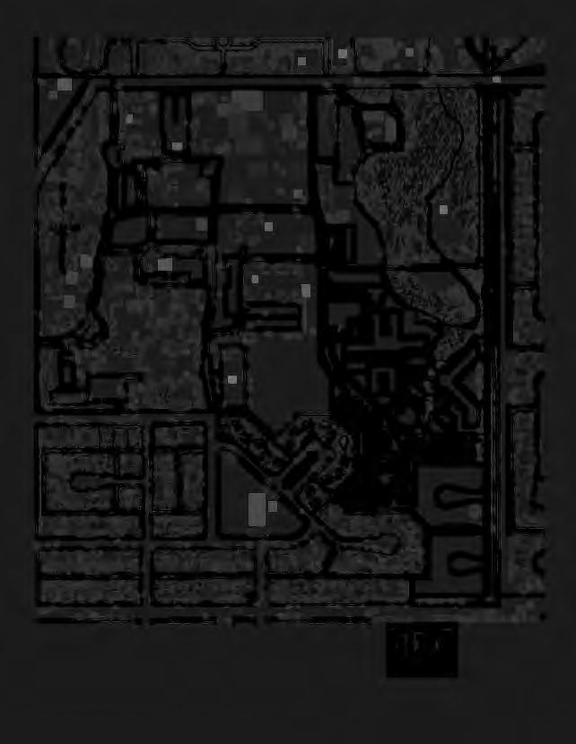
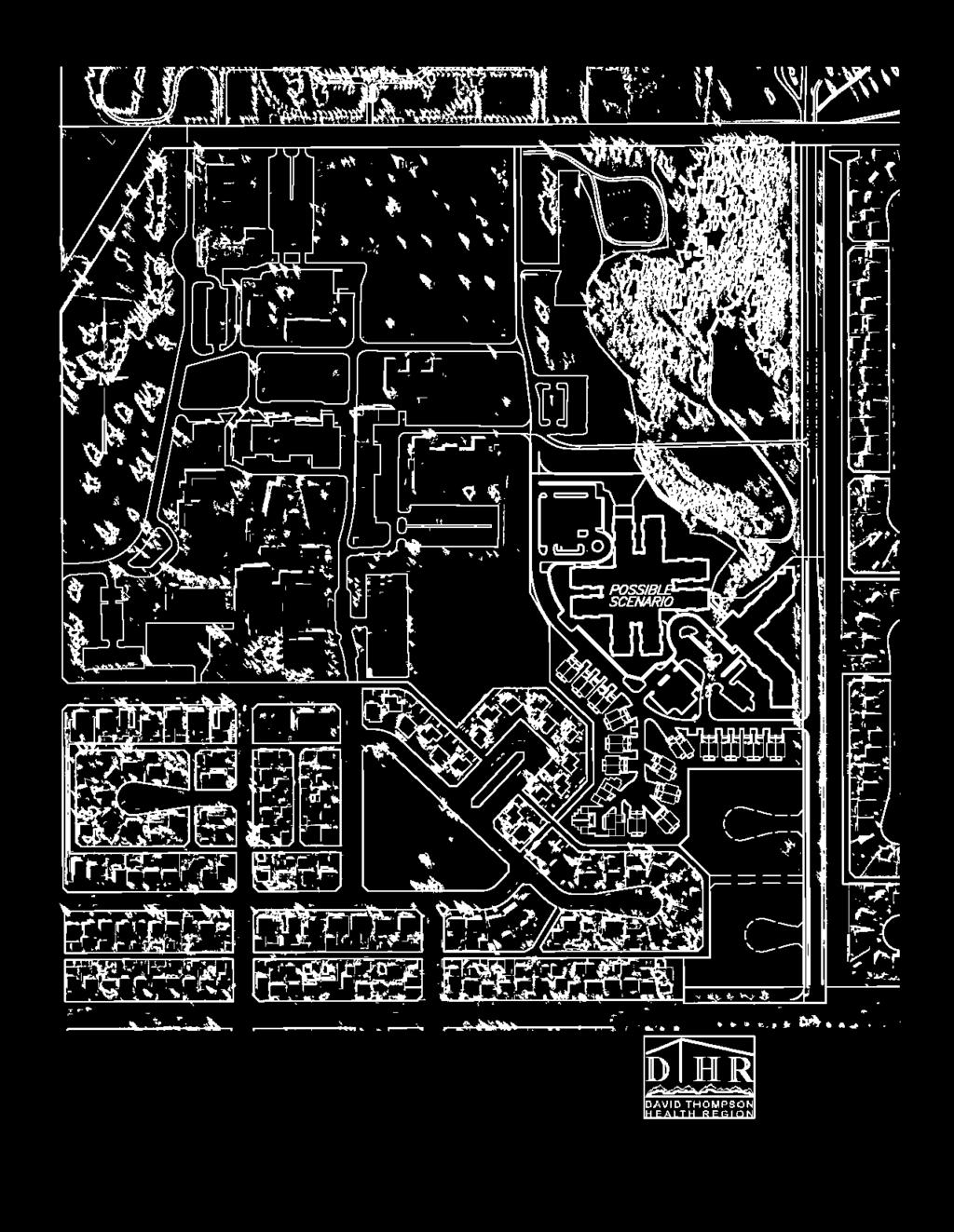
38 L STAGE 1 I ~N~ I STAGE 3 ~~c SOA STREET A ~ Y [ N[R CLOSE ,,10.0 ~- - I I o---=-20!!!!!!!!!! - +..,.o --~75 - I.a\l ii=t=l.a\ --~~ ENGINEERING LTI>. FIGURE 8: POSSIBLE SCENARIO FOR MICHENER HILL VILLAGE

39 PROPOSED NATURE TRAll (CITY OF RED DEER) 55 STREE! ~N~ I ITIJ 111 I J EXISTING PATH TO BE REMOVED -- EXISTING PA TH SYSTEM PROPOSED PATH SYSTEM PROPOSED 2. 5m PATHWAY --- FIGURE 9: TRAIL SYSTEM

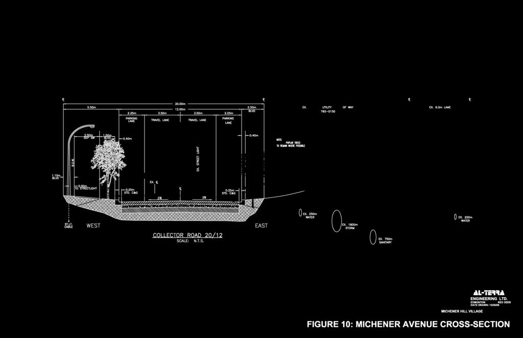
40 5.50m 2.25m 20.00m m 12.00m BLVD 2.25m EX. 15.B3Bm UTIUlY RIGHT OF WAY EX. 6.0m LANE PARKING LANE PARKING LANE 0.40m 001E: ~ISTINC POPIJ.R 1REES / 10 ~ WHERE l'ossibi. :ri q ID ' 1.1Dm BLVD TO Osl~'rETLIGHT EX. 7.0m ROAD EX. ~ I ST.LT. CABLE WEST COLLECTOR ROAD 20/12 SCALE: N.T.S. 0 EAST OEX. 1800m STORM EX. 750m SANITARY 0 EX. 200m WATER 4L ie 4 ENGINEERING LTD. EDMONTON RED DEER DATE DRAWN: 10/20/06..., MICHENERHILLVILLAGENASP------~ FIGURE 10: MICHENER AVENUE CROSS-SECTION
41 ~ z- -- ~ I I I I / ~ \ ) I I \ I \ I I I EXISTING TREES TO REMAIN WHERE POSSIBLE ~ ~ ~ e G "' e ~ :5 ~ e EXISTING ej r5 e ~ ~ TREES TO REMAIN WHER. POSSIBLE ICHENER AVENUE LIMIT OF CONSTRUCTION I I I I LEGEND EXISTING CURB\EDGE OF PAVEMENT TO BE REMOVED PROPOSED CURB TO BE INSTALLED -xx-- EXISTING STREETLIGHT >0< PROPOSED STREETLIGHT 0 4L ie 4 ENGINEERING LTD. EDMONTON RED DEER DATE DRAWN: 10/16/06 " MICHENERHILLEASTNASP --.- FIGURE 11: MICHENER AVENUE IMPROVEMENTS
 1------1(11 ~\)\\------1------1 LEGEND")

42 I --N- I I J T~ w I _ _,_ MICHENER CLOSE POSSIBLE If. FOR I ~ RESIDUAL LOTS l W --l_ ~ /. / 0:: ( I ~ "' t" ~ I ~ STREET LIMIT OF CONSTRUCTION ) (11 ~\)\\ LEGEND EXISTING CURB TO BE REMOVED PROPOSED CURB TO BE INSTALLED 14m ROAD WIDENING , _0 4 _o 4L ie=l=l4 ENGINEERING LTD. EDMONTON RED DEER DATE DRAWN: 10/16/06 7 _ 5 MICHENERHILLVILLAGENASP--"" FIGURE 12: ROSS STREET IMPROVEMENTS


43 e EXISTING TRANSIT STOPS 0 PROPOSED TRANSIT STOP TO BE CONTRUCTED WITH PHASED 4 DEVELOPMENT PROPOSED TRANSIT STOP COVERAGE AREA IIIIIIJ IIIIIIJ IlIIIIl IlIIIIl CIRCLES SHOW 400m RADIUS FROM NEAREST TRANSIT STOPS.J 1qo L ie 4 ENGINEERING LTD. EDMONTON RED DEER DATE DRAWN: 10/ MICHENERHILLVILLAGENASP---" FIGURE 13: TRANSIT PLAN
44 55 STREET ~ ~ ~N~ I ~ [[[ [[ [[ r rmni11w D~l [I I I I I I I I I I I I I I I I I I I I I l ~[ EXISTING STORM SEWER EXISTING RA VINE PROPOSED STORM SEWER.ll-ii:=t=t.l ENGINEERING LTD EDMONTON RED DEER DATE DRAWN: 11/14/ I FIGURE 14: STORM SEWER SERVICING
45 I ~ STREET 51A STREET J w ~ <( OJ n IILJill I l I I I I I I I I I I I I I I I I I I I t==l] [ I I I I I I I I I I I I I I I I I I I I I l ~ [ EXISTING SANITARY SEWER.lL iic=t=t.l ENGINEERING LTD. -- PROPOSED SANITARY SEWER I EDMONTON RED DEER DATE DRAWN: 11/14106 FIGURE 15: SANITARY SEWER SERVICING
46 STREET ROSS STREET ~---~, : D t==l] [~I I I 1~1111,,-ml ,,--,-,-1 ~1111 J E EXISTING WATER MAIN - PROPOSED WATER MAIN j\l-ii:=t=tj\ ENGINEERING LTD EDMONTON RED DEER I DATE DRAWN: 11/14106 FIGURE 16: WATER MAIN SERVICING


47 STAGE 4 55 Street P1 MR A2 ER Michener Avenue PS P1 MR N STAGE 1 PS InterPLAN strategies, inc. Land Planning Services STAGE 2 Proposed topsoil stockpile location NASP Boundary Stage One Stage Two R1A R1A STAGE 3 Michener Avenue Stage Three Ross Street Stage Four FIGURE 17: DEVELOPMENT STAGING
OP Council Resolution June 16, Planning and Development Services
 OP-08-01 Council Resolution June 16, 2008 Planning and Development Services Kingsgate Landing Outline Plan Table of Contents 1.0 Introduction 1 1.1 Purpose of Plan 1 1.2 Plan Area Location 1 1.3 Ownership
City of Grande Prairie Development Services Department KENNEDY DEVELOPMENTS LTD. OUTLINE PLAN OP-09-01
 City of Grande Prairie Development Services Department KENNEDY DEVELOPMENTS LTD. OUTLINE PLAN OP-09-01 July 27, 2009 TABLE OF CONTENTS 1.0 Introduction... 1 1.1 Plan Area Location & Context... 1 1.2 Ownership
City of Grande Prairie Development Services Department
 City of Grande Prairie Development Services Department ROYAL OAKS NORTH OUTLINE PLAN OP-07-03 NW 35-71-6 W6M May 7, 2007 Royal Oaks North Outline Plan TABLE OF CONTENTS 1.0 INTRODUCTION........ 3 1.1 Purpose
Leduc Industrial Outline Plan SE W4
 Leduc Industrial Outline Plan SE 1-50-25-W4 Within the North Leduc Industrial ASP Prepared for: Leduc Energy Park Ltd. Prepared by: Stantec Consulting Ltd. File No. 1161 104655 V5 Table of Contents 1.0
ROAD CLOSURE AND LAND USE AMENDMENT SILVER SPRINGS (WARD 1) NORTHEAST OF NOSEHILL DRIVE NW AND SILVER SPRINGS ROAD NW BYLAWS 2C2018 AND 29D2018
 NORTHEAST OF NOSEHILL DRIVE NW AND SILVER SPRINGS ROAD NW BYLAWS 2C2018 AND 29D2018") Page 1 of 19 EXECUTIVE SUMMARY This application proposes redesignating two parcels in the community of Silver Springs from Special Purpose Future Urban Development (S-FUD) District and undesignated road
Page 1 of 19 EXECUTIVE SUMMARY This application proposes redesignating two parcels in the community of Silver Springs from Special Purpose Future Urban Development (S-FUD) District and undesignated road
Clearview North. Neighborhood Area Structure Plan. Reference# Ross Stre I Red Deer AB T4N 1X5. March 2009
 Clearview North Neighborhood Area Structure Plan Reference# 112870942 SLlr I _ Cv... ulhr.g l..v 600 4808 Ross Stre I Red Deer AB T4N 1X5 March 2009 Amended on March 23, 2009 Bylaw 3217/B-2009 Clearview
Palisades Outline Plan
 NE ¼ 25 36 28 W4 Town of Penhold Approved August 13, 2012 Contents Figures & Tables... 2 Introduction... 1 Overview... 1 Purpose... 1 Development Area... 3 Ownership... 3 Topography... 3 Existing & Surrounding
Land Use Amendment in Southwood (Ward 11) at and Elbow Drive SW, LOC
 at and Elbow Drive SW, LOC") 2018 November 15 Page 1 of 10 EXECUTIVE SUMMARY This land use amendment application was submitted by Rick Balbi Architect on 2017 August 31 on behalf of Sable Developments Ltd, and with authorization from
2018 November 15 Page 1 of 10 EXECUTIVE SUMMARY This land use amendment application was submitted by Rick Balbi Architect on 2017 August 31 on behalf of Sable Developments Ltd, and with authorization from
WEST HILL BUSINESS PARK AREA STRUCTURE PLAN
 MUNICIPAL DISTRICT OF PEACE NO. 135 WEST HILL BUSINESS PARK AREA STRUCTURE PLAN Prepared by: TABLE OF CONTENTS 1.0 Introduction... 1 1.1 Purpose of Plan........ 1 1.2 Plan Area..... 1 1.3 Existing Conditions...
Bylaw C-1262 Adopted February 6, Planning and Development Department
 Bylaw C-1262 Adopted February 6, 2012 Planning and Development Department CITY OF GRANDE PRAIRIE BYLAW C-1262 A Bylaw to adopt the Brookfield Neighbourhood Outline Plan THE MUNICIPAL COUNCIL OF THE CITY
C ity of Grande Prairie Development Services Department
 C ity of Grande Prairie Development Services Department FAIRWAY DEVELOPMENT OUTLINE PLAN OP 08 09 Approved April 6, 2009 Prepared by: Focus Corporation Table of Contents 1.0. Introduction 2 3 1.1. Plan
The Uplands Area Structure Plan. City of Cold Lake, NE & SE W4
 City of Cold Lake, NE & SE 13-63-2-W4 July 2009 1 Contents 1 Background information... 1 1.1 Foreword... 1 1.2 Purpose... 1 1.3 Plan Area and Location... 1 1.4 Ownership... 2 2 Factors Influencing Development...
S o u t h C e n t r a l O u t l i n e P l a n. Leduc Business Park. North Leduc Industrial Area Structure Plan C it y of Led u c.
 Leduc Business Park North Leduc Industrial Area Structure Plan C it y of Led u c Prepared for Farm Air Properties Inc. January, 2007 Table of Contents Page Number 1.0 Purpose of Plan and Definition of
Bylaw C-1186 Adopted November 5, Planning and Development Services
 Bylaw C-1186 Adopted November 5, 2007 Planning and Development Services CITY OF GRANDE PRAIRIE OFFICE CONSOLIDATION BYLAW C-1186 A Bylaw to adopt the Westgate Area Structure Plan (As Amended by Bylaw C-1186-1,
LAND USE AMENDMENT CORNERSTONE (WARD 3) 60 STREET NE AND COUNTRY HILLS BOULEVARD NE MAP 26NE BYLAW 22D2017
 60 STREET NE AND COUNTRY HILLS BOULEVARD NE MAP 26NE BYLAW 22D2017") Page 1 of 14 EXECUTIVE SUMMARY This Land Use Amendment application covers an area of 43.76 hectares ± (108.14 acres ±) located in northeast Calgary, bound by Country Hills Boulevard NE to the south and
Page 1 of 14 EXECUTIVE SUMMARY This Land Use Amendment application covers an area of 43.76 hectares ± (108.14 acres ±) located in northeast Calgary, bound by Country Hills Boulevard NE to the south and
Bylaw No. B-03/2011 Adopted by Airdrie City Council February 21, 2012
 COOPER S CROSSING STAGE 4 Neighbourhood Structure Plan City of Airdrie WESTMARK HOLDINGS LTD. Bylaw No. B-03/2011 Adopted by Airdrie City Council February 21, 2012 CONSULTANTS: LAND USE PLANNING: Southwell
LAND USE AMENDMENT CORNERSTONE (WARD 3) COUNTRY HILLS BOULEVARD AND STONEY TRAIL NE BYLAW 9D2017
 COUNTRY HILLS BOULEVARD AND STONEY TRAIL NE BYLAW 9D2017") Page 1 of 12 EXECUTIVE SUMMARY This Land Use Amendment application covers an area of 54.92 hectares ± (135.71 acres ±) located in northeast Calgary, bound by Country Hills Boulevard NE to the north and
Page 1 of 12 EXECUTIVE SUMMARY This Land Use Amendment application covers an area of 54.92 hectares ± (135.71 acres ±) located in northeast Calgary, bound by Country Hills Boulevard NE to the north and
ADMINISTRATION RECOMMENDATION 2016 November 03. That Calgary Planning Commission recommends APPROVAL of the proposed Land Use Amendment.
 Page 1 of 12 EXECUTIVE SUMMARY This Land Use Amendment application covers an area of 75.76 hectares ± (187.20 acres ±) located in northeast Calgary, bound by Stoney Trail NE to the north, 128 Avenue NE
BYLAW C A Bylaw of Rocky View County to amend Land Use Bylaw C
 BYLAW C-7720-2017 A Bylaw of Rocky View County to amend Land Use Bylaw C-4841-97. The Council of Rocky View County enacts as follows: PART 1 TITLE This Bylaw shall be known as Bylaw C-7720-2017. PART 2
Municipal Development Plan. Summer Village of ROCHON SANDS. Bylaw #241-18
 Municipal Development Plan Summer Village of ROCHON SANDS Bylaw #241-18 TABLE OF CONTENTS PART ONE: BACKGROUND AND PURPOSE 3 SECTION 1: BACKGROUND 3 SECTION 2: GOALS AND POLICIES 3 PART TWO: PHYSICAL ENVIRONMENT
Central and East Neighbourhoods - Hermitage Outline Plan
 Central and East Neighbourhoods - Hermitage Outline Plan Office Consolidation September 2013 Prepared by: Planning and Policy Services Branch Planning and Development Department City of Edmonton The Central
Outline Plan in Belvedere (Ward 9) at Street SE, LOC (OP)
 at Street SE, LOC (OP)") 2018 October 04 Page 1 of 12 EXECUTIVE SUMMARY This outline plan application was submitted by B&A Planning Group on 2016 July 15, on behalf of Tristar Communities Inc. for 50.14 hectares (123.89 acres)
2018 October 04 Page 1 of 12 EXECUTIVE SUMMARY This outline plan application was submitted by B&A Planning Group on 2016 July 15, on behalf of Tristar Communities Inc. for 50.14 hectares (123.89 acres)
Ten Mile Creek Planning Area
 PLANNING AREA POLICIES TEN MILE CREEK Ten Mile Creek Planning Area Location and Context The Ten Mile Creek Planning Area ( Ten Mile Creek area ) is located south of the current Boise AOCI, generally south
Urban Design Brief. 583, 585 and 589 OXFORD STREET EAST. Salt Clinic Canada Inc.
 Urban Design Brief 583, 585 and 589 OXFORD STREET EAST Salt Clinic Canada Inc. February 3, 2013 TABLE OF CONTENTS Page No. INTRODUCTION... 1 SECTION 1 LAND USE PLANNING CONCEPT... 1 1.1 The Subject Property...
North Oakville East Parks Facilities Distribution Plan. November, 2009
 North Oakville East November, 2009 POLICY CONTEXT 1) Purpose a) The purpose of this document is to be a guide for the location, configuration, design and development of the parks system for the North Oakville
BYLAW NO. 3549/2015. Being a Bylaw of The City of Red Deer to provide a uniform levy of off-site costs in respect of previously undeveloped land.
 BYLAW NO. 3549/2015 Being a Bylaw of The City of Red Deer to provide a uniform levy of off-site costs in respect of previously undeveloped land. 1 WHEREAS pursuant to provisions of Section 648 of the Municipal
URBAN DESIGN BRIEF. 2136&2148 Trafalgar Road. Town of Oakville
 URBAN DESIGN BRIEF 2136&2148 Trafalgar Road Town of Oakville Prepared By: METROPOLITAN CONSULTING INC For 2500674 Ontario Inc November 2016 TABLE OF CONTENTS Page No. 1.0 Introduction/Description of Subject
Schonsee Neighbourhood Structure Plan of the Edmonton North Area Structure Plan
 Schonsee Neighbourhood Structure Plan of the Edmonton North Area Structure Plan Office Consolidation September 2010 Prepared by: Planning and Policy Services Branch Planning and Development Department
ADMINISTRATION RECOMMENDATION(S) 2018 January 25. That Calgary Planning Commission recommend APPROVAL of the proposed Land Use Amendment.
 2018 January 25. That Calgary Planning Commission recommend APPROVAL of the proposed Land Use Amendment.") Page 1 of 9 EXECUTIVE SUMMARY This land use amendment proposes to redesignate a parcel from DC Direct Control District to Multi-Residential Contextual Grade-Oriented (M-CG) District to allow for multi-residential
Page 1 of 9 EXECUTIVE SUMMARY This land use amendment proposes to redesignate a parcel from DC Direct Control District to Multi-Residential Contextual Grade-Oriented (M-CG) District to allow for multi-residential
POLICY AMENDMENT AND LAND USE AMENDMENT KILLARNEY/GLENGARRY (WARD 8) NW CORNER OF RICHMOND ROAD AND 33 STREET SW BYLAWS 1P2015 AND 7D2015
 NW CORNER OF RICHMOND ROAD AND 33 STREET SW BYLAWS 1P2015 AND 7D2015") Page 1 of 13 EXECUTIVE SUMMARY This application seeks to redesignate an RC-2 (Residential Contextual One/Two Dwelling) parcel to MC-Gd72 (Multi-Residential Contextual Grade-Oriented) to allow for multi-residential
Page 1 of 13 EXECUTIVE SUMMARY This application seeks to redesignate an RC-2 (Residential Contextual One/Two Dwelling) parcel to MC-Gd72 (Multi-Residential Contextual Grade-Oriented) to allow for multi-residential
HAMLET OF KINGMAN AREA STRUCTURE PLAN
 HAMLET OF KINGMAN AREA STRUCTURE PLAN Prepared by: Austrom Consulting Ltd. Page 1 of 19 Table of Contents TABLE OF CONTENTS... 2 1. BACKGROUND... 3 1.1 PLAN AREA... 3 1.2 PLAN PURPOSE... 3 1.3 LEGISLATIVE
9 th Street Sub Area Plan
 9 th Street Sub Area Plan In the 1990 s, when the Township prepared the last Master Plan, the 9 th Street corridor was studied as part of a larger 9 th Street Focus Area that included the West Main Street
This application has been applied for with support of an Outline Plan to provide the technical details for the site s development.
 Page 1 of 13 EXECUTIVE SUMMARY This application consists of a Land Use Amendment application proposing redesignation from Special Purpose Future Urban Development (S-FUD) District to an assortment of multiresidential,
OFFICE CONSOLIDATION SECONDARY PLAN AREA 22 THE BRAMALEA SOUTH INDUSTRIAL SECONDARY PLAN
 OFFICE CONSOLIDATION SECONDARY PLAN AREA 22 THE BRAMALEA SOUTH INDUSTRIAL SECONDARY PLAN November 2010 EXPLANATORY NOTES (Secondary Plan Area 22) General (pertaining to all secondary plan office consolidations)
Red Fox Commercial Outline Plan
 Red Fox Commercial Outline Plan City of Cold Lake, Alberta Prepared by Durrance Projects Ltd and Ross W. Sharp & Associates Ltd October 2014 Rupert 1 Table of Contents 1. PURPOSE...3 1.1. Location...4
Prepared for: Prepared by: Revised November 2013 by Stantec Consulting Ltd. 200, th Street Se Calgary, AB, T2A 7H8
 Prepared for: Prepared by: PLANNING PROTOCOL INC. 3916 1 ST STREET N.E. CALGARY, AB. T2E 3E3 Revised November 2013 by Stantec Consulting Ltd. 200, 325 25 th Street Se Calgary, AB, T2A 7H8 Table of Contents
SECTION E. Realizing the Plan
 SECTION E Realizing the Plan 60 DESIGN REGINA - OFFICIAL COMMUNITY PLAN SECTION E Realizing the Plan Design Regina has been an ambitious plan-making exercise, with a high level of community, stakeholder,
ONTARIO MUNICIPAL BOARD
 PL 120483 ONTARIO MUNICIPAL BOARD Applicant/Appellant: 2124123 Ontario Limited Subject: OPA, Rezoning and Draft Plan of Subdivision Municipal Address: 3940 Highway 7 East Municipality: City of Markham
Simon Fraser University Official Community Plan
 Simon Fraser University Official Community Plan 1.0 Introduction Adopted 1996 September 9, Amended April 15, 2002 1.1 The Role of the S.F.U. Official Community Plan 1.1.1 The Simon Fraser University Official
SOUTHPOINTE NEIGHBOURHOOD AREA STRUCTURE PLAN RED DEER. Adopted November 2nd, 2009 Bylaw 3217/E InterPLAN strategies inc.
 SOUTHPOINTE NEIGHBOURHOOD AREA STRUCTURE PLAN RED DEER Adopted November 2nd, 2009 Bylaw 3217/E-2009 SOUTHPOINTE NEIGHBOURHOOD AREA STRUCTURE PLAN PLANNING TEAM: Land Planning Services PREPARED FOR: THE
Mitchell Ranch South MPUD Application for Master Planned Unit Development Approval Project Narrative. Introduction
 Mitchell Ranch South MPUD Application for Master Planned Unit Development Approval Project Narrative Introduction Mitchell Ranch South is a proposed single family (detached) residential development on
Official Plan Review
 Official Plan Review Summary Report - The Built Environment August 2014 Part 1: Introduction Planning for a healthy, prosperous and sustainable community is an important goal for our municipality. From
14 October 10, 2012 Public Hearing APPLICANT: MPB, INC
 14 October 10, 2012 Public Hearing APPLICANT: MPB, INC PROPERTY OWNER: MUNDEN & ASSOCIATES, LP STAFF PLANNER: Karen Prochilo REQUEST: Conditional Change of Zoning (AG-1 & AG-2 to Conditional O-2) ADDRESS
Development Permit Application Form. Property Owner Information as Registered on Legal Title Property Owner Name: Phone:
 Development Application Requirements 1 1926 Tsawwassen Drive Tel: 604-943-2112 Tsawwassen, BC V4M 4G2 www.tsawwassenfirstnation.com Canada Development Permit Application Form Name of Applicant: Address:
PLANNING JUSTIFICATION REPORT
 PLANNING JUSTIFICATION REPORT 55 DELHI STREET CITY OF GUELPH PREPARED FOR: VESTERRA PROPERTY MANAGEMENT PREPARED BY: LABRECHE PATTERSON & ASSOCIATES INC. SCOTT PATTERSON, BA, CPT, MCIP, RPP PRINCIPAL,
Bylaw 884/13 Schedule A. Town of Rimbey. June 2008.
 Bylaw 884/13 Schedule A Town of Rimbey June 2008. Revised April 2013 Bylaw 884/13 Schedule A Johnson Estates Table of Contents 1. Introduction... 11 1.1 Purpose... 11 1.2 Location Context... 11 1.3 Land
GATEWAY AREA STRUCTURE PLAN
 CHESTERMERE GATEWAY AREA STRUCTURE PLAN COMMUNITY OPEN HOUSE SEPTEMBER 22 nd, 2015 PLAN AREA ± 512 hectares (± 1,265 acres) GATEWAY LOCATION UNDEVELOPED LANDS PRESENT AGRICULTURAL USE REGIONAL LAND USE
DEFINED VILLAGE CENTRES & NEIGHBOURHOODS
 DEFINED VILLAGE CENTRES & NEIGHBOURHOODS residents in Nanoose Bay support focusing attractive, planned future development in Red Gap Centre and the Area s neighbourhood centres. In addition, the development
CENTRAL PARK MAJOR AREA STRUCTURE PLAN. Bylaw No. 2017/30, Adopted February 20, P a g e
 CENTRAL PARK MAJOR AREA STRUCTURE PLAN Bylaw No. 2017/30, Adopted February 20, 2018 1 P a g e Table of Contents 1.0 Introduction 4 1.1 Background 4 1.2 Purpose 4 1.3 Location 4 1.4 Planning Process 4
TABLE OF CONTENTS. Sierra Springs Outline Plan
 Sierra Springs Outline Plan TABLE OF CONTENTS 1. Introduction...3 1.1. Purpose of the Plan... 3 1.2. The Approval Process... 3 1.3. Policy and Legislative Framework... 3 2. Development Area...6 2.1. Location
DAVENPORT VILLAGE SECONDARY PLAN
 27 DAVENPORT VILLAGE SECONDARY PLAN 27. DAVENPORT VILLAGE SECONDARY PLAN 1. VISION FOR THE DAVENPORT VILLAGE SECONDARY PLAN Davenport Village, municipally known as 830, 940, 980 and 1100 Lansdowne Avenue,
Westwind Developments Ltd. PIONEER LANDS AREA STRUCTURE PLAN - PROPOSED AMENDMENT
 FEBRUARY 2013 TABLE OF CONTENTS 1.0 BACKGROUND... 1 1.1 Amendment... 1 2.0 LOCATION & CONTEXT... 2 2.1 Land Ownership... 2 3.0 POLICY CONTEXT... 3 3.1 Municipal Development Plan... 3 3.2 Capital Region
ADMINISTRATION RECOMMENDATION(S) 2017 June 15. That Calgary Planning Commission recommends APPROVAL of the proposed Land Use Amendment.
 2017 June 15. That Calgary Planning Commission recommends APPROVAL of the proposed Land Use Amendment.") Page 1 of 7 EXECUTIVE SUMMARY The proposed land use amendment seeks to redesignate a Special Purpose Future Urban Development (S-FUD) District parcel in Residual Ward 3 Sub Area 3H to Industrial Outdoor
Page 1 of 7 EXECUTIVE SUMMARY The proposed land use amendment seeks to redesignate a Special Purpose Future Urban Development (S-FUD) District parcel in Residual Ward 3 Sub Area 3H to Industrial Outdoor
NEIGHBOURHOOD STRUCTURE PLAN
 NEIGHBOURHOOD STRUCTURE PLAN December 2012 2437.0023.06 This report is prepared for the sole use of Vesta Properties Ltd. No representations of any kind are made by Urban Systems Ltd. or its employees
Urban Design Brief December 23, 2015 Southside Construction Group Official Plan & Zoning By-Law Amendment
 Urban Design Brief Proposed Official Plan & Zoning By-Law Amendment 3244, 3263 and 3274 Wonderland Road South Southside Group December 23, 2015 TABLE OF CONTENTS Page No. INTRODUCTION... 1 SECTION 1 LAND
HURON COMMUNITY PLAN
 CITY OF KITCHENER DEPARTMENT OF DEVELOPMENT AND TECHNICAL SERVICES PD 94/7 HURON COMMUNITY PLAN Recommended by Planning and Economic Development Committee: October 31, 1994 Adopted by Kitchener City Council:
6 Growth Management Challenges and Opportunities
 6 Growth Management Challenges and Opportunities The Town has established a goal of attaining a 50% participation rate with respect to employment opportunities versus residential population. The Town s
Planning Commission Staff Report June 5, 2008
 Owner/Applicant Taylor Village Sacramento Investments Partners, LP c/o Kim Whitney 1792 Tribute Road #270 Sacramento, CA 95815 Staff Recommendation Planning Commission Staff Report Project: File: Request:
Description of Preferred Alternative
 Chapter 2 Description of Preferred Alternative 2.1 Introduction This chapter of the programmatic Sammamish Town Center Sub-area Plan Final EIS provides a more detailed description of the Preferred Alternative
5.0 Community Design Plan
 5.0 Community Design Plan The Community Design Plan for the Mer Bleue area is a composite of three plans: Land Use Plan Transportation Plan Municipal Servicing Plan Read together, these Plans and associated
Staff Report and Recommendation
 Community Planning and Development Planning Services 201 W. Colfax Ave., Dept. 205 Denver, CO 80202 p: 720.865.2915 f: 720.865.3052 www.denvergov.org/cpd TO: City Council Neighborhoods and Planning Committee
Checklists. Project Name: Location: File Number: Date of Submittal: Reviewer: Date: Applicant: Contact Name: Phone Number:
 Applicant: Contact Name: Phone Number: Email: Project Name: Location: File Number: Date of Submittal: Reviewer: Date: Concept Plan Requirements: I. General Project Information 1. Address or parcel number
March 21, 2018 ALCA Meeting. March 21, 2018
 March 21, 2018 ALCA Meeting March 21, 2018 Agenda 1. Process and Timeline 2. Original Submission 3. Revised Submission 4. Next Steps The City of Calgary Role: The City is responsible for capturing and
Town of Portola Valley General Plan. Nathhorst Triangle Area Plan
 Town of Portola Valley General Plan Amended December 10, 1997 Table of Contents Introduction... 1 Planning Area... 1 Objectives... 2 Principles... 2 Standards... 4 Description... 4 Community Commercial...
280 Manse Road - Official Plan Amendment, Zoning Amendment, Draft Plan of Subdivision Applications - Preliminary Report
 STAFF REPORT ACTION REQUIRED 280 Manse Road - Official Plan Amendment, Zoning Amendment, Draft Plan of Subdivision Applications - Preliminary Report Date: March 11, 2014 To: From: Wards: Reference Number:
4 Sustainability and Growth Management
 4 Sustainability and Growth Management Introduction Traditionally, has assumed growth and development with limited consideration for the long-term negative social, environmental or economic impacts on
SPECIFIC PLAN Requirements
 CITY OF LANCASTER PLANNING DEPARTMENT 44933 Fern Avenue, Lancaster, California 93534 (661) 723-6100 SPECIFIC PLAN Requirements Purpose The purpose of a specific plan is to provide for the logical development
City of Surrey PLANNING & DEVELOPMENT REPORT File:
 City of Surrey PLANNING & DEVELOPMENT REPORT File: 7916-0362-00 Planning Report Date: July 10, 2017 PROPOSAL: Development Permit Development Variance Permit to allow a truck/trailer staging area and to
WESTMINSTER GLEN CONCEPTUAL SCHEME
 WESTMINSTER GLEN CONCEPTUAL SCHEME Bylaw C-5379-2001, Adopted July 31, 2001 MUNICIPAL DISTRICT OF ROCKY VIEW NO. 44 Department of Planning and Development MUNICIPAL DISTRICT OF ROCKY VIEW NO. 44 BYLAW
PORT WHITBY COMMUNITY
 PORT WHITBY COMMUNITY SECONDARY PLAN UPDATE COMMUNITY IMPROVEMENT PLAN URBAN DESIGN GUIDELINES September 2015 DRAFT PROPOSED AMENDMENT NUMBER # to the Whitby Official Plan PURPOSE: The intent of this Amendment
Mayliewan Neighbourhood Structure Plan Neighbourhood 7 of the Edmonton North Area Structure Plan
 Mayliewan Neighbourhood Structure Plan Neighbourhood 7 of the Edmonton North Area Structure Plan Office Consolidation November 2008 Prepared by: Planning and Policy Services Branch Planning and Development
Proposed Kenmount Hill CDS Amendment. Public Hearing October 25 th, 2018
 Proposed Kenmount Hill CDS Amendment Public Hearing October 25 th, 2018 History of Kenmount Hill Why Kenmount Hill? Why Now? We are a city with a vision for growth and the development of Kenmount Hill
CONTENTS 8.0 LAND USE 8.1 GENERAL LAND USE 8.2 RESIDENTIAL 8.3 MIXED USE 8.4 COMMERCIAL 8.5 EMPLOYMENT LANDS
 8-2 Land Use 8.0 LAND USE CONTENTS 8.1 GENERAL LAND USE 8.1.1 Uses provided for in all Land Use Designations 8.1.2 Uses prohibited in Hazardous Lands, Hazardous Sites and Special Policy Areas 8.1.3 Uses
GEORGE DERBY COMMUNITY PLAN
 Planning and Building Department GEORGE DERBY COMMUNITY PLAN The following Council Report constitutes the George Derby Community Plan as adopted by Council in 1989. TO: MUNICIPAL MANAGER 1989 OCTOBER 17
BRIDGES OF LANGDON CONCEPTUAL SCHEME
 BRIDGES OF LANGDON CONCEPTUAL SCHEME Office Consolidation This page contains the history of relevant bylaws affecting this office consolidation. A copy of the original Bylaw and all amending Bylaws can
Bylaw No Page 1
 Bylaw No. 876-2014 Page 1 A BYLAW OF THE CITY OF LEDUC IN THE PROVINCE OF ALBERTA, TO ADOPT THE AREA STRUCTURE PLAN FOR THE: SOUTH WEST QUARTER OF 31-49-25-W4M The Municipal Government Act, R.S.A. 2000,
AWH REPORT OF THE PLANNING AND DEVELOPMENT DEPARTMENT FOR APPLICATION FOR REZONING ORDINANCE TO PLANNED UNIT DEVELOPMENT
 AWH REPORT OF THE PLANNING AND DEVELOPMENT DEPARTMENT FOR APPLICATION FOR REZONING ORDINANCE TO PLANNED UNIT DEVELOPMENT MAY 8, 2014 The Planning and Development Department hereby forwards to the Planning
Planning & Development. Background. Subject Lands
 Planning & Development APPLICATION BRIEFING Prepared For: Planning Advisory Committee Submitted by: Jason Fox, Director of Planning & Development Date: Subject: Development Agreement Application by Brentwood
WINTERBURN INDUSTRIAL AREA STRUCTURE PLAN
 OCTOBER 2009 Winterburn Industrial Area Structure Plan Office Consolidation November 2012 Prepared by: Current Planning Branch Sustainable Development City of Edmonton Bylaw 15356, was adopted by Council
Urban Design Brief Proposed Residential Development 5219 Upper Middle Road City of Burlington
 Urban Design Brief Proposed Residential Development 5219 Upper Middle Road City of Burlington Prepared by Weston Consulting Prepared for BLOOMFIELD DEVELOPMENT INC. Date: March 2017 Table of Contents 1.
TABLE OF CONTENTS 1.0 INTRODUCTION GENERAL OBJECTIVES LAND USE DESIGNATIONS, OBJECTIVES AND POLICIES 4
 Schedule I- Redstone Golf Course Resort Area Sector Plan 1 TABLE OF CONTENTS 1.0 INTRODUCTION 3 2.0 GENERAL OBJECTIVES 3 3.0 LAND USE DESIGNATIONS, OBJECTIVES AND POLICIES 4 4.0 TRANSPORTATION AND ROAD
TO: Mayor & Council DATE: April 12, The Planning and Development Department and the Engineering Department recommend that Council:
 CORPORATE REPORT NO: R080 COUNCIL DATE: April 12, 2010 REGULAR COUNCIL TO: Mayor & Council DATE: April 12, 2010 FROM: SUBJECT: General Manager, Planning and Development General Manager, Engineering Neighbourhood
AREA STRUCTURE PLAN NE W5M. Adopted by Council September 27, 2010 Bylaw
 AREA STRUCTURE PLAN NE 5-33-1 W5M Adopted by Council September 27, 2010 Bylaw 2010-14 CONTENTS 1.0 Introduction... 3 1.1 Purpose... 3 1.2 Objectives... 3 1.3 Discovery Plains Community Vision... 3 1.3.1
5. Spring Garden Planning Area (Secondary Plan added by OPA #05 11/29/2002)
") 5. Spring Garden Planning Area (Secondary Plan added by OPA #05 11/29/2002) 5.0 Preamble THE PLANNING AREA FRAGMENTED OWNERSHIP PATTERN EMERGING LAND USE ISSUES IMPLEMENT STUDY FINDINGS The Spring Garden
5. Spring Garden Planning Area (Secondary Plan added by OPA #05 11/29/2002) 5.0 Preamble THE PLANNING AREA FRAGMENTED OWNERSHIP PATTERN EMERGING LAND USE ISSUES IMPLEMENT STUDY FINDINGS The Spring Garden
EXHIBIT B PROJECT NARRATIVE POULSBO MEADOWS
 EXHIBIT B PROJECT NARRATIVE POULSBO MEADOWS Name of Project: Poulsbo Meadows; A Planned Residential Development (PRD)/Plat Applicants Name: PBH Group LLC/Byron Harris PO Box 1010 Silverdale, WA 98038 Description
GRAYSTONE ESTATES CONCEPTUAL SCHEME
 GRAYSTONE ESTATES CONCEPTUAL SCHEME Bylaw C-5438-2001, Adopted November 6, 2001 MUNICIPAL DISTRICT OF ROCKY VIEW NO. 44 Department of Planning and Development TABLE OF CONTENTS 1.0 INTRODUCTION 5 1.1 Conceptual
Advance Engineering & Surveying PLLC
 Advance Engineering & Surveying, PLLC Consulting in: Civil & Environmental Engineering Land Surveying Land Development 11 Herbert Drive Phone: (518) 698-3772 Latham, N.Y. 12110 Email:ncostape@gmail.com
Commercial Development Proposal Tenth Line Road. Planning Rationale Report. Minto Developments Inc.
 Commercial Development Proposal 2168 Tenth Line Road Report September 2015 Prepared for Minto Developments Inc. Paquette Planning Associates Ltd. 56 Hutchison Avenue Ottawa, Ontario K1Y 4A3 PH: 613-722-7217
INFRASTRUCTURE EXISTING INFRASTRUCTURE A. Circulation B. Signals C. Drainage D. Utilities
 7.01. EXISTING INFRASTRUCTURE A. Circulation B. Signals C. Drainage D. Utilities 7.02. PROPOSED INFRASTRUCTURE A. Overall Concept B. Circulation C. Signals D. Drainage 7.03. INFRASTRUCTURE MAP A. Key Infrastructure
URBAN DESIGN BRIEF URBAN DESIGN BRIEF 721 FRANKLIN BLVD, CAMBRIDGE August 2018
 URBAN DESIGN BRIEF URBAN DESIGN BRIEF 721 FRANKLIN BLVD, CAMBRIDGE August 2018 DESIGN BRIEF CONTENTS PART A 1.0 INTRODUCTION 2.0 DESCRIPTION & ANALYSIS OF SITE CONTEXT 3.0 DESIGN CONSTRAINTS AND OPPORTUNITIES
City of Spruce Grove East Campsite Business Park Area Structure Plan
 City of Spruce Grove East Campsite Business Park Area Structure Plan Prepared by: UMA Engineering Ltd. 17007 107 Avenue Edmonton, AB T5S 1G3 T 780.486.7000 F 780.486.7070 www.uma.aecom.com Job No. 1560
AMENDMENT NO. 30 TO THE OFFICIAL PLAN OF THE TOWN OF MILTON
 AMENDMENT NO. 30 TO THE OFFICIAL PLAN OF THE TOWN OF MILTON Subject: Boyne Survey Secondary Plan and Related Official Plan Amendments The following text and schedules constitute Amendment No. 30 to the
SUMMER VILLAGE OF SUNRISE BEACH
 SUMMER VILLAGE OF SUNRISE BEACH Municipal Development Plan Bylaw No. 132-13 ~ 2 ~ Summer Village of Sunrise Beach Municipal Development Plan 1 INTRODUCTION 1.1 SETTING The Summer Village of Sunrise Beach
CITY OF KELOWNA MEMORANDUM. Date: June 20, 2001 File No.: Z City Manager Planning and Development Services Department
 CITY OF KELOWNA MEMORANDUM Date: June 20, 2001 File No.: Z00-1033 To: From: City Manager Planning and Development Services Department Subject: APPLICATION NO. Z00-1033 OWNER: ELDORADO RANCH LTD. AT: JIM
Colerain Township report to. Hamilton County Regional Planning Commission. December 2, 2010, 1:00PM. t a f f r e p o r t
 Colerain Township report to Hamilton County Regional Planning Commission December 2, 2010, 1:00PM Preliminary Plan: Case No.: ZA2001-04, Forevergreen Prepared By: Amy Bancroft, Land Use Planner t a f f
523, 525 and 525A Adelaide Street West - Zoning Amendment Application - Preliminary Report
 STAFF REPORT ACTION REQUIRED 523, 525 and 525A Adelaide Street West - Zoning Amendment Application - Preliminary Report Date: May 12, 2012 To: From: Wards: Reference Number: Toronto and East York Community
East Panorama Ridge Concept Plan Amendment
 Page 1 of 7 L003 : East Panorama Ridge Concept Plan Amendment Corporate NO: L003 Report COUNCIL DATE: March 4, 2002 REGULAR COUNCIL LAND USE TO: Mayor & Council DATE: February 27, 2002 FROM: General Manager,
Municipal Development Plan Update Urban Service Area and Hamlets
 ENCLOSURE 1 Municipal Development Plan Update Urban Service Area and Hamlets Priorities Committee January 24, 2017 MUNICIPAL DEVELOPMENT PLAN UPDATE SHAPING OUR FUTURE MDP Update - Agenda MDP Update Public
HAYS RIDGE NEIGHBOURHOOD AREA STRUCTURE PLAN
 Melcor Developments Ltd. HAYS RIDGE NEIGHBOURHOOD AREA STRUCTURE PLAN CONSOLIDATED APRIL 2012 Hays Ridge Neighbourhood Area Structure Plan Office Consolidation April 2012 Prepared by: Current Planning
and services The protection and conservation of environmentally significant and sensitive natural heritage features and functions.
 6. Land Use 6.0 Preamble A healthy and livable city is one in which people can enjoy a vibrant economy and a sustainable healthy environment in safe, caring and diverse neighbourhoods. In order to ensure