EXISTING CONDITIONS REPORT
|
|
|
- Tamsin White
- 5 years ago
- Views:
Transcription


1 EXISTING CONDITIONS REPORT

2 Photo 2 and art Credit here city wide urban design analysis

3 3
4 Executive Summary The Existing Conditions Report culminates the first phase of the 5280 LOOP master planning process. Its purpose is to document the existing constraints along of the conceptual route and understand the existing built environment, public health issues, development patterns and mobility. These studies and analysis will be used to guide future ure design decisions that will inform the physical character and implementation of the LOOP. 4 city wide urban design analysis
5 INTRO 6 CITY WIDE URBAN DESIGN ANALYSIS 18 CITY WIDE PUBLIC HEALTH ANALYSIS 30 PLANNING SEGMENT URBAN DESIGN ANALYSIS 36 COMMUNITY ENGAGEMENT PROCESS 112 5


6 WHAT IS THE? 6 INTRODUCTION


7 IMAGINE a world-class trail linking together a network of distinct community spaces revolving around Downtown Denver. Prioritizing PEOPLE, HEALTH, CULTURE and NATURE, The 5280 Loop will connect people and neighborhoods through the great urban outdoors and create a powerful SENSE OF PLACE for the many vibrant and diverse city center neighborhoods. The Downtown Denver Partnership leads the way as the 5280 Loop design process begins. This effort builds on the visionary ideas and goals identified in numerous city and neighborhood plans to reimagine and repurpose our shared public spaces, linking neighborhoods and connecting people. It s about People It s about Place It s about Connection It s about Experience It s about Health It s about Denver 7

8 Looking at the city as a blank slate, the will better connect... Denver s parks, rivers, and trails Downtown neighborhoods 8 INTRODUCTION


9 major retail corridors major bike routes civic destinations, bars, restaraunts, schools and community centers 9
10 THE IDEA The idea for the 5280 Loop grew out of the many years of planning and community outreach efforts from the City of Denver and the Downtown Denver Partnership. The Loop aims to build a better and more connected city and realize ideas and principles born out of individual neighborhood plans and more encompassing City-Wide plans. Neighborhood Plans Community Workshops Ongoing Public Ownership Conservancy? The Idea Grant Funding Showcase Blocks Concept Design Detailed Design Construction Build a Better City Downtown Area Plan Outdoor Downtown Ideation Additional Long- Term Funding Maintenance 10 INTRODUCTION

 Key Language: Adopted as a supplement to Plan 2000.")

11 CITY WIDE PLANS DENVER COMPREHENSIVE PLAN (2000) Key Language: Objective 11: Green Connections - states cooperation is encouraged to further develop regional trail, bicycle and pedestrian amenities Goal: Anticipate and meet the expanding mobility needs of residents, businesses and visitors. The root of the problem is a society focused far too much on accommodating automobiles, We do not provide a range of convenient mobility choices for citizens from neighborhood pedestrian connection to crosstown transit. BLUEPRINT DENVER (2002) Key Language: Adopted as a supplement to Plan First step in planning an integrated land-use and transportation strategy for Denver, and called for an expanded transportation study. Identifies guiding principles to achieve citywide land use and transportation vision. Identifies land use and missing links in bike system. DENVERIGHT PLANS (ON-GOING) Once adopted, these plans will replace Blueprint Denver, Parks and Recreation Game Plan, and Denver Moves Bicycle Master Plan 11


12 DOWNTOWN PLANS THE OUTDOOR DOWNTOWN (2017) Established the idea for the Downtown Loop as one of four iconic projects Goals related to the 5280 Loop: Create an iconic, equitable, highly visible, and easily accessible project Provide safe and comfortable movement across and through Downtown Denver for cyclists and pedestrians Capitolize on opportunities in the organization of the loop and subloops that relate to specific social and cultural districts and development DOWNTOWN DENVER MULTIMODAL ACCESS PLAN (2005) Goals related to the 5280 Loop: Form a comprehensive network that conveniently connects all subareas within Downtown Reinforce and celebrate unique aspects of Denver s downtown Reconfigure intersection at Broadway/21st/Champa/Stout for pedestrians and motorists Provide bicycle connections on 18th, 19th, and Sherman, a distributor for other routes 12 INTRODUCTION
 Goals")

13 SMALL AREA PLANS & STUDIES DENVER DOWNTOWN AREA PLAN (2007) Goals related to the 5280 Loop: Put pedestrians first by making safe, comfortable, and attractive for pedestrians Establish programmatic, economic and cultural links between Downtown and Auraria Create a greener public realm by adding trees, open space, and landscaping NORTHEAST DOWNTOWN NEIGHBORHOODS PLAN (2011, amended 2016) Goals related to the 5280 Loop: Promote walkability, biking and transit while balancing vehicle demand Make 21st a focal point by promoting its role as pedestrian and bicycle route Prioritize ROW on 21st for pedestrians and bikes Bike Boulevard, Festival Street Introduce innovative stormwater strategies and enhanced streetscape to 21st Explore building a new park in underserved Northeast Downtown area 13

14 SMALL AREA PLANS & STUDIES 21ST AND WYNKOOP STREET URBAN DESIGN PLAN (2016) Goals related to the 5280 Loop: 21st Street identified as integral corridor and primary arm of an urban trail Provide neighborhood, park-like atmosphere while maintaining street functions along 21st Create a more consistent mobility experience along Wynkoop Increase open space Create a safe Broadway crossing on 21st Create a more consistent mobility experience along Wynkoop Build upon the existing assets of Wynkoop and acknowledge street as premier destination for residents and visitors Create a curbless environment and maximize pdestrian movement AURARIA HIGHER EDUCATION CENTER (2017) Goals related to the 5280 Loop: Weave the campus seamlessly into the fabric of the surrounding environment Design buildings and thier activities to be seen and experienced Define multiple ways to Connect to Denver Create strong physical connections from the campus to Denver s core 14 INTRODUCTION


15 SMALL AREA PLANS & STUDIES CAPITOL COMPLEX MASTER PLAN (2014) Goals related to the 5280 Loop: Create a Capitol Mall on Sherman between 12th and 16th to prioritize pedestrians Unify the Capitol Complex with consistent urban design elements and wayfinding Add striped bicycle routes to Sherman and more bike parking to endorse bicycle usage Enhance the public realm to create a better user experience and a sense of place Relocate parking in Capitol Circle to reduce pedestrian conflicts and security concerns GOLDEN TRIANGLE PLAN (2014) Goals related to the 5280 Loop: Connected Golden Triangle a walkable, bikeable neighborhood with great transit Improve connections to Civic Center Station through wayfinding and infrastructure Enhance connections to Cherry Creek Greenway at 11th and 8th/9th Intersection improvements along 11th at Speer, Broadway and Lincoln 10 ft. Multi-use path along west side of Speer to promote a Grand Boulevard Promote art walks, cultural tours, and extended programming throughout the area Create a world-class pedestrian and bicycle pathway to connect spaces and places Create a Neighborhood Greenway at Acoma for festivals, farmers markets 15


16 SMALL AREA PLANS & STUDIES LINCOLN PARK / LA ALMA NEIGHBORHOOD PLAN (2005) Goals related to the 5280 Loop: Improve pedestrian and bicycle connections throughout the neighborhood Tree preservation Increase circulation and connectivity Enhance character and quality of life Include new community gathering spaces Preserve valued attributes LINCOLN PARK NEIGHBORHOOD ASSESSMENT (2005) Goals related to the 5280 Loop: Celebrate character and diversity of neighborhood Preserve neighborhood boundaries and resist physical expansion of Auraria Campus Preserve murals, sandstone sidewalks, and other unique architectural elements 16 INTRODUCTION

17 SMALL AREA PLANS & STUDIES LODO NEIGHBORHOOD PLAN (2000) Goals related to the 5280 Loop: Enhance livability among residential, business/office, commercial and retail uses Develop lively street level uses and activities to enhance Lower Downtown s streets Develop a variety og open spaces to support neighborhood interaction Provide linkage to parks, attractions and open space outside the district 17

18
19 CITY-WIDE URBAN DESIGN ANALYSIS

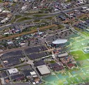
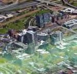
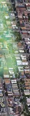
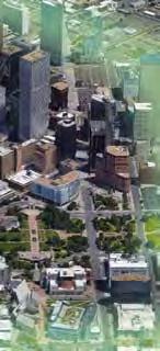
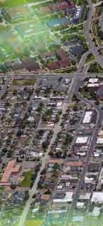
20 Kalamath Santa Fe Broadway Lincoln CITY WIDE URBAN DESIGN ANALYSIS CITY AERIAL COORS FIELD At over 5 miles in length, the 5280 Loop will connect a variety of neighborhoods, major landmarks, nodes, parks, and transportation systems. UNION STATION A city-wide analysis was conducted in order to understand the overlap and integration of the proposed Loop route with major streets and intersections, existing bicycle infrastructure, public transportation systems, city parks and landmarks. PEPSI CENTER TIVOLI STATION DPAC CONVENTION CENTER Park Ave The built environment is examined through landuse, building and block form. Existing right-of-way and curb to curb widths begin to outline the physical space and contraints of the public realm. I-25 Cultural Complex STATE CAPITOL Colfax Avenue 1/4 MILE The 5280 Loop will connect a variety of distinct neighborhoods around Downtown Denver. 20 city wide urban design analysis *Conceptual route shown and is subject to change.


21 Kalamath Santa Fe Broadway Lincoln 5280 LOOP PLANNING AREAS MAJOR STREETS + LANDMARKS COORS FIELD UNION STATION PEPSI CENTER Park Ave DPAC I-25 TIVOLI STATION Speer Boulevard CONVENTION CENTER Cultural Complex STATE CAPITOL Colfax Avenue 1/4 MILE 1/4 MILE The 5280 Loop has been divided into six planning areas that coincide with six Public Pop-Up Events and future community workshops to occur in September and October The 5280 Loop will cross several primary arterials in order to link significant downtown cultural destinations. The ultimate design needs to think about how pedestrian and bicycles safely interface with automobiles. *Conceptual route shown and is subject to change. 21


22 BUILDING FOOTPRINTS BLOCK PATTERN 1/4 MILE 1/4 MILE BUILDING FOOTPRINT The building footprint map highlights the scale of built environment that the 5280 Loop will pass through including Lower Downtown with larger building footprints and taller buildings, Auraria Campus with large footprint institutional buildings and minimal street network, to finer grain residential neighborhoods of Lincoln / La Alma and Capital Hill. The block pattern clearly shows the downtown grid shift and highlights how the conceptual route will interact with the street network. In the northeast and south, where the 5280 Loop runs east-west, it is located along the short face of blocks where intersections are closer together and alley access occurs, whereas to the east and northwest, the route is located along long face of blocks resulting in less street crossings. The larger blocks and disconnected street grid to the west and north creates the opportunity for a more contiguous trail design with minimal interruptions. 22 city wide urban design analysis *Conceptual route shown and is subject to change.


23 PUBLIC TRANSPORTATION BICYCLE NETWORK 1/4 MILE 1/4 MILE HIGH FREQUENCY BUS LOCAL BUS LIGHT RAIL / STATION The 5280 Loop can be thought of as part of the citywide transportation network, providing last mile connectivity between neighborhoods and public transit. The 5280 Loop crosses the Cherry Creek Trail at two locations and connects to a variety of existing and planned bicycle facilities throughout downtown. *Conceptual route shown and is subject to change. 23


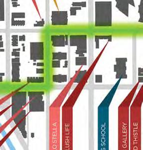
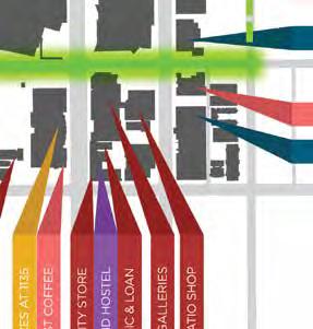
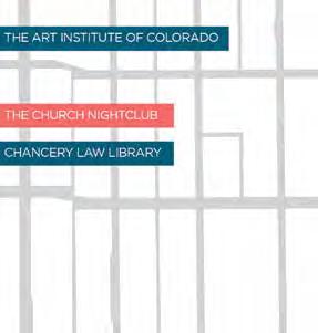
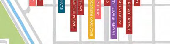
24 BUILDING USE ART / HISTORIC LANDMARKS 1/4 MILE 1/4 MILE The building use diagram highlights the variety of land uses the 5280 Loop will stitch together, including residential neighborhoods, institutional clusters, mixed-use clusters, and vacant properties. The specific land use pattern will inform the design and character of each section of the 5280 Loop. The 5280 Loop passes through neighborhoods that host numerous historic landmark buildings and concentrations of public art. The Loop creates a jumping off point for art and cultural tours that tell the story of Denver and creates a new stage for public art and future landmark architecture. 24 city wide urban design analysis *Conceptual route shown and is subject to change.


25 PARKING LOTS PUBLIC PARKS Commons Park Downtown Children s Playground Union Station Plaza Benedict Fountain Park Tivoli Quad Lawrence Street Plaza 16th Street Mall Wells Fargo Plaza Ninth Street Historic Park Civic Center Lincoln Park Art Museum Plaza Sunken Gardens 1/4 MILE 1/4 MILE PARKING LOTS The abundance of parking lots creates numerous opportunities to create new pocket parks, plazas and open spaces along the 5280 Loop. Public investment in the 5280 Loop as a signature placemaking element downtown also has the potential to spur infill development. The 5280 Loop will link several iconic downtown parks and plazas and has the potential to create new, usable open space in under-served neighborhoods. *Conceptual route shown and is subject to change. 25


26 TREE CANOPY PUBLIC REALM 1/4 MILE The 5280 Loop provides an opportunity to increase downtown tree canopy. A growing body of research demonstrates a correlation between access to trees and natural resources and improved health. RIGHT-OF-WAY PARKS 1/4 MILE Within a quarter mile of the 5280 Loop, 65% of the land is privately owned and 35% is public realm, or city owned land. Of the public realm, 3% is dedicated park and open space and 32% is right-of-way. The 5280 Loop has the opportunity to rethink how we utilize and prioritize space within the public realm. 26 city wide urban design analysis *Conceptual route shown and is subject to change.


27 RIGHT-OF-WAY CURB-TO-CURB WIDTHS STREETS AND CROSSINGS 21st + Broadway Speer + Wewatta Auraria + 11th 20th + Sherman Colfax + Osage Colfax + Sherman Speer + 11th 1/4 MILE 1/4 MILE The right-of-way width represents public land, or the land owned by the City. This space typically includes sidewalks, tree lawns or landscape areas, amenity zones, drive lanes, and parking lanes. The curb-to-curb width represents the width dedicated to the automobile (drive lanes and parking lanes). Approximately 45% of the right-of-way is dedicated to the automobile. The 5280 Loop has the opportunity to reimagine and prioritize how we use the Public Realm. The 5280 Loop will interact with over 45 intersections, several of which are major urban arterials. How the 5280 Loop interacts with intersections is critical to providing a safe, intuitive and user friendly experience. *Conceptual route shown and is subject to change. 27
28 UTILITY INFRASTRUCTURE The final alignment of the loop should take into consideration the horizontal and vertical locations of the existing underground utilities. Within the public realm, there can be up to three wet underground utilities under the paved streets. The wet utilities include water, sanitary sewer, and storm sewer lines. These lines are typically aligned within the streets based on city standards. They are typically spaced 10 apart - centerline of pipe to centerline of pipe. Depths vary, the typical waterline following Denver Water standards can be 4.5 to 5.5 below the top of grade. Sanitary sewer and storm sewer depths vary. These wet utilities are typically gravity lines and the depth increases as they slope downstream. The wet utilities are comprised of mains and service lines which feed the adjacent homes and businesses. Also within the public realm are existing underground utilities that fall into the dry utility category including cable, telecommunications, gas, and steam. These utilities are typically on the edges of the roadway section and are below grade. These utilities are flexible when it comes to bury depth and can be constructed to go below or above and potential utility conflicts when placed. The size of these lines can vary from 1 Ø lines to lines in excess of 12 Ø lines. Telecommunication lines and cable lines are typically run from point to point and cannot be spliced. Gas lines and steam lines can have bends in the lines if needed. As the public realm is developed into the 5280 Loop, listed below are several considerations for the utilities: - Maintenance of the lines Denver Public Works, Denver Water and the other utility providers need to be able to maintain their lines and make repairs if necessary. To do this, access must be maintained which typically means a paved access to the site for vehicles and equipment. Denver Public Works and Denver Water and the other utility providers will be reluctant to allow landscaping over the utility mains as this could cause issues with roots growing into the lines and for the need to quickly make emergency repairs when there is a leak. In addition, utility providers typically will not take on the costs of replacing any landscaping or hardscaping disturbed or destroyed due to maintenance activities. Access to fire hydrants that serve the adjacent buildings. Dependent on the final alignment, certain fire hydrants may need to be relocated for access reasons. 28 city wide urban design analysis *Conceptual route shown and is subject to change.


29 STORM MAINLINES SANITARY MAINLINES *Conceptual route shown and is subject to change. 29
30
31 CITY-WIDE PUBLIC HEALTH ANALYSIS

32 CITY WIDE PUBLIC HEALTH ANALYSIS CHILDHOOD ASTHMA While Denver is known for its healthy residents, the city faces its share of health risks and challenges inherent in fast-paced urbanization today. Rates of childhood obesity, asthma, and residents experiencing poor mental health have remained high over time. Additionally, traffic safety as well as the city s intense urban heat island effect continue to be concerns in the city. The Denver 5280 Loop will help alleviate these health risks by providing residents with spaces to engage in physical activity and connect with community members. Furthermore, the design of the Loop will support Denver s ambitions to improve air quality, mitigate urban environmental issues, and promote traffic calming. ASTHMA RELATED EMERGENCY ROOM VISITS PER 1,000 CHILDREN < 300 RESIDENTS UNDER 20yrs 1/4 MILE Asthma presents a significant concern for Denver residents. Approximately 9% of White adults, 6.9% of Hispanic adults, 10.7% of Black adults, and 12.5% of Other adults have Asthma. Nationally, approximately 7.6% of adults live with Asthma. About 20.6% of high school students were ever told they had Asthma and 11.2% of children (1-14 years) had Asthma. The number of emergency room visits due to childhood asthma varies by Denver neighborhood, with the highest number of visits occurring in predominantly Hispanic, Black, and lower-income neighborhoods. 32 *Conceptual route shown and is subject to change.


33 CHILDHOOD OBESITY WALK OR BIKE TO WORK 1/4 MILE 1/4 MILE PERCENTAGE OF CHILDREN OBESE <10% 10%-14% 15%-19% 20%-24% Childhood Obesity has remained level in Denver over the past five years; however, Black and Hispanic children have substantially higher obesity rates than White children. Obesity rates vary by Denver neighborhoods and are generally higher in communities with greater poverty. Fortunately, some neighborhoods facing high obesity rates are located in the vicinity of the Loop. The 5280 Loop will provide greater opportunity for people to walk or use bicycles for commuting to work. *Conceptual route shown and is subject to change. 33


34 % HISPANIC % WHITE 1/4 MILE 1/4 MILE % HISPANIC % WHITE ALONE BELOW 13% 29-48% ABOVE 68% BELOW 50% 68-81% ABOVE 91% 13-29% 48-68% 50-68% 81-91% The 5280 Loop will connect a diversity of residents. The 5280 Loop will connect a diversity of residents. 34 city wide public health analysis *Conceptual route shown and is subject to change.


35 MEDIAN HOUSEHOLD INCOME % OWNER OCCUPIED 1/4 MILE 1/4 MILE ANNUAL MEDIAN HOUSEHOLD INCOME % OWNER OCCUPIED BELOW $43K $68K - $105K NO DATA BELOW 21% 41-60% ABOVE 79% $43K - $68K ABOVE $105K 21-41% 60-79% The 5280 Loop will connect a diversity of income groups. The 5280 Loop will provide the opportunity to foster ownership of the public realm. *Conceptual route shown and is subject to change. 35
36
37 PLANNING SEGMENT URBAN DESIGN ANALYSIS
38 PLANNING SEGMENT URBAN DESIGN ANALYSIS The 5280 Loop will connect a variety of distinct neighborhoods around Downtown Denver. Each neighborhood has its own unique character along with a number of different resident groups, registered neighborhood organizations, and variety of users. In order to better understand how the Loop will be integrated into these various neighborhoods the design team broke the project into six planning segments. Each segment has a unique set of residents and stakeholders. Community engagement will be tailored to the communities in each segment to gain better input and understanding of each segment during the planning process PLANNING SEGMENT 1 LODO \ DENVER UNION STATION PLANNING SEGMENT 2 BALLPARK \ ARAPAHOE SQUARE PLANNING SEGMENT 3 CAPITOL HILL \ UPTOWN PLANNING SEGMENT 4 GOLDEN TRIANGLE \ CAPITOL HILL PLANNING SEGMENT 5 LINCOLN PARK \ LA ALMA PLANNING SEGMENT 6 AURARIA CAMPUS 38

39 1/4 MILE 39


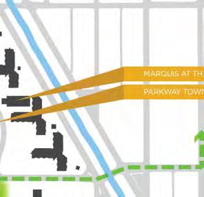
40 20th St 1 PLANNING SEGMENT 1 LODO \ DENVER UNION STATION Denver Union Station creates a strong central node while Coors Field and Pepsi Center anchor either end of downtown. While in proximity to LoDo the Pepsi Center is perceptually far away. The 5280 Loop can better link Lodo and the Pepsi Center. Wynkoop street is one of two places where the 5280 Loop intersects the Cherry Creek Trail, which provides regional trail connectivity. The 5280 Loop should capitalize on this asset and create clear gateway to the trail and Lodo. T WYNKOOP STREET Wazee St 17th St 18th St 19th St 16th St Speer Blvd 15th St LOCATION KEY MAP 40 planning segment urban design analysis
41 1 BUILDING FOOTPRINTS OBSERVATIONS: The conceptual 5280 Loop route is along Wynkoop Street. The dense grain of Lower Downtown (LoDo) buildings and heights creates high concentration of residents, workforce, visitors and amenities within proximity to one-another, creating a highly walkable environment. Coors Field provides a terminus view at the north end of Wynkoop, while Union Station provides a terminus view at the west end of 17th Street. The 5280 Loop project could consider a design intervention that creates a visual terminus at the southern end of Wynkoop Street, creating a visual marker for Cherry Creek from the 5280 Loop, and a visual marker for the 5280 Loop from Cherry Creek. The Union Station transit hub brings commuters and visitors to the heart of downtown. If Union Station is the gateway to Downtown Denver, the 5280 Loop will the thread the links to downtown neighborhoods. As such, it should be welcoming, safe and intuitive to use for visitors. Coors Field Union Station 20th St T 19th St Pepsi Center Cherry Creek WYNKOOP STREET Wazee St 16th St 17th St 18th St 15th St Speer Blvd Building Footprint *Conceptual route shown and is subject to change. 41
42 1 BLOCK FORM AND BUILDING FRONTAGE OBSERVATIONS: Buildings orient towards Wynkoop Street with primary facades and primary entrances. The 5280 Loop runs along the long sides of blocks providing longer segments between street crossings. The lack of through streets along the northern side of the street creates an opportunity to create a more continuous urban trail. 20th St T 19th St Cherry Creek WYNKOOP STREET Wazee St 17th St 18th St 16th St 15th St Speer Blvd Parcel Building Frontage Primary Building Entrance *Conceptual route shown and is subject to change. 42 planning segment urban design analysis


43 1 BUILDING USE OBSERVATIONS: Wynkoop is a predominately commercial core of downtown generating activity from early morning commuters to late night socialites, creating an 18 hour district. There is a significant amount of bars, restaurants and retail along this section of the Loop. 20th St Cherry Creek T WYNKOOP STREET Wazee St 17th St 18th St 19th St 16th St Speer Blvd 15th St Commercial Mixed-use Residential Government Civic / Education Religious Parking Garage *Conceptual route shown and is subject to change. 43
44 1 PARK & PEDESTRIAN NETWORK OBSERVATIONS: The 5280 Loop opens up the opportunity to better connect public amenities like the Cherry Creek Trail to the plazas of Denver Union Station Plaza and Coors Field. The Union Station Plaza is the primary open space amenity along this portion of the 5280 Loop with the fountain attracting a significant number of families and children. In addition, the Downtown Children s Playground is located just south of Cherry Creek. The 5280 Loop should consider how children and families will utilize this segment to access these amenities. Union Station Farmers Market Union Station Fountain Wynkoop Plaza Downtown Children s Playground T WYNKOOP STREET 18th St 19th St 20th St Wazee St 17th St 16th St Cherry Creek 15th St Speer Blvd Tree Location Existing Sidewalk Public Park Private Plaza *Conceptual route shown and is subject to change. 44 planning segment urban design analysis
45 1 BICYCLE NETWORK OBSERVATIONS: 15th, 18th and 19th are primary downtown bicycle connections. The 5280 Loop should be designed to provide safe, intuitive connections to these facilities. 20th St Connection to Cherry Creek Trail Cherry Creek T WYNKOOP STREET 18th St 19th St Wazee St 17th St 16th St 15th St Speer Blvd Bike Lane or Protected Facility Bike Route Multi-Use Trail Cherry Creek Trail Connection *Conceptual route shown and is subject to change. 45
46 1 CONNECTIVITY OBSERVATIONS: An urban grid of two-way streets provides great vehicular connectivity southeast of Denver Union Station. The interruption of the street grid by Union Station, the fact that Wynkoop is not a primary through street and that 16th Street is a pedestrian / shuttle mall decreases Wynkoop s importance to the overall through-put transportation network. This creates an opportunity to re-think the Wynkoop right-of-way in a manner that prioritizes people, placemaking, pedestrians and cyclists. LoDo is primarily accessed via one-way streets. The 5280 Loop design will need to consider how pedestrian and cyclist safely navigate one-way street crossings. 20th St Cherry Creek T WYNKOOP STREET Wazee St 17th St 18th St 19th St 16th St 15th St Speer Blvd One-way Street Two-way Street *Conceptual route shown and is subject to change. 46 planning segment urban design analysis
47 1 PARKING OBSERVATIONS: Existing parking structures and their entrances need to be considered when rethinking the Wynkoop street design. Existing surface parking lots are opportunities for new development, open space and amenities. 20th St 19th St Pepsi Center Cherry Creek T WYNKOOP STREET Wazee St 16th St 17th St 18th St 15th St Speer Blvd Parking Garage Parking Lot *Conceptual route shown and is subject to change. 47
48 1 GROUND FLOOR USES OBSERVATIONS: Wynkoop Street and Union Station have become the Front Porch of Denver, offering a rich and vibrant mix of restaurants, bars, galleries and retailers. Hotel Health Entertainment Civic / Education Art / Venue Retail Bars and Restaurants Residential 48 planning segment urban design analysis

49 *Conceptual route shown and is subject to change. 49


50 1 PHOTO SURVEY WYNKOOP STREET Wazee St 16th St 17th St 5 18th St 19th St 6 20th St 15th St Speer Blvd 1 Looking towards Coors Field along Wynkoop Street from Cherry Creek. 4 Looking towards the mountains down Wynkoop at 17th Street. 5 Plaza in front of Denver Union Station. 50 planning segment urban design analysis


51 2 B-cycles along Wynkoop Street, Coors Field can be seen in the distance. 3 Looking towards Coors Field along Wynkoop at 17th Street. 6 Wynkoop Plaza between 19th St and Coors Field. 7 Looking towards the mountains down Wynkoop Street from Coors Field. 51


52 2 PLANNING SEGMENT 2 21st STREET \ BALLPARK \ ARAPAHOE SQUARE The conceptual 5280 Loop route is predominately along 21st Street and jogs south at Blake Street for one block and north along 20th Street for one block. The route is approximately 0.9 miles long. Coors Field is the primary cultural anchor. LOCATION Wynkoop St Wazee St Blake St 20th St Market St Larimer St Lawrence St Arapahoe St Curtis St Champa St 21ST STREET Stout St California Broadway Welton St 20th Ave 19th Ave 52 planning segment urban design analysis

53 2 BUILDING FOOTPRINTS OBSERVATIONS: As the 5280 Loop route progresses west from Coors Field, building footprints becomes smaller and more dispersed with frequent vacant lots. This area is zoned for higher densities than currently exist today which suggest larger footprint buildings, similar to downtown, will be constructed in the future. Views are terminated at the west by Coors Field and a new residential building to the east. Coors Field Wynkoop St Wazee St Blake St 20th St Market St Larimer St Lawrence St Arapahoe St 21ST STREET Curtis St Champa St Stout St California Broadway Welton St 20th Ave 19th Ave Building Footprint *Conceptual route shown and is subject to change. 53

54 2 BLOCK FORM AND BUILDING FRONTAGE OBSERVATIONS: The blocks are approximately 450 long by 320 wide, oriented southwest/ northeast and serviced by mid-block alleys. Only some of the buildings along 21st Street front on to the street and primary entrances are dispersed. The block and alley layout and ownership patterns are conducive to a development pattern that will place the sides of buildings along 21st Street. Part of the design strategy should consider how buildings could front along 21st Street to provide eyes on the Loop. The Loops route runs along the short sides of blocks creating frequent streets and alley crossings. Design strategies need to facilitate safe pedestrian and bicycle crossing in order to create a sense of continuity and ease of use. Wynkoop St Wazee St Blake St 20th St Market St Larimer St Lawrence St Arapahoe St Curtis St 21st Street Champa St Stout St California Broadway Welton St 20th Ave 19th Ave Parcel Building Frontage Primary Building Entrance *Conceptual route shown and is subject to change. 54 planning segment urban design analysis

55 2 BUILDING USE OBSERVATIONS: 21st Street is a mix of multi-family residential development, small commercial, light industrial, retail buildings and vacant lots and buidings. Wynkoop St Wazee St Blake St 20th St Market St Larimer St Lawrence St Arapahoe St Curtis St 21ST STREET Champa St Stout St California Broadway Welton St 20th Ave Commercial Mixed-use Residential Government Industrial Civic / Education Religious Entertainment Parking Garage Vacant 19th Ave *Conceptual route shown and is subject to change. 55

56 2 PARK & PEDESTRIAN NETWORK OBSERVATIONS: There is a lack of tree canopy along 21st Street. There is a lack of park and open space in this neighborhood. The 5280 Loop should consider ways create parks and open space and increase tree canopy. Wynkoop St Wazee St Blake St Market St 20th St Larimer St Lawrence St Arapahoe St Curtis St 21ST STREET Champa St Stout St California Broadway Welton St Tree Location Existing Sidewalk Public Park Private Plaza 20th Ave 19th Ave *Conceptual route shown and is subject to change. 56 planning segment urban design analysis

57 2 BICYCLE NETWORK OBSERVATIONS: Protected bicycle facilities along Lawrence, Arapahoe, Champs and Stout street provide good north/south connectivity between downtown and five points and RiNo. The 5280 Loop design should create enhanced connections to existing bicycle facilities. Wynkoop St Wazee St Blake St Market St 20th St Larimer St Lawrence St Arapahoe St Curtis St Champa St 21ST STREET Stout St California Broadway Welton St 20th Ave 19th Ave Bike Lane or Protected Facility Bike Route *Conceptual route shown and is subject to change. 57
58 2 CONNECTIVITY OBSERVATIONS: The 5280 Route crosses significant one-way couplets. Broadway bi-sects the street grid at a 45 degree angle, creating a difficult crossing at Broadway and 21st. Design is currently underway to improve this crossing. The eastern end of 21st Street is a critical decision point along the route. Linking 21st Street to Sherman Street will require careful consideration. Wynkoop St Wazee St Blake St Market St 20th St Larimer St Lawrence St Arapahoe St Curtis St Champa St 21ST STREET Stout St California Broadway Welton St 20th Ave 19th Ave One-way Street Two-way Street *Conceptual route shown and is subject to change. 58 planning segment urban design analysis

59 2 PARKING OBSERVATIONS: Existing surface parking lots along the Loop can be opportunities for parks and open space and new development. Few parking garages are located along this segment, which means there is flexibility to influence where future garages are located and how they are accessed as a means to limit the need for vehicular access along 21st. Wynkoop St Wazee St Blake St Market St 20th St Larimer St Lawrence St Arapahoe St Curtis St Champa St 21ST STREET Stout St California Broadway Welton St 20th Ave 19th Ave Parking Garage Parking Lot *Conceptual route shown and is subject to change. 59

60 2 GROUND FLOOR USES OBSERVATIONS: 21st Street passes by a core of bars and restaurants that bring vibrant nightlife to LoDo and the Ballpark area. Hotel Health Entertainment Civic / Education Art / Venue Retail Bars and Restaurants Residential 60 planning segment urban design analysis

61 *Conceptual route shown and is subject to change. 61


62 Broadway 2 PHOTO SURVEY Wynkoop St Wazee St Blake St Market St 20th St Larimer St Lawrence St Arapahoe St Curtis St Champa St 21ST STREET Stout St 5 California Welton St th Ave 19th Ave 1 Corner of 20th Street and Blake Street. 4 21st and Larimer Street looking southeast. 5 Crossing Broadway at 21st Street. 62 planning segment urban design analysis


63 2 Looking towards Coors Field along 21st Street at Market Street. 3 Mural at 21st and Market Street. 6 21st Street looking towards Coors Field at Welton Street. 7 Looking down 21st Street towards Coors Field from 20th Ave. 63


 the")


64 3 PLANNING 20th St SEGMENT 3 CAPITOL HILL \ UPTOWN With both the State Capitol Building and the Wells Fargo Tower (cash register building) the Loop runs adjacent to two of the most iconic buildings in Denver. Glenarm Pl 21st St 20th Ave 19th 19th Ave Ave 18th 18th Ave Ave 17th Ave 16th 16th Ave Ave Colfax Ave 14th Ave Lincoln Lincoln St St 13th Ave LOCATION Broadway 12th Ave 64 planning segment urban design analysis

65 3 BUILDING FOOTPRINTS OBSERVATIONS: The conceptual 5280 Loop is located along Sherman Street and is approximately 0.9 miles long. The grain of the buildings along Sherman Street varies between the finer grain residential buildings and the larger government buildings and office towers. 20th St Glenarm Pl 21st St 20th Ave 19th Ave 18th Ave 17th Ave Wells Fargo Building State Capitol SHERMAN STREET 16th Ave Broadway Lincoln St Colfax Ave 14th Ave 13th Ave 12th Ave Building Footprint *Conceptual route shown and is subject to change. 65

66 3 BLOCK FORM AND BUILDING FRONTAGE OBSERVATIONS: Blocks are approximately 520 long by 280 wide. They are oriented north/south and serviced by mid-block alleys. Most of the buildings orient their primary facades and entrances toward Sherman Street. The Loops route runs along the long sides of blocks in this planning area providing longer segments between street crossings. Glenarm Pl 21st St 20th Ave 20th St 19th Ave 18th Ave 17th Ave SHERMAN STREET 16th Ave Broadway Lincoln St Colfax Ave 14th Ave 13th Ave 12th Ave Parcel Building Frontage Primary Building Entrance *Conceptual route shown and is subject to change. 66 planning segment urban design analysis

67 3 BUILDING USE OBSERVATIONS: The building stock is largely intact with few vacant parcels. The neighborhood character shifts from predominately commercial uses north of the State Capitol to finer grain residential buildings to the south. There are several large parking garages accessed from the northern section of Sherman Street. The 5280 Loop design will need to address how these are accessed. 20th St Glenarm Pl 21st St 20th Ave 19th Ave 18th Ave 17th Ave Wells Fargo Building State Capitol SHERMAN STREET 16th Ave Broadway Lincoln St Colfax Ave 14th Ave 13th Ave 12th Ave Commercial Mixed-use Residential Government Education Religious Parking Garage *Conceptual route shown and is subject to change. 67

68 3 PARK & PEDESTRIAN NETWORK OBSERVATIONS: Large gaps in the street tree planting along Sherman Street create opportunities for improving the quality of the streetscape. Proximity of the Loop to public and private parks opens up the opportunity for a better connected park network. Glenarm Pl 21st St 20th Ave 20th St 19th Ave 18th Ave 17th Ave State Capitol SHERMAN STREET 16th Ave Broadway Lincoln St Colfax Ave 14th Ave 13th Ave 12th Ave Tree Location Existing Sidewalk Public Park Private Plaza *Conceptual route shown and is subject to change. 68 planning segment urban design analysis

69 3 BICYCLE NETWORK OBSERVATIONS: 15th and 16th Avenue are highly utilized bicycle connections in this neighborhood. The Loop can create new routes and better connect the existing bike network. 21st St Glenarm Pl 20th Ave 20th St 19th Ave 18th Ave 17th Ave State Capitol SHERMAN STREET 16th Ave Broadway Lincoln St Colfax Ave 14th Ave 13th Ave 12th Ave Bike Lane or Protected Facility Bike Route *Conceptual route shown and is subject to change. 69

70 3 CONNECTIVITY OBSERVATIONS: The Loop intersects many busy one-way streets through Capitol Hill and provides the opportunity for safer bike and pedestrian crossings. The State Capitol has a private drive and parking area on either side. The 5280 Loop crosses several significant one-way arterials that provide access to downtown including 13th, 14th, 18th and 19th Avenues. 21st St Glenarm Pl 20th Ave 20th St 19th Ave 18th Ave 17th Ave State Capitol Sherman Street 16th Ave Broadway Lincoln St Colfax Ave 14th Ave 13th Ave 12th Ave One-way Street Two-way Street *Conceptual route shown and is subject to change. 70 planning segment urban design analysis

71 3 PARKING OBSERVATIONS: There are several large parking garages accessed from the northern section of Sherman Street. The 5280 Loop design will need to address how these are accessed. Existing surface parking lots are opportunities for new park, open space and development. 21st St Glenarm Pl 20th Ave 20th St 19th Ave 18th Ave 17th Ave State Capitol Lincoln St Broadway 16th Ave SHERMAN STREET Colfax Ave 14th Ave 13th Ave 12th Ave Parking Garage Parking Lot *Conceptual route shown and is subject to change. 71

72 3 GROUND FLOOR USES OBSERVATIONS: Sherman Street runs through the heart of the Capitol Complex and is home to many government institutions, some residential and few bars and restaurants. Hotel Health Entertainment Civic / Education / Religious Art / Venue Retail Bars and Restaurants Residential 72 planning segment urban design analysis

73 *Conceptual route shown and is subject to change. 73


74 3 PHOTO SURVEY 20th St 21st St Glenarm Pl 1 20th Ave 2 19th Ave 18th Ave 17th Ave 16th Ave 3 Colfax Ave 4 14th Ave Broadway Lincoln St 6 13th Ave 5 12th Ave 7 1 Alley at the north end of Sherman Street. 4 Parking Lot surrounding the State Capitol Building. 5 City O City at the corner of 13th Ave and Sherman Street. 74 planning segment urban design analysis


75 2 Looking south on Sherman Street at 18th Ave. 3 View of the CIty and County Building and Mountains from the Capitol steps. 6 View of Capitol and Wells Fargo Tower from Sherman Street and 13th Ave. 7 Sidewalk condition along Sherman Street near 12th Ave. 75


76 4 PLANNING SEGMENT 4 GOLDEN TRIANGLE \ CAPITOL HILL With both the State Capitol Building and the Wells Fargo Tower (cash register building) the Loop runs adjacent to two of the most iconic buildings in Denver. Lincoln St Sherman St Broadway Cherokee St Bannock St 12th AVENUE 11th Ave Delaware St Speer Blvd Cherry Creek LOCATION 76 planning segment urban design analysis


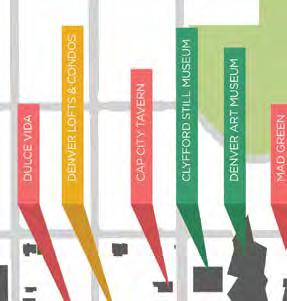
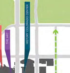
77 4 BUILDING FOOTPRINTS OBSERVATIONS: The conceptual 5280 Loop route is predominately along 12th Avenue, it jogs south along Cherokee Street, then along 11th Avenue to cross Speer Boulevard and Cherry Creek. The grain of buildings through out the Golden Triangle range from large civic footprints of the Cultural Complex to finer grained residential. History Colorado Center Denver Art Museum Clyfford Still Museum Lincoln St Sherman St Broadway Cherokee St Delaware St Bannock St 12th AVENUE 11th Ave Cherry Creek Speer Blvd Building Footprint *Conceptual route shown and is subject to change. 77


78 Cherry Creek Speer Blvd 4 BLOCK FORM AND BUILDING FRONTAGE OBSERVATIONS: The blocks in this area are approximately 500 long and 320 wide. They are oriented north/south and serviced with mid-block alleys. The block and alley layout and ownership patterns generally place the sides of buildings along 12th Avenue with some secondary building entries located along 12th Avenue. Most primary facades and building entries are located along north/south block faces. Lincoln St Sherman St Broadway Bannock St Cherokee St 12th AVENUE 11th Ave Delaware St Parcel Building Frontage Primary Building Entrance *Conceptual route shown and is subject to change. 78 planning segment urban design analysis


79 Speer Blvd 4 BUILDING USE OBSERVATIONS: 12th Ave is a mixed of civic, small commercial buildings and multi-family residential townhomes and towers. A mix of uses provides a variety of users and the opportunity for a variety of programming. The neighborhood is home to a half dozen museums and an eclectic mix of bars, restaurants and neighborhood services. Commercial Mixed-use Residential Government Civic / Education Religious Parking Garage Vacant Lincoln St Sherman St Broadway 12th AVENUE Cherokee St Bannock St Delaware St 11th Ave *Conceptual route shown and is subject to change. 79


80 4 PARK & PEDESTRIAN NETWORK OBSERVATIONS: Proximity of the Loop to public amenities and private plazas opens up the opportunity for a better connected park network. History Colorado Center Plaza Acoma Street Plaza Clyfford Still Park Lincoln St Sherman St Broadway Cherokee St Bannock St 12th AVENUE 11th Ave Delaware St Cherry Creek Tree Location Existing Sidewalk Public Park Plaza Speer Blvd Sunken Garden Park *Conceptual route shown and is subject to change. 80 planning segment urban design analysis


81 Speer Blvd 4 BICYCLE NETWORK OBSERVATIONS: 11th Avenue has bike lanes that connect Golden Triangle to Cheeseman Park to the east and Lincoln Park to the west. 12th Avenue is a high frequency east/west shared bicycle street that connects the Cherry Creek Trail to Capitol Hill, Cheeseman Park and Congress Park Neighborhood via bicycle lanes east of Broadway. Bannock Street is a primary north/south bicycle route linking downtown, Golden Triangle and Baker neighborhoods. The connection to Cherry Creek Trail occurs at 12th Avenues. The 5280 Loop design should facilitate a safe and intuitive connection between these two networks. Bike Lane or Protected Facility Bike Route Multi-Use Trail Cherry Creek Trail Connection Lincoln St Sherman St Broadway Bannock St Cherokee St 12th AVENUE 11th Ave Delaware St Cherry Creek Connection to Cherry Creek Trail *Conceptual route shown and is subject to change. 81


82 Speer Blvd 4 CONNECTIVITY OBSERVATIONS: An urban grid of two-way streets provides great vehicular connectivity throughout the Golden Triangle. The 11th Avenue and Speer Avenue intersection and bridge over Cherry Creek is difficult to navigate as pedestrian or cyclist. Lincoln St Sherman St Broadway Bannock St Cherokee St 12th AVENUE 11th Ave Delaware St Cherry Creek One-way Street Two-way Street *Conceptual route shown and is subject to change. 82 planning segment urban design analysis


83 Speer Blvd 4 PARKING OBSERVATIONS: Parking structures and their entrances pose vehicular circulation challenges. Existing surface parking lots can be opportunities for new development, openspace and amenities. Lincoln St Sherman St Broadway Bannock St Cherokee St 12th AVENUE 11th Ave Delaware St Cherry Creek Parking Garage Parking Lot *Conceptual route shown and is subject to change. 83


84 4 GROUND FLOOR USES OBSERVATIONS: The edge of Capitol Hill and the Golden Triangle has a rich mix of major cultural facilities, hotels, bars, restaurants and retail. Hotel Health Entertainment Civic / Education / Religious Art / Venue Retail Bars and Restaurants Residential 84 planning segment urban design analysis

85 *Conceptual route shown and is subject to change. 85


86 4 PHOTO SURVEY 6 Delaware St Speer Blvd Cherokee St Bannock St 4 Lincoln St Broadway 12th AVENUE th Ave Sherman St Looking west on 12 Ave at Sherman Street. 4 Denver Art Museum Plaza at Acoma Street. 5 Looking south on Cherokee Street at 12th Ave. 86 planning segment urban design analysis


87 2 12th Ave crossing at Broadway. 3 Looking west on 12th Ave at Acoma Street. 6 View of Cherry Creek Trail entry at 12th Ave and Speer Blvd. 7 11th Ave crossing over Cherry Creek at Speer Blvd.. 87


88 5 PLANNING SEGMENT 5 LINCOLN PARK \ LA ALMA The Mariposa development at the 10th and Osage Station has become a new identity for the neighborhood. *Conceptual route shown and is subject to change. Community engagement is on-going and exploring aternative routes through this planning segment. Speer Blvd Santa Fe Dr Kalamath St th St Galapago St Lipan St Mariposa St OSAGE STREET 11th Ave 10th AVENUE LOCATION 88 planning segment urban design analysis


89 Speer Blvd 5 BUILDING FOOTPRINTS OBSERVATIONS: The conceptual 5280 Loop route runs east/west along 10th Avenue and north/ south along Osage Street. Single family residential buildings create a fine grain of buildings through out the Lincoln / La Alma neighborhood with a few larger format schools and businesses interspersed. Building Footprint King Soopers Cherry Creek Santa Fe Dr Galapago St Kalamath St Lipan St 11th Ave OSAGE STREET Mariposa St 10th AVENUE West High Campus Greenlee Elementary School Emily Griffith Technical School Colorado High Charter School T Mariposa *Conceptual route shown and is subject to change. Community engagement is on-going and exploring aternative routes through this planning segment. 89
90 Speer Blvd 5 BLOCK PATTERN AND BUILDING FRONTAGE OBSERVATIONS: The traditional neighborhood residential blocks are 500 long by 270 wide, while the block between Lipan Street and Kalamath, and Kalamath and Santa Fe are 500 long and 345 wide. They are oriented north/south and serviced with midblock alleys. The block and alley layout and ownership patterns generally place the sides of buildings along 10th Avenue with the exception of the northern face of the block between Mariposa Street and Kalamath. This is the one location along the 5280 Loop where single family homes front along the Loop. The design of the 5280 Loop in this segment should be sensitive to the relationship between private and public space. The north/south portion of the 5280 Loop this is located along the long block faces including a park with very few street crossings. This creates an opportunity to create a unique character zone along Osage Street that can be different from any other experience on the Loop. Cherry Creek Santa Fe Dr Galapago St Lipan St Kalamath St 11th Ave Mariposa St 10th AVENUE Osage St Parcel Building Frontage Primary Building Entrance *Conceptual route shown and is subject to change. Community engagement is on-going and exploring aternative routes through this planning segment. 90 planning segment urban design analysis
91 Speer Blvd 5 BUILDING USE OBSERVATIONS: Building use is dominated by single family residential with pockets of multi-family residential, retail and commercial closer to the light rail station and major roads. Commercial Mixed-use Residential Government Civic / Education Religious Parking Garage Cherry Creek Santa Fe Dr Galapago St Lipan St Kalamath St 11th Ave Mariposa St 10th AVENUE Osage St *Conceptual route shown and is subject to change. Community engagement is on-going and exploring aternative routes through this planning segment. 91
92 Speer Blvd 5 PARK & PEDESTRIAN NETWORK OBSERVATIONS: Lincoln Park is a significant neighborhood amenity with passive play space, a baseball diamond, tennis courts and La Alma Recreation Center. The 5280 Loop is an opportunity to stitch the neighborhood together by connecting Lincoln Park, Emily Griffith Technical College, Colorado High Charter School, Mariposa, the light rail station, Art District on Santa Fe, West High School and Sunken Gardens with a safe, family friendly pedestrian and bike network. The 5280 Loop has the potential connect Lincoln Park, Mariposa, Tree Location Existing Sidewalk Public Park Private Plaza Baseball Diamond + Football Field Cherry Creek Santa Fe Dr Galapago St Lipan St Mariposa St Kalamath St 11th Ave 10th AVENUE Sunken Gardens Park Osage St Lincoln Park T *Conceptual route shown and is subject to change. Community engagement is on-going and exploring aternative routes through this planning segment. 92 planning segment urban design analysis
93 Speer Blvd 5 BICYCLE NETWORK OBSERVATIONS: 13th Avenue bike lanes connects to Sun Valley, S. Platte River Trail and Lakewood Gultch. A 5280 Loop spur should be considered to link these amenities and neighborhood to the Loop. The 5280 Loop will intersect with Mariposa bike lanes. The design should provide safe and intuitive connection between these two facilities. Bike Lane or Protected Facility Bike Route Multi-Use Trail Cherry Creek Santa Fe Dr Galapago St Lipan St Mariposa St Kalamath St 11th Ave 10th AVENUE Sunken Gardens Park Osage St Lincoln Park *Conceptual route shown and is subject to change. Community engagement is on-going and exploring aternative routes through this planning segment. 93
94 Speer Blvd 5 CONNECTIVITY OBSERVATIONS: The Loop crosses a mix of high volume one way streets and local two-way streets. Kalamath Street and Santa Fe Drive are a one-way couplet providing access to downtown from 285 and 6th Avenue. Speer experiences peak traffic during morning commute while Kalamath experiences peak traffic during evening commute. Santa Fe Drive is the heart of the Santa Fe Arts District. The scale of the street and adjacent uses tends to keep traffic speeds lower on Santa Fe than on Kalamath. This neighborhood is the only place where the 5280 Loop will connect directly to a Light Rail Station. Not only will the 5280 Loop become neighborhood connection, but also an important last mile connection providing access to Denver Health campus just south of Sunken Gardens Park, the Arts and Cultural district in Golden Triangle, and Civic Center. Cherry Creek 13th Ave Santa Fe Dr Galapago St Lipan St Mariposa St Kalamath St 11th Ave 10th AVENUE Sunken Gardens Park Osage St One-way Street Two-way Street Lincoln Park *Conceptual route shown and is subject to change. Community engagement is on-going and exploring aternative routes through this planning segment. 94 planning segment urban design analysis
95 Speer Blvd 5 PARKING OBSERVATION: Existing surface parking lots can be opportunities for new parks, open space and infill development. Cherry Creek Santa Fe Dr Galapago St Lipan St Mariposa St Kalamath St 11th Ave 10th AVENUE Sunken Gardens Park Osage St Parking Garage Parking Lot Lincoln Park T *Conceptual route shown and is subject to change. Community engagement is on-going and exploring aternative routes through this planning segment. 95


96 5 GROUND FLOOR USES OBSERVATIONS: While the Lincoln/ La Alma neighborhood is dominated by single family residential, the proposed route passes by a mix of multifamily residential, art galleries, restaurants and education buildings. Hotel Health Entertainment Civic / Education Art Retail Bars and Restaurants Residential *Conceptual route shown and is subject to change. Community engagement is on-going and exploring aternative routes through this planning segment. 96 planning segment urban design analysis


97 97


98 Mariposa St 5 PHOTO SURVEY Lipan St Speer Blvd 6 Kalamath St Santa Fe Dr 3 Galapago St 2 1 OSAGE STREET 11th Ave th AVENUE 1 11th Ave bridge crossing at Speer Blvd. 4 Mixed -use development at 10th Ave and Navajo Street looking towards the 10th and Osage light rail station. 5 Residences in Lincoln Park / La Alma. 98 planning segment urban design analysis


99 2 Looking west down 11 Ave from Speer Blvd. 3 10th Ave crossing Santa Fe. 6 Osage Street crossing at Colfax Ave. 7 Emily Griffith Technical College on Osage Street. 99


100 6 PLANNING SEGMENT 6 AURARIA CAMPUS The Loop will thread its way through the campus. Wewatta St Wynkoop St Speer Blvd Chopper Cir Auraria Pkwy 11th STREET LOCATION 7th St CURTIS STREET OSAGE STREET 100 planning segment urban design analysis

101 Speer Blvd 6 BUILDING FOOTPRINTS OBSERVATIONS: The conceptual 5280 Route is located along Curtis Street and 11th Street through campus and is approximately one mile long in this neighborhood. The campus is dominated by large footprint educational facilities that are in stark contrast to the adjacent downtown and Lincoln Park neighborhoods. Wewatta St Wynkoop St Auraria Library Chopper Cir Auraria Pkwy 11th STREET Pepsi Center Tivoli Station 7th St CURTIS STREET Colfax Avenue OSAGE STREET T St. Cajetan s Building Footprint *Conceptual route shown and is subject to change. 101

102 6 BLOCK FORM AND BUILDING FRONTAGE OBSERVATIONS: Building frontages and entries are organized around plazas and open space and few front the proposed Loop route. The 5280 Loop has an opportunity to create a unifying thread through Auraria Campus that feels accessible and welcoming to the public. The super-block pattern and limited street connections through campus can be difficult to navigate for those who aren t familiar with campus. The 5280 has the potential to stitch the campus into adjacent communities by providing a safe, intuitive route through campus. Wewatta St Wynkoop St Speer Blvd Larimer Street Chopper Cir Auraria Pkwy 11th STREET 7th St Lawrence Way CURTIS STREET Colfax Avenue OSAGE STREET Parcel Building Frontage Primary Building Entrance *Conceptual route shown and is subject to change. 102 planning segment urban design analysis

103 6 BUILDING USE OBSERVATIONS: Auraria Campus is home to Community College of Denver, Metropolitan State University, and University of Colorado Denver. The 5280 Loop could be come a unifying thread and front door to each college. Uses are predominately educational facilities and a large entertainment venue with a very small amount of commercial and multi-family residential at the edges of the campus. Wewatta St Wynkoop St Speer Blvd Larimer Street Chopper Cir Auraria Pkwy 11th STREET Commercial Mixed-use 7th St Lawrence Way CURTIS STREET Colfax Avenue Residential OSAGE STREET Entertainment Civic / Education Religious Parking Garage *Conceptual route shown and is subject to change. 103


104 6 PARK & PEDESTRIAN NETWORK OBSERVATIONS: The 5280 Loop will link together a series of quads, parks and pedestrian plazas. Opportunity for a better integrated pedestrian and park network between Downtown and Lincoln Park through Auraria Campus. Downtown Children s Park Tivoli Quad Wewatta St Wynkoop St Lawrence Street Mall Speer Blvd 10th Street Pedestrian Spine Larimer Street Ninth Street Historic Park Chopper Cir Auraria Pkwy 11th STREET 7th St Lawrence Way CURTIS STREET T Colfax Avenue OSAGE STREET Tree Location Existing Sidewalk Public Park Private Plaza *Conceptual route shown and is subject to change. 104 planning segment urban design analysis


105 Speer Blvd 6 BICYCLE NETWORK OBSERVATIONS: The Loop provides new routes through the campus and better connects to the existing bike network and regional trail network. The bicycle route on Lawrence Street connect to the Cherry Creek Trail and connects Auraria Campus to several academic buildings east of Speer Boulevard and Larimer Square. Connection to Cherry Creek Trail Cherry Creek Wewatta St Wynkoop St Connection to Cherry Creek Trail Larimer Street Chopper Cir Auraria Pkwy 11th STREET 7th St Lawrence Way CURTIS STREET T Colfax Avenue OSAGE STREET Bike Lane or Protected Facility Bike Route Multi-Use Trail Cherry Creek Trail Connection *Conceptual route shown and is subject to change. 105


106 Speer Blvd 6 STREET NETWORK OBSERVATIONS: The design and improvement of busy crossings such as Colfax Ave Speer Blvd and Auraria Parkway provide an opportunity for the Loop to better connect the Auraria Campus, Elitch s and the Pepsi Center to Downtown and Lincoln Park. Wewatta St Wynkoop St Larimer Street Chopper Cir Auraria Pkwy 11th STREET 7th St Lawrence Way CURTIS STREET Colfax Avenue OSAGE STREET T One-way Street Two-way Street *Conceptual route shown and is subject to change. 106 planning segment urban design analysis


107 Speer Blvd 6 PARKING OBSERVATIONS: Existing surface parking lots at Chopper Circle and Curtis Streets provide opportunities for wayfinding and amenities along the Loop. Wewatta St Wynkoop St Chopper Cir Auraria Pkwy 11th STREET CURTIS STREET T 7th St OSAGE STREET Parking Garage Parking Lot *Conceptual route shown and is subject to change. 107

108 6 GROUND FLOOR USES OBSERVATIONS: Dominated by educational uses, the Auraria Campus is the home to three separate institutions of higher learning. Hotel Health Entertainment Civic / Education / Religious Art Retail Bars and Restaurants Residential 108 planning segment urban design analysis

109 *Conceptual route shown and is subject to change. 109


110 OSAGE STREET 6 PHOTO SURVEY 1 Wewatta St Wynkoop St 2 3 Speer Blvd 4 Chopper Cir Auraria Pkwy 7th St 11th STREET 6 CURTIS STREET View from Chopper Circle looking back toward downtown. 4 11th Street from Larimer Street with Auraria Library on the left. 5 Bike lanes through campus along the south edge of the Library. 110 planning segment urban design analysis


111 2 11th Street cycle track in Auraria Campus. 3 View of the Tivoli from 11th Street. 6 Looking west down Curtis Street at 11th Street. 7 9th Street Historic Park from Curtis Street. 111
112
113 COMMUNITY ENGAGEMENT PROCESS
, embarked on a guerrilla marketing effort to raise interest and curiosity")
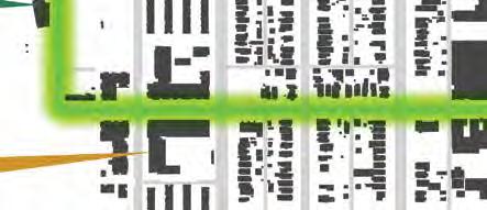
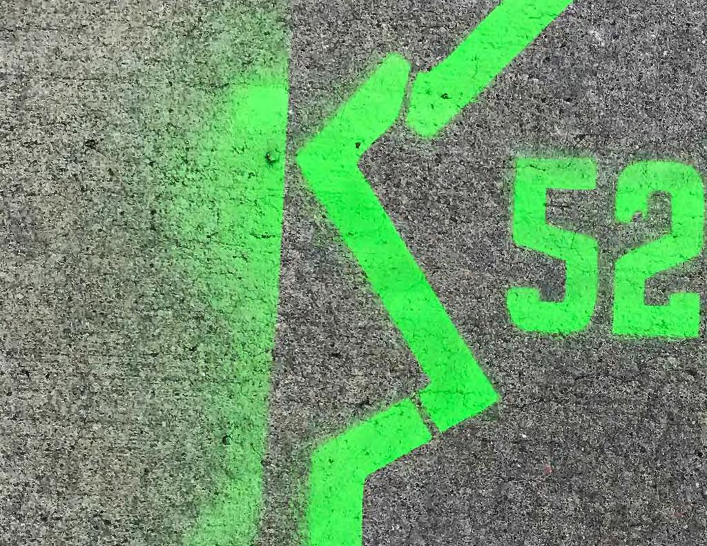
114 COMMUNITY ENGAGEMENT PROCESS SOFT LAUNCH JULY The 5280 Loop planning process features an extensive and robust public involvement strategy. In the late summer of 2017, the project team, bolstered by volunteers from the Downtown Denver Leadership Program (DDLP), embarked on a guerrilla marketing effort to raise interest and curiosity about the 5280 Loop. The campaign, dubbed the 5280 Soft Launch, painted the entire 5 mile route along sidewalks and helped advertise for the pop-up workshops. Held on a Saturday morning in early August, six pop-up workshops were held at key locations in each planning segment, representing a cohesive city-wide effort to launch the project and gather crucial data on local travel patterns, neighborhood destinations, and user types. Phase I of community workshops, designed to further develop a collaborative vision and garner routing consensus from each planning area segment, began in late summer and continue throughout the fall of As the 5280 Loop physical designs take shape, Phase II of community workshops will solicit specific input on street composition, place making concepts, and park designs. SOFT LAUNCH POP-UP WORKSHOPS WORKSHOPS PHASE I WORKSHOPS PHASE II Ribbons wrapped trees, posters plastered light poles, and spray chalk outlined the 5280 Loop route throughout Downtown Denver neighborhoods after a team of DDLP volunteers and project leaders spent a weekend morning highlighting the 5280 Loop. Social media exploded with #5280Loop and local news outlets, including Denver Channel 7 and Denver Streetsblog, buzzed with anticipation. 114 PUBLIC OUTREACH


115 POP-UP WORKSHOPS AUGUST COMMUNITY WORKSHOPS OCTOBER Following the Soft Launch, the project team hosted six, concurrent pop-up workshops near heavily trafficked destinations at each planning segment. Community members at each workshop shared their travel habits, highlighted local landmarks, and voiced opinions on a visual prefence survey. Key outcomes from these workshops included many residents speaking in favor of pedestrianonly streets or shared streets concepts, commonly known as wooneufs. Residents at all locations also listed safer connections, intuitive wayfinding, and re-greening Denver as crucial community values. Building on the unique identies of Denver s diverse downtown neighborhoods is a fundamental goal of the 5280 Loop planning and design. An intimate community workshop is planned for each individual planning segment, where project leaders will further develop design principles and community values unique to each neighborhood. These workshops will also provide critical input on finializing the coneptual 5280 Loop route established by the Downtown Denver Partnership. Several route options are floated to community members to gauge interest and excitement. 115
116
117
Town Center (part of the Comprehensive Plan)
") Town Center (part of the Comprehensive Plan) Mercer Island Town Center Looking North (2014) In 1994, a year-long process culminated in a set of design guidelines and code requirements for the Town Center
Town Center (part of the Comprehensive Plan) Mercer Island Town Center Looking North (2014) In 1994, a year-long process culminated in a set of design guidelines and code requirements for the Town Center
Neighborhood Districts
 NEIGHBORHOOD DISTRICTS SEVEN MAIN DISTRICTS Neighborhood Districts While the Development Plan provides a broad-scale overview of the neighborhood, this section focuses on uses and relationships at the
C. Westerly Creek Village & The Montview Corridor
 C. Westerly Creek Village & The VISION Community Vision When the goals of the city are achieved Westerly Creek Village, a distinctive community defined by Montview Boulevard and Westerly Creek, is a strong
FUTURE LAND USE ELEMENT
 FUTURE LAND USE ELEMENT GOAL I: To create and sustain a great place to live, play, and prosper Objective 1: The City of Ocala shall incorporate the principles and strategies of the Ocala 2035 Vision into
V. Vision and Guiding Principles
 V. Vision and Guiding Principles The Master Plan for the Powers Ferry Corridor seeks a foundation in the desires of the community. At times, various elements of the community offered opposing viewpoints,
East Central Area Plan
 East Central Area Plan Steering Committee Meeting March 8 th, 2018 CHUN Tears McFarlane House Vision Statement Development Opportunities Analysis Vision Elements 1. Equitable, Affordable and Inclusive
Hockessin Community Redevelopment Plan
 Hockessin Community Redevelopment Plan 3.1 Introduction The Community Redevelopment Plan for the Village of Hockessin is the result of the people s vision for a distinct village center that serves as the
THE NEIGHBORHOOD TODAY
 THE NEIGHBORHOOD TODAY CORE AREA VISION How are we Good Urbanism A Site s DNA thinking about Elements of great Unique elements urban communities embedded in a place the site and design? ELEMENTS LIKE:
Subarea 4 Indian Creek. Vision The combination of park networks and transportation amenities make Subarea 4 the greenest hub in the Corridor.
 indian creek 180 extends south from 101st Street to I-435. The I-435 and Metcalf intersection is one of the primary intersections in the Kansas City Metro Area. The area includes several residential neighborhoods
CHAPTER 7: Transportation, Mobility and Circulation
 AGLE AREA COMMUNITY Plan CHAPTER 7 CHAPTER 7: Transportation, Mobility and Circulation Transportation, Mobility and Circulation The purpose of the Transportation, Mobility and Circulation Chapter is to
The University District envisions, in its neighborhood
 Envisioning the University District Link Light Rail in Seattle s neighborhoods CIY OF SEALE CONCEP-LEVEL SAION AREA PLANNING RECOMMENDAION RESOLUION # 30165 EXHIBI L Vision 08.2000 he University District
Courthouse Square Planning & Urban Design Study. Courthouse Square Working Group #13 October 15, 2014
 Courthouse Square Planning & Urban Design Study Courthouse Square Working Group #13 October 15, 2014 1 Courthouse Square Process Working Group Community Courthouse Square Advisory Groups & Civic Associations
City of Farmington. Downtown Plan. Amendment to the 1998 Master Plan Adopted October 11, 2004
 City of Farmington Amendment to the 1998 Master Plan Adopted October 11, 2004 Introduction Planning Background 1 Scope and Components of the Plan Amendment 2 Concept Introduction 3 Plan Concepts 3 Conceptual
Civic Center District
 Civic Center District The Civic Center district is the civic and social heart of Warrenville, containing such public buildings as the City Hall, Warrenville Public Library, Police Station, Park District
EXISTING COMPREHENSIVE PLAN
 EXISTING COMPREHENSIVE PLAN Town Center Land Use Element: V. LAND USE POLICIES Town Center Mercer Island's business district vision as described in "Your Mercer Island Citizen-Designed Downtown" was an
Complete Neighbourhood Guidelines Review Tool
 Complete Neighbourhood Guidelines Review Tool Prepared By: City of Regina Planning Department October 2014 Page 1 of 14 Community Development Review Checklist for Secondary Plans and Concept Plans The
Central Platte Valley Auraria District Amendment. Steering Committee Meeting #
 Central Platte Valley Auraria Amendment Steering Committee Meeting #1 4.26.2017 Central Platte Valley Auraria Amendment Welcome of Steering Committee Members Co-Chairs: Tami Door & Bar Chadwick Brief Introductions
Seneca Meadows. Block 4 Locate office, technology, and medical development adjacent to I Screen views of garage structures from I-270.
 Seneca Meadows Seneca Meadows has an industrial park in its southern end and a mixed-use employment area planned for the north end. The district benefits from extensive I-270 visibility, stream valley
The Master Plan Framework
 The Master Plan Framework The East Harbour Master Plan advances the development of 60 acres of former industrial lands east of the Don River. The Master Plan outlines a vision for a vibrant, transit-oriented
Regency Developments. Urban Design Brief. Holyrood DC2 Rezoning
 Regency Developments Urban Design Brief Holyrood DC2 Rezoning Stantec Consulting Ltd. 7-31-2017 1. Overview Regency Developments intends to rezone the lands located at 8510 and 8511 93 Avenue, within the
Chapter 4. Linking Land Use with Transportation. Chapter 4
 Chapter 4 Linking Land Use with Transportation Chapter 4 59 Chapter 4 Linking Land Use with Transportation Community Design and Transportation Program Introduction Since the 1950s, the predominant development
URBAN DESIGN BRIEF. 2136&2148 Trafalgar Road. Town of Oakville
 URBAN DESIGN BRIEF 2136&2148 Trafalgar Road Town of Oakville Prepared By: METROPOLITAN CONSULTING INC For 2500674 Ontario Inc November 2016 TABLE OF CONTENTS Page No. 1.0 Introduction/Description of Subject
Westwind Developments Ltd. PIONEER LANDS AREA STRUCTURE PLAN - PROPOSED AMENDMENT
 FEBRUARY 2013 TABLE OF CONTENTS 1.0 BACKGROUND... 1 1.1 Amendment... 1 2.0 LOCATION & CONTEXT... 2 2.1 Land Ownership... 2 3.0 POLICY CONTEXT... 3 3.1 Municipal Development Plan... 3 3.2 Capital Region
This Review Is Divided Into Two Phases:
 Semiahmoo Town Centre Review The purpose of this review: To review the Semiahmoo Town Centre Concept Plan, originally approved in 1993, to ensure that this centre will continue to serve the needs of South
5.3 Central Platte Valley (CPV)
") 5.3 Central Platte Valley (CPV) Considered Denver s birthplace in 1858, the confluence of the South Platte River and Cherry Creek occurs in the Central Platte Valley at what is now called Confluence Park.
5.3 Central Platte Valley (CPV) Considered Denver s birthplace in 1858, the confluence of the South Platte River and Cherry Creek occurs in the Central Platte Valley at what is now called Confluence Park.
PLAN ELEMENTS WORKSHOP. April 5, 2016
 PLAN ELEMENTS WORKSHOP April 5, 2016 needs more housing. But there is no one-size fits-all solution. Every neighborhood has its own character. In some places, density is not only appropriate it is badly
Today Land & People. Northeast Nampa Gateway District. Employment. Land Use Characteristics. Demographics. Current Zoning
 Today Land & People Employment Major employers include Saint Alphonsus, the College of Western Idaho, the Auto Mall, Sorrento Lactalis and Walmart. 3,004 jobs in 2010 (COMPASS-CIM 2040 TAZ data) 4,345
PIKE PINE RENAISSANCE: ACT ONE. October 19, 2017
 PIKE PINE RENAISSANCE: ACT ONE October 19, 2017 WATERFRONT SEATTLE PROGRAM PROJECT INTRODUCTION Pike and Pine streets, between First and Melrose avenues Pedestrian and streetscape improvements Budget:
Sheridan Boulevard S TAT I O N A R E A P L A N S H E R I D A N B O U L E VA R D S TAT I O N A R E A P L A N
 Sheridan Boulevard S TAT I O N A R E A P L A N 1 City of Lakewood Adopted November, 2006 S H E R I D A N B O U L E VA R D S TAT I O N A R E A P L A N The Vision The City of Lakewood s overall vision is
Table of Contents. Elm Avenue Improvement Plan City of Waco, Texas. Introduction 1. Existing Context 1 Figure 1 2.
 Table of Contents Introduction 1 Existing Context 1 Figure 1 2 Plan Guidelines 3 Future Urban Form 4 The West-End 4 Main Street 6 The East-End 7 Figure 2 9 Public Improvement Recommendations 7 General
Policies and Code Intent Sections Related to Town Center
 Policies and Code Intent Sections Related to Town Center The Town Center Vision is scattered throughout the Comprehensive Plan, development code and the 1994 Town Center Plan. What follows are sections
Ivywild On The Creek PRELIMINARY CREEK DISTRICT MASTER PLAN
 Ivywild On The Creek PRELIMINARY CREEK DISTRICT MASTER PLAN Introduction: Rejuvenating an extraordinary Creekside neighborhood THE CREEKSIDE DISTRICT The Ivywild On The Creek Neighborhood District Master
DRAFT. 10% Common Open Space
 % OF CHARLOTTE IS CATEGORIZED AS A. LAND USES : Placeholder map displaying location of Place Type GOALS: Accommodate XX% of future growth. Provide a concentration of primarily commercial and civic activity
6. DOWNTOWN. The Downtown Element focuses on supporting and expanding the vitality and enhancement of Downtown Chico as the City s central core.
 VISION In 2030, Downtown Chico is the heart of the community and the center of cultural activity. Engaging and active at the street level, it is a multi-story, mixed-use hub, with specialty retail, restaurants,
University of Saskatchewan CAMPUS MASTER PLAN. Senate Meeting Preliminary Presentation. April 21, 2018 DIALOG ECS DA WATT
 University of Saskatchewan CAMPUS MASTER PLAN Senate Meeting Preliminary Presentation April 21, 2018 DIALOG ECS DA WATT project process presentation agenda Stakeholder Engagement Project Control phase1
DRAFT. October Wheaton. Design Guidelines
 October 2011 DRAFT Wheaton Design Guidelines 2 Draft - Design Guidelines - Wheaton Sector Plan Contents 04 Section 1: Introduction 06 Section 2: Context 08 Section 3: Design Guidelines 09 Goal 1: Create
CHAPTER 3 VISION, GOALS, & PLANNING PRINCIPLES. City of Greensburg Comprehensive Plan. Introduction. Vision Statement. Growth Management Goals.
 CHAPTER 3 VISION, GOALS, & PLANNING PRINCIPLES Introduction The Greensburg Comprehensive Plan is intended as a working community document. A combination of long and short-term goals, this document is intended
Gold Line Bus Rapid Transit Transit Oriented Development (BRTOD) Helmo Station Area Plan
 Helmo Station Area Plan") Appendix F Gold Line Bus Rapid Transit Transit Oriented Development (BRTOD) Helmo Station Area Plan Introduction and Purpose of the Plan The Gold Line Bus Rapid Transit facility is an eleven-mile dedicated
Appendix F Gold Line Bus Rapid Transit Transit Oriented Development (BRTOD) Helmo Station Area Plan Introduction and Purpose of the Plan The Gold Line Bus Rapid Transit facility is an eleven-mile dedicated
QUESTION 8: What are your Public Realm priorities for implementation? What would you like to see happen first? TELL US WHAT YOU THINK
 Public Realm Plan How will the Public Realm Plan be implemented? The Public Realm Plan document will set out a vision for the next 30 years. Over time, Plan elements and aspects can be implemented as opportunities
Lambeth Main Street Streetscape Improvements
 Lambeth Main Street Streetscape Improvements Open House October 5th, 2017 Agenda 1. Introduction 2. Project Background 3. Context 4. Project Objectives 5. Design Principles & Approach 6. Streetscape Design
Transportation. Strategies for Action
 Transportation A major priority for the Overlake Neighborhood is to develop a multimodal transportation system. To achieve this system, a balance has to be found among travel, circulation and access needs;
PROPOSED REDEVELOPMENT OF THE GLEN ABBEY GOLF CLUB. STREETSCAPE DESIGN STUDY (excerpt from the Urban Design Brief) TOWN OF OAKVILLE.
 TOWN OF OAKVILLE.") PROPOSED REDEVELOPMENT OF THE GLEN ABBEY GOLF CLUB STREETSCAPE DESIGN STUDY (excerpt from the Urban Design Brief) TOWN OF OAKVILLE OCTOBER, 2016 for 2.4.2 STREETS Streets are the single largest component
PROPOSED REDEVELOPMENT OF THE GLEN ABBEY GOLF CLUB STREETSCAPE DESIGN STUDY (excerpt from the Urban Design Brief) TOWN OF OAKVILLE OCTOBER, 2016 for 2.4.2 STREETS Streets are the single largest component
Planning Board Briefing
 Planning Board Briefing Why Now? The Sector Plan Implementation Chapter States: Before Stage 1 begins, the following must occur: Approval of the Sectional Map Amendment. Approval of the Greater Lyttonsville
McCowan Precinct Plan Study Background & Deliverables
 1 DRAFT & WITHOUT PREJUDICE McCowan Precinct Plan Study Background & Deliverables In September, 2011, City Planning (Scarborough District) began a study of an area within the Scarborough Centre, identified
Planning Districts INTRODUCTION
 INTRODUCTION To facilitate detailed examination of development prospects for all areas of the community, Delano has been divided into 14 planning districts. The location of these planning districts is
UNION STUDIO Greater Kennedy Plaza!
 April May 2013 UNION STUDIO Greater Kennedy Plaza! It s time: Providence s civic plaza and transit hub is re-imagined as a vibrant urban gathering place 1 Kennedy Plaza Reborn THE TEAM Client: The City
4.1.3 LAND USE CATEGORIES
 4.1.3 LAND USE CATEGORIES a. City Center District The City Center District incorporates the existing character and mix of uses in downtown Belmont to encourage redevelopment and new development in keeping
The transportation system in a community is an
 7 TRANSPORTATION The transportation system in a community is an important factor contributing to the quality of life of the residents. Without a sound transportation system to bring both goods and patrons
ANCHOR TO ANCHOR. Rescale the street to create an iconic boulevard.
 ANCHOR TO ANCHOR Rescale the street to create an iconic boulevard. UR NE ER UV GO NE LA OBJECTIVES 1. Maintain appropriate traffic flow and prioritize commercial curb access 2. Mark gateways at the street
DOWNTOWN GEORGETOWN PLANNING STUDY
 DOWNTOWN GEORGETOWN PLANNING STUDY Community Workshop #3 Thursday, May 4, 08 The Planning Partnership OVERVIEW OF STUDY, PROCESS & MILESTONES We are here PURPOSE OF THE STUDY To develop a clear vision
Denver Moves: Transit Task Force
 Insert transit picture Denver Moves: Transit Task Force Meeting #8 October 5, 2017 1. Welcome & Introductions Opening remarks and housekeeping Task Force and audience introductions Upcoming events and
Clairtrell Area Context Plan
 Clairtrell Area Context Plan March 2005 Urban Development Services City Planning Contents 1. Introduction... 4 2. Development Structure... 6 2.1 Streets... 7 2.1.1 Sheppard Avenue and Bayview Avenue...
3.1 community vision. 3.3 required plan elements
 Chapter 3 Community Form 3.1 community vision 3.2 Parks & landscaping concepts 3.3 required plan elements D R A F T 20 Community Form Chapter 3 3.0 Community form 3.1 community vision The Specific Plan
ELMVALE ACRES SHOPPING CENTRE MASTER PLAN
 ELMVALE ACRES SHOPPING CENTRE MASTER PLAN Contents 1.0 INTRODUCTION... 2 2.0 LOCATION... 2 3.0 EXISTING CONTEXT... 2 4.0 VISION & GUIDING PRINCIPLES... 2 5.0 LAND USE AND BUILT FORM... 4 5.1 St. Laurent
5.1 Site Plan Guidelines
 5. Community Core Guidelines Development of the Community Core will take place by plan of subdivision and site plan approval. It will occur in a phased manner that will reflect the timing of residential
Metro. Activity Center Design Guidelines. Recommendations For Developing Focused, Mixed-Use Commercial/Residential Centers
 Metro Activity Center Design Guidelines Recommendations For Developing Focused, Mixed-Use Commercial/Residential Centers Metro Activity Centers What is a MAC? Legacy, the adopted guide for the future growth
Figure 3-1: Public Realm Plan
 3 Public Realm Figure 3-1: Public Realm Plan 3.1 Public Realm Concept The public realm concept for the Little Mountain site integrates a clear and accessible movement network with public spaces for social
RE-Imagining the Downtown Colorado Springs Master Plan
 RE-Imagining the Downtown Colorado Springs Master Plan 2016 APA Colorado State Conference October 25, 2016 Overview 8:00 Welcome, Introductions, and Overview 8:15 Downtown s Planning History 8:30 A Market
NEIGHBORHOOD 7: FEE LANE AREA. Aerial View of Briscoe and McNutt Dormitories
 NEIGHBORHOOD 7: FEE LANE AREA Aerial View of Briscoe and McNutt Dormitories Fee Lane Area Map Briscoe Dormitory 278 neighborhoods NEIGHBORHOOD 7: FEE LANE AREA EXISTING CHARACTER The Fee Lane Area neighborhood
MAIN STREET ECONOMIC DEVELOPMENT STRATEGY
 MAIN STREET ECONOMIC DEVELOPMENT STRATEGY A PATHWAY TO A BETTER POUGHKEEPSIE DRAFT Working Paper #2: Planning Strategies Submitted December 1 st, 2015 to the City of Poughkeepsie LAND USE LAW CENTER PACE
Welcome. Comprehensive Plan & Transportation Plan Open House November 7, 2012
 Welcome Comprehensive Plan & Transportation Plan Open House November 7, 2012 Agenda Proposed future land use plan Comprehensive Plan strategies Traffic forecasts Future traffic operations Possible future
R STREET CORRIDOR NEIGHBORHOOD Site Plan and Design Review Supplemental Guidelines Checklist
 R STREET CORRIDOR NEIGHBORHOOD Site Plan and Design Review Supplemental Guidelines Checklist Applicant s Name: Project Address: Phone: Email: Applicant shall fill out the design guidelines checklist for
Executive Summary. NY 7 / NY 2 Corridor
 Executive Summary NY 7 / NY 2 Corridor Transportation and Land Use Study December 2005 Prepared for: Town of Colonie Capital District Transportation Committee Prepared by: Introduction: Land use decisions
II. SINGLE FAMILY RESIDENTIAL
 II. SINGLE FAMILY RESIDENTIAL Castle Rock is made up of numerous individually built houses and subdivision tracts that have been developed during the past century. Some of the tracts are diverse in architectural
38 Queen s University Campus Master Plan Part 1
 38 Queen s University Campus Master Plan Part 1 46 The Campus at the City Scale Chapter 4 The Campus at the City Scale 39 Queen s is an urban University centrally located in Kingston. Decisions made by
Wadsworth Boulevard S TAT I O N A R E A P L A N
 Wadsworth Boulevard S TAT I O N A R E A P L A N City of Lakewood Adopted November, 2006 The Vision The City of Lakewood s overall vision is to transform the area around the light rail station into a mixed-use
DALY CITY VISIONING PROCESS COMMUNITY WORKSHOP 3 MAY 8, 2008
 DALY CITY VISIONING PROCESS COMMUNITY WORKSHOP 3 MAY 8, 2008 PROCESS General Plan - a statement of the community s values, vision and aspirations for now and into the future... Timeframe LONG TERM - 2030
Midtown Greenway Land Use and Development Plan Executive Summary
 Midtown Greenway Land Use and Development Plan Executive Summary Introduction The Midtown Greenway Land Use and Development Plan sets policy direction for land use and development in the Midtown Greenway
City of Long Beach. creating vibrant and exciting places
 City of Long Beach creating vibrant and exciting places Land Use Element Urban Design Element Overview of the two draft General Plan elements Discuss areas of change Economic goals of the plans Case study
WELCOME and introduction
 1 WELCOME and introduction Mobility Hub Locations within Burlington STUDY OVERVIEW STUDY OBJECTIVES The City of Burlington is developing four Area Specific Plans, one for each of Burlington s Mobility
Town Center. Block 5 Existing multifamily residential units are expected to remain.
 Area Guidelines Germantown s districts should be developed as distinct communities with unique features that are supported through the guidelines. The guidelines not only help distinguish these districts
Illustration of Eastlake Farmer s Cooperative Grain Elevator. Chapter 5: implementation 5-1
 Illustration of Eastlake Farmer s Cooperative Grain Elevator Chapter 5: implementation 5-1 chapter 5: implementation Introduction The Eastlake Subarea Plan includes a wide range of recommendations intended
Public input has been an important part of the plan development process.
 Lakewood s Comprehensive Plan recognizes that transportation helps shape the community, and that the way the community provides for the safe and efficient movement of people affects the character of the
1.0 VISION STATEMENT. December 6, PRINCIPLES
 Vision Statement Lincoln Regional Airport 1.0 VISION STATEMENT 1.1 City LOCATION of AND OVERVIEW The Easton Lincoln Place Land Use Master Plan identifies the principles, goals, policies, and standards
BROOKLYN PARK / 85TH AVE LRT STATION CDI DEVELOPMENT GUIDELINES DRAFT
 August 2018 Page intentionally left blank The Brooklyn Park Library adjacent to the 85th Ave LRT Station Area. OVERVIEW The Blue Line LRT Extension / Bottineau corridor offers a unique opportunity to leverage
West Ocala Vision & Community Plan City Council Work Session. Presented by West Ocala Community Plan Steering Committee
 West Ocala Vision & Community Plan City Council Work Session Presented by West Ocala Community Plan Steering Committee November 29,2011 Ocala 2035 Vision West Ocala Community Vision & Master Plan West
Community Design Guidelines. Port Wallace DRAFT
 Community Design Guidelines Port Wallace DRAFT Energy 1 2 3 Nature Movement Connections Built Form DRAFT Layout Energy 1 Nature Community Design Guidelines GREAT COMMUNITIES PROTECT, CELEBRATE, AND CONSERVE
Issues Requiring Future Study
 Issues Requiring Future Study Transportation planning is an ongoing process that tends to identify new issues as it finds solutions for others. Some issues are so complex that a solution to one problem
Developer s Program. The Station at East 54
 Developer s Program The Station at East 54 Existing Conditions The Station at East 54 is proposed for a 1.12 acre site at the northeast corner of Hamilton Road and Prestwick Road, tucked between the East
Additional information about land use types is given in Chapter 5. Design guidelines for Centers and Neighborhoods are given in Chapter 7.
 4. Place Types Introduction In Albemarle County s Development Areas, the Neighborhood is the fundamental unit of community planning. The County s Neighborhood Model, an adopted part of the Comprehensive
2.0 THE PLATINUM TRIANGLE VISION
 2.0 THE PLATINUM TRIANGLE VISION The envisions an exciting future for the area surrounding Angel Stadium of Anaheim, the Honda Center and The Grove of Anaheim. 2.1 Planning Principles In order to further
Draft Memorandum #1: Goals and Vision for Revitalization
 Keizer Revitalization Plan Draft Memorandum #1: Goals and Vision for Revitalization Submitted to: City of Keizer April 12, 2018 (revised) Prepared By: Angelo Planning Group and Otak, Inc. Project No. 17482.A
Lehigh Acres Land Development Regulations Community Planning Project
 Lehigh Acres Land Development Regulations Planning Effort Summary In July, 2010 Commissioner Frank Mann invited the Lehigh Acres community to start discussing how to achieve their recently adopted community
Northwest Rail Corridor and US 36 BRT Development Oriented Transit Analysis 4.4 STATION AREA FINDINGS
 4.4 STATION AREA FINDINGS Each station is different, and each one requires a separate set of recommendations based on the vision for the site. This section outlines an initial TOD strategy and recommendations
appendix and street interface guidelines
 appendix five: building and street interface guidelines appendix 5 building and street interface guidelines BOULEVARDS Boulevards are generally characterized by higher levels of traffic movement at higher
Downtown North Las Vegas Demonstration Site Project. Project Update
 Downtown North Las Vegas Demonstration Site Project Project Update 7.16.14 Presentation Overview Project Purpose and Process Planning Context Opportunities and Barriers Summary Community Input Preliminary
Courthouse Square Planning & Urban Design Study. Clarendon / Courthouse Civic Association October 21, 2014
 Courthouse Square Planning & Urban Design Study Clarendon / Courthouse Civic Association October 21, 2014 1 Courthouse Square Process Working Group Community Courthouse Square Advisory Groups & Civic Associations
A. Background Summary of Existing Challenges and Potential Possibilities. 1. Summary of Existing Assets and Potential Opportunities
 A. Background 1 A Main Street Master Plan Study was performed and completed in October of 2007. The study was initiated to review current land uses and development patterns along Main Street, from Parrish
Highland Village Green Design Guidelines
 Highland Village Green Design Guidelines Publishing Information Title Highland Village Green Design Guidelins Author The City of Calgary Status DRAFT - Proposed document subject to changes Additional Copies
CHAPTER 8 ISSUES, CONCERNS, CONSTRAINTS AND OPPORTUNITIES
 CHAPTER 8 ISSUES, CONCERNS, CONSTRAINTS AND OPPORTUNITIES Introduction This River Conservation Plan was developed during a time of tremendous activity and effort in planning the transformation of the Delaware
Introduction. Community Outreach Approach. Sacramento Valley Station Master Plan. Online Questionnaire Summary of Feedback.
 Introduction Located in the northwest sector of downtown Sacramento, the Sacramento Valley Station (SVS) is the primary rail station in northern California and the seventh busiest station in the country.
ARLINGTON COUNTY, VIRGINIA
 ARLINGTON COUNTY, VIRGINIA County Board Agenda Item Meeting October 15, 2005 DATE: September 28, 2005 SUBJECT: Request to Advertise the adoption of the 2005 Clarendon Sector Plan C. M. RECOMMENDATION:
New-Cast Mixed-use Development Proposal King Street West, Newcastle, Ontario
 URBAN DESIGN BRIEF New-Cast Mixed-use Development Proposal King Street West, Newcastle, Ontario TABLE OF CONTENTS: 1.0 Executive Summary 2.0 Creating Vibrant and Sustainable Urban Places: Excerpts from
A. WHAT IS A GENERAL PLAN?
 I. Introduction A. WHAT IS A GENERAL PLAN? A general plan is the planning guideline for the future of a city. It contains goals and policies which regulate urban development, the protection of the natural
 Health Sciences City The available land area, although limited, combined with the unique partnership between the primary institutions and the supporting partnerships of the development interests within
DENVER DESIGN DISTRICT GDP
 DENVER DESIGN DISTRICT GDP Urban Design Standards and Guidelines November 17, 2008 Amended February 3, 2016 City and County of Denver CF Property Management, Inc. C/O Denver Design District - Starboard
Chapter 1: Introduction
 Chapter 1: Introduction The Penn Avenue Community Works Corridor Vision and Implementation Framework presents an integrated communitybased vision and a coordinated, long-term implementation framework for
DRAFT ROOSEVELT ROAD. District Recommendations. Figure 5.23 The Roosevelt Road Corridor
 CHAPTER 5 Figure 5.23 The Road Corridor Road will develop as a mixed-use corridor, emphasizing regional retail, west of the river and mixed-use development east of the river. KEY RECOMMENDATIONS 1. High
Study Area. Capitol Way. Greening America s Capitals 11/13/2014. A Greening America s Capitals Project
 Olympia, WA: Greening Capitol Way Supporting Communities move towards sustainability is a priority for the federal government. A Greening America s Capitals Project Office of Sustainable Communities U.S.
DOWNTOWN RESIDENTIAL DISTRICT DEVELOPMENT OPPORTUNITES
 DOWNTOWN RESIDENTIAL DISTRICT DEVELOPMENT OPPORTUNITES Out of all the areas in Downtown Painesville, this district provides the greatest opportunity for change with the vacation of Lake East Hospital.