Mapping Low-density Residential Development and Estimating # of Septic Systems
|
|
|
- Bertram Bryant
- 6 years ago
- Views:
Transcription

1 Mapping Low-density Residential Development and Estimating # of Septic Systems Peter Claggett, Fred Irani, Renee Thompson, and David Donato June 17, 2013 Land Use Workgroup Meeting U.S. Department of the Interior U.S. Geological Survey
2 Developed Land Uses Phase Impervious developed Regulated (MS4, CSO) Unregulated 2. Pervious developed (e.g., turf grass, landscaped areas) Regulated (MS4, CSO) Unregulated 3. Construction 2.5 x annual change in impervious surface; or acreage with an active E&S permit
3 Developed Land Uses Phase 6 1. Impervious developed Connected vs. Disconnected Regulated vs. Unregulated Rural, Low-density, Medium-density, High-density Residential, Mixed, Commercial/Industrial, Institutional Urban Tree Canopy (over impervious surfaces) 2. Pervious developed (e.g., turf grass, landscaped areas) Connected vs. Disconnected Regulated vs. Unregulated Open space, Low-density, Medium-density, Highdensity Residential, Mixed, Commercial/Industrial, Institutional Low risk turf grass High risk turf grass Golf courses Unfertilized turf, scrub/shrub, fallow developed Residential woodlands
4 Developed Land Uses Phase 6 3. Roads Connected vs Disconnected 1-lane, 2-lane, 4-6 lanes, 8+ lanes (to infer impervious area and size of medians and shoulders) Dirt and gravel Federal vs. state vs. other (to assign responsibility) Traffic volume ranges (linked to dry atmospheric deposition) 4. Construction (requiring an E&S or other permit) New development Shale gas pads and associated infrastructure (tentative)

5 CBLCD MDPLUMDPLU CBLCD 2006 Buffered secondary roads added Low-density Low-density residential residential removed added U.S. Department of the Interior U.S. Geological Survey
6 Estimating Impervious Cover and Turf Grass in the Chesapeake Bay Watershed Model Version Impervious Surface (circa 2001/02) Pervious Surface (circa 2001/02) Phase (land cover) 681,980 2,127,298 Phase (land use) 1,207,346 3,143,388 Source: Claggett, et al., submitted. Estimating the Extent of Impervious Surfaces and Turf Grass Across Large Regions. Journal of the American Water Resources Association
, Modeled (Phase 5.3.2), and Local Data")
7 County-level Impervious Surface Estimates Landsat (Phase 5.3.0), Modeled (Phase 5.3.2), and Local Data

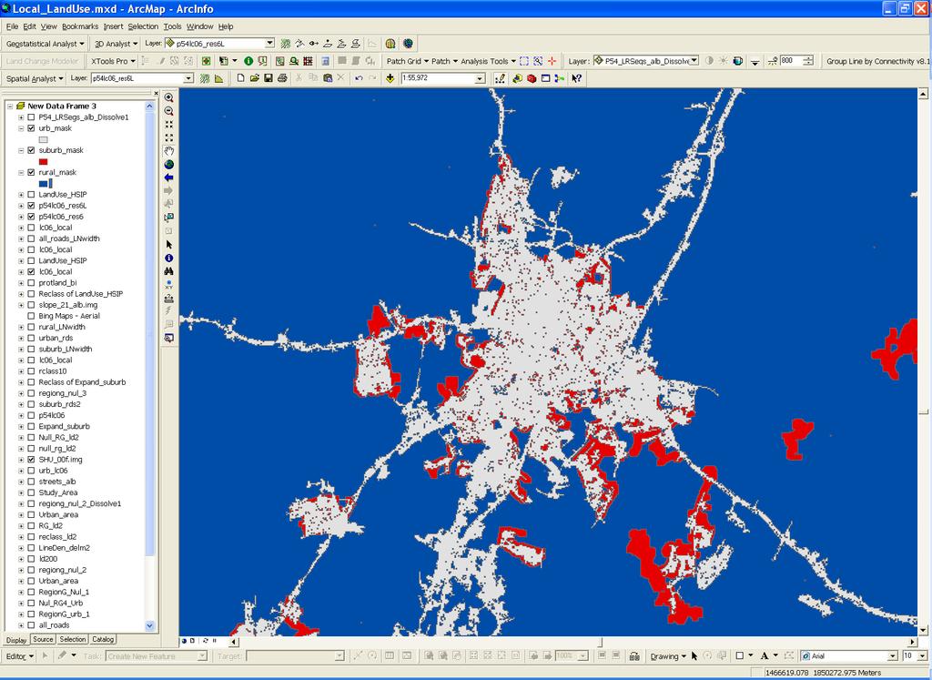
8 RURAL SUBURBAN URBAN

9 Dasymetric Housing Datasets Total Housing Units High Low

10 MD Median 0.14 Acres Plot DC WV PA VA All NY DE MD Median

11 MD Median 0.14 Plot DC WV PA VA All NY DE MD Median

12 DC Median 0.07 Acres Plot DC WV PA VA All NY DE MD Median

13 DE Median 0.12 Acres Plot DC WV PA VA All NY DE MD Median
14 U.S. Department of the Interior U.S. Geological Survey
15 Suburban & Rural Impervious Coefficients (acres) Median Suburban Rural DC DE MD NY PA VA WV
16 Urban Impervious Coefficients (% per pixel per county) NLCD Impervious Coefficients (County Ranges) Developed Land Cover Classes County Min County Mean County Max Developed Open Space 2.1 % 6.6% 19.2% Low-intensity Developed 11.4% 19.3% 37.1% Medium-intensity Developed 32.4% 43.4% 68.7% High-intensity Developed 53.0% 66.9% 90.8% Due to potential error at the low-end of the range, the coefficients are not allowed to be less than the 1 st quartile value in range of county coefficients for each state.
17 Measuring Impervious Surface Associated with Roads Road Type % of Rd Miles Literature Range Sample Range Sample Mean Selected Width 2-lanes (2-way) 88.8% (rural) 26 (urban) 4-6 lanes (2-way) 2.4% , 36, and lanes (2-way) (controlled access) 2.9% Within the Bay watershed, there are 372,461 acres of impervious surfaces associated with rural roads composing about 31% of all impervious surfaces. Eighty-nine percent of the roads have 2 lanes and most likely range from resulting in an impervious surface range of +/- 70,000 acres in the Bay watershed. Note: Lane width= Shoulder width= 2-12 (2 6 lanes) or (controlled access highway). This analysis does not take into account sidewalks or parking lanes.

18 P532 Turf Grass Acres in Maryland = 947,984 acres NASS Estimate = 1,134,000 acres Why the difference? 1. P532 does not capture turf grass associated road right-of-ways, and isolated commercial, industrial, and institutional establishments. 2. Turf Industry estimate is used to substantiate the economic importance of the industry. Therefore, it probably represents the upper bounds of the probable extent of turf grass.

19 Capturing low density residential development improved accuracy of agricultural classes P Farmland Acres in Maryland = 2,116,531 acres P Farmland Acres in Maryland = 1,639,198 acres USDA 2007 Ag Census = 1,558,546 acres P Chambersburg, PA
20 Tetra Tech 2009 Survey of WWTPs 403 major WWTPs in Bay watershed surveyed 257 facilities (~ 64%) responded Additional data collected in 2008 from: Maryland Department of Planning Delaware Counties (all) Washington Council of Governments Virginia: Albemarle, Arlington, Henrico, Loudoun, and Rockingham Counties and James City, Newport News City, Virginia Beach and Richmond City. Pennsylvania: Perry, Dauphin, Lancaster, Lycoming, and Cumberland Counties. New York: Broome County.


21 Dasymetric Mapping of Single-detached Housing Units Correlation with Census Block data at Modeling Segment Scale = 0.80
22


23 Estimating Population on Sewer Sewer Service Areas Population Distribution (yr. 2000) +


24 Alternative Mapping Techniques for Delineating Sewer Service Areas (Richmond, VA)
25 Phase 6 Possibilities Incorporate local land use and sewer service area data where provided. Estimate impervious surfaces at annual intervals using improved Landsat classifications Refine sample estimates of suburban and rural impervious surface. Refine estimates of rural lot sizes Refine turf grass estimates with fractional tree canopy Re-survey sewer service providers to map sewer service areas and to associate area served with each plant. Explore use of groundwater well and health department information to map septic systems.

26 High-density Landsat compositing Winter intra-annual median composite reflectances 2000 winter median SR Summer inter-annual composite, 3-year trailing maximum NDVI 2000 summer maximum NDVI

27 Growth of Fredericksburg, VA Clear patterns of urbanization Most growth outside municipal boundary

28 Development around the Verizon Center Parcel-level development evident Cleanly demarcated buildings, office parks, and subdivisions
29 Contact Information: Peter Claggett Research Geographer U.S. Geological Survey
Benchmark Nonpoint Source Management Approaches In Other States
 Governor s Environmental Advisory Council 2007 Nonpoint Source Pollution Control Initiative Benchmark Nonpoint Source Management Approaches In Other States Governor s Environmental Advisory Council April
Turf Grass v. Mixed Open
 Turf Grass v. Mixed Open Peter Claggett, U.S. Geological Survey March 8, 2016 Urban Stormwater Workgroup Meeting U.S. Department of the Interior U.S. Geological Survey What s the difference between turf
CSN TECHNICAL BULLETIN No. 8. April 1, 2010
 CSN TECHNICAL BULLETIN No. 8 The Clipping Point: Turf Cover Estimates for the Chesapeake Bay Watershed and Management Implications Tom Schueler, Coordinator, Chesapeake Stormwater Network April 1, 2010
An Integrated Green Infrastructure Plan to Address Combined Sewer Overflow, Stormwater and Nutrient Reductions in Lancaster City, PA
 An Integrated Green Infrastructure Plan to Address Combined Sewer Overflow, Stormwater and Nutrient Reductions in Lancaster City, PA Charlotte Katzenmoyer American Public Works Association Sustainability
BUILDER LOTS FOR SALE
 BUILDER LOTS FOR SALE NORTHERN CULPEPER - 135 ACRES RESIDENTIAL DEVELOPMENT 1256 Old Bridge Road, Amissville, VA 20106 SALE PRICE: $995,000 LOT SIZE: 135+ Acres APN #: Tax Map 2 Parcel 23 ZONING: R-1 ACCESS:
Appendix P Relative Load Reductions Analysis of Source Sectors and BMPs in the Jurisdictions Phase II Watershed Implementation Plans (WIPs)
") Load s Analysis of Source Sectors and s in the Jurisdictions Phase II Watershed Implementation Plans (WIPs) Objectives of analysis Analysis presented to the Verification Committee: March 13, 2013 Agriculture
Load s Analysis of Source Sectors and s in the Jurisdictions Phase II Watershed Implementation Plans (WIPs) Objectives of analysis Analysis presented to the Verification Committee: March 13, 2013 Agriculture
APPENDIX P. Relative Load Reductions Analysis of Source Sectors and BMPs in the Jurisdictions Phase II Watershed Implementation Plans (WIPs)
") APPENDIX P. Load s Analysis of Source Sectors and s in the Jurisdictions Phase II Watershed Implementation Plans (WIPs) Analysis presented to the Verification Committee: March 13, 2013 Agriculture Workgroup:
APPENDIX P. Load s Analysis of Source Sectors and s in the Jurisdictions Phase II Watershed Implementation Plans (WIPs) Analysis presented to the Verification Committee: March 13, 2013 Agriculture Workgroup:
PART 1: PROJECT SUMMARY. The application is Attachment A. The site plan is Attachment B.
 Belleterre Subdivision Sketch Plan Town Board 8.7.17 Belleterre Subdivision Sketch Plan PART 1: PROJECT SUMMARY Applicant: Bowman Development Project Size: +/- 20.85 acres Parcel Number: 01115104 and 01115121
Watershed Planning Workshop
 Watershed Planning Workshop Upper Four Mile Run, Gulf Branch and Donaldson Run March 18, 2010 Langston Brown Community Center Outline Overview of Arlington s s Watersheds Watershed Management in Arlington
Major Subdivision Sketch Plan Checklist
 This checklist provides specific requirements that are apart of the Sketch process. The entire process is described by the Huntersville Subdivision Review Process which details all the submittal and resubmittal
DRAFT SCOPE FOR THE DRAFT ENVIRONMENTAL IMPACT STATEMENT FOR HUDSON HIGHLANDS RESERVE TOWN OF PHILIPSTOWN, NEW YORK June 5, 2018
 DRAFT SCOPE FOR THE DRAFT ENVIRONMENTAL IMPACT STATEMENT FOR HUDSON HIGHLANDS RESERVE TOWN OF PHILIPSTOWN, NEW YORK June 5, 2018 Project Name: Project Location SEQRA Classification of Project: Lead Agency:
26 Attachment 2. Township of New Britain APPENDIX B STORMWATER MANAGEMENT DESIGN CRITERIA
 (26, APPENDIX B) 26 Attachment 2 Township of New Britain APPENDIX B STORMWATER MANAGEMENT DESIGN CRITERIA TABLE B-1 DESIGN STORM RAINFALL AMOUNT Source: Field Manual of Pennsylvania Department of Transportation
West Virginia Stormwater Management Manual: Methods.
 West Virginia Stormwater Management Manual: Methods Created to deliver targeted training on new tools and practices to improve the quality of stormwater runoff. www.cbstp.org www.chesapeakestormwater.net
Community LID Workgroup Issue Paper #6
 Community LID Workgroup Issue Paper #6 Topic: Hard and Impervious Surface Coverage Limits Objective: Minimize the amount of hard and impervious surfaces in developments to allow more stormwater to infiltrate
Pantops Master Plan Update 2018
 Pantops Master Plan Update 2018 Focus Area Topic Meeting #1 Land Use & Development Area Boundary North of I-64 February 26, 2018 Pantops Master Plan Update 2018 Focus Area Public Meetings: Kickoff Meeting
Prince William County Rural Preservation Study
 Prince William County Rural Preservation Study Kickoff Public Meeting, August 1, 2013 Insert then choose Picture select your picture. Right click your picture and Send to back. Purpose of the Study Evaluate
PLANNED UNIT DEVELOPMENT PUD For The Proposed Antietam Subdivision Escambia County, Florida. Introduction
 PLANNED UNIT DEVELOPMENT PUD For The Proposed Antietam Subdivision Escambia County, Florida Introduction The project is located in Escambia County approximately 0.75 + miles north of the US Highway 90,
Public Recreation Spaces. Brian E. Saelens, Lawrence D. Frank, Christopher Auffrey, Lauren Elise Leary,
 Environmental Assessment of Public Recreation Spaces Preliminary i Data for ALRConference Brian E. Saelens, Lawrence D. Frank, Christopher Auffrey, Lauren Elise Leary, Robert C. Whitaker, Hillary Burdette
COUNTY COUNCIL OF PRINCE GEORGE'S COUNTY, MARYLAND, SITTING AS THE DISTRICT COUNCIL ORDER AFFIRMING PLANNING BOARD DECISION (CORRECTED)
") Case No. Applicant: Lanham LLLP COUNTY COUNCIL OF PRINCE GEORGE'S COUNTY, MARYLAND, SITTING AS THE DISTRICT COUNCIL ORDER AFFIRMING PLANNING BOARD DECISION (CORRECTED) IT IS HEREBY ORDERED, after review
Case No. Applicant: Lanham LLLP COUNTY COUNCIL OF PRINCE GEORGE'S COUNTY, MARYLAND, SITTING AS THE DISTRICT COUNCIL ORDER AFFIRMING PLANNING BOARD DECISION (CORRECTED) IT IS HEREBY ORDERED, after review
THREE-STEP DESIGN PROCESS FOR OPEN SPACE SUBDIVISIONS
 00216106.DOC NMA/RRK 1/30/14 THREE-STEP DESIGN PROCESS FOR OPEN SPACE SUBDIVISIONS Open space subdivisions, sometimes called cluster developments, maintain a significant portion of a development site in
Chapter 1 Vision Statement & Goals
 Chapter 1 Section 1.1 Section 1.2 Section 1.3 Section 1.4 Section 1.5 Introduction Vision Statement Visioning Exercise Prioritization of Land Use Issues Goals of the Comprehensive Plan CHAPTER 1 SECTION
BMP Siting Tool. Step-by-Step Guide
 BMP Siting Tool Step-by-Step Guide ArcGIS 10.1 Service Pack 1 (Build 3143) Prepared by: Tetra Tech, Inc. 10306 Eaton Place, Suite 340 Fairfax, VA 22030 January 2013 Contents 1 Getting Started... 1 1.1
R E S O L U T I O N. Single-Family Residence/ Church. 2,488 sq. ft. 2,488 sq. ft. Area Parking Required: Church
 R E S O L U T I O N WHEREAS, the Prince George s County Planning Board is charged with the approval of Detailed Site Plans pursuant to Part 3, Division 9 of the Zoning Ordinance of the Prince George s
ARTICLE IV: DEVELOPMENT STANDARDS 404 MASTER PLANNING
 IV 13 404 MASTER PLANNING Master Planning through the Site Analysis (Master Planning Site Analysis) or Planned Development (Master Planning Planned Development) is provided to encourage development which
Correcting local polluted runoff problems with nature-based solutions in the Potomac River Watershed.
 Correcting local polluted runoff problems with nature-based solutions in the Potomac River Watershed. Source: National Geographic A Guide to Local Government Policy Changes to Implement Environmental Site
CROWN POINT SUBDIVISION
 CROWN POINT SUBDIVISION A COMPARISON OF CONVENTIONAL VERSUS CONSERVATION SUBDIVISION DESIGN DEVELOPER: PAUL LUCIANO BUILDERS LAND PLANNING & DESIGN: DAVID LAIRD ASSOCIATES FUNDING PROVIDED BY: PA SEA GRANT
Best Management Practices for Lawns and Landscapes
 Best Management Practices for Lawns and Landscapes Marty Petrovic, Ph.D Professor of Turfgrass Science Dept. of Horticulture Cornell University Concerns Some areas on NY with high phosphorus (P) levels
Proposed Comprehensive Plan Strategies DRAFT for discussion June 28, 2017
 Proposed Comprehensive Plan Strategies DRAFT for discussion June 28, 2017 Land Use Rural Areas Refine the Farm and Forest area (FF) Update FF boundaries to account for existing lots less than five acres
Table IX-1 LAND USES IN WASHINGTON COUNTY: 2006
 #128550 v1 - WASH CO CP TBL I-1 2006 LU NMA/RLR 12/21/07 Table I-1 LAND USES IN WASHINGTON COUNTY: 2006 Note: This table, and the accompanying map, is more general than the land use inventory conducted
PRELIMINARY REPORT. HIGHWAY 18 CORRIDOR NEIGHBORHOOD PLAN VILLAGE OF DOUSMAN November, 2014
 PRELIMINARY REPORT HIGHWAY 18 CORRIDOR NEIGHBORHOOD PLAN VILLAGE OF DOUSMAN November, 2014 This preliminary report presents the initial recommendations for land use within the Highway 18 corridor along
CHAPTER 4 FUTURE LAND USE AND URBAN SERVICES DISTRICTS
 CHAPTER 4 FUTURE LAND USE AND URBAN SERVICES DISTRICTS Introduction This chapter discusses how Benzie County should grow and change in the future. A community can grow and change in many different ways.
Working Group Meeting
 April 4,, 2017 Parks Operations Bldg Working Group Meeting Arts Districts Overview Stormwater/RPA/Stream Considerations First Principles Agenda 7:00pm 7:05pm 7:10pm 7:40pm 8:30pm 9:40pm 9:45pm Welcome
Chesapeake Bay Pollution Reduction Plan
 PA Municipal Separate Storm Sewer System (MS4) TMDL Plan Chesapeake Bay Pollution Reduction Plan Instructor: June 10, 2014 Julie Schneider, Watershed Planner CWP Bryan Seipp, Watershed Manager, CWP Ruth
Level 1: GIS-based Desktop Assessments. Meghan Burns, Landscape Ecologist
 Level 1: GIS-based Desktop Assessments Meghan Burns, Landscape Ecologist EPA three-tier framework WETLAND AND RIPARIAN MAPPING LEVEL 1 LANDSCAPE ASSESSMENT WETLAND LANDSCAPE PROFILES LEVEL 2 RAPID ASSESSMENT
Building Green into Complete Streets in the City of Lancaster, PA
 Building Green into Complete Streets in the City of Lancaster, PA Karl Graybill, AICP, City of Lancaster Cindy McCormick, PE, PTOE, McCormick Taylor MASITE Annual Meeting King of Prussia, PA October 5,
Innovative Land Use Techniques
 Innovative Land Use Techniques A Handbook for Sustainable Development Eric Williams, Assistant Administrator, NHDES Carolyn Russell, Principal Planner, NHDES Cliff Sinnott, Executive Director, RPC Jill
INTRODUCTION PLANNING HISTORY
 INTRODUCTION The Upper Rock Creek Master Plan Area lies in the east central part of Montgomery County. The Master Plan Area is adjacent to the City of Rockville to the south, the Olney Planning Area to
Managing Stormwater in the Community One Best Management Practice at a Time
 Managing Stormwater in the Community One Best Management Practice at a Time Maryland Department of the Environment 23 rd Annual Groundwater Symposium Wednesday, September 24, 2014 Managing Stormwater in
Stormwater Runoff and the District of Columbia RiverSmart Homes Defined:
 Stormwater Runoff and the District of Columbia Stormwater runoff is rainwater that flows off impervious surfaces such as rooftops, driveways, roads, sidewalks and sometimes even lawns. Stormwater runoff
IV. Development in the Rural Overlay District
 Intracoastal Waterway Route 17 Route 168 Great Dismal Swamp VIRGINIA NORTH CAROLINA IV. Development in the Rural Overlay District IV-1 Route 17 in Chesapeake s Rural Overlay District affords distant views
CHAPTER 22 Rural Open Space Community Developments
 CHAPTER 22 Rural Open Space Community Developments Section 22.1 Description and Purpose The intent of this Chapter is to offer property owners an alternative to traditional zoning requirements for rural
City of Manassas Park Proposed Stormwater Management Funding
 City of Manassas Park Proposed Stormwater Management Funding October 5, 2010 State and Federal Storm Water Mandates The State mandates implementation of ordinance, programs, and practices to meet storm
March 30, 2017
 March 30, 2017 2 municipal examples of GI installments: Lancaster, PA (population: 60,000) Dover, NH (population 31,000) The City of Lancaster: Overview Incorporated in 1742 as a borough and in 1818
An Update on the Mandated Stormwater Initiative Chesapeake Bay TMDL
 An Update on the Mandated Stormwater Initiative Chesapeake Bay TMDL Board of Supervisors Briefing January 27, 2016 Imagine the result Stormwater Utility Outline Background Regulatory Requirements Compliance
Chesapeake Bay Critical Area Conservation Plan
 The Maryland-National Capital Park and Planning Commission Prince George s County Planning Department Development Review Division 301-952-3530 Note: Staff reports can be accessed at www.mncppc.org/pgco/planning/plan.htm.
Using Runoff Reduction Practices to Shrink the Water Quality Volume (WQv) September 18, 2018 Jay Dorsey
 September 18, 2018 Jay Dorsey") Using Runoff Reduction Practices to Shrink the Water Quality Volume (WQv) September 18, 2018 Jay Dorsey This Presentation Ohio EPA Post-Construction Criteria/Guidance Runoff Reduction Accounting Green
Using Runoff Reduction Practices to Shrink the Water Quality Volume (WQv) September 18, 2018 Jay Dorsey This Presentation Ohio EPA Post-Construction Criteria/Guidance Runoff Reduction Accounting Green
Outlawing Sprawl. Pennsylvania Chapter American Planning Association October 6, 2009
 Outlawing Sprawl Pennsylvania Chapter American Planning Association October 6, 2009 Presented by: Ronald T. Bailey, AICP Executive Director Chester County Planning Commission Location: 2009 PA Chapter
Can Urban Redevelopment Restore Aquatic Resources
 Can Urban Redevelopment Restore Aquatic Resources with Standards for Stormwater Retention and Landscape Performance? Rebecca C. Stack District of Columbia Department of the Environment Industry, Agriculture,
E. RURAL COMMERCIAL/INDUSTRIAL PARK MODEL
 E. RURAL COMMERCIAL/INDUSTRIAL PARK MODEL 1. PURPOSE The purpose of the Rural Commerce/Industrial Park Model is to provide parameters within which a grouping of business buildings with parking, loading
TABLE OF CONTENTS. Transportation Chapter 1 - Introduction and Purpose of Planning to 1-3. Utilities
 Chapter 1 - Introduction and Purpose of Planning... 1-1 to 1-3 Pennsylvania Municipalities Planning Code (Act 247)...1-1 Previous County Planning Activities...1-1 Objectives of the Plan...1-2 Elements
Madison County Data List December 16, 2008
 Madison County Data List December 16, 2008 This data list is current as of the date listed above. This does not imply that the datasets listed are current. Although a dataset may be listed it may not be
Conservation Corridor Planning and Green Infrastructure Themes
 Conservation Corridor Planning and Green Infrastructure Themes Prepared by the Green Infrastructure Center Inc. and the Northern Virginia Regional Commission February 22, 2011 Brief Overview Project Background
Riverview Road Fort Washington, MD. 163 Waterfront Street, Suite #450 National Harbor, MD (301)
") Riverview Road Fort Washington, MD 163 Waterfront Street, Suite #450 National Harbor, MD 20745 (301) 750-7040 www.fleurdelisllc.com 1 Prepared by Monique Anderson Walker Principal +1 301-750-7040 Monique@FleurDeLisLLC.com
Riverview Road Fort Washington, MD 163 Waterfront Street, Suite #450 National Harbor, MD 20745 (301) 750-7040 www.fleurdelisllc.com 1 Prepared by Monique Anderson Walker Principal +1 301-750-7040 Monique@FleurDeLisLLC.com
Brian Madigan, RLA, CPESC Director Land Planning & Design
 Brian Madigan, RLA, CPESC Director Land Planning & Design bmadigan@gymodpc.com Architecture, Engineering & Land Surveying, DPC 18969 US Route 11 Watertown, New York 13601 T: (315) 788-3900 F: (315) 788-0668
Appendix F PENNSYLVANIA LOCAL PARKS AND THE COMMUNITIES THEY SERVE
 Appendix F PENNSYLVANIA LOCAL PARKS AND THE COMMUNITIES THEY SERVE August 8, 2014 By The Center for Rural Pennsylvania Profile Data Profiles and Analysis Introduction To assist in the development of the
Philadelphia Stormwater Management Criteria: What Are the Neighbors Doing? - A Peer City Comparison
 Philadelphia Stormwater Management Criteria: What Are the Neighbors Doing? - A Peer City Comparison S. Randall, C. Marjoram & M.J. Vanaskie Pennsylvania Stormwater Management Symposium, Villanova University
Improve Neighborhood Design and Reduce Non Point Source Water Pollution
 HOW TO Planning Guide Improve Neighborhood Design and Reduce Non Point Source Water Pollution This document was funded by a grant from the New Hampshire Coastal Program with funding from the National Oceanic
1.4 - PRINCESS ANNE COMMONS & TRANSITION AREA
 1.4 - PRINCESS ANNE COMMONS & TRANSITION AREA INTRODUCTION Princess Anne Commons and the Transition Area are strategically located below the Green Line, between the Suburban Area of the City to the north
ALBEMARLE COUNTY CODE CHAPTER 18 ZONING SECTION 20A NEIGHBORHOOD MODEL - NMD
 CHAPTER 18 ZONING SECTION 20A NEIGHBORHOOD MODEL - NMD Sections: 20A.1 PURPOSE AND INTENT 20A.2 STATUS AS A PLANNED DEVELOPMENT DISTRICT 20A.5 CODES OF DEVELOPMENT 20A.6 PERMITTED USES 20A.7 RESIDENTIAL
6 August 11, 2010 Public Hearing APPLICANT AND PROPERTY OWNER: CAVALIER GOLF AND YACHT CLUB
 6 August 11, 2010 Public Hearing APPLICANT AND PROPERTY OWNER: CAVALIER GOLF AND YACHT CLUB REQUEST: Conditional Use Permit (outdoor recreational facility) STAFF PLANNER: Faith Christie ADDRESS / DESCRIPTION:
GIS-Enabled Rain Garden Design: A Case Study in Austin, Texas. GIS in Water Resources (C E 394K-3) Clint Smith, E.I.T.
 Clint Smith, E.I.T.") GIS-Enabled Rain Garden Design: A Case Study in Austin, Texas GIS in Water Resources (C E 394K-3), E.I.T., MSCE 12/07/2018 Table of Contents: 1. Abstract 3 2. Introduction 4 2.1 Background 4 2.2 Project
GIS-Enabled Rain Garden Design: A Case Study in Austin, Texas GIS in Water Resources (C E 394K-3), E.I.T., MSCE 12/07/2018 Table of Contents: 1. Abstract 3 2. Introduction 4 2.1 Background 4 2.2 Project
CHAPTER 7: VISION AND ACTION STATEMENTS. Noble 2025 Vision Statement
 CHAPTER 7: VISION AND ACTION STATEMENTS This chapter presents the vision, policy and action statements that transform the comprehensive planning study, an analysis of Noble s past, future trends and community
GENERAL LAND USE POLICIES
 GENERAL LAND USE POLICIES The County will: GOALS AND OBJECTIVES 7.1 Fiscal Distribute the designation of land uses to balance the costs of providing public services and facilities with generating public
Project Name: MELWOOD HOTEL. Date Accepted: 1/12/04. Waived. Planning Board Action Limit: Plan Acreage: 1.7 Zone: Dwelling Units:
 The Maryland-National Capital Park and Planning Commission Prince George's County Planning Department Development Review Division 301-952-3530 Note: Staff reports can be accessed at www.mncppc.org/pgco/planning/plan.htm.
Major Subdivision Preliminary Plan Checklist
 This checklist provides specific requirements that are apart of the Major process. The entire process is described by the Huntersville Review Process which details all the submittal and resubmittal requirements.
III. PROJECT DESCRIPTION
 III. PROJECT DESCRIPTION A. PROJECT LOCATION Regional Setting The project site is located in the southeast quadrant of the City of Chico in Butte County, California and is comprised of four parcels totaling
PART 1: PROJECT SUMMARY. Proposed Land Use: 120 single-family lots. The application is Attachment A. The site plan is Attachment B.
 PART 1: PROJECT SUMMARY Applicant: JBH Development, LLC and Hopper Communities, INC Project Size: +/- 80.48 acres Parcel Number: 01513107, 01513108, 01513109, 01513113, 01513120, 01513121, 01513122, 01513124,
CITY OF VACAVILLE PLANNING COMMISSION Agenda Item No. G.1 STAFF REPORT February 21, 2012 BRIGHTON LANDING SPECIFIC PLAN & DEVELOPMENT PROJECT
 CITY OF VACAVILLE PLANNING COMMISSION Agenda Item No. G.1 STAFF REPORT February 21, 2012 Staff Contact: Fred Buderi (707) 449-5307 TITLE: PURPOSE: BRIGHTON LANDING SPECIFIC PLAN & DEVELOPMENT PROJECT INFORMATIONAL
A Guide to Open Space Design Development in Halifax Regional Municipality
 A uide to Open Space Design Development in Halifax Regional Municipality May 2007 1 Introduction Pursuant to Section 3.5 of the Regional Municipal Planning Strategy (RMPS), subdivision of land may proceed
Design for Health Comprehensive Plan Review Checklists. Design for Health,
 Comprehensive Plan Review Checklists, 2007 info@designforhealth.net These Comprehensive Plan Review Checklists summarize the key points of the (DFH) background and health impact assessment (HIA) materials.
R1a: REINFORCED TURF TO REPLACE GRAVEL /GRASS PARKING ADJACENT TO SOUTH PENNSYLVANIA AVENUE.
 R1a: REINFORCED TURF TO REPLACE GRAVEL /GRASS PARKING ADJACENT TO SOUTH PENNSYLVANIA AVENUE. Description The retrofit site is located along South Pennsylvania Avenue, between Maplewood Street and just
Water in storm drains does not go to a treatment plant
 Watershed Planning Workshop Upper Mainstem & Middle Four Mile Run November 30, 2011 Fairlington Community Center Arlington s watersheds Chesapeake Bay watershed Watershed Planning Initiated May 2008 Contracted
CITY OF ZEELAND PLANNING COMMISSION
 APPLICATION FOR SITE PLAN REVIEW AND SPECIAL LAND USE Date City Official App. Filing Fee Rec'd ($350) NOTE TO APPLICANT: Please submit this application for Site Plan Review along with twenty (20) copies
Nonpoint Education for Municipal Officials. Linking Land Use to Water Quality. Partnership for Environmental Technology Education
 MAINE NEMO Nonpoint Education for Municipal Officials Linking Land Use to Water Quality Partnership for Environmental Technology Education When it rains, pollution happens 1 Maine s Water Budget Impacts
AWH REPORT OF THE PLANNING AND DEVELOPMENT DEPARTMENT FOR APPLICATION FOR REZONING ORDINANCE TO PLANNED UNIT DEVELOPMENT
 AWH REPORT OF THE PLANNING AND DEVELOPMENT DEPARTMENT FOR APPLICATION FOR REZONING ORDINANCE TO PLANNED UNIT DEVELOPMENT MAY 8, 2014 The Planning and Development Department hereby forwards to the Planning
Cost Effective Low Impact Development
 Cost Effective Low Impact Development An Introductory Guide to Conserve Land, Restore Resources, Protect Water, and Save Money in Massachusetts Stefanie Covino Shaping the Future of Your Community Program
Procedures IV. V. Rural Road Design Option
 i IV. Procedures A. All applicants required to prepare a Conservation Design Subdivision shall provide the Planning Board with a conceptual conventional subdivision design as well as a proposed layout
Planning & Zoning Commission Meeting Date: June 04, 2012
 Meeting Date: June 04, 2012 Request Applicant Owner Zoning Preliminary/Final Plat of 24.114 acres of unplatted property into one lot with one reserve for landscape/open space. Extension of infrastructure
Welcome to Montgomery Irrigation
 Residential & Commercial Irrigation Landscape Lighting & Water Features Home About Us Products Photo Gallery Contact Us Welcome to Montgomery Irrigation Montgomery Irrigation Professional Contractors Cover
Town of Peru Comprehensive Plan Executive Summary
 Town of Peru Comprehensive Plan Executive Communities that plan grow by choice, not by chance. A plan makes growth thoughtful, understandable, and predictable. A plan shows that a community is managing
Managing Stormwater Naturally. July 17, 2013
 Managing Stormwater Naturally July 17, 2013 1 This image cannot currently be displayed. Guiding Documents 2 Stormwater Purpose Statement The City Council hereby finds, determines and declares the City
APPENDIX A SIMPLIFIED APPROACH TO STORMWATER MANAGEMENT FOR SMALL PROJECTS. In West Sadsbury Township, Chester County, Pennsylvania
 APPENDIX A SIMPLIFIED APPROACH TO STORMWATER MANAGEMENT FOR SMALL PROJECTS In West Sadsbury Township, Chester County, Pennsylvania TABLE OF CONTENTS I. Introduction 3 II. Importance of Stormwater Management
Application for Site Plan Review
 Application for Site Plan Review City of Pontiac Office of Land Use and Strategic Planning 47450 Woodward Ave, Pontiac, MI 48342 T: 248.758.2800 F: 248.758.2827 Property/Project Address: Sidwell Number:
Warren County/Bowling Green Focus 2030 Comprehensive Plan VOLUME 1 INDEX
 Appendix 5: Index VOLUME 1 INDEX A Aesthetics ES-6, FLU-15, FLU-17, FLU-24, NCR-7 Agricultural Base FLU-18, FLU-20 Agricultural Centers, Rural FLU-11 Agricultural District NCR-17-NCR-18 Agricultural Economy
4-Town Comprehensive Plan DRAFT 7/30/07
 4-Town Comprehensive Plan DRAFT 7/30/07 Acknowledgements ning Committee Town of Harrisburg Norman Roof Randy Nicol Town of Martinsburg Terry Thisse Paul Kelly Town of Montague Jan Bagdanowicz Wendy Perry
Exhibit A. 8:9 Scuffletown Rural Conservation District
 Exhibit A 8:9 Scuffletown Rural Conservation District 8:9.1 Intent and Purpose The Scuffletown Rural Conservation (SRC) District is intended to provide for residential development that supports the development
HEALTH SCIENCES BUILDING REDEVELOPMENT PROJECT
 INTRODUCTION In recent years, the University of Cincinnati (University) has demonstrated a commitment to identifying and implementing sustainable goals and objectives throughout University s Uptown Campuses.
Asbury Chapel Subdivision Sketch Plan
 Asbury Chapel Subdivision Sketch Plan PART 1: PROJECT SUMMARY Applicant: NVR Inc. Project Size: +/- 76.13 acres Parcel Numbers: 02101112,02116101,02116112, 02116113 Current Zoning: Transitional Residential
This chapter describes the purpose of the Plan, introduces how the Plan is organized and provides contextual background for the Plan.
 Chapter 1: INTRODUCTION Purpose of a Comprehensive Plan The 2040 Comprehensive Plan establishes Medina s vision as a community and sets goals and objectives which guide future decisions and policies. The
SECTION 1 Introduction...1. SECTION 2 Regional Context Criteria for Planning Districts Description of Planning District...
 Table of Contents SECTION 1 Introduction...1 SECTION 2 Regional Context...2 2.1 - Criteria for Planning Districts...2 2.2 - Description of Planning District...2 SECTION 3 Goals & Objectives...5 SECTION
20 November 12, 2014 Public Hearing APPLICANT:
 20 November 12, 2014 Public Hearing APPLICANT: PROPERTY OWNER: CITY OF VIRGINIA BEACH CHESAPEAKE BEACH VOLUNTEER FIRE AND RESCUE REQUEST: Conditional Use Permit Craft Brewery STAFF PLANNER: Graham Owen
Gadsden County Planning Commission Agenda Request
 Date of Meeting: November 16, 2017 To: From: Through: Subject: Gadsden County Planning Commission Agenda Request Honorable Chairperson and Members of the Board Jill A. Jeglie, AICP, Senior Planner Clyde
20 International Conference of The Coastal Society THE ROLE OF PLANNED UNIT DEVELOPMENTS IN ENVIRONMENTAL MANAGEMENT IN THE COASTAL ZONE
 th 20 International Conference of The Coastal Society THE ROLE OF PLANNED UNIT DEVELOPMENTS IN ENVIRONMENTAL MANAGEMENT IN THE COASTAL ZONE Kathleen E. Semon, University of South Carolina Braxton C. Davis,
KASPER. City of Georgetown, Texas PUD Planned Unit Development. December 30, 2015 Revised January 27, 2016
 KASPER City of Georgetown, Texas PUD Planned Unit Development December 30, 2015 Revised January 27, 2016 Applicant: Sentinel Land Company, LLC 4910 Campus Drive Newport Beach, CA Prepared by: SEC Planning
SECTION 6 - LAND USE - RURAL RESIDENTIAL
 16.6.10.1 Intent The intent of the rural residential land use category is to provide low-density, single-family residential development within the Town s outer fringe. The current land is predominantly
Washtenaw County Department of Planning & Environment
 Washtenaw County Department of Planning & Environment 9/12/2007 Trudy Feldkamp, Planning Commission Secretary 7887 Klager Rd. Saline, MI 48176 Re: General Development Plan for Saline Township Review Dear
Urban Development Areas Frederick County
 18 Urban Development Areas Frederick County UDA Needs Profile: All UDAs Frederick County, Virginia's northernmost county has two UDA s, surrounded by the City of Winchester and located adjacent to the
VILLAGE OF CLEMMONS PLANNING BOARD DRAFT STAFF REPORT. Single Family Residential, Townhomes
 VILLAGE OF CLEMMONS PLANNING BOARD DRAFT STAFF REPORT PETITION INFORMATION Docket # C-212 Staff Megan Ledbetter Petitioner(s) Peacehaven Development LLC Owner(s) Larry Jarvis, William Alexander and Peacehaven
Section 9 NEIGHBORHOOD DESIGN
 Section 9 NEIGHBORHOOD DESIGN City of Lancaster Comprehensive Plan D u n k i n, S e f k o & A s s o c i a t e s, I n c. NEIGHBORHOOD DESIGN INTRODUCTION There are many ways in which a neighborhood can
Village of Forest Park. July 27, Sewer Separation Evaluation
 Village of Forest Park July 27, 2015 Sewer Separation Evaluation Presentation Overview Study Background Historic Nature of Forest Park Drainage Scale of Flooding Problem Forest Park Sewer System Background