Yates Cattle & Conservation Ranch
|
|
|
- Buddy Shon Henry
- 6 years ago
- Views:
Transcription


1 Yates Cattle & Conservation Ranch
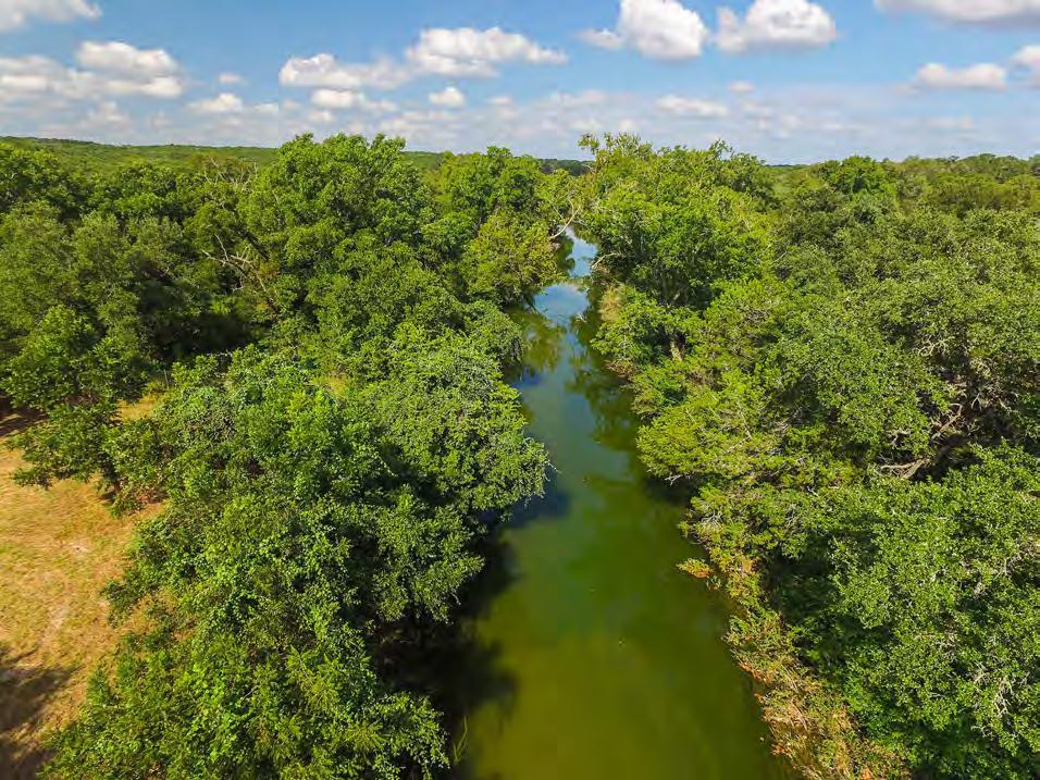
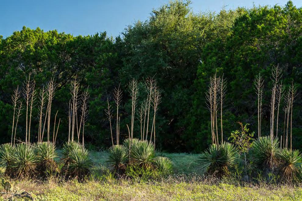
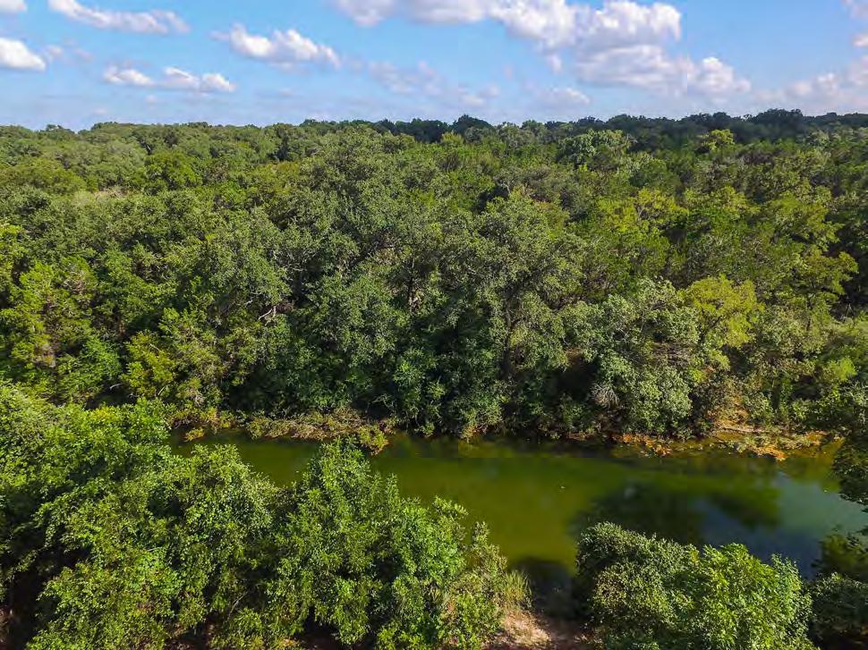
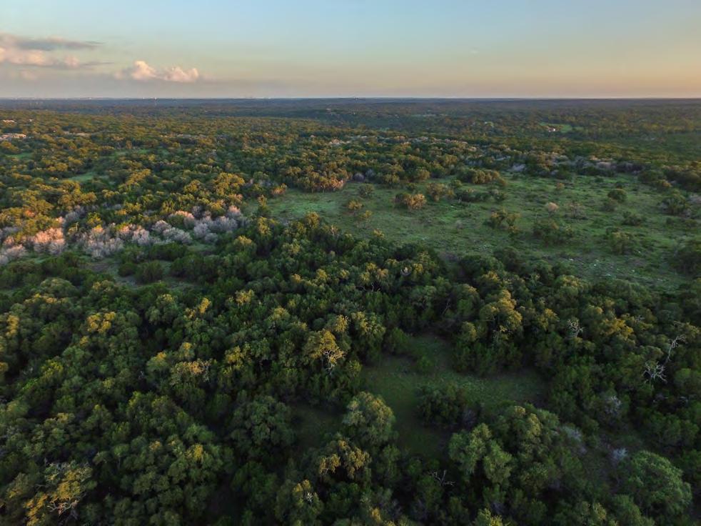
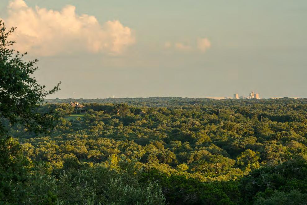
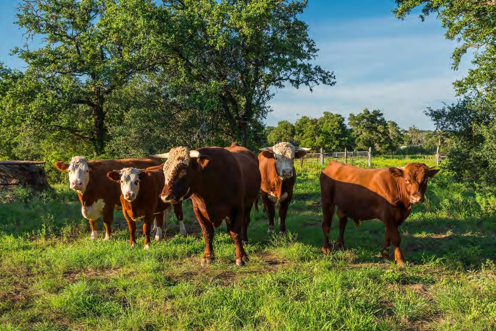
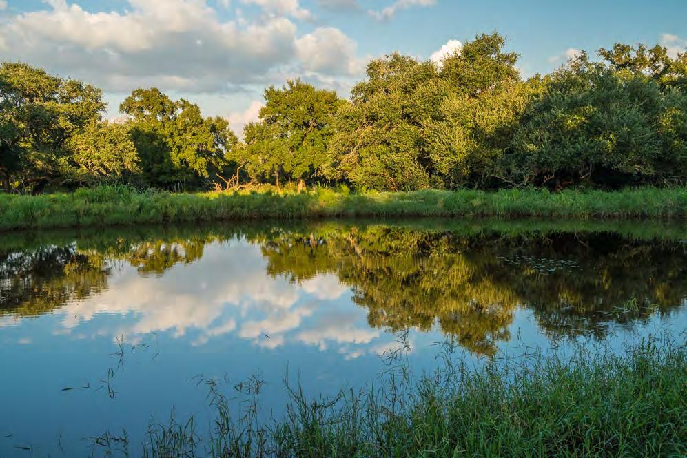
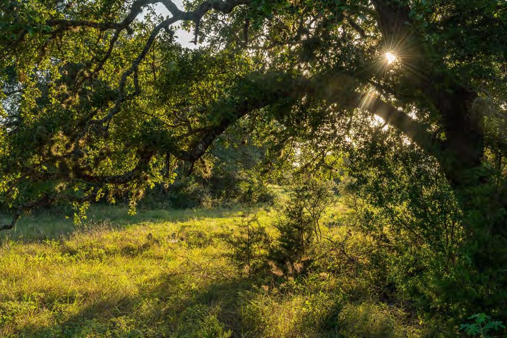
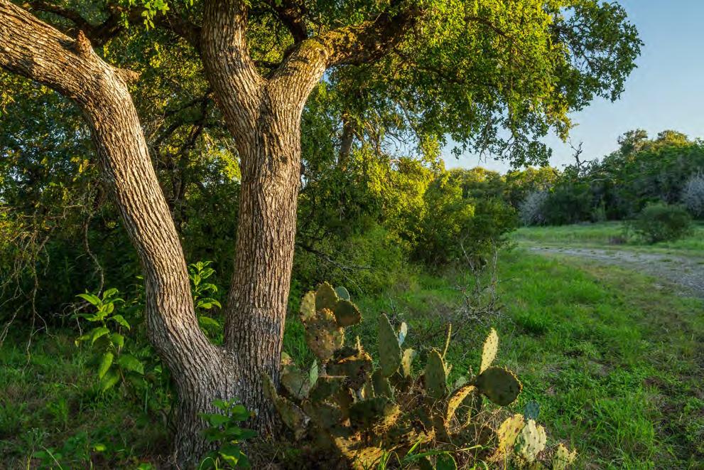
2 Yates Cattle and Conservation Ranch 385 +/- acres Hays & Travis Counties, Texas James King, Agent Office Location There is a property in the Hill Country where the bedded limestone strata and the historic layers of time come together to create a place like no other. Only 15 minutes from downtown Austin, Yates Cattle and Conservation Ranch s name says it all: a marriage of rich Texas ranching heritage with an array of unique natural resources in a protected, quiet world all its own. Saltlick is just minutes away, and the amazing restaurants of Austin are a mere short ride away down MoPac Boulevard, immersing you in the culture of music, food, art, nature, and outdoor recreation that makes Austin one of the most popular cities in the U.S. Here, nature balances with activity, livestock with big city lights, and people with solitude. The ranch is centrally-located just southwest of downtown Austin on Bear Creek, fronting on northbound side of Highway 45 where it turns into South MoPac. Nestled into this amazing natural setting is a ranch where cattle, deer, neo-tropical songbirds, bats, turkey, people exist together in a balanced ecosystem for nature and man. Enter the ranch and enjoy the tranquility of nature at its best with immediate access to all the amenities of Austin. Location and beauty makes this ranch exceptional. Acreage 385 Acres Description Just after World War II Polly Covert bought the 4,600 ac Circle C Ranch deep in the Hill Country southwest of Austin after receiving Governor Stevenson blessing on the purchase, and today the last remaining part of that amazing Hill County Ranch owned by her son is being offered for sale. The remaining family ranch is 385 acres being part of the old South Windmill Pasture and the Bear Creek Pasture, the historic ranch s most mysterious and natural area. The City of Austin has a Conservation Easement on the entire ranch, which was carefully negotiated by the current owner, that allows the ranch to be divided into two properties with two development compounds. Water and wastewater lines were buried and grandfathered, as was an approved, complete road network both caliche and paved, which provides access all over the ranch. Once again, there is a balance between development, nature, and livestock. The ranch has an active agricultural exemption. There is a sense of privacy here, unmatched in the Texas Hill County this close to Austin. The ranch is bordered with City of Austin Water Quality Protection Lands (or Wildlands) that is a mix of fee and conservation easements that encompasses several thousand acres. These lands provide a protected viewshed which, in a number of places on the ranch, offers vistas of green trees, grass, and rolling hills to the horizon. Habitat While best known for the beautiful and historic hill country, the Edwards Plateau Region includes a
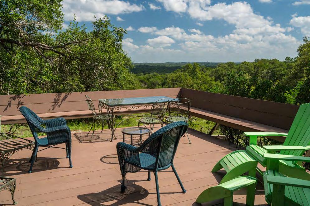
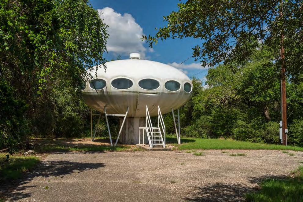
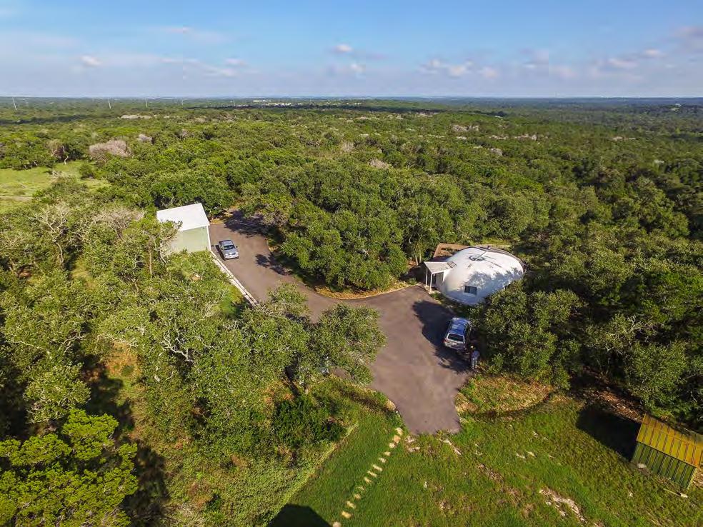
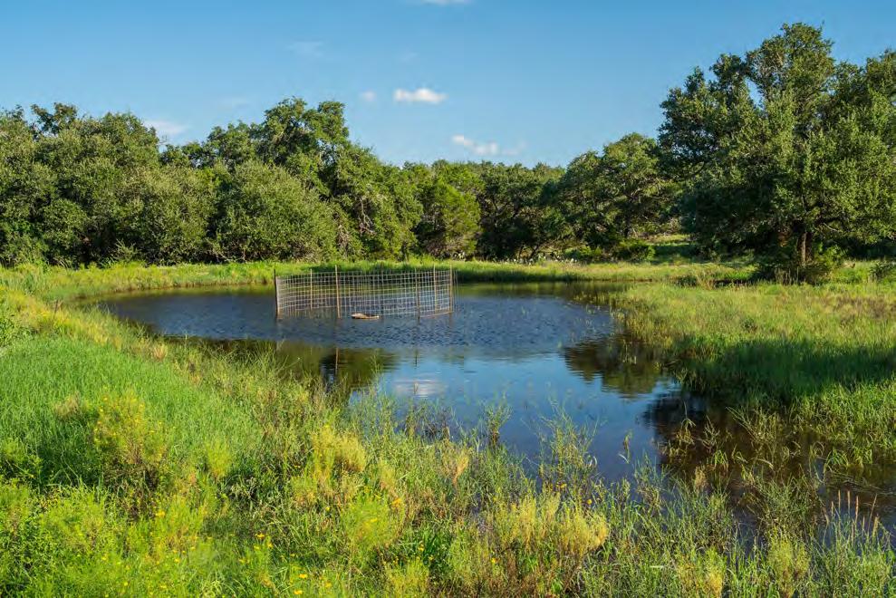
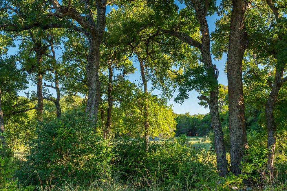
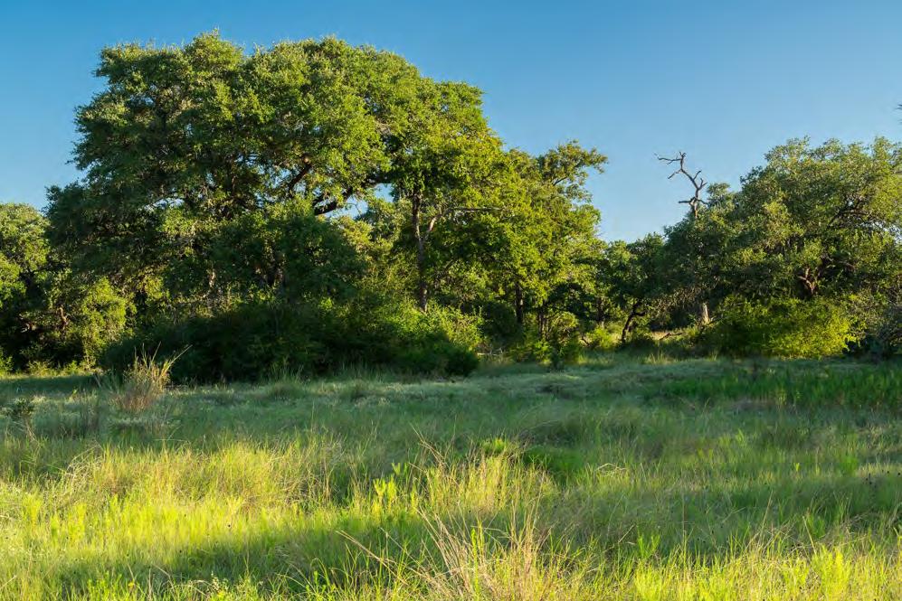
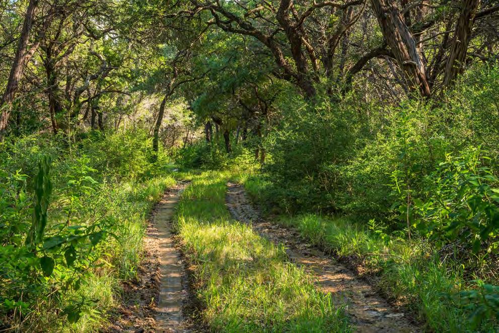
3 wide range of plants and animal communities, making it one of the most biologically-diverse in the nation. Herbaceous plants, shrubs, and hardwood trees create a mosaic of dense and open vegetation. The ranch is a wide plateau falling southeast to Bear Creek, with topography ranging from 800 feet to 950 feet. The grasslands, Oak Juniper woodlands, Cedar Elm deep bottoms are home to an amazing diversity of wildlife, both game and non-game species. Neotropical songbirds live in harmony with livestock and this park like property is a natural laboratory where one can wonder and get lost in the amazing array of plants and animals that call this place home. Improvements The improvements include two unique dwellings. The Pod, an elevated fiberglass building resembling a 1960 s flying saucer, and the Dome, a small modular surface-mounted home with a large deck overlooking the scenery of the City Wildlands to the south. There is a nice metal barn with concrete floors and paved access which houses an automotive lift, Tesla charging station, tools, and other equipment and is located near the Dome. Additional improvements include: Three portable storage buildings Several strategically located cattle troughs Centrally located cattle trap and pens Automatic gates along paved roads There are some outstanding building sites on the property and the existing improvements, utilities, and roads can be incorporated into site plan for development that would rival any in Austin and surrounding areas. Water The ranch has one water well (a second is permitted by the Conservation Easement) that serves the existing improvements as well as livestock and wildlife troughs. Water and wastewater pipelines are in place on the ranch and are available for immediate use for additional improvements. There is also the allure of both sides of Bear Creek, adjacent to City Conservation Lands where the current owner has enjoyed swimming for more than 50 years. A beautiful road cuts its way through wooded slopes and opens into a wide meadow, perfect for recreation down on the creek. Price $9,240, Reduced to $7,200,000 Contact Harrison King, Agent King Land & Water, LLC Office Cell Harrison@kinglandwater.com Disclaimer This property offering is subject to prior sale, change in price, or removal from the market without notice. While the information above was provided by sources deemed reliable, it is in no way guaranteed by the broker or agent.

4 Open Space City of Austin Parks Water Quality Protection Lands (COA) Lady Bird Johnson Wildflower Center Tree Canopy Dick Nichols District Park Circle C Ranch Metro Park FM 1826 SH 45 Grey Rock Golf Course Escarpment Blvd. MoPac Expy Wildflower Center Yates Cattle and Conservation Ranch Bauerle Ranch Park Water Quality Protection Lands 1 Inch = 8800 Feet Water Quality Protection Lands Yates Cattle and Conservation Ranch

5 Topo Base (COA, FEMA Data) SH 45 FEMA 100 Year Floodplain Property Boundary Fence 10 Contours Grey Rock Golf and Tennis Club Escarpment Blvd. South 20 Inn and Events Center Danz Creek Fence Low Point: 820 ft MoPac Expy TraviS Co. HayS Co. High Point: 944 ft TraviS Co. HayS Co. Bear Creek 1AC 5AC 1 Inch = 1000 Feet TraviS Co. HayS Co Yates Cattle and Conservation Ranch

6 Aerial Base (COA, FEMA Data) FEMA 100 Year Floodplain Property Boundary Fence 2 Contours South 20 Inn and Events Center SH 45 Grey Rock Golf and Tennis Club Escarpment Blvd. Danz Creek Fence Low Point: 820 ft MoPac Expy TraviS co. HayS co. High Point: 944 ft TraviS co. HayS co. Bear Creek 1AC 1 Inch = 1000 Feet 5AC TraviS co. HayS co Yates Cattle and Conservation Ranch

7 Utility Base (COA, FEMA Data) FEMA 100 Year Floodplain FEMA 50 Year Floodplain Gate SH 45 Primary Road Road / Trail Manhole Water Line Sewer Line Offsite Water Line and Manhole Offsite Sewer Line and Manhole Fence Existing Building Existing Building Potenial Building Sites Existing Barn / Structure Escarpment Blvd. Water Storage Tank Water Well Potential RV Site Gate Gate MoPac Expy TraviS CO. HayS CO. COA Water Easement and Fireplug Potential Access Drive Potential Access Drive TraviS CO. TraviS CO. 1AC 5AC 1 Inch = 1000 Feet HayS CO. HayS CO. Yates Cattle and Conservation Ranch

8 Yates Cattle and Conservation Ranch

9
10

11
12
13
14

15
16
17
Limpia Creek Duck Pond. 25 acres, Jeff Davis County
 Limpia Creek Duck Pond 25 acres, Jeff Davis County Limpia Creek Duck Pond Hwy 17 N, 25 acres Jeff Davis County, Texas James Tammy King, Agent Broker Office King Land 432 & 426.2024 Water, LLC 432 426.2024
Olds Creek Retreat 35 acres, Jeff Davis County, Texas
 Olds Creek Retreat 35 acres, Jeff Davis County, Texas James King, Agent Office 432 426.2024 Cell 432 386.2821 James@KingLandWater.com Olds Creek Retreat 35 acres Jeff Davis County, Texas Limpia Crossing
Venado Springs Ranch Bandera County, Texas, AC +/-
 Bandera County, Texas, 1400.0 AC +/- Main House Barn Foreman ' s House Pens Water Trough Windmill Spring Fence Primary Road Road Boundary Pond / Tank JIMMY & TRAVIS RENO P: (830)-329-1930 (830)-285-1728
LMC Ranch 161 +/- Acres, Wimberley, Hays County, Texas James King, Agent Office Cell
 LMC Ranch 161 +/- Acres, Wimberley, Hays County, Texas James King, Agent Office 432-426-2024 Cell 432-386-2821 James@KingLandWater.com King Land & Water LLC P.O. Box 109, 600 State Street, Fort Davis,
New Bremen Reserve. TRACTS 1, 2, 3, 4 and 5. Total Tract Acres: Total Common Acres: New Bremen Road Right of Way Grant to County: 4.
 TRACTS 1, 2, 3, 4 and 5 Total Tract Acres: 482.12 Total Common Acres: 3.18 New Bremen Road Right of Way Grant to County: 4.14 TRACT 3 101.89 ACRES Total Acres: 489.44 TRACT 2 93.96 ACRES TRACT 4 93.59
2 PLANNING AREA DESCRIPTION
 2 PLANNING AREA DESCRIPTION 2.1 LOCATION Hecker Pass is located within the City of Gilroy near the western city limit. Figure 2-1 illustrates the regional location of the Hecker Pass Area. Figure 2-1:
RED LODGE CREEK SHANE RIDGE RANCH
 RED LODGE CREEK SHANE RIDGE RANCH Roberts, Montana 59070 For additional details, contact: SCOTT R. GROSSKOPF Broker / Owner Member Landmark of Billings 1925 Grand Avenue, Ste. 144, Billings, MT 59102 Office:
OPEN GATE RANCH ACRES MEDINA COUNTY, HONDO, TX. AMY LEONARD Sales Agent
 OPEN GATE RANCH 518 + ACRES MEDINA COUNTY, HONDO, TX CLAYTON LEONARD Sales Agent 210-669-2782 claytonleonard @republicranches.com AMY LEONARD Sales Agent 210-861-6941 amyleonard @republicranches.com REPUBLICRANCHES.COM
Northeast Quadrant Plan
 Northeast Quadrant Plan Northeast Quadrant Distinctive Features Land Use The Northeast Quadrant includes all the area within the planning area that is east of Interstate 5 and to the north of State Route
Hidden Pointe Landscape Master Plan. June, archi terra
 Hidden Pointe Landscape Master Plan June, 2006 t h e archi terra g r o u p 1 Table of Contents Background Purpose and Goals of the Master Plan Master Plan Process Existing Conditions Entrance Hidden Pointe
Can this really be New Mexico?? YES!! This ranch has a lake of about acres in size (above).
.") Can this really be New Mexico?? YES!! This ranch has a lake of about 15-20 acres in size (above). A fabulous custom log home overlooks the hay meadows where deer, elk, and wild turkey come to munch on
Can this really be New Mexico?? YES!! This ranch has a lake of about 15-20 acres in size (above). A fabulous custom log home overlooks the hay meadows where deer, elk, and wild turkey come to munch on
Wildfire in Travis County
 Wildfire in Travis County Objectives Fires in other parts of America and Texas Brief History of Wildfire in Travis County Factors that will contribute to a wildfire in our area. Review Fire Department
Hi View NW County RD 3190 Dawson, TX Tim Cummings, REALTOR REAL ESTATE Cell:
 19005 NW County RD 3190 Dawson, TX 76639 MLS # 13070695 Welcome to this tranquil estate on 71 acres featuring a beautifully designed custom home, a large Morton barn and well maintained pastures with 2
ROARING FORK RAILROAD CORRIDOR
 ROARING FORK RAILROAD CORRIDOR CONSERVATION AREA ASSESSMENT August 28, 2017 Prepared For: Covenant Enforcement Commission Roaring Fork Transportation Authority Prepared By: NEWLAND PROJECT RESOURCES, INC
DRAFT ALDER CREEK FARM MASTER PLAN
 DRAFT ALDER CREEK FARM MASTER PLAN Lower Nehalem Community Trust Mission: To preserve land and nurture conservation values in partnership with an engaged community in the Nehalem region of the Oregon Coast
Beautiful 40 AC Horse & Cattle Ranch 3127 N. FM 113, Weatherford, Texas
 Beautiful 40 AC Horse & Cattle Ranch 3127 N. FM 113, Weatherford, Texas A 3,416 sq. ft. custom 3 bedroom 2.1 bath 2 car garage stone home with a metal roof. Excellent FM 113 frontage, productive soils
THREE-STEP DESIGN PROCESS FOR OPEN SPACE SUBDIVISIONS
 00216106.DOC NMA/RRK 1/30/14 THREE-STEP DESIGN PROCESS FOR OPEN SPACE SUBDIVISIONS Open space subdivisions, sometimes called cluster developments, maintain a significant portion of a development site in
BISCUIT RUN PARK MASTER PLAN
 BOARD OF SUPERVISORS November 14, 2018 BISCUIT RUN PARK MASTER PLAN COUNTY OF ALBEMARLE ANHOLD ASSOCIATES Contents Project Introduction Property Background County Park Planning Process Existing Site &
Holbrook Farm Mackay, Idaho
 Holbrook Farm Mackay, Idaho Land and Irrigation Details: This property is a nicely outfitted hay and barley farm and/or cattle ranch. The farm consists of 493.1 level and contiguous acres. Of the 493.1
Check the wildlife management practices implemented on the property during the year being reported. A minimum of three practices is required.
 1-D-1 Open Space Agricultural Valuation Wildlife Management Annual Report for the Year(s) Submit this plan to your County Tax Appraiser, not to Texas Parks and Wildlife Department Part I Owner Information
COMPANY JERALD WINETROUB COMPANY
 LAKELINE PROPERTIES Austin & Cedar Park, Texas JOHN L COMPANY REAL ESTATE INVESTMENTS JOHN C. LEWIS PRESIDENT 1717 WEST 6TH STREET, SUITE390 AUSTIN, TEXAS 78703 TEL (512) 476-7011 CELL (512) 413-8100 john
Southeast Quadrant Plan
 Southeast Quadrant Plan Southeast Quadrant Distinctive Features Land Use The Southeast Quadrant includes all the area within the planning area that is east of Interstate 5 and south of State Route 44.
Verde Valley Landscape Character Type
 Existing Condition Landscape Character The existing landscape character describes the existing set of valued aesthetic attributes for the current landscape. The landscape character descriptions include
280 ACRES - HOWELL COUNTY, MO
 PRICE: $434,700 ACRES: 280 COUNTY: HOWELL STATE: MISSOURI For more information contact: KYLE ORF, Land Agent 417.988.3333 KyleOrf@MidwestLandGroup.com MidwestLandGroup.com 100 280ACRES ACRES- -COUNTY,
11: Good Design - Boor Site
 Rural Design Workbook: 11: Site Introduction: A dairy and feed farm of over 450 acres in the town of Horseheads (Chemung County), David Boor s property has a number of notable features. The site is nearly
Sioux County Hideaway
 Sioux County Hideaway A one of a kind ranch with 160± acres sitting 20 miles NW of Crawford, NE. Property Highlights List Price $425,000 Location 20 miles NW of Crawford, NE Legal Description 29 33 53
Check the wildlife management practices implemented on the property during the year being reported. A minimum of three practices is required.
 1-D-1 Open Space Agricultural Valuation Wildlife Management Annual Report for the Year(s) Submit this plan to your County Tax Appraiser, not to Texas Parks and Wildlife Department Part I Owner Information
SOUTH PARK. Construction of a Portion of South Park at Fresh Kills Park, Staten Island
 SOUTH PARK Construction of a Portion of South Park at Fresh Kills Park, Staten Island FRESHKILLS PARK FIRST PHASE OF SOUTH PARK FRESHKILLS PARK CONTEXT SOUTH PARK EXISTING CONDITIONS PROJECT OPPORTUNITIES
Horse Lovers Dream Facility. 351 Cactus Rio Drive ~ Weatherford, TX. Stephen Reich Mobile: Fax:
 ~ Weatherford, TX PROPERTY SUMMARY 6.230 Acres 8.490 Additional Acres Available Custom 4,080 sq ft Farm and Ranch home Location: Conveniently located in the Heart of the Cutting Capital. From Weatherford,
20 Acres & Custom Spanish Home. Creston Hills Ranch
 20 Acres & Custom Spanish Home Creston Hills Ranch Situated in the gated community of Creston Hills Ranch, this 20 +/- acre property is the dream retreat that horse lovers, artists and those seeking a
ADDENDUM TO BIOLOGICAL SCOPING SURVEY REPORT, BOTANICAL SURVEY AND WETLAND DELINEATION
 ADDENDUM TO BIOLOGICAL SCOPING SURVEY REPORT, BOTANICAL SURVEY AND WETLAND DELINEATION FOR AVALON INN (APN 069-241-27 & -04) 1201 & 1211 NORTH MAIN STREET FORT BRAGG, CA MENDOCINO COUNTY prepared for:
Woodland Conservation and the Master Plan
 1 WHAT IS A MASTER PLAN? A Vision for the Future of Your Community Woodland Conservation and the Master Plan Goals Objectives Strategies 2 How Will Your Community Look? TREE PRESERVATION AND THE MASTER
11182 FM 1094 Sealy, Texas 77474
 AN EXCLUSIVE LISTING BY JFRANK MONK REAL ESTATE 11182 FM 1094 Sealy, Texas 77474 PREVIEW OUR YOUTUBE VIDEO OF THIS AMAZING PROPERTY AT THE LINK BELOW: https://youtu.be/etw6qdr-4ya On the Square 10 N Holland
Good Neighbours Guide
 Good Neighbours Guide We are fortunate to live near to a very special landscape: the Malvern Hills and Commons. Much of this landscape is managed by the Malvern Hills Trust (MHT) for the benefit of local
Purple Pipe, Golf Course Irrigation and Rainwater Harvesting. Rainwater Harvesting - MCMGA
 Purple Pipe, Golf Course Irrigation and Rainwater Harvesting Rainwater Harvesting - MCMGA - 2010 Wastewater for Recreation The Oaks & Panther Trail Golf Courses Rainwater Harvesting - MCMGA - 2010 Lake
Elm Fork Land Use. Trinity River Corridor Project Committee May 13, 2013
 Elm Fork Land Use Trinity River Corridor Project Committee May 13, 2013 Purpose Discuss Trinity River planned Land Use and Appropriate Compatible Uses, particularly with respect to the Elm Fork Area 2
Webb Hill Farm.qxp_Stags 10/08/ :58 Page 1 Webb Hill Farm
 Webb Hill Farm Webb Hill Farm Heathfield, Taunton, Somerset TA4 1DP A stunning farmhouse, situated in the middle of its own land, with a range of traditional and modern outbuildings and approx 30 acres
Draft Stillwater 2030 Comprehensive Plan- Goals and Policies
 Draft Stillwater 2030 Comprehensive Plan- Goals and Policies Instructions- Review each goal and policy and discuss with group any changes, deletions for additions to the list using your groups pen. Keep
APPENDIX A 6 CONCEPTUAL PRELIMINARY PLAN GUIDE AND CHECKLIST FOR MAJOR SUBDIVISIONS CARRBORO DEVELOPMENT GUIDE APPENDIX A
 6 CONCEPTUAL PRELIMINARY PLAN GUIDE AND CHECKLIST FOR MAJOR SUBDIVISIONS Conceptual Preliminary Guide/Checklist for Major Subdivisions Page 1 FORM: REVIEW DATE: CONCEPTUAL PLAN REVIEW 2000 REVIEWED BY:
CY-FAIR ISD Exemplary-rated schools
 -ACRE master planned community GREEN SPACE within a quarter-mile of every home -SQ.FT. community center CY-FAIR ISD Exemplary-rated schools Located in Cypress, Texas, Bridgeland is northwest Houston s
Mendota Heights 2040 Comprehensive Plan Draft Vers
 4 Parks and Trails The City of Mendota Heights boasts a variety of recreational and open space opportunities. Few cities can claim access to regional trails, riverside and lakeside parks, scenic bluffs
2.0 AREA PLANS. Lakeside Business District. Lakeside Business District Land Use Categories:
 Lakeside Business District Lakeside Business District Land Use Categories: Campus Commercial Campus Commercial means a mixture of uses which includes corporate offices, office parks, hotels, commercial,
Healthy land stewardship.
 Today s rancher preserves the great rangeland, which blankets vast areas of our country. Good land management practices result in improved land utilization, dependable livestock forage supply, diverse
THE CHICKERING COMPANY
 THE CHICKERING COMPANY RANCHES, LAKES, RIVERS / BROKER P. O. BOX 238 NEVADA CITY, CA 95959 530-265-5774 Lic. No. 01100594 EMAIL: ranches@chickeringco.com WEBSITE: www.ranchbuyer.com FORESTHILL PRESERVE
Southwest Fleetwood Enclave
 Southwest Fleetwood Enclave Development Concept Plan Southwest Fleetwood Enclave 1 st Land Owners Meeting April 30 th, 2012 Presentation Overview Why the Plan? ; Overview & Purpose of Study; Constraints
HIDDEN MEADOWS A Subdivision located near Buhler Road and 4th Avenue Hutchinson, Kansas
 HIDDEN MEADOWS A Subdivision located near Buhler Road and 4th Avenue Hutchinson, Kansas HIDDEN MEADOWS, LLC MORE INFO: www.hiddenmeadowshutch.com E-mail: info@hiddenmeadowshutch.com Call: 620-669-7032
R O B E R T E VERLY W I L D F L O W ER S AN C T U AR Y
 R O B E R T E VERLY W I L D F L O W ER S AN C T U AR Y April 10, 2010 W E L C O M E T O B A C K Y A R D N A T U R E C E N T E R S S I T E R E S O U R C E P AC K E T (BYNC) has selected and described six
Nob Hill Pipeline Improvements Project EIR
 Section 3.1 Aesthetics This section addresses the visual aspects that may affect the views experienced by the public, including the potential to impact the existing character of each area that comprises
MILL POND OVERLOOK. A project of the Town of Oyster Bay. Prepared by Cameron Engineering & Associates, LLP
 MILL POND OVERLOOK A project of the Town of Oyster Bay Prepared by Cameron Engineering & Associates, LLP Funded in part through an EPF grant from the NYS Department of State Project Goals & Advisory Committee
THE LAND CONSERVANCY OF SAN LUIS OBISPO COUNTY
 THE LAND CONSERVANCY OF SAN LUIS OBISPO COUNTY WWW.LCSLO.ORG WHO WE ARE Through voluntary and collaborative measures, we work to permanently protect and enhance lands having important scenic, agricultural,
JULIAN HOME SITE PROPERTY REPORT
 ADDRESS: HWY 79, Julian, CA 92036 JULIAN HOME SITE PROPERTY REPORT DESCRIPTION: A rare 3.37+/- acre home site in the Kentwood area of Julian. This site is contiguous with Highway 79, but accessed via Lakeview
City of Austin Parks:
 City of Austin Parks: Assessing impacts of invasive plants on native plant species diversity using a Bayesian approach Presented by: Angelita Rodriguez City of Austin Watershed Department Austin Invasive
Dalla Mountain Park Management Plan
 Dalla Mountain Park Management Plan Adopted by Durango City Council February 7, 2006 I. INTRODUCTION Dalla Mountain Park, located on the southwestern slope of Animas Mountain, is a 177.8 acre tract rich
Tract Name: Suzanne Russell Property Majority County: San Jacinto Additional Counties (if any):
:") 1-D-1 Open Space Agricultural Valuation Wildlife Management Annual Report for the Year(s) 2014 Submit this plan to your County Tax Appraiser, not to Texas Parks and Wildlife Department Part I Owner Information
1-D-1 Open Space Agricultural Valuation Wildlife Management Annual Report for the Year(s) 2014 Submit this plan to your County Tax Appraiser, not to Texas Parks and Wildlife Department Part I Owner Information
Riverwood Lane, Chislehurst, BR7 5QN
 Riverwood Lane, Chislehurst, BR7 5QN Riverwood Lane, Chislehurst, BR7 5QN Hunters are delighted to offer to the market this detached six bedroom contemporary themed family home nestled amidst woodland
Park Map, Species Guide & General Information
 Park Map, Species Guide & General Information Programs: Public Programs All ages can explore nature related topics; wildlife, gardening, insects, art, astronomy and more! Find a program brochure at the
KASPER. City of Georgetown, Texas PUD Planned Unit Development. December 30, 2015 Revised January 27, 2016
 KASPER City of Georgetown, Texas PUD Planned Unit Development December 30, 2015 Revised January 27, 2016 Applicant: Sentinel Land Company, LLC 4910 Campus Drive Newport Beach, CA Prepared by: SEC Planning
Section 3 Non-Structural BMPs
 3.1 Stream Buffers A stream buffer or stream setback is a designated area around a stream, lake, or wetland left in a natural, densely vegetated state so as to protect the receiving water quality and provide
173 ACRES - RILEY COUNTY, KS
 Buyers, Sellers & Land Connected PRICE: $690,000 ACRES: 173 COUNTY: RILEY STATE: KANSAS First Class Hunting with Outstanding Income Potential If you have ever dreamed of owning your very own piece of first
Riverview Road Fort Washington, MD. 163 Waterfront Street, Suite #450 National Harbor, MD (301)
") Riverview Road Fort Washington, MD 163 Waterfront Street, Suite #450 National Harbor, MD 20745 (301) 750-7040 www.fleurdelisllc.com 1 Prepared by Monique Anderson Walker Principal +1 301-750-7040 Monique@FleurDeLisLLC.com
Riverview Road Fort Washington, MD 163 Waterfront Street, Suite #450 National Harbor, MD 20745 (301) 750-7040 www.fleurdelisllc.com 1 Prepared by Monique Anderson Walker Principal +1 301-750-7040 Monique@FleurDeLisLLC.com
Development. Within of 25% or greater. ridges anticipated that the. foundations. and walk out. Page 1 of 4
 Ridge Estates May 11, 2016 LAND SUITABILITY ANALYSIS REPORT 1. INTRODUCTION This report is provided in accordance with the submittal requirements of the Planned Development Plan (PPD). The report accompanies
The following principles guide the development of goals and strategies to protect and promote these amenities:
 OPEN SPACE/PARKS/TRAILS/RECREATION GOALS/STRATEGIES Cherry Hills Village is a living environment that offers low density development, open areas, public scenic vistas, public trails and public parks. This
BYLAW C A Bylaw of Rocky View County to amend Land Use Bylaw C
 BYLAW C-7720-2017 A Bylaw of Rocky View County to amend Land Use Bylaw C-4841-97. The Council of Rocky View County enacts as follows: PART 1 TITLE This Bylaw shall be known as Bylaw C-7720-2017. PART 2
Kansas Partners for Fish and Wildlife Program
 Kansas Partners for Fish and Wildlife Program Tony Ifland Greg Kramos Jim Minnerath State Coordinator- Mike Rich 1 Post Rock Grazers 2 Tallgrass Legacy Alliance Flint Hills Tallgrass Prairie 3 4 5 6 History
CHAPTER 22 Rural Open Space Community Developments
 CHAPTER 22 Rural Open Space Community Developments Section 22.1 Description and Purpose The intent of this Chapter is to offer property owners an alternative to traditional zoning requirements for rural
Friendly Persuasion Farm
 Friendly Persuasion Farm 1061 White Pine Flats Troy, Idaho $975,000 Overview Specifically designed as a pilot and horse-lover s dream, this 173 +/- acre property is a gem in Northern Idaho. Features include
8 Future Land Use Plan
 The Plan provides a land use framework for future development in the county through 2020. Future Land Use Plan The Future Land Use Plan provides a land use framework for future development in the county
Peppertree Business Park
 12.55 Net Acres Corporate/Institution Development Site PEPPERTREE BUSINESS PARK IS A UNIQUELY BEAUTIFUL MASTER PLANNED DEVELOPMENT SITE NESTLED AT THE FOOT OF THE SIMI HILLS WITH MEIER CREEK STREAMBED
2.4 FUTURE LAND USE ELEMENT Goals, Objectives and Policies
 GOAL 1: To create developmental patterns that direct future growth to appropriate areas on campus, in a manner that promotes the educational mission of the University, the protection of environmentally
Scenic Resources Revised 7/19/2011
 1 Scenic Resources Revised 7/19/2011 Affected Environment The existing characteristic landscape of the Kiowa and Rita Blanca National Grasslands includes high mesas, dissected plateaus, deep canyons, volcanic
Bausley Hill Farm Crew Green Shrewsbury Powys
 Bausley Hill Farm Crew Green Shrewsbury Powys Bausley Hill Farm Crew Green Crew Green Shrewsbury Powys Shrewsbury 15 miles, Welshpool 10 miles, Oswestry 12 miles, Telford (via A5/M54) 29 miles, Chester
Development. Within of 25% or greater. ridges anticipated that the. foundations. and walk out. Page 1 of 4
 Ridge Estates May 11, 2016 LAND SUITABILITY ANALYSIS REPORT 1. INTRODUCTION This report is provided in accordance with the submittal requirements of the Planned Development Plan (PPD). The report accompanies
SITE PLAN (REVISED 8/13/18) l. Development Data Table
 l. Development Data Table") SITE PLAN (REVISED 8/13/18) l. Development Data Table a. Site Acreage: 9.25 b. Tax Parcels included in rezoning: #108-081-07 and #108-081-23 c. Existing Zoning (including overlays and vesting): R-3 (see
SITE PLAN (REVISED 8/13/18) l. Development Data Table a. Site Acreage: 9.25 b. Tax Parcels included in rezoning: #108-081-07 and #108-081-23 c. Existing Zoning (including overlays and vesting): R-3 (see
Wildflowers grow in the new community park on Oakwood Road
 Wildflowers grow in the new community park on Oakwood Road PLANNING AREA - NEW PARKS An important element in the plan for the City of Delafield is to look ahead for future park needs. The City has the
IV. Development in the Rural Overlay District
 Intracoastal Waterway Route 17 Route 168 Great Dismal Swamp VIRGINIA NORTH CAROLINA IV. Development in the Rural Overlay District IV-1 Route 17 in Chesapeake s Rural Overlay District affords distant views
APPENDIX 4. 5 ST AGNES LOCAL LANDSCAPE CHARACTER ASSESSMENT TABLE ST AGNES BEACON
 APPENDIX 4. 5 ST AGNES LOCAL LANDSCAPE CHARACTER ASSESSMENT TABLE ST AGNES BEACON CHARACTER AREA: ST AGNES BEACON DATE OF ASSESSMENT May 2016 Character Attribute Landscape reference guide ST AGNES BEACON
ROSE CREEK RANCH WINNEMUCCA, NV HUMBOLDT AND PERSHING COUNTY
 ROSE CREEK RANCH WINNEMUCCA, NV HUMBOLDT AND PERSHING COUNTY Industrial & Residential Development Site I-80 frontage @ Hwy 40 interchange Heart of Nevada Gold Country 2,743 acres Enjoy hunting, farming
Design Guidelines. for Conservation Subdivisions For Conservation Subdivisions. Town of Wallkill New York. in Wallkill, NY. in Wallkill, New York
 Design Guidelines Guidelines for Conservation Subdivisions For Conservation Subdivisions in Wallkill, NY in Wallkill, New York Town of Wallkill New York December 2009 Design Guidelines for Conservation
PRICE: $441,000. Buyers, Sellers & Land Connected 210 ACRES - ST. CLAIR COUNTY, MO ACRES: 210 COUNTY: ST. CLAIR STATE: MISSOURI
 Buyers, Sellers & Land Connected 210 ACRES - ST. CLAIR COUNTY, MO PRICE: $441,000 ACRES: 210 COUNTY: ST. CLAIR STATE: MISSOURI A Life Time of Adventures Await Not far from where the Osage and Sac Rivers
STREAM BUFFERS
 88-415 STREAM BUFFERS 88-415-01 PURPOSE In the Kansas City region and throughout the nation, vegetated stream buffers have been clearly shown to protect stream stability and related infrastructure, improve
SITE INTRODUCTIONS AND OVERVIEW
 SITE INTRODUCTIONS AND OVERVIEW The City s formal Open Space Program was established in 1990 to implement long-standing policies that called for the protection of the farmlands and wild areas that surround
4.1 AESTHETICS EXISTING ENVIRONMENTAL SETTING ALAMITOS BAY MARINA REHABILITATION PROJECT CITY OF LONG BEACH
 4.1 AESTHETICS This section provides a discussion of the existing visual and aesthetic resources on site and in the surrounding area as well as an analysis of potential impacts from implementation of the
Master Plan. of a new entry ramp as depicted on the Proposed First Floor Plan.
 Master Plan The completed Master Plan is an aggregation of the input gathered in the focus group, steering committee, staff and public open house meetings. The Design Team completed the Draft Master Plan
Fresh Kills Park in Regional Context
 Fresh Kills Park in Regional Context Fresh Kills Location On Staten Island Community District 1 THE SITE TODAY TRAVIS William T. Davis Wildlife Refuge New Jersey NEW SPRINGVILLE MOUND 3/4 Little Fresh
A summary of the aesthetics impacts identified in Section 4.1.3, Analysis of Project Impacts and Determination of Significance, is provided below.
 4.1 Aesthetics This section of the EIR describes the visual setting of the planning area and evaluates the potential for changes in the visual character with implementation of the proposed project. The
Beaumont THE. Wynyard
 Beaumont THE Wynyard Wynyard Park Building your dream 2 Tucked away in a fold of land protected by trees and hedgerows is a tranquil refuge where you can build life afresh. When you return from the outside
Hadlemore Oak Redbrook Street Woodchurch TN26 3QT
 Hadlemore Oak Redbrook Street Woodchurch TN26 3QT Seller Insight Hadlemore Oak, near the picturesque village of Woodchurch and just under five miles north east of Tenterden, is a stunning Victorian home
SECTION 2.0 INTRODUCTION
 SECTION 2.0 INTRODUCTION 2.1 PURPOSE AND SCOPE OF THE EIR Environmental Impact Reports (EIR) are informational documents which wil inform public agency decision-makers and the public generally of the significant
at Lakowe Lakes An exclusive sanctuary of only 18 villas... True Serenity.
 at Lakowe Lakes An exclusive sanctuary of only 18 villas... True Serenity. Content Introducing The Village About Lakowe Lakes About the course Aerial view at Lakowe Lakes Baobab - Bungalow Palm - Chalet-style
PREMIER BUILDING SITE
 VALLEY CENTER PREMIER BUILDING SITE PROPERTY REPORT ADDRESS: 15625 Rim of the Valley, Valley Center, CA 92082 DESCRIPTION: 10.56 ACRE premier building site located in the heart of San Diego County s avocado
Planning & Zoning Commission Planning & Development Department February 17, 2014
 Request Applicant Owner Zoning Location Attachments Subdivision of 2.79 acres of currently vacant property to create 27 town home lots and 6 restricted reserves for the use of HOA Parks. John English;
ALL FIELDS DETAIL GENERAL FEATURES
 ALL FIELDS DETAIL MLS # 160360 Status ACTIVE Type Farm/Ranch Area ELK RIVER AREA Asking Price $9,995,000 Address 52715 RCR 129 City Steamboat Springs State CO Zip 80487 Picture 18 Price/Tot Sq Ft $1,319.47
Mitchell Ranch South MPUD Application for Master Planned Unit Development Approval Project Narrative. Introduction
 Mitchell Ranch South MPUD Application for Master Planned Unit Development Approval Project Narrative Introduction Mitchell Ranch South is a proposed single family (detached) residential development on
Vision Statement for the Town of Flower Mound Master Plan The Town of Flower Mound Master Plan furthers the established community based vision to:
 Vision Statement for the The furthers the established community based vision to: Preserve the country atmosphere and natural environment that makes Flower Mound a unique and desirable community; Mitigate
INTRODUCTION Key Issues and Findings Goals, Objectives, and Policies - Natural Resources - Map M18 - Environmental Resources
 Natural, Environmental, Cu INTRODUCTION This Element provides policies related to the preservation and protection of the Centre Region s natural, environmental, cultural, and historic resources. This Element
Green Infrastructure Policies and Ordinances
 Green Infrastructure Policies and Ordinances October 23, 2013 By Karen Firehock, Green Infrastructure Center 2013 Georgia Urban Forest Council s 23 rd Annual Conference The mission of the nonprofit Green
Chapter Purpose and Intent. 7.2 Applicability. 7.3 General Provisions RECREATIONAL OPEN SPACE
 Chapter 7. RECREATIONAL OPEN SPACE 7.1 Purpose and Intent The intent of this Chapter is to provide for centrally located, unencumbered land as neighborhood recreational open space and not to permit the
SECTION 5: REACH RECOMMENDATIONS/MAPS
 SECTION 5: REACH RECOMMENDATIONS/MAPS This section describes areas of concern and provides specific recommendations for each project reach. Locations of stormwater drains were from GIS coverage supplied
Yahoo! Inc. CO-7. Santa Clara Valley Urban Runoff. Site Location: 701 First Avenue Sunnyvale, CA
 Yahoo! Inc. CO-7 Site Location: 701 First Avenue Sunnyvale, CA Rocky swales Multi-story buildings reduce building footprint Access to the Bay Trail open space area including parking available for visitors
PROJECT DESCRIPTION ENVIRONMENTAL SETTING. Project Site Location FIGURE 1 - REGIONAL LOCATION MAP
 PROJECT DESCRIPTION ENVIRONMENTAL SETTING Project Site Location The proposed project site is located within the City of Camarillo in Ventura County. As shown in Figure 1, the City of Camarillo is located