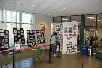
Community Workshop September 29, 2014 Visioning Exercise Input
|
|
|
- Melissa Strickland
- 5 years ago
- Views:
Transcription


1 Community Workshop September 29, 201 Visioning Exercise Input
2 ENHANCED/EMERGING CENTERS OF ACTIVITY Brookville Road Spring Center Coffield Center/Rosemary Hills-Lyttonsville Local Park

3 BROOKVILLE ROAD ENHANCED/EMERGING CENTER OF ACTIVITY Peggy Ln Leonard Dr National Park Seminary Linden Ln Fraser Ave Montgomery Hills LEGEND Sector Plan Boundary Trail Stream Parkland Proposed Capital Crescent Trail Alignment Proposed Purple Line Alignment Proposed Purple Line Station Woodlin Elementary Fort Detrick Forest Glen Annex Rock Creek Park Garfield Rd Brookville Rd Stewart Ave Albert Stewart Friendly Gardens Maine Ave Kansas Ave Pennsylvania Ave Talbot Ave Rosemary Hills Elementary Park Sutton Condominiums 16th Street Woodside Ride On Bus Depot Rock Creek Pool Washington Suburban Sanitary Commission Lyttonsville Pl Round Hill Rollingwood Claridge House Lyttonsville Rd Coffield Community Center Spencer Rd Paddington Square Rosemary Hills - Lyttonsville Local Park Lanier Rd Ross Rd Richland Pl Quinton Rd Richland St Mark Ct Sundale Dr Maywood Ave Ross Rd Spencer Rd Milford Ave Porter Ave The Barrington 8600 Summit Hills Spring Center Spring St Woodside Park Downtown Silver Spring Kramer Urban Park Grubb Rd Esther Ct East- West Hwy (MD 10) Fox Chase Rehabilitation & Nursing Center Rock Creek Forest District of Columbia N FT Location Map
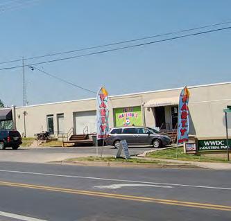

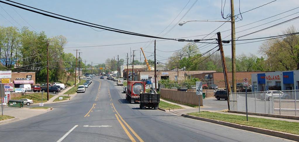
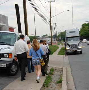
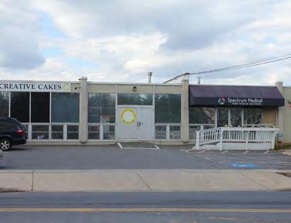
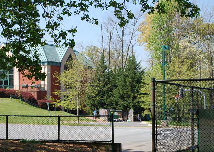
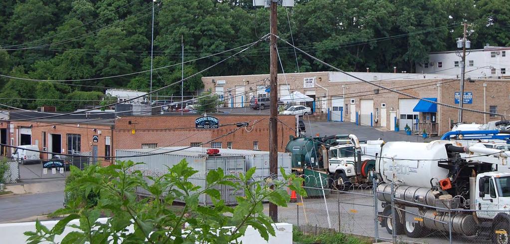
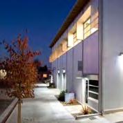
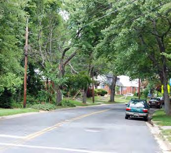
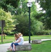
4 BROOKVILLE ROAD ENHANCED/EMERGING CENTER OF ACTIVITY Existing Conditions Photos
5 BROOKVILLE ROAD ENHANCED/EMERGING CENTER OF ACTIVITY Strengths: Challenges: Opportunities: Additional Comments: Large number of businesses, business diversity Street widths and turning radii advantageous for bus and truck maneuverability Strategic location inside beltway, close to customer base Affordable and competitive lease rates Proximity to future Purple Line station Presence of a large employer for potential customers Limited restaurants/cafes within walking distance Limited wayfinding signs for commercial vehicles Cut through traffic from E-W Highway to 95 Beltway Lack of support businesses if residential growth occurs Lack of good pedestrian connections to surrounding uses (Rock Creek Park, industrial areas) Increase walkability Environmental degradation Revitalize Brookville Road to be more walkable and inviting (Brookville Rd as a Main Street ) Creative use of warehouse space for new uses Unique retail and residential options Increased access to public transportation (Purple Line, RideOn, WMATA Bus) Opportunities to green corridor Opportunities to improve water quality, habitat Improve Streetscape Make use of Purple Line Keep Existing businesses but improve appearance Safer feel for pedestrians Keep quality existing businesses (non-polluters) and don t try to make Brookville Road into a fantasy main-street --MDOT won t do it, and will continue as an industrial thruway Add new consumer-oriented businesses along road Fix sidewalks on Brookville and industrial area So much potential. Let s make this area as a bohemian destination, w/o displacing businesses Speeding traffic need police assistance to slow down!?? Put stop sign back up Help existing businesses during construction Improve the roads (resurface) Please do not displace businesses with a useless fantasy of main st. Unique area full of vibrant economically successful businesses Need higher density and mixeduse along Brookville


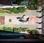
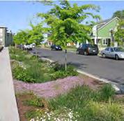
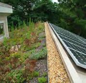
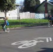
6 BROOKVILLE ROAD ENHANCED/EMERGING CENTER OF ACTIVITY Streetscape Elements: Too industrial to incent. public to come to area Bike Lanes Open Space Elements: Median Wider Sidewalks and Street Trees Through-block Connections Planting Buffer Along Surface Parking Places to Play Places to Sit in the Shade Places for Temporary Parks Green Spaces to Sit and Meet Places for Community Celebrations Environmental Elements: Mandate use of raingarden for storm water control with tax incentive Bioretention in Impervious Areas Sustainable Buildings Electric Vehicle Charging Stations Solar Panels and Green Roofs Community and Rooftop Gardens Land Use: Industrial Retail Office Residential Institutional


7 BROOKVILLE ROAD ENHANCED/EMERGING CENTER OF ACTIVITY Buildings: Rehab/Reuse of Existing Bldgs Lower Intensity Development Mid Intensity Development Placemaking Elements + Community Facilities: Mid-Higher Intensity Development Neighborhood hangout a la Parkway Deli We already have the Parkway Deli AND The Daily dish! Real Time Transit Capital Bikeshare Community WiFi Multi-Use Pavilion Public Art Business Wayfinding Food Trucks Temporary Use of Parking Lots Public Park Cafes and Outdoor Dining

8 SPRING CENTER ENHANCED/EMERGING CENTER OF ACTIVITY Peggy Ln Leonard Dr National Park Seminary Linden Ln Fraser Ave Montgomery Hills LEGEND Sector Plan Boundary Trail Stream Parkland Proposed Capital Crescent Trail Alignment Proposed Purple Line Alignment Proposed Purple Line Station Woodlin Elementary Fort Detrick Forest Glen Annex Rock Creek Park Garfield Rd Brookville Rd Stewart Ave Albert Stewart Friendly Gardens Maine Ave Kansas Ave Pennsylvania Ave Talbot Ave Rosemary Hills Elementary Park Sutton Condominiums 16th Street Woodside Ride On Bus Depot Rock Creek Pool Washington Suburban Sanitary Commission Lyttonsville Pl Round Hill Rollingwood Claridge House Lyttonsville Rd Coffield Community Center Spencer Rd Paddington Square Rosemary Hills - Lyttonsville Local Park Lanier Rd Ross Rd Richland Pl Quinton Rd Richland St Mark Ct Sundale Dr Maywood Ave Ross Rd Spencer Rd Milford Ave Porter Ave The Barrington 8600 Summit Hills Spring Center Spring St Woodside Park Downtown Silver Spring Kramer Urban Park Grubb Rd Esther Ct East- West Hwy (MD 10) Fox Chase Rehabilitation & Nursing Center Rock Creek Forest District of Columbia N FT Location Map

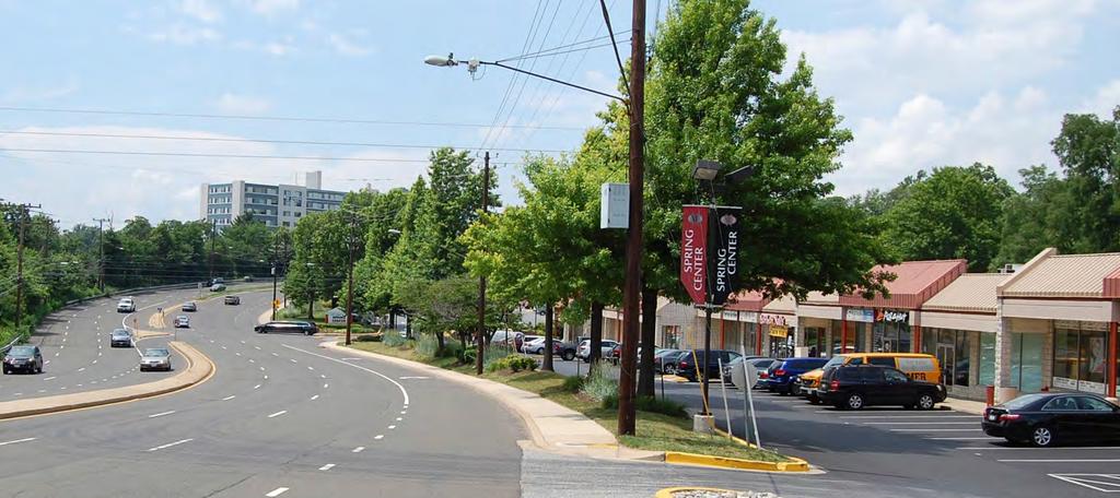
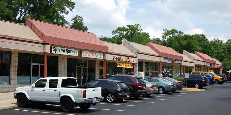
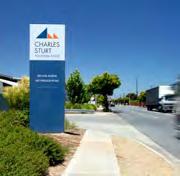
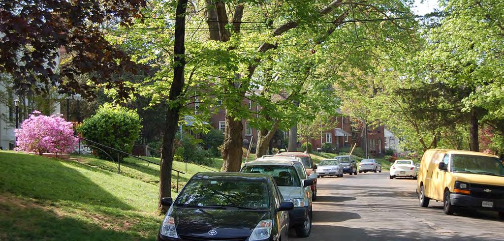
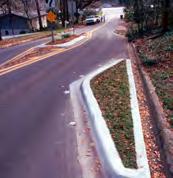
9 SPRING CENTER ENHANCED/EMERGING CENTER OF ACTIVITY Existing Conditions Photos

10 SPRING CENTER ENHANCED/EMERGING CENTER OF ACTIVITY Strengths: Proximity to Metro & the Purple Line Proximity to Downtown Silver Spring Provides useful services to multiple neighborhoods both inside and outside Sector Plan area Proximity to Beltway and 16th Street Challenges: Need to maintain this community retail Difficult to access for pedestrians and bicyclists Crossing 16th St difficult along site frontage High impervious cover/lack of vegetation Opportunities: Make area more neighborhood centric and accessible Improve environmental performance Better connections to Woodside community Improve site layout Create transit-oriented redevelopment around future purple line station Additional Comments: Believe Purple Line will require closing of 90% of the stores Need improved lighting E-W Hwk from Metro to Grubb. Very unsafe, dark, depressing now. Can easily be changed! Safer crossing for 16th st Less of a truck stop, commuter feel -- more neighborhood friendly Constrained site Better connections to Summit Hill Apts Purple Line Station can be attractive catalyst Very unfortunate that we will lose all valuable services. Please do not put more high density housing with useless empty commercial spaces. Keep retail, restaurants + services Keep post office! Plus (maybe) some modest midrise housing Make replacement retail more pedestrian-oriented


11 SPRING CENTER ENHANCED/EMERGING CENTER OF ACTIVITY Streetscape Elements: Improved Crossings Street Furniture - Lighting, Seating, etc. Wider Sidewalks Through-block Connections Bike Lanes Open Space Elements: Places for Adult Fitness Places for Concerts and Festivals Places for Creative Play Places for Farmer s Markets Places to let your Dog Run Places to Play and Socialize Places with Adventure Sports Places with Large Lawn Areas Places for Urban Gardening Places to Play and Socialize Environmental Elements: Integrated Habitat and Stromwater Electric Vehicle Charging Stations Green Streets Solar Panels and Green Roofs Solar Lighting


12 SPRING CENTER ENHANCED/EMERGING CENTER OF ACTIVITY Land Use: 15 Retail Office Residential Institutional Buildings: Lower-Mid Intensity Development Mid Intensity Development Mid-Higher Intensity Development Placemaking Elements + Community Facilities: Higher Intensity Development Neighborhood gathering spot a la Parkway Deli Covered Bus Facility Capital Bikeshare Community WiFi Cafes and Outdoor Dining Interactive Public Art

13 COFFIELD CENTER/ROSEMARY HILLS-LYTTONSVILLE PARK ENHANCED/EMERGING CENTER OF ACTIVITY Peggy Ln Leonard Dr National Park Seminary Linden Ln Fraser Ave Montgomery Hills LEGEND Sector Plan Boundary Trail Stream Parkland Proposed Capital Crescent Trail Alignment Proposed Purple Line Alignment Proposed Purple Line Station Woodlin Elementary Fort Detrick Forest Glen Annex Rock Creek Park Garfield Rd Brookville Rd Stewart Ave Albert Stewart Friendly Gardens Maine Ave Kansas Ave Pennsylvania Ave Talbot Ave Rosemary Hills Elementary Park Sutton Condominiums 16th Street Woodside Ride On Bus Depot Rock Creek Pool Washington Suburban Sanitary Commission Lyttonsville Pl Round Hill Rollingwood Claridge House Lyttonsville Rd Coffield Community Center Spencer Rd Paddington Square Rosemary Hills - Lyttonsville Local Park Lanier Rd Ross Rd Richland Pl Quinton Rd Richland St Mark Ct Sundale Dr Maywood Ave Ross Rd Spencer Rd Milford Ave Porter Ave The Barrington 8600 Summit Hills Spring Center Spring St Woodside Park Downtown Silver Spring Kramer Urban Park Grubb Rd Esther Ct East- West Hwy (MD 10) Fox Chase Rehabilitation & Nursing Center Rock Creek Forest District of Columbia N FT Location Map

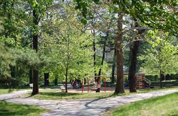
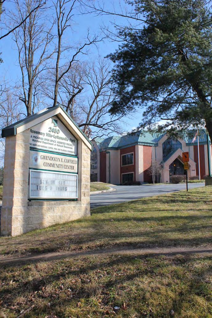
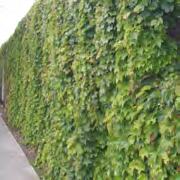
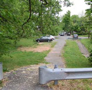
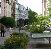
14 COFFIELD CENTER/ROSEMARY HILLS-LYTTONSVILLE PARK ENHANCED/EMERGING CENTER OF ACTIVITY Existing Conditions Photos


15 COFFIELD CENTER/ROSEMARY HILLS-LYTTONSVILLE PARK ENHANCED/EMERGING CENTER OF ACTIVITY Strengths: Amount of green space for a variety of activities Walkable connections between park and neighborhood Community center for exercise, educational activities, social gatherings Challenges: Maintenance and operation of community facilities Community perceived Purple Line impact on green space Increased demand if redevelopment occurs Need clean environment to exercise Better enforcement of trash removal on athletic fields! Opportunities: Expand and connect trails Expand recreation opportunities to include things such as dog park, pool, community gardens, volleyball Co-location of community facilities Trail and transitway will improve access and values Additional Comments: So much potential here, plus strong community support to make improvements Add cafe-style seating outside, so folks can congregate Community garden Dog park! Trail connector at end of Garfield into Rock Creek Park Need better trash can to control litter Illegal parking at park after purple line? Pedestrian connection to park from PL station Open Space + Recreation Elements: Wayfinding Path surrounding community center Places to Picnic Places for Baseball and Softball Places for Pick-up Athletics Places to Swim Places to Play Football and Soccer Places to Play Volleyball or Racket Sports Places to Play Places to Garden Places to Stroll and Sit on the Grass Indoor Spaces to Exercise
16 DISTRICTS/ NEIGHBORHOODS Industrial/Institutional Multifamily/Mixed-Use Single-family Residential

17 INDUSTRIAL/INSTITUTIONAL DISTRICTS/NEIGHBORHOODS Peggy Ln Leonard Dr National Park Seminary Linden Ln Fraser Ave Montgomery Hills LEGEND Sector Plan Boundary Trail Stream Parkland Proposed Capital Crescent Trail Alignment Proposed Purple Line Alignment Proposed Purple Line Station Woodlin Elementary Fort Detrick Forest Glen Annex Rock Creek Park Garfield Rd Brookville Rd Stewart Ave Albert Stewart Friendly Gardens Maine Ave Kansas Ave Pennsylvania Ave Talbot Ave Rosemary Hills Elementary Park Sutton Condominiums 16th Street Woodside Ride On Bus Depot Rock Creek Pool Washington Suburban Sanitary Commission Lyttonsville Pl Round Hill Rollingwood Claridge House Lyttonsville Rd Coffield Community Center Spencer Rd Paddington Square Rosemary Hills - Lyttonsville Local Park Lanier Rd Ross Rd Richland Pl Quinton Rd Richland St Mark Ct Sundale Dr Maywood Ave Ross Rd Spencer Rd Milford Ave Porter Ave The Barrington 8600 Summit Hills Spring Center Spring St Woodside Park Downtown Silver Spring Kramer Urban Park Grubb Rd Esther Ct East- West Hwy (MD 10) Fox Chase Rehabilitation & Nursing Center Rock Creek Forest District of Columbia N FT Location Map
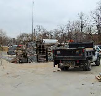
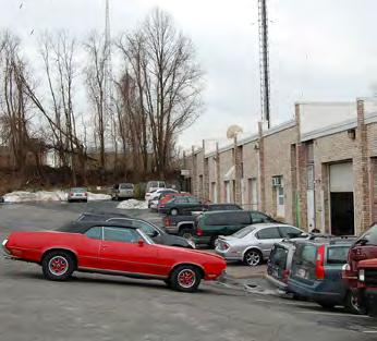
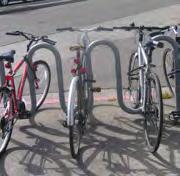
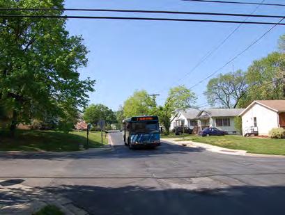
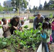
18 INDUSTRIAL/INSTITUTIONAL DISTRICTS/NEIGHBORHOODS Existing Conditions Photos
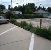
19 INDUSTRIAL/INSTITUTIONAL DISTRICTS/NEIGHBORHOODS Strengths: Major employment base Proximity to customer base inside beltway Provides industrial services in an area with limited supply Proximity to DC, Silver Spring, Bethesda Space for accommodating a variety of goods and services Affordable lease rates Space for small business opportunities Access to major arteries into City Challenges: Industrial area lacks positive visual character due to dumping, poor maintenance of properties, lack of upkeep of infrastructure Incompatible uses within close proximity (industrial & residential) Constrained parking/albert Stewart Lane Intersection of Lyttonsville Road & Lyttonsville Place unsafe and congested Poor traffic signage for commercial vehicles Cut through traffic from E-W Highway to 95 Beltsville Disorganized/ad-hoc parking Poor streetscape, unattractive Lack of Retail & Services Single Use Zoning Railroad tracks and fences cutoff communities & big streets Lack of public spaces (mingle/ meet space) Trail accessibility No access to Rock Creek Park Limited stormwater management High impervious cover/lack of vegetation Opportunities: Improve parking Provide access to Rock Creek stream valley network Implement green performance measures: - Porous pavement - Reduce impervious cover - Stormwater management - Tree planting - Reduce heat island effect Support/Grow Creative Arts Start-up Tech/Eco Companies Station Areas and Capital Crescent Trail can connect communities Bicycle-oriented pathways and plazas Neighborhood oriented development, eg. Restaurants, Outdoor dining, music ( third space ) Make area prettier Food Trucks But keep industrial uses Additional Comments: I don t come here much, it s just a big area separating the neighborhood from Rock Creek Park This area is critical to support businesses inside the beltway - it should remain industrial Separate industrial truck traffic from pedestrians Add start-up tech businesses Please keep the vibrant useful services on Brookville Rd. Do not displace or harm the businesses in any way Add more retail/shopping/food to this area so communities have better access to conveniences Redevelop industrial area as a whole. Keep it light industrial but better building design, street layout and parking

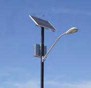
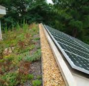
20 INDUSTRIAL/INSTITUTIONAL DISTRICTS/NEIGHBORHOODS Property Improvements: Facade Improvements Environmental Elements: Wayfinding Sidewalks and Street Trees Green Screening Through-block Connections Bicycle Parking Improved Recycling Solar Lighting Stormwater Treatment Strips Solar Panels and Green Roofs


 Fox Chase Rehabilitation & Nursing Center Rock Creek Forest District of Columbia N 0 125 250 500")
21 MULTIFAMILY/MIXED-USE DISTRICTS/NEIGHBORHOODS Peggy Ln Leonard Dr National Park Seminary Linden Ln Fraser Ave Montgomery Hills LEGEND Sector Plan Boundary Trail Stream Parkland Proposed Capital Crescent Trail Alignment Proposed Purple Line Alignment Proposed Purple Line Station Woodlin Elementary Fort Detrick Forest Glen Annex Rock Creek Park Garfield Rd Brookville Rd Stewart Ave Albert Stewart Friendly Gardens Maine Ave Kansas Ave Pennsylvania Ave Talbot Ave Rosemary Hills Elementary Park Sutton Condominiums 16th Street Woodside Ride On Bus Depot Rock Creek Pool Washington Suburban Sanitary Commission Lyttonsville Pl Round Hill Rollingwood Claridge House Lyttonsville Rd Coffield Community Center Spencer Rd Paddington Square Rosemary Hills - Lyttonsville Local Park Lanier Rd Ross Rd Richland Pl Quinton Rd Richland St Mark Ct Sundale Dr Maywood Ave Ross Rd Spencer Rd Milford Ave Porter Ave The Barrington 8600 Summit Hills Spring Center Spring St Woodside Park Downtown Silver Spring Kramer Urban Park Grubb Rd Esther Ct East- West Hwy (MD 10) Fox Chase Rehabilitation & Nursing Center Rock Creek Forest District of Columbia N FT Location Map
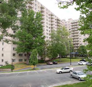
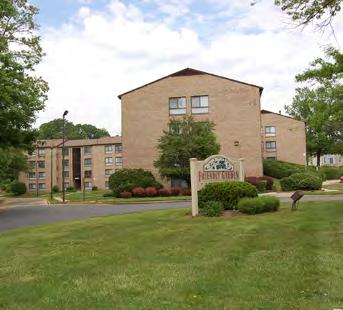


22 MULTIFAMILY/MIXED-USE DISTRICTS/NEIGHBORHOODS Existing Conditions Photos
23 MULTIFAMILY/MIXED-USE DISTRICTS/NEIGHBORHOODS Strengths: Diverse housing stock Good schools Proximity to DC, Silver Spring, Bethesda Affordability Cultural diversity Challenges: Safety at night Isolated areas (disconnected communities) E-W Highway and 16th Street have limited pedestrian crossings Lack of public spaces (mingle/meet space) Balance in affordable housing -maintain but doesn t become the reposting of affordable housing in Silver Spring High impervious coverage Limited stormwater management Parking issues Opportunities: Promote senior housing and elder services Promote aging in place Mix of housing at different price points condos, town houses, detached houses High density mixed use Improve stormwater management treatments, improve water quality in receiving streams Increase biodiversity Additional Comments: A good summary of the challenges and opportunities but I will add: Take advantage of Purple Line investment Make zoning density recommendations that encourage redevelopment Use other Purple Line route plans as a guide for density Keep at least part of the tree buffer between Park Sutton and railroad Preserve green spaces around apartment buildings We do not need more apartments, we have high density already Density closest to the Metro stops Don t develop anymore; improve what s there Just don t want to displace residents, but really need to improve look/offerings/parking! School capacity v. Density No plans for increase in school capacity. No place to build


24 MULTIFAMILY/MIXED-USE DISTRICTS/NEIGHBORHOODS Streetscape Elements: Better lighting Fill sidewalk gaps Shared Roadways Open Space Elements: 5 7 Improved Crossings Wider Sidewalks Through-block Connections Street Furniture - Lighting, Seating, etc Enhanced Existing with Trees and Seating Enhanced Lawn Areas for Informal Play Enhanced Existing Spaces with Public Art Enhanced Existing with Shade and Tables With Enhanced Existing Spaces or New Development, A Dog Run With New Development, A New Park With New Development, A New Plaza With New Development, A Water Feature With New Development, Recreation over Structured Parking


25 MULTIFAMILY/MIXED-USE DISTRICTS/NEIGHBORHOODS Environmental Elements: Vehicle charging stations at shopping centers and parking lots Land Use: Sustainable Buildings Rainwater Harvesting/Cisterns Integrated Habitat and Stormwater Green Roofs Electric Vehicle Charging Stations 9 Retail 2 Office 9 Residential Buildings: Rehab of Existing Buildings Lower-Mid Intensity Development Mid Intensity Development Mid-Higher Intensity Development Higher Intensity Development

26 SINGLE-FAMILY RESIDENTIAL DISTRICTS/NEIGHBORHOODS Peggy Ln Leonard Dr National Park Seminary Linden Ln Fraser Ave Montgomery Hills LEGEND Sector Plan Boundary Trail Stream Parkland Proposed Capital Crescent Trail Alignment Proposed Purple Line Alignment Proposed Purple Line Station Woodlin Elementary Fort Detrick Forest Glen Annex Rock Creek Park Garfield Rd Brookville Rd Stewart Ave Albert Stewart Friendly Gardens Maine Ave Kansas Ave Pennsylvania Ave Talbot Ave Rosemary Hills Elementary Park Sutton Condominiums 16th Street Woodside Ride On Bus Depot Rock Creek Pool Washington Suburban Sanitary Commission Lyttonsville Pl Round Hill Rollingwood Claridge House Lyttonsville Rd Coffield Community Center Spencer Rd Paddington Square Rosemary Hills - Lyttonsville Local Park Lanier Rd Ross Rd Richland Pl Quinton Rd Richland St Mark Ct Sundale Dr Maywood Ave Ross Rd Spencer Rd Milford Ave Porter Ave The Barrington 8600 Summit Hills Spring Center Spring St Woodside Park Downtown Silver Spring Kramer Urban Park Grubb Rd Esther Ct East- West Hwy (MD 10) Fox Chase Rehabilitation & Nursing Center Rock Creek Forest District of Columbia N FT Location Map
27 SINGLE-FAMILY RESIDENTIAL DISTRICTS/NEIGHBORHOODS Existing Conditions Photos
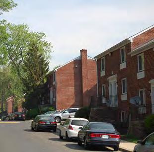
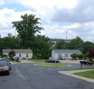
28 SINGLE-FAMILY RESIDENTIAL DISTRICTS/NEIGHBORHOODS Strengths: Community togetherness (diversity), racial/ethnic and religious integration Affordable housing & safety Much of community has been preserved physically and historically Retention of residents Good schools Proximity to DC, Silver Spring, Bethesda Access to Rock Creek Park and Georgetown Branch Trail Tree lined neighborhoods Historic character Amazing Community Great location but hard to find Challenges: Lack of public spaces (mingle/meet space) Integrate trail into community Connectors to surrounding neighbors (CSX, EW Hwy, 16th Street are barriers) Limited internal connections to Silver Spring, Metro stops, shopping, etc. Streets need repairs; in terrible condition Need more sidewalks Opportunities: Use Purple Line and Capital Crescent Trail to tie communities together Improve pedestrian access to adjacent neighborhoods Restore housing South of tracks, East of Lyttonsville Place, north of Lyttonsville Road Mix of housing at different price points condos, town houses, detached houses Provide improved pedestrian access to adjacent neighborhoods Must have improved access to capital crescent trail Capital Crescent major new benefit and Purple Line Additional Comments: Some streets have no sidewalks Lighting is dismal/unsafe in neighborhood; also terribly dark on E-W hwy from Silver Spring Metro to neighborhood Pennsylvania leading to school does not have a sidewalk neither does Michigan leading to Comm Center until you get to the townhouses Better pedestrian lighting is needed everywhere. Not just in single family residential area Roads need resurfacing and more lighting and better sidewalks Better maintenance of pests Don t increase apartment density! Will Brookville Purple Line Station increase noise level?

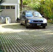

29 SINGLE-FAMILY RESIDENTIAL DISTRICTS/NEIGHBORHOODS Neighborhood Placemaking + Streetscape Elements: Improved sidewalks Improved Crossings and Connections Traffic Calming - Chicane Seating and Pedestrian Lighting Temporary Parks and Play in Streets Environmental Elements: Shared Roadways Bioretention in Streets Solar and Green Roofs Permeable Paving in Driveways Community Gardens Pollinator Pathways
Planning Board Briefing
 Planning Board Briefing Why Now? The Sector Plan Implementation Chapter States: Before Stage 1 begins, the following must occur: Approval of the Sectional Map Amendment. Approval of the Greater Lyttonsville
Community Meeting November 18, 2015
 Top Concerns We ve Heard Use of Urban Road Code Total number of units and effect on schools and transportation Land swaps with Parks Department: how do these benefit the community? Zoning classifications:
THE 355/270 CORRIDOR:
 THE 355/270 CORRIDOR: Strategic Ideas for Sustaining a Livable Work Place Project Summary ACCESS LIFE DESIGN HEALTH WORK Montgomery County Planning Department The Maryland-National Capital Park and Planning
Lower Merion Commercial Districts Issues and Characteristics Handbook November 2013
 Lower Merion Commercial Districts Issues and Characteristics Handbook November 2013 DRAFT TOWNSHIP-WIDE VISION: To maintain and enhance commercial areas to complement the surrounding high-quality residential
Sector Plan Briefing October 16, 2014
 Sector Plan Briefing October 16, 2014 M-NCPPC Greater Lyttonsville Team Robert Kronenberg, Chief Marc DeOcampo, Supervisor Erin Banks, Project Manager Melissa Williams, Outreach Matt Folden, Transportation
Seneca Meadows. Block 4 Locate office, technology, and medical development adjacent to I Screen views of garage structures from I-270.
 Seneca Meadows Seneca Meadows has an industrial park in its southern end and a mixed-use employment area planned for the north end. The district benefits from extensive I-270 visibility, stream valley
Town Center. Block 5 Existing multifamily residential units are expected to remain.
 Area Guidelines Germantown s districts should be developed as distinct communities with unique features that are supported through the guidelines. The guidelines not only help distinguish these districts
EXISTING COMPREHENSIVE PLAN
 EXISTING COMPREHENSIVE PLAN Town Center Land Use Element: V. LAND USE POLICIES Town Center Mercer Island's business district vision as described in "Your Mercer Island Citizen-Designed Downtown" was an
Long Branch Sector Plan
 June 2012 Long Branch is one of Montgomery County s most affordable, older communities and has served as a gateway community, especially for newly arriving immigrants, since the 1960s. Many within this
CHAPTER 3 VISION, GOALS, & PLANNING PRINCIPLES. City of Greensburg Comprehensive Plan. Introduction. Vision Statement. Growth Management Goals.
 CHAPTER 3 VISION, GOALS, & PLANNING PRINCIPLES Introduction The Greensburg Comprehensive Plan is intended as a working community document. A combination of long and short-term goals, this document is intended
Greater Lyttonsville Sector Plan Design Guidelines Stakeholder Meeting with Civic Association Leaders October 3, 2018
 Greater Lyttonsville Sector Plan Design Guidelines Stakeholder Meeting with Civic Association Leaders October 3, 2018 ATTENDANCE: Laura Shipman, Planning Department Robert Kronenberg, Planning Department
MONTGOMERY COUNTY METRO STATION AREA DESIGN CHARRETTE
 MONTGOMERY COUNTY METRO STATION AREA DESIGN CHARRETTE Shady Grove Metro Station Area Charrette Closing Presentation October 25-28, 2000 MONTGOMERY COUNTY, MD M-NCPPC Design Collective, Inc. Architects
Transportation. Strategies for Action
 Transportation A major priority for the Overlake Neighborhood is to develop a multimodal transportation system. To achieve this system, a balance has to be found among travel, circulation and access needs;
Chapter 1: Introduction
 Chapter 1: Introduction The Penn Avenue Community Works Corridor Vision and Implementation Framework presents an integrated communitybased vision and a coordinated, long-term implementation framework for
CHAPTER 7: Transportation, Mobility and Circulation
 AGLE AREA COMMUNITY Plan CHAPTER 7 CHAPTER 7: Transportation, Mobility and Circulation Transportation, Mobility and Circulation The purpose of the Transportation, Mobility and Circulation Chapter is to
Preliminary Recommendations Tk Takoma/Langley Crossroads Sector Plan
 Preliminary Recommendations Tk Takoma/Langley Crossroads Sector Plan Vision is to achieve a Transit Oriented, pedestrian friendly Community that Celebrates and builds upon the cultural Diversity of the
Germantown Forward Status Report to the Planning Board M NCPPC
 Germantown Forward Status Report to the Planning Board Germantown Forward March 27, 2008 What s new? CCT alignment Capital Improvement Program Agency partners Water quality conditions Sustainability Design
The Project. In 2013, construction was completed between 100 Street and 102 Street.
 The Project Jasper Avenue New Vision (JANV) is a major catalyst project identified in the Capital City Downtown Plan (2010) between 92 Street and 109 Street, including the streets half a block north and
Status Report: MD 355 Project
 Status Report: MD 355 Project OCTOBER 2006 M-NCPPC MONTGOMERY COUNTY PLANNING DEPARTMENT Summary of Community Comments, and break to the Results of the MD 355 Participation Session Brookside Gardens -
Silverdale Regional Center
 Silverdale Regional Center Vision for Silverdale Regional Center The Silverdale Regional Center Plan (Plan) will guide the evolution of the Silverdale Regional Center from a collection of strip malls and
4 C OMMUNITY D ISTRICTS
 4 C OMMUNITY D ISTRICTS N ew development in the Area will include many different types of land uses, including a destination retail area that attracts people from all over the region; recreation opportunities
Community Design Guidelines. Port Wallace DRAFT
 Community Design Guidelines Port Wallace DRAFT Energy 1 2 3 Nature Movement Connections Built Form DRAFT Layout Energy 1 Nature Community Design Guidelines GREAT COMMUNITIES PROTECT, CELEBRATE, AND CONSERVE
Sources of Copies The Maryland-National Capital Park and Planning Commission 8787 Georgia Avenue Silver Spring, MD 20910
 Abstract The Greater Lyttonsville Sector Plan contains the text and supporting maps for an amendment to the approved and adopted 2000 North and West Silver Spring Master Plan. It also amends the General
COMPLETE GREEN STREET CHECKLIST
 COMPLETE GREEN STREET CHECKLIST This document was developed to dissect the structure of an urban street and explore opportunities to make our streets more complete while also integrating green street strategies.
Shared Principles and Emerging Plan Directions
 Shared Principles and Emerging Plan Directions Introduction Since the Fairfield Neighbourhood planning process launched in June 2016, we have heard from many residents, businesses, groups and other people
Westwood Shopping Center Sketch Plan, Plan # February 23, 2017 Item # 9
 Westwood Shopping Center Sketch Plan, Plan # 320170010 February 23, 2017 Item # 9 Westwood II Site 64,111 s.f. Manor Care site: vacant two story building HOC-Westwood Towers, 15 story tower To be considered
Commercial Node Plan Devine Street/Jackson Blvd. COLUMBIA, SC
 Commercial Node Plan Devine Street/Jackson Blvd. COLUMBIA, SC 9.17.13 AGENDA 1 Introductions 2 Project Update 3 Concepts 4 Recommendations 5 Next Steps Introductions Project Update Process 5-Phase Process
3.1 community vision. 3.3 required plan elements
 Chapter 3 Community Form 3.1 community vision 3.2 Parks & landscaping concepts 3.3 required plan elements D R A F T 20 Community Form Chapter 3 3.0 Community form 3.1 community vision The Specific Plan
Plano Tomorrow Vision and Policies
 Plano Tomorrow Vision and Policies PLANO TOMORROW PILLARS The Built Environment The Social Environment The Natural Environment The Economic Environment Land Use and Urban Design Transportation Housing
TOWN COUNCIL / PLANNING COMMISSION
 Workshop #3 TOWN COUNCIL / PLANNING COMMISSION January 20, 2011 Consultant Team In Attendance Tonight BMS Design Group Nevada City and San Francisco Michael Smiley, AICP, ASLA Partner-in-Charge Nancy L.
2. Form and Character. 2.1 Introduction. 2.2 The Downtown Addition Plan. 2.1 Introduction
 2.1 Introduction 2.1 Introduction This section of the Specific Plan describes and illustrates the desired form, character and uses of the Downtown Addition and explains the underlying design principles.
Policies and Code Intent Sections Related to Town Center
 Policies and Code Intent Sections Related to Town Center The Town Center Vision is scattered throughout the Comprehensive Plan, development code and the 1994 Town Center Plan. What follows are sections
East Area Plan. Steering Committee Meeting May 24, Art Gym Denver
 East Area Plan Steering Committee Meeting May 24, 2018 Art Gym Denver East Area Plan Steering Committee Meeting May 24, 2018 ArtGym Denver, 1460 Leyden Street AGENDA 1 6:00-6:05 Approval of April Meeting
RESEDA - WEST VAN NUYS COMMUNITY PLAN
 RESEDA - WEST VAN NUYS COMMUNITY PLAN Executive Summary As part of the initial outreach effort, the Department of City Planning hosted two workshops for the Reseda-West Van Nuys Community Plan Area during
The Five Components of the McLoughlin Area Plan
 The Five Components of the McLoughlin Area Plan This documents contains the complete language of the five components of the McLoughlin Area Plan: The Vision Statement The Values The Guiding Principles
Lehigh Acres Land Development Regulations Community Planning Project
 Lehigh Acres Land Development Regulations Planning Effort Summary In July, 2010 Commissioner Frank Mann invited the Lehigh Acres community to start discussing how to achieve their recently adopted community
BROOKHILL NEIGHBORHOOD MODEL ZONING MAP AMENDMENT PREFACE TO APPLICATION
 BROOKHILL NEIGHBORHOOD MODEL ZONING MAP AMENDMENT PREFACE TO APPLICATION June 15, 2015 Revised: August 1, 2016 I. VISION Brookhill is a proposed community based upon the principles of Albemarle County
Neighborhood Districts
 NEIGHBORHOOD DISTRICTS SEVEN MAIN DISTRICTS Neighborhood Districts While the Development Plan provides a broad-scale overview of the neighborhood, this section focuses on uses and relationships at the
Town Center (part of the Comprehensive Plan)
") Town Center (part of the Comprehensive Plan) Mercer Island Town Center Looking North (2014) In 1994, a year-long process culminated in a set of design guidelines and code requirements for the Town Center
Town Center (part of the Comprehensive Plan) Mercer Island Town Center Looking North (2014) In 1994, a year-long process culminated in a set of design guidelines and code requirements for the Town Center
Complete Neighbourhood Guidelines Review Tool
 Complete Neighbourhood Guidelines Review Tool Prepared By: City of Regina Planning Department October 2014 Page 1 of 14 Community Development Review Checklist for Secondary Plans and Concept Plans The
Schedule B to Report PLS
 Page 25 Q1. The land use concept is made up of many different land uses (residential, commercial, parks, schools, environmental areas etc.) A number of land uses are concentrated in the Community Core,
Establish a network of streetscaped vehicle and pedestrian routes that connect within and outside the Plan area.
 This Plan s urban design goals are to create an urban scale, walkable community with connections to transit, parks, and services and with amenities and facilities for residents and employees. The 1992
4.9 Mendocino Avenue Corridor Plan Design Guidelines
 4.9 Mendocino Avenue Corridor Plan Design Guidelines The Mendocino Avenue Corridor Plan addresses the area between College Avenue and Steele Lane. Mendocino Avenue is a busy arterial that runs parallel
More than 30 adults and 19 children were involved in these community workshops.
 Linwood Workshops held at Household of Faith Deliverance Church 3.29.08 and 4.05.08 What is a Design Workshop? We use the term workshop (often called charrette among design professionals) to describe a
Coast Highway Oceanside, California
 Coast Highway Oceanside, California Coast Highway Plan Zones What We ve Heard - Walkable/Bikeable Community (Senior and Child Friendly) -Wider Sidewalks -Street Trees -Traffic Calming -Bike Lanes -Paseos
Chapter 4: The Vision
 Chapter 4: The Vision This plan is organized around the community vision detailed in this chapter. The vision describes the collective thoughts, values, and hopes of the community for its future. The community
Cobb County Design Guidelines Mableton Parkway & Veterans Memorial Highway Community Design Workshop January 12, 2017
 Community Design Workshop January 12, 2017 Agenda Opening Remarks / Introductions Scope of Work Existing Conditions Key Issues / Opportunities VPS Summary Draft Vision & Goal Statement Implementation Concepts
Appendix 4 Park, Trail, and Recreation Facilities For more information, call the Park Planning and Stewardship Division at
 Appendix 4 Park, Trail, and Recreation Facilities For more information, call the Park Planning and Stewardship Division at 301-650-4380 montgomery county planning board maryland-national capital park and
The transportation system in a community is an
 7 TRANSPORTATION The transportation system in a community is an important factor contributing to the quality of life of the residents. Without a sound transportation system to bring both goods and patrons
The Cambie Corridor 2015 Fall workshop series. What we heard WORKSHOP OUTLINE
 The Cambie Corridor 2015 Fall workshop series W 16 AVE Area 5 CAMBIE CORRIDOR Phase 3 What we heard ovember 21, 2015, 9am-noon, 1:30-4:30pm Peretz Centre 89 Participants* WORKSHOP OUTLIE Introductions
The Vision. Photo provided by The Minervini Group. 46 Vision, Objectives & Strategies
 Vision, Objectives & Strategies The is the public framework and guide for future development of the Grand Traverse Commons. The establishes public polices for infrastructure, the preservation of natural
Study Area. Capitol Way. Greening America s Capitals 11/13/2014. A Greening America s Capitals Project
 Olympia, WA: Greening Capitol Way Supporting Communities move towards sustainability is a priority for the federal government. A Greening America s Capitals Project Office of Sustainable Communities U.S.
East Central Area Plan
 East Central Area Plan Steering Committee Meeting March 8 th, 2018 CHUN Tears McFarlane House Vision Statement Development Opportunities Analysis Vision Elements 1. Equitable, Affordable and Inclusive
Corridors. Re-vitalize our Corridors and Gateways
 Corridors Re-vitalize our Corridors and Gateways Artist s rendering from the 287 Strategic Plan, 2015 Corridors are the major throughways of Loveland but they also provide important commercial, community
DRAFT. 10% Common Open Space
 % OF CHARLOTTE IS CATEGORIZED AS A. LAND USES : Placeholder map displaying location of Place Type GOALS: Accommodate XX% of future growth. Provide a concentration of primarily commercial and civic activity
Atlanta BeltLine. Subareas 9 & 10. Master Plan Updates. March 26, Washington Park Jamboree 1
 Atlanta BeltLine Subareas 9 & 10 Master Plan Updates March 26, 2018 Washington Park Jamboree 1 22 miles, connecting 45 neighborhoods 22 MILES of transit 46 MILES of streetscapes and complete streets 33
South Davis County COMMUNITY SPOTLIGHT
 South Davis County COMMUNITY SPOTLIGHT Davis/SLC Community Connector Bus Rapid Transit line connecting SLC & Davis County RTP Phase 1 Project Generate 3,100 average weekday riders Relieve congestion on
VEHICULAR AND PEDESTRIAN CIRCULATION
 This perspective sketch communicates the intended character and quality of a proposed streetscape design. Locate benches near a major intersection where people tend to gather. Seating and lighting provide
Cleveland Park Streetscape and Drainage Improvement Project 1
 Cleveland Park Streetscape and Drainage Improvement Project 1 Urban Context Washington, D.C. Connecticut Avenue Cleveland Park Streetscape and Drainage Improvement Project 2 Neighborhood Context Contributing
Part 2 Common Elements
 WHITE FLINT SECTOR PLAN Round Table Discussion: Part 2 Common Elements October 8, 2007 The M-NCPPC 1 Role Regional Marketplace North Bethesda s Downtown with a Conference Center District The M-NCPPC 2
WEST LOOP DESIGN GUIDELINES CHECKLIST
 WEST LOOP DESIGN GUIDELINES CHECKLIST Section 1.0 General Strategies 1.1 DESIGN EXCELLENCE: ENCOURAGE HIGH QUALITY AND INNOVATIVE DESIGN OF NEW BUILDINGS WITHIN THE WEST LOOP WITHOUT BEING PRESCRIPTIVE
Secondary Plan - Annexed Lands. Vision Workshop Summary March 14th 2011
 Secondary Plan - Annexed Lands Vision Workshop Summary March 14th 2011 i Table of Contents 1.0 Executive Summary 1 1.1 Priority Directions 1 1.2 A Vision for the Annexed Lands 2 2.0 Introduction 2 2.1
CHAPTER 8. Mrs. Zimman s Class - Central Elementary
 SUSTAINABILITY CHAPTER 8 Mrs. Zimman s Class - Central Elementary 8.1 OVERVIEW Green infrastructure also known as low impact development (LID) and environmental or sustainable site design is an environmentally
THE NEIGHBORHOOD TODAY
 THE NEIGHBORHOOD TODAY CORE AREA VISION How are we Good Urbanism A Site s DNA thinking about Elements of great Unique elements urban communities embedded in a place the site and design? ELEMENTS LIKE:
City of Dallas Complete Streets Program. SAME Infrastructure Forum February 2, 2018
 City of Dallas Complete Streets Program SAME Infrastructure Forum February 2, 2018 Complete Streets Design Manual Adopted by City Council January 27, 2016 JANUARY 27, 2016 2 What are Complete Streets?
Urban Design Manual PLANNING AROUND RAPID TRANSIT STATIONS (PARTS) Introduction. Station Study Areas
 Introduction. Station Study Areas") 111111 PLANNING AROUND RAPID TRANSIT STATIONS (PARTS) Introduction The ION rapid transit system will link Waterloo, Kitchener and Cambridge through a central transit corridor (CTC). There are a number
111111 PLANNING AROUND RAPID TRANSIT STATIONS (PARTS) Introduction The ION rapid transit system will link Waterloo, Kitchener and Cambridge through a central transit corridor (CTC). There are a number
Bethesda. Downtown Plan Design Guidelines. Approved July access + mobility. community identity. habitat + health. equity. water.
 Bethesda Downtown Plan Design Guidelines community identity equity habitat + health access + mobility water energy Approved July 2017 THE MONTGOMERY COUNTY PLANNING DEPARTMENT THE MARYLAND-NATIONAL CAPITAL
NORTH COLLEGE PARK. Residential Neighborhood and Neighborhood Center OBJECTIVES EXISTING SITUATION AND ISSUES CONCEPT
 Greenbelt Metro Area Sector Plan - Subarea Design Policies and Guidelines - North College Park 119 NORTH COLLEGE PARK Residential Neighborhood and Neighborhood Center CONCEPT North College Park is envisioned
Sahuarita District & Phase 1 Master Plan. Town Council December 11, 2017
 Sahuarita District & Phase 1 Master Plan Town Council December 11, 2017 Visioning Study Visioning Process Advisory Group Meetings Community Questionnaire Town Center Case Studies Community Analysis The
CITY OF UNION CITY MINUTES GENERAL PLAN ADVISORY COMMITTEE
 CITY OF UNION CITY MINUTES GENERAL PLAN ADVISORY COMMITTEE WEDNESDAY, MARCH 4, 2015, 6:30 P.M. IN THE CITY COUNCIL CONFERENCE ROOM OF CITY HALL 34009 ALVARADO-NILES BLVD., UNION CITY, CALIFORNIA Attachment
Ivywild On The Creek PRELIMINARY CREEK DISTRICT MASTER PLAN
 Ivywild On The Creek PRELIMINARY CREEK DISTRICT MASTER PLAN Introduction: Rejuvenating an extraordinary Creekside neighborhood THE CREEKSIDE DISTRICT The Ivywild On The Creek Neighborhood District Master
ITEM #8. Regional Smart Growth Program. Regional Smart Growth Program. Presentation Overview. Coast Highway Vision and Stategic Plan.
 Regional Smart Growth Program Economic Development Commission What is Smart Growth? Adopted as part of the Regional Comprehensive Plan (RCP) RCP provides vision for region based on Smart Growth and sustainability
TEAM INPUT SUMMARY. Postcard Image?
 DOWNTOWN MAULDIN TEAM PUBLIC INPUT TEAM INPUT SUMMARY Postcard Image? A nice neighborhood The main city center with government buildings Mauldin entry sign, high school, Cultural Center, Sunset Park, Hall
Draft Memorandum #1: Goals and Vision for Revitalization
 Keizer Revitalization Plan Draft Memorandum #1: Goals and Vision for Revitalization Submitted to: City of Keizer April 12, 2018 (revised) Prepared By: Angelo Planning Group and Otak, Inc. Project No. 17482.A
Potential Green Infrastructure Strategies May 6, 2015 Workshop
 Potential Green Infrastructure Strategies May 6, 2015 Workshop Background The City of Cortland is developing the Tioughnioga Urban Headwaters Green Infrastructure Action Plan with funding from the National
Draft Bergamot Area Plan
 ATTACHMENT 1 Draft Bergamot Area Plan Taskforce on the Environment April 15, 2013 www.bergamotplan.net 1 Overview WHAT IS THE BERGAMOT AREA PLAN? A Community-Based Planning Document Guiding the Future
6. DOWNTOWN. The Downtown Element focuses on supporting and expanding the vitality and enhancement of Downtown Chico as the City s central core.
 VISION In 2030, Downtown Chico is the heart of the community and the center of cultural activity. Engaging and active at the street level, it is a multi-story, mixed-use hub, with specialty retail, restaurants,
PLAN ELEMENTS WORKSHOP. April 5, 2016
 PLAN ELEMENTS WORKSHOP April 5, 2016 needs more housing. But there is no one-size fits-all solution. Every neighborhood has its own character. In some places, density is not only appropriate it is badly
Somers Point Master Plan
 Somers Point Master Plan Progress Report and Public Meeting August 20, 2014 Master Plan Reexamination Municipal Land Use Law require that all municipalities reexamine their master plan every ten years.
Table of Contents. Elm Avenue Improvement Plan City of Waco, Texas. Introduction 1. Existing Context 1 Figure 1 2.
 Table of Contents Introduction 1 Existing Context 1 Figure 1 2 Plan Guidelines 3 Future Urban Form 4 The West-End 4 Main Street 6 The East-End 7 Figure 2 9 Public Improvement Recommendations 7 General
VISION AND GUIDING DESIGN PRINCIPLES
 pleasure point commercial corridor VISION AND GUIDING DESIGN PRINCIPLES Public Draft November 26, 2018 County of Santa Cruz with assistance from MIG CONTENTS PART I: INTRODUCTION AND VISION... 3 Community
Rock Spring Master Plan Community Meeting #8: Preliminary Recommendations
 Rock Spring Master Plan Community Meeting #8: Preliminary Recommendations July 18, 2016 Ι Walter Johnson High School Andrea Gilles, andrea.gilles@montgomeryplanning.org Ι www.montgomeryplanning.org/community/rockspring/
Section4 Design Vision & Implementation Plan
 Section4 Design Vision & Implementation Plan W Woodschurch Rd 4.1 Design Focus Areas The Framework Plan is simply the starting point for directing the design and implementation of a wide range of transportation
Issues, Challenges & Opportunities
 Below is a summary of issues, challenges, and opportunities relating to the revitalization of Downtown Romeoville and potential development of the Village s East Side TOD Area. Current Issues & Challenges
9 th Street Sub Area Plan
 9 th Street Sub Area Plan In the 1990 s, when the Township prepared the last Master Plan, the 9 th Street corridor was studied as part of a larger 9 th Street Focus Area that included the West Main Street
urban design Introduction
 ACHIEVE SP RI NGF I ELD.3 Introduction Urban Design Areas Design Areas are areas within Springfield that have a unique and recognizable character that is different from other areas in the community. The
URBAN DESIGN BRIEF URBAN DESIGN BRIEF 721 FRANKLIN BLVD, CAMBRIDGE August 2018
 URBAN DESIGN BRIEF URBAN DESIGN BRIEF 721 FRANKLIN BLVD, CAMBRIDGE August 2018 DESIGN BRIEF CONTENTS PART A 1.0 INTRODUCTION 2.0 DESCRIPTION & ANALYSIS OF SITE CONTEXT 3.0 DESIGN CONSTRAINTS AND OPPORTUNITIES
A larger version of this map is located on the last page of this PDF.
 MAP Committee Input McLoughlin Area Draft Vision Map A larger version of this map is located on the last page of this PDF. 1. The map above is intended to portray a vision for the McLoughlin area. It highlights
HE VISION. Building a Better Connected Place
 HE VISION Building a Better Connected Place WALK INTO THE FUTURE. Life in Cranberry, 2030 Here s what our residents told us they wanted to see in their community by 2030: The Cranberry of 2030 is a place
Hopkins. Development Guidelines May Overview. Sponsored by: Blake Road Corridor Collaborative City of Hopkins
 Hopkins Blake Road LRT Station Area Development Guidelines May 2015 Sponsored by: Blake Road Corridor Collaborative City of Hopkins Overview Hopkins is a dynamic community of over 17,000 residents located
COURTICE MAIN STREET COMMUNITY IMPROVEMENT PLAN
 COURTICE MAIN STREET COMMUNITY IMPROVEMENT PLAN Public Meeting #1 April 28, 2016 Birdseye view of the study area PIC #1 AGENDA Agenda and Format 6:30 6:50 Registration 6:50 7:45 Introductions, Presentation
Kenilworth Avenue and Town of Cheverly Industrial Study Briefing
 Kenilworth Avenue and Town of Cheverly Industrial Study Briefing The Maryland-National Capital Park and Planning Commission Prince George s County Planning Department www.pgplanning.org Vanasse Hangen
The open space system should provide connective elements, relate to natural resources, and enhance the suburban character of the landscape..
 The open space system should provide connective elements, relate to natural resources, and enhance the suburban character of the landscape.. Mixed-use and infill development should maintain or enhance
Northwest Rail Corridor and US 36 BRT Development Oriented Transit Analysis 4.4 STATION AREA FINDINGS
 4.4 STATION AREA FINDINGS Each station is different, and each one requires a separate set of recommendations based on the vision for the site. This section outlines an initial TOD strategy and recommendations
Greenbrier Neighborhood Plan
 Greenbrier Neighborhood Plan Acknowledgments The 2006 Neighborhood Plans were developed through a collaborative effort of our neighborhood residents, city staff, the City Planning Commission, UVA students
1.0 Introduction. Purpose and Basis for Updating the TMP. Introduction 1
 1.0 Introduction The Town of Castle Rock is situated between the metropolitan areas of Denver and Colorado Springs, amidst a unique terrain of rolling hills, mesas, ravines, and waterways. Like many Front
Parker Pine Curve Master Plan January 28th, 2009, Public Workshop Comments
 Group 1 Big Ideas Pedestrian friendly within and to development - bridge over Main Street from downtown. Campus feel. Parking garage like Castle Rocks - Taj garage may be tucked in hillside. Large (big
Roanoke Rapids Streetscape Master Plan. City Council Presentation
 SCHEDULE: Stakeholder Meeting/Kick off November,2016 Master Planning Phase (November March 2017) Public Meeting #1 December 13, 2016 Review Meeting with Key Stakeholders Refine Concepts Based on Input
SECTION II SECTION II STATEMENT OF GOALS, OBJECTIVES, PRINCIPLES, ASSUMPTIONS, POLICIES AND STANDARDS
 STATEMENT OF GOALS, OBJECTIVES, PRINCIPLES, ASSUMPTIONS, POLICIES AND STANDARDS 1 2 STATEMENT OF GOALS, OBJECTIVES, PRINCIPLES, ASSUMPTIONS, POLICIES AND STANDARDS INTRODUCTION The New Jersey Municipal
Danvers High Street I-1 District Study
 Danvers High Street I-1 District Study Presentation of Final Recommendations Planning Board Presentation June 26 th, 2018 1 Introductions Metropolitan Area Planning Council Sam Cleaves AICP, Principal