Semi-automated extraction of Landscape Features from VHR satellite data
|
|
|
- Julian Fletcher
- 6 years ago
- Views:
Transcription

1 Semi-automated extraction of Landscape Features from VHR satellite data Lukas Brodsky, Katerina Jupova, Lubos Kucera GISAT
2 Goals and motivations Landscape Features: GAEC for control Maintaining of landscape features protecting soil against water, and wind erosion GAEC control: visual interpretation of current VHR image and historical aeiral orthophotos LPIS does not include any information on Landscape Features Landscape Features: ecological, geo-morphological or estetical value... There are not any information on spatial distribution and changes of LF various ecological studies Protection of soil against erosion also in other (non-european) regions


3 Objective Develop and test methodology for identification and extraction of LF by automatic/semi-automatic procedure from satellite images = reference layer for GAEC controls As much as automated procedure Identify LF Extract polygon layer of LF Compare with visual interpretation Derive basic statistics Accuracy assessment based on manual extraction as ground truth Apply developed methodology


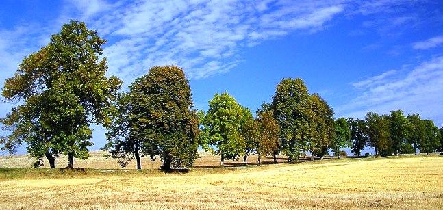
4 Landscape Features defined hedgerow (windbreak, trees and shrubs in rows) solitary trees groups of trees wooden embankment ditch, dike, channel, earthen embankment, etc. Definition: non-productive parts of agricultural landscape with ecological and geomorphological value focus lies on vegetation units
 Texture")
 Auxiliary data: LPIS (DAIFOR")
5 Data used Satellite VHR data: IKONOS images Pan + R G B NIR NDVI (per pixel) Texture measures (Haralick homogeneity, Sobel edge filter - NIR) Auxiliary data: LPIS (DAIFOR project)
6 LF manual extraction
7 Automatic extraction Object oriented image processing (Definiens Professional v. 5, Definiens Developer v. 7) Segmentation Find the right image segments Classification Object-based fuzzy logic classification Post-processing Cleaning the classification result Extraction of object statistics Exporting the object shapes Accuracy assessment


8 Automatic extraction Urban and Forest mask Landscape Features classification Segmentation

9 Post-processing Cleaning the classification result filtering the gaps reshaping resulting polygons (border optimisation, application of mathematical morphology algorithms; testing by generic shape futures)
10 Post-processing Extraction of object statistics and exporting the object shapes LF stock and typology (object-oriented) Total area Total perimeter Length/width ratio Min, max, median area Size distributions LF breakdown according LPIS mask (object-oriented) stock and typology inside and outside LPIS borders Proximity to linear features in the landscape (ArcGIS) LF breakdown according the proximity of pasture or arable land (object-oriented)
11 LF distribution and basic statistics agricultural land INTENSIVE area 84,4 % EXTENSIVE area 50,7 % number of SLUs total area avg. area min. area max. area area median area modus ha 0.19ha 15.3 m2 3.7 ha 0.089ha 0.004ha ha 0.16 ha 12.9 m2 7.8 ha ha ha total perimeter perimeter median 232 km 231 m 278 km 113 m
 area % area (ha) area % SLU along waterstreams 20,6 18% 44,1 22% SLU_along_paths 27,3 24% 58,3 29% SLU_along_roads 26,6 24% 9,1 4% SLU_along_railways 9,9 9% 2,8 1%")
12 LF breakdown linear features Linear features considered water streams paths roads railways All SLUs which are crossing the line or are within a distance 10m from the line intensive area extensive area SLU category area (ha) area % area (ha) area % SLU along waterstreams 20,6 18% 44,1 22% SLU_along_paths 27,3 24% 58,3 29% SLU_along_roads 26,6 24% 9,1 4% SLU_along_railways 9,9 9% 2,8 1% SLU_total 111,8 202,8

 18,58 23,50 More than 10m inside")
13 LF breakdown according to LPIS Location considered: outside and inside LPIS 10 m buffer inside LPIS border was used Intensive area Extensive area Inside LPIS (%) 18,58 23,50 More than 10m inside (%)
14 Accuraccy assesment irregular shapes low level of generalisation improved good delineation of single trees, tree clusters separation inside outside LPIS objective selection of all vegetation LF-objects (small and large trees, shrubs) and non-lf objects (open spaces in tree group, grass) user accuracy: > 75 % producer accuracy: > 80% Visual interpretation: pros: simple, accurate cons: time consuming


15 Application Case study Ikonos: 380 km2, foothill region 12 % LF 80% outside of LPIS

16 Application QB Ethiopia, Alaba Hedgerows along fields structure to protect against erosion and single trees

17 Application Lines of LF Single trees
18 Conclusions Automatic detection of all LF - good Extraction of final LF possible lower generalisation level than LPIS -> some more development possible Improvement: initial masking of forest and urban Final product: need of post-classification editing Future: classification performed on aerial orthophotos
DEFINITION, SPECIFICATION AND GIS LAYER CREATION OF LANDSCAPE FEATURES IN SLOVAKIA INCLUDING POSSIBLE SAPS CONSEQUENCES
 DEFINITION, SPECIFICATION AND GIS LAYER CREATION OF LANDSCAPE FEATURES IN SLOVAKIA INCLUDING POSSIBLE SAPS CONSEQUENCES Michal Sviček ek,, Kristína Gasiorková,, Martin Granec Soil Science and Conservation
Semi-Automatic Mapping of Landscape Features within the framework of GAEC. A selected case study from the Czech Republic.
 1 Semi-Automatic Mapping of Landscape Features within the framework of GAEC. A selected case study from the Czech Republic. R. de Kok MarS Unit, IPSC, JRC Ispra Main Topics The 6 mayor Landscape Feature
Fire Mapping Chapter. Working Paper
 Fire Mapping Chapter Working Paper Version 1.0 as of September 2018 International Working Group on Satellite-based Emergency Mapping (IWG-SEM) Contents 1. FOREWORD... 3 2. IWG-SEM Fire delineation section...
2017 CTS and other technical guidance updates
 The European Commission s science and knowledge service Joint Research Centre 2017 CTS and other technical guidance updates 2017 IACS workshop 29-31 May 2017 Ghent - Belgium Philippe LOUDJANI DG JRC D5
ANALYSIS ON EFFECTS OF SEOUL METROPOLITAN SUBWAY STATION BY USING GIS AND RS
 ANALYSIS ON EFFECTS OF SEOUL METROPOLITAN SUBWAY STATION BY USING GIS AND RS I.T. Yang, S.Y. Lee, S.I. Baek & J.H. Park E-Mail :intae@kangwon.ac.kr Lab. Of Surveying & Geospatial Information Department
Nature without barriers
 Nature without barriers Natura2000 sites as Green Infrastructure in the Austrian-Hungarian transborder region Fertö-Hansag-Neusiedlersee Thomas Wrbka Michael Kuttner Univ. Vienna - Department of Biodiversity
User Awareness & Training: Use of Copernicus data for land monitoring and environmental reporting in Italy Lisbon, Portugal 14 th February 2014 ISPRA
 User Awareness & Training: Use of Copernicus data for land monitoring and environmental reporting in Italy Lisbon, Portugal 14 th February 2014 ISPRA Contents Introduction to land take, urban sprawl and
Lecture: Landscape Ecology
 Borderland: Border Landscapes Across Europe 2013 Lecture: Landscape Ecology Dr Iwona Markuszewska Department of Landscape Ecology iwmark@amu.edu.pl Presentation schedule: Landscape ecology as a scientific
ECOLOGICAL INVENTORY EXPANSION AND ENVIRONMENTAL BEST PRACTICES REPORT
 ECOLOGICAL INVENTORY EXPANSION AND ENVIRONMENTAL BEST PRACTICES REPORT FINAL REPORT Submitted to: City of Airdrie O2 Planning + Design Inc. November 6, 2013 ACKNOWLEDGEMENTS Contributing authors for this
Detection of small landscape elements in Flanders based on remote sensing techniques
 Detection of small landscape elements in Flanders based on remote sensing techniques Jo Van Valckenborgh IACS workshop Ghent, & DEPARTEMENT LANDBOUW & VISSERIJ www.vlaanderen.be/informatievlaanderen Agenda
 108 40' 29'' W Soil Map Mesa County Area, Colorado 108 36' 55'' W 39 10' 11'' N 39 6' 31'' N 4331700 4332500 4333300 4334100 4334900 4335700 4336500 4337300 4338100 701100 701900 702700 703500 704300 705100
Submitted to Northern Coalfields Limited. Singrauli Coalfield 2015
 Land Restoration / Reclamation Monitoring of more than 5 million cu. m (Coal+OB) Capacity Open Cast Coal Mines of Northern Coalfields Limited based on Satellite Data for the Year 2015 Singrauli Coalfield
GAEC synthesis from CwRS 2010 survey
 1 GAEC synthesis from Cw 2010 survey Vincenzo ANGILERI MarS Unit, IPSC, JRC Ispra Aim of the presentation 2 New GAEC framework applicable since 2010 (except buffer strips) Are minimum requirements for
BUFFERS, TREE PROTECTION AND LANDSCAPING. Sec Purpose and Intent.
 ARTICLE 20 BUFFERS, TREE PROTECTION AND LANDSCAPING Sec. 20.1. Purpose and Intent. Trees improve air and water quality, reduce soil erosion, reduce noise and glare, provide habitat for desirable wildlife,
UBC Social Ecological Economic Development Studies (SEEDS) Sustainability Program. Student Research Report
 Sustainability Program. Student Research Report") UBC Social Ecological Economic Development Studies (SEEDS) Sustainability Program Student Research Report UBC Botanical Gardens Mapping Manual Amanda Leslie, Emma Cunningham, Gary Pinneo, Lauren Tekano,
UBC Social Ecological Economic Development Studies (SEEDS) Sustainability Program Student Research Report UBC Botanical Gardens Mapping Manual Amanda Leslie, Emma Cunningham, Gary Pinneo, Lauren Tekano,
This definition is from the Soil Science Glossary (Soil Science Society of America).
.") What is Soil? This definition is from the Soil Science Glossary (Soil Science Society of America). soil - (i) The unconsolidated mineral or organic material on the immediate surface of the earth that serves
What is Soil? This definition is from the Soil Science Glossary (Soil Science Society of America). soil - (i) The unconsolidated mineral or organic material on the immediate surface of the earth that serves
Meta-Analysis of Project Effectiveness: Learning at the Regional Scale
 Western Washington University Western CEDAR Salish Sea Ecosystem Conference 2014 Salish Sea Ecosystem Conference (Seattle, Wash.) May 1st, 10:30 AM - 12:00 PM Meta-Analysis of Project Effectiveness: Learning
Prioritizing Tidal Wetlands: A Landscape Approach
 Prioritizing Tidal Wetlands: A Landscape Approach Laura Brophy Director, Estuary Technical Group Institute for Applied Ecology Corvallis, OR College of Earth, Ocean and Atmospheric Sciences, Oregon State
The urbanization process through urban ecology: which definitions
 Addis Abeba, 1 st November 2014 PhD thesis: The urbanization process through urban ecology: which definitions & which resilience among ecosystems? André M. Introduction: a growing urban population 2 ONU,
A CASE STUDY OF LANDSCAPE ANALYSIS WITH HIGH-RESOLUTION SATELLITE IMAGERY IN OLEIROS (A CORUÑA, SPAIN)
") A CASE STUDY OF LANDSCAPE ANALYSIS WITH HIGH-RESOLUTION SATELLITE IMAGERY IN OLEIROS (A CORUÑA, SPAIN) Gil Docampo, Mª Luz a ; Corbelle Rico, Eduardo b ; López Rodríguez, Andrés c a, b, c Departamento
A CASE STUDY OF LANDSCAPE ANALYSIS WITH HIGH-RESOLUTION SATELLITE IMAGERY IN OLEIROS (A CORUÑA, SPAIN) Gil Docampo, Mª Luz a ; Corbelle Rico, Eduardo b ; López Rodríguez, Andrés c a, b, c Departamento
Monitoring Weed Growth in Forest Stands using QuickBird Imagery
 Monitoring Weed Growth in Forest Stands using QuickBird Imagery Mark Norris-Rogers; Fethi Ahmed*; Pol Coppin**; Jan van Aardt** (*University of KwaZulu-Natal; **Katholiek Universiteit Leuven) Outline Introduction
Evaluating the Potential for Green Roof Retrofit in Urban Fabric
 Full Paper 43 Evaluating the Potential for Green Roof Retrofit in Urban Fabric Dor Schreier 1, Tal Alon-Mozes 2 1 Haifa/Israel dor.schreier@gmail.com 2 Technion, Haifa/Israel Abstract: Green roof benefits
Annex F FBIS-C Tier 1 Tranche 1 Fencing Specification and installation guidelines
 Annex F FBIS-C Tier 1 Tranche 1 Fencing Specification and installation guidelines Minimum expenditure on all fencing types in FBIS - C The minimum expenditure on each eligible fencing item is 2500, within
Smart City Governance URBIS Solutions. David Ludlow, Assoc. Professor European Smart Cities University of the West of England, Bristol
 Smart City Governance URBIS Solutions David Ludlow, Assoc. Professor European Smart Cities University of the West of England, Bristol Integrated smart city model Smart Mobility Services focused on decreasing
Long-term Inventory of Fire Burned Areas and Emissions of North America s Boreal and Temperate Forests
 Long-term Inventory of Fire Burned Areas and Emissions of North America s Boreal and Temperate Forests P.Gong, Z. Li, I. Csiszar, W. Hao, R. Fraser J.Z. Jin, R. Pu Objectives 1. Map burn scars in boreal
Fire Detection Using Image Processing
 Fire Detection Using Image Processing Ku. R.A.Agrawal ME Student Department of CSE Babasaheb Naik college of Engineering Pusad, India rachanaagrawal90@gmail.com Prof. S.T.Khandare Associate professor Department
Water Resources and Policy Initiatives CSU Campus Water Use Calculations Standard Operating Procedures February 26, 2016
 Water Resources and Policy Initiatives CSU Campus Water Use Calculations Standard Operating Procedures February 26, 2016 Project Background California State University (CSU) campuses face a challenge in
Lecture 8 OPENINGS &ORGANIZATION OF FORM AND SPACE
 Islamic University-Gaza Faculty of Engineering Architecture Department Principles of Architectural and Environmental Design EARC 2417 Lecture 8 OPENINGS &ORGANIZATION OF FORM AND SPACE Instructor: Dr.
Technical Memorandum
 JB Industries Geostatistical Analysis of Spatial Data John Bull 2014 Introduction Finlay s Fabulous Ficiticious Fern, or Osmunda Finlayensis, is a plant species whose numbers took a sharp decline when
Mathematical-statistical investigations of the. meso scale landscape units border TEODÓRA BATA
 Doctoral School of Earth Sciences Department of Physical Geography and Geoinformatics University of Szeged, Faculty of Sciences Mathematical-statistical investigations of the meso scale landscape units
New forms of territorial governance for the promotion of landscape policies in the field of water resources management at water
 New forms of territorial governance for the promotion of landscape policies in the field of water resources management at water territories i EU Community Initiative Interreg III B ArchiMed KEPEMEP-MedRegio
Informaciaó de sòls. situciaó actual i perspectives. Nicola Filippi, D.G.Ambiente, Regione Emilia-Romagna Barcelona, 4 June 2009
 Informaciaó de sòls à la Regió Emilia-Romagna: situciaó actual i perspectives Nicola Filippi, D.G.Ambiente, Regione Emilia-Romagna Barcelona, 4 June 2009 EL MAPA DE SÒLS DE CATALUNIA 1 Informaciaó de sòls
M7 Naas to Newbridge Bypass Upgrade Scheme. Landscape and Visual Impact Assessment Brief of Evidence
 M7 Naas to Newbridge Bypass Upgrade Scheme Landscape and Visual Impact Assessment Brief of Evidence Presented by Richard Butler, Cunnane Stratton Reynolds Landscape Architect: BL Arch (University of Pretoria,
BLACK/HARMONY/FAREWELL CREEK WATERSHED EXISTING CONDITIONS REPORT CHAPTER 5 IMPERVIOUS SURFACES
 BLACK/HARMONY/FAREWELL CREEK WATERSHED EXISTING CONDITIONS REPORT CHAPTER 5 IMPERVIOUS SURFACES Draft November 2009 TABLE OF CONTENTS 1.0 INTRODUCTION... 3 2.0 STUDY AREA AND SCOPE... 4 3.0 METHODOLOGY...
01.02 Impervious Soil Coverage (Sealing of Soil Surface) (Edition 2007)
 (Edition 2007)") Senate Department for Urban Development 01.02 Impervious Soil Coverage (Sealing of Soil Surface) (Edition 2007) Overview Data on impervious soil coverage are regularly used in the offices of the Berlin
Senate Department for Urban Development 01.02 Impervious Soil Coverage (Sealing of Soil Surface) (Edition 2007) Overview Data on impervious soil coverage are regularly used in the offices of the Berlin
DETECTION AND MONITORING OF ACTIVE FIRES USING REMOTE SENSING TECHNIQUES
 DETECTION AND MONITORING OF ACTIVE FIRES USING REMOTE SENSING TECHNIQUES Source: Unknown n.d., http://www.hotrodsandclassics.net/featuredpictures/featurepictures2.htm. by Claire Riddell DETECTION AND MONITORING
EXPERIMENT 6 PREPARATION OF LAND CAPABILITY CLASS MAP
 EXPERIMENT 6 PREPARATION OF LAND CAPABILITY CLASS MAP Structure 6.0 Objectives 6.1 Intnxluction 6.2 Experiment 6.21 Deciding Factors for Land Capability 6.2.2 Requirements 6.23 Procedure 6.3 Observations
ARTICLE 3 LANDSCAPING AND SCREENING REQUIREMENTS
 ARTICLE 3 CHAPTER 4 LANDSCAPING AND SCREENING REQUIREMENTS SEC 3.401 SEC 3.402 (D) (E) PURPOSE: The purpose of this Chapter is to establish minimum standards for the design, installation, and maintenance
Urban Shape and Energy Performance: Evaluation of The Typical Urban Structures of Prague
 Urban Shape and Energy Performance: Evaluation of The Typical Urban Structures of Prague Anna Yunitsyna, Ernest Shtepani, 1 Department of Architecture, Epoka University, Albania 2 National Planning Sector,
URBAN SMS Soil Management Strategy
 URBAN SMS Soil Management Strategy Baseline scenario analysis Modeling future urban sprawl in pilot cities A. Łopatka, G. Siebielec, A. Żurek, M.Głuszynska, H. van Delden & T. Stuczynski December, 2010
LANDMAP Methodology Overview
 LANDMAP Methodology Overview June 2017 Jill Bullen, Senior Landscape Specialist jill.bullen@cyfoethnaturiolcymru.gov.uk 0300 065 4706 (Please note this is an information document and not a training presentation)
Methods to Simulate the Impact of BMPs
 LA221 Project Ortega Watershed Demonstration Area, Quito Ecuador Ricardo da Cruz e Sousa Master of Landscape Architecture & Environmental Planning University of California, Berkeley December 2011 Ortega
Using AutoCAD Civil 3D and ESRI ArcGIS to meet LEED-ND (Neighborhood Development) Requirements NDIA O Brien & Gere. All Rights Reserved.
 Requirements NDIA O Brien & Gere. All Rights Reserved.") Using AutoCAD Civil 3D and ESRI ArcGIS to meet LEED-ND (Neighborhood Development) Requirements NDIA 12457 1 Using AutoCAD Civil 3D and ESRI ArcGIS to meet LEED-ND (Neighborhood Development) Requirements
Using AutoCAD Civil 3D and ESRI ArcGIS to meet LEED-ND (Neighborhood Development) Requirements NDIA 12457 1 Using AutoCAD Civil 3D and ESRI ArcGIS to meet LEED-ND (Neighborhood Development) Requirements
Toronto Complete Streets Guidelines
 Toronto Complete Streets Guidelines 108 110 7.1 Green Infrastructure Design Principles 112 7.2 Context-Sensitive Green Streets 114 7.3 Key Green Street Elements Green infrastructure refers to natural and
Plan Review Checklist
 Plan Review Checklist FOR EROSION AND SEDIMENT CONTROL PLANS _ Minimum Standards - All applicable Minimum Standards must be addressed. All minimum Standards must be adhered to during the entire project
01.02 Impervious Soil Coverage (Sealing of Soil Surface) (Edition 2012)
 (Edition 2012)") Senate Department for Urban Development and the Environment 01.02 Impervious Soil Coverage (Sealing of Soil Surface) (Edition 2012) Overview Data on impervious soil coverage are regularly used in the offices
Senate Department for Urban Development and the Environment 01.02 Impervious Soil Coverage (Sealing of Soil Surface) (Edition 2012) Overview Data on impervious soil coverage are regularly used in the offices
Product data sheet Palas Fidas 200 S
 Product data sheet Palas Fidas 200 S Applications Regulatory environmental monitoring in measuring networks Ambient air measurement campaigns Oriented indicative measurements (spot checks) Long-term studies
LANDSCAPE HETEROGENEITY AS A TOOL FOR ENHANCING BIODIVERSITY
 Landscape and Landscape ecology / 17th International Symposium 27 29 May, 2015. Nitra, Slovakia University of Ljubljana, Biotechnical faculty, Agricultural institute of Slovenia, Aquarius d.o.o. LANDSCAPE
Optimizing Denitrification in Agricultural Streams. Todd V. Royer & Jennifer L. Tank
 Optimizing Denitrification in Agricultural Streams Todd V. Royer & Jennifer L. Tank Goals Lay a general groundwork for a discussion of how to optimize denitrification in agricultural landscapes Suggest
There are various resources and toolkits available to perform this task.
 Hands-On Exercise: Wildfires in Chile, January 2017 Task description Imagine you are analyst that has been assigned to the fire Las Maquinas burning in the vicinity of Constitución, in the Maule region
3-460 PARKING LOT LANDSCAPING A. Interior Landscaping Requirements 1. Any site requiring four (4) or more off-street parking spaces shall be provided
 or more off-street parking spaces shall be provided") 3-460 PARKING LOT LANDSCAPING A. Interior Requirements 1. Any site requiring four (4) or more off-street parking spaces shall be provided with landscaped interior planting, strips, and islands comprising
3-460 PARKING LOT LANDSCAPING A. Interior Requirements 1. Any site requiring four (4) or more off-street parking spaces shall be provided with landscaped interior planting, strips, and islands comprising
Real time Video Fire Detection using Spatio-Temporal Consistency Energy
 2013 10th IEEE International Conference on Advanced Video and Signal Based Surveillance Real time Video Fire Detection using Spatio-Temporal Consistency Energy Panagiotis Barmpoutis Information Technologies
ANALYSIS AND EVALUATION OF NATURE SPACE POTENTIAL IN PERI-URBAN SPACES USING REMOTE SENSING DATA AND GIS
 ANALYSIS AND EVALUATION OF NATURE SPACE POTENTIAL IN PERI-URBAN SPACES USING REMOTE SENSING DATA AND GIS Ellen BANZHAF UFZ-Centre for Environmental Research Leipzig-Halle, Permoserstr. 15, D-04318 Leipzig
IMAGE PROCESSING COLOR MODEL TECHNIQUES AND SENSOR NETWORKING IN IDENTIFYING FIRE FROM VIDEO SENSOR NODE S. R. VIJAYALAKSHMI & S.
 International Journal of Computer Science Engineering and Information Technology Research (IJCSEITR) ISSN (P): 2249-6831; ISSN (E): 2249-7943 Vol. 7, Issue 4, Aug 2017, 37-46 TJPRC Pvt. Ltd. IMAGE PROCESSING
Vision Based Intelligent Fire Detection System
 International Journal of Engineering Science Invention Volume 2 Issue 3 ǁ March. 2013 Vision Based Intelligent Fire Detection System AGITHA.K Dept. of Electronics &Telecommunication, VESIT hembur, Mumbai
Chapter 4 - Preparation of Stormwater Site Plans
 Chapter 4 - Preparation of Stormwater Site Plans The Stormwater Site Plan is the comprehensive report containing all of the technical information and analysis necessary for the City to evaluate a proposed
City of Surrey Ecosystem Management Study. Integration of ecological processes with land use
 City of Surrey Ecosystem Management Study Integration of ecological processes with land use Natural areas in Surrey are changing as the City grows and evolves. Many important natural areas remain or may
Landscape functional mosaics
 Klasyfikacja krajobrazu. Teoria i praktyka. Problemy Ekologii Krajobrazu. 2008, t. XX. 135-141. Landscape functional mosaics Burhard Meyer 1, Gábor Mezősi 2 1 University of Dortmund, Department of Landscape
Landscaping Standards
 CHAPTER 29 ARTICLE 403 29.403 Landscaping Standards Purpose: The purpose of this section is to protect and promote the public health, safety and general welfare by requiring landscaping in relation to
Zoning Ordinance Article 3
 Article 3 Natural Resources Protection Section 301 Natural Resources Protection 301.1. Purpose - The following natural resources protection standards are established to protect the public health, safety
GREEN NETWORK APPLICATIONS IN ESTONIA
 GREEN NETWORK APPLICATIONS IN ESTONIA Kalev Sepp, Tuuli Veersalu, Martk Külvik Estonian University of Life Sciences 1 WHY? BACKGROUND - POLITICAL By adopting the Pan-European Biological and Landscape Diversity
Radar technology in surveillance
 White paper Radar technology in surveillance November 2018 Summary Using radar technology for detection can reduce the number of false alarms and increase detection efficiency in conditions with poor visibility.
Alternative Crop Suitability Methodology
 Alternative Crop Suitability Methodology The Alternative Agriculture in Missouri Hub on Community Commons includes model-based ratings of natural suitability for selected alternative crops. These ratings
Landscape Design. Layers upon layers of information coming to life
 Landscape Design Layers upon layers of information coming to life Form and Function Property dimensions Getting an accurate account for the true property lines is the start to an accurate design. Length
BMP Siting Tool. Step-by-Step Guide
 BMP Siting Tool Step-by-Step Guide ArcGIS 10.1 Service Pack 1 (Build 3143) Prepared by: Tetra Tech, Inc. 10306 Eaton Place, Suite 340 Fairfax, VA 22030 January 2013 Contents 1 Getting Started... 1 1.1
Heritage Master Plan. A new participative planning instrument for heritage and landscape in Flanders
 Heritage Master Plan A new participative planning instrument for heritage and landscape in Flanders Nineteenth Council of Europe Meeting of the Workshops for the Implementation of the European Landscape
Improving the effectiveness of mitigation and monitoring for bats on roads and railways in the UK. Anna Berthinussen & John Altringham
 Improving the effectiveness of mitigation and monitoring for bats on roads and railways in the UK Anna Berthinussen & John Altringham Two year government funded project Prompted by PhD research showing
CHESAPEAKE LANDSCAPE ORDINANCE
 CHESAPEAKE LANDSCAPE ORDINANCE CONSERVATION PRESERVATION CZO 19-600 Effective October 16, 2008 BUFFER YARD C PARKING LOT REFORESTATION YEAR 1 REFORESTATION YEAR 4 BUFFER YARD F CBPA REFORESTATION Page
Evaluating Chicago s Urban Heat Island Policy with Remote Sensing. Chris Mackey
 Evaluating Chicago s Urban Heat Island Policy with Remote Sensing Chris Mackey The Heat Island Effect When a large urban area is a few degrees warmer than its surrounding rural area. Composed from LANDSAT
Improvement of leakage monitoring in dikes by the use of distributed fiber optics sensors
 6th International Conference on Scour and Erosion Paris, August 27-31, 2012 Improvement of leakage monitoring in dikes by the use of distributed fiber optics sensors Yves-Laurent BECK Pierre CUNAT Muriel
GOES-R AWG Land Team: Fire Detection and Characterization
 GOES-R AWG Land Team: Fire Detection and Characterization June 8, 2010 Presented By: Christopher C. Schmidt 1 1 UW-Madison/SSEC/CIMSS 1 FIRE Product Team AWG Land Team Chair: Yunyue (Bob) Yu FIRE Product
Balance (sustainable) land use and management of protected areas in Lithuania
 land use and management of protected areas in Lithuania") Balance (sustainable) land use and management of protected areas in Lithuania Kastytis Gedminas State Service for Protected Areas under the Ministry of Environment of Lithuania Living Lakes. Eastern Europe
Balance (sustainable) land use and management of protected areas in Lithuania Kastytis Gedminas State Service for Protected Areas under the Ministry of Environment of Lithuania Living Lakes. Eastern Europe
Approximations of Landscape
 Approximations of Landscape Geodesign. Approximations of a catchphrase 1. Geodesign Approaches and a typologies 2. Spatial Scenario Design Models for Geodesign 3. Collaboration as a challenge 4. Conclusions
MNLA Curriculum Unit B, Lesson 2
 MNLA Curriculum Unit B, Lesson 2 UNIT TITLE: Using Math to Create Functional Landscapes: LESSON 2: Designing Shrub and Flower Beds; 30-40 minutes MINNESOTA ACADEMIC STANDARDS IN SCIENCE: 3.1.3.2.2 -- Recognize
FUTURES: Regional Growth Modeling for NC Building a FUTURES Forecasting Model for the Triangle and Rocky Mount Regions
 FUTURES: Regional Growth Modeling for NC Building a FUTURES Forecasting Model for the Triangle and Rocky Mount Regions Presented by: Jeff Michael, RENCI at UNC Charlotte John Vogler, UNCC Center for Applied
Arvada Residential Water Budget Analysis
 Arvada Residential Water Budget Analysis Prepared by Jeremiah Bebo and Bryan Sullivan of CU Denver Project Partners Spring 2017 The Voice of Colorado s Cities and Towns Project Partners The City of Arvada
Stormwater Standards. Clackamas County Service District No. 1. Planting Guide for Buffers
 Stormwater Standards Clackamas County Service District No. 1 APPENDIX B Planting Guide for Buffers Table of Contents Appendix B - Planting Guide for Buffers... Page B.1 General... 1 B.1.1 Introduction...
Page 2. Introduction and Overview Page 3. Path Page 4. Edge Page 5. District Page 6. Landmark. Burlington Image of the Town
 Page 2. Introduction and Overview Page 3. Path Page 4. Edge Page 5. District Page 6. Landmark Burlington Introduction Overview 2 The is an inventory of Burlington s key physical typologies. The process
Kenilworth Station Art and Landscape Committee (KSALC) July 16, 2015
 July 16, 2015") Kenilworth Station Art and Landscape Committee (KSALC) July 16, 2015 1 Today s Topics Welcome and Introductions Review Proposed Concepts in Development Upcoming Events/Next Steps Questions and Open Discussion
Kenilworth Station Art and Landscape Committee (KSALC) July 16, 2015 1 Today s Topics Welcome and Introductions Review Proposed Concepts in Development Upcoming Events/Next Steps Questions and Open Discussion
Automated Fire and Flood Hazard Protection System
 De la Riva, J., Pérez-Cabello, F. & Chuvieco, E. (Eds) 2005 Proceedings of the 5 th International Workshop on Remote Sensing and GIS Applications to Forest Fire Management: Fire Effects Assessment: 167-172
Article 10: Landscaping and Buffering
 10.01: Purpose Article 10: Landscaping 10.01: Purpose The purpose of this article is to: A) Promote and protect the interest of the public convenience, comfort, prosperity, or general welfare in accordance
Welcome to the EUROPEAN SOIL BUREAU NETWORK 2009 Plenary Meeting. Szent István University, Gödöllő, HUNGARY September, 2009
 Welcome to the EUROPEAN SOIL BUREAU NETWORK 2009 Plenary Meeting Szent István University, Gödöllő, HUNGARY 14-15 September, 2009 Benchmark soils Introduction to the topic Current EU Needs /Expectations
Fiber optic system for monitoring large earth structures
 BAM Federal Institute for Materials Research and Testing, Berlin Fiber optic system for monitoring large earth structures (BAM) 3 November 2011 Overview Motivation Components of dams and dikes structural
EGNOS enabled equipment for CAP implementation in Catalonia, Spain
 EGNOS enabled equipment for CAP implementation in Catalonia, Spain EGNOS annual workshop 3-4 Oct 2017 Athens (Greece) Gemma Fustegueres-Rosich GUIDELINE 1) Introduction to the Common Agricultural Policy
Bats, Roads & Railways Improving survey and assessment. Anna Berthinussen and John Altringham
 Bats, Roads & Railways Improving survey and assessment Anna Berthinussen and John Altringham Format Background 10 min + 5 min discussion Methodology Landscape scale assessment 10 min + 5 min discussion
LIST OF TABLES, FIGURES AND APPENDICES
 LIST OF TABLES, FIGURES AND APPENDICES Chapter Page 2 INTERPRETATION FIGURE 2.1 SAMPLE AWNING...2.8 FIGURE 2.2 SAMPLE LOW-RISE APARTMENT DESIGN...2.9 FIGURE 2.3 SAMPLE DUPLEX DESIGN...2.10 FIGURE 2.4 SAMPLE
Sustainable and Resilient Roofs for the Sunset and Richmond Districts in San Francisco: Greening the Bay Area
 Sustainable and Resilient Roofs for the Sunset and Richmond Districts in San Francisco: Greening the Bay Area Professor John Radke University of California Berkeley LD ARCH 221 White Paper 1 Problem: Sustainable
Biotechnical streambank stabilization
 Traditional streambank stabilization Biotechnical streambank stabilization Channelization alters: shape pattern slope bed morphology cover Ecological effects: loss of riparian habitat loss of fish habitat
M4 Corridor around Newport Environmental Statement Volume 3: Appendices
 Environmental Statement Volume 3: Appendices Environmental Statement Volume 3: Appendices At Issue March 2016 CVJV/AAR 3 rd Floor Longross Court, 47 Newport Road, Cardiff CF24 0AD Volume 3: Contents 1
Urban Conservation Practice Physical Effects ESTABLISHMENT, GROWTH, AND HARVEST NUTRIENT MANAGEMENT
 NOT WELL 800 - Urban Stormwater Wetlands A constructed system of shallow pools that create growing conditions for wetland plants to lessen the impacts of stormwater quality and quantity in urban areas.
OBSERVING THE EXPANSION OF THE BUILT-UP AREAS OF REGIONAL CAPTAIL CITIES IN YANGTZE RIVER DELTA BY SATELLITE IMAGES
 OBSERVING THE EXPANSION OF THE BUILT-UP AREAS OF REGIONAL CAPTAIL CITIES IN YANGTZE RIVER DELTA BY SATELLITE IMAGES Kiyoshi TORII 1), Yoshiaki MORI 1), Zengmin JI 2), Yohei SATO 3), Kuninobu OTSUBO 4)
Sustainable Design of Alpine Infrastructures
 105 Sustainable Design of Alpine Infrastructures Kathrin ASTE 1 and Frank LUDIN 2 1 LAAC Architects, Innsbruck/Austria kathrin.aste@laac.eu 2 LAAC Architects, Innsbruck/Austria office@laac.eu Abstract
Mosaic of patches Agents of patch formation: Environmental constraints (Abiotic) Biotic processes Disturbances (natural and human induced)
 Biotic processes Disturbances (natural and human induced)") Landscape: Mosaic of patches Agents of patch formation: Environmental constraints (Abiotic) Biotic processes Disturbances (natural and human induced) Concepts for Quantification of a Landscape Landscape
Landscape: Mosaic of patches Agents of patch formation: Environmental constraints (Abiotic) Biotic processes Disturbances (natural and human induced) Concepts for Quantification of a Landscape Landscape
DEALING WITH STORM WATER MANAGEMENT
 December 2012 DEALING WITH STORM WATER MANAGEMENT This fact sheet provides information on the guiding principles of storm water management practices, explains the difference between structural and non-structural
EE04 804(B) Soft Computing Ver. 1.2 Class 1. Introduction February 21st,2012. Sasidharan Sreedharan
 Soft Computing Ver. 1.2 Class 1. Introduction February 21st,2012. Sasidharan Sreedharan") EE04 804(B) Soft Computing Ver. 1.2 Class 1. Introduction February 21st,2012 Sasidharan Sreedharan www.sasidharan.webs.com 1 Syllabus Artificial Intelligence Systems- Neural Networks, fuzzy logic, genetic
EE04 804(B) Soft Computing Ver. 1.2 Class 1. Introduction February 21st,2012 Sasidharan Sreedharan www.sasidharan.webs.com 1 Syllabus Artificial Intelligence Systems- Neural Networks, fuzzy logic, genetic
RIBBON of GREEN ECOLOGICAL RESOURCES OVERVIEW TECHNICAL REPORT. April 2018
 RIBBON of GREEN ECOLOGICAL RESOURCES OVERVIEW TECHNICAL REPORT April 2018 1. w Prepared for City of Edmonton Prepared by 02 Planning + Design CONTENTS 1 INTRODUCTION 1 STUDY AREA BOUNDARY 3 LAND COVER
CROWD-SOURCED REMOTE ASSESSMENTS OF REGIONAL-SCALE POST-DISASTER DAMAGE
 Eleventh U.S. National Conference on Earthquake Engineering Integrating Science, Engineering & Policy June 25-29, 2018 Los Angeles, California CROWD-SOURCED REMOTE ASSESSMENTS OF REGIONAL-SCALE POST-DISASTER
GeoPlanner SM for ArcGIS : An Introduction
 GeoPlanner SM for ArcGIS : An Introduction Greg Pleiss Robert Stauder Esri UC 2014 Technical Workshop Agenda Application Overview Specific Capabilities - Configuration - Avaliable Data - Spatial Analysis
Hydrologic Assessment of using Low Impact Development to Mitigate the Impacts of Climate Change. Chris Jensen, AScT Master of Science Thesis
 Hydrologic Assessment of using Low Impact Development to Mitigate the Impacts of Climate Change Chris Jensen, AScT Master of Science Thesis Bowker Creek Initiative April 12, 2012 Outline 1. Future Impacts
GIS Training of Undergraduates: Campus Stormwater Mapping. Joanne Logan, University of Tennessee. Gordie Bennett, University of Tennessee
 GIS Training of Undergraduates: Campus Stormwater Mapping Joanne Logan, University of Tennessee Gordie Bennett, University of Tennessee Seth Benge, University of Tennessee Tim Prather, University of Tennessee