MILLS PARK & PANTHER CREEK GREENWAY
|
|
|
- Shawn Stevenson
- 6 years ago
- Views:
Transcription


1 , North Carolina August 19th, 2014
2 Introduction, North Carolina Why are we here?
3 Planning Investment to Date - Park, North Carolina 2012 Parks, Recreation, and Cultural Resources Master Plan
4 Planning Investment to Date - Park, North Carolina PRCR Master Plan Phase 1 $1,600,000 2 multi purpose fields (one lighted) Lighted football/track stadium field Lighted youth softball field Picnic shelter with restrooms Lighted basketball slab
5 Planning Investment to Date - Park, North Carolina PRCR Master Plan Phase 1 Phase 2 $1,600,000 2 multi purpose fields (one lighted) Lighted football/track stadium field Lighted youth softball field Picnic shelter with restrooms Lighted basketball slab Community Investment Bonds Park (Phase 2): $1,070,000 (Design and Construction) Greenway: $1,400,000 (Design and Construction)


6 Planning Investment to Date - Park, North Carolina PRCR Master Plan Phase 1 Phase 2 Playground Ball Field Restrooms Picnic Shelter Walking Trails Greenway Greenway Connection Open Space Disc Golf
7 Planning Investment to Date - Greenway, North Carolina Town Greenway Map
8 Planning Investment to Date - Greenway, North Carolina Town Greenway Map 2012 Greenway Master Plan Update

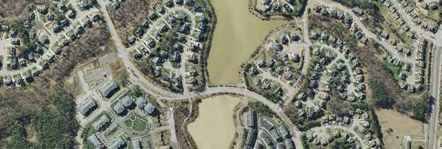
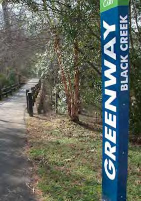
9 Planning Investment to Date - Greenway, North Carolina Town Greenway Map 2012 Greenway Master Plan Update Lake Crabtree to ATT Corridor
10 Planning Process, North Carolina Where do we go from here?
11 Planning Process, North Carolina Public Meeting #1A -Site Analysis -3 Concepts -Public Comments
12 Planning Process, North Carolina September 20 - Harris Teeter September 24 - Mills Middle School Home Football Game Public Meeting #1B -Site Analysis -3 Concepts -Public Comments Public Meeting #1A -Site Analysis -3 Concepts -Public Comments
13 Planning Process, North Carolina September 20 - Harris Teeter September 24 - Mills Middle School Home Football Game Winter Public Meeting #1A -Site Analysis -3 Concepts -Public Comments Public Meeting #1B -Site Analysis -3 Concepts -Public Comments Public Involvement -2 Concepts -Public Comments Final Master Plan -Public Comments
14 Planning Process, North Carolina September 20 - Harris Teeter September 24 - Mills Middle School Home Football Game Spring Winter Public Meeting #1B -Site Analysis -3 Concepts -Public Comments Council Approval Public Involvement Process -2 Concepts -Public Comments Public Meeting #1A -Site Analysis -3 Concepts -Public Comments Final Master Plan -Public Comments
15 Planning Process, North Carolina September 20 - Harris Teeter September 24 - Mills Middle School Home Football Game Spring Winter Fall 2015 Public Meeting #1B -Site Analysis -3 Concepts -Public Comments PHASE 2: Design Drawings Council Approval Public Involvement Process -2 Concepts -Public Comments Construction Public Meeting #1A -Site Analysis -3 Concepts -Public Comments Final Master Plan -Public Comments
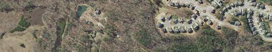
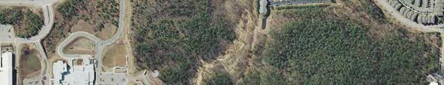
16 Where is Mills Park?, North Carolina Vicinity Map Future Park Existing Park * 1 MILE RADIUS Carpenter Fire Station Road Amberly 1/2 MILE RADIUS Cary Park Georgian Village Mills Park 540 Triangle Expressway Cameron Pond NC HWY 55 Southbridge Gabel Farms Morrisville Parkway Green Level Church Road Hilliard Forest Sears Farm Road Park Thomas E. Brooks Park

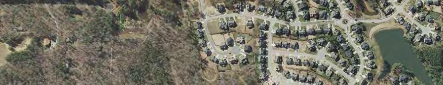
17 Site Analysis: Greenways, North Carolina Existing Greenway Existing Greenways Future Proposed Greenway Panther Creek Greenway American Tobacco Trail Carpenter Fire Station Road Mills Park 540 Triangle Expressway NC HWY 55 Future Park Existing Park * Morrisville Parkway Sears Farm Road Park Thomas E. Brooks Park
18 Site Analysis: Greenways, North Carolina Existing Greenway Future Greenways Future Proposed Greenway Panther Creek Greenway American Tobacco Trail Carpenter Fire Station Road Mills Park 540 Triangle Expressway NC HWY 55 Future Park Existing Park * Morrisville Parkway Sears Farm Road Park Thomas E. Brooks Park

19 Site Analysis: Greenways, North Carolina Existing Greenway Panther Creek Greenway Future Proposed Greenway Panther Creek Greenway American Tobacco Trail Carpenter Fire Station Road Mills Park 540 Triangle Expressway NC HWY 55 Future Park Existing Park * Morrisville Parkway Sears Farm Road Park Thomas E. Brooks Park

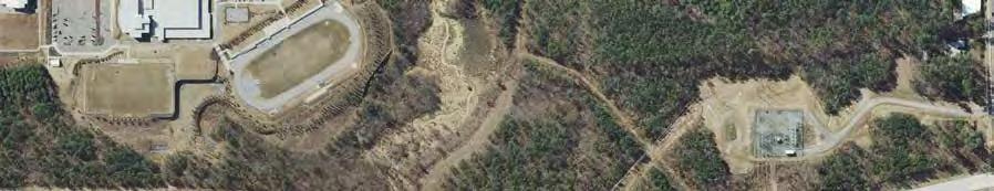
20 Site Analysis: Vegetation, North Carolina k Piedmont Alluvial Forest Green Level Church Road P a n r t h e C r e e 540 / Triangle Expressway Mesic Mixed Hardwood Forest Dry Mesic Oak Forest Onsite observations did not indicate any federally protected species. The habit is suitable for Mchaux s Sumac and the Northern Long-eared Bat, but neither were noted on site.

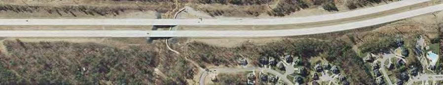
21 Site Analysis: Streams, North Carolina k Stream Buffer C r e e Green Level Church Road P a n r t h e 540 / Triangle Expressway 100 Buffer 50 Buffer
22 Site Analysis: Floodway +100 Year Flood + Floodplain, North Carolina P a n r t h e C r e e k 540 / Triangle Expressway Floodway 100 Year Flood Flood Plain Green Level Church Road
23 Site Analysis: Soils + Topography, North Carolina k Floodway C r e e 100 Year Flood Green Level Church Road P a n r t h e 540 / Triangle Expressway Flood Plain Unsuitable Soils

24 Site Analysis: Buildable Area, North Carolina k Floodway C r e e 100 Year Flood Green Level Church Road P a n r t h e 540 / Triangle Expressway Flood Plain Unsuitable Soils Core Park Potential Future Park Areas

25 k Site Analysis: Optimal Core Park, North Carolina 23 Acres+/- Optimal contruction area for Phase 2 in order to limit impacts to natural resources and Existing Facilities C r e e Green Level Church Road P a n r t h e 23 Acres +/- 540 / Triangle Expressway

26 k Site Analysis: Utility Access, North Carolina C r e e P a n r t h e 540 / Triangle Expressway Existing Sewer Green Level Church Road Existing Water Existing Stormwater

27 Site Analysis: Circulation, North Carolina Existing Greenway Existing Sidewalk Optimum point of entry to reduce impact on school circulation Green Level Church Road 540 / Triangle Expressway Park Vehicular Circulation School Vehicular Circulation Mixed Vehicular Existing point of entry

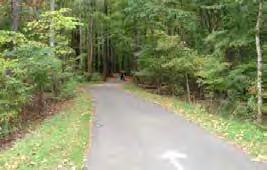
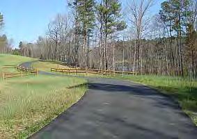
28 Greenway Design: Precedent, North Carolina


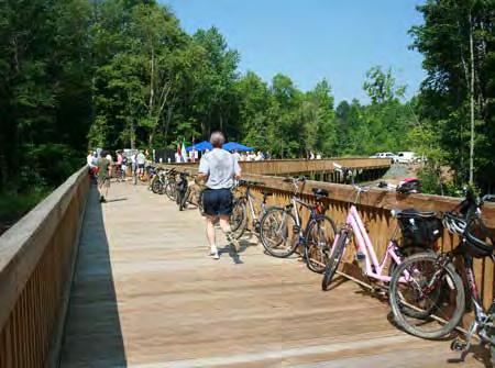
29 Greenway Design: Investment, North Carolina Cary Park Lake Greenway Loop Panther Creek Greenway Culvert Connection - Green Level Church Rd. Boardwalk Connection Under 540

30 Greenway Design: Connections, North Carolina Amberly Existing Pedestrian Tunnel Cary Park Lake Existing connection Harris Teeter Shopping Center Future Development Proposed development connection Cameron Pond Existing Connections Existing Connection Easements Panther Creek Mills Park Cary Park Green Level Church Road Mills Park Elementary School 540 / Triangle Expressway Mills Park Middle School Cameron Pond Connections Existing 540 Boardwalk Connection


31 Greenway Design: Cameron Pond Easement, North Carolina Vicinity Map Cameron Pond 540 Triangle Expressway


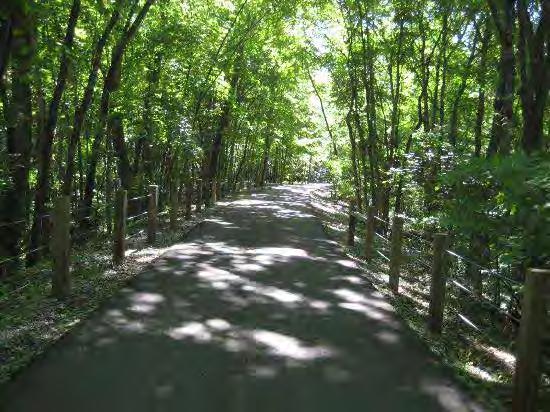
32 Greenway Design: Shade, North Carolina


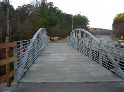
33 Greenway Design: Panther Creek Crossing Location, North Carolina

34 Greenway Design: Proposed Alignment, North Carolina Amberly Harris Teeter Shopping Center Future Development Proposed Panther Creek Greenway Cameron Pond Cary Park Lake Proposed Greenway Connections Cary Park Southbridge Panther Creek Panther Creek Crossing Green Level Church Road Mills Park Mills Park Elementary School 540 / Triangle Expressway Mills Park Middle School

35 Mills Park: Precedent Imagery, North Carolina

36 Mills Park: Precedent Imagery, North Carolina
37 Mills Park: Concept A - Diagram, North Carolina Concept A Nestled Playground Open Space Picnic Shelter Restrooms Future Phase Walking Trails Ball Field Disc Golf Greenway Greenway Connection
38 Mills Park: Concept A, North Carolina Concept A Nestled Playground Open Space Picnic Shelter Restrooms Future Phase Walking Trails Ball Field Disc Golf Greenway Greenway Connection

39 Mills Park: Concept B - Diagram, North Carolina Concept B Meadow Playground Open Space Picnic Shelter Restrooms Future Phase Walking Trails Ball Field Disc Golf Greenway Greenway Connection
40 Mills Park: Concept B, North Carolina Concept B Meadow Playground Open Space Picnic Shelter Restrooms Future Phase Walking Trails Ball Field Disc Golf Greenway Greenway Connection
41 Mills Park: Concept C - Diagram, North Carolina Concept C Park Beside a Complex Playground Open Space Picnic Shelter Restrooms Future Phase Walking Trails Ball Field Disc Golf Greenway Build upon the existing facilities Greenway Connection

42 Mills Park: Concept C, North Carolina Concept C Park Beside a Complex Playground Open Space Picnic Shelter Restrooms Future Phase Walking Trails Ball Field Disc Golf Greenway Build upon the existing facilities Greenway Connection
43 , North Carolina What are the next steps?
44 , North Carolina Next public meetings will be: September 20 - Harris Teeter September 24 - Mills Middle Home Football Game Invite those who were unable to attend tonight All updates will be posted on the website MILLS PARK: PANTHER CREEK GREENWAY:
Charles P. Johnson and Associates. Annapolis Landscape Architects
 Charles P. Johnson and Associates Annapolis Landscape Architects AGENDA Introduction Project Limits and Scope Site Analysis Opportunities & Constraints Program Goals Image Boards Design Alternatives Pros
Long Branch-Wayne Local Park Renovation Project
 Montgomery Parks Long Branch-Wayne Local Park Renovation Project Community Meeting #2 September 20, 2016 Oak View Elementary School 7:00-9:00 PM Welcome / Team Introductions M-NCPPC (Montgomery Parks)
BROOKHILL NEIGHBORHOOD MODEL ZONING MAP AMENDMENT PREFACE TO APPLICATION
 BROOKHILL NEIGHBORHOOD MODEL ZONING MAP AMENDMENT PREFACE TO APPLICATION June 15, 2015 Revised: August 1, 2016 I. VISION Brookhill is a proposed community based upon the principles of Albemarle County
Courthouse Planning Area
 Courthouse Planning Area Current Reality The Courthouse Planning Area is the characterized by expansive suburbanscale residential areas as well as the community resource planned area of athletic, educational,
BISCUIT RUN PARK MASTER PLAN
 BOARD OF SUPERVISORS November 14, 2018 BISCUIT RUN PARK MASTER PLAN COUNTY OF ALBEMARLE ANHOLD ASSOCIATES Contents Project Introduction Property Background County Park Planning Process Existing Site &
Chapter 6. Overall Vision RECOMMENDATIONS. More Trail and Trail. Connections. Equal Access to Park. Facilities and Programs. Water Access.
 Overall Vision More Trail and Trail Connections Equal Access to Park Facilities and Programs Water Access Environment Variety Chapter 6 RECOMMENDATIONS Chapter 6 The following recommendations for park,
Appendix A. Park Land Definitions
 Appendix A Park Land Definitions Mini Park May serve specific function for any and all ages, depending on need of the user area. Size range 1-5 acres with optimum size being 3 acres. Service area is sub-neighborhood
Draft Plan Recommendations
 Draft Plan Recommendations Sponsored by Henry County and the Atlanta Regional Commission T S W TEAM Tunnell-Spangler-Walsh & Associates URS Corporation Marketek Study Area 1,300 acres Includes parts of
Southeast Quadrant Plan
 Southeast Quadrant Plan Southeast Quadrant Distinctive Features Land Use The Southeast Quadrant includes all the area within the planning area that is east of Interstate 5 and south of State Route 44.
Little Neck Planning Area
 Little Neck Planning Area Current Reality The Little Neck Planning Area is characterized by established residential neighborhoods, Town Center and Pembroke. The Eastern and Western Branches of the Lynnhaven
MORRISVILLE TRANSPORTATION PLAN TOWN COUNCIL PRESENTATION AUGUST 22, 2017
 TOWN COUNCIL PRESENTATION AUGUST 22, 2017 SCENARIO PLANNING CORRIDORS Town Hall Drive Baseline + 2 McCrimmon Parkway Baseline + 2 NC 54 Baseline + 2 7 subregion model runs determining carrying capacity
SOUTHEAST SPORTS COMPLEX MASTER PLAN
 REPORT TO SOUTHGATE NEIGHBORHOOD COUNCIL APRIL 13, 2016 Visioning Process April 30: Stakeholder Meeting with Sports Groups May 5: Stakeholder Meeting with Southgate Land Use Committee May 13: SNC Meeting
MCCOYS CREEK RESTORATION 30% DESIGN
 MCCOYS CREEK RESTORATION 30% DESIGN THE MCCOYS CREEK RESTORATION PLAN The restoration plan aims to reduce flooding, restore ecosystem health, expand recreational opportunities along the creek, and connect
Chapter Purpose and Intent. 7.2 Applicability. 7.3 General Provisions RECREATIONAL OPEN SPACE
 Chapter 7. RECREATIONAL OPEN SPACE 7.1 Purpose and Intent The intent of this Chapter is to provide for centrally located, unencumbered land as neighborhood recreational open space and not to permit the
Yadkin River Greenway Feasibility Study Fact Sheet Village of Clemmons, Town of Lewisville, Town of Bermuda Run
 Fact Sheet Village of Clemmons, Town of Lewisville, Town of Bermuda Run Project Background The Yadkin River Greenway Feasibility Study is a joint project with the Village of Clemmons, the Town of Bermuda
Stormwater Regulations & Considerations Morse Study Area. Pam Fortun, P.E. CFM Senior Stormwater Treatment Engineer Engineering Services Division
 Stormwater Regulations & Considerations Morse Study Area Pam Fortun, P.E. CFM Senior Stormwater Treatment Engineer Engineering Services Division Stormwater Regulations Development Considerations Floodplain
Planning & Zoning Board Meeting. DRAFT Comprehensive Transportation Plan Update, February 23, 2018 version
 Planning & Zoning Board Meeting DRAFT Comprehensive Transportation Plan Update, February 23, 2018 version May 10, 2018 Overview Overview of Agency Comments Overview of proposed modifications to the Draft
Green Level West Road Cary, NC 27519
 Duke University Health Systems Future Publix Duke University Health Systems 540 LAND FOR SALE 3217 Partnership. Performance. Development Opportunity Approximately 10 acres of land is available to purchase
Cornwall Park Neighborhood Plan
 [1] Cornwall Park Neighborhood Plan As adopted by Ordinance No. 8868 and amended by Ordinance Nos. 8946, 9200, 9201, 9233, 9301, 9305, 9749, 9787, 9764, 10502 and 10738, 2000-12-094, 2004-12-087, 2004-12-091,
Carrboro Greenways Commission January 9 th, 2007
 Carrboro Greenways Commission January 9 th, 2007 Statewide The flooding of Crabtree Valley in the early 1970 s (right before Crabtree Valley Mall was set to open) caused city, state, and federal officials
Secrest Short Cut and Monroe Expressway Small Area Plan AUGUST 29, 2018
 Secrest Short Cut and Monroe Expressway Small Area Plan AUGUST 29, 2018 Background and Process Monroe Expressway will be open by the end of 2018 Union County and Indian Trail identified a need to revisit
SOUTH PARK. Construction of a Portion of South Park at Fresh Kills Park, Staten Island
 SOUTH PARK Construction of a Portion of South Park at Fresh Kills Park, Staten Island FRESHKILLS PARK FIRST PHASE OF SOUTH PARK FRESHKILLS PARK CONTEXT SOUTH PARK EXISTING CONDITIONS PROJECT OPPORTUNITIES
Welcome! to Keller Town Hall
 Welcome! to Keller Town Hall Keller Town Center Planning a New Downtown What is Keller Town Center? A new, growing downtown district planned as an urban village A combination of retail and office spaces,
M-NCPPC Park System in
 Park Planning & Stewardship Division Park & Trail Planning Section East County Science Center Master Plan Parks, Recreation, Trails, and Open Space- Issues and Opportunities PARK PLANNING & STEWARDSHIP
South East Sports Complex Phase I
 South East Sports Complex Phase I City of Spokane Design Review Board August 29, 2018 (Revised) Objectives 1. Early discussion and collaboration. 2. Provide framework / catalyst for future improvements
Asbury Chapel Subdivision Sketch Plan
 Asbury Chapel Subdivision Sketch Plan PART 1: PROJECT SUMMARY Applicant: NVR Inc. Project Size: +/- 76.13 acres Parcel Numbers: 02101112,02116101,02116112, 02116113 Current Zoning: Transitional Residential
CARPENTER PARK MASTER PLAN REPORT. Town of Cary Parks, Recreation, and Cultural Resources
 REPORT Town of Cary Parks, Recreation, and Cultural Resources www.townofcary.org APPROVAL DATE JANUARY 10, 2013 TABLE OF CONTENTS 3 Acknowledgements...5 Project Introduction...7 Project Process...11 Site
1. Parks & Recreation Neighborhood Parks Community Parks Special Use Sites 2. Open Space 3. Trails
 Appendix A: Park Classifications The intent of parks and recreation classifications is to aid in making acquisition and design decisions for park sites, facilities and the organization of recreation space
February 27, 2018 City Council Presentation The Crown Jewel Park in the City of Fairfax
 February 27, 2018 City Council Presentation The Crown Jewel Park in the City of Fairfax Master Planning Charge Van Dyck Park s first Master Plan will provide the City with a road map as to how best incorporate
OVERMOUNTAIN VICTORY TRAIL BURKE CALDELL CORRIDOR FEASIBLITY STUDY REQUEST FOR QUALIFICATIONS CALDWELL COUNTY PATHWAYS
 OVERMOUNTAIN VICTORY TRAIL BURKE CALDELL CORRIDOR FEASIBLITY STUDY REQUEST FOR QUALIFICATIONS CALDWELL COUNTY PATHWAYS Caldwell County Pathways along with our co-partners City of Lenoir, Town of Gamewell,
NORTH DISTRICT. Description
 VI plan and major recommendations district plans north disrict NORTH DISTRICT Description The North District comprises approximately 105 acres and is bounded by two important bio-habitats and corridors
Emerson Park Master Plan Update. Public Meeting III August 27, 2014
 Emerson Park Master Plan Update Public Meeting III August 27, 2014 Meeting Agenda: Project Update Presentation of Master Plan Components Discussion and Feedback The Path Forward: Building on the Concept
Mendota Heights 2040 Comprehensive Plan Draft Vers
 4 Parks and Trails The City of Mendota Heights boasts a variety of recreational and open space opportunities. Few cities can claim access to regional trails, riverside and lakeside parks, scenic bluffs
CHAPTER 5: PARKS & OPEN SPACE SYSTEM
 CHAPTER 5: PARKS & OPEN SPACE SYSTEM A. Introduction This chapter of Parks, Recreation & Cultural Resources (PRCR) Master Plan provides a comprehensive overview of the Town of Cary s impressive parks and
CARMODY PARK MASTER PLAN
 the site Smith Reservoir Cottonwood Lake Kendrick Lake Carmody Rec Center Carmody Middle School Pool Court Play Carmody Pond Sanderson Ditch Sports Fields Foothills Ice Arena Open Field why a master plan?
Neighborhood Districts
 NEIGHBORHOOD DISTRICTS SEVEN MAIN DISTRICTS Neighborhood Districts While the Development Plan provides a broad-scale overview of the neighborhood, this section focuses on uses and relationships at the
Parks, Recreation, and Open Space Land Use Goals
 Parks, Recreation, and Open Space Land Use Goals Issue: The preservation of open space and natural features will enhance the character of the built environment, promote public health and safety, provide
Parks, and Recreation & Cultural Arts Master Plan Update
 Parks, and Recreation & Cultural Arts Master Plan Update Community Profile Public Input Summary: Staff Interviews conducted April 14 and 15, 2014 Citizens Workshop - conducted April 15 th and 24 th, May
Outdoor Recreation Facilities Inventory
 Outdoor Recreation Facilities Inventory Allouez Neighborhood Parks: East Lawn Park (4.90 acres) is located in the northeastern corner of Allouez near Boyd Street. This site contains: Baseball diamond with
STAFF SUMMARY FOR S17-02 SPECIAL USE PERMIT APPLICATION
 APPLICATION SUMMARY Case Number: S17-02 Request: STAFF SUMMARY FOR S17-02 SPECIAL USE PERMIT APPLICATION SUP application in order to develop a convenience food store. Applicant: Property Owner(s): Cindee
Provide and maintain sufficient public parks, recreation facilities, and open space to meet the recreational needs of County residents and visitors.
 (ROS) Goal Provide and maintain sufficient public parks, recreation facilities, and open space to meet the recreational needs of County residents and visitors. OBJECTIVE ROS.01 The County shall acquire,
GOCO Grants Awarded to Projects in Arapahoe County through June 2015
 Grant Type Open Space Fiscal Year Applicant Project Title Grant Amount 2015 City of Aurora Acres Protected Triple Creek Greenway Corridor Phase 3 $2,050,000.00 0 Planning 2015 Arapahoe County High Line
North Oakville East Parks Facilities Distribution Plan. November, 2009
 North Oakville East November, 2009 POLICY CONTEXT 1) Purpose a) The purpose of this document is to be a guide for the location, configuration, design and development of the parks system for the North Oakville
Appendix I. Appendix I - CURRENT CONDITIONS & CONCEPTS. Appendix I - CURRENT CONDITIONS & CONCEPTS
 Appendix I - CURRENT CONDITIONS & CONCEPTS Appendix I - CURRENT CONDITIONS & CONCEPTS Appendix I Existing Regional Study Boundary and Zoning Susceptible To Change Existing Condition and Approved Plans
Town of Cornelius Bond Update August, 2017
 Town of Cornelius Bond Update August, 2017 Referendum Results Roads, Intersections, & Sidewalks ($11.15 mil) Pass rate 81.38% in favor Parks and Recreation ($5.25 mil) Pass rate 72.09% in favor Town Center
Fair Oaks Ranch Homeowners Association Parks and Trails Master Plan & 2019 Budget Planning
 Fair Oaks Ranch Homeowners Association Parks and Trails Master Plan & 2019 Budget Planning Sticky Dot Voting Priorities Community Survey Results Board Title Votes Parks, Open Spaces, and Trails 328 Emergency
include playgrounds, sports fields, community gardens and picnic areas.
 DEVELOPMENT PLAN OPEN SPACE SYSTEM OPEN SPACE SYSTEM The neighborhood provides for a range of open space types. The Village Square is an important open space in the neighborhood. It serves as a gathering
BURTON STATION STRATEGIC GROWTH AREA PLAN UPDATE PUBLIC MEETING 3/26/18
 BURTON STATION STRATEGIC GROWTH AREA PLAN UPDATE PUBLIC MEETING 3/26/18 1 WHERE WE ARE? 2 PRIMARY OBJECTIVES OF THE PLAN UPDATE 1. Update the land use designation for Burton Station Village to reflect
SITE PLAN (REVISED 8/13/18) l. Development Data Table
 l. Development Data Table") SITE PLAN (REVISED 8/13/18) l. Development Data Table a. Site Acreage: 9.25 b. Tax Parcels included in rezoning: #108-081-07 and #108-081-23 c. Existing Zoning (including overlays and vesting): R-3 (see
SITE PLAN (REVISED 8/13/18) l. Development Data Table a. Site Acreage: 9.25 b. Tax Parcels included in rezoning: #108-081-07 and #108-081-23 c. Existing Zoning (including overlays and vesting): R-3 (see
APPENDIX D2: PARKS AND TRAILS
 APPENDIX D2: PARKS AND TRAILS Cultivate Hopkins Comprehensive Plan 8/15/18 DRAFT Cultivate Hopkins Appendix D2 1 Existing Conditions Local Parks and Trails Figure D2.1 shows the existing park and trail
a) Inventory of all existing privately-owned, state-owned, or local governmentowned recreational facilities and open spaces within the context area
 Inventory of all existing privately-owned, state-owned, or local governmentowned recreational facilities and open spaces within the context area") 8.0 RECREATION AND OPEN SPACE ELEMENT (1) DATA REQUIREMENTS a) Inventory of all existing privately-owned, state-owned, or local governmentowned recreational facilities and open spaces within the context
8.0 RECREATION AND OPEN SPACE ELEMENT (1) DATA REQUIREMENTS a) Inventory of all existing privately-owned, state-owned, or local governmentowned recreational facilities and open spaces within the context
Obey Creek July 17, Vicinity Map. Concept Plan Submittal. No
 15/501 Fordham Blvd. 15/501 By-Pass To Downtown Chapel Hill Vicinity Map 0 1000 2000 FT Arlen Park DR. Bennett Road Mt. Carmel Church Rd. Southern Village Parkside Circle Market St. 15/501 Founder's Ridge
Major Subdivision Sketch Plan Checklist
 This checklist provides specific requirements that are apart of the Sketch process. The entire process is described by the Huntersville Subdivision Review Process which details all the submittal and resubmittal
Play areas overlooking climbing hill. School & playgrounds overlooking pond bottom ballfields. Project experience while at Loris and Associates, Inc.
 City of Thornton Parks & Open Space Cherrywood Park Thornton, CO Architect: Design Concepts Construction of this seven-acre City park, located adjacent to Adams Twelve Five Star Prairie Hills Elementary
29 Bella Fontaine Park
 29 Bella Fontaine Park 9565 Bellefontaine Road St. Louis County Parks Master Plan Planning Zone 2 Visit Date: July 2016 Page 1 129 Bella Fontaine Park 9565 Bellefontaine Road St. Louis County Parks Master
JCB & MIAMI SEWER SEPARATION PROJECT & ADAMS PARK WETLAND
 JCB & MIAMI SEWER SEPARATION PROJECT & ADAMS PARK WETLAND 30% Public Meeting November 29 th, 2012 ADAMS PARK MASTER PLAN H3 Studio Tonight s Agenda Review Adams Park Master Plan (H3 Studio) Context & Analysis
Town of Cary, North Carolina Sketch Site Plan Staff Report Weston Lakefront Offices (13-SP-031) Town Council Public Hearing July 25, 2013
 Town Council Public Hearing July 25, 2013") Town of Cary, North Carolina Sketch Site Plan Staff Report Weston Lakefront Offices (13-SP-031) Town Council Public Hearing July 25, 2013 REQUEST Piedmont Land Design, LLP, on behalf of the property owners,
Town of Cary, North Carolina Sketch Site Plan Staff Report Weston Lakefront Offices (13-SP-031) Town Council Public Hearing July 25, 2013 REQUEST Piedmont Land Design, LLP, on behalf of the property owners,
Section 3 INVENTORY OF RECREATION LAND AND FACILITIES
 Photo of Juan Bautista de Anza Park Section 3 INVENTORY OF RECREATION LAND AND FACILITIES Summary of Findings Park Definitions Summary of Recreation Facilities Other Recreation Facilities Nearby Recreation
11: Good Design - Boor Site
 Rural Design Workbook: 11: Site Introduction: A dairy and feed farm of over 450 acres in the town of Horseheads (Chemung County), David Boor s property has a number of notable features. The site is nearly
EXISTING PLANS Harriet Festing Center for Neighborhood Technology Midlothian Community Meeting March 12, 2015
 EXISTING PLANS Harriet Festing Center for Neighborhood Technology Midlothian Community Meeting March 12, 2015 BENEFITS Bring economic, community + environmental benefits Enhance property values Use
STAFF SUMMARY FOR S17-02 SPECIAL USE PERMIT APPLICATION
 APPLICATION SUMMARY Case Number: S17-02 Request: STAFF SUMMARY FOR S17-02 SPECIAL USE PERMIT APPLICATION SUP application in order to develop a convenience food store. Applicant: Property Owner(s): Cindee
PARTF Scoring System for Grants
 PARTF Scoring System for Grants The members of the N.C. Parks and Recreation Authority use the PARTF scoring system as one of several tools to select grant recipients. Please provide all of the information
ANCHORAGE PARK REPORT CARD Assessing A Park s Appearance, Function, & Condition
 ANCHORAGE PARK REPORT CARD Assessing A Park s Appearance, Function, & Condition Park Name: Is Your Park an A or an F? Your Name: Contact Information Optional: Date: General Instructions: Phone: Email:
Town of Jamestown. Parks and Recreation Master Plan for Jamestown Park
 Town of Jamestown Parks and Recreation Master Plan for Jamestown Park Adopted December 16, 2014 Acknowledgements Town Council Keith Volz, Mayor Brock Thomas Lynn Montgomery Georgia Nixon-Roney William
ITA and Vicinity Master Plan Update
 1 ITA and Vicinity Master Plan Update PHASE 3 SEPTEMBER 27, 2017 Three Phase Process 2 Phase 1 - Understanding October 13th Public Meeting Phase 2A - Exploring Ideas November 17th Public Meeting Phase
PARKS & RECREATION SUBCOMMITTEE. Oct. 1, 2015
 PARKS & RECREATION SUBCOMMITTEE Oct. 1, 2015 1999 Bond - $22,000,000 Land Acquisition Allen Station Phase II Neighborhood Parks PREVIOUS BOND ELECTIONS 1999 & 2007 2002 Bond - $4,000,000 Allen Senior Recreation
APPENDIX C: PUBLIC INPUT SUMMARY
 APPENDIX C: PUBLIC INPUT SUMMARY OVERVIEW The public process for the development of the GO! Green Oshtemo Plan was designed to follow both the legislative requirements for master plan adoption and the
McDaniel Creek Master Plan
 McDaniel Creek Master Plan UNIVERSITY AVE., PITTSBURGH NEIGHBORHOOD AND THE MCDANIEL CREEK WATERSHED 60 ANSLEY MALL AND THE CLEAR CREEK GREENWAY 61 INTRODUCTION The BeltLine Subarea 6 site lies within
nokomis-hiawatha regional park master plan and park improvements
 master plan and park improvements CAC Workshop # August 26th, 2014 charge of the cac The Nokomis Hiawatha Regional Park CAC shall: Become knowledgeable about the project and its scope Understand and represent
7.0 OPEN SPACE 7.1 OPEN SPACE DEDICATION CHAPTER 7: OPEN SPACE
 7.0 OPEN SPACE The intent of these requirements is to allow for the usage of centrally located unencumbered land as neighborhood open spaces and not to permit the use of leftover or otherwise unusable
Northeast Quadrant Plan
 Northeast Quadrant Plan Northeast Quadrant Distinctive Features Land Use The Northeast Quadrant includes all the area within the planning area that is east of Interstate 5 and to the north of State Route
Y Sports Complex PROGRAMMING Capitol Improvement Plan. Anticipated/Suggested Improvements. Sedgwick County Park: Sports Complex:
 PROJECT OVERVIEW Location: East of Ridge Road, between 21 st Street and 13 th Street, not including SCZ In conjunction with The Sedgwick County Park Facilities Observation Report Compilation of improvements
What is a Greenway? Active Transportation. Linear Public Park. Recreation. Health and Fitness. Desirable Amenity. Access to destinations
 What is a Greenway? Active Transportation Linear Public Park Recreation Health and Fitness Desirable Amenity Access to destinations Creates a Sense of Community County standard is a 10 wide asphalt trail
January 11, New benches installed. Paving of parking lot adjacent to piers and the canoe put-in. Near complete with clean up remaining.
 Project Updates January 11, 2018 CENTERVILLE CHESAPEAKE ARBORETUM BELLS MILL CITY CREEKWOOD SOUTH DEEP CREEK LOCK WORK TO BE PERFORMED/UPDATES Improvements to the parking lot include installation of a
SECTION 4(f) DE MINIMIS DOCUMENTATION
 DE MINIMIS DOCUMENTATION") SECTION 4(f) DE MINIMIS DOCUMENTATION Illinois Route 60/83 IL 176 to the intersection of IL 60 (Townline Road) Lake County P-91-084-07 Mundelein Park and Recreation District Project Limit SECTION 4(f)
SECTION 4(f) DE MINIMIS DOCUMENTATION Illinois Route 60/83 IL 176 to the intersection of IL 60 (Townline Road) Lake County P-91-084-07 Mundelein Park and Recreation District Project Limit SECTION 4(f)
MADISON MANOR PARK RENOVATIONS
 MADISON MANOR PARK RENOVATIONS COMMUNITY KICK-OFF MEETING MINUTES To: Wilfredo Calderon, Steven Torgerson (AMT), Tom Mitchler, Kevin Stalica, Vincent Verweij, Greg Anselene, Chris Willett, Peter Alchin,
GRACE CHURCH EXPANSION
 GRACE CHURCH EXPANSION REVIEW: NOVEMBER 24, 2014 200 SAGE ROAD, CHAPEL HILL NORTH CAROLINA PROJECT DATA OVERALL SITE MAP SITE INFORMATION OWNER PIN ACREAGE VICINITY MAP GRACE CHURCH 9890503171 271,600
PART 1: PROJECT SUMMARY. The application is Attachment A. The site plan is Attachment B.
 Belleterre Subdivision Sketch Plan Town Board 8.7.17 Belleterre Subdivision Sketch Plan PART 1: PROJECT SUMMARY Applicant: Bowman Development Project Size: +/- 20.85 acres Parcel Number: 01115104 and 01115121
The Illinois Department of Transportation and Lake County Division of Transportation. Route 173, including the Millburn Bypass
 The Illinois Department of Transportation and Lake County Division of Transportation welcome you to this Public Hearing for U.S. Route 45 from Illinois Route 132 to Illinois Route 173, including the Millburn
MAYFIELD VILLAGE GREENWAY TRAIL
 1 Shared use 10 wide asphalt all purpose trail Includes 60 ft. steel truss bridge, 549 ft. of boardwalk, three underpasses Connects Village center to Library, Metroparks, and Village recreational areas
CITY OF GAINESVILLE PARKS, RECREATION AND CULTURAL AFFAIRS DEPARTMENT VISION 2020
 CITY OF GAINESVILLE PARKS, RECREATION AND CULTURAL AFFAIRS DEPARTMENT VISION 2020 A BLUE PRINT FOR THE NEXT 20 YEARS The PRCA Vision 2020 Master Plan, adopted in November 2012, addresses the current state
Las Colonias Park Master Plan
 2013 Las Colonias Park Master Plan City of Grand Junction June 2013 Introduction Las Colonias Park, a 101 acre parcel on the edge of the Colorado River south of downtown, was deeded to the City of Grand
PART 1: PROJECT SUMMARY. Proposed Land Use: 120 single-family lots. The application is Attachment A. The site plan is Attachment B.
 PART 1: PROJECT SUMMARY Applicant: JBH Development, LLC and Hopper Communities, INC Project Size: +/- 80.48 acres Parcel Number: 01513107, 01513108, 01513109, 01513113, 01513120, 01513121, 01513122, 01513124,
Dowdy Park. Concept Plans TOWN OF NAGS HEAD NORTH CAROLINA. Developed by: Albemarle & Associates, Ltd VHB/ Vanasse Hangen Brustlin, Inc.
 TOWN OF NAGS HEAD NORTH CAROLINA Concept Plans Developed by: Albemarle & Associates, Ltd VHB/ Vanasse Hangen Brustlin, Inc. Site Looking Southeast Dowdy Park Existing Conditions Nags Head Woods Sound Future
PARKS AND RECREATION
 PARKS AND RECREATION The Parks and Recreation Department faces many challenges as the City of Allen continues its rapid growth. Demand for some activities already exceeds the city's ability to provide
THREE-STEP DESIGN PROCESS FOR OPEN SPACE SUBDIVISIONS
 00216106.DOC NMA/RRK 1/30/14 THREE-STEP DESIGN PROCESS FOR OPEN SPACE SUBDIVISIONS Open space subdivisions, sometimes called cluster developments, maintain a significant portion of a development site in
STREATER PARK. North Branch Canal Trail. Existing Head Race. Warm-Season Meadow. Picnic Area. Pedestrian Crosswalk
 North Branch Canal Trail Convert Old Railroad Bridge North Branch Canal Trail - to Catawissa and Danville Active Railroad Rupert Covered Bridge On-Road Route to Streater Park STREATER PARK Off-Road Route
Public Input This appendix describes the public
 COMPREHENSIVE RECREATIONAL MASTER PLAN Public Input This appendix describes the public input process used during the planning of the Comprehensive Recreational Master Plan for the Parks and Open Spaces
Appendix A Goals and Policies
 Appendix A Goals and Policies i This page left blank intentionally Introduction This Appendix lists the Goals and Policies from the adopted 1996 Parks and Recreation Master Plan. The Parks and Recreation
Marshview Park. Concept Briefing and Feedback Session. Aquarium/Owls Creek Plan Steering Committee March 20, 2012
 Marshview Park Concept Briefing and Feedback Session Aquarium/Owls Creek Plan Steering Committee March 20, 2012 1 Outline of Today s Discussion Introductions Context for Marshview Park Site analysis -
SEWRPC OUTDOOR RECREATION AND OPEN SPACE PLANNING OBJECTIVES, PRINCIPLES, AND STANDARDS
 SEWRPC OUTDOOR RECREATION AND OPEN SPACE PLANNING OBJECTIVES, S, AND STANDARDS Introduction The Southeastern Wisconsin Regional Planning Commission (SEWRPC), as part of the regional park and open space
ARROYO PROJECTS ADOPTED CAPITAL IMPROVEMENT PROGRAM BUDGET
 A RROYO P ROJECTS ADOPTED CAPITAL IMPROVEMENT PROGRAM BUDGET FISCAL YEARS 214-218 HAHAMONGNA Priority Description 1 Hahamongna Watershed Park - Implement Master Plan 211,6 211,6 (77565) 2 Hahamongna -
Neuse River Corridor Plan
 The One NC Naturally Initiative will not be a large scale state buyout of land in North Carolina. Over the next 10 years, the Million Acre Initiative will provide incentives and information for voluntary
CHAPTER 4 FUTURE LAND USE AND URBAN SERVICES DISTRICTS
 CHAPTER 4 FUTURE LAND USE AND URBAN SERVICES DISTRICTS Introduction This chapter discusses how Benzie County should grow and change in the future. A community can grow and change in many different ways.
master plan hodge park
 KCMO Parks & Commissioners Recreation Board of Parks & Recreation Kansas City, Missouri Mark McHenry Director Heather Runkel Project Manager LAND3 Studio L.L.C. Bob G Bushyhead Principle Michael H Malyn
Sam Furr and McCord Road Huntersville, North Carolina
 108± Acres of Sam Furr and McCord Road Huntersville, North Carolina NorthCross Shopping Center Land for Sale 108 Acres located in northeast Huntersville wth extensive frontage along both Sam Furr Road
Edgeley Pond + Park Public Meeting
 Edgeley Pond + Park Public Meeting February 21, 2017 Purpose of the meeting This Public Meeting is an opportunity for you to review the project background, process and provide input. City of Vaughan staff
WELLS BRANCH PARKS MASTER PLAN JULY 01, 2014 The information shown is based on the best information available and is subject to change without notice.
 WELLS BRANCH PARKS MASTER PLAN JULY 01, 2014 The information shown is based on the best information available and is subject to change without notice. TABLE OF CONTENTS PHASE 1: MASTER PLAN ANALYSIS...02
Existing Facilities. Chapter 3:
 Leave all the afternoon for exercise and recreation, which are as necessary as reading, I will rather say more necessary because health is worth more than learning. - Thomas Jefferson Chapter 3: Existing
(draft 1.14) Parks and Open Spaces 1
 Parks and Open Spaces 1") (draft 1.14) Parks and Open Spaces 1 (draft 1.14) Parks and Open Spaces 2 PARKS AND OPEN SPACES: HOW WE PLAY Why This Matters For Sartell: Be Fun and Active The Sartell area is blessed with an abundance
(draft 1.14) Parks and Open Spaces 1 (draft 1.14) Parks and Open Spaces 2 PARKS AND OPEN SPACES: HOW WE PLAY Why This Matters For Sartell: Be Fun and Active The Sartell area is blessed with an abundance