VICTORIA PARK / BAKKABAKKANDI COMMUNITY RECREATION PARK CONCEPT MASTER PLAN. November 2008
|
|
|
- Phyllis Reeves
- 6 years ago
- Views:
Transcription


1 CONCEPT MASTER PLAN November 2008
2 EXECUTIVE SUMMARY Concept Master Plan Summary Concept Master Plan Outline Plan Concept Master Plan Perspectives SECTION ONE - BACKGROUND Context Existing Site Existing Use SECTION TWO - VISION AND BENCHMARKS Proposed Vision Guiding Principles Benchmarks SECTION THREE - PRECINCT PLANS Precinct Plan Precinct 1 - Woodland Recreation Precinct 2 - Community Recreation and Sport Precinct 3 - Grandstand and Premium Field Precinct 4 - Special Events SECTION FOUR - OVERALL PLANS Movement Activities Vegetation Dog Off Leash Area SECTION FIVE - IMPLEMENTATION Project Packages CONTENTS
3 Introduction / Context Victoria Park/Bakkabakkandi is the largest intact segment of the Adelaide Park Lands comprising 72 hectares characterised by expansive open space. Horseracing has been the dominant activity within the Park since the 1840s. Victoria Park lends itself to a range of community activities due to its accessible open space, proximity to the CBD, availability of parking, facilities, size and picturesque location. Current uses include: School sports Football, soccer and cross country carnivals Pedal Prix Prologue event for the Classic Adelaide Car Rally Clipsal Model plane flying Horse Trials Community recreation activities such as use of the exercise trail, dog walking and running. Consultation with key stakeholders has been undertaken to explore the possible future of Victoria Park within the context of the South Australian Jockey Club (SAJC) vacating the site. This Master Plan is informed by the consultation findings and looks to build on and reinforce the existing site features and functions to encourage greater and more diverse use of the park for community based activities. Whilst the park may be used for mass participation events such as SAPSASA sporting carnivals, Pedal Prix, Masters Games or University Games, it is equally important to ensure access to the park for a variety of everyday individual recreation pursuits. Landscape character The open space character and long vistas to the Adelaide foothills provide identity to Victoria Park within the context of the Adelaide Park Lands. The edges of the park are proposed to be reinforced by extensive plantings of River Red Gums (E. camaldulensis) and Blue Gums (E. leucoxylon) which assist in enclosing and defining the Park. Built Form The majority of built structures in Victoria Park/Bakkabakkandi are old and dilapidated and do not contribute to the many active uses of the park by the community and licence holders. The result of the SAJC leaving the site will be that many of the buildings and fencing dominating the north-eastern corner of the site will be redundant and removed allowing new possibilities and uses for the site. Removal of this redundant infrastructure will greatly improve public access to the Park. Vision The draft Master Plan has been developed in line with a set of Council endorsed guiding principles. In addition, the project team propose the following vision for the improvement of Victoria Park/Bakkabakkandi: To create a vibrant, flexible and sustainable recreational open space within the iconic Adelaide Park Lands, supporting a variety of community activities whilst preserving the unique landscape and heritage qualities of the site. Design Themes Community use of Victoria Park/Bakkabakkandi for a wide variety of recreation activities drives the Master Plan. Multiuse recreation amenities support a range of users including school sports, sporting clubs, individuals and mass participation sporting and recreation activities. Existing landscape qualities such as the sense of open space and vistas to the hills are retained, whilst planting of the park edges is substantially reinforced. New trees and understorey build on the existing ecology of the site to achieve a rich biodiversity that is educative, attractive and sustainable. Improvements are made to the site s biodiversity, with the wooded urban forest character strengthened. Stormwater is retained within a new wetland in the south, offering opportunities for discovery, interpretation, revegetation and education whilst linking walking trails to the wider Park path network. An additional layer of exploration and adventure is established through experiences of the urban wilderness, nature trails, boardwalks and cultural gathering spaces. Park Precincts The Master Plan considers the site in four precincts. Precinct 1 (Woodland Recreation) reinforces connections with adjacent Park Lands and provides a strong site identity particularly along Fullarton and Wakefield Roads. Extensive new planting of trees and understorey reinforce the park edges and enclose the open space areas of Precincts 2 & 4. This also forms the playspace and extended sweat track facility. Precinct 2 (Community Recreation and Sport) is a flexible recreation and sporting precinct which is designed to foster a variety of community based activities. Precinct 3 (Grandstand and Premium Field) incorporates an informal plaza, gathering space and entrance axis along with securing a future for the heritage grandstand by providing viable and valued ongoing uses through the introduction of a premium playing field forward of the grandstand. The types of activities occurring in this precinct could include community based events and one off organised events such as state based sporting events. Precinct 4 (Racing) looks to take advantage of the existing Clipsal infrastructure for a broader range of community uses year round. A criterium loop allows cycling and pedal prix uses within the park, negating the current need to close Wakefield Road for competitive events. Combined, these improvements will contribute towards a revitalised Victoria Park as one of the Adelaide Park Lands best used venues for community Park Land recreation and activities. Biodiversity and ecological value of the park will also be increased by new plantings and adoption of contemporary park management techniques that support water conservation and ecological sustainability. Realisation of the Master Plan will contribute to the blueprint for responsible management of the wider Adelaide Park Lands that reinforces their world class value. EXECUTIVE SUMMARY
4 FULLARTON ROAD GREENHILL ROAD WAKEFIELD ROAD EAST TERRACE N CONCEPT MASTER PLAN - OUTLINE PLAN A vibrant, flexible and sustainable recreational open space within the iconic Adelaide Park Lands, supporting a variety of community activities whilst preserving the unique landscape and heritage qualities of the site. 1 retain + upgrade heritage grandstand 2 plaza courtyard 3 premium field 4 cycling / pedal prix criterium track 5 motor racing track 6 soft surface walking /running track 7 acc park lands trail 8 shared use pathway 9 formalisation of beaumont road parking 10 south park lands creek wetland, aquifer storage and recovery (ASR), boardwalk and trail 11 playing fields, ovals and temporary shade structures 12 public toilet 13 sports amenities 14 temporary car parking on permeable surface 15 entry 16 bike parking 17 urban forest 18 reference markers of former horse race track location 19 new native tree planting adjacent wakefield road 20 city of burnside car park 21 former kiosk and ticket box retained 22 iron gateway, grandstand entrance gates and bookmakers league building retained 23 picnic / bbq node 24 kaurna heritage bush tucker trail 25 signalised pedestrian crossing 26 wetlands and park lands education facility with public toilet and kiosk 27 bbq node, play space, childrens bicycle loop, petanque and 3-on-3 court 28 community playing courts 29 cafe / kiosk in grandstand entrance gates building 30 shelter 31 adventure play area 32 mature eucalypt plantings and lighting to path

5 PREMIUM PLAYING FIELD AND HERITAGE GRANDSTAND

6 SOUTH PARK LANDS CREEK, WETLAND, BOARDWALK AND TRAILS

7 ENTRY PLAZA AND HERITAGE LISTED GRANDSTAND

8 COMMUNITY RECREATION AND SPORT

9 PARK 15 / ITYAMAIITPINNA VICTORIA PARK / BAKKABAKKANDI PARK 17 / TUTTANGGA ADELAIDE CITY CONTEXT Victoria Park/Bakkabakkandi is the largest intact segment of the Adelaide Park Lands comprising 72 hectares and is characterised by expansive open space.

10 FULLARTON ROAD GREENHILL ROAD WAKEFIELD ROAD EAST TERRACE Bus Route To North Tce Bus Route To City PARK LANDS CONTEXT The Park is bounded on three sides by main connector roads and to the east by the residential precinct along East Terrace. Pedestrian and cycle links to adjacent parks and surrounding suburbs are provided by way of sealed shared use pathways. Main Road Links Pedestrian / Cycle Links Public Transport Routes


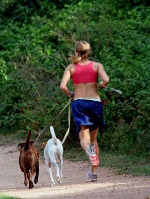
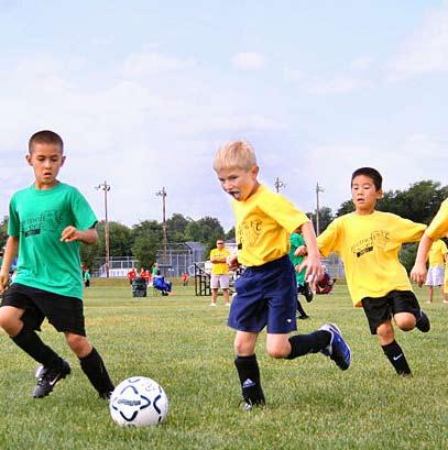
11 everyday use clipsal construction clipsal mode EXISTING SITE Community recreation such as running, dog walking, organised sports and individual recreation pursuits occur throughout the year. From January to early May the site is scattered with temporary infrastructure associated with Clipsal. The site experiences intense use during the Clipsal racing week with up to 90,000 spectators visiting each day and 3000 cars parked on site.


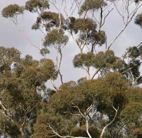
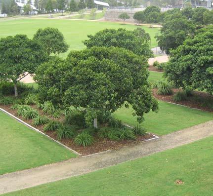
12 EXISTING SITE: LANDSCAPE QUALITIES The park is characterised by open vistas to the Adelaide foothills and mature tree planting of River Red Gums to the edges of the Park.


13 Former Kiosk Former Ticket Booth Horse Stables Grandstand Entrance Gates + Adelaide Jockey Club Bookmakers League Iron Gates Grandstand Entrance Gates Maintenace Building + Members Grandstand Heritage Grandstand EXISTING SITE: STRUCTURES The majority of buildings in Victoria Park/Bakkabakkandi are concentrated in the north-eastern corner and are associated with the former South Australian Jockey Club horse racing use of the site. The majority of these buildings are redundant and are recommended for removal as part of the vision for Victoria Park/Bakkabakkandi.


14 MAJOR STAKEHOLDERS EXISTING USES AND ACTIVITIES SA Motor Sport Board (Clipsal) Sporting Licence Holders Prince Alfred College Christian Brothers College Southern Soaring League Regular Event Holders Pedal Prix SAPSASA Classic Adelaide Australian International Three Day Event (Horse Trials) Adelaide Park Lands Authority South East City Residents Association Adelaide Park Lands Preservation Association Adelaide and Mount Lofty Ranges NRM Board Community Users City of Burnside City of Norwood, Payneham & St Peters City of Unley EXISTING USE Stakeholder consultation was conducted to determine existing elements for retention and possible future direction for Victoria Park/Bakkabakkandi within the context of SAJC departing the site. The consultation responses have informed the Master Plan proposal.
15 PROPOSED VISION FOR VICTORIA PARK / BAKKABAKKANDI To create a vibrant, flexible and sustainable recreational open space within the iconic Adelaide Park Lands, supporting a variety of community activities whilst preserving the unique landscape and heritage qualities of the site. VISION
16 GUIDING PRINCIPLES PREVIOUSLY ENDORSED BY COUNCIL Consider the design within the context of the City. Rejuvenate the Heritage Grandstand. Remove redundant buildings and structures. Ensure best practice in facility provision. Create a flexible design that permits a range of activities. Provide choices for the community. Connect spaces and encourage movement throughout the Park. Improve the natural assets of the Park. Ensure sustainable and efficient water use. Create a strong identity. VISION The Master Plan has been developed in line with a set of Council endorsed guiding principles provided within the project brief.


17 VISION & BENCHMARKS: ACTIVE RECREATION Mixed use recreation including school sport, sporting clubs, individuals and mass participation sporting and recreation activities.


18 VISION & BENCHMARKS: LANDSCAPE QUALITIES Open vistas to Adelaide foothills retained; wetland introduced and biodiversity improved; interpretation and natural discovery opportunities explored; wooded urban forest character reinforced.


19 VISION & BENCHMARKS: COMMUNITY USE Fun; exploration; adventure; urban wilderness; discovery; potential for unique adventure activities - rock climbing, flying fox; interpretation; education; boardwalks; nature trails.

20 VISION & BENCHMARKS: OPEN SPACE & VISTAS Vistas across the Park and to the foothills retained; open spaces defined and reinforced.
21 WAKEFIELD ROAD GREENHILL ROAD FULLARTON ROAD EAST TERRACE N CONCEPT PRECINCT PLAN The site is divided into four main precincts. Precinct 1 - Woodland Recreation Precinct 2 - Community Recreation and Sport Precinct 3 - Grandstand & Premium Field Precinct 4 - Special Events


22 Improved path and trail network - trail rides, horses, bikes Expanded sweat track - exercise stations, personal trainers, yoga Picnic areas South Park Lands Creek - habitat, biodiveristy, urban forest Bush tucker and heritage trails, interpretation, signage N Wetland and Aquifer Recharge - education, exploration, adventure, interpretative facility 1 WOODLAND RECREATION Precinct 1 reinforces connections with adjacent Park Lands and provides a strong site identity particularly along Fullarton and Wakefield Roads. Extensive new planting of trees and understorey reinforce the park edges and enclose the open space areas of Precincts 2 & 4.


23 10 full size soccer/hockey fields 3 full size cricket/football ovals Upgraded playing fields - sport Open space areas and upgraded playing fields - passive recreation, kite flying, model planes Open space areas and trails network - walking, running, dog exercise Upgraded playing fields - school sports, sporting carnivals N New community playing courts 2 COMMUNITY RECREATION AND SPORT Precinct 2 is a flexible recreation and sporting precinct which is designed to foster a variety of community based activities. Upgraded playing fields and amenities - mass participation activities such as masters games, university games, sapsasa, golden oldies


24 Investigate retention and reuse of former kiosk, ticket box, iron gates, grandstand entrances and bookmakers league building Entry plaza - cafe/kiosk, gardens, planting, public art, interpretation, gathering, markets, displays Heritage grandstand conserved and upgraded Criterium loop track - pedal prix, cycling races, presentation ceremony Childrens playspace New premium pitch and playing field for sporting carnivals, school sports day, cross country 3-on-3 basketball area New premium playing field - dressage, soccer, rugby, football, baseball 3N GRANDSTAND & PREMIUM FIELD Precinct 3 incorporates an informal plaza, gathering space and entrance axis along with securing a future for the heritage grandstand by providing viable and valued ongoing uses through the introduction of a premium playing field forward of the grandstand. The types of activities occurring in this precinct could include community based events and one off organised activities such as state based sporting carnivals.


25 Existing Clipsal track - Classic Adelaide Existing Clipsal hardstand - rollerblading, bike riding New criterium loop - pedal prix & cycle races, bike riding, criterium loop Existing Clipsal track - Clipsal 500 4N SPECIAL EVENTS Precinct 4 looks to take advantage of the existing Clipsal infrastructure for a broader range of community uses year round. A criterium loop allows cycling and pedal prix uses within the park, without the need to close Wakefield Road for competitive events.
26 WAKEFIELD ROAD GREENHILL ROAD FULLARTON ROAD EAST TERRACE N MOVEMENT Provision of a variety of pavement surfaces and access points support and enrich the public experience within Victoria Park/Bakkabakkandi. shared use: cycles / pedestrians (formal) jogging (permeable) walking trails (informal) criterium track
27 WAKEFIELD ROAD GREENHILL ROAD FULLARTON ROAD EAST TERRACE N ACTIVITIES Areas for a variety of informal community recreation activities dominate the site. Programmed activities utilising facilities such as the heritage grandstand area and the playing fields can run simultaneously whilst still allowing open public access to Victoria Park/Bakkabakkandi. playing fields cycling / pedal prix community use (formal uses) community use (informal recreation) wetland / interpretation / biodiversity

28 WAKEFIELD ROAD GREENHILL ROAD FULLARTON ROAD EAST TERRACE N VEGETATION New trees and understorey build on the existing ecology of the site, to achieve a rich biodiversity that is educative, attractive and sustainable. tree avenue woodland olive grove riparian / wetland playing field grassland existing vegetation
29 WAKEFIELD ROAD GREENHILL ROAD FULLARTON ROAD EAST TERRACE DOG OFF LEASH AREA DOG OFF LEASH AREA

30 WAKEFIELD ROAD GREENHILL ROAD FULLARTON ROAD EAST TERRACE PATHWAYS TREE PLANTING PATHWAYS N CONCEPT MASTER PLAN - PROJECT DELIVERY PACKAGE ONE - Pathways and tree planting (A large portion of these works to be completed by June 2009)
31 WAKEFIELD ROAD GREENHILL ROAD FULLARTON ROAD EAST TERRACE N PREMIUM PLAYING FIELD SPORTSFIELDS INCLUDING TOILETS AND CHANGING ROOMS CONCEPT MASTER PLAN - PROJECT DELIVERY PACKAGE TWO - Sportsfields and Premium Playing Field
32 WAKEFIELD ROAD GREENHILL GREENHILL ROAD ROAD FULLARTON ROAD FULLARTON ROAD EAST TERRACE EXPLORATION / ADVENTURE PLAY EAST TERRACE WETLANDS N CONCEPT MASTER PLAN - PROJECT DELIVERY PACKAGE THREE - Wetland, educational/interpretive facilities and exploration/adventure play EDUCATIONAL / INTERPRETIVE FACILITIES

33 GREENHILL ROAD CAFE / KIOSK SWEAT TRACK FULLARTON ROAD WAKEFIELD ROAD PAVED PLAZA EAST TERRACE FORMALISED PLAY SWEAT TRACK N CONCEPT MASTER PLAN - PROJECT DELIVERY PACKAGE FOUR - Community Plaza and Recreation facilities
34 GREENHILL ROAD FULLARTON ROAD WAKEFIELD ROAD GRANDSTAND REUSE EAST TERRACE CONCEPT MASTER PLAN - PROJECT DELIVERY PACKAGE FIVE - Grandstand understorey adaptive re-use
Implementation plan. 3.1 Staging
 3 Implementation plan 3.1 Staging The Olympic Park Master Plan has been developed to provide actions that are practical and realistic and considers the financial responsibilities and capacity of Council
PCAL Case Study Open Spaces: Blayney Heritage Park
 PCAL Case Study Open Spaces: Blayney Heritage Park Introduction Blayney Heritage Park is an area of high quality open space that offers a range of active and passive recreation facilities. The multi-purpose
UNIVERSITY TOWN NEIGHBOURHOODS 5.2 ECO-CORRIDOR MELBOURNE CAMPUS MASTER PLAN 2014
 5.2 ECO-CORRIDOR 37 ECO-CORRIDOR EXISTING CONDITIONS & VISION NEIGHBOURHOOD VISION Investment in the Eco-corridor Neighbourhood will signify the University s commitment to supporting local ecology and
VICTORIA PARK (BAKKABAKKANDI) MASTER PLAN
 MASTER PLAN") VICTORIA PARK (BAKKABAKKANDI) MASTER PLAN Submission by: GPO Box 2653 Adelaide SA 5001 Te: 8410 2988 Email: sa@planning.org.au Web: www.planning.org.au/sa 30 March 2007 Submission - Victoria Park (Bakkabakkandi)
VICTORIA PARK (BAKKABAKKANDI) MASTER PLAN Submission by: GPO Box 2653 Adelaide SA 5001 Te: 8410 2988 Email: sa@planning.org.au Web: www.planning.org.au/sa 30 March 2007 Submission - Victoria Park (Bakkabakkandi)
Dowdy Park. Concept Plans TOWN OF NAGS HEAD NORTH CAROLINA. Developed by: Albemarle & Associates, Ltd VHB/ Vanasse Hangen Brustlin, Inc.
 TOWN OF NAGS HEAD NORTH CAROLINA Concept Plans Developed by: Albemarle & Associates, Ltd VHB/ Vanasse Hangen Brustlin, Inc. Site Looking Southeast Dowdy Park Existing Conditions Nags Head Woods Sound Future
CHAPPLES PARK MASTER PLAN
 CHAPPLES PARK MASTER PLAN Presentation of Preliminary Development Options Public Open House #2 Wednesday November 2 nd, 2016 TONIGHT S AGENDA 1. Welcome & Introductions 2. Presentation by Sierra Planning
Seven Creeks Neighbourhood. Community Plan
 Seven Creeks Neighbourhood Community Plan INTRODUCTION SEVEN CREEKS The Seven Creeks Estate is home to a steadily expanding community of families, couples and individuals who enjoy the very best of both
H7 Open Space zones. (a) provide for the needs of the wider community as well as the needs of the community in which they are located;
 provide for the needs of the wider community as well as the needs of the community in which they are located;") H7. Open Space zones H7.1. Background The majority of land zoned as open space is vested in the Council or is owned by the Crown. However some areas zoned open space are privately owned. While the open
H7. Open Space zones H7.1. Background The majority of land zoned as open space is vested in the Council or is owned by the Crown. However some areas zoned open space are privately owned. While the open
ACKNOWLEDGEMENTS PROJECT TEAM
 ACKNOWLEDGEMENTS La Trobe University proudly acknowledges the Dja Dja Wurrung people, the traditional custodians of the land upon which the Bendigo Flora Hill campus is located. We recognise that Indigenous
10.0 Open Space and Public Realm
 10.0 Open Space and Public Realm 10.0 Open Space and Public Realm The Public Open Space System is comprised of: outdoor spaces available for public use that are either publicly owned (e.g., parks and
Plenty Gorge Park Draft Master Plan Consultation Report. Draft Master Plan April 2018
 Plenty Gorge Park Draft Master Plan Consultation Report Draft Master Plan April 8 Introduction As part of the development of the Plenty Gorge Park Master Plan, Parks Victoria designed a consultation and
LISMORE PARK, KELLY S FLAT, ALLENBY PARK, FAULKS TERRACE, DOMINI PARK & KENNEDY CRESCENT
 Attachment A: PROPOSED RESERVE MANAGEMENT PLAN FOR THE RECREATION RESERVES KNOWN AS: LISMORE PARK, KELLY S FLAT, ALLENBY PARK, FAULKS TERRACE, DOMINI PARK & KENNEDY CRESCENT WANAKA RECREATION RESERVES
Legend Explanation CONCEPT PLAN
 Legend Explanation CONCEPT PLAN A. Community Hall Flexible Space with associated amenities and catering facilities Adjacent smaller community meeting spaces Raised podium with wide sheltered breakout spaces
GREENBANK DEVELOPMENT MASTERPLAN
 DEVELOPMENT MASTERPLAN POTENTIAL TRAIN STATION COMMUNITY CENTRE Greenbank will be a connected masterplanned community providing easy access to local and surrounding amenity. Affordable quality homes, green
CHAPPLES PARK MASTER PLAN. Presentation to Council April 10, 2017
 CHAPPLES PARK MASTER PLAN Presentation to Council April 10, 2017 1 PRESENTATION AGENDA 1. Project Background, Aim and Process 2. The Site Issues and Opportunities 3. Community Engagement 4. Vision and
Forest Grove Park Master Plan
 Workshop 03 Steering Committee Meeting 2:00 5:00 PM Public Open House 5:00 7:00 PM February 21, 2012 Agenda February 21, 2012 Schedule and planning process update. Preliminary Program review. Concept plan
CANOPY AT AMSTEL (THE AMSTEL GOLF COURSE REDEVELOPMENT)
") CANOPY AT AMSTEL (THE AMSTEL GOLF COURSE REDEVELOPMENT) 1000 CRANBOURNE FRANKSTON ROAD, CRANBOURNE The former Amstel Golf Course was rezoned to a General Residential Zone in 2015 to facilitate its redevelopment
CANOPY AT AMSTEL (THE AMSTEL GOLF COURSE REDEVELOPMENT) 1000 CRANBOURNE FRANKSTON ROAD, CRANBOURNE The former Amstel Golf Course was rezoned to a General Residential Zone in 2015 to facilitate its redevelopment
Welcome to our exhibition
 Welcome to our exhibition The Homes & Communities Agency (HCA) welcomes you to this public exhibition explaining our proposals for the redevelopment of the former Lea Castle Hospital site. About the Homes
Section 4 - Public Realm & Landscape proposals Landscape Masterplan. Section 4 52
 - Public Realm & Landscape proposals Landscape Masterplan 52 Proposed Masterplan - Green Infrastructure Strategy District Park 4.33 Ha to provide Passive and active recreation with a large play area which
Charles P. Johnson and Associates. Annapolis Landscape Architects
 Charles P. Johnson and Associates Annapolis Landscape Architects AGENDA Introduction Project Limits and Scope Site Analysis Opportunities & Constraints Program Goals Image Boards Design Alternatives Pros
Terra Nova Rural Park Plan
 Terra Nova Rural Park Plan Part 1 Getting to know the land The Surrounding Area North Side Airport, River, Trail East Side - Residential West Side- Sturgeon Banks, West Dyke Trail South Side:Terra Nova
February 27, 2018 City Council Presentation The Crown Jewel Park in the City of Fairfax
 February 27, 2018 City Council Presentation The Crown Jewel Park in the City of Fairfax Master Planning Charge Van Dyck Park s first Master Plan will provide the City with a road map as to how best incorporate
University of Saskatchewan CAMPUS MASTER PLAN. Senate Meeting Preliminary Presentation. April 21, 2018 DIALOG ECS DA WATT
 University of Saskatchewan CAMPUS MASTER PLAN Senate Meeting Preliminary Presentation April 21, 2018 DIALOG ECS DA WATT project process presentation agenda Stakeholder Engagement Project Control phase1
UNIVERSITY TOWN NEIGHBOURHOODS 5.5 HOUSING MELBOURNE CAMPUS MASTER PLAN 2014
 5.5 169 EXISTING CONDITIONS & VISION NEIGHBOURHOOD VISION The provision of on-campus housing into the future will continue to be an important element of the La Trobe University experience. A long-term
Background Information
 Background Information view at site entrance THE LONDON BOROUGH OF SUTTON As the strategic local authority the Council is working with a range of partners to take forward various development sites in Hackbridge.
8.3 Sector 4 Brooklyn Hills
 8.3 Sector 4 Brooklyn Hills Wellington Town Belt on the Brooklyn Hills between Mt Cook and Brooklyn 8.4.1 Character and use This sector extends around the city-facing slopes below Brooklyn, from Mortimer
IMPLEMENTATION GUIDELINE NO. 27
 IMPLEMENTATION GUIDELINE NO. 27 Guidance on Recreation Range and Opportunity Outcomes Arising from Embellishment of Public Parks Date of Council Resolution This guideline was originally adopted by Council
doyle + o troithigh landscape - architecture
 doyle + o troithigh landscape - architecture REPORT: PROJECT: LANDSCAPE DESIGN REPORT. STUDENT HOUSING DEVELOPMENT AT WESTWOOD HOTEL SITE. DATE: MAY 2018. www.doyle-otroithigh.com Landscape design report,
master plan hodge park
 KCMO Parks & Commissioners Recreation Board of Parks & Recreation Kansas City, Missouri Mark McHenry Director Heather Runkel Project Manager LAND3 Studio L.L.C. Bob G Bushyhead Principle Michael H Malyn
North Adelaide Playspace and Pocket Orchard
 The Adelaide City Council invites engagement from the community about Playspace and Pocket Orchard Project Summary Adelaide City Council invites feedback from the community on the Tidlangga (Park 9) Playspace
SURVEY BACKGROUND. In addition to the upgrade of the play space, the courts and oval lighting will be upgraded.
 SURVEY BACKGROUND The Edwardstown Soldiers Memorial Recreation Ground play space has been identified in Council s Play Space Strategy for upgrade in the 2014/15 financial year. In addition to the upgrade
The London 2012 Olympic Park and Green Network Legacy
 2012 Central Scotland Green Network Forum How Green Networks make our Towns and Cities Livable The London 2012 Olympic Park and Green Network Legacy Neil Mattinson Senior Partner LDA Design The Story Begins.
Memorial Business Park Site. Proposed Future Development. Design guidelines. August
 Memorial Business Park Site Proposed Future Development Design guidelines August 2014 www.designenvironment.co.nz 0064 3 358 3040 Contents 1.0 Background 1.1 Introduction 3 1.2 Objectives 4 2.0 Context
ACADEMY AREA CONCEPT PLAN
 ACADEMY AREA Strip ling C hape l Roa d CONCEPT PLAN 7 S2 U Stripling 52 ROADWAYS AND PARKING: ADVENTURE PLAYGROUND AND SPRAYGROUND: Current roadways follow existing drives. It is recommended that the Folds
8.2 Sector 2 Kelburn Park
 8.2 Sector 2 Kelburn Park Kelburn Park, near Victoria University 8.2.1 Character and use Kelburn Park is a sector of the Town Belt, of a scale and character more like a suburban park. However, the woodland
Draft Koonung Park Management Plan May 2016
 MANNINGHAM CITY COUNCIL Draft Koonung Park Management Plan May 2016 Executive Summary Koonung Park is located in Bulleen and is 3.5 hectares in size and adjacent to Koonung Creek Linear Park with street
FORD PARK MASTER PLAN SEPTEMBER 2016
 FORD PARK MASTER PLAN SEPTEMBER 2016 The Ford Park Master Plan has been prepared for Banyule City Council by ACLA in association with insideedge. FINAL COPY - Submitted to Council 1 September 2016 Contents
SUFFOLK PARK COMMUNITY PARK MASTERPLAN a place for the community
 SUFFOLK PARK COMMUNITY PARK MASTERPLAN a place for the counity March 218 PARK & CONTEXT critical public open space for the counity BROKEN HEAD RD LAKE PARK ESCARPMENT BEECH DR SUFFOLK PARK VILLAGE CENTER
Minto-Brown Island. November 18, City of Salem, Parks & Transportation Services
 Minto-Brown Island Park Master Plan Public Meeting #1 November 18, 2014 City of Salem, Parks & Transportation Services Division, i i Public Works Welcome... and thanks for participating in the master planning
ROBERTS FIELD BRANDING GOALS NEW BRANDING PROJECT
 ROBERTS FIELD NEW BRANDING PROJECT Create branding and logos for Roberts Field and park areas including Friendship Park, The Wildlife Sanctuary and The Playing Fields. Best define use and expectations
3. STATEMENTS OF DESIRED CHARACTER FOR PLANNING AREAS AND PRECINCTS
 3.30 Planning Area No. 30 Mary River Valley 3.30.1 Location and Role This Planning Area encompasses rural lands in the western part of the Shire. These lands are located within the catchment area of the
WILLASTON PLAYSPACE // OPTION 1.1 LEGEND P r o je ct No. 18WOP / SCALE / Date of Issue
 WILLASTON PLAYSPACE // OPTION. P r o je ct No. WOP / :00@A / Date of Issue.0. Significant distance from other recreation facilities Visually disconnected from other facilities in precinct Access to services
Appendix H: Easement cross sections
 Appendix H: Easement cross sections SHARED PATH 1.5m FOOTPATH NATURE STRIP 7.3m CARRIAGEWAY 2.7m NATURE STRIP EXISTING PIPELINE 150mm DIA 5.0m (approx.) LOCAL ACCESS ROAD EXISTING PIPELINE 500mm DIA 2.7m
MCCOYS CREEK RESTORATION 30% DESIGN
 MCCOYS CREEK RESTORATION 30% DESIGN THE MCCOYS CREEK RESTORATION PLAN The restoration plan aims to reduce flooding, restore ecosystem health, expand recreational opportunities along the creek, and connect
weigall oval master plan report final draft Prepared for the City of West Torrens June 2014
 weigall oval master plan report Prepared for the City of West Torrens June 2014 final draft JPE Design Studio Pty Ltd with Suter Planners Level 4 19 Gilles Street Adelaide 5000 South Australia Australia
Colchester Northern Gateway Master Plan Vision Review Draft. July 2016
 Colchester Northern Gateway Master Plan Vision Review Draft July 2016 Contents Introduction 4 Context 8 Purpose of the Report 8 Strategic Position 9 Overview of the Process 11 2012 Master Plan Vision 12
QUESTION 8: What are your Public Realm priorities for implementation? What would you like to see happen first? TELL US WHAT YOU THINK
 Public Realm Plan How will the Public Realm Plan be implemented? The Public Realm Plan document will set out a vision for the next 30 years. Over time, Plan elements and aspects can be implemented as opportunities
BIRRARUNG MARR MASTER PLAN
 BIRRARUNG MARR MASTER PLAN COMMUNITY ENGAGEMENT SUMMARY 1 CONTENTS Engagement Summary p.3 Birrarung Marr Precincts p.4 Engagement Snapshot p.5 KEY FINDINGS AND RECOMMENDATIONS 1 Greenery and Nature p.6
Elsternwick Park Northern Sector. Phase 2 Community Engagement Summary Report
 Elsternwick Park Northern Sector Phase 2 Community Engagement Summary Report June 2016 Table of Contents Introduction... 3 Stage 1 Idea Generation Engagement Overview... 3 Stage 2 Concept Generation -
Types of Reserves. Recreational activities
 VALLEY FLOOR AND EASTERN HILLS Physical and ecological features Large, flat valley floor and river plain with intensive urban development Hutt River / Te Awa Kairangi and tributaries Waiwhetu Stream Eastern
Neighborhood Districts
 NEIGHBORHOOD DISTRICTS SEVEN MAIN DISTRICTS Neighborhood Districts While the Development Plan provides a broad-scale overview of the neighborhood, this section focuses on uses and relationships at the
Las Colonias Park Master Plan
 2013 Las Colonias Park Master Plan City of Grand Junction June 2013 Introduction Las Colonias Park, a 101 acre parcel on the edge of the Colorado River south of downtown, was deeded to the City of Grand
Marrickville Park DRAFT PLAN OF MANAGEMENT. April 2015
 Park DRAFT PLAN OF MANAGEMENT April 2015 CONTENTS 1.0 Introduction 1.1 What is a Plan of Management? 1.2 Community Strategic Plan 1.4 Land covered under this Plan of Management 2.0 Description 2.1 Legal
1 Welcome! UBC Okanagan Master Plan Update - Open House
 1 Welcome! UBC Okanagan Master Plan Update - Open House UBC is updating the Master Plan for the Okanagan Campus. The purpose of today s Open House is to: Present the draft 2015 Master Plan Answer any questions
PUBLIC MEETING APRIL 21, 2016
 HARWOOD PARK PUBLIC MEETING APRIL 21, 2016 HARWOOD PARK CONTEXT - 2 aerial image of site HARWOOD PARK PUBLIC MEETING On April 21, 2016, Parks for Downtown Dallas, the City of Dallas Park and Recreation
GATEWAY AREA STRUCTURE PLAN
 CHESTERMERE GATEWAY AREA STRUCTURE PLAN COMMUNITY OPEN HOUSE SEPTEMBER 22 nd, 2015 PLAN AREA ± 512 hectares (± 1,265 acres) GATEWAY LOCATION UNDEVELOPED LANDS PRESENT AGRICULTURAL USE REGIONAL LAND USE
Keystone Business Park Precinct Structure Plan North East Industrial Precinct. Part 2 Design Principles
 Keystone Business Park Precinct Structure Plan North East Industrial Precinct Part 2 Design Principles Context Issues Services Landform Issues Geotech and contamination Ecology Traffic and access Issues
Edgeley Pond + Park Public Meeting
 Edgeley Pond + Park Public Meeting February 21, 2017 Purpose of the meeting This Public Meeting is an opportunity for you to review the project background, process and provide input. City of Vaughan staff
Elderberry Walk. Developer HAB Housing
 Case studies Elderberry Walk Developer HAB Housing Development of 161 new homes on the former Dunmail Primary School site, focused around a central green street, with retained trees, new multifunctional
4.2 Ecological Principles
 4.2 Ecological Principles Introduction The overall character of the campus is one of open woodland in which locally and regionally indigenous tree species predominate. The colours, textures and quality
New Park / Entry Court & Plaza Concept Design
 New Park / Entry Court & Plaza Concept Design The SECC Public realm is proposed to have a focus on health, wellness, and community and that site users will include patrons of the neighbourhood. The block
ELLIS PARK NEW CLUBROOMS
 12. ELLIS PARK NEW CLUBROOMS CLUBROOM CONCEPT DESIGN 21/07/15 PRECINCT PLAN The following arial plan shows the extent of Tampawardli (Park 24) bounded by Glover Ave, West Tce, Sir Donald Bradman Dr and
Courthouse Square Planning & Urban Design Study. Courthouse Square Working Group #13 October 15, 2014
 Courthouse Square Planning & Urban Design Study Courthouse Square Working Group #13 October 15, 2014 1 Courthouse Square Process Working Group Community Courthouse Square Advisory Groups & Civic Associations
SITE ANALYSIS CALVARY HOSPITAL NORTH ADELAIDE LARGE INSTITUTIONS AND COLLEGES DPA CALVARY HOSPITAL
 SITE ANALYSIS Located at: 81-100 Strangways Terrace 55-79 Barnard Street 2-34 Hill Street 312-320 Ward Street HISTORY The Calvary Hospital was established in 1900 and is one of Adelaide's oldest hospitals.
Queensborough Eastern Neighbourhood Node. Community Open House
 Queensborough Eastern Community Open House The Vision The Queensborough Eastern will become the heart of eastern Queensborough. Through a sensitive mix of viable commercial and residential areas, the neighbourhood
ILLUSTRATIVE MASTERPLAN
 ILLUSTRATIVE MASTERPLAN The Development Dairy Crest (Imperial College) The Proposed Development aims to create a new high quality residential neighbourhood, alongside a new public park for White City.
GIS based mapping has been provided by Chris Bowey, Team Leader Property.
 DRAFT July 2017 Acknowledgements The Recreation and Open Space Study has been undertaken by Suter Planners in consultation with City of Victor Harbor Council staff and representatives. Suter Planners personnel
CHILDREN S PLAY ACTION PLAN
 ADELAIDE CITY COUNCIL CHILDREN S PLAY ACTION PLAN 2015 2025 Glossary: 1. Kaurna Acknowledgement Page 2 2. Lord Mayor s Message Page 2 3. Introduction Page 2 3.1 Guiding Principles Page 3 3.2 Strategic
Whitemarsh Comprehensive Plan Update: Housing & Land Use. Public Workshop #3: September 20, 2018
 Whitemarsh Comprehensive Plan Update: Housing & Land Use Public Workshop #3: September 20, 2018 Agenda Welcome Process Recap What We ve Heard The Plan Framework Review of Recommended Actions Land Use Housing
Mendota Heights 2040 Comprehensive Plan Draft Vers
 4 Parks and Trails The City of Mendota Heights boasts a variety of recreational and open space opportunities. Few cities can claim access to regional trails, riverside and lakeside parks, scenic bluffs
THREE KINGS RENEWAL DESCRIPTION OF URBAN DESIGN / ARCHITECTURAL ELEMENTS AND PROCESS. prepared by dko Architecture
 THREE KINGS RENEWAL DESCRIPTION OF URBAN DESIGN / ARCHITECTURAL ELEMENTS AND PROCESS prepared by dko Architecture THESE PLANS OUTLINE THE VISION OF FLETCHER RESIDENTIAL LTD AND ARE NOT ENDORSED BY AUCKLAND
heuston gateway: sections heuston gateway: regeneration strategy and development framework plan
 B B1 A B1 B C A heuston gateway: sections B B1 C 117 4.3.3 Zoning The station is the central hub of the area and this function must be preserved and developed. However large areas of the Heuston Station
TAO S PARKS MASTER PLAN
 TAO S PARKS MASTER PLAN December 2017 Kit Carson Park Fred aca Park Eco Park Youth + Family Center Eco Park TAOS PARKS MASTER PLAN December 2017 SCOPE OF WORK Town of Taos Parks + Recreation Master Plan
Brains and Archibald park concept plan
 Brains and Archibald park concept plan The Brains and Archibald park concept plan has been commissioned by the Whau Local Board for the purpose of providing a vision to guide improvements to Brains Park
4.0 ANALYSIS AND ASSESSMENT OF COMPONENTS Kadlitpinna/Park 13/Rundle Park Assessment
 4.0 ANALYSIS AND ASSESSMENT OF COMPONENTS 4.1.11 Kadlitpinna/Park 13/Rundle Park Assessment KADLITPINNA: 706 Kadlitpinna/Park 13/Rundle Park Existing Planning / Development Plan Context No component in
South th E ast Communit ity Centre (SECC)
") South East Community Centre (SECC) 1 New Park Design & Community Centre Update Thursday, February 8, 2018 Public Open House Thank you for attending this Open House! The town and the Consulting Team will
South East Community Centre (SECC) 1 New Park Design & Community Centre Update Thursday, February 8, 2018 Public Open House Thank you for attending this Open House! The town and the Consulting Team will
REFERENCE: 16/8568/ENQ Received: 25 October 2016 Accepted: 26 October 2016
 LOCATION: Allianz Park, Greenlands Lane, London, NW4 1RL REFERENCE: 16/8568/ENQ Received: 25 October 2016 Accepted: 26 October 2016 WARD(S): Mill Hill APPLICANT: Saracens Copthall Ltd. PROPOSAL: Extension
draft Belmont Sports Fields Master Plan November 2016
 draft Belmont Sports Fields Master Plan November 2016 Contents Site location and description... 3 Design brief... 6 Site analysis/existing facilities... 7 Relationship to other Council planning documents...
MVRC ARCHITECTURAL DESIGN STATEMENT
 11251 MOONEE VALLEY RACING CLUB MAY 201 CONTENTS 0 Contents Introduction 1 Site Analysis a. Site Features b. Built form Interfaces c. Existing Streetscape d. Site Opportunities and Constraints 2 Masterplan
The following principles guide the development of goals and strategies to protect and promote these amenities:
 OPEN SPACE/PARKS/TRAILS/RECREATION GOALS/STRATEGIES Cherry Hills Village is a living environment that offers low density development, open areas, public scenic vistas, public trails and public parks. This
Philip A. Ginsburg, General Manager Toks Ajike, Acting Planning and Capital Program Director
 Date: March 7, 2018 To: Through: From: Subject: Recreation and Park Commission Capital Committee Philip A. Ginsburg, General Manager Toks Ajike, Acting Planning and Capital Program Director Dan Mauer,
Hammersmith and Fulham Borough council parks department
 Who we are Hammersmith and Fulham Borough council parks department Clean, green and award winning parks and open spaces where residents can relax and enjoy a variety of activities and events in an attractive
1. Parks & Recreation Neighborhood Parks Community Parks Special Use Sites 2. Open Space 3. Trails
 Appendix A: Park Classifications The intent of parks and recreation classifications is to aid in making acquisition and design decisions for park sites, facilities and the organization of recreation space
PUBLIC RIGHT-OF-WAY IN THIS CHAPTER PUBLIC REALM
 PUBLIC RIGHT-OF-WAY This section provides design guidelines for improvements in the public right-of-way. The public right-of-way refers to streets, sidewalks, non-vehicular thoroughfares, parks and greenways
the village at market creek
 the village at market creek executive summary october 2012 i ii introduction The Village at Market Creek is primed to grow into one of San Diego s most lively, multi-cultural arts destinations. Our community
lot flankage Y street 16m 6m landscape strip for large site 3m landscape strip for small medium site
 Commercial General Commercial Objectives Create developments compatible with adjacent land uses in scale, function and character Define a consistent and attractive street edge with quality landscaping,
Throughout. square. (Crystal City Vision Plan 2050)
") 1: Terms related to the PSMP document 1 public space (see also public realm, civic space) An open space designated on the regulating plan, accessible to all, including Plazas, Mini Parks, and Neighborhoods
1: Terms related to the PSMP document 1 public space (see also public realm, civic space) An open space designated on the regulating plan, accessible to all, including Plazas, Mini Parks, and Neighborhoods
A BEAUTIFUL PLACE FOR LIVING
 A BEAUTIFUL PLACE FOR LIVING BEAULIEU: A PLACE FOR LIFE Beaulieu is a vibrant new district taking shape in Chelmsford, Essex; offering residents inspirational architecture and landscape. Developers Countryside
Woodbrook - Shanganagh
 Section 4: Key Sites Framework Strategy Woodbrook - Shanganagh Local Area Plan 2017-2023 4. Site Framework Strategies The Master Plans shall have regard to the thematic objectives under the LAP Development
a) Inventory of all existing privately-owned, state-owned, or local governmentowned recreational facilities and open spaces within the context area
 Inventory of all existing privately-owned, state-owned, or local governmentowned recreational facilities and open spaces within the context area") 8.0 RECREATION AND OPEN SPACE ELEMENT (1) DATA REQUIREMENTS a) Inventory of all existing privately-owned, state-owned, or local governmentowned recreational facilities and open spaces within the context
8.0 RECREATION AND OPEN SPACE ELEMENT (1) DATA REQUIREMENTS a) Inventory of all existing privately-owned, state-owned, or local governmentowned recreational facilities and open spaces within the context
MASTER PLAN IMPLEMENTATION COSTS. Appendix A
 Appendix A MASTER PLAN IMPLEMENTATION COSTS Town of Bradford West Gwillimbury HENDERSON COMMUNITY PARK MASTER PLAN IMPLEMENTATION COSTS Draft Order of Magnitude Costing Revised 5/27/2014 ITEM DESCRIPTION
Task Force on Kai Tak Harbourfront Development. Station Square at Kai Tak
 For discussion on 24 February 2017 Station Square at Kai Tak PURPOSE This paper seeks Members views on the design of the Station Square at Kai Tak. BACKGROUND 2. Upon the relocation of the Hong Kong International
CHAPTER 5: GUIDING PRINCIPLES
 CHAPTER 5: GUIDING PRINCIPLES The following 10 principles were developed based on public consultation, planning policy and the background analysis conducted during Phase 1. The Guiding Principles significantly
Glenn Highway MP DSR. Landscape Narrative
 Glenn Highway MP 34-42 DSR Landscape Narrative Project Landscape Goals The Glenn Highway MP 34-42 Project extends through a variety of landscape types typical to the Matanuska-Susitna Valley. In general,
Chapter IV: Development Pattern
 Chapter IV: Development Pattern Introduction The 2002 Prince George s County Approved General Plan designates three growth policy tiers Developed, Developing, and Rural as well as three center designations
SOUTHEAST SPORTS COMPLEX MASTER PLAN
 REPORT TO SOUTHGATE NEIGHBORHOOD COUNCIL APRIL 13, 2016 Visioning Process April 30: Stakeholder Meeting with Sports Groups May 5: Stakeholder Meeting with Southgate Land Use Committee May 13: SNC Meeting
7.2.9 Eudlo local plan code
 7.2.9 local plan code 7.2.9.1 Application (1) This code applies to assessable development:- (a) within the local plan area as shown on Map ZM29 contained within Schedule 2 (Mapping); and (b) identified
Key Open Spaces Recommendations
 8 8.1 Yarra Valley Parklands 2.43 ha Metropolitan Open Space State Government Access: Significantly improve pedestrian and bicycle access to the area. Prioritise pedestrian and bicycle movement along Yarra
Town Centre Park Master Plan Update - Terms of Reference
 CoQuitlam For Committee Our File: 12-6100-20/14-001/1 Doc#: 2176441.V7 To: From: Subject: For: City Manager General Manager Parks, Recreation & Culture Services Town Centre Park Master Plan Update - Terms
4.0 ANALYSIS AND ASSESSMENT OF COMPONENTS Kuntingga/Park 7 + Barnguttilla/Park 8 Assessment
 4.1.5 Kuntingga/Park 7 + Barnguttilla/Park 8 Assessment KUNTINGGA + BARNGUTTILLA: 658 Kuntingga/Park 7 + Barnguttilla/Park 8 Existing Planning / Development Plan Context The olive (Olea europaea) groves