ORANGE COUNTY AT A GLANCE
|
|
|
- Lucas Newton
- 6 years ago
- Views:
Transcription


1 ORANGE COUNTY AT A GLANCE Urban Land Institute Technical Advisory Panel Alberto Vargas, MArch Planning Division, Manager ORANGE COUNTY PLANNING DIVISION image credit: Google Earth April 23, 2014
2 2

3 Urban Service Area Boundary 3


4 Urban Service Area Rural Service Area 4
5 Rural Settlements 5
6 Growth Center 6

7 Horizon West Innovation Way 8
8 Incorporated Area 9
9 Environmental Protection Wekiva North Lake Apopka Econlockhatchee Protection Areas 10


10 Wekiva Parkway At A Glance US 441 Corridor Study UCF SR 50 AA DWTN Orlando SunRail Horizon West OIA Connector OCCC OIA Medical City Innovation Way 17
11 Zoning


12 Current Land Development Code ONE SIZE FITS ALL approach Not Flexible o Discourages infill and redevelopment o o Requires many variances and waivers Reinforces suburban development patterns


13 Streamlining and Sustainability

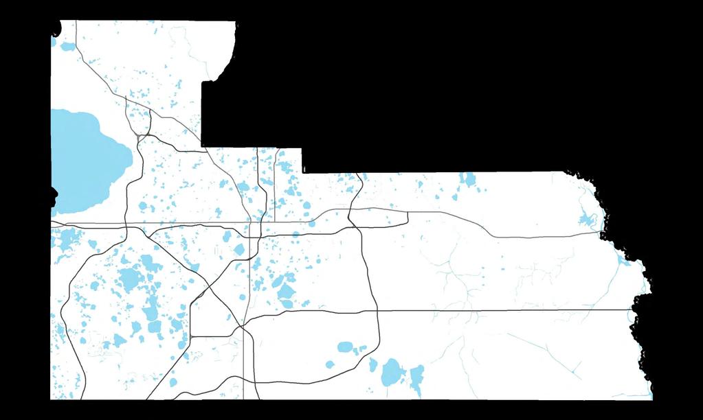
14 Market Areas Area 1: Northwest Unincorporated Orange County Urban Service Area Rural Service Area Rural Settlement Horizon West Boundary Innovation Way Overlay Area Growth Center Incorporated Area Area 2: Southwest Area 3: Core Area 5: East Area 4: South Area 6: Rural East


15 Sustainable Land Development Code More Predictable Integrated built form that addresses the relationship between buildings and the public realm Better suited for removing barriers, creating incentives, and providing mechanisms for countywide sustainable development and smart growth Graphical, calibrated


16 Transect Based Planning The rural-to-urban transect is a conceptual development framework for describing the regional elements from rural image credit: Topografis PC T T to the most densely urban. It is T a powerful tool for identifying and establishing appropriate relationships T amongst dissimilar physical and environmental factors. T T T T T1 Rural Preserve T2 Rural Reserve T3 Neighborhood General T4 Neighborhood Edge T5 Neighborhood Core T6 Urban Core T7 Special District 23 1 Mi

17 Rural Service Area Prior to 2009, development options in RSA: Annexations USA Expansion/ Sector Plans Growth Centers/ Expansions Rural Settlements/ Expansions Downtown Tangerine, FL


18 History of Rural Settlements Policy FLU No new Rural Settlements or expansions to the existing Rural Settlement boundaries shall occur Next Evaluation and Appraisal Report
19 Conservation Communities Policy FLU Orange County shall evaluate the Conservation Subdivision as a development tool for Rural Settlements within the Rural Service Area Sustainability Plan Recommendation to consider Conservation Communities

20 ULI TAP Conservation Communities The focus of this TAP will be the evaluation of proposed Conservation Communities within the Rural Service Area.
21 Rural Service Area minus Public Lands Area 1: Northwest Market Area Rural Service Area Acreage minus Public Lands 1 Northwest 11,221 2 Southwest 6,005 3 Core 0 4 South 14,651 5 East Rural East 98,270 Total 130,332 Acres Area 2: Southwest Area 3: Core Area 5: East Area 4: South Area 6: Rural East Parcels with DOR Code (a land use code assigned by the Orange County Property Appraiser for public lands) removed from Rural Service Area to estimate rural service area acreage.


22 Lake Apopka North Shore Restoration Area Winter Oakland Garden Apopka Ocoee Wekiva Protection Area Area 1: Northwest Small town Orange County Economic Drivers History Eco-tourism: Lake Apopka North Shore Restoration Area, LANSET Plan, Wekiva SR 429 corridor & the Tri-City Partnership Tangerine Zellwood - Clarcona Lake Apopka farms Indoor foliage Transportation Wekiva Parkway SR 50, SR 429, US 441 Environmental Lake Apopka Wekiva Land Use Patterns Small towns & old land use patterns Rural settlements Large scale industrial Rural Service Area: 11,221 acres Development Potential Low Mod High 30


23 Oakland Winter Garden Ocoee Area 2: Southwest Something for Everyone Economic Drivers Windermere Orlando Tourism Convention Center Horizon West Bay Lake Lake Buena Vista Shingle Creek Hunters Creek History Citrus rural Small town - Windermere Defense Lockheed Martin Disney, Sea World Transportation SR 429 OIA Connector Turnpike Environmental Shingle Creek Butler chain of lakes Land Use Patterns Rural Service Area: 6,005 acres Development Potential Low Mod High Large, master-planned communities Excluded industrial uses to east of boundary 31


24 Area 4: South Edgewood Belle Isle Orlando International Airport Orlando Medical City at Lake Nona Innovation Way Overlay Area Rural Service Area: 14,651 acres Development Potential Low Mod High Gateway to Orange County Economic Drivers History Orlando International Airport Biotech Industry Warehousing & Freight Rural settlements Air Force Ranching Transportation Orlando International Airport SunRail OIA Connector All Aboard Florida Osceola Parkway Environmental Lake Whippoorwill and Lake Mary Jane Boggy Creek preservation Land Use Patterns Airport support districts Freight villages Rural to urban transition areas Greenfield (Innovation Way) 32


25 Orlando Full Sail University Barry University Valencia College University of Central Florida Research Park Florida Technical College Area 5: East Live and Learn Economic Drivers Education and training Research Defense High tech History Florida Technical University/UCF Research park Road extensions Transportation SR 50 Cady Way Little Econ Greenway Environmental Little Econ Wetlands Land Use Patterns Suburban residential and related retail Education Rural Service Area: 185 acres Development Potential Low Mod High 33


26 Area 6: Rural East Orange County s Environmental Refuge Economic Drivers Agriculture Plant nurseries History Fort Christmas Wedgefield, Space Coast Bithlo Transportation SR 50 All Aboard Florida SR 528 Environmental Preservation Econ River St. Johns River Land Use Patterns Rural settlements Large land holding Wedgefield Rural Service Area: 98,270 acres Development Potential Low Mod High 34
27 Considerations Compatibility and Context Sensitivity Provision of Infrastructure and Services Goal of infill and redevelopment within the USA Vehicle Miles Traveled (VMT) Market Demand Proximity to other jurisdictions

28 Questions Location? Size? Policies? Uses? Design?
29 ORANGE COUNTY AT A GLANCE Urban Land Institute Technical Advisory Panel Alberto Vargas, MArch Planning Division, Manager ORANGE COUNTY PLANNING DIVISION image credit: Google Earth April 23, 2014
ORANGE COUNTY IMPLEMENTING THE FOUR C s
 ORANGE COUNTY IMPLEMENTING THE FOUR C s East Central Florida Corridor Task Force O R A N G E COUN TY P LA N N I N G DIVISION C O M M U N I T Y, E N V I R O N M E N T A L A N D D E V E L O P M E N T S E
Frequently Asked Questions. What is Sunbridge?
 Frequently Asked Questions What is Sunbridge? Created by Tavistock, Sunbridge is a new, master-planned community in Central Florida. Spanning across 24,000 acres, Sunbridge will feature a variety of housing
open public hearing and allow public comment request to continue LPA public hearing to January 16, 2014 at 10:30 am
 TODAY S AGENDA Work Session LPA Transmittal Public Hearing open public hearing and allow public comment request to continue LPA public hearing to January 16, 2014 at 10:30 am staff will issue a recommendation
North Ranch Master Plan
 North Ranch Master Plan Presentation to: East Central Florida Corridor Task Force Presentation by: Osceola County Office of Strategic Initiatives and Deseret Ranches Planning Team Kissimmee, Florida Friday,
A LONG-TERM PLAN FOR GREAT NEW PLACES TO GROW JOBS
 A LONG-TERM PLAN FOR GREAT NEW PLACES TO GROW JOBS Osceola County and Deseret Ranches of Florida, Inc., are proposing a master plan for 133,000 acres of Deseret s North Ranch in Central Florida. Deseret
Urban Development Areas Bedford County
 5 Urban Development Areas Bedford County UDA Needs Profile: All UDAs Bedford County has designated two UDAs: areas just outside the Bedford City Limits (generally to the south and east of the city) and
The State Road 7/U.S. 441 Collaborative. 8 th Annual New Partners for Smart Growth Building Safe, Healthy and Livable Communities
 The State Road 7/U.S. 441 Collaborative 8 th Annual New Partners for Smart Growth Building Safe, Healthy and Livable Communities J. Gary Rogers City of Lauderdale Lakes Florida Community Redevelopment
Warren County/Bowling Green Focus 2030 Comprehensive Plan VOLUME 1 INDEX
 Appendix 5: Index VOLUME 1 INDEX A Aesthetics ES-6, FLU-15, FLU-17, FLU-24, NCR-7 Agricultural Base FLU-18, FLU-20 Agricultural Centers, Rural FLU-11 Agricultural District NCR-17-NCR-18 Agricultural Economy
TABLE OF CONTENTS PAGE
 1989 BROWARD COUNTY LAND USE PLAN Original adoption March 1, 1989 Text amendments adopted as of March 10, 2015, are incorporated herein. BROWARD COUNTY BOARD OF COUNTY COMMISSIONERS BROWARD COUNTY PLANNING
Selected Area Study. Vision Plan Draft
 East Polk County Selected Area Study Draft 10.30.08 Contents Guiding Principles...4 Context Conclusions...5 Current Context...8 Scenarios...9 Scenario: Status Quo...10 Scenario: Connected & Directed Growth...12
Overview: CRA Impact Area Special Development Plan
 Overview: CRA Impact Area Special Development Plan As part of the CRA visioning effort, the City directed more focused planning efforts to three areas, Target Areas, within the CRA. The three Target Areas
LAKE COUNTY REGIONAL TRAIL PROJECTS
 LAKE COUNTY REGIONAL TRAIL PROJECTS LAKE APOPKA LOOP TRAIL SOUTH LAKE TRAIL LEESBURG-WILDWOOD TRAIL LAKE-CROSS FLORIDA GREENWAY LAKE LOUISA-HORIZON WEST WEKIVA PARKWAY- SR 46 CORRIDOR SR 40 CORRIDOR VAN
ECONOMIC DEVELOPMENT DISTRICT MASTER PLAN
 ECONOMIC DEVELOPMENT DISTRICT MASTER PLAN E Orange Ave Legend for the CIT Y OF MOUNT DORA/LAKE COUNT Y County Boundary Wekiva Corridor (Proposed Alignment) Public Land and Parks Park Public CityLimits
Learning from Other Communities Western Nassau Heritage Preservation Committee Nassau County Planning + Zoning Board May 1, 2018
 Learning from Other Communities Western Nassau Heritage Preservation Committee Nassau County Planning + Zoning Board May 1, 2018 Overview ULI Report References Other Florida Communities Communities Outside
CITY%OF%ORLANDO% GMP%FLU%MAP%AMENDMENT%APPLICATION% DIOCESE%OF%CENTRAL%FL%/%LAKE%NONA%HOLDINGS%% JUSTIFICATION%STATEMENT% %
 CITY%OF%ORLANDO% GMP%%MAP%AMENDMENT%APPLICATION% DIOCESE%OF%CENTRAL%FL%/%LAKE%NONA%HOLDINGS%% JUSTIFICATION%STATEMENT% % 1% The proposed development is a horizontal mixed use project that integrates compatible
CHAPTER 1. Ms. Guajardo s Class - Central Elementary CH 1 1
 INTRODUCTION CHAPTER 1 Ms. Guajardo s Class - Central Elementary CH 1 1 1.1 SETTING South Centre City is a linear corridor south of Downtown Escondido paralleling Centre City Parkway and South Escondido
SUNBRIDGE PARKWAY PRELIMINARY DESIGN STUDY. November 30, 2017
 SUNBRIDGE PARKWAY PRELIMINARY DESIGN STUDY November 30, 2017 Agenda Introductions and Overview Study Purpose Study Approach Key Analysis Components Study Context Existing Conditions Corridor Constraints
Northeast Connector Expressway Extension Concept, Feasibility and Mobility Study Environmental Advisory Group Meeting #1 June 26, 2018
 NORTHEAST CONNECTOR EXPRESSWAY EXTENSION (NECEE) ENVIRONMENTAL ADVISORY GROUP (EAG) MEETING #1 SUMMARY Date/Time: Tuesday, June 26, 2018; 1:30 p.m. 3 p.m. Location: Central Florida Expressway Authority
Urban Development Areas Frederick County
 18 Urban Development Areas Frederick County UDA Needs Profile: All UDAs Frederick County, Virginia's northernmost county has two UDA s, surrounded by the City of Winchester and located adjacent to the
General Location Annex, Rezone & Preliminary Plat Lansdowne Addition, Unit Three
 NEWFOUNDLAND I-5 Agricultural District Subject Site SUNDANCE ANDERSON Single Family Residential CHRISTY PUD Agricultural District Highway Business General Location Annex, Rezone & Preliminary Plat Lansdowne
FDOT/FTBA Construction Conference Work Plan
 FDOT/FTBA Construction Conference 19 2019 2023 Work Plan Ben Dreiling, P.E., Director of Construction Central Florida Expressway Authority January 18, 2019 Major Projects Map FY 2019-2023 Work Plan 2 FY
Presentation to Town Council in association with Kubilins Transportation Group Rose & Associates Equinox Environmental
 Presentation to Town Council 03.03.09 in association with Kubilins Transportation Group Rose & Associates Equinox Environmental Vision Statement: Boone 2030 is...a friendly, vibrant, attractive community...financially,
MEMORANDUM AGENDA ITEM #IV.C
 MEMORANDUM AGENDA ITEM #IV.C DATE: NOVEMBER 27, 2017 TO: FROM: COUNCIL MEMBERS STAFF SUBJECT: LOCAL GOVERNMENT COMPREHENSIVE PLAN PROPOSED AND ADOPTED AMENDMENT CONSENT AGENDA Pursuant to Section 163.3184,
Niagara Region Official Plan. Table of Contents
 Niagara Region Official Plan Table of Contents This page has been intentionally left blank. Table of Contents ii Niagara Region Official Plan Niagara Region Official Plan - Table of Contents Chapter 1
City of Lake Mary, Florida. Evolution of a Historic Downtown with Transit Oriented Development Strategies
 City of Lake Mary, Florida Evolution of a Historic Downtown with Transit Oriented Development Strategies What is Transit Oriented Development? Walkable villages located at and around transit stations in
East Central Florida Corridor Task Force Study Area
 1 East Central Florida Corridor Task Force Study Area TRANSMITTAL LETTER Dear Governor Scott: I am pleased to submit the final report of the East Central Florida Corridor Task Force, which was established
12/9/2013. HOLLYWOOD/PINES CORRIDOR PROJECT AMPO 2013 Annual Conference October 24, Our Perspective. Broward.
 HOLLYWOOD/PINES CORRIDOR PROJECT AMPO 2013 Annual Conference October 24, 2013 Our Perspective Broward Fort Lauderdale 1 Broward Metropolitan Planning Organization Fort Lauderdale Fort Lauderdale Skyline
Land Use & Transportation Primer
 Land Use & Transportation Primer Presented By Smitha Vijayan Center for Urban Transportation Studies University of Wisconsin-Milwaukee Role of Local Government Land use decision-making power mostly given
EAR WORKSHOP FOR PALM BEACH COUNTY LOCAL GOVERNMENTS APRIL 2010 TREASURE COAST REGIONAL PLANNING COUNCIL
 EAR WORKSHOP FOR PALM BEACH COUNTY LOCAL GOVERNMENTS APRIL 2010 TREASURE COAST REGIONAL PLANNING COUNCIL Why Should I Care about Transportation & Land Use? Congestion or Mobility Pick One!! Congestion
Future Land Use SAMPLE RECOMMENDATIONS
 SAMPLE RECOMMENDATIONS Future Land Use The Future Land Use Chapter of the Master Plan builds upon prior chapters examining the existing conditions in their respective topic areas to present a comprehensive
NORTHWEST OCOEE SECTOR STUDY RENAISSANCE PLANNING GROUP SUBMITTED BY: IN ASSOCIATION WITH
 NORTHWEST OCOEE SECTOR STUDY SUBMITTED TO: SUBMITTED BY: City of Ocoee RENAISSANCE PLANNING GROUP IN ASSOCIATION WITH May 2006 NORTHWEST OCOEE SECTOR STUDY Submitted to: City of Ocoee Submitted by: Renaissance
DRAFT Subject to Modifications
 TREASURE COAST REGIONAL PLANNING COUNCIL M E M O R A N D U M To: Council Members AGENDA ITEM 5P From: Date: Subject: Staff February 20, 2009 Council Meeting Local Government Comprehensive Plan Review Draft
RECREATION AND OPEN SPACE ELEMENT GOALS, OBJECTIVES, AND POLICIES
 RECREATION AND OPEN SPACE ELEMENT GOALS, OBJECTIVES, AND POLICIES Goal 7 To provide park facilities, recreation programs, and open space resources that are safe, adequate, and accessible to all City residents,
KAMPLAN City of Kamloops. Section D. Land Use Policies D-1
 KAMPLAN City of Kamloops Section D Land Use Policies D-1 City of Kamloops KAMPLAN D 1 Land Management and Development This section links to the following Community Values: D-2 develop complete neighbourhoods
ORDINANCE WHEREAS, this Ordinance is consistent with the City of Winter Garden Comprehensive Plan; and
 ORDINANCE 17-06 AN ORDINANCE OF THE CITY COMMISSION OF THE CITY OF WINTER GARDEN, FLORIDA, CREATING ARTICLE XIV OF CHAPTER 118 OF THE CITY OF WINTER GARDEN CODE OF ORDINANCES PROVIDING FOR THE EAST PLANT
Dwelling Units Max 12 dwelling units per acre/min 8 dwelling units per acre. Development Mix 80% non residential/20% residential
 13. OSTEEN LOCAL PLAN Background: The Osteen Local Plan area is located in southwest Volusia County along the SR 415 corridor between Lemon Bluff Road and Acorn Lake Road and includes 3,990 acres. The
Chapter IV: Development Pattern
 Chapter IV: Development Pattern Introduction The 2002 Prince George s County Approved General Plan designates three growth policy tiers Developed, Developing, and Rural as well as three center designations
TREASURE COAST REGIONAL PLANNING COUNCIL M E M O R A N D U M. To: Council Members AGENDA ITEM 10
 TREASURE COAST REGIONAL PLANNING COUNCIL M E M O R A N D U M To: Council Members AGENDA ITEM 10 From: Date: Subject: Staff March 18, 2016 Council Meeting Village of North Palm Beach Charrette Work-In-Progress
Micco Park Village Development
 FOR SALE Call For Pricing Micco Park Village Development Proposed Project Property Details Micco Park Village Development PRICE Call For Pricing A monumental development opportunity of a lifetime! The
Sustainable Regional Development via Placemaking
 Ford Foundation Fellowship Sustainable Regional Development via Placemaking Scott Polikov, AICP, CNU March 12, 2009 Gateway Planning Group, Inc. The days when we were just building sprawl forever, those
We d like to thank you for attending this Wekiva Parkway Section 8 Preliminary Design Update hosted by the Florida Department of Transportation.
 We d like to thank you for attending this Wekiva Parkway Section 8 Preliminary Design Update hosted by the Florida Department of Transportation. We will provide you information on the overall project and
Erik Rundell, Project Manager
 Erik Rundell, Project Manager M.U.R.P., Portland State University Certificate, Commercial Real Estate, University of Washington Graduate Certificate, GIS, University of Wisconsin-Madison B.A. Geography,
DRAFT. Urban Development Areas Fairfax County. UDA Needs Profile: Tysons Corner 13% Location Characteristics. Socio-Economic Characteristics
 14 Urban Development Areas Fairfax County UDA Needs Profile: Tysons Corner Tysons Corner is located in Fairfax County, surrounded by the town of McLean to the east and Vienna on the west along I-495, the
Hockessin Community Redevelopment Plan
 Hockessin Community Redevelopment Plan 3.1 Introduction The Community Redevelopment Plan for the Village of Hockessin is the result of the people s vision for a distinct village center that serves as the
Chapter 1 Vision Statement & Goals
 Chapter 1 Section 1.1 Section 1.2 Section 1.3 Section 1.4 Section 1.5 Introduction Vision Statement Visioning Exercise Prioritization of Land Use Issues Goals of the Comprehensive Plan CHAPTER 1 SECTION
NACCED/NACo CONFERENCE JULY 10, 2015
 NACCED/NACo CONFERENCE JULY 10, 2015 Regional Growth Framework 2 Regional Growth Framework Regional Priorities Preferred Growth Concept Tools to Support Local Governments 3 Top Priorities for the CONNECT
Regional Context Statement
 Regional Context Statement REGIONAL CONTEXT STATEMENT 3. REGIONAL CONTEXT STATEMENT In 1995, the Provincial Government passed into law the Growth Strategies Act. The purpose of this provincial initiative
CITY OF LANGLEY OFFICIAL COMMUNITY PLAN BYLAW, 2005, NO APPENDIX II - REGIONAL CONTEXT MAP
 CITY OF LANGLEY OFFICIAL COMMUNITY PLAN BYLAW, 2005, NO. 2600 APPENDIX II - REGIONAL CONTEXT MAP ± Legend Agricultural Mixed Employment Industrial Conservation & Recreation Regional City Centre Urban Containment
Spatial Areas of Practice AICP EXAM REVIEW. February 20, 2009 Georgia Tech Student Center Gary A. Cornell, FAICP
 Spatial Areas of Practice AICP EXAM REVIEW February 20, 2009 Georgia Tech Student Center Gary A. Cornell, FAICP Acknowledgement Thanks to Mary M. Shaw, AICP Planning at the National Level Federalism in
Parks and Open Space Preservation and Dedication. January 26, 2016 Fort Worth City Council Pre-Council Meeting Randle Harwood and Richard Zavala
 Parks and Open Space Preservation and Dedication January 26, 2016 Fort Worth City Council Pre-Council Meeting Randle Harwood and Richard Zavala Purpose How does the City of Fort Worth preserve and protect
LAND USE MODEL UPDATE. Planning and Land Use Advisory Committee Meeting #2 September 4, 2014
 1 LAND USE MODEL UPDATE Planning and Land Use Advisory Committee Meeting #2 September 4, 2014 2 Presentation Outline Introduction and Recap Model Process Study Design Place Types Suitability Factors 3
TREASURE COAST REGIONAL PLANNING COUNCIL M E M O R A N D U M. To: Council Members AGENDA ITEM 5H
 TREASURE COAST REGIONAL PLANNING COUNCIL M E M O R A N D U M To: Council Members AGENDA ITEM 5H From: Date: Subject: Staff October 17, 2008 Council Meeting Local Government Comprehensive Plan Review Draft
Transit / Housing Oriented Redevelopment
 Broward County Urban Planning and Redevelopment Department Kick-Off Meeting October 24, 2007 Transit / Housing Oriented Redevelopment 1 Future Land Use 2 Broward County Charter Voters approved in 1974.
This page has been intentionally left blank.
 This page has been intentionally left blank. Chapter 3 3-2 3. Employment 3.A Niagara Economic Gateway 3.A.1 General The Niagara Economic Gateway comprises: a) The Gateway Economic Zone which includes all
Citizen Comment Staff Response Staff Recommended Revision Planning Committee
 Citizen Comment Staff Response Staff Recommended Revision Planning Committee Area No. 1: Owner desires retail land uses. Area No. 1a: Owner of two small parcels adjacent to Area No. 1 desires retail land
SUNBRIDGE PARKWAY PRELIMINARY DESIGN STUDY. Board of County Commissioners Public Hearing
 SUNBRIDGE PARKWAY PRELIMINARY DESIGN STUDY Board of County Commissioners Public Hearing March 20, 2018 Presentation Overview Study Overview Existing Conditions Project Development Plan Public Involvement
Lake Fact Sheet. Raccoon Lake
 Lago Secret Dr Fact Sheet Raccoon Latitude: Northing: STR: 28 21' 11" N Longitude: 81 37' 41" W 1,461,627 Easting: 454,116 32-24-27 Major Drainage Basin: Water Management District: Commissioner District:
BROOKHILL NEIGHBORHOOD MODEL ZONING MAP AMENDMENT PREFACE TO APPLICATION
 BROOKHILL NEIGHBORHOOD MODEL ZONING MAP AMENDMENT PREFACE TO APPLICATION June 15, 2015 Revised: August 1, 2016 I. VISION Brookhill is a proposed community based upon the principles of Albemarle County
Linking Land Use and Transportation
 Linking Land Use and Transportation NJ s Experience January 18, 2006 NYMTC - PFAC Mark Stout Planning & Development New Jersey Department of Transportation Where We Are Los Angeles, CA San Francisco, CA
Chapter 2: Land Use Element
 Chapter 2: Land Use Element CHAPTER 2: LAND USE ELEMENT A VISION FOR LAND USE As Lake Stevens continues to grow in population and area, the city will strive to create balanced opportunities for residential
TOWN OF SAUGEEN SHORES OFFICIAL PLAN
 TOWN OF SAUGEEN SHORES OFFICIAL PLAN Adopted by Council: December 10, 2012 Approved by County of Bruce: March 26, 2014 (Office Consolidation September 2014) Town of Saugeen Shores 1 Table of Contents Saugeen
Pine Island Road Corridor Master Plan
 RECOMMENDED DEVELOPMENT PLAN Figure 9: Del Prado Village District Conceptual Framework The Conceptual Framework (Figure 8) for development of the Pine Island Corridor is to encourage mixed-use development
IMPLEMENTING SOMERSET COUNTY S INVESTMENT FRAMEWORK
 IMPLEMENTING SOMERSET COUNTY S INVESTMENT FRAMEWORK SMART CONSERVATION THROUGH SMART GROWTH NJ LAND CONSERVATION RALLY March 22, 2014 Laurette Kratina, PP, AICP, Supervising Planner Somerset County Planning
Midtown Greenway Land Use and Development Plan Executive Summary
 Midtown Greenway Land Use and Development Plan Executive Summary Introduction The Midtown Greenway Land Use and Development Plan sets policy direction for land use and development in the Midtown Greenway
14.5 HOPEFIELD: (REFER PLAN 39 AND PLAN 40)
") URBAN DYNAMICS WESTERN CAPE INC. 248 14.5 HOPEFIELD: (REFER PLAN 39 AND PLAN 40) FIGURE 83: LOCALITY - HOPEFIELD Within the context of the Saldanha Bay Municipal area, Hopefield, an historical agricultural
URBAN DYNAMICS WESTERN CAPE INC. 248 14.5 HOPEFIELD: (REFER PLAN 39 AND PLAN 40) FIGURE 83: LOCALITY - HOPEFIELD Within the context of the Saldanha Bay Municipal area, Hopefield, an historical agricultural
Section 3: Land Use M C H E N R Y K A N E. Figure 3.1: Potential Future Municipal Boundaries. Future Municipal Boundaries. County Land Use Plans
 Section 3: Land Use Figure 3.1: Potential Future Municipal Boundaries Land use and transportation are intertwined; yet, land use and transpor- tation planning are often undertaken as separate disciplines.
Status Update (2006 vs. Now) Citizen s Advisory Committee February Plan for Prosperity
 Citizen s Advisory Committee February Plan for Prosperity") Status Update (2006 vs. Now) Citizen s Advisory Committee February 2018 Plan for Prosperity 2000 2017 2000 2017 Gardnerville Population 6,000 5,760 5746 5,500 5,000 5,067 5,550 5,165 5,394 5,412 5,250
Status Update (2006 vs. Now) Citizen s Advisory Committee February 2018 Plan for Prosperity 2000 2017 2000 2017 Gardnerville Population 6,000 5,760 5746 5,500 5,000 5,067 5,550 5,165 5,394 5,412 5,250
Preserving Our Past. Securing Our Future.
 Heritage Woods/Traffic Montrose West Intersection Springside Dr./S.R. 18Intersection Flight Memorial Dr./ S.R. 18Intersection Red Roof Inn High Density Development Ridgewood/ Cleve-Mass Intersection Ridgewood/
Land Use 2025:Rhode Island State Land Use Policies and Plan
 Land Use 2025:Rhode Island State Land Use Policies and Plan State Guide Plan Element 152 The Power of Place Summit May 12, 2006 R.I. Statewide Planning Program 05-12-06 The Bay & Beaches R.I. Statewide
Behnke Ranch Property, Pasco County: Master Plan Development Approach
 February 24, 2014 , Pasco County: Master Plan Development Approach Location & Program The (Legacy PUD) is located in southwest Pasco County along State Road 54 approximately 1.5 miles west of the Suncoast
STUDY AREA LOCATION & CONTEXT:
 UNLOCKING THE POTENTIAL OF THE KEATING CROSS ROAD BUSINESS CORRIDOR A PLAN TO CREATE + RETAIN JOB-GENERATING BUSINESSES AND TO GUIDE INFRASTRUCTURE INVESTMENT The Keating Cross Road Corridor (the Keating
Intergovermental Coordination
 Intergovermental Coordination CITY OF WINTER PARK CHAPTER 8: INTERGOVERNMENTAL COORDINATION ELEMENT INTERGOVERNMENTAL COORDINATION ELEMENT GOAL 8-1: PROVIDE FOR IMPROVED INTERGOVERNMENTAL COORDINATION
LAND USE ELEMENT. Purpose. General Goals & Policies
 LAND USE ELEMENT Purpose This Land Use Element contains the goals and policies necessary to support the City s responsibility for managing land resources and guiding development through implementing regulations,
Planning Districts INTRODUCTION
 INTRODUCTION To facilitate detailed examination of development prospects for all areas of the community, Delano has been divided into 14 planning districts. The location of these planning districts is
SUSSEX COUNTY COMPREHENSIVE PLAN COUNTY PLANNING AND ZONING COMMISSION WORKSHOP
 SUSSEX COUNTY COMPREHENSIVE PLAN COUNTY PLANNING AND ZONING COMMISSION WORKSHOP August 21, 2017 TODAY S WORKSHOP Public Comment Utilities Update Economic Development Update Future Land Use Discussion Public
Smart Growth as a Sustainable Community Strategy
 Smart Growth as a Sustainable Community Strategy US EPA, Office of Policy Economics and Innovation March 9 th, 2009 1 Connected but Distinct Frameworks Climate Change Typical Scale Global, Regional Smart
Design Guidelines for Small Towns and Rural Communities. Design Guidelines for Small Towns & Rural Communities. Laura Minns, Associate HHI Orlando, FL
 Design Guidelines for Small Towns and Rural Communities Conference resources online at: www.planning.org/ audioconference/design Submit questions: Fax 312-786-6727 education@planning.org E-mail Design
3.5 Historic Old Town Character Area
 3.5 Historic Old Town Character Area Downtown Suwanee is characterized by two areas: Historic Old Town and Town Center. Due to their proximity and similar purposes, the two areas can function together
Cobb County Design Guidelines Mableton Parkway & Veterans Memorial Highway Community Design Workshop January 12, 2017
 Community Design Workshop January 12, 2017 Agenda Opening Remarks / Introductions Scope of Work Existing Conditions Key Issues / Opportunities VPS Summary Draft Vision & Goal Statement Implementation Concepts
DRAFT ROOSEVELT ROAD. District Recommendations. Figure 5.23 The Roosevelt Road Corridor
 CHAPTER 5 Figure 5.23 The Road Corridor Road will develop as a mixed-use corridor, emphasizing regional retail, west of the river and mixed-use development east of the river. KEY RECOMMENDATIONS 1. High
E O L A F I V E. Location Map SUMMARY G M P Z O N I T E M S # 1 A. & B.
 N. Eola Drive Staff Report to the Municipal Planning Board August 18, 2015 G M P 2 0 1 5-0 0 0 1 9 Z O N 2 0 1 5-00016 I T E M S # 1 A. & B. A N X 2 0 1 2-0 0 0 0 5 G M P 2 0 1 2-0 0 0 0 6 Z O N 2 0 1
Hibbing. Land Use. Hibbing Comprehensive Plan 8.1. Land Use
 Hibbing 8.1 Introduction 8.3 Information and Assessment 8.5-8.14 Recommendations 8.15-8.17 Implementation 8.18-8.19 8.2 Introduction Although land use was not identified as a discrete goal during the community
A P P E N D I X B - O P P O R T U N I T Y S I T E S
 A P P E N D I X B - O P P O R T U N I T Y S I T E S OPPORTUNITY SITES As listed in the Land Use Element, the City has identified 15 Opportunity Sites expected to be the focus of change and revitalization
KAMLOOPS BACKGROUND. Let s Ta!k KAMPLAN REVIEW & UPDATE Call: Web: REVIEW UPDATE
 REVIEW UPDATE February 2014 Development and Engineering Services City of Kamloops Let s Ta!k KAMPLAN REVIEW & UPDATE Call: 250-828-3568 Email: kamplan@kamloops.ca Web: www.kamloops.ca/kamplan REVIEW UPDATE
Lynn Housing Authority and Neighborhood Development. Washington Street Gateway District Plan A p r i l
 Lynn Housing Authority and Neighborhood Development Washington Street Gateway District Plan A p r i l 2 0 0 8 rendering of sagamore hill from lynnway pedestrian overpass table of contents project area
Sector Planning: Balancing Environmental Protection, Community Building and Economic Development. James A. Sellen Executive Vice President MSCW
 Sector Planning: Balancing Environmental Protection, Community Building and Economic Development James A. Sellen Executive Vice President MSCW Optional Sector Planning Optional sector planning authorized
REGIONAL ACTIVITY CENTER
 DRAFT REGIONAL ACTIVITY CENTER 70 EAST BENCH MASTER PLAN DRAFT 06 Introduction The East Bench Regional Activity center is comprised of large educational, research, medical, and employment centers. These
Future Land Use and Transportation
 Planning & Zoning Board Workshop Comprehensive Plan for Village of Estero Future Land Use and Transportation April 6, 2017 January Kick-off Meeting Public Input What do you like about Estero? Location
Planning for Waterfront Communities
 Planning for Waterfront Communities Redevelopment Ready Communities Supplemental Training Program OFFICE OF THE GREAT LAKES Waterfront Community Best Practices and Guidelines New supplemental criteria
Prepared for the Citizens of Forsyth County by the City-County Planning Board
 Prepared for the Citizens of Forsyth County by the City-County Planning Board Bryce A. Stuart Municipal Building 100 East First Street, Winston-Salem, NC 27101 336.727.8000 www.cityofws.org/planning www.legacy2030.com
FUTURE LAND USE ELEMENT
 FUTURE LAND USE ELEMENT GOAL I: To create and sustain a great place to live, play, and prosper Objective 1: The City of Ocala shall incorporate the principles and strategies of the Ocala 2035 Vision into
TREASURE COAST REGIONAL PLANNING COUNCIL M E M O R A N D U M. To: Council Members AGENDA ITEM 5I
 TREASURE COAST REGIONAL PLANNING COUNCIL M E M O R A N D U M To: Council Members AGENDA ITEM 5I From: Date: Subject: Staff December 12, 2008 Council Meeting Local Government Comprehensive Plan Review Town
The Floyds Fork Area Study A Framework for Growth
 The Floyds Fork Area Study A Framework for Growth 2 21 st Century Parks Master Plan: The Fork 3 Neighborhood Development Area Policy Recommendations 1. Create incentives to promote infill of existing development
Economic Development & Housing Council Committee Comprehensive Plan Update September 20, 2005
 1 Economic Development & Housing Council Committee Comprehensive Plan Update September 20, 2005 Purpose To update the Committee on the ForwardDallas! Plan, including: Status Anticipated Products Public
CHEROKEE STREET CORRIDOR GATEWAY
 CHEROKEE STREET CORRIDOR GATEWAY DESIGNED-BASED DEVELOPMENT CODE STAKEHOLDER COMMITTEE MEETING Presentation by: TONIGHT S AGENDA Welcome + Introductions Process + Schedule Your roles in the process Gateway
City of Heath. Town Center Concept
 In the give-and-take of getting projects designed, financed, and approved, the famous refrain from the film Field of Dreams is heard often: if you build it, they will come. From the perspective of the
5.9 LAND USE Existing Conditions Historic Land Use Trends Existing Land Use Distribution
 5.9 LAND USE This section describes the existing land use pattern and land use planning/regulatory framework in the City of Fontana. It also evaluates potential long-term land use impacts such as physically
Definitions. Average Daily Traffic Demand (ADT): The actual number or projected number of cars that pass a point in a 24-hour period.
: The actual number or projected number of cars that pass a point in a 24-hour period.") Definitions Access Management: A combination of physical techniques and transportation policies used to control the flow of traffic between roads and the surrounding lands. Alternative City Form Scenarios:
Definitions Access Management: A combination of physical techniques and transportation policies used to control the flow of traffic between roads and the surrounding lands. Alternative City Form Scenarios:
2 Collaboration Opportunities for Research and Exploration at Lakewood Ranch
 COLLABORATION OPPORTUNITIES FOR Collaboration RESEARCH Opportunities AND for Research EXPLORATION and Exploration at Lakewood Ranch 1 With research and innovation a key component of the growth in services
I-4 Beyond the Ultimate. Florida Transportation Builders Association February 9, 2018
 I-4 Beyond the Ultimate Florida Transportation Builders Association February 9, 2018 FDOT: Improving Mobility & Safety in Central Florida FDOT is Designing and building a better I-4 through Central Florida