NEIGHBORHOOD PLAN. Princeton-Midstreams, Brick Township, New Jersey. Prepared By:
|
|
|
- Merryl Horn
- 5 years ago
- Views:
Transcription

 from the New Jersey Department of Community")
1 NEIGHBORHOOD PLAN Princeton-Midstreams, Brick Township, New Jersey Prepared By: David G. Roberts, P.P., AICP, LLA, LEED AP ND Zachary Zeilman, Planner This document has been prepared with a Post Sandy Recovery Planning Grant (Phase II) from the New Jersey Department of Community Affairs with funds provided by the U.S. Department of Housing and Urban Development.
2 TABLE OF CONTENTS Introduction... 4 Neighborhood Description... 6 Plan Integration, Coordination, and Building Block Approach Planning Coordination and Process Neighborhood Plan Goals and Objectives Public Opinion Public Presentation June 11, Notes from the Princeton-Midstreams Public Meeting Public Presentation March 30, Neighborhood History Existing Conditions Analysis Neighborhood Profile Sub-Neighborhoods Demographics Housing Impact of Superstorm Sandy Neighborhood Physical Characteristics Connectivity and Mobility Signage Destinations in Princeton-Midstreams Public Services Public Utilities Neighborhood Parks, Recreation, and Public Spaces Open Space & Preservation/Conservation Areas Page 1
3 Other Neighborhood Destinations Zoning Analysis B-2 (General Business Zone) B-3 (Highway Development Zone) R-R-1 (Rural Residential Zone) R-R-2 (Rural Residential Adult Community Zone) R-15 (Single-Family Residential Zone) R-10 (Single-Family Residential Zone) R-5 & R-7.5 (Single-Family Residential Zones) Zoning Issues Recommendations Connectivity and Mobility Signage Identification Signage Wayfinding Signage Commercial Signage Design Guidelines Elevation of Buildings Landscaping Public Spaces & Streetscape Design Abandoned Buildings and Empty Lots Zoning Recommendations Bulk recommendations Zoning Map Changes Future Neighborhood Growth Page 2
4 Public Parks, Open Space, and Conservation Lands Existing Parks and Open Space Recommended Parks and Open Space Street-Ends, Bulkheads, and Right-of-Ways Ecosystem Restoration Future Storm and Disaster Preparedness Sustainable Recovery: Leadership In Energy & Environmental Design LEED For Homes LEED For Neighborhood Development Sea Level Rise And The Future Of Infrastructure Sea Level Rise Action Plan Appendix I Princeton-Midstreams Public Meeting Notes June 11, Appendix II Results from Public Comment Sheets June 11, Appendix III Princeton-Midstreams Public Meeting NOTES March 30, Page 3
5 POST SANDY RECOVERY PHASE II PLANNING Neighborhood Plan Princeton-Midstreams, Brick Township, New Jersey INTRODUCTION In a Resolution # on February 18, 2014, the Township Council of the Township of Brick, County of Ocean and State of New Jersey approved the preparation and submission of Post- Sandy Planning Studies and Reports, which allowed for the four Brick Neighborhood Plans. The Princeton-Midstreams Neighborhood Plan is included in these Planning Studies and is intended to look at a number of factors which will affect the future viability of this defined area, from the present state of the infrastructure and the ongoing re-building efforts, to methods of providing a sense of unity and community. This Plan seeks to identify and rectify some of the challenges faced by the community in the wake of the destruction of Superstorm Sandy in order to return the neighborhood to a state of normalcy, but also to mitigate and adapt to the effects of future storms, to improve the rebuilding process, and to create a more cohesive and well-designed community. The Princeton-Midstreams Plan Area extends from Bay Head Harbor at the head of Barnegat Bay in the east along the north side of the Metedeconk River to New Jersey State Route 88 and northeast to the municipal boundary with the Borough of Point Pleasant along the southerly side of Beaver Dam Creek North Branch. The Neighborhood Plan has been prepared in conjunction with three other Brick Neighborhood Plans and is also intended to complement the Hazard Mitigation Plan (HMP) and Floodplain Management Plan (FMP) prepared by Tetra Tech, Inc. in conjunction with other Post Sandy Phase II planning projects by the Township of Brick. This Neighborhood Plan provides an overview of the neighborhood, an analysis of the development pattern within the Princeton-Midstreams Neighborhood and its associated bulk standards to determine specific recommendations for changes that would make the neighborhood more resilient to future storm events comparable to Superstorm Sandy. As noted in the project scope, the Plan uses the sustainable development principles of the Leadership in Energy and Environmental Design (LEED) rating systems; specifically LEED for Homes (LEED-Home) and LEED for Neighborhood Development (LEED-ND). The LEED-Home standards are applicable for homeowners who are renovating as well as those considering a complete demolition and rebuild. The LEED-ND standards apply to the neighborhood as a whole and relate to maintaining and enhancing connectivity (and thereby walkability ) within the neighborhood for pedestrians and bicyclists, sustainable stormwater management, and enhancing neighborhood goods and services, parks and open space and schools within walking distance of the homes (1/4 mile or less). The Page 4

6 subsequent section of the Neighborhood Plan provides design standards to assist homeowners with renovating and rebuilding. Map 1: Four Brick Township Neighborhood Plan Areas Page 5
7 NEIGHBORHOOD DESCRIPTION The Princeton-Midstreams neighborhood is located in the eastern central portion of Brick Township, Ocean County, New Jersey. The neighborhood borders the Metedeconk River to the south, Bricktown to the west, and Point Pleasant Borough to the north and east, separated by the North Branch Beaver Dam Creek. The moniker Princeton-Midstreams is used to describe the entire geographic area, whereas Princeton and Midstreams both specifically refer to the individual sub-neighborhoods with their own distinct social and physical geographies, as well as the major access roads (Princeton Avenue and Midstreams Road) that connect them. This neighborhood is generally accessible by three major roads. Midstreams Road and Jordan Road lead from Route 88 to the north into the Midstreams sub-neighborhood and intersect and cross Beaver Dam Creek south into Princeton. Princeton Avenue and some smaller neighborhood streets extend into Princeton from the west where Route 70 and 88 meet and run east into the sub-neighborhood. Beaver Dam Road crosses Beaver Dam Creek into Princeton from Point Pleasant Borough to the north. The subneighborhoods are very much disconnected because of Beaver Dam Creek, which runs centrally between them. The Midstreams Road Bridge and Route 88 are the only roads connecting the Princeton peninsula to Midstreams. Despite the decidedly suburban form and sprawling planned communities, from a larger perspective Princeton-Midstreams expanded in an ad hoc nature with very little concern for connectivity. With the sub-neighborhoods laid out over several periods in a variety of patterns, they are often disconnected and have their own character. Whether purposeful or not, some of the streets that do connect form different sized blocks of various developments. There is also a network of sidewalks in both of the subneighborhoods, both along major corridors, such as Princeton Avenue and Midstreams Road, and some of the newer residential streets, as well as crosswalks at signalized intersections. Sidewalks are inconsistent and do not always connect, nor are they always on both sides of the road. Additionally, there is a designated/marked bike lane along the shoulder of both the eastbound and westbound sides of Princeton Avenue. There are also few recognizable signs indicating the neighborhood connectivity or identity, again with exception to a couple of the newer planned communities. Page 6

8 Map 2: Location of the Princeton-Midstreams neighborhood within Brick Township Page 7
9 Princeton-Midstreams is unique as a neighborhood compared to Shore Acres, Cherry Quay-Bay Harbor, and the Barrier Island due to its sheer size and location on two peninsulas. It encompasses the entire area southeast of New Jersey State Highway 88 from the border of the Borough of Point Pleasant to the east to where it meets Route 70 to the west. The sub-neighborhoods represent several homeowners and neighborhood associations, as well as distinct physical geographies and cover an approximate total of 1,708.8 acres, or 2.67 square miles, of densely populated land in the designated area. As of the 2010 U.S. Census, there were 4,133 housing units and a population of 9,468, resulting in approximately 1,521 units per square mile and 3,546.1 persons per square mile. 1 The neighborhood, primarily in Princeton, experiences some population increase during the summer with part-time residents with second homes and renters, although not significant. The neighborhood is almost entirely residential, but is bordered by convenience and highway commercial business and retail centers on the outer rim of the neighborhood along N.J. Route 88 and Route 70. A few restaurants, gas stations/auto service centers, neighborhood retail/deli, and marine-related or marina services, are also located along various parts of the main arterial roads, such as Princeton Avenue. There are a few public services, such as Midstreams Elementary School located on Midstreams Road. In addition to the developed areas, there are some existing and proposed natural conservation areas in and surrounding the neighborhood, including the marshes along the Beaver Dam Creek and Metedeconk River and some wooded areas in Midstreams. While there are a large number of private clubs, pools, and boat launch areas, the Township also provides several public recreational facilities and amenities throughout the neighborhood. Some of the public facilities include Windward Beach Park and playground in Princeton; and Norman J. Sherman Park, Crescent Woods Park, Midstreams Park, and the recreational fields at Midstreams Elementary School in the Midstreams sub-neighborhood. Princeton-Midstreams is more similar to the Cherry Quay-Bay Harbor neighborhood than it is to the Barrier Island or Shore Acres neighborhoods, such that the sub-neighborhoods are primarily defined by their natural peninsulas rather than man-made canals. Much of the neighborhood has frontage on the water, whether the Metedeconk River, Bay Head Harbor, or one of the branches of Beaver Dam Creek. However, there are a few areas with man-made lagoons, particularly the eastern end of Princeton Avenue at North and South Drive, Island Drive, and Lenape Trail in Princeton; and a few streets on the North Branch Beaver Dam Creek. The South Branch Beaver Dam Creek has some unusual man-made lagoons formed by a series of small barrier islands, which also help to protect the neighborhood from flooding and wave action. Other than those small islands, there is minimal natural or man-made buffer to absorb water from a rise in sea level. Much of the neighborhood along the Beaver Dam Creek and Metedeconk River waterfront was built on former coastal wetlands or marshes. Large swaths of wetlands were dredged to widen the rivers and to create lagoons that allow private boat traffic and mooring for neighborhood residents, although it was 1 U.S. Census Bureau, Page 8
10 not as prevalent in Princeton-Midstreams as in other coastal neighborhoods. The dredged silt was likely used to build up the land on which the riverside homes and roads were placed. Therefore, some formerly interior parts of the neighborhood are now accessible by boat, but are also subject to habitual flooding due to the proximity to the water, low elevation, and foundation built on naturally absorbent wetlands. Some protected wetlands ecosystems still exist to a limited extent within the interior riverine sections of the neighborhood and provide valuable habitat and flood protection. The barrier island to the east, which is essentially a long strand of naturally forming sand dunes that has been heavily developed, protects the mainland neighborhood of Princeton-Midstreams from the direct impact of the Atlantic Ocean. Bay Head Harbor, an estuarine extension of Barnegat Bay, separates the community from the barrier island. The Bay is part of the eastern Intracoastal Waterway, which extends from Bay Head, New Jersey in the north to Island Beach State Park, New Jersey in the south. Most of the mainland to the north, west, and south is also densely developed in a suburban character, but interspersed with a varied topography of rivers, wetlands, marshes, and forest areas. The Metedeconk River forms the southern boundary of the neighborhood, while the North Branch of Beaver Dam Creek forms the northern boundary, and the South Branch of Beaver Dam Creek forms the central boundary between the sub-neighborhoods. Together, these three rivers form the two peninsulas and the identity of the Princeton-Midstreams neighborhood. However, as was the case during Superstorm Sandy in 2012, heavy rain and rising flood levels can easily overwhelm the surrounding streams, rivers, and marshes in the low-lying area. The unpredicted breach of the barrier island by the ocean near the Mantoloking Bridge directly to the east, also allowed water to be pushed inland by several high tides and strong southerly winds. This combination of factors raised the level in Barnegat Bay even more quickly and the remaining marshes and storm drains could no longer absorb any more water. As a result, the already flood-prone streets and properties in the neighborhood were inundated because the water could not filter out and the neighborhood endured significant devastation from both flooding and wind during the storm. Although it was an extremely rare event, Princeton-Midstreams is especially vulnerable to flooding with its position at the junction of the mouths of two rivers and the head of Barnegat Bay, and with the potential of the barrier island being breached. Like other neighborhoods in the area, sections of Princeton-Midstreams are still continuing to rebuild, as well as implementing new adaptive and mitigation measures for future storms and sea level rise. Since Superstorm Sandy, some homes have either been renovated or demolished and rebuilt, and many homes, new and old, have been raised to meet BFE requirements in order to qualify for flood insurance or FEMA grant money. This process has been somewhat haphazard, rapid, and costly, causing some additional unforeseen issues with the developable land and bulk standards as homes are being raised exceptionally high or taking up more lot coverage to justify the loss of developable ground floor or to receive more funding. Page 9
11 In this neighborhood, 288 properties suffered substantial damage from Superstorm Sandy in 2012, which were nearly all located in areas directly on the lagoons and on the eastern ends of both peninsulas. The average year that structures on such substantially damaged properties were built is 1969, whereas the average year that homes were built in this neighborhood is also Newer properties, especially those built after the first Base Flood Elevation requirements, were more likely to already comply with height and lot requirements and generally experienced less damage. The geography of the neighborhood, while attractive, poses a hazard for residents. There are very few major access/emergency evacuation routes on the peninsulas and, in the case of the lagoon neighborhood in eastern Princeton, residents are entirely cut off from Princeton Avenue and the surrounding bridges during major flooding. Additionally, the length, narrowness and suburban nature of the sub-neighborhoods simultaneously increases and restricts traffic on the three major roads, which can be an issue for emergency vehicles. The location of the densely developed and largely impervious neighborhood on wetlands at the intersection of the bay and river makes it particularly vulnerable to water damage from storm events and increased flood levels, as well as wave and wind erosion from Barnegat Bay. Drainage issues, impact on wetlands, low-lying/flood-prone properties, and a lack of public neighborhood spaces and design standards could prove to be the biggest issues that this community faces. The ability of these two subneighborhoods to act together to protect and improve natural ecosystems, public spaces, infrastructure, connectivity, neighborhood development standards, and storm preparedness, in addition to the actions that are taken by the communities on the barrier island and the Township as a whole, will have a direct impact on the community s resiliency in the future. Map 3 below shows a close-up aerial image of the neighborhood, while the sub-neighborhoods are listed below in the Existing Conditions section and shown on Map 16. Page 10

12 Map 3: Princeton-Midstreams Neighborhood Plan Area Page 11
13 PLAN INTEGRATION, COORDINATION, AND BUILDING BLOCK APPROACH PLANNING COORDINATION AND PROCESS This Neighborhood Plan is part of the larger initiative taken on by the Township of Brick to better integrate planning processes with community development, local decision-making, and hazard mitigation efforts. This effort included the concurrent development of a series of township-specific working documents that create a framework for reducing vulnerabilities to hazards, increasing safety, and limiting damages to both public and private property. Each plan leverages the findings and analysis of the other planning efforts and fulfills a unique component of a comprehensive approach to hazard mitigation and community resilience. The following documents were developed concurrently with cross-utilization of experts and stakeholders: Township of Brick Neighborhood Plans Township of Brick Master Plan: Hazard Mitigation Plan Element Township of Brick Floodplain Management Plan Township of Brick Repetitive Loss Area Analysis Township of Brick Capital Improvement Plan Township of Brick Master Plan: Green Buildings and Sustainability Element The development of the Neighborhood Plan was led by the Township s Master Plan Sub-committee consisting of four members of the Planning Commission and supported by a public engagement process that included an open public meeting and presentation. As a result, this plan incorporates a wealth of local knowledge and ensures that recommendations align with the goals and preferences of the community. The methodology and associated tasks incorporated into the development of the Neighborhood Plan Element are outlined below. Review of existing plans and studies, including but not limited to: o 2007 Township of Brick Master Plan, inclusive of all Master Plan elements o 2014 Township of Brick Strategic Recovery Planning Report o 2014 Township of Brick Getting to Resilience Recommendations Report o Ocean County Long Term Community Recovery Plan Existing conditions analysis to document trends and the current status of the community, including: o Population/Demographics o Land Use and Development o Regulations and Ordinances Page 12
14 Public outreach and engagement efforts to incorporate local knowledge and values into the planning process. Public engagement included: o Open Houses o Meetings o Surveys Site visits and meetings with local officials. NEIGHBORHOOD PLAN GOALS AND OBJECTIVES The planning principles employed in this Neighborhood Plan are based on evaluations by the Township professional staff and interaction with property owners and residents of Princeton-Midstreams through public meetings and surveys. To empower the Princeton-Midstreams neighborhood, in partnership with the Township, to implement thoughtful, innovative, and resilient projects that will advance the visual and functional branding of Princeton-Midstreams as a cohesive riverfront community. To provide practical and affordable recommendations to make Princeton-Midstreams more resilient to future threats while improving quality of life, access to parks and open space and safety for pedestrians and bicyclists. To fully engage stakeholders about the impacts of climate change and to develop pathways to resilience based on sound science. To leverage investments to help the community implement the recommendations of this Neighborhood Plan. Page 13


15 PUBLIC OPINION The Township provided several opportunities for the public to voice opinions, concerns, comments, and questions about the Neighborhood Plans throughout the course of the year-long planning process. Public meetings were held for each of the four Neighborhood Plan Areas, as well as with the Township Planning Board. Residents were also able to submit comments by or by hand to a Township Official or Member of the Township Planning Board. PUBLIC PRESENTATION JUNE 11, 2015 An open public meeting for the Princeton-Midstreams neighborhood was held on June 11, 2015 at Midstreams Elementary School on Midstreams Road. The meeting was intended for residents of the neighborhood and was fairly attended by both Princeton and Midstreams residents, although it was also open to the general public of the Township. Township officials and consultants from Maser Consulting, P.A. and Tetra Tech, Inc. were present to share observations of the neighborhood conditions and impact from storm damage, as well as provide brainstorming materials, and gather feedback. Residents were invited to take part in discussion about the present state, existing conditions, storm damage, and ideas for the future of the neighborhood and wrote comments on poster boards and comment sheets. Below are the visuals that were created and distributed at this meeting. Figure 1, Figure 2, and Figure 3 were poster boards that were presented with the intention of getting comments from residents as to their opinions on various design approaches, neighborhood threats, and parks and green spaces concepts. Figure 4 and Figure 5 were presented as visuals to give context and ideas for the comment sheets and boards that were also provided. Page 14


16 Figure 1: Building Design Approaches comment board presented at June 11, 2015 meeting Figure 2: Identification of Neighborhood Threats comment board presented at June 11, 2015 meeting Page 15


17 Figure 3: Parks & Green Space Flood Storage comment board presented at June 11, 2015 meeting Figure 4: Neighborhood Visual Character Elevated Homes poster board presented at June 11, 2015 Page 16

18 Figure 5: Visual Preferences Parks & Open Space poster board presented at June 11, 2015 meeting NOTES FROM THE PRINCETON-MIDSTREAMS PUBLIC MEETING Comments during the meeting at Midstreams Elementary School on June 11, 2015 were synthesized and can be found in Appendix I. These comments have helped to inform the Neighborhood Plan below. The major issues in the neighborhood that were discussed most often include: overbuilding of narrow lots too many variances granted; do not want to be over-regulated; if flood-prone properties become an eyesore, codes should be enforced or properties condemned; stormwater/catch basin overflow; road flooding; the neighborhood east of the bridges is isolated in major flooding with no emergency access; there is no clear evacuation route; runoff from unpaved driveways undermines the road; and there is limited stormwater management. Some of the general ideas that came out of the public open house included: building up the islands in Beaver Dam Creek to create a living breakwater to buffer the developed areas on the other side; installing permeable pavement in Township parks; installing check valves on pipes into creek; and creating a No-Wake Zone in Beaver Dam Creek to prevent coastal erosion. Page 17
19 PUBLIC PRESENTATION MARCH 30, 2016 A presentation of the draft Mainland Neighborhood Plans, including Princeton-Midstreams, Shore Acres, and Cherry Quay-Bay Harbor, was made to the public on March 30, 2016 at the Brick Township Town Hall courtroom and coordinated by the Township. The intention of the meeting was to present the purpose, findings, and action plan in the Neighborhood Plan and to receive additional feedback prior to adoption of the Plan by the Township Council. Members of the public had an opportunity to make comments and ask questions at the end of the presentation, write on comment sheets, or send comments via . The comments can be found in Appendix III. Page 18


20 NEIGHBORHOOD HISTORY The development of Princeton-Midstreams is somewhat indicative of regional and national growth and changes, as well as a mix of other factors occurring around the same time. Although these large-scale external historical factors cannot be fully comprehended, the history of Princeton-Midstreams can be visualized and explained at the neighborhood level using a series of historic aerial photographs that were obtained from online sources, such as and Google Maps. The aerial photographs have been analyzed to determine changes that took place within the Neighborhood Plan Area over the course of the past century. The first available photography dates from 1931 in intervals of roughly 5 to 10 years through Figure 6: Example of how Princeton-Midstreams may have looked Cattus Island (William Hall, Sept. 26, 2013) Based on the first aerial image from the year 1931, very little would have occurred prior to that year that would be critical for the development of this Plan. However, it is somewhat unusual to note that the lagoons at the eastern end of Princeton had already been formed into their present shape prior to Such developments have not been noted in the other neighborhoods until at least the mid-1940s. One can infer through the aerial images that the subject neighborhood has changed drastically since Princeton was the first sub-neighborhood to begin to develop, but was largely farmland, as well as a small community in Wardells Neck. Midstreams remained mostly in a state of undisturbed natural land and wetlands until about Prior to development, Princeton-Midstreams likely resembled a cross between the forested area of the Township Open Space Plan Area, the wetlands area of Swan Point State Natural Area/Forsythe National Wildlife Refuge that exists today in Metedeconk Neck across the Metedeconk River, Cattus Island in Toms River Township, and Hartshorne Woods Park in Rumson. These are protected natural areas and parks that would have had similar features, although Princeton- Midstreams is unique in its geographic form and is slightly more protected from the elements. Figure 7: Example of how Princeton- Midstreams may have looked Hartshorne Park (Melissa Wahl Rose, Page 19

21 Princeton-Midstreams developed rapidly and intensively in a short period of time during the massive suburbanization movement of the twentieth century. Without proper conservation and zoning measures, much of the original forest and coastal wetlands area was permanently lost to development and dredging. A lack of regulation allowed for overpopulation and overdevelopment, in addition to putting the neighborhood at risk of severe flooding and storm damage. By the 1980s, nearly the entire neighborhood had been developed to its maximum extent, displacing hundreds of acres of natural lands. The neighborhood has generally remained the same since that time, with the exception of major damage caused by Superstorm Sandy in 2012 and the subsequent rebuilding. As a result of the proximity to all that the Metedeconk River, Barnegat Bay, and Atlantic Ocean have to offer, the Princeton-Midstreams neighborhood has continued to be a popular residential area. Unlike the Barrier Island and Shore Acres, Princeton-Midstreams is mostly occupied by year-round residents. Due to the popularity of the area, the year-round residents, and suburbanization trends, the neighborhood experienced growth with large residential subdivisions of homes much more rapidly, but also continued to fill in much later than the Barrier Island due to a greater extent of space. The development of the neighborhood can be traced through the series of images below, which show the neighborhood outlined in red, with the Princeton and Midstreams peninsulas divided by a yellow line (approximately Beaver Dam Creek South Branch). Map 4: 1931 Historic Aerial ( Page 20

22 In 1931 (Map 4), the Brick Township neighborhood appeared very different from the way that it appears today. Most of the study area had little to no development. Midstreams was still in a mostly undisturbed, natural state, while Princeton had some large farms along the north bank of the Metedeconk River to the west, a small street grid in Wardells Neck, and the lagoons in the east already built. Roads in Midstreams are unnoticeable, if there are any, although Princeton Avenue can be seen clearly and ran the length of the Princeton peninsula. Large expanses of intact marshes followed the entire perimeter of Midstreams along both branches of Beaver Dam Creek, as well as inland forest. With the wetlands, Midstreams appeared much wider and Beaver Dam Creek was much narrower. Map 5: 1940 Historic Aerial ( Almost a decade later, in 1940 (Map 5), a street grid in the Wardell s Neck of Princeton had become much more defined and the first lagoon neighborhood was beginning to fill in, while the farms and estates in western Princeton remained. Additionally, Midstreams Road appeared from what is now Route 88 to the end of the peninsula where newly dredged lagoons and barrier islands replaced some of the former wetlands. Midstreams Road Bridge into Princeton was also built by 1940, as well as the Beaver Dam Bridge from Princeton into Point Pleasant Borough and the adjacent marina. Very little development had occurred in Midstreams by this point and most of the other wetland areas in Beaver Dam Creek were still intact. Below is an image comparison of the area around Midstreams Road Bridge between 1931 and This was one of the most drastic changes in a short period of time. Most of the wetlands around the dredged Page 21
 and dredged into lagoons in 1940 (right) (www.historicaerials.")


23 lagoons in the 1940 image no longer exist, but it is evident from subsequent imagery that they may have been intended to be developed for more lagoon communities. Figure 8: South Branch Beaver Dam Creek in 1931 (left) and dredged into lagoons in 1940 (right) ( In 1947 (Map 6), the most significant change was the development of a street gird and some new homes in the lower Midstreams peninsula. It appears that a large estate that existed prior to that time may have begun subdividing and selling off surrounding parcels of land to a developer (see Figure 21). The lagoon neighborhood in Princeton was filling in slowly with more homes, several more side streets were built in Wardell s Neck, and another marina was built to the west of Beaver Dam Road Bridge. Map 6: 1947 Historic Aerial ( Page 22
 Development had hastened between 1947 and 1953 (Map 7).")
. The area along N.J.")


24 Figure 9: Midstreams subdivision between 1931 (left), 1940 (center), and 1947 (right) ( Development had hastened between 1947 and 1953 (Map 7). The eastern Midstreams peninsula filled in with more roads and homes and also saw the addition of Jordan Road and a modern Midstreams Road, which were more linear (Figure 22). The area along N.J. Route 88 and north was experiencing tremendous growth. The majority of the original wetlands, or some semblance of them, still remained in 1953, but it is evident that development was encroaching toward them as another lagoon neighborhood was beginning to be built in central Princeton along Beaver Dam Creek South Branch. The eastern Princeton lagoon was almost completely filled in with houses. In central/western Princeton, space for Windward Beach Park was being cleared for the public, replacing some private properties. Map 7: 1953 Historic Aerial ( Page 23


25 In 1956, a large area of central and western Midstreams, as well as parts of western Princeton had been subdivided for residential development. Some of the original farmland in western Princeton still remained, although they were also increasingly sold off or Figure 10: Addition of Midstreams Road and Jordan Road in Midstreams between 1947 and 1953 ( being encroached upon by other developments. Another small lagoon neighborhood on Island Drive was created on former wetlands in central Princeton along the Metedeconk River. Map 8: 1956 Historic Aerial ( Figure 11 below shows the changes in density and other development on the eastern end of the Princeton peninsula between 1931, 1940, and Page 24
 Map 9: 1963 Historic Aerial (www.historicaerials.")
 by 1963 (Map 9).")


26 Figure 11: Changes to the eastern end of Princeton in 1931 (left), 1940 (center), and 1956 (right) ( Map 9: 1963 Historic Aerial ( Analogous to other Brick neighborhoods, Princeton-Midstreams was almost entirely unrecognizable from its original appearance (in 1931) by 1963 (Map 9). Except for retaining the same general form, the majority of the neighborhood had completely transformed. The major natural wetlands system was compromised beyond recovery, replaced by new streets, marinas, and subdivisions, although some of the homes had not yet been built. The lagoons abstractly resembled the narrow streams that once ran through the marshes, but completely transformed the coastline and allowed for unrestricted boat access through the critical habitat. This can be seen once again in the Beaver Dam Creek North Branch and near the Route 88 Bridge. Additionally, the natural sand bar that once ran south of the Princeton lagoon into the Metedeconk was either dredged or submerged. Page 25

27 The other major change in the neighborhood in 1963 was the continued growth of subdivisions in central and western Midstreams and Princeton. Laurelton Heights, off of Route 88 in Princeton, seemed to completely disregard the existing street grid in favor of a new, private, and disconnected street grid. With the major new subdivisions in Midstreams, Midstreams Elementary School was built on Midstreams Road to serve the growing population. Map 10: 1970 Historic Aerial ( By 1970, the majority of the extensive growth in the Princeton-Midstreams neighborhood had occurred, although subdivisions continued to fill in with new homes and new large scale shopping centers began popping up along Route 88 around the western limit of the neighborhood. All of the farms, except one, that had previously occupied western Princeton had also been subdivided and built upon. The surrounding wetlands continued to be compromised and shrink, despite the attempts to continue building, especially in Princeton. In western Princeton, a road can be seen extending from Robbins Street to the wetlands to the east where there were also boat slips. However, looking further in time into the 1990s, it is clear that the attempt was abandoned as the available land disappeared into the river. In 1986 (Map 11), the neighborhood subdivisions had filled in close to their fullest extent and the outer shopping areas on Route 88 continued to grow, becoming the age of the strip shopping mall. A utility easement is also visible extending from near Midstreams Road Bridge along Beaver Dam Creek South Branch to Route 88. Page 26
, 1931, 1963, 1986, and 2013 (www.")


28 Figure 12: Change to wetlands, Robbins St. (left to right, top to bottom), 1931, 1963, 1986, and 2013 ( Map 11: 1986 Historic Aerial ( A couple more streets and lagoons had been created along the riverfront, but sat empty for the time. From this point, all of the remaining wetlands would remain untouched by development, following the 1977 Clean Water Act, Section 404: Protection of Wetlands Executive Order No by the United States Environmental Protection Agency. However, despite the environmental regulations, most of the wetlands had already been displaced or irreparably damaged and would continue to be inundated, nonetheless. Page 27

29 The Princeton-Midstreams neighborhood as a whole was built-out to its current extent and essentially at its maximum capacity by 1995 (Map 12) as the final houses filled subdivisions. Princeton Commons, in the northwestern part of Princeton, was the last major development to occur in the neighborhood and replaced a large area of forest between the two neighborhoods along Beaver Dam Creek South Branch. This semi-private community, like Laurelton Heights, was built with only one connection to any public streets, but has typical suburban winding streets and cul-de-sacs, rather than a street grid. Between 1995 and 2002 (Map 13), the neighborhood remained largely the same as the subneighborhoods were physically well-established and built-out, with the exception of some individual homes that may have been rebuilt. Map 14 illustrates this continuity into Map 12: 1995 Historic Aerial ( Page 28

 Page 29")
30 Map 13: 2002 Historic Aerial ( Map 14: 2010 Historic Aerial ( Page 29

31 Although not much changed within the neighborhood in terms of development between 2010 and 2013, Superstorm Sandy made landfall in Princeton-Midstreams in October 2012 and wreaked havoc on the neighborhood. The community sustained damage and loss of structures and shoreline that can be seen in aerial photographs. In 2013 (Map 15), many homes were torn down, lots were vacant, and bulkheads and docks were washed away. Map 15: 2013 Historic Aerial ( The peninsular neighborhood has changed dramatically between the 1930s and 2013, as demonstrated by the aerial photographs above. Most of the change has been man-made, but the environment has also clearly had an effect. Princeton-Midstreams began to be developed prior to 1931 (year of the first photograph). The Princeton sub-neighborhood was the first to be inhabited and developed, while Midstreams was slower to develop. The rate and density of development in Midstreams caught up with and then exceeded Princeton by approximately the year By 1995, both Princeton and Midstreams essentially reached their peak development, which generally occupies the same footprint that exists today. The final phase of development occurred much later in Princeton-Midstreams than in most of the three other Neighborhood Plan Areas due to the large amount of land in the neighborhood. Page 30
 Similar to many neighborhoods, however, the period between 1953 and 1972 saw the most profound structural and ecological transformation in the neighborhood")


32 Figure 13: Changes in the development of the neighborhood (left to right, top to bottom) 1931, 1953, 1970, and 2013 ( Similar to many neighborhoods, however, the period between 1953 and 1972 saw the most profound structural and ecological transformation in the neighborhood and was the period in which most of the subdivisions, street network, and lagoons were created. Although there were fewer lagoons dredged in Princeton-Midstreams than in other neighborhoods in the area, some of the first lagoons appeared here. While not all of the natural space had yet been developed, trends in other areas signified a major shift that it could ultimately become that way. However, many of the wetlands in the neighborhood were either unbuildable or already protected by the time that development was accelerating. Due to constraints on available land along the Bay, development intensified in the inland Midstreams subneighborhood until the 1990s. Although homes have historically been small structures on small, singlefamily lots, they have continued to increase in size while simultaneously occupying smaller lots to accommodate more growth. With the exception of damage from Superstorm Sandy, overall the neighborhood appears the same as it did in Page 31
 and Metedeconk (lower) near Midstreams Road Bridge (left to right, top to")
 The images above in Figure 14 illustrate the progression of development and")


33 Figure 14: Changes in wetlands and development along Beaver Dam Creek South Branch (upper) and Metedeconk (lower) near Midstreams Road Bridge (left to right, top to bottom) 1931, 1940, 1953, 1970, 1986, and 2013 ( The images above in Figure 14 illustrate the progression of development and destruction of wetlands between 1931 and 2013, focusing specifically on the central neighborhood area along Beaver Dam Creek South Branch. The depicted area is between Princeton and Midstreams near the Midstreams Road Bridge and also shows the Metedeconk River to the south. One can see the fullness of the wetlands in 1931 that occupy the rivers, which are reduced to remnants by The Cayuga Lane Conservation Area can also be seen in the bottom part of the image, but slowly begins to submerge throughout the years until it is nearly invisible by Similarly, the series of images below in Figure 15 show the degradation of wetlands in Beaver Dam Creek North Branch from expansive to nearly nothing by Page 32
 1931, 1940, 1963, 1986, 1995, and 2013")
 In addition to the changes to wetlands and development coverage, the")


34 Figure 15: Changes in wetlands and development along Beaver Dam Creek North Branch (left to right, top to bottom) 1931, 1940, 1963, 1986, 1995, and 2013 ( In addition to the changes to wetlands and development coverage, the historic aerials also indicate the substantial damage from Superstorm Sandy. The 2007 aerial image was taken only five years prior to the storm and 2013 was only one year after the storm. Despite being taken one year later, much of the recovery process also took place in 2013 and beyond due to the timing and magnitude of the storm. The amount of damage to the neighborhood is still evident. It is clear in the images that many homes were either destroyed, removed, are missing roofs or docks, or have been rebuilt. This is particularly true for properties along Barnegat Bay, Kettle Creek, and other waterfront, where the storm surge and winds caused flooding and inflicted the most damage upon the community. Page 33
35 EXISTING CONDITIONS ANALYSIS The initial assessment for the Neighborhood Plan involved several site visits of the area with local representatives and an analysis of the information gathered by Township Planners, investigations, historic documents, and U.S. Census and American Community Survey data. From this baseline information, the following facts and observations were identified: NEIGHBORHOOD PROFILE Princeton-Midstreams encompasses a total of 1,708.8 acres, or 2.67 square miles, which is the largest of the Brick neighborhoods in land area and population. The neighborhood is located on the mainland due west of the barrier island chain, which extends along the eastern coast of the United States, creating the protected channel known as the Intracoastal Waterway. The Brick Township neighborhood occupies a riverine peninsula with two sub-peninsulas surrounded by water, with the Metedeconk River to the south, Bay Head Harbor to the east, Beaver Dam Creek North Branch to the north, and Beaver Dam Creek South Branch through the center of the larger peninsula. The two sub-peninsulas are the defining physical boundaries of each sub-neighborhood. The neighborhood s strategic location with direct river and bay access and proximity to the Brick beaches via the Beaver Dam Road into Point Pleasant Borough, nearby nature preserves, and to major retail centers, has attracted both year-round and seasonal residents over the past century. This location provides residents and visitors alike with plentiful opportunities for recreation, housing, and employment. Due to the dense, yet sprawling development of the neighborhood, there are very few remaining ecologically diverse areas within its boundaries. However, what does remain is mostly protected wetlands and forested area that leaves little space for expansion of the populated neighborhood, with the exception of rebuilding existing lots. Additionally, the remaining wetlands and flood-prone land make further development impractical. The river neighborhood is one of the most accessible neighborhoods due to its location near the center of town and the main commercial area. N.J. Route 88 connects the neighborhood to other areas of the Township and other municipalities, while Princeton Avenue, Midstreams Road, and Jordan Road are the primary connecting roads through the neighborhood. Public transportation by bus is located in the vicinity, although personal automobile is the most common mode of transportation. The most sidewalks of any of the Neighborhood Plan neighborhoods are found in Princeton-Midstreams, although severely lacking in connectivity and extent. Princeton also has one of the few bicycle lanes in Brick Township. Boats are a popular mode of transportation and recreation for residents and visitors during the summer and are abundant due to the large number of marinas, yacht clubs, and private docks along the river. Page 34
36 SUB-NEIGHBORHOODS The Princeton peninsula, or sub-area, comprises the land between the Metedeconk River to the south, Beaver Dam Creek south branch to the north, and Route 88 to the west. The peninsula ends at the confluence of the Metedeconk River and Beaver Dam Creek in Bay Head Harbor. Princeton Avenue is the main artery of all of the sub-neighborhoods in Princeton from Brick Township and extends the entire length of the peninsula. While the Princeton area is large in width towards Route 88 (nearly the width of Midstreams), the landmass significantly narrows at the head of Beaver Dam Creek to the end of the peninsula. The neighborhood is nearly one and one-quarter mile across at the western end and less than 400 feet in width in some areas at the eastern end. The length of the peninsula, roughly following Princeton Avenue, is approximately 3.75 miles. Princeton is mostly residential in land use, with some commercial establishments, such as restaurants and marinas, interspersed but mainly toward the western and eastern boundaries and in the center. The sub-area is better known for its large single-family estate-like lots along the eastern end of Princeton Avenue. The very eastern end of Princeton (Metedeconk sub-neighborhood) is one of the few areas in the neighborhood with the typical man-made lagoons, similar to those in Shore Acres and the Barrier Island. Additionally, there are several areas that might qualify as districts rather than sub-neighborhoods due to common land use/ commercial establishments, and that typically span or intersect several subneighborhoods. For example, the area where N.J. Route 88 and Princeton Avenue meet serves as the neighborhood s business district to a limited extent. There are also three separate marina districts where the majority of the marinas, yacht clubs, and marine services are located. The Midstreams peninsula lies between the North and South Branch of Beaver Dam Creek and Route 88 to the west and ends where Beaver Dam Creek North and South converge. Midstreams primarily refers to the neighborhood association east of Jordan Road, which was the first to develop, but now often connotes the entire peninsula. From Brick Township, the peninsula is primarily accessible by way of either Midstreams Road or Jordan Road from Route 88 or Midstreams Road Bridge from Princeton Avenue in Princeton. The two roads converge at Midstreams Road Bridge before crossing into Princeton. These are the main arteries of the peninsula and also physically define much of the sub-neighborhood development. The Midstreams peninsula is almost entirely single-family residential in land use. Most residential lots in Midstreams are noticeably smaller than those in Princeton, although still quite large. N.J. Route 88, in some ways, serves as the neighborhood s business district, although it is on the very western edge and is an extension of the same highway/general commercial business strip that runs through Princeton and Page 35
37 beyond. Midstreams Elementary School also occupies a large area in the center of the sub-neighborhood along Midstreams Road. There are some man-made lagoons on the Midstreams peninsula, a few of which are akin to those in Princeton and other neighborhoods, and some of which are markedly different than those found anywhere else. The overall neighborhood boundary is an estimate based on the delineation of development and guidance from Township officials. In total, the neighborhood is much larger than any of the other Brick Township Neighborhood Plan Areas; however, the sub-neighborhoods vary greatly in size. Much of the Princeton-Midstreams neighborhood contains relatively new development in comparison to the other Neighborhood Plan Areas. However, the largest sub-neighborhoods tend to be located on the Midstreams peninsula, which consists of relatively newer construction, while the smaller subneighborhoods tend to be in western Princeton. The Princeton-Midstreams Neighborhood Plan Area contains several distinct areas due to various selfidentified homeowners, condominium, or neighborhood associations, development typologies, and physical geography, which form the sub-neighborhoods. Princeton-Midstreams is composed of at least twenty-five sub-neighborhoods, although the two peninsulas are generally well-known as Princeton and Midstreams, respectively. The sub-neighborhoods within Princeton and Midstreams do not span the South Branch of Beaver Dam Creek, which forms a physical barrier and creates unique neighborhoods on either side. The peninsulas are only connected by way of the Midstreams Road Bridge and Route 88. While much of the south branch is open and navigable, providing boat access to most waterfront properties, the inland part is still densely vegetated. This is one of the only locations where there exists large open space in Princeton- Midstreams. Some of the sub-neighborhoods are less neighborhoods in the sense of sharing community, similar features, and or physical connection by streets or paths, than they are in the sense that they are subdivisions of homes constructed by the same developer. This is certainly the case in some of the smaller sub-neighborhoods within Princeton. Other sub-neighborhood borders are more fluid, or not as welldefined. Below is a map of the sub-neighborhoods that comprise the Princeton-Midstreams Neighborhood Plan Area, as well as descriptions of each sub-neighborhood. For the majority of this Plan, however, the neighborhoods will be referred to as Princeton and Midstreams. Page 36

38 Map 16: Princeton-Midstreams Sub-Neighborhoods Page 37

 commercial businesses along Route 88, but the sub-neighborhood is almost entirely single-family residential. The sub-neighborhood is mostly zoned R- 7.")
 Figure 17: Characteristic inner neighborhood development Midstreams Rd. & Jordan Rd.")
39 ARROWHEAD PARK Arrowhead Park is one of the largest sub-neighborhoods in the Princeton-Midstreams Neighborhood Plan Area. It is located in and occupies most of the center of the Midstreams peninsula and forms a triangular, or arrowhead, shape that follows the length of Midstreams Road from Route 88 to Jordan Road, Jordan Road to Algonquin Road and then northwest to Route 88. Arrowhead Park is an entirely landlocked subneighborhood. There are a few General Business (B-2) commercial businesses along Route 88, but the sub-neighborhood is almost entirely single-family residential. The sub-neighborhood is mostly zoned R- 7.5 Residential with minimum front yard widths of 75 feet; however, the eastern portion is R-10 Residential, like most of the Midstreams peninsula. Figure 16: Arrowhead Park sub-neighborhood of Midstreams (highlighted in teal; center) Figure 17: Characteristic inner neighborhood development Midstreams Rd. & Jordan Rd., Arrowhead Park where it meets Midstreams Park and Midstreams (Google Maps) ARROWHEAD VILLAGE Arrowhead Village is located on the northwestern fringe of the Midstreams peninsula between Route 88, Midstreams Road, Beaver Dam Creek South Branch, and the conservation area in Midstreams Park. The sub-neighborhood is primarily zoned R-10 Residential, although contains some B-2 General Business along Route 88. Midstreams Place connects the subneighborhood to Route 88, in addition to Midstreams Road. Norman J. Sherman Park is also located within Arrowhead Village near the center. Figure 18: Arrowhead Village sub-neighborhood of Midstreams (highlighted in purple; center) Page 38
 BEAVER DAM MANOR Beaver Dam Manor")


40 Figure 19: Business District along Rt. 88, Arrowhead Village, Arrowhead Park, & Sullivan Estates (Google Maps) Figure 20: Norman J. Sherman Park & Beaver Dam Creek South conservation area, Arrowhead Village, Midstreams (Google Maps) BEAVER DAM MANOR Beaver Dam Manor is one of the few lagoon sub-neighborhoods in the Princeton-Midstreams Neighborhood Plan Area. Located on the eastern side of the Midstreams peninsula on Beaver Dam Creek North across from Point Pleasant Borough, Beaver Dam Creek was formerly carved out of wetlands to create lagoons and landfill for cul-de-sac streets. The lagoons in this sub-neighborhood are much shorter than in other lagoons in the area. The lagoon streets are in the R-10 Residential zone, while the inland streets along Jordan Road are in the R-10 Residential zone. The remaining wetlands to the north along the river are conservation land. Figure 21: Beaver Dam Manor sub-neighborhood of Midstreams (highlighted in purple; center) Figure 22: Beaver Dam Manor lagoon community on Beaver Dam Creek North, Midstreams (Google Maps) Page 39


41 CEDARCROFT Cedarcroft is one of the older and larger sub-neighborhoods and is located on the Princeton peninsula. Cedarcroft is east of Laurelton and Johnsonville, but west of Harding Manor and Midstreams Road Bridge, and is between Beaver Dam Creek South Branch and the Metedeconk River. There are some newer homes located along lagoons on both the Metedeconk and Beaver Dam Creek; Island Drive is a private street and lagoon. Many of the homes and lots are slightly smaller than most in the Princeton and the streets are densely filled with trees. Cedarcroft is located in the R-7.5 Residential zone, although it is surrounded by R-15 zones. Figure 23: Cedarcroft sub-neighborhood of Princeton (highlighted in yellow; center) Figure 24: Aerial map of Cedarcroft in central Princeton (Google Maps) GLEN RIDGE ESTATES Glen Ridge Estates is a very small area of recent construction homes that is accessible through the subneighborhood of Laurelhurst, but also adjacent to Princeton Commons and Laurelton. In fact, there are two access streets into Glen Ridge Estates, but they are non-contiguous within the sub-neighborhood. Functionally, the sub-neighborhood is part of Laurelhurst; however, the design is slightly different. The homes were all developed around the same time by the same developer with a cul-de-sac street grid and slightly larger lots than in Laurelhurst. Glen Ridge Estates is located in the R-15 Residential zone, whereas Laurelhurst is in the R-7.5 and R-10 zones. Only fifteen residential lots comprise the land-locked subneighborhood. Page 40
 HARDING MANOR Harding Manor is located south of Midstreams Park across the Beaver Dam Creek South")


42 Figure 25: Glen Ridge Estates sub-neighborhood of Princeton (highlighted in fuchsia; center) Figure 26: Aerial map of Glen Ridge Estates, Princeton (Google Maps) HARDING MANOR Harding Manor is located south of Midstreams Park across the Beaver Dam Creek South Branch, west of Wardell s Neck and the Midstreams Bridge, east of Cedarcroft, and along the northern shore of the Metedeconk River. The sub-neighborhood is characterized by its estate-like lots in the R-15 Residential zone, almost all of which are waterfront properties. There are also some lagoons, similar to those in Midstreams, which have undeveloped islands creating a wetlands buffer while providing boat access. Princeton Avenue runs through the center of the sub-neighborhood and Margherita Place is the only other public road. The Princeton Avenue conservation land is located within Harding Manor. Figure 27: Harding Manor sub-neighborhood of Princeton (highlighted in light orange; center) Figure 28: Harding Manor estate district in centraleastern Princeton (Google Maps) Page 41

 Figure 30: Aerial map of Johnsonville sub-neighborhood, Princeton (Google Maps) LAURELHURST Laurelhurst is a")
43 JOHNSONVILLE Johnsonville is a one road subdivision sub-neighborhood located along Davos Road on the north side of the Princeton peninsula. It is between the sub-neighborhoods of Stonegate and Cedarcroft, reaches the wetlands along Beaver Dam Creek South, and is accessible via Princeton Avenue. Johnsonville is located in the R-15 Residential zone. Windward Tavern a neighborhood retail/restaurant business is located at Davos Road and Princeton Avenue. Figure 29: Johnsonville sub-neighborhood of Princeton (highlighted in orange; center) Figure 30: Aerial map of Johnsonville sub-neighborhood, Princeton (Google Maps) LAURELHURST Laurelhurst is a fairly large sub-neighborhood north of Princeton Avenue on the central and western part of the Princeton peninsula. Laurelhurst is landlocked with Laurelton to the west, south, and east, Glen Ridge Estates to the east, Princeton Commons to the northeast, Laurelton Heights to the north, and Metedeconk Estates carved out of the center. The sub-neighborhood consists mostly of lots in the R-7.5 Residential zone, but with some in the R-15 zone to the west and R-10 zone to the north. Page 42
 LAUREL MANOR Laurel Manor is another small Princeton sub-neighborhood, which is located between Elizabeth Avenue")

 Figure 34: Aerial map of Laurel Manor sub-neighborhood,")

44 Figure 31: Laurelhurst sub-neighborhood of Princeton (highlighted in lavender-purple; center) Figure 32: Aerial Map of approximate Laurelhurst subneighborhood, Princeton (Google Maps) LAUREL MANOR Laurel Manor is another small Princeton sub-neighborhood, which is located between Elizabeth Avenue and Johnson Street, south of Princeton Avenue, along the Metedeconk River and surrounded by Laurelton to the east, west, and north. Laurel Manor is in an R-10 Residential zone, but surrounded mostly by R-15. Laurel Manor also borders a marina to the west and Windward Park to the east both are in Laurelton and not directly accessible by street. Figure 33: Laurel Manor sub-neighborhood of Princeton (highlighted in yellow-green; center) Figure 34: Aerial map of Laurel Manor sub-neighborhood, Princeton (Google Maps) LAURELTON The sub-neighborhood of Laurelton extends beyond the border of Princeton-Midstreams into the neighboring area. Within the Princeton-Midstreams part of Laurelton, it comprises the larger western part of the Princeton peninsula. However, the sub-neighborhood is somewhat piecemeal with several smaller sub-neighborhoods broken out of it. While most of the sub-neighborhood is residential, it also Page 43

 Figure 36: Laurelton sub-neighborhood Business District, Princeton Ave.")


45 has the densest concentration of commercial businesses and marinas of the sub-neighborhoods, although some of the large shopping plazas in Laurelton are not within the confines of the defined Princeton-Midstreams neighborhood. Laurelton has a mix of zones, including R-15 Residential, R-10, R- 7.5, B-2 General Business, and B-3 Highway Development Commercial. Figure 35: Laurelton sub-neighborhood of Princeton (highlighted in teal; center) Figure 36: Laurelton sub-neighborhood Business District, Princeton Ave. & Route 88, Princeton side (Google Maps) LAURELTON HEIGHTS Laurelton Heights is a triangular-shaped sub-neighborhood north of Laurelton and Laurelhurst and southwest of Princeton Commons. It is the only sub-neighborhood that is primarily oriented toward and has its only access by Route 88. Laurelton Heights has a street grid similar to Laurelhurst; however, the streets are oriented more north-south than east-west and do not connect because of private properties at each street end. Laurelton Heights is located in the R-10 Residential zone, with the exception of the B- 2 General Business commercial along Route 88. Laurelton Heights is separated from Princeton Commons by a narrow conservation easement. Figure 37: Laurelton Heights sub-neighborhood of Princeton (highlighted in yellow-green; center) Figure 38: Laurelton Heights sub-neighborhood, Princeton (Google Maps) Page 44


46 METEDECONK The Metedeconk sub-neighborhood is the easternmost part of the Princeton-Midstreams Neighborhood Plan Area, located on the tip of the Princeton peninsula where the Beaver Dam Creek and Metedeconk River converge into Barnegat Bay. This is one of the few lagoon communities in the neighborhood, and is also one of the earliest developed in the area, beginning around the 1940s. Princeton Avenue runs through the center of the neighborhood and terminates at the lagoon, while Beaver Dam Road Bridge to Point Pleasant is located near the center to the north. The entirety of the sub-neighborhood is located in the R-5 Residential zone with the smallest lots permitted. It is very densely developed and also at a low elevation and the narrowest part of the neighborhood, leaving many homes vulnerable and stranded during flooding events. Metedeconk was one of the worst impacted sub-neighborhoods from Superstorm Sandy in Many more of the homes in this sub-neighborhood are likely second or seasonal homes, similar to other lagoon communities. Figure 39: Metedeconk sub-neighborhood of Princeton (highlighted in red; center) Figure 40: Man-made lagoons in Metedeconk, Princeton (Google Maps) METEDECONK ESTATES Metedeconk Estates is located on the north side of Princeton Avenue on the central Princeton peninsula and is a landlocked sub-neighborhood carved out of Laurelhurst and adjacent to Laurelton. It was developed during the early 1980s out of a vacant parcel of land. Other than Princeton Avenue, there is one street, Diane Drive, which extends as a loop through the neighborhood and connects to Princeton Avenue. Metedeconk Estates is in the R-7.5 Residential zone. Page 45
 METEDECONK TERRACE Metedeconk Terrace is sub-neighborhood on")


47 Figure 41: Metedeconk Estates sub-neighborhood of Princeton (highlighted in red; center) Figure 42: Aerial map of Metedeconk Estates location, Princeton (Google Maps) METEDECONK TERRACE Metedeconk Terrace is sub-neighborhood on the south side of Princeton Avenue in Princeton, located along the Metedeconk River, and surrounded by Laurelton on all sides, as well as Princeton Pines to the west. The sub-neighborhood consists of two non-contiguous, dead-end streets, Callaghan Road and Sturdy Street, which run perpendicular to Princeton Avenue toward the river. River Avenue is an unfinished road without development that runs parallel to Princeton Avenue and the river. Metedeconk Estates is located in the R-7.5 Residential zone. Figure 43: Metedeconk Terrace sub-neighborhood of Princeton (highlighted in fuchsia; center) Figure 44: Aerial map of Metedeconk Terrace location, Princeton (Google Maps) Page 46

 zone and consists of park-like curvilinear")

48 MIDSTREAMS The sub-neighborhood of Midstreams is located at the easternmost end of the Midstreams peninsula, formed by the convergence of the North and South Branches of Beaver Dam Creek. It is east of Arrowhead Park and Midstreams Park, south of Beaver Dam Manor, north of Wardell s Neck via Midstreams Bridge from Princeton, and west of Point Pleasant Borough. Midstreams is the oldest and one of the largest sub-neighborhoods on the peninsula, developed around the mid-1940s. The sub-neighborhood is located in the R-10 Residential Figure 45: Midstreams sub-neighborhood of Midstreams peninsula (highlighted in green; center) zone and consists of park-like curvilinear streets with a number of conservation areas interspersed. Midstreams has lagoons that have been carved out of the wetlands, but rather than building homes on landfill on either side, narrow strips of land were left as small islands along the southern side of the peninsula in Beaver Dam Creek. These islands form a protective buffer and allow boat mooring and traffic in the inner lagoons up to private residences. Figure 46: Historic Midstreams sub-neighborhood east of Jordan Rd., Midstreams (Google Maps) Figure 47: Beaver Dam Creek South lagoon neighborhood, Midstreams (Google Maps) MIDSTREAMS PARK Midsteams Park is found along the north bank of Beaver Dam Creek South Branch, west of Midstreams and Midstreams Bridge, southwest of Arrowhead Park, and south of Arrowhead Village on the Midstreams peninsula. The large sub-neighborhood is located entirely within the R-10 Residential zone, but also contains conservation land and Midstreams Park along the Beaver Dam Creek, and Midstreams Page 47
 Figure 49: Section of Midstreams Park")


49 Elementary School along Midstreams Road. Midstreams Road is the primary means of access from both north and south. Figure 48: Midstreams Park sub-neighborhood of Midstreams (highlighted in light blue; center) Figure 49: Section of Midstreams Park sub-neighborhood along Beaver Dam Creek South, Midstreams (Google Maps) PINEWOOD ACRES Pinewood Acres is a sub-neighborhood in the western part of Princeton located between Princeton Avenue and Post Road and south of Route 88 that has been carved out of Laurelton. The subneighborhood consists of a Mobile Home Park with several private roads. Pinewood Acres is within the R-15 Residential zone, similar to the estate neighborhood of Harding Manor. It is bordered by R-15 lots to the east, but is otherwise surrounded by commercial B-2 (General Business) zoned lots. The subneighborhood is elevated and inland enough that is was not directly impacted by storm surge from Superstorm Sandy; however, mobile homes are vulnerable to high winds. Figure 50: Pinewood Acres sub-neighborhood of Princeton (highlighted in purple; center) Figure 51: Aerial map of Pinewood Acres Mobile Home Park, Princeton (Google Maps) Page 48

")

50 PRINCETON COMMONS Princeton Commons is one of the larger and wellknown sub-neighborhoods in the northwest of the Princeton peninsula. It is also one of the newer subdivisions, built between 1986 and 1995, and has a typical curvilinear cul-de-sac typography that is disconnected from surrounding street grids. The subneighborhood is accessible from Princeton Avenue to the south via Brushy Neck Drive through the subneighborhood of Timberland Estates. Princeton Commons is found in the R-R-2 Rural Residential Adult Community zone, with conservation easements Figure 52: Princeton Commons Homeowner s Association building (Google Streetview & Maps) surrounding the development. The sub-neighborhood is located to the south of the South Branch of Beaver Dam Creek, east of Laurelton Heights, west of Arrowhead Village and Midstreams Park, and north of the Laurelhurst, Glen Ridge Estates, Timberland Estates, and Stonegate sub-neighborhoods. Princeton Commons also has a Homeowner s Association with a club building. Figure 53: Princeton Commons sub-neighborhood of Princeton (highlighted in green; center) Figure 54: Aerial map of section of Princeton Commons subdivision, Princeton (Google Maps) PRINCETON PINES Princeton Pines is a small one-road subdivision sub-neighborhood of the western Princeton peninsula, south of Princeton Avenue, east and north of Laurelton, west of Metedeconk Terrace, and south of Pinewood Acres. Princeton Pines Place is the only access road into the cul-de-sac development. The subneighborhood is located in the R-10 Residential zone, with B-2 Commercial along the Princeton Avenue frontage. Page 49
 SOUTH HAMPTON CROSSING South Hampton Crossing is a landlocked sub-neighborhood located at the northern end of")


51 Figure 55: Princeton Pines sub-neighborhood of Princeton (highlighted in purple; center) Figure 56: Aerial map of Princeton Pines, Princeton (Google Maps) SOUTH HAMPTON CROSSING South Hampton Crossing is a landlocked sub-neighborhood located at the northern end of the Midstreams peninsula, bordering Route 88 to the north, but accessible to Jordan Road via Duchess Lane. There is also access to Route 88 via Sullivan Way through Sullivan Estates. It is west of Waterview Estates, east of Sullivan Estates, and north of Arrowhead Park. The sub-neighborhood is centered around the Fellowship Chapel and the now-defunct Township-owned V.F.W. Park. South Hampton Crossing is found in the R-10 Residential zone, with the exception of some B-2 Commercial zoned properties along Route 88, and consists of curvilinear streets. The majority of the sub-neighborhood was developed between 1986 and Figure 57: South Hampton Crossing sub-neighborhood of Midstreams (highlighted in orange; center) Figure 58: Aerial map of South Hampton Crossing, Midstreams (Google Maps) Page 50


 SULLIVAN ESTATES Sullivan Estates is a triangular-shaped landlocked sub-neighborhood in the north of Midstreams along Sullivan")

52 STONEGATE Stonegate is a narrow sub-neighborhood of central Princeton with one road access from the north side of Princeton Avenue and several cul-de-sacs. It is located south of Princeton Commons and South Branch of Beaver Dam Creek, east of Timberland Estates, west of Johnsonville, and north of Laurelton. The singlefamily residential sub-neighborhood, located in the R-15 Residential zone, was developed in the late- 1980s to early-1990s. Figure 59: Stonegate sub-neighborhood of Princeton (highlighted in red; center) Figure 60: Aerial map of Stonegate sub-neighborhood, Princeton (Google Maps) SULLIVAN ESTATES Sullivan Estates is a triangular-shaped landlocked sub-neighborhood in the north of Midstreams along Sullivan Road between Route 88 to the north, South Hampton Crossing to the east, and Arrowhead Park to the south. The sub-neighborhood is in the R-10 Residential zone with some B-2 Commercial zoned lots along Route 88, although they are not part of the development. Figure 61: Sullivan Estates sub-neighborhood of Midstreams (highlighted in yellow; center) Figure 62: Aerial map of Sullivan Estates, Midstreams (Google Maps) Page 51


53 TIMBERLAND ESTATES Timberland Estates is located in landlocked, central Princeton peninsula, north of Princeton Avenue, and provides access to Princeton Commons to the north. It is east of Laurelton, north of Laurel Manor, and west of Stonegate. The sub-neighborhood is accessible via two non-contiguous roads, Brushy Neck Road or Davids Road, and has a couple of cul-de-sac roads in the development. Timberland Estates was built slightly after Princeton Commons, after 1995, on vacant land and is found in the R-15 Residential zone. Figure 63: Timberland Estates sub-neighborhood of Princeton (highlighted in green; center) Figure 64: Aerial Map of Timberland Estates, Princeton (Google Maps) WARDELL S NECK Wardell s Neck is the oldest identifiable sub-neighborhood of Princeton-Midstreams, as seen on the 1931 aerial maps. The sub-neighborhood is located on the eastern portion of the Princeton peninsula, south of Midstreams, west of Metedeconk and the Beaver Dam Road Bridge, but east of Cedarcroft and the Midstreams Road Bridge. Wardell s Neck is located between Beaver Dam Creek South Branch to the north and the Metedeconk River and is one of the narrowest parts of the peninsula, but also one of the most densely developed. The sub-neighborhood suffered significant flooding and damage to bulkheads during Superstorm Sandy. Princeton Avenue is the primary means of access through the subneighborhood, from east to west, but there are several neighborhood streets designed in an oblong grid. Wardell s Neck is found in the R-5 Residential zone with a 50-foot front yard width requirement. Page 52
 WATERVIEW ESTATES Waterview")


.")
54 Figure 65: Wardell s Neck sub-neighborhood of Princeton (highlighted in orange; center) Figure 66: Aerial map of Wardell s Neck in eastern Princeton (Google Maps) WATERVIEW ESTATES Waterview Estates is located on the northeastern end of Midstreams along Jordan Road and the North Branch of Beaver Dam Creek. There are only four single-family homes located off of Duchess Lane and a commercial storage facility on Route 88; however, the sub-neighborhood contains some of the last remaining conserved wetlands on the North Branch. The sub-neighborhood is found in the R-R-1 (Rural Residential Zone). Figure 67: Waterview Estates sub-neighborhood of Midstreams (highlighted in purple; center) Figure 68: Aerial map of Waterview Estates location, Midstreams (Google Maps) Page 53
55 DEMOGRAPHICS According to the latest U.S. Census in 2010, the Princeton-Midstreams neighborhood of Brick Township had a population of 9,468, based on the aggregated census tracts 2. This was an increase of 441 persons, or 4.6 percent, from the 2000 Census 3. However, the data from 2009 shows an enormous jump to 10,159 persons, or 6.7 percent within nine years and then decreased in Although the overall trend of population decline continued from 2010 to 2014 (see Figure 69), some of the change be attributed to the damage caused by Superstorm Sandy in 2012, which forced many people out of their homes for up to a few years or forced abandonment of homes. As of the most recent data in 2014, the population has lost 692 people (6.8%) from its peak in 2009, and 52 people (0.5%) over the past twenty-three years Princeton-Midstreams Change in Population Figure 69: Princeton-Midstreams, Change in Population Meanwhile, Brick Township as a whole has also been losing some population. Each decade since 1950 through 2000 saw between 10,000 and 20,000 people added to the total population. After rapidly increasing in population for half a century, it began to plateau in 2000 at 76,119. Only another couple thousand people were added to the population by 2000, and by the following year the population lost over 3,000 people. The cause of the sudden decrease in population has not been determined. Since then, the population has hovered around 75,000 (see Figure 70). The population density of Brick 2 U.S. Census Bureau, Tract 7135, 7136, U.S. Census Bureau, Tract 7135, 7136, Page 54
56 Population Township in was estimated to be 2,979 persons per square mile, according to the Township of Brick 2007 Master Plan 4. Brick Township Change in Population 100,000 90,000 80,000 70,000 60,000 50,000 40,000 76,119 75,072 75,617 75,367 75,402 75,479 30,000 66,473 53,629 20,000 35,057 10,000 4,319 16, Year Population Linear (Population) Source: U.S. Census 2010, 2000; ACS 2013, 2012, 2011, 2009; Brick Township Master Plan Figure 70: Brick Township, Change in Population According to the 2010 U.S. Census, the median age of the total population that lived in the Princeton- Midstreams neighborhood was 48.1 years 2.6 years older than Shore Acres and 14.4 years younger than that of the Barrier Island neighborhood 5. Although the age of the population could not be bracketed evenly by decades, each age segment is relatively well represented within the total population. The entire population 44 years and younger and the population 45 and older each comprise approximately 50 percent of the population (50.8% and 49.2%, respectively). However, an approximated age breakdown shows a diverse neighborhood with a general aging trend in the Princeton-Midstreams population. Ages 20 and under represented 23.7 percent of the population, while ages 20 to 44 represented 27.1 percent, and ages 45 to 64 represented 28.2 percent. Ages 65 and up represented 30 percent of the Princeton-Midstreams population. By contrast, according to the 2010 U.S. Census, more than 75 percent of the Barrier Island neighborhood population is older than 50 years, 17.9 percent of the total Brick population is over 65 years old, and only 13.8 percent of the Shore Acres population is over 65 years old. 4 Township of Brick, Division of Land Use and Planning. Township of Brick Master Plan. June 6, U.S. Census 2010, U.S. Census Bureau Page 55
57 Princeton-Midstreams Age Profile 18.5% 28.2% 11.5% 9.7% 14.0% 12.9% 14.2% Under 10 Age 10 to 19 Age 20 to 34 Age 35 to 44 Age 45 to 64 Age 65 to 84 Age 85 and over Figure 71: Percentage of Total Neighborhood Population by Age (2010) Out of the total Princeton-Midstreams population in 2010, 4,878 were male (49.0%) and 5,082 were female (51.0%). Additionally, 9,893 people (99.3%) are of one race and 67 (0.7%) are of two or more races. Of those that are one race, 94.9 percent, or 9,449 people, identified as White alone (not Hispanic or Latino/a); whereas 12 people (0.1%) identified as American Indian and Alaskan; 207 people (2.1%) identified as Asian; and 252 (2.5%) identified as Hispanic or Latino/a (of any origin). Black or African American, Native Hawaiian, and other races were not represented. This data indicates an almost entirely racially homogenous neighborhood population. Page 56
58 Princeton-Midstreams Racial Profile 0.1% 2.1% 2.5% 0.5% White American Indian or Alaskan Asian Hispanic or Latino/a 94.9% Two or more races Figure 72: Percentage of Total Neighborhood Population by Race (2010) HOUSING In 2010, there were 4,133 total housing units in the Princeton-Midstreams neighborhood 6. Of those units, 3,784 (91.5%) were occupied housing units, while 349 (8.4%) were vacant. Some of these vacancies may have represented units for seasonal or recreational use or rentals. Out of 3,463 owneroccupied units, 2,181 had a mortgage (63%) and 1,282 did not have a mortgage (37%). Additionally, approximately 80 percent of residents were home-owners and 20 percent were renters, equating to 321 renter-occupied units. Out of all owner-occupied units, the median home value was approximately $358,300. This varied greatly between the census tracts, with eastern Princeton at $475,900 and western Midstreams at at median of $324,800. 1,598 units (~46%) were valued between $300,000 and $499,999 and 816 units (~24%) were valued at $500,000 or greater. However, the majority of higher valued properties were in Princeton, particularly at the end of the peninsula, whereas only 7% of units in Census Tract 7136 (western Midstreams) were valued at $500,000 or greater. Following the population trends and devastating impact by Superstorm Sandy, by the time of the 2012 American Community Survey, there was a total of 4,078 housing units with 3,690 (90.5%) occupied and 388 (9.5%) vacant units 7, reflecting a slight decrease in units and increase in vacancies. There was also a 20.7% rental vacancy rate in Census Tract 7137, eastern Princeton. 6 U.S. Census 2010, U.S. Census Bureau, Tract 7135, 7136, U.S. Census Bureau 2012, 5-Year American Community Survey, Tract 7135, 7136, 7137 Page 57
59 The median value of the 3,421 owner-occupied units throughout Princeton-Midstreams had fallen to approximately $329,900, and only 685 units (20%) were valued at $500,000 or more, with the biggest loss to properties $1,000,000 or more in Census Tract 3137 (eastern Princeton). This was a decrease of $28,400 in total median value and 16 percent fewer units valued over $500,000. However, the greatest decrease in median value occurred in Tract 3136 (western Midstreams) with a loss of over $35,000. According to the 2014 American Community Survey for these three Census Tracts, two years following Superstorm Sandy, there was a total of 4,103 housing units roughly half way between the 2010 and 2012 totals. Of these units, 3,677 (90%) were occupied and 426 (10%) were vacant, representing a slight increase in vacancies, which were mostly rentals. 8 By this point in time, many of the destroyed homes were either in the process of being restored or removed and replaced, although some properties remained vacant or abandoned. The median value of all Princeton-Midstreams properties dropped further to approximately $297,000, with decreases in all three Census Tracts. However, whereas the median value in western Midstreams was $279,700, the median value in eastern Princeton was still $457,500. There were fewer owneroccupied units that were valued at $500,000 or more, totaling 564, or 17 percent, of all owner-occupied units. Some of these likely consisted of newer construction or restored homes, but was a slight decrease since Despite these dramatic decreases in values in such a short period of time, the overall damage in Princeton-Midstreams was less than some other neighborhoods and the redevelopment of the neighborhood appears to have occurred very rapidly. The average year that all structures within the Princeton-Midstreams neighborhood was built is 1969, although there are many structures that were built long before or afterward. The oldest neighborhood is Princeton, where the average year that homes were built is Although the most recent and one of the largest subdivisions was also built in Princeton in the mid-1990s, the average year that all structures were built in Midstreams was slightly later in Many of the homes that were built prior to the 1980s suffered substantial damage during Superstorm Sandy, including the lagoon neighborhoods and many properties in the eastern portions of the Princeton and Midstreams peninsulas. Table 1: Average Year Built of Structures by Sub-Neighborhood Sub-Neighborhood Avg. Year Built Princeton 1967 Midstreams 1971 Princeton-Midstreams (Total) Source: U.S. Census Bureau, Year American Community Survey, Tract 7135, 7136, 7137 Page 58

60 IMPACT OF SUPERSTORM SANDY On October 29, 2012, Superstorm Sandy hit the New Jersey shore. A State of Emergency was declared for the entire State and destruction from the storm was witnessed as far inland as central Pennsylvania. Coastal flooding, wave action, and heavy wind caused the most severe damage at points directly along the coastline, waterways, and where the storm surge inundated the lowest elevations. The storm has had a long lasting effect on the environment, economy, and psyche of the State of New Jersey, During Superstorm Sandy, Barnegat Bay was breached and opened up to the Atlantic Ocean in several places, allowing water to flow inland, in addition to being high tide and a full moon, which created especially high tide cycles. The excessive amount of water overwhelmed the wetlands, and eventually the bulkheads, roads, storm drains, and properties. Built along three rivers, a bay, and former wetlands, most of the neighborhood is at a very low elevation and built immediately up to the water s edge with only the rear yard setbacks from the bulkheads required by the Township zoning ordinance. The storm surge from the catastrophic weather event was slightly over 10 feet and therefore covered most coastal areas of the neighborhood (see Map 17). Nearly the entire Princeton peninsula east of Point Avenue, as well as any remaining wetlands, was inundated. In fact, the eastern peninsula was left without an evacuation route and the bridge out of the neighborhood was also underwater. The northwest and interior sections of the peninsulas in the neighborhood experienced the least damage, where the land is naturally elevated and was originally nonwetlands forest. The removal and impermeable development of the wetlands in the past has drastically reduced natural protective elements and flood control. Fortunately, there are some remaining wetlands within and surrounding the neighborhood, which prevented further damage. These, too, continue to be compromised by rising sea level and by ocean breaches to the Barrier Island to the east. While it appears from a review of FEMA storm surge boundaries on Map 17 below that only the bayside neighborhoods experienced storm surge, the diagram in Figure 73 shows what the region experienced during Sandy when the brunt of the wind driven surge hit the ocean side of the island. The only surge was from the Atlantic Ocean and there was not a second surge from the Barnegat Bay, as previously thought. However, research found on a blog by Professor Sak, a researcher with Rutgers University in partnership with the National Estuarine Research Reserve System (a sub-group of NOAA), provides some insight to the perceived Figure 73: Diagram of Wind Surge on Barnegat Bay ( Page 59
61 phenomenon of the reverse surge from Barnegat Bay. On a June 6, 2013 blog post, data from a weather station in Brick Township that survived and provided data through Sandy was analyzed and described a shift in wind direction that had water rising in the Barnegat Bay through the inlet and driven north by SSE winds from wider areas of the bay to narrower areas during the same period that the ocean surge hit the barrier islands. While the ocean surge did the damage as it swept across to the bay, the funneled wind-driven water in the bay swelled up and exacerbated the flooding of bayfront properties on both the barrier island and the mainland. 9 Low-lying areas in the eastern sections of the neighborhood closest to Barnegat Bay and riverfront properties suffered tremendous loss. However, unlike the other three Neighborhood Plan Areas in Brick Township, Princeton-Midstreams largely avoided storm surge due to a slightly higher elevation and its interior location on the mainland, protected from Barnegat Bay and the Atlantic Ocean. In addition to the Atlantic barrier island, the Princeton peninsula acts as a secondary natural barrier for Midstreams. The remaining wetlands around the neighborhood were also able to absorb some of the damaging floodwater in some areas. 9 Blog entitled Barrier Islands in Cross Section and How it Plays Out During Storm Surge Events, posted on June 6, 2013 at Page 60
62 Map 17: Impact of Storm Surge from Superstorm Sandy on Neighborhood and Wetlands Page 61

 and Post-Sandy 11/3/2012 (center left), 4/25/2013 (center right), and 9/6/2013 (right) (Google Earth) From left to right, the")
63 Figure 74 below shows a detailed comparison, using aerial imagery, of the lagoon neighborhood at the eastern end of the Princeton sub-neighborhood near the convergence of Beaver Dam Creek and the Metedeconk River in Bay Head Harbor. This was an especially hard-hit and vulnerable area of Princeton- Midstreams due to its low elevation, high-density, and its location at the mouth of two rivers and head of Barnegat Bay. Figure 74: Princeton Focus Area Comparison of Pre-Sandy 9/20/2010 (left) and Post-Sandy 11/3/2012 (center left), 4/25/2013 (center right), and 9/6/2013 (right) (Google Earth) From left to right, the images show the same section Pre-Sandy on September 20, 2010; Post-Sandy November 3, 2012; April 25, 2013; and September 6, The 2010 image was taken two years prior to the storm and shows the neighborhood fully built-out and in very good condition. The second photo from 2012 was taken only a few days after the storm. Most of the houses appear to have remained in place, whereas many were washed away entirely in other neighborhoods. Although one cannot see into the houses at street level, severe damage is evident as the streets and yards are piled with debris and the missing docks are also a key indicator. The following image from April 2013 shows the neighborhood as the recovery process began ramping up. Several properties were cleared entirely, proving the structural damage that the storm caused. Leading up to the one year anniversary of the storm, the September 2013 image shows much of the neighborhood cleaned up, but several more lots were also cleared out. Some lots have been rebuilt with new houses, while some remain vacant. The process to clear the lots has taken several years due to both the high demand and due to absent property owners, which is the reason for which lots did not appear cleared until nearly a year later. Figure 75: Damaged/Gutted home, Post-Sandy (Google Streetview) Figure 76: Damaged/Gutted home, Post-Sandy (Google Streetview) Page 62
64 Outside of the Barrier Island and Shore Acres, this was one of the hardest hit areas of Brick Township during Superstorm Sandy. Some homes in the neighborhood were nearly washed away, leveled, or completely gutted by the storm surge and high winds. The debris from the storm can be seen in the aerial images. Although a lot of progress toward recovery has been made, certain parts of the neighborhood, including dense areas such as this one, have been slow to recover. At least 288 properties were substantially damaged in the Princeton-Midstreams neighborhood alone through 2015, which accounts for about 7 percent of the 2012 Princeton-Midstreams housing stock. This number includes, but is not limited to those properties damaged by Superstorm Sandy. Substantial damage is defined in the Township Ordinance as Damage of any origin sustained by a structure whereby the cost of restoring the structure to its condition before damage would equal or exceed 50% of the market value of the structure before the damage occurred. 10 Princeton-Midstreams, and the Midstreams peninsula in particular, had fewer substantially damaged properties that the Barrier Island or Shore Acres, likely owed to its somewhat protected location from the Atlantic Ocean and Barnegat Bay. Nearly all substantially damaged properties from Superstorm Sandy in 2012 are located in areas directly on the lagoons and on the eastern ends of the two peninsulas where the storm surge was most severe. These include homes on Island Road, Lenape Trail, South Drive, North Drive, eastern Princeton Avenue and Parker Avenue in the Princeton sub-neighborhood; and Harbor Road, Bancroft Road, Carroll Fox Road, and Bella Vista Road in Midstreams. The age of structures, or the year in which they were built, also has a strong correlation to the amount of damage that properties were likely to receive. The Base Flood Elevation (BFE) level requirement, which was first implemented in the Township in 1972, allows homes which are elevated to regulation to qualify for flood insurance. Homes that sit on higher ground or that have been elevated, whether by regulation or by personal decision, are naturally less likely to receive as much flood damage as older homes built before the requirement. Additionally, the BFE has been updated several times and generally increased the requirements in 1984, 1992, 1998, 2006, and 2015 respectively. Two BFE maps from 1998 for Princeton-Midstreams can be seen below on Map 18 and Map Township of Brick, New Jersey. Chapter 196. Flood Damage Prevention Ordinance. Thursday, May 28, Page 63


65 Map 18: 1998 Princeton-Midstreams (east) FEMA BFE Map Map 19: 1998 Princeton-Midstreams (west) FEMA BFE Map The average year that all properties within Princeton-Midstreams were built was 1969 a few years earlier than the average for other mainland waterfront neighborhoods. The Princeton sub-neighborhood has the oldest average housing stock, built in 1967, while Midstreams, as a sub-neighborhood, averages Congruently, the average built year of all structures that have suffered significant damage is 1969, Page 64
66 and most due to Superstorm Sandy. Accordingly, the most significant damage overall occurred in the oldest waterfront areas of the neighborhood eastern Princeton and eastern Midstreams while slightly newer low-lying lagoon communities built prior to the 1972 BFE regulations were also critically damaged, such as Island Drive, Lenape Trail, and Northeast Drive. The more western, inland, elevated properties of the neighborhood did not experience as much damage. By number of substantially damaged properties, Princeton had the most with 189, averaging a built year of , followed by Midstreams with 98, averaging the year Nearly all of the properties that were substantially damaged are entirely below 10 feet above sea level and within the FEMA Advisory Zone V (see Map 21) and/or were built prior to In general, it is unusual that newer properties incur more damage than older properties; however, Brick Township experienced some waterfront and lagoon development during the late 1960s through the early 1980s, prior to the more advanced Base Flood Elevation requirements. The Township s first BFE requirements in 1972 were much less stringent than they are today and flooding and major storms that affect the low-lying Bay neighborhoods have become more frequent over the years. Table 2: Substantially Damaged Properties by Sub-Neighborhood Sub-Neighborhood # of Properties Substantially Damaged Avg. Year Built of Substantially Damaged Properties Average Year Built of All Properties Princeton Midstreams Princeton-Midstreams (Total) Page 65

67 Page 66 Map 20: Substantially damaged properties in Princeton-Midstreams
68 Despite the apparent correlation, substantial damage faced by homes on the Barrier Island was much more circumstantial than the age and elevation of structures. Location (distance from the breach); type of construction; stillwater versus surge; velocity of water; and debris are also significant factors in considering the causes of substantial damage. 11 After Superstorm Sandy, many residents were unable to access their neighborhood for several weeks and unable to move back into their homes for months, if not years, due to the widespread damage. Some residents are continuing to rebuild their homes in Although access was not as restricted as it was to the Barrier Island neighborhoods, the destruction was vast along the riverfront and has taken years to cleanup and rebuild back to a somewhat normal condition. Not every coastal property was damaged; however, properties that were slightly more inland and elevated were much more likely to be spared from flooding and wave action. Following the storm, the Federal Emergency Management Agency (FEMA) revised the base flood elevation levels and advisory flood levels to reflect the approximate levels during Superstorm Sandy. The levels that Sandy reached were closer to what had been considered the 500 Year Flood Plain, but is now used as the 100 Year Flood Plain as major storms are predicted to become more frequent. Coastal flooding is a result of the storm surge where local sea level rises, often resulting in weakened or destroyed coastal structures. Hurricanes and tropical storms, severe storms, and Nor easters cause most of the coastal flooding in New Jersey. Much of the damage in Princeton-Midstreams was attributed to storm surge and wind-driven wave action due the large size of Barnegat Bay. Superstorm Sandy was also a unique situation in that the Barrier Island was breached between the ocean and the Bay in several locations, including one directly to the southeast of Princeton-Midstreams by the Herbert Street Bridge in Mantoloking. With the culmination of the barrier island breach by the ocean, wind-driven Bay water being pushed to the north, overflowing rivers from rainfall, and unusually high tides, Princeton- Midstreams was at a juncture that put it at a critical disadvantage. Figure 77 illustrates the effects of water energy dissipation and regeneration of a wave as it moves inland through the V-zone, Coastal A-zone, and A-zone. Similarly, Map 21 below depicts the elevation, 1% Annual Chance Flood Hazard Area, Advisory Zones A, V, and X, and the Limit of Moderate Wave Action (LiMWA) in the Princeton-Midstreams Neighborhood Plan Area. Although these zone boundaries have been altered over the years, this is the most recent version provided by FEMA in Paxton, Tara B., AICP/PP. Rebuild or Retreat: The Future of Planning Flood Zones. Spring Page 67

69 Figure 77: Transect Schematic of Zone V, Coastal A-Zone, and Zone A Approximately one-quarter of Princeton-Midstreams is located within a flood zone, according to the new boundaries. The most interior and western parts of the peninsulas are located outside of a flood zone, but the zone intensities, or vulnerability, increases toward the waterfront, especially to the south and east where the Metedeconk River, Beaver Dam Creeks, and Bay Head Harbor converge. The areas located directly along the riverfront and in the eastern Princeton lagoons are in the most vulnerable zone, Advisory Zone V 100 Year Flood Plain with High Velocity Wave Action, which is the same zone assigned to the ocean side of the Barrier Island. Page 68

70 Map 21: Preliminary FEMA flood levels post-superstorm Sandy Page 69
71 NEIGHBORHOOD PHYSICAL CHARACTERISTICS Princeton-Midstreams is defined by its geographic location at the head of Barnegat Bay between three rivers: the Metedeconk River and the North and South Branches of Beaver Dam Creek. These waterbodies form the two unique peninsulas that comprise the land mass of the neighborhood. The Princeton peninsula, which is unusually long and narrow and has minimal connections to other neighborhoods, functions similarly to a barrier island for Midstreams, which is a much wider and protected riverine peninsula. The Princeton peninsula is formed by the Metedeconk River and Beaver Dam Creek South Branch, while the Midstreams peninsula is formed by the South Branch and the North Branch of Beaver Dam Creek. The rivers and wetlands not only divide the sub-neighborhoods into more exclusive and well-defined peninsulas with individual characteristics, but they also provide valuable open space, natural breeding grounds for local fauna, and help to absorb floodwater. To the neighborhood s benefit, most of the remaining wetlands are protected and continue surround and permeate the neighborhood. CONNECTIVITY AND MOBILITY The neighborhood, like other suburban areas, was built in a way which intends it to be accessed primarily by individual automobiles, although the lagoons also permit boat access to many of the private residences. Boat access, however, is not a primary means of transportation in order to reach a destination, despite the fact that many homeowners also have boats. The arrangement of the neighborhood over time has resulted in streets that are oriented specifically toward those who live in that community often entirely residential; with cul-de-sacs or without outlet; without sidewalks or public transportation; and very low speed limit. Residents tend to enjoy the private nature of the neighborhood, while the restriction on thru traffic and speed creates a safer environment in some areas. However, dead-end streets, especially those separated by flood-prone wetlands and that are farremoved from emergency evacuation routes, are a particular safety hazard to residents. The lack of connected sidewalks also discourages walking and impacts the safety of pedestrians. In addition to limited pedestrian and bicycle amenities, there is virtually no public transportation available within or in proximity to the neighborhood. Such limited transportation options further restricts access to the neighborhood and any public lands therein, particularly for those residents who may be disabled, elderly, youth, or who do not own a vehicle. While sidewalks and bike paths or shared lanes are not necessarily conducive for getting everyone to every destination, they do provide a considerably safer alternative for pedestrians and cyclists to move around locally, rather than on the shoulder of a road. Page 70

72 Connectivity and accessibility are therefore major issues of concern. Some additional public amenities and design options may improve safety and the overall experience for residents on their own street and throughout the neighborhood. Along Princeton Avenue, which is one of the main access and busiest roads in the neighborhood, there are at least forty-seven (47) streets that meet Princeton Avenue on either side and twelve (12) crossroads, including N.J. Route 88/Route 70. The intersections with N.J. Route 88, Post Road, Bushy Neck Drive, Cherokee Lane, Midstreams Road, Beaver Dam Road, and North & South Drives are the busiest with the most vehicular traffic and are the most difficult to cross. The intersection of traffic at Princeton Avenue, N.J. Route 88 and Route 70 is especially hazardous for pedestrians and cyclists due to the high traffic from five directions, the long crossing, and short crossing time. The major neighborhood roads should be further analyzed. Although the speed limit throughout Princeton-Midstreams is 40 miles per hour or less, and most neighborhood streets have slower, local traffic with posted speeds around 15 to 25 miles per hour, the major thoroughfares have consistent and fast traffic, particularly during the summer months. Coupled with a lack of crosswalks, streetlights, sidewalks, the neighborhood can be dangerous for pedestrians, cyclists, and vehicles alike. According to data from the National Highway Traffic Safety Administration (NHTSA), there were 2 recorded fatal accidents between vehicles or vehicles and pedestrians in 2012, 1 in 2013, and 2 in 2014 in Princeton-Midstreams alone. 12 One accident occurred near the intersection of Post Road and N.J. Route 88; one at Midstreams Road and N.J. Route 88 (see Figure 90); one at Princeton Avenue near Point Avenue; one on Beaver Dam Road at Princeton Avenue; and one on Jordan Road near Colonial Drive. This data leads us to believe that Princeton-Midstreams is one of the more dangerous for traffic incidents of the Brick Township Neighborhood Plan Areas. Map 22: Fatalities in Princeton-Midstreams, (National Highway Traffic Safety Administration, March 2016) 12 Location of Fatal Crashes New Jersey Map. National Highway Traffic Safety Administration Page 71


 Figure 80: Sidewalk at Windward Beach Park ends abruptly at business area 300 feet away (Google")
73 WALKABILITY Pedestrians are rarely seen walking throughout Princeton-Midstreams, which is likely due to its size and lack of pedestrian infrastructure, but certainly does not lack in population, destinations, or willingness to travel by foot. There are no consistent design standards for streetscape treatments and pedestrian sidewalks throughout the Princeton-Midstreams neighborhood. Only a few disparate segments of sidewalk exist within the neighborhood, and those that do are somewhat scattered, substandard, and/or inconsistent. Figure 78: New existing sidewalk on residential side street, Davos Rd. (Google Streetview) Figure 80: Sidewalk at Windward Beach Park ends abruptly at business area 300 feet away (Google Streetview) Figure 79: Existing ADA sidewalks at Windward Beach Park no crosswalks, Princeton Ave. (Google Streetview) Figure 81: Sidewalk ends abruptly 200 feet after Midstreams Rd. Bridge (Google Streetview) Page 72
 Figure 83: Busy road without sidewalks, Princeton Ave.")
 Substandard and inconsistent sidewalks include those which are attached to the curb (5-7 wide); sidewalks with a curb")


74 Figure 82: Decorative, but substandard sidewalk, Princeton Ave. (Google Streetview) Figure 84: Intersection without sidewalks or crosswalks, Midstreams Rd. & Jordan Rd. (Google Streetview) Figure 83: Busy road without sidewalks, Princeton Ave. (Google Streetview) Figure 85: Busy commercial area without sidewalks, Princeton Ave., Princeton (Google Streetview) Substandard and inconsistent sidewalks include those which are attached to the curb (5-7 wide); sidewalks with a curb strip; no sidewalk at all; no curbing at all; stone without edging; lack of handicap accessible ramps; et cetera. People are often seen walking and running in the streets and some sidewalks are too narrow or inaccessible for handicapped people. There is a need for a standardization of sidewalk and curb treatments that can be modified to fit various applications. For example, the neighborhood could feature one sidewalk pattern with variations for the smaller and broader crossing streets. Existing sidewalks are found primarily within the newest communities and private subdivisions, as well as some along N.J. Route 88 and Princeton Avenue, as shown in Map 23. These are grouped closely enough that a connected network could easily be created. Page 73
 between Forge Pond Rd. and Princeton Ave.; 2. South side of Rt. 88 between Princeton Ave. and Post Rd.; 3. South side of Rt. 88 from Post Rd.")
75 Map 23: Overview of existing sidewalks in Princeton-Midstreams neighborhood The existing sidewalks are located in the following areas, as shown on Map 23 above and figures below: 1. South side of Rockefeller Memorial Hwy. (Rt. 70) between Forge Pond Rd. and Princeton Ave.; 2. South side of Rt. 88 between Princeton Ave. and Post Rd.; 3. South side of Rt. 88 from Post Rd. east one lot; 4. South side of Rt. 88 from mid-block between Post Rd. and Bruce Street east to Barb Ln.; 5. South side of Rt. 88 from Kenneth Pl. east to the boundary of block ; 6. South side of Rt. 88 from Old Squan Rd. east to mid-lot of 1989 NJ-88; 7. South side of Rt. 88 fronting 2039 NJ-88; 8. South side of Rt. 88 between Midstreams Rd. and Roosevelt Dr.; 9. South side of Rt. 88 between Harding Dr. and Sullivan Rd.; 10. South side of Rt. 88 between Sullivan Rd. and opposite 2170 NJ-88; 11. South side of Rt. 88 opposite 2190 NJ-88 eastward to 2213 NJ-88; 12. South side of Rt. 88 from 2225 NJ-88 eastward to Jordan Rd.; 13. South side of Princeton Ave. from Rockefeller Memorial Highway (Rt. 70) east to Division St.; 14. North side of Princeton Ave. from Rockefeller Memorial Highway (Rt. 70) east to Post Rd.; 15. South side of Princeton Ave. from Princeton Pines Pl. westward one lot; 16. North side of Princeton Ave. between Post Rd. and Pinewood Dr.; 17. South side of Princeton Ave. from Princeton Pines Pl. east to mid-block between Princeton Pines Pl. and Sturdy St.; 18. Both sides of Princeton Pines Pl., entire street; 19. South side of Princeton Ave. from Robbins St. westward one lot; 20. West side of Robbins St. from Princeton St. southward two lots; Page 74
76 21. East side of Robbins St. fronting 15 through 19 Robbins St.; 22. Both sides of Robbins St. from 17 and 34 Robbins St. south to and including the cul-de-sac; 23. South side of Princeton Ave. opposite Laurelhurst Dr.; 24. South side of Princeton Ave. between Diane Dr. and Fairview Ave.; 25. North side of Princeton Ave. between Diane Dr. and Edgewood Dr.; 26. West side of Fairview Ave. from Princeton Ave. south to 18 Fairview Ave. and including the culde-sac; 27. South side of Princeton Ave. mid-block between Fairview Ave. (W) and Fairview Ave. (E); 28. South side of Princeton Ave. from Lawrence Dr. west one lot; 29. South side of Princeton Ave. from Lawrence Dr. east to mid-block; 30. Both sides of Lawrence Dr., entire street; 31. North side of Princeton Ave. from Elizabeth Ave. west to mid-block; 32. North side of Princeton Ave. between Elizabeth Ave. and Davids Rd.; 33. South side of Princeton Ave. between Elizabeth Ave. and Stoneham Dr.; 34. North side of Princeton Ave. between Stoneham Dr. west one lot; 35. West side of Johnson St., 32 through 44 Johnson St.; 36. South side of Princeton Ave. between Johnson St. and Stoneham Dr.; 37. North side of Princeton Ave. from Midstreams Rd. west one lot; 38. North side of Princeton Ave. at 534 Princeton Ave.; 39. Both sides of Point Ave. from 641 and 644 Point Ave. east to and including the cul-de-sac; 40. South side of Princeton Ave. from 697 east to 703 Princeton Ave.; 41. West side of Beaver Dam Rd. from Princeton Ave. north across the sound; 42. West side of Midstreams Rd. from Princeton Ave. north across the sound; 43. Both sides of Stoneheam Drive, entire street; 44. Both sides of Buston Ct., entire street; 45. East side of Bushy Neck Ct. between Princeton Ave. and bulb of cul-de-sac; 46. West side of Brushy Neck Dr. between Princeton Ave. and Raccoon Ct.; 47. Both sides of Raccoon Ct., entire street; 48. Both sides of Deer Run Ln., entire street; 49. Both sides of Chipmunk Dr., entire street; 50. Both sides of Sweetbriar Ln., entire street; 51. Both sides of Mallard Dr., entire street; 52. Both sides of Brushy Neck Dr. between and Raccoon Ct. and Woodchuck Ln. (N); 53. Both sides of Woodchuck Ln., entire street; 54. Both sides of Springhill Dr., entire street; 55. Both sides of Golden Road Ct., entire street; 56. Both sides of Beaver Hollow Dr., entire street; 57. Both sides of Sleepy Hollow Dr., entire street; 58. Both sides of Mayapple Dr., entire street; Page 75
77 59. Both sides of Cottontail Dr., entire street; 60. Both sides of Brant Dr., entire street, excluding crown of cul-de-sac; 61. Both sides of Orchard Ct., entire street; 62. Both sides of Tanglewood Rd., entire street; 63. Both sides of Walden Rd., entire street; 64. Both sides of Ellen Dr., entire street; 65. Both sides of Cottage Pl., entire street; 66. Both sides of Bonnie Ct., entire street; 67. Both sides of Bonnie Ln., entire street; 68. North side of Glen Ridge Ct. between Fieldcrest Ln. and cul-de-sac; 69. South side of Glen Ridge Ct. from 179 Glen Ridge Ct. east to the cul-de-sac; 70. South side of Glen Ridge Ct. between Wayside Dr. and Fieldcrest Ln.; 71. East side of Fieldcrest Ln. from Glen Ridge Ct. south one lot; 72. West side of Fieldcrest Ln. from Glen Ridge Ct. south one lot; 73. West side of Harmony Dr. from Bonnie Ln. south to 30 Harmony Ln.; 74. East side of Harmony Dr. from Bonnie Ln. south to 31 Harmony Ln.; 75. West side of Edgewood Dr. from Princeton Ave. north to 34 Edgewood Dr.; 76. Both sides of Diane Dr., entire street; 77. East side of Kenneth Pl. between Rt. 88 and Kieser Blvd.; 78. Both sides of Barb Ln., between Rt. 88 and Kieser Blvd.; 79. Both sides of Robbins St. between Princeton Ave. and Salem Rd.; 80. Both sides of Robbins Ct., entire street; 81. North side of Salem Rd. from Robbins St. east to 78 Salem Rd.; 82. North side of Salem Rd. from Robbins St. east to 81 Salem Rd.; 83. East side of Post Rd. from Rt. 88 south one lot; 84. East side of Midstreams Rd. from Rt. 88 south one lot; 85. Both sides of Dennis Dr., entire street; 86. Both sides of Marcy Pl., from Dennis Dr., south to mid-block; 87. Both sides of Lorraine Pl., from Dennis Dr., south to mid-block; 88. West side of Lorraine Pl., from Dennis Dr., north to dead end; 89. East side of Lorraine Pl., from Dennis Dr., north to dead end, excluding a portion at 405 Lorraine Pl.; 90. Both sides of Sullivan Rd., entire street; 91. North side of Wiscasset Trail, entire street; 92. Both sides of Daybreak Ct., entire street; 93. Both sides of Freeport Rd., entire street; 94. Both sides of Duchess Ln., entire street; 95. Both sides of S. Hampton Pl., entire street; 96. South side of Waters Edge Ct., from Jordan Rd. to crown of cul-de-sac; Page 76
78 97. East side of Jordan Rd., from Rt. 88 south through frontage of 201 Jordan Rd.; 98. West side of Jordan Rd., from Rt. 88 south for one lot; 99. West side of Jordan Rd., from Duchess Ln. north through 190 Jordan Rd.; 100. West side of Jordan Rd., from Duchess Ln. south through 182 Jordan Rd.; 101. West side of Jordan Rd., from Meridian Dr. north through 162 Jordan Rd.; 102. North side of Meridian Dr. between Jordan Rd. and Natick Trail; 103. South side of Meridian Dr. from Natick trail east to Berkeley Dr.; 104. South side of Meridian Dr. from Berkeley Dr. east one lot; 105. Both sides of Berkeley Dr., entire street excluding the crown of the cul-de-sac; 106. Both sides of Harriet Dr., entire street; 107. Both sides of Natick Tr. between cul-de-sac and Coral Dr.; 108. Northeast side of Natick Tr. from Coral Dr. south to 135 Natick Tr.; 109. Southwest side of Natrick Tr. from Coral Dr. south one lot; 110. North side of Coral Dr. from Natick Tr. west one lot; 111. South side of Coral Dr. from Natick Tr. west one lot; 112. Northeast side of Colonial Dr. from Oriole Tr. south to 241 Colonial Dr.; 113. Southwest side of Colonial Dr. from 218 Colonial Dr. south to 246 Colonial Dr.; 114. Both sides of Orion Dr. between cul-de-sac and Meridian Dr.; 115. Northeast side of Midstreams Rd. between Colonial Dr. and Meridian Dr.; 116. Southwest side of Midstreams Rd. from Meridian Dr. northeast to parking lot driveway; 117. Southwest side of River Park Dr., entire street; 118. Northeast side of River Park Dr., from Midstreams Rd. east to 509 River Park Dr.; 119. South side of Sanctuary Ct., fronting 157 Sanctuary Ct.; 120. South side of Sanctuary Ct., fronting 153 Sanctuary Ct.; 121. East side of Leone Dr. from Arnie s Point south one lot; 122. South side of Arnie s Point from Leone Dr. east to 155 Arnie s Point; 123. East side of Arnie s Point at crown of cul-de-sac (158, 159, and 160 Arnie s Point); 124. Both sides of Northeast Dr., entire street; 125. Both sides of Joie Pl., from Arjo Dr. south to cul-de-sac; 126. South side of Arjo Dr. from Northeast Dr. southwest to side yard of 118 Joie Pl.; 127. North side of Arjo Dr. from Northeast Dr. southwest to side yard of 122 Northeast Dr.; 128. Both sides of Clemantis Pl,, entire street; 129. North side of Midwood Dr. between Manorside Dr. and Harbor Rd.; 130. West side of Harbor Rd. from Midwood Dr. north one lot; 131. East side of Charleson Rd. between Oakland Dr. and Midstreams Rd.; 132. West side of Charleston Rd. from Oakland Dr. south to 74 Charleson Rd.; 133. North side of Midstreams Rd. from Charleson Rd. east one lot; 134. North side of Oakland Dr. front77 and 81 Oakland Dr.; 135. South side of Oakland Dr. from Charleson Rd. west to mid-lot of 86 Oakland Dr.; Page 77
; 140. Both sides of Marlin Ct., entire street; 141. Both sides of Mako Ct.")
79 136. West side of Jordan Rd. from 100 Jordan Rd. south to 68 Jordan Rd.; 137. Both sides of River Park Dr. between Jordan Rd. and Charleson Rd.; 138. South side of River Park Dr. from Charleson Rd. west to 65 River Park Dr.; 139. North side of River Park Dr. from Charleson Rd. west to 94 Charleson Rd. (rear); 140. Both sides of Marlin Ct., entire street; 141. Both sides of Mako Ct., entire street; 142. Both sides of Bluefin Dr., entire street; 143. Both sides of Rainbow Dr., between Bella Vista Rd. and Bluefin Dr.; 144. Both sides of Rainbow Dr., from Bluefin Dr. west one lot; 145. Both sides of Solar Dr. between Rainbow Dr. and Bluefin Dr.; 146. West side of Solar Dr. from Bluefin Dr. one lot west; 147. East side of Solar Dr. from Bluefin Dr. west to 116 Solar Dr.; 148. West side of Canis Dr. from Rainbow Dr. north to 115 Canis Dr.; 149. East side of Canis Dr. from Rainbow Dr. north to 119 Bluefin Dr. side yard. Figure 86: Detail of Existing Sidewalks (western Princeton sub-area) Page 78


80 Figure 87: Detail of Existing Sidewalks (eastern Princeton sub-area) Figure 88: Detail of Existing Sidewalks (eastern Midstreams sub-area) Page 79


81 Figure 89: Detail of Existing Sidewalks (western Midstreams sub-area) In addition to a lack of adequate sidewalks in the neighborhood, there are few to no crosswalks connecting roads for safe pedestrian crossing or traffic signals anywhere within Princeton-Midstreams. Figure 90: Pedestrian crossing the street, Midstreams Rd. & Rt. 88 (Google Streetview) Page 80


82 BIKEABILITY Figure 91: Bicycle lane along Princeton Ave., Princeton (Google Streetview) Callaghan Road in the west to Beaver Dam Road in the east. Cyclists, whether recreational or commuters, appear to be more common than pedestrians in Princeton- Midstreams. They are often seen cycling throughout the neighborhood, but especially in Princeton, which currently has the longest bicycle lane in Brick Township, extending in both directions along Princeton Avenue in Princeton. The bicycle lane essentially occupies the road shoulder on both the eastbound and westbound sides for nearly the entire length of the peninsula. The marked and posted lanes extend the full segment of Princeton Avenue between Princeton Avenue is the busiest and one of the fastest roads in the neighborhood, with a maximum speed limit of 40 miles per hour, and, therefore, a two-way bicycle lane is a very valuable asset to neighborhood traffic and cyclists. However, there are no other existing connections to bicycle paths or lanes within the area. Even with the two one-way bicycle lanes, cyclists are sometimes seen biking against oncoming vehicular traffic on both sides of the roads, including children riding throughout the neighborhood in large groups extending into the roadway, or on the sidewalks where they exist. Cyclists riding on both sides of the road or riding in the wrong direction, as shown in the image in Figure 92, can create confusion amongst cyclists and drivers and create a dangerous situation for cyclists and pedestrians, regardless of the speed Figure 92: Cyclist riding in bicycle lane in wrong direction (Google Streetview) limit or bicycle lanes. In addition to separate lanes or designated shared lanes, appropriate bicycle signage and education can reduce confusion and the potential for injurious accidents. Page 81
 (Google Streetview) Despite not having any additional defined")
 for shared")


83 Figure 93: Examples of dangerous intersections for bicyclists (left to right, top to bottom: Princeton Ave & Beaver Dam Rd; N.J. Route 88; N.J. 70 & 88; Princeton Ave & N.J. Route 88) (Google Streetview) Despite not having any additional defined bicycle lanes or paths, most of the neighborhood streets have maximum speed limits of 35 miles per hour or less that are slow enough to be considered Bicycle- Friendly routes by the State of New Jersey Department of Transportation (NJDOT) for shared roads without bicycle facilities. Midstreams Road and N.J. Route 88 have posted maximum speed limits of 35 miles per hour; however, Princeton Avenue and Jordan Road, which are primary neighborhood arterial/collecting roads, have maximum speed limits of 40 miles per hour. All other streets are 25 miles Figure 94: 40 MPH - Road speed monitor along Princeton Ave., Princeton (Google Streetview) per hour or less. Streets that are greater than 25 miles per hour are not considered bicycle-friendly by U.S. Green Building Council LEED-ND standards. The main arterial roads in Princeton-Midstreams that have a speed limit of 35 miles per hour or greater generally have wide shoulders in most places to support separate bicycle lanes or marked shared lanes. Page 82

 Table 3: Speed Limits on Major Princeton-Midstreams Roads Sub-Neighborhood Road MPH Princeton Midstreams Princeton Avenue 40 Midstreams Road (between")
84 These options should be explored, as well as sidewalks in the right-of-way. At minimum, the use of signage to direct cyclists to safer routes could be implemented on Township and County Roads and both signage and shoulder markings added to the shoulders to some of the thru streets. Figure 95: Cyclist in marked bicycle lane, Princeton Ave., Princeton (Google Streetview) Figure 96: Cyclist in marked bicycle lane, Princeton Ave., Princeton (Google Streetview) Table 3: Speed Limits on Major Princeton-Midstreams Roads Sub-Neighborhood Road MPH Princeton Midstreams Princeton Avenue 40 Midstreams Road (between Princeton Ave. & Midstreams) 35 N.J. Route Midstreams Road (between Princeton & Route 88) 35 Jordan Road 40 N.J. Route Page 83
 in")
85 Page 84 Map 24: Existing Bicycle Facilities (blue lines) in Princeton-Midstreams

86 Map 25: Posted speed limits on Brick roads Page 85


87 SIGNAGE Signage in Princeton-Midstreams is much less prevalent and less consistent than in other neighborhoods, such as Shore Acres. The only signage includes monument signs for some subneighborhoods/subdivisions, as well as the public parks and some conservation areas, and general road signage, such as posted speed limits. There is no consistent theme in the existing neighborhood signage colors, logos, or fonts and the majority of sub-neighborhoods do not have signage. However, they tend to be wooden structures roughly 3-6 feet in height with some landscaping around the base. Signs must be compliant with Article XXXVI of Chapter 245 in the Township Ordinance. NEIGHBORHOOD AND INFORMATIONAL SIGNAGE Signage includes, but may not be limited to that which is found at the following locations: 1. Laurelton Heights monument sign located on the southerly side of N.J. Route 88 (eastbound) at westerly side of Kenneth Place (northeast corner of Block , Lot 10), which serves as the primary entrance to the Laurelton Heights neighborhood. The sign is white with a blue or black italic font and stands on two poles approximately 6 feet high within a planter box. There are no other details on the sign itself. It is oriented east/west for traffic along N.J. Route 88, although placed slightly far back from the road that it becomes difficult to see. Figure 97: Monument Sign for Laurelton Heights district, Kenneth Pl., Princeton (Google Streetview) Figure 98: Sign location on Rt. 88 & Kenneth Pl., Princeton (Google Maps) 2. Pinewood Mobile Home Park is a private mobile home community located between Princeton Avenue and Post Road in Princeton. A monument sign for the neighborhood is located along the Princeton Avenue entrance at 50 Princeton Avenue. The wooden sign is white with brown font and states the name of the property and Family Owned since The sign stands on two wooden posts in a small landscaped circle with mulch and stone, and sits approximately 10 feet back from the road oriented toward south toward Princeton Avenue. Page 86
 3.")


88 Figure 99: Pinewood Mobile Home Park monument sign, Princeton Ave., Princeton (Google Streetview) Figure 100: Sign location on Princeton Ave., Princeton (Google Maps) 3. A monument sign for the Princeton Commons neighborhood is located at the northeastern corner of Princeton Avenue at Bushy Neck Drive, which is the entrance into the neighborhood. The wide, gray wooden sign is bound by two stone pillars on either side and has a green name plate with Princeton Commons at Brick inscribed in a gold script. The emblem displays a raccoon in a tree. The sign is also surrounded by landscaping with stone, flowers, and shrubbery, with a flag pole to the rear. The sign is ideally oriented toward eastbound traffic on Princeton Avenue, who would presumably be the primary audience, but faces diagonally to signal the turn onto Bushy Neck Drive. Figure 101: Princeton Commons monument sign as seen from Princeton Ave. at Brushy Neck Drive, Princeton (Google Streetview) Figure 102: Sign location at Princeton Ave. & Brushy Neck Drive, Princeton (Google Maps) 4. A sign for Windward Beach Park is located at the southerly side of Princeton Avenue on the traffic island at the entrance. The brown wooden sign states the name of the park in white font, as the name of the Township Mayor and Municipal Council on attached, but individual white Page 87
 Figure 104: Sign location at Windward Beach Park entrance, Princeton Ave.")


 Figure 106: Sign locations of two Cedarcroft monument signs at Princeton Ave. & Navajo Trail, Princeton (Google Maps) 6.")
89 plaques. The sign is held up by three wooden posts approximately six feet high and ten feet back from the road and is oriented east-west. Figure 103: Windward Beach Park monument sign as seen from Princeton Ave., Princeton (Google Streetview) Figure 104: Sign location at Windward Beach Park entrance, Princeton Ave., Princeton (Google Maps) 5. Cedarcroft is a community in the central Princeton sub-neighborhood that occupies both sides of Princeton Avenue on the peninsula. Therefore, there are two signs one at the entrance to the community on either side on Navajo Trail. The two small, green, wooden signs are the same and state the name Cedarcroft with an emblem above. The signs are approximately four feet in height with a shingled eave and sit on the center of a lightly landscaped traffic island about six feet from the road. Due to the north-south orientation and small size, the signs are not highly visible on the east-west road. Figure 105: Cedarcroft monument sign as seen from Princeton Ave. & Navajo Trail, Princeton (Google Streetview) Figure 106: Sign locations of two Cedarcroft monument signs at Princeton Ave. & Navajo Trail, Princeton (Google Maps) 6. Although the name Midstreams indicates a larger neighborhood, the original Midstreams area is located east of Jordan Road and is identified as such by a small wooden monument sign located on the south side of Robin Hood Road and east side of Jordan Road. The maroon colored sign Page 88

 Figure 108: Hibbard Park sign location at the park entrance on Drum Point Road (Google Maps) 7.")
90 with white font states Welcome Midstreams and has an attached, temporary white sign for events. It is raised on two white posts approximately four feet high and six feet from the road in a landscaped plant bed and is angled northwest toward southbound traffic on Jordan Road for optimal viewing. However, the sign and font are very small for a neighborhood sign. Figure 107: Midstreams monument sign as seen from Jordan Rd. at Robin Hood Rd., Midstreams (Google Streetview) Figure 108: Hibbard Park sign location at the park entrance on Drum Point Road (Google Maps) 7. Midstreams Elementary School has the largest monument sign of any municipal or neighborhood sign in Princeton-Midstreams. It is located on the west side of Midstreams Road in front of the school in a low- to mid-density residential neighborhood. The white and blue sign stands approximately ten feet tall and eight feet back from the road. The small, bold white lettering with the name of the school against a blue background is small and difficult to read from the road. There is also a board below the school name for temporary messages. The sign is located between the two school entrances, which are approximately three hundred feet apart, in the center of the traffic island between the road and parking lot. Although the sign is oriented north and south for northbound and southbound traffic, its position is not ideal because motorists do not see it until after they have passed the entrance. Additionally, the traffic island has numerous trees, which further minimize visibility. Page 89
 Figure 110: Sign location at Midstreams Elementary School. Midstreams Rd., Midstreams (Google Maps) 8.")


 COMMERCIAL SIGNAGE In addition to regular neighborhood signs identifying subdivisions, associations, and parks, all commercial")
91 Figure 109: Midstreams Elementary School monument sign on Midstreams Rd., Midstreams (Google Streetview) Figure 110: Sign location at Midstreams Elementary School. Midstreams Rd., Midstreams (Google Maps) 8. A monument sign for Arrowhead Park/Norman J. Sherman Park sits on the southerly side of Green Tree Road in Midstreams to the right-hand side of the entrance. The sign is approximately three to four feet in height on two white, wooden posts. The sign itself is dark blue with gold lettering and emblem above. It is posted on the grass median between the road and parking lot without landscaping and is oriented north, or parallel with Green Tree Road. Although the park is highly visible, the sign is not visible for vehicles moving east-west. Figure 111: Arrowhead Park monument sign on Green Tree Rd., Midstreams (Google Streetview) Figure 112: Sign location at Norman J. Sherman/Arrowhead Park, Green Tree Rd., Midstreams (Google Maps) COMMERCIAL SIGNAGE In addition to regular neighborhood signs identifying subdivisions, associations, and parks, all commercial properties in Princeton-Midstreams are permitted to have signs, such that they comply with Article XXXVI of Chapter 245. However, signage throughout the commercial areas of the neighborhood is also mostly Page 90


92 inconsistent, haphazard, poorly sited, and inappropriately sized. Below are a few examples of different types of signs throughout the neighborhood. Sandwich board signs are permitted by the Township; however, they appear cluttered and overused in some places. These types of signs should only be for temporary advertisement, but in several cases they appear to be used as additional space for information not included on the primary signs, such as outdoor dining for a restaurant. Some are inappropriately placed in the center of a sidewalk and held up with concrete blocks, such as that shown in the center image of Error! Reference source not found.. Figure 113: Sandwich board signs along streets In the B-2 and B-3 commercial zones along Princeton Avenue and N.J. Route 88, monument signs are permitted to be quite large, as shown in Figure 114. In some cases, these signs are too large for the neighborhood scale sometimes as large as the building itself. Billboards are no longer permitted to be installed, but they can be maintained. There are two large billboard signs along N.J. Route 88 in Midstreams near Beaver Dam Creek. Figure 114: Signs in poor condition and very large for neighborhood scale (left); Billboards and large signs (right) Page 91


93 Figure 115: Slightly more appropriate signage Figure 116: Well-designed neighborhood commercial signage Page 92
94 DESTINATIONS IN PRINCETON-MIDSTREAMS Map 26: Community Facilities within and in the vicinity of Princeton-Midstreams Page 93


95 PUBLIC SERVICES There are two public services in Princeton-Midstreams, which include one elementary school owned by the Township and one fire engine company. Several other schools, fire stations, ambulances, police stations, libraries, government offices, and other services are located nearby to the west of the neighborhood. Many public services are located to the southwest between Route 70 and the Garden State Parkway. Relative to the neighborhood location within Brick Township, most public services are within close proximity. However, due to the very long single-lane main roads and the large internal neighborhood street grids, the time it takes between many parts of the neighborhood and public or emergency services can be quite long. MIDSTREAMS ELEMENTARY SCHOOL Figure 117: Front building façade and parking lot of Midstreams Elementary School (Google Streetview) Located at 500 Midstreams Road, Block 902, Lot 8, the Brick Township public elementary school serves neighborhood children from First Grade through Fifth Grade. The property is owned by the Brick Township Board of Education, has a total value of $5,624,700 and 14 acres of land. In addition to the school building, there are numerous fields and courts, as further described in the parks and open space section of this Plan. The school is also located adjacent to Beaver Dam Creek and accessible via a path from Midstreams Park. Figure 118: Aerial Map of Midstreams E.S. with approximate lot lines (outlined in red) (Google Maps) Figure 119: Township Tax Map with Midstreams E.S., Block 902, Lot 8 (outlined in red) Page 94
, the fire company is ideally situated to serve central and eastern Midstreams, as well as eastern Princeton, which")
 The property is 180 feet by 200 feet with one one-story building, which contains two garage doors for firetrucks, as well as an office area.")

 PUBLIC UTILITIES In addition to general public services, there are several utilities in the neighborhood that serve the public.")
96 LAURELTON FIRE COMPANY #1 The Laurelton Fire Company #1 is located at 765 Midstreams Road at the intersection of Jordan Road in Midstreams on Block , Lot 9. During average weather conditions (without major flooding), the fire company is ideally situated to serve central and eastern Midstreams, as well as eastern Princeton, which is nearby across Midstreams Road Bridge. Figure 120: Fire station façade ( Figure 121: Laurelton Fire Company #1, Jordan Rd. & Midstreams Rd., Midstreams (Google Streetview) The property is 180 feet by 200 feet with one one-story building, which contains two garage doors for firetrucks, as well as an office area. With the exception of the building and a small gravel area with a flagpole at the street corner, the majority of the lot is paved with asphalt. The property is owned by the fire company and is exempted. Figure 122: Aerial Map of Laurelton Fire Co. #1 with approximate lot lines (outlined in red) (Google Maps) Figure 123: Township Tax Map with Laurelton Fire Co. #1, Block , Lot 9 (outlined in red) PUBLIC UTILITIES In addition to general public services, there are several utilities in the neighborhood that serve the public. There are two power substations in Princeton-Midstreams, as well as three wastewater pumps. Two pumps and one substation are in Princeton, while one of each is located in Midstreams. Page 95

97 Map 27: Utility Facilities Map (provided by Tetra Tech, Brick Flood Management Plan) NEIGHBORHOOD PARKS, RECREATION, AND PUBLIC SPACES Both public and private recreational and park amenities, as well as conservation and open spaces, are abundant within Princeton-Midstreams significantly more than other neighborhoods. Although private and association-owned recreational amenities, such as beaches, pools, and marinas, are additional resources for many people, this Plan focuses on the public realm. There are a number of publicly-owned parks with planned active and/or passive recreational facilities and public amenities, as well as several parks and open spaces that contain mostly trails and natural land cover. Public parks and open spaces in the neighborhood include beaches, playgrounds, sports fields and courts, trails, and waterfront access. Table 4 below provides a list of amenities at various recreational facilities throughout the Township, with Princeton-Midstreams parks highlighted in yellow. Page 96

98 Table 4: Brick Township Recreational Facilities (Princeton-Midstreams facilities highlighted) The parks are mostly equally distributed between Princeton and Midstreams, although they tend to be clustered toward the western side of neighborhood which has the most space and developed last. The largest open space and greatest opportunity for additional public access is along the Beaver Dam Creek South Branch wetlands between the two sub-neighborhoods. Page 97

99 In addition to public parks and facilities, the Open Space Recreation map from the Township Master Plan also shows several existing and proposed conservation/recreations lots for future planning, which are further expanded upon in the following section. Map 28: Open Space and Recreation Map of Princeton-Midstreams (Brick Township Master Plan, 2007) Most, but not all, of the properties are listed on the State of New Jersey Department of Environmental Protection Green Acres Program ROSI Database. Page 98

100 Map 29: Open Space and Parks Map Page 99


 Figure 125: One of the playground areas in Windward Beach Park (Site Visit, April 24, 2015) The Township owns and maintains the park and")

101 The following public parks and open spaces serve an important function and are valuable assets to the neighborhood: WINDWARD BEACH PARK Windward Beach Park is the largest and most active park in Princeton-Midstreams. It is located at 265 Princeton Avenue, Block 876, Lot 5 in the Princeton sub-neighborhood. The park is situated on the southern side of the peninsula along the Metedeconk River, providing access public access to the water. The lot on which the park is located is 24.2 acres in area within the R-15 zone and has an estimated total value of $3,114,800 with an improvement value of only $220,800, or 7%. Figure 124: Entrance to Windward Beach Park on Princeton Ave., Princeton (Google Streetview) Figure 125: One of the playground areas in Windward Beach Park (Site Visit, April 24, 2015) The Township owns and maintains the park and provides opportunities for both active and passive recreation, as well as free seasonal events, such as Summerfest with concerts and fireworks. Amenities include a beach area for swimming, a pier for fishing and crabbing, playgrounds, bocce, volleyball, and horseshoe courts, a butterfly garden, fields, water fountains, restrooms, and two large parking lots. Figure 126: Birdseye view of Windward Beach Park with approximate lot lines (outlined in red) (Bing Maps) Figure 127: Township Tax Map with Windward Beach Park, Block 876, Lot 5 (outlined in red) Page 100


102 In addition to providing public access and recreational opportunities, the remaining natural and permeable areas within the park along the waterfront also serve to absorb water during storm surge and high flood levels and prevents nearby areas from flooding as drastically than if it were developed. MIDSTREAMS PARK Midstreams Park is the second largest public park/open space area, although improvements are minimal. The property is located on Block 902, Lot 15 along Rainbow Drive in Midstreams in the R-10 zone and is located between residential properties to the north and the South Branch of the Beaver Dam Creek to the south. The acre Township-owned property has a total value of $13,300 with no improvement value, according to the tax records. An Ocean County Utility Authority easement runs east to west through the park. Figure 128: View of Midstreams Park along Rainbow Dr., Midstreams (Google Streetview) The park property is mostly forested and undeveloped. However, the park does provide waterfront access to the Beaver Dam Creek, as well as a half basketball court, benches, street parking, and a walking path along the river. Figure 129: Aerial map of Midstreams Park with approximate lot lines (outlined in red) (Google Maps) Figure 130: Township Tax Map with Midstreams Park, Block 902, Lot 15 (outlined in red) MIDSTREAMS ELEMENTARY SCHOOL In the rear of Midstreams Elementary School at 500 Midstreams Road in center Midstreams there is a wide variety of active and passive recreational facilities and fields. These public amenities include baseball and softball fields, soccer/flex fields, a jogging trail, basketball court, playground, and a swing Page 101
 NORMAN J. SHERMAN PARK/ARROWHEAD PARK Norman J.")


 The park supports both active and passive recreation with a playground, swings, fields, basketball courts, and picnic")
103 set. There is also a large parking lot that belongs to the school, but could be used for public use during non-school hours and weekends. Figure 131: Recreational facilities behind Midstreams Elementary School, Midstreams (Google Maps) NORMAN J. SHERMAN PARK/ARROWHEAD PARK Norman J. Sherman Park, also known as Arrowhead Park, is part of the New Jersey DEP Green Acres program. The 3.1-acre park, owned by the Township of Brick, is located at 161 Village Way, Block , Lot 7 in an R-10 residential zone and surrounded by medium- to low-density single-family housing. The total value of the property is $757,000 with an improvement value of $87,500, or 12% of the total. Figure 132: Entrance to Norman J. Sherman Park, Green Tree Rd., Midstreams (Google Streetview) The park supports both active and passive recreation with a playground, swings, fields, basketball courts, and picnic tables. There are also about 18 parking stalls in the central lot, although there is also on-street parking available in the vicinity. Figure 133: Aerial image of Norman J. Sherman/Arrowhead Park, Midstreams (Google Maps) Figure 134: Township Tax Map with Norman J. Sherman/Arrowhead Park, Block , Lot 7 (in red) Page 102

 and, therefore, could be potentially redeveloped or repurposed as a new park and community center.")
 OPEN SPACE & PRESERVATION/CONSERVATION AREAS There are many Township-owned properties that are listed as conservation lands or wetlands, but are not properly marked or posted on")
104 V.F.W. PARK V.F.W. Park is a Township-owned property located at 154 Duchess Lane on Block , Lot 6.01 in northwestern Midstreams near N.J. Route 88. The property is currently unutilized and unmaintained and has a total property value of $153,000. There are no improvements other than a building, which is abandoned and boarded up. The 2.36-acre park is in an R-10 residential zone with medium- to low-density single-family homes surrounding the lot, as well as an adjacent church. V.F.W. Park is not currently listed under the State s Register of Open Space Inventory (ROSI) and, therefore, could be potentially redeveloped or repurposed as a new park and community center. Figure 135: View of VFW Park, Duchess Lane, Midstreams (Google Streetview) Figure 136: Birdseye view of VFW Park, Midstreams (Bing Maps) Map 30: Township Tax Map with Block , Lot 6.01 (outlined in red) OPEN SPACE & PRESERVATION/CONSERVATION AREAS There are many Township-owned properties that are listed as conservation lands or wetlands, but are not properly marked or posted on the property, nor provide public access amenities. Limiting foot traffic in certain sensitive natural areas may be necessary, but signs should be posted to notify the public. On the other hand, providing public access in existing and proposed conservation areas increases the incentive to retain the land as conservation/recreation space, as well as encourages public and environmental health, and increases opportunities to teach the public about the impact of development on the ecosystem. Existing and proposed Preservation/Conservation lands shown on Map 28 and Map 29 include: Page 103


105 BEAVER DAM CREEK NORTH BRANCH CONSERVATION AREA As the proposed name suggests, Beaver Dam Creek North Branch Conservation Area sits on the North Branch of the Beaver Dam Creek in Midstreams. This is one of the last remaining undeveloped areas in Princeton-Midstreams, which consists primarily of protected wetlands. The Township already owns most of this land and the northern part is designated conservation area in the Rural Residential (R-R-1) zone. However, there is additional surrounding land that is not currently designated that could be added to this area. Although there are views of the water and wetlands from Jordan Road, there is no public access or amenities. Figure 137: Part of Beaver Dam Creek South Branch Conservation Area, as seen from Jordan Rd. (Google Streetview) Figure 138: Detail from open space map of Beaver Dam Creek North Branch Conservation Area Jordan Road BEAVER DAM CREEK SOUTH BRANCH CONSERVATION AREA Similar to Beaver Dam Creek North Branch, the South Branch Conservation Area covers the South Branch of Beaver Dam Creek between Princeton and Midstreams. The Township-owned land between Princeton Commons and N.J. Route 88 is designated conservation land within the Rural Residential (R-R- 1) zone. However, there is a significant amount of forest and wetlands area beyond that, which could also be part of the conservation area and provide public access, wildlife refuge, and flood absorption. There are no public amenities or maintained public access; although the area at N.J. Route 88 and Van Zile Road appears to have a makeshift trailhead and potential parking area (see Figure 139). Page 104
 Figure 140: Detail from open space map of Beaver Dam Creek South Branch Conservation Area at Route 88")


 NORTH Figure 142:")
106 Figure 139: Part of Beaver Dam Creek South Branch Conservation Area, as seen from Rt. 88 & Van Zile Rd. (Google Streetview) Figure 140: Detail from open space map of Beaver Dam Creek South Branch Conservation Area at Route 88 NORTH CHEROKEE CONSERVATION AREA The North Cherokee Conservation Area is a small plot of forested wetlands located along the South Branch of Beaver Dam Creek on North Cherokee Lane in Princeton. This lot is in a residential neighborhood zoned R-7.5. There is no existing public access or amenities. However, this conservation area connects to a larger area of wetlands and forest along Beaver Dam Creek, as well as the Beaver Dam Creek North Branch Conservation Area and Midstreams Park. Figure 141: Conservation lot street frontage on North Cherokee Lane, Princeton (Google Streetview) NORTH Figure 142: Conservation Area on Aerial Map (highlighted in green) Streetview image from point of red dot Figure 143: Township Tax Map with Conservation Area (outlined in red) Page 105
; and Block 981, Lot 1 (northeast). However, only Block 981, Lot 1 still exists, while the other two have either been removed or inundated.")


107 LAGOON ISLAND CONSERVATION AREA According to the Township tax maps, the Township of Brick owns three islands in the South Branch of Beaver Dam Creek, including Block 978, Lot 1 (west); Block 900, Lot 1 (southeast); and Block 981, Lot 1 (northeast). However, only Block 981, Lot 1 still exists, while the other two have either been removed or inundated. Figure 144: Township Tax Map with Township properties (outlined in red) Figure 145: Approximate lot lines of conservation area on aerial map (Google Maps) The Bancroft Lagoon Peninsula Association owns the peninsular lot on Block 977, Lot 1 to the north of Block 978. The Township could explore the purchase of islands and peninsulas such as these from private entities to secure significant remaining wetlands for enhanced biodiversity and flood prevention/absorption. A speed limit for boat traffic with no wake could be introduced in Beaver Dam Creek South Branch to protect the existing islands and allow the restoration of the wetlands. Building up the islands might also provide an opportunity for a combined marine bird sanctuary and a beach for public open space accessible by non-motorized boats. CAYUGA LANE CONSERVATION AREA Figure 146: Cayuga Conservation Area from bulkhead to marsh (Google Streetview) Page 106


 PRINCETON AVENUE CONSERVATION AREA The Princeton Avenue Conservation Area is located on Block 912.")

108 The conservation area at Cayuga Lane in Princeton is located on Block 890, Lot 1. Although it is presently mostly underwater, the area is 1.05 acres and includes some wetlands at around sea level. The conservation area, defined by the lot, extends from the bulkhead at the street-end just beyond the existing marsh. There are no public amenities or access in this location, although it is located off of a public street. NORTH Figure 147: Township Tax Map with Cayuga Conservation Area (outlined in red) Figure 148: Approximate lot lines of conservation area on aerial map (Google Maps) PRINCETON AVENUE CONSERVATION AREA The Princeton Avenue Conservation Area is located on Block , Lot 1 between on the north side of Princeton Avenue where it meets Margherita Place. There are no improvements in this location nor public amenities. The site is densely forested and located on a natural lagoon. Public access is not restricted, but is not advisable. Figure 149: View of Princeton Conservation Area from Margherita Place (Google Streetview) Figure 150: View of Princeton Conservation Area from Princeton Ave. (Google Streetview) Page 107
 MIDSTREAMS CONSERVATION AREA The Midstreams Conservation Area includes Crescent Woods")


109 NORTH Figure 151: Arial Map of Princeton Conservation Area (outlined in red) (Google Maps) Figure 152: Township Tax Map with property (outlined in red) MIDSTREAMS CONSERVATION AREA The Midstreams Conservation Area includes Crescent Woods Park, Lauren Woods Park, Evergreen Woods Park, and Rosebush Park (name given for the street). These are all forested conservations lands owned by the Township within the eastern peninsula of Midstreams. Although they are separate lots, the neighborhood streets are also lined with trees and make the neighborhood feel park-like. The four parks do not have public amenities nor maintained access, although there are paths through a couple of them. All of them except Rosebush Park have a name and sign posted on the property. Details of each park/conservation area are shown below. Figure 153: Arial Map of Midstreams Conservation Area (outlined in red) (Google Maps) Figure 154: Township Tax Map with properties (outlined in red) Page 108


110 CRESCENT WOODS PARK Figure 155: Crescent Woods Park sign (Google Streetview) Figure 156: View of Crescent Woods Park (Google Streetview) Figure 157: Arial Map of Crescent Woods Park (outlined in red) (Google Maps) LAUREN WOODS PARK Figure 158: Lauren Woods Park sign (Google Streetview) Page 109
 Figure")
 (Google Maps)")


111 Figure 159: View of Lauren Woods Park (Google Streetview) Figure 160: Arial Map of Lauren Woods Park (outlined in red) (Google Maps) ROSEBUSH PARK Figure 161: View of Rosebush Park from Clematis Place (Google Streetview) Figure 162: View of Rosebush Park (Google Streetview) Figure 163: Arial Map of Rosebush Park (outlined in red) (Google Maps) Page 110
 (Google Maps) OTHER NEIGHBORHOOD DESTINATIONS Princeton-Midstreams has several other destinations, primarily commercial businesses and semi-public community facilities, in")


112 EVERGREEN WOODS PARK Figure 164: Evergreen Woods Park sign (Google Streetview) Figure 165: View of path through Evergreen Woods Park (Google Streetview) Figure 166: Aerial Map of Evergreen Woods Park (outlined in red) (Google Maps) OTHER NEIGHBORHOOD DESTINATIONS Princeton-Midstreams has several other destinations, primarily commercial businesses and semi-public community facilities, in addition to the parks and conservation areas listed above. Marinas, yacht clubs, and related businesses are most prominent in Princeton, which is a testament to the importance of the riverside location of the neighborhood. Marinas occupy a unique category bordering recreational and commercial. There are also a number of neighborhood, convenience, and general and highway development commercial businesses along the Princeton-Midstreams neighborhood border on New Jersey Route 88. In addition to the commercial destinations immediately within the borders of the Princeton-Midstream sub-neighborhoods, there are many commercial, professional, and institutional destinations in the surrounding vicinity, particularly along Drum Point Road to the west. These include various restaurants, Page 111

113 convenience stores, a pharmacy, a church, an elementary school, fire department, and parks, among other community and regional destinations. The following neighborhood destinations in Princeton-Midstreams are listed by either the peninsula of Princeton or Midstreams, but are not all-inclusive and are not necessarily restricted to residents of that area. NORTH Figure 167: Some of the marinas, parks and schools in Princeton-Midstreams PRINCETON 1. Ocean Early Childhood Center 2. First Baptist Church of Laurelton 3. Manasquan Savings Bank 4. Le Club, Beauty Salon 5. Jersey Shore Marina 6. Green Cove Marina 7. Weherlen Bros. Marina 8. Antonio s Sunset Grille 9. Hurricane Harbor Yacht Club 10. Mentor Marine 11. Blue Lagoon Marina 12. Sherman s Boat Basin Page 112


114 13. Comstock 14. Starcks Landing 15. Laurelton Yacht Basin 16. Riverfront Marina 17. Cedarcroft Club 18. Windward Tavern 19. Princeton Deli and Convenience Store 20. Tires Tires, 861 N.J The Big Button Consignment, 855 N.J Rainbow Diner, 849 N.J Jersey Shore Marina & Boat Sales, 841 N.J Brennan Boat Co. & Marina, Inc., 831 N.J Innovation Salon, 11 Princeton Avenue 26. Sunset Mortgage Co., LP, 11 Princeton Avenue 27. Shopping Plaza (Domino s Pizza, Bakers Outlet, Edible Arrangements, etc.), 1769 N.J Warehouse building, 1809 N.J Brick Rainbow Kids, 1823 N.J Century 21 Lawrence Realty, 1831 N.J. 88 Figure 168: Examples of businesses and destinations in Princeton (Google Streetview) Page 113


115 Figure 169: Examples of businesses and destinations in Princeton (Google Streetview) MIDSTREAMS 1. Cavalry Presbyterian Church 2. Young at Heart 3. Little Giggles Daycare and Preschool Center 4. Fellowship Chapel, 170 Duchess Lane 5. Uncle Bob s Self Storage, 201 Jordan Road 6. Dim Sum Restaurant, 2213 N.J. Route Hands Only Car Wash, 2225 N.J. Route Aspen Center Professional Building, 2211 N.J. Route Professional Building, 2141 N.J. Route Kinney Pools, 2155 N.J Route Ocean County Family Care, Health Center, 2125 N.J. Route Tony s Pizza and Subs, 2115 N.J. Route Allied Home Mortgage Capital Corporation, 2095 N.J. Route Jersey Mike s Subs, 2085 N.J. Route Sunoco Gas Station, 100 Midstreams Road Eleven, Convenience Store, 2075 N.J. Route Arrowhead Inn, Bar, 2071 N.J. Route Sentosa Restaurant, 2063 N.J. Route Indusco, Ltd., 210 Midstreams Rd. 20. Mattress Discounters, 2055 N.J. Route 88 Page 114


")

116 21. In-N-Go, Convenience Store, 2055 N.J. Route Shore Restaurant Supply, 2045 N.J. Route J s Garden Spot, Inc., 2039 N.J. Route 88 Figure 170: Examples of some destinations in Midstreams (Google Streetview) Figure 171: Examples of various destinations within the neighborhood (Google Streetview) Page 115

117 ZONING ANALYSIS There are a wide range of zones and densities within the the Princeton-Midstreams neighborhood, although the majority falls within a Mid- to High-Density Residential area. There are also low density, senior community, semi-public, public conservation, and commercial uses and zones within the neighborhood. Princeton has the most diverse uses and zoning due to its long history prior to zoning, whereas Midstreams is primarily mid-density residential of suburban character as most of it was built within the same period. The Township Land Use Plan, on Map 31 below, displays the land use types in more detail. Map 31: Land Use Plan for Princeton-Midstreams The Township Zoning Map breaks down the land uses further to better define what types of uses are permitted in each area. As shown on Map 32, there are eight different zones in the Princeton- Midstreams neighborhood, some of which are more prominent and/or intensive than others. Two of the six residential zones constitute High Density Residential, two are Medium Density Residential, one is Conservation, and one is Senior Community. These zones are divided in a similar way to the distinct sub-neighborhoods, following nearly the same boundaries, as well as the pattern and sequence in which they were built. The R-5, R-7.5, R-10, and R-15 Residential Zones cover most of the developed area of the neighborhood. The other zones include R-R-1 (Rural Residential Zone), R-R-2 (Rural Residential Adult Community Zone), B-2 (General Business Zone), and B-3 (Highway Development Zone). All are described further in this Page 116
118 section, referring to Chapter 245: Land Use in the Township Code. R-5, R-7.5, R-10, and R-15 have the same permitted uses. This Neighborhood Plan focuses on design standards and some suggested alterations to the uses and zoning map of the neighborhood. Map 32: Existing Princeton-Midstreams Zoning Map B-2 (GENERAL BUSINESS ZONE) The following are permitted uses in the B-2 Zone (per Section ): A. The retail sale of goods, as listed in the ordinance. B. Personal services establishments, as listed in the ordinance. C. Shops of a plumber, electrician, carpenter, printer, painter or similar tradesman. D. Boat sales and showrooms not in conjunction with a marina, provided that the standards and conditions in the ordinance are complied with. E. Adult day-care centers. F. Studios for such activities as aerobics, fitness and personal training, domestic animal training, martial arts, dance, music and art; health and fitness facilities; and indoor batting cages and indoor basketball courts shall be considered permitted uses and not conditional uses subject to the requirements of Page 117


119 Figure 172: Typical B-2 General Commercial development area, Midstreams (Google Streetview/Maps) G. Municipal buildings, volunteer first-aid buildings and firehouses. H. Public libraries. I. Taxicab and limousine services. J. The aforesaid permitted uses may be located in attached structures using common facilities which may be planned, developed and managed as a unit and in an enclosed building or buildings and utilizing such common facilities as customer parking areas, pedestrian walkways, truck loading and unloading space and utilities and sanitary facilities. Permitted accessory uses shall be accessory uses as defined in Part 1 of this chapter. The following uses are defined as conditional uses and may be permitted subject to the requirements as set forth in Article XXXII, et seq.: A. Utility installations, provided that the requirements of Article XXXII are met. B. Commercial recreation, provided that the requirements of are met. C. Automobile sales and/or rental facilities listed as a conditional use pursuant to D. Places of assembly, parish houses, convents and cemeteries. E. Scattered-site affordable housing units. Table 5: Schedule of Area, Yard and Building Requirements for Zone B-2 (from Township of Brick 245 Attachment 5) Minimum Lot Size Minimum Required Yard Depth Zone B-2 Area (sf) 20,000 Interior Lots Width (ft) 125 Depth (ft) 125 Area (sf) 20,000 Corner Lots Width (ft) 125 Depth (ft) 125 Front Yard (ft) 50 Principal Side Yard, Each (ft) 10 Building Aggregate Side (ft) - Page 118
 2 stories/1 story 2,000 Maximum Allowable Impervious Coverage 65% *The maximum lot coverage shall refer only to that percentage of an affected lot which is")

120 Rear Yard (ft) 50 Accessory Side Yard (ft) 10 Rear Yard (ft) 50 Maximum Lot Coverage by Building 30%* Stories 2 Maximum Building Height Eaves (ft) - Feet 35 Ridge (ft) 38.5 Minimum Floor/Building Area (square feet) 2 stories/1 story 2,000 Maximum Allowable Impervious Coverage 65% *The maximum lot coverage shall refer only to that percentage of an affected lot which is suitable for building. B-3 (HIGHWAY DEVELOPMENT ZONE) The following are permitted uses in the B-3 Zone (per Section ): A. Commercial and office complex uses, such as: 1. Retail stores, shops and markets, provided it meet the requirements in the ordinance. 2. Personal service establishments, such as barber and beauty shops, tailoring and dressmaking shops and drycleaning and laundry collection shops, provided that no more than 1/3 of the floor space is utilized for processing and self-service laundries, provided that public sewerage facilities are available, and appliance repair shops. 3. Business and professional offices, banks and fiduciary institutions. 4. Restaurants and lunchrooms, bars and other eating and drinking establishments. 5. (Reserved) Figure 173: Typical B-3 Highway Commercial development, Princeton (Google Streetview/Maps) 6. Studios for such activities as aerobics, fitness and personal training, domestic animal training, martial arts, dance, music and art, health and fitness facilities, and indoor Page 119
121 batting cages and indoor basketball courts shall be considered permitted uses and not conditional uses subject to the requirements of Telephone exchanges and offices, telegraph and express offices and other public utility installations. 8. Commercial parking lots for private passenger vehicles. 9. Private schools conducted for profit but excluding public schools or private schools not conducted for profit. 10. Mortuaries. 11. Distribution centers. The sale of goods in bulk or wholesale quantities may be conducted in conjunction with retail operations in the B-3 Zone, provided that it meet the requirements in the ordinance. 12. Taxicab and limousine services. B. (Reserved) C. Municipal parks, playgrounds and other municipal buildings and uses as are deemed appropriate and necessary by the Township Council. D. Boat sales and showrooms not in conjunction with a marina may be permitted, provided that they comply with the standards and conditions in the ordinance. E. (Reserved) F. Long- and short-term care medical facilities. G. Municipal buildings, volunteer first-aid buildings and firehouses. H. Public libraries. Permitted accessory uses shall be accessory uses as defined in Part 1 of this chapter. The following uses are defined as conditional uses and may be permitted subject to the requirements as set forth in Article XXXII, et seq.: A. Utility installations, provided that the requirements of Article XXXII are met. B. Gasoline filling stations, gasoline service stations, general auto repair and convenience stores, but excluding body repair, and provided that the requirements of Article XXXII, are met. C. Automobile sales and/or rental facilities, provided that the conditions of are met. D. Hotels, provided that the conditions of Article XXXII, , are met. E. Shopping centers, provided the conditions of Article XXXII are met. F. (Reserved) G. Commercial recreation, provided that the requirements of are met. H. Miniwarehouses, provided that the conditions of Article XXXII are met. Page 120
122 Table 6: Schedule of Area, Yard and Building Requirements for Zone B-3 (from Township of Brick 245 Attachment 5) Minimum Lot Size Minimum Required Yard Depth Zone B-3 Area (sf) 2 acres Interior Lots Width (ft) 200 Depth (ft) 200 Area (sf) 2 acres Corner Lots Width (ft) 200 Depth (ft) 200 Front Yard (ft) 75 Principal Side Yard, Each (ft) 30 Building Aggregate Side (ft) - Rear Yard (ft) 50 Accessory Side Yard (ft) 20 Rear Yard (ft) 50 Maximum Lot Coverage by Building 25%* Stories - Eaves (ft) - Feet 35 Maximum Building Height Ridge (ft) 38.5 Minimum Floor/Building Area (square feet) 2 stories/1 story 2,000 Maximum Allowable Impervious Coverage 65% *The maximum lot coverage shall refer only to that percentage of an affected lot which is suitable for building. R-R-1 (RURAL RESIDENTIAL ZONE) The following are permitted uses in the R-R-1 Zone: A. Customary and conventional farming operations. B. One-family dwellings. C. Public and accredited private schools and institutions which may be conducted as a business. D. Municipal parks, playgrounds and other such municipally owned buildings and uses as are deemed appropriate and necessary by the Township Council of the Township of Brick. E. Municipal buildings, volunteer first aid buildings and firehouses. F. Public libraries. The following are permitted as accessory uses: Page 121


123 A. Customary farm buildings for the storage of products or equipment or for the processing of farm products and which are located on the same parcel as the principal use. B. Accessory uses as defined in Part 1 of this chapter of the Code of the Township of Brick. Conditional uses are permitted subject to the requirements set forth in the Township ordinance and include: A. Public utility installation. B. Public and quasi-public philanthropic and charitable uses. C. Quasi-public buildings and recreation areas. D. Golf courses. E. Places of assembly, parish houses, convents and cemeteries. Figure 174: Typical R-R-1 Residential/Conservation neighborhood (Google Streetview/Maps) Table 7: Schedule of Area, Yard and Building Requirements for Zone R-R-1 (from Township of Brick 245 Attachment 5) Minimum Lot Size Minimum Required Yard Depth Zone Interior Lots Corner Lots Principal Building Maximum Building Height R-R-1 Area (sf) 40,000 Width (ft) 150 Depth (ft) 150 Area (sf) 40,000 Width (ft) 150 Depth (ft) 150 Front Yard (ft) 50 Side Yard, Each (ft) 50 Aggregate Side (ft) - Rear Yard (ft) 50 Accessory Side Yard (ft) 25 Rear Yard (ft) 25 Maximum Lot Coverage by Building 25% Stories - Eaves (ft) 26 Feet - Ridge (ft) - Page 122


124 R-R-2 (RURAL RESIDENTIAL ADULT COMMUNITY ZONE) The following are permitted uses in the R-R-2 Zone: A. All uses permitted in the R-R-1 Zone. B. Planned residential retirement communities. C. Planned residential communities. All accessory uses in the R-R-2 Zone are permitted accessory uses. The following uses may be permitted by the Planning Board subject to the conditions and procedures as specified for each use in Article XXXII, et seq.: A. Public utility installation. B. Public and quasi-public philanthropic and charitable uses. C. Quasi-public buildings and recreation areas. D. Golf courses. E. Single-family residential at 1.5 dwelling units per buildable acre. F. Single-family residential with open space. G. Places of assembly, parish houses, convents and cemeteries. Figure 175: Typical R-R-2 Residential neighborhood, Princeton (Google Streetview/Maps) Table 8: Schedule of Area, Yard and Building Requirements for Zone R-R-2/PRRC (from PRRC Zoning Schedule in Township of Brick ) Minimum Lot Size Minimum Required Yard Depth Zone Interior Lots Corner Lots Principal Building R-R-2/PRRC Single Duplexes Triplexes Quads Area (sf) 5,000 4,000 4,000 4,000 Frontage (ft) Area (sf) 7,000 6,000 6,000 6,000 Frontage (ft) Front Yard (ft) Side Yard, Each (ft) Rear Yard (ft) Rear Setback for Elevated Deck (ft) Page 123
 100 100 100 100 Maximum Lot Coverage per Unit 35 35 35 35 Maximum Building Height Feet 20 20 20 20 Minimum Floor Area (Sq. Ft. 1 bedroom 800 800 800 800 per Unit) 2 bedroom 960 960 960 960 Min.")

125 Rear Setback for Sunroom when the Rear Yard borders Common Open Space Area Rear Yard (ft)(with porch/patio/steps) Distance between buildings (ft) Minimum Lot Depth (ft) Maximum Lot Coverage per Unit Maximum Building Height Feet Minimum Floor Area (Sq. Ft. 1 bedroom per Unit) 2 bedroom Min. Number Off-Street Parking Spaces Required per Unit R-15 (SINGLE-FAMILY RESIDENTIAL ZONE) Permitted uses in the R-15 zone are the same as those zoned for the R-20 Residential zone ( ). The permitted uses are as follows: A. One-family dwellings B. Municipal parks, playgrounds, and other municipal buildings and uses as are deemed appropriate and established by the Township Council. The minimum land area shall not be less than 1/2 acre. C. Other public buildings of a governmental or cultural nature. D. Volunteer first aid buildings and firehouses. E. Public libraries. The following are permitted as accessory uses (as per R-20 zone): Figure 176: Typical R-15 Residential neighborhood, Princeton (Google Streetview/Maps) A. Private garage space for the storage of motor vehicles. B. Accessory uses as defined in Part 1 of this chapter Page 124
126 Conditional uses are permitted subject to the requirements set forth in the Township ordinance and include: A. Places of assembly, parish houses, convents and cemeteries. B. Public schools and private schools which are not conducted as a business shall be permitted as a conditional use, subject to the conditions and procedures in Table 9: Schedule of Area, Yard and Building Requirements for Zone R-15 (from Township of Brick 245 Attachment 5) Minimum Lot Size Minimum Required Yard Depth Interior Lots Corner Lots Principal Building Zone R-15 Area (sf) 15,000 Width (ft) 100 Depth (ft) 115 Area (sf) 17,250 Width (ft) 100 Depth (ft) 115 Front Yard (ft) 35 Side Yard, Each (ft) 12 Aggregate Side (ft) - Rear Yard (ft) 35 Accessory Side Yard (ft) 10 Rear Yard (ft) 10 Maximum Lot Coverage by Building 25% Stories - Eaves (ft) 26 Feet 35 Maximum Building Height Ridge (ft) 38.5 R-10 (SINGLE-FAMILY RESIDENTIAL ZONE) Permitted uses in the R-10 zone are the same as those zoned for the R-20 Residential zone ( ). The permitted uses are as follows: A. One-family dwellings Page 125
: A. Private garage space for the storage of motor vehicles. B.")
 A. Scattered-site single-family detached affordable housing units. B.")
127 B. Municipal parks, playgrounds, and other municipal buildings and uses as are deemed appropriate and established by the Township Council. The minimum land area shall not be less than 1/2 acre. C. Other public buildings of a governmental or cultural nature. D. Volunteer first aid buildings and firehouses. E. Public libraries. The following are permitted as accessory uses (as per R- 20 zone): A. Private garage space for the storage of motor vehicles. B. Accessory uses as defined in Part 1 of this chapter Conditional uses are permitted subject to the requirements set forth in the Township ordinance and include: Figure 177: Typical R-10 Residential neighborhood, Midstreams (Google Maps/Streetview) A. Scattered-site single-family detached affordable housing units. B. Public schools and private schools which are not conducted as a business shall be permitted as a conditional use, subject to the conditions and procedures in C. Places of assembly, parish houses, convents and cemeteries. Table 10: Schedule of Area, Yard and Building Requirements for Zone R-10 (from Township of Brick 245 Attachment 5) Minimum Lot Size Minimum Required Yard Depth Zone R-10 Area (sf) 10,000 Interior Lots Width (ft) 90 Depth (ft) 100 Area (sf) 10,500 Corner Lots Width (ft) 100 Depth (ft) 100 Front Yard (ft) 30 Principal Side Yard, Each (ft) 6 Building Aggregate Side (ft) 20 Page 126
 Figure 178: Typical neighborhood R-5 Residential, Princeton (Google Maps/Streetview) Permitted uses in the R-5 and R-7.")

128 Rear Yard (ft) 20 Accessory Side Yard (ft) 5 Rear Yard (ft) 5 Maximum Lot Coverage by Building 30% Stories - Maximum Building Height Eaves (ft) 26 Feet 35 Ridge (ft) 38.5 R-5 & R-7.5 (SINGLE-FAMILY RESIDENTIAL ZONES) Figure 178: Typical neighborhood R-5 Residential, Princeton (Google Maps/Streetview) Permitted uses in the R-5 and R-7.5 zones are the same as those zoned for the R-20 Residential zone ( ). The permitted uses are as follows: A. One-family dwellings B. Municipal parks, playgrounds, and other municipal buildings and uses as are deemed appropriate and established by the Township Council. The minimum land area shall not be less than 1/2 acre. C. Other public buildings of a governmental or cultural nature. D. Volunteer first aid buildings and firehouses. E. Public libraries. The following are permitted as accessory uses (as per R-20 zone): A. Private garage space for the storage of motor vehicles. B. Accessory uses as defined in Part 1 of this chapter Conditional uses are permitted subject to the requirements set forth in the Township ordinance and include: A. Scattered-site single-family detached affordable housing units B. Public schools and private schools which are not conducted as a business C. Places of assembly, parish houses, convents and cemeteries Page 127
129 D. Creation of beach cottage community conditional use for structural alteration or rebuilding of these residential buildings only on the following properties; Block 25, Lot 4, Block 26, Lot 4, and Block 36, Lots 12, 13, 24, and 28. The bulk standards for both zones are very similar because they are high density, although the minimums for the R-5 zone are slightly less than those in the R-7.5 zone. The biggest difference is seen in the lot size, where it is 5,000 square feet in R-5, whereas it is 7,500 square feet in the R-7.5 zone. Additionally, the minimum width is 50 feet for R-5 and 75 feet for R-7.5 and the minimum depth is 75 feet for R-5 and 90 feet for R-7.5. The percent lot coverage is slightly more for the R-5 zone than the R-7.5 zone, but the maximum building heights are the same for both zones. The present bulk standards for the R-5 and R-7.5 Zones are outlined in Table 5 below: Table 11: Schedule of Area, Yard and Building Requirements for Zones R-5 & R-7.5 (from Township of Brick 245 Attachment 5) Minimum Lot Size Minimum Required Yard Depth Interior Lots Corner Lots Principal Building Zone R-5 R-7.5 Area (sf) 5,000 7,500 Width (ft) Depth (ft) Area (sf) 6,000 9,000 Width (ft) Depth (ft) Front Yard (ft) Side Yard, Each (ft) 5 6 Aggregate Side (ft) Rear Yard (ft) Accessory Side Yard (ft) 5 5 Rear Yard (ft) 5 5 Maximum Lot Coverage by Building 35% 30% Stories - - Eaves (ft) Feet Maximum Building Height Ridge (ft) ZONING ISSUES Despite the above standards, lots vary in size and coverage, in particular for Zones R-5 and R-7.5. This is especially true in the older neighborhoods, which may have been established before the current zoning. Undersized lots (either in width or depth) cannot meet the setback requirements of the ordinance. These Page 128
130 issues will only be exacerbated when a homeowner tries to raise their home to avoid the Post-Sandy flood insurance premiums. When dealing with raising a home to meet the established Base Flood Elevations ( BFEs ), residents typically run into issues with building height, coverage and setbacks. Most towns affected by Sandy amended their zoning standards for height to allow homes to be elevated without height variances. However, on undersized lots the tendency was for applications for relief from yard requirements, mainly because the new construction was a larger home than what was on the lot pre-sandy. In Toms River Township, the governing body responded to the trend of over-building by adopting an ordinance that established a maximum Floor Area Ratio for single family homes, which linked the maximum size of the home to the size of the lot and elevated any variance relief to that under NJSA 40:55D-70-d, thereby requiring five affirmative votes of the Board rather than a simple majority. Since that ordinance amendment the trend has reportedly subsided. While the lots in Princeton-Midstreams are generally larger than those found on the Barrier Island in Brick or Toms River, there are isolated examples of overbuilding which suggest that a similar approach to regulating FAR might be appropriate. Although not everyone perceives the size of new homes in the neighborhood as a Township issue, many residents and Township officials have criticized that overbuilding is changing the character of the neighborhoods and is out of scale with existing homes. In many locations, newly constructed homes are twice the height of older homes and are often much larger in bulk area. Examples of conflicting residential developments in Princeton-Midstreams are shown below in Figure 179 and Figure 180. Page 129


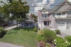


131 Figure 179: Examples of large-scale and raised new construction homes next to smaller original homes in Princeton-Midstreams (Google Streetview) Figure 180: Examples of large-scale and raised new construction homes next to smaller original homes in Princeton-Midstreams (Google Streetview) Page 130

132 Another issue that confronts property owners when elevating or reconstructing their homes is the conventional regulations regarding yards when the entrances to the homes are a story or more above grade, requiring additional stairs in mostly confined yard areas. Most zoning ordinances define a yard as a required open space on a lot between a lot line and building or structure, which is Figure 181: Typical riser and tread dimensions to cover a height of 8.33 ft unoccupied and unobstructed from grade to sky. There are a variety of stairway designs to transition from the finished grade of an elevated or reconstructed house to the entrance doors, which are often more than 10 feet above the ground. It would require about 17 steps to cover a rise of 10 feet based on the diagram in Figure 181, which would require about 14 feet of run. Straight run of steps to the front door would then frequently require front yard variance relief in an R-5 or R-7.5 zone. Breaking up the run of entry stairways to elevated homes with one or more landings provides for a more attractive transition, but also requires more space, which often forces stairways into required yards and generates applications for variance relief to the Zoning Board of Adjustment. Page 131


133 Figure 182: Examples of homes in Princeton-Midstreams with various types of entry stairways (Google Streetview) To facilitate such landings, the Township amended its zoning regulations in 245-Part 2: Article XXXVIIIA Supplemental Land Use and Zoning Regulations in Special Flood Hazard Areas. The purpose of which is to recognize limitations associated with federal and state construction and reconstruction requirements in special flood hazard areas, and encourage the restoration and reconstruction of existing neighborhoods within the Township of Brick in compliance with Chapter 196, special flood hazard areas, and the Uniform Construction Code Permitted Yard Encroachments permits: A. An access staircase and entry stoop, not to exceed 100 square feet in area, may project no further than 10 feet into a required front yard setback area. The previously referenced entry stoop may be covered or uncovered. B. An access staircase and entry stoop, not to exceed 50 square feet in area, may project no further than five feet into a required rear yard setback area. The previously referenced entry stoop may be covered or uncovered. C. An access staircase and entry stoop shall maintain a one-foot minimum side yard setback, provided that unobstructed access to the rear of the building is provided on a minimum of one side of the building. Page 132

134 D. Elevated platforms for mechanical devices serving a building shall maintain a one-foot minimum side yard setback, provided that unobstructed access to the rear of the building is provided on a minimum of one side of the building. E. The permitted yard encroachments noted in this section are applicable to all existing and proposed buildings on any parcel of land that is designated to be in a special flood hazard area. Additional consideration for dealing with transitioning to elevated entrances similar to the provisions made in the current ordinance for handicapped ramps could help to simplify the recovery process for property owners. The ordinance also provides requirements for Façade Treatments for Enclosed Spaces ( ), as follows: A. A building façade with an enclosed ground level must be treated to conceal the block face. B. Ground level areas that are below the base flood elevation, enclosed or exposed, are uninhabitable spaces. C. An exposed façade area shall be screened from public view. A minimum of 30% of an exposed façade area shall be screened with landscaping, siding, venire, faux window treatments, doors, etc., to visually break up the solid wall. These changes in the ordinance could work to help homeowners who are trying to raise their home. However, the Design Standards section of this Plan offers additional bulk standard recommendations for consideration by the Township as well as design guidelines. The waterfront, as expected, has seen the most redevelopment activity over the past few years. The houses are not only wider and taller, but many occupy double or triple lots in areas that are zoned for highdensity, such as the R-5 zone in Princeton. Figure 183: Existing R-5 Zoning around Point Avenue, Princeton (Brick Township Zoning Map) The reason for this particular trend is unknown, although as vacant properties appeared throughout the neighborhood, it may have allowed adjacent property owners to purchase the land. A wider lot would allow the owner to increase the size of the structure while maintaining adequate yards and would, therefore, require fewer variances. However, many of these lots and homes, as they currently exist, are more appropriate for medium- to low-density residential zones. Considering that overbuilding and overly dense neighborhoods can restrict access to the waterfront and also pose a health and safety hazard in areas of flood risk, encouraging larger, but less dense properties may be an advantage in certain parts of the neighborhood. Page 133

135 Figure 184, which overlays the Township Tax Map over a recent aerial photograph, provides one example from the Wardells Neck neighborhood on Point Avenue in Princeton. At least three of the properties in this subsection alone occupy double lots, although there are many others in other sections. Even many of the single lots are between 80 and 100 feet in width and well over 100 feet in depth. Despite being zoned for R-5, where the lot requirement is a minimum of 50 feet wide and 75 feet deep, the lots are more akin to the R-10 or R-15 zones. The map below shows some of the approximate lot widths, as well as three of the double lots (outlined in red) and one of the vacant 50 wide lots (outlined in green). Figure 184: Township Tax Map overlaid on Aerial map with double lots (red), vacant lots (green), and approximate lot widths (Google Maps) On the opposite spectrum, western Princeton, near N.J. Route 88 and Princeton Avenue, is the most dense and commercial area, as well as the most accessible in terms of public transportation and concentration of services of the neighborhood. However, this area still has R-15 zoning, which is mid- to low-density residential, whereas the housing stock is mostly mid- to high-density, and also includes a trailer park. The R-15 zone, as shown in Figure 185, is also located next to the B-2 General Commercial zone, which tends to be highly trafficked and dense. Part of the trailer park is also zoned within the B-2 zone. Page 134


136 Figure 185: Zoning overlay on aerial map with R-15 zone outlined in purple (Township Zoning Map & Google Maps) Figure 186 provides a side-by-side comparison of the example R-15 area with a more traditional R-15 zone in Princeton. The homes are generally much larger on wider and deeper lots and have other residential zones bordering them. Figure 186: Comparison of R-15 zone in west Princeton with traditional R-15 zone in central Princeton Another zoning issue is that there are a number of businesses throughout the neighborhood, including marinas, restaurants, auto services, and delis, but there is no commercial zoning in these areas. These commercial properties are most likely pre-existing and require variances for any alterations due to their non-conforming uses within the R-5, R-7.5, R-10, and R-15 residential zones. Page 135


137 Figure 187: Example of two commercial uses surrounding a single-family residence in the R-5 zone (Google Streetview) Figure 188: Township Zoning Map with red outlined areas showing businesses located in residential zones Page 136
138 RECOMMENDATIONS The initial assessment for the Neighborhood Plan involved site visits of the area with local representatives, gathering feedback from residents, and an analysis of the information from investigations, census data, and historic documents assembled by Township Planners and consultants. From this baseline information, the following ideas emerged: CONNECTIVITY AND MOBILITY As demonstrated in previous sections of this Plan, there is a major lack of public pedestrian infrastructure within and between the sub-neighborhoods of Princeton-Midstreams, as well as any connectivity to other neighborhoods in the region. Although there has clearly been some effort with private developers (i.e. Princeton Commons) and newer developments to implement sidewalks, they are few and far between and often found in subpar condition. The Township has recently demonstrated a commitment to apply for grant funding to improve circulation for increased bicycle access throughout Brick. A bicycle lane along both sides of Princeton Avenue between Route 88 and Beaver Dam Bridge has been completed and is a major step towards better connectivity. However, priority for bicycle safety and accessibility through complete streets infrastructure, circulation, and education has been slow to manifest and is still at a minimum throughout the neighborhood and the Township. Additionally, intra-neighborhood public transportation options are non-existent. Princeton-Midstreams does have the benefit of several County-wide public bus routes which run along major corridors to the west, such as Brick Boulevard and Route 88. These routes are adjacent to, but do not enter the expansive neighborhood. Therefore, they do not reasonably reach or provide transportation options for the majority of populations in isolated, but dense neighborhoods, such as Princeton-Midstreams. Mobility and connectivity are significant components of a sustainable recovery as property owners and the Township rebuild, from a safety/evacuation standpoint, an aesthetic/ property value standpoint, and an equity standpoint. Based upon the analysis of existing conditions the following could be further investigated: 1. The Township should continue to pursue grants for pedestrian and bicycle safety and mobility through all sources, particularly the New Jersey State Department of Transportation (NJDOT) and federal grants. 2. The Township should coordinate pedestrian and bicycle mobility enhancements with improvements made by the County of Ocean on County roads. Opportunities include: a. Enhancing berms along the road with street trees where space permits; Page 137
139 b. Extending or connecting existing sidewalks to serve all high traffic areas; c. Coordinating bicycle routes along streets that improve safety and connectivity for bicyclists; d. Adding additional crosswalks to facilitate pedestrian crossing, with priority for pedestrians, and particularly in areas not currently served by crosswalks or traffic lights, that have heavy seasonal traffic, and that have desirable amenities (i.e. public parks, marinas, beaches, restaurants, etc.). 3. Observe pedestrian and cyclist treatments in neighboring towns where mobility is a focus in order to get a better idea of the potential to implement such treatments in this neighborhood. Explore the potential for traffic calming methods to improve roadway safety and increase pedestrian and cyclist mobility options. As a largely residential and recreational neighborhood, it is important that the roadways serve these uses. A traffic and speed study should be conducted, with a focus on the three major arterial connector roads, Princeton Avenue, Midstreams Road, and Jordan Road, and access to public space. 4. Develop a comprehensive network of sidewalks and crosswalks throughout the neighborhood that connect and, especially, that allow safe and efficient pedestrian traffic along Princeton Avenue, Midstreams Road, and Jordan Road, and to major points of interest. Map 33 shows possible sidewalk connections in red that should be priority areas when new sidewalks are installed, with general indication to sides of the street, although a study should be conducted to determine proper location. In the process of making sidewalk and crosswalk recommendations, consideration was given to: the probable traffic level of vehicles and pedestrians; existing sidewalks and crosswalks for potential extensions; difficult intersections; creating the shortest distance between points and fewest road crossings; focusing growth in areas least compromised by the effects of climate change; and moving pedestrians to various points of interest, which are also indicated on the map. Figure 189 through Figure 195 show the neighborhoods in detail. Page 138
 sidewalks, and recommended crosswalks (black), and points of")
 and recommended (red) sidewalks, and recommended crosswalks")
140 NORTH Map 33: Princeton-Midstreams neighborhood map with existing (white) and recommended (red) sidewalks, and recommended crosswalks (black), and points of interest NORTH Figure 189: Detail of western Princeton sub-neighborhood with existing (white) and recommended (red) sidewalks, and recommended crosswalks (black) Page 139
 sidewalks, recommended crosswalks (black), existing paths (yellow), and")
 and recommended (red) sidewalks and recommended crosswalks")
141 NORTH Figure 190: Detail of central Princeton sub-neighborhood with existing (white) and recommended (red) sidewalks, recommended crosswalks (black), existing paths (yellow), and recommended paths (orange) NORTH Figure 191: Detail of central Princeton at Midstreams Road Bridge with existing (white) and recommended (red) sidewalks and recommended crosswalks (black) Page 140
 sidewalks, and recommended crosswalks (black)")
 sidewalks, recommended crosswalks (black) Page")
142 NORTH Figure 192: Detail of eastern Princeton with existing (white) and recommended (red) sidewalks, and recommended crosswalks (black) NORTH Figure 193: Detail of eastern Midstreams with existing (white) & recommended (red) sidewalks, recommended crosswalks (black) Page 141
 and recommended (red) sidewalks, recommended crosswalks (black), existing paths (yellow), and recommended paths (orange) 5.")

143 NORTH Figure 194: Detail of central Midstreams with existing (white) and recommended (red) sidewalks, recommended crosswalks (black), existing paths (yellow), and recommended paths (orange) NORTH Figure 195: Detail of northwest Midstreams with existing (white) and recommended (red) sidewalks, recommended crosswalks (black), existing paths (yellow), and recommended paths (orange) 5. Crosswalks should be placed at minimum at east to west crossings on Midstreams Road and Jordan Road, north to south crossings on Princeton Avenue and N.J. Route 88, and other major roads and connections between neighborhoods, parks, and destinations, and at least every halfmile (see Map 33 and Figure 189 through Figure 195 above). 6. Designate Bicycle Friendly routes within the Princeton-Midstreams neighborhood and continue to build a network of bicycle lanes, shared lanes, and paths between the neighborhoods and between major destinations from the rivers, Bay, parks, and commercial areas. New bicycle Page 142


 Figure 197: Examples")
144 facilities should enhance access for existing facilities and focus on safety along other highly trafficked and populated areas. The major neighborhood roads, such as Midstreams Road, Jordan Road, and Route 88, are wide enough to accommodate sidewalks and/or shared bicycle lanes. The secondary residential roads in Princeton-Midstreams have a slow enough speed limit that safe bicycle routes could be designated and posted without major infrastructure. Figure 196: Examples of major roads that could benefit from bicycle treatments (Google Streetview) Figure 197: Examples of primary and secondary roads that could benefit from bicycle treatments (Google Streetview) Page 143
145 Map 34: Princeton-Midstreams neighborhood with existing and recommended bicycle lanes or paths Page 144

 and recommended (shared) lanes or paths (purple) NORTH 1.")


146 We envision a much larger, comprehensive network of bicycle lanes and paths throughout the Township and County in the future that might develop to look similar to that which is pictured in Map 35 below. However, a further study must be conducted to determine precisely the needs and design of a bicycle network. These recommendations have been made based on mapping of existing bicycle lanes, most heavily trafficked roads, destinations, and Master Plan goals. Map 35: Bicycle Circulation Plan connecting four Brick neighborhoods with existing bicycle paths (blue) and recommended (shared) lanes or paths (purple) NORTH 1. At minimum, a Circulation Plan with a wayfinding system should be further developed and implemented for bicyclists and pedestrians and educational outreach targeted toward children to reduce the risk of accidents. 2. Explore the possibility of extending a bus line into Princeton-Midstreams along Princeton Avenue or Midstreams Road. In coordination with Ocean County Department of Transportation (Ocean Ride), a neighborhood bus stop with a proper bus shelter could be executed for commuters. According to the U.S. Census ACS data, 33.2% of 25 to 44 year-olds and 41.8% of 45 to 54 yearold workers in Brick Township use public transportation. This is an important demographic of the workforce to cater to due Figure 198: Example of a well-designed suburban bus shelter Page 145

147 to the size of the population, although younger populations should be encouraged to use public transportation and fewer individual automobiles in order to curb greenhouse gas emissions, which is a leading cause of climate change. 3. Sidewalk and curb treatments should be standardized with one pattern for the entire neighborhood, whether a Township standard or unique for the neighborhood, that can be modified to fit various applications. For example, slight variations could be used for smaller and broader crossing streets. 4. Conduct a study to determine the feasibility of raising the street levels in areas that are most prone to flooding and especially those that serve as coastal evacuation routes for subneighborhoods. It is not recommended that streets be raised where it is found to increase the negative impact of stormwater drainage upon the surrounding properties. High priority streets include: a. Princeton Princeton Avenue between lagoon and Point Figure 199: Coastal evacuation routes from subset of map Flood Hazard Vulnerability in the Township of Brick, prepared by TetraTech for Brick Township Hazard Mitigation Plan, 2016 Avenue; North Drive; South Drive; Bay Avenue; Point Avenue; 4 th Street; Parker Avenue between 4 th Street and 2 nd Street; Lenape Trail; North Cherokee Lane; Island Drive; and Island Court. b. Midstreams Leone Drive between Sanctuary Court and Midcen Road; Arnies Pointe; Cliff Road; Albert Road between Cliff Road and Manorside Drive; Manorside Drive; Rahway Drive; Midwood Drive; Harbor Road; Clematis Place; Robin Hood Road between Elgin Parkway and Albert Street; Harbor Place; Field Place; Carroll Fox Road; Bancroft Road; Ernestine Place; and Bella Vista Road between Jordan Road and Rainbow Drive. 5. Upgrade storm drains along streets to allow more efficient outflow of flood water without reverse flooding (water entering through storm drains), to allow emergency access/evacuation. a. Flooding was noted as a severe issue in eastern Princeton (Princeton Avenue, North Drive, and South Drive) according to residents, and that the neighborhood is often cut off from major roads and emergency services during flooding events. 6. Explore the possibility of connecting the street grid within the Princeton sub-neighborhoods, as shown in Figure 200, if the opportunity arises. Particularly, between the Laurelton Heights, Laurelhurst, and Princeton Commons sub-neighborhoods of Princeton to N.J. Route 88 and Page 146

148 Princeton Avenue. Alternatively, consider public right-of-ways for pedestrian paths between the streets. This will allow a higher density of development without adverse effect on traffic on the two thru-streets, and will increase accessibility to various parts of the neighborhood. NORTH Figure 200: Possible street connections (red lines) SIGNAGE IDENTIFICATION SIGNAGE With so many different sub-neighborhoods within each neighborhood with various typologies and a lack of adequate connections between Princeton and Midstreams, there does not appear to be any single identity for the neighborhood as a whole. It is simultaneously a neighborhood for residential and recreational use; it is a summer and a year-round destination; it has dense development, yet its streets are lined with trees and pocket parks; there are mansions and there are modest homes. The one defining characteristic of the neighborhood as a whole is its location on two peninsulas between three rivers and surrounded by wetlands and forest. Although there are many things the same or similar in both sub-neighborhoods, the distinction is also visible in both the development patterns and the geography, where they are separated by Beaver Dam Creek, but connected by a bridge. Despite the obvious characteristics of each, they can also blend together as one neighborhood. Yet, without the appropriate signage, Princeton-Midstreams does not have an identity that is recognizable as a brand and that makes people aware of their location. Page 147

149 Certain areas within the neighborhood, such as the parks, school, and some smaller neighborhood districts and associations, as identified earlier in this Plan, have their own signage. However, it is uncoordinated and missing opportunities to mark the importance of certain places and help guide visitors. The similarities of neighborhood form can be exploited to make the neighborhood appear more cohesive, if an effort is made to coordinate the overall branding and signage throughout. Individual signage for the separate sub-neighborhoods and districts within those sub-neighborhoods simultaneously helps identify their location, but also creates awareness about the connectivity of the neighborhood. This Neighborhood Plan recommends that there be some consistency in the identification message. A common design theme and graphics for signage should be chosen that also reflects the local character of the neighborhood. A blend of existing Township and neighborhood color schemes, along with the consistent use of a font type and a recognizable, uniform name shows relationships and hierarchy among places. The combination of the names of the sub-neighborhoods in this Plan area, Princeton and Midstreams into Princeton-Midstreams, could continue to be used to refer to the entirety of the neighborhood. This name identifies the neighborhood by two of its most recognizable areas, as well as the main artery streets, and is unique. Below is a graphic example of unified branding message for new identification and gateway signage, blending typical colors found in Brick Township and within Princeton-Midstreams, as well as an image and slogan that represents the neighborhood. It is also recommended that monument signage include a wooden base and an eave, similar to signs that already exist in the area. These signs should not be excessively large, but between 4-6 feet in height; should be wider than they are tall; should be freestanding on the ground; and should be oriented toward the opposite corner of the street on which they stand with a viewshed from the widest angle possible. Additional signage could be altered slightly for each sub-neighborhood, but might appear like the following: Page 148

150 Finally, informational signage could also be provided for the neighborhood, landmarks, natural conservation areas, and parks with various facts about local history, important dates, names, ecology, and contact information. WAYFINDING SIGNAGE Wayfinding signage can be utilized as a way to navigate to different sub-neighborhoods, businesses, parks, and other destinations, which currently proves to be challenging. Some of the navigational challenges without signage include successive dead-end streets; long, winding streets; lagoons and waterways without crossing; and overall enormous size of the neighborhood. A system of wayfinding signage for both pedestrians and vehicles should be coordinated with the gateway signage referenced above in order to reinforce the cohesiveness of the community, as well as to help residents, visitors, and customers find existing and future services, especially during the summer tourism season. Wayfinding signage could also be coordinated on Township-wide level. An example of such a system is shown below in Figure 201. Signage that clearly identifies destinations should be provided in visible and convenient areas throughout the neighborhood at a distance and orientation which is readable for both pedestrians and vehicles from the road, but which is not overwhelming in scale to the pedestrian environment. These would preferably be located at major intersections, crossroads, and destinations. Finally, a color or theme-coded system relating each to a subcategory of places allows for quick and easy dissemination of place descriptors and directions. The following points of interest should be linked by wayfinding signage (colors included as an example): Sub-Neighborhoods (Yellow) Parks, Trailheads, and Open Spaces (Green) Beaches, Marinas, and Water-Related Uses (Blue) Business Districts (Red) Page 149
.")

151 Government/Municipal and Public Services and Buildings (Brown) Other Brick Neighborhoods (Purple/Lilac) Figure 201: Wayfinding signage is used in downtown Toms River to direct motorists to primary destinations (left). The image to the right was taken in Nantucket, MA (June 2015) and shows a system of wayfinding using plaques purchased by businesses mounted into slots on a standard that matches the antique style of the pedestrian lighting on Main Street and points in the direction of the business. COMMERCIAL SIGNAGE It is recommended that the Township continue to enforce signage regulations in the commercial areas of the neighborhood. Sandwich board signs should be used sparingly and only for temporary purposes, such as a sale or special event. These should not interfere with traffic or pedestrian right-of-ways, as has been witnessed. The Township could encourage businesses to use signs that are scaled more for the pedestrian environment and that are attractive, with a similar theme among businesses, such as the wooden signs with eaves. It is also recommended that monument signs, or freestanding commercial signs, have some type of landscaping or planter around the base that can double as a rain garden. Page 150
.")

152 Figure 202: Examples of appropriate scale and design for neighborhood signs In order to better enforce design issues for signage, the Township could revisit or rewrite the Zoning Ordinance on Signs (Article XXXVI, Section ). DESIGN GUIDELINES Providing greater resiliency against flooding, storm damage, and demographic shifts in the future greatly depends on the development and design guidelines and planning practices that occur during the post- Sandy recovery process. In particular, the elevation of existing residential buildings as a result of recovery grant programs, as well as the elevation of new construction based on compliance with Flood Damage Prevention, will be significant factors. The following design guidelines are intended to integrate elevated buildings with existing non-elevated residences to soften the visual impact on the neighborhood. Additionally, there are numerous opportunities to introduce new landscaping and street treatments in certain areas that permit more pervious surfaces and stormwater management. ELEVATION OF BUILDINGS The raising of residential homes is usually accomplished by either the use pilings or by increasing the height of foundations and crawl spaces by adding courses of masonry block. To the extent that property owners determine to increase the elevation of the lowest habitable floor to the Design Base Flood Elevation in the Flood Damage Prevention Ordinance (usually the Advisory or Preliminary Base Flood Elevation plus freeboard), the height difference between the grade and the first floor can be considerable, causing a design challenge to access the elevated building. Many residents are choosing to upgrade and raise their homes, although there is somewhat of a consensus that new homes are too large for the neighborhood and that the height makes getting inside difficult for emergency purposes and for elderly or disabled persons. However, residents were not as accepting of having the designs of their homes regulated. Page 151


153 Depending on the size of the lot and the density of the building pattern in the neighborhood, the solutions to the challenge of providing access varies from a straight run of stairs to a progression of porches or landings (see Figure 203). Figure 203: Illustrations of various ways to design access to elevated first living floors of residential buildings, some which frame the piles and others that partially or completely "skirt" or wrap the piles for garage/storage space or use raised foundations. As stated in the 2015 Hazard Mitigation Plan Element: Identifying strategies to support additional home elevations is a key opportunity for improved safety and resilience. However new home elevations also come with additional potential risks that must be planned for and addressed. Ensuring that spaces below elevated homes are used only as storage or garages, and not livable space, is essential to protecting public safety. If illegally converted into bedrooms or living space, Page 152
154 these low areas become extremely dangerous during flood events. Newly elevated homes can also sometimes negatively impact the views and other aesthetic considerations for neighboring properties. Design and regulatory measures are currently in place and other controls are being explored that can help maximize the flood safety benefits of home elevations while finding creative solutions that reduce any negative impacts for neighboring properties. 13 Additionally, elevated buildings can pose a hindrance and hazard for disabled and elderly persons, as well as emergency services attempting to access persons in the house. For most physically impaired persons, the design guidelines and height requirements limit access almost entirely. Elevators from the ground floor to the first elevated floor, in addition to stairs, are ideal, although restrictive for many due to the high cost. Ramps are also ideal, but generally impractical for most houses that are being lifted to the maximum height, due to the space that they require, where most lots are quite small. However, for outdoor stairways it is recommended that they are not a straight run, but, rather, provide landings and, preferably, with turns in the stairway to allow for resting spots. The desirability of requiring such design standards as concealing exposed piles with framing or skirting, avoiding straight run stairs without a landing every so many steps will need to be balanced with the eligible costs of elevating homes covered under the various disaster relief programs so that they do not become a financial burden on property owners. If such aesthetic improvements are not covered by insurance or relief funding, the Township would need to seek other grant assistance to supplement the costs. LANDSCAPING Another approach to softening the visual impact of newly elevated buildings is to mask the exposed areas around the piles with landscaping. However, the present conditions caused by the elevation of housing and smaller setbacks will require that the installed landscaping not only be able to survive within the seashore environment, but may need to be compact and columnar in nature when used with narrow lot configurations. This may restrict the plant palette that can be used. It is also recommended that local plant species and xeriscaping techniques (landscaping that reduces or eliminates the need for supplemental water) be used to reduce water and fertilizer needs. Plant beds should be tolerant to the wind, sea salt, water, and overall variable conditions of the Barnegat Bay and estuaries, while also being able to aid in absorption of additional rain or flood waters. The following are some selections that may work well, but any planting directly in line of prevailing winds will struggle. 13 Hazard Mitigation Plan Element (Draft). Page 27. Township of Brick. Prepared by TetraTech & Maser Consulting, P.A. November, Page 153
155 Table 12: Plant Species for Brick Beach Neighborhood Plant Type Small Trees Large Shrubs Evergreens (for screening) Perennials (for decorative filler planting) Ornamental Grasses (for filler and accent) Species Red Maple (Acer Rubrum) Allegheny service-berry (Amelanchier laevis) Pawpaw (Asimina triloba) Black Cherry (Prunus serotina) American mountain ash (Sorbus americana) Indigo bush (Amorpha fruticosa) Coastal sweet pepperbush (Clethra alnifolia) Bigleaf Hydrangea (Hydrangea macrophylla) Northern bayberry (Morella pensylvanica) Beach Plum (Prunus maritima) Atlantic White Cedar (Chamaecyparis thyoides) American Holly (Ilex opaca) Eastern Red Cedar (Juniperus virginiana) Yarrow (Achillea) Coreopsis Daylily (Hemerocallis) Lavender (Lavandula) Foxglove (Digitalis) Summer Phlox (Phlox paniculata) Stonecrop (Sedum spurium) Fescue Grass (Festuca) Pannicum (Switch Grass) Pennisetum (Fountain Grass) PUBLIC SPACES & STREETSCAPE DESIGN The plant materials recommended above can also be used in plantings within public spaces such as road medians, tree lawns (the space between the curb and sidewalk or between the sidewalk and a parking lot or front property line), passive park spaces, and similar spaces that are identified as often being overgrown with weeds and unsightly in appearance. Bioswales are a good design option that can be used in public spaces, especially along streets to function similarly to a rain garden, which absorb water from heavy rains and flooding, while also removing pollution and silt from surface runoff water, providing a buffer from the street, and enhancing the streetscape visually. Bioswales are built with gently sloping sides that are concave toward an area of drainage and gravel and the slopes are vegetated with flood-tolerant plants. Page 154
 The use of the softer palette of plantings such as ornamental grasses and perennials, combined with the use")


156 Figure 204: Example of a streetside bioswale ( The use of the softer palette of plantings such as ornamental grasses and perennials, combined with the use of stone groundcover can help to enhance the coastal theme for these spaces in the subneighborhoods and could be relatively easily maintained by individual neighborhood associations or the Township. Private properties could also be encouraged to use similar groundcover, rather than traditional grass lawns. The images that follow are representations of various designs using these plant materials. Figure 205: Grasses and perennials used with gravel to provide color and definition to public spaces Page 155


157 Figure 206: Grasses & groundcovers used to soften roadside spaces and add visual interest to the public spaces such as medians Figure 207: Where space permits, perennials and ornamental grasses can be combined with conventional shade trees and shrubs to enhance commercial streetscapes Figure 208: Sidewalks are missing in many areas of the neighborhood, particularly where lawns or parking take the place of the public right-of-way, such as this commercial area on Princeton Ave., Princeton (Google Streetview) Page 156


158 Figure 209: Street tree with water retention below-grade Sections of Princeton Avenue and N.J. Route 88, particularly in the commercial areas such as that shown above, have no sidewalks due to the reliance on the public right-of-way for parking lots or private lawns. As development permits, these areas should be priorities for new sidewalks and other streetscape treatments that serve a threefold purpose: to provide a buffer that will increase safety for pedestrians; to improve the appearance of businesses and the Figure 210: Example of a themed neighborhood as a whole; and to absorb sidewalk planter stormwater runoff. In these business areas, the use of a "signature" planter, such as that illustrated to the right, would enable the planting of annuals and perennials within customized planters that would be sponsored by the individual businesses. Street trees, in addition to planters, add some character to the streetscape, help to absorb some rainfall, and provide an added benefit of shade to reduce urban heat island effect. GENERAL APPEARANCE FROM STREET Within the residential blocks, every effort should be made to provide designs for the newly elevated homes that will work within the context of the existing lot lines and setbacks to enhance the overall character of the neighborhood. A number of visual ideas are provided below to act as representative examples of what can be done. There have been some examples constructed within the neighborhood as part of the Sandy recovery which embody these ideas. Page 157

159 Figure 211: Upper set of illustrations shows potential streetscape treatment of narrow and deep lots using trees with vase shaped or columnar habit, while lower pair shows wider lots with street trees of spreading habit in larger spaces and narrower habit in more confined spaces between houses. Homes are shown as representative for the size of lots as elevated for flood resiliency. Residents worry that properties on small lots will look overcrowded and unappealing. Simultaneously, many small homes on small lots are directly adjacent to new homes nearly three times their size. The Township should look at various models that work well in other municipalities and provide guidelines that are appropriate for each neighborhood. Allowing for some variations in the designs for proper entrances and yard space, but maintaining some setbacks and some of the current bulk standards should prevent overcrowding while providing the necessary space to adapt to new regulations. ABANDONED BUILDINGS AND EMPTY LOTS Following Superstorm Sandy, many property owners who endured major damage to their homes and/or could not afford the pursuant repairs and insurance were forced to leave their properties behind or have been unable to make improvements. Several years later, there are some properties with homes that remain abandoned, have not been demolished and continue to deteriorate, or that sit empty and have not been rebuilt. These properties rest in a state of limbo because the property owners will not or cannot take responsibility and the Township has not established the necessary conduits for acquiring or selling such properties nor holding the owners accountable. Page 158
 Figure 213: Examples of vacant")


160 Figure 212: Examples of abandoned and/or unmaintained buildings throughout Princeton-Midstreams (Google Streetview) Figure 213: Examples of vacant lots throughout Princeton-Midstreams (Google Streetview) Below are some recommendations for properties and buildings that have remained abandoned or in disrepair for a long period of time, in response to concerns raised by residents. 1. Many homes sit abandoned, such as the properties shown in Figure 212, while some lots are entirely vacant, such as those in Figure 213. The Township needs to be more aggressive in taking action and holding property owners accountable. 2. The Township should look into the possibility of acquiring properties when they cannot hold property owners accountable or when property owners are unable to rebuild. Certain properties, particularly clusters of repetitive losses, should be strategically held for water retention areas, doubling as public open space, while others that are less strategic could be resold. 3. The Township could consider downzoning strategic properties where multiple vacancies exist and encourage development of double lots to decrease density and provide more Figure 215: Six out of twelve lots vacant on South Drive subsection (Google Maps) Figure 214: Vacant, but landscaped lot in Metedeconk subneighborhood (Google Streetview) Page 159

161 permeable coverage in flood-prone areas, while recovering some of the tax base. 4. The Township should encourage landscaping and public use for any strategic lots that cannot be built upon or improved by the property owner for any reason and that cannot reasonably be sold or acquired by the Township or County. Figure 214 provides an example. ZONING RECOMMENDATIONS Upon consideration of the existing zoning throughout the neighborhood, along with the physical challenges currently faced by the community and future predictions of storms and sea level rise, the following recommendations have been made to maintain and improve the built quality of the neighborhood: BULK RECOMMENDATIONS After reviewing the bulk standards, this Neighborhood Plan recommends the following be considered by the Township for the Princeton-Midstreams Neighborhood Plan Area: FLEXIBLE SIDE YARD SETBACKS Lot widths vary greatly within Princeton-Midstreams, with the smallest lots in the Wardell s Neck subneighborhood of Princeton, which is the oldest and most dense neighborhood in the R-5 zone. Some lots are less than 40 feet wide. Presently, the code requires one yard to be 5 feet wide and with the combined yards not less than 12 feet in the R-5 zone. In the R-7.5 zone, one side yard is required to be at least 6 feet and have combined side yards of at least 15 feet. A lot that is 40 feet in width would be restricted to a home that is only 28 feet wide in the R-5 zone and 25 feet wide in the R-7.5 zone, which is not practical or desired in today s residential designs. Two short-term options are presented for the Township s consideration. The first is reducing the side yard setbacks for lots with a width less than 40 feet. A sliding scale could be provided to offer homeowners looking to rebuild with variance-free options. Lots between 31 and 39.9 feet (in Figure 216: Illustration of Zero-Lot Line Homes Page 160
162 width) could be permitted side yard setbacks of 4 feet each, for a total of 8 feet. Lots between 20 and 30.9 feet, if any, could be permitted a side yard setback of 0 and 3 feet, for a total of 3 feet. The second option for the Township s consideration is a development concept called zero-lot line. A zero-lot line home essentially places the home on one side yard line, allowing for a generous side yard on the other side that functions as the home s outdoor space in conjunction with the rear yard. On lots narrower than 40 feet, the zero-lot line concept provides one useable side yard instead of two unutilized side yards. As shown in Figure 216, the homes are located along one property line. This alternative would provide more flexibility to owners of undersized lots (less than 40 feet wide) and produce usable side yards instead of useless slivers. For both zones, the potential amendments to the side yard parameters could include: Table 13: Amendments to Side Yard Setbacks Lot Width (ft) One Side Yard (ft) Combined Side Yards (Both) (ft) feet 0 and feet 0 and feet 0 and feet 0 and Lots that are 60 feet and greater in width could maintain the existing side yard setback requirements with two yards, so that larger homes do not overpower adjacent smaller lots. FLEXIBLE PRINCIPAL BUILDING COVERAGE There are some lots within the neighborhood, particularly in Princeton, which, when applying the 35% maximum principal building coverage to the lot, significantly restricts the footprint of the home. Existing on-the-ground conditions reveal that undersized lots contain homes that cover much more than 35% of the lot area. It is recommended that the Township consider allowing lots under a certain size (perhaps lots less than 3,000 square feet) to have a larger maximum principal building coverage, for example, 50% or 55%. This would allow a lot that is 30 feet by 50 feet to construct a home that has a first floor with 750 or 825 square feet. On the other hand, many homes that occupy larger lots or double lots are oversized and sometimes have a principal building coverage greater than 35% or even greater than 50%. This kind of overbuilding on lots that already meet the zoning requirements should be restricted to prevent unwanted growth and reduce impervious surfaces. In addition to some of the strides that have already been taken to assist homeowners who are rebuilding, the Township has identified the need to update and amend its Land Use and Development Regulations to Page 161
163 address many of these issues and is currently developing recommendations for zoning amendments as one of its Phase II Post Sandy Recovery Planning projects. ZONING MAP CHANGES It is recommended that the Township investigate the potential for changes to existing zoning areas, as shown on the current Zoning Map (see Map 36 below) in comparison with the recommended changes on Map 37 and described below. While the R-5 zone involves more undersized lots, consideration of whether a substantial number of them are undeveloped could lead to a possible downzoning to R-7.5 or R-10 bulk standards or greater to prevent overbuilding and to allow larger yards that will help to reduce impervious surfaces and create greater area for water retention. Lots will be slightly larger (7,500 square feet rather than 5,000 square feet) and reduce the number of properties impacted by flooding. Many of the properties already occupy more than one lot. This approach might trigger applications for lot area variances, but we think its exploration has merit. This might be applicable in the Princeton lagoon neighborhoods. Upzoning of certain blocks that are less flood-prone and offer more amenities will help to offset the downzoning of other blocks. The upzoning of the area around Midstreams Elementary School from R-7.5 to R-5 will maintain the overall neighborhood character, while allowing for marginally more dense development in an area that has public amenities and a walkable street grid, in addition to being more elevated. This will also allow more families with children to live in the vicinity where it is safer and easier for schoolchildren to walk or bike to school or nearby recreational facilities. Similarly, the upzoning of some of the blocks around VFW Park and the church might encourage more families to relocate there, which, in turn, will increase utilization of these amenities. Additionally, this area is located on a street grid near commercial destinations on N.J. Route 88. The R-15 zone on Princeton Avenue closest to N.J. Route 88 should be considered for upzoning to an R- 7.5 or R-5 zone. The neighborhood is already much more dense than in other R-15 zones, as previously demonstrated. The zoning change would be more appropriate to fit existing development, as well as to encourage a more walkable, higher-density, and mixed-use neighborhood in the Princeton-Route 88 corridor. Similarly, the existing trailer park lot in the R-15 zone does not quite fit and should be considered for R-M multi-family zoning. The adjacent private school also does not comply with the permitted uses in the R-15 zone and should be considered for a commercial zone. Together, the lot with the trailer park and the school would be large enough to have Mixed-Use overlay zoning that could contribute several different uses to a high-density area with limited available land. There are a number of additional parcels along Princeton Avenue that are located within various residential zones, but are commercial in use. Therefore, the Township may consider zoning these as Neighborhood Commercial (B-1), or another commercial zone in order to comply with the permitted uses and reduce the number of variances required for pre-existing properties. The Township may want to Page 162
164 encourage more neighborhood businesses in these identified areas to provide more compact, walkable/bikeable, and mixed-use communities without changing the existing neighborhood character. Some of these lots include marinas, which might then be able to include shops and restaurants, especially those that are in proximity public parks. Finally, areas around catch basins, rural parks, conservation areas, and wetlands, such as along Beaver Dam Creek South Branch, should be considered for downzoning to the Rural Residential (R-R-1) Zone in order to limit building, allow for more absorption of flood water in the basin without affecting private properties, and to provide additional public open space with access to the water. Page 163
165 Page 164 Map 36: Existing Princeton-Midstreams Zoning Map
166 Map 37: Princeton-Midstreams Zoning Map with Recommended Changes Page 165
167 FUTURE NEIGHBORHOOD GROWTH Consistent with the recommended zoning map changes, bulk recommendations, and predicted impacts of flooding, all future neighborhood growth should be concentrated accordingly. The R-5, R-7.5, and R-10 zones will continue to have the densest residential properties; however, growth should be emphasized in areas of higher elevation away from the coastline in the northwest of Princeton- Midstreams. Higher density growth should be encouraged particularly in areas with a primary traffic corridor with a street grid, areas around parks, and areas surrounding commercial zones. This density should promote better accessibility to services and recreation, while removing the largest populations away from areas that may sustain the most environmental damage. Similarly, lower density development and conservation areas that can better absorb floodwater should be encouraged along the Metedeconk River and Beaver Dam Creek coastal areas. Commercial properties that are not marine-related should be emphasized in the higher density inland areas to better serve the larger population. Currently, businesses occupying residentially zoned lots in Princeton generally do not comply with the permitted uses of that zone. Additional neighborhood commercial businesses that fall within the permitted uses should be encouraged in the commercial zones to make the community more inclusive and mixed-use. PUBLIC PARKS, OPEN SPACE, AND CONSERVATION LANDS All parks, open spaces, and conservation lands within the neighborhood should be considered for their multitude of roles to manage stormwater or provide wetlands, to provide public amenities and recreation opportunities, to improve aesthetics, and to increase property values. In order to prevent further development in sensitive or critical conservation areas, the Township of Brick should consider registering all available lands to the ROSI/Green Acres program with the NJDEP. To the extent possible, pervious surfaces and vegetation or plant beds should be used to allow for the absorption of stormwater or flooding, particularly in areas prone to flooding, such as eastern Princeton and Midstreams. Some parts of the neighborhood were built on former wetlands along Beaver Dam Creek and the Metedeconk River. Without adequate land, building, and road elevation, the neighborhood is extremely at risk. Asphalt and concrete should be avoided where pervious pavers, gravel, or natural vegetation could be used. In addition to reconfiguring Township-owned properties and parks to serve this function, the Township should work with the neighborhood associations to act on opportunities to provide new open public spaces or areas for stormwater management within the neighborhood. If properties are deeded to the Township or if abandoned lots can be acquired, such lots could be restored to a more natural state that also offers active or passive recreation facilities for public use. Waterfront properties should include Page 166
168 replenished wetlands. The Township could partner with the NJDEP or groups such as the Nature Conservancy, to develop wetlands replenishment programs. Such facilities should permit and encourage public use, while being sensitive to the maintenance of the wetlands. Where open space is not practical, other public services could be placed. On a similar note, it is recommended that the Township develop a comprehensive connectivity plan for sidewalks, crosswalks, and bicycle lanes in the neighborhood that strategizes how to best move people to various destinations around the neighborhood, including public parks and opens spaces. A connectivity plan should be able to serve the neighborhood at its peak population and use during the summer. This type of planning can be accomplished through a grant-funded Municipal Public Access Plan by the New Jersey Department of Environmental Protection. EXISTING PARKS AND OPEN SPACE Existing parks, open spaces, and conservation lands/wetlands with pervious or natural cover are a great way to absorb the impact of flooding events, as well as providing recreational opportunities for the public. These areas already function as a buffer between the water and residential developments, acting as natural absorption because of the wetlands. Although existing waterfront parks in the neighborhood are very limited, there are a few key areas that could be improved to serve this function, including Windward Beach Park, Midstreams Park, Cayuga Lane Conservation Area, Princeton Avenue Conservation Area, Lagoon Island Conservation Area, and North Branch Beaver Dam Creek Conservation Area. These coastal areas, although not in the most heavily impacted areas, will help to reduce the impact on the rest of the neighborhood. When funding becomes available, existing parks should be retrofitted to control and retain stormwater and filter any runoff. Consideration should be given to the transfer of water from other overwhelmed areas into the parks and upland areas through pipes or natural streams. Using surrounding wetlands could help to redistribute stormwater more equally and prevent flooding in certain developed areas, while also retaining water for later use for the parks. In addition to stormwater management, the existing parks can provide an opportunity for better connectivity throughout the neighborhood for pedestrians, cyclists, and recreational non-motorized watercraft. In particular, designated bicycle paths or lanes should pass by or through the parks. A pedestrian trail could link Midstreams Park to Princeton Avenue and N.J. Route 88 through the adjacent forest and wetlands. This connection will greatly improve access for the adjacent communities. Where necessary, the Township may be able to work out an agreement with private owners of street-ends and adjacent properties to allow a public pedestrian/bicycle right-of-way into public/conservation lands. Signs should also be included to identify the public access and whether parking is available. Page 167


169 V.F.W. PARK V.F.W. Park, located in South Hampton Crossing, Midstreams, currently sits in a state of disrepair and unutilized. Given its prime location in a dense and connected neighborhood within the vicinity of commercial businesses and conservation areas, the Township should make an effort to improve this park. Up-zoning the surrounding area may increase the utilization of the park as the neighborhood develops slightly more densely. If the Township determines that it is not feasible or impractical to maintain or improve due to funding or nearby parks, the lot should be considered for a multifamily or mixed-use zoning to strengthen the diversity and vibrancy of the neighborhood that can reciprocally serve the adjacent commercial district on Route 88. The park amenities should not compete with, but complement other neighborhood parks. A playground, tennis/racquetball courts, a community garden, and temporary farmers markets and events, or a community center might be options for V.F.W. Park. An informal village green type redevelopment, with a central commons, or park, that includes stormwater storage and surrounding quasi-public and mixed-use or commercial uses might be appropriate. However, if Figure 217: Top: Village Green. Wandering n Wondering. Center: Wendell Cox. Prairie Crossing's Village Green-Turned-Winter- White., Bottom: Village Green Community Center and Kingston Regional Library. more density or public uses are found to be practical, an additional road connection and a traffic study should be conducted. Included are some conceptual images. RECOMMENDED PARKS AND OPEN SPACE There are a few Township- or County-owned parcels of land in Princeton-Midstreams that currently do not have any designated use, conservation status, or improvements, but provide optimal opportunity for both additional public open space and for water retention. The large forested and wetlands area to the north of the neighborhood between Princeton and Midstreams and adjacent to the conservation area may also offer space for more active or passive recreation, if sensitive to the surrounding wetlands and coordinated with various County, State, and Federal agencies. A Municipal Public Access Plan for the Page 168


170 Township could help to further determine the needs and possibilities available to the community for expanded public access, particularly to the water. Some potentially feasible opportunities include: One example is in the eastern-most section of Princeton on South Drive in the lagoon sub-neighborhood known as Metedeconk. There is a large traffic triangle in the center of the road that is owned by the Township of Brick. This property is 0.15 acres, or 6,534 square feet, of land that is curbed and has a gravel groundcover and planted with coastal grasses and a variety of shade trees and shrubs. The traffic in this area is very minimal as it is the end of the peninsula in a single-family residential community. Therefore, this triangle space could be used as a passive park with a path, benches, and other simple improvements. The permeable and durable landscaping already allows for some degree of flooding and absorption, but bioswales and water retention tanks, if practical, could also be installed to further divert floodwater. This was the hardest hit area of Princeton-Midstreams, so this open space is a prime opportunity to implement any techniques for the diversion or retention of water to prevent future devastation. Figure 218: Unnamed triangle, center of South Drive, Metedeconk, Princeton (Google Streetview) Figure 219: Township Tax Map with Block 946, Lot 1, Metedeconk sub-neighborhood, Princeton (outlined in red) Another example of a potential open/public space improvement area is the circle on The Esplanade in the Midstreams Park sub-neighborhood of Midstreams. The neighborhood is relatively quiet with single-family residential homes. Although there are nearby parks and trails in the neighborhood, such as Midstreams Elementary School and Midstreams Park, the circle may function for a very different purpose more specific to that surrounding neighborhood. There is already evidence that the streetscape nearby is used for recreation, such as basketball hoops oriented to the Figure 220: Circle on the Esplanade, Midstreams Park (Google Streetview) street, and, therefore, a more defined recreational space may be needed. This should be studied further to determine the types of recreation that is missing or needed within the immediate area. A simple path, Page 169


171 benches, garden, or bocce court or half-basketball court, for instance, might improve the space and create added value for the neighborhood, while raingardens can help capture stormwater. Figure 221: Potential open space on The Esplanade, Midstreams Park (Google Maps) Figure 222: Tax Map of the circle on The Esplanade, Midstreams Park TRAILS As a way to improve the connectivity of the neighborhood, as well as provide additional recreational opportunities, the Township could explore the creation and maintenance of a trail system between Princeton and Midstreams that runs through the central open space. A conceptual trail map with associated streetview images of potential trailheads is provided below. Map 38: Conceptual open space trail map along Beaver Dam Creek South Branch (Google Streetview images) Page 170

172 STREET-ENDS, BULKHEADS, AND RIGHT-OF-WAYS Bulkheads, like jetties and other manmade barriers, can often exacerbate erosion and push floodwater elsewhere rather than absorb the water. Living shorelines, on the other hand, which include natural wetlands, are a better long-term alternative to impermeable barriers that allows the land and water to coexist while averting major damage during flooding events. Living shorelines use gentle slopes with sediment, sand, and small rocks, anchored by native coastal vegetation. The Township could experiment by removing bulkheads that are not directly protecting improved properties in strategic locations and replacing them with a natural living shoreline with native vegetation. This should be attempted where it does not interfere with neighboring properties, boat traffic, or boat launching. Small lots, street-ends, and land adjacent to bulkheads that are insufficient to build upon and, especially those already owned by the Township, provide an exceptional opportunity to add living shorelines and/or passive public recreational space. The examples below show various parcels throughout Princeton-Midstreams that are owned by Brick Township or where private owners could permit the Township to acquire and maintain for flood prevention. Some of these areas could be planted with marsh grasses or landscaped with benches for sitting or fishing, if there is adequate space. Figure 223: Example of Living Shoreline (Courtesy: Virginia Institute of Marine Science, College of William & Mary, 2016) Right-of-way areas along the sides of streets abutting wetlands, lagoons, or rivers, should also be preserved for public use and enjoyment, as well as protection against flooding in the roads. Raised sidewalks, bike paths, or other types of trails with permeable materials along the road will allow or maintain vistas, public access to recreation, and buffers between the wetlands and the existing road. VISUAL INVENTORY OF STREET-ENDS IN PRINCETON-MIDSTREAMS Street-ends can also provide a passive form of public access to the water, while also preserving a small amount of absorbent land if appropriate plant materials are used. Below are some of the street-ends near waterbodies that should be preserved and/or improved to absorb or deter stormwater. Page 171

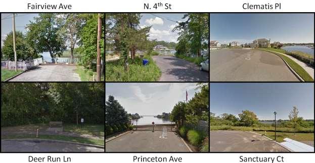
173 Page 172

174 ECOSYSTEM RESTORATION Over the years, most of the natural ecosystem of the neighborhood has been replaced by dense development, including wetlands cleared for boat traffic. Restoring these ecosystems, particularly wetlands, has become increasingly important as habitat loss increases from development, diversity of species is reduced, and storms and sea level rise threaten to flood neighborhoods. The provision of new open spaces and conservation lands can help reduce the cost of flooded properties, while also improving water quality, providing nursery grounds, and enhancing quality of life. The inclusion of residents can foster a sense of environmental and community stewardship to advance this mission. Based on a review of the early historic aerial photographs of the neighborhood, the wetlands and marshes surrounding the neighborhood were much more extensive than they are today. Correspondingly, the areas which lost the most wetlands since 1931 seem to have experienced the greatest storm surge and some of the most damage during Superstorm Sandy. Where there are existing wetlands, in most cases the storms surge inundated a majority of the wetlands without extending much farther inland. This is a testament to the importance of the ability of wetlands to absorb water. The map below shows this point by overlaying the wetlands line from 1931 with the Sandy Storm Surge Map. Page 173

175 Map 39: Map with Approximate 1931 Wetlands Line Overlaid on Sandy Storm Surge and Wetlands Map *Dark green line = 1931 line; purple = Sandy storm surge; light green = existing wetlands; turquoise = existing wetlands inundated by storm surge; black line = neighborhood boundary Page 174

176 For this reason, it is recommended that the Township explore opportunities to enhance, restore, or, in most cases, recreate wetlands in areas where they have previously existed in order to combat the level of storm surge that was experienced during Superstorm Sandy. The National Resource Conservation Service, through the United State Department of Agriculture, has some informational resources and practice standards for restoring and creating degraded wetlands. The existing barrier islands that form the lagoons in Beaver Dam Creek present a good opportunity for enhancing or restoring wetlands because they offer a somewhat stable environment for new marshes to begin growing and are also critical for preventing even more extensive damage in the rear neighborhoods. The lagoons should be maintained as much as possible, while extending the size of the wetlands further into the river. This process may not be practical along much of the southerly side of Princeton in the Metedeconk due to higher erosion rates, heavy boat traffic, and dense development along the waterfront. Map 40: Suggested areas for extended, restored, or enhanced wetlands (outlined in red) FUTURE STORM AND DISASTER PREPAREDNESS After speaking with several representatives and residents and from public feedback, there was a theme of there being a lack of proper communication channels throughout all stages of Superstorm Sandy s destruction before, during, and in the wake of the storm. In addition to a well-designed built Page 175
177 environment that can mitigate the effects of storms and provide physical connections for people, powered and effective communication services are critical to disaster preparedness and relief. Many times, a lack of or poor communication can lead to even more serious and costly consequences than the storm itself. In addition to measures found in the Hazard Mitigation Plan Element, we recommend that the Township continue to take measures to inform all residents of potential storms and disasters that may affect them, as well to inform them of what steps to take beforehand, and what to do during emergencies. This will require some, if not all, of the following steps: 1. Maintain a database of resident and property owner contact information for reverse emergency warnings. Provide a means for all, including visitors to the extent possible, to give their contact information voluntarily in order to stay informed. 2. Coordinate with all neighborhood and condominium associations, as well as fire, police, and ambulatory services, to establish and inform residents of the best safety practices, evacuation routes, and emergency care and lodging centers. 3. Obtain funding for backup generators and improvements for all communication outlets in case of disaster to prevent power failures. 4. Ensure that neighborhoods are not cut off and that there are central emergency locations that are well-stocked with supplies for all residents, preferably within less than a half-mile. The Township should also find ways in which to coordinate efforts with adjacent communities, including Point Pleasant Borough, in order to provide essential services and aid to those in need during disasters. Preparedness Plans and strategies for protecting properties and utilities could also be shared among municipalities. Page 176
178 SUSTAINABLE RECOVERY: LEADERSHIP IN ENERGY & ENVIRONMENTAL DESIGN Leadership in Energy and Environmental Design ( LEED ) is a recognized green building certification rating system. LEED provides third-party verification that a new or renovated building was designed and built using strategies and materials to lower a building s carbon footprint. LEED was developed by the U.S. Green Building Council and is a voluntary rating system that encourages buildings to do better, but does not add significant cost. 14 LEED has five rating systems for multiple project types that want to achieve LEED certification. The rating systems are: Building Design and Construction Interior Design and Construction Buildings Operations and Maintenance Neighborhood Development Homes Within each rating systems there are eight main credit categories: Location and transportation Sustainable sites Water efficiency Energy and atmosphere Materials and resources Indoor environmental quality Innovation Regional priority LEED provides building owners and operators with a framework for identifying and implementing practical and measurable green building design, construction, operations and maintenance solutions.15 Furthermore, LEED has been constantly improving its manuals and guidelines to keep up with technology and trends. Presently, there are four levels of LEED certification certified, silver, gold and platinum. This Neighborhood Plan focuses on two of the rating systems that could apply LEED for Homes (LEED- Homes) and LEED for Neighborhood Development (LEED-ND). LEED FOR HOMES LEED for Homes is the certification program for single-family home design and construction. LEEDdesigned homes provide clean indoor air and use less energy and water, which translates to lower utility bills. Homeowners looking to rehabilitate or redevelop their damaged home can use the LEED for Homes Page 177

179 credit system to make smart choices when it comes to water efficiency, energy usage, material selection, air quality and even rainwater management. LEED for Homes is an excellent resource for homeowners, even if they are not seeking LEED Certification. PRINCETON-MIDSTREAMS Credits that are worth noting, and that which could be utilized by the residents of the Princeton-Midstreams Neighborhood during rehabilitation and new home construction include: Rainwater management o Certain sections flood after a hard rain storm, let alone a hurricane. Reducing rainwater runoff is imperative. o LEED for Homes recommends the following actions to manage rainwater: - Planting areas with native or adapted plant material (e.g. trees shrubs) - Installing a vegetated roof - Using permeable paving - Installing permanent infiltration or collection features (e.g., vegetated swale, rain garden, rainwater cistern or rain barrels to capture roof runoff) Low-emitting materials o The intent of this LEED credit is to reduce concentrations of chemical contaminants that can impact air quality. o The requirement includes the use of low volatile organic compound ( VOC ) paints, floor materials and insulation. Quality views o Part of the appeal of the Princeton-Midstreams Neighborhood is that it is surrounded by riverfront views of Beaver Dam Creek North Branch, South Branch, the Metedeconk River, and Bay Head Harbor. However, private waterfront development means that most of these views are restricted for landowners. The purpose of this LEED credit is to give building occupants a connection to the natural outdoor environment providing quality views. o The requirement is to achieve a direct line of sight to the outdoors with glazing (e.g. windows and doors) for 75% of the regularly occupied floor area of the home. Page 178
180 Green power and carbon offsets o LEED for Homes encourages homeowner to reduce their greenhouse gas emissions through the use of grid-source, renewable energy technologies. o In order to qualify for the credits, a homeowner must engage in a contract for a minimum of five years, which provides between 50% and 100% of the home s energy from green power or renewable energy certificates. Renewable energy production o In order to offset the rising costs of homeownership, this LEED credit relies on the sun to power homes. Princeton-Midstreams is ideally situated for both solar and wind systems, as the nature of the sea air and high wind levels limits large vegetation in what is largely a grassland (salt marsh/wetlands) ecosystem. Streets in the Princeton sub-neighborhood are generally oriented so that they run east and west or long portions of the blocks face south. However, Midstreams is generally not aligned with the ideal orientation and is more heavily forested. Optimal solar orientation for temperate climate zones is 17.5 degrees east of due south. 16 LEED-ND Credit 10 under Green Infrastructure and Building (GIB C-10) provides for credit when the long side of the street block is 15 degrees or less east or west of due south, or if the long axis of 75% or more of the buildings is 15 degrees or less east or west of due south. The Princeton street grids would provide opportunities for optimizing passive solar exposure on new or rehabilitated homes. o o Areas with annual average wind speeds around 6.5 meters per second and greater at an 80-m height are generally considered to have a wind resource suitable for wind development. The Wind Speed Map indicates that the neighborhood is around 6.5 meters per second. This credit is offered to homeowners if they meet the parameters for solar energy. Indoor water use reduction o o The intent of this LEED credit is to reduce indoor water consumption. Homeowners can receive up to six points for this line item depending on how much they reduce their water usage. Daylight o o Daylighting is important in connecting building occupants to the outdoors, reinforcing circadian rhythms and reducing the use of electrical lighting. The requirement is to achieve at least 55% daylighting for the regularly occupied floor area of the home. Outdoor water use reduction o The intent of this LEED credit is to reduce outdoor water consumption. 16 Design With Climate, by Victor Olgyay, Princeton University Press, 1973, page 61. Page 179

181 o Homeowners receive credit if they reduce exterior irrigation between 50% and 100% by installing plants that require no irrigation (e.g. native species) or an efficient irrigation system with a water sense feature. LEED FOR NEIGHBORHOOD DEVELOPMENT LEED for Neighborhood Development or LEED-ND is a certification system for a neighborhood-scale project, such as the entire Brick Beach area. LEED-ND incorporates the principles of smart growth, urbanism and green building into a system for neighborhood design, which can be applied to entire neighborhoods, portions of neighborhoods or multiple neighborhoods. There are five credit categories for LEED-ND: 1. Smart location and linkage 2. Neighborhood pattern and design 3. Green infrastructure and buildings 4. Innovation and design process 5. Regional priority credit Figure 224: LEED-ND Checklist Chart Within the five categories there are a total of 12 prerequisites that are required to gain certification. Princeton-Midstreams can potentially meet some of these requirements, but may need to improve in Page 180
182 several areas, such as smart location and linkage, mixed-use neighborhoods, access to public services, transportation, and renewable energy production. The neighborhood already has some conservation areas, bicycle facilities, and compact development, among other items. Although the neighborhood is predominantly residential in land use, there is a unique variety of densities and street grid typologies, as well as a number of commercial areas along N.J. Route 88 and Princeton Avenue. The existing areas with neighborhood businesses and marinas could be expanded upon. Public transit does not currently service the interior of Princeton-Midstreams, but there are several Ocean County buses that stop along Route 88 and Brick Boulevard immediately to the west. However, Princeton-Midstreams is so expansive that getting to a bus stop from the opposite end could take nearly 20 to 25 minutes biking and over an hour walking. The Township could explore extending bus service from Route 88 to interior sections of Princeton-Midstreams, such as parks, beaches, restaurants, and schools. Like some of the other densely populated waterfront neighborhoods, there is ample potential for water-based/ferry transportation to provide public access along the Metedeconk River to commercial areas, or across the Bay connecting to the Brick Beaches. The Township should first focus on ways to make the neighborhood more compact, connected, and complete. Bicycle facilities, via a bike lane, is already provided along Princeton Avenue, but could continue to be expanded in identified heavy traffic areas and to connect public services. These sustainability principles can also be combined with efforts to make the neighborhood more resilient to storm and flood events in the future by elevating buildings and selected streets, as well as investigating longer term solutions to flood mitigation through the use of stormwater management practices. Using the adjacent salt marshes as a potential for managed wetlands for stormwater management is consistent with LEED-ND. In addition to the overall consistency with LEED-ND, homeowners can also advance the principles of LEED-ND by: Improving home energy performance by 5% for new homes or 3% for major building renovations. Reduce indoor water usage by 20% with water efficient toilets, faucets and showerheads. Reduce outdoor water use through the installation of native plants or smart irrigation systems. Reduce rainwater runoff. Design and orient new homes for maximum solar orientation. Utilize solar power, such as solar panels. For more information on LEED-ND, go to SEA LEVEL RISE AND THE FUTURE OF INFRASTRUCTURE SEA LEVEL RISE Page 181

183 This Neighborhood Plan for Princeton-Midstreams has been developed to deal with the immediate recovery needs of the neighborhood, as well as to anticipate measures for improving the resiliency of existing and future development to future storm events. However, it is important to recognize that the evidence for the phenomenon of sea level rise is compelling and that Superstorm Sandy may have been a precursor of more frequent and possibly more severe storm events to come in the future, which coupled with a rising sea level could threaten a repeat of the flooding that occurred during Sandy. Map 41: Flood Map of Princeton-Midstreams with 2 feet of sea level rise (credit: NOAA, accessed March 18, 2016) The map above estimates the portion of Princeton-Midstreams that would be flooded by a 1% storm event based on seal level rise of 2 ft. Given the above, we believe the emphasis of this Neighborhood Plan on taking actions to elevate buildings, especially residential buildings, and to protect major community facilities and utilities (where applicable) would be consistent with a shorter range strategy. Elevating roads and bridges and improving stormwater management facilities would be consistent with a mid-range strategy. However, strategies such as preventing further development, or over-development, in flood-prone areas and replacing vacant properties with natural absorbent wetlands will help to mitigate the effects of sea level rise and reduce the associated costs and hazards to human health and safety. Page 182
184 The key to protecting all of the mainland neighborhoods of Brick Township, as well as the Barrier Island, will be the coordination of beach dune construction and beach replenishment by the Army Corps of Engineers as soon as possible. This was a major concern of property owners and echoed by residents on both sides of Barnegat Bay during the neighborhood outreach in Page 183
185 ACTION PLAN There are a number of relatively low cost actions that can be undertaken through a partnership between the neighborhood associations, private owners, Brick Township, and Ocean County and coordinated with the State of New Jersey Department of Transportation, Department of Environmental Protection, FEMA, and potentially with non-profits with a coastal or environmental focus. The identified actions are also prioritized into high, moderate, and low. The Township should plan to address all high priority projects first, followed by those that are lowest cost and easiest to implement. They are summarized in the table below. Table 14: Princeton-Midstreams Neighborhood Plan Action Plan Project Responsible Entity Begin Estimated Cost Priority 1. Gateway Signage Neighborhood associations & Township Immediate to 1 year Landscape Treatments, including water Neighborhood Immediate 2. retention areas associations with to 1 year cooperation from Township & County 3. Update Zoning Map & Regulations Township Zoning Board Within 1 year Develop and implement an Impervious Surface Ordinance Township Planning Board Within 1 year Wayfinding Signage Township, NJDOT Grant Within 2 years Low Mod High Low Mod High Conduct study to elevate roads for emergency access and evacuation where it does not negatively impact stormwater drainage Elevate residential buildings and utility buildings impacted by predicted flooding 8. Strategic Plan for possible acquisition or sale of abandoned properties 9. Conduct study to extend public bus route into Princeton-Midstreams Conduct study of bulkheads and other manmade structures on the effect of 10. erosion and stormwater management & identification of living shorelines in strategic areas Conversion of identified strategic abandoned properties to natural & public. space and water retention areas Township and FEMA with cooperation from Ocean County & NJDOT Within 2 years Brick Township, FEMA Within 2 years Township, NJDEP Green Acres, FEMA Township & Ocean County DOT Township, Within 2 years Within 2 years Township, NJDEP, FEMA Within 3 years Page 184
186 Extension of sidewalk network & pedestrian improvements, including crosswalks (beginning with areas along Route 88, Princeton Avenue, Midstreams Road, and Jordan Road, where some currently exist) Bike Path network (Lane markings and/or signage on Township roads) to link to bike paths on St. Lawrence Boulevard and Joe Pal Airport Tract. Expand/Enhance public space and public access opportunities through the development of a Municipal Public Access Plan Develop strategy and begin implantation of wetlands restoration and enhancement in Beaver Dam Creek and Metedeconk River Capital Improvements to stormwater management infrastructure Township & NJDOT Grant Within 3 years Township & NJDOT Grant Within 3 years Township & NJDEP Within 5 years Township & NJDEP, partnership with coastal non-profits Within 5 years Township, FEMA Grants Within 5 years Page 185
187 APPENDIX I PRINCETON-MIDSTREAMS PUBLIC MEETING NOTES JUNE 11, 2015 The observations and ideas summarized above were discussed with the Township professional staff and members of Princeton-Midstreams in a public meeting at Midstreams Elementary School on June 11, The following comments were brought up during the meeting by the Township professionals and the public and have been synthesized or paraphrased: Building up islands in Beaver Dam Creak as protected wetlands area to buffer homes on other side No-Wake Zone buoys on Beaver Dam Creek to prevent (minor) erosion along coast Permeable asphalt in parks Photo #17 Utilize island to help wildlife and reduce storm surge/flooding by expanding islands where eroding, plant wetlands grasses on trees. Islands are along the South Branch of Beaver Dam Creek. Narrow lots: over-building. If variances were not granted then current regulations would work. This is yet another good reg[ulation]. Building Design Approaches all nice suggestions, but would not want it to be regulated (decks, steps, cover elevated foundation, etc.) Flood-prone property If it is an eyesore, local codes can condemn it and should be enforced. Stormwater/catch basin issues. Flooding - End of East Riverside. Sewer back flow. Address stormwater from Mantol Road. Segoing Road Need check valve on Kettle Creek pipe. Elevate road. Road flooding. Single access. Carroll Fox Road (at Arch Place) Road floods during regular rainstorms. Lenape Trail (off Princeton Avenue) Unpaved driveways. Runoff washes away driveways and undermines the road. Limited stormwater management. Water never makes it to the drain. Create living breakwater (or expand) on the small islands on the south branch of the Beaver Dam Creek. Catch basin for Princeton Avenue currently backs up and floods front of property. Should be fixed soon to be piped directly to Beaver Dam Creek. East of #9 was isolated without clear evacuation routes. Two bridges flooded and trees came down and blocked western access. Water breached south of here, isolating land to the east and preventing evacuation. Times were mostly safe, but no medical help could get in, if needed. Page 186

188 APPENDIX II RESULTS FROM PUBLIC COMMENT SHEETS JUNE 11, 2015 Page 187
NEIGHBORHOOD PLAN. Shore Acres, Brick Township, New Jersey. Prepared By: David G. Roberts, P.P., AICP, LLA, LEED AP ND Zachary Zeilman, Planner
 NEIGHBORHOOD PLAN Shore Acres, Brick Township, New Jersey Prepared By: David G. Roberts, P.P., AICP, LLA, LEED AP ND Zachary Zeilman, Planner This document has been prepared with a Post Sandy Recovery
Somers Point Master Plan
 Somers Point Master Plan Progress Report and Public Meeting August 20, 2014 Master Plan Reexamination Municipal Land Use Law require that all municipalities reexamine their master plan every ten years.
NEIGHBORHOOD PLAN. Brick Barrier Island, Brick Township, New Jersey. Prepared By:
 NEIGHBORHOOD PLAN Brick Barrier Island, Brick Township, New Jersey Prepared By: David G. Roberts, P.P., AICP, LLA, LEED AP ND Zachary Zeilman, Planner This document has been prepared with a Post Sandy
Ten Mile Creek Planning Area
 PLANNING AREA POLICIES TEN MILE CREEK Ten Mile Creek Planning Area Location and Context The Ten Mile Creek Planning Area ( Ten Mile Creek area ) is located south of the current Boise AOCI, generally south
Gold Line Bus Rapid Transit Transit Oriented Development (BRTOD) Helmo Station Area Plan
 Helmo Station Area Plan") Appendix F Gold Line Bus Rapid Transit Transit Oriented Development (BRTOD) Helmo Station Area Plan Introduction and Purpose of the Plan The Gold Line Bus Rapid Transit facility is an eleven-mile dedicated
Appendix F Gold Line Bus Rapid Transit Transit Oriented Development (BRTOD) Helmo Station Area Plan Introduction and Purpose of the Plan The Gold Line Bus Rapid Transit facility is an eleven-mile dedicated
Section 9 NEIGHBORHOOD DESIGN
 Section 9 NEIGHBORHOOD DESIGN City of Lancaster Comprehensive Plan D u n k i n, S e f k o & A s s o c i a t e s, I n c. NEIGHBORHOOD DESIGN INTRODUCTION There are many ways in which a neighborhood can
Improve Neighborhood Design and Reduce Non Point Source Water Pollution
 HOW TO Planning Guide Improve Neighborhood Design and Reduce Non Point Source Water Pollution This document was funded by a grant from the New Hampshire Coastal Program with funding from the National Oceanic
City Center Neighborhood Plan
 [1] City Center Neighborhood Plan As adopted by Ordinance No. 2014-09-049 and amended by Ordinance Nos. Formerly CBD Neighborhood as adopted by Ordinance No. 8868 and amended by Ordinance Nos. 8946, 9693,
hermitage town center
 hermitage town center A Community Vision prepared by Strada for The City of Hermitage and The Mercer County Regional Planning Commission January 2007 table of contents introduction 3 design principles
Planning Commission Report
 Planning Commission Report To: From: Subject: Planning Commission Meeting: January 6, 2016 Agenda Item: 8-B Planning Commission David Martin, Planning & Community Development Director Introduction to the
9 th Street Sub Area Plan
 9 th Street Sub Area Plan In the 1990 s, when the Township prepared the last Master Plan, the 9 th Street corridor was studied as part of a larger 9 th Street Focus Area that included the West Main Street
CHAPTER 8 ISSUES, CONCERNS, CONSTRAINTS AND OPPORTUNITIES
 CHAPTER 8 ISSUES, CONCERNS, CONSTRAINTS AND OPPORTUNITIES Introduction This River Conservation Plan was developed during a time of tremendous activity and effort in planning the transformation of the Delaware
Hockessin Community Redevelopment Plan
 Hockessin Community Redevelopment Plan 3.1 Introduction The Community Redevelopment Plan for the Village of Hockessin is the result of the people s vision for a distinct village center that serves as the
Land Use Amendment in Southwood (Ward 11) at and Elbow Drive SW, LOC
 at and Elbow Drive SW, LOC") 2018 November 15 Page 1 of 10 EXECUTIVE SUMMARY This land use amendment application was submitted by Rick Balbi Architect on 2017 August 31 on behalf of Sable Developments Ltd, and with authorization from
2018 November 15 Page 1 of 10 EXECUTIVE SUMMARY This land use amendment application was submitted by Rick Balbi Architect on 2017 August 31 on behalf of Sable Developments Ltd, and with authorization from
INTRODUCTION PLANNING HISTORY
 INTRODUCTION The Upper Rock Creek Master Plan Area lies in the east central part of Montgomery County. The Master Plan Area is adjacent to the City of Rockville to the south, the Olney Planning Area to
Master Plan for Preservation and Scenic Conservation (1995)
") 3.2 Master Plan for Preservation and Scenic Conservation (1995) The Master Plan for Preservation and Scenic Conservation was developed under the direction of the Guilford Preservation Alliance in the 1980s
3.2 Master Plan for Preservation and Scenic Conservation (1995) The Master Plan for Preservation and Scenic Conservation was developed under the direction of the Guilford Preservation Alliance in the 1980s
Description of Preferred Alternative
 Chapter 2 Description of Preferred Alternative 2.1 Introduction This chapter of the programmatic Sammamish Town Center Sub-area Plan Final EIS provides a more detailed description of the Preferred Alternative
Venice Pumping Plant Dual Force Main Project Draft EIR
 City of Los Angeles 5.9 LAND USE PLANS 5.9.1 Environmental Setting Venice Pumping Plant Dual Force Main Project Draft EIR The Project lies within the bounds of Los Angeles County and the City of Los Angeles.
SAN RAFAEL GENERAL PLAN 2040 INTRODUCTION AND OVERVIEW
 SAN RAFAEL GENERAL PLAN 2040 INTRODUCTION AND OVERVIEW Steering Committee Presentation February 14, 2018 Purpose of General Plan Guide land use and development decisions Coordinate transportation, infrastructure,
C. Westerly Creek Village & The Montview Corridor
 C. Westerly Creek Village & The VISION Community Vision When the goals of the city are achieved Westerly Creek Village, a distinctive community defined by Montview Boulevard and Westerly Creek, is a strong
Floodplain Management Plan 2016 Progress Report
 PREPARED FOR: Borough of Point Pleasant Beach 416 New Jersey Ave. Point Pleasant Beach, NJ 08742 (732) 892-1118 http://www.pointpleasantbeach.org/ PREPARED BY: T&M Associates 11 Tindall Road Middletown,
COASTAL MANAGEMENT ELEMENT. Last amended December 6, 2016 as part of the 2016 EAR
 COASTAL MANAGEMENT ELEMENT Last amended December 6, 2016 as part of the 2016 EAR Table of Contents Objective Page 7.1 Development and redevelopment of waterfront properties...7-1 7.2 Agency coordination
Outer Congress Street Land Use
 Outer Congress Street Land Use Outer Congress Street, with its historic residential district, natural resource and open space amenities, trail network, and proximity to major transportation infrastructure
TREASURE COAST REGIONAL PLANNING COUNCIL M E M O R A N D U M. To: Council Members AGENDA ITEM 5H
 TREASURE COAST REGIONAL PLANNING COUNCIL M E M O R A N D U M To: Council Members AGENDA ITEM 5H From: Date: Subject: Staff October 17, 2008 Council Meeting Local Government Comprehensive Plan Review Draft
AWH REPORT OF THE PLANNING AND DEVELOPMENT DEPARTMENT FOR APPLICATION FOR REZONING ORDINANCE TO PLANNED UNIT DEVELOPMENT
 AWH REPORT OF THE PLANNING AND DEVELOPMENT DEPARTMENT FOR APPLICATION FOR REZONING ORDINANCE TO PLANNED UNIT DEVELOPMENT MAY 8, 2014 The Planning and Development Department hereby forwards to the Planning
Empowering Local Action for Coastal Resilience in Massachusetts. Bruce K. Carlisle MA Office of Coastal Zone Management
 Empowering Local Action for Coastal Resilience in Massachusetts Bruce K. Carlisle MA Office of Coastal Zone Management Context Coastal communities continue to face both chronic and acute storm surge, erosion,
Route 1 Corridor Study
 Route 1 Corridor Study Westbrook, Connecticut A Vision for the Connecticut Shoreline Public Informational Meeting July 28, 2015 Lower Connecticut River Valley Council of Governments Fitzgerald & Halliday,
Transportation. Strategies for Action
 Transportation A major priority for the Overlake Neighborhood is to develop a multimodal transportation system. To achieve this system, a balance has to be found among travel, circulation and access needs;
The Illinois Department of Transportation and Lake County Division of Transportation. Route 173, including the Millburn Bypass
 The Illinois Department of Transportation and Lake County Division of Transportation welcome you to this Public Hearing for U.S. Route 45 from Illinois Route 132 to Illinois Route 173, including the Millburn
ADDENDUM TO BIOLOGICAL SCOPING SURVEY REPORT, BOTANICAL SURVEY AND WETLAND DELINEATION
 ADDENDUM TO BIOLOGICAL SCOPING SURVEY REPORT, BOTANICAL SURVEY AND WETLAND DELINEATION FOR AVALON INN (APN 069-241-27 & -04) 1201 & 1211 NORTH MAIN STREET FORT BRAGG, CA MENDOCINO COUNTY prepared for:
IDENTIFICATION TO IMPLEMENTATION THE JOURNEY OF CITY RESILIENCE
 IDENTIFICATION TO IMPLEMENTATION THE JOURNEY OF CITY RESILIENCE Cities are dynamic, living and growing entities. They are centers of art, heritage and cultural pride and their vibrancy attracts visitors,
Small Area Plan. South Gateway
 Small Area Plan Adopted May 12, 2008 South Gateway Purpose. The South Gateway Small Area Plan defines the City s expectations for the future of the southern entrance to the City at Interstate 85 and Highway
Chapter 6: Community Character
 Chapter 6: Community Character The term "community character" covers a broad spectrum of concerns. First and foremost, community character is a visual concept. In Long Grove, however, community character
Complete Neighbourhood Guidelines Review Tool
 Complete Neighbourhood Guidelines Review Tool Prepared By: City of Regina Planning Department October 2014 Page 1 of 14 Community Development Review Checklist for Secondary Plans and Concept Plans The
URBAN DESIGN BRIEF 181 Burloak Drive, Oakville
 URBAN DESIGN BRIEF 181 Burloak Drive, Oakville February 2017 Our File: 1730B 230-7050 WESTON ROAD / WOODBRIDGE / ONTARIO / L4L 8G7 / T: 905 761 5588/ F: 905 761 5589/WWW.MHBCPLAN.COM TABLE OF CONTENTS
Chapter 3 Site Planning and Low Impact Development
 CHAPTER 3 Site Planning and Low Impact Development Chapter 3 Site Planning and Low Impact Development 3.0 Introduction The City of Charleston requires that major residential, large commercial (>1 acre),
Bourne Downtown Site Planning
 Prepared for: The Town of Bourne, MA In Cooperation with: Bourne Financial Development Corporation Prepared by:, Inc. June 24, 2009 Table of Contents Introduction and Summary... 1 Site Existing Conditions...
Planning for Staten. Habitat Restoration and Green Infrastructure. Island s North Shore
 Habitat Restoration and Green Infrastructure Planning for Staten Island s North Shore Community Board 1 March 1, 2018 NYC Parks Forestry, Horticulture, and Natural Resources Funded by the NYS Department
POCKET COMMUNITY PLAN
 POCKET COMMUNITY PLAN Part Three : COMMUNITY PLAN AREAS AND SPECIAL STUDY AREAS CONTENTS Community Location... 3-P-3 Community Vision... 3-P-4 Community Profile... 3-P-4 Community Issues... 3-P-6 Land
CITY OF COLWICH COMPREHENSIVE PLAN LAND USE LAND USE 1
 LAND USE LAND USE 1 WHAT YOU WILL FIND IN THIS CHAPTER: Discussion of today s conditions and tomorrow s projections Discussion of challenges and opportunities Discussion of the environmental quality goals,
BRADENTON RIVERWALK EXPANSION MASTER PLAN
 BRADENTON RIVERWALK EXPANSION MASTER PLAN INTRODUCTION & AGENDA Process Update Community Engagement Summary Center for Active Design (CfAD) Recommendations Context and Existing Conditions Master Plan Alternatives
The West Vaughan Employment Area Secondary Plan Policies
 Part 2: The West Vaughan Employment Area Secondary Plan Policies 2.1 General Policies It is the policy of Council: 2.1.1. That the West Vaughan Employment Area (the WVEA), identified on Schedule 1, will
Proposed Comprehensive Plan Strategies DRAFT for discussion June 28, 2017
 Proposed Comprehensive Plan Strategies DRAFT for discussion June 28, 2017 Land Use Rural Areas Refine the Farm and Forest area (FF) Update FF boundaries to account for existing lots less than five acres
3.7. NEW JERSEY % 6.3% 2.0. Completed Yes Procedural Recommen dation
 C OST E FFICIENT C LIMATE A DAPTATION IN THE N ORTH A TLANTIC 135 3.7.1. LITTLE SILVER, NJ 3.7. NEW JERSEY Population Density Form of Government Category CRS Rating 2226/ sq. mi. Borough Suburban Bayfront
Planning Districts INTRODUCTION
 INTRODUCTION To facilitate detailed examination of development prospects for all areas of the community, Delano has been divided into 14 planning districts. The location of these planning districts is
SECTION II SECTION II STATEMENT OF GOALS, OBJECTIVES, PRINCIPLES, ASSUMPTIONS, POLICIES AND STANDARDS
 STATEMENT OF GOALS, OBJECTIVES, PRINCIPLES, ASSUMPTIONS, POLICIES AND STANDARDS 1 2 STATEMENT OF GOALS, OBJECTIVES, PRINCIPLES, ASSUMPTIONS, POLICIES AND STANDARDS INTRODUCTION The New Jersey Municipal
Page 1 of 19 URBAN DESIGN FRAMEWORK FOR BOLTON STREET WATERFORD
 Page 1 of 19 URBAN DESIGN FRAMEWORK FOR BOLTON STREET WATERFORD 1.0 Introduction: The relocation of the City Council stores and depot from Bolton Street creates an exciting opportunity for development
EXECUTIVE SUMMARY. Introduction
 EXECUTIVE SUMMARY Introduction State Route 68 is a designated scenic route that connects the world-renowned Monterey Peninsula to US Highway 101 and the Salinas Valley. SR 68 is a key route for bicycle,
CHAPTER 3 VISION, GOALS, & PLANNING PRINCIPLES. City of Greensburg Comprehensive Plan. Introduction. Vision Statement. Growth Management Goals.
 CHAPTER 3 VISION, GOALS, & PLANNING PRINCIPLES Introduction The Greensburg Comprehensive Plan is intended as a working community document. A combination of long and short-term goals, this document is intended
HE VISION. Building a Better Connected Place
 HE VISION Building a Better Connected Place WALK INTO THE FUTURE. Life in Cranberry, 2030 Here s what our residents told us they wanted to see in their community by 2030: The Cranberry of 2030 is a place
SECTION 4(f) DE MINIMIS DOCUMENTATION
 DE MINIMIS DOCUMENTATION") SECTION 4(f) DE MINIMIS DOCUMENTATION Illinois Route 60/83 IL 176 to the intersection of IL 60 (Townline Road) Lake County P-91-084-07 Mundelein Park and Recreation District Project Limit SECTION 4(f)
SECTION 4(f) DE MINIMIS DOCUMENTATION Illinois Route 60/83 IL 176 to the intersection of IL 60 (Townline Road) Lake County P-91-084-07 Mundelein Park and Recreation District Project Limit SECTION 4(f)
HAZARD MITIGATION GOALS AND OBJECTIVES
 SEWRPC Community Assistance Planning Report No. 282, 2nd Edition CITY OF MILWAUKEE ALL HAZARDS MITIGATION PLAN UPDATE Chapter IV HAZARD MITIGATION GOALS AND OBJECTIVES [NOTE: Throughout this plan update
Descriptive Summary of the Comprehensive Plan Amendment
 Applicant City of Virginia Beach Public Hearing October 12, 2016 2016 Comprehensive Plan Amendment Establishing the Historic Seatack & Vicinity Suburban Focus Area (SFA) in Chapter 1, Section 1.3 Agenda
South Meridian. Vision. Action
 South Meridian Vision Action Table of Contents Introduction... 1 Goal of the Vision Process...1 This is a really big deal!...1 A foreword thought...2 The Process... 2 Description of the Workshop Game...3
NJ Department of Environmental Protection
 NJ Department of Environmental Protection COASTAL AND LAND USE PLANNING New Jersey Coastal Management Program Covers NJ coastal waters to limit of tidal influence including 239 municipalities in 19 counties,
10.0 Open Space and Public Realm
 10.0 Open Space and Public Realm 10.0 Open Space and Public Realm The Public Open Space System is comprised of: outdoor spaces available for public use that are either publicly owned (e.g., parks and
Derry Green Corporate Business Park
 Town of Milton Derry Green Corporate Business Park Urban Design Guidelines BMI/Pace - June 2010 Draft 3 Prepared by: Brook McIlroy Planning + Urban Design / Pace Architects Suite 300-51 Camden Street Toronto,
LAND USE AMENDMENT CORNERSTONE (WARD 3) 60 STREET NE AND COUNTRY HILLS BOULEVARD NE MAP 26NE BYLAW 22D2017
 60 STREET NE AND COUNTRY HILLS BOULEVARD NE MAP 26NE BYLAW 22D2017") Page 1 of 14 EXECUTIVE SUMMARY This Land Use Amendment application covers an area of 43.76 hectares ± (108.14 acres ±) located in northeast Calgary, bound by Country Hills Boulevard NE to the south and
Page 1 of 14 EXECUTIVE SUMMARY This Land Use Amendment application covers an area of 43.76 hectares ± (108.14 acres ±) located in northeast Calgary, bound by Country Hills Boulevard NE to the south and
Secrest Short Cut and Monroe Expressway Small Area Plan AUGUST 29, 2018
 Secrest Short Cut and Monroe Expressway Small Area Plan AUGUST 29, 2018 Background and Process Monroe Expressway will be open by the end of 2018 Union County and Indian Trail identified a need to revisit
CHAPTER 7: VISION AND ACTION STATEMENTS. Noble 2025 Vision Statement
 CHAPTER 7: VISION AND ACTION STATEMENTS This chapter presents the vision, policy and action statements that transform the comprehensive planning study, an analysis of Noble s past, future trends and community
ARISE: The Rock Renaissance Area Redevelopment & Implementation Strategy
 2014 Professional Awards 1 ARISE: The Rock Renaissance Area Redevelopment & Implementation Strategy Janesville, WI Completed December 2014 Analysis & Planning Purpose of Project 2 The purpose of the Rock
WASHINGTON COUNTY OREGON
 WASHINGTON COUNTY OREGON LONG RANGE PLANNING DIVISION North Bethany Subarea Stream Corridors: Existing Regulations In Oregon, there is a distinct difference between the land use rules that apply in rural
City of Royalton Comprehensive Land Use Plan 2005 to Revision February 8, 2011
 City of Royalton Comprehensive Land Use Plan 2005 to 2015 2011 Revision February 8, 2011 PART ONE: INTRODUCTION TO THE COMPREHENSIVE PLAN 1.0 Purpose and Introduction The Comprehensive Land Use Plan provides
The Five Components of the McLoughlin Area Plan
 The Five Components of the McLoughlin Area Plan This documents contains the complete language of the five components of the McLoughlin Area Plan: The Vision Statement The Values The Guiding Principles
Chapter 5: Natural Resources and Environment
 NATURAL RESOURCES AND ENVIRONMENT 5-1 5 Chapter 5: Natural Resources and Environment BACKGROUND AND INTENT Urban expansion represents the greatest risk for the future degradation of existing natural areas,
Introducing Green Infrastructure for Coastal Resilience
 Introducing Green Infrastructure for Coastal Resilience National Oceanic and Atmospheric Administration (NOAA) Office for Coastal Management Gloucester, MA Office of Travel Courtesy, Tim Grafft What Is
BUILDER LOTS FOR SALE
 BUILDER LOTS FOR SALE NORTHERN CULPEPER - 135 ACRES RESIDENTIAL DEVELOPMENT 1256 Old Bridge Road, Amissville, VA 20106 SALE PRICE: $995,000 LOT SIZE: 135+ Acres APN #: Tax Map 2 Parcel 23 ZONING: R-1 ACCESS:
Overview of the Plan. The Building Blocks of Centers, Neighborhoods and Network INTERNAL DRAFT
 Overview of the Plan 4 East Davidson Ramah Church Rd June Washam Rd Bradford District Park Bradford Shearer Rd Campus District NC 73 Davidson-Concord North Rocky River This Master Plan projects an approximate
This Review Is Divided Into Two Phases:
 Semiahmoo Town Centre Review The purpose of this review: To review the Semiahmoo Town Centre Concept Plan, originally approved in 1993, to ensure that this centre will continue to serve the needs of South
The GATEWAYS Sub Area Master Plan. City of Walker
 The GATEWAYS Sub Area Master Plan City of Walker Introduction: The Walker City Commission and Planning Commission decided in 2011 to create a sub-area master plan for the Remembrance Road and Wilson Avenue
Scope of Services. River Oaks Boulevard (SH 183) Corridor Master Plan
 Corridor Master Plan") Scope of Services River Oaks Boulevard (SH 183) Corridor Master Plan PROJECT AREA The project area consists of the River Oaks Boulevard (SH 183) corridor bounded by SH 199 at the northern end and the Trinity
Scope of Services River Oaks Boulevard (SH 183) Corridor Master Plan PROJECT AREA The project area consists of the River Oaks Boulevard (SH 183) corridor bounded by SH 199 at the northern end and the Trinity
East Panorama Ridge Concept Plan Amendment
 Page 1 of 7 L003 : East Panorama Ridge Concept Plan Amendment Corporate NO: L003 Report COUNCIL DATE: March 4, 2002 REGULAR COUNCIL LAND USE TO: Mayor & Council DATE: February 27, 2002 FROM: General Manager,
New Auburn Village Center Study Auburn, Maine
 Auburn, Maine Option Review Summary Prepared for: Androscoggin Transportation Resource Center and City of Auburn Prepared by: T.Y. Lin International MRLD October 10, 2013 1. Introduction This memo summarizes
4.1 AESTHETICS EXISTING ENVIRONMENTAL SETTING ALAMITOS BAY MARINA REHABILITATION PROJECT CITY OF LONG BEACH
 4.1 AESTHETICS This section provides a discussion of the existing visual and aesthetic resources on site and in the surrounding area as well as an analysis of potential impacts from implementation of the
20 International Conference of The Coastal Society THE ROLE OF PLANNED UNIT DEVELOPMENTS IN ENVIRONMENTAL MANAGEMENT IN THE COASTAL ZONE
 th 20 International Conference of The Coastal Society THE ROLE OF PLANNED UNIT DEVELOPMENTS IN ENVIRONMENTAL MANAGEMENT IN THE COASTAL ZONE Kathleen E. Semon, University of South Carolina Braxton C. Davis,
E. RURAL COMMERCIAL/INDUSTRIAL PARK MODEL
 E. RURAL COMMERCIAL/INDUSTRIAL PARK MODEL 1. PURPOSE The purpose of the Rural Commerce/Industrial Park Model is to provide parameters within which a grouping of business buildings with parking, loading
GREENBANK DEVELOPMENT MASTERPLAN
 DEVELOPMENT MASTERPLAN POTENTIAL TRAIN STATION COMMUNITY CENTRE Greenbank will be a connected masterplanned community providing easy access to local and surrounding amenity. Affordable quality homes, green
TRANSPORTATION AND LAND USE
 CHAPTER 10 TRANSPORTATION AND LAND USE Transportation and land use are intimately linked. The expansion of a highway typically spurs housing, employment growth and land development in the communities that
Rhode Island Shoreline Change Special Area Management Plan
 Rhode Island Shoreline Change Special Area Management Plan Draft Document Outline REVISED 10/12/2017 VOLUME 1 Executive Summary & How to Use this Document (Draft by Dec 2017) 1. Introduction (Revised draft
Westport Master Plan. Town of Westport. Master Plan Master Plan Update Committee. Westport, Massachusetts
 Town of Westport Master Plan 2004 Master Plan Update Committee Westport, Massachusetts Open Space and Recreation 5-1 Table of Contents Table of Contents... i List of Tables... ix List of Figures... ix
2040 LUP is a part of the Comprehensive Plan and carries the same legal authority. Economic Challenges
 1.1. Guiding Anchorage s Growth Where will new residents settle over the next two decades? Where will people work, shop, and play? Will there be enough room to grow? How will Anchorage look? Will growth
CHAPTER 1. Ms. Guajardo s Class - Central Elementary CH 1 1
 INTRODUCTION CHAPTER 1 Ms. Guajardo s Class - Central Elementary CH 1 1 1.1 SETTING South Centre City is a linear corridor south of Downtown Escondido paralleling Centre City Parkway and South Escondido
4.1.3 LAND USE CATEGORIES
 4.1.3 LAND USE CATEGORIES a. City Center District The City Center District incorporates the existing character and mix of uses in downtown Belmont to encourage redevelopment and new development in keeping
PLANNED UNIT DEVELOPMENT PUD For The Proposed Antietam Subdivision Escambia County, Florida. Introduction
 PLANNED UNIT DEVELOPMENT PUD For The Proposed Antietam Subdivision Escambia County, Florida Introduction The project is located in Escambia County approximately 0.75 + miles north of the US Highway 90,
Port Lavaca Future Land Use
 Port Lavaca Future Land Use Introduction The City of Port Lavaca is beginning to see sustained growth, after many years of relative stable population. New single family homes, apartments, and businesses
URBAN DESIGN BRIEF. 2136&2148 Trafalgar Road. Town of Oakville
 URBAN DESIGN BRIEF 2136&2148 Trafalgar Road Town of Oakville Prepared By: METROPOLITAN CONSULTING INC For 2500674 Ontario Inc November 2016 TABLE OF CONTENTS Page No. 1.0 Introduction/Description of Subject
Page 2. Introduction and Overview Page 3. Path Page 4. Edge Page 5. District Page 6. Landmark. Burlington Image of the Town
 Page 2. Introduction and Overview Page 3. Path Page 4. Edge Page 5. District Page 6. Landmark Burlington Introduction Overview 2 The is an inventory of Burlington s key physical typologies. The process
Mitchell Ranch South MPUD Application for Master Planned Unit Development Approval Project Narrative. Introduction
 Mitchell Ranch South MPUD Application for Master Planned Unit Development Approval Project Narrative Introduction Mitchell Ranch South is a proposed single family (detached) residential development on
6 August 11, 2010 Public Hearing APPLICANT AND PROPERTY OWNER: CAVALIER GOLF AND YACHT CLUB
 6 August 11, 2010 Public Hearing APPLICANT AND PROPERTY OWNER: CAVALIER GOLF AND YACHT CLUB REQUEST: Conditional Use Permit (outdoor recreational facility) STAFF PLANNER: Faith Christie ADDRESS / DESCRIPTION:
Zoning and Development Considerations in the Boothbay Harbor Maritime/Water Dependent District
 Zoning and Development Considerations in the Boothbay Harbor Maritime/Water Dependent District Bob Faunce Lincoln County Planner Lincoln County Regional Planning Commission Board of Selectmen and Planning
Community Design Guidelines. Port Wallace DRAFT
 Community Design Guidelines Port Wallace DRAFT Energy 1 2 3 Nature Movement Connections Built Form DRAFT Layout Energy 1 Nature Community Design Guidelines GREAT COMMUNITIES PROTECT, CELEBRATE, AND CONSERVE
EXECUTIVE SUMMARY DRAFT CHAPTER 1 INTRODUCTION EXECUTIVE SUMMARY
 CHAPTER 1 EXECUTIVE SUMMARY INTRODUCTION Through the joint efforts of the City of Tulsa planning staff and the Land Services division of Indian Nations Council of Governments (INCOG), the Berryhill Land
{Best Practices. Summary of Tools, Strategies and Best Practices from 11 Michigan Case Study Communities
 Case Studies Michigan Coastal Community Working Waterfronts { Summary of Tools, Strategies and from 11 Michigan Case Study Communities Table of Contents Zoning...2 Community and Stakeholder Collaboration
RECREATION AND OPEN SPACE ELEMENT GOALS, OBJECTIVES, AND POLICIES
 RECREATION AND OPEN SPACE ELEMENT GOALS, OBJECTIVES, AND POLICIES Goal 7 To provide park facilities, recreation programs, and open space resources that are safe, adequate, and accessible to all City residents,
WATERFORD Plan of Preservation, Conservation and Development Supplement Part 1 - Policy Element
 WATERFORD 2012 Plan of Preservation, Conservation and Development 2015 Supplement Part 1 - Policy Element Effective June 11, 2015 2015 Plan Update GOAL To respond to the evolving land use needs and continually
Town of Peru Comprehensive Plan Executive Summary
 Town of Peru Comprehensive Plan Executive Communities that plan grow by choice, not by chance. A plan makes growth thoughtful, understandable, and predictable. A plan shows that a community is managing
A larger version of this map is located on the last page of this PDF.
 MAP Committee Input McLoughlin Area Draft Vision Map A larger version of this map is located on the last page of this PDF. 1. The map above is intended to portray a vision for the McLoughlin area. It highlights
CITY OF CHARLOTTESVILLE, VIRGINIA CITY COUNCIL AGENDA
 CITY OF CHARLOTTESVILLE, VIRGINIA CITY COUNCIL AGENDA Agenda Date: December 16, 2013 Action Required: Adoption of Resolution Presenter: Staff Contacts: Title: James E. Tolbert, AICP, Director of NDS James
SALISBURY TOMORROW Our Vision
 SALISBURY TOMORROW Our Vision Salisbury is committed to supporting a high quality of life and sense of community for all residents. These commitments need to be reflected in our community programs, services
Mendota Heights 2040 Comprehensive Plan Draft Vers
 4 Parks and Trails The City of Mendota Heights boasts a variety of recreational and open space opportunities. Few cities can claim access to regional trails, riverside and lakeside parks, scenic bluffs