SMART PLAN CORRIDOR INVENTORY EAST-WEST CORRIDOR. Prepared for: Miami-Dade Transportation Planning Organization. Prepared by: ATKINS October 2017
|
|
|
- Elmer Hamilton
- 5 years ago
- Views:
Transcription

1

2 SMART PLAN CORRIDOR INVENTORY EAST-WEST CORRIDOR SMART PLAN CORRIDOR INVENTORY EAST-WEST CORRIDOR Prepared for: Miami-Dade Transportation Planning Organization Prepared by: ATKINS October 2017 The Miami-Dade TPO complies with the provisions of Title VI of the Civil Rights Act of 1964, which states: No person in the United States shall, on grounds of race, color, or national origin, be excluded from participation in, be denied the benefits of, or be subjected to discrimination under any program or activity receiving federal financial assistance. It is also the policy of the Miami-Dade TPO to comply with all of the requirements of the Americans with Disabilities Act (ADA). For materials in accessible format please call The preparation of this report has been financed in part from the U.S. Department of Transportation (USDOT) through the Federal Highway Administration (FHWA) and/or the Federal Transit Administration (FTA), the State Planning and Research Program (Section 505 of Title 23, U.S. Code) and Miami-Dade County, Florida. The contents of this report do not necessarily reflect the official views or policy of the U.S. Department of Transportation. FINAL REPORT October 2017
3 Table of Contents 1. INTRODUCTION Purpose Background Scope Report Layout Literature Review CORRIDOR PROFILE Existing Land Cover Socioeconomic Conditions Employment Student Population (Higher Education) Community Features Historic Sites and Recreation Areas Natural Features Physical Features Existing Transportation Network Zoning and Existing Land Use Property Values and Built Environment NEEDS ANALYSIS Baseline Conditions Analysis Local TOD Guidelines CONCLUSION AND NEXT STEPS Page i
4 List of Figures Figure 2-1 Population Over the Age of Figure 2-2 Household Income Less than $25, Figure 2-3 Zero Vehicle Households Figure 2-4 Minority Population Figure 2-5 Transit Propensity Figure 2-6 Housing and Transportation Index Figure 2-7 Employment Distribution, Figure 2-8 Total Number of Vehicles (Vehicles Per Day) Figure 2-9 Freight Volume (Vehicles Per Day) Figure 2-10 AM Peak Average Truck Speed Figure 2-11 PM Peak Average Truck Speed Figure 2-12 MIC Rendering Figure 2-13 MIC Parking Aerial Figure 2-14 Hourly Occupancy Level (PM) Figure 2-15 Hourly Occupancy Level (AM) Figure 2-16 Dolphin Station Project Location Figure 2-17 Dolphin Station Rendering Figure 2-18 FIU PG-6 Aerial Image Figure 2-19 Generalized Zoning Map Figure 2-20 Existing Land Use Map Figure 3-1 Miami 21 Atlas Reference Page ii
5 List of Tables Table 1-1 Comparable Transit Corridors Table 1-2 HotReport Summary Table Table 2-1 Housing Units by Type Table 2-2 Housing Tenure Table 2-3 Employment Summary, Table 2-4 MIC Average Hourly Parking Table 2-5 MIC Peak Hourly Parking Table 2-6 FIU Parking Spaces, SW 8 th Street Table 2-7 Project Area TIP Projects Table 2-8 LRTP Projects Table 2-9 Generalized Zoning Districts Table 2-10 Existing Land Use Table 2-11 Property Values Summary Table 2-12 Residential Parcel Summary Table 2-13 Residential Property Values Table 2-14 Commercial Parcel Summary Table 2-15 Commercial Property Values Table 2-16 Mixed Use Parcel Summary Table 2-17 Mixed Use Property Values Table 2-18 Office Parcel Summary Table 2-19 Office Property Values Table 2-20 Industrial Parcel Summary Table 2-21 Industrial Property Values Table 2-22 Government Parcel Summary Table 2-23 Government Property Values Table 2-24 Other Parcel Summary Table 2-25 Other Property Values Page iii
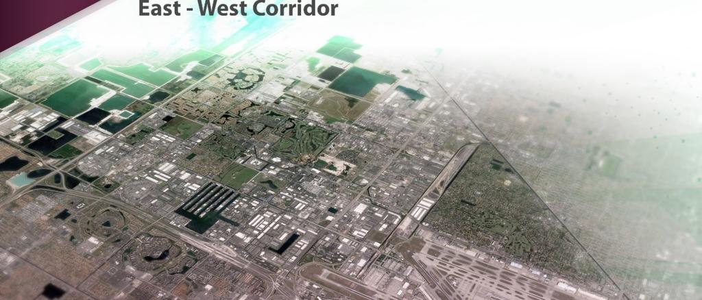
6 SMART PLAN CORRIDOR INVENTORY EAST-WEST CORRIDOR 1. Introduction This study provides a preliminary inventory of available demographic and socioeconomic data for the East-West Corridor of the SMART Plan. The East-West Corridor study area includes the Miami Intermodal Center (MIC), the Miami International Airport (MIA), and Florida International University (FIU). The East-West Corridor will provide multimodal solutions for the severe traffic congestion along SR 836/Dolphin Expressway, which is the only east-west expressway in central Miami-Dade County Purpose The purpose of this study is to provide available demographic and socioeconomic data that will function as an initial inventory of the current land use along the East-West Corridor Background The Strategic Miami Area Rapid Transit (SMART) Plan was approved by the Miami-Dade Metropolitan Planning Organization (MPO) Governing Board on April 21, 2016 in recognition of the necessity to advance a program of rapid transit initiatives to address the mobility needs throughout Miami-Dade County. The SMART Plan includes six (6) major rapid transit corridors, one of which is the East-West Corridor Scope The scope of the project includes the following: coordination with key state, county, and municipal agencies; a nationwide literature review of best practices and lessons from other similar initiatives; collection of demographic and socio-economic data; an existing conditions analysis including a corridor profile; a needs assessment identifying deficiencies for baseline conditions; and a final report documenting the findings Report Layout The report is organized into the following four sections: I. Introduction: Provides an overview of the study along with the literature review. II. Corridor Profile: Provides the inventory of conditions within the corridor. III. Needs Analysis: Identifies deficiencies for baseline conditions. IV. Conclusion and Next Steps: Summarizes the results and findings of the study. Page 1

 topics: Form Based Codes Access")
7 1.5. Literature Review A regional and nationwide literature review of planning initiatives was conducted with a focus on transportation and land use connections and implementation measures. The purpose of the literature review was to survey applicable transit programs and implementation methods that may offer strategic ideas or provide guidance for the overall SMART Plan implementation, with an emphasis on sources pertaining to the East-West Corridor. The literature review is divided into two sections. The first section provides an assortment of best practices resources for transportation and land use planning alternatives focusing on the following twelve (12) topics: Form Based Codes Access Management Corridor Improvements Economic Development Safety Housing Development Complete Streets Livable Communities Transit-Oriented Development (TOD) Guidelines Facilities for Pedestrians and Bicyclists Transit Services and Infrastructure Population and Employment Growth The second portion of the literature review provides an overview of the two specific sources assigned to the Consultant for review. The two sources reviewed in this section are the Smart Growth Implementation Toolkit from the Smart Growth Leadership Institute, and the Developer s Toolbox provided by the Smart Growth Network. TOD, Seattle. Source: Seattle Transit Communities, Page 2
8 Transportation and Land Use Planning Alternatives The first section of the literature review for the East-West Corridor involved identifying local and regionally significant initiatives and policies, and reviewing national research performed by organizations and think tanks addressing the identified twelve (12) transportation and land use topics. The sources chosen represent a selection of national research initiatives along with local and regional-level transit system examples relevant to the SMART Plan and specifically, the East- West corridor. The following is a list of the reviewed literature summarized in this section. National Research Initiatives Why Transit Development and Why Now, report from the national non-profit Reconnecting America (2007) Building Livable Communities with Transit: Planning, Developing, and Implementing Community-Sensitive Transit, report from the Federal Transit Administration and USDOT (1999) Realizing the Potential: Expanding Housing Opportunities Near Transit, report from Reconnecting America (2007) Light Rail and Land Use Change: Rail Transit s Role in Reshaping and Revitalizing Cities, Journal of Public Transportation (2014) Elements of an Ideal Complete Streets Policy, policy analysis report from Smart Growth America National Complete Streets Coalition (2011) Station Area Planning: How to Make Great Transit-Oriented Places, report from Reconnecting America (2008) Performance-Based Transit-Oriented Development Typology Guidebook, Center for Transit Oriented Development (2010) Local and Regional-Level Best Practices Seattle Transit Communities: Integrating Neighborhoods with Transit, Seattle Planning Commission (2010) Transit Oriented Development and Proposition 207 in Metropolitan Phoenix, United States Environmental Protection Agency (2009) Page 3
: Reconnecting America, Center for Transit-Oriented Development Publication Year: 2007 Transportation/Land Use Topics: Economic Development, Housing Development, Livable Communities, TOD")
9 National Research Initiatives WHY TRANSIT-ORIENTED DEVELOPMENT AND WHY NOW? Source(s): Reconnecting America, Center for Transit-Oriented Development Publication Year: 2007 Transportation/Land Use Topics: Economic Development, Housing Development, Livable Communities, TOD Guidelines, Transit Services and Infrastructure, Population and Employment Growth Description: A report describing how the shifting demographics and the changing real estate market have provided opportunities for transit-oriented development. The report explains what TOD is, how it benefits communities, and how it can be used as an affordability strategy for regions. Lessons Learned: TOD is defined as more compact development within half a mile of transit stations containing a mix of uses increasing location efficiency allowing people to walk, bike, and take transit, live healthier lifestyles, build community and sense of place. Examples of how location efficiency effects housing and transportation affordability are provided in the graphic below. Location Matters graphic, Why TOD and Why Now? TOD boosts transit ridership and minimizes traffic impacts. TOD provides value for public and private sectors, and for new and existing residents. Americans want more housing and transportation choices. TOD is beneficial for cities and suburbs. Page 4
10 Portland, Oregon Streetcar Case Study: o Private investment in TOD within the Pearl District helped the city meet public goals and objectives. o TOD has leveraged large-scale redevelopment in downtown Portland. o In the 1990s, the city negotiated with a landowner to build a streetcar past his property if he would up-zone from 15 dwelling units (du)/acre to 125 du/acre. Today, this is the city s densest neighborhood. o Properties closest to the streetcar developed at 90% permitted density, compared to 43% density three or four blocks away. o Portland s 20-year housing goal was met in 7 years on 1/10 th of the projected lands, with 25% of the units affordable. Page 5

11 BUILDING LIVABLE COMMUNITIES WITH TRANSIT: PLANNING, DEVELOPING, AND IMPLEMENTING COMMUNITY-SENSITIVE TRANSIT Source(s): US Department of Transportation (USDOT), Federal Highway Administration (FHWA) Publication Year: 1999 Transportation/Land Use Topics: Access Management, Corridor Improvements, Economic Development, Safety, Housing Development, Livable Communities, TOD Guidelines, Transit Services and Infrastructure, Population and Employment Growth Description: This report demonstrates ways to improve the link between transit and communities, promoting customerfriendly, community-oriented, and well-designed facilities and services through the Livable Communities Initiative, which is an initiative created by the FTA to strengthen the link between transit and communities. The initiative awarded funding to 21 demonstration projects that promote characteristics of community sensitive transit. Lessons Learned: Two of the demonstration projects are summarized below (St. Louis Metrolink and Oakland BART) as examples of having rapid rail connections between an international airport and a state universities, similar to the East-West Corridor. St. Louis Metrolink Wellston Station Enhancements At a total cost of approximately $1 million, a Livable Communities Initiative demonstration project in St. Louis has led to creating a center for mobility, child care and educational facilities, a police substation, and employment opportunities at the Metrolink Wellston Station. Using intensive and extensive community outreach, local groups and transit planners have collaborated to identify priorities for revitalizing a dying neighborhood. The effort is having a significant impact on changing Wellston from a depressed area with a decaying industrial park, high crime and unemployment to an attractive and viable community. Improvements include a new pedestrian pathway featuring an artist designed fence, lighting improvements, resurfacing of roads, new signage, bicycle lockers, and information on services at the Cornerstone Partnership. Transit Ridership: Both the improved access and expanded activities increased transit ridership and improved intermodal transfer. Site Amenities: Station aesthetics and customer service benefitted as a result of the various landscaping, access, and information provisions. Page 6

12 Leveraging Other Assistance: Through the St. Louis County Economic Council, the U.S. Department of Commerce committed $4.5 million for the Cornerstone Partnership project construction. An additional $1.5 million for training equipment was donated by the National Center for Manufacturing Sciences. Other funding participants include Arts in Transit, the Bi-State Development Agency, the East West Gateway Coordinating Council, and the City of Wellston. Public/Private Participation: The project united government agencies, non-profits, community residents, and businesses to develop and sustain the vocational training center. Community Involvement: The station area was planned and designed using innovative public involvement techniques, including use of a Visual Preferences Survey of focus groups. Oakland, CA BART Fruitvale Station Enhancements The Spanish Speaking Unity Council (SSUC), in cooperation with the City of Oakland, CA, the Bay Area Rapid Transit District (BART) and other Federal agencies, was developing a transit village at the BART Fruitvale station in Oakland. California legislation supports the development of transit villages, and the BART Board passed a resolution promoting transit village development around BART stations. The specific improvements included a new pedestrian plaza, relocation of the bus turn around facility, a child care center, a health care clinic, a public library, senior citizen housing, a police substation, and other public and commercial facilities. Fruitvale Station Rendering. Source: Building Livable Communities. access, and safety and security improvements will increase ridership. The Federal Transit Administration (FTA) provided funding to develop the site plan through a grant to the Metropolitan Transportation Commission (MTC), who worked with the SSUC. Additional FTA funding in the amount of $2.3 million supports station area enhancements and is leveraging $42 million in other transit village investments. Transit Ridership: New development around the station, improved bus and pedestrian Economic Development: The incorporation of community services and commercial facilities into the site will provide entrepreneurial and employment opportunities within the community. Leveraging Other Assistance: The FTA assistance will leverage assistance from the City of Oakland, U.S. Department of Housing and Urban Development, U.S. Department of Health and Human Services, and Federal Highway Administration. Community Involvement: The overall project vision and development concept were conceived through a collaborative, community-based planning process which will be continued through construction. Page 7

13 REALIZING THE POTENTIAL: EXPANDING HOUSING OPPORTUNITIES NEAR TRANSIT Source(s): Reconnecting America, Center for Transit-Oriented Development Publication Year: 2007 Transportation/Land Use Topics: Housing Development, Livable Communities, TOD Guidelines, Population and Employment Growth Description: A report demonstrating that location matters a great deal when it comes to reducing household costs. The report examines five case study regions-boston, Charlotte, Denver, Minneapolis, and Portland-to understand strategies being used to preserve affordable housing near transit. Lessons Learned: Mixed-income TOD housing obstacles: o High land prices around stations o Lack of capital for affordable housing developers o Complex financing structures o Parking requirements not up-to-date with TOD needs o Community opposition towards density and affordable housing Mixed-income TOD housing strategies: o Provide incentives o Remove regulatory barriers density and mixed-use developments o Coordinate housing and transportation plans and investments o Improve local technical capacity, partnerships, and data collection Twin Cities Hiawatha Corridor Case Study: o Strong inclusion of local city staff, community residents, and private sector help with the siting of critical infrastructure. o Market momentum should be captured via TOD to address concentrated poverty and provide affordable housing. Page 8

14 o Leverage community benefits from large development projects through developer agreements that link changes in use (i.e. increased density) and other entitlements to local community investments such as affordable housing. These types of programs need to be put in place prior to major rezoning and coordinated with public infrastructure improvements to be successful. o Providing incentives for New Development along Hiawatha Line, Source: Peter Ehrlich. increased density is a powerful way to also generate additional transit ridership and should be coordinated with reduced parking requirements for TOD projects. o Strong regional coordination of investments and policies is important to the overall efficacy of transit-oriented development. Page 9

15 LIGHT RAIL AND LAND USE CHANGE: RAIL TRANSIT S ROLE IN RESHAPING AND REVITALIZING CITIES Source(s): Journal of Public Transportation, Vol. 17, No. 2 Publication Year: 2014 Transportation/Land Use Topics: Corridor Improvements, Economic Development, Housing Development, TOD Guidelines, Facilities for Pedestrians and Bicyclists, Transit Services and Infrastructure, Population and Employment Growth. Description: A literature review to determine which factors contribute to the ability of investments in rapid transit to promote land use change. The six factors identified were: transit accessibility, positive growth and demand, positive social conditions, positive physical conditions, available land, and complementary planning. Lessons Learned: The six factors are further detailed below. Accessibility is central to locational advantages in an urban market. If rapid transit offers only a marginal or negligible improvement in accessibility and reduction in transportation costs it is unlikely to create a transit-based locational advantage which can in turn negatively impact by choice ridership and land use change. Land use impact of transit is contingent on regional economic, population, and employment growth, coupled with a strong real estate market with demand for high-density living. The impact will be enhanced if the transit service begins prior to a period of rapid growth. Pedestrian friendly environments are ideal for transit riders, and therefore more attractive to developers, financers, and those currently or interested in living there. Positive social conditions are crucial to the attractiveness of station areas for development. TOD is more straightforward and profitable if large parcels of land are already available, cheap, and suitable for development. Policies incentivizing TOD are crucial. Incentives include zoning, financing, and planning policies promoting TOD, parking and road investment policies that restrict the automobile, and complementary regional policies such as urban growth boundaries. Page 10


16 STATION AREA PLANNING: HOW TO MAKE GREAT TRANSIT-ORIENTED PLACES Source(s): Reconnecting America, Center for Transit-Oriented Development Publication Year: 2008 Transportation/Land Use Topics: Corridor Improvements, Complete Streets, Livable Communities, TOD Guidelines, Facilities for Pedestrians and Bicyclists, Transit Services and Infrastructure. Description: A guidebook to promote best practices in transit-oriented development intended to help with TOD and station area projects by providing examples based on seven TOD place types. Includes station area planning principles and TOD checklists. Lessons Learned: Station area planning principles: o Maximize ridership with TOD. Develop clear land use alternatives, understand market demand, forecast ridership using TOD modeling tools, minimize land use conflicts, evaluate zoning requirements on potential densities, locate key services near stations. o Generate meaningful community involvement. Provide multilingual outreach, organize citizen advisory and technical committees, create a plan website, have a media strategy. o Design streets for all users. Consider TODspecific street design Light rail station, Portland. Source: Station Area Planning, standards, multimodal performance standards, incorporate bicycle and pedestrian access, prioritize safety and security. o Create opportunities for affordable and accessible living. Set affordable housing goals, target affordable housing resources to station areas, provide a range of housing options, minimize displacement of current residents, ensure accessibility. Page 11

17 o Make great public spaces. Consider parks and open space, community involvement, public art, design standards. o Manage parking effectively. Evaluate parking supply and demand, review parking management policies, consider whether to provide parking, provide bicycle parking facilities, locate parking to maximize placemaking. o Capture the value of transit. Explore financing mechanisms for public infrastructure and affordable housing. o Maximize neighborhood and station connectivity. Identify key pedestrian corridors, create a bicycle network, consider the design of intermodal facilities. o Implement and evaluate its success. Provide for environmental review, develop an implementation plan and budget, monitor progress. Suburban station, Portland. Source: Station Area Planning, Page 12


18 PERFORMANCE-BASED TRANSIT-ORIENTED DEVELOPMENT TYPOLOGY GUIDEBOOK Source(s): Center for Transit Oriented Development Publication Year: 2010 Transportation/Land Use Topics: Corridor Improvements, Housing Development, Transit Services and Infrastructure, Population and Employment Growth Description: A guidebook created to evaluate the performance of transit zones in neighborhoods and towns using TOD typologies based upon the number of miles a typical household will travel in a year. These typologies identify the different conditions that exist in places and determine the form that TOD takes. Additionally, the guidebook includes nine case studies of transit zones to demonstrate the concepts. Lessons Learned: Community composition and transit quality influences greenhouse gas emissions and the ability of areas to meet their climate change goals. Performance of TOD should be measured at the neighborhood scale, or larger. Transit zones in low vehicle miles traveled (VMT) places tend have low transportation costs and low rates of automobile ownership. Low VMT zones are located much closer to employment than high VMT zones. Encouraging new development in transit zones, independent of the place type, can help reduce regional VMT, especially with above-average household VMTs. High VMT transit zones can see significant reductions in average household VMT from relatively moderate amounts of new development. Prioritizing low VMT transit zones for new development can produce the largest reductions in total regional VMT. Atlanta, GA place typologies. Source: Performance-Based Guidebook, Page 13
19 Local and Regional-Level Best Practices and Implementation The local and regional-level best practices examples were chosen based on comparable characteristics to the East-West Corridor, specifically examples with connections to an airport and a university. A nationwide search yielded the results identified in Table 1-1 below. A description of each transit line summarizing the service provided is detailed in this section. Additionally, a policy review was conducted for two of the transit corridors (Seattle and Phoenix) to illustrate best practices and lessons learned. Location Transit Line, Agency University Airport Metrorail Corridor, MDT+PW University of Miami Miami International (MIA) Miami, FL Students (Fall 2015): Annual Passengers (2016): Type: Heavy Rail 16, million Link, Sound Transit Univ. of Washington Seattle-Tacoma (SeaTac) Seattle, WA Students (Fall 2016): Annual Passengers (2016): Type: Light Rail 46, million Valley Metro Rail, Valley Metro Arizona State University Phoenix Sky Harbor (PHX) Phoenix, AZ Students (Fall 2016): Annual Passengers (2016): Type: Light Rail 71, million TRAX Red/Green, UTA University of Utah Salt Lake International (SLC) Salt Lake Students (Fall 2016): Annual Passengers (2016): City, UT Type: Light Rail 32, million Metro Blue/Green, Metro Transit University of Minnesota Minneapolis-St. Paul (MSP) Minneapolis, Students (Fall 2016): Annual Passengers (2016): MN Type: Light Rail 51, million Red Line, METRO St. Louis University of Missouri Lambert International (STL) St. Louis, MO Students (Fall 2016): Annual Passengers (2016): Type: Light Rail 10, million Green/Blue/Rapid Lines, San Diego San Diego State Univ., San Diego International Metropolitan Transit System UC San Diego (SAN) San Diego, CA SDSU Students: 33,778 Annual Passengers (2016): Type: Bus Rapid Transit, Light Rail UCSD Students: 35, million Metro Blue/Green, LA County University of Southern Los Angeles, Metropolitan Transit Authority California LA International (LAX) CA Students (Fall 2016): Annual Passengers (2016): Type: Light Rail 44, million Red Line, MARTA Georgia Tech University Hartsfield-Jackson Int'l (ATL) Atlanta, GA Annual Passengers (2016): Type: Heavy Rail Students (2015): 26, million Oakland, CA Table 1-1 Comparable Transit Corridors Warm Springs-Richmond Line, BART UC Berkeley Oakland International (OAK) Type: Heavy Rail Students (2016): 40,173 Annual Passengers (2016): 12 million Page 14


20 SEATTLE, WASHINGTON Transit Agency: Sound Transit Transit Line: Link Mode: Light Rail Airport Connection: Seattle-Tacoma International (SeaTac) University Connection: University of Washington Description: The Link light rail line Link light rail, Seattle, WA. Source: soundtransit.org, services the Seattle-Tacoma (Sea-Tac) International Airport, CenturyLink and Safeco Fields (NFL, MLS, and MLB stadiums), and the University of Washington. Trains run from 5:00 AM to 1:00 AM on Monday through Saturday, with frequencies ranging from every six minutes to every fifteen minutes. On Sundays and holidays, the trains run from 6:00 AM to 12:00 AM, with ten to fifteen minute frequencies. Adult fares range from $2.25 to $3.25. PHOENIX, ARIZONA Transit Agency: Valley Metro Transit Line: Valley Metro Rail Mode: Light Rail Airport Connection: Phoenix Sky Harbor International (PHX) University Connection: Arizona State University Description: The Valley Metro Rail is a light rail line spanning approximately Valley Metro Rail map. Source: Economic Development Brochure, miles servicing the cities of Phoenix, Tempe, and Mesa. The rail line also provides service to the Sky Harbor Airport, and Arizona State University. The rail system operates seven days a week, over 20 hours each day, with a 12-minute peak frequency. Fare options are: $2.00, one ride; $4.00, all day pass, $20.00 seven-day pass; $33.00 fifteen-day pass; $64 thirty-one day pass. Page 15

21 SALT LAKE CITY, UTAH Transit Agency: Utah Transit Authority Transit Line: TRAX Red/TRAX Green Mode: Light Rail Airport Connection: Salt Lake International (SLC) University Connection: University of Utah Description: TRAX is Utah Transit Authority s light rail system spanning 42.5 miles of line and 50 stations. The TRAX Red Line services the University of Utah, and the TRAX Green Line services the Salt Lake International Airport. Trains range in length from one to four cars depending on time, day, and projected ridership. The system runs seven days per week, with 15-minute frequency during peak times. An adult one-way fare costs $2.50, and an adult day pass costs $6.25. TRAX train, Salt Lake City, UT. Source: utahstories.com, MINNEAPOLIS, MINNESOTA Transit Agency: Metro Transit Transit Line: Metro Blue/Green Mode: Light Rail Airport Connection: Minneapolis-St. Paul International University Connection: University of Minnesota Description: Metro Transit s Blue and Green lines provide light rail service to Minneapolis and St. Paul, Minnesota 24 hours a day, seven days a week. The Blue Line services the University of Minnesota and the Mall of America, and the Green Line services the Minneapolis/St. Paul International Airport. Light rail trips operate every 10 minutes throughout the day, every 10 to15 minutes in the evenings, and every minutes overnight. The fare structure is based upon rush hours (Monday-Friday, 6:00 to 9:00 AM and 3:00 to 6:30 PM), and non-rush hours. A typical adult fare for rush hour is $2.25, and non-rush hour is $1.75. Metro Transit Blue Line map. Source: metrotransit.org, Page 16
 University Connection: University of Missouri Description: The MetroLink Red Line provides")

 University Connection: San Diego State University, University of California San Diego Description: The San Diego Metropolitan Transit System (MTS) provides rapid bus and")
22 ST. LOUIS, MISSOURI Transit Agency: METRO St. Louis Transit Line: Red Line, MetroLink Mode: Light Rail Airport Connection: Lambert International (STL) University Connection: University of Missouri Description: The MetroLink Red Line provides service to Lambert Airport and the University of Missouri. The Red Line runs 7 days per week with 12-minute frequency during peak times. The line runs from approximately 4:00 AM to 1:00 AM. The adult base fare for a one-way pass is $2.50; a 2-hour pass/transfer fare is $3.00, and a one-day pass is $7.50. MetroLink train, St. Louis, MO. Source: cml-stl.org, SAN DIEGO, CALIFORNIA Transit Agency: San Diego Metropolitan Transit System Transit Line: Mid City Rapid 215, Rapid 237, Green Line, Blue Line Mode: Bus Rapid Transit, Light Rail Airport Connection: San Diego International (SAN) University Connection: San Diego State University, University of California San Diego Description: The San Diego Metropolitan Transit System (MTS) provides rapid bus and light rail service to major attractions and destinations in San Diego. The rapid service is a highfrequency, limited-stop bus service. Some of the routes offer rapid service seven days a week, and some only weekdays. Generally, rapid service is provided from approximately 5:00 AM to 11:00 PM every 15 to 30 minutes. The light rail system, The Trolley services the San Diego Airport (Green Line), and UC San Diego (Blue Line). Fares are collected via random fare inspections. The Trolley generally runs form approximately 5:00 AM through 1:00 AM on weekdays, at a peak frequency of every 15 minutes. Rapid Route Map, San Diego, CA. Source: sdmtsl.org, Page 17
 University Connection: University of Southern California Description: Metro Rail is an urban rail system serving Los Angeles County, Metro Rail Car, Los Angeles, CA. Source: California.")

23 LOS ANGELES, CALIFORNIA Transit Agency: LA County Metropolitan Transit Authority Transit Line: Metro Green, Expo Line Mode: Bus Rapid Transit, Light Rail Airport Connection: Los Angeles International (LAX) University Connection: University of Southern California Description: Metro Rail is an urban rail system serving Los Angeles County, Metro Rail Car, Los Angeles, CA. Source: California. The system consists of two rapid la.streetsblog.org, transit subway lines (Red and Purple), and four light rail lines (Blue, Green, Gold, and Expo). The Metro Green Line is a fully grade-separated route running partly in the median of Interstate 105, and provides service to the Los Angeles International Airport. However, a shuttle bus is required from the Metro Green Line to ultimately reach the airport. The Expo Line serves the University of Southern California, with operating hours from approximately 4:30 AM to 2:00 AM on weekdays, and until 2:30 AM on Fridays and Saturdays, at a peak frequency of every 6 minutes. A one-ride base fare is $1.75. ATLANTA, GA Transit Agency: Metropolitan Atlanta Rapid Transit Authority (MARTA) Transit Line: Red Line Mode: Heavy Rail Airport Connection: Hartsfield-Jackson International (ATL) University Connection: Georgia Tech University Description: MARTA provides heavy rapid rail service to the Atlanta metropolitan area. The rapid rail system consists of 47.6 miles of route and 38 stations. The MARTA Red Line travels north and south through Atlanta, providing service to the Atlanta International Airport and Georgia Tech University. The Red Line operates between approximately 4:45 AM to 1:15 on weekdays, and 6:00 AM to 1:15 AM on weekends and holidays. Generally, trains run every 10 to 12 minutes and weekdays, and transition to every 20 minutes after 8:00 PM, and on weekends and holidays. MARTA Red Line route. Source: martaguide.com, Page 18


24 OAKLAND, CA Transit Agency: Bay Area Rapid Transit (BART) Transit Line: Warm Springs-Richmond Line (Orange) Mode: Heavy Rail Airport Connection: Oakland International (OAK) University Connection: UC Berkeley Description: BART is a heavy rail elevated and subway system operating six routes on 112 miles of track connecting 46 stations. The Warm BART train. Source: eastbaytimes.com, Springs-Richmond Line runs through Oakland providing connections to UC Berkeley and the Oakland International Airport, and is the only line that does not go to San Francisco. Train service begins around 4:00 AM on weekdays, 6:00 AM on Saturdays, and 8:00 AM on Sundays. Service ends daily around midnight, with station closings timed to the last train station. Fares are based on a formula that accounts both the length and the speed of the tip. A surcharge is sometimes added to trips; included with this surcharge are trips to the Oakland Airport. Unlike other rapid transit systems, BART does not have an unlimited ride pass. The minimum fare is $1.95. BART system map. Source: bart.gov, Page 19


25 SEATTLE TRANSIT COMMUNITIES: INTEGRATING NEIGHBORHOODS WITH TRANSIT Source(s): Seattle Planning Commission Publication Year: 2010 Transportation/Land Use Topics: Corridor Improvements, Economic Development, Housing Development, Livable Communities, Transit Services and Infrastructure, Population and Employment Growth. Description: This report was created in response to the growth demand forecasted in Seattle. The document outlines how Seattle s policies, practices, and infrastructure can create vital, sustainable communities, prioritizes transit communities where investment is urgent and will create the most impact, and provides a range of resources to leverage funding. Lessons Learned: The success of transit communities requires three integral components: investment in transit; appropriate zoning for focused, higher density development; and necessary investment in the essential components for livability. Benefits of transit communities are: lower overall household costs, improve public health, support diversity, enhance local business districts, reduce carbon footprint, and preserve regional open space and natural resource lands. The essential components for livability include: adequate open space, enhanced streetscape, and opportunities and activities for the people who live/work there. TOD and Land Use Graphic. Source: Seattle Transit Communities, All transit nodes should include the basic fundamental elements for transit connections, such as: protection from vehicular traffic, complete/context sensitive streets, well-defined waiting spaces that are safe and comfortable, sidewalks with adequate room to walk, places to secure bicycles, and coherent, consistent wayfinding. Page 20

26 TRANSIT ORIENTED DEVELOPMENT AND PROPOSITION 207 IN METROPOLITAN PHOENIX Source(s): US Environmental Protection Agency (EPA) Publication Year: 2009 Transportation/Land Use Topics: Form-Based Codes, Corridor Improvements, Economic Development, Livable Communities, TOD Guidelines, Facilities for Pedestrians and Bicyclists Description: A toolbox of five documents created by the EPA in response to the passage of Proposition 207 (Arizona Private Property Rights Protection Act) and its effects on the newly opened light rail and future extensions for the City of Phoenix, Valley Metro Rail, and the City of Mesa. The toolbox was developed to provide options for encouraging TOD while addressing Proposition 207. The project evolved into a discussion of the most appropriate tools and incentives localities can use to promote TOD. Lessons Learned: For rail systems, support for planning, relaxed parking standards, density bonuses, capital funding (infrastructure), and land use assembly are the most common TOD policy tools. The four most effective forms of state and regional policies to promote TOD are planning grants, targeted infrastructure funding, tying capital grants to TOD commitments, and locating government buildings near transit. Flexible parking standards for residential and commercial development near transit stations have been adopted in more than half of all rail-based TOD programs. The two rationales behind this are: households living near stations own fewer cars, and more workers take transit to jobs located near stations. Density bonuses are effective when: there is a market potential for any density beyond what is otherwise allowed; and if the density bonus changes the type of building to be built, the bonus must allow enough of an increase in square footage to offset the higher construction costs. Form-based codes may be an attractive alternative to TOD overlay zones or other traditional zoning methods in TOD districts to ensure the development around stations makes walking safe and pleasant, and builds ridership without restricting uses. They allow overall zones to focus on placemaking rather than controlling uses and moderating intensity. Examples of form-based codes to support TOD are Leander, Texas; Albuquerque, New Mexico; and Dallas, Texas. Page 21
27 Promoting TOD improves chances of receiving federal support to expand rail systems. Recommended TOD policy tools with positive viability for the area are: city and regional TOD strategic plans, station area plans, market studies, station area rezoning, land use standards and intensity tools, parking tools, fast track development review, tax-increment financing, reduced impact fees at station areas, streetscape bike/pedestrian improvements, a marketing plan, and livable communities plan. Page 22

28 Assigned Literature Sources The two sources reviewed in this section are the Smart Growth Implementation Toolkit from the Smart Growth Leadership Institute, and the Developer s Toolbox provided by the Smart Growth Network. Smart Growth Implementation Toolkit Smart Growth America s Leadership Institute developed the implementation toolkit through a four-year technical assistance program funded by the US EPA. The Smart Growth Implementation Toolkit is designed to help practitioners review current policies and process that do not match the citizen s goal of a sustainable community. The tools provide a guide to evaluate development requirements that impact growth. In addition, the tools are designed to build support for smart growth policies and identify the most problematic development issues. The tools provided below are templates that can be custom built to meet the community s smart growth goal. QUICK DIAGNOSTIC The Quick Diagnostic is a simple flowchart that will help you to understand which of the Smart Growth Implementation Tools can best help your community. POLICY AUDIT The Smart Growth Policy Audit is a guide to help evaluate land use and development polices to make sure they align with the jurisdictions intent to build sustainable communities. CODE AND ZONING AUDIT The Smart Growth Code and Zoning Audit is a guide to help evaluate land use codes and identify any hindrance to achieving smarter growth. AUDIT SUMMARY The Smart Growth Audit Summary is a compilation of the results from the Smart Growth Policy Audit and the Smart Growth Code and Zoning Audit. This will help identifying any polices or regulations that need improvements. In addition, it includes the governmental body responsible for approving any changes to the documents on record. Page 23
29 INCENTIVES MATRIX The Incentive matrix is a summary of incentive programs provided by various level of government that encourage redevelopment, infill, and mix use development with the intent of making smart growth development appealing to developers. STRATEGY BUILDER The Smart Growth Strategy Builder helps develop support for a Smart Growth vision. This tool can be utilized for group discussion to evaluate opportunities and challenges to build support for a community s vision of Smart Growth. PROJECT SCOREBOARD The Smart Growth Project Scoreboard will help identify good projects and others that need improvements to align with the Smart Growth vision. Citizens can use it as a checklist during a community and stakeholders process to determine the qualities of proposed projects and to identify areas for improvement. Page 24
30 Developer s Toolbox, Smart Growth Network The US EPA provides a set of smart growth tools and resources to help communities implement a smart growth network. The reviewed tool categories include: general smart growth tools, planning, zoning, and building codes, and transportation. Any of the tools described here supplement transit supportive strategies within the corridor. GENERAL SMART GROWTH TOOLS Sustainable Communities HotReport The HotReport is a web-based tool providing community leaders and residents a way to measure how well their community is performing on a variety of sustainability indicators. These indicators include transportation, housing, economic development, income, and equity. The tool functions by selecting a state and county, then charts, tables, and maps showing performance trends over time. Table 1-2 displays a summary table generated from the HotReport comparing Miami-Dade County to Florida and the United States as an example of the tool capabilities. Information from the HotReport uses sources from the American Community Survey (ACS), census data, the Department of Labor s Quarterly Census of Employment and Wages State Occupational Projections, and the Census Bureau s Local Employment Dynamics (LED). The HotReport was developed by the HUD-DOT-EPA Partnership for Sustainable Communities, with support from the US Census Bureau. Table 1-2 HotReport Summary Table Sustainability Indicator Miami-Dade County Florida United States Transportation Commute mode share percentage (non-singleoccupant 9.7% 5.8% 9.6% vehicle) Mean travel time to work (Minutes) Housing Percent households with housing costs greater 52.4% 41.4% 35.5% than 30% of income Equity Poverty rate 19.9% 16.3% 15.4% Share of income held by top 5% of households 26.1% 23.6% 22.4% Economic Development Unemployment 11.8% 11.7% 9.6% Share of population with a college degree 26.3% 26.4% 28.8% Income Median household income $43,100 46,956 56,046 Page 25
31 Sustainable Communities Indicator Catalog The Sustainable Communities Indicator Catalog provides a collection of indicators to help communities measure progress towards their sustainability objectives. The indicators focus on the relationships among land use, housing, transportation, human health, and the environment. The catalog was developed by a team of researchers evaluating over 100 community indicator initiatives across the Unities States. To use the catalog, the user selects one or more of the following: indicator topic (housing, land use, transportation), geographic scale (county, municipality, neighborhood/corridor, project, region), level of urbanization (rural, suburban, urban), and issue of concern. Once selections are made, relevant indicators are populated. The user may then select to view more information on indicators, including: a summary, how it relates to sustainable communities, data elements, calculation notes, and communities that use the metric. For example, when selecting the following options: transportation, neighborhood/corridor, urban, and access and equity, indicators including intersection density, walkability, bike parking per capita, and travel time to work were populated. Tools and Resources for Sustainable Communities The US EPA has compiled an additional list of tools and resources to help communities develop and support neighborhoods that provide transportation choices and affordable housing, increase economic competitiveness, and direct resources towards places with existing infrastructure. Some relevant tools and resources included with this list pertaining to transportation and land use are: Essential smart growth fixes for urban and suburban zoning codes. Toolkit for integrating land use and transportation decision-making. Smart growth scorecards. Codes that support smart growth development. Environmental justice. Funding resources. Housing and transportation affordability index. Walk score. Context sensitive solutions. Transit savings calculator. Page 26

32 PLANNING, ZONING, AND BUILDING CODES Essential Smart Growth Fixes for Urban and Suburban Zoning Codes This tool was created by the US EPA to help local governments apply targeted fixes to their zoning codes to address specific issues. The tool was created in response to land development codes and ordinances impeding smart growth goals for communities. Additionally, communities may not have the resources or expertise to make the specific regulatory changes that will create more sustainable communities. To respond to this, the US EPA assembled a panel of national smart growth experts to identify local zoning code topics that influence smart growth. Eleven essential fixes were developed from this panel. These essential fixes are listed as follows, and are described in detail in the tool. Allow or require mixed-use zones. Use urban dimensions in urban places. Rein in and reform the use of planned unit developments. Fix parking requirements. Increase density and intensity in centers. Modernize street standards. Enact standards to foster walkable places. Designate and support preferred growth areas and development sites. Use green infrastructure to manage stormwater. Adopt smart annexation policies. Encourage appropriate development densities on the edge. Page 27

33 TRANSPORTATION TOOLS National Walkability Index The National Walkability Index is a nationwide geographic data resource that ranks Census block groups according to their relative walkability. The dataset includes walkability scores and the underlying attributes that were used to score the walk groups. Examples of the underlying attributes are: mix of employment types and occupied housing, mix of employment types in a block group, street intersection density, and predicted commute mode split. The data set is available to the public for download and geoprocessing, or is viewable as an interactive map. Access to Jobs and Workers Via Transit Tool The Access to Jobs and Workers Via Transit is a free geospatial data resource and web mapping tool used for comparing neighborhood accessibility through public transit service. The data set is available to the public for download and geoprocessing, or is viewable as an interactive map. Infrastructure Financing Options for Transit-Oriented Development The Infrastructure Financing Options for Transit-Oriented Development is a report created by the US EPA in The report provides communities a set of tools and strategies for funding TOD infrastructure. The set of tools includes financing mechanisms and strategies, examples of communities that use the financing tools, provides models communities can consider for their TOD planning, and explains how community context and market factors affect the types of financing tools or funding strategies that communities can use. Mixed-Use Trip Generation Model The Mixed-Use Trip Generation Model is a spreadsheet tool developed by the US EPA in cooperation with the Institute of Transportation Engineers (ITE) developed new data methods and models to estimate trip generation impacts of mixed-use developments. The resulting spreadsheet provides a method to estimate trips generated by mixed-use development to more fairly assess these projects in the development review process. The spreadsheet is available for download. The models have been validated against actual traffic counts at mixed-use developments across the country. The typical development planning and approval process treats mixed-use developments as though the uses were separated and accessible only by car, leaving mixed-use developments at a disadvantage compared to conventional, single-use developments. Recognizing the lower traffic impacts of mixed-use development in central, well-connected neighborhoods in the planning and approvals process would help communities reduce traffic and realize other benefits. Page 28
34 Smart Location Calculator The Smart Location Calculator was developed by the US EPA and U.S. General Services Administration. The calculator demonstrates how workplace location affects worker commute travel. The calculator provides a Smart Location Index ranging from to demonstrate site efficiency. A score of 0 is the least location efficient site in the region, and a score of 100 represents the most efficient site. Site scores are relative to the region, and should not be compared across regions. The calculator is an interactive tool located online. Smart Location Database The Smart Location Database is a nationwide geographic resource used for measuring location efficiency. Location efficiency attributes include transit service, housing density, land use diversity, and destination accessibility. This tool is available for download, or as an interactive map. The tool functions similarly to the National Walkability Index and Access to Jobs and Workers Via Transit tools. Walkability Workbook The Walkability Workbook is a tool developed through the Building Blocks for Sustainable Communities Program. The tool is used to guide communities in assessing the pedestrian environment and forming a vision for short and long-term improvements to sidewalks and streets. The workbook primarily functions as a guide for communities to host Walkability Workshops, but also contains a Walkability Toolbox which explains key concepts for advancing walkability. Page 29
35 2. Corridor Profile The corridor profile was developed to establish a complete picture of the existing conditions within the East-West Corridor to provide an understanding of land use patterns and inconsistencies that are not transit supportive. The corridor profile includes the following: Existing Land Cover and Land Use Socioeconomic Conditions Employment Higher Education Student Population Community Features Historical Sites and Recreation 2.1. Existing Land Cover Natural Features Physical Features Existing Transportation Network Zoning Property Values and Built Environment The land use and land cover summary data was derived from the South Florida Water Management District (SFWMD) Florida Land Use and Land Cover dataset. This dataset provides acreages and percentages for generalized land use types used to group parcel-specific existing land use assigned by the county property appraiser office according to the Florida Department of Revenue (DOR) land use codes. The top five land uses within the study area are: Commercial and Services (17.3%) Roads and Highways (16.8%) Airports (16.4%) Reservoirs (9.41%) Multiple Dwelling Units Low Rise (9.2%) FARMLANDS There are 5.99 acres (0.8%) of Prime Farmlands Farmlands of Unique Importance. WETLANDS According to the National Wetlands Inventory (NWI), there are a total of acres of wetlands within the project area. Of the total wetlands, acres (51.5%) are lacustrine wetlands; (46.8%) are palustrine wetlands; and acres (1.8%) are riverine wetlands. Additionally, the SFWMD Restoration Project Eastern C-4 Structure is located within the study area. Critical Restoration Projects are considered critical environmental restoration efforts. FLOOD ZONES Approximately 61% of the study area is classified as a Special Flood Hazard Area (flood zones AH and AE). Zone AH consists of acres (31.2%), and Zone AE consists of 2, acres (30.17%). Page 30
36 2.2. Socioeconomic Conditions Socioeconomic conditions data was collected using the FDOT Environmental Screening Tool (EST) Sociocultural Data Report (SDR). The SDR uses the Census 2015 American Community Survey (ACS) data and reflects the approximation of the population based on a project buffer intersecting the Census Block Groups along the project corridor. Using the study area, the SDR identified the demographics summarized in this section. POPULATION AND INCOME The SDR identified 20,279 households, with a total population of 63,644 people. The median household income is $37,802. Several households are below poverty level (21.64%), and 2.88% of households receive public assistance. US Census poverty thresholds vary by family size and age of the members, and are updated annually for inflation using the Consumer Price Index for All Urban Consumers (CPI-U). For example, in 2016 the weighted average poverty threshold for a two person household under the age of 65 is $16,151. RACE AND ETHNICITY The minority population makes up 96.13% of the total population, most of whom (93.9%) identified as having a Hispanic or Latino of Any Race ethnicity. As defined by the SDR report, Minority refers to individuals who list a race other than White and/or list their ethnicity as Hispanic/Latino. In other words, people who are multi-racial, any single race other than White, or Hispanic/Latino of any race are considered minorities. The population identified as the following: White Alone, with a population of 59,924 (94.15%) Black or African American Alone with a population of 895 (1.41%) Asian Alone with a population of 792 (1.24%) American Indian or Alaska Native Alone with a population of 61 people (0.10%) Some Other Race Alone with a population of 916 (1.44%) 2 or More Races, with a population of 1,054 (1.66%) Hispanic or Latino of Any Race ethnicity with a population of 59,781 (93.4%) Not Hispanic or Latino ethnicity with a population of 3,863 (6.07%) Minority category, with a population of 61,181 (96.13%) AGE AND DISABILITY The median age is 41, and persons age 65 and over comprise 15.43% of the population. Nearly 25% of the population is under the age of 21. There are 1,997 persons (4.97%) between the ages of 20 and 64 that have a disability. Page 31
37 HOUSING There are 29,078 housing units within the study area. A majority of the units (85.1%) are either condominiums (59.2%) or Multi-family (25.9%). Less than 10% of the available housing is single family (8.4%). The remaining units are either mobile homes (3.1%), duplexes (2.6%), or townhouses (0.7%). Table 2-1 displays a summary of housing types. Table 2-1 Housing Units by Type Housing Type # of Units % of Units Condominium 17, % Multifamily 7, % Single Family 2, % Mobile Home % Duplex % Townhouse % Total 29, % Source: Miami-Dade County Property Appraiser GIS layer Prepared by Miami-Dade County, Department of Regulatory and Economic Resources, Planning Research and Economic Analysis, September Single Family Multifamily Other Condominium Of the total housing units, approximately 89.5% are occupied, meaning 10.5% are considered vacant. A majority of the occupied units are renter occupied (53.9%), whereas approximately 46.1% are owner occupied. Table 2-2 Housing Tenure Housing Tenure # of Units Total Housing Units 29,078 Vacant Housing Units 10.5% Occupied Housing Units 89.5% Owner Occupied 46.1% Renter Occupied 53.9% Source: U.S. Census Bureau, ACS , Tables B25001, B25002 and B25003, and Miami-Dade County, Regulatory and Economic Resources Department, Planning Research and Economic Analysis, September Renter Occupied Owner Occupied LANGUAGE Over 30% of the population claim to either not speak English at all (9,238 people, 15.49%) or not speak English well (10,387 people, 17.42%). The Florida Department of Transportation (FDOT) has identified factors based on US Department of Transportation Policy Guidance to help determine if Limited English Proficiency (LEP) services would be required as listed in the FDOT Project Development & Environment (PD&E) Manual, Part 1, Chapter 11, Section Based on a review of these factors, and the fact that LEP population accounts for nearly one third of the population within the study area, LEP services will be required. Page 32
38 TRANSIT-DEPENDENT POPULATION A spatial analysis was performed to demonstrate the concentrations of the transit-dependent populations near the study corridor. The transit-dependent population is recognized as those who must use public transportation for their travel. Generally, this population includes the following: those over the age of 65, those with low incomes (less than $25,000 household income), zero car households, and the minority population (the percentage of the population which is not white, non-hispanic ). Each of these demographic measures are mapped individually in Figure 2-1 through Figure 2-4, followed by an additional transit-dependent population map featuring all four measures overlapping identifying concentrations of transit-dependent populations within the study area in Figure 2-5. Additionally, as the data is categorized by Census Block Group (CBG), it may reflect conditions that are beyond the corridor study limits. For example, the CBG adjacent to the MIA CBG to the west is primarily warehousing and industrial uses near the corridor, but the CBG boundaries reach further north which includes a residential area. The results of the spatial analysis shown in Figure 2-5 indicate that the CBGs with higher concentrations of transit-dependent populations are represented primarily south of SR 836/Dolphin Expressway (shown in red). The CBG adjacent to MIA is also shown as a high concentration, but this is likely referring to the population north of the industrial district outside of the study area. Additionally, the FIU and MIA CBGs are shown as having a low transitdependent population (colored in blue). This is likely due to the lack of households and permanent population within those areas that are not typically represented in Census data. Page 33
39 SMART PLAN CORRIDOR INVENTORY EAST-WEST CORRIDOR Figure 2-1 Population Over the Age of 65 Page 34
40 SMART PLAN CORRIDOR INVENTORY EAST-WEST CORRIDOR Figure 2-2 Household Income Less than $25,000 Page 35

41 SMART PLAN CORRIDOR INVENTORY EAST-WEST CORRIDOR Figure 2-3 Zero Vehicle Households Page 36
42 SMART PLAN CORRIDOR INVENTORY EAST-WEST CORRIDOR Figure 2-4 Minority Population Page 37

43 SMART PLAN CORRIDOR INVENTORY EAST-WEST CORRIDOR Figure 2-5 Transit Dependent Population Page 38

44 HOUSING AND TRANSPORTATION INDEX According to the Housing and Transportation (H+T) Affordability Index overview of the study area displayed in Figure 2-6, many of the households are spending upwards of 45% of their income on housing and transportation costs. Figure 2-6 Housing and Transportation Index Source: H+T Index, Page 39
45 2.3. Employment Employment data was derived using 2015 socio-economic data from the Southeast Florida Regional Planning Model (SERPM7). According to the analysis, there were approximately 70,996 employees within the study area in 2015, with an employment density of 1,059 per square mile. The highest employment sectors were Wholesale and Warehousing (19.5%), Retail (17.4%), and Professional and Business Services (16.6%). Figure 2-7 and Table 2-3 provide a more detailed breakdown of the study area employment. Figure 2-7 Employment Distribution, 2015 Wholesale/Warehousing Retail Professional/Business Manufacturing Restaurants Transportation Personal Services Health Public Construction Hotels Amusement Education Agriculture Utilities - 2,000 4,000 6,000 8,000 10,000 12,000 14,000 Table 2-3 Employment Summary, 2015 Employment Sector Employees Percent Wholesale/Warehousing 13, % Retail 12, % Professional/Business 11, % Manufacturing 6, % Restaurants 4, % Transportation 4, % Personal Services 4, % Health 3, % Public 3, % Construction 2, % Hotels 1, % Amusement % Education % Agriculture % Utilities % Total Employees 70, % Page 40
46 2.4. Student Population (Higher Education) The higher education student population includes those enrolled in a non-k-12 school. This includes the FIU student population. According to the SERPM7 model, there were 40,261 students enrolled in higher education in 2015 within the study area Community Features According to the EST, the following types of facilities are located within the project area: Air Facilities: Miami International Airport, District VI Helistop, CBS Channel 4 Helistop Community Centers: St. Dominic s Center, Knights of Columbus 14998, YMCA Greater Miami, Directorio Democratico Cubano Inc., Junta Patriotica Cubana, and Municipos de Cuba En El Exilio Libraries: International Mall Branch Library, Third District Court of Appeal Law Library, ITT Technical Institute Learning Resource Center Miami Library, and NOAA Miami Regional Library National Hurricane Center Branch Central Library Recreational Trails: Coral Way Sidepath, Kitty Roedel Bike Path, and Tamiami Canal Park North Hospitals: Metropolitan Hospital of Miami Fire Departments: Miami Fire Department Rescue Station 10 Law Enforcement Facilities: FDLE Miami Regional Operations Center, Florida Highway Patrol Miami Troop E, Miami Police Department Flagami/West Flagler Net, and Miami- Dade Police Department Airport Station Government Buildings: Miami-Dade County Health Department West Dade Family Planning Clinic, US Post Offices Miami EAP Office Space and Avenue of the Americas, and Third District Court of Appeal Schools: El Redentor Presbyterian, ITT Technical Institute, University of Miami, US international Christian Academy, Vann Academy, Marjory Stoneman Douglas Elementary, Paul W. Bell Middle, Dr. Carlos J. Finlay Elementary, and George T. Baker Aviation School Public Lands: Florida International University Nature Preserve Religious Centers: Emmanuel Church of the Nazarene, Kingdom Hall of Jehovah s, The Redeemer Presbyterian, Saint Dominic Catholic, El Tempo Morada de Jesucristo, Christian Churches Disciples of Christ, Centro Cristiano de Amor y Fe, and Ministerio Cristo el Rey Other Geocoded Facilities: 57 healthcare facilities, 4 social services facilities, 22 group care facilities Page 41
47 2.6. Historic Sites and Recreation Areas The Department of Transportation Act of 1966 includes Section 4(f), which stipulates that FHWA and other DOT agencies cannot approve the of land from publicly owned parks, recreational areas, wildlife and waterfowl refuges, or public and private historical sites unless one of the following conditions apply: There is no feasible and prudent avoidance alternative to the use of land; and the action includes all possible planning to minimize harm to the property resulting from such use The Administration determines that the use of the property will have a deminimus impact The following resources listed may fall under the definition of Section 4(f): Florida Site File (FSF) Locations: Seven Archeological/Historical sites, one Historic Bridge eligible for the National Register of Historic Places (NHRP), 83 Historic Standing Structures, 12 Resource Groups Local Parks and Recreation Facilities: International Links Melreese Golf Course, Tamiami Canal Park, Tamiami Park, Ronselli Park, Tamiami Linear Park, Antonio Maceo Park and Boat Ramp, Kinloch Park, Grapeland Park, Sweetwater Groves Park, and Robert King High / Carlos Arboleya Camp Ground National Parks Projects: Tamiami Linear Park, Sweetwater Groves Park, Thompson/Tamiami Parks, Blue Lagoon/Genantonio Maceo Park Office of Greenways and Trails Hiking and Multi-Use Trails: Ludlam Trail Corridor, Miccosukee Link Corridor, Perimeter Trail, and Snapper Creek Trail Corridor Public Land: FIU Nature Preserve Recreational Trails: Coral Way Sidepath, Kitty Roedel Bike Path, Tamiami Canal Park North Page 42
48 2.7. Natural Features WATER QUALITY AND WATER QUANTITY The following provides an inventory of the existing water quality and quantities within the study area: Water Bodies: C-6/Miami River, C-6/Miami Canal, C-2/Snapper Creek, Coral Gables Canal (East), C-5 (Comfort Canal), C-4 Tamiami Canal. These are Impaired Florida Waters except for C-5 (Comfort Canal) Major Dams: Structure No. 25B (ID#FL00679) Principal Aquifer: Biscayne Aquifer (Sole Source Aquifer) (100%) Recharge Areas of the Florida Aquifer: Discharge/Less than 1 SFWMD Save Our Rivers Lands: East Coast Buffer (S/M Public lands coverage) SFWMD Canals: C-2, C-4, C-5 COASTAL AND MARINE LANDS The Submerged Lands Act covers acres (0.14%) within the study area. WILDLIFE AND HABITAT The following is the identified wildlife and habitat presence within the study area: Snail Kite Consultation Area: 100% Critical Habitat in Florida for the West Indian Manatee: acres (13.37%) FWC State Manatee Protection Zone: Idle Speed (all year), 0.48 acres (0.01%); Slow Speed (all year), acres (2.63%) American Crocodile Consultation Area: 100% Florida Natural Areas Inventory (FNAI) Element Occurrences: Bahama Brake, Bitter Bush, Fahkahatchee Ladies - Tresses, Myrtle-of-the-River, Skyblue Clustervine, Smooth Strongbark, Wild Potato Morning Glory, and one senetive element occurrence that can be obtained from FNAI Rare and Imperiled Fish: Mountain Mullet (Tamiami Canal) Woodstork Core Foraging Areas: 7, acres (100%) Page 43
49 2.8. Physical Features AIR QUALITY The project is not located within a USEPA-designated Air Quality Maintenance or Non-Attainment Area for any of the four pollutants (nitrogen oxides, ozone, carbon monoxide, and small particulate matter) specified by the USEPA in National Ambient Air Quality Standards. Therefore, the Clean Air Act conformity requirements do not apply to this project at this time. CONTAMINATION The following lists the contamination sites in the study area: Biomedical Waste Sites (150) Brownfield Location Boundaries (8) Department of Environmental Records Management (DERM) Contaminated Sites in Miami-Dade County (179) Florida Department of Environmental Protection (FDEP) Off Site Contamination Notices (2) Hazardous Waste Facilities (107) National Priority List Site Biscayne Aquifer - Varsol Onsite Sewage (176) Petroleum Contamination Monitoring Sites (182) Solid Waste Facilities (16) Storage Tank Contamination Monitoring Sites (237) Super Act Risk Sources (78) Superfund Hazardous Waste Site Miami International Airport Toxic Release Inventory Sites (4) USEPA National Pollutant Discharge Elimination Systems (NPDES) (54) USEPA Resource Conservation and Recovery Act (RCRA) Regulated Facilities (154) Page 44
50 2.9. Existing Transportation Network An overview of the existing transportation network is provided in this section. Included in this section is a traffic analysis evaluating the total vehicles and freight movement along the roadways, existing parking conditions, and an overview of planned projects Major Roadways The major roadways within the corridor include the SR 836/Dolphin Expressway, the SR 826/Palmetto Expressway, and the SR 821/Homestead Extension of Florida s Turnpike (HEFT). All three roadways are currently operating at a Level of Service (LOS) F Traffic Analysis Traffic analysis for the year 2040 was performed for the corridor using the standardized Florida Standard Urban Transportation Model Structure (FSUTMS) planning model developed by FDOT. Total Vehicles and Freight Volume Figure 2-8 displays the results for the total vehicles per day traveling the corridor, and Figure 2-9 displays the freight volume. The roads with the highest amount of vehicles include the Palmetto Expressway (SR 826), and the HEFT between SW 8 th Street and NW 2 nd Street. The roads with the highest truck volumes include the HEFT, the Palmetto Expressway, and SR 836 west of the Palmetto Expressway. Average Weekday Truck Speed Additionally, the average weekday peak AM and PM truck speeds were analyzed within the corridor. Data was collected from February 1, 2017 through July 27, The AM peak results are displayed in Figure 2-10, and the PM peak results are in Figure As indicated in the maps, trucks during the AM peak travel faster going south and west, while the northbound and eastbound truck traffic travels at slower speeds. Generally, the converse is true for the PM peak with the northbound and eastbound trucks traveling at faster speeds than the southbound and westbound trucks. Page 45

 Page")
51 Figure 2-8 Total Number of Vehicles (Vehicles Per Day) Page 46


")

52 Figure 2-9 Freight Volume (Vehicles Per Day) Page 47


53 Figure 2-10 AM Peak Average Truck Speed Page 48


54 Figure 2-11 PM Peak Average Truck Speed Page 49

55 Parking Several parking accommodations exist for transit service within the corridor. These accommodations include the MIC, the Dolphin Station Park and Ride Lot and Transit Facility, and surface lots and parking garages on FIU campus. Miami Intermodal Center (MIC) The MIC serves as a transportation hub designed to accommodate transportation connections between Metrorail, Tri-Rail, Amtrak, Greyhound, taxis, rental cars, the MIA Mover, and Metrobus routes. Along with elevated MIA Mover platforms, bus stops, bus stations, and room for future private development. Figure 2-12 displays a rendering of the MIC. Parking for the MIC is positioned east of the Rental Car Center (RCC), bounded by NW 25 th Street on the north, NW 37 th Avenue on the east, NW 21 st Street on the south, and NW 38 th Court on the west. It was observed that the analyzed parking lots have a total of 483 available parking spaces with an overall average occupancy of approximately 30%. The peak parking demand was observed to occur at 5 PM with 163 occupied spaces. The complete parking statistics are found in the appendix. Figure 2-12 MIC Rendering Source: Miami Intermodal Center, Page 50

56 MIC PARKING DEMAND ANALYSIS A 4-hour parking accumulation was performed with the purpose of calculating the parking demand for the parking spaces. Figure 2-13 shows the MIC parking aerial photo with the studied parking parcels outlined in red. The study was performed on Thursday, August 24, 2017 during the morning and evening two-hour peaks spanning from 7 AM to 9 AM and 4 PM to 6 PM. The volumes of the vehicles were counted on intervals of 5 minutes. The average and peak volumes are provided in Table 2-4 and Table 2-5. Figure 2-13 MIC Parking Aerial Source: Google maps. Table 2-4 MIC Average Hourly Parking Peak Hours Parking Available Occupancy Parking Efficiency Turnover Volume [1] Parking [2] Load [3] [4] [5] 7 AM 9 AM % % PM 6 PM % % 0.44 Table 2-5 MIC Peak Hourly Parking Peak Hours Parking Available Occupancy Parking Efficiency Turnover Volume [1] Parking [2] Load [3] [4] [5] 7 AM 9 AM % % PM 6 PM % % 0.51 Notes: [1] Parking Volume (average in Table 2-4 or peak in Table 2-5). [2] Occupancy is calculated as spaces used divided by total amount spaces, multiplied by 100. [3] Parking Load is calculated as vehicles multiplied by the time interval/hour. [4] Efficiency is calculated as parking load divided by parking capacity. [5] Turnover is calculated as parking volume divided by available parking. Page 51
57 Additionally, the survey indicated that the highest volume of parked vehicles was at 5 PM, with a total of 163 vehicles. At this peak, the occupancy of the facility reached 33.75%. The hourly occupancy level is shown in Figure and Figure 2-14 Hourly Occupancy Level (AM) Figure 2-15 Hourly Occupancy Level (PM) Page 52


58 Dolphin Park and Ride Lot The Dolphin Park and Ride Lot, also referred to as the Dolphin Transit Terminal Facility or Dolphin Station, is an approximately 15-acre publicly owned parcel on NW 12 th Street, west of the Turnpike and east of NW 122 nd Avenue. The Dolphin Station location is displayed in Figure A need for this park and ride/transit terminal facility was identified to serve as a transit hub for the SR 836 Express Bus Service, as well as other planned routes. Dolphin Station will provide a viable commute alternative for potential transit riders from Doral, Sweetwater, and other residential areas of West Dade to major employment areas such as MIA, the Health District, Downtown, and Brickell. It will also provide service for reverse commuters from the east to Doral, Dolphin and International Mall, and FIU. Figure 2-16 Dolphin Station Project Location Source: Dolphin Station Fact Sheet, Project elements include the following: 849 long term parking spaces and 20 short term parking spaces; 12 bus bays and 10 bus layover bays; a transit hub with passenger waiting areas and accommodation for retail; a driver s break lounge; bicycle racks and storage; landscaping, signage, fencing, and lighting; and Kiss-and-Ride drop off areas. Figure 2-17 displays a rendering of Dolphin Station. A groundbreaking event was held on January 23, 2017 to formally mark the start of construction of the project. Construction completion is scheduled for the end of Page 53


59 Figure 2-17 Dolphin Station Rendering Source: Dolphin Station Fact Sheet, Page 54
 at this location, which also features a transit station on the ground floor.")
60 Florida International University (FIU) A bus station is planned on FIU campus called the Panther Station, located near two existing parking garages along SW 8 th Street between SW 112 th and SW 109 th Avenues. FIU constructed Parking Garage 6 (PG 6) at this location, which also features a transit station on the ground floor. However, this location presents an access challenge requiring roadway widening to construct bus only lanes, exclusive bike lanes, and traffic signal improvements to provide bus signal priority to the two intersections along this roadway segment. Once complete, Panther Station will provide 10 bus bays to accommodate the relocation of existing DTPW routes and provide for future routes such as the SR 836 Express Bus. Completion of the Panther Station is estimated to align with the start of the SR 836 Express Bus in The existing parking facilities along SW 8 th Street provide 5,248 total parking spaces for students, faculty, and visitors at Parking Garages (PG) 4, 5, and 6 at the capacity listed in Table 2-6 FIU Parking Spaces, SW 8th Street. Table 2-6 FIU Parking Spaces, SW 8 th Street User Type Parking Structures Capacity Students PG 4, 5, 6 4,280 spaces Faculty/Staff/Admin/Exec. PG 4, 5, spaces Visitors (not affiliated w/fiu) PG 4, 5, metered spaces Figure 2-18 FIU PG-6 Aerial Image Source: Facchina Construction of Florida; Smith Aerial Photos, 2/24/2015; Page 55
61 Planned Projects Planned projects within the study area were identified within the Miami-Dade TPO Transportation Improvement Plan (TIP) and Long Range Transportation Plan (LRTP). The TIP specifies transportation improvements for an upcoming five-year period. All projects receiving federal funds must be included in this plan. The LRTP projects transportation improvements over a minimum of a 20-year planning horizon from the date of TPO adoption. The planned projects from the TIP and LRTP within the study area are summarized in this section. TIP The current TIP covers the period from October 1 st, 2015 through September 30 th, Categories of improvements include Highway, Transit, Aviation, Seaport, and Non-Motorized improvements with a combined cost in excess of $7.7 billion. The general goals of the TIP are to enhance mobility of the urban population, achieve a balanced transportation system, meet energy conservation needs, improve air quality, and preserve or enhance the physical and social environment of the community. The TIP projects that fall within the study area are detailed in Table 2-7. LRTP The current LRTP has a planning horizon through the year A major emphasis of the 2040 LRTP is the inclusion of projects that improve the operation of the existing system. Other emphases of the plan include: Quantitatively measuring the plan effectiveness in terms of mobility, safety, sustainability, and operational considerations Consideration of non-motorized modes of transportation Freight transportation movements The LRTP projects within the study area are summarized in Table 2-8. Page 56
62 TIP Project Number TP TP XA20001 XA83628 XA83629 Responsible Agency Florida's Turnpike Florida's Turnpike Miami-Dade Expressway Authority (MDX) MDX MDX Table 2-7 Project Area TIP Projects Project Name From To Type of Work FY Thermoplastic for Widen Heft Heft-SR 836 Express Lanes Direct MDX Connect 4 Express SR 836 (Dolphin) Improvements SR 836 Interchange Mod. Bird Road SR 836 Central Miami- Dade County NW 57 Avenue SR 836 West of 82 Avenue - - N. Miami- Dade County NW 17 Avenue NW 97 Avenue Signing/Pavement Markings Interchange Improvement New Expressway Connecting SR 836, SR 112, SR 924 and SR 826 Widening, Interchange Improvements Interchange Improvements 5-Year Funding ($000s) 2018 $ $5,551 $61,370 $33,558 XA83634 MDX SR 836 New Heft Ramp Connections NB/SB Heft EB/WB SR 836 New Connector $30,986 AP DT FDOT DT FDOT DT FDOT Miami-Dade Aviation (MDAD) Perimeter Road NW 57 Avenue NW 18 Street PD&E/EMO Study - - SR 826/Palmetto Expressway SR 969/Milam Dairy Road/NW 72 SR 826/Palmetto Expressway SR 968/W. Flagler Street N of Flagler Street US-1/S Dixie Hwy NW 154 Street S of NW 7 Street SR 83 PD&E/EMO Study 2021 $2,080 Resurfacing Transportation Planning 2019/ $1,783 $20 Page 57
63 TIP Project Number Responsible Agency DT FDOT SR 826 DT FDOT DT FDOT DT FDOT DT FDOT DT FDOT PW PW PW PW PW Miami-Dade DOT, Public Works (PW) Miami-Dade DOT, PW Miami-Dade DOT, PW Miami-Dade DOT, PW Miami-Dade DOT, PW Project Name From To Type of Work FY SR 953/Lejeune Road SR 968/Flagler Street SR 973/NW 87 Avenue SR 9/NW 27 Avenue SR 90/SW 8 Street Inter. Lighting NW 154 St. & I- 75 SW 2 Street SR 821/HEFT S. of NW 7 Street NW 7 Street SR 826 MIA Intermodal Center (MIC) SW 137 Avenue SR 826 & NW 170 Street NW 11 Street SR 5/ Biscayne Boulevard NW 800 Block NW 215 Street/ Unity Street SW 72 Avenue NW 76 Avenue 5-Year Funding ($000s) Add Special Use Lane 2018 $586 Intersection Improvement PD&E/EMO Study Intersection Improvement PD&E/EMO Study 2018 $2, $4, $ $4,819 Lighting 2019 $1,036 New 2 lanes - - NW 107 Avenue NW 12 Street NW 25 Street Resurfacing - - NW South River Drive W Flagler Street NW 31 Street W 117 Avenue Tamiami Swing Bridge W 107 Avenue Widen from 2 to 3 lanes 2018 $4,044 Resurfacing - - SW 117 Avenue SW 40 Street SW 8 Street Resurfacing - - Page 58
64 TIP Project Number TP TP AP AP TA14 TA TA TA Responsible Agency Florida's Turnpike Florida's Turnpike Miami-Dade Aviation Miami-Dade Aviation Miami-Dade DOT, PW Miami-Dade DOT, PW Miami-Dade DOT, PW Miami-Dade DOT, PW TR SFRTA DT FDOT PW000963, PW00964 Miami-Dade DOT, PW Project Name From To Type of Work FY Widen Bird Rd - SR 836 (6-10 Lanes) Widen Heft SR 836 (MP 26) Dolphin Station DTPW/MDT Transit Connector Flagler MAX RTE 51 Operating Assistance MIC Management Consultant MDT Operating Assistance MDT/(Bus Purchase) MIC Capacity Study Safe Routes to School - - At HEFT and NW 12TH Street NW 74th Street (MP 31) Add Lanes & Reconstruct Add Lanes & Reconstruct 5-Year Funding ($000s) Park and Ride Lots 2019 $10,000 Miami Miami Beach PTO Studies 2018 $2,500 West Miami- Dade Downtown - - W Miami-Dade Downtown - - Urban Corridor Improvements Intermodal Hub Capacity Urban Corridor Improvements CAPITAL FOR FIXED ROUTE - - Rail Capacity Project - - Pedestrian Safety Improvement $2,347 $680 $1, $ , $27, $157 Ludlam Bikepath Dadeland North NW 12 Street Bikepath - - Page 59
65 TIP Project Number AP MDAD AP , AP Responsible Agency MDAD AP MDAD AP MDAD AP MDAD AP MDAD APP253A APP267A MDAD MDAD Project Name From To Type of Work FY MIA Perimeter Road Widening MIA Taxiway Rehab MIA E Taxiway and Apron Rehab MIA Taxi Lot Replacement Opa Locka Airport Internal Per. Road Miami Executive Airport (TMB) Internal Per. Road MIA Central Base Apron and Utilities MIA Wayfinding and Signage - - Aviation Capacity Project Aviation Preservation Aviation Preservation Project Aviation Revenue/ Operational Aviation Capacity Project Aviation Capacity Project MIA - Rehabilitate Taxiway MIA Cen. Blvd. and Terminal APV006A MDAD MIA Taxi Lot - - Improve Airport Miscellaneous Relocation and/or Land Acquisition 5-Year Funding ($000s) $21,072 $1,000 each 2020 $ $1, $2, $24, $18, $1,322 Page 60
66 LRTP Project # MDT301 MDT302 CMP34 Table 2-8 LRTP Projects Facility From To Description North Corridor (NW 27 Ave) Enhanced Bus** SR-836 (Dolphin) Enhanced Bus** Intersection at NW 29th St and NW 42nd Ave MIC MIC NW 215 Street Terminal SW 8 Street Park-and-Ride - - FP1 Le Jeune Road CD5 - DT SFRTA110 MDT285 CMP13 MDT151 XA83628 MIC Connection to NW 37 Avenue MIC Capacity Improvement Study East-West (SR 836) Corridor (SMART Plan) NW 21st Street/MIA access/circulation road Douglas Road Corridor (37 Ave) Enhanced Bus SR-836 (Dolphin) Improvements MIC FIU NW 37 Avenue - - MIC Priority Project Enhanced bus service Priority 1 Enhanced bus service - Intersection improvements at NW 29th Street and NW 42nd Avenue Make SB left-turn protected only. Close sidewalk gaps. - Priority 1 New 2 lane road construction Priority 1 Double track remaining single track of Tri- Rail near Miami River SMART Plan East-West (SR 836) Corridor Study Priority 1 Priority Advanced Parking System - US-1 MIC Incremental improvement on PTP corridor Priority 2 NW 57 Avenue NW 17 Avenue Mainline widening and interchange improvements Priority 1 MDX102 SR-836 (Dolphin) Managed Lanes SR-826/SR- 836 Just West of 27 Avenue Two new managed lanes within the rightof-way of SR-836 (Dolphin) Priority 3 PW126 Perimeter Rd NW 42 Avenue NW 57 Avenue Widen from 2- to 4-lanes Priority 2 Page 61
67 LRTP Project # Facility From To Description Priority Project CMP26 NW 7th Street NW 72nd NW 7th Avenue Avenue Signal timing optimization Priority 1 MDT131 Miami FIU-MMC (SW East-West Corridor Downtown 112th Incremental improvement on PTP corridor (Flagler Enhanced Bus) Terminal Avenue) - NM76 Tamiami Canal Road W Flagler St. NW 7th Street Bicycle Facility Improvements Priority 3 NM81 SW 72nd Avenue W Flagler SW 4th Street Street Bicycle Facility Improvements Priority 3 NM88 Tamiami Canal Road W Flagler SW 8th Street Street Bicycle Facility Improvements Priority 3 CMP31 SW 8th St (Tamiami Trail) SR 826 I-95 Signal timing optimization Priority 1 FDOT136 SW 8 St (Tamiami) SW 107 SW 87 Avenue Avenue Grade separations Priority 2 PW182 SW 102 Avenue Tamiami Canal - New bridge over Tamiami Canal Priority 4 DT SW 107 Avenue SW 1100 Block SW 3 Street Add lanes and rehabilitate pavement Priority 1 DT SW 107 Avenue SW 3 Street W Flagler Street Add lanes and rehabilitate pavement Priority 1 PW119 NW 82 Avenue NW 7 Street NW 12 Street Widening to 3 lanes to NW 10th Street, new 4 lane road to NW 12 Street Priority 1 NM143 SW 16th Street SW 82nd SW 107th Avenue Avenue Bicycle Facility Improvements Priority 4 NM91 SW 117th Avenue SW 17th Street SW 8th Street Pedestrian Facility Improvements Priority 3 NM52 Snapper Creek Trail "A" SW 72nd SW 8th Street Trail Improvements Street / FIU Priority 2 TP108 SR-821 (HEFT) SW 40 Street SW 8th Street TSM&O Priority 4 TP SR-821 (HEFT) SW 40 Street SR 836 Add lanes and reconstruct Priority 1 Page 62
68 LRTP Project # FP1028 NW 12 Street Facility From To Description NW 107 Avenue Priority Project SR 826 Widening Priority 1 Operational and capacity improvements FP1024 NW 107 Avenue NW 12 Street NW 74 Street Priority 2 where feasible SR-836 (Dolphin) SR-826/836 Two new managed lanes within the ROW MDX110 SR 821 (HEFT) Priority 2 Managed Lanes Interchange of SR 836 (Dolphin) TP SR-821 (HEFT) SR 836 NW 74 Street Interchange improvement Priority 1 NW 12 Truck staging/parking area in northwest Truck Parking FP18 Street/SR quadrant of the interchange associated - Improvement (HEFT) with a freight facility development MDT243 MDT103 MDT192 Direct Ramps to Dolphin Station Intermodal Terminal (DSIT) Dolphin Station Intermodal Terminal Direct Ramps to Dolphin Station Intermodal Terminal SR 821 (HEFT) Managed Lanes SR 836 Managed Lanes - - DSIT Direct access ramps for transit and trucks Priority 2 Park-and-ride facility with kiss-and-ride, 12 bus bays, and 1000 parking spaces Priority 1 DSIT Direct access ramps Priority 3 TP109 SR 821 (HEFT) NW 12 Street NW 74 Street TSM&O Priority 4 XA83625 SR 836 Access Ramp NW 107 Avenue SR 836 Construction of access ramp Priority 1 DT SR 826 (Palmetto) US-1/S Dixie Highway SR 836 Managed lanes - DT SR 826 and I-75 NW 170 St NW 154 Street Managed lanes Priority 1 DT SR 826 (Palmetto) W. Flagler NW 154 Street Street - - Page 63
69 SMART PLAN CORRIDOR INVENTORY EAST-WEST CORRIDOR Zoning and Existing Land Use The study area spans five municipalities, each with their own set of zoning districts. The five municipalities are: unincorporated Miami-Dade County, the City of Doral, the City of Miami, the City of Miami Springs, and the City of Sweetwater. For the purpose of comparison, the zoning districts and land uses have been grouped into general categories. To summarize, two-thirds of the project area is either classified as General Use, Industrial, or Commercial. The remaining is either residential or mixed-use. There is little Office or Agricultural land use or zoning within the corridor Generalized Zoning The generalized zoning districts within the corridor displayed in Figure 2-19 on the following page, and summarized in Table 2-9 Generalized Zoning Districts below. Approximately one third of the project area is comprised of General Use zoning districts, which mostly includes MIA, the MIC, and FIU campus. An additional third of the project area is either Industrial (22.4%) or Commercial zoning (9.2%). Standalone residential uses comprise approximately 22% of the study area (Multi-family, 14.2%; Single Family 7.9%), whereas mixed-use residential comprises 4.5%. There is little Agriculture (0.2%) or Office (0.3%) zoning. Table 2-9 Generalized Zoning Districts Residential Mixed Use Residential (SF or MF) Other Industrial or Commercial General Use Zoning Description Acreage % Acreage Zone(s) Included General Use 2, % GU, IU Industrial 1, % IU-1 to IU-3, IU-C, I, I-1 to I-3 Residential Multi-Family % RU, T4-R, T5-R, RM-15, RM-24 Commercial % BU-1, BU-1A, BU-2, BU-3, CC, C-1 to C-3, AT Residential Single Family % EU-1, EU-M, RU-1, RU-2, RU-TH, T3-L, T3-O, T3-R, RD, RTW, T-1 Residential-Commercial % PAD, T4-L, T5-L, T5-O, T6-8-L, T6-8-O Public % CS Urban Centers % PLMC Institutional/Public Admin % GP, CI None % No zoning designated Office % OPD Agriculture % AG Industrial Commercial % IC Residential-Office % RU-5 Total 6, % - Page 64

70 SMART PLAN CORRIDOR INVENTORY EAST-WEST CORRIDOR Figure 2-19 Generalized Zoning Map Page 65
71 Existing Land Use The existing land use data reflects all current land uses data updates that could be traced back to 1994, and is updated weekly based on the most current aerial photography, property appraiser data, thematic layers, development, and environmental information. The existing land use data was produced by the Research Section of the Planning Division, Department of Regulatory and Economic Resources Department (RER) for Miami-Dade County. The existing land uses is displayed in the map in Figure 2-20 on the following page, and summarized in Table Generally, the non-residential land use categories (Transportation, Communication Utilities; Commercial and Service; Industrial) are located north of SR 836, whereas the Residential categories are distributed south of SR 836. To summarize, the land use category with the most acreage is Transportation, Communication, Utilities with 2,146 acres, comprising approximately 32% of the total land area, which mostly includes MIA and the MIC. The second highest category is Residential with 1,381 acres, Parks, Rec, Open Space covering approximately 21% of the land area. Industrial and Parks, Recreation, and Open Space contain about 445 acres each (6.7%). Approximately 4.1% of the land area is undeveloped (275 acres). Less than 2% of the project area has a Hotel/Motel use, and less than 1% is used for Agriculture. Table 2-10 Existing Land Use Undeveloped Industrial Institutional Inland Water Commercial and Service Other Transportation, Communication, Utilities Residential Existing Land Use Category Acres % Acreage Transportation, Communication, Utilities 2, % Residential 1, % Commercial and Service % Inland Water % Institutional % Industrial % Parks, Rec, Open Space % Undeveloped % Hotel/Motel % Agriculture % Total 6, % Page 66

72 SMART PLAN CORRIDOR INVENTORY EAST-WEST CORRIDOR Figure 2-20 Existing Land Use Map Page 67
73 2.11. Property Values and Built Environment The property values and built environment information was derived using the Department of Revenue Property (DOR) Classification Codes that identify land use. The DOR codes are a combination of the State Land Use Code (SLUC) and the County Land Use Code (CLUC). Summarized information in this section includes amount of parcels, total area of parcels, building size, land value, building value, market property value, and assessed property value for land use types within the study area per the Property Appraiser Parcel Database, To summarize, within the project area there are 4,258 parcels encompassing 6,473 acres. The total square footage of existing building area is approximately 51.8 million square feet, with an estimated property value of $5.4 billion. Government parcels (MIA, FIU, FDOT) comprise the most area with 2,725.5 acres covering 42% of the project area. Residential uses comprise the second highest land area, with 1,465 acres covering 23% of the project area. Additionally, Residential uses comprise the most building area, with approximately 12.8 million square feet. Government uses have the second highest building area (11 million square feet), and Industrial has the third highest building area (8.8 million square feet). Furthermore, Government, Residential, and Industrial uses have the highest property values ($1.3 billion, $1.1 billion, and $1 billion, respectively). The average property value figure is the result of the appraised land value and building value of the use type. Table 2-11 provides a summary of the property values and built environment analysis. Further details including a breakdown of the parcel summaries and property values are provided in this section. Table 2-11 Property Values Summary DOR Use # Parcel Area % Parcel Building Avg. Property % Property Type Parcels (acres) Area Area (SqFt) Value Value Residential 3,392 1, % 12.8 million $1.1 billion 20.2% Commercial % 6.7 million $820 million 15.1% Mixed Use % 61,000 $5.5 million 0.1% Office % 7.1 million $685 million 12.6% Industrial % 8.8 million $1 billion 18.4% Government % 11 million $1.3 billion 23.9% Other % 5.3 million $528 million 9.7% Total 4,258 6, % 51.8 million $5.4 billion 100% Page 68
74 Residential PARCEL SUMMARY As displayed in Table 2-12, residential uses comprise 1,465 acres within the study area, with over 12 million square feet in building size. More than half (52.3%) of the residential land use is made up of condominiums, totaling 766 acres. Approximately 24.7% of the residential land area is made up of single family uses, and 13.6% is multifamily units of 10 units or more. Less than 5% of the residential parcels are vacant. Table 2-12 Residential Parcel Summary Type DOR Code(s) # Parcel Area % Res. Building Parcels (acres) Area Size (SqFt) Vacant Residential 0005, 0066, % - Single Family 0101, 0102, , % 4,500,442 Townhouse (total value) % 275,663 Condominium (total value) % - Multifamily, 2-9 Units 0802, % 925,971 Multifamily, 10 Units % 7,117,432 Retirement Home ,216 Total - 3,392 1, % 12,822,724 PROPERTY VALUES As displayed in Table 2-13, the total residential property value is approximately $1.1 billion between market and assessed values. The land value is appraised at approximately $440 million, and the building value approximately $770 million. Table 2-13 Residential Property Values Type Market Assessed Land Value Building Value Property Value Property Value Vacant Residential $39,700,661 $36,253 $39,736,914 $30,981,164 Single Family $213,988,574 $370,161,831 $584,150,405 $457,212,802 Townhouse (total value) - - $33,539,244 $24,372,856 Multifamily, 2-9 Units $45,172,825 $60,189,459 $105,362,284 $88,532,131 Multifamily, 10 Units + $142,832,801 $342,345,887 $485,178,688 $473,763,639 Retirement Home $98,000 $196,616 $294,616 $247,248 Total $441,792,861 $772,930,046 $1,248,262,151 $1,075,109,840 Page 69
75 Commercial PARCEL SUMMARY There are 186 parcels totaling acres with a commercial classification. Nearly 40% of the commercial acreage is classified as Regional Shopping Center, which includes the Mall of Americas. Food or Service uses comprise approximately 25% of the commercial area. Approximately 8.4% of the commercial land is classified as vacant. A summary of the data is displayed in Table Table 2-14 Commercial Parcel Summary Type DOR Code(s) # Parcel Area % Comm. Building Parcels (acres) Area Size (SqFt) Vacant 1066, % - Food or Service 2111, 2211, 2611, % 1,455,781 Store/Department Store 1111, 1311, % 1,420,673 Regional Shopping Center 1511, % 2,797,572 Community Shopping Center 1611, % 1,096,904 Total % 6,770,930 PROPERTY VALUES The approximate commercial property value is $820 million between market and assessed values. The land value is appraised at $30.5 million, and the building value is appraised at $44 million. The vacant land value is approximately $33.8 million. A summary of the commercial property values is displayed in Table Table 2-15 Commercial Property Values Type Market Property Assessed Land Value Building Value Value Property Value Vacant $33,841,728 $90,368 $33,932,096 $30,142,827 Food or Service $164,764,035 $79,435,723 $244,199,758 $211,085,837 Store/Department Store $94,546,324 $61,181,100 $146,386,896 $140,075,177 Regional Shopping Center $23,051,081 $286,948,919 $541,955,000 $534,775,000 Community Shopping Center $39,889,423 $48,022,507 $126,911,930 $115,808,780 Total $356,092,591 $475,678,617 $1,093,385,680 $1,031,887,621 Page 70
76 Mixed Use PARCEL SUMMARY There are five Mixed Use parcels comprising 2.1 acres within the study area. Approximately 0.76 acres are classified as Mixed Use Residential, and 1.30 acres is classified as Mixed Used Commercial. The total Mixed Use building size is approximately 61,000 square feet. Table 2-16 Mixed Use Parcel Summary Type DOR # Parcel Area % MU Building Code(s) Parcels (acres) Area Size (SqFt) Mixed Use - Residential % 18,438 Mixed Use - Commercial % 42,531 Total % 60,969 PROPERTY VALUES The approximate Mixed Use property value is $5.5 million between market and assessed values. The land value is appraised at $2.9 million, and the building value is appraised at $2.8 million. Table 2-17 Mixed Use Property Values Type Land Value Building Market Assessed Value Property Value Property Value Mixed Use - Residential $649,277 $865,566 $1,514,843 $1,351,298 Mixed Use - Commercial $2,222,542 $1,920,062 $4,142,604 $3,968,994 Total $2,871,819 $2,785,628 $5,657,447 $5,320,292 Page 71
77 Office PARCEL SUMMARY There are 81 Office parcels comprising acres within the study area. The majority of the Office parcel area is classified as Multistory. The Office building square footage is approximately 7 million square feet. Table 2-18 Office Parcel Summary Type DOR Code(s) # Parcels Parcel Area Building Size (acres) (SqFt) Office - One Story ,297 All Other Office 1813, 1829, 1913, ,947,939 Total ,144,236 PROPERTY VALUES The approximate Office property value is $685 million between market and assessed values. The land value is appraised at an estimated $183 million, and the building value at $519 million. Table 2-19 Office Property Values Type Land Value Market Assessed Building Value Property Value Property Value Office - One Story $17,656,761 $14,839,579 $32,496,340 $26,393,120 All Other Office $165,322,945 $504,253,435 $669,576,380 $641,709,041 Total $182,979,706 $519,093,014 $702,072,720 $668,102,161 Page 72
78 Industrial PARCEL SUMMARY There are 258 Industrial parcels totaling acres within the study area. A large amount of the land is classified as Vacant Industrial (42.8%). Most of the non-vacant parcels are for Warehousing or Storage Uses (42.3%). Approximately 9.2% of the remaining land is for Light Industrial uses, and 5.7% of the land is for Heavy Industrial. There is 8.8 million square feet of developed building area. Table 2-20 Industrial Parcel Summary Type DOR Code(s) # Parcel Area % Ind. Building Parcels (acres) Area Size (SqFt) Vacant 4066, % - Warehousing/Storage 4837, % 6,431,449 Light Industrial 4132, 4311, % 1,536,703 Heavy Industrial % 861,427 Total % 8,829,579 PROPERTY VALUES The approximate Industrial property value is approximately $1 billion between market and assessed values. The land value is appraised at an estimated $610 million, and the building value at $432 million. Table 2-21 Industrial Property Values Type Land Value Building Market Property Assessed Value Value Property Value Vacant $122,312,596 $346,180 $122,658,776 $98,188,153 Warehousing/Storage $219,618,443 $198,057,652 $417,676,095 $389,819,275 Light Industrial $56,407,372 $36,205,968 $92,613,340 $80,033,713 Heavy Industrial $211,739,293 $197,824,921 $409,564,214 $387,599,512 Total $610,077,704 $432,434,721 $1,042,512,425 $955,640,653 Page 73
79 Government PARCEL SUMMARY There are 193 Government parcels totaling 2, acres within the study area. A majority of the parcels are non-vacant (87%), leaving 13% of the parcels vacant. There is 11 million square feet of building area. Type Table 2-22 Government Parcel Summary DOR Code(s) # Parcels Parcel Area (acres) % Gov t Area Building Size (SqFt) 8040, 8063, 8065, 8066, Vacant % , 8081, 8099, , 8637, 8647, 8663, Non-Vacant 49 2, % 11,043, , 8799, 8940 Total , % 11,043,554 PROPERTY VALUES The approximate Government property value is $1.3 billion between market and assessed values. The land value is appraised at an estimated $419 million, and the building value at $870 million. Table 2-23 Government Property Values Type Land Value Building Market Prop. Assessed Prop. Value Value Value Vacant $154,347,176 $1,524,632 $155,871,808 $150,906,378 Non-Vacant $266,717,974 $869,885,301 $1,136,603,275 $1,131,731,136 Total $421,065,150 $871,409,933 $1,292,475,083 $1,282,637,514 Page 74
80 Other The Other property use category contains uses that do not clearly fall into the residential, commercial, mixed use, office, industrial, or government use categories. PARCEL SUMMARY There are 140 Other parcels totaling acres within the study area. Transportation-related parcels comprise nearly 40% of this category, followed by Other (25%) and Healthcare/Religious/Education parcels. Less than 1% of the parcels were classified as Entertainment. There is 5.3 million square feet of building area in this category. Table 2-24 Other Parcel Summary Type DOR Code(s) # Parcel Area Building % Area Parcels (acres) Size (SqFt) Transportation 2061, 9464, 9751, % 3,254 Entertainment 3315, 3415, % 49,666 Hotel/Motel 3917, 3921, % 4,065,050 Healthcare/Religious /Education 7144, 7241, 7343, 7443, 7503, 7612, 7654, % 653,659 Utility 9113, % 542, , 8240, 9591, % 4,506 Other 9592, 9981 Total % 5,318,149 PROPERTY VALUES The approximate Other property value is approximately $528 million between market and assessed values. The land value is appraised at an estimated $163 million, and the building value at $358 million. Table 2-25 Other Property Values Type Land Value Building Market Assessed Value Property Value Property Value Transportation $645,110 $143,986 $789,096 $703,766 Entertainment $3,868,792 $3,064,143 $6,932,935 $6,159,968 Hotel/Motel $94,129,498 $285,517,470 $408,646,968 $381,948,148 Healthcare/Religious/ $37,199,862 $34,549,842 $71,749,704 $60,590,261 Education Utility $14,976,616 $34,762,985 $49,739,601 $47,369,104 Other $12,380,900 $382,883 $12,763,783 $8,591,855 Total $163,200,778 $358,421,309 $550,622,087 $505,363,102 Page 75
81 3. Needs Analysis Using the results of the Corridor Profile and previously developed Transit-Oriented Development (TOD) guidelines, the Needs Analysis identifies areas that would be appropriate for TOD that will support a rapid transit system through the East-West Corridor Baseline Conditions Analysis As a result of the Corridor Profile, the following baseline conditions were identified: All three major roadways traversing the corridor are heavily congested, operating at LOS F. The corridor is generally auto-centric. A variety of parking options are available to serve the needs of vehicles, ranging from parking at the MIC, parking garages at FIU, and other surface and on-street parking lots. Land uses are divided by SR 836/Dolphin Expressway. Uses north of the Dolphin Expressway are predominately industrial and commercial, and made up of industrial warehouse districts and two regional shopping malls. Uses south of the Dolphin Expressway are generally residential with single-family homes and low-rise multi-family units and condominiums. Most of the employment is either Wholesale and Warehousing within the Warehouse District, Retail concentrated at the two regional malls, and Professional and Business Services at the office complexes located within the corridor. Other employment centers to note are FIU and MIA. There is a large minority population (96%), and nearly one third of the population does not speak English at all or well. Most of the housing is multi-family or condominiums (85%). Nearly 25% of the population is below the poverty level. The transit-dependent population is largely located in the southwest portion of the corridor. Page 76
: Identified land use measures necessary to promote TOD and recommended transit station locations.")
82 3.2. Local TOD Guidelines In addition to the Literature Review summarized in Section 1.5, four existing TOD guidelines developed for the area were reviewed, and are summarized in this section. The four documents reviewed were: CSX East-West Corridor TOD Study (2016): Identified land use measures necessary to promote TOD and recommended transit station locations. Palmer Lake Charrette Area Plan (2012): An Area Plan developed as a result of a charrette process with residents and stakeholders within the corridor, highlighting TOD opportunities. Miami 21 (2016): The City of Miami s zoning code, which includes several TOD provisions. FIU Campus Master Plan ( ): Includes parking, design, and TOD-supportive policies. As a result of the review, it is evident that a policy foundation has been set for the corridor to move forward with TOD within the corridor CSX East-West Corridor TOD Study (2016) The purpose of this report was to identify the land use measures necessary to promote TOD at identified station areas along the East-West Corridor in an effort to advance a viable premium transit corridor. Building upon previous studies efforts, this study identified TOD opportunities that will improve the link between existing transit demand and land use development throughout the corridor. The following TOD opportunities and constraints were recognized in this study: Limited pedestrian connectivity from existing neighborhoods. Many of the residential developments were constructed around man-made lakes and golf courses, disconnecting them from the overall roadway network. This limits the pedestrian activity and concentrates vehicle flows to major arterials. Transit continuity is present to warehouse districts and employment centers. The corridor provides access and links to large employment centers in the region (MIA, Doral, Blue Lagoon, Downtown Miami, Health District), tied together by the MIC. Key success factors for TOD. Key success factors include: land use, political support, supporting anchor institutions, locally adopted plans and policies, and developer interest or capability. Page 77
83 Land use patterns have hindered transit planning efforts to date. The corridor has TOD potential due to its significant job and employment concentrations, but land use patterns have served as a hindrance causing relatively little transit coverage for the area. Initial station locations. The following four station locations were identified as having high ridership potential and the strongest opportunity to sustain TOD: o NW 82 nd Avenue: identified as the best location for short term development (5 years) due its pedestrian-friendly environment. o NW 107 th Avenue: identified for its long and short term development potential. It is near two regional attractors (Dolphin and International Malls), and has over 40 acres of adjacent land adjacent to the station location. However, the existing autooriented urban form is a challenge for this station. o Dolphin Station: Park-and-ride and transit terminal is scheduled for this location, located at the northwest corner of HEFT and the Dolphin Expressway. Has close proximity to two major highways providing for accessibility for north-south commuters. o NW 137 th Avenue: this will serve primarily as a park-and-ride station for local neighborhoods. Secondary station locations: NW 57 th Avenue, NW 72 nd Avenue, NW 97 th Avenue Page 78

84 Palmer Lake Charrette Area Plan (2012) The Palmer Lake Charrette Area Plan presents recommendations developed from the Palmer Lake Charrette, which was series of meetings for property owners, area residents, business owners, and other stakeholders to share their vision for the future of the Palmer Lake area. The following TOD opportunities were identified in this plan: Pedestrian-oriented and mixed-use development of the MIC Core area. The approximately 35 acres east of MIC was identified as the Core in this plan, and includes the MIC joint development area and extends east to about NW 35 th Avenue. It is recommended that since this area adjoins the most pedestrian-oriented portions of the MIC, future development that occurs here should be pedestrian-oriented as well. Specific design standards recommended for the MIC Core include: o Lower floors of buildings should fill their entire lot, or be placed along the perimeter of the property o Ground floors should be occupied by uses that provide interest for passing pedestrians o Primary building entrances should be located near the property line, facing the primary adjoining street o Parking and service areas should be internalized and screened from surrounding streets o Sidewalks should be at least 15 feet in width o The minimum floor area ration (FAR) should be greater than 3.0 o A network of elevated walkways extending from the Central Station throughout the Core area should be developed Redevelopment of the Bertram property potential. Continued use and expansion of the property as a boat manufacturing or other industrial facility should be allowed. However, if some or all of the industrial activity is relocated from this property, it would serve as an excellent opportunity for redevelopment due to its exceptional location, access size, and proximity to the MIC. Redevelopment of the Gumberg and Hertz properties. These properties located between NW 22 nd and 24 th Streets and 36 th and 37 th Avenues total approximately 7 acres are currently used as for surface parking. These properties would be more suitable for hotel and street facing retail uses. Page 79
85 Other redevelopment properties. The following list of properties were also recognized for their redevelopment potential: o Alamo property (former Alamo Rent-a-Car, approximately 7 acres) o National property (former National Car Rental) o MDT or Miami-Dade DTPW property (approximately 3 acres) Page 80

86 Miami 21 (2016) Miami 21 is the City of Miami s zoning code, which was most recently amended in May The code includes building design criteria, parking standards, site design criteria, and bicycle and pedestrian elements that promote TOD. The following provisions of the code support TOD: The City Guiding Principles o b. Growth strategies should encourage infill and redevelopment. o c. New Development should be structured to reinforce a pattern of Neighborhoods and urban centers, focusing growth at transit nodes rather than along Corridors. o f. The City should include a framework of transit, pedestrian, and bicycle systems that provide alternatives to automobile use. Article 4, Table 5. Shared Parking Standards. Provides a method for calculating shared parking for buildings with more than one Use type. Article 4, Diagram 11 Transit Oriented Development. Portrays the Official Miami 21 TOD diagram depicting future transit sheds, ½ mile transit sheds, and ¼ mile pedestrian sheds. The MIC Station is identified on this diagram. Article 4, Table 12 Design Review Criteria. o Articulate Building Façade at street level to recognize pedestrian continuity and interest o Design Facades that respond primarily to human scale and promote pedestrian interaction o Minimize the impact of automobile parking and driveways on the pedestrian environment and adjacent properties, especially T3 areas o For pedestrian and vehicular safety, minimize conflict points such as the number and width of driveway curb cuts o Minimize off-street parking adjacent to a thoroughfare front, and where possible locate parking behind the building In addition to zoning, Miami 21 includes Transects or Form-Based Zoning codes as a method of regulating development to achieve a specific urban form. Generally, the properties within the City of Miami within the corridor fall within Transects 3 through 6 ( T3, T4, T5, T6 ) and CI. An image of these transects along SR 836/Dolphin Expressway within the corridor is provided in Page 81


87 Figure 3-1. Transects 3 and 4 cover primarily the residential land cover of the corridor, and Transects 5, 6, and CI apply to the mixed-use, office, industrial, and commercial land cover of the corridor. The following selected provisions within these transects also serve as TOD guidelines for the corridor: Transect Zones T5, T6, CI buildable sites shall front a vehicular Thoroughfare or a Pedestrian Passage, with at least one Principal Frontage. Off-street bicycle parking shall be provided for all T4, T5, T6, and CI zones Design conflict between vehicular, bicycle, and pedestrian movement should be decided in favor of the pedestrian. T4 - T6: Surface parking lots, garages, loading space, and service areas shall be masked from the Frontage by a Linear Building or Streetscreen. T4 T6: The Facades on Retail Frontages shall be detailed as storefronts and glazed with clear glass no less than 70% of the Sidewalk level Story. T5, T6: Buildings shall have their principal pedestrian entrances on a Frontage Line or from a Courtyard at the Second Layer. T5, T6: At the first Story, Facades along a Frontage Line shall have frequent doors and windows; pedestrian entrances shall occur at a maximum spacing of 75 feet T5, T6: For sites with 340 feet Frontage length or more, a cross-block passage shall be provided. Figure 3-1 Miami 21 Atlas Reference NW 42 nd Avenue Page 82

88 FIU Campus Master Plan ( ) The currently adopted FIU Campus Master Plan (CMP) was reviewed for existing TOD guidelines, with selected excerpts from the CMP summarized below. Overall, the CMP emphasizes locating automobile uses on the edges of campus, connecting to future transit hubs and opportunities, promoting bicycle and pedestrian connections, and utilizing landscape design and placemaking techniques to promote TOD. The CMP identifies Parking Garage 6 (PG6) as the transit hub, consistent with the Panther Station detailed in Section of this report. 3.0 Urban Design Element o Goal: Focus on improving walkability by providing comfortable, shaded, and direct circulation opportunities. As FIU continues to grow, and parking is concentrated at the periphery of each campus, improving walkability will be a critical component. o Policy 1.1.4: Promote bicycle, pedestrian, and mass transit connectivity between the university community and recreational facilities. o Policy : Create an enhanced transit stop with one articulated and one regular bus stop with covered seating and landscape along SW 107 th Avenue to allow for enhanced connectivity to public transportation. o Policy 1.7.1: Create effective and continuous pedestrian and visual linkages with strong axial orientations. Enhance these linkages with canopy trees, building placement and articulation, varying landscape features, and strategically located art pieces. o Policy 1.7.2: Create a system of interconnected covered walkways, both architectural and landscape, to link facilities. o Policy 1.7.4: Cluster academic and support functions with buildings and academic neighborhoods that are characterized by compactness, compatibility of use, continuous pedestrian corridors, and covered walkways. o Policy 1.7.5: Distribute campus parking outside the academic core to minimize pedestrian-vehicle conflicts, walking distances, and promote a pedestrianoriented campus Transportation Element o Goal 1.1 Transit: FIU will continue to develop, operate, and maintain a multi-modal circulation system. Page 83
Transportation Land Use Integration & Regional Planning. Don Kostelec, AICP Senior Planner, Louis Berger Group February 1, 2010
 Transportation Land Use Integration & Regional Planning Don Kostelec, AICP Senior Planner, Louis Berger Group February 1, 2010 Transportation Land Use Integration DOT-HUD-EPA Sustainable Communities Initiative
Partnerships in Transportation Transit-oriented Development The Return on Investment
 Partnerships in Transportation Transit-oriented Development The Return on Investment David M. Taylor, CNU Senior Vice President National Director, Sustainable Transportation Solutions Transit and Development
TOD 101 CREATING LIVABLE COMMUNITIES WITH TRANSIT
 1 CREATING LIVABLE COMMUNITIES WITH TRANSIT What are transit Centered Communities? Benefits of Partnerships to Support and Implement What You Will Learn Portland s Pearl District Your Trainers Today Catherine
CHAPTER 7: Transportation, Mobility and Circulation
 AGLE AREA COMMUNITY Plan CHAPTER 7 CHAPTER 7: Transportation, Mobility and Circulation Transportation, Mobility and Circulation The purpose of the Transportation, Mobility and Circulation Chapter is to
Corridor-Level Approaches to Creating Transit-Oriented Districts
 Corridor-Level Approaches to Creating Transit-Oriented Districts Dena Belzer Strategic Economics and Center for Transit-Oriented Development August 2011 5-year old partnership dedicated to improving practice
TOD IMPLEMENTATION BEST PRACTICE TOOLBOX Leveraging Transit for City Shaping
 arrington.gb@gmail.com gbplacemaking.com THE TOD I LIVE IN ~ PORTLAND, OR TOD IMPLEMENTATION BEST PRACTICE TOOLBOX Leveraging Transit for City Shaping BEST PRACTICE TOPICS Timing & transit Parking & retail
Transit Oriented Development. PB PlaceMaking Group RTD Planning & Development Committee May 4, 2010
 Transit Oriented Development Peer Agency State of the t th Practice GB Arrington PB PlaceMaking Group RTD Planning & Development Committee May 4, 2010 TOD State of the Practice Overview 1. How does RTD
FUNDING CORRIDOR REVITALIZATION
 FUNDING CORRIDOR REVITALIZATION Integrated corridor planning for the 21 st Century America Planning Association Annual Conference Atlanta, GA April 27, 2014 Mariia Zimmerman, MZ Strategies, LLC mariia@mzstrategies.com
SMART Plan East-West Corridor Land Use Scenario & Visioning Planning
 SMART Plan East-West Corridor Land Use Scenario & Visioning Planning Implementation Plan Charrettes January 2018 Presentation Outline 1. SMART Plan and Land Use Visioning Study Overview 2. Live Polling
Transportation Working Team Duane Diggs, Co-Chair (VOICE Buffalo) Kelly Dixon, Co-Chair (GBNRTC) Paul Ray, Facilitator (UB Regional Institute)
 Kelly Dixon, Co-Chair (GBNRTC) Paul Ray, Facilitator (UB Regional Institute)") towards a more sustainable Buffalo Niagara Transportation Working Team Duane Diggs, Co-Chair (VOICE Buffalo) Kelly Dixon, Co-Chair (GBNRTC) Paul Ray, Facilitator (UB Regional Institute) Agenda Welcome,
towards a more sustainable Buffalo Niagara Transportation Working Team Duane Diggs, Co-Chair (VOICE Buffalo) Kelly Dixon, Co-Chair (GBNRTC) Paul Ray, Facilitator (UB Regional Institute) Agenda Welcome,
40 Years of Smart Growth Arlington County s Experience with Transit Oriented Development in the Rosslyn-Ballston Metro Corridor
 40 Years of Smart Growth Arlington County s Experience with Transit Oriented Development in the Rosslyn-Ballston Metro Corridor A presentation by the Arlington County Department of Community Planning,
12/9/2013. HOLLYWOOD/PINES CORRIDOR PROJECT AMPO 2013 Annual Conference October 24, Our Perspective. Broward.
 HOLLYWOOD/PINES CORRIDOR PROJECT AMPO 2013 Annual Conference October 24, 2013 Our Perspective Broward Fort Lauderdale 1 Broward Metropolitan Planning Organization Fort Lauderdale Fort Lauderdale Skyline
Making Transit Oriented Development Work For Boonton, NJ
 Making Transit Oriented Development Work For Boonton, NJ Bloustein School of Planning and Public Policy Studio Dan Burton Loannie Dao Webster Slater Brandon Williams Ian Watson Maria Laham Nicola Mammes
Tony Garcia, City-County Planning Commission & Beth Alden, Hillsborough MPO
 Tony Garcia, City-County Planning Commission & Beth Alden, Hillsborough MPO TOD Defined A compact neighborhood with housing, jobs and neighborhood services within easy walking distance of a transit station
Chapter 1: Introduction
 Chapter 1: Introduction The Penn Avenue Community Works Corridor Vision and Implementation Framework presents an integrated communitybased vision and a coordinated, long-term implementation framework for
Cumberland Region Tomorrow is a private, non-profit, citizen based regional organization working with Greater Nashville Regional Council
 Cumberland Region Tomorrow is a private, non-profit, citizen based regional organization working with Greater Nashville Regional Council and others in the public and private sectors, dedicated to planning
Silverdale Regional Center
 Silverdale Regional Center Vision for Silverdale Regional Center The Silverdale Regional Center Plan (Plan) will guide the evolution of the Silverdale Regional Center from a collection of strip malls and
DELIVERING ON THE TRANSIT PROMISE
 DELIVERING ON THE TRANSIT PROMISE Dena Belzer October 6, 2015 Presentation Overview 1. Puget Sound As a Transit Region: Putting SeaTac in Context 2. Starting at the Beginning: How Does TOD Work? 3. Strategies
greenprint midtown SUSTAINABILITY ACTION PLAN 2012
 greenprint midtown SUSTAINABILITY ACTION PLAN 2012 MIDTOWN ALLIANCE SOUTHFACE ENERGY INSTITUTE RENAISSANCE PLANNING GROUP SUSTAINABLE ATLANTA PERKINS+WILL 2 GREENPRINT MIDTOWN 1. Introduction Sustainability
3. VISION AND GOALS. Vision Statement. Goals, Objectives and Policies
 Vision Statement Queen Creek s interconnected network of parks, trails, open spaces and recreation opportunities provide safe and diverse activities and programs that sustain its unique, small town, equestrian
40 Years of Smart Growth Arlington County s Experience with Transit Oriented Development in the Rosslyn-Ballston Metro Corridor
 40 Years of Smart Growth Arlington County s Experience with Transit Oriented Development in the Rosslyn-Ballston Metro Corridor A presentation by the Arlington County Department of Community Planning,
The University District envisions, in its neighborhood
 Envisioning the University District Link Light Rail in Seattle s neighborhoods CIY OF SEALE CONCEP-LEVEL SAION AREA PLANNING RECOMMENDAION RESOLUION # 30165 EXHIBI L Vision 08.2000 he University District
Lesson 6. Corridor Planning
 Lesson 6 Corridor Planning 1 Learning Outcomes Identify land use strategies and solutions that can be incorporated into multimodal transportation corridor plans Identify land use stakeholders and describe
MOBILITY HUB GUIDELINES 2012 TAC Sustainable Urban Transportation Award Submission BACKGROUND MOBILITY HUB GUIDELINES
 MOBILITY HUB GUIDELINES 2012 TAC Sustainable Urban Transportation Award Submission BACKGROUND Rapid population growth, increasing congestion, and years of under investment in transit in the Greater Toronto
Integrated Urban Development. April Reflections from the NZPI Study Tour of Portland, Seattle and Vancouver
 Integrated Urban Development April 2009 Reflections from the NZPI Study Tour of Portland, Seattle and Vancouver Integrated Urban Development Urban Growth Management Transportation Transit Orientated Mixed
Joint Meeting City Council and the Plan Commission. September 1st, 2015
 Joint Meeting City Council and the Plan Commission September 1st, 2015 1 The City Plan Commission shall recommend a City Plan for the physical development of the City Article IX Section 2 of the City of
PSRC REVIEW REPORT & CERTIFICATION RECOMMENDATION
 PSRC REVIEW REPORT & CERTIFICATION RECOMMENDATION KITSAP COUNTY COUNTYWIDE PLANNING POLICIES July 2, 2012 BACKGROUND A major emphasis of the Washington State Growth Management Act (GMA) is the need to
Plano Tomorrow Vision and Policies
 Plano Tomorrow Vision and Policies PLANO TOMORROW PILLARS The Built Environment The Social Environment The Natural Environment The Economic Environment Land Use and Urban Design Transportation Housing
Mississippi Skyway Preliminary Engineering Report
 EXECUTIVE SUMMARY Mississippi Skyway Preliminary Engineering Report CITY OF RAMSEY, MINNESOTA DECEMBER 2014 City of RAMSEY EXECUTIVE SUMMARY Project Need and Intent The Mississippi Skyway pedestrian bridge
D-O LRT Zoning Discussion. Chapel Hill Boards & Commissions October 16, 2017
 D-O LRT Zoning Discussion Chapel Hill Boards & Commissions October 16, 2017 Update on Overall D-O LRT Station Area Initiative Objectives Design and educate on principles of Good Transit-Oriented Development
ITEM #8. Regional Smart Growth Program. Regional Smart Growth Program. Presentation Overview. Coast Highway Vision and Stategic Plan.
 Regional Smart Growth Program Economic Development Commission What is Smart Growth? Adopted as part of the Regional Comprehensive Plan (RCP) RCP provides vision for region based on Smart Growth and sustainability
Chapter 4. Linking Land Use with Transportation. Chapter 4
 Chapter 4 Linking Land Use with Transportation Chapter 4 59 Chapter 4 Linking Land Use with Transportation Community Design and Transportation Program Introduction Since the 1950s, the predominant development
LAND USE OVERVIEW WHAT YOU WILL FIND IN THIS CHAPTER
 LAND USE WHAT YOU WILL FIND IN THIS CHAPTER Information about the City s expected population and employment growth. Description and capacity of existing and future land use designations. Policies that
PLAN ELEMENTS WORKSHOP. April 5, 2016
 PLAN ELEMENTS WORKSHOP April 5, 2016 needs more housing. But there is no one-size fits-all solution. Every neighborhood has its own character. In some places, density is not only appropriate it is badly
Transit-Oriented Development
 Transit-Oriented Development Path to Sustainability West Windsor February 22, 2007 George S. Hawkins Context for Presentation NJ Future is a non-partisan, 501(c)3 non-profit organization. Offer perspective,
City of Tacoma Planning and Development Services
 Agenda Item E-1 City of Tacoma Planning and Development Services To: Planning Commission From: Elliott Barnett, Planning Services Division Subject: Tacoma Mall Regional Center Subarea Plan and EIS Meeting
Route 1 Corridor Study
 Route 1 Corridor Study Westbrook, Connecticut A Vision for the Connecticut Shoreline Public Informational Meeting July 28, 2015 Lower Connecticut River Valley Council of Governments Fitzgerald & Halliday,
From Partnership to Reality
 From Partnership to Reality New Partners for Smart Growth February 4, 2011 What is Sustainable (human) Development? It is development that meets the needs of the present without compromising the ability
Planning for TOD Implementation at a Corridor Scale
 Planning for TOD Implementation at a Corridor Scale Catherine Cox Blair, Reconnecting America Presentation to DRCOG and the Sustainable Communities Initiative May 14, 2012 What is Reconnecting America?
Living in Albemarle County s Urban Places
 Living in Albemarle County s Urban Places ALBEMARLE COUNTY, VIRGINIA A Closer Look at Albemarle s Approach to Managing Growth and Creating Quality Urban Environments www.albemarle.org Page 2 Living in
TREASURE COAST REGIONAL PLANNING COUNCIL M E M O R A N D U M. To: Council Members AGENDA ITEM 5H
 TREASURE COAST REGIONAL PLANNING COUNCIL M E M O R A N D U M To: Council Members AGENDA ITEM 5H From: Date: Subject: Staff October 17, 2008 Council Meeting Local Government Comprehensive Plan Review Draft
Atlanta BeltLine Corridor Environmental Study. Scoping Meeting August 2008
 Atlanta BeltLine Corridor Environmental Study Scoping Meeting August 2008 What Will We Be Discussing Today? Study Overview - How Did We Get Here? - What Is the Study About? - Who Is Involved? - Where Is
Robbinsdale LRT Station. CDI Development Guidelines. August Overview
 Robbinsdale LRT Station August 2018 Overview The City of Robbinsdale may have the coolest opportunity site along the 13 mile stretch of the Bottineau LRT corridor / Blue Line extension. Located a block
TRANSPORTATION ELEMENT GOALS, OBJECTIVES, AND POLICIES
 TRANSPORTATION ELEMENT GOALS, OBJECTIVES, AND POLICIES GOAL 2 The City shall provide a safe, convenient, effective, and energy efficient multimodal transportation system which is coordinated with the Future
The Need to Develop a Transit Ready Community
 Evaluation & Appraisal Report (EAR) Major Issue # 6 The Need to Develop a Transit Ready Community July 3, 2007 EAR Major Issue # 6 Transit Ready Existing Comp Plan policies apply only to Indiantown Road:
Three Decades of Smart Growth: Arlington s Urban Village
 Three Decades of Smart Growth: Arlington s Urban Village An Overview Christopher Zimmerman Arlington County Board January 26, 2006 Arlington, Virginia 3 1 Arlington Today Population ~200,000 Jobs >200,000
DRAFT Land Use Chapter
 Stevens Creek Urban Village DRAFT 1 18 17 Land Use Chapter INTRODUCTION This Land Use Chapter describes how the Stevens Creek Urban Village will accommodate the growth that is planned for it in the Envision
Corridor Vision. 1Pursue Minnehaha-Hiawatha Community Works Project. Mission of Hennepin County Community Works Program
 1Pursue Minnehaha-Hiawatha Community Works Project Minnehaha-Hiawatha Community Works is a project within the Hennepin Community Works (HCW) program. The mission of the HCW program is to enhance how the
A BLUEPRINT FOR BROCKTON A CITY-WIDE COMPREHENSIVE PLAN
 A BLUEPRINT FOR BROCKTON A CITY-WIDE COMPREHENSIVE PLAN Public Meeting October 2016 1 Plan Summary and Discussion Public Meeting May 4 2017 City of Brockton Bill Carpenter, Mayor Department of Planning
Public Open House #1
 Public Open House #1 TONIGHT S AGENDA Welcome Project Overview The Big Picture The Station Area The Analysis Thoughts about Future Change Breakout Group Discussions Summation / Next Steps Project Overview
TOD 203 CORRIDOR PLANNING and TOD
 2 CORRIDOR PLANNING and Scales of What You Will Learn The Transit Corridor Types of Corridors Objectives and Strategies for Transit and at the Corridor Level Main Street Corridor Planning and Your Trainers
Implementation Guide Comprehensive Plan City of Allen
 Implementation Guide 2030 Comprehensive Plan City of Allen DRAFT 2015 Implementation Guide Allen 2030 Comprehensive Plan INTRODUCTION The Comprehensive Plan serves as a guide for the growth and development
ROBBINSDALE LRT STATION CDI DEVELOPMENT GUIDELINES
 August 2018 OVERVIEW The City of Robbinsdale has a prime-opportunity site in the middle of the 13 mile stretch of the Bottineau LRT corridor / Blue Line extension. Robbinsdale offers a prominent, vital,
DRAFT Subject to Modifications
 TREASURE COAST REGIONAL PLANNING COUNCIL M E M O R A N D U M To: Council Members AGENDA ITEM 8 From: Date: Subject: Staff May 19, 2017 Council Meeting Florida Department of Transportation Complete Streets
Stakeholder Presentation
 CORE Connections 2035 LRTP Stakeholder Presentation Developed for CORE MPO Presented by: Marlene Connor Wilbur Smith Associates March 4, 2010 1 Project Setting How this study fits into other regional and
A. WHAT IS A GENERAL PLAN?
 I. Introduction A. WHAT IS A GENERAL PLAN? A general plan is the planning guideline for the future of a city. It contains goals and policies which regulate urban development, the protection of the natural
SAN RAFAEL GENERAL PLAN 2040 INTRODUCTION AND OVERVIEW
 SAN RAFAEL GENERAL PLAN 2040 INTRODUCTION AND OVERVIEW Steering Committee Presentation February 14, 2018 Purpose of General Plan Guide land use and development decisions Coordinate transportation, infrastructure,
Welcome to the Oakridge Centre Open House
 Welcome to the Oakridge Centre Open House Why is the City hosting this event? This open house is to inform you of a rezoning application submitted to the City of Vancouver to amend the existing CD-1 (Comprehensive
Increase density to meet housing and affordability goals and to support transit investments.
 Topic Issues Community & Plan Alternatives Ideas Built Environment 1 - Adapt and grow downtown's capacity for a vibrant mix of jobs, housing and other uses to meet the needs of existing residents and the
The transportation system in a community is an
 7 TRANSPORTATION The transportation system in a community is an important factor contributing to the quality of life of the residents. Without a sound transportation system to bring both goods and patrons
NEW YORK AND CONNECTICUT SUSTAINABLE COMMUNITIES. Fair Housing & Equity Assessment & Regional Planning Enhancement
 NEW YORK AND CONNECTICUT SUSTAINABLE COMMUNITIES Fair Housing & Equity Assessment & Regional Planning Enhancement November 12, 2013 Yonkers Public Library Federal grant to improve regional planning to
1 Introduction. 4 Environmental Integrity. 7 Community Facilities
 2037: A CALL TO ACTION 2017 COMPREHENSIVE PLAN EXECUTIVE SUMMARY is the purpose of the Q: What Comprehensive Plan? The comprehensive plan serves as a guide for the community s physical, social, and economic
8implementation. strategies
 PROGRAM STRATEGIES 8implementation strategies T he implementation actions of this chapter are designed to support and carry out the land use, economic development, transportation, urban design, and program
Rezoning Issues Setting a Foundation for Zoning Decisions
 Rezoning Issues Setting a Foundation for Zoning Decisions City Council Workshop May 2, 2016 Agenda Goal Need actionable items and sequence of steps Foundation for Zoning Decisions Council Workshop Discussion
Chapter 3: Land Use and Local Planning
 3.1 Chapter 3: Land Use and Local Planning 2040 3.2 Chapter 3: Land Use and Local Planning CONTENTS Introduction 3.3 Coordinating Thrive MSP 2040 and Transportation Policy Plan 3.6 Coordination of Regional
Economy Vision Statements: Social Wellbeing Vision Statements: Natural Environment Vision Statements:
 Economy Vision Statements: 1. Our business environment makes us a region of choice for new employers as we encourage entrepreneurship and have a vibrant, diversified and resilient regional economy. 2.
THE POLICY FRAMEWORK FOR WALKABLE COMMUNITIES. Community Technical Assistance Program Building Active Communities Institute March 2016
 THE POLICY FRAMEWORK FOR WALKABLE COMMUNITIES Community Technical Assistance Program Building Active Communities Institute March 2016 ACTIVE COMMUNITIES BACK THEN ACTIVE COMMUNITIES BACK THEN Lifestyle
SUSTAINABLE TRANSPORT & INTEGRATED LAND USE PLANNING
 SUSTAINABLE TRANSPORT & INTEGRATED LAND USE PLANNING UNESCAP Capacity Building Workshop, Colombo Integrated Land use and Urban Transport Planning : Principles and Practices 31st October 2017 ACTIVE TRANSPORTATION
Promoting Economic Development Through Upfront SEPA Review: Lessons from South Downtown Tacoma
 Promoting Economic Development Through Upfront SEPA Review: Lessons from South Downtown Tacoma 1 This session will focus on the City of Tacoma s South Downtown Subarea Plan and associated Non-Project SEPA
Comprehensive Plan. Faribault, Minnesota. Hoisington Koegler Group Inc. Claybaugh Preservation Architecture Inc. Howard R. Green Company Bonz/REA
 Comprehensive Plan Faribault, Minnesota Adopted by the Faribault City Council July 8, 2003 prepared for: prepared by: Hoisington Koegler Group Inc. Claybaugh Preservation Architecture Inc. Howard R. Green
Blueprint Denver A BLUEPRINT FOR AN INCLUSIVE CITY. Executive Summary
 Blueprint Denver A BLUEPRINT FOR AN INCLUSIVE CITY Executive Summary PUBLIC REVIEW DRAFT 2 1/7/2019 DENVERIGHT BLUEPRINTDENVER Blueprint Denver: A Blueprint for an Inclusive City An Equitable City Planning
Land Use Amendment in Southwood (Ward 11) at and Elbow Drive SW, LOC
 at and Elbow Drive SW, LOC") 2018 November 15 Page 1 of 10 EXECUTIVE SUMMARY This land use amendment application was submitted by Rick Balbi Architect on 2017 August 31 on behalf of Sable Developments Ltd, and with authorization from
2018 November 15 Page 1 of 10 EXECUTIVE SUMMARY This land use amendment application was submitted by Rick Balbi Architect on 2017 August 31 on behalf of Sable Developments Ltd, and with authorization from
Mobility Hub Guidelines: Tools for Achieving Successful Station Areas
 Mobility Hub Guidelines: Tools for Achieving Successful Station Areas This paper introduces Metrolinx s recently released Mobility Hub Guidelines and highlights two key aspects of the document: the importance
2040 LUP is a part of the Comprehensive Plan and carries the same legal authority. Economic Challenges
 1.1. Guiding Anchorage s Growth Where will new residents settle over the next two decades? Where will people work, shop, and play? Will there be enough room to grow? How will Anchorage look? Will growth
Midtown Greenway Land Use and Development Plan Executive Summary
 Midtown Greenway Land Use and Development Plan Executive Summary Introduction The Midtown Greenway Land Use and Development Plan sets policy direction for land use and development in the Midtown Greenway
FUTURE LAND USE ELEMENT
 FUTURE LAND USE ELEMENT GOAL I: To create and sustain a great place to live, play, and prosper Objective 1: The City of Ocala shall incorporate the principles and strategies of the Ocala 2035 Vision into
Burlington s Strategic Plan
 Burlington s Strategic Plan 2015 2040 DRAFT FOR CONSULTATION burlington.ca/strategicplan Welcome to Burlington s 2015 2040 Strategic Plan The City of Burlington s 2015-2040 Strategic Plan is the result
Arlington, Virginia is a worldclass
 EXECUTIVE S U M M A RY Arlington maintains a rich variety of stable neighborhoods, quality schools and enlightened land use policies, and received the Environmental Protection Agency s highest award for
City of Villages Parking Strategies. William Anderson, FAICP City Planning & Community Investment San Diego Parking Symposium July 14, 2006
 City of Villages Parking Strategies William Anderson, FAICP City Planning & Community Investment San Diego Parking Symposium July 14, 2006 City of Villages Strategy A hierarchy of walkable, mixed use districts
13 THORNHILL YONGE STREET STUDY IMPLEMENTATION CITY OF VAUGHAN OPA 669 AND TOWN OF MARKHAM OPA 154
 13 THORNHILL YONGE STREET STUDY IMPLEMENTATION CITY OF VAUGHAN OPA 669 AND TOWN OF MARKHAM OPA 154 The Planning and Economic Development Committee recommends the adoption of the recommendations contained
RESOLUTION NO. R Refining the route, profile and stations for the Downtown Redmond Link Extension
 RESOLUTION NO. R2018-32 Refining the route, profile and stations for the Downtown Redmond Link Extension MEETING: DATE: TYPE OF ACTION: STAFF CONTACT: Capital Committee Board PROPOSED ACTION 09/13/2018
Port Credit Local Advisory Panel October 20 th Meeting
 Port Credit Local Advisory Panel October 20 th Meeting Focus Of This Evening s Meeting: 1. Hurontario Main Street Higher Order Transit Study 2. Port Credit Mobility Hub & GO Station Parking Structure Study
Town of Peru Comprehensive Plan Executive Summary
 Town of Peru Comprehensive Plan Executive Communities that plan grow by choice, not by chance. A plan makes growth thoughtful, understandable, and predictable. A plan shows that a community is managing
Transportation. Strategies for Action
 Transportation A major priority for the Overlake Neighborhood is to develop a multimodal transportation system. To achieve this system, a balance has to be found among travel, circulation and access needs;
Corridor Background. Defining the Corridor Study Area. Lake Street. 38th Street. 46th Street
 1 Corridor Background Defining the Corridor Study Area Minnehaha Avenue (CSAH 48) and Hiawatha Avenue (MN 55) are parallel diagonal roadways, approximately three blocks apart, that provide two direct arterial
Subregion 4 Central Avenue-Metro Blue Line Corridor Transit-Oriented Development (TOD) Implementation Project. Community Meeting April 27, 2011
 Implementation Project. Community Meeting April 27, 2011") Subregion 4 Central Avenue-Metro Blue Line Corridor Transit-Oriented Development (TOD) Implementation Project Community Meeting April 27, 2011 Overview Introduction to Subregion 4 TOD Implementation Program
Subregion 4 Central Avenue-Metro Blue Line Corridor Transit-Oriented Development (TOD) Implementation Project Community Meeting April 27, 2011 Overview Introduction to Subregion 4 TOD Implementation Program
2030 Comprehensive Plan VISION STATEMENT
 RESOURCE DOCUMENT for Steering Committee Meeting #2 July 12, 2017 2030 Comprehensive Plan VISION STATEMENT Steering Committee from 2008 Established the Lauderdale s Vision as: Creating a livable, lovable
Concord Community Reuse Project Goals and Guiding Principles. Overarching Goals (OG)
") Concord Community Reuse Project Goals and Guiding Principles Overarching Goals (OG) No priority is implied by the order of presentation of the goals and guiding principles. Overarching goals for the Concord
Concord Community Reuse Project Goals and Guiding Principles Overarching Goals (OG) No priority is implied by the order of presentation of the goals and guiding principles. Overarching goals for the Concord
South King County High Capacity Transit Corridor Report. Figure 1-1. Study Area
 Figure 1-1. Study Area 2 Figure 1-2. Sound Transit Long-Range Plan 3 1.2 Goals, Objectives, and the Need for HCT Sound Transit developed a set of HCT guiding principles, goals, and objectives for the Long-Range
Denver Moves: Transit Task Force
 Insert transit picture Denver Moves: Transit Task Force Meeting #8 October 5, 2017 1. Welcome & Introductions Opening remarks and housekeeping Task Force and audience introductions Upcoming events and
MONTGOMERY COUNTY METRO STATION AREA DESIGN CHARRETTE
 MONTGOMERY COUNTY METRO STATION AREA DESIGN CHARRETTE Shady Grove Metro Station Area Charrette Closing Presentation October 25-28, 2000 MONTGOMERY COUNTY, MD M-NCPPC Design Collective, Inc. Architects
The Five Components of the McLoughlin Area Plan
 The Five Components of the McLoughlin Area Plan This documents contains the complete language of the five components of the McLoughlin Area Plan: The Vision Statement The Values The Guiding Principles
NEC of Central Avenue and Indian School Road
 NEC of Central Avenue and Indian School Road For this location, there are two applicable plans that provide guidance on development. The two plans include the Indian School Specific Plan (1991) and the
Equitable Growth Through TOD Planning
 Equitable Growth Through TOD Planning Community Meeting # 2 November 2017 Goals Objectives Extend investment from downtown Connect neighborhoods physically and economically Enhance places based on local
ForwardDallas! Comprehensive Plan. City Council Briefing February 15, 2006
 ForwardDallas! Comprehensive Plan City Council Briefing February 15, 2006 Purpose Brief City Council on the preliminary products of the Forward Dallas! Comprehensive Plan 2 Where we are in the process
TRANSIT-ORIENTED DEVELOPMENT POLICY DRAFT. City Planning and Development Department Kansas City, Missouri
 TRANSIT-ORIENTED DEVELOPMENT POLICY DRAFT City Planning and Development Department Kansas City, Missouri What is Transit Oriented Development (TOD)? Development that focuses land uses around a transit
CITY OF UNION CITY MINUTES GENERAL PLAN ADVISORY COMMITTEE
 CITY OF UNION CITY MINUTES GENERAL PLAN ADVISORY COMMITTEE WEDNESDAY, MARCH 4, 2015, 6:30 P.M. IN THE CITY COUNCIL CONFERENCE ROOM OF CITY HALL 34009 ALVARADO-NILES BLVD., UNION CITY, CALIFORNIA Attachment
Tysons Circulator Study: Process and Preliminary Results Summary. March 2012
 Tysons Circulator Study: Process and Preliminary Results Summary March 2012 Background: 1. The Comprehensive Plan for the Tysons Corner Urban Center calls for a System of Circulators in Tysons Corner to:
Definitions. Average Daily Traffic Demand (ADT): The actual number or projected number of cars that pass a point in a 24-hour period.
: The actual number or projected number of cars that pass a point in a 24-hour period.") Definitions Access Management: A combination of physical techniques and transportation policies used to control the flow of traffic between roads and the surrounding lands. Alternative City Form Scenarios:
Definitions Access Management: A combination of physical techniques and transportation policies used to control the flow of traffic between roads and the surrounding lands. Alternative City Form Scenarios:
Transit / Housing Oriented Redevelopment
 Broward County Urban Planning and Redevelopment Department Kick-Off Meeting October 24, 2007 Transit / Housing Oriented Redevelopment 1 Future Land Use 2 Broward County Charter Voters approved in 1974.