^_ ^_. Sanctuary West UV 14 «1. Aerial Site Map. 1 inch = 16,667 feet. 1 inch RL= 1,042 feet. Vicinity Map. Zoning Map.
|
|
|
- Barrie Gray
- 5 years ago
- Views:
Transcription


1 Sitzman Way Briarwood Rd Briarwood Rd Taft Hill Lemay Timberline S Impala Dr Sanctuary West W Hartman St UE W Magnolia St Arlene Dr 287 Vicinity Map ^_ ^_ ^_ Cherry St Shields Zoning Map Sunrise Ln UV 14 «1 N Hollywood St 287 Prospect Horsetooth Irish Elementary Cherry St S Hollywood St W Olive St Cherry Ln Laporte Ave RL Harmony Irish Dr Trilby Poudre Sr High Drake 287 W Woodford Ave Douglas Havel Ave 25 Mountain Vista Vine Mulberry W Vine Dr Poudre Community Academy N Sunset St S Sunset St inch = 16,667 feet N Impala Dr RL Psd Support Services Psd Administration Hillcrest Dr N Briarwood Rd Tarragon Ln W Vine Dr LMN N Taft Hill Rd LMN POL W Oak St 1 inch RL= 1,042 feet Sunrise Ln Irish Elementary Psd Administration Irish Dr Cherry St Psd Support Services Poudre Sr High W Olive St N Impala Dr Dr la S Impa I m pala Cir Hillcrest Dr ild C herry Ln Trevor St N Hillcrest Dr N Briarwood Rd Coriander Ln Bellwether Ln Tarragon Ln W Oak St Aerial Site Map Liberty Dr Briarwood Rd N Montview Rd Basil Ln Mercer Dr Pennsylvania St Grandview Cemetery City Park Nine Golf Course Woodford Ct S Taft Hill Rd N Taft Hill Rd N Taft Hill Rd 1 inch = 667 feet These map products and all underlying data are developed for use by the City of Fort Collins for its internal purposes only, and were not designed or intended for general use by members of the public. The City makes no representation or warranty as to its accuracy, timeliness, or completeness, and in particular, its accuracy in labeling or displaying dimensions, contours, property boundaries, or placement of location of any map features thereon. THE CITY OF FORT COLLINS MAKES NO WARRANTY OF MERCHANTABILITY OR WARRANTY FOR FITNESS OF USE FOR PARTICULAR PURPOSE, EXPRESSED OR IMPLIED, WITH RESPECT TO THESE MAP PRODUCTS OR THE UNDERLYING DATA. Any users of these map products, map applications, or data, accepts same AS IS, WITH ALL FAULTS, and assumes all responsibility of the use thereof, and further covenants and agrees to hold the City harmless from and against all damage, loss, or liability arising from any use of this map product, in consideration of the City's having made this information available. Independent verification of all data contained herein should be obtained by any users of these products, or underlying data. The City disclaims, and shall not be held liable for any and all damage, loss, or liability, whether direct, indirect, or consequential, which arises or may arise from these map products or the use thereof by any person or entity.
2 Development Review Guide STEP 2 of 8 PRELIMINARY DESIGN REVIEW: APPLICATION General Information Preliminary design review is an opportunity for an applicant to discuss the requirements, standards, procedure, and potential modifications of standards or variances that may be necessary for a project and to generally consider the development proposal design which has been evaluated as a part of the conceptual review process. While the conceptual review process is a general consideration of the development proposal, a Preliminary Design Review considers the development proposal in greater detail. Problems of both a major and minor nature can be identified and solved during the preliminary design review before a formal application is made. Preliminary design review applications must be submitted to City Staff no later than 5 pm, two weeks prior to the Wednesday meeting date. Application materials can be ed to currentplanning@fcgov.com or sent to/dropped off at 281 North College Avenue. Representatives of Community Development and Neighborhood Services (Zoning, Environmental Planning, Current Planning, and Development Review Engineering), Light and Power, Stormwater, Water/Waste Water, Advance Planning (Long Range Planning and Transportation Planning), Historic Preservation and Poudre Fire Authority regularly attend preliminary design review meetings. Additionally, other public or quasi-public agencies which may be impacted by the development project are invited and encouraged to attend the preliminary design review. These agencies may include the gas utility, water and/or wastewater utility districts, ditch companies, railroads, cable television service providers and other similar agencies. Upon receipt of a preliminary development proposal for review, and after review of such proposal with the applicant, the staff shall furnish the applicant with written comments and recommendations regarding such proposal in order to inform and assist the applicant prior to preparing components of the development application. The staff shall provide the applicant with a critical issues list, which will identify those critical issues that have surfaced in the preliminary design review as issues that must be resolved during the review process of the formal development application. To the extent that there is a misunderstanding or a misrepresentation of facts, the opinion of the staff may change during the course of development review. Section to be filled out by City Staff Date of Meeting Submittal Date Project Planner Fee Paid ($500) *BOLDED ITEMS ARE REQUIRED* *The more info provided, the more detailed your comments from staff will be.* Project Name Project Address (parcel # if no address) Contact Name(s) and Role(s) (Please identify whether Consultant or Owner, etc) Business Name (if applicable) Applicant Mailing Address Phone Number Address Basic Description of Proposal (a detailed narrative is also required) Zoning Proposed Use Existing Use Total Building Square Footage S.F. Number of Stories Lot Dimensions Age of any Existing Structures Info available on Larimer County s Website: *If any structures are 50+ years old, good quality, color photos of all sides of the structure are required. Increase in Impervious Area S.F. (Approximate amount of additional building, pavement, or etc. that will cover existing bare ground to be added to the site) Community Development & Neighborhood Services 281 North College Avenue Fort Collins, CO
3 Development Review Guide STEP 2 of 8 SUBMITTAL INFORMATION: PRELIMINARY DESIGN REVIEW (PDR) 1) Preliminary Design Review Application form and filing fee ($500). 2) Project Narrative Please include the following information: (a) (b) (c) (d) (e) (f) (g) (h) (i) (j) (k) (l) What are you proposing/use? What improvements and uses currently exist on the site? Describe the site circulation (auto and pedestrian), parking and how it coordinates with the existing neighborhood. Describe site design and architecture. How is your proposal compatible with the surrounding area? Is water detention provided? If so, where? (show on site plan) How does the site drain now (on and off site)? Will it change? If so, what will change? What is being proposed to treat run-off? How does the proposal impact natural features? Do any existing structures have automatic fire sprinklers? Will the new structures have fire sprinklers? Are there any unusual factors and/or characteristics are present that may restrict or affect your proposal? Have you previously submitted an application? (m) What specific questions, if any, do you want addressed? 3) Site Plan Please consider including the following: (a) (b) (c) (d) (e) (f) (g) (h) Project site boundary and adjacent property uses Proposed circulation system, and how it ties into existing infrastructure (pedestrian and auto) Existing and proposed landscaping (Will trees be removed?) Existing and proposed buildings (Will they remain? If they will change, how?) Existing natural features (Will these be impacted by the proposal?) On and off site improvements Location of detention, drainage and water quality features Emergency vehicle access and fire hydrant locations Community Development & Neighborhood Services 281 N College Ave Fort Collins, CO
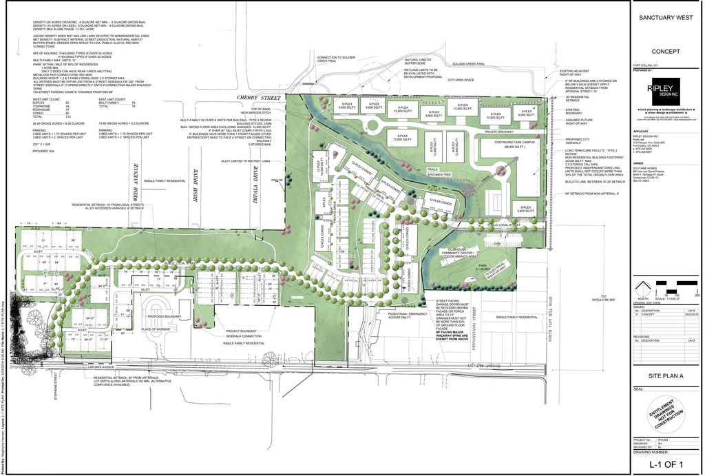
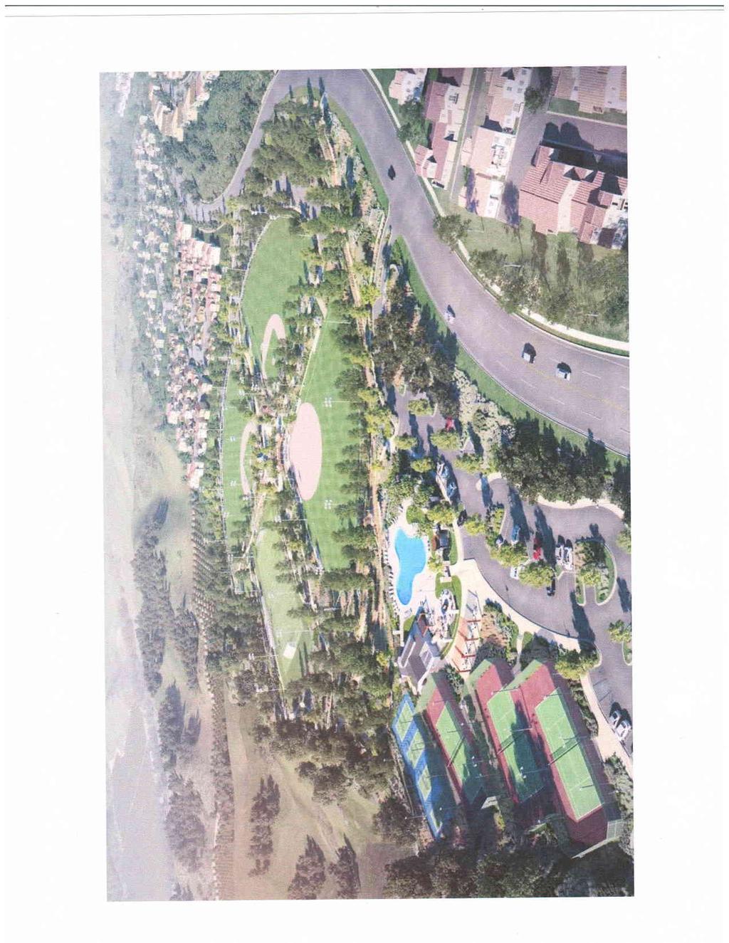
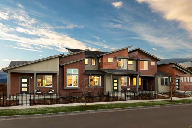
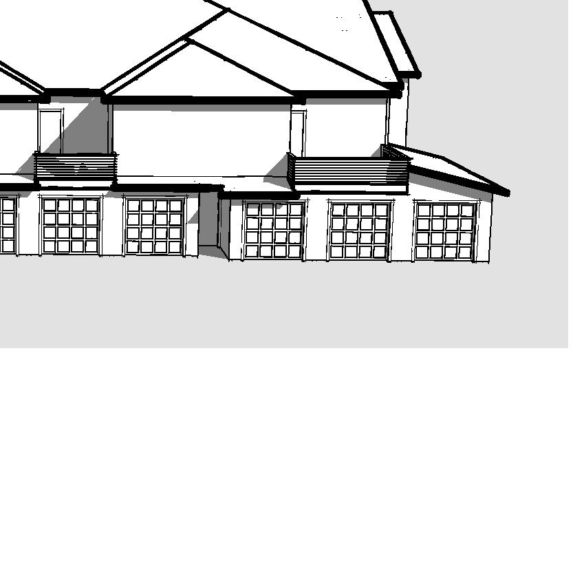
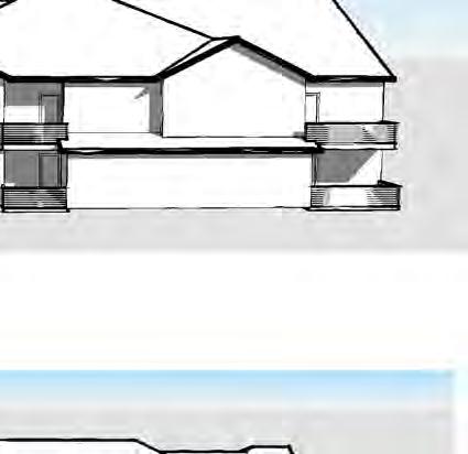
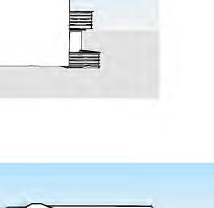
4 Sanctuary West Preliminary Development Review Narrative: A. Sanctuary West will be a dynamic new residential community in North Fort Collins. Drawing from the agricultural character of the area., Tthe architecture and site amenities are planned to have a modern farm and mid-century contemporary craftsman feel. It will be a mix of housing types ranging from two-family attached to 12 unit multi-family buildings and a senior housing continuum of care campus. Commented [DP1]: Will this be the name for the overall project? East and West parcels together? The site is located just north of Poudre High School on the North side of Laporte Avenue. The western eastern boundary borders Taft Hill Road and the site is divided by New Mercer Ditch. The west portion of the site is within the City limits and is zoned Low Density Mixed-Use Neighborhood (LMN). The plan proposes a mix of two family dwellings, single family attached and multi-family buildings. The area east of New Mercer ditch is currently not within the City limits. It will be annexed and zoned followed by a Project Development Plan (PDP) submittal. Due to the anticipated use of continuum senior care, Medium Density Mixed-Use Neighborhood (MMN) zoning is being proposed which varies from the LMN zoning shown on the Structure Plan. The east side of the project will also contain a park, community club house, and activity area for both the residential and senior housing users. B. There are currently no structures on the sitethere is one out building on the property which will be removed. There is also an n existing storm water conveyance on the west side of the property that will remain. C. There will be two points of access for vehicles into the neighborhood. There will be an access directly across from Stephens Street on Laporte Avenue with a second entrance along Taft Hill Road. Due to existing development of large storm water channels, extending the streets from the Green Acres Subdivision is not possible and instead will be connected by trails thereby significantly enhancing pedestrian connectivity to Laporte Avenue. In addition, two major pedestrian spines are proposed to connect Soldier Creek Trail to Laporte Avenue. These improvements will bring much needed pedestrian connectivity to this area of the City. Commented [DP2]: We do have part of the barn still there is this an issue? Commented [DP3]: Do we want to maintain the possibility of a third point of access per our discussion with Wonderland? D. Due to the site s irregular shape and existing storm water channels, the site design focuses on small neighborhoods. All of the dwelling units will be served by private drives and/ or alleys coming off of a single local street that runs east west through the site. Most all of the units face landscaped open space maintained by the home owner s association. Terminated vistas will be provided at the ends of major turns in the public road. The development is clustered in small neighborhoods and a modern farm and mid-century contemporary craftsman architectural aesthetic ties the community together. Pitched roof lines compliment the country feel and appearance as described in the Norwest Subarea Plan.
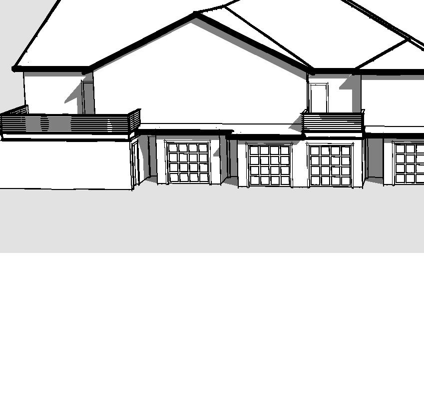
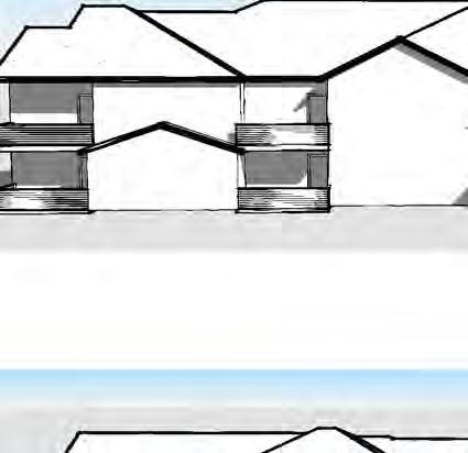
5 The multi-family units, the two-family attached (duplex) units, and the town home units will be two story with some of the townhome end units and duplexes offering a ranch option. The row homes will be three stories with a roof top deck. These building will utilize pitched roofs with varryingvarying heights to make them feel more like 2.5 story structures. The floor plates of these buildings will also change from floor to floor with the top floor pitched roof areas having as low as a 5-6 foot plate. These architectural features will reduce the massing of these buidlings and their location on the interior of the development will further reduce their prominence within the community. E. Through the placement of housing types, we have made a conscience effort to limit density adjacent to the existing single-family residences while meeting the minimumcoming in less dense on than code allows. density required(the west parcel is currently at 8 du/ac The east parcel is at 5.3 du/ac). E.. Most of the direct adjacencywhere there is adjacency to existing residential, the plan has placed hasthe 2 story duplex and town home units complimenting the existing residential.. The multi family and row homes have been placed in the eastern portion of the western half parcel of the project separated from adjacent housing by public streets and large water channels. In addition, the architecture proposed will complement the rural context of the surrounding area. Formatted: Not Highlight Commented [DP4]: Acreage allows for 234 units and we have 214 make more of a point about the lower than allowed density and how this will provide more open space and make the project feel less dense and more in keeping with the country character of the neighborhood. Formatted: Indent: Left: 0.5", No bullets or numbering F. Detention will occur on the southern half of both the eastern and western portions of the site. G. The detention and storm water will follow the current grades of the site and flow to natural low spots. H. Water quality will be provided to treat additional impervious run off. I. The New Mercer ditch flows through the site. An ECS will be provided. The current site plan shows the natural area buffer. Although some buildings and parking will intrude into the buffer zone, the overall aggregate area will exceed the buffer standard by 18,500 s.f. In addition, a trail will be provided from the Soldier Creek trail through the buffer to the southern property boundary. J. The multi-family buildings will have automatic fire sprinklers. What is the current code requirements for the: a. Two family dwellings? b. Single-family attached (3 plex and greater)? K. The irregular shape of the site along with the existing storm water facilities make the site difficult to develop. As a result, we are using pedestrian spines to create a livable community focusing on the existing and proposed open space. This will require modifications to the 350 pedestrian spine standard as well as street spacing. Additional Modifications requiredin Commented [DP5]: Should we list out our requested modifications of standard including 3 story buildings, 350 pedestrian spine, etc. and then list how we are providing equal to or better than offsets for these things? Ted has said over and over again that this is the key to getting these modifications approved. Formatted: Not Highlight
6 addition we will be asking for a modification to have 3 stories on the row homes.?the justifications will be based upon the generous buffer from the adjacent residential that localizing density allows along with the high percentage of open space. L. This project was submitted as a PDP and FDP in 2008 as Sanctuary West. Formatted: Not Highlight Formatted: Not Highlight Formatted: Not Highlight Formatted: Not Highlight M. Questions: a. What are the automatic fire sprinkler requirements for the two family and single family attached buildings? b. The loop drive on both the east and west end of the western portion of the site exceed 660. If these drives are to be public alleys, would a variance be viable. If they are private, is there an issue with the length. c. There is an existing right of way off set from Briarwood. We would like this to be gated emergency access only with an enhancea pedestrian corridor. Is that acceptable? d. All dwelling units are alley loaded. Much of the street in single loaded. In the areas with single loaded street, can we have a residential local cross section instead of the connector local? e. Additional questions? Commented [DP6]: Bill We were going to consider making this a usable access point in case Wonderland wants to develop the west parcel before the east parcel develops or develop the west parcel in stages. Formatted: Not Highlight Formatted: Numbered + Level: 2 + Numbering Style: a, b, c, + Start at: 1 + Alignment: Left + Aligned at: 0.75" + Indent at: 1"
7


8 ^ s^- Jf.r,c'::'1' r.4:,;t.:r
9
10
11

12 ,fr 'E _.d

13 .',...: :x!
14
15 Paired Homes STREETSCENE art and architecture PAIRED HOMES WONDERLAND HOMES Job DATE 23 MAY


16 art and architecture PLAN 1 & 2 MODERN FARMHOUSE PAIRED HOMES WONDERLAND HOMES Job DATE 23 MAY


17 art and architecture PLAN 1 & 3 MODERN FARMHOUSE PAIRED HOMES WONDERLAND HOMES Job DATE 23 MAY

18 art and architecture PLAN 1 & 2 MIDCENTURY MODERN PAIRED HOMES WONDERLAND HOMES Job DATE 23 MAY 2018


19 art and architecture PLAN 1 & 3 MIDCENTURY MODERN PAIRED HOMES WONDERLAND HOMES Job DATE 23 MAY 2018

20 Conceptual Street Scene Wonderland Homes - Sanctuary Concepts May 7, 2018

21 3 Unit Rowhome - Conceptual Front Elevation Wonderland Homes - Sanctuary Concepts May 7, 2018


22 3 Unit Rowhome - Front Perspective 3 Unit Rowhome - Rear Perspective 3 Unit Rowhome - Front Perspective Wonderland Homes - Sanctuary Concepts May 7, 2018

23 4 Unit Rowhome - Conceptual Front Elevation Wonderland Homes - Sanctuary Concepts May 7, 2018


24 4 Unit Rowhome - Front Perspective 4 Unit Rowhome - Rear Perspective 4 Unit Rowhome - Front Perspective Wonderland Homes - Sanctuary Concepts May 7, 2018
25 144'-4" SANCTUARY WEST 38'-2" 27'-1" 38'-2" 38'-2" MAIN LEVEL A1 03/28/18 36'-5 1/2" UNIT 3A UNIT 1B UNIT 3A UNIT 3A UNITS COUNT UNIT 3A 4 UNIT 2A 4 UNIT 1A 2 UNIT 1B 2 80'-0 1/2" 1-CAR GARAGE 2-CAR GARAGE TANDEM GARAGE TANDEM GARAGE TANDEM GARAGE TANDEM GARAGE TANDEM GARAGE TANDEM GARAGE TANDEM GARAGE TANDEM GARAGE 43'-7" GARAGE GARAGE 1 1ST LEVEL - SD 3/32" = 1'-0" S. QUEBEC ST., STE. 250 CENTENNIAL, CO 80111
26 144'-4" SANCTUARY WEST 38'-2" 26'-11" 38'-2" 38'-2" UPPER LEVEL A2 03/30/18 UNIT 3A 3A UNIT 1B 1A UNIT 3A 2A UNIT 3A 2A UNITS COUNT 68'-8" 32'-0" 36'-0" UNIT 2B UNIT 1A UNIT 1B UNIT 3A UNIT 3A 4 UNIT 2A 4 UNIT 1A 2 UNIT 1B 2 1 2ND LEVEL - SD 3/32" = 1'-0" S. QUEBEC ST., STE. 250 CENTENNIAL, CO 80111


27 SANCTUARY WEST MASSING MODEL A3 03/30/18 5 FRONT CORNER 3 SIDE 2 FRONT 4 REAR CORNER 1 REAR S. QUEBEC ST., STE. 250 CENTENNIAL, CO 80111
W Harmony Rd. Group Home
 Taft Hill Olt Ct Lemay Timberline Olt Ct 1109 W Harmony Rd Group Home 287 Vicinity Map «1 Douglas Aerial Site Map Wakerobin Ln 25 Mountain Vista Vine 287 Mulberry Prospect Shields Drake Horsetooth 25 ^_
1215 Shields Street Development PDR
 1215 Shields Street Development PDR Vicinity Map 287 Aerial Site Map Douglas 1 «V U 25 14 Mountain Vista Vine Mulberry Drake Lemay Shields Taft Hill Prospect Horsetooth Timberline _ ^ 287 University Ave
Conceptual Review Agenda
 Conceptual Review Agenda Schedule for 12/05/18 281 Conference Room A Wednesday, December 5, 2018 Time Project Name Applicant Info Project Description 8:30 Vine and Shields Multi-Family PDR180015 Todd Parker
Staybridge Suites. Aerial Site Map CCR POL. 1 inch = 17,493 feet. 1 inch = 250 feet. Vicinity Map. Zoning Map RL.
 Staybridge Suites Aerial Site Map 1 «2nd St 1st St 14 Vine Mulberry _ ^ U V Drake Lemay Prospect Shields Mountain Vista Buckingham Park Taft Hill Douglas Horsetooth Timberline 3rd St Vicinity Map E Lincoln
Harmony Commons, Lot 1 Office
 Technology Pkwy Taft Hill Lemay Timberline Technology Pkwy Lady Moon Dr Harmony Commons, Lot Office Vicinity Map 87 UV 4 «Douglas Mountain Vista Aerial Site Map Vine 87 Mulberry Prospect Shields Drake
Drake Rd & College Ave Spradley Barr Redevelopmentl
 Taft Hill Lemay Timberline Frontage Rd Frontage Rd Drake Rd & College Ave Spradley Barr Redevelopmentl 287 Vicinity Map «1 Douglas Colorado 287 State University 25 Mountain Vista Vine Mulberry Bay Rd Aerial
Penny Flats North Mixed-Use Residential
 Taft Hill Lemay Timberline Penny Flats North Mixed-Use Residential 287 Vicinity Map «1 Douglas 25 Aerial Site Map Mountain Vista Lee Martinez Community Park ^_ 287 Vine Mulberry Prospect Shields Drake
Preliminary Design Review. Poudre Garage Mixed Use December 14, 2015
 Preliminary Design Review December 14, 2015 1 Development Review Guide STEP 2 of 8 PRELIMINARY DESIGN REVIEW: APPLICATION General Information Preliminary design review is an opportunity for an applicant
Jason Holland 4/8/2015 x. *BOLDED ITEMS ARE REQUIRED* *The more info provided, the more detailed your comments from staff will be.
 Development Review Guide STEP 2 of 8 PRELIMINARY DESIGN REVIEW: APPLICATION General Information Preliminary design review is an opportunity for an applicant to discuss the requirements, standards, procedure,
Conceptual Review Agenda
 Conceptual Review Agenda Schedule for 10/23/17 to 10/23/17 281 Conference Room A Monday, October 23, 2017 Time Project Name Applicant Info Project Description Planner 9:30 Preston-Kelley Subdivision -
Conceptual Review Agenda
 Conceptual Review Agenda Schedule for 02/27/17 to 02/27/17 281 Conference Room A Monday, February 27, 2017 Time Project Name Applicant Info Project Description Planner 9:30 419 Wood Street Multi-Family
*BOLDED ITEMS ARE REQUIRED* *The more info provided, the more detailed your comments from staff will be.* Project Name
 Development Review Guide STEP 2 of 8 PRELIMINARY DESIGN REVIEW: APPLICATION General Information Preliminary design review is an opportunity for an applicant to discuss the requirements, standards, procedure,
Conceptual Review Agenda
 Conceptual Review Agenda Schedule for 04/09/18 to 04/09/18 281 Conference Room A Monday, April 9, 2018 Time Project Name Applicant Info Project Description Planner 9:30 College & Trilby Multi-Family CDR180019
Conceptual Review Agenda
 Conceptual Review Agenda Schedule for 06/02/14 to 06/02/14 281 Conference Room A Monday, June 2, 2014 Time Project Name Applicant Info Project Description Planner 9:30 1005 Riverside Avenue - Office CDR140036
PDR /21/15 Noah Beals 1/7/15 xx
 PDR150001 1/21/15 Noah Beals 1/7/15 xx 01.07.15 HTP Harmony Frontage Infrastructure Preliminary Design Review Project Narrative a) What are you proposing/use? The HTP Harmony Frontage Infrastructure project
Harmony Technology Park Third Filing, Second Replat Custom Blending, Project Development Plan/Final Development Plan - FDP #130021
 ITEM NO FDP #130021 MEETING DATE July 23, 2013 STAFF Pete Wray ADMINISTRATIVE TYPE I HEARING STAFF REPORT PROJECT: APPLICANT: OWNER: Harmony Technology Park Third Filing, Second Replat Custom Blending,
Conceptual Review Agenda
 Conceptual Review Agenda June 23, 2008 9:30 10:00 10:30 Project: Replat of Lots 13&16 Loomis Subdivision (Blk 267) Location: 429 Whitcomb (NW corner Whitcomb & Mulberry) Applicant: Craig Hughes Contact
EXHIBIT B PROJECT NARRATIVE POULSBO MEADOWS
 EXHIBIT B PROJECT NARRATIVE POULSBO MEADOWS Name of Project: Poulsbo Meadows; A Planned Residential Development (PRD)/Plat Applicants Name: PBH Group LLC/Byron Harris PO Box 1010 Silverdale, WA 98038 Description
Conceptual Review Agenda
 Conceptual Review Agenda March 9, 2009 9:30 10:00 10:30 11:00 11:30 Project: Little Gadgets Daycare Center Church expansion to include café and events center Location: 363 Jefferson (Iasis Church) Applicant:
Conceptual Review Agenda
 Conceptual Review Agenda May 11, 2009 9:30 10:00 10:30 11:00 11:30 Project: Orthopedic Center of the Rockies Expansion Location: 2500 E Prospect Applicant: Whitney Churchill Contact Info: 303-710-1937;
Section 9 NEIGHBORHOOD DESIGN
 Section 9 NEIGHBORHOOD DESIGN City of Lancaster Comprehensive Plan D u n k i n, S e f k o & A s s o c i a t e s, I n c. NEIGHBORHOOD DESIGN INTRODUCTION There are many ways in which a neighborhood can
2.0 AREA PLANS. Lakeside Business District. Lakeside Business District Land Use Categories:
 Lakeside Business District Lakeside Business District Land Use Categories: Campus Commercial Campus Commercial means a mixture of uses which includes corporate offices, office parks, hotels, commercial,
14 October 10, 2012 Public Hearing APPLICANT: MPB, INC
 14 October 10, 2012 Public Hearing APPLICANT: MPB, INC PROPERTY OWNER: MUNDEN & ASSOCIATES, LP STAFF PLANNER: Karen Prochilo REQUEST: Conditional Change of Zoning (AG-1 & AG-2 to Conditional O-2) ADDRESS
Request Modification of Proffers Approved by City Council on May 8, 2012 Modification of Conditions (Mini- Warehouse) Staff Recommendation Approval
 Staff Recommendation Approval") Applicant & Property Owner Salem Lakes Storage, LLC, a VA Limited Liability Company Public Hearing February 8, 2017 City Council Election District Centerville Agenda Item 4 Request Modification of Proffers
Applicant & Property Owner Salem Lakes Storage, LLC, a VA Limited Liability Company Public Hearing February 8, 2017 City Council Election District Centerville Agenda Item 4 Request Modification of Proffers
CITY OF ROHNERT PARK CITY COUNCIL AGENDA REPORT
 Mission Statement We Care for Our Residents by Working Together to Build a Better Community for Today and Tomorrow. CITY OF ROHNERT PARK CITY COUNCIL AGENDA REPORT ITEM NO. 5 Meeting Date: July 23, 2013
Sanford/Lee County Technical Review Committee (TRC) DEADLINES & MEETING DATES
 DEADLINES & MEETING DATES") Sanford/Lee County Technical Review Committee (TRC) DEADLINES & MEETING DATES The following 2019 information is based on the information available to staff at the time of creation. Dates & time may change
Sanford/Lee County Technical Review Committee (TRC) DEADLINES & MEETING DATES The following 2019 information is based on the information available to staff at the time of creation. Dates & time may change
Conceptual Review Agenda
 Conceptual Review Agenda Schedule for 10/28/13 to 10/28/13 281 Conference Room A Monday, October 28, 2013 Time Project Name Applicant Info Project Description Planner 9:30 Aggie Village North Redevelopment
SECTION 6 - LAND USE - RURAL RESIDENTIAL
 16.6.10.1 Intent The intent of the rural residential land use category is to provide low-density, single-family residential development within the Town s outer fringe. The current land is predominantly
CITY OF FORT COLLINS TYPE 1 ADMINISTRATIVE HEARING FINDINGS AND DECISION. CS Commercial, LLC 1337 Riverside Avenue, Unit 1 Fort Collins, CO 80524
 CITY OF FORT COLLINS TYPE 1 ADMINISTRATIVE HEARING FINDINGS AND DECISION HEARING DATE: January 7, 2016 PROJECT NAME: Caring Smiles Dental Clinic CASE NUMBER: FDP #150010 APPLICANT: OWNER: HEARING OFFICER:
CITY OF FORT COLLINS TYPE 1 ADMINISTRATIVE HEARING FINDINGS AND DECISION. Elevations Credit Union (2025 S. College Avenue)
") CITY OF FORT COLLINS TYPE 1 ADMINISTRATIVE HEARING FINDINGS AND DECISION HEARING DATE: September 28, 2016 PROJECT NAME: Elevations Credit Union (2025 S. College Avenue) CASE NUMBER: PDP #160021 APPLICANT:
CITY OF FORT COLLINS TYPE 1 ADMINISTRATIVE HEARING FINDINGS AND DECISION HEARING DATE: September 28, 2016 PROJECT NAME: Elevations Credit Union (2025 S. College Avenue) CASE NUMBER: PDP #160021 APPLICANT:
CONSENT CALENDAR CITY PLANNING COMMISSION AGENDA ITEM NO: A.1, A.2 STAFF: LARRY LARSEN
 Page 8 CONSENT CALENDAR CITY PLANNING COMMISSION AGENDA ITEM NO: A.1, A.2 STAFF: LARRY LARSEN FILE NO: CPC PUZ 14-00013 - QUASI-JUDICIAL FILE NO: CPC PUD 14-00014 QUASI-JUDICIAL PROJECT: APPLICANT: OWNER:
Public may provide comments on the GDP within the next two weeks (December 24)
") 25/70 General Development Plan (GDP) Public Meeting Wednesday, December 10, 2014 6:00 8:00 P.M. District 1 Police Station Community Room 1311 W 46th Ave, Denver, CO 80211 Council Woman Montero: This particular
25/70 General Development Plan (GDP) Public Meeting Wednesday, December 10, 2014 6:00 8:00 P.M. District 1 Police Station Community Room 1311 W 46th Ave, Denver, CO 80211 Council Woman Montero: This particular
Asbury Chapel Subdivision Sketch Plan
 Asbury Chapel Subdivision Sketch Plan PART 1: PROJECT SUMMARY Applicant: NVR Inc. Project Size: +/- 76.13 acres Parcel Numbers: 02101112,02116101,02116112, 02116113 Current Zoning: Transitional Residential
Design Review Application *Please call prior to submittal meeting to determine applicable fees*
 CITY OF EAGLE 660 E. Civic Lane, Eagle, ID 83616 Phone#: (208) 939-0227 Fax: (208) 938-3854 Design Review Application *Please call prior to submittal meeting to determine applicable fees* FILE NO.: CROSS
General Location Annex, Rezone & Preliminary Plat Lansdowne Addition, Unit Three
 NEWFOUNDLAND I-5 Agricultural District Subject Site SUNDANCE ANDERSON Single Family Residential CHRISTY PUD Agricultural District Highway Business General Location Annex, Rezone & Preliminary Plat Lansdowne
ARTICLE 6: Special and Planned Development Districts
 ARTICLE 6: Special and Planned Development Districts 6-10 Traditional Neighborhood Development (TND) District 6-10.10 Purpose and Intent The Traditional Neighborhood Development (TND) District provides
Conceptual Review Agenda
 Conceptual Review Agenda July 21, 2008 9:30 10:00 10:30 11:00 11:30 Project: Romero Park Community Center Location: 10 th Street, south of Romero, south of Museo de las Tres Colonias Applicant: Betty Aragon-Mitates
Applicant Name Phone / Fax / Address City State Zip Code . Property Owner Phone / Fax / Address City State Zip Code
 Master Development Plan Application Community Development Department City of Redmond 411 SW 9 th Street Redmond, Oregon 97756 541-923-7721 541-548-0706 FAX Master Development Plan Fee $38,862.52 File Number
Infill Residential Design Guidelines
 Infill Residential Design Guidelines Adopted March 23, 2004 Amended September 10, 2013 City of Orange Community Development Department Planning Division Phone: (714) 744-7220 Fax: (714) 744-7222 www.cityoforange.org
PLANNED UNIT DEVELOPMENT & SUBDIVISION STAFF REPORT Date: May 18, 2017
 & PUD-0000102-2017 PLANNED UNIT DEVELOPMENT & SUBDIVISION STAFF REPORT Date: May 18, 2017 NAME SUBDIVISION NAME Dauphin Creek Estates Subdivision Dauphin Creek Estates Subdivision LOCATION CITY COUNCIL
PLANNING COMMISSION. Agenda Item # 3
 PLANNING COMMISSION Agenda Item # 3 CASE SUMMARY Special Use Permit MEETING: Planning Commission, October 6, 2010 CASE NO: SITE ADDRESS: PROPOSAL: PRESENTED BY: STAFF RECOMMENDATION: SU-4-1010 406 S. 21st
Project Narrative Proposed Hillcrest Country Club Property Redevelopment Final Site Plan Application July 6, 2015 Revised: October 30, 2015
 Planning, Site and Master Planning, Landscape Architecture, Due Diligence, Project Management 2135 Bellcrest Court Royal Palm Beach, Fl. 33411 561-707-3410 Introduction and proposed application Project
RESIDENTIAL PLANNED UNIT DEVELOPMENT / SUBDIVISION AND REZONING CONCEPT AND DEVELOPMENT STAGE PLAN SUBMITTAL NARRATIVE
 RESIDENTIAL PLANNED UNIT DEVELOPMENT / SUBDIVISION AND REZONING CONCEPT AND DEVELOPMENT STAGE PLAN SUBMITTAL NARRATIVE DEVELOPMENT TEAM DONEGAL SOUTH Maple Grove, Minnesota March 27, 2017 Applicant/Developer/Builder:
Zoning Interface: Districts and Forms for Sioux Falls Zoning Ordinance
 Zoning Interface: Districts and Forms for Sioux Falls Zoning Ordinance For more information about each form, click on the associated link. Single-Family Residential Districts RR Rural Residential RS Single-Family
Eastcreek Farm. Planned Development Standards September, 2014
 Eastcreek Farm Planned Development Standards September, 2014 ekfarm Contents 01. General Standards 02. Residential Development Standards 03. Architectural Design Standards 04. Landscape Design Standards
STAFF REPORT. Planning and Zoning Case 16-17FDP Staff: Mike Peterman, City Planner Date: April 25, 2016
 STAFF REPORT Planning and Zoning Case 16-17FDP Staff: Mike Peterman, City Planner Date: April 5, 016 GENERAL INFORMATION Application: P&Z Case 16-17FDP: Final Development Plan to allow the development
12 January 12, 2011 Public Hearing APPLICANT: TAILWIND DEVELOPMENT GROUP,LLC PROPERTY OWNER: CITY OF VIRGINIA BEACH
 12 January 12, 2011 Public Hearing APPLICANT: TAILWIND DEVELOPMENT GROUP,LLC PROPERTY OWNER: CITY OF VIRGINIA BEACH STAFF PLANNER: Faith Christie REQUEST: Conditional Change of Zoning (from PD-H1 Planned
September 15 th and 27 th Public Workshops Summary
 September 15 th and 27 th Public Workshops Summary Overview The City of Fort Collins and Larimer County hosted two workshops in September, on the 15 th and 27 th, to discuss issues in specific areas of
TEN MILE & FRANKLIN LAND 39± ACRES 2954 WEST FRANKLIN ROAD MERIDIAN, ID
 PROPERTY INMATION HIGHLIGHTS Property Type: Land»» Access points: Three commercial access points on Ten Mile Land Size: 38.99 Acres Parcel: S1211336065 Zoning: RUT: Rural Urban Transition Future Zoning:
Developer s Program. The Station at East 54
 Developer s Program The Station at East 54 Existing Conditions The Station at East 54 is proposed for a 1.12 acre site at the northeast corner of Hamilton Road and Prestwick Road, tucked between the East
GREENBANK DEVELOPMENT MASTERPLAN
 DEVELOPMENT MASTERPLAN POTENTIAL TRAIN STATION COMMUNITY CENTRE Greenbank will be a connected masterplanned community providing easy access to local and surrounding amenity. Affordable quality homes, green
Neighborhood Districts
 NEIGHBORHOOD DISTRICTS SEVEN MAIN DISTRICTS Neighborhood Districts While the Development Plan provides a broad-scale overview of the neighborhood, this section focuses on uses and relationships at the
APPENDIX A 6 CONCEPTUAL PRELIMINARY PLAN GUIDE AND CHECKLIST FOR MAJOR SUBDIVISIONS CARRBORO DEVELOPMENT GUIDE APPENDIX A
 6 CONCEPTUAL PRELIMINARY PLAN GUIDE AND CHECKLIST FOR MAJOR SUBDIVISIONS Conceptual Preliminary Guide/Checklist for Major Subdivisions Page 1 FORM: REVIEW DATE: CONCEPTUAL PLAN REVIEW 2000 REVIEWED BY:
Drexel, Barrell & Co.
 Drexel, Barrell & Co. December 21, 2018 Engineers/Surveyors Boulder Colorado Springs Greeley 3 South 7 th Street Colorado Springs, Colorado 80905-1501 719 260-0887 719 260-8352 Fax El Paso County Planning
OCEANSIDE DEVELOPER S CONFERENCE. 1. 9:30-10:30 a.m. Proposed hotel on a 12,000 sq. ft. site at the northeast corner of Topeka St. and Tremont St.
 1 AGENDA OCEANSIDE DEVELOPER S CONFERENCE Wednesday, February 1st, 2017, 9:30 a.m. City Hall South, 1 st Floor, Guajome Room 1. 9:30-10:30 a.m. Proposed hotel on a 12,000 sq. ft. site at the northeast
MONTGOMERY COUNTY PLANNING DEPARTMENT THE MARYLAND-NATIONAL CAPITAL PARK AND PLANNING COMMISSION
 MONTGOMERY COUNTY PLANNING DEPARTMENT THE MARYLAND-NATIONAL CAPITAL PARK AND PLANNING COMMISSION MCPB Item No. Date: 3.10.2016 Site Plan 820160040 Nora School Parker Smith, Planning Technician, Area 1,
Planning Commission Staff Report Project Plan Approval Hearing Date: June 14, 2017
 Planning Commission Staff Report Project Plan Approval Hearing Date: June 14, 2017 ITEM 3 Peter Matson requests Project Plan Approval for an 80-acre mixed-use plan that includes 220 residential units and
SECTION ONE North East Industrial Zone Design Guide Palmerston North City Council June 2004
 SECTION ONE North East Industrial Zone Design Guide Palmerston North City Council June 2004 young heart easy living 1 Preface Industrial areas are a very important component of the economic well-being
M E M O R A N D U M November 9, 2018
 M E M O R A N D U M November 9, 2018 To: Southlake 2035 Corridor Planning Committee From: Kenneth Baker, Sr. Director of Planning and Development Services Subject: Item #8 Up to thirteen (13) residential
Urban Design Brief Proposed Residential Development 5219 Upper Middle Road City of Burlington
 Urban Design Brief Proposed Residential Development 5219 Upper Middle Road City of Burlington Prepared by Weston Consulting Prepared for BLOOMFIELD DEVELOPMENT INC. Date: March 2017 Table of Contents 1.
APPLICATION FOR REZONING PROPERTY CITY OF HOLLAND, MICHIGAN. Name of Applicant. Address, and Phone # of Applicant
 APPLICATION FOR REZONING PROPERTY CITY OF HOLLAND, MICHIGAN Name of Applicant Address, Email and Phone # of Applicant Name and Address of Owner (if other than applicant) Ownership Interest of Applicant
City of Lafayette Study Session Staff Report Design Review Commission
 City of Lafayette Study Session Staff Report Design Review Commission Meeting Date: April 24, 2017 Staff: Payal Bhagat, Senior Planner Subject: HDP18-15 & HDP31-15 Ramesh Patel & Melcor Development (Owners),
Planning Districts INTRODUCTION
 INTRODUCTION To facilitate detailed examination of development prospects for all areas of the community, Delano has been divided into 14 planning districts. The location of these planning districts is
Secrest Short Cut and Monroe Expressway Small Area Plan AUGUST 29, 2018
 Secrest Short Cut and Monroe Expressway Small Area Plan AUGUST 29, 2018 Background and Process Monroe Expressway will be open by the end of 2018 Union County and Indian Trail identified a need to revisit
M E M O R A N D U M SITE DATA
 Department of Community Planning & Economic Development 250 South 4 th Street, Room 300 Minneapolis, MN 55415-1385 M E M O R A N D U M TO: City Planning Commission, Committee of the Whole FROM: Lisa Steiner,
Application Number: SD Project Name: Walton Farms Preliminary Subdivision (acting as Master Plan)
") STAFF REPORT Town of Clayton Planning Department 111 E. Second Street, Clayton, NC 27520 P.O. Box 879, Clayton, NC 27528 Phone: 919-553-5002 Fax: 919-553-1720 Planning Board May 22, 2017 Application Number:
STAFF REPORT Town of Clayton Planning Department 111 E. Second Street, Clayton, NC 27520 P.O. Box 879, Clayton, NC 27528 Phone: 919-553-5002 Fax: 919-553-1720 Planning Board May 22, 2017 Application Number:
Watertown City Council
 City of Watertown Watertown City Council April 14 th, 2015 Agenda Item: City Comment on Sun Share CUP Application Request for Action: Motion to Approve City Comments regarding CUP Application Department:
Michael D, Harvey, Current Planning Supervisor. This project was originally approved in 2012 by the BOCC and is summarized as follows:
 PLANNING & INSPECTIONS DEPARTMENT Craig N. Benedict, AICP, Director Current Planning (919) 245-2575 (919) 644-3002 (FAX) www.orangecountync.gov 131 W. Margaret Lane Suite 201 P. O. Box 8181 Hillsborough,
Master Zoning Plan for the Northeast Property. in El Paso, Texas. Approved August Master Zoning Plan for the Northeast Property. City of.
 El Paso, Texas in El Paso, Texas Prepared for: City of Prepared by: Texas Kimley-Horn and Associates, Inc. 12700 Park Central Drive Suite 1800 Dallas, Texas 75251 Tel: (972) 770-1300 Approved August 2008
Behnke Ranch Property, Pasco County: Master Plan Development Approach
 February 24, 2014 , Pasco County: Master Plan Development Approach Location & Program The (Legacy PUD) is located in southwest Pasco County along State Road 54 approximately 1.5 miles west of the Suncoast
Drexel, Barrell & Co.
 Drexel, Barrell & Co. June 18, 2018 Engineers/Surveyors Boulder Colorado Springs Greeley 3 South 7 th Street Colorado Springs, Colorado 80905-1501 719 260-0887 719 260-8352 Fax El Paso County Planning
Landscape Design Requirements and Guidelines for Private Lots in the Old Town North Neighborhood
 Landscape Design Requirements and Guidelines for Private Lots in the Old Town North Neighborhood July 2009 Prepared for High Country Management on behalf of the OTN Homeowners Association, by Christine
Site Design (Table 2) Fact Sheet & Focus Questions:
 Fact Sheet & Focus Questions:") Site Design (Table 2) Fact Sheet & Focus Questions: BACKGROUND WHAT IS SITE DESIGN? Site design refers to the arrangement of buildings and open spaces on adjacent sites to maximize the shared benefits
Site Design (Table 2) Fact Sheet & Focus Questions: BACKGROUND WHAT IS SITE DESIGN? Site design refers to the arrangement of buildings and open spaces on adjacent sites to maximize the shared benefits
Colerain Township report to. Hamilton County Regional Planning Commission. December 2, 2010, 1:00PM. t a f f r e p o r t
 Colerain Township report to Hamilton County Regional Planning Commission December 2, 2010, 1:00PM Preliminary Plan: Case No.: ZA2001-04, Forevergreen Prepared By: Amy Bancroft, Land Use Planner t a f f
Baumgarten MPUD. Exhibit 3 Evaluation Criteria
 Pursuant to LDC subsections 10.02.13 B, 10.02.08 F and Chapter 3 G. of the Administrative Code, staff s analysis and recommendation to the Planning Commission, and the Planning Commission s recommendation
 PROJECT NARRATIVE AVENIR PCD SITE PLAN #2 SITE PLAN REVIEW March 14, 2018 Request Avenir Holdings, LLC, the owner of the approved Avenir Planned Urban Planning and Design Landscape Architecture Communication
COLVER ROAD INDUSTRIAL CONCEPT PLAN
 COLVER ROAD INDUSTRIAL CONCEPT PLAN A CONCEPTUAL LAND USE AND TRANSPORTATION PLAN FOR TA-4 AN URBAN RESERVE AREA OF THE CITY TALENT City of Talent Adopted by City Council Resolution No., June, 2015 PART
Mitchell Ranch South MPUD Application for Master Planned Unit Development Approval Project Narrative. Introduction
 Mitchell Ranch South MPUD Application for Master Planned Unit Development Approval Project Narrative Introduction Mitchell Ranch South is a proposed single family (detached) residential development on
Agenda Item. Applicant Logan Virginia Properties, LLC Property Owners Byler Azalea, LLC & Gateway Free Will Baptist Chuch
 Applicant Property Owners Byler Azalea, LLC & Gateway Free Will Baptist Chuch Public Hearing March 14, 2018 City Council Election District Kempsville Agenda Item 6 Request Conditional Rezoning (B-2 Community
CHAPTER 2 SUMMARY 1. PROJECT SUMMARY DATA
 CHAPTER 2 SUMMARY This is an Initial Study format used to determine, pursuant to CEQA Guidelines Section 15177, whether a project 1) is within the scope of a Master EIR (MEIR), 2) may result in additional
Ten Mile Creek Planning Area
 PLANNING AREA POLICIES TEN MILE CREEK Ten Mile Creek Planning Area Location and Context The Ten Mile Creek Planning Area ( Ten Mile Creek area ) is located south of the current Boise AOCI, generally south
Checklists. Project Name: Location: File Number: Date of Submittal: Reviewer: Date: Applicant: Contact Name: Phone Number:
 Applicant: Contact Name: Phone Number: Email: Project Name: Location: File Number: Date of Submittal: Reviewer: Date: Concept Plan Requirements: I. General Project Information 1. Address or parcel number
This Review Is Divided Into Two Phases:
 Semiahmoo Town Centre Review The purpose of this review: To review the Semiahmoo Town Centre Concept Plan, originally approved in 1993, to ensure that this centre will continue to serve the needs of South
CHAPTER 7: VISION AND ACTION STATEMENTS. Noble 2025 Vision Statement
 CHAPTER 7: VISION AND ACTION STATEMENTS This chapter presents the vision, policy and action statements that transform the comprehensive planning study, an analysis of Noble s past, future trends and community
SITE CITY PLANNING COMMISSION AGENDA ITEM NO: 5 STAFF: LONNA THELEN FILE NO: CPC CU QUASI-JUDICIAL ART C. KLEIN CONSTRUCTION
 Page 58 CITY PLANNING COMMISSION AGENDA ITEM NO: 5 STAFF: LONNA THELEN FILE NO: CPC CU 10-00022 QUASI-JUDICIAL PROJECT: APPLICANT: OWNER: COLORADO SPRINGS CHARTER ACADEMY ART C. KLEIN CONSTRUCTION COLORADO
MEMORANDUM. I2 District Downtown Parking Overlay District 24,000 square feet /.55 acres. Industrial Employment District North Loop Small Area Plan
 Department of Community Planning & Economic Development 50 South 4th Street, Room 300 Minneapolis, MN 5545-385 MEMORANDUM To: City Planning Commission, Committee of the Whole Prepared By: Peter Crandall,
Department of Community Development. Planning and Environmental Review Division Revised Notice of Preparation
 Department of Community Development Michael J. Penrose, Acting Director Divisions Building Permits & Inspection Code Enforcement County Engineering Economic Development & Marketing Planning & Environmental
TREE REMOVAL PERMIT PACKET
 PERMIT INTAKE HOURS Permit Applications will be accepted between 8:30 am and 4:30 pm. Community Development Engineering Division 38 Hill Street, Suite G-30 Roswell, GA 30075 770-641-3780 www.roswellgov.com
CITY PLANNING COMMISSION AGENDA. ITEM NO: 6.a 6.b STAFF: LONNA THELEN
 Page 156 CITY PLANNING COMMISSION AGENDA ITEM NO: 6.a 6.b STAFF: LONNA THELEN FILE NO(S): A. - CPC ZC 08-00069 QUASI-JUDICIAL B. - CPC CU 08-00070 QUASI-JUDICIAL PROJECT: APPLICANT: OWNER: PHIL LONG VALUCAR
Old Town Neighborhoods Plan. Choices Event Wednesday, December 9, 2015
 Old Town Neighborhoods Plan Choices Event Wednesday, December 9, 2015 Agenda 6:00 6:10 p.m. Welcome + Sign In 6:10 6:30 p.m. Presentation 6:30 8:00 p.m. Workshop + Open House Seeking your input on: Neighborhood
BYLAW C A Bylaw of Rocky View County to amend Land Use Bylaw C
 BYLAW C-7720-2017 A Bylaw of Rocky View County to amend Land Use Bylaw C-4841-97. The Council of Rocky View County enacts as follows: PART 1 TITLE This Bylaw shall be known as Bylaw C-7720-2017. PART 2
CHAPTER 22 Rural Open Space Community Developments
 CHAPTER 22 Rural Open Space Community Developments Section 22.1 Description and Purpose The intent of this Chapter is to offer property owners an alternative to traditional zoning requirements for rural
2. Form and Character. 2.1 Introduction. 2.2 The Downtown Addition Plan. 2.1 Introduction
 2.1 Introduction 2.1 Introduction This section of the Specific Plan describes and illustrates the desired form, character and uses of the Downtown Addition and explains the underlying design principles.
13. PRELIMINARY PLAT NO MILLS FARM - Vicinity of the southeast corner of 159 th Street and Quivira Road
 13. corner of 159 th Street and Quivira Road 1. APPLICANT: HNTB Corporation is the applicant for this request. 2. REQUESTED ACTION: The applicant is requesting approval of a preliminary plat for a 383-lot
REQUEST FOR COUNCIL ACTION 6A AGENDA ITEM ORIGINATING DEPT. AGENDA ITEM CITY ADMINISTRATOR APPROVAL
 DATE REQUEST FOR COUNCIL ACTION 6A AGENDA ITEM ORIGINATING DEPT. AGENDA ITEM CITY ADMINISTRATOR APPROVAL Community Development Territorial Greens PUD Concept Plan Development Stage Plan Subdivision (Preliminary
SEMSWA s Role in the Land Development Process
 SEMSWA s Role in the Land Development Process One of SEMSWA s responsibilities is to ensure that any new development or redevelopment within its service area is designed and constructed in compliance with
Major Subdivision Sketch Plan Checklist
 This checklist provides specific requirements that are apart of the Sketch process. The entire process is described by the Huntersville Subdivision Review Process which details all the submittal and resubmittal
Illustration of Eastlake Farmer s Cooperative Grain Elevator. Chapter 5: implementation 5-1
 Illustration of Eastlake Farmer s Cooperative Grain Elevator Chapter 5: implementation 5-1 chapter 5: implementation Introduction The Eastlake Subarea Plan includes a wide range of recommendations intended
Westwood Shopping Center Sketch Plan, Plan # February 23, 2017 Item # 9
 Westwood Shopping Center Sketch Plan, Plan # 320170010 February 23, 2017 Item # 9 Westwood II Site 64,111 s.f. Manor Care site: vacant two story building HOC-Westwood Towers, 15 story tower To be considered
RULES AND REGULATIONS FOR GENERAL DEVELOPMENT PLANS
 RULES AND REGULATIONS FOR GENERAL DEVELOPMENT PLANS IN THE MIXED-USE ZONE DISTRICTS OS-1, R-MU-20, R-MU-30, C-MU-10, C-MU-20, C-MU-30, T-MU-30 Jointly adopted by the Departments of Community Planning and