Conserving the Washington-Baltimore Region s Green Network: The Time to Act is Now
|
|
|
- Ashlynn Vanessa Chambers
- 5 years ago
- Views:
Transcription


1 Conserving the Washington-Baltimore Region s Green Network: The Time to Act is Now MAY 2004
2 ACKNOWLEDGEMENTS This report was developed under cooperative agreement CX awarded by the U.S. Environmental Protection Agency. It has not been formally reviewed by EPA. The views expressed in this document are solely those of American Farmland Trust and Chesapeake Bay Foundation, and EPA does not endorse any product or commercial services mentioned in this publication. Additional support to undertake this work was provided by the Prince Charitable Trusts to Chesapeake Bay Foundation. Thanks to the many individuals and organizations that provided the data used to develop the green network maps and report. It would be impossible to name everyone who contributed. In lieu, we would like to extend our deepest thanks to the following groups for contributing to this study: Planning directors and staff from each of the counties in the region, as they reviewed a draft version of the map for accuracy and provided detailed information on their county s planning and zoning efforts. Harford County (MD); Howard County (MD); Maryland Department of Natural Resources; Maryland Department of Planning; Montgomery County (MD); Piedmont Environmental Council; RESAC Program, Department of Geography, University of Maryland; Virginia Outdoors Foundation Map design and final Geographical Information Systems (GIS) work for this project was undertaken by GreenInfo Network of San Franciso, CA, directed by Larry Orman and primarily undertaken by Tommy Albo. Special thanks to AFT and CBF members without whose generous support of our efforts this project would not have been possible. Ed Thompson, AFT, and Lee Epstein, CBF, initially directed this project, with Kevin Schmidt ably stepping in for Ed for the final seven months of work and production. Thanks also to Jimmy Daukas and Kate Eldred, AFT, and to John Page Williams, John Surrick, and Jessica Hood of CBF for lending their editing, design and Web-publishing talents. Initial work on the project by Steve Libbey, formerly of CBF, also is appreciated. American Farmland Trust th Street, NW, Suite 800 Washington, DC (202) Chesapeake Bay Foundation Philip Merrill Environmental Center 6 Herndon Avenue Annapolis, MD / ; 410/ , American Farmland Trust and Chesapeake Bay Foundation
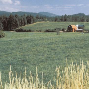
3 Conserving the Washington-Baltimore Region s Green Network: The Time to Act Is Now The Baltimore-Washington region relies on an existing green network of farms and forest land to enrich our lives in many ways, from scenic open space and cleaner water to wildlife habitat and fresh, local foods. However, that network, our incredible asset, is shrinking. Every day we lose a little bit more open space to satisfy the strong demand for land. We can t continue to lose thousands of acres and expect to enjoy the land s benefits. Based on GIS mapping just completed, we know that we still have enough farm and forest land to create an interconnected, green network throughout the region. But it won t last. We need to act now to permanently protect this resource for the future. We know how to do it, but we must coordinate the work across jurisdictions. We need a regional effort to protect a regional asset. Green Network = Quality of Life Permanently conserving an interconnected green infrastructure of open space is critically important to the future of the greater Washington-Baltimore region. Despite two centuries of steady population growth, the region s remaining network of farm and forest land still enriches our quality of life in many ways. Open space also provides crucial ecological services to us, such as flood protection and reduction of air and water pollution. This great green filter protects public drinking water supplies, reduces the impacts of stormwater runoff and reduces the degradation of streams, rivers and the Chesapeake Bay. Meanwhile, a green network throughout the region provides vital habitat for a broad variety of mammals, birds and fish species (some of which are rare, threatened or endangered). At the same time, the region s working farmland provides a direct supply of fresh farm products and yields direct economic benefits in rural communities, as well as helps to define the overall sense of place. The region s population, however, is growing quickly, sprawling out into predominantly rural areas. Ultimately, we cannot save the streams, the rivers, the Chesapeake or the wildlife habitats around them if we continue to lose tens of thousands of acres of these natural filters annually to poorly planned development. The science is clear: In stream watersheds where the acreage of impervious surfaces rooftops, roadways and parking lots exceeds 10 percent of the total area, we are beginning to lose the water quality that is essential to the waterways health. Add enough damaged streams, and an entire river system suffers, all the way to the Chesapeake Bay. The easiest land to develop is often farmland closest to the areas of fastest growth. Unfortunately, this land quite likely is the most productive and most valuable from environmental, cultural and economic perspectives when managed well. 1
4 A Fast-Closing Window of Opportunity to Conserve Land use in the greater Washington-Baltimore region is rapidly changing. Farmland and forests, which account for most of the region s open space, are being converted to developed land by the tens of thousands of acres each year. 1 Some of this new development is designed and located within existing communities, strengthening our villages, towns and urban places. Much of the development, however, is ill-planned sprawl, the kind of growth that spreads out across the landscape, paving our open space resources and costing our communities in many more ways than it benefits them. At the same time, this region of more than 5 million acres still has valuable green space assets worthy of permanent protection. There remains a significant amount of farm cropland with productive soils in the urban-edge and still-rural parts of the region. Other farmland has high livestock value for beef and dairy production. Some undeveloped land holds important cultural and historic resources, while additional land offers high natural resource value for water quality, water supply, wildlife habitat and protection of tidal waters of the Chesapeake Bay ecosystem. large blocks of contiguous forest, some public and some private, which provide high quality habitat for forest-interior-dwelling migratory bird species, while helping to clean the air and filter rain water. 2 Finally, the green infrastructure of farms, forests, river and stream corridors and wetlands also helps to shape and define the region s developed and growth areas. Open space and natural settings provide unique character of place. The bottom line is that there exsists still a great, green and interconnected network of open space throughout the region that provides substantial economic, cultural and environmental benefits to its citizens. But strong competition for land threatens the long-term sustainability of this network. Our region s green necklace needs a broadly coordinated planning effort if we wish to enjoy it in the future. A moderate amount of forested land in the region is currently growing harvestable timber, Christmas trees and nursery stock. There are also 1 From , the Maryland counties in this region alone converted about 10,600 acres each year to urban uses. Maryland Department of Planning, Maryland s Changing Land: Past, Present and Future (2001). In a Landsat-based 2002 study by the University of Maryland RESAC Program, urbanization in the region as a whole was seen as consuming an average of 28,000 acres of open land annually from C. Jantz et al., Modeling Future Growth in the Washington, DC Area, University of Maryland Department of Geography, Mid-Atlantic Regional Earth Science Application Center (April 2002). In 1997, American Farmland Trust (AFT) identified the Northern Piedmont, which included parts of Maryland and Virginia, as a highly threatened agricultural region. American Farmland Trust, Farming on the Edge (1997). 2 American Forests, Mid-Atlantic Eco-Regional Analysis for US Forest Service (1999). 2
5 Existing Open Space Protection: Well-Intentioned but Often Fragmented Over the years, the region s state and local governments and private citizens have taken steps to protect many valuable open space resources. Some efforts involved classic land conservation techniques, such as the purchase of deedrestricted open land or the sale or donation of conservation easements on private land. Indeed, almost 350,000 acres of the region s land base have been permanently conserved in this way. 3 Several hundred thousand more acres are owned as wildlife refuges, public parkland and public recreation open space. Table 1 shows how much land already has been protected solely by conservation and farmland easements. Many of the region s local jurisdictions have community master or comprehensive plans with good intentions to protect rural lands and landscapes. Without strong zoning, however, these plans may actually lead to more sprawl in the form of wide spread two- and three-acre developed lots. (Please see the Planning and Zoning Status map). A smaller number, including, for example, Montgomery and Baltimore Counties in Maryland, and Fauquier County in Virginia, have protected land through zoning that restricts development with densities generally considered low enough to keep agriculture, forest and other open space land uses viable. These successful programs allow density of one housing unit per 20, 25 or even 50 acres, providing a land base where viable farming and woodlot operations are at least possible. Zoning programs operating at such densities have protected approximately 1.5 million acres. This approach, when combined with zoning for more TABLE 1 Washington-Baltimore Preserved Land, 2003 COUNTIES ACREAGE Anne Arundel 11,278 Baltimore 32,133 Calvert 19,917 Carroll 37,844 Charles 12,027 Fairfax 179 Fauquier 51,863 Frederick 24,951 Harford 31,725 Howard 18,431 King George 3,106 Loudoun 34,900 Montgomery 53,832 Prince George s 3,186 Prince William 405 St. Mary s 7,759 Stafford 446 TOTAL 343,981 Sources: Maryland Department of Natural Resources; Maryland Department of Planning; Piedmont Environmental Council, Virginia local jurisdictions; Virginia Outdoors Foundation. compact growth in settled areas with existing infrastructure, can be very effective. It is unknown how much land is effectively zoned for compact, non-sprawling growth. Some localities have coupled zoning with strategic conservation purchases or have promoted conservation restrictions. With a few single-county exceptions (e.g., Montgomery County s Transfer of Development Rights and Legacy Open Space Programs, Fairfax County s Environmental Quality Corridors), however, many of these local efforts, public and private alike, have been reactive and piecemeal. They are often fragmented and scattershot, hardly ever coordinated across county lines. 3 Maryland Department of Planning and Maryland Department of Natural Resources (2003); local governments in Virginia ( ); Personal communication, Mike dehart, Piedmont Environmental Council (Jan. 2004); Virginia Outdoors Foundation Web site (2003). 3
6 Mapping a Coordinated Green Network for the Region Chesapeake Bay Foundation and American Farmland Trust undertook an effort to assess the condition of the region s open space assets, past and present attempts to conserve them and the effects that a coordinated green network might have on future growth. The project mapped the region s protected lands and collected conservation status information from state and local sources creating a greenprint for conservation. (Please see the Green Network map). The maps include the area s refuges, parks and recreation lands, wetlands, farmland and open space conservation easements and land protected by zoning, as well as unprotected farmland, forests and stream valleys. The green network map shows a conceptual protected area at the broad regional scale, with sufficient room for growth (light gray area on the green network map). More fine-grained, local detail will certainly be necessary, as our maps do not capture it. In dozens of interviews with local planning officials, three conclusions have become clear: First, the region has made much progress with respect to landscape-scale protection of open space and working lands, but it is not consistent or systematic throughout the region. Second, there is a natural green network that suggests itself through alreadyaccomplished private land conservation and enlightened planning, regulatory and public/private land purchase actions. Third, we still have a major challenge and a major opportunity to protect the kind of regional, interlinked green network that is so valuable to us all. What Are the Next Steps? The region has made some progress. Current growth pressures, however, ensure that our window of opportunity for coordinated conservation will close if we do not act quickly. Any regional greenprint must encompass regionwide, interconnected environmental systems and natural resources, as well as the working farm and forest landscape that provides food, fiber and direct economic and cultural benefit to all of our citizens. What can make this greenprint happen? What can launch and sustain such an endeavor? This kind of ambitious initiative requires development of an overarching vision, as well as active support and long-term commitment, by a wide variety of public and private constituencies. It also demands an open decision-making process that defines the details over time. It requires strong political will and a specific action plan that blends both regional and local efforts. At CBF and AFT, we see the vision beginning to emerge from the mapping we have begun here. Now we challenge others to join in to review, discuss and modify it to take it to the next level of detail and effort. Based on that vision, an action plan must come from three sources: Public organized participation by the public-at-large in town and country, and 4
7 by specific, affected stakeholders, such as builders and developers, environmental advocates, civic groups and communities of faith; Government regional, cooperative intergovernmental policy development and regulatory action by state and local governments, planning districts and regional councils of government, preferably in partnerships; and Funders support by public and private funding communities, for use of various financial tools and funding sources for key conservation purchases. There may be an opportunity now for federal agencies (e.g., the National Park Service); local, regional and national conservation organizations; the Metropolitan Washington Council of Governments; and the local jurisdictions to move this visioning process forward. CBF and AFT pledge our support toward the convening of stakeholders in a summit of public and private leaders, or another equally effective mechanism for progress. Together we can develop goals, objectives and a clear process for attaining them. We need local governments to promote permanent land protection in the form of easements/purchases/donations and effective zoning that restricts development to keep agriculture, forest and open space land uses viable. Further, we need to coordinate this action across jurisdictions to ensure a regional green network. The Value of a Green Network and the Need to Move Forward Now The region s green space includes productive, working farmland that helps provide its citizens with fresh fruit and produce, promoting a solid rural economy through a working landscape of farms and forests, while it protects the character of rural communities. Permanently conserved open space protects and provides historic and cultural ties for the citizens of the region, yielding honest, place-based character and identity that would otherwise be lost. The region s open space endows us with invaluable parks and recreation lands, corridors and greenways places for a Sunday drive, a hike or a bike ride. Meanwhile, conserving this green network of natural filters will complement massive regional efforts to reduce pollution of streams, rivers and the Chesapeake Bay. We can ensure that fishing, boating and a summer weekend s crab feast remain a part of the region s culture and a legacy we pass on to our children. Adequately conserved, networked open space also can help the region guide growth while providing quality human habitat and appreciated property values, along with fiscal efficiency for state and local governments. In this era of corporate mobility, a region s broad and protected green network can be a critical quality of life component that seals the deal for business location or retention. 4 4 Charles J. Fausold and Robert J. Lillieholm, The Economic Value of Open Space: A Review and Synthesis, Land Lines, v.8.no.5, Lincoln Institute of Land Policy (1996). 5
8 A future that permanently preserves an interconnected green network of our invaluable open space resources is a worthy goal for the Washington-Baltimore region. Attaining this will take hard work. Not attempting this is a conscious decision to allow such important land to be lost. There s no time to lose. About our Methodology Mapping resources and statistics for this project were collected from a variety of sources. The base map of the region, including its urbanized area, farm and forest land and already protected open space, was initially developed in 2002 from Landsat imagery and state and local data, by the University of Maryland Department of Geography, Mid-Atlantic Regional Earth Science Application Center (RESAC). Some new data were added as they became available: Year 2003 protected lands shapefiles and related information on protected lands in Montgomery, Harford, Howard, Loudoun and Fauquier counties from those local jurisdictions; and the addition of a northern sliver of land in Harford, Baltimore and Carroll counties that was excluded from the original Landsat image. Forest and farmland were combined into one color representation, and other adjustments were made, by GreenInfo Network of San Francisco, California, our GIS consultant for this project. The plans and policies map was handdrawn by AFT and CBF from information directly received from local jurisdictions on hardcopy maps and in interviews, May October, 2003, and digitized by GreenInfo Network in March (Interviews were conducted with senior planning staff in every county covered by the maps to discuss information displayed on draft versions.) The Green Network map/overlay was developed by AFT and CBF utilizing the overlaid information from the other maps, good conservation and environmental planning practice and best professional judgment. Statistics on land conserved by easement were separately collected from information developed by the Maryland Departments of Planning and Natural Resources, the Virginia Outdoors Foundation, local jurisdictions and the Piedmont Environmental Council. Statistics on land that is effectively protected by zoning were derived by digitizing and measuring that layer through the GIS system. ESRI s ArcGIS 8 was utilized as the basic GIS software by GreenInfo Network, Inc. 6

9 Conserving a Green Network Base Map 7

10 Planning and Zoning Status Map 8

11 Green Network Map 9
12 American Farmland Trust th Street, NW, Suite 800 Washington, DC (202) Chesapeake Bay Foundation Philip Merrill Environmental Center 6 Herndon Avenue Annapolis, MD / ; 410/
Protecting Farmland. The Future of Agriculture in Prince George s County
 Protecting Farmland As demonstrated in the previous section, farmland in Prince George s County is disappearing at a rapid pace. If the loss of farmland continues at this rate, no farmland will be left
Conservation Corridor Planning and Green Infrastructure Themes
 Conservation Corridor Planning and Green Infrastructure Themes Prepared by the Green Infrastructure Center Inc. and the Northern Virginia Regional Commission February 22, 2011 Brief Overview Project Background
Green Infrastructure. by Karen Engel, NYS DEC. NYS Department of Environmental Conservation
 Green Infrastructure by Karen Engel, NYS DEC What is Green Infrastructure? For some it s all about water Green Infrastructure techniques use soils and vegetation to infiltrate, evapotranspirate, and/or
Improve Neighborhood Design and Reduce Non Point Source Water Pollution
 HOW TO Planning Guide Improve Neighborhood Design and Reduce Non Point Source Water Pollution This document was funded by a grant from the New Hampshire Coastal Program with funding from the National Oceanic
CHAPTER 4 FUTURE LAND USE AND URBAN SERVICES DISTRICTS
 CHAPTER 4 FUTURE LAND USE AND URBAN SERVICES DISTRICTS Introduction This chapter discusses how Benzie County should grow and change in the future. A community can grow and change in many different ways.
National Association of Conservation Districts. Kris Hoellen Vice President, Sustainable Programs The Conservation Fund September 19, 2013
 National Association of Conservation Districts Kris Hoellen Vice President, Sustainable Programs The Conservation Fund September 19, 2013 Our Mission The Conservation Fund forges partnerships to conserve
Countywide Green Infrastructure
 Montgomery County s Countywide Green Infrastructure F U N C T I O N A L M A S T E R P L A N The Maryland National Capital Park and Planning Commission INFRASTRUCTURE An underlying base or foundation especially
Town of Peru Comprehensive Plan Executive Summary
 Town of Peru Comprehensive Plan Executive Communities that plan grow by choice, not by chance. A plan makes growth thoughtful, understandable, and predictable. A plan shows that a community is managing
The Trust for Public Land. in Minnesota
 The Trust for Public Land in Minnesota Protecting Minnesota s Natural Legacy In Minnesota, The Trust for Public Land (TPL) is protecting strategic land and water resources for people to enjoy as parks,
Green Infrastructure Policies and Ordinances
 Green Infrastructure Policies and Ordinances October 23, 2013 By Karen Firehock, Green Infrastructure Center 2013 Georgia Urban Forest Council s 23 rd Annual Conference The mission of the nonprofit Green
TOWN OF BETHLEHEM OPEN SPACE CONSERVATION PLAN PUBLIC MEETING: OCTOBER 12, 2017
 TOWN OF BETHLEHEM OPEN SPACE CONSERVATION PLAN PUBLIC MEETING: OCTOBER 12, 2017 Welcome and Agenda 6:00 6:45: Open House, Part One 6:45 7:15: Presentation and Questions 7:15 8:00: Open House, Part Two
What s in a Name Sustainability, Smart Growth, New Urbanism
 What s in a Name Sustainability, Smart Growth, New Urbanism Published in the Summer 2011 Issue of APA s The Commissioner Pete Pointner FAICP Planning commissioners frequently hear abstract terms bantered
Preface. Erie. Scranton. Allentown. Pittsburgh. Harrisburg. Philadelphia
 The Southern Alleghenies Region The Southern Alleghenies Region spans the Laurel Highlands and Allegheny Front in the west across the Appalachians to the east. It is comprised of Blair, Bedford, Cambria,
INTRODUCTION PLANNING HISTORY
 INTRODUCTION The Upper Rock Creek Master Plan Area lies in the east central part of Montgomery County. The Master Plan Area is adjacent to the City of Rockville to the south, the Olney Planning Area to
Blue/Green Infrastructure Study Accomack County, VA
 Blue/Green Infrastructure Study Accomack County, VA Draft Asset Maps March 8-9, 2010 Green Infrastructure Center, Inc. 2 Overview What is Green and Blue Infrastructure Project Timeline & Tasks Literature
CHAPTER 2 THE GEORGE WASHINGTON REGION TODAY
 CHAPTER 2 THE GEORGE WASHINGTON REGION TODAY 2.1 THE REGION DEFINED The George Washington Region represents 1,429 square miles in four counties. Political jurisdictions in the area include King George,
STEWARDSHIP OF LONG ISLAND SOUND S ECOLOGICAL AND RECREATIONAL RESOURCES
 STEWARDSHIP OF LONG ISLAND SOUND S ECOLOGICAL AND RECREATIONAL RESOURCES Robin Kriesberg, Save the Sound, Inc. Thomas Halavik, US Fish and Wildlife Service Coastal Program An Initiative to Identify, Protect
Chapter IV: Development Pattern
 Chapter IV: Development Pattern Introduction The 2002 Prince George s County Approved General Plan designates three growth policy tiers Developed, Developing, and Rural as well as three center designations
OPEN SPACE CHAPTER 7: OVERVIEW. Preserve open space to protect natural resources, enhance character and provide passive recreation opportunities
 CHAPTER 7: OPEN SPACE OVERVIEW Ridgefield has made tremendous progress permanently preserving areas of town as open space. Open space preservation can serve many important purposes, including: protect
SECTION I BACKGROUND
 Section I Overview SECTION I BACKGROUND The Resource Conservation Plan (RCP) is a countywide functional master plan that combines the related elements of green infrastructure planning and rural and agricultural
Staff will be providing an overview of the project need, purpose and intent for consideration as part of the Amendment cycle.
 Agenda Item D-2 City of Tacoma Planning and Development Services To: Planning Commission From: Stephen Atkinson, Planning Services Division Subject: Open Space Corridors Project Meeting Date: March 1,
Benchmark Nonpoint Source Management Approaches In Other States
 Governor s Environmental Advisory Council 2007 Nonpoint Source Pollution Control Initiative Benchmark Nonpoint Source Management Approaches In Other States Governor s Environmental Advisory Council April
Dwelling Units Max 12 dwelling units per acre/min 8 dwelling units per acre. Development Mix 80% non residential/20% residential
 13. OSTEEN LOCAL PLAN Background: The Osteen Local Plan area is located in southwest Volusia County along the SR 415 corridor between Lemon Bluff Road and Acorn Lake Road and includes 3,990 acres. The
Chapter 2: Vision, Goals and Strategies
 Chapter 2: Vision, Goals and Lake Elmo Today & Tomorrow Comprehensive Plan 2040 2 VISION, GOALS & STRATEGIES - DRAFT 4-6-2018 INTRODUCTION Comprehensive Plan Purpose Perhapse the most important objective
Presentation Outcomes
 Green Infrastructure Rappahannock-Rapidan Living Lands Planning Workshop September 17, 2009 Presentation Outcomes Define green infrastructure principles and concepts (video). How are green infrastructure
FARMLAND PRESERVATION AND PUBLIC POLICY ISSUES
 FARMLAND PRESERVATION AND PUBLIC POLICY ISSUES Lancaster County, home to the richest, most productive agricultural soils in the country, faces a tough battle in efforts to preserve our home, our harvest,
GIS to Estimate Archaeological Site Loss and Develop Conservation Strategies
 GIS to Estimate Archaeological Site Loss and Develop Conservation Strategies Terry Jackson Office of Decision Support Systems Planning and Environmental Management Division Georgia Department of Community
Member Service Plan Sierra Nevada AmeriCorps Partnership
 Member Service Plan Sierra Nevada AmeriCorps Partnership Service plans lay the framework for what each Member will be doing during their service. Service plans detail the major projects and expected results
Arlington, Virginia is a worldclass
 EXECUTIVE S U M M A RY Arlington maintains a rich variety of stable neighborhoods, quality schools and enlightened land use policies, and received the Environmental Protection Agency s highest award for
Karen Firehock. Strategic. Green Infrastructure. Planning. a multi-scale approach
 Karen Firehock Strategic Green Infrastructure Planning a multi-scale approach STRATEGIC GREEN INFRASTRUCTURE PLANNING STRATEGIC GREEN INFRASTRUCTURE PLANNING: A multi-scale approach By Karen Firehock
Community Conservation Workshop. Lake Placid
 Community Conservation Workshop Lake Placid 2 Community Conservation Program Welcome! We have designed a Community Conservation Program that listens to the needs of community members. We are conducting
section 3: Vision, Values and Goals
 Vision, Values and Goals 3 2041 Vision: Victoria is an urban sustainability leader inspiring innovation, pride and progress towards greater ecological integrity, livability, economic vitality, and community
Wasatch CHOICE for 2040
 Wasatch CHOICE for 2040 Economic Opportunities We Can Choose a Better Future We enjoy an unparalleled quality of life along the Wasatch Front. People from all over the world are drawn to our stunning scenery,
RECREATION, OPEN SPACE AND GREENWAYS ELEMENT GOALS, OBJECTIVES, AND POLICIES
 RECREATION, OPEN SPACE AND GREENWAYS ELEMENT GOALS, OBJECTIVES, AND POLICIES GOAL R-1: DEVELOP A RECREATION, OPEN SPACE AND GREENWAYS SYSTEM AS AN INTEGRAL COMPONENT OF AN OVERALL, COUNTY-WIDE ECONOMIC
Chesapeake Bay Critical Area Conservation Plan
 The Maryland-National Capital Park and Planning Commission Prince George s County Planning Department Development Review Division 301-952-3530 Note: Staff reports can be accessed at www.mncppc.org/pgco/planning/plan.htm.
THREE-STEP DESIGN PROCESS FOR OPEN SPACE SUBDIVISIONS
 00216106.DOC NMA/RRK 1/30/14 THREE-STEP DESIGN PROCESS FOR OPEN SPACE SUBDIVISIONS Open space subdivisions, sometimes called cluster developments, maintain a significant portion of a development site in
Maryland Association of Floodplain and Stormwater Managers. State of the State - Stormwater Management October 12, 2017
 Maryland Association of Floodplain and Stormwater Managers State of the State - Stormwater Management October 12, 2017 Sediment, Stormwater, & Dam Safety Program Sediment and Stormwater Program Review
COMMUNITY ENVIRONMENTAL MANAGEMENT
 COMMUNITY ENVIRONMENTAL MANAGEMENT CEM HANDBOOK FOR COMMUNITY CONSERVATION PLANNING ----- Draft ----- Prepared by the CENTER FOR COMMUNITY ENVIRONMENTAL MANAGEMENT in association with the NEW YORK STATE
Community Conservation Workshop. Saranac River Basin Communities
 Community Conservation Workshop Saranac River Basin Communities 2 Community Conservation Program Welcome! We have designed a Community Conservation Program that listens to the needs of community members.
CITY OF TIGARD EXPECTED SERVICE AREA
 CITY OF TIGARD EXPECTED SERVICE AREA City overview / Background Incorporated in 1961, the has experienced rapid growth over the years. This growth can be attributed to many factors, primarily the close
Pinellas County Greenways
 Pinellas County Greenways USING GREENWAYS TO LINK OPEN SPACES The Florida Greenways Commission has defined a greenway as...a corridor of protected open space that is managed for conservation and/or recreation.
Recreation, Open Space, Greenway Plan & Smart Agriculture Initiative
 Recreation, Open Space, Greenway Plan & Smart Agriculture Initiative This portion of the Plan represents a follow-up to Section 2, which addressed the natural environment of the two townships. This portion
Over $800,000 Announced to Support Local Green Infrastructure Projects to Improve Communities and Provide Jobs
 FOR IMMEDIATE RELEASE June 29, 2017 Contact: Chesapeake Bay Trust: Kelly Swartout, 410-974-2941 ext. 107, kswartout@cbtrust.org Over $800,000 Announced to Support Local Green Infrastructure Projects to
Project Summary. Rationale
 Modeling and Evaluating Potential Constraints Between Siting of Commercial Wind Power and Ecological and Social Values in the Mountains of the Northern Forest Principal Investigator(s): Dr. David Publicover
Parks and Open Space Preservation and Dedication. January 26, 2016 Fort Worth City Council Pre-Council Meeting Randle Harwood and Richard Zavala
 Parks and Open Space Preservation and Dedication January 26, 2016 Fort Worth City Council Pre-Council Meeting Randle Harwood and Richard Zavala Purpose How does the City of Fort Worth preserve and protect
Rural Land Use Designations Kittitas County December 6, 2007 Draft
 KITTITAS COUNTY COMMUNITY DEVELOPMENT SERVICES 411 N. Ruby St., Suite 2, Ellensburg, WA 98926 CDS@CO.KITTITAS.WA.US Office (509) 962-7506 Fax (509) 962-7682 Rural Land Use Designations Kittitas County
Whitemarsh Township Greenway Plan
 Whitemarsh Township Greenway Plan Prepared for: Whitemarsh Township August 16, 2007 Table of Contents Table of Contents... i Introduction... 1 Study Area Setting... 2 Regional Setting... 2 Township Character...
Subject: Hendry County Evaluation and Appraisal Report Letter of Understanding - Identification of Major Issues
 HENDRY COUNTY PLANNING & ZONING DEPARTMENT POST OFFICE BOX 2340 165 S. LEE STREET LABELLE, FLORIDA 33975 (863) 675-5240 FAX: (863) 675-5317 SUNCOM 744-4750 November 16, 2007 Mr. Mike McDaniel, Chief Office
But What About the People? The Role of Urban Planning and Green Infrastructure
 But What About the People? The Role of Urban Planning and Green Infrastructure The Southeast Conservation Adaptation Strategy: A Model for Collaborative Conservation David Rouse, FAICP, ASLA Managing Director,
GATEWAY AREA STRUCTURE PLAN
 CHESTERMERE GATEWAY AREA STRUCTURE PLAN COMMUNITY OPEN HOUSE SEPTEMBER 22 nd, 2015 PLAN AREA ± 512 hectares (± 1,265 acres) GATEWAY LOCATION UNDEVELOPED LANDS PRESENT AGRICULTURAL USE REGIONAL LAND USE
Pungo/Blackwater Planning Area
 Pungo/Blackwater Planning Area Current Reality The Pungo/Blackwater Planning Area represents the rural landscape and lifestyle that encompasses nearly 40% of Virginia Beach. The Agricultural Reserve Program
Green Infrastructure. NYS Department of Environmental Conservation
 Green Infrastructure Green infrastructure is an interconnected network of natural areas and open spaces that sustains ecosystems. Benedict, M.A. and E.T. McMahon. 2006. Green Infrastructure Linking Landscapes
{Best Practices. Summary of Tools, Strategies and Best Practices from 11 Michigan Case Study Communities
 Case Studies Michigan Coastal Community Working Waterfronts { Summary of Tools, Strategies and from 11 Michigan Case Study Communities Table of Contents Zoning...2 Community and Stakeholder Collaboration
CHAPTER 12 IMPLEMENTATION
 CHAPTER 12 IMPLEMENTATION The 2010 Town of Denton Comprehensive Plan is intended to capture a vision of the future of Denton. As such, it provides a basis for a wide variety of public and private actions
TREASURE COAST REGIONAL PLANNING COUNCIL M E M O R A N D U M. To: Council Members AGENDA ITEM 5I
 TREASURE COAST REGIONAL PLANNING COUNCIL M E M O R A N D U M To: Council Members AGENDA ITEM 5I From: Date: Subject: Staff December 12, 2008 Council Meeting Local Government Comprehensive Plan Review Town
3. VISION AND GOALS. Vision Statement. Goals, Objectives and Policies
 Vision Statement Queen Creek s interconnected network of parks, trails, open spaces and recreation opportunities provide safe and diverse activities and programs that sustain its unique, small town, equestrian
Candlestick Point SRA Yosemite Slough Restoration Project. Presented by
 Candlestick Point SRA Yosemite Slough Restoration Project Presented by Yosemite Slough Restoration Project The Center of a Revitalized Waterfront in Southeastern San Francisco The Yosemite Slough Restoration
Case studies. B1.1 Lloyds Crossing, Portland (USA)
") B. Case Studies 57 B1 Case studies B1.1 Lloyds Crossing, Portland (USA) Lloyds Crossing in Portland is a brownfields redevelopment site in the central city area, with the aim of: Developing a conceptual
B. Case Studies 57 B1 Case studies B1.1 Lloyds Crossing, Portland (USA) Lloyds Crossing in Portland is a brownfields redevelopment site in the central city area, with the aim of: Developing a conceptual
SALISBURY TOMORROW Our Vision
 SALISBURY TOMORROW Our Vision Salisbury is committed to supporting a high quality of life and sense of community for all residents. These commitments need to be reflected in our community programs, services
PREVIOUS PUBLIC PARTICIPATION BRIEF October 2014
 Comprehensive Planning During the development of the county comprehensive plan, Cultivating Community: A Plan for Union County s Future from 2007 through 2009, and three concurrent multi municipal plans
Mendota Heights 2040 Comprehensive Plan Draft Vers
 4 Parks and Trails The City of Mendota Heights boasts a variety of recreational and open space opportunities. Few cities can claim access to regional trails, riverside and lakeside parks, scenic bluffs
3. Endorse the LRT vision in transforming Surrey into Connected-Complete-Livable communities, and more specifically, the official vision statement:
 CORPORATE REPORT NO: R038 COUNCIL DATE: February 20, 2017 REGULAR COUNCIL TO: Mayor & Council DATE: February 16, 2017 FROM: General Manager, Engineering FILE: 8740-01 SUBJECT: Surrey Light Rail Transit
Regional Context Statement
 Regional Context Statement REGIONAL CONTEXT STATEMENT 3. REGIONAL CONTEXT STATEMENT In 1995, the Provincial Government passed into law the Growth Strategies Act. The purpose of this provincial initiative
APPENDIX A. Proposed Guidance and LID checklists for UConn and Town of Mansfield
 APPENDIX A. Proposed Guidance and LID checklists for UConn and Town of Mansfield 22 Guidance Document for Low Impact Development Best Management Practices for UConn June, 2011 In 2007, the Connecticut
CHAPTER 1 Introduction
 CHAPTER 1 Introduction From sea to summit, Lane County covers almost 4,800 square miles of diverse Oregon landscape. Stretching from the Pacific Ocean through the Coastal Range, the Willamette Valley to
Portage County Parks, Trails and Greenways Plan
 Portage County Parks, Trails and Greenways Plan Agenda for Local Planning Meeting Introductory Presentation Why we need a Plan Plan project goals and process Benefits Overview of local planning region
HAZARD MITIGATION GOALS AND OBJECTIVES
 SEWRPC Community Assistance Planning Report No. 282, 2nd Edition CITY OF MILWAUKEE ALL HAZARDS MITIGATION PLAN UPDATE Chapter IV HAZARD MITIGATION GOALS AND OBJECTIVES [NOTE: Throughout this plan update
PRINCIPLE 6: Preserve open space, farmland, natural beauty, and critical environmental areas
 HOW TO APPLY SMART GROWTH PRINCIPLES TO RURAL COMMUNITIES PRINCIPLE 6: Preserve open space, farmland, natural beauty, and critical environmental areas A product of AND A cooperative publication from the
Chapter 6: Community Character
 Chapter 6: Community Character The term "community character" covers a broad spectrum of concerns. First and foremost, community character is a visual concept. In Long Grove, however, community character
A Delta Renewed: A Guide to Science Based Ecological Restoration in the Delta
 A Delta Renewed: A Guide to Science Based Ecological Restoration in the Delta J. Letitia Grenier, San Francisco Estuary Institute, letitia@sfei.org Julie Beagle, San Francisco Estuary Institute, julieb@sfei.org
The Rocky Mountain Arsenal and the Northeast Greenway Corridor Project:
 The Rocky Mountain Arsenal and the Northeast Greenway Corridor Project: Contamination to Collaboration Presented by Howard Kenison Overview of Presentation Rocky Mountain Arsenal Contamination Litigation,
Kenilworth Avenue and Town of Cheverly Industrial Study Briefing
 Kenilworth Avenue and Town of Cheverly Industrial Study Briefing The Maryland-National Capital Park and Planning Commission Prince George s County Planning Department www.pgplanning.org Vanasse Hangen
Open Space and Farmland Preservation
 Vibrant. Green. Connected. Competitive. Open Space and Farmland Preservation Statement of Purpose The purpose of this section of the Plan is to encourage and support the preservation of open space areas
Sorted citizen input comments in review of Blount County plans July, August, and September 2007
 Sorted citizen input comments in review of Blount County plans July, August, and September 2007 The following presents sorted citizen input comments from three sessions held in July, August and September
CHONGMING ISLAND SHANGHAI CENTRAL CITY
 Chongming Island CHONGMING ISLAND SHANGHAI CENTRAL CITY Chongming Island Shanghai, China THE VISION: A GREEN ISLAND Chongming Island benefits from a magnificent setting, adjacency to the vibrant center
Innovative Land Use Techniques
 Innovative Land Use Techniques A Handbook for Sustainable Development Eric Williams, Assistant Administrator, NHDES Carolyn Russell, Principal Planner, NHDES Cliff Sinnott, Executive Director, RPC Jill
Chesapeake Bay Watershed Restoration Jessica Seipp, PMP Water Resources Department Manager
 Chesapeake Bay Watershed Restoration Jessica Seipp, PMP Water Resources Department Manager Bite of Science Loyola University, Baltimore, MD November 13, 2017 Agenda Who am I and where do I work? How did
This page intentionally blank.
 This page intentionally blank. Parks, Recreation, and Open Space Chapter Relationship to Vision Vision Parks, Recreation and Open Space Chapter Concepts County Government. County government that is accountable
PSRC REVIEW REPORT & CERTIFICATION RECOMMENDATION
 PSRC REVIEW REPORT & CERTIFICATION RECOMMENDATION KITSAP COUNTY COUNTYWIDE PLANNING POLICIES July 2, 2012 BACKGROUND A major emphasis of the Washington State Growth Management Act (GMA) is the need to
Elements of Smart Growth on the Waterfront. Framing the Public Conversation About Coastal Development
 Elements of Smart Growth on the Waterfront Framing the Public Conversation About Coastal Development BALTIMORE CITY CHESAPEAKE BAY WASHINGTON, D.C. University of Maryland National Center for Smart Growth
Welcome to Montgomery Irrigation
 Residential & Commercial Irrigation Landscape Lighting & Water Features Home About Us Products Photo Gallery Contact Us Welcome to Montgomery Irrigation Montgomery Irrigation Professional Contractors Cover
CHAPTER VI Plan Implementation
 Versailles-Midway CHAPTER VI Plan Implementation While prior sections focused on the tools the Commission needs to help it make the dayto-day decisions associated with subdivision, site plan and rezoning
Executive Summary Purpose of the Plan Defining Open Space and Greenways
 Executive Summary Bucks County possesses a vast array of open space resources including natural areas, parks, farmland and historic and cultural resources that contribute to a high quality of life valued
PARK PLANNING & STEWARDSHIP DIVISION
 MCPB Item # July 30, 2015 MEMORANDUM July 23, 2015 TO: Montgomery County Planning Board VIA: FROM: Mike Riley, Director of Parks Mitra Pedoeem, Acting Deputy Director of Parks John E. Hench, Ph.D., Chief,
The following principles guide the development of goals and strategies to protect and promote these amenities:
 OPEN SPACE/PARKS/TRAILS/RECREATION GOALS/STRATEGIES Cherry Hills Village is a living environment that offers low density development, open areas, public scenic vistas, public trails and public parks. This
Green Infrastructure Planning for Sustainability and Resiliency
 Green Infrastructure Planning for Sustainability and Resiliency Linking Lands and Communities in the Land-of-Sky Region SAMAB Conference - November 18, 2010 www.linkinglands.org Linda Giltz, AICP, Regional
HELPING SMALL TOWNS AND RURAL AREAS THRIVE
 EPA Office of Sustainable Communities HELPING SMALL TOWNS AND RURAL AREAS THRIVE Village of Vinton, Texas May 30, 2013 Katharine Ange, AICP Renaissance Planning Group Overview of Workshop Discussion of
ENVIRONMENT, LAND USE, AND NATURAL RESOURCES
 State of Upstate 2011 ENVIRONMENT, LAND USE, AND NATURAL RESOURCES M. Margaret Bryant, Ph.D. Department of Landscape Architecture State University of New York College of Environmental Science and Forestry
Planning for and Managing Open Space and Natural Areas
 Planning for and Managing Open Space and Natural Areas Increasingly, development proposals in Delaware include large amounts of open space and natural areas. While open space is important as a community
Subregion 4 Central Avenue-Metro Blue Line Corridor Transit-Oriented Development (TOD) Implementation Project. Community Meeting April 27, 2011
 Implementation Project. Community Meeting April 27, 2011") Subregion 4 Central Avenue-Metro Blue Line Corridor Transit-Oriented Development (TOD) Implementation Project Community Meeting April 27, 2011 Overview Introduction to Subregion 4 TOD Implementation Program
Subregion 4 Central Avenue-Metro Blue Line Corridor Transit-Oriented Development (TOD) Implementation Project Community Meeting April 27, 2011 Overview Introduction to Subregion 4 TOD Implementation Program
MONTCO 2040: A SHARED VISION The New Comprehensive Plan for Montgomery County. Dra Themes and Goals March, 2014
 MONTCO 2040: A SHARED VISION The New Comprehensive Plan for Montgomery County Dra Themes and Goals March, 2014 INTRODUCTION 2 WHAT IS A COMPREHENSIVE PLAN? A comprehensive plan is a long-range plan required
Sectoral workshop on Green infrastructure implementation. Multiple benefits of Green Infrastructure
 Sectoral workshop on Green infrastructure implementation Multiple benefits of Green Infrastructure Kristin Faurest Arad October 2015 Contents Green infrastructure as an integrated solution: social, ecological
Central Lake Ontario Conservation Conservation Lands Master Plan
 Conservation Lands Master Plan Top 13 Frequently Asked Questions 1. What are conservation lands? Where are these conservation lands located in the Central Lake Ontario Conservation watershed? Conservation
Rappahannock- Rapidan Regional Commission
 Rappahannock- Rapidan Regional Commission Last Updated July 2008 RAPPAHANNOCK-RAPIDAN REGIONAL TRANSPORTATION PLAN The Virginia Department of Transportation (VDOT) and the Rappahannock-Rapidan are partnering
I-1 COMMENCEMENT. History
 COMMENCEMENT Nature connects us to each other. All of creation has developed from natural processes, and thus by instinct, we are drawn back into them. Whether it be a forest, prairie, beach or community
The Mystic River Greenway
 The Mystic River Greenway City of Medford November 30, 2006 MIT Department of Urban Studies and Planning The Mystic River Greenway A greenway is a regional network that connects: Open Space Visibility,
4. What are the goals of the Kawarthas, Naturally Connected project? 7. What are watersheds and why are they being used as the project boundaries?
 Frequently Asked Questions (FAQs) 1. What are Natural Heritage Systems (NHS)? 2. Why are they important? 3. Which areas of the province have undertaken NHS projects? 4. What are the goals of the Kawarthas,
Outlawing Sprawl. Pennsylvania Chapter American Planning Association October 6, 2009
 Outlawing Sprawl Pennsylvania Chapter American Planning Association October 6, 2009 Presented by: Ronald T. Bailey, AICP Executive Director Chester County Planning Commission Location: 2009 PA Chapter
2.1 Principles & Objectives
 Designing With The Landform 2.1 Principles & Objectives Land planning which integrates the natural features of a site (i.e., designing with the landform ) into the site design is a major component of the
2014 South Atlantic LCC
 2014 South Atlantic LCC Annual Report 1 Allie Stewart, U.S. FWS The South Atlantic LCC s 2014 Annual Report this year of progress and accomplishments is dedicated to South Atlantic LCC Coordinator, Ken