Milton Major Transit Station Area / Mobility Hub Study Public Open House/ Workshop #1 Summary
|
|
|
- Arline Harrington
- 5 years ago
- Views:
Transcription


1 Milton Major Transit Station Area / Mobility Hub Study Public Open House/ Workshop # Summary Introduction Tuesday June 6, 08, 5:00 p.m. 9:00 p.m. Milton Room, 50 Mary St, Milton Milton is forecast to continue to add population and employment in the coming years. The Milton Mobility Hub is an area where an intensification of land uses can help to accommodate this future growth. The Milton Mobility Hub Study will determine how the area around the existing Milton GO station could be re-imagined and is considering land use, urban design, transportation, community facility i and servicing improvements necessary to support growth in the study area. The initial broad Study Area, prior to considering elements such as environmental features, infrastructure and policy, is identified on the map below.
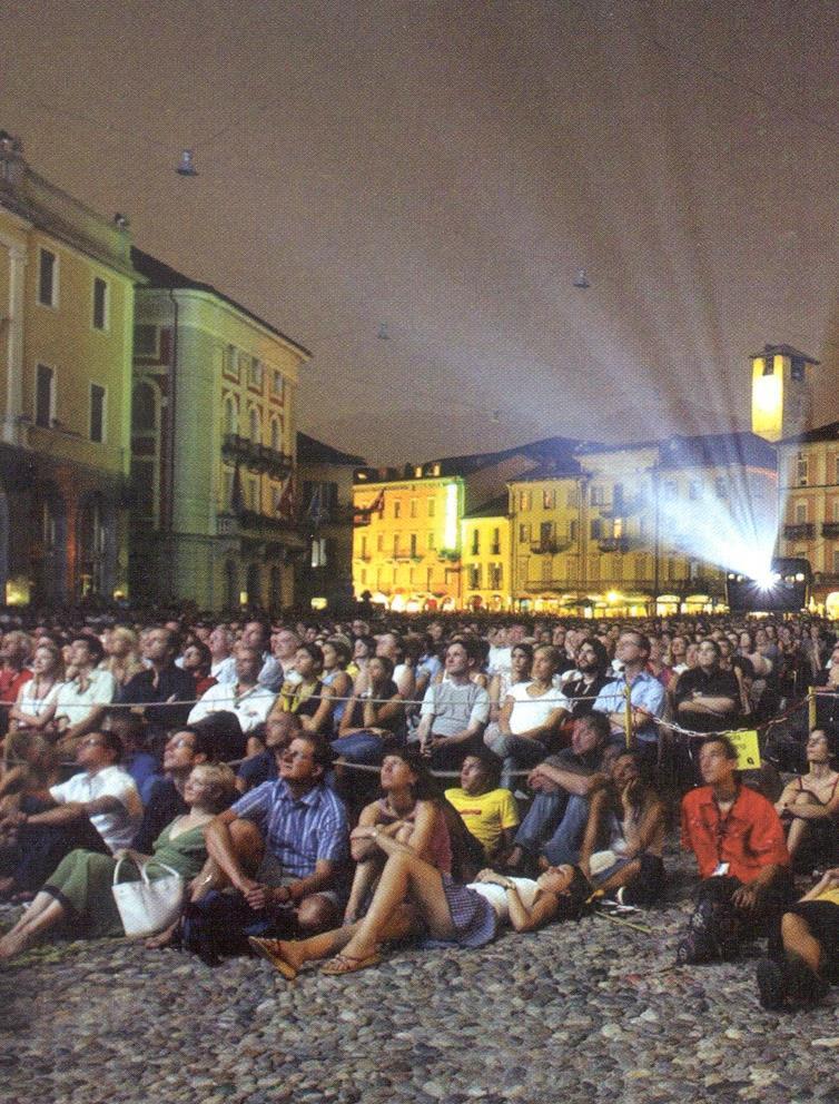
2 On Tuesday June 6 th, 08, the first of two public open houses/ workshops was held to launch the Mobility Hub Study community engagement process. The workshop was part of a larger Innovation & Future Development Fair hosted by the Town of Milton. The communication strategy created for this public event leveraged Town-owned assets and media channels, as well as traditional media outlets and community partnerships. Advertisements were posted throughout Town of Milton facilities for the weeks leading up to the event, event posters and digital signage was posted across Milton and at Town Hall. A promotional website banner and digital content was created to promote the event on the Town s website and an event listing was placed on Milton s online Community Event Calendar. Promotional content was distributed to the local business community and other community partners through enewsletters. Two print advertisements were published in the local Milton Champion (including one statutory PIC Notice and one generic event advertisement) in the month leading up to the event. In addition, a number of digital advertisements were purchased and run on the Town of Milton s social media channels. Invites and reminders were also delivered to stakeholders through the Planning and Development Department s project mailing lists. Two news releases promoting the public event were also sent to local media (pre and post-event). The Fair began with a drop-in session at 5:00 p.m. During this time, display boards for the Mobility Hub Study (and other Town projects) were set up in the Town Hall Lobby, where project staff were available to answer questions (Appendix A). From 7:00 p.m. to 8:30 p.m. members of the public could attend a presentation and workshop for the Mobility Hub Study. A full program of the night s events is available in Appendix B. For the Mobility Hub Study, the open house boards and workshop presentation provided a project overview describing the study context, process, and objectives; explaining the purpose of a mobility hub; providing examples of effective mobility hub features; and highlighting existing study area conditions. The workshop sought feedback on existing conditions identified by the project team and ideas for improvement within the study area regarding community features transportation, private spaces, and public spaces. The workshop began with opening remarks provided by David Twigg, Senior Planner, Policy, at the Town of Milton. David Sajecki, Partner, Sajecki Planning, presented an overview presentation of the Milton Major Transit Station Area (MTSA) / Mobility Hub Study (Appendix C). Liz McHardy, CEO, Lura Consulting, introduced and explained the workshop format to participants. Participants were then asked to travel to each of the five stations set up around the room to provide their feedback on the following topics: Community Features Getting Around (Transportation) Buildings and Private Spaces Public Spaces Other (What Else)
3 Each station included a facilitator, large study area map, markers, and sticky notes. Participants were encouraged to answer questions pertaining to each topic on colour coded sticky notes and place them on the map. The following questions were posed at each station: What s here? What s not? What s missing? What would you add? How would you make it better? Participants were also provided with a comment form upon entering the workshop (available in Appendix D). The session closed with the project team lead thanking participants for their valuable and thoughtful feedback throughout the workshop. In total, approximately 5 people attended the workshop. Summary of Participant Feedback A summary of the feedback obtained at the workshop is presented below. Feedback is organized by workshop station topic and question. Three participants provided written comments through the feedback forms. This feedback is also integrated into the summary, below. Station : Community Features What s here? Participants reflected on a number of characteristics about existing community features. Participants appreciate existing libraries and sports facilities. What s missing? Participants identified that there is no public high school in the neighbouhood west of Milton Evergreen Cemetery. What would you add? Participants suggested a number of additions and improvements to make community features in the study area better, including suggestions to: Upgrade arts and recreation spaces (e.g. the Milton Memorial Arena). Locate a daycare near the GO Station. Build an inclusive school for people with disabilities in the area around E.C. Drury High School. Build a new shelter for abused women in the study area (as there are long waiting lists at existing shelters). Build a 4-hour community center over the GO Station. Provide more affordable housing throughout the study area. Improve pedestrian connections to existing community features (e.g. libraries, the area around E.C. Drury High School ). 3
4 Station : Getting Around What s here? Participants reflected on getting around the existing study area. Participants dislike traffic congestion and poor traffic flow throughout the study area and especially along portions of Main street and near existing grocery stores. What s missing? Participants identified a number of characteristics related getting around that are missing from the study area, including: Safe pedestrian and cycling connections throughout the site. o Pedestrian safety features and pedestrian separation (from faster modes of travel) throughout the study area. o An off-road cycle network throughout the study area. North-South connections across the GO tracks. What would you add? Participants suggested a number of additions and improvements to make getting around the study area better, including: Overall Connectivity Increase linkages between destinations within the study area, as most are only easily accessible by vehicle. Ensure street and intersection designs can accommodate projected growth. o Improve intersection design. Better synchronize traffic (e.g. Improve signal coordination on Thompson Road). Make the intersections of Main and Ontario and Main and Thompson more attractive. Ensure the process of entering and exiting the study area is well-contemplated through the design process (e.g. design gateways into the study area). Active Transportation Emphasize active transportation routes (all seasons) throughout the study area by creating more cycling and pedestrian circulation paths throughout the study area. o Create separated (from vehicles and pedestrians) bike lanes and bike paths on all main roads (e.g. Main Street, Ontario Street, along Drew Centre). o Add a cycle lane adjacent to the rail corridor that connects to the Niagara Escarpment and Mississauga. o Extend the existing trail by Coxe Blvd. to link into the study area. o Create regional cycling connections (e.g. cycle tourism). o o Create a Bike Share system for Milton. Improve pedestrian connections with specific regard for the safety of students and seniors: Around, through and between community features and amenities including E.C. Drury High School, Milton Mall, libraries, Bishop Reding Highschool, Milton Leisure Centre, Lions Sports Park, and others. Over the rail path (e.g. Build a new a bridge or underpass). 4
5 Transit Better promote the advantages of Milton Transit. Create better transit connections between communities, including both local and regional transit connections. o Improve and expand the transit network within Milton. Introduce door-to-door shuttles Provide subsidize taxis, flexible transit, and rideshare options. o Improve and expand connections to other cities (e.g. Burlington). Provide increased regional transit service (e.g. all day, hourly GO service). Add a bike train on the Milton GO Line. o Improve connections between suburban portions of Milton and interregional travel destinations. Adjust sprinklers in Lions Sports Park to avoid wetting those using the trail. Consider the inclusion of driverless busses in future transit plans. Parking Provide parking on the edge of town to serve as a connection point to Milton Transit and to GO. Redesign parking around the GO Station: o Introduce shared parking to encourage public transit use and discourage vehicular use (note: shared parking is when complementary land uses share parking spaces instead of creating separate lots, to ensure efficient use of parking spots at all times of day). o Create a parking structure by the GO station rather than surface parking lots (e.g. on Nipissing Road). o Remove surface parking from GO station areas and make all parking paid parking to promote transit use. o Break up large areas of surface parking by adding trees. Accessibility and Safety Plan all forms of transportation for all ages. o Create a network for seniors to move around the study area safely (must be physically accessible). E.g. ensure seniors have enough time to cross roads at stop lights. Improve safety for pedestrians at traffic lights. Ensure all transportation routes and waiting areas are all-season in design and are maintained throughout the year. GO Station Design Create more than two station platforms (e.g. Union Station). Station 3: Buildings and Private Spaces What s here? Participants reflected on a number of characteristics about existing buildings and private spaces. Participants appreciate that: Automotive centres are conveniently located around the GO Station. There are very few tall buildings (and that buildings do not block the view of the Escarpment). There are many well-established businesses in the study area. 5
6 What s not? Participants identified that the Ready Mix Concrete Plant has more infrastructure than is shown on the map and that this is a vital site for the Town s growth. What s missing? Participants identified a number of characteristics related to buildings and private spaces that are missing from the study area, including: High density, tall, mixed-use developments. Buildings with cohesive character (e.g. in Historic downtown Milton). o Welcoming building facades along Main Street. o Consistent building height along Main Street. A Union Station like atmosphere. A network of open spaces to connect buildings. Desired retail including grocery stores, Costco, and high-end retail. Walkable commercial areas (for those who do not own cars). Restaurants within walking distance of the GO Station. What would you add? Participants suggested a number of additions and improvements to make public places in the study area better, including: Increase density in the study area to support transit and commercial developments. Build attractive, fun, mixed-use developments throughout the site. These developments should attract people to the study area and include commercial, retail, residential, and office spaces. o Create high density mixed-use development that includes housing and ground floor retail along Main Street. o Concentrate the tallest heights around the station (south of Main Street) to have less of an impact on other neighbourhoods. Ensure tall buildings do not block views of the escarpment. o Create buildings that engage with sidewalks to draw people in and create lively, animated streets and communal spaces. o Create more retail spaces at the GO Station. o Create more office space for small businesses throughout the study area. o Develop a landmark flatiron building at the intersection between Main Street and the GO tracks. o Require public art be provided as part of development applications to make streetscapes more interesting and pedestrian friendly. o Create more restaurants close to the GO Station on Main Street and create both indoor and outdoor cafeteria space that is connected to public spaces (e.g. as part of the GO Station). o Build a wedding chapel close to the GO Station to take advantage of the backdrop of the escarpment. Create an underground mall that connects to the GO Station and ground floor retail and commercial sites. This can include retail and commercial spaces that are exclusively underground. Redevelop or remove Milton Mall (does not attract people to the area). 6
7 o Implement a higher density for development on the Milton Mall site and ensure pedestrian friendly connectivity to the streetscape. Carry Milton s downtown charm along Main Street (through the study area); keep the smalltown charm of Milton while improving convenience for residents through development. Attract more development investment. Station 4: Public Places What s here? Participants reflected on a number of characteristics about existing public places in the study area. Participants appreciate the: Views of the escarpment from many public places throughout and around the study area. Existing community gardens (e.g. by Ontario Street and Childs Drive). Existing trails (e.g. Coxe Blvd.) Existing stormwater ponds, as the nature is entertaining to watch while waiting for transit (e.g. south of the GO Station). Participants dislike the: Lack of public congregation and gathering spaces. Lack of sitting features around the GO Station, in Lions Sports Park, and throughout the study area. Unattractive connection between Lions Park and Thompson Road. Lack of space in Lions Sports Park for those who are not participating in sports. What s not? Participants identified that the area south of the Milton Centre for the Arts is represented on the map as a park, however, this block of land is not really greenspace and could use maintenance and greening. What s missing? Participants identified a number of characteristics related to existing public places that are missing from the study area, including: Public washrooms throughout the study area. Pedestrian friendly spaces throughout the site and especially along Main Street (e.g. seating, shelters, safe connections to buildings, and crossings). What would you add? Participants suggested a number of additions and improvements to make public places in the study area better, including: General Make public spaces comfortable and accessible, and provide a range of types of public spaces, from relaxing to spaces, to lively gathering and event spaces. Overall, replace concrete with greenery and greenspace when possible (e.g. use green walls). Create and follow a cohesive vision for the Main Street public realm and make Main Street more pedestrian friendly overall, including more shaded seating areas. 7
8 Accessibility and Safety Ensure safety for pedestrians moving around within the study area. Make public spaces within the study area more physically accessible (e.g. for seniors and those with disabilities). o Create a physically accessible connection between the seniors centre and the station area. o Make all of Lions Sports Park more welcoming and accessible for Seniors. Ensure winter maintenance throughout the study area and especially the GO station. Active Transportation Make public spaces within the study area safely accessible by multiple modes of transportation. o o Create a pedestrian and cycling bridge over rail lines. Create non-vehicular connections between the properties off of Main Street, west of Lions Sports Park (between properties and into the park). Greening and Parks Add greenery (e.g. grass, trees, plants, green walls) wherever possible, throughout public spaces within the study area. o Add greenery to the area adjacent to the Milton Centre for the Arts in Lions Sports Park. Expand community gardens (e.g. at Childs Drive and Ontario Street). Provide more relaxing seating areas in the exiting Lions Sports Park; this can be accomplished through the placement of new trees. Add public amenities into Lions Sports Park including washrooms and food vendors. Improve lighting and winter maintenance in Lions Sports Park. Require a permit to remove trees over 5 years old from parks (as trees have been removed from Lions Sports Park and not properly replaced). Provide a peaceful place for people to relax and sit in nature (e.g. seniors). Expanding Public Space Create a public square with an open-air stage by the GO Station (similar to Celebration Square in Mississauga) to encourage a concentration of people, activities, and energy. Create an Urban Beach by the GO Station. Consider converting all or a portion of the Milton Mall into a public space. Create a pedestrian mall. Transit Station Provide visually interesting and comfortable public space within the station area, including pleasant waiting areas. Cover and provide climate-controlled waiting areas for at least a portion of the station area so that people can wait in comfort in all weather. Include a bus depot next to the GO Station to improve inter-modal transportation routes. Create an underground path system around the station area to connect different modes of transportation (e.g. bus depot and GO Station), connect the north and south side of the GO tracks, and to connect people to amenities (e.g. cafes and grocery stores, which can also be located underground). Including washrooms, cafes and shops in the transit station to service commuters. Create indoor and outdoor cafeteria or eating spaces around the GO station (that are part of or connected to public space). Ensure the station has 4-hour commuter facilities. Add additional bike corrals or lock stations. 8
9 Station 5: What Else/Other What s here? Participants reflected on a number of characteristics about the existing study area. Participants appreciate: Views of the escarpment. The Allendale Area Plan (Regional plan that should be considered throughout this study process). That there are many students that occupy and move around various locations within the study area. This includes the locations around E.C Drury High School, Bishop P.F. Reding Catholic Secondary School, and south onto Thompson Road. The study area is a convenient area to get to. The closed-community feel of the neighbourhood. Participants dislike: The amount of concrete throughout the study area. The lack of safety for pedestrians throughout the site, especially due to speeding cars around existing parking lots (e.g. grocery stores) and poor evening and winter lighting. Unattractive advertisements at Main and Ontario. That the land around Childs Drive is underutilized. That the area around E.C. Drury high school is large but not very functional or planned. This site can be integrated into GO Station planning (the Province should be brought in as a stakeholder for this site). What would you add? Participants suggested a number of additions and improvements to make the study area better, including: Maintain views of the Escarpment from the GO Station and along Main Street. Create features that highlight Milton as a gateway to the Escarpment. Add greenspace and ensure trees are not removed throughout the study area. Accelerate regional road projects prior to local construction projects in the study area. Other Comments One participant noted that they were disappointed there were no GO or CP staff present at this public meeting. Another participant noted they want the Town to ensure feedback is captures and reported back to the public. Finally, some participants suggested improving transit by increasing cross-promotion between GO Transit and Milton Transit and creating new forms of transit passes including a timed pass and a family pass for Milton Transit users (e.g. a 4-hour pass). 9
10 Appendix A - PIC Boards
11 MILTON MAJOR TRANSIT STATION AREA & MOBILITY HUB STUDY PHASE : STUDY CONTEXT AND BACKGROUND REVIEW Welcome to the first public meeting for the Milton Major Transit Station Area & Mobility Hub Study. This evening we will introduce the project, review the work to date, and seek your input on the opportunities and constraints. Feedback Please explore the presentation boards and participate in our workshop to learn more about the start of this project. We encourage you to provide feedback and comments by filling in a workbook, available at the registration table. Once complete, you can drop off your workbook at the registration table tonight, or send your feedback by , mail or fax to the contact below. Please provide any feedback by July 0th. For further information, please contact: David Twigg, Senior Planner Policy and Urban Design Planning and Development Town of Milton, ON L9T 6Z5 david.twigg@milton.ca MTSA and Mobility Hub Consulting Team
12 Milton MTSA / Mobility Hub Study Public Open House 0_June 6 08 STUDY PURPOSE PROCESS & OBJECTIVES A comprehensive study to guide the vision for the Milton Mobility Hub that optimizes the area s potential to create transitoriented, pedestrian-friendly and sustainable neighbourhoods. Study Overview The Town of Milton is developing a Mobility Hub Study that will support the future redevelopment and intensification of this area. The Study will include a particular emphasis on making the area around the Milton GO Station more pedestrian friendly and providing better walking and cycling routes. It is critical to ensure that plans for higher density, mixed use buildings and community uses are sensitive to and properly integrated with the needs of established neighborhoods and the character of downtown Milton. The Study contains six stages illustrated in the figure below. Study Objectives Accommodate a mix of uses within walking distance of transit that will create complete, compact and sustainable communities and the creation of a vibrant, welcoming and comfortable gateway destination for Milton. Develop land use and transportation plans that support and prioritize pedestrians, cyclists and transit users. Identify a built form that supports and promotes a pedestrian oriented high quality public realm and architectural design excellence. Develop an intensification strategy that is sensitive to stable residential neighbourhoods. Enable a mix of housing types that support affordability and the attraction of a broad range of demographics, including families. Identify opportunities and requirements for new or improved community services and facilities. Identify future municipal infrastructure needs and costs Identify a system of trails and public open spaces. Study Context and Background Review We Are Here Vision, Guiding Principles and Planning and Development Alternatives 3 Land Use and Design Framework 4 Technical Analysis 5 Major Transit Station Area Design and Layout 6 Implementation Plan and Recommended Planning Framework May 08 - Sept 08 Aug 08 - Jan 09 Jun 08 - Dec 08 Dec 08 - Mar 09 Mar 09 - Jul 09 Inventory of existintg conditions Background research & analysis Public Meeting # Preparation of a vision and guiding principles for the Milton Major Transit Station Area / Mobility Hub Creation of initial planning and development alternatives Urban design principles Evaluation criteria Significant stakeholder and public consultation Refinement of a preferred planning and development alternative for the Study Area Area Transportation Plan Community Services and Facilities Strategy Urban Design Guidelines Public Realm and Streetscape Plan Area Servicing Plan Conceptual urban design and public realm improvements, and supporting streetscape illustrations Recommendations for proposed municipal infrastructure improvements Public Meeting #3 Final planning policy recommendations Phasing and implementation plan along with a final report Public Meeting # Financial Feasibility Assessments R.E. Millward and Associates / Sajecki Planning DTAH / WSP / LURA


13 Milton MTSA / Mobility Hub Study Public Open House 0_June 6 08 MOBILITY HUBS AND THE BIG MOVE WHAT IS A MOBILITY HUB? Mobility hubs are neighbourhoods located around major transit stations. They serve a critical function in the regional transportation system as the origin, destination or transfer point for a significant portion of trips. The Milton Mobility Hub is identified as an Anchor Hub within Metrolinx s Regional Transportation Plan. It includes the Milton GO Station and bus bays for Milton Transit. This hub is planned to integrate Regional Rail, Rapid Transit and Local Transit Service and is identified as an area of strategic focus and intensification. Mobility Hubs are places of connectivity where all modes of transportation from walking to rapid transit come together seamlessly, and where there is a concentration of opportunities to live, work, shop and play. Mobility hubs tend to be: Located where two or more regional rapid transit lines intersect and where there is expected to be significant passenger activity; Forecast to achieve a higher density of people and jobs than the surrounding area; and Forecast to achieve 4500 or more combined peak period boardings and alightings by 03. Mobility Hubs and The Regional Transportation Plan A key strategy of the Province s Regional Transportation Plan is to build a network of 5 mobility hubs connecting the Greater Toronto and Hamilton Area. Elements of a Mobility Hub Integrated Transit Direct and weather protected access between modes of transit including GO Transit and Milton Transit. Active Transportation Promote active transportation including walking, cycling and transit. Streets as Spaces Sidewalks with street tree planting and street furniture, fronted by buildings that support a vibrant public realm. A Vibrant Mix of Uses Mix of retail, employment and residential uses will ensure a critical mass of people live and work, and play in the mobility hub. A Connected Station New development will provide visual and physical connections to the GO station and bus transit. Walkable Area Provide attractive and comfortable streetscapes, trails and parks that encourage walking and provide places to socialize and gather. Mixed-Use Buildings Promote safe, attractive streets and reinforce the streetscape to create a quality pedestrian experience. Green Identity A green, safe and attractive place consisting of parks, plazas and streetscapes that create a connected system and support a range of local social and recreational activities. R.E. Millward and Associates / Sajecki Planning DTAH / WSP / LURA 3

 to the station, existing")


14 Milton MTSA / Mobility Hub Study Public Open House 0_June 6 08 DRAFT STUDY AREA CONTEXT The Study Area is centred on Milton GO Station, toward the eastern end of Milton s Urban Growth Centre, as identified in the Growth plan for the Greater Golden Horseshoe (07) and the Halton Region Official Plan (009). Mobility Hub boundaries are determined based on a 0 minute walking distance (roughly 800m) to the station, existing environmental features, infrastructure barriers and established planning policies. The Study Area is divided into primary, secondary and tertiary zones, where different transportation and land use issues are considered. These preliminary boundaries are shown below. This project will also consider first and last kilometer connections to the station as well as community services and facilities located in the wider catchment that could serve the existing and future population in the Study Area. TH THO HOM OM MP M MPS P O PSO ON N RO ROA R OAD OA AD WILSON DRIVE 3 LORNE SCOTS DR CABOT TRAIL FROBISHER BLVD ET ET EE REET TR T ST S IN STR AIN AIN MAI MAIN ISSI NG THOMPSON ONTARIO STRE ET NIP ROAD MAIN STREET ET EET E STREE N STR AIN AIN MAIN MA M HARRIS BLVD O TARIO ON RIO RI I S ST T WO WOO W OOD ODWA ARD AR RD AV VE E RO AD DREW DR D REW EW W CENTRE CE CEN CE RE E CHILDS DRIVE CH IL Study Area Boundary / Tertiary Zone 3 DS E IV DR NIPISSING ROAD Primary Zone. Includes the Milton GO Station and immediate surrounding areas. The area will likely be the area of greatest intensification and focus of public realm improvements. Secondary Zone. Extends further along Main Street East, Thompson Road South and Ontario Street South. This area will provide opportunities for transit-oriented development. 3 Tertiary Zone. Will serve as the transition from the mobility hub to the broader community and its focus will include sensitive transitioning to established neighbourhoods and improved connectivity. AL FOREST ON NTA ARIO R O STR RE EET ET T CENTENNI COXE BLVD 3 DRIVE T TREET TR TREE AL AL STREET E ERCIA MMERCIAL OMMERCIA O OM COMMERCI CHILDS DRIVE IER IE UR LA UE EN AV THO HOM OMPS OM MPSO P ON ON R ROA OAD AD AD N E NUE NU ER AVENUE URIER LAURIER LAURIER m Data Sources: First Base Solutions Inc., 08 R.E. Millward and Associates / Sajecki Planning DTAH / WSP / LURA 4

15 Ontario.ca/PPS ROPA 38 as Partially Approved and the Region s Position on Parts Held for Adjudication OMB Hearing Case No. PL0966, PL358 & PL0857 Note: The purpose of this document is to provide a consolidation of the Halton Region Official Plan as partially approved by the Ontario Municipal Board as of the consolidation date. For those policies that remain under appeal, this document provides the Region s position on these policies. Readers should consult the Minister s Decision on ROPA 38 issued on November 4, 0 in addition to this document for accurate reference of those policies that remain under appeal. [Print Version Date: December 8, 009] Map Regional Structure Approved This map should be viewed and interpreted in conjunction with the text of the Official Plan. * The Boundaries of the Regional Natural Heritage System may have been refined in accordance with Section Kilometres Hwy 6 Plains Rd W Hamilton Harbour Waterdown Rd Kilbride Waterfront Park (See Map ) Major Transit Station Proposed Major Transit Station Mobility Hub Rail Line Proposed Major Arterial Major Road Provincial Freeway Lot and Concession Line Municipal Boundary 0 Side Rd Moffat Brant St 3 Side Rd Brookville Guelph Line Campbellville Lowville Mount Nemo 5 Side Rd Derry Rd Appleby Line Dundas St Upper Middle Rd Walker's Line New St Lakeshore Rd Tremaine Rd Crewsons Corners Rebecca St Urban Area Approved Hamlet Agricultural Area Regional Natural Heritage System * Mineral Resource Extraction Area North Aldershot Policy Area Burloak Dr Bronte Rd Lake Ontario Hwy 7 Britannia Rd Greenbelt Natural Heritage System (Overlay) Third Line Bannockburn Limehouse Upper Middle Rd 5 Side Rd James Snow Pky Henderson's Corners Trafalgar Rd Ballinafad Silver Creek 0 Side Rd Steeles Ave Burnhamthorpe Rd Dundas St 5 Side Rd Trafalgar Rd Eighth Line Glen Williams Ninth Line Tenth Line Ford Dr Terra Cotta Norval Greenbelt Plan Protected Countryside Boundary Niagara Escarpment Plan Boundary Parkway Belt West Plan Boundary Built Boundary Employment Area Approved Urban Growth Centre Area Eligible for Urban Servicing Halton Waste Management Site September, 05 Winston Churchill Blvd Milton MTSA / Mobility Hub Study Public Open House 0_June 6 08 POLICY CONTEXT PROVINCIAL AND REGIONAL PLANNING POLICY Plans for the Study Area are guided by provincial and regional policies. 04 Provincial Policy Statement Growth Plan for the Greater Golden Horseshoe (07) Interim Office Consolidation of the Regional Official Plan September 8, 05 HALTON REGION OFFICIAL PLAN [009] Regional Municipality of Halton Interim Office Consolidation Guelph Line Regional Rd 5 Ninth Line Under the Planning Act Based on Amendment 38 An Amendment to Incorporate the Results of Sustainable Halton, Official Plan Review Directions and Related Matters December 6, 009 As Adopted by Regional Council Provincial Policy Statement, 04 The Province s long term vision for land use planning provides direction on: Using land and infrastructure efficiently; Protecting the environment and resources; Supporting a mix of housing, employment, institutional, recreational and open space uses with a range transportation choices; Focusing growth in built-up areas through intensification and redevelopment where it can be accommodated; Promoting transitsupportive development and active transportation; and Prioritizing accessible and age-friendly community design. Growth Plan for the Greater Golden Horseshoe, 07 Key Provincial policies include: Integrating infrastructure and investment with land use planning to achieve complete communities; Promoting transitsupportive and pedestrianfriendly development; Designating Downtown Milton an Urban Growth Centre, a focus for investment, transit connections growth; Supporting transit use at Major Transit Station Areas through improved connections and a diverse mix of uses; Requiring coordinated infrastructure improvements; and Conserving natural, cultural heritage and archaeological resources. Halton Region Official Plan, 009 Identifies Milton GO Station as a Major Transit Station Area/Mobility Hub. Objectives include: Achieving increased residential and employment densities to support transit service; Achieving a mix of residential, office, institutional, and commercial development; Providing access from various modes to the transit facility, including pedestrians, bicycles, car share, and electric vehicles; and Promoting innovative urban design, high quality open spaces, and an urban form that transitions appropriately to adjacent areas for intensification areas. R.E. Millward and Associates / Sajecki Planning DTAH / WSP / LURA 5


16 Milton MTSA / Mobility Hub Study Public Open House 0_June 6 08 POLICY CONTEXT TOWN OF MILTON Milton s Official Plan provides a vision and framework to guide the town in managing growth while reinforcing community values and the environment. A number of planning studies and strategies reflect Milton s goal to achieve a complete community with a more urban, pedestrian-friendly and transit supportive environment. The Official Plan directs growth to certain parts of Milton while preventing it in others, with clear separation between developed and rural areas. Compact forms of development promoted in Urban Area. Downtown Central Business District (CBD) seen as focal point of community. Plan provides for CBD s expansion and opportunities for redevelopment, including commercial, office, institutional, recreational, cultural and residential uses. Milton Official Plan Key policies relevant to the MTSA/ Mobility Hub include: Encourage transit-oriented development with design, density and mix of uses which support public transit, rail/interregional travel, pedestrian and bicycle transportation. Encourage community design to reflect a human scale. Visually and physically connect the existing commercial core, Milton Mall and GO Train station areas with a mix of land uses along Main Street. The area adjacent to the GO train station is to be a major area of mixed use development. Create a system of open spaces, linkages and nodes in conjunction with development. Preserve and enhance built and natural heritage, as well as views to the Escarpment. Enhance gateway areas as entry points. Create design and urban design principles that reflect existing historical/architectural character. Other City Plans and Initiatives The Downtown Study (07) identifies opportunities for redevelopment and revitalization in Milton s downtown and proposes a more flexibly policy framework with new Zoning By-law designations and Local Official Plan Policies. The Future Urban Structure Map (07) locates the MTSA/Mobility Hub Area within the Urban Growth Centre and the GO station as a Major Transit Station surrounded by Stable Neighourhoods and Residential Areas. Milton s First Principles of Growth (07) outlines Milton s vision to build a complete community, including a variety of housing forms and intensification near transit supported locations, with appropriate and coordinated infrastructure investments. The Mid-Rise/Tall Building Guidelines (08) provide direction for future development and aid in the evaluation of development proposals. The MTSA/Mobility Hub area is largely within the area considered for higher density mixed use development. Image Source: Milton Official Plan (008 Consolidation) R.E. Millward and Associates / Sajecki Planning DTAH / WSP / LURA 6


17 Milton MTSA / Mobility Hub Study Public Open House 0_June 6 08 THOMPSO ON N ROAD E WILSON DRIV LORNE SCOTS DR IL CABOT TRAIL FROBISHER BLVD MAIN STREET E EET E TREET ST S STR MAIN STREET M MILTON CENTRE FOR THE ARTS / LIBRARY ISS ING EXISTING MILTON GO STATION RO AD HARRIS BLVD NIP MILTON MALL THOMPSON ONTARIO STR HISTORIC DOWNTOWN DREW CENTRE CHILDS DRIVE DS IL CH E IV DR NIPISSING ROAD CHILDS DRIVE COXE BLVD CENTENNIAL FOREST DRIV E ONTARIO STR EET E EE REET Very deep but thin properties are located along the north edge of Main Street. Larger properties south of Main Street are associated with commercial, institutional and park uses. The historic street and block pattern of downtown Milton is located just to the west of the Study Area. ROAD EET Parcel Fabric The core of the Study Area is noted for its large and irregular blocks, designed for auto-oriented retail commercial uses, but not for pedestrians. ONTARIO ST EXISTING CONDITIONS URBAN FORM LAURIER AVENUE WILSON DRIV E LORNE SCOTS DR CABOT TRAIL FROBISHER BLVD 3 3 EET ONTARIO STR N STREET MAIN 3 5 MAIN STREET E EET E STREET MAIN STREET NIP MILTON MALL ISS ING AD CHILDS DRIVE EXISTING MILTON GO STATION RO DREW CENTRE 3 9 DS IL E IV NIPISSING ROAD MILTON CENTRE FOR THE ARTS / LIBRARY 7 DR THOMPSON HARRIS BLVD 4 ROAD COXE BLVD Building (Planned/Under Review/Under Construction) THOMPS SON ROAD CENT CE CEN NTE TEN ENN NNIA NIAL IALL FOREST DRIV VE V E Building (Existing) ONTARIO STR EET E COMMERCIAL STREET CHILDS DRIVE Proposed Master Plan (Under Review) Number of Storeys LAURIER AVENUE Data Sources: Town of Milton, 08 R.E. Millward and Associates / Sajecki Planning DTAH / WSP / LURA THOMPSO N ROAD 4 CH Built Form Buildings immediately surrounding the GO station are comprised of one and two storey autooriented retail commercial buildings with parking lots located between the front of the building and the street. Stable residential neighbourhoods are located within the northern and southern edges of the Study Area. A number of recent and active development applications are beginning to transform the types of buildings and public spaces located within the Study Area. ONTARIO ST Data Sources: First Base Solutions Inc., m 7
18 Milton MTSA / Mobility Hub Study Public Open House 0_June 6 08 N ROAD WILSON DRIV E THOMPSO Zoning Categories LORNE SCOTS DR CABOT TRAIL L FROBISHER BLVD MAIN STREET MAIN STREET ISSI NG THOMPSON ONTARIO STR NIP ROA D DREW CENTRE CHILDS DRIVE DS ROAD NG RO NIPISSIN CHILDS DRIVE Study Area Boundary Downtown Supportive Area Urban Growth Centre Mixed Use Low Density Residential Medium Density Residential Medium Density Residential High Density Residential Minor Institutional Major Institutional Open Space Natural Heritage System A LAURIER AVENUE COXE BLVD L COMMERCIAL STREET Data Source: Town of Milton, 08 T 0 ONT TARIO m E THOMPSO N ROAD Existing General Land Use WILSON DRIV Further to the northwest are generally low density residential areas. To the northeast are major recreational, institutional and open spaces uses, including Milton Leisure Centre, Milton Memorial Arena, First Ontario Arts Centre, and Lions Sports Park. To the south are low-rise residential neighbourhoods, and additional institutional uses. Southwest of the Study Area is historic Old Milton, characterized by a mix of commercial and residential buildings. H A R R IS B LV D RO OA AD D ET REET TREET STR ST N STREET MAIN MA MAI EET The main land use in the MTSA is the Milton GO Station and its parking lot. Nearby, the primary uses are single storey retail commercial and industrial uses. ONT TARIO EXISTING CONDITIONS LAND USES LORNE SCOTS DR CABOT TRAIL L FROBISHER BLVD MAIN STREE MAIN STREET NIP ISSI NG H A R R IS B LV D THOMPSON ONTARIO STR EET RO OA AD D ST STR STREET N STREET IN MAIN MAI MA ROA D DREW CENTRE CHILDS DRIVE S ILD CH NIPISSING ROAD CHILDS DRIVE COXE BLVD L COMMERCIAL STREET Most lands in the mobility hub Study Area are zoned Urban Growth Centre Mixed Use. Commercial and industrial uses currently operate in the area. The area also includes substantial public lands. Study Area Boundary Commercial Industrial Residential Multi-residential * Certain lands, such as Town lands, places of worship, parks and school, are not shown in this map. Data Source: Teranet Inc., 08 ET A LAURIER AVENUE 0 R.E. Millward and Associates / Sajecki Planning DTAH / WSP / LURA m 8


19 CHILDS DRIVE T ISSING ROAD DREW CENTRE LAURIER AVENUE m Milton MTSA / Mobility Hub Study Public Open House 0_June 6 08 EXISTING CONDITIONS LAND USES Buildings in the Study Area are coloured to show their current land use.. Main Street and Thompson Road THOMPSON ROAD NTARIO STREET. Ontario Street North 3. Ontario Street Commercial Industrial Residential Multi-residential Institutional 4. Ontario Street South and Childs Drive 5. GO Station 6. Main Street 7. Childs Drive and Nipissing Road 8. Nipissing Road 9. Nipissing Road 0. Thompson Road South and Drew Centre R.E. Millward and Associates / Sajecki Planning DTAH / WSP / LURA 9


 THOMPSO EET COXE BLVD MILTON EVERGREEN CEMETERY ONTARIO STR Parks, open spaces and Natural Heritage areas")


20 Milton MTSA / Mobility Hub Study Public Open House 0_June 6 08 THOMPSO N ROAD E WILSON DRIV ABOT TRAIL FROBISHER BLVD DEMPSEY NEIGHBOURHOOD PARK MAIN STREET MAIN STREET E MILTON MALL NIP ISS ING EXISTING MILTON GO STATION RO AD ARRIS BLVD ROAD MILTON CENTRE FOR THE ARTS / LIBRARY THOMPSON ONTARIO STR EET MAIN STREET E DREW CENTRE CHILDS DRIVE LIONS SPORTS PARK DS E IV DR R.E. Millward and Associates / Sajecki Planning DTAH / WSP / LURA CENTRE PARK IL The Milton Mobility Hub Study will look at opportunities for a new parks and open space network to promote active lifestyles and improve pedestrian connections to Lions Sports Park. COURT PARK CH NIPISSING ROAD CHILDS DRIVE CENTE CEN TEN NNIA NIALL FOREST DRIV VE V E Parks / Open Spaces COXE BLVD PARK Natural Heritage System N ROAD Urban Plaza CENTENNIAL FOREST PARK Data Sources: Town of Milton, 08; Conservation Halton, 0; Halton Region, 0 Water (stream / pond) THOMPSO EET COXE BLVD MILTON EVERGREEN CEMETERY ONTARIO STR Parks, open spaces and Natural Heritage areas are located along the edges of the Study Area with Lions Sports Park, a major recreation destination, defining the eastern edge. Part of this park is designated as a Natural Heritage Area and contributes to a larger green corridor. An urban plaza marks the junction of Thompson and Main, and defines a sense of entry into the Study Area. WOODWARD WOODLOT LORNE SCOTS DR E EE TRE COMMERCIAL STREE The Study Area is scaled to the automobile and generally lacks features such as parks, pedestrian lighting, landscaping, street furniture, and sidewalk-related buildings that would contribute to creating a more pedestrianfriendly environment. ONTARIO ST EXISTING CONDITIONS PARKS AND OPEN SPACES Flood Plain LAURIER AVENU m Existing Trail south of Childs Drive Milton Centre for the Arts Entrance Plaza Storm water Management Pond South of Drew Centre Milton Evergreen Cemetery Lions Sports Park Community Park: Dempsey Neighbourhood Park 0
21 C HARRIS BLVD Milton MTSA / Mobility Hub Study Public Open House 0_June 6 08 EXISTING CONDITIONS MOVEMENT AND CONNECTIVITY Streets The street network surrounding the Milton GO Station primarily caters to private automobiles entering and existing the station and surrounding buildings. Streets within the Study Area tend to be wide featuring up to four and five lane cross sections. MAIN STREET E ONTARIO STREET ONTARIO ST MILTON MALL CHILDS DRIVE NIPISSING ROAD WILSON DRIVE LORNE SCOTS DR FROBISHER BLVD CABOT TRAIL CHILDS DRIVE MAIN STREET E EXISTING MILTON GO STATION DREW CENTRE THOMPSON ROAD MILTON CENTRE FOR THE ARTS / LIBRARY THOMPSON ROAD THOMPSON ROAD MAIN STREET Main Street East and Thompson Road South have grade separations at the GO railway tracks. Existing barriers to pedestrian movement include the rail corridor, busy roads, grade changes and large areas of surface parking. COMMERCIAL STREET Data Sources: Town of Milton, 08 ONTARIO STREET CENTENNIAL FOREST DRIVE NIPISSING ROAD CHILDS DRIVE COXE BLVD THOMPSON ROAD Public Roads Paths/ Trails Bridge/ Underpass (Existing) Bridge/ Underpass (Potential) LAURIER AVENUE m Transit Transit service is provided by Milton Transit and operates in a hub-spoke pattern connecting the town to the Milton GO Station. There are nine fixed routes and three alternative services including Trans-Cab, evening GO drop-off, and high school specials. Transit service operates generally from 5:00 a.m. to :00 p.m. on weekdays, and 7:00 a.m. to 8:00 p.m. on Saturdays. There is currently no service on Sundays. GO Train service is available to Toronto Union Station during the morning and afternoon peak hour in the peak direction only. GO Bus service is available at all other times. Active Transportation Active transportation (bicycle and pedestrian infrastructure) in the Study Area mostly consists of sidewalks and multi-use trails paralleling roadways. Sidewalks and multi-use trails vary in width from.5 m to 3.0 m. There is little to no physical separation of sidewalks and multi-use trails other than boulevard buffer space that varies from 0 to 3.0 m in width. Grade separated rail and busy roads are barriers to pedestrian and bicycle movement. Marked bicycle lanes are available on Main Street East west of Wilson Drive up to the access for Lowes and Shoppers Drug Mart. East of the station, there are multiple off-street trails supporting the Lions Sports Park and Milton Memorial Arena. R.E. Millward and Associates / Sajecki Planning DTAH / WSP / LURA


22 Milton MTSA / Mobility Hub Study Public Open House 0_June 6 08 WILSON DRIV E LORNE SCOTS DR 3 5 TE ET E EE EET E MAIN STREET 4 MAIN STREET E MILTON CENTRE FOR THE ARTS / LIBRARY ROAD NIP MILTON MALL ISS ING RO AD EXISTING MILTON GO STATION RE S ILD CH E IV DR NIPISSING ROAD Heritage Properties Character Area Existing Views Potential Views Data Sources: Town of Milton, 08 0 Escarpment views along the rail tracks looking north-west South-east view along the rail tracks with Go Station. 4 Looking East on Main Street. R.E. Millward and Associates / Sajecki Planning DTAH / WSP / LURA COXE BLVD CENT CE CEN NTE TEN ENN NNIA NIAL IALL FOREST DRIV VE V E ONTARIO STR EET ERCIAL S CHILDS DRIVE There are no listed or designated buildings within the Study Area. DREW CENT CHILDS DRIVE Future development provides an opportunity to frame and enhance landmark views, particularly of the escarpment. Heritage The original grid of historic streets and cluster of landmark heritage buildings just to the west of the Study Area define a sense of transition into the Downtown Heritage Character Area. THOMPSON ONTARIO STR EET 6 CABOT TRAIL FROBISHER BLVD ARRIS BLVD Views The irregular street grid, linearity of Main Street and the Niagara Escarpment contribute to a number of landmark views and vistas. Key existing views include: Niagara Escarpment views looking eastward along Main Street and from within the immediate vicinity of the GO Station; and views of Lions Sports Park and Centennial Forest Park. THOMPSO ON N ROAD ONTARIO ST EXISTING CONDITIONS HERITAGE AND VIEWS 3 Escarpment views along Main Street. 5 Rail bridge over Main Street looking West. 500m 6 Historic Downtown Milton.
23 Milton MTSA / Mobility Hub Study Public Open House 0_June 6 08 EXISTING CONDITIONS COMMUNITY SERVICES AND FACILITIES Community Services and Facilities are building blocks of complete communities. They include schools, libraries, child care providers, parks and recreation facilities, human services and emergency services. A wide range of services and facilities surround the Study Area including 3 schools, 4 child care providers, library, 9 parks and 3 recreation/sports centres, 8 human services and emergency services stations. Several places of worship are also found in the Study Area, offering additional community gathering space and services. FAY COURT PARK KINSMEN PARK At the same time, very few community facilities currently exist in the primary Study Area. New development in the Mobility Hub is an opportunity to bring new community destinations to the area. MELANIE PARK Boundary Schools BALDWIN PARK Conseil Scolaire de District Catholique WILSON DRIVE DEMPSEY NEIGHBOURHOOD PARK LORNE SCOTS DR CABOT TRAIL FROBISHER BLVD Halton Catholic District School Board Halton District School Board E.C. Drury School for the Deaf Human/Social Services Child and youth services Community food services Individual and family services Vocational rehabilitation services NIPI SSIN G RO AD HA RRI THOMPSON ROA ONTARIO STRE ET D MAIN STREET Emergency Services DREW CENTRE CHILDS DRIVE Paramedic Police E RIV SD ILD CH LIONS SPORTS PARK NIPISSING ROAD Child Care Licensed child care provider CHILDS DRIVE MILTON EVERGREEN CEMETERY 6 MILE CREEK PARK NORTH Data Sources: Halton Region, 05 Town of Milton, 08 Ontario Open Data, 08 R.E. Millward and Associates / Sajecki Planning DTAH / WSP / LURA COXE BLVD Milton Public Library - Main Library Parks and Recreation CENTENNIAL FOREST DRIVE Libraries COXE BLVD PARK CLARK NEIGHBOURHOOD PARK SAM SHERRATT PARK Community and Recreation Centre Parks Places of Worship Place of worship LAURIER PARK m 3


24 Milton MTSA / Mobility Hub Study Public Open House 0_June 6 08 EXISTING CONDITIONS MAIN STREET CHARACTER WILSON DRIVE Main Street East is an important and defining feature of Milton. The Main Street begins to narrow between Thompson Road and the historic downtown becoming more of an intimate scaled pedestrianoriented street. MAIN STREET E MAIN STREET E 5m-6m ISSI NG RO AD 7m 8m HARRIS BLVD NIP THOMPSO N ONTARIO HISTORIC DOWNTOWN DREW CENTRE ST RD MAIN STREET E 33m-35m Right of Way Width of Main Street East Existing boulevards within the Study Area are between 4.5 to 5m in width (from curb to property line), and include a sidewalk, lawn and street lighting or utilities. The streetscape generally lacks features such as pedestrian lighting, street furniture, and sidewalk-related buildings that would contribute to creating a more pedestrianfriendly environment. MAIN STREET E 7m ROW SOUTH The images below illustrate existing conditions along Main Street East. Setback Varies NORTH.5m.5m 4.5m-5m 7m-8m 4.5m-5m Boulevard Roadway Boulevard PL Setback Varies PL 7m Right-of-Way Main Street East Typical Cross-Section Limited street tree planting. Parking lots between building face and sidewalk. Typical existing auto-oriented Main Street buildings set back behind surface parking or with large informal landscaped frontages and no direct relationship to the street. Character of the street changes in Downtown Milton to the west. Panoramic of Main Street looking North: Utilities along the north side and street lighting is scaled to auto and not pedestrian. R.E. Millward and Associates / Sajecki Planning DTAH / WSP / LURA 4
25 Milton MTSA / Mobility Hub Study Public Open House 0_June 6 08 TRANSPORTATION PLAN WORKING VISION The vision of the transportation component of the Major Transit Station Area Study is to integrate transportation and land use planning to support a sustainable and multi-modal transportation network accessible to all users and all modes of transportation. The Study Area transportation network will focus on transit, walking and cycling and will be connected to the Town-wide transportation system. The vision integrates six key principles: Integrate transportation and land use; Connect the GO train station with local transit, walking and cycling facilities; Support local transit through transit priority measures; Enhance walking and cycling facilities to improve the attractiveness of these travel modes; Improve connectivity to the rest of Milton; and Create a foundation for balanced investment in transportation. The Municipal Class Environmental Assessment (EA) Process The Municipal Class EA process provides a process in accordance with the EA Act for municipal infrastructure projects. Master plans, such as the transportation component of this Study Area, are required to complete Phases and of the five phases of the Municipal EA process. Phase Identify the problem (vision) We Are Here. PEDESTRIAN BICYCLE 3 4 TRANSIT AUTO Phase Modal Hierarchy Identify alternative solutions to address the problem or opportunity by considering the existing environment and establishing the preferred solution R.E. Millward and Associates / Sajecki Planning DTAH / WSP / LURA 5

")

26 Milton MTSA / Mobility Hub Study Public Open House 0_June 6 08 OPPORTUNITIES AND CONSTRAINTS SUMMARY The analysis of the existing conditions and policy background review identified a number of opportunities and constraints, which are summarized in the diagram below. BALDWIN PARK ONTARIO ST KINSMEN PARK WOODWARD WOODLOT WILSON DRIV E 8 LORNE SCOTS DR ESTABLISHED RESIDENTIAL AREA NIP MILTON MALL ISS ING ROAD EXISTING MILTON GO STATION RO AD DREW CENTRE Transit Station / Mobility Hub CHILDS DRIVE 6 Park / Open Space COMMUNITY AND CULTURAL DISTRICT 4 LIONS SPORTS PARK DS IL CH 5 Natural Heritage E IV DR 7 NIPISSING ROAD Water (stream/pond) MILTON EVERGREEN CEMETERY Flood Plain CHILDS DRIVE FOREST DRIV ONTARIO STR Large Narrow Lots Large Wide Lots Under Review / Development Area 8 CENTENNIAL EET COMMERCIA E COXE BLVD Heritage / Civic Property Large Deep Lots 0 7 THOMPSON EET ONTARIO STR HISTORIC DOWNTOWN 3 MILTON CENTRE FOR THE ARTS / LIBRARY HARRIS BLVD MAIN STREET MAIN STREET E Draft Study Area Boundary Vacant / Underutilized lots CABOT TRAIL FROBISHER BLVD DEMPSEY NEIGHBOURHOOD PARK THOMPSO N RO COURT PARK AD CENTRE PARK COXE BLVD PARK ESTABLISHED RESIDENTIAL AREA Main Street East CENTENNIAL FOREST PARK Potential Gateway Area BEAVER COURT PARK SAM SHERRATT PARK Potential Focal Point Potential Green Corridor LAURIER AVENUE D Trail 50 Data Sources: First Base Solutions Inc., m Potential Bike Path Potential Street (Secondary Plan) GO Station 4 Opportunity to become the public realm focus and gateway to Milton, providing seamless interchange between all modes of travel. Potential Connections (S.P.) Main Street Opportunity to connect the community and cultural district (east) to the historic downtown (west). Opportunity to become a landmark street and central focus of the Study Area with street tree planting, widened sidewalks, cycling infrastructure and supportive building frontages. Grade change / rail overpass on Main Street creates a challenge in creating an active spine between historic downtown and the community and cultural area. 3 GO Lands One of the largest single ownership properties within the Study Area. Opportunities for the introduction of more compact, mixed use, transit oriented redevelopment. 9 Opportunities for green space connections to the surrounding parks. Opportunity to secure new network of parks, plazas and streetscapes through redevelopment. 5 Trails 6 Street Network Redevelopment provides opportunities to introduce a finer grain network of new pedestrian and cycle friendly streets and paths. 7 Current/ Existing Development Recent developments are adding a broader mix of uses, and helping to enliven the public realm. 8 Existing Neighborhoods Have their own sense of character and identity and are unlikely locations for redevelopment. Opportunities include: strengthen connections to Main Street and GO Station. 0 Redevelopment Existing large underutilized properties, Main Street frontage properties and publicly owned land provides opportunities for comprehensive redevelopment and infill. Finer grain ownership on north side of Main Street challenges for redevelopment. Storm Water Management Views Integrate low impact storm water management techniques into the design of new buildings, streets and public places. Key views to enhance: the escarpment, the future GO Station, Lions Sports Parks and the historic downtown. 3 Community Facilities Opportunity to enhance connections to existing facilities and create new community designations through redevelopment of station area lands. 4 R.E. Millward and Associates / Sajecki Planning DTAH / WSP / LURA Sense of Transition Deep lots (70m-0m) adjacent to existing stable residential neighborhoods provide opportunities for built form to seamlessly transition to existing neighbourhoods. Opportunities to connect the existing trail system and; Provide improved connections to Main Street, parks, transit and amenities. Rail Corridor A major barrier to connectivity. Opportunities include new north/ south connections through bridge or underpasses, east/west cycle connections, and increased greening. Parks and Open Space Industrial Uses The cement plant south of the existing Go station is designated as an industrial site - open in the Urban Area Sites of Potential Contamination ; more difficult to redevelop into the residential/ office sub-area anticipated. 6
27 MILTON MAJOR TRANSIT STATION AREA & MOBILITY HUB STUDY NEXT STEPS There are many opportunities to participate in the Milton Major Transit Station Area and Mobility Hub Study. Watch the project website for upcoming consultations and updates. We have developed a comprehensive public and stakeholder consultation plan that will take place over the next year. Your input is important to help shape the Study s vision and recommendations. Coming Up Technical Analysis: Ongoing Vision and Guiding Principles: July 08 Preliminary Planning & Development Alternatives: September 08 Public Meeting No. - Planning and Development Alternatives: Fall 08 For further information, please contact: David Twigg, Senior Planner Policy and Urban Design Planning and Development Town of Milton, ON L9T 6Z5 david.twigg@milton.ca MTSA and Mobility Hub Consulting Team
28 Appendix B - PIC Program

29 Innovation & Future Development Fair Tuesday June 6, pm Programme See Guide Map on Back 5:00 pm Drop In Town Hall Lobby Visit the following topic booths for one on one discussion with project specific experts, as well as interactive boards and feedback forms: Milton MTSA Milton Education Village Secondary Trafalgar Corridor and Agerton Secondary Plans Milton Education Village Innovation Centre 6 7:30pm Presentation and Workshop Milton Room Agerton Employment Area and Trafalgar Corridor Secondary Plans 7 8:30pm Presentation and Workshop Hugh Foster Hall 9:00pm Milton Mobility Hub Study Close

30 Lobby Milton Room 3 Hugh Foster Hall KEY Lobby Drop-In Milton Room Agerton/Trafalgar Secondary Plans 3 Hugh Foster Hall Milton Mobility Hub Study pm pm pm
31 Appendix C - PIC Presentation


32 Public Information Centre #: Milton Major Transit Station Area & Mobility Hub Study June 6, 08 A Place of Possibility
33 Presentation Outline. Great Neighbourhoods. Meeting Purpose 3. Mobility Hubs 4. Existing Conditions 5. Transportation Context and Vision 6. Draft Objectives 7. Workshop


34 Who We Are R.E. MILLWARD + ASSOCIATES LTD Project Lead & Planning SAJECKI PLANNING INC Project Management DTAH Urban Design WSP Transportation & Class EA Storm Water / Waste Water Barry Lyons Consultants Ltd. Retail/Commercial Market Analysis Listen Understand Relate Advance Public Engagement and Consultation

35 Great Neighbourhoods () Walkable

36 Great Neighbourhoods () Flexible

37 Great Neighbourhoods (3) Contextual

38 Great Neighbourhoods (4) Diverse

39 Great Neighbourhoods (5) Green

40 Great Neighbourhoods (6) Intimate
41 Meeting Purpose To provide an overview of the Milton Major Transit Station Area and Mobility Hub Study. To receive resident s input regarding what they like about their community, and what they would like to see improved, from the perspective of: Transportation; Buildings; Community Services; and Parks and Open Space.

42 Mobility Hubs

43 Milton Mobility Hub / MTSA
44 Existing Conditions

45 Existing Conditions Draft Study Area

46

47 Existing Conditions Land Use

48 Existing Conditions Built Form

49
50

51

52 Existing Conditions Parks and Open Space

53
54

55 Existing Conditions Heritage and Views

56
57

58 Existing Conditions Community Services and Facilities


59 Transportation Context: Now and in the Future Stratford International Station, London, UK Source: Metrolinx Mobility Hub Guidelines


60 Transportation Vision: A multi-modal Centre Foster a culture of walking and cycling Improve connections that encourage multi-modal access to the Milton GO station Integrate transit priority elements that attract people to use transit Design a complete street network that is supportive a sense of place Anticipate the future of mobility
61 Objectives A MIX of uses SUPPORT AND PRIORITIZE pedestrians, cyclists and transit users DESIGN EXELLENCE in architecture and public spaces PROTECT stable residential neighbourhoods A Place of Possibility
62 Objectives SUPPORT affordability IMPROVE community services and facilities IDENTIFY municipal infrastructure PROVIDE new trails and public open spaces A Place of Possibility


63 A Place of Possibility
64 THANK YOU!
65 Workshop Choose up to 4 Exercises What s here? Whats Not? What s missing? What would you add? How would you make it better? Exercise 5 min: Community Features Exercise 5 min: Getting Around Exercise 3 5 min: Buildings and Private Spaces Exercise 4 5 min: Public Places Exercise 5 5 min: What Else?

66

67
68 Appendix D - PIC Comment Forms
69 Milton Major Transit Station Area and Mobility Hub Study Public Information Centre # Wednesday June 6 th, 08 5 pm to 9 pm Milton City Hall Comment Form Contact Information (optional): Name: Postal Code: Check this box to add your address to the project notification list When you answer the questions below, think about the site as it is now, and how you would like to see it transform in the future. In particular think about: How you move through the site (transportation) What you do in the site (community features, public spaces, and private spaces). Based on the presentation and display boards, did we miss any important existing features of the study area (e.g. community features, public spaces, private spaces, traffic issues etc.)? If so, what did we miss? A. B. C.
70 . What do you like about the existing study area? A. B. C. 3. What do you not like about the existing study area? A. B. C. 4. What would like to see added to the study area, or how would you improve the study area? A. B. C.
 and the Environmental Assessment Act (EAA), unless otherwise stated in the submission, any personal information such")
71 5. Do you have any additional comments? Please note that all correspondence will be maintained for reference throughout the project and will become part of the project record. Under the Municipal Freedom of Information and Protection of Privacy Act (MFIPPA) and the Environmental Assessment Act (EAA), unless otherwise stated in the submission, any personal information such as name, address, telephone number and property location included in a submission will become part of the public record files for this project and will be released, if requested, to any person. 3
Draft ROPA 43 - HPBATS/GTA West Corridor Protection
 Draft ROPA 4 - HPBATS/GTA West Corridor Protection Overview Purpose The purpose of Regional Official Plan Amendment (ROPA) No. 4 is to: Implement a corridor protection area to protect for the planned corridor
WELCOME and introduction
 1 WELCOME and introduction Mobility Hub Locations within Burlington STUDY OVERVIEW STUDY OBJECTIVES The City of Burlington is developing four Area Specific Plans, one for each of Burlington s Mobility
SUBJECT: GO Station Mobility Hubs Preferred Concepts: Aldershot GO, Burlington GO and Appleby GO. Planning and Development Committee - Public Meeting
 Page 1 of Report PB-76-17 SUBJECT: GO Station Mobility Hubs Preferred Concepts: Aldershot GO, Burlington GO and Appleby GO TO: FROM: Planning and Development Committee - Public Meeting Planning and Building
Sustainable Growth. Sustainable Growth
 2 Sustainable Growth Sustainable Growth SUSTAINABLE GROWTH 2.1 COMMUNITY VISION... 2-5 2.2 THE CITY SYSTEM... 2-7 2.2.1 AREAS... 2-7 2.2.2 CITY-WIDE SYSTEMS... 2-8 2.2.3 PROVINCIAL PLAN BOUNDARIES AND
Mark-up of the effect of the proposed Bronte Village Growth Area OPA No.18 on the text of section 24, Bronte Village, of the Livable Oakville Plan
 Mark-up of the effect of the proposed Bronte Village Growth Area OPA No.18 on the text of section 24, Bronte Village, of the Livable Oakville Plan Notes: This document is provided for information purposes
Urban Design Manual PLANNING AROUND RAPID TRANSIT STATIONS (PARTS) Introduction. Station Study Areas
 Introduction. Station Study Areas") 111111 PLANNING AROUND RAPID TRANSIT STATIONS (PARTS) Introduction The ION rapid transit system will link Waterloo, Kitchener and Cambridge through a central transit corridor (CTC). There are a number
111111 PLANNING AROUND RAPID TRANSIT STATIONS (PARTS) Introduction The ION rapid transit system will link Waterloo, Kitchener and Cambridge through a central transit corridor (CTC). There are a number
GO Station Mobility Hubs: Draft Precinct Plans. Committee of the Whole July 12, 2018
 GO Station Mobility Hubs: Draft Precinct Plans Committee of the Whole July 12, 2018 Purpose of this Workshop Present Draft Precinct Plans for the 3 GO Station Mobility Hubs Continue the conversations that
Ontario Limited. Planning Justification Report. Zoning By-Law Amendment. 177 Cross Avenue Town of Oakville. October, 2012.
 915643 Ontario Limited Zoning By-Law Amendment Planning Justification Report 177 Cross Avenue Town of Oakville October, 2012 Prepared For: Prepared By: PLANNING JUSTIFICATION REPORT Proposed Zoning By-Law
ELMVALE ACRES SHOPPING CENTRE MASTER PLAN
 ELMVALE ACRES SHOPPING CENTRE MASTER PLAN Contents 1.0 INTRODUCTION... 2 2.0 LOCATION... 2 3.0 EXISTING CONTEXT... 2 4.0 VISION & GUIDING PRINCIPLES... 2 5.0 LAND USE AND BUILT FORM... 4 5.1 St. Laurent
Don Mills Crossing Study and Celestica Lands Development Application Community Meeting, Open House, and Breakout Discussions
 Consultation Summary Don Mills Crossing Study and Celestica Lands Development Application Community Meeting, Open House, and Breakout Discussions This report is not intended to provide a verbatim transcript
Workshop 3. City of Burlington Waterfront Hotel Planning Study. September 14, The Planning Partnership
 Workshop 3 City of Burlington Waterfront Hotel Planning Study September 14, 2017 The Planning Partnership The Waterfront Hotel Planning Study 01 The Brant & Lakeshore Planning Study will establish a Strategic
YONGE STEELES CORRIDOR SECONDARY PLAN. Young + Wright / IBI Group Architects Dillon Consulting Ltd. GHK International (Canada) Ltd.
 Ltd.") PART A: PREAMBLE 1.0 PURPOSE The purpose of this Secondary Plan is to provide a development framework for intensification of the Yonge/ Steeles corridor including the north side of Steeles Avenue West
PART A: PREAMBLE 1.0 PURPOSE The purpose of this Secondary Plan is to provide a development framework for intensification of the Yonge/ Steeles corridor including the north side of Steeles Avenue West
The protection of the agricultural resources of the Province;
 PART II INTRODUCTION An Official Plan is a policy document, which is intended to serve as the basis for making land use decisions and managing change in any municipality in Ontario. According to the Planning
SUBJECT: Proposed Downtown Mobility Hub Precinct Plan and Proposed Official Plan Policies
 Page 1 of Report PB-81-17 SUBJECT: Proposed Downtown Mobility Hub Precinct Plan and Proposed Official Plan Policies TO: FROM: Committee of the Whole Planning and Building Department Report Number: PB-81-17
Complete Neighbourhood Guidelines Review Tool
 Complete Neighbourhood Guidelines Review Tool Prepared By: City of Regina Planning Department October 2014 Page 1 of 14 Community Development Review Checklist for Secondary Plans and Concept Plans The
PUBLIC OPEN HOUSE HURONTARIO-MAIN CORRIDOR SECONDARY PLAN
 PUBLIC OPEN HOUSE HURONTARIO-MAIN CORRIDOR SECONDARY PLAN Tuesday, February 28, 2012 6pm 9pm 1 st Floor Atrium, City Hall 2 Wellington Street West, Brampton 1 POLICY FRAMEWORK The 2006 Provincial Growth
CITY OF VAUGHAN KIRBY GO TRANSIT HUB SUB-STUDY
 WELCOME! Thank you for attending, and welcome to the first of three Public Meetings for the Kirby GO Transit Hub Study. Your feedback is important to us, and will help inform the development of the draft
Town Center (part of the Comprehensive Plan)
") Town Center (part of the Comprehensive Plan) Mercer Island Town Center Looking North (2014) In 1994, a year-long process culminated in a set of design guidelines and code requirements for the Town Center
Town Center (part of the Comprehensive Plan) Mercer Island Town Center Looking North (2014) In 1994, a year-long process culminated in a set of design guidelines and code requirements for the Town Center
Trafalgar Road Corridor Planning Study Open House
 Trafalgar Road Corridor Planning Study Open House June 24, 2013 6:30-8:30 p.m. Oakville & Trafalgar Rooms Overview The Livable Oakville Plan identifies the lands along Trafalgar Road, between the QEW and
SECTION ONE: INTRODUCTION. introduction
 introduction 1 INTRODUCTION Since it was first established in 1843 as a trading post for the Hudson s Bay Company, Victoria has evolved into a Provincial capital city that is recognized across Canada and
THE CORPORATION OF THE TOWN OF OAKVILLE BY-LAW NUMBER
 THE CORPORATION OF THE TOWN OF OAKVILLE BY-LAW NUMBER 2017-120 A by-law to adopt an amendment to the Livable Oakville Plan, Official Plan Amendment Number 20 (Downtown Oakville Growth Area) WHEREAS the
DOWNTOWN GEORGETOWN PLANNING STUDY
 DOWNTOWN GEORGETOWN PLANNING STUDY Community Workshop #3 Thursday, May 4, 08 The Planning Partnership OVERVIEW OF STUDY, PROCESS & MILESTONES We are here PURPOSE OF THE STUDY To develop a clear vision
This Review Is Divided Into Two Phases:
 Semiahmoo Town Centre Review The purpose of this review: To review the Semiahmoo Town Centre Concept Plan, originally approved in 1993, to ensure that this centre will continue to serve the needs of South
THE CITY OF VAUGHAN BY-LAW BY-LAW NUMBER A By-law to adopt Amendment Number 1 to the Official Plan of the Vaughan Planning Area.
 THE CITY OF VAUGHAN BY-LAW BY-LAW NUMBER 015-2014 A By-law to adopt Amendment Number 1 to the Official Plan of the Vaughan Planning Area. NOW THEREFORE the Council of the Corporation of the City of Vaughan
Welcome. Walk Around. Talk to Us. Write Down Your Comments
 Welcome This is an information meeting introducing the applications for proposed redevelopment of the Yorkdale Shopping Centre site at 3401 Dufferin Street and 1 Yorkdale Road over the next 20+ years,
TOWN OF HALTON HILLS OFFICIAL PLAN AMENDMENT 10 PROPOSED MODIFICATIONS. Premier Gateway Employment Lands Re-Phasing. to implement
 TOWN OF HALTON HILLS OFFICIAL PLAN AMENDMENT 0 PROPOSED MODIFICATIONS Premier Gateway Employment Lands Re-Phasing to implement Halton Peel Boundary Area Transportation Study/ GTA West Corridor Protection
The Master Plan Framework
 The Master Plan Framework The East Harbour Master Plan advances the development of 60 acres of former industrial lands east of the Don River. The Master Plan outlines a vision for a vibrant, transit-oriented
PLAN ELEMENTS WORKSHOP. April 5, 2016
 PLAN ELEMENTS WORKSHOP April 5, 2016 needs more housing. But there is no one-size fits-all solution. Every neighborhood has its own character. In some places, density is not only appropriate it is badly
1.0 PLANNING MARKHAM S FUTURE CONTENTS
 1-1 Planning Markham s Future 1.0 PLANNING MARKHAM S FUTURE CONTENTS 1.1 THE PURPOSE OF THE OFFICIAL PLAN 1.2 THE MARKHAM CONTEXT 1.3 THE REGULATORY CONTEXT 1.3.1 Province of Ontario 1.3.2 York Region
Niagara GO Hub and Transit Stations Study
 Niagara GO Hub and Transit Stations Study Public Open House #2 June 2017 Study Purpose The purpose of this study is to prepare four key deliverables for each station area: 1. Work with Metrolinx to provide
burlington mobility hubs study Downtown Burlington Mobility Hub
 burlington mobility hubs study Downtown Burlington Mobility Hub Draft Precinct Plan Workbook PIC #3, September 7, 2017 downtown mobility hub objectives City staff and their consultants are proposing an
SUBJECT: Waterfront Hotel Planning Study Update TO: Planning and Development Committee FROM: Department of City Building. Recommendation: Purpose:
 Page 1 of Report PB-23-18 SUBJECT: Waterfront Hotel Planning Study Update TO: Planning and Development Committee FROM: Department of City Building Report Number: PB-23-18 Wards Affected: 2 File Numbers:
Courtice Main Street Study Community Vision Workshop PLANNING SERVICES DEPARTMENT
 Courtice Main Street Study Community Vision Workshop PLANNING SERVICES DEPARTMENT July 22, 2009 Tonight s Meeting 7:00 pm Introduction David Crome, Director of Planning 7:05 Presentation Stasia Bogdan,
Derry Green Corporate Business Park
 Town of Milton Derry Green Corporate Business Park Urban Design Guidelines BMI/Pace - June 2010 Draft 3 Prepared by: Brook McIlroy Planning + Urban Design / Pace Architects Suite 300-51 Camden Street Toronto,
Official Plan Review: Draft Built Form Policies
 PG.30.1 REPORT FOR ACTION Official Plan Review: Draft Built Form Policies Date: May 15, 2018 To: Planning and Growth Management Committee From: Chief Planner and Executive Director, City Planning Division
TOWN OF HALTON HILLS OFFICIAL PLAN AMENDMENT 10 PROPOSED MODIFICATIONS. Premier Gateway Employment Lands Re-Phasing. to implement
 TOWN OF HALTON HILLS OFFICIAL PLAN AMENDMENT 0 PROPOSED MODIFICATIONS Premier Gateway Employment Lands Re-Phasing to implement Halton Peel Boundary Area Transportation Study/ GTA West Corridor Protection
St. Clair Avenue West Area Transportation Master Plan
 1 (Between Keele Street and Old Weston Road) Public Information Centre 1 December 2, 2015 2 Welcome Welcome to the first Public Information Centre for the St. Clair Avenue West Area. The panels will present
Port Credit Local Advisory Panel October 20 th Meeting
 Port Credit Local Advisory Panel October 20 th Meeting Focus Of This Evening s Meeting: 1. Hurontario Main Street Higher Order Transit Study 2. Port Credit Mobility Hub & GO Station Parking Structure Study
[PLANNING RATIONALE] For Site Plan Control and Lifting of Holding Zone By-Law 101 Champagne Avenue. May 23, 2014
![[PLANNING RATIONALE] For Site Plan Control and Lifting of Holding Zone By-Law 101 Champagne Avenue. May 23, 2014](/thumbs/75/71599615.jpg "[PLANNING RATIONALE] For Site Plan Control and Lifting of Holding Zone By-Law 101 Champagne Avenue. May 23, 2014") [PLANNING RATIONALE] For Site Plan Control and Lifting of Holding Zone By-Law 101 Champagne Avenue May 23, 2014 Contents 1.0 Introduction... 2 2.0 Site Context... 2 2.1 Adjacent Uses... 2 Figure 1: Site
[PLANNING RATIONALE] For Site Plan Control and Lifting of Holding Zone By-Law 101 Champagne Avenue May 23, 2014 Contents 1.0 Introduction... 2 2.0 Site Context... 2 2.1 Adjacent Uses... 2 Figure 1: Site
4- PA - LD - LIVELY DOWNTOWN. LD - Background
 4- PA - LD - LIVELY DOWNTOWN LD - Background The downtown has been the service centre for the community since the city s inception and the area continues to supply people with their personal services,
Welcome. Community Consultation Meeting November 28, Review and discuss the Bathurst Quay Neighbourhood Plan Framework
 Welcome Community Consultation Meeting November 28, 2016 Why Are We Here Today? Review and discuss the Bathurst Quay Neighbourhood Plan Framework Review and discuss an Action Plan for Implementation Next
1.3 TRANSIT VISION 2040 FROM VISION TO ACTION THEME 1: PUTTING TRANSIT AT THE CENTRE OF COMMUNITIES. Fully integrate transit with community planning
 TRANSIT VISION 2040 FROM VISION TO ACTION TRANSIT VISION 2040 defines a future in which public transit maximizes its contribution to quality of life with benefits that support a vibrant and equitable society,
URBAN DESIGN BRIEF. 2136&2148 Trafalgar Road. Town of Oakville
 URBAN DESIGN BRIEF 2136&2148 Trafalgar Road Town of Oakville Prepared By: METROPOLITAN CONSULTING INC For 2500674 Ontario Inc November 2016 TABLE OF CONTENTS Page No. 1.0 Introduction/Description of Subject
Aldershot GO Draft Mobility Hub Concepts. East Plains United Church September 13, :30 8:30 pm
 Aldershot GO Draft Mobility Hub Concepts East Plains United Church September 13, 2017 6:30 8:30 pm Today s Agenda 6:30pm: 6:35pm: 7:10pm: 8:10pm: 8:25pm: Opening Remarks Rosa Bustamante, Manager Mobility
City of Farmington. Downtown Plan. Amendment to the 1998 Master Plan Adopted October 11, 2004
 City of Farmington Amendment to the 1998 Master Plan Adopted October 11, 2004 Introduction Planning Background 1 Scope and Components of the Plan Amendment 2 Concept Introduction 3 Plan Concepts 3 Conceptual
URBAN DESIGN BRIEF URBAN DESIGN BRIEF 721 FRANKLIN BLVD, CAMBRIDGE August 2018
 URBAN DESIGN BRIEF URBAN DESIGN BRIEF 721 FRANKLIN BLVD, CAMBRIDGE August 2018 DESIGN BRIEF CONTENTS PART A 1.0 INTRODUCTION 2.0 DESCRIPTION & ANALYSIS OF SITE CONTEXT 3.0 DESIGN CONSTRAINTS AND OPPORTUNITIES
Gold Line Bus Rapid Transit Transit Oriented Development (BRTOD) Helmo Station Area Plan
 Helmo Station Area Plan") Appendix F Gold Line Bus Rapid Transit Transit Oriented Development (BRTOD) Helmo Station Area Plan Introduction and Purpose of the Plan The Gold Line Bus Rapid Transit facility is an eleven-mile dedicated
Appendix F Gold Line Bus Rapid Transit Transit Oriented Development (BRTOD) Helmo Station Area Plan Introduction and Purpose of the Plan The Gold Line Bus Rapid Transit facility is an eleven-mile dedicated
September 26, Town of Milton Planning & Development Department 150 Mary Street Milton, ON L9T 6Z5. Director, Development Review
 September 26, 2018 Town of Milton Planning & Development Department 150 Mary Street Milton, ON L9T 6Z5 Attention: Chris Lupis, MCIP, RPP Director, Development Review Re: Planning Justification Report OPA
John M. Fleming Managing Director, Planning and City Planner. Old East Village Dundas Street Corridor Secondary Plan Draft Terms of Reference
 Report to Planning and Environment Committee To: From: Subject: Chair and Members Planning & Environment Committee John M. Fleming Managing Director, Planning and City Planner Old East Village Dundas Street
URBAN DESIGN BRIEF 181 Burloak Drive, Oakville
 URBAN DESIGN BRIEF 181 Burloak Drive, Oakville February 2017 Our File: 1730B 230-7050 WESTON ROAD / WOODBRIDGE / ONTARIO / L4L 8G7 / T: 905 761 5588/ F: 905 761 5589/WWW.MHBCPLAN.COM TABLE OF CONTENTS
Further input invited as Colchester Growth Strategy nears final phase
 IUE 3 / NOVEMBER 2015 Further input invited as Colchester Growth trategy nears final phase trathcona County is seeking public feedback as it enters the final phase of work on a Growth Management trategy
The transportation system in a community is an
 7 TRANSPORTATION The transportation system in a community is an important factor contributing to the quality of life of the residents. Without a sound transportation system to bring both goods and patrons
Employment and Commercial Review Analysis of Policy Directions
 Employment and Commercial Review Analysis of Policy Directions Appendix A The following analysis is town staff s response to the policy directions provided by the consultants who prepared the Employment
Midtown Oakville will be a vibrant, transit-supportive, mixed use urban community and employment area.
 Livable Oakville Part E: Growth Areas, Special Policy Areas and Exceptions 20. MIDTOWN OAKVILLE 20.1 Goal The interchange of Trafalgar Road and the QEW and the Oakville GO Station are major entry points
1.0 Purpose of a Secondary Plan for the Masonville Transit Village
 Report to Planning and Environment Committee To: Chair and Members Planning & Environment Committee From: John M. Fleming Managing Director, Planning and City Planner Subject: Masonville Transit Village
Downtown Streetscape Manual & Built Form Standards
 City of Guelph Downtown Streetscape Manual & Built Form Standards July 2014 Prepared by Brook McIlroy Inc. in association with Unterman McPhail Associates and McCormick Rankin Inc. City of Guelph Downtown
Lehigh Acres Land Development Regulations Community Planning Project
 Lehigh Acres Land Development Regulations Planning Effort Summary In July, 2010 Commissioner Frank Mann invited the Lehigh Acres community to start discussing how to achieve their recently adopted community
In surveys, Dallas residents say what they want to change most
 NEIGHBORHOODS ELEMENT In surveys, Dallas residents say what they want to change most in the city is its appearance they want it to look beautiful, with trees and pedestrian-friendly neighborhoods. The
13 THORNHILL YONGE STREET STUDY IMPLEMENTATION CITY OF VAUGHAN OPA 669 AND TOWN OF MARKHAM OPA 154
 13 THORNHILL YONGE STREET STUDY IMPLEMENTATION CITY OF VAUGHAN OPA 669 AND TOWN OF MARKHAM OPA 154 The Planning and Economic Development Committee recommends the adoption of the recommendations contained
CONTENTS 2.0 A FRAMEWORK FOR SUSTAINABLE GROWTH 2.1 MANAGING SUSTAINABLE GROWTH THE VISION TO GOALS AND OBJECTIVES 2.3 MARKHAM STRUCTURE
 2 A Framework for Sustainable Growth 2.0 A FRAMEWORK FOR SUSTAINABLE GROWTH CONTENTS 2.1 MANAGING SUSTAINABLE GROWTH THE VISION TO 2031 2.2 GOALS AND OBJECTIVES 2.2.1 Protecting the Natural Environment
Plan Framework Report. Attachment A
 Plan Framework Report Attachment A Uptown-Douglas Corridor Plan - Plan Framework Report Contents Introduction... 1 Planning Process... 3 Project Objectives... 4 Vision... 5 Community Values... 6 Structural
PORT WHITBY COMMUNITY
 PORT WHITBY COMMUNITY SECONDARY PLAN UPDATE COMMUNITY IMPROVEMENT PLAN URBAN DESIGN GUIDELINES September 2015 DRAFT PROPOSED AMENDMENT NUMBER # to the Whitby Official Plan PURPOSE: The intent of this Amendment
Welcome to the Oakridge Centre Open House
 Welcome to the Oakridge Centre Open House Why is the City hosting this event? This open house is to inform you of a rezoning application submitted to the City of Vancouver to amend the existing CD-1 (Comprehensive
Laird in Focus Community Information Session
 Laird in Focus Community Information Session Tuesday, December 5, 2017 St. Anslem Catholic School, 182 Bessborough Drive Session 1: 5:30 pm - Presentation and Question and Answer Period 6:15 pm - Breakout
EXISTING COMPREHENSIVE PLAN
 EXISTING COMPREHENSIVE PLAN Town Center Land Use Element: V. LAND USE POLICIES Town Center Mercer Island's business district vision as described in "Your Mercer Island Citizen-Designed Downtown" was an
5 TOWN OF MARKHAM OFFICIAL PLAN AMENDMENT NO. 144 MILLIKEN MAIN STREET SECONDARY PLAN
 5 TOWN OF MARKHAM OFFICIAL PLAN AMENDMENT NO. 144 MILLIKEN MAIN STREET SECONDARY PLAN The Planning and Economic Development Committee recommends the following: 1. The communication from Brendan O Callaghan,
Public Consultation Summary: Lakeview Place Making Workshop January 30, 2008.
 Page 1 of 11 Public Consultation Summary: Lakeview Place Making Workshop January 30, 2008. 1.0 Introduction: On January 30, 2008 the City of Mississauga, in conjunction with the consulting team of Brook
KANATA CENTRUM 255 KANATA AVENUE OFFICIAL PLAN AMENDMENT ZONING BY-LAW AMENDMENT
 KANATA CENTRUM 255 KANATA AVENUE OFFICIAL PLAN AMENDMENT ZONING BY-LAW AMENDMENT JUNE 2015 PREPARED BY: FOTENN Consultants Inc. 223 Mcleod Street Ottawa, ON K2P OZ8 (613) 730-5709 PREPARED FOR: Kanata
Transportation. Strategies for Action
 Transportation A major priority for the Overlake Neighborhood is to develop a multimodal transportation system. To achieve this system, a balance has to be found among travel, circulation and access needs;
New-Cast Mixed-use Development Proposal King Street West, Newcastle, Ontario
 URBAN DESIGN BRIEF New-Cast Mixed-use Development Proposal King Street West, Newcastle, Ontario TABLE OF CONTENTS: 1.0 Executive Summary 2.0 Creating Vibrant and Sustainable Urban Places: Excerpts from
Figure 1- Site Plan Concept
 Figure 1- Site Plan Concept Parking will be provided underground on three levels at rate of 1.0 space/ unit; this rate includes all visitors parking. MMM Group has prepared a parking assessment (April,
Sheridan Boulevard S TAT I O N A R E A P L A N S H E R I D A N B O U L E VA R D S TAT I O N A R E A P L A N
 Sheridan Boulevard S TAT I O N A R E A P L A N 1 City of Lakewood Adopted November, 2006 S H E R I D A N B O U L E VA R D S TAT I O N A R E A P L A N The Vision The City of Lakewood s overall vision is
*** DRAFT 2 FOR PUBLIC REVIEW ***
 6.7 The area is generally bounded by the Red Hill Valley Parkway to the west, Lake Avenue to the east, the Queen Elizabeth Way (QEW) to the north, and by the properties just south of Queenston Road to
Portage Parkway Environmental Assessment Public Information Centre No. 1
 City of Vaughan Portage Parkway Environmental Assessment Public Information Centre No. 1 November 25, 2015 Welcome to the Public Information Centre This first Public Information Centre (PIC) introduces
Urban Design Brief. Watson Parkway North & Watson Road North Guelph, Ontario. Prepared by Coletara Development
 Urban Design Brief Watson Parkway North & Watson Road North Guelph, Ontario Prepared by Coletara Development December, 2013 Urban Design Brief, Coletara Development 1 Introduction This Urban Design Brief
38 Queen s University Campus Master Plan Part 1
 38 Queen s University Campus Master Plan Part 1 46 The Campus at the City Scale Chapter 4 The Campus at the City Scale 39 Queen s is an urban University centrally located in Kingston. Decisions made by
1 Introduction. Chapter. In this chapter:
 Chapter 1 Introduction In this chapter: 1.1 A Snapshot of the Region 1.2 Towards a Sustainable Region 1.3 The Provincial Context 1.4 Purpose and Organization The Regional Municipality of York Official
2.0 A FRAMEWORK FOR SUSTAINABLE GROWTH CONTENTS
 2-2 A Framework for Sustainable Growth 2.0 A FRAMEWORK FOR SUSTAINABLE GROWTH CONTENTS 2.1 MANAGING SUSTAINABLE GROWTH THE VISION TO 2031 2.2 GOALS AND OBJECTIVES 2.2.1 Protecting the Natural Environment
Clairtrell Area Context Plan
 Clairtrell Area Context Plan March 2005 Urban Development Services City Planning Contents 1. Introduction... 4 2. Development Structure... 6 2.1 Streets... 7 2.1.1 Sheppard Avenue and Bayview Avenue...
Neighborhood Districts
 NEIGHBORHOOD DISTRICTS SEVEN MAIN DISTRICTS Neighborhood Districts While the Development Plan provides a broad-scale overview of the neighborhood, this section focuses on uses and relationships at the
Northwest Rail Corridor and US 36 BRT Development Oriented Transit Analysis 4.4 STATION AREA FINDINGS
 4.4 STATION AREA FINDINGS Each station is different, and each one requires a separate set of recommendations based on the vision for the site. This section outlines an initial TOD strategy and recommendations
CONTENTS 6.1 URBAN DESIGN
 6-2 Urban Design and Sustainable Development 6.0 URBAN DESIGN AND SUSTAINABLE DEVELOPMENT CONTENTS 6.1 URBAN DESIGN 6.1.1 General Policies 6.1.2 The Public Realm 6.1.3 Streets and Blocks 6.1.4 Streetscapes
Report to: Development Services Committee Report Date: April 24, 2017
 SUBJECT: Cornell Rouge National Urban Park Gateway - Report on Design Charrette and Next Steps PREPARED BY: Lilli Duoba, MES, MCIP, RPP, Manager, Natural Heritage (ext. 7925) REVIEWED BY: Marg Wouters,
Table of Contents. Elm Avenue Improvement Plan City of Waco, Texas. Introduction 1. Existing Context 1 Figure 1 2.
 Table of Contents Introduction 1 Existing Context 1 Figure 1 2 Plan Guidelines 3 Future Urban Form 4 The West-End 4 Main Street 6 The East-End 7 Figure 2 9 Public Improvement Recommendations 7 General
The University District envisions, in its neighborhood
 Envisioning the University District Link Light Rail in Seattle s neighborhoods CIY OF SEALE CONCEP-LEVEL SAION AREA PLANNING RECOMMENDAION RESOLUION # 30165 EXHIBI L Vision 08.2000 he University District
SCARBOROUGH SUBWAY EXTENSION. Scarborough Subway Extension. Final Terms of Reference
 Scarborough Subway Extension Final Terms of Reference 1 1.0 Introduction and Background 1.1 Introduction Toronto City Council recently confirmed support for an extension of the Bloor-Danforth Subway from
2136 & 2148 Trafalgar Road Town of Oakville Region of Halton
 PLANNING JUSTIFICATION REPORT 2136 & 2148 Trafalgar Road Town of Oakville Region of Halton Zoning By-Law Amendment Application 2500674 Ontario Inc. November 2016 Table of Contents Page 1.0 Location/Summary
Town of Cobourg Heritage Master Plan. Statutory Public Meeting
 Town of Cobourg Heritage Master Plan Statutory Public Meeting April 25 th 2016 Presentation Overview 1. Introduction 2. Project background and schedule overview 3. Review of strategic direction content
Corridor Vision. 1Pursue Minnehaha-Hiawatha Community Works Project. Mission of Hennepin County Community Works Program
 1Pursue Minnehaha-Hiawatha Community Works Project Minnehaha-Hiawatha Community Works is a project within the Hennepin Community Works (HCW) program. The mission of the HCW program is to enhance how the
CONTENTS 8.0 LAND USE 8.1 GENERAL LAND USE 8.2 RESIDENTIAL 8.3 MIXED USE 8.4 COMMERCIAL 8.5 EMPLOYMENT LANDS
 8-2 Land Use 8.0 LAND USE CONTENTS 8.1 GENERAL LAND USE 8.1.1 Uses provided for in all Land Use Designations 8.1.2 Uses prohibited in Hazardous Lands, Hazardous Sites and Special Policy Areas 8.1.3 Uses
2.0 A FRAMEWORK FOR SUSTAINABLE GROWTH CONTENTS
 2-2 A Framework for Sustainable Growth 2.0 A FRAMEWORK FOR SUSTAINABLE GROWTH CONTENTS 2.1 MANAGING SUSTAINABLE GROWTH THE VISION TO 2031 2.2 GOALS AND OBJECTIVES 2.2.1 Protecting the Natural Environment
Planning Board Briefing
 Planning Board Briefing Why Now? The Sector Plan Implementation Chapter States: Before Stage 1 begins, the following must occur: Approval of the Sectional Map Amendment. Approval of the Greater Lyttonsville
UTSC SECONDARY PLAN COMMUNITY OPEN HOUSE
 WELCOME TO THE UTSC SECONDARY PLAN COMMUNITY OPEN HOUSE 1 Welcome to the first Community Open House for the UTSC Secondary Plan. Hosted by the University of Toronto Scarborough (UTSC), the following panels
Create Policy Options Draft Plan Plan Approval. Public Consultation Events. Phase 2
 Background Grandview-Woodland Community Plan In the spring of 2012, the City of Vancouver embarked on a comprehensive community planning program in the Grandview-Woodland neighbourhood. The process has
Trafalgar Road Corridor Planning Study FINAL REPORT
 Trafalgar Road Corridor Planning Study FINAL REPORT February 2014 Table of Contents Executive Summary... 1 SECTION I Introduction... 2 What is a corridor?... 2 Why are corridors important?... 2 Why study
Sustainability, Health, Safety, Recreation & Open Space Working Group August 3, 2017
 Sustainability, Health, Safety, Recreation & Open Space Working Group August 3, 2017 DOWNTOWN OAKLAND SPECIFIC PLAN WELCOME Sustainability, Health, Safety, Recreation & Open Space Working Group Social
MAYFIELD WEST SECONDARY PLAN PHASE 2
 MAYFIELD WEST SECONDARY PLAN PHASE 2 Council Information Workshop February 16, 2010 Draft Preferred Land Use Plan TOWN OF CALEDON PLANNING & DEVELOPMENT DEPARTMENT Workshop Agenda TOWN OF CALEDON 1. Welcome
Executive Summary. NY 7 / NY 2 Corridor
 Executive Summary NY 7 / NY 2 Corridor Transportation and Land Use Study December 2005 Prepared for: Town of Colonie Capital District Transportation Committee Prepared by: Introduction: Land use decisions
4.1.3 LAND USE CATEGORIES
 4.1.3 LAND USE CATEGORIES a. City Center District The City Center District incorporates the existing character and mix of uses in downtown Belmont to encourage redevelopment and new development in keeping
Figure 3-1: Public Realm Plan
 3 Public Realm Figure 3-1: Public Realm Plan 3.1 Public Realm Concept The public realm concept for the Little Mountain site integrates a clear and accessible movement network with public spaces for social