Findings of Fact and Conclusion
|
|
|
- Cody Barker
- 5 years ago
- Views:
Transcription

1 TH 169/101 st Avenue Interchange Project S.P Proposer: City of Brooklyn Park RGU: Minnesota Department of Transportation Date: January 2017
2 Table of Contents Chapter 1 Administrative Background Chapter 2 Finding of Fact Project Description Changes in the Project and New Information Since Completion of the EAW Chapter 3 Agency and Public Comments on the EAW Summary of Comments from the Public Summary of Comments from Agencies Chapter 4 Decision Regarding Need for an Environmental Impact Statement Type, Extent, and Reversibility of Impacts Stormwater Management Groundwater Aquatic Resources Contamination/Hazardous Materials/Wastes Fish, Wildlife, Plant Communities, and Sensitive Ecological Resources (Rare Features) Construction Noise Right of Way Impacts Summary of Finding With Respect to Criteria Cumulative Potential Effects of Related or Anticipated Future Projects Extent to Which the Environmental Effects are Subject to Mitigation by Ongoing Public Regulatory Authority Extent to Which Environmental Effects can be Anticipated and Controlled as a Result of Other Environmental Studies Chapter 5 Conclusions TH 169/101 st Avenue Interchange Project i City of Brooklyn Park
3 Appendices Appendix A: Appendix B: Appendix C: Project Layout Figures Agency and Public Comments on the EAW Responses to Comments Appendix D: Affidavit of Publication I:\Projects\8757\EP\Reports\FOFC\3_Final\ _169_101st_FOFC_ docx TH 169/101 st Avenue Interchange Project ii City of Brooklyn Park
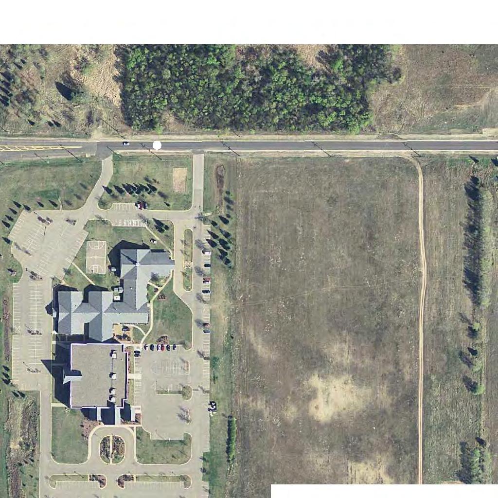
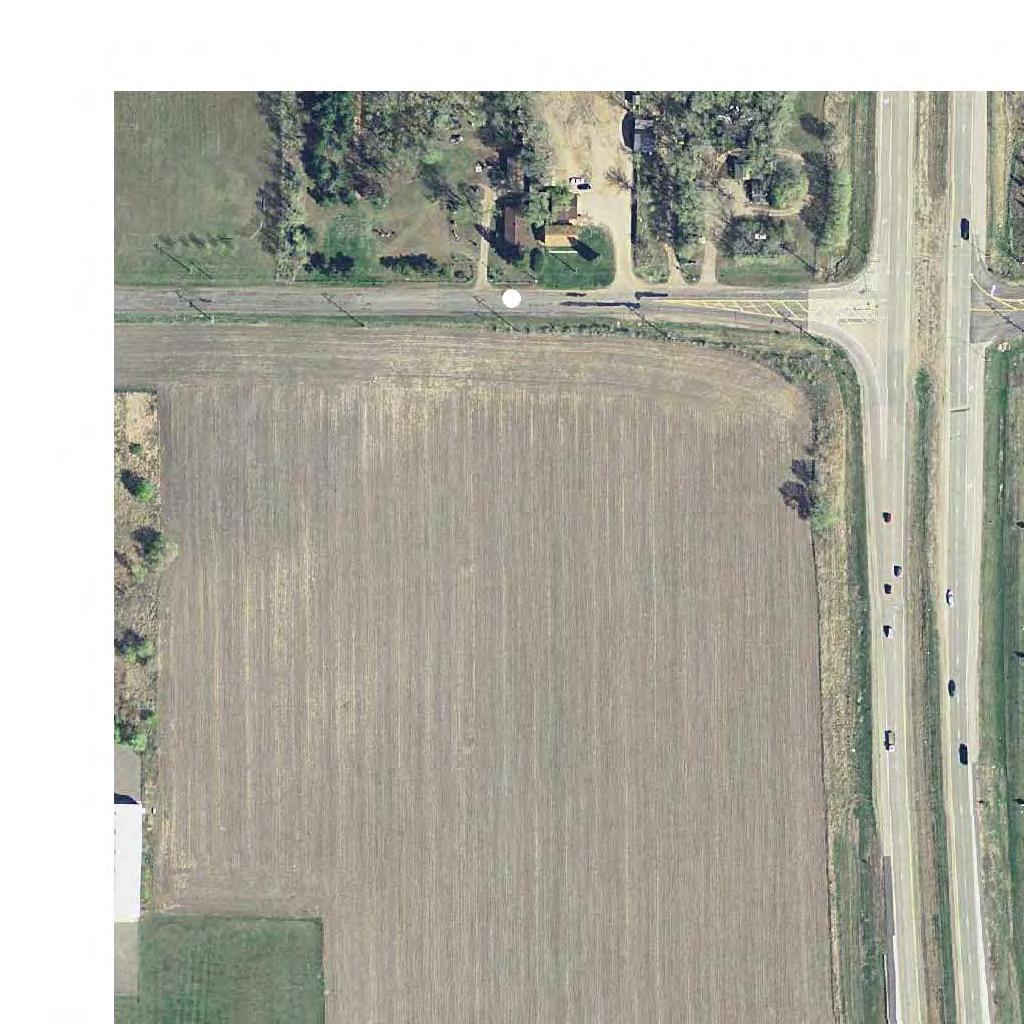
4 Administrative Background Chapter 1 Administrative Background The City of Brooklyn Park proposes construction of a new full access interchange at the Trunk Highway (TH) 169/101 st Avenue intersection. Additional project elements include reconstruction of 101 st Avenue from Jefferson Highway to Xylon Avenue; addition of auxiliary lanes along TH 169 between TH 610 and the proposed interchange; construction of stormwater ponds; and construction of trails and sidewalks. Figure 1, Appendix A and Figure 2, Appendix A illustrate the project location. Additional information regarding the proposed project is provided in Section 2.1 (Project Description). An Environmental Assessment Worksheet (EAW) has been prepared for the project. The City of Brooklyn Park is the project proposer. The Minnesota Department of Transportation (MnDOT) is the Responsible Governmental Unit (RGU) for the proposed project. The EAW has been prepared in accordance with Minnesota Rules Chapter The EAW was developed to assess the impacts of the project and other circumstances in order to determine if an Environmental Impact Statement (EIS) is needed. The EAW was filed with the Minnesota Environmental Quality Board (EQB) and circulated for review and comment to the required EAW distribution list. A Notice of Availability was published in the EQB Monitor on October 24, A news release was distributed by MnDOT Metro District to media outlets in the surrounding area and published on the MnDOT website at hwy169public.html. A legal advertisement, announcing the availability of the EAW and information regarding the public open house meeting, was published in the Brooklyn Park Sun Post (see affidavit of publication in Appendix D). The EAW was made available for public review on the TH 169/101 st Avenue Interchange Project website at Paper copies of the EAW were also made available for public review at the following locations: Brooklyn Park City Hall, th Avenue North, Brooklyn Park, MN Hennepin County Library Brooklyn Park, 8500 West Broadway Avenue, Brooklyn Park, MN TH 169/101 st Avenue Interchange Project 1-1 City of Brooklyn Park
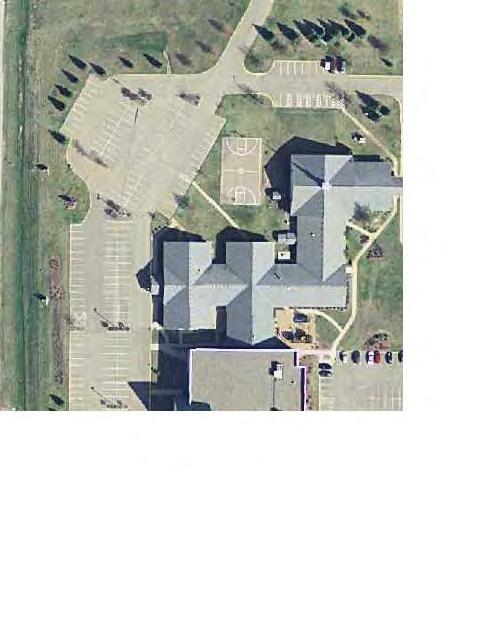
5 Administrative Background Hennepin County Library Minneapolis Central, Government Documents, 2nd Floor, 300 Nicollet Mall, Minneapolis, MN MnDOT Metro District Water s Edge Building, 1500 West County Road B2, Roseville, MN MnDOT Library, 395 John Ireland Boulevard, St. Paul, MN A public open house meeting was held for the project on Thursday, November 10, 2016 from 5:00 pm to 7:00 pm at Grace Fellowship Church ( st Avenue North, Brooklyn Park, MN 55445). Twenty-eight (28) individuals attended the public open house meeting. Copies of the EAW, display boards, and the preliminary design layout were available for review during the public open house meeting. The EAW public comment period was held until November 23, Seven written comments were received during the EAW comment period. All comments received during the EAW comment period were considered in determining the potential for significant environmental impacts. Comments received during the comment period are provided in Appendix B. Responses to substantive comments are provided in Appendix C. Based upon the information in the project record, which is composed of the EAW for the proposed project, the issues raised during the public comment period, the responses to the comments, and other supporting documents, MnDOT makes the following s. TH 169/101 st Avenue Interchange Project 1-2 City of Brooklyn Park
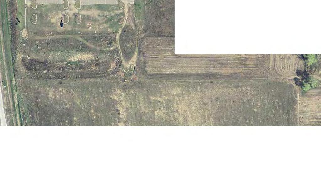
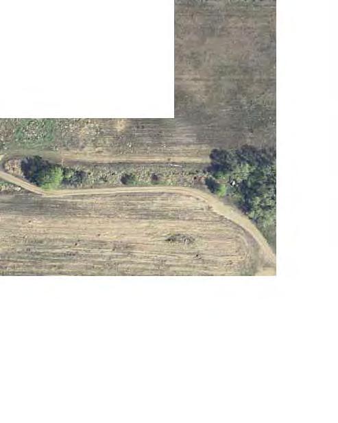
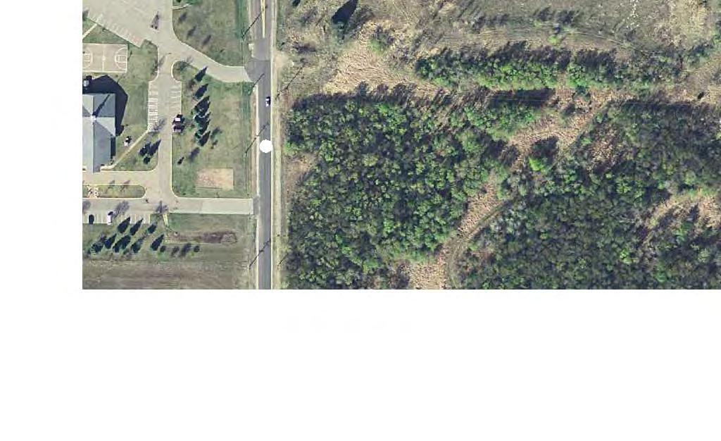
6 Findings of Fact Chapter 2 Finding of Fact 2.1 Project Description Figure 3 through Figure 5, Appendix A illustrate the preliminary design layout for the proposed project. The TH 169/101st Avenue Interchange Project would consist of the following features: Construct a folded diamond interchange at the TH 169/101 st Avenue intersection; Construct an auxiliary lane on southbound TH 169 between the TH 169/101 st Avenue southbound entrance loop ramp and exit ramp to westbound TH 610; Construct an auxiliary lane on northbound TH 169 between the exit ramp from westbound TH 610 and the TH 169/101 st Avenue northbound exit loop ramp; Reconstruct 101 st Avenue from Jefferson Highway to the proposed TH 169/101 st Avenue interchange. Figure 3 and Figure 4, Appendix A illustrate this segment of 101 st Avenue as a four-lane section roadway. This segment of 101 st Avenue could also be reconstructed as a three-lane section roadway (i.e., one westbound lane and one eastbound lane with a center turn lane). The number of lanes on this section of 101 st Avenue will be determined during final design; Reconstruct 101 st Avenue from the proposed TH 169/101 st Avenue interchange to Xylon Avenue as a four-lane section roadway; Construct a new access to the Grace Fellowship Church in the southeast quadrant of the proposed TH 169/101 st Avenue interchange. Figure 4, Appendix A illustrates one concept for providing this access from a future extension of Xylon Avenue south of 101 st Avenue. The final configuration for this will be determined as part of the right of way process, as well as future development and local road plans for lands south of 101 st Avenue. Construct a stormwater pond in the southeast corner of the 101 st Avenue and Jefferson Highway; Construct stormwater ponds and infiltration/filtration basins in the northwest and northeast quadrants of the proposed TH 169/101 st Avenue interchange; and TH 169/101 st Avenue Interchange Project 2-1 City of Brooklyn Park
7 Findings of Fact Construction of trails and/or sidewalks along 101 st Avenue from Jefferson Highway to Xylon Avenue. 2.2 Changes in the Project and New Information Since Completion of the EAW There have been no changes in the project design. No new information is available since completion of the EAW. TH 169/101 st Avenue Interchange Project 2-2 City of Brooklyn Park
8 Agency and Public Comments on the EAW Chapter 3 Agency and Public Comments on the EAW MnDOT received six agency comment letters and one citizen comment during the EAW comment period (see Appendix B). Written responses are provided for all substantive comments submitted during the EAW 30 day comment period, which concluded on November 23, 2016 (see Appendix C). Responses were not provided for comments of general opinions or statements of preference, or issues outside of the project. 3.1 Summary of Comments from the Public One public comment was received as an during the EAW comment period. This comment was in regards to the identification of the TH 169/101 st Avenue interchange location and suggestion for an alternative interchange concept. 3.2 Summary of Comments from Agencies Comment letters were received from the following state and local agencies: Minnesota Pollution Control Agency (MPCA) Metropolitan Council Hennepin County Three Rivers Park District West Mississippi Watershed Management Commission City of Maple Grove The following topics summarize the issues identified in the agency comment letters: Erosion control and in-water best management practices; Sewer interceptors; Rush Creek Regional Trail corridor and vegetation re-establishment; Rush Creek Regional Trail and procedures for conversion of Three Rivers Park District property; Stormwater runoff, water quality, volume control, erosion control, and wetlands; and TH 169/101 st Avenue Interchange Project 3-1 City of Brooklyn Park
9 Agency and Public Comments on the EAW Configuration of the 101 st Avenue corridor between TH 169/101 st Avenue and the design of the 101 st Avenue/Jefferson Highway intersection. TH 169/101 st Avenue Interchange Project 3-2 City of Brooklyn Park
10 Decision Regarding Need for an Environmental Impact Statement Chapter 4 Decision Regarding Need for an Environmental Impact Statement Minnesota Rules provides that an environmental impact statement shall be ordered for projects that have the potential for significant environmental effects. In deciding whether a project has the potential for significant environmental effects, the following four factors described in Minnesota Rules , Subp.7 shall be considered: A. Type, extent, and reversibility of environmental effects; B. Cumulative potential effects. The RGU shall consider the following factors: whether the cumulative potential effect is significant; whether the contribution from the project is significant when viewed in connection with other contributions to the cumulative potential effect; the degree to which the project complies with approved mitigation measures specifically designed to address the cumulative potential effect; and the efforts of the proposer to minimize the contributions from the project; C. The extent to which the environmental effects are subject to mitigation by ongoing public regulatory authority. The RGU may rely only on mitigation measures that are specific and that can be reasonably expected to effectively mitigate the identified environmental impacts of the project; and D. The extent to which environmental effects can be anticipated and controlled as a result of other available environmental studies undertaken by public agencies or the project proposer, including other EISs. Key findings with respect to each of these criteria are set forth below: 4.1 Type, Extent, and Reversibility of Impacts MnDOT finds that the analysis completed for the EAW is adequate to determine whether the project has the potential for significant environmental effects. The EAW described the type and extent of impacts to the natural and built environment anticipated to result from the proposed TH 169/101 st Avenue Interchange project. The information in the EAW and public/agency comments received during the public comment period (see Appendix B) were taken into account in considering the type, extent, and TH 169/101 st Avenue Interchange Project 4-1 City of Brooklyn Park
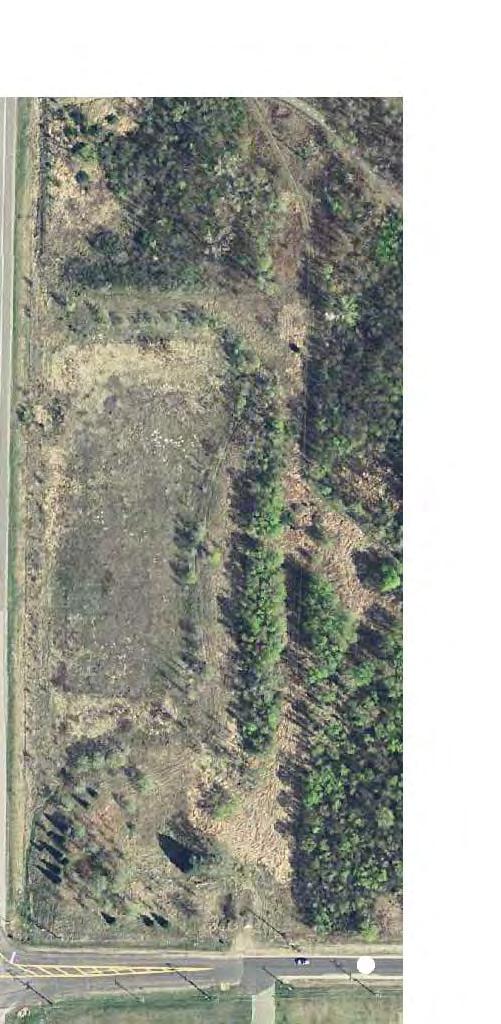
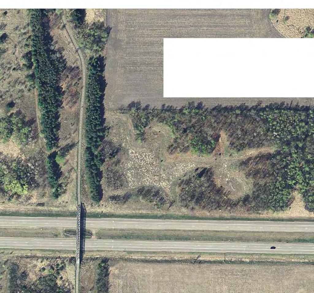
11 Decision Regarding Need for an Environmental Impact Statement reversibility of project impacts. Following are the key findings regarding potential environmental impacts of the proposed project and the design features included to avoid, minimize, and mitigate these impacts: Stormwater Management Existing impervious surface area within the project area is approximately 13.8 acres. The proposed project is anticipated to increase the amount of impervious surfaces by approximately 7.6 acres. Stormwater runoff from the proposed roadways will be collected in curb and gutter and storm sewer pipes and conveyed to stormwater ponds and infiltration basins. A stormwater pond would be located in the southeast corner of the 101 st Avenue/Jefferson Highway intersection. Additional stormwater ponds and infiltration basins would be located within the TH 169/101 st Avenue interchange area (see Figure 3 through Figure 5, Appendix A). Stormwater management features will be designed consistent with regulatory requirements in place at the time of final design. A stormwater pollution prevention plan (SWPPP) will be developed during final design as part of the National Pollutant Discharge Elimination System (NPDES) construction stormwater permitting process Groundwater The appropriate DNR groundwater appropriation permits would be obtained for any temporary dewatering activities during project construction. Groundwater would be treated prior to discharge as per NPDES permitting requirements Aquatic Resources Aquatic resources were identified within the project area using the Level 1, routine off-site wetland determination method. A Level 2 wetland delineation of the project will be completed in the future prior to wetland permitting. The proposed project is anticipated to result in approximately 6.8 acres of aquatic resource impacts, including approximately 3.8 acres of existing stormwater features and approximately 3.0 acres of potential wetland areas. Mitigation for unavoidable wetland impacts will be provided in accordance with all regulations and requirements in place at the time of final design and permitting. TH 169/101 st Avenue Interchange Project 4-2 City of Brooklyn Park
12 Decision Regarding Need for an Environmental Impact Statement Contamination/Hazardous Materials/Wastes Pre-Project Site Conditions A Phase I Environmental Site Assessment (ESA) was completed in February 2016 to assess the presence of potential contaminated properties within the project area. The Phase I ESA study area included a 500-foot buffer of the preliminary construction limits. High, medium, and low rankings were assigned to each site using criteria established by MnDOT. The ranking is based solely on the sites potential for contamination and not on the sites location with respect to the proposed construction limits. A copy of the Phase I ESA is available from the City of Brooklyn Park. Two medium ranked sites were identified in the Phase I ESA study area. No high ranked sites were identified within the study area. If necessary, Phase II drilling investigations will be completed in the future prior to construction at medium potential sites, at other locations where a substantial amount of earthwork is anticipated, and where former buildings occupied right of way to determine if any existing contamination is present. The results of the drilling investigations will be used to determine if any contaminated materials can be avoided or if the project s impacts can be minimized. If necessary, plans will be developed for properly handling and treating contaminated soil and/or groundwater during construction. Any contaminated soils or other potentially hazardous materials encountered during construction will be handled in accordance with regulatory requirements. Project Related Generation/Storage of Solid Wastes If suitable, excavated excess soil material would be reused onsite for construction of ramps and roadway embankments. Any excess soil material that is not suitable for use on the project site would become the property of the contractor and will be disposed of in accordance with state and federal requirements in place at the time of project construction. Excess materials and debris will be disposed of in accordance with MnDOT specifications in place at the time of final design and construction. Excess materials and debris will not be placed in wetlands or floodplains. Project Related Use/Storage of Hazardous Materials Temporary storage tanks for petroleum products may be located in the project area for refueling equipment during roadway construction. Appropriate measures will be taken during construction to avoid spills that could contaminate groundwater or surface water in the project area. In the TH 169/101 st Avenue Interchange Project 4-3 City of Brooklyn Park
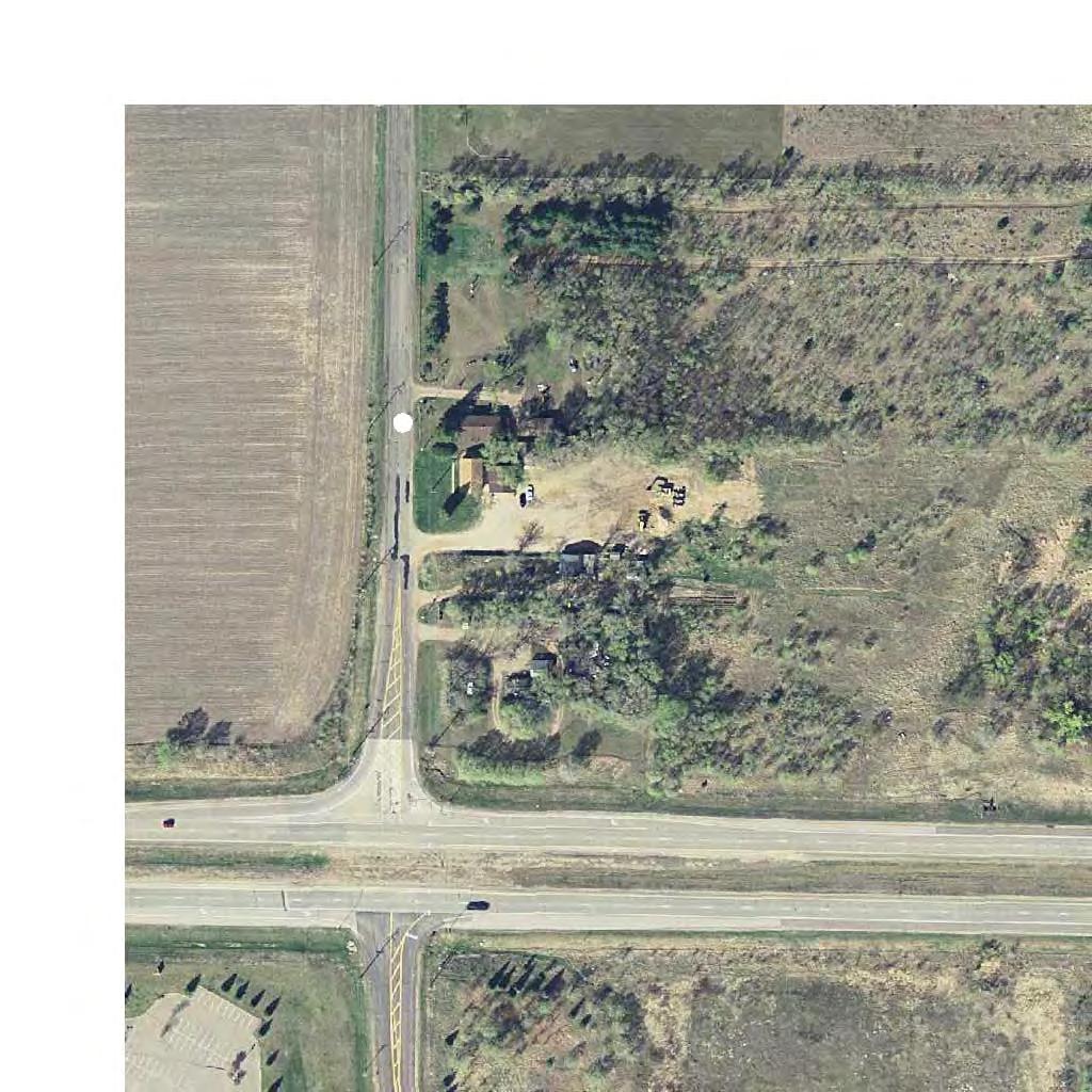
13 Decision Regarding Need for an Environmental Impact Statement event a leak or spill occurs during construction, it will be responded to in accordance with MPCA containment and remedial action procedures Fish, Wildlife, Plant Communities, and Sensitive Ecological Resources (Rare Features) Blanding s turtles (Emydoidea blandingii), a state listed threatened species, have been reported in the vicinity of the project area and may potentially be encountered during construction. The DNR s Blanding s Turtle Fact Sheet will be provided to all contractors working on site, and appropriate measures will be followed if turtles are encountered during construction Construction Noise Elevated noise levels are, to a degree, unavoidable for this type of project. MnDOT will require that construction equipment be properly muffled and in proper working order. While MnDOT and its contractor(s) are exempt from local noise ordinances, it is the practice to require contractor(s) to comply with applicable local noise restrictions and ordinances to the extent that is reasonable. Advanced notice will be provided to affected communities of any planned abnormally loud construction activities. The duration of construction and need for nighttime construction will be determined during the final design of the project. However, construction will be limited to daytime hours (7:00 AM to 10:00 PM) as much as possible. Any associated high-impact equipment noise, such as pile driving, pavement sawing, or jack hammering, will be unavoidable with construction of the proposed project. Pile driving noise is often associated with bridge construction and sheet-piling. High-impact noise construction activities will be limited in duration to the greatest extent possible Right of Way Impacts The project would require approximately 22.8 acres of permanent right of way acquisition from 13 parcels. The project would require three residential relocations located in the northwest quadrant of the proposed TH 169/101 st interchange. The project would convert approximately 3.3 acres of parkland in the northeast quadrant of the proposed TH 169/101 st Avenue interchange. All Metropolitan Council and Three Rivers Park District procedures and requirements for the conversion of parkland, including the acquisition of replacement parkland, will be completed. TH 169/101 st Avenue Interchange Project 4-4 City of Brooklyn Park
14 Decision Regarding Need for an Environmental Impact Statement Summary of Finding With Respect to Criteria MnDOT finds that the project, as it is proposed, does not have the potential for significant environmental effects based on the type, extent, and reversibility of impacts to the resources evaluated in the EAW and in the Findings summary above. Project impacts will be mitigated as described in the EAW and the Findings above. 4.2 Cumulative Potential Effects of Related or Anticipated Future Projects As discussed in Item 19 of the EAW, the cumulative potential effect of related or anticipated future transportation and development projects has been considered and the proposed project has low potential for cumulative impacts to the resources directly or indirectly affected by the project. Given laws, rules, and regulations in place, as well as local regulatory requirements and comprehensive planning and zoning laws, substantial adverse cumulative impacts to these resources are not anticipated. 4.3 Extent to Which the Environmental Effects are Subject to Mitigation by Ongoing Public Regulatory Authority The mitigation of environmental impacts will be designed and implemented in coordination with regulatory agencies and will be subject to the plan approval and permitting process. Permits and approvals that have been obtained or may be required prior to project construction include those listed in Table 4.1. The permits listed in Table 4.1 include general and specific requirements for mitigation of environmental effects of the project. Therefore, MnDOT finds that the environmental effects of the project are subject to mitigation by ongoing regulatory authority. Table 4.1 Permits and Approvals and Current Status Unit of Government Type of Application Status Federal US Army Corps of Section 404 Permit To be applied for Engineers (USACE) State Minnesota Department of Public Waters Work Permit To be applied for Natural Resources (DNR) DNR Temporary Water To be applied for Appropriation Permit (if necessary) MnDOT Environmental Assessment Completed TH 169/101 st Avenue Interchange Project 4-5 City of Brooklyn Park
15 Decision Regarding Need for an Environmental Impact Statement Unit of Government Type of Application Status Worksheet MnDOT EIS Need Decision To be completed MnDOT Wetland Conservation Act To be completed (Boundary Approval/ Replacement Plan) MnDOT Cooperative Agreement for To be completed Construction Projects Minnesota Pollution National Pollutant To be applied for Control Agency (MPCA) Discharge Elimination System (NPDES) Permit MPCA Section 401 Certification To be applied for Local Metropolitan Council Highway Interchange Completed Request Metropolitan Council Controlled Access Approval To be applied for Metropolitan Council and Three Rivers Park District West Mississippi Watershed Management Organization (WMO) City of Brooklyn Park Parkland Conversion Request Stormwater treatment and erosion control review Wetland Conservation Act (Boundary Approval/ Replacement Plan) To be applied for To be applied for To be completed 4.4 Extent to Which Environmental Effects can be Anticipated and Controlled as a Result of Other Environmental Studies MnDOT and the City of Brooklyn Park have extensive experience in roadway construction. Many similar projects have been designed and constructed throughout the metropolitan area. No problem is anticipated which the staff of the MnDOT Metro District and City of Brooklyn Park have not encountered and successfully solved many times in similar projects in or near the project area. MnDOT finds that the environmental effects of the project can be anticipated and controlled as a result of assessment of potential issues during environmental review, and experience in addressing similar issues on previous projects. TH 169/101 st Avenue Interchange Project 4-6 City of Brooklyn Park
16 Conclusions Chapter 5 Conclusions 1. The Minnesota Department of Transportation has jurisdiction in determining the need for an environmental impact statement on the TH 169/101 st Avenue Interchange Project. 2. All requirements for environmental review of the proposed project have been met. 3. The EAW and the permit development processes related to the project have generated information which is adequate to determine whether the project has the potential for significant environmental effects. 4. Areas where potential environmental effects have been identified and will be addressed during future environmental reviews and the final design of the project. Mitigation will be provided where impacts are expected to result from project construction, operation, or maintenance based on requirements in place at that time. Mitigation measures will be incorporated into project design, and will be coordinated with state and federal agencies during the permit process. 5. Based on the criteria in Minnesota Rules part , subp. 7, the project does not have the potential for significant environmental effects. 6. An Environmental Impact Statement is not required for the proposed TH 169/101 st Avenue Interchange Project. 7. Any findings that might properly be termed conclusions and any conclusions that might properly be called findings are hereby adopted as such. Based on the s contained herein and on the entire record: The Minnesota Department of Transportation hereby determines that the proposed TH 169/101 st Avenue Interchange Project will not result in significant environmental impacts, and that the project does not require the preparation of an environmental impact statement. TH 169/101 st Avenue Interchange Project 5-1 City of Brooklyn Park
17
18 Appendix A Project Layout Figures
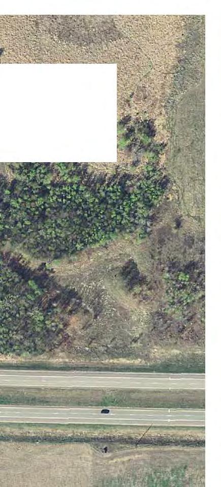
19 Becker Big Lake Elk River Nowthen Oak Grove East Bethel Otsego Ramsey Andover Ham Lake Buffalo Albertville Project Location Hennepin Saint County, MN Michael Rogers Dayton Anoka Hanover Hanover Greenfield Corcoran 94 Maple Grove Champlin Brooklyn Park Coon Rapids Blaine Crystal Brooklyn Center Fridley 694 Delano Independence Medina Plymouth New Hope Robbinsdale Orono Wayzata 494 Golden Valley Minneapolis Minnetrista Mound Minnetonka Hopkins Saint Louis Park Edina Victoria Chanhassen Richfield J:\Maps\8757\mxd\8757_Figure01_AreaLocation.mxd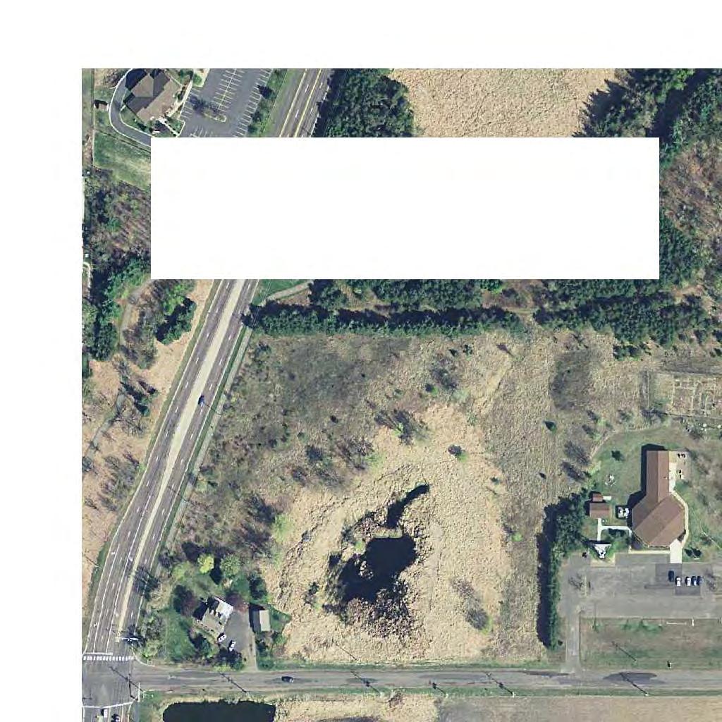


21
22

23
24 Appendix B Agency and Public Comments on the EAW
 TH 169/101 st Avenue Interchange Project B-1 City of Brooklyn")
25 Appendix B Agency and Public Comments on the EAW Exhibit B1. MPCA Letter (November 22, 2016) Exhibit B2. Metropolitan Council Letter (November 21, 2016) TH 169/101 st Avenue Interchange Project B-1 City of Brooklyn Park
 TH 169/101 st Avenue Interchange Project B-2 City of")
26 Appendix B Agency and Public Comments on the EAW Exhibit B3. Hennepin County (November 23, 2016) Exhibit B4. Three Rivers Park District Letter, Page 1 (November 23, 2016) TH 169/101 st Avenue Interchange Project B-2 City of Brooklyn Park
")
 TH")
27 Appendix B Agency and Public Comments on the EAW Exhibit B4. Three Rivers Park District Letter, Page 2 (November 23, 2016) Exhibit B5. West Mississippi WMO Memorandum, Page 1 (November 3, 2016) TH 169/101 st Avenue Interchange Project B-3 City of Brooklyn Park
28 Appendix B Agency and Public Comments on the EAW Exhibit B5. West Mississippi WMO Memorandum, Page 2 (November 3, 2016) Exhibit B5. West Mississippi WMO Memorandum, Page 3 (November 3, 2016) TH 169/101 st Avenue Interchange Project B-4 City of Brooklyn Park
")
 TH")
29 Appendix B Agency and Public Comments on the EAW Exhibit B5. West Mississippi WMO Memorandum, Page 4 (November 3, 2016) Exhibit B5. West Mississippi WMO Memorandum, Page 5 (November 3, 2016) TH 169/101 st Avenue Interchange Project B-5 City of Brooklyn Park
 Exhibit")

30 Appendix B Agency and Public Comments on the EAW Exhibit B6. City of Maple Grove Letter, Page 1 (November 23, 2016) Exhibit B6. City of Maple Grove Letter, Page 2 (November 23, 2016) TH 169/101 st Avenue Interchange Project B-6 City of Brooklyn Park
, Page 1 (November 23, 2016) Exhibit B7.")
31 Appendix B Agency and Public Comments on the EAW Exhibit B7. Nathan Brunner (Maple Grove Resident), Page 1 (November 23, 2016) Exhibit B7. Nathan Brunner (Maple Grove Resident), Page 2 (November 23, 2016) TH 169/101 st Avenue Interchange Project B-7 City of Brooklyn Park
32 Appendix C Responses to Comments
33 Appendix C Responses to Comments Minnesota Pollution Control Agency Letter (November 22, 2016) Comment #1: This project is not currently funded by the City of Brooklyn Park; however, it will be completed in the next few years if funds become available. When the Project does begin, specific in-water best management practices such as silt curtain, construction during low flow or winter conditions, cofferdam, or check-dams, etc. should be included in the Project construction plans. Response: Erosion control best management practices will be implemented during construction in accordance with the NPDES construction stormwater permit and stormwater pollution prevention plan (SWPPP). Metropolitan Council Letter (November 21, 2016) Comment #1: Metropolitan Council Interceptor (9004) is within Ave North right-of-way. The interceptor was built in 1997 and is a 54-inch reinforced concrete/lined pipe at a depth of approximately 24 to 31 feet. To assess the potential impacts to our interceptor system, prior to initiating this project, preliminary plans should be sent to Scott Dentz, Interceptor Engineering Manager ( ) at the Metropolitan Council Environmental Services for review and comment. Response: Construction plans have not yet been prepared for the project. When construction plans are completed, a copy will be sent to Metropolitan Council Environmental Services for review and comment. Hennepin County (November 23, 2016) Comment #1: Although Hennepin County is satisfied with the alternative selection process, it is worth noting this project will negatively impact the only remaining corridor of open space remaining in Brooklyn Park that has the potential of connecting Coon Rapids Regional Dam to Baker Park Preserve via the regional trail. It is also one of the last remaining semi natural open spaces that provide habitat to pollinators, wildlife and the potential for the propagation of native vegetation. As such, we request the project is designed to minimize the impact to the open space corridor by creating a buffer to the regional trail, and that all graded areas be restored with native vegetation to the extent possible to establish habitat for pollinators and other wildlife species. Response: The proposed project interchange would convert approximately 3.3 acres of Three Rivers Park District property to transportation uses in the northeast quadrant of the TH 169/101 st Avenue interchange. A buffer will be TH 169/101 st Avenue Interchange Project C-1 City of Brooklyn Park
34 Appendix C Responses to Comments maintained between the interchange and the Rush Creek Regional Trail. The TH 169/101 st Avenue interchange has been designed to avoid impacts to the existing regional trail bridge over TH 169. All graded areas will be revegetated with native vegetation suitable to the local habitat, consistent with MnDOT best management practices in place at the time of construction. Three Rivers Park District Letter (November 23, 2016) Comment #1: The Park District property being impacted was purchased by the Park District with Metropolitan Council funding in the late 1970s, along with several other properties in the regional trail corridor between Elm Creek Park Reserve and Coon Rapids Dam Regional Park. As such, Metropolitan Council restrictive convents are associated the property. As outlined in Metropolitan Council s 2040 Regional Parks Policy Plan, restrictive covenants are placed on regional parks system lands, trails and greenways to ensure that these lands are available for regional parks uses, and that the regional investment in these lands is protected. These covenants cannot be broken or amended without Metropolitan Council approval. Under certain exceptional circumstances, the Metropolitan Council will consider release restrictive covenants if equally valuable land or facility is provided in exchange for the released park land. Additionally, when Park District property is proposed for adverse impacts, the Park District Board policy states, the Board opposes diversion of Park District property for any purpose other than those for which the lands were acquired. Where proposed diversions of park property appear to be in the best interest of the Park District and where all other alternatives have been exhausted, and where the diversion poses no threat to the Park District s natural or recreational resource, and only under these conditions, requests will be taken under consideration by the Board on an individual basis. In those instances where the Board determines that a proposed diversion upon Park District property may meet these conditions, the following requirements are required: Restoration of any physical or natural property removed or damaged, or equivalent monetary compensation shall be provided. Compensation will reflect the impact of the intrusion on the aesthetic and recreational values of parkland as well as the market value of affected land measured by its highest and best use, and for associated administrative costs. In any case where conversion of Park District land to other uses is proposed, applicants must satisfy Metropolitan Council policies TH 169/101 st Avenue Interchange Project C-2 City of Brooklyn Park
35 Appendix C Responses to Comments governing such conversions, including but not limited to, the requirement that equally valuable land or facilities be exchanged. Response: The City of Brooklyn Park has been and will continue to coordinate the TH 169/101 st Avenue interchange project development process with Three River Park District. The City of Brooklyn Park will comply will all Metropolitan Council and Three Rivers Park District procedures and requirements for park property conversion. West Mississippi Watershed Management Organization Memorandum (November 3, 2016) Comment #1: The treatment provided by the various ponds and sump manholes should provide the amount of treatment necessary, however, calculations should be provided to show the treatment capacity of the stormwater ponds. Response: Drainage design calculations will be provided to the West Mississippi Watershed Management Commission during final design as part of the project review process. Comment #2: Commission rules require that site runoff be limited to predevelopment rates for the 2, 10, and 100 year storm events. Calculations should be provided to determine that post development rates are lower than predevelopment rates. Response: Calculations showing that post development stormwater runoff rates are lower than pre-development rates will be provided to the West Mississippi Watershed Management Commission during final design as part of the project review process. Comment #3: Commission rules require the site to infiltrate 1.0 of runoff from new impervious area within 48 hours. The project proposes 7.6 acres of new impervious surface from the addition of roads, trails, sidewalks, and turn lanes. This amount of impervious surface requires 27,588 cubic feet. (0.63 acre-feet) of infiltrative capacity. The current project area does include rate control ponds. With the inclusion of new stormwater ponds in the project, it is recommended that filtration trenches or other filtration BMPs included in the new pond construction as allows. Response: The stormwater management plan for the proposed project includes stormwater ponds and infiltration basins (see Figure 3 through Figure 5, Appendix A). The proposed infiltration basins are located in areas where there are currently infiltration basins; therefore, it is likely that infiltration would continue to occur with the proposed project. Additional geotechnical information, including soil borings, would be obtained during TH 169/101 st Avenue Interchange Project C-3 City of Brooklyn Park
36 Appendix C Responses to Comments final design. If infiltration is not feasible due to soil types or the presence of groundwater, then the proposed stormwater treatment system would likely only consist of stormwater ponds. The stormwater management plan for the proposed project will be reviewed as part of the final design process and revised to reflect West Mississippi Watershed Management Commission rules and regulations in place at that time. Comment #4: An erosion control and stormwater pollution prevention plan should be developed for the project. Response: An erosion control and SWPPP will be developed during final design as part of the permitting process. Comment #5: The NWI identified six wetlands within the project area. The Commission is LGU for WCA Administration and will review wetland impacts due to fill and hydrology alterations. Table 5 in the EAW shows all wetlands will be filled post construction. As part of design these must be delineated and if necessary a mitigation plan prepared. Response: A Level 2 wetland delineation will be completed in the future prior to permitting. MnDOT will function as the Wetland Conservation Act (WCA) local government unit (LGU) for aquatic resources within MnDOT right of way. The West Mississippi Watershed Management Commission will function as the WCA LGU for areas outside of MnDOT right of way along 101 st Avenue. Aquatic resource impacts will be identified during final design using the Level 2 wetland delineation boundaries. The appropriate Section 404 and WCA permits and approvals will be obtained. A mitigation plan will be prepared for unavoidable wetland impacts. Comment #6: 101 st Avenue crosses a public watercourse approximately immediately east of Jefferson Highway. This is public water (#254W). As part of design these must be delineated and if necessary a mitigation plan prepared. Response: The wetland boundary and ordinary high water level (OHWL) for public water #254W will be identified as part of the Level 2 wetland delineation. A DNR public water work permit will be obtained for any fill below the OHWL at public water #254W. Comment #7: Additional information needed for the West Mississippi Watershed Management Commission: TH 169/101 st Avenue Interchange Project C-4 City of Brooklyn Park
37 Appendix C Responses to Comments Calculations showing the amount of storage and to demonstrate that the project meets the Commission s water quality standards and rate control standards; Provide infiltration BMPs to meet the Commission s Volume control standards. Provide an abstraction volume equivalent to 1-inch of runoff from new impervious surfaces (27,588 cu ft.); Create erosion control and stormwater pollution prevention plans to meet the Commission s erosion control standards. Complete necessary WCA documentation. Response: The additional requested information will be provided to the West Mississippi Watershed Management Commission as part of the project review process. City of Maple Grove Letter (November 23, 2016) Comment #1: The proposed four-lane divided 101 st Avenue east of Jefferson Highway is inconsistent with the two-lane 101 st Avenue west of Jefferson Highway in the City of Maple Grove s Comprehensive Plan. The City of Maple Grove does not believe that the existing traffic signal will provide an adequate transition between the proposed four-lane divided roadway east of Jefferson Highway and the two-lane undivided west of Jefferson Highway. Response: A four-lane roadway for 101 st Avenue between Jefferson Highway and TH 169 was identified in the EAW for purposes of identifying a worst-case scenario with respect to the future roadway footprint and potential impacts. The City of Brooklyn Park has acknowledged, and the traffic forecasts support, that 101 st Avenue east of Jefferson Highway to TH 169 could be reconstructed as a three-lane urban section roadway (i.e., one through lane in each direction with a center turn lane). The 2030 forecast volume for 101 st Avenue between Jefferson Highway and TH 169 is approximately 13,000 vehicles per day (vpd). An updated 2040 forecast volume for 101 st Avenue will be prepared as part of future design and engineering studies using the Metropolitan Council s most recent travel demand model. The typical section for 101 st Avenue between Jefferson Highway and TH 169 will be identified based on the outcome of the future traffic forecasts. Consideration will also be given to available project funding. At this time, a three-lane section roadway appears likely. TH 169/101 st Avenue Interchange Project C-5 City of Brooklyn Park
38 Appendix C Responses to Comments Comment #2: The City of Maple Grove has long expressed our preference for a roundabout to be installed at the 101 st Avenue/Jefferson Highway intersection. This preference is based on the following considerations: A roundabout report the better traffic operations (lowest delays and subsequently better LOS) when compared to traffic signal control. A roundabout not only provides a transition east of Jefferson Highway by dropping one lane in each direction along 101 st Avenue between the proposed TH 169 interchange and Jefferson Highway, but it also will slow speeds and transition behavior through the intersection by constructing a roundabout at the 101 st Avenue/Jefferson Highway intersection. While a roundabout may require the reconstruction of the 101 st Avenue/Jefferson Highway intersection, and will likely have higher initial construction costs when compared to the existing traffic signal, the proposed roundabout will likely have much lower severity rates when it comes to crashes, and lower ongoing operating/maintenance costs when compared to traffic signal control at the intersection. The proposed roundabout is also consistent with the recent approach by Champlin, Maple Grove, and MnDOT that uses roundabouts on 109 th Avenue (west of TH 169), 117 th Avenue (east of TH 169), Zachary Lane (north of TH 610), and Elm Creek Boulevard (north of TH 610) as an effective transition from higher speed/volume facilities to lower speed/volume residential areas. Therefore, the EAW should directly address the recommended intersection configuration of the 101 st Avenue/Jefferson Highway intersection within the document rather than waiting until future development occurs along the corridor. Response: Several different intersection concepts were analyzed for 101 st Avenue/Jefferson Highway during the project development process for the TH 169/101 st Avenue interchange, including traffic signal concepts and a roundabout concept. The traffic signal concepts considered different options for the lane configuration on the 101 st Avenue eastbound and westbound approaches to the intersection. Table C.1 shows the existing, 2030 No Build Alternative, and 2030 Build Alternative intersection operations analysis results for 101 st Avenue/Jefferson Highway. TH 169/101 st Avenue Interchange Project C-6 City of Brooklyn Park
39 Appendix C Responses to Comments Table C st Avenue/Jefferson Highway LOS Results Future Intersection Concepts 101 st Avenue/ Jefferson Highway Intersection Delay (s/veh) AM Peak Hour LOS AM Peak Hour Delay (s/veh) PM Peak Hour LOS PM Peak Hour Existing Conditions (Signal) 2030 No Build Alternative (Signal) Signalized Scenario 1 Signalized Scenario 2 Signalized Scenario 3 Signalized Scenario 4 10 B 9 A 15 B 15 B 26 C 12 B 27 C 12 B 29 C 13 B 29 C 13 B Roundabout 17 C 9 A s/veh = seconds per vehicle It is feasible to design and construct the future 101 st Avenue roadway to match the existing 101 st Avenue/Jefferson Highway intersection without reconstructing the entire 101 st Avenue/Jefferson Highway intersection. Minor lane restriping may be necessary to accommodate lane configurations. The traffic operations analysis shows that there is not an existing operations problem at this location. The intersection is expected to continue to operate acceptably under 2030 No Build Alternative conditions, and the intersection concepts would also operate acceptably under 2030 Build Alternative conditions. As noted above, 101 st Avenue east of Jefferson Highway could be reconstructed as a three-lane section roadway. The three-lane section roadway could also be designed and constructed to match the existing 101 st Avenue/Jefferson Highway intersection configuration. The 101 st Avenue roadway design east of Jefferson Highway would not preclude any of the intersection concepts identified in Table C.1. The City of Brooklyn Park will continue to work with the City of Maple Grove to identify a future intersection configuration for 101 st Avenue/Jefferson Highway that addresses the needs of both municipalities. This may result in a roundabout at this location phased in over time as development, right of way, and funding opportunities become available. Future improvements at 101 st Avenue/Jefferson Highway will also be coordinated with Three Rivers Park District, as the Rush Creek Regional Trail crosses Jefferson Highway at 101 st Avenue. TH 169/101 st Avenue Interchange Project C-7 City of Brooklyn Park
40 Appendix C Responses to Comments Note that the proposed stormwater pond located in the southeast corner of the 101 st Avenue/Jefferson Highway intersection has been sized to accommodate the additional impervious surface and footprint associated with a roundabout design (see Figure 3, Appendix A). Nathan Brunner (Maple Grove Resident) (November 23, 2016) Comment #1: My primary concern with Recommended Alternative #2 is that the interchange is too close to the 169 /610 interchange. Traffic entering 169 northbound from 610 westbound will interfere with northbound 169 traffic exiting at 101st Avenue. Similarly, traffic entering 169 southbound from 101st will interfere with southbound traffic exiting at 610. With additional traffic volume that will come with 610 opening to I-94, the dynamics of these interchanges will change. I believe that additional spacing is needed as a buffer against future traffic volume as well as against current volume. Response: A traffic study was completed as part of the TH 169/101 st Avenue Interchange Study (December 2014). This study included an evaluation of freeway operations on TH 169 with and without the proposed 101 st Avenue interchange using the Highway Capacity Software (HCS). This traffic operations analysis showed that the northbound and southbound TH 169 would safely operate at an acceptable level of service under future (year 2030) traffic volumes with the proposed 101 st Avenue interchange. A high-level microsimulation freeway operations analysis was also completed as part of the December 2014 TH 169/101 st Avenue Interchange Study. This analysis used the CORSIM computer model to simulate travel lane conditions on TH 169 during the a.m. and p.m. peak hour conditions. The CORSIM analysis also included auxiliary lanes on TH 169 between the TH 610 system interchange the proposed 101 st Avenue interchange. The CORSIM analysis indicated that the segment of TH 169 between TH 610 and 101 st Avenue interchange would operate at an acceptable level of service (LOS) C or better under future year 2030 conditions. The analysis from the December 2014 TH 169/101 st Avenue Interchange Study was subsequently updated in Part of this update included a CORSIM microsimulation freeway operations analysis to confirm that the spacing between TH 610 and 101 st Avenue is acceptable. Updates to the CORSIM modeling since the December 2014 study are described in the TH 169/101 st Avenue Interchange Study Preliminary Design (Phase II), Traffic Analysis Update, TH 169 Freeway Analysis Memorandum (April 2016) available from the City of Brooklyn Park. Traffic operations were reviewed for the segment of TH 169 between the 101st Avenue interchange ramps and TH 610 interchange TH 169/101 st Avenue Interchange Project C-8 City of Brooklyn Park
41 Appendix C Responses to Comments ramps. During both the a.m. and p.m. peak periods, the 2030 Build Alternative condition with the proposed TH 169/101 st Avenue interchange shows improved conditions compared to the No Build Alternative (see Table C.2). Table C Freeway Operations between TH 610 and 101 st Avenue Interchanges Scenario A.M. Peak Hour LOS (density vpmpl) P.M. Peak Hour LOS (density vpmpl) No Build Alternative F (96) D (33) Build Alternative (with TH 169/101 st Avenue Interchange) F (73) C (22) vpmpl = vehicles per mile per lane The proposed auxiliary lanes on northbound and southbound TH 169 between 101 st Avenue and TH 610 will also help to improve traffic operations by providing additional length for entering traffic to merge onto TH 169 and exiting traffic to diverge from the freeway. The auxiliary lanes provide an additional lane to separate the merging and diverging movements from through traffic. Comment #2: There is already a problem in this area with northbound 169 traffic in the left lane making a late, sudden lane change to exit to 610 eastbound. Nearly every time I travel that route I have to brake for drivers making this kind of maneuver. There is no reason to believe this won t happen at the 101 st exit from northbound 169. The situation will be worse at 101st due to traffic accelerating onto 169 northbound from the 610 westbound ramp. From my perspective, Alternative #2 has two built-in safety flaws that can be eliminated by the following proposal. A solution to this problem is to build the same type of interchange at 109th Avenue North, except with all elements of the interchange on the south side of 109th. Please refer to the map below with my proposal drawn in red. Response: TH 169 Traffic Operations The late, sudden lane change observed for the exit from northbound TH 169 to eastbound TH 610 occurs because the TH 169/610 interchange is a system interchange and there is heavy demand for the northbound to eastbound movement, particularly during the p.m. peak hour. The similar movement at the proposed 101 st Avenue interchange is expected to be substantially less than at the TH 169/610 system interchange. TH 169/101 st Avenue Interchange Project C-9 City of Brooklyn Park
42 Appendix C Responses to Comments TH 169/101 st Avenue Interchange Alternatives The purpose of the project is to enhance access to TH 169 for the planned growth area of northwest Brooklyn Park, provide the transportation infrastructure necessary to serve the planned growth areas in northwest Brooklyn Park, and better distribute regional trips from existing interchanges. A range of interchange concepts were considered as part of the TH 169/101 st Avenue Interchange Study (December 2014). These concepts included different interchange configurations along TH 169 north of 101 st Avenue. Early concepts considered an interchange at TH 169 and 109 th Avenue. However, this alternative was dismissed from further consideration because of its proximity to the 114 th Avenue traffic signal (approximately ½-mile to the north). Traffic queues would be expected to extend back from the TH 169/114 th Avenue signal through the 109 th Avenue interchange. The proposed spacing between the 101 st Avenue interchange and 109 th Avenue provides more than twice the distance compared to 109 th Avenue and 114 th Avenue. An interchange north of 101 st Avenue does not provide the transportation infrastructure necessary to serve the regional travel demands of the planned growth area in northwest Brooklyn Park. Additional access to and from the regional roadway system is needed. Upgrading the current regional access at 109 th Avenue from an at-grade signalized intersection to an interchange would not be sufficient compared to an interchange at 101 st Avenue. In addition, the proposed TH 169/101 st Avenue interchange also helps to distribute trips throughout the project area. A majority of all trips generated in the planned growth area of northwest Brooklyn Park are regional trips destined to/from to the south. The ramps that provide access to/from the south account for a majority of the trips using the proposed 101 st Avenue interchange. Very few regional trips from the planned growth area destined to the south would go north to 109 th Avenue first, and then travel back south on TH 169. It is more likely that these trips would use the TH 610/West Broadway Avenue interchange to access westbound TH 610 and then southbound TH 169. This ramp currently operates at capacity during the a.m. peak hour, creating merging issues with traffic on TH 169 at the TH 610 system interchange. With the proposed TH 169/101 st Avenue interchange, more traffic accesses southbound TH 169 at 101 st Avenue, improving traffic operations at the TH 169/TH 610 system interchange. TH 169/101 st Avenue Interchange Project C-10 City of Brooklyn Park
43 Appendix D Affidavit of Publication
 TH 169/101 st Avenue")
44 Appendix D Affidavit of Publication Exhibit D1. Affidavit of Publication (Brooklyn Park Sun Post) TH 169/101 st Avenue Interchange Project D-1 City of Brooklyn Park
I-494 Rehabilitation Project SP (I-394 to Fish Lake Interchange) June 2014 Section 4(f) De Minimis Determination
 June 2014 Section 4(f) De Minimis Determination") I-494 Rehabilitation Project SP 2785-330 (I-394 to Fish Lake Interchange) June 2014 Section 4(f) De Minimis Determination State Project Number 2785-330 Federal Project No. NHPP-I494 (002) Trunk Highway:
I-494 Rehabilitation Project SP 2785-330 (I-394 to Fish Lake Interchange) June 2014 Section 4(f) De Minimis Determination State Project Number 2785-330 Federal Project No. NHPP-I494 (002) Trunk Highway:
ARGENTA TRAIL (CSAH 28/63) REALIGNMENT SOUTH PROJECT (CP 63-25)
 REALIGNMENT SOUTH PROJECT (CP 63-25)") ARGENTA TRAIL (CSAH 28/63) REALIGNMENT SOUTH PROJECT (CP 63-25) Preliminary Design Report February 2015 Prepared For: City of Inver Grove Heights Dakota County Prepared By: Kimley-Horn and Associates,
ARGENTA TRAIL (CSAH 28/63) REALIGNMENT SOUTH PROJECT (CP 63-25) Preliminary Design Report February 2015 Prepared For: City of Inver Grove Heights Dakota County Prepared By: Kimley-Horn and Associates,
This chapter describes the purpose of the Plan, introduces how the Plan is organized and provides contextual background for the Plan.
 Chapter 1: INTRODUCTION Purpose of a Comprehensive Plan The 2040 Comprehensive Plan establishes Medina s vision as a community and sets goals and objectives which guide future decisions and policies. The
WHAT IS THE PURPOSE OF THE OPEN HOUSE?
 WHAT IS THE PURPOSE OF THE OPEN HOUSE? OPEN HOUSE PURPOSE The purpose of the open house is to provide an update on the study process and introduce the preliminary concept alternatives. The open house provides
Public Hearing. Charlotte County-Punta Gorda MPO - Meeting Rooms A and B March 14, open house at 4 p.m., formal presentation at 5 p.m.
 Public Hearing Charlotte County-Punta Gorda MPO - Meeting Rooms A and B March 14, 2019 open house at 4 p.m., formal presentation at 5 p.m. Welcome to the Public Hearing for the Harborview Road (CR 776)
elm creek Watershed Management Commission
 elm creek Watershed Management Commission ADMINISTRATIVE OFFICE 3235 Fernbrook Lane Plymouth, MN 55447 PH: 763.553.1144 FAX: 763.553.9326 Email: judie@jass.biz Hickory Drive Utility & Street Improvements
June 14, 2017 for the June 20, 2017 Parks and Trails Commission Meeting
 105 South Fifth Avenue Suite 513 Minneapolis, MN 55401 Tel: 612-252-9070 Fax: 612-252-9077 www.landform.net TO: FROM: DATE: Corcoran Parks and Trails Commission Kendra Lindahl, Landform June 14, 2017 for
Subject: City of Richfield Cedar Avenue Corridor Plan Comprehensive Plan Amendment, Review File No
 Committee Report Business Item No. 2017-21 Community Development Committee For the Metropolitan Council meeting of January 25, 2017 Subject: City of Richfield Cedar Avenue Corridor Plan Comprehensive Plan
Mississippi Skyway Preliminary Engineering Report
 EXECUTIVE SUMMARY Mississippi Skyway Preliminary Engineering Report CITY OF RAMSEY, MINNESOTA DECEMBER 2014 City of RAMSEY EXECUTIVE SUMMARY Project Need and Intent The Mississippi Skyway pedestrian bridge
Project: Mooney Lake Preserve Received: Location: 300 Sixth Ave. N., Orono Complete: Noticed:
 Permit Application No.: 15-445 Rules: Erosion Control, Wetland Protection, & Stormwater Management Applicant: BPS Properties, LLC Project: Mooney Lake Preserve Received: 8-24-15 Location: 300 Sixth Ave.
7.0 SOCIAL, ECONOMIC, AND ENVIRONMENTAL ISSUES
 7.0 SOCIAL, ECONOMIC, AND ENVIRONMENTAL ISSUES The following list of social, economic, and environmental issues have been identified based on a preliminary inventory of resources in the project area, an
PROJECT BACKGROUND. Preliminary Design Scope and Tasks
 PROJECT BACKGROUND Preliminary Design Scope and Tasks The purpose of this Study is the development of preliminary designs for intersection improvements for Trunk Highway (TH) 36 at the intersections of
Appendix I. Checklists
 Appendix I Checklists Town of Greenwich Drainage Manual Department of Public Works - Engineering Division Town Hall - 101 Field Point Road, Greenwich, CT 06836-2540 Phone 203-622-7767 - Fax 203-622-7747
SECTION 4(f) DE MINIMIS DOCUMENTATION
 DE MINIMIS DOCUMENTATION") SECTION 4(f) DE MINIMIS DOCUMENTATION Illinois Route 60/83 IL 176 to the intersection of IL 60 (Townline Road) Lake County P-91-084-07 Mundelein Park and Recreation District Project Limit SECTION 4(f)
SECTION 4(f) DE MINIMIS DOCUMENTATION Illinois Route 60/83 IL 176 to the intersection of IL 60 (Townline Road) Lake County P-91-084-07 Mundelein Park and Recreation District Project Limit SECTION 4(f)
Information for File # MVP MMJ; Elim Care
 Information for File # MVP-217-2628-MMJ; Elim Care Applicant: Elim Care of Maple Plain Corps Contact: Melissa Jenny Address: 18 Fifth Street East, Suite 7, St. Paul, MN 5511-168 E-Mail: Melissa.m.jenny@usace.army.mil
Draft Rhode Island Stormwater Design and Installation Standards Manual
 Draft Rhode Island Stormwater Design and Installation Standards Manual Summary The May 2009 Public Review Draft version of the RI Stormwater Design and Installation Standards Manual consists of approximately
HAZARD MITIGATION GOALS AND OBJECTIVES
 SEWRPC Community Assistance Planning Report No. 282, 2nd Edition CITY OF MILWAUKEE ALL HAZARDS MITIGATION PLAN UPDATE Chapter IV HAZARD MITIGATION GOALS AND OBJECTIVES [NOTE: Throughout this plan update
SUMMARY. Support the Southeast Arkansas Regional Intermodal Facility.
 SUMMARY THE I-69 LOCATION STUDY The proposed I-69 Location Study from El Dorado to McGehee, Arkansas, represents one section (Section of Independent Utility No. 13) of the nationally designated I-69 Corridor
Huntington Stormwater Utility
 Huntington Stormwater Utility Stormwater Management & Sediment and Erosion Control Requirements for Construction Sites Authorized by Huntington City Code Articles: 971, 970, 930, 935, 955, Revised April
PURPOSE: The purpose is to provide commercial facilities in the Vancouver and Clark County vicinity.
 US Army Corps of Engineers Seattle District Joint Public Notice Application for a Department of the Army Permit and a Washington Department of Ecology Water Quality Certification and/or Coastal Zone Management
PLANNING COMMISSION Work Session Meeting Agenda
 PLANNING COMMISSION Work Session Meeting Agenda 5200 85TH AVENUE NORTH BROOKLYN PARK MN 55443 PHONE (763) 424-8000 FAX (763) 493-8391 Wednesday, September 27, 2017-7:00 P.M. Brooklyn Township Room If due
Appendix E Section 4(f) Evaluation
 Evaluation") Appendix E Section 4(f) Evaluation Appendix E Draft Section 4(f) Evaluation E.1 Introduction This appendix addresses a federal regulation known as Section 4(f), which protects parks, recreation areas,
Appendix E Section 4(f) Evaluation Appendix E Draft Section 4(f) Evaluation E.1 Introduction This appendix addresses a federal regulation known as Section 4(f), which protects parks, recreation areas,
Project Applicant Checklist for NPDES Permit Requirements SAN MATEO COUNTYWIDE STORMWATER POLLUTION PREVENTION PROGRAM
 Project Applicant Checklist for NPDES Permit Requirements SAN MATEO COUNTYWIDE STORMWATER POLLUTION PREVENTION PROGRAM I. PROJECT DATA Project Name Bay Meadows Development Phase II Project Address 2600
REQUEST FOR COUNCIL ACTION 6A AGENDA ITEM
 DATE REQUEST FOR COUNCIL ACTION 6A AGENDA ITEM ORIGINATING DEPT. AGENDA ITEM CITY ADMINISTRATOR APPROVAL Community Development PUD Concept & Development Stage Plan Preliminary Plat & Final Plat PREVIOUS
WELCOME! 8 8:30 6: TH STREET IMPROVEMENTS. Open House. Presentation & Q&A
 WELCOME! 168 TH STREET IMPROVEMENTS 6:30 Open House 7 8 Presentation & Q&A 8 8:30 Open House WELCOME Todd Pfitzer City of Omaha Engineer Bob Stubbe City of Omaha Public Works Director Jon Meyer Project
WASHINGTON COUNTY OREGON
 WASHINGTON COUNTY OREGON LONG RANGE PLANNING DIVISION North Bethany Subarea Stream Corridors: Existing Regulations In Oregon, there is a distinct difference between the land use rules that apply in rural
When planning stormwater management facilities, the following principles shall be applied where possible.
 2.0 Principles When planning stormwater management facilities, the following principles shall be applied where possible. 2.0.1 Drainage is a regional phenomenon that does not respect the boundaries between
Right-of-Way Acquisitions and Relocations Technical Memorandum
 Right-of-Way Acquisitions and Relocations Technical Memorandum Southeast Extension Project Lincoln Station to RidgeGate Parkway Prepared for: Federal Transit Administration Prepared by: Denver Regional
STATE OF TENNESSEE DEPARTMENT OF TRANSPORTATION ENVIRONMENTAL DIVISION
 STATE OF TENNESSEE DEPARTMENT OF TRANSPORTATION ENVIRONMENTAL DIVISION Suite 900 - James K. Polk Building 505 Deaderick Street Nashville, Tennessee 37243-0334 MEMORANDUM TO: FROM: Files Joe W. Matlock,
Storm Water Quality and Shoreline Restoration Improvements - Grant Funding Request City of Mound Carlson Park Bolton & Menk Project No.
 September 15, 2016 Brett Eidem Cost Share Grant Administrator Minnehaha Creek Watershed District 15320 Minnetonka Boulevard Minnetonka, MN 55345 RE: Storm Water Quality and Shoreline Restoration Improvements
Chapter 4 - Preparation of Stormwater Site Plans
 Chapter 4 - Preparation of Stormwater Site Plans The Stormwater Site Plan is the comprehensive report containing all of the technical information and analysis necessary for the City to evaluate a proposed
VISUALIZATION TOOLS FOR COMMUNICATION & DECISION MAKING REAL MINNESOTA EXAMPLES
 REAL MINNESOTA EXAMPLES 23rd Annual CTS Transportation Research Conference Leif Garnass, P.E., PTOE Senior Engineer lgarnass@srfconsulting.com Sean Jergens, ASLA, LEED AP Senior Landscape Architect sjergens@srfconsulting.com
City of Toronto. Emery Village Transportation Master Plan
 City of Toronto Emery Village Transportation Master Plan May 2009 Emery Village Transportation Master Plan Toronto, ON May 2009 Consulting Inc. 100 York Blvd., Suite 300 Richmond Hill, ON L4B 1J8 Tel:
METROPOLITAN COUNCIL 390 North Robert Street, St. Paul, MN Phone (651) TDD (651)
 TDD (651)") METROPOLITAN COUNCIL 390 North Robert Street, St. Paul, MN 55101 Phone (651) 602-1000 TDD (651) 291-0904 DATE: January 24, 2013 TO: FROM: SUBJECT: Metropolitan Parks and Open Space Commission Jan Youngquist,
METROPOLITAN COUNCIL 390 North Robert Street, St. Paul, MN 55101 Phone (651) 602-1000 TDD (651) 291-0904 DATE: January 24, 2013 TO: FROM: SUBJECT: Metropolitan Parks and Open Space Commission Jan Youngquist,
Chesapeake Bay Critical Area Conservation Plan
 The Maryland-National Capital Park and Planning Commission Prince George s County Planning Department Development Review Division 301-952-3530 Note: Staff reports can be accessed at www.mncppc.org/pgco/planning/plan.htm.
A. INTRODUCTION AND SUMMARY OF FINDINGS B. EXISTING CONDITIONS. Table 10-1 Adjacent Storm Drains
 Chapter 10: Stormwater Management A. INTRODUCTION AND SUMMARY OF FINDINGS This chapter describes existing and proposed stormwater management on the Site. Potential impacts to stormwater infrastructure
North Carolina Department of Transportation Project Development and Environmental Analysis Branch
 North Carolina Department of Transportation Project Development and Environmental Analysis Branch Citizens Informational Workshop I-85, from I-485 to NC 73 Mecklenburg and Cabarrus Counties October 30,
Coffee Creek Park Development Low Impact Development (LID)
") Coffee Creek Park Development Low Impact Development (LID) City of Duluth, St. Louis County, MN Presented By: Christopher J. Rousseau, P.E. February 27, 2008 Developer / Owner Information Trinity Development
Coffee Creek Park Development Low Impact Development (LID) City of Duluth, St. Louis County, MN Presented By: Christopher J. Rousseau, P.E. February 27, 2008 Developer / Owner Information Trinity Development
PUBLIC HEARING. Thursday, December 14, 2017 FDOT Urban Office 2198 Edison Avenue Jacksonville, FL 32204
 DISTRICT TWO PUBLIC HEARING I 10 (SR 8) from I 295 to I 95 Project Development & Environment Study Duval County, Florida Financial Project Number 213326 2 22 01 Efficient Transportation Decision Making
Richton Park Western Development Corridor Green Infrastructure Development Plan August 18, 2017
 Richton Park Western Development Corridor Green Infrastructure Development Plan August 18, 2017 Conservation Design Forum Geosyntec Consultants 403 W. St. Charles Road 1420 Kensington Road, Suite 103 Lombard,
ARLINGTON COUNTY, VIRGINIA. County Board Agenda Item Meeting of January 28, 2017 SUPPLEMENTAL REPORT
 ARLINGTON COUNTY, VIRGINIA County Board Agenda Item Meeting of January 28, 2017 SUPPLEMENTAL REPORT DATE: January 26, 2017 SUBJECT: The Virginia Department of Transportation s Transform I-66 Inside the
DRAFT MAP AMENDMENT FLU 04-4
 DRAFT MAP AMENDMENT FLU 04-4 SW 24 TH AVENUE ROADWAY CORRIDOR The University of Florida participates with the Metropolitan Transportation Planning Organization (MTPO) in its responsibilities for the continuing,
Gold Line Bus Rapid Transit Transit Oriented Development (BRTOD) Helmo Station Area Plan
 Helmo Station Area Plan") Appendix F Gold Line Bus Rapid Transit Transit Oriented Development (BRTOD) Helmo Station Area Plan Introduction and Purpose of the Plan The Gold Line Bus Rapid Transit facility is an eleven-mile dedicated
Appendix F Gold Line Bus Rapid Transit Transit Oriented Development (BRTOD) Helmo Station Area Plan Introduction and Purpose of the Plan The Gold Line Bus Rapid Transit facility is an eleven-mile dedicated
7.0 SECTION 4(F) EVALUATION
 EVALUATION") Chapter 7 Section 4(f) Evaluation 7.0 SECTION 4(F) EVALUATION 7.1 Background Information and Regulatory Requirements This chapter presents the existing conditions and potential effects to parklands and
Chapter 7 Section 4(f) Evaluation 7.0 SECTION 4(F) EVALUATION 7.1 Background Information and Regulatory Requirements This chapter presents the existing conditions and potential effects to parklands and
REQUEST FOR COUNCIL ACTION 6A AGENDA ITEM ORIGINATING DEPT. AGENDA ITEM CITY ADMINISTRATOR APPROVAL
 DATE REQUEST FOR COUNCIL ACTION 6A AGENDA ITEM ORIGINATING DEPT. AGENDA ITEM CITY ADMINISTRATOR APPROVAL Community Development Territorial Greens PUD Concept Plan Development Stage Plan Subdivision (Preliminary
City of Sun Prairie Wetland Buffer Reduction Request
 City of Sun Prairie Wetland Buffer Reduction Request Westside Development Area January 9, 2017 Prepared by: City of Sun Prairie 300 E. Main Street Sun Prairie, WI 53590 BACKGROUND The City of Sun Prairie
AGENCY: Federal Emergency Management Agency, DHS. SUMMARY: Flood hazard determinations, which may include additions or
 This document is scheduled to be published in the Federal Register on 07/27/2016 and available online at http://federalregister.gov/a/2016-17739, and on FDsys.gov 1 Billing Code 9110-12-P DEPARTMENT OF
Venice Pumping Plant Dual Force Main Project Draft EIR
 City of Los Angeles 5.9 LAND USE PLANS 5.9.1 Environmental Setting Venice Pumping Plant Dual Force Main Project Draft EIR The Project lies within the bounds of Los Angeles County and the City of Los Angeles.
Appendix G Response to Comments
 Appendix G Response to Comments This appendix contains the comments received during the public circulation and comment period (May 27, 2008 to July 11, 2008). The comments have been numbered (Comment Set
USF System Campus Master Plan Updates Goals, Objectives and Policies
 2015-2025 USF System Campus Master Plan Updates Goals, Objectives and Policies Tampa Goals, Objectives, and Policies Table of Contents Executive Summary 2015 2025 USF Campus Master Plan Update Introduction
SEWRPC. Joint Meeting of the Advisory Committees on Regional Land Use Planning and Regional Transportation Planning APRIL 26, 2018
 SEWRPC Joint Meeting of the Advisory Committees on Regional Land Use Planning and Regional Transportation Planning APRIL 26, 2018 WISCONSIN DEPARTMENT OF TRANSPORTATION BRETT WALLACE, FOXCONN PROJECT DIRECTOR
ARLINGTON COUNTY, VIRGINIA. County Board Agenda Item Meeting of January 28, 2017 SUPPLEMENTAL REPORT-2
 ARLINGTON COUNTY, VIRGINIA County Board Agenda Item Meeting of January 28, 2017 SUPPLEMENTAL REPORT-2 DATE: January 27, 2017 SUBJECT: The Virginia Department of Transportation s Transform I-66 Inside the
B. DESCRIPTION OF THE PROPOSED ACTION
 Executive Summary A. INTRODUCTION Metro-North Commuter Railroad Company ( Metro-North or the Project Sponsor ) is proposing the construction of a new, expanded parking garage at 50 Haarlem Avenue (formerly
Appendix E Preliminary Location Hydraulic Study
 Appendix E Prepared for: State of Alaska Department of Transportation and Public Facilities Prepared by: HDR Alaska, Inc. 2525 C Street, Suite 305 Anchorage, Alaska 99503 February 2014 This page intentionally
112th Avenue Light Rail Options Concept Design Report JUNE 2010 PREPARED FOR PREPARED BY TBG PGH
 112th Avenue Light Rail Options Concept Design Report JUNE 2010 PREPARED FOR PREPARED BY TBG060310124909PGH C ontents Introduction 1 Project Overview 1 Public Involvement and Technical Coordination 4 Description
C. WATER. 1. Surface Water Runoff. See Section C.3, Flood Hazard/Mudflow Hazard, page Ground Water
 C. WATER 1. Surface Water Runoff See Section C.3, Flood Hazard/Mudflow Hazard, page 67. 2. Ground Water Determined not significant by the October 1984 and January 1999 Initial Studies conducted by the
City of Cornwall Municipal Class Environmental Assessment. Proposed Improvement and Extension of Lemay Street
 Welcome City of Cornwall Municipal Class Environmental Assessment Proposed Improvement and Extension of Lemay Street Redevelopment and Design of the Municipal Works Yard Public Information Centre #1 Thursday,
Section 3 Non-Structural BMPs
 3.1 Stream Buffers A stream buffer or stream setback is a designated area around a stream, lake, or wetland left in a natural, densely vegetated state so as to protect the receiving water quality and provide
5-Year Street Reconstruction Plan ( )
") 5-Year Street Reconstruction Plan (2006-2010) City of Delano Wenck File #0564-37 Prepared for: CITY OF DELANO 234 2 nd Street West Delano, MN 55328 Prepared by: WENCK ASSOCIATES, INC. 1800 Pioneer Creek
5-Year Street Reconstruction Plan (2006-2010) City of Delano Wenck File #0564-37 Prepared for: CITY OF DELANO 234 2 nd Street West Delano, MN 55328 Prepared by: WENCK ASSOCIATES, INC. 1800 Pioneer Creek
Leduc Industrial Outline Plan SE W4
 Leduc Industrial Outline Plan SE 1-50-25-W4 Within the North Leduc Industrial ASP Prepared for: Leduc Energy Park Ltd. Prepared by: Stantec Consulting Ltd. File No. 1161 104655 V5 Table of Contents 1.0
ST. MARY S SOIL CONSERVATION DISTRICT (SMSCD) AND DPW&T CONCEPT EROSION AND SEDIMENT CONTROL AND STORMWATER MANAGEMENT GUIDELINES AND CHECKLIST
 AND DPW&T CONCEPT EROSION AND SEDIMENT CONTROL AND STORMWATER MANAGEMENT GUIDELINES AND CHECKLIST") St. Mary s Soil Conservation District 26737 Radio Station Way, Suite B Leonardtown, MD 20650 Phone: 301-475-8402 ext. 3 Fax: 301-475-8391 www.stmarysscd.com St. Mary s County Government Department of Public
St. Mary s Soil Conservation District 26737 Radio Station Way, Suite B Leonardtown, MD 20650 Phone: 301-475-8402 ext. 3 Fax: 301-475-8391 www.stmarysscd.com St. Mary s County Government Department of Public
Chapter 1: General Program Information
 Chapter 1: General Program Information 1.1 Introduction The Montgomery County Stormwater Management Resolution (#03-1-5) was adopted by the County Board of Commissioners on January 22, 2003. The purpose
GEOMETRIC IMPROVEMENTS AND WATERMAIN LOOPING MUNICIPAL CLASS ENVIRONMENTAL ASSESSMENT
 GEOMETRIC IMPROVEMENTS AND WATERMAIN LOOPING MUNICIPAL CLASS ENVIRONMENTAL ASSESSMENT Veterans Way (previously Powerline Road) and Klondike Park Road Wasaga Beach Welcome Please sign in Take a comment
9 CITY OF VAUGHAN OFFICIAL PLAN AMENDMENT NO BOCA EAST INVESTMENTS LIMITED
 9 CITY OF VAUGHAN OFFICIAL PLAN AMENDMENT NO. 631 - BOCA EAST INVESTMENTS LIMITED The Planning and Economic Development Committee recommends the adoption of the recommendations contained in the following
PROPOSED IMPROVEMENTS
 IV. PROPOSED IMPROVEMENTS The proposed improvements for each alternative carried forward are discussed below. A. FUNCTIONAL CLASSIFICATION AND ROADWAY CROSS-SECTIONS The classifications of the roadways
METROPOLITAN COUNCIL 390 North Robert Street, St. Paul, MN Phone (651) ; TDD (651)
 ; TDD (651)") DATE: December 20, 2011 METROPOLITAN COUNCIL 390 North Robert Street, St. Paul, MN 55101 Phone (651) 602-1000; TDD (651) 291-0904 TO: Metropolitan Parks and Open Space Commission FROM: Tori Dupre, Senior
DATE: December 20, 2011 METROPOLITAN COUNCIL 390 North Robert Street, St. Paul, MN 55101 Phone (651) 602-1000; TDD (651) 291-0904 TO: Metropolitan Parks and Open Space Commission FROM: Tori Dupre, Senior
TERRESTRIAL NATURAL HERITAGE SYSTEM STRATEGY APPENDIX F: MODEL POLICIES FOR THE IMPLEMENTATION OF THE TARGET TERRESTRIAL NATURAL HERITAGE SYSTEM
 TERRESTRIAL NATURAL HERITAGE SYSTEM STRATEGY APPENDIX F: MODEL POLICIES FOR THE IMPLEMENTATION OF THE TARGET TERRESTRIAL NATURAL HERITAGE SYSTEM C H A P T E R 1 M O D E L P O L I C I E S F O R I M P L
ENBRIDGE GAS DISTRIBUTION INC. Proposed Relocation for Ninth Line, Markham and Whitchurch-Stouffville. Environmental Screening Report
 Page 1 of 18 ENBRIDGE GAS DISTRIBUTION INC. Proposed Relocation for Ninth Line, Markham and Whitchurch-Stouffville Environmental Screening Report July 2011 Page 2 of 18 Table of Contents 1.0 INTRODUCTION
STORMWATER MANAGEMENT CODES ANALYSIS RICHLAND COUNTY, SC SITE PLANNING ROUNDTABLE
 STORMWATER MANAGEMENT CODES ANALYSIS RICHLAND COUNTY, SC SITE PLANNING ROUNDTABLE Codes analyses for each subcommittee were completed to assist participants of the Richland County Site Planning Roundtable.
St. Croix County Shoreland Overlay Zoning Districts. Public Hearing Community Development Committee December 19, 2013
 St. Croix County Shoreland Overlay Zoning Districts Public Hearing Community Development Committee December 19, 2013 Timeline CDC Review October 17 Public Information Meeting October 29 (6:00-8:00 pm)
City of Larkspur. Notice of Mitigated Negative Declaration for the 285
 Notice of Mitigated Negative Declaration for the 285 Magnolia Avenue Mixed-Use Project Date: December 2, 2013 Responsible Agency: Project Title: 285 Magnolia Avenue Mixed-Use Project Project Address: 285
CITY OF LOS ANGELES INTER-DEPARTMENTAL CORRESPONDENCE
 CITY OF LOS ANGELES INTER-DEPARTMENTAL CORRESPONDENCE 20000 Prairie St. DOT Case No. 41443 Date: November 5, 2014 To: R. Nicolas Brown, Associate Zoning Administrator Department of City Planning From:
SANTA CRUZ COUNTY REGULATORY IMPEDIMENT GAP ANALYSIS TOOL
 SANTA CRUZ COUNTY REGULATORY IMPEDIMENT GAP ANALYSIS TOOL BENCHMARK/OBJECTIVE Street Width Is the minimum pavement width allowed for streets in low density residential developments that have less than
4.1 Build Alternative 1 Construction Phasing
 SECTION 4 Implementation Plan This section discusses potential segmentation of the build alternatives into multiple projects for implementation of improvements to the NSH from Rabbit Creek Road to 36th
PepsiCo R & D Facility Expansion Town of Mount Pleasant, Westchester County, NY Draft Environmental Impact Statement Scoping Outline
 PepsiCo R & D Facility Expansion Town of Mount Pleasant, Westchester County, NY Draft Environmental Impact Statement Scoping Outline 10-17-2016 This document identifies the issues to be addressed in the
DRAFT SECTION 4(f) EVALUATION INTERSTATE 73 FEIS: I-95 to I-73/I-74 in North Carolina
 EVALUATION INTERSTATE 73 FEIS: I-95 to I-73/I-74 in North Carolina") DRAFT SECTION 4(f) EVALUATION INTERSTATE 73 FEIS: I-95 to I-73/I-74 in North Carolina 1.0 INTRODUCTION Section 4(f) of the Department of Transportation Act of 1966, 49 U.S.C. 303, requires that prior to
DRAFT SECTION 4(f) EVALUATION INTERSTATE 73 FEIS: I-95 to I-73/I-74 in North Carolina 1.0 INTRODUCTION Section 4(f) of the Department of Transportation Act of 1966, 49 U.S.C. 303, requires that prior to
Capital Projects in and near Odenton Town Center
 Capital Projects in and near Odenton Town Center Map ID Anne Arundel County Department of Public Works This project provides for the design, right of way acquisition, and construction of approximately
GREEN SHEET ENVIRONMENTAL COMMITMENTS FOR THE IOWA HIGHWAY 100 EXTENSION
 County: Linn County, IA GREEN SHEET Location: IA 100, from its terminus at Edgewood Rd. to US 30 southwest of Cedar Rapids Route: IA 100 Extension Project No.: NHS-100-1(36) 19-57 OLE Project Managers:
Transportation Committee
 Transportation Committee Business Item No. 2013-286SW Meeting date: October 14, 2013 For the Metropolitan Council meeting of October 16, 2013 Subject: Southwest Light Rail Transit (Green Line Extension):
NORTHEAST RIVER CROSSING FUNCTIONAL PLANNING STUDY
 WELCOME Northeast River Crossing Functional Planning Study Phase 2 Public Meeting 4 to 8 PM Informal drop-in format and discussion tables Meeting Purpose Introduce the Northeast River Crossing Functional
Lincoln 270. City of Lincoln. Stormwater Management Plan. April 2, 2013
 Lincoln 270 City of Lincoln Stormwater Management Plan April 2, 2013 # 2005.48 Prepared By: Civil Engineering Solutions, Inc. 590 E Street Lincoln, Ca 95648 (916) 645 5700 1.0 Background: The project site
CITY OF ST. AUGUSTA STEARNS COUNTY MINNESOTA ORDIANCE NO AN ORDINANCE ESTABLISHING REGULATIONS FOR STORMWATER MANAGEMENT
 CITY OF ST. AUGUSTA STEARNS COUNTY MINNESOTA ORDIANCE NO. 2017-05 AN ORDINANCE ESTABLISHING REGULATIONS FOR STORMWATER MANAGEMENT In the interest of the health, safety, and welfare of its citizens, the
STREAM BUFFERS
 88-415 STREAM BUFFERS 88-415-01 PURPOSE In the Kansas City region and throughout the nation, vegetated stream buffers have been clearly shown to protect stream stability and related infrastructure, improve
1.0 INTRODUCTION 1.1 TH 14 WEST STUDY AREA Project Description Functional Classification Purpose of the Project
 1.0 INTRODUCTION 1.1 TH 14 WEST STUDY AREA 1.1.1 Project Description The Trunk Highway (TH) 14 West Corridor is a two-lane roadway approximately 22 miles in length. Located in Nicollet County, the corridor
PROJECT STATEMENT LOCATION/DESIGN PUBLIC HEARING. 19 th AVENUE NORTH EXTENSION PROJECT FROM SPRINGDALE DRIVE TO NORTH 2 ND STREET/U.S.
 PROJECT STATEMENT LOCATION/DESIGN PUBLIC HEARING 19 th AVENUE NORTH EXTENSION PROJECT FROM SPRINGDALE DRIVE TO NORTH 2 ND STREET/U.S. 67 HEARING LOCATION: ERICKSEN COMMUNITY CENTER 1401 11 TH AVENUE NORTH
13. PRELIMINARY PLAT NO MILLS FARM - Vicinity of the southeast corner of 159 th Street and Quivira Road
 13. corner of 159 th Street and Quivira Road 1. APPLICANT: HNTB Corporation is the applicant for this request. 2. REQUESTED ACTION: The applicant is requesting approval of a preliminary plat for a 383-lot
STORMWATER SITE PLAN INSTRUCTIONS AND SUBMITTAL TEMPLATE Medium and Large Projects
 DEPARTMENT OF COMMUNITY DEVELOPMENT 621 Sheridan Street, Port Townsend, WA 98368 Tel: 360.379.4450 Fax: 360.379.4451 Web: www.co.jefferson.wa.us/communitydevelopment E-mail: dcd@co.jefferson.wa.us STORMWATER
STORM WATER UTILITY FREQUENTLY ASKED QUESTIONS
 STORM WATER UTILITY FREQUENTLY ASKED QUESTIONS In 2007, the City Council adopted Ordinance No. 1155 establishing a storm water utility in the City. No fee structure was adopted at that time. The idea of
MEMORANDUM AGENDA ITEM #6c
 South Florida Regional Planning Council MEMORANDUM AGENDA ITEM #6c DATE: FEBRUARY 1, 2010 TO: FROM: SUBJECT: COUNCIL MEMBERS STAFF CITY OF PARKLAND PROPOSED COMPREHENSIVE PLAN AMENDMENT (ALTERNATIVE REVIEW)
7.0 DRAFT SECTION 4(f) EVALUATION
 EVALUATION") 7. DRAFT SECTION 4(f) EVALUATION 7.1 Background Information and Regulatory Requirements This chapter presents the existing conditions and potential effects on parks, recreation areas, wildlife and waterfowl
7. DRAFT SECTION 4(f) EVALUATION 7.1 Background Information and Regulatory Requirements This chapter presents the existing conditions and potential effects on parks, recreation areas, wildlife and waterfowl
Nine Mile Creek Regional Trail Update. Edina City Council Workshop March 4, 2014
 Nine Mile Creek Regional Trail Update Edina City Council Workshop March 4, 2014 Presentation Outline: Where we ve been - Recap of route assessment process and approved route Where we are now - Summary
Heights, Elk Grove, Folsom, Galt, Rancho Cordova and Sacramento. For more information, see the Glossary.
 1 Introduction Purpose This Stormwater Quality Design Manual for the Sacramento and South Placer Regions (manual) outlines planning tools and requirements to reduce urban runoff pollution to the maximum
16-198/ W16-18 Erosion Control, Wetland Protection, Waterbody Crossings & Structures, & Stormwater Management Irwin Jacobs ity of Orono
 Permit Application No.: 16-198/ W16-18 Rules: Erosion Control, Wetland Protection, Waterbody Crossings & Structures, & Stormwater Management Applicant: Irwin Jacobs/ City of Orono Received:4/26/2016 Project:
Highway 427 Industrial Secondary Plan Area 47 Schedule C Class Environmental Assessment For Arterial Roadways
 Welcome to Pubic Information Centre #1 Highway 427 Industrial Secondary Plan Area 47 Schedule C Class Environmental Assessment For Arterial Roadways Welcome to Open House # 1 Tonight, we invite you to.
Note: Staff reports can be accessed at Zone: I-3. Tier:
 The Maryland-National Capital Park and Planning Commission Prince George s County Planning Department Development Review Division 301-952-3530 Note: Staff reports can be accessed at www.mncppc.org/pgco/planning/plan.htm.
October 7, City of Thornton 9500 Civic Center Drive Thornton, CO (303) RE: Maverik Thornton, CO - Drainage Report
 RE: Maverik Thornton, CO - Drainage Report") October 7, 2016 City of Thornton 9500 Civic Center Drive Thornton, CO 80229 (303) 538-7295 RE: Maverik Thornton, CO - Drainage Report As per your request, we are submitting to you the drainage report and
October 7, 2016 City of Thornton 9500 Civic Center Drive Thornton, CO 80229 (303) 538-7295 RE: Maverik Thornton, CO - Drainage Report As per your request, we are submitting to you the drainage report and
Issues Requiring Future Study
 Issues Requiring Future Study Transportation planning is an ongoing process that tends to identify new issues as it finds solutions for others. Some issues are so complex that a solution to one problem
Infrastructure Engineering Planning Construction Suite 300 Minneapolis, MN Tel: Fax:
 Infrastructure Engineering Planning Construction 701 Xenia Avenue outh uite 300 Minneapolis, MN 55416 Tel: 763-541-4800 Fax: 763-541-1700 Memorandum To: Minnehaha Creek Watershed District Board From: Tony
Project Overview. Get Involved. Public Information Meeting. Contact Information
 Get Involved VDOT representatives will review and evaluate information received as a result of this meeting. Please fill out the comment sheet provided in this brochure if you have any comments or questions.
5. LOW IMPACT DEVELOPMENT DESIGN STANDARDS
 5. LOW IMPACT DEVELOPMENT DESIGN STANDARDS Low Impact Development (LID) requires a shift in stormwater management away from conveying runoff to a small number of downstream points through hydraulically