CLIENT : Margen Industrial Services and PBA International (SA) for ESKOM
|
|
|
- Merilyn Greer
- 5 years ago
- Views:
Transcription
1
2 REPORT TITLE : Specialist study of the Turn-in Line for the proposed Braamhoek-Venus 400 kv Transmission Line to the Braamhoek Substation on the affected aesthetic environment CLIENT : Margen Industrial Services and PBA International (SA) for ESKOM PROJECT NAME : Braamhoek-Venus 400 kv Transmission Line Turn-in REPORT STATUS : Draft CKA PROJECT NUMBER : PLACE AND DATE : Pretoria, March 2005 Keywords and Phrases :, Eskom, Braamhoek- Venus, 400 kv Transmission Line Turn-in
3 TABLE OF CONTENTS 1 INTRODUCTION 1 2 BACKGROUND AND BRIEF 1 3 STUDY APPROACH Method Limitations, Constraints and Assumptions 2 4 DESCRIPTION OF THE BASELINE CONDITIONS Description of the Works Description of the Natural Physical Elements 5 5 IDENTIFICATION OF RISK SOURCES Construction Phase Negative Risk Sources Positive Risk Sources Operational Phase Negative Risk Sources Positive Risk Sources 8 6 IMPACT DESCRIPTION AND ASSESSMENT The Visual Analysis The Viewshed The Viewing Distance Critical Views The Visual Absorption Capacity The Visual Impact The View Distance Critical Viewpoints 10
4 6.2.3 Extent and Spatial Scale Duration Intensity or Severity The Probability of Occurrence Magnitude and Significance Status of the Impact Degree of Confidence in Predictions Legislation 12 7 RECOMMENDED GENERAL MITIGATION / MANAGEMENT MEASURES Route alignment Earthworks and Landscaping 14 8 DISCUSSION Evaluation 16 9 REFERENCES 19
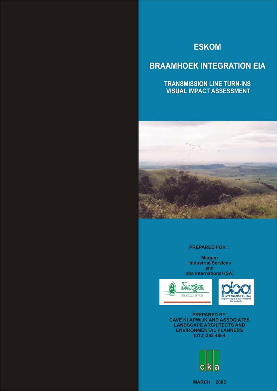
5 ESKOM BRAAMHOEK-VENUS 400 KV TRANSMISSION TURN-IN LINE VISUAL IMPACT ASSESSMENT 1 INTRODUCTION Margen Industrial Services / PBA International (SA) as the lead consultants for the Environmental Impact Assessment have commissioned Cave Klapwijk and Associates to undertake the visual assessment investigation for the construction of a 400 kv transmission turn-in line from the proposed Braamhoek-Venus Transmission Line to the proposed Braamhoek Substation near the De Beers Pass, Kwazulu-Natal. 2 BACKGROUND AND BRIEF The project components will consist of the transmission lines, pylons and access roads. This visual assessment is a specialist study to determine the visual effects of the proposed Project on the surrounding environment. The purpose of this Specialist Study is to determine the impact of the proposed project on the visual and aesthetic character of the proposed alternative routes. The rationale for this Study is that the placement of transmission lines may fundamentally alter the landscape character and sense of place of the local environment. The primary objective of this Specialist Study is therefore to describe the potential impact of these structures on the visual character and sense of place of the area. This Specialist Study will have the following objectives: Determine the visual character of the areas along the proposed transmission line routes by evaluating environmental components such as topography, current land use activities, surrounding land use activities, etc.; Identify elements of particular visual quality that could be affected by the proposed developments; Describe and evaluate the specific visual impacts of the preferred 400 kv Transmission Line and associated infrastructure. Recommend mitigation measures to reduce the potential visual impacts generated by the proposed power line. Cave Klapwijk and Associates 1
6 3 STUDY APPROACH 3.1 Method In order to address the objectives of the study the following method has been used: A site visit to determine the setting, visual character and land uses of the areas was undertaken; Determine the setting, visual character and land use of the area surrounding the route, and the Genius Loci (sense of place); Discussions and meetings with the specialist consultant team and Client to identify specific aspects of the construction and development which would affect the visual quality of a setting; Define the extent of the affected visual environmental, the viewing distance and the critical views. The visual impact assessment statements in this report are based on the expert opinion of the authors and attitudes that are generally accepted worldwide. The assessment is based on the field trip and the agreed alternative routes as determined during a field inspection held on 12, 13 and 14 January As this report is set at a scoping level with a limited budget no definitive surveys such as viewshed analysis and visual absorption capacity studies have been undertaken. 3.2 Limitations, Constraints and Assumptions The following assumptions and limitations are applicable to this study: The basis for this assessment is that scenic wilderness areas form the core of eco-tourism due to the high positive aesthetic appeal; The assessment does not consider the ancillary project infrastructure and components such as roads, borrow pits, spoil dumps, etc. These components will be assessed in detail during the design phase should the project be implemented; The assessment is based on assumed demographic data. No detailed study was done to determine accurate data on potential viewers of the project components. If necessary these studies could be undertaken during the design phase of the project; Cave Klapwijk and Associates 2
7 The location and extent of the construction and labour campsites, as well as material lay-down areas will only be determined during the design and construction phases. These are, however, of a relatively temporary nature and can effectively be controlled through the Environmental Management Plan; Determining a visual resource in absolute terms is not achievable. Evaluating a landscape s visual quality is both complex and problematic. Various approaches have been developed but they all have one problem in common: unlike noise or air pollution, which can be measured in a relatively simple way, for the visual landscape mainly qualitative standards apply. Therefore subjectivity cannot be excluded in the assessment procedure (Lange 1994). Individually there is a great variation in the evaluation of the visual landscape based on different experiences, social level and cultural background. Exacerbating the situation is the inherent variability in natural features. Climate, season, atmospheric conditions, region, sub-region all affect the attributes that comprise the landscape. What is considered scenic to one person may not be to another (NLA, 1997). Localised visual perceptions of the economically depressed communities of the population have not been tested as these may be influenced rather by the economic and job opportunities that will exist rather than the direct visual perception of the project. If the study, however, determined that the negative visual impact is of such a magnitude and significance that it will seriously influence the decision on whether or not to build, it will then be necessary to test and determine the visual perceptions of neighbouring communities. Such a study is involved, costly and time consuming. 4 DESCRIPTION OF THE BASELINE CONDITIONS 4.1 Description of the Works The proposed project comprises the following development components: Power line and Pylons Three sets of transmission lines are proposed for the Turn-in. The pylons that will support the 400 kv transmission lines will consist of two steel support structures supported by guy wires (Figure 1 Cross-rope Suspension Pylon). The transmission lines will be suspended between the supports. These 35 m tall pylons use far less steel in their structure than the commonly seen self-supporting pylons. The self-supporting pylons will only be used where the ground is unstable, where the line Cave Klapwijk and Associates 3
8 changes direction or where the terrain is too steep to accommodate the cross-rope suspension structure. The reduced steel quantity has the added benefit in that they are less visible and obtrusive within the landscape. Self-supporting suspension pylons will be used where there is a change in direction greater than 3, where space is limited or on steep slopes. These pylons contain considerably more steel than the cross-rope suspension pylons and are more visible in the landscape. New designs of pylons are currently underway. These are expected to use less steel and hence be even less visible and obtrusive. Figure 1: 400 kv Transmission Line Pylon Access Roads and Construction Camps Access roads will be required to transport personnel to site and for maintenance purposes. In areas that are inaccessible materials are brought in by helicopter. During this period all gates are installed and the tower positions pegged. Construction camps will need to be developed in strategic positions where they provide the optimum access to as much of the construction route as possible. Cave Klapwijk and Associates 4
9 Construction Large scraper equipment will be used to establish the access roads. Backactors are generally used to excavate for the foundations. Helicopters are used to deliver material and personnel to areas that cannot be accessed by road. Construction takes place in phases. The foundations of the towers are laid first, followed by the assembly of the towers on the ground, then the erection of the towers and finally the stringing of the conductors. These operations are not always continuous and each phase would involve a return to the site by the contractors. Once the construction is complete, this same representative will ensure that all restoration work has been completed satisfactorily. The landowner will be asked to sign a release from, providing written confirmation that rehabilitation was completed to his satisfaction. All areas that will be disturbed such as construction camps, access roads and the construction area around the pylons will be stripped of topsoil which is stockpiled for later use. Decommissioning Decommissioning of a major transmission line has yet to be undertaken in South Africa. It is assumed that the physical removal of the lines and pylons will be a reversal of the construction phase and that a rehabilitation programme of the land will need to be undertaken. 4.2 Description of the Natural Physical Elements Landform The landform consists of rolling and undulating hills and broad valleys of the Drakensberg foothills. This landform is located at relatively high altitudes that rise up to the high escarpment-type mountains of the Drakensberg. Soils are shallow, highly erodable and often rocky. Vegetation The vegetation is classified as North-eastern Mountain Grassland by Low and Rebelo (1996) and Highland Sourveld and Dohne Sourveld by Acocks (1988). The vegetation is predominantly grassveld with some forest relics in the steeper gorges and dongas. Cave Klapwijk and Associates 5
10 Critical Views and Visibility The surrounding mountain slopes and the De Beers Pass can be considered as major viewing points. Any physical change to the surface of the slopes would be highly visible. Views are extensive especially when viewed from the higher elevations. Views of the Turnin Lines would be intermittent as the lines and pylons would be screened from views from time to time where they dip down behind ridges into valleys. The route will be generally viewed, due to its lower position in the escarpment landscape, with a backdrop. This will assist in reducing the opportunity to view the pylons in silhouette. Genius Loci The spirit of place is created by the open broad valleys and rising dramatic Drakensberg backdrop which is reinforced by the lack of visible human intrusion. Visual Quality and Character The visual quality of this higher lying grassland area is considered high. This is due to the lack of human intrusion and the very diverse topography resulting in a high visual interest. These visual elements have created a quality that is vivid and one that unifies the visual landscape. Land Use This section is located within a landscape utilised predominantly for stock grazing and ecotourism. Few other land uses occur. This area is sparsely populated with few homesteads scattered within the area. The Scale of the Landscape The wide and extensive horizontal scale is reinforced by the vertical definition of the massive Drakensberg Mountains in the north. The horizontal scale of the landscape continues to the distant horizon to the east, south and west. Cave Klapwijk and Associates 6
11 5 IDENTIFICATION OF RISK SOURCES Various risk sources for the visual impact have been identified for the construction and operation phases and can be classified as both negative and positive. 5.1 Construction Phase It is anticipated that the major risk source during construction would be: Negative Risk Sources Excessive cleaning and stripping of topsoil for site offices, servitudes and temporary access road; The relatively random and disorganised lay down of building materials, vehicles and offices; Cut and fill slopes of access roads become highly visible if not revegetated and shaped to blend in with the existing topography; The extent and intensity of the security and construction lighting at night; Dust from construction activities; Open and unrehabilitated landscape scarring leading to erosion and the formation of dongas; Uncontrolled exploitation of borrow pits and quarries without compliance to environmental controls related to aesthetic rehabilitation; High seed bank of alien species such as Black Wattle (Acacia mearnsii) in the topsoil can lead to the uncontrolled spread of this exotic invader plant species along the edges of the transmission line servitude. This could create a treed edge that is visually contrary to the low grasslands; and Location and layout of construction workers camp if located in proximity of works area Positive Risk Sources Image of construction activity could lead to a perceived view of progress and benefit to the community. Cave Klapwijk and Associates 7
12 5.2 Operational Phase Negative Risk Sources Site engineering such as cuts and fills, could remain aesthetically incompatible with surrounding landscape. Edges may not blend in with the landscape or cut slopes may be too steep to be adequately revegetated; Areas and / or specific sites of high aesthetic value may be disfigured by the introduction of project components such as pylons and power lines within the viewshed resulting in a permanent change to the existing visual quality of visually sensitive areas; and Need to keep servitudes clear of vegetation, especially in commercial plantation areas, will result in visual scarring Positive Risk Sources The Braamhoek-Venus Transmission Turn-In Line could be the visual affirmation of progress and prosperity for the region. 6 IMPACT DESCRIPTION AND ASSESSMENT 6.1 The Visual Analysis This section describes the aspects which have been considered in order to determine the intensity of the visual impact on the area. The criteria includes the area from which the project can be seen (the viewshed), the viewing distance, the capacity of the landscape to visually absorb structures and forms placed upon it (the visual absorption capacity), and the appearance of the project from important or critical viewpoints. The focus of this study is specifically on the main project components such as the power lines, pylons and access roads and not on the ancillary infrastructure The Viewshed The viewshed is a topographically defined area which includes all possible observation sites from which the project will be visible. The boundary of the viewshed, which connects high points in the landscape, is the boundary of possible visual impact (Alonso, et al, 1986). Local variations in topography and man-made structures would cause local obstruction of views. The viewshed for the route based on the field work extends for the main part beyond a distance of five kilometres. Cave Klapwijk and Associates 8
13 6.1.2 The Viewing Distance The visual impact of an object in the landscape diminishes at an exponential rate as the distance between the observer and the object increases (Hull and Bishop, 1988). Thus, the visual impact at 1000 metres would be approximately a quarter of the impact as viewed from 500 metres. Consequently, at 2000 metres, it would be one sixteenth of the impact at 500 metres. The view of the project components would appear so small from a distance of 5000 metres or more that the visual impact at this distance is insignificant. On the other hand the visual impact of the project components from a distance of 500 metres or less would be at its maximum Critical Views Due to the linear nature of the proposed project it is not possible to provide an adequate descriptive analysis of visibility by plotting sections to determine the line of sight from the observer towards the project components to indicate the extent to which the elements are not screened by the intervening landforms or structures The Visual Absorption Capacity The Visual Absorption Capacity (VAC) is a measure of the landscape s ability to visually accept /accommodate or embrace a development. Areas which have a high visual absorption capacity are able to easily accept objects so that their visual impact is less noticeable. Conversely areas with low visual absorption capacity will suffer a higher visual impact from structures imposed on them. In this case the VAC has been defined as a function of three factors. Due to budgetary constraints a full VAC determination was not possible. It was, therefore, prudent to determine the VAC based on the author s field experience. Slope Visual pattern (landscape texture) with regard to vegetation and structures Vegetation height It is therefore concluded that the VAC of the Turn-in routes are regarded as low. Cave Klapwijk and Associates 9
14 6.2 The Visual Impact The visual impact of the project and associated structures in the landscape is a function of many factors (Table 2). Some of the factors are measurable such as viewing distance, the visual absorption capacity of the surrounding landscape and the scale of the surrounding environment and landform. Other factors are subjective viewpoints, which are extremely difficult to consistently categorise the opinion of the community. Studies in the U.S.A. have shown that professionals and environmental groups view modification of the natural landscape more negatively than other groups (McCool, et al 1986). The critical appraisal of the visual impact of the project and associated works on the landscape is presented from the viewpoint of the informed citizen and professional. To the community surrounding the proposed project, it may well be that they do not, or will not, object to the visual intrusion in their immediate environment. It may be that they welcome it since they could perceive it as a symbol of prosperity and personal advancement opportunity The View Distance The visual impact of the project and associated structures will reduce exponentially as the viewer moves further away from the proposed structures (Hull and Bishop, 1988). The pylons will exert a high visual impact within the 500 m and m zone. The viewshed analysis, based on the field experience, has indicated that the proposed transmission line will be visible in certain areas beyond the m zone especially when viewed from the higher lying areas such as the De Beers Pass. The servitude, if cleared of vegetation, and the construction access road will be visible, especially where the vegetation is diverse, for an extended distance beyond the m zone, if viewed from an elevated position. This scar will be visible until rehabilitation is complete. Fortunately much of the vegetation is grassland Critical Viewpoints Due to the linear nature of the proposed route specific viewpoints for the transmission line were not selected. However, areas with high volumes of traffic, areas with tourism potential and undeveloped rural areas with high scenic value were regarded as critical view zones against which the visual impact would be evaluated. Cave Klapwijk and Associates 10
15 Critical views were determined during the field trip and from the 1: topographical maps. Critical views considered were those views from where the majority of people could see the lines such as the De Beers Pass. The impact of the transmission lines is tempered somewhat by the fact that the route is visually modified by existing transmissions lines within the servitude and major roads Extent and Spatial Scale The visual impact for both the construction and operation phases will occur on a local to regional scale due to the considerable length of servitude adjacent to a national road and the view that extends to the edge of the viewshed or beyond a distance of five kilometres. The visual impact extends beyond the m zone for most of the route. The general lack of effective screening in the form of existing landform and trees from critical viewpoints, does not fully assist in limiting the extent of the impact. Readjusting the alignment to the valleys, avoiding alignment along ridges and crests, rather follow necks and gaps through higher lying areas will help mitigate the impacts Duration The duration of the impact during construction will be short term due to the relatively short construction period and the rehabilitation of the disturbed areas. The duration of the impact during the operational phase will be long term, in other words greater than 15 years, with the impact terminating only after a possible decommissioning of the transmission line Intensity or Severity The intensity of the visual impact during construction will be high within the 500 m zone wherever roads are encountered either alongside or crossing the route due to the fact that the majority of viewers will be exposed to the impacts within this zone. During the operational phase the visual impact of the transmission line within the 500 m zone will be medium as the construction vehicles, camps and stockpiles will be removed and surfaces to disturbed areas will be rehabilitated and the line will be tempered by the existing line adjacent to it. It is not possible to screen the transmission line from the majority of the viewers, namely the road users. Cave Klapwijk and Associates 11
16 Beyond the m zone the intensity of the impact becomes low due to the flat to rolling topography. The severity diminishes significantly from the m zone to the m zone where the impact can be regarded as insignificant due to the flat topography and extended viewing distance. The visual impact intensity remains medium for both the construction and operational phases The Probability of Occurrence The construction and operational impact described is probable but can be ameliorated to a certain extent by positioning the route alignment lower down in the valleys rather than along the ridge lines Magnitude and Significance It is considered that the significance of the impact of the construction phase is medium to high due to the fact that it is of a short, but intense, duration. The extent will be the full length of the route. The significance of the operational phase will remain high even though the route will be rehabilitated and that it will become relatively less obtrusive in the landscape where suitably aligned except where the route breaks the skyline or crosses the De Beers Pass. It must be mentioned that a highway (N3 De Beers Pass) is planned to come through this area which will have a significant impact on the visual environment Status of the Impact The impact status of the transmission line is considered medium negative for the construction and operational phases Degree of Confidence in Predictions The degree of confidence that the visual impacts will occur is high Legislation There are no specific legal requirements in the NEMA Act specific to the infringement of the visual attributes of the region. The National Heritage Resources Act No 25, 1999 requires that cultural sites and landscapes are protected against physical and aesthetic change. Cave Klapwijk and Associates 12
17 Table 1: Impacts on the Visual Environment Table 1.1 Braamhoek-Venus 400kV Transmission Line Turn-in Theme Aesthetics Nature of impact Visual Impacts Stage Construction and Decommission Operation Extent of impact Regional Regional Duration of impact Short term Long term Intensity or severity High Medium Probability of occurrence Highly probable Highly probable Status of the impact Negative Negative Legal Requirements National Heritage Resources Act No 25, 1999 National Heritage Resources Act No 25, 1999 Accumulative Impact Low Medium Level of significance Medium to high Medium to high Mitigation measures Re-align to avoid ridges and peaks. Place route on footslopes so that topography can form a backdrop to avoid silhouette or breaking the skyline. Limit extent of landscape disturbance. Align route through areas of great visual and topographical diversity. None Level of significance Potentially medium to high Potentially medium to high after mitigation EMP requirements Yes environmental rehabilitation None Discussion: The visual impact of the transmission line is medium to high as it is within a landscape with a high scenic value and one that does not lend itself to natural screening or blending. The impact is compounded by the fact that there will be three lines running parallel to each other. It could be said that the unspoilt visual environment would be altered significantly anyway by the proposed N3 De Beers Pass Highway. The VAC of the area is considered low and therefore that landscape has difficulty in visually absorbing the visual change. Cave Klapwijk and Associates 13
18 7 RECOMMENDED GENERAL MITIGATION / MANAGEMENT MEASURES 7.1 Route alignment Align the route through the lower lying landforms and off the ridge lines. This is to maximise the backdrop screening effect of the topography that will reduce presenting the transmission line in silhouette. Plan the route so that the route crosses existing main routes is as close to 90 as possible as this will reduce the time that the line is in the viewshed of the passing motorist / viewer. Align the route as south as possible to avoid most of the visitor access roads, this avoiding the opportunity to view the transmission lines in silhouette. However, if the alignment remains within the existing servitude this mitigation proposal is without merit. Avoid aligning the route along the top of ridges. Should it be necessary to cross a ridge it is preferable to cross directly over rather than at an angle. This will limit the extent that the transmission line will be visible. Attempt to cross over at a depression such as a neck or saddle in the ridge. This will limit the visual effect of any pylon standing proud above the ridgeline. Align the route, where possible, away from any main road where the two are parallel in relative pristine areas to where distance will mitigate the impact or to where the topography will form a screening backdrop. 7.2 Earthworks and Landscaping The visual impact during construction will be moderately significant and little can be done about reducing the effect since the works cannot be screened. The mitigation measures for the transmission line during operation will need to focus on effective rehabilitation of the construction corridor and work sites. These specifications must be explicit and detailed and included in the contract documentation (Environmental Management Plan) so that the tasks can be costed and monitored for compliance and result. The galvanising of the pylon should be allowed to weather to a matt grey finish rather than be painted silver, as is often the case. This allows the structures to blend in with the existing environmental colours more readily than the silver which is highly reflective especially early morning and late afternoon. Should it be necessary to paint, it is recommended that a neutral matt finish be used. Cave Klapwijk and Associates 14
19 Sculpturing or shaping the cut and fill slopes of access roads to angles and forms that are reflected in the adjacent landscape can reduce the visual impact. By blending the edges with the existing landforms the visual impression made, is that the project component has followed a natural route provided by the landscape, rather than been engineered through the landscape. For access / service roads and servitudes avoid straight edges and corridors. These lines should complement the landscape through which they pass (Litton, 1980). Special attention should be focussed on the width of servitude actually required for the construction and operational phases. There is a tendency to make these servitudes wider than necessary and access roads built to a higher engineering specification than required for a single lane 4x4 maintenance vehicle track. Vegetation stripping should be done in a manner where the edges are organic (non-geometric) or curvilinear rather than straight or sharp edged as viewers tend to form positive visual impressions such as gentleness and delicacy and tend to object to negative visual impressions such as rough, rugged or violent (Ribe, 1989). When disturbances in the landscape are viewed from a distance, those with irregular lines, rather than straight lines appear to blend in with the natural configuration and lines in the landscape (Schaefer, 1967). It is essential that all cut and fill slopes, as well as all areas disturbed by construction activity, are suitably topsoiled and vegetated as soon as is possible after final shaping. The progressive rehabilitation measures will allow the maximum growth period before the completion of the project. All areas affected by the construction works will need to be rehabilitated and re-vegetated. This includes the areas beyond the works area such as temporary access roads, construction campsites, workers campsites, borrow pits, laydown areas, etc. The special conditions of contract must include for the stripping and stockpiling of topsoil from the construction areas for later re-use. Topsoil is considered to be at leas the top 300 mm of the natural soil surface and includes grass, roots and organic matter. The areas to be cleared of topsoil should be all areas that will be covered by structures, roads and construction camps. The presence of degraded and disused roads and areas left over after development that are not rehabilitated, could present a high perceptual visual impact. These areas should be topsoiled and re-vegetated. Cave Klapwijk and Associates 15
20 All existing large trees that fall outside the earthworks area must be retained. These will assist in softening the forms of the structures and obscure views to them. Dust generated by construction activity and the haulage of materials and equipment will need to be suppressed by regular wetting. The importance of suppressing the visual aspects of dust cannot be overstressed since the visibility will generate the impression of a polluting industry. 8 DISCUSSION This study evaluated the visual impact of the Braamhoek-Venus Transmission Line Turn-in with a view to assessing its severity based on the author s experience, expert opinion and accepted techniques. 8.1 Evaluation Table 2, Visual Assessment Criteria Ratings, rates each criteria from high, medium to low according to the specific characteristics of that criteria. Table 3 Site Evaluation, lists for each criteria the visual criteria rating and the visual impact of the component on these criteria, The Eskom Braamhoek-Venus Transmission Line Turn-in will exert a negative influence on the visual environment. This is largely due to: high visibility of transmission lines from elevated positions along the De Beers Pass; high visibility of construction and operation activity within large areas of uniform visual pattern from scenic areas such as De Beers Pass and surrounding farms; the low visual absorption capacity of the setting which is attributable to: - relatively undulating topography; - the low vegetation height (less than one metre); and - the lack of visual diversity. the height of the pylons could be dominant in the landscape if mitigation is not built into the planning process. The significance of the visual impact during construction is regarded as medium to high due to the construction activities. This is, however, of a short duration until the rehabilitation is complete. The overall significance of the visual impact of the transmission lines during operation is regarded as remaining medium to high negative rather than moderate notwithstanding the implementation of the mitigation measures Cave Klapwijk and Associates 16
21 especially the route selection. Although it is not possible to screen the transmission lines, the placement of the route where it is not readily seen in silhouette, will assist in minimising the visual impact. Furthermore the lines are often viewed from extended distances which diminish considerably the visual intrusion to where it becomes insignificant at distances beyond five kilometres. Table 2: Visual Assessment Criteria Ratings CRITERIA HIGH MEDIUM LOW 1. Visibility Very visible from many places beyond 1000 metre zone Visible from within the 1000 metre zone but partially obscured by intervening Only partly visible within the 1000 metre zone and beyond due to screening by 2. Genius Loci A particularly definite place with an almost tangible dominant ambience or theme. 3. Visual Quality A very attractive setting with great variation and interest but no 4. Visible Social Structures 5. Surrounding Landscape Compatibility clutter. Housing and/or other structures as a dominant visual element. Cannot accommodate proposed development without it appearing totally out of place visually. 6. Character The site or surrounding area exhibits a definite character. objects. A place which projects a loosely defined theme or ambience. A setting which has some aesthetic and visual merit. Housing and/or other structures as a partial visual element. Can accommodate the proposed development without appearing totally out of place. The site or surrounding area exhibits some character. intervening objects. A place having little or no ambience with which it can be associated. A setting which has little aesthetic value. Housing and/or other structures as a minor visual element. Ideally suits or matches the proposed development. The site or surrounding area exhibits little or no character. 7. Scale A landscape which has horizontal and vertical elements in high contrast to the human scale. A landscape with some horizontal and vertical elements in some contrast to the Where vertical variation is limited and most elements are related to the human and Cave Klapwijk and Associates 17
22 CRITERIA HIGH MEDIUM LOW human scale. horizontal scale. 8. Visual Absorption Capacity (VAC) 9. View Distance 10. Critical Views The ability of the landscape to easily accept visually a particular development because of its diverse landform, vegetation and texture. If uninterrupted view distances to the site are > than 5 km. Views of the project are to be seen by many people passing on main roads and from prominent areas i.e. towns / urban areas / settlements, game farms, guest farms / lodges, hiking routes. The ability of the landscape to less easily accepts visually a particular development because of a less diverse landform, texture and vegetation. If uninterrupted view distances are < 5 km but > 1 km. Some views of the project from surrounding towns / urban areas / settlements, main roads and game farms / lodges. The ability of the landscape not to visually accept a proposed development because of a uniform texture, flat slope and limited vegetation cover. If uninterrupted view distances are >500 m and < 1000 m. Limited views to the project from towns / urban areas / settlements, main roads and game farms / lodges. Table 3: Site Evaluation: Western Route CHARACTERISTICS VISUAL CRITERIA VISUAL IMPACT RATING 1. Visibility High High 2. Genius Loci High High 3. Visual quality High High 4. Social structures Low Low 5. Surrounding landscape High Medium compatibility 6. Character High High 7. Scale High Medium 8. VAC Low Medium 9. View Distance High Medium 10. Critical Views Medium High Cave Klapwijk and Associates 18
23 9 REFERENCES ALONSO, S.G., AGUILO, M AND RAMOS, A. (1986). Methodology for Industrial Development Site Review in Spain. In: SAMRDON, R.C., PALMER, J.F. AND FELLEMAN, J.P. (1986) Foundations for Visual Project Analysis. John Wiley and Sons, New York, 374 p. AMERICAN SOCIETY OF LANDSCAPE ARCHITECTS, undated. Visual Impact Assessment for Highway Projects. ASLA, Washington D.C. CAVE KLAPWIJK & ASSOCIATES, (1994). Saldanha Steel Project Phase 2 Environmental Impact Assessment, Appendix 8, Specialist Study on Visual Impacts. Unpublished Report, Pretoria. CAVE KLAPWIJK & ASSOCIATES, (1996). Iscor Heavy Minerals (KwaZulu-Natal) EIA. Unpublished Report, Pretoria. CAVE KLAPWIJK & ASSOCIATES (1996). Mozal. Unpublished Report, Pretoria CAVE KLAPWIJK & ASSOCIATES (1998). Maputo Steel Project Visual Impact Assessment. Unpublished Report, Pretoria. CAVE KLAPWIJK & ASSOCIATES (1998). Unpublished report, Pretoria. N-3 Toll Road Scoping Plan. CAVE KLAPWIJK & ASSOCIATES (2001). Proposed Beta-Delphi 400kV Transmission Line. Unpublished Report, Pretoria. CAVE KLAPWIJK & ASSOCIATES (2003). Specialist Study on the Potential Impact of the Proposed Eros-Neptune-Grassridge 400kV Transmission Line on the Affected Aesthetic Environment. Unpublished report, Pretoria. HULL, R.B. AND BISHOP, I.E., (1988). Scenic Impacts of Electricity Transmission Towers: The Influence of Landscape Type and Observer Distance. Journal of Environmental Management (27) LANGE, E., (1994). Integration of computerised visual simulation and visual assessment in environmental planning. Landscape and Environmental Planning. 30: p LITTON, R.B., (1980). Ch 17 Aesthetic Values; Forest Resource Management Decision-making Principles and Cases. DEURR, W.A., TEEGUARDEN, D.E., CHRISTIANSEN, N.B., GUTTENBERG, S., (Editors). Philadelphia, PA, USA, WB Saunders Company , 2 February Cave Klapwijk and Associates 19
24 LOW, A.B. AND REBELO, A.G. (ed). (1996). Vegetation of South Africa, Lesotho and Swaziland. Department of Environmental Affairs and Tourism, Pretoria. LYNCH, K., (1992) Good City Form. The MIT Press, London, p McCOOL, S.F., BENSON, R.E. AND ASHOR, J.L., (1986). Environmental Management. Vol. 10, No. 3. NEWTOWN LANDSCAPE ARCHITETCS (1997). Saldanha Cement Project. Specialist Study Report: Visual Impacts. Unpublished Report, Pretoria. RIBE, R.G., (1989). The Aesthetics of Forestry, What has Empirical Preference Taught Us? Environmental Management. Vol. 13, No. 1, SHAFER, E.L., (1967). Forest Aesthetics - A Focal Point in Multiple Use Management and Research. SMARDON, R.C., PALMER, J.F., AND FELLEMAN, J.P., (1986) Foundations for Visual Project Analysis. John Wiley and Sons. Cave Klapwijk and Associates 20
25
Figure 6e: Ndwalane Mainline Toll Plaza Viewshed Analysis
 Figure 6e: Ndwalane Mainline Toll Plaza Viewshed Analysis CAVE KLAPWIJK AND ASSOCIATES 27 Figure 6f: Alternative Ndwalane Mainline Toll Plaza Viewshed Analysis CAVE KLAPWIJK AND ASSOCIATES 28 Figure 6g:
Digital Terrestrial Television Infrastructure Rollout. Environmental Impact Assessment - Corridor -
 Digital Terrestrial Television Infrastructure Rollout Environmental Impact Assessment - Corridor - 1 1 ENVIRONMENTAL IMPACT ASSESSMENT (EIA): CORRIDOR 1.1 INTRODUCTION Corridor is a small farming community
ESKOM PROPOSED CONSTRUCTION OF A 88KV POWER LINE BETWEEN CLOCOLAN AND FICKSBURG VISUAL IMPACT ASSESSMENT DRAFT REPORT
 ESKOM PROPOSED CONSTRUCTION OF A 88KV POWER LINE BETWEEN CLOCOLAN AND FICKSBURG VISUAL IMPACT ASSESSMENT DRAFT REPORT April 2013 PREPARED BY PO BOX 2122, WESTVILLE, 3630, SOUTH AFRICA FOR ACER Environmental
ENVIRONMENTAL IMPACT ASSESSMENT NATIONAL ROAD 3: KEEVERSFONTEIN TO WARDEN (DE BEERS PASS SECTION)
") ENVIRONMENTAL IMPACT ASSESSMENT for the proposed NATIONAL ROAD 3: KEEVERSFONTEIN TO WARDEN (DE BEERS PASS SECTION) DEA ref. no. 12/12/20/1992 Study on the Potential Impact of the Proposed National Road
ENVIRONMENTAL IMPACT ASSESSMENT for the proposed NATIONAL ROAD 3: KEEVERSFONTEIN TO WARDEN (DE BEERS PASS SECTION) DEA ref. no. 12/12/20/1992 Study on the Potential Impact of the Proposed National Road
VISUAL IMPACT ASSESSMENT
 ENVIRONMENTAL IMPACT ASSESSMENT FOR THE PROPOSED 170KM 1X400KV MAPHUTHA-WITKOP POWERLINE, LIMPOPO PROVINCE VISUAL IMPACT ASSESSMENT PREPARED FOR: NSOVO ENVIRONMENTAL CONSULTING CONTACT: REJOICE APHANE
Genex Kidston Connection Project: Draf t Environmental Assessment Report Powerlink Queensland
 : Draf t Environmental Assessment Report Powerlink Queensland Chapter 14 \\autsv1fp001\projects\605x\60577456\6. Draft Docs\6.1 Reports\4. Compiled draft 17 September\Covers\Chapters\Ch 14.docx Rev ision
Visual Impact Assessment January 2013
 Measures Maintain as much natural vegetation as possible between the mine buildings and the perimeter of the mine. The layout for mine buildings should include vegetation such as trees and thicket to break
3. Highway Landscaping Assessment
 Guidelines for Highway Landscaping 3-1 3. Highway Landscaping Assessment 3.1 Introduction This section outlines the steps necessary to assess the highway landscaping component of a state highway construction
14 Visual Amenity 14-1
 Visual Amenity 14 CONTENTS 14 Visual Amenity 14.1 14.1 Introduction Introduction 14.2 14.2 Project Setting Project Setting 14.3 14.3 Project Overview Project Overview 14.4 14.4 Viewing Locations Viewing
Digital Terrestrial Television Infrastructure Rollout. Site-specific Environmental Management Plan - Omega -
 Digital Terrestrial Television Infrastructure Rollout Site-specific Environmental Management Plan - Omega - 2 1 ENVIRONMENTAL IMPACT ASSESSMENT: OMEGA 1.1 RATIONALE FOR THE SITE Omega is situated in the
Visual Impact Assessment - December Figure 5.2: Viewshed analysis of the haul route.
 Visual Assessment - December 2014 Figure 5.2: Viewshed analysis of the haul route. 21 Baobab Resources (Pty) Ltd 5.1.3 Visual Exposure The following can be deduced from the Figure 5.1: the area to the
Visual Impact Rating Form - Instructions
 Visual Impact Rating Form Instructions Project Name: Baron Winds Project EDR Project No: 13039 Date: 05.16.17 Reference: Visual Impact Rating Form - Instructions These instructions are intended to guide
Galiuro Drilling EA Scenery Debby Kriegel 12/9/16
 Galiuro Drilling EA Scenery Debby Kriegel 12/9/16 INTRODUCTION The 1.7 million acre Coronado National Forest (CNF) is comprised of 12 sky island mountain ranges. CNF visitors have opportunities to sightsee
Chapter 7: Landscape and Visual Impact Assessment
 Chapter 7: Landscape and Visual Impact Assessment Landscape Character and Visual Impact Assessment 7. Landscape Character and Visual Impact Assessment... 2 7.1 Methodology... 2 7.2 Assessment Findings...
Guidance for Wind Turbine Development in the Dorset AONB
 Photo 1: Rew Manor Farm, West Dorset, chalk downland landscape (Planning application ref: 1/D/09/001280 1 ) Scale & siting: 12m to hub / 16m to blade tip. A well sited small scale turbine, grouped with
Rannoch 132 / 33 kv Substation Extension
 Who we are Scottish and Southern Energy Power Distribution is part of the SSE plc group of companies. We own, maintain and invest in the networks in the north of Scotland the electricity transmission network
APPENDIX K. Visual Impact Assessment
 APPENDIX K Visual Impact Assessment Integra Open Cut Project VISUAL IMPACT ASSESSMENT Prepared for URS Australia Pty Ltd 3 rd December 2008 GREEN BEAN DESIGN l a n d s c a p e a r c h I t e c t s GREEN
Guidance for Wind Turbine Development in the Dorset Area of Outstanding Natural Beauty
 DRAFT January 2012 Guidance for Wind Turbine Development in the Dorset Area of Outstanding Natural Beauty Photo 1: Rew Manor Farm, West Dorset, chalk downland landscape (Planning application ref: 1/D/09/001280
3.1 This evidence is based on the landscape and visual impact assessment included in Chapter 10 and Appendix I of the EIS.
 LANDSCAPE & VISUAL 1 QUALIFICATIONS AND EXPERIENCE 1.1 My name is Raymond Holbeach and I am a Regional Director for RPS Planning & Environment with full responsibility for management of the RPS Belfast
Visual Impact Assessment for the Proposed Solar Photovoltaic installation at the Grootvlei Power Station, Mpumalanga Province
 Professional Opinion: Visual Impact Assessment Final Report Visual Impact Assessment for the Proposed Solar Photovoltaic installation at the Grootvlei Power Station, Mpumalanga Province Yonanda Martin
Lower Sensitivity. VS Classification Level 2: Exposed Upland/Plateau
 S05 Y Moelwynion Reproduced from the Ordnance Survey map with the permission of Ordnance Survey on behalf of the Controller of Her Majesty s Stationery Office, Crown copyright Licence No. 100023387 Location
Annex G.11. Visual Specialist Report
 Annex G.11 Visual Specialist Report Proposed Gamsberg Zinc Mine & Associated Infrastructure near Aggenys, Northern Cape ACRONYMS, ABBREVIATIONS & GLOSSARY Acronyms & Abbreviations CSIR EIA IFC SACLAP VIA
6.3 VISUAL RESOURCES. Landscape Character
 6.3 VISUAL RESOURCES 6.3.1 Affected Environment The DMR discussion is divided into two areas, DMR and Dillingham Trail, which would extend from SBMR to DMR. The ROI includes all areas within the line of
Tables of Criteria and Matrices for Landscape Assessment (LSCA & LVIA)
") Carly Tinkler CMLI Environmental, Landscape and Colour Consultancy 46 Jamaica Road, Malvern, Worcestershire WR14 1TU Tel +44 (0)7711 538854 carlytinkler@hotmail.co.uk Tables of Criteria and Matrices for
Carly Tinkler CMLI Environmental, Landscape and Colour Consultancy 46 Jamaica Road, Malvern, Worcestershire WR14 1TU Tel +44 (0)7711 538854 carlytinkler@hotmail.co.uk Tables of Criteria and Matrices for
Digital Terrestrial Television Infrastructure Rollout
 Digital Terrestrial Television Infrastructure Rollout Environmental Impact Assessment - Ruacana - ENVIRONMENTAL IMPACT ASSESSMENT: RUACANA 1 INTRODUCTION Ruacana is a town in the Omusati Region, in northern
TOWN AND COUNTRY PLANNING (SCOTLAND) ACT 1997
 ACT 1997") TOWN AND COUNTRY PLANNING (SCOTLAND) ACT 1997 APPEAL AGAINST REFUSAL OF PLANNING PERMISSION FOR CONSTRUCTION OF WIND FARM, CONSISTING OF ERECTION OF 12 NO. WIND TURBINES, HEIGHT OF 70 METRES TO HUB, ASSOCIATED
TOWN AND COUNTRY PLANNING (SCOTLAND) ACT 1997 APPEAL AGAINST REFUSAL OF PLANNING PERMISSION FOR CONSTRUCTION OF WIND FARM, CONSISTING OF ERECTION OF 12 NO. WIND TURBINES, HEIGHT OF 70 METRES TO HUB, ASSOCIATED
Section 6A 6A Purpose of the Natural Features and Landscapes Provisions
 Section 6A 6A Purpose of the Natural Features and Landscapes Provisions This Chapter addresses the protection and management of natural features and landscapes within the City. The City has a number of
CHAPTER 10 AESTHETICS
 CHAPTER 10 AESTHETICS CHAPTER 10 AESTHETICS This section identifies and evaluates key visual resources in the project area to determine the degree of visual impact that would be attributable to the project.
Library of Birmingham integrated with The REP
 0123456789 Birmingham City Council Library of Birmingham integrated with The REP Environmental Statement Chapter 9 Shadowing 9 Shadowing Chapter Summary Key features A private amenity garden is located
Landscape Assessment CEUGP/SR9B
 Landscape Assessment CEUGP/SR9B TABLE OF CONTENTS 1 STUDY PHILOSOPHY... 3 2 GENERAL DESCRIPTION OF SITE... 4 3 LANDSCAPE THEMES... 8 TABLE OF FIGURES Table 1: Landscape... 5 Table 2: Landscape Themes...
Lower Sensitivity. VS Classification Level 2: Hills, Lower Plateau & Scarp Slopes (74%)/ Lowland Valleys (17%) / Exposed Upland/Plateau (7%)
/ Lowland Valleys (17%) / Exposed Upland/Plateau (7%)") S06 Coedwig Gwydyr Reproduced from the Ordnance Survey map with the permission of Ordnance Survey on behalf of the Controller of Her Majesty s Stationery Office, Crown copyright Licence No. 100023387 Location
S06 Coedwig Gwydyr Reproduced from the Ordnance Survey map with the permission of Ordnance Survey on behalf of the Controller of Her Majesty s Stationery Office, Crown copyright Licence No. 100023387 Location
Longbridge Town Centre Phase 2 Planning Application
 Longbridge Town Centre Phase 2 Planning Application Non-Technical Summary of the Environmental Statement December 2013 Introduction A full application for Planning Permission has been submitted to Birmingham
Visual Impact Assessment Addendum B FINAL. Proposed ACWA Power SolarReserve Redstone Solar Thermal Energy Plant Photovoltaic Power Plant
 Visual Impact Assessment Addendum B FINAL Proposed ACWA Power SolarReserve Redstone Solar Thermal Energy Plant Photovoltaic Power Plant Graham A Young (PrLArch) Newtown Landscape Architects Redstone CSP
Appendix One. Landscape. Areas of Outstanding Landscape Value: Criteria for Selection. Landscape Character
 Areas of Outstanding Value: Criteria for Selection The dimensions of landscape are landscape character and landscape quality. The analysis of landscape character and quality draws heavily on the visual
The analysis area for the scenic resource is the project area described in Chapter 1. Affected Environment/Existing Condition
 Chapter 3 - Scenic Resource SCENIC RESOURCES Introduction The Spotted Bear Ranger District is a destination point for outdoor recreation activities and offers a variety of recreation opportunities: driving
7. The Landscape. 7.1 Introduction. Environmental Impact Statement (EIS) Scoping Report
 Scoping Report") 7. The Landscape 7.1 Introduction The purpose of this section of the EIS Scoping Report is to describe the scope of work and methods to be applied in the identification and assessment of landscape and
7. The Landscape 7.1 Introduction The purpose of this section of the EIS Scoping Report is to describe the scope of work and methods to be applied in the identification and assessment of landscape and
Sherman Pass Project Post-Fire Treatment Scenery Report Barbara Jackson, Landscape Architect, 3/30/2016
 Sherman Pass Project Post-Fire Treatment Scenery Report Barbara Jackson, Landscape Architect, 3/30/2016 Introduction This report updates the 2015 Sherman Pass Project Scenery Report based on changes in
4 Residential and Urban Living Zones
 4 Residential and Urban Living Zones Refer to Chapters 11 to 20 for additional rules that may apply to these zones. 4.1 OBJECTIVES AND POLICIES Objective Res1 Policy 1 Policy 2 Policy 3 Policy 4 Policy
Section 3b: Objectives and Policies Rural Environment Updated 19 November 2010
 Page 1 of Section 3b 3b RURAL ENVIRONMENT 3b.1 Introduction The Rural Environment comprises all the land outside of the Residential, Town Centre and Industrial Environments. Most land within the District
SOIL SURVEY OF PORTIONS 81 AND 82 OFTHE FARM VAALBANK 512JQ, NEAR MAGALIESBURG, SOUTH-WEST OF PRETORIA
 REPORT For Newtown Landscape Architects SOIL SURVEY OF PORTIONS 81 AND 82 OFTHE FARM VAALBANK 512JQ, NEAR MAGALIESBURG, SOUTH-WEST OF PRETORIA By N.M. Mushia, D.G. Paterson and S.D. Mkula Report Number
North York Moors National Park Authority Planning Committee
 Item 8 North York Moors National Park Authority Planning Committee 12 December 2013 Consultation from Redcar and Cleveland Borough Council on proposed Wind Farm at Bank Field Guisborough 1. Purpose of
Proposed Shell Filling Station Parklands, Western Cape. Visual Impact Assessment
 Proposed Shell Filling Station Parklands, Western Cape Visual Impact Assessment Draft March 201 Prepared Bernard Oberholzer Landscape Architect and Environmental Planner In association with Quinton Lawson,
TIDAPA Structure Plan
 TIDAPA Structure Plan Prepared by Tract Consultants 28 MARCH 2017 0217-0074 Table of Contents 01 STRATEGIC CONTEXT Executive Summary Regional Context Page 3 Page 4 02 LOCAL CONTEXT Aerial Photograph Local
Digital Terrestrial Television Infrastructure Rollout. Environmental Impact Assessment - Kongola -
 Digital Terrestrial Television Infrastructure Rollout Environmental Impact Assessment - Kongola - 1 1 ENVIRONMENTAL IMPACT ASSESSMENT: KONGOLA 1.1 RATIONALE FOR THE SITE Kongola is situated in the Caprivi
Assessment of Landscape, Visual and Natural Character Effects
 Assessment of Landscape, Visual and Natural Character Effects Consent Footprint Amendments Mangamaunu Half Moon Bay Okiwi Bay South Report prepared for: New Zealand Transport Agency and KiwiRail Holdings
Digital Terrestrial Television Infrastructure Rollout. Environmental Impact Assessment - Tsumkwe -
 Digital Terrestrial Television Infrastructure Rollout Environmental Impact Assessment - Tsumkwe - 1 1 ENVIRONMENTAL IMPACT ASSESSMENT: TSUMKWE 1.1 RATIONALE FOR THE SITE Tsumkwe is a small town located
Wind energy development in the South Pennines landscape
 Wind energy development in the South Pennines landscape Programme for today Background Policy context South Pennines landscape Impacts of wind energy development The South Pennines Wind Energy Landscape
GLOCKNER-ETNA TRANSMISSION LINE VISUAL IMPACT ASSESSMENT
 VISUAL IMPACT ASSESSMENT Eskom Transmission PO Box 1091 Johannesburg 2157 Tel (011) 800-2465 Fax (011) 800-3917 E-mail: john.geeringh@eskom.co.za Prepared by: Strategic Environmental Focus (Pty) Ltd P.O.
Oxford Green Belt Study. Summary of Final Report Prepared by LUC October 2015
 Oxford Green Belt Study Summary of Final Report Prepared by LUC October 2015 Project Title: Oxford Green Belt Study Client: Oxfordshire County Council Version Date Version Details Prepared by Checked by
SCOPING REPORT. On contract research for ILISO CONSULTING
 SCOPING REPORT On contract research for ILISO CONSULTING Proposed Construction of a 65 MW Photovoltaic Power Plant, Duvha Power Station, Mpumalanga Province Soils and Agricultural Potential Scoping Study
3.1 AESTHETICS Background and Methodology
 3.1 AESTHETICS 3.1.1 Background and Methodology 3.1.1.1 Regulatory Context The California Environmental Quality Act (CEQA) requires that project sponsors evaluate the project s potential to cause aesthetic
CA.1 Coastal Area. Index. CA.1.1 Description and Expectations
 Index.1.2.3.4 CA.2 CA.2.1 CA.2.2 CA.2.3 CA.3 CA.3.1 CA.3.2 CA.3.1 CA.4 CA.4.1 CA.4.2 CA.4.3 CA.4.4 CA.5 CA.5.1 CA.5.2 Description and Expectations Objectives Policies Guidance Note Landuse Eligibility
Mollers Lane, Leopold, Victoria Significant Landscape Overlay Re-assessment
 XURBAN Mollers Lane, Leopold, Victoria Significant Landscape Overlay Re-assessment For: TGM Group November 2016 Final Mollers Lane, Leopold, Victoria Significant Landscape Overlay Re-assessment Client
Mining as a scar on the landscape
 Mine Closure 2012 A.B. Fourie and M. Tibbett (eds) 2012 Australian Centre for Geomechanics, Perth, ISBN 978-0-9870937-0-7 https://papers.acg.uwa.edu.au/p/1208_21_burge/ H. Burge Environmental Resources
site appraisals and reconnaissance, conducted in October 2008, to capture photographic images of the existing visual environment;
 15. Visual Amenity 15.1. Introduction This Chapter provides a description of the existing landscape character and visual amenity of the Project area. It also identifies potential visual impacts of the
Landscaping Management Plan. Woodlawn Mechanical Biological Treatment Facility. Veolia Environmental Services Australia Pty Ltd
 Landscaping Management Plan Woodlawn Mechanical Biological Treatment Facility Veolia Environmental Services Australia Pty Ltd May 2014 THIS PAGE INTENTIONALLY LEFT BLANK Landscaping Management Plan Page
GUIDELINES FOR THE ROUTEING OF NEW HIGH VOLTAGE OVERHEAD TRANSMISSION LINES
 The Holford Rules Guidelines on overhead line routeing were first formulated in 1959 by Sir William later Lord, Holford, who was a part-time member of the CEGB. National Grid has reviewed these guidelines,
an Inspector appointed by the Secretary of State for Communities and Local Government
 Appeal Decision Site visit made on 6 November 2017 by Rachel Walmsley BSc MSc MA MRTPI an Inspector appointed by the Secretary of State for Communities and Local Government Decision date: 19 th January
Appendix 1 Structure plan guidelines
 Appendix 1 Structure plan guidelines This appendix forms part of the regional policy statement [rps]. 1.1. Introduction Structure plans are an important method for establishing the pattern of land use
List of Policies. SESPlan. None applicable. Consolidated Scottish Borders Local Plan 2011: POLICY G1 - QUALITY STANDARDS FOR NEW DEVELOPMENT
 List of Policies Local Review Reference: 15/00021/RREF Planning Application Reference: 15/00616/FUL Development Proposal: Installation of 16no solar photovoltaic (PV) panels to roof Location: Raebank,
Ashton WMF WP
 09/26/2017 31 Allen Drive Loevenstein Cape Town 7530 South Africa C00720-AWMF-VIA-001 www.advisian.com Disclaimer This report has been prepared on behalf of and for the exclusive use of Legacy Environmental
2011 ASLA Design Awards
 2011 ASLA Design Awards Interstate 70 Mountain Corridor Aesthetic Guidance Honor Award Design Workshop, Aspen / THK Associates, Inc. / CH2MHill Planning and Urban Design Project Title: Interstate70 Mountain
Sustainability Statement. Whitby Business Park Area Action Plan
 Sustainability Statement Whitby Business Park Area Action Plan November 2014 Contents Page 1. Introduction 1 2. Scoping 3 3. Sustainability Appraisal of Options 6 4. Assessment of Draft Area Action Plan
MAIN ROADS Western Australia COALFIELDS HIGHWAY PROJECTS ROADSIDE REVEGETATION MANAGEMENT
 MAIN ROADS Western Australia COALFIELDS HIGHWAY PROJECTS ROADSIDE REVEGETATION MANAGEMENT Presentation - South West Region - Alan Grist, Project Manager, Environment (November 2015) Protecting and enhancing
SUSTAINABLE MANAGEMENT
 . Sustainable Management.1 The Concept of Sustainable Management The concept of sustainable management recognises there are limits to the use of natural and physical resources and there is a need to balance
Route Alignment Options Summary Report
 Brechfa Forest Connection Project February 2014 Summary report 1. RSK Environment Ltd (RSK) was commissioned by Western Power Distribution (WPD) to provide environmental consultancy support services for
Tāhuhu whakaruruhau ā-taone The sheltering ridge pole
 B2. Tāhuhu whakaruruhau ā-taone - Urban growth and form B2.1. Issues Tāhuhu whakaruruhau ā-taone The sheltering ridge pole Auckland s growing population increases demand for housing, employment, business,
Visual Impact Assessment 830 Pratt Avenue St Helena, CA
 Visual Impact Assessment 830 Pratt Avenue St Helena, CA 1. Introduction The following aesthetic visual impact assessment has been prepared pursuant to the California Environmental Quality Act (CEQA). The
BASIC ASSESSMENT REPORT. Background Information Document
 BASIC ASSESSMENT REPORT Background Information Document BASIC ASSESSMENT FOR THE PROPOSED LUIPERDSHOEK 33 KV POWER LINE PROJECT TO BE LOCATED NORTH OF THE TOWN OF POFADDER IN THE NORTHERN CAPE (DEA Ref
CHAPTER 20 VISUAL AMENITY
 Central Eyre Iron Project Mining Lease Proposal CHAPTER 20: VISUAL AMENITY CHAPTER 20 VISUAL AMENITY COPYRIGHT Copyright IRD Mining Operations Pty Ltd and Iron Road Limited, 2015 All rights reserved This
PURPOSE OF MEETING MEETING GUIDELINES PROJECT BACKGROUND ESKOM CLOCOLAN-FICKSBURG 88 KV POWERLINE, FREE STATE
 ESKOM CLOCOLAN-FICKSBURG 88 KV POWERLINE, FREE STATE DRAFT BASIC ASSESSMENT REPORT PUBLIC REVIEW LANDOWNERS MEETING FICKSBURG 23 JULY 2013 T his project is being conducted on behalf of Eskom PRESENTATION
Tables. J339 OMAS ESIA Page 1 of 28
 TABLE OF CONTENTS 12. VISUAL... 2 12.1 INTRODUCTION... 2 12.1.1 Objectives... 2 12.2 SUMMARY POLICY CONTEXT... 2 12.2.1 International Standards... 2 12.2.2 International Conventions and Treaties... 2 12.2.3
Integrated Visual Design Procedures and Standards
 FOREST STEWARDSHIP FOREST INVESTMENT ACCOUNT Integrated Visual Design Procedures and Standards Revised April 10, 2008 TABLE OF CONTENTS 1.0 Introduction... 1 2.0 Minimum Content... 1 3.0 Defining the
Apply scoring methodology
 1 Assessment of Alternatives The purpose of this assessment is to evaluate runway options against a range of environmental criteria. The first step is to formulate evaluation criteria necessary to understand
7. Landscape. Introduction
 Introduction Our landscapes provide us with a Marlborough identity and are an integral part of the Marlborough environment. Landscapes are distinct spatial areas influenced by location-specific processes
NATIONAL ROAD 3: KEEVERSFONTEIN TO WARDEN (DE BEERS PASS SECTION) CHAPTER 1: INTRODUCTION
 CHAPTER 1: INTRODUCTION") February 2016 NATIONAL ROAD 3: KEEVERSFONTEIN TO WARDEN (DE BEERS PASS SECTION) CHAPTER 1: INTRODUCTION 1. INTRODUCTION This Environmental Impact Assessment Report (EIR) has been compiled as part of an
February 2016 NATIONAL ROAD 3: KEEVERSFONTEIN TO WARDEN (DE BEERS PASS SECTION) CHAPTER 1: INTRODUCTION 1. INTRODUCTION This Environmental Impact Assessment Report (EIR) has been compiled as part of an
4.0 AFFECTED ENVIRONMENT AND ENVIRONMENTAL CONSEQUENCES
 4.0 AFFECTED ENVIRONMENT AND ENVIRONMENTAL CONSEQUENCES The following sections discuss the impacts associated with environmental resources for the tunneling method Alternatives A and B. The construction
14 LANDSCAPE AND VISUAL IMPACT ASSESSMENT
 Indaver Carranstown Landscape and Visual Impact Assessment 14 LANDSCAPE AND VISUAL IMPACT ASSESSMENT 14.1 INTRODUCTION ARC Consultants have been commissioned by the Applicant to carry out a visual impact
Lower Sensitivity. VS Classification Level 2: Exposed Upland/Plateau
 S02 Y Carneddau Reproduced from the Ordnance Survey map with the permission of Ordnance Survey on behalf of the Controller of Her Majesty s Stationery Office, Crown copyright Licence No. 100023387 Location
PHASE 1 ARCHAEOLOGICAL IMPACT ASSESSMENT PROPOSED DEVELOPMENT ERF 3 ROBERTSON WESTERN CAPE PROVINCE
 PHASE 1 ARCHAEOLOGICAL IMPACT ASSESSMENT PROPOSED DEVELOPMENT ERF 3 ROBERTSON WESTERN CAPE PROVINCE Prepared for BOLAND ENVIRO Att: Mr Nik Wullschleger PO Box 250 Worcester 6849 Fax: (023) 347 0336 By
APPENDIX C. Architectural and Environmental Design Standards. Environmentally sensitive areas should be protected.
 APPENDIX C Architectural and Environmental Design Standards Environmentally Sensitive Areas Goal A. Environmentally sensitive areas should be protected. Development, such as roads, houses, and other structures,
RLE.1 Rural Living Environment
 Index.1 Description and Expectations.2 Objectives.3 Policies.4 Guidance RLE.2 Landuse RLE.2.1 Eligibility Rules RLE.2.2 Notification Rules RLE.2.3 Discretionary Activities RLE.3 Subdivision RLE.3.1 Eligibility
ROCHFORD LOCAL DEVELOPMENT FRAMEWORK: Sustainability Appraisal/ Strategic Environmental Assessment. Rochford Core Strategy Preferred Options Document
 ROCHFORD LOCAL DEVELOPMENT FRAMEWORK: Sustainability Appraisal/ Strategic Environmental Assessment Non Technical Summary Rochford Core Strategy Preferred Options Document October 2008 SUSTAINABILITY APPRAISAL
6 Landsc apes and rur al char ac
 LANDSCAPES AND RURAL CHARACTER QLDC PROPOSED DISTRICT PLAN [PART TWO] DECISION VERSION ter 6 Landsc apes and rur al char ac 6.1 Purpose Appendix C QLDC DISTRICT PLAN [PART TWO] DECISION VERSION 6 Landsc
Lower Sensitivity. VS Classification Level 2: Exposed Upland/Plateau
 S04 Moel Hebog Reproduced from the Ordnance Survey map with the permission of Ordnance Survey on behalf of the Controller of Her Majesty s Stationery Office, Crown copyright Licence No. 100023387 Location
Toddington Central Bedfordshire Stage 3 Green Belt Study December 2017
 Toddington Central Bedfordshire Stage 3 Green Belt Study December 2017 Site: ALP086 - Middle Lakes, Toddington Site size (ha): 2.83 Site: ALP086 - Middle Lakes, Toddington Site size (ha): 2.83 Site description
PANSHANGER QUARRY, Hertfordshire
 PANSHANGER QUARRY, Hertfordshire Proposed enhanced restoration of Phases F & H Briefing Note 1 March 2015 INERT (INACTIVE) RESTORATION MATERIALS, CONTROLS AND OPERATIONS 1 Introduction This briefing note
Glenn Highway MP DSR. Landscape Narrative
 Glenn Highway MP 34-42 DSR Landscape Narrative Project Landscape Goals The Glenn Highway MP 34-42 Project extends through a variety of landscape types typical to the Matanuska-Susitna Valley. In general,
H7 Open Space zones. (a) provide for the needs of the wider community as well as the needs of the community in which they are located;
 provide for the needs of the wider community as well as the needs of the community in which they are located;") H7. Open Space zones H7.1. Background The majority of land zoned as open space is vested in the Council or is owned by the Crown. However some areas zoned open space are privately owned. While the open
H7. Open Space zones H7.1. Background The majority of land zoned as open space is vested in the Council or is owned by the Crown. However some areas zoned open space are privately owned. While the open
LYNWOOD QUARRY. Earth Bund Options Environmental Impact Analysis FINAL
 LYNWOOD QUARRY Earth Bund Options Environmental Impact Analysis FINAL October 2014 LYNWOOD QUARRY Earth Bund Options Environmental Impact Analysis FINAL October 2014 Prepared by on behalf of Holcim (Australia)
MOOLARBEN COAL PROJECT
 MOOLARBEN COAL PROJECT Stage 2 APPENDIX 14 Visual and Lighting Impact Assessment STAGE 2 MOOLARBEN COAL PROJECT VISUAL & LIGHTING IMPACT ASSESSMENT Prepared for MOOLARBEN COAL MINES PTY LTD 29 th July
4.3 Dudley Area Plan. Introduction. History and Existing Character. Desired Future Character for Dudley
 4.3 Dudley Area Plan Introduction The suburb of Dudley has developed as a result of various circumstances including its topography, history and mineral resources. Dudley development has been identified
3 Urban Design and the State Highway Network
 NZ Transport Agency Page 1 of 14 Urban Design Professional Services Guide 1 Introduction This is a professional services guide on urban design, which provides direction to the NZ Transport Agency (NZTA)
Landscape and Visual Effects Report
 Plan Change 50 Queenstown Town Centre Zone Landscape and Visual Effects Report Marion Read Principal Read Landscapes 8 th October 2014 1.0 Introduction 1.1 Queenstown Lakes District Council is proposing
5.11 AESTHETICS ENVIRONMENTAL SETTING
 5.11 AESTHETICS ENVIRONMENTAL SETTING The lies on a relatively flat valley floor surrounded by rugged hills and mountains. The topography of the planning area is defined by the Box Springs Mountains and
LANDSCAPE AND VISUAL IMPACT ASSESSMENT
 HARE STREET ROAD BUNTINGFORD LANDSCAPE AND VISUAL IMPACT ASSESSMENT Prepared by ACD Chartered Landscape Architects for Written By: SJD Checked By: JS Date: Document File Ref: TWNT18550lvia Revision: A-
McCormick Pit Category 1 Class A License, Pit Below Water For Blueland Farms Limited. Visual Impact Assessment Report February 2013
 McCormick Pit Category 1 Class A License, Pit Below Water For Blueland Farms Limited Visual Impact Assessment Report February 2013 TABLE OF CONTENTS EXECUTIVE SUMMARY... v 1.0 BACKGROUND... 1 Figure 1.
MOREE SOLAR POWER STATION
 MOREE SOLAR POWER STATION LANDSCAPE & VISUAL IMPACT ASSESSMENT Prepared for: December 2010 Prepared by: GREEN BEAN DESIGN l a n d s c a p e a r c h I t e c t s GREEN BEAN DESIGN l a n d s c a p e a r c
MANAGEMENT. Table 7. Forest Scenery Goal and Objectives: Takatz Lake Hydroelectric Project
 Management MANAGEMENT The second phase of Scenic Management Systems is establishing the management requirements including the development of scenery goals and objectives. This phase references the established
Definition of Cumulative Landscape and Visual Effects
 SECTION 5: GUIDANCE FOR ASSESSING CUMULATIVE LANDSCAPE AND VISUAL EFFECTS 5.1 Although this landscape sensitivity and capacity study has identified that parts of the National Park may be able to accommodate