Town Centre Park. Delahaye. David Avenue. Pine wood. Pipeline Rd. Pinetree. Town Ctr Blvd. Guildford. Guildford. High St. Westwood. Pinetree.
|
|
|
- Anissa Dean
- 6 years ago
- Views:
Transcription


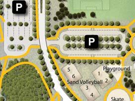
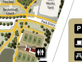
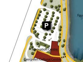
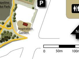
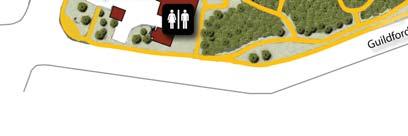
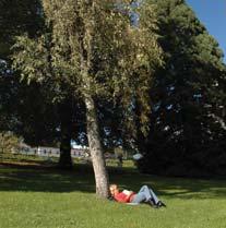
1 WELCOME This open house is to give you an opportunity to review the proposed design of an outdoor performance and events plaza at Town Centre ark and to share your ideas, suggestions and thoughts related to the proposed design. Spring/Summer 05. lease complete the comment form and let us know your thoughts. Contact information Wai-Sue Louie, ark lanner : E: wlouie@coquitlam.ca W: coquitlam.ca/parkprojects Delahaye Town Ctr Blvd City Centre Aquatic Complex ine wood inetree Secondary & Community Centre Douglas College inetree Lafarge Lake David Avenue Town Centre ark Youth ark Stadium roposed Location Inspiration Garden ipeline Rd Guildford High St City Hall Spirit Square Evergreen Cultural Centre Innovation Centre Guildford 0 5 Metres North Westwood
2 ROJECT SCHEDULE HASE SETEMBER 0 ONGOING Site Analysis and Information Gathering Gather site information, land survey(s), geotechnical reports, environmental inventory and assessment. HASE MARCH JUNE 05 Detailed Design HASE OCTOBER 0 roject Vision and Conceptual Design Exploration Consider site conditions, opportunities, and challenges. Establish design goals and objectives. Explore use and other requirements. Generate preliminary ideas for layout and interaction with other park features. HASE 5 JUNE AUGUST 05 roject ermit Approval and Tendering Submit detailed design drawings for permit approval and issue construction tender. HASE CURRENT HASE JANUARY 05 ublic Consultation Gather and consider public feedback, comments and suggestions about the conceptual design. HASE 6 FALL 05 SRING 06 roject Construction Award construction contract. roject construction underway.


3 HISTORY OF TOWN CENTRE ARK LAFARGE LAKE Lafarge Lake is a man-made lake that was once the site of a gravel pit. In the mid-980 s Lafarge donated the area to be developed as a city park. The rovince gave the rest of the land surrounding Lafarge Lake so the City could host the 99 BC Summer Games. Lafarge Gravel it* Unveiling Town Centre ark lans* storm water detention area. The lake levels adjust as excess water is released through Through partnerships with the Freshwater Fisheries Society of BC (FFSBC) and the Ministry of Forests, Lands and Natural Resources, Lafarge Lake is regularly stocked with rainbow trout between March and November by the Fraser Valley Trout Hatchery. It has for entry-level anglers. Lafarge Gravel it* TOWN CENTRE ARK Opening of BC Summer Games 99* Town Centre ark comprises 99 acres of parkland that was developed to serve both the local City Centre neighbourhood and is a city wide destination park. When Town Centre Lower Mainland. The park has since been developed as a premier sport, cultural, and recreational park for residents of all ages. The park has evolved over time, guided by early ark Master lanning in the mid 990 s. A key component of the 995 TC Master lan, was an outdoor event and festival site on the eastern shore of Lafarge Lake. Mel Earl, 99* 995 TOWN CENTRE MASTER LAN Council endorsed the initiation of planning for a purpose-built event and performance BC Summer Games Opening Ceremonies July 5, 99* Town Centre ark. September 988* Live Trout Release* *hotos courtesy of Don Cunnings


4 TOWN CENTRE ARK CURRENT FACILITIES OTHER CITY ARKS LOCATED WITHIN.5KM TOWN CENTRE ARK COQUITLAM RIVER ARK 5 5 GLEN ARK SIRIT SQUARE SCOTT CREEK LINEAR ARK WALTON FOREST ARK 8 HOY CREEK LINEAR ARK 9 0 ANORAMA ARK 7 8 HAMTON ARK 6 BLUE JAY TOT LOT 5 5 ROBSON ARK GALETTE ARK 6 You can see all City arks and their amenities at


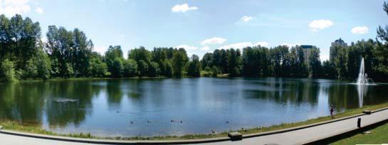
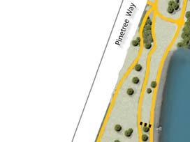
5 LAFARGE LAKE VIEWOINTS inetree Way Trevor Wingrove Way Lafarge Lake ipeline Road Guildford Way 5 6 North


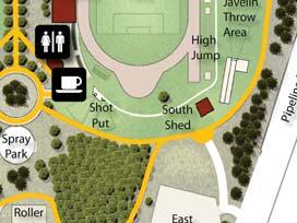
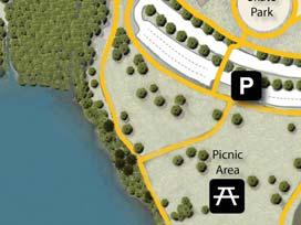
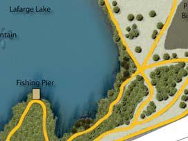
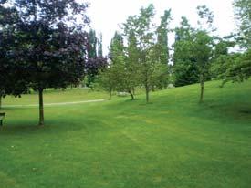
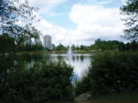
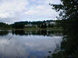
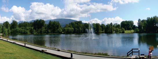
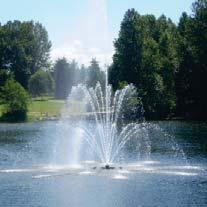
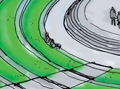
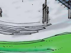
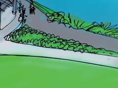
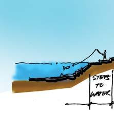
6 CURRENT ARK AREAS AND AMENITIES Town Centre ark s extensive trail network criss crosses the site to provide a variety of opportunities to enjoy the park and the immediate lake area. West Side of Lake Lafarge Southwest corner has many structures and amenities: The Evergreen Cultural Centre, Innovation Centre, Tri-City Chamber of Commerce and Tourist Information Centre Station Terminus. The lakeside trail continues here along the lake edge offering a clear and unobstructed view to the grass picnic area across the lake. North Side of Lafarge Lake The lake edge trail continues around the treed area away from the lake shore. A portion of the Hoy Creek Watershed drains into Lafarge Lake. The lake functions as part of the City s stormwater management system that slowly releases into the Coquitlam River The northwest corner has a gentle sloping shore from the trail for easy access to the water s edge for small boat and canoe launching, feeding ducks or sitting and viewing. Lafarge Lake - Douglas Skytrain Station Evergreen Cultural Centre inetree Way Lafarge Lake Fishing ier Trevor Wingrove Way icnic Area icnic Area Guildford Way ipeline Road North East Side of Lafarge Lake This is the proposed site for the outdoor performance and events area. The open, gently rolling grass area is used for picnicking, gatherings and socializing. The lake side trail continues along the natural lake edge. Groupings of trees are planted throughout the hillside for shade and seasonal colour. The gently sloping bank faces south and receives ample sun with a view towards Coquitlam City Centre area. South Side of Lafarge Lake The lakeside trail meanders through the pier and offers views across the lake and of the fountain. southeast corner helps regulate the water levels in the lake.


7 VISION Lake to Coquitlam and connects citizens to our rich past. The multi-functional plaza design supports a range of performances and events that will: Further enhance the park for visitors throughout the year; Complement existing park features and uses; and Accommodate current and future events. CONCET LAN The proposed plaza location will allow enjoyment all year for a variety of uses, based on the following design criteria: Seatwall Site Criteria Maintain and integrate the existing lakeside trail; The plaza should work with existing park topography and grading to reduce construction costs; Allow for portable performance and production equipment such as mobile stages, lighting and utilities; Consider the relationship between the outdoor performance plaza and neighbouring areas (parking, pathways, future festival/event functions, etc.); Consider and address any potential environmental impacts; and replacement of trees where appropriate, for shade and aesthetic appeal. rogramming Criteria Enhance and improve the overall quality of the park and lakeside by offering opportunities for a variety of casual use year round; for future expansion; Allow for portable performance and production equipment such as mobile stages, lighting and utilities; Accommodate a range of theatre and dance productions attracting audiences of 00,000. Orientation centred on fountain Orientation centred on Evergreen Cultural Centre Steps Open to Lake


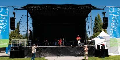


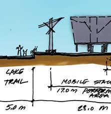
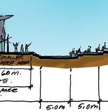
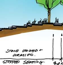
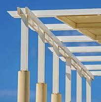
8 KEY DESIGN ELEMENTS A 0 metre diameter performance area, elevated for better viewing and capable of hosting different types of performances, including mobile stage set up. A semi-circular, stepped seating area, utilizing stone and grass. Continuation of the existing lake trail behind the stage area. Utilities (electrical, lighting, etc.) to accommodate mobile stage set up, as well as a variety of productions, both large and small. The design shall allow casual use and enjoyment of the plaza features and lakeside location by the public at all times. SECTION FROM LAFARGE LAKE THROUGH ROOSED OUTDOOR ERFORMANCE AREA BIRDS EYE VIEW LOOKING SOUTH WEST


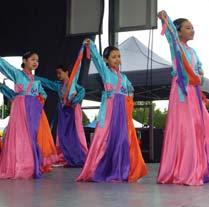
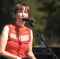
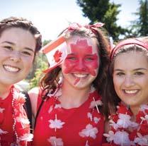
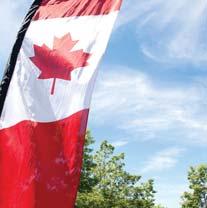

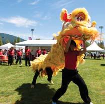


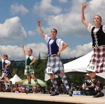
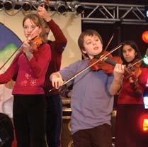
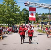
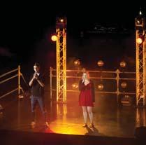
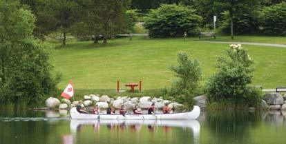


9 ROOSED SITE ROGRAMING CANADA DAY CASUAL USE FESTIVALS
Town Centre Park Master Plan Update - Terms of Reference
 CoQuitlam For Committee Our File: 12-6100-20/14-001/1 Doc#: 2176441.V7 To: From: Subject: For: City Manager General Manager Parks, Recreation & Culture Services Town Centre Park Master Plan Update - Terms
North Oakville East Parks Facilities Distribution Plan. November, 2009
 North Oakville East November, 2009 POLICY CONTEXT 1) Purpose a) The purpose of this document is to be a guide for the location, configuration, design and development of the parks system for the North Oakville
Neighborhood Districts
 NEIGHBORHOOD DISTRICTS SEVEN MAIN DISTRICTS Neighborhood Districts While the Development Plan provides a broad-scale overview of the neighborhood, this section focuses on uses and relationships at the
Appendix A: Park Improvement Plan. Cecelia Ravine Park Improvement Plan. Summary Report. April Cecelia Ravine Park Improvement Plan
 Appendix A: Park Improvement Plan Cecelia Ravine Park Improvement Plan Summary Report April 2018 Cecelia Ravine Park Improvement Plan 1 CITY OF VICTORIA 2 Appendix A: Park Improvement Plan Table of Contents
T O W N O F H I G H R I V E R
 T O W N O F H I G H R I V E R o p e n s p a c e p l a n The Town of High River, 30 minutes South of Calgary, still retains much of its distinctive small town character and provides residents with a high
10.0 Open Space and Public Realm
 10.0 Open Space and Public Realm 10.0 Open Space and Public Realm The Public Open Space System is comprised of: outdoor spaces available for public use that are either publicly owned (e.g., parks and
Washington Park Diagonal
 Public Input Meeting August 3, 2011 Nicole Stahly RLA DPR Project Manager Jesse Clark RLA, LEED Stream Design Paul Thomas RLA Stream Design Kerry White RLA Urban Play Studio Tonight s Agenda 1st Meeting:
April 11, 2016 Park Board Chair and Commissioners General Manager Vancouver Board of Parks and Recreation New Brighton Salt Marsh - Preferred Concept
 TO: FROM: SUBJECT: April 11, 2016 Park Board Chair and Commissioners General Manager Vancouver Board of Parks and Recreation New Brighton Salt Marsh - Preferred Concept RECOMMENDATION A. THAT the Vancouver
City Council March 27, Parks, Recreation, and Trails Master Plan
 City Council March 27, 2018 Parks, Recreation, and Trails Master Plan Planning Process Develop Goals and Objectives Inventory of Areas and Facilities Needs Assessment And Identification Public Participation
Pinellas County Greenways
 Pinellas County Greenways USING GREENWAYS TO LINK OPEN SPACES The Florida Greenways Commission has defined a greenway as...a corridor of protected open space that is managed for conservation and/or recreation.
A Vision for Walnut Creek
 A Vision for Walnut Creek Photo: City of Clive Walnut Creek Booklet 8 of 8 Greater Des Moines Water Trails and Greenways 1 Table of Contents Booklet 1: Water Trails Strategies and Policies Booklet 2: Beaver
South th E ast Communit ity Centre (SECC)
") South East Community Centre (SECC) 1 New Park Design & Community Centre Update Thursday, February 8, 2018 Public Open House Thank you for attending this Open House! The town and the Consulting Team will
South East Community Centre (SECC) 1 New Park Design & Community Centre Update Thursday, February 8, 2018 Public Open House Thank you for attending this Open House! The town and the Consulting Team will
Welcome! to Keller Town Hall
 Welcome! to Keller Town Hall Keller Town Center Planning a New Downtown What is Keller Town Center? A new, growing downtown district planned as an urban village A combination of retail and office spaces,
CONSULTATION SUMMARY. Public and Online Consultation #1
 CONSULTATION SUMMARY Public and Online Consultation #1 On December 4, 2013 the Ministry of Tourism, Culture and Sport launched the first public consultation for the urban park and waterfront trail at Ontario
Welcome! HORSESHOE BAY PARK. Welcome!
 Welcome! HORSESHOE BAY PARK Welcome! Where are we in the process? Today we would like your input on how Horseshoe Bay Park can be upgraded to serve the community s needs better. CONSULT STAKEHOLDERS TAKE
Parks Master Plan Implementation: Phase I Waterfront Use and Design REPORT #: September 7, 2016 File #
 0 'O DI Lan-171-14 1 - THE CORPORATION OF THE TOWN OF COBOURG..,. STAFF REPORT TO: FROM: Mayor and Members of Council Dean A. Hustwick, Director of Recreation and Culture DATE OF MEETING: Committee of
RECREATION, OPEN SPACE AND GREENWAYS ELEMENT GOALS, OBJECTIVES, AND POLICIES
 RECREATION, OPEN SPACE AND GREENWAYS ELEMENT GOALS, OBJECTIVES, AND POLICIES GOAL R-1: DEVELOP A RECREATION, OPEN SPACE AND GREENWAYS SYSTEM AS AN INTEGRAL COMPONENT OF AN OVERALL, COUNTY-WIDE ECONOMIC
BURTON STATION STRATEGIC GROWTH AREA PLAN UPDATE PUBLIC MEETING 3/26/18
 BURTON STATION STRATEGIC GROWTH AREA PLAN UPDATE PUBLIC MEETING 3/26/18 1 WHERE WE ARE? 2 PRIMARY OBJECTIVES OF THE PLAN UPDATE 1. Update the land use designation for Burton Station Village to reflect
Campus Master Plan Description Section 6 Storm water management and people places at campus buildings. Section 6 Campus MP Description
 Campus Master Plan Description Section 6 Storm water management and people places at campus buildings Section 6 Campus MP Description THIS PAGE INTENTIONALLY LEFT BLANK. appendix The following provides
Dundas Place Flexible Street Public Information Centre
 WELCOME TO THE DUNDAS PLACE DESIGN REVEAL Dundas Place Flexible Street Public Information Centre November 8, 2017 This project is funded by the City of London with support from the Government of Canada
Mississauga Waterfront. Parks Strategy - Draft
 Potential configuration for river s edge seating. Boating on Credit River: A regatta Boating on Credit River: Active enjoyment 5.2 Port Credit Memorial Park West Priority Park 5.2.1 Site Opportunities
01 Welcome! About Ontario Shores
 01 Welcome! Thank you for participating in the Master Planning Open House. Ontario Shores Centre for Mental Health Sciences is in the process of preparing a Master Program and Master Plan for submission
Johnson Street Bridge Public Realm Update
 Johnson Street Bridge Public Realm Update August 20, 2015 Background Johnson Street Bridge Replacement Project impacts a diverse range of stakeholders In addition to a new bridge, the project also includes
- Document 2 - Algonquin Interpretation and The Continuing Conversation toward a Vision for a Revitalized Lansdowne
 140 - Document 2 - Algonquin Interpretation and The Continuing Conversation toward a Vision for a Revitalized Lansdowne On May 4, 2012, the City of Ottawa participated in a Forum with a number of Elders,
Community Information Meeting
 Queensborough Eastern Community Information Meeting July 24, 2014 Cameron Chalmers, MCIP, RPP Platform Properties Meeting Format Purpose Format The purpose of the meeting is to invite the community to
Mariposa Lakes. Planned Community. Project Overview. Stockton, CA
 Planned Community Stockton, CA Project Overview March 2007 Summary of Proposed Community is a master-planned community proposed for development on approximately 3,810 acres in southeast Stockton. In 2004,
PLANNING ADVISORY BOARD AGENDA OCTOBER
 ! City of Langley PLANNING ADVISORY BOARD AGENDA OCTOBER 1, 2014 3-5pm LANGLEY CITY HALL - 112 2 nd Street, Langley WA 1) Call to Order and Roll Call 2) Approval of the Minutes September 10, 2014 3) Public
Project purpose. advise. The purpose of the Beaumaris Lake Open Space Rehabilitation project is to: + Develop a Functional Program Concept
 Project purpose owns Road Beaumaris Road The purpose of the Beaumaris Lake Open Space Rehabilitation project is to: + Develop a Functional Program Concept + Guide Rehabilitation of Landscape and Community
East Fraser Lands Area 2 Parks Concept Plan. Park Board Committee Meeting Monday, November 20, 2017
 East Fraser Lands Area 2 Parks Concept Plan Park Board Committee Meeting Monday, November 20, 2017 Purpose of this Presentation To share information on the public and intergovernmental engagement process
Century Park to Ellerslie Road Preliminary Engineering
 Century Park to Ellerslie Road Preliminary Engineering South LRT Extension Stakeholder Information Panel Brochure March 2010 www.edmonton.ca/lrtprojects LRT Station (left) and Transit Centre Architectural
Welcome to the Oakridge Centre Open House
 Welcome to the Oakridge Centre Open House Why is the City hosting this event? This open house is to inform you of a rezoning application submitted to the City of Vancouver to amend the existing CD-1 (Comprehensive
Edgeley Pond + Park Public Meeting
 Edgeley Pond + Park Public Meeting February 21, 2017 Purpose of the meeting This Public Meeting is an opportunity for you to review the project background, process and provide input. City of Vaughan staff
THE COMMUNITY-DRIVEN DESIGN PROCESS
 THE COMMUNITY-DRIVEN DESIGN PROCESS A PUBLIC DRIVEN PROCESS STEERING COMMITEE THE COMPREHENSIVE PLAN OPPORTUNITIES AND CONSTRAINTS THE COMMUNITY DRIVEN DESIGN PROCESS A Public Driven Process Beginning
Lawrencetown Beach & Rainbow Haven Beach
 Lawrencetown Beach & Rainbow Haven Beach Public Engagement Session Wednesday, September 27 th, 2017 6:00pm 8:00pm Cole Harbour Place 51 Forest Hills Pkwy, Dartmouth Agenda Welcome & Introductions Overview
Westwind Developments Ltd. PIONEER LANDS AREA STRUCTURE PLAN - PROPOSED AMENDMENT
 FEBRUARY 2013 TABLE OF CONTENTS 1.0 BACKGROUND... 1 1.1 Amendment... 1 2.0 LOCATION & CONTEXT... 2 2.1 Land Ownership... 2 3.0 POLICY CONTEXT... 3 3.1 Municipal Development Plan... 3 3.2 Capital Region
Call for Artists for: Design and Construction of Environmental Art Activation Story Mill Community Park, Bozeman, MT
 Call for Artists for: Design and Construction of Environmental Art Activation Story Mill Community Park, Bozeman, MT Seeking artists to design, fabricate and install art elements in the nature sanctuary
Northeast Anthony Henday Drive Manning Freeway to Whitemud Drive Welcome to this Construction Information Session
 Manning Freeway to Whitemud Drive Welcome to this Construction Information Session Purpose To inform interested residents and businesses about the plans accommodation. Background: The Government of Alberta
Municipal Development Plan. Summer Village of ROCHON SANDS. Bylaw #241-18
 Municipal Development Plan Summer Village of ROCHON SANDS Bylaw #241-18 TABLE OF CONTENTS PART ONE: BACKGROUND AND PURPOSE 3 SECTION 1: BACKGROUND 3 SECTION 2: GOALS AND POLICIES 3 PART TWO: PHYSICAL ENVIRONMENT
PIPELINE ROAD DESIGN PROJECT COMMUNITY INFORMATION SESSION
 Dunkirk Avenue COMPLETING THE STREET Coquitlam is initiating the design to complete Pipeline Road between Guildford Way and David Avenue. This arterial road serves the Town Centre and Northeast Coquitlam.
Charles P. Johnson and Associates. Annapolis Landscape Architects
 Charles P. Johnson and Associates Annapolis Landscape Architects AGENDA Introduction Project Limits and Scope Site Analysis Opportunities & Constraints Program Goals Image Boards Design Alternatives Pros
Moody Centre Station TOD Area Today
 Moody Centre Station TOD Area Today WHAT IS a transit-oriented Murray Street development area? A Transit-Oriented Development (TOD) Area is a dense, walkable residential and commercial area built to support
Appendix A. Park Land Definitions
 Appendix A Park Land Definitions Mini Park May serve specific function for any and all ages, depending on need of the user area. Size range 1-5 acres with optimum size being 3 acres. Service area is sub-neighborhood
REDMOND CENTRAL CONNECTOR ART & DESIGN MASTER PLAN
 REDMOND CENTRAL CONNECTOR ART & DESIGN MASTER PLAN Redmond Central Connector Master Plan design principles principles make it redmond: past, present, future not just a place with art, a place that is art
JACKsON STREET PIER CONCEPTUAL DESIGN PACKAGE SEPTEMBER 21, 2017
 JACKsON STREET PIER CONCEPTUAL DESIGN PACKAGE SEPTEMBER 21, 2017 JACKsON STREET PIER Process outline DESIGN PROCESS OVERVIEW: Sandusky s Jackson Street Pier Conceptual Design process included input from
Public Workshop 2 December 11, 2014 OLIN
 Public Workshop 2 December 11, 2014 OLIN TRIPLE IMAGE PANORAMA A NEW VISION FOR THE RIVERFRONT PROMENADE Burlington s Riverfront has historically been a defining character of the City s identity. This
Southwest Fleetwood Enclave
 Southwest Fleetwood Enclave Development Concept Plan Southwest Fleetwood Enclave 1 st Land Owners Meeting April 30 th, 2012 Presentation Overview Why the Plan? ; Overview & Purpose of Study; Constraints
The Planning Partnership Baird + Associates TCI Management Consultants Ltd. Plan B Natural Heritage Wills Consulting Engineers Poulos & Chung Limited
 Little Lake Master Plan The Planning Partnership Baird + Associates TCI Management Consultants Ltd. Plan B Natural Heritage Wills Consulting Engineers Poulos & Chung Limited May 26, 2009 Purpose of Study
{Best Practices. Summary of Tools, Strategies and Best Practices from 11 Michigan Case Study Communities
 Case Studies Michigan Coastal Community Working Waterfronts { Summary of Tools, Strategies and from 11 Michigan Case Study Communities Table of Contents Zoning...2 Community and Stakeholder Collaboration
Gorman Neighbourhood Structure Plan LDA WELCOME RESIDENTS. edmonton.ca/gormanneighbourhoodplan. CITY OF EDMONTON Sustainable Development
 Gorman Neighbourhood Structure lan WELCOME RESIDENTS Gorman Neighbourhood Structure lan AGENDA & CONTACT INFO Tonight s Agenda City of Edmonton File lanner Information Sarah Ramey, File lanner Registration
Chris James Park Planner July 16, Master Plan Kick Off Meeting
 Chris James Park Planner July 16, 2014 Master Plan Kick Off Meeting Meeting Overview Introductions Purpose of Meeting and Master Plan History & Background of Park Property Prior Planning Considerations
03 HIGH PRIORITY SITES
 03 HIGH PRIORITY SITES HOWARD PARK Howard Park is one of South Bend s largest riverfront parks, hosting nearly acres. Howard Park has a very passive landscape with a recreation building, ice skating rink,
LAKEVIEW VILLAGE VISION & MASTERPLAN PRESENTATION TO CITY OF MISSISSAUGA. April 9, 2018
 LAKEVIEW VILLAGE VISION & MASTERPLAN PRESENTATION TO CITY OF MISSISSAUGA April 9, 2018 AGENDA Introduction Vision Plan Comparison The Big Moves Trail Connections Plan Overview Districts Conveyance Comparison
WELCOME WHY A TEMPORARY PATHWAY? WE WANT TO HEAR FROM YOU
 WELCOME In March, the City of Vancouver purchased the lands known as the Arbutus Corridor from Canadian Pacific Railway for the purpose of creating a transportation corridor from False Creek to the Fraser
Welcome. Community Consultation Meeting November 28, Review and discuss the Bathurst Quay Neighbourhood Plan Framework
 Welcome Community Consultation Meeting November 28, 2016 Why Are We Here Today? Review and discuss the Bathurst Quay Neighbourhood Plan Framework Review and discuss an Action Plan for Implementation Next
Martin Pastucha, Director of Public Works Karen Ginsberg, Director of Community and Cultural Services
 Information Item Date: August 11, 2015 To: From: Subject: Mayor and City Council Martin Pastucha, Director of Public Works Karen Ginsberg, Director of Community and Cultural Services Reed Park Improvement
MASTER PLAN for the EARL NEWHOUSE WATERFRONT
 MASTER PLAN for the EARL NEWHOUSE WATERFRONT on RESERVOIR POND - CANTON, MA Community Meeting #2 - Thursday, January 11 th PROJECT INTRODUCTION Project Goals: To prepare a MASTER PLAN which develops the
A REGIONAL HERITAGE STRATEGIC PLAN for OKANAGAN - SIMILKAMEEN
 A REGIONAL HERITAGE STRATEGIC PLAN for OKANAGAN - SIMILKAMEEN The Regional District of Okanagan-Similkameen is preparing a Regional Heritage Strategic Plan. The Strategic Plan will identify important themes
Preliminary Sketch Plan for Fort Hunter Park
 Preliminary Sketch Plan for Fort Hunter Park Public Presentation November 19, 2009 Dauphin County Parks and Recreation 100 Fort Hunter Road Harrisburg, PA 17110 (717) 599-5188 www.dauphinc.org THOMAS COMITTA
SCC PRD (2016) COUNTY PARK MASTER PLAN
 COUNTY PARK MASTER PLAN") SCC PRD (2016) COUNTY PARK MASTER PLAN MASTER PLAN UPDATE PARKS AND RECREATION COMMISSION NOVEMBER 7, 2018 PURPOSE OF THE MASTER PLAN The Sanborn County Park Master Plan will provide the Department with
SCC PRD (2016) COUNTY PARK MASTER PLAN MASTER PLAN UPDATE PARKS AND RECREATION COMMISSION NOVEMBER 7, 2018 PURPOSE OF THE MASTER PLAN The Sanborn County Park Master Plan will provide the Department with
3.1 community vision. 3.3 required plan elements
 Chapter 3 Community Form 3.1 community vision 3.2 Parks & landscaping concepts 3.3 required plan elements D R A F T 20 Community Form Chapter 3 3.0 Community form 3.1 community vision The Specific Plan
Subarea 4 Indian Creek. Vision The combination of park networks and transportation amenities make Subarea 4 the greenest hub in the Corridor.
 indian creek 180 extends south from 101st Street to I-435. The I-435 and Metcalf intersection is one of the primary intersections in the Kansas City Metro Area. The area includes several residential neighborhoods
WELCOME and introduction
 1 WELCOME and introduction Mobility Hub Locations within Burlington STUDY OVERVIEW STUDY OBJECTIVES The City of Burlington is developing four Area Specific Plans, one for each of Burlington s Mobility
Sherwood Forest Park REVITALIZATION PLAN. Public Meeting (P.I.C) # 3 JUNE / 25 /2015
 # 3 JUNE / 25 /2015") Sherwood Forest Park REVITALIZATION PLAN Public Meeting (P.I.C) # 3 JUNE / 25 /2015 1 Agenda i. Where we are in the process and schedule ii. Consultation process iii. Key messages from PIC#2 iv. Purpose
Sherwood Forest Park REVITALIZATION PLAN Public Meeting (P.I.C) # 3 JUNE / 25 /2015 1 Agenda i. Where we are in the process and schedule ii. Consultation process iii. Key messages from PIC#2 iv. Purpose
Port of Camas-Washougal Waterfront Trail Master Plan
 Port of Camas-Washougal Waterfront Trail Master Plan The Port s facilities are the products of its mission: To make strategic investments that enhance the community s quality of life by bringing jobs,
THE CORPORATION OF THE CITY OF VERNON BYLAW NUMBER A bylaw to amend the City of Vernon s Plan Vernon Bylaw Number 5151
 THE CORPORATION OF THE CITY OF VERNON BYLAW NUMBER 5277 A bylaw to amend the City of Vernon s Plan Vernon Bylaw Number 5151 WHEREAS the Council of The Corporation of the City of Vernon has determined to
MEETING PURPOSE AND OVERVIEW
 MEETING PURPOSE AND OVERVIEW On February 23, 2012, the City of Elk Grove hosted the first of two community workshops related to the Southeast Policy Area. The workshop was held from 6:00 8:30 p.m. in the
PRELIMINARY DESIGN + DEVELOPMENT PLAN
 WELCOME! To The Public Open House May 30 th, 2017 HARBOUR WEST PARKS Vision Project Overview The City s vision for Port Credit Harbour West Parks is to develop a vibrant waterfront destination that integrates
Providence Waterfront Park
 I-195 Redevelopment Parcels Providence Waterfront Park June 30, 2014 I-195 30% Design Review 1 November 19, 2012 endorses open space design. 2 Design Chronology October 2013 10% Design Submitted for both
DOWNTOWN GEORGETOWN PLANNING STUDY
 DOWNTOWN GEORGETOWN PLANNING STUDY Community Workshop #3 Thursday, May 4, 08 The Planning Partnership OVERVIEW OF STUDY, PROCESS & MILESTONES We are here PURPOSE OF THE STUDY To develop a clear vision
Goals & Objectives (best derived from an input
 Goals & Objectives (best derived from an input process) Goal - sets an intent of the project States the expected result or outcome of the project The trail will provide recreation and transportation opportunities
4. Parks, Open Space and Urban Forest
 4. Parks, Open Space and Urban Forest Goals 1. Enhance parks as public gathering places for the neighbourhood 2. Refresh park facilities to attract diverse ages and activities 3. Improve waterfront access
The following principles guide the development of goals and strategies to protect and promote these amenities:
 OPEN SPACE/PARKS/TRAILS/RECREATION GOALS/STRATEGIES Cherry Hills Village is a living environment that offers low density development, open areas, public scenic vistas, public trails and public parks. This
a) Inventory of all existing privately-owned, state-owned, or local governmentowned recreational facilities and open spaces within the context area
 Inventory of all existing privately-owned, state-owned, or local governmentowned recreational facilities and open spaces within the context area") 8.0 RECREATION AND OPEN SPACE ELEMENT (1) DATA REQUIREMENTS a) Inventory of all existing privately-owned, state-owned, or local governmentowned recreational facilities and open spaces within the context
8.0 RECREATION AND OPEN SPACE ELEMENT (1) DATA REQUIREMENTS a) Inventory of all existing privately-owned, state-owned, or local governmentowned recreational facilities and open spaces within the context
Create a connected ecological network. Connect districts with transit. Let the centre define the community
 District A - D Southeast False Creek A 1 A 2 A 3 A 4 Create a connected ecological network Connect districts with transit Let the centre define the community Provide a variety of affordable housing types
Village of Fair Haven Goals & Objectives
 Village of Fair Haven Goals & Objectives 1 Natural Environmental Quality & Aesthetics Embrace policies and programs that preserve and enhance the Village s natural resources, environment, water quality,
WELCOME OLD SOUTH The Green Community Input Session. April 6, 2017
 WELCOME OLD SOUTH The Green Community Input Session April 6, 2017 AGENDA Welcome/Introductions Project History Heritage Status Existing Conditions What We ve Heard to Date Design Principles Concept Plan
WA PARKS FOUNDATION SWAN CANNING RIVERPARK
 WA PARKS FOUNDATION SWAN CANNING RIVERPARK Photograph: Giant Egret Large - Matt Kleczkowski SWAN CANNING RIVERPARK - RIVER JOURNEYS PROJECT Bringing Parks to our doorstep With the pace and demands of modern
2035 General Plan Update and Belmont Village Specific Plan. Joint Study Session with the City Council and Planning Commission April 12, 2016
 2035 General Plan Update and Belmont Village Specific Plan Joint Study with the City Council and Planning Commission April 12, 2016 Agenda 1. Welcome and Introductions 2. General Plan Update Status of
DOWNTOWN PARKS & PUBLIC REALM PLAN
 DOWNTOWN PARKS & PUBLIC REALM PLAN CHALLENGES The Parks and Public Realm Strategy addresses challenges associated with a growing Downtown, including: GOALS 3.3 New buildings will fit within their existing
doyle + o troithigh landscape - architecture
 doyle + o troithigh landscape - architecture REPORT: PROJECT: LANDSCAPE DESIGN REPORT. STUDENT HOUSING DEVELOPMENT AT WESTWOOD HOTEL SITE. DATE: MAY 2018. www.doyle-otroithigh.com Landscape design report,
CREATE A VIBRANT MIXED-USE COMMUNITY
 CREATE A VIBRANT MIXED-USE COMMUNITY Land Use Public Realm Plan Built Form Heritage Tell us what you think! Place a sticky note here or leave us a comment form LAND USE The land use framework of this Secondary
Building Great Neighbourhoods. Strathcona
 Building Great Neighbourhoods Strathcona March 21, 2018 Becky Redford Project Manager, Planning & Design Building Great Neighbourhoods Integrated Infrastructure Services Welcome and Purpose To provide
Crofton Manor 2803 West 41st Avenue WHAT WE HEARD. Public Consultation: Phase 1
 Crofton Manor 2803 West 41st Avenue WHAT WE HEARD Public Consultation: Phase 1 Background CROFTON MANOR What s Happening The City of Vancouver is undertaking a planning and public engagement process to
Mark-up of the effect of the proposed Bronte Village Growth Area OPA No.18 on the text of section 24, Bronte Village, of the Livable Oakville Plan
 Mark-up of the effect of the proposed Bronte Village Growth Area OPA No.18 on the text of section 24, Bronte Village, of the Livable Oakville Plan Notes: This document is provided for information purposes
Rogue River Recreation and Access Management Plan- Table Rocks Reach. Jackson County, Oregon Department of Fish and Wildlife, National Park Service
 Rogue River Recreation and Access Management Plan- Table Rocks Reach Jackson County, Oregon Department of Fish and Wildlife, National Park Service Today s Agenda Welcome Project refresher Project status/timeline
Cold Lake Marina Master Plan
 Cold Lake Marina Master Plan Intro to Team Moffatt & Nichol is recognized throughout the world for our role in the revitalization and redevelopment of urban waterfronts, including the evolution of modern
KHARTOUM GARDEN CITY. Dietmar Kamphans
 KHARTOUM GARDEN CITY Dietmar Kamphans As most cities in the world have been set up at river banks and sea shores, even Khartoum is located at the confluence of the Blue and White Nile. Beside the regular
2.1 Location and Size
 2.0 Context 7 2.1 Location and Size The Saanich Penninsula The study area is centrally located within the Town boundaries on the east side of Highway 17, which runs through Sidney in a north-south direction.
nokomis-hiawatha regional park master plan and park improvements
 master plan and park improvements CAC Workshop # August 26th, 2014 charge of the cac The Nokomis Hiawatha Regional Park CAC shall: Become knowledgeable about the project and its scope Understand and represent
City of Iowa City Department of Neighborhood and Development Services Department of Parks and Recreation Department of Public Works City Manager s
 RFP Pre-submittal meeting December 18, 2015 City of Iowa City Department of Neighborhood and Development Services Department of Parks and Recreation Department of Public Works City Manager s Office Background
Quality Public Realm & Streetscapes
 1 Quality Public Realm & Streetscapes Lambeth Community Association/Business Association 1.1 Install decoration and/or decorative lighting on London Hydro poles along Main Street from Campbell Street to
PARDI MARKET PLAZA PMSCDC WORKSHOP
 PARDI MARKET PLAZA PMSCDC WORKSHOP CITY OF DIXON FEBRUARY 23, 2017 Presented by: CITY STAFF INTRODUCTION Deborah Barr Associate Civil Engineer, Project Manager Joe Leach City Engineer/Public Works Director
Highest & Best Use Study Marina Park Lands
 Executive Summary of Report MARCH 2006 TABLE OF CONTENTS 1. Introduction...1 2. Study Process...2 3. Highest And Best Use Program...3 4. Concept Plan...8 5. Public Area Animation...9 6. Marina Park Implementation
Mendota Heights 2040 Comprehensive Plan Draft Vers
 4 Parks and Trails The City of Mendota Heights boasts a variety of recreational and open space opportunities. Few cities can claim access to regional trails, riverside and lakeside parks, scenic bluffs
PUBLIC ART CALL LIONS GATE COMMUNITY CENTRE. For Expressions of Interest Submission Deadline: March 18, 2018 Project Value: $85,000(inclusive)
") LIONS GATE COMMUNITY CENTRE PUBLIC ART CALL For Expressions of Interest Submission Deadline: March 18, 2018 Project Value: $85,000(inclusive) LGCC EOI 1 LIONS GATE COMMUNITY CENTRE (LGCC) PUBLIC ART CALL
LIONS GATE COMMUNITY CENTRE PUBLIC ART CALL For Expressions of Interest Submission Deadline: March 18, 2018 Project Value: $85,000(inclusive) LGCC EOI 1 LIONS GATE COMMUNITY CENTRE (LGCC) PUBLIC ART CALL
GLEN ROAD PEDESTRIAN BRIDGE ENVIRONMENTAL ASSESSMENT STUDY PUBLIC INFORMATION CENTRE #2 OCTOBER 24, 2017
 GLEN ROAD PEDESTRIAN BRIDGE ENVIRONMENTAL ASSESSMENT STUDY PUBLIC INFORMATION CENTRE #2 OCTOBER 24, 2017 Glen Road Pedestrian Bridge Class Environmental Assessment 1 WELCOME! Welcome to the second Public
PUBLIC ENGAGEMENT & SIX THEMES OF THE PLAN
 Connecting the heart of Eagle to the soul of the river - Kathy Chandler-Henry, Commissioner Eagle County CHAPTER 1 PUBLIC ENGAGEMENT & SIX THEMES OF THE PLAN town of eagle - river corridor plan 1 PUBLIC
BURNT BERRY POND COTTAGE DEVELOPMENT PLAN PHASE II ENVIRONMENTAL ASSESSMENT REGISTRATION
 GOVERNMENT OF NEWFOUNDLAND AND LABRADOR Department of Environment and Conservation Lands Branch, Land Management Division BURNT BERRY POND COTTAGE DEVELOPMENT PLAN PHASE II ENVIRONMENTAL ASSESSMENT REGISTRATION
BE PART OF THE CHANGE life works here.
 BE PART OF THE CHANGE life works here. A NEW DESTINATION FOR URBAN LIVING IN CALGARY Experience UNIVERSITY DISTRICT. A new quality of life community that will change the way you experience the city. Architecturally
Description of Preferred Alternative
 Chapter 2 Description of Preferred Alternative 2.1 Introduction This chapter of the programmatic Sammamish Town Center Sub-area Plan Final EIS provides a more detailed description of the Preferred Alternative