JAVIER GONZÁLEZ. Work Sample
|
|
|
- Teresa Jackson
- 5 years ago
- Views:
Transcription
1 JAVIER GONZÁLEZ Work Sample
2 Design


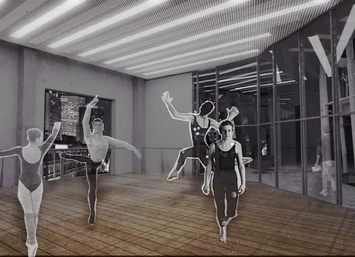
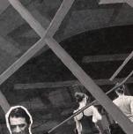
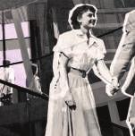
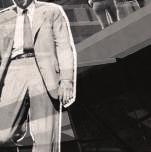
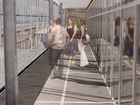
3 TanzHaus Central Business District New Orleans Contemporary dance is not axial or centered around a focal point. There are multiple points to be interpreted individ ually by spectators Dance, alongside with contemporary forms of art and philosophy, has undergone a transformation in its fundamental cosmological approach to its craft. No longer is it about representing the unity of a harmonic order of the perfect forms of the cosmos. Contemporary discourse has challenged the ability for individual subjects to be able to obtain true knowledge of this underlying unity if it exists at all. Individual perspectives are the focus of investigations and dance has become about the interpretations that each audience member has to the performance at the stage. There is no longer a proper way to underexperience the art of dance in contemporary functions because the dance becomes about the relationship of the choreography to the subject observing it. 01 How to embody this transformation architecturally became the driving question of this project. By putting the circulation in the middle, through a habitable structure, the person travelling through the space gets to understand the dancers in the building in different ways none of which can be considered proper. Structure
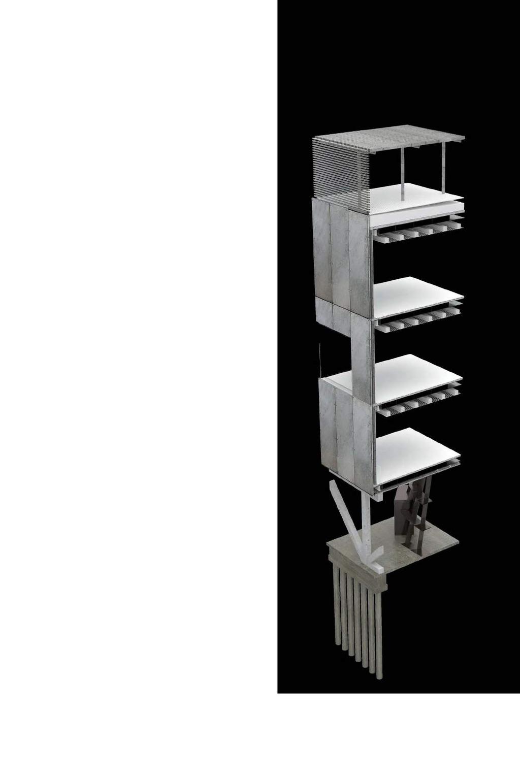
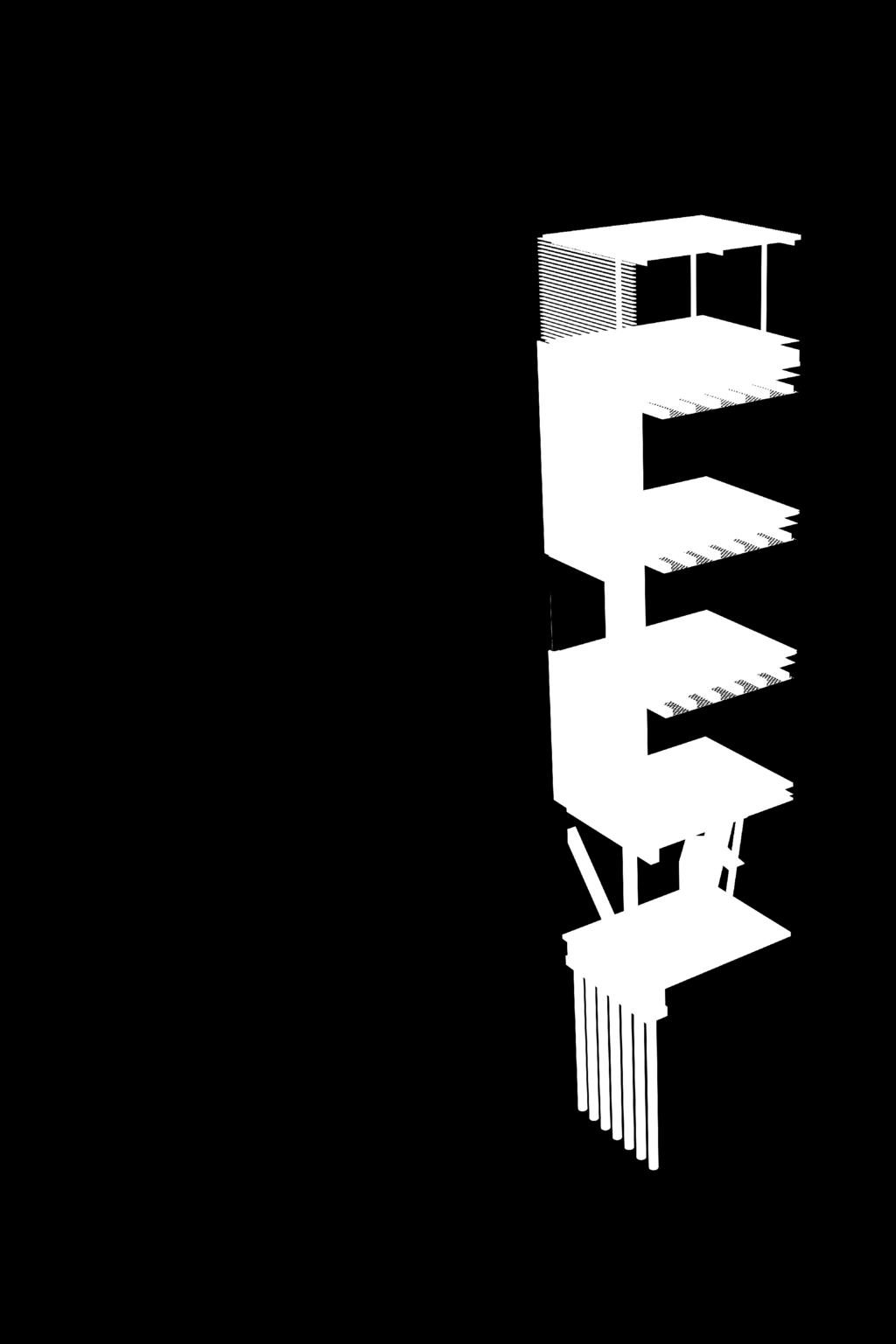


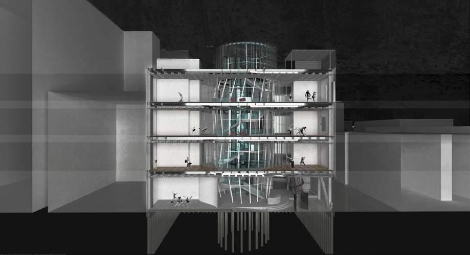

4 Vertical Circulation Horizontal Circulation Chilled Beam System Layout


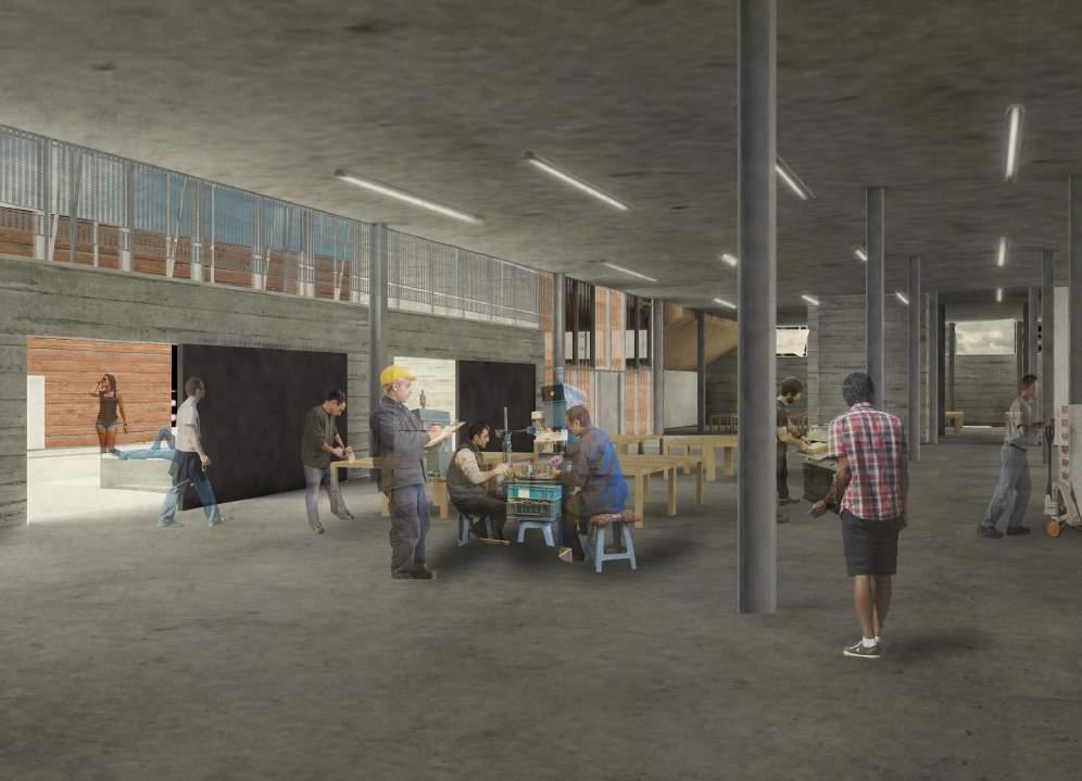
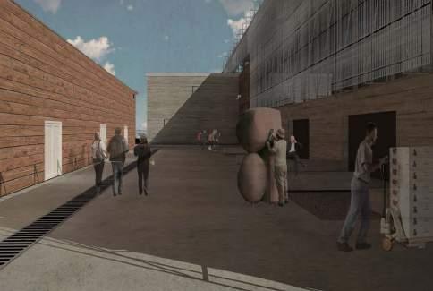
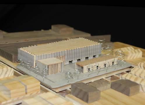
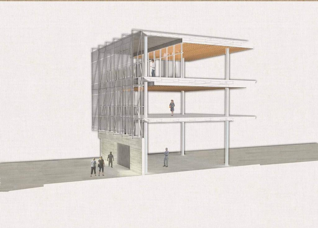
5 Building Arts Institute Irish Channel Neighborhood, New Orleans The Irish Channel is a neighborhood defined by its history of working class residents that moved to be in proximity to the industrial activities along the river. This merging of industry and residential programs is still a defining factor of the typologies found in the neighborhood, and one that is specifically felt in the site located in Rousseau St. The Building Arts Institute was designed to embody this threshold by mitigating the different scales one encounters in the neighborhood. The gallery, designed as a gesture to the typology of the shotgun home is located at the front of the site facing the residences and acting as a public place for people in the neighborhood to come inside. The scale of the Institute is larger, reacting to the warehouse typologies found towards the back of the site, and is tall enough to overlook the obstructions to reveal a glimpse of the Mississippi. 1/2 Mile Magazine St. 1/4 Mile Tchopitoulas St. Jackson Ave. 02 The gallery sits at the front and generates a courtyard which is also used by the workshops as an outdoor making space. Once inside the Institute, People can navigate through the space and towards the auditorium which faces the neighborhood. The upper floors, which have the greatest views are dedicated towards learning and culminate in the library at the third floor with large balconies on both sides that look towards both the city and the river.

6
7 Research / Community Engagement
 Legend Behavioral Health Clinics School Locations School Grades 9-12 PK - 8 Enrollment! 0-250! 251-500!")
 Legend Legend School Locations Behavioral Health Clinics Nightime Map School Locations Students Living per Zip Code 1,000 or Less")
 Counselor School Nurse Parents/Guardian Clinical Psychologist/ Psychiatrist Social Worker Counselor/ Social Worker As part of a fellowship with the")
8 Behavioral Health And Charter School Study New Orleans Partner with Shirley Chen Student Miles School Grades, Enrollment, and Clinics 03 Miles Schools and Clinics by Payment Concentration of Students in Schools (Daytime Map) Legend Behavioral Health Clinics School Locations School Grades 9-12 PK - 8 Enrollment! 0-250! !!! Legend More than 1001 School Locations Behavioral Health Clinics Payment Accepted No Help or Information Sliding Fee Only Medicaid Only Medicaid or Sliding Fee Free Miles Miles Concentration of Student s Homes (Nighttime Map) Legend Legend School Locations Behavioral Health Clinics Nightime Map School Locations Students Living per Zip Code 1,000 or Less 1,001-2,000 2,001-3,000 3,001-4,000 4,001 or More Behavioral Health Clinics Daytime Map Students Enrolled in Schools per Zip Code 1,000 or Less 1,001-2,000 2,001-3,000 3,001-4,000 4,001 or More Concentration of Students in Schools (Daytime Map) Counselor School Nurse Parents/Guardian Clinical Psychologist/ Psychiatrist Social Worker Counselor/ Social Worker As part of a fellowship with the Albert and Tina Small Center for Collaborative Design I coauthored a study to investigate the way which the all charter school system in New Orleans is affecting access to behavioral health resources in the city. Using Geographic Information Systems, we started to catalog the location of both schools and clinics, hoping to find a correlation between the patterns of their physical location. As our investigation took us forward, looking at the movement of kids throughout the city became a priority, as the information is not readily available. The next step of the process forced us to reconsider many of our initial assumptions and widen the scope of the research. The second half of the project involved an i qualitative investigation to work through the steps in the process of referring a kid. We found the problem was not as reducible to a spatial framework, but used our design skills to navigate and find ways to visualize the problem to serve as a useful tool for administrators and legislators.


9 INTERSTATE NEVADA INTERSTATE NEVADA Historic Westside Las Vegas Neighborhood Redevelopment Plan Community Engagement Studio A Center For Congregation G ST. HISTORIC WESTSIDE Bus Routes F ST. HARRISON AVE 20 min. H ST. JACKSON AVE. VAN BUREN AVE E ST. Vehicular Circulation JEFFERSON AVE D ST. 15 min. ADAMS AVE C ST. DOWNTOWN LAS VEGAS Pioneer Trail 15 Min 10 min 5 min Bicycle Circulation Pedestrian Circulation Concentration of churches in the area surrounded by clusters of empty land. 60 B ST. Vacant Land Churches Churches in the Urban Designation of West Las Vegas The historically black neighborhood founded in 1904 has had a history of segregation and systemic discrimination from the city of Las Vegas. As a diplomatic move in an effort to ease relations between the community and the city, UNLV had the opportunity to go into the neighborhood to meet with residents and draft a neighborhood revitalization plan. The approach was community driven, with a series of workshops that culminated in a plan and implementation strategy to encourage and guide future development ,759 1,800-10,000 Population living in the entire West Las Vegas Region Estimated Influx of People Every Sunday for Mass Through a phase of technical analysis, the student team gathered some necessary information about landmark features of the Historic Westside Community, including the peculiar condition of housing over 40 churches within a square mile. This produces an influx of thousands people that create a dichotomy between the normally vacant land and the saturated scene during Sundays.


10 NEVADA Community Engagement Outcome Urban Void Condition Pop-Up Infill proviides temporary solutions Empty spaces can become public spaces to engage in activities Pop-up interventions become a method to engage citizens by creating interest Temporary interventions can become a catalyst for long term change 10 Greenway at Owens Medium Density Housing Buffer for commercial and residential 7 Business in Edmond Town Center umc quick care clinic Walker African American Museum expansion 3 Medium Density Housing Keep eyes on the parks Bring back Jackson Community owned Business. 9 Community center Computers and courts for kids 6 Jackson Memorial PARK & plaza 16 Madison Lot Repair the Edges Martin Luther King commercial Blvd 4 11 Complete The Streets 8 Madison 'Spirit' Plaza INTERSTATE 12 1 Washington live Local entertainment corridor Westside School Renovation 5 Create gateways Use public art projects To create a strong brand 13 Green Corridor Moulin Rouge casino & Vocational training center 14 Density housing Students and downtown Residents Year plan What is going on now 5-10 Year plan Bringing back the neighborhood 2 tenaya creek brewery And commercial corridor Year plan Bold MOVES FOR THE WESTSIDE Work done through collaboration historic with community Westside members, artists, and architects in 0 500' 750' 1000' multiple design charettes, and Concept then elaborated and Execution with a team Plan of 8 students
11
CONTEXT: the Highway, the River + the Railroads run through us.
 CONTEXT: the Highway, the River + the Railroads run through us. I-25 36 In the past they have divided us, now we have an opportunity to unite us. I-76 I-270 I-76 CSU I-25 LEGEND Cut + Cover River North
PLAN ELEMENTS WORKSHOP. April 5, 2016
 PLAN ELEMENTS WORKSHOP April 5, 2016 needs more housing. But there is no one-size fits-all solution. Every neighborhood has its own character. In some places, density is not only appropriate it is badly
A Vibrant Downtown. Chapter 5 Cary Public Art Opportunities 31
 A Vibrant Downtown Cary s vision for Downtown is a unique, vibrant, dynamic, pedestrian friendly location; a regional destination and a place to live, work, and recreate, according to the 2001 Town Center
REGIONAL ACTIVITY CENTER
 DRAFT REGIONAL ACTIVITY CENTER 70 EAST BENCH MASTER PLAN DRAFT 06 Introduction The East Bench Regional Activity center is comprised of large educational, research, medical, and employment centers. These
Status Update (2006 vs. Now) Citizen s Advisory Committee February Plan for Prosperity
 Citizen s Advisory Committee February Plan for Prosperity") Status Update (2006 vs. Now) Citizen s Advisory Committee February 2018 Plan for Prosperity 2000 2017 2000 2017 Gardnerville Population 6,000 5,760 5746 5,500 5,000 5,067 5,550 5,165 5,394 5,412 5,250
Status Update (2006 vs. Now) Citizen s Advisory Committee February 2018 Plan for Prosperity 2000 2017 2000 2017 Gardnerville Population 6,000 5,760 5746 5,500 5,000 5,067 5,550 5,165 5,394 5,412 5,250
Urban Analysis. Downtown Zanesville like any city, has been physically modified through time as it
 Urban Analysis As a part of the consulting team s reconnaissance effort, an urban analysis was performed. Before the future of a place can be envisioned, one must understand the physical characteristics
the green business district
 the green business district Hazelwood Studio Ken Doyno, Instructor Dan Rothschild, Instructor Grace Whang, Jessica Kim The Second Avenue intervention is entitled the Green Building District. What this
Our Legacy Projects DOWNTOWN JACKSONVILLE MASTER PLAN
 DOWNTOWN JACKSONVILLE MASTER PLAN A major component of our master plan is the creation of a strong and accessible open space and recreation system. The four most vital links in that system are our legacy
Lynn Housing Authority and Neighborhood Development. Washington Street Gateway District Plan A p r i l
 Lynn Housing Authority and Neighborhood Development Washington Street Gateway District Plan A p r i l 2 0 0 8 rendering of sagamore hill from lynnway pedestrian overpass table of contents project area
West Ocala Vision & Community Plan City Council Work Session. Presented by West Ocala Community Plan Steering Committee
 West Ocala Vision & Community Plan City Council Work Session Presented by West Ocala Community Plan Steering Committee November 29,2011 Ocala 2035 Vision West Ocala Community Vision & Master Plan West
the village at market creek
 the village at market creek executive summary october 2012 i ii introduction The Village at Market Creek is primed to grow into one of San Diego s most lively, multi-cultural arts destinations. Our community
Table of Contents. Elm Avenue Improvement Plan City of Waco, Texas. Introduction 1. Existing Context 1 Figure 1 2.
 Table of Contents Introduction 1 Existing Context 1 Figure 1 2 Plan Guidelines 3 Future Urban Form 4 The West-End 4 Main Street 6 The East-End 7 Figure 2 9 Public Improvement Recommendations 7 General
7-PARKS, OPEN SPACE & PUBLIC ART
 7-s, Open Space & Public Art 7-PARKS, OPEN SPACE & PUBLIC ART This chapter provides recommendations for the expansion of new parks, plazas and open space that serve the many user groups targeted for downtown.
1. PLANNING CONCEPTS. Central Petaluma Specific Plan Chapter 1. Planning Concepts Page 7
 Page 7 1. PLANNING CONCEPTS Overview of Planning Concepts The plan for Central Petaluma envisions a reinvigorated central district that accommodates a greater diversity and intensity of activities, including
TEMPLE MEDICAL & EDUCATION DISTRICT
 City of Temple, Texas TEMPLE MEDICAL & EDUCATION DISTRICT 1 Description. The City of Temple joined in partnership with key public and private entities to jointly promote education and medical activities
UNIVERSITY OF KENTUCKY 2012 Campus Plan Update. Ross Tarrant Architects
 UNIVERSITY OF KENTUCKY 2012 Campus Plan Update AGENDA TEAM 1 2 3 4 5 ENGAGEMENT PUBLIC INPUT PROCESS GOALS AND OBJECTIVES PLANNING PROCESS AND SCHEDULE TOPICS AND DISCUSSION Team SASAKI UNIVERSITY OF PENNSYLVANIA
Center in the Square Science Museum of Western Virginia History Museum of Western Virginia Taubman Museum of Art
 Center in the Square Center in the Square serves as a catalyst for downtown revitalization and economic development, as well as excellence in education through uniting the arts, science, and education.
Animating the Rideau Canal December 2013
 Executive Summary Animating the Rideau Canal December 2013 Why study the Rideau Canal? The Rideau Canal has been an important part of Ottawa throughout its history, and has shaped and been shaped by the
B.A.T center paul mickula
 05-01 05-02 05-03 B.A.T center paul mickula 05-04 5.2 5.1 5.3 5.4 5.5 the bat center was established as a platform for artist to express themselves. their interventions completed the project and draws
A Campus Within Context
 A Campus Within Context A Comprehensive Master Plan for East Carolina University Optimize Valuable Resources Guide Future Development Establish Capital Priorities Create a Sense of Place Sustainable Campus
Anatomy of A Vibrant Downtown. Anatomy of a Vibrant Downtown
 Anatomy of A Vibrant Downtown The goal of MAIN ST. REVITALIZATION PLANNING is to provide a framework that will help transform your downtown into a VIBRANT DOWNTOWN a place where people love to LIVE, WORK,
Greening America s Cities: A Capital Idea
 Greening America s Cities: A Capital Idea Presenters Clark Wilson, EPA Mayor Mark Stodola, Little Rock, AR Mayor Harvey Johnson, Jackson, MS Caran Curry, Little Rock, AR Clare Watson, Montgomery, AL Program
Catalyst For Economic Development Washington Park Chicago IL
 Catalyst For Economic Development Washington Park Chicago IL Masters Project Joel Burkhart Advisors Dirk Denison Patrick Papczun Elevator Statement I propose to develop a comprehensive master plan that
FUTURE LAND USE ELEMENT
 FUTURE LAND USE ELEMENT GOAL I: To create and sustain a great place to live, play, and prosper Objective 1: The City of Ocala shall incorporate the principles and strategies of the Ocala 2035 Vision into
Parks, Open Space and Trails
 Introduction Parks have often been referred as the lungs of our cities, cleansing the air of pollutants and particulate matter. Parks are also gathering places for families and community. They offer spaces
PROJECT INFORMATION UNBUILT PUBLIC LIBRARY LATE 2017 TYPE II-B CONCRETE MASONRY WEATHERING STEEL GLASS GABION WALLS $6.4 MILLION 13,000 SF
 PROJECT INFORMATION PROJECT CATEGORY TYPE OF PROJECT COMPLETION DATE TYPE OF CONSTRUCTION MATERIALS USED COST BUILDING AREA UNBUILT PUBLIC LIBRARY LATE 2017 TYPE II-B CONCRETE MASONRY WEATHERING STEEL
Northwest Rail Corridor and US 36 BRT Development Oriented Transit Analysis 4.4 STATION AREA FINDINGS
 4.4 STATION AREA FINDINGS Each station is different, and each one requires a separate set of recommendations based on the vision for the site. This section outlines an initial TOD strategy and recommendations
A larger version of this map is located on the last page of this PDF.
 MAP Committee Input McLoughlin Area Draft Vision Map A larger version of this map is located on the last page of this PDF. 1. The map above is intended to portray a vision for the McLoughlin area. It highlights
EXECUTIVE SUMMARY DRAFT CHAPTER 1 INTRODUCTION EXECUTIVE SUMMARY
 CHAPTER 1 EXECUTIVE SUMMARY INTRODUCTION Through the joint efforts of the City of Tulsa planning staff and the Land Services division of Indian Nations Council of Governments (INCOG), the Berryhill Land
04Design. Methodology. Future of Jacksons Hill Identifying Potential Uses Building Typology and Adaptability Community Engagement
 Jacksons Hill Adaptive Re-Use Study 25 04Design Methodology Objectives Future of Jacksons Hill Identifying Potential Uses Building Typology and Adaptability Community Engagement Jacksons Hill Adaptive
Plan Overview. Manhattan Area 2035 Reflections and Progress. Chapter 1: Introduction. Background
 Plan Overview The Manhattan Urban Area Comprehensive Plan (the Comprehensive Plan) is a joint planning initiative of the City of Manhattan, Pottawatomie County, and Riley County. The 2014 Comprehensive
Design Approach Enable, Initiate, Claim and Coach. Enable Pin Point empty spaces where possible temporary pop-up interventions could accrue.
 Problem Statement The urban fabric of contemporary cities is changing at a rapid pace, with new development that rises to meet the population needs of modern society. This acceleration of development leaves
Ivywild On The Creek PRELIMINARY CREEK DISTRICT MASTER PLAN
 Ivywild On The Creek PRELIMINARY CREEK DISTRICT MASTER PLAN Introduction: Rejuvenating an extraordinary Creekside neighborhood THE CREEKSIDE DISTRICT The Ivywild On The Creek Neighborhood District Master
DANIEL RODRIGUEZ SELECTED WORKS
 LIO POR TFO DANIEL RODRIGUEZ SELECTED WORKS 2013-2016 EDUCATION Florida International University - 5 yr. Accelerated Masters Program 2011-2016 AWARDS HELLO. Coral Gables Exhibition For Infill Housing Design
Equitable Growth Through TOD Planning
 Equitable Growth Through TOD Planning Community Meeting # 2 November 2017 Goals Objectives Extend investment from downtown Connect neighborhoods physically and economically Enhance places based on local
WARM SPRINGS PARK MASTER PLAN
 TABLE OF CONTENTS page 1.0 Introduction and Overview 1 2.0 Information Gathering 2 3.0 Conceptual Alternative Development 8 4.0 Master Plan Development 14 5.0 Construction Cost Estimates 19 LIST OF FIGURES
2015 Campus Master Plan Update
 September 15, 2015 2015 Campus Master Plan Update Campus and Community Analysis Summary Presentation A G E N D A 1. Scope & Schedule of the Master Plan 2. Planning Principles & Draft Goals 3. Background
Atlanta BeltLine. Subareas 9 & 10. Master Plan Updates. March 26, Washington Park Jamboree 1
 Atlanta BeltLine Subareas 9 & 10 Master Plan Updates March 26, 2018 Washington Park Jamboree 1 22 miles, connecting 45 neighborhoods 22 MILES of transit 46 MILES of streetscapes and complete streets 33
City of Farmington. Downtown Plan. Amendment to the 1998 Master Plan Adopted October 11, 2004
 City of Farmington Amendment to the 1998 Master Plan Adopted October 11, 2004 Introduction Planning Background 1 Scope and Components of the Plan Amendment 2 Concept Introduction 3 Plan Concepts 3 Conceptual
Public may provide comments on the GDP within the next two weeks (December 24)
") 25/70 General Development Plan (GDP) Public Meeting Wednesday, December 10, 2014 6:00 8:00 P.M. District 1 Police Station Community Room 1311 W 46th Ave, Denver, CO 80211 Council Woman Montero: This particular
25/70 General Development Plan (GDP) Public Meeting Wednesday, December 10, 2014 6:00 8:00 P.M. District 1 Police Station Community Room 1311 W 46th Ave, Denver, CO 80211 Council Woman Montero: This particular
UMBC Facilities Management. UMBC Facilities Master Plan Update
 Management UMBC 2009-2019 February 19, 2010 A is the Vision for buildings, lands, open spaces and infrastructure Framework for the shape and development of the campus built environment driven by the University
Cultural Arts Review of Town of Chapel Hill and UNC Planning Documents
 Cultural Arts Review of Town of Chapel Hill and UNC ning Documents Primary s Chapel Hill 2020 Comprehensive Level of relevance to Stage Year Produced Target Time Geographic Range Responsible Agent High
IMPLEMENTATION STRATEGIES. In This Chapter. Goals & Strategies 182 Project List 183 Future Land Use 186 CHAPTER 11 IMPLEMENTATION STRATEGIES
 In This Chapter Goals & Strategies 182 Project List 183 Future Land Use 186 11 IMPLEMENTATION STRATEGIES NORTH AUGUSTA, SC 2017 COMPREHENSIVE PLAN 179 Individual commitment to a group effort that is what
An Ambitious Plan: Transforming the blighted South Platte River and surrounding environment into Denver s greatest natural resource.
 CONNECTING THE PEOPLE TO THEIR RIVER SOUTH PLATTE RIVER VISION IMPLEMENTATION PROGRAM: GRANT-FRONTIER PARK TO OVERLAND POND PARK REACH The South Platte River Vision Implementation Program (River Vision)
K. SMART ASSOCIATES LIMITED
 Planning Justification Report Zoning By-Law Amendment 185 King Street North Waterloo, Ontario April 7th, 2017 Project Reference Number 16-245 K. SMART ASSOCIATES LIMITED CONSULTING ENGINEERS AND PLANNERS
TOWN COUNCIL / PLANNING COMMISSION
 Workshop #3 TOWN COUNCIL / PLANNING COMMISSION January 20, 2011 Consultant Team In Attendance Tonight BMS Design Group Nevada City and San Francisco Michael Smiley, AICP, ASLA Partner-in-Charge Nancy L.
Public Art Plan. We have elected to submit Public Art Plans before or concurrently with the CSP Submittal per the FDP Manual
 Public Art Plan The intent of the Horizon Uptown Public Arts Program is to create great places that engage the community and leverage the neighborhood development and economic vitality. The Horizon Uptown
It is about sustainable development. A sustainable education and research center for our city.
 It is about sustainable development A sustainable education and research center for our city. It is about sustainable development It is about building community A new vision Located in the heart of Downtown
MENDING A RIFT: Urbanism for North Tulsa, Oklahoma UNIVERSITY OF NOTRE DAME SCHOOL OF ARCHITECTURE 2017 GRADUATE URBAN DESIGN STUDIO
 MENDING A RIFT: Urbanism for North Tulsa, Oklahoma UNIVERSITY OF NOTRE DAME SCHOOL OF ARCHITECTURE 2017 GRADUATE URBAN DESIGN STUDIO Project Description Mending A Rift: Urbanism for North Tulsa focuses
BLOK BADEL ZAGREB. Competition for the urban-architectural concept design for the BADEL SITE redevelopment COMPETITION NUMBER: ZG-UA
 BLOK BADEL ZAGREB Competition for the urban-architectural concept design for the BADEL SITE redevelopment COMPETITION NUMBER: 136-12-ZG-UA 1.0 DESCRIPTION AND EXPLANATION OF THE OVERALL CONCEPT The Badel
OVERVIEW OF PLANS FOR THE JEFFERSON COUNTY COUNTRYSIDE FARM In the Context of Quality Place Characteristics
 OVERVIEW OF PLANS FOR THE JEFFERSON COUNTY COUNTRYSIDE FARM In the Context of Quality Place Characteristics By Steve Grabow, Professor and Community Development Educator University of Wisconsin-Extension,
Abingdon Urban Path System
 Abingdon Urban Path System Transportation Enhancement Program Application (FY 2012-2013) Submitted by: Town of Abingdon,Virginia P. O. Box 789 133 West Main Street Abingdon, VA, 24212 November 1, 2011
VILLAGE OF ROMEOVILLE
 VILLAGE OF ROMEOVILLE COMPREHENSIVE PLAN FRAMEWORK PLAN, KEY STRATEGIES & GUIDING PRINCIPLES December 8, 2016 KEY PLANNING THEMES 2 KEY PLANNING THEME #1 ADVANCING A BALANCED ECONOMIC BASE KEY PLANNING
Draft Memorandum #1: Goals and Vision for Revitalization
 Keizer Revitalization Plan Draft Memorandum #1: Goals and Vision for Revitalization Submitted to: City of Keizer April 12, 2018 (revised) Prepared By: Angelo Planning Group and Otak, Inc. Project No. 17482.A
Corridors. Re-vitalize our Corridors and Gateways
 Corridors Re-vitalize our Corridors and Gateways Artist s rendering from the 287 Strategic Plan, 2015 Corridors are the major throughways of Loveland but they also provide important commercial, community
Gold Line Bus Rapid Transit Transit Oriented Development (BRTOD) Helmo Station Area Plan
 Helmo Station Area Plan") Appendix F Gold Line Bus Rapid Transit Transit Oriented Development (BRTOD) Helmo Station Area Plan Introduction and Purpose of the Plan The Gold Line Bus Rapid Transit facility is an eleven-mile dedicated
Appendix F Gold Line Bus Rapid Transit Transit Oriented Development (BRTOD) Helmo Station Area Plan Introduction and Purpose of the Plan The Gold Line Bus Rapid Transit facility is an eleven-mile dedicated
Blue Line LRT Extension
 v e Noble Pkwy Noble Pkwy Xerxes Ave N Shingle Creek Penn Ave N Penn Ave N Fremont Ave N Lyndale Ave N S Washington Ave University Ave NE Blue Line LRT Extension LIGHT RAIL PLATFORM AND STATION DESIGN
Shima Hamidi, PhD Director
 1OUR HISTORY 1OUR HISTORY 2OUR 1OUR HISTORY 2OUR 1OUR HISTORY Shima Hamidi, PhD Director OUR 3REPUTATION 1967 In 1967, the Texas Legislature created the at the University of Texas at Arlington. Based in
2011 ASLA Design Awards. Westside Creeks Restoration Plan Merit Award AECOM, Fort Collins. Planning & Urban Design
 2011 ASLA Design Awards Westside Creeks Restoration Plan Merit Award AECOM, Fort Collins Planning & Urban Design Project Fact Sheet Category of Entry: Rotating Specialty Award: 2011 2011 ASLA Colorado
Courthouse Square Planning & Urban Design Study. Courthouse Square Working Group #13 October 15, 2014
 Courthouse Square Planning & Urban Design Study Courthouse Square Working Group #13 October 15, 2014 1 Courthouse Square Process Working Group Community Courthouse Square Advisory Groups & Civic Associations
University of Minnesota. MINNEAPOLIS CAMPUS DEVELOPMENT FRAMEWORK February 11, 2016
 MINNEAPOLIS CAMPUS DEVELOPMENT FRAMEWORK DEVELOPMENT FRAMEWORK of use shape the campus today and may inform the future. Form, meaning how the shape, size, orientation, and arrangement of buildings, spaces,
4 C OMMUNITY D ISTRICTS
 4 C OMMUNITY D ISTRICTS N ew development in the Area will include many different types of land uses, including a destination retail area that attracts people from all over the region; recreation opportunities
SECTION TWO: Urban Design Concepts
 SECTION TWO: Urban Design Concepts The Gardnerville Plan for Prosperity shapes economic opportunities presented by regional growth. The Urban Design Concepts provide policies and concepts for land use,
UDF PLANS AND GUIDELINES
 UDF PLANS AND GUIDELINES 5 Land Use Land Use Development Plan Plan no. 3 Land Use Development Mixed Use Retail / Leisure Residential Civic and Institutional Proposed Zoning Table Development Edges Plan
REDLANDS TRANSIT VILLAGES SPECIFIC PLAN
 REDLANDS TRANSIT VILLAGES SPECIFIC PLAN CITY COUNCIL STUDY SESSION JANUARY 4, 2019 Redlands Blvd. Eureka St. Orange St. State St. Citrus Ave. Vine St. GENERAL PLAN TRANSIT VILLAGES WE ARE HERE SPECIFIC
Mix of Uses Guide for Transit-Oriented Development MIX OF USES
 MIX OF USES Creating a Destination Magnet A diversity of uses such as retail, housing, offices, civic and entertainment within the TOD creates a destination magnet for transit users and TOD neighbors.
RESIDENTIAL DISTRICTS
 RESIDENTIAL DISTRICTS The residential district standards have been revised to reflect on-the-ground conditions, while continuing to respect the use patterns established within the neighborhoods. This will
2011 ASLA Design Awards. Centennial Park Merit Award Design Concepts CLA, Inc. Design over $500,000 Construction Budget
 2011 ASLA Design Awards Centennial Park Merit Award Design Concepts CLA, Inc. Design over $500,000 Construction Budget 2011 ASLA Colorado Professional Design Awards Project Name: Category: Location: Const.
WELCOME TO THE CHOUTEAU GREENWAY DESIGN, DEVELOPMENT AND CONSTRUCTION WORKING GROUP!
 WELCOME TO THE CHOUTEAU GREENWAY DESIGN, DEVELOPMENT AND CONSTRUCTION WORKING GROUP! Chouteau Greenway Steering Committee and Working Groups Overview Overview January 9, 2019 Chouteau Greenway will transform
Stadium District Masterplan
 Stadium District Masterplan Masterplan (noun): an evolving long-term planning document that establishes the framework and key elements of a site. It reflects a clear vision synthesizing developer goals
CHAPTER 7: Transportation, Mobility and Circulation
 AGLE AREA COMMUNITY Plan CHAPTER 7 CHAPTER 7: Transportation, Mobility and Circulation Transportation, Mobility and Circulation The purpose of the Transportation, Mobility and Circulation Chapter is to
... the real city lives on... Character Area 5: LOWER WASHINGTON
 ... the real city lives on... Character Area 5: LOWER WASHINGTON 89 Boundaries This area is bordered by the extension of Fair Way to the north, the Napa River to the south, Gerard Street/Fire Station parking
EXECUTIVE SUMMARY EXECUTIVE SUMMARY
 1 EXECUTIVE SUMMARY EXECUTIVE SUMMARY Penn s Landing is envisioned as a welcoming riverfront green space adjacent to a refurbished civic marina becoming the centerpiece for adjacent development. With a
VISION, GOALS & CONCEPT DIAGRAM 2.0
 CHAPTER 2.0 2.1 Vision Creation Process 2.2 City Center Vision Statement, Goals and Objectives 2.3 Individual Zone Visions 2.4 Steps in City Building 2.5 Urban Form Concept Diagram for City Center VISION,
Mobility Districts and Traffic Studies
 Mobility Districts and Traffic Studies During the last Comprehensive Plan update in 2008, the City of Sarasota identified the need to develop a citywide strategy for enhancing the mobility options of all
12/9/2013. HOLLYWOOD/PINES CORRIDOR PROJECT AMPO 2013 Annual Conference October 24, Our Perspective. Broward.
 HOLLYWOOD/PINES CORRIDOR PROJECT AMPO 2013 Annual Conference October 24, 2013 Our Perspective Broward Fort Lauderdale 1 Broward Metropolitan Planning Organization Fort Lauderdale Fort Lauderdale Skyline
3.8 CUMULATIVE IMPACTS
 TIER II DRAFT ENVIRONMENTAL IMPACT STATEMENT 3.8 CUMULATIVE IMPACTS 3.8.1 What are the results of the Cumulative Impacts analysis? The No Action Alternative along with the four action alternatives were
Additional information about land use types is given in Chapter 5. Design guidelines for Centers and Neighborhoods are given in Chapter 7.
 4. Place Types Introduction In Albemarle County s Development Areas, the Neighborhood is the fundamental unit of community planning. The County s Neighborhood Model, an adopted part of the Comprehensive
FRUITVALE TRANSIT VILLAGE (Phase 2) Residential Project
 Residential Project") FRUITVALE TRANSIT VILLAGE (Phase 2) Residential Project DEVELOPER: SIGNATURE PROPERTIES ARCHITECT: HKIT ARCHITECTS April 23, 2010 TABLE OF CONTENTS 3 Vision 4 Description of Site 5 Guiding Concepts 6
FRUITVALE TRANSIT VILLAGE (Phase 2) Residential Project DEVELOPER: SIGNATURE PROPERTIES ARCHITECT: HKIT ARCHITECTS April 23, 2010 TABLE OF CONTENTS 3 Vision 4 Description of Site 5 Guiding Concepts 6
dr. robert paterson Spring 2016
 sustainable land use planning community and regional planning dr. robert paterson Spring 2016 Contemporary land use planning requires an analysis and understanding of physical and social demographics,
REQUEST FOR PROPOSALS (RFP) DEVELOPMENT OF CITY-OWNED PROPERTY LOCATED AT THE NORTHWEST CORNER OF OLIVE BOULEVARD AND MIDLAND BOULVARD
 DEVELOPMENT OF CITY-OWNED PROPERTY LOCATED AT THE NORTHWEST CORNER OF OLIVE BOULEVARD AND MIDLAND BOULVARD") REQUEST FOR PROPOSALS (RFP) DEVELOPMENT OF CITY-OWNED PROPERTY LOCATED AT THE NORTHWEST CORNER OF OLIVE BOULEVARD AND MIDLAND BOULVARD CITY OF UNIVERSITY CITY 6801 DELMAR BOULEVARD UNIVERSITY CITY, MO
REQUEST FOR PROPOSALS (RFP) DEVELOPMENT OF CITY-OWNED PROPERTY LOCATED AT THE NORTHWEST CORNER OF OLIVE BOULEVARD AND MIDLAND BOULVARD CITY OF UNIVERSITY CITY 6801 DELMAR BOULEVARD UNIVERSITY CITY, MO
IMAGINE CLEARWATER. Community Workshop 3. November 2016
 IMAGINE CLEARWATER Community Workshop 3 November 2016 Imagine Clearwater has been a 6-month community-focused process to re-envision the downtown waterfront. VISIONING FRAMEWORK MASTER PLAN HOW CAN WE
4.1.3 LAND USE CATEGORIES
 4.1.3 LAND USE CATEGORIES a. City Center District The City Center District incorporates the existing character and mix of uses in downtown Belmont to encourage redevelopment and new development in keeping
AMITY STATION Revised Concept Plan Review West Rosemary Street Chapel Hill, NC September 27, 2016
 AMITY STATION Revised Concept Plan Review West Rosemary Street Chapel Hill, NC September 27, 2016 DEVELOPER'S PROGRAM Introduction This is a request for review of a Revised Concept Plan by Chapel Hill
The transportation system in a community is an
 7 TRANSPORTATION The transportation system in a community is an important factor contributing to the quality of life of the residents. Without a sound transportation system to bring both goods and patrons
THE 355/270 CORRIDOR:
 THE 355/270 CORRIDOR: Strategic Ideas for Sustaining a Livable Work Place Project Summary ACCESS LIFE DESIGN HEALTH WORK Montgomery County Planning Department The Maryland-National Capital Park and Planning
2-FRAMEWORK STRATEGY
 2-Framework Strategy 2-FRAMEWORK STRATEGY The Downtown Master Plan Update is based on a framework of organizational concepts that should guide investment in the area. All of the components of the plan
Urban Design Webpage-Definitions
 Urban Design Webpage-Definitions What is Urban Design? Urban Design addresses the character and quality of the built environment in relation to the human scale. Urban designers are involved with building
Corridor Vision. 1Pursue Minnehaha-Hiawatha Community Works Project. Mission of Hennepin County Community Works Program
 1Pursue Minnehaha-Hiawatha Community Works Project Minnehaha-Hiawatha Community Works is a project within the Hennepin Community Works (HCW) program. The mission of the HCW program is to enhance how the
ROBBINSDALE LRT STATION CDI DEVELOPMENT GUIDELINES
 August 2018 OVERVIEW The City of Robbinsdale has a prime-opportunity site in the middle of the 13 mile stretch of the Bottineau LRT corridor / Blue Line extension. Robbinsdale offers a prominent, vital,
3.1 community vision. 3.3 required plan elements
 Chapter 3 Community Form 3.1 community vision 3.2 Parks & landscaping concepts 3.3 required plan elements D R A F T 20 Community Form Chapter 3 3.0 Community form 3.1 community vision The Specific Plan
Courthouse Square Planning & Urban Design Study. Clarendon / Courthouse Civic Association October 21, 2014
 Courthouse Square Planning & Urban Design Study Clarendon / Courthouse Civic Association October 21, 2014 1 Courthouse Square Process Working Group Community Courthouse Square Advisory Groups & Civic Associations
LAND USE OVERVIEW WHAT YOU WILL FIND IN THIS CHAPTER
 LAND USE WHAT YOU WILL FIND IN THIS CHAPTER Information about the City s expected population and employment growth. Description and capacity of existing and future land use designations. Policies that
The Atlanta BeltLine. Quarterly Briefing March @atlantabeltline. Reynoldstown Senior Affordable Housing
 The Atlanta BeltLine Quarterly Briefing March 30, 2017 @atlantabeltline @atlantabeltline @atlantabeltline Reynoldstown Senior Affordable Housing Framework for a multi-use and transit corridor in the heart
Summer School Bali TROPICAL ARCHITECTURE. a study abroad program in collaboration between Sekolah Tinggi Desain Bali (STD Bali) and StudyInBali (SIB)
 and StudyInBali (SIB)") ! Summer School Bali TROPICAL ARCHITECTURE a study abroad program in collaboration between Sekolah Tinggi Desain Bali (STD Bali) and StudyInBali (SIB)!1 ABSTRACT Course Content Bali is one of the most
! Summer School Bali TROPICAL ARCHITECTURE a study abroad program in collaboration between Sekolah Tinggi Desain Bali (STD Bali) and StudyInBali (SIB)!1 ABSTRACT Course Content Bali is one of the most
3.5 Historic Old Town Character Area
 3.5 Historic Old Town Character Area Downtown Suwanee is characterized by two areas: Historic Old Town and Town Center. Due to their proximity and similar purposes, the two areas can function together
Making TOD Work in the Heart of Suburban Sprawl
 Making TOD Work in the Heart of Suburban Sprawl Rocky Mountain Land Use Institute March 6, 2009 Speakers Ben Herman, FAICP, Principal Clarion Associates Darcie White, AICP, Principal Clarion Associates
ESTABLISH AN EFFICIENT TOWN CENTER
 ESTABLISH AN EFFICIENT TOWN CENTER 4 Overview Lisbon residents are proud of the history of Newent and at the same time recognize its current importance as a centralized location for a variety of municipal
St. Kevin s Area Planning Collaborative
 Table of Contents page 2 EXECUTIVE SUMMARY 3 MISSION STATEMENT 4 NEIGHBORHOOD CONTEXT 6 STREET CHARACTER 7 SITE PARAMETERS 9 COMMUNITY CHARRETTE - VISIONING GROUP TABLE 1 11 GROUP TABLE 2 12 GROUP TABLE
AREA-WIDE PEDESTRIAN AND BICYCLE CIRCULATION
 OUSD LANEY CHILD CARE CENTER ART BUILDING LANEY COLLEGE BALL FIELDS PCCD OFFICES PERALTA PARK AQUATIC CENTER & ESTUARY PARK EDOFF MEMORIAL BANDSTAND SNOW PARK COURT HOUSE OAKLAND MUSEUM OAK ST AREA-WIDE