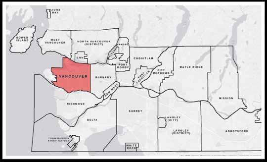
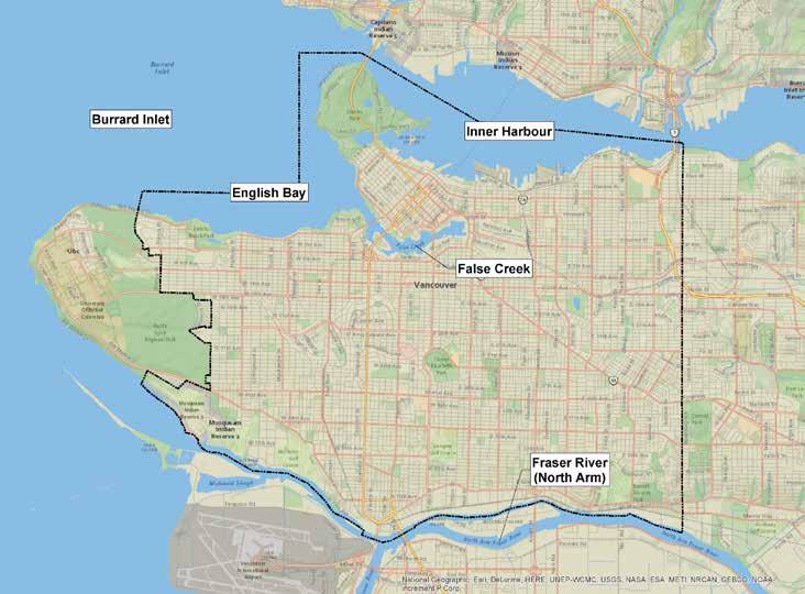
Sea Level Rise in the City of Vancouver: Mapping Coastal Flood Risk. Sarah North, GISP Northwest Hydraulic Consultants Ltd.
|
|
|
- Benjamin Shields
- 5 years ago
- Views:
Transcription

1 Sea Level Rise in the City of Vancouver: Mapping Coastal Flood Risk Sarah North, GISP Northwest Hydraulic Consultants Ltd.
2
3


4 INNER HARBOUR PORT, CONVENTION CENTRE SKYTRAIN, WEST COAST EXPRESS, FREIGHT TRAINS Photos: Port Metro Vancouver; City of Vancouver


5 STANLEY PARK SEAWALL STANLEY PARK SEAWALL KING TIDE DEC 2012 KITS BEACH AND POOL Photos: City of Vancouver, LiveSmart BC KITS BEACH AND POOL KING TIDE DEC 2012


6 POINT GREY ROAD LOCARNO Photos: City of Vancouver


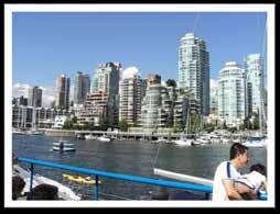
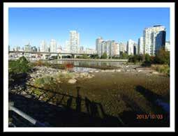
7 2010 OLYMPIC VILLAGE PROPOSED HOSPITAL GRANVILLE ISLAND FALSE CREEK Images: City of Vancouver, NHC


8 EAST FRASERLANDS SOUTHLANDS AND DEERING ISLAND ARTHUR LAING BRIDGE, VANCOUVER TRANSIT CENTRE Photos: City of Vancouver
9 Coastal Flood Risk Assessment Study Numerical Modelling Results and Assessment Recommendations Coastal - SWAN Flood - Telemac - Mike11 Stormwater - SWMM Flood mapping FCLs Vulnerability assessment Consequence assessment - Hazus Mitigation and adaptation
10 Model Development: Sea Level, Joint Probability Model Sea Level - Deterministic component: Tide - Probabilistic components: Storm Surge, Wave Setup, Wind Setup, Wave Runup - Modelled using Joint Probabilistic approach - Several different scenarios different return periods, for different years (2013, 2100, 2200) Add predicted Sea Level Rise caused by climate change to 2.0 m, depending on time horizon

11 Model Development: Sea Level Rise Figure: British Columbia. (2013). Sea Level Rise Adaptation Primer. Ministry of Environment. Victoria.
12 Model Development: Multiple Scenarios Scenario Year SLR Return Period none 1:500 year m 1:500 year m 1:500 year m 1:10,000 year m 1:10,000 year Scenario 3 was used by City for planning.


13 Model Development: Data inputs - DEM BC Place Stadium Rogers Arena Georgia Viaduct Pacific Blvd False Creek 250 m (800 ft)


14 Model Development: Data inputs - DEM Bare Earth removal of BC Place Stadium Planned removal of viaduct and reconfiguration of roads

15 Model Development: Data inputs - Mesh


16 Model Development: Data inputs - Mesh Multiple buildings generalized to one polygon


17 Model Development: Validation King tide 17 December 2012 Peak Water Level = 2.66 m GD Photos: City of Vancouver, LiveSmart BC

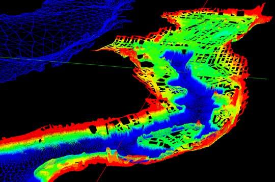
18 Map Model Results

19 Map Model Results

20 Map Model Results

21 Vulnerability Assessment Based on: Supply Chain Challenges Emergency Management Community Transportation Sewer Buildings Map: Arlington Group
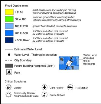
22 Consequence Assessment Hazus Flood Hazard (Depth) Asset Inventory Depth- Damage Curves Damage & Loss Estimates % Damage to Building Water Height above First Floor (ft) For flooding, HAZUS estimates: Displaced households Shelter seekers Buildings damaged Building type damaged Building losses Debris generated Business interruption costs Graph: FEMA Hazus Flood Model Technical Manual


23 Consequence Assessment Hazus Map and Graph: Ebbwater Consulting Hot spot map of total dollar losses
24 Recommendations Re-examine emergency evacuation plans Adapt flood plans based on changing SLR predictions Account for research-supported increases in storminess Plan for bare earth DEM development with future Lidar Examine flooding of below-ground infrastructure Gather data during future high water events Increase stormwater pumping capacity Identify and develop other mitigation and adaptation options Implement measures to reduce risk along Fraser River
25 Next Steps Phase 2 work - Evaluating preferred mitigation options for key flood risk areas Interest from others - Expanding assessment to other Burrard Inlet municipalities and Port facilities Hazus modelling - Wider application of Canadian Hazus Flood Model to Lower Mainland municipalities as part of a regional flood vulnerability study currently under way
26 Project Team City of Vancouver Port Metro Vancouver Northwest Hydraulic Consultants Ltd - Bruce Walsh P.Eng., Charlene Menezes P.Geo, Vanessa O Connor P.Eng., Sarah North GISP Cascadia Coastal Research Ltd - Clayton Hiles P.Eng. Arlington Group - Graham Farstad R.P.P., Amanda Grochowich Ebbwater Consulting - Tamsin Lyle M.R.M., P.Eng. Technical Advisory Committee

27 THANK YOU! Sarah North, GISP GIS Analyst Northwest Hydraulic Consultants Ltd. .
City of Norfolk Coastal Flood Mitigation Program. March 13, 2013
 City of Norfolk Coastal Flood Mitigation Program March 13, 2013 Topics Brief overview of Norfolk s Coastal Flood Program Data-driven analysis and decision making City-wide vulnerability, project concepts,
NORTH KINGSTOWN PILOT PROJECT May 9, 2016 North Kingstown Town Council
 Engaging RI Local Governments in Hazard Mitigation and Coastal Resilience NORTH KINGSTOWN PILOT PROJECT May 9, 2016 North Kingstown Town Council Teresa A. Crean, AICP University of Rhode Island Coastal
PART 4.2 HYDE CREEK. Emergency Services Contact Royal Canadian Mounted Police British Columbia Ambulance Service 9-1-1
 PART 4.2 HYDE CREEK 4.2.1 Overview The Hyde Creek area is roughly bounded by Port McNeill to the west and the Nimpkish River to the east. The Spring Hill portion of the community is found just east of
PART 4.1 COAL HARBOUR
 PART 4.1 COAL HARBOUR 4.1.1 Overview Coal Harbour is located on Quatsino Sound which has access to the Pacific Ocean on the west coast of Vancouver Island. Population is approximately 225. Emergency Services:
Empowering Local Action for Coastal Resilience in Massachusetts. Bruce K. Carlisle MA Office of Coastal Zone Management
 Empowering Local Action for Coastal Resilience in Massachusetts Bruce K. Carlisle MA Office of Coastal Zone Management Context Coastal communities continue to face both chronic and acute storm surge, erosion,
Preparing Hudson River Waterfronts for an Era of Rapid Sea Level Rise
 Preparing Hudson River Waterfronts for an Era of Rapid Sea Level Rise CITY OF KINGSTON TIDAL WATERFRONT FLOODING TASK FORCE Gregg Swanzey Director, Office of Economic Development & Strategic Partnerships,
Presenta/on Outline. Sea Level Rise Adapta/on Guidelines for Sea Dikes & Coastal Development 11/24/11
 Sea Level Rise Adapta/on Guidelines for Sea Dikes & Coastal Development 2011 UBCM Conven-on Rising Oceans & Raising Dikes: Rethinking Coastal Development in a Changing Climate September 27, 2011 Jesal
MUNICIPAL RESILIENCE PLANNING ASSISTANCE PROJECT
 MUNICIPAL RESILIENCE PLANNING ASSISTANCE PROJECT William R. Rath, Esq. Legal Research Fellow Center for Energy & Environmental law University of Connecticut School of Law 860-570-5058 William.Rath@ UConn.edu
Mitigation + Adaptation Strategies for Historic Structures and Sites
 Mitigation + Adaptation Strategies for Historic Structures and Sites Adrienne Burke, Esq., MSAS, LEED AP+ Executive Director, Riverside Avondale Preservation, Jacksonville, FL Cultural Resources, Disaster
Stormwater Master Plan Update. City Council Briefing January 8, 2019
 Stormwater Master Plan Update City Council Briefing January 8, 2019 1 Stormwater Master Plan Update January 8, 2019 Agenda Background for Update Stormwater Modeling and Calibration Visualizations of Results
Planning for Historic/Cultural Resources Coastal Resiliency in Connecticut. Presented to CAFM s 3 rd Annual Conference
 Planning for Historic/Cultural Resources Coastal Resiliency in Connecticut Presented to CAFM s 3 rd Annual Conference October 25, 2016 Agenda Introduction and Project Overview Background Historic and Cultural
Preparing New Hampshire for Projected Storm Surge, Sea-Level Rise, and Extreme Precipitation
 NEW HAMPSHIRE COASTAL RISK AND HAZARDS COMMISSION Preparing New Hampshire for Projected Storm Surge, Sea-Level Rise, and Extreme Precipitation July 14, 2017 The Beaches Conference Wells High School Wells,
Risk Analysis Tools to Support Resilient Design
 Risk Analysis Tools to Support Resilient Design 1755 Cape Ann 6.3: BC WO Paul A. Morey FEMA Region I Woods Hole, MA/NOAA Hurricane & Earthquake Program Manager Maps Commonly used by FEMA and other Federal,
Hydrologic Assessment of using Low Impact Development to Mitigate the Impacts of Climate Change. Chris Jensen, AScT Master of Science Thesis
 Hydrologic Assessment of using Low Impact Development to Mitigate the Impacts of Climate Change Chris Jensen, AScT Master of Science Thesis Bowker Creek Initiative April 12, 2012 Outline 1. Future Impacts
Queensborough Eastern Neighbourhood Node. Community Open House
 Queensborough Eastern Community Open House The Vision The Queensborough Eastern will become the heart of eastern Queensborough. Through a sensitive mix of viable commercial and residential areas, the neighbourhood
Removal of the Georgia and Dunsmuir Viaducts
 Removal of the Georgia and Dunsmuir Viaducts RENDERING OF NEFC CONCEPTUAL PLAN 2 RENDERING OF CREEKSIDE PARK EXTENSION 3 RENDERING OF GEORGIA WHARF 4 SUMMARY OF STAFF RECOMMENDATIONS THAT Council: Approve
VIEW PROTECTION GUIDELINES. Adopted by City Council on December 12, 1989 Amended December 11, 1990 Corrected May 5, 2010 Amended February 1, 2011
 $1 City of Vancouver Land Use and Development Policies and Guidelines Community Services, 453 W. 12th Ave Vancouver, BC V5Y 1V4 F 604.873.7344 fax 604.873.7060 planning@vancouver.ca VIEW PROTECTION GUIDELINES
Rhode Island Shoreline Change Special Area Management Plan
 Rhode Island Shoreline Change Special Area Management Plan Draft Document Outline REVISED 10/12/2017 VOLUME 1 Executive Summary & How to Use this Document (Draft by Dec 2017) 1. Introduction (Revised draft
Virginia Pilot. Climate Change Vulnerability and Risk Assessments of Transportation Infrastructure Hampton Roads, Virginia Implementation Pilot
 Virginia Pilot Climate Change Vulnerability and Risk Assessments of Transportation Infrastructure Hampton Roads, Virginia Implementation Pilot Yao-Jan Wu Andres Clarens Tanveer Hayat Brian Smith Jose Gomez
Iona Island Wastewater Treatment Plant Project. Welcome to Community Workshop 1 January 9, 2019
 Iona Island Wastewater Treatment Plant Project Welcome to Community Workshop 1 January 9, 2019 Iona Island Wastewater Treatment Plant Project Lena Zordan POLICY COORDINATOR, LIQUID WASTE SERVICES January
[FORMALLY ADOPTED AS GUIDELINES FOR SITING AND MASSING BUILDINGS ADJACENT TO DOWNTOWN VANCOUVER BRIDGEHEADS ] 1 Application and Intent...
![[FORMALLY ADOPTED AS GUIDELINES FOR SITING AND MASSING BUILDINGS ADJACENT TO DOWNTOWN VANCOUVER BRIDGEHEADS ] 1 Application and Intent...](/thumbs/77/76598648.jpg "[FORMALLY ADOPTED AS GUIDELINES FOR SITING AND MASSING BUILDINGS ADJACENT TO DOWNTOWN VANCOUVER BRIDGEHEADS ] 1 Application and Intent...") $1 City of Vancouver Land Use and Development Policies and Guidelines Community Services, 453 W. 12th Ave Vancouver, BC V5Y 1V4 F 873.7344 fax 873.7060 planning@city.vancouver.bc.ca BRIDGEHEAD GUIDELINES
$1 City of Vancouver Land Use and Development Policies and Guidelines Community Services, 453 W. 12th Ave Vancouver, BC V5Y 1V4 F 873.7344 fax 873.7060 planning@city.vancouver.bc.ca BRIDGEHEAD GUIDELINES
QUESTIONS AND ANSWERS Windsor Woods, Princess Anne Plaza & The Lakes Combined Drainage Project
 QUESTIONS AND ANSWERS Windsor Woods, Princess Anne Plaza & The Lakes Combined Drainage Project Project Overview... 2 Thalia Creek (Windsor Woods) Tide Gate... 6 Club House Road Drainage Project... 9 Updated
What Planners Do. Heather Wade, Coastal Planning Specialist Texas Sea Grant
 What Planners Do Heather Wade, Coastal Planning Specialist Texas Sea Grant What Planners Do Seminar Series Department of Landscape Architecture and Urban Planning College of Architecture ABOUT ME B.S.
Public Workshop #3. Sea Level Rise Vulnerability Assessment. Infrastructure Property Cultural Civic Coastal Amenities Ecological
 Infrastructure Property Cultural Civic Coastal Amenities Ecological Public Workshop #3 Sea Level Rise Vulnerability Assessment Funded in part by CCC Grant LCP-14-09 Introducing the Team: Purpose of Today
Coastal Planning in Texas. Tony Williams Senior Director of Planning Coastal Resources Division Texas General Land Office
 Coastal Planning in Texas Tony Williams Senior Director of Planning Coastal Resources Division Texas General Land Office e The Texas General Land Office (GLO) and the Texas Coast Since 1836: Manager of
Vu Kim Chi Nguyen Thi Thuy Hang
 Vu Kim Chi Nguyen Thi Thuy Hang Tokyo, Dec 7, 2015 Introduction Data and methods Results and discussions Conclusion The city of Quy Nhon Urban planning in Quy Nhon Climate change and sea level rise Natural
Park Board Chair and Commissioners General Manager Vancouver Board of Parks and Recreation Love Locks Concept Plan
 Date: June 30, 2015 TO: FROM: SUBJECT: Park Board Chair and Commissioners General Manager Vancouver Board of Parks and Recreation Love Locks Concept Plan RECOMMENDATION A. THAT the Vancouver Park Board
Planning for Historic/Cultural Resources Coastal Resiliency in Connecticut. Presented to ASFPM 41 st Annual Conference, Kansas City, MO
 Planning for Historic/Cultural Resources Coastal Resiliency in Connecticut Presented to ASFPM 41 st Annual Conference, Kansas City, MO May 3, 2017 Agenda Introduction and Project Overview Historic and
RESILIENCY, ADAPTATION, & SUSTAINABILITY AT THE CITY OF ST. AUGUSTINE
 RESILIENCY, ADAPTATION, & SUSTAINABILITY AT THE CITY OF ST. AUGUSTINE PROGRAM UPDATE JANUARY 14, 2019 MICHAEL G. CULLUM, P.E. DIRECTOR, PUBLIC WORKS PROGRESSION OF PLANNING FOR RESILIENCY / ADAPTATION
Coastal hazard assessments in Victoria
 Coastal hazard assessments in Victoria Viktor Brenners viktor.brenners@delwp.vic.gov.au Future Coasts program 4 year program established in 2007. Outputs included: Coastal Digital Elevation Models Victorian
SURREY COASTAL FLOOD ADAPTATION STRATEGY (CFAS) Phase 1 Open House
 Phase 1 Open House") SURREY COASTAL FLOOD ADAPTATION STRATEGY (CFAS) Phase 1 Open House CFAS Open House Photo Contest Winners #SurreyCoastal Activity Gail Stephan Under crescent beach pier. Great place to take a long exposure
SURREY COASTAL FLOOD ADAPTATION STRATEGY (CFAS) Phase 1 Open House CFAS Open House Photo Contest Winners #SurreyCoastal Activity Gail Stephan Under crescent beach pier. Great place to take a long exposure
water resource specialists
 Vaughn Collins, PE, CFM, Northwest Hydraulic Consultants Brad Livingston, Oregon Department of Transportation Melissa Reich, North Coast Land Conservancy Location Necanicum River 75 sq mi watershed Active
Methods to Simulate the Impact of BMPs
 LA221 Project Ortega Watershed Demonstration Area, Quito Ecuador Ricardo da Cruz e Sousa Master of Landscape Architecture & Environmental Planning University of California, Berkeley December 2011 Ortega
LEGAL & POLICY ANALYSIS TO SUPPORT RESILIENCE MEASURES. CEEL Tasks
 LEGAL & POLICY ANALYSIS TO SUPPORT RESILIENCE MEASURES William R. Rath, Esq. Legal Research Fellow Center for Energy & Environmental law University of Connecticut School of Law 860-570-5058 William.Rath@
Port of San Diego Sea Level Rise Ad Hoc Committee Meeting 1 of 3.. September 18, 2018
 Port of San Diego Sea Level Rise Ad Hoc Committee Meeting 1 of 3. September 18, 2018 Agenda Welcome Introductions Rules of the Ad-Hoc Presentation Background Vulnerability Assessment Results Non-Agenda
STORMWATER MANAGEMENT FACILITIES/STORMWATER PONDS - What Are They?
 STORMWATER MANAGEMENT FACILITIES/STORMWATER PONDS - What Are They? As land is developed, the natural water cycle is disrupted. Rain infiltrates less, resulting in larger amounts of runoff This increased
SBPO BOARD MEETING MARCH 20, 2018
 SBPO BOARD MEETING MARCH 20, 2018 TODAY'S AGENDA > Booker Middle School Outreach > Property Information > Schedule > Guiding Principles > Three Concepts Booker Middle School Outreach Property Information
Figure 1. Park Ave. Portsmouth
 Aquidneck Island Resilience Strategy Issue Paper 2 Issue: TRANSPORTATION Description of Concern: Aquidneck Island encompasses a 38 square mile area, including three municipalities, all supported by an
Adaptation and Resilience at the City of Fort Lauderdale
 Adaptation and Resilience at the City of Fort Lauderdale Carlos Acosta, P.E. Assistant City Engineer City of Fort Lauderdale Overview Climate challenges and limitations Sea Level Rise Projections King
QUESTIONS AND ANSWERS Windsor Woods, Princess Anne Plaza & The Lakes Combined Drainage Project
 QUESTIONS AND ANSWERS Windsor Woods, Princess Anne Plaza & The Lakes Combined Drainage Project PROJECT OVERVIEW Windsor Woods, Princess Anne Plaza and The Lakes are neighborhoods located in what was once
Planning for Staten. Habitat Restoration and Green Infrastructure. Island s North Shore
 Habitat Restoration and Green Infrastructure Planning for Staten Island s North Shore Community Board 1 March 1, 2018 NYC Parks Forestry, Horticulture, and Natural Resources Funded by the NYS Department
Construction Electrician and Industrial Electrician Transition Plan
 Construction Electrician and Industrial Electrician Transition Plan Construction Electrician/Industrial Electrician Transition Plan - February 27, 2018 Page 1 of 22 Table of Contents Abbreviations... 3
Tracking spatiotemporal patterns of building vulnerabilities and evacuations during flood hazards
 Tracking spatiotemporal patterns of building vulnerabilities and evacuations during flood hazards Shane Hubbard Junchuan Fan Kathleen Stewart Emily White The University of Wisconsin Madison, SSEC/CIMSS
South Bismarck Watershed Model Update and Stormwater Improvement Project
 Preliminary Engineering Report Bismarck Tribune South Bismarck Watershed Model Update and Stormwater Improvement Project City of Bismarck, ND January 2017 14.105.0046 1.0 Executive Summary The focus of
CITY CORE 2050 A VISION FOR THE HEART OF THE REGION
 CITY CORE 2050 A VISION FOR THE HEART OF THE REGION INITIAL SCOPE OF WORK OCTOBER 17, 2017 CITY CORE 2050 Phase 1 January to July 2018 A public conversation about challenges and opportunities A preliminary
Coastal Climate Change Vulnerability and Flexible Adaptation Planning: the Cockburn Sound Coastal Alliance Experience
 Coastal Climate Change Vulnerability and Flexible Adaptation Planning: the Cockburn Sound Coastal Alliance Experience Presentation to Climate Change Forum by Doug Vickery Manager Infrastructure Services,
Approaches of Urban and Spatial Planning implementing adaptation strategies and measures Guide Climate Adaptation in Planning
 Approaches of Urban and Spatial Planning implementing adaptation strategies and measures Guide Climate Adaptation in Planning Manfred Born Sustainability Center Bremen 30.05.2010 ICLEI International Conference
THE PROTECTION OF CHATHAM COUNTY S NATURAL RESOURCES - THE POLICY SIDE
 THE PROTECTION OF CHATHAM COUNTY S NATURAL RESOURCES - THE POLICY SIDE SEA GRANT TIDAL CREEK SUMMIT CHARLESTON, SOUTH CAROLINA DECEMBER 5, 2011 Jackie Jackson Teel Chatham County-Savannah Metropolitan
COASTAL MANAGEMENT ELEMENT. Last amended December 6, 2016 as part of the 2016 EAR
 COASTAL MANAGEMENT ELEMENT Last amended December 6, 2016 as part of the 2016 EAR Table of Contents Objective Page 7.1 Development and redevelopment of waterfront properties...7-1 7.2 Agency coordination
Statewide Community Resiliency Initiative : Planning for Sea Level Rise Adaptation
 Statewide Community Resiliency Initiative : Planning for Sea Level Rise Adaptation Julie A. Dennis Division of Community Development www.floridajobs.org/adaptationplanning Overview The New Role of the
Create a connected ecological network. Connect districts with transit. Let the centre define the community
 District A - D Southeast False Creek A 1 A 2 A 3 A 4 Create a connected ecological network Connect districts with transit Let the centre define the community Provide a variety of affordable housing types
Thank you! Events and Entertainment in Northeast False Creek. Tuesday, March 7, 2017
 Events and Entertainment in Northeast False Creek Tuesday, March 7, 2017 Thank you! Thank you for taking the time to attend the Events and Entertainment in Northeast False Creek (NEFC) workshop in partnership
COMMUNITY RESILIENCE IN COASTAL NEW HAMPSHIRE
 COMMUNITY RESILIENCE IN COASTAL NEW HAMPSHIRE Kirsten Howard Coastal Resilience Specialist New Hampshire Department of Environmental Services Coastal Program Kirsten.Howard@des.nh.gov Coastal Hazard Vulnerability
Virginia Beach and Sea Level Rise: Where Do We Go From Here?
 Virginia Beach and Sea Level Rise: Where Do We Go From Here? Clay Bernick City of Virginia Beach Environment & Sustainability Office Bayfront Advisory Committee Presentation July 19, 2012 Five Items to
City of Rockingham. Local Management Practices, Costs and Strategic Coastal Planning
 City of Rockingham Local Management Practices, Costs and Strategic Coastal Planning Decision Making Process Considerations Climate Change Response Action Plan Ongoing observations/major Storm events Ongoing
ADAPTIVE EVACUATION PLANNING FOR FLOOD RISK MANAGEMENT
 ADAPTIVE EVACUATION PLANNING FOR FLOOD RISK MANAGEMENT Bas Kolen Senior consultant at HKV PhD candidate Radboud University Nijmegen Kolen@hkv.nl HKV consultants Private Company, 65 people Applied research
New Brighton Park Shoreline Habitat Restoration Project
 Vancouver Board of Parks and Recreation and Port Metro Vancouver New Brighton Park Shoreline Habitat Restoration Project Conceptual Design Public Consultation August 26 September 9, 2015 Discussion Paper
Special Joint Meeting. Emerald Isle Planning Board. Emerald Isle Board of Commissioners. January 18, 2017
 Special Joint Meeting Emerald Isle Planning Board Emerald Isle Board of Commissioners January 18, 2017 STEERING COMMITTEE: Jim Normile Town Commissioner Ken Sullivan Planning Board Larry Watson Retail
VANCOUVER PUBLIC LIBRARY GREEN ROOF MONITORING PROJECT
 VANCOUVER PUBLIC LIBRARY GREEN ROOF MONITORING PROJECT Chris Johnston P.Eng., Kathryn McCreary B.A.Sc., Cheryl Nelms, B.Eng. Kerr Wood Leidal Associates Ltd. Burnaby, B.C. Public Works and Government Services
Funding, Designing, and (eventually) Building Miles of Shoreline and Acres of Wetlands and Oyster Reefs on an Urbanized River!
 Building Miles of Shoreline and Acres of Wetlands and Oyster Reefs on an Urbanized River!") CW Gaskill City of Norfolk Funding, Designing, and (eventually) Building Miles of Shoreline and Acres of Wetlands and Oyster Reefs on an Urbanized River! Don Cole Brown and Caldwell C. W. Gaskill City
CW Gaskill City of Norfolk Funding, Designing, and (eventually) Building Miles of Shoreline and Acres of Wetlands and Oyster Reefs on an Urbanized River! Don Cole Brown and Caldwell C. W. Gaskill City
1.4 TRANSIT VISION 2040 FROM VISION TO ACTION THEME 1: PUTTING TRANSIT AT THE CENTRE OF COMMUNITIES. Fully integrate transit with community design
 TRANSIT VISION 2040 FROM VISION TO ACTION TRANSIT VISION 2040 defines a future in which public transit maximizes its contribution to quality of life with benefits that support a vibrant and equitable society,
ROCKLAND P.L.U.S. PLANNING LAND USE WITH STUDENTS
 ROCKLAND P.L.U.S. PLANNING LAND USE WITH STUDENTS PLUS Program Goals: High School Students from throughout Rockland County understand: The power of land use planning in shaping a community Their role as
Ecosystems and Biodiversity Ecosystem Services in the City. City of Burnaby Environmental Sustainability Strategy
 Ecosystems and Biodiversity Ecosystem Services in the City City of Burnaby Environmental Sustainability Strategy Realms of concern / Realms of possibility In ecosystems, everything is connected to everything
STORMWATER UTILITY PRESENTATION November 18, 2014
 STORMWATER UTILITY PRESENTATION November 18, 2014 AGENDA 1. Introduction 2. What is Stormwater 3. What is the problem with polluted runoff? 4. Local Environmental Initiatives 5. Current status to fund,
Appendix to Amicus Curiae Brief: Selected Provisions of the South Carolina Beachfront Management Act
 Loyola Marymount University and Loyola Law School Digital Commons at Loyola Marymount University and Loyola Law School Loyola of Los Angeles Law Review Law Reviews 6-1-1992 Appendix to Amicus Curiae Brief:
April 11, 2016 Park Board Chair and Commissioners General Manager Vancouver Board of Parks and Recreation New Brighton Salt Marsh - Preferred Concept
 TO: FROM: SUBJECT: April 11, 2016 Park Board Chair and Commissioners General Manager Vancouver Board of Parks and Recreation New Brighton Salt Marsh - Preferred Concept RECOMMENDATION A. THAT the Vancouver
I. INTRODUCTION. identify long-term capital improvements and rehabilitation measures for the existing drainage system;
 I. INTRODUCTION The Town of Windsor, Colorado is presently experiencing rapid growth and development within the boundaries of several of its major drainage basins. As growth continues within these basins,
City of Surrey PLANNING & DEVELOPMENT REPORT File: Development Permit in order to redevelop portions of this industrial site.
 City of Surrey PLANNING & DEVELOPMENT REPORT File: 7910-0181-00 Planning Report Date: December 13, 2010 PROPOSAL: Development Permit in order to redevelop portions of this industrial site. LOCATION: OWNER:
TRANSPORTATION ELEMENT GOALS, OBJECTIVES, AND POLICIES
 TRANSPORTATION ELEMENT GOALS, OBJECTIVES, AND POLICIES GOAL 2 The City shall provide a safe, convenient, effective, and energy efficient multimodal transportation system which is coordinated with the Future
WELCOME WHY A TEMPORARY PATHWAY? WE WANT TO HEAR FROM YOU
 WELCOME In March, the City of Vancouver purchased the lands known as the Arbutus Corridor from Canadian Pacific Railway for the purpose of creating a transportation corridor from False Creek to the Fraser
The Canadian Society of Landscape Architects Association des architectes paysagistes du Canada
 The Canadian Society of Landscape Architects Association des architectes paysagistes du Canada honouring our past: sustaining our future Janet Rosenberg & Studio Inc. 02 Planning and Deign Inc.. Andre
Bernardo Aliaga. Ken Gledhill. Laura Kong. Programme Specialist Tsunami Unit UNESCO/IOC ICG/CARIBE EWS Technical Secretary
 UNESCO IOC CTIC US NOAA ITIC Regional Training Workshop on Strengthening Tsunami Warning and Emergency Response Standard Operating Procedures and the Development of the ICG/CARIBE-EWS PTWC New Enhanced
ORDINANCE NO
 ORDINANCE NO. 9048-17 AN ORDINANCE OF THE CITY OF CLEARWATER (THE CITY), FLORIDA, MAKING AMENDMENTS TO THE CITY S COMPREHENSIVE PLAN IN ACCORDANCE WITH FLORIDA SENATE BILL 1094 (2015) PERIL OF FLOOD ACT
Figure 1 Cypress Street Study Area Location Map
 July 20, 2016 TO: FROM: Jim Massarelli Director of Engineering Jeff Julkowski, PE Michael Burke, PE SUBJECT: Cypress Street Study Area Stormwater Analysis (CBBEL Project No. 16-0058) At the request of
Erik Rundell, Project Manager
 Erik Rundell, Project Manager M.U.R.P., Portland State University Certificate, Commercial Real Estate, University of Washington Graduate Certificate, GIS, University of Wisconsin-Madison B.A. Geography,
Natural & Nature-Based Solutions for Risk Reduction & Resilience
 University of Massachusetts Amherst ScholarWorks@UMass Amherst International Conference on Engineering and Ecohydrology for Fish Passage International Conference on Engineering and Ecohydrology for Fish
Living Underwater: Hazard Mitigation Challenges from Sea Level Rise and Tidal Flooding
 ASFPM 2015 National Conference Living Underwater: Hazard Mitigation Challenges from Sea Level Rise and Darryl Hatheway, CFM, Sr. Coastal Scientist June 3, 2015 AGENDA Sea Level Rise and Science of climate
SH1 - Causeway, Auckland, 2014 (Source: NZ Transport Agency)
") SH1 - Causeway, Auckland, 2014 (Source: NZ Transport Agency) Coastal effects assessment guide Environmental and social responsibility policy State highway environmental plan Transport Agency statement
SH1 - Causeway, Auckland, 2014 (Source: NZ Transport Agency) Coastal effects assessment guide Environmental and social responsibility policy State highway environmental plan Transport Agency statement
Northern Branch Corridor SDEIS March Table of Contents
 Table of Contents Executive Summary... ES-1 ES.1 Introduction... ES-1 ES.2 Project Background... ES-1 ES.3 Purpose and Need... ES-5 ES.4 Alternatives... ES-6 ES.5 Operating Plan... ES-11 ES.6 Cost Analysis...
Floodplain Management Plan 2016 Progress Report
 PREPARED FOR: Borough of Point Pleasant Beach 416 New Jersey Ave. Point Pleasant Beach, NJ 08742 (732) 892-1118 http://www.pointpleasantbeach.org/ PREPARED BY: T&M Associates 11 Tindall Road Middletown,
EXHIBIT A CITY OF FORT WALTON BEACH, FLORIDA COASTAL MANAGEMENT & CONSERVATION
 EXHIBIT A CITY OF FORT WALTON BEACH, FLORIDA INTRODUCTION The Coastal Management and the Conservation Elements required by Chapter 9J-5.012 and 5.013, F.A.C., respectively, have been combined into one
Vaughan Metropolitan Centre (VMC) Black Creek Renewal CLASS ENVIRONMENTAL ASSESSMENT
 Black Creek Renewal CLASS ENVIRONMENTAL ASSESSMENT") PUBLIC INFORMATION CENTRE Vaughan Metropolitan Centre (VMC) Black Creek Renewal Wednesday, May 10, 2017 6:00 p.m. to 8:00 p.m. Add photo Project Management, Environmental Assessment, Stormwater Management
PUBLIC INFORMATION CENTRE Vaughan Metropolitan Centre (VMC) Black Creek Renewal Wednesday, May 10, 2017 6:00 p.m. to 8:00 p.m. Add photo Project Management, Environmental Assessment, Stormwater Management
FALSE CREEK SOUTH SUMMARY OF THEMES DRAFT
 FALSE CREEK SOUTH SUMMARY OF THEMES NOVEMBER 2017 TABLE OF CONTENTS INTRODUCTION 2 SUMMARY OF THEMES 3 The False Creek Environment 3 First Nations 5 Industrial Development 10 Post-Industrial Planning 13
Hazard Mitigation Planning. Association of New Jersey Environmental Commissions Workshop Edison, New Jersey October 20, 2012
 Hazard Mitigation Planning Association of New Jersey Environmental Commissions Workshop Edison, New Jersey October 20, 2012 Mitigation Planning NJ Hazard Mitigation Plan? What is the status of the HMP
GREEN SHEET ENVIRONMENTAL COMMITMENTS FOR THE IOWA HIGHWAY 100 EXTENSION
 County: Linn County, IA GREEN SHEET Location: IA 100, from its terminus at Edgewood Rd. to US 30 southwest of Cedar Rapids Route: IA 100 Extension Project No.: NHS-100-1(36) 19-57 OLE Project Managers:
Project Output Indicators for Federal Gas Tax Investments
 Municipalities are required to report results achieved through the investment of federal Gas Tax funds under the Municipal Funding Agreement. AMO uses the indicators listed below to capture the outputs
Rainfall Capture and Green Subdivision Design:
 Rainfall Capture and Green Subdivision Design: Applying the Water Balance Model Kim Stephens, MEng, PEng, Project Coordinator Inter-Governmental Partnership from Stormwater Management to Rainwater Management
SB1 Grant. Regional Sea Level Rise Adaptation Guidance for Transportation Infrastructure PRESENTED BY SARAH PIERCE & SARAH RICHMOND OCTOBER 4, 2018
 SB1 Grant Regional Sea Level Rise Adaptation Guidance for Transportation Infrastructure PRESENTED BY SARAH PIERCE & SARAH RICHMOND OCTOBER 4, 2018 Project Team SANDAG (Sarah Pierce, Katie Hentrich) Dudek
TREASURE COAST REGIONAL PLANNING COUNCIL M E M O R A N D U M. To: Council Members AGENDA ITEM 5H
 TREASURE COAST REGIONAL PLANNING COUNCIL M E M O R A N D U M To: Council Members AGENDA ITEM 5H From: Date: Subject: Staff October 17, 2008 Council Meeting Local Government Comprehensive Plan Review Draft
Ashbridges Bay Erosion and Sediment Control Project
 Ashbridges Bay Erosion and Sediment Control Project Project Brief Overview Toronto and Region Conservation Authority, in partnership with the City of Toronto, intends to carry out remedial erosion control
Planning To Avoid Disaster: Action Plan to Update Floodplain Maps in British Columbia
 Planning To Avoid Disaster: Action Plan to Update Floodplain Maps in British Columbia Last updated: September 2013 Planning To Avoid Disaster: Action Plan to Update Floodplain Maps in British Columbia
P.O. Box 1749 Halifax, Nova Scotia B3J 3A5 Canada Item No Audit & Finance Standing Committee November 28, 2018
 P.O. Box 1749 Halifax, Nova Scotia B3J 3A5 Canada Item No. 12.4.1 Audit & Finance Standing Committee November 28, 2018 TO: SUBMITTED BY: Chair and Members of the Audit & Finance Standing Committee Original
CITY OF VANCOUVER ADMINISTRATIVE REPORT
 CITY OF VANCOUVER ADMINISTRATIVE REPORT Report Date: Author: Robin Petri Phone No.: 604.871.6878 RTS No.: 5322 CC File No.: 8206 Meeting Date: July 19, 2005 TO: FROM: SUBJECT: Vancouver City Council Project
VANCOUVER CONVENTION CENTRE EXPANSION PROJECT (VCCEP) SUPPLEMENTARY BULLETIN: * WATER-ORIENTED DEVELOPMENT
 SUPPLEMENTARY BULLETIN: * WATER-ORIENTED DEVELOPMENT") City of Vancouver Planning - By-law Administration Bulletins Community Services, 453 W. 12th Ave Vancouver, BC V5Y 1V4 F 604.873.7344 fax 604.873.7060 planning@vancouver.ca VANCOUVER CONVENTION CENTRE
City of Vancouver Planning - By-law Administration Bulletins Community Services, 453 W. 12th Ave Vancouver, BC V5Y 1V4 F 604.873.7344 fax 604.873.7060 planning@vancouver.ca VANCOUVER CONVENTION CENTRE
HARVARD PROJECT ON SOUTHWEST FLORIDA AND SEA LEVEL: THE CASE OF COLLIER COUNTY (INCLUDING NAPLES, MARCO ISLAND & EVERGLADES CITY)
") HARVARD PROJECT ON SOUTHWEST FLORIDA AND SEA LEVEL: THE CASE OF COLLIER COUNTY (INCLUDING NAPLES, MARCO ISLAND & EVERGLADES CITY) PROPOSAL DATE: MAY 21, 2016 Professor Charles Waldheim, Principal Investigator
HARVARD PROJECT ON SOUTHWEST FLORIDA AND SEA LEVEL: THE CASE OF COLLIER COUNTY (INCLUDING NAPLES, MARCO ISLAND & EVERGLADES CITY) PROPOSAL DATE: MAY 21, 2016 Professor Charles Waldheim, Principal Investigator
Building Ecological Solutions to Coastal Community Hazards: Guidance and NJ Coastal Community Assistance
 Building Ecological Solutions to Coastal Community Hazards: Guidance and NJ Coastal Community Assistance Stacy Small-Lorenz National Wildlife Federation Restore America s Estuaries Summit New Orleans,
Resilient Redesign III
 Resilient Redesign III Site Briefing Packet Over the next four days, you will join a team of regional and local experts to design strategies which may serve as models of resilience for communities throughout
7. EMERGENCY MANAGEMENT
 7. EMERGENCY MANAGEMENT The Clallam County Emergency Management Division operates a Comprehensive Emergency Management Plan jointly with the cities of Port Angeles, Sequim, and Forks using the Incident
STORMWATER QUALITY MARION STREET GREEN INFRASTRUCTURE PROJECT COMMON SOURCES OF URBAN POLLUTANTS URBAN STORMWATER
 STORMWATER QUALITY COMMON SOURCES OF URBAN POLLUTANTS Fertilizers Litter Pet-waste COMMON POLLUTANTS FOUND IN URBAN STORMWATER BACTERIA TRASH METALS Dumpsters Vehicle exhaust, automotive fluids, etc. IMPACTS
Landscape Horticulturist Transition Plan
 Landscape Horticulturist Transition Plan March 15, 2018 Landscape Horticulturist Harmonization Transition Plan, page 1 Table of Contents Abbreviations... 3 Harmonization Overview... 4 Changes to Apprenticeship