Risk Analysis Tools to Support Resilient Design
|
|
|
- Marilynn Fleming
- 5 years ago
- Views:
Transcription

1 Risk Analysis Tools to Support Resilient Design 1755 Cape Ann 6.3: BC WO Paul A. Morey FEMA Region I Woods Hole, MA/NOAA Hurricane & Earthquake Program Manager
2 Maps Commonly used by FEMA and other Federal, State and Local Agencies DFIRM Digital Flood Insurance Rate Map Hurricane Surge Inundation Maps Sandy flooding: Insurance Journal Yukon River Alaska: FEMA Hurricane Andrew: FEMA 2014 Napa: FEMA USGS Seismic Hazard Maps Regional/Local Soils and Liquefaction Maps IRC Wind Speed Maps CZM Shoreline Change Maps Fluvial Erosion Hazard Maps Paul A. Morey October 2,

3 Maps Commonly used by FEMA and other Federal, State and Local Agencies FLOOD DFIRM Digital Flood Insurance Rate Map Hurricane Surge Inundation Maps CZM Shoreline Change Maps Fluvial Erosion Hazard Maps Sources: FEMA, USACE, MA CZM, VT ANR Paul A. Morey October 2,


4 Maps Commonly used by FEMA and other Federal, State and Local Agencies EARTHQUAKE USGS Seismic Hazard Maps Regional/Local Soils and Liquefaction Maps Landslide Potential Maps Sources: USGS, VT ANR, Tufts University, ME GS Paul A. Morey October 2,


5 Maps Commonly used by FEMA and other Federal, State and Local Agencies WIND IRC Wind Speed Maps Sources: IRC, ASCE Paul A. Morey October 2,


6 What are the maps used for? DFIRM Building regulations and design Flood insurance rating Building siting Mitigation planning Hazus Hurricane Surge Inundation Maps Primarily used for hurricane evacuation zone creation Hurricane preparedness and response Siting of shelters and critical infrastructure Hazus Mitigation planning Shoreline Change Maps Building siting Infrastructure siting Mitigation planning Fluvial Erosion Hazard Maps Building siting Infrastructure siting Land use planning Mitigation planning Sources: FEMA, USGS,VT ANR Paul A. Morey October 2,


7 What are the maps used for? USGS Seismic Hazard Maps Building regulations and design Building siting Infrastructure siting and design Critical facilities siting and design FEMA Earthquake state assistance Mitigation planning Regional and Local Soils and Liquefaction Maps Building regulations and design Building siting Critical facilities siting and design Infrastructure siting and design Hazus Mitigation planning Landslide Potential Maps Building siting Infrastructure siting Critical facilities siting Mitigation planning IRC Wind Speed Maps Building regulations and design Sources: FEMA, USGS,VT ANR Paul A. Morey October 2,

8 Geospatial Data Sources FEMA GeoPlatform Open access National Flood Hazard Layer Mitigation based maps fema.maps.arcgis.com Disaster event specific maps Source: FEMA Paul A. Morey October 2,


9 FEMA National Flood Hazard Layer FEMA GeoPlatform Google Earth FEMA MSC WMS ArcGIS DVD Sources: FEMA, Google Earth Paul A. Morey October 2,


10 NOAA Coastal Services Center Digital Coast csc.noaa.gov Map based risk analysis tools Sea Level Rise Viewer Land Cover Atlas Past hurricane tracks Sources: NOAA, archboston Paul A. Morey October 2,


11 USGS Seismic Hazard Maps Map based risk analysis tools US Seismic design maps Interactive viewer earthquake.usgs.gov/hazards US Seismic hazard maps Source: USGS Paul A. Morey October 2,
12 HAZUS for Risk Assessment Risk assessment tool for analyzing potential physical, economic and social losses from hurricanes, floods, and earthquakes. Uses current scientific and engineering concepts in a GIS to estimate hazard related damages. HAZUS is only an estimation tool for losses due to a disaster. Source: FEMA Paul A. Morey October 2,
13 Loss Estimation Process Produces maps, tables, reports Analyzes social and economic impacts Considers what is at risk Identifies hazard Analyzes physical landscape Source: FEMA Paul A. Morey October 2,
14 HAZUS Analysis Levels Source: FEMA Paul A. Morey October 2,
15 HAZUS Training - Classroom Training available at FEMA s Emergency Management Institute, also on ESRI Virtual Classroom. Funding is available for all expenses for State and Local governments Training courses: E190 ArcGIS for Emergency Managers E313 Basic Hazus-MH E170 Hazus-MH for Hurricanes E172 Hazus-MH for Floods E174 Hazus-MH for Earthquakes E296 Using Hazus-MH for Risk Management E176 Hazus for Floodplain Managers E179 Applications of Hazus-MH for Disaster Operations E317 Comprehensive Data Management for Hazus-MH FEMA HAZUS Website - Paul A. Morey October 2,
16 FEMA Earthquake Program NETAP Training Sources: FEMA National Earthquake Technical Assistance Program Provides the knowledge, tools and technical assistance to effectively implement local earthquake risk reduction initiatives Variety of training courses provided Paul A. Morey October 2,


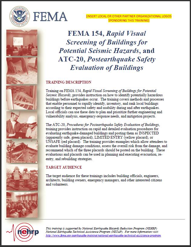
17 Examples of Available Training Courses FEMA 154 Rapid Visual Screening of Buildings for Potential Seismic Hazards combined with ATC 20 Post earthquake Safety Evaluation of Buildings E-74 Reducing the Risks of Nonstructural Earthquake Damage FEMA P-767 Earthquake Mitigation for Hospitals Source: FEMA, USGS, NSF, Livescience.com Paul A. Morey October 2,
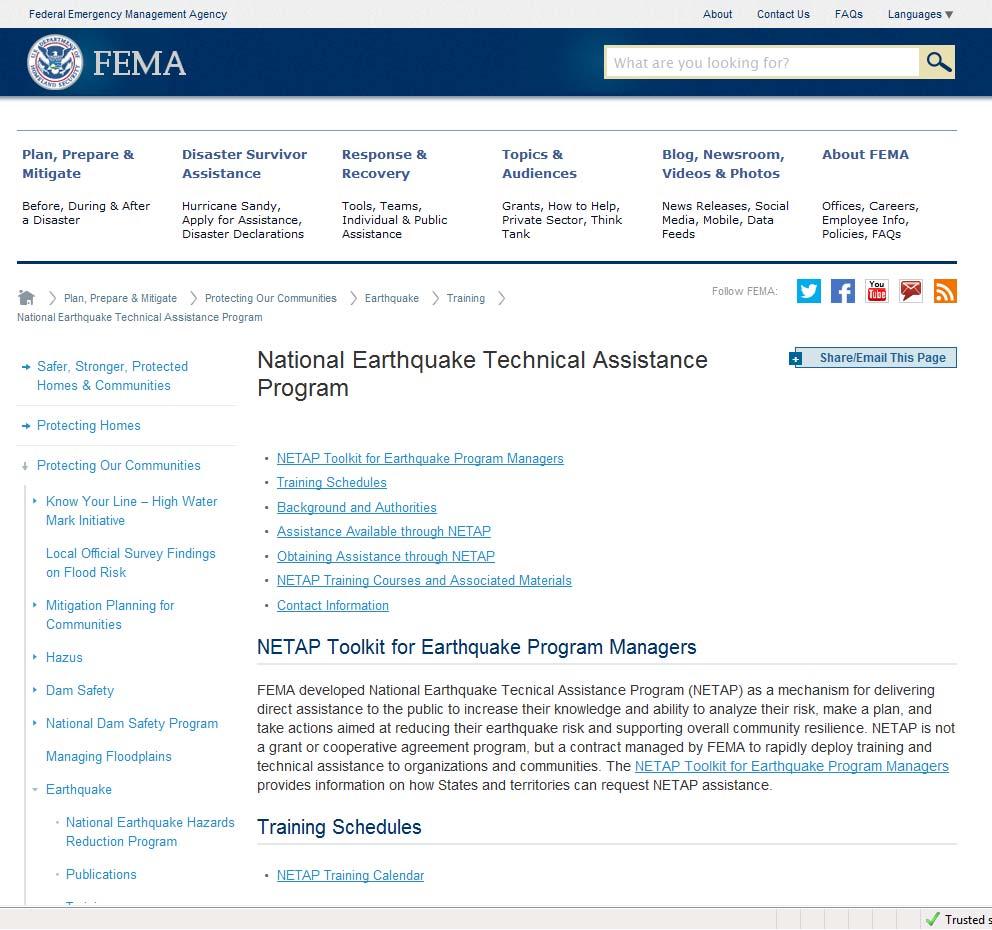
18 NETAP Website E39 Paul A. Morey October 2,
19 Slide 18 E39 Zach Kittrie, EA: Boat losses, while interesting, would not be covered by FEMA. If they are business-related, possibly SBA, but not FEMA. ES, 5/23/2013
,1955,1960 A Personal Story Paul A.")
20 Category 3 hurricanes impacting New England ,1944, 2 in 1954 (two weeks apart),1955,1960 A Personal Story Paul A. Morey October 2,
21 Paul A. Morey FEMA Region I Hurricane & Earthquake Program Manager paul.morey@fema.dhs.gov Paul A. Morey October 2, 2014
Empowering Local Action for Coastal Resilience in Massachusetts. Bruce K. Carlisle MA Office of Coastal Zone Management
 Empowering Local Action for Coastal Resilience in Massachusetts Bruce K. Carlisle MA Office of Coastal Zone Management Context Coastal communities continue to face both chronic and acute storm surge, erosion,
What Planners Do. Heather Wade, Coastal Planning Specialist Texas Sea Grant
 What Planners Do Heather Wade, Coastal Planning Specialist Texas Sea Grant What Planners Do Seminar Series Department of Landscape Architecture and Urban Planning College of Architecture ABOUT ME B.S.
Preparing Hudson River Waterfronts for an Era of Rapid Sea Level Rise
 Preparing Hudson River Waterfronts for an Era of Rapid Sea Level Rise CITY OF KINGSTON TIDAL WATERFRONT FLOODING TASK FORCE Gregg Swanzey Director, Office of Economic Development & Strategic Partnerships,
NJ Department of Environmental Protection
 NJ Department of Environmental Protection COASTAL AND LAND USE PLANNING New Jersey Coastal Management Program Covers NJ coastal waters to limit of tidal influence including 239 municipalities in 19 counties,
Hazard Mitigation Planning. Association of New Jersey Environmental Commissions Workshop Edison, New Jersey October 20, 2012
 Hazard Mitigation Planning Association of New Jersey Environmental Commissions Workshop Edison, New Jersey October 20, 2012 Mitigation Planning NJ Hazard Mitigation Plan? What is the status of the HMP
Executive Office of Energy and Environmental Affairs Massachusetts Vulnerability Preparedness Program. June 6, 2018
 Executive Office of Energy and Environmental Affairs Massachusetts Vulnerability Preparedness Program June 6, 2018 Presentation Outline: 1. What Natural Hazards Impact Falmouth 2. Coastal Resiliency Efforts
Introducing Green Infrastructure for Coastal Resilience
 Introducing Green Infrastructure for Coastal Resilience National Oceanic and Atmospheric Administration (NOAA) Office for Coastal Management Gloucester, MA Office of Travel Courtesy, Tim Grafft What Is
TSUNAMI PREPAREDNESS CHECKLIST FOR K-12 SCHOOL ADMINISTRATORS AND PRINCIPALS
 TSUNAMI PREPAREDNESS CHECKLIST FOR K-12 SCHOOL ADMINISTRATORS AND PRINCIPALS 1 A Product of EERI s School Earthquake Safety Initiative, Tsunami Safety Subcommittee Version 1.0, October 2016 Introduction
Planning for Historic/Cultural Resources Coastal Resiliency in Connecticut. Presented to CAFM s 3 rd Annual Conference
 Planning for Historic/Cultural Resources Coastal Resiliency in Connecticut Presented to CAFM s 3 rd Annual Conference October 25, 2016 Agenda Introduction and Project Overview Background Historic and Cultural
NORTH KINGSTOWN PILOT PROJECT May 9, 2016 North Kingstown Town Council
 Engaging RI Local Governments in Hazard Mitigation and Coastal Resilience NORTH KINGSTOWN PILOT PROJECT May 9, 2016 North Kingstown Town Council Teresa A. Crean, AICP University of Rhode Island Coastal
LEGAL & POLICY ANALYSIS TO SUPPORT RESILIENCE MEASURES. CEEL Tasks
 LEGAL & POLICY ANALYSIS TO SUPPORT RESILIENCE MEASURES William R. Rath, Esq. Legal Research Fellow Center for Energy & Environmental law University of Connecticut School of Law 860-570-5058 William.Rath@
WEATHER IT TOGETHER Building Resilience. The Annapolis Model for Cultural Resource Hazard Mitigation Planning
 WEATHER IT TOGETHER Building Resilience The Annapolis Model for Cultural Resource Hazard Mitigation Planning Weather It Together A Public / Private Partnership Weather It Together is the Annapolis model
Tracking spatiotemporal patterns of building vulnerabilities and evacuations during flood hazards
 Tracking spatiotemporal patterns of building vulnerabilities and evacuations during flood hazards Shane Hubbard Junchuan Fan Kathleen Stewart Emily White The University of Wisconsin Madison, SSEC/CIMSS
Coastal Planning in Texas. Tony Williams Senior Director of Planning Coastal Resources Division Texas General Land Office
 Coastal Planning in Texas Tony Williams Senior Director of Planning Coastal Resources Division Texas General Land Office e The Texas General Land Office (GLO) and the Texas Coast Since 1836: Manager of
MUNICIPAL RESILIENCE PLANNING ASSISTANCE PROJECT
 MUNICIPAL RESILIENCE PLANNING ASSISTANCE PROJECT William R. Rath, Esq. Legal Research Fellow Center for Energy & Environmental law University of Connecticut School of Law 860-570-5058 William.Rath@ UConn.edu
City of Norfolk Coastal Flood Mitigation Program. March 13, 2013
 City of Norfolk Coastal Flood Mitigation Program March 13, 2013 Topics Brief overview of Norfolk s Coastal Flood Program Data-driven analysis and decision making City-wide vulnerability, project concepts,
Discussion objectives
 APPROACHES TO MITIGATION OF DISASTER RISK AND NEED FOR INFORMATION ON LOSS ESTIMATION N.M.S.I.ARAMBEPOLA PROGRAM MANAGER ASIAN URBAN DISASTER MITIGATION PROGRAM Discussion objectives : Explain the concept
COASTAL MANAGEMENT ELEMENT. Last amended December 6, 2016 as part of the 2016 EAR
 COASTAL MANAGEMENT ELEMENT Last amended December 6, 2016 as part of the 2016 EAR Table of Contents Objective Page 7.1 Development and redevelopment of waterfront properties...7-1 7.2 Agency coordination
Virginia Beach and Sea Level Rise: Where Do We Go From Here?
 Virginia Beach and Sea Level Rise: Where Do We Go From Here? Clay Bernick City of Virginia Beach Environment & Sustainability Office Bayfront Advisory Committee Presentation July 19, 2012 Five Items to
RESILIENCY, ADAPTATION, & SUSTAINABILITY AT THE CITY OF ST. AUGUSTINE
 RESILIENCY, ADAPTATION, & SUSTAINABILITY AT THE CITY OF ST. AUGUSTINE PROGRAM UPDATE JANUARY 14, 2019 MICHAEL G. CULLUM, P.E. DIRECTOR, PUBLIC WORKS PROGRESSION OF PLANNING FOR RESILIENCY / ADAPTATION
ROSS Appendix F Land Conversion. Ecosystem Services Value Lost from Land Conversion in the Central Puget Sound Region ( )
") Ecosystem Services Value Lost from Land Conversion in the Central Puget Sound Region (1992-2011) 1 Purpose The purpose of this study is to estimate, in dollars, the value of annual ecosystem services in
Ecosystem Services Value Lost from Land Conversion in the Central Puget Sound Region (1992-2011) 1 Purpose The purpose of this study is to estimate, in dollars, the value of annual ecosystem services in
Ivy Frances, CFM, CEM Chief, Floodplain Management and Insurance Branch FEMA Region One
 Ivy Frances, CFM, CEM Chief, Floodplain Management and Insurance Branch FEMA Region One Where we are Today In recent years we spent billions of dollars on disasters So many flood claims have been paid
Preliminary Sea Level Rise Case Study: Navarre Beach, FL
 Preliminary Sea Level Rise Case Study: Navarre Beach, FL This publication was funded in part, through a grant agreement from the Florida Department of Environmental Protection, Florida Coastal Management
Green Infrastructure Resources for Coastal Flood Risk Management
 Natural Floodplain Functions Alliance (NFFA) WEBINAR SERIES PRESENTS: Green Infrastructure Resources for Coastal Flood Risk Management Maria Honeycutt, PhD, CFM Lauren Long Tashya Allen NFFA Webinars Hosted
TO: Port of Orcas FROM: Tina Whitman, Science Director SUBJECT: Master Plan Update DATE: September 7, 2018
 TO: Port of Orcas FROM: Tina Whitman, Science Director SUBJECT: Master Plan Update DATE: September 7, 2018 Friends of the San Juans appreciates the opportunity to provide input to the Port of Orcas Master
Improvement of the Atlantic Coast of New York City,
 Improvement of the Atlantic Coast of New York City, Rockaway Inlet to Norton Point Project at Sea Gate Meeting Purpose The U.S. Army Corps of Engineers, the New York State Department of Environmental Conservation,
Sea Level Rise in the City of Vancouver: Mapping Coastal Flood Risk. Sarah North, GISP Northwest Hydraulic Consultants Ltd.
 Sea Level Rise in the City of Vancouver: Mapping Coastal Flood Risk Sarah North, GISP Northwest Hydraulic Consultants Ltd. INNER HARBOUR PORT, CONVENTION CENTRE SKYTRAIN, WEST COAST EXPRESS, FREIGHT
Mitigation + Adaptation Strategies for Historic Structures and Sites
 Mitigation + Adaptation Strategies for Historic Structures and Sites Adrienne Burke, Esq., MSAS, LEED AP+ Executive Director, Riverside Avondale Preservation, Jacksonville, FL Cultural Resources, Disaster
Coastal Erosion Commission: context, examples, and next steps
 Coastal Erosion Commission: context, examples, and next steps Overview Themes from other national and state level reports 2007 MA Coastal Hazards Commission Best practices and examples Financial i and
Interdependences and the Role of Technology in Critical Infrastructure Coordination: Resilient Design Solutions
 Interdependences and the Role of Technology in Critical Infrastructure Coordination: Resilient Design Solutions Thomas G. Dallessio AICP/PP Executive Director, Next City Outgoing Director, Center for Resilient
Rhode Island Shoreline Change Special Area Management Plan
 Rhode Island Shoreline Change Special Area Management Plan Draft Document Outline REVISED 10/12/2017 VOLUME 1 Executive Summary & How to Use this Document (Draft by Dec 2017) 1. Introduction (Revised draft
EXHIBIT A CITY OF FORT WALTON BEACH, FLORIDA COASTAL MANAGEMENT & CONSERVATION
 EXHIBIT A CITY OF FORT WALTON BEACH, FLORIDA INTRODUCTION The Coastal Management and the Conservation Elements required by Chapter 9J-5.012 and 5.013, F.A.C., respectively, have been combined into one
Virginia s Tidal Wetlands: Managing for Resilience. Pam Mason
 Virginia s Tidal Wetlands: Managing for Resilience Pam Mason Image: Skip Stiles, Wetlands Watch PAST: City of Norfolk shallow water and wetlands Fill. Maersk Nauticus Chrysler Museum Mc Arthur Mall Opera
Resilient Communities Are Prepared Communities
 Resilient Communities Are Prepared Communities Lincoln Walther, FAICP Planning Director CSA Ocean Sciences Inc. 8502 SW Kansas Avenue, Stuart, Florida 34997 Local Comprehensive Plan Mandated to have adopted
Bernardo Aliaga. Ken Gledhill. Laura Kong. Programme Specialist Tsunami Unit UNESCO/IOC ICG/CARIBE EWS Technical Secretary
 UNESCO IOC CTIC US NOAA ITIC Regional Training Workshop on Strengthening Tsunami Warning and Emergency Response Standard Operating Procedures and the Development of the ICG/CARIBE-EWS PTWC New Enhanced
DRR in URBAN PLANNING PROCESS in ISTANBUL
 DRR in URBAN PLANNING PROCESS in ISTANBUL Geomatic Engineer, MSc. Emin Yahya MENTEŞE Directorate of Earthquake & Ground Analysis ISTANBUL-Some facts Housing more than 15 million inhabitants Most crowded
Floodplain Management Plan 2016 Progress Report
 PREPARED FOR: Borough of Point Pleasant Beach 416 New Jersey Ave. Point Pleasant Beach, NJ 08742 (732) 892-1118 http://www.pointpleasantbeach.org/ PREPARED BY: T&M Associates 11 Tindall Road Middletown,
EEA Capital Investment in Green Infrastructure
 EEA Capital Investment in Green Infrastructure Goal: Advance local efforts to implement measures to increase natural storm damage protection, flood control, and community resilience State capital funding
The APA Sustainable Communities Division supports planners who are committed to planning for sustainable communities by integrating all aspects of
 The APA Sustainable Communities Division supports planners who are committed to planning for sustainable communities by integrating all aspects of sustainability into our work through the combined economic,
Creating More Resilient Florida Coastlines. Whitney Gray Administrator, FRCP March 15, 2019
 Creating More Resilient Florida Coastlines Whitney Gray Administrator, FRCP March 15, 2019 1 What is Coastal Resilience Planning? Comprehensive plans Maintain, restore and enhance the coastal zone Reduce
Structural Project (stream daylighting) Property Protection (elevation) PREVENTION NATURAL RESOURCE PROTECTION STRUCTURAL PROJECTS PUBLIC EDUCATION
 Property Protection (elevation) PREVENTION NATURAL RESOURCE PROTECTION STRUCTURAL PROJECTS PUBLIC EDUCATION") NEW MITIGATION GOALS, STRATEGIES, ACTIONS PREVENTION STRUCTURAL PROJECTS NATURAL RESOURCE Structural Project (stream daylighting) PROPERTY PUBLIC EDUCATION EMERGENCY SERVICES Property Protection (elevation)
NEW MITIGATION GOALS, STRATEGIES, ACTIONS PREVENTION STRUCTURAL PROJECTS NATURAL RESOURCE Structural Project (stream daylighting) PROPERTY PUBLIC EDUCATION EMERGENCY SERVICES Property Protection (elevation)
COASTAL MANAGEMENT ELEMENT GOALS, OBJECTIVES, AND POLICIES
 COASTAL MANAGEMENT ELEMENT GOALS, OBJECTIVES, AND POLICIES Goal 5 The City shall protect human life and limit public expenditure in areas subject to destruction by natural disasters and, where appropriate,
Coastal Resilience in Connecticut
 Adam Whelchel, Ph.D. awhelchel@tnc.org (860) 970 8442 Coastal Resilience in Connecticut Objective: To help protect People and Nature through hazard mitigation and preparedness. Awareness Risk Choices Action
CITY OF BENICIA EMERGENCY OPERATIONS PLAN 2019 UPDATE. Community Meeting February 28, 2019
 CITY OF BENICIA EMERGENCY OPERATIONS PLAN 2019 UPDATE Community Meeting February 28, 2019 Introduction & Agenda Logistics Emergency exits Restrooms Refreshments Phones Introduction Agenda Purpose Goals
COASTAL CITY PHILADELPHIA IS A. Michael W. Tantala, P.E. Tantala Associates, LLC, Engineers and Architects. (Karen M Closkey and Keith VanDerSys)
") Waterfront Development in a Changing a Changing Climate Climate PHILADELPHIA IS A COASTAL CITY Michael W. Tantala, P.E. Tantala Associates, LLC, Engineers and Architects (Karen M Closkey and Keith VanDerSys)
Waterfront Development in a Changing a Changing Climate Climate PHILADELPHIA IS A COASTAL CITY Michael W. Tantala, P.E. Tantala Associates, LLC, Engineers and Architects (Karen M Closkey and Keith VanDerSys)
Towards a Resilient Stormwater Future: Building Back from Hurricane Irene and Tropical Storm Lee. October 15, 2015 VUSP Symposium
 Towards a Resilient Stormwater Future: Building Back from Hurricane Irene and Tropical Storm Lee October 15, 2015 VUSP Symposium Russ Dudley, P.E., LEED AP Environmental Engineer Presentation Outline Impacts
Planning for Historic/Cultural Resources Coastal Resiliency in Connecticut. Presented to ASFPM 41 st Annual Conference, Kansas City, MO
 Planning for Historic/Cultural Resources Coastal Resiliency in Connecticut Presented to ASFPM 41 st Annual Conference, Kansas City, MO May 3, 2017 Agenda Introduction and Project Overview Historic and
Auke Bay Area Plan. Complete List of Goals and Policies for the Auke Bay Area Plan
 Auke Bay Area Plan Complete List of Goals and for the Auke Bay Area Plan Recreation Goals & Pedestrian Access Goal 1: Link the Auke Bay area with an accessible system for recreation and transportation.
Natural & Nature-Based Solutions for Risk Reduction & Resilience
 University of Massachusetts Amherst ScholarWorks@UMass Amherst International Conference on Engineering and Ecohydrology for Fish Passage International Conference on Engineering and Ecohydrology for Fish
A. INTRODUCTION B. CUMULATIVE EFFECTS ANALYSIS
 Chapter 4: Cumulative Effects A. INTRODUCTION The New York City Department of Parks and Recreation plans to reconstruct the Rockaway Beach Boardwalk in the borough of Queens, New York City, which Hurricane
Living Underwater: Hazard Mitigation Challenges from Sea Level Rise and Tidal Flooding
 ASFPM 2015 National Conference Living Underwater: Hazard Mitigation Challenges from Sea Level Rise and Darryl Hatheway, CFM, Sr. Coastal Scientist June 3, 2015 AGENDA Sea Level Rise and Science of climate
SHORELINE, FLOOD AND COASTAL DEFENCE MANAGEMENT PLANS
 These plans may provide opportunities as well as concern for recreational boating. They are currently being revised and consulted on. This document explains how we can engage in the process. Shoreline,
2014 HAZARD MITIGATION PLAN ANNUAL REVIEW. Consider receiving the 2014 Hazard Mitigation Plan annual review.
 STAFF REPORT MEETING DATE: July 22, 2014 TO: FROM: City Council Police Chief James Berg 922 Machin Avenue Novato, CA 94945 (415) 899-8900 FAX (415) 899-8213 www.novato.org SUBJECT: 2014 HAZARD MITIGATION
Fairfax County Community Services Board Emergency Response System: Notifier
 Lathan S. Dennis, MSc., GIS Analyst Fairfax County, Human Services 12011 Government Center Parkway, Suite 946, Fairfax, VA 22035 Voice (703) 324-5648 Fax (703) 324-7572 Email ldenni@fairfaxcounty.gov Jim
Geodesign. Presenter: Shannon McElvaney
 Geodesign Presenter: Shannon McElvaney Overview Drivers of change What is geodesign? Why is geodesign important? Who is doing it? How can you get started? Population Growth and Urbanization Population
The Language of Geography. Health and Human Services
 The Language of Geography Health and Human Services Cover Points of Distribution: this Esri map shows population density in relation to vaccine distribution centers, helping health officials perform a
QUESTIONS AND ANSWERS Windsor Woods, Princess Anne Plaza & The Lakes Combined Drainage Project
 QUESTIONS AND ANSWERS Windsor Woods, Princess Anne Plaza & The Lakes Combined Drainage Project PROJECT OVERVIEW Windsor Woods, Princess Anne Plaza and The Lakes are neighborhoods located in what was once
PART 4.1 COAL HARBOUR
 PART 4.1 COAL HARBOUR 4.1.1 Overview Coal Harbour is located on Quatsino Sound which has access to the Pacific Ocean on the west coast of Vancouver Island. Population is approximately 225. Emergency Services:
Natural Infrastructure for Coastal Resilience Unlocking Funding Resources
 Natural Infrastructure for Coastal Resilience Unlocking Funding Resources Siddharth Narayan University of California Santa Cruz / The Nature Conservancy Financing Climate- Safe, Resilient Infrastructure
WEATHER IT TOGETHER. The Annapolis Model for Cultural Resource Adaptation Planning. Cultural Resources, Disaster Resilience, and Climate Uncertainty
 WEATHER IT TOGETHER The Annapolis Model for Cultural Resource Adaptation Planning Cultural Resources, Disaster Resilience, and Climate Uncertainty Historic Annapolis A Colonial Capital: National Landmark
Local Planning to Advance Implementation of Living Shorelines at Municipal Properties
 Local Planning to Advance Implementation of Living Shorelines at Municipal Properties SALEM LIVING SHORELINE PROJECT CZM Green Infrastructure for Coastal Resilience Grant COLLINS COVE LIVING SHORELINE
3.7. NEW JERSEY % 6.3% 2.0. Completed Yes Procedural Recommen dation
 C OST E FFICIENT C LIMATE A DAPTATION IN THE N ORTH A TLANTIC 135 3.7.1. LITTLE SILVER, NJ 3.7. NEW JERSEY Population Density Form of Government Category CRS Rating 2226/ sq. mi. Borough Suburban Bayfront
RIVER RECREATION AND CONSERVATION: LESSONS FROM COLORADO S 2013 FLOODS
 RIVER RECREATION AND CONSERVATION: LESSONS FROM COLORADO S 2013 FLOODS SORP RMIS May 2016 L O G A N S I M P S O N Agenda Why Are You Here? Land Use Resiliency Public Outreach Dialogue Recreation and Land
Learning Objectives. Thinking about Tomorrow s Waterfront Parks Lessons from Hurricane Sandy and Beyond. Hurricane Sandy
 Learning Objectives Thinking about Tomorrow s Waterfront Parks Lessons from Hurricane Sandy and Beyond Presenters Peter Kelley, ASLA, James Koth, ASLA, Jeffery Sandgrund, Brooklyn Bridge Park Andrew Lavallee,
Approaches of Urban and Spatial Planning implementing adaptation strategies and measures Guide Climate Adaptation in Planning
 Approaches of Urban and Spatial Planning implementing adaptation strategies and measures Guide Climate Adaptation in Planning Manfred Born Sustainability Center Bremen 30.05.2010 ICLEI International Conference
Getting to Resilience webinar
 Getting to Resilience webinar A brief description of two NJDEP Projects: Resilient Coastal Communities Initiative & Municipal Public Access & Resiliency Small Grants Program June 26, 2014 Marty Rosen NJ
ORDINANCE NO
 ORDINANCE NO. 9048-17 AN ORDINANCE OF THE CITY OF CLEARWATER (THE CITY), FLORIDA, MAKING AMENDMENTS TO THE CITY S COMPREHENSIVE PLAN IN ACCORDANCE WITH FLORIDA SENATE BILL 1094 (2015) PERIL OF FLOOD ACT
Virginia Pilot. Climate Change Vulnerability and Risk Assessments of Transportation Infrastructure Hampton Roads, Virginia Implementation Pilot
 Virginia Pilot Climate Change Vulnerability and Risk Assessments of Transportation Infrastructure Hampton Roads, Virginia Implementation Pilot Yao-Jan Wu Andres Clarens Tanveer Hayat Brian Smith Jose Gomez
Functional Areas of Practice AICP EXAM REVIEW. February 20, 2009 Georgia Tech Student Center
 Functional Areas of Practice AICP EXAM REVIEW February 20, 2009 Georgia Tech Student Center Areas of Practice Community development Comprehensive or long range planning Development regulation or administration
CHATHAM COUNTY S PATH TO SUSTAINABILITY - THE NATURAL RESOURCES SIDE
 CHATHAM COUNTY S PATH TO SUSTAINABILITY - THE NATURAL RESOURCES SIDE GEORGIA ENVIRONMENTAL CONFERENCE SAVANNAH, GEORGIA AUGUST 23, 2012 Jackie Jackson Teel Chatham County-Savannah Metropolitan Planning
Adapting to Climate Change California Resources for Local Governments
 Department of Water Resources Adapting to Climate Change California Resources for Local Governments Adrienne I. Greve Assistant Professor, City & Regional Planning Cal Poly - San Luis Obispo agreve@calpoly.edu
CONSERVATION & COASTAL ZONE MANAGEMENT ELEMENT GOALS, OBJECTIVES, & POLICIES
 CONSERVATION & COASTAL ZONE MANAGEMENT ELEMENT GOALS, OBJECTIVES, & POLICIES GOAL 1: The City of North Port shall protect, conserve and enhance its natural, environmental and historic resources to ensure
PART 4.2 HYDE CREEK. Emergency Services Contact Royal Canadian Mounted Police British Columbia Ambulance Service 9-1-1
 PART 4.2 HYDE CREEK 4.2.1 Overview The Hyde Creek area is roughly bounded by Port McNeill to the west and the Nimpkish River to the east. The Spring Hill portion of the community is found just east of
water resource specialists
 Vaughn Collins, PE, CFM, Northwest Hydraulic Consultants Brad Livingston, Oregon Department of Transportation Melissa Reich, North Coast Land Conservancy Location Necanicum River 75 sq mi watershed Active
Nevada Floodplain Management Program
 Nevada Floodplain Management Program Mt Rose Highway-NHP February 2017 - Courtesy NWS Reno East Fork Carson River January 2017 Douglas County, NV - Courtesy Courtney Walker I 15, Overton 9/10/14 Rye Patch
An Integrated Approach for Water Management Examples from The Netherlands. Addressing Climate Change and Sea Level Rise
 An Integrated Approach for Water Management Examples from The Netherlands Addressing Climate Change and Sea Level Rise Superstorm Sandy Forum College of Staten Island March 8 2013 Water: a challenge and
Local rain-driven flooding (surface and ground water) Upstream rain-driven flooding (rivers) Tidal or storm surge-driven flooding (coast)
 Upstream rain-driven flooding (rivers) Tidal or storm surge-driven flooding (coast)") Adapting cities to floods Kristina Hill, PhD University of Virginia School of Architecture Hamburg, Germany What kinds of floods? 1 2 3 Local rain-driven flooding (surface and ground water) Upstream rain-driven
Adapting cities to floods Kristina Hill, PhD University of Virginia School of Architecture Hamburg, Germany What kinds of floods? 1 2 3 Local rain-driven flooding (surface and ground water) Upstream rain-driven
PEWS - Sirens. Westminster Chimes - Testing. Wailing Sounds Real Emergency. Westminster Chime
 PEWS PEWS - Sirens Located in various areas throughout the Port of Tacoma Locations provide overlapping sound radius to ensure comprehensive warning ability Westminster Chimes - Testing Wailing Sounds
Upward Evacuation Experiment for Estimating Evacuation Speed in Water Disaster
 , pp.97-101 http://dx.doi.org/10.14257/astl.2015.100.21 Upward Evacuation Experiment for Estimating Evacuation Speed in Water Disaster Ji-Soo Lee 1, Won-Hwa Hong 2 1 Assistant Professor, Departments of
Making Space for Nature A Leicester Case Study. Dr Helen O Brien Leicester City Council
 Making Space for Nature A Leicester Case Study Dr Helen O Brien Leicester City Council Helen.Obrien@Leicester.gov.uk Definitions Biodiversity (biological diversity) The variety of plant and animal life
Saltmarsh Conference. 8 October in the Suffolk Coast & Heaths Area of Outstanding Natural Beauty
 Saltmarsh Conference 8 October 2015 in the Suffolk Coast & Heaths Area of Outstanding Natural Beauty Conference organised by Haidee Stephens, Suffolk Estuaries Officer Suffolk Coast & Heaths AONB t: 01394
Developing Emergency Planning and Business Continuity Plans
 Developing Emergency Planning and Business Continuity Plans Why Develop Emergency Planning? Hurricane Katrina August, 2005 Texas Flash Floods March, 2016 Haiti Earthquake, 2010 September 11, 2001 But maybe
Disaster Preparedness. CERT Basic Training Unit 1
 Disaster Preparedness Unit 1 Etiquette Please be on time Please turn off your cell phones Be respectful of your instructors and other students Get involved with class and hands-on 1-1 Expectations Don
Township of Toms River s Ortley Beach and North Beaches: What was the approach to sustainability and resiliency planning after Superstorm Sandy?
 Township of Toms River s Ortley Beach and North Beaches: What was the approach to sustainability and resiliency planning after Superstorm Sandy? Photo Credits: T. Larsen (Photo 1); C. Yuhas (Photos 3-4)
1 foot of Sea Level Rise
 1 foot of Sea Level Rise Schools Fire Stations Law Enforcement Assisted Living Hospitals 1ft SLR 0 0.35 0.7 1.4 Miles Year 20 Poplation: the 2013 stdy A Geological Perspective U.S. Mid-Atlantic Coast a
National Landmarks at Risk: A Colonial Capital Case Study Annapolis, Maryland
 A Colonial Capital Case Study Annapolis, Maryland Union of Concerned Scientists May 20, 2014 Lisa Craig, Chief of Historic Preservation City of Annapolis A Colonial Capital Planned City Annapolis laid
Advice from Department of Ecology
 Advice from Department of Ecology The simplest way to reduce landslide risk is to avoid slideprone areas in the first place. Simple practices such as building a house farther from the edge of a steep slope,
7. EMERGENCY MANAGEMENT
 7. EMERGENCY MANAGEMENT The Clallam County Emergency Management Division operates a Comprehensive Emergency Management Plan jointly with the cities of Port Angeles, Sequim, and Forks using the Incident
If you Google Disaster Recovery, you will get approximately 47,700,000 hits.
 DISASTER RECOVERY If you Google Disaster Recovery, you will get approximately 47,700,000 hits. Disaster Planning and Prevention are the keys to Disaster Recovery. Those who forget the past are condemned
Port of San Diego Sea Level Rise Ad Hoc Committee Meeting 1 of 3.. September 18, 2018
 Port of San Diego Sea Level Rise Ad Hoc Committee Meeting 1 of 3. September 18, 2018 Agenda Welcome Introductions Rules of the Ad-Hoc Presentation Background Vulnerability Assessment Results Non-Agenda
The Moors at Arne Project, Managing Coastal Change
 General Questions What are we doing? The Environment Agency, RSPB and Natural England are working together to adapt approximately 150ha of The Moors at Arne into a diverse wetland habitat. With the sea
QUESTIONS AND ANSWERS Windsor Woods, Princess Anne Plaza & The Lakes Combined Drainage Project
 QUESTIONS AND ANSWERS Windsor Woods, Princess Anne Plaza & The Lakes Combined Drainage Project Project Overview... 2 Thalia Creek (Windsor Woods) Tide Gate... 6 Club House Road Drainage Project... 9 Updated
Statewide Community Resiliency Initiative : Planning for Adaptation
 Statewide Community Resiliency Initiative : Planning for Adaptation Julie A. Dennis Division of Community Development www.floridajobs.org/adaptationplanning Coastal Planning Initiatives Community Resiliency
Mapping and the 2013 Colorado Floods. Mapping before, during, and after
 Mapping and the 2013 Colorado Floods Mapping before, during, and after Presented by Outline 2013 Floods Floodplain Mapping Before During After 20 counties 21,000 households 6000 sq. mi. 2,132 NFIP claims
The Esri Public Works Platform. More Than Mapping
 The Esri Public Works Platform More Than Mapping Intelligent Public Works Sustaining a safe, vibrant community requires a smart public works system. Esri created a platform that connects public works departments
Toward a Robust Flood Emergency Evacuation Integration of 2-D Hydraulic Modeling and Dynamic Evacuation Routing
 Toward a Robust Flood Emergency Evacuation Integration of 2-D Hydraulic Modeling and Dynamic Evacuation Routing Esri User Conference 2016 Sheng Tan, GISP June 29, 2016 Presentation Overview Study purpose
Nature-based Solutions. Exploring nature-based mitigation, including post-disaster solutions and their impact.
 Nature-based Solutions Exploring nature-based mitigation, including post-disaster solutions and their impact. June 28, 2018 Agenda Introduction to nature-based solutions Case studies Nature-based solutions
Legal implications of failing to
 Legal implications of failing to plan for sea level rise Gavin Leydon, Partner 30 April 2010 Outline Relevance to local l government & developers assessment & policy Developments in case law Climate change
THE PROTECTION OF CHATHAM COUNTY S NATURAL RESOURCES - THE POLICY SIDE
 THE PROTECTION OF CHATHAM COUNTY S NATURAL RESOURCES - THE POLICY SIDE SEA GRANT TIDAL CREEK SUMMIT CHARLESTON, SOUTH CAROLINA DECEMBER 5, 2011 Jackie Jackson Teel Chatham County-Savannah Metropolitan
Live, Work, Locate and Site Selector
 Configuring Live, Work, Locate and Site Selector in Your Community John Hauck ArcGIS for State Government Solutions for Esri s government customers Series of useful maps and apps focused on government