The Road to Sustainability September 18, 2014
|
|
|
- Darrell West
- 5 years ago
- Views:
Transcription

1 - The Road to Sustainability September 18, 2014
2 Speedway The town of Speedway was developed as a "city of the future." Meant to be a testing ground much like the famed race track which is its namesake. Speedway was designed to be a city that was hospitable to the car. In a time when Indianapolis streets were often the narrow orange brick thoroughfares laid in the 1920s and 1930s, the Town of Speedway had homes with garages for cars. Not a city with shacks sprouting up near other industrialized areas, but instead, a well planned and comfortable city of cleanliness and pride.

3 Founders James Allison Carl Fisher Frank Wheeler Arthur Newby
4 IMS Established 1909 Speedway Incorporated 1927 Major Stakeholders Allison Transmission Praxair Surface Technologies Formally Prest-o-lite, Union Carbide Electric Steel Castings Early Automotive Industries Thriving Commercial Industrial Area


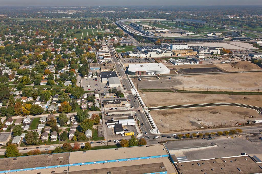
5
6 Quick Demographics Roughly 4 square miles Population 12,000 New homes 1 within last 15 years Planned Community Main Street Retail vs Commercial / Industrial
7 Excluded City Under Uni-Gov Governance Boards and Commissions Public Safety Operations Public Works School Town of Speedway Walkable Schools No Buses All A s Speedway Public Library
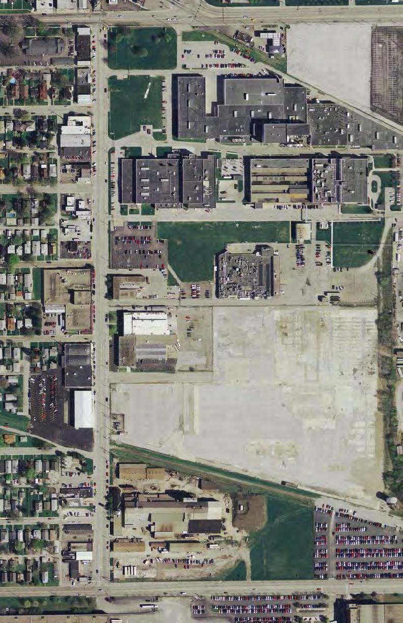
8 Issues Landlocked Two railroad corridors Three feeder liquid fuel lines Old utility lines converging along Main Street Industrial base established in 1910 s 1920 s No environmental standards or awareness or concerns Asbestos 1924 linked to disease 1934 first regulations
9 Prior to 2005 Economic Development - MDC Speedway Redevelopment Commission 2005 Designated Redevelopment Areas / TIF Districts Master Plan Public Input Over 300 Public Meetings, Presentations and Focus Groups Master Plan Presentation, Public Hearing, SRC and Town Approvals 2007 and 2009 Design/Zoning Guidelines Form along with Use
10
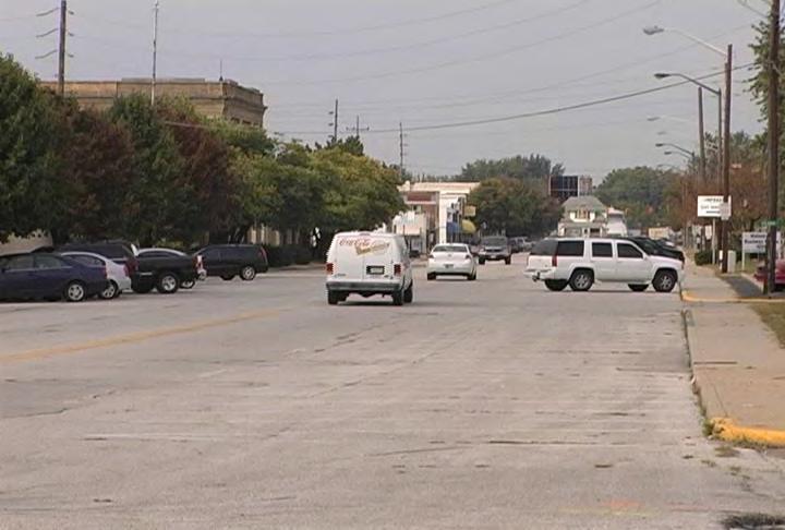
11 Everybody Has A Plan Redevelopment Does Take Money No One Believes You Until You Implement Something Once You Begin Those Doubters Are You Most Impatient Soles
12 Resident Vision Group MPO Sponsored Regional Transportation Corridor Study Urban Land Institute Main Street Building Study Main Street Parking Analysis Market Assessment RCLCO 16 th Street Project DPW/ASP/DLZ Traffic Impact Study Environmental Assessment Comprehensive Road Projects FONSI
13 Re Creating Sustainability Multiple Elements It s Not Just Main Street Abandoned Property Vacant Buildings
14 Persistent Drainage / Water Quality Problems Long Term Control Quality of Life Matters Parks Improvements Programming Art on Main Street Trails Development Housing Initiative Traffic Impact Study

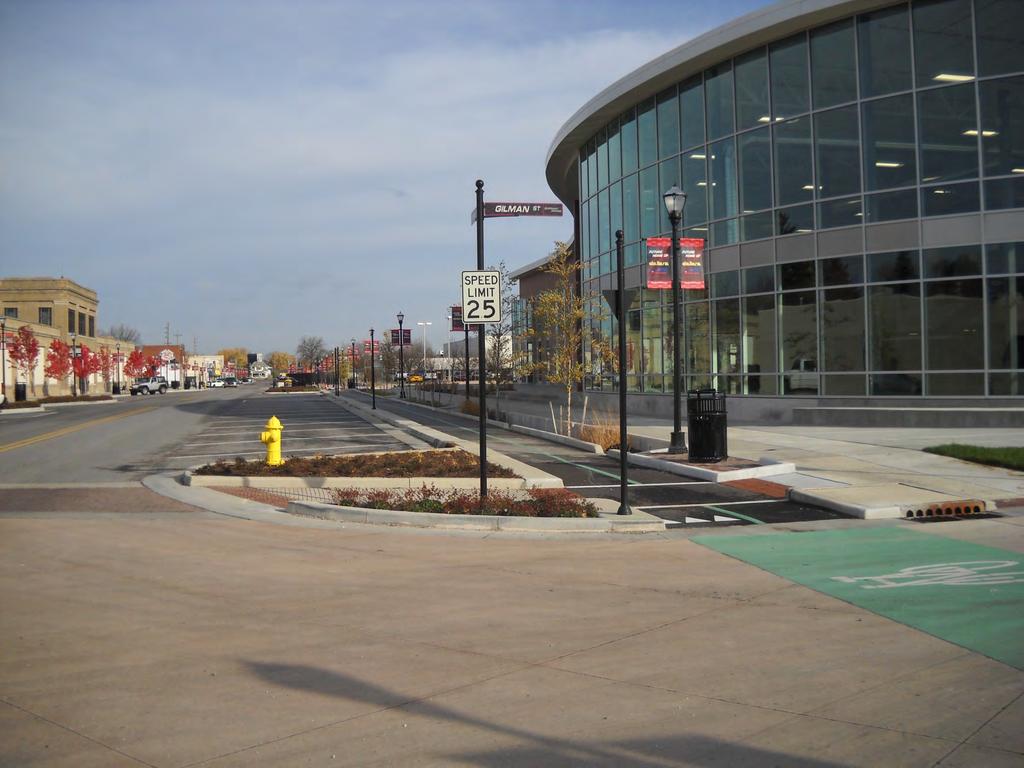
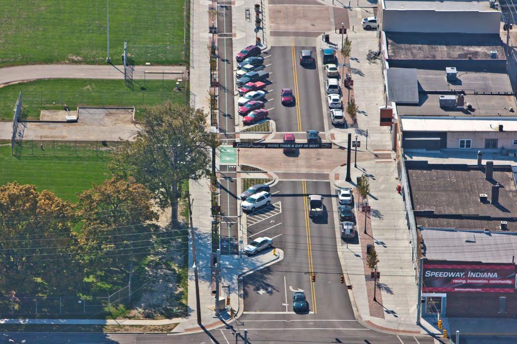
15 Finished >2017 Lynhurst- Moeller Georgetown Rd 25 th Connector 16 th Street Roundabout 16 th Realignment 10 th Realignment Main Street Holt South of 16th Gillman Project

16

17 Relocate Fence Enhance Fan Experience Emergency Access Pedestrian Corridors Vendor Clusters Camping Areas Bathrooms Utilities Safety and Security Looks Better!!
18 Blighted Properties Vacant Buildings Crumbling Sidewalks Aged Infrastructure One Restaurant No New Investment A Tired Street Our Deck of Cards

19 16 th and Main

20 Gas / Auto Repair 3 Properties

21 Dry Cleaners

22 Allison Plant 2

23

24

25 Prest O Lite

26 Lime Mound - Praxair Gas

27 Electric Steel Castings
28 Redevelopment Strategies for Abandoned and Problem (Challenged) Properties Land Acquisition Environmental Assessment Abatement Shovel Ready Sale and Development
29 Land Acquisition It s Likely That if Government Doesn t Purchase Land Remains As Is Acquisition + Demolition + Investigation + Abatement + Infrastructure Big Companies Don t Have to Sell Educated Risk Environmental Investigation May Occur After Acquisition Eminent Domain
30 Contaminated Dirt Mound
")
31 AOI 2 2,000 sq. ft. on 11 acres (0.4%)
32 Create Shovel Ready Parcels Working On Challenged Ground Piles of Dirt A and B and C Utilities Sale for Future Sale No Delayed Development Marathon not a Sprint Keep the Vision

33 Investment Transition Costs Environmental Infrastructure Total Over 35 acres
34 Speedway s Story Revitalizing a Great Community Creating Spaces for Innovation Protecting One of Our State s Great Assets

35

36

37
38

39
40
41

42

43
44

45
46

47
48

49

50
51
52 Main Street Events Mardi Gras Crawl Mini Marathon Festival on Main Rock in on Main Vintage Car Hauler s Event Sprockets State Bicycle Racing Championships Spam a Rama Hops and Flip Flops Speedway Spectacular and Festival Jazz Fest Trunk or Treat Light the Night Over 80 Private Events

53 Roundabout Opens Up Main Street


54 Speedway and Exciting Story In Progress Reinventing a Sustainable Community
CHAPTER 3 VISION, GOALS, & PLANNING PRINCIPLES. City of Greensburg Comprehensive Plan. Introduction. Vision Statement. Growth Management Goals.
 CHAPTER 3 VISION, GOALS, & PLANNING PRINCIPLES Introduction The Greensburg Comprehensive Plan is intended as a working community document. A combination of long and short-term goals, this document is intended
Chapter 4. Linking Land Use with Transportation. Chapter 4
 Chapter 4 Linking Land Use with Transportation Chapter 4 59 Chapter 4 Linking Land Use with Transportation Community Design and Transportation Program Introduction Since the 1950s, the predominant development
Tyvola & Archdale Transit Station Area Plan. May 15, 2008
 Tyvola & Archdale Transit Station Area Plan First Public Meeting May 15, 2008 Presentation Outline 1. Purpose and Process 2. Station Area Overview 3. Plan Recommendations Vision Land Use Transportation
Issues, Challenges & Opportunities
 Below is a summary of issues, challenges, and opportunities relating to the revitalization of Downtown Romeoville and potential development of the Village s East Side TOD Area. Current Issues & Challenges
Rio/29 Small Area Plan. Design Plan & Implementation Framework Open House - January 25, 2018
 Rio/29 Small Area Plan Design Plan & Implementation Framework Open House - January 25, 2018 MEETING PURPOSE PRESENTATION 1. Orient to the updated design plans 2. Introduce implementing options 3. Explain
Draft for Public Review. The Market and Octavia Neighborhood Plan
 Draft for Public Review The Market and Octavia Neighborhood Plan San Francisco Planning Department As Part of the Better Neighborhoods Program December 2002 IOverview Why Plan a Better Neighborhood Here
Developer s Program. The Station at East 54
 Developer s Program The Station at East 54 Existing Conditions The Station at East 54 is proposed for a 1.12 acre site at the northeast corner of Hamilton Road and Prestwick Road, tucked between the East
Chapter 1.0 Introduction
 Chapter 1.0 Introduction 1.1 Background The North Metro commuter rail line is part of the RTD FasTracks regional transit system expansion program to build more than 100 miles of rail transit throughout
ULI St. Louis Technical Assistance Panel
 ULI St. Louis Technical Assistance Panel ULI St. Louis Technical Assistance Panel Sponsored by: Citizens for Modern Transit in partnership with METRO ULI St. Louis Mission Statement The mission of the
Project Consulting Team:
 THE DOWNTOWN CHERRYVILLE LAND USE + STREETSCAPE MASTER PLAN WAS FUNDED THROUGH THE GENEROUS DONATIONS OF THE FOLLOWING: The Community Foundation of Gaston County ElectriCities of North Carolina The Cherryville
Ann Arbor Intermodal Station Environmental Review
 Ann Arbor Intermodal Station Environmental Review Park Advisory Commission September 19, 2017 AGENDA 1. Project Update 2. Draft Environmental Assessment 3. Draft Preferred Alternative 4. Next Steps 5.
Windsor Locks Transit-Oriented Development Planning Grant Request. Project Background
 Windsor Locks Transit-Oriented Development Planning Grant Request Project Background Downtown Windsor Locks runs along Main Street in the vicinity of the intersection of Routes 159 and 140. The current
Implementation Guide Comprehensive Plan City of Allen
 Implementation Guide 2030 Comprehensive Plan City of Allen DRAFT 2015 Implementation Guide Allen 2030 Comprehensive Plan INTRODUCTION The Comprehensive Plan serves as a guide for the growth and development
ARISE: The Rock Renaissance Area Redevelopment & Implementation Strategy
 2014 Professional Awards 1 ARISE: The Rock Renaissance Area Redevelopment & Implementation Strategy Janesville, WI Completed December 2014 Analysis & Planning Purpose of Project 2 The purpose of the Rock
Making Transit Oriented Development Work For Boonton, NJ
 Making Transit Oriented Development Work For Boonton, NJ Bloustein School of Planning and Public Policy Studio Dan Burton Loannie Dao Webster Slater Brandon Williams Ian Watson Maria Laham Nicola Mammes
Cobb County Design Guidelines Mableton Parkway & Veterans Memorial Highway Community Design Workshop January 12, 2017
 Community Design Workshop January 12, 2017 Agenda Opening Remarks / Introductions Scope of Work Existing Conditions Key Issues / Opportunities VPS Summary Draft Vision & Goal Statement Implementation Concepts
CHAPTER 7: Transportation, Mobility and Circulation
 AGLE AREA COMMUNITY Plan CHAPTER 7 CHAPTER 7: Transportation, Mobility and Circulation Transportation, Mobility and Circulation The purpose of the Transportation, Mobility and Circulation Chapter is to
Delaware River Waterfront Corporation
 Delaware River Waterfront Corporation Delaware River Waterfront Corporation Created in January 2009 to replace Penn s Landing Corporation o Open, accountable, effective leadership o New Board of Directors
LITTLETON RIVER DISTRICT REDEVELOPMENT PROJECT A LEGACY OF LEADERSHIP & COMMUNITY INVOLVEMENT
 LITTLETON RIVER DISTRICT REDEVELOPMENT PROJECT A LEGACY OF LEADERSHIP & COMMUNITY INVOLVEMENT Background Information Littleton Saranac Street Design Charrette Sponsored by the Town of Littleton and Plan
What Does It Take To Create A Town Center?
 What Does It Take To Create A Town Center? Context, Design, and Process The Prince Frederick Master Plan Update 1 Background and Overview A Brief History of Town Centers in Calvert County 2 Background
MONTGOMERY COUNTY METRO STATION AREA DESIGN CHARRETTE
 MONTGOMERY COUNTY METRO STATION AREA DESIGN CHARRETTE Shady Grove Metro Station Area Charrette Closing Presentation October 25-28, 2000 MONTGOMERY COUNTY, MD M-NCPPC Design Collective, Inc. Architects
City of Le Sueur DOWNTOWN MASTER PLAN
 City of Le Sueur DOWNTOWN MASTER PLAN City Council Update 9/11/2017 Hoisington Koegler Group Inc. Presentation Agenda 01 Schedule Update / Tonight s Objectives 02 What We ve Heard - Engagement Comments
A Dynamic Downtown requires Dynamic Planning
 A Dynamic Downtown requires Dynamic Planning DOWNTOWN WINSTON -SALEM: 15 YEARS OF TRANSFORMATION OCTOBER 17, 2014 A.PAUL NORBY, FAICP JASON THIEL ADAM SEBASTIAN, AIA What Has Happened So Far To Make Downtown
EXHIBIT A. Tax Increment Reinvestment Zone No. 1 (Town Center) First Amended Project Plan 1
 First Amended Project Plan 1") EXHIBIT A Tax Increment Reinvestment Zone No. 1 (Town Center) First Amended Project Plan 1 1 As amended by Resolution No. 2008-02-001(TR1R) of the Tax Increment Reinvestment Zone No.1, and approved to
EXHIBIT A Tax Increment Reinvestment Zone No. 1 (Town Center) First Amended Project Plan 1 1 As amended by Resolution No. 2008-02-001(TR1R) of the Tax Increment Reinvestment Zone No.1, and approved to
International Blvd. TOD Plan Public Workshop #1
 International Blvd. TOD Plan Public Workshop #1 Add photos or project images September 21 and 22, 2010 Workshop Purpose Introduce the public to the Project Review and discuss the existing conditions analysis
S C O P E O F W O R K A P R I L
 white flint 2 sector plan S C O P E O F W O R K A P R I L 2 0 1 2 MONTGOMERY COUNTY PLANNING DEPARTMENT M-NCPPC MontgomeryPlanning.org 1 white flint 2 sector plan Scope of Work abstract This scope of work
Community Visioning Workshop Prep
 Community Visioning Workshop Prep Visioning Workshop 73 Visioning Workshop: Public Events 1 2 3 4 74 Visioning Workshop: draft Schedule 75 Visioning Workshop: draft Schedule working to schedule stakeholder
The Auburn Plan Designing the Future of Auburn February 28, 2005
 The Auburn Plan Designing the Future of Auburn February 28, 2005 Block-by-Block Bicycle Tour Aerial survey Focus Group Meetings September 7 and 8 Design Workshops October 11, 14, and 21 Revitalization
Albert Lea. Redevelopment Plan. 701 Xenia Avenue South, Suite 300 Minneapolis, MN Tel: (763) Fax: (763) wsbeng.
 Fax: (763) wsbeng.") Albert Lea Redevelopment Plan 701 Xenia Avenue South, Suite 300 Minneapolis, MN 55416 Tel: (763) 541-4800 Fax: (763) 541-1700 wsbeng.com Albert Lea Redevelopment Plan Table of Contents Composite Districts...
Albert Lea Redevelopment Plan 701 Xenia Avenue South, Suite 300 Minneapolis, MN 55416 Tel: (763) 541-4800 Fax: (763) 541-1700 wsbeng.com Albert Lea Redevelopment Plan Table of Contents Composite Districts...
Tyvola & Archdale Transit Station Area Plan. June 5, 2008
 Tyvola & Archdale Transit Station Area Plan Second Public Meeting June 5, 2008 Presentation Outline 1. Purpose and Process 2. Station Area Overview 3. Plan Recommendations 4. Comments Received and Proposed
What. - Civic anchors including a park and an updated library branch
 SUMMARY What Master Plan aimed at delivering - A walkable, mixed-use downtown in the heart of University City anchored by UNC Charlotte and University Research Park - Civic anchors including a park and
Idora: Creating a Smaller Stronger Neighborhood Thriving Communities Ohio Land Bank Conference
 Idora: Creating a Smaller Stronger Neighborhood Thriving Communities Ohio Land Bank Conference Wednesday, November 28, 2012 11:10am to 12:00pm Ian J. Beniston YNDC YNDC Ian Beniston, Deputy Director Youngstown
APPENDIX D: Visual and Aesthetic Conditions for NCCU Station Refinement. Durham-Orange Light Rail Transit Project
 APPENDIX D: Visual and Aesthetic Conditions for NCCU Station Refinement Durham-Orange Light Rail Transit Project October 2016 1. Introduction The Combined FEIS/ROD summarizes the effects of the D-O LRT
Economic Development & Housing Council Committee Comprehensive Plan Update September 20, 2005
 1 Economic Development & Housing Council Committee Comprehensive Plan Update September 20, 2005 Purpose To update the Committee on the ForwardDallas! Plan, including: Status Anticipated Products Public
DALY CITY VISIONING PROCESS COMMUNITY WORKSHOP 3 MAY 8, 2008
 DALY CITY VISIONING PROCESS COMMUNITY WORKSHOP 3 MAY 8, 2008 PROCESS General Plan - a statement of the community s values, vision and aspirations for now and into the future... Timeframe LONG TERM - 2030
495/MetroWest Development Compact Plan Citizen Planner Training Collaborative Conference. March 17, 2012
 495/MetroWest Development Compact Plan Citizen Planner Training Collaborative Conference March 17, 2012 Project Process Local and Regional Priority Areas Growth Scenarios Transportation Investment Categories
1.0 Introduction. Purpose and Basis for Updating the TMP. Introduction 1
 1.0 Introduction The Town of Castle Rock is situated between the metropolitan areas of Denver and Colorado Springs, amidst a unique terrain of rolling hills, mesas, ravines, and waterways. Like many Front
Citizen Advisory Committee Meeting #3.2
 Citizen Advisory Committee Meeting #3.2 August 10, 2016, 7:00 p.m. to 9:00 p.m. Police Department Conference Room, 7301 Hanna Street, Gilroy, CA 95020 Meeting Summary I. Call to Order Members present:
Draft Plan Recommendations
 Draft Plan Recommendations Sponsored by Henry County and the Atlanta Regional Commission T S W TEAM Tunnell-Spangler-Walsh & Associates URS Corporation Marketek Study Area 1,300 acres Includes parts of
West Kendall Corridor June 11, 2014
 June 11, 2014 Miami-Dade County Department of Regulatory and Economic Resources Development Services Division ā 1 Presentation Outline Review Study Area Review of Citizens Plans and Presentations Planning
Gratigny Parkway East Extension Project Development & Environment (PD&E) Study
 Study") Gratigny Parkway East Extension Project Development & Environment (PD&E) Study Session 4: Presentation of Charrette Results December 8, 2010 MDX Work Program #: 92407 ETDM#: 11500 Project Location & Description
Gratigny Parkway East Extension Project Development & Environment (PD&E) Study Session 4: Presentation of Charrette Results December 8, 2010 MDX Work Program #: 92407 ETDM#: 11500 Project Location & Description
Ridgewood Precinct Plan
 June 20, 2011 PUBLIC OPEN HOUSE - COMMENT FORM RESULTS A public open house and workshop session were held on June 20, 2011 at the Charleswood United Church at 4820 Roblin Avenue. Approximately 400-500
Coatesville Station Area Planning Work in Progress Meeting, August 19, 2010 STATION AREA PLANNING WORK IN PROGRESS PRESENTATION
 COATESVILLE STATION AREA PLANNING WORK IN PROGRESS PRESENTATION Summarize Project Approach and Schedule Discuss What We ve Heard So Far Present Strategies Get Your Feedback On Design Options Tonight s
Robbinsdale LRT Station. CDI Development Guidelines. August Overview
 Robbinsdale LRT Station August 2018 Overview The City of Robbinsdale may have the coolest opportunity site along the 13 mile stretch of the Bottineau LRT corridor / Blue Line extension. Located a block
The Village of Shirlington
 The Village of Shirlington Suburban Smart Growth Without Rail Transit July 2018 Agenda History (1940 to present) Attributes and Outcomes Lessons Learned Setting the Stage Arlington County Arlington is
Lynn Housing Authority and Neighborhood Development. Washington Street Gateway District Plan A p r i l
 Lynn Housing Authority and Neighborhood Development Washington Street Gateway District Plan A p r i l 2 0 0 8 rendering of sagamore hill from lynnway pedestrian overpass table of contents project area
Repositioning Suburban Corridors: From Souless Strips to Something Better
 Repositioning Suburban Corridors: From Souless Strips to Something Better Moderator: Ed McMahon, Urban Land Institute Presenters: Takis Karatonis, Columbia Pike Revitalization Organization Mike Hallibaugh,
TOWN COUNCIL / PLANNING COMMISSION
 Workshop #3 TOWN COUNCIL / PLANNING COMMISSION January 20, 2011 Consultant Team In Attendance Tonight BMS Design Group Nevada City and San Francisco Michael Smiley, AICP, ASLA Partner-in-Charge Nancy L.
Rights-of-Way Preservation Guidelines
 Rights-of-Way Preservation Guidelines Summary of Policy The purpose of the Rights-of-Way Preservation Guidelines is to help staff make decisions about preserving rights-ofway for future transportation
2030 Comprehensive Plan VISION STATEMENT
 RESOURCE DOCUMENT for Steering Committee Meeting #2 July 12, 2017 2030 Comprehensive Plan VISION STATEMENT Steering Committee from 2008 Established the Lauderdale s Vision as: Creating a livable, lovable
Public Meeting March 10 th 2011
 Public Meeting March 10 th 2011 Agenda 6:00-6:15 6:15-7:00 7:00-8:00 8:00-8:30 8:30-9:00 9:00 Welcome and Introductions Presentation» Project Overview» Recap Existing Conditions / Issues & Opportunities»
CHAPTER 7: VISION AND ACTION STATEMENTS. Noble 2025 Vision Statement
 CHAPTER 7: VISION AND ACTION STATEMENTS This chapter presents the vision, policy and action statements that transform the comprehensive planning study, an analysis of Noble s past, future trends and community
Lehigh Acres Land Development Regulations Community Planning Project
 Lehigh Acres Land Development Regulations Planning Effort Summary In July, 2010 Commissioner Frank Mann invited the Lehigh Acres community to start discussing how to achieve their recently adopted community
Urban Planning and Land Use
 Urban Planning and Land Use 701 North 7 th Street, Room 423 Phone: (913) 573-5750 Kansas City, Kansas 66101 Fax: (913) 573-5796 Email: planninginfo@wycokck.org www.wycokck.org/planning To: From: City Planning
Beaverton City Council: Work Session. SIDEDistrict. May 6, 2014
 BEAVERTON Beaverton City Council: CREEK Work Session SIDEDistrict May 6, 2014 Tonight s Agenda BEAVERTON CREEK SIDE Brief updates Creekside Vision Scenarios & discussion: Redevelopment & Parking Project
Civic Center District
 Civic Center District The Civic Center district is the civic and social heart of Warrenville, containing such public buildings as the City Hall, Warrenville Public Library, Police Station, Park District
Hopkins. Development Guidelines May Overview. Sponsored by: Blake Road Corridor Collaborative City of Hopkins
 Hopkins Blake Road LRT Station Area Development Guidelines May 2015 Sponsored by: Blake Road Corridor Collaborative City of Hopkins Overview Hopkins is a dynamic community of over 17,000 residents located
The GATEWAYS Sub Area Master Plan. City of Walker
 The GATEWAYS Sub Area Master Plan City of Walker Introduction: The Walker City Commission and Planning Commission decided in 2011 to create a sub-area master plan for the Remembrance Road and Wilson Avenue
Sherri Ferguson. President/CEO Portland Chamber of Commerce. Tennessee Certified Economic Developer Capstone Project
 Sherri Ferguson President/CEO Portland Chamber of Commerce Tennessee Certified Economic Developer Capstone Project Strategic Plan Development for the North Gateway of Portland, Tennessee The New Gateway
The Eau Claire Revitalization Story. April 17, Traffic Engineering Workshop and Transportation Planning Forum Pewaukee, Wisconsin
 The Eau Claire Revitalization Story April 17, 2018 2018 Traffic Engineering Workshop and Transportation Planning Forum Pewaukee, Wisconsin Overview Downtown Redevelopment Public Response to Redevelopment
Illustration of Eastlake Farmer s Cooperative Grain Elevator. Chapter 5: implementation 5-1
 Illustration of Eastlake Farmer s Cooperative Grain Elevator Chapter 5: implementation 5-1 chapter 5: implementation Introduction The Eastlake Subarea Plan includes a wide range of recommendations intended
Ivywild On The Creek PRELIMINARY CREEK DISTRICT MASTER PLAN
 Ivywild On The Creek PRELIMINARY CREEK DISTRICT MASTER PLAN Introduction: Rejuvenating an extraordinary Creekside neighborhood THE CREEKSIDE DISTRICT The Ivywild On The Creek Neighborhood District Master
Creve Coeur is well known
 2.0 Vision Creve Coeur is well known throughout the region as a very desirable place for businesses and residents alike. Reinvestment in new homes and large commercial projects demonstrate the strong demand
Forest Hills Improvement Initiative A Partnership for Building a Better Community. Use & Design Guidelines September 23, 2008
 Forest Hills Improvement Initiative A Partnership for Building a Better Community City of Boston Thomas M. Menino, Mayor Emerging Community Vision p. 2 Site Use & Design Guidelines p. 3 to 21 Arborway
Public Information Meeting
 Public Information Meeting Corridor Study / Environmental Analysis for County Road 600 West from County Road 300 North to County Road 1000 North (96 th Street) Study Limits it County Road 600 West from
CITY OF NORCROSS LILLIAN WEBB PARK REDEVELOPMENT AREAS
 7/2/2016 CITY OF NORCROSS LILLIAN WEBB PARK REDEVELOPMENT AREAS 2016 Potential Development Around Lillian Webb Park The Lillian Webb Park Development Project is located north of Buford Highway; east of
ROBBINSDALE LRT STATION CDI DEVELOPMENT GUIDELINES
 August 2018 OVERVIEW The City of Robbinsdale has a prime-opportunity site in the middle of the 13 mile stretch of the Bottineau LRT corridor / Blue Line extension. Robbinsdale offers a prominent, vital,
Future Land Use SAMPLE RECOMMENDATIONS
 SAMPLE RECOMMENDATIONS Future Land Use The Future Land Use Chapter of the Master Plan builds upon prior chapters examining the existing conditions in their respective topic areas to present a comprehensive
CITY OF BOYNTON BEACH SE 1 ST STREET COMPLETE STREETS IMPROVEMENTS
 CITY OF BOYNTON BEACH SE 1 ST STREET COMPLETE STREETS IMPROVEMENTS N Project Location -Town Square -Villages at Ocean SE 1st St, between E Woolbright Rd and SE 2nd Ave Project Location -Boynton One -Publix
SECTION TWO: Urban Design Concepts
 SECTION TWO: Urban Design Concepts The Gardnerville Plan for Prosperity shapes economic opportunities presented by regional growth. The Urban Design Concepts provide policies and concepts for land use,
Examples of Asset Based Approaches to Development. Economic and Community Development Suffield, CT
 Examples of Asset Based Approaches to Development Presented by: Patrick McMahon, Director of Economic and Community Development Suffield, CT Neighborhood Commercial Development Wilson, CT Issues Elevated
Mobility Districts and Traffic Studies
 Mobility Districts and Traffic Studies During the last Comprehensive Plan update in 2008, the City of Sarasota identified the need to develop a citywide strategy for enhancing the mobility options of all
Site 1: Roxy s Cleaners
 Site 1: Roxy s Cleaners 395 Main Avenue Antfil Realty LLC SBL #: 124.6-8-9.11 Acres: 0.43 Current Use/ Status: The property is vacant and part of the NYSDEC State Superfund Program, Classification 04 properly
Allen Street Civic District Redevelopment Area Plan Redevelopment Plan & Proposal State College Planning Commission State College Redevelopment
 Allen Street Civic District Redevelopment Area Plan Redevelopment Plan & Proposal State College Planning Commission State College Redevelopment Authority September 17, 2015 Discussion Points Overview of
Dignowity Hill Neighborhood Plan & Eastside Reinvestment Plan
 Dignowity Hill Neighborhood Plan & Eastside Reinvestment Plan Rebecca Paskos, Senior Planner Neighborhood & Urban Design Division Planning & Community Development Department City of San Antonio (210) 207-7816
A P P E N D I X B - O P P O R T U N I T Y S I T E S
 A P P E N D I X B - O P P O R T U N I T Y S I T E S OPPORTUNITY SITES As listed in the Land Use Element, the City has identified 15 Opportunity Sites expected to be the focus of change and revitalization
Olde Towne Vision Plan
 Olde Towne Vision Plan Introduction In 2016, the City of Bellevue will complete its move of City offices from Olde Towne Bellevue to its new municipal complex on Wall Street. The City intends to sell its
EXISTING COMPREHENSIVE PLAN
 EXISTING COMPREHENSIVE PLAN Town Center Land Use Element: V. LAND USE POLICIES Town Center Mercer Island's business district vision as described in "Your Mercer Island Citizen-Designed Downtown" was an
New Partners for Smart Growth Conference February 5, 2010
 Dan Stroh, Planning Director City of Bellevue Planning and Community Development Bellevue, WA New Partners for Smart Growth Conference February 5, 2010 Summary of Project Long-range plan update for Bel-Red
MALL REVITALIZATION CASE STUDIES
 MALL REVITALIZATION CASE STUDIES DECEMBER 9, 2012 MALL REVITALIZATION OVERVIEW Introduction Sample Case Studies prepared for Lacey Woodland District Steering Committee as it considers strategies to revitalize
Franklin/Myrtle School Small Area Plan Adopted February 18, 2003
 Franklin/Myrtle School Small Area Plan Adopted February 18, 2003 Introduction This plan area includes properties on all four corners of the Franklin/Myrtle School intersection. The magnitude of development
Silver Line CPAM UPDATE. Transportation and Land Use Committee October 14, 2016
 Silver Line CPAM UPDATE Transportation and Land Use Committee October 14, 2016 Purpose Recap Project History and Map Changes Provide Overview of CPAM Components Discuss Transportation Impacts Discuss Fiscal
Courtice Main Street Study Community Vision Workshop PLANNING SERVICES DEPARTMENT
 Courtice Main Street Study Community Vision Workshop PLANNING SERVICES DEPARTMENT July 22, 2009 Tonight s Meeting 7:00 pm Introduction David Crome, Director of Planning 7:05 Presentation Stasia Bogdan,
Sewanee Village + Request for Builder/Developer Proposals
 Sewanee Village + Request for Builder/Developer Proposals Contact: Frank X. Gladu Special Assistant to the Vice Chancellor University of the South 735 University Ave Version 3 Sewanee TN 37383 Released:
New Urbanism Theory and Practice
 New Urbanism Theory and Practice New Urbanist principles Established neighborhoods Recent attempts at New Urbanist design CE512 New Urbanist Principles Neighborhoods compact, pedestrian-friendly, and mixed-use.
New Town Mixed Use District
 New Town Mixed Use District Montgomery County Planning Commission 2009 Annual Conference PA Chapter of the American Planning Association October 6, 2009 What is NTMU? More urban style of development Complementary
Current City Warehouse Facility. City Market Re-Use Concept. Indoor Market/ Maker s Incubator 1.06 acres +/- Open Air Market 1.
 Current City Warehouse Facility City Market Re-Use Concept Indoor Market/ Maker s Incubator 1.06 acres +/- Open Air Market Open 1.63 acres Air Market +/- 1.63 acres +/- 4.59 acres +/- Artists Workshops/
The Need to Develop a Transit Ready Community
 Evaluation & Appraisal Report (EAR) Major Issue # 6 The Need to Develop a Transit Ready Community July 3, 2007 EAR Major Issue # 6 Transit Ready Existing Comp Plan policies apply only to Indiantown Road:
PINE CURVE REZONING. BACKGROUND Purchased as two parcels in 2001 and 2002
 BACKGROUND Purchased as two parcels in 2001 and 2002 WHAT THE PROJECT IS AND IS NOT A Rezoning establishes the land use standards for Annexed and Zoned Greater Downtown District Historic Center September
Town Center (part of the Comprehensive Plan)
") Town Center (part of the Comprehensive Plan) Mercer Island Town Center Looking North (2014) In 1994, a year-long process culminated in a set of design guidelines and code requirements for the Town Center
Town Center (part of the Comprehensive Plan) Mercer Island Town Center Looking North (2014) In 1994, a year-long process culminated in a set of design guidelines and code requirements for the Town Center
P3-60 Recreating Spaces for Making richly designed, pedestrian oriented and economically sustainable Places
 P3-60 Recreating Spaces for Making richly designed, pedestrian oriented and economically sustainable Places Michigan Municipal League Conference Grand Rapids, Michigan October 6, 2011 614.678.0214 Recreating
South Davis County COMMUNITY SPOTLIGHT
 South Davis County COMMUNITY SPOTLIGHT Davis/SLC Community Connector Bus Rapid Transit line connecting SLC & Davis County RTP Phase 1 Project Generate 3,100 average weekday riders Relieve congestion on
STAFF SUMMARY FOR S17-02 SPECIAL USE PERMIT APPLICATION
 APPLICATION SUMMARY Case Number: S17-02 Request: STAFF SUMMARY FOR S17-02 SPECIAL USE PERMIT APPLICATION SUP application in order to develop a convenience food store. Applicant: Property Owner(s): Cindee
Bourne Downtown Site Planning
 Prepared for: The Town of Bourne, MA In Cooperation with: Bourne Financial Development Corporation Prepared by:, Inc. June 24, 2009 Table of Contents Introduction and Summary... 1 Site Existing Conditions...
hermitage town center
 hermitage town center A Community Vision prepared by Strada for The City of Hermitage and The Mercer County Regional Planning Commission January 2007 table of contents introduction 3 design principles
Waterfront Development Master Plan
 PORT of VANCOUVER USA Vancouver, WA Waterfront Development Master Plan DRAFT - FINAL CONCEPTUAL MASTER PLAN PROJECT TEAM NBBJ Heritage Research Associates JLA Kittelson Associates Leland Consulting Group
Urban Renewal Proposal
 Urban Renewal Proposal South Nevada Avenue & South Tejon Street June 24, 2015 After Eight (8) years of exhaustive efforts by a number of local developers, the time has finally come for the City of Colorado
Introduction. Chapter 1. Purpose of the Comprehensive Plan Plan Organization Planning Process & Community Input 1-1
 Chapter 1 Introduction Lakewood 2025: Moving Forward Together Purpose of the Comprehensive Plan Plan Organization Planning Process & Community Input 1-1 Purpose of the Comprehensive Plan The Comprehensive
IOWA HIGHWAY 57 / WEST 1 ST STREET STUDY PUBLIC INFORMATIONAL MEETING APRIL 22, 2014
 IOWA HIGHWAY 57 / WEST 1 ST STREET STUDY PUBLIC INFORMATIONAL MEETING APRIL 22, 2014 INTRODUCTION The City of Cedar Falls and the Iowa Department of Transportation are conducting a Public Informational
Pennsy Greenway Trail
 Town of Schererville Pennsy Greenway Trail DES. #s: 0401062, 1173595 & 1382661 Construction of Pennsy Greenway Trail beginning at Wilhelm Street and continuing northwest along the former Penn Central railroad