City of Coquitlam Parkland Management Framework
|
|
|
- Erica Barrett
- 5 years ago
- Views:
Transcription
 of parkland that s about double the size of Stanley.")


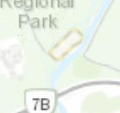
1 City of Coquitlam land Management Framework Coquitlam s land Management Framework The City of Coquitlam currently manages approximately 955 hectares (2,359 acres) of parkland that s about double the size of Stanley. Sustainable management of City parkland is an important role of municpal government because these lands help to enhance quality of life. The City regularly reviews the demand for parkland and park services within the municipality. With population growth, where appropriate, the City may look at acquiring new parkland or making service improvements to existing parkland such as developing playgrounds, trails, picnic shelters, sports courts, fiels and many more amenities. The City s parkland management framework assists in protecting the park and recreational lands for future use in this capacity. Once a property comes under the City s stewardship as a park, there are various methods and regulatory tools available to Council to protect these public lands and to limit their use to park and recreational purposes. To keep the parkland management framework up-to-date, regular reviews of parkland inventory will be conducted, which may result in some regulatory changes such as ensuring appropriate rezoning, or changes to the Official Community Plan (OCP) designation of certain parks. Rest assured that these changes are to protect and preserve these assets. The goal of the parkland management framework is to provide a consistent methodology to the management and conservation of our parks in order to protect them now and for generations to come. You can find more information online at coquitlam.ca/parksplanning Contact: parksandconsultation@coquitlam.ca CityofCoquitlam
 Coquitlam s Citywide OCP contains policies that set a vision, and priorities to address issues that affect the entire City.")


2 Management Framework All land used or managed as a park is required to be zoned and designated for parkland in the Official Community Plan. OFFICIAL COMMUNITY PLAN (OCP) Coquitlam s Citywide OCP contains policies that set a vision, and priorities to address issues that affect the entire City. The OCP provides Land Use Designations that describe the future use of all land in the City and has a general statement about the form and character for future development. An application to amend the OCP is decided upon by City Council. LAND USE DESIGNATIONS are a classification that determines the type of future use a property can have (i.e. parkland recreational, commercial, single-family housing, etc.). Each OCP Land Use Designation has a number of associated zones that can be applied through rezoning. There are currently 53 designations set out in the OCP. All parkland should be designated appropriately within the OCP to protect the lands. REZONING The process of changing the existing zone on a property to another zone. This is a regular part of the development process that occurs when an applicant applies to change the zone of a property. The zones that the applicant can choose to rezone to are determined by the land use designation (set out in the OCP). The rezoning process amends the City s Zoning Bylaw and requires public notification to nearby property owners, a Public Hearing and approval by City Council. specific zoning provides the parklands with another level of additional protection for the community. ZONE The zone on a property specifies permitted uses, the dimensional requirements for lots, the height of buildings and how far they can be setback from a property boundary. The zone also determines the maximum density of buildings on a property and is typically measured in the City s zones as a Floor Area Ratio (FAR). All land in the City is assigned a zone under the City s Zoning Bylaw. The type of zone that can be applied to a property is set by the land use designation in the City s OCP. ZONING BYLAW This bylaw regulates the present use of land. Zoning is a tool to implement the City s policies and land use designations as set out in the OCP. Dedication Bylaw A bylaw to dedicate the land for park use only is the main regulatory option available to the City to protect park assets in the long-term. A Dedication Bylaw can only be removed through another bylaw, and with the approval of voters through a referendum or alternative process. This provides a strong level of protection for the park by restricting the use of the lands in question. Additional Considerations and Limitations There are several parks owned by the City that do not require a Dedication Bylaw due to inherent protection offered by their status or legal restrictions. For example:»» City owned properties legally identified in a subdivision plan as park and obtained by the City as part of a subdivision requirement in the Local Government Act. Because of their protection under the Act, they do not need further dedication. Examples of these are neighbourhood parks such as Aloutte, Dawes Hill, Guilby, Ranch, and Selkirk.»» Stream Protection and Enhancement Area lands are typically riparian corridors and have mandated protection, environmental and geotechnical restrictions by Provincial or Federal legislation. Examples of these parks are Ridge, Noons Creek Ravine, North Hoy Creek, and Pacific Reach Linear.»» s that are obtained by the City through a Provincial Crown Grant carry heavy restrictions that the land must be used for recreational and park purposes. Examples of these parks are Town Centre, Riverview Forest and Harper. You can find more information online at coquitlam.ca/parksplanning Contact: parksandconsultation@coquitlam.ca CityofCoquitlam
3 PARK FOR OCP RE-DESIGNATIONS PARK NAME PROPERTY ADDRESS CURRENT OCP PROPOSED OCP Blue Jay 1625 Blue Jay Place One Family Residential s and Rec. Cape Horn 186 San Juan Place Compact One Family Residential s and Rec. Don Roberts 1780 United Boulevard Industrial s and Rec. Galette 3252 Galette Avenue One Family Residential s and Rec. Hockaday and Trail 3318 McTavish Court Suburban Residential s and Rec. Corridors Keets 2995 Pasture Circle One Family Residential s and Rec. Shiloh 2990 Shiloh Place One Family Residential s and Rec. Tanglewood 1533 Tanglewood Lane Compact One Family Residential s and Rec. Turnberry 2208 Turnberry Lane Compact One Family Residential s and Rec. Westwood Summit 1342 Honeysuckle Lane One Family Residential s and Rec. Nelson Creek Ravine and 1002 Delestre Ave Neighbourhood Attached Natural Area Coquitlam Greenlinks Trail 3100 Pier Drive One Family Residential Scott Creek Trail 3101 Pier Drive One Family Residential PARKS FOR REZONING PARK NAME PROPERTY ADDRESS CURRENT ZONING PROPOSED ZONING Blue Jay 1625 Blue Jay Place RS-3 P-5 Cape Horn 186 San Juan Place RS-4 P-5 Don Roberts 1780 United Boulevard M-1 P-5 Galette 3252 Galette Avenue RS-2 P-5 Hockaday and Trail 3318 McTavish Court RS-2 P-5 Corridors Keets 2995 Pasture Circle RS-1 P-5 Shiloh 2990 Shiloh Place RS-3 P-5 Tanglewood 1533 Tanglewood Lane RS-4 P-5 Turnberry 2208 Turnberry Lane RS-4 P-5 Westwood Summit 1342 Honeysuckle Lane RS-1 P-5 Nelson Creek Ravine and 1002 Delestre Ave RS-1, RT-1 P-5 Natural Area Coquitlam Greenlinks Trail 3100 Pier Drive RS-1 P-5 Scott Creek Trail 3101 Pier Drive RS-1 P-5 Cottonwood 672 Aspen Street RS-1 P-5 Sandstone 2641 Sandstone Crescent None P-5 Selkirk 928 Selkirk Crescent RS-1 P-5 Chineside Ravine & Natural 1000 MacIntosh St. RS-1 P-5 Areas Pinnacle Creek Ravine and Thermal Drive RS-1 P-5 File #: /91044/1 Doc #: v1


4 Don Roberts Cape Horn s Identified Requiring OCP Designations Nelson Creek Ravine & Shiloh Keets (Undeveloped ) Coquitlam Green Links Blue Jay Hockaday Galette Blue Jay Cape Horn Coquitlam Green Links Don Roberts Galette Hockaday Keets (Undeveloped ) Nelson Creek Ravine & Scott Creek Trail Shiloh Tanglew ood Turnberry Westw ood Summit Name Address 1:60, Blue Jay Place 186 San Juan Place 3100 Pier Drive 1780 United Boulevard 3252 Galette Avenue 3318 McTavish Court 2995 Pasture Circle 3101 Pier Drive 2992 Shiloh Place 1533 Tanglew ood Lane 2208 Turnberry Lane 1342 Honeysuckle Lane 4 Kilometers Service Layer Credits: Sources: Esri, HERE, DeLorme, Intermap, increment P Corp., GEBCO, USGS, FAO, NPS, NRCAN, GeoBase, IGN, Kadaster NL, Ordnance Scott Creek Survey, Esri Japan, METI, Esri China (Hong Trail Kong), swisstopo, MapmyIndia, OpenStreetMap contributors, and the GIS User Community Westwood Summit Tanglewood Turnberry [


5 Chineside Ravine and Don Roberts Selkirk Pinnacle Creek Ravine Cape Horn s Identified Requiring Re-zoning Nelson Creek Ravine & Cottonwood Chineside Ravine and Westwood Summit Blue Jay Hockaday Galette 0 Keets (Undeveloped ) Shiloh 1 2 Blue Jay Cape Horn Chineside Ravine and Coquitlam Green Links Cottonw ood Don Roberts Galette Hockaday Keets (Undeveloped ) Nelson Creek Ravine & Pinnacle Creek Ravine Sandstone Scott Creek Trail Selkirk Shiloh Tanglew ood Turnberry Name Service Layer Credits: Sources: Esri, HERE, DeLorme, Intermap, increment P Corp., GEBCO, USGS, FAO, NPS, NRCAN, GeoBase, IGN, Kadaster NL, Ordnance Coquitlam Survey, Esri Japan, METI, Esri China (Hong Green Scott Creek Links Kong), swisstopo, MapmyIndia, Trail OpenStreetMap contributors, and the GIS User Community Sandstone Tanglewood Turnberry 4 Kilometers 1:60, Blue Jay Place 186 San Juan Place 3100 Pier Drive 672 Aspen Street 1780 United Boulevard 3252 Galette Avenue 3318 McTavish Court 2995 Pasture Circle 2641 Sandstone Crescent 3101 Pier Drive 928 Selkirk Crescent 2992 Shiloh Place 1533 Tanglew ood Lane 2208 Turnberry Lane Address [
6 Coquitlam land Regulatory Protection by Site (2015) This chart is meant to provide a general high level comparison and overview of the various means of local level protection currently in place throughout the City's park system and is meant for general information purposes only; further detailed site by site analysis would be required prior to any recommendations or changes be made to existing or future City policies or bylaws. This chart does not include city owned civic facility sites. land Levels land Levels City Owned OCP Designation Municipal Zoning Dedication Bylaw "PARK" Designation SPEA Crown Grant Restrictions Strategic Site or Undeveloped Municipal land: Neighbourhood, Community & City s City Owned OCP Designation Municipal Zoning Dedication Bylaw "PARK" Designation SPEA Crown Grant Restrictions Municipal land: Ravines and (see Note) Alouette Blackwater Slopes Blue Jay P Booth Creek Ravine & Blue Mountain Chineside Ravine & Bramble (joint use SD43) P Como Creek Ravine & Brookmere P Coquitlam River Greenway Booth Farm Eagle Ridge/ Eagle Mountain Hydro Corridor Burns P Fraser River Foreshore Burquitlam P Goodyear Creek Ravine & Burquitlam Community Garden Hickey Street Forested Area North of Courts Cape Horn Hockaday Creek Ravine & Como Lake P Hoy Creek Linear, Ravine & Cottonwood P Hyde Creek Ravine & P Coquitlam River P Lost Creek Ravine and Crane MacDonald Creek Ravine & P Crestwood Mariner Way Hydro Right of Way Dacre P Mundy Creek Ravine & Dawes Hill P Nelson Creek Ravine & DeBoville Slough Trail (Province owned) Noons Creek Ravine & Don Roberts Northeast Hydro Right of Way Durant Linear Pacific Reach Linear Eagle Mountain (Province owned) Panorama Hydro Right of Way & Trail Eagle Ridge Pinnacle Creek Ravine & Eagle Ridge Pool Grounds and Sandstone Freemont P Schoolhouse Creek Ravine and Gabriola P Scott Creek Ravine and Galette Smiling Creek Galloway Watkins Creek Ravine & Natural Area Glen Gilley's Trail Good Neighbour P Current Level in Place A portion of the parkland is designated as "PARK" Guilby Hampton (SD43 Owned) lands Owned by Other Agencies: Site currently not owned by City but managed through license of occupation or management agreeement. Harper Harrier Hickey Street (Greater Vancouver Water District) Additional Level Recommended under the Management Framework P Hockaday Neighbourhood Level 1: OCP Designation and Municipal Zoning Recommended Keets Level 2: Dedication Bylaw Recommended Leigh Lower Lougheed (Province owned) Mackin Maquabeak Marguerite P Mariner Meadowbrook Millard Orchard Note: Miller Mountain View Mundy (Urban Forest Dedication) Nestor Ravines and natural areas can contain a number of individual properties that make up the overall site. This chart indicates the various means of protection for the majority of the overall park, however individual properties within a larger grouping making up a park may have specific details associated with them (i.e. many individual properties make up Hoy Creek Linear and ). Noons Creek Norm Staff North Hoy Creek P Oakdale Ozada Panorama (joint use SD43) Princeton Queenston Ranch Ridge Riverview Forest (Urban Forest Dedication) Riverview (joint use SD43) ( Forest Dedication) Rochester Scott Creek Linear Selkirk Sheffield Shiloh Tanglewood Town Centre Turnberry Upper Coquitlam River Victoria Walton (Urban Forest Dedication) Westwood Summit
Option 7A Alignment Map. 100-year Floodplain with or without Project
 1-year Floodplain with or without Project New 1-year Floodplain with Project 1-year Floodplain Removed with Project i.e., Benefitted Area) Option 7A Alignment increment P 37ft Corp., GEBCO, USGS,Town FAO,
In November and December, SACOG staff conducted the following Blueprint Implementation land use activities:
 SACOG Board of Directors Item #18-1-16 Receive & File January 11, 2018 Blueprint Implementation Activities The purpose of this item is to regularly inform the Board of SACOG land use related activities
WELCOME! Four Corners and Upper Rio Grande Vulnerability Assessment Webinar Series
 WELCOME! Four Corners and Upper Rio Grande Vulnerability Assessment Webinar Series Phone audio: Dial: 866-620-8138; Passcode: 5952203# Mute your phone and turn off computer speakers (prevents echo issue).
Information for File MVP MMJ; CSAH 10 Reconstruction (Waconia and Watertown Townships)
") Information for File MVP-2014-03830-MMJ; Reconstruction (Waconia and Watertown Townships) Applicant: Carver County Corps Contact: Melissa Jenny Address: 180 Fifth Street East, Suite 700, St. Paul, MN 55101
Information for File MVP-2014-03830-MMJ; Reconstruction (Waconia and Watertown Townships) Applicant: Carver County Corps Contact: Melissa Jenny Address: 180 Fifth Street East, Suite 700, St. Paul, MN 55101
CITY OF VACAVILLE PLANNING COMMISSION Item No. 8.A STAFF REPORT July 18, 2016 STAFF CONTACT: Amy Feagans, Contract Planner (707)
") CITY OF VACAVILLE PLANNING COMMISSION Item No. 8.A STAFF REPORT July 18, 2016 STAFF CONTACT: Amy Feagans, Contract Planner (707) 449-5140 TITLE: THE FARM AT ALAMO CREEK ENVIRONMENTAL IMPACT REPORT (EIR)
CITY OF VACAVILLE PLANNING COMMISSION Item No. 8.A STAFF REPORT July 18, 2016 STAFF CONTACT: Amy Feagans, Contract Planner (707) 449-5140 TITLE: THE FARM AT ALAMO CREEK ENVIRONMENTAL IMPACT REPORT (EIR)
JOINT PUBLIC NOTICE. 26 June United States Army Corps of Engineers State of Louisiana
 JOINT PUBLIC NOTICE 26 June 2017 United States Army Corps of Engineers State of Louisiana New Orleans District Department of Environmental Quality Regulatory Branch Office of Environmental Services 7400
Regional Context Statement
 Regional Context Statement REGIONAL CONTEXT STATEMENT 3. REGIONAL CONTEXT STATEMENT In 1995, the Provincial Government passed into law the Growth Strategies Act. The purpose of this provincial initiative
Transportation Impact Study Technical Working Group (TISTWG) July 1, 2015 Meeting #10 1:30-3:30 PM Agenda
 July 1, 2015 Meeting #10 1:30-3:30 PM Agenda") Transportation Impact Study Technical Working Group (TISTWG) July 1, 2015 Meeting #10 1:30-3:30 PM Agenda 1) Final review and comment on Pro-Rata Share Approach 2) Summary and status of LATR Concepts moving
Transportation Impact Study Technical Working Group (TISTWG) July 1, 2015 Meeting #10 1:30-3:30 PM Agenda 1) Final review and comment on Pro-Rata Share Approach 2) Summary and status of LATR Concepts moving
Legend. Miles. Fence Removal Location Map for Powdermill 2 and 3. Powdermill Rehab 3 Powdermill Rehab 2 PGC_Roads SGL_Boundary
 ¹ Fence Removal N40.3580 W79.0374 Fence Removal Location Map for Powdermill 2 and 3 SGL 042 Compartment: 2 Cover Stand: 46, 68 Westmoreland County St. Clair Township Hipchain Perimeter 8990 Ft. 42 acres
Coast & Creek Cleanup Cordelia American Canyon Creek
 Rodriguez High School Oakbrook Dr. & Silverado Dr. G:\EnvironmentalComplaince\..\SiteMap_LowerUnionCreek.mxd Cordelia American Canyon Creek Scandia Dan Wilson Creek Subway End of Lookout Hill Rd. off Central
water resource specialists
 Vaughn Collins, PE, CFM, Northwest Hydraulic Consultants Brad Livingston, Oregon Department of Transportation Melissa Reich, North Coast Land Conservancy Location Necanicum River 75 sq mi watershed Active
D.M. Wills Associates Limited PARTNERS IN ENGINEERING OSIM Bridge and Culvert Inspection Program. Township of North Frontenac
 2016 OSIM Bridge and Culvert Inspection Program Township of North Frontenac D.M. Wills Project No. 16-9206 D.M. Wills Associates Limited PARTNERS IN ENGINEERING Peterborough February 2017 Prepared for:
Wallace Country Acreage
 Wallace Country Acreage A stunning brick home surrounded by beautiful landscaping and picturesque views of the Nebraska plains Email: Jordan@lashleyland.com Property Highlights List Price $500,000 Location
Information for File # MHK
 Information for File #2014-03555-MHK Applicant: Corps Contact: Wimmer Communities Marie Kopka Address: 250 N. Sunnyslope Road, Suite 296 Brookfield, Wisconsin 53005 E-Mail: Marie.H.Kopka@usace.army.mil
DEVELOPMENT PERMIT SENSITIVE ECOSYSTEMS
 DEVELOPMENT PERMIT SENSITIVE ECOSYSTEMS What is the Sensitive Ecosystem Development Permit Area (SEDPA)? Surrey s SEDPA is made up of two distinct classifications of the natural environment: Streamside
Parks and Open Space Preservation and Dedication. January 26, 2016 Fort Worth City Council Pre-Council Meeting Randle Harwood and Richard Zavala
 Parks and Open Space Preservation and Dedication January 26, 2016 Fort Worth City Council Pre-Council Meeting Randle Harwood and Richard Zavala Purpose How does the City of Fort Worth preserve and protect
A. Selma Park, Davis Bay and Wilson Creek
 A. Selma Park, Davis Bay and Wilson Creek This waterfront neighbourhood consists of three separate community areas, linked by Highway 101, but with different character, land use patterns and future potential.
10.0 Open Space and Public Realm
 10.0 Open Space and Public Realm 10.0 Open Space and Public Realm The Public Open Space System is comprised of: outdoor spaces available for public use that are either publicly owned (e.g., parks and
Glenbrooke North. New Westminster s Neighbourhoods Identifying Historical Contexts. Historical Neighbourhood Context Statements 2008
 Historical Neighbourhood Context Statements 2008 Glenbrooke North Fifth Street: wide boulevard, with garden median at south end 1950s subdivision character along much of Eighth Avenue and east of Fourth
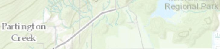
Partington Creek Neighbourhood Plan. Citywide Official Community Plan - Chapter City of Coquitlam. The Heart of Burke Mountain
 City of Coquitlam Citywide Official Community Plan - Chapter.4 Partington Creek Neighbourhood Plan AMENDED JULY 0, 207 - BYLAW 4742, 207 AMENDED JULY 27, 205 - BYLAW 4575, 205 ADOPTED JULY 8, 203 - BYLAW
CITY CLERK. Parkland Acquisition Strategic Directions Report (All Wards)
") CITY CLERK Clause embodied in Report No. 10 of the, as adopted by the Council of the City of Toronto at its meeting held on November 6, 7 and 8, 2001. 10 Parkland Acquisition Strategic Directions Report
CITY CLERK Clause embodied in Report No. 10 of the, as adopted by the Council of the City of Toronto at its meeting held on November 6, 7 and 8, 2001. 10 Parkland Acquisition Strategic Directions Report
Town Centre Park. Delahaye. David Avenue. Pine wood. Pipeline Rd. Pinetree. Town Ctr Blvd. Guildford. Guildford. High St. Westwood. Pinetree.
 WELCOME This open house is to give you an opportunity to review the proposed design of an outdoor performance and events plaza at Town Centre ark and to share your ideas, suggestions and thoughts related
Community Information Meeting
 Queensborough Eastern Community Information Meeting July 24, 2014 Cameron Chalmers, MCIP, RPP Platform Properties Meeting Format Purpose Format The purpose of the meeting is to invite the community to
City of Pittsburg: Billboard Corridor Study
 City of Pittsburg: Billboard Corridor Study Prepared for: City of Pittsburg Economic Development Department 65 Civic Avenue Pittsburg, California 94565-3814 Prepared by: Stantec Consulting Services Inc.
1. POPLAR LANDING + MUNI EVERS PARK
 . POPLAR LANDING + MUNI EVERS PARK WHAT S HAPPENING? PROJECT DESCRIPTION PROJECT TIMELINE Poplar Landing and the future Muni Evers Park site (located at 00 Quayside Drive) is jointly owned by the City
Welcome to the BC Hydro public open house
 Welcome to the BC Hydro public open house West Transmission Project We re here to share the most recent project information and to gather your comments on what we know so far. We hope you ll share your
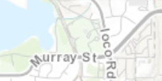
Moody Centre Station TOD Area Today
 Moody Centre Station TOD Area Today WHAT IS a transit-oriented Murray Street development area? A Transit-Oriented Development (TOD) Area is a dense, walkable residential and commercial area built to support
1 foot of Sea Level Rise
 1 foot of Sea Level Rise Schools Fire Stations Law Enforcement Assisted Living Hospitals 1ft SLR 0 0.35 0.7 1.4 Miles Year 20 Poplation: the 2013 stdy A Geological Perspective U.S. Mid-Atlantic Coast a
Area and Neighbourhood Plans
 City of Coquitlam Citywide Official Community Plan Area and Neighbourhood Plans 9.0 Southwest Coquitlam/Town Centre Area Plan NOTE: All references, policies and schedules relating to Town Centre in Part
Staff Report and Recommendation
 Community Planning and Development Planning Services 201 W. Colfax Ave., Dept. 205 Denver, CO 80202 p: 720.865.2915 f: 720.865.3052 www.denvergov.org/cpd TO: City Council Neighborhoods and Planning Committee
City of Surrey Ecosystem Management Study. Integration of ecological processes with land use
 City of Surrey Ecosystem Management Study Integration of ecological processes with land use Natural areas in Surrey are changing as the City grows and evolves. Many important natural areas remain or may
OPEN SPACE CHAPTER 7: OVERVIEW. Preserve open space to protect natural resources, enhance character and provide passive recreation opportunities
 CHAPTER 7: OPEN SPACE OVERVIEW Ridgefield has made tremendous progress permanently preserving areas of town as open space. Open space preservation can serve many important purposes, including: protect
City of Surrey PLANNING & DEVELOPMENT REPORT. OCP Amendment of a portion from Suburban to Urban
 City of Surrey PLANNING & DEVELOPMENT REPORT File: 7911-0119-00 Planning Report Date: November 7, 2011 PROPOSAL: OCP Amendment of a portion from Suburban to Urban Rezoning from RA to RH and RF in order
T O W N O F H I G H R I V E R
 T O W N O F H I G H R I V E R o p e n s p a c e p l a n The Town of High River, 30 minutes South of Calgary, still retains much of its distinctive small town character and provides residents with a high
UNIVERSITY OF CALIFORNIA, SAN DIEGO
 UNIVERSITY OF CALIFORNIA, SAN DIEGO BERKELEY DAVIS IRVINE LOS ANGELES MERCED RIVERSIDE SAN DIEGO SAN FRANCISCO SANTA BARBARA SANTA CRUZ PHYSICAL AND COMMUNITY PLANNING Tel. (858) 534-6515 9500 Gilman Drive
2.0 PROJECT DESCRIPTION
 Brunswick Street Apartment Project SCEA Project Description 2.0 PROJECT DESCRIPTION 2.1 PROJECT LOCATION The proposed project is located in Daly City, San Mateo County, California (Figure 2.0-1). The project
CHAPTER 7: PARKS, OPEN SPACES AND RECREATION
 CHAPTER 7: PARKS, OPEN SPACES AND RECREATION The delivery of Parks and Recreation services in Port Moody aims to provide benefits, either direct or indirect, to all citizens in the community. There is
City of Surrey Ecosystem Management Study. Integration of ecological processes with land use
 City of Surrey Ecosystem Management Study Integration of ecological processes with land use Natural areas in Surrey are changing as the City grows and evolves. Many important natural areas remain or may
M-NCPPC Park System in
 Park Planning & Stewardship Division Park & Trail Planning Section East County Science Center Master Plan Parks, Recreation, Trails, and Open Space- Issues and Opportunities PARK PLANNING & STEWARDSHIP
Official Plan Review
 Official Plan Review Summary Report - The Built Environment August 2014 Part 1: Introduction Planning for a healthy, prosperous and sustainable community is an important goal for our municipality. From
Re: Hazeldean Road - Minto Potters Key Subdivision Responses to Resident Concerns
 November 28, 2015 D07-16-14-0013 Councillor Shad Qadri 110 Laurier avenue west Ottawa, Ontario K1P 1J1 Dear Councillor Qadri, Re: 6111 6141 Hazeldean Road - Minto Potters Key Subdivision Responses to Resident
MOUNT PLEASANT SECONDARY PLAN & VILLAGE BLOCK PLAN. Wednesday, March 5, 2008 Informal Public Open House
 MOUNT PLEASANT SECONDARY PLAN & VILLAGE BLOCK PLAN Wednesday, March 5, 2008 Informal Public Open House 1. Welcome & Introductions 2. Highlights of Provincial Growth Plan 3. Overview and Status Update -
Southwest Fleetwood Enclave
 Southwest Fleetwood Enclave Development Concept Plan Southwest Fleetwood Enclave 1 st Land Owners Meeting April 30 th, 2012 Presentation Overview Why the Plan? ; Overview & Purpose of Study; Constraints
Saanich Park Property Inventory
 2010 Saanich Park Property Inventory Saanich Parks and Recreation Saanich, British Columbia September 2010 District of Saanich Park Property Inventory; September 2010 SECTION 1 INTRODUCTION...1 Introduction...
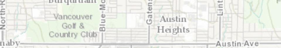
9.5 Austin Heights Neighbourhood Plan
 City of Coquitlam Austin Heights Neighbourhood Plan 1.0 BACKGROUND 1 1.1 Welcoming Innovative and Sustainable Investment in Neighbourhoods 1 1.2 Relationship with the CWOCP and the SWCAP 1 1.3 Austin Heights
PARKS & RECREATION SUBCOMMITTEE. Oct. 1, 2015
 PARKS & RECREATION SUBCOMMITTEE Oct. 1, 2015 1999 Bond - $22,000,000 Land Acquisition Allen Station Phase II Neighborhood Parks PREVIOUS BOND ELECTIONS 1999 & 2007 2002 Bond - $4,000,000 Allen Senior Recreation
GOCO Grants Awarded to Projects in Arapahoe County through June 2015
 Grant Type Open Space Fiscal Year Applicant Project Title Grant Amount 2015 City of Aurora Acres Protected Triple Creek Greenway Corridor Phase 3 $2,050,000.00 0 Planning 2015 Arapahoe County High Line
Surrey Ecosystem Management Study
 Surrey Ecosystem Management Study Green Infrastructure Network Opportunities Public Open House & Information Session June 24 th, 2010 EMS Process Ecological Inventory Ecological Assessment Management Policy
Provide and maintain sufficient public parks, recreation facilities, and open space to meet the recreational needs of County residents and visitors.
 (ROS) Goal Provide and maintain sufficient public parks, recreation facilities, and open space to meet the recreational needs of County residents and visitors. OBJECTIVE ROS.01 The County shall acquire,
RECREATION AND OPEN SPACE ELEMENT
 RECREATION AND OPEN SPACE ELEMENT Last amended August 19, 2008 Table of Contents Objective Page 5.1 Park system defined... 5-1 5.2 Access to parks and recreational facilities... 5-2 5.3 Recreation and
Carrboro Greenways Commission January 9 th, 2007
 Carrboro Greenways Commission January 9 th, 2007 Statewide The flooding of Crabtree Valley in the early 1970 s (right before Crabtree Valley Mall was set to open) caused city, state, and federal officials
Rocky View County Plans
 COUNTY PLAN Guides overall growth and development for the county. INTER-MUNICIPAL DEVELOPMENT PLAN Guides growth and development in an area where the County shares a border with another municipality. -
GEORGE DERBY COMMUNITY PLAN
 Planning and Building Department GEORGE DERBY COMMUNITY PLAN The following Council Report constitutes the George Derby Community Plan as adopted by Council in 1989. TO: MUNICIPAL MANAGER 1989 OCTOBER 17
City of Missoula and Missoula County Open Space Planning Open House
 City of Missoula and Missoula County Open Space Planning Open House FEBRUARY 6, 2018 The following slides contain the display board content from the open house. Please use boards to answer questions in
Create a connected ecological network. Connect districts with transit. Let the centre define the community
 District A - D Southeast False Creek A 1 A 2 A 3 A 4 Create a connected ecological network Connect districts with transit Let the centre define the community Provide a variety of affordable housing types
Rezoning. Rezone from C-4 and RA to RF-9C and RF-12C to allow subdivision into approximately 47 small single family lots in East Clayton.
 City of Surrey PLANNING & DEVELOPMENT REPORT File: 7903-0275-00 Rezoning Proposal: Rezone from C-4 and RA to RF-9C and RF-12C to allow subdivision into approximately 47 small single family lots in East
Rezoning. Rezone from A-1 to RH to create 9 suburban single family residential lots. Approval to Proceed
 City of Surrey PLANNING & DEVELOPMENT REPORT Rezoning Proposal: Rezone from A-1 to RH to create 9 suburban single family residential lots. Recommendation: Approval to Proceed Location: 18712 and Portion
June 12, 2012 Our File: O-20/02-II/I Doc#: I.VI. City Manager. General Manager Planning and Development
 CoQuitlam For Council Our File: 13-648O-20/02-II/I Doc#: 126318I.VI To: From: Subject: For: City Manager General Manager Planning and Development Partington Creek Neighbourhood Plan Update Council Recommendations:
Staff will be providing an overview of the project need, purpose and intent for consideration as part of the Amendment cycle.
 Agenda Item D-2 City of Tacoma Planning and Development Services To: Planning Commission From: Stephen Atkinson, Planning Services Division Subject: Open Space Corridors Project Meeting Date: March 1,
Planning Primer Legislative Background, Policy Documents and Development Review Processes. Presented by: Planning Services Date: April 6, 2017
 Planning Primer Legislative Background, Policy Documents and Development Review Processes Presented by: Planning Services Date: April 6, 2017 Agenda Legislative Background 7:30 to 8:00 pm Questions 8:00
LAND USE AMENDMENT CORNERSTONE (WARD 3) 60 STREET NE AND COUNTRY HILLS BOULEVARD NE MAP 26NE BYLAW 22D2017
 60 STREET NE AND COUNTRY HILLS BOULEVARD NE MAP 26NE BYLAW 22D2017") Page 1 of 14 EXECUTIVE SUMMARY This Land Use Amendment application covers an area of 43.76 hectares ± (108.14 acres ±) located in northeast Calgary, bound by Country Hills Boulevard NE to the south and
Page 1 of 14 EXECUTIVE SUMMARY This Land Use Amendment application covers an area of 43.76 hectares ± (108.14 acres ±) located in northeast Calgary, bound by Country Hills Boulevard NE to the south and
Joint Public Hearing. Preliminary Subregion 5 Master Plan and Proposed Sectional Map Amendment
 Preliminary Subregion 5 Master Plan and Proposed Sectional Map Amendment Joint Public Hearing April 11, 2013 Council Hearing Room Upper Marlboro 7:00 pm His Lordship s Kindness (Clinton) Presentation Overview
George Hotel application STAFF REVIEW COMMITTEE OF THE WHOLE JANUARY 14, 2014
 George Hotel application STAFF REVIEW COMMITTEE OF THE WHOLE JANUARY 14, 2014 1 Presentation outline Purpose: to seek Council direction for next steps in the review process Application process to date
RECREATION AND OPEN SPACE ELEMENT GOALS, OBJECTIVES, AND POLICIES
 RECREATION AND OPEN SPACE ELEMENT GOALS, OBJECTIVES, AND POLICIES Goal 7 To provide park facilities, recreation programs, and open space resources that are safe, adequate, and accessible to all City residents,
The urban parks in Charlottesville include Jackson Park, Lee Park, and McGuffey Park.
 Park Classifications Charlottesville s parks can be grouped into 4 different classifications: urban parks, neighborhood parks, community parks, and regional parks. Figure 1 on page 5 inventories the facilities
TO: Mayor & Council DATE: April 12, The Planning and Development Department and the Engineering Department recommend that Council:
 CORPORATE REPORT NO: R080 COUNCIL DATE: April 12, 2010 REGULAR COUNCIL TO: Mayor & Council DATE: April 12, 2010 FROM: SUBJECT: General Manager, Planning and Development General Manager, Engineering Neighbourhood
LAND USE AMENDMENT CORNERSTONE (WARD 3) COUNTRY HILLS BOULEVARD AND STONEY TRAIL NE BYLAW 9D2017
 COUNTRY HILLS BOULEVARD AND STONEY TRAIL NE BYLAW 9D2017") Page 1 of 12 EXECUTIVE SUMMARY This Land Use Amendment application covers an area of 54.92 hectares ± (135.71 acres ±) located in northeast Calgary, bound by Country Hills Boulevard NE to the north and
Page 1 of 12 EXECUTIVE SUMMARY This Land Use Amendment application covers an area of 54.92 hectares ± (135.71 acres ±) located in northeast Calgary, bound by Country Hills Boulevard NE to the north and
Courthouse Planning Area
 Courthouse Planning Area Current Reality The Courthouse Planning Area is the characterized by expansive suburbanscale residential areas as well as the community resource planned area of athletic, educational,
RECREATION, OPEN SPACE AND GREENWAYS ELEMENT GOALS, OBJECTIVES, AND POLICIES
 RECREATION, OPEN SPACE AND GREENWAYS ELEMENT GOALS, OBJECTIVES, AND POLICIES GOAL R-1: DEVELOP A RECREATION, OPEN SPACE AND GREENWAYS SYSTEM AS AN INTEGRAL COMPONENT OF AN OVERALL, COUNTY-WIDE ECONOMIC
DEFINED VILLAGE CENTRES & NEIGHBOURHOODS
 DEFINED VILLAGE CENTRES & NEIGHBOURHOODS residents in Nanoose Bay support focusing attractive, planned future development in Red Gap Centre and the Area s neighbourhood centres. In addition, the development
Gloucester County s Comprehensive Plan. The Community Connection
 Gloucester County s Comprehensive Plan The Community Connection Current Comp Plan Adopted in 1991 with a 20 year planning horizon Updated in 1995 with Part V- Implementation Recommendations and Appendix
Section 3 INVENTORY OF RECREATION LAND AND FACILITIES
 Photo of Juan Bautista de Anza Park Section 3 INVENTORY OF RECREATION LAND AND FACILITIES Summary of Findings Park Definitions Summary of Recreation Facilities Other Recreation Facilities Nearby Recreation
Buffers and Agricultural Protection: The BC Experience
 Buffers and Agricultural Protection: The BC Experience Brooke Marshall RPP, MCIP Halton Region Edge Planning Workshop Friends of the Greenbelt Foundation October 18, 2016 ALR Lands in Metro Vancouver
Planning and Public Consultation Process for the Preparation of a General Land Use Plan for South Port Kells TERMS OF REFERENCE
 APPENDIX "B" Planning and Public Consultation Process for the Preparation of a General Land Use Plan for South Port Kells TERMS OF REFERENCE PURPOSE South Port Kells is located in the northeastern quadrant
Southeast Quadrant Plan
 Southeast Quadrant Plan Southeast Quadrant Distinctive Features Land Use The Southeast Quadrant includes all the area within the planning area that is east of Interstate 5 and south of State Route 44.
Waterfront Project VISION, GOALS AND OBJECTIVES
 Waterfront Project VISION, GOALS AND OBJECTIVES INTRODUCTION The City of North Vancouver created the Waterfront Project in 2005 in order to provide a focus for waterfront redevelopment opportunities and
POLICY AMENDMENT AND LAND USE AMENDMENT TUXEDO PARK (WARD 9) CENTRE STREET N AND 26 AVENUE NE BYLAWS 36P2017 AND 234D2017
 CENTRE STREET N AND 26 AVENUE NE BYLAWS 36P2017 AND 234D2017") Page 1 of 11 EXECUTIVE SUMMARY This application proposes to redesignate a single parcel of land in the Community of Tuxedo Park from Commercial Corridor 2 (C-COR2 f1h10) District to Mixed Use Active Frontage
Page 1 of 11 EXECUTIVE SUMMARY This application proposes to redesignate a single parcel of land in the Community of Tuxedo Park from Commercial Corridor 2 (C-COR2 f1h10) District to Mixed Use Active Frontage
OP Council Resolution June 16, Planning and Development Services
 OP-08-01 Council Resolution June 16, 2008 Planning and Development Services Kingsgate Landing Outline Plan Table of Contents 1.0 Introduction 1 1.1 Purpose of Plan 1 1.2 Plan Area Location 1 1.3 Ownership
Coronation Park Neighbourhood Plan. Open House #2 15 September 2016
 Coronation Park Neighbourhood Plan Open House #2 15 September 2016 Outline What is a Neighbourhood Plan? Project Status Update Policy Context Refresher Coronation Park Yesterday & Today What We Heard -
6: 2417 Fourth Line, Sixteen Hollow, Lion Valley Park
 1. Description of Property 6: 2417 Fourth Line, Sixteen Hollow, Lion Valley Park Municipal Address 2417 Fourth Line ame (if applicable) Sixteen Hollow, Lion Valley Park Legal Description CO 1 SDS PT LOTS
Tools for Implementing your Comprehensive Plan. Josh Campbell City of Suwanee Planning and Inspections
 Tools for Implementing your Comprehensive Plan Josh Campbell City of Suwanee Planning and Inspections Tools for Implementing your Comprehensive Plan Planning Expectations and Culture Policies Regulations
BISCUIT RUN PARK MASTER PLAN
 BOARD OF SUPERVISORS November 14, 2018 BISCUIT RUN PARK MASTER PLAN COUNTY OF ALBEMARLE ANHOLD ASSOCIATES Contents Project Introduction Property Background County Park Planning Process Existing Site &
AWH REPORT OF THE PLANNING AND DEVELOPMENT DEPARTMENT FOR APPLICATION FOR REZONING ORDINANCE TO PLANNED UNIT DEVELOPMENT
 AWH REPORT OF THE PLANNING AND DEVELOPMENT DEPARTMENT FOR APPLICATION FOR REZONING ORDINANCE TO PLANNED UNIT DEVELOPMENT MAY 8, 2014 The Planning and Development Department hereby forwards to the Planning
Waverley West B Secondary Planning Process. Open House South Pointe School April 25, 2018
 averley est B Secondary Planning Process South Pointe School April 25, 2018 averley est B Secondary planning process open house Please review the boards and provide your feedback. 1 The Role of a Secondary
Secrest Short Cut and Monroe Expressway Small Area Plan AUGUST 29, 2018
 Secrest Short Cut and Monroe Expressway Small Area Plan AUGUST 29, 2018 Background and Process Monroe Expressway will be open by the end of 2018 Union County and Indian Trail identified a need to revisit
2136 & 2148 Trafalgar Road Town of Oakville Region of Halton
 PLANNING JUSTIFICATION REPORT 2136 & 2148 Trafalgar Road Town of Oakville Region of Halton Zoning By-Law Amendment Application 2500674 Ontario Inc. November 2016 Table of Contents Page 1.0 Location/Summary
ADMINISTRATION RECOMMENDATION 2016 November 03. That Calgary Planning Commission recommends APPROVAL of the proposed Land Use Amendment.
 Page 1 of 12 EXECUTIVE SUMMARY This Land Use Amendment application covers an area of 75.76 hectares ± (187.20 acres ±) located in northeast Calgary, bound by Stoney Trail NE to the north, 128 Avenue NE
Land Use Amendment in Southwood (Ward 11) at and Elbow Drive SW, LOC
 at and Elbow Drive SW, LOC") 2018 November 15 Page 1 of 10 EXECUTIVE SUMMARY This land use amendment application was submitted by Rick Balbi Architect on 2017 August 31 on behalf of Sable Developments Ltd, and with authorization from
2018 November 15 Page 1 of 10 EXECUTIVE SUMMARY This land use amendment application was submitted by Rick Balbi Architect on 2017 August 31 on behalf of Sable Developments Ltd, and with authorization from
11 APPEAL BY LEBOVIC ENTERPRISES INC. AND REVLIS LTD. TO OFFICIAL PLAN AMENDMENT D , TOWN OF AURORA
 11 APPEAL BY LEBOVIC ENTERPRISES INC. AND REVLIS LTD. TO OFFICIAL PLAN AMENDMENT D09-09-03, TOWN OF AURORA The Planning and Economic Development Committee recommends the following: 1. The deputation by
edmonton.ca/ribbonofgreen #ribbonofgreen
 WHAT IS THE RIBBON OF GREEN? The Ribbon of Green is Edmonton s entire river valley and ravine system. The Ribbon of Green (2018) Project will provide strategic guidance for the southwest and northeast
Nearby Features (Water body, T&E Habitat, Wetlands, Noxious Weed):
:") Variance Request Form Company: Avangrid Renewables Variance: VAR-016 Address: 1125 NW Couch Street, Suite 700 Request No.: Rev 0 City, State, Zip : Portland, OR, 97209 Date Submit: 07/07/17 Date Agency
Variance Request Form Company: Avangrid Renewables Variance: VAR-016 Address: 1125 NW Couch Street, Suite 700 Request No.: Rev 0 City, State, Zip : Portland, OR, 97209 Date Submit: 07/07/17 Date Agency
Minnesota Department of Natural Resource - Natural Resource Guidance Checklist Conserving Natural Resources through Density Bonuses
 Minnesota Department of Natural Resource - Natural Resource Guidance Checklist Conserving Natural Resources through Density Bonuses NRDB Why Use Density Bonuses & This Checklist Local units of government
BYLAW C A Bylaw of Rocky View County to amend Land Use Bylaw C
 BYLAW C-7720-2017 A Bylaw of Rocky View County to amend Land Use Bylaw C-4841-97. The Council of Rocky View County enacts as follows: PART 1 TITLE This Bylaw shall be known as Bylaw C-7720-2017. PART 2
December 11, December 10, 2015
 December 11, 2015 December 10, 2015 2 Welcome & Introductions Project Overview Discussion Questions Group Insights Key Takeaways Next Steps 3 4 5 6 7 8 9 Governed by multiple layers of policy UNESCO World
Parks Plan Overview. City of Toronto Parks, Forestry and Recreation Division
 Parks Plan Overview City of Toronto Parks, Forestry and Recreation Division 1 In February 2010 Council approved the development of a five year plan to guide the acquisition, development, management and
8 Oak Street - Official Plan and Zoning By-law Amendment Application - Preliminary Report
 STAFF REPORT ACTION REQUIRED 8 Oak Street - Official Plan and Zoning By-law Amendment Application - Preliminary Report Date: March 17, 2014 To: From: Wards: Reference Number: Planning and Growth Management
CHAPTER 7: Transportation, Mobility and Circulation
 AGLE AREA COMMUNITY Plan CHAPTER 7 CHAPTER 7: Transportation, Mobility and Circulation Transportation, Mobility and Circulation The purpose of the Transportation, Mobility and Circulation Chapter is to
Land Use. Chapter 8: Introduction. Land Use Vision. Section I: Current Land Use 8-1
 Introduction Land use is the defining element of the comprehensive plan. It will serve as a framework for decision makers, guiding future growth and development in the Town of Oconto Falls. This chapter
Baby Point Heritage Conservation District Study. Kick-off Community Meeting March 27, 2017 Humbercrest United Church
 Baby Point Heritage Conservation District Study Kick-off Community Meeting March 27, 2017 Humbercrest United Church Agenda 7:00 Welcome 7:10 HCD Study Overview and Process 8:00 Interactive Discussion /
LAKEVIEW VILLAGE VISION & MASTERPLAN PRESENTATION TO CITY OF MISSISSAUGA. April 9, 2018
 LAKEVIEW VILLAGE VISION & MASTERPLAN PRESENTATION TO CITY OF MISSISSAUGA April 9, 2018 AGENDA Introduction Vision Plan Comparison The Big Moves Trail Connections Plan Overview Districts Conveyance Comparison