LANDSCAPE SCHEMATIC SITE PLAN CONCEPT DIAGRAM
|
|
|
- Clement Pierce
- 6 years ago
- Views:
Transcription


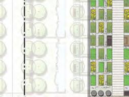
1 LANDSCAP SCHTIC SIT PLAN CONCPT DIAGAM W 64TH AV. W 64TH AV STTSCAP NOTH CON PLAZA FOCAL POT NOTH COUT WAT/STOMWAT FATU PUBLIC AT WALKWAY VHICL ACCSS LAN / MWS PHAS 2 NTY COUT PHAS 1 PHAS 1 SKYTA - CANADA L PHAS 2 WAT/STOMWAT FATU CAMBI STT SOUTH COUT PHAS 1 NTY COUT PHAS 2 SOUTH CON PLAZA STT SCAP FOCAL POT CAMBI & CAMBI & ZONG SUBMISSION LANDSCAP SCHTIC SIT PLAN- CONCPT DIAGAM 1

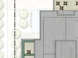
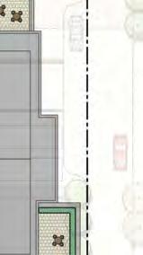
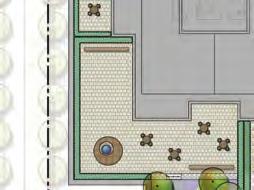
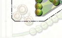
2 LANDSCAP AWGS LANDSCAP SCHTIC SIT PLAN W 64TH AV. North Corner Plaza pedestrian node focal point with public art interpretation separate public and private with planting and hedging W 64th Ave Street Scape continuation of street trees and sidewalk width from adjacent parcel separate public and private with grade change, planting and hedging entry court leads to the vehicle access lane / mews / informal gathering North stepped terraces seating / gathering opportunities stormwater channel with planting green buffer between private patio and public realm Live / Work Private Patio (phase 2) every 2-3 units at same FF on level 1 separate public and private with grade change, planting and hedging landscape buffer / edge provides privacy Public Art walkway public art interpretation double row of trees 5 green buffer on both sides 3.5% pathway 10 wide pedestrian pathway 8 wide bikeway Loading & Parking ntry (phase 2) screen between live/work and loading area AcquaPave permeable paving ntry water feature surrounds the lobby bridge to Main ntry grand steps connect to the South planting buffer as a backdrop water channel connects to the stormwater feature in the south court special paving to enhance the eastwest connection SKYTA - CANADA L ntry water feature surrounds the lobby bridge to Main ntry special paving to enhance the eastwest connection Vehicle Access Lane / Mews double row of street trees 5 green buffer on both sides access to entry drop-off, parking entries and loading areas CAMBI STT stepped terraces and stormwater channel links upper level and lower level ntry s lawn for recreation stone bridges cross the channel seating / gathering opportunities green buffer between private patio and public realm Drop-Off services phase 2 lobby steps/ ramps connect to the ntry Live / Work Private Patio (phase 1) every 2-3 units at same FF on level 1 separate public and private with grade change, planting and hedging landscape buffer / edge provides privacy Drop-Off services phase 1 lobby steps/ ramps connect to the ntry Loading & Parking ntry (phase 1) screen between ntry and loading area AcquaPave permeable paving etail Frontage stepped terraces outdoor cafe/ seating planters define the edge and provide seating opportunities Potential Future Plaza strong connection to ntry pedestrian node / focus point site furniture / seating areas South Corner Plaza pedestrian node public art interpretation informal trees site furniture / seating areas Marine Drive Streetscape street trees and planting provide green buffer between traffic and pedestrians patterned paving for retail storefronts CAMBI & LANDSCAP SCHTIC SIT PLAN JAMS KM CHNG Scale 1:50 ACHITCTS 2 53


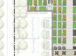

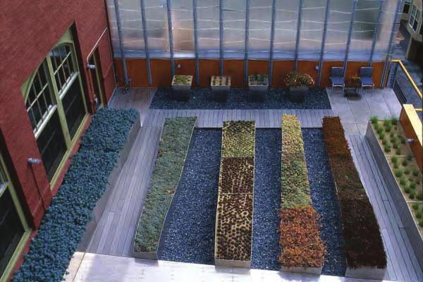
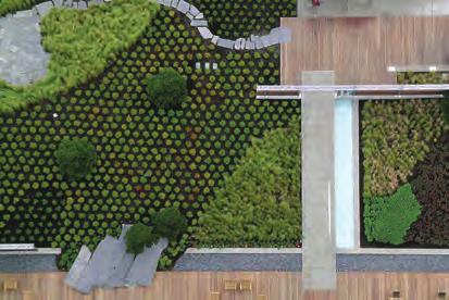
3 LANDSCAP SCHTIC OOF GADN PLAN Urban Agriculture community agriculture plots storage areas rain barrels Urban Agriculture community agriculture plots storage areas rain barrels oof Garden Precedent Image oof Terrace focal point roof garden oof Garden Precedent Image oof Garden Precedent Image CAMBI & LANDSCAP SCHTIC OOF GADN PLAN Scale 1:50 6 CAMBI & ZONG SUBMISSION


4 W 64th Ave Vehicle Access Lane/ Mews Planting as buffer ntry SCTION C2 SCTION C1 SCTION A Phase1 ntry North amp to ntry etails Phase2 ntry Live/ work Private Patio B A Stormwater Feature South Corner Plaza / Marine Public Art walkway Skytrain C1 SCTION B Public Art walkway Skytrain LANDSCAP SCHTIC SCTIONS CAMBI & LANDSCAP AWGS JAMS KM CHNG ACHITCTS 55 LANDSCAP SCHTIC - SCTIONS 3


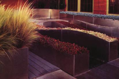
5 LANDSCAP SCHTIC PCDNT IGS W 64th Ave Street Scape W 64TH AV. Vehicle Access Lane / Mews Drop-Off/ ntry SKYTA - CANADA L Live / Work Private Patio CAMBI STT Drop-Off / ntry Marine Drive Streetscape CAMBI & CAMBI & ZONG SUBMISSION LANDSCAP SCHTIC - PCDNT IGS 5


6 LANDSCAP AWGS LANDSCAP SCHTIC PCDNT IGS North Corner Plaza / Public Art Walkway W 64TH AV. North ntry SKYTA - CANADA L CAMBI STT ntry Public Art Walkway South Corner Plaza CAMBI & LANDSCAP SCHTIC - PCDNT IGS JAMS KM CHNG ACHITCTS 57 4
Landscape Site Plan BLOCK D BLOCK A BLOCK C BLOCK B DEC 2009 L A N E W AY ARBUTUS 2 MEWS ARBUTUS STREET YEW STREET EXTENSION LEGEND
 Landscape Site Plan Green Edges Arbutus Mews Public Square Urban Garden Courts Green Roofs City Homes Private Patios Private Roof Terraces Urban Agriculture Plots BLOCK D BLOCK C YEW STREET EXTENSION L
Official Community Plan Bylaw No. 4360, 2004, Amendment Bylaw No. 4897, 2016 (Sewell s Landing)
") District of West Vancouver Official Community Plan Bylaw No. 4360, 2004, Amendment Bylaw No. 4897, 2016 (Sewell s Landing) Effective Date: 1089612v1 District of West Vancouver Official Community Plan Bylaw
District of West Vancouver Official Community Plan Bylaw No. 4360, 2004, Amendment Bylaw No. 4897, 2016 (Sewell s Landing) Effective Date: 1089612v1 District of West Vancouver Official Community Plan Bylaw
Figure 3-1: Public Realm Plan
 3 Public Realm Figure 3-1: Public Realm Plan 3.1 Public Realm Concept The public realm concept for the Little Mountain site integrates a clear and accessible movement network with public spaces for social
EXISTING TOWNHOUSE. What s working & What s not?
 What s working & What s not? Distance from the sidewalk/street to the building Landscape vs. Hardscape in front of the building Porches, stoops, steps, and entries Residential vs. contemporary character
appendix and street interface guidelines
 appendix five: building and street interface guidelines appendix 5 building and street interface guidelines BOULEVARDS Boulevards are generally characterized by higher levels of traffic movement at higher
4 Semi-Private & Private Open Spaces
 4 Semi-Private & Private Open Spaces 4.1 Semi-private Open Space 4.1.1 Common Courtyards The common courtyards for each complex will be designed and programmed for the typical owners living there. They
4.0 Design Guidelines For The Village Centre. South fields Community Architectural Design Guidelines Town of Caledon
 4.0 Design Guidelines For The Village Centre 4.0 Design Guidelines for the Village Centre The Village Centre is the focal point of the entire South Fields Community and is designed as a traditional commercial
R STREET CORRIDOR NEIGHBORHOOD Site Plan and Design Review Supplemental Guidelines Checklist
 R STREET CORRIDOR NEIGHBORHOOD Site Plan and Design Review Supplemental Guidelines Checklist Applicant s Name: Project Address: Phone: Email: Applicant shall fill out the design guidelines checklist for
Hilltop Town Garden City
 Page 1 of 14 4.1 CITY PLANNING PRECEDENTS Oakridge is a Hybrid of the positive aspects of these urban design strategies that integrate nature within the city: Hilltop Town Garden City Using topography
WINDSOR GLEN DESIGN GUIDELINES
 WINDSOR GLEN DESIGN GUIDELINES Adopted by Council, 2006 WINDSOR GLEN REDEVELOPMENT DESIGN GUIDELINES August 2006 1.0 Master Plan Organization For this area of the Coquitlam Town Centre, a mix of high,
Site Planning. 1.0 Site Context. 2.0 Pedestrian Circulation Systems. Pag e 2-23
 The following photographs from throughout the country illustrate key urban design principles. Photographs are provided to illustrate the overall urban design concepts described in Chapter 1 of the Downtown
Cleveland Park Streetscape and Drainage Improvement Project 1
 Cleveland Park Streetscape and Drainage Improvement Project 1 Urban Context Washington, D.C. Connecticut Avenue Cleveland Park Streetscape and Drainage Improvement Project 2 Neighborhood Context Contributing
LANDSCAPE DESIGN NARRATIVE AND PRECEDENT IMAGES 37
 LANDSCAPE DESIGN The landscape design for 0 Beach is inspired by both the fluid architectural design and the site itself, which forms a landmark gateway in and out of the downtown via the Granville Street
Division VI Community Mixed Use (CMU) Architectural Guidelines and Standards
 Architectural Guidelines and Standards") Division VI 18.40.800 Community Mixed Use (CMU) Architectural Guidelines and Standards 18.40.810 Guidelines The goals of the Comprehensive Plan include a focus on pedestrian safety, amenities and aesthetics
Division VI 18.40.800 Community Mixed Use (CMU) Architectural Guidelines and Standards 18.40.810 Guidelines The goals of the Comprehensive Plan include a focus on pedestrian safety, amenities and aesthetics
VEHICULAR AND PEDESTRIAN CIRCULATION
 This perspective sketch communicates the intended character and quality of a proposed streetscape design. Locate benches near a major intersection where people tend to gather. Seating and lighting provide
The Village. Chapter 3. Mixed Use Development Plan SPECIFIC PLAN
 The Village SPECIFIC PLAN Chapter 3 3.1 INTRODUCTION 3.1.1 Purpose This Chapter describes the development regulations applicable to the Mixed-Use and Transit Center Planning Areas. These form-based regulations
(DC1) Direct Development Control Provision DC1 Area 4
 Direct Development Control Provision DC1 Area 4") . General Purpose (DC) Direct Development Control Provision DC Area 4 The purpose of this Provision is to provide for an area of commercial office employment and residential development in support of the
. General Purpose (DC) Direct Development Control Provision DC Area 4 The purpose of this Provision is to provide for an area of commercial office employment and residential development in support of the
Clairtrell Area Context Plan
 Clairtrell Area Context Plan March 2005 Urban Development Services City Planning Contents 1. Introduction... 4 2. Development Structure... 6 2.1 Streets... 7 2.1.1 Sheppard Avenue and Bayview Avenue...
EXISTING VEHICULAR & PEDESTRIAN CIRCULATION
 46 EXISTING CONDITIONS EXISTING VEHICULAR & PEDESTRIAN CIRCULATION Vehicular and pedestrian circulation patterns are illustrated on this graphic. Campus entry points and major vehicular circulation routes
Walnut Creek Transit Village Design Guidelines. Part Three III - 25
 C. General Design Criteria Part Three DRAFT 0/6/ III - 5 Frontage Types Frontage is a semi-public transition zone at the ground level where public and private realms meet. An understanding of various frontage
Context Plan and Urban Design Guidelines for the lands west of Provost Drive
 Concord Park Place Context Plan and Urban Design Guidelines for the lands west of Provost Drive Amendment to the Bessarion-Leslie Context Plan October 2013 Concord Park Place Urban Design Guidelines The
New Park / Entry Court & Plaza Concept Design
 New Park / Entry Court & Plaza Concept Design The SECC Public realm is proposed to have a focus on health, wellness, and community and that site users will include patrons of the neighbourhood. The block
Cit of Kitchener Ur 6 an Design Manual PARTA. Desi n for _--::
 Cit of Kitchener Ur 6 an Design Manual Date PARTA Year ) Desi n for k Nodes Corridors _--:: Section Page 01 of 12 2 INTRODUCTION Purpose & Application Nodes and Corridors have been identified as key intensification
Complete Neighbourhood Guidelines Review Tool
 Complete Neighbourhood Guidelines Review Tool Prepared By: City of Regina Planning Department October 2014 Page 1 of 14 Community Development Review Checklist for Secondary Plans and Concept Plans The
RIVERSIDE DESIGN CD-1 GUIDELINES. Adopted by City Council August 9, 1983
 $1 City of Vancouver Land Use and Development Policies and Guidelines Community Services, 453 W. 12th Ave Vancouver, BC V5Y 1V4 F 604.873.7344 fax 873.7060 planning@city.vancouver.bc.ca RIVERSIDE DESIGN
Design Guidelines April 12, 2016
 100 Braid Street 100 BRAID STREET Design Guidelines April 12, 2016 Previous Issues: April 01, 2016 March 11, 2016 March 07, 2016 2 Cover Image: conceptual rendering of proposed development Table of Contents
7-PARKS, OPEN SPACE & PUBLIC ART
 7-s, Open Space & Public Art 7-PARKS, OPEN SPACE & PUBLIC ART This chapter provides recommendations for the expansion of new parks, plazas and open space that serve the many user groups targeted for downtown.
Highland Village Green Design Guidelines
 Highland Village Green Design Guidelines Publishing Information Title Highland Village Green Design Guidelins Author The City of Calgary Status DRAFT - Proposed document subject to changes Additional Copies
ACSA/AIA Housing Design Education Award
 ACSA/AIA Housing Design Education Award 2014-2015 Winner: Submission Materials FOUR URBAN HOUSING NARRATIVES: Getting the City to be a Master Developer STEPHEN D. LUONI University of Arkansas JEFFREY ERWIN
EXISTING CONDITIONS 41. Existing Conditions
 EXISTING CONDITIONS 41 Existing Conditions The Existing Analysis phase of the planning process involved a study of the existing conditions on the campus in order to identify key planning issues to be addressed
East Grove Public Realm
 H - - MP - Elephant Park Public Realm RO EY DN NEW KENT ROAD E AC PL The public realm has been designed to create an environment which is easy to move through, accessible to all, safe and playful. The
Classroom Science Building
 Classroom Science Building Public Realm Presented by: Gary Branville, Joe Moore, Justin Rechtzigel, Tom Roth & Hailey Wall Proposal Objective: To create a node on the Grand Rounds Parkway Connect the public
3 Parks, Open Spaces and the Public Realm
 3 Parks, Open Spaces and the Public Realm 3.1 Open Spaces and Public Places Pearson Dogwood Policy Statement Open Spaces and Public Places A legible, welcoming and sustainable open space system will be
18. Form & Character Development Permit Areas
 18. Form & Character Development Permit Areas 18.1. Overview 18.1.1. AREAS Lands designated as Downtown Smithers, Mixed Residential and Highway 16 Commercial and identified on Schedule: C. 18.1.2. PURPOSE
5.1 Site Plan Guidelines
 5. Community Core Guidelines Development of the Community Core will take place by plan of subdivision and site plan approval. It will occur in a phased manner that will reflect the timing of residential
Urban Design Principles
 Urban Design Principles 3.0 Harbouside Waterfront Rezoning Submission - November 2012 3.1 Urban Design Principles Twelve distinct design principles have been identifi ed for the Harbourside Waterfront
4.9 Mendocino Avenue Corridor Plan Design Guidelines
 4.9 Mendocino Avenue Corridor Plan Design Guidelines The Mendocino Avenue Corridor Plan addresses the area between College Avenue and Steele Lane. Mendocino Avenue is a busy arterial that runs parallel
HIGHLAND VILLAGE GREEN URBAN DESIGN PRINCIPLES/GUIDELINES
 URBAN DESIGN GUIDING PRINCIPLES/GUIDELINES CONTEXT/CHARACTER The City of Calgary s Municipal Development Plan (MDP), Transit-Oriented Development (TOD) Policy Guidelines and Main Street/Corridor policy
Throughout. square. (Crystal City Vision Plan 2050)
") 1: Terms related to the PSMP document 1 public space (see also public realm, civic space) An open space designated on the regulating plan, accessible to all, including Plazas, Mini Parks, and Neighborhoods
1: Terms related to the PSMP document 1 public space (see also public realm, civic space) An open space designated on the regulating plan, accessible to all, including Plazas, Mini Parks, and Neighborhoods
The open space system should provide connective elements, relate to natural resources, and enhance the suburban character of the landscape..
 The open space system should provide connective elements, relate to natural resources, and enhance the suburban character of the landscape.. Mixed-use and infill development should maintain or enhance
The subject site plan amendment proposes the following revisions to the approved site plan:
 PROPOSED AMENDMENT The subject site plan amendment proposes the following revisions to the approved site plan: 1. The building footprint was modified to accommodate the revised architectural design. 2.
SECTION TWO: Overall Design Guidelines
 SECTION TWO: Overall Design Guidelines This section provides overall design principles and guidelines for the Gardnerville Mixed-use Overlay. They provide criteria for mixed-use places consisting of residential,
Community Mixed Use Zone Districts (CMU)
") 18.28.500 Community Mixed Use Zone Districts (CMU) The Community Mixed Use Zone Districts (CMU) are intended to help implement the land use goals and strategies found in the Golden Vision 2030 values,
18.28.500 Community Mixed Use Zone Districts (CMU) The Community Mixed Use Zone Districts (CMU) are intended to help implement the land use goals and strategies found in the Golden Vision 2030 values,
Planning Board Briefing
 Planning Board Briefing Why Now? The Sector Plan Implementation Chapter States: Before Stage 1 begins, the following must occur: Approval of the Sectional Map Amendment. Approval of the Greater Lyttonsville
Stadium District Masterplan
 Stadium District Masterplan Masterplan (noun): an evolving long-term planning document that establishes the framework and key elements of a site. It reflects a clear vision synthesizing developer goals
Community Design Guidelines. Port Wallace DRAFT
 Community Design Guidelines Port Wallace DRAFT Energy 1 2 3 Nature Movement Connections Built Form DRAFT Layout Energy 1 Nature Community Design Guidelines GREAT COMMUNITIES PROTECT, CELEBRATE, AND CONSERVE
Form & Character Development Permit Areas
 Form & Character 1.1. Overview 1.1.1. AREAS Lands designated as Downtown Smithers, Multi-family Residential, and Highway 16 Commercial and identified on Schedule: C. 1.1.2. PURPOSE The Form and Character
/05 Architectural Response
 /05 Architectural Response 5.1 Inspiration Stacked Boxes (Artist : Rachael Whiteread) Cubism ( Architect : Le Corbusier) 52 1133 Melville Rezoning Submission Patterns ( Textile Artist : Annie Albers) Overlapping
The Project. In 2013, construction was completed between 100 Street and 102 Street.
 The Project Jasper Avenue New Vision (JANV) is a major catalyst project identified in the Capital City Downtown Plan (2010) between 92 Street and 109 Street, including the streets half a block north and
PUBLIC REALM DESIGN PLAN APRIL, 2012
 PUBLIC REALM DESIGN PLAN APRIL, 2012 Introduction NoMa is growing quickly. Fueled by transit accessibility, proximity to both Downtown and Capitol Hill and streamlined entitlements, the neighborhood has
PUBLIC REALM STRATEGY
 Concept PUBLIC REALM STRATEGY The design approach for of the public realm is to provide a streetscape interface appropriate to supporting Alberni s consistent scale and residential character. A series
Bloor Street East Potential Ravine Portal Overlook and Access Passage to the Rosedale Valley and Don River Valley Ravine, Toronto, Canada
 TRANSFORMATIVE IDEA 2. GREAT STREETS Bloor Street Christie Pits Park Bloor St Spadina Ave Bathurst St Shaw St 1 Recognize the significant public realm improvements along Bloor Street and extend and enhance
Appendix 1. Private Projects with Respective On Site PUS and Public Parks in the Silver Spring CBD
 Appendix 1 Private Projects with Respective On Site PUS and Public Parks in the Silver Spring CBD Green Space Guidelines for the Silver Spring Central Business District montgomery county planning board,
BROADWAY/COMMERCIAL C-3A GUIDELINES. Adopted by City Council August 2, 2001
 $2 City of Vancouver Land Use and Development Policies and Guidelines Community Services, 453 W. 12th Ave Vancouver, BC V5Y 1V4 F 873.7344 fax 873.7060 planning@vancouver.ca BROADWAY/COMMERCIAL C-3A GUIDELINES
Neighborhood Districts
 NEIGHBORHOOD DISTRICTS SEVEN MAIN DISTRICTS Neighborhood Districts While the Development Plan provides a broad-scale overview of the neighborhood, this section focuses on uses and relationships at the
Sierra Springs Regional Commercial Master Site Plan Airdrie, Alberta Hopewell Development Corporation Project No May 26, 2010
 Sierra Springs Regional Commercial Master Site Plan Airdrie, Alberta Hopewell Development Corporation Project No. 205-077 May 26, 2010 TABLE OF CONTENTS Purpose... 2 Master Site Plan Guidelines... 3 Overall
599 Kennedy Road - Official Plan Amendment and Zoning Amendment Application - Preliminary Report
 STAFF REPORT ACTION REQUIRED 599 Kennedy Road - Official Plan Amendment and Zoning Amendment Application - Preliminary Report Date: March 7, 2017 To: From: Wards: Reference Number: Scarborough Community
CAMBIE CORRIDOR PLAN
 1 WELCOME TO THE OPEN HOUSE PUBLIC REALM PLAN - CAMBIE CORRIDOR Thank you for coming to the Cambie Corridor Public Realm Open House! Place a dot where you live Please provide us with your comments and
open house 3 CITY OF SALEM Downtown Streetscape Plan
 open house 3 Streetscape concepts CITY OF SALEM Downtown Streetscape Plan analysis concepts we are here refined concepts & document Feb 13th 1 2 3 apr 18th KICKOFF OPEN HOUSE Streetscape Work Group Walking
Providence Waterfront Park
 I-195 Redevelopment Parcels Providence Waterfront Park June 30, 2014 I-195 30% Design Review 1 November 19, 2012 endorses open space design. 2 Design Chronology October 2013 10% Design Submitted for both
Welcome! to Keller Town Hall
 Welcome! to Keller Town Hall Keller Town Center Planning a New Downtown What is Keller Town Center? A new, growing downtown district planned as an urban village A combination of retail and office spaces,
404. Non-Residential Districts TC: McMurray Town Center
 404. Non-Residential Districts 404.1 TC: McMurray Town Center Intent: 400: District TC Classifications The Township s established Town Center district is intended to provide a defined community-scale residential,
400 West Georgia Street Urban Design Panel. Public Realm
 400 West Georgia Street Urban Design Panel Public Realm Public Benefits The main benefit in regards to the proposed development at 400 West Georgia Street will be to increase density of Commercial Office
15. Rock Bay Employment Sub-Area
 15. Employment Sub-Area Future Land Use Directions and Urban Design The area will continue to serve as Victoria s urban industrial district. The waterfront is a key location for heavier, often harbour-dependent
Buildings may be set back to create small plazas provided that these setbacks do not substantially disrupt the street wall s continuity.
 6-22 Community Design Street Walls and Street-front Setbacks The siting of buildings will play a critical role in establishing the character and sense of place for the District. Siting buildings at the
PUBLIC RIGHT-OF-WAY IN THIS CHAPTER PUBLIC REALM
 PUBLIC RIGHT-OF-WAY This section provides design guidelines for improvements in the public right-of-way. The public right-of-way refers to streets, sidewalks, non-vehicular thoroughfares, parks and greenways
SITE PLANNING. USC Village will be a mixeduse urban environment. creating a common ground with the surrounding community. Our planning goals include:
 North University Park West 101 6 5 North University Park East 5 3 North of Jefferson University Village/ Cardinal/Century 4 110 Downtown Los Angeles University Park Academic Core 1 10 60 University Park
SOUTH UNIVERSITY Street Design Alternatives in Progress
 1 Alternatives in Progress 2016.01.20 Meeting Agenda 2 1. Progress & Schedule 2. Utilizing the Street Design Manual 3. Site Characteristics and Input Received 4. Street Geometry What can we accomplish
ARTICLE 12. LANDSCAPING REQUIREMENTS.
 ARTICLE 12. LANDSCAPING REQUIREMENTS. 12.1 GENERAL REQUIREMENTS 12.2 LANDSCAPE PLAN REQUIRED 12.3 LANDSCAPE DESIGN STANDARDS 12.4 REQUIRED PARKING LOT LANDSCAPE 12.5 REQUIRED BUFFER YARD 12.6 ADDITIONAL
Mix of Uses Guide for Transit-Oriented Development MIX OF USES
 MIX OF USES Creating a Destination Magnet A diversity of uses such as retail, housing, offices, civic and entertainment within the TOD creates a destination magnet for transit users and TOD neighbors.
City of Vaughan Urban Design Guidelines for Infill Development in Established Low-Rise Residential Neighbourhoods
 City of Vaughan Urban Design Guidelines for Infill Development in Established Low-Rise Residential Neighbourhoods DRAFT - September 2016 Contents 1. Introduction 1 2. Policy Context 3 3. Characteristics
Charles P. Johnson and Associates. Annapolis Landscape Architects
 Charles P. Johnson and Associates Annapolis Landscape Architects AGENDA Introduction Project Limits and Scope Site Analysis Opportunities & Constraints Program Goals Image Boards Design Alternatives Pros
Figure 12: St Andrews, Bow 14 TOWNSHEND LANDSCAPE ARCHITECTS
 Figure 12: St Andrews, Bow 14 TOWNSHEND LANDSCAPE ARCHITECTS 2.4 COURTYARD The courtyard of Building 12S will act as the main amenity space for the residents of this building. Built in the centre of the
Rezoning Information booklet 6600 Cambie Street
 Rezoning Information booklet 6600 Cambie Street December 2013 CONTENTS page Vision 2 Site and Context Context Plan 3 Context Images 4 Proposal Building Design 5-8 Sustainability/Livability 9-10 Landscape
Architectural Standards
 Architectural Standards A collection of provisions working in concert to meet the community design objectives for downtown 1. Average Daylight Plane Concept. Provisions ensures that facades along streets
Proposals for a new college and homes. Thank you for visiting our exhibition.
 1 Welcome Thank you for visiting our exhibition. The college are pleased to welcome you to view our plans to regenerate. If you have any questions, please feel free to speak with a member of the project
Mary Hills Nature Area. Roadway Lighting. The Minneapolis Clinic of Neurology Courage Kenny Rehabilitation Institute
 PUBLIC REALM IMPROVEMENTS Mary Hills Nature Area Enhanced Programming Glenview Terrace Valley View Roadway Lighting Enhanced Streetscape Trail Lighting / Roadway Lighting Wayfinding Public Art The Minneapolis
1. Welcome to the Squamish Nation Traditional Territory Ha7lh en skwalwn Kwis tl'iknumut tl'a Skwxwuu7mesh Uxwumixw
 DISTRICT OF SQUAMISH Minutes of the Regular Meeting of the Advisory Design Panel held Thursday, November 3, 2016, at 2:00 P.M. in the District of Squamish Council Chambers, 37955 Second Avenue, Squamish,
Bayshore Boulevard Home Improvement District Design Guidelines
 Bayshore Boulevard Home Improvement District Design Guidelines guidelines for New construction projects and major alterations IN the bayshore boulevard home improvement special use DISTRICT SAN FRANCISCO
Draft Master Plan for Franklin Park
 Draft Master Plan for Franklin Park Metro Parks Tacoma with SiteWorkshop November 2009 I. overview & background Process & History Master Plan Process The Master Plan is based on a community involvement
Marpole Community Plan. Parks and Open Space
 Marpole Community Plan Parks and Open Space Community Workshop, March 13 th, 2013 Overview 1 Community Plan 2 City-wide initiatives 3 4 Overview 1 Community Plan 2 City-wide initiatives 3 4 Marpole: Boundaries
Urban Design Guidelines Townhouse and Apartment Built Form
 Urban Design Guidelines Townhouse and Apartment Built Form Town of Wasaga Beach Table of Contents 1. Introduction 1.1. Purpose 1.2. Urban Design Principles 1.3. Application of Guidelines 2. Site Design,
Architectural Review Board Report
 Architectural Review Board Report To: From: CC: Subject: Architectural Review Board Architectural Review Board Meeting: May 21, 2018 Agenda Item: 8-A Grace Page, Senior Planner Stephanie Reich, AIA, LEED
ROME WATERFRONT VILLAGE PROJECT NARRATIVE January 25, 2018
 January 25, 2018 The Rome Waterfront Village project is intended to foster the revitalization of the area between South James Street and Erie Boulevard north of the Erie Canal as well as improve public
Westwind Developments Ltd. PIONEER LANDS AREA STRUCTURE PLAN - PROPOSED AMENDMENT
 FEBRUARY 2013 TABLE OF CONTENTS 1.0 BACKGROUND... 1 1.1 Amendment... 1 2.0 LOCATION & CONTEXT... 2 2.1 Land Ownership... 2 3.0 POLICY CONTEXT... 3 3.1 Municipal Development Plan... 3 3.2 Capital Region
Advisory Design Panel Minutes
 Present: Chair - L Mickelson D. Newby M. Ehman M. Vance T. Coady K. Johnston S. Forrest M. Younger Advisory Design Panel Minutes Guests: C. Kay, Townline S. Jedreicich, Townline C. Mackintosh, GBL Architects
Artists impression of the Park Promenade and plot H4 with café and restaurant uses that is still subject to change
 The Park Promenade Artists impression of how a café might look Artists impression of the Park Promenade and plot H4 with café and restaurant uses that is still subject to change Precedent images for balconies
ATTACHMENT A. SILVERDALE DESIGN STANDARDS Amendments to the Waaga Way Town Center Chapter
 ATTACHMENT A SILVERDALE DESIGN STANDARDS Amendments to the Waaga Way Town Center Chapter Chapter 10. Waaga Way Town Center 10.1 Physical Identity Elements & Opportunities The Waaga Way Town Center includes
Existing Site. Ash Crescent at 57th Avenue. Ash Crescent with Low Rise. Ash Crescent with Giant Sequoias
 Existing Site Ash Crescent at 57th Avenue Ash Crescent with Low Rise Ash Crescent with Giant Sequoias 1 Existing Site Courtyard with Towers Tower Courtyard with Pool Low Rise Courtyard with Pool 2 Existing
THE CORPORATION OF DELTA ADVISORY DESIGN PANEL. Laura Ryan, Planner Yvette Luke, Senior Planner Candice Dannhauer, Recording Clerk
 THE CORPORATION OF DELTA ADVISORY DESIGN PANEL Minutes of the Regular Meeting of the Advisory Design Panel held Thursday, February 28, 2013 at 6:30 p.m. in the Tilbury Room at Delta Municipal Hall, 4500
Community Design Plan
 Gardena General Plan 2006 Authority While the is not a required element of a General Plan, it is included because improving the community appearance and image is paramount to the overall quality of life
SITE DESIGN IN THIS CHAPTER FIRE CODE REQUIREMENTS FLOOD DAMAGE PREVENTION
 SITE DESIGN New construction and redevelopment in the Blue Hill District should incorporate high-quality site design to enhance community image and help create more pedestrian-oriented spaces and connections
Residential Commons at Barry s Corner. Boston civic design commission February 5, 2013
 Residential Commons at Barry s Corner Boston civic design commission February 5, 2013 TABLE OF CONTENTS project summary 3 PROJECT site 4 PLANNING APPROACh 6 Parcel Diagams 6 Design Principles 8 Street
401/Keele Provincial Campus Ontario Realty Corp.
 1.0 INTRODUCTION 1.1 Site Location and Description The study area consists of approximately 74 acres (30 ha) located in the Keele Street and Wilson Avenue area. It is bounded by Wilson Avenue to the north,
lot flankage Y street 16m 6m landscape strip for large site 3m landscape strip for small medium site
 Commercial General Commercial Objectives Create developments compatible with adjacent land uses in scale, function and character Define a consistent and attractive street edge with quality landscaping,
urban design Introduction
 ACHIEVE SP RI NGF I ELD.3 Introduction Urban Design Areas Design Areas are areas within Springfield that have a unique and recognizable character that is different from other areas in the community. The
The following concept plans and illustrations are the result of this 10 month study of the alley connections from CSU to the River District.
 W E L C O M E T O T H E F O R T C O L L I N S D O W N T O W N A L L E Y S A N D I N T E G R AT E D W A L K W AY S M A S T E R P L A N O P E N H O U S E The following concept plans and illustrations are
2.5 Roads. Loading and service areas adjacent to Highway 401 should be screened through architectural walls and/or landscape buffer planting.
 N HIGHWAY OFF RAMP 2.5 Roads A legible road network with a clear hierarchy will help create a connected community, both within and surrounding the Milton Heights. The following section outlines the proposed
Bow to Bluff Public Realm Plan Design Update
 Bow to Bluff Public Realm Plan Design Update December 017 Great public spaces encourage people to gather, recreate, explore and discover. Introduction The City of Calgary is planning to improve the corridor
What We Heard. Downtown Georgetown Planning Study. Consultation Event #3 May 24, 2018
 What We Heard Downtown Georgetown Planning Study Consultation Event #3 May 4, 08 Workshop - July 5, 07 0 WORKSHOP The Downtown Georgetown Planning Study will guide growth and development in the downtown