April 10, RE: Allegany County 2015 Transportation Priorities. Dear Transportation Secretary Rahn:
|
|
|
- Christine Cox
- 5 years ago
- Views:
Transcription

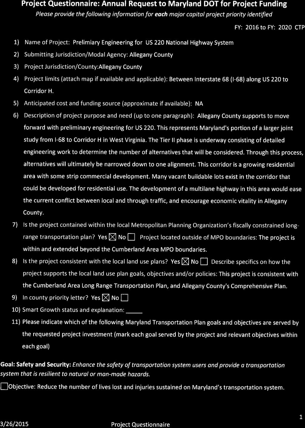
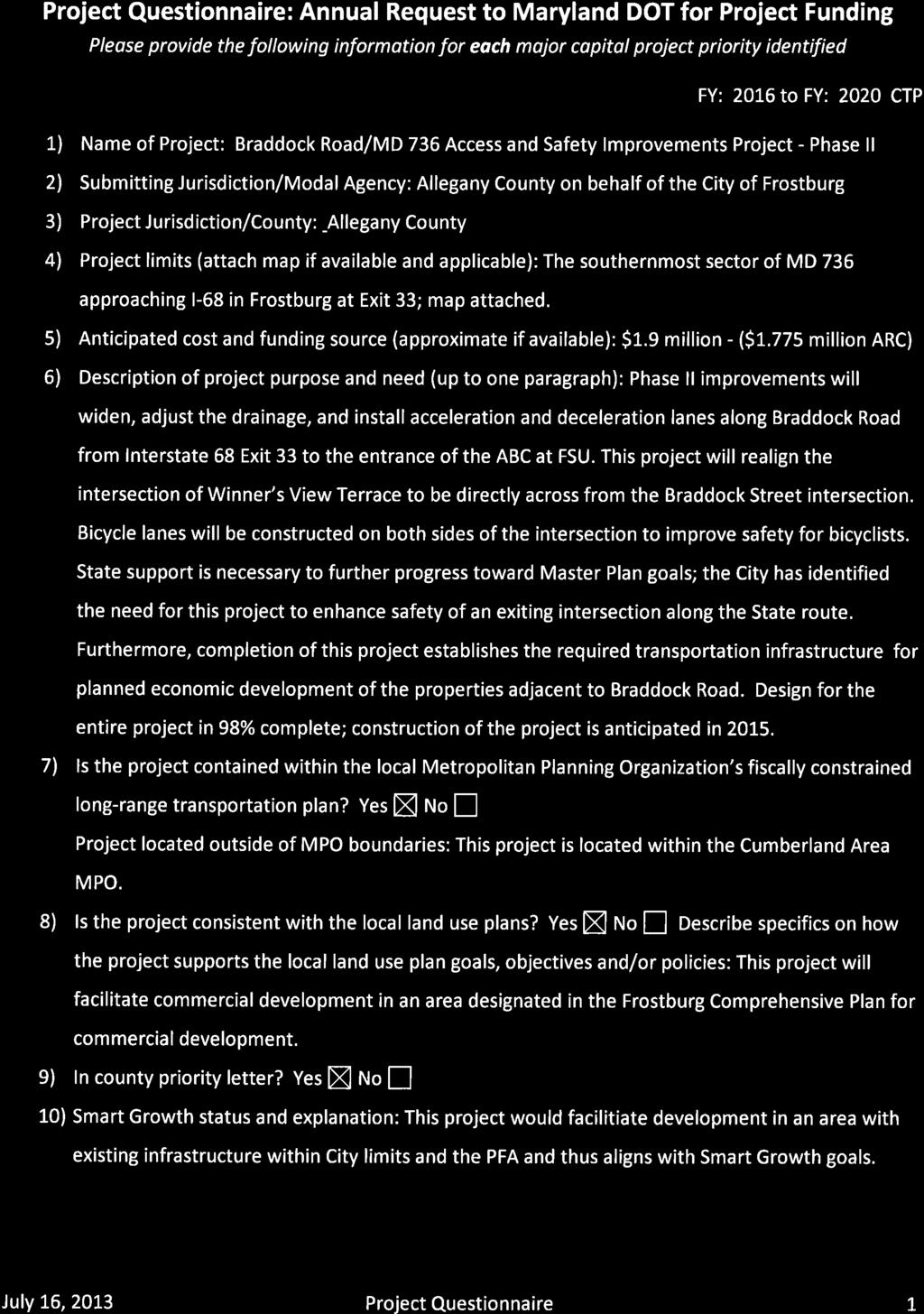
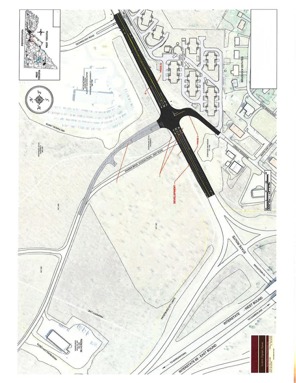
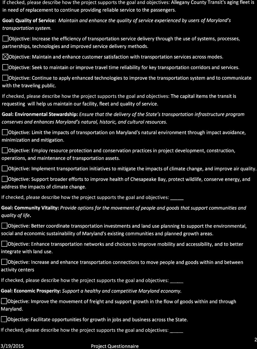
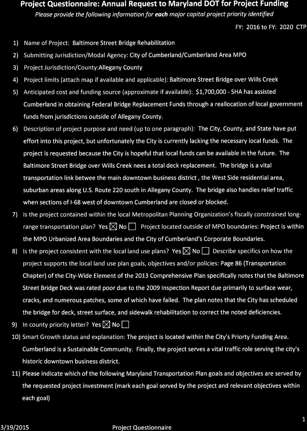
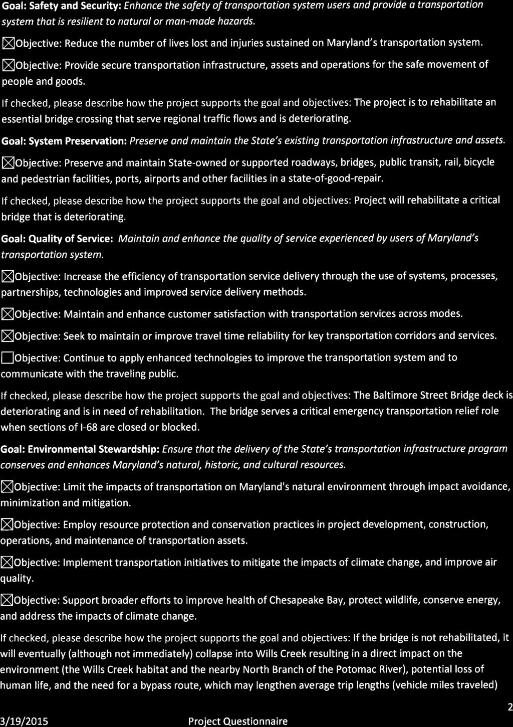
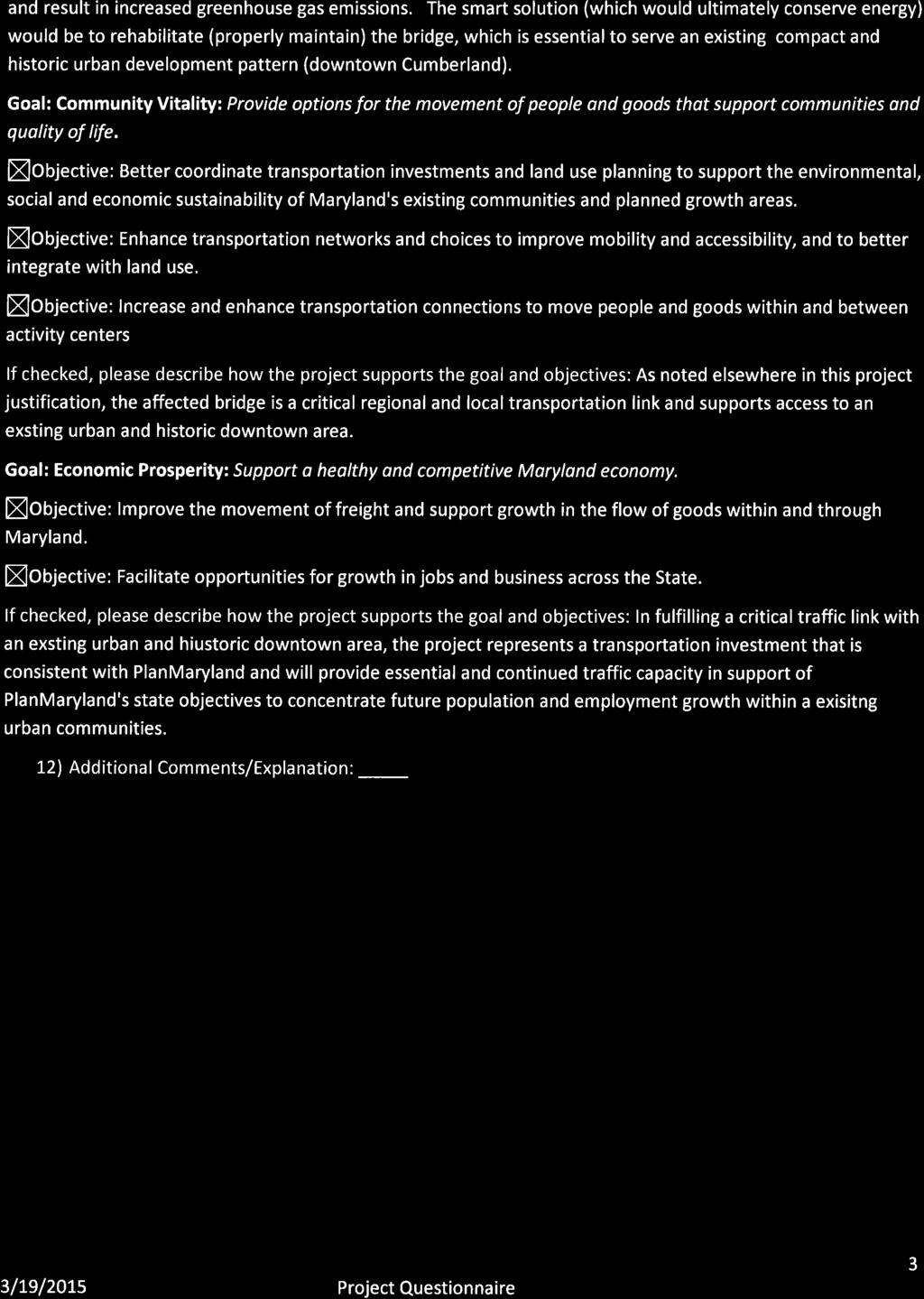
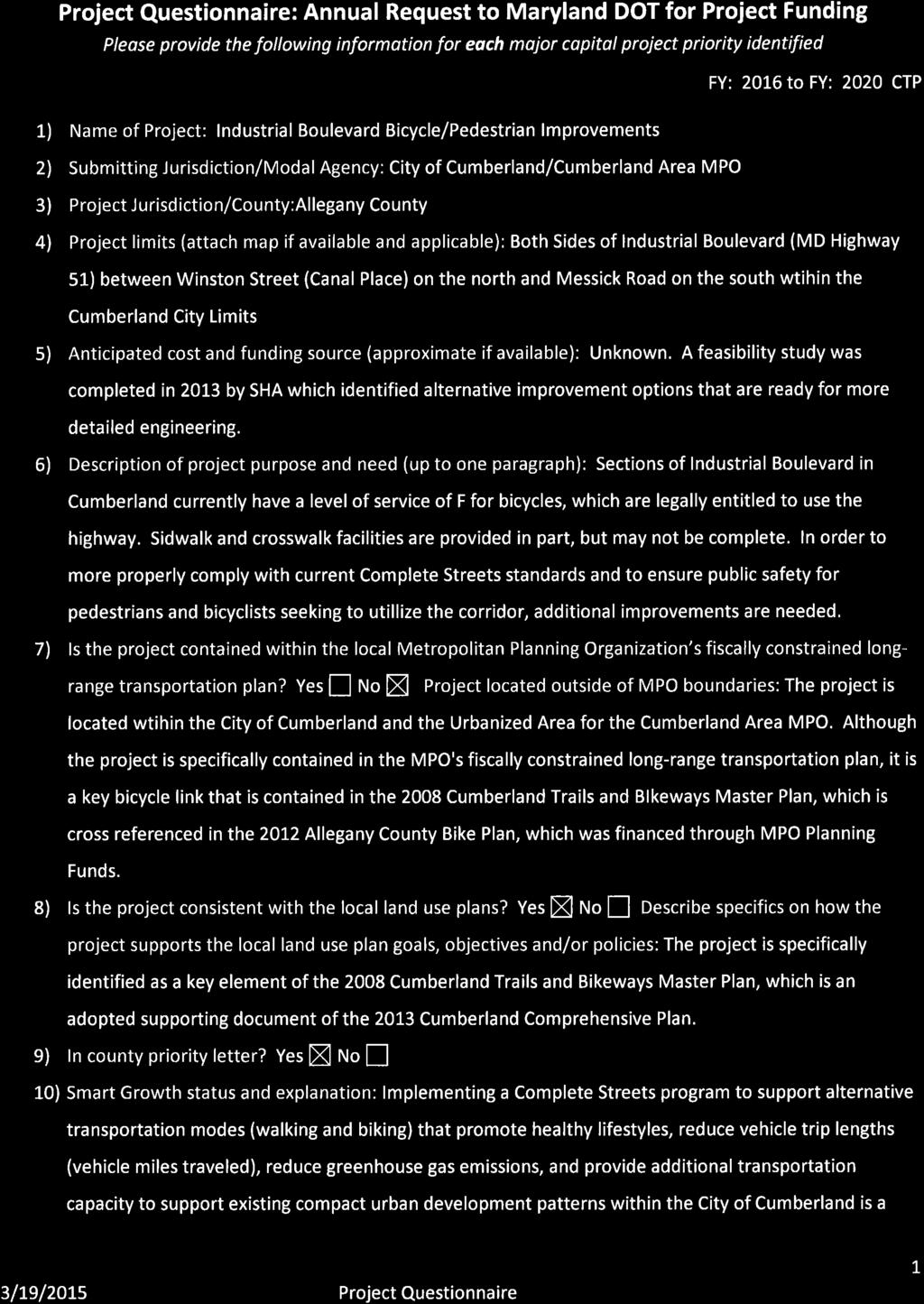
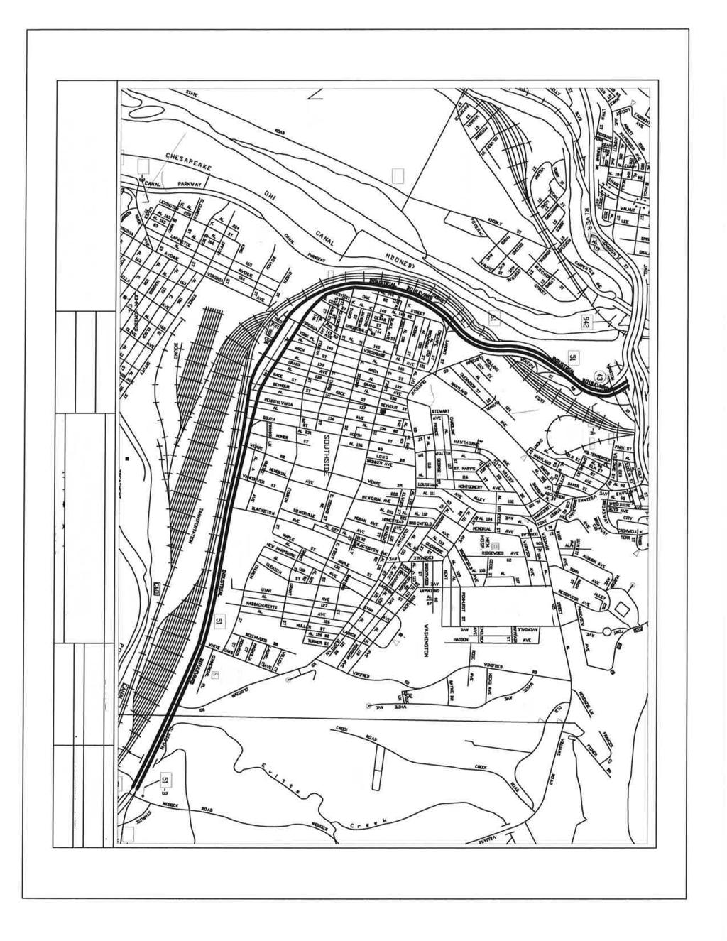
1 April 10, 2015 The Hon. Pete K. Rahn, Maryland Transportation Secretary Maryland Department of Transportation 7201 Corporate Center Drive Hanover, Maryland Dear Transportation Secretary Rahn: RE: Allegany County 2015 Transportation Priorities The Board of Commissioners of Allegany County, in cooperation with the municipalities of Allegany County is pleased to have the opportunity to present its transportation priorities to your department for the FY Consolidated Transportation Program (CTP). The County s transportation priorities focus on system preservation, safety and supporting economic development. To be consistent with the Chapter 725 process, representatives from the County and the municipalities discussed and prioritized the projects at a coordination meeting held Wednesday, March 18, The Board of Commissioners, as a part of the agenda on Thursday, March 26, 2015 endorsed the 2015 priority projects. On behalf of Allegany County, the Town of Barton, the City of Cumberland, the City of Frostburg, the Town of Lonaconing, the Town of Luke, the Town of Midland, and the Town of Westernport, we would like to submit our projects as follows: 1. Preliminary Engineering for US 220 National Highway System Allegany County supports to move forward with preliminary engineering for US 220. This represents Maryland's portion of a larger joint study from I-68 to Corridor H in West Virginia. The Tier II phase is underway consisting of detailed engineering work to determine the number of alternatives that will be considered. Through this process, alternatives will ultimately be narrowed down to one alignment. This corridor is a growing residential area with some strip commercial development. Many vacant buildable lots exist in the corridor that could be developed for residential use. The development of a multilane highway in this area would ease the current conflict between local and through traffic, improve safety and encourage economic vitality in Allegany County. 2. Braddock Road/MD 736 Access and Safety Improvements Project Phase II Phase II improvements will widen, adjust the drainage, and install acceleration and deceleration lanes along Braddock Road from Interstate 68 Exit 33 to the entrance of the ABC at FSU. This project will realign the intersection of Winner s View Terrace to be directly across from the Braddock Street intersection. Bicycle lanes will be constructed on both sides of the intersection to improve safety for bicyclists. State support is necessary to further progress toward Master Plan goals; the City has identified the need for this project to enhance safety of an existing intersection along the State route. Furthermore, completion of this project establishes the required transportation infrastructure for planned economic development of the properties adjacent to Braddock Road. Design for the entire project in 98% complete; construction of the project is anticipated in Greene Street Complete Street Project The Greene Street Complete Street Plan is underway and is expected to be completed by Spring The plan provides a vision for a safer, more attractive and economically viable street spanning from Baltimore Street to the end of City Maintenance at I-68 Exit 42. Greene Street, formally US Route 220 and prior to that it was part of the National Road, is in need of significant rehabilitation to handle the traffic on this West Side arterial street. Lack of local funds as well as any funds for road improvements have prevented the City from being able to do anything on this street since the days of Urban Systems Federal Aid sharing through the Maryland SHA. The portion of Greene Street between Baltimore Street and Lee Street has been re-designated as part of the National Road Scenic Byway, as part of its campaign to replace scenic byway signage along the route. The City is looking to implement the Greene Street Complete Street Plan to improve the corridor for all modes of transportation.
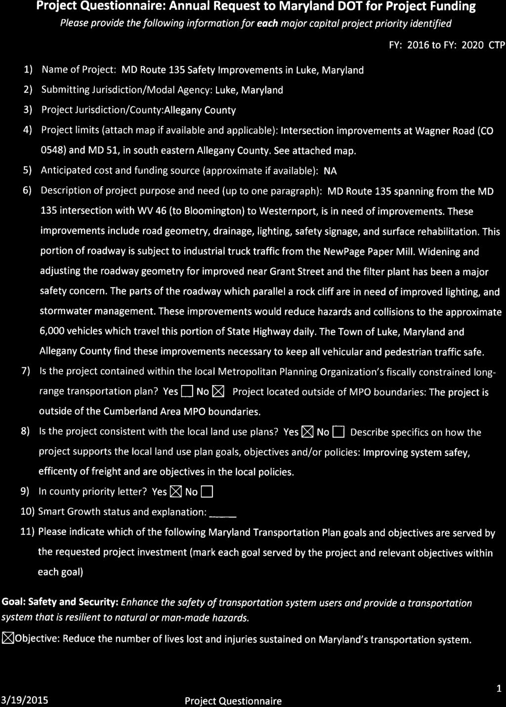
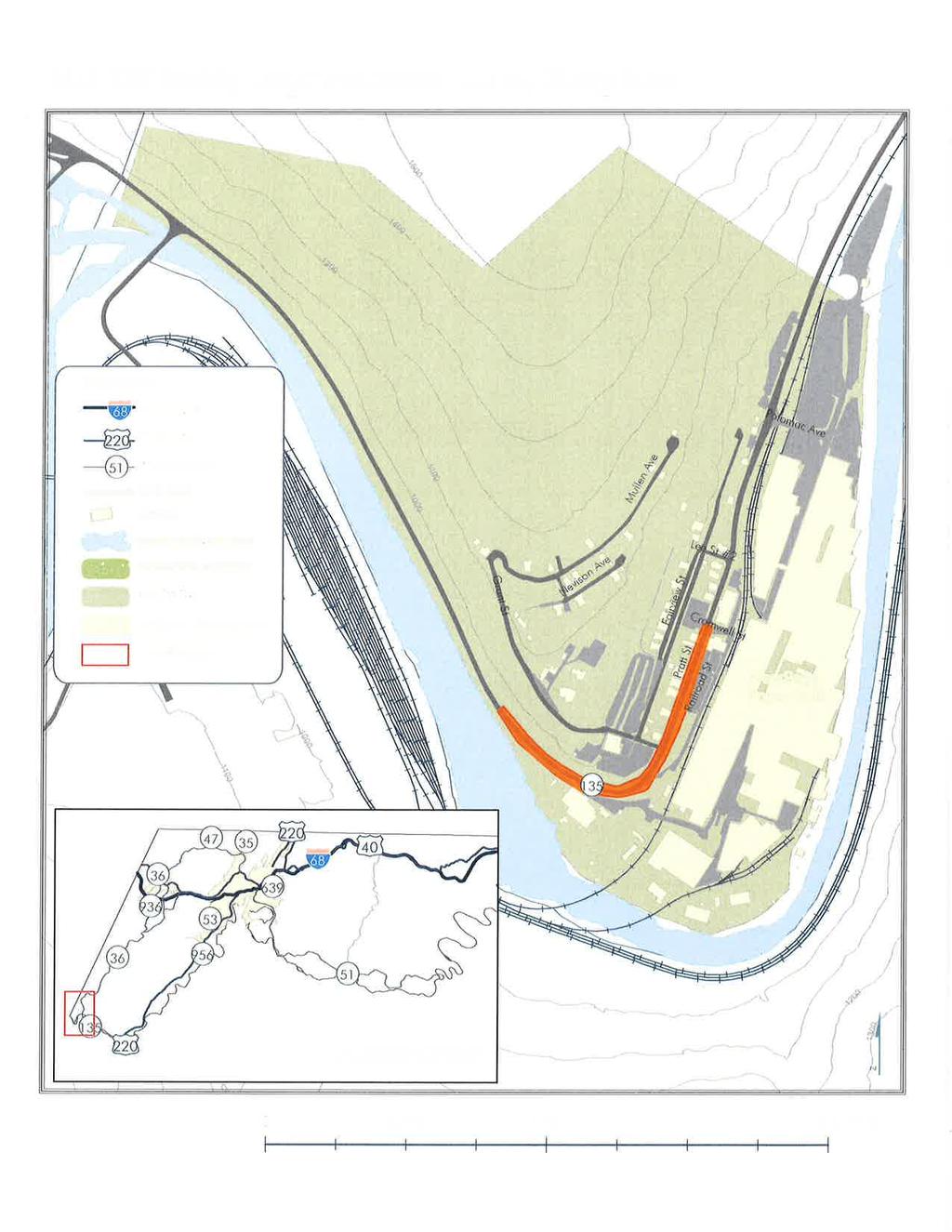
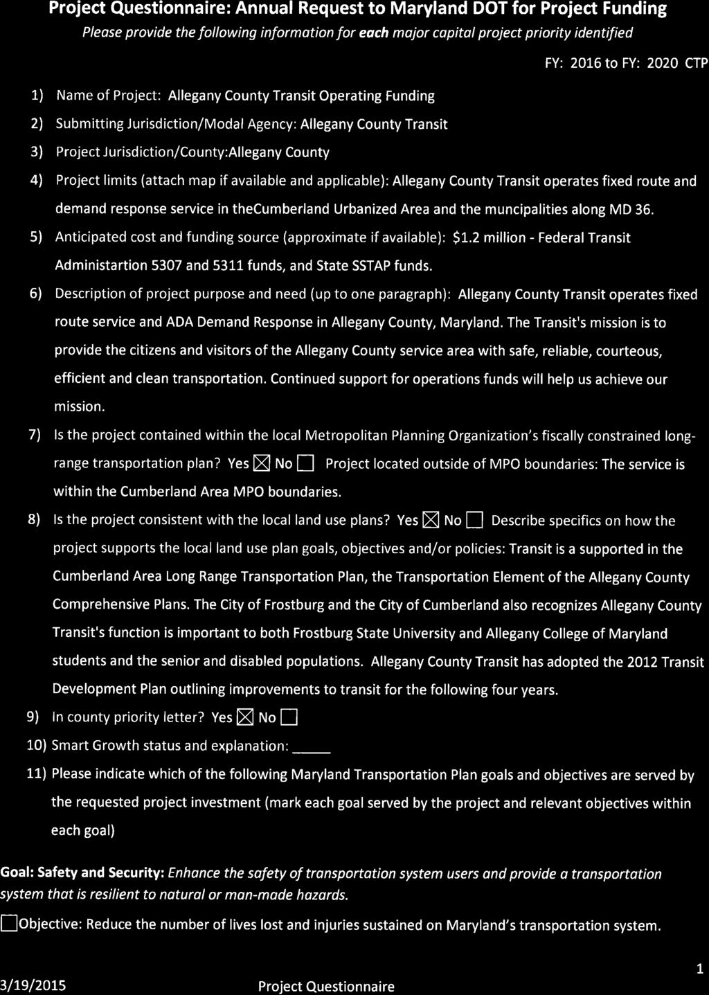
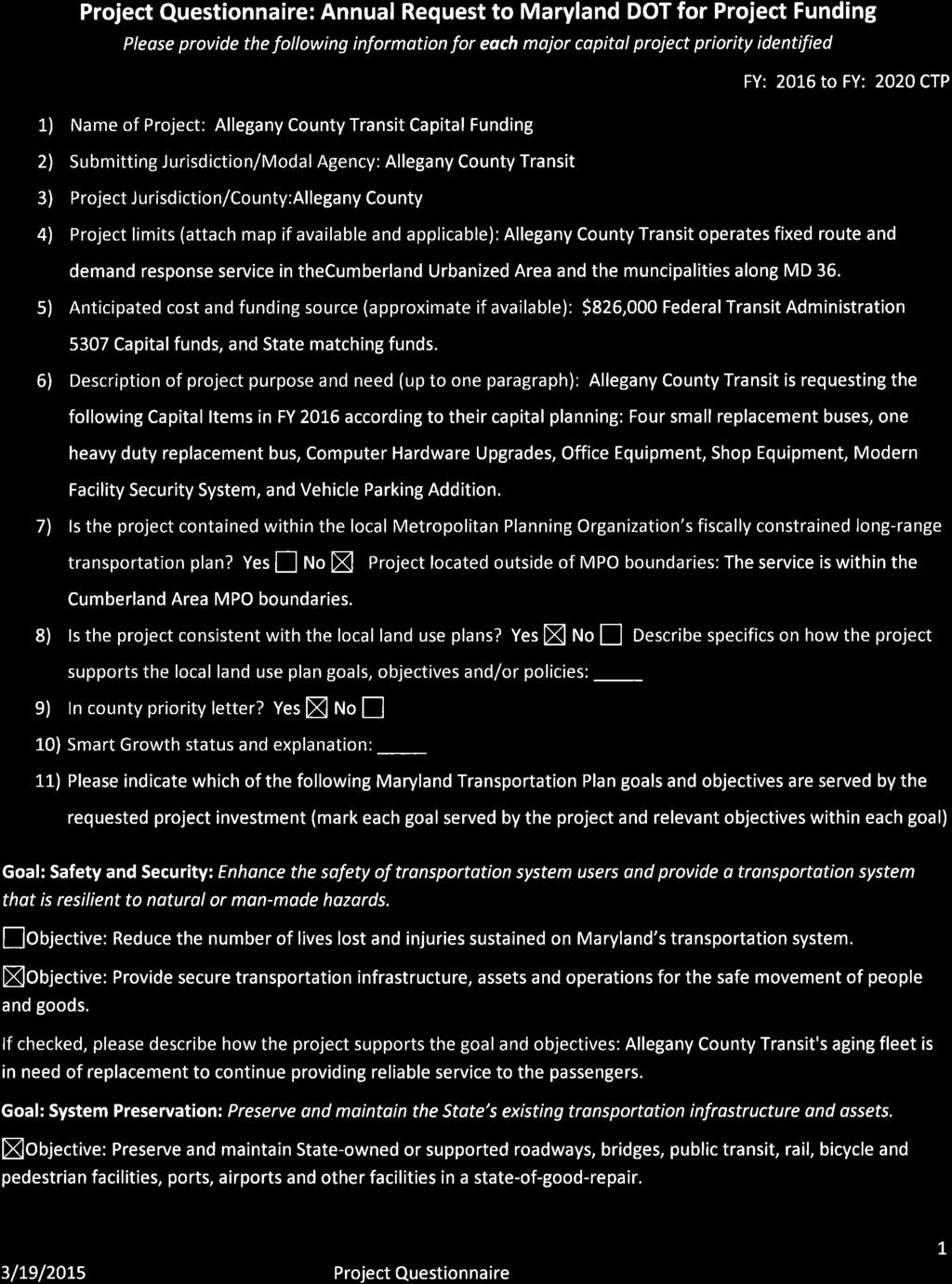
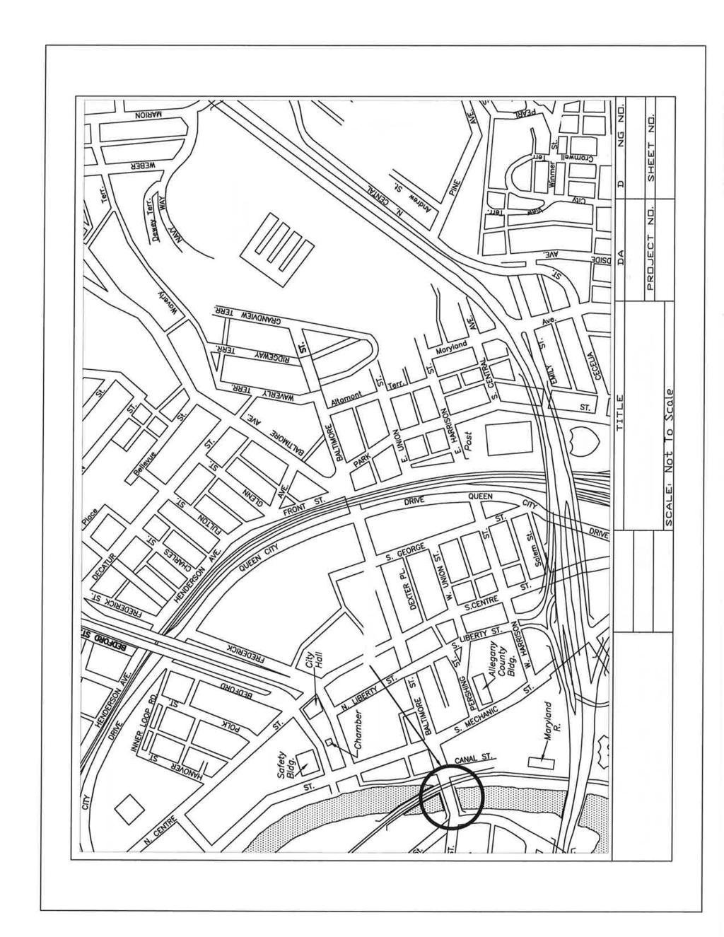
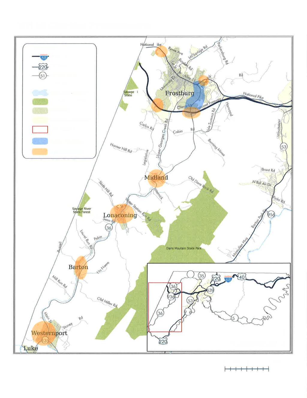
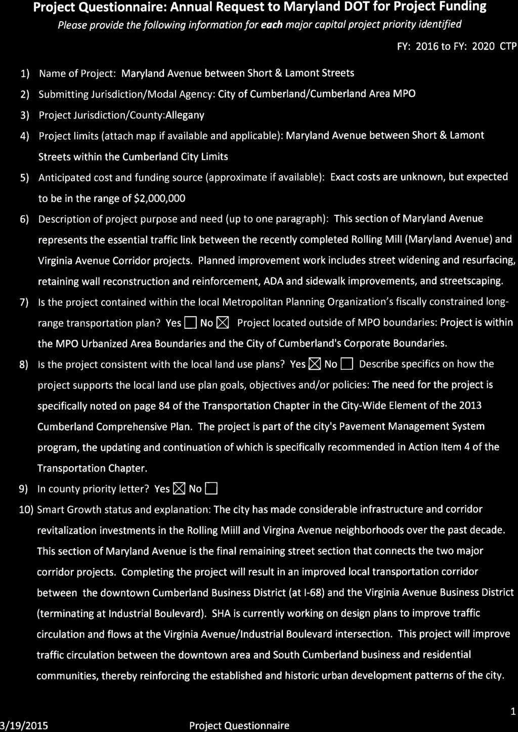
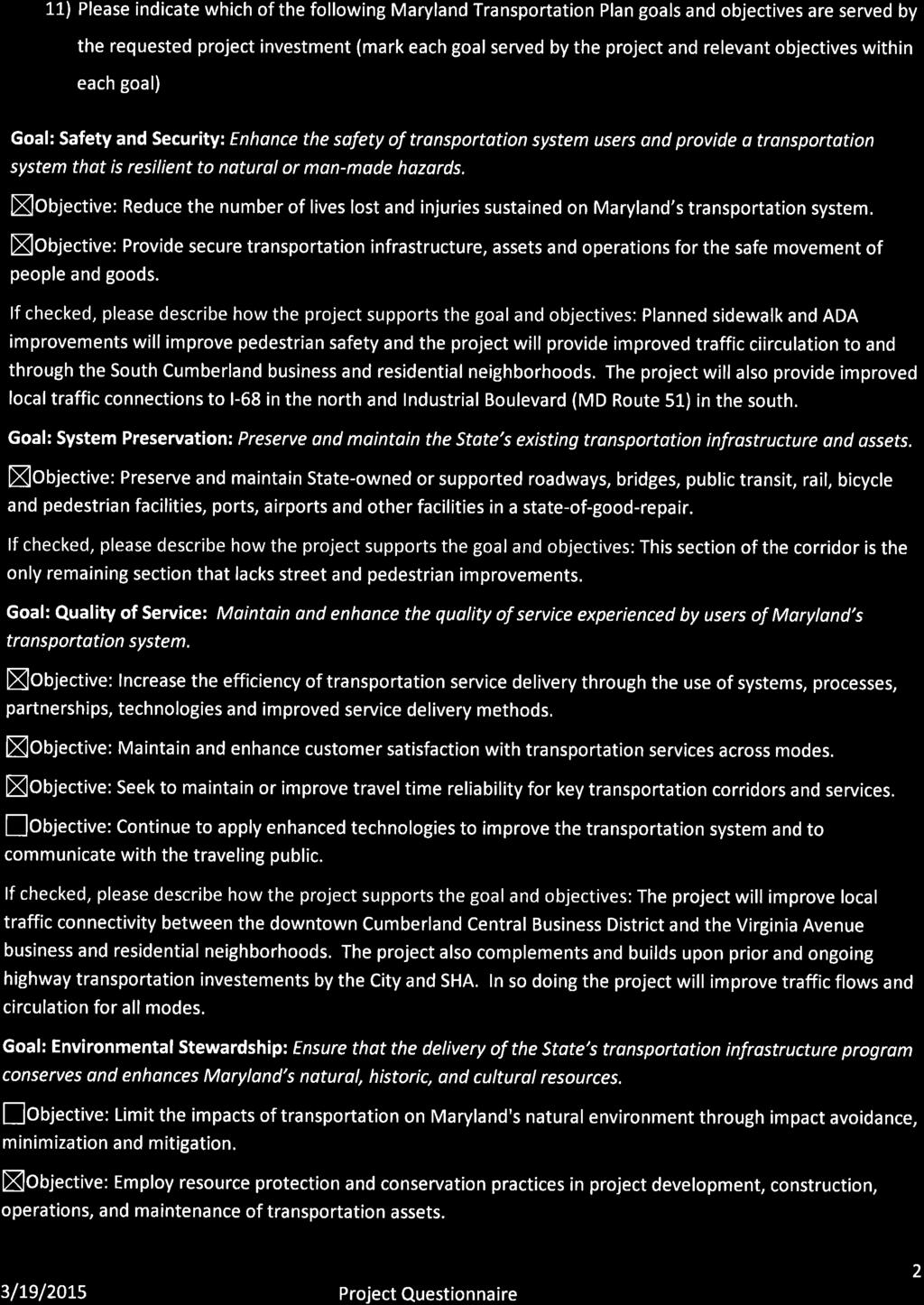
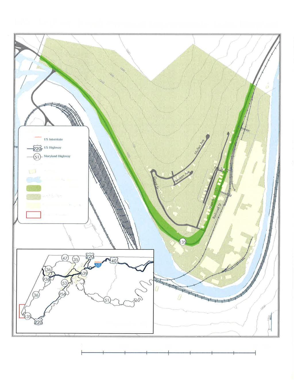
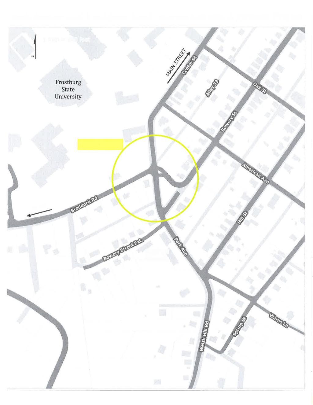
2 The Hon. Pete K. Rahn April 10, 2015 Page 2 4. MD 936, Grant Street Stormwater and Safety Improvements Project The proposed project would include improvements to 1,300 linear feet of storm sewer to convey separated stormwater from Main Street (US 40) and Grant Street (MD 936) to a proper outfall. Currently, stormwater is collected in 13 inlets on Grant Street and Main Street near Grant Street and enters into a sanitary sewer. The design and construction of a new stormwater system by Maryland State Highway Administration is necessary in order for the City to be successful in eliminating combined sewer overflows, (CSOs). These 13 Maryland State Highway Administration inlets significantly contribute to Frostburg s CSOs. The City is under an MDE Consent Decree and Court Order to eliminate its CSOs. The project should also improve the safety characteristics for motorists by removing excess sheet flow due to surface runoff during periods of heavy rain or major snow melts, as there is a steep grade from Main Street to the bottom of the hill near Blair Street. Additional safety and pedestrian enhancements such as ADA compliant sidewalks and crosswalks would be part of the project. Maryland SHA and the City are currently reviewing an MOU in which MD SHA will partner with the City of Frostburg in the completion of this project and provide the funding to address the aspects of the project for which MD SHA is responsible. 5. MD 135 Safety Improvements in Luke, Maryland MD Route 135 spanning from the MD 135 intersection with WV 46 (to Bloomington) to Westernport, is in need of improvements. These improvements include road geometry, drainage, lighting, safety signage, and surface rehabilitation. This portion of roadway is subject to industrial truck traffic from the NewPage Paper Mill. Widening and adjusting the roadway geometry for improved near Grant Street and the filter plant has been a major safety concern. The parts of the roadway which parallel a rock cliff are in need of improved lighting, and stormwater management. These improvements would reduce hazards and collisions to the approximate 6,000 vehicles which travel this portion of State Highway daily. The Town of Luke, Maryland and Allegany County find these improvements necessary to keep all vehicular and pedestrian traffic safe. 6. Allegany County Transit Operating Funding Allegany County Transit operates fixed route service and ADA Demand Response in Allegany County, Maryland. The Transit's mission is to provide the citizens and visitors of the Allegany County service area with safe, reliable, courteous, efficient and clean transportation. Continued support for operations funds will help us achieve our mission. 7. Allegany County Transit Capital Funding Allegany County Transit is requesting the following Capital Items in FY 2016 according to their capital planning: Four small replacement buses, one heavy duty replacement bus, Computer Hardware Upgrades, Office Equipment, Shop Equipment, Modern Facility Security System, and Vehicle Parking Addition. 8. Baltimore Street Bridge Rehabilitation This project remains a priority for Cumberland and we appreciate the SHA s assistance in obtaining Federal Bridge Replacement Funds through a reallocation of Local Government Funds from jurisdictions outside of Allegany County. The City, County and State have put effort into this project, but unfortunately the City is currently lacking local funds for this project. The project is listed here because the City is hopeful that local funds can be available in the future. The Baltimore Street Bridge over Wills Creek needs a total deck replacement. The bridge connects the main downtown business area with the West Side of Cumberland. 9. MD 36 Corridor Management Project Allegany County, in partnership with the City of Frostburg, and the Towns of Midland, Lonaconing, Barton, and Westernport, are requesting a Corridor Improvement Project for MD 36. The project would include land preservation, environmental improvements, efficient transportation design, sign upgrades and safety enhancements in an effort to revitalize the participating communities along MD 36. An emphasis should be placed on aesthetic and functional improvements to the gateways at each town or city. Furthermore, at these gateways, pedestrian connectivity should be considered. As an example, in Frostburg at the intersection of US 40 and MD 36, a pedestrian disconnect exists between the residential/historic Main Street community and the newer commercial area. Examining opportunities for pedestrian improvements is an important component of the project, especially in this instance, as the regional high school is located at this intersection. The MD 36 Corridor Improvement Project would result in attractive gateways, improved safety, and an increased opportunity for future development, while revitalizing communities and conserving natural resources in Western Maryland. 10. Maryland Avenue Improvements between Short and Lamont Streets This section of Maryland Avenue is the last section that must be improved to link the Rolling Mill and Virginia Avenue project. Improvement work includes street widening and resurfacing, retaining wall reconstruction and reinforcement, sidewalk improvements, and streetscaping. 2
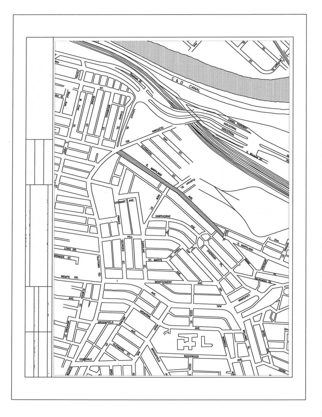
 Pavement Improvements The Town of Luke requests that the State of Maryland, consider MD 135, also known as Pratt Street, for pavement repair.")
3 The Hon. Pete K. Rahn April 10, 2015 Page MD 135 (Pratt Street) Pavement Improvements The Town of Luke requests that the State of Maryland, consider MD 135, also known as Pratt Street, for pavement repair. The Town would like to see this area improved for public safety, and to improve quality of service in the area by providing better road surfaces for general and industry-related freight traffic. 12. Park Avenue and Braddock Road Intersection and Approach Project A traffic study and conceptual plan was prepared in 2014 by Bennett, Brewer, and Associates, and was funded by Allegany County through the Cumberland Area MPO Unified Planning Work Program. The study examined pedestrian, bicycle, and vehicular needs and a conceptual plan for intersection improvements addressing the issues identified. The City of Frostburg plans to seek funding to move forward with the design and construction phase(s) of the intersection improvements, as this intersection serves as a main gateway to the City via Braddock Road (MD 736), the intersection has a substantial amount of pedestrian traffic and all forms of traffic are expected to increase as enrollment at Frostburg State University is expected to grow 10-20% by Bicycle/Pedestrian Improvements to Industrial Boulevard Building upon previous coordination meetings between the City of Cumberland and SHA officials in 2011, design and implement bicycle and pedestrian improvements along both sides of Industrial Boulevard (MD Highway 51) between Winston Street (Canal Place) on the north and Mesick Road on the south. The improvements evaluated in the feasibility and design assessment would include, but not necessarily be limited to, a combination of dedicated bike lanes, shared lane bikeways, and bike boxes at key intersections as may be warranted and appropriate. This project is part of the City s Grand Loop bicycling route as recommended in the 2008 Trails and Bikeways Master Plan, which is a component of the City s Comprehensive Plan. The project is identified and described as an on-road facility that is part of the Grand Loop. It is identified as part of Goal A-9 of the plan and is depicted in the master plan map of the bikeway network in Appendix A. The project supports the City s long-range plans to extend bicycling access for residents and visitors from the two regional bike trails that connect in Downtown Cumberland. The City considers this route to be an essential connection, since it is the only level route that provides a direct link between the downtown area and the other planned neighborhood bikeway routes in South Cumberland. The route is currently used occasionally by the Bicycling community and has been rated as dangerous for bicycling in its current condition. 14. Mechanic Street Access Road Improvements Mechanic Street from north of Bedford Street to I-68 (at Howard Street), the block of Bedford Street from North Centre Street to Mechanic Street and Baltimore Street from Mechanic Street to the scenic railroad crossing provide important economic and transportation linkage between the Central Business District of Cumberland and other major transportation routes, including I-68 and MD 51. The route also serves as a critical emergency traffic route for police, fire and ambulance service because the Public Safety Building is located at Bedford and Mechanic Streets. The City is interested in pursuing MPO, State, and/or Federal funding support for the necessary structural and streetscape improvements needed to effectively rehabilitate this corridor and position it to serve its growing traffic role as one of the city's most critical traffic arterials. 15. Mount Savage Road (MD 36) Streetscape Allegany County requests streetscape improvements on Mount Savage Road (MD 36) from New School Road to the intersection of Iron Rail Street at the east end of town. Improvements should consider pedestrian accommodations and furnishings, landscaping, and lighting. We feel these improvements will further revitalize the community of Mount Savage. We are aware of the challenges associated with the project, but are hopeful for any improvements that can be made along the state route. Thank you for your consideration of these transportation priorities in Allegany County. We look forward to a productive partnership with the Maryland Department of Transportation and to actively participate in the development of the CTP to plan and implement these projects. If you need any clarifications about our recommendations please contact us. Sincerely, The Board of Commissioners of Allegany County President, William R. Valentine Commissioner Creade V. Brodie, Jr. Commissioner Jacob C. Shade 3


4 The Hon. Pete K. Rahn April 10, 2015 Page 4 Western Maryland Delegation Senator George C. Edwards, District 1 Delegate Jason C. Buckel, District 1B Delegate Wendell R. Beitzel, District 1A Delegate Michael W. McKay, District 1C Municipal Elected Officials of Allegany County Daniel A. Colmer, Mayor, Town of Barton Edward E. Clemons, Jr., Mayor, Town of Luke Brian K. Grim, Mayor, City of Cumberland Richard M. Blair, Mayor, Town of Midland W. Robert Flanigan, Mayor, City of Frostburg J. Daniel Laffey, Mayor, Town of Westernport John W. Coburn, Mayor Town of Lonaconing Enclosures: Project Questionnaires, for all projects Braddock Road MD 736 Access & Safety Improvement Project Phase II Map Greene Street Streetscape Improvement Map Corridor Management Project for MD 36 Map Maryland 135 Safety Improvements Luke, Maryland Map MD Grant Street Stormwater and Safety Improvements Project Map Baltimore Street Bridge Rehabilitation Location Map Cc: The Hon. George C. Edwards, Maryland Senate The Hon. Jason C. Buckel, Maryland House of Delegates The Hon. Wendell R. Beitzel, Maryland House of Delegates The Hon. Michael W. McKay, Maryland House of Delegates Daniel A. Colmer, Mayor, Town of Barton Brian K. Grim, Mayor, City of Cumberland W. Robert Flanigan, Mayor, City of Frostburg John W. Coburn, Mayor Town of Lonaconing Edward E. Clemons, Jr., Mayor, Town of Luke Richard M. Blair, Mayor, Town of Midland J. Daniel Laffey, Mayor, Town of Westernport Anthony F. Crawford, District 6 State Highway Administration Mike Nixon, Manager, Regional Planning, Office of Planning and Capital Programming, Maryland Department of Transportation Ian Beam, Regional Planner, Office of Planning and Capital Programming, Maryland Department of Transportation David Eberly, Administrator, Allegany County Paul Kahl, Director, Public Works, Allegany County Adam Patterson, Public Works, Allegany County Roy Cool, Planner III/ MPO Coordinator Park Street and Braddock Road Intersection and Approach Project Map MD 135 (Pratt Street) Pavement Improvements Luke, Maryland Map Industrial Boulevard Bicycle & Pedestrian Safety Improvements Map Maryland Avenue between Short Street and Lamont Street Map Mount Savage (MD 36) Streetscape Map Mechanic Street Access Road Improvements Map Siera Wigfield, Transportation Planner, Allegany County David Dorsey, Acting Planning Coordinator, Allegany County John Difonzo, City Engineer, City of Cumberland David Umling, Planner City of Cumberland Elizabeth Stahlman, Director of Community Development, City of Frostburg Robert Ketterman, Community Development Specialist, City of Frostburg 4
5
6
7
8
9
10
11
12
13
14
15
16
17
18
19


20
21
22
23
24
25
26
27
28
29
30
31
32
33
34
35
36
37
38
39
40
41
42
43
44
45
46
47

48
49
50
51
52
53

54

55
56

57
58
59
60
61
The transportation system in a community is an
 7 TRANSPORTATION The transportation system in a community is an important factor contributing to the quality of life of the residents. Without a sound transportation system to bring both goods and patrons
Potential Green Infrastructure Strategies May 6, 2015 Workshop
 Potential Green Infrastructure Strategies May 6, 2015 Workshop Background The City of Cortland is developing the Tioughnioga Urban Headwaters Green Infrastructure Action Plan with funding from the National
THREE-YEAR CAPITAL IMPROVEMENT PLAN FY
 THREE-YEAR CAPITAL IMPROVEMENT PLAN FY2016 2018 Annual CIP Development Process Public Works & Engineering Divisions Prepare List of Capital Needs and Recommended Deferred Maintenance Public Works & Engineering
Onondaga County Sustainable Streets Project. Onondaga County Planning Federation June 7, Onondaga County Sustainable Streets Project 1
 Onondaga County Sustainable Streets Project Onondaga County Planning Federation June 7, 2012 Onondaga County Sustainable Streets Project 1 Sustainable Streets 1. Introduction to the SMTC 2. Sustainable
Illustration of Eastlake Farmer s Cooperative Grain Elevator. Chapter 5: implementation 5-1
 Illustration of Eastlake Farmer s Cooperative Grain Elevator Chapter 5: implementation 5-1 chapter 5: implementation Introduction The Eastlake Subarea Plan includes a wide range of recommendations intended
FDOT D4 Complete Streets
 FDOT D4 Complete Streets Context Sensitive Solutions Directs that complete street solutions will complement the context of the community. Collaborative approach to decision making, project development,
TRANSPORTATION ELEMENT
 TRANSPORTATION ELEMENT GOAL I: To create and maintain a safe, efficient and aesthetic transportation system that encourages multi-modal transportation and promotes the mobility strategies of the Ocala
38 Queen s University Campus Master Plan Part 1
 38 Queen s University Campus Master Plan Part 1 46 The Campus at the City Scale Chapter 4 The Campus at the City Scale 39 Queen s is an urban University centrally located in Kingston. Decisions made by
2017 General Obligation Bond
 2017 General Obligation Bond Presentation of Public and Council Projects to the Transportation & Mobility Stakeholder Committee April 13, 2017 Agenda Deferred Maintenance Project Development Process Projects
Capital Projects in and near Odenton Town Center
 Capital Projects in and near Odenton Town Center Map ID Anne Arundel County Department of Public Works This project provides for the design, right of way acquisition, and construction of approximately
The Vision. Photo provided by The Minervini Group. 46 Vision, Objectives & Strategies
 Vision, Objectives & Strategies The is the public framework and guide for future development of the Grand Traverse Commons. The establishes public polices for infrastructure, the preservation of natural
Hockessin Community Redevelopment Plan
 Hockessin Community Redevelopment Plan 3.1 Introduction The Community Redevelopment Plan for the Village of Hockessin is the result of the people s vision for a distinct village center that serves as the
IMPLEMENTATION STRATEGIES. In This Chapter. Goals & Strategies 182 Project List 183 Future Land Use 186 CHAPTER 11 IMPLEMENTATION STRATEGIES
 In This Chapter Goals & Strategies 182 Project List 183 Future Land Use 186 11 IMPLEMENTATION STRATEGIES NORTH AUGUSTA, SC 2017 COMPREHENSIVE PLAN 179 Individual commitment to a group effort that is what
Public Meeting May 20, 2014
 Public Meeting May 20, 2014 Overview Study Purpose Study Area Overview Strategies Potential Opportunities Implementation and Discussion Skeo Solutions Raleigh Walkable Watershed Pilot 2 Purpose Develop
Transportation. Strategies for Action
 Transportation A major priority for the Overlake Neighborhood is to develop a multimodal transportation system. To achieve this system, a balance has to be found among travel, circulation and access needs;
Alternatives Development Three conceptual alternatives were developed for the Race Road/Jessup Village Planning Study and are described below:
 Race Road/Jessup Village Planning Study (H550601) Project Newsletter Spring 2015 Project Description The Study Team, consisting of staff from Anne Arundel County (Department of Public Works and Department
4-Town Comprehensive Plan DRAFT 7/30/07
 4-Town Comprehensive Plan DRAFT 7/30/07 Acknowledgements ning Committee Town of Harrisburg Norman Roof Randy Nicol Town of Martinsburg Terry Thisse Paul Kelly Town of Montague Jan Bagdanowicz Wendy Perry
COMPLETE GREEN STREET CHECKLIST
 COMPLETE GREEN STREET CHECKLIST This document was developed to dissect the structure of an urban street and explore opportunities to make our streets more complete while also integrating green street strategies.
Corridor Vision. 1Pursue Minnehaha-Hiawatha Community Works Project. Mission of Hennepin County Community Works Program
 1Pursue Minnehaha-Hiawatha Community Works Project Minnehaha-Hiawatha Community Works is a project within the Hennepin Community Works (HCW) program. The mission of the HCW program is to enhance how the
SPRINGHILL LAKE TRANSIT VILLAGE
 Greenbelt Metro Area Sector Plan - Subarea Design Policies and Guidelines - Springhill Lake Transit Village 113 SPRINGHILL LAKE TRANSIT VILLAGE Residential Neighborhood and Village Center CONCEPT Springhill
TRANSPORTATION ELEMENT GOALS, OBJECTIVES, AND POLICIES
 TRANSPORTATION ELEMENT GOALS, OBJECTIVES, AND POLICIES GOAL 2 The City shall provide a safe, convenient, effective, and energy efficient multimodal transportation system which is coordinated with the Future
COMMUNITY DESIGN. GOAL: Create livable and attractive communities. Intent
 COMMUNITY DESIGN Intent An attractive, well-designed County will attract quality development, instill civic pride, improve the visual character of the community, and create a strong, positive image for
Implementation Guide Comprehensive Plan City of Allen
 Implementation Guide 2030 Comprehensive Plan City of Allen DRAFT 2015 Implementation Guide Allen 2030 Comprehensive Plan INTRODUCTION The Comprehensive Plan serves as a guide for the growth and development
HILLSBOROUGH COUNTY Greenways and Trails Plan Update. Executive Summary. Date
 HILLSBOROUGH COUNTY Greenways and Trails Plan Update Executive Summary Date PURPOSE AND PROJECT OVERVIEW The Hillsborough County Greenways Master Plan (1995) and the City of Tampa s Greenways and Trails
TOWN BRANCH COMMONS & VINE STREET MOBILITY IMPROVEMENTS
 TOWN BRANCH COMMONS & VINE STREET MOBILITY IMPROVEMENTS CONTACT: Jeff Fugate, President O: 859-367-4972 F: 859-425-2292 JFugate@LexingtonDDA.com www.lexingtondda.com TOWN BRANCH COMMONS & VINE STREET MOBILITY
Fifth and Detroit Street Design May 2017 Capital Improvements Committee. DOWNTOWN Street Design
 1 Fifth and Detroit Street Design May 2017 Capital Improvements Committee Agenda 2 Review Street Configuration Prior Meeting Review Outreach Synopsis Functional Street Design Refinements Curb Edge, Turning
Capital Projects impacting Odenton Town Center
 Capital Projects impacting Odenton Town Center 1 2 E549700 W801600/ W801602 Anne Arundel County Department of Public Works Manor View Elementary School Transmission Main - MD 32 @ Meade Phase 2 $34,399,000
The Illinois Department of Transportation and Lake County Division of Transportation. Route 173, including the Millburn Bypass
 The Illinois Department of Transportation and Lake County Division of Transportation welcome you to this Public Hearing for U.S. Route 45 from Illinois Route 132 to Illinois Route 173, including the Millburn
Street Flooding Mitigation Plan KYOVA Interstate Planning Commission. Presented to AMPO National Conference October 18, 2017
 Street Flooding Mitigation Plan KYOVA Interstate Planning Commission Presented to AMPO National Conference October 18, 2017 Saleem Salameh, Ph.D., P.E., M.ASCE Chet Parsons, AICP CTP Agenda: Background
John M. Fleming Managing Director, Planning and City Planner. Old East Village Dundas Street Corridor Secondary Plan Draft Terms of Reference
 Report to Planning and Environment Committee To: From: Subject: Chair and Members Planning & Environment Committee John M. Fleming Managing Director, Planning and City Planner Old East Village Dundas Street
Windsor Locks Transit-Oriented Development Planning Grant Request. Project Background
 Windsor Locks Transit-Oriented Development Planning Grant Request Project Background Downtown Windsor Locks runs along Main Street in the vicinity of the intersection of Routes 159 and 140. The current
Issues Requiring Future Study
 Issues Requiring Future Study Transportation planning is an ongoing process that tends to identify new issues as it finds solutions for others. Some issues are so complex that a solution to one problem
IOWA HIGHWAY 57 / WEST 1 ST STREET STUDY PUBLIC INFORMATIONAL MEETING APRIL 22, 2014
 IOWA HIGHWAY 57 / WEST 1 ST STREET STUDY PUBLIC INFORMATIONAL MEETING APRIL 22, 2014 INTRODUCTION The City of Cedar Falls and the Iowa Department of Transportation are conducting a Public Informational
Northwest Rail Corridor and US 36 BRT Development Oriented Transit Analysis 4.4 STATION AREA FINDINGS
 4.4 STATION AREA FINDINGS Each station is different, and each one requires a separate set of recommendations based on the vision for the site. This section outlines an initial TOD strategy and recommendations
CHAPTER 7: Transportation, Mobility and Circulation
 AGLE AREA COMMUNITY Plan CHAPTER 7 CHAPTER 7: Transportation, Mobility and Circulation Transportation, Mobility and Circulation The purpose of the Transportation, Mobility and Circulation Chapter is to
Proposed Comprehensive Plan Strategies DRAFT for discussion June 28, 2017
 Proposed Comprehensive Plan Strategies DRAFT for discussion June 28, 2017 Land Use Rural Areas Refine the Farm and Forest area (FF) Update FF boundaries to account for existing lots less than five acres
Scope of Services. River Oaks Boulevard (SH 183) Corridor Master Plan
 Corridor Master Plan") Scope of Services River Oaks Boulevard (SH 183) Corridor Master Plan PROJECT AREA The project area consists of the River Oaks Boulevard (SH 183) corridor bounded by SH 199 at the northern end and the Trinity
Scope of Services River Oaks Boulevard (SH 183) Corridor Master Plan PROJECT AREA The project area consists of the River Oaks Boulevard (SH 183) corridor bounded by SH 199 at the northern end and the Trinity
Executive Summary. NY 7 / NY 2 Corridor
 Executive Summary NY 7 / NY 2 Corridor Transportation and Land Use Study December 2005 Prepared for: Town of Colonie Capital District Transportation Committee Prepared by: Introduction: Land use decisions
Access Management: An Overview
 Figures 1-5 Below Evolution of development along a highway. In the early stages, land along the road is used for farming with little traffic generated. As time passes, the highway corridor becomes a de
OFFICIAL CONTROLS IMPLEMENTATION LEGAL REQUIREMENTS
 IMPLEMENTATION The objective of the Implementation component of the Comprehensive Plan is to identify the changes that need to be made to the official controls in order to be consistent with the Comprehensive
Olde Towne Vision Plan
 Olde Towne Vision Plan Introduction In 2016, the City of Bellevue will complete its move of City offices from Olde Towne Bellevue to its new municipal complex on Wall Street. The City intends to sell its
Spring 2018 Construction Update
 Spring 2018 Construction Update Ward 3 Southwest Engineering Department Locust Street Bridge over the Des Moines River The Locust Street Bridge over the Des Moines River project is being let through the
A larger version of this map is located on the last page of this PDF.
 MAP Committee Input McLoughlin Area Draft Vision Map A larger version of this map is located on the last page of this PDF. 1. The map above is intended to portray a vision for the McLoughlin area. It highlights
SDOT DPD. SDOT Director s Rule DPD Director s Rule DCLU DR SED DR of 7 CITY OF SEATTLE
 SDOT SDOT Director s Rule 2-07 DPD Applicant: CITY OF SEATTLE Page 1 of 7 Supersedes: DCLU DR 11-93 SED DR 93-4 Seattle Department of Transportation (SDOT) Department of Planning and Development (DPD)
TIRZ 17/Redevelopment Authority Capital Improvements Plan Projects
 Gessner Widening: T-1701 What: Widen the road from a six-lane divided boulevard to an eight-lane divided boulevard street section, increase turn lanes, update traffic signal system, improve drainage by
Fall 2017 Construction Update
 Fall 2017 Construction Update Ward 4 Southeast Engineering Department Riverwalk Red Multi-Use Trail Bridge Rehabilitation The Riverwalk Red Multi Use Trail Bridge was awarded to Cramer and Associates,
BROOKHILL NEIGHBORHOOD MODEL ZONING MAP AMENDMENT PREFACE TO APPLICATION
 BROOKHILL NEIGHBORHOOD MODEL ZONING MAP AMENDMENT PREFACE TO APPLICATION June 15, 2015 Revised: August 1, 2016 I. VISION Brookhill is a proposed community based upon the principles of Albemarle County
Corridors. Re-vitalize our Corridors and Gateways
 Corridors Re-vitalize our Corridors and Gateways Artist s rendering from the 287 Strategic Plan, 2015 Corridors are the major throughways of Loveland but they also provide important commercial, community
TRANSPORTATION PROJECTS
 TRANSPORTATION PROJECTS 40 BUFFALO S LWRP PROPOSED PROJECTS T1. Niagara Street/Great Lakes Seaway Trail Streetscape Project City of Buffalo Department of Public Works Niagara Street from Niagara Square
Public input has been an important part of the plan development process.
 Lakewood s Comprehensive Plan recognizes that transportation helps shape the community, and that the way the community provides for the safe and efficient movement of people affects the character of the
This page left intentionally blank.
 July 2012 This page left intentionally blank. Table of Contents Appendix A : Project Development Checklist Appendix B: At-Grade Rail Crossings Appendix C: Maintenance and Operations Examples Appendix D:
Table of Contents. Elm Avenue Improvement Plan City of Waco, Texas. Introduction 1. Existing Context 1 Figure 1 2.
 Table of Contents Introduction 1 Existing Context 1 Figure 1 2 Plan Guidelines 3 Future Urban Form 4 The West-End 4 Main Street 6 The East-End 7 Figure 2 9 Public Improvement Recommendations 7 General
DRAFT Civic Center Station Area Plan. Executive Summary
 DRAFT Civic Center Station Area Plan Executive Summary This project is funded in part through the Metropolitan Transportation Commission s Station Area Planning Program. The preparation of this report
FOSTER COMPREHENSIVE PLAN UPDATE CIRCULATION
 5.8.1 INTRODUCTION CIRCULATION The Circulation Element of the Comprehensive Plan studies the routes and modes of travel. The circulation network of the town affects the ease of movement through Foster
2040 Long Range Transportation Plan
 2040 Long Range Transportation Plan Adopted: April 15, 2013 APPENDIX D HIGHWAY NEEDS PLAN PROJECTS FREDERICKSBURG Existing and Committed Projects Fall Hill Avenue/Mary Washington Blvd. (Fredericksburg)
FY STATEWIDE TRANSPORTATION IMPROVEMENT PROGRAM New Jersey Department of Transportation Projects
 ROUTE/ Project ID No. TIP No. Burlington County Computerized Signal Control, IV D9911 D9911 This ITS project will be a traffic responsive signal system, consisting of 24 intersections--9 on CR 607, 4 on
Public may provide comments on the GDP within the next two weeks (December 24)
") 25/70 General Development Plan (GDP) Public Meeting Wednesday, December 10, 2014 6:00 8:00 P.M. District 1 Police Station Community Room 1311 W 46th Ave, Denver, CO 80211 Council Woman Montero: This particular
25/70 General Development Plan (GDP) Public Meeting Wednesday, December 10, 2014 6:00 8:00 P.M. District 1 Police Station Community Room 1311 W 46th Ave, Denver, CO 80211 Council Woman Montero: This particular
Study Area. Capitol Way. Greening America s Capitals 11/13/2014. A Greening America s Capitals Project
 Olympia, WA: Greening Capitol Way Supporting Communities move towards sustainability is a priority for the federal government. A Greening America s Capitals Project Office of Sustainable Communities U.S.
CHAPTER VIII Implementation
 CHAPTER VIII Implementation VIII. Implementation The vision for the Marlboro Pike Corridor will require that a variety of participants work together to make it a reality. The following action steps outline
11.0 TRANSPORTATION ELEMENT
 11.0 TRANSPORTATION ELEMENT Transit, Circulation and Parking Sub-Element: For all campuses, FIU's goal is to increase multimodal access. In combination with other measures - such as the development of
10 Implementation. Implementation. Responsibility for Implementation. Blueprint for Bloomsburg. Town of Bloomsburg Comprehensive Plan 10-1
 Implementation 10 Implementation This chapter overviews how to use the comprehensive plan as a land use and programming tool for the Town of Bloomsburg and recommends annual review of the plan by the Town
Joint Public Hearing. Preliminary Subregion 5 Master Plan and Proposed Sectional Map Amendment
 Preliminary Subregion 5 Master Plan and Proposed Sectional Map Amendment Joint Public Hearing April 11, 2013 Council Hearing Room Upper Marlboro 7:00 pm His Lordship s Kindness (Clinton) Presentation Overview
PORT CLINTON DOWNTOWN REVITALIZATION PLAN
 The City has been awarded a $2.34 million Ohio Department of Transportation (ODOT), Small Cities Grant for the complete reconstruction of Madison Street AWARD WINNING PROJECT Best of Lake Erie Award Lake
FY Capital Improvement Program Arroyo Projects
 FY 219-223 Capital Improvement Program FY 218 FY 219 FY 22 FY 221 FY 222 FY 223 1 2 3 4 5 6 7 8 9 1 Hahamongna - Implement Master Plan - Oak Grove Area Improvements (7756) Hahamongna - Implement Master
Maplewood Avenue Downtown Complete Street Project
 Maplewood Avenue Downtown Complete Street Project Second Public Meeting January 24, 2018 Welcome and Introduction of Project Team City Planning and Public Works Staff City of Portsmouth Juliet Walker Planning
Mississippi Skyway Preliminary Engineering Report
 EXECUTIVE SUMMARY Mississippi Skyway Preliminary Engineering Report CITY OF RAMSEY, MINNESOTA DECEMBER 2014 City of RAMSEY EXECUTIVE SUMMARY Project Need and Intent The Mississippi Skyway pedestrian bridge
Highway 12 Sibley Avenue Reconstruction. Project Overview and Progress To Date Litchfield City Council April 17, 2017
 Highway 12 Sibley Avenue Reconstruction Project Overview and Progress To Date Litchfield City Council April 17, 2017 Agenda Item Topic 1) Project Purpose and Need 2) Key Recommendations from Study 3) Preliminary
EXISTING COMPREHENSIVE PLAN
 EXISTING COMPREHENSIVE PLAN Town Center Land Use Element: V. LAND USE POLICIES Town Center Mercer Island's business district vision as described in "Your Mercer Island Citizen-Designed Downtown" was an
PROJECTS AND THE PUBLIC ART MASTER PLAN
 MEMO TO: PUBLIC ART STEERING COMMITTEE MEMBERS FROM: SHARI COOPER, DEVELOPMENT PROJECT COORDINATOR DATE: FEBRUARY 24, 2017 SUBJECT: AGENDA ITEM 5.A: PUBLIC ART PROJECT FOR 2017-18 BACKGROUND One of the
City of Hermosa Beach Administrative Policy #
 City of Hermosa Beach Administrative Policy # SUBJECT: Living Streets Policy Date: Approved by: City Council Authority: Public Works Department & Community Development Department Mayor, PURPOSE The City
1.0 Circulation Element
 5/9/18 1.0 Circulation Element 1.1 Introduction As growth and development occur in Apache County, enhancements to its circulation system will be necessary. With time, more roads will be paved and air and
FY 2018 TRANSPORTATION CAPITAL PROGRAM New Jersey Department of Transportation Projects
 Schooleys Mountain Bridge Rehabilitation Project ID Numbers: N1707 / 173470 Schooleys Mountain Road Bridge was built in 1920 and widened in 1937. The project is a replacement of the bridge structure and
TRANSPORTATION. Part 1: Background. Section 1: Introduction. P a g e 70
 P a g e 70 Part 1: Background Section 1: Introduction TRANSPORTATION Round Hill is served by secondary state roads which are maintained by the Virginia Department of Transportation (VDOT). The Route 7
City of Plattsburgh DRI: Downtown Streetscapes & Riverfront Access. Downtown Streetscape and Riverfront Access Design
 City of Plattsburgh DRI: Downtown Streetscapes & Riverfront Access Welcome Thank you for coming this evening. Agenda PART I - Project Context The Downtown Revitalization Program Our DRI Projects Other
Regional and Local Perspectives
 Regional and Local Perspectives Transportation Engineering and Safety Conference Tom Zilla Principal Transportation Planner Centre County Metropolitan Planning Organization We are here! We are here! 1
Project Goal. RRRC Living Towns Planning Workshp. Town of Halifax Revitalization Project. Dynamic Planning & Management Duo: July 12, 2006
 Project Goal Town of Halifax Revitalization Project RRRC Living Towns Planning Workshp July 12, 2006 Town of Halifax Halifax County *** Revitalization Project Goal*** To create Economic Opportunity and
This is the East Carolina University Comprehensive Facilities Master Plan Final Draft Plan Review. This workbook reviews the campus draft master plan
 This is the East Carolina University Comprehensive Facilities Master Plan Final Draft Plan Review. This workbook reviews the campus draft master plan first presented on campus on June 29 and June 30, 2011.
Tricia Millington, RLA New York State Department of Transportation
 Tricia Millington, RLA New York State Department of Transportation pmillington@dot.state.ny.us Context Sensitive Principles: Context Sensitive Solutions is a philosophy wherein safe transportation solutions
Welcome. Comprehensive Plan & Transportation Plan Open House November 7, 2012
 Welcome Comprehensive Plan & Transportation Plan Open House November 7, 2012 Agenda Proposed future land use plan Comprehensive Plan strategies Traffic forecasts Future traffic operations Possible future
3. VISION AND GOALS. Vision Statement. Goals, Objectives and Policies
 Vision Statement Queen Creek s interconnected network of parks, trails, open spaces and recreation opportunities provide safe and diverse activities and programs that sustain its unique, small town, equestrian
Pedestrian and Bike Bridge LOGO
 6.2.2 Pedestrian and Bike Bridge The proposed pedestrian and bike crossing re-envisions the existing bridge at Pismo Creek on Cypress Street. The bridge is currently underutilized by vehicular through
City of Utica Genesee Street Corridor Improvement & Downtown Parking Project Plan
 City of Utica Genesee Street Corridor Improvement & Downtown Parking Project Plan Mayor Robert M. Palmieri Goran Smiljic Deputy City Engineer Brian Thomas Commissioner of Urban & Economic Development The
EXISTING PLANS Harriet Festing Center for Neighborhood Technology Midlothian Community Meeting March 12, 2015
 EXISTING PLANS Harriet Festing Center for Neighborhood Technology Midlothian Community Meeting March 12, 2015 BENEFITS Bring economic, community + environmental benefits Enhance property values Use
Gold Line Bus Rapid Transit Transit Oriented Development (BRTOD) Helmo Station Area Plan
 Helmo Station Area Plan") Appendix F Gold Line Bus Rapid Transit Transit Oriented Development (BRTOD) Helmo Station Area Plan Introduction and Purpose of the Plan The Gold Line Bus Rapid Transit facility is an eleven-mile dedicated
Appendix F Gold Line Bus Rapid Transit Transit Oriented Development (BRTOD) Helmo Station Area Plan Introduction and Purpose of the Plan The Gold Line Bus Rapid Transit facility is an eleven-mile dedicated
TOWN OF WHITBY REPORT RECOMMENDATION REPORT
 TOWN OF WHITBY REPORT RECOMMENDATION REPORT REPORT TO: Council REPORT NO: PL 95-09 DATE OF MEETING: October 13, 2009 PREPARED BY: Planning/Public Works Joint Report FILE NO(S): N/A LOCATION: N/A REPORT
14 October 10, 2012 Public Hearing APPLICANT: MPB, INC
 14 October 10, 2012 Public Hearing APPLICANT: MPB, INC PROPERTY OWNER: MUNDEN & ASSOCIATES, LP STAFF PLANNER: Karen Prochilo REQUEST: Conditional Change of Zoning (AG-1 & AG-2 to Conditional O-2) ADDRESS
SECTION 4(f) DE MINIMIS DOCUMENTATION
 DE MINIMIS DOCUMENTATION") SECTION 4(f) DE MINIMIS DOCUMENTATION Illinois Route 60/83 IL 176 to the intersection of IL 60 (Townline Road) Lake County P-91-084-07 Mundelein Park and Recreation District Project Limit SECTION 4(f)
SECTION 4(f) DE MINIMIS DOCUMENTATION Illinois Route 60/83 IL 176 to the intersection of IL 60 (Townline Road) Lake County P-91-084-07 Mundelein Park and Recreation District Project Limit SECTION 4(f)
The Project. In 2013, construction was completed between 100 Street and 102 Street.
 The Project Jasper Avenue New Vision (JANV) is a major catalyst project identified in the Capital City Downtown Plan (2010) between 92 Street and 109 Street, including the streets half a block north and
5. Father Hennepin Blufs Park and Hennepin Island Father Hennepin Bluffs Park Supporting Initiatives (see Figure 36): 7-22
: 7-22") 5. Father Hennepin Blufs Park and Hennepin Island As described in existing conditions portion of Chapter 2, Father Hennepin Blufs Park lies on the upland portion of the park and Hennepin Island spans the
5. Father Hennepin Blufs Park and Hennepin Island As described in existing conditions portion of Chapter 2, Father Hennepin Blufs Park lies on the upland portion of the park and Hennepin Island spans the
5.0 IMPLEMENTATION STRATEGIES
 5.0 IMPLEMENTATION STRATEGIES 5.1 Recommended Alternative This chapter discusses the anticipated steps needed to move each project from recommendation to construction. Since full funding for these alternatives
Integration of Trees into Roads Policy - the road to success -
 Integration of Trees into Roads Policy - the road to success - Trees, People and the Built Environment 3 City of Birmingham, UK April 5 th, 2017 Ian Buchanan Natural Heritage and Forestry Regional Municipality
Highway 15 Project - Hutchinson
 Highway 15 Project - Hutchinson Agenda What are we going to talk about today? Goals and benefits of the project Details about the proposed work Project schedule and costs Any questions you may have about
FY STATEWIDE TRANSPORTATION IMPROVEMENT PROGRAM New Jersey Department of Transportation Projects
 69th Street Bridge 02311 02311 A grade separation at 69th Street would eliminate the current at-grade crossing which causes frequent automobile delays due to long freight trains moving through this area.
Volume 2: Implementation Plan
 Volume 2: Implementation Plan February 25 th 2002 Implementation Introduction This document outlines the steps that should be taken to implement the Washington Heights Neighborhood Plan. The City Council
ADOPTED CAPITAL IMPROVEMENT PROGRAM BUDGET ARROYO PROJECTS
 ADOPTED CAPITAL IMPROVEMENT PROGRAM BUDGET ARROYO PROJECTS HAHAMONGNA FY 212-216 Capital Improvement Program Priority Description Total Estimated Costs Appropriated Through FY 211 Adopted FY 212 FY 213
I-70 Corridor Enhancement Plan
 i - Table of Contents Table of Contents Chapter I Overview Chapter II Bridge and Roadway Improvements Chapter III Landscape Enhancements Chapter IV Riparian Corridors Chapter V Showcase Missouri Plan Chapter
JANUARY 19, 2011 CENTRAL AVENUE-METRO BLUE LINE TRANSIT-ORIENTED DEVELOPMENT IMPLEMENTATION PROJECT COMMUNITY FORUM
 CENTRAL AVENUE-METRO BLUE LINE TRANSIT-ORIENTED DEVELOPMENT IMPLEMENTATION PROJECT COMMUNITY FORUM JANUARY 19, 2011 THE MARYLAND-NATIONAL CAPITAL PARK AND PLANNING COMMISSION PRINCE GEORGE S COUNTY PLANNING
Downtown Lead Revitalization Project Final Recommendations. Three Proposed Options for the Revitalization of Downtown Lead
 Downtown Lead Revitalization Project Final Recommendations Three Proposed Options for the Revitalization of Downtown Lead November 1, 2011 Three Proposed Options for the Revitalization of Downtown Lead
Today Land & People. Northeast Nampa Gateway District. Employment. Land Use Characteristics. Demographics. Current Zoning
 Today Land & People Employment Major employers include Saint Alphonsus, the College of Western Idaho, the Auto Mall, Sorrento Lactalis and Walmart. 3,004 jobs in 2010 (COMPASS-CIM 2040 TAZ data) 4,345
The West Vaughan Employment Area Secondary Plan Policies
 Part 2: The West Vaughan Employment Area Secondary Plan Policies 2.1 General Policies It is the policy of Council: 2.1.1. That the West Vaughan Employment Area (the WVEA), identified on Schedule 1, will