Prospect Community Plan Update Public Meeting November 2, 2017 OVERVIEW PROSPECT BEAUTIFICATION/CONNECTIVITY PLAN
|
|
|
- Gavin Newman
- 5 years ago
- Views:
Transcription

1 Prospect Community Plan Update Public Meeting November 2, 2017 OVERVIEW PROSPECT BEAUTIFICATION/CONNECTIVITY PLAN
2 Presentation Overview Introduction Project History Project Goals/Objectives Project Progress to Date
3 Introduction Prospect Community Plan Committee Councilmember Luke Schmidt, Chairperson Mayor John Evans Councilmember Stuart Miles Councilmember Sandra Leonard Herb Shulhafer (citizen/retired architect)
4
5 Project History Initial interest in connectivity expressed by citizens Site visits to two cities QK4 conducts preliminary study Great Recession brings everything to a halt Effort initiated to bring the Louisville Loop to Prospect Beautification & Landscape Committee in place Committee begins to think about improving the appearance of Prospect Initial plan calls for the installation of hanging baskets, HC bridge improvements Interest expressed in developing more of a comprehensive plan Working group established by Mayor Evans; becomes PCPC QK4 retained to develop plan to include beautification and connectivity Conduct connectivity project preliminary engineering Develop financing plan Agreed to partner with Louisville Metro on initial part of connectivity plan Develop grant applications Submit grant applications Begin and complete project component implementation Secure grant awards Confirm project component implementation schedule QK4 completes plan Components prioritized
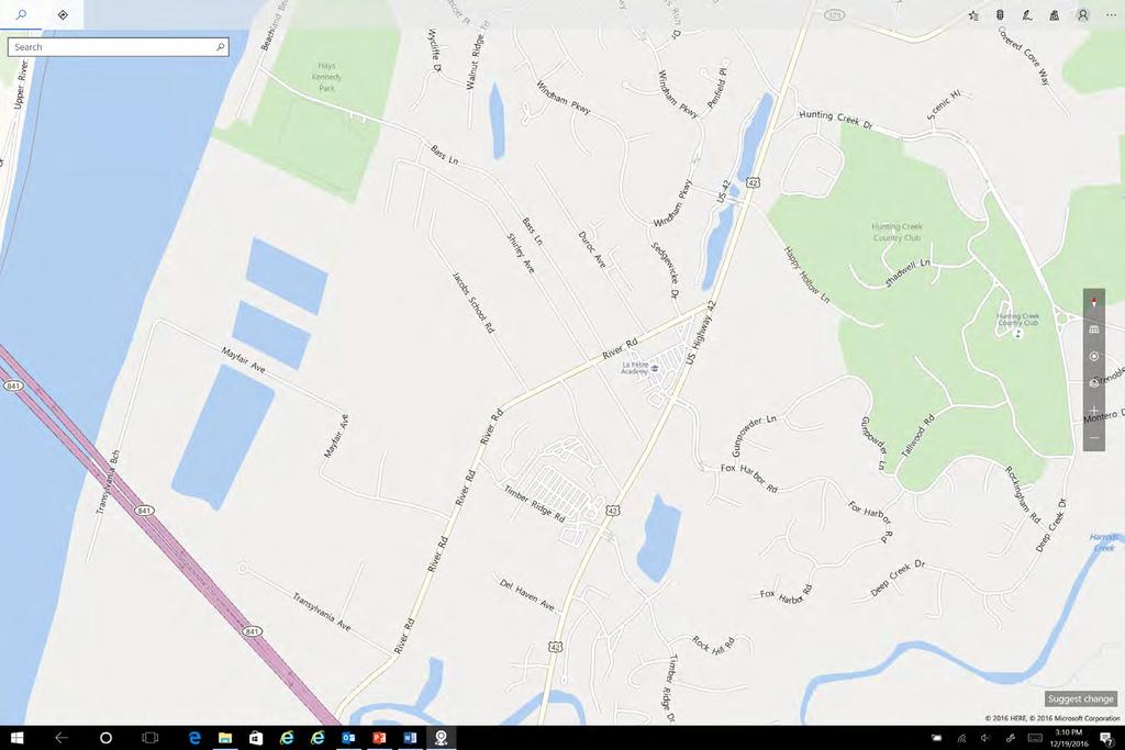
6 Project Needs Impact of Lewis and Clark Bridge Changes at US 42/Gene Snyder FWY will impact aesthetics and traffic patterns City entrance US 42 corridor River Road corridor Planned expansion of Louisville Loop from Big Four Bridge to L & C Bridge/Prospect Introduction of community-wide connectivity in Prospect Project focus Enhancement Connectivity
7 Project Goals Enhancement Consider existing environment Consider varied patterns of land use/setbacks Consider options for streetscape Consider specialty areas of landscaping/buffering where appropriate Consider lighting options/styles to coordinate with existing environment
8 Project Goals Enhancement Consider signage both commercial and regulatory/wayfinding Consider options for rural and/or urban corridor character Consider relocation of overhead utilities Consider options to modify/improve the aesthetics of corridor guardrails
9 Project Goals Connectivity Explore shared use path options along corridors Explore shared use path options across Harrods Creek Explore shared use path connections to existing facilities/neighborhoods Explore funding opportunities for shared use path design/construction
10 Project Methodology Inventory Assess existing architecture, material types, traffic, setbacks, signage, lighting, etc. Agency coordination KYTC District 5 Metro Parks Concept development site visits Parklands of Floyds Fork City of Jeffersontown Taylorsville Road streetscape University of Louisville Shelbyhurst office park


11 1.1 MATERIAL TYPES / PALETTE Brick Limestone Metal Roof Four-Board Fence Brick is widely utilized architecturally, with a balanced mixture of traditional red brick and a darker brown or bronze colored brick. CITY OF PROSPECT CORRIDOR MASTER PLAN June 2016


12 1.1 MATERIAL TYPES / PALETTE Brick Limestone Metal Roof Four-Board Fence Limestone accents are a common feature architecturally, with many of the signature entrance structures featuring limestone accents, or limestone as the primary material. CITY OF PROSPECT CORRIDOR MASTER PLAN June 2016


13 1.1 MATERIAL TYPES / PALETTE Brick Limestone Metal Roof Four-Board Fence Metal standing seam is a common material for roofing and/or canopy treatments; asphalt shingle roofing is also common. CITY OF PROSPECT CORRIDOR MASTER PLAN June 2016


14 1.1 MATERIAL TYPES / PALETTE Brick Limestone Metal Roof Four-Board Fence Black 4-Board fencing is prevalent along portions of the corridor, primarily along the east side where residential land use prevails. CITY OF PROSPECT CORRIDOR MASTER PLAN June 2016

15 1.2 LAND USE / SETBACK The west side of the corridor primarily features commercial land uses, contrasted with the east side which is primarily residential. Setbacks along the corridor are mixed - generous in areas of established residential land use and more recent commercial development; contrasting with minimal setbacks in areas of older commercial land use along the west side, between Timber Ridge Drive and Fox Harbor Road. 50 US NORTH CITY OF PROSPECT CORRIDOR MASTER PLAN June 2016


16 1.3 EXISTING STREETSCAPE Walls Sidewalks Streetscape is a broad term used to describe the varied elements or components which characterize the street corridor, and primarily the shoulder enhancement areas outside the vehicular way. Elements such as sidewalks, walls, fencing, landscaping, signage and lighting combine to characterize the streetscape. Fencing types were discussed in prior Materials Section 1.1 and Landscape, Lighting and Signage elements are discussed as separate elements in subsequent pages. CITY OF PROSPECT CORRIDOR MASTER PLAN June 2016


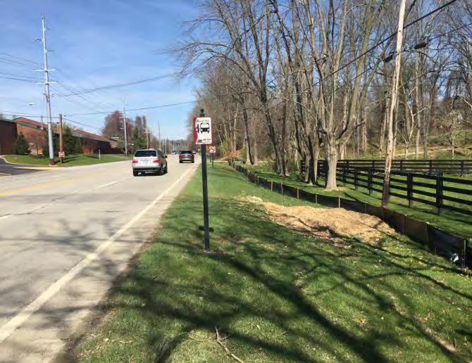
17 1.3 EXISTING STREETSCAPE Walls Sidewalks Sidewalks the primary component of the urban streetscape are present within some areas of more recent commercial development along the west side of the corridor, but it is by no means a unified or continuous element. For the most part, the corridor offers a very inhospitable environment for pedestrians. CITY OF PROSPECT CORRIDOR MASTER PLAN June 2016


18 1.4 LANDSCAPING Vehicular Use Buffering Other Buffering There is a strong presence of landscape enhancements and vegetative buffering along both sides of the corridor, and while it is by no means unified, it represents a consistent pattern and conscious effort to value and promote landscaping and tree preservation along the corridor. CITY OF PROSPECT CORRIDOR MASTER PLAN June 2016


19 1.4 LANDSCAPING Vehicular Use Buffering Other Buffering The residential east side of the corridor is typified by perimeter landscape massings and preservation of large mature trees; the west side, of primarily commercial land use features patterned ornamental landscaping and buffering of vehicular use areas, as varied offerings for compliance with local landscape ordinances, but again, there is no consistency in pattern or treatment. CITY OF PROSPECT CORRIDOR MASTER PLAN June 2016


20 1.5 LIGHTING The City of Prospect is one of a few local communities with enhanced lighting ordinances, with specific focus on reducing light pollution. While some of the fixtures along the corridor are in use as a reoccurring response to this initiative, the pattern is inconsistent, and there are other lighting fixtures both modern and older which offer neither consistency nor responsiveness to a traditional night sky lighting ordinance. CITY OF PROSPECT CORRIDOR MASTER PLAN June 2016


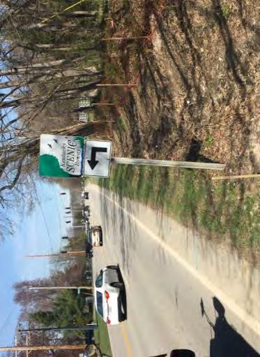
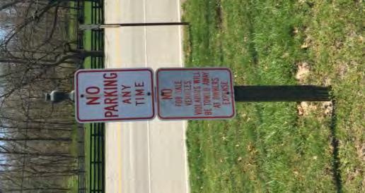
21 1.6 SIGNAGE Identification Signage Regulatory / Wayfinding Signage For the most part, the commercial and signature entrance signage along the corridor is low and monumental in character, as opposed to a taller free-standing or pole-mounted signage. Further, there is a consistent material composition of the signage structures, using combinations of brick and stone masonry, with accents of metal lettering and/or decorative wrought iron. Some of the signage of primarily more modern commercial examples - is lighted from the interior; other signage is lighted on the exterior by ground mounted directional fixtures. CITY OF PROSPECT CORRIDOR MASTER PLAN June 2016
22 1.6 SIGNAGE Identification Signage Regulatory / Wayfinding Signage CITY OF PROSPECT CORRIDOR MASTER PLAN June 2016


23 1.7 VEHICULAR CORRIDOR TYPES Rural Section Urban Section Corridor typology is defined as urban, characterized by concrete curb and gutter drainage along the roadway perimeter; or rural, characterized by paved or earthen shoulders and roadside drainage ditches. Areas of rural section showed mixed conditions, with some areas of well-maintained ditches and edge of pavement, to other areas of poor ditch maintenance and inconsistent edge of pavement conditions. CITY OF PROSPECT CORRIDOR MASTER PLAN June 2016


24 1.7 VEHICULAR CORRIDOR TYPES Rural Section Urban Section The subject corridor is primarily rural in type, with only small segments of urban curb and gutter along the west side of the commercial corridor between Timber Ridge Drive and River Road. CITY OF PROSPECT CORRIDOR MASTER PLAN June 2016

25 1.8 INTERSECTION AND PAVEMENT CONDITIONS Timber Ridge Fox Harbor River Road Aside from regulatory lane markings and stop bars at signalized intersections, there are limited areas of pedestrian crosswalks primarily due to the inconsistent presence of sidewalks and pedestrian facilities along the corridor. There are some crosswalks at the Timber Ridge Drive, Fox Harbor Road, and River Road intersections, however with the exception of Timber Ridge Drive, there is no receiving corner accessible ramp and connecting sidewalk to adequately serve the pedestrian at these intersections, which is the basis for the previous observation that the corridor is inhospitable for the pedestrian. Timber Ridge Rd. NORTH CITY OF PROSPECT CORRIDOR MASTER PLAN June 2016

26 1.8 INTERSECTION AND PAVEMENT CONDITIONS Timber Ridge Fox Harbor River Road NORTH CITY OF PROSPECT CORRIDOR MASTER PLAN June 2016

27 1.8 INTERSECTION AND PAVEMENT CONDITIONS Timber Ridge Fox Harbor River Road CITY OF PROSPECT CORRIDOR MASTER PLAN June 2016
 carried by both the large steel poles and smaller")
28 1.9 OVERHEAD UTILITIES A large overhead electric transmission/distribution line exists along the west side of the corridor, served by a combination of steel and metal poles of varied height. The larger steel poles carry the elevated electric transmission facilities, with electric distribution and telecommunication (telephone and cable) carried by both the large steel poles and smaller wooden poles. There is also a telecommunication corridor of smaller wooden poles along the east side of the corridor. NORTH CITY OF PROSPECT CORRIDOR MASTER PLAN June 2016


29 1.10 GUARDRAILS Existing Conditions Galvanized metal guardrail is present along the corridor south of the Harrods Creek Bridge, where it serves as a near continuous safety barrier to protect vehicular traffic along areas of elevated roadway and steep shouldered drop-offs. While removal of the safety barrier is not an option, there are many opportunities to improve guardrail and barrier aesthetics, which would help to improve the imagery and character along the corridor. CITY OF PROSPECT CORRIDOR MASTER PLAN June 2016
30 Prioritized Recommendations

31 Prioritized Recommendations Guardrail enhancement Replace existing, damaged guardrail Painting/staining of existing galvanized metal guardrail Rustic color Quick fix/relatively inexpensive Coordinate with KYTC


32 Prioritized Recommendations Preliminary engineering all connectivity Needed in order to apply for grants Will provide blueprint for what is needed to install shared use pathways Demonstrates commitment on the part of the city when applying for grants


33 Prioritized Recommendations Intersection improvements Enhance safety for drivers/pedestrians/bicyclists Improve aesthetics/remove traffic light overhead wires Replace with masts/poles Add in pavement markings

34 Prioritized Recommendations Connectivity Build on planned Louisville Loop Connect to Louisville Loop and Lewis & Clark Bridge Make the Loop work for Prospect

35 Planned Prospect Connectivity System

 side of the corridor to link area pedestrian facilities and become the future route of the Louisville Loop.")
36 4.4 CONNECTIVITY CONCEPTS Overall Plan US 42 Rendered Concepts US 42 Overall Plan River Road Rendered Concepts River Road Pavement Treatments Curb and gutter sections are proposed along the corridor as a means to define and control the edge of pavement and to eliminate unsightly drainage conditions. Sidewalks are proposed on the west (commercial) side of the corridor to continue existing pattern. A shared use-path is proposed on the east (residential) side of the corridor to link area pedestrian facilities and become the future route of the Louisville Loop. Proposed Shared Use Path Proposed 5 Wide Sidewalk Existing Curb and Gutter Proposed Curb and Gutter CITY OF PROSPECT CORRIDOR MASTER PLAN June 2016


37 4.4 CONNECTIVITY CONCEPTS Overall Plan US 42 Rendered Concepts US 42 Overall Plan River Road Rendered Concepts River Road Pavement Treatments Right of Way Impacts Right of Way conditions along US 42 vary widely. When considering suitable conditions to support the introduction of sidewalks and shared use-paths there is available shoulder in the areas between the Harrods Creek Bridge and Timber Ridge Road. Between Timber Ridge Road and River Road, the available shoulder area is diminished significantly, especially along the east side of the corridor where right of way and perimeter four-board fencing are not aligned with right of way located closer to the edge of pavement. North of River Road shoulder conditions improve, but are still restricted along the east side of the corridor. CITY OF PROSPECT CORRIDOR MASTER PLAN June 2016

38 4.4 CONNECTIVITY CONCEPTS Overall Plan US 42 Rendered Concepts US 42 Overall Plan River Road Rendered Concepts River Road Pavement Treatments A combination of curb and gutter, sidewalk and rail fence is proposed along the south side of the corridor. As an option, the sidewalk could be widened to a shared use-path as a combined initiative with Metro Parks to provide a Louisville Loop connection to the East End Bridge. CITY OF PROSPECT CORRIDOR MASTER PLAN June 2016


39 4.4 CONNECTIVITY CONCEPTS Overall Plan US 42 Rendered Concepts US 42 Overall Plan River Road Rendered Concepts River Road Pavement Treatments Right of Way Impacts Right of Way conditions along River Road are varied with suitable conditions to support the introduction of sidewalks or shared use-paths along the east and south sides of the corridor, but with limited shoulder available along the west and north sides of the corridor. CITY OF PROSPECT CORRIDOR MASTER PLAN June 2016
40 Prioritized Recommendations Remove overhead utilities US 42 corridor
41 So, Where Are We Now? Beautification/landscaping remains in the domain of the Beautification & Landscape Committee Relocation of utility lines dropped due to excessive cost New lighting plan Existing residential fixtures will remain in place in order to continue to capture the benefit of good cost terms with LG&E New lighting system plan under development by LG&E along US 42 (from Harrods Creek Bridge to Hunting Creek/Innisbrook entrances Moving forward on connectivity plan
42 Connectivity Plan Implementation Newfound partner with Metro New access to L & C Bridge due to demand Metro pathway under development from bridge to Prospect River Timber Ridge Drive To be built at Metro s expense Will tie in with Louisville Loop Metro willing to partner with Prospect to tie systems together
43 Connectivity Plan Implementation Prospect/Metro agreed to pursue Phase One Phase One addresses following segment: River Road/Timber Ridge Drive Parallels Timber Ridge Drive to US 42 Parallels US 42 to River Road (north side) Benefits of Phase One routing: Links three neighborhoods to Prospect central business district and L & C Bridge Smithfield Greene The Landings Fox Harbor City is currently exploring adding a link to Sutherland (Sedgewicke Drive) to the end of pathway at US River Road Safe, signalized crossings exist at three points on US 42
44 Connectivity Plan Implementation Phase One includes: Pathway design Right of way (land) acquisition Why just Phase One? More affordable than doing entire project at once Better chance of receiving first state grant Better chance of receiving follow-up/ future state grants to complete entire project Prospect s share of Phase One: $209,000 Ordinance to be introduced during October city council meeting
45 Expected Community Benefits Traffic mitigation/reduces air pollution Removal of some vehicles from travel lanes/replaced by walkers and bicyclists Improvement of health/wellness of Prospect citizens Improvement of health outcomes for Prospect citizens Aesthetic improvements in the Prospect business district
46 Expected Community Benefits Enhancement of property values in the City s business district Enhancement of property values in the City s residential districts Makes Prospect a better place to live and do business this is what younger residents and those considering moving to Prospect want Makes Prospect more competitive when it comes to economic development
47 Discussion
BUILDING SCALE AND SETBACKS 5 ELEMENTS:... 5 FAÇADES (COMMERCIAL/RESIDENTIAL) 5
 5") VISION STATEMENT 3 UTILIZATION OF THE GUIDELINES 3 IMPLEMENTATION 3 PROCEDURES FOR DESIGN REVIEW 3 LAND USE AND ZONING 4 LAND USE 4 ELEMENTS:... 4 ZONING 4 ELEMENTS:... 4 BUILDING SCALE AND SETBACKS 5
VISION STATEMENT 3 UTILIZATION OF THE GUIDELINES 3 IMPLEMENTATION 3 PROCEDURES FOR DESIGN REVIEW 3 LAND USE AND ZONING 4 LAND USE 4 ELEMENTS:... 4 ZONING 4 ELEMENTS:... 4 BUILDING SCALE AND SETBACKS 5
Chain Bridge Road Sidewalk Improvements Citizen Council Work Session
 Chain Bridge Road Sidewalk Improvements Citizen Council Work Session May 10, 2016 Project Location 2 Project Objectives Provide a continuous pedestrian facility (sidewalk) connection from Downtown City
VEHICULAR AND PEDESTRIAN CIRCULATION
 This perspective sketch communicates the intended character and quality of a proposed streetscape design. Locate benches near a major intersection where people tend to gather. Seating and lighting provide
Design Guidelines for Residential Subdivisions
 Design Guidelines for Residential Subdivisions Development Services 972-466-3225 cityofcarrollton.com This page intentionally left blank. Table of Contents Purpose... 1 Design Objectives... 1 Design Guidelines
Rezoning Transportation Analysis Petition Number: General Location Identifier:
 From: Kelsie Anderson, PE Kelsie.Anderson@charlottenc.gov 704-432-5492 Staff Reviewer: Kory Hedrick, PE, PMP Khedrick@charlottenc.gov 704-432-6511 CDOT s review of this rezoning petition is intended to
Table of Contents. Elm Avenue Improvement Plan City of Waco, Texas. Introduction 1. Existing Context 1 Figure 1 2.
 Table of Contents Introduction 1 Existing Context 1 Figure 1 2 Plan Guidelines 3 Future Urban Form 4 The West-End 4 Main Street 6 The East-End 7 Figure 2 9 Public Improvement Recommendations 7 General
section five BEAUTIFICATION PLAN
 section five BEAUTIFICATION PLAN BEAUTIFICATION PLAN Section Five Beautification Plan The goal of the Beautification Plan is to improve the Route 8-Sunnyland Corridor in terms of aesthetics and to create
CONFORMED AGREEMENT INCORPORATED REVISIONS PER AMENDMENT DATED: APRIL 2, 2013 FOR REFERENCE
 CONFORMED AGREEMENT INCORPORATED REVISIONS PER AMENDMENT DATED: APRIL 2, 2013 FOR REFERENCE CITY STREETS AS PART OF STATE HIGHWAYS GUIDELINES REACHED BY THE WASHINGTON STATE DEPARTMENT OF TRANSPORTATION
COMMUNITY DESIGN. GOAL: Create livable and attractive communities. Intent
 COMMUNITY DESIGN Intent An attractive, well-designed County will attract quality development, instill civic pride, improve the visual character of the community, and create a strong, positive image for
3.13. Development Guidelines
 3.3 Landscaping Elements Landscaping should be used to frame and soften structures, define site functions, enhance the quality of the environment, and screen undesirable views. Safety, environmental impacts,
3.0 master plan concept
 3.0 master plan concept 3.1 introduction The purpose of the Huron Church Road Master Plan Concept is to provide an overview of the Master Plan design process, identify preliminary streetscape installations
Appendix D North Road/N. Leroy Street Subarea Plan
 North Road/N. Leroy Street Subarea Plan INTRODUCTION The City of Fenton Master Plan was updated in 1996 and included a subarea plan for the North Leroy Street area of the City. It was recognized at that
Maplewood Avenue Downtown Complete Street Project
 Maplewood Avenue Downtown Complete Street Project Second Public Meeting January 24, 2018 Welcome and Introduction of Project Team City Planning and Public Works Staff City of Portsmouth Juliet Walker Planning
CITY OF CHARLOTTESVILLE DEPARTMENT OF NEIGHBORHOOD DEVELOPMENT SERVICES STAFF REPORT TO THE ENTRANCE CORRIDOR REVIEW BOARD (ERB)
") CITY OF CHARLOTTESVILLE DEPARTMENT OF NEIGHBORHOOD DEVELOPMENT SERVICES STAFF REPORT TO THE ENTRANCE CORRIDOR REVIEW BOARD (ERB) ENTRANCE CORRIDOR CERTIFICATE OF APPROPROPRIATENESS DATE OF PLANNING COMMISSION
CITY OF CHARLOTTESVILLE DEPARTMENT OF NEIGHBORHOOD DEVELOPMENT SERVICES STAFF REPORT TO THE ENTRANCE CORRIDOR REVIEW BOARD (ERB) ENTRANCE CORRIDOR CERTIFICATE OF APPROPROPRIATENESS DATE OF PLANNING COMMISSION
COMPLETE GREEN STREET CHECKLIST
 COMPLETE GREEN STREET CHECKLIST This document was developed to dissect the structure of an urban street and explore opportunities to make our streets more complete while also integrating green street strategies.
R STREET CORRIDOR NEIGHBORHOOD Site Plan and Design Review Supplemental Guidelines Checklist
 R STREET CORRIDOR NEIGHBORHOOD Site Plan and Design Review Supplemental Guidelines Checklist Applicant s Name: Project Address: Phone: Email: Applicant shall fill out the design guidelines checklist for
5.1.1 The streetscape along US Highway 64 (Brevard Road); and, The built environment within new residential developments; and,
; and, The built environment within new residential developments; and,") Article 5. Landscaping 5.1 Purpose The Town of Laurel Park s landscape standards are designed to create a beautiful, aesthetically pleasing built environment that will complement and enhance community
Article 5. Landscaping 5.1 Purpose The Town of Laurel Park s landscape standards are designed to create a beautiful, aesthetically pleasing built environment that will complement and enhance community
ARTICLE 13 STREETS General
 ARTICLE 13 STREETS 13.1 General Streets shall be designed to suit their functions. Many streets have purposes other than vehicular traffic. As an alternative to current N.C. Department of Transportation
VILLAGE OF CHANNAHON COMMERCIAL DESIGN GUIDELINES. Village of Channahon S. Navajo Drive Channahon, IL (815)
") VILLAGE OF CHANNAHON COMMERCIAL DESIGN GUIDELINES Village of Channahon 24555 S. Navajo Drive Channahon, IL 60410 (815) 467-6644 www.channahon.org Adopted March 6, 2006 VILLAGE OF CHANNAHON COMMERCIAL DESIGN
VILLAGE OF CHANNAHON COMMERCIAL DESIGN GUIDELINES Village of Channahon 24555 S. Navajo Drive Channahon, IL 60410 (815) 467-6644 www.channahon.org Adopted March 6, 2006 VILLAGE OF CHANNAHON COMMERCIAL DESIGN
ORDINANCE NO
 ORDINANCE NO. 2014-032 Amending Ordinance 2012-059 granting encroachment to the University of South Carolina for use of the right of way area of the 1500 block of Greene Street and 800 block of Pickens
ARTICLE 13 STREETS General
 ARTICLE 13 STREETS 13.1 General Streets shall be designed to suit their functions. Many streets have purposes other than vehicular traffic. As an alternative to current N.C. Department of Transportation
COMMERCIAL DESIGN REVIEW APPLICATION
 CITY OF LACEY Community Development Department 420 College Street Lacey, WA 98503 (360) 491-5642 COMMERCIAL DESIGN REVIEW APPLICATION OFFICIAL USE ONLY Case Number: Date Received: By: Related Case Numbers:
Route 29 Project Delivery Advisory Panel September 11, 2014 Meeting Minutes
 Route 29 Project Delivery Advisory Panel Meeting Minutes Meeting 5 of the Route 29 Project Delivery Advisory Panel (PDAP) was held at the Virginia Center for Transportation Innovation and Research in Charlottesville,
This page left intentionally blank.
 July 2012 This page left intentionally blank. Table of Contents Appendix A : Project Development Checklist Appendix B: At-Grade Rail Crossings Appendix C: Maintenance and Operations Examples Appendix D:
Parapet/Formliner/Fencing
 Parapet/Formliner/Fencing Cross Parapet/Formliner/Fencing Street Aesthetic Features Context The I-290 Phase I study is evaluating improvements along 13 miles of the Eisenhower Expressway, from west of
BOULEVARD AND PARKWAY STANDARDS
 88-323 BOULEVARD AND PARKWAY STANDARDS 88-323-01 PURPOSE Considerable public and private investment exists and is expected to occur adjacent to boulevards and parkways within the city. The following standards
VILLAGE OF SKOKIE Design Guidelines for Mixed-Use Districts NX Neighborhood Mixed-Use TX Transit Mixed-Use CX Core Mixed-Use
 VILLAGE OF SKOKIE Design Guidelines for Mixed-Use Districts NX Neighborhood Mixed-Use TX Transit Mixed-Use CX Core Mixed-Use TABLE OF CONTENTS CHAPTER 1 SITE DESIGN Purpose 1 CHAPTER 2 SITE DESIGN Streetscape
4. INDUSTRIAL 53 CASTLE ROCK DESIGN
 4. INDUSTRIAL 53 CASTLE ROCK DESIGN CASTLE ROCK DESIGN 54 4. INDUSTRIAL Overview Well-designed and attractive industrial centers are the product of blending economic realities with both functional and
APPENDIX 4 NEWBURY TOWNSHIP TOWN CENTER MASTER PLAN
 APPENDIX 4 NEWBURY TOWNSHIP TOWN CENTER MASTER PLAN Prepared by the Urban Design Center of Northeast Ohio September, 2008 Newbury Township Land Use Plan A4-1 INDEX Page No. 1 Newbury Township Town Center
Fifth and Detroit Street Design May 2017 Capital Improvements Committee. DOWNTOWN Street Design
 1 Fifth and Detroit Street Design May 2017 Capital Improvements Committee Agenda 2 Review Street Configuration Prior Meeting Review Outreach Synopsis Functional Street Design Refinements Curb Edge, Turning
3. VISION AND GOALS. Vision Statement. Goals, Objectives and Policies
 Vision Statement Queen Creek s interconnected network of parks, trails, open spaces and recreation opportunities provide safe and diverse activities and programs that sustain its unique, small town, equestrian
Potential Green Infrastructure Strategies May 6, 2015 Workshop
 Potential Green Infrastructure Strategies May 6, 2015 Workshop Background The City of Cortland is developing the Tioughnioga Urban Headwaters Green Infrastructure Action Plan with funding from the National
West Dennis Center: Bass River to Old Main Street. West Dennis Business District: Old Main Street to Dennis Commons
 West Dennis Center: Bass River to Old Main Street West Dennis Business District: Old Main Street to Dennis Commons Dennisport Center: Dennis Commons to Division Street Main Street Project Goals Project
SH 199 Corridor Master Plan. Community Meeting No. 2 May 31, 2017
 Community Meeting No. 2 May 31, 2017 Transportation Projects On or Near SH 199 SH 199 from 0.3 miles south of FM 1886 to south end of Lake Worth bridge Construct freeway mainlanes and frontage roads 10-Year
FREEWAY/TOURIST DISTRICT
 FREEWAY/TOURIST DISTRICT DESIGN STANDARDS FOR THE CITY OF MOUNTLAKE TERRACE March, 2014 MOUNTLAKE TERRACE FREEWAY/TOURIST DESIGN STANDARDS March, 2014 1 TABLE OF CONTENTS Introduction...1 Design Site Design
The Illinois Department of Transportation and Lake County Division of Transportation. Route 173, including the Millburn Bypass
 The Illinois Department of Transportation and Lake County Division of Transportation welcome you to this Public Hearing for U.S. Route 45 from Illinois Route 132 to Illinois Route 173, including the Millburn
The open space system should provide connective elements, relate to natural resources, and enhance the suburban character of the landscape..
 The open space system should provide connective elements, relate to natural resources, and enhance the suburban character of the landscape.. Mixed-use and infill development should maintain or enhance
PIKE PINE RENAISSANCE: ACT ONE. October 19, 2017
 PIKE PINE RENAISSANCE: ACT ONE October 19, 2017 WATERFRONT SEATTLE PROGRAM PROJECT INTRODUCTION Pike and Pine streets, between First and Melrose avenues Pedestrian and streetscape improvements Budget:
Corridor Identity. Section 9. Introduction. Corridor Guiding Principles
 Corridor Identity An attractive and healthy community is a critical element of a quality place, and the design of quality places is a balance between environmental, economic, and social considerations.
Main Street Reconstruction From Ninth Line to Stouffer Street. Town of Whitchurch-Stouffville. Public Information Centre
 Main Street Reconstruction From Ninth Line to Stouffer Street Town of Whitchurch-Stouffville Public Information Centre November 23, 2016 4:30 to 6:00 pm & 7:00 to 8:00 pm 6240 Main Street, Stouffville
Chapter 7: Streetscape & Design Elements
 OVERVIEW Chapter 7: Streetscape & Design Elements During the public input phase of The Dixie Fix, the area of streetscape generated much interest. While safety and traffic flow are primary objectives of
Design Guidelines: Brownsville Rd Façade Improvement Program
 : Brownsville Rd Façade Improvement Program Thank you for your interest in the Brownsville Rd Façade Improvement Program These Design Guidelines were prepared by Design Center Pittsburgh (DCP) for Economic
Project Goal. RRRC Living Towns Planning Workshp. Town of Halifax Revitalization Project. Dynamic Planning & Management Duo: July 12, 2006
 Project Goal Town of Halifax Revitalization Project RRRC Living Towns Planning Workshp July 12, 2006 Town of Halifax Halifax County *** Revitalization Project Goal*** To create Economic Opportunity and
Preliminary Sketch Plan for Fort Hunter Park
 Preliminary Sketch Plan for Fort Hunter Park Public Presentation November 19, 2009 Dauphin County Parks and Recreation 100 Fort Hunter Road Harrisburg, PA 17110 (717) 599-5188 www.dauphinc.org THOMAS COMITTA
SUBCHAPTER 4-B GUIDELINES FOR THE B-3 COMMERCIAL CHARACTER AREA
 1 SUBCHAPTER 4-B GUIDELINES FOR THE B-3 COMMERCIAL CHARACTER AREA Downtown Bozeman should be the location of buildings of greatest height and intensity in the community. The following guidelines apply
Chapter 4: Jordan Road Character District
 4: Jordan Road Character District 4.1 Introduction The Jordan Road character district encompasses much of the former Jordan orchard and farmstead, which was a significant part of Sedona s history. The
Asbury Chapel Subdivision Sketch Plan
 Asbury Chapel Subdivision Sketch Plan PART 1: PROJECT SUMMARY Applicant: NVR Inc. Project Size: +/- 76.13 acres Parcel Numbers: 02101112,02116101,02116112, 02116113 Current Zoning: Transitional Residential
City of Hermosa Beach Administrative Policy #
 City of Hermosa Beach Administrative Policy # SUBJECT: Living Streets Policy Date: Approved by: City Council Authority: Public Works Department & Community Development Department Mayor, PURPOSE The City
Mississippi Drive Corridor Revitalization. A DestinationTransportation Project...
 Mississippi Drive Corridor Revitalization A DestinationTransportation Project... Mississippi Drive Corridor Revitalization Welcome! Tonight s Agenda: Further define the Scope of the Project Discuss the
STANDARD SPECIFICATIONS Book 2 ENGINEERING DRAWINGS INCLUDES ADDENDUMS
 STANDARD SPECIFICATIONS Book 2 ENGINEERING DRAWINGS INCLUDES ADDENDUMS July 23, 2018 Page 1 of 7 STANDARD LEGEND SYMBOLS (September, 1973)... AS-101A STANDARD LEGEND SYMBOLS (September, 1973)... AS-101B
Rt. 29 Solutions Project Delivery Advisory Panel. January 7, 2016
 Rt. 29 Solutions Project Delivery Advisory Panel January 7, 2016 Agenda item 1: Introductions Project Delivery Advisory Panel Technical Team 2 Agenda item 2: Interaction and Feedback Live Streaming Dec
Creating Complete Roadway Corridors:
 Creating Complete Roadway Corridors: The AASHTO Guide to Transportation Landscape Architecture and Environmental Design NCHRP Project 15-33 Status Report AASHTO Standing Committee on Design Technical Committee
D. Landscape Design. 1. Coverage Intent: To provide adequate landscaping materials that enhance the appearance of development projects.
 D. Landscape Design The standards and guidelines in this section give design guidance for the landscaping components of industrial and office projects. City regulations require that all landscaping be
The Vision. Photo provided by The Minervini Group. 46 Vision, Objectives & Strategies
 Vision, Objectives & Strategies The is the public framework and guide for future development of the Grand Traverse Commons. The establishes public polices for infrastructure, the preservation of natural
US-10/US-31 Corridor Planning Charrette Summary. Resilient Ludington Mason County, Michigan
 US-10/US-31 Corridor Planning Charrette Summary Resilient Ludington Mason County, Michigan Plan Prepared By Resilient Ludington Participating Units of Government: Mason County City of Ludington Pere Marquette
Town Center Design Guidelines
 Adopted by City Council on September 18, 2018 Design Theme The Draper Town Center Design Theme is defined as encompassing those architectural design styles that were prevalent in the construction of civic
COMMUNICATION URBAN DESIGN REVIEW BOARD CITY OF DES MOINES, IOWA MAY 16, 2017 MEETING
 COMMUNICATION URBAN DESIGN REVIEW BOARD CITY OF DES MOINES, IOWA MAY 16, 2017 MEETING Subject: Recommendation Prepared by: PRELIMINARY DESIGN REVIEW OF LOCUST STREET BRIDGE CONSTRUCTION & COURT AVENUE,
Please see attached for more detailed project information. Project Schedule Designer Award by SBC Executive Sub-Committee December 21, 2015
 Project Title Campus Beautification Projects Volunteer Blvd Ph 1 540/009-08-2015 Institution Description UT Knoxville This project will improve Volunteer Boulevard from West Cumberland Ave. to East Cumberland
Glenn Highway MP DSR. Landscape Narrative
 Glenn Highway MP 34-42 DSR Landscape Narrative Project Landscape Goals The Glenn Highway MP 34-42 Project extends through a variety of landscape types typical to the Matanuska-Susitna Valley. In general,
8 October 14, 2015 Public Hearing
 8 October 14, 2015 Public Hearing APPLICANT & PROPERTY OWNER: PRICE S HOLDINGS, LLC STAFF PLANNER: Karen Lasley REQUEST: A. Conditional Use Permit (Automobile Repair Garage) B. Change in Nonconforming
14.0 BUILT FORM DESIGN CRITERIA
 14.0 BUILT FORM DESIGN CRITERIA CORPORATION OF THE TOWN OF CARLETON PLACE DEVELOPMENT PERMIT BY-LAW 123 124 CORPORATION OF THE TOWN OF CARLETON PLACE DEVELOPMENT PERMIT BY-LAW 14.1 MISSISSIPPI DISTRICT
Focus Group First Meeting Belfountain Community Centre Tuesday June 29, :00 p.m. to 9:00 p.m.
 Focus Group First Meeting Belfountain Community Centre 7:00 p.m. to 9:00 p.m. Mississauga Road/Old Main Street and Bush Street, from Olde Base Line Road to Winston Churchill Boulevard Environmental Assessment
Chapter 5: Mixed Use Neighborhood Character District
 5: Mixed Use Neighborhood Character District 5.1 Introduction The Mixed Use Neighborhood character district acts as a transition or bridge between the State Route 89A District s commercial area to the
Community Design Plan
 Gardena General Plan 2006 Authority While the is not a required element of a General Plan, it is included because improving the community appearance and image is paramount to the overall quality of life
Elgin O Hare Western Access Project Local Advisory Committee. February 10, 2014
 Elgin O Hare Western Access Project Local Advisory Committee February 10, 2014 Agenda Project status update Design and construction Funding Aesthetics Project events and outreach Land acquisition Next
PUBLIC RIGHT-OF-WAY IN THIS CHAPTER PUBLIC REALM
 PUBLIC RIGHT-OF-WAY This section provides design guidelines for improvements in the public right-of-way. The public right-of-way refers to streets, sidewalks, non-vehicular thoroughfares, parks and greenways
URBAN DESIGN BRIEF Gordon Street City of Guelph. Prepared on behalf of Ontario Inc. March 25, Project No. 1507
 URBAN DESIGN BRIEF 1131 Gordon Street City of Guelph Prepared on behalf of 1876698 Ontario Inc. March 25, 2016 Project No. 1507 423 Woolwich Street, Suite 201, Guelph, Ontario, N1H 3X3 Phone (519) 836-7526
GYPSUM PARKWAY CORRIDOR ENHANCEMENT Gypsum, Colorado. Schematic Design January 2015
 GYPSUM PARKWAY CORRIDOR ENHANCEMENT Gypsum, Colorado Schematic Design January 2015 1 2 3 4 5 6 7 8 9 DESIGN WORKSHOP Landscape Architecture Land Planning Urban Design Tourism Planning Asheville Aspen Austin
Architectural Style. The utilization of forms from any of the following traditional styles are acceptable: Craftsman Prairie French Country
 A G A 207 Introduction Walden is a naturally inspired community, located on the south edge of Calgary, on land that encompasses standing groves of trees and wetlands. The community is named for the book
AMEND DMENT H HOSPITAL
 AMEND DMENT TO LAND USE PLAN ELEMENT VILLAGE OF RIDGEWOOD MASTER PLAN H HOSPITAL ZONE DISTRICT Village of Ridgewood Planning Board February 28, 2014with technical revisions from June 9, 2014 Planning Board
A. Background Summary of Existing Challenges and Potential Possibilities. 1. Summary of Existing Assets and Potential Opportunities
 A. Background 1 A Main Street Master Plan Study was performed and completed in October of 2007. The study was initiated to review current land uses and development patterns along Main Street, from Parrish
SDOT DPD. SDOT Director s Rule DPD Director s Rule DCLU DR SED DR of 7 CITY OF SEATTLE
 SDOT SDOT Director s Rule 2-07 DPD Applicant: CITY OF SEATTLE Page 1 of 7 Supersedes: DCLU DR 11-93 SED DR 93-4 Seattle Department of Transportation (SDOT) Department of Planning and Development (DPD)
City of Burlington Downtown Street Design & Construction Standards
 City of Burlington Downtown Street Design & Construction Standards Adopted April 16, 2018 b City of Burlington Downtown Street Design Standards CITY OF BURLINGTON, VT The Great Streets Initiative is a
PROJECT SITE The Proposed Project includes the Allen and Pike Street malls between Delancey and South Streets (see Figure 2C-1).
.") Chapter 2, Section C: A. INTRODUCTION This chapter considers the potential of the proposed Reconstruction of the Allen and Pike Street Malls project to affect the urban design characteristics and visual
Chapter 2, Section C: A. INTRODUCTION This chapter considers the potential of the proposed Reconstruction of the Allen and Pike Street Malls project to affect the urban design characteristics and visual
VILLAGE OF HUNTLEY COMMERCIAL DESIGN GUIDELINES
 VILLAGE OF HUNTLEY COMMERCIAL Village of Huntley Development Services Department Planning & Zoning Division 10987 Main Street Huntley, Illinois 60142 (847) 515-5252 www.huntley.il.us VILLAGE OF HUNTLEY
Recreational Pathway Crossing of Richmond Street Municipal Class Environmental Assessment. Public Information Centre #2 April 22, 2015
 Recreational Pathway Crossing of Richmond Street Municipal Class Environmental Assessment Public Information Centre #2 April 22, 2015 1. Study Process PHASE 1 PHASE 2 PHASE 3 PHASE 1 : Problem/Opportunity
The transportation system in a community is an
 7 TRANSPORTATION The transportation system in a community is an important factor contributing to the quality of life of the residents. Without a sound transportation system to bring both goods and patrons
July 12, Columbus City Council City Hall 90 West Broad Street Columbus, OH RE: I-70/71 Columbus Crossroads Project
 OHIO DEPARTMENT OF TRANSPORTATION DISTRICT 6 400 EAST WILLIAM STREET DELAWARE, OHIO 43015 800.372.7714 Columbus City Council City Hall 90 West Broad Street Columbus, OH 43215-9015 RE: I-70/71 Columbus
Figure Example of out door dining in the public right-of-way.
 Section 2 Core Area Goal 2.2.1 To maintain and enhance the character of existing streets in the Downtown Area. Character Figure 2.2.1 Example of out door dining in the public right-of-way. A. Provide street
Appendix A COMMUNITY IMPROVEMENT PLAN DESIGN GUIDELINES
 Appendix A COMMUNITY IMPROVEMENT PLAN DESIGN GUIDELINES INTRODUCTION The continuous and desirable improvement of Arnprior requires a clear understanding of what is envisioned for the Town. These Design
SITE PLAN REVIEW APPLICATION AND CHECKLIST
 SITE PLAN REVIEW APPLICATION AND CHECKLIST PROJECT SUMMARY: Project Name: City/ETA Location: City ETA (Application fee & number of copies needed are based on location) Property Location (Legal Description
Urban Design 9Identity
 Urban Design 9Identity URBAN DESIGN IDENTITY Urban design is about connecting people to their places through the built environment, nature, and overall urban form. Done well, it creates a memorable space
The following principles guide the development of goals and strategies to protect and promote these amenities:
 OPEN SPACE/PARKS/TRAILS/RECREATION GOALS/STRATEGIES Cherry Hills Village is a living environment that offers low density development, open areas, public scenic vistas, public trails and public parks. This
Resolution : Exhibit A. Downtown District Design Guidelines March 2003
 Resolution 03-011: Exhibit A Downtown District Design Guidelines March 2003 DOWNTOWN DISTRICT DESIGN GUIDELINES CITY OF SOUTHLAKE, TEXAS Adopted March 2003 1 DOWNTOWN DISTRICT DESIGN GUIDELINES Adopted
Public input has been an important part of the plan development process.
 Lakewood s Comprehensive Plan recognizes that transportation helps shape the community, and that the way the community provides for the safe and efficient movement of people affects the character of the
ARTICLE 27 CORRIDOR OVERLAY DISTRICTS
 Section 2701 - PURPOSE ARTICLE 27 HIGHWAY 52 CORRIDOR OVERLAY DISTRICT First Reading: 9-1-2015 Second Reading: 10-6-2015 Adoption: 11-7-2015 Yankton County offers one of the most scenic drives in South
Appendix B - Design Standards and Guidelines November 18, 2015 B-35
 Avila Ranch Figure B-28: R-1 Residential Landscape Palette Figure B-29: R-2 Residential Landscape Palette B-35 Figure B-30: Residential Landscape Palette B-36 Avila Ranch E.2 Buildings Buildings placed
MULTIFAMILY RESIDENTIAL DESIGN PRINCIPLES Site Plan and Design Review Principles Checklist
 MULTIFAMILY RESIDENTIAL DESIGN PRINCIPLES Site Plan and Design Review Principles Checklist Applicant s Name: Project Address: Phone: Email: Applicant shall fill out the design guidelines checklist for
PROJECTS UNDER CONSTRUCTION
 Project Name Project Status Project Funding Project Manager PJ 2144 Clayton Rd-Treat Blvd Intersection Improvements Widen the Clayton Road/Treat Blvd intersection and upgrade the traffic signal. Construction
INFRASTRUCTURE EXISTING INFRASTRUCTURE A. Circulation B. Signals C. Drainage D. Utilities
 7.01. EXISTING INFRASTRUCTURE A. Circulation B. Signals C. Drainage D. Utilities 7.02. PROPOSED INFRASTRUCTURE A. Overall Concept B. Circulation C. Signals D. Drainage 7.03. INFRASTRUCTURE MAP A. Key Infrastructure
ELK GROVE TOWN CENTER DESIGN GUIDELINES
 ......... ELK GROVE TOWN CENTER DESIGN GUIDELINES LAGUNA RIDGE SPECIFIC PLAN... June 2008 ............ DESIGN GUIDELINES Table of Contents Contents Section A: Town Center Overview...1 A.1. Purpose and
Technical Advisory Committee
 CULVER DOWNTOWN STREETSCAPE PLAN STREETSCAPE IDEAS REPORT 01.08.2008 Project Team Matt Crall, Transportation and Growth Management Quick Response Program Donna McCormack, City of Culver Darrell Newton,
WEST LOOP DESIGN GUIDELINES CHECKLIST
 WEST LOOP DESIGN GUIDELINES CHECKLIST Section 1.0 General Strategies 1.1 DESIGN EXCELLENCE: ENCOURAGE HIGH QUALITY AND INNOVATIVE DESIGN OF NEW BUILDINGS WITHIN THE WEST LOOP WITHOUT BEING PRESCRIPTIVE
WELCOME! 8 8:30 6: TH STREET IMPROVEMENTS. Open House. Presentation & Q&A
 WELCOME! 168 TH STREET IMPROVEMENTS 6:30 Open House 7 8 Presentation & Q&A 8 8:30 Open House WELCOME Todd Pfitzer City of Omaha Engineer Bob Stubbe City of Omaha Public Works Director Jon Meyer Project
MISSION PARK AT HEARTHSTONE
 MISSION PARK AT HEARTHSTONE A connected business community of small to medium businesses, creating a safe, and enjoyable business neighborhood. Architectural Guidelines First draft 9/10/17 Revised 9/18/17
BUSINESS DISTRICT DESIGN GUIDELINES
 Des Plaines, Illinois Prepared for the City of Des Plaines by: The Lakota Group Laurie Marston, AICP March 2005 Section 5: Streetscape Elements Business District Design Guidelines STREETSCAPE ELEMENTS
CENTERS AND CORRIDORS
 INITIAL DESIGN STANDARDS AND GUIDELINES for CENTERS AND CORRIDORS City of Spokane Planning Services Third Floor, City Hall 808 W. Spokane Falls Blvd. Spokane, WA 99201-3329 (509) 625-6300 www.spokaneplanning.org
4.500 Preston Road Overlay District
 Section 4.500 Preston Road Overlay District 2004 Zoning Ordinance 4.500 Preston Road Overlay District (ZC 98-29; Ordinance No. 98-9-12) 4.501 Purpose To provide appropriate design standards for the use
Zoning Code Issues Prioritization
 City of Streetsboro The City of Streetsboro has begun the process of updating its Zoning Code. The new Zoning Code will be based on the recently adopted Comprehensive Plan, which establishes the overall
Open House RIVER DES PERES GREENWAY: LANSDOWNE SHREWSBURY METROLINK TO FRANCIS R. SLAY PARK
 Open House 10.12.16 RIVER DES PERES GREENWAY: LANSDOWNE SHREWSBURY METROLINK TO FRANCIS R. SLAY PARK MEETING AGENDA Great Rivers Greenway and Project Partners River des Peres Greenway Overview Project