Town of Brunswick, Maine - AGENDA - BRUNSWICK TOWN HALL 85 UNION STREET ROOM 206 WEDNESDAY, MARCH 1, 2017, 10:00 A.M.
|
|
|
- Arleen Cobb
- 6 years ago
- Views:
Transcription

1 Town of Brunswick, Maine STAFF REVIEW COMMITTEE 85 Union Street Brunswick, ME AGENDA - BRUNSWICK TOWN HALL 85 UNION STREET ROOM 206 WEDNESDAY, MARCH 1, 2017, 10:00 A.M. 1. Case # Fitzpatrick Boat Storage Facility: The Staff Review Committee will review and provide a recommendation to the Planning Board on a Major Development Review Sketch Plan application submitted by authorized representative, Curtis Neufeld from Sitelines, P.A. for John L. and Beverly S. Fitzpatrick to construct a 9,750 square foot boat storage building and a 13,000 square foot outdoor storage area located at 0 Hale Street (Map 45, Lot 74). The proposed development is located within the I3 (Business and Industry 3 / Bath Road) Zoning District and contains the Natural Resource Protection Zone (NRPZ). 2. Case # Medical Office Building: The Staff Review Committee will review and provide a recommendation to the Planning Board on a Major Development Review Sketch Plan application submitted by authorized representative, Curtis Neufeld from Sitelines, P.A. for 305 Bath Road, LLC c/o Dan Catlin, to develop a three (3) story medical office building with associated parking and stormwater treatment areas located at 305 Bath Road (Map 45, Lot 34). The proposed development is located within the Cooks Corner Center (CC) Zoning District. 3. Adjourn This agenda is mailed to owners of property within 200 feet of proposed development sites. In cases where Committee action is pending this agenda serves as notice of same. In cases where the Committee's role is to advise the Planning Board, this agenda is mailed as a courtesy along with notice of the Planning Board meeting. The Staff Review Committee meeting is open to the public. All are invited to attend and participate. For further information call Anna Breinich at the Brunswick Department of Planning and Development ( ).
2 February 21, 2017 Mr. Jared Woolston Town Planner Town of Brunswick 85 Union Street Brunswick, Maine Re: Major Development Review Sketch Plan Application Boat Storage Facility Hale Street, Brunswick, Maine Tax Map 45, Lot 74 Dear Jared: On behalf of Beverly S. Fitzpatrick and John L. Fitzpatrick, Sitelines, PA is pleased to submit the enclosed Major Development Review Sketch Application and supporting materials for the construction of a 9,750 s.f. boat storage building and fenced, gravel storage area at Hale Street in Brunswick. The new building is intended to allow for yearround access to stored and minimal painting or applying of varnish to boats. By providing access to boats in under cover, they may be taken from the site to the maintenance facility at the marina during winter months. This letter is intended to summarize the project in order to facilitate the review process. The Fitzpatricks own the parcel of land located at Hale Street Road identified as Tax Map 45, Lot 74 on the Town of Brunswick Tax Assessors Map. The 4.16-acre parcel is located in the I3 (Business and Industry 3 / Bath Rd) Zoning district. The proposed project consists of construction of a single-story, 9,750 s.f. footprint, pre-engineered steel boat storage building at the south corner of the site and 13,000± s.f. adjacent, fenced gravel storage yard. The construction will result in approximately 15,750± s.f. of new impervious area. The building design includes a restroom and breakroom to support four on-site employees. Four (4) off-street parking spaces are proposed, including one (1) ADA compliant space. Connections will be made to the existing sewer, water, electric, and telephone utilities in the Hale Street and Mallet Park Drive rights-of-way. The building will be accessed via the Hale Street right-of-way driveway into the site. The building will be screened by existing vegetation and will not be visible from Mallet Park Drive or adjacent properties. Previously, the Applicant received a permit from the Town of Brunswick in 2005 for construction of a boat storage facility to include a 10,000 s.f. pre-engineered steel boat storage building and 7,830± s.f. of new gravel area. A copy of the site plan approved in 2005 is enclosed for reference. SITELINES PA CIVIL ENGINEERS LAND SURVEYORS 8 Cumberland Street, Brunswick, Maine www. sitelinespa.com
3 Boat Storage Facility Hale Street, Brunswick, Maine 02/21/2017 Page 2 We trust that this information satisfactorily addresses the requirements for Major Development Sketch Plan Review. We look forward to meeting with the Planning Board on March 7, 2017 to discuss and approve the project. If you have any questions or require additional information, please do not hesitate to call. Thank you for your assistance with this project. Very truly yours, Curtis Y. Neufeld, P.E. Vice President Enclosure cc: John & Beverly Fitzpatrick
4
5 SKETCH PLAN REQUIREMENTS Key: O = omit; S =submit; NA =not applicable; W = waiver; P =pending Item O S NA W P Comments Indicate Variances Granted Indicate Special Permits Indicate Special Exceptions Date, north point, scale Land area, existing use of the property, location of proposed development, locations reserved for future development Tentative rights-of-way locations, lot lines, lot numbers, lot areas Estimated soil boundary locations from the Soil Conservation Service Medium Intensity Soil Survey noting areas of severe and very severe soil limitations Existing natural, topographical, and cultural features including areas of steep slopes, bedrock outcrops, ponds, streams, aquifers, and other water bodies, wetlands, groundwater recharge areas, slumps, flood hazard areas, trees, and other vegetation, excavation sites, stone walls, net site area, historic and archeological sites, structures, or districts, and any other pertinent features. Tentative locations of proposed structures, owners of existing structures, and neighboring land uses Special conservation and recreation areas Location map Zoning information, including the zoning district(s) in which the property is located and the location of any overlay zones depicted on the plan. Any conditions imposed by previous development on the site. Other information Planning Board/Staff Review Committee deems necessary to conduct an informed review. Letter of consent signed by property owner authorizing the development review application in cases where applicant is not the owner of the property. Application Fee For Open Space Developments, sketch plan design review requirements indicated in Section Open Space Development: Request for Bonus Density
6
7
8
9
10
11 200 foot Abutters List Report Brunswick, ME February 09, 2017 Subject Property: HALE ST FITZPATRICK, JOHN L & BEVERLY S JT 53 SHORE RD BRUNSWICK, ME Abutters: BATH RD BATH RD NORTHBRIDGE BRUNS. ASSISTED LIVING LLC 71 THIRD AVE BURLINGTON, MA WATER (THE) DOCTORS LLC PO BOX 281 BATH, ME BATH RD COMCAST OF MAINE/NH INC 1500 MARKET ST PHILADELPHIA, PA HALE ST FITZPATRICK, JOHN L & BEVERLY S JT 53 SHORE RD BRUNSWICK, ME BATH RD HERITAGE PROPERTIES LLC 18 PARKER POINT RD BLUE HILL, ME C 46-39C-1 16 MALLETT PARK RD BATH IRON WORKS CORP MS WASHINGTON ST BATH, ME C 46-39C BATH RD NO NE TELEPHONE OPERATIONS LLC ATTN: ROY DRUKKER 770 ELM ST MANCHESTER, NH MALLETT PARK RD JUNIPER HOLDINGS LLC 31 HOLTON ST WINCHESTER, MA BATH RD BRUNSWICK, TOWN OF 85 UNION ST BRUNSWICK, ME /9/ Data shown on this report is provided for planning and informational purposes only. The municipality and CAI Technologies are not responsible for any use for other purposes or misuse or misrepresentation of this report. Page 1 of 1 Abutters List Report - Brunswick, ME

12 69 53' 23'' W Soil Map Cumberland County and Part of Oxford County, Maine 69 53' 10'' W 43 54' 47'' N Soil Map may not be valid at this scale ' 47'' N 43 54' 35'' N ' 35'' N 69 53' 23'' W N Map Scale: 1:1,860 if printed on A portrait (8.5" x 11") sheet. Meters Feet Map projection: Web Mercator Corner coordinates: WGS84 Edge tics: UTM Zone 19N WGS ' 10'' W Natural Resources Conservation Service Web Soil Survey National Cooperative Soil Survey 2/9/2017 Page 1 of 3
13 Soil Map Cumberland County and Part of Oxford County, Maine MAP LEGEND MAP INFORMATION Area of Interest (AOI) Area of Interest (AOI) Soils Soil Map Unit Polygons Soil Map Unit Lines Soil Map Unit Points Special Point Features Blowout Borrow Pit Clay Spot Closed Depression Gravel Pit Gravelly Spot Landfill Lava Flow Marsh or swamp Mine or Quarry Miscellaneous Water Perennial Water Rock Outcrop Saline Spot Sandy Spot Severely Eroded Spot Sinkhole Slide or Slip Sodic Spot Spoil Area Stony Spot Very Stony Spot Wet Spot Other Special Line Features Water Features Streams and Canals Transportation Rails Interstate Highways US Routes Major Roads Local Roads Background Aerial Photography The soil surveys that comprise your AOI were mapped at 1:24,000. Warning: Soil Map may not be valid at this scale. Enlargement of maps beyond the scale of mapping can cause misunderstanding of the detail of mapping and accuracy of soil line placement. The maps do not show the small areas of contrasting soils that could have been shown at a more detailed scale. Please rely on the bar scale on each map sheet for map measurements. Source of Map: Natural Resources Conservation Service Web Soil Survey URL: Coordinate System: Web Mercator (EPSG:3857) Maps from the Web Soil Survey are based on the Web Mercator projection, which preserves direction and shape but distorts distance and area. A projection that preserves area, such as the Albers equal-area conic projection, should be used if more accurate calculations of distance or area are required. This product is generated from the USDA-NRCS certified data as of the version date(s) listed below. Soil Survey Area: Cumberland County and Part of Oxford County, Maine Survey Area Data: Version 12, Sep 15, 2016 Soil map units are labeled (as space allows) for map scales 1:50,000 or larger. Date(s) aerial images were photographed: Jul 17, 2010 Jul 27, 2010 The orthophoto or other base map on which the soil lines were compiled and digitized probably differs from the background imagery displayed on these maps. As a result, some minor shifting of map unit boundaries may be evident. Natural Resources Conservation Service Web Soil Survey National Cooperative Soil Survey 2/9/2017 Page 2 of 3
14 Soil Map Cumberland County and Part of Oxford County, Maine Map Unit Legend Cumberland County and Part of Oxford County, Maine (ME005) Map Unit Symbol Map Unit Name Acres in AOI Percent of AOI W Water % WmB Windsor loamy sand, 0 to 8 percent slopes WmC Windsor loamy sand, 8 to 15 percent slopes % % Totals for Area of Interest % Natural Resources Conservation Service Web Soil Survey National Cooperative Soil Survey 2/9/2017 Page 3 of 3


15 40'-0" 32'-0" 14'-6" 16'-0" 20'-0" 40'-0" 130'-0" 75'-0" ARCHITECTURAL ELEVATIONS FITZPATRICK BOAT STORAGE 1 02 /14 /2017 SUBMITTED WITH SKETCH PLAN 2 / /... 3 / /... 4 / /... 5 / /... A REMARKS MM/DD/YY 01 REVISIONS
16

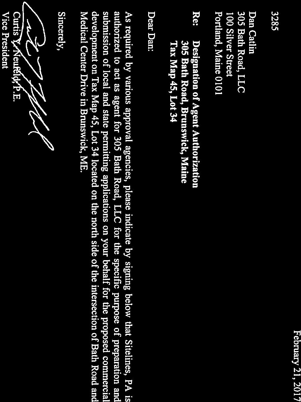
17 February 21, 2017 Mr. Jared Woolston Town Planner Town of Brunswick 85 Union Street Brunswick, Maine Re: Sketch Plan Application MEDICAL OFFICE BUILDING 305 BATH ROAD, BRUNSWICK, MAINE Tax Map 45, Lot 34 Dear Jared: On behalf of 305 Bath Road, LLC, Sitelines, PA is pleased to submit the enclosed Sketch Plan Application and supporting materials for the construction of a Medical Office building consisting of a 3-story building at 305 Bath Road (Tax Map 45, Lot 34). The current owner of the property is Franklin T. Crooker and 305 Bath Road, LLC, has an option on the property. This letter is intended to summarize the project in order to facilitate the review process. The project will be a redevelopment of the parcel occupied by the Long Shot Golf Center driving range and mini-golf business. The existing building and site improvements will be demolished and removed from the site. The gravel parking area will be scarified, loamed, and seeded to establish a meadow. The proposed development will consist of a 13,280 s.f. footprint, 3-story medical office building (39,840 s.f. total). A total of 160 parking spaces will be provided, including 8 ADA compliant spaces. The main access to the property will be from a new curb cut on Bath Road at the Medical Center Drive intersection; the existing curb cut will be closed. The proposed site sets the building centrally and to the rear of the parcel. Parking is set mostly to the sides and rear of the building, but some parking is located in the front of the building for access by individuals with limited mobility. A covered drop-off is also planned to provide all-weather curb-side access. A large landscaped area is proposed in front of the building, which may serve as a stormwater quality treatment area. Stormwater is anticipated to drain to the northeast corner, where a wet-pond or similar best management practice (BMP) will detain and provide water quality treatment. Public water and sewer will be extended from the Bath Road right-of-way. The remaining land is anticipated to be developed in the future and the drive aisles are configured to provide access to those areas; however, there are no uses identified at this time. SITELINES PA CIVIL ENGINEERS LAND SURVEYORS 8 Cumberland Street, Brunswick, Maine www. sitelinespa.com
18 Medical Office Building 305 Bath Road, Brunswick, Maine 02/21/2017 Page 2 We trust that this information satisfactorily addresses the requirements for Sketch Plan Review and we look forward to meeting with you and the Planning Board at their March 14, 2017 meeting to obtain their feedback. If you have any questions or require additional information, please do not hesitate to call. Thank you for your assistance with this project. Very truly yours, Curtis Y. Neufeld, P.E. Vice President Enclosure cc: Dan Catlin, 305 Bath Road, LLC
19
20 SKETCH PLAN REQUIREMENTS Key: O = omit; S =submit; NA =not applicable; W = waiver; P =pending Item O S NA W P Comments Indicate Variances Granted Indicate Special Permits Indicate Special Exceptions Date, north point, scale Land area, existing use of the property, location of proposed development, locations reserved for future development Tentative rights-of-way locations, lot lines, lot numbers, lot areas Estimated soil boundary locations from the Soil Conservation Service Medium Intensity Soil Survey noting areas of severe and very severe soil limitations Existing natural, topographical, and cultural features including areas of steep slopes, bedrock outcrops, ponds, streams, aquifers, and other water bodies, wetlands, groundwater recharge areas, slumps, flood hazard areas, trees, and other vegetation, excavation sites, stone walls, net site area, historic and archeological sites, structures, or districts, and any other pertinent features. Tentative locations of proposed structures, owners of existing structures, and neighboring land uses Special conservation and recreation areas Location map Zoning information, including the zoning district(s) in which the property is located and the location of any overlay zones depicted on the plan. Any conditions imposed by previous development on the site. Other information Planning Board/Staff Review Committee deems necessary to conduct an informed review. Letter of consent signed by property owner authorizing the development review application in cases where applicant is not the owner of the property. Application Fee For Open Space Developments, sketch plan design review requirements indicated in Section Open Space Development: Request for Bonus Density


21
22

23 Soil Map Cumberland County and Part of Oxford County, Maine ' 7'' W 69 53' 42'' W 43 54' 51'' N 43 54' 51'' N ' 40'' N ' 7'' W 69 53' 42'' W 43 54' 40'' N Soil Map may not be valid at this scale. N Map Scale: 1:2,480 if printed on A landscape (11" x 8.5") sheet. Meters Feet Map projection: Web Mercator Corner coordinates: WGS84 Edge tics: UTM Zone 19N WGS84 Natural Resources Conservation Service Web Soil Survey National Cooperative Soil Survey 2/10/2017 Page 1 of 3
24 MAP LEGEND MAP INFORMATION Soil Map Cumberland County and Part of Oxford County, Maine Area of Interest (AOI) Area of Interest (AOI) Soils Soil Map Unit Polygons Soil Map Unit Lines Soil Map Unit Points Special Point Features Blowout Borrow Pit Clay Spot Closed Depression Gravel Pit Gravelly Spot Landfill Lava Flow Marsh or swamp Mine or Quarry Miscellaneous Water Perennial Water Rock Outcrop Saline Spot Sandy Spot Severely Eroded Spot Sinkhole Slide or Slip Sodic Spot Spoil Area Stony Spot Very Stony Spot Wet Spot Other Special Line Features Water Features Streams and Canals Transportation Rails Interstate Highways US Routes Major Roads Local Roads Background Aerial Photography The soil surveys that comprise your AOI were mapped at 1:24,000. Warning: Soil Map may not be valid at this scale. Enlargement of maps beyond the scale of mapping can cause misunderstanding of the detail of mapping and accuracy of soil line placement. The maps do not show the small areas of contrasting soils that could have been shown at a more detailed scale. Please rely on the bar scale on each map sheet for map measurements. Source of Map: Natural Resources Conservation Service Web Soil Survey URL: Coordinate System: Web Mercator (EPSG:3857) Maps from the Web Soil Survey are based on the Web Mercator projection, which preserves direction and shape but distorts distance and area. A projection that preserves area, such as the Albers equal-area conic projection, should be used if more accurate calculations of distance or area are required. This product is generated from the USDA-NRCS certified data as of the version date(s) listed below. Soil Survey Area: Cumberland County and Part of Oxford County, Maine Survey Area Data: Version 12, Sep 15, 2016 Soil map units are labeled (as space allows) for map scales 1:50,000 or larger. Date(s) aerial images were photographed: Jul 17, 2010 Jul 27, 2010 The orthophoto or other base map on which the soil lines were compiled and digitized probably differs from the background imagery displayed on these maps. As a result, some minor shifting of map unit boundaries may be evident. Natural Resources Conservation Service Web Soil Survey National Cooperative Soil Survey 2/10/2017 Page 2 of 3
25 Soil Map Cumberland County and Part of Oxford County, Maine Map Unit Legend Cumberland County and Part of Oxford County, Maine (ME005) Map Unit Symbol Map Unit Name Acres in AOI Percent of AOI Au Au Gres loamy sand % WmB Windsor loamy sand, 0 to 8 percent slopes % Totals for Area of Interest % Natural Resources Conservation Service Web Soil Survey National Cooperative Soil Survey 2/10/2017 Page 3 of 3
26 200 foot Abutters List Report Brunswick, ME February 10, 2017 Subject Property: BATH RD CROOKER, FRANKLIN T 11 HARPSWELL ISLANDS RD HARPSWELL, ME Abutters: MEDICAL CENTER DR ALLEN, MATTHEW B ETAL TRUSTEES PO BOX NEWTON CENTRE, MA C 45-1C-1 22 OLD BATH RD CROOKER, THEODORE D 44 STORER RD BRUNSWICK, ME C 45-1C-2 22 OLD BATH RD MAINE RSA #1 INC PO BOX CHICAGO, IL C 45-1C-3 22 OLD BATH RD AMERICAN TOWER CORPORATION PO BOX ATLANTA, GA C 45-1C-5 22 OLD BATH RD 45-1C 45-1C-6 22 OLD BATH RD AT&T MOBILITY LLC 575 MOROSGO DR SUITE 13-F WEST TOWER ATLANTA, GA VERIZON WIRELESS VERRILL DANA LLP PO BOX 586 PORTLAND, ME BATH RD CENTRAL MAINE POWER CO 70 FARM VIEW DR NEW GLOUCESTER, ME BATH RD SAI KRUPA LLC 287 BATH RD BRUNSWICK, ME C 45-2C 0 OLD BATH RD CROOKER, FRANKLIN T 11 HARPSWELL ISLANDS RD HARPSWELL, ME BATH RD BRUNSWICK WEST LLC PO BOX CENTRE ST STE 403 NEWTON CENTRE, MA /10/ Data shown on this report is provided for planning and informational purposes only. The municipality and CAI Technologies are not responsible for any use for other purposes or misuse or misrepresentation of this report. Page 1 of 2 Abutters List Report - Brunswick, ME


27 200 foot Abutters List Report Brunswick, ME February 10, B 45-31B 310 BATH RD 310 BATH RD ASSOCIATES LLC 27 BARIBEAU DR BRUNSWICK, ME MEDICAL CENTER DR MID COAST HEALTH SERVICES INC 123 MEDICAL CENTER DR SUITE 2200 BRUNSWICK, ME MEDICAL CENTER DR BRUNSWICK ASSOCIATES LLC 349 WEST COMMERCIAL ST SUITE 2273 EAST ROCHESTER, NY MEDICAL CENTER DR MID COAST HEALTH SERVICES 349 WEST COMMERCIAL ST SUITE 2273 EAST ROCHESTER, NY MEDICAL CENTER DR BATH ROAD ASSOCIATES LLC PO BOX SOUTHLAKE, TX MEDICAL CENTER DR MID COAST HEALTH SERVICES INC PO BOX SOUTHLAKE, TX BATH RD SOWLES REAL ESTATE LLC PO BOX 3788 PORTLAND, ME BATH RD JOHN G MORSE & SONS LLC 4 MILL RD PHIPPSBURG, ME RAILROAD R/W MAINE, STATE OF #16 STATE HOUSE STATION AUGUSTA, ME BATH RD JOHN G MORSE & SONS LLC 4 MILL RD PHIPPSBURG, ME BATH RD STAR DEVELOPMENT LLC 85 SHOAL COVE RD WEST BATH, ME /10/ Data shown on this report is provided for planning and informational purposes only. The municipality and CAI Technologies are not responsible for any use for other purposes or misuse or misrepresentation of this report. Page 2 of 2 Abutters List Report - Brunswick, ME


28
29 SITELINES, PA ENGINEERS PLANNERS SURVEYORS 8 CUMBERLAND STREET, BRUNSWICK, ME
 108 40' 29'' W Soil Map Mesa County Area, Colorado 108 36' 55'' W 39 10' 11'' N 39 6' 31'' N 4331700 4332500 4333300 4334100 4334900 4335700 4336500 4337300 4338100 701100 701900 702700 703500 704300 705100
Farmland Classification Centre County, Pennsylvania (Student Farm Site) Web Soil Survey National Cooperative Soil Survey
 Web Soil Survey National Cooperative Soil Survey") 256300 256600 256900 257200 257500 257800 258100 77 51' 20'' W 77 53' 26'' W Farmland Classification Centre County, Pennsylvania 258400 258700 259000 40 49' 4'' N 4520600 4520900 4520900 4521200 4521200
256300 256600 256900 257200 257500 257800 258100 77 51' 20'' W 77 53' 26'' W Farmland Classification Centre County, Pennsylvania 258400 258700 259000 40 49' 4'' N 4520600 4520900 4520900 4521200 4521200
Custom Soil Resource Report for Craighead County, Arkansas
 United States Department of Agriculture Natural Resources Conservation Service A product of the National Cooperative Soil Survey, a joint effort of the United States Department of Agriculture and other
HCI ENGINEERING. March 27, City of Thornton, Development Engineering 9500 Civic Center Drive Thornton, CO 80229
 HCI ENGINEERING A division of HABERER CARPENTRY INC. March 27, 2014 Attn: Heath Klein, P.E. City of Thornton, Development Engineering 9500 Civic Center Drive Thornton, CO 80229 Re: Drainage Letter for
Yields of Non-Irrigated Crops (Component): Soybeans (Bu) Edgecombe County, North Carolina, and Halifax... (SOYBEANS)
: Soybeans (Bu) Edgecombe County, North Carolina, and Halifax... (SOYBEANS)") 77 37' 52'' W Yields of Non-Irrigated Crops (Component): Soybeans (Bu) Edgecombe County, North Carolina, and Halifax... () 77 36' 28'' W 263300 263600 263900 264200 264500 264800 265100 36 6' 59'' N 36
77 37' 52'' W Yields of Non-Irrigated Crops (Component): Soybeans (Bu) Edgecombe County, North Carolina, and Halifax... () 77 36' 28'' W 263300 263600 263900 264200 264500 264800 265100 36 6' 59'' N 36
Sacramento River Farmland Anderson, California
 AG-LAND INVESTMENT BROKERS 275 Sale Lane / P. O. Box 896 Red Bluff, CA 96080 530.529.4400 office / 530.527.5042 fax Sacramento River Farmland Anderson, California Property: 43 +/- acres of farmland with
Custom Soil Resource Report for Pope County, Illinois
 United States Department of Agriculture Natural Resources Conservation Service A product of the National Cooperative Soil Survey, a joint effort of the United States Department of Agriculture and other
Custom Soil Resource Report for Southampton County, Virginia
 United States Department of Agriculture Natural Resources Conservation Service A product of the National Cooperative Soil Survey, a joint effort of the United States Department of Agriculture and other
Custom Soil Resource Report for Polk County, Oregon
 United States Department of Agriculture Natural Resources Conservation Service A product of the National Cooperative Soil Survey, a joint effort of the United States Department of Agriculture and other
NRCS Soils Report. Encana Oil & Gas (USA) Inc. C19 Injection Well. OA Project No
 Inc. C19 Injection Well. OA Project No") NRCS Soils Report Encana Oil & Gas (USA) Inc. C19 Injection Well OA Project No. 012-0178 826 21 ½ Road Grand Junction, CO 81505 TEL 970.263.7800 FAX 970.263.7456 United States Department of Agriculture
NRCS Soils Report Encana Oil & Gas (USA) Inc. C19 Injection Well OA Project No. 012-0178 826 21 ½ Road Grand Junction, CO 81505 TEL 970.263.7800 FAX 970.263.7456 United States Department of Agriculture
Custom Soil Resource Report for Orange County, Virginia
 United States Department of Agriculture Natural Resources Conservation Service A product of the National Cooperative Soil Survey, a joint effort of the United States Department of Agriculture and other
Custom Soil Resource Report for Fond du Lac County, Wisconsin
 United States Department of Agriculture Natural Resources Conservation Service A product of the National Cooperative Soil Survey, a joint effort of the United States Department of Agriculture and other
Custom Soil Resource Report for Polk County, Oregon
 United States Department of Agriculture Natural Resources Conservation Service A product of the National Cooperative Soil Survey, a joint effort of the United States Department of Agriculture and other
RaC. RaD GlG. GlF. RaD GlE. CeA. RaE. RcD. GoF. GoF SkC. SkD. CfA. AdA. GoF. GoF. GoF. RcD. GgD. GoF. RaE GlE. RaE DbF. GoF. DbE. RaC.
 526300 527400 528500 529600 530700 531800 532900 534000 535100 4240200 4241300 4242400 4243500 4244600 4245700 ADRIAN DR FAIRWAY DR STATE FARM DR DOLORES DR HUDIS ST SANTA ALICIA DR Cotati PAGE ST ALTA
Richfield Prunes, Pistachios & Walnuts
 AG-LAND Investment Brokers 275 Sale Lane Red Bluff, CA 96080 530-529-4400 Fax 530-527-5042 Richfield Prunes, Pistachios & Walnuts 210 +/- acres 3 Parcels Corning, CA - Tehama County jsubject AG-LAND
FOR SALE ± ACRES VALENTINES, VIRGINIA Price: $150,000
 LATITUDE & LONGITUDE 36.566924, -77.764781 Features STRONG RECREATIONAL INVESTMENT opportunity located south of Triplet with access from VSR 600 (Triplet Rd.) to the north. TRACT HAS BEEN RECENTLY CUTOVER
Custom Soil Resource Report for Kent County, Maryland
 United States Department of Agriculture Natural Resources Conservation Service A product of the National Cooperative Soil Survey, a joint effort of the United States Department of Agriculture and other
Custom Soil Resource Report for Daviess County, Missouri
 United States Department of Agriculture Natural Resources Conservation Service A product of the National Cooperative Soil Survey, a joint effort of the United States Department of Agriculture and other
Town of Windham. Planning Department 8 School Road Windham, ME voice fax
 Town of Windham Planning Department 8 School Road Windham, ME 04062 voice 207.864-5960 fax 207.892.1916 MEMO DATE: TO: Staff Review Committee FROM: Amanda Lessard, Planner Cc: Ellen Rathbone, St. Germain
Town of Scarborough, Maine
 Town of Scarborough, Maine Planning Board June 2, 2014 1. Call to Order (7:00 P. M.) 2. Roll Call 3. Approval of Minutes (May 12, 2014) AGENDA 5. The Rock Church requests site plan review for expansion
Custom Soil Resource Report for Hancock County Area, Maine
 United States Department of Agriculture Natural Resources Conservation Service A product of the National Cooperative Soil Survey, a joint effort of the United States Department of Agriculture and other
Custom Soil Resource Report for State of Connecticut
 United States Department of Agriculture Natural Resources Conservation Service A product of the National Cooperative Soil Survey, a joint effort of the United States Department of Agriculture and other
Custom Soil Resource Report for Kane County, Illinois
 United States Department of Agriculture Natural Resources Conservation Service A product of the National Cooperative Soil Survey, a joint effort of the United States Department of Agriculture and other
Custom Soil Resource Report for Yamhill Area, Oregon
 United States Department of Agriculture Natural Resources Conservation Service A product of the National Cooperative Soil Survey, a joint effort of the United States Department of Agriculture and other
CITY OF BIDDEFORD PLANNING DEPARTMENT PLANNING BOARD REPORT. Larry Patoine, Chair & Members of the Biddeford Planning Board
 CITY OF BIDDEFORD PLANNING DEPARTMENT 2016.25 Greg D. Tansley, A.I.C.P. 205 Main Street PO Box 586 (207) 284-9115 gtansley@biddefordmaine.org PLANNING BOARD REPORT TO: Larry Patoine, Chair & Members of
Custom Soil Resource Report for Gallia County, Ohio
 United States Department of Agriculture Natural Resources Conservation Service A product of the National Cooperative Soil Survey, a joint effort of the United States Department of Agriculture and other
Custom Soil Resource Report for Choctaw County, Oklahoma, and McCurtain County, Oklahoma
 United States Department of Agriculture Natural Resources Conservation Service A product of the National Cooperative Soil Survey, a joint effort of the United States Department of Agriculture and other
Custom Soil Resource Report for Pope County, Illinois
 United States Department of Agriculture Natural Resources Conservation Service A product of the National Cooperative Soil Survey, a joint effort of the United States Department of Agriculture and other
APPENDIX A SOIL RESOURCES REPORTS
 APPENDIX A SOIL RESOURCES REPORTS United States Department of Agriculture Natural Resources Conservation Service A product of the National Cooperative Soil Survey, a joint effort of the United States Department
FOR SALE 280.5± ACRES SUSSEX COUNTY, VA Price: $430,000
 LATITUDE & LONGITUDE 37.5556, -79.2318 Winchester Front Royal 15 Leesburg 495 Washington 66 Chantilly Arlington Falls Church Fairfax Alexandria Springfield Manassas Warrenton 301 13 113 Dale City Waldorf
PROPOSED DRAINAGE PATTERNS
 1121 1118.50 Basin Floor 1120 1119 0 N 100 200 PROPOSED DRAINAGE PATTERNS Deroiser Drive Riverwood Drive County 260 0 100 200 Project Name: Riverwood Drive LITTLE FALLS TOWNHOMES Project Location: LITTLE
~ NRCS. Custom Soil Resource Report for Rifle Area, Colorado, Parts of Garfield and Mesa Counties. USDA United States ~ Department of Agriculture
 USA United States ~ epartment of Agriculture ~ NRCS Natural Resources Conservation Service A product of the National Cooperative Soil Survey, a joint effort of the United States epartment of Agriculture
~ NRCS. Custom Soil Resource Report for Rifle Area, Colorado, Parts of Garfield and Mesa Counties. Encana Upper Gate Communication Tower
 USA United States ~ epartment of Agriculture ~ NRCS Natural Resources Conservation Service A product of the National Cooperative Soil Survey, a joint effort of the United States epartment of Agriculture
BENNING ROAD & BRIDGES TRANSPORTATION IMPROVEMENTS NRCS SOIL RESOURCE REPORT DRAFT MAY 2016
 BENNING ROAD & BRIDGES TRANSPORTATION IMPROVEMENTS NRCS SOIL RESOURCE REPORT DRAFT MAY 2016 United States Department of Agriculture Natural Resources Conservation Service A product of the National Cooperative
Custom Soil Resource Report Soil Map
 77 11' 22'' W Custom Soil Resource Report Soil Map 77 9' 43'' W 36 48' 13'' N 304700 304900 305100 305300 305500 305700 305900 306100 306300 306500 306700 306900 307100 36 48' 13'' N 36 47' 21'' N 4073800
Agenda Item # 1. Meeting Date September 21, Prepared By. Approved By
 Agenda Item # 1 Work Session Meeting Date September 21, 2015 Prepared By Approved By Erkin Ozberk, Senior Planner Suzanne R. Ludlow City Manager Discussion Item Background Discussion of Site Plan Application
Custom Soil Resource Report for Clark County, Missouri
 United States Department of Agriculture Natural Resources Conservation Service A product of the National Cooperative Soil Survey, a joint effort of the United States Department of Agriculture and other
Custom Soil Resource Report for Walker County, Texas
 United States Department of Agriculture Natural Resources Conservation Service A product of the National Cooperative Soil Survey, a joint effort of the United States Department of Agriculture and other
SECTION 4(f) DE MINIMIS DOCUMENTATION
 DE MINIMIS DOCUMENTATION") SECTION 4(f) DE MINIMIS DOCUMENTATION Illinois Route 60/83 IL 176 to the intersection of IL 60 (Townline Road) Lake County P-91-084-07 Mundelein Park and Recreation District Project Limit SECTION 4(f)
SECTION 4(f) DE MINIMIS DOCUMENTATION Illinois Route 60/83 IL 176 to the intersection of IL 60 (Townline Road) Lake County P-91-084-07 Mundelein Park and Recreation District Project Limit SECTION 4(f)
John Callaway, for Rees 514 LLC & Brent Brunswick LLC Name of Project
 COMMUNITY DEVELOPMENT DEPARTMENT Planning and Zoning Division 1725 Reynolds Street, Suite 200, Brunswick, GA 31520 Phone: 912-554-7428/Fax: 1-888-252-3726 PLANNING COMMISSION STAFF REPORT DATE November
Custom Soil Resource Report for Franklin County, Washington
 United States Department of Agriculture Natural Resources Conservation Service A product of the National Cooperative Soil Survey, a joint effort of the United States Department of Agriculture and other
PLANNED UNIT DEVELOPMENT & SUBDIVISION STAFF REPORT Date: May 18, 2017
 & PUD-0000102-2017 PLANNED UNIT DEVELOPMENT & SUBDIVISION STAFF REPORT Date: May 18, 2017 NAME SUBDIVISION NAME Dauphin Creek Estates Subdivision Dauphin Creek Estates Subdivision LOCATION CITY COUNCIL
Custom Soil Resource Report for Ulster County, New York
 United States Department of Agriculture Natural Resources Conservation Service A product of the National Cooperative Soil Survey, a joint effort of the United States Department of Agriculture and other
HILLSIDE BUILDING COMMITTEE PLAN REVIEW DIRECTIONS
 HILLSIDE BUILDING COMMITTEE PLAN REVIEW DIRECTIONS 1 1. Review Hillside Regulations to ensure your design is in conformance with current Town Code. 2. Complete page 3 and contact Paul Mood at 480-348-3573,
SITE ASSESSMENT AND SEPTIC EVALUATION FOR JASON & JANET THATCHER 201 N. SPRAGUE AVED KINGSTON, PA 18704
 DATE: December 13, 2010 N.H. LICENSED DESIGNER OF SUBSURFACE DISPOSAL SYSTEMS 216 Hill Road Phone & Fax: 934-6206 Franklin, NH 03235 Cell: 393-3085 SITE ASSESSMENT AND SEPTIC EVALUATION FOR JASON & JANET
John Callaway, for Rees 514 LLC & Brent Brunswick LLC Name of Project
 COMMUNITY DEVELOPMENT DEPARTMENT Planning and Zoning Division 1725 Reynolds Street, Suite 200, Brunswick, GA 31520 Phone: 912-554-7428/Fax: 1-888-252-3726 PLANNING COMMISSION STAFF REPORT DATE November
Custom Soil Resource Report for Payne County, Oklahoma
 United States Department of Agriculture Natural Resources Conservation Service A product of the National Cooperative Soil Survey, a joint effort of the United States Department of Agriculture and other
TOWN OF BRUNSWICK MEETING AGENDA TOWN COUNCIL CHAMBERS TOWN HALL 85 UNION STREET TUESDAY, MAY 13, :00 P.M.
 TOWN OF BRUNSWICK ZONING ORDINANCE REWRITE COMMITTEE 85 Union Street, Brunswick, ME 04011-1583 MEETING AGENDA TOWN COUNCIL CHAMBERS TOWN HALL 85 UNION STREET TUESDAY, MAY 13, 2014 4:00 P.M. 1. Discuss
Custom Soil Resource Report for Lane County Area, Oregon
 United States Department of Agriculture Natural Resources Conservation Service A product of the National Cooperative Soil Survey, a joint effort of the United States Department of Agriculture and other
MOBILE CITY PLANNING COMMISSION LETTER OF DECISION. October 22, 2010
 MOBILE CITY PLANNING COMMISSION LETTER OF DECISION Archbishop of Mobile 400 Government St. Mobile, AL 36602 Re: Case #SUB2010-00075 (Subdivision) 3650 Springhill Avenue (Northwest corner of Springhill
TOWNSHIP OF LOGAN SOIL & FILL IMPORTATION AND PLACEMENT APPLICATION SUBMITTAL CHECKLIST
 TOWNSHIP OF LOGAN SOIL & FILL IMPORTATION AND PLACEMENT APPLICATION SUBMITTAL CHECKLIST Applications: 5 copies of application - Applicant will reproduce the copies at his/her costs. The Township Clerk
Custom Soil Resource Report for Hinds County, Mississippi
 United States Department of Agriculture Natural Resources Conservation Service A product of the National Cooperative Soil Survey, a joint effort of the United States Department of Agriculture and other
Custom Soil Resource Report for Centre County, Pennsylvania
 United States Department of Agriculture Natural Resources Conservation Service A product of the National Cooperative Soil Survey, a joint effort of the United States Department of Agriculture and other
Blue Fox Farm $1,795,000
 Offered Exclusively By: Blue Fox Farm 6105 Sulphur Well Road 117± acres Fayette County $1,795,000 Zach Davis Principal Broker +1.859.576.8195 www.kirkfarms.com zach@kirkfarms.com Hannah Davis Emig Agent
~ NRCS. Custom Soil Resource Report for Rifle Area, Colorado, Parts of Garfield and Mesa Counties. USDA United States ~ Department of Agriculture
 USA United States ~ epartment of Agriculture ~ NRCS Natural Resources Conservation Service A product of the National Cooperative Soil Survey, a joint effort of the United States epartment of Agriculture
Part 5. Environmental Protection Overlay District Regulations
 Part 5 Environmental Protection Overlay District Regulations Section 501. Statement of Intent. As established through the goals, objectives and policies of the Amity Township Comprehensive Plan, it is
Town of Malta Planning Board 2540 Route 9 Malta, NY (518) Fax: (518)
 Fax: (518)") William Smith - Chairman Dave Bowman Kyle Kordich Roger Laime Jean Loewenstein John Viola David Wallingford Joseph Lopez (Alt) Town of Malta Planning Board 2540 Route 9 Malta, NY 12020 (518) 899-2685 Fax:
William Smith - Chairman Dave Bowman Kyle Kordich Roger Laime Jean Loewenstein John Viola David Wallingford Joseph Lopez (Alt) Town of Malta Planning Board 2540 Route 9 Malta, NY 12020 (518) 899-2685 Fax:
6. CPRC Group, requests sketch plan review for 70 Pleasant Hill Road, Map R77, Lot 7
 REGULAR MEETING AGENDA Planning Board November 20, 2017 1. Call to Order (7:00 P. M.) 2. Roll Call 3. Approval of Minutes (October 30, 2017) 4. Rosewood Land Development, Inc., requests sketch plan review
PARISH OF ASCENSION OFFICE OF PLANNING AND DEVELOPMENT PLANNING DEPARTMENT. Joint Planning and Zoning Meeting
 1. Call To Order 2. Roll Call of Members 3. Chairman's Comments PARISH OF ASCENSION OFFICE OF PLANNING AND DEVELOPMENT PLANNING DEPARTMENT Joint Planning and Zoning Meeting January 11, 2017 6:00 PM Courthouse
Drexel, Barrell & Co.
 Drexel, Barrell & Co. June 18, 2018 Engineers/Surveyors Boulder Colorado Springs Greeley 3 South 7 th Street Colorado Springs, Colorado 80905-1501 719 260-0887 719 260-8352 Fax El Paso County Planning
FOR SALE. Arvin Edison Vineyard & Open Land Gross Acres Kern County, CA
 Arvin Edison Vineyard & Open Land FOR SALE Property Highlights Arvin Edison Water Storage District Class I and II Soils Neighboring properties planted to almonds, vineyards, and citrus The information
APPENDIX A SIMPLIFIED APPROACH TO STORMWATER MANAGEMENT FOR SMALL PROJECTS. In West Sadsbury Township, Chester County, Pennsylvania
 APPENDIX A SIMPLIFIED APPROACH TO STORMWATER MANAGEMENT FOR SMALL PROJECTS In West Sadsbury Township, Chester County, Pennsylvania TABLE OF CONTENTS I. Introduction 3 II. Importance of Stormwater Management
Custom Soil Resource Report for Banks and Stephens Counties, Georgia
 United States Department of Agriculture Natural Resources Conservation Service A product of the National Cooperative Soil Survey, a joint effort of the United States Department of Agriculture and other
APPLICATION FORM SITE PLAN REVIEW REGULATIONS TOWN OF CONWAY, NH
 February 25, 2010 INSTRUCTIONS APPLICATION FORM SITE PLAN REVIEW REGULATIONS TOWN OF CONWAY, NH Please complete each section of this application from and submit it with all required application material
Drexel, Barrell & Co.
 Drexel, Barrell & Co. December 21, 2018 Engineers/Surveyors Boulder Colorado Springs Greeley 3 South 7 th Street Colorado Springs, Colorado 80905-1501 719 260-0887 719 260-8352 Fax El Paso County Planning
The Maryland-National Capital Park and Planning Commission Prince George's County Planning Department Development Review Division
 The Maryland-National Capital Park and Planning Commission Prince George's County Planning Department Development Review Division 301-952-3530 Note: Staff reports can be accessed at www.mncppc.org/pgco/planning/plan.htm.
APPLICATION FOR REZONING PROPERTY CITY OF HOLLAND, MICHIGAN. Name of Applicant. Address, and Phone # of Applicant
 APPLICATION FOR REZONING PROPERTY CITY OF HOLLAND, MICHIGAN Name of Applicant Address, Email and Phone # of Applicant Name and Address of Owner (if other than applicant) Ownership Interest of Applicant
An Analysis of Soil Features and. Their Suitability for Recreational Uses. Using the U.S.D.A. s Web Soil Survey
 Soils of Pheasant Branch Conservancy An Analysis of Soil Features and Their Suitability for Recreational Uses Using the U.S.D.A. s Web Soil Survey Dreux J. Watermolen, Sally J. Kefer, and Adam C. Mednick
Town of West Point Plan of Development
 Town of West Point Plan of Development Plan Submission In accordance with Section 70-51(b) of the Town Code, the Zoning Administrator shall establish a written policy for the form, format, content and
Major Subdivision Sketch Plan Checklist
 This checklist provides specific requirements that are apart of the Sketch process. The entire process is described by the Huntersville Subdivision Review Process which details all the submittal and resubmittal
Project phasing plan (if applicable) 12 copies of site plan
 12 copies of site plan") SITE PLAN REVIEW PERMIT APPLICATION City of Grand Haven, 11 N. Sixth Street, Grand Haven, MI 49417 Phone: (616) 847-3490 Fax: (616) 844-2051 Website: www.grandhaven.org 1. Project Information Address/location
SITE PLAN REVIEW PERMIT APPLICATION City of Grand Haven, 11 N. Sixth Street, Grand Haven, MI 49417 Phone: (616) 847-3490 Fax: (616) 844-2051 Website: www.grandhaven.org 1. Project Information Address/location
Custom Soil Resource Report for Columbia County, New York
 United States Department of Agriculture Natural Resources Conservation Service A product of the National Cooperative Soil Survey, a joint effort of the United States Department of Agriculture and other
Plat Requirements CHECKLIST FOR SITE PLAN REVIEW
 This checklist is to be used as a guide for complying with the Town of Hollis Site Plan Regulations. It is to be used for each individual site plan review application submitted. Applicants are encouraged
Advance Engineering & Surveying PLLC
 Advance Engineering & Surveying, PLLC Consulting in: Civil & Environmental Engineering Land Surveying Land Development 11 Herbert Drive Phone: (518) 698-3772 Latham, N.Y. 12110 Email:ncostape@gmail.com
FEG AIR COMMERCE PARK - PD FRAMEWORK MASTER PLAN ORLANDO, FLORIDA FLORIDA ENGINEERING GROUP. Orlando, FL Phone: Fax:
 AIR COMMERCE PARK - PD FRAMEWORK MASTER PLAN ORLANDO, FLORIDA PARCEL I.D. NOs. 30-24-05-0000-00-002 30-24-05-0000-00-008 30-24-05-0000-00-003 30-24-05-7268-00-761 30-24-05-0000-00-004 OWNERS: GEOTECHNICAL
Review Zone Application for D&R Canal Commission Decision
 Review Zone Application for D&R Canal Commission Decision MEETING DATE: July 20, 2016 DRCC #: 16-4803 Latest Submission Received: June 13, 2016 Applicant: Robert McCarthy, PE PSE&G 4000 Hadley Road, 2
Custom Soil Resource Report for Hamilton County, Texas
 United States Department of Agriculture Natural Resources Conservation Service A product of the National Cooperative Soil Survey, a joint effort of the United States Department of Agriculture and other
NRCS Soils Report. Grand River Gathering LLC K28E Compressor Station. OA Project No
 NRCS Soils Report Grand River Gathering LLC K28E Compressor Station OA Project No. 012-032 82 21 ½ Road Grand Junction, CO 81505 TEL 90.23.800 FAX 90.23.45 United States Department of Agriculture A product
Custom Soil Resource Report for Hinds County, Mississippi
 United States Department of Agriculture Natural Resources Conservation Service A product of the National Cooperative Soil Survey, a joint effort of the United States Department of Agriculture and other
Custom Soil Resource Report for McCurtain County, Oklahoma
 United States Department of Agriculture Natural Resources Conservation Service A product of the National Cooperative Soil Survey, a joint effort of the United States Department of Agriculture and other
Custom Soil Resource Report for McCurtain County, Oklahoma, and Red River County, Texas
 United States Department of Agriculture Natural Resources Conservation Service A product of the National Cooperative Soil Survey, a joint effort of the United States Department of Agriculture and other
City of La Palma Agenda Item No. 5
 City of La Palma Agenda Item No. 5 MEETING DATE: August 21, 2018 TO: FROM: SUBMITTED BY: CITY COUNCIL CITY MANAGER Laurie A. Murray, City Manager AGENDA TITLE: Kennedy High School Site Improvement Project
City of Stoughton Erosion Control Permit Application (effective 2/6/2018)
") City of Stoughton Erosion Control Permit Application (effective 2/6/2018) Incomplete applications will not be accepted Project Name: Address of subject property: Landowner Name(s): Applicant Name: Landowner
City of Stoughton Erosion Control Permit Application (effective 2/6/2018) Incomplete applications will not be accepted Project Name: Address of subject property: Landowner Name(s): Applicant Name: Landowner
Sanford/Lee County Technical Review Committee (TRC) DEADLINES & MEETING DATES
 DEADLINES & MEETING DATES") Sanford/Lee County Technical Review Committee (TRC) DEADLINES & MEETING DATES The following 2019 information is based on the information available to staff at the time of creation. Dates & time may change
Sanford/Lee County Technical Review Committee (TRC) DEADLINES & MEETING DATES The following 2019 information is based on the information available to staff at the time of creation. Dates & time may change
Custom Soil Resource Report for Centre County, Pennsylvania
 United States Department of Agriculture Natural Resources Conservation Service A product of the National Cooperative Soil Survey, a joint effort of the United States Department of Agriculture and other
TP73 4PTP101 TP45 TP9 TP74 TP46 TP47 TP115 TP48 TP32 TP5 TP31 TP22 TP49 V58 TP57 4F TP50 TP51 3PD 3PD TP80 TP28 TP55
 Figure 2.1-3 - Capability Assessment Map Part of Lots 18 and 19, Concession 3 Township of Russell sified unclas TP72 TP90 TP624P V18 3D TP35 TP73 4PTP101 3D TP45 TP9 TP74 TP89 TP117 V61 V34 TP19 TP20 TP100
5. Would the proposed project require modifications to the existing regulations?
 TOWN OF CHAPEL HILL Planning and Sustainability Department 405 Martin Luther King Jr. Blvd. Chapel Hill, NC 27514 www.townofchapelhill.org phone (919) 968-2728 Concept Plans are intended to be an opportunity
March 15, 2017 Project:
 March 15, 2017 Project: 161.06121 Maureen O Meara, Town of Cape Elizabeth 320 Ocean House Road P.O. Box 6260 Cape Elizabeth, Maine 04107 SUBJECT: Maxwell Woods Condominium Development Major Subdivision
Innovative Land Use Techniques
 Innovative Land Use Techniques A Handbook for Sustainable Development Eric Williams, Assistant Administrator, NHDES Carolyn Russell, Principal Planner, NHDES Cliff Sinnott, Executive Director, RPC Jill
Riverview Road Fort Washington, MD. 163 Waterfront Street, Suite #450 National Harbor, MD (301)
") Riverview Road Fort Washington, MD 163 Waterfront Street, Suite #450 National Harbor, MD 20745 (301) 750-7040 www.fleurdelisllc.com 1 Prepared by Monique Anderson Walker Principal +1 301-750-7040 Monique@FleurDeLisLLC.com
Riverview Road Fort Washington, MD 163 Waterfront Street, Suite #450 National Harbor, MD 20745 (301) 750-7040 www.fleurdelisllc.com 1 Prepared by Monique Anderson Walker Principal +1 301-750-7040 Monique@FleurDeLisLLC.com
APPENDIX 1: SCOPED ENVIRONMENTAL IMPACT STATEMENT (EIS) FORM
 FORM") APPENDIX 1: SCOPED ENVIRONMENTAL IMPACT STATEMENT (EIS) FORM This form is intended for use by applicants (primarily private landowners) who need to conduct a Scoped EIS in support of minor development
APPENDIX 1: SCOPED ENVIRONMENTAL IMPACT STATEMENT (EIS) FORM This form is intended for use by applicants (primarily private landowners) who need to conduct a Scoped EIS in support of minor development
ARTICLE 3. LARGE-SCALE SOLAR PHOTOVOLTAIC INSTALLATIONS SECTION XXI
 ARTICLE 3. LARGE-SCALE SOLAR PHOTOVOLTAIC INSTALLATIONS SECTION XXI 1.1 PURPOSE The purpose of this by-law is to regulate the installation of solar photovoltaic installations that are to produce 250 kw
COMMISSION ACTION FORM
 ITEM #: 6 DATE: 09-06-17 COMMISSION ACTION FORM REQUEST: Introduction and Initial Review of Proposed Amendments to the Ames Urban Fringe Future Land Map for the North Growth Gap Area BACKGROUND INFORMATION:
PLANNED UNIT DEVELOPMENT STAFF REPORT Date: June 2, 2016
 # 9 ZON2016-01032 PLANNED UNIT DEVELOPMENT STAFF REPORT Date: June 2, 2016 DEVELOPMENT NAME JJT Properties LLC LOCATION 1147 & 1151 East I-65 Service Road South and 1180 Sledge Drive (Southeast corner
Holmberg & Howe, Land Surveyors and Civil Engineers Zoning District: R-35
 Development Impact Statement Name of Project: Red Tail Drive Acreage: 13.5 Acres± Type of Project: Residential Subdivision Owner: 96 East Street Development, LLC Location: rear of 112 East Street Parcel
THE CITY OF MOBILE, ALABAMA
 THE CITY OF MOBILE, ALABAMA LETTER OF DECISION Ark of Safety, Inc. Mobile, AL 36617 Re: (Northwest corner of Main Street and First Avenue, extending to the Southwest corner of Esau Avenue and Main Street.)
SUBMITTAL REQUIREMENTS
 WHEN PROCESS TYPE III IS USED References to Process Type III applications are found in several places in the Milton Municipal Code (MMC), indicating that the development, activity, or use, is permitted
Custom Soil Resource Report for Clearfield County, Pennsylvania
 United States Department of Agriculture Natural Resources Conservation Service A product of the National Cooperative Soil Survey, a joint effort of the United States Department of Agriculture and other
November 21, Planning Commission Charter Township of Lyon Grand River Ave. New Hudson, MI 48165
 Planning Commission Charter Township of Lyon 58000 Grand River Ave. New Hudson, MI 48165 Subject: AP-18-68; 11 Mile and Milford Road Park, Site Plan Review #1 Based on site plan dated 11/12/18 Location:
September 20, 2016 Soils Investigation for Agricultural Designation Windemere Place, Missoula County, Montana
 September 20, 201 Soils Investigation for Agricultural Designation Windemere Place, Missoula County, Montana The purpose of this report is to compare on-site soils of the proposed subdivision with the