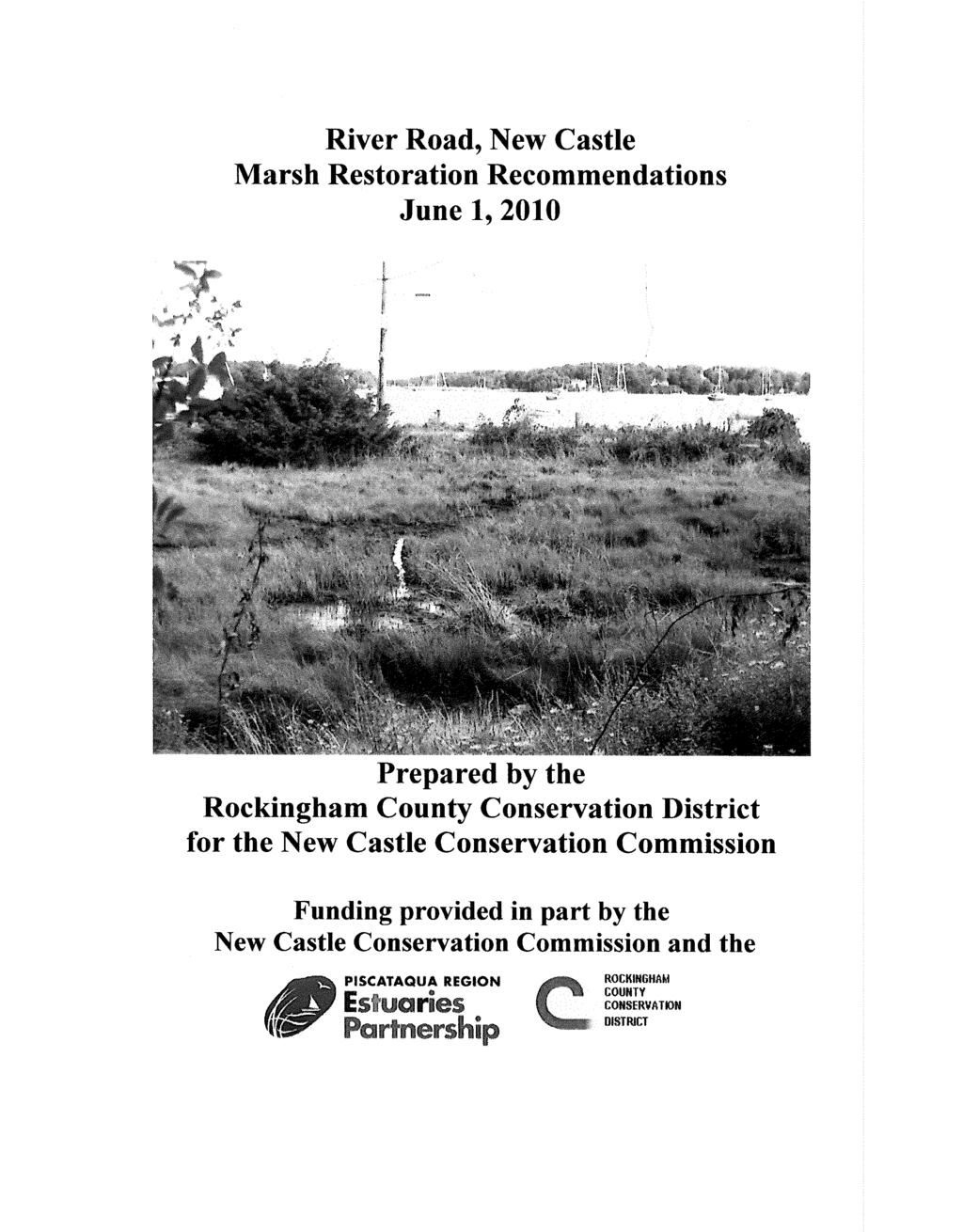
River Road New Castle Marsh Restoration Recommendations
|
|
|
- Teresa Boone
- 6 years ago
- Views:
Transcription


1 University of New Hampshire University of New Hampshire Scholars' Repository PREP Reports & Publications Institute for the Study of Earth, Oceans, and Space (EOS) River Road New Castle Marsh Restoration Recommendations Rockingham County Conservation District Follow this and additional works at: Part of the Marine Biology Commons Recommended Citation Rockingham County Conservation District, "River Road New Castle Marsh Restoration Recommendations" (2010). PREP Reports & Publications This Report is brought to you for free and open access by the Institute for the Study of Earth, Oceans, and Space (EOS) at University of New Hampshire Scholars' Repository. It has been accepted for inclusion in PREP Reports & Publications by an authorized administrator of University of New Hampshire Scholars' Repository. For more information, please contact
2 River Road New Castle Marsh Restoration Recommendations This report is available at University of New Hampshire Scholars' Repository:
.")
 Overview of Projects: 1.")
3 Background: Rockingham County Conservation District River Road Marsh and Stuart Farm Restoration Projects Final Project Report June 2010 PREP s 2009 (YR 13) workplan allocated $30,000 of EPA 320 funds for restoration project funding (Workplan ID 09-D-2). $9,500 of this allocation went to the Rockingham County Conservation District (RCCD) to fund planning work on two separate salt marsh restoration projects: 1. Stuart Farm (Stratham, NH) 2. River Road Marsh (New Castle, NH) Overview of Projects: 1. Stuart Farm (Stratham, NH) The project scope involved completing engineered plans and federal and state permits necessary to allow the replacement of a failing culvert located at the Stuart Farm in Stratham, NH. The purpose of this project was to obtain the plans and permits so that the landowners can move forward quickly with the construction component. The salt marsh directly affected by this culvert is approximately 12 acres in size, and connects to the Squamscott River. The property is owned by one landowner. The existing oval bituminous coated corrugated pipe (approximately 7 feet tall, 12 feet wide, and 60 feet long was installed in 1993 (with assistance from NOAA & USF&W S funds) to replace a tide gate that was limiting salt water flow. With the new culvert installed, the increased influence of salt water restored approximately 12 acres of salt marsh. Salt water corrosion greatly shortened the expected life of the corrugated culvert, which has nearly completely rusted out through the bottom. Several extreme flood events in 2009 and 2010 severely deformed the culvert and caused it to be a tidal constriction. Due to the failing culvert, the road at this site has been overtopped by floodwaters repeatedly and is a source of fine sedimentation into the adjacent marsh. Upstream inlet Downstream (bayside) outlet
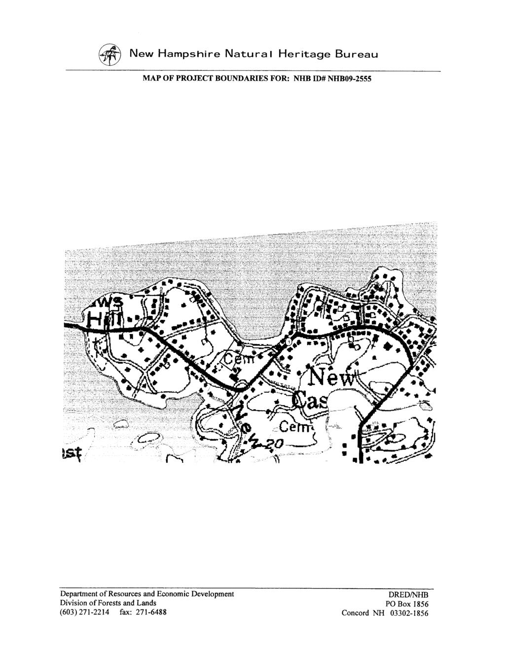
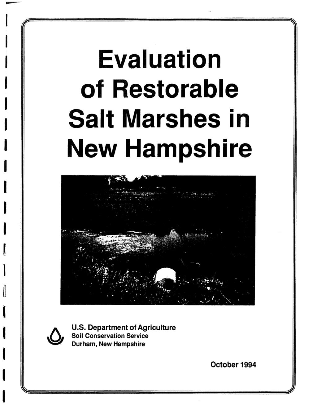
4 The site was reviewed by NRCS staff and is included in the Evaluation of Restorable Salt Marshes in New Hampshire in 1994 (restriction # 110 in the above mentioned report). Restoration objectives have been revisited several times by NHCP and NHDES staff with agreement that an embedded HDPE culvert was probably the best solution due to the need to keep the farm road open and is resistant to salt water degradation. A low-cost bridge crossing option was also evaluated by the design engineer, but was not deemed feasible for the site. The RCCD evaluation of the site included hydrologic analysis, survey data, wetland delineation, an engineered design and specifications, and a permit application to the NHDES Wetlands Bureau for the failed culvert replacement. Results of the project were presented to the Stratham Conservation Commission, landowners, and PREP staff. Funding for the culvert replacement itself is expected to come from the NRCS EQIP program. The final engineering plans and wetlands permit for this project are on file within the PREP office library. The Stratham Conservation Commission provided $500 cash match towards the project. 2. River Road Marsh (New Castle, NH) The project scope involved completing an assessment and restoration evaluation of a small degraded salt marsh interfaced with a freshwater marsh. The purpose of the study was to provide a set of restoration alternatives for the site. The marsh is located in the middle of two properties (co-owned) by willing landowners on an extremely well traveled and viewed site on River Road in New Castle, NH. There is an existing sewer line and pump station adjacent to the marsh with an easement that the Town of New Castle holds that was installed in the mid 1970 s. An existing 15 RCP culvert that is 44 long (according to an NRCS field survey completed in 1993) connects the marsh to Portsmouth Harbor beneath River Road. The site was reviewed by NRCS staff and is included in the Evaluation of Restorable Salt Marshes in New Hampshire in 1994 (restriction # 54 in the above mentioned report). The site and restoration objectives have been revisited several times by NHCP staff. Although noted in the 1994 report, due to the lack of willingness of a former landowner, the restoration effort was stalled in The RCCD evaluation of the site included hydrology analysis, survey data, wetland delineation, and alternative restoration options/plans. Results of the study were described in a public presentation and a report to landowners and municipal officials in New Castle. The data that was collected under the assessment will be available for use in any future design plan. It will also assist in educating the landowners on appropriate methods that may restore natural surface hydrology and create conditions that will naturally and inexpensively manage mosquito populations, as well as to optimize the functionality of the salt marsh. It is anticipated that this ecological analysis/assessment and educational outreach project will result in a salt marsh restoration effort that will be completed efficiently, effectively and in an ecologically sound manner with interested, educated, and
5 willing landowners. The New Castle Conservation Commission spent $2,000 cash and $263 in-kind on this project. Attachments River Road New Castle Marsh Restoration Recommendations Report, June 1, 2010 This project was supported funding from the US Environmental Protection Agency through an agreement with the University of New Hampshire.
6
7
8
9
10
11
12
13
14
15
16
17
18
19
20
21
22
23
24
25
26
27
Shoreland Protection in Maine Communities of the Piscataqua River Estuary
 University of New Hampshire University of New Hampshire Scholars' Repository PREP Reports & Publications Institute for the Study of Earth, Oceans, and Space (EOS) 5-2010 Shoreland Protection in Maine Communities
Freshwater Wetlands Inventory Outreach Activities for the Freshwater Wetland Mitigation Inventory of Nineteen Coastal Communities Report
 University of New Hampshire University of New Hampshire Scholars' Repository PREP Reports & Publications Institute for the Study of Earth, Oceans, and Space (EOS) 10-2004 Freshwater Wetlands Inventory
COMMUNITY RESILIENCE IN COASTAL NEW HAMPSHIRE
 COMMUNITY RESILIENCE IN COASTAL NEW HAMPSHIRE Kirsten Howard Coastal Resilience Specialist New Hampshire Department of Environmental Services Coastal Program Kirsten.Howard@des.nh.gov Coastal Hazard Vulnerability
Eelgrass Distribution in the Great Bay Estuary and Piscataqua River for 2013
 University of New Hampshire University of New Hampshire Scholars' Repository PREP Publications Institute for the Study of Earth, Oceans, and Space (EOS) 5-17-2014 Eelgrass Distribution in the Great Bay
The Napa River Flood Protection Project
 The Napa River Flood Protection Project Creating Flood Protection and Restoring Geomorphic and Biological Processes Jeremy Sarrow, Napa County Flood Control & Water Conservation District June 2, 2014.
Developing 2015 High-Resolution Impervious Cover Estimates for the 52 Towns in the Piscataqua Region Estuaries Partnership: Final Report
 University of New Hampshire University of New Hampshire Scholars' Repository PREP Reports & Publications Institute for the Study of Earth, Oceans, and Space (EOS) 6-2017 Developing 2015 High-Resolution
Prioritizing Tidal Wetlands: A Landscape Approach
 Prioritizing Tidal Wetlands: A Landscape Approach Laura Brophy Director, Estuary Technical Group Institute for Applied Ecology Corvallis, OR College of Earth, Ocean and Atmospheric Sciences, Oregon State
Shoreland Buffer Module for GRANIT Data Mapper
 University of New Hampshire University of New Hampshire Scholars' Repository PREP Publications Institute for the Study of Earth, Oceans, and Space (EOS) 12-31-2006 Shoreland Buffer Module for GRANIT Data
Draft Rhode Island Stormwater Design and Installation Standards Manual
 Draft Rhode Island Stormwater Design and Installation Standards Manual Summary The May 2009 Public Review Draft version of the RI Stormwater Design and Installation Standards Manual consists of approximately
EMERGENCY ACTION PLAN
 EMERGENCY ACTION PLAN Lake Sunapee Dam Sunapee, NH Dam #229.04 (Class B Dam) Water Division Lake Sunapee Dam - Sunapee, NH TABLE OF CONTENTS Section 1 Section 2 Section 3 Section 4 Notification Flowchart
PRE-DESIGN CONCEPT REPORT GRAND CANAL RESTORATION
 PRE-DESIGN CONCEPT REPORT GRAND CANAL RESTORATION Project Background November 19, 2007 Executive Summary The Grand Canal is an important tidal waterway in the Venice community of Los Angeles, California,
STATE OF NEW HAMPSHIRE. RSA Chapter 482-A. Water Division/Wetlands Bureau
 STATE OF NEW HAMPSHIRE Aquatic Resource Mitigation Fund RSA Chapter 482-A Fiscal Year 2012 Report Water Division/Wetlands Bureau December 6, 2012 Introduction Compensation for unavoidable wetland impacts
TOWN OF BEDFORD CONSERVATION COMMISSION
 PUBLIC NOTICE DRAFT Work Plan The is in the process of forming a subcommittee that will be studying the of Exceptional Value and their importance to the Town of Bedford. This document will serve as the
Regional Restoration Planning:
 Regional Restoration Planning: A Case Study in Collaborative Restoration Science and Planning Campbell Ingram, Executive Officer NCER August 28, 2018 Co-Equal Responsibilities Act as a primary state agency
NJ Department of Environmental Protection
 NJ Department of Environmental Protection COASTAL AND LAND USE PLANNING New Jersey Coastal Management Program Covers NJ coastal waters to limit of tidal influence including 239 municipalities in 19 counties,
Town of Peru Comprehensive Plan Executive Summary
 Town of Peru Comprehensive Plan Executive Communities that plan grow by choice, not by chance. A plan makes growth thoughtful, understandable, and predictable. A plan shows that a community is managing
RFP REQUEST FOR PROPOSALS CITY OF PORTSMOUTH, NH. DESIGN ENGINEERING SERVICES North Mill Pond Trail and Greenway
 RFP 61-18 REQUEST FOR PROPOSALS CITY OF PORTSMOUTH, NH DESIGN ENGINEERING SERVICES North Mill Pond Trail and Greenway Sealed Requests for Proposals, plainly marked RFP 61-18 Design Engineering Services
How much of the Piscataqua Region watershed is currently covered by impervious surfaces and how has it changed over time?
 Indicator: Question How much of the Piscataqua Region watershed is currently covered by impervious surfaces and how has it changed over time? Short Answer In 2015, 5.6% of the land area of the Piscataqua
Appendix E Preliminary Location Hydraulic Study
 Appendix E Prepared for: State of Alaska Department of Transportation and Public Facilities Prepared by: HDR Alaska, Inc. 2525 C Street, Suite 305 Anchorage, Alaska 99503 February 2014 This page intentionally
SECTION 5: REACH RECOMMENDATIONS/MAPS
 SECTION 5: REACH RECOMMENDATIONS/MAPS This section describes areas of concern and provides specific recommendations for each project reach. Locations of stormwater drains were from GIS coverage supplied
Stormwater Regulations & Considerations Morse Study Area. Pam Fortun, P.E. CFM Senior Stormwater Treatment Engineer Engineering Services Division
 Stormwater Regulations & Considerations Morse Study Area Pam Fortun, P.E. CFM Senior Stormwater Treatment Engineer Engineering Services Division Stormwater Regulations Development Considerations Floodplain
Preparing New Hampshire for Projected Storm Surge, Sea-Level Rise, and Extreme Precipitation
 NEW HAMPSHIRE COASTAL RISK AND HAZARDS COMMISSION Preparing New Hampshire for Projected Storm Surge, Sea-Level Rise, and Extreme Precipitation July 14, 2017 The Beaches Conference Wells High School Wells,
Shoreline Master Program Town of La Conner, Washington
 Shoreline Master Program Town of La Conner, Washington Department of Ecology approval effective Adopted September 24, 2013 by Town of La Conner Ordinance No.1106 Amended May 13, 2014 by Town of La Conner
Erosion & Sediment Control Plan Application Form & Checklist
 Erosion & Sediment Control Plan Application Form & Checklist GENERAL INFORMATION Application Date: Project Address: Tax Map / Parcel Number(s): PROPERTY OWNER / DEVELOPER Firm Name: Contact Person: Title:
CHARLES COUNTY GOVERNMENT RFP NO POPES CREEK RAIL TRAIL DESIGN
 CHARLES COUNTY GOVERNMENT Department of Fiscal and Administrative Services Purchasing Division Telephone: 301-645-0656 July 7, 2015 RFP NO. 16-02 POPES CREEK RAIL TRAIL DESIGN ADDENDUM NUMBER ONE TO: All
Agenda. NPDES Phase II Program (US EPA, 2003 Pending 2009) Costs of Stormwater Management and How to Structure a Stormwater Utility
 Costs of Stormwater Management and How to Structure a Stormwater Utility") Costs of Stormwater Management and How to Structure a Stormwater Utility Richard Claytor, P.E. Horsley Witten Group, Inc How to Fund Your Municipal Stormwater Program April 30, 2009 Peabody Institute Library
Costs of Stormwater Management and How to Structure a Stormwater Utility Richard Claytor, P.E. Horsley Witten Group, Inc How to Fund Your Municipal Stormwater Program April 30, 2009 Peabody Institute Library
Leduc Industrial Outline Plan SE W4
 Leduc Industrial Outline Plan SE 1-50-25-W4 Within the North Leduc Industrial ASP Prepared for: Leduc Energy Park Ltd. Prepared by: Stantec Consulting Ltd. File No. 1161 104655 V5 Table of Contents 1.0
Town of New Durham Zoning & Land Use Odinance
 University of New Hampshire University of New Hampshire Scholars' Repository PREP Publications Institute for the Study of Earth, Oceans, and Space (EOS) 2-6-2007 Town of New Durham Zoning & Land Use Odinance
HAZARD MITIGATION GOALS AND OBJECTIVES
 SEWRPC Community Assistance Planning Report No. 282, 2nd Edition CITY OF MILWAUKEE ALL HAZARDS MITIGATION PLAN UPDATE Chapter IV HAZARD MITIGATION GOALS AND OBJECTIVES [NOTE: Throughout this plan update
Weston Conservation Commission
 Weston Conservation Commission Commission Roles and Responsibilities Laws that protect Wetlands What residents can do to protect wetlands and open space 1 Conservation Commission Made up of 7 volunteer
7th Avenue Creek Master Plan Development Project. City of St. Charles, IL. IAFSM CONFERENCE March 14, 2018 MARKET
 7th Avenue Creek Master Plan Development Project MARKET City of St. Charles, IL IAFSM CONFERENCE March 14, 2018 7 TH AVENUE CREEK PROJECT AREA 2 2008 RAIN EVENT 3 RESIDENTIAL STRUCTURE FLOODING COMMERCIAL
Planning for Staten. Habitat Restoration and Green Infrastructure. Island s North Shore
 Habitat Restoration and Green Infrastructure Planning for Staten Island s North Shore Community Board 1 March 1, 2018 NYC Parks Forestry, Horticulture, and Natural Resources Funded by the NYS Department
Letter of Notification For East Lima Station Expansion Project
 Letter of Notification For East Lima Station Expansion Project PUCO Case No. 18-0906-EL-BLN Submitted to: The Ohio Power Siting Board Pursuant to Ohio Administrative Code Section 4906-6-05 Submitted by:
THE PROTECTION OF CHATHAM COUNTY S NATURAL RESOURCES - THE POLICY SIDE
 THE PROTECTION OF CHATHAM COUNTY S NATURAL RESOURCES - THE POLICY SIDE SEA GRANT TIDAL CREEK SUMMIT CHARLESTON, SOUTH CAROLINA DECEMBER 5, 2011 Jackie Jackson Teel Chatham County-Savannah Metropolitan
Fisher Slough Tidal Marsh Restoration Project Scaling Down the Restoration Planning & Analysis Framework to Evaluate Project Alternatives
 Fisher Slough Tidal Marsh Restoration Project Scaling Down the Restoration Planning & Analysis Framework to Evaluate Project Alternatives Project Sponsor/Partners The Nature Conservancy Dike District #3
Retrofitting Low Impact Development (LID) for Stormwater at Sacramento State. City of Sacramento Sacramento State Facilities Management
 for Stormwater at Sacramento State. City of Sacramento Sacramento State Facilities Management") Retrofitting Low Impact Development (LID) for Stormwater at Sacramento State City of Sacramento Sacramento State Facilities Management Project Background Campus Storm Drain System Drain Inlet - Campus
Retrofitting Low Impact Development (LID) for Stormwater at Sacramento State City of Sacramento Sacramento State Facilities Management Project Background Campus Storm Drain System Drain Inlet - Campus
Information for File #MVP MVM
 Information for File #MVP-2004-02804-MVM Applicant: St. Michael MF, LLC Corps Contact: Marissa Merriman Address: 180 Fifth Street East, Suite 700, St. Paul, Minnesota 55101-1678 E-Mail: Marissa.V.Merriman@usace.army.mil
Coastal Planning in Texas. Tony Williams Senior Director of Planning Coastal Resources Division Texas General Land Office
 Coastal Planning in Texas Tony Williams Senior Director of Planning Coastal Resources Division Texas General Land Office e The Texas General Land Office (GLO) and the Texas Coast Since 1836: Manager of
ITEM # _ 41 _ DATE: COUNCIL ACTION FORM MAJOR FINAL PLAT FOR MENARDS SUBDIVISION BACKGROUND:
 ITEM # _ 41 _ DATE: 06-12-18 COUNCIL ACTION FORM SUBJECT: MAJOR FINAL PLAT FOR MENARDS SUBDIVISION BACKGROUND: The City s subdivision regulations are included in Chapter 23 of the Ames Municipal Code.
Update on the Bayfront Canal Bypass Project. Recommendation This an informational item only. No City Council action is required at this time.
 AGENDA ITEM H-7 continued from 4/18 Public Works STAFF REPORT City Council Meeting Date: 4/18/2017 Staff Report Number: 17-081-CC Informational Item: Update on the Bayfront Canal Bypass Project Recommendation
Review of Northwood s Stormwater Management Regulations Northwood, New Hampshire
 University of New Hampshire University of New Hampshire Scholars' Repository PREP Reports & Publications Institute for the Study of Earth, Oceans, and Space (EOS) 10-22-2007 Review of Northwood s Stormwater
Recent Tidal Creek Restoration Efforts in Tampa Bay
 Recent Tidal Creek Restoration Efforts in Tampa Bay Ed Sherwood Tampa Bay Estuary Program Co-Authors: Brandt Henningsen, SWFWMD, SWIM Overview Tampa Bay Watershed & Tidal Creek Overview Habitat Restoration
Why a new Food & Farm Ordinance?
 Growing for Kane Why a new Food & Farm Ordinance? 1. Growing obesity issue 64% of Kane adults are overweight or obese 2. Low rates of fruit & vegetable consumption Healthy diets include more fruits & veggies.
Joint Public Notice. Public Notice Date: February 9, 2015 Expiration Date: March 11, 2015
 US Army Corps of Engineers Seattle District Joint Public Notice Application for a Department of the Army Permit and a Washington Department of Ecology Water Quality Certification and/or Coastal Zone Management
Existing Conditions and Environmental Consequences Floodplains
 3.9 Environmental Consequences 3.8 3.8.1 WHAT ARE FLOODPLAINS? are low-lying areas adjacent to rivers, streams, and other waterbodies that are susceptible to inundation (flooding) during rain events. These
Building Ecological Solutions to Coastal Community Hazards: Guidance and NJ Coastal Community Assistance
 Building Ecological Solutions to Coastal Community Hazards: Guidance and NJ Coastal Community Assistance Stacy Small-Lorenz National Wildlife Federation Restore America s Estuaries Summit New Orleans,
Mitigation for the I-93 Improvements Salem to Manchester
 Mitigation for the I-93 Improvements Salem to Manchester Mitigation Overview Throughout the planning stages for the I-93 Improvements, the impacts to wetlands were carefully evaluated. The term wetland
Weston s Wetlands, Stormwater, & Open Space
 Weston s Wetlands, Stormwater, & Open Space Weston s Wetlands, Stormwater, & Open Space Conservation Commission Role and Responsibilities Laws that protect wetlands What residents can do to protect wetlands
TOWNSHIP OF LOGAN SOIL & FILL IMPORTATION AND PLACEMENT APPLICATION SUBMITTAL CHECKLIST
 TOWNSHIP OF LOGAN SOIL & FILL IMPORTATION AND PLACEMENT APPLICATION SUBMITTAL CHECKLIST Applications: 5 copies of application - Applicant will reproduce the copies at his/her costs. The Township Clerk
Ecosystem Restoration Business Line Budgeting A Systems Approach
 Ecosystem Restoration Business Line Budgeting A Systems Approach Laura Orr (NWS), Shawn Phillips (MVM), Greg Steele (NAO) Introduction Chesapeake Bay Bridge Mouth of Mississippi River Bonneville Dam Fish
Hunt Highway CELESTE PEMBERTON, CFM, CPM PINAL COUNTY CARLOS SANCHEZ SORIA, PE T.Y. LIN INTERNATIONAL
 Hunt Highway CELESTE PEMBERTON, CFM, CPM PINAL COUNTY CARLOS SANCHEZ SORIA, PE T.Y. LIN INTERNATIONAL Agenda Design Concept Report Phase 1 Phase 2 Phase 3 Phase 4 Phase 5 Questions Design Concept Report
continues in the watershed, additional flood control and water quality / natural system improvements may be required in the future.
 The Duck Pond Watershed is located in northern Hillsborough County in an area in which a number of land and water management issues are currently being addressed by citizen's action groups and state, regional
Vaughan Metropolitan Centre (VMC) Black Creek Renewal CLASS ENVIRONMENTAL ASSESSMENT
 Black Creek Renewal CLASS ENVIRONMENTAL ASSESSMENT") PUBLIC INFORMATION CENTRE Vaughan Metropolitan Centre (VMC) Black Creek Renewal Wednesday, May 10, 2017 6:00 p.m. to 8:00 p.m. Add photo Project Management, Environmental Assessment, Stormwater Management
PUBLIC INFORMATION CENTRE Vaughan Metropolitan Centre (VMC) Black Creek Renewal Wednesday, May 10, 2017 6:00 p.m. to 8:00 p.m. Add photo Project Management, Environmental Assessment, Stormwater Management
Whitemarsh Township Greenway Plan
 Whitemarsh Township Greenway Plan Prepared for: Whitemarsh Township August 16, 2007 Table of Contents Table of Contents... i Introduction... 1 Study Area Setting... 2 Regional Setting... 2 Township Character...
City of Waco Stormwater Management Regulations
 1.0 Applicability: City of Waco Stormwater Management Regulations These regulations apply to all development within the limits of the City of Waco as well as to any subdivisions within the extra territorial
Driveway Regulations TOWN OF FREMONT ROCKINGHAM COUNTY NEW HAMPSHIRE
 Driveway Regulations TOWN OF FREMONT ROCKINGHAM COUNTY NEW HAMPSHIRE September 14, 2005 ARTICLE 1: GENERAL PROVISIONS SECTION 1. AUTHORITY Under the Authority vested in the Fremont Planning Board by the
Central Lake Ontario Conservation Conservation Lands Master Plan
 Conservation Lands Master Plan Top 13 Frequently Asked Questions 1. What are conservation lands? Where are these conservation lands located in the Central Lake Ontario Conservation watershed? Conservation
Ashbridges Bay Erosion and Sediment Control Project
 Ashbridges Bay Erosion and Sediment Control Project Project Brief Overview Toronto and Region Conservation Authority, in partnership with the City of Toronto, intends to carry out remedial erosion control
2008 Combined Clean Water Legacy Grant Application Id#: Use TAB key to move from field to field
 cwl funds - CWL_FY08Application.doc Page 1 2008 Combined Clean Water Legacy Grant Application Id#: Use TAB key to move from field to field 1. Applicant Organization Applicant Organization:THREE RIVERS
Peninsular Florida Landscape Conservation Cooperative. Marine and Estuarine Priority Resources and Conservation Targets
 Peninsular Florida Landscape Conservation Cooperative Marine and Estuarine Priority Resources and Conservation Targets Why are we here today? Workshop Goals: Develop a list of potential conservation targets
ITS Concept Development Activity Descriptions
 ITS Concept Development Activity Descriptions October 2015 Procedures are subject to change without notice. Check the NJDOT website to ensure this is the current version. Table of Contents Concept Development
Supporting Hudson Riverfront Communities as Climate-Adaptive Leaders. Libby Zemaitis November 17, 2017 NYS DEC Hudson River Estuary Program
 1 Supporting Hudson Riverfront Communities as Climate-Adaptive Leaders Libby Zemaitis November 17, 2017 NYS DEC Hudson River Estuary Program The Hudson River Estuary Program 2 Working to achieve 6 key
26 Attachment 2. Township of New Britain APPENDIX B STORMWATER MANAGEMENT DESIGN CRITERIA
 (26, APPENDIX B) 26 Attachment 2 Township of New Britain APPENDIX B STORMWATER MANAGEMENT DESIGN CRITERIA TABLE B-1 DESIGN STORM RAINFALL AMOUNT Source: Field Manual of Pennsylvania Department of Transportation
The Moors at Arne Project, Managing Coastal Change
 General Questions What are we doing? The Environment Agency, RSPB and Natural England are working together to adapt approximately 150ha of The Moors at Arne into a diverse wetland habitat. With the sea
C. WATER. 1. Surface Water Runoff. See Section C.3, Flood Hazard/Mudflow Hazard, page Ground Water
 C. WATER 1. Surface Water Runoff See Section C.3, Flood Hazard/Mudflow Hazard, page 67. 2. Ground Water Determined not significant by the October 1984 and January 1999 Initial Studies conducted by the
LAMPREY RIVER SUBWATERSHED
 LAMPREY RIVER SUBWATERSHED PISCATAQUA REGION ENVIRONMENTAL PLANNING ASSESSMENT 05 Lamprey River Subwatershed, including: Candia, Deerfield, Epping, Newmarket, Northwood, Nottingham, Raymond www.prepestuaries.org
Assessment of Key Municipal Planning Regulations for. Derek Sowers Conservation Program Manager Piscataqua Region Estuaries Partnership
 Assessment of Key Municipal Planning Regulations for Water Quality Protection in the Piscataqua Region Derek Sowers Conservation Program Manager Piscataqua Region Estuaries Partnership The Physical Piscataqua
ALTERNATIVE SHORELINE MANAGEMENT IN COASTAL MISSISSIPPI
 ALTERNATIVE SHORELINE MANAGEMENT IN COASTAL MISSISSIPPI Project supported via financial assistance provided by the Coastal Zone Management Act of 1972, as amended, administered by the Office of the Ocean
POLE BRIDGE ROAD NEAR FIVE LOT FARM
 Drainage Improvements Village of Avon Pole Bridge Road near Five Lot Farm December 2014 POLE BRIDGE ROAD NEAR FIVE LOT FARM Pole Bridge Road is the eastern border of the Village south of NYS route 5 &
MANUAL OF DESIGN, INSTALLATION, AND MAINTENANCE REQUIREMENTS FOR STORMWATER MANAGEMENT PLANS
 MANUAL OF DESIGN, INSTALLATION, AND MAINTENANCE REQUIREMENTS FOR STORMWATER MANAGEMENT PLANS May 2007 SECTION 1 Responsibility of Applicant TABLE OF CONTENTS A. Stormwater Management Plan Required Information
Anne Arundel County s Severn River Watershed Implementation Strategy. Severn River Association
 Anne Arundel County s Severn River Watershed Implementation Strategy Severn River Association Watershed Protection and Restoration Program Anne Arundel County Department of Public Works August 18, 2014
Waterfront Land Use Planning Survey! Celebrating 20 years of Partnership
 Waterfront Land Use Planning Survey! Celebrating 20 years of Partnership Waterfront Land Use Planning Survey! 46 respondents 74% Lake Ontario / 26% St Lawrence River 4 Case Studies: Grimsby, Prescott,
6. CPRC Group, requests sketch plan review for 70 Pleasant Hill Road, Map R77, Lot 7
 REGULAR MEETING AGENDA Planning Board November 20, 2017 1. Call to Order (7:00 P. M.) 2. Roll Call 3. Approval of Minutes (October 30, 2017) 4. Rosewood Land Development, Inc., requests sketch plan review
City of Easton Storm Water Program Development Project Frequently Asked Questions August 27, 2018
 City of Easton Storm Water Program Development Project Frequently Asked Questions August 27, 2018 Managing storm water runoff is a necessary and capital-intensive function provided by the City of Easton
Innovative Land Use Techniques
 Innovative Land Use Techniques A Handbook for Sustainable Development Eric Williams, Assistant Administrator, NHDES Carolyn Russell, Principal Planner, NHDES Cliff Sinnott, Executive Director, RPC Jill
City of Petersburg, VA Stormwater Utility Frequently Asked Questions
 Q. What is stormwater runoff? A. Stormwater runoff is the water that flows off roofs, driveways, parking lots, streets and other hard surfaces during rain storms. Stormwater runoff is also the rain that
Westport Master Plan. Town of Westport. Master Plan Master Plan Update Committee. Westport, Massachusetts
 Town of Westport Master Plan 2004 Master Plan Update Committee Westport, Massachusetts Open Space and Recreation 5-1 Table of Contents Table of Contents... i List of Tables... ix List of Figures... ix
Kankakee River Bridge & Track Improvements Supplemental Environmental Assessment. May 5, 2016
 Kankakee River Bridge & Track Improvements Supplemental Environmental Assessment May 5, 2016 1 History: Chicago-St. Louis Corridor Since 1980 s IDOT has been looking at this corridor for high-speed service
I. INTRODUCTION. identify long-term capital improvements and rehabilitation measures for the existing drainage system;
 I. INTRODUCTION The Town of Windsor, Colorado is presently experiencing rapid growth and development within the boundaries of several of its major drainage basins. As growth continues within these basins,
Information for File #MVP DAS
 Information for File #MVP201702209DAS Applicant: HyVee, Inc. Corps Contact: David Studenski Address: 1114 South Oak Street, La Crescent, Minnesota 559471560 EMail: david.a.studenski@usace.army.mil Phone:
Highlands Region Stormwater Management Program Guidance
 DRAFT Highlands Region Stormwater Management Program Guidance Release Date: January 2016 Abstract This guidance document provides an overview of the Highlands Stormwater Management Program. It is intended
A: Downtown Diversion Pipe
 A: Downtown Diversion Pipe b c with modifications Map highlighting conservation easement. The diversion pipe would run along the railroad. Will divert 40-44% of total flow.; and Reduce the impact on Sand
TOWN OF BETHLEHEM OPEN SPACE CONSERVATION PLAN PUBLIC MEETING: OCTOBER 12, 2017
 TOWN OF BETHLEHEM OPEN SPACE CONSERVATION PLAN PUBLIC MEETING: OCTOBER 12, 2017 Welcome and Agenda 6:00 6:45: Open House, Part One 6:45 7:15: Presentation and Questions 7:15 8:00: Open House, Part Two
Living Underwater: Hazard Mitigation Challenges from Sea Level Rise and Tidal Flooding
 ASFPM 2015 National Conference Living Underwater: Hazard Mitigation Challenges from Sea Level Rise and Darryl Hatheway, CFM, Sr. Coastal Scientist June 3, 2015 AGENDA Sea Level Rise and Science of climate
U.S. Army Corps of Engineers, Los Angeles District Prado Basin Project Updates
 U.S. Army Corps of Engineers, Los Angeles District Prado Basin Project Updates Host: Inland Empire Utilities Agency January 19, 2017 10:00 a.m. Purpose: To provide project overviews and updates to regional
The South Carolina Stormwater Ponds Research and Management Collaborative
 The South Carolina Stormwater Ponds Research and Management Collaborative Melody Hunt, Ph.D. and M. Richard DeVoe S.C. Sea Grant Consortium Charleston, SC Why? Stormwater ponds are by far the most common
Point-No-Point Tide-Gate & Outfall Replacement Project. Briefing Memo 2013
 Point-No-Point Tide-Gate & Outfall Replacement Project Briefing Memo 2013 This memo provides an initial outline of the proposed Point-No-Point (PNP) Tide-Gate and Outfall replacement project. The current
ENBRIDGE GAS DISTRIBUTION INC. Proposed Relocation for Ninth Line, Markham and Whitchurch-Stouffville. Environmental Screening Report
 Page 1 of 18 ENBRIDGE GAS DISTRIBUTION INC. Proposed Relocation for Ninth Line, Markham and Whitchurch-Stouffville Environmental Screening Report July 2011 Page 2 of 18 Table of Contents 1.0 INTRODUCTION
1/21/2014. Definitions vary widely Legal vs. functional Not always obvious. Wetlands are legally protected by Clean Water Act (1972)
") What is a Wetland? Freshwater Wetlands of Gulf Coast Plains Definitions vary widely Legal vs. functional Not always obvious What is a Wetland? Wetlands are legally protected by Clean Water Act (1972) Corps
What is a Wetland? Freshwater Wetlands of Gulf Coast Plains Definitions vary widely Legal vs. functional Not always obvious What is a Wetland? Wetlands are legally protected by Clean Water Act (1972) Corps
Empowering Local Action for Coastal Resilience in Massachusetts. Bruce K. Carlisle MA Office of Coastal Zone Management
 Empowering Local Action for Coastal Resilience in Massachusetts Bruce K. Carlisle MA Office of Coastal Zone Management Context Coastal communities continue to face both chronic and acute storm surge, erosion,
30% Design Technical Report
 NAPLES BEACH RESTORATION AND WATER QUALITY IMPROVEMENT PROJECT Outfalls 3, 4, 5 & 6 May 2016 Erickson Consulting Engineers, Inc. www.ericksonconsultingengineers.com Outfall 6 www.stantec.com Naples Beach
Design Considerations for Open Channel and Detention Pond Design. Howard Redfearn, City of Mansfield
 Design Considerations for Open Channel and Detention Pond Design Howard Redfearn, City of Mansfield Previous Experience/Criteria/Maintenance Issues New Criteria Discussion Overview Where is Mansfield?
Pontchartrain Coastal Lines of Defense Program Figure 1 Figure 2 Figure 1
 Pontchartrain Coastal Lines of Defense Program Coastal Sustainability Program February 2006 The Pontchartrain Coastal Lines of Defense Program consists of ten priority project areas within the Pontchartrain
Restoring Water Ecosystems in NYC Parks
 Restoring Water Ecosystems in NYC Parks Hooked on our Waters Con October 19, 2013 - CUNY Graduate Center Marit Larson NYC Parks Landscape and ecosystem focus Watershed Streams Freshwater wetlands Tidal
ST. MARY S SOIL CONSERVATION DISTRICT (SMSCD) AND DPW&T CONCEPT EROSION AND SEDIMENT CONTROL AND STORMWATER MANAGEMENT GUIDELINES AND CHECKLIST
 AND DPW&T CONCEPT EROSION AND SEDIMENT CONTROL AND STORMWATER MANAGEMENT GUIDELINES AND CHECKLIST") St. Mary s Soil Conservation District 26737 Radio Station Way, Suite B Leonardtown, MD 20650 Phone: 301-475-8402 ext. 3 Fax: 301-475-8391 www.stmarysscd.com St. Mary s County Government Department of Public
St. Mary s Soil Conservation District 26737 Radio Station Way, Suite B Leonardtown, MD 20650 Phone: 301-475-8402 ext. 3 Fax: 301-475-8391 www.stmarysscd.com St. Mary s County Government Department of Public
I. STAFF POLICY RECOMMENDATIONS. The following RMP policy strategies are proposed by staff in support of a Scenic Resource Protection Program:
 Policy Consideration: Scenic Resource Protection Program Status: For Consideration by the Highlands Council at September 14, 2006 Work session Date: September 12, 2006 I. STAFF POLICY RECOMMENDATIONS The
Lake and Stream Restoration Project
 Pre-project Fact Sheet May 2012 Toledo Botanical Garden (TBG) is a 60 acre public garden visited by more than 120,000 people annually. It is located in Toledo, Ohio in the Ottawa River watershed within
Inventing The Future 2005 Planning Retreat
 Presentations (PLI) Public Lands Institute 2005 Inventing The Future 2005 Planning Retreat Public Lands Institute Follow this and additional works at: https://digitalscholarship.unlv.edu/pli_presentations
Severn River Sub-Watershed: BMP 09-Retrofit
 Project ID: BMP_09 Total Treated Drainage Area: 4.57 acres Total Treated Impervious Area: 2.9 acres Total Water Quality Volume (WQv): ~10,300 cubic feet; 0.236 acre-foot Rainfall Depth Treated (Pe): 1
San Diego River Coalition 2012 Work Plan
 San Diego River Coalition 2012 Work Plan Adopted November 18, 2011 The mission of the San Diego River Coalition is preserve and enhance the San Diego River, its watershed, and its natural, cultural and