Sheridan Station Area Plan. Sheridan. Station Area Plan. Community Planning & Development
|
|
|
- Angela Green
- 5 years ago
- Views:
Transcription


1 Sheridan Station Area Plan Sheridan Station Area Plan Community Planning & Development Adopted June 8, 2009
2
3 Sheridan Station Area Plan Table of Contents Executive Summary i Introduction 1 Vision and Goals 9 The Plan Concept 15 Land Use and Urban Design 16 Circulation and Mobility Plan 25 Parking 30 Economic Opportunity 32 Implementation and Next Steps 35 Supporting Documentation 43 The Community 44 Public Engagement 56 Relevant Plans 62 Acknowledgements 67
4


5 Sheridan Station Area Plan Executive Summary Executive Summary i
6 Sheridan Station Area Plan Executive Summary Introduction The FasTracks transit corridors are a source of pride and excitement for neighborhoods and businesses in Denver. Opportunities for changes to land use, design and mobility exist at each new station. Through the planning process, community members worked together with the station area planning team to articulate these opportunities and craft strategies to achieve the community s vision. The Sheridan light rail station will be located on RTD s West Corridor light rail line in Gulch near the intersection of 12th Avenue and Sheridan Boulevard. The station lies at the boundary between the City of and the City and County of Denver. The West Corridor will link and Jefferson County with Downtown Denver and tie into the future FasTracks system of rapid transit corridors. The station platform is planned to be located under a newly constructed Sheridan Boulevard bridge adjacent to an ii
7 Sheridan Station Area Plan Executive Summary 800 space park-n-ride structure at 10th Avenue and Sheridan. Both the new bridge and park-n-ride will be built as part of FasTracks. The Sheridan Station Area Plan articulates near and long-term goals, issues, and recommendations for the future. The plan provides a guide to determine appropriate development, including recommendations for land-use patterns, urban design, circulation, and infrastructure. The Denver Comprehensive Plan 2000, Blueprint Denver, and other adopted city-wide plans form the basis for recommendations contained in the Sheridan Station Area Plan. station and support new convenience retail uses. Incorporate Dry Gulch into the station design and bring new uses to its edge that will increase the number of people along the park and create a safer park environment. Create a safe and convenient pedestrian environment in the station area by improving access along and across Sheridan Boulevard from 6th Avenue to 17th Avenue. Develop a station identity that reflects the best aspects of the surrounding neighborhoods and the Dry Gulch amenity. Provide pedestrian-priority solutions that increase safety at key streets and intersections. These goals formed the basis of the specific land use concepts and recommendations of the plan. The Denver Comprehensive Plan 2000, Blueprint Denver, and other adopted city-wide plans form the basis for recommendations contained in the Sheridan Station Area Plan. Vision and Goals Transit-oriented development is a mix of uses at various densities within a 10-minute walk, or about a half-mile, of a transit stop. TOD integrates transit into neighborhoods and creates lively and vital communities. From discussions with the public and through a series of meetings with the city and other constituents in the station area, the following goals were established for the plan: Create strong pedestrian connections between the light rail station and Colfax Avenue along Sheridan Boulevard. Protect and enhance the existing residential neighborhoods around the station by providing infrastructure improvements and new uses to increase the number of people living near the Illustrative concepts were used to convey the vision and goals as they apply to the plan area. iii


8 Sheridan Station Area Plan Executive Summary The Plan: Land Use and Urban Design The future land use plan for the Sheridan Station was developed with the community at two public workshops. The plan includes the following priorities: Colfax Avenue: the Sheridan Station Area should support redevelopment of Colfax Avenue. Dry Gulch: Dry Gulch is the main amenity of the area: new uses should front onto the gulch to increase access and visibility. Sheridan Boulevard from 6th Avenue to 17th Avenue: Sheridan Boulevard is the main north/ south connector for both pedestrians and vehicles. 10th Avenue and Sheridan park-n-ride facility: the new park-n-ride facility provides an opportunity to create a linkage between development and the station. Mixed income and market rate housing: new housing developed in the station area needs to include a mix of housing types and incomes. The Plan: Circulation and Mobility The circulation plan identifies the key connections for vehicles, pedestrians and bicycles throughout the station area. Streets that should be priorities for pedestrian improvements include: Sheridan Boulevard, the key north/south arterial. Colfax Avenue, the primary east/west arterial. 10th and 14th Avenues, the main east/west collector streets around the station. Other key elements of the circulation plan: Creation of a continuous 11th Avenue on the south side of Gulch and 12th Avenue on the north side of Gulch on the east side of Sheridan to improve park access and visibility and to help organize development. A new intersection and 13th Avenue connection at Sheridan Boulevard to provide safer and more direct access to the neighborhoods. Coordination: close coordination with the City of in planning for future development and infrastructure improvements. The land use and urban design section of the plan contains descriptions and images of the type of TOD appropriate for the Sheridan Station iv

9 Sheridan Station Area Plan Executive Summary Section #2-12th Avenue Park Corridor Looking West Cross sections are shown to reflect existing lane-width standards of the Denver Fire Department and Public Works. These standards may change prior to implementation as a result of future discussions concerning multi-modal design goals identified in Blueprint Denver and the Strategic Transportation Plan. Section #1-10th Avenue Mixed Use Cross Section Cross sections are shown to reflect existing lane-width standards of the Denver Fire Department and Public Works. These standards may change prior to implementation as a result of future discussions concerning multi-modal design goals identified in Blueprint Denver and the Strategic Transportation Plan. Illustrative cross sections tied to section lines on the concept plan map show how streets and buildings will interact v

10 Sheridan Station Area Plan Executive Summary Sheridan MS-3 MS-2 MS-2 Colfax Ave Commercial Commercial Colfax Ave MS-1 Low Density Medium Density Commercial Mountair Park Depew St Low Density Medium Density Ames St Commercial 3 St Zenobia Beth Jacob High School St ates Y Urban Neighborhood High Density High Density Commercial SHERIDAN 12th T T 12th 2 High Density P 11th 10th Ave 1 10th Ave Cowell Elementary School Medium Density Station Core Sheridan Urban Neighborhood Sheridan Land Use and Urban Design Concept Proposed Land Use Existing Plans and Zoning Area Features Mixed Use Station Plan West Corridor Light Rail Line Station Residential Existing Main Street Zoning MS-1 T Light Rail Station Denver / Bounda ry Townhouse Residential Parks, Open Space and Drainageways Existing Main Street Zoning MS-2 Existing Main Street Zoning MS-3 P RTD Parking Structure Active building st reet frontage Section Lines vi


11 Sheridan Station Area Plan Executive Summary St 16 Colfax Colfax Ave Commercial Commercial 51 MS-3 Zenobia St ates Y MS-2 MS-2 Colfax Colfax Ave MS-1 16 Low Density Medium Density Commercial Mountair Park 9 Depew wst Depew St 14th Low Density 13th High Density Benton St Ames St 12th 12th 12 h T High Density Medium Density Benton St Medium Density High Density Commercial Commercial P Station Core SHERIDAN Sheridan Blvd Sheridan Blvd Sheridan T Beth Jacob High School 11th 14th Urban Neighborhood 12th Ave Cowell Elementary School Urban Neighborhood 9 51 Sheridan Circulation Concept Proposed Land Use Existing Plans and Zoning Area Features Mixed Use Station Residential Townhouse Residential Parks, Open Space and Drainageways Station Plan Existing Main Street Zoning MS-1 Existing Main Street Zoning MS-2 Existing Main Street Zoning MS-3 T West Corridor Light Rail Line Light Rail Station Pedestrian Imp rovements Major arterial Pedestrian Priority Street Collector P 9 New Local Street or Connection Recreational Trail / Bike Way Pedestrian Bridge Signalized Intersection RTD Parking Structure Bus Routes Denver / Boundary On-street bike routes vii

12 Sheridan Station Area Plan Executive Summary Implementation and Next Steps The implementation plan for the Sheridan Station is intended to lay out the framework to enable development and infrastructure consistent with the plan. The Sheridan implementation plan covers a series of actions: Specific recommendations Strategies for implementation Implementation timing Citywide TOD implementation evaluation Specific recommendations are listed in tables in the implementation section. The most immediate steps include plan adoption followed by rezonings that provide the regulatory framework to implement the recommendations. Rezonings should occur within the context and timeframe of Denver s zoning code update. It is anticipated that new zone districts will be available under the updated code that will be suited to the unique development character of station areas. Another immediate step includes the scoping of infrastructure projects and the identification of potential funding sources to implement the infrastructure needed in the station area. These infrastructure improvements should be pursued through both public-private partnerships between the city, businesses, landowners and the development community as well as public-public partnerships between local, regional, state and federal agencies. Improving the pedestrian environment along Sheridan Boulevard is a top priority for implementing the plan vision First Tier Implementation Recommendations and Timing It is important for the city to make the Sheridan Station development ready. Development ready includes: Getting new zoning in place Identifying an implementation toolbox both financial and regulatory Putting in place the partnerships with other City departments,, CDOT and RTD Moving forward with a jointly lead and defined project for the park-n-ride with RTD, the City of Denver and private and public input. Timeframe: Short -now to mid 2013 (opening of West Corridor) viii

13 Sheridan Station Area Plan Introduction Introduction 1
14 Sheridan Station Area Plan Introduction The West Corridor and Sheridan Station The Sheridan Station is one of 57 new transit stations to be added as part of the FasTracks program, and one of 11 on the West Corridor Light Rail project. The Sheridan Station is located at approximately 12th Avenue and Sheridan Boulevard along Gulch. With the exception of a few areas, Sheridan Boulevard forms the boundary between the city and County of Denver and the City of in Jefferson County. The light rail line will pass under Sheridan Boulevard and the station platform will be located directly beneath Sheridan with access to the platform from each side of Sheridan. The station area extends from approximately 8th Avenue to Colfax Avenue along Sheridan Boulevard. The station is one of four stations in Denver on the West Corridor Light Rail line. The area has been identified by the Denver Transit- Oriented Development Strategic Plan as an urban neighborhood station, with residential and local-serving retail uses. Northwest Corridor US 36 BRT Corridor 76 Golden JeffCo Government Center Morrison N Gold Line Red Rocks CC Light Rail Rapid Transit park-n-ride Station Without Parking Final alignment and technology to be determined during the environmental study process Colfax Ave. Federal Center Wheat Ridge Kipling St. Kipling St. Oak Garrson Wadsworth Blvd. 44th Ave. 38th Ave. 32nd Ave. 26th Ave. 20th Ave. Wadsworth Wadsworth Blvd. Lamar Alameda Ave. Mississippi Ave. Florida Ave. Jewell Ave. Hampden Sheridan Blvd. Sheridan Sheridan Blvd. 70 Edgewater Perry Union Station Knox Federal Blvd. Federal Blvd. Federal Evans Ave. 25 Southwest Corridor Auraria West Denver Broadway Englewood North Metro Corridor Downing St. East Corridor Southeast Corridor The Sheridan Station is one of 11 new stations being constructed as part of the West Corridor. The West Corridor light rail will connect west Denver neighborhoods with employment centers in Jefferson County, downtown Denver and the FasTracks corridors linking the entire region. 2


15 Sheridan Station Area Plan Introduction planning area over the coming years as it relates to land use, urban design and mobility. Zoning Amendments: The plan does not convey or deny any zoning entitlement but is an essential evaluation tool used in proposed zoning changes. Capital Improvements: A plan can provide the justification for the allocation of funding from the city s capital improvement budget and other sources. Funding and Partnership Opportunities: Implementation of plans requires a collaborative effort between neighborhoods, businesses, elected officials, city departments and neighboring jurisdictions. This plan identifies and supports partnerships and resource leveraging efforts. The FasTracks System Purpose of the Plan The Sheridan Station Area Plan articulates near and longterm goals, issues, and recommendations for future development. The plan provides a guide to determine appropriate development, including recommendations for land-use patterns, urban design, circulation, and infrastructure. The Denver Comprehensive Plan 2000, Blueprint Denver, and other adopted city-wide plans such as the Pedestrian Master Plan and park s Game Plan form the basis for recommendations contained in the Sheridan Station Area Plan. The plan also examined the adopted West Colfax Plan and Villa Park Neighborhood Plans. Once adopted, the Sheridan Station Area Plan will serve as a supplement to the Denver Comprehensive Plan The plan is not an official zoning map, nor does it create or deny any rights. Property owners, elected officials, neighborhood organizations and city departments will use the Sheridan Station Area Plan for many purposes over its lifespan. The following is a description of the primary uses of the plan ranging from general goals to implementation. Reference for Larger City-Wide Plans: The station area plan may include analysis that can inform other larger city-wide plans. The analysis and recommendations included here should be considered in the future development of the Strategic Parking Plan and updates to Blueprint Denver. The Denver Comprehensive Plan 2000, Blueprint Denver, and other adopted city-wide plans form the basis for recommendations contained in the Sheridan Station Area Plan. Data Resource: The plan offers data on existing conditions for the planning area in an easy-toreference document. Reinvestment Guidance: The plan guides public and private decisionmaking and investment in the 3

16 Sheridan Station Area Plan Introduction Plan Process The planning, design, construction and opening of the expanded FasTracks transit corridors are a source of pride and excitement for neighborhoods and businesses in Denver. Opportunities for changes to land use, design and mobility exist at each new station in Denver. Over a course of approximately eighteen months, community members worked together with city staff and the station area planning team to articulate these opportunities, develop a vision and craft strategies to achieve the vision. These community members represented businesses, developers and residents in the area. The planning area (within Council Districts 1 and 3) contains part of the Villa Park and West Colfax neighborhoods. In addition, the process involved collaboration between the City and County of Denver, RTD and the City of. Regular public meetings shaped plan contents and concepts were reviewed before City Council, agency staff and the Denver Planning Board. The overall process included the following steps: Existing conditions analysis Station Area Context The Sheridan Station Area includes portions of the West Colfax and Villa Park neighborhoods in Denver and the Molholm neighborhood in. The portion of the station area has been addressed in the Sheridan Boulevard Station Area Plan, adopted by the City of in November of All references to the station area in this plan refer to the area located within the City and County of Denver within 1/2 mile of the station, unless otherwise noted. Existing Land Use and Zoning The current residential land use in the Sheridan Station Area is a mixture of single-family and low-rise multi-family residential with some higher-density apartment buildings. Approximately 86 percent of the land area is zoned R-2, R-2-A, R-3 or R-4. These zone districts all allow multi-unit dwellings. Only about 12 percent of the 1/2 mile station area is zoned for commercial or main street commercial mixed-use development -concentrated along Colfax Avenue and the intersection of 10th Avenue and Sheridan. Draft vision and key objectives Identify opportunities and constraints Public visioning workshop Develop and analyze plan alternatives Technical review of plan concepts Alternative concepts public workshop Develop preferred plan alternative with public input Draft station area concept plan Public open house to present draft station area plan Plan refinements Planning Board review and approval Plan adoption by City Council Sheridan Station Area Existing Land Use 4


17 Sheridan Station Area Plan Introduction Schools and Public Facilities Cowell Elementary School is located within the 1/2 mile station area at 10th Avenue and Vrain Street. In addition, the Beth Jacobs High School is located northeast of the the proposed station at 14th Avenue, with a dormitory located near the light rail station. Beth Jacobs High School is a private, all-girls religious school. No recreation facilities, libraries, fire stations, police stations, or post offices are located with the 1/2 mile station area. St. Anthony s Hospital is located approximately one-mile to the northeast of the station. However, the hospital is closing in mid-2010 and will be moving to a new facility at the Denver Federal Center in. Efforts are underway to plan for the redevelopment of the site. Sheridan Station Area Existing Zoning Population and Housing According to 2008 data from the City and County of Denver, the station area within Denver contains 2,068 housing units with a population of 5,368 residents. The average household size was 3.09 persons per household. The station area average household income of $40,619 is slightly lower than the city-wide average of $49,373. The average sales price for single family homes in the station area was $185,397 in 2006; for condominiums it was $127,500. Parks and Open Space Gulch is the principal defining open space feature in the station area. It is considered an important recreational amenity by the surrounding neighborhoods. Most of the undeveloped area along the Dry Gulch is owned by the City and County of Denver and will become dedicated parkland following the completion of the West Corridor project. To the northwest of the station, Mountair Park in the City of contains outdoor recreational facilities and ball fields. Retail and Commercial Neighborhood services, such as grocery stores and other retail services, are limited within the station area. The closest major grocery and department store shopping is located in the City of Edgewater at 18th Avenue and Sheridan Boulevard, approximately one mile from the station. Colfax Avenue is a historic commercial corridor that has been targeted for retail development in the West Colfax Plan. Currently, West Colfax Avenue has many auto-oriented retail uses and motels but is envisioned to become an active, pedestrian shopping environment. Strip retail is located on the southeast and southwest corners of the 10th Avenue and Sheridan Boulevard intersection. Gulch is an important neighborhood amenity 5

18 Sheridan Station Area Plan Introduction Transportation The station area is dominated by Sheridan Boulevard (Colorado State Highway 95), a five-lane regional arterial with a continuous center turn-lane. The posted speed limit is 35 miles-per-hour. Sheridan Boulevard lacks sidewalks on one or both sides of the street in many sections. Key signalized intersections along Sheridan Boulevard include 10th Avenue, 14th Avenue and W. Colfax Avenue. Colfax Avenue is also US Highway 40 with a posted speed limit of 30 miles-per-hour. The remaining streets surrounding the station area are generally built on the Denver grid system. However, along the edge of Gulch, many streets do not connect and the street grids are off-set creating difficult intersections. In addition, 13th Avenue does not connect between Sheridan Boulevard and Yates Street and between Vrain and Wolf streets further to the east. Alleys provide vehicle and loading access to most residential and commercial properties. Bus stops for route 51 include stops at 10th and Sheridan and 12th and Sheridan. Bus stops in the station area are marked by signs but many stops lack benches, shelter or route and schedule information. The Dry Gulch Trail, Denver bicycle route D-10, is the primary off-street bicycle and pedestrian path in the vicinity of the station. The east-west path parallels the railroad line through the station area and will connect underneath the new Sheridan Boulevard bridge being constructed as part of the West Corridor light rail project. The Denver Bicycle Master Plan Update (2001) recommends a future off-street trail connection along Gulch to Martinez Park, located southeast of the station at 9th and Raleigh Street. In addi- The station area includes three RTD bus routes: Route 51 along Sheridan Boulevard Routes 16 and 16L (limited) along West Colfax Avenue Route 9 along 10th Avenue Station Area Bus Service 2006 Source: RTD 2006 Service Standards Analysis Weekday Total Peak Boardings Route Frequency 2006 There are many problems with the existing condition of Sheridan Boulevard including poor pedestrian conditions min 834, min 1,859,751 16L 15 min 629, min 323,677 6
19 Sheridan Station Area Plan Introduction Sheridan Station Area Bicycle and Transit Routes 7

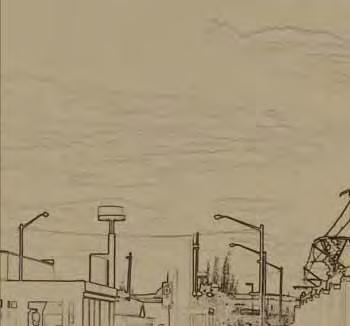
20 Sheridan Station Area Plan Introduction tion, The D-12 bicycle route is an on-street bicycle route that runs along 10th Avenue through the station area. Most of the existing sidewalks in the station area are narrow in width. Attached three-foot sidewalks predominate in most of the residential and commercial areas. The Denver Pedestrian Master Plan (2004) calls for a minimum 13-foot pedestrian area along streets. The pedestrian area typically consists of a five-foot detached sidewalk and an eight-foot tree lawn. Along transit corridors and busy commercial streets, a minimum 16 foot pedestrian zone is recommended. With the exception of Sheridan Boulevard, most other streets allow on-street parking. On-street parking is allowed only during limited hours on Colfax Avenue. In addition, most businesses and residential properties provide their own off-street parking. Sheridan Boulevard, showing a section with a 3 attached sidewalk. 8


21 Sheridan Station Area Plan Vision and Goals Vision & Goals 9
22 Sheridan Station Area Plan Vision and Goals Vision Statement The Sheridan Station will develop over the coming decades into the vibrant center of a diverse, transit-supportive and economically sustainable urban neighborhood. Residents of all ages, incomes and backgrounds will be drawn to the convenience and amenities of this location. Improved sidewalks will tie the light rail station with Main Street development on Colfax Avenue a short distance to the north. Development of new housing along Sheridan Boulevard and Gulch will allow more people to live near the light rail connecting them to jobs in downtown Denver and s Federal Center. The increased population base will support a variety of new neighborhood retail services near the station and on Colfax Avenue including food stores, dry cleaners, hardware stores, restaurants and child care centers. Sheridan Boulevard will be transformed by new development and improvements coordinated between Denver, the City of and the Colorado Department of Transportation. Buildings on both sides of Sheridan will complement the street and the transit station thanks to the close coordination and cooperation between the cities of Denver and. Pedestrian improvements on Sheridan will make walking to the station easy and convenient from the neighborhoods to the south and the north. Improvements to the street grid along the edge of Gulch will allow new buildings to face the park and bring more visibility and activity to this neighborhood amenity. Parents will be able to watch their children play in the park from their front windows, doors and balconies. People from across Denver and will use the park s regional bicycle trail for both transportation and recreation. 10th Avenue will remain an important connection for neighborhoods to the east and west, allowing residents to conveniently walk or bicycle to the station. A new street connection at 13th Avenue will also help to improve access to Sheridan Boulevard for nearby residents. open onto the sidewalk, creating a feeling of inclusiveness and activity. Buildings will be of a scale that helps create a sense of enclosure and safety for pedestrians as they walk to their destinations. More intense development will be centered along Sheridan Boulevard, Colfax Avenue and the Gulch corridor, transitioning to quieter, interior urban neighborhoods to the northwest and southwest of the station. The 800 space RTD park-n-ride will be designed to encourage activity near the intersection of 10th and Sheridan. Opportunities to integrate transit supportive and civic uses with the parking structure will provide a catalyst for change in the area. Although this is a vision for the future, it shows what can be achieved through coordinated change and investment in transit. To achieve this vision, cooperation between Denver, and their regional partners will be necessary to guide the incremental change. Creating a vision is an important first step in identifying goals and methods to achieve them. This vision should guide the future of the area and direct positive change as it occurs over time. Foundation of TOD Principles Developing the community s vision began with the underlying principles of transit-oriented development. Transitoriented development is a mix of uses at various densities within a half-mile radius, or walking distance, of a transit stop. TOD should create specific areas that integrate transit into neighborhoods and help support lively, walkable and vital communities. The TOD Strategic Plan defines TOD in Denver and establishes strategies for implementation. In order to succeed, TOD should address these five guiding principles. Place-making: Create safe, comfortable, varied and attractive station areas with a distinct identity. New development will be high-quality and architecturally interesting with ground floors and building entrances that 10

23 Sheridan Station Area Plan Vision and Goals 11

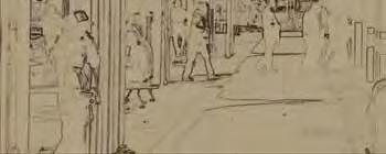
24 Sheridan Station Area Plan Vision and Goals Rich Mix of Choices: Provide housing, employment, transportation and shopping choices for people of all ages, household types, incomes and lifestyles. Location Efficiency: Place homes, jobs, shopping, entertainment, parks and other amenities close to the station to promote walking, biking and transit use. Value Capture: Encourage all stakeholders residents, business owners, RTD and the city to take full economic advantage of the amenity of enhanced transit services. Portal to the Region: Understand and maximize the station s role as an entry to the regional transit network and as a safe pleasant and private place to live. Opportunities and Constraints The Sheridan Station has excellent potential for future development because of the strong existing neighborhood base in the surrounding area, the proximity of Dry Gulch and the recreational and green space opportunities it brings, the desirability of parcels close to the station for redevelopment near the light rail line, beautiful views to the mountains and downtown along Dry Gulch, and consistent access from both Sheridan Boulevard and Colfax Avenue. The City of has also planned and rezoned to the west of the station area to allow for transit related uses and higher density with the potential to spur development around the station. One of the biggest constraints in the study area is the condition of Sheridan Boulevard with its inadequate sidewalks and heavy traffic flow. This street is currently a barrier to pedestrians because of the limited opportunities to cross, particularly near the station. While the new light rail station location will help to solve some of these issues, the street will remain a challenge for pedestrians. The changing conditions highlight the need to create a safer pedestrian environment while preserving the functionality of the roadway for through traffic. Another constraint that currently exists is the limited opportunity for joint development with RTD s planned 800 space parking structure. RTD s current enabling legislation limits the types of uses that RTD can jointly develop on property that it owns. This use restriction currently makes it difficult to pursue mixed-use joint development on RTD property. A change in state legislation would be required to make possible many of the mixed-use, joint development goals that the plan identifies for the parking structure. Community Needs and Desires The community around the Sheridan Station includes an active and involved group of citizens. The registered neighborhood organizations include the Villa Park Neighborhood Association and the Sloan s Lake Citizen s Group. They have been involved in the West Colfax Area Plan, the St. Anthony s Hospital Redevelopment Plan, the West Corridor Environmental Impact Statement process, and the Main Street Zoning for West Colfax Avenue. Because of these previous planning efforts, many citizens are well informed and involved in land use and planning issues in the neighborhood. Many of these same citizens have attended the design workshops and focus groups for the Sheridan Station. With this input, plans have been developed that reflect the vision and desires of the neighborhoods that surround the station. Above, above right: The community played an active role in the planning process. 12


25 Sheridan Station Area Plan Vision and Goals Sheridan Station Goals From discussions with the public and through a series of meetings with the city and other constituents around the station, the following goals were established to develop the concept plan: Create strong pedestrian connections between the light rail station and Colfax Avenue along Sheridan Boulevard. Create a safe and convenient pedestrian environment in the station area by improving access along and across Sheridan Boulevard from 6th Avenue to 17th Avenue and across Sheridan Boulevard. Protect and enhance the existing residential neighborhoods around the station by providing infrastructure improvements. Encourage new development near the station that will increase the population base and support neighborhood retail uses. Incorporate Dry Gulch into the station design and bring new uses to its edge that will increase the number of people along the park and create a safer park environment. Develop a station identity within the corridor that reflects the surrounding neighborhoods. Enhance pedestrian connections in all directions. Provide pedestrian-priority solutions that increase the safety at key streets and intersections. Design solutions to provide eyes on the park -more visibility of the park so park users feel safe. Opportunities for new development should increase housing supply and diversity and preserve affordable housing stock in the area. These goals form the basis for the land use, urban design and mobility concepts presented in this plan. They also guide the implementation recommendations intended to make the plan vision a reality. These goals form the basis for the land use, urban design and mobility concepts presented in this plan. They also guide the implementation recommendations intended to make the plan vision a reality. 13
26 Sheridan Station Area Plan Vision and Goals 14


27 Sheridan Station Area Plan The Plan Concept The Plan Concept 15
28 Sheridan Station Area Plan The Plan Concept Land Use and Urban Design The land use plan for the Sheridan Station was developed with the community at two public workshops with additional input gathered through small group meetings and stakeholder interviews. The plan reflects the desires of the community and the goals for the project. The station area should support commercial development along Colfax Avenue and use of the light rail by focusing denser residential development opportunities in the station area. While Colfax Avenue will be the focus, the highest densities near the station are planned around the intersection of 10th Avenue and Sheridan Boulevard. The separation of commercial uses on Colfax Avenue from the station and the impact of Dry Gulch on neighborhood connectivity both increase the importance of rebuilding Sheridan Boulevard as a more walkable and pedestrian friendly street. New residential development should be placed along Dry Gulch, with the highest densities along the gulch, transitioning to lower densities adjacent to the interior neighborhoods. The plan includes the following priorities: Colfax Avenue: the Sheridan Station Area should support the Colfax Avenue redevelopment. Dry Gulch: Dry Gulch is the main amenity of the area. New uses should front onto the gulch. Sheridan Boulevard from 6th Avenue to 17th Avenue: Sheridan Boulevard should be the main north/south connector for both pedestrians and vehicles and should support new residential and mixed-use development. 10th Avenue and Sheridan park-n-ride facility: the new park-n-ride facility provides an opportunity to create a linkage between development and the station. Mixed income and market rate housing: the new housing that is provided in the station area needs to include a mix of housing types and incomes. Close coordination with the City of in the development around the station and for Sheridan Boulevard improvements. The following pages contain descriptions of the land use concept components. Section lines on the land use concept map correspond to the street cross section views. Land Use Plan Components Mixed Use Development (4-7 Stories) The mixed use areas contain the highest-intensity of use and are located directly adjacent to the light rail station focused around the intersection of 10th Avenue and Sheridan Boulevard. The intent is to provide active ground-floor uses, such as retail, and encourage higher density residential or employment uses in the upper levels directly around the station. South of Gulch, mixed-use development of 4-7 stories could develop from Sheridan Boulevard east to Xavier Street. East of Xavier, lower density urban residential is planned between Xavier and Wolff streets. Station Residential (3-5 Stories) Station residential uses are focused along the north side of Dry Gulch and will provide the eyes on the park that were desired by the community. This area would be residential without any retail or commercial uses on the ground floors due to the location and limited frontage and access for those types of uses. Townhouse Residential (2-3 Stories) The urban residential uses are intended to be a transition use between the higher densities around the station and Dry Gulch and the existing neighborhoods. These uses should be predominantly townhouses with tuck-under parking behind the units, or some other type of attached unit with parking accessed from an alley. 16
29 Sheridan Station Area Plan The Plan Concept Existing Urban Neighborhood Areas The areas outside the colored portions of the map should retain their existing character as urban neighborhoods through reinvestment. These urban neighborhood areas were defined in the 2006 West Colfax Plan as consisting of a range of development intensities with housing options appropriate for a central city location including single-family houses, carriage houses, duplexes, apartments, townhomes, row houses and condominiums. City of Zoning Through a separate planning process in 2006 and 2007, the City of developed a land use plan and new zoning for property within their jurisdiction on the west side of Sheridan. The plan calls for higher density around the station with their station core located at the southwest corner of Sheridan Boulevard and 10th Avenue. proposes commercial uses along the west side of Sheridan, with medium and lower density residential to the west to Depew Street that transition in size and scale to the existing neighborhood. Dry Gulch Dry Gulch is the primary physical asset of the station area and the community. It is currently open space owned by the City and County of Denver and should be changed to a city park designation once the West Corridor Line opens in Improvements in the gulch should include trails and additional landscape and pedestrian improvements such as pedestrian crossings, signage, and lighting where required and as identified in the Dry Gulch Park Concept Plan. The gulch is located at a low point in the station area, with slopes to the north and south. This creates views of the mountains and downtown from the perimeter of the gulch. Residential development along 11th and 12th Avenues should take advantage of the topography and views provided by the gulch. These streets will provide better access and visibility to this currently hidden asset. RTD Light Rail Station and park n-ride The new light rail station on the West Corridor will be located between 11th Avenue and 12th Avenue, directly adjacent to the north side of Dry Gulch. The station platform will be below a new bridge at Sheridan Boulevard (part of the FasTracks project). Access to the platform will be located on each side of Sheridan via stairs and elevators. A small plaza will be built with the station below the new Sheridan Boulevard bridge. The parking structure for the park-n-ride will be located on the south side of Dry Gulch, west of Sheridan Boulevard and north of 10th Avenue. The parking structure will be accessed from both Sheridan Boulevard and 10th Avenue connecting to the light rail platform under Sheridan Boulevard and will include approximately 800 parking spaces. RTD is issuing an RFP for a private partner in a joint development project that will encourage ancillary development within the parking structure that is within the constraints of RTD s enabling legislation. Station-oriented convenience retail or a civic use is envisioned along the first floor to wrap the parking structure to promote street activity on 10th Avenue and Ames Street. West Colfax Avenue A plan for West Colfax Avenue was adopted by the Denver City Council in 2006, followed by legislative rezoning of parcels to Main Street zoning in The plan recommends mixed-use development with buildings oriented to the sidewalk. The intensity of the Main Street zoning categories differ along Colfax Avenue through the station vicinity, with the greatest intensity (MS-3) at the Colfax and Sheridan intersection. The Colfax corridor should contain some of the most intense retail and employment uses in the station area, complementing potential new development opportunities directly adjacent to the station. Tying Colfax Avenue to the station area will be of critical importance to support the development goals of the plan. 17

30 Sheridan Station Area Plan The Plan Concept Sheridan MS-3 MS-2 MS-2 Colfax Ave Commercial Commercial Colfax Ave MS-1 Low Density Medium Density Commercial Mountair Park Depew St Low Density Medium Density Ames St Commercial 3 St Zenobia Beth Jacob High School St ates Y Urban Neighborhood High Density High Density Commercial SHERIDAN 12th T T 12th 2 High Density P 11th 10th Ave 1 10th Ave Cowell Elementary School Medium Density Station Core Sheridan Urban Neighborhood Sheridan Land Use and Urban Design Concept Proposed Land Use Existing Plans and Zoning Area Features Mixed Use Station Plan West Corridor Light Rail Line Station Residential Existing Main Street Zoning MS-1 T Light Rail Station Denver / Bounda ry Townhouse Residential Parks, Open Space and Drainageways Existing Main Street Zoning MS-2 Existing Main Street Zoning MS-3 P RTD Parking Structure Active building st reet frontage Section Lines 18
31 Sheridan Station Area Plan The Plan Concept Section #1-10th Avenue Mixed Use Cross Section Cross sections are shown to reflect existing lane-width standards of the Denver Fire Department and Public Works. These standards may change prior to implementation as a result of future discussions concerning multi-modal design goals identified in Blueprint Denver and the Strategic Transportation Plan. Section #2-12th Avenue Park Corridor Looking West Cross sections are shown to reflect existing lane-width standards of the Denver Fire Department and Public Works. These standards may change prior to implementation as a result of future discussions concerning multi-modal design goals identified in Blueprint Denver and the Strategic Transportation Plan. 19


32 Sheridan Station Area Plan The Plan Concept Section #2-11th Avenue Park Corridor Looking West Cross sections are shown to reflect existing lanewidth standards of the Denver Fire Department and Public Works. These standards may change prior to implementation as a result of future discussions concerning multi-modal design goals identified in Blueprint Denver and the Strategic Transportation Plan. Cross sections are shown to reflect existing lane-width standards of the Denver Fire Department and Public Works. These standards may change prior to implementation as a result of future discussions concerning multi-modal design goals identified in Blueprint Denver and the Strategic Transportation Plan. Section #3 - Sheridan Cross Section 20
 and represents anticipated development through the year 2030.")


33 Sheridan Station Area Plan The Plan Concept Sheridan Station Area Development Summary Note: The development program is based on a market analysis (BBPC Market Study 2007) and represents anticipated development through the year The actual amount of development may be more or less than shown below. Future development projections assume an average unit size of approximately 1,200 sf, average household size of approximately 3, and an average of approximately 300 sf per employee and a residential vacancy rate of 5.7 percent. Total Estimate Residential square feet 3,223,500 Retail square feet 206,000 Offices square feet 215,000 Housing Units 2,550 Population 7,650 Employees 1,400 Transit-oriented development examples of a scale appropriate for the Sheridan Station 21
34 Sheridan Station Area Plan The Plan Concept Urban Design Plan Components This section addresses the physical appearance and form of station area development identified in the land use plan. This perspective is drawn from street-level views of primary streets in the station area. This section addresses how the uses will physically fit together and within the larger neighborhood to create a pedestrian-scaled environment for new development around the station. Build-To Lines and Set-Back Ranges Build-to lines and set-back limits are tools that help address the way buildings and front entrances connect to the sidewalk. The first-floor uses surrounding the intersection at 10th Avenue and Sheridan are intended to be active retail or commercial. This presence should include frontages and building facades that extend to the right-of-way with minimal setbacks. The frontages on 10th Avenue extending east and west of this intersection should be similar in form to create a common zone so that the buildings work together to define the street space. Set-backs of ten feet or less are recommended on 10th Avenue between Xavier and Sheridan, and between Sheridan and the parking structure and mixed uses west of Sheridan. These streets should include eight-foot tree lawns and fivefoot sidewalks or a continuous 13-foot sidewalk to create desirable space for the pedestrian. Where the concept plan calls for multiple-family residential uses, buildings should be set-back between 0 and 12 feet from the street right-of-way. The privately-owned set-back areas will be reserved for an amenity zone, where building walk-ups, landscaping and patio uses should be encouraged. Parking RTD will be constructing a large parking structure on the northwest corner of 10th Avenue and Sheridan Boulevard that will provide parking for users of the light rail system. Surface parking and structures should be located behind buildings along the 10th Avenue mixed use corridor. If a parking garage is built along 10th Avenue, it should include active ground floor uses and should adhere to the guidelines set by the form and massing section. Architecture and wrapping of the parking structure should hide the parking from pedestrians on all street faces and the Gulch. Form and Massing Form and massing refer to the overall bulk, shape, and structure of a project or projects. The form and massing of new development in the Sheridan Station Area should relate to the existing scale of development on existing blocks where they adjoin. When possible, architectural elements in new buildings should complement and draw from positive examples found in existing buildings in the immediate neighborhood. The massing of buildings within the station area should strive to create street-building proportions that create a comfortably scaled pedestrian environment. In general, the proportion of street width to building height should be 3:2. This ratio will help to create a section that encloses the public space and gives it a human scale. Below is the suggested street width to building height proportion for prominent streets within the conceptual plan. Notice that as the street width increases the building height grows. Access to sunlight along 10th Avenue will help to create an inviting urban environment, especially in the short days of winter. One option to help the larger buildings fit into the neighborhood is to step back or vary upper stories above the 53 recommended building height. These step backs and variations will help ensure that the street and surrounding uses receive natural light. Recommended Building Height Street Street Width to Cornice 10th Avenue between 80' 53' Xavier and Benton Ames Street Between 60' 40' Dry Gulch and 10th Zenobia between Colfax 60' 40' and 12th Avenue Yates between 11th and 12th Differences in massing and form create a hierarchal order in which more important streets in the development have taller structures and a slightly wider right-of-way. Priority streets such as 10th Avenue within the concept plan should strive to create an urban environment that provides the pedestrian with a sense of place and activity. The smaller widths for ROW s and elements such as private landscaping, porches 22
35 Sheridan Station Area Plan The Plan Concept and stoops in residential areas notify the pedestrian of a less active place with a more residential character. Active Edges The intent of this plan is to create a seamless connection to the neighborhood to enliven, complement and relate to the neighborhood. North of Gulch, Yates and 13th Avenue serve as the transitional streets between the proposed town homes of 2-3 stories and the existing single-family neighborhoods. South of the gulch, 10th Avenue and Zenobia Street form the edge of the proposed station redevelopment. It is important that the urban form and architecture of new residential development does not turn its back on the existing single-family residential, and that the scale responds to the existing street scale. To ensure opportunities for active, ground-floor uses such as retail, ground floor ceiling heights in new buildings should be no lower than 14 feet. Where new densities and land uses are suggested, the transition to the existing neighborhood should be actuated at the alley. When transitions are created across the street, the neighboring forms should be within a reasonable scale of each other. Where new streets and street alignments are created they should connect to the existing Denver grid. By creating connections to the existing street network, the station area will reinforce pedestrian access and connections to the surrounding neighborhood. Required Building Entries Primary entrances to residences and businesses should be located on active street edges (sidewalks) to promote pedestrian activity at street level. Entrances to the residential units along Sheridan should be offset from the sidewalk through stoops and porches. This creates a private porch area while maintaining a desirable pedestrian scale and appropriate transition from the public realm to the private. Alleys should provide vehicular access to new developments in the area, following existing norms already established within the neighborhood. Rear-loaded residential structures will also frame a street environment that values the pedestrian by allowing for interesting landscapes and architectural forms. Where street access for garages is the only option, side driveways with rear garages should be encouraged. Architectural Character The architecture of new development should include durable, high-quality materials. Materials should include stone, brick, or other sustainable materials which are in the tradition of Denver neighborhoods. Diversity in architectural forms is important for creating an interesting urban environment. However, the orientation of these structures to the public realm should be consistent and follow the directives set by the massing, entry, and build-to sections. Where a mixeduse pedestrian-scaled street is planned, a substantial level of building transparency should be encouraged. Windows and entrances invite the pedestrian to explore the street, creating interest and street activity. Open Space Systems Dry Gulch divides the station area into two sections; north and south. The station area plan recommends that 11th and 12th Avenues continue along the open space corridor. New development, which will be positioned with front doors facing Dry Gulch, will help activate the park. This development will frame the green corridor and provide more security to users of the amenity. Both 11th and 12th Avenues should be constructed to similar standards set forth by the City of Denver s Department of Public Works for local streets and should provide detached sidewalks, street parking and a build-to line of six feet. Detached sidewalks and street amenities should occur on the park side of these streets. Streetscape and Gateway Features Streets should have detached sidewalks and tree lawns to create a more active and safe street environment for the pedestrian. Areas with very high pedestrian activity, such as commercial areas, may require a continuous attached sidewalk with trees in grates. Buildings will front the pedestrian priority streets to create a more intimate pedestrian experience. Gateways providing a sense of arrival to the TOD district are proposed at the intersection of Sheridan and Colfax and the intersection of 10th Avenue and Sheridan, both of which will be higher in density than surrounding uses. The presence of these two station book-ends, approximately a half-mile apart, will signal to the pedestrian and motorist that they are entering a unique area within the larger neighbor- 23


36 Sheridan Station Area Plan The Plan Concept hood. Streets should create qualities that engage the eyes, such as regular landscape forms and public amenities. Public art is proposed along Sheridan Boulevard north and south of the station as a means of slowing traffic and announcing the station. Signage is also recommended within Dry Gulch to announce the presence of the station to bicyclists, pedestrians and open space users. Street cross sections should be based upon approved city standards outlined in Rules and Regulations for Standard Right-of- Way Cross Sections and Utility Locations. New streets within the station area should reinforce the existing City of Denver grid system, helping to create more logical and direct vehicular and pedestrian wayfinding in and out of the station area. 24

37 Sheridan Station Area Plan The Plan Concept Circulation and Mobility Plan The circulation plan identifies the key connections for vehicles, pedestrians and bicycles throughout the station area. The streets and intersections with the highest intensities of land use require the most attention. Colfax Avenue and Sheridan Boulevard are the major arterials in the station area. 10th and 14th Avenues serve as east/west collector streets around the station. New local street connections are proposed along the edge of Gulch to complete the street grid and provide more access and activity along the park s edge. Cross sections for the street types can be found in the urban design section. Colfax Avenue Colfax Avenue is the primary east/west arterial in the area and is located approximately three blocks north of the station. Colfax Avenue is also a CDOT facility designated U.S. Highway 40. Colfax Avenue carries approximately 35,000 vehicles per day. The right-of-way for West Colfax near Sheridan varies between 80 and 90 feet in most places. The current cross section includes four through-lanes and a center turn-lane. The south side of Colfax has on-street parking and on the north side there is a part time parking lane that converts to a drive lane in the afternoon peak travel time. The West Colfax Plan identifies Colfax Avenue as a pedestrian priority street with mixed land uses. According to the West Colfax Plan, the desired future cross section for Colfax would include a 16 foot pedestrian zone with sidewalks and street trees and on-street parking on both sides of the street. Current conditions on Sheridan Boulevard 25
38 Sheridan Station Area Plan The Plan Concept Sheridan Boulevard Sheridan Boulevard is the key north/south arterial and is currently four lanes with a continuous center turn lane and some attached sidewalks in a 70 existing right-of-way. Sheridan Boulevard carries approximately 40,000 to 50,000 vehicles per day. Sheridan is a Colorado Department of Transportation (CDOT) facility designated State Highway 95. Because of its important role in connecting the station to Colfax Avenue, Sheridan should be a priority street for pedestrian improvements. At this time, the City and County of Denver and the City of intend to maintain Sheridan Boulevard with fourlanes of through traffic. Sidewalk improvements should be added to the existing street by providing a 10 foot pedestrian zone within the 70 foot right-of-way. Pedestrian improvements should stretch from 6th Avenue (north of the highway interchange) all the way north to 17th Avenue. Over the long term, the total right-of-way for Sheridan Boulevard would need to increase from 70 to 110 to meet Denver s standard cross section for a four-lane arterial street. However, Sheridan should first be examined as part of a joint corridor study between the City of, City and County of Denver, and the Colorado Department of Transportation. Sheridan Boulevard cross sections for both the existing 70 right-of-way and desired 110 right-of-way 26

39 Sheridan Station Area Plan The Plan Concept 10th Avenue and 14th Avenue 10th and 14th Avenues serve as east/west collector streets around the station with on-street parking and detached sidewalks. These streets intersect with and will have signalized intersections at Sheridan Boulevard. These streets will be key to linking neighborhood residents with the station and are also designated as pedestrian priority streets in the plan. The intersection at 10th Avenue and Sheridan Boulevard should be improved with wide sidewalks, crosswalks and pedestrian signals to allow pedestrians to cross safely. The four blocks that surround the intersection will be concentrated with higher density uses, including s proposed station core area at the southwest corner of 10th Avenue and Sheridan Boulevard. New Streets Currently, 11th Avenue and 12th Avenue do not exist adjacent to Dry Gulch. A key element of this plan is to build these local streets to provide better access to Dry Gulch and frontage for new residential development that will bring more activity and visibility to the park. The proposed cross sections for 11th and 12th Avenues would include onstreet parking on the side of the street with buildings and parking bulb-ins between the street trees along the park edge. This will allow for the required 25 feet of clearance for fire vehicles on streets with higher density development. The alignment for a new 12th Avenue would follow the alignment of the existing Wells Place between Utica and Zenobia. 11th Avenue would be at the same alignment as the existing 11th Avenue and run between a new Wolff Street and a Zenobia Street connection north of 10th Avenue. A new intersection is proposed at 13th Avenue and Sheridan Boulevard to provide more direct access into the neighborhoods. This access will provide the necessary circulation (ingress and egress) for the residential units along Sheridan Boulevard and will also provide better access to the north side of Gulch. Right-of-way acquisitions and improvements will need to be made to 13th Avenue between Sheridan Boulevard and Zenobia Street, Zenobia Street to Yates Street, and Winona Street to Vrain Street to complete 13th Avenue as a through street. Other Local Streets Other local streets in the area include the north/south streets of Zenobia, Yates, Xavier, Wolff, Winona, Vrain, Utica and Tennyson. These streets are primarily residential streets with detached sidewalks. These streets should be designed to slow down traffic where possible to provide a safer, more comfortable pedestrian environment and strong connections to the light rail station. The other east/west Avenues include 8th, 9th, and 13th Avenues. These streets do not have houses that front onto them. Bus Connections There are currently four bus routes that serve the Sheridan Station Area. The east/west routes are the 9 on 10th Avenue and the 16 and 16L (limited) on West Colfax Avenue. The primary north/south bus route is the 51, which runs on Sheridan Boulevard. These routes will stay in place once the West Corridor light rail is operational. Currently, RTD has no plans to increase bus service in the area but may examine future service increases following the opening of the West Corridor. Buses will stop on the new Sheridan Bridge with passengers accessing the station below the bridge using stairs and elevators. Local bus service will play an important role in tying the station to surrounding neighborhoods. 27

40 Sheridan Station Area Plan The Plan Concept Bicycle Improvements The Dry Gulch regional bike trail (D-10) extends from the South Platte River trail to the city limits. This trail provides an east-west pedestrian/bicycle corridor through the station area. Three pedestrian bridges, consistent with the City and County of Denver s Parks Game Plan, are proposed across Gulch at Yates, Wolff and Tennyson streets. These pedestrian bridges, along with pedestrian improvements extending north and south from these streets, will serve to knit the two neighborhoods together. Wolff Street serves as a neighborhood bicycle route between 10th Avenue and Sloan s Lake Park. Tennyson Street should also serve the north/south bicycle movements and this street should be designated as a neighborhood bicycle route in the future. The on-street bicycle trail on 10th Avenue (D-12) will remain with the proposed improvements to the area. The proposed cross section on page 19 shows shared bicycle indicators or sharrows for the traffic lanes on this route. Access to the light rail station will be via stairs and elevators to the station located directly below Sheridan Boulevard. These improvements will be on both sides of the street. Pedestrian and bicycle connections will also be provided directly from the Dry Gulch trail to the station platform and plaza below Sheridan Boulevard. Design of streets should consider all modes of transportation 28
41 Sheridan Station Area Plan The Plan Concept St 16 Colfax Colfax Ave Commercial Commercial 51 MS-3 Zenobia St ates Y MS-2 MS-2 Colfax Colfax Ave MS-1 16 Low Density Medium Density Commercial Mountair Park 9 Depew wst Depew St 14th Low Density 13th High Density Benton St Ames St 12th 12th 12 h T High Density Medium Density Benton St Medium Density High Density Commercial Commercial P Station Core SHERIDAN Sheridan Blvd Sheridan Blvd Sheridan T Beth Jacob High School 11th 14th Urban Neighborhood 12th Ave Cowell Elementary School Urban Neighborhood 9 51 Sheridan Circulation Concept Proposed Land Use Existing Plans and Zoning Area Features Mixed Use Station Residential Townhouse Residential Parks, Open Space and Drainageways Station Plan Existing Main Street Zoning MS-1 Existing Main Street Zoning MS-2 Existing Main Street Zoning MS-3 T West Corridor Light Rail Line Light Rail Station Pedestrian Imp rovements Major arterial Pedestrian Priority Street Collector P 9 New Local Street or Connection Recreational Trail / Bike Way Pedestrian Bridge Signalized Intersection RTD Parking Structure Bus Routes Denver / Boundary On-street bike routes 29
42 Sheridan Station Area Plan The Plan Concept Parking Parking and Development Capacity The economic success of TOD projects requires sufficient parking. But just as too little parking will create economic problems, so will too many spaces. Since Denver s TOD policy seeks to maximize the number of units around its stations and maximize those units affordability, it will be important to ensure parking does not consume too much of the buildable square footage in TOD projects. Parking and Walkability Walkability is a key measurement of the quality of public space. In addition, ridership at rail stations increases as the quality of the pedestrian environment improves in the station area. Research findings have shown that transit commute shares increase with pedestrian-oriented design of neighborhoods around rail stops. For these reasons, it is important that the design of parking not create barriers real or perceived to pedestrians. Denver has already established design guidelines for parking downtown and on main streets, such as Colfax Avenue, requiring that parking structures have active ground floor uses rather than blank walls or surface parking lots along streets. Parking and Trip Generation Properly managed and located parking can lower automobile usage. In auto-dependent areas, the size of different land uses is the best predictor of automobile traffic. Where there are transportation choices, however, automobile trip rates become highly variable. In these locations, parking supply is a more effective predictor of auto trips, provided this supply is properly managed to ensure adequate availability at all times. In such locations, more parking means more traffic. Parking as an Economic Asset, Not an End in Itself The high prices people pay to park in Lower Downtown are a testament to the value of parking near mixed-use, compact and pedestrian-oriented development. But not all spaces have the same value. In all mixed-use districts, some parking spaces are more desirable than others. Left to market forces, the more desirable spaces would command higher prices and vice versa. When parking is underpriced, the city incurs all the burden of operating and maintaining it while incurring reduced financial benefits of controlling it. More importantly, underpriced parking reduces customer convenience, with the best spaces quickly filled by the lucky few. While underpriced parking results in direct loss of revenue to the city, the indirect costs are even higher if shoppers and developers are deterred by a lack of convenient parking. In Denver, most on-street metered parking currently costs $1 an hour, regardless of location or demand patterns. In highdemand areas, the result is that parking utilization regularly exceeds 95 percent, resulting in added search traffic and customer inconvenience. This in turn leads to poorer business performance and greater traffic congestion and pollution. Belmar s Block 7 Studios and Galleries demonstrates a flexible approach to activating parking structures New Approaches to Parking Historically, solving the parking problem almost always meant increasing supply. But planners have begun to acknowledge that there are many different types of parking problems, and many different solutions. The majority of 30


43 Sheridan Station Area Plan The Plan Concept the parking for transit at the station area will be provided through a 800 car parking structure at the northwest corner of 10th Avenue and Sheridan Boulevard. The parking in this facility will be a mix of parking for the transit users and parking for the mixed used development within the parking structure itself. This parking structure should be wrapped with development to provide an active frontage on the facility. Parking for local retail uses that front onto 10th Avenue will need to be conveniently located either within the parking structure or along the street. The details of this facility will need to be coordinated with the City of Denver as RTD examines its options. The amount of parking required for new development is currently determined by the City of Denver Zoning Code depending on the use. Parking at the Sheridan Station could be reduced however, depending on the tenant mix, the quality and accessibility of the local transit (bus, light rail, bicycle and pedestrian), trip reduction requirements or incentives, mode split calculations, residential demographics, site conditions and other local factors. Surface parking lots should be avoided within the station planning area. One of the many benefits of transit in this area is the potential to reduce the amount of parking for new development because of its close proximity to transit and the possibility of shared parking opportunities presented by the new RTD park-n-ride. After the opening of the West Corridor in mid 2013, parking within the area will need to be reviewed and monitored to assess the impact of the station. Further parking regulations within the neighborhood may need to be implemented. These regulations may include maximum parking durations in some areas or the development of a shared parking program for the park-n-ride facility. Other tools for parking implementation should include: Unbundling of parking, particularly for residential uses having parking sold or rented separately from the housing unit Real time parking information systems Placement of driveways and curb cuts to access parking Parking signage and way-finding Vehicle trip reduction incentives (Ecopass. etc) Additional study will be required to determine how the various TOD parking strategies outlined in this station area plan may be implemented. This should be done in conjunction with a broader city-wide analysis of parking. Examples of parking signage and way-finding 31
44 Sheridan Station Area Plan The Plan Concept Economic Opportunity FasTracks brings to the Denver region an unprecedented opportunity to promote and facilitate transit-oriented higher density, mixed-use residential and commercial development. To identify, leverage, and maximize these opportunities, the city commissioned a TOD Economic Analysis and Market Study completed by BBPC. The primary goal of the TOD Economic Analysis and Market Study was to provide the city with an assessment of TOD potential at the regional, corridor, and station area levels through analysis of short- and long-term demand (e.g. demand in 2015 and 2030). Conducted in coordination with station area planning efforts, the market study helped to better align station area plans with existing and future market realities and dynamics. The overall objectives of the TOD Economic Analysis and Market Study were to forge a better understanding of the economic context in which the city may plan for TOD, and to develop specific recommendations regarding the amount, type, mix, and intensity of uses appropriate for selected station areas. Existing Market Conditions The Sheridan Station Area occupies a unique position at the border of two jurisdictions Denver and. The station area features residential neighborhoods and the Gulch open space, part of a future regional trail and park system. Residents of this station area can walk to some retail goods and services along Colfax, which is located just north of the station site. The Sheridan Station Area has a larger household size compared to that of the city and the region. Residents outnumber jobs at a scale of nearly 4 to 1. Station Area household income is lower than that of the city and one-and-a-half times lower than the region. It is primarily a Hispanic neighborhood with a higher percentage of residents engaged in blue collar occupations than the average for the city or region, and has a higher than average unemployment rate. The majority of built space in the Sheridan Station Area is residential. Commercial uses include approximately 100,000 square feet of retail space, the majority of which is clustered along Colfax Avenue. The retail vacancy rate for this station area as of the first quarter of 2007 was 11 percent. Office space is relatively limited in the station area, with less than 15,000 square feet of class B and C office space. Though office space is limited, it experiences 100 percent occupancy. More information on existing demographics and land uses for the Sheridan Station Area can be found in the Community section in the supporting documentation of the plan. Future Market Demand The Sheridan Station Area is envisioned to expand its existing housing stock and become a distinctive mixed-income neighborhood with pedestrian-friendly retail streets ( Main Streets ) over the long-term. As part of the trend toward a mixed-use and mixed-income neighborhood, private investment will likely drive increased construction of additional housing and retail services near the station adding more people and jobs while allowing existing residents to benefit from the new station area amenities. The addition of new residential units will support the introduction of new community-serving retail focused along West Colfax Avenue and near the intersection of 10th Avenue and Sheridan. This area of West Colfax may find precedent in the successful revitalization of sections of East Colfax Avenue. Future retail expansion efforts should conform to the targeted Main Street character for Colfax Avenue, and should be encouraged through investment in improved pedestrian and transportation linkages between the station and Colfax. New development could pay homage to the area s ethnic diversity and historical past. New, small-format ethnic food stores could develop near the station area along Colfax Avenue and Sheridan Boulevard, and community service and office employers could enhance employment opportunities and job training possibilities in the community. Further, joint development opportunities involving the station s park-n- Ride could expand the station core development area identified for mixed-use commercial development in the City of s station area plan. Three redevelopment scenarios have been projected for possible net new development in the 1/2 mile radius around the platform based on current market trends and land capacity. The first two scenarios, modest and moderate, are based 32
45 Sheridan Station Area Plan The Plan Concept on projected market conditions over the next years and call for 1.2 to 1.5 million square feet of development. The third, maximum capacity, is based on land capacity and identified an additional 1.9 million square feet of potential development if all underutilized sites were redeveloped to their maximum allowable square footage. As shown in the chart below, there is projected to be more demand for office than would be available under current zoning capacity. Future redevelopment scenarios Net square feet of development Residential Office Retail Capacity 1,390, , ,000 Modest 850, , ,000 Moderate 1,000, , ,000 Economic Development Strategies Source: BBPC Market Study, 2007 Below are possible economic development strategies and tools for the Sheridan Station Area. Development efforts will require the involvement of many agencies within the City and County of Denver as well as coordination and cooperation with developers, land owners and businesses. Several strategies are complementary to specific projects already planned or proposed for implementation by the city s Public Works Department. As the city moves forward with implementation of station area plans, an inter-departmental TOD team approach will continue to be used. Identified strategies are outlined below: Housing and Housing Affordability Preserve current housing affordability in the area. Because of the Sheridan Station s location almost equidistant between two major employment hubs downtown Denver to the east, and the Federal Center and new St. Anthony s Hospital in to the west this station area is potentially well positioned to cater to the residential needs of employees working in these two employment centers. Using appropriate resources and incentives, maximize mixed income multi-family development in proximity to the station. With the current neighborhood s economic profile, promoting the area for more market-rate housing will add increased community amenities, safety, and future economic growth and stability to the area. Strategic and Catalytic Projects The four corners of 10th and Sheridan are of strategic importance to the redevelopment of the area. Projects on these corners particularly the commercial / retail elements will help to spur further area revitalization and therefore should be the first redevelopment pursued. Seek to have development at 10th and Sheridan share parking with the future RTD park-n-ride garage, especially commercial uses with high off-peak customer traffic (e.g., evening traffic such as food and beverage establishments, movie theaters, etc.). Desired land uses as well as buildings should be encouraged through regulation, and through publicprivate partnerships. Coordination Coordinate economic development activities with. Coordinate with the Department of Public Works to use future public infrastructure investment to leverage private sector investment. Employment and Commercial Development Business retention in the area as well as new company growth and job creation are significant objectives for the city. At the Sheridan station more employment opportunities should be promoted. Due to the affordability of land in this area there is a potential market for Class B and B+ office space to be incorporated in future development offering an alternative to more expensive office markets closer to downtown. 33
46 Sheridan Station Area Plan The Plan Concept Ensure commercial uses at or around the station area are neighborhood oriented and compliment rather than compete with commercial uses along Colfax through targeted incentives, business marketing and land use regulation. A strong connection between the Sheridan Station and Colfax is important for promoting the economic viability and growth of Colfax business development under West Colfax s new Main Street Zoning. 34


47 Sheridan Station Area Plan Implementation and Next Steps Implementation and Next Steps 35
48 Sheridan Station Area Plan Implementation and Next Steps Implementation at the Sheridan Station The purpose of this section is two fold: first, to define an implementation framework for the Sheridan Station, and second to suggest a strategic approach for considering implementation of transit-oriented development (TOD) in the City of Denver. Transforming Denver s transit stations into vital dynamic TODs will not happen over night. Areas as diverse as Washington, DC, San Francisco and Portland with noted TOD programs still have uneven results between stations after two decades of effort. The market, planning, infrastructure, community and political readiness of Denver s existing and future FasTracks stations can be expected to vary considerably. Understanding that not all stations will be ripe for attention at any one time is an important consideration when implementing a citywide strategy. Consequently, an important step in realizing the transformation of Denver s station areas into dynamic, vital TODs will be for the city to establish where it will place its attention and emphasis. The implementation plan for the Sheridan Station is intended to lay out the framework to enable development of TOD consistent with the plan. The Sheridan implementation plan covers a series of actions: Specific recommendations Strategies for implementation Implementation timing Citywide TOD implementation evaluation To aid the City of Denver and its partners in completing an assessment of the station area, each station should be evaluated in relation to how they measure against the following seven TOD success factors: Implementation Continuum. Development of TOD at stations requires a series of actions over a period of time ranging from initial planning, to making targeted investments, to putting the full range of necessary tools and leadership in place to achieve TOD. Knowing where a station is on the development continuum will help in targeting what kind of assistance may be required at any one time. Cost Benefit Payback. Ensure that the limited funds available for public investment in infrastructure and economic development are targeted to those station areas where they can leverage the most private investment and create the most successful examples of TOD. Development Ready. To what extent has the public sector taken the necessary steps to make the station area development ready? Current Trends. What are existing real estate market dynamics for potential TOD in a particular station area? Is the market already starting to deliver development products that can be considered TOD friendly? In other words, is development occurring of moderate to higher density in relation to past patterns of development? Do new developments have: A mix of land uses, horizontally or vertically mixed Compact pedestrian-oriented design and streetscapes Building design and orientation to the street to allow easy pedestrian and transit access A reduction in parking in relation to conventional development A fine-grained connected street pattern A system of parks and open spaces 36

49 Sheridan Station Area Plan Implementation and Next Steps Developer Interest in TOD. To what extent is there demonstrated developer interest in the station area? Are there TOD friendly development activities in the station area? Are parcels of land being sold or optioned for development? Are privately led master planning or plan changes underway? Are local officials getting inquiries about the station area? Ability to nudge. In a nudge station a series of factors supportive of achieving the development of TOD appear to be in place. To what extent can a strategic investment of time and energy by the public sector help nudge the station area to the next level of activity and achieve TOD? Land Use, Urban Design and Mobility Recommendations and Implementation Strategies The specific land use and urban design recommendations followed by the mobility and infrastructure recommendations are listed on the following pages. Details on the implementation strategy, timeframe and responsibility can be found in the table. Leadership is in place. A lesson learned repeatedly is that the single most significant factor is whether a project is fundamentally viable regardless of the presence of transit. No development is going to occur just because a station goes in if there is not a market to support it. A transit station does not create the market or make an uneconomical project viable. Implementation is the result of market, planning and community readiness 37
50 Sheridan Station Area Plan Implementation and Next Steps Land Use and Urban Design Recommendation Implementation Strategy Timeframe Responsibility LU 1 Colfax Avenue as Main Street Tie the station area to Colfax Avenue redevelopment through better pedestrian connections. Ensure new residential and employment opportunities near the station complement the Colfax Avenue redevelopment goals. Direct new, larger format retail to Colfax Avenue while allowing smaller-scale, convenience retail near the station at 10th and Sheridan through targeting of business incentives and zoning regulations. Short to Medium CPD, Public Works, OED LU 2 Mixed-Use Review and test existing zone districts to assess appropriate zoning language (mixed-use) for map amendment. If no existing district can be identified, develop new TOD district language to adopt that addresses density and form requirements. Work with new zoning code update revisions to mixed use zone districts. Medium CPD, Public Works, City of Planning Department LU 3 Leverage Light Rail Investment The West Corridor Light Rail is the most significant public infrastructure investment to occur in the vicinity of Sheridan Boulevard and Colfax Avenue. This transportation access and public infrastructure improvements should be leveraged through additional public infrastructure investment, and changes in zoning and development incentives to attract private investment in housing, employment, commercial amenities and additional infrastructure. Short to Long CPD, OED, DURA LU 4 Housing Incentives Encourage mixed income and market rate housing development near the station to achieve a diverse range of housing prices. Use city housing incentives such as revenue bonds and Community Development Block Grants to promote mixed income housing. Medium to Long CPD, OED LU 5 Community Partnerships for Housing Establish private public partnerships with both non-profit community organizations, community development corporations (CDCs), and for-profit development companies to preserve housing affordability in the area. Medium to Long CPD, OED, Enterprise Community Partners, Newsed, Private Developers LU 6 Active Ground Floor Uses The form of the public realm and view from Sheridan Boulevard onto 10th Avenue will be the foundation to promote activation of 10th Avenue. Active retail uses will support the form. Particular attention should be paid to the urban design of 10th Avenue from Sheridan Boulevard to Ames Street, and be coordinated with the City of. Medium to Long CPD, City of LU 7 Development along the Sheridan Corridor Reorient vehicular access of parcels aligning Sheridan Boulevard to alley side as redevelopment occurs. Ensure new development dedicates a 16 foot minimum pedestrian zone suitable for enhanced transit corridors. Medium to Long CPD, Public Works, CDOT, Land Owners, Developers LU 8 Coordination with Coordinate with the City of for development efforts, track developer proposals, and work on transitional issues in the area. Provide coordinated infrastructure improvements and urban design standards for Sheridan Boulevard and 10th Avenue to creating a cohesive look and feel around the station area. Short to Long OED, City of 38
51 Sheridan Station Area Plan Implementation and Next Steps Recommendation Implementation Strategy Timeframe Responsibility LU 9 Shared and Structured Parking The City of Denver needs to work closely with RTD and the developer selection process at the parking structure to leverage the parking structure as a catalyst project to help realize the implementation of the station area plan. Review parking language in applicable zoning to ensure maximization of shared and structured parking opportunities. Short to Medium CPD, RTD LU 10 Beth Jacob High School Beth Jacob School has some unique religious requirements that need to be maintained. The city should establish regular contact with Beth Jacob School to ensure their requirements are being met. Short to Long CPD, Beth Jacob High School LU 11 Leverage Dry Gulch as an Amenity The city will need to coordinate closely with RTD as the new West Corridor line is being constructed through the park and to ensure that the pedestrian crossings being planned are implemented. The gulch should be dedicated as an official City of Denver park when the light rail construction is complete. The city should also implement the improvements identified in the park master plan. Key pedestrian connections that facilitate access to the station and north-south connections across the park should be in place prior to the opening of the light rail line in mid Short to Medium Public Works, Parks, CPD, RTD LU 12 Joint Development as Catalyst The City should participate as an equal partner with RTD in the definition of a development program, and in the developer selection process for the joint development RFP to realize the type of development proposed to ensure it meets the goals of this plan and the TOD Strategic Plan. Short CPD, OED, RTD, Private Developers LU 13 Active Community Engagement Continue to use existing neighborhood communications, meetings and city processes to keep the community updated on the station area implementation. Ongoing All City Agencies LU 14 Station Core and Targeted Development Areas It will be critical that the areas of new development directly around the station have active ground floor uses that help to activate the street and pedestrian environment. Building heights in the area should range from 2-7 stories. Zoning for this area should support this recommendation by requiring building entrances that face the street, minimum transparency requirements for the building façade, pedestrian scaled architectural elements and building heights and setbacks that reinforce the scale of development for the area. Short CPD LU 15 Neighborhood Transitions New development should step down at the transitions to the existing R-2 urban neighborhoods. Maximum building height in the R-2 is 35 feet, but the majority of the existing structures are one to two stories. Use bulk plane and step-downs to provide transitions to existing urban neighborhoods. Medium to Long CPD, Developers LU 16 Bring Buildings to the Sidewalk Setbacks should be addressed as part of the zoning code, however, articulation of outdoor seating areas, public-private transition zones, fencing, architectural fenestration, etc. should be further defined as a follow-up item through the new zone districts created as part of the zoning code update. Medium to Long CPD, Developers 39
52 Sheridan Station Area Plan Implementation and Next Steps Mobility and Infrastructure Recommendation Implementation Strategy Timeframe Responsibility MI 1 Pedestrian Routes to School Prioritize pedestrian routes to the station, schools, and other community gathering points for capital infrastructure improvements. Priority streets include 10th Avenue and Sheridan Boulevard. Short to Medium Public Works, Parks, CPD, RTD MI 2 Landscaped Median on Sheridan Boulevard The cities of Denver and have expressed a strong desire to keep Sheridan Boulevard in its current 4 drive lane configuration and redesign the center turn lane as a landscaped median with left turn pockets. Both cities will need to coordinate with CDOT and DRCOG to ensure regional plans reflect the four-lane arterial configuration. Short to Long Public Works, CPD, City of, CDOT, DRCOG MI 3 Sheridan Boulevard Corridor Study The cities and CDOT should collaborate and co-fund a study to develop a recommended configuration and the design speed of Sheridan Boulevard. Make a specific recommendation to revise the DRCOG 2035 plan for this street. Short to Long Public Works, CPD, City of, CDOT, DRCOG MI 4 Restore Street Grid To fully implement the plan, the street grid needs to be complete in the area. In some areas, right-of-way will need to be obtained to establish 11th, 12th and 13th Streets. The streetscape improvements for at least ½ the street can be part of redevelopment activities by developers along 11th and 12th Avenues. Improvements along 13th Avenue may take longer due to the smaller parcel size and the location of the connections in the existing urban neighborhood. Capital funds for ROW acquisition should be identified and prioritized in the capital improvement program budget. Medium to Long CPD, Public Works, private developers MI 5 Street Frontages along Park Create two great streets that front the north and south sides of Dry Gulch Park. These streets should be local in nature and respond to the context of the greenway. Streetscape may vary on each side of the street. These improvements will need to be coordinated with the private developers that build the future residential uses that front these streets. Some public land and existing right-of-way may be available for portions of the park roads. Funding sources for 11th and 12th avenue extensions will have to be identified. Medium to Long Public Works, Private Developers MI 6 Trail Crossings of the Gulch Both Wolff Street and Tennyson Street should be dedicated neighborhood bike routes and the Bicycle Master Plan should be amended to show this revision. These connections should also improve the pedestrian environment along these roadways for pedestrians traveling to and from the Colfax Avenue corridor (shopping, schools, etc), Sloan s Lake, or Gulch to the south Short CPD, Public Works, Denver Bicycle Coordinator MI 7 10th Avenue Bicycle Improvements As new development occurs on 10th Avenue, new bicycle improvements need to be installed when the street is rebuilt. Bicycle improvements along 10th Avenue should include the addition of shared bicycle route indicators to the traffic lanes ( sharrows ) and installation of sidewalk bicycle racks. Medium to Long CPD, Public Works, Denver Bicycle Coordinator, City of 40
53 Sheridan Station Area Plan Implementation and Next Steps Recommendation Implementation Strategy Timeframe Responsibility MI 8 Gulch Trail The trail connection from downtown Denver to along Dry Gulch is an important regional access route. Regional funding should be pursued to study trail continuity to the west of the station. Ensure bicycle connections are present to the Sheridan Station platform and under Sheridan Boulevard. Short to Medium City of, DRCOG, Denver Bicycle Coordinator, CPD, Public Works MI 9 Sheridan Boulevard Pedestrian Infrastructure Pedestrian improvements should be complete along Sheridan prior to the opening of the West Corridor in mid The improvements not provided by FasTracks will need to be funded separately through City of Denver CIP or other funding mechanism. Short CPD, Public Works, City of, RTD, CDOT, DRCOG MI 10 American with Disabilities All new construction must abide by the current code. The city should look at alternate funding mechanisms to make improvements to existing conditions that are sub-standard, particularly around the light rail station where pedestrian access is critical. Short CPD, Public Works, Denver Commission on Disabilities MI 11 Completion of a Continuous 13th Avenue East of Sheridan Create a 13th Avenue connection between Sheridan and Yates streets and Wolff and Vrain streets. Identify right-of-way and construction costs. Medium to Long Public Works, CDOT MI 12 Water Quality The amount of land required for on-site detention and water quality for new development could be substantial. The city should look for ways to help new development to provide sub regional basins that all new development in the area can share. Explore opportunities to utilize the Dry Gulch for storm water quality, retention and detention. Detention facilities can often be designed for multiple functions in park space to create amenities for park users. New facilities should serve multiple buildings and be designed in such a way as to appear park-like. Medium to Long CPD, Public Works, Parks, Urban Drainage, Developers 41
54 Sheridan Station Area Plan Implementation and Next Steps Implementation Next Steps and Timing The tables on the preceding pages outline important steps and the timeline for implementing the recommendations of the Sheridan Station Area Plan. Development of new infrastructure and changes brought through new development may take many years to be fully achieved. The plan and regulatory framework represent the first step in this process. The most immediate steps include plan adoption followed by rezonings that implement the recommendations. Rezonings should occur within the context and timeframe of Denver s zoning code update. It is anticipated that new zone districts will be available that will be suited to the unique development character for station areas. Another immediate step includes the scoping of infrastructure projects and the identification of potential funding sources to implement the infrastructure needed in the station area. These infrastructure improvements should be pursued through both public-private partnerships between the city and the business and development community as well as public-public partnerships between local, regional, state and federal agencies. First Tier Implementation Recommendations and Timing It is important for the city to make the Sheridan Station development ready. Development ready includes: Getting new zoning in place Identifying an implementation toolbox both financial and regulatory Putting in place the partnerships with other City departments,, CDOT and RTD Moving forward with a jointly lead and defined project for the Park-n-Ride with RTD, the City of Denver and private and public input. Timeframe: Short -now to mid 2013 (opening of West Corridor) 42


55 Sheridan Station Area Plan Supporting Documentation Supporting Documentation 43

56 Sheridan Station Area Plan Supporting Documentation The Community Study Area Location and Overview The Sheridan Station is one of 57 new transit stations to be added as part of the FasTracks program, and one of eight on the West Corridor Light Rail project. The station is located in the West Corridor at Sheridan Boulevard and approximately 12th Avenue. Sheridan Boulevard forms the boundary between Denver and, with some variation to the west side of Sheridan immediately north of 10th Avenue. The station area extends from approximately 8th Avenue to Colfax Avenue along Sheridan Boulevard. The station is one of four stations in Denver on the West Corridor Light Rail line. The area has been identified by the Denver Transit-Oriented Development Strategic Plan as an urban 44
57 Sheridan Station Area Plan Supporting Documentation neighborhood station, with residential and local-serving retail uses around the station. The light rail line will pass under Sheridan Boulevard and the station platform will be located directly beneath Sheridan with access to the platform from each side of Sheridan. Population and Housing Characteristics The station area includes portions of two Denver neighborhoods: West Colfax on the north side of the Gulch and Villa Park on the south side of Gulch. After declines in the 1980s and early 1990s these two neighborhoods are once again beginning to experience significant growth. Both neighborhoods are primarily Latino in their ethnic makeup. Number of Households Household Income West Colfax and Villa Park Neighborhoods (2007) West Colfax Villa Park According to 2008 data from the City of Denver, the station area contains 2,068 housing units with a population of 5,368 residents. The average household size was 3.09 persons per household. The station area average household income of $40,619 is lower than that of the city-wide average of $49,373. The average sales price for single-family homes in the station area was $185,397 in 2006; for condominiums it was $127,500. The station area is mostly composed of renters living in multi-family housing. Only 23 percent of the housing units in the station area are owner occupied and only 24 percent of the housing units in the station area are single family homes. Total Poulation 5,368 Group Quarters Population 0 Residential Population 5,368 Total Housing Units 2,068 Group Quarters Units 0 Residential Units 2,068 Vacancy Rate (residential units only) 16% # Persons per Household (residential units only) 3.09 Total Housing Units 0 4,500 4,000 3,500 3,000 2,500 2,000 1,500 1, <$15,000 $15,000- $25,000 Total Housing Units Villa Park and West Colfax Neighborhoods ( ) West Colfax Villa Park 1950 $25,000- $35, $35,000- $50,000 $50,000- $75,000 $75,000- $100,000 Income Range Year $100,000- $150, $150,000- $250,000 $250,000- >$500,000 $500,000 Source: Claritas, 2007 (estimate) 3,958 3, Source: U.S. Census ( ); Denver CPD (2007) % Housing Units Owner Occupied 23% 45
58 Sheridan Station Area Plan Supporting Documentation 1400 Housing Type Distribution (2008) Sheridan Station Area Number of Units (Percent of Total) units (7.6%) 205 units (9.9%) 1207 units (58.4%) 496 units (24%) 0 2 units (0.1%) Mixed Use Multi-Family High Rise Multi-Family Mid Rise Housing Type Multi-Family Low Rise Single-Family Total Population ( ) Villa Park and West Colfax Neighborhoods Source: Assessors Data, CPD 12,000 10,000 11,285 9,887 Sheridan Station Area Neighborhood Age Distribution (2007) Total Population 8,000 6,000 4, % 90% 80% 8% 7% 2,000 0 West Colfax Villa Park Year % Source: U.S. Census ( ); Denver CPD (2007) Age Distribution 60% 50% 40% 60% 60% 30% 20% 21% 23% 10% 10% 10% 0% West Colfax Year Villa Park to 64 5 to 17 <5 Source: Claritas 46
59 Sheridan Station Area Plan Supporting Documentation Population by Race and Ethnicity Villa Park and West Colfax Neighborhood (2000) Villa Park Neighborhood 16% West Colfax Neighborhood 24% <1% <1% 80% <1% <1% 1% 68% <1% 1% 1% 2% 3% Naitive American Asian/Pacific Islander Non-Latino White Latino African American Other Race 2 or More Races Births by Ethnicity West Colfax Neighborhood ( ) 100% 90% 80% 1.3% 3.46% 18.18% 2.05% 2.05% 14.37% 2.00% 21.2% Percentage of Births 70% 60% 50% 40% 30% 74.03% 78.89% 72.8% 20% 10% 0% 2.6% 2.64% Year 3.6% 2006 Naitive American Asian/Pacific Islander Non-Latino White Latino African American Source: CDPHE via Piton Foundation (2007) 47
60 Sheridan Station Area Plan Supporting Documentation Sheridan Station Zoning and Land Use There are currently 11 zone districts in the Sheridan Station Area. Only about 12 percent of the 1/2 mile station area is zoned for commercial or main street commercial mixed-use development -concentrated along Colfax Avenue and the intersection of 10th Avenue and Sheridan. Approximately 86 percent of the land area is zoned R-2, R- 2-A, R-3 or R-4. These zone districts all allow multi-unit dwellings. Approximately 75 percent of the station area is zoned R-2, which allows multi-unit dwellings generally in the form of duplexes and triplexes. No portion of the station area is zoned exclusively for single-family residential development. The current residential land use in the Sheridan Station Area is a mixture of single-family and low-rise multi-family residential with some higher-density apartment buildings. Approximately 38 percent of the land area is public or quasipublic comprising such uses as street right-of-way and publicly owned park or open space. Only 4 percent of the land is vacant or counts surface parking as an independent use. 35% 81.6 acres Sheridan Station Area Land Use Distribution (2008) 30% 67.9 acres Percentage of Land 25% 20% 15% 49.2 acres 10% 22.7 acres 5% 0% Single Family ROW Multi- Family Low Rise Parks, Open Space 7.9 acres Retail 6.7 acres Vacant 5.5 acres Public/ Quasi- Public 3.4 acres 2 acres Commercial Multi- Family Mid- Rise 1.5 acres Surface Parking 0.7 acres Office 0.6 acres Multi- Family High- Rise 0.5 acres Mixed Use Land Use 48


61 Sheridan Station Area Plan Supporting Documentation Sheridan Station Existing Land Use Existing Development along Sheridan Boulevard 49

62 Sheridan Station Area Plan Supporting Documentation Sheridan Station Existing Zoning 50
63 Sheridan Station Area Plan Supporting Documentation Distribution of Denver Zoning Districts Sheridan Station Area (2008) Zoning District Acres Percent B % B % MS % MS % O % PUD % R % R-2-A % R % R % R % Total Acres Existing Zone Districts The following are descriptions of the existing zone districts in the Sheridan Station Area: Business and Mixed Use Districts B-1 Limited Office District: This district provides office space for services related to dental and medical care and for office-type services, often for residents of nearby residential areas. The district is characterized by a low volume of direct daily customer contact. This district is characteristically small in size and is situated near major hospitals or between large business areas and residential areas. The district regulations establish standards comparable to those of the low density residential districts, resulting in similar building bulk and retaining the low concentration of pedestrian and vehicular traffic. Building height is controlled by bulk standards and open space requirements. Building floor cannot exceed the site area. B-2 Neighborhood Business District: This district provides for the retailing of commodities classified as convenience goods and the furnishing of certain personal services to satisfy the daily and weekly household or personal needs of residents of surrounding residential neighborhoods. This district is located on collector streets, characteristically is small in size, usually is entirely surrounded by residential districts and is located at a convenient walking distance from the residential districts it is designed to serve. The district regulations establish standards comparable to those of low density residential districts. Building floor cannot exceed the site area. MS-2 Main Street District: The Main Street zone districts were developed to facilitate the community s sustainable development vision for integrating land use with transportation, and to promote a broad mix of land uses in building forms that shape a Main Street pattern that is pedestrian and transit-oriented. MS-2 applies to sections of main streets in close proximity to medium density residential areas with structures of two or more stories. MS-2 has build-to requirements for street frontages, a minimum height limit of 24 feet and a maximum height limit of 65 feet, and residential protection upper story setbacks. MS-3 Main Street District: MS-3 applies to the highest intensity section of main streets within 600 feet of the intersection of enhanced transit corridors within one mile of downtown Denver. MS-3 has build-to requirements for street frontages, a minimum height of 24 feet and a maximum height limit of 100 feet and residential protection upper story setbacks. Residential Districts R-2 Multi-Unit Dwellings, Low Density: Typically duplexes and triplexes. Home occupations are allowed by permit. Minimum of 6,000 square feet of land required for each duplex structure with an additional 3,000 square feet required for every unit over 2. R-2-A Multi-Unit Dwellings, Medium Density: 2,000 square feet of land required for each dwelling unit unless site plan is submitted under planned building group (PBG) provisions, in which case 1,500 square feet of land is required for each unit. Home occupations are allowed by permit. 51
64 Sheridan Station Area Plan Supporting Documentation R-3 Multi-Unit Dwellings, High Density: Building size is controlled by bulk standards, off-street parking and open space requirements. Building floor area cannot exceed three times the site area. R-4 Multi-Unit Dwellings and/or Offices, High Density: The purpose of this district is to provide a location for high-density residential and intensive office development. Building size is controlled by bulk standards, off street parking and open space requirements. Allows hotel or motel uses and limited accessory retail shopping. Building floor cannot exceed four times the site area. R-5 Institutional District: Allows colleges, schools, churches and other institutional uses. Maximum lot coverage is 60 percent of the zone lot. Building height is controlled by bulk standards. Other Districts O-1 Open Space District: Allows airports, recreation uses, parks, cemeteries, reservoirs, community correctional facilities, and other public and semi-public uses housed in buildings. Setback requirements apply to the location of structures. Sheridan Station Blueprint Denver Land Uses Blueprint Denver identifies a core area to the south of the station as transit oriented development. This transit oriented development is concentrated around the intersection of 10th Avenue and Sheridan. Along the edge of Gulch, Blueprint Denver shows areas of urban residential transitioning to single-family duplex and single-family residential in the neighborhoods to the northeast and southeast of the station. The area along Colfax Avenue is shown as a mixed-use area of change. Blueprint Denver identifies several goals for the areas surrounding rail transit stations. These goals include: A balanced mix of uses. Compact mid- to high-density development. Reduced emphasis on auto parking. Attractive multi-story buildings. A variety of housing types and prices. Access to open space and recreation amenities. A high degree of connectivity between the station area and surrounding neighborhoods. PUD Planned Unit Development District: The PUD district is an alternative to conventional land use regulations, combining use, density and site plan considerations into a single process. The PUD district is specifically intended to encourage diversification in the use of land and flexibility in site design with respect to spacing, heights and setbacks of buildings, densities, open space and circulation elements; innovation in residential development that results in the availability of adequate housing opportunities for varying income levels; more efficient use of land and energy through smaller utility and circulation networks; pedestrian considerations; and development patterns in harmony with nearby areas and with the goals and objectives of the comprehensive plan for the city. 52

65 Sheridan Station Area Plan Supporting Documentation Sheridan Station Blueprint Denver Land Uses 53

66 Sheridan Station Area Plan Supporting Documentation Transportation The station area is dominated by Sheridan Boulevard, a five-lane regional arterial and Colorado State Highway. The posted speed limit is 35 miles-per-hour. Sheridan Boulevard lacks sidewalks on one or both sides of the street in many sections. Key signalized intersections along Sheridan Boulevard include 10th Avenue, 14th Avenue and Colfax Avenue. Colfax Avenue is also a State Highway with a posted speed limit of 30 miles-per-hour. The Dry Gulch Trail, Denver bicycle route D-10, is the primary off-street bicycle and pedestrian path in the vicinity of the station. The path parallels the railroad line east-west through the station area. The Denver Bicycle Master Plan Update (2001) recommends a future off-street trail connection along Gulch to Martinez Park, located southeast of the station at 9th and Raleigh Street. In addition, the D-12 bicycle route is an on-street bicycle route that runs along 10th Avenue through the station area. Most of the existing sidewalks in the station area are narrow in width. Attached three-foot sidewalks predominate in most of the residential and commercial areas. The Denver Pedestrian Master Plan (2004) calls for a minimum 13-foot pedestrian area along streets. The pedestrian area typically consists of a five-foot detached sidewalk and an eight-foot tree lawn. Along transit corridors and busy commercial streets, a minimum 16-foot pedestrian zone is recommended. With the exception of Sheridan Boulevard, most streets, including Colfax Avenue, allow on-street parking. In addition, most businesses and residential properties provide their own off-street parking. 10th Avenue and Sheridan Boulevard Looking North The remaining streets surrounding the station area are generally built on the Denver grid system. However, along the edge of Gulch, many streets do not connect and the street grids are off-set creating difficult intersections. In addition, 13th Avenue does not connect through between Sheridan Boulevard and Yates Street or between Wolff and Vrain streets. Alleys provide vehicle and loading access to most residential and commercial properties. The station area includes three RTD bus routes: Route 51 along Sheridan Boulevard Routes 16 and 16 limited along West Colfax Avenue Station Area Bus Service 2006 Source: RTD 2006 Service Standards Analysis Weekday Total Peak Boardings Route Frequency min 834, min 1,859,751 16L 15 min 629, min 323,677 Route 9 along 10th Avenue Bus stops for route 51 include stops at 10th and Sheridan and 12th and Sheridan. Bus stops in the station area are marked by signs but many stops lack seating, shelter or route and schedule information. 54

67 Sheridan Station Area Plan Supporting Documentation Sheridan Station Area Bicycle and Transit Routes 55

68 Sheridan Station Area Plan Supporting Documentation Public Engagement The goal of the outreach process was to provide a fair, open and effective process for engaging the community in the development of the plan for the Sheridan Station Area. The outreach objectives included: Receive meaningful and useful input from residents and community interests Directly engage a broad representation of residents and community interests by using several different methods of community outreach Ensure openness in communication of all aspects of the plan and make relevant information freely available Ensure fairness in consideration of all opinions and ideas from community members and interest groups within the context of City and regional objectives and the framework of the planning process Three public workshops and two focus groups were held as part the public involvement process. These hands on, interactive meetings included a brief presentation on project issues and process followed by interactive sessions aimed at soliciting input. The public meetings occurred at the following project milestones: Plan visioning Development of alternative concepts Plan recommendations and implementation In addition, planning staff attended numerous meetings with stakeholders throughout the process, including presentations to registered neighborhood organizations, business associations and other interest groups. 56

69 Sheridan Station Area Plan Supporting Documentation Outreach Methods In the community City staff provided meeting notices and copies of informational material to the registered neighborhood organizations, business organizations and and City Council offices in the Sheridan area. City staff also provided notification through an initial mailing to all property owners within ½ mile of the station, flyers at the elementary schools in the station area, presentations to interest groups, postings on the city s website, and direct contact to plan participants via and phone calls. In the region City staff sent meeting notices and copies of informational material to neighboring jurisdictions and our regional partners including: The Denver Regional Council of Governments The Regional Transportation District The Colorado Department of Transportation The City of Denver Public Schools Denver Public Libraries In the media City staff provided press releases concerning the project and public meetings to the Rocky Mountain News, the Denver Post and community newspapers. 57
70 Sheridan Station Area Plan Supporting Documentation Public Meetings Sheridan Visioning Focus Group, February 13, 2007 St. Anthony s Central Hospital - Discussion of opportunities, constraints, examples, and vision for future. 7 attendees. Sheridan Visioning Workshop, February 21, St. Anthony s Central Hospital - Discussion of opportunities, constraints, examples, and vision for future. 34 attendees. Sheridan Alternatives Focus Group, May 3, 2007 St. Anthony s Central Hospital - Evaluation of elements of three alternatives based on vision and goals. 9 attendees. Sheridan Alternatives Public Workshop, May 22, 2007, Denver Human Services Building- Evaluation of elements of three alternatives based on vision and goals. 22 attendees. Sheridan Plan Recommendations Public Meeting, November 27, 2007, St. Anthony s Central Hospital- Discussion of draft plan concept and recommendations to achieve plan vision. 27 attendees. Additional Group Meetings and Presentations: Villa Park Neighborhood Association, Wednesday, June 27, 2007 Villa Park Neighborhood Association, Tuesday, July 17, 2007 Sloan s Lake Neighborhood Association, Wednesday, July 11, 2007 West Colfax Business Improvement District, Thursday, July 19, 2007 West Colfax Business Improvement District, Thursday, October 11, 2007 Workshop Summaries Visioning Workshop The Sheridan Station Visioning Workshop was held February 21st, Thirty four members of the public were in attendance. Tom Hoagland of the City and County of Denver provided opening remarks. Rob Smetana provided a summary of the City of s station area plan for Sheridan. Gideon Berger with RTD provided a summary of RTD s FasTracks planning efforts. David Starnes of BBP provided information regarding market analysis for the Denver station areas. GB Arrington of PB PlaceMaking provided an overview of transit-oriented development. The full presentation was available on the City and County of Denver website ( Following the presentation, the attendees were divided into small groups with a facilitator and notetaker at each table. The following summarizes the notes from each group s discussion: Group #1 Improve Sheridan (all the way from Colfax to 6th) with better sidewalks, lighting, street trees, and active retail frontages. Maintain the existing neighborhoods behind Sheridan to the NW, NE, and SE. Target new mixed-use development in two primary areas: at 10th Avenue and along Sheridan. Development should be in the range of 2-3 stories. Improve/maintain park. More neighborhood serving retail uses (barber, restaurant, neighborhood grocery) are needed along Sheridan. Create a mixed-use development at the station s park-n-ride. Planning Board, Tuesday, February 6, 2007 Apartment Association of Metro Denver, Wednesday, March 21, 2007 Metro Board of Realtors, Friday, December 7,
71 Sheridan Station Area Plan Supporting Documentation Group #2 Improve Sheridan (from Colfax to 6th) with better sidewalks, lighting, street trees, etc. Elevate Sheridan over the rail to better connect the park below. Improve park with better amenities and maintenance. Encourage quality redevelopment of run down properties along Sheridan. Improve intersection of Sheridan and 10th with better lighting, signals, red light cameras, pedestrian crossings. Improve shopping center on the SW corner of Sheridan and 10th. Include active uses as part of any parking structure at the station. Include bike parking at the station. Group #3 Need additional community services (community center, library, police station). Need street improvements streetscaping sidewalks. Safety in park- maintenance in park. Beautify Gulch. More density west of Sheridan at 10th should blend into the neighborhood. Preservation of view. Mixed-use/residential near station. No more than 3-5 stories. Mixed-use near 10th should blend into neighborhood. Include a youth center and library as part of the park-n-ride facility. Create two community gathering places within the park on the east side of Sheridan, at points where two proposed pedestrian connections would knit the north and south neighborhoods together. Preserve the residential character of the NE and SE neighborhoods. Promote mixed-use and retail along Colfax. Group #5 Calm traffic on Sheridan from Colfax to 6th, and improve with streetscaping. Improve and maintain park with better lighting. Encourage quality redevelopment along Sheridan. Improve intersection at Sheridan and 10th - perceived high rate of accidents. Create mixed-use on the SW and SE corners of Sheridan and 10th, with a good transition to the adjacent neighborhoods. Include an active frontage, with coffee shops and restaurants, along Sheridan as part of any parking structure at the station. Create a plaza between the station and the parking area. Preserve single-family neighborhoods. Create connectivity between parks and trails in the area. Promote mixed-use and retail at the intersection of Sheridan and Colfax need a grocery store! Protect views to downtown. Group #4 Redefine 10th as a safe pedestrian street with wide sidewalks, lighting, and the addition of a bicycle route. Designate office as the land use behind the park-n-ride. 59
72 Sheridan Station Area Plan Supporting Documentation Alternatives Workshop The Sheridan Station Alternatives Workshop was held on May 22, Twenty-two persons were in attendance. Tom Hoaglund of the City and County of Denver provided opening remarks. GB Arrington of PB Placemaking gave an overview of the two concepts developed for the station area to-date, based on public feedback and design. These concepts are referred to as crash test dummies becasue they represent different land use scenarios that are not designed to survive on their own. The purpose of this workshop was to evaluate each of these concepts in small groups and to modify them to form a desired land use scenario. Public comments/questions Development next to the park should not detract from views that surrounding homes have to the park. How will pedestrians access the park? There will be elevators on both sides of the park. Next steps Following the workshop, the City and design team worked together to create a recommended TOD concept for the station. This concept incorporated the public feedback heard to-date. The recommended concept was presented for public feedback at an open house in the fall. The full presentation was made available on the City and County of Denver website. Sheridan Summary of Group Comments Clear preference for residential along Sheridan between Gulch and 14th Avenue, with potential for limited ground floor retail. Create eyes on the park by facing residential onto Gulch. Encourage high density residential with mixed-use in the station area. Develop a bicycle and pedestrian framework that connects north/south (across Gulch) and east/west (across Sheridan). Group 1 Used People by the Park alternative as the base. Stress residential character on Sheridan with mixed use on ground floor. 10th Avenue intersection needs improvementcritical. Connect into neighborhood with walkable streets and great streetscapes. Need for pedestrian friendliness along Sheridan. Face residential onto the park. Emphasize bike connections. Group 2 Preferred People by the Park alternative. Encourage residential along Sheridan (high-density). Create focal point at the station as part of the bridge design. Make the bridge open. Create an inspiring place. Make it an attraction. Build a plaza at the mixed-use area just north of the station. Draft an IGA between Denver and for redevelopment and park improvements to implement revenue sharing. Need for pedestrian connections across the Gulch. Transition residential from high to low to the neighborhoods through alley or street differentiators (street preferred). No detailed discussion on the 10th Avenue intersection, but the group agreed that redevelopment should happen there and that this intersection must be improved to provide for the parking planned in the area. 60


73 Sheridan Station Area Plan Supporting Documentation 61
74 Sheridan Station Area Plan Supporting Documentation Group 3 Need strong bike and pedestrian connections along the Gulch. Build ground floor retail along Sheridan (north of station) - make the zoning flexible to accommodate residential and commercial/retail - make the zoning flexible to accommodate residential and commercial/retail. Encourage live/work spaces along Sheridan. Create a walkable neighborhood. Focus development at the station. Residential stepped back -dense along Sheridan and then transition to lower densities in the neighborhood. Relevant Plans The Sheridan Station Area Plan builds upon a solid foundation of existing documents and guiding principles. This section provides a review of the applicable content of adopted citywide plans. The Sheridan Station Area Plan provides specific recommendations for the planning area that, in case of conflict, supersede general recommendations from existing plans. Comprehensive Plan, 2000 The City Council adopted Denver Comprehensive Plan in Plan 2000 provides the planning and policy framework for development of Denver s human and physical environment. The key subjects of Plan 2000 that relate to this Station Plan are land use, mobility, legacies, and housing. Mobility: Plan 2000 emphasizes planning for multiple modes of transportation walking, biking, transit and cars. Key concepts include expanding mobility choices for commuters and regional cooperation in transit system planning. Plan 2000 also promotes compact, mixed-use development in transit rich places (like station areas). Legacies: Plan 2000 prioritizes planning for park, open space and recreation systems. Historic building preservation and respect for traditional patterns of development in established areas are also key tenets of Plan To this end, Plan 2000 places a high value on maintenance of streets, trails, and parkways that link destinations within the community. Ensuring that new buildings, infrastructure and open spaces create attractive, beautiful places is the foundation of the legacies chapter. Housing: Plan 2000 recognizes that access to housing is a basic need for Denver citizens. Thus, Plan 2000 emphasizes preservation and maintenance of the existing housing stock and expanding housing options. Providing a variety of unit types and costs, in addition to housing development in transit rich places are fundamental tenets of Plan This ensures a sustainable balance of jobs and housing as the city matures. Land Use: Land use recommendations promote new investment that accommodates new residents, improves economic vitality and enhances the city s aesthetics and livability. In addition, Plan 2000 supports sustainable development patterns by promoting walking, biking and transit use. The Denver Comprehensive Plan 2000, Blueprint Denver, and other adopted city-wide plans form the basis for recommendations contained in the Sheridan Station Area Plan. 62


75 Sheridan Station Area Plan Supporting Documentation Blueprint Denver: An Integrated Land Use and Transportation Plan, 2002 Plan 2000 recommended that the city create a plan to integrate land use and transportation planning. Blueprint Denver is the implementation plan that recognizes this relationship and describes the building blocks and tools necessary to achieve the vision outlined in Plan Areas of Change and Stability: Blueprint Denver divides the city into areas of change and areas of stability. Over time, all areas of the city will fluctuate between change and stability. The goal for areas of stability is to identify and maintain the character of an area while accommodating new development and redevelopment. The goal for areas of change is to channel growth where it will be beneficial and can best improve access to jobs, housing and services. Blueprint Denver describes two types of areas of stability: committed areas and reinvestment areas. Committed areas are stable neighborhoods that may benefit from the stabilizing effects of small, individual lot infill development rather than large-scale land assembly and redevelopment. Reinvestment areas are neighborhoods with a character that is desirable to maintain but would benefit from reinvestment and modest infill. This reinvestment, however, is more limited in comparison to that of areas of change. Transportation: The transportation component of Blueprint Denver provides transportation building blocks and tools that promote multimodal and intermodal connections. Elements of connection include the street system, bus transit system, bicycle system, and pedestrian system. These components must work together to realize the guiding principles of Blueprint Denver. is allowed to be built on a given property. That complexity can make doing quality development more difficult and raises the cost of doing business in Denver by requiring lengthy study of our unique and cumbersome zoning code. The updated zoning code will better reflect the vision of Blueprint Denver by promoting proper development in areas of change while enhancing neighborhood character in areas of stability. Transit Oriented Development Strategic Plan, 2006 The Transit Oriented Development (TOD) Strategic Plan prioritizes the city s planning and implementation efforts related to the transit system and station area development. TOD Defined: The TOD Strategic Plan defines TOD as development near transit that creates beautiful, vital, walkable neighborhoods; provides housing, shopping, and transportation choices; generates lasting value; and provides access to the region via transit. TOD Typologies: The TOD Strategic Plan establishes TOD typologies for every transit station in the city. Typologies establish a framework to distinguish the types of places linked by the transit system. The typologies frame expectations about the land use mix and intensity of development at each of the stations. Zoning Code Update (in development) Denver citizens called for reform of the City s Zoning Code in the 1989 Comprehensive Plan and again in the Denver Comprehensive Plan Blueprint Denver (2002) provided the vision and initial strategy to begin this effort. The current zoning code was established in the 1950 s and assumes an automobile oriented land use development pattern. Further, the complexity of the current zoning code makes it difficult for property owners to easily identify what The Denver Bicycle Master Plan and the Strategic Transportation Plan 63
76 Sheridan Station Area Plan Supporting Documentation Station Area Planning: While providing an important planning framework, the TOD Strategic Plan calls for more detailed station area plans. Such plans offer specific direction for appropriate development, needed infrastructure investments and economic development strategies. Bicycle Master Plan, 2002 In 2002 in response to Plan 2000, the Bicycle Master Plan (2002) provides a framework for an interconnected bicycle system. The primary objectives of the Bicycle Master Plan are: Develop new neighborhood routes that create connections between the existing bicycle route system and nearby facilities not currently on a bicycle route. Close the gaps in the existing bicycle routes to complete the bicycle grid route system. Improve access with bike route and trail signage around light rail stations to make bicycling and transit work in a seamless manner. Support education, enforcement and public policy for the bicycle system. Dry Gulch Park Concept Plan The Dry Gulch Park Concept Plan identifies nine design principles for the Dry Gulch. Several of the principles relate directly to the station area plan including: Create a continuous non-motorized trail system linking the western edge of the park to downtown Denver. Provide cross slope linkages that safely connect key areas. Provide attractive and distinctive railings and barriers to ensure park user safety, reduce site degradation and minimize dumping. Develop light rail stations that also serve as community parks with strong linkages to water. Create a design character that unifies all the stations along the corridor. Improve streets, turn-arounds and alleys to meet city standards, upgrade the area and minimize speeding. Greenprint Denver, 2006 Greenprint Denver is an effort to fully integrate sustainability as a core value and operating principle in Denver city government. The Greenprint Denver action agenda for 2006 charts the city s course over the next five years. Included in Greenprint Denver action agenda are specific actions that relate directly to the city s ambitious station area planning effort. For example, this plan directs the city to decrease reliance on automobiles through public transit use and access, and promote transit-oriented development, as well as bike and pedestrian enhancements, and increase by 20% the new development located within ½ mile of existing transit stations by Parks and Recreation Game Plan, 2002 The Game Plan is a master plan for the city s park, open space and recreation system. A primary principle is to create greener neighborhoods. Game Plan establishes a street tree and tree canopy goal of percent for the entire city. The plan also establishes a parkland acreage target of 8-10 acres per 1,000 residents. Tools to accomplish these goals include promoting green streets and parkways, which indicate routes that require greater emphasis and additions to the landscape. Strategic Transportation Plan, 2006 Denver Public Works drafted the Strategic Transportation Plan (STP). The STP will be a primary implementation tool for Blueprint Denver and Plan The objective of the STP is to determine needed transportation investments. The STP process will (1) provide education concerning options for transportation alternatives; (2) reach consensus on transportation strategies along transportation corridors through a collaborative process; and (3) build stakeholder support. The STP represents a new approach to transportation planning in Denver. Instead of forecasting future auto travel on Denver streets, the STP will forecast person-trips to evaluate the magnitude of transportation impacts caused by all types of travel. This person-trip data provides the ability to plan for bikes, pedestrians, transit, and street improvements. The 64


77 Sheridan Station Area Plan Supporting Documentation STP is the first step in identifying the needs for every major travel corridor in the city. The STP will create concepts for how to meet transportation needs, including a prioritization of corridor improvements. Storm Drainage Master Plan (2005) and Sanitary Sewer Master Plan, 2006 The Storm Drainage Master Plan and the Sanitary Sewer Master Plan evaluates adequacy of the existing systems assuming the future land uses identified in Blueprint Denver. The Storm Drainage Master Plan determines the amount of imperviousness resulting from future land development and the subsequent runoff. The Sanitary Sewer Master Plan identifies needed sanitary sewer improvements to respond to the forecasted development. Greenprint Denver and the Pedestrian Master Plan Pedestrian Master Plan, 2004 The Pedestrian Master Plan was written to address the mobility goals of the Comprehensive Plan and Blueprint Denver. Specifically, the plan calls for a pedestrian environment that is: safe from automobiles; encourages barrier free pedestrian mobility; enables pedestrians to move safely and comfortably between places and destinations; attractive, human scale and encourages walking; and promotes the role of walking in maintaining health and preventing disease. To achieve these goals, the plan calls for land use changes to encourage walking through mixed-use development patterns. The plan identifies a minimum 13 foot pedestrian zone on all streets including an 8 foot tree lawn and a 5 foot sidewalk and a minimum 16 foot pedestrian zone on most arterial streets. 65
78 Sheridan Station Area Plan Supporting Documentation 66

79 Sheridan Station Area Plan Acknowledgements Acknowledgements 67
Sheridan Boulevard S TAT I O N A R E A P L A N S H E R I D A N B O U L E VA R D S TAT I O N A R E A P L A N
 Sheridan Boulevard S TAT I O N A R E A P L A N 1 City of Lakewood Adopted November, 2006 S H E R I D A N B O U L E VA R D S TAT I O N A R E A P L A N The Vision The City of Lakewood s overall vision is
Policies and Code Intent Sections Related to Town Center
 Policies and Code Intent Sections Related to Town Center The Town Center Vision is scattered throughout the Comprehensive Plan, development code and the 1994 Town Center Plan. What follows are sections
EXISTING COMPREHENSIVE PLAN
 EXISTING COMPREHENSIVE PLAN Town Center Land Use Element: V. LAND USE POLICIES Town Center Mercer Island's business district vision as described in "Your Mercer Island Citizen-Designed Downtown" was an
Wadsworth Boulevard S TAT I O N A R E A P L A N
 Wadsworth Boulevard S TAT I O N A R E A P L A N City of Lakewood Adopted November, 2006 The Vision The City of Lakewood s overall vision is to transform the area around the light rail station into a mixed-use
Introduction. Chapter 1. Purpose of the Comprehensive Plan Plan Organization Planning Process & Community Input 1-1
 Chapter 1 Introduction Lakewood 2025: Moving Forward Together Purpose of the Comprehensive Plan Plan Organization Planning Process & Community Input 1-1 Purpose of the Comprehensive Plan The Comprehensive
, C-MS I June 3, 2016 $1500 pd chk #216918
 , C-MS-8 LOTS 21 THROUGH 40, INCLUSIVE, BLOCK 299 CLEMENTS ADDITION TO THE CITY OF DENVER SOUTHEAST QUARTER OF SECTION 34, TOWNSHIP 3 SOUTH, RANGE 68 WEST, SIXTH PRINCIPAL MERIDIAN, CITY
Town Center (part of the Comprehensive Plan)
") Town Center (part of the Comprehensive Plan) Mercer Island Town Center Looking North (2014) In 1994, a year-long process culminated in a set of design guidelines and code requirements for the Town Center
Town Center (part of the Comprehensive Plan) Mercer Island Town Center Looking North (2014) In 1994, a year-long process culminated in a set of design guidelines and code requirements for the Town Center
CHAPTER 7: Transportation, Mobility and Circulation
 AGLE AREA COMMUNITY Plan CHAPTER 7 CHAPTER 7: Transportation, Mobility and Circulation Transportation, Mobility and Circulation The purpose of the Transportation, Mobility and Circulation Chapter is to
Chapter 1.0 Introduction
 Chapter 1.0 Introduction 1.1 Background The North Metro commuter rail line is part of the RTD FasTracks regional transit system expansion program to build more than 100 miles of rail transit throughout
2.0 THE PLATINUM TRIANGLE VISION
 2.0 THE PLATINUM TRIANGLE VISION The envisions an exciting future for the area surrounding Angel Stadium of Anaheim, the Honda Center and The Grove of Anaheim. 2.1 Planning Principles In order to further
1.0 VISION STATEMENT. December 6, PRINCIPLES
 Vision Statement Lincoln Regional Airport 1.0 VISION STATEMENT 1.1 City LOCATION of AND OVERVIEW The Easton Lincoln Place Land Use Master Plan identifies the principles, goals, policies, and standards
The transportation system in a community is an
 7 TRANSPORTATION The transportation system in a community is an important factor contributing to the quality of life of the residents. Without a sound transportation system to bring both goods and patrons
Lehigh Acres Land Development Regulations Community Planning Project
 Lehigh Acres Land Development Regulations Planning Effort Summary In July, 2010 Commissioner Frank Mann invited the Lehigh Acres community to start discussing how to achieve their recently adopted community
Corridor Vision. 1Pursue Minnehaha-Hiawatha Community Works Project. Mission of Hennepin County Community Works Program
 1Pursue Minnehaha-Hiawatha Community Works Project Minnehaha-Hiawatha Community Works is a project within the Hennepin Community Works (HCW) program. The mission of the HCW program is to enhance how the
Chapter 1: Introduction
 Chapter 1: Introduction The Penn Avenue Community Works Corridor Vision and Implementation Framework presents an integrated communitybased vision and a coordinated, long-term implementation framework for
City of Farmington. Downtown Plan. Amendment to the 1998 Master Plan Adopted October 11, 2004
 City of Farmington Amendment to the 1998 Master Plan Adopted October 11, 2004 Introduction Planning Background 1 Scope and Components of the Plan Amendment 2 Concept Introduction 3 Plan Concepts 3 Conceptual
Transportation. Strategies for Action
 Transportation A major priority for the Overlake Neighborhood is to develop a multimodal transportation system. To achieve this system, a balance has to be found among travel, circulation and access needs;
Mark-up of the effect of the proposed Bronte Village Growth Area OPA No.18 on the text of section 24, Bronte Village, of the Livable Oakville Plan
 Mark-up of the effect of the proposed Bronte Village Growth Area OPA No.18 on the text of section 24, Bronte Village, of the Livable Oakville Plan Notes: This document is provided for information purposes
PLAN ELEMENTS WORKSHOP. April 5, 2016
 PLAN ELEMENTS WORKSHOP April 5, 2016 needs more housing. But there is no one-size fits-all solution. Every neighborhood has its own character. In some places, density is not only appropriate it is badly
The University District envisions, in its neighborhood
 Envisioning the University District Link Light Rail in Seattle s neighborhoods CIY OF SEALE CONCEP-LEVEL SAION AREA PLANNING RECOMMENDAION RESOLUION # 30165 EXHIBI L Vision 08.2000 he University District
Staff Report and Recommendation
 Community Planning and Development Planning Services 201 W. Colfax Ave., Dept. 205 Denver, CO 80202 p: 720.865.2915 f: 720.865.3052 www.denvergov.org/cpd TO: City Council Neighborhoods and Planning Committee
Northwest Rail Corridor and US 36 BRT Development Oriented Transit Analysis 4.4 STATION AREA FINDINGS
 4.4 STATION AREA FINDINGS Each station is different, and each one requires a separate set of recommendations based on the vision for the site. This section outlines an initial TOD strategy and recommendations
September 25th, 2018 $2000 fee pd CC
 2.7267 acres 2018I-00075 September 25th, 2018 $2000 fee pd CC Rezoning Review Criteria Analysis - Map Amendment Application Number: 2018I-00075 805 W. 38 th Avenue October 19, 2018 (amd.) September 17,
REZONING GUIDE. Zone Map Amendment (Rezoning) - Application. Rezoning Application Page 1 of 3. Return completed form to
 - Application. Rezoning Application Page 1 of 3. Return completed form to") Zone Map Amendment (Rezoning) - Application COMMUNITY PLANNING & DEVELOPMENT REZONING GUIDE Rezoning Application Page 1 of 3 PROPERTY OWNER INFORMATION* CHECK IF POINT OF CONTACT FOR APPLICATION Property
Zone Map Amendment (Rezoning) - Application COMMUNITY PLANNING & DEVELOPMENT REZONING GUIDE Rezoning Application Page 1 of 3 PROPERTY OWNER INFORMATION* CHECK IF POINT OF CONTACT FOR APPLICATION Property
Developer s Program. The Station at East 54
 Developer s Program The Station at East 54 Existing Conditions The Station at East 54 is proposed for a 1.12 acre site at the northeast corner of Hamilton Road and Prestwick Road, tucked between the East
TO: Denver Planning Board FROM: Analiese Hock, Senior City Planner DATE: March 13, 2018 RE:
 Community Planning and Development Planning Services 201 W. Colfax Ave., Dept. 205 Denver, CO 80202 p: 720.865.2915 f: 720.865.3052 www.denvergov.org/cpd TO: Denver Planning Board FROM: Analiese Hock,
BUILDING SCALE AND SETBACKS 5 ELEMENTS:... 5 FAÇADES (COMMERCIAL/RESIDENTIAL) 5
 5") VISION STATEMENT 3 UTILIZATION OF THE GUIDELINES 3 IMPLEMENTATION 3 PROCEDURES FOR DESIGN REVIEW 3 LAND USE AND ZONING 4 LAND USE 4 ELEMENTS:... 4 ZONING 4 ELEMENTS:... 4 BUILDING SCALE AND SETBACKS 5
VISION STATEMENT 3 UTILIZATION OF THE GUIDELINES 3 IMPLEMENTATION 3 PROCEDURES FOR DESIGN REVIEW 3 LAND USE AND ZONING 4 LAND USE 4 ELEMENTS:... 4 ZONING 4 ELEMENTS:... 4 BUILDING SCALE AND SETBACKS 5
Copyright, 2010 Hyperform Design Co-op, All Rights Reserved WEST COLFAX AVENUE GREEN PILOT: STREETSCAPE
 c Copyright, 2010 Hyperform Design Co-op, All Rights Reserved 2 Prepared for West Colfax Business Improvement District Prepared by Hyperform Design Co-op Hyperform Design Co-op 227 Broadway, Suite 205
C. Westerly Creek Village & The Montview Corridor
 C. Westerly Creek Village & The VISION Community Vision When the goals of the city are achieved Westerly Creek Village, a distinctive community defined by Montview Boulevard and Westerly Creek, is a strong
Gold Line Bus Rapid Transit Transit Oriented Development (BRTOD) Helmo Station Area Plan
 Helmo Station Area Plan") Appendix F Gold Line Bus Rapid Transit Transit Oriented Development (BRTOD) Helmo Station Area Plan Introduction and Purpose of the Plan The Gold Line Bus Rapid Transit facility is an eleven-mile dedicated
Appendix F Gold Line Bus Rapid Transit Transit Oriented Development (BRTOD) Helmo Station Area Plan Introduction and Purpose of the Plan The Gold Line Bus Rapid Transit facility is an eleven-mile dedicated
WEST LOOP DESIGN GUIDELINES CHECKLIST
 WEST LOOP DESIGN GUIDELINES CHECKLIST Section 1.0 General Strategies 1.1 DESIGN EXCELLENCE: ENCOURAGE HIGH QUALITY AND INNOVATIVE DESIGN OF NEW BUILDINGS WITHIN THE WEST LOOP WITHOUT BEING PRESCRIPTIVE
Bourne Downtown Site Planning
 Prepared for: The Town of Bourne, MA In Cooperation with: Bourne Financial Development Corporation Prepared by:, Inc. June 24, 2009 Table of Contents Introduction and Summary... 1 Site Existing Conditions...
Tyvola & Archdale Transit Station Area Plan. June 5, 2008
 Tyvola & Archdale Transit Station Area Plan Second Public Meeting June 5, 2008 Presentation Outline 1. Purpose and Process 2. Station Area Overview 3. Plan Recommendations 4. Comments Received and Proposed
3.1 community vision. 3.3 required plan elements
 Chapter 3 Community Form 3.1 community vision 3.2 Parks & landscaping concepts 3.3 required plan elements D R A F T 20 Community Form Chapter 3 3.0 Community form 3.1 community vision The Specific Plan
Urban Design Manual PLANNING AROUND RAPID TRANSIT STATIONS (PARTS) Introduction. Station Study Areas
 Introduction. Station Study Areas") 111111 PLANNING AROUND RAPID TRANSIT STATIONS (PARTS) Introduction The ION rapid transit system will link Waterloo, Kitchener and Cambridge through a central transit corridor (CTC). There are a number
111111 PLANNING AROUND RAPID TRANSIT STATIONS (PARTS) Introduction The ION rapid transit system will link Waterloo, Kitchener and Cambridge through a central transit corridor (CTC). There are a number
Preliminary Plan Framework: Vision and Goals
 Preliminary Plan Framework: Vision and Goals Draft: May 2015 Introduction Since the Town of Milliken s comprehensive plan was last updated in 2010, the community was heavily impacted by the 2013 flood,
FUTURE LAND USE ELEMENT
 FUTURE LAND USE ELEMENT GOAL I: To create and sustain a great place to live, play, and prosper Objective 1: The City of Ocala shall incorporate the principles and strategies of the Ocala 2035 Vision into
URBAN DESIGN BRIEF URBAN DESIGN BRIEF 721 FRANKLIN BLVD, CAMBRIDGE August 2018
 URBAN DESIGN BRIEF URBAN DESIGN BRIEF 721 FRANKLIN BLVD, CAMBRIDGE August 2018 DESIGN BRIEF CONTENTS PART A 1.0 INTRODUCTION 2.0 DESCRIPTION & ANALYSIS OF SITE CONTEXT 3.0 DESIGN CONSTRAINTS AND OPPORTUNITIES
FLORIN ROAD CORRIDOR Site Plan and Design Review Guidelines Checklist
 FLORIN ROAD CORRIDOR Site Plan and Design Review Guidelines Checklist Applicant s Name: Project Address: Phone: Email: Applicant shall fill out the design guidelines checklist for all guidelines applicable
Blueprint Denver Task Force Meeting #16 February 22, 2018
 Blueprint Denver Task Force Meeting #16 February 22, 2018 Agenda Welcome, Meeting Overview and Process Update Change Categories Small Group Recommendations Discussions: Land Use and Built Form General
LEED-ND 101: Practical Strategies for Achieving Sustainability Goals. Travis Parker Lakewood Planning Director
 LEED-ND 101: Practical Strategies for Achieving Sustainability Goals Travis Parker Lakewood Planning Director Metro Vision Idea Exchange Oct 11, 2012 West Corridor Stations West Corridor Overview West
TRANSIT ORIENTED DEVELOPMENT PINELLAS COUNTY MPO LIVABLE COMMUNITIES INITIATIVE PINELLAS COUNTY COMPREHENSIVE PLAN AMENDMENTS
 PINELLAS COUNTY MPO LIVABLE COMMUNITIES INITIATIVE MODEL LAND DEVELOPMENT CODE TRANSIT ORIENTED DEVELOPMENT PINELLAS COUNTY COMPREHENSIVE PLAN AMENDMENTS MPO Livable Communities Initiative Goal: Improve
Planning for TOD Implementation at a Corridor Scale
 Planning for TOD Implementation at a Corridor Scale Catherine Cox Blair, Reconnecting America Presentation to Northwest Corridor Working Group November 6, 2013 What is Reconnecting America? Reconnecting
DRAFT Northeast Quadrant of Kipling Avenue and Highway 7 DRAFT AUGUST 29, Goals Land Use. The goals of this Plan are to:
 AUGUST 29, 2017 12.15 Northeast Quadrant of Kipling Avenue and Highway 7 12.15.1 Goals 12.15.2 Land Use The goals of this Plan are to: 12.15.2.1 General Provisions: a) Ensure the development of a compact
appendix and street interface guidelines
 appendix five: building and street interface guidelines appendix 5 building and street interface guidelines BOULEVARDS Boulevards are generally characterized by higher levels of traffic movement at higher
CHAPTER 1. Ms. Guajardo s Class - Central Elementary CH 1 1
 INTRODUCTION CHAPTER 1 Ms. Guajardo s Class - Central Elementary CH 1 1 1.1 SETTING South Centre City is a linear corridor south of Downtown Escondido paralleling Centre City Parkway and South Escondido
Clairtrell Area Context Plan
 Clairtrell Area Context Plan March 2005 Urban Development Services City Planning Contents 1. Introduction... 4 2. Development Structure... 6 2.1 Streets... 7 2.1.1 Sheppard Avenue and Bayview Avenue...
Public input has been an important part of the plan development process.
 Lakewood s Comprehensive Plan recognizes that transportation helps shape the community, and that the way the community provides for the safe and efficient movement of people affects the character of the
Civic Center District
 Civic Center District The Civic Center district is the civic and social heart of Warrenville, containing such public buildings as the City Hall, Warrenville Public Library, Police Station, Park District
New-Cast Mixed-use Development Proposal King Street West, Newcastle, Ontario
 URBAN DESIGN BRIEF New-Cast Mixed-use Development Proposal King Street West, Newcastle, Ontario TABLE OF CONTENTS: 1.0 Executive Summary 2.0 Creating Vibrant and Sustainable Urban Places: Excerpts from
PINE CURVE REZONING. BACKGROUND Purchased as two parcels in 2001 and 2002
 BACKGROUND Purchased as two parcels in 2001 and 2002 WHAT THE PROJECT IS AND IS NOT A Rezoning establishes the land use standards for Annexed and Zoned Greater Downtown District Historic Center September
East Bayshore Road Neighbourhood
 East Bayshore Road Neighbourhood Northridge Property Management Urban Design Brief 3195 East Bayshore Road City of Owen Sound January 2016 East Bayshore Road Neighbourhood Northridge Property Management
CHARLES PUTMAN CHARLES PUTMAN AND ASSOCIATES, INC
 MEMORANDUM CHARLES PUTMAN & ASSOCIATES, INC. LAND DEVELOPMENT CONSULTANTS PLANNING ZONING PERMITTING 4722 NW Boca Raton Boulevard, Suite C-106 Boca Raton, Florida 33431 Phone: 561/994-6411 FAX: 561/994-0447
DRAFT. October Wheaton. Design Guidelines
 October 2011 DRAFT Wheaton Design Guidelines 2 Draft - Design Guidelines - Wheaton Sector Plan Contents 04 Section 1: Introduction 06 Section 2: Context 08 Section 3: Design Guidelines 09 Goal 1: Create
Land Use Amendment in Southwood (Ward 11) at and Elbow Drive SW, LOC
 at and Elbow Drive SW, LOC") 2018 November 15 Page 1 of 10 EXECUTIVE SUMMARY This land use amendment application was submitted by Rick Balbi Architect on 2017 August 31 on behalf of Sable Developments Ltd, and with authorization from
2018 November 15 Page 1 of 10 EXECUTIVE SUMMARY This land use amendment application was submitted by Rick Balbi Architect on 2017 August 31 on behalf of Sable Developments Ltd, and with authorization from
FRUITVALE TRANSIT VILLAGE (Phase 2) Residential Project
 Residential Project") FRUITVALE TRANSIT VILLAGE (Phase 2) Residential Project DEVELOPER: SIGNATURE PROPERTIES ARCHITECT: HKIT ARCHITECTS April 23, 2010 TABLE OF CONTENTS 3 Vision 4 Description of Site 5 Guiding Concepts 6
FRUITVALE TRANSIT VILLAGE (Phase 2) Residential Project DEVELOPER: SIGNATURE PROPERTIES ARCHITECT: HKIT ARCHITECTS April 23, 2010 TABLE OF CONTENTS 3 Vision 4 Description of Site 5 Guiding Concepts 6
V. Vision and Guiding Principles
 V. Vision and Guiding Principles The Master Plan for the Powers Ferry Corridor seeks a foundation in the desires of the community. At times, various elements of the community offered opposing viewpoints,
4.1.3 LAND USE CATEGORIES
 4.1.3 LAND USE CATEGORIES a. City Center District The City Center District incorporates the existing character and mix of uses in downtown Belmont to encourage redevelopment and new development in keeping
CHAPTER 3 VISION, GOALS, & PLANNING PRINCIPLES. City of Greensburg Comprehensive Plan. Introduction. Vision Statement. Growth Management Goals.
 CHAPTER 3 VISION, GOALS, & PLANNING PRINCIPLES Introduction The Greensburg Comprehensive Plan is intended as a working community document. A combination of long and short-term goals, this document is intended
ELMVALE ACRES SHOPPING CENTRE MASTER PLAN
 ELMVALE ACRES SHOPPING CENTRE MASTER PLAN Contents 1.0 INTRODUCTION... 2 2.0 LOCATION... 2 3.0 EXISTING CONTEXT... 2 4.0 VISION & GUIDING PRINCIPLES... 2 5.0 LAND USE AND BUILT FORM... 4 5.1 St. Laurent
Danvers High Street I-1 District Study
 Danvers High Street I-1 District Study Presentation of Final Recommendations Planning Board Presentation June 26 th, 2018 1 Introductions Metropolitan Area Planning Council Sam Cleaves AICP, Principal
City of Tacoma Planning and Development Services
 Agenda Item E-1 City of Tacoma Planning and Development Services To: Planning Commission From: Elliott Barnett, Planning Services Division Subject: Tacoma Mall Regional Center Subarea Plan and EIS Meeting
Midtown Greenway Land Use and Development Plan Executive Summary
 Midtown Greenway Land Use and Development Plan Executive Summary Introduction The Midtown Greenway Land Use and Development Plan sets policy direction for land use and development in the Midtown Greenway
hermitage town center
 hermitage town center A Community Vision prepared by Strada for The City of Hermitage and The Mercer County Regional Planning Commission January 2007 table of contents introduction 3 design principles
SECTION TWO: Overall Design Guidelines
 SECTION TWO: Overall Design Guidelines This section provides overall design principles and guidelines for the Gardnerville Mixed-use Overlay. They provide criteria for mixed-use places consisting of residential,
Hockessin Community Redevelopment Plan
 Hockessin Community Redevelopment Plan 3.1 Introduction The Community Redevelopment Plan for the Village of Hockessin is the result of the people s vision for a distinct village center that serves as the
Regency Developments. Urban Design Brief. Holyrood DC2 Rezoning
 Regency Developments Urban Design Brief Holyrood DC2 Rezoning Stantec Consulting Ltd. 7-31-2017 1. Overview Regency Developments intends to rezone the lands located at 8510 and 8511 93 Avenue, within the
7Page 91 CLEMMONS COMMUNITY COMPASS 7 COMMUNITY CHARACTER
 7 Community Character The beauty of Clemmons won t necessarily be a reflection of our past, but our future. This quote from Comprehensive Plan Steering Committee member Wayne Dodson captures the essence
This Review Is Divided Into Two Phases:
 Semiahmoo Town Centre Review The purpose of this review: To review the Semiahmoo Town Centre Concept Plan, originally approved in 1993, to ensure that this centre will continue to serve the needs of South
Northwest commuter rail station US 36 BRT. Westminster Station
 Northwest commuter rail station Westminster Station US 36 BRT Westminster Center US 36 & Church Ranch Broomfield Flatiron/96 th St. US 36 & McCaslin Table Mesa Boulder Junction 13-month effort that will
2040 LUP is a part of the Comprehensive Plan and carries the same legal authority. Economic Challenges
 1.1. Guiding Anchorage s Growth Where will new residents settle over the next two decades? Where will people work, shop, and play? Will there be enough room to grow? How will Anchorage look? Will growth
178 Carruthers Properties Inc.
 178 Carruthers Properties Inc. Planning Rationale for 178 Carruthers Avenue Site Plan Control Application June 2014 Table of Contents 1.0 Introduction 2.0 Overview of Subject Property 3.0 Current Zoning
The Five Components of the McLoughlin Area Plan
 The Five Components of the McLoughlin Area Plan This documents contains the complete language of the five components of the McLoughlin Area Plan: The Vision Statement The Values The Guiding Principles
B L A C K D I A M O N D D E S I G N G U I D E L I N E S for Multi-family Development
 B L A C K D I A M O N D D E S I G N G U I D E L I N E S for Multi-family Development Adopted June 18, 2009 This section of the Design and focuses on site planning and design guidance for new multi-family
Port Lavaca Future Land Use
 Port Lavaca Future Land Use Introduction The City of Port Lavaca is beginning to see sustained growth, after many years of relative stable population. New single family homes, apartments, and businesses
EXECUTIVE SUMMARY DRAFT CHAPTER 1 INTRODUCTION EXECUTIVE SUMMARY
 CHAPTER 1 EXECUTIVE SUMMARY INTRODUCTION Through the joint efforts of the City of Tulsa planning staff and the Land Services division of Indian Nations Council of Governments (INCOG), the Berryhill Land
Executive Summary. NY 7 / NY 2 Corridor
 Executive Summary NY 7 / NY 2 Corridor Transportation and Land Use Study December 2005 Prepared for: Town of Colonie Capital District Transportation Committee Prepared by: Introduction: Land use decisions
Review of Opportunity Area C Draft Comprehensive Plan and Draft BOS Follow-On Motions. Special Working Group Meeting March 4, 2015
 Review of Opportunity Area C Draft Comprehensive Plan and Draft BOS Follow-On Motions Special Working Group Meeting March 4, 2015 The slides that follow identify where the draft Comprehensive Plan has
URBAN DESIGN BRIEF. 2136&2148 Trafalgar Road. Town of Oakville
 URBAN DESIGN BRIEF 2136&2148 Trafalgar Road Town of Oakville Prepared By: METROPOLITAN CONSULTING INC For 2500674 Ontario Inc November 2016 TABLE OF CONTENTS Page No. 1.0 Introduction/Description of Subject
Tyvola & Archdale Transit Station Area Plan. May 15, 2008
 Tyvola & Archdale Transit Station Area Plan First Public Meeting May 15, 2008 Presentation Outline 1. Purpose and Process 2. Station Area Overview 3. Plan Recommendations Vision Land Use Transportation
WELCOME and introduction
 1 WELCOME and introduction Mobility Hub Locations within Burlington STUDY OVERVIEW STUDY OBJECTIVES The City of Burlington is developing four Area Specific Plans, one for each of Burlington s Mobility
NEC of Central Avenue and Indian School Road
 NEC of Central Avenue and Indian School Road For this location, there are two applicable plans that provide guidance on development. The two plans include the Indian School Specific Plan (1991) and the
McCowan Precinct Plan Study Background & Deliverables
 1 DRAFT & WITHOUT PREJUDICE McCowan Precinct Plan Study Background & Deliverables In September, 2011, City Planning (Scarborough District) began a study of an area within the Scarborough Centre, identified
PORT WHITBY COMMUNITY
 PORT WHITBY COMMUNITY SECONDARY PLAN UPDATE COMMUNITY IMPROVEMENT PLAN URBAN DESIGN GUIDELINES September 2015 DRAFT PROPOSED AMENDMENT NUMBER # to the Whitby Official Plan PURPOSE: The intent of this Amendment
Metro. Activity Center Design Guidelines. Recommendations For Developing Focused, Mixed-Use Commercial/Residential Centers
 Metro Activity Center Design Guidelines Recommendations For Developing Focused, Mixed-Use Commercial/Residential Centers Metro Activity Centers What is a MAC? Legacy, the adopted guide for the future growth
Planning Board Briefing
 Planning Board Briefing Why Now? The Sector Plan Implementation Chapter States: Before Stage 1 begins, the following must occur: Approval of the Sectional Map Amendment. Approval of the Greater Lyttonsville
North Downtown Specific Plan MEMORANDUM
 North Downtown Specific Plan MEMORANDUM MEETING DATE: November 13, 2017 TO: Members of the North Downtown Specific Plan Advisory Committee FROM: Jeanine Cavalli, Senior Planner SUBJECT: Materials for the
BROOKHILL NEIGHBORHOOD MODEL ZONING MAP AMENDMENT PREFACE TO APPLICATION
 BROOKHILL NEIGHBORHOOD MODEL ZONING MAP AMENDMENT PREFACE TO APPLICATION June 15, 2015 Revised: August 1, 2016 I. VISION Brookhill is a proposed community based upon the principles of Albemarle County
ARLINGTON COUNTY, VIRGINIA
 ARLINGTON COUNTY, VIRGINIA County Board Agenda Item Meeting October 15, 2005 DATE: September 28, 2005 SUBJECT: Request to Advertise the adoption of the 2005 Clarendon Sector Plan C. M. RECOMMENDATION:
CONTENTS 8.0 LAND USE 8.1 GENERAL LAND USE 8.2 RESIDENTIAL 8.3 MIXED USE 8.4 COMMERCIAL 8.5 EMPLOYMENT LANDS
 8-2 Land Use 8.0 LAND USE CONTENTS 8.1 GENERAL LAND USE 8.1.1 Uses provided for in all Land Use Designations 8.1.2 Uses prohibited in Hazardous Lands, Hazardous Sites and Special Policy Areas 8.1.3 Uses
Urban Planning and Land Use
 Urban Planning and Land Use 701 North 7 th Street, Room 423 Phone: (913) 573-5750 Kansas City, Kansas 66101 Fax: (913) 573-5796 Email: planninginfo@wycokck.org www.wycokck.org/planning To: From: City Planning
A. Background Summary of Existing Challenges and Potential Possibilities. 1. Summary of Existing Assets and Potential Opportunities
 A. Background 1 A Main Street Master Plan Study was performed and completed in October of 2007. The study was initiated to review current land uses and development patterns along Main Street, from Parrish
Table of Contents. Elm Avenue Improvement Plan City of Waco, Texas. Introduction 1. Existing Context 1 Figure 1 2.
 Table of Contents Introduction 1 Existing Context 1 Figure 1 2 Plan Guidelines 3 Future Urban Form 4 The West-End 4 Main Street 6 The East-End 7 Figure 2 9 Public Improvement Recommendations 7 General
Preliminary Recommendations Tk Takoma/Langley Crossroads Sector Plan
 Preliminary Recommendations Tk Takoma/Langley Crossroads Sector Plan Vision is to achieve a Transit Oriented, pedestrian friendly Community that Celebrates and builds upon the cultural Diversity of the
Creating Connecting Celebrating. Lamar Street Station Area Plan
 Creating Connecting Celebrating Lamar Street Station Area Plan City of Lakewood Adopted March 2010 Table of Contents Vision 1 Station Area Highlights 2 Lakewood Citizen Participation 3 Reflecting the Comprehensive
Public may provide comments on the GDP within the next two weeks (December 24)
") 25/70 General Development Plan (GDP) Public Meeting Wednesday, December 10, 2014 6:00 8:00 P.M. District 1 Police Station Community Room 1311 W 46th Ave, Denver, CO 80211 Council Woman Montero: This particular
25/70 General Development Plan (GDP) Public Meeting Wednesday, December 10, 2014 6:00 8:00 P.M. District 1 Police Station Community Room 1311 W 46th Ave, Denver, CO 80211 Council Woman Montero: This particular
A. WHAT IS A GENERAL PLAN?
 I. Introduction A. WHAT IS A GENERAL PLAN? A general plan is the planning guideline for the future of a city. It contains goals and policies which regulate urban development, the protection of the natural
Implementation Guide Comprehensive Plan City of Allen
 Implementation Guide 2030 Comprehensive Plan City of Allen DRAFT 2015 Implementation Guide Allen 2030 Comprehensive Plan INTRODUCTION The Comprehensive Plan serves as a guide for the growth and development
II. SINGLE FAMILY RESIDENTIAL
 II. SINGLE FAMILY RESIDENTIAL Castle Rock is made up of numerous individually built houses and subdivision tracts that have been developed during the past century. Some of the tracts are diverse in architectural
TRANSIT ORIENTED DEVELOPMENT STRATEGIC PLAN t 2014 EXECUTIVE SUMMARY
 TRANSIT ORIENTED DEVELOPMENT STRATEGIC PLAN t 2014 SETTING THE STAGE Development around rail stations is part of Denver striving to become a world-class city where everyone can be part of the community.