Stillwater Neighbourhood Structure Plan
|
|
|
- Stanley McKenzie
- 5 years ago
- Views:
Transcription


1 SCHEDULE "C"
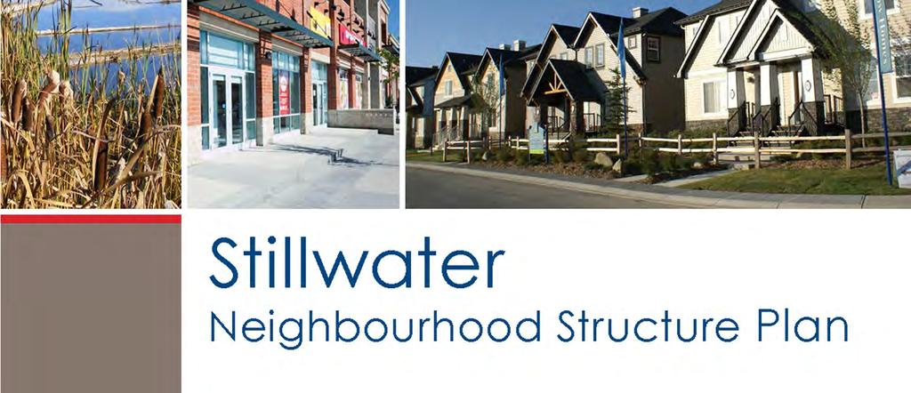
2 Stillwater Neighbourhood Structure Plan Prepared for: Walton Development and Management LP Mattamy Homes Sunwapta Holdings Corp. Prepared by: Stantec Consulting Ltd Final Submission August 22, 2016 DN\\cd1001-c200\workgroup\1161\active\ \reports\nsp bylaw\riverview 2\final submission\riverview nsp_11july2016_final.docx Stantec Stillwater Neighbourhood Structure Plan
3 Table of Contents 1 Introduction Planning Framework and Plan Area... 1 Authorization... 2 Stakeholder Consultation Pre-Application Consultation Advanced Notification Public Meeting Public Hearing... 3 Interpretation... 3 Amendment Neighbourhood Context General Plan Context Technical Review Land ownership Existing Land Uses Topography Soil and Groundwater Conditions Natural Areas and Ecological Resources Environmental Overview Historical Resources Pipelines, Wells and Utility Corridors Parkland County Interface Neighbourhood Vision Statement Development Concept Public Realm Streetscapes and Built Form Historical Resources All-Weather Design Landscaping Land Use Residential Residential / Mixed Use Commercial Town Centre Commercial with Main Street Institutional and Community Services Ecology, Parks and Amenities Natural Areas Green Development Parks and Open Space Agriculture and Food Infrastructure and Servicing Sanitary and Stormwater Servicing Stantec Stillwater Neighbourhood Structure Plan
4 7.2 Water Distribution Staging Public Utility - Communications Facility Environment and Energy Infrastructure Transportation Roadway Network Transit and Land Use Integration Active Modes Network Appendix 1 Land Use and Population Statistics Appendix 2: Figures LIST OF TABLES Table 1: Pipeline Corridors... 7 Table 2: Well Site Information... 7 Stantec Stillwater Neighbourhood Structure Plan
 allows municipalities to establish a Municipal Development Plan (MDP) and to plan a framework for neighbourhoods through an Area")
5 1 INTRODUCTION 1.1 PLANNING FRAMEWORK AND PLAN AREA The Municipal Government Act (MGA) allows municipalities to establish a Municipal Development Plan (MDP) and to plan a framework for neighbourhoods through an Area Structure Plan (ASP). The City of Edmonton s MDP, The Way We Grow, designates Riverview as an Urban Growth Area, which is planned to accommodate much of the city s residential growth. The Riverview ASP was approved by Edmonton s City Council in July 2013, through the adoption of Bylaw Stillwater is identified in the Riverview ASP as Neighbourhood 2. The Stillwater Neighbourhood Structure Plan (NSP) has been prepared in response to current and anticipated market demands in the Edmonton area as well as the aspirations of the landowners in the plan area. The preparation of this NSP has been guided by existing City of Edmonton statutory plans and policy documents shown on the adjoining graphic: City of Edmonton Planning Framework. The purpose of this NSP is to establish a framework for future land use planning, and the provision of municipal infrastructure, services and amenities in conformance with established planning policies, objectives and requirements of the City of Edmonton and based on the characteristics and opportunities contained within the site. This NSP describes: The general pattern of development and subdivision; The location, configuration and size of various land uses, including residential, commercial, parks and open spaces, and public utility land uses; The anticipated density of residential development; The pattern and alignment of the arterial and collector roadway and pedestrian walkway systems; and, Detailed servicing schemes. The Stillwater NSP is one of five neighbourhoods described in the Riverview ASP and encompasses approximately 315 hectares (ha) of land located in southwest Edmonton. As illustrated in Figure 1: Location and Figure 2: NSP Boundary, the neighbourhood is defined by the following general boundaries: North Maskêkosihk Trail (23 Avenue NW) East (realigned) 199 Street South (realigned) 199 Street West Winterburn Road (215 Street NW) (City Boundary) In relation to planned and developing neighbourhoods, Stillwater represents a logical extension of infrastructure and services. Development in Stillwater is expected to commence in 2016 and should develop over the next 20 years. Stillwater Neighbourhood Structure Plan 1 of 53
6 1.2 AUTHORIZATION As per policy of The Way We Grow, Edmonton s MDP, all neighbourhood structure plans within Edmonton s Urban Growth Areas require Council authorization and compliance with the Growth Coordination Strategy, the Integrated Management Plan, and the City Wide Food and Agriculture Strategy. A report was prepared for Council consideration and on August 28, 2013 Edmonton City Council provided authorization for work to commence on the Stillwater NSP. The Stillwater NSP complies with all higher documents including the Riverview ASP. 1.3 STAKEHOLDER CONSULTATION The consultation process proceeded in accordance with Edmonton s Public Involvement Policy process and guidelines (Policy C513). All affected landowners and community leagues in the area have been notified in accordance with the City of Edmonton s policies and application requirements for new neighbourhood plans. The following is a summary of consultation activities that took place PRE APPLICATION CONSULTATION A technical advisory session was held on October 9, This session involved relevant review agencies and civic departments. The purpose of this session was to present neighbourhood information, identify technical constraints, discuss application process, and to receive general comments from the review agencies. On October 28, 2013, a visioning session was held with key civic departments and the participating land owners. The purpose of this session was to present a preliminary neighbourhood concept and the integration of Designing New Neighbourhoods; Guidelines for Edmonton s Future Residential Communities. The commentary in this session focused on the: Vision, land use integration and development of the Town Centre; Integration of multi modal transportation and transit; Establishment of quality public open spaces; and Protection and connectivity of the natural areas. These sessions guided the development of the principles and vision for the Stillwater NSP development. A Riverview landowner open house was held on February 25, 2014, which invited all affected landowners within Stillwater to attend. This event provided the opportunity for landowners and residents within the neighbourhood to receive information regarding development staging, timing and processes as well as provide feedback on the preliminary land use concept ADVANCED NOTIFICATION Consistent with Policy C513, the City of Edmonton s Public Involvement Policy, advance notification was sent to Parkland County and all neighbourhood landowners and residents on December 17, 2014, advising them of the application and encouraging them to contact either Sustainable Development or the applicant (Stantec Consulting Ltd.) for further questions or to communicate any possible concerns PUBLIC MEETING A public meeting hosted by Sustainable Development was held to review the draft Plan on June 25, Mailed notification letters were sent to landowners in and surrounding the NSP area advising of this meeting. The purpose of the meeting was to provide an update on the proposed Plan and the planning process followed to date, and to hear from attendees regarding their Stillwater Neighbourhood Structure Plan 2 of 53
7 questions, comments and concerns. All feedback received at the public meeting will be summarized in Sustainable Development s report to City Council PUBLIC HEARING In accordance with the MGA, landowners have been notified of the Public Hearing and were been given the opportunity to provide written comments or register to speak in front of City Council. A public hearing was held on July 11, 2016 in order to hear representations made by parties affected by the proposed bylaw and to receive approval by Council. 1.4 INTERPRETATION All map symbols, locations, and boundaries contained within the Stillwater NSP shall be interpreted as approximate unless otherwise specified in the plan, or coincide with clearly recognizable physical features or fixed (i.e. legal) boundaries. A policy statement(s) containing shall is mandatory and must be implemented. Where a policy proves impractical or impossible, an applicant may apply to amend the Plan. A policy statement(s) containing should is an advisory statement and indicates the preferred objective, policy and/or implementation strategy. If the should statement is not followed because it is impractical or impossible, the intent of the policy may be met through other agreed-upon means, without formal plan amendment. 1.5 AMENDMENT Policies, text and mapping information contained within the Stillwater NSP may be amended from time to time in order to remain current and up-to-date in response to broader or more specific issues affecting the plan area. Any change to policy, text or mapping information contained within the Stillwater NSP shall be in accordance with the Municipal Government Act, the Riverview Area Structure Plan (Bylaw 16407), and the terms of reference for the preparation and amendment of residential neighbourhood structure plans. Stillwater Neighbourhood Structure Plan 3 of 53
8 2 NEIGHBOURHOOD CONTEXT 2.1 GENERAL PLAN CONTEXT Stillwater is one of five neighbourhoods in the Riverview ASP, and covers approximately 315 ha in the southwest portion of Edmonton. Currently, Stillwater consists of undeveloped land zoned for agricultural land uses. The Stillwater NSP has been prepared in response to current and anticipated commercial and residential market demands in the Edmonton Region and a review of best practices in land use planning, as well as the aspirations of the various landowners in the plan area. This NSP area is designated as Urban Growth Area within the MDP, The Way We Grow, to accommodate a portion of the anticipated growth within the city of Edmonton. This neighbourhood also plans to provide employment and commercial land uses catering to its residents as well as the adjacent communities. The NSP is designed in accordance with City of Edmonton servicing standards, creating a well-defined planning unit that represents a logical extension of infrastructure and services. Development staging and the extension of infrastructure will be contiguous, efficient, and economical while having regard for potential environmental and ecological impacts TECHNICAL REVIEW In support of this NSP, technical reports have been submitted to the City of Edmonton for lands owned by the Plan proponents. During the preparation of this Plan, the applicant did not have access to non-participating lands for survey or study. Should the non-participating lands become available for development in the future, a technical review will be needed to determine the development capability of the lands and must be prepared at the rezoning stage. Technical studies, including but not limited to, Environmental Site Assessment, Risk Assessment, Geotechnical Investigation, and Historic Resource Clearance, as well as associated updates and revisions to the Transportation Impact Assessment (TIA), Hydraulic Network Analysis (HNA) and Neighbourhood Design Report (NDR) may be required prior to rezoning of nonparticipating lands. An amendment to the Stillwater NSP and Riverview ASP may also be necessary to maintain accuracy and a comprehensive approach to neighbourhood planning LAND OWNERSHIP This NSP was prepared on behalf of three private corporations, who have ownership of the majority of lands within the Plan area at the time of plan preparation. The remaining parcels are held by non-participating landowners and although not directly participating in the NSP process, have been consulted through the plan preparation process EXISTING LAND USES The majority of the plan area is characterized by large tracts of land that have been historically cultivated for crops and other agricultural purposes. Throughout the northern half of the neighbourhood a number of semi-permanent and ephemeral wetlands have been identified. Additionally, a communication facility is located south of Maskêkosihk Trail (23 Avenue NW). This facility has not been contemplated for future development at the time of Plan preparation and should this parcel become available for redevelopment, will require an amendment to this NSP. A gas pipeline right-of-way is also located within this plan area and has been incorporated into the neighbourhood. These existing land uses have been illustrated in Figure 4: Site Features. Stillwater Neighbourhood Structure Plan 4 of 53
9 2.1.4 TOPOGRAPHY The topography in the area is generally flat with some lightly rolling areas. Surface drainage in the area generally flows northerly to Wedgewood Creek and east towards the North Saskatchewan River. Elevations through the Plan area vary between 693 m and 688 m. The neighbourhood s topographic contours are illustrated in Figure 3: Site Contours SOIL AND GROUNDWATER CONDITIONS As part of the Plan preparation, a geotechnical investigation was conducted for the participating lands contained within the Plan area. The Geotechnical Report (Hoggan Engineering & Testing (1980) Ltd, (2014) has been submitted to the City of Edmonton under separate cover and has been reviewed by the City of Edmonton s Geotechnical Engineer. Soils within the Stillwater NSP generally consist of mm of topsoil, underlain by a native deposit of lacustrine clay material then bedrock. The depth of bedrock varies throughout the plan ranging from 14m to 40m and classified as either clay shale or sandstone. The groundwater table within the neighbourhood is variable, with low to high table levels. The soil and groundwater conditions at this site are acceptable for residential development NATURAL AREAS AND ECOLOGICAL RESOURCES The City of Edmonton s Inventory of Environmentally Sensitive and Significant Natural Areas (Geowest 1993) was a high level desktop study using historical aerial photography, and identifies several environmentally sensitive or significant natural areas within the Stillwater neighbourhood boundaries. A Phase II Ecological Network Report (ENR) (Stantec Consulting Ltd., 2016), submitted under separate cover, has identified several natural areas that have been recommended to be incorporated into the neighbourhood development concept. The City of Edmonton s Inventory of Environmentally Sensitive and Significant Natural Areas (1993) and Phase II ENR identifies the following natural areas to be retained within the Neighbourhood 2 boundaries (see Figure 4: Site Features). NW 354 is a wetland complex located in the central area of the neighbourhood. The complex provides important habitat for ungulate and raptor species. NW 355 is a wetland complex in the northwest plan area. A detailed assessment of the subject wetland and the surrounding land was prepared by EBA A Tetra Tech Company in October of 2012, and submitted under separate cover. Alberta Environment and Parks (AEP) have claimed ownership of the bed and shore, a portion of this wetland complex, under the Public Lands Act. Ownership of the bed and shore has been registered and transferred to AEP. NW 357 is a wetland complex located in the northeast of the plan area. A portion of this wetland complex has been claimed and has been legally surveyed by AEP, in accordance with the Public Lands Act. The boundary of the natural area will be registered through subdivision and transferred to AEP. NW 663 is a linear tree stand corridor consisting of a good vegetated structure and provides good bird habitat and connectivity to the North Saskatchewan River valley and ravine system. A small class III wetland is also located within the complex, located east of a pipeline utility corridor. The neighbourhood s natural areas may be retained and protected in accordance with the MGA through the dedication of a combination of Environmental and Municipal Reserve, reserved for Crown ownership where the bed and shore have been surveyed and claimed by AEP, under the Public Lands Act, or through some other conservation mechanism. Suitable development adjacent to these areas will retain pre-development water flows using adequate buffers and Low Impact Development (LID) methods to allow wetlands to maintain suitable water levels and conserve valuable natural habitat. Individually, these wetlands are important habitat components. These ecological areas become exceptionally more significant when they are connected together by parkland, creating a robust, integrated ecological network. Stillwater Neighbourhood Structure Plan 5 of 53
10 The neighbourhood conserves its main ecological connection to the North Saskatchewan River through linear hedgerow corridor, which is to be designated as Municipal Reserve. This linear tree stand is being retained to protect the existing mature trees and an unmaintained buffer to allow for root protection and future habitat growth for small wildlife and bird species, to live and travel between the neighbourhood and Edmonton s ravine system. Consideration is also given to connectivity of open spaces between natural areas, stormwater facilities, and parks to strengthen the ecological integrity. Integrating parks, stormwater management facilities and wildlife passages, will assist in the movement of small animals and birds, and introduce new habitat into the neighbourhood ENVIRONMENTAL OVERVIEW An Environmental Overview (Stantec Consulting Ltd., 2014) of the neighbourhood has been submitted under separate cover. The purpose of this overview is to provide a high-level assessment based on a desktop review and a focus on areas that may impact development such as areas of potential soil contamination. The City of Edmonton requires that individual landowners provide Environmental Site Assessments (ESA) or disclosure statements prior to the rezoning stage. A Phase I ESA is meant to evaluate the location and type of surface and/or subsurface impacts that may be present on the subject site and adjacent areas. Where deemed to be required, a Phase II or Phase III ESA will further evaluate areas where contamination may be present HISTORICAL RESOURCES The preservation, conservation and integration of cultural, historical and/or archaeological resources within the Riverview area is important to retaining local history and character that may also be of regional or provincial significance. A Statement of Justification and Historical Resources Act clearance has been received for lands owned by the plan proponents. Nonparticipating landowners will be required to apply for Historical Resources Act clearance for their respective parcels prior to rezoning. At the direction of Alberta Culture and Tourism (ACT), additional review, such as through a Historical Resources Impact Assessment (HRIA) may also be required prior to development PIPELINES, WELLS AND UTILITY CORRIDORS A Risk Assessment has been prepared by Doug McCutcheon and Associates, Consulting (2014) and submitted under separate cover. A review of the Alberta Energy Regulator (AER) pipeline and oil well information available through the Abadata website indicates that there are two natural gas pipelines and three wellheads located in Neighbourhood 2, respectively listed in Tables 1 and 2, and illustrated within Figure 4: Site Features. Development adjacent to pipeline rights-of-way shall provide adequate setbacks to residential development at the subdivision stage, in accordance with all applicable municipal, provincial, and federal policies and guidelines. Utility rights-of-way provide an opportunity to incorporate shared used paths that pass through the neighbourhood, establishing an open space in the form of a pedestrian and ecological corridor connecting open spaces within the neighbourhood and to adjacent communities. Stillwater Neighbourhood Structure Plan 6 of 53
11 TABLE 1: PIPELINE CORRIDORS ERCB Licence # Licensee Substance Status MOP (kpa) H z S (mol/ kmol) OD (mm) Penn West Petroleum Ltd. Natural Gas A Penn West Petroleum Ltd. Natural Gas O All wellheads will be required to be surveyed prior to rezoning or subdivision to ensure the exact location and to determine required development setbacks. Development adjacent to oil, gas, and electrical facilities will comply with all applicable municipal, provincial, and federal policies and guidelines. TABLE 2: WELL SITE INFORMATION Well Id 00 / w4 / 0 w0 / w4 / 0 00 / w4 / 0 Licence # J K B Licence Date 23-Apr Aug Mar-48 Licensee Post Armisie Imp 54 Camao Th Consolidated Homestead No. 2 Location W W W4 Licensee Penn West Petroleum Ltd. Imperial Oil Resources Limited Inter-City Gas Corporation Spud Date 31-Jul Aug Apr-48 Final Drill Date 7-Aug Aug Jun-48 Status/Substance GAS Abandoned Abandoned Abandoned Abandoned Date 27-Oct-04 n/a n/a Total Depth (m) Abandoned Status n/a RecExempt RecExempt PARKLAND COUNTY INTERFACE An urban-rural interface exists between the City of Edmonton and Parkland County ( County ). Lands immediately west of Stillwater are designated under the Rural Residential District within the County s Woodbend-Graminia Area Structure Plan. As development occurs, Winterburn Road (215 Street) in its ultimate form would provide a clear delineation between the City and County. Winterburn Road (215 Street) is expected to be upgraded to a 4-lane, urban-arterial standard, including a 3m shared use path along the eastern boundary. All residential lots adjacent to this road will also include noise attenuation, where appropriate, to mitigate the impacts of traffic noise. These features, in addition to the width of the carriageway, will provide adequate buffer between the existing country residential and agricultural land uses within Parkland County and the proposed urban land uses within Stillwater NSP. Stillwater Neighbourhood Structure Plan 7 of 53
12 3 NEIGHBOURHOOD VISION STATEMENT Stillwater is a healthy residential community that connects neighbours and respects its unique ecological landscape, celebrating the natural features and open spaces as key assets in the community. Stillwater offers exceptional community amenities, providing a range of retail and employment opportunities within the Town Centre and establishing a community that truly is a place in which to live, work, and shop. 3.1 DEVELOPMENT CONCEPT The Stillwater neighbourhood is designed to provide a high quality environment for residents and visitors to the Riverview area. The neighbourhood is predominantly residential in character, providing a mix of low and medium density residential opportunities amidst unique ecological features. The neighbourhood landscape is defined by four separate ecological complexes within its boundaries. These natural areas offer a diversity of vegetation and wildlife habitat that significantly contribute to the ecological integration into the neighbourhood, as well as providing a means of flood protection, aesthetic benefits, and recreational enjoyment. In addition, this NSP allocates naturalized stormwater management facilities (SWMFs) to be integrated with the natural areas that expand the habitat. At the intersection of Maskêkosihk Trail (23 Avenue NW) and 199 Street, the neighbourhood s Town Centre offers significant shopping, entertainment, and employment opportunities featuring the values of a Main Street. The Main Street component of this commercial area is intended to be designed as pedestrian-oriented street fronted by small-scale retail/commercial uses that create a great place for people to meet, shop and create enduring experiences. The NSP also provides two community commercial nodes, in the north-west and south-west, providing additional shopping and employment opportunities. The neighbourhood has also been designed to include two school sites that are located along the internal collector roadway system and linked to the wider pedestrian network for convenient access, and creating a stronger neighbourhood identity. Proximity to the ecological features and pedestrian network also offers the two school sites substantial environmental learning opportunities and wildlife observation. The following section outlines the development concept for the Stillwater NSP. Figure 5: Development Concept, illustrates the designated land uses providing the direction for the neighbourhood vision, which is to be further implemented at the zoning and subdivision level. For more detailed information on the distribution of land uses, please refer to Appendix 1 Land Use and Population Statistics. The overall goals of the Stillwater NSP are intended to establish a community that: Creates a unique neighbourhood identity using appropriate urban design principles that also address year-round weather conditions; Conserves it s natural areas in an appropriate and beneficial manner; Offers a variety of residential uses for a range of economic levels and household types; Supports retail and employment uses for the neighbourhood and surrounding communities; Emphasizes public open spaces that encourage community interaction; Encourages opportunities for active and passive recreational activities; Achieves a balanced transportation network that provides connectivity to neighbourhood amenities and integrates an efficient transit system; and, Ensures a compact urban form that provides efficient and orderly infrastructure. Stillwater Neighbourhood Structure Plan 8 of 53
13 The neighbourhood vision statement and overall goals have formed the basis for the following plan objectives and policies, which have been derived from the Riverview ASP and further refined to guide the development of the Stillwater neighbourhood. The following sections outline the development concept for the Stillwater NSP in more detail. Stillwater Neighbourhood Structure Plan 9 of 53

14 4 PUBLIC REALM CONTEXT AND APPROACH Attractive streetscapes can be created through provision of thoughtful land uses aligned with the streets and well-designed street cross sections. Building orientation also plays an important role in creating interesting and varied streetscapes and can increase the sense of awareness of neighbourhood activities and safety. Such streetscapes form the visual image of the neighbourhood and provide a comfortable environment for the public realm. 4.1 STREETSCAPES AND BUILT FORM OVERVIEW AND RATIONALE A neighbourhood s built form is important in establishing its character. It can have an impact on perceived safety and is a strong determinant of community health. Urban design also has the ability to impact pedestrian movement patterns and even human behaviour within the public realm streets, sidewalks, parks, and other open spaces. A comfortable, humanscale and compact urban form that provides a mix of uses and housing types, connected by pedestrian and bicycle friendly streets, will encourage residents to walk and bicycle to neighbourhood amenities instead of using their vehicles, fostering a strong sense of place and reducing car dependency. Accordingly, the Stillwater neighbourhood is intended to consist of pedestrian-friendly streets and open spaces to connect key land uses that are focused on community destinations, such as natural areas and its Town Centre. Source: Stantec While developing a compact urban community is important, maintaining privacy and mitigating the impact of traffic noise is equally essential. Good urban design techniques will transition higher intensity uses from lower density residential uses by using careful building orientation, setbacks/stepbacks, screening and landscaping, etc. to minimize any perceived impacts making the Stillwater neighbourhood a comfortable place to live and to visit. Environmental and community characteristics are also reflected in the urban form to maintain a unique identity and character, and to foster a sense of place and attachment. Strong urban design should emphasize views into the retained natural areas, which are important and character-defining features of this neighbourhood. Interaction with the natural areas, naturalized stormwater management facilities and other open spaces will be designed to encourage activity and interaction in public spaces, such as exercising, photography, or wildlife viewing. Objective 1: Design streetscapes which are functional, pedestrian friendly, safe and form an integral and attractive component of the public realm. Designing attractive residential streetscapes supported by the built form and appropriate building setbacks provides a comfortable physical environment and human-scale development. Orienting buildings towards public spaces also plays an important role in creating interesting and varied streetscapes, while increasing a sense of resident awareness of neighbourhood activities and safety. Stillwater Neighbourhood Structure Plan 10 of 53

15 1. Design of streetscapes should consider all-season design, public art and furniture. 2. All streets shall form part of the pedestrian network, to link residential areas to key destinations such as transit facilities, open spaces, and retail areas. 3. Encourage appropriate transitions between higher intensity (apartment housing and commercial) uses and lower density residential. 4. Neighbourhood destinations such as the shopping nodes, parks, community gardens, etc. shall be designed to promote access and encourage community interactions. Implementation: Specific type and location of land uses as well as building design will be reviewed at the rezoning, subdivision and Source: Stantec development permit application stages, in accordance with the Zoning Bylaw. Design of alternate roadway cross sections will be prepared at the rezoning or subdivision stage, to the satisfaction of the Transportation Services. The design of public realm shall be reviewed and developed in conjunction with the responsible civic departments to ensure the incorporation of appropriate design elements using City of Edmonton s Transit Oriented Design Guidelines, Complete Streets Guidelines and the Winter Design Guidelines. Objective 2: Design streets and built form within 400m of the transit centre to support transit use The bus transit centre within the River s Edge neighbourhood will provide a convenient bus transit option for the surrounding Riverview neighbourhoods. Development within 400m of this transit centre, or Station Area, as illustrated on Figure 12: Transportation, will be designed to support various modes of transport, including pedestrians, bicycles, bus transit, and vehicles. Accordingly, the NSP creates a Pedestrian Zone that generally coincides with the area approximately 400m from the transit centre (Station Area). Figure 13: Active Modes Network illustrates the location of the Pedestrian Zone, where the streets and public spaces will be designed to encourage pedestrian/active transportation and a higher quality pedestrian environment. Special design consideration will be given to 199 Street and Maskêkosihk Trail (23 Avenue NW) pedestrian crossings as these two arterial roadways are major barriers between neighbourhoods. In order to provide safe pedestrian connections across Maskêkosihk Trail (23 Avenue NW) and 199 Street, priority crossings at key intersections will be provided to encourage safe pedestrian movement across these high-traffic arterial roadways. Where possible, especially within the ground-floor retail within the Main Street node of the Town Centre, emphasis will be placed on the design of smaller ground floor retail to provide an engaging interface with the streets and open spaces. Good site and building design contribute to a more interesting and comfortable streetscape that attracts pedestrian activity. 1. Streets and land uses within Pedestrian Zone shall be designed to provide a safe, convenient and attractive connection to the transit centre. 2. Streets within the Pedestrian Zone should provide a greater mix of roadway cross-sections that accommodate all modes of transport on public streets, providing access to transit facilities. 3. Techniques to promote pedestrian-friendly streetscapes such as building orientation, façade transparency, scale, etc. shall be explored with the Town Centre Commercial with Main Street land use. Stillwater Neighbourhood Structure Plan 11 of 53
16 4. Where permitted by geometry, residential and non-residential buildings abutting a collector roadway should provide active frontages and/or main entrances to the street. Implementation: Figure 13: Active Modes Network illustrates pedestrian connections and public realm. Streets and land uses will conform to the City of Edmonton Transit Oriented Development Guidelines for areas within 400m of the transit centre. The City of Edmonton s Complete Streets Guidelines should be used in the identification of cross sections for roadways within the Town Centre. Opportunities to facilitate pedestrian connectivity through the Pedestrian Zone and across arterial roadways will be explored at rezoning and subdivision stages, and monitored as development continues in the Riverview area. Site planning and building design shall be reviewed at the development and building permit stages, in accordance with the Zoning Bylaw. Objective 3: Encourage innovative architectural design and building orientation that provides local placemaking opportunities. Orientation of buildings towards public spaces (i.e. streets, parks and SWMFs) play an important part of creating interesting and varied streetscapes, while increasing a sense of resident awareness of neighbourhood activities and safety. Large building sites also have the opportunity to create interesting and creative use of space. 1. Provide adequate visual and physical access to all parks and open spaces. 2. Larger buildings and public spaces should be designed to be high quality and located in close proximity to public streets and open spaces to ensure safety, visual interest, and be integrated with the community. 3. Higher density residential, civic and commercial sites shall be designed considering building orientation and variations in façade treatment with regard to massing and human scale architecture. Implementation: Site planning and building design shall be reviewed at the development and building permit stages, in accordance with the Zoning Bylaw. The design and location of buildings shall be reviewed and developed in conjunction with the responsible civic departments to ensure the incorporation of appropriate design elements using Crime Prevention Through Environmental Design (CPTED) principles and the City of Edmonton s Transit Oriented Design Guidelines, Complete Streets Guidelines, and the Winter Design Guidelines. Objective 4: Utilize parks and open spaces to create destinations which are visually and physically accessible and aesthetically pleasing The location and design of parks and SWMFs provide views into the site from the abutting roadways, and thereby heighten residents awareness of access and activities within the neighbourhood. This promotes open spaces as walking destinations and enhances their natural surveillance to prevent crime. Parks and SWMFs will be designed to serve as destinations for pedestrians and cyclists, providing passive recreation opportunities. 1. Roadway design should maximize viewing opportunities of wetlands, parks and stormwater management facilities. 2. Public spaces such as parks and SWMFs shall be designed to encourage passive and active recreational opportunities. 3. Parks and SWMFs shall be designed using Crime Prevention Through Environmental Design (CPTED) principles. 4. Stormwater management facilities and parks are to be located and designed to be neighbourhood destinations, to reinforce the natural theme for the community. 5. A minimum of 50% of the Stormwater Management Facilities perimeter shall be designed with a shared use path. Stillwater Neighbourhood Structure Plan 12 of 53
17 Implementation: Figure 5: Development Concept illustrates the location of parks and SWMFs. At the subdivision stage, parks and SWMFs will be designed with frontage onto public streets and in safe proximity to residential uses. The Subdivision Authority, in consultation with the reviewing civic departments, shall have regard for the provision of adequate street frontage abutting open spaces to maintain passive and active surveillance and enhance view opportunities. 4.2 HISTORICAL RESOURCES OVERVIEW AND RATIONALE A neighbourhood s historical characteristics must be conserved to maintain its unique relationship to its past and to generate a sense of place. In review of development within Stillwater, a Statement of Justification and/or Historic Resource Impact Assessment must be submitted to Alberta Culture and Tourism (ACT). Considering the majority of the Stillwater neighbourhood has been cleared for agricultural purposes, it is unlikely to contain any structures or settlements of historical significance. As a result, the likelihood that the planned development will impact any significant historical resources is low. Objective 5: Ensure that historical, archaeological, and paleontological resources are identified, conserved, and incorporated where applicable. Identification and protection of historical resources is important for preserving and understanding Alberta s history of the land and culture of the people who have called it home. Where applicable, development within the Stillwater neighbourhood will have regard for the preservation of historical, archaeological and paleontological resources identified by the City of Edmonton or Government of Alberta. 1. Statement of Justification and/or Historical Resource Impact Assessments shall be submitted and approved by ACT prior to development. 2. All historical, archaeological, and paleontological discoveries made during construction shall be reported. Implementation: Pursuant to Section 31 of the Historical Resources Act, development proponents, builders and/or their representatives are required to report the discovery of any archaeological, historic period or paleontological resources, which may be encountered during construction. Lands which have not received Historical Resources Act clearance will be required from ACT prior to rezoning or subdivision approval. 4.3 ALL-WEATHER DESIGN OVERVIEW AND RATIONALE Neighbourhoods designed in consideration of year-round weather conditions will provide opportunities for residents to enjoy and experience all the amenities their neighbourhood has to offer, in all seasons. Winter is the dominant season in Edmonton, and utilizing winter design initiatives will help to make outdoor public spaces enjoyable throughout the winter months. The City embraces our winters and, through the Winter Design Guidelines, encourages us to celebrate the winter months. Through a variety of methods such as effective sun capture and wind control measures, as well as landscaping in parks and other outdoor spaces we can enliven these spaces in all seasons. Stillwater Neighbourhood Structure Plan 13 of 53

18 Objective 6: Ensure neighbourhood infrastructure and design elements address year-round weather conditions. Design of streets and buildings should accommodate winter climates, providing a comfortable physical environment for people to enjoy the outdoors throughout all four seasons. Orientation of roadways and function of boulevards will aid in identifying the appropriate cross sections to be used. For instance, to ensure comfortable pedestrian movement and safety, sidewalks should be separated from carriageways by treed boulevards to allow for snow storage and buildings should be oriented to capture sunlight and provide shelter from prevailing winds. The neighbourhood shall be designed to accommodate infrastructure programming requirements in the public realm including snow clearing and landscaping maintenance. Source: Stantec 1. Boulevards should be designed to accommodate snow removal and year-round service vehicles. 2. Alternative development standards shall meet infrastructure programming needs for all seasons. 3. Encourage the integration of vibrant colours and warm materials in civic, institutional, commercial and higher density residential buildings. 4. Create visual interest with lighting, while being mindful of density, spread and colour. 5. Commercial sites and higher density residential areas shall be designed with consideration given to building orientation and variations in façade treatment that reduce the amount of sun shadowing on open spaces in the winter and to prevent wind tunnelling. 6. Building orientation and design will take into account opportunities to maximize exposure to sunshine and reduce wind funnelling. 7. Design public spaces and provide infrastructure that supports desired winter life and improves comfort in cold weather. Implementation: Developers are encouraged to include winter design considerations and elements within architectural controls. Developers shall work with civic departments to plan for appropriate snow storage and removal. Transportation Services and Sustainable Development shall review proposed tentative plans of subdivision. Where required, alternate roadway development cross-sections or standards will be prepared and submitted to Transportation Services for review and approval prior to subdivision. The design of public realm shall be reviewed and developed in conjunction with the responsible civic departments to ensure the incorporation of appropriate design elements using the Complete Streets Guidelines and Winter Design Guidelines. Objective 7: Consider the winter season in the landscaping of schools, public parks, open spaces, plazas and boulevards. Public spaces and buildings within Stillwater will be designed for residents to enjoy engaging public activities during the colder months of the year. Design and development of parks, open spaces, plazas, and boulevards will consider the winter season, including use and placement of street furniture, low maintenance landscaping and also the use of light and colour. Stillwater Neighbourhood Structure Plan 14 of 53

19 1. Design public buildings, parks and open spaces that protect users from the wind and maximize access to sunlight. 2. The design of public open spaces shall consider incorporating design elements that respond to all seasons, through such measures as the creative use of light, and colour. 3. Appropriate plant species should be included in the detailed landscape design of public parks, stormwater management facilities, and open spaces such that they provide wind shelter, enable solar penetration, attract winter wildlife, and promote year-long appeal. Source: Stantec Implementation: Winter design consideration and elements in public buildings, parks and public spaces is encouraged by the City of Edmonton. Design of public land will be reviewed and developed in conjunction with the responsible civic departments to ensure the incorporation of appropriate design elements using the Winter Design Guidelines. 4.4 LANDSCAPING OVERVIEW AND RATIONALE Neighbourhood landscaping will enhance the character of Stillwater and reinforce the neighbourhood s connection to nature. Utilizing native plant species generally requires less maintenance and irrigation than many non-native, ornamental species, which minimizes costs associated with development and maintenance. Native landscaping within open spaces provides opportunities to enhance wildlife habitats, and strengthens the ecological network within Stillwater. Objective 8: Promote the use of natural landscaping using native tree and plant species. This Plan encourages the use of native species, where practical, to enhance the streetscapes and open spaces consistent with the existing landscape to create a sense of place, as well as additional habitat for native birds, small animals and insects. Native landscaping is a more ecologically-sensitive approach to landscaping because native plants are accustomed to the local climate, soil and hydrology of a certain area. Using native plant materials promotes a healthier natural ecosystem that over time will integrate with the surrounding landscape. 1. Landscaping of parks, open spaces, and stormwater management facilities shall incorporate native plant species that are low maintenance and considered non-invasive. 2. Open spaces shall include native trees and plantings, where practical, intended to be lower maintenance, reduce the need for irrigation and provide additional native habitat for birds and wildlife. 3. Locations of plantings of native species on school sites and greenways will be designed to support the neighbourhood s ecological network. 4. Where practical, mature trees located within parks, open spaces, and stormwater management facilities should be preserved and incorporated into the ultimate site design. Stillwater Neighbourhood Structure Plan 15 of 53
20 Implementation: Specific species for landscaping on public properties shall be determined between the developer and relevant City departments at the time of review of landscaping plans as part of the engineering drawing review. Objective 9: Promote the use of edible landscaping in suitable locations within the neighbourhood. As the City-Wide Food and Agriculture Strategy evolves, communities and wildlife may benefit from edible landscaping techniques used in open spaces. Landscaping of parks and open spaces are encouraged to provide opportunities for edible landscaping elements, in areas such as pocket parks. 1. The landscape design of parks and open spaces shall provide opportunities for edible landscaping elements, where appropriate. Implementation: Specific species used on landscape plans shall be determined between the developer and relevant civic departments as part of the engineering drawing review and will consider appropriate edible plants. The developer, in conjunction with responsible civic departments, will ensure the incorporation of Fresh: Edmonton s Food and Urban Agricultural Strategy. Figure 7: Urban Agriculture and Food illustrates potential locations where edible landscaping may be planted for the benefit of the community. Stillwater Neighbourhood Structure Plan 16 of 53

, to take advantage of vehicular traffic on the arterial roadways,")
 and north of the realigned 199 Street.")
21 5 LAND USE CONTEXT AND APPROACH The Stillwater NSP has been planned as a complete community offering a variety of commercial, recreational and residential land uses. Within the NSP, various forms of commercial and employment uses have been envisioned in the neighbourhood taking advantage of the high capacity arterial roadways surrounding the neighbourhood and proximity to transit facilities. The Town Centre Commercial with Main Street area is planned at the intersection of 199 Street and Maskêkosihk Trail (23 Avenue NW), to take advantage of vehicular traffic on the arterial roadways, and pedestrian traffic in proximity to the transit centre. Two other Community Commercial shopping centres have been located east of 215 Street, south of Maskêkosihk Trail (23 Avenue NW) and north of the realigned 199 Street. In addition, a smaller Neighbourhood Commercial site has been designated central to the neighbourhood with frontage onto two collector roadways. The Stillwater NSP has been planned to support a range of dwelling types and densities offering a choice of accommodation for a variety of income groups and household types. Higher density residential development has been allocated adjacent to the higher intensity commercial developments, such as the town centre and shopping centres, as well as other arterial and collector intersections. The following subsections will further discuss these land uses within Stillwater. Figure 5: Development Concept generally illustrates the location and configuration of land uses within Stillwater. 5.1 RESIDENTIAL OVERVIEW AND RATIONALE Residential uses in Stillwater are comprised of Single/Semi-detached Housing, (Stacked) Row Housing, and Low-rise/Medium Density Housing. These housing types are intended to cater to a diverse consumer market of different economic levels and age groups and contributing to a sustainable residential urban form. For neighbourhood land use, density, and population statistics see Appendix 1 Land Use and Population Statistics. Source: Stantec The Single/Semi-detached designation will allow for single-detached, semi-detached and limited amount of row housing. This designation offers a balance of housing choices within the community and will take advantage of local amenities offered by commercial and employment uses, and parks and open spaces. Stillwater Neighbourhood Structure Plan 17 of 53
22 The Row Housing and Low-rise/Medium Density Housing designations allow for higher density residential uses such as row housing, stacked row housing and apartment housing. Medium and high-density residential developments are best situated along transit routes, within walking distance of the Town Centre and other community destinations to create a more compact, walkable and liveable neighbourhood that reduces vehicular dependency. Standard zones within the Edmonton Zoning Bylaw will be applied to facilitate residential development consistent with contemporary trends and market innovations. Innovative or intensive housing styles, such as reverse-housing, shallow lot or zero lot line housing, etc., add variety to the streetscape and make neighbourhoods more interesting places to live. The use of site specific Direct Control Provisions (DC1 or DC2) or Special Area Zones may be utilized to achieve these alternative housing forms within this neighbourhood. Objective 10: Plan for a variety of residential housing types in different built forms for a range of household types and income levels. Providing a variety of housing types promotes the creation of a well-balanced and complete community, one which can accommodate a range of income groups and household structures throughout their lifecycles. This plan seeks to provide a choice of housing forms within the neighbourhood and makes more efficient use of land. 1. A mixture of housing types shall be provided including single / semi-detached, secondary suites, row housing, stacked row housing and apartment housing. 2. The NSP encourages intensive and/or innovative housing forms through the use of alternative and land-efficient development regulations (e.g. reduced minimum site area and depth, reduced lot width, reduced yard requirements, higher site coverage, etc.). Implementation: The City of Edmonton Zoning Bylaw provides for a range of densities and housing forms that will be applied at the rezoning stage through one of the applicable zones. In some cases, Direct Control Provisions (DC1 or DC2) or Special Area Zoning (Section 900) may be utilized for innovative, intensive, affordable, or mixed-use development of individual sites or areas within the neighbourhood. Objective 11: Establish an overall residential density that is compact and efficiently utilizes municipal infrastructure. The Stillwater NSP is located in the Capital Region Growth Plan s Priority Growth Area Cw which sets a minimum density target of 30 units per net residential hectare. The Stillwater NSP meets this target and plans for residential density that is able to support public transit, use infrastructure more effectively, and provide a user base for community facilities. 1. The Stillwater NSP shall meet or exceed the approved density target of 30 units per net residential hectare, as set out by the Capital Region Board. Implementation: Please refer to Figure 5: Development Concept and Appendix 1: Land Use and Population Statistics, which will guide intensified urban development. Stillwater Neighbourhood Structure Plan 18 of 53

23 Objective 12: Establish affordable housing in Stillwater. The Stillwater NSP provides the potential for more intensive forms of residential housing by maximizing land and servicing efficiencies; creating a diversity of housing using a variety of lot sizes and housing forms; and reducing auto dependency by improving pedestrian circulation and access to bus transit. The NSP encourages the exploration of innovation in affordable housing whether it is driven by the developer or the City. The City of Edmonton s Affordable Housing Policies and Guidelines will be applied prior to rezoning. 1. Promote housing affordability through the provision of more intensive forms of residential development. Source: Stantec 2. Allow for a wide variety of housing types, with a wide range of price points, to create a more inclusive neighbourhood. 3. Opportunities for secondary suites, garage suites, or garden suites should be encouraged among builders and homeowners. Implementation: Developments shall comply with the City of Edmonton s Affordable Housing Policies and Guidelines. Secondary suites can further provide an important potential source of affordable housing for singles and other small households as well as create an additional source of income for the owners of the principal dwelling. Secondary suites, garage suites, or garden suites shall be implemented through the applicable Sections of the Edmonton Zoning Bylaw. 5.2 RESIDENTIAL / MIXED USE OVERVIEW AND RATIONALE Stillwater offers flexibility and choice in housing form through provision of Residential / Mixed Use sites in the northwest corner of the neighbourhood. The intent of this development is to allow for integration of higher density residential with compatible and complementary retail uses adjacent to the commercial shopping centre. Objective 13: Encourage a variety of mixed use developments, which may include a combination of different housing forms and commercial uses to create complete communities. Sites allocated for Residential Mixed Use are ideal for more intensive forms of development that will aid in maintaining viable retail/services uses and facilitating the higher transit usage along the adjacent collector roadways. Residential/Mixed Use development will require a comprehensive site planning approach with careful attention being paid to site design, planning and landscaping to ensure a positive land use interface and high quality neighbourhood focal point. 1. Mixed use development shall be pedestrian-friendly, comfortable and aesthetically pleasing. 2. Land uses may be vertically integrated within a single building or horizontally integrated within multiple buildings on a site, to provide a compatible mix of uses and intensity. Stillwater Neighbourhood Structure Plan 19 of 53

24 3. Allow land uses to intensify incrementally over the long term through logical phasing of development or redevelopment of lower intensity uses. 4. Building siting will have high regard for maximizing sunlight and reducing sun shadowing on open space and residential uses. 5. Larger buildings shall use design techniques and materials to reduce the massing perception. 6. Landscaping shall be used to enhance building entries, screen areas of surface parking, and enhance the overall character of these sites. 7. Street furnishings, pedestrian corridors and site landscaping will be utilized to connect transit facilities and promote activity and interaction as well as ensure visual interest. Source: Stantec Implementation: The City of Edmonton Zoning Bylaw provides for a range of densities and housing forms that will be applied at the rezoning stage through one of the applicable zones. The Development Officer should have regard for building placement, pedestrian accessibility, etc. in conjunction with the responsible civic departments to ensure the incorporation of appropriate design elements using the City of Edmonton s Transit Oriented Design Guidelines, Complete Streets Guidelines, and the Winter Design Guidelines, in assessing development applications under the applicable zone. 5.3 COMMERCIAL OVERVIEW AND RATIONALE Commercial uses add to the vibrancy and sustainability of the community. They provide local employment opportunities and the ability for residents to live, work and shop in the same neighbourhood, reducing the need to commute outside the neighbourhood for shopping or work. The locations of the commercial sites are within walking distance of residential areas and are accessible through the pedestrian network, thereby reducing the need for automobile use. A variety of commercial opportunities have been provided throughout the NSP area. Town Centre Commercial with Main Street sites are located in the northeast corner of the neighbourhood, at the intersection of 199 Street and Maskêkosihk Trail (23 Avenue NW). These sites are intended to serve the commercial needs of the neighbourhood and surrounding communities as well as the visitors to the neighbourhood for general retail, restaurants and grocery stores. A component within the Town Centre is intended to emulate a Main Street type development, designed to provide a pedestrian-friendly environment offering a range of smaller format retail and employment uses. Please refer to Section 5.4Town Centre Commercial with Main Street for objectives and policies pertaining to this land use. Community Commercial has been located at the intersection of Maskêkosihk Trail (23 Avenue NW) and Winterburn Road (215 Street) and at the intersection of 199 Street and Winterburn Road. These sites are ideally located and oriented for the travelling public and intended to offer a mix of larger retail, service, civic or office opportunities for both residents and surrounding communities. Stillwater Neighbourhood Structure Plan 20 of 53


25 Neighbourhood Commercial uses are important to serve the daily needs of the neighbourhood residents and have been located central to the neighbourhood. This site is intended to offer smaller scale personal services and convenience commercial uses. Any commercial zone that allows for small format retail within the Edmonton Zoning Bylaw, as amended, will be applied to facilitate commercial development consistent with contemporary trends and market innovations. The use of Direct Control Provisions (DC1 or DC2) or Special Area Zoning may also be utilized to achieve the development goals of this Plan such as Mixed Use areas that provide commercial retail opportunities amongst residential, office, or urban service uses. Objective 14: Locate and orient commercial sites to provide an inviting experience and ensure maximum visibility and convenient access. Larger-scale commercial development is most viable when located adjacent to arterial/collector roadways and in proximity to transit facilities, providing adequate access and visibility and reducing the number of single-occupancy vehicular trips. Entrances for the commercial sites should be prominent and establish a sense of arrival. These entrances should be well defined and landscaped to create gateways especially useful for wayfinding. 1. Commercial sites shall be located along arterial and collector roadways, transit routes, and along pedestrian corridors to maximize accessibility and visibility. 2. Commercial uses shall be located and oriented with particular attention to transit routes and facilities, especially along pedestrian corridors to ensure accessibility and convenience. 3. Building clustering is recommended to help create smaller parking lot areas and encourage the park-once shopping experience. Implementation: The Development Officer should have regard for building placement, pedestrian accessibility and activity areas in assessing development applications for commercial development under the applicable zone. The review of access locations shall be approved by Transportation Services. The developer will work with the responsible civic departments to implement appropriate design and access elements. Source: Stantec Objective 15: Minimize the impacts of commercial development on adjacent land uses. Impacts associated with the commercial development shall be minimized and carefully integrated with surrounding residential development. Attention to site design will separate incompatible use activities and minimize potential impacts. In particular, activity associated with large and intense commercial uses shall be oriented towards arterial or collector roadways, away from low density residential uses. 1. Site planning of commercial areas shall take into consideration the layout and location of all structures and parking and loading facilities to ensure that impacts on adjacent land uses are minimized. Stillwater Neighbourhood Structure Plan 21 of 53


26 2. Ensure that the impact of commercial development on adjacent land uses is minimized through the use of transitional land uses, orientation of development and the appropriate application of setbacks and landscaping available through the Edmonton Zoning Bylaw. 3. Larger buildings shall be articulated and landscaped in a manner that softens the building edge and creates visual relief. 4. Appropriate fencing and landscaping shall be provided to buffer residential uses that back on to or flank commercial uses, in accordance with the Zoning Bylaw. Implementation: The Development Officer shall evaluate and have regard for the appropriate application of setbacks, landscaping, buffers and façade treatments available under the Zoning Bylaw at the Development Permit stage. 5.4 TOWN CENTRE COMMERCIAL WITH MAIN STREET OVERVIEW AND RATIONALE The Town Centre is located in the northeast corner of the neighbourhood adjacent to two major arterial roadways (199 Street and Maskêkosihk Trail (23 Avenue NW)), offering an ideal location of high visibility and access for commercial uses. The Town Centre Commercial with Main Street serves as a major focal point within Riverview Neighbourhood 2 drawing business synergies, employment opportunities, and amenities to the greater area. This site is intended to be a well-designed commercial node that integrates with transit, has high regard for pedestrian circulation, and provides enhanced aesthetics and amenities, as well as offers a mix of small to large format retail/commercial uses. Main streets have traditionally been known as places where residence and commerce come together as the central hub of a community. The Main Street component will be designed to emulate the feel of a street that is pedestrian-oriented, and features smaller shops and multiple uses and functions. The Main Street area will provide the opportunity for a range of office, retail, residential, entertainment and urban service uses integrated both vertically and horizontally, and generally built to human-scale. Objective 16: Create a pedestrian-friendly and comfortable node that encourages interactive and social well-being. The Town Centre is a place to work and shop as well as a place to congregate and socialize. Within the Town Centre, the quasi-public realm will include smaller open spaces and an urban plaza capable of providing space for community events or passive recreation. These open spaces should be Source: Stantec & Google Earth Stillwater Neighbourhood Structure Plan 22 of 53
 providing an added benefit and amenity adjacent to this community hub.")
27 connected by pedestrian corridors and complimented by the adjacent commercial uses by including outdoor patios or seating areas. In addition, the Town Centre is located directly north of Natural Area (NW357) providing an added benefit and amenity adjacent to this community hub. The design of the Town Centre will provide an interface with the Natural Area that will allow for natural surveillance and connectivity. 1. Plazas and courtyards should connect to other activities such as outdoor cafes, restaurants, and building entries. 2. Public amenities, open space, and plazas should be designed to be easily accessible and comfortable for as much of the year as possible. 3. Open space and plazas should be oriented to take advantage of view corridors and sunlight. 4. Design features including, but not limited to public art, public seating areas and street furniture, and ornamental planting beds will be incorporated into open spaces. 5. Buildings adjacent to the open spaces will be oriented and designed to frame and enhance the area and provide opportunities for passive surveillance. 6. Building façades that front onto open spaces should include architectural elements such as terraces and porticos that contribute to the pedestrian experience and animate the street. 7. An integrated landscaping theme should be used to highlight major circulation patterns, pedestrian linkages, and the overall development. 8. Provide a pedestrian-friendly interface between the Town Centre and Natural Area (NW357) through methods such as but not limited to, viewpoints, plazas, walkways, and/or orientation and placement of buildings. Implementation: Where a staged development is proposed within the Town Centre, development abutting NW357 shall be zoned using a DC1 or DC2 Provision to ensure a pedestrian friendly interface. Conventional zoning or a Special Area Zone may be used within the Town Centre development where development will not be abutting NW357. The Development Officer shall evaluate and have regard for the appropriate application of landscaping, and façade treatments available under Zoning Bylaw at the development permit stage. The Development Officer shall circulate the proposed development application of the Town Centre to Parks and Biodiversity to ensure integration and appropriate public access between the Natural Area and the commercial development. Objective 17: Manage vehicle circulation and off-street parking to complement the urban character of the Town Centre. The Town Centre will be designed to minimize the visual presence of automobile circulation as well as service functions as much as possible, such as locating parking and service access away from primary building frontages. This will also be achieved by minimizing vehicular access (curb cuts) on primary building frontages to reinforce a clear hierarchy and organization of circulation within the Town Centre and minimizing conflicts between vehicles and pedestrians. 1. Where feasible, provide smaller, decentralized offstreet parking areas serving different clusters of buildings. 2. Vehicular access points should be shared between Source: Southlands Aurora, CO Stillwater Neighbourhood Structure Plan 23 of 53


28 buildings to minimize curb cuts that interrupt pedestrian movement 3. Bicycle parking should be located near amenities or building entrances in at-grade locations. Implementation: The Development Officer shall evaluate and have regard for the provision of smaller parking areas, appropriate locations for shared vehicular access points, and appropriate bicycle parking locations during the development permit stage. Objective 18: Create a successful Town Centre Commercial with Main Street area that caters to pedestrians and supports a compact mixed use development. The Town Centre is a key focal point and destination node within the neighbourhood. Convenient pedestrian access to the transit centre located in the River s Edge neighbourhood and transit services throughout the Town Centre will alleviate the demand for parking, and increase foot traffic. As such, commercial buildings and public amenities will be located near transit facilities and designed for convenient pedestrian access. 1. Town Centre Commercial with Main Street development should encourage opportunities, where appropriate, to develop apartment housing above ground floor retail, commercial, and/or office uses. 2. Building façades shall be constructed to provide storefront windows with direct access to the street. 3. Use of architectural features, urban design elements and landscape materials shall be incorporated to maintain visual interest and encourage street level activity. 4. Site design shall incorporate convenient pedestrian access to transit facilities by connecting with the public sidewalks abutting the site. 5. The pattern and scale of development will be consistent with an urban and pedestrian character. 6. Provide a clear pedestrian walking zone on both sides of the street to facilitate pedestrian movement. Source: Stantec 7. Protect pedestrians from the elements through the use of awnings, wind screens, mid-block crossings and other design features that make the outdoors more enjoyable through all seasons. 8. Street furnishings and amenities should occupy consistent, well defined zones parallel to the pedestrian walking zone. Implementation: The Development Officer shall have regard for the appropriate application of setbacks, landscaping, pedestrian access, and façade treatments available under the Zoning Bylaw at the Development Permit stage. In some cases, Direct Control Provisions (DC1 or DC2) or Special Areas Provisions (Section 900) may be utilized for innovative, intensive, affordable, or mixed-use development of individual sites or areas within the neighbourhood. In cooperation with Transportation Services, opportunities for the integration with transit facilities will be reviewed prior to rezoning and subdivision. Where required, alternate roadway cross sections, guided by Complete Street principles, will be prepared and Stillwater Neighbourhood Structure Plan 24 of 53

29 submitted to Transportation Services for review and approval prior to subdivision. The developer will work in conjunction with responsible civic departments to incorporate appropriate design elements using the Transit Oriented Development Guidelines and Complete Streets Guidelines. 5.5 INSTITUTIONAL AND COMMUNITY SERVICES OVERVIEW AND RATIONALE Whether provided by publicly or privately owned organizations, urban and institutional service uses aid in the development of a complete community. By identifying and anticipating future community needs, land may be set aside for fire rescue, emergency medical services, health providers, religious assemblies, or other uses. One location has been identified for a resident s association, which will provide private amenities and facilities to be enjoyed year-round. Objective 19: To accommodate future development of institutional, civic service, and community land uses. Institutional and community service land uses are encouraged to be located near the Town Centre and School/Parks land uses, and are intended to support social sustainability, providing space for worship, learning, recreation and community safety. The NSP supports the future development of community services in the Riverview area, including religious assembly, fire hall, residents association and/or police station. 1. The NSP shall allow for development of institutional and community service uses based on assessed requirements. Implementation: The location of emergency services shall be determined through consultation with Edmonton Fire Rescue Services Source: City of Edmonton or any other emergency service agency. A review of the perceived nuisances and impacts of the proposed uses will be reviewed by Sustainable Development and Transportation Services at the rezoning stage. The Development Officer will have regard for building placement, buffering, and landscaping in assessing development applications under the applicable zones. Stillwater Neighbourhood Structure Plan 25 of 53

30 6 ECOLOGY, PARKS AND AMENITIES CONTEXT AND APPROACH The majority of lands within Stillwater have been historically cultivated and used for agriculture uses, with the exception of four wetland areas. These four natural areas have been identified for retention through the dedication of Environmental Reserve and Municipal Reserve. Where AEP has indicated that the bed and shore of any wetland will be claimed, the area will be verified by legal survey and reserved for Crown ownership. Individually, these natural areas are self-contained and provide important habitat components that will be protected and integrated into the residential neighbourhood. The neighbourhood provides a connection to the North Saskatchewan River through retention of a hedgerow corridor, connecting to the Grandisle neighbourhood. This hedgerow will be retained through the dedication of Municipal Reserve, which will protect the existing mature trees and provide an Source: Stantec unmaintained buffer on the east side to allow for root protection. The hedgerow and unmaintained buffer will also provide additional habitat for small wildlife and bird species, as well as encouraging travel between the neighbourhood and Edmonton s ravine system. Consideration is given to creating links between natural areas, stormwater facilities, and parks to strengthen the ecological network within the plan area. Integrating new open spaces, such as naturalized stormwater management facilities, bio-swales, or wildlife passages will assist in providing new habitat for small animals and birds in the neighbourhood. The preservation and integration of the open spaces will help facilitate the movement of wildlife, in addition to increasing aesthetic and recreational benefits for the residents of Stillwater. Phase I (2013) and Phase II (2016) Ecological Network Reports (ENR) have been submitted that identify natural areas within the plan area, provide an assessment of the existing regional ecological network and provides recommendations on how to conserve or protect integral natural areas. A full review has been completed for the plan proponents land, and a desktop review has been completed for the entire neighbourhood. 6.1 NATURAL AREAS OVERVIEW AND RATIONALE The Stillwater NSP identifies several natural areas to be retained, including four wetland complexes, generally composed of various wetland and vegetative features that maintain the ecological integrity of suitable habitat for wildlife. A large hedgerow has also been identified, consisting of old growth trees, connecting to 199 Street allowing for birds and smaller wildlife species to travel from the neighbourhood through the Grandisle neighbourhood and further to the North Saskatchewan River. The neighbourhood s natural areas provide the basis for plant and animal populations to be integrated within the neighbourhood adding diversity and vitality. Public access to these natural areas will be provided to allow residents to walk through the area and view the natural vegetation and wildlife near their home, helping the neighbourhood achieve a sense of place, and allowing residents to explore and enjoy nature close to home. Proximity to School/Parks uses also allows for a unique educational opportunity, providing students access to their natural surroundings first-hand. Stillwater Neighbourhood Structure Plan 26 of 53
 will be enhanced by locating and designing (naturalized) stormwater facilities to abut the wetlands to augment the ecological complex")
31 Objective 20: Protect natural areas within the community Four Natural Areas (wetland and vegetated upland) will be partially retained using Municipal and Environmental Reserve. Three of the larger wetland complexes (NW354, NW355, and NW357) will be enhanced by locating and designing (naturalized) stormwater facilities to abut the wetlands to augment the ecological complex in this neighbourhood. A linear tree stand and smaller class III wetland (NW663) are centrally located in the neighbourhood and provide a linear corridor of vegetation that is planned to be retained using Municipal and Environmental Reserve. Conserving the neighbourhood s ecological habitat will be achieved by the following policies. 1. Conservation planning in Stillwater shall adhere to City of Edmonton Policy C531 Natural Area Systems. Source: Stantec 2. Explore opportunities for the conservation of natural areas through a variety of mechanisms including retention, compensation or integration with stormwater management facilities. 3. A Wetland Assessment shall be completed for each titled parcel. 4. Stormwater management facilities should be integrated with the adjacent wetlands in order to improve stormwater quality. 5. A Natural Area Management Plan (NAMP) shall be completed prior to the rezoning or subdivision of any land located within 250m of a natural area to be retained. 6. Each retained Natural Area shall be appropriately buffered from urban development, in accordance with the recommendations of a Natural Area Management Plan. 7. Surface flows shall be directed to upland Natural Areas to maintain the pre-development water balance to the greatest extent possible. 8. Where natural areas and buffers are to be retained, land shall be dedicated as Environmental or Municipal Reserve, in accordance with the Municipal Government Act. 9. Street lighting shall be designed to reduce light pollution in proximity to retained natural areas. Implementation: An Ecological Network Report (ENR) and Neighbourhood Design Report (NDR) were prepared and submitted under separate cover in support of the NSP. The ENR identifies natural areas and provides an assessment of the existing ecological network as well as provides recommendations on how to conserve and protect natural areas. The NDR reviews and identifies the natural areas pre-development and post-development basin hydrology. Buffers around natural areas are set to 30m for wetlands and 10m for tree stands, unless otherwise indicated within an NAMP and approved by Parks and Biodiversity. Wetland Assessment A Wetland Assessment is required for each titled area prior to rezoning or subdivision approval. Wetland Assessments will identify any potential wetlands and determine the required regulatory approvals, and potential sustainability of wetlands with future development. Local wetland compensation opportunities shall be explored at the subdivision stage, in accordance with the Alberta Wetland Policy, City of Edmonton Wetland Strategy and City Policy C-531.The Subdivision Authority in Stillwater Neighbourhood Structure Plan 27 of 53
32 consultation with the responsible civic departments will determine the dedication of Reserves owing for the neighbourhood, to be confirmed by legal survey at the time of subdivision. Natural Area Management Plan In compliance with Policy C531, a NAMP will be prepared prior to rezoning and subdivision to address issues related to phasing of construction activities, ongoing management, maintenance and sustainability of the natural areas planned to be retained in the Stillwater neighbourhood. The NAMP will be used to determine and confirm the necessary development setbacks, if it is proposed to be different than the development setbacks recommended as per City Procedure (C531). NAMPs and proposed adjustments to development setbacks must be reviewed and accepted by Parks & Biodiversity, Sustainable Development. In accordance with Attachment 3 of the City Procedure, the retained wetland components of Natural Areas NW663, NW354, NW355 and NW357 require a minimum fixed 30m buffer (Environmental Reserve) for the purpose of pollution prevention from abutting urban development. Where wetlands are planned to be supported by an abutting naturalized stormwater management facility a fixed 30 m pollution prevention buffer may not be necessary, in which case the minimum buffer distance may be further evaluated through the NAMP to be biologically viable, prior to rezoning or subdivision approval. Lands consisting of Natural Areas identified for retention, which have not been claimed by the AEP, will be dedicated at the time of subdivision through a combination of Environmental Reserve or Municipal Reserve, and in accordance with the Municipal Government Act. Land allocated for Natural Area that does not meet the definition of Environmental Reserve shall be dedicated to the City of Edmonton as Municipal Reserve (MR), in accordance with the Municipal Government Act, or purchased at market value. Objective 21: Integrate naturalized stormwater management facilities with natural wetlands Wetlands are part of the diverse ecological system that characterizes Stillwater. Three significant wetland/upland complexes are planned to be retained using a combination of Environmental/Municipal Reserves and Crown ownership, maintaining the function and integrity of the ecological areas and integrating the habitat into the neighbourhood. The intent of integrating natural wetlands NW354, NW355 and NW357 with stormwater management facilities is to provide a functional stormwater management component to the unique ecological features. The overarching goal is to provide a transformed ecological area that increases stormwater capacity and improves the water quality prior to discharging into the wetlands and ultimately to Wedgewood Creek and the North Saskatchewan River. The integrated naturalized stormwater management facility provides new wildlife habitat, enhancing the existing ecosystem and creating an aesthetic amenity for the residents of Stillwater. Compared with conventional stormwater management systems, naturalized stormwater wet ponds more closely mimic the natural attributes of prairie wetlands, allowing soils and plants to filter pollutants from stormwater and permitting the processes of infiltration, evaporation, and transpiration to occur. From a community design standpoint, naturalized systems can create passive green space, provide wildlife habitat, offer improved aesthetics over traditional treatment systems, and provide educational opportunities. The integrated stormwater facilities will mimic a wetland function by incorporating open water zones, deep marsh zones, shallow marsh zones, and upland buffers. These zones will be designed to provide both wildlife habitat and filtration capacity for stormwater which meets criteria set forth by AEP, including the Alberta Wetland Policy and Alberta Protection and Enhancement Act. Stillwater Neighbourhood Structure Plan 28 of 53
33 1. Naturalized stormwater ponds integrated with wetlands shall be constructed to imitate a class IV/V wetland, in accordance with the Stewart and Kantrud (1971) system. 2. Naturalized stormwater facilities, including swales, fore-bays and water controls should be located using natural catchment characteristics, when possible, to assist in meeting the hydrologic requirements of the wetland. 3. Development impacts that have the potential to redirect water flows within the wetland should be avoided or managed and accounted for in the design. 4. Timing of runoff into wetlands should be designed to imitate the wetland s hydroperiods. 5. Natural wetlands should be designed to allow for a full drawdown event to maintain productivity of the wetland, if that is what is historically required. 6. Surrounding land and development shall be designed to ensure a wetland s overall pre- and post-development water balance is maintained. 7. Surface flows should be directed towards the wetlands through buffer zones. 8. Runoff from hard surfaces, such as roadways and commercial parking lots, shall be pre-treated, either through directional flow (e.g. bioswales and fore bays), naturalized stormwater facilities, or vegetated buffer zones before reaching the wetland. 9. Inlet and outlet control structures should be built to accommodate the highest and lowest historical elevations, to manage the water levels, to allow for flood control in extreme events, and to provide the flexibility to adjust water levels accordingly if it is found that operating water levels are negatively impacting the wetland. 10. Buffer zones shall be maintained in a natural state and where required, re-vegetated using native plant species. Implementation: Development of naturalized stormwater management facilities will depend on the necessary innovative engineering and landscape design of a facility to provide functional and low maintenance stormwater management for the neighbourhood. Due to site constraints and hydrology unique to integrating wetland NW357, a pump is being considered to sustain its natural hydroperiod. Should this be required, the integrated SWMF/wetland complex will be managed as a special test site. In this case, there will be a minimum 5 year test period to assess the pump s utility in maintaining the natural hydrology of the wetland. If required, there will be an allowance for a reduced ER buffer to a minimum of 6m, at the interface of the wetland and naturalized SWMF to be re-vegetated with a plant species community representative of a Class III seasonal wetland in the Edmonton area (see ENR for more details). The exact size and configuration of the facilities will be determined prior to any rezoning and subdivision. Any innovative development techniques that do not meet current city standards must be approved by the necessary civic departments prior to or concurrently with detailed engineering review. Objective 22: Strengthen Edmonton s ecological network and maintain ecological linkages to the North Saskatchewan River valley and ravine system The North Saskatchewan River valley plays a significant role in the region s ecological network and provides an important ecological resource. Parks, greenways and SWMFs provide for connectivity within the neighbourhood. Providing connections to the larger North Saskatchewan River valley will further add diversity and vitality to the neighbourhood s ecology. Wildlife passages will be considered in accordance with the Wildlife Passage Guidelines. This Plan seeks to maintain the existing ecological corridors as well as utilizing parks, SWMFs and natural areas, to develop a network within the neighbourhood boundaries enhanced with plantings of native plant species to provide additional habitat. The potential for a wildlife passage at 199 Street would facilitate the movement of smaller animals and/or birds across the Stillwater Neighbourhood Structure Plan 29 of 53
34 arterial roadway. Large animals will not be encouraged to traverse through the neighbourhood to reduce negative human/wildlife encounters. 1. Integrate and connect green open spaces (e.g. parks, greenways, and SWMFs) to maintain habitat and promote ecological connectivity. 2. Wildlife passages shall be constructed, where practical, to assist the movement of small to medium sized animals and/or birds, through ecological corridors. 3. Existing hedgerows should be retained, where feasible, on public lands to provide direct connections to other natural features and open spaces. 4. Native plant species should be used in landscaping public spaces to increase the habitat value of the ecological network. 5. Maximize the use of wetland soils in constructed SWMFs, where possible, in order to accelerate the re-vegetation of native species. Implementation: Figure 5: Development Concept illustrates the location and configurations of parks, greenways and SWMFs. A potential wildlife passage will be located and designed using the recommendations of an Ecological Network Report, the Wildlife Passage Engineering Design Guidelines and shall be reviewed by Transportation Services, in conjunction with the Urban Ecology Unit (Sustainable Development). Wildlife passages are illustrated in Figure 12: Transportation. Tree plantings and landscaping will be determined at the design stage, in consultation with Sustainable Development. 6.2 GREEN DEVELOPMENT OVERVIEW AND RATIONALE In support of the City of Edmonton s Green Building Plan and The Way We Green policy documents, the Stillwater NSP provides consideration to green initiatives and innovations. This Plan encourages implementing innovative and sustainable ideas such as green building design and environmentally conscious landscaping techniques in neighbourhood development. Engineering and design standards establish a baseline for construction that provides safe and reliable municipal infrastructure. However, recent trends and rapidly improving technology provide ample opportunities for alternative standards to reduce construction and maintenance costs. This plan encourages the exploration of alternative development standards (e.g. reduced roadway widths, smaller lot design, and servicing techniques that differ from City standards) as a way of stepping toward increased sustainability. Low Impact Development (LID) is an approach that uses simple ecological principles to reflect natural ecosystem processes with respect to managing stormwater in a developed area. This Plan encourages implementing innovative and sustainable ideas such as green building design and environmentally conscious landscaping techniques, including the use of native species to the extent feasible. The following LID techniques are recommended for this NSP, in accordance with the City of Edmonton Low Impact Development Best Management Practices Design Guide Edition 1.0 (2011). Absorbent Landscaping Stillwater Neighbourhood Structure Plan 30 of 53


35 Absorbent landscaping could be incorporated into the development of all the SWMFs and parks, by increasing the depth of topsoil within the NSP in order to help temporarily store stormwater and allow stored water to permeate over time. This is particularly helpful for small, frequent events. The increased organic layer will increase the water holding capacity of the soil surrounding the various SWMFs and parks, increasing absorption and break down of pollutants. Bioswales and Bioretention Areas Bioswales and bioretention areas are stormwater treatment areas located within a shallow depression using vegetation and additional topsoil. These areas provide water quality treatments, reduce runoff and aid in infiltration. Bioswales and bioretention areas could be incorporated in the form of parking lot islands, islands within road rights-of-way, traffic circles, bump outs/boulevards and rain gardens, where feasible. Naturalized Stormwater Management Facilities Naturalized stormwater management facilities incorporate local topsoil or live soils, where available, and native vegetation to maintain water balance and remove pollutants from stormwater by increasing the duration that the water remains within vegetated areas. These systems also provide wildlife habitat. In addition, there may be opportunities to integrate naturalized storm ponds with natural wetlands to ensure the long term sustainability of the natural areas in the NSP. Early planning and innovative designs will help to ensure natural wetlands are conserved and integrated into the neighbourhood. Stormwater Reuse Stormwater reuse is a method of conserving rain water and aids in decreasing the amount of contaminants entering the groundwater system. This is an inexpensive method that can be incorporated by all of the businesses and residential developments within the neighbourhood. Stormwater collection can be accomplished by the use of rain barrels, rain gardens or used to irrigate public areas within The NSP. This LID technique could be coupled with resident education regarding the benefits of reusing stormwater. Source: Stantec Objective 23: Consider sustainable, alternative or Low Impact Development standards in the planning and design of the neighbourhood. Best practices will be used in the development of the Stillwater NSP. Technological advances and innovation in the construction industry will continually improve as well as the demand for more efficient and affordable construction practices/products that will change the way neighbourhoods are built. Stillwater Neighbourhood Structure Plan 31 of 53

36 Stormwater management systems can simultaneously satisfy regulatory requirements and protect the environment by controlling runoff and improving water quality, in addition to reducing infrastructure costs all of which minimize the impact of development. 1. Landscaping of parks and open spaces should incorporate increased top soil depths and landscape with native plant species, where appropriate. 2. SWMFs shall include naturalized shoreline plantings and other native vegetative species intended to provide habitat opportunities for wildlife and promote natural water treatment. 3. SWMFs shall maximize the use of wetland soils, to the greatest extent possible, in order to accelerate the revegetation of native plant species. 4. Where possible, bioswales or bioretention areas should be utilized to increase groundwater infiltration and improve water quality prior to discharging into the ravine system. 5. Development should consider utilizing pervious surfaces where appropriate, for trails and parking areas in public and private development. 6. Multi-family development (Low Rise /Medium Density Housing) immediately south of Natural Area NW355 shall be designed with LID features to detain stormwater and provide improved stormwater quality to the Natural Area wetland. 7. In addition to LID best practices, development should consider alternative development standards such as energy efficient lighting, green building standards/technologies and alternative road construction standards to reduce energy consumption of buildings and neighbourhood development as a whole. Implementation: Figure 14: Low Impact Development Opportunities illustrates areas identified to potentially utilize LID principles. Detailed design of parks, naturalized stormwater management facilities, bioswales, or bioretention areas will be reviewed by City Administration. Plant, shrub, and tree species for landscaping on public properties shall be determined between the developer(s) and City Administration at the time of review of landscaping plans and as part of the engineering drawing review. Details of alternative design standards proposed will be reviewed as part of the engineering drawing stages and will require approval from City Administration. 6.3 PARKS AND OPEN SPACE OVERVIEW AND RATIONALE An integrated open space network is proposed for the Stillwater NSP that is comprised of existing natural areas, two School and Community Park Sites and four various pocket parks, as shown in Figure 6: Ecological Network and Parks. The pedestrian network provides a linear, multi-modal connection throughout the neighbourhood using shared use paths (SUP) and sidewalks along local, collector and arterial roadways, providing linkages from the commercial nodes to the north to the school site to the south and further to adjacent communities. School and Community Park Sites The Stillwater NSP plans for two school and community park sites set Source: Stantec Stillwater Neighbourhood Structure Plan 32 of 53
37 aside for the Edmonton Public School Board and the Edmonton Catholic School Board. As shown on Figure 5 - Development Concept, a Public (K-9) school site is provided in the north and a Separate (K-9) school is provided further south of the NSP. Each of these school and community parks sites is sized to accommodate a K-9 school building, playfields, parking, and potential community league facility. Each site will also be configured to have adequate collector roadway frontage that will accommodate drop-off parking and traffic to/from the sites. The two sites will remain as open space until such time that the student population warrants the construction of each school, as determined by the individual school boards. Special Study Area (LDR / Park) A Special Study Area located southeast of the Public (K-9) school/park has been identified as a swing site for the potential expansion of the school and community park site. Considerations for expanding the site include requirements for onsite stormwater drainage and the placement of school and community league buildings, sports fields, parking and student drop/off areas. The designation of a Special Study Area confirms the ability to designate Municipal Reserve without precluding future programming needs. The Public K-9 school and community park site has been reduced in area to accommodate the integration and conservation of the adjacent Natural Area (NW355 and NW357) complexes. Natural Areas A buffered hedgerow corridor and four wetland/upland complexes within the plan area will provide good connectivity between school sites, and ultimately the North Saskatchewan River Valley, as illustrated in Figure 6: Ecological Network and Parks. These natural areas are being retained to conserve the wildlife habitat, amidst the native vegetation and wetland complexes that exist today. These natural areas act as stepping stones, providing connectivity through the residential neighbourhood. These natural areas are also utilized as passive recreation areas for residents that are linked into the pedestrian network by shared use paths. Pocket Parks Pocket parks will be used to serve residential sub-areas within the neighbourhood to meet the needs of all users within the community. The pocket parks have been placed to ensure that all residents have convenient access to parkland for everyday activities. Greenways Greenways are linear open spaces linking other open spaces enhancing the neighbourhood s tree canopy and providing active modes connections for recreational purposes. One greenway is designated in this Plan, designed to connect the northern Public K-9 school and community park site to the pipeline utility corridor and Natural Area (NW663) further south. Stormwater Management Facilities Stormwater management facilities are considered neighbourhood amenities and part of the open space network. These facilities add to the neighbourhood s attractiveness, character and image as a pedestrian-friendly community. All SWMFs are linked within the neighbourhood trail network and complement the open space system by providing additional areas for passive recreation. A Parkland Impact Assessment (PIA) and Community Knowledge Campus Needs Assessment (CKCNA) were completed and submitted under separate cover, in support of this NSP. In accordance with the Riverview ASP, this Plan has a lower percentage of parkland allocated within its boundary, in order to accommodate the assembly of the District Park site, located in the River s Edge NSP. Stillwater Neighbourhood Structure Plan 33 of 53
 provides strategic direction for the acquisition, design, development and management of Edmonton s parkland.")
38 Objective 24: Accommodate City of Edmonton requirements for park sites within the neighbourhood. The Urban Parks Management Plan (UPMP) provides strategic direction for the acquisition, design, development and management of Edmonton s parkland. This NSP uses the UPMP to guide the allocation of school and park sites and land assembly guidelines. 1. The UPMP shall be utilized as the guiding document for the distribution of parkland. 2. As part of the subdivision approval process, Municipal Reserve shall be dedicated as land, money-in-place of land, or a combination thereof, in accordance with the Municipal Government Act. Source: University Village Seattle, WA 3. Parks identified for schools shall have adequate collector roadway frontage to accommodate flexible building design, parking access, drop-off/pick-up areas as well as to ensure sightlines, natural surveillance, adequate lighting and connectivity to pedestrian routes. 4. The location of abandoned wells and associated setbacks, or other public utilities on park sites shall not be permitted, with the exception of utilities that uniquely serve a park space. 5. Servicing shall be provided to school sites to accommodate future school and/or community league buildings. Implementation: The school and community parks, pocket parks, natural areas and open spaces are conceptually configured and located in Figure 6: Ecological Network and Parks. The Subdivision Authority, in consultation with Parks Planning shall determine the Municipal Reserve owing for the Stillwater NSP, and the areas dedicated as MR shall be confirmed by legal survey at time of subdivision. The Special Study Area (LDR/Park) will be developed for Low Density Residential uses, unless it is determined through a site planning exercise that the Special Study Area, or a portion thereof, is required for additional programming requirements and dedicated as Municipal Reserve. Municipal Reserve within the Special Study Area (LDR / Park) will be determined prior to rezoning or subdivision, with the exact area being determined upon review of a site plan and programming requirements in consultation with the landowner, Sustainable Development, and the Edmonton Public School Board. The development (timing) of the schools are dependent on available funding and need (i.e. a threshold of school aged population being present in the neighbourhood). The neighbourhood servicing scheme shall ensure that the type and amount of servicing is provided within road rights-of-way to service school/park facilities and adhere to the guidelines set out in the UPMP at the subdivision stage. Lighting, frontage, and design of parks and open spaces shall take into consideration basic CPTED principles and design principles included in the Design Guide for a Safer City and Urban Parks Management Plan. A linear greenway connection, located south of the Public K-9 school and community park site will be 12m in width, where half (6m) will be dedicated as road right-of-way and will accommodate an active modes connection via 3m paved shared use path and park furniture (e.g. benches, waste receptacles, and directional signage). The other half (6m) will be dedicated as Municipal Reserve and landscaped to encourage ecological connectivity along this corridor using naturalized plantings. Stillwater Neighbourhood Structure Plan 34 of 53

39 6.4 AGRICULTURE AND FOOD OVERVIEW AND RATIONALE The Stillwater NSP supports the intent of Fresh, Edmonton s City-Wide Food and Agricultural Strategy. It does this by proposing a number of land uses, policies and approaches to support local food production in the area and to grow the local food market, as well as to promote sustainable food practices. Incorporation of urban agriculture in the form of community gardens and edible landscaping will create an interest and uniqueness to the open spaces in Stillwater, and will increase access to local food. Figure 7: Urban Agriculture and Food identifies potential locations that communities gardens and edible landscaping may be explored. Objective 25: Provide opportunities to promote urban agriculture. Community gardening is considered both a recreational and community building activity. Community gardens may be incorporated into the programming of community parks in balance with other park programming needs. Community gardens could also be integrated into other public or private open spaces. Community gardens are features that are found in many neighbourhoods throughout the city where people can connect through food and the growing, preparing, and celebrating of food. Community gardens are generally divided into individual plots which are made available to the public or members of the community, often for a nominal fee or for no cost. These spaces serve multiple purposes from social gathering spaces, to vegetable gardens, to ornamental flower gardens and are often popular in locations with higher density housing where private open space is limited. Public open spaces may be dedicated to community gardens throughout the Stillwater neighbourhood. Organizations such as community leagues, non-profit societies, residents associations or faith groups are often willing to administer community gardens, likely with nominal support from Integrated Infrastructure Services. Source: Stantec 1. Encourage and provide opportunities for community garden plots within public and private lands. 2. Encourage the utilization of harvested rainwater for irrigation of community gardens. Implementation: Implementation of community gardens may be explored at the detailed landscape design stage in consultation with Sustainable Development and Integrated Infrastructure Services. Objective 26: Support the development of pocket markets, mobile markets, and/or mobile food vendors. Open areas such as urban plazas or parking lots within commercial developments, such as the Town Centre; provide opportunities for temporary markets such as farmers markets or mobile food vendors, providing residents with entertaining special events and local food options. 1. Open spaces and quasi-public spaces shall be encouraged and accommodating for local food establishments. Stillwater Neighbourhood Structure Plan 35 of 53
40 Implementation: Programming and event coordination will be planned at the permitting level through Sustainable Development. Consideration shall be provided to ensure accessibility and suitable parking management. Objective 27: Support the use of edible plant species in landscaping of open spaces. In addition to private gardens, public spaces can provide attractive and productive land. Public lands such as parks and open spaces, or even utility rights of way, can be planted with a broad variety of edible species. These might include fruit trees, berries such as saskatoon berries, high-bush cranberries, raspberries, nuts, or other plants like rhubarb. Expanding the variety of plants in public spaces beyond ornamental species is a fairly easy way to increase the range of potential uses, and to provide a source of local food. 1. Landscaping of public parks, open spaces, and private spaces should consider edible fruit and vegetable plants where appropriate. Implementation: Figure 7: Urban Agriculture and Food identifies potential locations that edible landscaping may be utilized in public open spaces. Selection and location of plant species will take place at the detailed design stage and be incorporated where feasible. Stillwater Neighbourhood Structure Plan 36 of 53

41 7 INFRASTRUCTURE AND SERVICING CONTEXT AND APPROACH Expansion of the City s infrastructure will be necessary to accommodate Stillwater development. The Stillwater NSP will be a fully serviced neighbourhood designed and constructed in accordance with City servicing standards. Development staging and extension of infrastructure will be contiguous, efficient, and economical while having regard for potential environmental and ecological impacts. Opportunities for research and innovation should be supported in order to discover efficient, low cost or low environmental impact servicing options. Further details on the sanitary and stormwater collection services have been supplied in the Neighbourhood Design Report (NDR), under separate cover. Details on the water distribution system have been provided in a Hydraulic Network Analysis (HNA), also submitted under separate cover to EPCOR Water Services. 7.1 SANITARY AND STORMWATER SERVICING OVERVIEW AND RATIONALE Permanent sanitary servicing for the Riverview areas will be provided using a network of onsite gravity mains and a lift station draining to the future South Edmonton Sanitary Sewer (SESS) trunk SW7. SESS will ultimately carry the neighbourhood sanitary flows to the Alberta Capital Region Wastewater Treatment Commission wastewater treatment plant. The construction of SW7 is not planned until 2030; however, a commitment by major developers to develop the Riverview area sooner may result in advancement of this timeline. An interim sanitary system funded by developer owned and operated temporary lift station(s) will be utilized to service the initial stages of development in Riverview. This interim system will use a temporary force connect to the Edgemont lift station, which discharges into the Lessard trunk. The interim system will be available until such time that there is no excess capacity within the Edgemont neighbourhood. The permanent lift station in the River s Edge neighbourhood will then be constructed and pumped to SESS trunk. The sanitary servicing network for the Stillwater neighbourhood is identified on Figure 8: Sanitary Servicing. Source: Stantec Stormwater management for the Riverview basins will consist of a series of interconnected management facilities that will provide storage for peak events as well as treatment of stormwater prior to release into existing watercourses. Stormwater drainage within the Stillwater neighbourhood includes two basins, where a piped outfall will discharge the controlled flows to either Wedgewood Creek or the North Saskatchewan River. The general direction of stormwater drainage to each of these watercourses is shown on Figure 9: Stormwater Servicing. High regard will be given to the quality and rate of discharge into the North Saskatchewan River as the E.L. Smith Water Treatment Plant s intake near the Cameron Heights neighbourhood is located downstream of the NSRV outfalls. The monitoring program will be developed in consultation with EPCOR Water as neighbourhood plans that will require outfalls to the river are prepared. Stillwater Neighbourhood Structure Plan 37 of 53
42 A portion of the neighbourhood s existing natural area wetlands are planned to be integrated with naturalized stormwater management systems, aiding in stormwater storage and improved water quality. Portion of the drainage system has been designed to provide a water source to the retained Natural Areas (ER). SWMFs located adjacent to natural areas will have a high regard for protecting the ecological integrity of the ecological complex by controlling discharge rates into the wetlands and incorporating preliminary forebays and deep ponding where necessary to allow heavy debris and pollutants to settle prior to entering into the wetland system, as well as providing an overflow relief to ensure any excess water has a safe outlet to prevent flooding. LID principles related to stormwater management will be implemented wherever feasible to increase infiltration of stormwater, improve cleansing, and help manage runoff rates. Figure 14: Low Impact Development Opportunities illustrates areas identified to potentially utilize LID principles. For more information on LID principles, please refer to 6.2 Green Development. Stormwater management facilities will also be designed as easily accessible community destinations within Riverview, including shared use paths and landscaping to enhance the overall quality of the public open space. Further details regarding the sanitary and stormwater drainage scheme for Stillwater are provided in the associated NDR (MMM Group, 2016), submitted under separate cover. Objective 28: Ensure that the sanitary and stormwater drainage systems are provided at an urban standard and in an efficient, contiguous and staged manner using LID principles or other sustainable infrastructure solutions The City s separate storm and sanitary system will be extended into Riverview to safely manage stormwater runoff and disposal of sanitary waste. Riverview s permanent sanitary network will ultimately deliver waste to the Alberta Capital Region Wastewater Treatment Commission wastewater treatment plant for treatment. Managing stormwater runoff through culverts, pipes and stormwater ponds prevents flooding and destruction of property while also providing primary treatment of water prior to discharging into the wetlands and ultimately the North Saskatchewan River. Advancements in engineering practices and technology continuously create new and innovative ways to reduce runoff, improve water quality, and lower maintenance costs. These innovative advancements, including LID principles will continually be reviewed and utilized during neighbourhood development. A Special Study Area is identified in the west portion of Stillwater, south of Riverview Way and east of 215 Street, as illustrated on Figure 5: Development Concept. This particular area can be developed as Low Density Residential but may be converted to a Stormwater Management Facility land use. The land use will be determined at the rezoning stage. The detailed design of this SWMF is constrained due to its location east and south of two arterial roadways and its proximity to Natural Area NW354 to the west. Accordingly, this dual designation provides the flexibility to allow for appropriate review of additional technical and design detail, as well as a review of the NAMP prior to rezoning. 1. Lands within the Stillwater NSP, except where exempted, shall be subject to a Permanent Area Contributions (PAC) to cost share the sanitary and stormwater drainage facilities needed to service the area. 2. Sanitary and stormwater servicing shall be provided in accordance with the associated NDR. 3. LID principles related to stormwater management facilities shall be implemented wherever feasible. 4. Allow for the size and shape of the westerly stormwater management facility to be determined as part of a Special Study Area. Areas not required as SWMF shall convert to Low Density Residential land use and be zoned accordingly. Stillwater Neighbourhood Structure Plan 38 of 53

43 Implementation: Approval of engineering drawings and servicing agreements shall be required for installation of sanitary and stormwater servicing. LID techniques such as bioswales and stormwater management facilities shall be integrated, where feasible, through consultation with relevant civic departments. Sufficient technical detail will be provided on any proposed LID at zoning and subdivision to the satisfaction of Drainage Services. The Special Study Area will be determined at the rezoning stage, when the NAMP shall be reviewed by Parks and Biodiversity to determine and confirm the necessary development setbacks of NW354. If it is determined by Parks and Biodiversity that the minimum development setback is less than the recommended setback, as per City Procedure (C531), then adjustments to SWMF area will not be required and the site will be developed as Low Density Residential. However, if the fixed minimum 30 m pollution buffer is required, then this designation will allow for the area to be developed as a stormwater management facility. The ultimate stormwater management facility will be required to comply with the provisions of the relevant NDR and NAMP requirements, and design principles located under Objective 20 of this NSP. 7.2 WATER DISTRIBUTION OVERVIEW AND RATIONALE Water services for the Stillwater neighbourhood will be extended from Edgemont and The Uplands neighbourhoods via a water main within the Maskêkosihk Trail (23 Avenue NW) and 199 Street rights-of-way. Servicing within the neighbourhood will be designed to provide sufficient peak hour flows and adequate fire flows for higher density residential uses as well as commercial uses. Objective 29: Ensure that the water distribution system within the neighbourhood is provided at a full urban standard and in an efficient, contiguous and staged manner. The servicing design will ensure that the water distribution system is provided at a full urban standard and in an efficient, contiguous and staged manner. 1. Water servicing shall be provided in accordance with the approved HNA. 2. Water looping will be provided in accordance with the requirements of EPCOR Water Services Inc. Implementation: An HNA has been submitted under separate cover to EPCOR Water Services Inc. Approval of engineering drawings and servicing agreements shall be required for installation of water servicing. The conceptual water system is shown in Figure 10: Water Servicing. Source: Urecon Stillwater Neighbourhood Structure Plan 39 of 53
44 7.3 STAGING OVERVIEW AND RATIONALE The anticipated sequence of development is conceptually shown in Figure 11: Staging. Initial development is expected to advance from north to south along 199 Street and 215 Street, with the Town Centre Commercial with Main Street and Community Commercial sites seeing slower staged growth. In general, development will proceed in a manner that is contiguous, logical and economical with respect to municipal servicing. Development of individual development stages may vary depending on contemporary market demands and the aspirations of the respective landowners. Should sufficient demand warrant or engineering design be made more efficient, portions of separate phases may be developed concurrently with The Uplands or River s Edge neighbourhoods. Objective 30: Ensure that the Stillwater NSP is serviced to a full urban standard, in an efficient, contiguous and staged manner. In general, development will proceed in a manner that is contiguous, logical and economical with respect to municipal servicing. Initial services to the Stillwater neighbourhood will be expanded from the Edgemont and The Uplands neighbourhood via 199 Street crossing at Wedgewood Creek. Should sufficient demand warrant or engineering design be made more efficient, portions of separate phases may be developed concurrently. 1. Provide infrastructure on a phased basis to accommodate the logical extension of services. 2. Sanitary and stormwater shall be provided in accordance with the associated NDR. 3. Water servicing shall be provided in accordance with the associated HNA. 4. Shallow utilities shall be extended into the plan area as required. Implementation: Approval of engineering drawings and servicing agreements shall be required for the installation of water, sanitary and stormwater servicing. Installation of shallow utilities shall be executed through servicing agreements. 7.4 PUBLIC UTILITY - COMMUNICATIONS FACILITY OVERVIEW AND RATIONALE In the north portion of the neighbourhood, an existing transmitter site is located south of Maskêkosihk Trail (23 Avenue NW). It is anticipated that this transmitter site will continue its operations over the long term accordingly, this site is designated as a Public Utility. Nonetheless, should the land become available for development, this NSP accommodates potential redevelopment of this site through appropriate provisions for access and servicing. Objective 31: Ensure the Public Utility site is appropriately integrated into the neighbourhood while having regard for the safe, ongoing operation of these transmission facilities. The broadcast transmitter site offers a large tract of land that could potentially be redeveloped as part of the comprehensive neighbourhood planning exercise. Although the facility is not anticipated to be removed or relocated, site planning will need to contemplate redevelopment to avoid a situation where the parcel becomes land locked or unserviceable. Stillwater Neighbourhood Structure Plan 40 of 53

45 1. Plan for the potential redevelopment of the Public Utility site. 2. Should the Public Utility site become available for development, an amendment to this NSP shall be required. 3. Municipal Reserves shall be addressed at the time of subdivision. Implementation: The location and configuration of the telecommunication facility is conceptually illustrated in Figure 4: Site Features and Figure 5: Development Concept. A shadow plan illustrating the potential development of the transmitter site shall be submitted upon application of the subdivision of the adjacent lands. 7.5 ENVIRONMENT AND ENERGY INFRASTRUCTURE OVERVIEW AND RATIONALE A number of existing oil and gas facilities are currently found within this neighbourhood (see Figure 4: Site Features). Should the land become available for development, this NSP accommodates the potential redevelopment of these sites through the appropriate provisions requiring access, servicing and remediation, as necessary. Objective 32: Ensure that the environmental status of lands is suitable for development. To ensure lands within the Stillwater NSP are suitable for development, the City requires that Phase I Environmental Site Assessments (ESA) be submitted, reviewed and endorsed prior to rezoning or subdivision stages. 1. Environmental conditions of the site shall be confirmed through submission of ESA reports and/or updates prior to rezoning or subdivision. Implementation: The City of Edmonton requires that individual landowners provide ESAs or disclosure statements prior to the rezoning stage. The Phase I ESA evaluates the types and location of surface and/or subsurface impacts that may be present on the subject site and adjacent areas. Phase I ESA reports older than one year from the date Source: Stantec of the report shall be updated, and any Phase I ESA report older than five years from the date of the report shall be redone. Where necessary, a Phase II or Phase III ESA may be required where contaminated material is found and needs to be removed and disposed in an environmentally sensitive manner and in accordance with Federal, Provincial and Municipal regulations. A Phase III ESA shall dictate the reclamation plan for the site remediation. All Phase I, II, & III ESA reports and updates shall receive sign-off by the responsible civic departments prior to rezoning or subdivision stages. Stillwater Neighbourhood Structure Plan 41 of 53
46 Objective 33: Minimize oil and gas well sites potential hazards and disruption of residential areas through careful neighbourhood design and adhering to all relevant requirements of the Alberta Energy Regulator (AER) and the City of Edmonton Policies relating to existing and abandoned oil and gas facilities will ensure conscientious development around oil and gas well sites at all stages of the plan implementation and construction process while minimizing potential disturbances to future residents. Urban development in the vicinity of all oil and gas well sites will be planned in accordance with the City s Policy Guidelines for the Integration of Resource Operations and Urban Development (1985), Policy C515 Oil and Gas Facilities (2007), and other relevant City procedures. Development of lands involving abandoned wells shall comply with AER guidelines for development around abandoned wells. An assessment of risk and nuisance will be conducted on operating or suspended oil and gas wells, as directed by existing or future City policy for the integration of oil facilities prior to any rezoning of the parcel where the facility is located. 1. Ensure public safety around oil and gas facilities (including high-pressure pipelines, oil/gas wells, etc.), through the use of appropriate risk mitigation measures including, but not limited to, the use of Direct Control Provision at the time of rezoning, fencing of abandoned well sites to limit public access at the time of subdivision, etc. 2. Parcels abutting or containing a well site(s) shall be designed to comply with the relevant requirements of the AER regulations and the City of Edmonton policies. 3. Development adjacent to pipeline rights-of-way shall provide adequate setbacks to residential development and will be determined at the subdivision and development permitting stages, in accordance with all applicable municipal, provincial, and federal policies and guidelines. Implementation: An assessment of risk and nuisance will be conducted on operating or suspended oil and gas wells, as directed by existing or future City policy for the integration of oil facilities prior to any rezoning of the parcel where the facility is located. Special care will be taken to mitigate the risk of those developments near oil and gas facilities. Figure 4: Site Features illustrates the approximate locations of existing facilities. Exact locations shall be confirmed and surveyed prior to rezoning and subdivision approval. Subdivision planning must adhere to all relevant AER regulations and City of Edmonton Policy C515. Stillwater Neighbourhood Structure Plan 42 of 53
.")
, Maskêkosihk Trail (23 Avenue NW), and 199 Street are designated as arterial roadways, which will provide the neighbourhood with major access to the")

47 8 TRANSPORTATION CONTEXT AND APPROACH The transportation network has been designed to meet both the internal and external traffic generated through the neighbourhood in accordance with City of Edmonton s guidelines and standards. A hierarchy of arterial, collector and local roadways are intended to facilitate the efficient movement of vehicular traffic (see Figure 12: Transportation). Arterial roadways facilitate the movement of intra-municipal traffic and generally maintain limited direct access to adjacent land uses. Within the plan area, Winterburn Road (215 Street), Maskêkosihk Trail (23 Avenue NW), and 199 Street are designated as arterial roadways, which will provide the neighbourhood with major access to the surrounding areas and Anthony Henday Drive. The collector roadway network has generally been designed to prevent shortcutting; allow efficient transit services; and to provide convenient access for residents, employees, and visitors travelling within the neighbourhood. A collector roadway connecting 215 Street and 199 Street is planned to transition from a collector to an arterial as it continues east into the River s Edge neighbourhood. Neighbourhood connectivity contributes to the development of a compact, integrated community with a balanced transportation network. The transportation system has been designed to balance efficiency, safety and comfort for all types of users and modes. Stillwater will accommodate all modes of travel, including automobiles, buses, walking and bicycling. Neighbourhoods that have a high degree of connectivity encourage residents to use more active modes of travel, reducing the number of trips made by vehicles and promoting recreational and commuter transportation. An efficient and continuous active modes network connecting key nodes (e.g. parks and open spaces, employment and commercial uses) will promote safe pedestrian access within and external to the neighbourhood. An active modes network is illustrated in Figure 13: Active Modes Network, Source: Stantec which will utilize the roadway network and will be integrated with shared-use paths and walkways connecting key destinations and adjacent residential areas. Pedestrian crossings will be clearly marked using appropriate signage and markings in order to minimize potential conflicts between vehicles, cyclists, and pedestrians in the neighbourhood. A Transportation Impact Assessment (TIA) has been submitted under separate cover for review and approval by Transportation Services. Stillwater Neighbourhood Structure Plan 43 of 53
, 199 Street, and 215 Street are all planned to be developed as 4-lane divided roadways.")

48 8.1 ROADWAY NETWORK OVERVIEW AND RATIONALE The arterial roadway surrounding Stillwater is planned to support a high amount of traffic. Maskêkosihk Trail (23 Avenue NW), 199 Street, and 215 Street are all planned to be developed as 4-lane divided roadways. North of 20 Avenue, 215 Street will transition to a 6-lane arterial roadway prior to intersecting with Maskêkosihk Trail (23 Avenue NW). The arterial framework planned for Stillwater is laid out to provide efficient movement based on the expected population and full build out of the Riverview area. The collector network has been designed to provide efficient and convenient transit service through the neighbourhood, to generally Source: Stantec minimize shortcutting through residential communities, and to ensure that sufficient distance is available to allow for right and left turn-bay development along arterial roadways. An east-west collector crosses through the neighbourhood and is planned to be developed as a 2-lane undivided collector roadway, connecting 215 Street with 199 Street. It is anticipated that this east-west collector will implement alternate cross-sections that reflect the Complete Streets guidelines. Also within the Town Centre area, special attention will need to be given to the function and design of Maskêkosihk Trail (23 Avenue NW) and 199 Street, as this area will also need to facilitate way-finding and enhanced pedestrian crossings between each of the Town Centre quadrants. Additional roadway elements such as on-street parking, active modes elements (e.g. sidewalks, bike facilities), and boulevard treatments should be designed to reflect the adjacent land uses, the overall active modes network, and vehicle access requirements (e.g. transit or truck traffic). Local roadways provide access to adjacent land uses and maintain a limited role in the overall movement of traffic within Stillwater. Objective 34: Implement the City of Edmonton s road hierarchy system of an integrated arterial, collector and local roadway network. The transportation network has been designed to meet both the internal and external traffic flow requirements generated by the neighbourhood in accordance with City of Edmonton guidelines and standards. A hierarchy of roads are intended to facilitate the efficient movement of vehicular traffic. Vehicular access to the surrounding arterial roadways will be provided via 199 Street, Maskêkosihk Trail (23 Avenue NW) and Winterburn Road (215 Street). As the City s urban form continues to transform, opportunities for redesigning the public realm becomes essential to maintain a balance between the built form and the way people move. The Complete Streets Guidelines provide a framework of principles to accommodate multiple modes of transportation in an efficient and safe manner. Opportunities within the Stillwater neighbourhood to integrate viable and cost effective transportation solutions will be encouraged in the early design of the Source: Stantec Stillwater Neighbourhood Structure Plan 44 of 53
49 neighbourhood and reviewed at the subdivision and development stages. 1. Lands within the Stillwater NSP, except where exempted, shall be subject to an Arterial Road Assessment (ARA) to cost share the roadway facilities needed to service the area, in accordance with the Arterial Roads for Development Bylaw A well-integrated system of arterial, collector and local roadways shall be established for vehicular and pedestrian circulation within the NSP boundaries and the adjacent neighbourhoods. 3. Opportunities for roadways to be developed with innovative and/or alternative standards that follow Complete Streets Guidelines shall be explored. 4. Wildlife passages shall be considered where transportation thoroughfares create barriers to key wildlife corridors. Implementation: The Arterial Roads for Development Bylaw shall be amended to include the Riverview catchment basin. Road right-of-way and arterial road widening shall be dedicated to the City of Edmonton in accordance with the MGA at the subdivision stage of development. Roadway design shall be in accordance with City of Edmonton design regulations. Roadway designs that do not comply with City of Edmonton design regulations will be submitted for review and consideration by Transportation Services. Potential wildlife passages will be located and designed using the recommendations of an Ecological Network Report and the Wildlife Passage Engineering Design Guidelines and shall be reviewed by Transportation Services, in conjunction with the Urban Ecology Unit (Sustainable Development). Objective 35: Design collector roadways to enhance safety, minimize internal roadway congestion and move vehicular traffic efficiently through the neighbourhood. Front drive access will be restricted along collector roadways with high traffic volumes in order to promote a safe and pedestrian friendly streetscape and to reduce vehicular conflicts. Traffic calming such as roundabouts, pedestrian islands, raised intersections, or curb extensions may be utilized to reduce vehicular speeds and enhance pedestrian safety. 1. No more than 30% of residential lots shall front onto and take direct access from a collector road and shall not interfere with transit manoeuvring or transit facilities. 2. Traffic calming should be employed to reduce automobile speeds, increase pedestrian safety and improve the streetscape. Implementation: The Subdivision Authority, in consultation with Transportation Services shall have regard for the number of lots having direct access onto a collector roadway. The provision of front drive access within the overall plan area will be consistent with applicable City of Edmonton policies and will be determined prior to rezoning and subdivision approval. Traffic calming measures such as roundabouts, raised intersections or curb extensions may be incorporated along roadways. Details will be reviewed by Transportation Services prior to development. Stillwater Neighbourhood Structure Plan 45 of 53

50 8.2 TRANSIT AND LAND USE INTEGRATION OVERVIEW AND RATIONALE Planning communities to incorporate and embrace transit infrastructure helps encourage transit use, develops a more compact city, and minimizes Edmonton s environmental footprint. The transportation network within Stillwater has been designed to complement the neighbourhoods residential, commercial and employment land uses, reducing the need for automobile travel. Objective 36: Maximize access to transit for the residents in accordance with City of Edmonton Transit System Guidelines and demands. Public transit service will be extended into the Stillwater NSP area in accordance with the Edmonton Transit System guidelines and demands. The neighbourhood has been designed to maximize the number of residents within 400 metres walking distance (approximately a 5 minute walk) of transit service. Future transit routes will be established on the basis of the proportion of trips which are expected to be generated from within the neighbourhood and adjacent areas. Transit service will be accommodated via collector roadways which will be developed to a suitable standard providing readily accessible service to all areas of the neighbourhood. 1. All residential land uses shall be located within 400 metre walking distance of a transit route. 2. Explore opportunities to initiate early transit services at the early stages of neighbourhood development. Source: Stantec 3. Pedestrian linkages shall be provided to transit facilities located within Stillwater. Implementation: Edmonton Transit System will determine the routing for public transit along the arterial and collector roadways which have been identified as future transit routes. In an effort to provide transit services earlier in the development of the neighbourhood, participating landowners may cooperatively fund transit for the first two years of service. Following this two year period, Edmonton Transit shall consider providing transit service, subject to City Council budget approvals and other factors, including sufficient ridership levels. Shared use paths along utility corridors in addition to sidewalk and walkway connections along collector and local roadways will provide access to the transit facilities. Objective 37: Mitigate the impact of automobile traffic associated with commercial and higher density residential areas on adjacent single/semi-detached residential areas. Commercial and higher density residential uses are to be located along the periphery of the neighbourhood and along arterial and collector roadways to reduce the impact of traffic on local roadways. To aid in reducing the total number of vehicles used within the community, reductions for private off-street parking may be reviewed in conjunction with development applications for residential and commercial areas of the Town Centre with Main Street and Mixed Use areas. Where it can be demonstrated that commercial or higher density residential development encourages transit use or where there are overlapping Stillwater Neighbourhood Structure Plan 46 of 53
51 requirements, such as mixed use development, parking may be reduced as per approval by Transportation Services. Reducing the amount of area of land required for parking is not only cost efficient and more aesthetically appealing, but also passively encourages the use of public transit where it is feasible to do so. 1. Commercial and higher density residential sites shall be located adjacent to arterial or collector roadways. 2. Uses within the Town Centre with Main Street are encouraged to reduce off-street parking, where practical. 3. Where opportunities exist, shared parking facilities will be used to reduce the area required for parking. Implementation: Figure 5: Development Concept and Figure 12: Transportation conceptually illustrates commercial, other higher intensity land uses, and the surrounding arterial and collector street network. Access to these sites will be confirmed at the rezoning and subdivision stages. Transportation Services and Sustainable Development will review applications proposing a reduction in the number of parking stalls required by the Zoning Bylaw. Applications for reduced parking may be required to demonstrate its feasibility through a Parking Impact Study. Vehicular parking will generally be provided on-site in conjunction with Commercial and Medium Density Residential development applications. Objective 38: Provide noise attenuation for residential uses abutting transportation corridors. Where residential development will be constructed adjacent to arterial roadways, the City of Edmonton requires the proposed development to address nuisance noise. If required by Transportation Services, noise level evaluations will be carried out by the developer prior to the design phase of the project. Based on the results of the study, noise attenuation facilities may be required (i.e. berm, fence, or combination thereof) to be incorporated into the design of subdivisions bordering arterial roads. 1. Appropriate noise attenuation facilities, where required, shall be provided for residential uses adjacent to 215 Street, 199 Street, and Maskêkosihk Trail (23 Avenue NW). Implementation: Transportation Services shall determine if a noise attenuation assessment is required for residential development at the subdivision approval stage, in accordance with the City of Edmonton Urban Traffic Noise Policy C506A. Stillwater Neighbourhood Structure Plan 47 of 53
 to access neighbourhood destinations, amenities and services within the neighbourhood.")
52 8.3 ACTIVE MODES NETWORK OVERVIEW AND RATIONALE The Stillwater NSP supports the creation of a walkable, complete community. This includes provision of alternative transportation modes that support a range of users (and abilities) to access neighbourhood destinations, amenities and services within the neighbourhood. An efficient and continuous active modes network connecting key destinations will assist pedestrian circulation through the neighbourhood. The surrounding arterial roadways will be developed with a shared use path on at least one side, providing a continuous and direct active mode connection between neighbourhoods. In addition, all local and collector roadways will be developed with sidewalks on at least one side of the road and/or shared-use paths providing a sufficient level of active modes access within the neighbourhood. Connectivity is characterized by a logical network for movement that comprehensively links destinations within as well as outside of the neighbourhood, as well as provides accesses and is integrated with the environment. Neighbourhoods designed with connectivity in mind support the residents ability to walk and cycle to destinations, reducing the number of vehicle trips, promoting active transportation, supporting social interaction, and reducing energy consumption and greenhouse gas emissions. Active modes connections will be constructed along arterial roadways, utility rights-of-way, parks and opens spaces and SWMFs with a 3m hard surface shared use path (SUP). Active modes connections identified within local or collector roadways may include dedicated or shared bike lanes and/or SUPs. The type of facility selected for these roadways should consider the adjacent land use, roadway traffic volumes, and the type of facility developed along the remainder of the link. It is also noted that a key element along links within local or collector roadway is way-finding information. Where multiple facilities can be provided within parallel rights-of-way or corridors only one facility is required to be constructed. The type of facility selected along the segment should provide a logical, consistent extension of the overall active modes network. Wherever possible, the SUPs should be extended to adjacent intersections to facilitate pedestrian crossing. In addition to the active modes network components identified above, sidewalks and on-street bicycle access will be available along arterial, collector, and local roadways as per existing standards. Within the Town Centre area, a Pedestrian Zone has been identified, illustrated in Figure 13: Active Modes Network. The Pedestrian Zone will require special attention to the design of streets and active mode connections, making pedestrian travel as safe and convenient as possible. The City of Edmonton s Complete Streets Guidelines and Transit Oriented Guidelines will be utilized to achieve the design and functionality of the Pedestrian Zone. Enhanced design consideration will also need to be given to the Pedestrian Zone s collector-arterial intersections, located at Maskêkosihk Trail (23 Avenue NW) and 199 Street. These key intersections will also need to facilitate way-finding and priority pedestrian crossings between each of the Town Centre quadrants. Stillwater Neighbourhood Structure Plan 48 of 53

53 Objective 39: Provide strong, direct and convenient active modes connections to neighbourhood amenities and to surrounding communities. Stillwater is characterized by a logical network for active modes utilizing public utility corridors and natural areas to provide safe linear corridors throughout the neighbourhood, as well as to adjoining communities. Walkways, roads and shared-use paths provide a pedestrian circulation system that is safe and convenient. As outlined in Figure 13: Active Modes Network, active modes linkages will be designed to provide convenient connections to destinations, such as the Town Centre, schools and SWMFs, as well as the transit centre in the River s Edge neighbourhood. Where off-street connections are not feasible or available, sidewalks and shared use paths along local and collector roadways will facilitate active modes connectivity. Active modes connections between neighbourhoods will be assisted by Source: Stantec pedestrian crossing improvements in specific locations at arterial and collector roadways. A mid-block pedestrian crossing is planned on 199 Street to create strong active modes connection between the linear corridors, designated as Natural Area (MR), which will be designed to include a shared use path. Priority crossings are also located at controlled intersections within the Town Centre and will be designed to facilitate pedestrian movement across Maskêkosihk Trail (23 Avenue NW) and 199 Street, within the Town Centre s Pedestrian Zone. This means that minimum pedestrian crossing times across Maskêkosihk Trail (23 Avenue NW) and 199 Street should be provided during all time periods (no pedestrian actuation). 1. Provide convenient pedestrian access to and through amenity areas such as schools, parks and open spaces, Resident s Association, Town Centre and other commercial areas. 2. A network of hard-surfaced sidewalks, walkways, and shared-use paths shall be provided to promote walkability, cycling, and access to park space, open space/pipeline corridor, natural areas, and stormwater management facilities. 3. Shared-use paths shall be provided through the SWMFs, parks and greenways, utility corridors, and adjacent to arterial roadways. 4. Pedestrian timing strategies at controlled intersections shall be provided in key locations to mitigate safe pedestrian crossing within the Pedestrian Zone, across Maskêkosihk Trail (23 Avenue NW) and 199 Street. 5. Mid-block crossings shall be designed to facilitate pedestrian movements across collector or arterial roadways where safe pedestrian linkages are required. 6. All local roadways shall be developed with sidewalks on at least one side of the street. 7. All collector roadways shall be developed with sidewalks on both sides of the street, providing a sufficient level of pedestrian access. 8. Minor walkways shall be provided to promote walkability and access to transit facilities and neighbourhood amenities. 9. The Complete Streets Guidelines and Transit Oriented Design Guidelines will guide the design of streets, intersections and crossings within the Pedestrian Zone. Implementation: Figure 12: Transportation conceptually illustrates the arterial and collector street network and connections with surrounding neighbourhoods. Local roadway configuration and pedestrian crossing facilities will be reviewed at the subdivision stage. The Subdivision Authority should have regard for the dedication of walkways to promote walkability and appropriate access to neighbourhood amenities and transit facilities. Stillwater Neighbourhood Structure Plan 49 of 53
54 Figure 13: Active Modes Network conceptually illustrates the active modes connections within the neighbourhood. The provision of shared use paths within commercial sites, school sites, utility corridors and other amenities will be explored by the developer, City of Edmonton and the utility companies, at the rezoning and subdivision stage. If permission is granted by the utility companies, a 3m shared use path will be built within public utility corridors by the developer at their expense with adjacent subdivisions. A linear greenway connection, located south of the Public K-9 school and community park site will be 12m in width, where half (6m) will be dedicated as road right-of-way and will accommodate an active modes connection via 3m paved shared use path and park furniture (e.g. benches, waste receptacles, and directional signage). The other half (6m) will be dedicated as Municipal Reserve and landscaped to encourage ecological connectivity along this corridor using naturalized plantings. Stillwater Neighbourhood Structure Plan 50 of 53
55 APPENDIX 1 LAND USE AND POPULATION STATISTICS Area (ha) % of GA % of GDA Gross Area % Alternative Jurisdiction (Crown Claimed Wetland) % Environmental Reserve (Natural Area) % Pipeline & Utility Right-of-Way % Communication Facility (Existing) 8.14 Arterial Road Right-of-Way % Gross Developable Area % Commercial Town Centre Commercial % Community Commercial % Neighbourhood Commercial % Parkland, Recreation, School (Municipal Reserve) 1 School/ Park Site % Pocket Park % Greenway % Natural Area % Transportation Circulation % Residents Association % Infrastructure & Servicing Stormwater Management Facilities (SWMF) % Special Study Area (SWMF/LDR) % Total Non-Residential Area % Net Residential Area (NRA) % RESIDENTIAL LAND USE, DWELLING UNIT COUNT AND POPULATION Land Use Area (ha) Units/ha Units Ppl/Unit Population % of NRA Single / Semi-detached , ,834 84% Rowhousing ,279 7% Low Rise/Medium Density ,263 5% Mixed Use / Residential ,179 4% Total ,100 12, % 9.1% Stillwater Neighbourhood Structure Plan 51 of 53
56 SUSTAINABILITY MEASURES Population Per Net Residential Hectare (p/nha) 84.0 Dwelling Units Per Net Residential Hectare (du/nrha) 34.1 [Low Density Residential] / [Medium and High Density Residential] Unit Ratio 62% / 38% Population (%) within 500m of Parkland 100% Population (%) within 400m of Transit Service 100% Population (%) within 600m of Commercial Service 98% Presence/Loss of Natural Areas Land Water Protected as Environmental Reserve Conserved as Naturalized Municipal Reserve (ha) Protected though other means (ha) Lost to Development (ha) STUDENT GENERATION STATISTICS Public School Board 1,077 Elementary / Junior High (K-9) 808 Senior High (10-12) 269 Separate School Board 538 Elementary / Junior High (K-9) 404 Senior High (10-12) 134 Total Student Population 1,615 1 Areas dedicated as Environmental Reserve and Municipal Reserve to be confirmed by legal survey. 2 The area (0.82 ha) designated as Special Study Area (Park/LDR) will be developed as Single/Semi-detached Housing, unless additional Municipal Reserve is deemed necessary prior to subdivison. Note: Location and configuration of collector roads and land uses (e.g. stormwater management facilities, parkland and natural areas) are subject to minor revisions during rezoning and subdivision of the neighbourhood and may not be developed exactly as illustrated in this Plan. Stillwater Neighbourhood Structure Plan 52 of 53
57 APPENDIX 2: FIGURES List of Figures Figure 1: Location Figure 2: NSP Boundary Figure 3: Site Contours Figure 4: Site Features Figure 5: Development Concept Figure 6: Ecological Network and Parks Figure 7: Urban Agriculture and Food Figure 8: Sanitary Servicing Figure 9: Stormwater Servicing Figure 10: Water Servicing Figure 11: Staging Figure 12: Transportation Figure 13: Active Modes Network Figure 14: Low Impact Development Opportunities Stillwater Neighbourhood Structure Plan 53 of 53
58 N Legend Stillwater NSP Boundary

59 N Anthony Henday Drive Enoch Reserve Edgemont Wedgewood Creek 199 Street The Uplands 23 Avenue River's Edge Parkland County Winterburn Road (215 Street) City Boundary Stillwater Realigned 199 Street Grandisle North Saskatchewan River White Birch Legend Stillwater NSP Boundary Adjacent Neighbourhood Boundary
60 N 23 Avenue Winterburn Road (215 Street) City Boundary Existing 199 Street Realigned 199 Street Legend ## Elevation in Metres Contour NSP Boundary

61 N 23 Avenue Winterburn Road (215 Street) City Boundary NW355 Lot 1 Block 1 Plan NW354 SW Existing Structure (Communication Facility) NW357 NE Lot 1 Plan Lot 2 Plan Existing 199 Street SW 32-5 SE Existing Structure NW663 NE Lot A Plan 2344TR NW Legend Abandoned Wellhead Pipeline ROW ROW Existing Structure Natural Area Crown Claimed Bed & Shore NSP Boundary
Chappelle Neighbourhood Area Structure Plan
 Chappelle Neighbourhood Area Structure Plan Office Consolidation September 2017 Prepared by: City Planning Urban Form and Corporate Strategic Development City of Edmonton Bylaw 14779 was adopted by Council
Edgemont Neighbourhood Area Structure Plan
 Edgemont Neighbourhood Area Structure Plan Office Consolidation May 2017 Prepared by: Current Planning Branch Sustainable Development City of Edmonton Bylaw 15717 was adopted by Council in May 2011. In
Cy Becker Neighbourhood Structure Plan
 Cy Becker Neighbourhood Structure Plan Office Consolidation May 2013 Prepared by: Current Planning Branch Sustainable Development City of Edmonton Bylaw 15747, as amended, was adopted by Council in July
Westwind Developments Ltd. PIONEER LANDS AREA STRUCTURE PLAN - PROPOSED AMENDMENT
 FEBRUARY 2013 TABLE OF CONTENTS 1.0 BACKGROUND... 1 1.1 Amendment... 1 2.0 LOCATION & CONTEXT... 2 2.1 Land Ownership... 2 3.0 POLICY CONTEXT... 3 3.1 Municipal Development Plan... 3 3.2 Capital Region
Land Use Amendment in Southwood (Ward 11) at and Elbow Drive SW, LOC
 at and Elbow Drive SW, LOC") 2018 November 15 Page 1 of 10 EXECUTIVE SUMMARY This land use amendment application was submitted by Rick Balbi Architect on 2017 August 31 on behalf of Sable Developments Ltd, and with authorization from
2018 November 15 Page 1 of 10 EXECUTIVE SUMMARY This land use amendment application was submitted by Rick Balbi Architect on 2017 August 31 on behalf of Sable Developments Ltd, and with authorization from
Heritage Valley Neighbourhood 12 Neighbourhood Area Structure Plan
 Heritage Valley Neighbourhood 12 Neighbourhood Area Structure Plan Office Consolidation August 2011 Prepared by: Current Planning Branch Sustainable Development City of Edmonton Bylaw 15845 was adopted
LAND USE AMENDMENT CORNERSTONE (WARD 3) 60 STREET NE AND COUNTRY HILLS BOULEVARD NE MAP 26NE BYLAW 22D2017
 60 STREET NE AND COUNTRY HILLS BOULEVARD NE MAP 26NE BYLAW 22D2017") Page 1 of 14 EXECUTIVE SUMMARY This Land Use Amendment application covers an area of 43.76 hectares ± (108.14 acres ±) located in northeast Calgary, bound by Country Hills Boulevard NE to the south and
Page 1 of 14 EXECUTIVE SUMMARY This Land Use Amendment application covers an area of 43.76 hectares ± (108.14 acres ±) located in northeast Calgary, bound by Country Hills Boulevard NE to the south and
URBAN DESIGN BRIEF URBAN DESIGN BRIEF 721 FRANKLIN BLVD, CAMBRIDGE August 2018
 URBAN DESIGN BRIEF URBAN DESIGN BRIEF 721 FRANKLIN BLVD, CAMBRIDGE August 2018 DESIGN BRIEF CONTENTS PART A 1.0 INTRODUCTION 2.0 DESCRIPTION & ANALYSIS OF SITE CONTEXT 3.0 DESIGN CONSTRAINTS AND OPPORTUNITIES
ROAD CLOSURE AND LAND USE AMENDMENT SILVER SPRINGS (WARD 1) NORTHEAST OF NOSEHILL DRIVE NW AND SILVER SPRINGS ROAD NW BYLAWS 2C2018 AND 29D2018
 NORTHEAST OF NOSEHILL DRIVE NW AND SILVER SPRINGS ROAD NW BYLAWS 2C2018 AND 29D2018") Page 1 of 19 EXECUTIVE SUMMARY This application proposes redesignating two parcels in the community of Silver Springs from Special Purpose Future Urban Development (S-FUD) District and undesignated road
Page 1 of 19 EXECUTIVE SUMMARY This application proposes redesignating two parcels in the community of Silver Springs from Special Purpose Future Urban Development (S-FUD) District and undesignated road
Welcome. Walk Around. Talk to Us. Write Down Your Comments
 Welcome This is an information meeting introducing the applications for proposed redevelopment of the Yorkdale Shopping Centre site at 3401 Dufferin Street and 1 Yorkdale Road over the next 20+ years,
LAND USE AMENDMENT CORNERSTONE (WARD 3) COUNTRY HILLS BOULEVARD AND STONEY TRAIL NE BYLAW 9D2017
 COUNTRY HILLS BOULEVARD AND STONEY TRAIL NE BYLAW 9D2017") Page 1 of 12 EXECUTIVE SUMMARY This Land Use Amendment application covers an area of 54.92 hectares ± (135.71 acres ±) located in northeast Calgary, bound by Country Hills Boulevard NE to the north and
Page 1 of 12 EXECUTIVE SUMMARY This Land Use Amendment application covers an area of 54.92 hectares ± (135.71 acres ±) located in northeast Calgary, bound by Country Hills Boulevard NE to the north and
Keswick Neighbourhood Structure Plan
 Keswick Neighbourhood Structure Plan Office Consolidation January 2018 Prepared by: City of Edmonton Bylaw 15514 was adopted by Council in July 2010. In January 2018 this document was consolidated by virtue
ELMVALE ACRES SHOPPING CENTRE MASTER PLAN
 ELMVALE ACRES SHOPPING CENTRE MASTER PLAN Contents 1.0 INTRODUCTION... 2 2.0 LOCATION... 2 3.0 EXISTING CONTEXT... 2 4.0 VISION & GUIDING PRINCIPLES... 2 5.0 LAND USE AND BUILT FORM... 4 5.1 St. Laurent
Regency Developments. Urban Design Brief. Holyrood DC2 Rezoning
 Regency Developments Urban Design Brief Holyrood DC2 Rezoning Stantec Consulting Ltd. 7-31-2017 1. Overview Regency Developments intends to rezone the lands located at 8510 and 8511 93 Avenue, within the
Riverview Area Structure Plan
 Riverview Area Structure Plan Office Consolidation April 2017 Prepared by: City Planning City of Edmonton Bylaw 16407, as amended, was adopted by Council in July 2013. In April 2017, this document was
ADMINISTRATION RECOMMENDATION 2016 November 03. That Calgary Planning Commission recommends APPROVAL of the proposed Land Use Amendment.
 Page 1 of 12 EXECUTIVE SUMMARY This Land Use Amendment application covers an area of 75.76 hectares ± (187.20 acres ±) located in northeast Calgary, bound by Stoney Trail NE to the north, 128 Avenue NE
Complete Neighbourhood Guidelines Review Tool
 Complete Neighbourhood Guidelines Review Tool Prepared By: City of Regina Planning Department October 2014 Page 1 of 14 Community Development Review Checklist for Secondary Plans and Concept Plans The
Outline Plan in Belvedere (Ward 9) at Street SE, LOC (OP)
 at Street SE, LOC (OP)") 2018 October 04 Page 1 of 12 EXECUTIVE SUMMARY This outline plan application was submitted by B&A Planning Group on 2016 July 15, on behalf of Tristar Communities Inc. for 50.14 hectares (123.89 acres)
2018 October 04 Page 1 of 12 EXECUTIVE SUMMARY This outline plan application was submitted by B&A Planning Group on 2016 July 15, on behalf of Tristar Communities Inc. for 50.14 hectares (123.89 acres)
LAND USE AMENDMENT DOWNTOWN COMMERCIAL CORE (WARD 7) MACLEOD TRAIL SE AND 5 AVENUE SE BYLAW 254D2017
 MACLEOD TRAIL SE AND 5 AVENUE SE BYLAW 254D2017") Page 1 of 10 EXECUTIVE SUMMARY This Land Use Amendment application seeks to redesignate a full downtown block (currently the YWCA site) from a Direct Control based on the CM-2 District (Land Use Bylaw
Page 1 of 10 EXECUTIVE SUMMARY This Land Use Amendment application seeks to redesignate a full downtown block (currently the YWCA site) from a Direct Control based on the CM-2 District (Land Use Bylaw
Urban Design Manual PLANNING AROUND RAPID TRANSIT STATIONS (PARTS) Introduction. Station Study Areas
 Introduction. Station Study Areas") 111111 PLANNING AROUND RAPID TRANSIT STATIONS (PARTS) Introduction The ION rapid transit system will link Waterloo, Kitchener and Cambridge through a central transit corridor (CTC). There are a number
111111 PLANNING AROUND RAPID TRANSIT STATIONS (PARTS) Introduction The ION rapid transit system will link Waterloo, Kitchener and Cambridge through a central transit corridor (CTC). There are a number
PORT WHITBY COMMUNITY
 PORT WHITBY COMMUNITY SECONDARY PLAN UPDATE COMMUNITY IMPROVEMENT PLAN URBAN DESIGN GUIDELINES September 2015 DRAFT PROPOSED AMENDMENT NUMBER # to the Whitby Official Plan PURPOSE: The intent of this Amendment
GATEWAY AREA STRUCTURE PLAN
 CHESTERMERE GATEWAY AREA STRUCTURE PLAN COMMUNITY OPEN HOUSE SEPTEMBER 22 nd, 2015 PLAN AREA ± 512 hectares (± 1,265 acres) GATEWAY LOCATION UNDEVELOPED LANDS PRESENT AGRICULTURAL USE REGIONAL LAND USE
[PLANNING RATIONALE] For Site Plan Control and Lifting of Holding Zone By-Law 101 Champagne Avenue. May 23, 2014
![[PLANNING RATIONALE] For Site Plan Control and Lifting of Holding Zone By-Law 101 Champagne Avenue. May 23, 2014](/thumbs/75/71599615.jpg "[PLANNING RATIONALE] For Site Plan Control and Lifting of Holding Zone By-Law 101 Champagne Avenue. May 23, 2014") [PLANNING RATIONALE] For Site Plan Control and Lifting of Holding Zone By-Law 101 Champagne Avenue May 23, 2014 Contents 1.0 Introduction... 2 2.0 Site Context... 2 2.1 Adjacent Uses... 2 Figure 1: Site
[PLANNING RATIONALE] For Site Plan Control and Lifting of Holding Zone By-Law 101 Champagne Avenue May 23, 2014 Contents 1.0 Introduction... 2 2.0 Site Context... 2 2.1 Adjacent Uses... 2 Figure 1: Site
Stewart Greens Neighbourhood Structure Plan
 Stewart Greens Neighbourhood Structure Plan Office Consolidation June 2017 Prepared by: Planning and Policy Services Branch Planning and Development Department City of Edmonton Bylaw 14674, as amended,
SECTION E. Realizing the Plan
 SECTION E Realizing the Plan 60 DESIGN REGINA - OFFICIAL COMMUNITY PLAN SECTION E Realizing the Plan Design Regina has been an ambitious plan-making exercise, with a high level of community, stakeholder,
TOWN OF BRUDERHEIM Report to the capital region board
 TOWN OF BRUDERHEIM Report to the capital region board Introduction to the Town of Bruderheim Municipal Development Plan amendment and Relation to the CRB Evaluation Criteria 02 march 2017 1 Introduction
Hawks Ridge Neighbourhood Structure Plan
 Hawks Ridge Neighbourhood Structure Plan Office Consolidation June 2014 Prepared by: Current Planning Branch Sustainable Development City of Edmonton Bylaw 15547 was adopted by Council in September 13,
FORMER CANADIAN FORCES BASE (CFB) ROCKCLIFFE SECONDARY PLAN. Official Plan Amendment XX to the Official Plan for the City of Ottawa
 ROCKCLIFFE SECONDARY PLAN. Official Plan Amendment XX to the Official Plan for the City of Ottawa") FORMER CANADIAN FORCES BASE (CFB) ROCKCLIFFE SECONDARY PLAN Official Plan Amendment XX to the Official Plan for the City of Ottawa 1 INDEX THE STATEMENT OF COMPONENTS PART A THE PREAMBLE PAGE Purpose...
FORMER CANADIAN FORCES BASE (CFB) ROCKCLIFFE SECONDARY PLAN Official Plan Amendment XX to the Official Plan for the City of Ottawa 1 INDEX THE STATEMENT OF COMPONENTS PART A THE PREAMBLE PAGE Purpose...
North Oakville East Parks Facilities Distribution Plan. November, 2009
 North Oakville East November, 2009 POLICY CONTEXT 1) Purpose a) The purpose of this document is to be a guide for the location, configuration, design and development of the parks system for the North Oakville
LOW DENSITY RESIDENTIAL
 LOW DENSITY RESIDENTIAL Corner lots with coach houses to increase diversity, provide unity to the streetscape and increase eyes on the street. Garages and ancillary units accessed via rear lanes. Parking
The Uplands Area Structure Plan. City of Cold Lake, NE & SE W4
 City of Cold Lake, NE & SE 13-63-2-W4 July 2009 1 Contents 1 Background information... 1 1.1 Foreword... 1 1.2 Purpose... 1 1.3 Plan Area and Location... 1 1.4 Ownership... 2 2 Factors Influencing Development...
Welcome to the Oakridge Centre Open House
 Welcome to the Oakridge Centre Open House Why is the City hosting this event? This open house is to inform you of a rezoning application submitted to the City of Vancouver to amend the existing CD-1 (Comprehensive
Heritage Valley Town Centre Neighbourhood Area Structure Plan
 Heritage Valley Town Centre Neighbourhood Area Structure Plan Office Consolidation March 2011 Prepared by: Current Planning Branch Planning and Development Department City of Edmonton Bylaw 15296 was adopted
MAYFIELD WEST SECONDARY PLAN PHASE 2
 MAYFIELD WEST SECONDARY PLAN PHASE 2 Public Open House #3 February 25, 2010 Draft Preferred Land Use Scenario TOWN OF CALEDON PLANNING & DEVELOPMENT DEPARTMENT Open House Agenda TOWN OF CALEDON 1. Welcome
2136 & 2148 Trafalgar Road Town of Oakville Region of Halton
 PLANNING JUSTIFICATION REPORT 2136 & 2148 Trafalgar Road Town of Oakville Region of Halton Zoning By-Law Amendment Application 2500674 Ontario Inc. November 2016 Table of Contents Page 1.0 Location/Summary
Official Plan Review: Draft Built Form Policies
 PG.30.1 REPORT FOR ACTION Official Plan Review: Draft Built Form Policies Date: May 15, 2018 To: Planning and Growth Management Committee From: Chief Planner and Executive Director, City Planning Division
178 Carruthers Properties Inc.
 178 Carruthers Properties Inc. Planning Rationale for 178 Carruthers Avenue Site Plan Control Application June 2014 Table of Contents 1.0 Introduction 2.0 Overview of Subject Property 3.0 Current Zoning
ADMINISTRATION RECOMMENDATION(S) 2018 January 25. That Calgary Planning Commission recommend APPROVAL of the proposed Land Use Amendment.
 2018 January 25. That Calgary Planning Commission recommend APPROVAL of the proposed Land Use Amendment.") Page 1 of 9 EXECUTIVE SUMMARY This land use amendment proposes to redesignate a parcel from DC Direct Control District to Multi-Residential Contextual Grade-Oriented (M-CG) District to allow for multi-residential
Page 1 of 9 EXECUTIVE SUMMARY This land use amendment proposes to redesignate a parcel from DC Direct Control District to Multi-Residential Contextual Grade-Oriented (M-CG) District to allow for multi-residential
OP Council Resolution June 16, Planning and Development Services
 OP-08-01 Council Resolution June 16, 2008 Planning and Development Services Kingsgate Landing Outline Plan Table of Contents 1.0 Introduction 1 1.1 Purpose of Plan 1 1.2 Plan Area Location 1 1.3 Ownership
TERMS OF REFERENCE FOR THE PREPARATION AND AMENDMENT OF RESIDENTIAL AREA STRUCTURE PLANS
 Attachment 3 TERMS OF REFERENCE FOR THE PREPARATION AND AMENDMENT OF RESIDENTIAL AREA STRUCTURE PLANS Prepared by: Planning and Development Department Version 5 (2010) TABLE OF CONTENTS 1 INTRODUCTION
*** DRAFT 2 FOR PUBLIC REVIEW ***
 6.7 The area is generally bounded by the Red Hill Valley Parkway to the west, Lake Avenue to the east, the Queen Elizabeth Way (QEW) to the north, and by the properties just south of Queenston Road to
HORSE HILL AREA STRUCTURE PLAN
 HORSE HILL AREA STRUCTURE PLAN Office Consolidation September 2015 Prepared by: Current Planning Branch Sustainable Development Department City of Edmonton Bylaw 16353, as amended, was adopted by Council
POLICY AMENDMENT AND LAND USE AMENDMENT TUXEDO PARK (WARD 9) CENTRE STREET N AND 26 AVENUE NE BYLAWS 36P2017 AND 234D2017
 CENTRE STREET N AND 26 AVENUE NE BYLAWS 36P2017 AND 234D2017") Page 1 of 11 EXECUTIVE SUMMARY This application proposes to redesignate a single parcel of land in the Community of Tuxedo Park from Commercial Corridor 2 (C-COR2 f1h10) District to Mixed Use Active Frontage
Page 1 of 11 EXECUTIVE SUMMARY This application proposes to redesignate a single parcel of land in the Community of Tuxedo Park from Commercial Corridor 2 (C-COR2 f1h10) District to Mixed Use Active Frontage
CONTENTS 8.0 LAND USE 8.1 GENERAL LAND USE 8.2 RESIDENTIAL 8.3 MIXED USE 8.4 COMMERCIAL 8.5 EMPLOYMENT LANDS
 8-2 Land Use 8.0 LAND USE CONTENTS 8.1 GENERAL LAND USE 8.1.1 Uses provided for in all Land Use Designations 8.1.2 Uses prohibited in Hazardous Lands, Hazardous Sites and Special Policy Areas 8.1.3 Uses
The West Vaughan Employment Area Secondary Plan Policies
 Part 2: The West Vaughan Employment Area Secondary Plan Policies 2.1 General Policies It is the policy of Council: 2.1.1. That the West Vaughan Employment Area (the WVEA), identified on Schedule 1, will
URBAN DESIGN BRIEF. Saginaw Subdivision 124 SAGINAW PARKWAY, CAMBRIDGE OCTOBER 2015 OUR FILE 1422A
 URBAN DESIGN BRIEF Saginaw Subdivision 124 SAGINAW PARKWAY, CAMBRIDGE OCTOBER 2015 OUR FILE 1422A Contents 1.0 INTRODUCTION AND SITE DESCRIPTION... 1 2.0 MUNICIPAL DESIGN DIRECTION... 7 3.0 MASTER CONCEPT
Urban Design Brief to 1557 Gordon Street & 34 Lowes Road West
 Urban Design Brief 1533 to 1557 Gordon Street & 34 Lowes Road West Reid s Heritage Homes Ltd. & 883928 Ontario Ltd. and RHH Property Management Ltd. City of Guelph Zoning By-law Amendment November 2017
East Bayshore Road Neighbourhood
 East Bayshore Road Neighbourhood Northridge Property Management Urban Design Brief 3195 East Bayshore Road City of Owen Sound January 2016 East Bayshore Road Neighbourhood Northridge Property Management
URBAN DESIGN BRIEF. 2136&2148 Trafalgar Road. Town of Oakville
 URBAN DESIGN BRIEF 2136&2148 Trafalgar Road Town of Oakville Prepared By: METROPOLITAN CONSULTING INC For 2500674 Ontario Inc November 2016 TABLE OF CONTENTS Page No. 1.0 Introduction/Description of Subject
Ambleside Neighbourhood Structure Plan
 Ambleside Neighbourhood Structure Plan Office Consolidation May 2016 Prepared by: City Planning Sustainable Development City of Edmonton Bylaw 14057 was adopted by Council in July 2005. In May 2016, this
1.0 Purpose of a Secondary Plan for the Masonville Transit Village
 Report to Planning and Environment Committee To: Chair and Members Planning & Environment Committee From: John M. Fleming Managing Director, Planning and City Planner Subject: Masonville Transit Village
THE WAY WE GROW TERMS OF REFERENCE FOR THE PREPARATION AND AMENDMENT OF NEIGHBOURHOOD STRUCTURE PLANS IN EDMONTON S URBAN GROWTH AREAS APRIL 2014
 THE WAY WE GROW TERMS OF REFERENCE FOR THE PREPARATION AND AMENDMENT OF NEIGHBOURHOOD STRUCTURE PLANS IN EDMONTON S URBAN GROWTH AREAS APRIL 2014 TABLE OF CONTENTS 1. INTRODUCTION 1 1.1 Goal of Terms of
New-Cast Mixed-use Development Proposal King Street West, Newcastle, Ontario
 URBAN DESIGN BRIEF New-Cast Mixed-use Development Proposal King Street West, Newcastle, Ontario TABLE OF CONTENTS: 1.0 Executive Summary 2.0 Creating Vibrant and Sustainable Urban Places: Excerpts from
Bel-Air Lexus Automobile Service Station
 Bel-Air Lexus Automobile Service Station Design Brief 443-447 McArthur Avenue Ottawa April 30, 2015 14-1299-MCA Site Details Application: Site Plan Control Legal Description and Municipal Addresses: 443
Gold Line Bus Rapid Transit Transit Oriented Development (BRTOD) Helmo Station Area Plan
 Helmo Station Area Plan") Appendix F Gold Line Bus Rapid Transit Transit Oriented Development (BRTOD) Helmo Station Area Plan Introduction and Purpose of the Plan The Gold Line Bus Rapid Transit facility is an eleven-mile dedicated
Appendix F Gold Line Bus Rapid Transit Transit Oriented Development (BRTOD) Helmo Station Area Plan Introduction and Purpose of the Plan The Gold Line Bus Rapid Transit facility is an eleven-mile dedicated
BROOKHILL NEIGHBORHOOD MODEL ZONING MAP AMENDMENT PREFACE TO APPLICATION
 BROOKHILL NEIGHBORHOOD MODEL ZONING MAP AMENDMENT PREFACE TO APPLICATION June 15, 2015 Revised: August 1, 2016 I. VISION Brookhill is a proposed community based upon the principles of Albemarle County
Ebbers Neighbourhood Area Structure Plan
 Ebbers Neighbourhood Area Structure Plan Office Consolidation November 2016 Prepared by: City Planning Branch Sustainable Development City of Edmonton Bylaw 14079, was adopted by Council in February 2006.
edmonton.ca/ribbonofgreen #ribbonofgreen
 WHAT IS THE RIBBON OF GREEN? The Ribbon of Green is Edmonton s entire river valley and ravine system. The Ribbon of Green (2018) Project will provide strategic guidance for the southwest and northeast
City of Grande Prairie Development Services Department
 City of Grande Prairie Development Services Department ROYAL OAKS NORTH OUTLINE PLAN OP-07-03 NW 35-71-6 W6M May 7, 2007 Royal Oaks North Outline Plan TABLE OF CONTENTS 1.0 INTRODUCTION........ 3 1.1 Purpose
DAVENPORT VILLAGE SECONDARY PLAN
 27 DAVENPORT VILLAGE SECONDARY PLAN 27. DAVENPORT VILLAGE SECONDARY PLAN 1. VISION FOR THE DAVENPORT VILLAGE SECONDARY PLAN Davenport Village, municipally known as 830, 940, 980 and 1100 Lansdowne Avenue,
Bylaw No. B-03/2011 Adopted by Airdrie City Council February 21, 2012
 COOPER S CROSSING STAGE 4 Neighbourhood Structure Plan City of Airdrie WESTMARK HOLDINGS LTD. Bylaw No. B-03/2011 Adopted by Airdrie City Council February 21, 2012 CONSULTANTS: LAND USE PLANNING: Southwell
Community Information Meeting
 Queensborough Eastern Community Information Meeting July 24, 2014 Cameron Chalmers, MCIP, RPP Platform Properties Meeting Format Purpose Format The purpose of the meeting is to invite the community to
Red Fox Commercial Outline Plan
 Red Fox Commercial Outline Plan City of Cold Lake, Alberta Prepared by Durrance Projects Ltd and Ross W. Sharp & Associates Ltd October 2014 Rupert 1 Table of Contents 1. PURPOSE...3 1.1. Location...4
URBAN DESIGN BRIEF 181 Burloak Drive, Oakville
 URBAN DESIGN BRIEF 181 Burloak Drive, Oakville February 2017 Our File: 1730B 230-7050 WESTON ROAD / WOODBRIDGE / ONTARIO / L4L 8G7 / T: 905 761 5588/ F: 905 761 5589/WWW.MHBCPLAN.COM TABLE OF CONTENTS
JASPER PLACE. Area Redevelopment Plan
 JASPER PLACE Area Redevelopment Plan Executive Summary Jasper Place is an established community where people live, work and play. The Jasper Place Area Redevelopment Plan (ARP) provides a tool to help
Town Center (part of the Comprehensive Plan)
") Town Center (part of the Comprehensive Plan) Mercer Island Town Center Looking North (2014) In 1994, a year-long process culminated in a set of design guidelines and code requirements for the Town Center
Town Center (part of the Comprehensive Plan) Mercer Island Town Center Looking North (2014) In 1994, a year-long process culminated in a set of design guidelines and code requirements for the Town Center
DRAFT Northeast Quadrant of Kipling Avenue and Highway 7 DRAFT AUGUST 29, Goals Land Use. The goals of this Plan are to:
 AUGUST 29, 2017 12.15 Northeast Quadrant of Kipling Avenue and Highway 7 12.15.1 Goals 12.15.2 Land Use The goals of this Plan are to: 12.15.2.1 General Provisions: a) Ensure the development of a compact
Midtown Greenway Land Use and Development Plan Executive Summary
 Midtown Greenway Land Use and Development Plan Executive Summary Introduction The Midtown Greenway Land Use and Development Plan sets policy direction for land use and development in the Midtown Greenway
Staff Report and Recommendation
 Community Planning and Development Planning Services 201 W. Colfax Ave., Dept. 205 Denver, CO 80202 p: 720.865.2915 f: 720.865.3052 www.denvergov.org/cpd TO: City Council Neighborhoods and Planning Committee
Municipal Development Plan. Summer Village of ROCHON SANDS. Bylaw #241-18
 Municipal Development Plan Summer Village of ROCHON SANDS Bylaw #241-18 TABLE OF CONTENTS PART ONE: BACKGROUND AND PURPOSE 3 SECTION 1: BACKGROUND 3 SECTION 2: GOALS AND POLICIES 3 PART TWO: PHYSICAL ENVIRONMENT
HAYS RIDGE NEIGHBOURHOOD AREA STRUCTURE PLAN
 Melcor Developments Ltd. HAYS RIDGE NEIGHBOURHOOD AREA STRUCTURE PLAN CONSOLIDATED APRIL 2012 Hays Ridge Neighbourhood Area Structure Plan Office Consolidation April 2012 Prepared by: Current Planning
This application has been applied for with support of an Outline Plan to provide the technical details for the site s development.
 Page 1 of 13 EXECUTIVE SUMMARY This application consists of a Land Use Amendment application proposing redesignation from Special Purpose Future Urban Development (S-FUD) District to an assortment of multiresidential,
MAGRATH HEIGHTS NEIGHBOURHOOD AREA STRUCTURE PLAN AMENDMENT
 Attachment 2E MAGRATH HEIGHTS NEIGHBOURHOOD AREA STRUCTURE PLAN AMENDMENT NASP JUNE 2008 TABLE OF CONTENTS 1.0 INTRODUCTION...1 1.1 Purpose of Amendment... 1 1.2 Local Setting & Access... 1 1.3 Proposed
Urban Design Brief Proposed Residential Development 5219 Upper Middle Road City of Burlington
 Urban Design Brief Proposed Residential Development 5219 Upper Middle Road City of Burlington Prepared by Weston Consulting Prepared for BLOOMFIELD DEVELOPMENT INC. Date: March 2017 Table of Contents 1.
URBAN DESIGN BRIEF Gordon Street City of Guelph. Prepared on behalf of Ontario Inc. March 25, Project No. 1507
 URBAN DESIGN BRIEF 1131 Gordon Street City of Guelph Prepared on behalf of 1876698 Ontario Inc. March 25, 2016 Project No. 1507 423 Woolwich Street, Suite 201, Guelph, Ontario, N1H 3X3 Phone (519) 836-7526
599 Kennedy Road - Official Plan Amendment and Zoning Amendment Application - Preliminary Report
 STAFF REPORT ACTION REQUIRED 599 Kennedy Road - Official Plan Amendment and Zoning Amendment Application - Preliminary Report Date: March 7, 2017 To: From: Wards: Reference Number: Scarborough Community
Municipal Development Plan Update Urban Service Area and Hamlets
 ENCLOSURE 1 Municipal Development Plan Update Urban Service Area and Hamlets Priorities Committee January 24, 2017 MUNICIPAL DEVELOPMENT PLAN UPDATE SHAPING OUR FUTURE MDP Update - Agenda MDP Update Public
THE CITY OF SPRUCE GROVE BYLAW C PIONEER LANDS AREA STRUCTURE PLAN AMENDMENT
 THE CITY OF SPRUCE GROVE BYLAW C-797-11 PIONEER LANDS AREA STRUCTURE PLAN AMENDMENT WHEREAS, pursuant to the Municipal Government Act, R.S.A., 2000, c.m-26, a municipality shall adopt Area Structure Plans
A Growing Community Rural Settlement Areas
 Town of Huntsville Official Plan Review - POLICY BACKGROUND PAPER A Growing Community Rural Settlement Areas BACKGROUND: In addition to the fully municipally-serviced Urban Settlement Area and the Hidden
Mark-up of the effect of the proposed Bronte Village Growth Area OPA No.18 on the text of section 24, Bronte Village, of the Livable Oakville Plan
 Mark-up of the effect of the proposed Bronte Village Growth Area OPA No.18 on the text of section 24, Bronte Village, of the Livable Oakville Plan Notes: This document is provided for information purposes
COMMUNITY DESIGN. GOAL: Create livable and attractive communities. Intent
 COMMUNITY DESIGN Intent An attractive, well-designed County will attract quality development, instill civic pride, improve the visual character of the community, and create a strong, positive image for
The transportation system in a community is an
 7 TRANSPORTATION The transportation system in a community is an important factor contributing to the quality of life of the residents. Without a sound transportation system to bring both goods and patrons
QUEEN-RIVER SECONDARY PLAN
 34 QUEEN-RIVER SECONDARY PLAN 34. QUEEN RIVER SECONDARY PLAN 1. INTRODUCTION The Queen-River area is approximately 6.4 hectares and is located at the eastern edge of the Downtown as shown on Map 34-1.
10.0 Open Space and Public Realm
 10.0 Open Space and Public Realm 10.0 Open Space and Public Realm The Public Open Space System is comprised of: outdoor spaces available for public use that are either publicly owned (e.g., parks and
URBAN DESIGN BRIEF 305, 309, & 315 SOUTHDALE ROAD WEST LONDON ONTARIO
 URBAN DESIGN BRIEF 305, 309, & 315 SOUTHDALE ROAD WEST LONDON ONTARIO CARVEST PROPERTIES LTD. December 2013 Section 1 - Land Use Planning Context 1.1 Subject Lands The subject lands are located immediately
(DC1) Direct Development Control Provision DC1 Area 4
 Direct Development Control Provision DC1 Area 4") . General Purpose (DC) Direct Development Control Provision DC Area 4 The purpose of this Provision is to provide for an area of commercial office employment and residential development in support of the
. General Purpose (DC) Direct Development Control Provision DC Area 4 The purpose of this Provision is to provide for an area of commercial office employment and residential development in support of the
DOWNTOWN GEORGETOWN PLANNING STUDY
 DOWNTOWN GEORGETOWN PLANNING STUDY Community Workshop #3 Thursday, May 4, 08 The Planning Partnership OVERVIEW OF STUDY, PROCESS & MILESTONES We are here PURPOSE OF THE STUDY To develop a clear vision
STRATHEARN HEIGHTS APARTMENTS PARKLAND IMPACT ASSESSMENT
 STRATHEARN HEIGHTS APARTMENTS PARKLAND IMPACT ASSESSMENT This document is submitted with the DC2 Application to the City of Edmonton on behalf of Rockwell Investments Ltd. and Nearctic Development Corporation
280 Manse Road - Official Plan Amendment, Zoning Amendment, Draft Plan of Subdivision Applications - Preliminary Report
 STAFF REPORT ACTION REQUIRED 280 Manse Road - Official Plan Amendment, Zoning Amendment, Draft Plan of Subdivision Applications - Preliminary Report Date: March 11, 2014 To: From: Wards: Reference Number:
WEST HILL BUSINESS PARK AREA STRUCTURE PLAN
 MUNICIPAL DISTRICT OF PEACE NO. 135 WEST HILL BUSINESS PARK AREA STRUCTURE PLAN Prepared by: TABLE OF CONTENTS 1.0 Introduction... 1 1.1 Purpose of Plan........ 1 1.2 Plan Area..... 1 1.3 Existing Conditions...
Palisades Outline Plan
 NE ¼ 25 36 28 W4 Town of Penhold Approved August 13, 2012 Contents Figures & Tables... 2 Introduction... 1 Overview... 1 Purpose... 1 Development Area... 3 Ownership... 3 Topography... 3 Existing & Surrounding
I615. Westgate Precinct
 I615. Westgate Precinct I615.1. Precinct Description The Westgate Precinct is located approximately 18km west of the Auckland city centre. There are seven Sub-precincts in the Westgate Precinct: Sub-precinct
URBAN DESIGN BRIEF New Street Burlington, ON
 3225-3237 New Street Burlington, ON MARCH 2017 Prepared for: Royal Living Development Group Inc. Prepared by: adesso design inc. 218 Locke Street South, 2nd Floor Hamilton, ON L8P 4B4 t. 905.526.8876 3225-3237
4.11 Town Centre Secondary Plan (Former City of Cumberland)
") 4.11 Town Centre Secondary Plan (Former City of Cumberland) 4.11.1 Town Centre Objectives 4.11.1.1 Introduction The reason for the preparation of this Secondary Plan for the Town Centre is as follows:
4.11 Town Centre Secondary Plan (Former City of Cumberland) 4.11.1 Town Centre Objectives 4.11.1.1 Introduction The reason for the preparation of this Secondary Plan for the Town Centre is as follows:
March 21, 2018 ALCA Meeting. March 21, 2018
 March 21, 2018 ALCA Meeting March 21, 2018 Agenda 1. Process and Timeline 2. Original Submission 3. Revised Submission 4. Next Steps The City of Calgary Role: The City is responsible for capturing and
Northern Territory Compact Urban Growth Policy
 Northern Territory Compact Urban Growth Policy A Reference Policy Document to clause 2.7 (Reference to Policy) of the NT Planning Scheme May 2015 Table of Contents 1 Policy Setting... 3 1.1 Context for
THE CORPORATION OF THE TOWN OF OAKVILLE BY-LAW NUMBER
 THE CORPORATION OF THE TOWN OF OAKVILLE BY-LAW NUMBER 2017-120 A by-law to adopt an amendment to the Livable Oakville Plan, Official Plan Amendment Number 20 (Downtown Oakville Growth Area) WHEREAS the
THE CITY OF WINNIPEG BY-LAW NO. 4/2013. A By-law of THE CITY OF WINNIPEG to adopt a Secondary Plan for the Waverley West Southwest Neighbourhood.
 THE CITY OF WINNIPEG BY-LAW NO. 4/2013 A By-law of THE CITY OF WINNIPEG to adopt a Secondary Plan for the Waverley West Southwest Neighbourhood. THE CITY OF WINNIPEG, in Council assembled, enacts as follows:
Leduc Industrial Outline Plan SE W4
 Leduc Industrial Outline Plan SE 1-50-25-W4 Within the North Leduc Industrial ASP Prepared for: Leduc Energy Park Ltd. Prepared by: Stantec Consulting Ltd. File No. 1161 104655 V5 Table of Contents 1.0
Highland Village Green Design Guidelines
 Highland Village Green Design Guidelines Publishing Information Title Highland Village Green Design Guidelins Author The City of Calgary Status DRAFT - Proposed document subject to changes Additional Copies