How can landscape architects aide in transportation planning process? John Dempsey, PLA Toole Design Group July 24, 2015
|
|
|
- Sydney Bennett
- 5 years ago
- Views:
Transcription


1 How can landscape architects aide in transportation planning process? John Dempsey, PLA Toole Design Group July 24, 2015

2 What is Landscape Architecture? Landscape Architecture 1863

3 What is Landscape Architecture?

4 What is Landscape Architecture? Landscape architecture is the design of space to achieve environmental, social-behavioral and aesthetic balance.


5 Common Misconceptions


6 Landscape Architect Skill Set


7 Landscape Architecture Specialty Disciplines

8 Transportation Planning Transportation planning deals with the evaluation, assessment, design and siting of sidewalk, bicycle, roadway and public transit facilities.


9 Transportation for All

10 Landscape Architecture & Transportation


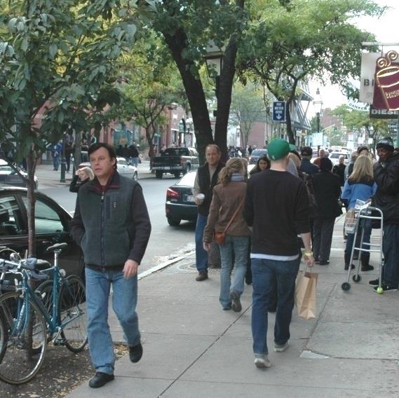


11 Streets define the character of neighborhoods and are the common ground where people travel, meet and do business on a daily basis.

12 Complete Streets


13 Complete Streets

14 Complete Streets
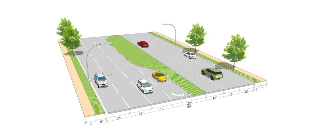
15 Existing
16 Proposed

17 Complete Streets

18 Complete Streets


19 Tactical Urbanism

20 Tactical Urbanism

21 Tactical Urbanism
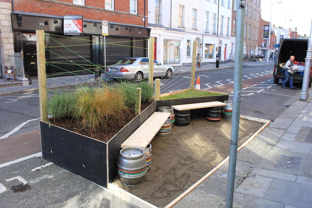

22 Parklet
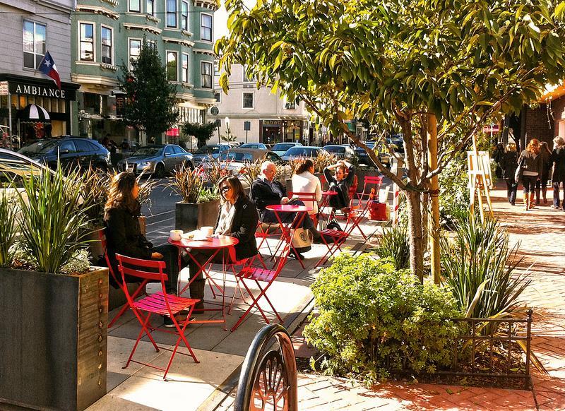
23 Parklet
24 Landscape Architecture & Transportation

25 Rails to Trails


26 Rails to Trails


27 Rails to Trails

28 Rails to Trails
29 Landscape Architecture & Transportation

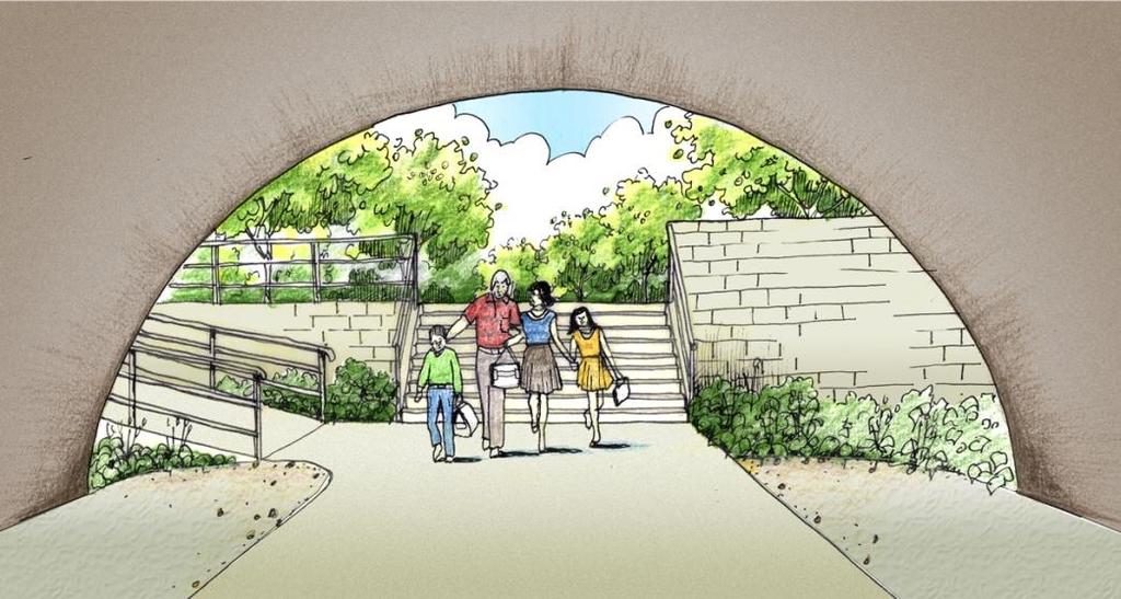
30 Underpasses

31 Underpasses

32 Underpasses
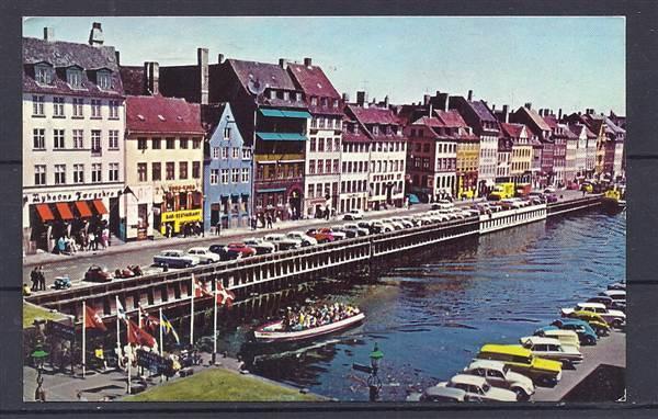
33 Waterways
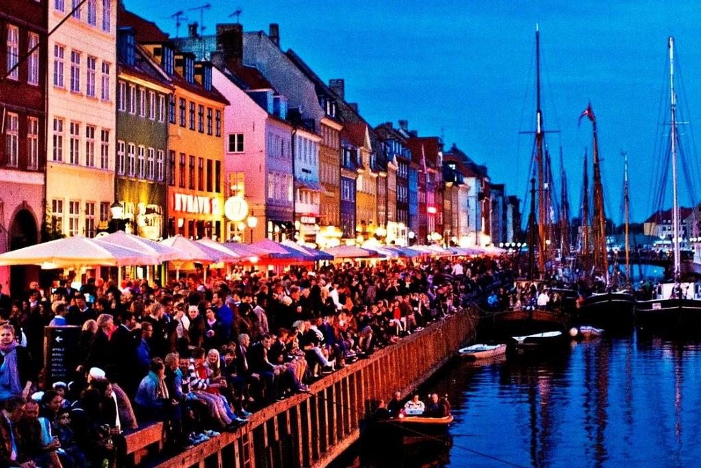

34 Waterways
35 Waterways

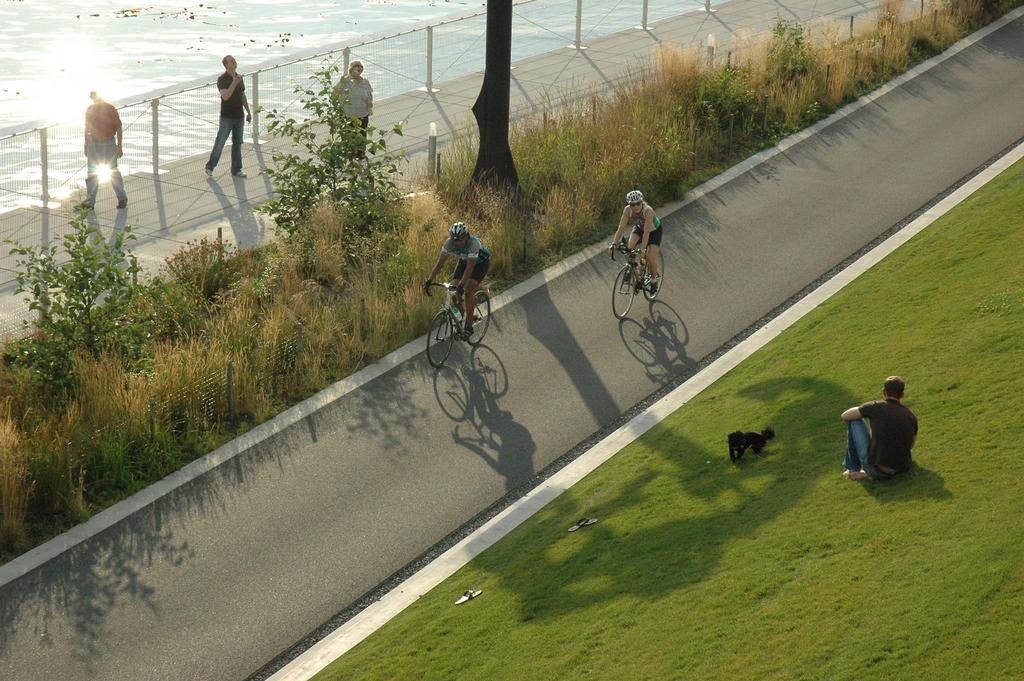
36 Transportation for All


37 John Dempsey, PLA

38

39

40

41

42

43

44

45

46

47

48

49

50


51 After Before

52

53


54 Structural Soil CU Specification Provide minimum 40% porosity beneath hard surfaces with light or stationary loading. Structural Cells For applications beneath hard surfaces with heavy and moving traffic.
55

56

57
58

59

60
61

62

63


64 Over Under Through obstacles to multi-modal transportation facilities William Collins, RLA, VP

65 Types of obstacles X Physical X Costs / funding X Bureaucratic X Nimbys X Friends

66 Types of structural solutions for trail / pedestrian / non-motor vehicle facilities Bridges Underpasses At-grade crossings Tunnels Road diets
67 Landscape Architecture services Master planning Defining the program Funding development Partnership negotiation Site design Structure / bridge architecture
68 Over


69 OVER Tohickon Aqueduct Delaware Canal National Landmark Delaware Canal State Park Point Pleasant, Bucks County Rehabilitate historic transportation resource

70 Obstacles: Tohickon Aqueduct X Physical X Costs X Bureaucratic X Friends Strategies: Modern timber structure Traditional bridge truss system Innovative materials, reuse stone Alternative funding partners

71 Tohickon Aqueduct LA Services Historic research, concept design Substructure schematics, materials specs Bridge architecture, documentation Funding strategy, grant applications Community consultant
 Funding Partners Tohickon Aqueduct PennDOT Enhancements")

72 Budget: $2.1 M (Construction) Funding Partners Tohickon Aqueduct PennDOT Enhancements USDA Forest Service Commonwealth of Pennsylvania Awards 1 st Place - National Timber Bridge, 2002 Honor - ASLA PA/DE Chapter, 2003 Honorable Mention - National Rail-Trail, 2003 Design Excellence - Central Bucks AIA, 2002

73 OVER Obstacles: X Physical X Nimbys X Bureaucratic Solebury Township, Bucks County Strategies: Canal Park Bridge Delaware Canal National Landmark Delaware Canal State Park Create new bridge over the canal Modern steel structure customize pre-fab Mimic iconic traditional Camelback truss Justify impacts to the Landmark


74 Traditional 1831 design Canal Park Bridge New 2009 design


75 Canal Park Bridge LA Services Master planning, historic research Funding strategy, grant applications

76 Canal Park Bridge LA Services Structure simulations, park and trail design

77 Canal Park Bridge Ramps would total 4 times the bridge length LA Services ADA alternatives analyses Compliance justification to SHPO

78 Canal Park Bridge LA Services Bridge architecture, specifications Design collaboration with engineer

79 Canal Park Bridge $150,000 Construction Funding DRJTBC Township Partner DCNR NIMBYs now use the bridge

80 OVER Kings Covered Bridge Rehabilitate historic transportation structure Middlecreek Township, Somerset County Obstacles: X Physical X Costs X Bureaucratic Eligible for the National Historic Register
 LA Services After")

81 Kings Covered Bridge Before (stabilized) LA Services After restored Funding strategy Prime consultant to PennDOT Bridge architecture, site design
 After")

82 Kings Covered Bridge Before (Stabilized) After Rehabilitated Acquired by non-profit from private owners for rehabilitation

83 $90,000 Stabilization $0.865 M Rehabilitation Funding Partners PennDOT Enhancements $ FHWA National Covered Bridge Commonwealth of PA Somerset County US Forest Service Awards Modjeski - Preservation PA, 2008 Kings Covered Bridge
 at interchange of PA Turnpike NE")
84 Forty Foot Road Pedestrian Bridge OVER Build new pedestrian bridge over state highway Towamencin Township Montgomery County Obstacles: X Physical X Costs X Bureaucratic X Nimbys State Route 63 (Forty Foot Road) at interchange of PA Turnpike NE Extension


85 Forty Foot Road Pedestrian Bridge called the bridge to nowhere by opponents Strategies: Create walkable community Depress highway horizontally Create mid-block, non-motorized bridge Design context sensitive civic icon Bridge location


86 Forty Foot Road Pedestrian Bridge Initial Ultimate Economic studies informed highway design
87 Forty Foot Road Pedestrian Bridge LA Services Town Center Recreation Plan Concept depress and span highway Bridge design, TC zoning overlay Alternative alignment analyses


88 Art Deco motif integrated into structure Forty Foot Road Pedestrian Bridge Cloistered pedestrian environment on deck


89 Forty Foot Road Pedestrian Bridge Bridge as a landscape structure Feature concrete as a sculptural material
90 $1M Bridge $13M Roadway Funding Partners PennDOT / FHWA Towamencin Twp Awards Forty Foot Road Pedestrian Bridge National Concrete Bridge - PCA, 2008 Project of the Year - ASHE, 2008 Merit - ASLA PA/DE, 2009
91 Under


92 Pottstown Pedestrian Underpass UNDER Create pedestrian thoroughfare under active railroad Pottstown, Montgomery County

93 Pottstown Pedestrian Underpass Obstacles: X Physical X Costs X Bureaucratic Strategies: Adaptively reuse former millrace under active railroad Create safe pedestrian link from town center to regional trail Connect two halves of college campus


94 Pottstown Pedestrian Underpass Before After Concept


95 Pottstown Pedestrian Underpass LA Services Park master plans, funding strategy Underpass architecture, site design Compliance justification to SHPO

96 Pottstown Pedestrian Underpass $1.08 M Rehabilitation Funding Partners PennDOT TE $ PA DCNR Montgomery County Awards Revitalization - MCPC, 2008 Project of the Year - ASHE, 2008
97 Through


98 THROUGH Minisink Greenway Trail Create pedestrian walkway thru existing overpass Smithfield Township Monroe County I-80 Link between Appalachian Trail NPS McDade Trail


99 Obstacles: Minisink Greenway Trail X Physical X Costs X Bureaucratic X Friends Before After


100 Before Minisink Greenway Trail After LA Services Trail plan, funding strategy, grant application Thoroughfare / trail design / documentation PennDOT negotiation


101 Minisink Greenway Trail Concept Built


102 3-foot sidewalk = 11 years Minisink Greenway Trail

103 $0.8 M Rehabilitation Minisink Greenway Trail Funding Partners DRJTBC Commonwealth of PA Client Smithfield Township
104 THROUGH Solebury Route 32 Trail Obstacles: X Physical Solebury Township Bucks County X Costs X Bureaucratic Retire a lane of the state scenic highway for a new bike trail
105 Solebury Gateway Trail Existing Proposed Strategies: Road diet, stormwater bioswale, trail


106 $1.9 M Total Project Funding Partners DRJTBC Solebury Township PennDOT PA DCNR PA DCED Solebury Gateway Trail LA Services Concept strategy / funding strategy Grant applications, site design


107 THROUGH Big Savage Tunnel Rehabilitate former railroad tunnel for interstate trail Mason Dixon Line Somerset County * Great Allegheny Passage (GAP)

108 Big Savage Tunnel Obstacles: X Physical X Costs Strategies: Analyze alternative routes Rehabilitate former RR structure


109 THROUGH Big Savage Tunnel Completed new liner, drainage, lighting, doors, trail


110 $12 M - Rehabilitation Big Savage Tunnel Funding Partners Commonwealth of PA National Park Service Allegheny Trail Alliance USDA Forest Service Somerset County
111 Thank you Contact Brian J. Laverty John Dempsey Stephen Luoni William Collins
112
Potential Green Infrastructure Strategies May 6, 2015 Workshop
 Potential Green Infrastructure Strategies May 6, 2015 Workshop Background The City of Cortland is developing the Tioughnioga Urban Headwaters Green Infrastructure Action Plan with funding from the National
Project Status. Construction is underway for Phase 3. Overall Project Area and Schedule. Schedule of Current Construction Phases.
 I-95 Avenue Interchange Project Status Construction is underway for Phase 3. Overall Project Area and Schedule Phase 0: Completed 2010 Section GR0: Completed in Fallin 2010 Phase 2: Completed Section GR2:
Tricia Millington, RLA New York State Department of Transportation
 Tricia Millington, RLA New York State Department of Transportation pmillington@dot.state.ny.us Context Sensitive Principles: Context Sensitive Solutions is a philosophy wherein safe transportation solutions
Transportation. Strategies for Action
 Transportation A major priority for the Overlake Neighborhood is to develop a multimodal transportation system. To achieve this system, a balance has to be found among travel, circulation and access needs;
FY STATEWIDE TRANSPORTATION IMPROVEMENT PROGRAM New Jersey Department of Transportation Projects
 69th Street Bridge 02311 02311 A grade separation at 69th Street would eliminate the current at-grade crossing which causes frequent automobile delays due to long freight trains moving through this area.
Highway & Bridge Capabilities
 Highway & Bridge Capabilities Part of a diversified family of solutions www.jmt.com An Employee Owned Company I-95/I-295/I-495 Interchange, Woodrow Wilson Memorial Bridge, Prince George s County, MD Our
National Register of Historic Places Continuation Sheet
 NPS Form 10-900-a (Rev. 8/2002) OMB No. 1024-0018 (Expires 5-31-2012) United States Department of the Interior National Park Service National Register of Historic Places Continuation Sheet Bridge No. 5721
This page left intentionally blank.
 July 2012 This page left intentionally blank. Table of Contents Appendix A : Project Development Checklist Appendix B: At-Grade Rail Crossings Appendix C: Maintenance and Operations Examples Appendix D:
Table L-1 Summary Action Strategy. Action Item Timing Status Responsible Agency
 CHAPTER 4: CIRCULATION ELEMENT ISSUE #1: MAJOR THOROUFARES AND TRANSPORTATION ROUTES A balanced transportation system for Fontana is provided that meets the mobility needs of current and future residents
APOLLO BEACH COMMUNITY PLAN Comprehensive Plan Amendment
 APOLLO BEACH COMMUNITY PLAN Comprehensive Plan Amendment I. Introduction Apollo Beach is a thriving Hillsborough County community located approximately 12 miles southeast of Tampa between Gibsonton and
PREVIOUS PUBLIC PARTICIPATION BRIEF October 2014
 Comprehensive Planning During the development of the county comprehensive plan, Cultivating Community: A Plan for Union County s Future from 2007 through 2009, and three concurrent multi municipal plans
The transportation system in a community is an
 7 TRANSPORTATION The transportation system in a community is an important factor contributing to the quality of life of the residents. Without a sound transportation system to bring both goods and patrons
Mississippi Skyway Preliminary Engineering Report
 EXECUTIVE SUMMARY Mississippi Skyway Preliminary Engineering Report CITY OF RAMSEY, MINNESOTA DECEMBER 2014 City of RAMSEY EXECUTIVE SUMMARY Project Need and Intent The Mississippi Skyway pedestrian bridge
San Francisco Bay Pilot: Sausal Creek Community Leader Charrette May 11, 2016 Marcus Griswold
 San Francisco Bay Pilot: Sausal Creek Community Leader Charrette May 11, 2016 Marcus Griswold 1 Overview Project Overview Watershed Context Assets and Challenges Opportunities Green Streets Creek Access
2014 PSPE Philadelphia Chapter Outstanding Engineering Achievement Award Nomination
 2014 PSPE Philadelphia Chapter Outstanding Engineering Achievement Award Nomination Route 29 Roadway Improvement Project SR 0029, Section AL2 Charlestown Township, Chester County, PA Nomination Form Route
The Lower SaLuda Greenway
 The Lower SaLuda Greenway InITIaTIve a FLourIShInG Greenway. a hub For economic GrowTh. a ConneCTIon BeTween CoMMunITIeS. In April 2017 the Michael J. Mungo Foundation and Lexington County commissioned
NORTH CLAYMONT AREA MASTER PLAN COMMUNITY WORKSHOP #1 FEBRUARY 3, 2016
 NORTH CLAYMONT AREA MASTER PLAN COMMUNITY WORKSHOP #1 FEBRUARY 3, 2016 1. Introduction To the team and to the Plan Planning Partners The Claymont Community WILMAPCO New Castle County Claymont Renaissance
Northwest Rail Corridor and US 36 BRT Development Oriented Transit Analysis 4.4 STATION AREA FINDINGS
 4.4 STATION AREA FINDINGS Each station is different, and each one requires a separate set of recommendations based on the vision for the site. This section outlines an initial TOD strategy and recommendations
To qualify for federal Transportation Enhancement (TE) funds a project must meet two basic federal requirements:
 funds a project must meet two basic federal requirements:") Eligibility Requirements To qualify for federal Transportation Enhancement (TE) funds a project must meet two basic federal requirements: 1) Relate to surface transportation and 2) Be one of the 12 designated
Eligibility Requirements To qualify for federal Transportation Enhancement (TE) funds a project must meet two basic federal requirements: 1) Relate to surface transportation and 2) Be one of the 12 designated
HISTORIC BRIDGES IN CRAWFORD COUNTY. Bridges Listed on the National Register of Historic Places in Crawford County
 Arkansas State Highway and Transportation Department HISTORIC BRIDGES IN CRAWFORD COUNTY Bridges Listed on the National Register of Historic Places in Crawford County 2004 Arkansas State Highway and Transportation
MINNESOTA ARCHITECTURE - HISTORY INVENTORY FORM
 Identification Historic Name Dean Parkway Bridge Current Name Bridge 90661 Field # Address Midtown Greenway over Dean Parkway City/Twp Minneapolis County Hennepin Legal Desc. Twp 29N Range 24W Sec 32 QQ
RE: Comments on the Environmental Notification Form (ENF) for the I 90 Allston Interchange Project MEPA #15278
 for the I 90 Allston Interchange Project MEPA #15278") December5,2014 SecretaryMaeveVallelyBartlett ExecutiveOfficeofEnergyandEnvironmentalAffairs(EEA) 100CambridgeSt.,Suite900 BostonMA02114 RE:CommentsontheEnvironmentalNotificationForm(ENF)fortheI 90AllstonInterchangeProject
December5,2014 SecretaryMaeveVallelyBartlett ExecutiveOfficeofEnergyandEnvironmentalAffairs(EEA) 100CambridgeSt.,Suite900 BostonMA02114 RE:CommentsontheEnvironmentalNotificationForm(ENF)fortheI 90AllstonInterchangeProject
Division Street in Portland. Division Green Street / Main Street
 Division Green Street / Main Street Division Street in Portland Putting People in the Process Division Corridor Concept Emphasis on Sustainability and Green development Division Corridor Concept Reuniting
Table of Contents. Elm Avenue Improvement Plan City of Waco, Texas. Introduction 1. Existing Context 1 Figure 1 2.
 Table of Contents Introduction 1 Existing Context 1 Figure 1 2 Plan Guidelines 3 Future Urban Form 4 The West-End 4 Main Street 6 The East-End 7 Figure 2 9 Public Improvement Recommendations 7 General
BACKGROUND, GOALS, STUDY AREA, EVALUATION CRITERIA, ORGANIZATION
 CHAPTER 1 BACKGROUND, GOALS, STUDY AREA, EVALUATION CRITERIA, ORGANIZATION 1.0 INTRODUCTION The Executive Office of Transportation and Public Works Office of Transportation Planning (Planning) initiated
DRAFT ROOSEVELT ROAD. District Recommendations. Figure 5.23 The Roosevelt Road Corridor
 CHAPTER 5 Figure 5.23 The Road Corridor Road will develop as a mixed-use corridor, emphasizing regional retail, west of the river and mixed-use development east of the river. KEY RECOMMENDATIONS 1. High
A BLUEPRINT FOR BROCKTON A CITY-WIDE COMPREHENSIVE PLAN
 A BLUEPRINT FOR BROCKTON A CITY-WIDE COMPREHENSIVE PLAN Public Meeting October 2016 1 Plan Summary and Discussion Public Meeting May 4 2017 City of Brockton Bill Carpenter, Mayor Department of Planning
I-70/71 Innerbelt Project
 I-70/71 Innerbelt Project Project Progress Meeting and Design Enhancement Update November 9, 2009 Ohio Department of Transportation MS Consultants MSI Design Overview of Presentation 1. Recap Recent Project
Open House RIVER DES PERES GREENWAY: LANSDOWNE SHREWSBURY METROLINK TO FRANCIS R. SLAY PARK
 Open House 10.12.16 RIVER DES PERES GREENWAY: LANSDOWNE SHREWSBURY METROLINK TO FRANCIS R. SLAY PARK MEETING AGENDA Great Rivers Greenway and Project Partners River des Peres Greenway Overview Project
National Association of Recreation Resource Planners Conference
 DEVELOP INTERPRET RESTORE National Association of Recreation Resource Planners Conference Pittsburgh-to-Harrisburg Main Line Canal Greenway new connections between old neighbors Learning Objectives By
Meeting Agenda. 1. Introductions (5 min)
") Meeting Agenda Monaca, PA Ohio River Brownfields Redevelopment Planning Federal/State/Regional Partners Meeting June 5, 2012; 3-4pm EDT Conference call-in #: 1-866-299-3188 Conference code: 202 566 0633#
Meeting Agenda Monaca, PA Ohio River Brownfields Redevelopment Planning Federal/State/Regional Partners Meeting June 5, 2012; 3-4pm EDT Conference call-in #: 1-866-299-3188 Conference code: 202 566 0633#
S T V. P E R F O R M A N C E M A T T E R S. highways + bridges
 S T V. P E R F O R M A N C E M A T T E R S. highways + bridges STV s bridge and highway assignments traverse major metropolitan areas, cities and towns as well as rural corridors. Reflecting the tenets
Regional and Local Perspectives
 Regional and Local Perspectives Transportation Engineering and Safety Conference Tom Zilla Principal Transportation Planner Centre County Metropolitan Planning Organization We are here! We are here! 1
VILLAGE & TOWN OF BERGEN: COMPREHENSIVE PLAN
 VILLAGE & TOWN OF BERGEN: COMPREHENSIVE PLAN CPC Public Hearing April 21, 2016 History 1996 Comprehensive Plan Comprehensive Plan Update Committee Consultant (LaBella Associates): December 2014 Residents
Philadelphia Trail Master Plan
 Philadelphia Trail Master Plan Jeannette Brugger, AICP Philadelphia City Planning Commission April 30, 2013 Delaware Valley Regional Planning Commission 190 N. Independence Mall West, 8 th Floor Philadelphia2035
St. Louis Engineering and Transportation Services
 St. Louis Engineering and Transportation Services Amec Foster Wheeler s St. Louis office, with over 80 professional and support personnel, provides excellence in engineering and professional consulting
Proposed FY 2004 TRANSPORTATION CAPITAL PROGRAM New Jersey Department of Transportation Projects
 Carteret Industrial Road 98547 This project will address the upgrade of Carteret Industrial Road. The federal Transportation Equity Act for the 21st Century (TEA-21) provided funding for this project under
Chapter 7: Streetscape & Design Elements
 OVERVIEW Chapter 7: Streetscape & Design Elements During the public input phase of The Dixie Fix, the area of streetscape generated much interest. While safety and traffic flow are primary objectives of
Illustration of Eastlake Farmer s Cooperative Grain Elevator. Chapter 5: implementation 5-1
 Illustration of Eastlake Farmer s Cooperative Grain Elevator Chapter 5: implementation 5-1 chapter 5: implementation Introduction The Eastlake Subarea Plan includes a wide range of recommendations intended
TOWN COUNCIL / PLANNING COMMISSION
 Workshop #3 TOWN COUNCIL / PLANNING COMMISSION January 20, 2011 Consultant Team In Attendance Tonight BMS Design Group Nevada City and San Francisco Michael Smiley, AICP, ASLA Partner-in-Charge Nancy L.
COMMUNICATION URBAN DESIGN REVIEW BOARD CITY OF DES MOINES, IOWA MAY 16, 2017 MEETING
 COMMUNICATION URBAN DESIGN REVIEW BOARD CITY OF DES MOINES, IOWA MAY 16, 2017 MEETING Subject: Recommendation Prepared by: PRELIMINARY DESIGN REVIEW OF LOCUST STREET BRIDGE CONSTRUCTION & COURT AVENUE,
Corridor Enhancements
 Corridor Enhancements Safety is MoDOT s first priority in widening and rebuilding I-70 across the state of Missouri. MoDOT also understands that the interstate - and its interchanges and overpasses - are
PUBLIC RIGHT-OF-WAY IN THIS CHAPTER PUBLIC REALM
 PUBLIC RIGHT-OF-WAY This section provides design guidelines for improvements in the public right-of-way. The public right-of-way refers to streets, sidewalks, non-vehicular thoroughfares, parks and greenways
FY STATEWIDE TRANSPORTATION IMPROVEMENT PROGRAM New Jersey Department of Transportation Projects
 ROUTE/ Project ID No. TIP No. Burlington County Computerized Signal Control, IV D9911 D9911 This ITS project will be a traffic responsive signal system, consisting of 24 intersections--9 on CR 607, 4 on
This page intentionally blank.
 This page intentionally blank. Parks, Recreation, and Open Space Chapter Relationship to Vision Vision Parks, Recreation and Open Space Chapter Concepts County Government. County government that is accountable
Implementation Guide Comprehensive Plan City of Allen
 Implementation Guide 2030 Comprehensive Plan City of Allen DRAFT 2015 Implementation Guide Allen 2030 Comprehensive Plan INTRODUCTION The Comprehensive Plan serves as a guide for the growth and development
III - design standards
 III - design standards The Circulation Classification and Character section of the Design Standards chapter prescribes the types of circulation routes, the location of the circulation routes, the connections
Grand Rounds History
 Grand Rounds History 1883 Plan for Minneapolis Park System prepared by Landscape Architect Horace W. S. Cleveland. The system of connecting parks and parkways was first called the Grand Rounds by William
St. Anthony Parkway Bridge Over Northtown Yard Project S.P. No
 St. Anthony Parkway Bridge Over Northtown Yard Project S.P. No. 141-454-01 Questions & comments made by attendees during the Public Meeting held on April 9, 2013. How will the existing bridge be removed
Historic Bridge Adoption Information Packet
 Historic Bridge Adoption Information Packet Falls County CR 179 over Big Elm Creek Bridge October 2017 Table of Contents Announcement... 3 Bridge Location... 4 Bridge Information... 4 Bridge Condition
Subarea 5 Southern Gateway. Vision. Mobility The proposed street network will create developable blocks that are scaled appropriately for the area.
 southern gateway 194 Southern Gateway extends south of I-435 to 123 rd Street and includes the area past the Blue Valley Parkway division. This area is adjacent to major office centers such as the College
Route 347. New York State Department of Transportation Region 10, Long Island. THE GREENING of ROUTE 347
 The GREENING of Route 347 The Greening of Route 347 The Greening of Route 347: History 3 The Greening of Route 347 4 The Greening of Route 347 5 The Greening of Route 347 Smith Haven Mall 6 The Greening
LOCATION AND DESIGN DIVISION
 VIRGINIA DEPARTMENT OF TRANSPORTATION LOCATION AND DESIGN DIVISION INSTRUCTIONAL AND INFORMATIONAL MEMORANDUM GENERAL SUBJECT: Landscape Architecture Program NUMBER: SPECIFIC SUBJECT: Integration of Landscape
 Health Sciences City The available land area, although limited, combined with the unique partnership between the primary institutions and the supporting partnerships of the development interests within
Recreational Pathway Crossing of Richmond Street Municipal Class Environmental Assessment. Public Information Centre #2 April 22, 2015
 Recreational Pathway Crossing of Richmond Street Municipal Class Environmental Assessment Public Information Centre #2 April 22, 2015 1. Study Process PHASE 1 PHASE 2 PHASE 3 PHASE 1 : Problem/Opportunity
SMEDLEY TRACT MASTER SITE PLAN Draft Master Plan Presentation
 SMEDLEY TRACT MASTER SITE PLAN Draft Master Plan Presentation Public Meeting #3 03.16.2010 Middletown Township, Pennsylvania MEETING AGENDA Project Schedule Site Analysis Site Concepts Draft Master Site
AASHTO SUBCOMMITTEE ON DESIGN. June 15, 2006 MARK ROBINSON, P.E. DISTRICT 5 INTERSTATE PROGRAM MANAGER FLORIDA DEPARTMENT OF TRANSPORTATION
 AASHTO SUBCOMMITTEE ON DESIGN June 15, 2006 MARK ROBINSON, P.E. DISTRICT 5 INTERSTATE PROGRAM MANAGER FLORIDA DEPARTMENT OF TRANSPORTATION CENTRAL FLORIDA INTERSTATE 4 FACTS Trucks and Others 12% Tourist
ROBBINSDALE LRT STATION CDI DEVELOPMENT GUIDELINES
 August 2018 OVERVIEW The City of Robbinsdale has a prime-opportunity site in the middle of the 13 mile stretch of the Bottineau LRT corridor / Blue Line extension. Robbinsdale offers a prominent, vital,
Rapid Bridge Replacem ent Project
 Rapid Bridge Replacem ent Project Construction Update NEARLY 300 BRIDGES SLATED FOR REPLACEMENT IN 2017 The Rapid Bridge Replacement Project originated in 2013 when PennDOT was challenged by an aging,
V. Gateways GATEWAYS / V-1
 V. GATEWAYS / V-1 Many of Chesapeake s gateways are located on highways and call for bold and attractive designs that motorists can understand, appreciate, and enjoy. can also take the form of natural
Preservation: Why Not In Pennsylvania? Presented By: Nathan Holth
 Preservation: Why Not In Pennsylvania? Presented By: Nathan Holth PA Preservation Barriers Why Not Pennsylvania? Pennsylvania has an unrivaled collection of historic bridges, particularly metal truss bridges,
Secrest Short Cut and Monroe Expressway Small Area Plan AUGUST 29, 2018
 Secrest Short Cut and Monroe Expressway Small Area Plan AUGUST 29, 2018 Background and Process Monroe Expressway will be open by the end of 2018 Union County and Indian Trail identified a need to revisit
Seneca Meadows. Block 4 Locate office, technology, and medical development adjacent to I Screen views of garage structures from I-270.
 Seneca Meadows Seneca Meadows has an industrial park in its southern end and a mixed-use employment area planned for the north end. The district benefits from extensive I-270 visibility, stream valley
Turkey Creek Streamway Corridor
 Turkey Creek Streamway Corridor Turkey Creek Corridor Overview History Watershed Corridor Inventory Coalition Corridor Plan Stages of Development Benefits Funding Turkey Creek History Kansas and Missouri
Corridor Vision. 1Pursue Minnehaha-Hiawatha Community Works Project. Mission of Hennepin County Community Works Program
 1Pursue Minnehaha-Hiawatha Community Works Project Minnehaha-Hiawatha Community Works is a project within the Hennepin Community Works (HCW) program. The mission of the HCW program is to enhance how the
Supporting our communities. Bridges
 Supporting our communities Bridges 1,000+ We ve partnered with thousands of owners/clients to inspect, analyze, design, and manage their bridges, providing lasting community connections. We design bridges
Preface. Erie. Scranton. Allentown. Pittsburgh. Harrisburg. Philadelphia
 The Southern Alleghenies Region The Southern Alleghenies Region spans the Laurel Highlands and Allegheny Front in the west across the Appalachians to the east. It is comprised of Blair, Bedford, Cambria,
Fall 2017 Construction Update
 Fall 2017 Construction Update Ward 4 Southeast Engineering Department Riverwalk Red Multi-Use Trail Bridge Rehabilitation The Riverwalk Red Multi Use Trail Bridge was awarded to Cramer and Associates,
RE-Imagining the Downtown Colorado Springs Master Plan
 RE-Imagining the Downtown Colorado Springs Master Plan 2016 APA Colorado State Conference October 25, 2016 Overview 8:00 Welcome, Introductions, and Overview 8:15 Downtown s Planning History 8:30 A Market
REHABILITATION FEASIBILITY STUDY ER#
 REHABILITATION FEASIBILITY STUDY MILLER FARM ROAD BRIDGE PROJECT VENANGO COUNTY BRIDGE NO. 34 CARRYING S.R. 7212, SECTION L00 OVER OIL CREEK OIL CREEK AND CHERRYTREE TOWNSHIPS VENANGO COUNTY, PENNSYLVANIA
Whitemarsh Comprehensive Plan Update: Housing & Land Use. Public Workshop #3: September 20, 2018
 Whitemarsh Comprehensive Plan Update: Housing & Land Use Public Workshop #3: September 20, 2018 Agenda Welcome Process Recap What We ve Heard The Plan Framework Review of Recommended Actions Land Use Housing
AGENDA ACTION ITEMS INFORMATION ITEMS
 NOACA Bicycle and Pedestrian Advisory Council Meeting Friday, March 21 st, 2014 10:30 a.m. NOACA Office 1299 Superior Avenue Cleveland, Ohio 44114 Phone: (216) 241-2414; website: www.noaca.org AGENDA ACTION
Public Comments on Draft Plan Fall, 2014 Montco 2040: A Shared Vision Steering Committee
 s on Draft Plan Fall, 2014 Montco 2040: A Shared Vision Steering Committee The comments from the public, the Steering Committee, and the MCPC Board are listed below under the goal or vision area that is
Existing Transportation System 5-1
 5-1 The Jackson County transportation system is served by several modes of transportation including streets and highways, multi-modal, non-motorized, rail, and aviation. While the focus of the transportation
Parapet/Formliner/Fencing
 Parapet/Formliner/Fencing Cross Parapet/Formliner/Fencing Street Aesthetic Features Context The I-290 Phase I study is evaluating improvements along 13 miles of the Eisenhower Expressway, from west of
APPENDIX D: Visual and Aesthetic Conditions for NCCU Station Refinement. Durham-Orange Light Rail Transit Project
 APPENDIX D: Visual and Aesthetic Conditions for NCCU Station Refinement Durham-Orange Light Rail Transit Project October 2016 1. Introduction The Combined FEIS/ROD summarizes the effects of the D-O LRT
In Development By: IRON TO ARTS CORRIDOR August 10, 2018
 In Development By: IRON TO ARTS CORRIDOR August 10, 2018 The Iron to Arts Corridor is an expansive project that encompasses infrastructure improvements, landscape architecture, streetscape beautification,
Classroom Science Building
 Classroom Science Building Public Realm Presented by: Gary Branville, Joe Moore, Justin Rechtzigel, Tom Roth & Hailey Wall Proposal Objective: To create a node on the Grand Rounds Parkway Connect the public
Welcome to the. Open House
 Welcome to the 5th Street to Kinsman Road Open House November 14 5:30 7:00 p.m. Please sign in Project Overview In December 2016, City Council adopted SW 5th Street as the preferred alignment to connect
TOWN OF JUPITER. Honorable Mayor and Members of Town Council Andrew D. Lukasik, Town Manager
 DATE: June 07, 2016 TO: THRU: TOWN OF JUPITER Honorable Mayor and Members of Town Council Andrew D. Lukasik, Town Manager FROM: Thomas V. Driscoll, P.E., Director of Engineering, Parks & Public Works SUBJECT:
PROTECT AND PROMOTE QUALITY OF LIFE AND LIVABILITY FOR THE CITIZENS OF GAINESVILLE THROUGH QUALITY URBAN DESIGN.
 Goals, & Urban Design Element PROTECT AND PROMOTE QUALITY OF LIFE AND LIVABILITY FOR THE CITIZENS OF GAINESVILLE THROUGH QUALITY URBAN DESIGN. GOAL 1 By 2003, the City shall adopt urban design standards
DOMINION BOULEVARD CORRIDOR STUDY AND ECONOMIC DEVELOPMENT STRATEGIC PLAN A MODEL FOR CHESAPEAKE S FUTURE
 DOMINION BOULEVARD CORRIDOR STUDY AND ECONOMIC DEVELOPMENT STRATEGIC PLAN A MODEL FOR CHESAPEAKE S FUTURE Overview I. Draft Plan Process II. Draft Plan Overview a. Market Analysis b. Master Land Use Plan
Delaware River Waterfront Corporation
 Delaware River Waterfront Corporation Delaware River Waterfront Corporation Created in January 2009 to replace Penn s Landing Corporation o Open, accountable, effective leadership o New Board of Directors
CHAPTER 9. Community Character
 CHAPTER 9 Community Character Chapter 9. Community Character Goal: A distinctive image that promotes the communities within Forsyth County as attractive, unique, authentic and special places. Introduction
FY STATEWIDE TRANSPORTATION IMPROVEMENT PROGRAM New Jersey Department of Transportation Projects
 Route 1&9, County Road 99380 99380 Improvements are planned at the Route 1&9, County Road intersection to address operational and safety issues in the vicinity of Manhattan Avenue and County Road. COUNTY:
The Auburn Plan Designing the Future of Auburn February 28, 2005
 The Auburn Plan Designing the Future of Auburn February 28, 2005 Block-by-Block Bicycle Tour Aerial survey Focus Group Meetings September 7 and 8 Design Workshops October 11, 14, and 21 Revitalization
FDOT D4 Complete Streets
 FDOT D4 Complete Streets Context Sensitive Solutions Directs that complete street solutions will complement the context of the community. Collaborative approach to decision making, project development,
I-70 Corridor Enhancement Plan
 i - Table of Contents Table of Contents Chapter I Overview Chapter II Bridge and Roadway Improvements Chapter III Landscape Enhancements Chapter IV Riparian Corridors Chapter V Showcase Missouri Plan Chapter
Capital Projects impacting Odenton Town Center
 Capital Projects impacting Odenton Town Center 1 2 E549700 W801600/ W801602 Anne Arundel County Department of Public Works Manor View Elementary School Transmission Main - MD 32 @ Meade Phase 2 $34,399,000
5. Father Hennepin Blufs Park and Hennepin Island Father Hennepin Bluffs Park Supporting Initiatives (see Figure 36): 7-22
: 7-22") 5. Father Hennepin Blufs Park and Hennepin Island As described in existing conditions portion of Chapter 2, Father Hennepin Blufs Park lies on the upland portion of the park and Hennepin Island spans the
5. Father Hennepin Blufs Park and Hennepin Island As described in existing conditions portion of Chapter 2, Father Hennepin Blufs Park lies on the upland portion of the park and Hennepin Island spans the
Welcome. Comprehensive Plan & Transportation Plan Open House November 7, 2012
 Welcome Comprehensive Plan & Transportation Plan Open House November 7, 2012 Agenda Proposed future land use plan Comprehensive Plan strategies Traffic forecasts Future traffic operations Possible future
Mendota Heights 2040 Comprehensive Plan Draft Vers
 4 Parks and Trails The City of Mendota Heights boasts a variety of recreational and open space opportunities. Few cities can claim access to regional trails, riverside and lakeside parks, scenic bluffs
CHAPTER 8 ISSUES, CONCERNS, CONSTRAINTS AND OPPORTUNITIES
 CHAPTER 8 ISSUES, CONCERNS, CONSTRAINTS AND OPPORTUNITIES Introduction This River Conservation Plan was developed during a time of tremendous activity and effort in planning the transformation of the Delaware
TABLE OF CONTENTS. Transportation Chapter 1 - Introduction and Purpose of Planning to 1-3. Utilities
 Chapter 1 - Introduction and Purpose of Planning... 1-1 to 1-3 Pennsylvania Municipalities Planning Code (Act 247)...1-1 Previous County Planning Activities...1-1 Objectives of the Plan...1-2 Elements
Transportation Alternatives Program (TAP) Experience
 Experience") 1 Transportation Alternatives Program (TAP) Experience McCormick Taylor is a full-service engineering firm providing creative design, planning, and environmental solutions to the challenges of everyday
1 Transportation Alternatives Program (TAP) Experience McCormick Taylor is a full-service engineering firm providing creative design, planning, and environmental solutions to the challenges of everyday
Victoria Street Pedestrian Bridge
 Township of Centre Wellington Victoria Street Pedestrian Bridge Class Environmental Assessment County of Wellington & Township of Centre Wellington Badley Bridge Replacement/Rehabilitation (County of Wellington),
Trail Feasibility and Planning Project for Northern Dutchess County, New York
 for Northern Dutchess County, New York Funded in Part by Grants from the Hudson River Valley Greenway, Land Trust Alliance Conservation Partnership Program and the Thomas Thompson Trust 1 STEERING COMMITTEE
The University District envisions, in its neighborhood
 Envisioning the University District Link Light Rail in Seattle s neighborhoods CIY OF SEALE CONCEP-LEVEL SAION AREA PLANNING RECOMMENDAION RESOLUION # 30165 EXHIBI L Vision 08.2000 he University District
Windsor Locks Transit-Oriented Development Planning Grant Request. Project Background
 Windsor Locks Transit-Oriented Development Planning Grant Request Project Background Downtown Windsor Locks runs along Main Street in the vicinity of the intersection of Routes 159 and 140. The current
Silverdale Regional Center
 Silverdale Regional Center Vision for Silverdale Regional Center The Silverdale Regional Center Plan (Plan) will guide the evolution of the Silverdale Regional Center from a collection of strip malls and