GREATER DES MOINES WATER TRAILS AND GREENWAYS PLAN
|
|
|
- Todd Hopkins
- 5 years ago
- Views:
Transcription
1 GREATER DES MOINES WATER TRAILS AND GREENWAYS PLAN A shared vision for our rivers, creeks and greenways. www. Des Moines Area MPO Iowa Department of Natural Resources

2 Iowa s First Regional Water Trails Plan
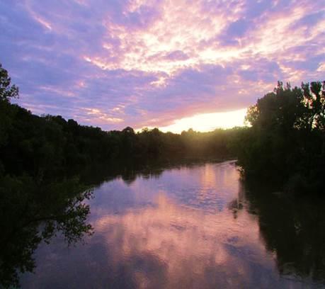
3 Water Trails & Greenways Vision: The water trails and greenways of Greater Des Moines will be a natural haven, healthy ecosystem, signature recreational destination, economic driver, and community focal point that welcome people of all ages, abilities, interests, incomes, and cultures to connect with their rivers, creeks and greenways. Mission: Ever mindful of future generations, our mission is to cooperate across political boundaries, cultures and recreational uses to accentuate and enhance the region s water trails and greenways to realize their immense potential as a multifaceted centerpiece for a vibrant and dynamic region.
4 Water Trails & Greenways: Project Phases Existing Conditions Report Complete State of the Rivers Report Vision and Goals - Complete Draft Plan Complete Master Plan Fall 2016 Public Input Major input opportunities throughout
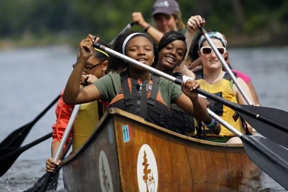
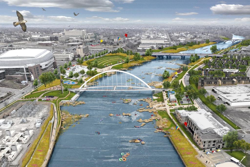
5 All this plan could include. WHAT ARE WATER TRAILS?

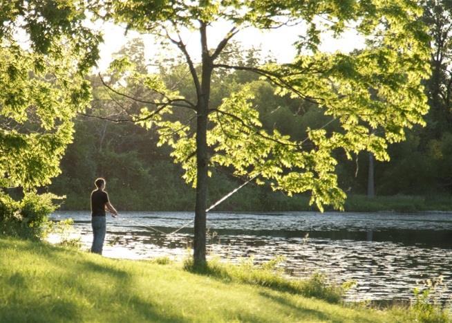
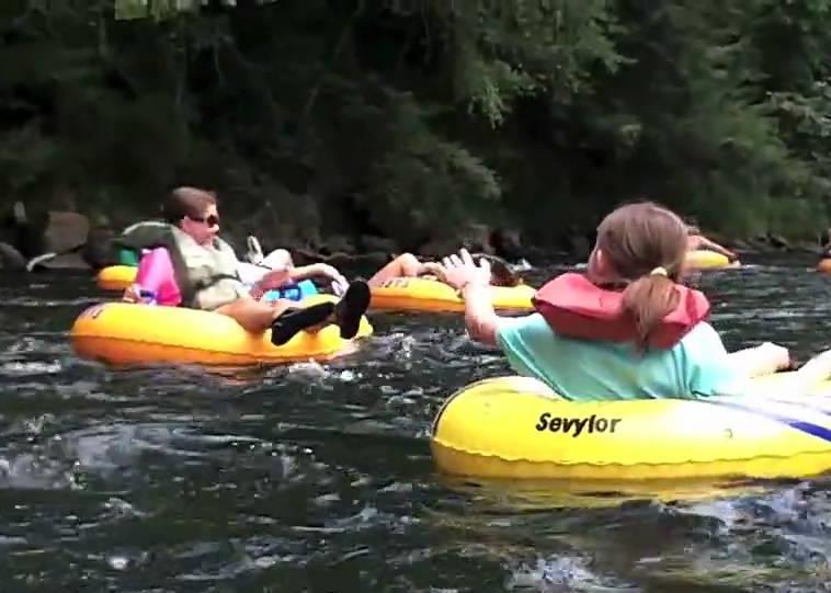
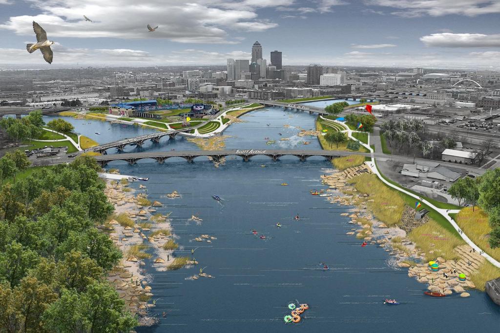
6 Variety of User Experiences
7 DRAFT WATER TRAILS & GREENWAYS PLAN
8 Organization Booklets Goals/Strategies/Policies 7 river and creek segments High level recommendations Maps Project lists Creative writing
9 Greater Des Moines Water Trails & Greenways Plan 23 soft trails 150 miles of waterways 15 fishing nodes 36% of floodplain protected 22 govts. 18 wading areas 13 paddle carry down accesses


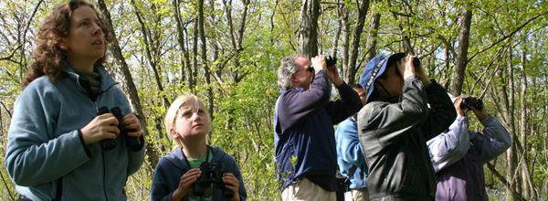
10 Public Outreach 23 focus groups 3 rounds of surveys 7 design workshops 2 Dam Debates 3 open houses

11 Raccoon River 31 miles Tale of two rivers rural and urban 24% in public ownership Multi-day paddling trips

12 Raccoon River: Van Meter to I35

13 Raccoon River: I-35 to downtown

14 Des Moines River 65 miles 41% in publically owned land along Wooded to urban to wild Most visible Sections highly used Levees

15 Des Moines River: Hwy 210 Botanical Garden
16 Des Moines River: Downtown Lake Red Rock
 Downtown Pleasant Hill (improve) Harriet Street (improve) Yellow Banks (improve) Red Rock")
 Downtown Des Moines (north side) Beaver Creek: 2 carry down Walnut Creek: 2 carry down Middle River: 2")
17 Carry-down/Drive-down Boat Access Points Des Moines River: Hwy 17 Sycamore (improve) Riverpoint Place Prospect & Birdland (improve) Downtown Pleasant Hill (improve) Harriet Street (improve) Yellow Banks (improve) Red Rock (improve) Raccoon River: Van Meter Booneville (improve) Commerce Ledges 63 rd Street (north side) Water Works Park 2 (add/improve) Downtown Des Moines (north side) Beaver Creek: 2 carry down Walnut Creek: 2 carry down Middle River: 2 carry down


 Riverpoint")

18 Economic Development Hubs Van Meter Booneville Johnston (Merle Hay Rd.) Riverpoint Place Birdland Marina/Union Park Downtown Des Moines


19 Redevelopment Hubs Re-imagine Prospect Park, Birdland Marina, Union Park, Botanical Garden Harriet Street Boat Access

20 Raccoon River Super Park Hallett Quarry Restoration Maffitt and adjoining WW property Walnut Woods Brown s Woods Raccoon River Park Water Works Park Gray s Lake Park

21 Ding Darling Regional Park Ding Darling Greenway McHenry/Riverview Park Prospect/Crocker Woods Birdland Marina/Union Park Botanical Garden
22 Des Moines River Regional Park Downtown Des Moines to Lake Red Rock


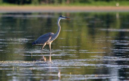
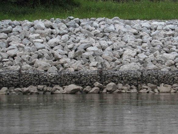
23 Des Moines, Raccoon, Middle & North Rivers Walnut and Beaver Creeks Fishing Access & Aquatic Habitat


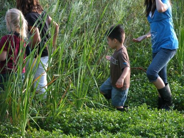
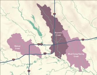
24 Des Moines, Raccoon, Middle & North Rivers Walnut, Fourmile, Mud and Beaver Creeks Wading, Discovery and Play


25 Des Moines & Raccoon Rivers Beaver, Walnut and Fourmile Creeks Trail Connections and Soft Trails Increase soft trails network Pedestrian connections from parks/trails along the river to the river


26 Des Moines & Raccoon Rivers Beaver, Walnut and Fourmile Creeks Pedal/Paddle Opportunities Creative shuttling


27 Des Moines, Raccoon and Middle Rivers, Fourmile, Beaver, Mud and Walnut Creeks Interpretation, Wayfinding, Marketing


28 Des Moines and Raccoon Rivers Beaver Creek Rentals/ Liveries

29 Programming classes and events

30 Beauty & Respite
 Dam mitigation Fish cleaning station Bcycle Hub")
31 Water Works Park Master Plan: Circuit Access points (2) Dam mitigation Fish cleaning station Bcycle Hub

32 Public Art
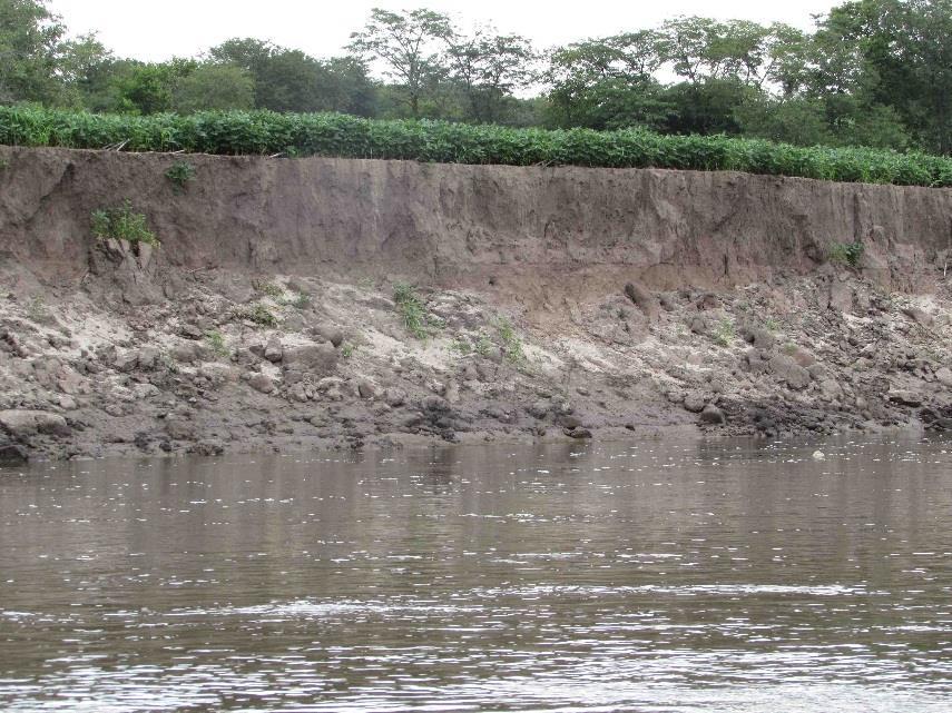
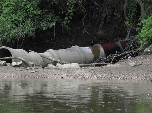
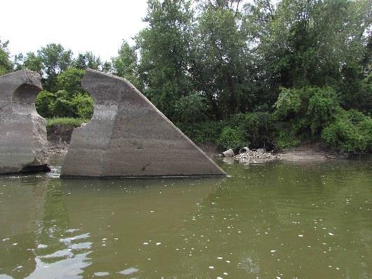
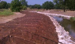
33 Shoreline Restoration & Watershed Improvements
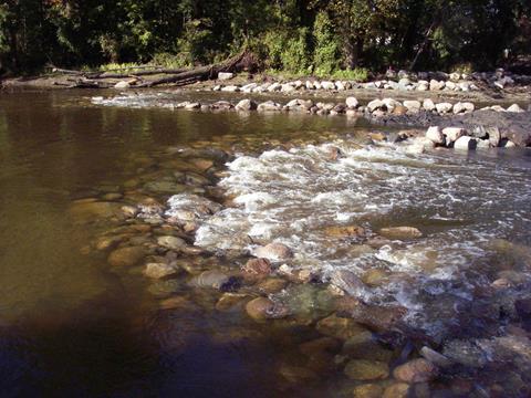
34 Shoreline Restoration & Aquatic Habitat

35 Watershed Improvements

36 Floodplain Protection 27% of Raccoon River floodplain is protected 41% of Walnut Creek floodplain is protected 1% of the North River floodplain is protected 43% of the Middle River floodplain is protected 16% of Fourmile Creek floodplain is protected 75% of Des Moines River floodplain is protected 36% of Beaver Creek floodplain is protected 1% of North River floodplain is protected


37 Maintenance: Logjams, Land Management, Flood Resilience

38 Regional Coordination & Marketing
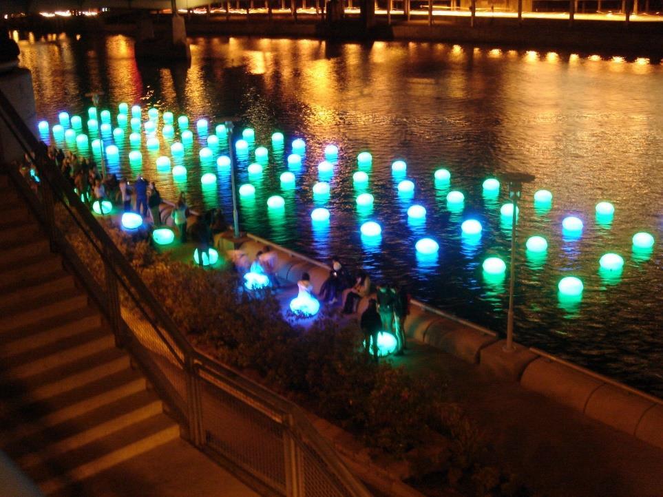
39 DOWNTOWN DES MOINES

40 Downtown Considerations Water levels: low-flow pool need to match flash board water levels Consensus: dams should be mitigated Edge treatment: more habitat, less formal Channel treatment: full spectrum of experiences Historic nature of balustrades Below dams: fishing/birding important
41
42
43 Next Steps Gather feedback this summer including feedback from council, boards, etc. MPO Board vote on final master plan fall 2016 Request each city adopt the plan Phase I Implementation
44 Lead Planner Teva Dawson WHAT DID WE MISS?
GREATER DES MOINES WATER TRAILS AND GREENWAYS PLAN
 GREATER DES MOINES WATER TRAILS AND GREENWAYS PLAN A shared vision for our rivers, creeks and greenways. www. Des Moines Area MPO Iowa Department of Natural Resources Iowa s First Regional Water Trails
A Vision for Walnut Creek
 A Vision for Walnut Creek Photo: City of Clive Walnut Creek Booklet 8 of 8 Greater Des Moines Water Trails and Greenways 1 Table of Contents Booklet 1: Water Trails Strategies and Policies Booklet 2: Beaver
MPO UPDATE. Metro Advisory Committee. August 8, 2017
 MPO UPDATE Metro Advisory Committee August 8, 2017 Iowa Data Bike 1 2 3 4 Greater Des Moines Water Trails and Greenways Master Plan MPO Strategic Plan QUESTIONS? Photo Credit: Maharry Photograpy, 2014
WILLAMETTE FALLS LEGACY PROJECT
 OPPORTUNITIES & CONSTRAINTS There are here three falls on a line of rocks extending across the river, which forms the bed of the upper channel. The water is precipitated through deep abrazed gorges, and
RIVER RECREATION AND CONSERVATION: LESSONS FROM COLORADO S 2013 FLOODS
 RIVER RECREATION AND CONSERVATION: LESSONS FROM COLORADO S 2013 FLOODS SORP RMIS May 2016 L O G A N S I M P S O N Agenda Why Are You Here? Land Use Resiliency Public Outreach Dialogue Recreation and Land
Welcome! to Keller Town Hall
 Welcome! to Keller Town Hall Keller Town Center Planning a New Downtown What is Keller Town Center? A new, growing downtown district planned as an urban village A combination of retail and office spaces,
City of Iowa City Department of Neighborhood and Development Services Department of Parks and Recreation Department of Public Works City Manager s
 RFP Pre-submittal meeting December 18, 2015 City of Iowa City Department of Neighborhood and Development Services Department of Parks and Recreation Department of Public Works City Manager s Office Background
INTRODUCING THE BALTIMORE CITY GREEN NETWORK VISION PLAN
 INTRODUCING THE BALTIMORE CITY GREEN NETWORK VISION PLAN GOALS OF THE GREEN NETWORK PLAN Protect and enhance the unique ecological resources of our city Support economic growth and sustainable redevelopment
Regional Open Space Conservation Plan. Regional Staff Committee January 18, 2018
 Regional Open Space Conservation Plan Regional Staff Committee January 18, 2018 Schedule We are here Task 1 - Stakeholder Input & Work Plan Dev. v z 2016 2017 2018 Oct Nov Dec Jan Feb Mar Apr May Jun Jul
COMMERCIAL CORRIDOR PLANNING SW 9 TH STREET CORRIDOR NE CORRIDOR MARKET DISTRICT KEO WAY CORRIDOR
 COMMERCIAL CORRIDOR PLANNING SW 9 TH STREET CORRIDOR NE CORRIDOR MARKET DISTRICT KEO WAY CORRIDOR Council Workshop July 29, 2013 SW 9 th Street Corridor Plan What is this initiative? A PUBLIC-PRIVATE pilot-partnership
edmonton.ca/ribbonofgreen #ribbonofgreen
 WHAT IS THE RIBBON OF GREEN? The Ribbon of Green is Edmonton s entire river valley and ravine system. The Ribbon of Green (2018) Project will provide strategic guidance for the southwest and northeast
THE TOMORROW PLAN TODAY 2015 Edition
 THE TOMORROW PLAN TODAY 2015 Edition Greater Des Moines is better off today in light of many people endeavoring toward the common vision of building a collaborative, vibrant and dynamic region of lasting
South Central Connecticut Region Plan of Conservation & Development 2018 Update. Municipal Planners
 South Central Connecticut Region Plan of Conservation & Development 2018 Update Municipal Planners July 28th, 2017 1 Introductions 2 Purpose of Today s Meeting Supplement data analysis with qualitative
An Ambitious Plan: Transforming the blighted South Platte River and surrounding environment into Denver s greatest natural resource.
 CONNECTING THE PEOPLE TO THEIR RIVER SOUTH PLATTE RIVER VISION IMPLEMENTATION PROGRAM: GRANT-FRONTIER PARK TO OVERLAND POND PARK REACH The South Platte River Vision Implementation Program (River Vision)
Rogue River Recreation and Access Management Plan- Table Rocks Reach. Jackson County, Oregon Department of Fish and Wildlife, National Park Service
 Rogue River Recreation and Access Management Plan- Table Rocks Reach Jackson County, Oregon Department of Fish and Wildlife, National Park Service Today s Agenda Welcome Project refresher Project status/timeline
Baselands Trails Master Plan Public Meeting. April 28, 2015 Fire Academy, 895 Eastern Avenue, Toronto 6:30 p.m. to 9:00 p.m.
 Baselands Trails Master Plan Public Meeting April 28, 2015 Fire Academy, 895 Eastern Avenue, Toronto 6:30 p.m. to 9:00 p.m. Baselands Trails Master Plan Meeting Purpose To present and get feedback on:
Ivywild On The Creek PRELIMINARY CREEK DISTRICT MASTER PLAN
 Ivywild On The Creek PRELIMINARY CREEK DISTRICT MASTER PLAN Introduction: Rejuvenating an extraordinary Creekside neighborhood THE CREEKSIDE DISTRICT The Ivywild On The Creek Neighborhood District Master
CRESCENT PARK GREENWAY VISION
 CRESCENT PARK GREENWAY VISION City of Hillsboro Trails Master Plan CRESCENT PARK GREENWAY Members of the Hillsboro community came together to determine the following vision and goals for the Crescent Park
Albion Hills Conservation Area Master Plan. Public Information Session
 Albion Hills Conservation Area Master Plan Public Information Session 1 03.25.2014 Meeting Agenda 1. Project Introduction Property History Current Use Master Plan Process 2. Draft Vision Goals and Objectives
Atlanta BeltLine. Subareas 9 & 10. Master Plan Updates. March 26, Washington Park Jamboree 1
 Atlanta BeltLine Subareas 9 & 10 Master Plan Updates March 26, 2018 Washington Park Jamboree 1 22 miles, connecting 45 neighborhoods 22 MILES of transit 46 MILES of streetscapes and complete streets 33
Urban runoff in my neighborhood (Capitol Hill) is heavy with trash and other debris.
 is heavy with trash and other debris.") South Platte River Meeting Comments & s #1 I am a huge fan of river areas and would love the Platte and surrounding waterways to improve to allow habitat for wildlife and recreation opportunities for citizens.
South Platte River Meeting Comments & s #1 I am a huge fan of river areas and would love the Platte and surrounding waterways to improve to allow habitat for wildlife and recreation opportunities for citizens.
Route 1 Corridor Study
 Route 1 Corridor Study Westbrook, Connecticut A Vision for the Connecticut Shoreline Public Informational Meeting July 28, 2015 Lower Connecticut River Valley Council of Governments Fitzgerald & Halliday,
Arkansas River Corridor
 Planning for Access Welcome to the Access Project. This project is a recreational planning effort in response to an interest by regional communities along the Arkansas River corridor. The project plan
2035 General Plan Update and Belmont Village Specific Plan. Joint Study Session with the City Council and Planning Commission April 12, 2016
 2035 General Plan Update and Belmont Village Specific Plan Joint Study with the City Council and Planning Commission April 12, 2016 Agenda 1. Welcome and Introductions 2. General Plan Update Status of
Sustainability, Health, Safety, Recreation & Open Space Working Group August 3, 2017
 Sustainability, Health, Safety, Recreation & Open Space Working Group August 3, 2017 DOWNTOWN OAKLAND SPECIFIC PLAN WELCOME Sustainability, Health, Safety, Recreation & Open Space Working Group Social
Lake O the Pines Master Plan Revision Public Information Meeting April 25 & 27, 2017
 Lake O the Pines Master Plan Revision Public Information Meeting April 25 & 27, 2017 Presented By Matthew Like, Lake Manager U.S. Army Corps of Engineers Fort Worth District US Army Corps of Engineers
2011 ASLA Design Awards. Westside Creeks Restoration Plan Merit Award AECOM, Fort Collins. Planning & Urban Design
 2011 ASLA Design Awards Westside Creeks Restoration Plan Merit Award AECOM, Fort Collins Planning & Urban Design Project Fact Sheet Category of Entry: Rotating Specialty Award: 2011 2011 ASLA Colorado
City of Peterborough Draft Official Plan 2016 Part 1 (Sections A to C) Vision and Strategic Policies
 Vision and Strategic Policies") City of Peterborough Draft Official Plan 2016 Part 1 (Sections A to C) Vision and Strategic Policies Includes Figure 2 Commercial Structure and Schedule A-1 City Structure Table of Contents A. INTRODUCTION...
City of Peterborough Draft Official Plan 2016 Part 1 (Sections A to C) Vision and Strategic Policies Includes Figure 2 Commercial Structure and Schedule A-1 City Structure Table of Contents A. INTRODUCTION...
WORKSHOP PURPOSE PERRY COMPREHENSIVE PLAN COMMUNITY WORKSHOP APRIL 4 TH, 2013 WHAT IS A COMPREHENSIVE PLAN? AGENDA
 WORKSHOP PURPOSE PERRY COMPREHENSIVE PLAN COMMUNITY WORKSHOP APRIL 4 TH, 2013 Provide background information on the Perry Comprehensive Plan Tap the expertise of the local experts (YOU!) Understand what
NORTH CLAYMONT AREA MASTER PLAN COMMUNITY WORKSHOP #1 FEBRUARY 3, 2016
 NORTH CLAYMONT AREA MASTER PLAN COMMUNITY WORKSHOP #1 FEBRUARY 3, 2016 1. Introduction To the team and to the Plan Planning Partners The Claymont Community WILMAPCO New Castle County Claymont Renaissance
DRAFT PLAN PRESENTATION
 DRAFT PLAN PRESENTATION 1.23.2018 AGENDA Process Project Schedule Results from Visioning Workshop Draft Plan Highlights Concept Plans Feedback Next Steps PROJECT SCHEDULE KICK-OFF WORKSHOP August 29 th
APPENDIX K WINDSOR OFFICIAL PLAN
 CEAA ENVIRONMENTAL ENVIRONMENTAL IMPACT ASSESSMENT AMBASSADOR BRIDGE ENHANCEMENT PROJECT Replacement Span and Plaza Expansion APPENDIX K WINDSOR OFFICIAL PLAN Avalon Consulting Professionals of Ontario,
Public Workshop #2 Summary
 Public Workshop #2 Summary Project Number: Project Title: 2320.01 (R&M) MOA Parks and Recreation Muldoon Town Square Park Master Plan Subject: Muldoon Town Square Park Master Plan Public Workshop #2 Author:
This page intentionally blank.
 This page intentionally blank. Parks, Recreation, and Open Space Chapter Relationship to Vision Vision Parks, Recreation and Open Space Chapter Concepts County Government. County government that is accountable
10.0 Open Space and Public Realm
 10.0 Open Space and Public Realm 10.0 Open Space and Public Realm The Public Open Space System is comprised of: outdoor spaces available for public use that are either publicly owned (e.g., parks and
RE: Application for FERC Project No , Scott s Mill dam hydropower proposal
 RE: Application for FERC Project No. 14425, Scott s Mill dam hydropower proposal To Whom It May Concern: James River Association (JRA) is a conservation organization that has been solely dedicated to restoring
Atlanta BeltLine Subarea 3 Master Plan Update
 Atlanta BeltLine Subarea 3 Master Plan Update April 14, 2018 Workshop Meeting 1 22 miles, connecting 45 neighborhoods 22 MILES of transit 46 MILES of streetscapes and complete streets 33 MILES of urban
Myriophyllum aquaticum. Parrot feather milfoil
 Myriophyllum aquaticum Parrot feather milfoil Parrotfeather (Myriophyllum aquaticum) is an exotic invasive water weed from South America. It is becoming a problem in a number of places globally. Like many
Al Hansen, Director of Parks and Recreation City of Petoskey, Michigan
 Al Hansen, Director of Parks and Recreation City of Petoskey, Michigan 231-347-2500 ahansen@petoskey.us What is Placemaking? Definitions Found Online: Creating a sense of place Creating a sense of belonging
SBPO BOARD MEETING MARCH 20, 2018
 SBPO BOARD MEETING MARCH 20, 2018 TODAY'S AGENDA > Booker Middle School Outreach > Property Information > Schedule > Guiding Principles > Three Concepts Booker Middle School Outreach Property Information
Corridor Vision. 1Pursue Minnehaha-Hiawatha Community Works Project. Mission of Hennepin County Community Works Program
 1Pursue Minnehaha-Hiawatha Community Works Project Minnehaha-Hiawatha Community Works is a project within the Hennepin Community Works (HCW) program. The mission of the HCW program is to enhance how the
NORTHEAST RIVER CROSSING FUNCTIONAL PLANNING STUDY
 WELCOME Northeast River Crossing Functional Planning Study Phase 2 Public Meeting 4 to 8 PM Informal drop-in format and discussion tables Meeting Purpose Introduce the Northeast River Crossing Functional
A larger version of this map is located on the last page of this PDF.
 MAP Committee Input McLoughlin Area Draft Vision Map A larger version of this map is located on the last page of this PDF. 1. The map above is intended to portray a vision for the McLoughlin area. It highlights
LAKEVIEW VILLAGE VISION & MASTERPLAN PRESENTATION TO CITY OF MISSISSAUGA. April 9, 2018
 LAKEVIEW VILLAGE VISION & MASTERPLAN PRESENTATION TO CITY OF MISSISSAUGA April 9, 2018 AGENDA Introduction Vision Plan Comparison The Big Moves Trail Connections Plan Overview Districts Conveyance Comparison
EXECUTIVE SUMMARY EXECUTIVE SUMMARY
 1 EXECUTIVE SUMMARY EXECUTIVE SUMMARY Penn s Landing is envisioned as a welcoming riverfront green space adjacent to a refurbished civic marina becoming the centerpiece for adjacent development. With a
City of Missoula and Missoula County Open Space Planning Open House
 City of Missoula and Missoula County Open Space Planning Open House FEBRUARY 6, 2018 The following slides contain the display board content from the open house. Please use boards to answer questions in
Lewisville Lake Master Plan Revision Public Information Meeting May 2 & 4, 2017
 Lewisville Lake Master Plan Revision Public Information Meeting May 2 & 4, 2017 Presented By Rob Jordan Lake Manager U.S. Army Corps of Engineers Fort Worth District US Army Corps of Engineers Purpose
Comprehensive Plan Introduction Bristol, TN
 COMMUNITY MEETING #3 PROGRESS REPORT: Kick Off meeting with Staff Kick Off Meeting with Planning Commission and City Council Kick Off Meeting with Community Advisory Committee (CAC) 10-12 Individual and
Mendota Heights 2040 Comprehensive Plan Draft Vers
 4 Parks and Trails The City of Mendota Heights boasts a variety of recreational and open space opportunities. Few cities can claim access to regional trails, riverside and lakeside parks, scenic bluffs
Rosemount Greenway Master Plan Executive Summary. draft. Spring for more information visit
 Rosemount Greenway Master Plan Executive Summary Spring 2012 draft for more information visit www.hkgi.com/projects/dakota INTRODUCTION The Rosemount Greenway Master Plan portrays a vision to establish
Please read the entire document
 projects impacting the waterfront revitalization area. The waterfront revitalization area of the town will have to subareas to the west and east of the village. Page 6 of 6 Wayfinding master plan create
Planning for Staten. Habitat Restoration and Green Infrastructure. Island s North Shore
 Habitat Restoration and Green Infrastructure Planning for Staten Island s North Shore Community Board 1 March 1, 2018 NYC Parks Forestry, Horticulture, and Natural Resources Funded by the NYS Department
Brice Prairie Master Plan
 Brice Prairie Master Plan Town of Onalaska Community Meeting #1 Sand Lake Elementary School January 28, 2006 9 am 11 am Agenda Background What is a Master Plan? Brice Prairie Capacity Reports Starter Ideas
A BLUEPRINT FOR BROCKTON A CITY-WIDE COMPREHENSIVE PLAN
 A BLUEPRINT FOR BROCKTON A CITY-WIDE COMPREHENSIVE PLAN Public Meeting October 2016 1 Plan Summary and Discussion Public Meeting May 4 2017 City of Brockton Bill Carpenter, Mayor Department of Planning
Preface. Erie. Scranton. Allentown. Pittsburgh. Harrisburg. Philadelphia
 The Southern Alleghenies Region The Southern Alleghenies Region spans the Laurel Highlands and Allegheny Front in the west across the Appalachians to the east. It is comprised of Blair, Bedford, Cambria,
DALY CITY VISIONING PROCESS COMMUNITY WORKSHOP 3 MAY 8, 2008
 DALY CITY VISIONING PROCESS COMMUNITY WORKSHOP 3 MAY 8, 2008 PROCESS General Plan - a statement of the community s values, vision and aspirations for now and into the future... Timeframe LONG TERM - 2030
RECREATION AND OPEN SPACE ELEMENT GOALS, OBJECTIVES, AND POLICIES
 RECREATION AND OPEN SPACE ELEMENT GOALS, OBJECTIVES, AND POLICIES Goal 7 To provide park facilities, recreation programs, and open space resources that are safe, adequate, and accessible to all City residents,
Great Rivers Greenway CLEAN GREEN CONNEC TED T RAILS
 Great Rivers CLEAN GREEN CONNEC TED T RAILS Great Rivers (GRG) was established in 2000 to create a clean, green, connected St. Louis region. Today, many new and exciting projects demonstrate the social,
SECTION 9 PUBLIC FORUM DRAFT 5/31/2017 SEVEN YEAR ACTION PLAN
 SECTION 9 SEVEN YEAR ACTION PLAN The Seven-Year Action Plan addresses the objectives of the Open Space and Recreation Plan and identifies actions to meet these objectives. While the Open Space and Recreation
HOT SPRINGS COMPREHENSIVE PLAN OUTLINE
 HOT SPRINGS COMPREHENSIVE PLAN OUTLINE 7/28/2015 Draft outline - Hot Springs Comprehensive Plan Draft outline of topics to be discussed at public hearings and in planning sessions. Order and topics and
Somers Point Master Plan
 Somers Point Master Plan Progress Report and Public Meeting August 20, 2014 Master Plan Reexamination Municipal Land Use Law require that all municipalities reexamine their master plan every ten years.
Genesee/Finger Lakes Regional Planning Council (G/FLRPC) February Webinar Series. Regional Planning Councils. G/FLRPC - February 10, 2016, 12:00-1:00
 February Webinar Series. Regional Planning Councils. G/FLRPC - February 10, 2016, 12:00-1:00") Genesee/Finger Lakes Regional Planning Council (G/FLRPC) February Webinar Series G/FLRPC - February 10, 2016, 12:00-1:00 Exploring Census Data Tools - February 17, 2016, 12:00-1:00 Economic Development
Genesee/Finger Lakes Regional Planning Council (G/FLRPC) February Webinar Series G/FLRPC - February 10, 2016, 12:00-1:00 Exploring Census Data Tools - February 17, 2016, 12:00-1:00 Economic Development
MOUNTAIN RESILIENCE PLAN
 LARIMER COUNTY COMMUNITY DEVELOPMENT MOUNTAIN RESILIENCE PLAN PHASE 1 OF A NEW COMPREHENSIVE PLAN VISIONING: PRELIMINARY RESULTS AUGUST 2017 200 W. Oak Street, Fort Collins, CO 80521 970.498.7000 larimer.org
Parks, Open Space and Trails
 Introduction Parks have often been referred as the lungs of our cities, cleansing the air of pollutants and particulate matter. Parks are also gathering places for families and community. They offer spaces
Memorial Park Workshop Notes March 20, :30 10:30am
 Memorial Park Workshop Notes March 20, 2012 7:30 10:30am Black Team Veronica, Jeff, Shelly, Pat, Darcey, Gordy, Jeff Strengths River Size/Space Central Location History River Riffles in River View from/going
Canyon Lake Master Plan Revision Public Information Meeting March 18, 2016
 Canyon Lake Master Plan Revision Public Information Meeting March 18, 2016 Marcus Schimank Canyon Lake Manager Capital Regional Office U.S. Army Corps of Engineers Fort Worth District US Army Corps of
Middle Mississippi River. Regional Corridor
 Middle Mississippi River St. Louis District Regional Corridor Lessons Learned from a Collaborative Planning Study Brian Johnson US Army Corps of Engineers 12 th Biennial Governor s Conference on the Management
Santa Cruz River Master Plan. Presented to the Arizona Floodplain Management Association Spring Conference June 8-10, 2011
 Santa Cruz River Master Plan Presented to the Arizona Floodplain Management Association Spring Conference June 8-10, 2011 Introduction Who is FICO? 2 Project Team Kimley-Horn and Associates, Inc. River
Wasatch CHOICE for 2040
 Wasatch CHOICE for 2040 Economic Opportunities We Can Choose a Better Future We enjoy an unparalleled quality of life along the Wasatch Front. People from all over the world are drawn to our stunning scenery,
EL DORADO COUNTY GENERAL PLAN PARKS AND RECREATION ELEMENT PRINCIPLE INTRODUCTION STATE AUTHORIZATION
 EL DORADO COUNTY GENERAL PLAN PARKS AND RECREATION ELEMENT PRINCIPLE The General Plan must identify the types of governmental services, including parks and recreation facilities, which are necessary to
Parks, Trails, and Open space Element
 Parks, Trails, and Open space Element Parks, Trails, and Open Space element Parks, Recreation, and Open Space are important components of the quality of life desired by the residents of Elk Grove. This
Objective: Resolution to recommend adoption of the Big Thompson Assessment to the Planning Commission
 Type of Meeting: Administrative Matters Name of requestor: Zac Wiebe - 619-4534, Kerri Rollins - 619-4577, Gary Buffington - 619-4560 Department: Natural Resources Preferred appearance date: 8/18/2015
Provide and maintain sufficient public parks, recreation facilities, and open space to meet the recreational needs of County residents and visitors.
 (ROS) Goal Provide and maintain sufficient public parks, recreation facilities, and open space to meet the recreational needs of County residents and visitors. OBJECTIVE ROS.01 The County shall acquire,
RECREATION, OPEN SPACE AND GREENWAYS ELEMENT GOALS, OBJECTIVES, AND POLICIES
 RECREATION, OPEN SPACE AND GREENWAYS ELEMENT GOALS, OBJECTIVES, AND POLICIES GOAL R-1: DEVELOP A RECREATION, OPEN SPACE AND GREENWAYS SYSTEM AS AN INTEGRAL COMPONENT OF AN OVERALL, COUNTY-WIDE ECONOMIC
ELK GROVE GENERAL PLAN VISION
 2-1 CHAPTER 2: 2-2 CREATING OUR The Community Vision for Elk Grove, expressed through a Vision Statement and a series of Supporting Principles, is a declaration of the kind of community that Elk Grove
Shared History, Shared Future
 Open Space is Shared History, Shared Future Builds upon past and current regional planning: PSP Action Agenda, Vision 2040, the Cascade Agenda, and Mountains to Sound Greenway The ROSS Approach Building
TABLE OF CONTENTS. Transportation Chapter 1 - Introduction and Purpose of Planning to 1-3. Utilities
 Chapter 1 - Introduction and Purpose of Planning... 1-1 to 1-3 Pennsylvania Municipalities Planning Code (Act 247)...1-1 Previous County Planning Activities...1-1 Objectives of the Plan...1-2 Elements
Joe Pool Lake Master Plan Revision Public Information Meeting May 23, 2017
 Joe Pool Lake Master Plan Revision Public Information Meeting May 23, 2017 Presented By Jason Owen Lake Manager U.S. Army Corps of Engineers Fort Worth District US Army Corps of Engineers Purpose of this
The University District envisions, in its neighborhood
 Envisioning the University District Link Light Rail in Seattle s neighborhoods CIY OF SEALE CONCEP-LEVEL SAION AREA PLANNING RECOMMENDAION RESOLUION # 30165 EXHIBI L Vision 08.2000 he University District
PUBLIC ENGAGEMENT & SIX THEMES OF THE PLAN
 Connecting the heart of Eagle to the soul of the river - Kathy Chandler-Henry, Commissioner Eagle County CHAPTER 1 PUBLIC ENGAGEMENT & SIX THEMES OF THE PLAN town of eagle - river corridor plan 1 PUBLIC
{Best Practices. Summary of Tools, Strategies and Best Practices from 11 Michigan Case Study Communities
 Case Studies Michigan Coastal Community Working Waterfronts { Summary of Tools, Strategies and from 11 Michigan Case Study Communities Table of Contents Zoning...2 Community and Stakeholder Collaboration
TAMARACK LAKE SHORELINE DEVELOPMENT PLAN. Charrette: Putting Ideas on Paper September 14, 2016
 TAMARACK LAKE SHORELINE DEVELOPMENT PLAN Charrette: Putting Ideas on Paper September 14, 2016 Welcome Kimberly Jongsma, MUP Urban Planner Matt Levandoski, PLA Landscape Architect Lakeview Downtown Development
Texas News. Recent Successes. We bring expertise in. planning, how you. envisioning what the. Greens Bayou Inaugurates its First Canoe- Kayak Launch
 Rivers, Trails, and Conservation Assistance Program Intermountain Region National Park Service U.S. Department of the Interior Texas News NPS Unit State Capital CURRENT PROJECTS 2014 1. Austin Tejano Trails
1 Port Street East: Delivering on the Vision. Andrew Whittemore Director, City Planning Strategies. Ruth Marland. TOPCA May 23, 2017
 1 Port Street East: Delivering on the Vision Andrew Whittemore Director, City Planning Strategies Ruth Marland TOPCA May 23, 2017 Strategic Leader, City Planning Strategies Mary Ellen Bench City Solicitor
BROOKHILL NEIGHBORHOOD MODEL ZONING MAP AMENDMENT PREFACE TO APPLICATION
 BROOKHILL NEIGHBORHOOD MODEL ZONING MAP AMENDMENT PREFACE TO APPLICATION June 15, 2015 Revised: August 1, 2016 I. VISION Brookhill is a proposed community based upon the principles of Albemarle County
Town of Lyons Parks Flood Recovery Planning Process. Photograph courtesy of Ed Bruder
 Town of Lyons Parks Flood Recovery Planning Process Photograph courtesy of Ed Bruder Lyons Parks and Recreation Flood Recovery Update 1. Meadow Park Phase II - Project PW20B1 Estimated Completion: Summer
Adopting the Manual of Best Management Practices for Stormwater Quality. Facts for Communities
 Adopting the Manual of Best Management Practices for Stormwater Quality Facts for Communities Adopting the Manual of Best Management Practices for Stormwater Quality September 2006 prepared for the Mid-America
Isabel Neighborhood Plan: Alternatives
 Isabel Neighborhood Plan: Alternatives Presented by: Lori Parks, Associate Planner February 2, 2015 Agenda 1. Background on BART to Livermore 2. Isabel Neighborhood Plan 3. Alternative Scenarios 4. General
Support the implementation of Cape Coral's Comprehensive Plan. Protect and utilize the unique natural resources in the City.
 7.0 OVERVIEW - RECOMMENDATIONS Chapter 7 The preparation of the Cape Coral Parks and Recreation Master Plan spanned a period of approximately 12 months. Plan preparation included the input of a wide range
Burnside Gorge Neighbourhood Plan. Engagement Summary
 Burnside Gorge Neighbourhood Plan Engagement Summary Table of Contents Engagement Summary... 3 Phase One Engagement (April May 2015)... 4 Phase Two Engagement (January March 2016)... 4 Appendix One: Summary
RIVERFRONT REDEVELOPMENT PLAN
 RIVERFRONT REDEVELOPMENT PLAN PROJECT BACKGROUND DEVELOPMENT OPPORTUNITIES This project strives to connect St. Francisville s downtown Historic District to the Mississippi River through river tourism,
WASHINGTON COUNTY OREGON
 WASHINGTON COUNTY OREGON LONG RANGE PLANNING DIVISION North Bethany Subarea Stream Corridors: Existing Regulations In Oregon, there is a distinct difference between the land use rules that apply in rural
Edgeley Pond + Park Public Meeting
 Edgeley Pond + Park Public Meeting February 21, 2017 Purpose of the meeting This Public Meeting is an opportunity for you to review the project background, process and provide input. City of Vaughan staff
Southwest Fleetwood Enclave
 Southwest Fleetwood Enclave Development Concept Plan Southwest Fleetwood Enclave 1 st Land Owners Meeting April 30 th, 2012 Presentation Overview Why the Plan? ; Overview & Purpose of Study; Constraints
Public Information Meeting
 Lavon Lake Master Plan Revision Public Information Meeting March 10, 2015 Presented By Michael Kinard Lake Manager U.S. Army Corps of Engineers Fort Worth District US Army Corps of Engineers Purpose of
PREVIOUS PUBLIC PARTICIPATION BRIEF October 2014
 Comprehensive Planning During the development of the county comprehensive plan, Cultivating Community: A Plan for Union County s Future from 2007 through 2009, and three concurrent multi municipal plans
REGIONAL ACTIVITY CENTER
 DRAFT REGIONAL ACTIVITY CENTER 70 EAST BENCH MASTER PLAN DRAFT 06 Introduction The East Bench Regional Activity center is comprised of large educational, research, medical, and employment centers. These
STREAM BANK STABILIZATION THORPS MORTIMER RECREATION AREA Grandfather Ranger District SITE LOCATION & DRAINAGE AREA
 STREAM BANK STABILIZATION THORPS CREEK @ MORTIMER RECREATION AREA SITE LOCATION & DRAINAGE AREA SITE LOCATION Drainage Area = 1.14 sq. miles STREAM BANK STABILIZATION THORPS CREEK @ MORTIMER RECREATION
Economy Vision Statements: Social Wellbeing Vision Statements: Natural Environment Vision Statements:
 Economy Vision Statements: 1. Our business environment makes us a region of choice for new employers as we encourage entrepreneurship and have a vibrant, diversified and resilient regional economy. 2.
Bridgeport Comprehensive Waterfront Plan 2 nd Launch Neighborhood Meeting 3/9/16
 CivicMoxie 2016 #WaterfrontBPT @CivicMoxie Bridgeport Comprehensive Waterfront Plan 2 nd Launch Neighborhood Meeting 3/9/16 City of Bridgeport OPED, Department of Planning Bridgeport s greatest asset is