Northwest Corridor LRT Line to Irving/DFW. Mandalay Place HOA February 7, 2005
|
|
|
- Sharon Cobb
- 5 years ago
- Views:
Transcription

1 Northwest Corridor LRT Line to Irving/DFW Mandalay Place HOA February 7, 2005


2 Agenda: Introductions North Lake College Station Issues from November Meeting Recommendations Q & A

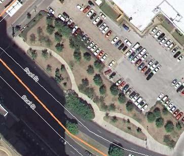
3 Proposed Grade Separation Proposed Road Closure Proposed Grade Separation Proposed Parking Proposed Road Extension Proposed College Access North Lake College Station
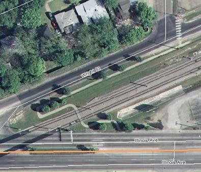
4 NOVEMBER MEETING ISSUES Irving Issues: Explain how Mandalay Place streets became privatized? Can Mandalay Place streets become public? Alignment Considerations: Move Rail alignment further south Put Rail Underground
5 Brangus Issues: Can Brangus Remain Open What becomes of Brangus ROW if severed? (Sidewalks?) What will prevent confused motorist from driving through Mandalay Place? Impact Issues: How will DART address visual impacts? How will construction impact homes? What can be done to mitigate impacts of lighting? How will DART address neighborhood safety?
6 Information Requests: Does DART understand the soil conditions? How will soil affect construction? What are the LRT travel times? Request for fare evasion information Request to be kept current on design changes Can DART provide a Gated Community?


7 Irving Issues: Mandalay Place was originally platted in 1983 with private streets Streets do not meet City of Irving Standards for Public Streets
8 Alignment Considerations: Move Rail alignment further south A. Adjust alignment south to pull away from Mandalay Place B. Place LRT alignment within Brangus ROW going west C. Move alignment deeper into North Lake Campus A B C
9 A. Adjust Adjust alignment south to pull away from Mandalay Place Tight fit, further constricts platform, bus and parking (Fatal Flaw) Adds undesirable curves Increases Property Acquisition w/limited utility Not Preferred by North Lake
 Limited ROW Profile issues")

10 B. Brangus Place LRT alignment within Brangus ROW Very Problematic (Many Fatal Flaws) Limited ROW Profile issues Access issues Grade Separation? Crossings Displacements Tight Fit Parking/Buses Remain Traffic Impacts Expensive?
 North Lake Providing ROW Significantly alters existing infrastructure Uses much additional ROW Does not fit Campus Master Plan Cumulative Fatal")
11 C. Campus Move alignment into North Lake Campus Operationally inferior: Adds curves, travel time, length, unnecessary crossings Divides campus (Not wanted by North Lake) North Lake Providing ROW Significantly alters existing infrastructure Uses much additional ROW Does not fit Campus Master Plan Cumulative Fatal Flaws

12 Tunnel Put alignment Underground Tunnel is not considered mitigation Tunnel only used when dictated by terrain, ROW or extreme circumstance Tunnel construction increases impacts Station surface elements include: Parking, mezzanine, buses, vertical access, ventilation Terrain would likely preclude tunnel Very expensive Cumulative Fatal Flaws

13 Proposed Alignment Uses Route reserved for DFW Access Operationally Superior Best Meets Station/LRT Requirements Campus Perimeter Serves Campus/Residential Does not divide campus: Fits Campus Master Plan Minimal infrastructure impact Segregates Residential/Station/Campus 400 LF Mandalay Place Adjacency 60,000 LF DART Residential Adjacency Impacts can be mitigated Cost Effective

14 Brangus Issues: Can Brangus Remain Open? Additional LRT Crossing Separating parking from platform is undesirable Crossing signals generate significant noise Station would generate high traffic volumes on Brangus Rail Profile does not match Brangus Profile Impacts can be mitigated
15 Brangus Issues: What becomes of Brangus ROW if severed at LRT? TBD (Many Options) Pedestrian way? Green space? Kiss & Ride? Cul de Sac? K&R
16 Brangus Issues: What will prevent confused motorists from driving through Mandalay Place? Depends on Disposition of Brangus Signage Placement of Cul de Sac No repeat offenders
17 Impact Issues: How will DART address visual impacts? Determine noise impact/mitigation (Sound Wall?) Standard LRT Visual Mitigation Trees spaced appropriately to break up views Vegetation to mitigate identified visual impacts Station Design May include buffer Station Standards/Irving Development Code Landscaping requirement Residential Betterments Policy Mandalay Place to be part of Art & Design Tree Preservation/Removal Permit Walnut Hill At-Grade vs. Grade Separation?


18 Walnut Hill At-Grade Walnut Hill Lane Crossing At-Grade vs. Aerial Addresses Visual Impacts Reduces LRT Profile Other Considerations Traffic Noise
 Croix")

19 (100 St. Croix Green) (100 St. Croix Green) At-Grade Walnut Hill Ariel Walnut Hill
 Monet)")

20 (1220 St. Monet) (1220 St. Monet) At-Grade Walnut Hill Ariel Walnut Hill

21 How will construction impact homes? Identified Impacts will be mitigated Short term Construction Impacts Noise Dust Disruptions Long term Impacts Visual Changes Traffic Pattern Changes Improved Transit Potential to Improve Property Values

22 What can be done to mitigate impacts of lighting? Irving Development Standards & DART Design Standards protect Residential neighborhoods Light Reflected away from Residential Property Minimize Pole Height Limit Brightness Sensitive Design Experience: DART has many facilities with Residential Adjacency Response to Complaints
23 How will DART address neighborhood safety? Transit Police Pilot Video Surveillance Program Emergency Call Boxes CPTED Homeland Security Initiatives DART Education Responsive to Specific Issues Work with Local Jurisdictions Irving Police Campus Police
 Geotechnical Information is gathered at all levels of Design: Existing Conditions, PE, Final Design, Construction DART/Consultants/Contractors highly experienced with all")
24 Information Requests: Does DART understand the soil conditions? (How will soil affect construction?) Geotechnical Information is gathered at all levels of Design: Existing Conditions, PE, Final Design, Construction DART/Consultants/Contractors highly experienced with all soil conditions Rely of experience of others: City of Irving/TxDOT/ NTTA/ DFW
 North Lake To: DFW")


 Deep Ellum: 36")

25 Approximate LRT Travel Times (Minutes) North Lake To: DFW (Future):10-15 Love Field: 17 AAC/Victory: 24 West End/CBD: 27 Mockingbird: 37 Richardson: 55 Plano: North Lake To: (With Transfer) Deep Ellum: 36 Dallas Zoo: 36 Fair Park: 38 Carrollton: 39 Garland:

26 Fare Evasion Information Most of DART s LRT Customers use Monthly or Yearly Passes DART uses a barrier-free honor system Spot Checks Exact Ridership/Fare Compliance? Sampling indicates 98% Compliance 98%


27 Request to be kept current on design changes Public Involvement Process PE/EIS: Periodic Meetings Public Hearing Final Design: 30%, 65% & 95% Design Residential Betterments Construction: Periodic Meetings Extensive Public Information Mandalay Place: As Requested As design changes
28 Can DART provide a Gated Community? DART is limited in what it can provide Mitigation: Only mitigate identified impacts (Per Policy) Equity: Cannot provide more or less than elsewhere in LRT System Residential Betterments might be used Requires Board Approval $70 per linear foot (escalated) Would preclude other uses (screening, landscaping, vegetation) Would not include operation

29 Recommendations: DART with the City of Irving & North Lake College Proposes: Implementing LRT and Station along perimeter of North Lake as originally presented Realigning Brangus? Proposed Road Closure Proposed Grade Separation Proposed Parking Proposed Road Extension Proposed College Access
 4. Level of Station Access desired by Mandalay Place 5.")
30 To Be Determined: 1. Final Mitigation of identified impacts (Per FEIS Standards) 2. Residential Betterments 3. Disposition of Brangus (DART will work with Mandalay Place) 4. Level of Station Access desired by Mandalay Place 5. Disposition of Walnut Hill Crossing
 Varying Degrees of Access Residential")
31 Neighborhood/Station Setting: Setting can incorporate many features Visual Mitigation: Sound Wall (If warranted) LRT Mitigation Station Mitigation Development Standards Tree Preservation Art & Design Program Residential Betterments Lower Profile: (At-Grade Walnut Hill Lane) Varying Degrees of Access Residential Betterments


32 Sound Wall (If warranted) Tree Preservation?

33 LRT Mitigation Station Mitigation Art & Design Program Development Standards
34 Access

35 North Lake College Station Q & A (1220 St. Monet)
Northwest Corridor LRT Line to Irving/DFW Public Meeting No. 1 Project Overview
 LRT Line to Irving/DFW Public Meeting No. 1 Project Overview January 21, 2004 Agenda Purpose Corridor Background Environmental Impact Assessment Public Involvement Plan Project Schedule Purpose Project
Mary Hills Nature Area. Roadway Lighting. The Minneapolis Clinic of Neurology Courage Kenny Rehabilitation Institute
 PUBLIC REALM IMPROVEMENTS Mary Hills Nature Area Enhanced Programming Glenview Terrace Valley View Roadway Lighting Enhanced Streetscape Trail Lighting / Roadway Lighting Wayfinding Public Art The Minneapolis
Elm Fork Land Use. Trinity River Corridor Project Committee May 13, 2013
 Elm Fork Land Use Trinity River Corridor Project Committee May 13, 2013 Purpose Discuss Trinity River planned Land Use and Appropriate Compatible Uses, particularly with respect to the Elm Fork Area 2
Cotton Belt Regional Rail Corridor Project
 Cotton Belt Regional Rail Corridor Project North Dallas AFG University of Texas at Dallas Administration Building March 1, 2018 0 Discussion Public Involvement Project Scope Alignment Stations Environmental
Sustainable Development Call for Projects
 Sustainable Development Call for Projects 2005-2006 Infrastructure Project Examples *Note: This list is not all inclusive, but a sampling of the types of projects that were awarded funds. 137 Projects
Crenshaw Transit Corridor Alternatives Analysis/EIS/EIR
 Crenshaw Transit Corridor Alternatives Analysis/EIS/EIR Working Group Meetings South Corridor Meeting Darby Park Wednesday, September 17, 2008 6:30 8:30 PM Mid-Corridor Meeting Leimert Park Community Build
Dallas CBD Second Light Rail Alignment (D2)
") Dallas CBD Second Light Rail Alignment (D2) Subway Project Refinement Public Meetings January 19, 2017 Discussion Items Background Schedule Public/Stakeholder Involvement Subway Construction Overview Potential
Dallas CBD Second Light Rail Alignment (D2) Subway Project Refinement Public Meetings January 19, 2017 Discussion Items Background Schedule Public/Stakeholder Involvement Subway Construction Overview Potential
Meeting Display Boards for Public Hearing on the Wilson Transfer Station Project held Tuesday, February 18, 2014.
 Meeting Display Boards for Public Hearing on the Wilson Transfer Station Project held Tuesday, February 18, 2014. Board 1: Welcome Welcome to the Wilson Transfer Station Project Public Hearing. The purpose
East Corridor Final Environmental Impact Statement
 East Corridor Final Environmental Impact Statement Alternatives Considered Operating Plan The requirements for opening day operations versus year 2030 are based on ridership and operations. Opening day
Dallas CBD Second Light Rail Alignment (D2)
") Dallas CBD Second Light Rail Alignment (D2) Subway Project Refinement City of Dallas Transportation and Trinity River Project Committee February 13, 2017 Discussion Items Background Schedule Public/Stakeholder
Dallas CBD Second Light Rail Alignment (D2) Subway Project Refinement City of Dallas Transportation and Trinity River Project Committee February 13, 2017 Discussion Items Background Schedule Public/Stakeholder
Hopkins. Development Guidelines May Overview. Sponsored by: Blake Road Corridor Collaborative City of Hopkins
 Hopkins Blake Road LRT Station Area Development Guidelines May 2015 Sponsored by: Blake Road Corridor Collaborative City of Hopkins Overview Hopkins is a dynamic community of over 17,000 residents located
Welcome. to the 95th Street Terminal Improvement Project Public Hearing
 Welcome to the 95th Street Terminal Improvement Project Public Hearing The purpose of this Public Hearing is to solicit comments from the community about the Environmental Assessment prepared for the 95th
ARGENTA TRAIL (CSAH 28/63) REALIGNMENT SOUTH PROJECT (CP 63-25)
 REALIGNMENT SOUTH PROJECT (CP 63-25)") ARGENTA TRAIL (CSAH 28/63) REALIGNMENT SOUTH PROJECT (CP 63-25) Preliminary Design Report February 2015 Prepared For: City of Inver Grove Heights Dakota County Prepared By: Kimley-Horn and Associates,
ARGENTA TRAIL (CSAH 28/63) REALIGNMENT SOUTH PROJECT (CP 63-25) Preliminary Design Report February 2015 Prepared For: City of Inver Grove Heights Dakota County Prepared By: Kimley-Horn and Associates,
LOS ANGELES MISSION COLLEGE MASTER PLAN Master Plan DESIGN & DEVELOPMENT PRINCIPLES
 LOS ANGELES MISSION COLLEGE MASTER PLAN DESIGN & DEVELOPMENT PRINCIPLES 34 Quality Learning Along the Arroyo PROGRAM SUMMARY BY PROJECT The following are program summaries for each of the projects planned
Midtown Corridor Alternatives Analysis. Appendix A - Initially Considered Alternatives Screening
 Midtown Corridor Alternatives Analysis Appendix A - Initially Considered Alternatives Screening Arterial BRT on Lake Street - Overall Rating: RATING Metropolitan Council recommendations stated in the Transportation
Right-of-Way Acquisitions and Relocations Technical Memorandum
 Right-of-Way Acquisitions and Relocations Technical Memorandum Southeast Extension Project Lincoln Station to RidgeGate Parkway Prepared for: Federal Transit Administration Prepared by: Denver Regional
Green Line North Centre City Alignment
 Project overview The Green Line will be an important piece of Calgary's transit network, adding 40 kilometres of track to the existing 59 kilometre LRT system. End-to-end, the line will connect North Pointe
D2 Subway Project Development. Stakeholder Committee October 24, 2018
 D2 Subway Project Development Stakeholder Committee October 24, 2018 1 Agenda Welcome and Introductions D2 Subway Overview Status of Project Development (PD) Efforts Focus Area Workshop Results Potential
Expo Line Transit Project. Project Status Update Meeting West End Corridor Segment C
 Exposition Light Rail Transit Project Project Status Update Meeting West End Corridor Segment C Culver City Senior Center November 18, 2010 Phase 1 Project Description Phase 1 from Downtown Los Angeles
APPENDIX D: Visual and Aesthetic Conditions for NCCU Station Refinement. Durham-Orange Light Rail Transit Project
 APPENDIX D: Visual and Aesthetic Conditions for NCCU Station Refinement Durham-Orange Light Rail Transit Project October 2016 1. Introduction The Combined FEIS/ROD summarizes the effects of the D-O LRT
Cotton Belt Corridor Regional Rail
 Cotton Belt Corridor Regional Rail Visual Impact Assessment Technical Memorandum December 2013 Prepared for Dallas Area Rapid Transit General Planning Consultant Managed by URS Corporation Cotton Belt
4.0 AFFECTED ENVIRONMENT AND ENVIRONMENTAL CONSEQUENCES
 4.0 AFFECTED ENVIRONMENT AND ENVIRONMENTAL CONSEQUENCES The following sections discuss the impacts associated with environmental resources for the tunneling method Alternatives A and B. The construction
History: a Grand Urban Boulevard
 History: a Grand Urban Boulevard 1890 1910: At its peak, Euclid Avenue, "Millionaire's Row," was considered the second most beautiful urban street in the country next to Fifth Avenue in Manhattan. 1910-2030:
Evaluation Criteria. Detailed Evaluation Criteria
 Evaluation Criteria Detailed Evaluation Criteria Community Well-being A safe and socially inclusive service that improves access to key community destinations and provides transportation choices for Calgarians.
Western Light Rail Transit Corridor Planning and Environmental Assessment Study. Public Open House #2 25 April 2013
 Western Light Rail Transit Corridor Planning and Environmental Assessment Study Public Open House #2 25 April 2013 1 Presentation Overview 2 1. Where We Began Background and Study Area 2. Understanding
DESIGN PARAMETERS DESIGN OBJECTIVES. Design Focus and the Elements of the Corridor. Driver Confidence. Visual Organization.
 Design Focus and the Elements of the Corridor LBJ Corridor DESIGN PARAMETERS For any project to be successful, the project goals must be clear. Therefore, with the assistance of TxDOT, the Urban Design
SCARBOROUGH RAPID TRANSIT ENVIRONMENTAL PROJECT REPORT CHAPTER 2 PROJECT DESCRIPTION. Table 2-4: North Segment Alignment Analysis 2-21
 Table 2-4: North Segment Alignment Analysis 2-21 SCARBOROUGH RAPID TRANSIT Based on the above analysis (detailed analysis is contained in Appendix A-4), North Alignment 3 is preferred because it: Has the
Wiles Road from University Drive to Riverside Drive
 Wiles Road from University Drive to Riverside Drive Presented to: Broward County WSP Parsons Brinckerhoff is now Presented by: WSP USA Inc. Our Team.. Introduction / Project Team Cecilia Villoria, PE Project
U T D N o r t h C a m p u s T O D and D o w n t o w n D e n t o n T O D
 U n i v e r s i t y o f T e x a s a t D a l l a s C i t y o f R i c h a r d s o n U T D N o r t h C a m p u s T O D and D o w n t o w n D e n t o n T O D Rick Leisner, AICP Assistant Director of Development
4.13 Security and System Safety
 4.13 4.13.1 Introduction This section describes the affected environment and environmental consequences related to security and system safety from operations of the NEPA Alternatives. Information regarding
The Urban Transit Challenge
 On-Street Priority Transitways Sustainable Transport Using Available Right-of-Ways Mark C. Walker, AICP The Urban Transit Challenge Increase urban mobility & transit speed Use available rights-of-way Minimize
Honorable Members of the Mobility Solutions, Infrastructure and Sustainability Committee
 Memorandum DATE March 23, 2018 CITY OF DALLAS TO Honorable Members of the Mobility Solutions, Infrastructure and Sustainability Committee SUBJECT Cotton Belt Regional Rail Corridor Project On Monday, March
Equity and Environmental Justice B. MINORITY, ELDERLY, AND LOW INCOME POPULATIONS IN THE STUDY AREA
 Chapter 16: Equity and Environmental Justice A. INTRODUCTION The proposed project alternatives would traverse a large study area that contains a wide range of neighborhoods, residents, and workers. The
ARTICLE 13 STREETS General
 ARTICLE 13 STREETS 13.1 General Streets shall be designed to suit their functions. Many streets have purposes other than vehicular traffic. As an alternative to current N.C. Department of Transportation
Downtown Lead Revitalization Project Final Recommendations. Three Proposed Options for the Revitalization of Downtown Lead
 Downtown Lead Revitalization Project Final Recommendations Three Proposed Options for the Revitalization of Downtown Lead November 1, 2011 Three Proposed Options for the Revitalization of Downtown Lead
Description of Preferred Alternative
 Chapter 2 Description of Preferred Alternative 2.1 Introduction This chapter of the programmatic Sammamish Town Center Sub-area Plan Final EIS provides a more detailed description of the Preferred Alternative
Town Center (part of the Comprehensive Plan)
") Town Center (part of the Comprehensive Plan) Mercer Island Town Center Looking North (2014) In 1994, a year-long process culminated in a set of design guidelines and code requirements for the Town Center
Town Center (part of the Comprehensive Plan) Mercer Island Town Center Looking North (2014) In 1994, a year-long process culminated in a set of design guidelines and code requirements for the Town Center
Bostwick Road. Municipal Class Environmental Assessment. Public Information Centre #2 June 14, City of London
 Bostwick Road Municipal Class Environmental Assessment Public Information Centre #2 June 14, 2017 Welcome! Welcome to the 2 nd Public Information Centre for the. Representatives from the and the consulting
Edmonton s LRT Setting the Stage for Heading Further South
 4 Capital Projects Project Updates Edmonton s LRT Setting the Stage for Heading Further South Art Washuta, P.Eng. AECOM Canada Ltd. Edmonton, Alberta Carole Cej, P.Eng. City of Edmonton Edmonton, Alberta
Rosecrans/Marquardt Grade Separation Project. Community Open House Meeting
 Rosecrans/Marquardt Grade Separation Project Community Open House Meeting October 17, 2017 Rosecrans/Marquardt Presentation Agenda 1. Welcome Remarks & Introductions 2. Community Outreach 3. Project Goals
Gold Line Bus Rapid Transit Transit Oriented Development (BRTOD) Helmo Station Area Plan
 Helmo Station Area Plan") Appendix F Gold Line Bus Rapid Transit Transit Oriented Development (BRTOD) Helmo Station Area Plan Introduction and Purpose of the Plan The Gold Line Bus Rapid Transit facility is an eleven-mile dedicated
Appendix F Gold Line Bus Rapid Transit Transit Oriented Development (BRTOD) Helmo Station Area Plan Introduction and Purpose of the Plan The Gold Line Bus Rapid Transit facility is an eleven-mile dedicated
SECTION 4(f) DE MINIMIS DOCUMENTATION
 DE MINIMIS DOCUMENTATION") SECTION 4(f) DE MINIMIS DOCUMENTATION Illinois Route 60/83 IL 176 to the intersection of IL 60 (Townline Road) Lake County P-91-084-07 Mundelein Park and Recreation District Project Limit SECTION 4(f)
SECTION 4(f) DE MINIMIS DOCUMENTATION Illinois Route 60/83 IL 176 to the intersection of IL 60 (Townline Road) Lake County P-91-084-07 Mundelein Park and Recreation District Project Limit SECTION 4(f)
City of Lake Elmo Planning Commission Meeting Minutes of August 10, 2015
 City of Lake Elmo Planning Commission Meeting Minutes of August 10, 2015 Chairman Dodson called to order the meeting of the Lake Elmo Planning Commission at 7:00 p.m. COMMISSIONERS PRESENT: Dodson, Dorschner,
Open the. Possibilities. Discover the art along the Orange Line.
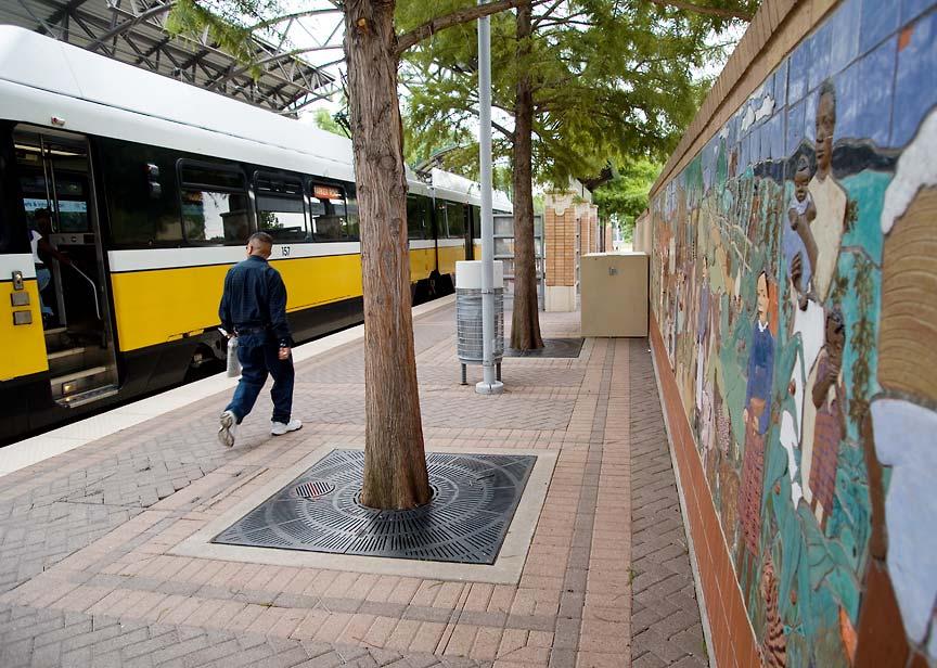
 Open the Possibilities. Discover the art along the Orange Line. 2012 DART s award-winning Art & Design Program Launched in 1988 Brightens the DART Service Area with uncommon works of public art Makes art
Cotton Belt Corridor. Area Focus Group (AFG) Richardson/Plano August 24, John Hoppie, Capital Planning
 Richardson/Plano August 24, John Hoppie, Capital Planning") Cotton Belt Corridor Area Focus Group (AFG) Richardson/Plano August 24, 2017 John Hoppie, Capital Planning 0 Agenda Design Update Environmental Update Documentation of Existing Conditions Noise Traffic
Cotton Belt Corridor Area Focus Group (AFG) Richardson/Plano August 24, 2017 John Hoppie, Capital Planning 0 Agenda Design Update Environmental Update Documentation of Existing Conditions Noise Traffic
Welcome. Green Line LRT. Beltline Alignment Options. Stay engaged! Follow the Green Line story at calgary.ca/greenline
 Welcome Green Line LRT Beltline Alignment Options Stay engaged! Follow the Green Line story at calgary.ca/greenline Green Line LRT Why are we here? Our Challenge Determine the best alignment in the Beltline.
Welcome! MILLENNIUM LINE BROADWAY EXTENSION. Over the next 30 years, Metro Vancouver will welcome 1 million new residents and 600,000 new jobs.
 WELCOME Welcome! MILLENNIUM LINE BROADWAY EXTENSION Over the next 30 years, Metro Vancouver will welcome 1 million new residents and 600,000 new jobs. The Broadway Corridor is home to the second largest
Mount Dennis Mobility Hub Study Public Meeting December 12 th, :30pm 9:30pm York Memorial Collegiate, Cafeteria 2690 Eglinton Avenue West
 Mount Dennis Mobility Hub Study Public Meeting December 12 th, 2012 6:30pm 9:30pm York Memorial Collegiate, Cafeteria 2690 Eglinton Avenue West MEETING SUMMARY On December 12 th, 2012, over 89 people participated
Pine Hills Bus Transit Center Community Design Workshop. Presentation April 21, 2018
 Pine Hills Bus Transit Center Community Design Workshop Presentation April 21, 2018 1 Today s Workshop Welcome and Overview (10:00-1015 AM) Site Programming (10:15-10:45 AM) InfraWorks Demo (10:45-11:00
Northwest Rail Corridor and US 36 BRT Development Oriented Transit Analysis 4.4 STATION AREA FINDINGS
 4.4 STATION AREA FINDINGS Each station is different, and each one requires a separate set of recommendations based on the vision for the site. This section outlines an initial TOD strategy and recommendations
Good Neighbor Plan Dallas Love Field Airport Transportation and Environment Committee
 June 25, 2012 Good Neighbor Plan Dallas Love Field Airport Transportation and Environment Committee Overview Vision for Dallas Love Field Downtown Dallas 360 Plan Targeted Improvement Zones Lemmon Avenue
University of the District of Columbia Van Ness Campus Master Plan Community Open House 3. December 8, 2010
 University of the District of Columbia Van Ness Campus Master Plan Open House 3 December 8, 2010 Introductions Sequence of Work: Campus Master Plan BEGIN: INTRODUCE AND START WORK Project Initiation Team
Transit Terminal Design Surveillance Access Control - Territoriality. Ian Trites Supervisor Facilities and Architectural Design
 Transit Terminal Design Surveillance Access Control - Territoriality Ian Trites Supervisor Facilities and Architectural Design The public space is not kept primarily by the police, necessary as police
April 21, 2007 CCRP Workshop Summary
 April 21, 2007 CCRP Workshop Summary Group 1 1. Reuse around BART with a lot of housing and jobs 2. Greenway around creek 3. Transit and auto connection all through the site from Kirker Pass to Port Chicago
City of Hermosa Beach Administrative Policy #
 City of Hermosa Beach Administrative Policy # SUBJECT: Living Streets Policy Date: Approved by: City Council Authority: Public Works Department & Community Development Department Mayor, PURPOSE The City
Accessibility Improvement Study
 Jersey City Redevelopment Agency Canal Crossing Redevelopment Project TASK 4 Accessibility Improvement Study for Garfield Avenue Light Rail Station FINAL February 28, 2013 Prepared by URS Corporation for
Capital Improvement Program. Development Services Staff Recommended Projects
 2014-2019 Capital Improvement Program Development Services Staff Recommended Projects Ongoing Capital Improvement Ellsworth Road Ryan to Germann Roads $3.5 M Germann Rd Ryan Rd Half-street improvements
Commissioners Road West Realignment Environmental Assessment
 City of London Commissioners Road West Realignment Environmental Assessment Public Information Centre No. 1 March 30, 2017 Welcome to the Public Information Centre This first Public Information Centre
APPENDIX C Township 9 Consistency with Applicable Plans
 Township 9 Consistency with Applicable Plans 1985 American River Parkway Plan Policies Project Consistency Policy 4.14: The following activities and facilities, which are incompatible with the Parkway,
7.0 PUBLIC AND AGENCY INVOLVEMENT
 7.0 PUBLIC AND AGENCY INVOLVEMENT This chapter documents the dialogue between DART and interested citizens and agencies regarding issues raised by the design and construction of the proposed project. This
Corridor Management Committee. April 14, 2016
 Corridor Management Committee April 14, 2016 1 Today s Topics Chair s Update Corridor-wide Safety/Security Golden Valley Rd Park & Ride, Trails and Intersection Section 106 (Historic Properties) Update
TIRZ 17/Redevelopment Authority Capital Improvements Plan Projects
 Gessner Widening: T-1701 What: Widen the road from a six-lane divided boulevard to an eight-lane divided boulevard street section, increase turn lanes, update traffic signal system, improve drainage by
1. Golf Course Residential Single Family and Townhome Community
 DEIS Section II Project Description II. Project Description A. Location The Villages of Chestnut Ridge Project is being proposed on a 198.3 acre site within the Village of Bloomingburg in the Town of Mamakating,
Attachment D Eastside Transit Corridor Phase 2 Technical Study Route Options Screening Analysis and Community Outreach Executive Summary April 2017
 Attachment D Eastside Transit Corridor Phase 2 Technical Study Route Options Screening Analysis and Community Outreach Executive Summary April 2017 Technical Study Scope Nov 2014: Board-directed Technical
STANDARD SPECIFICATIONS Book 2 ENGINEERING DRAWINGS INCLUDES ADDENDUMS
 STANDARD SPECIFICATIONS Book 2 ENGINEERING DRAWINGS INCLUDES ADDENDUMS July 23, 2018 Page 1 of 7 STANDARD LEGEND SYMBOLS (September, 1973)... AS-101A STANDARD LEGEND SYMBOLS (September, 1973)... AS-101B
Pinellas County. Staff Report
 Pinellas County 315 Court Street, 5th Floor Assembly Room Clearwater, Florida 33756 Staff Report File #: 16-416A, Version: 1 Agenda Date: 3/29/2016 Subject: Election of the Chairman and Vice-Chairman of
Michigan City Alternative Analysis Realignment Study. Progress Status Update Report Presentation to City Council February 1, 2012
 Michigan City Alternative Analysis Realignment Study Progress Status Update Report Presentation to City Council Project Web Site Project Web Site is Active www. emichigancity.com Click on NICTD logo at
MUNICIPALITY OF ANCHORAGE
 MUNICIPALITY OF ANCHORAGE ANCHORAGE PARKS & RECREATION Memorandum PRC 08-38 DATE: June 4, 2008 TO: FROM: SUBJECT: Parks & Recreation Commission Monique Anderson, Parks Superintendent PRC 08-38 Creekside
Expo Light Rail Line. Expo Line Community Meeting Phase 2 Design Update November 2011
 Expo Line Community Meeting Phase 2 Design Update November 2011 Meeting Agenda Phase 2 Design Update Meeting Meeting Purpose and Format Project Status Update Overview of Design Progress Next Steps Open
ARTICLE 13 STREETS General
 ARTICLE 13 STREETS 13.1 General Streets shall be designed to suit their functions. Many streets have purposes other than vehicular traffic. As an alternative to current N.C. Department of Transportation
SEATTLE PACIFIC UNIVERSITY MIMP Condition Status Matrix: July 1, 2015 June 30, 2016
 SEATTLE PACIFIC UNIVERSITY MIMP Condition Status Matrix: July 1, 2015 June 30, 2016 # CITY COUNCIL CONDITION FULFILLED/ 1 Modify the MIMP to replace the last sentence of the first paragraph on page 43
Shift Rapid Transit Public Participation Meeting May 3, 2017
 Shift Rapid Transit Public Participation Meeting May 3, 2017 Shift Rapid Transit Initiative Largest infrastructure project in the city s history. Rapid Transit initiative will transform London s public
D2 Subway Project Development. Public Meeting September 12, 2018
 D2 Subway Project Development Public Meeting September 12, 2018 1 Agenda Project Background Process, Funding and Schedule Project Development (PD) Efforts Preliminary Engineering (PE) Environmental Impact
Jenifer Street Reconstruction Neighborhood Engagement Meeting November 4, 2015
 Jenifer Street Reconstruction Neighborhood Engagement Meeting November 4, 2015 Hosted by the Marquette Neighborhood Association Facilitated by Urban Assets Funded in part by the City of Madison Neighborhood
Appendix D Community Impact Assessment
 Appendix D Community Impact Assessment This page is intentionally blank. Mid-City/Exposition Light Rail Transit Project Community Impact Assessment Memorandum for the Improvements at Farmdale Avenue and
East Link Extension. June 28, South Bellevue Final Design Open House Public Involvement Summary
 East Link Extension June 28, 2013 South Bellevue Final Design Open House Public Involvement Summary Table of Contents 1 Background 2 Overview 2 Notification 3 Open House Overview 4 Comment Summary 4 South
112th Avenue Light Rail Options Concept Design Report JUNE 2010 PREPARED FOR PREPARED BY TBG PGH
 112th Avenue Light Rail Options Concept Design Report JUNE 2010 PREPARED FOR PREPARED BY TBG060310124909PGH C ontents Introduction 1 Project Overview 1 Public Involvement and Technical Coordination 4 Description
MONTGOMERY COUNTY PLANNING DEPARTMENT THE MARYLAND-NATIONAL CAPITAL PARK AND PLANNING COMMISSION
 MONTGOMERY COUNTY PLANNING DEPARTMENT THE MARYLAND-NATIONAL CAPITAL PARK AND PLANNING COMMISSION MCPB Item No. 7 Date: 2-28-13 Purple Line Briefing David Anspacher, Senior Planner, david.anspacher@montgomeryplanning.org,
ROAD CLOSURE AND LAND USE AMENDMENT SILVER SPRINGS (WARD 1) NORTHEAST OF NOSEHILL DRIVE NW AND SILVER SPRINGS ROAD NW BYLAWS 2C2018 AND 29D2018
 NORTHEAST OF NOSEHILL DRIVE NW AND SILVER SPRINGS ROAD NW BYLAWS 2C2018 AND 29D2018") Page 1 of 19 EXECUTIVE SUMMARY This application proposes redesignating two parcels in the community of Silver Springs from Special Purpose Future Urban Development (S-FUD) District and undesignated road
Page 1 of 19 EXECUTIVE SUMMARY This application proposes redesignating two parcels in the community of Silver Springs from Special Purpose Future Urban Development (S-FUD) District and undesignated road
Lincoln Multi-Modal Center
 University of Nebraska - Lincoln DigitalCommons@University of Nebraska - Lincoln Theses from the Architecture Program Architecture Program May 2006 Lincoln Multi-Modal Center Jeffrey Bayer Follow this
Flooding Hearing: Long and Short Term Strategies
 Services of the San Francisco Public Utilities Commission Flooding Hearing: Long and Short Term Strategies Presentation to San Francisco Board of Supervisors Public Safety and Neighborhood Services Subcommittee
Public may provide comments on the GDP within the next two weeks (December 24)
") 25/70 General Development Plan (GDP) Public Meeting Wednesday, December 10, 2014 6:00 8:00 P.M. District 1 Police Station Community Room 1311 W 46th Ave, Denver, CO 80211 Council Woman Montero: This particular
25/70 General Development Plan (GDP) Public Meeting Wednesday, December 10, 2014 6:00 8:00 P.M. District 1 Police Station Community Room 1311 W 46th Ave, Denver, CO 80211 Council Woman Montero: This particular
GUIDELINES. Transit Oriented Development. Approved by Edmonton City Council on February 15, 2012 in tandem with City Policy C565
 Transit Oriented Development GUIDELINES Prepared by the City of Edmonton Sustainable Development and Transportation Services Departments Approved by Edmonton City Council on February 15, 2012 in tandem
Meeting Purpose: Date and Time: Location: Attendance: Handouts:
 Meeting Purpose: Date and Time: Location: Attendance: Handouts: PA Turnpike / I-95 Interchange Project Design Advisory Committee (DAC)/Public Officials Meeting #8 April 12, 2012 at 1:30 p.m. Project Office,
BeltLine Corridor Environmental Study
 BeltLine Corridor Environmental Study Citywide Conversation on Transit and Trails April 2, 2009 Agenda & Introductions Introductions Environmental Study Process Overview of the BeltLine Project BeltLine
THE CITY OF WINNIPEG BY-LAW NO. 48/2014
 THE CITY OF WINNIPEG BY-LAW NO. 48/2014 A By-law of THE CITY OF WINNIPEG to adopt a secondary plan for Precinct K of the Complete Communities Direction Strategy By-law No. 68/2010. THE CITY OF WINNIPEG,
2016 REVISIONS COMMENT FORM RULES AND REGULATIONS FOR CONSTRUCTION IN THE PUBLIC WAY COMMENT PERIOD: JUNE 1 TO JUNE 30, 2015
 AGENCY: 2016 REVISIONS COMMENT FORM Section Title Number Chapter 1 Introduction Comment 1.1 CDOT Mission Statement 1.2 Purpose of Rules and Regulations for Construction in the Public Way 1.3 Chicago Department
Adelaide Street / Canadian Pacific Railway (CPR) Grade Separation Class Environmental Assessment. Public Information Centre 3
 Grade Separation Class Environmental Assessment. Public Information Centre 3") 1 Adelaide Street / Canadian Pacific Railway (CPR) Grade Separation Study Process and Purpose of PIC 3 2 Study Commencement February 2016 Phase 1: Problem and Opportunity Identify problems and opportunities
1 Adelaide Street / Canadian Pacific Railway (CPR) Grade Separation Study Process and Purpose of PIC 3 2 Study Commencement February 2016 Phase 1: Problem and Opportunity Identify problems and opportunities
ROBBINSDALE LRT STATION CDI DEVELOPMENT GUIDELINES
 August 2018 OVERVIEW The City of Robbinsdale has a prime-opportunity site in the middle of the 13 mile stretch of the Bottineau LRT corridor / Blue Line extension. Robbinsdale offers a prominent, vital,
TABLE OF CONTENTS INTRODUCTION PLAN CONCEPT... 3
 TABLE OF CONTENTS BY-LAW NO. Z-1 INTRODUCTION... 1 1.0 PLAN CONCEPT... 3 1.1 Mission... 3 1.2 A Future Vision for Fredericton... 3 1.3 Growth Strategy Goals... 5 National Context... 5 Provincial Context...
Figure East End of 2 nd Street Tunnel
 Figure 4-13. East End of 2 nd Street Tunnel Figure 4-14. West End of 3 rd Street Tunnel Draft Environmental Impact Statement/Environmental Impact Report Page 23 Figure 4-15. 3 rd Street Corridor and East
SOUTHWEST TRANSITWAY (STAGE 2) PUBLIC OPEN HOUSE
 PUBLIC OPEN HOUSE") WELCOME! SOUTHWEST TRANSITWAY (STAGE 2) PUBLIC OPEN HOUSE Monday, November 18, 2013 3:30 to 5:30PM and 7:00 to 9:00PM Tuesday, November 19, 2013 3:30 to 5:30PM and 7:00 to 9:00PM Welcome to the Southwest
WELCOME! SOUTHWEST TRANSITWAY (STAGE 2) PUBLIC OPEN HOUSE Monday, November 18, 2013 3:30 to 5:30PM and 7:00 to 9:00PM Tuesday, November 19, 2013 3:30 to 5:30PM and 7:00 to 9:00PM Welcome to the Southwest
City of Dallas Plans
 City of Dallas Plans Name Year 1. A Report on a Sheltered Pedestrian System in CBD 1979 2. A Report on the Public Uses of Block 250 1980 3. Achieving the Goals for Dallas 1978 4. Amendments to the City
Northwest LRT Downtown to. Northwest Edmonton Study. Public Workshops
 Northwest LRT Downtown to Northwest Edmonton Study Public Workshops March 23 & 24, 2010 Welcome Thank you all for attending Welcome Introductions Welcome Our Team s Commitment to You for Tonight To provide
9 th Street Sub Area Plan
 9 th Street Sub Area Plan In the 1990 s, when the Township prepared the last Master Plan, the 9 th Street corridor was studied as part of a larger 9 th Street Focus Area that included the West Main Street
Preliminary Recommendations Tk Takoma/Langley Crossroads Sector Plan
 Preliminary Recommendations Tk Takoma/Langley Crossroads Sector Plan Vision is to achieve a Transit Oriented, pedestrian friendly Community that Celebrates and builds upon the cultural Diversity of the
Request Alternative Compliance (Commercial Parking Lot in Restricted Area) Staff Recommendation Approval. Staff Planner Ashby Moss
 Staff Recommendation Approval. Staff Planner Ashby Moss") Applicant Property Owners Pacific Avenue West, LLC Public Hearing April 11, 2018 City Council Election District Beach Agenda Item 2 Request Alternative Compliance (Commercial Parking Lot in Restricted
Applicant Property Owners Pacific Avenue West, LLC Public Hearing April 11, 2018 City Council Election District Beach Agenda Item 2 Request Alternative Compliance (Commercial Parking Lot in Restricted
Retail Signage Options. Planning Commission Special Meeting February 19, 2015
 Retail Signage Options Planning Commission Special Meeting February 19, 2015 1 Agenda Todays PC Workshop Structure: 1) Review of current shopping center locations 2) General Plan and Code Review 3) Provide
Cotton Belt Corridor Regional Rail
 Cotton Belt Corridor Regional Rail Socioeconomic Impact Assessment Technical Memorandum December 2013 Prepared by URS Corporation Prepared for Dallas Area Rapid Transit General Planning Consultant Managed
The University District envisions, in its neighborhood
 Envisioning the University District Link Light Rail in Seattle s neighborhoods CIY OF SEALE CONCEP-LEVEL SAION AREA PLANNING RECOMMENDAION RESOLUION # 30165 EXHIBI L Vision 08.2000 he University District