Cordata Park Master Plan
|
|
|
- Ross Day
- 5 years ago
- Views:
Transcription


1 Cordata Park Master Plan City of Bellingham, Washington October 2008 Prepared by:
2 Cordata Park Master Plan Table of Contents 1.0 Introduction & Background 2.0 Public Planning Process 3.0 Site Analysis Summary 4.0 Site Plan Alternatives 5.0 Preferred Master Plan 6.0 Phased Implementation & Estimated Costs 7.0 Appendix Project Team Civil Design Narrative Wetland Reconnaissance Confirmation Steering Committee/ Public Meeting Notes
3 Introduction & Background
4 Cordata Park Master Plan Introduction & Background The process for creating Cordata Park began with a vision to purchase of a large tract of wooded land on the edge of the city limits with the goal of serving the needs of the Guide Meridian and Cordata Neighborhoods. Bellingham Parks acquired a 20-acre parcel, which together with the adjoining 7-acres of public land (including a stormwater pond) transferred from Whatcom County, presents an exciting opportunity to provide a desperately needed neighborhood park for this growing community. The collaborative public planning process began in April 2008 and has yielded a host of great ideas and generated excitement about the park. The process included citizen input obtained through interactive community meetings, park board presentations and staff discussions to help determine the park components and direction. The progression has involved working closely with stakeholders and designing for the long-term with an eye toward longevity, multiple uses and low maintenance. The undeveloped, diverse site also contains wetland complexes, streams, meadows and stands of mature trees. Therefore, a major challenge has been to provide increased recreational opportunities serving the neighborhood, while sensitively preserving natural areas and wildlife habitat from the pressures of development. Because of its size and strategic location, the park will not only be a destination and community gathering spot, but also provide greatly improved connectivity between Horton and Aldrich Roads, Birchwood Presbyterian Church, the new elementary school site, Whatcom Community College, the North Bellingham trail network and the surrounding residential neighborhood. This report is the culmination of the Cordata Park Master Planning process that occurred April through September 2008 and documents the public process, site analysis, design options and ultimately the preferred direction and vision for future development of Cordata Park.

5 Cordata Park Master Plan

6 Cordata Park Master Plan Cfy of Bellingham and North Master Planning Future Trails Map..;th Enviroomental Features ~ Miles Z-1""'"1..._... ~ '" _ D, N The Berger Partnership PS Landscape Architecture
7 Public Process to Date
8 Cordata Park Master Plan Planning Process This Master Plan is the result of a multi-step process and was shaped by input from the Park Steering Committee, the City of Bellingham Parks and Recreation Department, the Parks Board, City Council and general public. At the first public meeting in March 2008, the Park Steering Committee met with Parks staff and brainstormed ideas and activities the community might like to see in the park. All ideas were documented and presented to the design team. Those ideas generated at the first meeting, combined with the initial program developed by the Parks Department, were great insight into what the future of the park could be. At the next public meeting, held in April 2008, members of the consultant design team were introduced and got a chance to meet members of the surrounding community. The discussion involved the overall schedule and outlined how the planning process would unfold between that night and the completion of the Master Plan in September Monthly steering committee meeting dates were identified, with the purpose being to report progress, get the community s feedback, and make sure everything was on track at each milestone. The design team emphasized that the community would shape the vision for the park and that there were not any preconceived ideas or concept plans. Instead, the intent was for everyone to work together to help carve a beautiful park out of this wooded, undeveloped site. At that same meeting, boards were presented to illustrate concept images and photos associated with the list generated at the first meeting. After brainstorming additional ideas and recording input, attendees were then asked to help prioritize some of the ideas and park elements that surfaced that evening. Each person was each given three dots to place on the board listing desired park program elements. This exercise clearly identified the highest priorities and was extremely helpful toward developing the design concepts. In May, Site Analysis boards were presented. They included information about topography, soils, solar exposure, winds, existing site character, and plant communities. Information on the wetlands and streams found onsite, as well as their respective buffers, was also reported. This information, as it turned out, would have a huge impact on the design of the park.

9 CORDATA PARK MASTER PLAN PROJECT Tl MELINE AND PUBLIC INPUT OPPORTUNITIES MARCH AUGUST 2008 PREFERRED MASTER PLAN & FINAL REPORT STEERING COMMITTEE MEETING #5 JULY 10, 2008 PRESENT PREFERRED PLAN OPTIONAL STEERING COMMITTEE MEETING # AUGUST, 2008
 e ELECTRICAL OUTLETS")
10 ENVIRONMENT INTERPRETIVE TRAILS AND SIGNAGE PRESERVE WILDLIFE HABITAT PRESERVE TREES BOARDWALKS & BRIDGES ENVIRONMENTAL EDUCATION SHELTER/ARCHITECTURE e COVERED PICNIC AREA e RESTROOMS e ENTERTAINMENT SPACE. e GREEN DESIGN (E.G. SOLAR, GREEN ROOFS) e ELECTRICAL OUTLETS
 e FENCED SPACE FOR DOG e TEEN GATHERING PLACE. e INFORMAL PARK LOOP TRAILS.. REGIONAL TRAM CONNECTIONS.-' e ART '.~ :~;~\" '. ~ fi~ ' '~~! ~\ ~ ' i \ ~.~, ~ 11 -~~tt1. ~. ~~ ~,:-.")
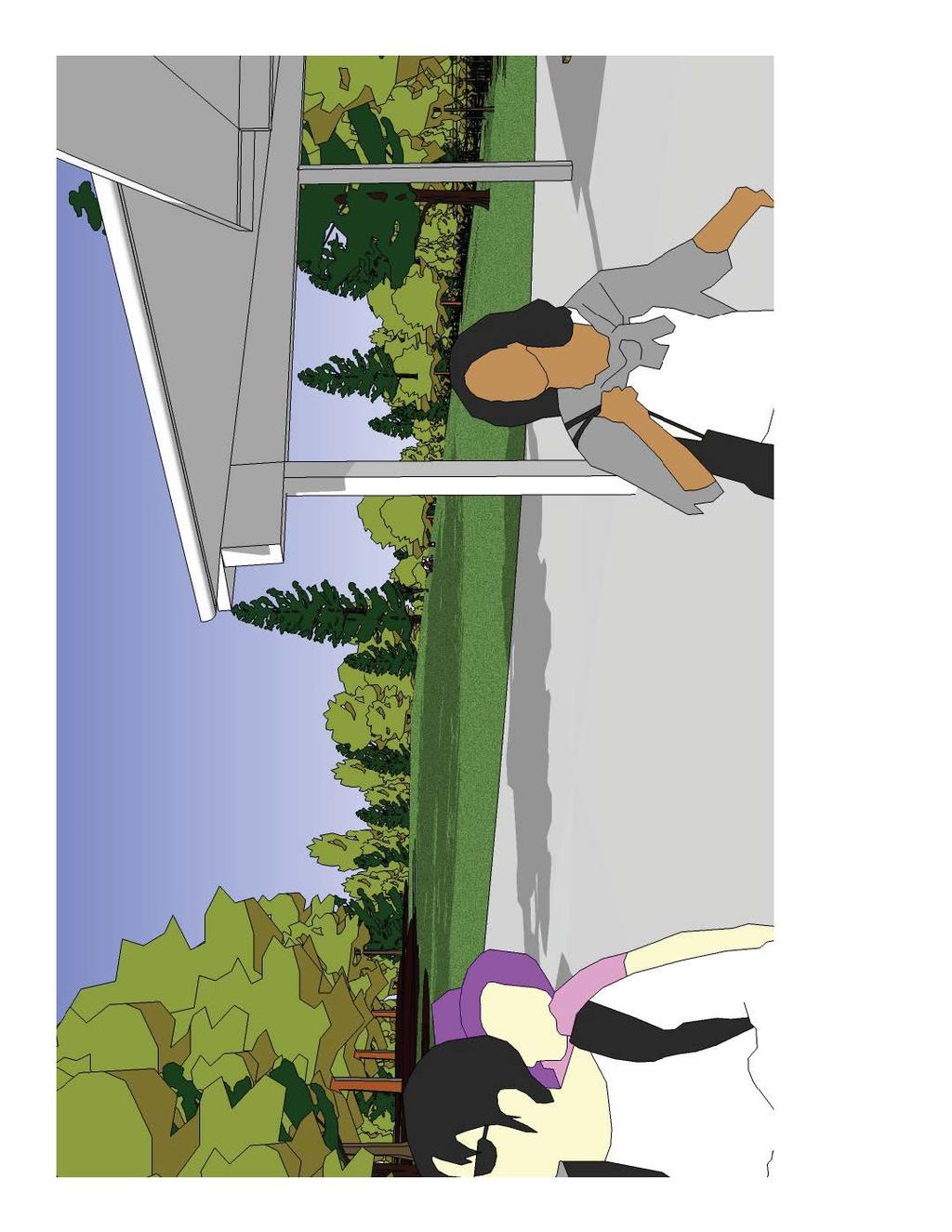
11 ACTIVE PLAY/USES PLAYGROUND (AGES 2-5 & 5-12) e SWINGS e SKATEBOARD SPOT BASKETBALL COURT e BALL WALL e SAND VOLLEY BALL BOCCE BALL e SPRAY PARK PICKLE BALL PASSIVE PLAY USES e OPEN SPACE... (NON PROGRAMMED USE) e FENCED SPACE FOR DOG e TEEN GATHERING PLACE. e INFORMAL PARK LOOP TRAILS.. REGIONAL TRAM CONNECTIONS.-' e ART '.~ :~;~" '. ~ fi~ ' '~~! ~\ ~ ' i \ ~.~, ~ 11 -~~tt1. ~. ~~ ~,:-... :r.. _:, ':' ~ ' ~ ;. { I ~.. ".'f.. ' ' ~ f '. ~ ' '.. ' t... ' -. " \..._, ;~i?;/~ -a' \:; h.. ~~~~ ~j>.. : ~-.: - ' ~ '."~. ':f.5~... < ~_,-... 'J~ ~lffll~/j,,1t~ "\\C\~.. ~. (_~~I~~ \... ':-. ~--."'"''~. : -~.-;:-. ''-"'-~,;jj' (~ \, ~. ' '\:. ~ ~..., \. ;, ~. ~, ' :. ' ;.-,, ::,'/'J.~-~ )!.. ~ - 1 r,\,~-..:~~\- 'i,. ~:,..,?Y,,/ '. L!t:f-. t.~ IC' _,-.. //, " ' /.. ' l; ~ \.' \..,... <'.,,,, i,.,.\'ii '. ~..? /.-.' -,.: I'. : :.,...,,,,,, " -
12 Site Analysis Summary
13 Cordata Park Master Plan Site Analysis Summary Given the fact that the site is completely undeveloped, it was critical to begin the master planning process with an Inventory and Analysis phase about relevant natural and contextual aspects of the site. That process revealed some major challenges that needed to be taken into consideration once sensitive areas and their associated buffers were identified. This analysis identified many opportunities and constraints and laid a sound foundation of information before exploring design alternatives. Existing Site: The 20-acre site is located in northwest Bellingham. The parcel is approximately 750 feet wide (east-west) by 1,100 feet long (north-south). An adjoining 7-acre parcel with a stormwater pond was added at the northeast corner of the park and together they form an L-shaped site. Adjacent property uses include a church, multifamily residential, single family residential, and undeveloped natural areas. Current public pedestrian access points are either from the parking lot of the Birchwood Presbyterian Church to the north or the Horton Road street end at the south. Future vehicular access will be possible once the Horton Road extension project is completed. Topography & Slopes: There is approximately 30 feet of grade change across the site with generally smooth grade transitions. There is a slightly perceptible ridge running north-south on the western half of the site with the high point located in the western section of the site. On the eastern half of the site there are wetlands with some draining to the creek drainage that flows north and west away from the site. Vegetation: The site is completely forested and undeveloped. Dominant species include Red Alder, Vine Maple, Big Leaf Maple, Black Cottonwood, Douglas Fir and Western Red Cedar. The forested habitat appears to range from 20 to 35 years in age. Other species observed, but not limited to, are Douglas Spirea, Red Elderberry, Salmonberry, Sword Fern, Piggy Back Plant, and several species of Trillium. Streams & Wetlands: The presence of several streams and wetlands contribute to the beautiful character of the future park site. However, when required buffers are taken into account based on the DOE classifications, the result is that nearly the whole eastern portion of the site is within a critical area. It should be noted that only a wetland reconnaissance confirmation has been performed at this time. A formal wetland and stream delineation would be required for submittal with any permit or land use applications associated with implementation. For more detailed information about streams, wetlands, soils and plant communities, as well as anticipated permitting requirements, see Section 7.0, Appendix for Wetland Reconnaissance Confirmation for the Aldrich Road Parcels, dated July 24, 2007 and prepared by Northwest Ecological Services, LLC.
! ~:f I~. I~~... 1 I SUMM ER FALL SUN PATH DIAG RAM LEGEND '''' WETLAND TO BE VEGETATIVE WETLANDTO,;.")
14 WIND WINTER " ~... ~-~ T"... I... i- -_ _~ :_' _.-.- _.._-_-_.-_ _-_--_--_--_---. -~.: _._-..',.. ' ; '\ -~ i_ = -- : "-""" SPRING I ~ )! ~:f I~. I~~... 1 I SUMM ER FALL SUN PATH DIAG RAM LEGEND '''' WETLAND TO BE VEGETATIVE WETLANDTO,;._ - FUTURE ROAD MITIGATED REMAIN BUFFER TOPOGRAPHY c [GRADE] -PROPOSED SITE ACTIVITY SITE BOUNDARY WETLAND - STREAM& r::::: (HIGH TO LOW) ( > ~~~~ENC~~;:;IL BUFFER MITIGATION AREA
15 Site Plan Alternatives
16 Cordata Park Master Plan Site Plan Alternatives With a solid understanding about site opportunities, challenges, and a clear direction about the desired program, a range of graphic concepts were explored. Physical space was assigned to each program element in the form of concept diagrams. Three diagrams were presented to the steering committee as well as illustrative site design alternatives. Since analysis of the site yielded a large amount of useful information about the parameters of site, there was a conscious effort not to develop wildly different options that were of questionable feasibility. Instead, since the site had inherent constraints (e.g., wetlands, access issues), realistic concepts were explored where subtle refinements distinguished one plan from another. Primary differences between the concepts highlighted levels of activity, intensity, and the degree to which the site was impacted. Each of the alternatives identifies a common set of proposed elements, such as primary and secondary pedestrian circulation, parking and nonmotorized trails, unprogrammed open space, and site structures. Comparison between the options is very straightforward and intuitive. The goal was not to select one plan over another, but instead to find positive parts of each plan that reflected the collective community desire. A great discussion ensued and through a collaborative review process, patterns began to emerge about the placement of certain site features as well as aspects of each plan that resonated with the community. The challenge was to take that input and synthesize it into a refined plan.


17 Options ABC Concept Diagrams


18 Options ABC Schematic Site Plans


19 Options ABC Character Images
20 Preferred Master Plan

21 7-Acre Parcel Transferred from Whatcom County
 5 GREAT LAWN/ BENCHES AT PERIMETER 6 PRIMARY PATH (PAVED) 7 PICNIC 8 INFORMAL SEATING 9 EXISTING WETLAND 10 SWINGS 11 NEIGHBORHOOD GATHERING PLAZA 12 RESTROOM & SHELTER WITH GREEN ROOF 13 PLAY")
22 Trail connection to church & satelite parking Trail connection to Cordata Parkway via Whatcom County Parcel LEGEND 1 SCULPTURAL ROCKS 2 BRIDGE WITH OVERLOOK 3 CREEK #1 4 SECONDARY PATH (CRUSHED STONE) 5 GREAT LAWN/ BENCHES AT PERIMETER 6 PRIMARY PATH (PAVED) 7 PICNIC 8 INFORMAL SEATING 9 EXISTING WETLAND 10 SWINGS 11 NEIGHBORHOOD GATHERING PLAZA 12 RESTROOM & SHELTER WITH GREEN ROOF 13 PLAY (AGES 2-5) 14 PLAY (AGES 5-12) 15 PARK KIOSK 16 NATIVE PLANT BUFFER 17 SKATE SPOT 18 WOODCHIP PATHWAY 19 OVERLOOK/BIRD BLIND 20 WETLAND MITIGATION & STREAM ENHANCEMENT 21 SPORT COURTS so --- I N I Trail connection to Horton Road and School 22 LOW IMPACT DEVELOPMENT PARKING LOT
23 Cordata Park Master Plan Master Plan At the meeting in June, the process to date was recapped and the design alternatives were summarized. The meeting then transitioned to describing the refined plan. The presenters used bubble diagrams to identify where the major site program elements were located and then reviewed the illustrative site plan. The plan was a hybrid composite of the previous alternatives so there was familiarity with many elements, yet all arranged differently so as to create a truly unique scheme. While working through each of the elements of the plan, clarification questions were asked along the way. Many of the ideas contained within the refined plan were well-received. The result was that with some slight fine tuning, the refined plan could be finalized and become the preferred Cordata Site Master Plan. Site Elements The following are the major site elements and design principles identified in the Cordata Park Master Plan: Preserve environmentally sensitive areas: Wet indicator species and an ephemeral stream are present in the forest that defines the eastern half of the park. Preservation of these areas is important in maintaining the character of the park. Proposed improvements to these areas include strategically located trails, boardwalks and interpretive signage. Opportunities for environmental learning could be partnered with local schools or the nearby college. Improve Access & Connectivity: Non-motorized access from surrounding communities will consist of a combination of ADA pedestrian pathways and trails, regional bicycle trail connections, and low-impact raised boardwalks located in sensitive areas. Neighborhood Gathering Plaza: Centrally located next to the Great Lawn, the Restroom and the Children s play area, the gathering plaza is at the heart of the park. The goal was to create a strong sense of place and identity that is unique to the park and reflects the surrounding community. Children s Play Areas: A host of play opportunities are proposed throughout the park for a variety of ages. Closest to the community gathering plaza are formal play areas arranged to accommodate ages 2-5 and Nearby is the skate spot. This is not a destination skateboard park, but instead a hardscape area with a few raised features that are designed to withstand the punishment that comes with heavy use and skateboards. Just beyond the skate spot, and adjacent to the parking lot, are the sport courts. Half-court basketball and other activities can be accommodated here. In addition to those distinctly identifiable play spaces, there are a number of sculptural rocks, logs and features throughout the site that can be seating opportunities or environmental play places for kids and adults alike. Restroom & Covered Shelter: A small-scale structure is proposed to adequately support the various uses throughout the park. Described in the community meetings as a small structure with a big roof, this is strategically located to be the heart of the park. To the degree feasible, any park structures should be designed utilizing sustainable building techniques with the goal of translating into life-cycle costs savings and minimizing their impact on the natural environment. Measures to consider include ensuring that new structures make use of local building materials, increase the efficiency of water use, minimize waste, and make efficient use of energy. A few other small structures may include information kiosks at trailheads, simple picnic shelters, an overlook and a bird blind. Great Lawn: A high priority for the community was to create a large open space in the center of the park. While no formalized sports are proposed, the space is generally flat and is approximately the same size as a standard soccer field. This lawn area can be used for picnicking, Frisbee, bocce, informal gathering and other activities. A variety of seating opportunities exist along its edges so that the life of the park can be observed.

24 Cordata Park Master Plan Site Elements Outdoor Rooms: While there is a need in the park for areas that have specific uses and get programmed accordingly, there is also a need to provide spaces that suit a variety of less formal uses. The outdoor rooms identified on the master plan are clearings in the forest that are linked via the trail system. These rooms can be used for picnics, small gatherings, casual bird watching or just experiencing nature. They not only provide a diversity of experiences along the trail system, but also provide a more diverse habitat for plants and wildlife. LID Parking Lot: Once Cordata Park becomes a reality, new amenities will draw visitors to the park from the surrounding community. Many visitors will arrive by foot or bicycle, and others will arrive by car. Rather than having one large parking lot, the design proposes two small lots for visitors arriving by car. This approach decentralizes the impervious surface of the parking lots and provides better access from both the north and south end of the park. See Civil Design Narrative for additional information about low-impact development techniques. Vegetation Management: Preservation of the maturing second-growth forest along the perimeters is important to maintain the buffer between park and the surrounding neighborhood. A management plan should be considered to identify how to handle blow down and emphasize the importance of keeping the biomass within the forest to complete healthy nutrient cycles. Incompatible uses have been kept out of this area so as not to damage the ecological functions of the park. Now that the major elements of the park have been identified, attention turned toward determining appropriate phasing and estimating associated cost information.
 (I).")
25 Section at Bridge (I) en :::I 0.c (I) (I)......


26 Section at Play Area Plaza Section at Great Lawn

27 Model Birdseye Looking North

28 Model Parking, Courts, Play Area, Open Space

29 Model Looking North from Play Area to Great Lawn

30

31
32
33 Phased Implementation & Estimated Costs
34 Cordata Park Master Plan Phased Implementation Phasing: The Cordata Park Master Plan lays out a vision for these newly acquired and undeveloped properties. Due to budget and construction realities most park projects lend themselves to phasing. Implementing the proposed improvements at Cordata Park will likely occur in more than one phase. However, it is important to recognize these priorities may change over time, based on project realities. Therefore, based on the needs identified in the master planning process, we offer the following priorities for Phase 1 implementation. Phase 1 Implementation: 1. Trailhead at Horton Road street end. 2. Trailhead at Meadowbrook Court. 3. Central pedestrian trail spine. 4. Stream crossings (small bridges and/or elevated boardwalks). Optional Items to Include in Phase 1: Establish the beginnings of the great lawn open space area. Partial Horton Road extension to parking lot entrance. The road extension would require mitigation of affected wetlands. Phase 2 Implementation: 1. All remaining park elements not included in Phase 1 and identified in the Cordata Park Master Plan. Estimated Costs Estimated Costs: The following Probable Costs of Construction (PCC) represent budgeting figures, and do not reflect guaranteed construction costs, as the elements are not yet fully designed to provide that level of accuracy. This master plan is intended to serve as a decision-making guide for the City. It documents physical improvements that can be undertaken in the park to better meet the program needs of park users and the City. Decision-making frequently implies spending money and as a result, this plan includes preliminary cost ranges for major items in the park. It is important to note that these costs are intended to be used as budgeting figures and do not reflect a guaranteed construction cost, as the elements are not yet fully designed to ensure that level of accuracy. Extension of Horton Road is not included in this cost estimate. This Probable Cost of Construction (PCC) has been broken down into geographic sections within which specific construction items and tasks have been itemized. The cost estimate is intended to provide enough detail to allow cost information to be extracted in order to define the project scope and set budgets for possible future phases. This estimate has been prepared on the assumption that a general contractor will complete the work. Assumptions: A list of assumptions related to the estimate has been included. Given that the project is at an early level of development, much of the cost work must be based on assumptions of construction type, project scope, and allowances used to estimate quantities. Additionally, area square footages used to calculate some of the costs are based on the site aerial photo, leading to a reasonable but not exact level of accuracy. An awareness of these assumptions is critical in using this cost estimate as an effective tool. Assumptions include: This PCC is based on master plan level design. Fees such as permits, inspections, and utility connections are not included in this PCC. No maintenance costs are included in this PCC. Cost Ranges: Some elements included in the PCC are included as a range in order to identify range of scope/complexity of the respective park element and to allow the city further leeway in establishing a budget. In instances where a range has been listed, a mid range figure has been included in the cost estimate total. Therefore, total park cost may rise or fall dependant on the precise cost identified.
35 Cordata Park Master Plan Estimated Costs Mark-up Definitions: There are numerous mark-ups that are generally applied to the direct construction costs, and the range of these mark-ups can vary greatly. For this reason, with the exception of a design contingency, we have not included mark-ups on the direct construction cost, but are including these possible mark-ups for your consideration in later budgeting. Mark-ups are generally required to allocate prime contractor costs beyond those that can be quantified under Direct Costs. Additional post-bid mark-ups may also be included to reflect additional costs to the project beyond those of the general contractor including sales tax, design fees and administrative costs. A typical percentage assigned to each of these markups is noted below and is typical for similar projects but may vary based upon a variety of factors. Construction Contract Mark-ups: Direct Construction Costs: The sum of line item costs in the estimate. These are the direct costs to the prime contractor. Design Contingency: Design contingency is a reflection of the level of design on which the PCC is based. This contingency is an allowance to reflect unforeseen or nonquantifiable elements of the project that will be incorporated during subsequent design development work. This contingency is higher in the early phases of design and gets lower as the design approaches completion. This is not a bid contingency or an owner construction contingency. For this project, we would recommend a design contingency of 20%. General Conditions: Direct field costs to the general contractor which cannot be charged to any particular item of work. These items include, but are not limited to: mobilization, job shack, phone and fax, storage shed, temporary work, demobilization, etc. General conditions are generally assumed to be 5%. Contractor Overhead: Home office costs to the general contractor including, but not limited to: accounting, billing, estimating, project management, etc. Contractor overhead is generally assumed to be 5%. Contractor Profit: This fee is a percentage of gross project costs. Contractor profit is generally assumed to be 6%. Escalation: Escalation is a provision for inflation increasing the cost of labor, material and equipment over time. Escalation is typically applied from the date of the estimate projecting to the midpoint of future construction. For the purposes of this cost estimate, given no firm timeline, no escalation has been included in this cost estimate. While a rate of escalation is highly dependent on existing economic conditions, the rate is historically in the ballpark of around 3% annually. However, currently and for the last 2-3 years, escalation has been greatly accelerated and construction costs have increased at a very high rate of 12-15% a year or more. Post-Bid Costs (Soft Costs): Sales Tax: This PCC assumes no sales tax. However, the local sales tax rate will ultimately be applied to the costs. Estimated Design Fees: Design costs to the consultant team to develop the design, apply for permits, and produce Construction Documents to put the project out to bid. Design fees are generally assumed to be 10-13% of the total cost of construction. Administrative Costs: Administrative costs are generally assumed to be 10%, and include budgeting of city department staff time in realizing a project. For this PCC, no such costs are included. Probable Cost of Construction Qualifications: This Probable Cost of Construction is prepared as a guide only. The Berger Partnership makes no warranty that actual costs will not vary from the amounts indicated and assumes no liability for such variance.
36 Cordata Park Master Plan Probable Cost of Construction Project: Cordata Park Master Plan Date: Oct-08 Total PHASE 1 Assumes Horton Road has not been built. Primary work includes site preparation and selective demolition required for building a trail connection through the property. Includes a path surfacing bridges and phasing of wetland mitigation work in anticipation of future phases. Phase 1 Cost Range $ ,000 PHASE 2a Assumes Horton Road has been constructed with water and sewer available on site. Primary work includes all infrastructure for the park (utility connections, pathways, parking, walls, planting, irrigation, some site furnishings and lighting) Phase 2a Cost Range $1.1 - $1.4 million PHASE 2b Assumes all infrastructure is in place. Phase includes constructing restroom/multi-use pavillion and bird blind, installing all play equipment and other furnishings. Phase 2b Cost Range $1.0 - $1.2 million TOTAL PROJECT Project Subtotal Cost Ranges $2,700, $3,350, General Conditions (5%) $135, $167, Subtotal $2,835, $3,517, Contractor Overhead (5%) $141, $175, Subtotal $2,976, $3,693, Contractor Profit (6%) $178, $221, TOTAL Construction Contract Cost Ranges $3,155, $3,914, Escalation (undetermined %) $0.00 $0.00 Not including W.S.S.T., design fees, permits, taxes

37 Appendix
38 Cordata Park Master Plan Project Team City of Bellingham The Berger Partnership PS Mayfly Engineers RMC Architects NW Ecological Services Parks Design & Development Division Leslie Bryson, Design & Development Manager Gina Gobo, PE, MASCE, Project Engineer Prime Consultant / Landscape Architecture Jonathan Morley, Principal Andy Mitton, Associate Jan Satterthwaite, Project Manager Matt Martenson, Landscape Architectural Staff Ann DeOtte, Marketing & Graphics Coordinator Civil Engineering Robin McKennon-Thayler, Principal Architectural Consulting Brad Cornwall, Principal Wetland & Environmental Consulting Vikki Jackson, Principal
Charles P. Johnson and Associates. Annapolis Landscape Architects
 Charles P. Johnson and Associates Annapolis Landscape Architects AGENDA Introduction Project Limits and Scope Site Analysis Opportunities & Constraints Program Goals Image Boards Design Alternatives Pros
1. Parks & Recreation Neighborhood Parks Community Parks Special Use Sites 2. Open Space 3. Trails
 Appendix A: Park Classifications The intent of parks and recreation classifications is to aid in making acquisition and design decisions for park sites, facilities and the organization of recreation space
DRAFT SCOPE OF SERVICES PEER REVIEW OF BAKER PARK. Request for Qualifications (RFQ)
") DRAFT SCOPE OF SERVICES PEER REVIEW OF BAKER PARK Request for Qualifications (RFQ) The following scope of services is presented for consideration and development of firm qualifications submittal. Some
DRAFT SCOPE OF SERVICES PEER REVIEW OF BAKER PARK Request for Qualifications (RFQ) The following scope of services is presented for consideration and development of firm qualifications submittal. Some
Long Branch-Wayne Local Park Renovation Project
 Montgomery Parks Long Branch-Wayne Local Park Renovation Project Community Meeting #2 September 20, 2016 Oak View Elementary School 7:00-9:00 PM Welcome / Team Introductions M-NCPPC (Montgomery Parks)
Lowe Park Master Plan Update Marion, IA August 25 th, 2011
 Lowe Park Master Plan Update Marion, IA August 25 th, 2011 Lowe Park Master Plan Update Concept Plan - June 1 st, 2011 Agenda 1 - INTRODUCTION Vision Statement Aerial of Existing Condition 2 MASTER PLAN
Chapter 6. Overall Vision RECOMMENDATIONS. More Trail and Trail. Connections. Equal Access to Park. Facilities and Programs. Water Access.
 Overall Vision More Trail and Trail Connections Equal Access to Park Facilities and Programs Water Access Environment Variety Chapter 6 RECOMMENDATIONS Chapter 6 The following recommendations for park,
Fair Oaks Ranch Homeowners Association Parks and Trails Master Plan & 2019 Budget Planning
 Fair Oaks Ranch Homeowners Association Parks and Trails Master Plan & 2019 Budget Planning Sticky Dot Voting Priorities Community Survey Results Board Title Votes Parks, Open Spaces, and Trails 328 Emergency
2011 ASLA Design Awards. Centennial Park Merit Award Design Concepts CLA, Inc. Design over $500,000 Construction Budget
 2011 ASLA Design Awards Centennial Park Merit Award Design Concepts CLA, Inc. Design over $500,000 Construction Budget 2011 ASLA Colorado Professional Design Awards Project Name: Category: Location: Const.
WARM SPRINGS PARK MASTER PLAN
 TABLE OF CONTENTS page 1.0 Introduction and Overview 1 2.0 Information Gathering 2 3.0 Conceptual Alternative Development 8 4.0 Master Plan Development 14 5.0 Construction Cost Estimates 19 LIST OF FIGURES
Marshview Park. Concept Briefing and Feedback Session. Aquarium/Owls Creek Plan Steering Committee March 20, 2012
 Marshview Park Concept Briefing and Feedback Session Aquarium/Owls Creek Plan Steering Committee March 20, 2012 1 Outline of Today s Discussion Introductions Context for Marshview Park Site analysis -
OVERMOUNTAIN VICTORY TRAIL BURKE CALDELL CORRIDOR FEASIBLITY STUDY REQUEST FOR QUALIFICATIONS CALDWELL COUNTY PATHWAYS
 OVERMOUNTAIN VICTORY TRAIL BURKE CALDELL CORRIDOR FEASIBLITY STUDY REQUEST FOR QUALIFICATIONS CALDWELL COUNTY PATHWAYS Caldwell County Pathways along with our co-partners City of Lenoir, Town of Gamewell,
Gold Line Bus Rapid Transit Transit Oriented Development (BRTOD) Helmo Station Area Plan
 Helmo Station Area Plan") Appendix F Gold Line Bus Rapid Transit Transit Oriented Development (BRTOD) Helmo Station Area Plan Introduction and Purpose of the Plan The Gold Line Bus Rapid Transit facility is an eleven-mile dedicated
Appendix F Gold Line Bus Rapid Transit Transit Oriented Development (BRTOD) Helmo Station Area Plan Introduction and Purpose of the Plan The Gold Line Bus Rapid Transit facility is an eleven-mile dedicated
City Council March 27, Parks, Recreation, and Trails Master Plan
 City Council March 27, 2018 Parks, Recreation, and Trails Master Plan Planning Process Develop Goals and Objectives Inventory of Areas and Facilities Needs Assessment And Identification Public Participation
ATTACHMENT A AERIAL PHOTO OF McINTIRE PARK EAST
 ATTACHMENT A AERIAL PHOTO OF McINTIRE PARK EAST McIntire Botanical Garden Request for Proposals Attachments Page 1 of 33 ATTACHMENT B - MEMORANDUM OF AGREEMENT WITH THE CITY OF CHARLOTTESVILLE McIntire
Las Colonias Park Master Plan
 2013 Las Colonias Park Master Plan City of Grand Junction June 2013 Introduction Las Colonias Park, a 101 acre parcel on the edge of the Colorado River south of downtown, was deeded to the City of Grand
Philip A. Ginsburg, General Manager Toks Ajike, Acting Planning and Capital Program Director
 Date: March 7, 2018 To: Through: From: Subject: Recreation and Park Commission Capital Committee Philip A. Ginsburg, General Manager Toks Ajike, Acting Planning and Capital Program Director Dan Mauer,
More than 30 adults and 19 children were involved in these community workshops.
 Linwood Workshops held at Household of Faith Deliverance Church 3.29.08 and 4.05.08 What is a Design Workshop? We use the term workshop (often called charrette among design professionals) to describe a
BISCUIT RUN PARK MASTER PLAN
 BOARD OF SUPERVISORS November 14, 2018 BISCUIT RUN PARK MASTER PLAN COUNTY OF ALBEMARLE ANHOLD ASSOCIATES Contents Project Introduction Property Background County Park Planning Process Existing Site &
An Ambitious Plan: Transforming the blighted South Platte River and surrounding environment into Denver s greatest natural resource.
 CONNECTING THE PEOPLE TO THEIR RIVER SOUTH PLATTE RIVER VISION IMPLEMENTATION PROGRAM: GRANT-FRONTIER PARK TO OVERLAND POND PARK REACH The South Platte River Vision Implementation Program (River Vision)
APPENDIX D: PARKS AND RECREATION ACTION PLAN
 APPENDIX D: PARKS AND RECREATION ACTION PLAN Goals The following goals are specific to the development, maintenance, and operation of the existing parks in the Township, as well as the acquisition and
REPORT TO COUNCIL City of Sacramento
 REPORT TO COUNCIL City of Sacramento 915 I Street, Sacramento, CA 95814-2604' www.cityofsacramento.org CONSENT August 25, 2009 Honorable Mayor and Members of the City Council Title: Contract: Valley Hi
North Oakville East Parks Facilities Distribution Plan. November, 2009
 North Oakville East November, 2009 POLICY CONTEXT 1) Purpose a) The purpose of this document is to be a guide for the location, configuration, design and development of the parks system for the North Oakville
6. RECREATION AND OPEN SPACE ELEMENT
 6. RECREATION AND OPEN SPACE Introduction This Recreation and Open Space Element includes Goals, Objectives and Policies (GOP) that apply to the main campus in Gainesville and the Lake Wauburg Recreation
Description of Preferred Alternative
 Chapter 2 Description of Preferred Alternative 2.1 Introduction This chapter of the programmatic Sammamish Town Center Sub-area Plan Final EIS provides a more detailed description of the Preferred Alternative
Preliminary Sketch Plan for Fort Hunter Park
 Preliminary Sketch Plan for Fort Hunter Park Public Presentation November 19, 2009 Dauphin County Parks and Recreation 100 Fort Hunter Road Harrisburg, PA 17110 (717) 599-5188 www.dauphinc.org THOMAS COMITTA
City of Bonney Lake Allan Yorke Park. MASTER PLAN SUMMARY REPORT June 30, 2016
 City of Bonney Lake Allan Yorke Park MASTER PLAN SUMMARY REPORT June 30, 2016 TABLE OF CONTENTS INTRODUCTION PUBLIC INVOLVEMENT PROCESS MASTER PLAN North Park Central Park South Park East Park Field Development
Silver Creek Subdivision Public Park
 Silver Creek Subdivision Public Park Design Team: team80026 Munding Design Lead Consultant Gaia Designs Landscape Architect Wildrye Design Landscape Architect Akamai Design Civil Engineer introduction
MASTERPLAN AND PARK IMPROVEMENTS
 ST.JAMES PARK MASTERPLAN AND PARK IMPROVEMENTS Stakeholder Meeting 3 April 26, 2016 Team: PMA Landscape Architects Ltd. Lead Landscape Architects MASS LBP Public Facilitation Consultant RAW Design Architectural
PARK AND RECREATION MASTER PLAN UPDATE
 PARK AND RECREATION MASTER PLAN UPDATE 2014-2018 Prepared for: Avon Parks, Recreation and Beautification Council (PRBC) and Town of Avon Prepared by: Lehman & Lehman, Inc. 24-Apr-14 Mission Statement The
Public Art Plan. We have elected to submit Public Art Plans before or concurrently with the CSP Submittal per the FDP Manual
 Public Art Plan The intent of the Horizon Uptown Public Arts Program is to create great places that engage the community and leverage the neighborhood development and economic vitality. The Horizon Uptown
CARMODY PARK MASTER PLAN
 the site Smith Reservoir Cottonwood Lake Kendrick Lake Carmody Rec Center Carmody Middle School Pool Court Play Carmody Pond Sanderson Ditch Sports Fields Foothills Ice Arena Open Field why a master plan?
AVONDALE ESTATES GREENSPACE AD-HOC COMMITTEE
 AVONDALE ESTATES GREENSPACE AD-HOC COMMITTEE INVENTORY AND RECOMMENDATIONS REPORT November 7, 2018 Our Mission Statement: To provide assistance and support, through professional expertise in matters of
Green Infrastructure Recommendations For Parks and Public Spaces
 Green Infrastructure Recommendations For Parks and Public Spaces Issued by the Jersey Water Works Green Infrastructure Committee And Prepared by Meliora Design This document recommends ways to integrate
Draft Master Plan for Franklin Park
 Draft Master Plan for Franklin Park Metro Parks Tacoma with SiteWorkshop November 2009 I. overview & background Process & History Master Plan Process The Master Plan is based on a community involvement
Arkansas River Corridor
 Planning for Access Welcome to the Access Project. This project is a recreational planning effort in response to an interest by regional communities along the Arkansas River corridor. The project plan
SOUTHEAST SPORTS COMPLEX MASTER PLAN
 REPORT TO SOUTHGATE NEIGHBORHOOD COUNCIL APRIL 13, 2016 Visioning Process April 30: Stakeholder Meeting with Sports Groups May 5: Stakeholder Meeting with Southgate Land Use Committee May 13: SNC Meeting
1999 Approval to replace World War I monument and relocate plaques Approval to rehabilitate the Chase Mill building and surrounding site
 Memorandum PLANNING DIVISION DEPARTMENT OF COMMUNITY AND NEIGHBORHOODS To: Historic Landmark Commission From: Katia Pace, Principal Planner Date: October 26, 2016 Re: Liberty Park Improvements The purpose
Neighborhood Districts
 NEIGHBORHOOD DISTRICTS SEVEN MAIN DISTRICTS Neighborhood Districts While the Development Plan provides a broad-scale overview of the neighborhood, this section focuses on uses and relationships at the
City of Talent Capital Improvements Plan
 City of Talent Capital Improvements Plan Report Prepared For: City of Talent Prepared by: Community Planning Workshop Community Service Center 1209 University of Oregon Eugene, OR 97403-1209 Email: cpw@uoregon.edu
The following principles guide the development of goals and strategies to protect and promote these amenities:
 OPEN SPACE/PARKS/TRAILS/RECREATION GOALS/STRATEGIES Cherry Hills Village is a living environment that offers low density development, open areas, public scenic vistas, public trails and public parks. This
EASTSIDE REGIONAL PARK MASTER PLAN
 EASTSIDE REGIONAL PARK MASTER PLAN Goal 3: Promote the visual image of El Paso Goal 4: Enhance El Paso s Quality of Life through Recreational, Cultural and Educational Environments Goal 4.1: Deliver bond
JACKsON STREET PIER CONCEPTUAL DESIGN PACKAGE SEPTEMBER 21, 2017
 JACKsON STREET PIER CONCEPTUAL DESIGN PACKAGE SEPTEMBER 21, 2017 JACKsON STREET PIER Process outline DESIGN PROCESS OVERVIEW: Sandusky s Jackson Street Pier Conceptual Design process included input from
Public Workshop #2 Summary
 Public Workshop #2 Summary Project Number: Project Title: 2320.01 (R&M) MOA Parks and Recreation Muldoon Town Square Park Master Plan Subject: Muldoon Town Square Park Master Plan Public Workshop #2 Author:
FORT MISSOULA REGIONAL PARK
 FORT MISSOULA REGIONAL PARK Master Plan Refinement/ Design Development www.missoulaparks.org DHM Design/WGM Group December 3, 2008 Master Plan Report Fort Missoula Regional Park Guiding Principals i 6/14/01
Errol Heights Park and Community Garden Frequently Asked Questions March 22, 2018
 Errol Heights Park and Community Garden Frequently Asked Questions March 22, 2018 Question 1: What improvements are planned for Errol Heights Park? How will the community be engaged in the process to shape
Martin Pastucha, Director of Public Works Karen Ginsberg, Director of Community and Cultural Services
 Information Item Date: August 11, 2015 To: From: Subject: Mayor and City Council Martin Pastucha, Director of Public Works Karen Ginsberg, Director of Community and Cultural Services Reed Park Improvement
4 Park Planning and Design
 4 Park Planning and Design Park Constellations Elliot Gateway/Mills Loring North Loop Commons Twins Minneapolis Park & Recreation Board Downtown Service Area Master Plan 4-1 PROJECT APPROACH REFERENCE
City of Iowa City Department of Neighborhood and Development Services Department of Parks and Recreation Department of Public Works City Manager s
 RFP Pre-submittal meeting December 18, 2015 City of Iowa City Department of Neighborhood and Development Services Department of Parks and Recreation Department of Public Works City Manager s Office Background
Scope of Services. River Oaks Boulevard (SH 183) Corridor Master Plan
 Corridor Master Plan") Scope of Services River Oaks Boulevard (SH 183) Corridor Master Plan PROJECT AREA The project area consists of the River Oaks Boulevard (SH 183) corridor bounded by SH 199 at the northern end and the Trinity
Scope of Services River Oaks Boulevard (SH 183) Corridor Master Plan PROJECT AREA The project area consists of the River Oaks Boulevard (SH 183) corridor bounded by SH 199 at the northern end and the Trinity
Throughout. square. (Crystal City Vision Plan 2050)
") 1: Terms related to the PSMP document 1 public space (see also public realm, civic space) An open space designated on the regulating plan, accessible to all, including Plazas, Mini Parks, and Neighborhoods
1: Terms related to the PSMP document 1 public space (see also public realm, civic space) An open space designated on the regulating plan, accessible to all, including Plazas, Mini Parks, and Neighborhoods
Ivywild On The Creek PRELIMINARY CREEK DISTRICT MASTER PLAN
 Ivywild On The Creek PRELIMINARY CREEK DISTRICT MASTER PLAN Introduction: Rejuvenating an extraordinary Creekside neighborhood THE CREEKSIDE DISTRICT The Ivywild On The Creek Neighborhood District Master
Design Specifications & Requirements Manual
 11 PARKS & OPEN SPACES 11.1 DEFINITIONS... 1 11.1.1 Neighbourhood Parks... 1 11.1.2 District Parks... 1 11.1.3. Sport Parks... 1 11.1.4 Urban Parks... 1 11.1.5 Civic Spaces... 1 11.1.6 Open Space System...
3. VISION AND GOALS. Vision Statement. Goals, Objectives and Policies
 Vision Statement Queen Creek s interconnected network of parks, trails, open spaces and recreation opportunities provide safe and diverse activities and programs that sustain its unique, small town, equestrian
Hidden Pointe Landscape Master Plan. June, archi terra
 Hidden Pointe Landscape Master Plan June, 2006 t h e archi terra g r o u p 1 Table of Contents Background Purpose and Goals of the Master Plan Master Plan Process Existing Conditions Entrance Hidden Pointe
Project purpose. advise. The purpose of the Beaumaris Lake Open Space Rehabilitation project is to: + Develop a Functional Program Concept
 Project purpose owns Road Beaumaris Road The purpose of the Beaumaris Lake Open Space Rehabilitation project is to: + Develop a Functional Program Concept + Guide Rehabilitation of Landscape and Community
CITY OF VAUGHAN EXTRACT FROM COUNCIL MEETING MINUTES OF NOVEMBER 15, 2016
 Item 11, Report No. 38, of the Committee of the Whole, which was adopted without amendment by the Council of the City of Vaughan on November 15, 2016. Regional Councillor Di Biase declared an interest
RPD GEORGE CHRISTOPHER PLAYGROUND COMMUNITY MEETING 1 SEPTEMBER 24, Duncan St
 RPD GEORGE CHRISTOPHER PLAYGROUND COMMUNITY MEETING 1 SEPTEMBER 24, 2015 Duncan St Supervisorial District 8 Supervisor Scott Wiener 1 Agenda Welcome & Introductions Purpose of Meeting Ground Rules Project
1 Welcome! UBC Okanagan Master Plan Update - Open House
 1 Welcome! UBC Okanagan Master Plan Update - Open House UBC is updating the Master Plan for the Okanagan Campus. The purpose of today s Open House is to: Present the draft 2015 Master Plan Answer any questions
(Exhibit A) Site Plan Adoption Detail and Support Information
 Site Plan Adoption Detail and Support Information") McCormick Park Master Site Plan (Exhibit A) Site Plan Adoption Detail and Support Information July, 2003 McCormick Park Site Plans.... 2-3 McCormick Park Site Plan Comparison... 4 Basic Assumptions about
McCormick Park Master Site Plan (Exhibit A) Site Plan Adoption Detail and Support Information July, 2003 McCormick Park Site Plans.... 2-3 McCormick Park Site Plan Comparison... 4 Basic Assumptions about
APPENDIX C. Architectural and Environmental Design Standards. Environmentally sensitive areas should be protected.
 APPENDIX C Architectural and Environmental Design Standards Environmentally Sensitive Areas Goal A. Environmentally sensitive areas should be protected. Development, such as roads, houses, and other structures,
Design Alternatives Workshop. Hilfiker Park Master Plan Workshop #2
 Design Alternatives Workshop Hilfiker Park Master Plan Workshop #2 Agenda for Tonight Staff Presentation (40 min) Introduction Master Plan Process Planning Context What We ve Heard So Far Design Alternatives
Comprehensive Study N A G L E H A R T R A Y A R C H I T E C T U R E GILBANE BUILDING C O M P A N Y P R O J E C T M A N A G E M E N T A D V I S O R S
 N A G L E H A R T R A Y A R C H I T E C T U R E GILBANE BUILDING C O M P A N Y P R O J E C T M A N A G E M E N T A D V I S O R S BOE COW Meeting October 6, 015 Comprehensive Study North Shore School District
Support the implementation of Cape Coral's Comprehensive Plan. Protect and utilize the unique natural resources in the City.
 7.0 OVERVIEW - RECOMMENDATIONS Chapter 7 The preparation of the Cape Coral Parks and Recreation Master Plan spanned a period of approximately 12 months. Plan preparation included the input of a wide range
Request for Proposal
 Request for Proposal 10 th Street Corridor Master Plan Department of Planning and Zoning 500 Quartermaster Court Suite 200 Jeffersonville, IN 47130 April 18, 2017 For further information contact: Chad
The Illinois Department of Transportation and Lake County Division of Transportation. Route 173, including the Millburn Bypass
 The Illinois Department of Transportation and Lake County Division of Transportation welcome you to this Public Hearing for U.S. Route 45 from Illinois Route 132 to Illinois Route 173, including the Millburn
South East Sports Complex Phase I
 South East Sports Complex Phase I City of Spokane Design Review Board August 29, 2018 (Revised) Objectives 1. Early discussion and collaboration. 2. Provide framework / catalyst for future improvements
TOWN COUNCIL / PLANNING COMMISSION
 Workshop #3 TOWN COUNCIL / PLANNING COMMISSION January 20, 2011 Consultant Team In Attendance Tonight BMS Design Group Nevada City and San Francisco Michael Smiley, AICP, ASLA Partner-in-Charge Nancy L.
Request for Statement of Interest in Implementation of the Roosevelt Road Redevelopment Plan
 425 Hillside Avenue Request for Statement of Interest in Implementation of the Roosevelt Road Redevelopment Plan I. INTRODUCTION The is seeking the services of a qualified consulting firm to prepare plans
The Vision. Photo provided by The Minervini Group. 46 Vision, Objectives & Strategies
 Vision, Objectives & Strategies The is the public framework and guide for future development of the Grand Traverse Commons. The establishes public polices for infrastructure, the preservation of natural
MASTER PLAN IMPLEMENTATION COSTS. Appendix A
 Appendix A MASTER PLAN IMPLEMENTATION COSTS Town of Bradford West Gwillimbury HENDERSON COMMUNITY PARK MASTER PLAN IMPLEMENTATION COSTS Draft Order of Magnitude Costing Revised 5/27/2014 ITEM DESCRIPTION
Dowdy Park. Concept Plans TOWN OF NAGS HEAD NORTH CAROLINA. Developed by: Albemarle & Associates, Ltd VHB/ Vanasse Hangen Brustlin, Inc.
 TOWN OF NAGS HEAD NORTH CAROLINA Concept Plans Developed by: Albemarle & Associates, Ltd VHB/ Vanasse Hangen Brustlin, Inc. Site Looking Southeast Dowdy Park Existing Conditions Nags Head Woods Sound Future
26/Old Dominion Task Force
 26/Old Dominion Task Force Meeting #9: March 21, 2019 Study Area Overview Staff Name, Department (DEPT ACRONYM) Preferred Scenarios Outline 1. Task Force Feedback from 3/7 2. Refined Concepts 3. Implementation
A cknovvledgements. Table of Contents. Project Introduction...1
 Pashek Asscx::iates MARCH2007 A cknovvledgements Pashek Associates would like to thank Jackson Township and the Jackson Township Recreation Board for their valuable contributions, support, and input during
Courthouse Planning Area
 Courthouse Planning Area Current Reality The Courthouse Planning Area is the characterized by expansive suburbanscale residential areas as well as the community resource planned area of athletic, educational,
PITKIN COUNTY AIRPORT LANDSCAPE MASTERPLAN
 WELCOMING VIEW OF AIRPORT CAMPUS AND AN IM- PORTANT SECTION OF THE EXPERIENCE INTO ASPEN. SOUTH MEADOW IS PART OF THE NATIVE GRASS, SAGE, AND WILDFLOWER MEADOW EXTENDING FROM BUTTERMILK MOUNTAIN DOWN TO
CITY OF CHARLOTTESVILLE, VIRGINIA CITY COUNCIL AGENDA
 CITY OF CHARLOTTESVILLE, VIRGINIA CITY COUNCIL AGENDA Agenda Date: December 16, 2013 Action Required: Adoption of Resolution Presenter: Staff Contacts: Title: James E. Tolbert, AICP, Director of NDS James
Little Squalicum Park Master Plan Stakeholder Workshop #1 7/15/09. Summary
 Little Squalicum Park Master Plan Stakeholder Workshop #1 7/15/09 Summary Attendees: Gina Gobo Austin - City of Bellingham Tim Wahl - City of Bellingham Leslie Bryson - City of Bellingham Renee LaCroix
ARISE: The Rock Renaissance Area Redevelopment & Implementation Strategy
 2014 Professional Awards 1 ARISE: The Rock Renaissance Area Redevelopment & Implementation Strategy Janesville, WI Completed December 2014 Analysis & Planning Purpose of Project 2 The purpose of the Rock
Derry Green Corporate Business Park
 Town of Milton Derry Green Corporate Business Park Urban Design Guidelines BMI/Pace - June 2010 Draft 3 Prepared by: Brook McIlroy Planning + Urban Design / Pace Architects Suite 300-51 Camden Street Toronto,
April 11, 2016 Park Board Chair and Commissioners General Manager Vancouver Board of Parks and Recreation New Brighton Salt Marsh - Preferred Concept
 TO: FROM: SUBJECT: April 11, 2016 Park Board Chair and Commissioners General Manager Vancouver Board of Parks and Recreation New Brighton Salt Marsh - Preferred Concept RECOMMENDATION A. THAT the Vancouver
section five BEAUTIFICATION PLAN
 section five BEAUTIFICATION PLAN BEAUTIFICATION PLAN Section Five Beautification Plan The goal of the Beautification Plan is to improve the Route 8-Sunnyland Corridor in terms of aesthetics and to create
2. Analysis. DRAFT Gerald Richards & Pleasantview Park Master Plan
 DRAFT Gerald Richards & Pleasantview Park Master Plan 19 Historic Features According to the National Register of Historic Places and the National Historic Landmarks Program, there is nothing of national
HEALTH SCIENCES BUILDING REDEVELOPMENT PROJECT
 INTRODUCTION In recent years, the University of Cincinnati (University) has demonstrated a commitment to identifying and implementing sustainable goals and objectives throughout University s Uptown Campuses.
APPENDIX A 6 CONCEPTUAL PRELIMINARY PLAN GUIDE AND CHECKLIST FOR MAJOR SUBDIVISIONS CARRBORO DEVELOPMENT GUIDE APPENDIX A
 6 CONCEPTUAL PRELIMINARY PLAN GUIDE AND CHECKLIST FOR MAJOR SUBDIVISIONS Conceptual Preliminary Guide/Checklist for Major Subdivisions Page 1 FORM: REVIEW DATE: CONCEPTUAL PLAN REVIEW 2000 REVIEWED BY:
CITY OF GAINESVILLE PARKS, RECREATION AND CULTURAL AFFAIRS DEPARTMENT VISION 2020
 CITY OF GAINESVILLE PARKS, RECREATION AND CULTURAL AFFAIRS DEPARTMENT VISION 2020 A BLUE PRINT FOR THE NEXT 20 YEARS The PRCA Vision 2020 Master Plan, adopted in November 2012, addresses the current state
RFP REQUEST FOR PROPOSALS CITY OF PORTSMOUTH, NH. DESIGN ENGINEERING SERVICES North Mill Pond Trail and Greenway
 RFP 61-18 REQUEST FOR PROPOSALS CITY OF PORTSMOUTH, NH DESIGN ENGINEERING SERVICES North Mill Pond Trail and Greenway Sealed Requests for Proposals, plainly marked RFP 61-18 Design Engineering Services
Port of Camas-Washougal Waterfront Trail Master Plan
 Port of Camas-Washougal Waterfront Trail Master Plan The Port s facilities are the products of its mission: To make strategic investments that enhance the community s quality of life by bringing jobs,
Design Specifications & Requirements Manual
 11 PARKS & OPEN SPACES 11.1 DEFINITIONS... 1 11.1.1 Neighbourhood Parks... 1 11.1.2 District Parks... 1 11.1.3. Sport Parks... 1 11.1.4 Urban Parks... 1 11.1.5 Civic Spaces... 1 11.1.6 Open Space System...
MEMO 1. INTRODUCTION PURPOSE & PROCESS REQUEST
 MEMO Date: August 22, 2017 To: Board of Commissioners From: Jason Burdette, Planning Director Re: Davidson Commons East Hotel Stakeholder Feedback 1. INTRODUCTION PURPOSE & PROCESS This memorandum summarizes
Washington Park Diagonal
 Public Input Meeting August 3, 2011 Nicole Stahly RLA DPR Project Manager Jesse Clark RLA, LEED Stream Design Paul Thomas RLA Stream Design Kerry White RLA Urban Play Studio Tonight s Agenda 1st Meeting:
COLVER ROAD INDUSTRIAL CONCEPT PLAN
 COLVER ROAD INDUSTRIAL CONCEPT PLAN A CONCEPTUAL LAND USE AND TRANSPORTATION PLAN FOR TA-4 AN URBAN RESERVE AREA OF THE CITY TALENT City of Talent Adopted by City Council Resolution No., June, 2015 PART
TAO S PARKS MASTER PLAN
 TAO S PARKS MASTER PLAN December 2017 Kit Carson Park Fred aca Park Eco Park Youth + Family Center Eco Park TAOS PARKS MASTER PLAN December 2017 SCOPE OF WORK Town of Taos Parks + Recreation Master Plan
B L A C K D I A M O N D D E S I G N G U I D E L I N E S for Multi-family Development
 B L A C K D I A M O N D D E S I G N G U I D E L I N E S for Multi-family Development Adopted June 18, 2009 This section of the Design and focuses on site planning and design guidance for new multi-family
Section 4 - Public Realm & Landscape proposals Landscape Masterplan. Section 4 52
 - Public Realm & Landscape proposals Landscape Masterplan 52 Proposed Masterplan - Green Infrastructure Strategy District Park 4.33 Ha to provide Passive and active recreation with a large play area which
PLANNING AND NATURAL RESOURCES COMMITTEE. Public Access Conceptual Design Alternatives for the Red Barn Area of La Honda Creek Open Space Preserve
 PLANNING AND NATURAL RESOURCES COMMITTEE R-17-56 May 9, 2017 AGENDA ITEM AGENDA ITEM 2 Public Access Conceptual Design Alternatives for the Red Barn Area of La Honda Creek Open Space Preserve GENERAL MANAGER
Developer s Program. The Station at East 54
 Developer s Program The Station at East 54 Existing Conditions The Station at East 54 is proposed for a 1.12 acre site at the northeast corner of Hamilton Road and Prestwick Road, tucked between the East
CHARLES COUNTY GOVERNMENT RFP NO POPES CREEK RAIL TRAIL DESIGN
 CHARLES COUNTY GOVERNMENT Department of Fiscal and Administrative Services Purchasing Division Telephone: 301-645-0656 July 7, 2015 RFP NO. 16-02 POPES CREEK RAIL TRAIL DESIGN ADDENDUM NUMBER ONE TO: All
AWH REPORT OF THE PLANNING AND DEVELOPMENT DEPARTMENT FOR APPLICATION FOR REZONING ORDINANCE TO PLANNED UNIT DEVELOPMENT
 AWH REPORT OF THE PLANNING AND DEVELOPMENT DEPARTMENT FOR APPLICATION FOR REZONING ORDINANCE TO PLANNED UNIT DEVELOPMENT MAY 8, 2014 The Planning and Development Department hereby forwards to the Planning
Mitchell Ranch South MPUD Application for Master Planned Unit Development Approval Project Narrative. Introduction
 Mitchell Ranch South MPUD Application for Master Planned Unit Development Approval Project Narrative Introduction Mitchell Ranch South is a proposed single family (detached) residential development on
Silverdale Regional Center
 Silverdale Regional Center Vision for Silverdale Regional Center The Silverdale Regional Center Plan (Plan) will guide the evolution of the Silverdale Regional Center from a collection of strip malls and