Context Sensitive Solutions for State Route 179
|
|
|
- Jessie Elliott
- 5 years ago
- Views:
Transcription


1 Context Sensitive Solutions for State Route 179 September 9, 2005 Salt Lake City

2 How Perfect for CSS?

3 Project Map
4 Project Background Community Concerns Threatening Lawsuit November Engineer-to-Engineer Meeting - Needs Based Implementation Plan (NBIP) Program - Integration of Context Sensitive Solutions - Utilization of Design Charrettes in NBIP Process High Profile and Political One Corridor/One Team Multiple Stakeholders
5 Agency Stakeholders Federal Highway Administration Coconino National Forest Coconino County Yavapai County City of Sedona Big Park Regional Coordinating Council


6 Purpose of the Project Reach Consensus on the Planning, Design, and Construction of SR 179
7 Context Sensitive Solutions Address the Transportation Need Safe, Financially Feasible, Implementable Become a Community Asset Involve the Community and Stakeholders in Collaborative, Interdisciplinary Approach Compatibility with the Natural and Built Environments Implemented with Minimal Impacts, Aesthetic Integration


8 Needs Based Implementation Plan Collaborative Team Effort that Assesses Community Needs as the Foundation for a Context Sensitive Solution for SR 179


9 Teams Established to Date Executive Team Public Outreach Team Project Management Team ADOT Technical Team


10 Agency Perspective: Unique to CSS New Public Agency Commitment Agency as Visible Project Spokesperson Collaborative Scope Development Multi-Disciplinary Team Composition Resources Required (time, cost)
11 Engineer s Multi-Disciplinary Perspective Team Perspective Community and Transportation Planners Interdisciplinary Engineering Group Urban Designers Landscape Architects Graphic Artists Environmental Specialists Public Outreach (facilitation, communication, event planning, etc.)
12 Project Team Involvement Concept to Construction - Planning (NBIP) - Design - Construction Key Team Members Involved Throughout All Project Phases - Level of Commitment Varies by Phase - Long-term Commitment Nowhere to Run Nowhere to Hide - Ownership of Process and Outcome Successful Planning Phase is Key to Project Success
13 CSS Process Collaborative, Multi-Disciplinary Approach Integrating both the Agencies and the Community into the Planning and Design of Corridor Improvements Requires Early Definition of How Decisions will be Made and Who Makes Those Decisions Carefully Thought Out Public Outreach Program
14 NBIP 3-Phase Process Objective Phase Process Definition Define Consensus-Based Planning and Design Program and Decision-Making Process Corridor-Wide Design Framework Establish Corridor-Wide Design Vision and Corridor Components for Design Segment Design Concepts Establish Segment Design Concepts within Corridor-Wide Design Framework Executive Team approval required prior to beginning next phase!!!

15 NBIP Process Timeline
16 NBIP Phase 1: Process Definition MONTHS July 2003 August 2003 Stakeholder Input Draft Process Definition Approval By Executive Team COMMUNITY INVOLVEMENT Agency Stakeholders Meetings Key Community Interviews COMMUNICATION Newsletter Website Updates News Releases Press Conference E-newsletters TEAMS Executive Team Public Outreach Team
17 Process Definition Identify/Verify Stakeholders Establish the Plan/Scope of Work for the Planning Phase of the Project Agree Upon Decision-Making Structure/Process Establish the Public Outreach Program for the Project - Public Information/Communications - Ongoing Education - Community Participation Opportunities
18 NBIP Phase 2: Corridor-Wide Framework MONTHS Sept 03 Oct 03 Nov 03 Dec 03 Jan 04 Feb 04 Mar 04 Apr 04 Community Information Gathering COMMUNITY INVOLVEMENT Celebratory Events Educational Forums (4) Focus Groups (15) Electronic Forums (7) Charrettes (3 multi-day events) Random Sample Survey Donuts and Dialogue COMMUNICATION News Releases (8) Newsletters (7) Website Updates E-newsletters Press Conferences (2) TEAMS Executive Team Public Outreach Team Situation Assessment Problems Needs Resources Community Suggestions Vision Core Values Resources Community Suggestion s Charrette 1 Charrette Process Preliminary Alternatives Evaluation of Preliminary Alternatives Prioritization of Corridor-Wide Alternatives Charrette 2 Charrette 3 Products: Draft Corridor-Wide Framework Corridor Consistency Team Design Advisory Panels Executive Team Approval
19 Corridor-Wide Framework Corridor Situation Assessment - Problems - Needs - Resources - Community Suggestions Vision Core Values of the Community Evaluation Program - Evaluation Criteria - Prioritization (Weighting Factor) - Performance Measures Planning Concept Development Establish Preferred Concept Defining the Major Form Givers, but Not All the Detail
20 NBIP Phase 3: Segment Concept Design MONTHS May 04 June 04 July 04 Aug 04 Sept 04 Oct 04 Nov 04 Design Workshops By Segment Formulate Segment Alternative Concepts Refinement of Segment Alternative Concepts Evaluation Criteria Detailed Design Options Workshop 1 Evaluate Detailed Design Options Draft Preferred Segment Concept Plans Workshop 2 Informal Approval By Jurisdiction Agencies Approval By Executive Team Products: NBIP AMP CMP COMMUNITY INVOLVEMENT Segment Walkabouts (4) Design Workshops (8 events) Celebratory Event Electronic Forums (8) Donuts and Dialogue COMMUNICATION News Releases (5) Newsletters (6) E-newsletters Press Conference Website Updates TEAMS Executive Team Public Outreach Team Corridor Consistency Team Design Advisory Panels
21 Segment Concept Design Refinement of the Corridor-Wide Framework Segment by Segment Address the Details Finalize the Corridor Plan for Design
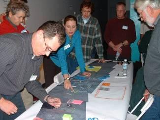
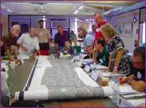
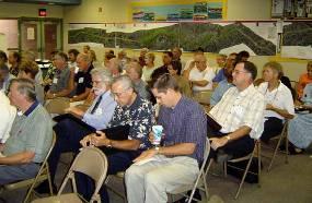
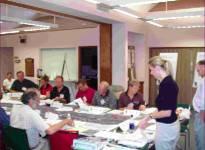
22 Charrette Characteristics Multi-Day Collaborative Event Corridor Tour Community Working Together to Resolve Problems or Issues Continual Feedback Loops Public Event to Present Findings Holistic Approach to Collaboration
23 Charrette Process Charrette Process Core Values Vision Evaluation Program Formulation of Planning Concepts Prioritization of Planning Concepts Charrette 1 Charrette 2 Charrette 3
24 Charrette #1: Core Values Economic Sustainability Regional Coordination Walkability Multi-Modal Corridor Mobility Context Sensitive Multi-Purpose Character Roadway Footprint Environmental Preservation Scenic Beauty Public Safety


25 Core Values Application


26 Charrette #2: Gaming Workshop


27 Evolution of Planning Concepts Planning Concept from Gaming Workshop Matrix Summarizing Planning Concepts Fishbone Diagram 12 Planning Concepts (Level 1 Screening)
 Evaluation Criteria And Performance Measures 6 +/- Planning Concepts (Mar-May) 3 +/-")
28 Planning Concepts Evaluation Process DESIGN TOOLBOX Charrette #2 Roadway Elements Transit Elements Bicycle Elements Pedestrian Elements Supportive Facilities Donuts & Dialogue /ET Mtg Screening Workshop/ET Mtg Screening Workshop/ET Mtg Project Constraint Criteria Charrette #3 12 +/- Planning Concepts (Jan) Evaluation Criteria And Performance Measures 6 +/- Planning Concepts (Mar-May) 3 +/- Planning Concepts (May) Preferred Planning Concept- Corridor-Wide Design Framework


")

29 Refinement of Planning Concepts Planning Concepts (Level 2 Screening) Screening Workshop #1 Screening Workshop #2


30 Charrette #3: Preferred Planning Concept
")
31 Planning Concept Matrix (Example)

")
32 Planning Concept Diagram (Example)

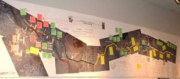
33 Displays: Planimetric Illustration Planning Concept Presented On Aerial Photograph

34 Displays: Typical Sections (Section Displayed for Each Segment by Concept)

35 Displays: Focus Area Rendering


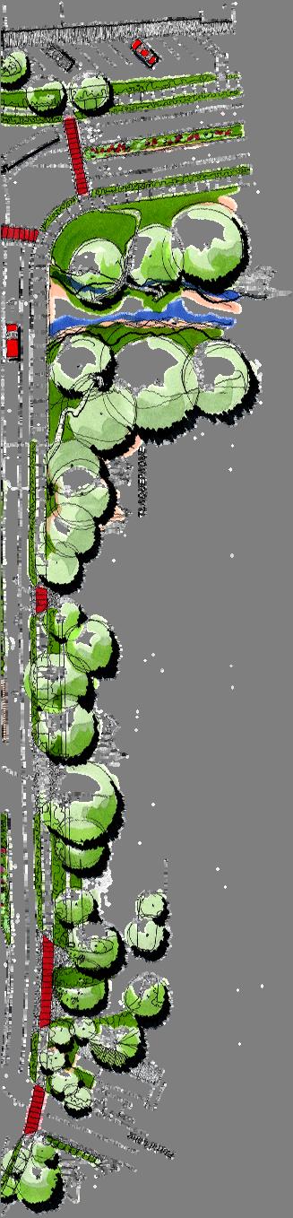

36 Displays: Urban Design Studies


37 Displays: Photo Simulations (Concept Superimposed on an Existing Photograph at Two Locations: Bell Rock Blvd., Poco Diablo Entrance)
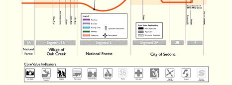
38 Core Value Applicability

39 Technical Analysis Displays Traffic Forecasts Planning Concept Tradeoffs Physical Impact of Level 3 Planning Concepts Construction Cost of Level 3 Planning Concepts Tradeoff Graphics Level 3 Evaluation Criteria/Performance Measures Comparison

40 Trade Offs Intersection Control Options Bifurcation Concept Urban Design Studies Median Options Paved Pathway Options

41 Physical Impact of Level 4 Planning Concept

42 Construction Cost of Level 4 Planning Concepts

43 Level 4 Planning Concept Ranking
44 Evaluation Program Summary Based on 17 Evaluation Criteria and 64 Performance Measures Finalized in Charrette #2 Results of the Evaluation Program Ranking are Within 14% of Each Other Demonstrates the Planning Concepts are All Viable and Reflect the Community s Values
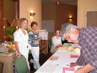
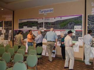
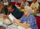
45 Prioritization Form (example segment by segment) The purpose of this worksheet is to identify your priorities, segment by segment, for the SR 179 planning concepts under consideration. The outcome of Charrette #3 will be the preferred planning concept for the corridor. INSTRUCTIONS - You have been given six dots--one for each segment. - Please place one dot in the box corresponding with the planning concept you prefer for each segment. - You can place dots straight across one row, or you can mix and match segments as you prefer. If you have any questions, please contact any of the staff available during the Charrette. Worksheets that are not completed correctly will not be considered, so please carefully place your dots! ID # Planning Concept Segment 1A MP to Village of Oak Creek Segment 1B Village of Oak Creek Segment 2 USFS Segment 3A Back O Beyond Rd to Canyon Dr Segment 3B Canyon Dr to Schnebly Hill Rd Segment 4 Schnebly Hill Rd to SR 89A Copper Turquoise Quartz ---Worksheet Continued on Other Side ---
46 Prioritization of Preferred Planning Concept Tier #1: Statistical Analysis - Prioritization Worksheets Results - Cross Tabulation of Priorities and Questions from Worksheets Tier #2: Project Team Analysis - Planning Concept Rankings from Evaluation Program - Professional Judgment Tier #3: Observation Based Analysis - Interaction between Project Team and Community - Trends in Community Feedback through NBIP Process
47 SR Matrix 179 Preferred Planning Concept Matrix Planning Concept SR 179 Preferred Planning Concept Lanes Components (1A) MP to Village of Oak Creek Segment 1 Segment 2 Segment 3 Segment 4 (1B) Village of Oak Creek USFS (3A) Back O'Beyond - Canyon (3B) Canyon - Schnebly Schnebly - SR 89A 2 throughout 2 NB 1 SB to Y + Passing Lanes Shoulders 8' Edge of Pavement (EPs) Curbs with underground storm drains/scuppers throughout Median 4' Raised 16' Raised Bifurcated 12' Raised to Ranger Accommodates Pedestrians Landscape Buffer between EPs and Pathways Maximum Total Section Width* Accommodates Bikes Major Intersection Types Left Turn Accommodation Other Yes 5' unpaved East side only Yes 4' - 12' meandering Yes 8' both sides Yes Bell Rock Path w/ trailhead connection Yes 10 one side Yes 8 both sides No Yes 4' None Ranger to Y 12' Flush Decorative Yes 6 both sides 78 Max 96 Max Max Bike Lane both Yes on 8' shoulder sides Roundabouts Ridge Trail, Jacks Canyon, Cortez, Bell Rock, Chapel, Schnebly Hill (or Traffic Signal), Ranger, 'Y', Brewer/89A (Study potential Roundabouts at Back-O-Beyond, Arrow/Morgan) Widen Intersections Realigned Wild Horse Mesa Dr. In Median Island None Widen Intersections Realigned Morgan Rd. In Median Island Realigned Highland Dr. In Flush Decorative Median Brewer/Ranger Two-Way Loop (2 NB, 1 SB on SR 179, 1 NB, 1 SB on Brewer/Ranger) * Dimension from back of sidewalk to back of sidewalk

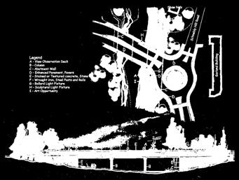
48 SR 179 Preferred Planning Concept Diagram
49 Segment Concept Design (July-November) Address the Details of the Community-Generated Corridor-Wide Framework Segment by Segment Citizen-Based Design Advisory Panels Finalize the Planning Process to Prepare for Final Design and Preparation of Construction Documents


50 Segment Concept Design Concept 1 Concept 2


51 Project Team Perspective: Unique to CSS Difference in Role for Project Team in Collaborative Design Establish Trust with Community and Stakeholders Importance of Education Importance of Listening Massive Amount of Data to Gather, Sort, and Analyze No Opinion - All Alternatives Technically Feasible Creativity to Convey Complex Messages


52 Community Involvement Key Community Interviews Focus Groups Celebratory Events Educational Forums Charrettes Donuts and Dialogue Workshops (Screening, Design) Random Sample Surveys Corridor Tour Segment Walkabouts
 Website")

53 Communications Program Newsletters E-newsletters News Releases/Media Outreach Program (Print, Electronic) Website Telephone Hotline Speakers Bureaus Small Group/One-on-One Meetings Press Kits Process Diary Traveling Exhibit Question Quilt


54 Approach to Public Outreach Program Excellent and Ongoing Information Two-Way Education Between the Project Team and Stakeholders, as well as Community, Throughout the Process Wide Variety of Active and Passive Participation Opportunities to Maximize Stakeholder Involvement Throughout -17 -


55 Local Project Office Required in DMJM+HARRIS Scope of Work On-Site Project Information Center Including Computer Terminal, Process Diary, and Project Displays to View Project Information and Public Comment ADOT and Consultant Team Work Room Location for Small Group Meetings Construction Coordination Office

56 Overall SR 179 Corridor Project Schedule Project Schedule* Charrette Process
57 SR 179 Recognitions ITE 2004 Best International Transportation Planning Project APA 2004 Award for Public Outreach/Multi- Agency Coordination, Arizona Planning Association Notable Practice in AASHTO Center for Environmental Excellence s Best Practices in CSS TRB 2005 Paper and Poster Presentation, Committee on Public Involvement
CITY OF CHARLOTTESVILLE, VIRGINIA CITY COUNCIL AGENDA
 CITY OF CHARLOTTESVILLE, VIRGINIA CITY COUNCIL AGENDA Agenda Date: December 16, 2013 Action Required: Adoption of Resolution Presenter: Staff Contacts: Title: James E. Tolbert, AICP, Director of NDS James
Scope of Services. River Oaks Boulevard (SH 183) Corridor Master Plan
 Corridor Master Plan") Scope of Services River Oaks Boulevard (SH 183) Corridor Master Plan PROJECT AREA The project area consists of the River Oaks Boulevard (SH 183) corridor bounded by SH 199 at the northern end and the Trinity
Scope of Services River Oaks Boulevard (SH 183) Corridor Master Plan PROJECT AREA The project area consists of the River Oaks Boulevard (SH 183) corridor bounded by SH 199 at the northern end and the Trinity
1.0 INTRODUCTION 1.1 TH 14 WEST STUDY AREA Project Description Functional Classification Purpose of the Project
 1.0 INTRODUCTION 1.1 TH 14 WEST STUDY AREA 1.1.1 Project Description The Trunk Highway (TH) 14 West Corridor is a two-lane roadway approximately 22 miles in length. Located in Nicollet County, the corridor
Executive Summary. NY 7 / NY 2 Corridor
 Executive Summary NY 7 / NY 2 Corridor Transportation and Land Use Study December 2005 Prepared for: Town of Colonie Capital District Transportation Committee Prepared by: Introduction: Land use decisions
Atlanta BeltLine Corridor Environmental Study. Scoping Meeting August 2008
 Atlanta BeltLine Corridor Environmental Study Scoping Meeting August 2008 What Will We Be Discussing Today? Study Overview - How Did We Get Here? - What Is the Study About? - Who Is Involved? - Where Is
MASTER PLAN KICK-OFF Open House #1A, April 28, 2015
 "The beginning is the most important part of the work." Plato, The Republic MASTER PLAN KICK-OFF Open House #1A, April 28, 2015 YOUR CAMPUS PLANNING TEAM Campus Planners Landscape Architects Urban Designers
Date: April 10, 2017 City Council Work Session April 24, 2017: Status Report on the Comprehensive Plan Update and Transportation Master Plan
 AGENDA REPORT To: From: By: Honorable Mayor and City Council Members Warren Hutmacher, City Manager Sharon Ebert, Director Community Development Date: April 10, 2017 Agenda: City Council Work Session April
The Illinois Department of Transportation and Lake County Division of Transportation. Route 173, including the Millburn Bypass
 The Illinois Department of Transportation and Lake County Division of Transportation welcome you to this Public Hearing for U.S. Route 45 from Illinois Route 132 to Illinois Route 173, including the Millburn
University of Saskatchewan CAMPUS MASTER PLAN. Senate Meeting Preliminary Presentation. April 21, 2018 DIALOG ECS DA WATT
 University of Saskatchewan CAMPUS MASTER PLAN Senate Meeting Preliminary Presentation April 21, 2018 DIALOG ECS DA WATT project process presentation agenda Stakeholder Engagement Project Control phase1
Sustainability, Health, Safety, Recreation & Open Space Working Group August 3, 2017
 Sustainability, Health, Safety, Recreation & Open Space Working Group August 3, 2017 DOWNTOWN OAKLAND SPECIFIC PLAN WELCOME Sustainability, Health, Safety, Recreation & Open Space Working Group Social
Rt 29 Solutions Hydraulic Planning Advisory Panel. September 28, 2017
 Hydraulic Planning Advisory Panel September 28, 2017 Agenda Item 1: Introductions Hydraulic Planning Advisory Panel members Technical Team members 2 Agenda item 2: Public Interaction and Feedback Live
Welcome to the. Open House
 Welcome to the 5th Street to Kinsman Road Open House November 14 5:30 7:00 p.m. Please sign in Project Overview In December 2016, City Council adopted SW 5th Street as the preferred alignment to connect
4/8/2015 Item #10D Page 1
 MEETING DATE: April 8, 2015 PREPARED BY: Christy Villa, Associate Civil Engineer DEPT. DIRECTOR: Glenn Pruim DEPARTMENT: Public Works CITY MANAGER: Larry Watt SUBJECT: NORTH COAST HIGHWAY 101 STREETSCAPE
Denton. A. Downtown Task Force
 2 Public Involvement Early and ongoing public involvement was solicited so that the public had ample opportunity to help direct the DTIP s concepts and implementation strategies. The residents of Denton
In partnership with: Harbor Corridor Plan Bali Hi Mobile Home Park July 24, 2013
 In partnership with: Harbor Corridor Plan Bali Hi Mobile Home Park July 24, 2013 Project Intro 2-miles of Harbor Boulevard Westminster/17 th Street to just north of Edinger Avenue Many people use the corridor
THE COMMUNITY-DRIVEN DESIGN PROCESS
 THE COMMUNITY-DRIVEN DESIGN PROCESS A PUBLIC DRIVEN PROCESS STEERING COMMITEE THE COMPREHENSIVE PLAN OPPORTUNITIES AND CONSTRAINTS THE COMMUNITY DRIVEN DESIGN PROCESS A Public Driven Process Beginning
FOUR MILE RUN VALLEY WORKING GROUP AND CHARGE
 FOUR MILE RUN VALLEY WORKING GROUP AND CHARGE Adopted April 16, 2016 Amended July 19, 2016 Overview of Integrated Effort The overall goal of the Four Mile Run Valley (4MRV) initiative is to develop a comprehensive
Rt 29 Solutions Hydraulic Planning Advisory Panel. September 14, 2017
 Hydraulic Planning Advisory Panel September 14, 2017 Agenda Item 1: Introductions Hydraulic Planning Advisory Panel members Technical Team members 2 Agenda item 2: Public Interaction and Feedback Live
Update. What is the Osborne Bridge Rehabilitation project all about and how is it being planned? Neighbourhood Advisory Committee (NAC)
") Update JANUARY 2010 Neighbourhood Advisory Committee (NAC) ARTS AND CULTURE Gas Station Theatre BUSINESS Osborne Village BIZ Downtown BIZ COMMERCIAL PROPERTY OWNER Great-West Life COMMUNITY ORGANIZATIONS
Update JANUARY 2010 Neighbourhood Advisory Committee (NAC) ARTS AND CULTURE Gas Station Theatre BUSINESS Osborne Village BIZ Downtown BIZ COMMERCIAL PROPERTY OWNER Great-West Life COMMUNITY ORGANIZATIONS
3. VISION AND GOALS. Vision Statement. Goals, Objectives and Policies
 Vision Statement Queen Creek s interconnected network of parks, trails, open spaces and recreation opportunities provide safe and diverse activities and programs that sustain its unique, small town, equestrian
Transportation Research Center
 Increasing Design Flexibility in the AASHTO Green Book Your Department Name Presentation to AASHTO Subcommittee on Design Doug Harwood, MRIGlobal July 2017 Transportation Research Center Resolution of
Informational Presentation JULIE CHRISTIENSEN DP-NWP GBD 29 JUNE 2016
 Informational Presentation JULIE CHRISTIENSEN DP-NWP GBD 29 JUNE 2016 TODAY S TOPICS 1. Public Realm Plan Goals & Outcomes 2. Project Identification & Polling 3. Current Capital Projects 4. Early Implementation
SCTPO Project Summary September 2014
 A1A MULTIMODAL CORRIDOR PLANNING AND ENGINEERING ANALYSIS Florida Department of Transportation SCTPO Project Summary September 2014 PRESENTATION FOOTER Meeting Agenda What We Plan To Do Project Background
Building Great Neighbourhoods. Strathcona
 Building Great Neighbourhoods Strathcona March 21, 2018 Becky Redford Project Manager, Planning & Design Building Great Neighbourhoods Integrated Infrastructure Services Welcome and Purpose To provide
TOWN OF NEW CASTLE - Master Plan Update
 Our Presentation Today (1) Recap the Master Planning Process To Date (2) Present the Outline of the Master Planning Work Plan (3) Present the Calendar for the Master Plan (4) Outline the scope of a Downtown
Streets, Connectivity & Built Environment Working Group August 2, 2017
 Streets, Connectivity & Built Environment Working Group August 2, 2017 DOWNTOWN OAKLAND SPECIFIC PLAN WELCOME Streets, Connectivity & Built Environment Working Group Social Equity Meeting August 2, 2017
EXECUTIVE SUMMARY. Introduction
 EXECUTIVE SUMMARY Introduction State Route 68 is a designated scenic route that connects the world-renowned Monterey Peninsula to US Highway 101 and the Salinas Valley. SR 68 is a key route for bicycle,
Broadway District Specific Plan. Community Workshop #2 February 23,2016
 Broadway District Specific Plan Community Workshop #2 February 23,2016 1 Agenda Introductions Project Progress Status Upcoming Milestones Emerging Framework Land Use Urban Design Circulation Infrastructure
edmonton.ca/ribbonofgreen #ribbonofgreen
 WHAT IS THE RIBBON OF GREEN? The Ribbon of Green is Edmonton s entire river valley and ravine system. The Ribbon of Green (2018) Project will provide strategic guidance for the southwest and northeast
Implementation Guide Comprehensive Plan City of Allen
 Implementation Guide 2030 Comprehensive Plan City of Allen DRAFT 2015 Implementation Guide Allen 2030 Comprehensive Plan INTRODUCTION The Comprehensive Plan serves as a guide for the growth and development
FOUR MILE RUN VALLEY WORKING GROUP AND CHARGE Adopted April 16, 2016 Amended July 19, 2016
 FOUR MILE RUN VALLEY WORKING GROUP AND CHARGE Adopted April 16, 2016 Amended July 19, 2016 Working Group Charge The Working Group is charged by the County Board to collaborate with staff to provide commission,
Context Sensitive Solutions A Process to Achieve Better Results
 Context Sensitive Solutions A Process to Achieve Better Results Brian Bochner 1 Context Sensitive Solutions Collaborating with stakeholders to develop projects that meet their needs Stakeholders views
Oroville Area Urban Greening Plan. Joint Meeting of the Oroville Planning, Park, and Arts Commissions October 12, 2015
 Oroville Area Urban Greening Plan Joint Meeting of the Oroville Planning, Park, and Arts Commissions October 12, 2015 Project Team Lead Agency Butte County Department of Development Services Claudia Stuart,
Presentation August 6, 2018
 Steering Committee Meeting #4 Presentation August 6, 2018 1 A. Commercial Strip Development and Alternatives B. Public Kick-off Meeting C. Next Steering Committee Meeting Road Map of Planning Process 2
CITY OF VAUGHAN EXTRACT FROM COUNCIL MEETING MINUTES OF JUNE 7, 2016
 Item 5, Report No. 26, of the Committee of the Whole (Working Session), which was adopted without amendment by the Council of the City of Vaughan on June 7, 2016. 5 MUNICIPAL CLASS ENVIRONMENTAL ASSESSMENT
Denver Moves: Transit Task Force
 Insert transit picture Denver Moves: Transit Task Force Meeting #8 October 5, 2017 1. Welcome & Introductions Opening remarks and housekeeping Task Force and audience introductions Upcoming events and
Potential Green Infrastructure Strategies May 6, 2015 Workshop
 Potential Green Infrastructure Strategies May 6, 2015 Workshop Background The City of Cortland is developing the Tioughnioga Urban Headwaters Green Infrastructure Action Plan with funding from the National
Introduction. Chapter 1. Purpose of the Comprehensive Plan Plan Organization Planning Process & Community Input 1-1
 Chapter 1 Introduction Lakewood 2025: Moving Forward Together Purpose of the Comprehensive Plan Plan Organization Planning Process & Community Input 1-1 Purpose of the Comprehensive Plan The Comprehensive
Cobb County Design Guidelines Mableton Parkway & Veterans Memorial Highway Community Design Workshop January 12, 2017
 Community Design Workshop January 12, 2017 Agenda Opening Remarks / Introductions Scope of Work Existing Conditions Key Issues / Opportunities VPS Summary Draft Vision & Goal Statement Implementation Concepts
UNCW CAMPUS MASTER PLAN
 UNCW CAMPUS MASTER PLAN JULY 27, 2017 MASTER PLAN FRAMEWORK RECOMMENDATIONS BOARD OF TRUSTEES PRESENTATION UNCW Campus Master Plan Update Board of Trustees Presentation July 27, 2017 The attached Campus
TAC/CAC, TPO Project Update February 2016
 A1A MULTIMODAL CORRIDOR PLANNING AND ENGINEERING ANALYSIS Florida Department of Transportation TAC/CAC, TPO Update February 2016 PRESENTATION FOOTERT Meeting Agenda What We Plan To Discuss Background New
Community Visioning Workshop Prep
 Community Visioning Workshop Prep Visioning Workshop 73 Visioning Workshop: Public Events 1 2 3 4 74 Visioning Workshop: draft Schedule 75 Visioning Workshop: draft Schedule working to schedule stakeholder
The Village of Sugar Grove, in partnership with Kane County, the Illinois Department of Transportation, and the Illinois Tollway welcomes you to the
 The Village of Sugar Grove, in partnership with Kane County, the Illinois Department of Transportation, and the Illinois Tollway welcomes you to the first Public Meeting for the proposed interchange improvement
PART 1. Background to the Study. Avenue Study. The Danforth
 The Danforth 1.1/ Study Purpose & Key Municipal Goals 1.2/ The Local Advisory Committee 1.3/ The Project Team 1.4/ Study Process/Summary of Method 1.5/ Summary of Consultation 1.1 Study Purpose and Key
Rt. 29 Solutions Project Delivery Advisory Panel. January 7, 2016
 Rt. 29 Solutions Project Delivery Advisory Panel January 7, 2016 Agenda item 1: Introductions Project Delivery Advisory Panel Technical Team 2 Agenda item 2: Interaction and Feedback Live Streaming Dec
RESOLUTION NO. R Refining the route, profile and stations for the Downtown Redmond Link Extension
 RESOLUTION NO. R2018-32 Refining the route, profile and stations for the Downtown Redmond Link Extension MEETING: DATE: TYPE OF ACTION: STAFF CONTACT: Capital Committee Board PROPOSED ACTION 09/13/2018
Route 1 Corridor Study
 Route 1 Corridor Study Westbrook, Connecticut A Vision for the Connecticut Shoreline Public Informational Meeting July 28, 2015 Lower Connecticut River Valley Council of Governments Fitzgerald & Halliday,
PREPARED FOR: PLATTEVIEW ROAD CORRIDOR STUDY EXECUTIVE SUMMARY
 PREPARED FOR: PLATTEVIEW ROAD CORRIDOR STUDY EXECUTIVE SUMMARY SEPTEMBER 2016 Introduction The Platteview Road Corridor Study was led by the Metropolitan Area Planning Agency (MAPA) with assistance from
I. DESCRIPTION OF PROPOSED ACTION... 1 A. General Description... 1 B. Historical Resume and Project Status... 2 C. Cost Estimates...
 PROJECT COMMITMENTS SUMMARY... S-1 1. Type of Action... S-1 2. Description of Action... S-1 3. Summary of Purpose and Need... S-1 4. Alternatives Considered... S-2 5. NCDOT Alternatives Carried Forward...
City of Farmington. Downtown Plan. Amendment to the 1998 Master Plan Adopted October 11, 2004
 City of Farmington Amendment to the 1998 Master Plan Adopted October 11, 2004 Introduction Planning Background 1 Scope and Components of the Plan Amendment 2 Concept Introduction 3 Plan Concepts 3 Conceptual
Boulder County Comprehensive Drilling Plan Surface Owner Meeting. Thursday, Oct. 19, 2017
 Boulder County Comprehensive Drilling Plan Surface Owner Meeting Thursday, Oct. 19, 2017 Contact Crestone Crestone Peak Resources Quick Facts www.crestonepeakresources.com cdpboulder@crestonepr.com (720)
A New Plan For The Calgary Region June calgary.ca call 3-1-1
 A New Plan For The Calgary Region June 2009 calgary.ca call 3-1-1 Introduction Since January 2006, The City of Calgary has been actively participating with the member municipalities of the Calgary Regional
Urban Planning and Land Use
 Urban Planning and Land Use 701 North 7 th Street, Room 423 Phone: (913) 573-5750 Kansas City, Kansas 66101 Fax: (913) 573-5796 Email: planninginfo@wycokck.org www.wycokck.org/planning To: From: City Planning
Creating Complete Roadway Corridors:
 Creating Complete Roadway Corridors: The AASHTO Guide to Transportation Landscape Architecture and Environmental Design NCHRP Project 15-33 Status Report AASHTO Standing Committee on Design Technical Committee
Corridor Management Committee. September 29, 2017
 Corridor Management Committee September 29, 2017 1 Today s Topics Chair s Update Proposed Corridor Protection Wall Aesthetic Design Overview Public Outreach Environmental Review Civil Construction Update
Scarborough Waterfront Project
 Scarborough Waterfront Project Public Information Centre #1 Environmental Assessment Terms of Reference September 10, 2014 Agenda Open House Presentation 7:00 to 7:30 pm Presentation 7:30 to 8:15 pm History
SECTION 4(f) DE MINIMIS DOCUMENTATION
 DE MINIMIS DOCUMENTATION") SECTION 4(f) DE MINIMIS DOCUMENTATION Illinois Route 60/83 IL 176 to the intersection of IL 60 (Townline Road) Lake County P-91-084-07 Mundelein Park and Recreation District Project Limit SECTION 4(f)
SECTION 4(f) DE MINIMIS DOCUMENTATION Illinois Route 60/83 IL 176 to the intersection of IL 60 (Townline Road) Lake County P-91-084-07 Mundelein Park and Recreation District Project Limit SECTION 4(f)
Downtown Development Specialist 2017 Year in Review
 Downtown Development Specialist 2017 Year in Review Downtown Development Specialist 3 Year Plan as Proposed (Autumn 2016): Year 1: Imagine Change (Organizationally Driven) Inspiring the local community
Toronto Complete Streets Guidelines Stakeholder Advisory Group #
 Toronto Complete Streets Guidelines Stakeholder Advisory Group #1 2015-03-24 What are Complete Streets? 2 Streets designed with all users in mind: pedestrians/those with disabilities cyclists street car
Downtown by Design: The Bradenton CRA Master Plan. Glatting Jackson, Inc Robert Charles Lesser & Co. Downtown Bradenton Development Authority
 Downtown by Design: The Bradenton CRA Master Plan Glatting Jackson, Inc Robert Charles Lesser & Co. Downtown Bradenton Development Authority October 3, 2006 Our Goal for Today: Introduce Project Introduce
2. AGENCY COORDINATION AND PUBLIC INVOLVMENT
 2. AGENCY COORDINATION AND PUBLIC INVOLVMENT This chapter discusses the process carried out for conducting agency coordination and public involvement activities. TECHNICAL ADVISORY COMMITTEE A Technical
12/9/2013. HOLLYWOOD/PINES CORRIDOR PROJECT AMPO 2013 Annual Conference October 24, Our Perspective. Broward.
 HOLLYWOOD/PINES CORRIDOR PROJECT AMPO 2013 Annual Conference October 24, 2013 Our Perspective Broward Fort Lauderdale 1 Broward Metropolitan Planning Organization Fort Lauderdale Fort Lauderdale Skyline
ARGENTA TRAIL (CSAH 28/63) REALIGNMENT SOUTH PROJECT (CP 63-25)
 REALIGNMENT SOUTH PROJECT (CP 63-25)") ARGENTA TRAIL (CSAH 28/63) REALIGNMENT SOUTH PROJECT (CP 63-25) Preliminary Design Report February 2015 Prepared For: City of Inver Grove Heights Dakota County Prepared By: Kimley-Horn and Associates,
ARGENTA TRAIL (CSAH 28/63) REALIGNMENT SOUTH PROJECT (CP 63-25) Preliminary Design Report February 2015 Prepared For: City of Inver Grove Heights Dakota County Prepared By: Kimley-Horn and Associates,
India Basin/Hunters Point Shoreline Community Workshop May 21, 2008
 India Basin/Hunters Point Shoreline Community Workshop May 21, 2008 Workshop Agenda Welcome Process Overview Context & Existing Conditions Presentation of Draft Concepts Land Use and Open Space Priorities
Glenn Highway MP DSR. Landscape Narrative
 Glenn Highway MP 34-42 DSR Landscape Narrative Project Landscape Goals The Glenn Highway MP 34-42 Project extends through a variety of landscape types typical to the Matanuska-Susitna Valley. In general,
UPDATE ON THE INDEPENDENCE BOULEVARD AREA PLAN. Citizen Advisory Group Meeting March 3, 2011
 UPDATE ON THE INDEPENDENCE BOULEVARD AREA PLAN Citizen Advisory Group Meeting March 3, 2011 Purpose: Why are we here? To provide an update on the Independence Boulevard Area Plan 1. Overview of the ULI
This page left intentionally blank.
 July 2012 This page left intentionally blank. Table of Contents Appendix A : Project Development Checklist Appendix B: At-Grade Rail Crossings Appendix C: Maintenance and Operations Examples Appendix D:
WELCOME TO OPEN HOUSE TWO November 28, 2018
 Langstaff Road Weston Road to Highway 7 Class Environmental Assessment Study WELCOME TO OPEN HOUSE TWO November 28, 2018 Please sign in and join our mailing list Study Overview York Region is conducting
PLANNING COORDINATING COMMITTEE
 PLANNING COORDINATING COMMITTEE Fall Meeting/Luncheon Welcome! October 16, 2009 PLANNING COORDINATING COMMITTEE Fall Meeting/Luncheon WELCOME! WELCOME! October 16, 2009 October 16, 2009 Agenda I. Lunch/Socialize
Boulder County Comprehensive Drilling Plan Surface Owner Meeting. Thursday, Nov. 2, 2017
 Boulder County Comprehensive Drilling Plan Surface Owner Meeting Thursday, Nov. 2, 2017 Contact Crestone Crestone Peak Resources Quick Facts www.crestonepeakresources.com cdpboulder@crestonepr.com (720)
Elm Street Business District: Streetscape and Signage Plan
 Elm Street Business District: Streetscape and Signage Plan VILLAGE OF WINNETKA DOWNTOWN MASTER PLAN TASK FORCE MTG #1 Teska Associates 30 October 2017 AGENDA 1. Introductions and Walking Tour 2. Past Streetscape
Ann Arbor Downtown Street Design Manual. Ann Arbor DDA IDA 2015 Awards Planning Category
 Ann Arbor Downtown Street Design Manual Ann Arbor DDA IDA 2015 Awards Planning Category 1 Ann Arbor s downtown streets are vibrant public spaces that accommodate multi-modal transportation, special events,
SOUTH UNIVERSITY Street Design Alternatives in Progress
 1 Alternatives in Progress 2016.01.20 Meeting Agenda 2 1. Progress & Schedule 2. Utilizing the Street Design Manual 3. Site Characteristics and Input Received 4. Street Geometry What can we accomplish
REVIEW AND EVALUATION OF REGIONAL LAND USE
 REVIEW AND EVALUATION OF REGIONAL LAND USE AND TRANSPORTATION SCENARIOS #220831 Environmental Justice Task Force October 7, 2014 VISION 2050 Process Development of Guiding Vision for Land Use and Transportation
DRAFT PLAN PRESENTATION
 DRAFT PLAN PRESENTATION 1.23.2018 AGENDA Process Project Schedule Results from Visioning Workshop Draft Plan Highlights Concept Plans Feedback Next Steps PROJECT SCHEDULE KICK-OFF WORKSHOP August 29 th
Blueprint Denver Task Force Meeting #
 Blueprint Denver Task Force Meeting #1 6.23.16 1. Welcome and Introductions Your name and affiliation Name 1 thing you love about Denver Name 1 thing you d change about Denver All in 30 seconds! Ready,
SH 199 Corridor Master Plan. Community Meeting No. 2 May 31, 2017
 Community Meeting No. 2 May 31, 2017 Transportation Projects On or Near SH 199 SH 199 from 0.3 miles south of FM 1886 to south end of Lake Worth bridge Construct freeway mainlanes and frontage roads 10-Year
Report to: Development Services Committee Report Date: April 24, 2017
 SUBJECT: Cornell Rouge National Urban Park Gateway - Report on Design Charrette and Next Steps PREPARED BY: Lilli Duoba, MES, MCIP, RPP, Manager, Natural Heritage (ext. 7925) REVIEWED BY: Marg Wouters,
PLAN ELEMENTS WORKSHOP. April 5, 2016
 PLAN ELEMENTS WORKSHOP April 5, 2016 needs more housing. But there is no one-size fits-all solution. Every neighborhood has its own character. In some places, density is not only appropriate it is badly
Public Hearing. Charlotte County-Punta Gorda MPO - Meeting Rooms A and B March 14, open house at 4 p.m., formal presentation at 5 p.m.
 Public Hearing Charlotte County-Punta Gorda MPO - Meeting Rooms A and B March 14, 2019 open house at 4 p.m., formal presentation at 5 p.m. Welcome to the Public Hearing for the Harborview Road (CR 776)
Toronto Complete Streets Guidelines
 c. DTAH 58 60 3.1 70 3.2 Performance Measurement 71 3.3 Exceptions Chapter 3 describes the five general steps in the street design process. Not all projects follow these steps, as the number of steps and
Downtown Area. Draft Vision and Strategies. February 24, 2015 Public Meeting
 Downtown Area Draft Vision and Strategies February 24, 2015 Public Meeting 1 SEA District North Beach Sea and Sky 3 Uptown Opportunity Neighborhoods Hillcrest Assist owner-occupants in negotiating fair
18 May 2016 CAMPUS MASTER PLAN UPATE
 18 May 2016 CAMPUS MASTER PLAN UPATE Council of the Deans ( Over view) AGENDA Engagement & What We Heard Focus Elements: 1. Development Framework Plan 2. Campus Mobility 3. Campus Guidelines 4. Wayfinding
DRAFT: NOT FINAL DESIGN
 T H E M E S O F S T A K E H O L D E R I N P U T GREEN INFRAST RUCTURE & EDGES STEWARDSHIP THROUGH P ARTNERSHIP AMENITIES & ANCHORS DESTINATION DISTRICT sustainable landscapes & infrastructure that are
The Community and Transportation Linkage Planning Program
 The Community and Transportation Linkage Planning Program Sandy Misiewicz, AICP Capital District Transportation Committee Senior Transportation Planner II CSS National Dialog 2 October 1, 2013 Capital
DALY CITY VISIONING PROCESS COMMUNITY WORKSHOP 3 MAY 8, 2008
 DALY CITY VISIONING PROCESS COMMUNITY WORKSHOP 3 MAY 8, 2008 PROCESS General Plan - a statement of the community s values, vision and aspirations for now and into the future... Timeframe LONG TERM - 2030
Portage Parkway Environmental Assessment Public Information Centre No. 1
 City of Vaughan Portage Parkway Environmental Assessment Public Information Centre No. 1 November 25, 2015 Welcome to the Public Information Centre This first Public Information Centre (PIC) introduces
Plan Framework Report. Attachment A
 Plan Framework Report Attachment A Uptown-Douglas Corridor Plan - Plan Framework Report Contents Introduction... 1 Planning Process... 3 Project Objectives... 4 Vision... 5 Community Values... 6 Structural
Route 347. New York State Department of Transportation Region 10, Long Island. THE GREENING of ROUTE 347
 The GREENING of Route 347 The Greening of Route 347 The Greening of Route 347: History 3 The Greening of Route 347 4 The Greening of Route 347 5 The Greening of Route 347 Smith Haven Mall 6 The Greening
Presentation Overview
 DETROIT RIVER INTERNATIONAL CROSSING STUDY Presentation to Windsor Rotary Club October 23, 2006 1 Presentation Overview 1. Overview 2. Progress Update Technical Work Program Environmental Work Program
Welcome. Green Line LRT. Beltline Alignment Options. Stay engaged! Follow the Green Line story at calgary.ca/greenline
 Welcome Green Line LRT Beltline Alignment Options Stay engaged! Follow the Green Line story at calgary.ca/greenline Green Line LRT Why are we here? Our Challenge Determine the best alignment in the Beltline.
Washington Pass Overlook
 Washington Pass Overlook The Washington Pass Overlook is located on the Methow Valley Ranger District on the Okanogan-Wenatchee National Forest. The overlook is at the crest of Washington Pass and is part
MEETING PURPOSE AND OVERVIEW
 MEETING PURPOSE AND OVERVIEW On February 23, 2012, the City of Elk Grove hosted the first of two community workshops related to the Southeast Policy Area. The workshop was held from 6:00 8:30 p.m. in the
11 February CAMPUS MASTER PLAN UPDATE Focus Group - Research Park
 11 February 2016 CAMPUS MASTER PLAN UPDATE Focus Group - Research Park AGENDA Introductions Planning Scope The 2004 Campus Plan Observations SWOT Exercise Analysis Goals and Advice Questions & Discussion
Public Information/Cultural Resources Committee Workshop August 15, Florida Department of Transportation District One
 Public Information/Cultural Resources Committee Workshop August 15, 2012 Florida Department of Transportation District One SR 542 from 1 st Street to E. of Buckeye Loop Road Winter Haven, Polk County FPID#
East Midtown Greenway East 53 rd 61 st Street. Community Board 8 Project Introduction November 16, 2017
 East Midtown Greenway East 53 rd 61 st Street Community Board 8 Project Introduction November 16, 2017 Agenda Overview - Development of the East Midtown Waterfront Esplanade Current East Midtown Greenway
Plan Overview. Manhattan Area 2035 Reflections and Progress. Chapter 1: Introduction. Background
 Plan Overview The Manhattan Urban Area Comprehensive Plan (the Comprehensive Plan) is a joint planning initiative of the City of Manhattan, Pottawatomie County, and Riley County. The 2014 Comprehensive
Onondaga County Sustainable Streets Project. Onondaga County Planning Federation June 7, Onondaga County Sustainable Streets Project 1
 Onondaga County Sustainable Streets Project Onondaga County Planning Federation June 7, 2012 Onondaga County Sustainable Streets Project 1 Sustainable Streets 1. Introduction to the SMTC 2. Sustainable
CONTENTS BACKGROUND AND CONTEXT... 3 Plan Area... 3 History... 3 Previous Planning Initiatives... 4 PLANNING FRAMEWORK... 5 Countywide Transit
 CONTENTS BACKGROUND AND CONTEXT... 3 Plan Area... 3 History... 3 Previous Planning Initiatives... 4 PLANNING FRAMEWORK... 5 Countywide Transit Corridors Functional Master Plan... 5 Veirs Mill Road Bus
City of Missoula and Missoula County Open Space Planning Open House
 City of Missoula and Missoula County Open Space Planning Open House FEBRUARY 6, 2018 The following slides contain the display board content from the open house. Please use boards to answer questions in