The Lower Yahara River Trail Phase One Planning and Design. Public Information Meeting February 27 th, 2014
|
|
|
- Lenard Turner
- 6 years ago
- Views:
Transcription

1 The Lower Yahara River Trail Phase One Planning and Design Public Information Meeting February 27 th, 2014
2 The Lower Yahara River Trail Introductions Meeting Purpose Project Overview Planning Process History & Current Status Overview of Major Planning and Design Considerations for the Environmental Report Proposed Trail Alignment & Typical Section Update Remaining Project Timeline and Estimated Cost Future Operations and Maintenance Next Steps/QA
3 The Lower Yahara River Trail Meeting Purpose Refresh Public/Stakeholder Project Awareness & Status Discuss Major Planning Considerations & Decisions Included within the Environmental Report Present Preferred Alternative Alignment & Cross Sections Answer Questions, Listen to Comments
4 The Lower Yahara River Trail Project History and Overview Trail Concept Originated 1995 from Village of McFarland during update to County POSP Support for the trail has steadily increased from 2007 to present.

5

6

7

8

9
10 Original 2009 Stakeholder Oversight Committee Ken Lucht, WSOR Sue Josheff, WDNR Cami Peterson, WDNR Vicki Schaefer, WDOT Kim Johnson, Citizen Member Larry Nelson, City of Madison John Reimer, City of Madison Rob Phillips, City of Madison Rich Vela, City of Monona Arthur Ross, Bicycle Advocate Jeremy Balousek, Dane County Kevin Connors, Dane County Chris James, Dane County Pauline Boness, Village of McFarland Doug Wood, OCR Roger Breske, OCR
11 Planning Process History Fall 2007 Stakeholder Kickoff Meeting Scope of Project Expanded to Consider Water Flow, Navigation and Corridor Safety Spring 2008 Established Stakeholder Committee Summer 2008 Issued LYRT RFP Fall 2008 Hired Graef for Design Development Winter 2009 Began Conceptual Design Development Spring 2009 Expanded Graef Contract to PS&E May 2009 Completed Wetland Delineation, Boring Investigation June 2009, Public Information Meeting Summer 2009 Subsurface Borings at Lake Bed
12 Planning Process History Cont Hydraulic Modeling of the Railroad Trestle October 2010 Awarded $2.9 million TE funds 2011 KJohnson Engineers Hired as WDOT Management Consultant (MC) for Design Review 2011 through Current -Floodplain Impact Analysis -Phase 1 & 2 Archaeological Investigations -Additional Topographic and Boundary Surveying -Ongoing WSOR Shared Use Discussions -Ongoing WDNR Shoreline/Wetland Impact Discussions - Ongoing Wisconsin Historical Society Discussions -Ongoing WDOT Archaeological Discussions -Additional Soil Borings -Alternative Alignment Number 7!
13 Current Phase 1 Lower Yahara River Trail Planning Team Steve Huberty, P.E., GRAEF, Project Manager Chris James, Dane County Parks, Project Manager Dan Windorski, P.E., GRAEF, Structural Engineer Bill Wuellner, P.E., CGC, Inc. (Borings) Bill Biesmann, P.E., KJohnson Engineers, WDOT Management Consultant Ian Chidister, FHWA, Environmental Program Manager Russ Anderson, WDNR, NR Region Program Manager Eric Heggelund, WDNR, Environmental Analysis and Review Specialist James Becker, WDOT, Archaeological Program Coordination Mark Dudzik, WDNR, Archaeologist Sherman Banker, Wisconsin Historical Society, Compliance Archaeologist Jennifer Haas, Great Lakes Archaeological Research Center


14 Major Planning &Design Considerations for the Environmental Report
15 Major Design Considerations Wetlands All Swamp White Oak tree locations were surveyed and trail alignments were adjusted to minimize impacts Extensive boardwalking Limiting fill/at-grade path to upland areas & utilized existing bank berm profile. Minimal wetland disturbance (approximately 1.75 acres) at slope transitions and under boardwalks Trail will enhance awareness and appreciation of floodplain/wetland communities

16

17
18 Major Design Considerations Aquatic Lakebed Impacts Approximately 2000 linear feet of lakespan shoreline boardwalking is being proposed About ½ of the lakespan boardwalk will be completely over the water, the remainder partially Little to no impact to boaters. Lakespan boardwalk may actually protect against future shoreline loss from wind, wave, ice damage.

19

20

21
22 Major Design Considerations Archaeological Lake Farms Archaeological District listed on National Register of Historic Places (NRHP) in 1978 Phase 2 archaeological field investigations in 2012 resulted in additional lands being eligible for designation on the NRHP in 2013 within McDaniel Park. Wisconsin Native American tribes were sent project notification information in 2009 and 2012; and were invited to Consultation meetings in Dec and January 2014 James Becker, WDOT Archaeological Program Manager, had informal discussions with members of the Ho Chunk Nation related to the scope of the project and pending Consultation meetings.
23 Major Design Considerations Archaeological Constructing boardwalk throughout the entire archaeological district area was discussed. Trail user safety was the primary reason why boardwalk is not being proposed throughout the entire Lake Farm archaeological district.
24 Major Design Considerations Archaeological-Data Recovery Plan Great Lakes Archaeological Research Center/UW Milwaukee will be conducting hand dug field investigations in areas of known concentrations prior to construction. Artifacts uncovered will be curated at a UW Milwaukee facility that meets Federal storage standards. GLARC will provide monthly reports on findings and will facilitate several on site progress meetings to present findings.
25 Major Design Considerations Archaeological-Data Recovery Plan GLARC will provide a comprehensive written report of all findings. GLARC will publish an article of findings in a scholarly journal and provide a public lecture at a forum to be determined. (Heritage Center?)

26 Major Design Considerations Archaeological-Data Recovery Plan Dane County Parks will work with a consultant to develop updated educational and interpretive materials based on findings of the final report.

27

28

29 Major Design Considerations Floodplain A floodplain analysis and permit application was completed and submitted to Dane County Planning and Development. The project was found to conform to Dane County Code of Ordinance, Chapter 17, Floodplain Regulations and a permit has been issued.
30 Major Design Considerations Railroad Wisconsin & Southern Railroad Co. and Dane County Parks staff met between 2007 and 2013 to discuss the possibility of a shared use corridor for portions of the LYRT. Changes to WSOR/WATCO insurance requirements and lack of coverage for RR incidents under the Dane County insurance policy led to an eventual relocation of the trail corridor outside of the existing WSOR/WDOT right of way. Narrowness of corridor made separation challenging!
31 Major Design Considerations Path Width WDOT recommends 10 minimum width with 2 wide shoulders for off road paths in their Wisconsin Bicycle Facility Design Handbook. Areas of higher and mixed use may warrant increasing path width to 12 or even 14. Paths in popular parks, along regional shorelines or near large population centers and universities can easily generate high levels of mixed use traffic
32 Major Design Considerations Boardwalk Width WDOT recommends 12 minimum inside width from rail to rail in their Wisconsin Bicycle Facility Design Handbook. 14 inside width from rail to rail is their desired standard.
33 Major Design Considerations Trail Width 10? 12? 14?
34 Major Design Considerations Trail Width* Boardwalk widths are proposed at 12 vs. 14 wide to minimize footprint at wetlands and over water. At grade paved sections 10 wide with 2 shoulders to minimize wetland/archaeological impacts. *Minimizing impacts to water, wetlands and archaeological resources and maintaining safe distance from the active rail line were primary planning considerations.

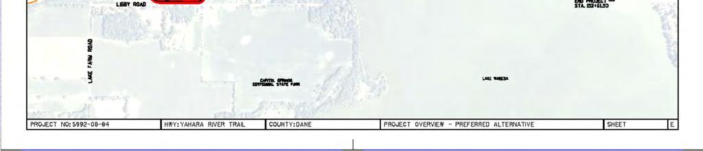
35 Proposed Trail Alignment & Typical Section Update The preferred alternative alignment is #7. Location of swamp white oak trees, intial archaeological field tests, receding shorelines, lack of current survey data and uncertainty of a suitable/acceptable shoreline location has resulted in many updates to the alignment!

36

37
38


39


40
41
42 Updated Project Timeline Section 106 Initial Approval: July, 2013 Consultation Meeting 1: December, 2013 Consultation Meeting 2: January / February 2014 Public Information Meeting End of February, 2014 Environmental Report Submittal End of February, 2014 Draft MOA: March, 2014 Final MOA Approval: April, 2014 Approved Environmental Report: May, % Preliminary Plan: April/May, 2014 Approved DSR: June, 2014 Draft PS&E: September, 2014 Final PS&E: November, 2014 WDOT Bid Let: March, 2015 Construction May 1, 2015
43 Estimated Construction Costs Total Estimated Project Cost: $5.4 million Estimated Federal Funds (Pending TAP approval) $4 million Dane County Funds $1.4 million

44 Future Operations and Maintenance Will Dane County plow snow on the Lower Yahara River Trail?

45 Future Operations and Maintenance Will Dane County Charge a Trail Pass Fee for the Lower Yahara River Trail?
46 We Don t Know Continue to monitor winter use on Capital City Trail Explore sustainable bike trail maintenance ideas with MPO through their 2014 Bicycle Transportation Plan Solicit ideas from the bicycle community
47 What We Do Know Dane County Parks now has nearly 20 miles of off road bicycle trails, the system has nearly doubled in the past 10 years. Commuter cyclist numbers are on the rise. Dane County has spent more than $12 million dollars on planning, acquisition and development of bicycle trails since 2000.
48 Current Maintenance Strategies State Trail Pass Fees (CCT only) Dane County User Fees (Mt. Bike, XC Ski, Equestrian, Lake Access, Dog Parks, Disc Golf Volunteer Trail Maintenance Fund Raising Events Volunteers sell trail passes, keep revenue, maintain trails.

49 Final Maintenance Thoughts We are looking for ideas on how everyone can sustain ongoing O/M costs for the ever growing off road bike trail network!

50 It s Time for our Patent Pending Public Listening Session! Please Respect your allotted time limit Do not interrupt or interject during others comments Do not laugh at somebody else s idea or comment Refrain from talking while others are speaking We ll be here as long as we can afterward to answer additional questions.
51 Questions? For more information contact: Chris James, Park Planner Dane County Parks Division 1 Fen Oak Court, Room 234 Madison, WI James@co.dane.wi.us Thank You!
Chris James Park Planner July 16, Master Plan Kick Off Meeting
 Chris James Park Planner July 16, 2014 Master Plan Kick Off Meeting Meeting Overview Introductions Purpose of Meeting and Master Plan History & Background of Park Property Prior Planning Considerations
Silverwood Masterplan Kickoff Meeting. Jim Neidhart Dane County Parks Planning
 Silverwood Masterplan Kickoff Meeting Jim Neidhart Dane County Parks Planning 608-224-3614 January 30, 2014 Silverwood County Park Public Information Meeting Notice Sent notice to all landowners adjacent
Information for File # SEK
 Information for File # Applicant: Dane County Corps Contact: Simone Kolb Address: 20711 Watertown Rd., Suite F, Waukesha, WI, 53186 E-Mail: simone.e.kolb@usace.army.mil Phone: 262-717-9539 Primary County:
Dane County Parks and Open Space Plan
 Dane County Parks and Open Space Plan 2018-2023 Connect People to the Land and Water Resources of Dane County 2012 2017 Dane County Parks and Open Space Plan Vision Statement March 30 th, 2017 Public Information
METROPOLITAN COUNCIL 390 North Robert Street, St. Paul, MN Phone (651) ; TDD (651)
 ; TDD (651)") DATE: December 20, 2011 METROPOLITAN COUNCIL 390 North Robert Street, St. Paul, MN 55101 Phone (651) 602-1000; TDD (651) 291-0904 TO: Metropolitan Parks and Open Space Commission FROM: Tori Dupre, Senior
DATE: December 20, 2011 METROPOLITAN COUNCIL 390 North Robert Street, St. Paul, MN 55101 Phone (651) 602-1000; TDD (651) 291-0904 TO: Metropolitan Parks and Open Space Commission FROM: Tori Dupre, Senior
The Illinois Department of Transportation and Lake County Division of Transportation. Route 173, including the Millburn Bypass
 The Illinois Department of Transportation and Lake County Division of Transportation welcome you to this Public Hearing for U.S. Route 45 from Illinois Route 132 to Illinois Route 173, including the Millburn
SECTION 4(f) DE MINIMIS DOCUMENTATION
 DE MINIMIS DOCUMENTATION") SECTION 4(f) DE MINIMIS DOCUMENTATION Illinois Route 60/83 IL 176 to the intersection of IL 60 (Townline Road) Lake County P-91-084-07 Mundelein Park and Recreation District Project Limit SECTION 4(f)
SECTION 4(f) DE MINIMIS DOCUMENTATION Illinois Route 60/83 IL 176 to the intersection of IL 60 (Townline Road) Lake County P-91-084-07 Mundelein Park and Recreation District Project Limit SECTION 4(f)
Yadkin River Greenway Feasibility Study Fact Sheet Village of Clemmons, Town of Lewisville, Town of Bermuda Run
 Fact Sheet Village of Clemmons, Town of Lewisville, Town of Bermuda Run Project Background The Yadkin River Greenway Feasibility Study is a joint project with the Village of Clemmons, the Town of Bermuda
BeltLine Corridor Environmental Study
 BeltLine Corridor Environmental Study Joint TAC and SAC Meeting December 8, 2008 What We Will Discuss Today Outreach and Agency Coordination Scoping Results Existing Conditions Historical and Archeological
St. Croix County Shoreland Overlay Zoning Districts. Public Hearing Community Development Committee December 19, 2013
 St. Croix County Shoreland Overlay Zoning Districts Public Hearing Community Development Committee December 19, 2013 Timeline CDC Review October 17 Public Information Meeting October 29 (6:00-8:00 pm)
PROJECT BACKGROUND. Preliminary Design Scope and Tasks
 PROJECT BACKGROUND Preliminary Design Scope and Tasks The purpose of this Study is the development of preliminary designs for intersection improvements for Trunk Highway (TH) 36 at the intersections of
BEACH AND INLET PROJECTS UPDATE
 BEACH AND INLET PROJECTS UPDATE USACE DELTA PROJECT USACE Delta Project Project Extents Elevation Elevation (ft NAVD88) (ft NAVD88) USACE Delta Project Project Cross-Section 20 18 20 16 18 14 16 12 14
DRAFT MAP AMENDMENT FLU 04-4
 DRAFT MAP AMENDMENT FLU 04-4 SW 24 TH AVENUE ROADWAY CORRIDOR The University of Florida participates with the Metropolitan Transportation Planning Organization (MTPO) in its responsibilities for the continuing,
APPENDIX I PUBLIC MEETING AT PROJECT INCEPTION
 APPENDIX I PUBLIC MEETING AT PROJECT INCEPTION OKLAHOMA DEPARTMENT OF TRANSPORTATION STATE HIGHWAY 10 ENVIRONMENTAL ASSESSMENT (MIAMI, OKLAHOMA) OPEN HOUSE SEPTEMBER 7, 2006 PROJECT OVERVIEW The Oklahoma
Grand River Ravines Georgetown Township
 Grand River Ravines Georgetown Township Project Description: The Grand River Ravines County Park property is composed of the 68-acre former Fillmore at the Bend Open Space purchased in 1999 and two more
Project Overview. Get Involved. Public Information Meeting. Contact Information
 Get Involved VDOT representatives will review and evaluate information received as a result of this meeting. Please fill out the comment sheet provided in this brochure if you have any comments or questions.
SOUTHWEST CORRIDOR EXTENSION. Environmental Evaluation and Basic Engineering Results PUBLIC MEETING/OPEN HOUSE November 18, 2009
 SOUTHWEST CORRIDOR EXTENSION Environmental Evaluation and Basic Engineering Results PUBLIC MEETING/OPEN HOUSE November 18, 2009 AGENDA I. Welcome/Introductions II. Project Review and Status III. Environmental
Call for Artists for: Design and Construction of Environmental Art Activation Story Mill Community Park, Bozeman, MT
 Call for Artists for: Design and Construction of Environmental Art Activation Story Mill Community Park, Bozeman, MT Seeking artists to design, fabricate and install art elements in the nature sanctuary
Overview of Southwestern Pennsylvania Commission s (SPC) 2040 Long Range Transportation Plan (LRTP)
 2040 Long Range Transportation Plan (LRTP)") Overview of Southwestern Pennsylvania Commission s (SPC) 2040 Long Range Transportation Plan (LRTP) Presented to Pennsylvania Agency Coordination Meeting May 27, 2015 Doug Smith & Ryan Gordon 1 Southwestern
Overview of Southwestern Pennsylvania Commission s (SPC) 2040 Long Range Transportation Plan (LRTP) Presented to Pennsylvania Agency Coordination Meeting May 27, 2015 Doug Smith & Ryan Gordon 1 Southwestern
DRAFT SCOPE OF SERVICES PEER REVIEW OF BAKER PARK. Request for Qualifications (RFQ)
") DRAFT SCOPE OF SERVICES PEER REVIEW OF BAKER PARK Request for Qualifications (RFQ) The following scope of services is presented for consideration and development of firm qualifications submittal. Some
DRAFT SCOPE OF SERVICES PEER REVIEW OF BAKER PARK Request for Qualifications (RFQ) The following scope of services is presented for consideration and development of firm qualifications submittal. Some
Pennsy Greenway Trail
 Town of Schererville Pennsy Greenway Trail DES. #s: 0401062, 1173595 & 1382661 Construction of Pennsy Greenway Trail beginning at Wilhelm Street and continuing northwest along the former Penn Central railroad
Project Overview. Fairfax County Parkway Widening Fairfax County. Get Involved. Public Information Meeting. Contact Information
 Get Involved VDOT representatives will review and evaluate information received as a result of this meeting. Please fill out the comment sheet provided in this brochure if you have any comments or questions.
West Dennis Center: Bass River to Old Main Street. West Dennis Business District: Old Main Street to Dennis Commons
 West Dennis Center: Bass River to Old Main Street West Dennis Business District: Old Main Street to Dennis Commons Dennisport Center: Dennis Commons to Division Street Main Street Project Goals Project
Request for Proposal
 Request for Proposal 10 th Street Corridor Master Plan Department of Planning and Zoning 500 Quartermaster Court Suite 200 Jeffersonville, IN 47130 April 18, 2017 For further information contact: Chad
Office of Greenways & Trails Providing Statewide Leadership and Coordination. Southeast Greenways and Trails Summit October 1-3, 2017
 Office of Greenways & Trails Providing Statewide Leadership and Coordination Southeast Greenways and Trails Summit October 1-3, 2017 1 Office of Greenways and Trails The Office of Greenways and Trails
4/8/2015 Item #10D Page 1
 MEETING DATE: April 8, 2015 PREPARED BY: Christy Villa, Associate Civil Engineer DEPT. DIRECTOR: Glenn Pruim DEPARTMENT: Public Works CITY MANAGER: Larry Watt SUBJECT: NORTH COAST HIGHWAY 101 STREETSCAPE
METROPOLITAN COUNCIL 390 North Robert Street, St. Paul, MN Phone (651) ; TDD (651)
 ; TDD (651)") DATE: October 24, 2012 METROPOLITAN COUNCIL 390 North Robert Street, St. Paul, MN 55101 Phone (651) 602-1000; TDD (651) 291-0904 TO: Metropolitan Parks and Open Space Commission FROM: Tori Dupre, Senior
DATE: October 24, 2012 METROPOLITAN COUNCIL 390 North Robert Street, St. Paul, MN 55101 Phone (651) 602-1000; TDD (651) 291-0904 TO: Metropolitan Parks and Open Space Commission FROM: Tori Dupre, Senior
USA Addition of South & East Side Residential Parcels. USA Deletion of a Town of Christiana Parcel. Conversion from USA to Limited Service Area
 Village of Rockdale Village of Rockdale 148 Water Street Cambridge, WI 53523 Phone 608.423.1497 Fax 608.423.9694 Urban Service Area (USA) Amendment USA Addition of South & East Side Residential Parcels
Wisconsin downtown action council Downtown project case study profile
 Wisconsin downtown action council Downtown project case study profile Project Name Onalaska Waterfront Project Location City of Onalaska Project Type (check all that apply) g Residential g Commercial g
Link Union Station (Link US) Project Open House September 26, 2018
 Project Open House September 26, 2018") Link Union Station (Link US) Project Open House September 26, 2018 Major Project Components 1. New rail communication, signals, and tracks 2. New run-through tracks over US-101 and new loop track 3. New
Link Union Station (Link US) Project Open House September 26, 2018 Major Project Components 1. New rail communication, signals, and tracks 2. New run-through tracks over US-101 and new loop track 3. New
Housing Development and Land Use in Dane County. Don Esposito VP, Land Development
 Housing Development and Land Use in Dane County Don Esposito VP, Land Development Our Mission We build great homes by never losing sight of what is important: our customers, our employees, our communities
PUBLIC SPACES MASTER PLAN UPDATE (POPS) Crystal City Citizen s Review Council October 24, 2018
 Crystal City Citizen s Review Council October 24, 2018") PUBLIC SPACES MASTER PLAN UPDATE (POPS) Crystal City Citizen s Review Council October 24, 2018 1 PLANNING CONTEXT Arlington County Comprehensive Plan UPDATE Related Documents: CIP Sector Plans Area Plans
PUBLIC SPACES MASTER PLAN UPDATE (POPS) Crystal City Citizen s Review Council October 24, 2018 1 PLANNING CONTEXT Arlington County Comprehensive Plan UPDATE Related Documents: CIP Sector Plans Area Plans
Public Services Department
 Public Services Department PAUL SMITH PUBLIC SERVICES DIRECTOR Memorandum Date: July 24, 2018 To: Honorable Mayor and Board of Commissioners Through: Mark LeCouris, City Manager From: Paul Smith, Public
Transportation Committee
 Transportation Committee Business Item No. 2013-286SW Meeting date: October 14, 2013 For the Metropolitan Council meeting of October 16, 2013 Subject: Southwest Light Rail Transit (Green Line Extension):
1.0 INTRODUCTION 1.1 TH 14 WEST STUDY AREA Project Description Functional Classification Purpose of the Project
 1.0 INTRODUCTION 1.1 TH 14 WEST STUDY AREA 1.1.1 Project Description The Trunk Highway (TH) 14 West Corridor is a two-lane roadway approximately 22 miles in length. Located in Nicollet County, the corridor
Texas AgriLife Extension Service
 I. Abstract Texas AgriLife Extension Service Sheldon Lake State Park Prairie Wetland Restoration FY 10 CWA 319(h) TSSWCB Project 10 05 Quarter no. _9 From 10 1 12 Through 12 31 12 The quarter was marked
RECREATION, OPEN SPACE AND GREENWAYS ELEMENT GOALS, OBJECTIVES, AND POLICIES
 RECREATION, OPEN SPACE AND GREENWAYS ELEMENT GOALS, OBJECTIVES, AND POLICIES GOAL R-1: DEVELOP A RECREATION, OPEN SPACE AND GREENWAYS SYSTEM AS AN INTEGRAL COMPONENT OF AN OVERALL, COUNTY-WIDE ECONOMIC
Fair Oaks Ranch Homeowners Association Parks and Trails Master Plan & 2019 Budget Planning
 Fair Oaks Ranch Homeowners Association Parks and Trails Master Plan & 2019 Budget Planning Sticky Dot Voting Priorities Community Survey Results Board Title Votes Parks, Open Spaces, and Trails 328 Emergency
QUESTIONS AND ANSWERS Windsor Woods, Princess Anne Plaza & The Lakes Combined Drainage Project
 QUESTIONS AND ANSWERS Windsor Woods, Princess Anne Plaza & The Lakes Combined Drainage Project PROJECT OVERVIEW Windsor Woods, Princess Anne Plaza and The Lakes are neighborhoods located in what was once
3. VISION AND GOALS. Vision Statement. Goals, Objectives and Policies
 Vision Statement Queen Creek s interconnected network of parks, trails, open spaces and recreation opportunities provide safe and diverse activities and programs that sustain its unique, small town, equestrian
Historic Ottawa Beach Waterfront Walkway Park Township
 Historic Ottawa Beach Waterfront Walkway Park Township Project Description: Public access improvements to the shoreline of Lake Macatawa are the final steps in completing the park master plan for the Historic
Vaughan Metropolitan Centre (VMC) Black Creek Renewal CLASS ENVIRONMENTAL ASSESSMENT
 Black Creek Renewal CLASS ENVIRONMENTAL ASSESSMENT") PUBLIC INFORMATION CENTRE Vaughan Metropolitan Centre (VMC) Black Creek Renewal Wednesday, May 10, 2017 6:00 p.m. to 8:00 p.m. Add photo Project Management, Environmental Assessment, Stormwater Management
PUBLIC INFORMATION CENTRE Vaughan Metropolitan Centre (VMC) Black Creek Renewal Wednesday, May 10, 2017 6:00 p.m. to 8:00 p.m. Add photo Project Management, Environmental Assessment, Stormwater Management
Committee on Community Gardens Report
 Committee on Community Gardens Report 2008-2011 Introduction The City of Madison has a robust and long-standing community gardening movement with 43 gardens serving approximately 2120 families in 2011
Final Design Activity Descriptions July, 2017
 Final Design Activity Descriptions July, 2017 Check the Capital Project Delivery website to ensure this is the current version. Table of Contents Final Design Final Design Initiated (4000)... 7 Initiate
Ashbridges Bay Erosion and Sediment Control Project
 Ashbridges Bay Erosion and Sediment Control Project Project Brief Overview Toronto and Region Conservation Authority, in partnership with the City of Toronto, intends to carry out remedial erosion control
Watertown City Council
 City of Watertown Watertown City Council April 14 th, 2015 Agenda Item: City Comment on Sun Share CUP Application Request for Action: Motion to Approve City Comments regarding CUP Application Department:
CITY OF CHARLOTTESVILLE, VIRGINIA CITY COUNCIL AGENDA
 CITY OF CHARLOTTESVILLE, VIRGINIA CITY COUNCIL AGENDA Agenda Date: December 16, 2013 Action Required: Adoption of Resolution Presenter: Staff Contacts: Title: James E. Tolbert, AICP, Director of NDS James
PUBLIC SPACES MASTER PLAN UPDATE (POPS) Joint Facilities Advisory Commission (JFAC) November 28, 2018
 Joint Facilities Advisory Commission (JFAC) November 28, 2018") PUBLIC SPACES MASTER PLAN UPDATE (POPS) Joint Facilities Advisory Commission (JFAC) November 28, 2018 1 AGENDA POPS Planning Context Timeline Public Input Final POPS Draft Next Steps 2 PLANNING CONTEXT
PUBLIC SPACES MASTER PLAN UPDATE (POPS) Joint Facilities Advisory Commission (JFAC) November 28, 2018 1 AGENDA POPS Planning Context Timeline Public Input Final POPS Draft Next Steps 2 PLANNING CONTEXT
Preliminary Design of Major Rehabilitation Works for the Bridge Structure on PTH 1A Over Assiniboine River and CP Rail (Bridge Site No.
 Preliminary Design of Major Rehabilitation Works for the Bridge Structure on PTH 1A Over Assiniboine River and CP Rail (Bridge Site No. 2582-00) Public Consultation Report December 2014 First Street Bridge
Citizen Information Meeting
 Prince William County Government Citizen Information Meeting Vint Hill Road Extension May 11, 2016 Benefits: Route 28 Corridor Improvement Program Estimated significant cost savings versus bidding these
ROCKAWAY BOARDWALK Community Board 14 Parks Committee Meeting June 4, 2014
 ROCKAWAY BOARDWALK Community Board 14 Parks Committee Meeting June 4, 2014 Introduction 2 Agenda Design Update Construction Update Local Hiring Update 3 Community Input 7 Meeting Date September 17, 2013
AASHTO SUBCOMMITTEE ON DESIGN. June 15, 2006 MARK ROBINSON, P.E. DISTRICT 5 INTERSTATE PROGRAM MANAGER FLORIDA DEPARTMENT OF TRANSPORTATION
 AASHTO SUBCOMMITTEE ON DESIGN June 15, 2006 MARK ROBINSON, P.E. DISTRICT 5 INTERSTATE PROGRAM MANAGER FLORIDA DEPARTMENT OF TRANSPORTATION CENTRAL FLORIDA INTERSTATE 4 FACTS Trucks and Others 12% Tourist
Public Information Meeting
 Public Information Meeting Corridor Study / Environmental Analysis for County Road 600 West from County Road 300 North to County Road 1000 North (96 th Street) Study Limits it County Road 600 West from
Appendix E Section 4(f) Evaluation
 Evaluation") Appendix E Section 4(f) Evaluation Appendix E Draft Section 4(f) Evaluation E.1 Introduction This appendix addresses a federal regulation known as Section 4(f), which protects parks, recreation areas,
Appendix E Section 4(f) Evaluation Appendix E Draft Section 4(f) Evaluation E.1 Introduction This appendix addresses a federal regulation known as Section 4(f), which protects parks, recreation areas,
Pine Flat Lake Master Plan Update FACT SHEET September 2014
 Pine Flat Lake Master Plan Update FACT SHEET September 2014 PURPOSE AND OBJECTIVE The U.S. Army Corps of Engineers Sacramento District is revising the 1976 Pine Flat Lake Master Plan and is seeking public
Update for City Council 7 Years of Progress. May 2013
 Update for City Council 7 Years of Progress May 2013 Setting the Stage Needs Assessment 2006 City of Charlottesville Inventory National Guideline Service Level School Sites Inventory Total Current Inventory
2. AGENCY COORDINATION AND PUBLIC INVOLVMENT
 2. AGENCY COORDINATION AND PUBLIC INVOLVMENT This chapter discusses the process carried out for conducting agency coordination and public involvement activities. TECHNICAL ADVISORY COMMITTEE A Technical
MONTGOMERY COUNTY PLANNING DEPARTMENT
 MONTGOMERY COUNTY PLANNING DEPARTMENT THE MARYLAND-NATIONAL CAPITAL PARK AND PLANNING COMMISSION Ashburton Elementary School Addition, Mandatory Referral, MR2018009 MCPB Item No. Date: 02-15-18 Troy Leftwich,
Mary Bradford, Director of Parks Mike Riley, Deputy Director of Parks John E. Hench, Ph.D., Chief, Park Planning & Stewardship Division
 DATE: September 18, 2009 MCPB Item # # 10 Date: 09/24/09 TO: VIA: FROM: RE: Montgomery County Planning Board Mary Bradford, Director of Parks Mike Riley, Deputy Director of Parks John E. Hench, Ph.D.,
Presentation Overview
 DETROIT RIVER INTERNATIONAL CROSSING STUDY Presentation to Windsor Rotary Club October 23, 2006 1 Presentation Overview 1. Overview 2. Progress Update Technical Work Program Environmental Work Program
WARM SPRINGS PARK MASTER PLAN
 TABLE OF CONTENTS page 1.0 Introduction and Overview 1 2.0 Information Gathering 2 3.0 Conceptual Alternative Development 8 4.0 Master Plan Development 14 5.0 Construction Cost Estimates 19 LIST OF FIGURES
Minto-Brown Island. November 18, City of Salem, Parks & Transportation Services
 Minto-Brown Island Park Master Plan Public Meeting #1 November 18, 2014 City of Salem, Parks & Transportation Services Division, i i Public Works Welcome... and thanks for participating in the master planning
REQUEST FOR PROPOSAL RFP PRESERVATION MASTER PLAN FOR THE ELAM MARTIN FARMSTEAD CITY OF WATERLOO RIM PARK TERMS OF REFERENCE
 REQUEST FOR PROPOSAL RFP-01-28 PRESERVATION MASTER PLAN FOR THE ELAM MARTIN FARMSTEAD CITY OF WATERLOO RIM PARK TERMS OF REFERENCE The City of Waterloo is requesting proposals for the development of a
TOWN OF NEW CASTLE - Master Plan Update
 Our Presentation Today (1) Recap the Master Planning Process To Date (2) Present the Outline of the Master Planning Work Plan (3) Present the Calendar for the Master Plan (4) Outline the scope of a Downtown
Public Open House. Welcome! Presentation at 5:15 p.m. Please sign-in at the registration table
 Public Open House Welcome! Presentation at 5:15 p.m. Please sign-in at the registration table The Grand Avenue Extension Location and Environmental Study will determine the location of the extension of
CHARLES COUNTY GOVERNMENT RFP NO POPES CREEK RAIL TRAIL DESIGN
 CHARLES COUNTY GOVERNMENT Department of Fiscal and Administrative Services Purchasing Division Telephone: 301-645-0656 July 7, 2015 RFP NO. 16-02 POPES CREEK RAIL TRAIL DESIGN ADDENDUM NUMBER ONE TO: All
CHAPTER 1: INTRODUCTION
 CHAPTER 1: INTRODUCTION MAP OF OUTAGAMIE COUNTY, WI N 1 = 6 miles INTRODUCTION The Town and Village of Black Creek are located in central Outagamie County, Wisconsin. The Village is located in the north
T H A T E V E R Y O N E
 B R I N G I N G C H A N G E T H A T E V E R Y O N E C A N F E E L. AT CHW, we survey, plan, design, engineer, administer and inspect with a purpose: to positively transform the communities we serve. From
1.0 Circulation Element
 5/9/18 1.0 Circulation Element 1.1 Introduction As growth and development occur in Apache County, enhancements to its circulation system will be necessary. With time, more roads will be paved and air and
I. INTRODUCTION SITE DESCRIPTION
 Request for Proposals Design Services for the Visitor Access and Engagement Project at Roy s Redwoods Open Space Preserve Marin County Parks & Open Space Preserve Woodacre, Marin County, CA November 12,
RFP REQUEST FOR PROPOSALS CITY OF PORTSMOUTH, NH. DESIGN ENGINEERING SERVICES North Mill Pond Trail and Greenway
 RFP 61-18 REQUEST FOR PROPOSALS CITY OF PORTSMOUTH, NH DESIGN ENGINEERING SERVICES North Mill Pond Trail and Greenway Sealed Requests for Proposals, plainly marked RFP 61-18 Design Engineering Services
Intelligence Community Campus- Bethesda (ICC-B)
") Intelligence Community Campus- Bethesda (ICC-B) MNCPPC Presentation June 20, 2013 US Army Corps of Engineers 1 NCPC Informational Agenda ICC-B Project Opening Remarks Community Engagement ICC-B Development
Intelligence Community Campus- Bethesda (ICC-B) MNCPPC Presentation June 20, 2013 US Army Corps of Engineers 1 NCPC Informational Agenda ICC-B Project Opening Remarks Community Engagement ICC-B Development
Philip A. Ginsburg, General Manager Toks Ajike, Acting Planning and Capital Program Director
 Date: March 7, 2018 To: Through: From: Subject: Recreation and Park Commission Capital Committee Philip A. Ginsburg, General Manager Toks Ajike, Acting Planning and Capital Program Director Dan Mauer,
The Art of Submitting a Successful WRAPP. A City of Madison Perspective. Jojo O Brien City of Madison Engineering Division
 The Art of Submitting a Successful WRAPP A City of Madison Perspective Jojo O Brien City of Madison Engineering Division OUTLINE Our Typical NOIs Our Typical Chapter 30 Permits Our System for Managing
The Capital Design Advisory Committee St. Mary s College of Maryland & Historic St. Mary s City
 The Capital Design Advisory Committee St. Mary s College of Maryland & Historic St. Mary s City Welcome April 21, 2010 Capital Design Advisory Presentation: Relocating Margaret Brent Hall Traffic Calming
COMMUNITY SUSTAINABILITY AND ENVIRONMENTAL MASTER PLAN IMPLEMENTATION UPDATE
 Attachment 1 COMMUNITY SUSTAINABILITY AND ENVIRONMENTAL MASTER PLAN IMPLEMENTATION UPDATE Priorities and Key Initiatives Committee May 2013 Page E-1 How we grow Goal 2: To ensure sustainable development
RESOLUTION NO. R Refining the route, profile and stations for the Downtown Redmond Link Extension
 RESOLUTION NO. R2018-32 Refining the route, profile and stations for the Downtown Redmond Link Extension MEETING: DATE: TYPE OF ACTION: STAFF CONTACT: Capital Committee Board PROPOSED ACTION 09/13/2018
BEST PRACTICES FOR PROJECT NOMINATIONS TA Set-Aside Program
 BEST PRACTICES FOR PROJECT NOMINATIONS 2017 TA Set-Aside Program Focus of this presentation Photos Public Support Maps & Exhibits Proposed Budget Design Details Project Evaluation & Selection Criteria
State Highway 121 Southwest Parkway. Fort Worth s Transportation Success Story in Design and Cooperation
 State Highway 121 Southwest Parkway Fort Worth s Transportation Success Story in Design and Cooperation Greater Fort Worth Association of Realtors October 24, 2007 Presented by: Dan Lamers, P.E. North
1.0 Introduction. Purpose and Basis for Updating the TMP. Introduction 1
 1.0 Introduction The Town of Castle Rock is situated between the metropolitan areas of Denver and Colorado Springs, amidst a unique terrain of rolling hills, mesas, ravines, and waterways. Like many Front
Beckett Bridge PD& E Study. Presentation to: Board of County Commissioners
 Beckett Bridge PD& E Study Presentation to: Board of County Commissioners October 22, 2013 Introduction Study Began January 2012 Alternatives Presented to Commission October 2013 Alternatives Presented
ARGENTA TRAIL (CSAH 28/63) REALIGNMENT SOUTH PROJECT (CP 63-25)
 REALIGNMENT SOUTH PROJECT (CP 63-25)") ARGENTA TRAIL (CSAH 28/63) REALIGNMENT SOUTH PROJECT (CP 63-25) Preliminary Design Report February 2015 Prepared For: City of Inver Grove Heights Dakota County Prepared By: Kimley-Horn and Associates,
ARGENTA TRAIL (CSAH 28/63) REALIGNMENT SOUTH PROJECT (CP 63-25) Preliminary Design Report February 2015 Prepared For: City of Inver Grove Heights Dakota County Prepared By: Kimley-Horn and Associates,
PUBLIC HEARING. Thursday, December 14, 2017 FDOT Urban Office 2198 Edison Avenue Jacksonville, FL 32204
 DISTRICT TWO PUBLIC HEARING I 10 (SR 8) from I 295 to I 95 Project Development & Environment Study Duval County, Florida Financial Project Number 213326 2 22 01 Efficient Transportation Decision Making
2.0 REGULATORY CONTEXT
 2.0 REGULATORY CONTEXT 2.1 CEAA and BC Parks Cooperation This Environmental Assessment Report (EAR) reflects the Terms of Reference for a Screening Report under the Canadian Environmental Assessment Act
DRAFT SECTION 4(f) EVALUATION INTERSTATE 73 FEIS: I-95 to I-73/I-74 in North Carolina
 EVALUATION INTERSTATE 73 FEIS: I-95 to I-73/I-74 in North Carolina") DRAFT SECTION 4(f) EVALUATION INTERSTATE 73 FEIS: I-95 to I-73/I-74 in North Carolina 1.0 INTRODUCTION Section 4(f) of the Department of Transportation Act of 1966, 49 U.S.C. 303, requires that prior to
DRAFT SECTION 4(f) EVALUATION INTERSTATE 73 FEIS: I-95 to I-73/I-74 in North Carolina 1.0 INTRODUCTION Section 4(f) of the Department of Transportation Act of 1966, 49 U.S.C. 303, requires that prior to
PROJECT SHOWING MINUTES
 PROJECT SHOWING MINUTES North Lynn Street Esplanade Improvements Project No. 0029-000-859, C501, B605 UPC No. 109813 November 1, 2017 10:00 a.m. 1911 North Ft. Myer Drive, LL-10, Arlington, VA Overview
7.0 SOCIAL, ECONOMIC, AND ENVIRONMENTAL ISSUES
 7.0 SOCIAL, ECONOMIC, AND ENVIRONMENTAL ISSUES The following list of social, economic, and environmental issues have been identified based on a preliminary inventory of resources in the project area, an
I-66 EASTBOUND WIDENING INSIDE THE BELTWAY PARDON OUR DUST MEETING
 I-66 EASTBOUND WIDENING INSIDE THE BELTWAY From the Dulles Connector Road (Route 267) to Fairfax Drive (Route 237) PARDON OUR DUST MEETING Bill Cuttler, PE (VDOT District Construction Engineer, Northern
SUMMARY. Support the Southeast Arkansas Regional Intermodal Facility.
 SUMMARY THE I-69 LOCATION STUDY The proposed I-69 Location Study from El Dorado to McGehee, Arkansas, represents one section (Section of Independent Utility No. 13) of the nationally designated I-69 Corridor
State Project No Heroes Tunnel
 Public Scoping Meeting State Project No. 167-108 Bridge No. 00773 Heroes Tunnel Route 15 Wilbur Cross Parkway Through West Rock Ridge Towns of Hamden, Woodbridge City of New Haven Agenda Show Project Location
PROJECT STATEMENT LOCATION/DESIGN PUBLIC HEARING. 19 th AVENUE NORTH EXTENSION PROJECT FROM SPRINGDALE DRIVE TO NORTH 2 ND STREET/U.S.
 PROJECT STATEMENT LOCATION/DESIGN PUBLIC HEARING 19 th AVENUE NORTH EXTENSION PROJECT FROM SPRINGDALE DRIVE TO NORTH 2 ND STREET/U.S. 67 HEARING LOCATION: ERICKSEN COMMUNITY CENTER 1401 11 TH AVENUE NORTH
I.T.S. PLAN ALONG I-95 INSTALL FIBER OPTIC LINE PROJECT SHOWING Tuesday, June 18, 2013, 1:30pm Ashland Residency Conference Room
 I.T.S. PLAN ALONG I-95 INSTALL FIBER OPTIC LINE PROJECT SHOWING Tuesday, June 18, 2013, 1:30pm Ashland Residency Conference Room PROJECT SHOWING AGENDA I. Welcome A. Sign In Sheet; Non-Disclosure Agreement
Town of Peru Comprehensive Plan Executive Summary
 Town of Peru Comprehensive Plan Executive Communities that plan grow by choice, not by chance. A plan makes growth thoughtful, understandable, and predictable. A plan shows that a community is managing
Portage County Parks, Trails and Greenways Plan
 Portage County Parks, Trails and Greenways Plan Agenda for Local Planning Meeting Introductory Presentation Why we need a Plan Plan project goals and process Benefits Overview of local planning region
6:00 8:00 PM I-95 FROM EXIT 57 TO EXIT 60 PROJECT
 PUBLIC INFORMATIONAL MEETING TUESDAY, APRIL 27, 2010 AT NEWBURYPORT CITY HALL, AUDITORIUM 60 PLEASANT STREET NEWBURYPORT, MASSACHUSETTS 6:00 8:00 PM FOR THE PROPOSED WHITTIER BRIDGE / I-95 IMPROVEMENTS
Parks Major Service Actual Adopted Projected Request Executive Adopted
 Parks Agency Number: 61 Budget Function: Culture, Recreation and Education The mission of the Parks Division is to: provide the ideal system of parks, natural resources and recreational opportunities which
2013 Annual Status Report St. Elizabeths Programmatic Agreement. January 29, 2014 Page 1 of 8. PA Ref. Line Begin End. Description Timeframe Category
 Page 1 of 8 60 64 Finalize deed conveyance per Exchange Recitals Completed. Agreement to Transfer Five Buildings and Related Land From DC to GSA 71 74 Finalize Occupancy Agreements Recitals Completed.
NORTH-SOUTH CORRIDOR STUDY EXECUTIVE SUMMARY. Executive Summary
 Executive Summary Background As congestion continues to affect mobility in the region, the Ozarks Transportation Organization (OTO) is particularly concerned with traffic movement. The North-South Corridor
Strachan Ave. Overpass Community Design Update. October 26, 2010 Stephen Lipkus Executive Director Georgetown South Project GO Transit
 Strachan Ave. Overpass Community Design Update October 26, 2010 Stephen Lipkus Executive Director Georgetown South Project GO Transit Welcome Program Overview 6:30 8:30 p.m.: Storyboard Review Project
SOUTHWEST TRANSITWAY (STAGE 2) PUBLIC OPEN HOUSE
 PUBLIC OPEN HOUSE") WELCOME! SOUTHWEST TRANSITWAY (STAGE 2) PUBLIC OPEN HOUSE Monday, November 18, 2013 3:30 to 5:30PM and 7:00 to 9:00PM Tuesday, November 19, 2013 3:30 to 5:30PM and 7:00 to 9:00PM Welcome to the Southwest
WELCOME! SOUTHWEST TRANSITWAY (STAGE 2) PUBLIC OPEN HOUSE Monday, November 18, 2013 3:30 to 5:30PM and 7:00 to 9:00PM Tuesday, November 19, 2013 3:30 to 5:30PM and 7:00 to 9:00PM Welcome to the Southwest