Building Great Neighbourhoods LAURIER HEIGHTS
|
|
|
- Ethan Anthony
- 6 years ago
- Views:
Transcription

1 Building Great Neighbourhoods LAURIER HEIGHTS
2 Building Great Neighbourhoods Building Great Neighbourhoods (BGN) is a longterm framework that coordinates and integrates the efforts of three City of Edmonton programs Drainage Neighbourhood Renewal Neighbourhood Renewal Great Neighbourhoods Capital Program to renew, replace and enhance infrastructure in Edmonton neighbourhoods.
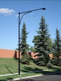
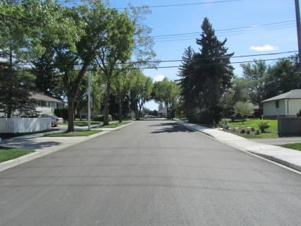
3 Laurier Heights Neighbourhood Reconstruction Reconstruct the pavement Replace curbs and gutters Replace sidewalks Upgrade standard streetlights Coordinate with other projects Internal (City) External (utilities) Surface works conceptual cost: $33 Million
4 Laurier Heights Neighbourhood Reconstruction Contributes toward: Improving Edmonton s livability. Promoting active transportation (walking and cycling). Preserving and sustaining the environment.

5 LAURIER HEIGHTS NEIGHBOURHOOD DESIGN


6 Design Considerations Intersection improvements Active transportation Drainage

7 Public Involvement Community league meeting: November 12, 2012 Public meeting: May 22, 2013
8 What We Heard Concerns about narrowing wide local roads (highlighted orange) Investigation Transportation Services re-evaluated its policy of narrowing wider local roads in neighbourhoods
 or an operational issue.")
9 What We Propose Local roads will not be narrowed to the minimum 9 m standard. Roads will only be narrowed if there is an engineering reason (i.e. trees) or an operational issue.

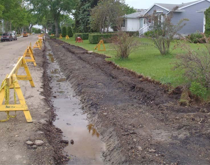
10 Active Transportation Previous proposal was to realign the existing asphalt trail Due to sight line issues, the City will no longer be realigning this trail The trail will stay in its current location 10


11 Great Neighbourhoods Capital Program Proposed asphalt trail from the existing set of stairs to be connected to an existing trail on Laurier Drive PROPOSED NEW ASPHALT TRAIL


12 Great Neighbourhoods Capital Program Improve trail connection from 81 Avenue to Buena Vista Park Proposed Trail

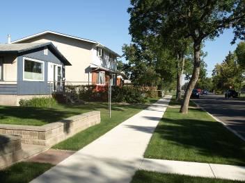
13 What We Heard New sidewalk on Service Road (87 Ave, 149 St and 142 St) Investigation City Council reviewed the policy for the construction of missing sidewalk links on service roads The City will continue the policy to construct critical missing links on service roads in Laurier Heights PROPOSED NEW 1.2M SIDEWALK
14 More Information Call: Website: edmonton.ca/buildinggreatneighbourhoods

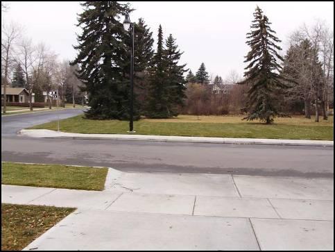
15 CONSTRUCTION PROCESS BEFORE AFTER
16 Neighbourhood Renewal Contract has been awarded to the lowest qualified bidder. Two-year contractor warranty period.

17 Construction Staging Construction will be staged over two years ( ). Ultimate staging is dependant on weather conditions, coordination with utilities, and unforeseen design and construction issues

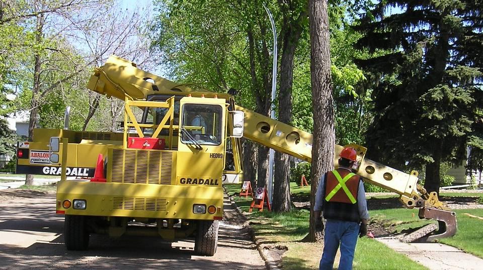
18 Preconstruction Activities Underground utility work Pruning of existing trees Installation of new streetlights

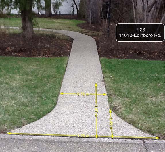
19 Photo Record of Neighbourhood
20 Removals

21 Setting Sidewalk Forms

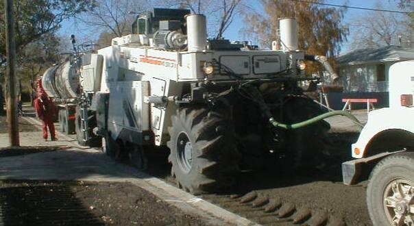
22 Placement of Granular Base

23 Hand Poured Sidewalk

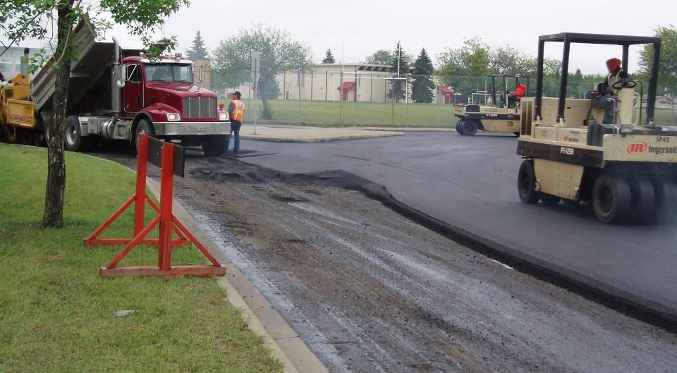
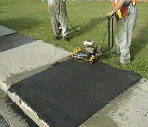
24 Machine Poured Sidewalk

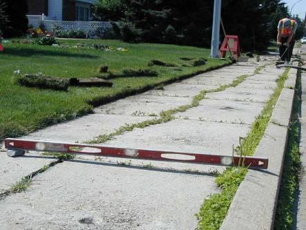
25 Mature Trees and Roots

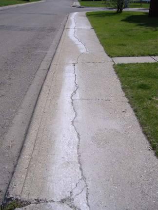
26 Curb Ramps at Corners


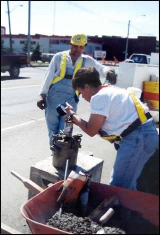
27 Private Connector Sidewalks & Crossings


28 Private Connector Sidewalks & Crossings
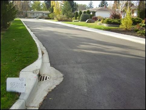
29 Landscaping
30 Road Reclamation

31 Ready for Paving
32 Paving

33 Quality Assurance


34 Defeated Local Improvement Asphalt patching

35 Defeated Local Improvement Grinding

36 Defeated Local Improvement Mud-jacking

37 Completed Project

38 Construction Communications Construction bulletins provided: Beginning of construction season 7-10 days before start of construction adjacent to your property 24 hours before construction: no parking Contact us for: Access needs Scheduling information Landscaping Concerns
39 More Information Contact: Avi Thiessen Phone: (780) Website: edmonton.ca/neighbourhoodrenewal

40 LOCAL IMPROVEMENT PROCESS
41 What is a Local Improvement? A local improvement is a construction project undertaken near or adjacent to your property. A project City Council considers of greater benefit to an area of the municipality than to the municipality as a whole. A project to be paid for in part or in whole by a Local Improvement tax.
42 Types of Local Improvement In your neighbourhood: Sidewalk reconstruction (50-50 cost share with City) Decorative streetlights (100% paid by property owners) Other types of local improvement: Curb crossing Streetscaping Alley Lighting Alley Renewal (reconstruction or resurfacing)

43 Neighbourhoods with Sidewalk Local Improvement
 A typical 50 ft. (15.24 m) frontage would cost: $3,021.79 (one-time payment) $235.")
44 50/50 Cost Share for Sidewalks 2014 Local Improvement sidewalk rates: $198.28/m (one-time payment) $15.44/m (yearly rate over 20 years) A typical 50 ft. (15.24 m) frontage would cost: $3, (one-time payment) $ (yearly rate over 20 years)

45 Assessment Length: Frontage Frontage assessable length is the shorter side of the lot The orientation of the house does not impact the frontage calculation
 2 Note: this average may not be more than two times the front parcel")
46 Assessment Length: Pie-shaped or Odd-shaped Lots For odd-shaped lots, local improvement will be assessed as: (front + rear dimension) 2 Note: this average may not be more than two times the front parcel dimension.

47 Local Improvement Notices Package includes: Invitation Notice Petition Form Affidavit of Execution Local Improvement Project Map Neighbourhood Renewal Brochure

48 Local Improvement Petition Package includes: Invitation Notice Petition Form Affidavit of Execution Local Improvement Project Map Neighbourhood Renewal Brochure
49 Affidavit of Execution Package includes: Invitation Notice Petition Form Affidavit of Execution Local Improvement Project Map Neighbourhood Renewal Brochure

 frontage would cost: $228.90 (one-time payment) $20.")
50 Decorative Streetlight Cost Laurier Heights decorative pole selection: Black-fluted poles with Heritage Arm 2014 Local Improvement decorative streetlight rates: $15.02/m (one-time payment) $1.32/m (yearly rate over 15 years) A typical 50 ft. (15.24m) frontage would cost: $ (one-time payment) $20.12 (yearly rate over 15 years)

51 Decorative Streetlight Local Improvement Outcomes Project supported (<50% petitions received) Property owners will pay 100% of the cost to install decorative streetlights. Project not supported (>50% petitions received) City will pay 100% of cost to rebuild lighting to current standards.

52 Decorative Streetlights The entire Laurier Heights neighbourhood is considered ONE project Must have the majority of property owners to defeat the local improvement for decorative streetlights
53 Local Improvement Process City prepares Local Improvement Plan Notices sent to owners Bylaw prepared 30-day petition period Bylaw passed by City Council Construction Local Improvement Tax Levy
54 More Information Contact: General Local Improvements (Melinda Durand, CET / Virgilio Mendoza, CET) Phone: (780) NeighbourhoodRenewal@edmonton.ca Website: edmonton.ca/localimprovements
Building Great Neighbourhoods. Strathcona
 Building Great Neighbourhoods Strathcona March 21, 2018 Becky Redford Project Manager, Planning & Design Building Great Neighbourhoods Integrated Infrastructure Services Welcome and Purpose To provide
TABLE OF CONTENTS. Building Great Neighbourhoods. Working together to make the most out of your neighbourhood.
 1 What We Heard Report October 2018 City of Edmonton Building Great Neighbourhoods TABLE OF CONTENTS 1. Introduction PG 2 2. Objectives PG 2 3. Public Engagement and Communications Methods PG 3 4. About
Project will Replace: Utilities Curb Pavement Lighting. City of Madison
 Project will Replace: Utilities Curb Pavement Lighting Replace sanitary sewer main & laterals Winnebago: Existing 8 main, 1905 Linden: Existing 6 main, 1915, upsize to 8 main Atwood: Existing 12 main,
RECEIVE AN UPDATE ON THE ALMOND GROVE PHASE II PROJECT
 TOWN OF LOS GATOS COUNCIL AGENDA REPORT MEETING DATE: 12/20/2016 ITEM NO: 12 DATE: TO: FROM: SUBJECT: MAYOR AND TOWN COUNCIL LAUREL PREVETTI, TOWN MANAGER RECEIVE AN UPDATE ON THE ALMOND GROVE PHASE II
Town of Yucca Valley Capital Improvement Projects Report July 24, 2014
 Town of Yucca Valley Capital Improvement Projects Report July 24, 2014 SR 62 Traffic and Pedestrian Improvements from Apache Trail to Palm Avenue (PLHD) The project includes construction of curbs, gutters,
Local Growth Planning in North Central Green Line Communities
 2018 April 30 Page 1 of 6 EXECUTIVE SUMMARY This report outlines a high-level scope for local growth planning for north central Green Line communities. The catalyst for this review is the significant investments
FOR IMMEDIATE RELEASE DATE: FRIDAY, AUGUST 31, Road Commission of Kalamazoo County Weekly Project Updates HAVE YOU SIGNED UP?
 FOR IMMEDIATE RELEASE DATE: FRIDAY, AUGUST 31, 2018 Road Commission of Kalamazoo County Weekly Project Updates HAVE YOU SIGNED UP? Sign up for RCKC CONNECT to receive message alerts for road construction,
DRIVEWAY APRON REPLACEMENT WITH STREET RECONSTRUCTION
 DATE: APRIL 18, 2014 TO: FROM: CC: RE: CHATEAULIN/PARKWOOD SOUTH AREA RESIDENT BRIAN CONNOLLY, CONSTRUCTION COORDINATOR RYAN PETERSON, CITY ENGINEER DRIVEWAY APRON REPLACEMENT WITH STREET RECONSTRUCTION
Welcome. Community Consultation Meeting November 28, Review and discuss the Bathurst Quay Neighbourhood Plan Framework
 Welcome Community Consultation Meeting November 28, 2016 Why Are We Here Today? Review and discuss the Bathurst Quay Neighbourhood Plan Framework Review and discuss an Action Plan for Implementation Next
MPRD s Keith Mione (Community) Park Midlothian Road Entrance Traffic Signals
 Park Midlothian Road Entrance Traffic Signals") MPRD s Keith Mione (Community) Park Midlothian Road Entrance Traffic Signals Purpose: The Midlothian Road entrance to Mundelein Park & Recreation District s (MPRD s) Keith Mione (Community) Park would
MPRD s Keith Mione (Community) Park Midlothian Road Entrance Traffic Signals Purpose: The Midlothian Road entrance to Mundelein Park & Recreation District s (MPRD s) Keith Mione (Community) Park would
John Portman Boulevard Corridor
 Corridor Multi-use Path + Streetscape Improvements February 8, 13 SOUTH SIDE BLOCK IMPROVEMENT NOTES: Consolidation of Utility/Sign Locations Remove Existing Trees Centennial Olympic Park Drive Planter
DESIGN CRITERIA PACKAGE
 RFQ: 17-C-00003 DESIGN-BUILD SERVICES FOR THE DESIGN CRITERIA PACKAGE PREPARED BY: JAMES E. JACKSON, JR. AIA CITY ARCHITECT CONTRACT ADMINISTRATION DEPARTMENT and INTERFLOW ENGINEERING, L.L.C DESIGN CRITERIA
Capital Projects impacting Odenton Town Center
 Capital Projects impacting Odenton Town Center 1 2 E549700 W801600/ W801602 Anne Arundel County Department of Public Works Manor View Elementary School Transmission Main - MD 32 @ Meade Phase 2 $34,399,000
INFRASTRUCTURE EXISTING INFRASTRUCTURE A. Circulation B. Signals C. Drainage D. Utilities
 7.01. EXISTING INFRASTRUCTURE A. Circulation B. Signals C. Drainage D. Utilities 7.02. PROPOSED INFRASTRUCTURE A. Overall Concept B. Circulation C. Signals D. Drainage 7.03. INFRASTRUCTURE MAP A. Key Infrastructure
2017 Investment in Infrastructure Expo February 28, 2017 Jason Jonas, P.E. Public Works Director
 2017 Investment in Infrastructure Expo February 28, 2017 Jason Jonas, P.E. Public Works Director 1 Jefferson County, Missouri Road and Bridge Sales Tax: Jefferson County has a one-half cent sales tax that
Construction Engineering & Inspection
 Construction Engineering & Inspection Serving Florida for 20 Years CEI Engineering Planning Landscape Architecture Urban Design Construction Engineering & Inspection (CEI) I N T R O D U C T I O N Over
Getting Started On Your Green Infrastructure (GI) Plan
 Plan") Getting Started On Your Green Infrastructure (GI) Plan Peter Schultze-Allen EOA Inc. Annual SCVURPPP C3 Workshop June 16, 2015 Presentation Outline MRP 2.0 C.3.j (GI) requirements GI Framework elements
Getting Started On Your Green Infrastructure (GI) Plan Peter Schultze-Allen EOA Inc. Annual SCVURPPP C3 Workshop June 16, 2015 Presentation Outline MRP 2.0 C.3.j (GI) requirements GI Framework elements
23 EA , , , , , , , LF , , ,596.
 Mast Arm Traffic Signals at Central Ave. 5th, 6th, 8th & 31st St. Engineering & Capital Improvements Department, City of St. Petersburg, FL Project No.: 11027-112 Bid date: January 10, 2012 Item Description
CARVER COUNTY DIVISION OF PUBLIC WORKS LANDSCAPE POLICY. Adopted by the Carver County Board of Commissioners March 3, 2015
 CARVER COUNTY DIVISION OF PUBLIC WORKS LANDSCAPE POLICY Adopted by the Carver County Board of Commissioners March 3, 2015 Policy Statement Goals It is the goal of Carver County Public Works to provide
Focus Group First Meeting Belfountain Community Centre Tuesday June 29, :00 p.m. to 9:00 p.m.
 Focus Group First Meeting Belfountain Community Centre 7:00 p.m. to 9:00 p.m. Mississauga Road/Old Main Street and Bush Street, from Olde Base Line Road to Winston Churchill Boulevard Environmental Assessment
Illustration of Eastlake Farmer s Cooperative Grain Elevator. Chapter 5: implementation 5-1
 Illustration of Eastlake Farmer s Cooperative Grain Elevator Chapter 5: implementation 5-1 chapter 5: implementation Introduction The Eastlake Subarea Plan includes a wide range of recommendations intended
VEHICULAR AND PEDESTRIAN CIRCULATION
 This perspective sketch communicates the intended character and quality of a proposed streetscape design. Locate benches near a major intersection where people tend to gather. Seating and lighting provide
Abbott Loop. Community Council Survey Capital Projects Needs Ranking Survey. Comm Council Priority Rank. Rank # ABBOTT LOOP COMMUNITY PARK
 Municipality of Anchorage Community Council Survey ABBOTT LOOP COMMUNITY PARK This state funding request would be used to implement the remaining elements of the Community Park Master Plan Vision including
The Project. In 2013, construction was completed between 100 Street and 102 Street.
 The Project Jasper Avenue New Vision (JANV) is a major catalyst project identified in the Capital City Downtown Plan (2010) between 92 Street and 109 Street, including the streets half a block north and
City of Kearney Capital Improvement Update October 1, TH STREET AND 17TH AVENUE IMPROVEMENTS
 56TH STREET AND 17TH AVENUE IMPROVEMENTS FUNDING: Bonded ESTIMATED COST: $3,885,000 COMPLETION DATE: Fall 2018 SCOPE OF PROJECT: Widening of 56th Street from 6th Avenue to 19th Avenue, and widening 17th
CITY OF MANHATTAN BEACH DEPARTMENT OF COMMUNITY DEVELOPMENT. TO: Parking and Public Improvements Commission
 Clay Curtin, Management Analyst (I the same walls at a maximum of 1 foot tall. Section 7.36.150 of the Municipal Code permits BY: Eric Haaland, Associate Planner right-of-way) between walkways leading
Green Streets. Sustainable Stormwater Solutions for Greener Communities and a Cleaner Bay
 Green Streets Sustainable Stormwater Solutions for Greener Communities and a Cleaner Bay As the Bay Area continues to grow through development of roads, revitalization of neighborhoods, and construction
I. DEFINITIONS For the purpose of this policy the following terms, phrases, words and their derivations shall have the meaning given herein.
 CITY OF DYERSVILLE TREE AND LANDSCAPING ON PUBLIC RIGHT-OF-WAY POLICY This policy shall regulate the planting, maintenance, and removal of trees and shrubs in public rights-of-way. An approval from the
John M. Fleming Managing Director, Planning and City Planner. Old East Village Dundas Street Corridor Secondary Plan Draft Terms of Reference
 Report to Planning and Environment Committee To: From: Subject: Chair and Members Planning & Environment Committee John M. Fleming Managing Director, Planning and City Planner Old East Village Dundas Street
Highway 15 Project - Hutchinson
 Highway 15 Project - Hutchinson Agenda What are we going to talk about today? Goals and benefits of the project Details about the proposed work Project schedule and costs Any questions you may have about
University Park Subdivision Street Assessment Report
 University Park Subdivision Street Assessment Report Prepared for: University Park Subdivision TABLE OF CONTENTS Introduction... 3 Existing Conditions Analysis... 4 Street Improvements... 5 Existing:...
Complete Streets Guidelines & Implementation Strategy. Public Open House #2 June 12, :30-8:00 pm
 Complete Streets Guidelines & Implementation Strategy Public Open House #2 June 12, 2018 5:30-8:00 pm Purpose The purpose of this project is to develop Complete Streets guidelines and an implementation
STREETSCAPE MANUAL ONLINE TRAINING SESSION 3: Decision-Making
 TRAINING SESSION 3: The Urban Design Streetscape Manual is a reference tool developed to help implement City policy and guide the design, construction and maintenance of streetscape improvements in Toronto.
DISTRICT OF INVERMERE
 DISTRICT OF INVERMERE Community Enhancement Plan Final Report November 10, 2008 0953.0077.01 table of contents Purpose & Process 1 Stakeholder Workshop Summary. 2 A Possible Framework 4 Proposed Pedestrian
Integration of Trees into Roads Policy - the road to success -
 Integration of Trees into Roads Policy - the road to success - Trees, People and the Built Environment 3 City of Birmingham, UK April 5 th, 2017 Ian Buchanan Natural Heritage and Forestry Regional Municipality
Rezoning Frequently Asked Questions
 elcome The City of Vancouver has received an application to rezone 6929-6969 Cambie Street and 515 est 54th Avenue from RS-1 (Single Family) District to CD-1 (Comprehensive Development) District. The proposal
ANNUAL PARKWAY TREE DONATION PROGRAM. Dear Kenilworth Resident:
 ANNUAL PARKWAY TREE DONATION PROGRAM Dear Kenilworth Resident: It is parkway tree planting time again in Kenilworth. The Village s Parkway Tree Donation Program is a great way for residents to directly
STORMWATER UTILITY FREQUENTLY ASKED QUESTIONS
 STORMWATER UTILITY FREQUENTLY ASKED QUESTIONS What is Stormwater? Stormwater is water that falls to the ground during a precipitation event. When land is undeveloped or covered with vegetative surface,
Presentation Item C Annotated Model Outline for a Framework for a Green Infrastructure Plan
 Date: August 17, 2016 To: From: Subject: Management Committee Dan Cloak, Consultant Presentation Item C Annotated Model Outline for a Framework for a Green Infrastructure Plan Recommendation: Receive the
PennDOT Public Meeting. S.R. 3044, Section A01 Castle Shannon Boulevard Roadway Improvement Project
 PennDOT Public Meeting S.R. 3044, Section A01 Castle Shannon Boulevard Roadway Improvement Project Mt Lebanon Township, Allegheny County Mt Lebanon Township Municipal Building November 6, 2014 1 Project
2017 Asphalt Contractors Association of Florida Pavement Awards
 2017 Asphalt Contractors Association of Florida Pavement Awards Special Projects Any project of a special or unique nature requiring specialized equipment, techniques, materials, time restrictions, or
TAC/CAC, TPO Project Update February 2016
 A1A MULTIMODAL CORRIDOR PLANNING AND ENGINEERING ANALYSIS Florida Department of Transportation TAC/CAC, TPO Update February 2016 PRESENTATION FOOTERT Meeting Agenda What We Plan To Discuss Background New
I-95 Girard Avenue Interchange Near Neighbors Meeting. Project Status
 I-95 Girard Avenue Interchange Project Status Construction is underway for Phase 1 and 2. Phase 3 construction will begin early 2014. Overall Project Area and Schedule GR0: Completed GR0: Completed in
open house 3 CITY OF SALEM Downtown Streetscape Plan
 open house 3 Streetscape concepts CITY OF SALEM Downtown Streetscape Plan analysis concepts we are here refined concepts & document Feb 13th 1 2 3 apr 18th KICKOFF OPEN HOUSE Streetscape Work Group Walking
COMPLETE GREEN STREET CHECKLIST
 COMPLETE GREEN STREET CHECKLIST This document was developed to dissect the structure of an urban street and explore opportunities to make our streets more complete while also integrating green street strategies.
Corridor Transformation Strategy
 Corridor Transformation Strategy County Road 22 Special Planning Area Design Guidelines January 2012 D14-06017 Corridor Transformation Strategy County Road 22 Special Planning Area Corridor Design Guidelines
Ken Kortkamp, PE San Francisco Public Utilities Commission San Francisco, CA
 Ken Kortkamp, PE San Francisco Public Utilities Commission San Francisco, CA Development Process of San Francisco s GI Typical Details SCVURPPP GI Workshop April 19, 2017 Outline How to develop GI details
PROJECTS UNDER CONSTRUCTION
 Project Name Project Status Project Funding Project Manager PJ 2144 Clayton Rd-Treat Blvd Intersection Improvements Widen the Clayton Road/Treat Blvd intersection and upgrade the traffic signal. Construction
Executive Summary. The goals of the Plan are to:
 Executive Summary The Wiscasset Bath Road Master Plan (Plan) seeks to maximize development opportunities along Bath Road through the strategic coordination of traffic infrastructure improvements, land
Rezoning Transportation Analysis Petition Number: General Location Identifier:
 From: Kelsie Anderson, PE Kelsie.Anderson@charlottenc.gov 704-432-5492 Staff Reviewer: Kory Hedrick, PE, PMP Khedrick@charlottenc.gov 704-432-6511 CDOT s review of this rezoning petition is intended to
Prince William Street Project (Grant Avenue to Wellington Road)
") Prince William Street Project (Grant Avenue to Wellington Road) 1 Goals Improve pedestrian and bike traffic safety Improve street drainage with curb & gutter Upsize water mains Enhance overall street appearance
Prince William Street Project (Grant Avenue to Wellington Road) 1 Goals Improve pedestrian and bike traffic safety Improve street drainage with curb & gutter Upsize water mains Enhance overall street appearance
Quality Public Realm & Streetscapes
 1 Quality Public Realm & Streetscapes Lambeth Community Association/Business Association 1.1 Install decoration and/or decorative lighting on London Hydro poles along Main Street from Campbell Street to
The transportation system in a community is an
 7 TRANSPORTATION The transportation system in a community is an important factor contributing to the quality of life of the residents. Without a sound transportation system to bring both goods and patrons
Carson Street Streetscape Improvements. Request for Proposals
 Carson Street Streetscape Improvements Request for Proposals Complete Design Services for a Landscape/Streetscape Plan for Carson Street (Pioneer Boulevard to Norwalk Boulevard) Submittal Deadline: October
WEST LOOP DESIGN GUIDELINES CHECKLIST
 WEST LOOP DESIGN GUIDELINES CHECKLIST Section 1.0 General Strategies 1.1 DESIGN EXCELLENCE: ENCOURAGE HIGH QUALITY AND INNOVATIVE DESIGN OF NEW BUILDINGS WITHIN THE WEST LOOP WITHOUT BEING PRESCRIPTIVE
CHAPTER 8. Mrs. Zimman s Class - Central Elementary
 SUSTAINABILITY CHAPTER 8 Mrs. Zimman s Class - Central Elementary 8.1 OVERVIEW Green infrastructure also known as low impact development (LID) and environmental or sustainable site design is an environmentally
FDOT D4 Complete Streets
 FDOT D4 Complete Streets Context Sensitive Solutions Directs that complete street solutions will complement the context of the community. Collaborative approach to decision making, project development,
Roads Plan
 Roads Plan 2019-2023 Background Road conditions have been a problem for Painesville City over the past decade. Between 2009 and 2013, the city was only able to dedicate $1.9 million in total road repairs
Municipality of Anchorage, Alaska Parks & Recreation Department
 Municipality of Anchorage, Alaska Parks & Recreation Department 632 W. 6 th Avenue, Suite 630 P.O. Box 196650 Anchorage, AK 99519 Tel 907-343-4355 URL www.muni.org/departments/parks MEMORANDUM Date: October
Palisades Outline Plan
 NE ¼ 25 36 28 W4 Town of Penhold Approved August 13, 2012 Contents Figures & Tables... 2 Introduction... 1 Overview... 1 Purpose... 1 Development Area... 3 Ownership... 3 Topography... 3 Existing & Surrounding
Welcome. Green Line LRT. Beltline Alignment Options. Stay engaged! Follow the Green Line story at calgary.ca/greenline
 Welcome Green Line LRT Beltline Alignment Options Stay engaged! Follow the Green Line story at calgary.ca/greenline Green Line LRT Why are we here? Our Challenge Determine the best alignment in the Beltline.
Main Street Streetscape and Open Space Improvements Master Plan. Final Report
 Village of Bayfield Municipality of Bluewater Heritage Conservation District Main Street Streetscape and Open Space Improvements Master Plan Final Report Prepared by: Wendy Shearer Landscape Architect
St. Clair Avenue West Area Transportation Master Plan
 1 (Between Keele Street and Old Weston Road) Public Information Centre 1 December 2, 2015 2 Welcome Welcome to the first Public Information Centre for the St. Clair Avenue West Area. The panels will present
Lambeth Main Street Streetscape Improvements
 Lambeth Main Street Streetscape Improvements Open House October 5th, 2017 Agenda 1. Introduction 2. Project Background 3. Context 4. Project Objectives 5. Design Principles & Approach 6. Streetscape Design
Const. ROADS - Description
 Road Projects make up the bulk of the capital expenditures for the township. For the term of this CIP, road projects total $9,843,000 or 72.0% of the total capital expenditures for all capital projects
Cottage Grove Road Reconstruction. City of Madison Engineering
 Public Informational Meeting Cottage Grove Road Reconstruction October 8, 2015 Presentation Outline Introduction Project Purpose & Need Proposed Design Overview Environmental Concerns Pedestrian Needs
Dundas Place Flexible Street Public Information Centre
 WELCOME TO THE DUNDAS PLACE DESIGN REVEAL Dundas Place Flexible Street Public Information Centre November 8, 2017 This project is funded by the City of London with support from the Government of Canada
MOUNTAIN VIEW ELEMENTARY SCHOOL SITE REDEVELOPMENT OPEN HOUSE. MacPherson Room, 10 am 5 pm
 MOUNTAIN VIEW ELEMENTARY SCHOOL SITE REDEVELOPMENT OPEN HOUSE MacPherson Room, 10 am 5 pm MOUNTAIN VIEW SCHOOL SITE REDEVELOPMENT 1 WELCOME TO THE OPEN HOUSE FOR THE MOUNTAIN VIEW SCHOOL SITE WHY WE ARE
3.13. Development Guidelines
 3.3 Landscaping Elements Landscaping should be used to frame and soften structures, define site functions, enhance the quality of the environment, and screen undesirable views. Safety, environmental impacts,
Fall 2017 Construction Update
 Fall 2017 Construction Update Ward 4 Southeast Engineering Department Riverwalk Red Multi-Use Trail Bridge Rehabilitation The Riverwalk Red Multi Use Trail Bridge was awarded to Cramer and Associates,
Fort Edmonton Footbridge and Trails Project Design Phase
 WELCOME TO Fort Edmonton Footbridge and Trails Project Design Phase OPEN HOUSE #2 Wednesday, November 21, 2007 4:00pm to 8:00pm Westridge Wolf Willow Community League Hall 505 Wolf Willow Road, Edmonton
Edenfield Avenue Green Street Demonstration Project Neighborhood Meeting
 Edenfield Avenue Green Street Demonstration Project Neighborhood Meeting Edenfield Avenue Green Street Demonstration Project Neighborhood Meeting Road Reconstruction Elements Grant Background What is a
ROME WATERFRONT VILLAGE PROJECT NARRATIVE January 25, 2018
 January 25, 2018 The Rome Waterfront Village project is intended to foster the revitalization of the area between South James Street and Erie Boulevard north of the Erie Canal as well as improve public
Green Stormwater Infrastructure Handbook. Kristin Kerr, P.E. EOA / SCVURPPP November 29, 2018
 Green Stormwater Infrastructure Handbook Kristin Kerr, P.E. EOA / SCVURPPP November 29, 2018 Outline of Presentation Overview Handbook Contents Example Details Overview MRP requires GSI Plans to include
Attachment 1 TOWN OF NEW TECUMSETH. Manual for the Preparation of an Urban Design Report
 Attachment 1 TOWN OF NEW TECUMSETH Manual for the Preparation of an Urban Design Report July 2010 TABLE OF CONTENTS Background, Policy Framework and the Preparation of Urban Design Reports 1. Introduction
JASPER PLACE. Area Redevelopment Plan
 JASPER PLACE Area Redevelopment Plan Executive Summary Jasper Place is an established community where people live, work and play. The Jasper Place Area Redevelopment Plan (ARP) provides a tool to help
PROJECT SHOWING MINUTES
 PROJECT SHOWING MINUTES North Lynn Street Esplanade Improvements Project No. 0029-000-859, C501, B605 UPC No. 109813 November 1, 2017 10:00 a.m. 1911 North Ft. Myer Drive, LL-10, Arlington, VA Overview
Table of Contents. Elm Avenue Improvement Plan City of Waco, Texas. Introduction 1. Existing Context 1 Figure 1 2.
 Table of Contents Introduction 1 Existing Context 1 Figure 1 2 Plan Guidelines 3 Future Urban Form 4 The West-End 4 Main Street 6 The East-End 7 Figure 2 9 Public Improvement Recommendations 7 General
Project Consulting Team:
 THE DOWNTOWN CHERRYVILLE LAND USE + STREETSCAPE MASTER PLAN WAS FUNDED THROUGH THE GENEROUS DONATIONS OF THE FOLLOWING: The Community Foundation of Gaston County ElectriCities of North Carolina The Cherryville
JOB CREATION PROJECTS
 SPRINGDALE INFRASTRUCTURE DEVELOPMENT PLAN JOB CREATION PROJECTS The following pages provide a narrative description, preliminary street alignment and a preliminary construction cost estimate for each
THREE-YEAR CAPITAL IMPROVEMENT PLAN FY
 THREE-YEAR CAPITAL IMPROVEMENT PLAN FY2016 2018 Annual CIP Development Process Public Works & Engineering Divisions Prepare List of Capital Needs and Recommended Deferred Maintenance Public Works & Engineering
East Bayshore Road Neighbourhood
 East Bayshore Road Neighbourhood Northridge Property Management Urban Design Brief 3195 East Bayshore Road City of Owen Sound January 2016 East Bayshore Road Neighbourhood Northridge Property Management
City of Toronto. Emery Village Transportation Master Plan
 City of Toronto Emery Village Transportation Master Plan May 2009 Emery Village Transportation Master Plan Toronto, ON May 2009 Consulting Inc. 100 York Blvd., Suite 300 Richmond Hill, ON L4B 1J8 Tel:
Public Works Project Delivery Report
 Public Works Project Delivery Report May 2017 San Gabriel Public Works delivers reliable infrastructure & welcoming public spaces by designing, constructing, operating & maintaining the City s streets,
South Yonge Street Corridor
 South Yonge Street Corridor Streetscape Master Plan Study Draft Final Executive Summary Prepared by: January 2012 In Partnership with: Introduction The Future... Yonge Street is at the forefront of York
Shell Beach Road Streetscape Frequently asked Questions
 Shell Beach Road Streetscape Frequently asked Questions General What is the Shell Beach Road Streetscape Improvements Project? The overall goal of the Shell Beach Road Streetscape Improvement project is
WELCOME. Welcome to the Public Open House
 WELCOME City of Catharines Streetscaping St. Paul Street and Carlisle Street Public Open House June 9, 2016 FirstOntario Performing Arts Centre 6:00 pm to 8:00 pm Welcome to the Public Open House Please
The Illinois Department of Transportation and Lake County Division of Transportation. Route 173, including the Millburn Bypass
 The Illinois Department of Transportation and Lake County Division of Transportation welcome you to this Public Hearing for U.S. Route 45 from Illinois Route 132 to Illinois Route 173, including the Millburn
Creative Village Design Review Committee
 N. Terry Ave. CVDRC Staff Report Creative Village Design Review Committee April 11, 2017 Case Number Agenda Item 4 W. Livingston Street Extension MPL2017-00023 ARB2017-00014 Applicant William Burns, Project
2016 WORKSHOP LVR Field Trip
 2016 WORKSHOP LVR Field Trip ***Note*** Many of the sites on this tour were NOT related to, or funded by, the DGLVR program. They are being shown to encourage discussion about the kinds of projects that
DRAFT. 1. General Purpose. 2. Area of Application. 3. Uses CLIFTON PLACE AREA A DC2 (DRAFT)
") CLIFTON PLACE AREA A DC2 () May 1, 2017 1. General Purpose To accommodate a high rise, high density residential Tower and podium that will accommodate a potential mix of commercial and residential uses,
CLIFTON PLACE AREA A DC2 () May 1, 2017 1. General Purpose To accommodate a high rise, high density residential Tower and podium that will accommodate a potential mix of commercial and residential uses,
AGENDA ITEM # 13A/B. AGENDA ITEM EXECUTIVE SUMMARY Village Board Meeting December 10, 2018
 AGENDA ITEM # 13A/B AGENDA ITEM EXECUTIVE SUMMARY Village Board Meeting December 10, 2018 Item Title: Main Street Parking Improvements Parking Lot Project Change Order #2 and Final Pay Request Staff Contact:
Revocable Street Privilege
 Revocable Street Privilege A Revocable Street Privilege (RSP) is an authorized right to use a part of the public Right-of-Way for a private purpose. An RSP may be granted to abutting property owners for
Tree Removal Procedure
 Tree Removal Procedure Procedure Type: Procedure Approved By: Council Decision No: 1014/2016 Approval Date: 26 April 2016 Last Reapproval Date: Review Date: April 2018 Internal Reference No.: Department:
Clairtrell Area Context Plan
 Clairtrell Area Context Plan March 2005 Urban Development Services City Planning Contents 1. Introduction... 4 2. Development Structure... 6 2.1 Streets... 7 2.1.1 Sheppard Avenue and Bayview Avenue...
TONIGHT S PURPOSE INFORMATION SESSION CANORA & WEST JASPER PLACE SIDE STREETS CONCEPT PLANNING STUDY. Share draft side streets concept plan
 TONIGHT S PURPOSE Share draft side streets concept plan INFORMATION SESSION Share information and answer questions Tuesday, December 1, 2015 Drop-In 5:30 8:00 PM West Jasper/Sherwood Community Hall TONIGHT
2.5 Roads. Loading and service areas adjacent to Highway 401 should be screened through architectural walls and/or landscape buffer planting.
 N HIGHWAY OFF RAMP 2.5 Roads A legible road network with a clear hierarchy will help create a connected community, both within and surrounding the Milton Heights. The following section outlines the proposed
Study Area. Capitol Way. Greening America s Capitals 11/13/2014. A Greening America s Capitals Project
 Olympia, WA: Greening Capitol Way Supporting Communities move towards sustainability is a priority for the federal government. A Greening America s Capitals Project Office of Sustainable Communities U.S.
FY 2018 TRANSPORTATION CAPITAL PROGRAM New Jersey Department of Transportation Projects
 Schooleys Mountain Bridge Rehabilitation Project ID Numbers: N1707 / 173470 Schooleys Mountain Road Bridge was built in 1920 and widened in 1937. The project is a replacement of the bridge structure and
Bylaw A Bylaw to amend Bylaw 12800, as amended, The Edmonton Zoning Bylaw Amendment No. 1592
 Bylaw 16322 A Bylaw to amend Bylaw 12800, as amended, The Edmonton Zoning Bylaw Amendment No. 1592 WHEREAS Lot 17, Block 25, Plan 4065AE; located at 11342-64 Street NW, Highlands, Edmonton, Alberta, is