LEGEND. vehicular circulation. pedestrian circulation. bus stop. residential use. civic use. residential/mixed use. commercial use.
|
|
|
- Rosaline Logan
- 5 years ago
- Views:
Transcription


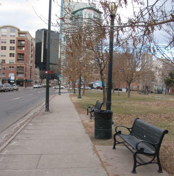
1 LEGEND vehicular circulation pedestrian circulation bus stop residential use civic use residential/mixed use commercial use on-street parking CIRCULATION ANALYSIS


2 LEGEND enclosed focal point view open area sloping grade perforated enclosure SPATIAL ANALYSIS
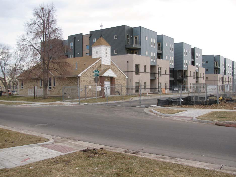
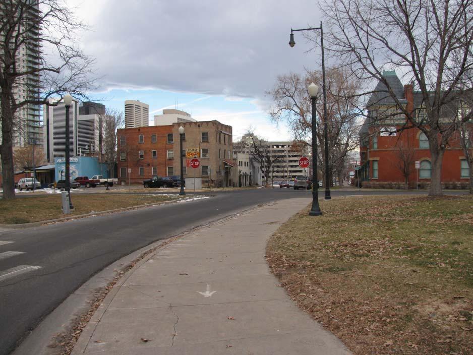
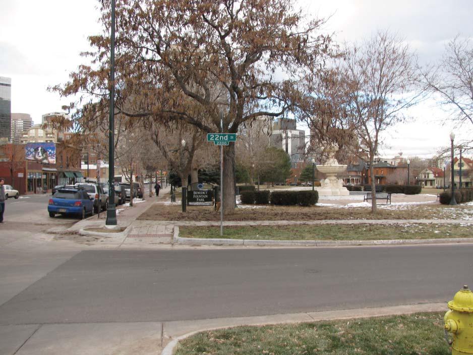
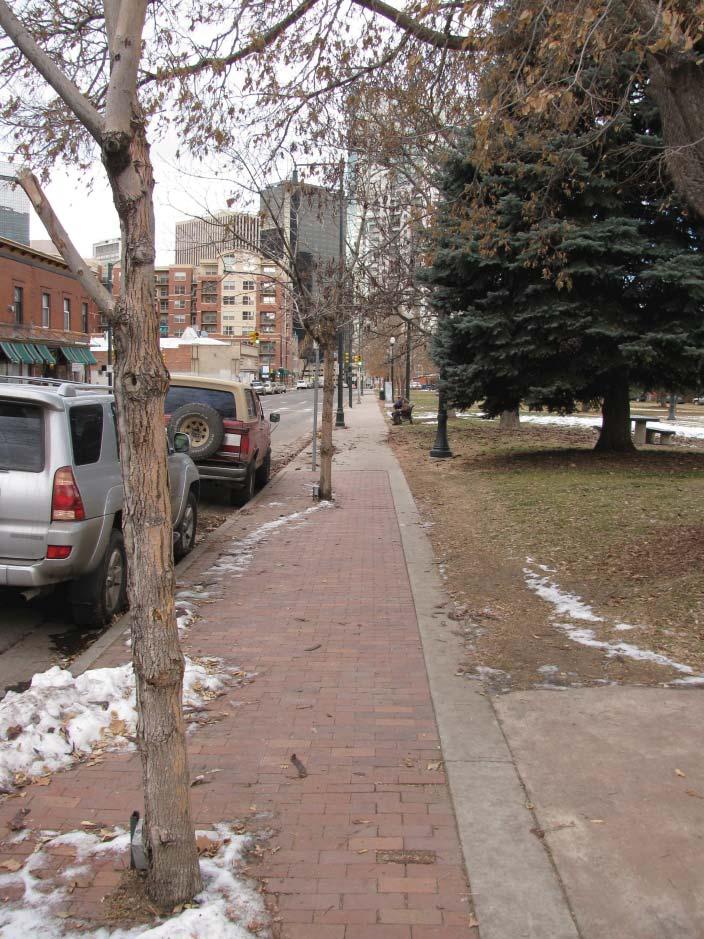
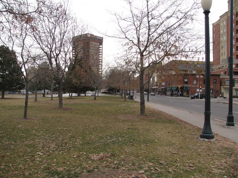
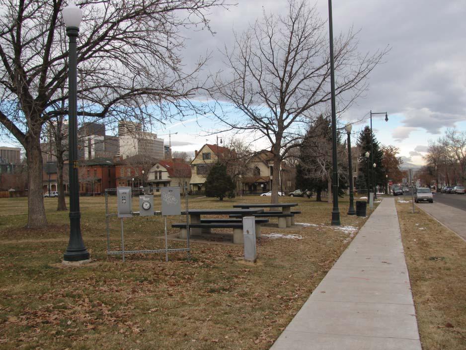
3 FEEDBACK FROM INITIAL PUBLIC MEETING 1/2009 Concerns Graffi ti- everything will get tagged Policing- social issues, negative behaviors, homeless- transient Trees Block the access to the Fountain Traffi c, the turn lane- speeding and accidents at 21st Drainage issues at triangle Heavily Used Park Overall! Edge of the Park Dumpster at 22nd and Tremont Utility Box (I am resolving this) Lighting (I am working on resolving this as well) Suggestions Low maintenance landscaping/ green space, Passive Park (mentioned by multiple people) Keep the green space Something Aesthetically Pleasing, native species, sometimes the park looks drab in the summer Historic Landmark in Park (highlight this item) No trees in Tree Lawn along 22nd place (I am working on resolving this) Create a place for children Would be a great place for a Market or cultural activities, Hope to see this money improve the park Expose fountain, benches, Add life to the park Mound or hill potentially- sled hill Activate Park and make it a center for the neighborhood Great place to hold events and there is a lot of opportunity in the park. Gardens Park has the opportunity for new design, how about events, new elements, art FACTS 388 new units with Block 4 and 5 of DHA development.2 mi. to 20th & Welton light rail.9 mi. to Convention Center.6 mi. to State Capitol.7 mi to 16th & Welton 1.5 mi. to Cherry Creek Trail.9 mi. to Coors Field FEEDBACK/ FACTS


 St.")
 Colorado Building at 16th and California Echo Lake Lodge many park structures many")


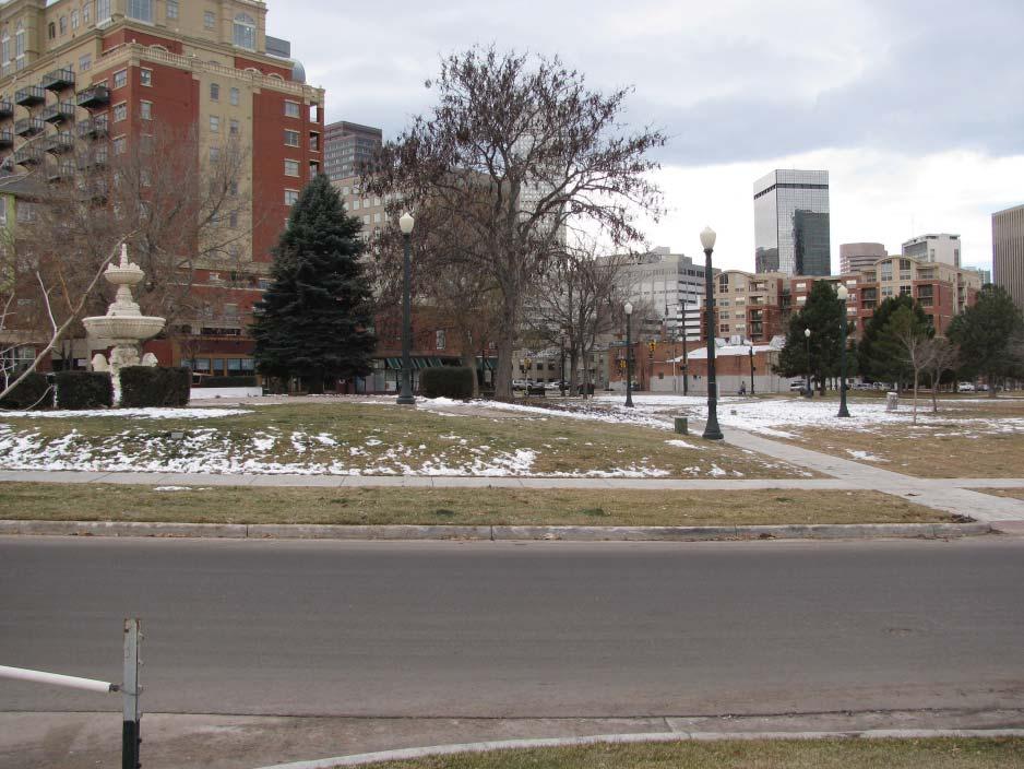
4 RESEARCH Fountain and wading pool for children was donated by J.B. Benedict circa A duplicate of this fountain was designed for the Belmar Estate and was moved in 1971 to Hungarian Freedom Park. Benedict was one of Denver s most prolifi c and talented architects from He designed roughly 80 buildings across Colorado in Beaux Arts styles ranging from Italian and French Renaissance Revival, Spanish Colonial Revival, Gothic Revival, Classical Revival, and Tudor Revival including one Art Deco design. Some of these include: Gart Sports Castle Washington Park Boating Pavilion Sunken Gardens Pavilion (demolished) Woodbury Branch Library Chief Hosa Lodge Summer Home for the Presidents at Mt. Falcon (never completed) St. Catherine s Chapel at St. Malo (near Estes Park) Colorado Building at 16th and California Echo Lake Lodge many park structures many residences many churches Interesting fact about Benedict: The commission for Walker stimulated a period in Benedict s life that his friends referred to as his castle stage.... during this fi veyear period, the architect would sit with pencil and paper and sketch the most elaborate fantasy castles, complete with fl ying buttresses, turrets, and long arches and bridges between buildings. They would be situated on the wildest cliffs or steep escarpments. He would produce 10 or 12 a year, sign them with Merry Christmas and mail them off to his favorite friends. (from U.S. Dept. of the Interior, NPS, National Register of Historic Places nomination) He used permanent materials like brick stone, terra cotta and masonry. he was talented, cultured, eccentric, fl amboyant, practical, diffi cult, opinionated, generous, temperamental, considerate, a gentleman farmer, man about town - an architect. RESEARCH


5 LEGEND defi ned edge green play area open gathering area visual focal point PROPOSED SPATIAL DIAGRAM

6 new concrete path crusher fi nes picnic area stone play pieces stone benches sand play area concrete mow strip 3-4 berms perennial/ ornamental grass beds concrete pavers concrete steps with Benedict story imprinted retaining wall ornamental grasses existing fountain plaza concrete paver plaza perennial bed with park sign ornamental trees perennial/ ornamental grass beds bus stop bench 8 wide new concrete path existing brick walk widened 4 schematic design scale:1 =30 2/21/2010
Benedict Fountain Park Meeting Notes Wednesday, February 15, 2012
 Benedict Fountain Park Meeting Notes Wednesday, February 15, 2012 ALTERNATIVE #1 Like the big open lawn space in alternative 1. Like cohesiveness of sidewalk walk and play areas shown on alternative 1
DESIGN CONCEPTS. Option C: Seasons
 DESIGN CONCEPTS Option C: Seasons Colorado is known for its snowy active winters, hot fun summers, brilliant spring blooms, and dramatic fall color. This design highlights all of these elements in order
Morgan s Subdivision Historic District Character-defining Features
 Morgan s Subdivision Historic District Character-defining Features DISTRICT DESCRIPTION This small addition, designed as a neighborhood for those wishing to move east from Capitol Hill, was predominantly
BRADENTON RIVERWALK EXPANSION MASTER PLAN
 BRADENTON RIVERWALK EXPANSION MASTER PLAN INTRODUCTION & AGENDA Process Update Community Engagement Summary Center for Active Design (CfAD) Recommendations Context and Existing Conditions Master Plan Alternatives
Baker Historic District
 DISTRICT DESCRIPTION This is a historically middle-class neighborhood in the South Side, an area annexed by Denver in 1883, consisting of more than 20 tightly interwoven residential subdivisions. The earliest
lakeway mixed use tract open space plan
 LEGEND:. UNDISTURBED NATURAL AREA. ENTRY STATEMENT BUILT INTO HILLSIDE. R.O.W. PLANTING (STREET TREES/LIGHTS). HEB ENTRY DRIVE 5. BIO-FILTRATION IN MEDIAN 6. MAIN ENTRY @ MAIN STREET. EXISTING TREES TO
Chapter 6.2: Commercial Architectural Styles
 Chapter 6.2: Commercial Architectural Styles In this chapter you will find: Commercial, Civic, and Religious Styles Vernacular Commercial Victorian Commercial Moderne Gothic Revival COMMERCIAL ARCHITECTURAL
Draft Master Plan for Franklin Park
 Draft Master Plan for Franklin Park Metro Parks Tacoma with SiteWorkshop November 2009 I. overview & background Process & History Master Plan Process The Master Plan is based on a community involvement
Standards (R-3) Figure B-11: R-3 Residential Standards Exhibit
 Figure B-11: R-3 Residential Standards Exhibit") Avila Ranch Avila Ranch Specific Plan Development Standards High Medium Density - High Residential Density Residential Lot and Building Lot and Standards Building (R-3) Standards (R-3) EXAMPLES These sketches
Avila Ranch Avila Ranch Specific Plan Development Standards High Medium Density - High Residential Density Residential Lot and Building Lot and Standards Building (R-3) Standards (R-3) EXAMPLES These sketches
SFMTA PHELAN LOOP AND PUBLIC PLAZA PHELAN OCEAN AVENUE
 SFMTA Municipal Transportation Agency Image: a bus in front of the Palace of the Legion of honor SFMTA PHELAN LOOP AND PUBLIC PLAZA PHELAN AVENUE @ OCEAN AVENUE Community Meeting May 23, 2012 San Francisco,
Chapter 11. Exterior Design Factors. Introduction. House design does not stop once room arrangements are determined
 Chapter 11 Exterior Design Factors Introduction House design does not stop once room arrangements are determined Exterior must also be considered Often a client has a certain style in mind that dictates
Proposed Open Space, UNC-Chapel Hill. Polk Place and Surroundings, UNC-Chapel Hill
 Composite McCorkle Place Formal Quad Polk Place Natural Pinetum Proposed Open Space, UNC-Chapel Hill Polk Place and Surroundings, UNC-Chapel Hill Open spaces on a campus are often the physical core around
Welcome to the Sellwood Bridge Project Pre-Construction Open House
 Welcome to the Sellwood Bridge Project Pre-Construction Open House 5:30 7:30 p.m. Please sign in here Information stations and project staff are located throughout the room. Goals for Tonight s Meeting
Lancaster Conservation Area Appraisal. Character Area 8. Cathedral
 Lancaster Conservation Area Appraisal Character Area 8. Cathedral March 2013 118 3.8 Character Area 8. Cathedral 3.8.1. Definition of Special Interest "This character area is distinctive for the fine group
Architecture of Massachusetts. By: Danny Surujdeo and Mara Yella Architecture P1
 Architecture of Massachusetts By: Danny Surujdeo and Mara Yella Architecture P1 Timeline 1600-1700 Post-Medieval 1700-1780 Georgian 1780-1820 Federal 1825-1860 Greek Revival 1840-1880 Gothic Revival 1840-1885
Georgeson Botanical Garden Master Plan
 Georgeson Botanical Garden Master Plan Alaska Chapter 2018-03-12 This Master Plan was developed by volunteers representing the Alaska Chapter of the American Society of Landscape Architects. Eliza Bober
The following principles guide the development of goals and strategies to protect and promote these amenities:
 OPEN SPACE/PARKS/TRAILS/RECREATION GOALS/STRATEGIES Cherry Hills Village is a living environment that offers low density development, open areas, public scenic vistas, public trails and public parks. This
Woods Chapel Park. Park Amenities: Playground, basketball court, single table shelter, small pond and multi-use trail.
 Woods Chapel Park Park Location: 3925 NW Dogwood Park Land Established: 1979 Park Size: 10 acres Developed Acres: 6 acres Undeveloped Acres: 4 acres Park Type: Neighborhood Park Amenities: Playground,
WARM SPRINGS PARK MASTER PLAN
 TABLE OF CONTENTS page 1.0 Introduction and Overview 1 2.0 Information Gathering 2 3.0 Conceptual Alternative Development 8 4.0 Master Plan Development 14 5.0 Construction Cost Estimates 19 LIST OF FIGURES
What Style Is It? Part II: Practice
 California Preservation Foundation What Is It? Part II: Practice Diane Kane, Ph.D., AICP Architectural Historian Stephen Schaffer, Photographer January 24, 2012 bay windows Upswept eaves Banked Chicago
URBAN DESIGN BRIEF NORTHVIEW FUNERAL HOME HIGHBURY AVE N, LONDON, ON
 URBAN DESIGN BRIEF NORTHVIEW FUNERAL HOME - 1490 HIGHBURY AVE N, LONDON, ON 1.1Purpose The intent of the following report is to identify an opportunity for redevelopment of two residential properties within
ACADEMY AREA CONCEPT PLAN
 ACADEMY AREA Strip ling C hape l Roa d CONCEPT PLAN 7 S2 U Stripling 52 ROADWAYS AND PARKING: ADVENTURE PLAYGROUND AND SPRAYGROUND: Current roadways follow existing drives. It is recommended that the Folds
Barrie Park Site Master Plan
 Barrie Park Site Master Plan Community Meeting Number 4 May 13th, 2015 Barrie Park Site Master Plan: Process A Blue Print for the Future Already taken place: Site walkthrough, Focus Groups, 3 Community
PARDI MARKET PLAZA MASTER PLANS
 PARDI MARKET PLAZA MASTER PLANS CITY OF DIXON APRIL 25, 2017 Presented by: 1 CITY STAFF INTRODUCTION Deborah Barr Associate Civil Engineer, Project Manager Joe Leach City Engineer/Public Works Director
VEHICULAR AND PEDESTRIAN CIRCULATION
 This perspective sketch communicates the intended character and quality of a proposed streetscape design. Locate benches near a major intersection where people tend to gather. Seating and lighting provide
GYPSUM PARKWAY CORRIDOR ENHANCEMENT Gypsum, Colorado. Schematic Design January 2015
 GYPSUM PARKWAY CORRIDOR ENHANCEMENT Gypsum, Colorado Schematic Design January 2015 1 2 3 4 5 6 7 8 9 DESIGN WORKSHOP Landscape Architecture Land Planning Urban Design Tourism Planning Asheville Aspen Austin
russell+mills studios
 S C H E M A T I C D E S I G N B O O K L E T O C T O B E R 2 2, 2 0 0 8 114 east oak st, fort col TABLE OF CONTENTS...ii SITE CONTEXT...1 BACKGROUND...2 PARK PROGRAM...3 SLOPE ANALYSIS...4 SPATIAL ANALYSIS...5
Sheet Index. Legal Description. General Notes: Vicinity Map Scale 1" = 600'
 LOCATED IN THE SOHWEST QUARTER OF SECTION, TOWNSHIP SOH, Case # Z 6 - Legal Description Tract G, H and J of the Villages at Riverdale Filing No., a part of the Southwest quarter of Section, Township South,
Ottawa Historic Resources Inventory: Commercial Historic District Building Information. Significance and Potential Eligibility
 C 01 1 Address: address 1 PIN: 21 11 218 001 Plan: Rectangular Stories: 2 Original Owner: Roof Type: Flat Building Names: Marquette School Foundation: Important Dates: ca 1955 Walls: BRICK Architect /
HOMEWOOD. Architectural Style Guide
 HOMEWOOD Architectural Style Guide HOMEWOOD Architectural Style Guide Homewood Architectural Style Guide 2016 Sponsors: Operation Better Block Neighborhood Allies Carnegie Mellon University To the residents
PUTTING THE HEART INTO BATTERSEA. A vision
 PUTTING THE HEART INTO BATTERSEA A vision INTRODUCTION This document is a vision for creating a Battersea that its community can be proud of and it is about putting Battersea on the map. It is being proposed
Learning in the Landscape
 Learning in the Landscape Pelion Community Garden at City Honors School Garden Narrative Vacant properties deter community reinvestment. With no prospect for permanent reuse, these properties will become
14.0 BUILT FORM DESIGN CRITERIA
 14.0 BUILT FORM DESIGN CRITERIA CORPORATION OF THE TOWN OF CARLETON PLACE DEVELOPMENT PERMIT BY-LAW 123 124 CORPORATION OF THE TOWN OF CARLETON PLACE DEVELOPMENT PERMIT BY-LAW 14.1 MISSISSIPPI DISTRICT
III. PROJECT DESCRIPTION
 III. PROJECT DESCRIPTION LOCATION AND BOUNDARIES The City of Manhattan Beach is located in the South Bay region of Los Angeles County, California, approximately 2 miles south of the Los Angeles International
Tazewell Pike. Neighborhood Conservation Overlay District Design Guidelines
 Tazewell Pike Neighborhood Conservation Overlay District Design Guidelines Knoxville Knox County Metropolitan Planning Commission November 2, 2000 These design guidelines were: Adopted by the Knoxville
Silver Creek Subdivision Public Park
 Silver Creek Subdivision Public Park Design Team: team80026 Munding Design Lead Consultant Gaia Designs Landscape Architect Wildrye Design Landscape Architect Akamai Design Civil Engineer introduction
PUBLIC FRONTAGE REGULATIONS MAP
 2.4. PUBLIC FRONTAGE REGULATIONS The Public Frontage is the area between the face of the curb and the back of the sidewalk. It includes the sidewalk, street trees, street lighting, and any landscaped planting
PARDI MARKET PLAZA MASTER PLAN
 PARDI MARKET PLAZA MASTER PLAN CITY OF DIXON PLANNING COMMISSION MAY 16, 2017 Presented by: 1 CITY STAFF INTRODUCTION Deborah Barr Associate Civil Engineer, Project Manager Joe Leach City Engineer/Public
PROGRAMMING & PUBLIC INVOLVEMENT
 PROGRAMMING & PUBLIC INVOLVEMENT G O A L S & O B J E C T I V E S vision statement Promoting community by establishing an exemplary Greenway along Little Sugar Creek connecting people and neighborhoods
C a m p u s I d e n t i t y
 Campus Identity Campus Identity a) Landscape Guidelines i. Materials ii. Components iii. Composition b) Wayfinding i) Entrance Features ii) Vehicular iii) Pedestrian c) Focus Areas i) Green Spine ii) Warriner
Project purpose. advise. The purpose of the Beaumaris Lake Open Space Rehabilitation project is to: + Develop a Functional Program Concept
 Project purpose owns Road Beaumaris Road The purpose of the Beaumaris Lake Open Space Rehabilitation project is to: + Develop a Functional Program Concept + Guide Rehabilitation of Landscape and Community
CHAPTER 2: HISTORIC BACKGROUND
 CHAPTER 2: HISTORIC BACKGROUND The historic town of Eastlake was created on June 22, 1911 when the Eastlake Subdivision was recorded at the Adams County Clerk and Recorder s Office. The Eastlake Investment
Y Sports Complex PROGRAMMING Capitol Improvement Plan. Anticipated/Suggested Improvements. Sedgwick County Park: Sports Complex:
 PROJECT OVERVIEW Location: East of Ridge Road, between 21 st Street and 13 th Street, not including SCZ In conjunction with The Sedgwick County Park Facilities Observation Report Compilation of improvements
DERUlandscape architecture 812 Huron Road E, #411 Cleveland. OH
 EAST BOULEVARD EXISTING ENTRY MAGEN DAVID PLAZA OVERLOOK NEW WALK ON HILLSIDE MARTIN LUTHER KING JR DRIVE NEW ENTRY WITH FLAGPOLE AND SIGN Overall Renovation Plan EAST BOULEVARD REMOVE DECLINING PLANTING
Site Analysis Parks and Environment Open/green Space, Vegetation, Microclimate, Drainage and Soils
 Site Analysis Larc 503: Community Design Studio Winter 09 Prof. Jeff Hou 1 Site Analysis Parks and Environment Open/green Space, Vegetation, Microclimate, Drainage and Soils Jordan West Monez The is located
The open space system should provide connective elements, relate to natural resources, and enhance the suburban character of the landscape..
 The open space system should provide connective elements, relate to natural resources, and enhance the suburban character of the landscape.. Mixed-use and infill development should maintain or enhance
South Bend Park. Visioning Plan
 South Bend Park Visioning Plan 2007 South Bend Park, Visioning Program, Executive Summary The South Bend Park Visioning Program began with the receipt of an application from the Friends of South Bend Park,
7.0 OPEN SPACE 7.1 OPEN SPACE DEDICATION CHAPTER 7: OPEN SPACE
 7.0 OPEN SPACE The intent of these requirements is to allow for the usage of centrally located unencumbered land as neighborhood open spaces and not to permit the use of leftover or otherwise unusable
Design Guidelines for a Mixed-Use Community. Prairie Trail Pattern Book
 Design Guidelines for a Mixed-Use Community Prairie Trail Pattern Book u r b a n d e s i g n a s s oc i a t e s p r a i r i e t r a i l p a t t e r n b o o k september 2007 A n k e n y, I o w a Partners
Neighborhood Districts
 NEIGHBORHOOD DISTRICTS SEVEN MAIN DISTRICTS Neighborhood Districts While the Development Plan provides a broad-scale overview of the neighborhood, this section focuses on uses and relationships at the
Key Concepts for Colonial Boston
 Key Concepts for Colonial Boston 1. 2. 3. 4. English Puritans founded Boston in 1630. The Puritans were officially members of the Church of England, but wanted to purify it of what they regarded as traditional
Master Plan Presentation August 12, 2015
 Master Plan Presentation August 12, 2015 A vision for tomorrow... May, 13 2015 prepared for: prepared by: SITE LOCATION SITE NTS SITE ANALYSIS +/- 17.8 Ac. RESIDENTIAL HOMES 1 2 RAIL ROAD (SAFETY CONCERNS)
Illustrative Examples: Using the Flexible. Point System
 Illustrative Examples: Using the Flexible 1 Point System Xeriscape is a registered trademark of Denver water, Denver, Co and is used with permission 2 Xeriscape is a registered trademark of Denver water,
I-70/71 Innerbelt Project
 I-70/71 Innerbelt Project Project Progress Meeting and Design Enhancement Update November 9, 2009 Ohio Department of Transportation MS Consultants MSI Design Overview of Presentation 1. Recap Recent Project
Welcome to the Neighborhood! COPPERLEAF NEIGHBORHOOD GUIDE
 Welcome to the Neighborhood! COPPERLEAF NEIGHBORHOOD GUIDE 2017 At Copperleaf, feeling at home just comes naturally. Not surprising when you take a look around at the abundance of resources we offer to
Preferred Riverwalk Alternative Components August 17, 2017:
 Preferred Riverwalk Alternative Components August 17, 2017: 1. Entrance and Future Pump Station Location: Entrance location to line up with main parking entrance to Captain Parkers and allows future Pump
Colorado Station 2.0
 Colorado Station 2.0 Spring 2016 MURP Workshop UC Denver Ellen Ittelson Gregory Meek Megan Yonke Katelyn Puga Nathan Silverstein Claire Dalby Matthias Helfen Mark Richardson Jake Schmitz Gaby Hart Lauren
CARMODY PARK MASTER PLAN
 the site Smith Reservoir Cottonwood Lake Kendrick Lake Carmody Rec Center Carmody Middle School Pool Court Play Carmody Pond Sanderson Ditch Sports Fields Foothills Ice Arena Open Field why a master plan?
Appendix 1. Private Projects with Respective On Site PUS and Public Parks in the Silver Spring CBD
 Appendix 1 Private Projects with Respective On Site PUS and Public Parks in the Silver Spring CBD Green Space Guidelines for the Silver Spring Central Business District montgomery county planning board,
ANALYSIS OF PROPOSALS ERIK MØLLER ARKITEKTER KANOZI ARKITEKTER LILJEWALL ARKITEKTER
 ANALYSIS OF PROPOSALS ARKITEKTER ARKITEKTER ARKITEKTER 1 CRITERIA A. CONTINUITY B. EFFICIENCY C. QUALITY D. DIVERSITY E. ACCESSIBILITY How are the connections between adjacent neighborhoods and Region
Daniels Park Master Plan
 Daniels Park Master Plan Prepared for: Douglas County & The City and County of Denver October, 2007 EXHIBIT A Contents Daniels Park Overview 2 Project History & Goals 2-3 Regional Context Map 4 Park Zone
12600 S Existing Conditions
 STUDY AREA BOUNDARY Study Area Boundary Study Area Context The District Riverton Meadows Vista Station Mountain View Village Market Center 2 Mile Radius 12600 S Existing Conditions 12600 S is a river of
PUBLIC MEETING APRIL 21, 2016
 HARWOOD PARK PUBLIC MEETING APRIL 21, 2016 HARWOOD PARK CONTEXT - 2 aerial image of site HARWOOD PARK PUBLIC MEETING On April 21, 2016, Parks for Downtown Dallas, the City of Dallas Park and Recreation
Welcome! to Keller Town Hall
 Welcome! to Keller Town Hall Keller Town Center Planning a New Downtown What is Keller Town Center? A new, growing downtown district planned as an urban village A combination of retail and office spaces,
THE CITY OF LAKE FOREST HISTORIC PRESERVATION COMMISSION LOCAL LANDMARK NOMINATION INSTRUCTIONS
 THE CITY OF LAKE FOREST HISTORIC PRESERVATION COMMISSION LOCAL LANDMARK NOMINATION INSTRUCTIONS This application is for the nomination of individual properties as Local Historic Landmarks within the City
Parker Pine Curve Master Plan January 28th, 2009, Public Workshop Comments
 Group 1 Big Ideas Pedestrian friendly within and to development - bridge over Main Street from downtown. Campus feel. Parking garage like Castle Rocks - Taj garage may be tucked in hillside. Large (big
Dowdy Park. Concept Plans TOWN OF NAGS HEAD NORTH CAROLINA. Developed by: Albemarle & Associates, Ltd VHB/ Vanasse Hangen Brustlin, Inc.
 TOWN OF NAGS HEAD NORTH CAROLINA Concept Plans Developed by: Albemarle & Associates, Ltd VHB/ Vanasse Hangen Brustlin, Inc. Site Looking Southeast Dowdy Park Existing Conditions Nags Head Woods Sound Future
Fredericksburg s Riverfront Park plan is taking
 THE NEWS DESK Share Like 4 Tweet 2 July 23rd, 2014, 4:57 pm Fredericksburg s Riverfront Park plan is taking shape MORE:Read more news from Fredericksburg 2 BY PAMELA GOULD / THE FREE LANCE STAR The design
7-PARKS, OPEN SPACE & PUBLIC ART
 7-s, Open Space & Public Art 7-PARKS, OPEN SPACE & PUBLIC ART This chapter provides recommendations for the expansion of new parks, plazas and open space that serve the many user groups targeted for downtown.
West Dennis Center: Bass River to Old Main Street. West Dennis Business District: Old Main Street to Dennis Commons
 West Dennis Center: Bass River to Old Main Street West Dennis Business District: Old Main Street to Dennis Commons Dennisport Center: Dennis Commons to Division Street Main Street Project Goals Project
Urban runoff in my neighborhood (Capitol Hill) is heavy with trash and other debris.
 is heavy with trash and other debris.") South Platte River Meeting Comments & s #1 I am a huge fan of river areas and would love the Platte and surrounding waterways to improve to allow habitat for wildlife and recreation opportunities for citizens.
South Platte River Meeting Comments & s #1 I am a huge fan of river areas and would love the Platte and surrounding waterways to improve to allow habitat for wildlife and recreation opportunities for citizens.
PUBLIC RIGHT-OF-WAY IN THIS CHAPTER PUBLIC REALM
 PUBLIC RIGHT-OF-WAY This section provides design guidelines for improvements in the public right-of-way. The public right-of-way refers to streets, sidewalks, non-vehicular thoroughfares, parks and greenways
T O W N O F H I G H R I V E R
 T O W N O F H I G H R I V E R o p e n s p a c e p l a n The Town of High River, 30 minutes South of Calgary, still retains much of its distinctive small town character and provides residents with a high
Urban Design Webpage-Definitions
 Urban Design Webpage-Definitions What is Urban Design? Urban Design addresses the character and quality of the built environment in relation to the human scale. Urban designers are involved with building
WELCOME. Memorial Courthouse Campus Citizen Workshop
 WELCOME Memorial Courthouse Campus Citizen Workshop FRAMEWORK High Concentration of Employment + Community Attractions There is a high concentration of employees and community attractions within walking
Section 4 - Public Realm & Landscape proposals Landscape Masterplan. Section 4 52
 - Public Realm & Landscape proposals Landscape Masterplan 52 Proposed Masterplan - Green Infrastructure Strategy District Park 4.33 Ha to provide Passive and active recreation with a large play area which
EAST NAPLES SELF STORAGE
 FLORIDAN AVENUE ABUTTING ZONING DISTRICT: RSF-4 LAND USE: SINGLE FAMILY HOMES LAND USE: ROW 11.02.16 REVISIONS FOR STAFF COMMENTS REV #1 LAND USE: VACANT / VEGETATED FOLIO # 62150320005 REQUIRED WEST LDC
PART TWO: PROJECT SPECIFIC DESIGN GUIDELINES
 PART TWO: PROJECT SPECIFIC DESIGN GUIDELINES 2.1.0 GENERAL REQUIREMENTS: 1. Approved warm season turf varieties shall be used for LMD/CFD, commercial, industrial, and public landscape areas. The use of
University of Washington
 Parrington Lawn to Denny Yard APPROACH Defi ne and further develop the enduring character of what is the Campus largest reserve of open space from Parrington Lawn to Denny Yard. CAPITAL PROJECTS OFFICE
CITY OF SANTA ANA Public Works Agency. PARKWAYS..What are they, and why are they important?
 PARKWAYS..What are they, and why are they important? A parkway generally refers to the narrow piece of land between the street and sidewalk. They are also sometimes called tree lawns, parking strips or
INSTITUTIONAL USE DESIGN COMPATIBILITY TECHNIQUES
 INSTITUTIONAL USE DESIGN COMPATIBILITY TECHNIQUES INTRODUCTION Community institutions are an important part of the character and vitality of neighborhoods in Forsyth County. Institutional uses include
Norwood Public Library Rendering
 The new Norwood Public Library is based on a lot that is a few blocks south of Highway 145 (Main Street) in Norwood, Colorado at the intersection of Pine Street and San Miguel Street. It is owned by the
RESPONSES TO PUBLIC CONCERNS AND QUESTIONS
 RESPONSES TO PUBLIC CONCERNS AND QUESTIONS Stations and Summary Questions for Public Meeting #2 June 23, 2015 General Questions / Concerns: 1. Is there any way this development can raise revenue for the
BEMIDJI CITY COUNCIL Work Session Agenda Monday July 9, 2012
 BEMIDJI CITY COUNCIL Work Session Agenda Monday July 9, 2012 City Hall Conference Room 5:30 p.m. 1. CALL TO ORDER / ROLL CALL 2. REVIEW PARK PLANS FOR PAUL BUNYAN PARK, LIBRARY PARK AND SOUTH SHORE BAUER
handling). The information will be reviewed and verified by the Commission at its next regular meeting, then forwarded to Ould Colony Artisans.
. The information will be reviewed and verified by the Commission at its next regular meeting, then forwarded to Ould Colony Artisans.") Thank you for your interest in the Historic Marker Program. The Hampton Heritage Commission has established this program to recognize buildings in Hampton that contribute in some positive way to the appreciation
Thank you for your interest in the Historic Marker Program. The Hampton Heritage Commission has established this program to recognize buildings in Hampton that contribute in some positive way to the appreciation
Worthington Scranton. Campus Exterior Architectural Plan
 Contents Introduction and Purpose Existing Conditions Inventory s Introduction and purpose The stated mission, vision and strategic goals of Penn State clearly define the University s responsibility to
Numerical Feedback on Graphic Examples, Sorted by Ranking
 Bayview Ridge Community Workshop PUD/LID Graphic Examples Survey Results April 21, 2010 Numerical Feedback on Graphic Examples, Sorted by Ranking 30. Trail and Tot Lot Gainesville, FL 47. Green Finger
MASTERPLAN AND PARK IMPROVEMENTS
 ST.JAMES PARK MASTERPLAN AND PARK IMPROVEMENTS Stakeholder Meeting 3 April 26, 2016 Team: PMA Landscape Architects Ltd. Lead Landscape Architects MASS LBP Public Facilitation Consultant RAW Design Architectural
Willistead Park Public Meeting
 City of Windsor Parks Department Willistead Park Public Meeting Tuesday, December 9, 2014 5:00 p.m. to 7:00pm Willistead Park Classification Willistead Park is designated a Regional Park under the City
Memo Preliminary. City of Miamisburg Parks Site Reconnaissance
 Memo Preliminary To: From: Ms. Rebecca Benna Woolpert, Inc. Date: Subject: City of Miamisburg Parks Site Reconnaissance The consultant team toured the existing Miamisburg Parks to assess current levels
EcoVerde MADISON TO DOWNTOWN TO BEACH. Legend Highway Major Connection Major Street Local Street Proposed Access. Response to Tropicana Field RFP
 EcoVerde TO BEACH 275 16th Street North 16th Street South 13th Street North 13th Street South 11th Street North 11th Street South 1st Avenue North Central Avenue 1st Avenue South TO DOWNTOWN 2nd Avenue
Part 2 Common Elements
 WHITE FLINT SECTOR PLAN Round Table Discussion: Part 2 Common Elements October 8, 2007 The M-NCPPC 1 Role Regional Marketplace North Bethesda s Downtown with a Conference Center District The M-NCPPC 2
Subarea 5 Southern Gateway. Vision. Mobility The proposed street network will create developable blocks that are scaled appropriately for the area.
 southern gateway 194 Southern Gateway extends south of I-435 to 123 rd Street and includes the area past the Blue Valley Parkway division. This area is adjacent to major office centers such as the College
WILLISTON CROSSING. Williams County, North Dakota MAJOR COMPREHENSIVE PLAN AMENDMENT PRESENTATION 01/27/2015
 WILLISTON CROSSING Williams County, North Dakota MAJOR COMPREHENSIVE PLAN AMENDMENT PRESENTATION 01/27/2015 Williston Crossing, located in northwest North Dakota, is an exciting mixed use development planned
IMAGE AND DESIGN. Guiding Principles
 Building competitive cities means building more than just places to live and work. It s about creating places that inspire, places with character, places that draw people with a personal sense of identity.
V. Vision and Guiding Principles
 V. Vision and Guiding Principles The Master Plan for the Powers Ferry Corridor seeks a foundation in the desires of the community. At times, various elements of the community offered opposing viewpoints,
ONE DOESN T HAVE TO BE A COUNTY OFFICIAL to
 FIRST IN A SERIES OF 5 The Detailed Beauty of Texas Courthouses ONE DOESN T HAVE TO BE A COUNTY OFFICIAL to appreciate the joy of a beautiful county courthouse. Several coffee-table books and numerous
Long Branch-Wayne Local Park Renovation Project
 Montgomery Parks Long Branch-Wayne Local Park Renovation Project Community Meeting #2 September 20, 2016 Oak View Elementary School 7:00-9:00 PM Welcome / Team Introductions M-NCPPC (Montgomery Parks)
2011 ASLA Design Awards. Centennial Park Merit Award Design Concepts CLA, Inc. Design over $500,000 Construction Budget
 2011 ASLA Design Awards Centennial Park Merit Award Design Concepts CLA, Inc. Design over $500,000 Construction Budget 2011 ASLA Colorado Professional Design Awards Project Name: Category: Location: Const.
SANDPOINT/LAURELHURST. <Study Area>
 SANDPOINT/LAURELHURST Team Leaders: Kari Olson, Jason Morse Student Team Leaders: Tim Shuck, Terry Shaver. Team Members: Lynda Betts, Thomas Hargrave, Lolly Kunkler, Diana Kincaid, Edith Sze