USDA Forest Service Fire Remote Sensing Program Update. Everett Hinkley/Brad Quayle
|
|
|
- Sibyl Taylor
- 6 years ago
- Views:
Transcription

1 USDA Forest Service Fire Remote Sensing Program Update Global Observation of Forest and Land Cover Dynamics Fire Mapping and Monitoring Implementation Team Meeting July 29 31, 2014 Everett Hinkley/Brad Quayle USDA Forest Service, Remote Sensing Applications Center

2 Remote Sensing Applications Center (RSAC) National Forest System Deputy Area; Engineering Staff National Technical Center Located in Salt Lake City, Utah Mission: Provide the Forest Service with the knowledge, tools, and technical services required to use remote sensing data to meet the agency s stewardship responsibilities.
3 RSAC Support to Interagency Fire Management RSAC provides remote sensing/geospatial support to all phases of fire management Wildfire Management Phase Preparedness Detection and Response Post-Fire Assessment Functions Fire intelligence and fire risk assessment data Strategic and tactical fire detection, monitoring & mapping Burn severity mapping & characterization Activities National Interagency Coordination Center Support Predictive Services Program Support Tactical Fire Mapping Support UAS Technology Evaluation/Integration Active Fire Mapping/Satellite DR Operations Burned Area Emergency Response (BAER) Support Reforestation Planning & Prioritization Support Monitoring Trends in Burn Severity (MTBS)


4 Autonomous Modular Sensor (AMS) 16 band multispectral scanner Multi-mission capability Developed by NASA Ames and UC Santa Cruz Used extensively since 2006 for wildfire mapping & cal/val activities Western States Fire Missions Targeted active fire/post-fire incident support USFS tactical fire support operations


5 AMS Timeline First Test Flight Data From AMS on Citation, March 2013 AMS integrated on Altair; flies Esperanza Fire, Oct 2006 AMS flies No. CA Lightning Storm Wildfires, Summer 2008 AMS flies Station Fire Post-Fire Assessment, Nov 2009 AMS Integrated on NASA B200 KA, December 2010 CBP Predator B AMS integrated on Ikhana; flies four Western States Fire Missions covering eight states and +20 fires, summer 2007 AMS flies So. CA Firestorm missions; Oct AMS flies Los Conches NM Wildfire & 2 So. CA Wildfires AMS Integrated on USFS Citation jet Courtesy of V. Ambrosia
6 Forest Service AMS Testing/Integration Limited testing/integration flights between late March/early May 2013 Testing/integration flights March through late May 2014 Completed flights for 11 target areas 3 wildfire incidents (multiple days) Mission objectives: Forest Service IR technician training Refinement of onboard processing (OBP) system for NRT data production/delivery Remote control of sensor from the ground
")

7 N144Z Specifications 144Z: Cessna Citation Bravo 149Z Beechcraft 200 Super King Air Cessna Citation Bravo Primary Mission Infrared Fire Mapping (April October) AirCell Datalink Average 204 Kbs downlink Continuous coverage CONUS at 10,000 AGL Sensor Bay Port Side blister Opening 18 in long 15 wide Sensor bay 24 in long 17 wide
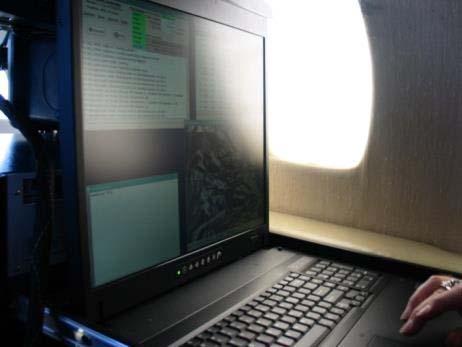
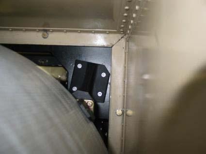
8 144Z AMS Installation
9 Citation Performance Boundaries Cruise Speed Max Altitude 380 kts 45,000 ft (13,700 m) Min Safe Acquisition 120 kts This creates issues with using the AMS Max AMS Velocity/Height = 11.1 Minimum 10,000 ft/3,050m AGL 7.6 meter pixel 3.07 nautical mile swath width (3.5 statute miles/5.6 kilometers)

 CIR")

10 Prescribed Fire: Rocky Canyon, Boise NF April 11, 2014 Planned ~1,500ac/600ha burn AMS fire product (CCRS) CIR visual image (bands 7,5,3) AMS hot spots enhanced for visualization ~3km
11 Prescribed Fire: Rocky Canyon, Boise NF April 11, 2014 Planned ~1,500ac/600ha burn AMS fire product (CCRS) CIR visual image (bands 7,5,3) AMS hot spots enhanced for visualization AMS Overflight at ~1945 UTC VIIRS Overpass at ~2046 UTC VIIRS I-Band 375m Product (Schroeder) VIIRS-AF 750m Product (NASA-Direct Readout Lab)
 CIR visual image (bands 7,5,3) AMS hot spots")
 VIIRS-AF 750m Product (NASA-Direct")
12 Prescribed Fire: Rocky Canyon, Boise NF April 11, 2014 Planned ~1,500ac/600ha burn AMS fire product (CCRS) CIR visual image (bands 7,5,3) AMS hot spots enhanced for visualization AMS Overflight at ~1945 UTC VIIRS Overpass at ~2046 UTC VIIRS I-Band 375m Product (Schroeder) VIIRS-AF 750m Product (NASA-Direct Readout Lab)

13 Ongoing USFS AMS Activities Testing/integration flights for AMS control from ground Fall 2014 Identify 3 rd USFS platform for the AMS Proposal to F&AM for N182Z Address requisite platform upgrades Sensor port/pod installation SatCom system installation Demonstrate value to provide multi-mission support Tactical fire support surge aircraft; daytime fire missions Post-fire/post-storm assessment Forest health monitoring Cal/Val of satellite products

14 RSAC X-Band Direct Readout Ground Station Location: Salt Lake City, Utah; o W o N History: MODIS direct broadcast data collection since 2002 VIIRS direct broadcast data collection since 2012 Antenna: 2.4 meter X-band antenna; 3-axis SeaTel Model 9497A-7 Radome enclosure RSAC X-band antenna in radome
 University of")
 NASA GSFC Direct Readout Lab (GSFC) NASA LANCE/FIRMS provides global MODIS coverage; backs up ground")
15 Direct Readout Network Forest Service area of interest for fire detection and monitoring UAF OSU RSAC SSEC GSFC MODIS/VIIRS Ground Station Network USDA Forest Service Remote Sensing Applications Center (RSAC) University of Wisconsin Space Science Engineering Center (SSEC) University of Alaska Fairbanks (UAF) Oregon State University (OSU) NASA GSFC Direct Readout Lab (GSFC) NASA LANCE/FIRMS provides global MODIS coverage; backs up ground station network
 Developed and implemented at RSAC in 2001 Coordination w/nasa, NOAA & space agency science teams Operational near real-time")

16 Active Fire Mapping (AFM) Program ( Developed and implemented at RSAC in 2001 Coordination w/nasa, NOAA & space agency science teams Operational near real-time (NRT) satellite data/mapping/visualization products for wildfire management Value-added products All lands and ownerships in U.S. and Canada Facilitates wildfire decision support Prioritize allocation of fire suppression assets Focus tactical airborne reconnaissance assets Key data input to several fire-related operational applications
 - NASA-DRL/IPOPP VIIRS (VIIRS-AF)")
 - NOAA NESDIS AVHRR (FIMMA) - NOAA")
17 AFM Active Fire Detection Data Products/Sources MODIS (MOD14) - NASA-DRL/IPOPP VIIRS (VIIRS-AF) - NASA-DRL/IPOPP VIIRS (I Band) - Schroeder GOES (WF-ABBA) - NOAA NESDIS AVHRR (FIMMA) - NOAA NESDIS


18 Transitioning From MODIS to VIIRS Carlton Complex July July 21, 21, Aqua MODIS VIIRS-AF I MOD14 Band CREFL 21:03 20:56 UTC UTC


19 AFM Geospatial Products Mapping/Visualization Products JPG/PDF fire detection maps Interactive fire detection map viewers Google Earth fire detection KMLs/KMZs Detection analysis/summary products Imagery/Geospatial Data Products Daily satellite imagery subsets Fire detection GIS datasets WMS/WFS fire detection services


20 AFM Clients/Stakeholders Used at all levels of the FS, DOI agencies, state/local agencies and general public Strategic scale fire monitoring, planning and response Essential data for fire decision support applications Informs the public on ongoing fire activity Provides data/information that are in high demand Oct 2012-Sept 2014 (FY13): >24 million user sessions and > 16TB of downloads Oct 2013-June 2014: >16.8 million user sessions and > 9.7TB of downloads

21 New Technology Development by AFM Partners Development of spatially refined active fire detection data from new sensors VIIRS (I Bands) Landsat 8 Sentinel-2 NASA A35 Wildfire Project Dr. Wilfrid Schroeder Increase capabilities to meet strategic and tactical fire management information needs Transfer VIIRS I Band detection algorithm to IPOPP framework Benefit broader DR user community


22 New Technology Development by AFM Partners Goal: Detection and initial confirmation of new ignitions: rapid, low cost, reliable, systematic UC DAVIS: USFS RSAC: NASA Ames: Alex Koltunov, Susan Ustin, Elaine Prins Brad Quayle, Brian Schwind Vince Ambrosia Faster initial detection of new incidents Fewer false new incidents Improved geolocation precision Alpha version GOES EFD ver. 0.3 ready: detects new ignitions faster than WF ABBA can provide the earliest alarm for many incidents simulated real time Advancing to a Beta version: Algorithm optimization System Integration Component level tests AFM interface


23 Burned Area Emergency Response (BAER) Forest Service fast track emergency assessment Fires exceeding thresholds for size, severity and/or soil resource damage Range from 100s of acres to 100s of thousands of acres in size Straw waddles on Pike-San Isabel NF Rapidly assess fire effects on the soil and watershed hydrologic function Prescribe and implement emergency stabilization measures to mitigate potential hazards to: Life Property Long-term soil productivity Water quality Natural resources BAER data analysis and plan development BAER response plan required within 7 days of fire containment
,")

24 BAER Imagery Support Program Overview RSAC provides rapid delivery of imagery and derived products to BAER teams Emergency assessment; support provided at or immediately after fire containment BARC Burned Area Reflectance Classification (BARC), preliminary vegetation burn severity, based on dnbr/dndvi assessment BAER teams use BARC with field observations and other spatial data to generate a soil burn severity map BARC >900 requests supported since 2001 (>20 million acres/8.1 million ha) Soil Burn Severity
25 BAER Imagery Support Program Leveraged Sensors Sensor Platform Type Spatial Resolution (Reflectance Bands) Temporal Resolution (per instrument) Data Source Landsat 8 OLI Polar orbiting 30m 16 days NASA/USGS EROS Landsat 7 ETM + Polar orbiting 30m 16 days NASA/USGS EROS Landsat 5 TM (Decommissioned) Polar orbiting 30m 16 days NASA/USGS EROS EO-1 ALI Polar orbiting 30m 2-3 days (pointable) SPOT 4 (Decommissioned) Polar orbiting 20m 2-3 days (pointable) SPOT 5 Polar orbiting 10m/20m 2-3 days (pointable) NASA/USGS EROS USGS EROS/HDDS USGS EROS/HDDS SPOT 6/7 Polar orbiting 6m Daily (pointable) USGS EROS/HDDS DEIMOS-1 and UK DMC Autonomous Modular Sensor Polar orbiting 22m 2-3 days USDA Foreign Agriculture Service - Satellite Image Archive Airborne Variable -- NASA/USFS

; > 500ac/202ha (eastern U.")


 NBR = (NIR SWIR) / (NIR + SWIR) Differenced")
26 Monitoring Trends in Burn Severity (MTBS) Map the location, extent and associated burn severity of all large fires on all lands in the United States since 1984 >1,000ac/404ha (western U.S.); > 500ac/202ha (eastern U.S.) Leverages Landsat TM/ETM + /OLI data record Sponsored by the interagency Wildland Fire Leadership Council One element of a strategy to monitor the effectiveness of national fire management policies Jointly conducted by RSAC and USGS EROS Data Center Landsat NBR Pre-fire dnbr Burn Severity 6/8/2005 Difference Post-fire 6/14/2007 Normalized Burn Ratio (NBR) NBR = (NIR SWIR) / (NIR + SWIR) Differenced Normalized Burn Ratio (dnbr) dnbr = Pre NBR Post NBR

 Interactive severity data analysis tools Burn Severity Indices")
27 MTBS Geospatial Deliverables Geospatial data: Imagery and burn severity data on all large fires 30m Landsat imagery subsets 30m thematic and continuous severity layers Burn scar boundaries/fire occurrence data Vector layers w/attributes Thematic and feature level metadata Burn severity analysis summaries: Stratified by vegetation type, administrative ownership, etc. Web-based delivery system: Geospatial data delivery tools Visualization products (Maps, Google Earth KMZs) Interactive severity data analysis tools Burn Severity Indices Thematic Burn Severity Unburned to Low Low Moderate High

28 MTBS Fire Mapping Production Status 17,936 fires completed 133 million acres 53.8 million hectares ~40,000 fire records analyzed

29 MTBS and USFS International Programs (IP) Recent IP-sponsored burn severity mapping support activities with international partners Bhutan Zambia (Kafue NP)
30 Comments/Questions? Contact Information: Everett Hinkley National Remote Sensing Program Manager Brad Quayle Program Leader - Rapid Disturbance Assessment & Service USDA Forest Service, Remote Sensing Applications Center
Enhancing our Nation s Wildfire Management Capabilities Through Application of NASA Science and Technology
 Enhancing our Nation s Wildfire Management Capabilities Through Application of NASA Science and Technology Vince Ambrosia Earth Science Division. Biospherics Branch NASA-Ames Research Center 2nd Annual
Overview of Federal Wildfire Remote Sensing Support 2018
 Overview of Federal Wildfire Remote Sensing Support 2018 Everett Hinkley GIO (acting) GWIS & GOFC Fire IT Meeting October 2018 Fire Season to Date* Currently Planning Level 5 Total Fires: 48,946 (10 yr
Use of new spatially refined satellite remote sensing fire detection data in support of advanced wildfire mapping and modeling
 Use of new spatially refined satellite remote sensing fire detection data in support of advanced wildfire mapping and modeling Dr. Wilfrid Schroeder 1 Dr. Janice Coen 2 Dr. Patricia Oliva 1 Dr. Louis Giglio
National Infrared Operations (NIROPS) Program Overview. Tom Mellin National Infrared Program Manager
 Program Overview. Tom Mellin National Infrared Program Manager") National Infrared Operations (NIROPS) Program Overview Tom Mellin National Infrared Program Manager Topics NIROPS organization Phoenix imaging system Aircraft Data delivery to infrared interpreters IRIN
National Infrared Operations (NIROPS) Program Overview Tom Mellin National Infrared Program Manager Topics NIROPS organization Phoenix imaging system Aircraft Data delivery to infrared interpreters IRIN
GOFC/GOLD Fire IT Strategic Planning. Day 1 - Break Out Group Discussion
 GOFC/GOLD Fire IT Strategic Planning Day 1 - Break Out Group Discussion Aims of the Fire IT refining and articulating the international requirements for fire related observations making the best possible
S-NPP/VIIRS and Landsat-8/OLI Global Active Fire Data Sets
 S-NPP/VIIRS and Landsat-8/OLI Global Active Fire Data Sets Wilfrid Schroeder Louis Giglio, Pierre Guillevic, William Walsh (Dept of Geographical Sciences/UMD) Janice Coen (NCAR/Boulder) Ivan Csiszar (NOAA/NESDIS/STAR)
Presentation Outline
 Presentation Outline! Background WRAP Project TFRSAC Technology Development Sensor / R/T Data Communications CDE as DSS Long-Duration Airborne Mission Capability (UAS) Western States Fire Mission Support
ALBERTA FOREST PROTECTION THERMAL INFRARED PROGRAM
 ALBERTA FOREST PROTECTION THERMAL INFRARED PROGRAM Eleventh Biennial USDA Forest Service Remote Sensing Applications Conference Salt Lake City, Utah April 25 Ken Dutchak, P. Biol. Reconnaissance and Remote
Recent Developments and Prospects for Innovative Remote Sensing of High-Temperature Events and Vegetation Fire Impacts
 Recent Developments and Prospects for Innovative Remote Sensing of High-Temperature Events and Vegetation Fire Impacts by D. Oertel, E. Lorenz, B. Zhukov German Aerospace Center, (DLR-OS) Berlin Adlershof
GOES-R AWG Land Team: Fire Detection and Characterization
 GOES-R AWG Land Team: Fire Detection and Characterization June 8, 2010 Presented By: Christopher C. Schmidt 1 1 UW-Madison/SSEC/CIMSS 1 FIRE Product Team AWG Land Team Chair: Yunyue (Bob) Yu FIRE Product
Fire Information for Resource Management System (FIRMS)
") Fire Information for Resource Management System (FIRMS) Diane Davies 1, Chris Justice 1, Jacques Descloitres 2, John Latham 3 John Musinsky 4 1 Department of Geography, University of Maryland 2 SSAI /
Fire Information for Resource Management System (FIRMS) Diane Davies 1, Chris Justice 1, Jacques Descloitres 2, John Latham 3 John Musinsky 4 1 Department of Geography, University of Maryland 2 SSAI /
Development of a Canadian Wildland Fire Monitoring Sensor (CWFMS)
") Unclassified Development of a Canadian Wildland Fire Monitoring Sensor (CWFMS) Helena (Marleen) van Mierlo 1 Linh Ngo Phong 1 Steeve Montminy 1 Joshua M. Johnston 2 Denis Dufour 3 (1) Canadian Space Agency
Unclassified Development of a Canadian Wildland Fire Monitoring Sensor (CWFMS) Helena (Marleen) van Mierlo 1 Linh Ngo Phong 1 Steeve Montminy 1 Joshua M. Johnston 2 Denis Dufour 3 (1) Canadian Space Agency
DETECTION AND MONITORING OF ACTIVE FIRES USING REMOTE SENSING TECHNIQUES
 DETECTION AND MONITORING OF ACTIVE FIRES USING REMOTE SENSING TECHNIQUES Source: Unknown n.d., http://www.hotrodsandclassics.net/featuredpictures/featurepictures2.htm. by Claire Riddell DETECTION AND MONITORING
VIIRS FIRE PRODUCTS UPDATE
 VIIRS FIRE PRODUCTS UPDATE Ivan Csiszar 1, Wilfrid Schroeder 2, Louis Giglio 2, Brad Wind 2, Evan Ellicott 2, Christopher O. Justice 2 1 NOAA/NESDIS Center for Satellite Applications and Research, Camp
Interim evaluation of the New IR Sensor Technology (NIRST) as a wildfire monitoring tool
 as a wildfire monitoring tool") Interim evaluation of the New IR Sensor Technology (NIRST) as a wildfire monitoring tool Joshua Johnston Forest Fire Analyst Canadian Forest Service Great Lakes Forestry Centre Sault Ste. Marie, Ontario
Interim evaluation of the New IR Sensor Technology (NIRST) as a wildfire monitoring tool Joshua Johnston Forest Fire Analyst Canadian Forest Service Great Lakes Forestry Centre Sault Ste. Marie, Ontario
Global Biomass Burning Emissions from a Constellation of Geostationary Satellites for Global Model Forecast Applications
 1 Global Biomass Burning Emissions from a Constellation of Geostationary Satellites for Global Model Forecast Applications Shobha Kondragunta NOAA/NESDIS Center for Satellite Applications and Research
Fire Detection and Monitoring
 Fire Detection and Monitoring Akli Benali Forest Research Center, University of Lisbon aklibenali@gmail.com Conference & Summer School on Forest Fire Management Istituto Superiore Antincendi, Rome, September
Long-term Inventory of Fire Burned Areas and Emissions of North America s Boreal and Temperate Forests
 Long-term Inventory of Fire Burned Areas and Emissions of North America s Boreal and Temperate Forests P.Gong, Z. Li, I. Csiszar, W. Hao, R. Fraser J.Z. Jin, R. Pu Objectives 1. Map burn scars in boreal
Strategic Research Agenda for. High-Altitude Aircraft and Airship. Remote Sensing Applications
 Strategic Research Agenda for USE HAAS High-Altitude Aircraft and Airship Remote Sensing Applications Christian Barbier (CSL, B), Bavo Delauré (VITO, B), Arie Lavie (CTI, Is) 1 OUTLINE 1. The USE HAAS
University of Puerto Rico at Mayagüez Direct Broadcast Polar Orbiter Workshop
 University of Puerto Rico at Mayagüez Direct Broadcast Polar Orbiter Workshop 27 April 2016 Lab 2 Part 4: Investigating VIIRS and MODIS Fire Detection Capabilities 1.1. Use Hydra to open the VIIRS directory
Global fire hotspots detected by NASA satellite to help United Nations
 Global fire hotspots detected by NASA satellite to help United Nations Published on 24 Sep 2010 is Image NASA's not found Moderate or type unknown Resolution Imaging Spectroradiometer (MODIS), an instrument
Colonel Paul Hargrove
 Colonel Paul Hargrove 1 PAST- MAFFS - Why was the Program Established? 1) MAFFS Program was established by Congress in 1970 after the Laguna Fire burned in San Diego County - Caused by downed power lines
Elaine M. Prins* NOAA/NESDIS, Office of Research and Applications, Advanced Satellite Products Branch (ASPB) Madison, WI
 Madison, WI") P4.6 Global Geostationary Fire Monitoring System Elaine M. Prins* NOAA/NESDIS, Office of Research and Applications, Advanced Satellite Products Branch (ASPB) Madison, WI Donna McNamara NOAA/NESDIS, Office
P4.6 Global Geostationary Fire Monitoring System Elaine M. Prins* NOAA/NESDIS, Office of Research and Applications, Advanced Satellite Products Branch (ASPB) Madison, WI Donna McNamara NOAA/NESDIS, Office
DFPC s Toolbox. Colorado Fire Prediction System (CO-FPS)
") DFPC s Toolbox Colorado Fire Prediction System (CO-FPS) Wildfire in Colorado 68% of Colorado s forested lands are under federal jurisdiction The Wildland-Urban Interface in Colorado is currently 1.1 million
DFPC s Toolbox Colorado Fire Prediction System (CO-FPS) Wildfire in Colorado 68% of Colorado s forested lands are under federal jurisdiction The Wildland-Urban Interface in Colorado is currently 1.1 million
Conservation by Design: Promoting Resilient Coastal Wetlands & Communities. GreatLakesLCC.org
 Conservation by Design: Promoting Resilient Coastal Wetlands & Communities Brent Schleck The Baldwin Group - NOAA Office for Coastal Management ASFPM 6/22/16 GreatLakesLCC.org Overview 2 Great Lakes coastal
Rapid Prototyping of NASA Next Generation Sensors for the SERVIR System of Fire Detection in Mesoamerica
 Rapid Prototyping of NASA Next Generation Sensors for the SERVIR System of Fire Detection in Mesoamerica Joel S. Kuszmaul, Henrique Momm, Greg Easson University of Mississippi, University, MS 38677 Timothy
Satellite Derived Fire Products for Biomass Burning Studies
 Satellite Derived Fire Products for Biomass Burning Studies Chris Justice University of Maryland and colleagues Fires in Indochina April 6 2010 ( NASA MODIS Aqua) THE GLOBAL FIRE PRODUCT (1992 93) bioval.jrc.ec.europa.eu/
Fire Mapping Chapter. Working Paper
 Fire Mapping Chapter Working Paper Version 1.0 as of September 2018 International Working Group on Satellite-based Emergency Mapping (IWG-SEM) Contents 1. FOREWORD... 3 2. IWG-SEM Fire delineation section...
Verification and Validation of OOV-TET1 Multispectral Camera Observations within the FireBIRD Project
 DLR.de Chart 1 Verification and Validation of OOV-TET1 Multispectral Camera Observations within the FireBIRD Project O. Frauenberger **, A. Börner *, E. Borg **, W Halle *, E. Lorenz *, S. Mitchell *,
Wildfire Mapping Using FireBIRD Data
 Wildfire Mapping Using FireBIRD Data Global Wildfire Information System (GWIS) GOFC GOLD Fire IT 20-23 rd November 2017, Cumberland Lodge Christian Fischer on behalf of the FireBIRD-Team German Aerospace
Optech Thermal IR Sensing Solutions Expanding the Industry
 Optech Thermal IR Sensing Solutions Expanding the Industry Optech Overview Strategic Growth through acquisitions of camera manufacturers 20 Years of Patented & Proven Camera System Experience Broader Imaging
A temporal active fire detection algorithm applied to geostationary satellite observations
 8 th 10 th June LSA-SAF Workshop 2015 A temporal active fire detection algorithm applied to geostationary satellite observations Gareth Roberts (University of Southampton) Outline Active fire detection
THE NORTHSTAR SYSTEM: A NEW ERA IN EARTH OBSERVATION
 THE NORTHSTAR SYSTEM: A NEW ERA IN EARTH OBSERVATION Daniel O Connell 1, Derek R. Peddle 2, 6, Stewart Bain 3, Douglas W. Bancroft 4, Kjell Stakkestad 5,7 NorthStar, Montréal, Québec, Canada. http://www.northstar-data.com
Fire-Implementation Team (Fire-IT) Update and Future Steps
 Update and Future Steps") Global Observation of Forest and Land Cover Dynamics Fire-Implementation Team (Fire-IT) Update and Future Steps Fire-IT Co-Chair: Chris Justice (U. Maryland) Fire-IT Executive Officer: Krishna Vadrevu
Global Observation of Forest and Land Cover Dynamics Fire-Implementation Team (Fire-IT) Update and Future Steps Fire-IT Co-Chair: Chris Justice (U. Maryland) Fire-IT Executive Officer: Krishna Vadrevu
The Role of Satellite Observations in Assessing Impacts of Wildfire Occurrence on Respiratory Health of Population
 The Role of Satellite Observations in Assessing Impacts of Wildfire Occurrence on Respiratory Health of Population Tatiana Loboda University of Maryland Outline Wildfire and human health Interdisciplinary
Overview of the WF_ABBA Global Geostationary Fire Monitoring Program: Current Implementation and Future Plans
 Overview of the WF_ABBA Global Geostationary Fire Monitoring Program: Current Implementation and Future Plans Elaine M. Prins Consultant Christopher C. Schmidt Jay Hoffman Jason Brunner UW-Madison SSEC
NEAR REAL TIME DETECTION OF BURNED SCAR AREA USING LANDSAT-8 IMAGERIES
 NEAR REAL TIME DETECTION OF BURNED SCAR AREA USING LANDSAT-8 IMAGERIES Danang Surya Candra Kustiyo - Indonesian National Institute of Aeronautics and Space (LAPAN) - Outline INTRODUCTION: Background, Problems,
[Some] Updates on Research into Fire Radiative Power & Energy
![[Some] Updates on Research into Fire Radiative Power & Energy](/thumbs/89/100768239.jpg "[Some] Updates on Research into Fire Radiative Power & Energy") Environmental Monitoring & Modelling Research Group [Some] Updates on Research into Fire Radiative Power & Energy Presented by Martin Wooster (Kings College London, UK) Slide contributions from many others
Environmental Monitoring & Modelling Research Group [Some] Updates on Research into Fire Radiative Power & Energy Presented by Martin Wooster (Kings College London, UK) Slide contributions from many others
RAPID FIRE DETECTION IN MEXICO AND CENTRAL AMERICA USING REMOTE SENSING METHODS
 RAPID FIRE DETECTION IN MEXICO AND CENTRAL AMERICA Bart Wickel Gerardo Lopez Ma. Isabel Cruz Erik de Badts Raúl Jimenez Rosenberg Comisión nacional para el conocimiento y uso de la biodiversidad Organization
I. INTRODUCTION. Index Terms Fires, satellites.
 248 IEEE JOURNAL OF SELECTED TOPICS IN APPLIED EARTH OBSERVATIONS AND REMOTE SENSING, VOL. 1, NO. 4, DECEMBER 2008 Short-Term Observations of the Temporal Development of Active Fires From Consecutive Same-Day
 www.inpe.br/queimadas This (short) presentation will stress: - Interaction with users; - GOES-16 detections A system with dozens of diferent products www.inpe.br/queimadas Our new portal CIMAN combines
SEVIRI/MSG sensor early fire detection performances assessment
 SEVIRI/MSG sensor early fire detection performances assessment G. Laneve, E. Cadau CRPSM Università di Roma La Sapienza e-mail: laneve@psm.uniroma1.it 2 nd GOFC/GOLD Workshop on GEO Fire Monitoring, Darmstadt,
The New Mexico Opportunity Mapping Project
 The New Mexico Opportunity Mapping Project Elaine Kohrman 1, Joe Zebrowski 2, Susan Rich 3 1 United States Forest Service, Cibola National Forest 2 New Mexico Highlands University, New Mexico Forest and
Advanced Fire Information System
 Advanced Fire Information System Karen Steenkamp Philip Frost CSIR Meraka Institute www.sac.co.za Meraka Institute - RSRU RSRU Mission: To conduct basic and applied remote sensing research for the advancement
GOES-R ABI Emissive IR Bands Radiometric Performance Monitoring and Trending
 GOES-R ABI Emissive IR Bands Radiometric Performance Monitoring and Trending Haifeng Qian a, Robert Iacovazzi a, Xiangqian Wu b, Boryana Efremova a, Fangfang Yu a, Xi Shao a a ERT, Inc. Laurel, MD 20707
Standardization of Remote Sensing Technology. Yuan-Yuan Jia. Academy of Opto-Electronics (AOE), CAS
, CAS") WGCV-36 Shanghai, China May 13-17, 2013 Standardization of Remote Sensing Technology Yuan-Yuan Jia 1 Academy of Opto-Electronics (AOE), CAS 2 Secretariat of National Technical Committee 327 on RS of Standardization
WGCV-36 Shanghai, China May 13-17, 2013 Standardization of Remote Sensing Technology Yuan-Yuan Jia 1 Academy of Opto-Electronics (AOE), CAS 2 Secretariat of National Technical Committee 327 on RS of Standardization
Collaborative Conservation across Landscapes: Experiences from the Upper Midwest and Great Lakes LCC 2/29/2016. GreatLakesLCC.org
 Collaborative Conservation across Landscapes: Experiences from the Upper Midwest and Great Lakes LCC 2/29/2016 GreatLakesLCC.org Personal introduction Brad Potter - Science Coordinator for the Upper Midwest
systems is available on the Colorado Wetland Information Center (CWIC) website.
 website.") Colorado Natural Heritage Program Wetland Program Plan -- Dec 2015 Status Update and Addendum -- The Colorado Natural Heritage Program (CNHP) developed a Wetland Program Plan (WPP) in 2010 for the planning
Colorado Natural Heritage Program Wetland Program Plan -- Dec 2015 Status Update and Addendum -- The Colorado Natural Heritage Program (CNHP) developed a Wetland Program Plan (WPP) in 2010 for the planning
Case Study of the Modified Fire Suppression Option: Three 1997 Alaska Fires 1
 Case Study of the Modified Fire Suppression Option: Three 1997 Alaska Fires 1 Kent Slaughter 2 Abstract Flexibility in the Alaska Interagency Fire Management Plan allowed for varied responses to three
Sentinel Asia Wildfire Monitoring
 Sentinel Asia Wildfire Monitoring Masami FUKUDA Institute of Low Temp. Sci. Hokkaido Univ. 3rd Sentinel Asia JPT Meeting 13 March 2007, Singapore Objective of Sentinel Asia Wildfire Monitoring Contribution
1.1. SYSTEM MODELING
 1 INTRODUCTION Electro-optical imaging system analysis is a mathematical construct that provides an optimum design through appropriate trade studies. A comprehensive model includes the target, background,
From Marine Pollution to Inland. Wildfire Mapping
 From Marine Pollution to Inland Louis Armstrong Wildfire Mapping The Mobilization of the National Aerial Surveillance Program (NASP) in support of the Fort McMurray Wildfires TC Chief, Intelligence, Surveillance
The FireBird mission - a scientific mission for Earth observation and hot spot detection
 The FireBird mission - a scientific mission for Earth observation and hot spot detection Terzibaschian, Thomas Reile, H., Lorenz, E. DLR, Germany 9th IAA SYMPOSIUM ON SMALL SATELLITES FOR EARTH OBSERVATION,
Level 1: GIS-based Desktop Assessments. Meghan Burns, Landscape Ecologist
 Level 1: GIS-based Desktop Assessments Meghan Burns, Landscape Ecologist EPA three-tier framework WETLAND AND RIPARIAN MAPPING LEVEL 1 LANDSCAPE ASSESSMENT WETLAND LANDSCAPE PROFILES LEVEL 2 RAPID ASSESSMENT
Evaluation of remote sensing-based active fire datasets in Indonesia
 INT. J. REMOTE SENSING, 20JANUARY, 2004, VOL. 25, NO. 2, 471 479 Evaluation of remote sensing-based active fire datasets in Indonesia F. STOLLE*{, R. A. DENNIS{, I. KURNIWAN{ and E. F. LAMBIN {Global Forest
Sentinel Asia. Disaster Management Support System. Wild Fire Working Group
 Sentinel Asia Disaster Management Support System Wild Fire Working Group Impact to future global warming Carbon Cycle Sink Source Contribution to Kyoto Protocol Sustainable Forest Management Reports on
CO 2, CH 4 and CO Observa0ons from CrIS on S-NPP and JPSS-1
 CO 2, CH 4 and CO Observa0ons from CrIS on S-NPP and JPSS-1 Xiaozhen (Shawn) Xiong 1,2, Lihang Zhou 2 Antonia Gambacorta 1,3, Nick Nalli 1,2, Changyi Tan 1,2 Flavio Iturbide-Sanchez 1,2, Kexing Zhang 1,2
Prioritizing Tidal Wetlands: A Landscape Approach
 Prioritizing Tidal Wetlands: A Landscape Approach Laura Brophy Director, Estuary Technical Group Institute for Applied Ecology Corvallis, OR College of Earth, Ocean and Atmospheric Sciences, Oregon State
Chapter 2 Background. 2.1 VID Technology
 Chapter 2 Background 2.1 VID Technology In general, a fire VID system consists of video-based analytical algorithms that integrate cameras into advanced flame and smoke detection systems. The video image
ARMY RDT&E BUDGET ITEM JUSTIFICATION (R-2 Exhibit)
") COST (In Thousands) FY 2001 FY 2002 FY 2003 FY 2004 FY 2005 FY 2006 FY 2007 Actual Estimate Estimate Estimate Estimate Estimate Estimate H95 NIGHT VISION & EO TECH 24935 22993 22333 22434 23718 23594 24585
COST (In Thousands) FY 2001 FY 2002 FY 2003 FY 2004 FY 2005 FY 2006 FY 2007 Actual Estimate Estimate Estimate Estimate Estimate Estimate H95 NIGHT VISION & EO TECH 24935 22993 22333 22434 23718 23594 24585
Appendix J Framework Fire Prevention and Suppression Plan. Prepared by Idaho Power Company 1221 W Idaho Street Boise, ID 83702
 Framework Fire Prevention and Suppression Plan Prepared by Idaho Power Company W Idaho Street Boise, ID 0 November 0 TABLE OF CONTENTS.0.0.0.0.0 INTRODUCTION.... Purpose.... Oregon's Wildfire Protection
3rd GWIS and GOFC-GOLD Fire IT meeting 1st-2nd October 2018, University of Maryland, Agenda v.0
 3rd GWIS and GOFC-GOLD Fire IT meeting 1st-2nd October 2018, University of Maryland, Agenda v.0 Meeting Venue Earth System Science Interdisciplinary Center (ESSIC) University of Maryland Research Park
Itron Water Loss Management Solutions. Advanced Digital Leak Detection Overview Session
 Itron Water Loss Management Solutions Advanced Digital Leak Detection Overview Session Pipeline Assessment Management The Hidden/Aware/Locate/Repair cycle of a leak can cause extensive water loss The Conventional
There are various resources and toolkits available to perform this task.
 Hands-On Exercise: Wildfires in Chile, January 2017 Task description Imagine you are analyst that has been assigned to the fire Las Maquinas burning in the vicinity of Constitución, in the Maule region
Airborne Imagery Potential Role in Monitoring Climate Change
 PC.DEL/773/09 13 October 2009 ENGLISH only Airborne Imagery Potential Role in Monitoring Climate Change US Department of State 5 October 2009 Briefing Topics Introduction Climate Change Threats to National
Wildland fire phenomenology experiments:
 Wildland fire phenomenology experiments: 2001-2002 RIT: Bob Kremens Stef VanGorden Andy Fordham Bryce Nordgren Dave Pogolarza Adam Cisz RMSC: Dan Latham Colin Hardy Brett Butler We plan to measure unknown
Chemical Solutions. Automation Solutions for Chemical Producers
 Chemical Solutions Automation Solutions for Chemical Producers Honeywell chemical solutions add value to your bottom line. Whether your facility makes millions of tons of ethylene or thousands of pounds
Results on verification and validation of OOV-TET1 multispectral camera observations within the FireBIRD project
 Results on verification and validation of OOV-TET1 multispectral camera observations within the FireBIRD project O. Frauenberger **, E. Borg **, A. Börner *, W Halle *, E. Lorenz *, S. Mitchell *, C. Paproth
New Tools for Land Management: A Quick Introduction to Ecological Site Descriptions
 New Tools for Land : A Quick Introduction to Ecological Site Descriptions Land management agencies have the job of managing natural resources for multiple uses in a sustainable manner. A sound understanding
Forest fire detection based on MODIS satellite imagery, and Comparison of NOAA satellite imagery with fire fighters' information
 Forest fire detection based on MODIS satellite imagery, and Comparison of NOAA satellite imagery with fire fighters' information *Koji Nakau, Masami Fukuda, Keiji Kushida, Hiroshi Hayasaka, Keiji Kimura,
Conservation Corridor Planning and Green Infrastructure Themes
 Conservation Corridor Planning and Green Infrastructure Themes Prepared by the Green Infrastructure Center Inc. and the Northern Virginia Regional Commission February 22, 2011 Brief Overview Project Background
Automated Fire and Flood Hazard Protection System
 De la Riva, J., Pérez-Cabello, F. & Chuvieco, E. (Eds) 2005 Proceedings of the 5 th International Workshop on Remote Sensing and GIS Applications to Forest Fire Management: Fire Effects Assessment: 167-172
Overview of Southwestern Pennsylvania Commission s (SPC) 2040 Long Range Transportation Plan (LRTP)
 2040 Long Range Transportation Plan (LRTP)") Overview of Southwestern Pennsylvania Commission s (SPC) 2040 Long Range Transportation Plan (LRTP) Presented to Pennsylvania Agency Coordination Meeting May 27, 2015 Doug Smith & Ryan Gordon 1 Southwestern
Overview of Southwestern Pennsylvania Commission s (SPC) 2040 Long Range Transportation Plan (LRTP) Presented to Pennsylvania Agency Coordination Meeting May 27, 2015 Doug Smith & Ryan Gordon 1 Southwestern
Earth Observation & GeoSpatialBig Data for Monitoring SDG Indicators
 Earth Observation & GeoSpatialBig Data for Monitoring SDG Indicators Yifang Ban, Professor Director, Division of Geoinformatics Vice Chair, Department for Urban Planning and Environment KTH Royal Institute
Estimating Fire Properties by Remote Sensing 1.
 Estimating Fire Properties by Remote Sensing 1. Philip J. Riggan USDA Forest Service Pacific Southwest Research Station 4955 Canyon Crest Drive Riverside, CA 92507 909 680 1534 PJRiggan@IBM.net James W.
Quarterly Report & Code Evaluation
 A New Zoning Code for a 21st Century Los Angeles To create livable communities, encourage sustainable development and foster economic vitality, we need a modern and user-friendly zoning code we need to
Bringing Smarts to Methane Emissions Detection
 Bringing Smarts to Methane Emissions Detection An Update on the DOE Smart Methane Emissions Project Maria Araujo Manager R&D Southwest Research Institute Background Fugitive emissions from compressors
I am Rick Jeffress and I handle sales for Fike Video Image Detection. We thank the AFAA for coordinating the venue for this presentation, and we
 I am Rick Jeffress and I handle sales for Fike Video Image Detection. We thank the AFAA for coordinating the venue for this presentation, and we appreciate your taking the time to learn more about this
ForestWatch. Oregon. Click to edit Master subtitle style. KEY Features 09/05/10
 ForestWatch Oregon KEY Features Range-aware, allowing Geo-referencing from a single camera. 12 Mile + detection capability and night-detection. Smart software learns the environment, drastically reducing
Integrating fire-spread and household-level trigger modeling to stage wildfire evacuation warnings
 Integrating fire-spread and household-level trigger modeling to stage wildfire evacuation warnings Dapeng. Li 1, Thomas. J. Cova 1, Philip. E. Dennison 1 1 Department of Geography, University of Utah,
PARALLEL USE OF SEVIRI LSA SAF FRP AND MPEF FIR PRODUCTS FOR FIRE DETECTION AND MONITORING
 PARALLEL USE OF SEVIRI LSA SAF FRP AND MPEF FIR PRODUCTS FOR FIRE DETECTION AND MONITORING C. G. Georgiev, J. S. Stoyanova National Institute of Meteorology and Hydrology, Bulgarian Academy of Sciences
GIS Training of Undergraduates: Campus Stormwater Mapping. Joanne Logan, University of Tennessee. Gordie Bennett, University of Tennessee
 GIS Training of Undergraduates: Campus Stormwater Mapping Joanne Logan, University of Tennessee Gordie Bennett, University of Tennessee Seth Benge, University of Tennessee Tim Prather, University of Tennessee
PUBLICATIONS. Journal of Geophysical Research: Atmospheres
 PUBLICATIONS RESEARCH ARTICLE Key Points: We compared the 2011 HMS fire pixels to ground-based fire records in Georgia The fire detection rate increases from 3% to 80% with the increase of fire size Detection
Battery Performance Alert
 Battery Performance Alert A TOOL FOR IMPROVED PATIENT MANAGEMENT FOR S UNDER BATTERY ADVISORY VERSION 2.0 Abstract BACKGROUND: In October 2016, St. Jude Medical (now Abbott) issued an advisory on a family
Maurice Borgeaud. Directorate of Earth Observation Programmes. Head of Science, Applications and Futures Technologies Department
 Maurice Borgeaud Directorate of Earth Observation Programmes Head of Science, Applications and Futures Technologies Department ESRIN ESA s Earth Observation HQ Personnel on site: ~ 550 Payload operations
WRAP/RMC Fire Sensitivity Modeling Project
 WRAP/RMC Fire Sensitivity Modeling Project WRAP Regional Modeling Center University of California Riverside Fire Emissions Joint Forum Meeting Denver, CO June 7, 2005 2004 Sensitivity Cases - completed
3. Managing smoke: Our strategies and opportunities
 3. Managing smoke: Our strategies and opportunities Dr. Zifei Liu zifeiliu@ksu.edu Pasture burning smoke management and air quality workshop March 28 th, 2015 Engineering Two strategies for reduction Minimize
GeoPlanner SM for ArcGIS : An Introduction
 GeoPlanner SM for ArcGIS : An Introduction Greg Pleiss Robert Stauder Esri UC 2014 Technical Workshop Agenda Application Overview Specific Capabilities - Configuration - Avaliable Data - Spatial Analysis
East to West, North to South: NFPA Resources for Fire Safety
 East to West, North to South: NFPA Resources for Fire Safety Presentation to Wildland Fire Canada October 9, 2014 Shayne Mintz, National Fire Protection Association What is the National Fire Protection
The Esri Public Works Platform. More Than Mapping
 The Esri Public Works Platform More Than Mapping Intelligent Public Works Sustaining a safe, vibrant community requires a smart public works system. Esri created a platform that connects public works departments
Moving to the Cloud: The Potential of Hosted Central Station Services
 Moving to the Cloud: The Potential of Hosted Central Station Services Moving to the Cloud: The Potential of Hosted Central Station Services The global market for alarm monitoring services is expected to
Ramona Fire Station (Station 86) Gillespie Helitack Base. Dos Picos County Park. Potrero County Park
 Gillespie Helitack Base. Dos Picos County Park. Potrero County Park") HPWREN currently provides support to large-scale wildland firefighting operations. It connects local first responder sites, and has provided ad-hoc data connectivity over the years to seven Incident Command
HPWREN currently provides support to large-scale wildland firefighting operations. It connects local first responder sites, and has provided ad-hoc data connectivity over the years to seven Incident Command
ArcGIS Online at Philadelphia Water Department
 ArcGIS Online at Philadelphia Water Department ESRI Public Sector Conference December 2017 Jessica Gould, GISP Megan Clarkin, AICP, LEED Green Associate Tim Smith We provide the City with integrated water,
Sherman Pass Project Post-Fire Treatment Scenery Report Barbara Jackson, Landscape Architect, 3/30/2016
 Sherman Pass Project Post-Fire Treatment Scenery Report Barbara Jackson, Landscape Architect, 3/30/2016 Introduction This report updates the 2015 Sherman Pass Project Scenery Report based on changes in
Connecticut River Watershed Initiative
 Connecticut River Watershed Initiative How it came about UMASS Amherst What is the concept? What is the near-term process? How it came about 1992-2002 University of Oregon CLAMS 1998 UMass proposal to
2011 ASLA Design Awards. Top of the Rockies National Scenic and Historic Byway Merit Award Bluegreen. Planning & Urban Design
 2011 ASLA Design Awards Top of the Rockies National Scenic and Historic Byway Merit Award Bluegreen Planning & Urban Design ASLA Colorado 2011 Design Awards Category 2: Planning Project Fact Sheet Project
R&D for the improvement of O&M in CSP plants. Dr. Marcelino Sánchez. - November,
 R&D for the improvement of O&M in CSP plants. Dr. Marcelino Sánchez - November, 2015 - í n d i c e 1 Need of R&D for O&M improvement in CSP Plants 2 Current R&D activities in O&M improvement carried out
Domestic Nuclear Detection Office (DNDO)
") Domestic Nuclear Detection Office (DNDO) Detecting Nuclear Threats 18 November 2008 Thomas McIlvain Architecture Directorate Domestic Nuclear Detection Office Mission and Objectives DNDO was founded on
Domestic Nuclear Detection Office (DNDO) Detecting Nuclear Threats 18 November 2008 Thomas McIlvain Architecture Directorate Domestic Nuclear Detection Office Mission and Objectives DNDO was founded on
Airmux Market. Airmux Family Sept 2013 Slide1
 Airmux Market Airmux Family Sept 2013 Slide1 Airmux Verticals Market Video Surveillance Oil & Gas and Utilities Public Safety Networks Mining Transportation Perimeter & Border Security Airmux Family Sept
Battery Performance Alert: A TOOL FOR IMPROVED PATIENT MANAGEMENT FOR DEVICES UNDER BATTERY ADVISORY
 Battery Performance Alert: A TOOL FOR IMPROVED PATIENT MANAGEMENT FOR S UNDER BATTERY ADVISORY VERSION 1.0 AUGUST 8, 2017 Abstract: BACKGROUND: In October 2016, St. Jude Medical issued an advisory on a